Community Development Department. This memorandum provides points of clarification as requested for the above noted project.
|
|
|
- Edwina Griffin
- 5 years ago
- Views:
Transcription


1 MEMORANDUM Community Development Department Date: November 13, 2014 To: From: Planning Commission Travis Goddard, Planning Manager Community Development Department File No: AME Re: Supplemental Public Input and Analysis This memorandum provides points of clarification as requested for the above noted project. The rezone request was initiated by CBJ Community Development Staff after a discussion with a property owner within the transition zoning area. This property owner was contemplating a cottage development but needed a higher density zoning. It was determined at that time that the transition trigger, the provision of utilities in this case, had been satisfied and that the transition was warranted. While processing AME with the existing transition zones, the CBJ Lands and Resources Division noted that the transition zoning was not the highest density zoning that could be obtained under the 2013 Comprehensive Plan and suggested that the land be rezoned to a higher density. Up-zoning was recommended to the Planning Commission. AME received a recommendation for approval from the Planning Commission at the regular August 26, 2014 hearing and the Notice of Recommendation was filed with the City Clerk on September 4, The Assembly reviewed the case at the October 20, 2014 hearing. Neighbors speaking at the hearing raised questions about the case and whether notice had adequately been given. After discussion of the issues, the Assembly remanded the case to the Planning Commission. The Assembly asked that staff ensure proper notice is given for the case and that analysis be performed to determine whether zoning for even higher densities could be assigned to the area.
2 Concerns over Public Notice Compliance Public notice consistent with CBJ chapter was provided on three occasions. In addition, prior to the Assembly hearing, property owners within the area affected by AME were invited to a neighborhood meeting to explain the effects of the rezone. Public notice was also performed for the October 20, 2014 Assembly meeting. Staff finds that the application has met public notice standards. Staff Report Density Highlights In the original staff report CDD Planner, Chrissy McNally, reviewed the Plan for density direction and noted her findings in the attached staff report. Specifically she found: Medium Density Residential (MDR) prescribes densities ranging from 5 to 20 units per acre ; Urban/Low Density Residential (ULDR) prescribes densities of one to six units per acre ; and, Rural Dispersed Residential (RDR) prescribes densities intended to permit one dwelling unit per acre or larger lot sizes In the staff report, analysis identified that the appropriate zoning under each Comprehensive Plan designation was: MDR D-3, D-5, D-10, D-10SF, D-15, and D-18 are all consistent with the MDR designation. o D-3, D-5 and D-10SF are single-family residential zoning districts. o D-10 and D-15 are intended to be relatively low-density multi-family residential districts. o D-18 is intended for high density multi-family development accommodated through midrise-type development. ULDR D-5 at five units per acre (D-10 being too high and D-3 not being appropriate within urban service boundaries); and RDR D-1 and outside of urban service boundaries. Reconciling Inconsistencies between the Comprehensive Plan & Zoning Staff review identified conflicts/inconsistencies between the Comprehensive Plan and zoning, which warranted changes to the requested transition zones. ULDR - For those parcels in ULDR, the proposed transition zone of D-3 was no longer appropriate because D-3 zoning is for land outside urban service boundaries. The very fact that the transition wasn t triggered till urban services became available created a catch-22 for staff. When Lands (who own 200 of the 285 acres) suggested higher densities were warranted, CDD staff agreed and recommended the highest density single-family residential zoning possible within the six-unit per acre density outlined in the Plan. Staff reviewed the zoning code and
3 found D-5 to be both within the Plan density range goal, but also to be a zoning district to be served by urban services. Therefore, staff recommended D-5 up-zoning. RDR The Plan intends RDR designations to be very low density development that is not provided with municipal water or sewer. So right from the start, the Plan designation does not fit with the underlying zoning that existed when the Plan was adopted. Now, faced with the desire to accommodate, and if possible facilitate, residential development, staff was faced with reviewing a transition rezone request that is on its face inconsistent with the Plan. Staff concluded that the RDR designation could not be fulfilled because the area was already serviced by municipal services and the existing zoning envisioned densities higher than the Plan. Lacking further guidance, staff concluded implementation of the underlying transition zone of D-3 was appropriate given that it existed prior to adoption of the Plan and that the Plan adoption process made no effort to correct the discrepancy. For this reason, staff recommended D-3 zoning for the RDR properties. D-5 up-zoning was not recommended because it would not be consistent with either the RDR Plan Designation or the underlying transition zoning district. MDR The Plan intends land designated as MDR to be urban residential development for multifamily dwelling units. Densities between 5 and 20 units per acre are desired. As noted above, transition from RR to D-3, D-5, and D-10SF would not be consistent because they are not consistent with the desire for higher density multi-family development. This means that D-10, D-15, and D-18 were zoning designation candidates that could be consistent with the Plan. Staff analyzed the existing conditions and neighboring zoning and found the transition D-15 zoning be consistent with both the Plan and the neighboring D-15 property zoning. However, it must be noted that D-18 would also be consistent with the Plan. Staff did not recommend the up-zoning to D-18 for two reasons: first, D-18 intends to have midrise-type developments which aren t currently in the neighborhood, and second, because it isn t consistent with the D-15 transition designation that the property already has. Higher Density Considerations During the Assembly meeting, several Assembly-members inquired as to whether higher densities could be assigned to the properties. As discussed above, only one property has the opportunity to be up-zoned further and still be consistent with the Plan. This is the 11 acres of land transitioning from RR to D-15. The property could be up-zoned from D-15 to D-18 (adding a potential capacity for 33 more units).
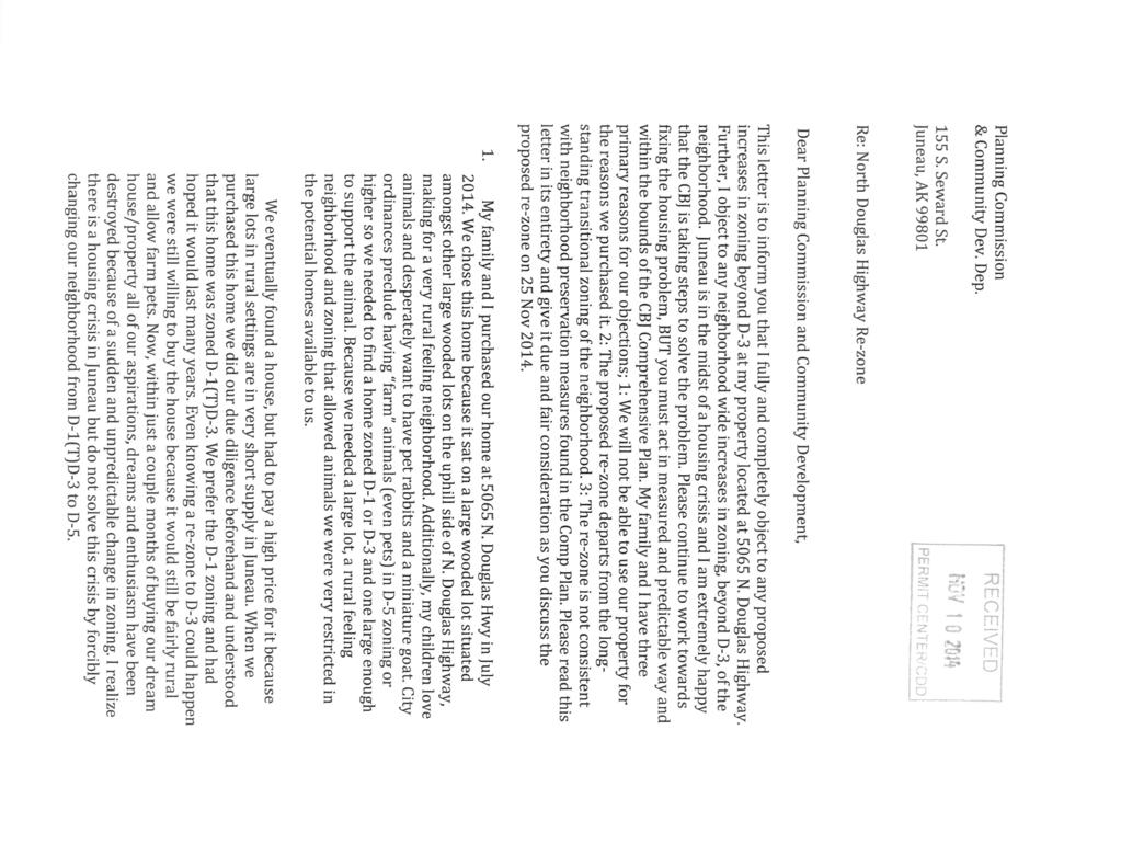
4 Higher densities could not be achieved within the Plan designations for these properties. However, it should be noted that by code, higher densities can be achieved in other zones: MU (no maximum density); MU2 (80 units per acre); LC (30 units per acre); and GC (50 units per acre). The property between N. Douglas Highway and the property being rezoned D-15 (the Jeep dealership) is zoned LC. Public Comments and Requests Staff held a neighborhood meeting for AME on June 24, 2014 but no members of the public attended. Public phone calls and comments were received after the Notice of Recommendation was issued but prior to the Assembly hearing. Comments were again raised before Assembly and the Assembly felt they warranted additional review so the case was remanded to the Commission. Comments received after the remand order and in response to the additional public notice are: Mr. Fred Yates, neighbor at 5470 N. Douglas Highway, indicated he would like to be included in the rezone. Staff Response: Unfortunately, Mr. Yates property was not transition zoned so the property was not included within the rezone proposal when it previously reviewed by the Planning Commission. Staff could not consider accommodating Mr. Yates request because the property had not been properly noticed for rezoning. Mr. Yates would need to apply for a rezone though the normal rezone application process. Mr. Kody & Sofia Stitz, property owners within the rezone at 5065 N. Douglas Highway, attended the Assembly Hearing to raise objections, met with staff, and submitted written comments. Mr. Stitz s written comments are attached. Staff Response: When meeting with Travis Goddard, CDD Planning Manager, Mr. Stitz raised concerns about the rezone because of advice he was previously given by staff, which indicated that he would be required to apply for a Conditional Use Permit to keep livestock should his property be up-zoned. He indicated that when he purchased the property, his intent was to have rabbits and goats for his children; he felt that the rezone to D-5 would harm his chances for keeping livestock. He also expressed that the City had no right to up-zone his property without his express support. During that conversation, staff indicated that the rezone was intended to serve as an opportunity creator and to implement the desired transition to higher zoning as envisioned in the 1980 s. It was not intended to limit his property rights or prevent him from keeping livestock. Staff also indicated that he was well within his rights to ask to be removed from the up-zone.
5 Staff indicated they would recommend support of his removal from the up-zone given his concerns about the effect on his property, but warned him that should he wish to rezone the property in the future, he would have to incur those rezone costs himself. Mr. Stitz understood and agreed to this because he stated he had no intention to rezone the property. Mr. Stitz s written comments expand on the concerns he has for his property. His comments reflect opposition to the up-zoning of not only his property but all the up-zoned parcels in the neighborhood. His attached comments include three points: 1. The property will not be able to be used for its intended purpose; 2. The proposed rezone is inconsistent with the long-standing transitional zoning of the neighborhood; and 3. The rezone is not consistent with neighborhood preservation measures and other parts of the Comprehensive Plan. Staff Response 1. Staff assumes Mr. Stitz s primary concern is about the density of neighboring development affecting the enjoyment of his property, not his actual ability to live on his property. Staff sympathizes with this concern but staff s responsibility is to take guidance from the Comprehensive Plan which is in turn implemented by the zoning code. As discussed above, all the rezoned zoning designations approved by the Planning Commission are consistent with the Comprehensive Plan or with the transition zoning designation. 2. Regardless of the zoning, each property owner has the ability to choose not to develop their property. The rezone of the property creates the opportunity for owners to increase the value of their land by adding additional dwellings or subdividing the property. Each property owner was given four separate mailings informing them that the zoning of their property would be changed. This provided them with ample opportunity to contact CDD and request to be excluded from the rezone or up-zone. Mr. Stitz is the only owner who has contacted CDD and requested to be excluded from the up-zone (but not the transition rezone). It also needs to be noted that while the property has had a long history of having transitional zoning, the provision of public services were only recently provided. Therefore, the unfulfilled transition shouldn t be seen as a matter of neighborhood choice or tradition; it was a function of the fiscal realities associated with capital budgeting. Now that the transition trigger has been met, Staff had no choice but to view the up-zoning of the property as consistent with the Comprehensive Plan. 3. Mr. Stitz points out that there are inconsistencies between the zoning and the Plan. There also seem to be inconsistencies within the Plan itself. In the past, staff and the Planning Commission have tried to balance the competing interests and desires outlined within the Plan. To this end, staff regularly has to weigh different parts of the Plan and
6 apply their best professional judgment to assign them priority depending upon how they apply to a given case. Mr. Stitz expressed that the adopted Plan in its entirety must be adhered too and used as a basis for decisions. This is only true to a point because it assumes that consistency is black and white. For example, this logic assumes that a D-3 residential development can meet every goal for residential development, as well as all the goals for commercial development, industrial development, natural resource preservation, historic preservation, etc. For this reason, consistency with the entire plan is a review standard that would be nearly impossible to meet for any project. Staff instead reviews for general consistency and ensures that projects are generally fulfilling the goals of the community as set forth in the Plan. The stated goals for housing support the approval of increased densities wherever possible, as consistent with the Plan. This logic is what led to the staff recommendation as outlined in the staff report. Staff still finds this logic to be sound. After meeting with Mr. Stitz, staff understands his concerns. Staff indicated to Mr. Stitz they would recommend that his property be excluded from the up-zone and simply be rezoned to the transition zone of D-3. Staff made this conditional upon his understanding that such an action would mean that any future rezone request for the property would be done at the owner s expense. Recommendation Staff recommends that the Planning Commission reaffirm its recommendation of approval of AME with the exception of Parcel 6D , which should be rezoned to D-3 as requested by the property owner.
7 PROPOSAL: Residential rezone of 43 parcels along North Douglas Highway. The Planning Commission has the discretion to consider and recommend alternative rezoning designations other than that being proposed by the applicant or recommended by staff. File No: AME Applicant: City and Borough of Juneau To: Adjacent Property Owners Property PCN: Multiple Hearing Date: November 25, 2014 Owner: Multiple Hearing Time: 7:00 PM Size: 285 Acres Place: Assembly Chambers Zoned: RR(T)D3 and RR(T)D15 Municipal Building Site Address: Mile of N. Douglas Highway 155 South Seward Street Accessed Via: N. Douglas Highway Juneau, Alaska PROPERTY OWNERS PLEASE NOTE: You are invited to attend this Public Hearing and present oral testimony. The Planning Commission will also consider written testimony. You are encouraged to submit written material to the Community Development Department 14 days prior to the Public Hearing. Materials received by this deadline are included in the information packet given to the Planning Commission a week before the Public Hearing. Written material received after the deadline will be provided to the Planning Commission at the Public Hearing. If you have questions, please contact Travis Goddard at travis.goddard@juneau.org or at Date notice was printed: November 5, 2014 Planning Commission Agendas, Staff Reports and Meeting Results can be viewed at
8 PROPOSAL: Residential rezone of 43 parcels along North Douglas Highway. File No: AME Applicant: City and Borough of Juneau To: Adjacent Property Owners Property PCN: Multiple Hearing Date: November 25, 2014 Owner: Multiple Hearing Time: 7:00 PM Size: 285 Acres Place: Assembly Chambers Zoned: RR(T)D3 and RR(T)D15 Municipal Building Site Address: Mile of N. Douglas Highway 155 South Seward Street Accessed Via: N. Douglas Highway Juneau, Alaska PROPERTY OWNERS PLEASE NOTE: You are invited to attend this Public Hearing and present oral testimony. The Planning Commission will also consider written testimony. You are encouraged to submit written material to the Community Development Department 14 days prior to the Public Hearing. Materials received by this deadline are included in the information packet given to the Planning Commission a week before the Public Hearing. Written material received after the deadline will be provided to the Planning Commission at the Public Hearing. If you have questions, please contact Chrissy McNally at or christine.mcnally@juneau.org Planning Commission Agendas, Staff Reports and Meeting Results can be viewed at Date notice was printed: October 28, 2014
9
10

11
12
D3, D1(T)D3, and RR(T)D15 to D3 and D15 along North Douglas Highway.")
13 DATE: August 18, 2014 TO: FROM: Planning Commission Chrissy McNally, Planner Community Development Department FILE NO.: AME PROPOSAL: Rezone property from RR(T)D3, D1(T)D3, and RR(T)D15 to D3 and D15 along North Douglas Highway. Applicant: Property Owner: Property Address: Site Size: Zoning: City and Borough of Juneau City and Borough of Juneau, Multiple North Douglas Highway 285 Acres RR(T)D3, D1(T)D3, RR(T)D15 Comprehensive Plan Land Use Designations: Utilities: Access: Existing Land Use: Surrounding Land Use: MDR, ULDR, RDR, SC (Maps K &L) CBJ water and sewer North Douglas Highway vacant, single family, duplex, multifamily, commercial North- Rural Reserve/D1 South- D3/D18 East - Gastineau Channel West - Rural Reserve

14 Planning Commission File No.: AME August 18, 2014 Page 2 of 13 VICINITY MAP Attachment A: Comprehensive Plan Land Use Maps Attachment B: 2009 Traffic impact analysis study areas map Attachment C: Ordinance Attachment D: Ordinance 99-01AM Attachment E Ordinance 97-01AM Attachment F: Public notice Attachment G: Neighborhood meeting notice
15 Planning Commission File No.: AME August 18, 2014 Page 3 of 13 Parcel Code No. Legal Description Current Zoning Transition Zone Acres 6D USMS 2225 Tract 1 RR D D USS 4605 FR RR D D USS 4605 FR RR D D Channel View Lot 1 RR D D Triangle Lot 3 RR D D USS 2960 Lot 7A D1 D D USS 2960 Lot 7B D1 D D USS 2960 Lot 8B D1 D D USS 2960 Lot 8A D1 D D USS 2960 Lot 9A D1 D D USS 2960 Lot 9B D1 D D USS 2960 Lot 10 FR D1 D D USS 2960 Lot 10 FR D1 D D Deep Lots Lot 11A D1 D D Deep Lots Lot 11B D1 D D Deep Lots Lot 11C D1 D D Deep Lots Lot 11D D1 D D USS 2960 Lot 12A D1 D D USS 2960 Lot 12B D1 D D USS 2960 Lot 13 FR D1 D D USS 2960 Lot 13 FR D1 D D USS 2960 Lot 14 Tract 2 D1 D D USS 2960 Lot 14 Tract 1 D1 D D USS 2960 Lot 15 D1 D D USS 2960 Lot 16 D1 D D USS 2960 Lot 6 Tract 1 D1 D D USS 2960 Lot 6 Tract 2 D1 D D USS 2960 Lot 6 Tract 2A D1 D D USS 2960 Lot 5 Tract A D1 D D USS 2960 Lot 5 Tract B D1 D D USS 2960 Lot 5 Tract C D1 D D Scott Lot 6 D1 D D Scott Lot 7 D1 D D Scott Lot 5 D1 D D Scott Lot 4 D1 D3 0.26
16 Planning Commission File No.: AME August 18, 2014 Page 4 of 13 6D Scott Lot 3 D1 D D Scott Lot 2 D1 D D Scott Lot 1 D1 D D Graham Lot 3A D1 D D Graham Lot 3B D1 D D Graham Lot 3C D1 D D Graham Lot 3D D1 D D USS 2960 Lot 2 FR D1 D3 0.31
17 Planning Commission File No.: AME August 18, 2014 Page 5 of 13 BACKGROUND The rezone of 43 parcels along North Douglas Highway extending from mile 1.3 to 1.9 was initiated by Community Development staff. The area is identified as a transition zone, RR(T)D3, RR(T)D-15, and D1(T)D3. The area has remained a transition zone in anticipation of City sewer installation. Sewer installation was completed in the summer of Prior to 1984 the area was a mixture of zoning districts that included Low Density Multi-Family Residential District (RML), Residential Waterfront Commercial District (CWR), Residential District (R12) and Residential Reserve (R40). In 1987 zoning districts were amended on a borough wide scale. The zoning for these parcels was changed to RR(T)D3 and D1(T)D3. Discussion The area discussed in this staff report is currently zoned D1(T)D-3, RR(T)D3, and RR(T)D-15. CBJ 49.70, Article VII addresses transition zones. CBJ states that a transition zone is an overlay zoning district for certain lands that are set aside for higher density development after public water and sewer have been provided. It further states that the increase in density will take place at the time public services are provided. Public water has been available for some time, and public sewer installation was completed in the summer of The following language is provided by the CBJ Land Use Code to describe the zoning designations: CBJ describes the Rural Reserve (RR) zoning district as follows: The RR, rural reserve zoning district, is intended for lands primarily in public ownership managed for the conservation and development of natural resources and for future community growth. In addition, recreation cabins, lodges and small seasonal recreational facilities may be allowed. (emphasis added) CBJ (a) describes the D-1 zoning district as follows: The D-1, residential district, is intended to accommodate primarily single-family and duplex residential development in areas outside the urban service boundary at a density of one unit per acre. Certain D-1 zoned lands, however, may exist within the urban service boundary in transition areas if public sewer or water are absent but planned for. The D-1 classification will be changed to a higher density upon provision of services. (emphasis added)
18 Planning Commission File No.: AME August 18, 2014 Page 6 of 13 CBJ (b) describes the D-3 zoning district as follows: The D-3, residential district is intended to accommodate primarily single-family and duplex residential development at a density of three dwelling units per acre. D-3 zoned lands are primarily located outside the urban service boundary where public utilities are not provided. The density reflects the existing pattern of development of properties in the district. There is a limited amount of D-3 zoned lands located within the urban service boundary. These are lands for which a lower density is deemed appropriate or, in the case of transition zones, where the zoning will be changed to a higher density when sewer and water are provided. (emphasis added) CBJ (e) describes D-15 as follows: The D-10 and D-15 residential districts are intended to accommodate primarily multifamily residential development at a density of ten and 15dwelling units per acre respectively. These are relatively low-density multi-family districts. The 2013 Comprehensive Plan land use maps K and L show a variety of land use designations in the area (See attachment A). Four parcels are partially designated Medium Density Residential (MDR). These include parcels 6D are 6D designated for transition from RR to D3 and parcel 6D , designated for transition from RR to D-15. A portion of this 14.7 acre parcel was zoned Light Commercial with Ordinance (See attachment C). Additionally, the southeast corner of the nearly 200 acre parcel, 6D , is designated MDR. The approximately 200 acres of CBJ owned land designated for transition from RR to D3 is shown primarily as Urban Low Density Residential (ULDR). In addition, there is a 400 foot wide buffer along Eagle Creek which is designated SC which means Stream Protection Corridor. The total area of RR(T)D3 is approximately 216 acres. The remaining 38 parcels are designated for transition from D1 to D3. Of these parcels, 26 are shown as ULDR on the Comprehensive Plan maps and 12 are shown as Rural Dispersed Residential (RDR). The plan describes MDR (page 147) as follows: These lands are characterized by urban residential lands for multi-family dwelling units at densities ranging from 5 to 20 units per acre. Any commercial development should be of a scale consistent with a residential neighborhood, as regulated in the Table of Permissible Uses (CBJ ). The plan describes ULDR (page 147) as follows:
19 Planning Commission File No.: AME August 18, 2014 Page 7 of 13 These lands are characterized by urban or suburban residential lands with detached single-family units, duplex, cottage or bungalow housing, zero-lot-line dwelling units and manufactured homes on permanent foundations at densities of one to six units per acres. Any commercial development should be of a scale consistent with a single-family residential neighborhood, as regulated in the Table of Permissible Uses (CBJ ). The plan describes RDR (page 147) as follows: These lands are characterized by dispersed, very low density development not provided with municipal sewer or water. Densities are intended to permit one dwelling unit per acre or larger lot sizes, based on existing platting or the capability of the land to accommodate on-site septic systems and wells. Uses may also include small-scale visitororiented, seasonal recreational facilities. (emphasis added) The plan describes SC (page 145) as follows: On CBJ-owned lands, a SC-Stream Protection Corridor designation serves to protect anadromous fish streams and their tributaries from development that could cause pollution, erosion, depletion of groundwater infiltration or otherwise could degrade the stream corridor and its biological functions. Upon first designation, a 200 foot wide corridor on both sides of the bank would be included within the designated corridor along anadromous fish water bodies included within the Alaska Department of Fish and Game Inventory adopted by the CBJ Assembly. However, this base designation should be revised and the length and breadth of the specific corridor should be determined by a scientific/biological assessment of the functionality and habitat value of the particular stream segment; the width and length of the protected corridor may be more or less than the 200-foot base protection zone. No development should be permitted other than passive, non-motorized trails, their support systems and, under special circumstances, roads and parking areas necessary to the maintenance and protection of the resources therein or to facilitate managed non-motorized public access for education and passive recreation activities. These lands should be zoned to prevent residential, commercial, and industrial development, as well as resource extraction activities. The CBJ should retain ownership of these lands. CBJ places restrictions on rezoning. One of these restrictions is that a rezoning shall not allow uses which violate the land use maps of the comprehensive plan. ANALYSIS Zone Change Initiation CBJ INITIATION. A rezoning may be initiated by the director, the commission or the assembly at any time during the year. A developer or property owner
20 Planning Commission File No.: AME August 18, 2014 Page 8 of 13 may initiate a request for rezoning in January or July only. Adequate public notice shall be provided by the director to inform the public that a rezoning has been initiated. 1. Were the proposed zone changes initiated by the property owner during the appropriate time frame? Yes. Application for AME was submitted by the director on December 20, Did the director provide adequate public notice through newspaper advertising, property owner mailings and requiring a public notice sign to be posted on-site as required by CBJ , Public Notice Requirements? Yes. The public was notified through newspaper advertising published on Friday, August 15, 2014 and Monday, August 25, 2014, mailings to owners of all properties within 500 feet of the subject properties, and a public notice sign posted on-site for two weeks prior to the Planning Commission hearing on the rezone request. Restrictions and Procedure CBJ RESTRICTIONS ON REZONINGS. Rezoning requests covering less than two acres shall not be considered unless the rezoning constitutes an expansion of an existing zone. Requests which are substantially the same as a rezoning request rejected within the previous twelve months shall not be considered. A rezoning shall not allow uses which violate the land use maps of the comprehensive plan. The CBJ Land Use Code provides minimum restrictions for zone change requests. This proposal conforms to these restrictions as follows: The entire area, as proposed for rezoning is greater than 2 acres. The proposed area for transition from RR and D1 to D-3 is 274 acres and is an expansion of an existing zoning district. The area proposed for transition from RR to D-15 is 11 acres and not part of an expansion of an existing zoning district. However, the proposed rezone to D-15 is consistent with the MDR designation shown on the maps of the Comprehensive Plan and is greater than 2 acres. CBJ 49.70, Article VII addresses Transition Zones. CBJ states that a transition zone is an overlay zone district for certain lands that are set aside for higher density development after public water and sewer have been provided. It further states that the increase in density will take place at the time public services are provided. As stated previously, public water has been available for some time, and public sewer installation was completed in the summer of 2013.
21 Planning Commission File No.: AME August 18, 2014 Page 9 of 13 Land use The area is made up of 43 individual lots. The majority of the transition area is a nearly 200 acre portion of a CBJ owned parcel. Of the 38 parcels designated to transition to D3, eight are vacant twenty of them are developed with single family homes; five are developed with single family homes with accessory apartments; two are developed with duplexes and three with triplexes. These lots range in size from10,018 square feet to 3.54 acres. The approximately 200 acres of CBJ owned land designated for rezoning is part of a larger vacant 654 acre parcel. This parcel was part of the Community Development Department s 2006 Buildable Sites study. Buildable land was considered to have less than an 18% slope and absent of Category A or B wetlands. The area in the transition zone is a bench consisting mostly of Category B wetlands. The 2006 study determined only 10% or 65 acres of the entire 654 acre parcel developable. There is currently no developed access road to this parcel. CBJ Lands and Resources Manager, Greg Chaney provided the following comments on the rezone: Given that this area has some locations that represent development challenges, in the future multifamily zoning might be appropriate so that development could be clustered in the best sites. Until this time, the proposed D3 zoning will serve our needs as a placeholder. The parcel designated for partial transition to D-15 is the site of an inactive gravel pit. A portion of the parcel is zoned Light Commercial. As previously stated, this parcel was partially rezoned to Light Commercial in The purpose of this rezone was to provide an appropriate designation for a permitted gravel pit. In 1997 the remaining portion of the lot was rezoned from RR(T)D3 to RR(T)D-15 with the approval of MAP-ZC96-03 in order to create a better transition from Light Commercial for future development (Attachment E). To the east of the Light Commercial zone is parcel 6D , partially zoned General Commercial. This rezone occurred with Ordinance 99-01AM (Attachment D). This lot is restricted to motor vehicle sales and repairs and is the site of Mike Hatch Jeep. The area of parcel 6D designated to be rezoned from RR to D3 is vacant. Density The requested D-3 zone would allow for up to 3 dwellings per acre. Already developed lots could potentially accommodate additional dwelling units each based on individual lot size. Current zoning will allow for 1 unit per acre on each of the 43 lots in the transition area. A total of 44 units currently exist on the subject parcels. An upgrade in zoning density provides for a potential maximum of 161 dwelling units. Without considering topographical and other design constraints, the eleven privately owned vacant lots combined area could potentially support 54 units. The maximum potential density could be as high as 259 units if the entire area was built out to its highest potential.
22 Planning Commission File No.: AME August 18, 2014 Page 10 of 13 The requested D-15 zone would allow for 15 units per acre. The subject area is 11 acres, therefore, this site could allow for 165 units. A D-3 and D-15 zoning designation would allow for some lots to be subdivided. For lots currently zone RR(T)D-3 and D-1(T)D-3 the minimum lot size will decrease from 36,000 square feet to 12,000 square feet with a transition to D3. The parcel to transition from RR to D-15 will have the minimum lot size decrease from 36,000 to 5,000 square feet. However, according to the CBJ roadway classification maps North Douglas Highway is classified as a minor arterial. Based on CBJ (b) lots resulting from a subdivision of land seeking new access via a minor arterial must meet the D1 zoning district lot area standards. This requirement is found in the Access section of Title 49. This section is intended to minimize the number of driveways, and vehicles accessing the minor arterial. Therefore, excluding the large CBJ owned parcel, 17 lots would eligible for subdivision without the need for an approved variance. However, most lots will be able to add dwelling units without subdividing. Any new access onto North Douglas Highway would require approval of the Alaska Department of Transportation and Public Facilities (DOT&PF). DOT&PF classifies North Douglas Highway as a collector. While solicited, comments from the Fire Marshall were not received specific to this rezone. The Fire Marshall will be consulted regarding any future development proposals. Comprehensive Plan As mentioned earlier, the entire area is shown on Maps K and L (pgs 161 & 162) of the 2013 Comprehensive Plan. The area is shown as Rural Dispersed Residential (RDR), Urban Low Density Residential (ULDR), and Medium Density Residential (MDR) and the area around Eagle Creek as a Stream Protection Corridor (SC). Parcels 6D , 6D , and 6D are each either in part or in whole designated for transition to D-3 and are designated as MDR on the Comprehensive Plan maps. A D-3 zoning designation is not consistent with the MDR designation which calls for 5 to 20 units per acre. A zoning designation of D-5, D-10, D-15, or D-18 would be consistent with the MDR land use designation. However, rezoning to any zone other than D-3 will require approval by the Assembly. Parcel 6D is designated for transition to D-15. This parcel is designated as MDR on the Comprehensive Plan maps. The D-15 zone is consistent with the MDR designation. For those parcels zoned D-1(T)D-3 and the remainder of the large CBJ owned parcel, a zoning designation of D-3 is not entirely consistent with the ULDR designation provided by the Comprehensive Plan maps. The ULDR designation calls for 1 to 6 units an acre and is intended
23 Planning Commission File No.: AME August 18, 2014 Page 11 of 13 for common wall development, which is allowed in the D-5 zoning district but not in the D-3 zoning district. These parcels could be rezoned to D-5 and be more consistent with the ULDR designation. D-5 is consistent with the maps of the comprehensive plan but would require approval by the Assembly. Further inconsistency exists between those parcels zoned D-1(T)D-3 that are designated RDR by the Comprehensive Plan. An RDR designation is consistent with the D-1 zoning district as it calls for 1 unit an acre and no municipal sewer. These lots now have city sewer service. The RDR land use designation does not align with the provision of city water and sewer. However, given the installation of public sewer and several policies of the Comprehensive Plan that support increased density, a transition to D-3 would be appropriate. The Comprehensive Plan offers general guidance for residential development: Policy 10.1 (page 129) states it is the policy of the CBJ to facilitate availability of sufficient land with adequate public facilities and services for a range of housing types and densities to enable the public and private sectors to provide affordable housing opportunities for all CBJ residents. SOP2 (page 130) states Designate sufficient land on the Comprehensive Land Use Maps and zoning maps to provide for a full range of housing types and densities desired by CBJ households. Provide choices in residential neighborhood character such that residents can choose to live in urban, suburban and rural residential settings and neighborhoods. Policy 10.3 (page 131) states it is the policy of the CBJ to facilitate residential developments of various types and densities that are appropriately located in relation to site considerations, surrounding lands uses, and capacity of public facilities and transportation systems. The proposed rezoning is within Subarea 8 of the 2013 Comprehensive Plan. The Plan (page 190) states that when recognizing the growth potential of this area the limitation of the North Douglas Highway and the Juneau-Douglas Bridge must also be considered. On page 192 Guideline and Considerations number 4 states in part that when city water and sewer are provided, more efficient use of the land should be encouraged. It also states that residential densities should be increased when, and where roads, terrain, and other public services would provide carrying capacity for the additional residential population. Therefore, given the recent installation of City sewer services, this transition to a higher density is in general conformity with the 2013 Comprehensive Plan. Traffic and Access As mentioned above, North Douglas Highway and the Juneau-Douglas Bridge create limitations for future development. This is why CBJ commissioned a Traffic Impact Analysis (TIA) prior
24 Planning Commission File No.: AME August 18, 2014 Page 12 of 13 to evaluating previous rezoning requests adjacent to the subject area. The conclusions of this TIA are relevant to the rezone considered in this staff report. The TIA Study Area evaluated potential future traffic impacts along the North Douglas Highway from the roundabout to just past Nelson Creek. The TIA further broke the study area up into three sections. The subject area is within study area 2 (Attachment B). The study concludes that traffic generated by future development along North Douglas Highway will negatively impact the level of service (LOS) at the Douglas roundabout and at the intersection of Egan Drive and 10 th Street. On page 3-22 the study estimated how much additional traffic could be added before LOS F is reached. The study concludes that at 10 th and Egan the limiting time is PM peak hour. The TIA states the intersection can accommodate 517 additional vehicles before reaching LOS F. For the Douglas roundabout the limiting time is the AM peak hour, and 334 additional vehicles can be accommodated before LOS F is reached. The TIA also notes that access road schemes for future development in the study area have not been established (pg 3-27). Future driveways and access roads will be subject to the DOT&PF permitting process. However, the TIA recommends that access points for new developments should be aggregated to the extent possible, and access roads should be spaced at least one quarter mile from adjacent access roads. In response to a request for comment on this rezone DOT&PF expressed concern with future access points and would like to see them limited. DOT&PF commented that it is difficult to comment without specific development plans. Access is addressed with the subdivision ordinance mentioned previously requiring any additional lots that sought new access onto a minor arterial to meet the D-1 zoning district minimum lot size of 36,000 square feet. If access was to be shared with an existing lot, this standard would not apply. CBJ Title 49 may also require future applications for development to submit traffic impact analyses. This places the burden of mitigation on the developer whose proposal triggers the number of trips that requires mitigation. Summary There is an inconsistency with the definition of the D-3 zoning district and transitioning 42 parcels to this zoning designation. As stated on page 6 of this report, the D-3 zoning district is intended to exist primarily outside of the urban service boundary or as the zoning designation before a transfer to a higher density. However, the D-3 zoning designation may be applied where generally lower densities are considered appropriate. Therefore, while D-3 is not entirely inconsistent, a D-5 zoning designation for those lots designated ULDR should be considered. While density of 3 units per acre is consistent with the ULDR designation of the Comprehensive Plan, it is not consistent with the MDR designation. A D-5 zoning designation is more consistent with the ULDR and MDR designations. Further, a D-15 zoning designation is consistent with
25 Planning Commission File No.: AME August 18, 2014 Page 13 of 13 MDR and would great a continuous D-15 zone next to the Light Commercial and General Commercial zones. A recommendation of D-5 or higher must be approved by the Assembly. Only the transitions to D-3 and D-15 can be approved by the Planning Commission. Should the Planning Commission approve any zoning other than the mapped transitions, staff recommends holding an additional neighborhood meeting before seeking Assembly action. FINDINGS After review of the application materials, the CBJ Land Use Code and the CBJ Comprehensive Plan the Director makes the following findings: 1. The request meets the submittal requirements and the rezoning initiation, zone change restrictions and procedural requirements of the CBJ Land Use Code. 2. D-3 zoning substantially conforms to Land Use maps K and L of the Comprehensive Plan for those lots designated as ULDR, RDR and SC. 3. D-15 zoning substantially conforms to Land Use maps K and L of the Comprehensive Plan for those lots designated MDR. RECOMMENDATION Staff recommends the following: 1. Approve the zone transition from RR to D Approve the zone transition from D1 to D-3 for those lots designated RDR on the Land Use maps of the Comprehensive Plan. Additionally, staff recommends consideration of the following: 1. An upzone to D5 for lots designated as ULDR on the Land Use maps of the Comprehensive Plan. 2. An upzone to D-15 for lots designated as MDR on the Land Use maps of the Comprehensive Plan. Should the Planning Commission approve any zoning other than the mapped transitions, staff recommends holding an additional neighborhood meeting before seeking Assembly action.
26 2013 Comprehensive Plan Land Use Map ATTACHMENT A
27 ATTACHMENT B
28 ATTACHMENT C
29 ATTACHMENT C
30 ATTACHMENT D
31 ATTACHMENT D
32 ATTACHMENT E
33 PROPOSAL: Rezone of approximately 245 acres of RR(T)D3 to D3 and RR(T)D15 to D15 and approximately 40 acres of D1(T)D3 to D3 along North Douglas Highway. File No: AME Applicant: City and Borough of Juneau To: Adjacent Property Owners Property PCN: Multiple Hearing Date: August 26, 2014 Owner: Muliple Hearing Time: 7:00 PM Size: 285 Acres Place: Assembly Chambers Zoned: RR(T)D3 and RR(T)D15 Municipal Building Site Address: Mile of N. Douglas Highway 155 South Seward Street Accessed Via: N. Douglas Highway Juneau, Alaska PROPERTY OWNERS PLEASE NOTE: You are invited to attend this Public Hearing and present oral testimony. The Planning Commission will also consider written testimony. You are encouraged to submit written material to the Community Development Department 14 days prior to the Public Hearing. Materials received by this deadline are included in the information packet given to the Planning Commission a few days before the Public Hearing. Written material received after the deadline will be provided to the Planning Commission at the Public Hearing. If you have questions, please contact Chrissy McNally at or christine_mcnally@ci.juneau.ak.us Planning Commission Agendas, Staff Reports and Meeting Results can be viewed at ATTACHMENT F Date notice was printed: August 5, 2014

34 NOTICE OF NEIGHBORHOOD MEETING FOR TRANSITION ZONE Assembly Chambers Wednesday, June 25, 6:30-7:30 p.m. June 3, 2014 Dear Resident, You are receiving this letter because your property is zoned either RR(T)D3, RR(T)D15, or D1(T)D3. The CBJ Community Development Department initiated a Zone Change Application for properties in transition zones along mile 1.3 and 1.9 of North Douglas Highway. Enclosed you will find a list of all the properties in the transition area. The CBJ Community Development Department is hosting a neighborhood meeting to explain the details and the CBJ rezone process. This meeting will be held on Wednesday, June 25, 2014, from 6:30 to 7:30 p.m. in the Assembly Chambers of City Hall. The purpose of the June 25 th meeting is to provide information, respond to questions, and to get a sense of concerns that the neighborhood might have, so issues may be addressed in advance of the formal public hearing with the CBJ Planning Commission. The project has been scheduled for review by the Planning Commission at the August 26 th Regular Meeting. Prior to the meeting all landowners within 500 feet of the proposed rezone will receive a separate notice with details on how and where to submit comments or testify on the proposal. If you have questions or would like more information, please contact Chrissy McNally, Community Development Planner, at or christine_mcnally@ci.juneau.ak.us. Enclosure: List of properties to be rezoned cc: File number AME ATTACHMENT G
Rezone property from RR(T)D3, D1(T)D3, and RR(T)D15 to D3 and D15 along North Douglas Highway.
D3, D1(T)D3, and RR(T)D15 to D3 and D15 along North Douglas Highway.") DATE: TO: FROM: Planning Commission Chrissy McNally, Planner Community Development Department FILE NO.: AME2013 0016 PROPOSAL: Rezone property from RR(T)D3, D1(T)D3, and RR(T)D15 to D3 and D15 along North
DATE: TO: FROM: Planning Commission Chrissy McNally, Planner Community Development Department FILE NO.: AME2013 0016 PROPOSAL: Rezone property from RR(T)D3, D1(T)D3, and RR(T)D15 to D3 and D15 along North
Jonathan Lange, Planner Community Development Department
 DATE: March 10, 2014 TO: FROM: Planning Commission Jonathan Lange, Planner Community Development Department FILE NO.: AAP2014 0001 PROPOSAL: A Conditional Use permit application for an accessory apartment
LAND USE INTRODUCTION EXISTING CONDITIONS
 INTRODUCTION This chapter describes land use in the Lemon Creek area using maps and data that show designations of all properties by the 2013 Comprehensive Plan, zoning code, and locations of developed
United States Post Office and Multi-Family Residential; and, Single- Family Residence with an Apartment
 Planning Commission File No.: AME2013 0009 January 9, 2014 Page 2 of 9 Existing Land Use: United States Post Office and Multi-Family Residential; and, Single- Family Residence with an Apartment Surrounding
MAP , MAP , and MAP
 MEMORANDUM CITY AND BOROUGH OF JUNEAU 155 S. Seward Street, Juneau, AK 99801 DATE: September 30, 2004 TO: FROM: FILE NO: Planning Commission Nathan Bishop, Planner Community Development Department MAP2004-00003,
Mohave County General Plan
 63 64 65 66 67 68 69 70 71 The Land Use Diagram is not the County's zoning map. 13 It is a guide to future land use patterns. Zoning and area plan designations may be more restrictive than the land use
REZONING APPLICATION INSTRUCTIONS
 REZONING APPLICATION INSTRUCTIONS All required information, as stated on the Rezoning Application Checklist, must be included to qualify as a complete application. Upon receipt, staff will review the application
Eric Feldt, Planner II, CFM Community Development Department
 DATE: August 28, 2014 TO: FROM: Board of Adjustment Eric Feldt, Planner II, CFM Community Development Department FILE NO.s: VAR2014 0017 & VAR2014 0018 PROPOSAL: A Variance to reduce two side yard setbacks
9. REZONING NO Vicinity of the northwest corner of 143 rd Street and Metcalf Avenue
 9. REZONING NO. 2002-15 Vicinity of the northwest corner of 143 rd Street and Metcalf Avenue 1. APPLICANT: Andrew Schlagel is the applicant for this request. 2. REQUESTED ACTION: The applicant is requesting
SECTION 16. "PUD" PLANNED UNIT DEVELOPMENT OVERLAY DISTRICT
 SECTION 6. "PUD" PLANNED UNIT DEVELOPMENT OVERLAY DISTRICT Subsection. Purpose. This district is established to achieve the coordinated integration of land parcels and large commercial and retail establishments
PLANNING COMMISSION REPORT Regular Agenda Public Hearing Item
 PC Staff Report 11/12/12 Item No. 2B- 1 PLANNING COMMISSION REPORT Regular Agenda Public Hearing Item ITEM NO. 2B: A TO GPI; 110 ACRES; E OF K-10 & N OF W 6 TH ST (MKM) : Consider a request to rezone approximately
Staff Report PLANNED DEVELOPMENT. Salt Lake City Planning Commission. From: Lauren Parisi, Associate Planner; Date: December 14, 2016
 Staff Report PLANNING DIVISION COMMUNITY & NEIGHBORHOODS To: Salt Lake City Planning Commission From: Lauren Parisi, Associate Planner; 801-535-7932 Date: December 14, 2016 Re: 1611 South 1600 East PLANNED
Staff Report. Planning Commission Public Hearing: October 17, 2007 Staff Recommendation: Denial
 COUNTY OF PRINCE WILLIAM 5 County Complex Court, Prince William, Virginia 22192-9201 PLANNING (703) 792-6830 Metro 631-1703, Ext. 6830 FAX (703) 792-4401 OFFICE Internet www.pwcgov.org Stephen K. Griffin,
INTEROFFICE MEMORANDUM
 HARLES COUNTY GOVERNMENT Department of Planning and Growth Management Melvin C. Beall, Jr., P.E., Director INTEROFFICE MEMORANDUM TO: Denise Ferguson, Clerk to the County Commissioners THRU: THRU: FROM:
RE: 6. GILL/GREEN COMPREHENSIVE PLAN AMENDMENT, REZONING AND PRELIMINARY PLAT
 commission memo DATE: Thursday - August 9, 2018 TO: Marion Planning & Zoning Commission FROM: David N. Hockett, AICP Principal Planner RE: 6. GILL/GREEN COMPREHENSIVE PLAN AMENDMENT, REZONING AND PRELIMINARY
(Not to exceed a total of 10 minutes nor more than 2 minutes for any individual).
.") I. ROLL CALL II. III. IV. APPROVAL OF AGENDA APPROVAL OF MINUTES A. March 20, 2017 Minutes PUBLIC PARTICIPATION ASSEMBLY STANDING COMMITTEE LANDS AND RESOURCES COMMITTEE THE CITY AND BOROUGH OF JUNEAU,
I. ROLL CALL II. III. IV. APPROVAL OF AGENDA APPROVAL OF MINUTES A. March 20, 2017 Minutes PUBLIC PARTICIPATION ASSEMBLY STANDING COMMITTEE LANDS AND RESOURCES COMMITTEE THE CITY AND BOROUGH OF JUNEAU,
SUBJECT PARCEL(S) Property Owner(s) TMS Number Approximate Acreage Carolina Park Development, LLC
 Property Owner(s) TMS Number Approximate Acreage Carolina Park Development, LLC") Staff Report Special Planning Commission Meeting November 19, 2014 For reference, the Zoning Code and Land Development Regulations are available online. AGENDA ITEM 5c. SKETCH PLAN APPROVAL REQUEST: Request
Staff Report Special Planning Commission Meeting November 19, 2014 For reference, the Zoning Code and Land Development Regulations are available online. AGENDA ITEM 5c. SKETCH PLAN APPROVAL REQUEST: Request
Draft Model Access Management Overlay Ordinance
 Draft Model Access Management Overlay Ordinance This model was developed using the City of Hutchinson and the Trunk Highway 7 corridor. The basic provisions of this model may be adopted by any jurisdiction
Subdivision FAQ s. Prepared by the Sitka Planning Office, Sara Russell, Planning Assistant Wells Williams, Planning Director
 Subdivision FAQ s Prepared by the Sitka Planning Office, 747-1814 Sara Russell, Planning Assistant Wells Williams, Planning Director Outline of Questions Answered on the following Pages - What defines
Prince George s County Zoning Ordinance and Subdivision Regulations Rewrite March 13, 2017
 Prince George s County Zoning Ordinance and Subdivision Regulations Rewrite March 13, 2017 The Maryland National Capital Park & Planning Commission 1 Worksessions Schedule Topic Date Zone Structure January
DEPARTMENT OF COMMUNITY PLANNING, HOUSING AND DEVELOPMENT Planning Division
 DEPARTMENT OF COMMUNITY PLANNING, HOUSING AND DEVELOPMENT Planning Division #1 Courthouse Plaza, 2100 Clarendon Boulevard, Suite 700 Arlington, VA 22201 TEL 703.228.3525 FAX 703.228.3543 www.arlingtonva.us
ARTICLE I ZONE BASED REGULATIONS
 ARTICLE I ZONE BASED REGULATIONS RZC 21.08 RESIDENTIAL REGULATIONS 21.08.290 Cottage Housing Developments A. Purpose. The purpose of the cottage housing requirements is to: 1. Provide a housing type that
Town of Bristol Rhode Island
 Town of Bristol Rhode Island Subdivision & Development Review Regulations Adopted by the Planning Board September 27, 1995 (March 2017) Formatted: Highlight Formatted: Font: 12 pt Table of Contents TABLE
STAFF REPORT. Permit Number: Garland. Kitsap County Board of Commissioners; Kitsap County Planning Commission
 STAFF REPORT Permit Number: 15 00686 Garland DATE: February 25, 2016 TO: FROM: Kitsap County Board of Commissioners; Kitsap County Planning Commission Katrina Knutson, AICP, Senior Planner, DCD and Jeff
ARLINGTON COUNTY, VIRGINIA. County Board Agenda Item Meeting of June 17, 2017
 ARLINGTON COUNTY, VIRGINIA County Board Agenda Item Meeting of June 17, 2017 DATE: June 9, 2017 SUBJECT: Request to authorize advertisement of public hearings by the Planning Commission and County Board
VICINITY MAP. Board of Adjustment File No.: VAR & VAR January 9, 2014 Page 2 of 11 ATTACHMENTS
 Board of Adjustment File No.: VAR2013 0024 & VAR2013 0025 January 9, 2014 Page 2 of 11 VICINITY MAP ATTACHMENTS Attachment A Applicant s Letter Attachment B Site Plan Attachment C Elevation Drawings Board
MONTGOMERY COUNTY PLANNING DEPARTMENT THE MARYLAND-NATIONAL CAPITAL PARK AND PLANNING COMMISSION
 MONTGOMERY COUNTY PLANNING DEPARTMENT THE MARYLAND-NATIONAL CAPITAL PARK AND PLANNING COMMISSION MCPB Item No. 8 Date: 03-07-13 Sonoma, Preliminary Plan, 120130040 Melissa Williams, Senior Planner, Melissa.williams@montgomeryplanning.org,
Planning Department Oconee County, Georgia
 Planning Department Oconee County, Georgia STAFF REPORT REZONE CASE #: 6985 DATE: October 31, 2016 STAFF REPORT BY: Andrew C. Stern, Planner APPLICANT NAME: Williams & Associates, Land Planners PC PROPERTY
Land Use. Land Use Categories. Chart 5.1. Nepeuskun Existing Land Use Inventory. Overview
 Land Use State Comprehensive Planning Requirements for this Chapter A compilation of objectives, policies, goals, maps and programs to guide the future development and redevelopment of public and private
Planning Department Oconee County, Georgia STAFF REPORT
 Planning Department Oconee County, Georgia STAFF REPORT REZONE CASE #: 7332 DATE: November 28, 2017 STAFF REPORT BY: Gabriel Quintas, Planner APPLICANT NAME: Smith Planning Group PROPERTY OWNER: John Hadden
Understanding the Conditional Use Process
 Understanding the Conditional Use Process The purpose of this document is to explain the process of applying for and obtaining a conditional use permit in the rural unincorporated towns of Dane County.
A. Land Use Relationships
 Chapter 9 Land Use Plan A. Land Use Relationships Development patterns in Colleyville have evolved from basic agricultural and residential land uses, predominate during the early stages of Colleyville
STAFF REPORT. Permit Number: Unlimited. Kitsap County Board of Commissioners; Kitsap County Planning Commission
 STAFF REPORT Permit Number: 15 00550 Unlimited DATE: March 2, 2016 TO: FROM: Kitsap County Board of Commissioners; Kitsap County Planning Commission Katrina Knutson, AICP, Senior Planner, DCD and Jeff
TENTATIVE PARCEL MAP TIME EXTENSION
 EL DORADO COUNTY DEVELOPMENT SERVICES ZONING ADMINISTRATOR STAFF REPORT Agenda of: October 15, 2008 Item No.: Staff: 4.a. Mel Pabalinas TENTATIVE PARCEL MAP TIME EXTENSION APPLICATION FILE NO.: APPLICANT:
PALM BEACH COUNTY PLANNING, ZONING AND BUILDING DEPARTMENT ZONING DIVISION
 PALM BEACH COUNTY PLANNING, ZONING AND BUILDING DEPARTMENT ZONING DIVISION Application No.: Z-2014-01627 Application Name: Dazco Center Control No.: 2003-00040 Applicant: 4730 Hypoluxo LLC Owners: 4730
DIVISION 7. R-6 AND R-6A RESIDENTIAL ZONES* The purpose of the R-6 residential zone is:
 Date of Draft: March 6, 2015 DIVISION 7. R-6 AND R-6A RESIDENTIAL ZONES* Sec. 14-135. Purpose. The purpose of the R-6 residential zone is: (a) To set aside areas on the peninsula for housing characterized
2030 General Plan. December 6, 7 pm
 2030 General Plan GPAC Meeting #9 GPAC Meeting #9 December 6, 7 pm City Council Input on Working Draft Land Use Map Council discussed GPAC & PC versions of the working draft land use map 11/28 Council
Board of Adjustment File No.: VAR February 24, 2014 Page 2 of 7 VICINITY MAP ATTACHMENTS
 Board of Adjustment File No.: VAR2014 0004 February 24, 2014 Page 2 of 7 VICINITY MAP ATTACHMENTS Attachment A: Variance application Attachment B: As-built Attachment C: 1999 Plat Attachment D: Front of
French, Bruce. The applicant is requesting a zone change from Suburban to Rural Service Center.
 BONNER COUNTY PLANNING DEPARTMENT PLANNING AND ZONING COMMISSION STAFF REPORT FOR FEBRUARY 2, 2017 Project Name: French, Bruce File Number,Type: ZC358-16, Zone Change Request: The applicant is requesting
B. Subarea Provisions, including the Design Elements and Area of Special Concern and Potential Park/Open Space/Recreation Requirements;
 ARTICLE III: LAND USE DISTRICTS III-1 300 INTRODUCTION Article III of the Washington County Community Development Code consists of the primary and overlay districts which apply to the unincorporated areas
March 26, Sutter County Planning Commission
 March 26, 2003 To: Re: Sutter County Planning Commission Agenda Item #12: Public hearing on Rezoning #03-04 to change the zoning classification of two parcels totaling 324+ acres from the AG (General Agricultural)
CHAPTER 3 PRELIMINARY PLAT
 10-3-1 10-3-3 SECTION: CHAPTER 3 PRELIMINARY PLAT 10-3-1: Consultation 10-3-2: Filing 10-3-3: Requirements 10-3-4: Approval 10-3-5: Time Limitation 10-3-6: Grading Limitation 10-3-1: CONSULTATION: Each
City of Grande Prairie Development Services Department
 City of Grande Prairie Development Services Department COUNTRYSIDE SOUTH OUTLINE PLAN Prepared by: GPEC Consulting Ltd. #202, 10712-100th Street Grande Prairie, AB Council Resolution of August 20, 2001
PLANNED UNIT DEVELOPMENTS
 PLANNED UNIT DEVELOPMENTS SECTION 9.01 DESCRIPTION AND PURPOSE. A. The purpose of a planned unit development (PUD) is to permit greater flexibility in development than is generally possible under standard
CITY OF DURHAM DURHAM COUNTY NORTH CAROLINA. Zoning Map Change Report. RR Existing Zoning. Rural Rural Density Residential Site Characteristics
 CITY OF DURHAM DURHAM COUNTY NORTH CAROLINA Zoning Map Change Report Meeting Date: February 26, 2007 Reference Name Arrowhead () Jurisdiction County Proposed Zoning RR Existing Zoning RS-20 Request Proposed
STAFF REPORT. Permit Number: Porter. Kitsap County Board of Commissioners; Kitsap County Planning Commission
 STAFF REPORT Permit Number: 15 00461 Porter DATE: November 9, 2015 TO: FROM: Kitsap County Board of Commissioners; Kitsap County Planning Commission Katrina Knutson, AICP, Senior Planner, DCD and Jeff
Town of Jamestown Planning Board Zoning Staff Report June 14, 2010
 Town of Jamestown Planning Board Zoning Staff Report June 14, 2010 The information provided in this staff report has been included for the purpose of reviewing proposed zoning changes. Since the zoning
4.2 RESIDENTIAL ZONING DISTRICTS
 4.2 RESIDENTIAL ZONING DISTRICTS A. Purpose: To define regulations and standards for each residential zoning district in the City. The following sections identify uses, regulations, and performance standards
Guide to Minor Developments
 Guide to Minor Developments Introduction The Douglas County (DCD) is committed to providing open, transparent application processes to the public. This Guide is provided to assist anyone interested in
Comprehensive Plan 2030
 Introduction The purpose of this chapter of the Comprehensive Plan is to accurately describe, in words and images, the goals and visions for the future of Clearfield, as determined by the people who live
CITY OF RIO VISTA PLANNING COMMISSION STAFF REPORT
 MEETING DATE: January10, 2018 CITY OF RIO VISTA PLANNING COMMISSION STAFF REPORT AGENDA ITEM #4.2 PREPARED BY: Lamont Thompson, Planning Manager SUBJECT: Vesting Tentative Tract No. 2017-001: To consider
Single Family Residential
 Housing Development Tools Single Family Residential Single Family Residence 1 Current Accessory Apartment Ordinance Single Family Residence 600 Square Foot Accessory Apartment (Net Floor Area) Twice Minimum
Community Development Department 333 Broadalbin Street SW, P.O. Box 490 Albany, OR 97321
 SUMMARY Community Development Department 333 Broadalbin Street SW, P.O. Box 490 Albany, OR 97321 STAFF REPORT Application for Tentative Partition Plat Review Planning File PA-06-17 Phone: 541-917-7550
Planning and Zoning Commission STAFF REPORT REQUEST. DSA : Zone Change from R-3 (Multi-Family Residential) to B-4 (Community Services).
 to B-4 (Community Services).") Planning and Zoning Commission STAFF REPORT AGENDA # TO: FROM: PLANNING AND ZONING COMMISSION Joseph Horn, City Planner MEETING DATES: August 4, 2016 SUBJECT: Gino Tarantini zone change requests REQUEST
Planning and Zoning Commission STAFF REPORT AGENDA # TO: FROM: PLANNING AND ZONING COMMISSION Joseph Horn, City Planner MEETING DATES: August 4, 2016 SUBJECT: Gino Tarantini zone change requests REQUEST
Strathcona County Municipal Policy Handbook. Last Review Date: May 21, 2013 Next Review Date: 05/2016
 SER-008-019 Strathcona County Municipal Policy Handbook Conceptual Schemes Date of Approval by Council: 09/28/04; 05/08/2007; 05/21/2013 Resolution No: 786/2004; 386/2007; 314/2013 Lead Role: Chief Commissioner
Missing Middle Housing Types Showcasing examples in Springfield, Oregon
 Missing Middle Housing Types Showcasing examples in Springfield, Oregon MissingMiddleHousing.com is powered by Opticos Design Illustration 2015 Opticos Design, Inc. Missing Middle Housing Study Prepared
BEFORE THE LAND USE HEARINGS OFFICER OF CLACKAMAS COUNTY, OREGON
 BEFORE THE LAND USE HEARINGS OFFICER OF CLACKAMAS COUNTY, OREGON Regarding an Application for a Conditional Use ) Case File No. Permit to Establish a New Headquarters and ) Demonstration Center. ) (Soils
Mike & Sherry Dudley Rezone, RZ
 / Planning and Zoning Staff Report Mike & Sherry Dudley Rezone, RZ2019-0005 Hearing Date: April 18, 2019 Development Services Department Applicant: Mike & Sherry Dudley Staff: Deb Root, 454-7340 droot@canyonco.org
Open Space Model Ordinance
 Open Space Model Ordinance Section I. Background Open space development has numerous environmental and community benefits, including: 1) Reduces the impervious cover in a development. Impervious cover
The Zoning Committee voted 4-2 to APPROVE this petition.
 Rezoning Petition 2016-T001 Zoning Committee Recommendation August 9, 2016 REQUEST SUMMARY OF PETITION PETITIONER AGENT/REPRESENTATIVE COMMUNITY MEETING STATEMENT OF CONSISTENCY Text amendment to Sections
PLANNING COMMISSION PUBLIC HEARING STAFF REPORT ZRTD FAIRFAX MARBLE & GRANITE
 Date of Hearing: PLANNING COMMISSION PUBLIC HEARING STAFF REPORT SUBJECT: ELECTION DISTRICT: ZRTD-2016-0009 FAIRFAX MARBLE & GRANITE Broad Run CRITICAL ACTION DATE: September 27, 2017 STAFF CONTACTS: APPLICANT:
REPORT OF THE PLANNING AND DEVELOPMENT DEPARTMENT FOR APPLICATION FOR REZONING ORDINANCE TO PLANNED UNIT DEVELOPMENT SEPTEMBER 22, 2016
 BEL REPORT OF THE PLANNING AND DEVELOPMENT DEPARTMENT FOR APPLICATION FOR REZONING ORDINANCE 2016-576 TO PLANNED UNIT DEVELOPMENT SEPTEMBER 22, 2016 The Planning and Development Department hereby forwards
Umatilla County Department of Land Use Planning
 Umatilla County Department of Land Use Planning 216 SE 4 th ST, Pendleton, OR 97801, (541) 278-6252 PROCESSING TYPE I & III APPLICATIONS Land Division, Type I - IV Supplemental Application & Information
ARLINGTON COUNTY, VIRGINIA
 ARLINGTON COUNTY, VIRGINIA County Board Agenda Item Meeting of January 21, 2006 DATE: January 5, 2006 SUBJECT: Action on Proposed Amendments to provide for the achievement of affordable housing objectives
Plat Alteration request of Barkley North LLC re 3400 Sussex Drive (aka Village on the Green Division #5 Tract B) 08/26/2015
 08/26/2015") Hearing Examiner Summary and Decision Hearing Examiner No. Planning No. Incident No. Filing Date City Contact Hearing Date Description Decision Date Decision Summary HE-15-PL-022 SUB2015-00019 06/22/2015
Hearing Examiner Summary and Decision Hearing Examiner No. Planning No. Incident No. Filing Date City Contact Hearing Date Description Decision Date Decision Summary HE-15-PL-022 SUB2015-00019 06/22/2015
LARAMIE COUNTY PLANNING & DEVELOPMENT DEPARTMENT
 LARAMIE COUNTY PLANNING & DEVELOPMENT DEPARTMENT Planning Building MEMORANDUM TO: FROM: Laramie County Planning Commission Brett Walker, Planner DATE: January 25, 2018 TITLE: Review and action of a Subdivision
Bylaw No , being "Official Community Plan Bylaw, 2016" Schedule "A" DRAFT
 Bylaw No. 2600-2016, being "Official Community Plan Bylaw, 2016" Schedule "A" Urban Structure + Growth Plan Urban Structure Land use and growth management are among the most powerful policy tools at the
MONTGOMERY COUNTY PLANNING DEPARTMENT THE MARYLAND-NATIONAL CAPITAL PARK AND PLANNING COMMISSION
 MONTGOMERY COUNTY PLANNING DEPARTMENT THE MARYLAND-NATIONAL CAPITAL PARK AND PLANNING COMMISSION MCPB Item No.: Date: 06-21-12 The Plantations, Preliminary Plan -120090240 Benjamin Berbert, Senior Planner,
2014 Plan of Conservation and Development. Development Plan & Policies
 The Town of Hebron Section 3 2014 Plan of Conservation and Development Development Plan & Policies C. Residential Districts I. Residential Land Analysis This section of the plan uses the land use and vacant
PLANNING COMMISSION REPORT Regular Agenda - Public Hearing Item
 Z-11-25-09; Z-11-26-09; Z-11-28-09 Item No. 2-1 PC Staff Report 3/28/11 PLANNING COMMISSION REPORT Regular Agenda - Public Hearing Item ITEM NO. 2A RM32 TO MU;.19 ACRES; 1340 TENNESSEE ST (MJL) Z-1-1-11:
ZRTD , Glenn Drive. M. Tyler Klein, AICP, Project Manager, Planning and Zoning John Merrithew, Acting Director, Planning and Zoning
 DEPARTMENT OF PLANNING Date of Hearing: AND ZONING STAFF REPORT # 4 BOARD OF SUPERVISORS PUBLIC HEARING SUBJECT: ELECTION DISTRICT: ZRTD-2014-0003, 22675 Glenn Drive Broad Run CRITICAL ACTION DATE: September
812 Page Street. Item 10 June 21, Staff Report
 Item 10 Department of Planning & Development Land Use Planning Division Staff Report 812 Page Street Tentative Map #8355 to allow condominium ownership in a five (5) unit project with four (4) residential
ZONING VARIANCES - ADMINISTRATIVE
 Planning Department 200 W. Oak Street 3 rd Floor Fort Collins, CO 80521 970-498-7683 www.larimer.org/planning ZONING VARIANCES - ADMINISTRATIVE The submittal requirements listed in this packet are intended
Planning Justification Report
 Planning Justification Report, Township of Puslinch FARHI HOLDINGS CORPORATION Updated January 27, 2017 Zelinka Priamo Ltd. Page i TABLE OF CONTENTS Page No. 1.0 1.1 1.2 1.3 2.0 2.1 2.2 2.3 2.4 2.5 3.0
TOWN OF ORO VALLEY PLANNING & ZONING COMMISSION MEETING DATE: December 6, 2011
 PLANNING & ZONING COMMISSION MEETING DATE: December 6, 2011 TO: FROM: SUBJECT: PLANNING & ZONING COMMISSION Matt Michels, Senior Planner mmichels@orovalleyaz.gov; tel. 229-4822 Public Hearing: Rancho de
Lincoln County Board of Commissioner s Agenda Item Cover Sheet
 Lincoln County Board of Commissioner s Agenda Item Cover Sheet Board Meeting Date: Agenda Item Type: Consent Agenda: Public Hearing: Regular Agenda: Presentation Time (est): Submitting Person: Phone Number/Ext:
Midwest City, Oklahoma Zoning Ordinance
 2010 Midwest City, Oklahoma Zoning Ordinance 9/2/2010 Table of Contents Section 1. General Provisions... 5 1.1. Citation... 5 1.2. Authority... 5 1.3. Purpose... 5 1.4. Nature and Application... 5 1.5.
PLANNING FOR OUR FUTURE
 PLANNING FOR OUR FUTURE ELLSWORTH TOWNSHIP LAND USE AND POLICY PLAN The purpose of this Plan is to serve as a guide for the Township Trustees, Zoning Commission, Board of Zoning Appeals, developers, employers,
Chapter 100 Planned Unit Development in Corvallis Urban Fringe
 100.100 Scope and Purpose. Chapter 100 Planned Unit Development in Corvallis Urban Fringe (1) All applications for land divisions in the Urban Residential (UR) and Flood Plain Agriculture (FPA) zones within
PLANNING COMMISSION STAFF REPORT
 PLANNING COMMISSION STAFF REPORT REZONING CASE: RZ-15-002 REPORT DATE: January 26, 2016 CASE NAME: Thursday Lunch Club Rezoning PLANNING COMMISSION DATE: February 17, 2016 ADDRESS OF REZONING PROPOSAL:
The following regulations shall apply in the R-E District:
 "R-E" RESIDENTIAL ESTATE DISTRICT (8/06) The following regulations shall apply in the R-E District: 1. Uses Permitted: The following uses are permitted. A Zoning Certificate may be required as provided
MARIN COUNTY BOARD OF SUPERVISORS RESOLUTION
 MARIN COUNTY BOARD OF SUPERVISORS RESOLUTION A RESOLUTION DENYING THE LUCAS VALLEY ESTATES HOMEOWNERS ASSOCIATION APPEAL AND SUSTAINING THE PLANNING COMMISSION S DECISION TO CERTIFY THE GRADY RANCH PRECISE
A. Location. A MRD District may be permitted throughout the County provided it meets the standards established herein.
 752. Multi-Residential District (MRD) The Multi-Residential (MRD) District is intended to provide opportunities for rural, suburban and urban density mixed-residential developments consistent with the
8/17/16 PC Meeting 1
 1 GENERAL INFORMATION OWNER/APPLICANT: Thomas Corff & Terry Moberly (1943 13 th St.) 19328 Towercrest Dr. Oregon City, OR 97045 Michael & Jill Parker (1983 13 th St.) 1708 Oak St. Lake Oswego, OR 97034
Community Development Department Planning Division 1600 First Street + P.O. Box 660 Napa, CA (707)
") Community Development Department Planning Division 1600 First Street + P.O. Box 660 Napa, CA 94559-0660 (707) 257-9530 PLANNING COMMISSION STAFF REPORT July 7, 2016 AGENDA ITEM #6.C. PL16-0038 HEXA PERSONAL
Community Development Department Planning Division 1600 First Street + P.O. Box 660 Napa, CA 94559-0660 (707) 257-9530 PLANNING COMMISSION STAFF REPORT July 7, 2016 AGENDA ITEM #6.C. PL16-0038 HEXA PERSONAL
1 November 13, 2013 Public Hearing APPLICANT & PROPERTY OWNER: HOME ASSOCIATES OF VIRGINIA, INC.
 1 November 13, 2013 Public Hearing APPLICANT & PROPERTY OWNER: HOME ASSOCIATES OF VIRGINIA, INC. STAFF PLANNER: Carolyn A.K. Smith REQUEST: Conditional Change of Zoning (AG-1 & AG-2 Agricultural Districts
PLANNING COMMISSION Thursday, September 5, :00 p.m. Council Chambers, Administration Building 100 Ribaut Road, Beaufort, South Carolina
 PLANNING COMMISSION Thursday, September 5, 2013 6:00 p.m. Council Chambers, Administration Building 100 Ribaut Road, Beaufort, South Carolina In accordance with South Carolina Code of Laws, 1976, Section
STAFF REPORT. Community Development Director PO Box 4755 Beaverton, OR 97076
 STAFF REPORT HEARING DATE: July 7, 2010 TO: Planning Commission STAFF: Jana Fox, Assistant Planner PROPOSAL: Southeast Beaverton Office Commercial Zoning Map Amendment (ZMA2010-0006) LOCATION: The subject
PRELIMINARY PLAT CHECK LIST
 PRELIMINARY PLAT CHECK LIST Name of Proposed Subdivision: The following items must be included with the initial submittal of a Preliminary Plat: Application, filled out completely Project Narrative Pre-application
ARTICLE 23 CONDOMINIUM STANDARDS
 ARTICLE 23 CONDOMINIUM STANDARDS Section 23.01 Intent. The intent of this Article is to provide regulatory standards for condominiums and site condominiums similar to those required for projects developed
SANTA CRUZ COUNTY ACCESSORY DWELLING UNIT ADU BASICS
 SANTA CRUZ COUNTY ACCESSORY DWELLING UNIT ADU BASICS JUNE 2018 Use this guide with its companion documents Santa Cruz County ADU Basics and ADU Design Guide and the resources provided at sccoplanning.com/adu
City and County of Broomfield, Colorado
 City and County of Broomfield, Colorado CITY COUNCIL AGENDA MEMORANDUM To: From: Mayor and City Council George Di Ciero, City and County Manager Teri Malies, Principal Planner Terrance Ware, Planning Director
Staff Report for Town Council
 Staff Report for Town Council Meeting Date: June 22, 2017 16-REZ-24 Trimble Avenue Residential Rezoning Purpose: Consider action on proposed rezoning request Prepared by: Katie Drye, Planning Speaker:
1069 regarding Accessory Dwelling Units (ADUs) were signed into law; and
 were signed into law; and") AN ORDINANCE OF THE CITY COUNCIL OF THE CITY OF ARROYO GRANDE AMENDING TITLE 16 OF THE ARROYO GRANDE MUNICIPAL CODE REGARDING ACCESSORY DWELLING UNITS FOR COMPLIANCE WITH STATE LAW AND ADDITIONALLY ROOFTOP
AN ORDINANCE OF THE CITY COUNCIL OF THE CITY OF ARROYO GRANDE AMENDING TITLE 16 OF THE ARROYO GRANDE MUNICIPAL CODE REGARDING ACCESSORY DWELLING UNITS FOR COMPLIANCE WITH STATE LAW AND ADDITIONALLY ROOFTOP
Land Use Survey Summer 2014
 Land Use Survey Summer 2014 North Ogden City, Utah Robert Scott, City Planner Travis Lund, Planning Intern Contents General Information... 1 Land Use Groups... 1 Urbanized Land Uses... 1 Residential...
DEPARTMENT OF CITY PLANNING
 CITY PLANNING COMMISSION DEPARTMENT OF CITY PLANNING Date: June 28, 2007 Time: After 8:30 a.m.* Place: Van Nuys City Hall City Council Chambers 2 nd Floor 14410 Sylvan Street Van Nuys CA. 91401 Public
Staff Report: Date: Applicant: Property Identification: Acreage of Request: Current Zoning of Requested Area: Requested Action: Attached:
 Staff Report: Completed by Jeff Palmer Director of Planning & Zoning Date: November 7, 2018, Updated November 20, 2018 Applicant: Greg Smith, Oberer Land Developer agent for Ronald Montgomery ET AL Property
CITY OF WILDOMAR PLANNING COMMISSION Agenda Item #2.3 PUBLIC HEARING Meeting Date: January 6, 2016
 CITY OF WILDOMAR PLANNING COMMISSION Agenda Item #2.3 PUBLIC HEARING Meeting Date: January 6, 2016 TO: FROM: Chairman and Members of the Planning Commission Matthew C. Bassi, Planning Director SUBJECT:
PALM BEACH COUNTY PLANNING, ZONING AND BUILDING DEPARTMENT ZONING DIVISION
 PALM BEACH COUNTY PLANNING, ZONING AND BUILDING DEPARTMENT ZONING DIVISION Application No.: Z-2016-00663 Application Name: Autism School Control No.: 2014-00133 Applicant: Dayna2, LLC Owners: Dayna2, LLC
Parkland-Spanaway-Midland LUAC - Agenda
 1. 6:30 P.M. Parkland-Spanaway-Midland LUAC - Agenda Documents: 8 2 17 PSMAC Agenda.pdf 2. Parkland-Spanaway-Midland LUAC Initial Project Review Documents: Lincoln Court PP IPR PSMAC-RJ.pdf Department