INTEROFFICE MEMORANDUM
|
|
|
- Ashley Poole
- 5 years ago
- Views:
Transcription

1 HARLES COUNTY GOVERNMENT Department of Planning and Growth Management Melvin C. Beall, Jr., P.E., Director INTEROFFICE MEMORANDUM TO: Denise Ferguson, Clerk to the County Commissioners THRU: THRU: FROM: Chuck Beall, PGM Director Reed Faasen, Acting Planning Director Shelley Wagner, Program Manager DATE: June 17, 2008 SUBJECT: AGENDA ITEM: Zoning Map Amendment #07-31 Jenkins Property Public Hearing (Chaney Enterprises) Please find attached three (3) copies of the above referenced documents for public BoardDocs. This agenda item is currently scheduled for June 25, 2008 at 6:30 An electronic copy has been forwarded and may also be found on the R drive under Commissioners' Agenda Items for June 25, If you have any questions, please contact Shelley Wagner at #2608. Attachment cc: Chuck Beall w/attachment
2 Report to the County Commissioners Zoning Map Amendment, ZMA #07-31 Chaney Enterprises, Inc. Jenkins Property SUMMARY The applicant, Chaney Enterprises, Inc., the owner of the subject property, requests an amendment to change the AC, Agricultural Conservation Zone and the RV. Village Residential Zone to IH, Heavy Industrial Zone for a portion of the property located on the south side of Prince Frederick Road (Route 231) in Hughesville. The subject property is also known as Tax Map 24, Grid 1, Parcel 46. The subject property is west of the Hughesville Post Office and the Brookleigh Woods Subdivision and east of the Hughesville Industrial Park. The applicant presented a case for a substantial change in the character of the neighborhood and mistake as defined by Article 66B of the Annotated Code of Maryland and the Charles County Zoning Ordinance. BACKGROUND The request for the above referenced Zoning Map Amendment was heard at a Public Meeting by the Planning Commission at the regularly scheduled meeting of March 17, At the public meeting, testimony was provided by four (4) speakers for Chaney Enterprises. An additional thirty-nine (39) Hughesville residents and members representing the American Red Cross and the College of Southern Maryland (CSM) spoke. Other than those representing the Red Cross and CSM, the majority of the speakers were opposed to the map amendment. During the open record period, the Planning Commission received fifty-two (52) comment letters/ s. Seven (7) were in support of the rezoning with the remaining letters in opposition. At the May 5, 2008 Planning Commission meeting, a work-session was held. At that meeting, the Planning Commission voted 5-2 to recommend approval of ZMA 7-31 on the grounds of change in the character of the neighborhood. Mr. Creelman and Mr. Detig opposed.. FACTS AND FINDINGS The Planning Commission made the following findings and conclusions for granting a rezoning of the Property: 1. The Applicant, Chaney Enterprises, Inc., is seeking a rezoning of the property identified as Tax Map 36, Grids 16 and 23, Parcels 47, 99, and 217, containing acres, and located in the 9 th Election District of Charles County, Maryland (hereinafter The Property ). Parcels 99 and 217 are zoned Agricultural Conservation (AC) and Parcel 47 is zoned both AC and Village Residential (RV). 2. On March 17, 2008, the Charles County Planning Commission held a public meeting to consider the Application. The meeting was properly advertised on February 29, 2008 and March 5, 2008 in the Maryland Independent, a newspaper of general circulation in Charles County. The record was held open until close of business on April 16, 2008
3 to allow ample opportunity to the public County staff and the Applicant to comment and submit additional information. At the public meeting, the Planning Commission considered the application, staff analysis and all written and oral testimony. 3. The Planning Commission held a work session on May 5, 2008 to consider the application, all testimony, documents, and exhibits offered therein by way of oral, written or referenced material and matters of public record of which official notice was taken. At the meeting, a motion was made, duly seconded and approved by a vote of 5-2 to recommend to the County Commissioners approval of the rezoning request based on a finding of Change in Character of the Neighborhood. The Planning Commission did not made a recommendation to the request for a finding of Mistake. 4. According to both oral and written testimony, the Property is located on Prince Frederick Road (Route 231) just west of the Hughesville Post Office and the Brookleigh Woods Subdivision and east of the Hughsville Industrial Park Property adjoining the Property is zoned IG (General Industrial), RV (Village Residential) and AC (Agricultural Conservation). 5. The Property is not located within the Hughesville Subarea Plan study area, but is adjacent to it. 6. The Hughsville area has undergone economic and physical changes with the planning and building of the Hughesville By-Pass. There has been an increase in traffic from St. Mary's County with the expansion of the Patuxent Naval Air Station. The business community in the Village of Hughesville has been negatively impacted by the buyout of the tobacco industry. In addition, the establishment the Harley-Davidson dealership and the expansion of the Everything Amish site are examples of changes to the neighborhood. 7. The neighborhood, as defined by the applicant, is acceptable. 8. The proposed rezoning supports the Comprehensive Plan. Dissenting Opinion The two Planning Commission members voting against the rezoning request felt that a case was not made for either a Mistake or Change in the Character of the Neighborhood. There have been changes in the Hughesville area, however, these changes did not impact the Property. Nor did they agree with the definition of the neighborhood as defined by the applicant. CHARLES COUNTY PLANNING COMMISSION Raymond Detig, Chairman
4
5
6
7
8
9
10
11
12
13
14
15
16
17
18
19
20
21
22
23
24
25
26
27
28
29
30
31
32
33
34
35
36
37
38
39
40
41
42
43
44
45
46
47
48
49
50
51
52
53
54
55
56
57
58
59
60
61
62
63
64
65
66
67
68
69
70
71
72
73
74
75
76
77
78
79
80
81
82
83
84
85
86
87
88
89
90
91
92
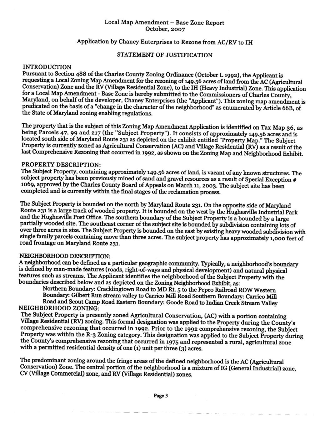
93 Report to the Planning Commission Base Zone Amendment ZMA#07-31 Chaney Enterprises, Inc. Jenkins Property Public Meeting January 7, 2008 This report is submitted pursuant to Article XXVII, of the Charles County Zoning Ordinance. The report includes a summary of the requested change, history of the subject property, and findings as to change in the character of the neighborhood and mistake. Requested Change The applicant, Chaney Enterprises, Inc., the owner of the subject property, requests an amendment to change the AC, Agricultural Conservation Zone and the RV, Village Residential Zone, to IH, Heavy Industrial Zone, for the property located on the south side of Prince Frederick Road (Route 231) near Hughesville. The subject property is also known as Tax Map 36, Grids 16 and 23, Parcels 47, 99 and 217. The subject property is west of the Hughesville Post Office and the Brookleigh Woods Subdivision and east of the Hughesville Industrial Park. Property to the north of the property is currently undeveloped. The applicant has presented a report (Application-attached) which proposes a finding a substantial change and mistake as defined by Article 66B of the Annotated Code of Maryland and the Charles County Zoning Ordinance. History of the Property The subject property consists of acres and is currently zoned AC Agricultural Conservation and RV Village Residential per the existing Charles County Zoning Maps and Zoning Ordinance. The subject property is currently being used for gravel operations. The subject property received a Special Exception (#1069) on January 28, 2003 for gravel mining. The mining of the subject property has been completed and is currently being reclaimed. Substantial Change Rationale Requirements of Article 66B: Test for a Finding of Change or Mistake Article 66B, Section 4.05(a) of the Annotated Code of Maryland describes two situations in which a zoning map amendment may be granted: 1) based upon a finding that there was a substantial change in the character of the neighborhood where the property is located; or 2) that there was a mistake in the existing zoning classification. The applicant claims that there has been a substantial change in the character of the neighborhood and that a mistake in the existing zoning classification was made. Summary of the Applicant s Assertion Regarding a Substantial Change in Character: Applicant states that a substantial change in the character of the neighborhood has occurred due to the decline of the tobacco agricultural industry and the impact this loss has had on the businesses located in Hughesville. Prior to this decline, the location of Hughesville as a hub for the Tri-County Area, the Tobacco Warehouse Barns, and other supporting businesses, made Hughesville a vibrant area. Most of the businesses that existed to support the tobacco farmer and activities that support the farming 1
94 community have closed. In addition, the applicant states that in the past, the vast amount of commuter traffic using Maryland Route 5 through Hughesville has added to the decline of the village and local businesses as the heavy volume of traffic and inadequate roads have prevented the public from accessing these local businesses. With, however, the completion of the Hughesville Bypass, the village is now free of the constant everyday traffic and the village is now able to expand and to encourage new business to come into the Hughesville area. Furthermore, the building of the Harley Davidson motorcycle dealership and the expansion of Everything Amish are businesses that have developed over the past few years that are examples of how the Village of Hughesville has changed and is expanding. Summary of Applicant's Assertion of Mistake The applicant states that the County did not anticipate nor properly consider the need to provide for business expansion areas for Hughesville during the 1992 Comprehensive Rezoning process. In light of the limited commercial development in Hughesville and the inclusion of industrial zoning, the subject property would have been a logical expansion of the neighboring Hughesville Industrial Park. Comprehensive Plan Compliance: Consistency with County Plans Applicant states that the rezoning from Agricultural Conservation and Village Residential to Heavy Industrial zoning would be consistent with the Charles County Comprehensive Plan because the use of the subject property furthers the goals of the Comprehensive Plan by not having an impact on schools or recreation space. The applicant feel that Maryland Route 231 can handle traffic generated by an industrial use and at time of site plan, an APF Traffic study requirements will comply with the goals of the Comprehensive Plan (1997). Furthermore, the applicant states that the rezoning of the subject property complies with the Comprehensive Plan's goals of strengthening the County's economic base through improvement of existing businesses and industry (2006 Comprehensive Plan, 4-2) and by providing sufficient improved business and industrial land relative to market needs to provide for flexibility and reduced cost in site selection (2006 Comprehensive Plan, 4-10). Staff Finding: The applicant's statement that Maryland 231 is capable of handling any additional traffic that may be generated is not supported by the application. Since MD 231 has only one through lane in each direction, it has a limited capacity. With an existing average daily traffic volume of approximately 17,000 vehicles per day, MD Route 231 experiences the highest traffic-volume of any two-lane state roadway in the county. A traffic study would need to be submitted in order to determine if the level of development of an IH Zone could be supported by this roadway. State Highway Administration: Any further development that may be approved on this property, which results from the Zoning change to a higher use, will be required to provide frontage improvements along MD 231 to mitigate the increased traffic volume. Staff Finding: Hughesville Village is a designated Village in the Comprehensive Plan. The vision for villages is to preserve and enhance their present character so that they may continue to act 2
95 as rural service areas and to serve their traditional roles in county life. The Comprehensive Plan discusses several functions and characteristics of, and recommends for, the villages that make the proposed rezoning a subject of concern and additional review. These include the following: Generally, villages should remain small in physical area. Villages are primarily residential in character. The Comprehensive Plan states that the broad range of non-residential uses that are permitted in villages is a concern. Villages should continue to provide limited, highly localized commercial services and limited employment opportunities. Staff Finding: The Comprehensive Plan states that the Village of Hughesville serves regional as well as local populations. The proposed industrial rezoning would fit into that scenarios, however the issues of size, scope and impacts of the project on the Village of Hughesville would need to be reviewed in detail. Staff Finding: The subject property is located adjacent to, but outside of, the study area for the 2007 Hughesville Revitalization Plan. The proposed rezoning would effectively expand the amount of industrial land in the general area surrounding the Hughesville Village Study Area in the Plan. The Build-Out Analysis for the Plan indicates that there is existing underutilized industrial land within the Village of Hughesville. Industrial or commercial development outside of these underutilized areas may have the effect of drawing needed infill development from the Village proper and expanding the Village beyond what is recommended by the Comprehensive Plan and the Hughesville Village Revitalization Plan. If, however, it can be shown that the proposed industrial use would generate a significant number of jobs for the area, this could have the effect of generating more people to support the businesses within the Village. Economic Development Department: The application supports the Comprehensive Plan's goal of providing sufficient improved business and industrial land relative to market needs to provide for flexibility and reduced cost in site selection. Based upon 2006 Tax Map data base, there are 28 IH parcels (954 acres) in the County, 167 parcels (670 acres) in the PUD, and 21 parcels (192 acres) in the Town of La Plata. Rezoning the subject property to IH would be an expansion of an adjoining industrial area (zoned IG). Charles County Zoning Ordinance: The Charles County Zoning Ordinance states that the objective of the Industrial Zones zones is to strengthen the economic environment of the county by recognizing existing industrial uses and promoting industrial development in order to broaden the county's tax base and create new jobs. The Heavy Industrial Zone as an area that provides appropriate locations for larger scale or intensive processing which may generate substantially more impact on surrounding properties than intended in the General Industrial Zone. Staff Findings: The applicant's application does not provide information as to how this proposed map amendment fulfills the objectives of the Industrial Zone in general and the Heavy Industrial (IH) Zone in particular. Information provided speaks to general zoning requirements that have to met by any use that might be introduced to the IH Zone. 3
96 Patuxent River Policy Plan (1984, update 1997) Staff Findings: The application does not appear to be fully consistent with the 1984 Patuxent River Policy Plan and the 1997 Update, which the Charles County Commissioners approved by Resolutions and Land use, forest cover and living resources are the specific areas of of inconsistency. For example, the proposed IH zoning allows an impervious surface ratio of 60%. This impervious surface ratio would have detrimental impacts to headwater streams. Additional Information The subject property is located in the vicinity of historic resources, such as the George J. Chappalear property (CH-468) and the Gerhard King property (CH-486). Staff Evaluation of Request As stated in the Charles County application for Local Map Amendment-Base Zones, if the applicant contends that a change in the character of a neighborhood has occurred, the applicant must include information sufficient to prove that neighborhood character changed by providing a description of the changes which have occurred since the original or last comprehensive rezoning and explaining how these changes justify the amendment and is compatible with existing and proposed development in the area. If the applicant asserts that a mistake has been made, it must be established by the applicant that at the time of the last comprehensive rezoning, the County failed to take into account then existing facts, projects, or trends in making the decisions regarding the zoning of the property. Staff Findings as to a Substantial Change in Character: 1. The acre subject property,located on Tax Map 36, Grids 16 and 23, Parcels 47, 99 and 217, is currently zoned Agricultural Conservation (AC) and Residential Village (RV). 2. The property located on the south side of Prince Frederick Road (Maryland Route 231), to the west of the Brookleigh Woods Subdivision and the the east of the Hughsville Industrial Park (zoned IG). 3. The property is not within the limits of the Hughesville Revitalization Plan. 4. The property is not served by public water and sewer. 5. The proposed map amendment does support the Comprehensive Plan (2006) goal of providing sufficient improved business and industrial land relative to market needs to provide for flexibility and reduced cost in site selection". 6. The proposed map amendment does not support the Comprehensive Plan (1997) goals for transportation. 7. Insufficient information was provided to show how the proposed rezoning supports the goals of the industrial zones in general and the heavy industrial zone in particular. 8. A traffic study for Adequate Public Facilities will need to be completed to determine the impact a heavy industrial use will have on Maryland Route 231, Route 5 and the Hughesville By-Pass. 4
97 9. The applicant does not appear to be fully consistent with the 1984 Patuxent River Policy Plan and the 1997 Update. Staff Findings as to Mistake 1. Insufficient information was provided to determine a mistake. Recommendations Should ZMA #07-31 be approved, staff recommend the following conditions of approval: 1. A full traffic study be preformed prior to Special Exception application, if necessary, or Site Development Plan if a Special Exception is not necessary. 2. A Bufferyard "E" be provided around the property to screen any heavy industrial use from adjoining residential uses and to shield any adjacent historic properties on the Maryland Inventory. Prepared By Reviewed By 5
98 Supplemental Report ZMA Jenkins Property Traffic Analysis A traffic study was submitted on February 29, 2008 by the applicant. The Planning APF staff has provided a cursory review of the document and have the following comments: 1. The applicant states on page 27 of the analysis that this transportation analysis is for informational purposes only and was prepared to show that improvements to the area road network could be accomplished to support the requested zoning of the subject site. 2. The analysis assumes the land used of Research and Development, Recreation Community Center and Satellite Community College. These uses will be reviewed at time of Special Exception or Site Development Plan submission for use appropriateness. 3. The conclusions include that under the above land use assumptions, the two (2) land Maryland Route 231 in front of the site would not be able to handle the existing traffic plus the hypothetical site development traffic (i.e. The road would be over-capacity per County regulations), and would likely need to be widened from two (2) to five (5) lanes. The analysis also states that the site access at MD Route 231 would not meet APF standards, and that mitigation in the form of a traffic signal would likely be required. 4. Since the above potential improvements involve a state-owned and maintained facility, and insufficient time did not allow for a State Highway Administration (SHA) review of the Transportation Analysis, staff finds that when the applicant for the subject site applies for either a Site Development Plan or Special Exception application, a traffic study which reflects proposed/allowed land uses shall be submitted at that time (with study parameters determined by PGM Planning APF Section and all traffic counts be no older than 12 months old), and that if be appropriately reviewed by the State Highway Administration. Fiscal Impact Study Fiscal Impact Study was received on March 5, 2008 and insufficient time was given for review and comment by the Budget Director. Those comments, if any, will be presented to the Planning Commission at their worksession, if one is held.
99
100
101
102
103
104
105
106
107
108
109
110
111
112
113
114
115
116
117
118
STATE OF RHODE ISLAND AND PROVIDENCE PLANTATIONS CITY OF EAST PROVIDENCE CHAPTER
 STATE OF RHODE ISLAND AND PROVIDENCE PLANTATIONS CITY OF EAST PROVIDENCE CHAPTER AN ORDINANCE IN AMENDMENT OF CHAPTER 19 OF THE REVISED ORDINANCES OF THE CITY OF EAST PROVIDENCE, RHODE ISLAND 1998, AS
MEMORANDUM. City Council. David J. Deutsch City Manager. Resolution R TLBT, LLC Annapolis Road Annexation Plan. DATE: September 3, 2015
 MEMORANDUM TO: FROM: RE: City Council David J. Deutsch City Manager Resolution R-66-15 TLBT, LLC 13401 Annapolis Road Annexation Plan DATE: September 3, 2015 In accordance with the Annotated Code of Maryland,
DISTRICT COUNCIL FOR PRINCE GEORGE'S COUNTY, MARYLAND OFFICE OF THE ZONING HEARING EXAMINER ZONING MAP AMENDMENT A DECISION
 DISTRICT COUNCIL FOR PRINCE GEORGE'S COUNTY, MARYLAND OFFICE OF THE ZONING HEARING EXAMINER ZONING MAP AMENDMENT A-10029 DECISION Application: R-R to C-M Zone Applicant: Santos, LLC Opposition: Richard
9. REZONING NO Vicinity of the northwest corner of 143 rd Street and Metcalf Avenue
 9. REZONING NO. 2002-15 Vicinity of the northwest corner of 143 rd Street and Metcalf Avenue 1. APPLICANT: Andrew Schlagel is the applicant for this request. 2. REQUESTED ACTION: The applicant is requesting
Hamilton County Regional Planning Commission
 Hamilton County Regional Planning Commission March 1, 2012 Colerain Township Staff Report Zone Map Amendment: Case No.: ZA2012-01 Joseph Toyota Prepared By: Amy Bancroft, Land Use Planner ACTION REQUESTED:
MINUTES OF THE ST. MARY S COUNTY PLANNING COMMISSION MEETING ROOM 14 * GOVERNMENTAL CENTER * LEONARDTOWN, MARYLAND Monday, May 8, 2006
 MINUTES OF THE ST. MARY S COUNTY PLANNING COMMISSION MEETING ROOM 14 * GOVERNMENTAL CENTER * LEONARDTOWN, MARYLAND Monday, May 8, 2006 Members present were Joseph St. Clair, Chair; Steve Reeves, Vice Chair;
Bethel Romanian Church - Rezone, RZ
 / Planning and Zoning Staff Report Bethel Romanian Church - Rezone, RZ2018-0023 Hearing Date: November 15, 2018 Development Services Department Owners: Bethel Romanian Church, Corp. Applicant: Viorel Botos
PC Staff Report 11/18/2013 Z Item No. 1-1
 Z-13-00401 Item No. 1-1 PLANNING COMMISSION REPORT Regular Agenda - Public Hearing Item PC Staff Report 11/18/2013 ITEM NO. 1: Z-13-00401 IG (General Industrial) District TO CS (Strip Commercial) District;
STAFF REPORT. Permit Number: Lee. Kitsap County Board of Commissioners; Kitsap County Planning Commission
 STAFF REPORT Permit Number: 15 00689 Lee DATE: March 2, 2016 TO: FROM: Kitsap County Board of Commissioners; Kitsap County Planning Commission Katrina Knutson, AICP, Senior Planner, DCD and Jeff Arango,
CITY OF ELK GROVE CITY COUNCIL STAFF REPORT
 AGENDA ITEM NO. 9.2 CITY OF ELK GROVE CITY COUNCIL STAFF REPORT AGENDA TITLE: A public hearing to consider a Specific Plan Amendment to the Laguna Ridge Specific Plan and a Rezone of approximately 4.14
PLANNING COMMISSION STAFF REPORT
 PLANNING COMMISSION STAFF REPORT West Capitol Hill Zoning Map Amendment Petition No. PLNPCM2011-00665 Located approximately at 548 W 300 North Street, 543 W 400 North Street, and 375 N 500 West Street
Town of Bethlehem 20/20 Advisory Committee. Committee Meeting March 14, 2008 Elsmere Fire House, Poplar Drive 7:45 9:30 a.m.
 Town of Bethlehem 20/20 Advisory Committee Committee Meeting March 14, 2008 Elsmere Fire House, Poplar Drive 7:45 9:30 a.m. Agenda 1. Co-Chair Report Terri Egan and Ken Ringler 2. Town of Bethlehem Comp
MINUTES OF THE ST. MARY S COUNTY PLANNING COMMISSION MEETING ROOM 14 * GOVERNMENTAL CENTER * LEONARDTOWN, MARYLAND Monday, March 27, 2006
 MINUTES OF THE ST. MARY S COUNTY PLANNING COMMISSION MEETING ROOM 14 * GOVERNMENTAL CENTER * LEONARDTOWN, MARYLAND Monday, March 27, 2006 Members present were Joseph St. Clair, Chair; Steve Reeves, Vice
CITY OF DURHAM DURHAM COUNTY NORTH CAROLINA. Zoning Map Change Report. RR Existing Zoning. Rural Rural Density Residential Site Characteristics
 CITY OF DURHAM DURHAM COUNTY NORTH CAROLINA Zoning Map Change Report Meeting Date: February 26, 2007 Reference Name Arrowhead () Jurisdiction County Proposed Zoning RR Existing Zoning RS-20 Request Proposed
NOTICE OF MEETING AND AGENDA FOR THE PLANNING COMMISSION OF SPRINGVILLE, UTAH... JANUARY 23, 2018
 NOTICE OF MEETING AND AGENDA FOR THE PLANNING COMMISSION OF SPRINGVILLE, UTAH............................ JANUARY 23, 2018 Notice is hereby given that the Planning Commission will hold a public meeting
Land Use. Land Use Categories. Chart 5.1. Nepeuskun Existing Land Use Inventory. Overview
 Land Use State Comprehensive Planning Requirements for this Chapter A compilation of objectives, policies, goals, maps and programs to guide the future development and redevelopment of public and private
Planning Department Oconee County, Georgia STAFF REPORT
 Planning Department Oconee County, Georgia STAFF REPORT REZONE CASE #: 7332 DATE: November 28, 2017 STAFF REPORT BY: Gabriel Quintas, Planner APPLICANT NAME: Smith Planning Group PROPERTY OWNER: John Hadden
Town of Holly Springs
 Meeting Date: 7/17/2018 Agenda Topic Cover Sheet / last modified June 13, 2018 Town of Holly Springs Town Council Meeting Agenda Form Agenda Placement: Public Hearing (Special Recognitions (awards, proclamations),
R E S O L U T I O N PUBLIC HEARING
 R E S O L U T I O N WHEREAS, the Prince George s County Planning Board is charged with the approval of Comprehensive Design Plans pursuant to Part 8, Division 4 of the Zoning Ordinance of the Prince George
RM18 RS9 RM12 RS9 !( S DOCKET #: W3120 PROPOSED ZONING: GB-L EXISTING ZONING: HB-S. PETITIONER: Bank of North Carolina for property owned by Same
 DELANE DR DOCKET #: W3120 RM18 BARRY ST PROPOSED ZONING: GB-L RS9 EXISTING ZONING: HB-S IP OLD GREENSBORO RD WALES ST DENVER ST GEORGE BIG REDD CT LOUISE WILSON LN RM12!(DS MOSES LUCAS CT 585' 627' HB-S
RC ; Reclassification The Garrison at Stafford Proffer Amendment (formerly Stafford Village Center)
") Board of Supervisors Robert Bob Thomas, Jr., Chairman Laura A. Sellers, Vice Chairman Meg Bohmke Jack R. Cavalier Wendy E. Maurer Paul V. Milde, III Gary F. Snellings Anthony J. Romanello, ICMA CM County
Board of Supervisors Robert Bob Thomas, Jr., Chairman Laura A. Sellers, Vice Chairman Meg Bohmke Jack R. Cavalier Wendy E. Maurer Paul V. Milde, III Gary F. Snellings Anthony J. Romanello, ICMA CM County
WHEREAS, the staff of The Maryland-National Capital Park and Planning Commission recommended APPROVAL of the application with conditions; and
 R E S O L U T I O N WHEREAS, Redeemed Christian Church of God is the owner of a 2.83-acre parcel of land known as Lot 9, Lot 19, P/O Lot 1 and P/O Lot 18, Block B, Plat Book A, Plat 5, said property being
STAFF REPORT FOR ANNEXATION AND ZONING. CASE NAME: Taylor Annexation and Zoning PC DATE: August 7, 2013
 STAFF REPORT FOR ANNEATION AND ZONING ANNEATION CASE NO: A-13-001 ZONING CASE NO: RZ-13-002 REPORT DATE: July 30, 2013 CASE NAME: Taylor Annexation and Zoning PC DATE: August 7, 2013 ADDRESS OF PROPOSAL:
Metropolitan Planning Commission. DATE: April 5, 2016
 TO: FROM: Metropolitan Planning Commission MPC Staff DATE: April 5, 2016 SUBJECT: Petition of Nine Line Inc. Robert McCorkle, Agent PIN: 2-1034-01-002 380.5 Acres Aldermanic District: 5 (Shabazz) County
O-I (Office-Institutional) and AG-1(Agricultural)
 and AG-1(Agricultural)") PROPERTY INFORMATION ADDRESS 3503 and 3505 Bethany Bend DISTRICT, LAND LOTS 2/1 973 and 974 OVERLAY DISTRICT State Route 9 PETITION NUMBERS EXISTING ZONING O-I (Office-Institutional) and AG-1(Agricultural)
PROPERTY INFORMATION ADDRESS 3503 and 3505 Bethany Bend DISTRICT, LAND LOTS 2/1 973 and 974 OVERLAY DISTRICT State Route 9 PETITION NUMBERS EXISTING ZONING O-I (Office-Institutional) and AG-1(Agricultural)
AGENDA REPORT FLOR1 Q. City Commission
 F P LA G r fir Y AGENDA REPORT 1 FLOR1 Q DATE 22 SEP 08 TO City Commission FROM David R Sollenberger City Manager SUBJECT Public hearing on an ordinance to modify County Line Commerce Center Community
Town of Ontario Zoning Board of Appeals Minutes September 13, 2017
 Town of Ontario Zoning Board of Appeals Minutes September 13, 2017 Present: Zoning Board Members Chairman, Bill Bridson, Chuck Neumann,, Rich Williams Town Lawyer, Beth Hart Zoning Clerk, 7 members of
REZONING APPLICATION INSTRUCTIONS
 REZONING APPLICATION INSTRUCTIONS All required information, as stated on the Rezoning Application Checklist, must be included to qualify as a complete application. Upon receipt, staff will review the application
AGENDA ITEM SUMMARY GLADES COUNTY BOARD OF COUNTY COMMISSIONERS
 AGENDA ITEM SUMMARY GLADES COUNTY BOARD OF COUNTY COMMISSIONERS SUBJECT: Case Number COMP17-01, Legend Moto LLC This is a Legislative Hearing. DEPARTMENT REQUEST: The Community Development Department requests
CITY OF WILDOMAR PLANNING COMMISSION Agenda Item #2.3 PUBLIC HEARING Meeting Date: January 6, 2016
 CITY OF WILDOMAR PLANNING COMMISSION Agenda Item #2.3 PUBLIC HEARING Meeting Date: January 6, 2016 TO: FROM: Chairman and Members of the Planning Commission Matthew C. Bassi, Planning Director SUBJECT:
Appendix A: Guide to Zoning Categories Prince George's County, Maryland
 Appendix A: Guide to Zoning Categories Prince George's County, Maryland RESIDENTIAL ZONES 1 Updated November 2010 R-O-S: Reserved Open Space - Provides for permanent maintenance of certain areas of land
SUBJECT: CUP ; Conditional Use Permit - Telegraph Road Vehicle Sales / Storage
 2 Board of Supervisors Robert Bob Thomas, Jr., Chairman Laura A. Sellers, Vice Chairman Meg Bohmke Jack R. Cavalier Wendy E. Maurer Paul V. Milde, III Gary F. Snellings August 24, 2016 Anthony J. Romanello,
Marion County Board of County Commissioners
 Marion County Board of County Commissioners Date: 12/29/2015 P&Z: 12/28/2015 BCC: 1/12/2016 Item Number 160113Z Type of Application Rezoning Request From: A-1 (General Agriculture) To: PUD (Planned Unit
CITY OF WILDOMAR PLANNING COMMISSION Agenda Item #2.3 PUBLIC HEARING Meeting Date: June 6, 2018
 CITY OF WILDOMAR PLANNING COMMISSION Agenda Item #2.3 PUBLIC HEARING Meeting Date: June 6, 2018 TO: FROM: Chairman and Members of the Planning Commission Robert Kain, Senior Planner SUBJECT: Change of
HOMER TOWNSHIP PLANNING COMMISSION LAND USE APPLICATION
 LAND USE APPLICATION 1-APPLICATION FOR: (check all that apply) Site plan Rezoning-regular PUD Special use Rezoning-spot Subdivision Rezoning-conditional 2-APPLICANT/PARCEL INFORMATION - Applicant is property
CITY OF RIO VISTA PLANNING COMMISSION STAFF REPORT
 MEETING DATE: January10, 2018 CITY OF RIO VISTA PLANNING COMMISSION STAFF REPORT AGENDA ITEM #4.2 PREPARED BY: Lamont Thompson, Planning Manager SUBJECT: Vesting Tentative Tract No. 2017-001: To consider
April 16, The following persons signed in as being present in the audience:
 April 16, 2013 The East Lampeter Township Board of Supervisors met on Tuesday, April 16, 2013, beginning at 7:30 p.m. in the East Lampeter Township Office, 2250 Old Philadelphia Pike, Lancaster, PA 17602.
MINUTES JOINT MEETING LINCOLN COUNTY and SIOUX FALLS PLANNING COMMISSIONS 7:00 pm July 14, 2010
 MINUTES JOINT MEETING LINCOLN COUNTY and SIOUX FALLS PLANNING COMMISSIONS 7:00 pm July 14, 2010 Commissioners Room - Lincoln County Court House A joint meeting of Lincoln County and Sioux Falls Planning
4.2 LAND USE INTRODUCTION
 4.2 LAND USE INTRODUCTION This section of the EIR addresses potential impacts from the Fresno County General Plan Update on land use in two general areas: land use compatibility and plan consistency. Under
Carroll County Planning Commission Report and Recommendation to the Board of County Commissioners
 Carroll County Planning Commission Report and Recommendation to the Board of County Commissioners Rezoning Case No. 219 Long Reach Farms Inc. (Robert Summary: Petitioner: Robert R. Clarke, petitioner 129
RESOLUTION NO
 RESOLUTION NO. 2014- A RESOLUTION OF THE BOARD OF SUPERVISORS OF THE COUNTY OF NAPA, STATE OF CALIFORNIA, ADOPTING CEQA FINDINGS FOR ADOPTION OF THE DEVELOPMENT PLAN, DESIGN GUIDELINES, DEVELOPMENT AGREEMENT
DISTRICT COUNCIL FOR PRINCE GEORGE S COUNTY, MARYLAND OFFICE OF ZONING HEARING EXAMINER SPECIAL EXCEPTION 4658 DECISION
 DISTRICT COUNCIL FOR PRINCE GEORGE S COUNTY, MARYLAND OFFICE OF ZONING HEARING EXAMINER SPECIAL EXCEPTION 4658 DECISION Application: Three Chair Barber Shop Applicants: Danta L. & Felicia B. Wright/Fort
PLANNING AND ZONING COMMISSION ZONE CHANGE
 PLANNING AND ZONING COMMISSION ZONE CHANGE DOÑA ANA COUNTY COMMUNITY DEVELOPMENT DEPARTMENT Doña Ana County Government Center 845 N. Motel Blvd. Las Cruces, New Mexico 88007 Telephone: (575) 647-7350 MEETING
RECOMMENDATION REPORT
 DEPARTMENT OF CITY PLANNING RECOMMENDATION REPORT City Planning Commission Date: August 27, 2009 Time: After 8:30 AM Place: City Hall 200 North Spring Street Los Angeles, CA 90012 Public Hearing: Completed
ARTICLE B ZONING DISTRICTS
 ARTICLE B ZONING DISTRICTS Sec. 8-3021 Established. In order to protect the character of existing neighborhoods; to prevent excessive density of population in areas which are not adequately served with
IREDELL COUNTY ZONING BOARD OF ADJUSTMENT
 IREDELL COUNTY ZONING BOARD OF ADJUSTMENT The Iredell County Zoning Board of Adjustment met at a regular and duly advertised meeting on Thursday, February 21, 2013 at 7:00 p.m. in the Commissioners Meeting
Agenda Item No. October 14, Honorable Mayor and City Council Attention: David J. Van Kirk, City Manager
 Agenda Item No. October 14, 2008 TO: FROM: SUBJECT: Honorable Mayor and City Council Attention: David J. Van Kirk, City Manager Scott D. Sexton, Community Development Director ORDINANCE OF THE CITY COUNCIL
CITY COUNCIL SPECIAL MEETING THURSDAY, SEPTEMBER 1, :00 P.M. CITY COUNCIL CHAMBER, CITY HALL 2401 MARKET STREET BAYTOWN, TEXAS AGENDA
 CITY OF BAYTOWN NOTICE OF MEETING CITY COUNCIL SPECIAL MEETING THURSDAY, SEPTEMBER 1, 2016 5:00 P.M. CITY COUNCIL CHAMBER, CITY HALL 2401 MARKET STREET BAYTOWN, TEXAS 77520 AGENDA CALL TO ORDER AND ANNOUNCEMENT
A Affordable Storage CUP Amendment, in Section 20, T35N R2W NMPM, at 4340B US Hwy 160W and 122 Meadows Dr.
 Archuleta County Development Services Planning Department 1122 HWY 84 P. O. Box 1507 Pagosa Springs, Colorado 81147 970-264-1390 Fax 970-264-3338 MEMORANDUM TO: Archuleta County Planning Commission FROM:
Hal Simmons Planning Director Boise City Planning and Development Services. CAR / 1689 South Entertainment Avenue
 MEMORANDUM MEMO TO: FROM: Mayor and Boise City Council Hal Simmons Planning Director Boise City Planning and Development Services DATE: November 15, 2008 RE: CAR08-00019 / 1689 South Entertainment Avenue
Comprehensive Plan 2030
 Introduction The purpose of this chapter of the Comprehensive Plan is to accurately describe, in words and images, the goals and visions for the future of Clearfield, as determined by the people who live
MONTGOMERY COUNTY PLANNING DEPARTMENT THE MARYLAND-NATIONAL CAPITAL PARK AND PLANNING COMMISSION
 MONTGOMERY COUNTY PLANNING DEPARTMENT THE MARYLAND-NATIONAL CAPITAL PARK AND PLANNING COMMISSION MCPB Item No.: Date: 11-12-15 15931 Frederick Road (CarMax) Annexation Request ANX2015-00145 Patrick Butler,
CITY OF TYLER CITY COUNCIL COMMUNICATION
 CITY OF TYLER CITY COUNCIL COMMUNICATION Agenda Number: Z-2 Date: January 23, 2019 Subject: PD18-035 FAIR NANCY WOOD (2801 AND 2835 SOUTH BROADWAY AVENUE) Request that the City Council consider approving
PLANNING & DEVELOPMENT
 PLANNING & DEVELOPMENT STAFF REPORT Rezoning PETITION: APPLICANT: PROPERTY OWNER: TYPE OF REQUEST: SIZE OF TRACT: LOCATION: (#17-22) Rezone from A-PUD (Agri-Business Planned Unit Development) to A-PUD
PUBLIC NOTICE & AGENDA PLAN COMMISSION City Hall Forum State Street, Beloit, WI :00 PM Wednesday, November 07, 2018
 PUBLIC NOTICE & AGENDA PLAN COMMISSION City Hall Forum - 100 State Street, Beloit, WI 53511 7:00 PM Wednesday, November 07, 2018 1. CALL TO ORDER AND ROLL CALL 2. MINUTES 2.a. Consideration of the Minutes
LETTER OF TRANSMITTAL
 LETTER OF TRANSMITTAL To: Clallam County Board of Commissioners From: Clallam County Planning Commission Date: November 18, 2009 Subject: Transmittal to BOCC: Findings and Conclusions regarding proposed
CITY COUNCIL SUMMARY REPORT. Agenda No. (,.J Key Words: Southwest Dixon, General Plan, Specific Plan Rezone Meeting Date: May 18, 2016
 SUMMARY REPORT Agenda No. (,.J Key Words: Southwest Dixon, General Plan, Specific Plan Rezone Meeting Date: May 18, 2016 CITY COUNCIL PREPARED BY: Kristen Maze, Community Development Director.fU"._,./.JA
St. Mary s County Comprehensive Zoning Ordinance Article 1. GENERAL PROVISIONS
 0 0 0 0 ARTICLE. GENERAL PROVISIONS CHAPTER 0 TITLE, PURPOSE AND ORGANIZATION Sections: 0. Title. 0. Authority. 0. Purpose. 0. Organization of the Zoning Ordinance. 0. Official Zoning Map. 0. Applicability.
STAFF REPORT. Permit Number: Unlimited. Kitsap County Board of Commissioners; Kitsap County Planning Commission
 STAFF REPORT Permit Number: 15 00550 Unlimited DATE: March 2, 2016 TO: FROM: Kitsap County Board of Commissioners; Kitsap County Planning Commission Katrina Knutson, AICP, Senior Planner, DCD and Jeff
Annexation Procedure
 Annexation Procedure Meet with Planning Department Staff - Recommended Figure 1.9 Submit petition for Annexation, w/ majority of property owner s signature, legal description of proposed property, lot
Agenda Information Sheet
 Page 90 Agenda Information Sheet December 13, 2018 Agenda Item Z-18-10 - Conduct a public hearing and consider approval of an ordinance rezoning a 33.4 tract of land out of the H. Teal Survey Abstract
French, Bruce. The applicant is requesting a zone change from Suburban to Rural Service Center.
 BONNER COUNTY PLANNING DEPARTMENT PLANNING AND ZONING COMMISSION STAFF REPORT FOR FEBRUARY 2, 2017 Project Name: French, Bruce File Number,Type: ZC358-16, Zone Change Request: The applicant is requesting
Kitsap County Department of Community Development
 Kitsap County Department of Community Development Staff Report and Recommendation Annual Comprehensive Plan Amendment Process for 2018 George s Corner LAMIRD Boundary Adjustment Report Date 7/16/2018 Hearing
ARLINGTON COUNTY, VIRGINIA
 ARLINGTON COUNTY, VIRGINIA County Board Agenda Item Meeting of April 19, 2008 DATE: April 2, 2008 SUBJECT: ORDINANCE TO AMEND, REENACT, AND RECODIFY Section 20 CP- FBC, Columbia Pike Form Based Code Districts
CITY OF NORTH LAS VEGAS MEMORANDUM
 CITY OF NORTH LAS VEGAS MEMORANDUM TO: FROM: SUBJECT: Planning Commission Community Development and Compliance Department # 28 ) AMP-03-15; Coleman Airpark II & III - Comprehensive Plan Amendment (Public
BEFORE THE GALLATIN COUNTY COMMISSION GALLATIN COUNTY, MONTANA
 BEFORE THE GALLATIN COUNTY COMMISSION GALLATIN COUNTY, MONTANA IN THE MATTER OF THE APPLICATION OF TOM MURPHY, MANAGING MEMBER OF THE BRIDGER CENTER, LLC, FOR A ZONE MAP AMENDMENT TO THE GALLATIN COUNTY/BOZEMAN
Waupaca County Planning & Zoning
 Waupaca County Planning & Zoning Zoning Map Amendment Application Packet Zoning Amendment Packet Includes: Checklist Zoning Map Amendment Application Town Recommendation Form for Rezoning PRIOR TO SUBMITTING
Special Use Permit - Planned Unit Development Checklist. Property Address:
 Special Use Permit - Planned Unit Development Checklist Special Use Permit Number. Parcel Code/s #28-11- - - Property Address: Applicant: ARTICLE VIII Ordinance Reference - Section 8.1.2 Permit Procedures:
Honorable Mayor and Members of the City Council
 Office of the City Manager ACTION CALENDAR June 11, 2013 To: From: Honorable Mayor and Members of the City Council Christine Daniel, City Manager Submitted by: Eric Angstadt, Director, Planning & Development
March 9, Planning Commission. Benjamin J. Ziskal, AICP, CEcD Planning Office
 COUNTY OF PRINCE WILLIAM 5 County Complex Court, Suite 210, Prince William, Virginia 22192-9201 PLANNING (703) 792-7615 FAX (703) 792-4401 www.pwcgov.org OFFICE Rebecca Horner, AICP, CZA Director of Planning
CHAPTER Committee Substitute for Committee Substitute for Senate Bill No. 2188
 CHAPTER 2004-372 Committee Substitute for Committee Substitute for Senate Bill No. 2188 An act relating to land development; amending s. 197.502, F.S.; providing for the issuance of an escheatment tax
MONTGOMERY COUNTY PLANNING BOARD
 MONTGOMERY COUNTY PLANNING BOARD T H E MARYLAND-NATIONAL CAPITAL PARK A N D P L A N N I N G C O M M I S S I O N MCPB NO. 10-144 Hearing Date: September 30, 2010 MONTGOMERY COUNTY PLANNING BOARD RESOLUTION
13 Sectional Map Amendment
 13 Sectional Map Amendment Introduction This chapter reviews land use and zoning policies and practices in Prince George s County and presents the proposed zoning in the sectional map amendment (SMA) to
Farmland Preservation Plan
 WELCOME! Farmland Preservation Plan Douglas County, WI Kickoff Steering Committee Meeting Amnicon Town Hall Tuesday, February 9, 2016 1:30 pm to 3:30 pm Source: http://www.loc.gov/item/fsa2000044046/pp/
Ontario Municipal Board Commission des affaires municipales de l Ontario Ontario Limited P. A. Robertson
 ISSUE DATE: MAR. 17, 2009 PL081277 Ontario Municipal Board Commission des affaires municipales de l Ontario IN THE MATTER OF subsection 34(19) of the Planning Act, R.S.O. 1990, c. P. 13, as amended Appellant:
Summary. Draft Redevelopment Plan Summary Flowery Branch Tax Allocation District # 1:
 Summary Draft Redevelopment Plan Summary Flowery Branch Tax Allocation District # 1: Flowery Branch Tax Allocation District Old Town and Commercial Gateways 1 Public Hearing Presentation November 21, 2007
(c) County board of commissioners means 1 of the following, as applicable: (ii) In all other counties, 1 of the following:
 County board of commissioners means 1 of the following, as applicable: (ii) In all other counties, 1 of the following:") TOWNSHIP PLANNING Act 168 of 1959, as amended, (including 2001 amendments, 2006 amendments) AN ACT to provide for township planning; for the creation, organization, powers and duties of township planning
TOWNSHIP PLANNING Act 168 of 1959, as amended, (including 2001 amendments, 2006 amendments) AN ACT to provide for township planning; for the creation, organization, powers and duties of township planning
REPRESENTATIVE: Centerline Solutions Table Mountain Parkway Golden, CO 80403
 COMMISSIONERS: DARRYL GLENN (PRESIDENT) MARK WALLER (PRESIDENT PRO TEMPORE) STAN VANDERWERF LONGINOS GONZALEZ PEGGY LITTLETON PLANNING AND COMMUNITY DEVELOPMENT DEPARTMENT CRAIG DOSSEY, EXECUTIVE DIRECTOR
Mike & Sherry Dudley Rezone, RZ
 / Planning and Zoning Staff Report Mike & Sherry Dudley Rezone, RZ2019-0005 Hearing Date: April 18, 2019 Development Services Department Applicant: Mike & Sherry Dudley Staff: Deb Root, 454-7340 droot@canyonco.org
ARLINGTON COUNTY, VIRGINIA
 ARLINGTON COUNTY, VIRGINIA County Board Agenda Item Meeting of September 18, 2004 DATE: August 19, 2004 SUBJECTS: A. GP-297-04-1 GENERAL LAND USE PLAN AMENDMENT from Service Commercial (Personal and business
CITY OF WEST PALM BEACH PLANNING BOARD Meeting Date: July 17, 2018 Planning Board Case No. 1670I
 CITY OF WEST PALM BEACH PLANNING BOARD Meeting Date: July 17, 2018 Planning Board Case No. 1670I Palms Gateway Commercial Planned Development (CPD) Southeast Corner of Belvedere Road and Australian Avenue
STAFF REPORT City of Lancaster
 STAFF REPORT City of Lancaster CPR 1 10/25/16 MVB Date: To : From: Subject: October 25, 2016 Mayor Parris and City Council Members Brian S. Ludicke, Planning Director~ Amendment to Title 17 of the Lancaster
Mayor Leon Skip Beeler and Members of the City Commission. Anthony Caravella, AICP, Director of Development Services
 CITY COMMISSION BRIEFING & Planning Board Report For Meeting Scheduled for November 4, 2010 Thousand Island Conservation Area Rezoning Ordinance 1519 FINAL ACTION TO: FROM: THRU: RE: Mayor Leon Skip Beeler
The Corporation of the Township of Otonabee-South Monaghan. Public Meeting - Section 34 Zoning By-law Amendment. Monday, January 8, 6:00pm
 The Corporation of the Township of Otonabee-South Monaghan Public Meeting - Section 34 Zoning By-law Amendment Monday, January 8, 2018 @ 6:00pm Council Chambers, Municipal Office - Keene Page 1. CALL TO
PLANNING COMMISSION PUBLIC HEARING STAFF REPORT ZRTD FAIRFAX MARBLE & GRANITE
 Date of Hearing: PLANNING COMMISSION PUBLIC HEARING STAFF REPORT SUBJECT: ELECTION DISTRICT: ZRTD-2016-0009 FAIRFAX MARBLE & GRANITE Broad Run CRITICAL ACTION DATE: September 27, 2017 STAFF CONTACTS: APPLICANT:
Midwest City, Oklahoma Zoning Ordinance
 2010 Midwest City, Oklahoma Zoning Ordinance 9/2/2010 Table of Contents Section 1. General Provisions... 5 1.1. Citation... 5 1.2. Authority... 5 1.3. Purpose... 5 1.4. Nature and Application... 5 1.5.
REZONING GUIDE. Zone Map Amendment (Rezoning) - Application. Rezoning Application Page 1 of 3. Return completed form to
 - Application. Rezoning Application Page 1 of 3. Return completed form to") Zone Map Amendment (Rezoning) - Application COMMUNITY PLANNING & DEVELOPMENT REZONING GUIDE Rezoning Application Page 1 of 3 PROPERTY OWNER INFORMATION* CHECK IF POINT OF CONTACT FOR APPLICATION Property
Zone Map Amendment (Rezoning) - Application COMMUNITY PLANNING & DEVELOPMENT REZONING GUIDE Rezoning Application Page 1 of 3 PROPERTY OWNER INFORMATION* CHECK IF POINT OF CONTACT FOR APPLICATION Property
PLANNING AND ZONING COMMISSION AGENDA MEMORANDUM
 PLANNING AND ZONING COMMISSION AGENDA MEMORANDUM City and County of Broomfield, Colorado To: Planning and Zoning Commission From: John Hilgers, Planning Director Prepared by: Michael Sutherland, Senior
RS9 LB-S RSQ-S RS9 RS9 DOCKET: W2822 PROPOSED ZONING: LB EXISTING ZONING: RS-9. PETITIONER: J&J Properties of W-S, LLC, for property owned by Same
 HAYMOUNT ST RS9 IP DOCKET: W2822 PROPOSED ZONING: LB POPE RD CLEMMONSVILLE RD EXISTING ZONING: RS-9 RSQ-S LB-S OLD SALISBURY RD WINSTON-SALEM ZONING FORSYTH COUNTY ZONING PETITIONER: J&J Properties of
PLANNING FOR OUR FUTURE
 PLANNING FOR OUR FUTURE ELLSWORTH TOWNSHIP LAND USE AND POLICY PLAN The purpose of this Plan is to serve as a guide for the Township Trustees, Zoning Commission, Board of Zoning Appeals, developers, employers,
CITY OF WILDOMAR PLANNING COMMISSION Agenda Item #2.1 PUBLIC HEARING Meeting Date: June 6, 2018
 CITY OF WILDOMAR PLANNING COMMISSION Agenda Item #2.1 PUBLIC HEARING Meeting Date: June 6, 2018 TO: FROM: Chairman and Members of the Planning Commission Alfredo Garcia, Associate Planner SUBJECT: WPS/Mission
MINUTES OF THE ST. MARY S COUNTY PLANNING COMMISSION MEETING ROOM 14 * GOVERNMENTAL CENTER * LEONARDTOWN, MARYLAND Monday, June 27, 2005
 MINUTES OF THE ST. MARY S COUNTY PLANNING COMMISSION MEETING ROOM 14 * GOVERNMENTAL CENTER * LEONARDTOWN, MARYLAND Monday, June 27, 2005 Members present were Larry Greenwell, Chairman; Joseph St. Clair,
KNOXVILLE/KNOX COUNTY METROPOLITAN PLANNING COMMISSION PLAN AMENDMENT/REZONING REPORT
 KNOXVILLE/KNOX COUNTY METROPOLITAN PLANNING COMMISSION PLAN AMENDMENT/REZONING REPORT FILE #: 4-G-12-RZ 4-C-12-SP AGENDA ITEM #: 27 AGENDA DATE: 5/10/2012 POSTPONEMENT(S): 4/12/12 APPLICANT: OWNER(S):
Comprehensive Plan Amendment #PLN , Reserve at Cannon Branch (Coles Magisterial District)
") COUNTY OF PRINCE WILLIAM 5 County Complex Court, Prince William, Virginia 22192-9201 PLANNING (703) 792-7615 FAX (703) 792-4758 OFFICE Internet www.pwcgov.org Christopher M. Price, AICP Director of Planning
COUNTY OF PRINCE WILLIAM 5 County Complex Court, Prince William, Virginia 22192-9201 PLANNING (703) 792-7615 FAX (703) 792-4758 OFFICE Internet www.pwcgov.org Christopher M. Price, AICP Director of Planning
AGENDA ITEM SUMMARY GLADES COUNTY BOARD OF COUNTY COMMISSIONERS
 AGENDA ITEM SUMMARY GLADES COUNTY BOARD OF COUNTY COMMISSIONERS SUBJECT: Case Number COMP17-02, RFYC, LLC This is a Legislative Hearing. DEPARTMENT REQUEST: The Community Development Department requests
STATE OF ALABAMA SHELBY COUNTY
 STATE OF ALABAMA SHELBY COUNTY Members Present: Members Absent: Staff Present: SHELBY COUNTY PLANNING COMMISSION MINUTES Regular Meeting March 6, 2017 6:00 PM Michael O Kelley, Chairman; Jim Davis, Vice
PLANNING COMMISSION REPORT Regular Agenda Public Hearing Item
 PC Staff Report 6/20/16 Item No. 4-1 PLANNING COMMISSION REPORT Regular Agenda Public Hearing Item PC Staff Report 06/20/16 ITEM NO. 4: IG to CS 1.56 ACRES; 706 E 23 RD STREET (MKM) : Consider a request
Town of Onalaska. A scale map depicting the portion of Pineview Drive to be officially laid out as a Town highway is attached hereto as Exhibit A.
 Town of Onalaska Special Meeting Minutes for March 31, 2011 The Town Board met on site of the Pineview Road and County OT in Onalaska for the purpose of viewing the lay out of the road as required by law.
STAFF REPORT # CONDITIONAL USE PLANNING COMMISSION MEETING DATE: July 20, 2017
 STAFF REPORT #17-4000-0005 CONDITIONAL USE PLANNING COMMISSION MEETING DATE: July 20, 2017 1. APPLICATION: An application submitted by Stephanie Moye requesting a conditional use permit to allow for a
R E S O L U T I O N. 2. Development Data Summary
 R E S O L U T I O N WHEREAS, the Prince George's County Planning Board is charged with the approval of Detailed Site Plans pursuant to Part 3, Division 9 of the Zoning Ordinance of the Prince George's