Village of Bellevue Plan Commission Meeting TUESDAY, AUGUST 15, 2017 Village Hall/Public Safety Building 3100 Eaton Road 6:00 PM
|
|
|
- Chrystal Goodwin
- 5 years ago
- Views:
Transcription

1 Village of Bellevue Plan Commission Meeting TUESDAY, AUGUST 15, 2017 Village Hall/Public Safety Building 3100 Eaton Road 6:00 PM ROLL CALL: Steve Soukup, Chairman Greg Layton Paul Hamachek, Vice Chair/Secretary Dave Maccoux Paul Carron Mark Roznowski Mark Janowski I. 6:00 PM CALL MEETING TO ORDER 1. Pledge of Allegiance 2. Approval of Agenda II. CONSENT ITEMS These items consist of non-controversial or housekeeping items required by law. Any Commission member making such request prior to a motion and vote on the Consent items may consider items individually. 3. Consider/Discuss/Act on the Minutes of the July 18, 2017 Plan Commission Meeting. III. REGULAR ITEMS 4. RP Consider/Discuss/Act on the request by Deborah Meacham, Owner, for a request to rezone Parcel B-2071 from R-1 Single Family Residential to R-2 Two Family Residential, generally located on the northwest corner of Eaton Road (County Highway JJ) and Ontario Road. 5. CSM Consider/Discuss/Act on the request by Steve Bieda, Mau & Associates, LLP, Petitioner, on behalf of Aldo Santaga, Owner, for approval of a Certified Survey Map for Parcel B generally located at the terminus of Paris Lane. 6. PDD Consider/Discuss/Act on the Request by Steve Bieda, Mau & Associates, LLP, Petitioner, on Behalf of Willow Creek Crossing, LCC, Owner, for approval of a Planned Development District (PDD) Amendment in order to Deviate from the Minimum Lot Size, Minimum Lot Width, Minimum Setback Requirements and Right-of-Way Width for the Proposed Somerset Fields Subdivision, Located on the North Side of Easton Road (County Highway JJ), approximately 1,070 Feet East of Ontario Road (Parcel B-36-5). 7. PLAT Consider/Discuss/Act on the Request by Steve Bieda, Mau & Associates, LLP, Petitioner, on Behalf of Willow Creek Crossing, LCC, Owner, for approval of a Preliminary Plat of Somerset Heights, 42 Single-Family Residential Lots and 2 Outlots, Located on the North Side of Easton Road (County Highway JJ), approximately 1,070 Feet East of Ontario Road (Parcel B-36-5). 8. PDD Consider/Discuss/Act on the request by Steve Bieda, Mau & Associates, Petitioner, on behalf of Ken Larsen, Managing Partner, Cottage Road Development, LLC, Owner, for creation of a Preliminary Planned Development District Vision (PDD) to include
2 IV. OTHER approximately Acres of Low-Density Single-Family Residential (51 Lots), 1.26 Acres of Two-Family Residential (2 Lots), 8.08 Acres of Multi-Family Residential (60 units), 4.93 Acres of Commercial and 1.82 Acres of Neighborhood Business generally located at the northeast corner of Huron Road (County Highway EA) and Willow Road (Parcel B-185). 7. Matters from the Public 8. Director s Update 9. Next scheduled meeting is for Tuesday, September 19, V. ADJOURN Any person wishing to attend who, because of disability requires special accommodations should contact the Village Clerk at , 2828 Allouez Avenue, at least 48 hours prior to the meeting so that arrangements can be made. Attachments or other documents referenced in this agenda are available for view or copying at the Bellevue Village Office, 2828 Allouez Avenue, during normal business hours, or by contacting the Community Development Department at (920) Posted and notified by Andrew Vissers, August 8 th, 2017
3 July 18, 2017 Village of Bellevue Plan Commission Pursuant to Section Wis. Stats., a scheduled regular meeting of the Village of Bellevue Plan Commission was held on Tuesday, July 18, 2017 at 6:00 p.m. at the Bellevue Village Hall/Public Safety Building 3100 Eaton Road, Bellevue, WI ROLL CALL: Steve Soukup, Chairman x Greg Layton x Paul Hamachek, Vice Chair/Secretary x David Maccoux Exc. Paul Carron x Mark Roznowski x Mark Janowski x Also Present: Michelle Du Chateau Assistant Planner/Zoning Administrator, Mike Selner, TCD Homes I. 6:00 P.M. CALL REGULAR MEETING TO ORDER: The meeting was called to order by Chairman Soukup at 6:00 p.m. 1. Pledge of Allegiance 2. Approval of Agenda: Moved by P. Carron, seconded by M. Roznowski to approve the agenda. MOTION UNANIMOUSLY APPROVED II. CONSENT ITEMS: These items consist of non-controversial or housekeeping items required by law. Any Commission member making such request prior to a motion and vote on the Consent items may consider items individually. 3. Consider/Discuss/Act on the Minutes of the May 16, 2017 Plan Commission Meeting. Moved by M. Roznowski, seconded by P. Hamachek to approve the minutes. MOTION UNANIMOUSLY APPROVED III. REGULAR ITEMS: NEW BUSINESS: 4. PDD Consider/Discuss/Act on the request by Mike Selner, TCD Homes, Applicant, on behalf of Scott Karbon, Guardian Storage LLC, Owner, for approval of a Preliminary/Final PDD Planned Development District for a development exceeding 80,000 square feet in order to allow for construction of six mini storage buildings located at 3410 Delmar Lane (Parcel B-D110-4). M. Du Chateau stated the proposed Planned Development District is being requested in order to allow a development greater than 80,000 square feet and to deviate from various aspects of the Zoning Ordinance. The proposal would allow for an additional six mini storage buildings to be constructed on the subject property. 1
4 July 18, 2017 IV. OTHER: M. Du Chateau stated the applicant is requesting relief from the Physical Development Standards as it relates to the variation in the roof height in order to be consistent with the existing buildings on site. In addition, the applicant is proposing brick wainscoting on the northern elevation only. M. Du Chateau stated staff feels brick wainscoting is not warranted on the south sides of the buildings due to the lack of visibility. As an offset, the applicant has agreed to plant evergreen trees south of the proposed buildings along the perimeter of the pavement. M. Du Chateau stated that because the buildings will have overhead doors on both sides the only area where building foundation landscaping could be provided would be on the ends of the buildings. Due to the lack of visibility from the right-of-way and also to maintain the necessary drive aisle widths, the applicant has proposed to install trees north of the proposed buildings and pavement rather than along each building. M. Du Chateau stated in 2013 the Village Board approved an exception to the Municipal Code delaying improvements to Delmar Lane. Per the Developer s Agreement the property owner is required to fully improve the roadway within 5 years. In the interim, Delmar Lane was allowed to remain gravel, but was required to be improved to 24 to accommodate emergency vehicles and snow plows. As the fifth year approaches and the development is expanding, the property owner either needs to ask for an extension to the agreement or planning needs to begin for the road improvements. M. Du Chateau stated a site plan has been submitted for review and approval. Staff is recommending approval as conditioned in the staff report. P. Carron asked the applicant to address Delmar Lane and the existing potholes and when the road would be improved. M. Selner stated the neighboring property utilizes the road and had concrete trucks coming in and out of the property, which tore it up. M. Selner stated they were originally going to put asphalt on the road but it was put aside while waiting to see if Ledgeview was going to pay for a portion of the road. S. Soukup asked the applicant if they had the opportunity to fill the potholes. M. Selner stated they have filled the potholes many times. Motion made by M. Janowski and seconded by G. Layton to recommend approval of the proposed Planned Development District (PDD ) subject to the following conditions: 1. Approval of the Draft PDD Ordinance. 2. Review and approval of the site plan. 3. A minimum of six (6) trees shall be planted north of the proposed buildings; a minimum of six (6) evergreen trees shall be planted south of the proposed buildings. 4. After issuance of the building permit for the fifth building on site, the property owner must request an extension to the Developer s Agreement or planning needs to begin for the road improvements to Delmar Lane. MOTION UNANIMOUSLY APPROVED (6-0) 8. Matters from the Public: None. 9. Director s Update: M. Du Chateau gave a brief update of the status of development related projects occurring in the Village. 2
5 July 18, Next Scheduled Meeting Tuesday, August 15, 2017 V. ADJOURN: Motion made by G. Layton and seconded by M. Janowski to adjourn at 6:28 p.m. MOTION UNANIMOUSLY APPROVED Respectfully submitted, Approved Date: Michelle Du Chateau Recording Secretary 3
6 AGENDA ITEM PLAN COMMISSION MEETING OF 8/15/17 AGENDA ITEM RP TO: THROUGH: FROM: SUBJECT: Angela Gorall, Village Administrator Plan Commission Andrew Vissers, Community Development Director Michelle Du Chateau, Assistant Planner/Zoning Administrator RP Consider/Discuss/Act on the request by Deborah Meacham, Owner, for a request to rezone Parcel B-2071 from R-1 Single Family Residential to R-2 Two Family Residential, generally located on the northwest corner of Eaton Road and Ontario Road. APPROVAL PROCESS: The recommendation of the Plan Commission will be forwarded to Village Board for consideration at the September 13, 2017 meeting. STAFF RECOMMENDATION: Staff recommends approval of the proposed rezoning request. APPLICATION SUBMITTAL DATE: June 30, 2017 (Original Application) ITEM SUMMARY: The applicant is proposing to rezone Parcel B-2071 from R-1 Single Family Residential to R-2 Two Family Residential in order to construct a duplex. SURROUNDING ZONING AND LAND USES: Subject Property: R-1 Single Family Residential Undeveloped North R-1 Single Family Residential Single Family Residence South R-1 Single Family Residential Single Family Residence East R-1 Single Family Residential Single Family Residence West R-1 Single Family Residential Single Family Residence PROPOSED ZONING: The property is generally located on the northwest corner of Eaton Road and Ontario Road. The applicant is proposing to rezone Parcel B-2071 from R-1 Single-Family Residential to R-2 Two-Family Residential in order to construct a duplex.
7 The subject property is approximately 0.82 acres and is currently undeveloped. The applicant is proposing to build a ranch duplex with approximately 1,400 square feet per side which would be designed to be desirable, but not exclusive, to 55+ residents. Both units would feature two bedrooms, a no step entry from the garage and walk in tub/showers with grab bars. Lawn care and snow removal would be provided for the property. This lot is identified as Low Density Residential on the Future Land Use Plan, which is consistent with the current zoning of the property; rezoning the property to R-2 Two- Family Residential would be inconsistent with the Future Land Use Plan. While the Comprehensive Plan doesn t support the proposed rezone, staff recognizes that the property has been vacant for years and the probability is low it will develop as single family as the lot is somewhat undesirable due to its location on a busy corner and proximity to the fire station and future commercial across the street. In addition, over the years low intensity commercial and an apartment building have attempted to locate on this lot and failed. Therefore, Staff believes this would be an appropriate use for the lot. CONFORMANCE WITH COMPREHENSIVE PLAN: The property is identified as Low Density Residential on the Future Land Use Plan (FLUP). Therefore, rezoning the property to R-2 Two Family Residential would be inconsistent with the Comprehensive Plan. However, the subject property is somewhat unique based on its location and existing and future uses within the area. OPPOSITION TO OR SUPPORT OF REQUEST: Staff has not received any calls or e- mails in support of or opposition to this request as of the drafting of this report. ATTACHMENTS: Application Location Map Rezoning Order Action:

8
9

10
11
12

13
14 RP Village of Bellevue, Wisconsin Village of Bellevue MapprovidedbytheVilageofBelevu e'sinternalinteractivewebmappingsystem Pleasevisit: e.org/gis toaccessbelevu e sinteractivewebmappingsystem. This map is intended for advisory purposes only. The data presented has been compiled from various sources, each of which introduces varying degrees of inaccuracies or inconsistencies. Such discrepancies in data are inherent. The Village of Bellevue assumes no liability for its use or accuracy Feet Date: 8/8/2017 Reference Scale: 1:0 Legend Site Location
15 VILLAGE OF BELLEVUE REZONING ORDER ORDINANCE NO. O REZONING PETITION NO. RP Section 1 Authority Whereas, on the 30 th day of June 2017, a rezoning petition was received from Deborah Meacham, Owner, requesting to rezone Parcel B-2071 generally located on the northwest corner of Eaton Road and Ontario Road, from R-1 Single-Family Residential to R -2 Two-Family Residential; and Whereas, pursuant to the Village of Bellevue Zoning Ordinance Chapter , Administration and Enforcement, the Village Board may amend district boundary lines; and Whereas, after considering the Village of Bellevue Comprehensive Plan, the recommendations of the Plan Commission, and testimony received at Public Hearing on the 13 th day of September 2017, the Village Board finds that approval of this rezoning would be consistent with the public interest; It is therefore ordered, that Parcel B-2071, generally located on the northwest corner of Eaton Road and Ontario Road, be rezoned from R-1 Single-Family Residential to R -2 Two-Family Residential, and that the Village of Bellevue Zoning Map be updated to incorporate this amendment. Adoption of this Rezoning Order constitutes an amendment to the Village of Bellevue Zoning Ordinance, Brown County, Wisconsin, as provided for in sec (7)(d)2., Wis. Stats. Section 2 Conditions, it is hereby ordered Intentionally left blank. Section 3 Adoption Adopted by the Board of Trustees of the Village of Bellevue this 13 th day of September Section 4 Enforcement Intentionally left blank. Section 5 Right to Amend or Repeal Intentionally left blank. Approved Attest: Steve Soukup, Village President Karen Simons, Clerk Motion by Seconded by
16 Name Aye Nay Abstain Absent Pres. Soukup Trustee Katers Trustee Gauthier Trustee Kaster Trustee Daul Total Motion: Adopted Defeated
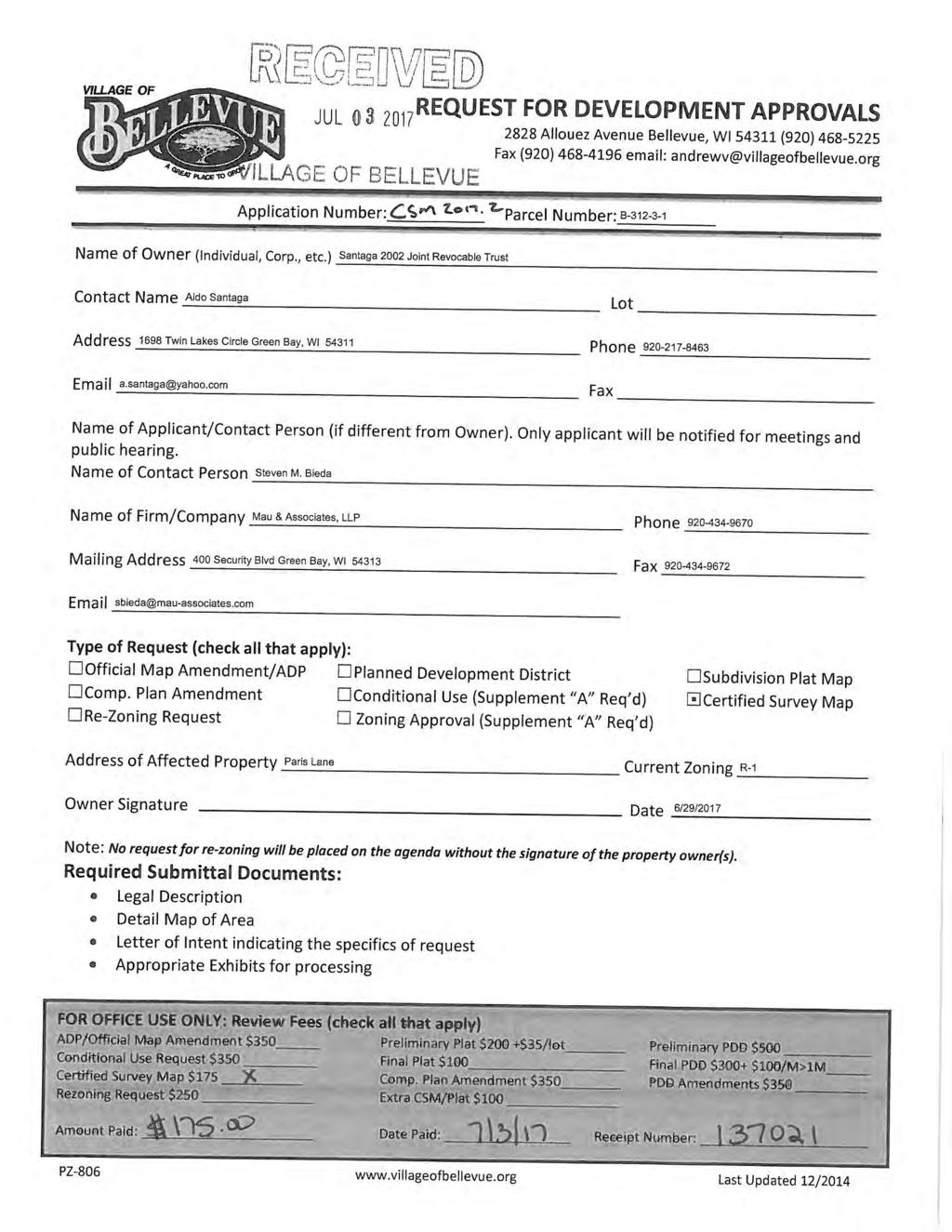
17 PLAN COMMISSION MEETING OF 8/15/17 AGENDA ITEM CSM AGENDA ITEM TO: THROUGH: FROM: SUBJECT: Angela Gorall, Village Administrator Planning Commission Andrew Vissers, Community Development Director Michelle Du Chateau, Assistant Planner/Zoning Administrator CSM Consider/Discuss/Act on the request by Steve Bieda, Mau & Associates, LLP, Petitioner, on behalf of Aldo Santaga, Owner, for approval of a Certified Survey Map for Parcel B generally located at the terminus of Paris Lane. APPROVAL PROCESS: The recommendation of the Planning Commission will be forwarded to Village Board for consideration at the September 13, 2017 meeting. STAFF RECOMMENDATION: Staff recommends approval of the proposed Certified Survey Map (CSM) subject to the following conditions: 1. Review, approval, and signature from Brown County Planning Commission. 2. All easements as required by reviewing agencies. 3. CSM shall depict a temporary turnaround and meet Fire Department specifications. 4. Paris Lane shall be realigned to eliminate unbuildable area or the developer shall coordinate acquisition of the area. APPLICATION SUBMITTAL DATE: July 3, 2017 (Original Application) ITEM SUMMARY: The proposed Certified Survey Map will divide the parcel located at the terminus of Paris Lane into four single family lots. The proposal also includes the extension of Paris Lane. As roads are extended throughout the Village, it s preferable not to do small stub roads. Issues arise when, based on the life expectancy of the road, sections of roadway are redone at different times creating a situation where you re driving over a fairly new roadway to redo the old one. With Paris Lane the new and old sections would be about a decade apart in age. In addition, if the layout of Paris Lane continues as shown on the CSM, the future roadway will create a small, future non-conforming lot or remnant parcel located immediately east of proposed Lot 2 on the adjacent parcel. Since the adjacent property will be impacted by the proposed layout, Paris Lane shall either be realigned to eliminate the unbuildable area (still meeting street design standards) or the developer shall coordinate acquisition of the remnant area. SURROUNDING ZONING AND LAND USES: Subject Property: R-1 Single Family Residential (Undeveloped)
18 North R-1 Single Family Residential Single Family Residences (Bower Creek North Subdivision) South A-2 Agricultural Transition Single Family Residence/Tree Farm East R-1 Single Family Residential Single Family Residences West R-1 Single Family Residential Single Family Residences ACCESS/CIRCULATION: Adjacent Streets: Paris Lane ROW Width 70 Paris Lane will be extended to accommodate the four lots. The Fire Department is requiring a 20 x 70 turnaround at the end. The turnaround shall not extend onto the neighboring parcel without approval from the property owner. The Subdivision Ordinance states that streets designed to have one end permanently closed shall not exceed 1,000 feet in length and shall provide a turnaround. However, Paris Lane is part of an overall road network which extends south and east and is not intended to be a cul de sac. DRAINAGE: The applicant/owner will be responsible for all drainage associated with the subject property, and for compliance with the Village of Bellevue Storm Water Ordinance. OPPOSITION TO OR SUPPORT OF REQUEST: Staff has not received any comments either in opposition to or in support of the proposed Certified Survey Map. ATTACHMENTS: Application Location Map Proposed CSM Action:
19
20 CSM Village of Bellevue, Wisconsin Village of Bellevue MapprovidedbytheVilageofBelevu e'sinternalinteractivewebmappingsystem Pleasevisit: e.org/gis toaccessbelevu e sinteractivewebmappingsystem. This map is intended for advisory purposes only. The data presented has been compiled from various sources, each of which introduces varying degrees of inaccuracies or inconsistencies. Such discrepancies in data are inherent. The Village of Bellevue assumes no liability for its use or accuracy Feet Date: 8/8/2017 Reference Scale: 1:0 Legend Site Location
21
22
23
24
25
26 PLAN COMMISSION MEETING OF AGENDA ITEM PDD AGENDA ITEM TO: FROM: SUBJECT: Angela Gorall, Village Administrator Plan Commission Andrew J. Vissers, Community Development Director PDD Consider/Discuss/Act on the Request by Steve Bieda, Mau & Associates, LLP, Petitioner, on Behalf of Willow Creek Crossing, LCC, Owner, for approval of a Planned Development District (PDD) Amendment in order to Deviate from the Minimum Lot Size, Minimum Lot Width, Minimum Setback Requirements and Right-of-Way Width for the Proposed Somerset Fields Subdivision, Located on the North Side of Easton Road (County Highway JJ), approximately 1,070 Feet East of Ontario Road (Parcel B-36-5). APPROVAL PROCESS: The recommendation of the Plan Commission will be forwarded to Village Board for a public hearing and consideration at the September 13, 2017 meeting. STAFF RECOMMENDATION: Staff recommends approval of the proposed Planned Development District Amendment request subject to the following conditions: 1. Approval of the DRAFT Ordinance. APPLICATION SUBMITTAL DATE: July 25, 2017 (Original Application) ITEM SUMMARY: In September of 2016, the Village Board adopted the Planned Development District that governed at what was the time known as Willow Creek Crossing which included an assisted living facility component, a multi-family component, and a single-family residential component. Since that time, a portion of the development has been acquired by a different developer who will continue the multifamily and develop the single-family components. A preliminary plat has been submitted (see PLAT ) which coincides to this request. If the PDD amendment is not approved, then the related preliminary plat cannot be approved as proposed. The amendments requested only apply to the single-family component of the development and relate to a reduction in minimum lots size for six (6) of the proposed lots, a reduction in front and side yard setbacks for all lots and a reduction in minimum lot width for some of the lots.
27 The changes also include elimination of the two (2) duplex lots (originally identified on proposed lots 41 & 42) and replacing them with single-family residential lots. SURROUNDING ZONING AND LAND USES: Subject Property: PDD Overlay (Ordinance No. O ) Undeveloped land North South R-1 Single-Family Residential District and B-2 General Business District R-1 Single-Family Residential District and P Public Use District Undeveloped land and Joski Tile Business Single-Family Residence, Church and Village of Bellevue Public Safety Building East B-2 General Business District Bellin College West R-1 Single-Family Residential District Single-Family Residences PROPOSED ZONING: The PDD established zoning for an area with a mix of uses but kept the standard R-1 Single-Family Residential District regulations as the underlying zoning that regulated that component. This proposal requested some slight deviations to allow for some additional single-family lots as well as to fit the developer s product better. The changes likely will not be that noticeable but there will be a slightly different look and feel to the proposed subdivision than other existing Bellevue subdivisions. These changes have been successful in other communities with the proposed developer, so there appears there is a market. Requested Deviations: Minimum Front Yard Setback as required by Village Code 30 Requested Change 25 A reduction of 5 (applies to all lots) Minimum Lot Width (at Front Yard Setback) by Village Code 80 Requested Change 70 A reduction of 10 (doesn t apply to all lots) Minimum side yard setback as required by Village Code 8 Requested Change 7 A reduction in 1 (applies to all lots) Corner Side yard Setback as required by Village Code 30 Requested Change 25
28 A reduction of 5 (applies to only corner lots) Minimum Lot Area as required by Village Code Requested Change 11,000 sf 9,500 sf A reduction of 1,500 sf - The reduction in lot size only applies to six (6) of the proposed 42 lots (14%). Analysis: Staff feels that these requested changes will not have a negative impact on the development. Standards in the Code are a guide and obviously can be requested to be changed to create something unique. As stated these regulations are similar to other developments in Hobart, Menasha, and Little Chute. The reductions do not mean a reduction in quality, size of home or cost/value of home. The requested changes provide for a different product from what you find throughout most of Bellevue and not everyone desires to have a large lot with significant maintenance. CONFORMANCE WITH COMPREHENSIVE PLAN: The property is identified as Low Density Residential and Northeast Development District on the Future Land Use Plan (FLUP). The Comprehensive Plan encourages a diversity of housing stock and styles which this proposal does incorporate. Staff feels the request is consistent with the recommendations of the Comprehensive Plan. OPPOSITION TO OR SUPPORT OF REQUEST: Staff has not received any calls or e- mails in support of or opposition to this request as of the drafting of this report. ATTACHMENTS: Application Letter of Intent Location Map Proposed Preliminary Plat and Building Pad Exhibit DRAFT PDD Ordinance Amendment Action:

29
30 Mau & Associates, LLP. July 25, 2017 Land Surveying & Planning - Civil & Water Resource Engineering 400 Security Boulevard, Green Bay, WI Phone (920) Fax (920) Website: Zoning and Planning Request RE: Parcel B-36-5 Mau and Associates, on behalf of Willowcreek Crossing LLC and Lexington Homes, requests to amend land use of acres located at Eaton Road conjunction with a preliminary plat submitted for the property. The plat seeks to create 42 individual single family residential lots. The parcel is apart of the approved PDD The general road layout and use of the land remains similar. Changes to the PDD include Previously Approved PDD Amendments Proposed 38 Single Family Lots 42 Single Family Lots 2 Duplex Lots 0 Duplex Lots 42 Total Dwelling Units 42 Total Dwelling Units After full build out, the single family neighborhood is projected to have a property value of $11,300,000. Wetlands throughout the entire PDD area has been a hurdle to overcome throughout the design process. The wetlands have played a role in the layout of the properties and road patterns. Looking to change these challenges into opportunities, the lot sizes have provided an opportunity to have a mix lot sizes. A majority of lot sizes are either 70 or 80 feet wide at the front yard setback line. This will allow a mixture of single family housing stock which will provide either two or three stall attached garages for homes depending on lot size and orientation. These differences add up to a few alterations from typical R1 code R1 Code Proposed Single Family Lot Changes Minimum Front Yard Setback Minimum Lot Width (at Front Yard Setback) Side Yard Setback 8 each 7 each Corner side (from ROW) Minimum Lot Area (square feet) 11,000 9,500
31 Lexington Homes has built a portfolio of successful neighborhoods in recent years with similar conditions in mixed lot sizes in which 70 to 80 foot wide front yards is the norm. Recent examples include: Fieldstone Estates (Hobart) Cobblestone at Centennial Centre (Hobart) Tailwind Crossing (Hobart) The Ponds of Menasha (Menasha) Crosswind Estates (Little Chute) Currently 109 Homes of 117 Home Site 84 Homes 127 Homes Currently 110 Homes of 123 Home Site Currently 60 of 98 Home Site Lexington Homes anticipates to begin infrastructure for the site in late Fall 2017 to allow for the arrival of 20 spec homes in Spring 2018.

32 Location Map - PDD Village of Bellevue, Wisconsin Map provided by the Village of Bellevue's Interactive Web Mapping System Please visit: to access Bellevue s Interactive Web Mapping System. This map is intended for advisory purposes only. The data presented has been compiled from various sources, each of which introduces varying degrees of inaccuracies or inconsistencies. Such discrepancies in data are inherent. The Village of Bellevue assumes no liability for its use or accuracy. Printed 08/09/2017
33
34
35 ORDINANCE NO. TBD PDD VILLAGE OF BELLEVUE Ordinance Amending Willow Creek Crossing Planned Development District Ordinance No. O Whereas, pursuant to Article 1 of the Village of Bellevue Zoning Code and the Statutory Authority referred to therein, a Planned Unit Development no. PDD was approved for Willow Creek Crossing, LLC for Village of Bellevue parcel B- 36 and as since further subdivided; and, Therefore, be it resolved that, this document amends Ordinance No. O for Planned Development District no. PDD ; for Village of Bellevue Parcel B-36-5 described as follows, Legal Description: LOT 3 OF CSM Volume 62, Page 108 And be it further resolved that, pursuant to Chapter of the Village of Bellevue Zoning Code, the following amendments are imposed as follows: C. PERMITTED USES SEVERABILITY. a Single-Family Residential Lots meeting the minimum lot size and spacing requirements of the R-1 Single-Family Residential Zoning District except as follows: i. Minimum Lot size shall be 9,500 sf ii. Minimum front yard setback shall be 25 iii. Minimum lot width at front yard setback shall be 70 iv. Minimum side yard setback shall be 7 v. Minimum Corner Side Yard Setback shall be 25 b. 2 Duplex Lots meeting the minimum lot size and spacing requirements of the R-2 Two Family Residential Zoning District. These two lots shall have a B-2 General Business District option to develop as commercial. The several sections of this ordinance are declared to be severable. If any section, phrase, sentence, or portion of this Ordinance is for any reason adjudged to be invalid or unconstitutional by a court of competent jurisdiction, such portions shall be deemed a separate, distinct, and independent provision, and such decision shall not affect the validity of the remaining portions thereof. ENFORCEMENT AND PENALTIES. Any violation of the provisions of this ordinance by any person shall be unlawful and shall be referred to the municipal attorney who shall expeditiously prosecute all such violators. A violator shall, upon conviction, forfeit to the municipality a penalty in accordance with Village of Bellevue Municipal Code Chapter Each day of continued violation shall constitute a separate offense. Every violation of this ordinance is a public nuisance and the creation may be enjoined and the maintenance may be abated by action at suit of the municipality, the state, or any citizen thereof pursuant to s , Stats. Approved by the Village of Bellevue Village Board on the 13 th day of September Approved: Attest: Steve Soukup, President Karen M. Simons, Clerk 1 of 2
36 Ordinance No. TBD PDD amending PDD Willow Creek Crossing (Now Known as Somerset Heights) Signed and sworn to before me this day of Printed name Signature Notary Public of Wisconsin My commission expires on Motion by Seconded by Name Aye Nay Abstain Absent Pres. Soukup Trustee Daul Trustee Gauthier Trustee Kaster Trustee Katers Total Motion: Adopted Defeated 2 of 2
37 PLAN COMMISSION MEETING OF 8/15/17 AGENDA ITEM PLAT AGENDA ITEM TO: FROM: SUBJECT: Angela Gorall, Village Administrator Plan Commission Andrew J. Vissers, Community Development Director PLAT Consider/Discuss/Act on the Request by Steve Bieda, Mau & Associates, LLP, Petitioner, on Behalf of Willow Creek Crossing, LCC, Owner, for approval of a Preliminary Plat of Somerset Heights, 42 Single-Family Residential Lots and 2 Outlots, Located on the North Side of Easton Road (County Highway JJ), approximately 1,070 Feet East of Ontario Road (Parcel B-36-5). APPROVAL PROCESS: The recommendation of the Plan Commission will be forwarded to Village Board for consideration at their September 19, 2017 meeting. STAFF RECOMMENDATION: Staff recommends conditional approval of the proposed preliminary plat subject to the following conditions: 1. Approval of PDD as proposed. 2. Submit plat to Brown County Planning for review and approval. 3. Submission of a Final Plat. 4. Provide all easements as required by reviewing agencies. 5. Provide a Drainage and Grading Plan subject to review and approval by Director of Public Works with the Final Plat Submission. 6. The proposed stormwater pond on Outlot 1 shall have a minimum of 15 free and clear around it in order for future maintenance by way of easement or distance from adjacent property line as well as a maintenance easement that connects to an adjacent street. 7. Provide a 15 pedestrian connection easement between Lot 13 and Lot 14 and extending along the rear of Lot 14 to the north property line. 8. Identify all existing easements on the subject property. 9. Payment of all applicable Impact Fees prior to Plat recording. 10. Approval of a reduction of street Right-of-Way from 70 to Approval of a Cul-de-Sac exceeding 1,000 feet in length. APPLICATION SUBMITTAL DATE: July 25, 2017 (Original Submittal) ITEM SUMMARY: The applicant is proposing the Somerset Fields subdivision which is proposing 42 single-family residential lots and two outlots which will contain stormwater management ponds. The original zoning and uses were approved in 2016, however the applicant is requesting some slight deviations to the Planned Development District (see
38 request PDD ) to adjust some setback and area regulations which will increase the number of single-family lots. If the associated PDD amendment is not approved, then the Preliminary Plat cannot be approved as proposed. SURROUNDING ZONING AND LAND USES: Subject Property: PDD Overlay (Ordinance No. O ) with an R-1 Single- Family Residential District underlying regulating district Undeveloped land Zoning District Current use of property North R-1 Single-Family Residential District Undeveloped land Owned by Bellin College South R-1 Single-Family Residential District; I Institutional District Messiah Evangelical Lutheran Church and Cemetary East B-2 General Business District Bellin College West PDD Planned Development District (Ordinance No. O ) Future Nottingham Place Apartments and undeveloped land PROPOSED PLAT: The Preliminary Plat proposes a total of 42 single-family lots and has been identified as Somerset Fields. Originally, the approved zoning for the parcel proposed 38 single-family lots and two (2) duplex lots. However, a new developer has taken over the project and has requested some deviations if the space and area regulations for R-1 lots (see PDD ) which would allow an increase in the number of single-family lots as well as to change the duplex lots to single-family residential. Some of the changes being requested through the PDD Amendment (see PDD ) are a reduction in minimum lots size for six (6) of the proposed lots, a reduction in front and side yard setbacks for all lots and a reduction in minimum lot width for some of the lots. The applicant has provided a building pad exhibit which shows that even with these reductions, there will still be adequate area to build typical homes. The changes likely will not be that noticeable but there will be a slightly different look and feel to the proposed subdivision than other existing Bellevue subdivisions. These changes have been successful in other communities with the proposed developer, so there appears there is a market. In addition, having diversity among single-family housing stock throughout the community is encouraged by the Comprehensive Plan, therefore staff is supportive of the proposed changes. Another change being requested is a deviation from the Village of Bellevue Subdivision Ordinance (Chapter 410) which requires that all local streets provide right-of-way of 70.
39 The applicant has proposed 60 of right-of-way. The Subdivision Code allows the Village Board to reduce the width of the right-of-way through the approval process. There are a number of engineering comments included that will need to be worked though as design takes this to the Final Platting stage, but nothing cited that are sending significant red flags from preventing the property from developing as shown. There may be some minor design tweaks as the plat would move towards being a final, but it is anticipated that it will be significantly consistent with the layout on the preliminary. The developer is planning to begin the infrastructure work late fall of 2017 and have 20 foundations started sometime in ACCESS/CIRCULATION: Adjacent Streets: Eaton Road (County Highway JJ) 100 Right-of-Way Discussion: The proposed lots will all take access off of future interior streets but the only connection will be to Eaton Road (County Highway JJ). Due to environmental constraints such as wetlands, existing adjacent development and approval by the Village of Bellevue of an Official Map Amendment eliminating a proposed vehicular connection to the northwest in 2011 all traffic will circulate to this one point. The proposed cul-de-sac exceeds the maximum distance of 1,000 feet in length as regulated by the Subdivision Code. However based on previous approvals as stated above, there are no alternative options. Staff still recommends pedestrian connectivity be maintained however. There is a proposed trail that will connect Ontario Road and Huron Road (County Highway EA) with an exact location yet to be determined but likely further north than the proposed subdivision. The trail has appeared previous in the Village of Bellevue Capital Improvement Plan, but has been placed in the Pending Projects category, which means it is out there and known but not scheduled in the next 5 years. The Village of Bellevue Comprehensive Outdoor Recreation Plan (CORP) indicates a possible future trail that would follow along the creek and drainage way. No study on this trail exists and there are no plans for any future pedestrian facilities on the north side of Eaton Road (County Highway JJ) so staff feels that providing an easement which would allow the construction of a path or sidewalk that would ultimately connect into the future path to the north would accomplish the pedestrian activity. The Village of Bellevue Pedestrian, Bicycle & Safe Routes to School Plan recommends in areas of the Village west of Huron Road to only require sidewalks and bike lanes along arterials and collectors. Since this proposed subdivision only has local streets, no sidewalks are required. In addition, there are no pedestrian facilities proposed for the north side of Eaton Road (County Highway JJ).
40 DRAINAGE: The applicant/owner will be responsible for working with the Village of Bellevue on all drainage associated with the subject property, and for compliance with the Village of Bellevue Storm Water Ordinance. OPPOSITION TO OR SUPPORT OF REQUEST: Staff has not received any comments either in opposition to or in support of the proposed preliminary plat. ATTACHMENTS: Application Letter of Intent Location Map Aerial Map Proposed Preliminary Plat Engineering Comments Official Map CORP Huron/Ontario Proposed Future Trail

41
42 Mau & Associates, LLP. July 25, 2017 Land Surveying & Planning - Civil & Water Resource Engineering 400 Security Boulevard, Green Bay, WI Phone (920) Fax (920) Website: Zoning and Planning Request RE: Parcel B-36-5 Mau and Associates, on behalf of Willowcreek Crossing LLC and Lexington Homes, requests to amend land use of acres located at Eaton Road conjunction with a preliminary plat submitted for the property. The plat seeks to create 42 individual single family residential lots. The parcel is apart of the approved PDD The general road layout and use of the land remains similar. Changes to the PDD include Previously Approved PDD Amendments Proposed 38 Single Family Lots 42 Single Family Lots 2 Duplex Lots 0 Duplex Lots 42 Total Dwelling Units 42 Total Dwelling Units After full build out, the single family neighborhood is projected to have a property value of $11,300,000. Wetlands throughout the entire PDD area has been a hurdle to overcome throughout the design process. The wetlands have played a role in the layout of the properties and road patterns. Looking to change these challenges into opportunities, the lot sizes have provided an opportunity to have a mix lot sizes. A majority of lot sizes are either 70 or 80 feet wide at the front yard setback line. This will allow a mixture of single family housing stock which will provide either two or three stall attached garages for homes depending on lot size and orientation. These differences add up to a few alterations from typical R1 code R1 Code Proposed Single Family Lot Changes Minimum Front Yard Setback Minimum Lot Width (at Front Yard Setback) Side Yard Setback 8 each 7 each Corner side (from ROW) Minimum Lot Area (square feet) 11,000 9,500
43 Lexington Homes has built a portfolio of successful neighborhoods in recent years with similar conditions in mixed lot sizes in which 70 to 80 foot wide front yards is the norm. Recent examples include: Fieldstone Estates (Hobart) Cobblestone at Centennial Centre (Hobart) Tailwind Crossing (Hobart) The Ponds of Menasha (Menasha) Crosswind Estates (Little Chute) Currently 109 Homes of 117 Home Site 84 Homes 127 Homes Currently 110 Homes of 123 Home Site Currently 60 of 98 Home Site Lexington Homes anticipates to begin infrastructure for the site in late Fall 2017 to allow for the arrival of 20 spec homes in Spring 2018.

44 Location Map - PLAT Village of Bellevue, Wisconsin Map provided by the Village of Bellevue's Interactive Web Mapping System Please visit: to access Bellevue s Interactive Web Mapping System. This map is intended for advisory purposes only. The data presented has been compiled from various sources, each of which introduces varying degrees of inaccuracies or inconsistencies. Such discrepancies in data are inherent. The Village of Bellevue assumes no liability for its use or accuracy. Printed 08/09/2017

45 Aerial Map - PLAT Village of Bellevue, Wisconsin Map provided by the Village of Bellevue's Interactive Web Mapping System Please visit: to access Bellevue s Interactive Web Mapping System. This map is intended for advisory purposes only. The data presented has been compiled from various sources, each of which introduces varying degrees of inaccuracies or inconsistencies. Such discrepancies in data are inherent. The Village of Bellevue assumes no liability for its use or accuracy. Printed 08/09/2017
46

47
48
49

50 Official Map - PLAT Village of Bellevue, Wisconsin Map provided by the Village of Bellevue's Interactive Web Mapping System Please visit: to access Bellevue s Interactive Web Mapping System. This map is intended for advisory purposes only. The data presented has been compiled from various sources, each of which introduces varying degrees of inaccuracies or inconsistencies. Such discrepancies in data are inherent. The Village of Bellevue assumes no liability for its use or accuracy. Printed 08/09/2017
51 Figure 7.1 Future Park and Facility Locations Village of Bellevue, Brown County, Wisconsin «K «C 2 16 «K 13 9 Future Park Name Location Description Type A Town Center Mini-park B Bedford Heights Mini-park C Bethel Park Neighborhood park D Spring Creek Neighborhood park E VFW Memorial Community Park F Shaha Memorial Community Park G South West Community Park H East River Linear Park/Conservancy I Bower Creek North Linear Park/Conservancy J Bower Creek South Linear Park/Conservancy K Willow Creek Linear Park/Conservancy L Spring Creek Linear Park/Conservancy M Eastside Trail Linear Park/Conservancy N Northside Trail Linear Park/Conservancy O Huron/Ontario Trail Linear Park/Conservancy «O 17 «N Park Name Type 1 Bel-Meadow Park Park 2 Bethel Park Park 3 Bower Creek Conservancy Park 4 Bower Creek Park Park 5 DeBroux Park Park 6 East River Parkway Park 7 Izac Walton League Park 8 Josten Park Park 9 Moonrise Park Park 10 Shaha Memorial Park Park 11 VandenHeuvel Park Park 12 VFW Memorial Park Park 13 Willow Creek Park Park 14 Village Administration Offices Facility 15 Christa McAuliffe Elementary School Facility 16 Community Center/ Fire Station 2 Facility 17 Village Hall/Public Safety Building Facility 18 Bedford Heights Park «F 10 «A 5 15 «H «D «L 12 «E «M «K 18 «B 7 «J «G 3 4 Legend Park Facility Linear Park/Conservancy µ Miles Q:\Leisure Services\Comprehensive Outdoor Recreational Plan (CORP)\CORP2010_FutureParkLocations.mxd TMH Revision 2.1
52
53
54 PLAN COMMISSION MEETING OF 8/15/17 AGENDA ITEM PDD AGENDA ITEM TO: FROM: SUBJECT: Angela Gorall, Village Administrator Plan Commission Andrew J. Vissers, Community Development Director PDD Consider/Discuss/Act on the request by Steve Bieda, Mau & Associates, Petitioner, on behalf of Ken Larsen, Managing Partner, Cottage Road Development, LLC, Owner, for creation of a Preliminary Planned Development District Vision (PDD) to include approximately Acres of Low-Density Single-Family Residential (51 Lots), 1.26 Acres of Two-Family Residential (2 Lots), 8.08 Acres of Multi-Family Residential (60 units), 4.93 Acres of Commercial and 1.82 Acres of Neighborhood Business generally located at the northeast corner of Huron Road (County Highway EA) and Willow Road (Parcel B-185). APPROVAL PROCESS: The recommendation of the Plan Commission will be forwarded to Village Board for consideration at the September 13, 2017 meeting. STAFF RECOMMENDATION: Staff recommends denial of the proposed Preliminary Planned Development District (PDD) request due to the following finding of facts: 1. Inconsistency with the recommendations of the Future Land Use Plan 2. Inconsistency with reasoning given for previous denial by the Village Board. 3. Minimum architectural standards only being met for the Multi-Family Component of the proposal. If the Plan Commission and Village Board find reasoning to approve the proposal, staff would recommend the following conditions be added to that recommendation: 1. Submission of an Official Map Amendment/Area Development Plan with coordination from adjacent property owners for the overall area. 2. Submission of a Comprehensive Plan Amendment to alter the land uses for the area where the mixed-use residential has been agreed to be designated as Low Density Residential. 3. Submission, consideration, and approval of a Final Planned Development District within a year of approval of the Preliminary PDD. 4. Approval of future proposed Site Plans for multi-family and commercial projects by the Village of Bellevue. 5. Submission of revised elevations of the multi-family component that exceed minimum standards to include architectural elements as well as site amenities
55 (i.e. which could include a clubhouse, small park, additional landscaping, walking trails, etc.) 6. Addressing all of the Engineering Comments. APPLICATION SUBMITTAL DATE: July 25, 2017 (Original Application) ITEM SUMMARY: The proposed Preliminary Planned Development District (PDD) is requesting to zone Acres of Low-Density Single-Family Residential (51 Lots), 1.26 Acres of Two-Family Residential (2 Lots), 8.08 Acres of Multi-Family Residential (60 units), 4.93 Acres of Commercial and 1.82 Acres of Neighborhood Business SURROUNDING ZONING AND LAND USES: Subject Property: A-2 Agricultural Transition District (undeveloped land) North A-2 Agricultural Transition District undeveloped land South A-2 Agricultural Transition District undeveloped land East A-2 Agricultural Transition District Prince of Peace Church; undeveloped land West A-1 Exclusive Agricultural District; A- 2 Agricultural Transition District Single-family undeveloped land residence; PROPOSED ZONING: The purpose of the Planned Development District and the regulations applicable to the same are to encourage and provide means for effecting desirable and quality development by permitting greater flexibility and design freedom than that permitted under the basic district regulations, and to accomplish a well balanced, aesthetically satisfying Village and economically desirable development of building sites within a Planned Development District. These regulations are established to permit latitude in the development of the building site if such development is found to be in accordance with the purpose, spirit and intent of this ordinance and is found not to be hazardous, harmful, offensive or otherwise adverse to the environment, property values or the character of the neighborhood or the health, safety and welfare of the community. It is intended to permit and encourage diversification, variation and imagination in the relationship of uses, structures, open spaces and heights of structures for developments conceived and implemented as comprehensive and cohesive unified projects. It is further intended to encourage more rational and economic development with relationship to public services, and to encourage and facilitate preservation of open space and other natural features, such as woodlands, floodplains and wetlands. As the Zoning Code states the procedure for approval of a planned development project shall consist of two phases: 1. Preliminary Approval - consisting of approval of the proposed project in principle only, and
56 2. Final approval - consisting of approval of the proposed project in all its terms and details. This is the third request that the Village has considered for this particular area in the past 6 years. Originally PDD was submitted which proposed approximately Acres (102 Units) of Multi-Family Residential, Acres of Single-Family Residential, and 3 Acres of General Commercial. That item was withdrawn by the developer at the public hearing due to concerns raised by the residents and Village Board members. A subsequent Preliminary PDD was submitted in late 2015 (PDD ) and proposed approximately 59.8 acres of low density single-family residential, acres of multifamily with 120 units, 1.08 acres of two-family residential (duplex), 3.8 acres of general commercial, and 2.87 acres of neighborhood business. It included Parcel B-184-2, which is not included in this request, but does show a conceptual layout of additional single-family residential. That request was denied by the Village Board in early 2016 by a vote of 5-0 based on the comments of the multi-family component and looking at some other possible land use and the fact that the initial phase did not include singlefamily residential. This current proposal reduces the number of multi-family units to a total of 60 within five (5) twelve (12) unit buildings as well as indicates that the first phase would include single-family residential. This proposal addresses one of the concerns raised with the last proposal in 2015/2016 by including single-family in the first phase however does not address the concerns of including the multi-family component. This area is identified as Mixed-Use Residential on the Village of Bellevue Comprehensive Plan, which allows for every 100 units of development, 80 units of single-family, 12 units of multi-family, and 8 units of duplexes in the mixed use residential designation. The request intends to pool the allotment of multi-family from he other adjacent parcels that the development group owns towards the intersection of Willow and Huron and then commit to single-family development as you get further from Huron Road (County Highway EA) as well as on other parcels with the mixed-use designation owned in the vicinity by the applicant. The logic behind the creation of the mixed-use land use was to avoid the over concentration of multi-family in one area. The petitioner indicated that having a scattered 12-unit multi-family building scattered within residential subdivisions make it difficult to get a quality management area, site amenities, etc that most renters are looking for. Contained developments such as Crystal Lake or Huron Grove are what seems to be popular among renters. The developer feels this will help fill a need with the proximity to a major roadway where single-family homes are unlikely to develop. The Comprehensive Plan also recommends all forms of housing within neighborhoods should be mixed so people of different ages and incomes have opportunities to live in various areas in the Village. The recommendation for most of the future residential development is to encourage variation and a mixing of residential types. Townhouses,
57 duplexes, and smaller apartment buildings can be strategically interspersed with singlefamily residences. Design standards and the creation of open space and other buffers can help integrate different residential intensities. Large expanses of strictly one residential type should be avoided. Variation in house models should also be encouraged to avoid monotonous streetscapes. Builders and developers are encouraged to use their ingenuity to combine and distribute a variety of housing types to make an attractive marketable neighborhood with housing for people of various income levels and preferences. The current preference for the Village is to reduce the number of multifamily and mobile home housing as the Village develops. However, a mix of housing types and designs that work together should always be considered when developing neighborhoods. A sufficient ratio of single-family, two-family, and multifamily housing should be developed, potentially including single-family attached homes, multifamily homes, and aged-care facilities as the community continues to age. As the acreage of the residential stock increases, the number of housing types should also increase. Quite simply, the applicant is looking to see if the Village will buy into this vision before they invest any additional time or money into defining and detailing the plans. Staff has been supportive of these requests in the past as was the Plan Commission of the 2015/2016 proposal. However, staff does have concerns of the multi-family meeting just the minimum requirements architecturally. If the applicant is asking for a land use that is not recommended by the Comprehensive Plan or exceeds what is recommended based on the Mixed-use District, there should be a give and take which proposes a development which far exceeds to the minimum or proposes a product that we have not seen or have in Bellevue. Concerns have been raised in the past by residents who are concerned that the zoning of a portion to allow for multi-family may lead to future requests to zone additional acreage within the proposed development as multi-family. The Village control of this is zoning. If this is zoned, any change would require a subsequent public hearing and approval by the Village Board. So, obviously there cannot be any 100% guarantee, but zoning is the tool that communities use to control development. There are plenty of examples of recent apartment development near single-family development that don t appear to have impacted home values (case in point in the Town of Ledgeview near Angel s Path and Clermont Ct and a proposal in the Village of Bellevue that is north of the Public Safety Building). A transition of uses in regards to intensity from major roadway is sound planning and staff does see benefit in that. Items to be considered if this preliminary PDD ( VISION ) moves forward to Final PDD: Public Works and Engineering have a number of items (included in attachment) of questions that will need to be discussed and agreed upon. The coordination with surrounding property owners on the Area Development Plan layout and connectivity to areas to the northeast regardless of the creek. A submission of an Official Map Amendment/Area Development Plan in coordination with those adjacent land owners would be required prior to
58 submission of a Final PDD. The area specifically a concern is how future Evening Star is aligned on the eastern side of the development as well as looking at the Kraft Trust property. The Comprehensive Outdoor Recreation Plan identifies a trail along the ravine and creek. That will need to be negotiated through the final PDD. Buffering of the commercial and multi-family from the single-family component. Again, what we are looking at is the big picture preliminary zoning layout and not so much specific details of the plan, unless they are added as conditions so the applicant can take that into account moving forward. This is the vision stage of the PDD process. Preliminary PDD does not guarantee Final PDD approval and there a significant number of items that would need to be flushed out to move forward. If the Village Board is of the stance that no multi-family is desired here outside of the recommendations of the Comprehensive Plan, then that needs to be part of the final consideration and determination to avoid coming back with a similar plan multiple times and causing concerns among adjacent residents. At the very least, staff can advise future proposals that based on past decisions, that the likelihood of it getting zoned with multi-family as a component is not likely. CONFORMANCE WITH COMPREHENSIVE PLAN: The Village of Bellevue Comprehensive Plan identifies this area for Mixed-Use Residential land uses as well as General Business uses right at the intersection of Willow and Huron. The proposed Preliminary Planned Development District (PDD) for a mixture of uses is somewhat consistent with the Comprehensive Plan. The largest inconsistency is the mixed-use district which for every 100 units, 80 are recommended to be single-family, 12 total units of multi-family are recommended and 8 units (4 duplexes) are recommended. This proposal exceeds the allotted amount of multi-family units, even when taking into account the reduced number of duplexes proposed. If approved, staff would recommend a Comprehensive Plan Amendment be submitted to alter the future land uses for the areas that would be impacted by pooling for the multi-family units and shall now be developed as single-family residential. OPPOSITION TO OR SUPPORT OF REQUEST: Staff has not received any calls or e- mails in support of or opposition to this request as of the drafting of this report. ATTACHMENTS: Application Location Map Letter of Intent Exhibits Public Works Comments Action:
59

60 Location Map - PDD Village of Bellevue, Wisconsin Map provided by the Village of Bellevue's Interactive Web Mapping System Please visit: to access Bellevue s Interactive Web Mapping System. This map is intended for advisory purposes only. The data presented has been compiled from various sources, each of which introduces varying degrees of inaccuracies or inconsistencies. Such discrepancies in data are inherent. The Village of Bellevue assumes no liability for its use or accuracy. Printed 08/09/2017
61
62

63

64
65

66
Village of Bellevue Plan Commission
 Village of Bellevue Plan Commission Pursuant to Section 19.84 Wis. Stats., a scheduled regular meeting of the Village of Bellevue Plan Commission was held on Tuesday, at 7:00 p.m. at the Bellevue Village
Draft Model Access Management Overlay Ordinance
 Draft Model Access Management Overlay Ordinance This model was developed using the City of Hutchinson and the Trunk Highway 7 corridor. The basic provisions of this model may be adopted by any jurisdiction
Staff Report: Date: Applicant: Property Identification: Acreage of Request: Current Zoning of Requested Area: Requested Action: Attached:
 Staff Report: Completed by Jeff Palmer Director of Planning & Zoning Date: November 7, 2018, Updated November 20, 2018 Applicant: Greg Smith, Oberer Land Developer agent for Ronald Montgomery ET AL Property
# Grant St. Apartments Preliminary/Final PUD Project Review for Planning and Zoning Commission
 #2014-48 95 Grant St. Apartments Preliminary/Final PUD Project Review for Planning and Zoning Commission Meeting Date: March 4, 2015 and May 6, 2015 Requests: Location: Acreage: Existing Zoning: Preliminary
RESOLUTION NO CITY OF MAPLE GROVE
 RESOLUTION NO. 18-122 CITY OF MAPLE GROVE RESOLUTION GRANTING PLANNED UNIT DEVELOPMENT CONCEPT STAGE PLAN, PLANNED UNIT DEVELOPMENT - DEVELOPMENT STAGE PLAN, AND PRELIMINARY PLAT FOR TERRITORIAL GREENS
PLANNED UNIT DEVELOPMENT & SUBDIVISION STAFF REPORT Date: April 18, 2019
 PLANNED UNIT DEVELOPMENT & SUBDIVISION STAFF REPORT Date: April 18, 2019 DEVELOPMENT NAME SUBDIVISION NAME Springhill Village Subdivision Springhill Village Subdivision LOCATION 4350, 4354, 4356, 4358,
DEWITT CHARTER TOWNSHIP 1401 W. HERBISON ROAD, DeWITT, MI PLANNING COMMISSION MINUTES TUESDAY, SEPTEMBER 5, 2006
 DEWITT CHARTER TOWNSHIP 1401 W. HERBISON ROAD, DeWITT, MI PLANNING COMMISSION MINUTES TUESDAY, SEPTEMBER 5, 2006 The regularly scheduled meeting of the DeWitt Charter Township Planning Commission was called
CITY OF TYLER CITY COUNCIL COMMUNICATION
 CITY OF TYLER CITY COUNCIL COMMUNICATION Agenda Number: Z-2 Date: January 23, 2019 Subject: PD18-035 FAIR NANCY WOOD (2801 AND 2835 SOUTH BROADWAY AVENUE) Request that the City Council consider approving
CONDITIONAL USE PERMIT (CUP)
") CONDITIONAL USE PERMIT (CUP) LAND DEVELOPMENT APPLICATION FORM DEPARTMENT OF PLANNING 300 East Main Street, Sun Prairie, WI 53590-2227 (608)825-1107 FAX (608)825-1194 Applications will not be processed
CONDITIONAL USE PERMIT (CUP) LAND DEVELOPMENT APPLICATION FORM DEPARTMENT OF PLANNING 300 East Main Street, Sun Prairie, WI 53590-2227 (608)825-1107 FAX (608)825-1194 Applications will not be processed
ELK RAPIDS TOWNSHIP ANTRIM COUNTY, MICHIGAN ORDINANCE NO
 ELK RAPIDS TOWNSHIP ANTRIM COUNTY, MICHIGAN ORDINANCE NO. 3-2011 AN ORDINANCE TO REPLACE THE SUBDIVISION CONTROL ORDINANCE WITH A NEW SUBDIVISION DEVELOPMENT ORDINANCE, IN ACCORD WITH THE LAND DIVISION
O-I (Office-Institutional) and AG-1(Agricultural)
 and AG-1(Agricultural)") PROPERTY INFORMATION ADDRESS 3503 and 3505 Bethany Bend DISTRICT, LAND LOTS 2/1 973 and 974 OVERLAY DISTRICT State Route 9 PETITION NUMBERS EXISTING ZONING O-I (Office-Institutional) and AG-1(Agricultural)
PROPERTY INFORMATION ADDRESS 3503 and 3505 Bethany Bend DISTRICT, LAND LOTS 2/1 973 and 974 OVERLAY DISTRICT State Route 9 PETITION NUMBERS EXISTING ZONING O-I (Office-Institutional) and AG-1(Agricultural)
Town of Waxhaw Board of Commissioners. Waxhaw Police Department Community Meeting Room Tuesday January 12, 2016
 Town of Waxhaw Board of Commissioners Waxhaw Police Department Community Meeting Room Tuesday January 12, 2016 Petition RZ-003994-2015 A request by the Town of Waxhaw Planning & Community Development Department,
ACTION FORM BRYAN CITY COUNCIL
 ACTION FORM BRYAN CITY COUNCIL DATE OF COUNCIL MEETING: July 8, 2014 DATE SUBMITTED: June 17, 2014 DEPARTMENT OF ORIGIN: Development Services SUBMITTED BY: Maggie Dalton MEETING TYPE: CLASSIFICATION: ORDINANCE:
TILDEN TOWNSHIP PLANNING COMMISSION
 TILDEN TOWNSHIP PLANNING COMMISSION Tuesday, Regular Meeting The Tilden Township Planning Commission met in the Township Municipal Building on Tuesday, with the following present: Dale Keener, Sharon Enevoldson,
Draft Ordinance: subject to modification by Town Council based on deliberations and direction ORDINANCE 2017-
 ORDINANCE 2017- Draft Ordinance: subject to modification by Town Council based on deliberations and direction AN INTERIM URGENCY ORDINANCE OF THE TOWN COUNCIL OF THE TOWN OF LOS GATOS ESTABLISHING A TEMPORARY
THE AREA PLAN COMMISSION OF ST. JOSEPH COUNTY, IN AGENDA
 THE AREA PLAN COMMISSION OF ST. JOSEPH COUNTY, IN AGENDA Tuesday, June 20, 2017 Fourth-Floor Council Chambers 3:30 p.m. County-City Building, South Bend, IN PUBLIC HEARINGS: 1. Rezonings: A. A combined
Staff Report: Date: Applicant: Property Identification: Acreage of Request: Current Zoning of Requested Area: Requested Action: Attached:
 Staff Report: Completed by Jeff Palmer Director of Planning & Zoning Date: November 7, 2018 Applicant: Greg Smith, Oberer Land Developer agent for Ronald Montgomery ET AL Property Identification: Frontage
Chapter 22 PLANNED UNIT DEVELOPMENT.
 Chapter 22 PLANNED UNIT DEVELOPMENT. Sec. 22.1 INTENT. The use of land and the construction and use of buildings and other structures as Planned Unit Developments in Georgetown Township may be established
PLANNED DEVELOPMENT DISTRICT STANDARDS. Cadence Site
 PLANNED DEVELOPMENT DISTRICT STANDARDS Cadence Site A Planned Development District 1. Statement of General Facts, Conditions and Objectives Property Size: Approximately 57.51 Acres York County Tax Map
TOWN OF CLAYTON. Town Plan Commission. Meeting Minutes. 7:00 P.M. 8:12 P.M. on Wednesday, July 10 th, 2013
 TOWN OF CLAYTON Approved 08/14/13 Town Plan Commission Meeting Minutes 7:00 P.M. 8:12 P.M. on Wednesday, July 10 th, 2013 Town Office Meeting Room, 8348 County Road T, Larsen, WI 54947 I. Call to Order:
COUNTY OF ALBEMARLE PLANNING STAFF REPORT SUMMARY
 COUNTY OF ALBEMARLE PLANNING STAFF REPORT SUMMARY Project Name: ZMA 2010-00015, Cedar Hill Planning Commission Worksession: February 15, 2011 Public Hearing: Not scheduled Staff: Judith C. Wiegand, AICP
RESOLUTION NO. B. The proposed amendment would not be detrimental to the public interest, health, safety, convenience, or welfare of the City; and
 RESOLUTION NO. RESOLUTION OF THE PLANNING COMMISSION OF THE CITY OF SANTA ROSA RECOMMENDING TO CITY COUNCIL REZONING TO MODIFY THE EXISTING POLICY STATEMENT AND ADOPT THE BAY VILLAGE HOMES DEVELOPMENT
CITY OF ALBERT LEA PLANNING COMMISSION ADVISORY BOARD
 CITY OF ALBERT LEA PLANNING COMMISSION ADVISORY BOARD 9/1/2015, 5:30 p.m. City Council Chambers AGENDA A. CALL TO ORDER AND ROLL CALL B. APPROVAL OF THE AGENDA C. APPROVAL OF MINUTES 1. PC Minutes from
1. APPLICANT: Polsinelli, Shalton & Welte is the applicant for this request.
 5. REVISED PRELIMINARY PLAN APPROVAL - THE RETREAT AT MAPLECREST - Vicinity of the northeast corner of 159 th Street and U.S. 69 Highway 1. APPLICANT: Polsinelli, Shalton & Welte is the applicant for this
AN ORDINANCE TO AMEND SECTION OF THE RAPID CITY MUNICIPAL CODE TO ALLOW FOR ADMINISTRATIVE DISSOLUTION OF PLANNED DEVELOPMENTS
 Ordinance No. 6231 AN ORDINANCE TO AMEND SECTION 17.50.050 OF THE RAPID CITY MUNICIPAL CODE TO ALLOW FOR ADMINISTRATIVE DISSOLUTION OF PLANNED DEVELOPMENTS WHEREAS, the City of Rapid City has adopted a
# Coventry Rezoning, Variation and Preliminary/Final PUD Project Review for Planning and Zoning Commission
 #2018-21 460 Coventry Rezoning, Variation and Preliminary/Final PUD Project Review for Planning and Zoning Commission Meeting Date: May 2, 2018 public intro meeting and May 16, 2018 public hearing Requests:
PUD, HPUD, OSC Rezoning & Conceptual Plan Application (Planned Unit Development, Haggerty Road Planned Unit Development, Open Space Community)
") Township Use Only RZ #: Date: Hearing Date: Fee Paid: PUD, HPUD, OSC Rezoning & Conceptual Plan Application (Planned Unit Development, Haggerty Road Planned Unit Development, Open Space Community) Project
Township Use Only RZ #: Date: Hearing Date: Fee Paid: PUD, HPUD, OSC Rezoning & Conceptual Plan Application (Planned Unit Development, Haggerty Road Planned Unit Development, Open Space Community) Project
PALM BEACH COUNTY PLANNING, ZONING AND BUILDING DEPARTMENT ZONING DIVISION
 PALM BEACH COUNTY PLANNING, ZONING AND BUILDING DEPARTMENT ZONING DIVISION Application No.: Z/CA-2013-00493 Application Name: Trails Charter School Control No.: 2013-00085 Applicant: MG3 ALF Military LLC
PUBLIC NOTICE & AGENDA PLAN COMMISSION City Hall Forum State Street, Beloit, WI :00 PM Wednesday, November 07, 2018
 PUBLIC NOTICE & AGENDA PLAN COMMISSION City Hall Forum - 100 State Street, Beloit, WI 53511 7:00 PM Wednesday, November 07, 2018 1. CALL TO ORDER AND ROLL CALL 2. MINUTES 2.a. Consideration of the Minutes
PLANNING COMMISSION STAFF REPORT June 18, 2015
 Community Development Department Planning Division 1600 First Street + P.O. Box 660 Napa, CA 94559-0660 (707) 257-9530 PLANNING COMMISSION STAFF REPORT June 18, 2015 AGENDA ITEM 7.B. PL15-0052 PM, GASSER
Section 4 Master Plan Framework
 Section 4 Master Plan Framework 4.1 PURPOSE The Master Plan, as an implementation tool of the SPC District, establishes the primary framework for the overall development of the Property. Detailed site
9. REZONING NO Vicinity of the northwest corner of 143 rd Street and Metcalf Avenue
 9. REZONING NO. 2002-15 Vicinity of the northwest corner of 143 rd Street and Metcalf Avenue 1. APPLICANT: Andrew Schlagel is the applicant for this request. 2. REQUESTED ACTION: The applicant is requesting
ARTICLE 3: Zone Districts
 ARTICLE 3: Zone Districts... 3-1 17.3.1: General...3-1 17.3.1.1: Purpose and Intent... 3-1 17.3.2: Districts and Maps...3-1 17.3.2.1: Applicability... 3-1 17.3.2.2: Creation of Districts... 3-1 17.3.2.3:
DeWITT CHARTER TOWNSHIP 1401 W. HERBISON ROAD, DeWITT, MI PLANNING COMMISSION MINUTES MONDAY, MARCH 6, 2006
 DeWITT CHARTER TOWNSHIP 1401 W. HERBISON ROAD, DeWITT, MI PLANNING COMMISSION MINUTES MONDAY, MARCH 6, 2006 The regularly scheduled meeting of the DeWitt Charter Township Planning Commission was called
Town of Prairie du Sac Sauk County, WI. Land Division Ordinance 07-3
 Town of Prairie du Sac Sauk County, WI Land Division Ordinance 07-3 1.01 DISCLAIMER (1) Multiple Jurisdictions. All persons reviewing the provisions of this Ordinance should be aware that the Town of Prairie
STATE OF MICHIGAN COUNTY OF BERRIEN ORONOKO CHARTER TOWNSHIP PRIVATE ROAD ORDINANCE ORDINANCE NO. 65
 STATE OF MICHIGAN COUNTY OF BERRIEN ORONOKO CHARTER TOWNSHIP PRIVATE ROAD ORDINANCE ORDINANCE NO. 65 AN ORDINANCE TO REQUIRE THAT ALL LOTS OR PARCELS OF LAND WHICH DO NOT ABUT PUBLIC STREETS ABUT A PRIVATE
TOWN OF ORO VALLEY PLANNING & ZONING COMMISSION MEETING DATE: December 6, 2011
 PLANNING & ZONING COMMISSION MEETING DATE: December 6, 2011 TO: FROM: SUBJECT: PLANNING & ZONING COMMISSION Matt Michels, Senior Planner mmichels@orovalleyaz.gov; tel. 229-4822 Public Hearing: Rancho de
ARTICLE 14 PLANNED UNIT DEVELOPMENT (PUD) DISTRICT
 DISTRICT") ARTICLE 14 PLANNED UNIT DEVELOPMENT (PUD) DISTRICT Section 14.01 Intent. It is the intent of this Article to allow the use of the planned unit development (PUD) process, as authorized by the Michigan Zoning
ARTICLE 14 PLANNED UNIT DEVELOPMENT (PUD) DISTRICT Section 14.01 Intent. It is the intent of this Article to allow the use of the planned unit development (PUD) process, as authorized by the Michigan Zoning
ARTICLE IV: DEVELOPMENT STANDARDS
 ARTICLE IV: DEVELOPMENT STANDARDS IV-53 409 PRIVATE STREETS A private street means any way that provides ingress to, or egress from, property by means of vehicles or other means, or that provides travel
Village of South Elgin, IL. CHAPTER 156: Unified Development Ordinance
 Village of South Elgin, IL CHAPTER 156: Unified Development Ordinance UNIFIED DEVELOPMENT ORDINANCE (UDO) EFFECTIVE DATE: October 1, 2018 1 TABLE OF CONTENTS SECTION 156.01: TITLE AND APPLICABILITY...4
NOTICE OF MEETING AND AGENDA FOR THE PLANNING COMMISSION OF SPRINGVILLE, UTAH... JANUARY 23, 2018
 NOTICE OF MEETING AND AGENDA FOR THE PLANNING COMMISSION OF SPRINGVILLE, UTAH............................ JANUARY 23, 2018 Notice is hereby given that the Planning Commission will hold a public meeting
SUBJECT PARCEL(S) Property Owner(s) TMS Number Approximate Acreage Carolina Park Development, LLC
 Property Owner(s) TMS Number Approximate Acreage Carolina Park Development, LLC") Staff Report Special Planning Commission Meeting November 19, 2014 For reference, the Zoning Code and Land Development Regulations are available online. AGENDA ITEM 5c. SKETCH PLAN APPROVAL REQUEST: Request
Staff Report Special Planning Commission Meeting November 19, 2014 For reference, the Zoning Code and Land Development Regulations are available online. AGENDA ITEM 5c. SKETCH PLAN APPROVAL REQUEST: Request
Draft Zoning Changes for the 2nd Planning Board Public Hearing, January 22, 2018.
 Draft Zoning Changes for the 2nd Planning Board Public Hearing, January 22, 2018. No changes were made at the 1st Public Hearing. Proposed wording for the 1 st Public Hearing in red, eliminated text in
City Recorder s Office
 City Recorder s Office PUBLIC NOTICE Notice is Hereby Given that the Tooele City Council & Tooele City Redevelopment Agency will meet in a Work Session, on Wednesday, September 19, 2018 at the hour of
AGENDA ITEM SUMMARY GLADES COUNTY BOARD OF COUNTY COMMISSIONERS
 AGENDA ITEM SUMMARY GLADES COUNTY BOARD OF COUNTY COMMISSIONERS SUBJECT: Case Number COMP17-01, Legend Moto LLC This is a Legislative Hearing. DEPARTMENT REQUEST: The Community Development Department requests
SUBJECT: Application for Planned Unit Development and Rezoning 1725 Winnetka Road
 TO: FROM: CHAIRMAN BILL VASELOPULOS AND MEMBERS OF THE PLAN & ZONING COMMISSION STEVE GUTIERREZ DIRECTOR OF COMMUNITY DEVELOPMENT MEETING DATE: September 5, 2017 SUBJECT: Application for Planned Unit Development
BY THE CITY COMMISSION ORDINANCE NO.:
 BY THE CITY COMMISSION ORDINANCE NO.: 2005-0868 AN ORDINANCE BY THE CITY COMMISSION OF THE CITY OF DADE CITY, FLORIDA CREATING A DEVELOPMENT REVIEW PROCEDURES ORDINANCE; PROVIDING FOR INTENT, PURPOSE,
Staff Report PLANNING DIVISION COMMUNITY & ECONOMIC DEVELOPMENT. Alley Closure
 Staff Report PLANNING DIVISION COMMUNITY & ECONOMIC DEVELOPMENT To: From: Salt Lake City Planning Commission Doug Dansie, 801-535-6182, doug.dansie@slcgov.com Date: March 23, 2016 Re: PLNPCM2015-00941
ORDINANCE NO BE IT ORDAINED BY THE CITY COUNCIL OF THE CITY OF RICHARDSON, TEXAS:
 ORDINANCE NO. 3719 AN ORDINANCE OF THE CITY OF RICHARDSON, TEXAS AMENDING THE COMPREHENSIVE ZONING ORDINANCE OF THE CITY OF RICHARDSON, AS HERETOFORE AMENDED, ADDING ARTICLE XXII-G TO ESTABLISH A NEIGHBORHOOD
Preliminary Plat Information & Application Packet
 Introduction Preliminary Plat Information & Application Packet This information packet was created to assist anyone who is considering applying for a preliminary plat of subdivision that is not a part
AGENDA ITEM SUMMARY GLADES COUNTY BOARD OF COUNTY COMMISSIONERS
 AGENDA ITEM SUMMARY GLADES COUNTY BOARD OF COUNTY COMMISSIONERS SUBJECT: Case Number COMP17-02, RFYC, LLC This is a Legislative Hearing. DEPARTMENT REQUEST: The Community Development Department requests
LETTER OF APPLICATION
 Description of Proposed Land Division: LETTER OF APPLICATION The proposed land division would split a 1.94 acres rectangular lot into two lots. The general configuration would have one lot in front of
RP-2, RP-3, RP-4, AND RP-5 PLANNED RESIDENTIAL DISTRICTS
 6.10 - RP-2, RP-3, RP-4, AND RP-5 PLANNED RESIDENTIAL DISTRICTS 6.10.1 GENERAL DESCRIPTION: 6.10.1.1 The regulations established in this Section are intended to provide optional methods of land development
a. It is the intent of these regulations to encourage the preservation of natural resources and facilitate orderly growth in the County.
 Part V Transfer of Development Rights Section 246. 1. Intent a. It is the intent of these regulations to encourage the preservation of natural resources and facilitate orderly growth in the County. b.
STATE OF ALABAMA SHELBY COUNTY
 STATE OF ALABAMA SHELBY COUNTY Members Present: Members Absent: Staff Present: SHELBY COUNTY PLANNING COMMISSION MINUTES Regular Meeting March 6, 2017 6:00 PM Michael O Kelley, Chairman; Jim Davis, Vice
PLANNING AND ZONING DEPARTMENT
 Town of Minturn Development Review Process: Guide To Planned Unit Developments (Concept Plan) This guide describes the Planned Unit Development Process. This guide should be utilized in conjunction with
Planning Department Oconee County, Georgia
 Planning Department Oconee County, Georgia STAFF REPORT REZONE CASE #: 6985 DATE: October 31, 2016 STAFF REPORT BY: Andrew C. Stern, Planner APPLICANT NAME: Williams & Associates, Land Planners PC PROPERTY
DEPARTMENT OF PLANNING JEFFERSON PARISH, LOUISIANA
 DEPARTMENT OF PLANNING JEFFERSON PARISH, LOUISIANA SUBDIVISION REPORT DOCKET NO: ES-89-15-PF SUMMARY NO: COUNCIL DISTRICT 2 Paul D. Johnston COUNCIL AT LARGE: A Chris Roberts B Elton M. Lagasse ADVERTISING
Town of Cary, North Carolina Rezoning Staff Report 14-REZ-31 Cary Park PDD Amendment (Waterford II) Town Council Meeting January 15, 2015
 Town Council Meeting January 15, 2015") Town of Cary, North Carolina Rezoning Staff Report 14-REZ-31 Cary Park PDD Amendment (Waterford II) Town Council Meeting January 15, 2015 REQUEST To amend the Town of Cary Official Zoning Map by amending
Town of Cary, North Carolina Rezoning Staff Report 14-REZ-31 Cary Park PDD Amendment (Waterford II) Town Council Meeting January 15, 2015 REQUEST To amend the Town of Cary Official Zoning Map by amending
REVISED # Federal Drive Milestones Therapy Project Review for Planning and Zoning Commission
 REVISED #2012-111 394 Federal Drive Milestones Therapy Project Review for Planning and Zoning Commission Meeting Date: November 7, 2012 and November 19, 2012 Request: Location: Acreage: Existing Zoning:
ARTICLE 2: General Provisions
 ARTICLE 2: General Provisions 2-10 Intent The basic intent of the Town of Orange s Zoning Ordinance is to implement the goals and objectives of the adopted Town of Orange Comprehensive Plan, hereafter
Initial Project Review
 Pierce County Department of Planning and Land Services, 2401 South 35th Street, Tacoma, WA (253) 798-7037 Initial Project Review Major Amendment to Preliminary Plat: Hawks Ridge Division 1 Application
Community Development Department
 Community Development Department SUBJECT: Consideration of a Resolution for a Single-Lot Subdivision for the Skyler Park Subdivision at 626 Forest Road AGENDA ITEM: 9.b.v MEETING DATE: November 17, 2015
201 General Provisions
 201 General Provisions 201.01 Title 201.09 Amendments 201.02 Purpose and Intent 201.10 Public Purpose 201.03 Authority 201.11 Variances and Appeals 201.04 Jurisdiction 201.12 Nonconformances 201.05 Enactment
CHAPTER 21.01: GENERAL PROVISIONS
 CHAPTER 21.01: GENERAL PROVISIONS 21.01.010 TITLE AND EFFECTIVE DATE... 1-2 21.01.020 AUTHORITY... 1-2 21.01.030 PURPOSE OF THIS TITLE... 1-2 21.01.040 APPLICABILITY AND JURISDICTION... 1-3 A. General...
PLANNING COMMISSION Thursday, September 5, :00 p.m. Council Chambers, Administration Building 100 Ribaut Road, Beaufort, South Carolina
 PLANNING COMMISSION Thursday, September 5, 2013 6:00 p.m. Council Chambers, Administration Building 100 Ribaut Road, Beaufort, South Carolina In accordance with South Carolina Code of Laws, 1976, Section
4 June 11, 2014 Public Hearing
 4 June 11, 2014 Public Hearing APPLICANT: FRANKLIN JOHNSTON MANAGEMENT DEVELOPMENT, L.L.C. PROPERTY OWNER: TRUSTEES OF FIRST LYNNHAVEN BAPTIST CHURCH STAFF PLANNER: Stephen J. White REQUEST: Change of
CONDOMINIUM REGULATIONS
 ARTICLE 37 CONDOMINIUM REGULATIONS SECTION 37.01. Purpose The purpose of this Article is to regulate projects that divide real property under a contractual arrangement known as a condominium. New and conversion
PITTSFIELD CHARTER TOWNSHIP WASHTENAW COUNTY, MICHIGAN ORDINANCE #294 COMPLETE STREETS ORDINANCE REMOVAL OF SNOW/ICE REVISIONS
 PITTSFIELD CHARTER TOWNSHIP WASHTENAW COUNTY, MICHIGAN ORDINANCE #294 COMPLETE STREETS ORDINANCE REMOVAL OF SNOW/ICE REVISIONS ADOPTED AN ORDINANCE TO AMEND THE TOWNSHIP CODE TO CREATE ARTICLE I AND REVISE
SPECIAL ZONING DISTRICTS
 SPECIAL ZONING DISTRICTS 5.01 5.99 RESERVED 5.100 PLANNED DEVELOPMENTS: Purpose: This district is intended to accommodate unified design of residential, commercial, office, professional services, retail
Chapter Plat Design (LMC)
") Chapter 18.14 Plat Design (LMC) Sections: 18.14.010 Lot width 18.14.020 Right-of-way requirements 18.14.030 Pipe stem lots 18.14.040 Division resulting in minimum lot sizes 18.14.050 Flood prone and bad
Chapter 18.14 Plat Design (LMC) Sections: 18.14.010 Lot width 18.14.020 Right-of-way requirements 18.14.030 Pipe stem lots 18.14.040 Division resulting in minimum lot sizes 18.14.050 Flood prone and bad
PLANNED UNIT DEVELOPMENTS (Ordinance No.: 3036, 12/3/07; Repealed & Replaced by Ordinance No.: 4166, 10/15/12)
") 159.62 PLANNED UNIT DEVELOPMENTS (Ordinance No.: 3036, 12/3/07; Repealed & Replaced by Ordinance No.: 4166, 10/15/12) A. PURPOSE 1. General. The Planned Unit Development (PUD) approach provides the flexibility
159.62 PLANNED UNIT DEVELOPMENTS (Ordinance No.: 3036, 12/3/07; Repealed & Replaced by Ordinance No.: 4166, 10/15/12) A. PURPOSE 1. General. The Planned Unit Development (PUD) approach provides the flexibility
Salem Township Zoning Ordinance Page 50-1 ARTICLE 50.0: PUD PLANNED UNIT DEVELOPMENT
 Salem Township Zoning Ordinance Page 50-1 ARTICLE 50.0 PLANNED UNIT DEVELOPMENT Section 50.01 Purpose The provisions of this Article provide enabling authority and standards for the submission, review,
VILLAGE OF ORLAND PARK
 14700 Ravinia Avenue Orland Park, IL 60462 www.orlandpark.org Ordinance No: File Number: 2016-0865 ORDINANCE REZONING CERTAIN REAL ESTATE FROM E-1 ESTATE RESIDENTIAL DISTRICT TO COR MIXED USE DISTRICT
CITY OF RIO VISTA PLANNING COMMISSION STAFF REPORT
 MEETING DATE: January10, 2018 CITY OF RIO VISTA PLANNING COMMISSION STAFF REPORT AGENDA ITEM #4.2 PREPARED BY: Lamont Thompson, Planning Manager SUBJECT: Vesting Tentative Tract No. 2017-001: To consider
mandatory injunction to remove any previous violation hereof.
 ORDINANCE NO. 2013-10- 099 AN ORDINANCE OF THE CITY COUNCIL OF THE CITY OF McKINNEY, TEXAS, AMENDING THE ZONING MAP OF THE CITY OF McKINNEY, TEXAS; SO THAT AN APPROXIMATELY 41. 64 ACRE PROPERTY IS REZONED
STAFF REPORT. Guttman Development Group, LLC. PUD-R (Residential Planned Unit Development Plan)
") P a g e 1 STAFF REPORT CASE: APPLICANT: LOCATION: ZONED: REQUEST: ZC09-2017 Guttman Development Group, LLC 4990 Wilmington Pike PUD-R (Residential Planned Unit Development Plan) A Major Change to an Approved
P a g e 1 STAFF REPORT CASE: APPLICANT: LOCATION: ZONED: REQUEST: ZC09-2017 Guttman Development Group, LLC 4990 Wilmington Pike PUD-R (Residential Planned Unit Development Plan) A Major Change to an Approved
ZONING ORDINANCE: OPEN SPACE COMMUNITY. Hamburg Township, MI
 ZONING ORDINANCE: OPEN SPACE COMMUNITY Hamburg Township, MI ARTICLE 14.00 OPEN SPACE COMMUNITY (Adopted 1/16/92) Section 14.1. Intent It is the intent of this Article to offer an alternative to traditional
May 21, ACHD Board of Commissioners Stacey Yarrington, Planner II DRH /DRH
 Development Services Department May 21, 2013 TO: FROM: SUBJECT: ACHD Board of Commissioners Stacey Yarrington, Planner II DRH13-00106/DRH13-00108 Executive Summary: This is a design review application
CERTIFIED SURVEY MAPS
 Chapter 1 - INTRODUCTION CERTIFIED SURVEY MAPS Certified Survey Maps (CSMs) are one of the permitted methods of dividing land in the City of Muskego. CSMs are allowed when it is proposed to create four
In order to permit maximum applicability of the PUD District, PUD-1 and PUD-2 Districts are hereby created.
 ARTICLE III. PUD ned Unit Development Overlay District 205-128. Purpose. The PUD ned Unit Development Overlay District is intended to provide flexibility in the design of planned projects; to encourage
THE AREA PLAN COMMISSION OF ST. JOSEPH COUNTY, IN AGENDA
 THE AREA PLAN COMMISSION OF ST. JOSEPH COUNTY, IN AGENDA Tuesday, January 17, 2017 Fourth-Floor Council Chambers 3:30 p.m. County-City Building, South Bend, IN EXECUTIVE SESSION: A. Election of Officers
Chapter SPECIAL USE ZONING DISTRICTS
 Chapter 20.20 Sections: 20.20.010 Urban Transition (U-T) Zoning District 20.20.020 Planned Development (P-D) Zoning Districts 20.20.010 Urban Transition (U-T) Zoning District A. Purpose. The purpose of
Rapid City Planning Commission
 Rapid City Planning Commission Initial Planned Development Overlay Project Report March 9, 2017 Item #15 Applicant Request(s) Case # 17PD007 Initial Planned Development Overlay to allow a residential development
The commercial land uses will provide for increase in employment opportunities as well as an increase in retail and construction sales tax revenues.
 AGENDA ITEM # DATE: December 13, 2010 COAC NUMBER: _10-4549 CITY OF GOODYEAR CITY COUNCIL ACTION FORM SUBJECT: Ordinance to amend the Estrella Commons Preliminary Planned Area Development (PAD) to allow
WILLIAMSBURG PLANNING COMMISSION MINUTES
 WILLIAMSBURG PLANNING COMMISSION MINUTES Wednesday, The regular monthly meeting of the Williamsburg Planning Commission was held on Wednesday, at 3:30 p.m. in the Council Chambers at the Stryker Building,
Special Use Permit - Planned Unit Development Checklist. Property Address:
 Special Use Permit - Planned Unit Development Checklist Special Use Permit Number. Parcel Code/s #28-11- - - Property Address: Applicant: ARTICLE VIII Ordinance Reference - Section 8.1.2 Permit Procedures:
TOWN OF FARMINGTON ZONING BOARD OF APPEALS AREA VARIANCE FINDINGS AND DECISION
 TOWN OF FARMINGTON ZONING BOARD OF APPEALS AREA VARIANCE FINDINGS AND DECISION APPLICANT: Indus Hospitality Group File: ZB #0701-17 950 Panorama Trail S. Zoning District: GB General Business and MTOD Rochester,
ZONING AMENDMENT, PLANNED UNIT DEVELOPMENT & SUBDIVISION STAFF REPORT Date: August 8, 2013
 ZONING AMENDMENT, PLANNED UNIT DEVELOPMENT & SUBDIVISION STAFF REPORT Date: August 8, 2013 NAME SUBDIVISION NAME PV-Magnolia, LLC Twelve Trees Subdivision LOCATION 2860, 2862 and 2866 Pleasant Valley Road
EXECUTIVE SUMMARY 04/06/2017
 AGENDA ITEM #22 EXECUTIVE SUMMARY 04/06/2017 COUNCIL AGENDA SUBJECT: Discuss and consider the Second Reading of an Ordinance regarding 16-OR-006a amending the Leander Code of Ordinances, Chapter 14, Zoning,
WAYNE COUNTY, UTAH SUBDIVISION ORDINANCE
 WAYNE COUNTY, UTAH SUBDIVISION ORDINANCE A LAND USE ORDINANCE OF WAYNE COUNTY As Adopted by the Wayne County Board of County Commissioners Effective January 01, 2011 Prepared by: PLANNING AND DEVELOPMENT
TOWN OF KINNICKINNIC St. Croix County, Wisconsin. Ordinance An Ordinance Requiring Developer Agreements
 Or 0^ TOWN OF KINNICKINNIC St. Croix County, Wisconsin Ordinance 2004-1 An Ordinance Requiring Developer Agreements In the interest of the public health, safety, and welfare, the Town Board of the Town
Cover Letter with Narrative Statement
 Cover Letter with Narrative Statement March 31, 2017 rev July 27, 2017 RE: Rushton Pointe Residential Planned Unit Development Application for Public Hearing for RPUD Rezone PL2015 000 0306 Mr. Eric Johnson,
LETTER OF APPLICATION
 Description of Proposed Land Division: LETTER OF APPLICATION The proposed land division would split a 1.94 acres rectangular lot into two lots. The general configuration would have one lot in front of
Betty Jefferson, Vice Chairman Rick Keeler Bonney Ramsey Jim Phillips Rodney Bell
 A regular meeting of the Planning & Zoning Commission of the City of Waxahachie was held on Tuesday, at 7:00 p.m. in the Council Chamber at 401 S. Rogers, Waxahachie, Texas. Members Present: Members Absent:
CHAPTER34 PRUD - PLANNED RESIDENTIAL UNIT DEVELOPMENT
 CHAPTER34 PRUD - PLANNED RESIDENTIAL UNIT DEVELOPMENT 17-34-1 17-34-2 17-34-3 17-34-4 17-34-5 17-34-6 17-34-7 17-34-8 17-34-9 Purpose Planned Residential Unit Development Defined Planned Residential Unit
Plan nt Plan Filing and
 PARISH OF ASCENSION OFFICE OF PLANNING AND DEVELOPMENT PLANNING DEPARTMENT APPENDIX VI PLANNED UNIT DEVELOPMENT (PUD) CODE Contents: 17-601. General Purpose: Procedures... 3 17-602. General Character:...
1. Roll Call. 2. Minutes a. September 26, 2016 Regular Meeting. 3. Adoption of the Agenda. 4. Visitors to Be Heard
 1. Roll Call City of Vermillion Planning Commission Agenda 5:30 p.m. Regular Meeting Tuesday, October 11, 2016 Large Conference Room 2 nd Floor City Hall 25 Center Street Vermillion, SD 57069 2. Minutes
Lake County Planning, Building and Development Department
 SUBMISSION CHECKLIST FOR SUBDIVISION FINAL PLAT Lake County Planning, Building and Development Department 500 W. Winchester Rd. Unit 101 Libertyville, Illinois 60048-1331 Telephone (847) 377-2600 E-mail:
Plans shall be drawn at a readable scale, signed, and sealed by a Florida Registered Engineer. The application package shall include:
 CHAPTER 400. SECTION 403. PERMIT TYPES AND APPLICATIONS SITE DEVELOPMENT 403.3. Preliminary Site Plans (PSP) A. Intent and Purpose PSPs are used to identify existing site conditions and demonstrate general