Introduction to ERDAS Imagine
|
|
|
- Ira Arnold Griffith
- 5 years ago
- Views:
Transcription
1 Course: Remote Sensing Basic Theory & Image Processing Methods September 2011 Introduction to ERDAS Imagine Michiel Damen UNIVERSITY of TWENTE - Michiel Damen 1
2 Contents About ERDAS Imagine ERDAS Product suite Imagine Startup Viewer - View of multiple layers Setting of preferences Import / Export Examples: Filter, Geometric correction, Mosaicing, Map composer, Image classification, Spatial modeler, Stereo analyst, Virtual GIS HELP! function ITC FACULTY OF GEO-INFORMATION SCIENCE AND EARTH OBSERVATION, UNIV. OF TWENTE 2 2
3 About ERDAS Pioneer in PC-based image processing (1978) One of the leading providers of Geographic Imaging products & services Headquarter Atlanta, Georgia, USA ITC FACULTY OF GEO-INFORMATION SCIENCE AND EARTH OBSERVATION, UNIV. OF TWENTE 3 3
4 About ERDAS Focus on image processing and information extraction; aerial and space Raster based analysis Increasing integration of GIS functionality Close links with the ArcGIS suite of ESRI ITC FACULTY OF GEO-INFORMATION SCIENCE AND EARTH OBSERVATION, UNIV. OF TWENTE 4 4
5 ERDAS Product Suite Imagine Essentials Add-on modules (a.o. Virtual GIS, Vector Module) Photogrammetric Applications i (OrthoBASE, Stereo- Analyst) Radar Applications ITC FACULTY OF GEO-INFORMATION SCIENCE AND EARTH OBSERVATION, UNIV. OF TWENTE 5 5
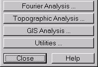
6 ERDAS Interfaces Classical Windows 2010 ITC FACULTY OF GEO-INFORMATION SCIENCE AND EARTH OBSERVATION, UNIV. OF TWENTE 6 6

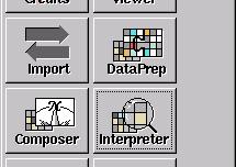
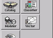
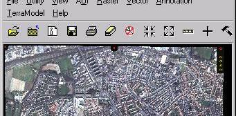
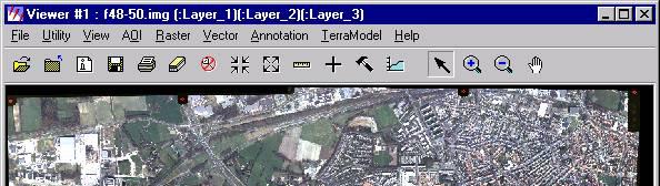
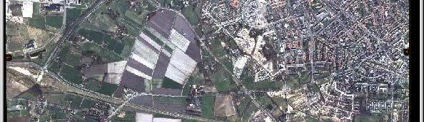
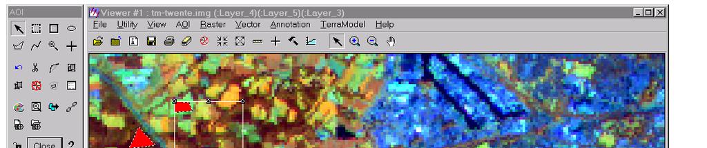
7 Imagine startup (Classic interface) Viewer ITC FACULTY OF GEO-INFORMATION SCIENCE AND EARTH OBSERVATION, UNIV. OF TWENTE 7 7


8 Viewer Most common data types have a pull-down menu f Most common functions have short cuts and an icon 8

 Use")


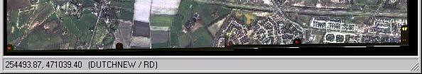
9 Viewer Viewer -> File -> Open - > Raster Layer... (Ctrl-R) Use Recent... or Goto.. to use recent files or go to recent subdirectories Change preferences for default file locations and viewer preferences if you wish 9


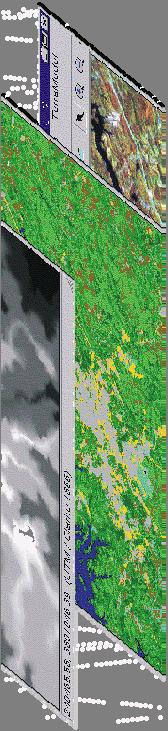
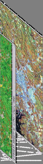


10 View multiple layers Sharing the same co- ordinates and projection Viewer -> View -> Arrange Layers (Ctrl-L) 10


 ITC FACULTY OF")

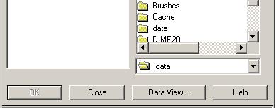
11 Preferences It s useful here to specify the folder that contains the exercise data (and to which you have writing access) ITC FACULTY OF GEO-INFORMATION SCIENCE AND EARTH OBSERVATION, UNIV. OF TWENTE 11 11

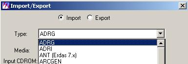
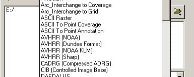
12 Import / Export ITC FACULTY OF GEO-INFORMATION SCIENCE AND EARTH OBSERVATION, UNIV. OF TWENTE 12 12


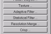
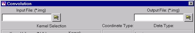
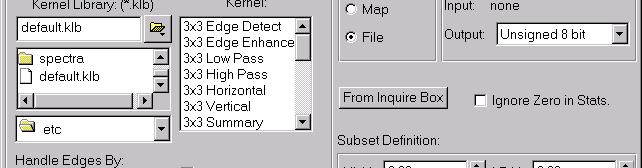
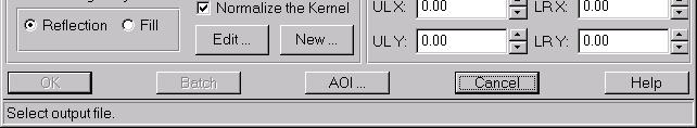
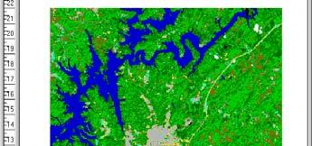
13 Example: filter ITC FACULTY OF GEO-INFORMATION SCIENCE AND EARTH OBSERVATION, UNIV. OF TWENTE 13 13

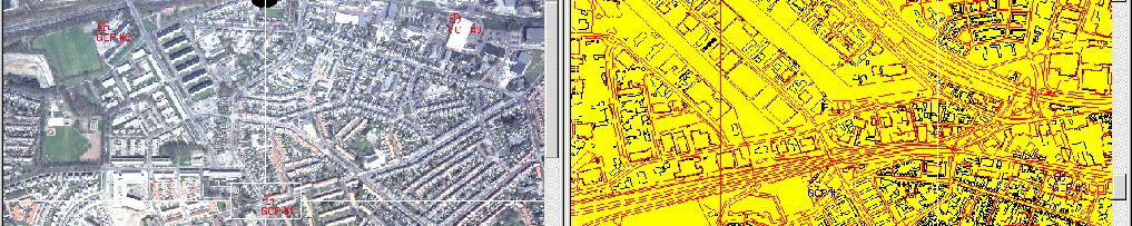
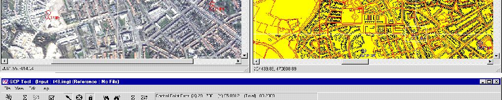
14 Example : Geometric correction tool Chip extraction 14


15 Example : Mosaicing tool 15

16 Mosaic output 16


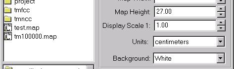
17 Map composer Map Frame tool 17


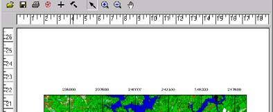
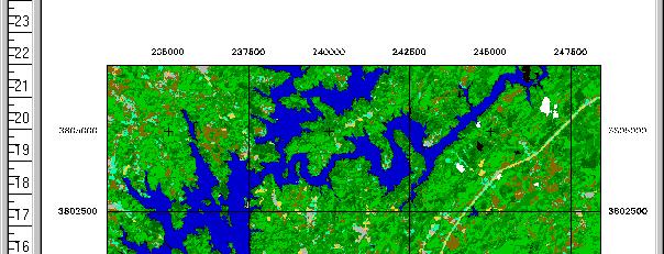
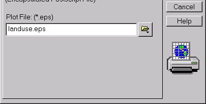
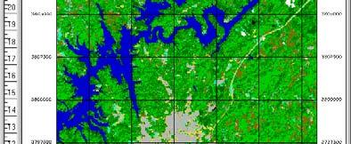
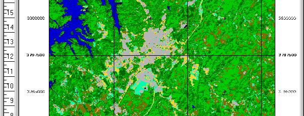
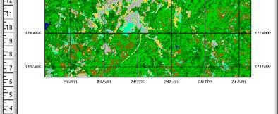
18 Map composer Map Grid tool Map Output 18

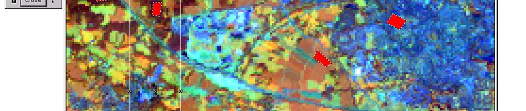
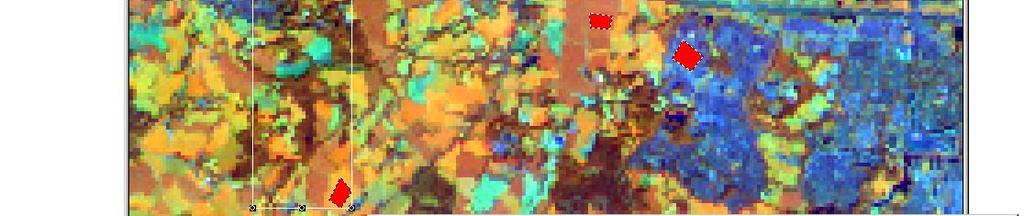
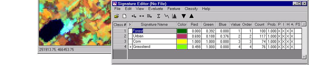
19 Classification 19


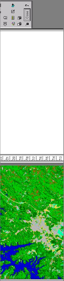
20 Spatial Modeler ITC FACULTY OF GEO-INFORMATION SCIENCE AND EARTH OBSERVATION, UNIV. OF TWENTE 20 20


21 Stereo Analyst Creation of anaglyph red < > green/blue ITC FACULTY OF GEO-INFORMATION SCIENCE AND EARTH OBSERVATION, UNIV. OF TWENTE 21 21


22 Virtual GIS 3D images ITC FACULTY OF GEO-INFORMATION SCIENCE AND EARTH OBSERVATION, UNIV. OF TWENTE 22 22
23 Help! Context C t t sensitive Help menu: pull down menu right-mouse button over a window ITC FACULTY OF GEO-INFORMATION SCIENCE AND EARTH OBSERVATION, UNIV. OF TWENTE 23 23
24 Documentation Introduction ERDAS Imagine Both Guides are available in PFD at the data CD ITC FACULTY OF GEO-INFORMATION SCIENCE AND EARTH OBSERVATION, UNIV. OF TWENTE 24 24
25 ITC FACULTY OF GEO-INFORMATION SCIENCE AND EARTH OBSERVATION, UNIV. OF TWENTE 25 25
26 Questions ITC FACULTY OF GEO-INFORMATION SCIENCE AND EARTH OBSERVATION, UNIV. OF TWENTE 26 26
ITC, ENSCHEDE, THE NETHERLANDS. Gateway to international knowledge exchange focusing on capacity building and institutional development
 ITC, ENSCHEDE, THE NETHERLANDS Gateway to international knowledge exchange focusing on capacity building and institutional development FACULTY ITC UNIVERSITY OF TWENTE In 2010 ITC became a faculty of the
Cloud GIS Real Estate Management, Appraisal and Development Service USING ESRIs ARCGIS SERVER
 Cloud GIS Real Estate Management, Appraisal and Development Service USING ESRIs ARCGIS SERVER INFODIM: Was founded on 1992 and is internationally certified as a GIS company from D&B Dun & Bradstreet Global
Pro Series User Guide
 Pro Series User Guide Table of Contents Page 2 Getting Started Page 7 Property Search and Reports Page 22 Farm Search and Reports Page 30 Using the Map GETTING STARTED 2 P a g e Property Search select
Presented by: Stewart Information International, Inc. Jack McKenna
 Presented by: Stewart Information International, Inc. Jack McKenna Held at the: 2007 ESRI Survey & Engineering GIS Summit San Diego Convention Center San Diego, California June 16-19, 2007 Integrating
GAUSSCAD A WEBGIS APPLICATION FOR COLLECTING CADASTRAL DATA
 M.M. Moise GaussCAD a WebGIS Application for Collecting Cadastral Data GAUSSCAD A WEBGIS APPLICATION FOR COLLECTING CADASTRAL DATA Mihai-Mircea MOISE, S.C. GAUSS S.R.L., mihai.moise@gauss.ro Abstract:
Innovations in Education at Faculty ITC and within Land Administration Programme
 Innovations in Education at Faculty ITC and within Land Administration Programme Prof. Jaap Zevenbergen, Vice-Dean Education at Faculty ITC, Prof. Land Administration dr. Dimo Todorovski, Course Coordinator
A Geocoded Cadastral Fabric as a Precondition for a Sustainable Land Management System
 A Geocoded Fabric as a Precondition for a Sustainable Land Management System Gottfried KONECNY, Germany; J.P. LAUZON, Canada; Abdul Salam MOHAMMED, India Key words: SDI,, Parcel Boundaries, GPS-GNSS, Land
Realist: Foreclosure Search Workshop
 Realist: Foreclosure Search Workshop JANUARY 11, 2010 1 FORECLOSURE SEARCH WORKSHOP OUTLINE 1. NEW COUNTIES: ALL THE STATE IS AVAILABLE 2. Investor Search a. Search for Auctions b. View Foreclosure data
A Vision for a Fully Digital Cadastral Survey System
 A Vision for a Fully Digital Cadastral Survey System Anselm HAANEN, Trent GULLIVER, New Zealand Key words: cadastral survey system, digital cadastre, survey plans SUMMARY Surveyors have traditionally prepared
A NOMINAL ASSET VALUE-BASED APPROACH FOR LAND READJUSTMENT AND ITS IMPLEMENTATION USING GEOGRAPHICAL INFORMATION SYSTEMS
 A NOMINAL ASSET VALUE-BASED APPROACH FOR LAND READJUSTMENT AND ITS IMPLEMENTATION USING GEOGRAPHICAL INFORMATION SYSTEMS by Tahsin YOMRALIOGLU B.Sc., M.Sc. A thesis submitted for the Degree of Doctor of
GIS & Mobile Technology: It s Not Just For Real Property Tangible Technology for Tangible Personal Property Valuation
 GIS & Mobile Technology: It s Not Just For Real Property Tangible Technology for Tangible Personal Property Valuation Steve Weissman, RES, CFE, MBA Manager, Personal Property Appraisal Section Palm Beach
Web Based Land Information System for Nintavur Divisional Secretariat Division (DSD), Sri Lanka
, Sri Lanka") Journal of Geography, Environment and Earth Science International 5(4): 1-6, 2016; Article no.jgeesi.20748 ISSN: 2454-7352 SCIENCEDOMAIN international www.sciencedomain.org Web Based Land Information System
Journal of Geography, Environment and Earth Science International 5(4): 1-6, 2016; Article no.jgeesi.20748 ISSN: 2454-7352 SCIENCEDOMAIN international www.sciencedomain.org Web Based Land Information System
CLICK HERE TO KNOW MORE
 CLICK HERE TO KNOW MORE LANDS AND SURVEYS DEPARTMENT SABAH, MALAYSIA GEO-CADASTRE IN LAND ADMINISTRATION: SABAH S EXPERIENCE Sr Hj SAFAR B UNTONG, FISM, MRICS Director, Lands & Surveys Department Sabah,
Here s How to Do a Simple Property Search.
 Here s How to Do a Simple Property Search. Conducting a Search Using the Single Property Search First step to conducting a property search is selecting the state and the county in which to search. Then,
Implementing a Cadastre in Internet in Poland
 Marcin KARABIN, Poland Key words: cadastre, Internet access to cadastre SUMMARY In Poland cadastre is maintained on a district level (each province is divided into district units in Polish powiat which
Real Estate Software User s Guide Close It Original HUD Title Page DisplaySoft 2018 Display Systems, Inc.
 DisplaySoft Close It Original HUD Real Estate Software User s Guide Close It Original HUD Title Page DisplaySoft 2018 Display Systems, Inc. GET STARTED Open a new file or a file in progress (File). Inside
Six Steps to a Completed Appraisal Report
 Six Steps to a Completed Appraisal Report Section 1 DataLog - Comparable Sales Database ClickFORMS - Report Processor Section 2 Addenda Section 3 Mini Sample - Approach Pages 1 Six Steps to a Completed
AREC responsibilities, data and registries and the way of their distribution
 Data as a basis of the digital society PCC, 13-15 March 2018, Sofia AREC responsibilities, data and registries and the way of their distribution Vlatko Dimovski Agency for Real Estate Cadastre (AREC) the
Georgia Department of Revenue. WinGAP. Georgia CAMA Software
 WinGAP Georgia CAMA Software Presenter Tracy Thomas Business Operations Specialist Georgia Department of Revenue Local Government Services tracy.thomas@dor.ga.gov Public Utility Appraisal Eight DOR field
Estate Administration. Quickstart Guide
 Estate Administration Quickstart Guide WORKFLOW SOLUTIONS...SIMPLIFIED ESTATE ADMINISTRATION Emergent Estate Administration is designed to handle data storage and document assembly. Matters are the actual
Using ArcGIS Server for National Property Information System
 Using ArcGIS Server for National Property Information System Shota Chachkhunashvili (National Agency of Public Registry, Georgia) Mikheil Tsiklauri (Geographic, Georgia) San Diego, 2008 About us National
ArcCadastre Implementations within the Middle East
 ArcCadastre Implementations within the Middle East Kholoud Saad SALAMA, Egypt Key words: Cadastre, GIS, Survey, Data Conversion, Workflow SUMMARY In recent years, cadastre systems have developed from manual
IT-SUPPORTED STATE-LAND MANAGEMENT IN A TRANSITIONAL ENVIRONMENT
 IT-SUPPORTED STATE-LAND MANAGEMENT IN A TRANSITIONAL ENVIRONMENT - Examples from Eastern Germany and Mongolia - TOPICS 1 S LAND INFORMATION SYSTEM History and main components IT-strategy and development
Modernizing Land Administration Systems
 Presented at the FIG Congress 2018, May 6-11, 2018 in Istanbul, Turkey Modernizing Land Administration Systems B r e n t J o n e s P E, PLS E s r i Land Administration Systems GIS is the Technology Platform
GIS and Land Records Integration A PRIA White Paper
 110 Horizon Drive, Suite 210, Raleigh, NC 27615 919.459.2081 GIS and Land Records Integration A PRIA White Paper Adopted by the PRIA Board on December 20, 2017 www.pria.us/ GIS and Land Records Integration
Integrated Geo-information Database for Geological Disposal of High-Level Radioactive Waste in China
 Integrated Geo-information Database for Geological Disposal of High-Level Radioactive Waste in China Peng Wang, Yong-an Zhao, Min Gao, Shu-tao Huang, Ju Wang, Lun Wu and Heng Cai Introduction Deep geological
table of contents Profile Setup...1 Personal Info, Contact Info, Web Info... 2 Profile Photo... 3 Create a Presentation in 5 Easy Steps!...
 USER GUIDE table of contents Profile Setup...1 Personal Info, Contact Info, Web Info... 2 Profile Photo... 3 Create a Presentation in 5 Easy Steps!... 3 Working with the Search Screen... 4 Presentation
ITC. Geo-Information Science & Earth Observation... and Capacity Building
 ITC Geo-Information Science & Earth Observation... and Capacity Building Rolf A. de By International Institute for Geo-Information Science and Earth Observation, ITC II Taller Internacional de la Red de
Object Oriented Unified Real Estate Registry for a Good Spatial Data Management
 Object Oriented Unified Real Estate Registry for a Good Spatial Data Management Gyula IVÁN Gábor SZABÓ Zoltán WENINGER Institute of Geodesy, Cartography and Remote Sensing (FÖMI), Hungary Workshop on e-governance,
Regression + For Real Estate Professionals with Market Conditions Module
 USER MANUAL 1 Automated Valuation Technologies, Inc. Regression + For Real Estate Professionals with Market Conditions Module This Regression + software program and this user s manual have been created
Learning from land suitability analysis and Dutch spatial policy for sustainable land use in Japan
 Learning from land suitability analysis and Dutch spatial policy for sustainable land use in Japan Toru Nagayama 22 January 2009 GIS Research Group Seminar, University of Tsukuba Highlights from : Nagayama.,
ParcelMap BC Compiling a Parcel Fabric for the Province of British Columbia. Presented by: Ellen Styner (General Manager) and Wendy Amy (GIS Manager)
 and Wendy Amy (GIS Manager)") ParcelMap BC Compiling a Parcel Fabric for the Province of British Columbia Presented by: Ellen Styner (General Manager) and Wendy Amy (GIS Manager) Who is MNC? MNC is a geomatics engineering firm with
ParcelMap BC Compiling a Parcel Fabric for the Province of British Columbia Presented by: Ellen Styner (General Manager) and Wendy Amy (GIS Manager) Who is MNC? MNC is a geomatics engineering firm with
Cadastral services and virtual office in e-cadastre
 Cadastral services and virtual office in e-cadastre Priit Kuus Estonian Land Board October 26, 2016 Coimbra Scope of data Cadastral parcels (as of September 2016) 674 383 cadastral parcels, i.e. 97,7 %
QUESTIONNAIRE. 1. Authorizing statute(s) citation West Virginia Code and 11-1C-4(d)
 citation West Virginia Code and 11-1C-4(d)") QUESTIONNAIRE (Please include a copy of this form with each filing of your rule: Notice of Public Hearing or Comment Period; Proposed Rule, and if needed, Emergency and Modified Rule.) DATE: 6/8/15 TO:
QUESTIONNAIRE (Please include a copy of this form with each filing of your rule: Notice of Public Hearing or Comment Period; Proposed Rule, and if needed, Emergency and Modified Rule.) DATE: 6/8/15 TO:
Cube Land integration between land use and transportation
 Cube Land integration between land use and transportation T. Vorraa Director of International Operations, Citilabs Ltd., London, United Kingdom Abstract Cube Land is a member of the Cube transportation
Installation Boundary Mapping and the DoD Real Property Inventory Program
 Installation Boundary Mapping and the DoD Real Property Inventory Program 11 October 2007 SAME Mid-Atlantic Regional Conference Jeff Swallow Real Property History Real Property data reported to the Office
Cadastral Information System of Sofia
 Alexander LAZAROV and Hristo DECHEV, Bulgaria Key words: ABSTRACT A new Cadastre and Property Register Act (CPRA) was passed in April 2000, setting up rules for the maintenance of these two registers.
Town of North Topsail Beach
 Town of North Topsail Beach Build-Out and Non-Conforming Lot Study In Coordination with The Eastern Carolina Council of Governments February 2010 Introduction The Town of North Topsail Beach has conducted
Virtual Werribee: A planning support tool
 19th International Congress on Modelling and Simulation, Perth, Australia, 12 16 December 2011 http://mssanz.org.au/modsim2011 Virtual Werribee: A planning support tool M.Z. Abdul Ghani a, S. Datta a and
Recent Developments concerning Land Administration in Austria
 Recent Developments concerning Land Administration in Austria Main topics e-government reference data go online / egeodata Austria new pricing and licensing / business models INSPIRE / PSI / national infrastructure
International funding projects in Republic Geodetic Authority
 International funding projects in Republic Geodetic Authority Serbia: Republic Geodetic Authority Workshop Exploring Funding Instruments for NMCA 7-8 November 2012 Republic Geodetic Authority Republic
Fit-for Purpose Approaches to Land Administration
 Fit-for Purpose Approaches to Land Administration Brent Jones, PE, PLS Global Manager, Casastre/Land Records bjones@esri.com Land Administration GIS is the platform for land administration Land administration
In Conversation with Charles Young Bringing Government Cadastres Online
 In Conversation with Charles Young Bringing Government Cadastres Online Spatial Dimension Background Founded in 1999 with 4 staff Currently 50 staff (business analysts, programmers, database specialists,
Investit Software Inc. Developer Pro USA 45 LOT SUBDIVISION DEVELOPMENT EXAMPLE
 INTRODUCTION This example uses the Land Subdivisions template. Developer Pro USA 45 LOT SUBDIVISION DEVELOPMENT EXAMPLE This practice example consists of three Sections; 1. The input information for the
City of Lithonia Housing Inventory
 City of Lithonia Housing Inventory ARC Community Choices Program GPA Winner- Outstanding Initiative in a Small Community Housing Inventory Summary As part of the city s participation in the Georgia Initiative
Table of Contents Before You Begin... 2 Starting an Analysis... 2 Address Verification... 3 Order Confirmation... 5 Overview of Drop Down Menu Bar...
 Table of Contents Before You Begin... 2 Starting an Analysis... 2 Address Verification... 3 Order Confirmation... 5 Overview of Drop Down Menu Bar... 6 Overview of the Analytic Process... 7 Process Tab
Will County GIS Product Distribution Policy January, 2008
 Will County GIS Product Distribution Policy January, 2008 Background: The goal of this policy is to provide GIS products to users in a reasonable manner and to ensure that products released are of sufficient
Yardi Voyager 6.0 Manual
 Yardi Voyager 6.0 Manual Created 2.26.2010 Updated On 12.11 Updated 3.26.2012 Echelon Property Group 5655 South Yosemite Street #460 Greenwood Village, CO 80111 Yardi Voyager Manual Page Voyager Log in
contents Government and Governance Governance and Space Governance Space and Land Development, land and space Securities,
 contents Governance and Space the Role of of Civil Registers and Registers of of Public and Private Land as as Conditions for for Development Johan de Meijere The Netherlands Mabel Alvarez de Lopez Argentina
Title Transfer of Ownership (Bill of Sale Initiation)
") Title Transfer of Ownership (Bill of Sale Initiation) Note: The transfer of title between Free Miners is handled in two (2) parts. These instructions cover the Initiation portion. 1. The seller enters
Title Transfer of Ownership (Bill of Sale Initiation) Note: The transfer of title between Free Miners is handled in two (2) parts. These instructions cover the Initiation portion. 1. The seller enters
Features Guide. Enhancements. Mortgage Calculators VERSION 7. May 2008
 Features Guide VERSION 7 May 2008 Copyright 2002-2008 SuperTech Software All rights reserved. Printed in Australia. Enhancements This document describes new features and enhancements in POSH. Mortgage
ParcelMap BC. Compiling a Parcel Fabric for the Province of British Columbia. WENDY AMY and ELLEN STYNER
 ParcelMap BC Compiling a Parcel Fabric for the Province of British Columbia WENDY AMY and ELLEN STYNER Who is MNC? Established in 1997, MNC is a geomatics engineering firm located in Calgary, Alberta.
Cadastre in Addis Ababa. Status and future development
 Status and future development Dr.-Ing. Paul Hartfiel Mülheim, 1. Oct. 2010-1 - Addis Ababa Capital of Ethiopia Area population 540 km² > 3,200,000 (rapidly growing) 2,300,000 in 1994 > 22% of all urban
FACTS ANDFIGURES. ITC: gateway to international knowledge exchange focusing on capacity building and institutional development
 FACTS ANDFIGURES 2008 ITC: gateway to international knowledge exchange focusing on capacity building and institutional development Introduction Geo-information management, worldwide and innovative The
New Models for Property Data Verification and Valuation
 New Models for Property Data Verification and Valuation for 2006 IAAO Councils and Sections Joint Seminar May 9-11, 2006 Charleston, South Carolina Presented by George Donatello, CMS Principal Consultant
EduMapping + JobMapping
 EduMapping + JobMapping Frans Rip Centre for Geoinformation, Wageningen UR 18 April 2011 1. What is EduMapping? Present GI-course descriptions Toekomst: mèt etiket Assessment by teacher Course content
A CADASTRAL GEODATA BASE FOR LAND ADMINISTRATION USING ARCGIS CADASTRAL FABRIC MODEL A CASE STUDY OF UWANI ENUGU, ENUGU STATE, NIGERIA
 A CADASTRAL GEODATA BASE FOR LAND ADMINISTRATION USING ARCGIS CADASTRAL FABRIC MODEL A CASE STUDY OF UWANI ENUGU, ENUGU STATE, NIGERIA BY Ndukwu, Raphael. Ike Department of Geoinformatics & Surveying University
1. A portion of the cost to the public body for obtaining the original or copies of the documents, printouts or photographs.
 39-121.03. Request for copies, printouts or photographs; statement of purpose; commercial purpose as abuse of public record; determination by governor; civil penalty; definition A. When a person requests
Accessing and Viewing Voided Claims in EI Billing
 1 Accessing and Viewing Voided Claims in EI Billing 2 Introduction Hint: For quicker navigation, click on the 'Menu' link on the top right-hand side of the player to move freely among the sections of this
MLSSAZ: Comparative Market Analysis (CMA) in Flexmls
 in Flexmls") MLSSAZ: Comparative Market Analysis (CMA) in Flexmls Class Objectives Utilize property research tools to assist you in obtaining listing information. Use search results to create a CMA.. MLS Technical
MLSSAZ: Comparative Market Analysis (CMA) in Flexmls Class Objectives Utilize property research tools to assist you in obtaining listing information. Use search results to create a CMA.. MLS Technical
The Boundary and the Effects of Cadastral Surveying in Cyprus
 The Boundary and the Effects of Cadastral Surveying in Cyprus Aristi Louca, Margarita Fani Surveyor Engineers, Cyprus Association of Rural and Surveying Engineers The History of Cyprus goes back 11000
WinTen² Section 8 Desktop Inspections
 WinTen² Section 8 Desktop Inspections Preliminary User Manual User Manual Edition: 11/15/2004 We are your inside track for making your job easier! Tenmast Software 132 Venture Court, Suite 1 Lexington,
PANAFRICA GEOINFORMATION SERVICES PLC ETHIOPIA
 PANAFRICA GEOINFORMATION SERVICES PLC ETHIOPIA Tenets PanafricaGIS is a technology-enthusiast company operated by experienced professionals in the field of geo-information. We believe a sustained and inclusive
PREPARING SURVEY TENDER GIS DATABASE OUTCOMES
 PREPARING SURVEY TENDER SPECIFICATIONS FOR PROJECT GIS DATABASE OUTCOMES Presentation by Ian Harper GEODATA AUSTRALIA ESRI User Conference 2009 24 st July 2009 BACKGROUND GIS databases now provide a more
11.01 digital painting I
 digital paintings The Theater of Totality with its multifarious complexities of light, space, plane, form, motion, sound, man and with all the possibilities for varying and combining these elements must
2018 Assessment Roll Edit Guide for Parcel-Level Geographical Information System (GIS) Information
 Information") 2018 Assessment Roll Edit Guide for Parcel-Level Geographical Information System (GIS) Information Florida Department of Revenue Property Tax Oversight January 2, 2018 Intended Users This edit guide is
2018 Assessment Roll Edit Guide for Parcel-Level Geographical Information System (GIS) Information Florida Department of Revenue Property Tax Oversight January 2, 2018 Intended Users This edit guide is
Map Modernization Modernization Program
 FEMA Map Modernization Program Presented to Maryland Association of Floodplain and Stormwater Managers October 27, 2005 Map Modernization Program Autorun.exe 2 Map Modernization Program Outline Map Mod
space for global development
 FACULTY OF GEO-INFORMATION SCIENCE AND EARTH OBSERVATION ITC space for global development ITC: gateway to international knowledge exchange focusing on capacity building and institutional development The
How to Receive, Refund and Transfer Money from an Applicant
 How to Receive, Refund and Transfer Money from an Applicant There are at least three types of money you might receive from an Applicant: 1. Security Deposit for a Move-In at a future date. 2. Applicant
Status and Perspectives of the Geodesy, Cartography and Cadastre Authority Availability of Geographic Information in Slovakia.
 Status and Perspectives of the Geodesy, Cartography and Cadastre Authority Availability of Geographic Information in Slovakia Hedviga Májovská Geodesy, Cartography and Cadastre Authority of the Slovak
Meeting the Changing National Geospatial Information Needs. Palitha Udayakantha Surveyor General - Sri Lanka
 Meeting the Changing National Geospatial Information Needs Palitha Udayakantha Surveyor General - Sri Lanka Sri Lanka Location Latitude 5 55 10-9 50 6 North Longitude 79 31 19-81 52 36 East Area 65610
Problems and Solution Proposals in Integration of Cadastral Data into Geographical Information System (GIS) in Turkey
 in Turkey") Problems and Solution Proposals in Integration of Cadastral Data into Geographical Information System (GIS) in Turkey Gülgün OZKAN, S. Savas DURDURAN, Ali ERDI and Bilal GIRGIN, Turkey Key words: Cadastre,
Problems and Solution Proposals in Integration of Cadastral Data into Geographical Information System (GIS) in Turkey Gülgün OZKAN, S. Savas DURDURAN, Ali ERDI and Bilal GIRGIN, Turkey Key words: Cadastre,
The Survey Data Model Technology A practical survey solution to generate all levels of spatial and e-governance outcomes.
 Land Governance in a Rapidly Changing Environment Annual World Bank Conference on Land and Poverty April 24 & 25, 2012 The Survey Data Model Technology A practical survey solution to generate all levels
A FIRST ATTEMPT FOR USING VOLUNTEERED GEOGRAPHIC INFORMATION AND CROWD SOURCING TECHNIQUES IN CADASTRE
 A FIRST ATTEMPT FOR USING VOLUNTEERED GEOGRAPHIC INFORMATION AND CROWD SOURCING TECHNIQUES IN CADASTRE Sofia Basiouka National Technical University of Athens PhD student s.basiouka@gmail.com Chryssy Potsiou
Real Estate Administration at the Vancouver Port Authority (VPA) Presentation by Ron McMillan - GIS/LIS Coordinator December 13, 2004
 Presentation by Ron McMillan - GIS/LIS Coordinator December 13, 2004") Real Estate Administration at the Vancouver Port Authority (VPA) Presentation by Ron McMillan - GIS/LIS Coordinator December 13, 2004 Introduction Overview of the Vancouver Port Authority (VPA) How CAD
Real Estate Administration at the Vancouver Port Authority (VPA) Presentation by Ron McMillan - GIS/LIS Coordinator December 13, 2004 Introduction Overview of the Vancouver Port Authority (VPA) How CAD
Marsha M. Faux, CFA, ASA Polk County Property Appraiser. A Tour of Our Website
 Marsha M. Faux, CFA, ASA Polk County Property Appraiser A Tour of Our Website 2017 www.polkpa.org Bartow Main Office 255 N Wilson Ave Bartow, FL 33830 Phone: 863-534-4777 Fax: 863-534-4753 Lakeland Branch
Land Information System For Ayedun Layout Ido Local Government Aera, Oyo State, Nigeria
 Land Information System For Ayedun Layout Ido Local Government Aera, Oyo State, Nigeria Idhoko K.E Tinuoso A Adeleke M Adegboyega S Department of Surveying and Geoinformatics, Faculty of Environmental
CATALOGING, MONITORING AND MANAGING INVASIVE SPECIES ON POST LANDS. PSU Geog596A Capstone Proposal Dale Jantzen Dec 17, 2015
 CATALOGING, MONITORING AND MANAGING INVASIVE SPECIES ON POST LANDS PSU Geog596A Capstone Proposal Dale Jantzen Dec 17, 2015 PROJECT OUTLINE AND PURPOSE Define a particular need within a non-profit land
Project Name: (Name as it appears in ESNAPS.) Spring Care Association
 Spring Care Association") Page 1 of 4 U.S. Department of Housing and Urban Development 451 Seventh Street, SW Washington, DC 20410 www.hud.gov espanol.hud.gov Environmental Review for Continuum of Care (CoC) Rental Assistance Project
Page 1 of 4 U.S. Department of Housing and Urban Development 451 Seventh Street, SW Washington, DC 20410 www.hud.gov espanol.hud.gov Environmental Review for Continuum of Care (CoC) Rental Assistance Project
Cadastral Map Upgrading and Layers Harmonization for the Spatial Data Infrastructure in Friuli Venezia Giulia, Italy
 Cadastral Map Upgrading and Layers Harmonization for the Spatial Data Infrastructure in Friuli Venezia Giulia, Italy A. Beinat, F. Crosilla, E. Sossai M. Basso, R. Piuzzo 2 Summary - The cadastral mapping:
Hi-tech Survey Operation using Modern Technologies: Concept & Process Flow
 Hi-tech Survey Operation using Modern Technologies: Concept & Process Flow Presented by Sri Biswaranjan Rath Asst. Director,CLR Board of Revenue, Odisha Limitations of present system of surveying Survey
A Quantitative Comparison of Completely Visible Cadastral Parcels Using Satellite Images: A Step towards Automation
 A Quantitative Comparison of Completely Visible Cadastral Parcels Using Satellite Images: A Step towards Automation Divyani KOHLI, Netherlands, Rohan BENNETT, Australia, Christiaan LEMMEN, Kwabena ASIAMA,
DEVELOPMENT OF A GIS-BASED LAND REGISTRY SYSTEM
 DEVELOPMENT OF A GIS-BASED LAND REGISTRY SYSTEM *Vanum Govindu 1, Kidu Gebremedhin 2 and Desta Luel Tsegay 3 1 Department of GEOS for Natural Resource Management, Institute of Geo-Information and Earth
GeoWarehouse Land Registry. Teranet Enterprises Inc.
 GeoWarehouse Land Registry Teranet Enterprises Inc. TABLE OF CONTENTS Neighoubourhood Sales... 1 Overview... 1 Find Neighbourhood Sales... 1 Neighbourhood Sales and Map... 6 Map Neighbourhood Sales...
OPEN SOURCE WEB-BASED SOLUTIONS FOR DISSEMINATING AND ANALYZING FLOOD HAZARD INFORMATION AT THE COMMUNITY LEVEL
 OPEN SOURCE WEB-BASED SOLUTIONS FOR DISSEMINATING AND ANALYZING FLOOD HAZARD INFORMATION AT THE COMMUNITY LEVEL Meriam Makinano-Makinano-Santillan, Jojene R. Santillan*, Edsel Matt O. Morales Caraga Center
Aspect of preliminary activities in the function of supporting NSDI
 Sonja DIMOVA, Republic of Macedonia Key words: e-governance, geospatial data, NSDI, INSPIRE, metadata SUMMARY The successful establishment of the NSDI in the true sense of the word cannot be performed
Utility networks in Estonian Restrictions Information
 Utility networks in Estonian Restrictions Information System Mr. Priit Kuus Department of Land Cadastre priit.kuus@maaamet.ee +372 675 0843 Tallinn 2011 Restrictions: legal grounds The Constitution of
Tool for Land Consolidation
 LandSpaCES * : A Spatial Planning The Empowerment of Local Authorities: Spatial Information and Spatial Planning Tools 25-28 October, Paris, France Tool for Land Consolidation Demetris Demetriou **, John
CFPB Implementation of Parcels Provision in HMDA Under Dodd-Frank
 CFPB Implementation of Parcels Provision in HMDA Under Dodd-Frank Land ownership is the foundation of the financial, legal, and real estate systems in our society Parcel Data vs. Census Data + Census data
Development of 3D Cadastre in Hungary
 Development of 3D Cadastre in Hungary András OSSKÓ Gyula IVÁN CLGE General Assembly 22 March 2013, Budapest, HUNGARY Content Introduction Problems in development of 3D cadastre and registration Hungarian
LAND ADMINISTRATION FOR FOOD SECURITY A RESEARCH SYNTHESIS
 LAND ADMINISTRATION FOR FOOD SECURITY A RESEARCH SYNTHESIS BY Georgina Rockson(Ghana) Dr. Rohan Bennett and Ir. Liza roenendijk (Netherland) MAY, 2012 OUTLINE Acknowledgement Introduction Research problem
Use of GIS to Manage Community-Based Land Transactions: A Case Study of Kirinyaga Central District
 Use of GIS to Manage Community-Based Land Transactions: A Case Study of Kirinyaga Central District J. K. Mbui, T. M. Ng ang a, P. G. Githere Abstract The elements of Land Administration in Kenya has been
Telling Tales. Storytelling as architectural representation By Jana Čulek
 Telling Tales Storytelling as architectural representation By Jana Čulek Telling Tales Telling Tales Storytelling as architectural representation By Jana Čulek As architects, we often create more stories
Demonstrate knowledge of, and extract, cadastral data from Landonline
 Page 1 of 5 Demonstrate knowledge of, and extract, cadastral data from Landonline Level 3 Credits 5 Purpose This unit standard is for people who are working in the surveying industry in jobs which involve
National Report. Submitted by Cyprus **
 UNITED NATIONS E/CONF.97/5/CRP. 12 ECONOMIC AND SOCIAL COUNCIL Seventeenth United Nations Regional Cartographic Conference for Asia and the Pacific Bangkok, 18-22 September 2006 Item 6 (b) of the provisional
A Review and Perspective on Parcel Data Models for Urban Planning
 A Review and Perspective on Parcel Data Models for Urban Planning Yiqiang Ouyang Prof. Dr. Ilir Bejleri Department of Urban and Regional Planning University of Florida June 19-21, 2010 1 Content 1. Introduction
Buildable Lands and Land-Use Trends in the Columbia River Gorge National Scenic Area
 Buildable Lands and Land-Use Trends in the Columbia River Gorge National Scenic Area As of October 2017 Table of Contents INTRODUCTION Purposes of this Report... 1 Key Findings.... 1 Background... 1 Study
General Questions. What happens to my saved CMAs in my current program? Your saved CMAs, unfortunately, cannot be transferred over to Moxi Present.
 FAQs General Questions What is Moxi Present? Moxi Present is a powerful presentation and CMA tool that you can use to easily create professional, tech-savvy presentations that will impress clients and
REGISTRATION OF PROPERTIES IN STRATA
 REGISTRATION OF PROPERTIES IN STRATA REPORT ON THE WORKING SESSIONS INTRODUCTION A cadastre is usually, and in most countries, a parcel-based, and up-to-date land information system containing records
Universal Geo-database Connector Interface Component (UG-CIC) For Virtual Web-base GIS Server Essential For Real Estate Industry Uses
 For Virtual Web-base GIS Server Essential For Real Estate Industry Uses") Universal Geo-database Connector Interface Component (UG-CIC) For Virtual Web-base GIS Server Essential For Real Estate Industry Uses Jad Jarroush & Dr. Kobi Zaid Zaid Orniv Group L.T.D Israel kobi_z@zaidorniv.co.il
Universal Geo-database Connector Interface Component (UG-CIC) For Virtual Web-base GIS Server Essential For Real Estate Industry Uses Jad Jarroush & Dr. Kobi Zaid Zaid Orniv Group L.T.D Israel kobi_z@zaidorniv.co.il