Canyons South. Annexation Impact Report. September 1, 2015
|
|
|
- Johnathan Page
- 5 years ago
- Views:
Transcription
1 Canyons South Annexation Impact Report September 1,
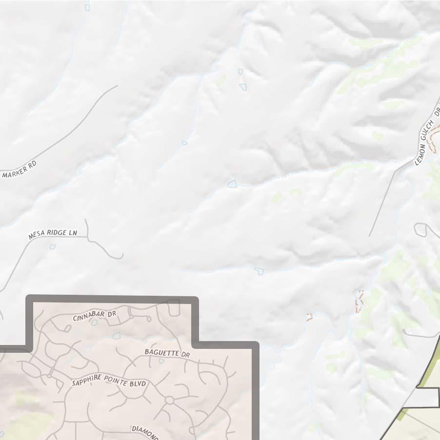
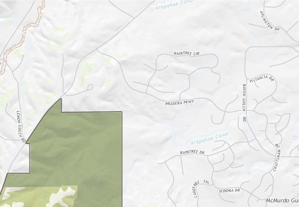
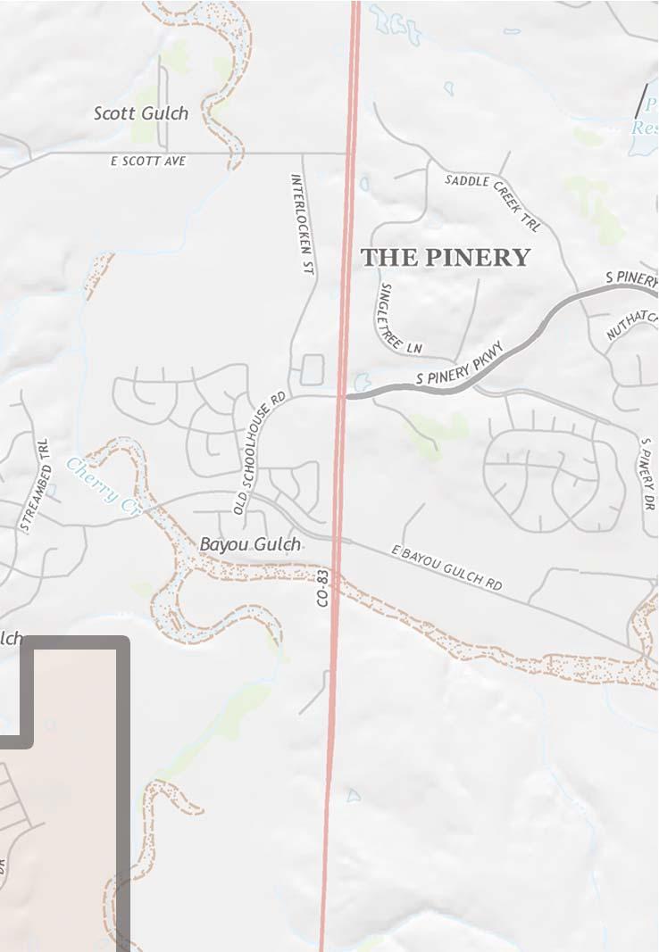
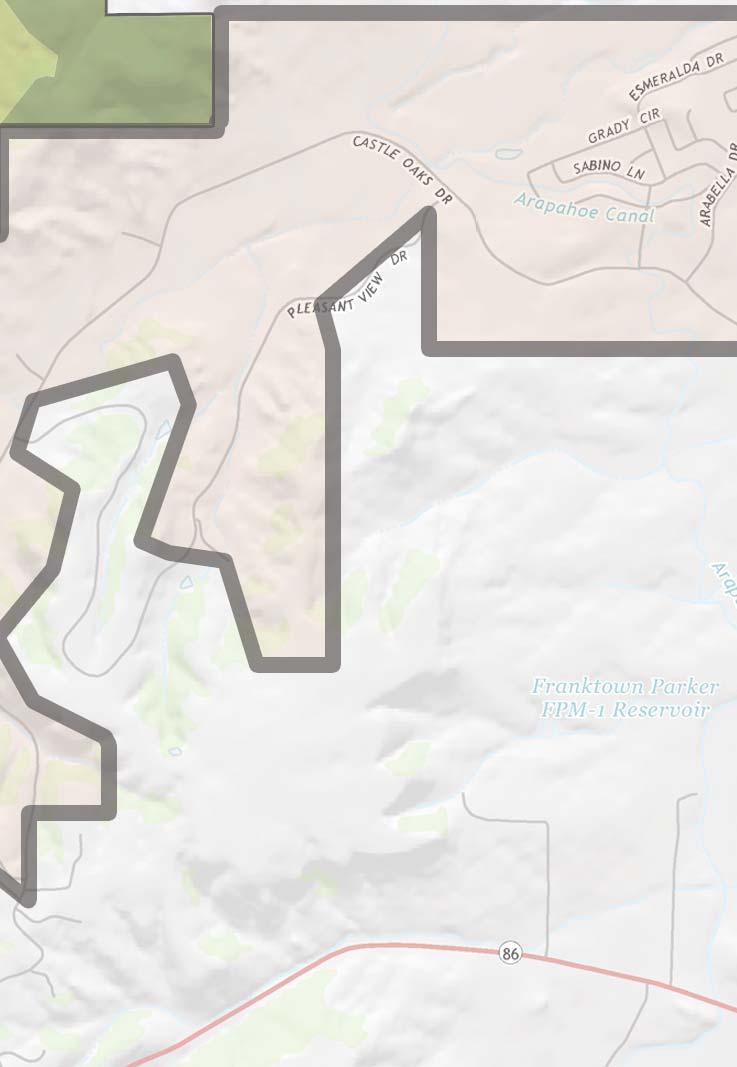
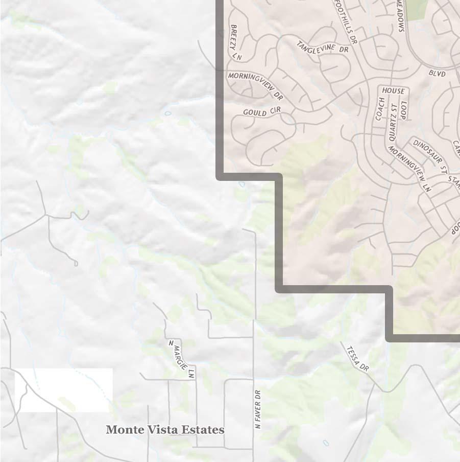
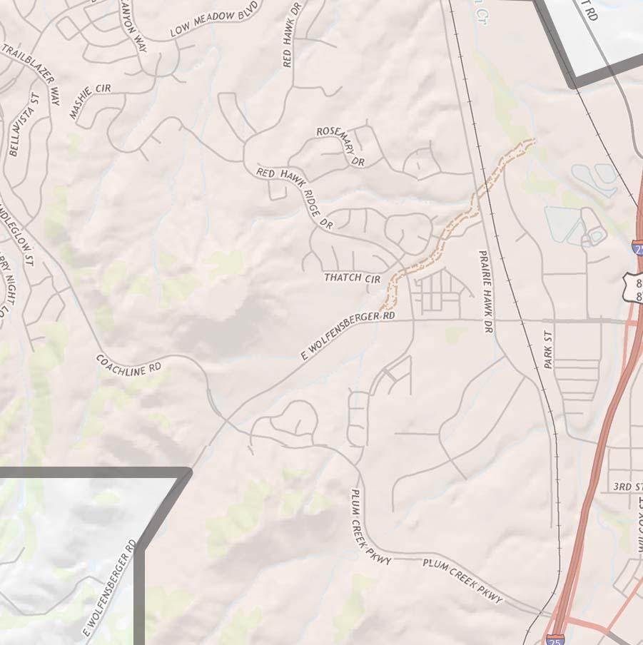
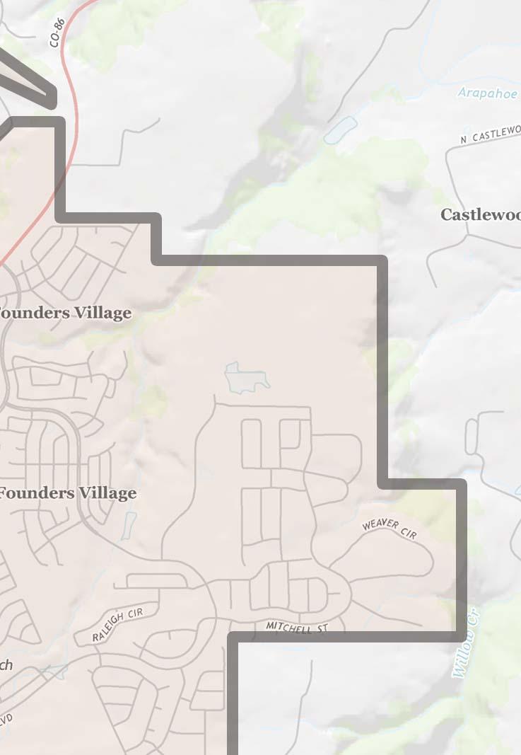
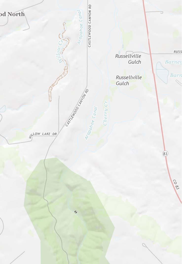
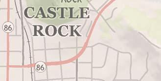
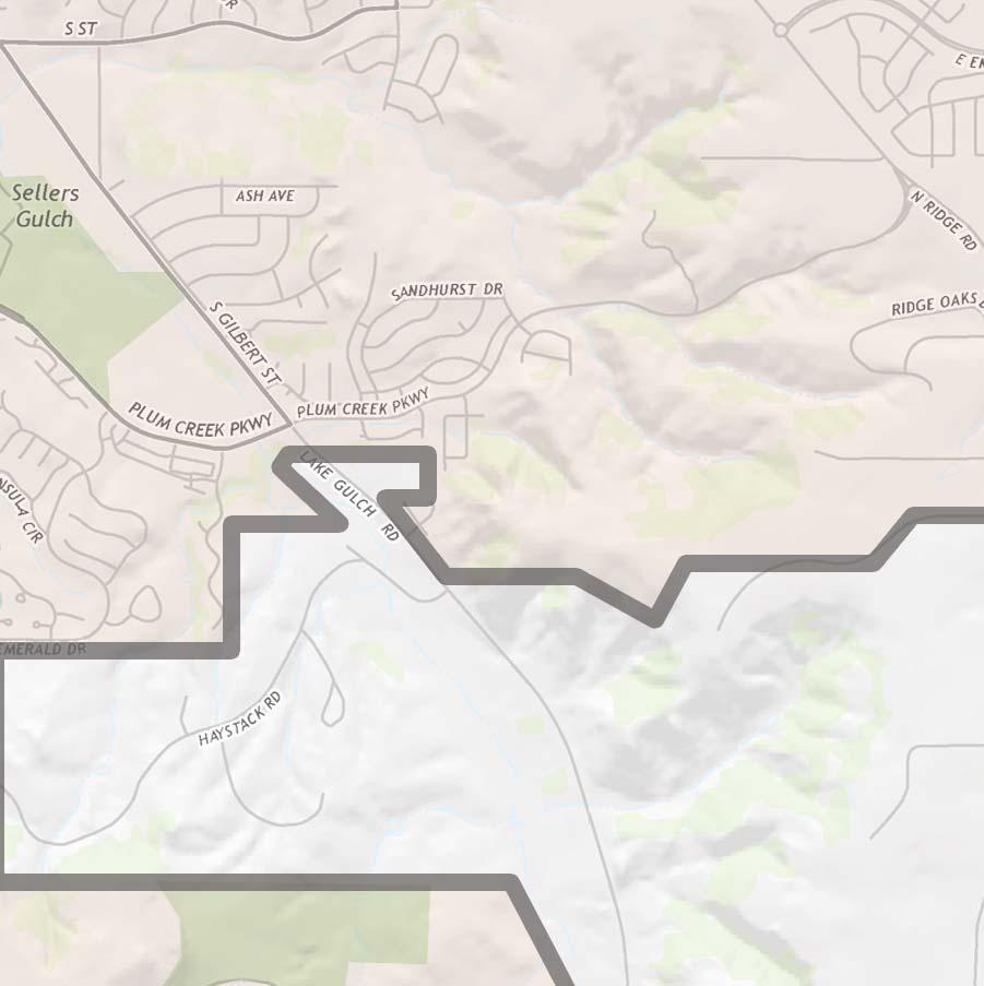
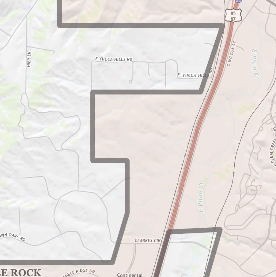
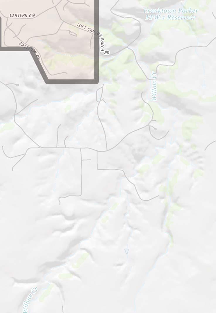
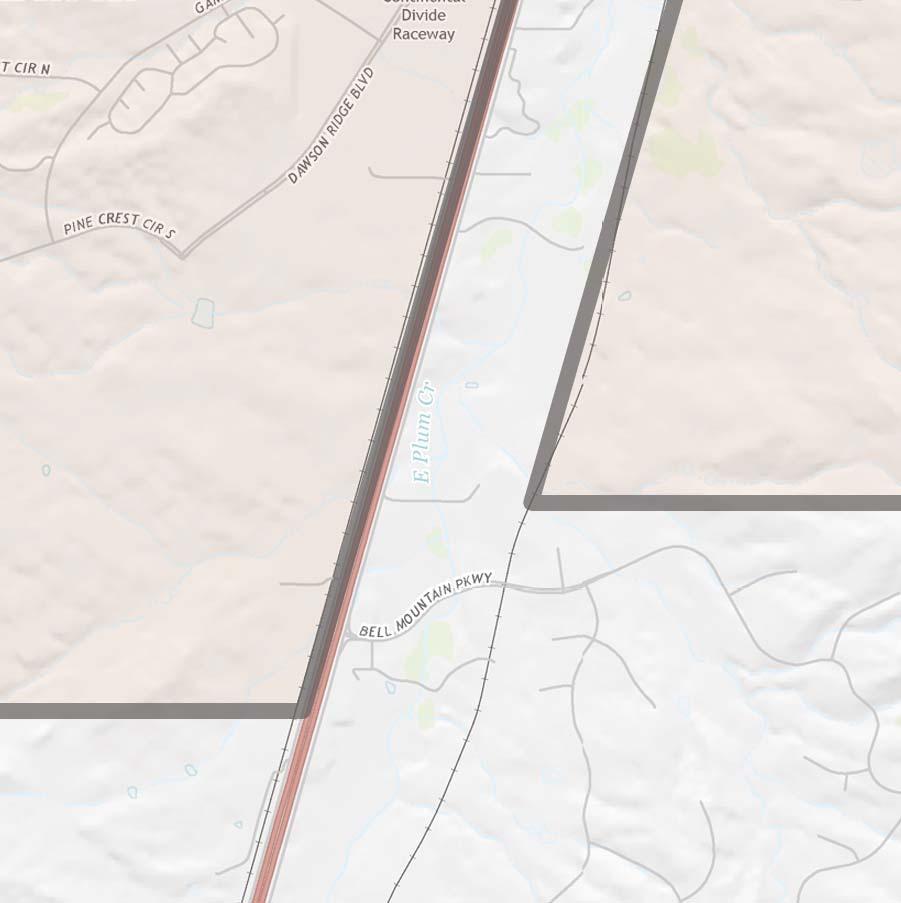
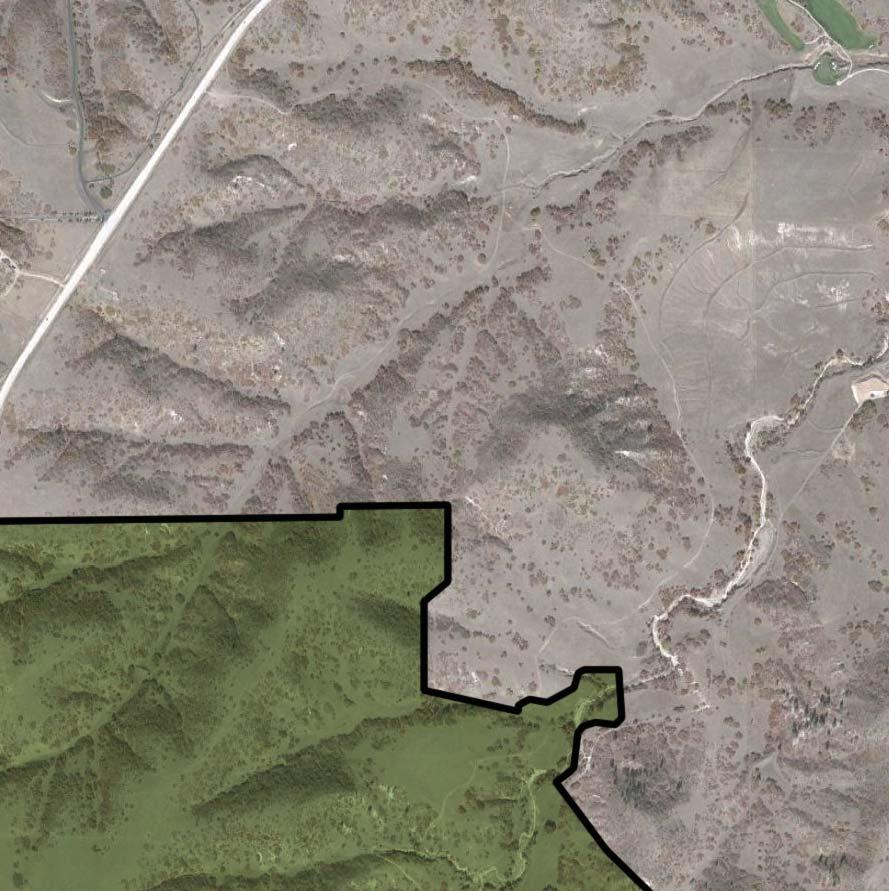
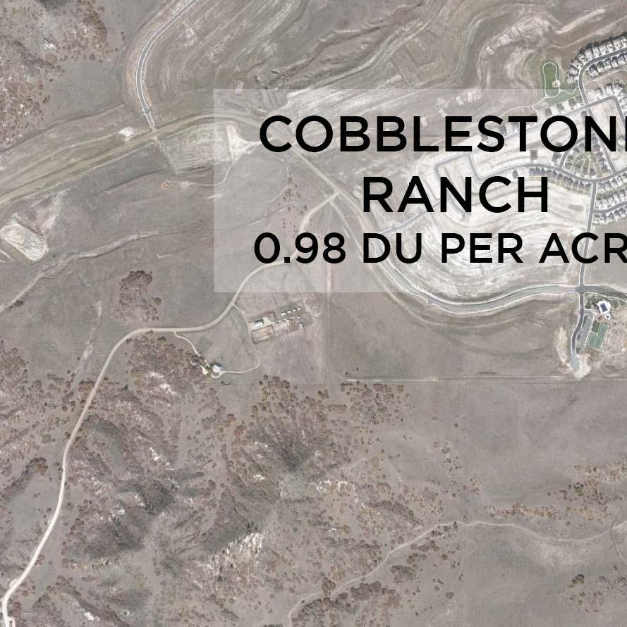
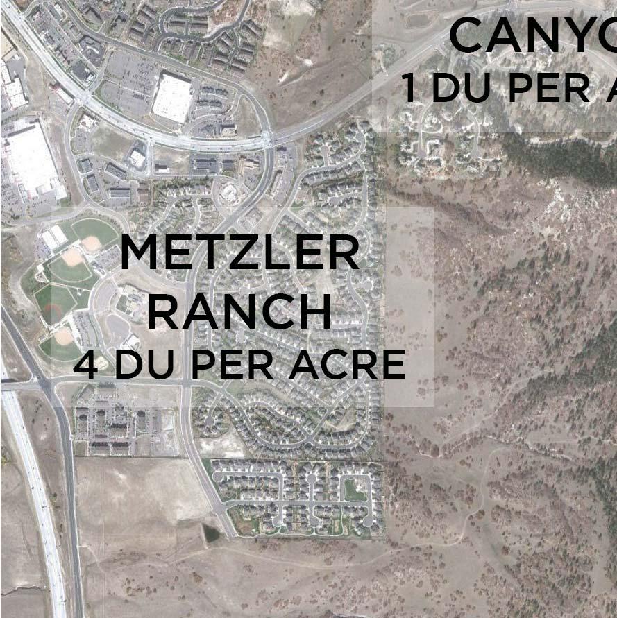
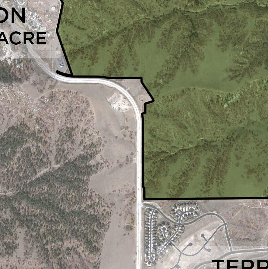
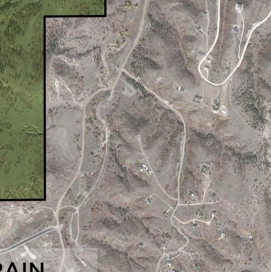
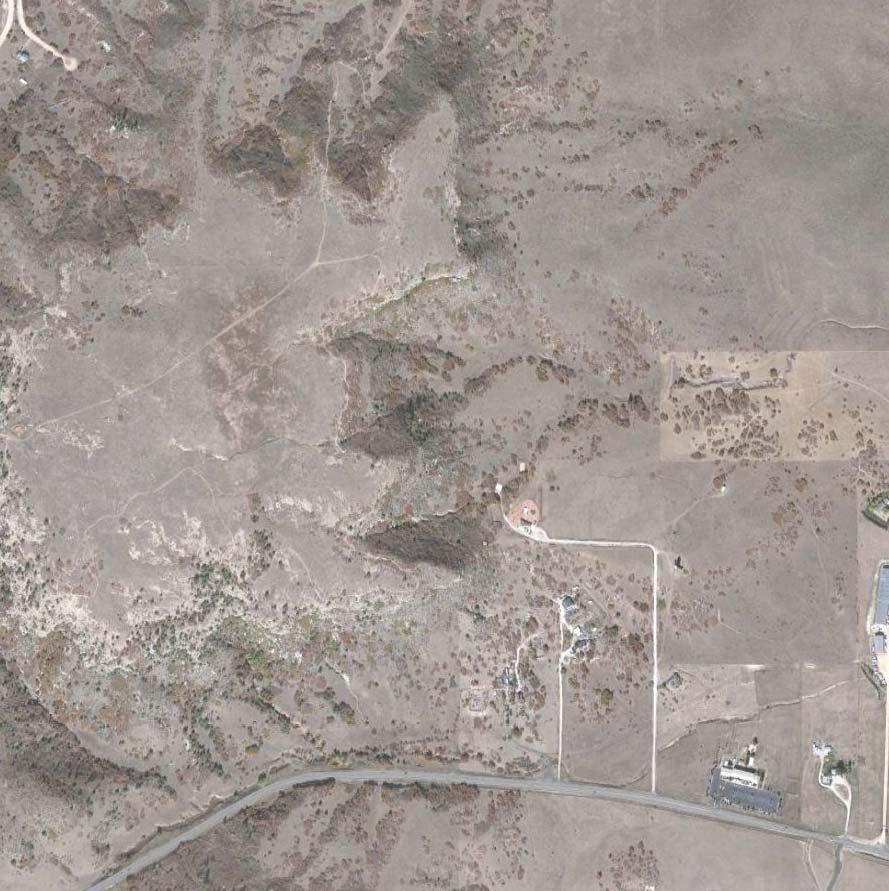
2 Introduction This Annexation Impact Report has been prepared to meet the statutory requirements set forth in Colorado Revised Statutes for the application for annexation of the property known as Canyons South into the Town of Castle Rock, Colorado. The information contained herein represents preliminary estimates and assessments regarding the anticipated impact of the proposed annexation. The information and representations are based on the best available information at the time of the preparation of this report. For purposes of clarification, the annexation area contains parcels owned by Canyons South, LLC, referred to herein as the Property, as well as parcels owned by Douglas County Board of County Commissioners, the Town of Castle Rock, and Crowfoot Valley Metropolitan District #1. As combined, these areas will be referred to herein as the Annexation Area. Property Owner Support for Annexation Colorado Statute requires the majority of the property owners of a proposed annexation area support the annexation and that the parcels of the supporters make up the majority of the Annexation Area. Canyons South, LLC, the majority property owner within the Annexation Area, Crowfoot Valley Metropolitan District #1, and Douglas County have signed petitions requesting the annexation of their respective property s into the Town of Castle Rock. General Location and Description a. Location The Annexation Area is located approximately 1.5 miles east of Interstate 25 and is generally bordered by Crowfoot Valley Road to the north, Founders Parkway to the west, the Terrain community to the south, and Castle Oaks Drive to the east. More specifically, the Annexation Area is located in Sections 17, 18, 19, 20, 30 and 31 of Township 7 South, Range 66 West of the 6 th Principal Meridian together with a part of Sections 24 and 25 of Township 7 South, Range 67 West of the 6 th Principal Meridian. The Annexation Area is bordered by the Town of Castle Rock to the south, east, and west. A portion of the northern property edge is bordered by The Town of Castle Rock with the remainder being Douglas County. 2
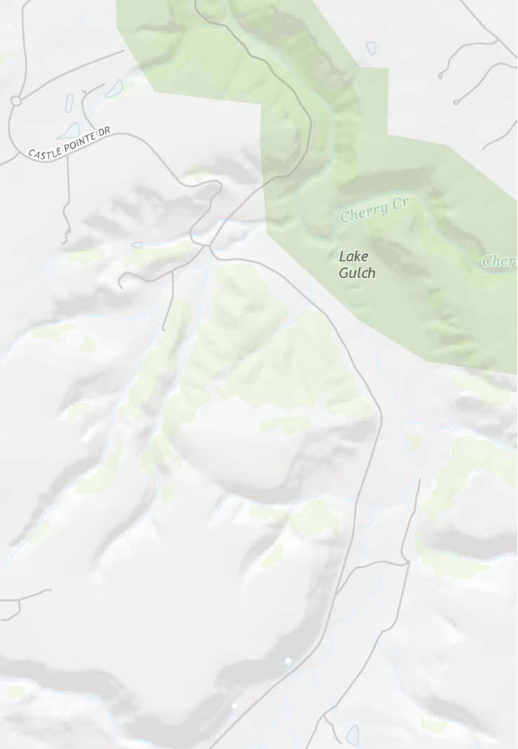
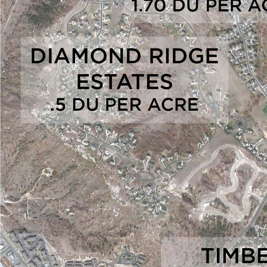
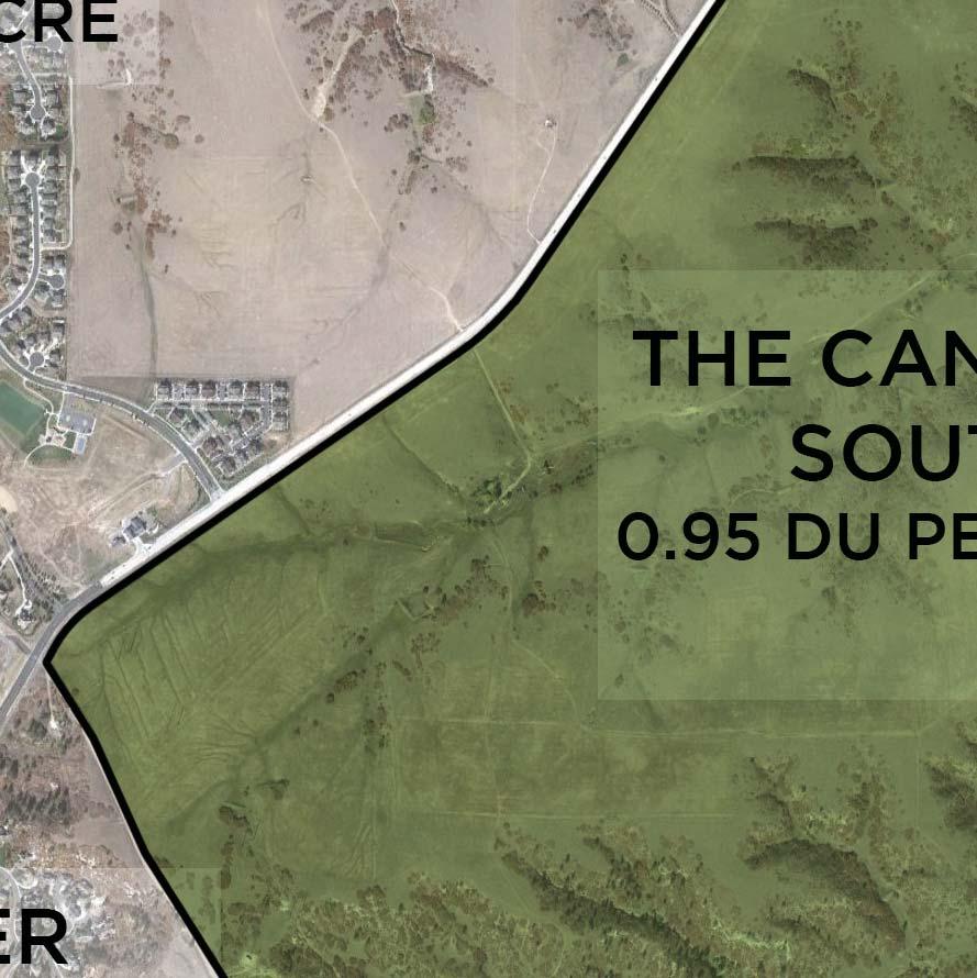
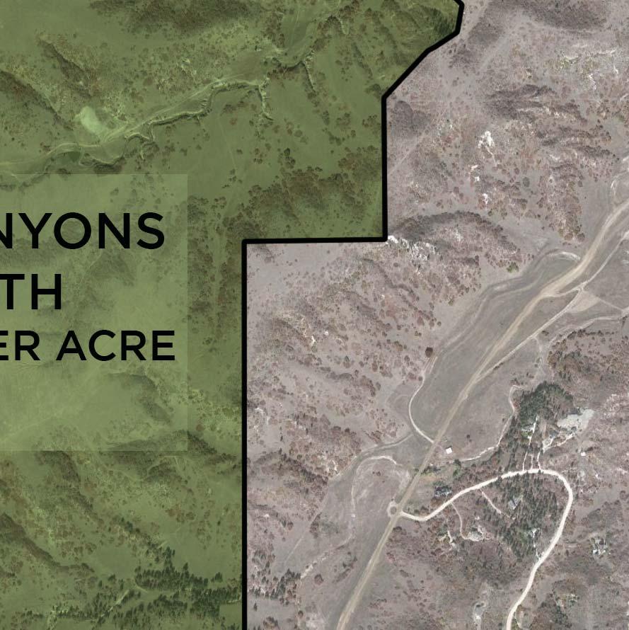
3 b. Project Site Description The Property s topography consists of distinct areas of plateaus separated by low lying drainages intermixed with gradual sloping meadows. Development is planned to occur in a clustered fashion in those areas most naturally suitable development, outside of the steeper slope and drainage areas. The majority of the site, approximately 619 acres of the total 1584 acres, will remain as open space. In addition to the 619 acres of open space that is included in the annexation area, CSLLC previously dedicated acres to Douglas County for a regional park, which is not included in the land summaries contained herein. c. Annexation Land Summary Total Land Area: 1584 ac. Residential Planning Areas: ac. (includes open space within PAs) Park Land: 37.9 ac Open Space Area: 619 ac (excluding the acre regional park previously dedicated to Douglas County) School Sites: 39 ac Right of way: 37.1 ac Land Use and Zoning a. Existing The Property is undeveloped except for two small single family dwellings and out buildings used for agricultural purposes. The Property is currently zoned PD in Douglas County with approval for 968 single family residential units, two school sites, a 27 hole golf course and two community clubhouses. Of the existing entitlements, 425 single family lots, the 27 hole golf course, two community recreation center parcels, and two school sites have all been platted and recorded with Douglas County. Additionally, the two schools sites have been deeded to the Douglas County Board of County Commissioners on behalf of the School District. b. Proposed The proposed PD zoning and land use for the Property includes 1506 single family units, two school sites, two public parks to be owned, developed, and managed by the Town of Castle 3
4 Rock, a community recreation center, and both public and private open space. The proposed zoning and land dedications are in conformance with Section of the Town of Castle Rock Town Code. Special Districts There currently are two existing Special Districts, Crowfoot Valley Metropolitan District 1 & 2, which have been created to finance and develop major project infrastructure. It is anticipated that the community s municipal services infrastructure will be funded and developed by one or more special districts. School District Impacts Two school sites have been deeded to Douglas County Board of County Commissioners for future school development. The Property is currently assessed by the Douglas County Assessor for tax dollars for the benefit of the Douglas County School District based on current zoning. The proposed annexation and ensuing zoning will increase the assessed value of the Property and therefore the tax dollars to the Douglas County School District. Municipal Services It is anticipated the Property s utilities will be funded and constructed by the Crowfoot Valley Metropolitan District. The design and construction of the municipal services, including streets, water, and storm drainage systems will be in accordance with Town of Castle Rock regulations unless as modified and approved by Town. These services and infrastructure will be serviced by the Town of Castle Rock Public Works Department. In most cases, there will be no impact on service as a result of the annexation. The following services should experience no or limited impacts from the annexation; streets, drainage, water, sewer, flood control, library, fire protection, transit, and utilities. For those areas in which an impact to service has been identified, a development agreement between the Town and Property, as part of zoning approval, will specify the commitments and obligations that are to be fulfilled 4
5 The Town currently has a commitment to provide potable water service under the existing zoning to the Annexation Area. With the annexation and proposed zoning, the Town will expand its commitment to provide potable water service for the Annexation Area. The Owner of the Property will meet water dedication requirements per Section of the Town Code. Sanitary sewer service for the Annexation Area will be provided by the Denver Southeast Suburban Water and Sanitation District (dba the Pinery Water and Wastewater District). Design and construction of the sanitary sewer system will be in accordance with the Denver Southeast Suburban Water and Sanitation District guidelines. The sanitary sewer infrastructure will be owned and maintained by a special district. Sanitary sewer infrastructure for the Annexation Area will connect to the existing sanitary sewer infrastructure in the Pradera community to the northeast. The Annexation Area will be served by the Town of Castle Rock Fire Department and Police Department. The Town of Castle Rock Fire Department has a fire station directly adjacent to the annexation area. The Owners of the Property made a financial contribution in 2007 in the amount of $270,000 toward the construction of the fire station facility. The Annexation Area is immediately adjacent to the existing Town of Castle Rock boundaries and no appreciable impact due to the annexation is anticipated since the police force currently patrols the surrounding area. Existing Tax District for Canyons South Tax Authority Tax Rate (mils) Douglas County Government Law Enforcement Authority Developmental Disabilities Douglas County Schools Cedar Hill Cemetery District Castle Rock Fire Cherry Creek Basin Water Douglas County Libraries Crowfoot Valley Ranch Metropolitan District (approved per existing Service Plan) TOTAL


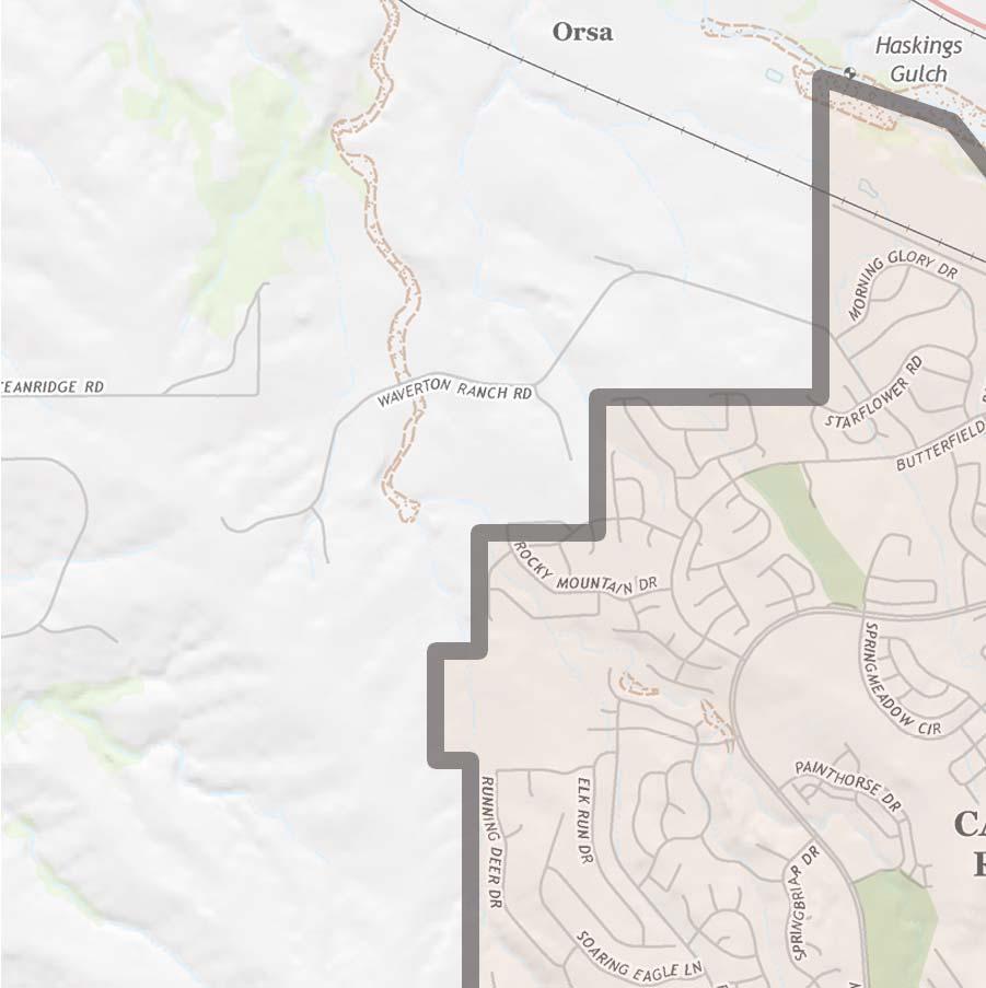

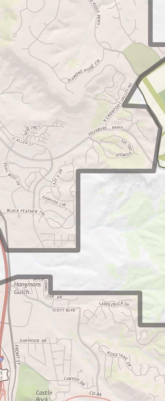


6 SITE TOWN OF CASTLE ROCK V CANYONS SOUTH 10 JUNE :2,000 SCALE 0 1,000 2,000 4,000 ANNEXATION CONTEXT
7


8 V 10 JUNE 2015 SCALE: 1 =1, ,000 2,000 CANYONS SOUTH PROJECT LOCATION
REPLACEMENT EXHIBIT 2 SECOND AMENDMENT TO THE COMPREHENSIVE DEVELOPMENT PLAN
 REPLACEMENT EXHIBIT 2 SECOND AMENDMENT TO THE COMPREHENSIVE DEVELOPMENT PLAN User s Guide for the Douglas County Town of Parker Intergovernmental Agreement (IGA) Please be advised that approved amendments
Stroh Ranch Apartment Sites
 Stroh Ranch Apartment Sites J. Morgan Blvd & Ironstone Way Parker, CO 80134 Price: $4,200,000 Size: 11.05 Acres Units: 204 Zoned: Multi-Family Jurisdiction: Town of Parker Water & San: Parker Water & San
PUBLIC FACILITIES REPORT. Triple Creek Community Development District. Hillsborough County, Florida
 PUBLIC FACILITIES REPORT For the: Triple Creek Community Development District Hillsborough County, Florida March 2015 Prepared by: SCAROLA ASSOCIATES Engineering Design and Land Consultants, PA PURPOSE
Planning Department Oconee County, Georgia
 Planning Department Oconee County, Georgia STAFF REPORT REZONE CASE #: 6985 DATE: October 31, 2016 STAFF REPORT BY: Andrew C. Stern, Planner APPLICANT NAME: Williams & Associates, Land Planners PC PROPERTY
COUNCIL ACTION FORM. 1. The City Council can approve the Preliminary Plat for Menards Ames Subdivision
 ITEM #: 49 DATE: 03-27-18 COUNCIL ACTION FORM SUBJECT: PRELIMINARY PLAT FOR MENARDS BACKGROUND: Menards Ames Subdivision is a proposed 41-acre development on SE 16 th Street just west of the Skunk River.
Project File #: SF Project Name: Jackson Ranch Filing No. 4 Parcel Nos.: , and
 COMMISSIONERS: DARRYL GLENN (PRESIDENT) MARK WALLER (PRESIDENT PRO TEMPORE) STAN VANDERWERF LONGINOS GONZALEZ PEGGY LITTLETON PLANNING AND COMMUNITY DEVELOPMENT DEPARTMENT CRAIG DOSSEY, EXECUTIVE DIRECTOR
PLANNING COMMISSION REPORT Regular Agenda Public Hearing Item
 PC Staff Report 11/12/12 Item No. 2B- 1 PLANNING COMMISSION REPORT Regular Agenda Public Hearing Item ITEM NO. 2B: A TO GPI; 110 ACRES; E OF K-10 & N OF W 6 TH ST (MKM) : Consider a request to rezone approximately
ADDRESS / DESCRIPTION: Northeast corner of Sandbridge Road and Atwoodtown Road ELECTION DISTRICT: PRINCESS ANNE
 10 & 11 March 14, 2012 Public Hearing APPLICANT: MARLYN DEVELOPMENT CORPORATION PROPERTY OWNER: CORAL DEVELOPMENT, LLC STAFF PLANNER: Faith Christie REQUEST: Modification of Conditional Change of Zoning
8Land Use. The Land Use Plan consists of the following elements:
 8Land Use 1. Introduction The Land Use Plan consists of the following elements: 1. Introduction 2. Existing Conditions 3. Opportunities for Redevelopment 4. Land Use Projections 5. Future Land Use Policies
ARTICLE FIVE FINAL DRAFT
 ARTICLE FIVE 021218 FINAL DRAFT Sec. 503.6 Open Space Preservation Option Open Space Preservation Option Open Space Preservation developments may be approved in the AR, R-1, R-2 and R-3 zoning districts,
COUNTY OF EL DORADO DEVELOPMENT SERVICES PLANNING COMMISSION STAFF REPORT TENTATIVE MAP
 COUNTY OF EL DORADO DEVELOPMENT SERVICES PLANNING COMMISSION STAFF REPORT Agenda of: June 27, 2013 Item No.: 9.a Staff: Mel Pabalinas TENTATIVE MAP FILE NUMBER: APPLICANT: REQUEST: LOCATION: TM10-1501/West
Guide to Combined Preliminary and Final Plats
 Guide to Combined Preliminary and Final Plats Introduction The Douglas County is committed to providing open, transparent application processes to the public. This Guide is provided to assist anyone interested
Concept Plan Project Narrative For 852 River Ranch Court
 Concept Plan Project Narrative For 852 River Ranch Court Date: January 5, 2016 Prepared by: Robert W. Jones II, P.E. Vortex Engineering, Inc. 2394 Patterson Rd., Ste 201 Grand Junction, CO 81505 970-245-9051
ARTICLE 1 GENERAL PROVISIONS AUTHORITY AND ADMINISTRATION RESPONSIBILITIES OF DEVELOPER AND PLANNING COMMISSION
 ARTICLE 1 GENERAL PROVISIONS 103.101. TITLE 103.102. AUTHORITY AND ADMINISTRATION 103.103. PURPOSE 103.104. INTERPRETATION 103.105. RESPONSIBILITIES OF DEVELOPER AND PLANNING COMMISSION 103.106. JURISDICTION
Chapter 100 Planned Unit Development in Corvallis Urban Fringe
 100.100 Scope and Purpose. Chapter 100 Planned Unit Development in Corvallis Urban Fringe (1) All applications for land divisions in the Urban Residential (UR) and Flood Plain Agriculture (FPA) zones within
PLANNING & DEVELOPMENT
 PLANNING & DEVELOPMENT STAFF REPORT Rezoning PETITION: APPLICANT: PROPERTY OWNER: TYPE OF REQUEST: SIZE OF TRACT: LOCATION: (#17-22) Rezone from A-PUD (Agri-Business Planned Unit Development) to A-PUD
E WASHINGTON COUNTY OREGON. Andy Back, Planning and Development Services Manager
 Exhibit A E WASHINGTON COUNTY OREGON August 8, 2016 To: From: Subject: Board of Commissioners Andy Back, Planning and Development Services Manager MINOR BOUNDARY CHANGE CASEFILE NOS. 16-029 LRP/BC - ANNEXATION
SUBDIVISION REGULATIONS
 CHAPTER 14 SUBDIVISION REGULATIONS 14-100 Provisions 14-200 Preliminary Plat 14-300 Final Plat 14-400 Replat 14-500 Minor Subdivision 14-600 Administrative Replat 14-700 Vacation of Roadways, Public Easements,
The Ranches Sketch Plan
 The Ranches Sketch Plan APPLICATION: RURAL LAND USE PROCESS (AKA CLUSTER DEVELOPMENT) HEARING DATES: Planning Commission: 12 July 2017 at 6:30 pm Board of County Commissioners: TBD APPLICANT: REQUEST:
APPLICATION PROCESSING. CHECK WITH STAFF - Development Services Staff will explain the requirements and procedures to you.
 PLANNED DEVELOPMENT ZONE 1810 E. HAZELTON AVENUE, STOCKTON CA 95205 BUSINESS PHONE: (209) 468-3121 Business Hours: 8:00 a.m. to 5:00 p.m. (Monday through Friday) STEP 1 STEP 2 FEE FORM DEED SERVICES APPLICATION
Guide to Preliminary Plans
 Guide to Preliminary Plans Introduction The Douglas County is committed to providing open, transparent application processes to the public. This Guide is provided to assist anyone interested in the procedures
40 +/- Acres Cornerstone Group- Colonial Boulevard 40 Acres Section 32, Township 44, Range 25. For Cornerstone Group. Prepared by
 DUE DILIGENCE REPORT 40 +/- Acres Cornerstone Group- Colonial Boulevard 40 Acres Section 32, Township 44, Range 25 For Cornerstone Group Prepared by David Douglas Associates, Inc. 2037 West First Street
Attachment 4. Planning Commission Staff Report. June 26, 2017
 Planning Commission Staff Report June 26, 2017 Agenda #: Regular Agenda - 2 Title: Applicant: Request: Location: Existing Zoning: Proposed Use: Staff Planner: The Brands and The Brands West Eagle Crossing
CITY OF COLORADO SPRINGS 2006 ANNEXATION PLAN CHAPTER 4 ENCLAVES
 CITY OF COLORADO SPRINGS 2006 ANNEXATION PLAN CHAPTER 4 ENCLAVES As the City has expanded, enclaves, remnants of land that are surrounded by the City, have remained within the jurisdiction of El Paso County.
City of Sanibel. Planning Department STAFF REPORT
 City of Sanibel Planning Department STAFF REPORT Planning Commission Meeting: July 23, 2013 Planning Commission Agenda Item: No 7b. Application Number: 13-7438DP Applicant Name: Attorney Beverly Grady
AGENDA. EDMOND PLANNING COMMISSION 20 S. Littler, Edmond, Oklahoma Tuesday, February 18, :30 p.m. CITY COUNCIL WORKSHOP
 City of Edmond NOTICE OF PUBLIC MEETING The City of Edmond encourages participation from all its citizens. If participation at any Public meeting is not possible due to a disability, notification to the
MUDDY CREEK TOWNSHIP PO BOX 239 PORTERSVILLE, PA SUBDIVISION AND LAND DEVELOPMENT APPLICATION
 MUDDY CREEK TOWNSHIP PO BOX 239 PORTERSVILLE, PA 16051 724-368-3438 SUBDIVISION AND LAND DEVELOPMENT APPLICATION NOTE TO ALL APPLICANTS: This checklist must be completed in its entirety If an item is not
Planning Commission Preliminary Plan Hidden Lakes Estates Medina Township EXECUTIVE SUMMARY
 Planning Commission Preliminary Plan Hidden Lakes Estates Medina Township Meeting: January 2, 2019 App. No.: 105-2018-PP Applicant: Hidden Lake Medina, LLC Engineer: Cunningham & Associates, LLC Parcel
Public Hearing. Item # 16. Meeting Date: June 3, 2014
 Item # 16 Meeting Date: June 3, 2014 Public Hearing Ordinance No. 2014-18: An Ordinance Amending the Town s Zone District Map by Approving the Plum Creek Ridge Planned Development Plan Amendment No. 1
Planning and Zoning Commission STAFF REPORT
 TO: FROM: Planning and Zoning Commission STAFF REPORT CASA GRANDE PLANNING AND ZONING COMMISSION James Gagliardi, AICP, City Planner MEETING DATE: September 1, 2016 REQUEST AGENDA # Request by Marshall
Parcel Map Review Committee Staff Report
 Parcel Map Review Committee Staff Report Meeting Date: October 11, 2018 Agenda Item: 7A TENTATIVE PARCEL MAP CASE NUMBER: (Larkins) BRIEF SUMMARY OF REQUEST: Request to divide one parcel of ±1.084-acres
Planning Commission 16 February 4, 2014 EDMOND PLANNING COMMISSION MEETING. Tuesday, February 4, 2014
 Planning Commission 16 EDMOND PLANNING COMMISSION MEETING Tuesday, 5:30 P.M. The Edmond Planning Commission Meeting was called to order by Chairperson Barry K. Moore at 5:30 p.m., Tuesday,, in the City
MEMORANDUM. City Council. David J. Deutsch City Manager. Resolution R TLBT, LLC Annapolis Road Annexation Plan. DATE: September 3, 2015
 MEMORANDUM TO: FROM: RE: City Council David J. Deutsch City Manager Resolution R-66-15 TLBT, LLC 13401 Annapolis Road Annexation Plan DATE: September 3, 2015 In accordance with the Annotated Code of Maryland,
ELMORE COUNTY LAND USE & BUILDING DEPARTMENT 520 E 2 nd South Mountain Home, ID (208) Preliminary Plat Application
 Preliminary Plat Application") ELMORE COUNTY LAND USE & BUILDING DEPARTMENT 520 E 2 nd South Mountain Home, ID 83647 (208) 587-2142 www.elmorecounty.org Preliminary Plat Application We are unable to accept facsimile copies. (Subdivisions
ELMORE COUNTY LAND USE & BUILDING DEPARTMENT 520 E 2 nd South Mountain Home, ID 83647 (208) 587-2142 www.elmorecounty.org Preliminary Plat Application We are unable to accept facsimile copies. (Subdivisions
RESOLUTION NO
 ITEM 4 ATTACHMENT B RESOLUTION NO. 2014-1412 A RESOLUTION OF THE CITY COUNCIL OF THE CITY OF CALABASAS APPROVING GENERAL PLAN AMENDMENTS ASSOCIATED WITH THE WEST AGOURA ROAD TERRITORY IN CONFORMANCE WITH
June 23, 2009 Initial Meeting RURAL FRAMEWORK COMMITEE
 June 23, 2009 Initial Meeting RURAL FRAMEWORK COMMITEE Committee Member Introductions One minute summary Name Subarea location/stakeholder identification What do you hope will come out of this rural framework
DOÑA ANA COUNTY PLANNING AND ZONING COMMISSION
 DOÑA ANA COUNTY Doña Ana County Government Complex 845 N. Motel Blvd. Las Cruces, New Mexico 88007 Office: (575) 647-7350 MEETING DATE: September 28, 2017 REQUEST: Preliminary Plat Approval for Vista Rancho
STAFF REPORT FOR ANNEXATION AND ZONING. CASE NAME: Taylor Annexation and Zoning PC DATE: August 7, 2013
 STAFF REPORT FOR ANNEATION AND ZONING ANNEATION CASE NO: A-13-001 ZONING CASE NO: RZ-13-002 REPORT DATE: July 30, 2013 CASE NAME: Taylor Annexation and Zoning PC DATE: August 7, 2013 ADDRESS OF PROPOSAL:
Guide to Replats. Step 1. Step 2. Step 3. Step 4. Step 5. Step 6. Step 7. Step 8. Step 9. Step 10
 Guide to Replats Introduction Douglas County is committed to providing open, transparent application processes to the public. This Guide is provided to assist anyone interested in the procedures and expectations
Appendix J - Planned Unit Development (PUD)
") Appendix J - Planned Unit Development (PUD) Intent and Purpose The purpose of the PUD is: 1. To provide development that is consistent with the Comprehensive Land Use Plan and promote the goals and objectives
Appendix J - Planned Unit Development (PUD) Intent and Purpose The purpose of the PUD is: 1. To provide development that is consistent with the Comprehensive Land Use Plan and promote the goals and objectives
Project File #: VA Project Name: Beauperthuy Variance Parcel Nos.: , , , ,
 COMMISSIONERS: DARRYL GLENN (PRESIDENT) MARK WALLER (PRESIDENT PRO TEMPORE) STAN VANDERWERF LONGINOS GONZALEZ PEGGY LITTLETON PLANNING AND COMMUNITY DEVELOPMENT DEPARTMENT CRAIG DOSSEY, EXECUTIVE DIRECTOR
WASECA PLANNING COMMISSION TUESDAY, FEBRUARY 14, :00 P.M. CITY COUNCIL CHAMBERS 508 SOUTH STATE STREET
 WASECA PLANNING COMMISSION TUESDAY, FEBRUARY 14, 2017 7:00 P.M. CITY COUNCIL CHAMBERS 508 SOUTH STATE STREET Any person speaking to the Commission shall first give to the Recording Secretary of the Commission
THE PINERY PLANNED DEVELOPMENT GUIDE SUMMARY
 THE PINERY PLANNED DEVELOPMENT GUIDE SUMMARY Combined Version of Amendments 1-22 As of October 2015 i Table of Contents Article I: Preamble and Statement of Commitments... 4 A. Preamble... 4 B. Mitigation/Statement
STAFF REPORT FOR MAJOR SUBDIVISION
 STAFF REPORT FOR MAJOR SUBDIVISION FINAL PLAT CASE NO. FA-13-001 HEARING DATE: November 6, 2013 CASE NAME: Solterra Subdivision Filing No. 14 PROCEDURE: Planning Commission ADDRESS OF MAJOR SUBDIVISION
TOWN COUNCIL MEETING UPDATE
 TOWN COUNCIL MEETING UPDATE Oct. 15, 2018 CLICK TO WATCH THE MEETING VIDEO - FACEBOOK YOUTUBE PUBLIC HEARINGS AND SECOND READINGS Public Hearings Fireworks Stands Ordinance 1 Town Council approved this
Planning Commission Preliminary Plan Riverview Villas of Stonegate Medina Township App. No PP EXECUTIVE SUMMARY
 Planning Commission Preliminary Plan Riverview Villas of Stonegate Medina Township App. No. 088-2013-PP Meeting: January 8, 2014 Applicant: Stonegate Center, LLC Ken Cleveland Engineer: Lewis Land Professionals,
when the following proceedings, among others were held and done, to-wit:
 STATE OF COLORADO ) COUNTY OF ADAMS ) At a regular meeting of the Board of County Commissioners for Adams County, Colorado, held at the Administration Building in Brighton, Colorado on the 2 nd day of
TENTATIVE PARCEL MAP APPLICATION GUIDE TENTATIVE PARCEL MAP APPLICATION REQUIREMENTS
 TENTATIVE PARCEL MAP APPLICATION GUIDE SISKIYOU COUNTY PLANNING DIVISION 806 South Main Street, Yreka CA 96097 Phone: (530) 841-2100 / Fax: (530) 841-4076 TENTATIVE PARCEL MAP APPLICATION REQUIREMENTS
ARTICLE 15 - PLANNED UNIT DEVELOPMENT
 Section 15.1 - Intent. ARTICLE 15 - PLANNED UNIT DEVELOPMENT A PUD, or Planned Unit Development, is not a District per se, but rather a set of standards that may be applied to a development type. The Planned
RESPONSIVE RESULTS-ORIENTED TRUST-BUILDERS ACCOUNTABLE
 RESPONSIVE RESULTS-ORIENTED TRUST-BUILDERS ACCOUNTABLE PZ - 0015 Staff Report City of Pearland TO: Planning and Zoning Commission FROM: Planning and Community Development MEETING: Planning & Zoning - 20
Wampus Mills Subdivision, Tree Removal Permit and Steep Slope Permit Approvals [#14-103]
![Wampus Mills Subdivision, Tree Removal Permit and Steep Slope Permit Approvals [#14-103]](/thumbs/95/122755150.jpg "Wampus Mills Subdivision, Tree Removal Permit and Steep Slope Permit Approvals [#14-103]") TOWN OF NORTH CASTLE WESTCHESTER COUNTY 17 Bedford Road Armonk, New York 10504-1898 PLANNING DEPARTMENT Adam R. Kaufman, AICP Director of Planning Telephone: (914) 273-3542 Fax: (914) 273-3554 www.northcastleny.com
TOWN OF NORTH CASTLE WESTCHESTER COUNTY 17 Bedford Road Armonk, New York 10504-1898 PLANNING DEPARTMENT Adam R. Kaufman, AICP Director of Planning Telephone: (914) 273-3542 Fax: (914) 273-3554 www.northcastleny.com
EXHIBIT A. City of Corpus Christi Annexation Guidelines
 City of Corpus Christi Annexation Guidelines Purpose: The purpose of this document is to describe the City of Corpus Christi s Annexation Guidelines. The Annexation Guidelines provide the guidance and
Planning Commission Hearing Date: 2/21/2017 Board of County Commissioners Hearing Date: 3/8/2017
 COMMISSIONERS: DARRYL GLENN (PRESIDENT) MARK WALLER (PRESIDENT PRO TEMPORE) STAN VANDERWERF LONGINOS GONZALEZ PEGGY LITTLETON PLANNING AND COMMUNITY DEVELOPMENT DEPARTMENT CRAIG DOSSEY, EXECUTIVE DIRECTOR
CITY PLANNING COMMISSION AGENDA ITEM NOS: B.1-B.3 STAFF: MEGGAN HERINGTON
 Page 17 CITY PLANNING COMMISSION AGENDA ITEM NOS: B.1-B.3 STAFF: MEGGAN HERINGTON FILE NO(S): CPC MP 87-00381-A13MN14 QUASI-JUDICIAL CPC PUZ 14-00101 QUASI-JUDICIAL CPC PUP 05-00139-A1MJ14 QUASI-JUDICIAL
Diamond Falls Subdivision PROPOSED YELLOWSTONE COUNTY BOARD OF PLANNING FINDINGS OF FACT
 Diamond Falls Subdivision PROPOSED YELLOWSTONE COUNTY BOARD OF PLANNING FINDINGS OF FACT The City/County Planning Staff has prepared the Findings of Fact for the Diamond Falls Subdivision. These findings
Urban Planning and Land Use
 Urban Planning and Land Use 701 North 7 th Street, Room 423 Phone: (913) 573-5750 Kansas City, Kansas 66101 Fax: (913) 573-5796 Email: planninginfo@wycokck.org www.wycokck.org/planning To: From: City Planning
INDIAN RIVER COUNTY, FLORIDA. The Honorable Members of the Planning and Zoning Commission DEPARTMENT HEAD CONCURRENCE
 Public Hearing Legislative INDIAN RIVER COUNTY, FLORIDA M E M O R A N D U M TO: The Honorable Members of the Planning and Zoning Commission DEPARTMENT HEAD CONCURRENCE Robert M. Keating, AICP; Community
USE BY SPECIAL REVIEW STAFF REPORT- UPDATE
 ~~DOUGLAS COl-U~!X www.douglas.co.us Department of Community Development Planning Services USE BY SPECIAL REVIEW STAFF REPORT- UPDATE December 2, 2014 TO: FROM: RE: Douglas County Planning Commission Pam
LOCAL AGENCY FORMATION COMMISSION MEETING AGENDA *************************************************************************
 LOCAL AGENCY FORMATION COMMISSION MEETING AGENDA Wednesday, May 23, 2007 9:00 a.m. Room 381B Kenneth Hahn Hall of Administration 500 West Temple Street, Los Angeles 90012 *************************************************************************
ITEM #6 & 6A. Application #LEGP
 CHANGE OF ZONING FROM SR LOW DENSITY SINGLE FAMILY SUBURBAN RESIDENTIAL TO R2/PD LOW TO MODERATE DENSITY RESIDENTIAL/PLANNED DEVELOPMENT AND APPROVAL OF A PRELMINARY DEVELOPMENT PLAN Application #LEGP-001557-2014
REPRESENTATIVE: NES, Inc. 619 North Cascade Avenue, Suite 200 Colorado Springs, CO 80903
 COMMISSIONERS: MARK WALLER (CHAIR) LONGINOS GONZALEZ, JR. (VICE-CHAIR) HOLLY WILLIAMS STAN VANDERWERF CAMI BREMER PLANNING AND COMMUNITY DEVELOPMENT DEPARTMENT CRAIG DOSSEY, EXECUTIVE DIRECTOR TO: FROM:
Initial Project Review
 Pierce County Department of Planning and Land Services, 2401 South 35th Street, Tacoma, WA (253) 798-7037 Initial Project Review Major Amendment to Preliminary Plat: Hawks Ridge Division 1 Application
LOCAL AUTHORITIES BOARD SEPARATION ORDER TOWN QF PINCHER CREEK
 LOCAL AUTHORITIES BOARD SEPARATION ORDER Board Order No. 15281 TOWN QF PINCHER CREEK bo Before: The Local Authorities Board for the Province of Alberta In the matter of the Local Authorities Board Act
PLANNING COMMISSION REPORT PUBLIC HEARING ITEM. DE-ANNEXATION OF 2.4 ACRES LOCATED AT 1820 N. 3 rd STREET. (DDW)
") A-6-1-10 Item No. 5-1 PC Staff Report 9/20/10 PLANNING COMMISSION REPORT PUBLIC HEARING ITEM ITEM NO. 5: DE-ANNEXATION OF 2.4 ACRES LOCATED AT 1820 N. 3 rd STREET. (DDW) A-6-1-10: De-annexation of approximately
A-6-1-10 Item No. 5-1 PC Staff Report 9/20/10 PLANNING COMMISSION REPORT PUBLIC HEARING ITEM ITEM NO. 5: DE-ANNEXATION OF 2.4 ACRES LOCATED AT 1820 N. 3 rd STREET. (DDW) A-6-1-10: De-annexation of approximately
Planning Commission Final Plat Riverview Villas of Stonegate Medina Township App. No FP EXECUTIVE SUMMARY
 Planning Commission Final Plat Riverview Villas of Stonegate Medina Township App. No. 077-2014-FP Meeting: October 1, 2014 Applicant: Stonegate Center, LLC Ken Cleveland Engineer: Lewis Land Professionals,
Guide to Minor Developments
 Guide to Minor Developments Introduction The Douglas County (DCD) is committed to providing open, transparent application processes to the public. This Guide is provided to assist anyone interested in
Staff Planner Carolyn A.K. Smith
 Applicant Property Owner, Pamela K. & Steven A. Gray Public Hearing April 13, 2016 City Council Election District Princess Anne Agenda Item 8 Request Modification of Proffers (Modification to the proffer
APPENDIX. Municipal Government Act ORDER ANNEXING LAND FROM LEDUC COUNTY AND THE TOWN OF BEAUMONT TO THE CITY OF EDMONTON
 APPENDIX Municipal Government Act ORDER ANNEXING LAND FROM LEDUC COUNTY AND THE TOWN OF BEAUMONT TO THE CITY OF EDMONTON 1 In this Order, (a) annexed land means the land described in Schedule 1 and shown
CHAPTER 18 SITE CONDOMINIUM PROJECTS
 15.1800 CHAPTER 18 SITE CONDOMINIUM PROJECTS 15.1801 SECTION 18.01 PURPOSE AND SCOPE GRAND HAVEN CHARTER TOWNSHIP Site condominium projects are condominium developments in which each condominium unit consists
Achieving the Community Vision through Excellence, Dedication and Service
 Development Services Department 100 N. Wilcox Street, Castle Rock CO 80104 Planner of the Day 303-660-1393 Applicant Information Preliminary Project Application (PPA) Achieving the Community Vision through
Section Preliminary Plat Checklist and Application Forms
 Section 201 - Preliminary Plat Checklist and Application Forms PRELIMINARY SUBDIVISION PLAT REVIEW PROCESS CHART PRELIMINARY SUBDIVISION PLAT APPLICATION PRELIMINARY PLAT REVIEW CHECKLIST CITY OF NAMPA
MKP Development, LLC., represented by Adlai Pennington
 Applicant: Property Owner: Sector Plan: MKP Development, LLC., represented by Adlai Pennington MKP Development, LLC., represented by Adlai Pennington Southwest Council District: 2 Allowable Uses: Development
REPORT TO THE SHELBY COUNTY PLANNING COMMISSION From the Department of Development Services Planning Services. February 4, 2019
 REPORT TO THE SHELBY COUNTY PLANNING COMMISSION From the Department of Development Services Planning Services February 4, 2019 Case No. Request for Rezoning Approval From E-1 to E-2 SD This is a request
REPRESENTATIVE: Centerline Solutions Table Mountain Parkway Golden, CO 80403
 COMMISSIONERS: DARRYL GLENN (PRESIDENT) MARK WALLER (PRESIDENT PRO TEMPORE) STAN VANDERWERF LONGINOS GONZALEZ PEGGY LITTLETON PLANNING AND COMMUNITY DEVELOPMENT DEPARTMENT CRAIG DOSSEY, EXECUTIVE DIRECTOR
Planning Commission Hearing Date: 1/2/2018 Board of County Commissioners Hearing Date 1/23/2018
 COMMISSIONERS: DARRYL GLENN (PRESIDENT) MARK WALLER (PRESIDENT PRO TEMPORE) STAN VANDERWERF LONGINOS GONZALEZ PEGGY LITTLETON PLANNING AND COMMUNITY DEVELOPMENT DEPARTMENT CRAIG DOSSEY, EXECUTIVE DIRECTOR
/
 Creekside West, Inc. 2600 Golden Gate Parkway Naples FL 34105 239.403.6804 dgenson@barroncollier.com D. Wayne Arnold, AICP / Richard D. Yovanovich, Esq. Q. Grady Minor and Associates, P.A. / Coleman, Yovanovich
DOUGLAS COUNTY SUBDIVISION RESOLUTION Article 4 Preliminary Plan 10/13/2015
 ARTICLE 4 PRELIMINARY PLAN 401 Intent An in-depth analysis of the proposed subdivision, including a review of the design considering the ability to obtain water and sanitation, identified geologic hazards,
EXTRA TERRITORIAL ZONING COMMISSION CASE ANALYSIS
 DOÑA ANA COUNTY CASE # Z07-011 COMMUNITY PLANNING AND ECONOMIC DEVELOPMENT DEPARTMENT Building Planning GIS 845 North Motel Boulevard Las Cruces, New Mexico 88007 (575) 647-7350 Fax: (575) 525-6131 Toll
Lincoln County Board of Commissioner s Agenda Item Cover Sheet
 Lincoln County Board of Commissioner s Agenda Item Cover Sheet Board Meeting Date: Agenda Item Type: Consent Agenda: Public Hearing: Regular Agenda: Presentation Time (est): Submitting Person: Phone Number/Ext:
Urban Planning and Land Use
 Urban Planning and Land Use 701 North 7 th Street, Room 423 Phone: (913) 573-5750 Kansas City, Kansas 66101 Fax: (913) 573-5796 Email: planninginfo@wycokck.org www.wycokck.org/planning To: From: City Planning
LYON COUNTY COMMUNITY DEVELOPMENT DEPARTMENT
 LYON COUNTY COMMUNITY DEVELOPMENT DEPARTMENT B UILDING D EVELOPMENT E NGINEERING P LANNING 27 S. MAIN S TREET Y ERINGTON, NEVADA 89447 (775) 463-6591 F AX: (775) 463-5305 34 LAKES B OULEVARD D AYTON, NEVADA
STAFF REPORT. Guttman Development Group, LLC. PUD-R (Residential Planned Unit Development Plan)
") P a g e 1 STAFF REPORT CASE: APPLICANT: LOCATION: ZONED: REQUEST: ZC09-2017 Guttman Development Group, LLC 4990 Wilmington Pike PUD-R (Residential Planned Unit Development Plan) A Major Change to an Approved
P a g e 1 STAFF REPORT CASE: APPLICANT: LOCATION: ZONED: REQUEST: ZC09-2017 Guttman Development Group, LLC 4990 Wilmington Pike PUD-R (Residential Planned Unit Development Plan) A Major Change to an Approved
Report to the Plan Commission December 19, 2011
 Report to the Plan Commission Legistar I.D. #24825, Extraterritorial Certified Survey Map Requested Action: Consideration of a two-lot Certified Survey Map (CSM) of the Keryluk-Wee property located at,,
APPENDIX. Municipal Government Act ORDER ANNEXING LAND FROM LETHBRIDGE COUNTY TO THE TOWN OF COALDALE
 APPENDIX Municipal Government Act ORDER ANNEXING LAND FROM LETHBRIDGE COUNTY TO THE TOWN OF COALDALE 1 In this Order, annexed land means the land described in Schedule 1 and shown on the sketch in Schedule
Mount Airy Planning Commission March 26, Staff Report
 Mount Airy Planning Commission March 26, 2018 Staff Report Special Exception Request Mixed Use Development in CC District Recommendation to Board of Appeals CASE MA-A-18-01 Applicant: Location: Zoning:
CRYSTAL VALLEY RANCH SECOND AMENDED AND RESTATED DEVELOPMENT AGREEMENT
 CRYSTAL VALLEY RANCH SECOND AMENDED AND RESTATED DEVELOPMENT AGREEMENT DATE: February 21, 2012. PARTIES: TOWN OF CASTLE ROCK, a home rule municipal corporation, 100 Wilcox Street, Castle Rock, Colorado
PRE-ANNEXATION AGREEMENT
 City of Commerce City 7887 East 60th Avenue Commerce City, Colorado 80022 p: 303.289.3683 f: 303.289.3731 c3gov.com PRE-ANNEXATION AGREEMENT PRE-ANNEXATION AGREEMENT THIS PRE-ANNEXATION AGREEMENT ( Agreement
ANNEXATION IMPACT REPORT
 ANNEXATION IMPACT REPORT Project: RED MOUNTAIN RANCH ANNEXATION 17500 Hwy 6 (unincorporated Eagle County) Eagle, CO 81631 Prepared By: Town of Eagle Morgan Landers, Town Planner 200 Broadway St Eagle,
STAFF REPORT FOR MAJOR SUBDIVISION
 STAFF REPORT FOR MAJOR SUBDIVISION FINAL PLAT CASE NO. FA-12-003 HEARING DATE: November 6, 2013 CASE NAME: Solterra Subdivision Filing No. 13 PROCEDURE: Planning Commission ADDRESS OF MAJOR SUBDIVISION
CITY OF PAPILLION PLANNING COMMISSION STAFF REPORT MAY 31, 2017 AGENDA SHADOW LAKE 2 FINAL PLAT FP
 I. GENERAL INFORMATION CITY OF PAPILLION PLANNING COMMISSION STAFF REPORT MAY 31, 2017 AGENDA SHADOW LAKE 2 FINAL PLAT FP-17-0006 A. APPLICANT: Shadow Lake 2, LLC 15950 West Dodge Road, Suite 300 Omaha,
ARTICLE 14 PLANNED UNIT DEVELOPMENT (PUD) DISTRICT
 DISTRICT") ARTICLE 14 PLANNED UNIT DEVELOPMENT (PUD) DISTRICT Section 14.01 Intent. It is the intent of this Article to allow the use of the planned unit development (PUD) process, as authorized by the Michigan Zoning
ARTICLE 14 PLANNED UNIT DEVELOPMENT (PUD) DISTRICT Section 14.01 Intent. It is the intent of this Article to allow the use of the planned unit development (PUD) process, as authorized by the Michigan Zoning
LOCAL AGENCY FORMATION COMMISSION REGULAR MEETING AGENDA. Wednesday, October 13, :00 a.m.
 LOCAL AGENCY FORMATION COMMISSION REGULAR MEETING AGENDA Wednesday, October 13, 2004 9:00 a.m. Board of Supervisors Hearing Room, Room 381B Kenneth Hahn Hall of Administration 500 West Temple Street, Los
31, Township 29 South, Range 25 East, Polk County, Florida, as depicted by the Land Use Plan attached
 ORDINANCE NO. 2013-04 AN ORDINANCE AMENDING THE ZONING MAP OF THE CITY OF BARTOW, FLORIDA, REZONING APPROXIMATELY 2. 2 ACRES OF LAND OWNED BY BALA3I OF POLK COUNTY, LLC AND LOCATED IN SECTION 31, TOWNSHIP
APPLICATION REVIEW CHECKLISTS
 APPLICATION REVIEW CHECKLISTS The following must be submitted with and are part of each application. No application is complete until all required documentation has been submitted to the Community Development
Letter of Intent May 2017 (Revised November 2017)
") THE BEACH AT WOODMOOR LETTER OF INTENT MAY 2017 (REVISED NOVEMBER 2017) OWNER/APPLICANT: CONSULTANT: Lake Woodmoor Holdings LLC N.E.S. Inc. 1755 Telstar Drive, Suite 211 619 North Cascade Avenue Colorado
THE BEACH AT WOODMOOR LETTER OF INTENT MAY 2017 (REVISED NOVEMBER 2017) OWNER/APPLICANT: CONSULTANT: Lake Woodmoor Holdings LLC N.E.S. Inc. 1755 Telstar Drive, Suite 211 619 North Cascade Avenue Colorado
Planning Commission Hearing Date: 3/6/2018 Board of County Commissioners Hearing Date 3/27/2018
 COMMISSIONERS: DARRYL GLENN (PRESIDENT) MARK WALLER (PRESIDENT PRO TEMPORE) STAN VANDERWERF LONGINOS GONZALEZ PEGGY LITTLETON PLANNING AND COMMUNITY DEVELOPMENT DEPARTMENT CRAIG DOSSEY, EXECUTIVE DIRECTOR
SUBDIVISION REGULATIONS for Lawrence and the Unincorporated Areas of Douglas County, KS
 SUBDIVISION REGULATIONS for Lawrence and the Unincorporated Areas of Douglas County, KS December 19, 2006 Edition Amended: 09/11/07; 12/04/07; 03/25/08; 09/10/08 Amended: January 6, 2009 Article 8 Subdivision
Residential Subdivision Preliminary Plat Application
 WATER MODELING FEES Major : $650 or Minor : $550 # of lots x $35 per lot Residential Preliminary Plat Application Lots: 1-9 10-19 20-49 50-99 100-199 $300 $400 $475 $625 $825 200-349 350-499 500-499 700-999
NORMAN, OKLAHOMA OWNER: RCB BANK APPLICATION FOR 2025 PLAN CHANGE PLANNED UNIT DEVELOPMENT PRELIMINARY PLAT. 12 December 2011 Revised 5 January 2012
 THE VILLAGE AT OAKHURST ADDITION NORMAN, OKLAHOMA OWNER: RCB BANK APPLICATION FOR 2025 PLAN CHANGE PLANNED UNIT DEVELOPMENT PRELIMINARY PLAT 12 December 2011 Revised 5 January 2012 PREPARED BY: THE RIEGER
Project File #: SF Project Name: Meadowbrook Crossing Filing No. 1 Final Plat Parcel No.:
 COMMISSIONERS: DARRYL GLENN (PRESIDENT) MARK WALLER (PRESIDENT PRO TEMPORE) STAN VANDERWERF LONGINOS GONZALEZ PEGGY LITTLETON PLANNING AND COMMUNITY DEVELOPMENT DEPARTMENT CRAIG DOSSEY, EXECUTIVE DIRECTOR