CITY OF PAPILLION PLANNING COMMISSION STAFF REPORT APRIL 26, 2017 AGENDA PRAIRIE QUEEN PRELIMINARY PLAT & CHANGE OF ZONE PP , CZ
|
|
|
- Piers Banks
- 5 years ago
- Views:
Transcription
1 I. GENERAL INFORMATION CITY OF PAPILLION PLANNING COMMISSION STAFF REPORT APRIL 26, 2017 AGENDA PRAIRIE QUEEN PRELIMINARY PLAT & CHANGE OF ZONE PP , CZ A. APPLICANT: Jerry Reimer Prairie Queen, LLC 4880 South 131 st Street, Suite 3 Omaha, NE B. PROPERTY OWNER(S): Jerry Reimer Prairie Queen, LLC 4880 South 131 st Street, Suite 3 Omaha, NE Papio-Missouri River Natural Resource District (P-MRNRD) 8901 S 154 th Street Omaha, NE C. LOCATION: Near the intersection of S 132 nd Street & Lincoln Road intersection D. LEGAL DESCRIPTION: Tract 1: a tract of land located in the W1/2 of the NW1/4 of Section 30, TN, R12E of the 6 th P.M., Sarpy County, NE, and Tract 2: that part of the NW1/4 of Section 30, TN, R12E of the 6 th P.M., Sarpy County, NE E. REQUESTED ACTION: Approval of a Preliminary Plat and Change of Zone from Agricultural (AG) to Mixed Use (MU) F. EXISTING ZONING AND LAND USE: Zoned AG (Agricultural), undeveloped G. SIZE OF SITE: 2.1 acres
2 2 II. BACKGROUND INFORMATION A. COMPREHENSIVE PLAN SPECIFICATIONS: The Future Land Use map approved as part of the West Papio Future Land Use Plan (WPFLUP) Comprehensive Plan amendment identifies this site as Mixed Use. The pending Future Land Use map identifies this area as Mixed Use Residential. B. EXISTING CONDITION OF SITE: Undeveloped. C. GENERAL VICINITY AND LAND USE: The areas to the east and north consist of the Prairie Queen Recreation Area, which is zoned AG (Agricultural). The area to the west consist of Hilltop Industrial Park which is zoned LI (Limited Industrial) and developed with a mix of industrial and commercial uses. The area to the south, is zoned AG (Agricultural) and is undeveloped. D. RELEVANT CASE HISTORY: In February 2010, City Council approved the West Papio Future Land Use Plan Comprehensive Plan Amendment for the WP-5 Sub-Area, which included this site. The amendment identified this site as Mixed Use. In 2012, the City of Papillion, Sarpy County, SID 290, and the Papio- Missouri NRD entered into the West Papillion Flood Control Interlocal Agreement. The agreement specified the actions required to construct the WP-5 Project, which is now known as Prairie Queen Recreation Area. The agreement contemplated that the Papio-Missouri NRD would obtain all rights-of-way required for the project. It also contemplated that the NRD would transfer ownership of the Prairie Queen Recreation Area to the City upon the City s annexation of said recreation area or June 1, 2025, whichever date was earlier. The City annexed the Prairie Queen Recreation Area in July of The NRD is in the process of transferring ownership of Prairie Queen Recreation Area to the City. In February 2017, the P-MRNRD Board of Directors consented to the P- MRNRD s participation in the Prairie Queen Change of Zone and Preliminary Plat applications subject to the condition that the Prairie Queen Final Plat not be considered by the Papillion City Council until the transfer deed for Prairie Queen Recreation Area is executed. E. APPLICABLE ORDINANCES AND REGULATIONS: Zoning and Subdivision Regulations and Comprehensive Plan. III. ANALYSIS AND DEVELOPMENT ALTERNATIVES STAFF COMMENTS: April 26, 2017 Planning Commission PP /CZ
3 3 A. REQUEST: 1. This is a request for a Preliminary Plat and a Change of Zone from AG (Agricultural) to Mixed Use (MU). Prairie Queen is proposed to be developed with a mix of Residential uses on Lots 1 41, with limited Commercial uses along Lincoln Road, all to be zoned MU. Proposed Lot 42 (90.32 acres) will remain zoned as Agricultural and continue to be used as the Prairie Queen Recreation Area dam pool and open space/recreation. 2. The proposed Mixed Use District is approximately 52 acres with a rolling topography that leads down to the Prairie Queen Recreation area. The overall development proposal calls for over 500 units, ranging in size from 864 to 1,500 square feet, of which a majority will be small and large fourplexes, sixplexes, mansion apartments, forecourt apartments, townhouses, and live-work units. 3. As noted above, the Preliminary Plat includes a portion of Prairie Queen Recreation Area. This is required because the applicant is requesting that the City allow the dedication of a north-south street between Cornhusker Road and Lincoln (referred to as Lakeside Drive on the paving plan) partially within what is currently the boundary of Prairie Queen Recreation Area. Further, the applicant is requesting that the City, upon assuming ownership of Prairie Queen Recreation Area, deed a portion of land within the boundary of Prairie Queen Recreation Area to the applicant. Staff, with a positive recommendation from NRD, has deemed that such property is not required for the Prairie Queen Recreation Area. As such, staff will recommend approval of such dedication and land transfer when City Council is formally requested to take such action. It should be noted that approval of the Preliminary Plat does not constitute official approval of either the right-of-way dedication or the deed transaction. Such actions will require separate approval of City Council. Such approval must be granted prior to City Council approval of the Final Plat. 4. Three outlots, Outlots A C, are proposed. Based on the grading plan, Outlots A, B, and C are to be used for permanent postconstruction stormwater management facilities. Ownership and maintenance responsibility for the outlots shall be addressed in the subdivision agreement. Finally, per C(13), the ownership, maintenance responsibility, and purpose of all outlots must be identified on the Preliminary Plat. No notes for the outlots were provided on the Preliminary Plat. 5. It should be noted that the Illustrative Master Plan submitted with this Preliminary Plat is not binding and at this time is conceptual in nature. Approval of a mixed use development agreement will be required with the final plat submittal. The location of utilities and public improvements may need to change based on the final design. April 26, 2017 Planning Commission PP /CZ
4 4 B. LAND USE/COMPREHENSIVE PLAN: 1. The proposed Mixed Use zoning is generally consistent with the current future land use designation of Mixed Use as described in the West Papio Future Land Use Plan (WPFLUP) Comprehensive Plan. 2. The proposed density for Prairie Queen (approximately 9 to 10 units per acre) is consistent with the WPFLUP, having a density of 3 to 12 units per acre (WPFLUP, Page 5) 3. According to WPFLUP, neighborhoods are intended to be developed as primarily of single family detached homes, but a mix of compatible housing types - attached/duplex homes, cottage housing and townhouses is recommended. (WPFLUP, Page 26) The proposed residential development fulfills the goal of providing a mix of residential use types. 4. The WPFLUP identified that Mixed Use sites intended for pedestrian oriented neighborhood centers are intended to blend commercial, retail, and residential development. (Page 21) Further, neighborhood centers are made of smaller, two-story retail and live/work units. (Page 28) Prairie Queen fulfills this goal by providing residential buildings that provide live/work units with a robust sidewalk and trail system. C. PARK/TRAILS/SIDEWALKS: 1. Prairie Queen does not include a dedicated park to serve the development. However, the proposed Illustrative Master Plan includes an interior trail/sidewalk system that provides direct connection to the Prairie Queen Recreation Area. 2. Prairie Queen was designed as a walkable community design and the Illustrative Master Plan provides connectivity between the buildings and the street sidewalk network. The final design of the Mixed Use Development Plan will need to ensure that pedestrian connections between the individual buildings and the internal parking lots are provided for the entire development. This meets the goal of providing accessibility to bicyclists and pedestrians as outlined in the WPFLUP. (Page 22) D. TRAFFIC AND ACCESS: 1. Access will be provided from local streets that connect to 132 nd Street, Lincoln Road and Cornhusker Road. 2. The Preliminary Plat includes the dedication of right-of-way for: a. Cornhusker Road; b. Lakeside Drive; and c. Local Streets. April 26, 2017 Planning Commission PP /CZ
5 5 3. Dedication of right-of-way for 132 nd Street and Lincoln Road is not necessary because the full width of right-of-way has already been dedicated. 4. A Traffic Impact Study (TIS) was provided. Staff is in the process of obtaining a third party review of the TIS. The applicant shall address any comments that result from said review prior to City Council consideration of the Final Plat. 5. The Preliminary Plat dedicates four street connections to 132 nd Street. The turn movements for such street connections are currently under review and shall be revised, as applicable, to address City concerns, Sarpy County Public Works concerns, and third party TIS review comments prior to Final Plat consideration by City Council. 6. The Illustrative Master Plan depicts a driveway connection to Lincoln Road for the shared driveway access between Lots 28 and 31. Such driveway connection is currently under review and shall be revised, as applicable, to address City concerns, Sarpy County Public Works concerns, and third party TIS review comments prior to Final Plat consideration by City Council. 7. The paving plan provides for parallel parking along Lakeside Drive. The cross-section for the parallel parking indicates a 12.5 foot drive lane width with a seven and a half foot width parking space. The City of Papillion follows the City of Omaha standards. Therefore the applicant shall revise the cross-sections to show a drive lane width of 12 feet and a parking stall width of eight feet with a 21 foot depth. Additionally, the pavement thickness for this street will need to be nine inches, and all other residential streets will be seven inches. 8. The Illustrative Master Plan introduces a fine-grain network of narrow streets and blocks to maximize walkability. To achieve the desired design of the street network, it is recommended that the internal streets proposed as public right-of-way on the Preliminary Plat, excluding Lakeside Drive, be converted to private streets. Private streets would need to be encompassed within separate outlots with public access easements. All the easements shall be reciprocal amongst all lots served by the private streets or drives utilizing the access. The applicant may be required to request waivers from the design requirements under Article V, Subdivision Design Standards. The applicant shall submit any requested waivers in writing prior to City Council consideration of the Preliminary Plat. 9. Given that staff is recommending that the internal public streets, excluding Lakeside Drive, be converted to private streets, such change shall constitute a minor amendment to the Preliminary Plat. As such, a revised Preliminary Plat will not be required to be presented to Planning Commission provided that the alignment of the private streets is generally consistent with the alignment of the public streets as depicted on the current Preliminary Plat. April 26, 2017 Planning Commission PP /CZ
6 6 10. The applicant shall revise the Preliminary Plat to provide a note that no direct access will be permitted from any of the proposed lots to S 132 nd Street, Cornhusker Road, and Lincoln Road, except for the shared driveway access between Lots 28 and All private drive connections to public rights-of-ways shall be subject to access easements, if provided. 12. If the applicant converts the public local streets to private local streets, maintenance agreements shall be required for all private street networks within the Mixed Use District and they will need to be included in the subdivision agreement. 13. The street system and internal driveways connections shown on the Illustrative Master Plan is conceptual. As part of the final design, the developer will be required to show that it is navigable by the Papillion Fire Department s largest vehicle.. Street names are under review pending the applicant determining if the local streets will be private or public. The applicant shall submit a revised Preliminary Plat with the assigned street names prior to City Council consideration of the Preliminary Plat. 15. The applicant is advised that addressing may be a challenge due to the private street systems. Special considerations may be necessary to allow for addressing that is readily comprehended by emergency services. E. GRADING/DRAINAGE: 1. In the event that the site plan is significantly modified from the conceptual Illustrative Master Plan, lot line adjustments may be required to ensure the basins remain within the outlots and are appropriately sized to reflect the revised site plan detention and treatment requirements. Significant modification would consist of an increase in impervious coverage from the conceptual Illustrative Master Plan. 2. Any offsite grading shall require written authorization or temporary easements from the property owner. 3. All rights-of-way shall be graded full width with 2% grade projecting from top of curb elevation to edge of right-of-way. 4. The developer shall address over lot drainage in the covenants. Documentation of this provision will be required at the time of final plat. F. PAVING/STORM SEWER: 1. Stop controlled intersections require a 2% maximum cross slope in any ADA crosswalks. The applicant shall review all major April 26, 2017 Planning Commission PP /CZ
7 7 intersections which may have stop conditions and adjust the grades as necessary to provide the required ADA access. 2. The city typically requires residential radii of 25 to help ensure emergency vehicle access throughout a site. Such a radii may impact the proposed on street parking indicated in the Mixed Use District. The applicant may need to revise the Illustrative Master Plan in order to ensure emergency vehicle access throughout the site. 3. The applicant shall revise the proposed on street parking typical cross-sections to reflect tie bar connections to the street paving. 4. NRD approval may be required for the storm sewer and any grading modification suggested or indicated. The developer shall provide documentation of such approval prior to City Council consideration of the Final Plat. Likewise, provisions may need to be adopted that protect the water quality of Prairie Queen. For example, the use of fertilizers that contain phosphorous and/or nitrogen may need to be limited or controlled in order to avoid eutrophication. WATER/SANITARY SEWER: 1. The proposed subdivision is located within Sarpy County s wastewater service area and Metropolitan Utilities District s (MUD s) water service area. As such, the developer will be required to work with those entities for sanitary sewer and water services. The obligations related to this requirement shall be detailed in the Subdivision Agreement. 2. At this time, Prairie Queen is proposing to connect to the Sarpy County wastewater system. The applicant shall coordinate with Sarpy County on the required connection to the Sarpy County wastewater system. Further, the applicant will be required to enter into an agreement with Sarpy County for sanitary sewer service. Any fees that are due to Sarpy County in conjunction with the Final Plat shall be paid prior to signature of the Final Plat mylars unless Sarpy County specifically authorizes deferral of such payment. G. EASEMENTS: 1. A public access easement is required for the off-site trail connections to the existing NRD trail. The applicant shall provide a draft public access easement for review in conjunction with the Final Plat application. 2. The dedication of water, sanitary sewer, storm sewer, and access easements within the Mixed Use District are being deferred at this time because the locations of these improvements are not known because the Mixed Use site plan is conceptual. When the final design is established, the applicant will be required to dedicate all necessary easements. The requirement to dedicate such easements shall be a condition of the Subdivision Agreement. April 26, 2017 Planning Commission PP /CZ
8 8 3. Standard utility easements shall be provided along all lot lines. 4. All proposed easements shall be by separate instruments including a prescription outlining the rights and terms of the easements. Copies of the recorded documents shall be provided to the City of Papillion. H. MIXED USE DISTRICT: 1. The concept behind the Prairie Queen Mixed Use Illustrative Master Plan is to provide a new, walkable, new urbanist neighborhood developed with Missing Middle housing types. Missing Middle is a range of multi-unit or clustered housing types compatible in scale with single-family homes that help meet the growing demand for walkable urban living. Some of the development concepts are explained in more context below: a. The Illustrative Master Plan provides a network of narrow streets and blocks to maximize walkability. There are three primary elements of the plan: Lakeside Street will be a treelined promenade linked to the Prairie Queen recreation trail system; a small center/neighborhood main street at the southwest corner of the project area that is defined by live/work units; and two diagonal axes that lead from the high points of the north and south sub-areas of the site down to the lake. b. The axis on the southern portion is pedestrian only, thus providing a green view corridor that captures views down to the lake, even for units at the top of the hill. c. Each block provides for multiple residential use types within it. However, the same group of residential use types will frame both sides of the street. d. The Illustrative Master Plan provides a neighborhood center, instead of a large clubhouse. The Illustrative Master Plan proposes live/work units with ground-floor flex spaces (25 x 35 ) that in the short-term can accommodate a gym and community space (as examples), in addition to sales and management offices. 2. The Permitted Uses list included a comprehensive list of uses that are anticipated for the development. Staff understands the intent of the development is to create a walkable neighborhood with multiple amenities. However, the Illustrative Master Plan does not identify where many of these individual uses would be located and most are not compatible as stand-alone uses or viable as live/work uses as outlined below. The applicant should provide further clarity on how proposed non-residential uses would be incorporated into the development. 3. The Permitted Uses list should be revised as follows: a. Clarify the intent of the Agricultural uses. The Illustrative Master Plan does not support agricultural uses as defined by the Zoning Ordinance. If the intent is to provide small local April 26, 2017 Planning Commission PP /CZ
9 9 greenhouses or community gardens within the development, those types of uses may be permitted as accessory uses. As such, add an Accessory Use Type section that identifies these uses. b. Eliminate Group Home. Group Homes are intended to accommodate up to eight people who reside at the home while receiving therapy.. This use is not consistent with the proposed Illustrative Master Plan. c. Clarify how Group Care Facility, Nursing Facility and Skilled Nursing are intended to be incorporated into the development. These uses typically serve larger groups of residents, which would not be compatible with the proposed Illustrative Master Plan. d. Clarify how Campground is intended to be incorporated into the development. The Illustrative Master Plan does not depict an area to provide camping or parking areas and services for travelers in recreational vehicles or tents. e. Eliminate Convenience food sales. It is associated with the sales of fuel for motor vehicles, which is not depicted on the Illustrative Master Plan. Limited food sales, which is already on the Permitted Uses list, is more appropriate to the scale and nature of the development. f. Eliminate General retail services. It is an outdated use type. Limited retail services, which is already on the Permitted Uses list, is more appropriate to the scale and nature of the development. g. Eliminating Lodging or clarify how it could be incorporated into the development. Given the small size of the Mixed Use District lots, this use does not appear to be compatible with the proposed Illustrative Master Plan and the limited commercial/retail nature of the Mixed Use District. Bed-andbreakfast, which is already on the Permitted Use list, seems more appropriate to the scale and intended residential nature of the Mixed Use District. h. Clarify the intent for Restaurants (drive-in/drive-through or fast-food) because a large, high-traffic generating restaurant is not compatible with the proposed Illustrative Master Plan. Consideration may be given to allowing such use provided that it is limited to pedestrian traffic only and an appropriate size limitation is identified. i. Clarify how Public Assembly and Religious Assembly are intended to be incorporated into the development. If standalone buildings are anticipated, identify where these uses would be located within the development and how parking would be accommodated. j. Clarify the intent to allow separate uses for Corporate, General, Financial and Medical Office. Additionally, identify where these uses would be located within the development. The Illustrative Master Plan does not identify any commercial or office uses other than live/work units. April 26, 2017 Planning Commission PP /CZ
10 10 k. The Illustrative Master Plan does not identify any separate areas for commercial use types, other than live/work units. Clarify the intent to allow these uses, as listed under the commercial use types, and identify where these uses would be located within the development. l. Eliminate Kennels. Kennels provide boarding to animals with outside components (dog runs). This use is only permitted by right in Agricultural and Limited Industrial zoning districts and therefore it is not compatible with the Illustrative Master Plan. Pet Services, which is already on the Permitted Uses list, will allow dog daycare and boarding within a structure, which is more appropriate to the residential nature of the development. In lieu of a commercial kennel, pet enclosures may be allowed as an accessory use. m. Eliminate Storage (Convenience and Limited Access). These uses are not appropriate due to the residential nature of the development. If the intention is to provide a limited amount of small private storage units for the residents use, staff recommends classifying such storage as an accessory use type and providing that documentation in the Mixed Use Development Agreement and identifying it on the Illustrative Master Plan. n. Alphabetize the uses within each use type category. 4. The permitted uses list identifies Mobile Vendor as a permitted use. The applicant is advised that the Mixed Use Development Agreement does not supersede the requirements of Chapter 6 (Door-To-Door Sales, Mobile Vendors, and Facility Use and Event Permits). As such, mobile vendors will be subject to the requirements of Chapter The Illustrative Master Plan provided by the applicant is conceptual in nature. However, significant deviations from the concept plan are not anticipated. A more definitive Mixed Use Development Plan will be required as part of the Mixed Use Development Agreement. The Mixed Use Development Plan for the agreement shall comply with the site plan criteria established in Staff will be working directly with the applicant on developing the agreement. 6. Conceptual streetscape tree plantings have been identified on the Illustrative Master Plan. However, no landscape plan for the development has been provided at this time. As part of the Mixed Use Development Agreement, landscape exhibit(s) will be required. 7. The Mixed Use Development Agreement shall comply with B. 8. The Mixed Use Development Agreement(s) shall incorporate the Multi-Family Design Guidelines as appropriate based on the mix of uses. April 26, 2017 Planning Commission PP /CZ
11 11 I. GENERAL: 1. The applicant shall revise the Preliminary Plat as follows: a. Per C(13), provide a note that identifies the ownership, maintenance responsibility, and purpose of all the outlots on the Preliminary Plat. b. Provide a note that no direct access will be permitted from any of the proposed lots abutting S 132 nd Street, Cornhusker Road, and Lincoln Road, except for the shared driveway access between lots 28 and 31. c. Provide a note that states that standard utility easements shall be provided along all lot lines. d. Identify street names as established by the street naming process. 2. Provide an update paving exhibit revising the cross-sections for the parallel parking as described here within. 3. Street naming is currently on hold by Sarpy GIS until a final determination is made regarding public or private streets within the development. The applicant shall revise all exhibits accordingly prior to City Council consideration of the Preliminary Plat. 4. The applicant may phase the development. If the applicant decides to phase the development, the applicant shall provide a phasing plan prior to City Council consideration of the Preliminary Plat. 5. A subdivision agreement with the City of Papillion will be required. The applicant shall provide all exhibits needed for the Subdivision Agreement in conjunction with the Final Plat submittal. IV. RECOMMENDATION The Planning Department recommends approval of the Prairie Queen Preliminary Plat (PP ) and Change of Zone (CZ ) based on: 1. General consistency with the Comprehensive Plan. 2. Compatibility with adjacent uses. 3. Compliance with the Subdivision Regulations (if City Council approves the requested waivers). 4. Compliance with the Zoning Regulations. The recommendation for approval is contingent upon the applicant: 1. Revising the Preliminary Plat per Section III, I, 1(a-d). 2. Revising the Preliminary Plat with the appropriate street names as outlined in Section III, I, Providing an updated Paving Plan outlining the comments in Section III, D, 7 & Section III, F, Providing a revised Permitted Use List per Section III, H, 3(a-o). April 26, 2017 Planning Commission PP /CZ
12 12 5. Addressing any comments that result from the review of the Traffic Impact Study as detailed in Section III, D, Verifying all grades as outlined in Section III, F, Verify and revising all residential radii as described in Section III, F, Providing access easement and documentation as described in Section III, G, 1, 3 & Providing a written request for any subdivision design waivers as described in Section III, D, The Mixed Use Development Plan for the agreement shall comply with the site plan criteria established in as described in Section III, H, Providing a landscape plan(s) as detailed in Section III, H, The Mixed Use Development Agreement shall comply with B per Section III, H, Complying with the Subdivision Regulations (provided that the requested waivers are granted by City Council). V. COPIES OF REPORT TO: Applicant Public upon request VI. ATTACHMENTS: Preliminary Plat Application Preliminary Plat Traffic Movements Change of Zone Application Change of Zone Exhibit Permitted Uses List Illustrative Master Plan Aerial Report prepared by: Mark Stursma, Planning Director Derek Goff, Staff Engineer April 26, 2017 Planning Commission PP /CZ
13
14
15
16


17 120
18
19
20 Zoning Exhibit I KEY Mixed Use (MU) Agriculture (AG) Property Line S. 132nd Street Lincoln Road Cornhusker Road Scale: 1 : March 29, Opticos Design Prairie Queen Development, Omaha, Nebraska
21 Prairie Queen Mixed Use District PERMITTED USES LIST Agricultural Use Types Animal production Confined Animal Feeding Operation (CAFO) Horticulture. Livestock sales Residential Use Types Single-family residential o Single-family residential (detached) o Single-family residential (attached) Condominium Duplex residential Two-family residential Townhouse residential Multiple-family residential Downtown residential Group residential Retirement residential Civic Use Types Administration Assisted Living Clubs o Clubs (Recreational) o Clubs (Social) Cultural services Day care services o Day care services (Adult) o Day care services (Children) Family Child Care Home I Family Child Care Home II Child Care Center Preschool Greenhouse 1 Group care facility Group home Nursing facility 1 A publicly or privately owned and operated facility for the growing of horticultural and floricultural specialties, such as flowers, shrubs or trees intended for ornamental or landscaping purposes
22 Park and recreation services Public assembly Religious assembly Skilled nursing services Office Use Types Corporate Offices General offices Financial services Medical offices Commercial Use Types Bed-and-breakfast Campground Commercial Recreation (Controlled Impact) General Retail Services 2 o Limited Retail Services 3 o Body art services o Business support services o Cocktail lounge o Consumer services o Food sales Convenience food sales Limited food sales o Garden center o Kennels o Liquor sales o Lodging o Personal services o Pet services 2 Establishments providing services including limited retail services, business support services, consumer services, food sales, personal services, and pet services. 3 Establishments providing retail services, occupying facilities less than 10,000 square feet in a single establishment or multi-tenant facility. Typical establishments provide for specialty retailing or general purpose retailing oriented to Papillion and its surrounding vicinity. Typical uses include department stores, apparel stores, furniture stores or establishments providing the following products or services: Household cleaning and maintenance products, drugs, cards, stationery, notions, books, tobacco products, cosmetics and specialty items; flowers, plants, hobby materials, toys and handcrafted items; apparel jewelry, fabrics and like items; cameras, photograph services, household electronic equipment, records, sporting equipment, kitchen utensils, home furnishing and appliances, art supplies and framing, arts and antiques, paint and wallpaper, hardware, carpeting and floor covering; interior decorating services; office supplies; mail order or catalog sales; bicycles; and automotive parts and accessories (excluding service and installation).
23 o Storage (Convenience) o Storage (Limited Access o Tobacco Sales o Veterinary services Mobile Vendor (Also known as Food Truck) 4 Restaurants o Restaurant (drive-in/drive-through or fast-food). Parking Use Types o Restaurant (general) Off-street parking Parking structure Miscellaneous Use Types Wind energy conservation system (WECS) 4 A person, firm, corporation, or nonprofit that engages in any of the following types of activities, excluding participants in City-sponsored community events: 1. Any farmers, growers or others who produce, hawk or peddle products of the farm, fruit or other staples of food or who sell or offer to sell any commodity or articles of commerce or trade who park their mobile vending units or erect a place of business for the purpose of selling said products or services; 2. Any person(s) who travels from street to street, upon public or private property, carrying, conveying or transporting items or services and offering and exposing the same for sale by hand or from a mobile vending unit; or 3. Any person(s), whether owner, agent, bailee, consignee or employee, who temporarily engages in business out of a vehicle, trailer, boxcar, tent, other portable shelter, or empty storefront for the purpose of exposing or displaying for sale, selling or attempting to sell, and delivering goods, wares, products, merchandise, services or other personal property within the City limits.
 7 56 Sixplex (6 units) 12 72 Large Fourplex (4 units) 8 32 Small Fourplex (4 units) 18 72 Live/Work (4 units, unless noted) 7 32 Tuck-Under Townhouse (4 units, unless noted) 10 52")
24 Illustrative Master Plan Program Summary Proposed Building Types Building Pads Units 1 Small Mansion Apartment (7 units) Large Mansion Apartment (8 units) 8 64 Forecourt Apartment (8 units) 7 56 Sixplex (6 units) Large Fourplex (4 units) 8 32 Small Fourplex (4 units) Live/Work (4 units, unless noted) 7 32 Tuck-Under Townhouse (4 units, unless noted) Townhouse (4 units) 5 20 Mews A (1 unit) 2 7 Mews E (1 unit) 2 2 Podium Building 2 TBD Treehouse (1 unit) 4 4 Carriage House (1 unit) Carriage House: Back-to-Back (2 units) 4 8 Carriage Court (2 units) 2 4 Illustrative Site Plan (7 units) (7 units) Lincoln Road 2 8 S. 132nd Street (6 units) Poolhouse (5 units) (5 units) 6 4 Greenhouse Community Bldg (7 units) (7 units) Cornhusker Road 17 Garage (No units) 11 0 TOTAL Scale: 1 : March 29, Opticos Design Prairie Queen Development, Omaha, Nebraska
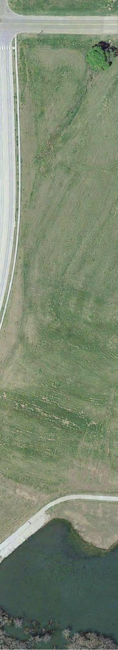
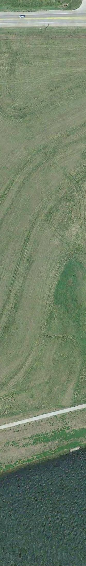
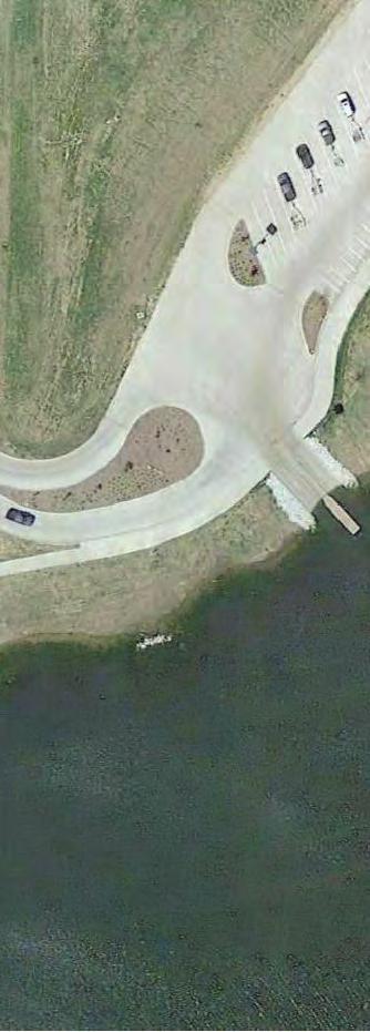
25 S 132nd St S 126th St S 126th St S 125th St S 135th St I80 WB I80 WB To Hwy 50 Ramp I80 EB Valley Ridge Dr S 124th St S 2nd St S 0th St Cornhusker Rd Area of Application Pheasant Run Ln Cornhusker Rd Windward Ave S 124th S 136th St S 134th St Lynam Dr Lincoln Rd S Pintail Cir 126th St S 125th Ave Ave S 124th St Superior Dr Osprey Ln Caspian Dr Cove Hollow Dr Ballpark Way Hwy 370 EB Hwy 370 WB Glenn St Westmont Dr Shepard St Grissom St Richland Dr Richland Plz S 131st Plz Richland Dr Carpenter St Glenn St Schirra St Priaire Queen PP ; CZ
CITY OF PAPILLION PLANNING COMMISSION STAFF REPORT MAY 31, 2017 AGENDA I COMMERCE PRELIMINARY PLAT & CHANGE OF ZONE PP ; CZ
 I. GENERAL INFORMATION CITY OF PAPILLION PLANNING COMMISSION STAFF REPORT MAY 31, 2017 AGENDA I 80-370 COMMERCE PRELIMINARY PLAT & CHANGE OF ZONE PP-17-0003; CZ-17-0004 A. APPLICANT: Dowd Grain Co. 220
CITY OF PAPILLION PLANNING COMMISSION STAFF REPORT MAY 31, 2017 AGENDA SHADOW LAKE 2 FINAL PLAT FP
 I. GENERAL INFORMATION CITY OF PAPILLION PLANNING COMMISSION STAFF REPORT MAY 31, 2017 AGENDA SHADOW LAKE 2 FINAL PLAT FP-17-0006 A. APPLICANT: Shadow Lake 2, LLC 15950 West Dodge Road, Suite 300 Omaha,
CITY OF PAPILLION PLANNING COMMISSION STAFF REPORT FEBRUARY 26, 2014 AGENDA KINGSBURY HILLS REPLAT TWO PRELIMINARY PLAT PP
 I. GENERAL INFORMATION A. APPLICANT: Stone Creek Plaza LLC 11205 S. 150 th St., Ste. #100 Omaha, NE 68138 B. PROPERTY OWNER: BHI Development LLC 11205 S. 150 th St., Ste. #100 Omaha, NE 68138 SID 275 11440
CITY OF PAPILLION PLANNING COMMISSION STAFF REPORT DECEMBER 17, 2014 AGENDA
 CITY OF PAPILLION PLANNING COMMISSION STAFF REPORT DECEMBER 17, 2014 AGENDA PAPILLION JUNIOR HIGH SOUTH PAPILLION REPLAT 1 PRELIMINARY PLAT, FINAL PLAT & SPECIAL USE PERMIT PP-14-0007; FP-14-0012; SUP-14-0005
CITY OF PAPILLION PLANNING COMMISSION STAFF REPORT DECEMBER 13, 2017 AGENDA LINCOLN WAY PRELIMINARY PLAT & CHANGE OF ZONE PP ; CZ
 I. GENERAL INFORMATION CITY OF PAPILLION PLANNING COMMISSION STAFF REPORT DECEMBER 13, 2017 AGENDA LINCOLN WAY PRELIMINARY PLAT & CHANGE OF ZONE PP-17-0013; CZ-17-0017 A. APPLICANT: Jeff Elliott 17007
CITY OF PAPILLION MAYOR AND CITY COUNCIL REPORT APRIL 3, 2018 AGENDA. Subject: Type: Submitted By: Resolution #R
 CITY OF PAPILLION MAYOR AND CITY COUNCIL REPORT APRIL 3, 2018 AGENDA Subject: Type: Submitted By: A request for a Final Plat for the property legally described as Tax Lot 3 located in the NE 1/4 of the
Commercial Zoning Districts
 Article 4 Commercial Zoning Districts Section 4.1 Section 4.2 Section 4.3 C-D Downtown Commercial District C-1 General Commercial District C-2 Heavy Service Commercial District 4.1 C-D, Downtown Commercial
Enclosed are amended PUD documents for The Grove at Shoal Creek Proposed by
 Enclosed are amended PUD documents for The Grove at Shoal Creek Proposed by The Bull Creek Road Coalition (BCRC) was formed in 2012 and is made up of residents in the six neighborhoods surrounding the
ZONING ORDINANCE FOR THE CITY OF RICHLAND CENTER CHAPTER 408 SPECIFIC REGULATIONS AFFECTING LANDS IN A "C-DT" CENTRAL [DOWNTOWN] BUSINESS DISTRICT
![ZONING ORDINANCE FOR THE CITY OF RICHLAND CENTER CHAPTER 408 SPECIFIC REGULATIONS AFFECTING LANDS IN A C-DT CENTRAL [DOWNTOWN] BUSINESS DISTRICT](/thumbs/96/126607517.jpg "ZONING ORDINANCE FOR THE CITY OF RICHLAND CENTER CHAPTER 408 SPECIFIC REGULATIONS AFFECTING LANDS IN A C-DT CENTRAL [DOWNTOWN] BUSINESS DISTRICT") ZONING ORDINANCE FOR THE CITY OF RICHLAND CENTER CHAPTER SPECIFIC REGULATIONS AFFECTING LANDS IN A "C-DT" CENTRAL [DOWNTOWN] BUSINESS DISTRICT.01 APPLICABILITY OF CHAPTER 400 TO A "C-DT" CENTRAL BUSINESS
ZONING ORDINANCE FOR THE CITY OF RICHLAND CENTER CHAPTER SPECIFIC REGULATIONS AFFECTING LANDS IN A "C-DT" CENTRAL [DOWNTOWN] BUSINESS DISTRICT.01 APPLICABILITY OF CHAPTER 400 TO A "C-DT" CENTRAL BUSINESS
PLANNED UNIT DEVELOPMENT & SUBDIVISION STAFF REPORT Date: April 18, 2019
 PLANNED UNIT DEVELOPMENT & SUBDIVISION STAFF REPORT Date: April 18, 2019 DEVELOPMENT NAME SUBDIVISION NAME Springhill Village Subdivision Springhill Village Subdivision LOCATION 4350, 4354, 4356, 4358,
4.2 RESIDENTIAL ZONING DISTRICTS
 4.2 RESIDENTIAL ZONING DISTRICTS A. Purpose: To define regulations and standards for each residential zoning district in the City. The following sections identify uses, regulations, and performance standards
CITY OF PAPILLION MAYOR AND CITY COUNCIL REPORT OCTOBER 2, 2018 AGENDA. Subject: Type: Submitted By:
 CITY OF PAPILLION MAYOR AND CITY COUNCIL REPORT OCTOBER 2, 2018 AGENDA Subject: Type: Submitted By: A request for a Revised Preliminary Plat for the property legally described as a tract of land located
DAUPHIN CREEK ESTATES SUBDIVISION
 # 12 SUB-000076-2017 DAUPHIN CREEK ESTATES SUBDIVISION Engineering Comments: FINAL PLAT COMMENTS (should be addressed prior to submitting the FINAL PLAT for review and/or signature by the City Engineer):
ARTICLE 15. RULES, REGULATIONS AND DEFINITIONS
 ARTICLE 15. RULES, REGULATIONS AND DEFINITIONS Section 1. Interpretation and Construction: The following rules and regulations regarding interpretation and construction of the Ulysses-Grant County, Kansas,
Chapter Residential Mixed Density Zone
 Chapter 19.16 Residential Mixed Density Zone 19.16.010 Purpose and Intent 19.16.020 Permitted Uses 19.16.030 Accessory Permitted Uses 19.16.040 Secondary Permitted Uses 19.16.050 Conditional Uses 19.16.060
2.110 COMMERICAL MIXED USE (CM)
") CITY OF KEIZER DEVELOPMENT BULLETIN 2.110.01 Purpose 2.110 COMMERICAL MIXED USE (CM) The Commercial Mixed Use (CM) zone is the primary commercial zone within the City. The zone is specifically designed
CITY OF KEIZER DEVELOPMENT BULLETIN 2.110.01 Purpose 2.110 COMMERICAL MIXED USE (CM) The Commercial Mixed Use (CM) zone is the primary commercial zone within the City. The zone is specifically designed
ARTICLE C. ZONING TEXT, DISTRICT CLASSIFICATIONS AND BOUNDARIES
 ARTICLE C. ZONING TEXT, DISTRICT CLASSIFICATIONS AND BOUNDARIES Sec. 10-2054. ZONING TEXT, DISTRICT CLASSIFICATIONS AND BOUNDARIES. In order to regulate the location of structures, the height and bulk
CITY OF PAPILLION PLANNING COMMISSION STAFF REPORT MARCH 28, 2018 AGENDA
 I. GENERAL INFORMATION A. APPLICANT: Renee L. Krueger 1012 Mesa Circle Papillion, NE 68046 B. PROPERTY OWNER: Renee L. Krueger 1012 Mesa Circle Papillion, NE 68046 C. LOCATION: 1012 Mesa Circle D. LEGAL
ARTICLE IV DISTRICT REGULATIONS
 PART 1. RESIDENTIAL DISTRICTS 4-101. RS. Single-Family Residential Suburban District. The RS District is designed for single-family dwellings, and compatible uses, at a density no greater than one dwelling
ZONING AMENDMENT & SUBDIVISION STAFF REPORT Date: November 3, 2016
 ZONING AMENDMENT & SUBDIVISION STAFF REPORT Date: November 3, 2016 APPLICANT NAME SUBDIVISION NAME David Shumer 5955 Airport Subdivision CITY COUNCIL DISTRICT District 6 5955 Airport Boulevard, 754 Linlen
Condominium Unit Requirements.
 ARTICLE 19 CONDOMINIUM REGULATIONS Section 19.01 Purpose. The purpose of this Article is to regulate projects that divide real property under a contractual arrangement known as a condominium. New and conversion
2. Second dwellings and medical hardships per Article 10.
 Article 7: Zoning Districts and Zoning Map Section 135: NON-URBAN ZONING DISTRICT (NU) A. Purpose The intent of this district is to allow agricultural, recreational, wildlife, forestry, open space, farming
MIXED USE DEVELOPMENT AGREEMENT
 MIXED USE DEVELOPMENT AGREEMENT THIS MIXED USE DEVELOPMENT AGREEMENT (hereinafter "Agreement") made and entered into this day of, 2007, pursuant to Section 205-30 of the Zoning Ordinances of the City of
CONDOMINIUM REGULATIONS
 ARTICLE 37 CONDOMINIUM REGULATIONS SECTION 37.01. Purpose The purpose of this Article is to regulate projects that divide real property under a contractual arrangement known as a condominium. New and conversion
ZONING AMENDMENT & SUBDIVISION STAFF REPORT Date: March 1, 2018
 #13 SUB-000406-2018 & ZON-000407-2018 ZONING AMENDMENT & SUBDIVISION STAFF REPORT Date: March 1, 2018 NAME SUBDIVISION NAME LOCATION Creekside @ Kooiman Dairy Creekside @ Kooiman Dairy Subdivision (South
ARTICLE 14 PLANNED UNIT DEVELOPMENT (PUD) DISTRICT
 DISTRICT") ARTICLE 14 PLANNED UNIT DEVELOPMENT (PUD) DISTRICT Section 14.01 Intent. It is the intent of this Article to allow the use of the planned unit development (PUD) process, as authorized by the Michigan Zoning
ARTICLE 14 PLANNED UNIT DEVELOPMENT (PUD) DISTRICT Section 14.01 Intent. It is the intent of this Article to allow the use of the planned unit development (PUD) process, as authorized by the Michigan Zoning
Planning Department Oconee County, Georgia
 Planning Department Oconee County, Georgia STAFF REPORT REZONE CASE #: 6985 DATE: October 31, 2016 STAFF REPORT BY: Andrew C. Stern, Planner APPLICANT NAME: Williams & Associates, Land Planners PC PROPERTY
COMMERCIAL ZONING DISTRICTS (Amended 11/13/14) Part I. C-1 Restricted Commercial District
 Part I. C-1 Restricted Commercial District") ARTICLE XI. COMMERCIAL ZONING DISTRICTS (Amended 11/13/14) Part I. C-1 Restricted Commercial District Section 152: Purpose This district is designed to accommodate commercial uses which act as a transition
ARTICLE XI. COMMERCIAL ZONING DISTRICTS (Amended 11/13/14) Part I. C-1 Restricted Commercial District Section 152: Purpose This district is designed to accommodate commercial uses which act as a transition
TOTTENHAM SECONDARY PLAN
 TOTTENHAM SECONDARY PLAN AMENDMENT NO. 11 TO THE OFFICIAL PLAN OF THE TOWN OF NEW TECUMSETH The following text and schedules to the Official Plan of the Town of New Tecumseth constitute Amendment No. 11
City and County of Broomfield, Colorado
 City and County of Broomfield, Colorado CITY COUNCIL AGENDA MEMORANDUM To: From: Mayor and City Council George Di Ciero, City and County Manager Teri Malies, Principal Planner Terrance Ware, Planning Director
S U B D I V I S I O N AGREEMENT
 S U B D I V I S I O N AGREEMENT THIS AGREEMENT made this 17th day of January, 2006, by and between Peachtree Properties, L.L.C., (hereinafter referred to as "Developer"); SANITARY AND IMPROVEMENT DISTRICT
SECTION 13 COMMERCIAL DISTRICT 1 (C.1)
") SECTION 13 COMMERCIAL DISTRICT 1 (C.1) 13.1 No person shall within a C.1 District use any land or erect, alter or use any building or part thereof for any purpose other than; (a) a barber shop (b) a beauty
SECTION 13 COMMERCIAL DISTRICT 1 (C.1) 13.1 No person shall within a C.1 District use any land or erect, alter or use any building or part thereof for any purpose other than; (a) a barber shop (b) a beauty
Article 04 Single Family Residential Districts
 Article 04 Article 04 Section 04.01 Intent (a) R1A Residence District. The R1A Single Family Residential District is established to include areas of low density single-family residences and limited agricultural
Operating Standards Attachment to Development Application
 Planning & Development Services 2255 W Berry Ave. Littleton, CO 80120 Phone: 303-795-3748 Mon-Fri: 8am-5pm www.littletongov.org Operating Standards Attachment to Development Application 1 PLANNED DEVELOPMENT
Subchapter 5 Zoning Districts and Limitations
 Subchapter 5 Zoning Districts and Limitations 35.5.1 Rural Districts Sections: 35.5.1.1 Purpose. 35.5.1.2 Permitted Uses. 35.5.1.3 General Regulations. 35.5.1.1 Purpose. The purpose of a Rural District
WESTMINSTER PARK SUBDIVISION
 WESTMINSTER PARK SUBDIVISION Engineering Comments: FINAL PLAT COMMENTS (should be addressed prior to submitting the FINAL PLAT for review and/or signature by the City Engineer): A. Provide all of the required
RECOMMENDATION REPORT
 SARPY COUNTY PLANNING & BUILDING DEPARTMENT RECOMMENDATION REPORT CHANGE OF ZONE (CZ 18-005) PRELIMINARY PLAT (PP 18-007) FINAL PLAT (FP 18-008) SCHOLTING ESTATES APPLICANT: DIANE SCHOLTING PLANNING COMMISSION
THRASHER ADDITION SUBDIVISION AGREEMENT
 THRASHER ADDITION SUBDIVISION AGREEMENT THIS SUBDIVISION AGREEMENT (hereinafter referred to as Agreement ) made this day of, 2016, by and between GNT Properties, LLC, a Nebraska limited liability corporation
SECTION 118.0: B 1 (Business: Local) District
 District") SECTION 118.0: B 1 (Business: Local) District A. Purpose The B-1 District is established to provide areas of local business that can directly serve the general public with retail sales and services. B.
SECTION 118.0: B 1 (Business: Local) District A. Purpose The B-1 District is established to provide areas of local business that can directly serve the general public with retail sales and services. B.
ARTICLE 13 CONDOMINIUM REGULATIONS
 ARTICLE 13 CONDOMINIUM REGULATIONS Section 13.01 Purpose. The purpose of this Article is to regulate projects that divide real property under a contractual arrangement known as a condominium. New and conversion
City of Lynden Title 19 ZONING
 City of Lynden Title 19 ZONING Chapters Page Number 19.03 Comprehensive Plan 2 19.05 General Provisions 3 19.09 Maps and District Boundaries 4 19.11 Districts Established 5 19.13 Agricultural Zone 6 19.15
May 21, ACHD Board of Commissioners Stacey Yarrington, Planner II DRH /DRH
 Development Services Department May 21, 2013 TO: FROM: SUBJECT: ACHD Board of Commissioners Stacey Yarrington, Planner II DRH13-00106/DRH13-00108 Executive Summary: This is a design review application
Staff Report for Council Public Meeting
 Agenda Item 3.3 Staff Report for Council Public Meeting Date of Meeting: September 27, 2017 Report Number: SRPRS.17.134 Department: Division: Subject: Planning and Regulatory Services Development Planning
ZONING AMENDMENT & SUBDIVISION STAFF REPORT Date: June 18, 2015
 ZONING AMENDMENT & SUBDIVISION STAFF REPORT Date: June 18, 2015 APPLICANT NAME SUBDIVISION NAME EAA LLC / Eryka Rogers Aaiden Place Subdivision LOCATION 2480 Government Boulevard (North side of Government
ARTICLE 7 R-1 ONE FAMILY RESIDENTIAL DISTRICT
 ARTICLE 7 R-1 ONE FAMILY RESIDENTIAL DISTRICT SECTION 700 STATEMENT OF PURPOSE This district classification is designed to be the most restrictive of the residential districts intended to encourage an
NORMAN, OKLAHOMA OWNER: RCB BANK APPLICATION FOR 2025 PLAN CHANGE PLANNED UNIT DEVELOPMENT PRELIMINARY PLAT. 12 December 2011 Revised 5 January 2012
 THE VILLAGE AT OAKHURST ADDITION NORMAN, OKLAHOMA OWNER: RCB BANK APPLICATION FOR 2025 PLAN CHANGE PLANNED UNIT DEVELOPMENT PRELIMINARY PLAT 12 December 2011 Revised 5 January 2012 PREPARED BY: THE RIEGER
1105 SUBDIVISIONS, PARTITIONS, REPLATS, CONDOMINIUM PLATS, AND VACATIONS OF RECORDED PLATS
 1105 SUBDIVISIONS, PARTITIONS, REPLATS, CONDOMINIUM PLATS, AND VACATIONS OF RECORDED PLATS 1105.01 PURPOSE AND APPLICABILITY Section 1105 is adopted to provide standards, criteria, and procedures under
WESTMINSTER PARK PLACE SUBDIVISION
 WESTMINSTER PARK PLACE SUBDIVISION Engineering Comments: FINAL PLAT COMMENTS (should be addressed prior to submitting the FINAL PLAT for review and/or signature by the City Engineer): A. Provide all of
PLANNED UNIT DEVELOPMENT & SUBDIVISION STAFF REPORT Date: November 17, 2016
 PLANNED UNIT DEVELOPMENT & SUBDIVISION STAFF REPORT Date: November 17, 2016 DEVELOPMENT NAME SUBDIVISION NAME LOCATION Autonation Ford of Mobile Autonation Ford of Mobile Subdivision 901, 909, and 925
ARTICLE 6. GREER ZONES
 ARTICLE 6. GREER ZONES Section 601. Definitions and application of Greer Zones A. In this Article, unless otherwise specified: GA-2 means Greer Agricultural Zone GR-1 means Greer Residential Zone GC means
Planning Commission Preliminary Plan LRC Subdivision Montville Township
 Planning Commission Preliminary Plan LRC Subdivision Montville Township Meeting: February 1, 2017 App. No.: 002-2017-PP Owner: Faith & Hope Land Dev. Co. Applicant: Montville Investors LLC Engineer: Weber
PLANNED UNIT DEVELOPMENT & SUBDIVISION STAFF REPORT Date: July 20, 2017
 PLANNED UNIT DEVELOPMENT & SUBDIVISION STAFF REPORT Date: July 20, 2017 DEVELOPMENT NAME SUBDIVISION NAME LOCATION Rangeline Crossing III Subdivision Rangeline Crossing III Subdivision 5289 Halls Mill
STAFF REPORT FOR MAJOR SUBDIVISION
 STAFF REPORT FOR MAJOR SUBDIVISION FINAL PLAT CASE NO. FA-13-001 HEARING DATE: November 6, 2013 CASE NAME: Solterra Subdivision Filing No. 14 PROCEDURE: Planning Commission ADDRESS OF MAJOR SUBDIVISION
CITY OF PAPILLION MAYOR AND CITY COUNCIL REPORT MAY 16, 2018 AGENDA
 CITY OF PAPILLION MAYOR AND CITY COUNCIL REPORT MAY 16, 2018 AGENDA Subject: Type: Submitted By: A request to vacate the Final Plat for Prairie Queen First Subdivision, a subdivision legally described
SHOPPING CENTER DISTRICT (Zone BSC)
") Sec. 3-27. SHOPPING CENTER DISTRICT (Zone BSC) (a) (b) Area. All land designated as Zone BSC is subject to the regulations of this Section and Sec. 20.3-10. Such areas are established to provide for planned
Sec. 3-27. SHOPPING CENTER DISTRICT (Zone BSC) (a) (b) Area. All land designated as Zone BSC is subject to the regulations of this Section and Sec. 20.3-10. Such areas are established to provide for planned
Branan Field Traditional Neighborhood **Please refer to Branan Field Land Development Regulation document for specific design criteria.
 Branan Field Traditional Neighborhood **Please refer to Branan Field Land Development Regulation document for specific design criteria. The Traditional Neighborhood (TN) is a land use category characterized
CITY OF PAPILLION MAYOR AND CITY COUNCIL REPORT JUNE 19, 2018 AGENDA. Subject: Type: Submitted By: Resolution #R (Public Hearing)
") CITY OF PAPILLION MAYOR AND CITY COUNCIL REPORT JUNE 19, 2018 AGENDA Subject: Type: Submitted By: A request for a Special Use Permit to allow Automotive Rental and Sales as an accessory use on the property
CITY OF PAPILLION MAYOR AND CITY COUNCIL REPORT JUNE 19, 2018 AGENDA Subject: Type: Submitted By: A request for a Special Use Permit to allow Automotive Rental and Sales as an accessory use on the property
Watertown City Council
 City of Watertown Watertown City Council 2/14/2017 Agenda Item: Riverpointe Subdivision 2 nd Replat Request for Action: Sketch Plan Department: Planning Request for Action Request: Paxmar, LLC (Applicant)
Coding For Places People Love Main Street Corridor District
 Coding For Places People Love Main Street Corridor District 1) Scope a) District boundaries are assigned according to the District Boundary Map. b) The Primary Retail Corridor is assigned according to
SUBJECT PARCEL(S) Property Owner(s) TMS Number Approximate Acreage Carolina Park Development, LLC
 Property Owner(s) TMS Number Approximate Acreage Carolina Park Development, LLC") Staff Report Special Planning Commission Meeting November 19, 2014 For reference, the Zoning Code and Land Development Regulations are available online. AGENDA ITEM 5c. SKETCH PLAN APPROVAL REQUEST: Request
Staff Report Special Planning Commission Meeting November 19, 2014 For reference, the Zoning Code and Land Development Regulations are available online. AGENDA ITEM 5c. SKETCH PLAN APPROVAL REQUEST: Request
Appendix J - Planned Unit Development (PUD)
") Appendix J - Planned Unit Development (PUD) Intent and Purpose The purpose of the PUD is: 1. To provide development that is consistent with the Comprehensive Land Use Plan and promote the goals and objectives
Appendix J - Planned Unit Development (PUD) Intent and Purpose The purpose of the PUD is: 1. To provide development that is consistent with the Comprehensive Land Use Plan and promote the goals and objectives
ARTICLE 10 SPECIAL PURPOSE DISTRICTS
 ARTICLE 10 SPECIAL PURPOSE DISTRICTS Sec. 29.1000. SPECIAL PURPOSE DISTRICTS. (1) Purpose. Each Special Purpose District will appear on the City's Zoning Map as a Base Zone. The Special Purpose Districts
Guidelines for the Approval of New Homes Sales Offices (Building Permits, Agreements, Securities)
") Guidelines for the Approval of New Homes Sales Offices (Building Permits, Agreements, Securities) ENCLOSURES: Site Plan Application Building Permit Application Grading and Drainage Approval Requirements
Guidelines for the Approval of New Homes Sales Offices (Building Permits, Agreements, Securities) ENCLOSURES: Site Plan Application Building Permit Application Grading and Drainage Approval Requirements
Planning and Zoning Commission STAFF REPORT
 TO: FROM: Planning and Zoning Commission STAFF REPORT CASA GRANDE PLANNING AND ZONING COMMISSION James Gagliardi, AICP, City Planner MEETING DATE: September 1, 2016 REQUEST AGENDA # Request by Marshall
ORDINANCE WHEREAS, the Board of County Commissioners has determined that it is
 ORDINANCE 2002-63 AN ORDINANCE AMENDING ORDINANCE 97-19, AS AMENDED, KNOWN AS THE NASSAU COUNTY COMPREHENSIVE ZONING CODE; SPECIFICALLY ADDING ARTICLE 9-A, RESIDENTIAL, SINGLE FAMILY - AMERICAN BEACH:
CITY COUNCIL STUDY SESSION MEMORANDUM
 City and County of Broomfield, Colorado To: From: Prepared by: Owner Applicant Property Size Property Location: CITY COUNCIL STUDY SESSION MEMORANDUM Mayor and City Council Charles Ozaki, City and County
CHAPTER ZONING DISTRICTS. For the purposes of this title, the city is divided into districts designated as follows:
 CHAPTER 17.30 ZONING DISTRICTS 17.30.00 ZONING DISTRICT DESIGNATIONS For the purposes of this title, the city is divided into districts designated as follows: DISTRICT SYMBOL Parks and Open Space POS Residential
CITY OF PAPILLION PLANNING COMMISSION STAFF REPORT NOVEMBER 18, 2015 AGENDA BUCKY S CONVENIENCE STORES SPECIAL USE PERMIT SUP
 I. GENERAL INFORMATION A. APPLICANT: Jeffery Guyette 7315 Mercy Road Omaha, NE 68124 CITY OF PAPILLION PLANNING COMMISSION STAFF REPORT NOVEMBER 18, 2015 AGENDA BUCKY S CONVENIENCE STORES SPECIAL USE PERMIT
PLANNING COMMISSION REPORT Regular Agenda Public Hearing Item
 PC Staff Report 11/12/12 Item No. 2B- 1 PLANNING COMMISSION REPORT Regular Agenda Public Hearing Item ITEM NO. 2B: A TO GPI; 110 ACRES; E OF K-10 & N OF W 6 TH ST (MKM) : Consider a request to rezone approximately
Chapter MIXED USE ZONING DISTRICTS
 Page 1 of 12 Page 1/12 Chapter 17.18 MIXED USE ZONING DISTRICTS Sections: 17.18.010 Purposes. 17.18.020 Permitted, conditional and prohibited uses. 17.18.030 Bulk, 17.18.010 Purposes. A. Mixed Use Districts.
APPLICANT NAME SUBDIVISION NAME DEVELOPMENT NAME LOCATION. CITY COUNCIL DISTRICT Council District 4 PRESENT ZONING PROPOSED ZONING
 SUBDIVISION, PLANNED UNIT DEVELOPMENT, PLANNING APPROVAL, ZONING AMENDMENT, & SIDEWALK WAIVER REQUEST STAFF REPORT Date: February 17, 2010 APPLICANT NAME SUBDIVISION NAME DEVELOPMENT NAME LOCATION David
THE WHEELER BUILDING SUBDIVISION
 THE WHEELER BUILDING SUBDIVISION Engineering Comments: FINAL PLAT COMMENTS (should be addressed prior to submitting the FINAL PLAT for review and/or signature by the City Engineer): A. Provide all of the
8.5.1 R1, Single Detached Residential District
 8.5.1 R1, Single Detached Residential District The purpose of this district is to provide for residential development in the form of single detached dwellings. Dwelling, Single Detached Home Business,
CITY OF PAPILLION PLANNING COMMISSION STAFF REPORT MAY 27, 2015 AGENDA REVISE ZONING MAP MISC
 PLANNING COMMISSION STAFF REPORT MAY 27, 2015 AGENDA REVISE ZONING MAP MISC-15-0006 I. GENERAL INFORMATION A. APPLICANT: City of Papillion 122 East Third St. Papillion, NE 68046 B. REQUESTED ACTION: Approval
A favorable recommendation to the City Council is requested.
 To: Sycamore Plan Commission From: Brian Gregory, City Manager Date: November 9, 2017 Re: November 13, 2017 Plan Commission Meeting The Plan Commission has one action item and three workshop items. I.
ARTICLE IV: DEVELOPMENT STANDARDS
 ARTICLE IV: DEVELOPMENT STANDARDS IV-53 409 PRIVATE STREETS A private street means any way that provides ingress to, or egress from, property by means of vehicles or other means, or that provides travel
Town of Bedford, NH 2018 Zoning Amendments
 Town of Bedford, NH 2018 Zoning Amendments ZONING AMENDMENTS PROPOSED BY THE PLANNING BOARD: Amendment No. 1 Are you in favor of the adoption of Amendment No. 1 as proposed by the Planning Board for the
A. Preserve natural resources as identified in the Comprehensive Plan.
 1370.08 Conservation Residential Overlay District. Subd. 1 Findings. The City finds that the lands and resources within the Conservation Residential Overlay District are a unique and valuable resource
3.92 Acres Chesterfield County, VA
 3.92 Acres Chesterfield County, VA ASKING PRICE - $154,500 Represented By: William G. Grant ALC. VLS (804) 754-3476 JEFFREY S. HUFF ALC, FORESTER (804) 750-1207 Table of Contents I. Property Description
RESIDENTIAL ZONING DISTRICTS (Amended 11/13/14; 6/9/16; 10/13/16) PART I. R-1 SINGLE FAMILY RESIDENTIAL DISTRICT
 PART I. R-1 SINGLE FAMILY RESIDENTIAL DISTRICT") ARTICLE X. RESIDENTIAL ZONING DISTRICTS (Amended 11/13/14; 6/9/16; 10/13/16) PART I. R-1 SINGLE FAMILY RESIDENTIAL DISTRICT Section 108: Purpose This district is designed to accommodate single family detached
ARTICLE X. RESIDENTIAL ZONING DISTRICTS (Amended 11/13/14; 6/9/16; 10/13/16) PART I. R-1 SINGLE FAMILY RESIDENTIAL DISTRICT Section 108: Purpose This district is designed to accommodate single family detached
Attachment 5 - Ordinance 3154 Exhibit D (Revised for 9/15 Council Meeting) Page 1 of 7 Port Townsend Municipal Code. Chapter 17.18
 Page 1 of 7 Port Townsend Municipal Code. Chapter 17.18") Page 1 of 7 Page 1/7 Chapter 17.18 MIXED USE ZONING DISTRICTS Sections: 17.18.010 Purposes. 17.18.020 Permitted, conditional and prohibited uses. 17.18.030 Bulk, 17.18.010 Purposes. A. Mixed Use Districts.
Page 1 of 7 Page 1/7 Chapter 17.18 MIXED USE ZONING DISTRICTS Sections: 17.18.010 Purposes. 17.18.020 Permitted, conditional and prohibited uses. 17.18.030 Bulk, 17.18.010 Purposes. A. Mixed Use Districts.
SUBDIVISION, PLANNED UNIT DEVELOPMENT, ZONING AMENDMENT, & SIDEWALK WAIVER STAFF REPORT Date: July 19, 2018
 SUBDIVISION, PLANNED UNIT DEVELOPMENT, ZONING AMENDMENT, & SIDEWALK WAIVER STAFF REPORT Date: July 19, 2018 NAME SUBDIVISION NAME LOCATION West Mobile Properties, LLC U.S. Machine Subdivision 556, 566,
Community Development
 Land Use Petition RZ-16-002 Date of Staff Recommendation Preparation: April 15, 2016 (CEL) Date of Planning Commission Recommendation: May 3, 2016 PROJECT LOCATION: DISTRICT/SECTION/LANDLOT(S): ACREAGE
Bylaw No , being "Official Community Plan Bylaw, 2016" Schedule "A" DRAFT
 Bylaw No. 2600-2016, being "Official Community Plan Bylaw, 2016" Schedule "A" Urban Structure + Growth Plan Urban Structure Land use and growth management are among the most powerful policy tools at the
PLANNED UNIT DEVELOPMENT & SUBDIVISION STAFF REPORT August 18, 2016
 PLANNED UNIT DEVELOPMENT & SUBDIVISION STAFF REPORT August 18, 2016 DEVELOPMENT NAME SUBDIVISION NAME Mullinax Ford Subdivision Mullinax Ford Subdivision LOCATION CITY COUNCIL DISTRICT District 6 Southeast
PART 3 - ZONING ORDINANCE
 PART 3 - ZONING ORDINANCE ARTICLE 3.1 Section 3-101. Short Title GENERAL PROVISIONS Part 3 of the Alpine Land Use and Development Code shall be known, cited and referred to as the Alpine Zoning Ordinance.
PUD Zoning Framework
 PUD Zoning Framework PUD Zoning Framework Purpose Development Review Process Site Plan Review Process Planned Unit Developments (PUD) are tools for dealing with special situations or accomplishing certain
CONCEPTUAL MASTER PLAN CHECKLIST Major Land Development Project
 CONCEPTUAL MASTER PLAN CHECKLIST Major Land Development Project To initiate the application, the applicant shall submit to the Administrative Officer: 1. The application review fee, as established by the
PINE RIDGE COMMONS PUD AMEND ORDINANCE NUMBER 99-94
 PINE RIDGE COMMONS PUD AMEND ORDINANCE NUMBER 99-94 Title page of the Planned Unit Development Document, previously attached as Exhibit A to the PUD document of Ordinance Number 99-94, the Pine Ridge commons
PINK INDUSTRIAL PARK 2 PHASE 2 SUBDIVISION AGREEMENT
 PINK INDUSTRIAL PARK 2 PHASE 2 SUBDIVISION AGREEMENT THIS SUBDIVISION AGREEMENT (hereinafter referred to as Agreement ) made this day of, 2017, by and between 120 Valley Ridge Road, LLC, a Nebraska limited
EDGERTON CITY HALL PLANNING COMMISSION MEETING REGULAR SESSION March 12, 2019
 EDGERTON CITY HALL PLANNING COMMISSION MEETING REGULAR SESSION The met in regular session with Chair John Daley calling the meeting to order at 7:00 p.m. All present participated in the Pledge of Allegiance.
Division S-19. PD Subdistrict 19.
 Division S-19. PD Subdistrict 19. SEC. S-19.101. LEGISLATIVE HISTORY. PD Subdistrict 19 was established by Ordinance No. 23022, passed by the Dallas City Council on February 12, 1997. Ordinance No. 23022
Article 10. R-S Rural Single Family Residential District
 Article 10. R-S Rural Single Family Residential District Section 10.01 Purpose and Intent Section 10.02 Permitted Land Uses Section 10.03 Land Uses Permitted by Condition Section 10.04 Height, Yard, and
Part 4, C-D Conservation District
 The Township is divided into the districts set forth by this chapter and as shown by the district boundaries on the Official Zoning District Map. The zoning districts are: C-D Conservation District A-1
PLANNED UNIT DEVELOPMENTS (Ordinance No.: 3036, 12/3/07; Repealed & Replaced by Ordinance No.: 4166, 10/15/12)
") 159.62 PLANNED UNIT DEVELOPMENTS (Ordinance No.: 3036, 12/3/07; Repealed & Replaced by Ordinance No.: 4166, 10/15/12) A. PURPOSE 1. General. The Planned Unit Development (PUD) approach provides the flexibility
159.62 PLANNED UNIT DEVELOPMENTS (Ordinance No.: 3036, 12/3/07; Repealed & Replaced by Ordinance No.: 4166, 10/15/12) A. PURPOSE 1. General. The Planned Unit Development (PUD) approach provides the flexibility
ORDINANCE NO (revision of )
") ORDINANCE NO. 2008-05-27-001 (revision of 2008-03-25-003) AN ORDINANCE OF THE CITY OF KEMPNER, TEXAS, REGULATING GARAGE SALES AND CONTINUOUS SALES WITHIN THE CITY LIMITS OF KEMPNER; PROVIDING DEFINITIONS;
ORDINANCE NO. 2008-05-27-001 (revision of 2008-03-25-003) AN ORDINANCE OF THE CITY OF KEMPNER, TEXAS, REGULATING GARAGE SALES AND CONTINUOUS SALES WITHIN THE CITY LIMITS OF KEMPNER; PROVIDING DEFINITIONS;
COUNCIL ACTION FORM. 1. The City Council can approve the Preliminary Plat for Menards Ames Subdivision
 ITEM #: 49 DATE: 03-27-18 COUNCIL ACTION FORM SUBJECT: PRELIMINARY PLAT FOR MENARDS BACKGROUND: Menards Ames Subdivision is a proposed 41-acre development on SE 16 th Street just west of the Skunk River.
Sec Tier 2 principal uses and structures. The principal uses of land and structures allowed in Tier 2 are provided below subject to the
 Sec. 27-730.4.9. Tier 2 principal uses and structures. The principal uses of land and structures allowed in Tier 2 are provided below subject to the standards and limitations contained within this division.
Time Extension Staff Report
 Time Extension Staff Report Subdivision Name Lunara Subdivision File Number SUB07-00019 Approval Time Extension for Lead Agency Boise City Certification Signature of Boise City Engineer Annexation Date
ZONING ORDINANCE: OPEN SPACE COMMUNITY. Hamburg Township, MI
 ZONING ORDINANCE: OPEN SPACE COMMUNITY Hamburg Township, MI ARTICLE 14.00 OPEN SPACE COMMUNITY (Adopted 1/16/92) Section 14.1. Intent It is the intent of this Article to offer an alternative to traditional