Through: Jason D. Sutphin, Community Development Division Chief Brooke Hardin, Director of Community Development and Planning
|
|
|
- Amice Atkins
- 5 years ago
- Views:
Transcription
1 Meeting Date: 04/23/2018 Agenda Item: 7a MEMORANDUM To: From: Chairman Cunningham and Members of the Planning Commission Paul Nabti, Senior Planner Through: Jason D. Sutphin, Community Development Division Chief Brooke Hardin, Director of Community Development and Planning Subject: Public Hearing Paul VI Redevelopment Proposal Fairfax Boulevard, & Cedar Ave Z Meeting Date: April 23, 2018 The attached documents are inclusive of all materials for the public hearing on the abovereferenced items, and include the entire application for both the Planning Commission and the City Council Public Hearings. This memorandum serves to provide explanation of these materials, actions required by the Planning Commission and additional actions to be considered by City Council. The applicant requests a Comprehensive Plan Amendment and a Planned Development Review subject to Section 6.6 of the Zoning Ordinance. City Code requires that the Planning Commission review the proposed Comprehensive Plan Amendment and the proposed planned development at a public hearing and provide a recommendation to the City Council. Sample motions will be provided under separate cover for Planning Commission action.

2 CITY OF FAIRFAX Department of Community Development & Planning Zoning Map Amendment (Z ) PUBLIC HEARING DATE April 23, 2018 APPLICANT/ OWNER IDI Fairfax L.C. AGENT Enrico C. Cecchi Manager of IDI PARCEL DATA Tax Map ID , 113 & 114 Street Address Fairfax Boulevard, & Cedar Ave Zoning District CR Commercial Retail, RM Residential Medium, John C Wood House Historic District, Architectural Control Overlay District Location Map APPLICATION SUMMARY The applicant requests to rezone the subject site from CR Commercial Retail, RM Residential Medium and John C. Wood House Historic District to PDM Planned Development Mixed Use, to allow development of 164 multifamily condominiums, 137 townhomes, 20,000 sf of retail space and 24,000 sf of commercial and/or community space to be located within a retained portion of the original school building. In addition to the rezoning, the applicant is seeking a Comprehensive Plan Amendment to modify the future land use map designation from Institutional to Business Commercial, Transitional and Residential - High. The following applications are also proposed which do not require action or recommendation from the Planning Commission: 1. Special Use Permit for disturbance in the floodplain; 2. Support for Waivers from the Public Facilities Manual as listed in the Master Development Plan; 3. Certificate of Appropriateness. STAFF RECOMMENDATION Staff recommends that the Planning Commission provide a recommendation for approval of the Zoning Map Amendment and Comprehensive Plan Amendment subject to the revisions provided on Page 5 of this staff report. City Hall Armstrong Street Room 207 Fairfax Virginia (FAX)

3 Rezoning Z and Comprehensive Plan Amendment Page 2 Background The subject site is located within the block bounded by Fairfax Boulevard, Oak Street, Cedar Avenue and McLean Avenue. It is a consolidation of three parcels for a total of acres as summarized in Table 1. Address Description Area Current Zoning Fairfax Blvd. Paul VI Catholic High School acres Cedar Avenue John C. Wood House 1.25 acres CR Commercial Retail and RM Residential Medium Architectural Control Overlay District (ACOD) RM Residential Medium/John C. Wood House Historic Overlay District Cedar Avenue Single Family Home 1.15 acres RM Residential Medium Total Area: acres Table 1: Parcel Summary The parcels that are included within the consolidation for this application, along with their current zoning designations, are shown in Figure 1. Figure 1: Existing Zoning The current Paul VI property is split zoned with a commercial designation along Fairfax Boulevard and McLean Avenue, encompassing approximately acres, and a residential designation closer to Pat Rodio Park, encompassing the remaining 3.91 acres. The other two parcels are entirely zoned with residential designations. In total, 66% of the site is designated as CR Commercial Retail, with the remaining 34% designated as RM Residential Medium. City Hall Armstrong Street Room 207 Fairfax Virginia (FAX)
4 Rezoning Z and Comprehensive Plan Amendment Page 3 The parcel at Cedar Avenue is overlaid by the John C. Wood House Historic Overlay District, which provides additional restrictions, including the requirement for a Certificate of Appropriateness issued by the Board of Architectural Review or City Council for any demolition, relocation or alteration of the existing structure on that parcel. The character of surrounding properties transition from primarily commercial uses along Fairfax Boulevard to primarily single-family residential within the Historic Triangle Neighborhood to the south. Table 2 provides a summary of surrounding land uses. Site North South East West Existing Zoning Existing Land Use Existing Description Future Land Use CR Commercial Paul VI Catholic High Institutional - General, Retail, School, John C. Wood Institutional, Residential Single RM Residential House, Single Family Residential Low Detached Medium, JCWHOD Residence CR Commercial Retail, ACOD RM Residential Medium CR Commercial Retail, RM - Residential Medium, ACOD CO - Commercial Office, CG Commercial General, ACOD Table 2: Surrounding Property Descriptions Commercial/Retail Open Space Recreation & Historic, Residential Single Detached Commercial/Retail, Residential Single Detached Commercial/Office The Shops at Fairfax Pat Rodio Park, Historic Fairfax Neighborhood Various Commercial, Fairfax Fairfax Neighborhood Fast Food, Child Care Business - Commercial Open Space Recreation, Residential - Low Residential Low, Business - Commercial Business- Commercial, Transitional Proposal History In October 2015, the Catholic Diocese of Arlington announced that the IDI Group Companies (IDI) had been selected as the master developer for the Diocese-owned Paul VI Catholic High School (Paul VI) site. The Diocese had previously announced its intention to relocate the high school to a property in Loudoun County. IDI was tasked by the Diocese with creating a development plan for the existing site and obtaining the necessary zoning approvals. IDI began meeting with stakeholders and held community meetings in February and March 2016 to gather initial feedback from the community and identify planning principles. In September 2016, the applicant team presented two plan concepts to City Council and held community meetings regarding those concepts in October. Both schemes proposed a mixture of townhomes, multifamily apartments, multifamily condominiums and some commercial space/community space and included demolition of the John C. Wood House. The layout for both of these schemes was generally consistent with the guiding factors presented at a community meeting in March Among others, these factors included a potential street and pedestrian access network, and prescribed land use intensities. The primary difference between the two schemes was that the original City Hall Armstrong Street Room 207 Fairfax Virginia (FAX)

5 Rezoning Z and Comprehensive Plan Amendment Page 4 portion of the existing school building (approximately 24,000 square feet) was retained at it s current location in one scheme and was demolished with a reproduction building proposed elsewhere on the site in the other scheme. An application was officially filed in April 2017, primarily based on the scheme that retained the original portion of the school building at it s current location. The initial application included a total of 550 residential units, 10,000 square feet of retail space and 24,000 square feet of undefined community space. Following feedback from staff and a joint work session with the Planning Commission and City Council in October 2017, the plan was revised to remove a multifamily apartment building, add commercial space and revise portions of the site layout. Proposal Summary The current proposal includes a total of 301 residential units, including 137 townhomes and 164 multifamily residential condominiums, 20,000 square feet of retail space and the 24,000 square foot retained portion of the school building, which may contain a mix of commercial and/or undefined community uses. The current site plan is shown in Figure 2. Figure 2: Proposed Site Plan City Hall Armstrong Street Room 207 Fairfax Virginia (FAX)
6 Rezoning Z and Comprehensive Plan Amendment Page 5 Vehicular access is provided with one access point from Oak Street and four access points from Fairfax Boulevard. Signalized access is provided at an existing traffic signal. Although no vehicular access is provided from the east side of the site, pedestrian access is provided at multiple locations. Approximately 22 percent of the site area is designated as recreation and open space. REQUESTS In order to fully execute the aforementioned improvements, the applicant proposes the following land use requests for Planning Commission recommendation and City Council action: Comprehensive Plan Amendment to change the Future Land Use Map from Institutional to Business Commercial, Transitional and Residential High. Rezoning CR Commercial Retail, RM Residential Medium and John C Wood House Historic District to PDM - Planned Development Mixed Use; With a proposed Planned Development Mixed Use zoning district, this application is reviewed for compliance with the standards of Planned Developments as specified in Section 3.8 of the Zoning Ordinance. The applicant also requests action from the City Council on the following land use requests, for which a recommendation from the Planning Commission is not required: Special Use Permit to allow disturbance in the floodplain; Support for Waivers from the Public Facilities Manual as listed in the Master Development Plan; Certificate of Appropriateness. RECOMMENDATION Staff recommends the Planning Commission provide a recommendation for approval of the request for a Comprehensive Plan Amendment to change the Future Land Use Map designation for the site from Institutional to Business Commercial, Transitional and Residential High. Staff recommends the Planning Commission provide a recommendation for approval of the request for a Zoning Map Amendment (rezoning) provided the following revisions are incorporated into the Master Development Plan (MDP): 1. Provide a statement in the MDP Narrative that clarifies that the narrative is a part of the MDP and should be read in coordination with the MDP; 2. Remove the statement from the MDP Narrative that suggests and/or relies upon City participation in the floodplain control project; 3. Revise the landscape plan in the area near the southwest corner of the site, near Pat Rodio Park to provide overstory and ornamental trees in place of evergreen trees; 4. Provide at least one crosswalk across the private street near the southwest corner of the site, allowing a connection between the open spaces on the north and south sides of that street. City Hall Armstrong Street Room 207 Fairfax Virginia (FAX)
7 Rezoning Z and Comprehensive Plan Amendment Page 6 5. Extend the multi-use trail along the southern property line from the Cedar/Keith intersection to the southwest property line near Panther Place and provide a connection between the trail and the intersection of Mclean Avenue and Cedar Avenue; 6. Comply with the Zoning Ordinance by adding a request for a modification to Section D.1(b) pertaining to the required percentage of ground floor area allocated to nonresidential uses in an upper-story residential mixed use building; 7. Specify the limited non-residential uses that would be permitted on the ground floor of the upper-story residential mixed use buildings considering potential adverse impacts to the community; 8. Comply with the Zoning Ordinance by adding a request for a modification to Section A.1, which requires that sidewalks must be located on both sides of all streets; 9. Provide a phasing plan to clarify when project improvements such as public amenities and infrastructure would be constructed in relation to the timeframe for the overall development, in accordance with the requirements of Section H of the Zoning Ordinance; 10. Indicate on the MDP whether accessible units or universal design strategies will be provided; 11. Adjust parking calculations and discussion on parking for the MDP as follows: a. Remove modifications requests pertaining to requirements for parking quanitites in the Zoning Ordinance. Such modifications are not necessary based on the proposed parking quantities indicated in the MDP; b. If the applicant intends to provide parking in support of Pat Rodio Park, such parking must be identified on the MDP and considered in the parking calculations; c. Provide a shared parking analysis inclusive of commercial and appropriate residential uses to support inclusion of commercial parking spaces within the multifamily parking garage; d. Indicate that time restrictions will be applicable to all on-street parking to ensure turnover during daytime hours. Indicate that amendment to such parking restrictions may be approved by the Director of Community Development and Planning subject to supporting analysis by the applicant or Community Association. 12. Clarify how utility service would be continued to existing residences on the east side of McLean Avenue if existing utilities are relocated underground; 13. Provide a preliminary sanitary capacity analysis prior to City Council hearings as specified by the Department of Public Works; 14. Include a provision in the MDP that addresses the City s goals and objectives as they pertain to affordable housing, including those set forth in the Comprehensive Plan; 15. Provide for community benefits in the MDP as they pertain to schools, public parks and transportation; 16. Provide for temporary signage identifying the project in the Construction Management Plan; 17. Identify measures to protect the existing historical marker along Fairfax Boulevard in the Construction Management Plan; 18. Add a note to the MDP stating that any realignment of the private accessway near the southwest corner of the site that results from an approved plan for the relocation of Panther Place, which is not a part of this application, shall be deemed in conformance with the approved MPD provided there is no decrease in recreation and open space, no decrease in the quantity of parking spaces and there are no other significant modifications to the plan. City Hall Armstrong Street Room 207 Fairfax Virginia (FAX)
8 Rezoning Z and Comprehensive Plan Amendment Page 7 ANALYSIS Staff analysis of the compliance of this proposal with the Comprehensive Plan, Zoning Ordinance and other City goals and policy is provided in Attachment 1. ATTACHMENTS 1. Analysis 2. Summary of Zoning Districts 3. Planned Development Application 4. Master Development Plan - Narrative 5. Master Development Plan Plan Set 6. Traffic Impact Study 7. Parking Analysis a. Residential b. Commercial 8. Fiscal Impact Analysis 9. Board of Architectural Review Staff Report and Recommendations a. Staff report b. Applicant submission c. Letter from Historic Resources Director d. Historic Structure Report Paul VI Catholic High School e. Historic Structure Report John C. Wood House f. Certificate of Appropriateness recommendation 10. Postings and Notices 11. Comprehensive Plan Amendment Resolution 12. Sample Motions City Hall Armstrong Street Room 207 Fairfax Virginia (FAX)
9

10 ATTACHMENT 1 ANALYSIS This attachment contains staff analysis on the submitted proposal for the redevelopment of the Paul VI site. It is divided into three primary sections: A. Comprehensive Plan Amendment: Analysis of the applicants request for an amendment to the Comprehensive Plan Future Land Use Map. B. City Policy: Analysis of the conformance of the application with the Comprehensive Plan, general requirements of the Zoning Ordinance and other City goals and policy. C. Procedural Requirements and Review Criteria: Analysis of conformance of the plan with specific citations from the Zoning Ordinance. PART A: COMPREHENSIVE PLAN AMENDMENT The existing school property is designated as Institutional on the Comprehensive Plan Future Land Use Map and the two single family parcels are designated as Residential Low as indicated in Figure 1-1A. The relocation of the existing school was not anticipated at the time that the current Comprehensive Plan was adopted. The applicant requests a Comprehensive Plan Amendment to change the designation of the site on the future land use map from Institutional and Residential Low to Business Commercial, Transitional and Residential - High, as shown in Figure 1-1B in order to allow the proposed development to be reviewed based on the Comprehensive Plan Guidance for those land use designations. Figure 1-1A: Future Land Use Page 1

11 Figure 1-1B: Applicant s Proposed Future Land Use Guidance for consideration of amendments to the Comprehensive Plan Future Land Use Map is provided by the Land Use Strategy provided below: LU2.1 Require an applicant to submit a formal request for a Plan amendment concurrent with a requested rezoning when the rezoning would be inconsistent with the Future Land Use Map. The future land use designations contained in this Plan are based on the City s best assessment of current and projected conditions. However, unforeseen situations may develop that make amendment of the Plan necessary to ensure its integrity. Consideration of an interim Plan amendment will entail a review of criteria articulated in the City Code, including consistency with the goals and objectives established in the Comprehensive Plan. However, it is important to recognize that strict, literal adherence to each provision in the Plan is not required in development proposals, because different sections of the Plan, as applied, may compete with, rather than complement, one another. Rather, development should be evaluated based on its consistency with the guidance provided in the Plan as a whole. Per the above guidance, the proposed Comprehensive Plan Future Land Use Map amendment is reviewed based on its consistency with the Comprehensive Plan as a whole. Descriptions of specific Comprehensive Plan strategies and other language that influence the staff recommendations on the requested Comprehensive Plan Amendment are provided below. The property lines for the site abut a variety of land use types with different characteristics. The north side of the site is adjacent to Fairfax Boulevard, where adjacent land uses are primarily commercial in nature. The south and east sides of the site are adjacent to single-family residential neighborhoods. The south end of the site is also adjacent to Pat Rodio Park. With this variety in adjacent land use types, the following guidance for new development is provided in the Comprehensive Plan. Page 2
12 LU-1.1 Encourage the establishment of appropriate transitions between commercial uses and residential uses. Certain land uses, such as apartments, townhouses, single-family detached homes on small lots and limited office uses, have attributes of both more intensive and less intensive uses. The City should encourage the location of such uses between commercial uses and low density residential uses, where appropriate, to establish logical transitions which minimize land use incompatibilities. Alternatively, substantial buffering may be designed to provide an effective transition between uses of different intensity without intermediate land uses. Efficient, safe and convenient pedestrian and vehicular access to commercial uses from adjacent residential areas should be encouraged. [Comprehensive Plan, page 155] The future land use designations proposed for the site by the applicant are consistent with the above Land Use Strategy because they include Business Commercial and Transitional land uses along Fairfax Boulevard with Residential High land uses establishing logical transitions between commercial uses and low density residential uses. With a location directly fronting onto Fairfax Boulevard, guidance for the site is further provided through the Fairfax Boulevard section of the land use chapter and by the Fairfax Boulevard Vision Summary as provided in Appendix D of the Comprehensive Plan. Future development along Fairfax Boulevard is primarily envisioned as commercial in the Comprehensive Plan as stated below: Appropriate land uses along the corridor are primarily commercial, with opportunities for substantial levels of development in key areas. The mix and design of future development and redevelopment along the Fairfax Boulevard corridor should support the City s vision for its economic future and reflect the importance of this centrally located area within the region. [Comprehensive Plan, page 169] The proposed Comprehensive Plan Amendment is consistent with the Comprehensive Plan vision for primarily commercial land uses along the Fairfax Boulevard corridor by providing Business Commercial and Transitional land uses along the property s Fairfax Boulevard frontage. No stand-alone residential land uses are proposed adjacent to Fairfax Boulevard. All areas along the Fairfax Boulevard corridor are either defined as Centers or Connectors with Centers being targeted for relatively higher intensity, pedestrian oriented development and Connectors targeted for more moderate intensity development with appropriate transitions to adjacent neighborhoods. This site is located in the West Connector generally encompassing the area along Fairfax Boulevard between Kamp Washington and Chain Bridge Road, as shown in Figure 1-2. Page 3

13 Figure 1-2: Site location along the Fairfax Boulevard corridor Specific guidance from the Comprehensive Plan for development within connectors is provided below: Connectors: Connectors should take the form of a linear, aesthetically enhanced boulevard. Most of these areas do not have the proper depth or potential for unified, coordinated development. Their focus would be on lower scale buildings (predominantly 1 to 3 stories) with emphasis on accessibility, improvements in architectural and site design, and appropriate interface between the commercial boulevard and existing neighborhoods, such as appropriate land use transitions and green space buffers. [Comprehensive Plan page 169] While consideration of the application is focused on the more restrictive guidance of connectors, as opposed to centers, some flexibility should be afforded because the overall size and depth of the site does provide potential for a unified, coordinated development. Staff Analysis: Staff believes the applicant s proposal to amend the future land use map from Institutional and Residential Low to Business Commercial, Transitional and Residential - High is consistent with the recommendations for connectors along the Fairfax Boulevard corridor. No stand-alone residential land uses are provided adjacent to Fairfax Boulevard. Residential High land uses provide a logical transition to adjacent Residential Low land uses. Page 4
14 PART B: CITY POLICY This section is divided into the following subjects: 1. Land Use 2. Scale 3. Circulation (including vehicular circulation, pedestrian circulation and parking) 4. Architecture and Landscaping 5. Historic Resources 6. Stormwater Management 7. Dry Utilities 8. Open Space 9. Tree Coverage 10. Fiscal Impact Land Uses The applicant proposes three land use categories for the site: Business Commercial, Transitional and Residential High. Guidance from the Comprehensive Plan for each of these land uses is provided below followed by a description of the conformance of the development proposal with that guidance. Business Commercial Retail, office and hotel uses are appropriate in this category. The broad nature of this category allows for a mixture of nonresidential uses in addition to the typical single-use shopping center or office park developments commonly found along a commercial strip. (Comprehensive Plan, Page 162) Retail, office and potential community uses are proposed in the portion of the site designated as Business Commercial in the applicant s Comprehensive Plan Amendment request. While retail and office uses are specifically stated as appropriate uses in the statement above, community uses listed as Public, Civic and Institutional uses in the Zoning Ordinance are generally permitted in commercial districts. Transitional This category is established to recognize specific areas, generally along arterial corridors, that provide a transition between office and commercial uses and less densely developed residential areas. These parcels may be suited to either commercial or residential development depending on the site-specific development potential and impacts on surrounding land uses. Where commercial use is chosen, the plan calls for low profile, small-scale office development with a floor area ratio (FAR) of up to The small office buildings and generous landscaping and screening that are characteristic of this category are intended to result in suitable transitions between existing residential uses and more intensive uses or arterial streets. Where residential use is chosen, the plan calls for small infill singlefamily residential developments at densities approaching the midpoint of the medium density residential category. (Comprehensive Plan, Page 164) Within the area of the site proposed to be designated as Transitional, the applicant proposes residential townhouse units that can function as live-work type townhouse units with optional commercial space on the ground floor of each unit. These units would be defined as upper-story mixed use in the Zoning Ordinance, which requires 75 percent of the ground floor area to be uses solely for non-residential uses. If individual owners are anticipated to have an option to use the ground floor for residential uses, a modification to the Zoning Ordinance would be required. Commercial and residential uses are both considered appropriate uses under this land use category. The proposed commercial uses are anticipated to be small in scale as described in the above language, though the specific commercial uses that would be permitted in the units has not been clarified. The townhouse units have a similar character to small scale office uses and generally provide an appropriate transition to surrounding residential uses. Residential uses in the Transitional land use category are described as small infill single-family residential developments at densities approaching the midpoint of the medium density residential category. This suggests a density of around 10 dwelling units per acre where an estimated 13 units per acre are proposed. Page 5
15 Residential High Generally supporting a residential density greater than 12 units per acre, this category is typically applied to apartment or condominium developments. Providence Park apartments, located between Chain Bridge Road and Providence Park, is an example of high density development. (Comprehensive Plan, Page 161) Residential condominiums and townhomes are both indicated on the MDP for the proposed Residential High portion of the site. The overall density for this area is estimated at 20.9 units per acre, as proposed by the applicant. Staff Analysis: Staff believes the uses shown on the MDP are generally in conformance with the land use categories proposed through the Comprehensive Plan Amendment, though staff recommends that the commercial uses permitted in the live/work units be limited considering potential adverse impacts to the community. Staff notes that a modification to Section D.1(b) of the Zoning Ordinance would be required if the applicant intends to provide individual owners the option of using ground floor areas for residential uses. Scale Density: Although the Comprehensive Plan does not specifically recommended densities for the various types of potential uses along the Fairfax Boulevard Corridor, the descriptions for recommended building height locate the highest intensity uses within the three Centers with more moderate intensities occurring within the Connectors. Since the incorporation of the Fairfax Boulevard Vision and Summary into the Comprehensive Plan, there have been two land use approvals for mixed-use/multifamily developments within Centers. No proposals for development with residential uses within Connectors have been approved to date. Other recently approved residential developments with multifamily components have had varying densities, reflective of their locations within the City. For the purpose of comparison, the overall residential densities for all recently approved multifamily residential development applications as compared to the subject proposal are provided in Table 1-1. Project Site Area Number of Units Residential Density/Acre Non- Residential Area Paul VI Redevelopment acres ,000 Fairfax Circle Plaza 9.18 acres ,000 Novus Fairfax Gateway 8.32 acres ,000 Mount Vineyard 6.11 acres The Enclave 3.76 acres Layton Hall 7.81 acres Table 1-1: Comparison with approved developments Comprehensive Plan Area Designation Fairfax Boulevard Connector Fairfax Boulevard Center Fairfax Boulevard Center Undesignated Main Street Undesignated Pickett Road Transition District Height: The submitted MDP indicates building heights of up to five stories for portions of multifamily building at the core of the site, and as low as one story for retail buildings along Fairfax Boulevard. Building heights for the townhomes range from three to four stories, with three story units located in portions of the site that are closest to existing single-family residential neighborhoods. Some building heights in the proposal exceed the Comprehensive Plan recommendation for buildings that are predominantly 1 to 3 stories in Fairfax Boulevard Connectors as cited above. It should be noted that the Comprehensive Plan height recommendation is based on typical commercial lot sizes along Fairfax Boulevard, which are generally somewhat smaller than the subject site and do not have the proper depth or potential for unified, Page 6
16 coordinated development. The zoning ordinance also permits a height of 5 stories or 60 feet in the CR Commercial Retail district, which is the predominant zoning classification for properties along the length of Fairfax Boulevard. Staff Analysis: Staff believes that the overall density of the proposed development is appropriate given it s location within a Fairfax Boulevard connector. Staff believes the proposed height of 3 stories is appropriate for buildings located adjacent to lower density residential neighborhoods, which have a permitted height of 3 stories. Staff further believes that building heights of 4 and 5 stories are appropriate at the specific locations shown in the Master Development Plan with lower buildings contributing toward logical transitions to adjacent lower density neighborhoods. Circulation Vehicular Network: Vehicular access is provided to the site through an existing access point from Oak Street and multiple access points along Fairfax Boulevard. No vehicular connections are proposed between the site and McLean Avenue, Cedar Avenue or Keith Avenue to the east. The omission of access points on that side of the site results in conflict with the standards of the Subdivision Ordinance, which requires a maximum block length of 600 feet. The overall block length along McLean Avenue between Fairfax Boulevard and Cedar Avenue is over 1,100 feet. The block length between McLean Avenue and Oak Street along the southern property line is over 1,000 feet. The applicant is requesting a modification to this requirement through this application. While direct vehicular connections to McLean and Cedar Avenues are preferred, the proposed plan includes several pedestrian connections to those street frontages that serve some of the transportation needs of the immediate community. This pedestrian network can be improved with the revisions stated under the Pedestrian Network section of this Analysis. Along Fairfax Boulevard, access is provided to the existing signalized intersection across from Boulevard Shopping Center (Petco). A Boulevard style slow-lane is provided along the length of the Fairfax Boulevard frontage for the site. The Comprehensive Plan suggests that slow lanes should be considered along Fairfax Boulevard in certain circumstances as stated below: Slow lanes (with on-street parking), separated from the main travel lanes by landscaped medians, while not intended to be a consistent feature throughout the corridor, they should be considered within or adjacent to portions of the Centers if the nature of adjacent redevelopment activity is such that those features would be appropriate [Comprehensive Plan, page 126]. Although the site is not located within an area designated as a Center, the size of the site and the nature of the development proposal lend themselves to inclusion of slow lanes. The benefit of slow lanes in this situation is that they allow for on-street parking, which improves access to commercial uses and provides a buffer between the streetscape, including open spaces on the site and traffic along Fairfax Boulevard. In particular, the slow-lane in this proposal provides direct access and parking in support of the proposed live/work units. The applicant requests a modification to Section B.3 of the Zoning Ordinance to allow paving within six feet of a right-of-way in order to allow the slow lane to be constructed as shown. The distance from the edge of pavement on-site to the Fairfax Boulevard curb is approximately 10 feet. A traffic impact study submitted by the applicant, as provided in Attachment 6 indicates a net increase of 1,691 trips per day as compared to the existing institutional use. These trips are distributed with different peak periods from existing conditions. Table 6-1 from the study shows a decrease of 789 trips during the morning peak hour and an increase of 294 trips during the afternoon peak hour. About 60% of the afternoon peak hour trips are attributed to the commercial and community uses on the site. The submitted analysis, as reviewed by the City Traffic Engineer, indicates that levels of service for all studied intersections would remain generally consistent with existing conditions. Studied intersections include all access points for the site, all signalized intersections along Fairfax Boulevard from Main Street to McLean Avenue, Cedar Avenue at Walnut Street, Cedar Avenue and Oak Street and Cedar Avenue at McLean Avenue. Staff Analysis: Staff believes the internal vehicular circulation network is generally in conformance with the Comprehensive Plan for development in Fairfax Boulevard Connectors, including the incorporation of a slow lane along Fairfax Boulevard, and allows studied intersections to operate at Page 7
17 levels of service that are generally consistent with existing conditions. Staff is supportive of the applicant s request for a modification to the requirements of the subdivision ordinance for minimum block sizes, provided the pedestrian network in the areas of the site that are impacted by this request is revised as described in the Pedestrian Network section of this Analysis. Pedestrian Network: With internal streets designed with narrow cross sections, on street parking, landscaping and other pedestrian amenities, the overall vehicular network in the proposed plan generally accommodates pedestrians as well. In addition, internal open spaces and mid-block pedestrian accessways provide connections for pedestrians, including connections to the street network east of the site. A shared use path is proposed along McLean Avenue as recommended by the Comprehensive Plan trails map (page 89). This path extends to the west along Cedar Avenue to connect to the existing trail along Keith Avenue. Nonvehicular access could generally be improved in and around the site if the shared use path extended along the southern property line for the site. This would provide a direct east-west link across the block as well as improve access to Pat Rodio Park. The following three recommendations for design revisions are included in the recommendations in the Staff Report. 1. Extend the multi-use trail along the southern property line from the Cedar/Keith intersection to the southwest property line near Panther Place; 2. Provide a connection between the multi-use trail and the street intersection at McLean and Cedar; 3. Provide at least one crosswalk across the private street near the southwest corner of the site, connecting the open spaces and pedestrian paths on the north and south sides of that street. A shared use path is also proposed along the site s Fairfax Boulevard frontage. This trail is designed as a typical standalone trail from the western property line to the signalized entrance to the site. To the east of the signalized entrance, the shared use path is located adjacent to and flush with the slow-lane. This design measure is provided to allow the shared-use path to accommodate emergency vehicles when necessary and is supported by the Fire Marshal. The overall pedestrian network supports additional linkages between adjacent neighborhoods, open spaces and commercial areas as supported in Comprehensive Plan strategy T cited below: T Examine roadway segments near schools, churches, parks, shopping areas, and neighborhoods to provide safe pedestrian routes. At appropriate locations along the City s streets, the provision of sidewalks, trails, pedestrian signals and crosswalks will help facilitate the safe travel of pedestrians. It is especially critical to connect residential areas with one another and with public facilities, businesses and services that residents need. [Comprehensive Plan, page 133] In general, pedestrian accessible accessways within the site create block faces that range from 200 feet to 500 feet in length. These dimensions are consistent with existing block lengths in Old Town Fairfax and at recently approved mixed-use developments at Fairfax Circle Plaza and Fairfax Gateway and are considered appropriate for pedestrian oriented environments. Sidewalks or other pedestrian accessways are provided on both sides of all proposed streets except for alleyways. Alleyways are not exempt from the requirements of the Zoning Ordinance and Subdivision Ordinance for sidewalks to be located on both sides of all streets. In general, sidewalks are not encouraged along alleyways, though a modification to these provisions is still required. Staff Analysis: Staff believes the pedestrian network provided in the submitted plan is appropriate subject to the recommended revisions stated above as listed in the Recommendations section of the staff report. In addition, a modification requirements of the Zoning Ordinance and Subdivision Ordinance for sidewalks to be located on both sides of all streets is necessary for this application to be considered. Parking: Parking is provided through a combination of parking structures, on-street parallel spaces, individual garages, private driveways and in some cases, small surface lots. Parking for all residential uses would be provided in shared or individual garages. Parking for all other uses is provided with parallel on-street spaces or in surface lots. The applicant Page 8
18 requests a modification to allow a reduction in the parking requirement of the multifamily condominium uses and commercial uses. Despite the parking reduction requests, the overall quantity of parking spaces proposed for the site exceeds the requirements of the Zoning Ordinance for the combined uses. Provided that none of the use types proposed for the site are restricted from the excess parking spaces, the requested parking modifications are not necessary for this application. The overall proposed parking ratios as considered by staff are provided in Table 1-2. Use Type Quantity Requirement Parking Parking Delta from Ratio Required Provided Required Multifamily Condominium 164 units 1.79/unit (30) Townhomes 137 units 2.0/unit Commercial Space 32,000 sf 1/200 sf 160 Community/Office Space 12,000 sf 1/300 sf (73) Live/Work Commercial 4,500 sf 1/300 sf 15 0 (15) Other Parking Total Multifamily parking requirements are based on the number of bedrooms in each unit. See Table 1-3 for parking requirement calculations for multifamily units. 2. All parking spaces shown in this table that are above the minimum requirement for townhouses are located on private driveways. They are not considered in the total comparison because, while they are considered excess spaces, they are only available for use by individual townhouse owners and guests. Table 1-2: Proposed Parking Ratios Based on the above table, the quantity of parking spaces proposed for the site is sufficient to meet the demand for all proposed uses. Although not included in the parking summary, the MDP Narrative states that public parking serving the park would be provided with no specific quantity stated. Depending on the quantity of parking spaces intended for that purpose, modifications to the parking requirements for other uses may be needed. In addition, while there are a sufficient quantity of commercial parking spaces provided, they are not necessarily concentrated in the commercial area. If a shared parking analysis for residential and commercial uses is provided, some commercial parking spaces can be accommodated within the condominium parking garage, which is directly accessible to the commercial uses. While a shared parking analysis is more appropriate for the proposed conditions on the site, the applicant has submitted parking analyses to justify proposed parking reductions for multifamily and commercial uses. In general, the overall parking reductions requests are not supported based on these analyses. A description of each analysis is provided below: Multifamily Parking Analysis: Parking requirements for multifamily units are calculated based on the number of bedrooms in each unit with 1.5 spaces required for each one-bedroom unit and 2.0 spaces required for each twobedroom unit. A breakdown of the parking requirement calculations for multifamily units is provided in Table 1-3. Condominiums Quantity of unit type Spaces per unit required Total Spaces Required for Unit Type 1 Bedroom Units Bedroom Units Total Total Provided Table 1-3: Multifamily Parking Ratios The applicant requests a modification from the Zoning Ordinance requirement of 1.79 parking spaces per unit to allow a parking ratio of 1.6 parking spaces per unit.. This equates to a reduction of 30 parking spaces, or 10.2 percent of the requirement. A residential parking analysis was submitted by the applicant and is provided in Attachment 7A for reference. This analysis provides three reasons to justify the parking reduction request: previously approved projects in the City with a parking ratio of 1.6 spaces per unit; parking observations from the Institute for Transportation Engineers Parking Generation Manual (ITE Parking); and experience of the applicant on other properties. ITE Parking standards and previous approvals within the City were often referenced to support parking reduction requests under Page 9
19 parking reduction requirements of the former Zoning Ordinance. With more reasonable standards included in the current Zoning Ordinance as adopted in 2016, such references are no longer suggested. Commercial Parking Analysis: The applicant also requests a modification to the number of parking spaces required for commercial/community uses proposed to the north of the multifamily building. Two calculations for the quantity of non-residential parking spaces required by the Zoning Ordinance have been provided. The difference between the two calculations is reflective of the amount of space used for retail, office and community uses. For the purpose of this analysis, staff will refer to the more intensive calculation. It should be noted that despite the request for a parking reduction for commercial uses, the submitted MDP indicates that 237 parking spaces would be provided to serve those uses, which exceeds the maximum requirement for those uses. A shared parking analysis has been submitted to support this reduction request, as provided in Attachment 7B. This analysis, as summarized in Table 1-4, claims a peak demand of 127 parking spaces where 200 parking spaces are required by the Zoning Ordinance. This claim is based on three factors: transit trip reductions; internal capture; and shared parking spaces among commercial uses with different peak demands. While shared parking among uses with different peak demands is encouraged through the Zoning Ordinance there is no guidance through City policy for parking reductions due to transit usage or internal capture. Zoning Ordinance Requirement 200 Transit Reduction -34 Internal Capture -40 Shared Parking -5 Peak Demand 127 Table 1-4: Parking Reduction Proposal from Applicant Transit mode share is not unique to the site and is considered to be factored in to the parking requirement for the Zoning Ordinance. The transit reduction methodology in the analysis is based on census data for primary transportation mode for work trips within the census tract where the project is located. This data is not considered for the staff recommendation because while over 14% of commuters within the census tract state public transportation as their primary mode for work trips, over 9% state subway or railroad as that type of transit. Since a secondary mode is not listed, it is impossible to determine what percentage of transit users simply drive to the Metro for their commute trips. Internal capture considers the number of users of the commercial space that would come from residential buildings within the site, who would be more likely to walk and less likely to consume a commercial parking space. While internal capture is considered a valid justification for parking reductions, the basis behind number inputs in the submitted analysis is unclear. Given the dependence on shared parking for the site, a shared parking analysis would be preferred to an internal capture analysis. The submitted shared parking analysis is based on variations in peak demand for the different uses proposed in the commercial land use area. Most notably, community and office uses have different peak demands than retail uses. While the exact impact of the difference in peak demands is not specifically stated in the submitted parking analysis, it appears to support a reduction of five parking spaces. Staff Analysis: Staff does not believe modifications to the parking requirements of the Zoning Ordinance for multifamily and commercial uses are necessary for this application. Staff recommends, however, that a shared parking analysis that includes residential and commercial uses be submitted to support inclusion of commercial parking spaces within the multifamily parking garage. While the suggested reductions from the submitted parking analyses are not generally supported, reductions based on shared parking between uses may be supported. Complete recommendations considering parking are provided in the Recommendations section of the Staff Report. Page 10
20 Architecture and Landscaping: This proposal is subject to the provisions of the Architectural Control Overlay District (ACOD) pertaining to townhomes at initial construction, multifamily and all non-residential land uses. The requirements of the ACOD include review and recommendation by the Board of Architectural Review (BAR) and issuance of a Certificate of Appropriateness for architecture and landscaping by City Council. Guidance on architecture and landscaping for new development within the ACOD is provided in the Community Appearance Plan. The BAR reviewed the submitted plans and materials with this application at a public hearing on March 28, 2018 and provided a recommendation of support to City Council for a Certificate of Appropriateness subject to conditions for architecture only. At the time of the BAR public hearing, sufficient material for review of landscaping and site elements had not been provided. The decision on this portion of the Certificate of Appropriateness will be made at a future hearing with the BAR. In addition, the BAR recommended that the applicant revise designs for the two retail buildings adjacent to the retained school building and provide them for further review. Staff Analysis: While the Planning Commission is not required to provide a recommendation on the Certificate of Appropriateness to City Council, the full staff report for the BAR meeting is provided in Attachment 9 for reference. Historic Resources Although there are no structures on the site that are currently included on the National Register of Historic Places, the site does include Paul VI High School (formerly Fairfax High School) and the John C. Wood House. The John C. Wood House is located within the John C. Wood House Historic Overlay District. Paul VI High School is not included within a historic overlay district as defined by the Zoning Ordinance. The original portion of Paul VI High School was constructed in 1935 and contains exemplary architectural elements of that time period. The Comprehensive Plan considers further protection of these types of buildings through the following Historic Resources Strategy: HR-1.8 Seek National Register nomination of additional historic resources, as appropriate. The City should support individual property owners in seeking National Register designation for their properties. In addition, the City should initiate designation for publicly held properties, as appropriate. Examples of sites that may now or soon meet the designation criteria include Paul VI High School (formerly Fairfax High School), the Farr property, the Sisson House (currently used for School Board and Voter Registrar offices) on the City Hall grounds, and a potential residential historic district in the Fairfax Triangle area. [Comprehensive Plan page 114] The applicant proposes to retain and modify the original center portion of the high school for adaptive reuse (area shaded in Figure 1-3). Since construction of that portion of the building, multiple additions and modifications have occurred. It is anticipated that substantial restorative work and modifications would be required to the structure in order to retain it. The applicant has submitted a Historic Structure Report for the building, as provided in Attachment 9B, claiming that as it stands, it would not be eligible for consideration for inclusion on the National Register due to its alleged loss of physical integrity. The City disagrees with this claim, but the Department of Historic Resources and Historic Fairfax City, Inc. (HFCI) are agreeable with the proposed retention of the existing front façade of the 1935 building. They have commented that this treatment satisfies the spirit of the community desire for the retention of this structure. Staff believes that the proposed work would deem the building ineligible for consideration for inclusion on the National Register due to the substantial amount of proposed change to the building s fabric. Page 11

21 Figure 1-3: Building area proposed to be retained The applicant proposes to rezone the John C. Wood House as a part of the submitted plan, and requests that the John C. Wood House Historic Overlay District be removed. This district was established by City Council in 2010 on the site of the former home of John C. Wood, the first Mayor of The City of Fairfax based on the following criteria: 1. The age of the building and its ties to the Cedar Avenue neighborhood, which is the oldest residential subdivision in the City; 2. The association with the honorable John C. Wood, a prominent local figure. The applicant has submitted a Historic Structure Report for the John C. Wood House, as provided in Attachment 9C. The report indicates that the house is in an ongoing state of disrepair and has lost, and would continue to lose material integrity with the work needed to bring the house back to a usable condition. The recommendations in the report are to demolish the building as proposed by the applicant, but prior to this, document the property with scaled plans and photographs, much of which is already included in the report. The Director of Historic Resources has agreed with this treatment recommendation by the preservation consultant, and recommends a list of several more items to be added to this report for the property to be deemed sufficiently documented as indicated in the recommended approval conditions for the Certificate of Appropriateness. If the rezoning is approved, the John C. Wood House Historic Overlay District would be removed, and a certificate of appropriateness for demolition would not be required, though the conditions of the Certificate of Appropriateness for the overall proposal would still be applicable. Staff Analysis: While the Planning Commission is not required to provide a recommendation on the application for a Certificate of Appropriateness to City Council, the staff report from the BAR hearing on that application is provided in Attachment 9 for reference. Staff supports the applicant s proposal to retain the original portion of the school building. Staff also supports the proposal to remove the John C. Wood House Historic Overlay District and rezone the property given the condition of the building and the substantial modifications that would be required to exterior elements of the building in order to preserve it. Stormwater Management: Although stormwater management typically is not fully designed until the administrative site plan review period of a project, this proposal will be required to meet the requirements of state code and the City stormwater ordinance. This requires peak discharge to be reduced from current conditions for the 1-year and 10-year 24 hours storm event. The Page 12

22 applicant proposes to meet these requirements primarily by installing a series of underground detention facilities. Preliminary locations for these facilities are indicated on the submitted MDP. Much of the western portion of the site is located in the floodplain as shown in Figure 1-4. The City has recently constructed stormwater improvements at the intersection of Fairfax Boulevard and Oak Street, which is located upstream from, but would have a minimal impact on the site. In order for the applicant to maximize development potential in this portion of the site, further improvements for the length of the stormwater pipe that runs along the western property line, removing or reducing the floodplain on the site, would be necessary. The applicant intends to make such improvements in order to receive a Letter of Map Revision (LOMR) from FEMA to officially modify the boundaries of the floodplain based on stormwater improvement on the site. The applicant has applied for a Special Use Permit for disturbance in the floodplain to allow them to make the improvements that would modify the floodplain boundary, as well as a Conditional Letter of Map Revision (CLOMR) from FEMA. A CLOMR to be issued from FEMA has not yet been received by the City for review and is required before the Special Use Permit can be authorized by City Council. Figure 1-4: Existing Floodplain Conditions In the MDP Narrative, the applicant proposes to advance the costs of upgrading the stormwater culvert that runs along the west end of the site and to be reimbursed by the City through tap fees generated by the development. Any financial commitment by the City would require separate action from City Council and would not be associated with land use actions in the subject application. For this reason, staff recommends a plan revision to remove this language from the MDP Narrative to avoid the implication that City participation in this proposal is agreed upon through approval of the application. Staff Analysis: Staff is awaiting a modified floodplain study from the applicant and issuance of a CLOMR from FEMA before providing a recommendation on the proposed modifications to the floodplain boundary and the Special Use Permit for disturbance in the floodplain. Staff recommends the MDP Narrative be revised to remove any discussion of an agreement between the City and the applicant for on-site stormwater improvements, as none has been agreed to by the City. Dry Utilities: Section 4.11 of the Zoning Ordinance requires all on-site above-ground utilities to be relocated underground for any development that will require administrative site plan approval. Overhead utility lines currently run along the eastern property line for the entire length of the property s McLean Avenue frontage with direct service to each single family residential lot on the east side of the street. Some of the poles for these overhead lines are located on the applicant Page 13
23 property. There are no other above ground utilities on the site except for those that only serve existing uses on the site. The MDP indicates that the lines on McLean Avenue will be relocated underground in accordance with the requirements of the Zoning Ordinance. The applicant has not clarified how service would be continued for the residential properties across the street. Staff Analysis: Staff supports the applicant s proposal to relocate the existing overhead utilities underground per the requirements of the Zoning Ordinance. Staff recommends that more information be provided on continuing service to single family residences that are directly served by those overhead utilities while maintaining compliance with the requirements of the Zoning Ordinance. Parks and Open Space: As a Planned Development, this application is required to meet the recreation and open space coverage requirement of the Planned Development as provided in Section G of the Zoning Ordinance and stated below: G. Recreation and open space The master development plan shall provide recreation and open space in accordance with the requirements of At least 20 percent of each planned development site shall be designated as recreation and open space for use and enjoyment of the residents and occupants of the Planned Development. An open space plan is provided in Sheet 7 of the MDP identifying those areas of the site considered by that the applicant to qualify as recreation and open space per the requirements of the Zoning Ordinance. The plan states that applicant is meeting this requirement by providing approximately 22% coverage for open space. Specific requirements for an area to qualify as recreation and open space are provided in Section of the Zoning Ordinance. These requirements, along with staff analysis of the open space plan in the MDP are provided below Recreation and Open Space A. General 1. Recreation and open space is an integral part of planned developments (residential, commercial, industrial and mixed use). 2. Where recreation and open space is included in a planned development in addition to the individual lots, such lands must be in one or more parcels dedicated to or otherwise protected as permanent (active or passive) recreation and open space. 3. Any city-accepted parks, schools and other public land dedication made as part of a planned development will be counted towards complying with the requirements of The applicant does not propose to dedicate any open space to be owned and managed by the City, nor has the City indicated that such dedications would be desired. All open space is permanently protected through the adoption of a MDP. The MDP states that permanent public access easements will be provided for pedestrian accessways. B. Configuration and use 1. The location, size, character and shape of required recreation and open space in a planned development district must be appropriate for its intended use. Recreation and open space land must be useable for recreational purposes. The MDP indicates that private recreation space, publicly accessible recreation space, cultural amenities and programmable gathering spaces would be included in the required recreation and open space areas. The location, size, character and shape of the applicable open spaces are appropriate for each of their intended uses. 2. No more than 50 percent of any area otherwise containing development challenges, such as the presence of the 100-year floodplain, open water, jurisdictional wetlands, a slope greater than or equal to 25 percent grade or geological hazards, may be considered to comply with the recreation and open space requirement. Page 14
24 The stormwater easements along the western property line is considered by staff to be an obvious development challenge for which no more than 50 percent of the challenge area may count toward required open space. Staff estimates that 8,500 square feet of the area of the easement may count toward the open space requirements as opposed to around 11,000 square feet as indicated by the applicant. This results in a total reduction of around 2,500 square feet of total open space from the applicant calculation, though the overall percentage coverage still falls within the 22 percent range. 3. The minimum width for any required recreation and open space shall be 50 feet. The zoning administrator may grant exceptions for items such as trail easements and mid-block crossings, when their purpose meets the intent of All open space areas indicated on the MDP provide a width of at least 50 feet or provide a pedestrian trail. In order for the trail areas to count toward the open space requirement, access easements must be provided for the trails. The MDP Narrative states that public access easements will be provided over the private streets, trails, sidewalks and open space areas generally shown on the MDP. 4. At least 60 percent of the required recreation and open space shall be contiguous. For the purposes of 3.8.7, the term contiguous shall include any recreation and open space bisected by a local street, provided that: (a) A pedestrian crosswalk or underpass is constructed to provide safe and adequate access to the recreation and open space from both sides of the street; (b) The right-of-way area is not included in the minimum recreation and open space calculation; (c) The recreation and open space shall adjoin any neighboring recreation and open spaces, protected lands, and non-protected natural lands that would be candidates for inclusion as part of future recreation and open spaces or protected lands; (d) Adopted city plans shall be taken into consideration when evaluating land use and development applications; (e) Where appropriate, the required recreation and open space shall be directly accessible to the largest practicable number of lots within the planned development. Non-adjoining lots shall be provided with safe, convenient access to the recreation and open space (i.e. mid-block connections in logical locations); (f) Access to the recreation and open space shall be provided either by an abutting street or easement. Any such easement shall be at least 30 feet wide for its entire length; (g) Trails may be developed in recreation and open space; and (h) At least 20 percent of the recreation and open space shall be improved in accordance with the options set forth below. The shape, topography and subsoil shall be appropriate to the improvements proposed. (see Zoning Ordinance for specific options) Open space area considered by staff to be contiguous per the requirements of the Zoning Ordinance are provided in Figure 1-5. This includes approximately 71 percent of the total open space area and is inclusive of trail areas where public access easements will be provided as clarified in the MDP Narrative. This calculation is subject to the recommended trail extension along the south property line and additional of a crosswalk across the private street in the southwest corner of the site, connecting the open spaces on the north and south sides of this street. Page 15

25 Figure 1-5: Open space areas considered to be contiguous A summary of the staff calculation of open space is provided in Table 1-5. Total Site Area 806,332 sf 20% Open Space 161,266 sf Requirement Area Provided 171,500 sf Percent Provided 22% Continuous Area 122,000 sf Percentage of Total 71% Table 1-5: Open Space Calculations The submitted plan provides a mixture of publicly accessible open spaces, private open spaces and linear open spaces along accessways and rights of way. The Fairfax Boulevard Master Plan Vision and Summary provided in Appendix D of the Comprehensive Plan particularly encourages the inclusion of new and enhanced public spaces and green buffer zones located between commercial lots and single family neighborhoods. Staff Analysis: Staff supports the general concept of a network of open spaces, including larger open space, linear open space and pocket parks, as included in the submitted plans. Staff believes the open space network as provided in the MDP is in conformance with the recreation and open space requirements for planned development in the Zoning Ordinance, subject a crosswalk being added across the private street near the southwest corner of the site, connecting the open spaces on the north and south sides of that street. Page 16
26 Tree Coverage: The following two environmental strategies from the Comprehensive Plan should be considered as the site design for this proposal is refined: ENV-1.1 Continue to enforce and refine the City s regulations that require new development to preserve existing natural features to the extent practical. Special protection is provided for trees, floodplains, and watersheds through zoning regulations. Although it is not possible to develop wooded property without removing trees, significant stands of trees should receive considerable attention in the development review process to ensure that all practical and reasonable attempts at preservation have been made. Through the review of development plans and in the process of negotiated rezoning, special use permit and special exception requests, the City can ensure that natural resources are protected. ENV-1.2 Encourage planned development that maximizes the retention of natural features. Conventional development often results in the destruction of a site s natural features. Sites are often completely denuded of tree cover, the topography is leveled, and streams are piped and covered. Planned developments, however, can be used to encourage buildings, roads and utilities to be arranged in clusters, resulting in the preservation of significant natural features. [Comprehensive Plan, page 33] The applicant proposes to remove all existing trees on the site. As a previously developed site, there are no natural resource areas or significant stands of trees. The portion of the site that is currently occupied by the two single family lots was identified by staff as an area for further consideration for potential tree protection, particularly three potential monumental trees based on the submitted tree survey. The applicant conducted further analysis of those trees indicating specific conditions that could complicate tree preservation efforts and create potential hazards. The proposed landscape plan results in an ultimate tree coverage of 10.67% where 10% is required in the Planned Development Mixed Use district. The applicant requests a modification to Section B of the Zoning Ordinance which requires street trees along all streets, including private internal streets. Street trees, as indicated on the MDP are generally in conformance with the requirements of the Zoning Ordinance except along alleyways, certain segments of internal streets with utility conflicts and along a portion of Fairfax Boulevard where an existing utility easement prohibits trees from being planted. A note on the landscape sheet indicates that trees will be planted along Fairfax Boulevard if supported by final utility surveys. The applicant also proposes a modification to Section D.1 of the Zoning Ordinance pertaining to parking lot island requirements. This modification is requested for the parking lot near the southwest corner of the site and is intended to allow landscaped pervious area surrounding the parking lot to be consolidated in the adjacent Resource Protection Area. As provided in Section C.2 of the Zoning Ordinance, transitional yards TY3 are required in certain circumstances in Planned Development Mixed-Use districts. Section D states the requirements for a transitional yard TY3 including a 15 foot wide landscape strip, six foot fence and four canopy trees, four understory trees and four shrubs per 100 linear feet. The applicant requests a modification to this section of the Zoning Ordinance along all property lines, though the transitional yard requirement is only applicable along the west property line and along the south property line adjacent to Pat Rodio Park. Per the applicability description of transitional yards in Section A, transitional yards are not required along property lines that abut right-of-way. The easement for the proposed stormwater culvert along the west side of the site only allows six feet of planting area between the edge of the easement and the property line. While tree locations are limited in that area, shrub plantings are typically permitted in utility easements. The applicant intends to provide tree plantings within the six-foot plantable area and shrub plantings extending into the easement as permitted. Adjacent to Pat Rodio Park, the design intent is to allow the open spaces within the proposed development to complement the park. In this area, providing the required transitional yard would conflict with this intent. Staff Analysis: Staff believes the submitted MDP is generally in conformance with the environmental strategies of the Comprehensive Plan. Staff supports the applicant s request for modifications to the Zoning Ordinance pertaining to street tree requirements and transitional yard requirements. Page 17
27 Fiscal Impact An estimate of fiscal impacts to the City based on revue generated and expenses required to serve the proposed development is provided in Table 1-6. The applicant conducted a separate fiscal impact analysis based on the City standard model, which resulted in similar total impacts. The applicant also estimated total costs to the City to serve the existing school use on the site. Potential Redevelopment LOW Potential Redevelopment HIGH RESIDENTIAL REVENUES Real Estate Tax $1,657,000 $1,838,000 BPOL (Rental Tax) $0 $0 Personal Property Tax $240,000 $266,000 Retail Sales Tax (1%) $21,000 $23,000 Restaurant Tax (1% + 4%) $23,000 $25,000 TOTAL $1,941,000 $2,152,000 RESIDENTIAL EXPENSES Education $620,000 $686,000 Police/Fire $290,000 $320,000 Misc. Gov't $452,000 $500,000 TOTAL $1,362,000 $1,506,000 COMMERCIAL REVENUES Real Estate Tax $105,000 $128,000 BPOL (Rental Tax) $1,000 $1,000 Retail Sales Tax (1%) $32,000 $38,000 Restaurant Tax (4%) $76,000 $88,000 (Less ⅛ resident spending) ($6,000) ($6,000) Retail/Restaurant BPOL/BPP $7,000 $8,000 Office BPOL/BPP $4,000 $4,000 TOTAL $219,000 $261,000 COMMERCIAL EXPENSES Police/Fire $14,000 $16,000 Misc. Gov't $15,000 $17,000 TOTAL $29,000 $33,000 BALANCE $621,000 $1,022,000 Table 1-6: Fiscal Impact Summary A breakdown of estimated public school student generation from the proposal is provided in Table 1-7. It should be noted that further increases in public school students could result from the existing private school relocating, though such impacts would occur regardless of the proposed redevelopment. Units Yield Ratio Students Townhouse Condo TOTAL OF ABOVE 42 Table 1-7: Estimated Student Generation Page 18
28 Staff Analysis The proposed development is anticipated to result in an annual increase in net revenue of $706,000 to $1,107,000 based on the City s standard fiscal impact analysis. Staff recommends that the applicant address impacts to City schools, public parks and transportation. PART C: PROCEDURAL REQUIREMENTS AND REVIEW CRITERIA Following is an analysis of citations from the Zoning Ordinance related to procedural requirements and review criteria derived from the proposed PD-M Planned Development Mixed Use zoning designation, for which a Planned Development Review is required Districts Established/Purpose Statements Planned development districts B. PD-M, Planned Development Mixed Use The PD-M, Planned Development Mixed Use District, is intended to provide for coordinated mixed use developments which may include general residential and nonresidential uses within a planned development. The variety of land uses available in this district allows greater flexibility to respond to market demands and the needs of tenants, thereby providing for a variety of physically and functionally integrated land uses. Staff Analysis The proposed development meets the purpose statement for the Planned Development Mixed Use district by providing a coordinated mixed use development with physically and functionally integrated residential and non-residential uses. 3.8 Planned Development Districts General purposes The planned development districts of this article are intended to allow the city, at the request of an applicant, to set aside rigid zoning rules in order to allow applicants to create special and unique developments by mixing and clustering, where appropriate, land uses and/or dwelling types and providing more usable recreation and open space in a master development plan proposed by the applicant and approved by the city council. Planned developments should create a more livable, affordable and sustainable community. Starting from the baseline, which is current zoning, applicants may be given increased development rights, such as increased density and height, as well as increased flexibility, in return for providing benefits that make the project superior and the community better in accordance with the goals and objectives of the city, including, but not limited to, those set forth in the comprehensive plan. Staff Analysis The general standards for planned developments are utilized in this proposal to mix and cluster land uses and associated infrastructure, providing usable recreation and open space at key areas throughout the site. The proposal also creates a more livable community by establishing a pedestrian oriented street network with an integrated mix of uses General provisions A. Review process All planned developments shall be reviewed and approved in accordance with the procedures of 6.6. A planned development can only be applied for by an applicant; the city cannot and will not unilaterally rezone any property to a planned development district without the submission of an application by an applicant, including the applicant's proposed master development plan. No proffers will be allowed in a planned development, as the master development plan and the applicable provisions of the zoning ordinance will control what may be created in an approved planned development. B. Minimum requirements Page 19
29 1. In approving a rezoning for a planned development, the city council shall find the proposed district designation and master development plan comply with the general provisions for all planned development in and the specific standards for the planned development listed in through 3.8.6, below, respectively. 2. Planned development district rezonings may be approved only when the applicant demonstrates to the satisfaction of the city council that a proposed planned development project would result in a greater benefit to the city than would a development under general zoning district regulations. Staff Analysis Discussion of the procedures of Section 6.6 and provisions of Section pertaining to Planned Development Mixed Use districts, is provided below. As required by the Zoning Ordinance, no proffers are submitted with this application. The applicant has submitted a Master Development Plan (MDP) inclusive of all necessary components, including a plan set and narrative. The applicant has provided discussion of how the proposed planned development project would result in greater benefit to the city than would development under general district regulations within the submitted MDP Narrative. C. Master development plan The development proposed in the master development plan shall be in substantial conformance with the comprehensive plan. A master development plan shall be filed by the applicant and approved by the city council as part of the approval of each planned development rezoning. After a master development plan has been submitted by an applicant and approved by the city council, development of the property that is the subject of that plan shall be in substantial conformance with the approved master development plan. In the event the owner of a property that has been approved for a planned development wishes to make any changes to the master development plan for that property, said owner may request that the city council approve an amendment to the master development plan. In the event the owner of a property that has been approved for a planned development wishes to abandon that planned development, said owner may apply for a rezoning to the same or a different zoning district. At a minimum, such required plan shall set forth the following: 1. A narrative addressing the proposed development that includes, but is not limited to, the following: (a) A statement of how the proposed development is in substantial conformance with the comprehensive plan; (b) A description of how the proposed development provides greater benefits to the city than would a development carried out in accordance with general zoning district regulations; (c) An identification of site planning features designed to ensure compatibility between on-site residential and nonresidential uses, and with the surrounding neighborhood and land uses; and (d) An explanation of the relationship of the proposed development to existing development in the area. 2. A plan depicting the proposed development that includes, but is not limited to, the following: (a) An existing conditions plan, proposed layout plan with applicable dimensions, grading plan, conceptual utilities plan, tree survey, landscaping plan with tree coverage and impervious coverage, architectural elevations showing exterior building materials, site sections showing building heights, and recreation and open space plan; (b) A tabulation of land uses by acreage, total number and square footage of dwelling units by housing type, residential density and/or square footage of nonresidential uses per acre, and recreation and open space acreage; and (c) General zoning district uses and standards to be applicable within the planned development, including requests for modifications under D, E, and/or F. 3. Other relevant information as may be deemed necessary by the city council to demonstrate conformance with the goals and policies of the city, including the comprehensive plan. Staff Analysis All of the above information has been provided by the applicant through one of the components of the submitted Master Development Plan, including the plan set and narrative. Page 20
30 D. Specific use standards At the request of an applicant requesting approval of a planned development, the specific use standards of 3.5 may be modified by city council in the approval of a master development plan. Any such modifications of the specific use standards of 3.5 requested by the applicant shall be clearly noted on the master development plan. Unless specifically modified by the city council as requested by an applicant in the approval of a master development plan, all specific use standards specified in 3.5 shall apply. Staff Analysis While the applicant does not propose any modifications from the use standards of Section 3.5 of the Zoning Ordinance, a modification may be required to Section D.1(b) to allow upper story residential/mixed use buildings with less than 75% of the ground floor area solely used for non-residential uses. Further discussion is provided in Part B of this analysis. E. Site development standards 3. At the request of an applicant requesting approval of a planned development, the site development standards of Article 4 and the streets, pedestrian facilities, and lots and blocks design and improvement standards (See Subdivision Ordinance, Sections 2.2, 2.3 and 2.4) may be modified by the city council in the approval of a master development plan. Any such modifications requested by the applicant shall be clearly stated on the master development plan. Unless specifically modified by the city council in the approval of a master development plan, all site development standards specified in Article 4 shall apply. Staff Analysis The applicant proposes to modify the following site development standards of Article 4 of the Zoning Ordinance as part of this planned development review: 1. Section E pertaining to parking requirements for the multifamily condominium building and commercial uses. 2. Section B.3 to allow paving within six feet of a right-of-way. 3. Section D pertaining to transitional yard requirements along certain property boundaries. 4. Section B requiring street trees along all street, including private internal streets. 5. Section D.1 pertaining to parking lot island requirements. 6. Section of the subdivision ordinance pertaining to the maximum permitted block length. In addition, modifications are required to Sections A.1 of the Zoning Ordinance and A.1 of the Subdivision Ordinance, which require sidewalks to be located on both sides of all streets. Discussion of each of the above modification requests is provided in the appropriate sections of Part B of this analysis. F. Design guidelines and dimensional standards 1. Each planned development shall provide a comprehensive set of design guidelines as part of the master development plan that demonstrate the project will be in substantial conformance with the comprehensive plan. All dimensional standards shall be established in the master development plan when it is approved by the city council. 2. All master development plans shall include design guidelines and all modifications to the dimensional standards of 3.6 requested by the applicant. Once a master development plan is approved by the city council, all design guidelines and all modifications stated in the master development plan will be binding on the applicant. Staff Analysis: Dimensional standards are provided on Sheet 10 of the submitted MDP. Approval of the Planned Development by City Council would incorporate these standards which then become binding on the applicant. Design guidelines are accomplished through the application for a Certificate of Appropriateness and through the verbal description of site plan features provided in the MDP Narrative. Analysis of specific dimensional standards and design features are discussed in Part B of this Analysis. Page 21
31 G. Recreation and open space The master development plan shall provide recreation and open space in accordance with the requirements of At least 20 percent of each planned development site shall be designated and provided as recreation and open space. Staff Analysis: Discussion of the conformance of this application with the Recreation and Open Space requirements of Section of the Zoning Ordinance are provided Part B of this Analysis. H. Phasing If development is proposed to occur in phases, the master development plan shall include a phasing plan for the development, and if appropriate, shall include specific build-out dates. Guarantees shall be provided by the applicant in the master development plan that project improvements and amenities that are necessary and desirable for residents and occupants of the project or that are of benefit to the city, shall be constructed and provided as part of the first phase of the project, or, if this is not possible, specific deadlines as early in the project as may be feasible shall be provided by the applicant. Staff Analysis In the MDP Narrative, the applicant states that the project is intended to be constructed in one continuous phase, subject to market conditions. The application for the Certificate of Appropriateness, however, states that the condominium building may be delivered in two phase. The Board of Architectural Review has provided a condition on the Certificate of Appropriateness recommendation that the applicant shall return for final approval on interim landscape and site design conditions should this occur. In addition, the mix of uses proposed for the site suggest the development could occur under different entities. While a phasing timeline may not be achievable, staff recommends a phasing plan be provided to clarify when project improvements such as public amenities and infrastructure would be constructed in relation to specific elements of the plan PD-M, Planned Development Mixed Use District The purpose of the district shall be consistent with the provisions set forth in B and A. Minimum Requirements: The PD-M district is permissible only on sites of at least two contiguous acres unless the city council waives this requirement in the approval of a master development plan. B. Permitted Uses: All uses permitted or listed as special uses in those permitted in the R districts and in the C districts may be permitted in a PD-M district (see 3.3.1), subject to approval by the city council when it approves a master development plan. C. Signs: Signs allowed in the PD-M district shall be the same as signs allowed in the general residential and nonresidential districts, respectively, in accordance with Staff Analysis The site is greater than two contiguous acres as required. The mixture of residential, commercial and potential community uses proposed in this application are permitted in the R and C districts in Section of the Zoning Ordinance and are thus permitted in the PD-M district. The applicant has not requested any modification from the sign requirements of the Zoning Ordinance Planned Development Review approval considerations In determining whether to approve, approve with modifications or conditions, or disapprove a planned development, planning commission and city council shall consider the following: A. Substantial conformance with the comprehensive plan; Staff Analysis: Staff believes the MDP is in substantial conformance with the comprehensive plan, subject to approval of an amendment to the Comprehensive Plan Future Land Use Map as requested by the applicant. Discussion of this amendment and general conformance of the proposal with the Comprehensive Plan are discussed in Parts A and B of this Analysis. Page 22
32 B. Any greater benefits the proposed planned development provides to the city than would a development carried out in accordance with the general zoning district regulations; Staff Analysis: The proposed development generally provides greater benefits to the city than would a development carried out in accordance with the current zoning districts or other general zoning district by allowing a mixture of uses within a single development that respond to surrounding land use characteristics. Further discussion of the mix of uses and transitions is provided in Part A of this Analysis. C. Suitability of the subject property for the development and uses permitted by the general zoning district regulations versus the proposed district; Staff Analysis: The site is currently zoned Commercial-Retail and Residential- Medium. While these uses are generally suitable for the site given the commercial nature of the north end of the site near Fairfax Boulevard and the residential nature of the south end of the site, existing zoning does not accommodate a transition of uses by permitting commercial development deeper into the neighborhood than is typical for this portion of the Fairfax Boulevard corridor. The submitted application proposes commercial and residential uses which are suitable for their respective locations on the site and provide appropriate transitions between the uses accommodated within the plan. The Planned Development provides for restrictions and compatibility measures not required by the general zoning district. D. Adequacy of existing or proposed public facilities such as public transportation facilities, public safety facilities, public school facilities, and public parks; Staff Analysis: Staff recommends the applicant consider community benefits in the MDP as they pertain to City schools, public parks and transportation. E. Adequacy of existing and proposed public utility infrastructure; Staff Analysis: This application has been reviewed by the appropriate departments within the City for impacts to public utility infrastructure. Any areas of concern have been addressed through plan modifications or are discussed in the appropriate section of this Analysis. The Department of Public Works notes that there are capacity limitations for sanitary sewer in areas around the site and recommends that the applicant conduct a preliminary capacity analysis prior to City Council public hearing. If capacity issues are identified during the administrative site plan review period, the applicant may not be able to obtain approvals for sanitary connections. F. Consistency with the applicable requirements of this chapter, including the general provisions of 3.8.2; Staff Analysis: The proposal is consistent with the applicable requirements of the Zoning Ordinance chapter of the City Code, including the General Provisions for Planned Development Districts. Further discussion of consistency of the plan with Section 3.8.2, pertaining to Planned Development requirements, is discussed above. In addition to Planned Development Review, the applicant has requested a Special Use Permit to allow disturbance in a floodplain. While the Planning Commission is not required to provide a recommendation to City Council on Special Use Permits, information on the applicant s proposed improvements is provided in Part B of this Analysis. G. Compatibility of the proposed development with the adjacent community; Page 23
33 Staff Analysis: As discussed in Parts A and B of this Analysis, the proposal is generally consistent with the Comprehensive Plan goal of providing transitional uses between the commercial nature of Fairfax Boulevard and adjacent residential neighborhoods, and building heights are further used to provide a transition in scale. H. Consistency with the stated purpose of the respective planned development district in and the general purposes of 3.2.3; Staff Analysis: Consistency with the stated purpose of the Planned Development Mixed Use district and Planned Development districts in general is provided under the discussion of Section and above. I. Compatibility of each component of the overall development with all other components of the proposed planned development; Staff Analysis: The general components of the proposed development include the residential uses, commercial uses, open space area, vehicular network, pedestrian network and landscaped areas. Staff believes the overall design of the site provides compatible relationships between each of these components as further described in Part B of this Analysis. J. The quality of design intended for each component of the project and the ability of the overall master development plan to ensure a unified, cohesive environment at full build-out; Staff Analysis: Staff believes adequate quality of design and unified cohesive environment are provided as further discussed in the attached Certificate of Appropriateness staff report. K. Self-sufficiency requirements for each phase of the overall project of H; Staff Analysis: The applicant states that the project would be developed in one continuous phase subject to market conditions. Staff notes that the three use types in the proposal (townhomes, multifamily residential and commercial) could be developed by separate entities and should therefore have the ability to function independently. Based on the proposed access points and street network, staff believes that each of these uses could function independently. The applicant also notes that the condominium building could be constructed in two phases, though a timeline is uncertain. Through the review of the Certificate of Appropriateness, the Board of Architectural Review has provided a condition that the applicant return for review of interim site and landscape conditions should the condominium building be constructed in two phases. L. The effectiveness with which the proposal protects and preserves the ecologically sensitive areas within the development; Staff Analysis: A portion of the southwest corner of the site is identified as Chesapeake Bay Resource Protection Area, as confirmed by an RPA delineation study conducted by the applicant. Part of this area is impacted by the entrance location for the site from Panther Place. It should be noted that this entrance location is based on existing right-of-way and cannot be relocated by the applicant. No impervious surface beyond what is required for access to the site is proposed within the RPA area. The proposed plan also results in a reduction of impervious surface within the RPA from existing conditions. Page 24
34 M. The extent to which the residential component of the proposed planned development promotes the creation and preservation of affordable housing suitable for supporting the current and future needs of the city. Staff Analysis: Although the proposal provides a range of units types and anticipated price points, staff recommends consideration be given to City goals and objectives pertaining to affordable housing as specified in the Comprehensive Plan. Page 25
35 ATTACHMENT 2 SUMMARY OF ZONING DISTRICTS AND OVERLAYS GENERAL ZONING DISTRICTS: Unless within a planned development district, each property in the City belongs to one of the following zoning districts, which spells out permitted uses and types of development for all parcels within each district, as summarized below: RL, RM & RH RESIDENTIAL DISTRICTS: Permits single-family detached housing and select types of supportive, complementary uses that create quiet and comfortable neighborhoods. Development must be consistent with the character of a residential neighborhood and fit within certain parameters, including: RL RESIDENTIAL LOW: 20,000 minimum lot size and 40 front setback from the street; RM RESIDENTIAL MEDIUM: 7,500 minimum lot size and 25 front setback from the street; RH RESIDENTIAL HIGH: 6,000 minimum lot size and 20 front setback from the street. RT & RT-6 TOWNHOUSE DISTRICTS: Provides townhouses in both districts, as well as duplexes, single-family attached, and single-family detached housing in the RT district. RT-6: Limited to 6 units per acre; RT: Limited to 12 units per acre. RMF MULTIFAMILY DISTRICT: Provides for multifamily housing as well as townhouses, duplexes, single-family attached, and single-family detached housing. Buildings may be no taller than 3 stories and 35 or 4 stories and 45 (where not adjacent to a single-family detached district) with a density limited to 20 units per acre. Permitted uses also include nursing homes, assisted living facilities, congregate living facilities and select directly related, complementary uses. CL COMMERCIAL LIMITED DISTRICT: Provides for limited, low intensity office development as a transitional use between residential and commercial areas with buildings limited to 3 stories and 35 in height that may not exceed 17,500 sq. ft. in floor area. CO COMMERCIAL OFFICE DISTRICT: Provides for offices for business, governmental and professional uses, and uses accessory or complementary thereto. Buildings may be up to 5 stories and 60. CR COMMERCIAL RETAIL DISTRICT: Provides for office and general business and retail establishments, and uses accessory or complementary thereto. Buildings may be up to 5 stories and 60. CU COMMERCIAL URBAN DISTRICT: Provides an urban, mixed use development option for appropriate parts of the downtown area and sites in the general vicinity of the three key Fairfax Boulevard intersections: Main Street, Chain Bridge Road, and Old Lee Highway, or as may be more precisely specified by a current or future adopted plan. Buildings may be up to 5 stories and 60. CG COMMERCIAL GENERAL DISTRICT: Provides areas for office, general retail, automobilerelated uses, and uses accessory or complementary thereto. Buildings may be up to 5 stories and 60. IL INDUSTRIAL LIGHT DISTRICT: Provides areas for light industrial uses. Buildings may be up to 3 stories and 35. IH INDUSTRIAL HEAVY DISTRICT: Provides areas for general industrial uses. Building may be up to 6 stories and 60.
36 ATTACHMENT 2 PLANNED DEVELOPMENT DISTRICTS AND ZONING OVERLAYS: Some properties are included in planned development districts and/or are governed by regulations that exceed that of the underlying general zoning district through overlays and other development standards. These are summarized below: PD-R, PD-M, PD-C & PD-I PLANNED DEVELOPMENT DISTRICTS: Provides for coordinated developments and communities with appropriate boundary transitional yards and recreation and open space. The districts provide additional flexibility not available in general zoning districts and allows for innovations and special features in site development that make the community better. PD-R PLANNED DEVELOPMENT RESIDENTIAL: Allows for permitted/special uses in the R districts; PD-M PLANNED DEVELOPMENT MIXED USE: Allows for permitted/special uses in the R and C districts; PD-C PLANNED DEVELOPMENT COMMERCIAL: Allows for permitted/special uses in the C districts; PD-I PLANNED DEVELOPMENT INDUSTRIAL: Allows for permitted/special uses in the CG, IL, and IH districts. HISTORIC OVERLAY DISTRICTS: Provide additional protection to areas of historic interest in the City in order to ensure that development or building modifications do not alter or diminish the historic quality of the district: OLD TOWN FAIRFAX HISTORIC DISTRICT: Encourages a compatible mixture of residential, retail and office uses within the district. FAIRFAX PUBLIC SCHOOL HISTORIC DISTRICT: Includes the property containing the Fairfax Museum & Visitor Center; the district controls uses and structures built on the property. BLENHEIM HISTORIC DISTRICT: Includes the property at Historic Blenheim; the district preserves Blenheim mansion and controls uses and structures built on the property. JOHN C. WOOD HOUSE HISTORIC DISTRICT: Includes the former residence of John C. Wood, the first Mayor of the City of Fairfax; the district prohibits certain uses and structures on the property. OLD TOWN FAIRFAX TRANSITION OVERLAY DISTRICT: Established to encourage a compatible mixture of residential, retail and office uses in areas close to the Old Town Fairfax Historic District. New development must complement the scale, siting and design of the Historic District. ARCHITECTURAL CONTROL OVERLAY DISTRICT: Includes all land in the city which is located outside of an historic district and zoned and used for anything other than a single-family detached residence. This district seeks to encourage the construction of attractive buildings, to protect and promote the general welfare and to prevent deterioration of the appearance of the city, to make the city more attractive for the development of business and industry, and to protect land values. RESOURCE PROTECTION AREA (RPA): Includes land within 100 feet of water bodies that have perennial flow, as well as other natural features such as wetlands and intermittent streams. The RPA seeks to protect these waters from significant degradation due to land disturbances. RESOURCE MANAGEMENT AREA (RMA): Includes all land in the City that is not part of an RPA. Land disturbances in the RMA can have cause water quality degradation and diminish the functionality of RPA lands. Together, the RMA and RPA form the Chesapeake Bay Preservation Area, which encompasses all of the City. 100-YEAR FLOODPLAIN: Includes land subject to inundation by the 100-year flood as on FEMA flood maps (a flood that has a 1% chance of occurring each year).


37 ATTACHMENT 3


38
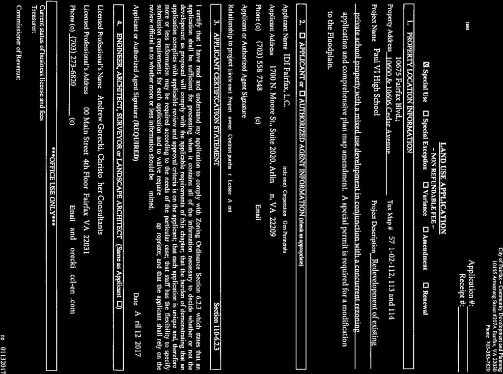


39
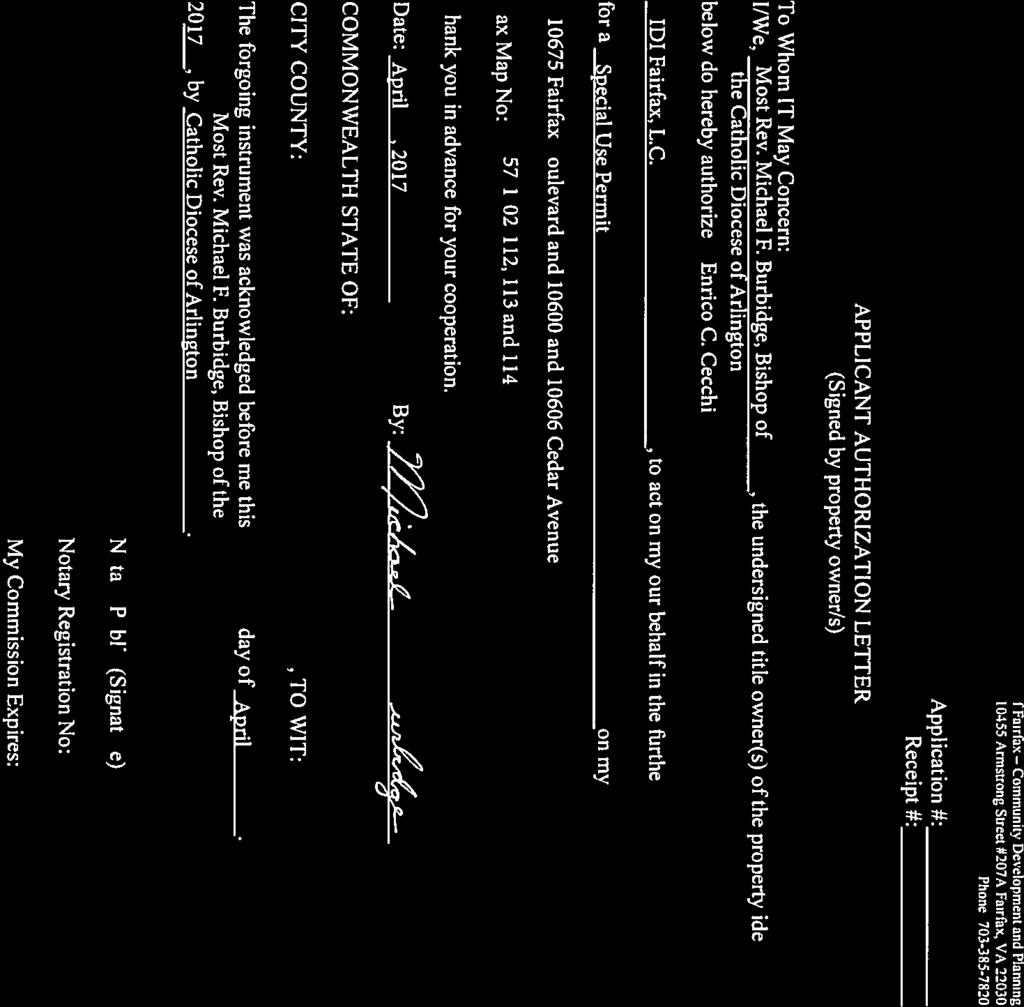


40


41
Project: Address: MAJOR CERTIFICATE OF APPROPRIATENESS FOR THE BOARD OF ARCHITECTURAL REVIEW
 The BAR recommended approval of the major COA with the following 10 conditions at the special meeting on March 28, 2018. Project: Address: Case Number: Applicant: ATTACHMENT 9e Paul VI Redevelopment 10675
Paul VI Redevelopment
 City of Fairfax City Council and Planning Commission Joint Work Session October 3, 2017 Paul VI Redevelopment The IDI Group Companies 1 Site Background Chain Bridge Road Cedar Ave 2 Project History June-October
City of Fairfax, Virginia City Council Work Session
 City of Fairfax, Virginia City Council Work Session Agenda Item # City Council Meeting 2a 7/3/2018 TO: FROM: SUBJECT: Honorable Mayor and Members of City Council Robert Sisson, City Manager iscussion of
ARLINGTON COUNTY, VIRGINIA
 ARLINGTON COUNTY, VIRGINIA County Board Agenda Item Meeting December 9, 2006 DATE: November 20, 2006 SUBJECT: GP-302-05-2 Adoption of General Land Use Plan Amendments for the Clarendon Metro Station Area:
Town of Cary, North Carolina Rezoning Staff Report 14-REZ-31 Cary Park PDD Amendment (Waterford II) Town Council Meeting January 15, 2015
 Town Council Meeting January 15, 2015") Town of Cary, North Carolina Rezoning Staff Report 14-REZ-31 Cary Park PDD Amendment (Waterford II) Town Council Meeting January 15, 2015 REQUEST To amend the Town of Cary Official Zoning Map by amending
Town of Cary, North Carolina Rezoning Staff Report 14-REZ-31 Cary Park PDD Amendment (Waterford II) Town Council Meeting January 15, 2015 REQUEST To amend the Town of Cary Official Zoning Map by amending
CITY OF CHARLOTTESVILLE DEPARTMENT OF NEIGHBORHOOD DEVELOPMENT SERVICES STAFF REPORT APPLICATION FOR A SPECIAL USE PERMIT
 CITY OF CHARLOTTESVILLE DEPARTMENT OF NEIGHBORHOOD DEVELOPMENT SERVICES STAFF REPORT APPLICATION FOR A SPECIAL USE PERMIT PLANNING COMMISSION AND CITY COUNCIL JOINT PUBLIC HEARING DATE OF HEARING: December
Section 1: US 19 Overlay District
 Section 1: US 19 Overlay District Section 1.1 Intent and Purpose The purpose of the US Highway 19 Overlay District is to manage access to land development along US Highway 19 in a manner that preserves
Appendix A: Guide to Zoning Categories Prince George's County, Maryland
 Appendix A: Guide to Zoning Categories Prince George's County, Maryland RESIDENTIAL ZONES 1 Updated November 2010 R-O-S: Reserved Open Space - Provides for permanent maintenance of certain areas of land
Indicates Council-recommended changes Introduced by: Mr. Tackett Date of introduction: June 14, 2016 SUBSTITUTE NO. 1 TO ORDINANCE NO.
 Indicates Council-recommended changes Introduced by: Mr. Tackett Date of introduction: June 14, 2016 SUBSTITUTE NO. 1 TO ORDINANCE NO. 16-067 TO AMEND NEW CASTLE COUNTY CODE CHAPTER 40 (ALSO KNOWN AS THE
PLANNED UNIT DEVELOPMENT & SUBDIVISION STAFF REPORT Date: April 18, 2019
 PLANNED UNIT DEVELOPMENT & SUBDIVISION STAFF REPORT Date: April 18, 2019 DEVELOPMENT NAME SUBDIVISION NAME Springhill Village Subdivision Springhill Village Subdivision LOCATION 4350, 4354, 4356, 4358,
City of Fairfax, Virginia City Council Work Session
 City Council Work Session Agenda Item # City Council Meeting 5a 10/7/2014 TO: FROM: SUBJECT: Honorable Mayor and Members of City Council Robert Sisson, City Manager Discussion of a request by The IDI Group
ARLINGTON COUNTY, VIRGINIA
 ARLINGTON COUNTY, VIRGINIA County Board Agenda Item Meeting of January 21, 2006 DATE: January 5, 2006 SUBJECT: Action on Proposed Amendments to provide for the achievement of affordable housing objectives
Midwest City, Oklahoma Zoning Ordinance
 2010 Midwest City, Oklahoma Zoning Ordinance 9/2/2010 Table of Contents Section 1. General Provisions... 5 1.1. Citation... 5 1.2. Authority... 5 1.3. Purpose... 5 1.4. Nature and Application... 5 1.5.
Draft Model Access Management Overlay Ordinance
 Draft Model Access Management Overlay Ordinance This model was developed using the City of Hutchinson and the Trunk Highway 7 corridor. The basic provisions of this model may be adopted by any jurisdiction
PALM BEACH COUNTY PLANNING, ZONING AND BUILDING DEPARTMENT ZONING DIVISION
 PALM BEACH COUNTY PLANNING, ZONING AND BUILDING DEPARTMENT ZONING DIVISION Application No.: CA-2012-00688 Control No.: 2011-00552 Applicant: Garry Bernardo Owners: Garry Bernardo Agent: Frogner Consulting,
PLANNING COMMISSION WILLIAMSBURG, VIRGINIA WORK SESSION AGENDA Wednesday, May 23, 2012
 PLANNING COMMISSION WILLIAMSBURG, VIRGINIA WORK SESSION AGENDA Wednesday, May 23, 2012 The meeting will be called to order in the third floor Conference Room (Room 310), Williamsburg Municipal Building,
REGULATING PLAN for the Plaza Saltillo TOD Station Area Plan (SAP)
") REGULATING PLAN for the Plaza Saltillo TOD Station Area Plan (SAP) Adopted: December 11, 2008 Effective: March 1, 2009 REGULATING PLAN for the Plaza Saltillo TOD Station Area Plan (SAP) CONTENTS BACKGROUND...iv
REGULATING PLAN for the Plaza Saltillo TOD Station Area Plan (SAP) Adopted: December 11, 2008 Effective: March 1, 2009 REGULATING PLAN for the Plaza Saltillo TOD Station Area Plan (SAP) CONTENTS BACKGROUND...iv
Transit Oriented Communities Affordable Housing Incentive Program Guidelines (TOC Guidelines)
") Transit Oriented Communities Affordable Housing Incentive Program Guidelines (TOC Guidelines) Implementing Section 6 of Measure JJJ, approved by the voters in November 2016, and added to Los Angeles Municipal
Transit Oriented Communities Affordable Housing Incentive Program Guidelines (TOC Guidelines) Implementing Section 6 of Measure JJJ, approved by the voters in November 2016, and added to Los Angeles Municipal
Bylaw No , being "Official Community Plan Bylaw, 2016" Schedule "A" DRAFT
 Bylaw No. 2600-2016, being "Official Community Plan Bylaw, 2016" Schedule "A" Urban Structure + Growth Plan Urban Structure Land use and growth management are among the most powerful policy tools at the
DEVELOPMENT DEPARTMENT STAFF REPORT THE PARK AT 5 TH
 DEVELOPMENT DEPARTMENT STAFF REPORT ARB Meeting Date: July 3, 2018 Item #: _PZ2018-293_ THE PARK AT 5 TH Request: Site Address: Project Name: Parcel Number: Applicant: Proposed Development: Current Zoning:
SUBJECT: Application for Planned Unit Development and Rezoning 1725 Winnetka Road
 TO: FROM: CHAIRMAN BILL VASELOPULOS AND MEMBERS OF THE PLAN & ZONING COMMISSION STEVE GUTIERREZ DIRECTOR OF COMMUNITY DEVELOPMENT MEETING DATE: September 5, 2017 SUBJECT: Application for Planned Unit Development
Two alternative land use scenarios for the retail, restaurant, and community/office uses are examined. Those scenarios are as follows:
 ATTACHMENT 7 MEMORANDUM TO: Enrico C. Cecchi, IDI Group Companies Patrick Rhodes, IDI Group Companies 1420 Spring Hill Road, Suite 610, Tysons, VA 22102 FROM: John J. Andrus Christopher Turnbull COPY:
8.5.1 R1, Single Detached Residential District
 8.5.1 R1, Single Detached Residential District The purpose of this district is to provide for residential development in the form of single detached dwellings. Dwelling, Single Detached Home Business,
ARLINGTON COUNTY, VIRGINIA. County Board Agenda Item Meeting of September 19, 2015
 ARLINGTON COUNTY, VIRGINIA County Board Agenda Item Meeting of September 19, 2015 DATE: August 28, 2015 SUBJECT: Request to authorize advertisement of public hearings by the Planning Commission and the
1417, , 1427 & 1429 Yonge Street - Official Plan Amendment and Zoning Amendment Applications - Preliminary Report
 STAFF REPORT ACTION REQUIRED 1417, 1421-1425, 1427 & 1429 Yonge Street - Official Plan Amendment and Zoning Amendment Applications - Preliminary Report Date: March 24, 2015 To: From: Wards: Reference Number:
Montreal Road District Secondary Plan [Amendment #127, October 9, 2013]
![Montreal Road District Secondary Plan [Amendment #127, October 9, 2013]](/thumbs/72/66783104.jpg "Montreal Road District Secondary Plan [Amendment #127, October 9, 2013]") [Amendment #127, October 9, 2013] 1.0 General The following policies are applicable to the Montreal Road District as set out in Schedule 1. 1.1 District Objectives The objective of this Plan is to guide
[Amendment #127, October 9, 2013] 1.0 General The following policies are applicable to the Montreal Road District as set out in Schedule 1. 1.1 District Objectives The objective of this Plan is to guide
SUBDIVISION DESIGN PRINCIPLES AND STANDARDS
 SECTION 15-200 SUBDIVISION DESIGN PRINCIPLES AND STANDARDS 15-201 STREET DESIGN PRINCIPLES 15-201.01 Streets shall generally conform to the collector and major street plan adopted by the Planning Commission
MEADOWBROOK FLATS SPECIAL USE PERMIT APPLICATION
 MEADOWBROOK FLATS SPECIAL USE PERMIT APPLICATION March 26, 2013 Submitted by: Bluestone Land, L.L.C. William N. Park, Manager 1821 Avon St. Suite 200 Charlottesville VA 22902 434-979-2900 wpark@pinnacleconstructionva.com
STAFF REPORT PLN September 11, 2017
 Page: 1 TO: SUBJECT: GENERAL COMMITTEE APPLICATIONS FOR OFFICIAL PLAN AMENDMENT AND ZONING BY-LAW AMENDMENT 37 JOHNSON STREET WARD: WARD 1 PREPARED BY AND KEY CONTACT: SUBMITTED BY: GENERAL MANAGER APPROVAL:
4 LAND USE 4.1 OBJECTIVES
 4 LAND USE The Land Use Element of the Specific Plan establishes objectives, policies, and standards for the distribution, location and extent of land uses to be permitted in the Central Larkspur Specific
Conditional Use Permit case no. CU 14-06: Bristol Village Partners, LLC
 PLANNING AND ZONING COMMISSION STAFF REPORT August 7, 2014 Conditional Use Permit case no. CU 14-06: Bristol Village Partners, LLC CASE DESCRIPTION: LOCATION: LEGAL DESCRIPTION: EXISTING LAND USE: ZONING:
Place Type Descriptions Vision 2037 Comprehensive Plan
 Place Type Descriptions Vision 2037 Comprehensive Plan The Vision 2037 Comprehensive Plan establishes a range of place types for Oxford, ranging from low intensity (limited development) Rural and Natural
PIN , Part 1, Plan SR-713 in Lot 2, Concession 5, Township of McKim (1096 Dublin Street, Sudbury)
") STAFF REPORT Applicant: Dalron Construction Limited Location: PIN 02124-0103, Part 1, Plan SR-713 in Lot 2, Concession 5, Township of McKim (1096 Dublin Street, Sudbury) Official Plan and Zoning By-law:
STAFF REPORT Applicant: Dalron Construction Limited Location: PIN 02124-0103, Part 1, Plan SR-713 in Lot 2, Concession 5, Township of McKim (1096 Dublin Street, Sudbury) Official Plan and Zoning By-law:
Cover Letter with Narrative Statement
 Cover Letter with Narrative Statement March 31, 2017 rev July 27, 2017 RE: Rushton Pointe Residential Planned Unit Development Application for Public Hearing for RPUD Rezone PL2015 000 0306 Mr. Eric Johnson,
9. REZONING NO Vicinity of the northwest corner of 143 rd Street and Metcalf Avenue
 9. REZONING NO. 2002-15 Vicinity of the northwest corner of 143 rd Street and Metcalf Avenue 1. APPLICANT: Andrew Schlagel is the applicant for this request. 2. REQUESTED ACTION: The applicant is requesting
Hamilton County Regional Planning Commission
 Hamilton County Regional Planning Commission March 1, 2012 Colerain Township Staff Report Zone Map Amendment: Case No.: ZA2012-01 Joseph Toyota Prepared By: Amy Bancroft, Land Use Planner ACTION REQUESTED:
50 and 52 Finch Avenue East - Official Plan and Zoning By-law Amendment Applications - Preliminary Report
 STAFF REPORT ACTION REQUIRED 50 and 52 Finch Avenue East - Official Plan and Zoning By-law Amendment Applications - Preliminary Report Date: August 16, 2016 To: From: Wards: Reference Number: North York
Comprehensive Plan Amendment #PLN , Reserve at Cannon Branch (Coles Magisterial District)
") COUNTY OF PRINCE WILLIAM 5 County Complex Court, Prince William, Virginia 22192-9201 PLANNING (703) 792-7615 FAX (703) 792-4758 OFFICE Internet www.pwcgov.org Christopher M. Price, AICP Director of Planning
COUNTY OF PRINCE WILLIAM 5 County Complex Court, Prince William, Virginia 22192-9201 PLANNING (703) 792-7615 FAX (703) 792-4758 OFFICE Internet www.pwcgov.org Christopher M. Price, AICP Director of Planning
b) Tangerine Corridor Overlay District 1) Tangerine Corridor District Regulations
 Tangerine Corridor Overlay District 1) Tangerine Corridor District Regulations") Attachment 1 Tangerine Road Corridor Overlay District Section 27.10.D.3.f.vi.b Initiation of Code Amendment September 2, 2014, Planning and Zoning Commission b) Tangerine Corridor Overlay District 1) Tangerine
Attachment 1 Tangerine Road Corridor Overlay District Section 27.10.D.3.f.vi.b Initiation of Code Amendment September 2, 2014, Planning and Zoning Commission b) Tangerine Corridor Overlay District 1) Tangerine
CASE SUMMARY Conditional District Zoning Modification Planning Commission January 9, 2013 CD M1212
 CASE SUMMARY Conditional District Zoning Modification Planning Commission January 9, 2013 CD-3-109-M1212 Jim Diepenbrock, Associate Planner jim.diepenbrock@wilmingtonnc.gov 910-341-3257 Staff recommendation
NOTICE OF MEETING AND AGENDA FOR THE PLANNING COMMISSION OF SPRINGVILLE, UTAH... JANUARY 23, 2018
 NOTICE OF MEETING AND AGENDA FOR THE PLANNING COMMISSION OF SPRINGVILLE, UTAH............................ JANUARY 23, 2018 Notice is hereby given that the Planning Commission will hold a public meeting
TASK 2 INITIAL REVIEW AND ANALYSIS U.S. 301/GALL BOULEVARD CORRIDOR FORM-BASED CODE
 TASK 2 INITIAL REVIEW AND ANALYSIS U.S. 301/GALL BOULEVARD CORRIDOR FORM-BASED CODE INTRODUCTION Using the framework established by the U.S. 301/Gall Boulevard Corridor Regulating Plan (Regulating Plan),
GENERAL DESCRIPTION STAFF RECOMMENDATION IMPLEMENTATION REQUIREMENTS
 Application No.: 891418 Applicant: AREA-WIDE MAP AMENDMENT Rezone two parcels from Moderate Density Single Family (MSF) to Neighborhood Center (NC) and Employment Center (EC). Charles Bitton GENERAL DESCRIPTION
PALM BEACH COUNTY PLANNING, ZONING AND BUILDING DEPARTMENT ZONING DIVISION
 PALM BEACH COUNTY PLANNING, ZONING AND BUILDING DEPARTMENT ZONING DIVISION Application No.: W-2014-00288 Application Name: O Reilly Auto Parts Control No.: 2013-00286 Applicant: Hutton Growth Blue Sky
Master Plan Review SILVER SPRING CBD. Approved and Adopted February Updated January 2013
 Master Plan Review SILVER SPRING CBD Approved and Adopted February 2000 BACKGROUND ZONING CODE REWRITE In 2007, the Montgomery County Council directed the Planning Department to undertake a comprehensive
County of Loudoun. Department of Planning MEMORANDUM
 County of Loudoun Department of Planning MEMORANDUM DATE: September 3, 2013 TO: FROM: Marchant Schneider, Project Manager Land Use Review Marie Genovese, AICP, Planner III, Community Planning SUBJECT:
Be linked by an internal circulation system (i.e., walkways, streets, etc.) to other structures within the IPUD;
 to other structures within the IPUD;") 2. HALIFAX ACTIVITY CENTER A. DESCRIPTIONS OF FUTURE LAND USE DESIGNATIONS Each of the future land use designations specified by Phase I of the Halifax Activity Center Plan, and the relationship of these
2. HALIFAX ACTIVITY CENTER A. DESCRIPTIONS OF FUTURE LAND USE DESIGNATIONS Each of the future land use designations specified by Phase I of the Halifax Activity Center Plan, and the relationship of these
Puyallup Downtown Planned Action & Code Changes. January 10, 2017
 Puyallup Downtown Planned Action & Code Changes January 10, 2017 Purpose & Location Purpose Promote economic development and downtown revitalization Tools: Municipal Code amendments Change development
H-POLICY 1: Preserve and improve existing neighborhoods. Ensure that Prince William County achieves new neighborhoods with a high quality of life.
 HOUSING Intent The intent of the Housing Plan is to provide a framework for providing for the housing needs of all residents of Prince William County. These needs are expressed in terms of quality, affordability,
Director, Community Planning, North York District NNY 23 OZ and NNY 23 RH
 STAFF REPORT ACTION REQUIRED 2 & 50 Sheppard Avenue East 4841 to 4881 Yonge Street and 2 to 6 Forest Laneway Official Plan Amendment, Zoning By-law Amendment and Rental Housing Demolition Applications
From Policy to Reality
 From Policy to Reality Updated ^ Model Ordinances for Sustainable Development 2000 Environmental Quality Board 2008 Minnesota Pollution Control Agency Funded by a Minnesota Pollution Control Agency Sustainable
17-23 Clairtrell Road and 391 Spring Garden Avenue - OPA & Rezoning, Site Plan - Preliminary Report
 STAFF REPORT ACTION REQUIRED 17-23 Clairtrell Road and 391 Spring Garden Avenue - OPA & Rezoning, Site Plan - Preliminary Report Date: April 10, 2008 To: From: Wards: Reference Number: North York Community
ARLINGTON COUNTY, VIRGINIA
 ARLINGTON COUNTY, VIRGINIA County Board Agenda Item Meeting March 17, 2007 DATE: March 8, 2007 SUBJECT: Request to Advertise Public Hearings on Amendments to Section 25B. C-O Rosslyn Commercial Office
Staff Report for Council Public Meeting
 Agenda Item 3.3 Staff Report for Council Public Meeting Date of Meeting: September 27, 2017 Report Number: SRPRS.17.134 Department: Division: Subject: Planning and Regulatory Services Development Planning
ARTICLE 14 PLANNED UNIT DEVELOPMENT (PUD) DISTRICT
 DISTRICT") ARTICLE 14 PLANNED UNIT DEVELOPMENT (PUD) DISTRICT Section 14.01 Intent. It is the intent of this Article to allow the use of the planned unit development (PUD) process, as authorized by the Michigan Zoning
ARTICLE 14 PLANNED UNIT DEVELOPMENT (PUD) DISTRICT Section 14.01 Intent. It is the intent of this Article to allow the use of the planned unit development (PUD) process, as authorized by the Michigan Zoning
CONNECTING ARLINGTON S POLICY FRAMEWORK TO THE RESIDENTIAL PARKING WORKING GROUP
 CONNECTING ARLINGTON S POLICY FRAMEWORK TO THE RESIDENTIAL PARKING WORKING GROUP Contents Arlington County Development and Growth Goals... 1 Master Transportation Plan Policies Related to Multi Family
O-I (Office-Institutional) and AG-1(Agricultural)
 and AG-1(Agricultural)") PROPERTY INFORMATION ADDRESS 3503 and 3505 Bethany Bend DISTRICT, LAND LOTS 2/1 973 and 974 OVERLAY DISTRICT State Route 9 PETITION NUMBERS EXISTING ZONING O-I (Office-Institutional) and AG-1(Agricultural)
PROPERTY INFORMATION ADDRESS 3503 and 3505 Bethany Bend DISTRICT, LAND LOTS 2/1 973 and 974 OVERLAY DISTRICT State Route 9 PETITION NUMBERS EXISTING ZONING O-I (Office-Institutional) and AG-1(Agricultural)
THE AREA PLAN COMMISSION OF ST. JOSEPH COUNTY, IN AGENDA
 THE AREA PLAN COMMISSION OF ST. JOSEPH COUNTY, IN AGENDA Tuesday, June 20, 2017 Fourth-Floor Council Chambers 3:30 p.m. County-City Building, South Bend, IN PUBLIC HEARINGS: 1. Rezonings: A. A combined
STAFF REPORT. January 25, North York Community Council. Director, Community Planning, North District
 STAFF REPORT January 25, 2005 To: From: Subject: Purpose: North York Community Council Director, Community Planning, North District Refusal Report OPA & Rezoning Application 04 194214 NNY 33 OZ Applicant:
PLANNING COMMISSION STAFF REPORT
 PLANNING COMMISSION STAFF REPORT REZONING CASE: RZ-16-001 REPORT DATE: March 8, 2016 CASE NAME: Trailbreak Partners Rezoning PLANNING COMMISSION DATE: March 16, 2016 ADDRESSES OF REZONING PROPOSAL: 5501
Town of Cary, North Carolina Rezoning Staff Report 12-REZ-27 Morris Branch Town Council Public Hearing January 24, 2013
 Town of Cary, North Carolina Rezoning Staff Report 12-REZ-27 Morris Branch Town Council Public Hearing January 24, 2013 REQUEST To amend the Town of Cary Official Zoning Map to rezone approximately 9.0
Inspira Medical Center Woodbury Development Options Report
 Development Options Report Prepared for: City of Woodbury, Gloucester County Improvement Authority, Inspira Health Network Prepared by: Urban Partners (Draft Final) October 25, 2018 1. INTRODUCTION Inspira
Article 7: Residential Land Use and Development Requirements
 Article 7: Residential Land Use and Section 701: Statement of Intent (A) (B) (C) The intent of Article 7 is to develop certain land use and development requirements for the residential uses within Cumru
DEVELOPMENT DEPARTMENT STAFF REPORT STAFF REPORT DRESDEN DRIVE TOWNHOMES DCI
 DEVELOPMENT DEPARTMENT STAFF REPORT Meeting Date: September 13, 2018 Item #: PZ2018-319 STAFF REPORT DRESDEN DRIVE TOWNHOMES DCI Request: Project Name: Development of Community Compact (DCI) and six concurrent
ARLINGTON COUNTY, VIRGINIA
 ARLINGTON COUNTY, VIRGINIA County Board Agenda Item Meeting of April 19, 2008 DATE: April 2, 2008 SUBJECT: ORDINANCE TO AMEND, REENACT, AND RECODIFY Section 20 CP- FBC, Columbia Pike Form Based Code Districts
Yonge Street and 3 Gerrard Street East - Zoning Amendment Application - Preliminary Report
 STAFF REPORT ACTION REQUIRED 363-391 Yonge Street and 3 Gerrard Street East - Zoning Amendment Application - Preliminary Report Date: May 22, 2015 To: From: Wards: Reference Number: Toronto and East York
COUNTY OF ALBEMARLE PLANNING STAFF REPORT SUMMARY
 COUNTY OF ALBEMARLE PLANNING STAFF REPORT SUMMARY Project Name: ZMA 2010-00015, Cedar Hill Planning Commission Worksession: February 15, 2011 Public Hearing: Not scheduled Staff: Judith C. Wiegand, AICP
PLANNING COMMISSION REPORT Regular Agenda -Public Hearing Item
 PDP-13-00518 Item No. 3B- 1 PLANNING COMMISSION REPORT Regular Agenda -Public Hearing Item PC Staff Report 2/24/14 ITEM NO. 3B PRELIMINARY DEVELOPMENT PLAN FOR HERE @ KANSAS; 1101 INDIANA ST (SLD) PDP-13-00518:
M-43 CORRIDOR OVERLAY ZONE
 ARTICLE 26.00 M-43 CORRIDOR OVERLAY ZONE Section 26.01 Findings A primary function of the M-43 state highway is to move traffic through the Township and to points beyond. As the primary east-west arterial
1202 & 1204 Avenue Road Zoning By-law Amendment Application - Preliminary Report
 STAFF REPORT ACTION REQUIRED 1202 & 1204 Avenue Road Zoning By-law Amendment Application - Preliminary Report Date: March 17, 2017 To: From: Wards: Reference Number: North York Community Council Director,
DRAFT Plan Incentives. Part A: Basic Discount
 DRAFT 2030 Plan Incentives July 26, 2006 Part A: Basic Discount In order for a development to be eligible for any 2030 Land Resource Management Plan Discounts it must be located in the Urban Corridor and
Church Street and 117 Dundas Street East - Zoning Amendment Application - Preliminary Report
 STAFF REPORT ACTION REQUIRED 215-229 Church Street and 117 Dundas Street East - Zoning Amendment Application - Preliminary Report Date: February 26, 2015 To: From: Wards: Reference Number: Toronto and
3.1. OBJECTIVES FOR RESIDENTIAL LAND USE DESIGNATIONS GENERAL OBJECTIVES FOR ALL RESIDENTIAL DESIGNATIONS
 3. RESIDENTIAL LAND USE DESIGNATIONS INTRODUCTION The Residential land use designations provide for housing and other land uses that are integral to, and supportive of, a residential environment. Housing
Glades County Staff Report and Recommendation Unified Staff Report for Small Scale Plan Amendment and Rezoning
 Glades County Staff Report and Recommendation Unified Staff Report for Small Scale Plan Amendment and Rezoning CASE NUMBERS: COMP17-02 and RZ17-02 DATE of STAFF REPORT: May 1, 2017 CASE TYPE: Application
MEMORANDUM. DATE: August 31, Honorable Mayor and City Councilmembers Patrick Klaers, City Administrator. Matthew Bachler, Associate Planner
 NEW BUSINESS 8B MEMORANDUM DATE: August 31, 2015 TO: FROM: Honorable Mayor and City Councilmembers Patrick Klaers, City Administrator Matthew Bachler, Associate Planner SUBJECT: Planning Case #15-016 Applicant:
APPENDIX D: DEFINITIONS
 D APPENDIX D: DEFINITIONS Terms used throughout the 2040 Comprehensive Plan should be interpreted using the definitions provided in this appendix. For interpretation of any term not defined, defer to the
THE REDEVELOPMENT PLAN
 PAGE 37 THE REDEVELOPMENT PLAN FUTURE LAND USE The Silver Terrace Redevelopment Area is currently designated as Redevelopment Area #4 on the City of Delray Beach Future Land Use Map (FLUM). This designation
Charlottesville Planning Commission, Neighborhood Associations & News Media
 CITY OF CHARLOTTESVILLE A World Class City Department of Neighborhood Development Services City Hall Post Office Box 911 Charlottesville, Virginia 22902 Telephone 434-970-3182 Fax 434-970-3359 www.charlottesville.org
CITY OF CHARLOTTESVILLE DEPARTMENT OF NEIGHBORHOOD DEVELOPMENT SERVICES STAFF REPORT APPLICATION FOR A SPECIAL USE PERMIT
 CITY OF CHARLOTTESVILLE DEPARTMENT OF NEIGHBORHOOD DEVELOPMENT SERVICES STAFF REPORT APPLICATION FOR A SPECIAL USE PERMIT PLANNING COMMISSION AND CITY COUNCIL JOINT PUBLIC HEARING DATE OF HEARING: July
Courtyards at Kinnamon Park Sketch Plan
 Courtyards at Kinnamon Park Sketch Plan Courtyards at Kinnamon Park Sketch Plan Staff Analysis PART 1: PROJECT SUMMARY Applicant: EPCON Communities Property Owner: Johnsie M. Kinnamon Heirs, Douglas and
Impact Fee Nexus & Economic Feasibility Study
 Impact Fee Nexus & Economic Feasibility Study Stakeholder Working Group December 10, 2015 Urban Economics Agenda Follow Up From Last Meeting Proposals Presentation Proposals Discussion Wrap Up 1 Oakland
CITY COUNCIL STUDY SESSION MEMORANDUM
 City and County of Broomfield, Colorado To: From: Prepared by: Owner Applicant Property Size Property Location: CITY COUNCIL STUDY SESSION MEMORANDUM Mayor and City Council Charles Ozaki, City and County
Request Subdivision Variance (4.1 (m)(1) of the Subdivision Regulations) Staff Recommendation Approval. Staff Planner Jonathan Sanders
(1) of the Subdivision Regulations) Staff Recommendation Approval. Staff Planner Jonathan Sanders") Applicant Property Owner Jo Stallard Woolling Hodges Public Hearing December 12, 2018 (Deferred November 14, 2018) City Council Election District Beach Agenda Item D4 Request Subdivision Variance (4.1
Applicant Property Owner Jo Stallard Woolling Hodges Public Hearing December 12, 2018 (Deferred November 14, 2018) City Council Election District Beach Agenda Item D4 Request Subdivision Variance (4.1
13 Sectional Map Amendment
 13 Sectional Map Amendment Introduction This chapter reviews land use and zoning policies and practices in Prince George s County and presents the proposed zoning in the sectional map amendment (SMA) to
Toronto and East York Community Council. Director, Community Planning, Toronto and East York District
 STAFF REPORT ACTION REQUIRED 1481, 1491, 1501 Yonge Street, 25 & 27 Heath Street East and 30 Alvin Avenue Official Plan and Zoning Amendment Application 06 199698 STE 22 OZ Preliminary Report Date: March
Technology Park Planned Unit Development Technology Park PUD-IP
 Technology Park Planned Unit Development Technology Park PUD-IP Rob Anderson Community Development Director Planned Unit Development Background 2 Planned Unit Development (PUD) means a mixed use redevelopment
SECTION 3.1 ZONING DISTRICTS ESTABLISHED
 ARTICLE 3. ZONING DISTRICTS SECTION 3.1 ZONING DISTRICTS ESTABLISHED The City of Cedar Hill, Texas is hereby divided into the following zoning districts. The use, height and area regulations as set out
City of Valdosta Land Development Regulations
 Chapter 206 Section 206-1 Base Zoning Districts Standards for Uses, Structures, and Property Development (B) (C) Principal Uses and Structures. Principal uses and structures permitted in each base zoning
3804 Wilson Boulevard (Staples Site) Special General Land Use Plan Study
 Special General Land Use Plan Study") 1 3804 Wilson Boulevard (Staples Site) Special General Land Use Plan Study Long Range Committee of the Planning Commission Meeting May 16, 2018 Department of Community Planning, Housing and Development
1 3804 Wilson Boulevard (Staples Site) Special General Land Use Plan Study Long Range Committee of the Planning Commission Meeting May 16, 2018 Department of Community Planning, Housing and Development
Primary Districts Established 4
 4.1 GENERAL PURPOSE SECTION 4 PRIMARY DISTRICTS ESTABLISHED The Town of Waxhaw, North Carolina is hereby divided into PRIMARY ZONING DISTRICTS as designated herein and as shown on the Official Zoning Map.
Future Land Use Categories & Nodes December 23, Future Land Use Categories
 Future Land Use Categories & Nodes December 23, 2015 A note regarding nodes: Descriptions for nodes are located in the general recommendations handout. Node locations are set in part by the Auburn Interactive
SECTION 7000 LAND DEVELOPMENT REQUIREMENTS
 SECTION 7000 LAND DEVELOPMENT REQUIREMENTS 7000 LAND DEVELOPMENT REQUIREMENTS... 1 7001 LEGISLATIVE AUTHORITY... 1 7001.1 LAND DEVELOPMENT... 1 7001.1.1 Title 40, Idaho Code... 1 7001.1.2 Idaho Code 40-1415
Composition of traditional residential corridors.
 Page 1 of 7 St. Petersburg, Florida, Code of Ordinances >> PART II - ST. PETERSBURG CITY CODE >> Chapter 16 - LAND DEVELOPMENT REGULATIONS >> SECTION 16.20.060. CORRIDOR RESIDENTIAL TRADITIONAL DISTRICTS
Secondary Street Acceptance Requirements Virginia Administrative Code
 Secondary Street Acceptance Requirements Virginia Administrative Code 24VAC30-92-10. Definitions. The following words and terms when used in these regulations shall have the following meanings unless the
INDIAN RIVER COUNTY, FLORIDA. The Honorable Members of the Planning and Zoning Commission DEPARTMENT HEAD CONCURRENCE
 Public Hearing Legislative INDIAN RIVER COUNTY, FLORIDA M E M O R A N D U M TO: The Honorable Members of the Planning and Zoning Commission DEPARTMENT HEAD CONCURRENCE Robert M. Keating, AICP; Community
ARTICLE 3: Zone Districts
 ARTICLE 3: Zone Districts... 3-1 17.3.1: General...3-1 17.3.1.1: Purpose and Intent... 3-1 17.3.2: Districts and Maps...3-1 17.3.2.1: Applicability... 3-1 17.3.2.2: Creation of Districts... 3-1 17.3.2.3:
Official Plan & Zoning By-law Amendment Application Preliminary Report
 STAFF REPORT ACTION REQUIRED 847 873 Sheppard Avenue West Official Plan & Zoning By-law Amendment Application Preliminary Report Date: January 13, 2010 To: From: Wards: Reference Number: North York Community
ARTICLE 887. PD 887. Valley View - Galleria Area Special Purpose District
 ARTICLE 887. PD 887. Valley View - Galleria Area Special Purpose District SEC. 51P-887.101. LEGISLATIVE HISTORY. PD 887 was established by Ordinance No. 29032, passed by the Dallas City Council on June
Evolution of the Vision for NE 181st Street Study Area
 City Council Action on NE 181 St Street Study Area Evolution of the Vision for NE 181st Street Study Area such uses to ensure neighborhood compatibility. More intense uses may be allowed through a conditional
Bowie Marketplace Residential Detailed Site Plan Statement of Justification January 13, 2017 Revised February 2, 1017
 Bowie Marketplace Residential Detailed Site Plan Statement of Justification January 13, 2017 Revised February 2, 1017 Submitted on behalf of: BE Bowie LLC 5410 Edson Lane, Suite 220 Rockville, MD 20852