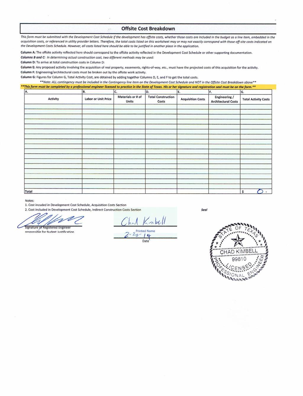
3. IMPACT, SITE DEVELOPMENT PERMIT, BUIDLING PERMIT AND OTHER FEES
|
|
|
- Griffin Small
- 5 years ago
- Views:
Transcription
1
2 Art at Bratton s Edge Page 2 of 13 TABLE OF CONTENTS A. EXECUTIVE SUMMARY 1. PROJECT OVERVIEW 2. DUE DILIGENCE STATEMENT B. SITE SUMMARY ITEMS 1. ZONING REQUIREMENTS 2. SUBDIVISION REQUIREMENTS 3. DEVELOPMENT ORDINANCES 4. FIRE DEPARTMENT REQUIREMETNS 5. SITE INGRESS AND EGRESS REQUIREMENTS 6. BUILDING CODES AND LOCAL DESIGN ORDINANCES 7. ATYPICAL ITEMS 8. SURVEY 9. PRELIMINARY SITE PLAN C. OVERVIEW OF PROCESS, TIMING AND COSTS 1. ENTITLEMENT, SITE DEVELOPMENT PERMITTING PROCESS AND TIMING 2. BUILDING PERMITTING PROCESS AND TIMING 3. IMPACT, SITE DEVELOPMENT PERMIT, BUIDLING PERMIT AND OTHER FEES APPENDICES A. SITE LOCATION MAP B. FEMA FLOOD INSURANCE RATE MAP C. ZONING MAP D. BOUNDARY SURVEY E. PRELIMINARY SITE PLAN F. FEE SCHEDULES KBGE TBPE No. F W Riverside Dr. Suite 110 Austin, Texas (512)
3 Art at Bratton s Edge Page 3 of 13 A. EXECUTIVE SUMMARY 1. Project Overview The intent of this report is to provide a due diligence assessment of current site conditions and development requirements for the proposed Art at Bratton s Edge project. The report has been prepared in accordance with (5) of the 2014 Uniform Multifamily Rules, issued by the Texas Department of Housing & Community Affairs (TDHCA) Art at Bratton s Edge is a proposed multi-family residential development consisting of 76 units in four buildings along with associated parking, infrastructure and site amenities. A club house, common amenities and management offices are located within one of the residential buildings. The property is located at the southeast corner of the Bratton Lane and Long Vista Drive intersection in the in the 2- mile Extra Territorial Jurisdiction (ETJ) of the City of Austin, Travis County, Texas. Warehouse/office uses are to the east and north, while single family use is to the west and south. A site location map has been provided in Appendix A. The site is approximately ± acres and described as Lot 1, Block A of the Vista Business Park II subdivision- Travis County Appraisal District property ID The Art at Bratton s Edge parcel is currently an undeveloped lot with grass cover located in Flood Hazard Zone X, areas determined to be outside the 500-year floodplain, according to Flood Insurance Rate Map Panel No C0260H, dated September 26, A floodplain map has been included with this summary as Appendix B. The millage rate is $ per $1,000 of appraised value. The Art at Bratton s Edge site will need a Site Development Permit (SDP) from the City of Austin to construct the development. The SDP will require approval from Travis County, Austin Water Utility and the fire department authority. In addition, the development is governed by the Vista Park Owners Association, Inc. (VPO). VPO is a private 100% commercial owner s association and not a Home Owner s Association. The proposed use is allowed by the current VPO governing document. The project will need to amend the existing plat to remove a plat note that currently restricts residential development. Originally, the VPO governing document prohibited residential development; however, that document was amended to specifically allow for residential development including multi-family. The plat was not simultaneously amended. A similar plat note was removed from an immediate adjacent plat also located within the boundaries of the Vista Park Owners Association, Inc. 2. Due Diligence Statement This report was compiled based on information ascertained by phone and correspondence with pertinent staff members at the City of Austin, Travis County, Austin Water Utility, internet research of the applicable code and information obtained from title searches including the Articles of Amendment by the Members to the Articles of Incorporation of Vista Park Owners Association, Inc. KBGE TBPE No. F W Riverside Dr. Suite 110 Austin, Texas (512)
4 Art at Bratton s Edge Page 4 of 13 A. SITE SUMMARY ITEMS 1. Zoning Requirements The Art at Bratton s Edge parcel is presently located in a 2-mile Extra Territorial Jurisdiction (ETJ). The City of Austin does not have zoning regulations in the ETJ; therefore, the land use is not governed by zoning regulations and multi-family development is allowed by the City of Austin for this lot. Refer to Appendix E for the Preliminary Site Plan for Art at Bratton s Edge. 2. Subdivision Requirements The lot is currently platted as Lot 1, Block A of the Vista Business Park II subdivision. Refer to Appendix C for the Plat. This plat will need to be amended to remove plat note 19 that restricts uses to other than residential. A similar plat note was amended from the Vista Business Park I subdivision to restrict only single family use. Vista Business Park I is within the boundaries of the Vista Park Owners Association, Inc (VPO). The VPO governing document specifically allows multi-family development. 3. Development Ordinances The City of Austin and Travis County each have a Code of Ordinances available online, providing guidance on design criteria for residential and commercial developments within the jurisdiction. This section presents a summary of the applicable development ordinances governing the proposed project: Water & Wastewater The site is located within the Austin Water Utility (AWU) boundaries. Water and wastewater are available in the right-of-way immediately adjacent to the site and both utilities will be provided by AWU. An 8 PVC wastewater sits within the Bratton Lane Right-of-way and a 15 PVC main traverses the south property line. Both were built in An 8 ductile iron water line is stubbed out to the site from the 12 main located in Long Vista Drive. This line will provide both fire and domestic water for the development. A master meter is required by the City of Austin for domestic use. Each unit will be privately sub-metered. Impact fees involving water and wastewater are called Capital Recovery Fees and are determined by the water meter size. We anticipate a 2 meter will suffice for domestic needs. A schedule of fees is contained in Section C of this report. Drainage Currently, the site naturally slopes from the northeast to the southwest towards the existing detention pond on the southwest corner of the site. This pond was designed to provide detention for 75% KBGE TBPE No. F W Riverside Dr. Suite 110 Austin, Texas (512)
5 Art at Bratton s Edge Page 5 of 13 impervious cover on the development site. The proposed impervious cover is approximately 46% and therefore the existing detention area will provide sufficient storm water detention for the proposed development. Water quality is required per City of Austin requirements. The existing pond is detention only, and therefore on-site water quality will be required. Water quality will be achieved via rain gardens in accordance with Section of the City s Environmental Criteria Manual. These will placed at multiple places downstream of impervious cover. Dry Utilities TXU is the electric provider and Texas Gas is the gas service infrastructure provider for the area per discussions with City staff. AT&T Texas and Time Warner are companies which provide telephone services to both residences and businesses in the area according to the Public Utility Commission of Texas. The development does not anticipate using gas service at this time. Additional Development Ordinances Although the City of Austin does not have land use jurisdiction, they do have environmental regulations that apply to the site. The project is located in the City s desired development zone and in the Walnut Creek Watershed, classified as a Suburban Watershed. Multi-family impervious cover is limited to 60%. The site is currently designed with approximately 46% impervious cover. There are no parking requirements in the ETJ. Per TDHCA s 2014 Uniform Multi-Family Rules for sites located where there is no local parking code, parking is required at a ratio of 1.5 spaces per unit. Under this Rule, the site would need 114 parking spaces and 131 have been provided. The site is located in the transition zone of the Edwards Aquifer. Transition zone regulations do not require TCEQ approval for construction. A Storm Water Protection Plan (SWPPP) prepared per TCEQ standards will need to be present on site however at all times during construction. Travis County will perform fire review and will require a driveway permit to access Long Vista Drive. As designed, Art at Bratton s Edge will comply with all applicable development ordinances. Fire Requirements Travis County will provide fire protection. The Fire Code requires a fire hydrant to be located within 500 feet of all points of the first floor of a building housing any occupancy, if the building is provided with an approved automatic sprinkler system. There are two hydrants adjacent to the site in the rightof-way along Long Vista Drive. One private fire hydrant internal to the site will be required. To meet the requirement for adequate horizontal emergency access, all portions of the exterior walls of the first story of the building and all portions of the facility must be located within 150 feet of a KBGE TBPE No. F W Riverside Dr. Suite 110 Austin, Texas (512)
6 Art at Bratton s Edge Page 6 of 13 public street or designated fire lane. All internal drives will be designated fire lanes as shown in Appendix E to satisfy this requirement. 4. Site Ingress and Egress Requirements One access point is proposed for the Art at Bratton s Edge project from Long Vista Drive. The proposed driveway would be reviewed and approved as part of the City s and County s Engineering Review process. Travis County will require a driveway permit to access Long Vista Drive. The City and County will allow a drive access to Long Vista. 5. Building Codes and Local Design Ordinances The City of Austin does not have building code jurisdiction over this site. Travis County does not require a building permit nor have they adopted any building codes for non-single-family construction. They have adopted the following fire codes: Portions of 2003 International Fire Code (with local amendments) Portions of 2009 International Fire Code (with local amendments) The Art at Bratton s Edge project will comply with the applicable adopted design codes. 7. Atypical Items Parkland will need to be dedicated via the plat or a fee provided in lieu. Unless a restrictive covenant is filed to limit the density, 24 units per acre will be used to determine the parkland acreage or fee in lieu requirement. As a rule of thumb, $650/unit could be used for the fee-in-lieu amount. 8. Survey A Category 1A Land Title Survey prepared by KBGE Surveying, Inc., is attached in Appendix D showing the proposed acre parcel. 9. Preliminary Site Plan A Preliminary Site Plan is attached in Appendix E which shows the proposed layout for the Art at Bratton s Edge development. C. OVERVIEW OF PROCESS, TIMING, AND COSTS 1. Entitlement, Site Development Permitting Process and Timing This section presents a summary of the applicable entitlement and site development permitting processes that may affect the proposed project: KBGE TBPE No. F W Riverside Dr. Suite 110 Austin, Texas (512)
7 Art at Bratton s Edge Page 7 of 13 Platting Process Based on the need to remove the aforementioned plat note, the plat will need to be amended. The amended plat will require City of Austin Planning Commission approval. The platting process could run concurrently with the Site Development Permit process and would not impact the overall permitting schedule. The total process should take 4-6 months. Site Development Permit Site Development Permit construction plans will be reviewed by the City of Austin and Travis County. To obtain a site development permit, both the Travis County Fire Marshal and Austin Water Utility will need to approve the plans. The process for each requires administrative approval and should take 6-8 months. 2. Building Permitting Process and Timing Building permits are not required. 3. Impact, Site Development Permit, Building Permit and Other Fees This section presents a summary of the applicable fees that will affect the proposed project: Capital Recovery Fee (Water and Wastewater Impact Fee) - $61,500 Parkland Dedication Fee- (1.7 x 122 x 5)/1000 = Ac of Parkland Dedicated or $650 per unit (max allowable density) = $79,300 Final Plat - $433 + $7/acre = $468 Site Plan Review Fee- $2,547 Travis County Development Permit Fee- $45 + $1.35 per $1, of construction cost = $1,350 Fiscal Surety (returned after certificate of completion) - $68,000 deposit Notification Fee - $302 Inspection Fee- $2,800 Fee schedules have been included in Appendix F of this report. KBGE TBPE No. F W Riverside Dr. Suite 110 Austin, Texas (512)
8 Art at Bratton s Edge Page 8 of 13 APPENDIX A SITE LOCATION MAP KBGE TBPE No. F W Riverside Dr. Suite 110 Austin, Texas (512)
 439-0400 www.kbge-eng.com TBPE No.")
9 CLIENT INFORMATION N W E WOLFPACK GROUP, LLC S SHORELINE DR SAUIS DR SITE BRATTON LN LONG VISTA DR WELLS PORT DR GRAND AVE PKWY LONG VISTA DR 0 400' 800' SCALE: 1" = 400' N INTERSTATE West Riverside Drive, Ste 110, Austin, Texas T (512) TBPE No.F BRATTON LN WELLS PORT DR JOB NUMBER: CHECKED BY: CHAD KIMBELL, PE SHEET: ISSUE DATE: /12/14 CITY OF AUSTIN, 2 MILE ETJ, TRAVIS COUNTY, TX N INTERSTATE 35
10 Art at Bratton s Edge Page 9 of 13 APPENDIX B FEMA FLOODPLAIN MAP KBGE TBPE No. F W Riverside Dr. Suite 110 Austin, Texas (512)

11
12 Art at Bratton s Edge Page 10 of 13 APPENDIX C PLAT KBGE TBPE No. F W Riverside Dr. Suite 110 Austin, Texas (512)
13
14
15
16
17 Art at Bratton s Edge Page 11 of 13 APPENDIX D BOUNDARY SURVEY KBGE TBPE No. F W Riverside Dr. Suite 110 Austin, Texas (512)
18
19 Art at Bratton s Edge Page 12 of 13 APPENDIX E PRELIMINARY SITE PLAN KBGE TBPE No. F W Riverside Dr. Suite 110 Austin, Texas (512)


20 CLIENT INFORMATION N NOTES: E 1. THIS DRAWING IS NOT INTENDED FOR CONSTRUCTION, BIDDING OR PERMITTING. WOLFPACK GROUP, LLC 2. THIS DRAWING MATERIALLY ADHERES TO ALL APPLICABLE SITE DEVELOPMENT AND BUILDING CODE ORDINANCES TO THE BEST OF OUR KNOWLEDGE. W S 3. EXISTING CONTOURS ARE BASED ON CITY OF AUSTIN GIS. 0 LINETYPE LEGEND PROPOSED EXISTING 80' 160' SCALE: 1" = 80' RIGHT OF WAY LOT BOUNDARY EASEMENT FENCE: BARBED FENCE: WOOD (PICKET) FENCE: WOOD (PRIVACY) FENCE: METAL MAJOR CONTOUR MINOR CONTOUR ELECTRIC LINE GAS LINE WASTE WATER LINE WATER LINE CURB & GUTTER STRIPING FIRE LANE STRIPING CONCRETE BLOCK LEGEND PROPOSED EXISTING BENCHMARK CUT IN CONCRETE CONTROL POINT IRON PIPE IRON ROD MONUMENT TYPE 1 MONUMENT TYPE 2 MONUMENT TYPE 3 NAIL PIPE BREAK PIPE CAP PIPE FLOW REDUCER UTILITY VALVE UTILITY METER FIRE HYDRANT WASTE WATER M.H. CLEANOUT AREA INLET CURB INLET DRAINAGE FLOW ELEC./TELE. POLE GUY WIRE UTILITY RISER SIGN BOLLARD/GUARD POLE TREE 105 West Riverside Drive, Ste 110, Austin, Texas T (512) TBPE No.F DEMO TREE JOB NUMBER: CHECKED BY: CHAD KIMBELL, PE SHEET: ISSUE DATE: /19/14 CITY OF AUSTIN, 2 MILE ETJ, TRAVIS COUNTY, TX SITE SUMMARY ITEM EXISTING PROPOSED
21 CLIENT INFORMATION 10" PVC 8" PVC SAUIS DR 15" PVC SITE GRAND AVE PKWY LONG VISTA DR 10" PVC 6" DI LS 15" PVC 0 W N S E 400' 800' SCALE: 1" = 400' LINETYPE LEGEND EXISTING LOT BOUNDARY CITY MAINTAINED WATER LINE PRIVATE MAINTAINED WATER LINE 15" PVC WOLFPACK GROUP, LLC 105 West Riverside Drive, Ste 110, Austin, Texas T (512) TBPE No.F SHORELINE DR BRATTON LN 15" PVC 15" PVC 12" PVC 15" PVC PVC 8" 12" PVC WELLS PORT DR 8" UNK 8" DI LS N INTERSTATE 35 N INTERSTATE 35 CHECKED BY: CHAD KIMBELL, PE ISSUE DATE: JOB NUMBER: /12/14 SHEET: CITY OF AUSTIN, 2 MILE ETJ, TRAVIS COUNTY, TX
22 CLIENT INFORMATION 12" PVC 16" DI 16" DI 16" DI SAUIS DR 12" PVC 16" DI 12" PVC 16" DI SITE 12" AC 16" DI 16" DI 12" AC GRAND AVE PKWY 12" AC 12" AC 12" AC 12" PVC 12" AC 12" AC 12" AC 12" AC 12" AC 12" AC 6" PVC 12" AC 0 W N S E 400' 800' SCALE: 1" = 400' LINETYPE LEGEND EXISTING LOT BOUNDARY CITY MAINTAINED WATER LINE PRIVATE MAINTAINED WATER LINE 12" DI N INTERSTATE 35 6" CI WOLFPACK GROUP, LLC 105 West Riverside Drive, Ste 110, Austin, Texas T (512) TBPE No.F " PVC 12" PVC BRATTON LN 8" PVC PVC 6" 16" DI WELLS PORT DR 6" AC 8" AC 6" PVC 6" CI 8" AC 6" AC 12" AC 6" AC 8" AC 8" CI 8" CI JOB NUMBER: CHECKED BY: CHAD KIMBELL, PE SHEET: ISSUE DATE: /12/14 CITY OF AUSTIN, 2 MILE ETJ, TRAVIS COUNTY, TX N INTERSTATE 35
23 Art at Bratton s Edge Page 13 of 13 APPENDIX F FEE SCHEDULES KBGE TBPE No. F W Riverside Dr. Suite 110 Austin, Texas (512)
24 Completeness check is required on all site plan and subdivision applications. Once your completeness check is approved, you need to call the Intake staff to schedule an appointment to submit your application. Please let the Intake staff know if your project qualifies for a Smart Growth reduction so they can determine the correct fees. Intake Staff is available to assist you in calculating your fees and advising you on any requirements. Please call for an appointment to submit your application: (512) , (512) , (512) , or (512) Note: 100% of the site plan fee shall be paid prior to commencement of construction for site plans that include construction improvements within the public right of way and/or easements with the improvements to be maintained by the City or County. Development Intake is located on the 4 th floor of One Texas Center, 505 Barton Springs Road Mailing Address: City of Austin Development Intake OTC, 4th Floor P.O. Box 1088 Austin, Texas SITE PLAN REVIEW & REVISION FEES Revised September 2013 (Effective October. 1 st, 2013)
25 SITE PLAN REVIEW FEES Land Use Consolidated** Element** < 0.25 acre... $2, $3,847 < 0.5 acre... $2, $4,058 < 1 acre... $2, $4,226 < 2 acres... $2, $4,387 < 4 acres... $2, $4,498 < 7 acres... $3, $4,614 < 10 acres... $3, $4,724 <= 15 acres... $3, $4,840 > 15 acres... $3, $4,840 + $9 per acre $16 per acre over 15 acres over 15 acres SITE PLAN REVIEW REVISION FEES Land Use Consolidated** Element** < 0.25 acre... $1, $1, < 0.5 acre... $1, $1, < 1 acre... $1, $1, < 2 acres... $1, $1, < 4 acres... $1, $1, < 7 acres... $1, $1, < 10 acres... $1, $1, <= 15 acres... $1, $1, > 15 acres... $1, $1, $4.50 per acre $5 per acre over 15 acres over 15 acres Protected Tree Removal Permit Tree Permit Review and inspection (waived if tree is dead) a. Commercial..$100 b. Residential..$50 c. Tree Re-inspection $65 Landscape Inspection Fee < 1.00 acre $ acres to 5 acres $781 >5 acres $781 + $62.50 per acre over 5 acres Re-inspection Fee $78 KEY TO SYMBOLS < Less than <= Less than or equal to > Greater than For all per acre fees and all per linear foot fees, fractions of acres are rounded up to the next acre if 0.5 Or over and rounded down to the previous acre if less than 0.5 acres. CONSTRUCTION ELEMENT 1. Building, Parking, and Site work** Revision < 0.25 acre $1,766 $ < 0.5 acre $1,977 $ < 1 acre. $2,135 $ < 2 acres. $2,306 $ < 4 acres. $2,547 $ < 7 acres. $2,528 $ < 10 acres. $2,613 $ <= 15 acres. $2,753 $ > 15 acres. $2,753+ $ $16 per acre $5 per acre over 15 acres over 15 acres 2. Drainage ** Revision < 0.25 acre. $1,798 $ < 0.5 acre $ 1,884 $ < 1 acre $ 1,970 $ < 2 acres $ 2,056 $ < 4 acres $ 2,142 $ < 7 acres $ 2,223 $ < 10 acres $ 2,283 $ <= 15 acres $ 2,393 $ > 15 acres $ 2,393+ $ $10 per acre $5 per acre over 15 acres over 15 acres 3. Boat Dock **...$1, Utility and Storm Sewers **...$1,105 + $0.55 per linear foot over 500 feet* {Maximum of $3,300} 5. Street and Drainage **...$1,442 a. Add $24 per lot over 32 lots {For non-subdivision related streets, use full development fee with no per lot charge} b. Rough cut or preliminary clearing with a full development application...$138 c. Rough cut without a full development application...$917 d. Preliminary clearing for surveying and testing..$ General permit for maintenance work....$4, Fast Track Certification Fee...$220 *Plus Notification if applicable ** Notification fee required, excluding Small Project MISCELLANEOUS FEES 1. Small Projects {see LDC } a. Consolidated...$1,766 b. Non-consolidated land use site plan required...$880 c. Non-consolidated construction site plan required...$391 d. PARD fee for boat dock...$ Hill Country Roadway Ordinance waiver or bonus a. First...$275 b. Subsequent...$ Inspection for additional phasing...$ Notification or re-notification...$ Restrictive Covenant Amendment **...$ Shared or offsite Parking Analysis on existing parking lots **...$ Signs (CUP)...$86 8. Site Plan a. Extension or Deletion**...$165 b. Revisions (see revision schedule) c. Change of Use fee...$50 d. Correction fee...$170 e. Commercial exemption...$94 f. Variance or Waiver *...$330 g. Env Re-inspection Fee. $133 h. Non-Admin. Env Variance **...$1,430 i. With no site work **...$330 j. Withdrawal/resubmit*... ½ of original fee k. Replacement Site Plan **...$330 l. Chapter 245 Review fee..$ Traffic Impact Analysis (TIA) a. 2,001 to 5,000 trips per day...$2,000 b. 5,001 to 10,000 trips per day...$3,000 c. 10,001 to 15,000 trips per day...$4,000 d. > 15,000 trips per day...$5, TIA Revision Fee... ½ of current fee 11. Zoning Verification Letter...$ Zoning Compliance Letter... $ Fair Notice Fee.....$200 A 4% Services Surcharge will be added to all applicable fees. If applicable, the Chapter 245 Review fee will be time of completeness check

26 Completeness check is required on all site plan and subdivision applications. Once your completeness check is approved, you need to call the Intake staff to schedule an appointment to submit your application. Please let the Intake staff know if your project qualifies for Smart Growth reduced fees so they can determine the correct fees. Intake Staff is available to assist you in calculating your fees and advising you on any requirements. Please call for an appointment to submit your application: (512) , (512) , (512) , or (512) Development Intake is located on the 4th floor of One Texas Center, 505 Barton Springs Road Mailing Address: City of Austin Development Intake OTC, 4th Floor P.O. Box 1088 Austin, Texas SUBDIVISION REVIEW FEES For City, Non-Travis County ETJ and Near Term Annexation Area Revised September 26, 2013 (Effective October 1, 2013)
27 For City, Non-Travis County ETJ and Near Term Annexation Area Preliminary*** 1000 acres... $765 + $55/acre >1000 acres... $55,550 + $22/acre over 1000 acres For subdivisions within or that extend into a water supply watershed: 1000 acres... $550 + $73/acre >1000 acres... $73,150 + $35/acre over 1000 acres Final 500 acres... $715 + $9/acre >500 acres... $5,115 + $4/acre over 500 acres For subdivisions within or that extend into a water supply watershed: 500 acres... $825 + $9/acre >500 acres... $5,225 + $6/acre over 500 acres Final without Preliminary $605 + $10/acre For subdivisions within or that extend into a water supply watershed: $850+$10/acre Fractions of per acre fees are rounded up to the nearest acre if 0.5 or more and rounded down if less than 0.5. Key Symbols <... Less than... Less than or equal to >... Greater than... Greater than or equal to MISCELLANEOUS FEES {Add these fees as required} 1. Administrative revision to approved preliminary...$ Construction Plan a. Concurrent...$1,015* b. Non-Concurrent... $1,515* 3. County review and recording fees as applicable. 4. Engineering Review and Construction Inspection between 3% and 7% estimated project cost ($50 minimum). 5. Health Dept review of Prelim & Final w/o Prelim... $125+$5/lot over 20 lots 6. Land status determination...$ Municipal Utility District (MUD) consent agreement (Preliminary & Final w/o Preliminary)...$ Notification/Re-notification...$ Plat Plan a. Amendment...$275 b. Extension of approved preliminary...$220 c. Name change...$55 d. Vacation (no plan submitted)...$275 e. Vacation (revised plan submitted).. $55 f. Withdrawal/resubmit**.. ½ of original fee 10. Resubdivision requiring notice of public hearing...$ Variance (applicant requested) ** a. Watershed-related...$330 b. Other...$330 c. Non-Admin. EV Variance***...$ Floodplain Model Maintenance Fee $1,000 Per application 13. Chapter 245 Review...$672 If applicable, Chapter 245 Review fee will be time of completeness check * Add $24/lot over 32 lots ** Notification fee if applicable *** Notification fee required FEE DETERMINATION POLICIES 1. The water supply watershed fee will be charged if the application is exempt from the Comprehensive Watersheds Ordinance and is in a special watershed. 2. An additional Health Department private sewage review fee will be charged on all Preliminaries and Finals without Preliminaries with septic tanks. 3. An Engineering Review and Construction Inspection fee for the Department of Public Works must be paid for all Finals and Finals without Preliminaries involving construction of infrastructure: streets, drainage, sidewalks, and/or water and wastewater lines. These fees can range from 3% to 7% of the estimated cost of the project (Minimum of $50) with an adjustment at the end of the project. At the time of final platting, 25% of subdivision fees will be collected prior to plat approval. The remaining 75% of the fee will be paid prior to the approval of the construction plan. A 4% Services Surcharge will be added to all applicable fees. Effective October 1, 2013
28
29
Site Plan Application
 Site Plan Application City of St. Pete Beach Community Development Department 155 Corey Avenue St. Pete Beach, Florida 33706 (727) 367-2735 www.stpetebeach.org Case Number: PROPERTY OWNER: Name: Address:
FINAL SUBDIVISION AND LAND DEVELOPMENT PLAN CHECKLIST. Plan Name. Applicant's Name:
 TOWNSHIP OF UPPER ST. CLAIR FINAL SUBDIVISION AND LAND DEVELOPMENT PLAN CHECKLIST Date Filed Plan Name PLC Applicant's Name: Phone Filing Date for Final Application Final Plat 114.22. FINAL APPLICATION
RIVERDALE CITY PLANNING COMMISSION APPLICATION FOR RESIDENTIAL SUBDIVISION SITE PLAN APPROVAL
 Community Development 4600 So. Weber River Drive Riverdale, Utah 84405 RIVERDALE CITY PLANNING COMMISSION APPLICATION FOR RESIDENTIAL SUBDIVISION SITE PLAN APPROVAL CASE NO: DATE SUBMITTED: APPLICANT S
ARTICLE 900 PLAT AND PLAN REQUIREMENTS
 ARTICLE 900 PLAT AND PLAN REQUIREMENTS SEC. 900.1 ITEMS TO BE SHOWN ON PLAT OR PLAN General (1) Property lines of all property owners adjacent to the exterior boundaries of the project shall be located
CITY OF OCOEE LAND DEVELOPMENT CODE SUFFICIENCY TABLE WITH NOTES
 CITY OF OCOEE LAND DEVELOPMENT CODE SUFFICIENCY TABLE WITH NOTES The Sufficiency Table is a checklist to help identify the types of information and documentation needed for various types of projects. The
SUBDIVISION APPLICATION
 SUBDIVISION APPLICATION Preliminary Plat Minor Plat Final Plat Amended Plat Applicant Name: Owner (if different from applicant) Name: Company: Company: Address: Address: City, State, Zip City, State, Zip
DEVELOPMENT POLICY INFRASTRUCTURE GUIDELINES FOR NEW DEVELOPMENT
 CITY OF HAYS SUBJECT DEVELOPMENT POLICY INFRASTRUCTURE GUIDELINES FOR NEW DEVELOPMENT ISSUED BY LAST REVISION DATE POLICY MANUAL REVISION DATE City Commission 3-13-08 10-22-09 POLICY STATEMENT: The City
DAUPHIN CREEK ESTATES SUBDIVISION
 # 12 SUB-000076-2017 DAUPHIN CREEK ESTATES SUBDIVISION Engineering Comments: FINAL PLAT COMMENTS (should be addressed prior to submitting the FINAL PLAT for review and/or signature by the City Engineer):
Residential Major Subdivision Review Checklist
 Residential Major Subdivision Review Checklist Plan Submittal Requirements: 2 full sets of stamped plans Electric submittal - all plans contained in a single PDF 3 full sets if commercial kitchen or dining
ANDOVER CODE. Checklist #5 Preliminary Site Plan Conditional Use
 ANDOVER CODE Checklist #5 Preliminary Site Plan Conditional Use Applicant: Block Lot File No. This checklist is for general reference only. Further information may be required by the reviewing authority.
CITY OF SARALAND PRELIMINARY SUBDIVISION PLAT REVIEW
 PRELIMINARY SUBDIVISION PLAT REVIEW Application Number: Date Plat Submitted: Name of Subdivision: Name of Owner: Owner Address: (Street or P.O. Box) Telephone #: (City) (State) (Zip) E-mail: Name of Authorized
DIVISION 2 - CONSTRUCTION PLAN AND MISCELLANEOUS REQUIREMENTS
 DIVISION 2 - CONSTRUCTION PLAN AND MISCELLANEOUS REQUIREMENTS 2.1 Required Plan Sheets 2.2 Drawing Requirements 2.3 Graphic Standards 2.4 Easements 2.5 Utility Locations 2.6 Private Facility Locations
SITE DEVELOPMENT PLAN REQUIREMENTS CHECKLIST
 SITE DEVELOPMENT PLAN REQUIREMENTS CHECKLIST Completed DRC Application for Review Required for Application Process DRC Processing Fee 1 Commercial $2,500.00 Fire Department Review Fee 150.00 Total $2,650.00
Residential Minor Subdivision Review Checklist
 Residential Minor Subdivision Review Checklist Plan Submittal Requirements: 2 full sets of stamped plans Electric submittal - all plans contained in a single PDF 3 full sets if commercial kitchen or dining
DOÑA ANA COUNTY PLANNING AND ZONNING COMMISSION
 DOÑA ANA COUNTY PLANNING AND ZONNING COMMISSION Doña Ana County Government Complex 845 N. Motel Blvd. Las Cruces, New Mexico 88007 Office: (575) 647-7350 MEETING DATE: June 22, 2017 REQUEST: Variance CASE
MINOR PLAT. The following documents are provided as required by the City of Conroe for use in the above titled platting submittals:
 Public Works - Engineering Division CITY OF CONROE MINOR PLAT The following documents are provided as required by the City of Conroe for use in the above titled platting submittals: Submittal Questionnaire
Subdivision (Plat) Checklist
 Checklist") Subdivision (Plat) Checklist This Checklist is intended to assist you in preparing a complete application for submittal. Occasionally, additional items may be required to complete the review. Incomplete
Subdivision (Plat) Checklist This Checklist is intended to assist you in preparing a complete application for submittal. Occasionally, additional items may be required to complete the review. Incomplete
ARTICLE 900 PLAT AND PLAN REQUIREMENTS
 Final SEC. 900.01 ARTICLE 900 PLAT AND PLAN REQUIREMENTS General provisions. (a) Scale. The scale of all plats and plans shall be a minimum of 1 to 100 ft. (b) Size. The minimum page size for all plats
REGULAR FINAL PLAT SUBDIVISION APPLICATION
 REGULAR FINAL PLAT SUBDIVISION APPLICATION Name of Subdivision (Subdivision Name must be approved by at 856-6216) ( )Cluster Subdivision ( )Lot-by-Lot Subdivision ( )Open Space Subdivision Name of Subdivision
APPLICATION. Airport Hazard In ETJ - one- and two family dwelling $100 Airport Hazard in ETJ anything other than one- and twofamily
 APPENDIX D. FEE SCHEDULE Section A. Schedule of Development Fees. APPLICATION FEE BUILDING PERMITTING, PLAN REVIEW, INSPECTIONS Permit Application fee (all new construction, additions and substantial alterations)
MASTER SUBDIVISION FINAL PLAT APPLICATION Town of Apex, North Carolina
 MASTER SUBDIVISION FINAL PLAT APPLICATION Town of Apex, North Carolina This document is a public record under the North Carolina Public Records Act and may be published to the Town s website or disclosed
FINAL SITE PLAN PLAT APPLICATION Town of Apex, North Carolina
 FINAL SITE PLAN PLAT APPLICATION Town of Apex, North Carolina This document is a public record under the North Carolina Public Records Act and may be published on the Town s website or disclosed to third
Section Preliminary Plat Checklist and Application Forms
 Section 201 - Preliminary Plat Checklist and Application Forms PRELIMINARY SUBDIVISION PLAT REVIEW PROCESS CHART PRELIMINARY SUBDIVISION PLAT APPLICATION PRELIMINARY PLAT REVIEW CHECKLIST CITY OF NAMPA
PLANNING BOARD CITY OF CONCORD, NH MINOR SUBDIVISION CHECKLIST
 PLANNING BOARD CITY OF CONCORD, NH MINOR SUBDIVISION CHECKLIST Summary This checklist is intended to assist applicants and design professionals in the preparation of minor subdivision applications for
SOUTHERN INDUSTRIAL PARK SUBDIVISION, LOT A, RESUBDIVISION OF LOTS 7 & 8
 SOUTHERN INDUSTRIAL PARK SUBDIVISION, LOT A, RESUBDIVISION OF LOTS 7 & 8 Engineering Comments: Need to increase width of existing easement to include an area at least 20 from the top of the existing ditch,
Use permitted by: Right Special Exemption
 CENTER TOWNSHIP 150 Henricks Road Butler, PA 16001-8472 Phone (724) 282-7805 Fax (724) 282-6550 Application Number: FEE COLLECTED: Application for: Preliminary Final Land Development Location: Map and
Planning&Development Fee Standards
 Comprehensive Schedule Standards Payment Due s for applications and plan reviews are due with the submission of the application or plan. In accordance with the city's Development Ordinance, no action shall
ARTICLE 13 CONDOMINIUM REGULATIONS
 ARTICLE 13 CONDOMINIUM REGULATIONS Section 13.01 Purpose. The purpose of this Article is to regulate projects that divide real property under a contractual arrangement known as a condominium. New and conversion
MINOR SUBDIVISION FINAL PLAT APPLICATION Town of Apex, North Carolina
 MINOR SUBDIVISION FINAL PLAT APPLICATION Town of Apex, North Carolina This document is a public record under the North Carolina Public Records Act and may be published on the Town s website or disclosed
Condominium Unit Requirements.
 ARTICLE 19 CONDOMINIUM REGULATIONS Section 19.01 Purpose. The purpose of this Article is to regulate projects that divide real property under a contractual arrangement known as a condominium. New and conversion
CONSTRUCTION PLANS for HALCYON A RESIDENTIAL SUBDIVISION 6100 MIDNIGHT PASS ROAD, SARASOTA, FL 34242
 CONSTRUCTION PLANS for HALCYON A RESIDENTIAL SUBDIVISION 6100 MIDNIGHT PASS ROAD, SARASOTA, FL 34242 SECTION 18, TOWNSHIP 37 SOUTH, RANGE 18 EAST SARASOTA COUNTY, FLORIDA PID: 0030001 A DEVELOPMENT BY
APPENDIX B. SUBMISSION REQUIREMENTS
 Master Major Site Minor Site Landscape Section B.1 Table of /Plat Requirements Proposed or approved name of development, project, subdivision, and/or phase. Location, including township, county, and state.
WESTMINSTER PARK PLACE SUBDIVISION
 WESTMINSTER PARK PLACE SUBDIVISION Engineering Comments: FINAL PLAT COMMENTS (should be addressed prior to submitting the FINAL PLAT for review and/or signature by the City Engineer): A. Provide all of
Subdivision - Minor Plat Submittal
 Subdivision - Minor Plat Submittal This Checklist is intended to provide the information and data that is necessary to assess the merits of the project proposal. Please note that this Checklist is intended
SITE FEASIBILITY ASSESSMENT 2501 WEST BRAKER LANE SITE
 SITE FEASIBILITY ASSESSMENT FOR THE 2501 WEST BRAKER LANE SITE AUSTIN, TRAVIS COUNTY TEXAS Prepared for: TAYLOR COMMERCIAL 900 Congress Avenue, Suite L-165 Austin, Texas 78701 Prepared by: BURY+PARTNERS,
PRELIMINARY PLAT CHECK LIST
 PRELIMINARY PLAT CHECK LIST Name of Proposed Subdivision: The following items must be included with the initial submittal of a Preliminary Plat: Application, filled out completely Project Narrative Pre-application
STAFF REPORT Administrative Subdivision Hearing West 150 South Street, Parcel # , and
 Petition Number: 490-06-24 STAFF REPORT Administrative Subdivision Hearing Project Name: Project Location: Project Type: Applicant: Planning Staff: Haight Industrial Subdivision 5550 West 150 South Street,
Individual Well Individual Septic. Community Well 19. What is the proposed method of sewage disposal? Public. None
 Please Answer the Following Questions: (attach sheet if needed). What type of facility is being proposed? Campground Recreational Vehicle (RV) Park Both 2. What is the total acreage of the proposed facility?
THE CITY OF ELM SPRINGS
 THE CITY OF ELM SPRINGS APPLICATION & CHECKLIST FOR A REZONING FOR STAFF USE ONLY FEE: $ Date Application Submitted: PC Meeting Date: Date Accepted as Complete: Zone: Case / Appeal Number: APPLICATION:
Preliminary Plat Application & Submittal Checklist
 Planning & Community Development Department 550 Landa Street New Braunfels, Texas 78130 (830) 221-4050 www.nbtexas.org Preliminary Plat Application & Submittal Checklist Applicant Name: *Signature. * By
PLANNING & DEVELOPMENT SERVICES 1800 Continental Place Mount Vernon, WA Inspections Office Fax 360.
 PLANNING & DEVELOPMENT SERVICES 1800 Continental Place Mount Vernon, WA 98273 Inspections 360.416.1330 Office 360.416-1320 Fax 360.416-1340 Date Received: Administrative Setback Reduction Checklist Pursuant
JEFFERSON COUNTY, ALABAMA
 JEFFERSON COUNTY, ALABAMA Major Development Checklist, Notes and Information A Major Development is any proposed new structure or addition to an existing structure which will cause a change in the topography
APPLICATION PROCEDURE
 ANTRIM PLANNING BOARD P. O. Box 517 Antrim, New Hampshire 03440 Phone: 603-588-6785 FAX: 603-588-2969 APPLICATION FORM AND CHECKLIST FOR MINOR OR MAJOR SITE PLAN REVIEW File Date Received By APPLICATION
PLANNING & ZONING DEPARTMENT 401 South Rogers Street Waxahachie, Texas (469)
") ZONING APPLICATION Select Application Type: Zoning Change Specific Use Permit (SUP) PD Concept Plan PD Detailed Plan PD Amendment Site Plan The following items shall be included in the application submittal:
ZONING APPLICATION Select Application Type: Zoning Change Specific Use Permit (SUP) PD Concept Plan PD Detailed Plan PD Amendment Site Plan The following items shall be included in the application submittal:
Walmart Excess Land For Sale
 Walmart Excess Land For Sale San Antonio, TX Store # 5290 SWC S. Ellison Dr. & Marbach Rd. Excess Land FOR INFORMATION CONTACT: Excess Land (+ 6.41 AC)...Coming Soon Ryan Tinch Hollis Bloom (214) 265 1555
Department of Planning & Development Services
 Department of Planning & Development Services S T A F F R E P O R T February 9, 2015 CASE NO: PROJECT: EXECUTIVE SUMMARY: ZA14-154 Plat Revision for Lots 25R-1A, 25R-1B and 25R-1C, Block 1, Woodland Heights
Cobb County Community Development Agency Zoning Division 1150 Powder Springs St. Marietta, Georgia 30064
 Cobb County Community Development Agency Zoning Division 1150 Powder Springs St. Marietta, Georgia 30064 Case # Z-63 Public Hearing Dates: PC: 11-06-18 BOC: 11-20-18 SITE BACKGROUND Applicant: Loyd Development
City of High Point Development Fee Schedule
 City of High Point Development Fee Schedule Effective August 3, 2015 BE IT RESOLVED by the City Council of the City of High Point, North Carolina that pursuant to the provisions of NCGS 160A-414 and Section
SUBDIVISION, PLANNING APPROVAL, & REZONING STAFF REPORT Date: June 4, 2015
 SUBDIVISION, PLANNING APPROVAL, & REZONING STAFF REPORT Date: June 4, 2015 APPLICANT NAME SUBDIVISION NAME DEVELOPMENT NAME LOCATION Board of Water & Sewer Commissioners of the City of Mobile MAWSS MLK
Town of Holly Springs Residential Development Fee Worksheet. Effective July 1, 2018 June 30, 2019
 Town of Holly Springs Residential Development Fee Worksheet Single-Family Residential Subdivisions Townhome Developments Apartment/Condominium Developments Planning & Zoning Development Fees Engineering
Unified Development Code
 Unified Development Code City of Keller, Texas Prepared by the City of Keller Community Development Department Adopted: July 7, 2015 Article One Introduction UDC Table of Contents Section 1.01 - Title
Waseca County Planning and Zoning Office
 Waseca County Planning and Zoning Office 300 North State Street Waseca, Minnesota 56093 Phone: 507-835-0650 Fax: 507-837-5310 Form no. PZ 081009 Web Site: www.co.waseca.mn.us FEES: 1) CUP FEE- $400.00
Bowie Marketplace Residential Detailed Site Plan Statement of Justification January 13, 2017 Revised February 2, 1017
 Bowie Marketplace Residential Detailed Site Plan Statement of Justification January 13, 2017 Revised February 2, 1017 Submitted on behalf of: BE Bowie LLC 5410 Edson Lane, Suite 220 Rockville, MD 20852
MINOR SUBDIVISION PLAT CHECKLIST
 MINOR SUBDIVISION PLAT CHECKLIST Project Name: Tax ID #: Project Number: Date: _ Reviewed By: Telephone: NOTES: All lots on septic systems must comply with the Fulton County Health Department requirements
PLANNING COMMISSION STAFF REPORT
 COMMUNITY DEVELOPMENT DEPARTMENT Planning and Zoning Division 1725 Reynolds Street, Suite 200, Brunswick, GA 31520 Phone: 912-554-7428/Fax: 1-888-252-3726 PLANNING COMMISSION STAFF REPORT DATE: January
ARTICLE IV: DEVELOPMENT STANDARDS
 ARTICLE IV: DEVELOPMENT STANDARDS IV-53 409 PRIVATE STREETS A private street means any way that provides ingress to, or egress from, property by means of vehicles or other means, or that provides travel
Stroh Ranch Apartment Sites
 Stroh Ranch Apartment Sites J. Morgan Blvd & Ironstone Way Parker, CO 80134 Price: $4,200,000 Size: 11.05 Acres Units: 204 Zoned: Multi-Family Jurisdiction: Town of Parker Water & San: Parker Water & San
DETAILED GRADING PLAN CHECKLIST (TEARDOWN/REDEVELOPMENT) Updated: 12/12/2017
 Updated: 12/12/2017") DETAILED GRADING PLAN CHECKLIST (TEARDOWN/REDEVELOPMENT) Updated: 12/12/2017 ADDRESS: PERMIT #: DATE: Sat. Not GENERAL 1. A disposition of comments should be included in all subsequent submittals. 2. Plan
DETAILED GRADING PLAN CHECKLIST (TEARDOWN/REDEVELOPMENT) Updated: 12/12/2017 ADDRESS: PERMIT #: DATE: Sat. Not GENERAL 1. A disposition of comments should be included in all subsequent submittals. 2. Plan
DETAILED GRADING PLAN CHECKLIST (TEARDOWN/REDEVELOPMENT)
") GENERAL DETAILED GRADING PLAN CHECKLIST (TEARDOWN/REDEVELOPMENT) ADDRESS: PERMIT #: DATE: 1. Plan is signed and sealed by an Illinois registered professional engineer including date signed and license
GENERAL DETAILED GRADING PLAN CHECKLIST (TEARDOWN/REDEVELOPMENT) ADDRESS: PERMIT #: DATE: 1. Plan is signed and sealed by an Illinois registered professional engineer including date signed and license
ARTICLE 7 UTILITIES AND EASEMENTS
 7.1 PLACEMENT OF UTILITIES ARTICLE 7 UTILITIES AND EASEMENTS 7.1.1 All authorized public underground utilities shall be located within the right-of-way of a public street or within an easement designated
Appendix A Reproducible Forms
 Appendix A Reproducible Forms Form LD-33 LD-34 LD-35 LD-40 LD-41 LD-42 LD-50 LD-51 LD-52 LD-53 Subject County Engineer Approval Form Storm Sewer Computation Sheet Ohio Drainage Design Criteria Form Gutter
FINAL PLAT CHECKLIST
 FINAL PLAT CHECKLIST Project Name: Tax ID #: Project Number: Date: _ Reviewed By: Telephone: Please address all items marked with an "X" Please return redline comments with corrected plan, original mylar,
JOHNNY S RV PARK SUBDIVISION
 # 11 SUB2016-00001 JOHNNY S RV PARK SUBDIVISION Engineering Comments: The following comments should be addressed prior to submitting the FINAL PLAT for acceptance and signature by the City Engineer: A.
1 Mile: Population: 14,200 Median HH Income: $62, Mile: Population: 71,100 Median HH Income: $68,600
 Walmart Outparcel For Sale Arlington (SW), TX Store # 3284 4800 Highway 287 US I-20 Lot 2 Hwy 287 Treepoint Dr Little Rd For more information about this site, contact: Lot 2: ±1.02 Acres - $850,000 Bank
PLANNED UNIT DEVELOPMENT & SUBDIVISION STAFF REPORT Date: July 20, 2017
 PLANNED UNIT DEVELOPMENT & SUBDIVISION STAFF REPORT Date: July 20, 2017 DEVELOPMENT NAME SUBDIVISION NAME LOCATION Rangeline Crossing III Subdivision Rangeline Crossing III Subdivision 5289 Halls Mill
Medical Marijuana Special Exception Use Information
 Medical Marijuana Special Exception Use Information The Special Exception Use information below is a modified version of the Unified Development Code. It clarifies the current section 5:104 Special Exceptions
CERTIFICATION OF THE APPROVAL OF WATER AND SEWERAGE SYSTEMS
 ARTICLE 9 FORMS AND CHECK LISTS 9.100 On preliminary layout & final subdivision plat CERTIFICATION OF THE APPROVAL OF WATER AND SEWERAGE SYSTEMS I hereby certify that the (...type: private or pubic...)
Grand Forks Growth Fund, A Jobs Development Authority Staff Report
 Grand Forks Growth Fund, A Jobs Development Authority Staff Report Growth Fund Committee March 20, 2017 JDA March 20, 2017 Agenda Item: Business Park Infrastructure Submitted by: Ryan Brooks, Deputy City
MIDWAY CITY Planning Office 75 North 100 West Phone: x105 Midway, Utah Fax:
 MIDWAY CITY Planning Office 75 North 100 West Phone: 435-654-3223 x105 Midway, Utah 84049 Fax: 435-654-2830 mhenke@midwaycityut.org Preliminary/ Final Application for Small Scale Subdivision Application
MAJOR SUBDIVISION PRELIMINARY PLAT CHECKLIST
 TOWNSHIP OF EGG HARBOR PLANNING BOARD/ZONING BOARD OF ADJUSTMENT 3515 BARGAINTOWN ROAD EGG HARBOR TOWNSHIP, NJ 08234 MAJOR SUBDIVISION PRELIMINARY PLAT CHECKLIST The following checklist is designed to
PLANNED UNIT DEVELOPMENT & SUBDIVISION STAFF REPORT Date: April 18, 2019
 PLANNED UNIT DEVELOPMENT & SUBDIVISION STAFF REPORT Date: April 18, 2019 DEVELOPMENT NAME SUBDIVISION NAME Springhill Village Subdivision Springhill Village Subdivision LOCATION 4350, 4354, 4356, 4358,
SITE DEVELOPMENT PERMIT
 Received on/by:, initials APPLICATION FOR A SITE DEVELOPMENT PERMIT Proposed Name of Project: Name of Applicant: Legal Description of Project Site: Address of Project: Name of Property Owner: Contact Mailing
PLANNED UNIT DEVELOPMENT
 JAY STREET HARLAN STREET NEWLAND STREET 670, 600, & 650 W. 9TH AVE, EDGEWATER, CO 804 A PARCEL OF LAND LOCATED IN THE SOUTHEAST /4 OF THE SOUTHWEST /4 OF 5, TOWNSHIP 3 SOUTH, RANGE 69 WEST OF THE 6TH P.M.,,
PLANNING COMMISSION STAFF REPORT
 PLANNING COMMISSION STAFF REPORT Alder-Robinson Subdivision Amending the Amended Plat of the Arcadia Heights Plat A Subdivision Case #PLNSUB2010-00044 2857 East 2100 South June 23, 2010 Applicant: Greg
GUIDEBOOK OF STANDARDS AND PRACTICES FOR DEVELOPMENT
 GUIDEBOOK OF STANDARDS AND PRACTICES FOR DEVELOPMENT CITY OF HIGH POINT, NORTH CAROLINA This guidebook may be obtained from: Department of Planning and Development 211 S. Hamilton Street, Room 316 High
E L M E R B O R O U G H L A N D U S E B O A R D APPLICATION COVER SHEET (to be completed for all applications and appeals)
") E L M E R B O R O U G H L A N D U S E B O A R D APPLICATION COVER SHEET (to be completed for all applications and appeals) 1. Name(s): 2. Address: 3. Telephone Number(s): 4. E-mail: 5. Owner Name(s) (if
E L M E R B O R O U G H L A N D U S E B O A R D APPLICATION COVER SHEET (to be completed for all applications and appeals) 1. Name(s): 2. Address: 3. Telephone Number(s): 4. E-mail: 5. Owner Name(s) (if
PLANNED UNIT DEVELOPMENT & SUBDIVISION STAFF REPORT August 18, 2016
 PLANNED UNIT DEVELOPMENT & SUBDIVISION STAFF REPORT August 18, 2016 DEVELOPMENT NAME SUBDIVISION NAME Mullinax Ford Subdivision Mullinax Ford Subdivision LOCATION CITY COUNCIL DISTRICT District 6 Southeast
Diamond Falls Subdivision PROPOSED YELLOWSTONE COUNTY BOARD OF PLANNING FINDINGS OF FACT
 Diamond Falls Subdivision PROPOSED YELLOWSTONE COUNTY BOARD OF PLANNING FINDINGS OF FACT The City/County Planning Staff has prepared the Findings of Fact for the Diamond Falls Subdivision. These findings
PLANNED UNIT DEVELOPMENT & SUBDIVISION STAFF REPORT Date: September 15, 2016
 # 10 SUB2016-00089 PLANNED UNIT DEVELOPMENT & SUBDIVISION STAFF REPORT Date: September 15, 2016 NAME SUBDIVISION NAME LOCATION Lot 12 Laughlin Industrial Park Subdivision Lot 12 Laughlin Industrial Park
Community Development Fees (as of March 2015)
") Community Development Fees (as of March 2015) Planning Page 2 Engineering Page 3 Building Page 5 Building Use Tax Page 6 Water and Sewer License/Tap Page 7 Additional Building Fees Page 9 Temporary Water/Sewer
Community Development Fees (as of March 2015) Planning Page 2 Engineering Page 3 Building Page 5 Building Use Tax Page 6 Water and Sewer License/Tap Page 7 Additional Building Fees Page 9 Temporary Water/Sewer
Final Plats for Major Residential and Commercial Subdivisions Checklist
 Project Name: : This form is a checklist of Zoning Ordinance requirements for major residential and commercial subdivision plats to assist the applicant in their submittal. It is not intended to be a comprehensive
Time Extension Staff Report
 Time Extension Staff Report Subdivision Name Lunara Subdivision File Number SUB07-00019 Approval Time Extension for Lead Agency Boise City Certification Signature of Boise City Engineer Annexation Date
HERON LANDING SUBDIVISION
 HERON LANDING SUBDIVISION Engineering Comments: Per FEMA guidelines, any development greater than 5 acres in size or subdivision 50 lots in size, requires a flood study. Width of drainage easement to be
Memphis City Council Summary Sheet. S.D Roland Road Street Right-of-Way Dedication
 Memphis City Council Summary Sheet S.D. 16-01 Roland Road Street Right-of-Way Dedication Resolution requesting a Street Dedication south of U.S. Hwy 64 at the southern terminus of Roland Road to extend
LYON COUNTY COMMUNITY DEVELOPMENT DEPARTMENT
 LYON COUNTY COMMUNITY DEVELOPMENT DEPARTMENT B UILDING D EVELOPMENT E NGINEERING P LANNING 27 S. MAIN S TREET Y ERINGTON, NEVADA 89447 (775) 463-6591 F AX: (775) 463-5305 34 LAKES B OULEVARD D AYTON, NEVADA
Section 3.0: RESIDENTIAL AND NON-RESIDENTIAL SUBDIVISION APPLICATION AND APPROVAL PROCESS
 Cherokee County Development Ordinance Adopted - January 15, 2002 3-1 Section 3.0: RESIDENTIAL AND NON-RESIDENTIAL SUBDIVISION APPLICATION AND APPROVAL PROCESS It shall be the policy of the Cherokee County
CHECKLIST FOR DEVELOPMENT REVIEW
 CHECKLIST FOR DEVELOPMENT REVIEW Petitions and related documents and plans for land development or other proposals regulated by Title 16 of the Municipal Code (Development Ordinance) and Title 17 of the
géãç Éy VtÇtÇwt zât 5440 Routes 5 & 20 West Canandaigua, NY Phone: (585) / Fax: (585)
 / Fax: (585)") géãç Éy VtÇtÇwt zât 5440 Routes 5 & 20 West Canandaigua, NY 14424 Phone: (585) 394-1120 / Fax: (585) 394-9476 NOTICE TO ALL PLANNING BOARD APPLICANTS FOR PRELIMINARY SUBDIVISION PHASED PROJECTS The applicant
géãç Éy VtÇtÇwt zât 5440 Routes 5 & 20 West Canandaigua, NY 14424 Phone: (585) 394-1120 / Fax: (585) 394-9476 NOTICE TO ALL PLANNING BOARD APPLICANTS FOR PRELIMINARY SUBDIVISION PHASED PROJECTS The applicant
PUBLIC HEARING* N/A. C I T Y O F T A C O M A Planning & Development Services Department 747 Market St, Rm 345 Tacoma, WA 98402
 C I T Y O F T A C O M A Planning & Development Services Department 747 Market St, Rm 345 Tacoma, WA 98402 PUBLIC HEARING* Date of Notifcation: 10/5/2018 Application Received: 04/19/2018 Application Complete:
WASHINGTON COUNTY CUP SUBMITTAL CHECKLIST
 WASHINGTON COUNTY CUP SUBMITTAL CHECKLIST The following must be turned in to the Planning Office by the submittal date for your CUP to be reviewed by the Planning Board. (Incomplete applications will not
APPLICATION REVIEW CHECKLISTS
 APPLICATION REVIEW CHECKLISTS The following must be submitted with and are part of each application. No application is complete until all required documentation has been submitted to the Community Development
FOR SALE Acre Residential Property Cypress Lakes Subdivision (Partially Completed) 6138 Moseley Dixon Road Macon, Bibb County, GA 31220
 6138 Moseley Dixon Road Macon, Bibb County, GA 31220") FOR SALE BANK OWNED Property Video: https://youtu.be/kdeoaplz1s4 37.18 Acre Residential Property Cypress Lakes Subdivision (Partially Completed) 6138 Moseley Dixon Road Macon, Bibb County, GA 31220 SALES
FOR SALE BANK OWNED Property Video: https://youtu.be/kdeoaplz1s4 37.18 Acre Residential Property Cypress Lakes Subdivision (Partially Completed) 6138 Moseley Dixon Road Macon, Bibb County, GA 31220 SALES
SUBMITTAL REQUIREMENTS
 PRELIMINARY PLAT APPLICATION ***A PRE-APPLICATION MEETING WITH CITY STAFF IS REQUIRED FOR THIS APPLICATION*** DATE STAMP FOR CITY USE ONLY PROJECT NAME (if any): TO BE FILLED OUT BY APPLICANT PROJECT STREET
Fees--Commercial Development (includes Residential 3 units or more) Effective January 1, 2019
 Effective January 1, 2019") Fees--Commercial Development (includes Residential 3 units or more) Effective January 1, 2019 ABL Alcoholic Beverage License Application Review No fee ABN ANX Abandonment Abandonment of Easement $500 Abandonment
Fees--Commercial Development (includes Residential 3 units or more) Effective January 1, 2019 ABL Alcoholic Beverage License Application Review No fee ABN ANX Abandonment Abandonment of Easement $500 Abandonment
LAND USE APPLICATION
 LAND USE APPLICATION File Name: File No(s).: Receipt No.: Receipt Date: Received By: Amount.: $ Instructions for Applicants Please read and follow all instructions on your application carefully. If you
SITE PLAN REVIEW ADMINISTRATIVE REVIEW. Please Note: Once submitted to the County, all application materials become a matter of public record.
 200 W. Oak Street, 3rd Floor Fort Collins, CO 80521 (970) 498-7683 / larimer.org/planning SITE PLAN REVIEW ADMINISTRATIVE REVIEW The submittal requirements listed in this packet are intended to collect
CONCEPT PLAN APPLICATION Meeting with Staff Commercial Projects
 COMMUNITY DEVELOPMENT City of South Salt Lake Community Development Department 220 E. Morris Avenue South Salt Lake City, Utah 84115 Phone (801) 483-6011 Fax (801) 483-6060 CONCEPT PLAN APPLICATION Meeting
ARTICLE 15. RULES, REGULATIONS AND DEFINITIONS
 ARTICLE 15. RULES, REGULATIONS AND DEFINITIONS Section 1. Interpretation and Construction: The following rules and regulations regarding interpretation and construction of the Ulysses-Grant County, Kansas,
SECTION SITE SURVEYS
 PART 1 - GENERAL 1.1 DESCRIPTION SECTION 02 21 00 SPEC WRITER NOTES: 1. Use this section only for NCA projects. 2. Delete between //---// if not applicable to project. Also delete any other item or paragraph
COUNTY OF ADAMS, STATE OF COLORADO E. 40TH AVE. TOWER RD. E. 38TH AVE. SALIDA ST. HIGH LINE CANAL PROJECT LOCATION E. 32ND PKWY.
 LEGAL DESCRIPTION:, GATEWAY EAST AT TOWER SUBDIVISION FILING NO. 1, SAID PARCEL CONTAIN 598,154 SQUARE FEET OR MORE OR LESS GENERAL NOTES: 1. NOTICE: ACCORDING TO COLORADO LAW YOU MUST COMMENCE ANY LEGAL