PLANNED UNIT DEVELOPMENT
|
|
|
- Brian Allison
- 5 years ago
- Views:
Transcription
1 JAY STREET HARLAN STREET NEWLAND STREET 670, 600, & 650 W. 9TH AVE, EDGEWATER, CO 804 A PARCEL OF LAND LOCATED IN THE SOUTHEAST /4 OF THE SOUTHWEST /4 OF 5, TOWNSHIP 3 SOUTH, RANGE 69 WEST OF THE 6TH P.M.,, COUNTY OF JEFFERSON, STATE OF COLORADO W. 9TH AVENUE W. 30TH AVENUE W. 30TH AVENUE W. 9TH AVENUE W. 9TH AVENUE PROJECT SITE FENTON STREET Sheet List Table Sheet Number Sheet Title OF 3 COVER OF 3 PROJECT DESCRIPTION 3 OF 3 PROPERTY MAP 4 OF 3 SITE PLAN 5 OF 3 LAND USE PLAN 6 OF 3 AREA UTILITY PLAN 7 OF 3 DRAINAGE PLAN 8 OF 3 PUD GUIDLINES 9 OF 3 BULK PLANE ANALYSIS 0 OF 3 ARCHITECTURAL ELEVATIONS A OF 3 ARCHITECTURAL ELEVATIONS B OF 3 LANDSCAPE PLAN 3 OF 3 PHOTOMETRIC PLAN 0333 E. Dry Creek Rd. Suite 40 Englewood, CO 80 Tel: (70) Fax: (70) GRANT ST., STE. 0 DENVER, CO 8003 No. Revisions Date Init. Appr. Date N:\PROJECTS\EDGEWATER\CAD\ENGINEERING\SHEET SETS\SDP\COVER.DWG, ANDREWP, /5/08 :58 AM CALL DEVELOPER: BLVD INVESTMENTS, LLC D.B.A. 800 GRANT ST., STE. 0 DENVER, CO 8003 TEL: (303) CONTACT: AARON FOY PLANNER/ LANDSCAPE DESIGNER: PEL-ONA ARCHITECTS AND URBANISTS 4676 BROADWAY BOULDER, CO TEL: (303) CONTACT: KORKUT ONARAN SURVEYOR/ ENGINEER: CVL CONSULTANTS OF COLORADO, INC E. DRY CREEK RD. STE 40 ENGLEWOOD, CO 80 TEL: (70) CONTACT: TOM ODLE 670, 600, 650 W 9th AVE RESIDENTIAL COVER OF NOVEMBER 6, 08


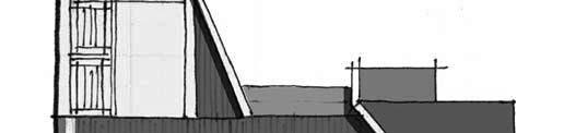
2 Date Appr. 670, 600, & 650 W. 9TH AVE, EDGEWATER, CO 804 As described in the attached traffic study, the future connection of Kendall Street will allow traffic from this development to access 6th Avenue or 9th Avenue for entry and exit. The connection of Kendall Street will include traffic calming measures to encourage lower speeds along the existing apartment complex located south of this property. The connection to 6th Avenue will also allow the neighboring apartment complex to access 9th Avenue directly and alleviate congestion on 6th Avenue. The through street connection onto 9th Avenue shall be mid-block between Jay Street and Ingalls Street to not interfere with existing intersections to the north. Please note that this project is only constructing the Kendall Street portion that is adjacent to this project's boundary. If the future Kendall connection does not get constructed, then circulation of traffic for this development shall strictly be with two entrances/exits along 9th Ave: the Kendall and 9th Ave intersection and the 9th and private road intersection. This development shall be served with Edgewater domestic water services from proposed water main improvements in 9th Avenue to the north and will use Wheat Ridge Sanitation District with a connection to existing infrastructure in Harlan Street southeast of the property. Stormwater runoff shall maintain historic flow patterns and will be detained onsite at the southeast corner of the parcel prior to release. It shall flow via new storm sewer pipe, proposed as a part of this development, through Harlan Street to the south where it will connect with existing infrastructure at the Harlan Street and 6th Avenue intersection. With the proposed improvements of the domestic water line in 9th Avenue, this development shall have minimal impact on water capacity of that new line. Sanitary and storm sewer capacities have been studied by Wheat Ridge Sanitation District and their engineers and have determined that existing infrastructure is adequately sized to receive the additional flows this development will produce. We are proposing to construct site improvements illustrated in the PUD application in one construction phase to accommodate utility looping and minimize the impacts and traffic delays to the adjacent and neighboring residents. Residential home construction sequencing and phasing shall be determined and driven by current market conditions. This application for PUD as opposed to SDP is due to some zoning modifications that are required to meet the densities of the project, which allow it to meet the goals of the Comprehensive Plan. The current property is zoned as R-3 however, limitations within this zoning does not promote higher densities as it relates to residential products. The zoning criteria this development follows closer reflects that of the R-PD zoning of the Edgewater Municipal Code. Although this PUD is not a re-zoning of the property, we are requesting similar criteria to that of R-PD while maintaining the permitted uses of the existing R-3. This narrative shall discuss the variations between R-PD and this PUD, but the following chart shall depict the differences and discrepancies from the current R-3 zoning. Date Revisions Design Standards This PUD is not subject to the Edgewater Design Standards as it is outside the boundaries of those previsions. Vehicle and Pedestrian Safety Per the proposed site plan, vehicular and pedestrian safety, traffic congestion, and fire protection have been accommodated. Pedestrian safety has been addressed with detached sidewalks throughout the neighborhood with slow vehicle traffic on the private roads. This has been accomplished with narrowed street sections and the use of traffic calming intersections and neck downs. This promotes a walk-friendly environment suitable for families to enjoy the common spaces throughout the neighborhood. Although this product proposes 0' setbacks on all sides of the building, consistent with R-PD zoning; the layout of detached sidewalks, this places the building and homes away from the road which allows for better visibility, unobstructed views and safe intersections for vehicles. No. Internally, pedestrian use of this site shall primarily be for residents and visitors of residents of this community. Each dwelling shall have its own onsite parking and the private road accommodates parallel parking on one side for visitors and additional parking necessary for residents. In addition to typical landscape elements; this PUD proposed a retaining wall along the south property line to adjust grades of the existing site to allow for storm water runoff to flow in the historical pattern. Along this retaining wall will be a cedar, picket fence that will serve dual purposes: safety for pedestrians and the fall hazard of the retaining wall and to prevent light trespass from vehicular traffic on the private alleys from entering the Terra Village property. Vehicular Circulation Internal vehicle circulation is fairly limited to the use of the private road with access to the homes being off private alleys. In order to enter or exit the neighborhood, you will access from Kendall St. or 9th Ave. per the site plan. Service Buildings and Facilities This project does not propose any service buildings or facilities. It will have a detention pond on the southeast corner of the property that will be naturally landscaped in the bottom and shall have block retaining walls creating the depression in the ground. A simple 3-rail fence will be around the top of the retaining walls, but there is an accessible gate into the pond for maintenance. All structures will have grating on it to keep the public out of the infrastructure for safety. There will also be a block retaining wall along the south property line to create a flatter grade within the PUD boundary. This wall is approximately high and will have a privacy fence on top of it. This privacy fence will keep the public from falling off the retaining wall and it will also stop vehicular glare from entering the neighboring property. Safety All buildings will be opening up to a green space in front of the front door. This creates an open feel and safe feel for pedestrians. These areas shall have low, uniform light from the front porches and will be lined with sidewalks for ease of walking. Signage There are no proposed monument signs for this PUD application; only the standard traffic signs as shown on the PUD plans. Lighting The site has street lighting proposed along the private street and Kendall Street connection per the photometric plan in the PUD plan set. These lights have full cut off shields to eliminate off-site light trespass. Use As described in the Edgewater Municipal Code; the PUD process shall not allow for modifications to the land use of the existing zoning of the property. This PUD maintains allowable uses under the pre-existing R-3 zoning and intend on using the land for -family dwellings and multi-family dwellings. Building Height Building height in the Edgewater Code is calculated using section which requires use of existing grades at each corner to be averaged when the property exceeds a 3% grade change from north to south, as is true for our property. The existing grade of this site slopes 6% on the west and 7% on the east. After calculation of these averages, our base line existing grade is On the north side of the project we have actual existing grades of 544 and proposed finish floor elevations of 54. This adds approximately 0'- to each building height as described in the code. However, we propose the tallest structures to be 4 from proposed grade which fits the intent of the code as shown in R-PD, but are requesting a maximum height of 60' to accommodate the code methodology of calculating building height. 800 GRANT ST., STE. 0 DENVER, CO 8003 As a part of the master plan for the city of Edgewater, this property is located in the High Density Residential area, which has a maximum density limit of 85 units per acre. This proposed PUD is reaching.69 units per gross acre. This property is also marked within the Evolution Area of the master plan. The Evolution Area is proposed to improve the overall image, accommodate pedestrians, cyclists and public transportation. This development will achieve these goals with a transitional-style architecture depicted in the PUD submittal that will blend some of the styles of the existing community with more modern architecture that has begun to appear in the neighboring communities. The neighborhood will have a pedestrian-friendly feel with detached sidewalks, front doors served off landscaped courtyards and a narrower, slow-speed through street to promote walkability. The proposed right-of-way improvements in the Kendall Street connection shall promote a new north/south route for not only vehicle traffic, but also pedestrians and bicyclists from 9th Avenue to 6th Avenue where there is an existing bus route. Because landscape areas throughout the development are common spaces to be used by all public residing or visiting the community, we are proposing to dedicate Tracts B and J to the city as parks/open space. These two areas combined equate to 5.4% of the overall project. Since it can be assumed the majority of the use of these spaces will be used by residents of this community, it is proposed that the maintenance of this spaces be continued by the HOA or metro district managing this community and will not be supported by City of Edgewater funds E. Dry Creek Rd. Suite 40 Englewood, CO 80 Tel: (70) Fax: (70) Included in the development is the completion of pedestrian improvements along the West 9th Avenue right-of-way for the length of the property boundary and the construction of the street, curb, gutter and sidewalk in the Kendall Street right-of-way along the property's west boundary line. Landscape In addition to the lot coverage, we are requesting no minimums of landscaping compared to R-PD. This is consistent with R-3, which does not discuss or have minimum coverage of landscaping. This PUD represents 80% maximum lot coverage for the internal units of townhomes, which leaves 0% to be landscaped and have sidewalks. As these are the minimums on individual, private lots, overall the project proposes 30.7% of open space or landscaped areas, including sidewalks. The attached planned unit development (PUD) application is for a residential community consisting of 56 lots including two-family attached dwellings and multi-family townhouse dwellings on 4.79 acres. The property is located on the southeast corner of 9th Avenue and the future Kendall Street intersection. Init. A PARCEL OF LAND LOCATED IN THE SOUTHEAST /4 OF THE SOUTHWEST /4 OF 5, TOWNSHIP 3 SOUTH, RANGE 69 WEST OF THE 6TH P.M.,, COUNTY OF JEFFERSON, STATE OF COLORADO CALL NOVEMBER 6, 08 Density While R-3 zoning does not list limitations on density, R-PD calls out a maximum density of 0 units per acre. Our PUD is proposing.69 units per gross acre, which fits the intent of both zonings. Parking As stated in R-3 and R-PD zoning: multi-family requires.5 off-street parking spaces per unit. This PUD meets this intent as an overall project, but does have units that will only have.0 parking spaces on their private lot. However, with the street being deemed private and will not be owned or maintained by the city, this project as a whole delivers 30 spaces while only requiring 84 for the 56 units. The PUD plans depicts two of the most extreme bulk plane situations in the project. It is being proposed that in lieu of providing each building elevation at PUD site plan level plans, that bulk plane analysis be provided to show each individual building meets the requirements of this PUD at time of building permit application. This is due to the optional roof top decks that may be available to purchasers that would change the building elevations prior to building permit submittal. Along 9th Avenue, there are minor adjustments to grade and for the most part maintain the existing grade there. The intent of Bulk Plane will be maintained along this property with the use of 4 maximum height from proposed grade. Bulk Plane R-3 zoning as well as R-PD has limitations on bulk-plane per code. This PUD application is requesting no bulk-plane requirements within the boundary of the PUD, but will maintain code bulk-plane requirements against the adjacent properties which are to the south and east. This shall ensure other property owners maintain their feel of privacy, sunlight access and not overwhelmed by building massing. Setbacks To mimic the setbacks of the R-PD zoning, we are requesting 0' minimum setbacks on all sides of the dwelling. However, as you will see on the site plans and Architectural guidelines, our proposed buildings are drawn with 3'+ setbacks to accommodate stairs, front yard space, drainage, driveway aprons, etc. N:\PROJECTS\EDGEWATER\CAD\ENGINEERING\SHEET SETS\SDP\COVER.DWG, ANDREWP, /5/08 :58 AM Lot Area and Coverage We are requesting a lot coverage maximum of 80% compared to the 50% in R-3 and 45% in R-PD due to our internal, middle townhome products, where the majority of the site is comprised of the building footprint. OF 3 Only 5.8% of the dwelling types will be the 4 height structures from proposed grade which require a code height of 60'. 48.% of the dwellings will have a 3 height from proposed grade which will require a code height of 4 due to the base line calculation. 670, 600, 650 W 9th AVE RESIDENTIAL PROJECT DESCRIPTION It shall also be mentioned that 75% of the proposed lots are negatively effected by the height calculation as defined in the code as 75% of the lots will have finished floor elevations above the base line of 544.
3 JAY STREET HARLAN STREET ZONE R-: RESIDENTIAL- USE: SINGLE FAMILY DWELLINGS 5.' R.O.W. ZONE R-: RESIDENTIAL- USE: SINGLE FAMILY DWELLINGS 670, 600, & 650 W. 9TH AVE, EDGEWATER, CO 804 A PARCEL OF LAND LOCATED IN THE SOUTHEAST /4 OF THE SOUTHWEST /4 OF 5, TOWNSHIP 3 SOUTH, RANGE 69 WEST OF THE 6TH P.M.,, COUNTY OF JEFFERSON, STATE OF COLORADO 00' LINE FROM PROPERTY ZONE R-: RESIDENTIAL- USE: SINGLE FAMILY DWELLINGS ZONE R-3: RESIDENTIAL-3 USE:SINGLE FAMILY DWELLINGS LEND CENTERLINE RIGHT-OF-WAY LINE EASEMENT EDGE OF PAVEMENT EXISTING CONTOUR EXISTING ' CONTOUR EXISTING OVERHEAD POWER EXISTING TELEPHONE LINE No. Revisions Date Init. Appr. Date N:\PROJECTS\EDGEWATER\CAD\ENGINEERING\SHEET SETS\SDP\PROPERTY MAP.DWG, TOMO, /5/08 :58 AM ZONE R-: RESIDENTIAL- USE: CHURCH CALL (544.46) ( ) PARCEL A 5408 (5406.6) 5406 (544.3) DRIVEWAY EASEMENT USED BY: TERRA VILLAGE APARTMENTS 5 R.O.W. PARCEL C (545.56) ZONE R-3: RESIDENTIAL, MULTIPLE-DWELLING FAMILY USE: APARTMENTS ZONE R-3: RESIDENTIAL, MULTIPLE-DWELLING FAMILY USE: VACANT LAND ( ) (545.94) ( ) PARCEL F 4 Area : PARCEL B 548 (5403.4) SUBJECT PROPERTY W. 9TH AVENUE (545.74) (540.96) ( ) 00' LINE FROM PROPERTY 4 LINE PARCEL D (54.78) (54.97) (540.0) PARCEL E R.O.W (54.33) (54.67) DRIVEWAY EASEMENT USED BY: TERRA VILLAGE APARTMENTS ZONE R-3: RESIDENTIAL, MULTIPLE-DWELLING FAMILY USE: SINGLE FAMILY & MULTI-UNIT DWELLINGS (540.53) ( ) ZONE R-3: RESIDENTIAL, MULTIPLE-DWELLING FAMILY USE: APARTMENTS LINE ZONE R-C: RESIDENTIAL-C USE: SINGLE FAMILY DWELLINGS " = 40' 0333 E. Dry Creek Rd. Suite 40 Englewood, CO 80 Tel: (70) Fax: (70) GRANT ST., STE , 600, 650 W 9th AVE RESIDENTIAL DENVER, CO 8003 PROPERTY MAP 3 OF NOVEMBER 6, 08

4 JAY STREET N:\PROJECTS\EDGEWATER\CAD\ENGINEERING\SHEET SETS\SDP\SITE PLAN.DWG, TOMO, /5/08 :58 AM EXISTING STREET LIGHT EXISTING FENCE EXISTING ASPHALT PARKING EXISTING ASPHALT DRIVEWAY 6" FIRE HYDRANT 8' FL-FL 5.' R.O.W. 8' SIDEWALK CALL PRIVATE STRET 9.7' EXISTING OVERHEAD ELECTRIC EXISTING FIRE HYDRANT EXISTING POLE MADON SUBDIVISION REC. NO ' 3 7. ALLEY ALLEY CEDAR PRIVACY FENCE 6" VERTICAL CURB & GUTTER 4' * 4' STREET PARKING EXISTING ASPHALT PARKING EXISTING ASPHALT DRIVEWAY TERRA VILLAGE APARTMENTS HOLDING COMPANY EXISTING OVERHEAD ELECTRIC 5 R.O.W. EXISTING POLE SW SIDEWALK 3' 8' 9' FL-FL * * 9.' 4' 0' 4' 4' 0' 0' PUBLIC ACCESS EASEMENT 8' FL-FL 0' 0' 8' TRAVEL LANE TRAVEL LANE PARKING (VARIES) WALK 4' 9' 4' * 4' 6" FIRE HYDRANT SW ALLEY 9.' 8' DRIVEWAY EASEMENT WALK 6" VERTICAL CURB & GUTTER (SPILL) 8' 3' TRAVEL LANE 670, 600, & 650 W. 9TH AVE, EDGEWATER, CO 804 A PARCEL OF LAND LOCATED IN THE SOUTHEAST /4 OF THE SOUTHWEST /4 OF 5, TOWNSHIP 3 SOUTH, RANGE 69 WEST OF THE 6TH P.M.,, COUNTY OF JEFFERSON, STATE OF COLORADO 9' ' 5 R.O.W. 9' ALLEY 5 R.O.W. 3' TRAVEL LANE 3% SLOPE SW PATH OF TRAVEL 3 8' FL-FL 5.8' PARKING (VARIES) PRIVATE STREET 5 R.O.W. MAIL KIOSK 5.8' WALK 8' 7' 7. EXISTING SANITARY SEWER 0' W. 9TH AVENUE SIDEWALK 8' ALLEY 7.7' 6" VERTICAL CURB & GUTTER (CATCH) EXISTING STORM 7' 4.4' 4' 4' 0' 4 LINE * 6" FIRE HYDRANT 7' 8" SD 8" WL STREET LIGHT RETAINING WALL STREET PARKING 9.3' 0.9' CEDAR PRIVACY FENCE ' CONCRETE CURB 3 UNPLATTED 9. EOP-EOP ' GUTTER % SLOPE PRIVATE STREET SIDEWALK 5. SW EXISTING ASPHALT DRIVEWAY PATH OF TRAVEL.3' 8.9' DETENTION POND PER 00 YR EVENT EXISTING DRIVEWAY EASEMENT ASPHALT PARKING MOUNTABLE CURB & GUTTER PRIVATE ALLEY 4' 7' 0' ALLEY TERRA VILLAGE APARTMENTS HOLDING COMPANY 5 R.O.W. 0' ALLEY EXISTING FENCE RETAINING WALL 4" SD 3 RAIL CEDAR FENCE EVANS VIEW SUBDIVISION BOOK, PAGE 5 HELEN MARIE BERGLUND AS TRUSTEE BUTTERFLY VALVE CAP WITH END OF LINE BLOWOFF VALVE FIRE HYDRANT WL FITTING WITH THRUST BLOCK FLARED END LIGHT POLE SIDEWALK EXISTING ELEVATION DESIGN ELEVATION DRAIN INLET DRAIN MANHOLE EXISTING OVERHEAD POWER EXISTING TELEPHONE LINE SIGN BUILDING FOOTPRINT " = 40' NOTES:. SIDEWALK & SITE IMPROVEMENTS ALONG 9TH AVE. TO BE COORDINATED WITH WHEAT RIDGE'S STREET IMPROVEMENTS.. MAILBOX KIOSK TO BE DETERMINED BY US POSTAL SERVICE * LEND MULTI-FAMILY DWELLING TWO-FAMILY ATTACHED DWELLING POTENTIAL ACCESSIBLE UNIT STREET NAME CENTERLINE RIGHT-OF-WAY EDGE OF PAVEMENT DIRECTION OF FLOW SLOPE & DIRECTION EXISTING CONTOUR EXISTING ' CONTOUR CONTOUR ' CONTOUR DRAIN SEWER LINE WITH MANHOLE SEWER LATERAL WATER LINE WATER LATERAL W/ METER LINE ACCESSIBLE PATHWAY E. Dry Creek Rd. Suite 40 Englewood, CO 80 Tel: (70) Fax: (70) GRANT ST., STE , 600, 650 W 9th AVE RESIDENTIAL DENVER, CO 8003 SITE PLAN 4 OF 3 No. Revisions Date Init. Appr. Date NOVEMBER 6, 08
5 JAY STREET N:\PROJECTS\EDGEWATER\CAD\ENGINEERING\SHEET SETS\SDP\SITE PLAN - PARCEL PAGE.DWG, TOMO, /5/08 :58 AM PUBLIC ACCESS EASEMENT 5.' R.O.W. PUBLIC ACCESS EASEMENT ALLEY ALLEY MADON SUBDIVISION 5 R.O.W. EXISTING PARCEL LINE TO BE REMOVED UTILITY EASEMENT TRACT SUMMARY TABLE TRACT AREA AREA USE OWNERSHIP MAINTENANCE A AC.,880 S.F. UTILITIES/ACCESS HOA/METRO DIST. HOA/METRO DIST. TRACT I B AC. 4,03 S.F. UTILITIES/ACCESS CITY HOA/METRO DIST. C AC.,880 S.F. UTILITIES/ACCESS HOA/METRO DIST. HOA/METRO DIST. D 0.05 AC.,6 S.F. UTILITIES/ACCESS HOA/METRO DIST. HOA/METRO DIST. E AC. 3,37 S.F. UTILITIES/ACCESS HOA/METRO DIST. HOA/METRO DIST. F 0.86 AC. 8,0 S.F. UTILITIES/ACCESS HOA/METRO DIST. HOA/METRO DIST. G AC.,585 S.F. UTILITIES/ACCESS HOA/METRO DIST. HOA/METRO DIST. H 0.05 AC.,7 S.F. UTILITIES/ACCESS HOA/METRO DIST. HOA/METRO DIST. I 0.00 AC. 864 S.F. OPEN SPACE/UTILITIES HOA/METRO DIST. HOA/METRO DIST. J 0.65 AC. 7,0 S.F. OPEN SPACE/UTILITIES CITY HOA/METRO DIST. K AC. 8,78 S.F. OPEN SPACE/UTILITIES HOA/METRO DIST. HOA/METRO DIST. CALL TRACT A TRACT G , 600, & 650 W. 9TH AVE, EDGEWATER, CO 804 A PARCEL OF LAND LOCATED IN THE SOUTHEAST /4 OF THE SOUTHWEST /4 OF 5, TOWNSHIP 3 SOUTH, RANGE 69 WEST OF THE 6TH P.M.,, COUNTY OF JEFFERSON, STATE OF COLORADO TRACT B TRACT H TO BE DEDICATED TO CITY ALLEY EXISTING PARCEL LINE TO BE REMOVED U.E. 3 TRACT C TRACT K R.O.W. ALLEY EXISTING DRIVEWAY EASEMENT USED BY: TERRA VILLAGE APARTMENTS UNIT TYPE 4 Area : MULTIFAMILY (W/ CAR GARAGE) MULTIFAMILY (W/ CAR GARAGE) ADDITIONAL STREET PARKING ADDITIONAL STREET PARKING ON KENDALL ST. 9 8 TRACT J 7 3 U.E. TO BE DEDICATED TO CITY 6 4 TRACT F 5 5 PARKING TABLE # OF UNITS REQUIRED PARKING W. 9TH AVENUE 4 3 TRACT D 8 ALLEY 7 6 EXISTING PARCEL LINE TO BE REMOVED PROVIDED PARKING GARAGE/ 5 ON-STREET NA NA NA NA 8 TOTAL * MUNICIPAL CODE: SEC TABLE LINE EXISTING PARCEL LINE TO BE REMOVED 7 UNPLATTED 8 9 UTILITY EASEMENT 3 4 UTILITY EASEMENT UTILITY EASEMENT TRACT E U.E. 5 R.O.W. ALLEY ALLEY 5 TRACT K 6 LAND USE TABLE TYPE SQ. FT. ACRES EVANS VIEW SUBDIVISION EXISTING DRIVEWAY EASEMENT USED BY: TERRA VILLAGE APARTMENTS UTILITY EASMENT % OF TOTAL AREA TWO-FAMILY ATTACHED DWELLING 4, MULTI-FAMILY DWELLING 6, OPEN SPACE/UTILITIES 36, ACCESS/UTILITIES 7, ROAD RIGHT OF WAY 39, TOTAL 08, " = 40' UTILITY EASEMENT LINE UTILITY EASMENT HARLAN STREET 0333 E. Dry Creek Rd. Suite 40 Englewood, CO 80 Tel: (70) Fax: (70) GRANT ST., STE , 600, 650 W 9th AVE RESIDENTIAL DENVER, CO 8003 LAND USE PLAN 5 OF 3 No. Revisions Date Init. Appr. Date NOVEMBER 6, 08
6 JAY STREET 5.' R.O.W. 8" WL EXISTING 8" WL EXISTING OVERHEAD ELECTRIC EXISTING FIRE HYDRANT EXISTING POLE MADON SUBDIVISION REC. NO R.O.W. EXISTING POLE ALLEY 670, 600, & 650 W. 9TH AVE, EDGEWATER, CO 804 A PARCEL OF LAND LOCATED IN THE SOUTHEAST /4 OF THE SOUTHWEST /4 OF 5, TOWNSHIP 3 SOUTH, RANGE 69 WEST OF THE 6TH P.M.,, COUNTY OF JEFFERSON, STATE OF COLORADO EXISTING OVERHEAD ELECTRIC W. 9TH AVENUE ALLEY EXISTING STORM EXISTING SANITARY SEWER 4 LINE CONNECT TO EXISTING WL 6" FIRE HYDRANT PRIVATE STREET UNPLATTED 8" WL ALLEY 5 R.O.W. ALLEY EXISTING FENCE EVANS VIEW SUBDIVISION BOOK, PAGE 5 JAY STREET W. 9TH AVENUE KEYMAP N.T.S. HARLAN STREET 0333 E. Dry Creek Rd. Suite 40 Englewood, CO 80 Tel: (70) Fax: (70) No. Revisions Date Init. Appr. Date EXISTING STREET LIGHT EXISTING FENCE EXISTING ASPHALT DRIVEWAY 6" FIRE HYDRANT 8' FL-FL FL-FL ALLEY CONNECT TO EXISTING WL EXISTING 8" WL PRIVATE STRET ALLEY 8" WL FL-FL STREET LIGHT EXISTING ASPHALT PARKING STREET LIGHT, TYP. 8" WL EXISTING ASPHALT DRIVEWAY DRIVEWAY EASEMENT 6" FIRE HYDRANT 5 R.O.W. ALLEY 8" WL FL-FL STREET LIGHT 8" SD RETAINING WALL SIDEWALK SW DETENTION POND PER 00 YR EVENT EXISTING DRIVEWAY EASEMENT ASPHALT PARKING EXISTING ASPHALT DRIVEWAY 4" SD U.E RETAINING WALL HELEN MARIE BERGLUND AS TRUSTEE EXISTING WATER LINE LINE CONNECT TO EXISTING SS MH U.E. EXISTING OVERHEAD ELECTIC " = 40' LEND EXISTING OVERHEAD POWER EXISTING TELEPHONE LINE EXISTING GAS LINE EXISTING FIBER OPTICS EXISTING SANITARY SEWER EXISTING STORM DRAIN EXISTING WATER MAIN BUTTERFLY VALVE CAP WITH END OF LINE BLOWOFF VALVE FIRE HYDRANT WL FITTING WITH THRUST BLOCK WATER LINE WATER LATERAL W/ METER SEWER LINE WITH MANHOLE 800 GRANT ST., STE. 0 DENVER, CO 8003 N:\PROJECTS\EDGEWATER\CAD\ENGINEERING\SHEET SETS\SDP\AREA UTILITY PLAN.DWG, TOMO, /5/08 :58 AM NOTES:. W 9TH IMPROVEMENTS TO BE COORDINATED WITH THE CITY.. IMPROVEMENTS WITHIN WHEAT RIDGE WILL REQUIRE A WHEAT RIDGE ROW PERMIT CALL TERRA VILLAGE APARTMENTS HOLDING COMPANY MATCHLINE - SEE ABOVE EXISTING WL 4" SD " = 40' HARLAN STREET EXISTING GAS LINE TERRA VILLAGE APARTMENTS HOLDING COMPANY LINE EXISTING WL EXISTING SS EXISTING FIRE HYDRANT EXISTING SANITARY SEWER U.E. 4" SD EXISTING GAS LINE MATCHLINE - SEE BELOW HARLAN STREET EXISTING SD CONNECT TO EXISTING SD EXISTING FIBER OPTICS EXISTING OVERHEAD ELECTRIC SEWER LATERAL DRAIN FLARED END DRAIN INLET DRAIN MANHOLE LIGHT POLE SIDEWALK 670, 600, 650 W 9th AVE RESIDENTIAL AREA UTILITY PLAN 6 OF NOVEMBER 6, 08

7 6.0% 5.99% JAY STREET.00% 3.00% 6.5% 6.0% 0: 3: 6.00%.85% 6.5% N:\PROJECTS\EDGEWATER\CAD\ENGINEERING\SHEET SETS\SDP\DRAINAGE PLAN.DWG, CLAYG, /5/08 :59 AM 46. FL H FL FL 540 3: 545 FL-FL 540 8' FL-FL FL FL A-A B-B C-C FL 8' FL-FL FL FL FL-FL H : % : % A 5: A G G 8: STAIRS W/ HANDRAIL (3 RISERS) STAIRS W/ HANDRAIL (4 RISERS) MADON SUBDIVISION STAIRS W/ HANDRAIL (8 RISERS) 3: 0: : B B FL " RCP TOW: 0.45 BOW: 7.38 STAIRS W/ HANDRAIL (7 RISERS) 0.97% 3.00% 3: W. 9TH AVENUE F 3: 4.7 F : % TOW:.00 BOW: FL STAIRS W/ HANDRAIL (7 RISERS) HP % 5.55% FL 3.85 TOW: 3.79 BOW: FL : 3.00% UNPLATTED FL-FL FL 8" RCP 8" RCP FL 54. FL :.08 C C % E E 3: : " RCP FL FL FL D D FL FL 8" RCP FL FL FL FL 6.30 HP TOW: 6.0 BOW:.0 8" RCP FL FL FL-FL FL FL TOW: FL HP FL 6.05 BOW: % : FL FL FL DETENTION FL FL POND PER BOP = : YR EVENT 8" RCP SIDEWALK W. 9TH AVE SIDEWALK W. 9TH AVE SIDEWALK W. 9TH AVE CALL R.O.W. 3: MAX 3: MAX R.O.W. R.O.W. ' D-D E-E F-F EX. FENCE RETAINING WALL 9.3' P.L RAIL CEDAR FENCE P.L. RETAINING WALL EASEMENT EX. PARKING P.L. 3: 3: MAX 4: PRIVACY FENCE POND RETAINING WALL 670, 600, & 650 W. 9TH AVE, EDGEWATER, CO 804 A PARCEL OF LAND LOCATED IN THE SOUTHEAST /4 OF THE SOUTHWEST /4 OF 5, TOWNSHIP 3 SOUTH, RANGE 69 WEST OF THE 6TH P.M.,, COUNTY OF JEFFERSON, STATE OF COLORADO ' RETAINING WALL G-G H-H P.L. PRIVACY FENCE EASEMENT EX. PARKING CONCRETE STRAIRS PUBLIC ACCESS EASEMENT 8' KENDALL ST (PUBLIC) ' RETAINING WALL HANDRAIL DETAIL DRAINAGE EASEMENT RETAINING WALL TOP RAIL 34-38" L.L. SIDEWALK BUTTERFLY VALVE CAP WITH END OF LINE BLOWOFF VALVE FIRE HYDRANT WL FITTING WITH THRUST BLOCK FLARED END LIGHT POLE SIDEWALK EXISTING ELEVATION DESIGN ELEVATION DRAIN INLET DRAIN MANHOLE EXISTING OVERHEAD POWER EXISTING TELEPHONE LINE SIGN BUILDING FOOTPRINT LEND CENTERLINE RIGHT-OF-WAY EDGE OF PAVEMENT DIRECTION OF FLOW SLOPE & DIRECTION EXISTING CONTOUR EXISTING ' CONTOUR CONTOUR ' CONTOUR DRAIN SEWER LINE WITH MANHOLE SEWER LATERAL WATER LINE WATER LATERAL W/ METER LINE ACCESSIBLE PATHWAY TOW: 6.0 BOW: : 4: 4: " = 30' NOTES:. WALLS OVER 4' TO INCLUDE STRUCTURAL CALCS AND REQUIRE PERMIT 0333 E. Dry Creek Rd. Suite 40 Englewood, CO 80 Tel: (70) Fax: (70) GRANT ST., STE , 600, 650 W 9th AVE RESIDENTIAL DENVER, CO 8003 DRAINAGE PLAN 7 OF 3 No. Revisions Date Init. Appr. Date NOVEMBER 6, 08
8


9


10


11
12

13
SITE. Sheet Index. Legal Description. General Notes: Vicinity Map Scale 1" = 600'
 Quebec St. LOCATED IN THE SOHWEST QUARTER OF SECTION 8, TOWNSHIP SOH, RANE 67 WEST OF THE 6TH P.M., Case # Z 06-005 Legal Description Tract, H and J of the Filing No., a part of the Southwest quarter of
EDGEWATER PLANNING AND ZONING COMMISSION RESOLUTION NO. PC
 EDGEWATER PLANNING AND ZONING COMMISSION RESOLUTION NO. PC 2019-02 A RESOLUTION CONDITIONALLY APPROVING A PRELIMINARY PLAT OF PARCELS A, B, C, D, E AND F, IN THE SOUTHEAST ¼ OF THE SOUTHWEST ¼ OF SECTION
CITY OF MERCED SMALL LOT SINGLE-FAMILY HOME DESIGN GUIDELINES
 CITY OF MERCED SMALL LOT SINGLE-FAMILY HOME DESIGN GUIDELINES Development Services Department Planning and Permitting Adopted August 15, 2005 SMALL LOT SINGLE FAMILY HOME GUIDELINES A. Purpose and Applicability.
DEVELOPMENT STANDARDS FOR RESIDENTIAL PROJECTS RESIDENTIAL BUILDING TYPES: APPROPRIATE ZONES AND DENSITIES 2-1
 2 DEVELOPMENT STANDARDS FOR RESIDENTIAL PROJECTS RESIDENTIAL BUILDING TYPES: APPROPRIATE ZONES AND DENSITIES 2-1 This Chapter presents the development standards for residential projects. Section 2.1 discusses
CONSTRUCTION PLANS for HALCYON A RESIDENTIAL SUBDIVISION 6100 MIDNIGHT PASS ROAD, SARASOTA, FL 34242
 CONSTRUCTION PLANS for HALCYON A RESIDENTIAL SUBDIVISION 6100 MIDNIGHT PASS ROAD, SARASOTA, FL 34242 SECTION 18, TOWNSHIP 37 SOUTH, RANGE 18 EAST SARASOTA COUNTY, FLORIDA PID: 0030001 A DEVELOPMENT BY
RIVERDALE CITY PLANNING COMMISSION APPLICATION FOR RESIDENTIAL SUBDIVISION SITE PLAN APPROVAL
 Community Development 4600 So. Weber River Drive Riverdale, Utah 84405 RIVERDALE CITY PLANNING COMMISSION APPLICATION FOR RESIDENTIAL SUBDIVISION SITE PLAN APPROVAL CASE NO: DATE SUBMITTED: APPLICANT S
Introduction. General Development Standards
 Introduction The development standards will set the zoning regulations for the East Park development. This section will illustrate lot standards, approximate open space locations and road standards. The
PRIMUS TRACT MOUNT PLEASANT, SOUTH CAROLINA
 DEVELOPMENT GUIDELINES FOR PRIMUS TRACT MOUNT PLEASANT, SOUTH CAROLINA Date February 18, 2015 PLANNING COMMISSION SUBMITTAL Owner/Developer: American Star Development SC, LLC P.O. Box 211 Sullivans Island,
ARTICLE IV: DEVELOPMENT STANDARDS
 ARTICLE IV: DEVELOPMENT STANDARDS IV-53 409 PRIVATE STREETS A private street means any way that provides ingress to, or egress from, property by means of vehicles or other means, or that provides travel
ARTICLE 900 PLAT AND PLAN REQUIREMENTS
 ARTICLE 900 PLAT AND PLAN REQUIREMENTS SEC. 900.1 ITEMS TO BE SHOWN ON PLAT OR PLAN General (1) Property lines of all property owners adjacent to the exterior boundaries of the project shall be located
PLANNING COMMISSION STAFF REPORT
 PLANNING COMMISSION STAFF REPORT Alder-Robinson Subdivision Amending the Amended Plat of the Arcadia Heights Plat A Subdivision Case #PLNSUB2010-00044 2857 East 2100 South June 23, 2010 Applicant: Greg
SUBJECT: Application for Planned Unit Development and Rezoning 1725 Winnetka Road
 TO: FROM: CHAIRMAN BILL VASELOPULOS AND MEMBERS OF THE PLAN & ZONING COMMISSION STEVE GUTIERREZ DIRECTOR OF COMMUNITY DEVELOPMENT MEETING DATE: September 5, 2017 SUBJECT: Application for Planned Unit Development
REPORT TO THE PLANNING COMMISSION
 Agenda Number: PC14-50 MEETING DATE: February 5, 2015 REPORT TO THE PLANNING COMMISSION SUBJECT: Villas of Tara Oaks Request approval of a Preliminary Subdivision Plat for 29 lots, on 9.14 acres located
ARTICLE 15 - PLANNED UNIT DEVELOPMENT
 Section 15.1 - Intent. ARTICLE 15 - PLANNED UNIT DEVELOPMENT A PUD, or Planned Unit Development, is not a District per se, but rather a set of standards that may be applied to a development type. The Planned
E. 140TH AVE. VICINITY MAP SCALE: 1"=600' LAND USE TABLE NET AREA 599,946 SQFT AC. GROSS AREA 741,420 SQFT AC.
 SHEET OF PURPOSE STATEMENT: THIS PLAT IS INTENDED TO SUBDIVIDE. ACRES INTO SINGLE FAMILY ATTACHED LOTS, TRACTS, DEDICATE AND GRANT EASEMENTS. LEGAL DESCRIPTION: THE UNDERSIGNED BEING THE OWNER(S) OF A
Subdivision of existing two lots into three lots.
 PP-15-00189 Item No. 4-1 PC Staff Report 06/22/2015 PLANNING COMMISSION REPORT NON PUBLIC HEARING ITEM PUBLIC HEARING ON THE VARIANCE ONLY ITEM NO 4: PRELIMINARY PLAT FOR DEERFIELD WOODS SUBDIVISION NO.
QUEBEC STREET EAST 130TH AVENUE ONEIDA STREET E. 130TH AVE. VALENTIA ST TAMARAC ST EAST 128TH AVENUE MONACO STREET BACHMAN DR. SITE QUINCE ST.
 SHEET OF CASE NO.: SUBA 0-0 PURPOSE STATEMENT: THIS PLAT IS INTENDED TO SUBDIVIDE. ACRES INTO 0 SINGLE FAMILY LOTS, AND TRACTS FOR PARKS, OPEN SPACE, DRAINAGE AND DETENTION, DEDICATE RIGHT-OF-WAY AND GRANT
Cover Letter with Narrative Statement
 Cover Letter with Narrative Statement March 31, 2017 rev July 27, 2017 RE: Rushton Pointe Residential Planned Unit Development Application for Public Hearing for RPUD Rezone PL2015 000 0306 Mr. Eric Johnson,
Condominium Unit Requirements.
 ARTICLE 19 CONDOMINIUM REGULATIONS Section 19.01 Purpose. The purpose of this Article is to regulate projects that divide real property under a contractual arrangement known as a condominium. New and conversion
QUEBEC STREET EAST 130TH AVENUE ONEIDA STREET E. 130TH AVE. VALENTIA ST TAMARAC ST EAST 128TH AVENUE MOACO STREET BACHMAN DR. SITE QUINCE ST.
 SHEET OF CASE NO.: SUBA - PURPOSE STATEMENT: THIS PLAT IS INTENDED TO SUBDIVIDE. ACRES INTO SINGLE FAMILY LOTS, AND TRACTS FOR PARKS, OPEN SPACE, DRAINAGE AND DETENTION, DEDICATE RIGHT-OF-WAY AND GRANT
Indian Peaks Filing No. 2 Replat B Page 2 Sketch Plan Review
 MEMO To: Planning Commission From: Paul Rayl, Planning Manager Date: February 18, 2016 Subject: Indian Peaks Filing No. 2, Replat B Sketch Plan Review Applicant/Owner: McStain Neighborhoods, Applicant
Article 3. SUBURBAN (S-) NEIGHBORHOOD CONTEXT
 NEIGHBORHOOD CONTEXT") Article 3. SUBURBAN (S-) NEIGHBORHOOD CONTEXT this page left intentionally blank Contents ARTICLE 3. SUBURBAN (S-) NEIGHBORHOOD CONTEXT DIVISION 3.1 NEIGHBORHOOD CONTEXT DESCRIPTION...3.1-1 Section 3.1.1
Article 3. SUBURBAN (S-) NEIGHBORHOOD CONTEXT this page left intentionally blank Contents ARTICLE 3. SUBURBAN (S-) NEIGHBORHOOD CONTEXT DIVISION 3.1 NEIGHBORHOOD CONTEXT DESCRIPTION...3.1-1 Section 3.1.1
New Electronic Planning Commission Submittal Process
 New Electronic Planning Commission Submittal Process STANDARD OPERATING PROCEDURE Purpose: To outline the electronic submittal process for applications to the Planning Commission. Background: Procedure:
ARTICLE 900 PLAT AND PLAN REQUIREMENTS
 Final SEC. 900.01 ARTICLE 900 PLAT AND PLAN REQUIREMENTS General provisions. (a) Scale. The scale of all plats and plans shall be a minimum of 1 to 100 ft. (b) Size. The minimum page size for all plats
STAFF REPORT FOR MAJOR SUBDIVISION
 STAFF REPORT FOR MAJOR SUBDIVISION FINAL PLAT CASE NO. FA-13-001 HEARING DATE: November 6, 2013 CASE NAME: Solterra Subdivision Filing No. 14 PROCEDURE: Planning Commission ADDRESS OF MAJOR SUBDIVISION
To: Planning and Zoning Commission Anna Bertanzetti, Planning Director Alice Hanson, Senior Planner
 To: Planning and Zoning Commission From: Anna Bertanzetti, Planning Director Alice Hanson, Senior Planner Meeting Date Agenda Category Agenda Item # June 26, 2017 Business 4.b 1. Public Hearing on a Proposed
City and County of Broomfield, Colorado
 City and County of Broomfield, Colorado CITY COUNCIL AGENDA MEMORANDUM To: From: Mayor and City Council George Di Ciero, City and County Manager Teri Malies, Principal Planner Terrance Ware, Planning Director
FINAL SUBDIVISION AND LAND DEVELOPMENT PLAN CHECKLIST. Plan Name. Applicant's Name:
 TOWNSHIP OF UPPER ST. CLAIR FINAL SUBDIVISION AND LAND DEVELOPMENT PLAN CHECKLIST Date Filed Plan Name PLC Applicant's Name: Phone Filing Date for Final Application Final Plat 114.22. FINAL APPLICATION
ARTICLE 23 CONDOMINIUM STANDARDS
 ARTICLE 23 CONDOMINIUM STANDARDS Section 23.01 Intent. The intent of this Article is to provide regulatory standards for condominiums and site condominiums similar to those required for projects developed
Initial Project Review
 Pierce County Department of Planning and Land Services, 2401 South 35th Street, Tacoma, WA (253) 798-7037 Initial Project Review Major Amendment to Preliminary Plat: Hawks Ridge Division 1 Application
Section Preliminary Plat Checklist and Application Forms
 Section 201 - Preliminary Plat Checklist and Application Forms PRELIMINARY SUBDIVISION PLAT REVIEW PROCESS CHART PRELIMINARY SUBDIVISION PLAT APPLICATION PRELIMINARY PLAT REVIEW CHECKLIST CITY OF NAMPA
RESIDENTIAL Site Plan Architecture Review Cannon Trail Project Narrative
 RESIDENTIAL Site Plan Architecture Review Cannon Trail Project Narrative Thank you for the opportunity to present the architecture planned for Cannon Trail. The challenge Diverge Homes faced when creating
SUBDIVISION AND LAND DEVELOPMENT. 185 Attachment 20
 185 Attachment 20 APPENDIX S Plat No. Date of Submission Twp. Fee $ Dauphin Co. Fee $ TOWNSHIP OF DERRY SUBDIVISION OR LAND DEVELOPMENT PLAN SUBMISSION APPLICATION This block for Twp. use only 1. Title
DETAILED GRADING PLAN CHECKLIST (TEARDOWN/REDEVELOPMENT) Updated: 12/12/2017
 Updated: 12/12/2017") DETAILED GRADING PLAN CHECKLIST (TEARDOWN/REDEVELOPMENT) Updated: 12/12/2017 ADDRESS: PERMIT #: DATE: Sat. Not GENERAL 1. A disposition of comments should be included in all subsequent submittals. 2. Plan
DETAILED GRADING PLAN CHECKLIST (TEARDOWN/REDEVELOPMENT) Updated: 12/12/2017 ADDRESS: PERMIT #: DATE: Sat. Not GENERAL 1. A disposition of comments should be included in all subsequent submittals. 2. Plan
ARTICLE 9 SPECIFICATIONS FOR DOCUMENTS TO BE SUBMITTED
 ARTICLE 9 SPECIFICATIONS FOR DOCUMENTS TO BE SUBMITTED SECTION 950 GENERALLY All applications shall be properly signed and filed by the owner or, with the owner s specific written consent, a contract purchaser
DETAILED GRADING PLAN CHECKLIST (TEARDOWN/REDEVELOPMENT)
") GENERAL DETAILED GRADING PLAN CHECKLIST (TEARDOWN/REDEVELOPMENT) ADDRESS: PERMIT #: DATE: 1. Plan is signed and sealed by an Illinois registered professional engineer including date signed and license
GENERAL DETAILED GRADING PLAN CHECKLIST (TEARDOWN/REDEVELOPMENT) ADDRESS: PERMIT #: DATE: 1. Plan is signed and sealed by an Illinois registered professional engineer including date signed and license
UPPER MOUNT BETHEL TOWNSHIP NORTHAMPTON COUNTY, PENNSYLVANIA
 UPPER MOUNT BETHEL TOWNSHIP NORTHAMPTON COUNTY, PENNSYLVANIA JOINDER DEED / LOT CONSOLIDATION TOWNSHIP REVIEW PROCESS When accepting proposed Joinder Deeds / Lot Consolidations, review the Joinder Deed
Planned Residence District (PR) To review a plan to construct 11 single family homes on approximately 4.01 acres.
 To review a plan to construct 11 single family homes on approximately 4.01 acres.") STAFF REPORT PLANNING & ZONING COMMISSION Village Green Municipal Building, Council Chambers 47 Hall Street Wednesday, March 13, 2019 7:00 P.M. 1. FINAL DEVELOPMENT PLAN REVIEW Applicant: Romanelli and
STAFF REPORT PLANNING & ZONING COMMISSION Village Green Municipal Building, Council Chambers 47 Hall Street Wednesday, March 13, 2019 7:00 P.M. 1. FINAL DEVELOPMENT PLAN REVIEW Applicant: Romanelli and
ARTICLE 13 CONDOMINIUM REGULATIONS
 ARTICLE 13 CONDOMINIUM REGULATIONS Section 13.01 Purpose. The purpose of this Article is to regulate projects that divide real property under a contractual arrangement known as a condominium. New and conversion
Accessory Dwelling Units (ADUs)
") Community Development Department Planning Division 14177 Frederick Street PO Box 8805 Moreno Valley, CA 92552-0805 (951) 413-3206 Fax (951) 413-3210 Accessory Dwelling Units (ADUs) Completed Project Application
Community Development Department Planning Division 14177 Frederick Street PO Box 8805 Moreno Valley, CA 92552-0805 (951) 413-3206 Fax (951) 413-3210 Accessory Dwelling Units (ADUs) Completed Project Application
CHAPTER 26 PLANNING AND ZONING ARTICLE VII. MOBILE HOMES AND RECREATIONAL VEHICLE (RV) PARKS. Recreational Vehicle (RV) Park Development Standards
 PARKS. Recreational Vehicle (RV) Park Development Standards") CHAPTER 26 PLANNING AND ZONING ARTICLE VII. MOBILE HOMES AND RECREATIONAL VEHICLE (RV) PARKS. Section 26-VII-1. Section 26-VII-2. Section 26-VII-3. Section 26-VII-4. Section 26-VII-5. Purpose Permitted
CHAPTER 26 PLANNING AND ZONING ARTICLE VII. MOBILE HOMES AND RECREATIONAL VEHICLE (RV) PARKS. Section 26-VII-1. Section 26-VII-2. Section 26-VII-3. Section 26-VII-4. Section 26-VII-5. Purpose Permitted
CHECKLIST FOR DEVELOPMENT REVIEW
 CHECKLIST FOR DEVELOPMENT REVIEW Petitions and related documents and plans for land development or other proposals regulated by Title 16 of the Municipal Code (Development Ordinance) and Title 17 of the
AGENDA SLOT HOME EVALUATION & TEXT AMENDMENT. 5:30 - Welcome
 AGENDA 5:30 - Welcome Please sign-in, put a sticker on the map, grab snacks, materials and a seat 5:45 - Staff Presentation 6:15 - Open House Stations Background Information Mixed Use Districts Multi Unit
Project Description: Consider site plan approval for the construction of a new car wash in the Gateway Center subdivision.
 COMMUNITY DEVELOPMENT DEPARTMENT Planning and Zoning Division 1725 Reynolds Street, Suite 200, Brunswick, GA 31520 Phone: 912-554-7428/Fax: 1-888-252-3726 MAINLAND PLANNING COMMISSION STAFF REPORT August
Report to the Plan Commission February 4, 2013
 Report to the Plan Commission Legistar I.D. #28789 Conditional Use Requested Actions: Approval of a conditional use for a structure exceeding 10,0000 square feet of total floor area and an accessory building
ARTICLE 14 PLANNED UNIT DEVELOPMENT (PUD) DISTRICT
 DISTRICT") ARTICLE 14 PLANNED UNIT DEVELOPMENT (PUD) DISTRICT Section 14.01 Intent. It is the intent of this Article to allow the use of the planned unit development (PUD) process, as authorized by the Michigan Zoning
ARTICLE 14 PLANNED UNIT DEVELOPMENT (PUD) DISTRICT Section 14.01 Intent. It is the intent of this Article to allow the use of the planned unit development (PUD) process, as authorized by the Michigan Zoning
PLANNED UNIT DEVELOPMENT & SUBDIVISION STAFF REPORT August 18, 2016
 PLANNED UNIT DEVELOPMENT & SUBDIVISION STAFF REPORT August 18, 2016 DEVELOPMENT NAME SUBDIVISION NAME Mullinax Ford Subdivision Mullinax Ford Subdivision LOCATION CITY COUNCIL DISTRICT District 6 Southeast
PUBLIC HEARING* N/A. C I T Y O F T A C O M A Planning & Development Services Department 747 Market St, Rm 345 Tacoma, WA 98402
 C I T Y O F T A C O M A Planning & Development Services Department 747 Market St, Rm 345 Tacoma, WA 98402 PUBLIC HEARING* Date of Notifcation: 10/5/2018 Application Received: 04/19/2018 Application Complete:
PLANNING COMMISSION REPORT Regular Agenda Non Public Hearing Item
 PC Staff Report 3/23/15 FDP-14-00551 Item No. 2-1 PLANNING COMMISSION REPORT Regular Agenda Non Public Hearing Item PC Staff Report 3/23/15 ITEM NO. 2: FINAL DEVELOPMENT PLAN FOR HUTTON FARMS WEST PHASE
PRELIMINARY PLAT CHECK LIST
 PRELIMINARY PLAT CHECK LIST Name of Proposed Subdivision: The following items must be included with the initial submittal of a Preliminary Plat: Application, filled out completely Project Narrative Pre-application
Packet Contents: Page #
 CLEAR CREEK COUNTY PLANNING DEPARTMENT REQUIREMENTS FOR COMMERCIAL AND MULTI-FAMILY DEVELOPMENTS Prior to submitting a building permit application, the Planning staff will review the site plan and construction
Chapter 22 PLANNED UNIT DEVELOPMENT.
 Chapter 22 PLANNED UNIT DEVELOPMENT. Sec. 22.1 INTENT. The use of land and the construction and use of buildings and other structures as Planned Unit Developments in Georgetown Township may be established
Final PD Site Plan Checklist. Name of Project: Project No.:
 Town of Monument Planning Department Final PD Site Plan Checklist Name of Project: Project No.: The following checklist must be returned with the application to the Planning Department. Any waivers must
Watertown City Council
 City of Watertown Watertown City Council 2/14/2017 Agenda Item: Riverpointe Subdivision 2 nd Replat Request for Action: Sketch Plan Department: Planning Request for Action Request: Paxmar, LLC (Applicant)
CONDOMINIUM REGULATIONS
 ARTICLE 37 CONDOMINIUM REGULATIONS SECTION 37.01. Purpose The purpose of this Article is to regulate projects that divide real property under a contractual arrangement known as a condominium. New and conversion
THE REDEVELOPMENT PLAN
 PAGE 37 THE REDEVELOPMENT PLAN FUTURE LAND USE The Silver Terrace Redevelopment Area is currently designated as Redevelopment Area #4 on the City of Delray Beach Future Land Use Map (FLUM). This designation
MIDWAY CITY Planning Office 75 North 100 West Phone: x105 Midway, Utah Fax:
 MIDWAY CITY Planning Office 75 North 100 West Phone: 435-654-3223 x105 Midway, Utah 84049 Fax: 435-654-2830 mhenke@midwaycityut.org Preliminary/ Final Application for Small Scale Subdivision Application
SUBDIVISION APPLICATION
 SUBDIVISION APPLICATION Preliminary Plat Minor Plat Final Plat Amended Plat Applicant Name: Owner (if different from applicant) Name: Company: Company: Address: Address: City, State, Zip City, State, Zip
Re: Case # ZP Preplanning Application for 8 townhomes at 1526 Ingalls Street in Lakewood, CO.
 Planning Department Civic Center North 480 South Allison Parkway Lakewood, Colorado 80226-3127 303.987.7505 303.987.7057 TTY/TDD Lakewood.org/Planning February 27, 2017 Nathan Taylor 601 S Jason Street
Community Development Department 333 Broadalbin Street SW, P.O. Box 490 Albany, OR 97321
 SUMMARY Community Development Department 333 Broadalbin Street SW, P.O. Box 490 Albany, OR 97321 STAFF REPORT Application for Tentative Partition Plat Review Planning File PA-06-17 Phone: 541-917-7550
CITY OF DERBY. MEETING OF THE PLANNING COMMISSION REGULAR MEETING June 19, :30 PM
 CITY OF DERBY MEETING OF THE PLANNING COMMISSION REGULAR MEETING June 19, 2014 6:30 PM CALL MEETING TO ORDER ROLL CALL CONSIDERATION OF MINUTES: Planning Commission Meeting of June 5, 2014. PUBLIC FORUM
M-43 CORRIDOR OVERLAY ZONE
 ARTICLE 26.00 M-43 CORRIDOR OVERLAY ZONE Section 26.01 Findings A primary function of the M-43 state highway is to move traffic through the Township and to points beyond. As the primary east-west arterial
MAJOR SUBDIVISION APPLICATION
 Revised 2.26.18 The Department is here to assist you with your development application pursuant to the Community Development Code (CDC). This publication outlines the Major Subdivision Development Application
320 Maple Mixed Use PDR Narrative Fort Collins, CO Project # 1525
 320 Maple Mixed Use PDR Narrative Fort Collins, CO Project # 1525 July 28, 2015 (a) What are you proposing/use? A 47,00 S.F., 3-story, mixed used project with 30 for-sale condo residential units and 2
PLANNED UNIT DEVELOPMENT & SUBDIVISION STAFF REPORT Date: April 18, 2019
 PLANNED UNIT DEVELOPMENT & SUBDIVISION STAFF REPORT Date: April 18, 2019 DEVELOPMENT NAME SUBDIVISION NAME Springhill Village Subdivision Springhill Village Subdivision LOCATION 4350, 4354, 4356, 4358,
CITY COUNCIL STUDY SESSION MEMORANDUM
 City and County of Broomfield, Colorado To: From: Prepared by: Owner Applicant Property Size Property Location: CITY COUNCIL STUDY SESSION MEMORANDUM Mayor and City Council Charles Ozaki, City and County
MAPLETON CITY CORPORATION. Step 7: Upon final approval and prior to plat recording the applicant shall provide the following:
 MAPLETON CITY CORPORATION Subdivision Process The City s subdivision requirements are designed to facilitate orderly, safe and efficient development and to implement the adopted General Plan. Below is
ARTICLE 24 SITE PLAN REVIEW
 ARTICLE 24 SITE PLAN REVIEW 24.1 PURPOSE: The intent of these Ordinance provisions is to provide for consultation and cooperation between the land developer and the Township Planning Commission in order
Guidelines for the Approval of New Homes Sales Offices (Building Permits, Agreements, Securities)
") Guidelines for the Approval of New Homes Sales Offices (Building Permits, Agreements, Securities) ENCLOSURES: Site Plan Application Building Permit Application Grading and Drainage Approval Requirements
Guidelines for the Approval of New Homes Sales Offices (Building Permits, Agreements, Securities) ENCLOSURES: Site Plan Application Building Permit Application Grading and Drainage Approval Requirements
3. IMPACT, SITE DEVELOPMENT PERMIT, BUIDLING PERMIT AND OTHER FEES
 Art at Bratton s Edge Page 2 of 13 TABLE OF CONTENTS A. EXECUTIVE SUMMARY 1. PROJECT OVERVIEW 2. DUE DILIGENCE STATEMENT B. SITE SUMMARY ITEMS 1. ZONING REQUIREMENTS 2. SUBDIVISION REQUIREMENTS 3. DEVELOPMENT
SUBJECT PARCEL(S) Property Owner(s) TMS Number Approximate Acreage Carolina Park Development, LLC
 Property Owner(s) TMS Number Approximate Acreage Carolina Park Development, LLC") Staff Report Special Planning Commission Meeting November 19, 2014 For reference, the Zoning Code and Land Development Regulations are available online. AGENDA ITEM 5c. SKETCH PLAN APPROVAL REQUEST: Request
Staff Report Special Planning Commission Meeting November 19, 2014 For reference, the Zoning Code and Land Development Regulations are available online. AGENDA ITEM 5c. SKETCH PLAN APPROVAL REQUEST: Request
FINAL SPUD APPLICATION
 The Planning & Development Services Department is here to assist you with your development application pursuant to the Community Development Code (CDC). This publication outlines the Final SPUD Development
Unified Development Code
 Unified Development Code City of Keller, Texas Prepared by the City of Keller Community Development Department Adopted: July 7, 2015 Article One Introduction UDC Table of Contents Section 1.01 - Title
DEVELOPMENT DEPARTMENT STAFF REPORT THE PARK AT 5 TH
 DEVELOPMENT DEPARTMENT STAFF REPORT ARB Meeting Date: July 3, 2018 Item #: _PZ2018-293_ THE PARK AT 5 TH Request: Site Address: Project Name: Parcel Number: Applicant: Proposed Development: Current Zoning:
APPLICANT NAME SUBDIVISION NAME DEVELOPMENT NAME LOCATION. CITY COUNCIL DISTRICT Council District 4 PRESENT ZONING PROPOSED ZONING
 SUBDIVISION, PLANNED UNIT DEVELOPMENT, PLANNING APPROVAL, ZONING AMENDMENT, & SIDEWALK WAIVER REQUEST STAFF REPORT Date: February 17, 2010 APPLICANT NAME SUBDIVISION NAME DEVELOPMENT NAME LOCATION David
Planning Department st Avenue East Kalispell, MT Phone: (406) Fax: (406)
 Fax: (406)") Planning Department 201 1 st Avenue East Kalispell, MT 59901 Phone: (406) 758-7940 Fax: (406) 758-7739 www.kalispell.com/planning April 1, 2015 Doug Russell, City Manager City of Kalispell 201 1 st Ave
Planning Department 201 1 st Avenue East Kalispell, MT 59901 Phone: (406) 758-7940 Fax: (406) 758-7739 www.kalispell.com/planning April 1, 2015 Doug Russell, City Manager City of Kalispell 201 1 st Ave
Bowie Marketplace Residential Detailed Site Plan Statement of Justification January 13, 2017 Revised February 2, 1017
 Bowie Marketplace Residential Detailed Site Plan Statement of Justification January 13, 2017 Revised February 2, 1017 Submitted on behalf of: BE Bowie LLC 5410 Edson Lane, Suite 220 Rockville, MD 20852
SUBDIVISION, PLANNED UNIT DEVELOPMENT, PLANNING APPROVAL, ZONING AMENDMENT, & SIDEWALK WAIVER REQUEST STAFF REPORT Date: February 17, 2010
 SUBDIVISION, PLANNED UNIT DEVELOPMENT, PLANNING APPROVAL, ZONING AMENDMENT, & SIDEWALK WAIVER REQUEST STAFF REPORT Date: February 17, 2010 APPLICANT NAME SUBDIVISION NAME DEVELOPMENT NAME LOCATION David
STAFF REPORT. Guttman Development Group, LLC. PUD-R (Residential Planned Unit Development Plan)
") P a g e 1 STAFF REPORT CASE: APPLICANT: LOCATION: ZONED: REQUEST: ZC09-2017 Guttman Development Group, LLC 4990 Wilmington Pike PUD-R (Residential Planned Unit Development Plan) A Major Change to an Approved
P a g e 1 STAFF REPORT CASE: APPLICANT: LOCATION: ZONED: REQUEST: ZC09-2017 Guttman Development Group, LLC 4990 Wilmington Pike PUD-R (Residential Planned Unit Development Plan) A Major Change to an Approved
(a) Commercial uses on Laurel Avenue, abutting the TRO District to the
 Commercial uses on Laurel Avenue, abutting the TRO District to the") 32X Zoning Code 150.36 TRANSITIONAL RESIDENTIAL OVERLAY DISTRICT. (A) Intent and purpose. (1) It is the intent of the Transitional Residential Overlay District (hereinafter referred to as the "TRO District")
32X Zoning Code 150.36 TRANSITIONAL RESIDENTIAL OVERLAY DISTRICT. (A) Intent and purpose. (1) It is the intent of the Transitional Residential Overlay District (hereinafter referred to as the "TRO District")
PLANNED UNIT DEVELOPMENT & SUBDIVISION STAFF REPORT Date: November 17, 2016
 PLANNED UNIT DEVELOPMENT & SUBDIVISION STAFF REPORT Date: November 17, 2016 DEVELOPMENT NAME SUBDIVISION NAME LOCATION Autonation Ford of Mobile Autonation Ford of Mobile Subdivision 901, 909, and 925
ARTICLE VI. SUBDIVISION STANDARDS, PUBLIC
 ARTICLE VI. SUBDIVISION STANDARDS, PUBLIC IMPROVEMENTS, AND DESIGN REQUIREMENTS ARTICLE VI. SUBDIVISION STANDARDS, PUBLIC IMPROVEMENTS, AND DESIGN REQUIREMENTS DIVISION 1. GENERAL PROVISIONS Sec. 21-6100.
Urban Design Brief. Proposed Medical / Dental Office 1444 Adelaide Street North. Vireo Health Facility Ltd.
 Urban Design Brief Proposed Medical / Dental Office Vireo Health Facility Ltd. November 27, 2013 TABLE OF CONTENTS Page No. INTRODUCTION... 1 SECTION 1 LAND USE PLANNING CONTEXT... 1 1.1 The Subject Lands...
Village of Glenview Plan Commission
 Village of Glenview Plan Commission STAFF REPORT May 13, 2014 TO: Chairman and Plan Commissioners CASE #: P2014-037 FROM: Community Development Department CASE MANAGER: Tony Repp, Planner SUBJECT: Final
REPORT TO THE SHELBY COUNTY PLANNING COMMISSION From the Department of Development Services Planning Services. February 4, 2019
 REPORT TO THE SHELBY COUNTY PLANNING COMMISSION From the Department of Development Services Planning Services February 4, 2019 Case No. Request for Rezoning Approval From E-1 to E-2 SD This is a request
Accessory Dwelling Unit Permit
 PLANNING SERVICES DEPARTMENT 411 Main Street (530) 87-6800 P.O. Box 3420 Chico, CA 527 Application No. APPLICATION FOR Accessory Dwelling Unit Permit Applicant Information Applicant Street Address Daytime
619. Planned Development District (PD)
") 619. Planned Development District (PD) Intent. The purpose of the Planned Development District (sometimes hereinafter referred to as PD) is to provide opportunities to create more desirable environments
619. Planned Development District (PD) Intent. The purpose of the Planned Development District (sometimes hereinafter referred to as PD) is to provide opportunities to create more desirable environments
PLAINFIELD CHARTER TOWNSHIP COMMUNITY DEVELOPMENT DEPARTMENT PLANNING, ZONING & BUILDING SERVICES MEMORANDUM
 PLAINFIELD CHARTER TOWNSHIP COMMUNITY DEVELOPMENT DEPARTMENT PLANNING, ZONING & BUILDING SERVICES 6161 BELMONT AVENUE N.E. BELMONT, MI 49306 PHONE 616-364-1190 FAX: 616-364-1170 www.plainfieldchartertwp.org
Community Development
 Land Use Petition RZ-15-010 Concurrent Variance VC-15-010-01 Date of Staff Recommendation Preparation: August 14, 2015 Date of Planning Commission Recommendation: September 1, 2015 PROJECT LOCATION: DISTRICT/SECTION/LANDLOT(S):
WESTMINSTER PARK PLACE SUBDIVISION
 WESTMINSTER PARK PLACE SUBDIVISION Engineering Comments: FINAL PLAT COMMENTS (should be addressed prior to submitting the FINAL PLAT for review and/or signature by the City Engineer): A. Provide all of
Site Plan Application
 Site Plan Application City of St. Pete Beach Community Development Department 155 Corey Avenue St. Pete Beach, Florida 33706 (727) 367-2735 www.stpetebeach.org Case Number: PROPERTY OWNER: Name: Address:
Exhibit A-1. Piney Creek Bend Planned Development
 Exhibit A-1 Piney Creek Bend Planned Development A. Purpose and Intent The Piney Creek Bend PD is composed of approximately 90.91 acres, as described in Exhibit D (Field Notes). The development of this
CHAPTER 32 SUBDIVISIONS SECTION TITLE PAGE NO.
 Page 1 of 46 CHAPTER 32 SUBDIVISIONS SECTION TITLE PAGE NO. SECTION 32-1 Purpose of Ordinance 3 SECTION 32-2 Definitions 3 SECTION 32-3 Staff Sketch Review 4 SECTION 32-4 Subdivision and PUD Plats Required
Medical Marijuana Special Exception Use Information
 Medical Marijuana Special Exception Use Information The Special Exception Use information below is a modified version of the Unified Development Code. It clarifies the current section 5:104 Special Exceptions
SUBMITTAL REQUIREMENTS: The number indicates the number of copies for submittal (if applicable).
.") Office Use Only Preliminary Long Plat Long Subdivision Applicant Checklist PLANNING, COMMUNITY, & ECONOMIC DEVELOPMENT DEPARTMENT PRELIMINARY LONG PLAT LONG SUBDIVISION CHECKLIST Mailing Address: P.O.
Office Use Only Preliminary Long Plat Long Subdivision Applicant Checklist PLANNING, COMMUNITY, & ECONOMIC DEVELOPMENT DEPARTMENT PRELIMINARY LONG PLAT LONG SUBDIVISION CHECKLIST Mailing Address: P.O.
PLAT OF SURVEY VICINITY MAP (NOT TO SCALE) N N W E SITE BENCHMARK # 2 W E N&D ON BACK OF CURB NAVD 88 S S 0' 10' 20' 40' 60' 1" = 20' TOP=106.7
 N N W E SITE BENCHMARK # 2 W E N&D ON BACK OF CURB NAVD 88 S S 0' 10' 20' 40' 60' 1 = 20' TOP=106.7") PLAT OF SURVEY VICINITY MAP (NOT TO SCALE) N N W E SITE BENCHMARK # 2 W E N&D ON BACK OF CURB 106.21 NAVD 88 S S 0' 10' 20' 40' 60' 1" = 20' TOP=106.72 N INV PVC=99.27 S INV PVC=99.32 E INV CLAY=99.39
PLAT OF SURVEY VICINITY MAP (NOT TO SCALE) N N W E SITE BENCHMARK # 2 W E N&D ON BACK OF CURB 106.21 NAVD 88 S S 0' 10' 20' 40' 60' 1" = 20' TOP=106.72 N INV PVC=99.27 S INV PVC=99.32 E INV CLAY=99.39
Operating Standards Attachment to Development Application
 Planning & Development Services 2255 W Berry Ave. Littleton, CO 80120 Phone: 303-795-3748 Mon-Fri: 8am-5pm www.littletongov.org Operating Standards Attachment to Development Application 1 PLANNED DEVELOPMENT
BOSSIER CITY PARISH METROPOLITAN PLANNING COMMISSION 620 Benton Rd. Bossier City, LA Phone: Fax: PRELIMINARY PLAT
 (OFFICE USE ONLY) Application Fee: Paid: Date: CASE # Project Information BOSSIER CITY PARISH METROPOLITAN PLANNING COMMISSION 620 Benton Rd. Bossier City, LA 71111 Phone: 318-741-8824 Fax: 318-741-8827
LINCOLN COUNTY PLANNING & INSPECTIONS DEPARTMENT
 LINCOLN COUNTY PLANNING & INSPECTIONS DEPARTMENT 302 NORTH ACADEMY STREET, SUITE A, LINCOLNTON, NORTH CAROLINA 28092 704-736-8440 OFFICE 704-736-8434 INSPECTION REQUEST LINE 704-732-9010 FAX To: Board
Parkland-Spanaway-Midland LUAC - Agenda
 1. 6:30 P.M. Parkland-Spanaway-Midland LUAC - Agenda Documents: 8 2 17 PSMAC Agenda.pdf 2. Parkland-Spanaway-Midland LUAC Initial Project Review Documents: Lincoln Court PP IPR PSMAC-RJ.pdf Department