|
|
|
- Daniel Randall
- 5 years ago
- Views:
Transcription
1
2
3 Action Items
4
5
6
7 Reporting of the Nominating Committee and Election of 2014 Officers
8 Act 247 Reviews
9 Subdivision & Land Development
10 Act 247 Reviews of Proposed Development during December 2013 Symbols 15 9 Residential Lots/Units Non-Residential Square Feet @ @ Other D D 1-10,000 10, , ,001-1,200,000 Mixed Use Not Consistent with Livable Landscapes Livable Landscapes2 Note: Excludes lot line revisions, lot consolidations, second reviews, sketch plans, and surface parking, UNLESS those reviews cited unique or significant community impacts # Plan # Title 1 LD JMP Malvern Associates LP 2 LD Quarry Ridge 3 LD Ultimate Image - Lionville 4 LD Brandywine YMCA 5 LD Clover Mill Road Lot 2 6 LD Traditions of West Goshen 7 LD Struble Trail Trailhead and Crossing Improvements 8 LD Heartland Dental Care 9 LD Valley Forge Educational Services 10 SD The Comerford Tract 11 SD Waln Run Park 12 SD Northmark Building, LLC 13 SD Thomas J. Manuel & Lewis E. Manuel 14 SD Old Lancaster Road 15 SD Frank J. Batchelor Growth Areas Urban Suburban Suburban Center Rural Resource Areas Agricultural Rural Rural Center Overlay Features Natural Landscape Municipalities Miles
11 To: Chester County Planning Commission From: Planning Staff Re: 247 Activity - 12/1/2013 to 12/31/2013 SUBDIVISION AND LAND DEVELOPMENT APPLICATIONS Applications consist of the following land use types: LAND USE PROP. LOTS/UNITS Sfr YEAR TO DATE PROP. LOTS/UNITS YEAR TO DATE PROP. LOTS/UNITS TOTAL PROP. LOTS/UNITS Apt , , ,009 Ths Twn Mh Agr Com Ind Ins TOTALS: , , ,542 UNOFFICIAL SKETCH PLAN EVALUATIONS Applications consist of the following land use types: LAND USE PROP. LOTS/UNITS Sfr YEAR TO DATE PROP. LOTS/UNITS YEAR TO DATE PROP. LOTS/UNITS TOTAL PROP. LOTS/UNITS 0 0 Apt Ths Twn Mh Agr Com Ind Ins TOTALS:
12 Subdivision & Land Development Review Reports
13 Subdivision and Land Development Reviews 12/1/2013 thru 12/31/2013 Community Name Municipality Plan # Title Acreage Land Use Lots/Units Roads (L Feet) (+, -, N/R) Landscapes2 Central Upper Uwchlan Township LD Struble Trail Trailhead Ins 3 + Uwchlan Township SD Northmark Building, LLC 2.49 Sfr 3 + Uwchlan Township LD Heartland Dental Care 0.86 Com 1 + Uwchlan Township SD Ultimate Image - Lionville 3.95 Com 2 + Uwchlan Township LD Ultimate Image - Lionville 3.95 Com 1 + Wallace Township SD Louis T. and Susan C Sfr 2 N/R Schneider West Bradford Township SD Klein Head & Head, LLP Agr 2 + West Brandywine Township LD Brandywine YMCA Ins 1 + Eastern East Whiteland Township LD Lapp Road 3.60 Ind 1 N/R East Whiteland Township LD Quarry Ridge Com 1 + East Whiteland Township LD JMP Malvern Associates LP 4.67 Com 1 + Tredyffrin Township SD Old Lancaster Road 1.39 Sfr 2 + Tredyffrin Township LD Valley Forge Educational Services 8.40 Ins 1 + Willistown Township SD Elizabeth R. Moran Sfr 2 + Agr Northern Honey Brook Township SD Ricmar Real Estate, LP Ind 2 + North Coventry Township SD John S. & Susan A. Andybur Sfr 2 N/R Agr West Vincent Township SD Frank J. Batchelor 7.28 Sfr 2 + Southeastern Kennett Square Borough SD Thomas J. Manuel & Lewis E. Manuel 0.51 Twn 2 + Southwestern East Nottingham Township SD Mark R. & Gail L. Bowden Sfr Agr 2 + West Chester East Bradford Township SD The Comerford Tract Sfr 3 + Thornbury Township SD Waln Run Park Sfr 3 + West Goshen Township LD Traditions of West Goshen 6.65 Apt December 23, 2013 Page 1 of 2
14 Community Name Municipality Plan # Title Acreage Land Use Lots/Units Roads (L Feet) (+, -,N/R) Landscapes2 West Whiteland Township LD Clover Mill Road Lot Ind 1 + County Totals Municipalities Reviews Acreage Lots/Units Linear Feet There are 20 plans consistent, 0 plans inconsistent, and 3 plans with no relevance to Landscapes2. December 23, 2013 Page 2 of 2
15 Structure Square Footage/Use Per Land Development for 12/1/2013 thru 12/31/2013 Municipality Planning Square Number of Total Number Title Footage Structure Use Buildings Lots/Units Acreage East Whiteland Township LD Quarry Ridge 50,000 Com Addition to Existing East Whiteland Township LD JMP Malvern Associates LP 16,742 Com Retail Tredyffrin Township LD Valley Forge Educational Services 1,694 Ins Addition to Existing Upper Uwchlan Township LD Struble Trail Trailhead 252 Ins Unique Uwchlan Township LD Heartland Dental Care 6,170 Com Medical Building Uwchlan Township LD Ultimate Image - Lionville 4,547 Com Unique West Brandywine Township LD Brandywine YMCA 21,317 Ins Addition to Existing West Whiteland Township LD Clover Mill Road Lot 2 99,080 Ind Unique Grand Total 8 199, December 23, 2013 Page 1 of 1
16 Subdivision & Land Development Letters
17 December 4, 2013 Terry Woodman, Manager East Whiteland Township 209 Conestoga Road Frazer, PA Re: Preliminary/Final Land Development Lapp Road # LD East Whiteland Township Dear Ms. Woodman: A preliminary/final land development plan entitled 380 Lapp Road, prepared by Edward B. Walsh & Associates, Inc., and dated October 28, 2013, was received by this office on November 6, The land development is situated on the south side of Lepp Road south of Wilburdale Road and involves the reconfiguration of the parking facilities for the existing 30,000 square foot office/warehouse building, along with the construction of a new loading dock, on a 3.6 acre site (UPI# ). No new water or sewer supply is proposed by the current plan submission. The project site is located in the O/BP Office/Business Park zoning district. This plan is reviewed by the Chester County Planning Commission in accord with the provisions of Section 502 of the Pennsylvania Municipalities Planning Code (MPC). This report does not review the plan for compliance to all aspects of your ordinance, as this is more appropriately done by agents of East Whiteland Township. We offer the following comments on the proposed land development for your consideration: ADMINISTRATIVE NOTES: 1. It is identified on Sheet 2 that, on September 23, 2013, the Township Zoning Hearing Board granted special exception approval (pertaining to the outdoor storage of crusher parts), along with a variance from the parking/driveway setback requirements of the Township zoning ordinance, with six conditions of approval. Prior to granting final plan approval, the Township should verify that the plan conforms to the decision issued by the Township Zoning Hearing Board. 2. The site is underlain by carbonate geology in which the presence or potential may exist for formation and/or expansion of solution channels, sinkholes and other karst features. These features can present risk of collapse and groundwater contamination that often can be overcome and avoided with careful stormwater management design. The location, type, and design of stormwater facilities and best management practices (BMPs) should be based on a site evaluation conducted by a qualified licensed professional that ascertains the conditions relevant to formation of karst features, and the PA BMP Manual or other design guidance acceptable to the Municipal Engineer. 3. The site is located in an area designated by the Pennsylvania Department of Environmental Protection (DEP) as a Special Protection Watershed. Special Protection Watersheds are important because Chester County s High Quality and Exceptional Value Watersheds may be especially ccplanning@chesco.org Web site:
18 Page: 2 December 4, 2013 Re: Preliminary/Final Land Development Lapp Road # LD East Whiteland Township sensitive to degradation and pollution that could result from development. The following map note should appear on all erosion and sediment pollution control plans (we acknowledge that a similar note is provided on Sheet 4): The site is located in an area designated by the Pennsylvania Department of Environmental Protection as a Special Protection Watershed, and extreme care should be exercised in all disturbance activities to prevent degradation of the waters of the Commonwealth. All disturbed areas on which work has been, or will be stopped, must be promptly stabilized with appropriate temporary or permanent stabilization measures. 4. A minimum of four (4) copies of the plan should be presented at the Chester County Planning Commission for endorsement to permit recording of the final plan in accord with the procedures of Act 247, the Pennsylvania Municipalities Planning Code, and to meet the requirements of the Recorder of Deeds and the Assessment Office. RECOMMENDATION: The Commission recommends that all East Whiteland Township requirements be satisfied, and the administrative issues raised in this letter be addressed, before action is taken on this plan. Sincerely, RTB/PF cc: Burch Materials & Supplies Edward B. Walsh & Associates, Inc. Virginia McMichael, Board of Supervisors Chair Gregory Davis, Planning Commission Chair Maureen Perri, Planning Commission Secretary Chester County Conservation District Ronald T. Bailey, AICP Secretary
19 Terry Woodman, Manager East Whiteland Township 209 Conestoga Road Frazer, PA December 4, 2013 Re: Preliminary/Final Land Development - JMP Malvern Associates LP # LD East Whiteland Township Dear Ms. Woodman: A preliminary/final land development plan entitled JMP Malvern Associates LP, prepared by Landcore Engineering Consultants, P.C, and dated June 10, 2013 and last revised October 26, 2013, was received by this office on November 6, The 4.67 acre project site (UPI# ) is situated to the immediate northeast of the intersection of Morehall Road (Route 29) and East Lancaster Avenue (we note the site plan identifies the project site as Unit No. 2 of the Malvern Hotel Condominium project, and the existing Holiday Inn Express on UPI# to the west as Unit No. 1). The applicant proposes the construction of a 16,742 square foot restaurant/retail building (comprised of seven retail spaces), and 125 additional parking spaces. The project site, which is served by public water and sewer, is located in the O/BPS Office/Business Park Services zoning district. This plan is reviewed by the Chester County Planning Commission in accord with the provisions of Section 502 of the Pennsylvania Municipalities Planning Code (MPC). This report does not review the plan for compliance to all aspects of your ordinance, as this is more appropriately done by agents of East Whiteland Township. We offer the following comments on the proposed land development for your consideration: BACKGROUND: 1. The Chester County Planning Commission has previously reviewed a preliminary land development proposal for this site. CCPC# ( One Morehall Road ), dated June 6, 2007, addressed the construction of a three-story 132 unit hotel building and 147 parking spaces. According to our records, this plan was approved by the Township on October 10, We note that the currently proposed restaurant building is generally situated on the same area of the site previously approved for the hotel building. LANDSCAPES: 2. The project site is located within the Suburban Center Landscape designation of Landscapes2, the 2009 County Comprehensive Plan. The location of the proposed land development is consistent with the guidelines of the Suburban Center Landscape. WATERSHEDS: 3. Watersheds, An Integrated Water Resources Plan for Chester County and Its Watersheds, was adopted in 2002 as the water resources component of Landscapes. Watersheds indicates that the proposed development activity is located within the Valley Creek watershed. The highest priority ccplanning@chesco.org Web site:
20 Page: 2 December 4, 2013 Re: Preliminary/Final Land Development - JMP Malvern Associates LP # LD East Whiteland Township management objectives identified in Watersheds for consideration in land development and land use planning within the Valley Creek watershed include: reduce stormwater runoff, restore water quality of impaired streams, and protect/enhance historic, cultural and recreational resources. It is recommended that these concerns and conditions be taken into consideration in final site design decisions. Specific strategies for implementation to effectively address these items can be found in Part 8 of Watersheds. A more detailed listing of water resources management needs and resources to be protected within the Valley Creek watershed can be found in Part 10 of Watersheds. The applicant should also comply with the applicable provisions of the Valley Creek Act 167 Plan approved by the Pennsylvania Department of Environmental Protection on February 4, The site is located in an area designated by the Pennsylvania Department of Environmental Protection (DEP) as a Special Protection Watershed. Special Protection Watersheds are important because Chester County s High Quality and Exceptional Value Watersheds may be especially sensitive to degradation and pollution that could result from development. The DEP may impose stricter limitations on proposed wastewater and stormwater discharges in these watersheds, and DEP also encourages that special care be exercised in the design and construction of stormwater control facilities in these areas. The DEP suggests that Best Management Practices (BMPs) be used for stormwater control, as recommended in The Pennsylvania Stormwater Best Management Practices Manual. This document is available from the Chester County Conservation District or directly from DEP via the web at: then select Best Management Practices (BMP) Manual. The applicant should also refer to the Best Management Practices for Stormwater Management Tool on the County Planning Commission website, which is located online at: Project engineers are encouraged to incorporate BMPs into their site designs. Additionally, the following map note should appear on all erosion and sediment pollution control plans: PRIMARY ISSUES: The site is located in an area designated by the Pennsylvania Department of Environmental Protection as a Special Protection Watershed, and extreme care should be exercised in all disturbance activities to prevent degradation of the waters of the Commonwealth. All disturbed areas on which work has been, or will be stopped, must be promptly stabilized with appropriate temporary or permanent stabilization measures. 5. The site is underlain by carbonate geology in which the presence or potential may exist for formation and/or expansion of solution channels, sinkholes and other karst features. These features can present risk of collapse and groundwater contamination that often can be overcome and avoided with careful stormwater management design. The location, type, and design of stormwater facilities and best management practices (BMPs) should be based on a site evaluation conducted by a qualified licensed professional that ascertains the conditions relevant to formation of karst features, and the PA BMP Manual or other design guidance acceptable to the Municipal Engineer.
21 Page: 3 December 4, 2013 Re: Preliminary/Final Land Development - JMP Malvern Associates LP # LD East Whiteland Township 6. We recommend that the applicant and Township provide a sidewalk extension to connect to the existing Wyeth Labs Trail to the east. Landscapes2 promotes development design that encourages walking and bicycling, including sidewalks and other pedestrian facilities in urban and suburban centers. ADMINISTRATIVE NOTES: 7. The plan identifies that, on September 23, 2013, the Township zoning hearing board granted a variance from the impervious coverage requirements, along with special exception approval for additional signage. Prior to granting final plan approval, the Township should verify that the plan conforms to the decision issued by the Township Zoning Hearing Board. 8. The item on the attached agency contact list should be addressed and reflected in the proposed land development. 9. A minimum of four (4) copies of the plan should be presented at the Chester County Planning Commission for endorsement to permit recording of the final plan in accord with the procedures of Act 247, the Pennsylvania Municipalities Planning Code, and to meet the requirements of the Recorder of Deeds and the Assessment Office. RECOMMENDATION: The Commission recommends that the issues raised in this letter be addressed and all East Whiteland Township requirements be satisfied before action is taken on this plan. Sincerely, RTB/PF Attachment cc: Buckley, Brion, McGuire, Morris & Sommer LLP JMP Malvern Associates Landcore Engineering Consultants P.C. Virginia McMichael, Board of Supervisors Chair Gregory Davis, Planning Commission Chair Maureen Perri, Planning Commission Secretary Chester County Conservation District Ronald T. Bailey, AICP Secretary
22 Terry Woodman, Manager East Whiteland Township 209 Conestoga Road Frazer, PA December 4, 2013 Re: Final Land Development - 3 Quarry Ridge # LD East Whiteland Township Dear Ms. Woodman: A preliminary/final land development plan entitled 3 Quarry Ridge, prepared by Nave Newell, and dated October 28, 2013, was received by this office on November 6, The acre site (UPI# ) is situated on the west side of Old Morehall Road north of Swedesford Road. The applicant proposes the construction of a 50,000 square foot building addition to a previously approved six-story 200,000 square foot office building, and 330 additional parking spaces, on a acre site (UPI ). The project site, which is served by public water and sewer, is located in the O/BP Office/Business Park zoning district. This plan is reviewed by the Chester County Planning Commission in accord with the provisions of Section 502 of the Pennsylvania Municipalities Planning Code (MPC). This report does not review the plan for compliance to all aspects of your ordinance, as this is more appropriately done by agents of East Whiteland Township. We offer the following comments on the proposed land development for your consideration: BACKGROUND: 1. The Chester County Planning Commission has previously reviewed a land development proposal for this site (CCPC# , dated October 1, 2001), which addressed the construction of a 200,000 square foot office building and 1,006 parking spaces (including a parking garage). Our records indicate that this plan was approved by East Whiteland Township on April 1, 2003, and a site visit conducted by Commission staff on November 22, 2013 identified that this project is currently under construction. We note the current plan identifies that two additional levels are proposed to be added to the previously approved parking garage and, according to the parking summary tables on Sheet 5, 30 fewer surface parking spaces will be provided. LANDSCAPES: 2. The project site is located within the Suburban Landscape and Natural Landscape designations of Landscapes2, the 2009 County Comprehensive Plan. The location of the proposed land development is consistent with the guidelines of the Suburban Landscape. PRIMARY ISSUE: 3. The site is underlain by carbonate geology in which the presence or potential may exist for formation and/or expansion of solution channels, sinkholes and other karst features. These features can present risk of collapse and groundwater contamination that often can be overcome and avoided with careful stormwater management design. The location, type, and design of stormwater facilities and best management practices (BMPs) should be based on a site evaluation ccplanning@chesco.org Web site:
23 Page: 2 December 4, 2013 Re: Final Land Development - 3 Quarry Ridge # LD East Whiteland Township conducted by a qualified licensed professional that ascertains the conditions relevant to formation of karst features, and the PA BMP Manual or other design guidance acceptable to the Municipal Engineer. ADMINISTRATIVE NOTES: 4. It is identified on Sheet 5 that the applicant is requesting variances from the accessory building height and common parking area setback standards of the Township zoning ordinance. The Township should not grant final plan approval prior to the Zoning Hearing Board granting any variance requests. The final plan should accurately note the Zoning Hearing Board s decision, including any conditions of approval issued by the Board. 5. The site is located in an area designated by the Pennsylvania Department of Environmental Protection (DEP) as a Special Protection Watershed. Special Protection Watersheds are important because Chester County s High Quality and Exceptional Value Watersheds may be especially sensitive to degradation and pollution that could result from development. The following map note should appear on all erosion and sediment pollution control plans: The site is located in an area designated by the Pennsylvania Department of Environmental Protection as a Special Protection Watershed, and extreme care should be exercised in all disturbance activities to prevent degradation of the waters of the Commonwealth. All disturbed areas on which work has been, or will be stopped, must be promptly stabilized with appropriate temporary or permanent stabilization measures. 6. The applicant should verify that consistent, accurate terminology is utilized throughout the site plan. For instance, Sheets 4 and 7 identify the previously approved office building as an existing building, while Sheets 5 and 6 identify it as proposed. 7. The item on the attached agency contact list should be addressed and reflected in the proposed land development. 8. A minimum of four (4) copies of the plan should be presented at the Chester County Planning Commission for endorsement to permit recording of the final plan in accord with the procedures of Act 247, the Pennsylvania Municipalities Planning Code, and to meet the requirements of the Recorder of Deeds and the Assessment Office. RECOMMENDATION: The Commission recommends that all East Whiteland Township requirements be satisfied, and the issues raised in this letter be addressed, before action is taken on this plan. Sincerely, RTB/PF Attachment cc: Liberty Property Limited Partnership Nave Newell Virginia McMichael, Board of Supervisors Chair Gregory Davis, Planning Commission Chair Maureen Perri, Planning Commission Secretary Chester County Conservation District Ronald T. Bailey, AICP Secretary
24 December 11, 2013 Doug Hanley, Manager Uwchlan Township 715 North Ship Road Exton, PA Re: Final Land Development - Ultimate Image-Lionville # LD Uwchlan Township Dear Mr. Hanley: A final land development plan entitled Ultimate Image-Lionville, prepared by Medveczky Associates Ltd., and dated July 29, 2004 and last revised November 1, 2013, was received by this office on November 12, The 3.95 acre project site (UPI # and UPI# A) is situated on the east side of North Village Drive south of North Pottstown Pike and involves the construction of a two-story 4,547 square foot commercial building (salon & spa) and 52 parking spaces on UPI# , along with the construction of a dumpster pad and enclosure on UPI# A for an existing restaurant building. The project site, which is served by public water and sewer, is located in the PC Planned Commercial zoning district. This plan is reviewed by the Chester County Planning Commission in accord with the provisions of Section 502 of the Pennsylvania Municipalities Planning Code (MPC). This report does not review the plan for compliance to all aspects of your ordinance, as this is more appropriately done by agents of Uwchlan Township. We offer the following comments on the proposed land development for your consideration: BACKGROUND: 1. The Chester County Planning Commission has previously reviewed a land development proposal for this site. CCPC# 11634, dated August 25, 2004, addressed the construction of a 4,700 square foot commercial building and 52 parking spaces. According to our records, this prior land development plan was not approved by Uwchlan Township (we note the Act 247 County Referral Form identifies the current submission as a new proposal). LANDSCAPES: 2. The project site is located within the Suburban Center Landscape designation of Landscapes2, the 2009 County Comprehensive Plan. Suburban Centers are focal points for intense mixed use growth in the Suburban Landscape, and serve as the County s economic centers. They include a mix of commercial uses, office buildings, parks, and community facilities, and they are suitable for additional development and redevelopment. While the location of the proposed land use is consistent with Suburban Center Landscape, the overall site design is more akin to an auto-oriented suburban setting. Greater consistency with the Suburban Center designation could be achieved if the recommended design changes outlined in comments #5 and #6 are incorporated into the overall site design. ccplanning@chesco.org Web site:
25 Page: 2 December 11, 2013 Re: Final Land Development - Ultimate Image-Lionville # LD Uwchlan Township 3. Watersheds, An Integrated Water Resources Plan for Chester County and Its Watersheds, was adopted in 2002 as the water resources component of Landscapes. Watersheds indicates that the proposed development activity is located within the Shamona Creek subbasin of the Brandywine Creek watershed and the Pine Creek subbasin of the Pickering Creek watershed. The highest priority management objectives identified in Watersheds for consideration in land development and land use planning within the Brandywine Creek watershed include: reduce stormwater runoff, restore water quality of impaired streams, and protect vegetated riparian corridors. The highest priority management objectives identified for consideration within the Pickering Creek watershed include: implement comprehensive stormwater management, protect vegetated riparian corridors, and protect first order streams It is recommended that these concerns and conditions be taken into consideration in final site design decisions. Specific strategies for implementation to effectively address these items can be found in Part 8 of Watersheds. A more detailed listing of water resources management needs and resources to be protected within these watersheds can be found in Part 10 of Watersheds. 4. The site is located in an area designated by the Pennsylvania Department of Environmental Protection (DEP) as a Special Protection Watershed. Special Protection Watersheds are important because Chester County s High Quality and Exceptional Value Watersheds may be especially sensitive to degradation and pollution that could result from development. The DEP may impose stricter limitations on proposed wastewater and stormwater discharges in these watersheds, and DEP also encourages that special care be exercised in the design and construction of stormwater control facilities in these areas. The DEP suggests that Best Management Practices (BMPs) be used for stormwater control, as recommended in The Pennsylvania Stormwater Best Management Practices Manual. This document is available from the Chester County Conservation District or directly from DEP via the web at: then select Best Management Practices (BMP) Manual. The applicant should also refer to the Best Management Practices for Stormwater Management Tool on the County Planning Commission website, which is located online at: Project engineers are encouraged to incorporate BMPs into their site designs. Additionally, the following map note should appear on all erosion and sediment pollution control plans (we note that a similar notation appears on Drawing 600 of the plan submission): PRIMARY ISSUES: The site is located in an area designated by the Pennsylvania Department of Environmental Protection as a Special Protection Watershed, and extreme care should be exercised in all disturbance activities to prevent degradation of the waters of the Commonwealth. All disturbed areas on which work has been, or will be stopped, must be promptly stabilized with appropriate temporary or permanent stabilization measures. 5. The plan indicates the applicant is requesting 11 more parking spaces than required by the Township zoning ordinance. We recommend that the applicant and the Township evaluate the actual anticipated parking demand for this facility, and determine whether all the proposed parking spaces will be necessary. If fewer spaces are required, we recommend that the extra spaces
26 Page: 3 December 11, 2013 Re: Final Land Development - Ultimate Image-Lionville # LD Uwchlan Township could be landscaped and held in reserve instead of being paved. The reserve spaces could be installed in the future if it becomes evident that they are actually needed. Reserving parking spaces in this manner can help to reduce initial construction costs, limit the creation of impervious surfaces, and increase opportunities for landscaping. 6. We recommend that the applicant and Township consider a revised site design, in which the proposed building would be situated closer towards the street, with parking providing towards the side and rear of the building, to better reflect the village layout in the surrounding project area, the Lionville Historic District. The removal of the extra parking spaces in front of the building, as discussed in comment #5, would facilitate this suggested design revision. ADMINISTRATIVE NOTES: 7. The site plan also depicts the proposed conveyance of a 735 square foot portion of UPI # (1.2 acres) to UPI# A (2.75 acres). This final subdivision plan submission is addressed by the Commission in a separate review (CCPC# LD , dated December 11, 2013). 8. While the site plan identifies that conditional use approval has been granted for this project, it appears that this conditional use decision (granted March 22, 2004) was for the previously proposed restaurant building. The Township should determine whether this prior conditional use decision is still applicable for this current submission. 9. A minimum of four (4) copies of the plan should be presented at the Chester County Planning Commission for endorsement to permit recording of the final plan in accord with the procedures of Act 247, the Pennsylvania Municipalities Planning Code, and to meet the requirements of the Recorder of Deeds and the Assessment Office. RECOMMENDATION: The Commission recommends that the issues raised in this letter be addressed, particularly the recommended site design revisions discussed in comments #5 and #6, and all Uwchlan Township requirements be satisfied before action is taken on this plan. Sincerely, RTB/PF cc: Ultimate Image Salon Pura Viola Health, LLC Medveczky Associates Ltd. Chester County Conservation District Ronald T. Bailey, AICP Secretary
27 Linda Formica, Secretary/Treasurer West Brandywine Township 198 Lafayette Road Coatesville, PA Re: Land Development Plan - Brandywine YMCA # LD West Brandywine Township Dear Ms. Formica: December 12, 2013 A land development plan entitled "Brandywine YMCA", prepared by Edward B. Walsh and Associates, Inc. and dated June 7, 2013 was received by this office on November 19, The land development is situated on the north side of Hurley Road, west of Reeceville Road and involves the construction of additions to the Brandywine YMCA, which is located on a acre site (UPI # E). The additions will total 21,327 square feet (the Act 247 referral form lists 21,321 square feet) and will include a total of 398 parking spaces with 26 held in reserve. No change to the site s access onto Hurley Road is proposed. The site will is served by public water and sewer facilities and is located in the MSI Medical Service Industrial zoning district. This plan is reviewed by the Chester County Planning Commission in accord with the provisions of Section 502 of the Pennsylvania Municipalities Planning Code. This report does not review the plan for compliance to all aspects of your ordinance, as this is more appropriately done by agents of West Brandywine Township. We offer the following comments on the proposed land development for your consideration: LANDSCAPES: 1. The site is located within the Suburban Landscape designation of Landscapes2, the 2009 County Comprehensive Plan. The Suburban Landscape is dominated by the built environment and is largely served by public sewer and water systems and an auto-dominated transportation network. This Landscape includes developed areas and nearby areas that are planned for additional future development. It is typically characterized by residential subdivisions containing primarily single-family housing. This landscape also contains concentrations of non-residential land uses and the largest employment centers in the county. The location of the proposed land development is consistent with the guidelines of the Suburban Landscape. WATERSHEDS: 2. Watersheds, An Integrated Water Resources Plan for Chester County and Its Watersheds, was adopted in 2002 as the water resources component of Landscapes. Watersheds indicates that the western portion of the site is located within the Brandywine Creek watershed, which is designated as a High Quality watershed. The highest priority management objectives identified in Watersheds for consideration in land development and land use planning within the Brandywine Creek watershed include: ccplanning@chesco.org Web site:
28 Page: 2 December 12, 2013 Re: Final Land Development - Brandywine YMCA # LD West Brandywine Township reduction of stormwater runoff, restoration of water quality of impaired streams, and protection of vegetated riparian corridors. It is recommended that these concerns and conditions be taken into consideration in final site design decisions. Specific strategies for implementation to effectively address these items can be found in Part 8 of Watersheds. A more detailed listing of water resources management needs and resources to be protected within the Brandywine Creek watershed can be found in Part 10 of Watersheds. PRIMARY ISSUES: 3. We endorse the appropriate use of reserved parking spaces. We suggest that the applicant and the Township discuss how and when the reserved spaces will be installed in the future, and who will make such a decision. 4. There are no sidewalks in the vicinity of the facility, but we recommend that the applicant agree to provide sidewalks along Hurley Road if the Township establishes a future plan to install sidewalks in this area. 5. Sheet 6 of 13 of the plan indicates that rain garden areas will be used. We commend the applicant on the use of advanced stormwater management systems, as well as the detailed maintenance plan for these areas. ADMINISTRATIVE NOTE: 6. A minimum of four copies of the plan should be presented at the Chester County Planning Commission for endorsement to permit recording of the final plan in accord with the procedures of Act 247, the Pennsylvania Municipalities Planning Code, and to meet the requirements of the Recorder of Deeds and the Assessment Office. RECOMMENDATION: The Commission recommends that the issues raised in this letter be addressed and all West Brandywine Township requirements be satisfied before action is taken on this plan. Sincerely, Ronald T. Bailey, AICP Secretary RTB/WSB cc: Edward B. Walsh and Associates, Inc. YMCA of the Brandywine Valley Thomas J. McCaffrey, West Brandywine Township Board of Supervisors Chairman John Conti, West Brandywine Township Planning Commission Secretary
29 December 17, 2013 Michael Cotter, Manager West Whiteland Township 101 Commerce Drive Exton, PA Re: Preliminary Land Development Clover Mill Road Lot 2 # LD West Whiteland Township Dear Mr. Cotter: A preliminary land development plan entitled Clover Mill Road Lot 2 (aka 410 Clover Mill Road), prepared by Aria Engineering, and dated November 18, 2013, was received by this office on November 20, The land development is situated on the south side of Clover Mill Road west of South Whitford Road and involves the construction of a 99,080 square foot office/warehouse building, and 67 parking spaces (with 45 additional parking spaces held in reserve), on a acre site (the central portion of UPI # ). The plan indicates that the proposed building will be constructed in two phases (the initial construction of 67,720 square feet of office/warehouse space, and a future 31,360 square foot warehouse expansion). The project site, which is served by public water and sewer, is located in the I-2 General Industrial zoning district. This plan is reviewed by the Chester County Planning Commission in accord with the provisions of Section 502 of the Pennsylvania Municipalities Planning Code (MPC). This report does not review the plan for compliance to all aspects of your ordinance, as this is more appropriately done by agents of West Whiteland Township. We offer the following comments on the proposed land development for your consideration: BACKGROUND: 1. The County Planning Commission previously reviewed a subdivision proposal for this site. CCPC# SD , dated March 15, 2013, addressed the creation of three lots from the acre parent tract (UPI# ). While the County Planning Commission (as of November 20, 2013) has not received notice of municipal approval, the July 10, 2013 Board of Supervisors meeting minutes posted in the Township website identify that this subdivision was approved on July 10, This land development proposal involves the construction of an office/warehouse building on Lot 2 of the previously approved subdivision plan. 2. The County Planning Commission previously reviewed the land development proposals for Lots 1 and 3 of the Clover Mill Road subdivision. CCPC# LD , dated October 18, 2013, addressed the construction of a 190,000 square foot office/warehouse building on Lot 3. CCPC# LD , dated October 22, 2013, addressed the construction of a 20,168 square foot auto body repair shop on Lot 1. According to our records, neither of these land development plans have been approved by the Township. ccplanning@chesco.org Web site:
30 Page: 2 December 17, 2013 Re: Preliminary Land Development - Clover Mill Road Lot 2 # LD West Whiteland Township LANDSCAPES: 3. The project site is located within the Suburban Landscape and Natural Landscape designations of Landscapes2, the 2009 County Comprehensive Plan. While the location of the proposed land development is consistent with the guidelines of the Suburban Landscape, careful consideration of the proposed development activity is required due to existing environmental constraints such as carbonate geology (this issue is further addressed in comment #5). WATERSHEDS: 4. Watersheds, An Integrated Water Resources Plan for Chester County and Its Watersheds, was adopted in 2002 as the water resources component of Landscapes. Watersheds indicates that the proposed development activity is located within the Valley Creek (West) subbasin of the Brandywine Creek watershed. The highest priority management objectives identified in Watersheds for consideration in land development and land use planning within the Brandywine Creek watershed include: reduce stormwater runoff, restore water quality of impaired streams, and protect vegetated riparian corridors. It is recommended that these concerns and conditions be taken into consideration in final site design decisions. Specific strategies for implementation to effectively address these items can be found in Part 8 of Watersheds. A more detailed listing of water resources management needs and resources to be protected within the Brandywine Creek watershed can be found in Part 10 of Watersheds. PRIMARY ISSUES: 5. The site is underlain by carbonate geology in which the presence or potential may exist for formation and/or expansion of solution channels, sinkholes and other potentially dangerous karst features and the associated risk of groundwater contamination. These features present significant risks and challenges that often can be overcome and avoided with careful stormwater management design. The location, type, and design of stormwater facilities and best management practices (BMPs) should be based on a site evaluation conducted by a qualified licensed professional that ascertains the subsurface soil, rock and groundwater conditions that are relevant to formation of karst features, and the PA BMP Manual or other design guidance acceptable to the Municipal Engineer. Where site conditions preclude achieving the required stormwater infiltration or water quality volume, other conservation development design techniques and BMPs should be used to reduce as much as possible the total volume and pollutant load of stormwater released to streams. ADMINISTRATIVE NOTES: 6. It is identified on Sheet 1 that conditional use approval was granted for this project, with 15 conditions of approval. Prior to granting final plan approval, the Township should verify that all applicable conditions of approval have been incorporated into the final plan. 7. The site contains land within the 100 year floodplain. Although it does not appear that any development activity on Lot 2 will encroach into the floodplain, the applicant should be aware that the Federal Emergency Management Agency and Pennsylvania Department of Environmental Protection regulate filling or development in the floodplain. Development within a floodplain can increase the magnitude and frequency of normally minor floods, and present health and safety problems.
31 Page: 3 December 17, 2013 Re: Preliminary Land Development - Clover Mill Road Lot 2 # LD West Whiteland Township 8. The item on the attached agency contact list should be addressed and reflected in the proposed land development. 9. A minimum of four (4) copies of the plan should be presented at the Chester County Planning Commission for endorsement to permit recording of the final plan in accord with the procedures of Act 247, the Pennsylvania Municipalities Planning Code, and to meet the requirements of the Recorder of Deeds and the Assessment Office. RECOMMENDATION: The Commission recommends that all West Whiteland Township requirements be satisfied, and the issues raised in this letter be addressed, before action is taken on this plan. Sincerely, RTB/PF Attachment cc: J. Loew Property Management, Inc. Aria Engineering Keith Choper, Board of Supervisors Chair Andy Wright, Planning Commission Chair John Weller, Planning Commission Secretary Chester County Conservation District Ronald T. Bailey, AICP Secretary
32 Casey LaLonde, Manager West Goshen Township 1025 Paoli Pike West Chester, PA December 17, 2013 Re: Preliminary/Final Land Development - Traditions of West Goshen # LD West Goshen Township Dear Mr. LaLonde: A preliminary/final land development plan entitled Traditions of West Goshen, prepared by Alpha Consultants Engineering, Inc., and dated November 8, 2013, was received by this office on November 20, The land development is situated on the east side of the intersection of Route 202 and Boot Road, north of Greenhill Road, and involves the construction of a 114 unit independent living facility, and 102 parking spaces, on a 6.65 acre site (UPI # ). The project site, which will be served by public water and sewer, is located in the R-3 Residential zoning district. The Transportation Impact Study for this project, prepared by Alpha Consulting Engineers, Inc., dated October 31, 2013, identifies that proposed roadway improvements include the applicant constructing a right-turn lane for Greenhill Road southbound traffic onto Boot Road. The site adjoins East Goshen Township. This plan is reviewed by the Chester County Planning Commission in accord with the provisions of Section 502 of the Pennsylvania Municipalities Planning Code (MPC). This report does not review the plan for compliance to all aspects of your ordinance, as this is more appropriately done by agents of West Goshen Township. We offer the following comments on the proposed land development for your consideration: LANDSCAPES: 1. The project site is located within the Suburban Landscape designation of Landscapes2, the 2009 County Comprehensive Plan. The proposed independent living facility is an appropriate use in a Suburban Landscape designation. WATERSHEDS: 2. Watersheds, An Integrated Water Resources Plan for Chester County and Its Watersheds, was adopted in 2002 as the water resources component of Landscapes. Watersheds indicates that the proposed development activity is located within the Ridley Creek watershed. The highest priority management objectives identified in Watersheds for consideration in land development and land use planning within the Ridley Creek watershed include: reduce stormwater runoff, protect vegetated riparian corridors, and protect/enhance water-based recreation, cultural, historic resources and public access. It is recommended that these concerns and conditions be taken into consideration in final site design decisions. Specific strategies for implementation to effectively address these items can be found in Part 8 of Watersheds. A more detailed listing of water resources management needs and resources to be protected within the Ridley Creek watershed can be found in Part 10 of Watersheds. ccplanning@chesco.org Web site:
33 Page: 2 December 17, 2013 Re: Preliminary/Final Land Development - Traditions of West Goshen # LD West Goshen Township 3. The site is located in an area designated by the Pennsylvania Department of Environmental Protection (DEP) as a Special Protection Watershed. Special Protection Watersheds are important because Chester County s High Quality and Exceptional Value Watersheds may be especially sensitive to degradation and pollution that could result from development. The DEP may impose stricter limitations on proposed wastewater and stormwater discharges in these watersheds, and DEP also encourages that special care be exercised in the design and construction of stormwater control facilities in these areas. The DEP suggests that Best Management Practices (BMPs) be used for stormwater control, as recommended in The Pennsylvania Stormwater Best Management Practices Manual. This document is available from the Chester County Conservation District or directly from DEP via the web at: then select Best Management Practices (BMP) Manual. The applicant should also refer to the Best Management Practices for Stormwater Management Tool on the County Planning Commission website, which is located online at: Project engineers are encouraged to incorporate BMPs into their site designs. Additionally, the following map note should appear on all erosion and sediment pollution control plans: PRIMARY ISSUE: The site is located in an area designated by the Pennsylvania Department of Environmental Protection as a Special Protection Watershed, and extreme care should be exercised in all disturbance activities to prevent degradation of the waters of the Commonwealth. All disturbed areas on which work has been, or will be stopped, must be promptly stabilized with appropriate temporary or permanent stabilization measures. 4. The applicant should identify if any recreation facilities will be provided on this site. No outdoor facilities are shown on the current plan submission. The Commission encourages the development of passive recreation facilities in Suburban Landscape designations, to protect resources, provide connections, and promote healthy lifestyles (Landscapes Policy LU #3.8). ADMINISTRATIVE NOTES: 5. Vehicular access will be provided from Greenhill Road on the adjoining Goshen Fire Company site, along with a shared driveway entrance on Boot Road. The details of these shared driveway arrangements should be incorporated into the deeds of both parcels. 6. It is specified on Sheet 1 that conditional use approval was granted for this project on May 12, 2010, with 25 conditions of approval. Prior to granting final plan approval, the Township should verify that all conditions of approval are incorporated into the final plan. We note that one of the conditions of approval was the applicant shall install two movable gates and warning lights at the property boundary which will be activated when emergency vehicles from the fire hall are called to respond to an emergency. 7. The Township should carefully examine the design of the proposed landscaping plan (Sheet 6), due to the site s adjacency to Route 202 and Boot Road.
34 Page: 3 December 17, 2013 Re: Preliminary/Final Land Development - Traditions of West Goshen # LD West Goshen Township 8. The items on the attached agency contact list should be addressed and reflected in the proposed land development. 9. A minimum of four (4) copies of the plan should be presented at the Chester County Planning Commission for endorsement to permit recording of the final plan in accord with the procedures of Act 247, the Pennsylvania Municipalities Planning Code, and to meet the requirements of the Recorder of Deeds and the Assessment Office. RECOMMENDATION: The Commission recommends that all West Goshen Township requirements be satisfied, and the issues raised in this letter be addressed, before action is taken on this plan. Sincerely, RTB/PF Attachment cc: Preferred Development Services, Inc. Stephen B. Janiec Alpha Consulting Engineers, Inc. Traditions Development Corporation Rich Avicolli, District Permits Manager, PennDOT Francis J. Hanney, P.E., PennDOT Chester County Conservation District Ronald T. Bailey, AICP Secretary
35 December 17, 2013 Cary Vargo, Manager Upper Uwchlan Township 140 Pottstown Pole Chester Springs, PA Re: Preliminary/Final Land Development - Struble Trail Trailhead and Crossing Improvements # LD Upper Uwchlan Township Dear Mr. Vargo: A preliminary/final land development plan entitled Struble Trail Trailhead and Crossing Improvements, prepared by McCormick Taylor, and dated November 7, 2013 was received by this office on November 20, The acre project site (UPI# E, and E) is situated on the east side of Dorlans Mill Road (State Route 4019) north of Hopewell Road. The plan depicts the proposed construction of a 252 square foot contact station for public trail usage, 32 parking spaces, and associated stormwater management facilities. While the overall project site contains land within both Upper Uwchlan and Uwchlan Townships, it is stated on Sheet 3 that all proposed improvements will occur in Upper Uwchlan Township. The project site, which will be served by on-site water and public sewer, is located in the LI Limited Industrial zoning district. The site adjoins East Brandywine Township. This plan is reviewed by the Chester County Planning Commission in accord with the provisions of Section 502 of the Pennsylvania Municipalities Planning Code (MPC). This report does not review the plan for compliance to all aspects of your ordinance, as this is more appropriately done by agents of Upper Uwchlan Township. We offer the following comments on the proposed land development for your consideration: LANDSCAPES: 1. The project site is located within the Rural Landscape and Natural Landscape designations of Landscapes2, the 2009 County Comprehensive Plan. The location of the proposed land development is consistent with the guidelines of the Rural Landscape. ADMINISTRATIVE NOTES: 2 The plan indicates that six variances have been requested for this project, including variances from the area and bulk requirements and the lighting requirements of the Township zoning ordinance. The Township should not grant final plan approval prior to the Zoning Hearing Board granting any variance requests. The final plan should accurately note the Zoning Hearing Board s decision, including any conditions of approval issued by the Board. ccplanning@chesco.org Web site:
36 Page: 2 December 17, 2013 Re: Preliminary/Final Land Development - Struble Trail Trailhead and Crossing Improvements # LD Upper Uwchlan Township 3. The site is located in an area designated by the Pennsylvania Department of Environmental Protection (DEP) as a Special Protection Watershed. Special Protection Watersheds are important because Chester County s High Quality and Exceptional Value Watersheds may be especially sensitive to degradation and pollution that could result from development. The following map note should appear on all erosion and sediment pollution control plans: The site is located in an area designated by the Pennsylvania Department of Environmental Protection as a Special Protection Watershed, and extreme care should be exercised in all disturbance activities to prevent degradation of the waters of the Commonwealth. All disturbed areas on which work has been, or will be stopped, must be promptly stabilized with appropriate temporary or permanent stabilization measures. 4. The items on the attached agency contact list should be addressed and reflected in the proposed land development. 5. A minimum of five (5) copies of the plan should be presented at the Chester County Planning Commission for endorsement to permit recording of the final plan in accord with the procedures of Act 247, the Pennsylvania Municipalities Planning Code, and to meet the requirements of the Recorder of Deeds, the Assessment Office and the Health Department. RECOMMENDATION: The Commission recommends that all Upper Uwchlan Township requirements be satisfied, and the administrative issues raised in this letter be addressed, before action is taken on this plan. Sincerely, RTB/PF Attachment cc: Ronald T. Bailey, AICP Secretary Chester County Department of Facilities and Parks McCormick Taylor Chester County Board of Commissioners, Attn. Mark Rupsis David Leh, P.E., Gilmore and Associates, Township Engineer, Upper Uwchlan Township Doug Hanley, Manager, Uwchlan Township Scott T. Piersol, Manager, East Brandywine Township Chester County Health Department Rich Avicolli, District Permits Manager, PennDOT Francis J. Hanney, P.E., PennDOT
37 Doug Hanley, Manager Uwchlan Township 715 North Ship Road Exton, PA December 17, 2013 Re: Preliminary Land Development - Heartland Dental Care # LD Uwchlan Township Dear Mr. Hanley: A preliminary land development plan entitled Heartland Dental Care, prepared by PennTerra Engineering, Inc., and dated November 12, 2013, was received by this office on November 25, The land development is situated on northwest corner of Eagleview Boulevard and West Uwchlan Avenue, and the east side of Mukalian Drive, and involves the construction of a 6,170 square foot dental and medical office building, and 40 parking spaces, on a 0.86 acre site (UPI # A). Vehicular access will be provided from Mukalian Drive. The project site, which is served by public water and sewer, is located in the PC Planned Commercial zoning district. This plan is reviewed by the Chester County Planning Commission in accord with the provisions of Section 502 of the Pennsylvania Municipalities Planning Code (MPC). This report does not review the plan for compliance to all aspects of your ordinance, as this is more appropriately done by agents of Uwchlan Township. We offer the following comments on the proposed land development for your consideration: LANDSCAPES: 1. The project site is located within the Suburban Center Landscape designation of Landscapes2, the 2009 County Comprehensive Plan. The location of the proposed land development is consistent with the guidelines of the Suburban Center Landscape. WATERSHEDS: 2. Watersheds, An Integrated Water Resources Plan for Chester County and Its Watersheds, was adopted in 2002 as the water resources component of Landscapes. Watersheds indicates that the proposed development activity is located within the Valley Creek (West) subbasin of the Brandywine Creek watershed. The highest priority management objectives identified in Watersheds for consideration in land development and land use planning within the Brandywine Creek watershed include: reduce stormwater runoff, restore water quality of impaired streams, and protect vegetated riparian corridors. It is recommended that these concerns and conditions be taken into consideration in final site design decisions. Specific strategies for implementation to effectively address these items can be found in Part 8 of Watersheds. A more detailed listing of water resources management needs and resources to be protected within the Brandywine Creek watershed can be found in Part 10 of Watersheds. ccplanning@chesco.org Web site:
38 Page: 2 December 17, 2013 Re: Preliminary Land Development - Heartland Dental Care # LD Uwchlan Township PRIMARY ISSUES: 3. The parking data table on Sheet 1 identifies that the applicant is proposing 9 additional parking spaces than required by the Township zoning ordinance. We recommend that the applicant and Uwchlan Township evaluate the actual anticipated parking demand for this facility, and determine whether all the proposed parking spaces will be necessary. If fewer spaces are required, we suggest that the extra spaces could be landscaped and held in reserve instead of being paved. The reserve spaces could be installed in the future if it becomes evident that they are actually needed. Reserving parking spaces in this manner can help to reduce initial construction costs, limit the creation of impervious surfaces, and increase opportunities for landscaping. ADMINISTRATIVE NOTES: 4. The applicant should clearly identify what is meant by the plan note in the zoning compliance chart on Sheet 1 that no building side yard is required per agreement with adjacent property owners. We note the plan identifies that the proposed building will be located 3.2 feet from the side yard boundary with UPI# If relief from the sidewalk setback standard is required, then Uwchlan Township should refrain from granting final plan approval prior to the Township Zoning Hearing Board taking action on this issue, with the details of the decision (including any conditions of approval) identified on the final approved plan. 5. The structural square footage figure specified in the Statement of Proposed Use note on Sheet 1 differs from the site plan note on Sheet 4. This should be corrected by the applicant. 6. A minimum of four (4) copies of the plan should be presented at the Chester County Planning Commission for endorsement to permit recording of the final plan in accord with the procedures of Act 247, the Pennsylvania Municipalities Planning Code, and to meet the requirements of the Recorder of Deeds and the Assessment Office. RECOMMENDATION: The Commission recommends that all Uwchlan Township requirements be satisfied, and the issues raised in this letter be addressed, before action is taken on this plan. Sincerely, RTB/PF cc: Professional Resource Development, Inc. PennTerra Engineering, Inc. Heart Dental Center Ronald T. Bailey, AICP Secretary
39 December 12, 2013 William F. Martin, Manager Tredyffrin Township 1100 DuPortail Road Berwyn, PA Re: Preliminary/Final Land Development - Valley Forge Educational Services # LD Tredyffrin Township Dear Mr. Martin: A preliminary/final land development plan entitled Valley Forge Educational Services, prepared by Chester Valley Engineers, Inc., and dated November 25, 2013, was received by this office on November 27, The land development is situated east of North Valley Road north of Minden Lane and involves the placement of a 1,694 square foot modular classroom building on a 8.4 acre site (UPI # E). The project site, which is served by public water and sewer, is located in the R-1/2 Residence zoning district. This plan is reviewed by the Chester County Planning Commission in accord with the provisions of Section 502 of the Pennsylvania Municipalities Planning Code (MPC). This report does not review the plan for compliance to all aspects of your ordinance, as this is more appropriately done by agents of Tredyffrin Township. We offer the following comments on the proposed land development for your consideration: BACKGROUND: 1. The Chester County Planning Commission previously reviewed a land development proposal for this site. CCPC# LD ( The Crossroads & Vanguard School Campus ), dated February 5, 2010, which addressed the construction of a 6,377 square foot cafeteria building, was approved by Tredyffrin Township on September 16, LANDSCAPES: 2. The project site is located within the Suburban Landscape designation of Landscapes2, the 2009 County Comprehensive Plan. The location of the proposed land development is consistent with the guidelines of the Suburban Landscape. ADMINISTRATIVE NOTES: 3. While the proposed development activity is limited to UPI# E, County Assessment records indicate that the school tract is comprised of five parcels, two of which (UPI# E and # E) are not identified on Sheet 1 of the site plan. This should be corrected by the applicant. The Chester County Recorder of Deeds Office requires that the correct UPI numbers be identified on all subdivision and land development plans submitted for recording. ccplanning@chesco.org Web site:
40 Page: 2 December 12, 2013 Re: Preliminary/Final Land Development - Valley Forge Educational Services # LD Tredyffrin Township 4. The site is located in an area designated by the Pennsylvania Department of Environmental Protection (DEP) as a Special Protection Watershed. Special Protection Watersheds are important because Chester County s High Quality and Exceptional Value Watersheds may be especially sensitive to degradation and pollution that could result from development. The following map note should appear on all erosion and sediment pollution control plans: The site is located in an area designated by the Pennsylvania Department of Environmental Protection as a Special Protection Watershed, and extreme care should be exercised in all disturbance activities to prevent degradation of the waters of the Commonwealth. All disturbed areas on which work has been, or will be stopped, must be promptly stabilized with appropriate temporary or permanent stabilization measures. 5. A minimum of four (4) copies of the plan should be presented at the Chester County Planning Commission for endorsement to permit recording of the final plan in accord with the procedures of Act 247, the Pennsylvania Municipalities Planning Code, and to meet the requirements of the Recorder of Deeds and the Assessment Office. RECOMMENDATION: The Commission recommends that all Township requirements be satisfied, and the administrative issues raised in this letter be addressed, before action is taken on this plan. Sincerely, RTB/PF cc: Valley Forge Educational Services Chester Valley Engineers, Inc. James Kirkpatrick Michelle Kichline, Board of Supervisors Chair Reaves Lukens, Planning Commission Chair Kate Jones, Planning Commission Secretary Matt Baumann, Director of Planning and Zoning Ronald T. Bailey, AICP Secretary
41 December 2, 2013 Betty Randzin, Manager Wallace Township P.O. Box 670 Glenmoore, PA Re: Final Subdivision - Louis T. and Susan C. Schneider # SD Wallace Township Dear Ms. Randzin: A final subdivision plan entitled Louis T. and Susan C. Schneider, prepared by Commonwealth Engineers, Inc., and dated September 4, 2013, was received by this office on November 5, The subdivision is situated on the north side of Highspire Road east of Brittany Lane and involves lot line revisions between two parcels totaling acres (UPI # and ). There is an existing residence on proposed UPI# , which is served by on-site water and sewer. No development activity is proposed by the current plan submission. The project site is located in the FRR Farm Residential zoning district. This plan is reviewed by the Chester County Planning Commission in accord with the provisions of Section 502 of the Pennsylvania Municipalities Planning Code (MPC). This report does not review the plan for compliance to all aspects of your ordinance, as this is more appropriately done by agents of Wallace Township. We offer the following comments on the proposed subdivision for your consideration: ADMINISTRATIVE NOTES: 1. The applicant should clarify whether an existing garden area along proposed property boundary, along with an existing shed on the portion of the site proposed to be exchanged, will remain. 2. According to County Tax Assessment records, UPI# appears to be subject to an Act 319 (Clean and Green) covenant. We advise the applicant to contact the Chester County Tax Assessment Office (telephone # ) regarding this subdivision. 3. According to our records, the site is located within an agricultural security area adopted by the Township in accordance with the Agricultural Security Area Act (Act 43). Adoption of an agricultural security area is a public policy statement for the preservation of agriculture. 4. A minimum of four (4) copies of the plan should be presented at the Chester County Planning Commission for endorsement to permit recording of the final plan in accord with the procedures of Act 247, the Pennsylvania Municipalities Planning Code, and to meet the requirements of the Recorder of Deeds and the Assessment Office. ccplanning@chesco.org Web site:
42 Page: 2 December 2, 2013 Re: Final Subdivision - Louis T. and Susan C. Schneider # SD Wallace Township RECOMMENDATION: The Commission recommends that all Wallace Township requirements be satisfied, and the issues raised in this letter be addressed, before action is taken on this plan. Sincerely, RTB/PF cc: Louis T. & Susan C. Schneider Commonwealth Engineers, Inc. Robert Jones, Board of Supervisors Chair John Frommeyer, Planning Commission Chair Chester County Health Department Chester County Tax Assessment Office Ronald T. Bailey, AICP Secretary
43 December 4, 2013 Michael P. Lynch, Manager East Bradford Township 666 Copeland School Road West Chester, PA Re: Final Subdivision - The Comerford Tract # SD East Bradford Township Dear Mr. Lynch: A final subdivision plan entitled The Comerford Tract, prepared by Commonwealth Engineers, Inc., and dated November 4, 2013, was received by this office on November 8, The subdivision is situated on the south side of Sunset Hollow Road and the west side of Copeland School road and involves the creation of three residential lots from a acre site (UPI # ). There is an existing residence on Lot 2 (43.43 acres). Vehicular access to all three lots will be provided by a shared private roadway from Copeland School Road. The project site, which is served by on-site water and sewer, is located in the R-2 Residential zoning district. This plan is reviewed by the Chester County Planning Commission in accord with the provisions of Section 502 of the Pennsylvania Municipalities Planning Code (MPC). This report does not review the plan for compliance to all aspects of your ordinance, as this is more appropriately done by agents of East Bradford Township. We offer the following comments on the proposed subdivision for your consideration: LANDSCAPES: 1. The project site is located within the Suburban Landscape and Natural Landscape designations of Landscapes2, the 2009 County Comprehensive Plan. The Suburban Landscape is dominated by the built environment and is largely served by public sewer and water systems and an auto-dominated transportation network. This Landscape includes developed areas and nearby areas that are planned for additional future development. It is typically characterized by residential subdivisions containing primarily single-family housing. This landscape also contains concentrations of non-residential land uses and the largest employment centers in the county. The Natural Landscape Overlay encompasses Chester County's network of natural resources. It is identified by stream corridors, steep slopes and forests, which are essential elements of the physical environment. While this designation does not preclude development or agricultural operations, it indicates major areas of natural resources that should be protected and be subject to only limited disturbance. The location of the proposed subdivision is consistent with the guidelines of the Suburban Landscape. PRIMARY ISSUES: 2. According to our copy of the current Township Official Map (adopted August 14, 2012), the project site is situated in a Land Proposed for Future Conservation Easement designation, and is also traversed by a proposed Township trail corridor. We note the southern portion of the proposed trail ccplanning@chesco.org Web site:
44 Page: 2 December 4, 2013 Re: Final Subdivision - The Comerford Tract # SD East Bradford Township corridor extends from Copeland School Road to Conner Road, and the western segment extends along the western boundary of the project site to Sunset Hollow Road. The Township should resolve all matters pertaining to the Official Map designation of this site according to the provisions of Section 406 of the PA Municipalities Planning Code, prior to taking action on this subdivision proposal. The applicant and Township agreeing to place a conservation easement on this site, limiting development activity to two additional residential units and the construction of a Township trail, would be consistent with the policies of Landscapes2. 3. If a Township trail is developed on this site, the Commission recommends that the applicant and Township consider utilizing all-weather materials in the construction of this trail corridor, which will accommodate a wider variety of uses, and be handicapped-accessible. Additionally, we recommend that any trails be constructed prior to the Township issuing any building occupancy permits for this development. ADMINISTRATIVE NOTES: 4. The plan depicts the location of two PECO rights-of-way along northern portion of Lots 1 and 2. The details of the location of these rights-of-way, and any associated use restrictions, should be incorporated into the deeds of Lots 1 and 2. We note that no development activity is currently proposed within these rights-of-way. 5. The site is located in an area designated by the Pennsylvania Department of Environmental Protection (DEP) as a Special Protection Watershed. Special Protection Watersheds are important because Chester County s High Quality and Exceptional Value Watersheds may be especially sensitive to degradation and pollution that could result from development. The DEP may impose stricter limitations on proposed wastewater and stormwater discharges in these watersheds, and DEP also encourages that special care be exercised in the design and construction of stormwater control facilities in these areas. The DEP suggests that Best Management Practices (BMPs) be used for stormwater control, as recommended in The Pennsylvania Stormwater Best Management Practices Manual. This document is available from the Chester County Conservation District or directly from DEP via the web at: then select Best Management Practices (BMP) Manual. The applicant should also refer to the Best Management Practices for Stormwater Management Tool on the County Planning Commission website, which is located online at: Project engineers are encouraged to incorporate BMPs into their site designs. Additionally, the following map note should appear on all erosion and sediment pollution control plans: The site is located in an area designated by the Pennsylvania Department of Environmental Protection as a Special Protection Watershed, and extreme care should be exercised in all disturbance activities to prevent degradation of the waters of the Commonwealth. All disturbed areas on which work has been, or will be stopped, must be promptly stabilized with appropriate temporary or permanent stabilization measures.
45 Page: 3 December 4, 2013 Re: Final Subdivision - The Comerford Tract # SD East Bradford Township 6. According to County Tax Assessment records, the land of the proposed subdivision appears to be subject to an Act 319 (Clean and Green) covenant. We advise the applicant to contact the Chester County Tax Assessment Office (telephone # ) regarding this subdivision. 7. The items on the attached agency contact form should be addressed and reflected in the proposed subdivision. 8. A minimum of five (5) copies of the plan should be presented at the Chester County Planning Commission for endorsement to permit recording of the final plan in accord with the procedures of Act 247, the Pennsylvania Municipalities Planning Code, and to meet the requirements of the Recorder of Deeds, the Assessment Office, and the Health Department. RECOMMENDATION: The Commission recommends that all East Bradford Township requirements be satisfied, and the issues raised in this letter be addressed, before action is taken on this plan. Sincerely, RTB/PF Attachment cc: Patrick J. Comerford Commonwealth Engineers, Inc. Chester County Health Department Rich Avicolli, District Permits Manager, PennDOT Francis J. Hanney, P.E., PennDOT Chester County Conservation District Chester County Tax Assessment Office Ronald T. Bailey, AICP Secretary
46 December 2, 2013 David R. Burman, Manager Willistown Township 40 Lloyd Avenue Suite 204/206 Malvern, PA Re: Final Subdivision - Elizabeth R. Moran # SD Willistown Township Dear Mr. Burman: A final subdivision plan entitled Elizabeth R. Moran, prepared by Chester Valley Inc., and dated October 4, 2013, was received by this office on November 8, The acre project site (UPI# , and ) is situated on the south side of Green Lane and the west side of Sugartown Road. The applicant proposes the consolidation of the three parcels that comprise the project site into two parcels. There are existing residences on both lots, which are served by on-site water and sewer. No development activity is proposed as part of the current plan submission. The project site is located in the RU Rural zoning district. This plan is reviewed by the Chester County Planning Commission in accord with the provisions of Section 502 of the Pennsylvania Municipalities Planning Code (MPC). This report does not review the plan for compliance to all aspects of your ordinance, as this is more appropriately done by agents of Willistown Township. We offer the following comments on the proposed subdivision for your consideration: BACKGROUND: 1. The Chester County Planning Commission has previously reviewed a final subdivision plan for this site, which also addressed the consolidation of the three existing parcels into two parcels (CCPC# SD , dated November 19, 2010). According to our records, this prior subdivision plan has not been granted final plan approval by the Township. While the Act 247 County Referral Form identifies this submission as a new proposal, it appears that the proposed lot configuration in the current plan submission appears to be identical to the previous proposal. ADMINISTRATIVE NOTES: 2. The plan depicts a required right-of-way line on the south side of Green Lane, which would create a 50-foot wide right-of-way on Green Lane, which is appropriate for a local access road. The area within the required right-of-way should be offered for dedication to the Township. 3. According to County Tax Assessment records, UPI# and appear to be subject to an Act 319 (Clean and Green) covenant. We advise the applicant to contact the Chester County Tax Assessment Office (telephone # ) regarding this subdivision. 4. According to our records, the site is located within an agricultural security area adopted by the Township in accordance with the Agricultural Security Area Act (Act 43). Adoption of an agricultural security area is a public policy statement for the preservation of agriculture. ccplanning@chesco.org Web site:
47 Page: 2 December 2, 2013 Re: Final Subdivision - Elizabeth R. Moran # SD Willistown Township 5. A minimum of four (4) copies of the plan should be presented at the Chester County Planning Commission for endorsement to permit recording of the final plan in accord with the procedures of Act 247, the Pennsylvania Municipalities Planning Code, and to meet the requirements of the Recorder of Deeds and the Assessment Office. RECOMMENDATION: The Commission recommends that all Willistown Township requirements be satisfied, and the administrative issues raised in this letter be addressed, before action is taken on this plan. Sincerely, RTB/PF cc: Elizabeth R. Moran Chester Valley Engineers, Inc. Robert T. Lange, Board of Supervisor Chair Rita Reves, Planning Commission Chair Chester County Health Department Chester County Tax Assessment Office Ronald T. Bailey, AICP Secretary
48 December 3, 2013 Bob Anthony, Chairman Thornbury Township, Board of Supervisors 8 Township Drive Cheyney, PA Re: Preliminary/Final Subdivision - Waln Run Park # SD Thornbury Township Dear Mr. Anthony: A preliminary/final subdivision plan entitled "Waln Run Park", prepared by Yerkes Associates Inc., dated July 19, 2013 and last revised November 6, 2013, was received by this office on November 13, The subdivision is situated on the west side of Westtown-Thornton Road, north of Echo Hill Road, and involves the adjustment of the lot lines between two lots to create three lots from a acre site (UPI # E, ). The tract contains wetland, floodplain and wooded areas but no construction and no water or sewer facilities are shown on the plan, and no driveway access is proposed. Proposed Parcel 1 and Parcel 2 will be owned by Thornbury Township. The site is located in the Agricultural/Residential zoning district. This plan is reviewed by the Chester County Planning Commission in accord with the provisions of Section 502 of the Pennsylvania Municipalities Planning Code. This report does not review the plan for compliance to all aspects of your ordinance, as this is more appropriately done by agents of Thornbury Township. We have no comments on the design of the proposed subdivision. LANDSCAPES: The project site is located within the Suburban Landscape designation of Landscapes2, the 2009 County Comprehensive Plan. The location of the proposed subdivision is consistent with the guidelines of the Suburban Landscape. ADMINISTRATIVE NOTES: The items on the attached agency contact form should be addressed and reflected in the proposed subdivision. A minimum of five copies of the plan should be presented at the Chester County Planning Commission for endorsement to permit recording of the final plan in accord with the procedures of Act 247, the Pennsylvania Municipalities Planning Code, and to meet the requirements of the Recorder of Deeds, the Assessment Office, and the Health Department. ccplanning@chesco.org Web site:
49 Page: 2 December 3, 2013 Re: Preliminary/Final Subdivision - Waln Run Park # SD Thornbury Township RECOMMENDATION: The Commission recommends that all Thornbury Township requirements are satisfied before action is taken on this plan. Sincerely, Ronald T. Bailey, AICP Secretary RTB/WSB Attachment cc: Brody Bovero, Thornbury Township Manager Yerkes Associates Inc. Jim Jordan, Thornbury Township Planning Commission Chairman Teresa DeStefano, Thornbury Township Planning Commission Secretary Bruce M. & Karen L. Allen, Thornbury Township Thornbury Township, Chester County General Fund Chester County Health Department
50 Toni Antonini, Township Administrator Honey Brook Township PO Box 1281 Honey Brook, PA Re: Final Subdivision - Ricmar Real Estate, LP # SD Honey Brook Township December 18, 2013 Dear Ms. Antonini: A final minor subdivision plan entitled "Ricmar Real Estate, LP", prepared by Commonwealth Engineers, Inc. and dated November 8, 2013, was received by this office on November 18, The subdivision is situated on the south side of Horseshoe Pike (State Route 322), opposite Todd Road and involves the consolidation of seven lots into two lots, totaling acres (composed of UPI # , , , , , , ). The lots are served by public water and sewer facilities and are located in the Industrial zoning district. The site contains an office building and a storage building. No additional development and no changes to the site s access onto Horseshoe Pike are shown on the plan. This plan is reviewed by the Chester County Planning Commission in accord with the provisions of Section 502 of the Pennsylvania Municipalities Planning Code. This report does not review the plan for compliance to all aspects of your ordinance, as this is more appropriately done by agents of Honey Brook Township. We have no comments on the design of the proposed subdivision. LANDSCAPES: 1. The project site is located within the Rural Landscape designation of Landscapes2, the 2009 County Comprehensive Plan. The location of the proposed subdivision/land development is consistent with the guidelines of the Rural Landscape. ADMINISTRATIVE NOTES: We note that the plan proposes no additional site development or disturbances. However, we acknowledge that the plan indicates that the site contains wetlands. The plan also indicates that the site is located within a Special Exception Watershed and that the site contains areas within the 100-year floodplain. The item on the attached agency contact form should be addressed and reflected in the proposed subdivision. A minimum of five copies of the plan should be presented at the Chester County Planning Commission for endorsement to permit recording of the final plan in accord with the procedures of Act 247, the Pennsylvania Municipalities Planning Code, and to meet the requirements of the Recorder of Deeds, the Assessment Office, and the Health Department. ccplanning@chesco.org Web site:
51 Page: 2 December 18, 2013 Re: Final Subdivision - Ricmar Real Estate, LP # SD Honey Brook Township RECOMMENDATION: The Commission recommends that all Honey Brook Township requirements are satisfied before action is taken on this plan. Sincerely, Ronald T. Bailey, AICP Secretary RTB/WSB Attachment cc: Richard Hoover, RicMar Real Estate Mike Reinert, Honey Brook Township Engineer, c/o Technicon Enterprises, Inc. RicMar Real Estate L.P. Commonwealth Engineers, Inc. Chester County Health Department Joe Fenstermacher, Chairman, Honey Brook Township Board of Supervisors Chairman Stacie Popp-Young, Chair, Honey Brook Township Planning Commission Leslie Siebert, Secretary, Honey Brook Township Planning Commission
52 December 4, 2013 P.J. Scheese, Secretary East Nottingham Township, Planning Commission 158 Election Rd. Oxford, PA Re: Final Subdivision - Mark R. & Gail L. Bowden # SD East Nottingham Township Dear Ms. Scheese: A final subdivision plan entitled "Mark R. & Gail L. Bowden", prepared by Concord Land Planners and Surveyors, Inc., and dated October 31, 2013 was received by this office on November 19, The subdivision is situated on on the south side of Saginaw Road, east of Hickory Hill Road and involves the creation of 2 lots, on a acre site (UPI # , ). No new sewage disposal or water supply is proposed. The project site is located in the R-1 Agricultural/Residential zoning district. This plan is reviewed by the Chester County Planning Commission in accord with the provisions of Section 502 of the Pennsylvania Municipalities Planning Code (MPC). This report does not review the plan for compliance to all aspects of your ordinance, as this is more appropriately done by agents of East Nottingham Township. We offer the following comments on the proposed subdivision for your consideration: LANDSCAPES: 1. The project site is located within the Rural Landscape and Natural Landscape designations of Landscapes2, the 2009 County Comprehensive Plan. The Rural Landscape is characterized by open space, woodlands and undeveloped areas. It contains agriculture and scattered residential development on relatively large lots, or subdivisions with protected common open space. Development is primarily served by on-lot sewer and water systems. The Natural Landscape Overlay encompasses Chester County's network of natural resources. It is identified by stream corridors, steep slopes and forests, which are essential elements of the physical environment. While this designation does not preclude development or agricultural operations, it indicates major areas of natural resources that should be protected and be subject to only limited disturbance. The location of the proposed subdivision is consistent with the guidelines of the Rural Landscape because no new residential parcels are being created. ADMINISTRATIVE NOTES: 2. The applicant is requesting three waivers from the provisions of the Township Subdivision and Land Development Ordinance. Waiver requests should only be considered following the determination that the proposed project either meets the purpose of these requirements or does not create the impacts that these provisions are intended to manage. ccplanning@chesco.org Web site:
53 Page: 2 December 4, 2013 Re: Final Subdivision - Mark R. & Gail L. Bowden # SD East Nottingham Township 3. A minimum of four (4) copies of the plan should be presented at the Chester County Planning Commission for endorsement to permit recording of the final plan in accord with the procedures of Act 247, the Pennsylvania Municipalities Planning Code, and to meet the requirements of the Recorder of Deeds and the Assessment Office. RECOMMENDATION: The Commission recommends that all Township requirements be satisfied before action is taken on this plan. Sincerely, Ronald T. Bailey, AICP Secretary RTB/GPB cc: Mark & Gail Bowden Concord Land Planners and Surveyors, Inc. John P. Coldiron, Board of Supervisors, Chairman John Wallace, Planning Commission, Chairman
54 Doug Hanley, Manager Uwchlan Township 715 North Ship Road Exton, PA December 17, 2013 Re: Preliminary Subdivision - Northmark Building, LLC # SD Uwchlan Township Dear Mr. Hanley: A preliminary subdivision plan entitled Northmark Building, LLC, prepared by Della Penna Engineering, Inc., and dated September 5, 2013, was received by this office on November 20, The subdivision is situated on the south side of Newcomen Road east of Denbigh Lane and involves the creation of three residential lots from a 2.49 acre site (UPI # ). There is an existing residence on Lot 1 (0.73 net acres). The project site, which will be served by public water and sewer, is located in the R-1 Residence zoning district. This plan is reviewed by the Chester County Planning Commission in accord with the provisions of Section 502 of the Pennsylvania Municipalities Planning Code (MPC). This report does not review the plan for compliance to all aspects of your ordinance, as this is more appropriately done by agents of Uwchlan Township. We offer the following comments on the proposed subdivision for your consideration: LANDSCAPES: 1. The project site is located within the Suburban Landscape designation of Landscapes2, the 2009 County Comprehensive Plan. The location of the proposed subdivision is consistent with the guidelines of the Suburban Landscape. WATERSHEDS: 2. Watersheds, An Integrated Water Resources Plan for Chester County and Its Watersheds, was adopted in 2002 as the water resources component of Landscapes. Watersheds indicates that the proposed development activity is located within the Pickering Creek watershed. The highest priority management objectives identified in Watersheds for consideration in land development and land use planning within the Pickering Creek watershed include: implement comprehensive stormwater management, protect vegetated riparian corridors, and protect first order streams. It is recommended that these concerns and conditions be taken into consideration in final site design decisions. Specific strategies for implementation to effectively address these items can be found in Part 8 of Watersheds. A more detailed listing of water resources management needs and resources to be protected within the Pickering Creek watershed can be found in Part 10 of Watersheds. 3. The site is located in an area designated by the Pennsylvania Department of Environmental Protection (DEP) as a Special Protection Watershed. Special Protection Watersheds are important because Chester County s High Quality and Exceptional Value Watersheds may be especially ccplanning@chesco.org Web site:
55 Page: 2 December 17, 2013 Re: Preliminary Subdivision - Northmark Building, LLC # SD Uwchlan Township sensitive to degradation and pollution that could result from development. The following map note should appear on all erosion and sediment pollution control plans: PRIMARY ISSUES: The site is located in an area designated by the Pennsylvania Department of Environmental Protection as a Special Protection Watershed, and extreme care should be exercised in all disturbance activities to prevent degradation of the waters of the Commonwealth. All disturbed areas on which work has been, or will be stopped, must be promptly stabilized with appropriate temporary or permanent stabilization measures. 4. Vehicular access to all three parcels will be provided from a single shared driveway entrance. The details of this shared access arrangement should be incorporated into the deeds of all three parcels. We recommend that, due to the slope of the proposed driveway, the applicant provide a parking area where the driveway meets the road for possible use during inclement weather. 5. The plan depicts a proposed 25 foot wide right-of-way on the south side of Newcomen Road (State Route 1025), which is being offered for dedication. The 2004 Road Functional Classification Technical Memorandum by the Chester County Planning Commission classifies Newcomen Road as a minor collector road. The memorandum recommends a 60 to 80 foot-wide right-of-way for minor collector roads to accommodate future road improvement. We recommend that the applicant contact PennDOT to determine the appropriate right-of-way for this section of Newcomen Road. ADMINISTRATIVE NOTES: 6. The item on the attached agency contact form should be addressed and reflected in the proposed subdivision. 7. A minimum of four (4) copies of the plan should be presented at the Chester County Planning Commission for endorsement to permit recording of the final plan in accord with the procedures of Act 247, the Pennsylvania Municipalities Planning Code, and to meet the requirements of the Recorder of Deeds and the Assessment Office. RECOMMENDATION: The Commission recommends that the issues raised in this letter be addressed and all Uwchlan Township requirements be satisfied before action is taken on this plan. Sincerely, RTB/PF Attachment cc: Rockland Building & Development Northmark Building Della Penna Engineering Rich Avicolli, District Permits Manager, PennDOT Francis J. Hanney, P.E., PennDOT Ronald T. Bailey, AICP Secretary
56 December 12, 2013 Brant Kucera, Manager Kennett Square Borough 120 Marshall Street Kennett Square, PA Re: Preliminary Subdivision - Thomas J. Manuel & Lewis E. Manuel # SD Kennett Square Borough Dear Mr. Kucera: A preliminary subdivision plan entitled Thomas J. Manuel & Lewis E. Manuel, prepared by Regester Associates, Inc., and dated November 4, 2013, was received by this office on November 20, The subdivision is situated on the north side of East South Street (State Route 82) east of Hornblende Avenue and involves the creation of two residential lots from a 0.51 acre site (UPI # ). The project site, which is served by public water and sewer, is located in the R-3 Medium Density Residential zoning district. The site adjoins Kennett Township. This plan is reviewed by the Chester County Planning Commission in accord with the provisions of Section 502 of the Pennsylvania Municipalities Planning Code (MPC). This report does not review the plan for compliance to all aspects of your ordinance, as this is more appropriately done by agents of Kennett Square Borough. We offer the following comments on the proposed subdivision for your consideration: LANDSCAPES: 1. The project site is located within the Urban Landscape and Natural Landscape designations of Landscapes2, the 2009 County Comprehensive Plan. The location of the proposed subdivision is consistent with the guidelines of the Urban Landscape. ADMINISTRATIVE NOTES: 2. The northernmost portion of the site is situated within the 100-year floodplain. Although it does not appear that any development activity will encroach into the floodplain, the applicant should be aware that the Federal Emergency Management Agency and Pennsylvania Department of Environmental Protection regulate filling or development in the floodplain. Development within a floodplain can increase the magnitude and frequency of normally minor floods, and present health and safety problems. 3. The item on the attached agency contact list should be addressed and reflected in the proposed subdivision. 4. A minimum of four (4) copies of the plan should be presented at the Chester County Planning Commission for endorsement to permit recording of the final plan in accord with the procedures of Act 247, the Pennsylvania Municipalities Planning Code, and to meet the requirements of the Recorder of Deeds and the Assessment Office. ccplanning@chesco.org Web site:
57 Page: 2 December 12, 2013 Re: Preliminary Subdivision - Thomas J. Manuel & Lewis E. Manuel # SD Kennett Square Borough RECOMMENDATION: The Commission recommends that all Kennett Square Borough requirements be satisfied before action is taken on this plan, subject to the above-mentioned administrative notes. Sincerely, RTB/PF Attachment cc: Ronald T. Bailey, AICP Secretary Lewis & Thomas Manuel Regester Associates, Inc. Russell H. Drumheller, Zoning Officer, Kennett Square Borough Rich Avicolli, District Permits Manager, PennDOT Francis J. Hanney, P.E., PennDOT Lisa M. Moore, Manager, Kennett Township
58 Doug Hanley, Manager Uwchlan Township 715 North Ship Road Exton, PA December 11, 2013 Re: Final Subdivision - Ultimate Image-Lionville # SD Uwchlan Township Dear Mr. Hanley: A final subdivision plan entitled Ultimate Image-Lionville, prepared by prepared by Medveczky Associates Ltd., and dated July 29, 2004, and last revised November 1, 2013, was received by this office on November 12, The subdivision is situated on the east side of North Village Avenue south of North Pottstown Pike and involves the conveyance to a 735 square foot portion of UPI # (1.2 acres) to UPI# A (2.75 acres). The project site, which is served by public water and sewer, is located in the PC Planned Commercial zoning district. The applicant also proposes the construction of two-story 4,547 square foot commercial building and 52 parking spaces on UPI# This final land development plan submission is addressed by the Commission in a separate review (CCPC# LD , dated December 11, 2013). This subdivision plan is reviewed by the Chester County Planning Commission in accord with the provisions of Section 502 of the Pennsylvania Municipalities Planning Code (MPC). This report does not review the plan for compliance to all aspects of your ordinance, as this is more appropriately done by agents of Uwchlan Township. We have no comments on the design of the proposed subdivision plan. A minimum of four (4) copies of the plan should be presented at the Chester County Planning Commission for endorsement to permit recording of the final plan in accord with the procedures of Act 247, the Pennsylvania Municipalities Planning Code, and to meet the requirements of the Recorder of Deeds and the Assessment Office. RECOMMENDATION: Uwchlan Township should approve the subdivision plan provided that all Township requirements are satisfied. Sincerely, RTB/PF cc: Ultimate Image Salon Pura Viola Health, LLC Medveczky Associates Ltd. Chester County Conservation District Ronald T. Bailey, AICP Secretary ccplanning@chesco.org Web site:
59 December 12, 2013 Thomas Ryan, Manager West Bradford Township 1385 Campus Drive Downingtown, PA Re: Final Subdivision - Klein Head & Head, LLP # SD West Bradford Township Dear Mr. Ryan: A final subdivision plan entitled Klein Head & Head, LLP, prepared by D.L. Howell & Associates, Inc., and dated November 14, 2013, was received by this office on November 22, The subdivision is situated on the west side of Stargazers Road south of West Strasburg Road and involves the creation of two lots from a acre site (UPI #50-7-2). There is an existing residence on Lot 1 (13.08 acres). No development activity is proposed by the current plan submission (a plan note states the purpose of this subdivision plan is for estate purposes). The project site is located in the R-1 Residential zoning district. The site adjoins Newlin Township. This plan is reviewed by the Chester County Planning Commission in accord with the provisions of Section 502 of the Pennsylvania Municipalities Planning Code (MPC). This report does not review the plan for compliance to all aspects of your ordinance, as this is more appropriately done by agents of West Bradford Township. We offer the following comments on the proposed subdivision for your consideration: LANDSCAPES: 1. The project site is located within the Rural Landscape designation of Landscapes2, the 2009 County Comprehensive Plan. The location of the proposed subdivision is consistent with the guidelines of the Rural Landscape, because no development activity is proposed as part of the current plan submission. ADMINISTRATIVE NOTES: 2. While the Protected Lands Map in the Township s 2009 Comprehensive Plan identifies the site is protected by an easement, and county records indicate the site is subject to a land trust open space easement, there is no reference made on the site plan itself pertaining to any existing easement(s). This should be clarified by the applicant. If this site is subject to an easement, the details of this easement should be specified on the site plan, and the applicant should demonstrate to the Township that the owner of this easement approves of this subdivision plan submission. 3. The site is located within an agricultural security area adopted by the Township in accordance with the Agricultural Security Area Act (Act 43). Adoption of an agricultural security area is a public policy statement for the preservation of agriculture. ccplanning@chesco.org Web site:
60 Page: 2 December 12, 2013 Re: Final Subdivision - Klein Head & Head, LLP. # SD West Bradford Township 4. According to County Tax Assessment records, the land of the proposed subdivision appears to be subject to an Act 319 (Clean and Green) covenant. We advise the applicant to contact the Chester County Tax Assessment Office (telephone # ) regarding this subdivision. 5. A minimum of four (4) copies of the plan should be presented at the Chester County Planning Commission for endorsement to permit recording of the final plan in accord with the procedures of Act 247, the Pennsylvania Municipalities Planning Code, and to meet the requirements of the Recorder of Deeds and the Assessment Office. RECOMMENDATION: The Commission recommends that all West Bradford Township requirements be satisfied, and the administrative issues raised in this letter be addressed, before action is taken on this plan. Sincerely, RTB/PF cc: Estate of Margaret P. Anderson D.L. Howell & Associates, Inc. Chester County Tax Assessment Office Gail Abel, Secretary, Newlin Township Chester County Tax Assessment Office Ronald T. Bailey, AICP Secretary
61 Kevin Hennessey, Manager North Coventry Township 845 South Hanover Street Pottstown, PA Re: Final Subdivision - John S. & Susan A. Andybur # SD North Coventry Township Dear Mr. Hennessey: December 2, 2013 A final subdivision plan entitled "John S. & Susan A. Andybur", prepared by Bercek and Smith Engineering Inc. and dated April 17, 2013, was received by this office on November 25, The subdivision is situated on the west side of Coventryville Road, south of Saint Peters Road and involves the adjustment of the lot lines separating two lots totaling acres (UPI # , ). The lots will be served by on-site water and sewer facilities and are located in the RC - Resource Conservation zoning district. No additional development is proposed by this subdivision and no change to the site s access onto Coventryville Road is proposed. This plan is reviewed by the Chester County Planning Commission in accord with the provisions of Section 502 of the Pennsylvania Municipalities Planning Code. This report does not review the plan for compliance to all aspects of your ordinance, as this is more appropriately done by agents of North Coventry Township. We have no comments on the design of the proposed subdivision. LANDSCAPES: 1. The project site is located within the Rural Landscape and Natural Landscape designations of Landscapes2, the 2009 County Comprehensive Plan. The Rural Landscape is characterized by open space, woodlands and undeveloped areas. It contains agriculture and scattered residential development on relatively large lots, or subdivisions with protected common open space. Development is primarily served by on-lot sewer and water systems. The Natural Landscape Overlay encompasses Chester County's network of natural resources. It is identified by stream corridors, steep slopes and forests, which are essential elements of the physical environment. While this designation does not preclude development or agricultural operations, it indicates major areas of natural resources that should be protected and be subject to only limited disturbance. The location of the proposed subdivision is consistent with the guidelines of the Rural and Natural Landscapes. ADMINISTRATIVE NOTES: The plan indicates that an access easement will be provided to proposed Lot 4, which does not have road frontage. This easement will also be granted to North Coventry Township, which owns the parcel to the west and south of proposed Lot 4. The applicant is requesting 11 waivers from the provisions of the Township Subdivision and Land Development Ordinance, including a request to process this plan as a final plan, waivers relating ccplanning@chesco.org Web site:
62 Page: 2 December 2, 2013 Re: Final Subdivision - John S. & Susan A. Andybur # SD North Coventry Township to plan content and natural resource identification; the plan notes that no development is proposed by this plan. Waiver requests should only be considered following the determination that the proposed project either meets the purpose of these requirements or does not create the impacts that these provisions are intended to manage The item on the attached agency contact form should be addressed and reflected in the proposed subdivision. A minimum of five copies of the plan should be presented at the Chester County Planning Commission for endorsement to permit recording of the final plan in accord with the procedures of Act 247, the Pennsylvania Municipalities Planning Code, and to meet the requirements of the Recorder of Deeds, the Assessment Office, and the Health Department. RECOMMENDATION: The Commission recommends that all North Coventry Township requirements are satisfied before action is taken on this plan. Sincerely, Ronald T. Bailey, AICP Secretary RTB/WSB Attachment cc: Kevin Hennessey, North Coventry Township Board of Supervisors Chairman Jay Kline, North Coventry Township Planning Commission Chairman Susan Andybur Chester County Health Department Bercek and Smith Engineering Inc.
63 December 17, 2013 William F. Martin, Manager Tredyffrin Township 1100 DuPortail Road Berwyn, PA Re: Preliminary/Final Subdivision Old Lancaster Road # SD Tredyffrin Township Dear Mr. Martin: A preliminary/final subdivision plan entitled 1065 Old Lancaster Road, prepared by Edward B. Walsh & Associates, Inc., and dated September 29, 2013, was received by this office on November 25, The subdivision is situated on the south side of Old Lancaster Avenue and the east side of Latches Lane and involves the creation of two residential lots from a 1.39 acre site (UPI #43-10K-109). There is an existing residence on Lot 1 (0.48 acres). The project site, which is served by public water and sewer, is located in the R-2 Residence zoning district. This plan is reviewed by the Chester County Planning Commission in accord with the provisions of Section 502 of the Pennsylvania Municipalities Planning Code (MPC). This report does not review the plan for compliance to all aspects of your ordinance, as this is more appropriately done by agents of Tredyffrin Township. We offer the following comments on the proposed subdivision for your consideration: LANDSCAPES: 1. The project site is located within the Suburban Landscape designation of Landscapes2, the 2009 County Comprehensive Plan. The location of the proposed subdivision is consistent with the guidelines of the Suburban Landscape. PRIMARY ISSUE: 2. The site plan depicts a proposed driveway entrance for Lot 2 on Old Lancaster Avenue (State Route 1006). However, while General Note 11 states that this proposed driveway will be modified to tie into an existing driveway that currently serves UPI# 43-10K-108 if a common driveway can be agreed upon, county records identify that vehicular access to this adjoining parcel is provided from Latches Lane, a local/private road (county assessment records identify the address of UPI# 43-10K-108 as 10 Latches Lane ). This should be clarified by the applicant. We recommend that the applicant and Township resolve this access issue prior to the Township taking official action on this submission. ccplanning@chesco.org Web site:
64 Page: 2 December 17, 2013 Re: Preliminary/Final Subdivision Old Lancaster Road # SD Tredyffrin Township ADMINISTRATIVE NOTES: 3. The item on the attached agency contact list should be addressed and reflected in the proposed subdivision. 4. A minimum of four (4) copies of the plan should be presented at the Chester County Planning Commission for endorsement to permit recording of the final plan in accord with the procedures of Act 247, the Pennsylvania Municipalities Planning Code, and to meet the requirements of the Recorder of Deeds and the Assessment Office. RECOMMENDATION: The Commission recommends all Tredyffrin Township requirements are satisfied, and the issues raised in this letter be addressed, before action is taken on this plan. Sincerely, RTB/PF Attachment cc: Exton Homes LLC Barry Evangelist Edward B. Walsh & Associates, Inc. Black Rock Homes Michelle Kichline, Board of Supervisors Chair Reaves Lukens, Planning Commission Chair Kate Jones, Planning Commission Secretary Matt Baumann, Director of Planning and Zoning Rich Avicolli, District Permits Manager, PennDOT Francis J. Hanney, P.E., PennDOT Ronald T. Bailey, AICP Secretary
65 James Wendelgass, Manager West Vincent Township 729 Saint Matthews Rd. Chester Springs, PA Re: Final Subdivision - Frank J. Batchelor # SD West Vincent Township Dear Mr. Wendelgass: December 16, 2013 A final subdivision plan entitled "Frank J. Batchelor", prepared by D.L. Howell & Associates Inc., and dated November 14, 2013 was received by this office on December 2, The subdivision is situated on north of Barrington Lane, west of Horseshoe Trail and involves the creation of 2 lots, on a 7.28 acre site (UPI # ). The lots will be served by onsite water and onsite sewer. The project site is located in the R-2 Residential zoning district. This plan is reviewed by the Chester County Planning Commission in accord with the provisions of Section 502 of the Pennsylvania Municipalities Planning Code (MPC). This report does not review the plan for compliance to all aspects of your ordinance, as this is more appropriately done by agents of West Vincent Township. We offer the following comments on the proposed subdivision for your consideration: LANDSCAPES: 1. The project site is located within the Rural Landscape designation of Landscapes2, the 2009 County Comprehensive Plan. The location of the proposed subdivision is consistent with the guidelines of the Rural Landscape. WATERSHEDS: 2. The site is located in an area designated by the Pennsylvania Department of Environmental Protection (DEP) as a Special Protection Watershed. Special Protection Watersheds are important because Chester County s High Quality and Exceptional Value Watersheds may be especially sensitive to degradation and pollution that could result from development. The DEP may impose stricter limitations on proposed wastewater and stormwater discharges in these watersheds, and DEP also encourages that special care be exercised in the design and construction of stormwater control facilities in these areas. The DEP suggests that Best Management Practices (BMPs) be used for stormwater control, as recommended in The Pennsylvania Stormwater Best Management Practices Manual. This document is available from the Chester County Conservation District or directly from DEP via the web at: then select Best Management Practices (BMP) Manual. The applicant should also refer to the Best Management Practices for Stormwater Management Tool on the County Planning Commission website, which is located online at: ccplanning@chesco.org Web site:
66 Page: 2 December 16, 2013 Re: Final Subdivision - Frank J. Batchelor # SD West Vincent Township Project engineers are encouraged to incorporate BMPs into their site designs. Additionally, the following map note should appear on all erosion and sediment pollution control plans: The site is located in an area designated by the Pennsylvania Department of Environmental Protection as a Special Protection Watershed, and extreme care should be exercised in all disturbance activities to prevent degradation of the waters of the Commonwealth. All disturbed areas on which work has been, or will be stopped, must be promptly stabilized with appropriate temporary or permanent stabilization measures. PRIMARY ISSUE: 3. The plan does not indicate well locations for either Lot #1 or Lot #2. The Township should not act on this submission until existing and proposed well locations are shown on the plan. This is necessary to verify that minimum isolation distances between wells and sewage absorption areas and/or other features can be achieved. ADMINISTRATIVE NOTES: The applicant is requesting nine waivers from the provisions of the Township Subdivision and Land Development Ordinance. Waiver requests should only be considered following the determination that the proposed project either meets the purpose of these requirements or does not create the impacts that these provisions are intended to manage. The item on the attached agency contact form should be addressed and reflected in the proposed subdivision. A minimum of five (5) copies of the plan should be presented at the Chester County Planning Commission for endorsement to permit recording of the final plan in accord with the procedures of Act 247, the Pennsylvania Municipalities Planning Code, and to meet the requirements of the Recorder of Deeds, the Assessment Office, and the Health Department. RECOMMENDATION: The Commission recommends that the issues raised in this letter be addressed and all West Vincent Township requirements be satisfied before action is taken on this plan. Sincerely, Ronald T. Bailey, AICP Secretary RTB/GPB cc: Frank Batchelor D.L. Howell & Associates Inc. Clare Quinn, Board of Supervisors Chair George Martin, Planning Commission Chairman Tammy Swavely, West Vincent Township Secretary
67 Proposed Plan and Ordinance Reviews

68 ORDINANCE PROPOSALS 12/1/13 to 12/31/13 The staff reviewed proposals for: - 10 Subdivision and Land Development Ordinance Amendments - 1 Conditional Use Application - 1 Zoning Ordinance Update - 7 Zoning Ordinance Amendments - 5 Miscellaneous Ordinance Amendments FILE NO. MUNICIPALITY TOPIC SA Caln Township Proposed - SLDO Amendment This amendment deletes "as-built plan", "Conservation/soil erosion and sedimentation control plan", amends utility easement widths, deletes "Stormwater drainage, erosion and sedimentation control", amends the Floodplain delineation and Riparian Buffer Zone, deletes the section relating to the design requirements for the Lincoln Highway Overlay Districts SA Uwchlan Township Proposed - SLDO Amendment The Township proposes to amend Section 508 of its Subdivision and Land Development Ordinance, by updating the reference that the Stormwater Management provisions are now located in Chapter 214 of the Township Code. SA West Chester Borough Proposed - SLDO Amendment West Chester Borough proposes to amend Section Storm and Surface Drainage, of its Subdivision and Land Development Ordinance, by updating the reference that storm sewers shall be designed in accordance with the specifications in the Borough s Stormwater Management Ordinance. SA Franklin Township Proposed - SLDO Amendment The proposed SLDO amendment revises seven sections of the ordinance to reference the proposed Stormwater Management Ordinance, which will be adopted as Chapter 19 of the Franklin Township Code of Ordinances. LANDSCAPES 2 CONSISTENCY Consistent Consistent Not Relevant Consistent December 23, 2013 Page 1 of 4
69 FILE NO. MUNICIPALITY TOPIC SA West Whiteland Township Proposed - SLDO Amendment The Township has proposed the following amendments to its SLDO: amend Section , Storm and Surface Drainage, by updating the reference that the stormwater management standards are in Chapter 270 of the Township Code; and amend Section , As-Built Plans, by including provisions pertaining to digital submissions of as-built plans. SA Upper Oxford Township Proposed - SLDO Amendment Revisions to the SLDO to reference new Stormwater Management Ordinance. SA West Vincent Township Proposed - SLDO Amendment Snow removal and paving standard provisions are proposed for the SLDO. SA Penn Township Proposed - SLDO Amendment Penn Township Stormwater Management Ordinance amendment to the SLDO. SA Elk Township Proposed - SLDO Amendment SLDO amendment in association with new Stormwater Management Ordinance. SA Upper Uwchlan Township Proposed - SLDO Amendment SLDO Amendments associated with proposed Stormwater Management Ordinance adoption. CU London Grove Township Proposed - Conditional Use The applicant proposes to establish a canine sport performance and training facility in the A-P Agricultural Preservation zoning district. ZO Phoenixville Borough Proposed - Zoning Ordinance Update The Borough proposes to adopt a new zoning ordinance which, as referenced in Section , is being created to implement the recommendations of the 2011 Phoenixville Borough Comprehensive Plan, as well as being drafted in a manner consistent with the Phoenixville Regional Comprehensive Plan. ZA Caln Township Proposed - Zoning Ordinance Amendment This amendment removes the section regarding filling, excavating and grading. LANDSCAPES 2 CONSISTENCY Consistent Consistent Not Relevant Consistent Consistent Consistent Consistent Consistent Consistent December 23, 2013 Page 2 of 4
70 FILE NO. MUNICIPALITY TOPIC ZA Tredyffrin Township Proposed - Zoning Ordinance Amendment The proposed amendments to the Township zoning ordinance include: amending the language for the minimum and maximum height, building separation, sidewalk, and parking standards of the Town Center Districts; and amending the steep slope provisions in Section ZA Pocopson Township Proposed - Zoning Ordinance Amendment This amendment relates to alternate and emerging energy facilities, including definitions and provisions relating to wind energy, solar energy, geothermal systems, wood fired boilers, manure digesters, and emerging energy systems that do not involve wind, solar, water, biogas or geothermal sources. ZA Franklin Township Proposed - Zoning Ordinance Amendment The proposed zoning ordinance amendments revise provisions related to the adoption of a new Stormwater Management Ordinance, which is to be adopted as Chapter 19 of the Franklin Township Code of Ordinances. The proposed revisions include: floodproofing criteria, plan requirements for steep slopes, general standards for stripping soil, fill material at composting opreations, and storm drainage. ZA West Whiteland Township Proposed - Zoning Ordinance Amendment The Township proposes to amend Section of its Zoning Ordinance, Storm Drainage, by updating the reference that the stormwater management standards are located in Chapter 270 of the Township Code. ZA West Vincent Township Proposed - Zoning Ordinance Amendment Revised submission removing Tier V option in the R-2 and R-3 zoning districts and revising provisions in the BV-Birchrunville Village zoning district. ZA Upper Uwchlan Township Proposed - Zoning Ordinance Amendment Zoning ordinance amendments related to adoption of Act 167 Stormwater Management Ordinance. MA Uwchlan Township Proposed - Misc Amendment The Township proposes to adopt a new stormwater management ordinance (Chapter 214 of the Township Code), which is necessary to comply with the requirements of the County-wide Act 167 Stormwater Management Plan for Chester County, PA. MA Franklin Township Proposed - Misc Amendment Stormwater Management Ordinance LANDSCAPES 2 CONSISTENCY Consistent Consistent Consistent Not Relevant Consistent Consistent Consistent Consistent December 23, 2013 Page 3 of 4
71 FILE NO. MUNICIPALITY TOPIC MA East Coventry Township Proposed - Misc Amendment stormwater management ordinance necessary to comply with the requirements of the County-wide Act 167 Stormwater Management Plan for Chester County, PA. MA West Marlborough Township Proposed - Misc Amendment Proposed Stormwater Management Ordinance. MA Elk Township Proposed - Misc Amendment Elk Township is proposing adoption of a Stormwater Management Ordinance in compliance with Act 167. LANDSCAPES 2 CONSISTENCY Consistent Consistent Consistent TOTAL NUMBER OF ORDINANCE PROPOSALS WITH RELEVANCE TO LANDSCAPES2: 21 TOTAL NUMBER OF ORDINANCE PROPOSALS CONSISTENT WITH LANDSCAPES2: 21 December 23, 2013 Page 4 of 4
72 Ordinance Reviews Letters
73 Steve Brown, Manager London Grove Township 372 Rosehill Rd. Suite 100 West Grove, PA Re: Proposed Conditional Use - Cliff M. Anderson # CU London Grove Township Dear Mr. Brown: December 16, 2013 The Chester County Planning Commission has examined the Cliff M. Anderson conditional use application for London Grove Township as a planning service, although it is not required by Act 247, the Pennsylvania Municipalities Planning Code as amended. This office received the referral for review on November 22, The application was accompanied by a plan entitled "Cliff M. Anderson," prepared by Regester Associates Inc, dated January 1, This report compares the conditional use to the requirements set by your zoning ordinance and to County policies. Compliance with the conditions set forth in your ordinance should be verified by agents of your Township. If this proposal does not meet all of the required conditions, it should not be approved. Approval of this conditional use does not imply approval of the proposed land development plan, nor release the requirement of the applicant to submit a land development plan under other Township ordinances. Section (b)(3), referring to Section 603(c)(2) of the Municipalities Planning Code, permits the Board of Supervisors to attach reasonable conditions and safeguards, in addition to those expresses in the zoning ordinance. We advise London Grove Township to do so if necessary. We offer the following comments in considering the proposed land use as it relates to the consideration of the conditional use application. CONDITIONAL USE DESCRIPTION: The applicant proposes to construct a canine training and performance facility on a 33 acre parcel located on the west side of North Guernsey Road, south of Hilton Road. The facility will consist of two arenas and parking for 124 vehicles including RV parking spaces. AREA EVALUATION: The relevant land use planning policies and regulations that apply to the site are as follows: 1. This site will be served by on-site water and sewer facilities. 2. Site Zoning: A-P Agricultural Preservation. 3. The Land Use Plan map in the London Grove Township Comprehensive Plan designates this portion of the Township for Agriculture. 4. Adjacent Zoning: The parcel to the north of the site is zoned AR-Agricultural Residential zoning district. ccplanning@chesco.org Web site:
74 Page: 2 December 16, 2013 Re: Proposed Conditional Use - Cliff M. Anderson # CU London Grove Township LANDSCAPES: 5. The project site is located within the Rural Landscape and Natural Landscape designations of Landscapes2, the 2009 County Comprehensive Plan. The Rural Landscape is characterized by open space, woodlands and undeveloped areas. It contains agriculture and scattered residential development on relatively large lots, or subdivisions with protected common open space. Development is primarily served by on-lot sewer and water systems. The Natural Landscape Overlay encompasses Chester County's network of natural resources. It is identified by stream corridors, steep slopes and forests, which are essential elements of the physical environment. While this designation does not preclude development or agricultural operations, it indicates major areas of natural resources that should be protected and be subject to only limited disturbance. The location of the proposed land development is consistent with the guidelines of the Rural Landscape. WATERSHEDS: 6. Watersheds, An Integrated Water Resources Plan for Chester County and Its Watersheds, was adopted in 2002 as the water resources component of Landscapes. Watersheds indicates that the proposed development activity is located within the Middle Branch subbasin of the White Clay Creek watershed. The highest priority management objectives identified in Watersheds for consideration in land development and land use planning within the White Clay Creek watershed include: Reduction of stormwater runoff, Restoration of water quality of impaired streams, and, Protection of vegetated riparian corridors. It is recommended that these concerns and conditions be taken into consideration in final site design decisions. Specific strategies for implementation to effectively address these items can be found in Part 8 of Watersheds. A more detailed listing of water resources management needs and resources to be protected within the White Clay Creek watershed can be found in Part 10 of Watersheds. PRIMARY ISSUES: The plan submitted for our review contains very little information about the proposed use for this site, so on Friday December 6, 2013 the reviewer contacted the applicant to collect background information on the proposed facility. One of the partners of this proposal, Mr. Mark Ungmach answered our enquiries. The proposed facility is to be used to host dog sport training and competition, which includes dog agility trials. The competition will be mostly one day events hosted on the weekend with training occurring during the week. All events will be conducted within the fully enclosed arenas. The Act 247 Referral form included with the submission indicates that on site water and sewer facilities are proposed. While we note that the plan shows the location for a proposed well, the location of a sewage absorption area is not shown on the plan. The applicant, the Township and the County Health Department should discuss the design and location of sanitary sewer facilities for this proposal. Details related to sanitary sewer facilities at this site should be included with the land development plan and could be classified as a condition of land development approval.
75 Page: 3 December 16, 2013 Re: Proposed Conditional Use - Cliff M. Anderson # CU London Grove Township Both the conditional use plan submission and special exception plan submission requirements list safe and convenient pedestrian access and internal circulation as elements that should be demonstrated by the plan. While we acknowledge the inclusion of fire truck accessibility on the proposed plan, the plan should include more detail related to pedestrian safety and internal circulation. This could include designated pedestrian crossings of the active traffic lane between the parking on the outside of the driveway and access points to the buildings. We also suggest that a one way counter clockwise circulation pattern would also improve pedestrian safety, while providing for ease of RV parking. The applicant should consider incorporating these two ideas into the land development plan. Both the conditional use plan submission and special exception plan submission requirements indicate that the proposed use should be adequately screened from the adjoining properties. The submitted plan does not delineate any existing or proposed screening, however during our conversation with the applicant, he indicated that trees have been planted along the northern property line. We suggest that all existing screening plantings be added to the plan. If additional plantings are required they could be included as part of the approval of this submission. The White Clay Creek Watershed has been designated a Wild and Scenic River by the National Parks Service. The Township should verify that the plan is consistent with Management Plan for the White Clay Creek Wild and Scenic River. A PennDOT permit is required for any new access or modification of an existing access onto North Guernsey Road (State Route 3037), as required by Section 508(6) of the PA Municipalities Planning Code as indicated in plan note #19. The PennDOT permit number should be displayed on the final plan. The Township s emergency service providers should be requested to review the land development plan when it is submitted. RECOMMENDATION: London Grove Township should consider the comments in this letter before acting on the conditional use application. We appreciate the opportunity to comment on this proposal. Approval of this conditional use does not imply approval of the proposed land development plan, nor release the requirement of the applicant to submit a land development plan under other London Grove Township ordinances and the Pennsylvania Municipalities Planning Code. Sincerely, RTB/GPB cc: Cliff M. Anderson Regester Associates Inc. David Connors, Board of Supervisors Chairman Geoffrey Stroud, Planning Commission Chairman Marilyn Venegas, Planning Commission Secretary Ronald T. Bailey, AICP Secretary
76 Doug Hanley, Manager Uwchlan Township 715 North Ship Road Exton, PA December 4, 2013 Re: Proposed Township Code Amendment Stormwater Management # MA Uwchlan Township Dear Mr. Hanley: The Chester County Planning Commission has reviewed the proposed amendment as submitted by Uwchlan Township. The referral for review was received by this office on November 8, While we acknowledge we have no official review comments under the provisions of the Pennsylvania Municipalities Planning Code (MPC), we offer the following comments to assist in your review of the proposed ordinance. DESCRIPTION OF THE AMENDMENT: 1. The Township proposes to adopt a new stormwater management ordinance (Chapter 214 of the Township Code), which is necessary to comply with the requirements of the County-wide Act 167 Stormwater Management Plan for Chester County, PA. The Act 167 Plan was approved by the Pennsylvania Department of Environmental Protection on July 2, 2013, and Act 167 requires that each municipality shall adopt or amend their ordinances and regulations within six months of approval, i.e. by January 2, The Township also proposes to amend Section 508 of its Subdivision and Land Development Ordinance (SLDO), by updating the reference that the Stormwater Management provisions are now located in Chapter 214 of the Township Code. This SLDO amendment is addressed by the Commission in a separate review (CCPC# SA , dated December 4, 2013). COMMENTS ON THE AMENDMENT: 3. The Township engineer and solicitor should both review the proposed ordinance language to ensure consistency with the County-wide Act 167 Stormwater Management Plan for Chester County, PA. We note that there are numerous section references within the proposed ordinance language that were directly copied from the countywide model ordinance without being adjusted to the Township s proposed codification scheme. For instance, the section reference in the last sentence of proposed Section 5.A.3. on page 7 should refer to Section 25 (Other Conveyance and System Design Standards), rather than Section 311. This issue should be corrected prior to the Township taking official action on this submission. 4. The Township should recognize that, upon final adoption of the minimum mandatory ordinance standards, it must submit notification to the Pennsylvania Department of Environmental Protection s Southeast Regional Office and Bureau of Point and Non-Point Source Management (Harrisburg). A sample Statement of Certification is available on the CCWRA website at: Please carbon copy the Chester County Water Resources Authority, and the Chester County Planning Commission, on your submittal to the Department of Environmental Protection. ccplanning@chesco.org Web site:
77 Page: 2 December 4, 2013 Re: Proposed Township Code Amendment Stormwater Management # MA Uwchlan Township RECOMMENDATION: Uwchlan Township should adopt the proposed stormwater management ordinance provided the comments in this review are addressed prior to the Township taking official action. We request an official copy of the decision made by the Board of Supervisors. This will allow us to maintain a current file copy of your ordinance. Sincerely, Ronald T. Bailey, AICP Secretary RTB/PF cc: Chester County Water Resources Authority
78 December 4, 2013 Jeffrey Eastburn, Assistant Township Manager Franklin Township PO Box 118 Kemblesville, PA Re: Proposed Code Amendment Stormwater Management Ordinance # MA Franklin Township Dear Mr. Eastburn: The Chester County Planning Commission has reviewed the proposed amendment as submitted by Franklin Township. The referral for review was received by this office on November 15, While we acknowledge we have no official review comments under the provisions of the Pennsylvania Municipalities Planning Code (MPC), we offer the following comments to assist in your review of the proposed ordinance. DESCRIPTION OF THE AMENDMENT: The Franklin Township proposes to adopt a new stormwater management ordinance, which is necessary to comply with the requirements of the County-wide Act 167 Stormwater Management Plan for Chester County, PA. The Act 167 Plan was approved by the Pennsylvania Department of Environmental Protection on July 2, 2013, and Act 167 requires that each municipality shall adopt or amend their ordinances and regulations within six months of approval, i.e. by January 2, The submission also included minor Zoning and Subdivision and Land Development Ordinance amendments that reference the revised Chapter 19 Stormwater Management Ordinance. COMMENTS ON THE AMENDMENT: 1. The Township engineer and solicitor should both review the proposed ordinance language to ensure consistency with the County-wide Act 167 Stormwater Management Plan for Chester County, PA. 2. Upon final adoption of the minimum mandatory ordinance standards, the Township should submit notification to the Pennsylvania Department of Environmental Protection s Southeast Regional Office and Bureau of Point and Non-Point Source Management (Harrisburg). A sample Statement of Certification is available on the CCWRA website at: Please carbon copy the Chester County Water Resources Authority, and the Chester County Planning Commission, on your submittal to the Department of Environmental Protection. 3. The proposed content of Appendix E differs significantly from that of the model ordinance. The Township should verify that the content of Appendix E is consistent with all requirements. ccplanning@chesco.org Web site:
79 Page: 2 December 4, 2013 Re: Proposed Code Amendment - Stormwater Management Ordinance # MA Franklin Township RECOMMENDATION: Franklin Township should adopt the proposed amendment. We request an official copy of the decision made by the Board of Supervisors. This will allow us to maintain a current file copy of your ordinance. Sincerely, Ronald T. Bailey, AICP Secretary RTB/GPB cc: John Auerbach, Board of Supervisors Chairman Ralph Olivier, Planning Commission Chairman Richard Squadron, Planning Commission Secretary Chester County Water Resources Authority
80 Bernard A. Rodgers, Manager, East Coventry Township 855 Ellis Woods Road Pottstown, PA Re: Stormwater Management Ordinance Amendment # MA East Coventry Township Dear Mr. Rodgers: December 3, 2013 The Chester County Planning Commission has reviewed a proposed amendment to the East Coventry Township Code of Ordinances, relating to stormwater management. The referral for review was received by this office on November 8, While we acknowledge we have no official review comments under the provisions of the Pennsylvania Municipalities Planning Code, we offer the following comments to assist in your review of the proposed ordinance. The proposed East Coventry Township stormwater management ordinance is necessary to comply with the requirements of the County-wide Act 167 Stormwater Management Plan for Chester County, PA. The Act 167 Plan was approved by the Pennsylvania Department of Environmental Protection on July 2, 2013, and Act 167 requires that each municipality shall adopt or amend their ordinances and regulations within six months of approval, i.e. by January 2, Upon final adoption of the minimum mandatory ordinance standards, the Township should submit notification to the Pennsylvania Department of Environmental Protection s Southeast Regional Office and Bureau of Point and Non-Point Source Management (Harrisburg). A sample Statement of Certification is available on the CCWRA website at: Please copy the Chester County Water Resources Authority, and the Chester County Planning Commission, on your submittal to the Department of Environmental Protection. The Township engineer and solicitor should both review the proposed ordinance language to ensure consistency with the County-wide Act 167 Stormwater Management Plan for Chester County, PA. RECOMMENDATION: The Commission recommends that the Township adopt the amendment. We request an official copy of the decision made by the Board of Supervisors. This will allow us to maintain a current file copy of your ordinance. Sincerely, Ronald T. Bailey, AICP Secretary RTB/WSB cc: Ray Kolb, East Coventry Township Board of Supervisors Chairman Harold Kulp, East Coventry Township Planning Commission Chairman Bonnie Frisco, East Coventry Township Planning Commission Secretary ccplanning@chesco.org Web site:
81 December 13, 2013 Shirley Walton, Secretary West Marlborough Township 1300 Doe Run Rd. Coatesville, PA Re: Proposed Code Amendment Stormwater Management Ordinance # MA West Marlborough Township Dear Ms. Walton: The Chester County Planning Commission has reviewed the proposed amendment as submitted by West Marlborough Township. The referral for review was received by this office on November 22, While we acknowledge we have no official review comments under the provisions of the Pennsylvania Municipalities Planning Code (MPC), we offer the following comments to assist in your review of the proposed ordinance. DESCRIPTION OF THE AMENDMENT: The Township proposes to adopt a new stormwater management ordinance, which is necessary to comply with the requirements of the County-wide Act 167 Stormwater Management Plan for Chester County, PA. The Act 167 Plan was approved by the Pennsylvania Department of Environmental Protection on July 2, 2013, and Act 167 requires that each municipality shall adopt or amend their ordinances and regulations within six months of approval, i.e. by January 2, COMMENTS ON THE AMENDMENT: 1. The Township engineer and solicitor should both review the proposed ordinance language to ensure consistency with the County-wide Act 167 Stormwater Management Plan for Chester County, PA. 2. Upon final adoption of the minimum mandatory ordinance standards, the Township should submit notification to the Pennsylvania Department of Environmental Protection s Southeast Regional Office and Bureau of Point and Non-Point Source Management (Harrisburg). A sample Statement of Certification is available on the CCWRA website at: Please carbon copy the Chester County Water Resources Authority, and the Chester County Planning Commission, on your submittal to the Department of Environmental Protection. 3. The Township should review the numbering of the provisions in Section 702.A, which starts with subsection 16, rather than 1. ccplanning@chesco.org Web site:
82 Page: 2 December 13, 2013 Re: Proposed Code Amendment Stormwater Management Ordinance # MA West Marlborough Township RECOMMENDATION: The Township should adopt the proposed amendment. We request an official copy of the decision made by the Board of Supervisors. This will allow us to maintain a current file copy of your ordinance. Sincerely, Ronald T. Bailey, AICP Secretary RTB/GPB cc: William W. Wylie Township Board of Supervisors Chairman John Taylor, Planning Commission Chairman Anna W. Myers, Planning Commission Secretary J. Dwight Yoder, Township Solicitor
83 December 13, 2013 Terri Kukoda, Secretary Elk Township 952 Chesterville Road, PO Box 153 Lewisville, PA Re: Proposed Code Amendment Stormwater Management Ordinance # MA Elk Township Dear Ms. Kukoda: The Chester County Planning Commission has reviewed the proposed amendment as submitted by Elk Township. The referral for review was received by this office on December 1, While we acknowledge we have no official review comments under the provisions of the Pennsylvania Municipalities Planning Code (MPC), we offer the following comments to assist in your review of the proposed ordinance. COMMENTS ON THE AMENDMENT: 1. The Township engineer and solicitor should both review the proposed ordinance language to ensure consistency with the County-wide Act 167 Stormwater Management Plan for Chester County, PA. 2. Upon final adoption of the minimum mandatory ordinance standards, the Township should submit notification to the Pennsylvania Department of Environmental Protection s Southeast Regional Office and Bureau of Point and Non-Point Source Management (Harrisburg). A sample Statement of Certification is available on the CCWRA website at: Please carbon copy the Chester County Water Resources Authority, and the Chester County Planning Commission, on your submittal to the Department of Environmental Protection In Section 202 of the proposed ordinance, we suggest that the definition following the definition of Municipal Engineer, (i.e. relating to the municipality), be revised to read: Municipality-Elk Township, Chester County, Pennsylvania. We note that proposed Sections 310 through 312 vary significantly from the language of the model ordinance. The Township should verify that these sections are consistent with intent of the model ordinance language. The content in Appendix A.2 has been rearranged from that of the model ordinance. The Township should verify that all provisions have been included and that the rearranged presentation of the material is logical. 6. The content of Appendix E varies significantly from that of the model ordinance. The Township should verify that the revised content is consistent with the intent of that of the model ordinance. ccplanning@chesco.org Web site:
84 Page: 2 December 13, 2013 Re: Proposed Code Amendment - Stormwater Management Ordinance # MA Elk Township RECOMMENDATION: The Township should adopt the proposed ordinance after addressing the comments in this review. We request an official copy of the decision made by the Board of Supervisors. This will allow us to maintain a current file copy of your ordinance. Sincerely, Ronald T. Bailey, AICP Secretary RTB/GPB cc: F. Palmer Durborow, Board of Supervisors Chairman Mark Gruber, Planning Commission Chairman Mary Gruber, Planning Commission Secretary Chester County Water Resources Authority
85 Gregory E. Prowant, AICP, Manager Caln Township 253 Municipal Drive Thorndale, PA December 4, 2013 Re: Subdivision and Land Development Ordinance Amendment # SA Caln Township Dear Mr. Prowant: The Chester County Planning Commission has reviewed the proposed Caln Township Subdivision and Land Development Ordinance Amendment as submitted pursuant to the provisions of the Pennsylvania Municipalities Planning Code, Section 505(a). The referral for review was received by this office on November 4, This amendment deletes a Section relating to an "as-built plan", deletes a section relating to "Conservation/soil erosion and sedimentation control plan", amends utility easement widths, deletes a section relating to Stormwater drainage, erosion and sedimentation control" and amends the Floodplain delineation and Riparian Buffer Zone, and deletes the section relating to the design requirements for the Thorndale Station and Lincoln Highway Overlay Districts. We offer the following comments to assist in your review of the proposed amendment. COMMENTS ON THE AMENDMENT: The Township is proposing to eliminate Section requiring an "as-built" plan. Section also requires an "as-built" plan, so this amendment eliminates an unnecessary section. The amendment also eliminates a requirement that plans show the locations of the Flood Hazard District and eliminates various stormwater and floodplain regulations. The Township will be adopting a new stormwater management ordinance, which is necessary to comply with the requirements of the County-wide Act 167 Stormwater Management Plan for Chester County, PA.. The Act 167 Plan was approved by the Pennsylvania Department of Environmental Protection on July 2, 2013, and Act 167 requires that each municipality shall adopt or amend their ordinances and regulations within six months of approval, i.e. by January 2, The Township's Stormwater Management Plan will address the elements that are proposed for elimination by this amendment. The design provisions related to the Lincoln Highway Overlay District and the Thorndale Station Overlay District are also located in the Township Zoning Ordinance. The Chester County Planning Commission previously reviewed an amendment to the Township Zoning Ordinance that related to the Lincoln Highway Overlay District and the Thorndale Station Overlay District (CCPC # ZA , dated September 20, 2013), where we recommended that some of the design requirements of these districts should be considered for retention. The amendment to the minimum width for utility easements is appropriate, and we have no further suggestions regarding this amendment. ccplanning@chesco.org Web site:
86 Page: 2 December 4, 2013 Re: Subdivision and Land Development Ordinance Amendment # SA Caln Township RECOMMENDATION: The Commission recommends that the issues raised in this letter be addressed before action is taken on the proposed amendment. We request an official copy of the decision made by the Board of Commissioners, as required by Section 505(b) of the Pennsylvania Municipalities Planning Code. This will allow us to maintain a current file copy of your ordinance. Sincerely, Ronald T. Bailey, AICP Secretary RTB/WSB cc: Vincent Rose, President, Caln Township Board of Commissioners David M. Lamb Jr., Chairman, Caln Township Planning Commission Cheryl Lafferty, Secretary, Caln Township Planning Commission
87 December 4, 2013 Doug Hanley, Manager Uwchlan Township 715 North Ship Road Exton, PA Re: Subdivision and Land Development Ordinance Amendment Stormwater Management # SA Uwchlan Township Dear Mr. Hanley: The Chester County Planning Commission has reviewed the proposed amendment as submitted pursuant to the provisions of the Pennsylvania Municipalities Planning Code, Section 505(a). The referral for review was received by this office on November 8, We offer the following comments to assist in your review of the proposed amendment. DESCRIPTION OF THE AMENDMENT: 1. Uwchlan Township proposes to amend Section 508 of its Subdivision and Land Development Ordinance, by updating the reference that the Stormwater Management provisions are now located in Chapter 214 of the Township Code. 2. The Township also proposes the adoption of a new Township Stormwater Management Ordinance, which is necessary to comply with the requirements of the County-wide Act 167 Stormwater Management Plan for Chester County, PA. This Township Code amendment is addressed by the Commission in a separate review (CCPC# MA , dated December 4, 2013). COMMENT ON THE AMENDMENT: 3. The proposed ordinance language appears to be appropriate. RECOMMENDATION: The Commission recommends that Uwchlan Township adopt the proposed Subdivision and Land Development Ordinance amendment. We request an official copy of the decision made by the Board of Supervisors, as required by Section 505(b) of the Pennsylvania Municipalities Planning Code. This will allow us to maintain a current file copy of your ordinance. Sincerely, RTB/PF Ronald T. Bailey, AICP Secretary ccplanning@chesco.org Web site:
88 Ernie McNeely, Manager West Chester Borough 401 East Gay Street West Chester, PA December 3, 2013 Re: Subdivision and Land Development Ordinance Amendment Storm and Surface Drainage # SA West Chester Borough Dear Mr. McNeely: The Chester County Planning Commission has reviewed the proposed amendment as submitted pursuant to the provisions of the Pennsylvania Municipalities Planning Code, Section 505(a). The referral for review was received by this office on November 14, We offer the following comments to assist in your review of the proposed amendment. DESCRIPTION OF THE AMENDMENT: 1. West Chester Borough proposes to amend Section Storm and Surface Drainage, of its Subdivision and Land Development Ordinance, by updating the reference that storm sewers shall be designed in accordance with the specifications in the Borough s Stormwater Management Ordinance. 2. The County Planning Commission recently reviewed the Borough s new stormwater management ordinance, which is necessary to comply with the requirements of the County-wide Act 167 Stormwater Management Plan for Chester County, PA (refer to CCPC# MA , dated October 2, 2013). COMMENT ON THE AMENDMENT: 3. The proposed ordinance language appears to be appropriate. RECOMMENDATION: West Chester Borough should adopt the proposed Subdivision and Land Development Ordinance amendment. We request an official copy of the decision made by Borough Council, as required by Section 505(b) of the Pennsylvania Municipalities Planning Code. This will allow us to maintain a current file copy of your ordinance. Sincerely, RTB/PF cc: Ronald T. Bailey, AICP Secretary Holly V. Brown, Borough Council President Allen Burke, Planning Commission Chair Suzzane Adams, Planning Commission Secretary Michael Perrone, Building Housing and Codes Enforcement Director ccplanning@chesco.org Web site:
89 Jeffrey Eastburn, Assistant Township Manager Franklin Township PO Box 118 Kemblesville, PA December 4, 2013 Re: Subdivision and Land Development Ordinance Amendment # SA Franklin Township Dear Mr. Eastburn: The Chester County Planning Commission has reviewed the proposed amendment as submitted pursuant to the provisions of the Pennsylvania Municipalities Planning Code, Section 505(a). The referral for review was received by this office on November 15, We offer the following comments to assist in your review of the proposed amendment. DESCRIPTION OF THE AMENDMENT: 1. The proposed Subdivision and Land Development Ordinance amendment revises seven sections of the ordinance to reference the proposed Stormwater Management Ordinance, which will be adopted as Chapter 19 of the Franklin Township Code of Ordinances. The revisions address: definitions, review procedures, preliminary plan requirements, improvement standards, roadside swales, sediment and erosion control, stormwater management, storm drainage and access easements associated with stormwater facilities. COMMENTS ON THE AMENDMENT: 2. The Township should verify that all references to any aspect of stormwater management in the Subdivision and Land Development Ordinance have been identified and revised as necessary. RECOMMENDATION: The Commission recommends that the issues raised in this letter be addressed before action is taken on the proposed amendment. We request an official copy of the decision made by the Board of Supervisors, as required by Section 505(b) of the Pennsylvania Municipalities Planning Code. This will allow us to maintain a current file copy of your ordinance. Sincerely, RTB/GPB cc: John Auerbach, Board of Supervisors Chairman Ralph Olivier, Planning Commission Chairman Richard Squadron, Planning Commission Secretary Ronald T. Bailey, AICP Secretary ccplanning@chesco.org Web site:
90 December 6, 2013 Michael Cotter, Manager West Whiteland Township 101 Commerce Drive Exton, PA Re: Subdivision and Land Development Ordinance Amendment - Storm and Surface Drainage, and As-Built Plans # SA West Whiteland Township Dear Mr. Cotter: The Chester County Planning Commission has reviewed the proposed amendment as submitted pursuant to the provisions of the Pennsylvania Municipalities Planning Code, Section 505(a). The referral for review was received by this office on November 21, We offer the following comments to assist in your review of the proposed amendment. DESCRIPTION OF THE AMENDMENT: 1. West Whiteland Township has proposed the following amendments to its Subdivision and Land Development Ordinance (SLDO): A. Amend Section , Storm and Surface Drainage, by updating the reference that the stormwater management standards are in Chapter 270 of the Township Code; and B. Amend Section , As-Built Plans. The amended language includes a provision that the final corrected copy of an as-built plan should be in electronic form compatible with the latest version of AutoCAD or compatible file format (dwg or dxf), as well as a portable document format (pdf) file format. 2. The draft Ordinance also addresses an amendment to the storm drainage requirements in the Township Zoning Ordinance, which is addressed by the Commission in a separate review (CCPC# ZA , dated December 6, 2013). We also note that, while Section 1 of the draft Ordinance identifies the Township proposes to adopt a new Stormwater Management Ordinance (Chapter 270 of the Township Code), we acknowledge the November 18, 2013 cover letter states the Township is only requesting a review of the SLDO and zoning amendments identified in Sections 2 and 3 of the draft Ordinance. COMMENT ON THE AMENDMENT: 3. The proposed ordinance language appears to be appropriate. RECOMMENDATION: The Commission recommends that West Whiteland Township adopt the proposed Subdivision and Land Development Ordinance amendment. ccplanning@chesco.org Web site:
91 Page: 2 December 6, 2013 Re: Subdivision and Land Development Ordinance Amendment - Storm and Surface Drainage, and As-Built Plans # SA West Whiteland Township We request an official copy of the decision made by the Board of Supervisors, as required by Section 505(b) of the Pennsylvania Municipalities Planning Code. This will allow us to maintain a current file copy of your ordinance. Sincerely, RTB/PF cc: Keith Choper, Board of Supervisors Chair Andy Wright, Planning Commission Chair John Weller, Planning Commission Secretary Ronald T. Bailey, AICP Secretary
92 December 9, 2013 Jane Daggett, Secretary Upper Oxford Township 1185 Limestone Rd. Oxford, PA Re: Subdivision and Land Development Ordinance Amendment # SA Upper Oxford Township Dear Ms. Daggett: The Chester County Planning Commission has reviewed the proposed amendment as submitted pursuant to the provisions of the Pennsylvania Municipalities Planning Code, Section 505(a). The referral for review was received by this office on November 20, We offer the following comments to assist in your review of the proposed amendment. DESCRIPTION OF THE AMENDMENT: 1. The proposed Subdivision and Land Development Ordinance amendment revises the provisions of Sections 503.G, 613 and 803 to reference the new Upper Oxford Township Stormwater Management Ordinance. COMMENTS ON THE AMENDMENT: 2. The Township should verify that all references to storrmwater management provisions in any of its current documents have been identified and revised to reference the new Stormwater Management Ordinance. The proposed amendment is appropriate. RECOMMENDATION: The Township should adopt the proposed amendment. We request an official copy of the decision made by the Board of Supervisors, as required by Section 505(b) of the Pennsylvania Municipalities Planning Code. This will allow us to maintain a current file copy of your ordinance. Sincerely, Ronald T. Bailey, AICP Secretary RTB/GPB cc: Scott A. Rugen, Board of Supervisiors, Chairman Christine Nibouar, Planning Commission Chair ccplanning@chesco.org Web site:
93 James Wendelgass, Manager West Vincent Township 729 Saint Matthews Rd. Chester Springs, PA December 5, 2013 Re: Subdivision and Land Development Ordinance Amendment # SA West Vincent Township Dear Mr. Wendelgass: The Chester County Planning Commission has reviewed the proposed amendment as submitted pursuant to the provisions of the Pennsylvania Municipalities Planning Code, Section 505(a). The referral for review was received by this office on November 25, We offer the following comments to assist in your review of the proposed amendment. DESCRIPTION OF THE AMENDMENT: 1. The first section of the amendment adds language to the provisions regulating cul-de-sacs to add two subsections addressing snow removal stockpiling easements. The second section of the amendment revises the paving standards of Section 612.A. In the final section of the amendment Appendix C is revised in its entirety. This submission revises the language a previous submission that was reviewed on November 19, 2013 as review number SA COMMENT ON THE AMENDMENT: 2. The proposed language addresses a comment raised in our previous review; the proposed amendment is appropriate. RECOMMENDATION: The Township should adopt the proposed amendment. We request an official copy of the decision made by the Board of Supervisors, as required by Section 505(b) of the Pennsylvania Municipalities Planning Code. This will allow us to maintain a current file copy of your ordinance. Sincerely, Ronald T. Bailey, AICP Secretary RTB/GPB cc: Clare Quinn, Board of Supervisors Chair George Martin, Planning Commission Chairman Tammy Swavely, West Vincent Township Secretary ccplanning@chesco.org Web site:
94 December 12, 2013 W. A. Finnen, Secretary Penn Township 260 Lewis Rd. West Grove, PA Re: Subdivision and Land Development Ordinance Amendment Stormwater Management # SA Penn Township Dear Mr. Finnen: The Chester County Planning Commission has reviewed the proposed amendment as submitted pursuant to the provisions of the Pennsylvania Municipalities Planning Code, Section 505(a). The referral for review was received by this office on November 25, We offer the following comments to assist in your review of the proposed amendment. DESCRIPTION OF THE AMENDMENT: 1. The Penn Township proposes to adopt a new stormwater management ordinance amendment, which is necessary to comply with the requirements of the County-wide Act 167 Stormwater Management Plan for Chester County, PA. The Act 167 Plan was approved by the Pennsylvania Department of Environmental Protection on July 2, 2013, and Act 167 requires that each municipality shall adopt or amend their ordinances and regulations within six months of approval, i.e. by January 2, COMMENTS ON THE AMENDMENT: 2. The Township engineer and solicitor should both review the proposed ordinance language to ensure consistency with the County-wide Act 167 Stormwater Management Plan for Chester County, PA. 3. Upon final adoption of the minimum mandatory ordinance standards, the Township should submit notification to the Pennsylvania Department of Environmental Protection s Southeast Regional Office and Bureau of Point and Non-Point Source Management (Harrisburg). A sample Statement of Certification is available on the CCWRA website at: Please carbon copy the Chester County Water Resources Authority, and the Chester County Planning Commission, on your submittal to the Department of Environmental Protection. ccplanning@chesco.org Web site:
95 Page: 2 December 12, 2013 Re: Subdivision and Land Development Ordinance Amendment Stormwater Management # SA Penn Township RECOMMENDATION: The Township should adopt the proposed amendment. We request an official copy of the decision made by the Board of Supervisors, as required by Section 505(b) of the Pennsylvania Municipalities Planning Code. This will allow us to maintain a current file copy of your ordinance. Sincerely, Ronald T. Bailey, AICP Secretary RTB/GPB cc: Chester County Water Resources Authority
96 December 13, 2014 Terri Kukoda, Secretary Elk Township 952 Chesterville RD PO Box 153 Lewisville, PA Re: Subdivision and Land Development Ordinance Amendment # SA Elk Township Dear Ms. Kukoda: The Chester County Planning Commission has reviewed the proposed amendment as submitted pursuant to the provisions of the Pennsylvania Municipalities Planning Code, Section 505(a). The referral for review was received by this office on December 2, We offer the following comments to assist in your review of the proposed amendment. DESCRIPTION OF THE AMENDMENT: 1. The proposed Subdivision and Land Development Ordinance amendment revises Section 518 to reference the new Township Stormwater Management Ordinance. COMMENTS ON THE AMENDMENT: 2. The Township should verify that all references to applicable stormwater management activities in the Subdivision and Land Development Ordinance have been revised. The proposed amendment is appropriate. RECOMMENDATION: The Township should adopt the proposed amendment. We request an official copy of the decision made by the Board of Supervisors, as required by Section 505(b) of the Pennsylvania Municipalities Planning Code. This will allow us to maintain a current file copy of your ordinance. Sincerely, Ronald T. Bailey, AICP Secretary RTB/GPB cc: F. Palmer Durborow, Board of Supervisors Chairman Mark Gruber, Planning Commission Chairman Mary Gruber, Planning Commission Secretary Chester County Water Resources Authority ccplanning@chesco.org Web site:
97 December 16, 2013 Cary Vargo, Manager Upper Uwchlan Township 140 Pottstown Pike Chester Springs, PA Re: Subdivision and Land Development Ordinance Amendment Act 167 Revisions # SA Upper Uwchlan Township Dear Mr. Vargo: The Chester County Planning Commission has reviewed the proposed amendment as submitted pursuant to the provisions of the Pennsylvania Municipalities Planning Code, Section 505(a). The referral for review was received by this office on December 11, We offer the following comments to assist in your review of the proposed amendment. DESCRIPTION OF THE AMENDMENT: 1. The proposed Subdivision and Land Development Ordinance (SLDO) amendment reflects changes to the SLDO related to the adoption of a new Stormwater Management Ordinance codified as Section 152 of the Upper Uwchlan Township Code. The first section of the amendment revises the provision of Section to reference Chapter 152 of the Township Code. The next section of the amendment deletes Section , Storm Sewers. The third section of the amendment revises Section changing the title to Erosion and Sedimentation Control and establishes provisions under the new title. The final section of the amendment revises four references to list the newly adopted Stormwater Management provisions of Chapter 152. COMMENTS ON THE AMENDMENT: The Township should verify that all references to stormwater management in its documents have been revised to reference the newly adopted Stormwater Management Ordinance. Upon final adoption of the minimum mandatory ordinance standards, the Township should submit notification to the Pennsylvania Department of Environmental Protection s Southeast Regional Office and Bureau of Point and Non-Point Source Management (Harrisburg). A sample Statement of Certification is available on the CCWRA website at: Please carbon copy the Chester County Water Resources Authority, and the Chester County Planning Commission, on your submittal to the Department of Environmental Protection. ccplanning@chesco.org Web site:
98 Page: 2 December 16, 2013 Re: Subdivision and Land Development Ordinance Amendment - Act 167 Revisions # SA Upper Uwchlan Township RECOMMENDATION: The Commission recommends that the issues raised in this letter be addressed before action is taken on the proposed amendment. We request an official copy of the decision made by the Board of Supervisors, as required by Section 505(b) of the Pennsylvania Municipalities Planning Code. This will allow us to maintain a current file copy of your ordinance. Sincerely, Ronald T. Bailey, AICP Secretary RTB/GPB cc: Chester County Water Resources Authority
99 Gregory E. Prowant, AICP, Manager Caln Township 253 Municipal Drive Thorndale, PA Re: Zoning Ordinance Amendment Deleting Filling, Excavating and Grading, and Blasting # ZA Caln Township Dear Mr. Prowant: December 4, 2013 The Chester County Planning Commission has reviewed the proposed Caln Township Zoning Ordinance amendment as submitted pursuant to the provisions of the Pennsylvania Municipalities Planning Code, Section 609(e). The referral for review was received by this office on November 4, We offer the following comments to assist in your review of the proposed amendment. COMMENTS ON THE AMENDMENT: This amendment removes the requirement that filling, excavating and grading of areas exceeding 10,000 square feet must be accompanied with an erosion control plan, that no unstable grades are to be created, that no grading directs surface water to adjacent sites, that topsoil not be removed unless it is part of a subdivision or land development, and that trees and stumps may not be buried on a site. The amendment also deletes a provision requiring all blasting and detonation operations be conducted by a qualified licensed contractor. The Township's Subdivision and Land Development Ordinance contains stormwater management and other regulations that will control the site disturbances that are the subject of this amendment. However, the Township should be aware that there may be instances of site disturbance that may not be related to a subdivision or land development, and that those activities should still be regulated. The Township may wish to retain protections in those instances. RECOMMENDATION: Caln Township should consider the comment in this letter before acting on the proposed amendment. We request an official copy of the decision made by the Board of Supervisors, as required by Section 609(g) of the Pennsylvania Municipalities Planning Code. This will allow us to maintain a current file copy of your ordinance. Sincerely, Ronald T. Bailey, AICP Secretary RTB/WSB cc: Vincent Rose, Caln Township Board of Commissioners President David M. Lamb Jr., Caln Township Planning Commission Chairman Cheryl Lafferty, Caln Township Planning Commission Secretary ccplanning@chesco.org Web site:
100 William F. Martin, Manager Tredyffrin Township 1100 DuPortail Road Berwyn, PA December 3, 2013 Re: Zoning Ordinance Amendment - Town Center Design Standards, and Steep Slope Regulations # ZA Tredyffrin Township Dear Mr. Martin: The Chester County Planning Commission has reviewed the proposed ordinance amendment as submitted pursuant to the provisions of the Pennsylvania Municipalities Planning Code, Section 609(e). The referral for review was initially received by this office on November 12, 2013 (a revised version of this amendment was received on November 14, 2013). We offer the following comments to assist in your review of the proposed ordinance amendment.. DESCRIPTION OF THE AMENDMENT: 1. Tredyffrin Township has proposed the following amendments to its Zoning Ordinance: A. Amend the definition of Impervious Surface in Section B; B. Amend the language for the minimum and maximum height, building separation, sidewalk, and parking standards of the Town Center Districts; and C. Amend the steep slope provisions in subsections B(2)(a) and B(2)(e) of Section COMMENT ON THE AMENDMENT: 2. The proposed ordinance language appears to be appropriate. RECOMMENDATION: Tredyffrin Township should adopt the proposed zoning ordinance amendment. We request an official copy of the decision made by the Board of Supervisors, as required by Section 609(g) of the Pennsylvania Municipalities Planning Code. This will allow us to maintain a current file copy of your ordinance. Sincerely, RTB/PF cc: Michelle Kichline, Board of Supervisors Chair Reaves Lukens, Planning Commission Chair Kate Jones, Planning Commission Secretary Matt Baumann, Director of Planning and Zoning Ronald T. Bailey, AICP Secretary ccplanning@chesco.org Web site:
101 Susan Simone, Secretary Pocopson Township PO Box 1 Pocopson, PA December 12, 2013 Re: Zoning Ordinance Amendment - Alternate Energy Systems # ZA Pocopson Township Dear Ms. Simone: The Chester County Planning Commission has reviewed the proposed Pocopson Township Zoning Ordinance amendment as submitted pursuant to the provisions of the Pennsylvania Municipalities Planning Code, Section 609(e). The referral for review was received by this office on November 12, We offer the following comments to assist in your review of the proposed ordinance amendment. COMMENTS ON THE AMENDMENT: This amendment relates to alternate and emerging energy facilities, including definitions and provisions relating to wind energy, solar energy, geothermal systems, wood fired boilers, manure digesters, and emerging energy systems that do not involve wind, solar, water, biogas or geothermal sources. We endorse the Township's efforts regarding the encouragement and regulation of alternative energy systems. The Chester County Planning Commission reviewed a previous version of this amendment, (CCPC # ZA , dated October 11, 2013). The current submission addresses the comments in our previous review. We have no further suggestions regarding this amendment. RECOMMENDATION: Pocopson Township should adopt the proposed amendment. We request an official copy of the decision made by the Board of Supervisors, as required by Section 609(g) of the Pennsylvania Municipalities Planning Code. This will allow us to maintain a current file copy of your ordinance. Sincerely, Ronald T. Bailey, AICP Secretary RTB/WSB cc: Stephen R. Conary, Chairman, Pocopson Township Board of Supervisors Gary Summers, Chairman, Pocopson Township Planning Commission ccplanning@chesco.org Web site:
102 Jeffrey Eastburn, Assistant Township Manager Franklin Township PO Box 118 Kemblesville, PA December 4, 2013 Re: Zoning Ordinance Amendment Stormwater related Zoning Amendments # ZA Franklin Township Dear Mr. Eastburn: The Chester County Planning Commission has reviewed the proposed ordinance amendment as submitted pursuant to the provisions of the Pennsylvania Municipalities Planning Code, Section 609(e). The referral for review was received by this office on November 15, We offer the following comments to assist in your review of the proposed ordinance amendment. DESCRIPTION OF THE AMENDMENT: 1. The proposed zoning ordinance amendments revise provisions related to the adoption of a new Stormwater Management Ordinance, which is to be adopted as Chapter 19 of the Franklin Township Code of Ordinances. The revisions address: floodproofing criteria, plan requirements for steep slopes, general standards for stripping soil, fill material at composting opreations, storm drainage, golf course stormwater design provisions, appeals from the determination of the zoning officer, building permit requirements, conditional use provisions and review criteria and natural resource protection standards. COMMENT ON THE AMENDMENT: 2. The Township should verify that all references to any aspect of stormwater management in the Zoning Ordinance have been identified and revised as necessary. RECOMMENDATION: Franklin Township should consider the comment in this letter before acting on the proposed amendment. We request an official copy of the decision made by the Board of Supervisors, as required by Section 609(g) of the Pennsylvania Municipalities Planning Code. This will allow us to maintain a current file copy of your ordinance. Sincerely, RTB/GPB cc: John Auerbach, Board of Supervisors Chairman Ralph Olivier, Planning Commission Chairman Richard Squadron, Planning Commission Secretary Ronald T. Bailey, AICP Secretary ccplanning@chesco.org Web site:
103 Michael Cotter, Manager West Whiteland Township 101 Commerce Drive Exton, PA December 6, 2013 Re: Zoning Ordinance Amendment Storm Drainage # ZA West Whiteland Township Dear Mr. Cotter: The Chester County Planning Commission has reviewed the proposed ordinance amendment as submitted pursuant to the provisions of the Pennsylvania Municipalities Planning Code, Section 609(e). The referral for review was received by this office on November 21, We offer the following comments to assist in your review of the proposed ordinance amendment. DESCRIPTION OF THE AMENDMENT: 1. West Whiteland Township proposes to amend Section of its Zoning Ordinance, Storm Drainage, by updating the reference that the stormwater management standards are located in Chapter 270 of the Township Code. 2. The draft ordinance also addresses amendments to the storm drainage and as-built plan requirements in the Township Subdivision and Land Development Ordinance, which is addressed by the Commission in a separate review (CCPC# SA , dated December 6, 2013). COMMENT ON THE AMENDMENT: 3. The proposed ordinance language appears to be appropriate. RECOMMENDATION: amendment. West Whiteland Township should adopt the proposed zoning We request an official copy of the decision made by the Board of Supervisors, as required by Section 609(g) of the Pennsylvania Municipalities Planning Code. This will allow us to maintain a current file copy of your ordinance. Sincerely, RTB/PF cc: Keith Choper, Board of Supervisors Chair Andy Wright, Planning Commission Chair John Weller, Planning Commission Secretary Ronald T. Bailey, AICP Secretary ccplanning@chesco.org Web site:
104 December 5, 2013 James Wendelgass, Manager West Vincent Township 729 Saint Matthews Rd. Chester Springs, PA Re: Zoning Ordinance Amendment Revisions to the provisions removing the Tier V option from the R-2 and R-3 Districts # ZA West Vincent Township Dear Mr. Wendelgass: The Chester County Planning Commission has reviewed the proposed ordinance amendment as submitted pursuant to the provisions of the Pennsylvania Municipalities Planning Code, Section 609(e). The referral for review was received by this office on November 25, We offer the following comments to assist in your review of the proposed ordinance amendment. DESCRIPTION OF THE AMENDMENT: 1. Section 2 of the amendment deletes all references to Tier V development options in the R-3 zoning district. The following section of the amendment deletes all references to the Tier V development option in the R-2 zoning district. This submission revises provisions based on the comments offered in our previous review ZA , dated November 20, LANDSCAPES: 2. The area of the Township affected by the proposed ordinance amendment is located within the Rural Landscape and the Natural Landscape designations of Landscapes2, the 2009 County Comprehensive Plan. The Rural Landscape is characterized by open space dominated by woodland and undeveloped areas. It contains agriculture and scattered residential development on relatively large lots, or subdivisions with protected common open space. Development is primarily served by on-lot sewer and water systems. The Natural Landscape Overlay encompasses Chester County's network of natural resources. It is identified by stream corridors, steep slopes and forests, which are essential elements of the physical environment. While this designation does not preclude development or agricultural operations, it indicates major areas of natural resources that should be protected and be subject to only limited disturbance. The removal of the Tier V provisions from the R-2 and R-3 zoning districts is consistent with the guidelines of the Rural and Natural Landscapes. COMMENT ON THE AMENDMENT: 3. As noted in our previous review the Township indicated that the rationale for this amendment was to bring the West Vincent Zoning Ordinance into compliance with the Phoenixville Regional Comprehensive Plan. The revision to the previously submitted language is appropriate. ccplanning@chesco.org Web site:
105 Page: 2 December 5, 2013 Re: Zoning Ordinance Amendment - Revisions to the provisions removing the Tier V option from the R-2 and R-3 Districts # ZA West Vincent Township RECOMMENDATION: West Vincent Township should adopt the proposed amendment. We request an official copy of the decision made by the Board of Supervisors, as required by Section 609(g) of the Pennsylvania Municipalities Planning Code. This will allow us to maintain a current file copy of your ordinance. Sincerely, Ronald T. Bailey, AICP Secretary RTB/GPB cc: Clare Quinn, Board of Supervisors Chair George Martin, Planning Commission Chairman Tammy Swavely, West Vincent Township Secretary
106 December 16, 2014 Cary Vargo, Manager Upper Uwchlan Township 140 Pottstown Pike Chester Springs, PA Re: Zoning Ordinance Amendment Stormwater Management References # ZA Upper Uwchlan Township Dear Mr. Vargo: The Chester County Planning Commission has reviewed the proposed ordinance amendment as submitted pursuant to the provisions of the Pennsylvania Municipalities Planning Code, Section 609(e). The referral for review was received by this office on December 11, We offer the following comments to assist in your review of the proposed ordinance amendment. DESCRIPTION OF THE AMENDMENT: 1. The proposed zoning ordinance amendment reflects changes related to the adoption of a new Stormwater Management Ordinance to be adopted as Chapter 152 of the Township Code. The first section of the amendment revises a reference to the stormwater management provisions. The second section similarly revises references to the stormwater management provisions. COMMENTS ON THE AMENDMENT: 2. 3 The Township should verify that all references to stormwater management provisions in its documents have been revised to reference the newly adopted Stormwater Managment Ordinance, Chapter 152 of the Township Code. Upon final adoption of the minimum mandatory ordinance standards, the Township should submit notification to the Pennsylvania Department of Environmental Protection s Southeast Regional Office and Bureau of Point and Non-Point Source Management (Harrisburg). A sample Statement of Certification is available on the CCWRA website at: Please carbon copy the Chester County Water Resources Authority, and the Chester County Planning Commission, on your submittal to the Department of Environmental Protection. ccplanning@chesco.org Web site:
107 Page: 2 December 16, 2014 Re: Zoning Ordinance Amendment - Stormwater Management References # ZA Upper Uwchlan Township RECOMMENDATION: The Township should adopt the proposed amendment. We request an official copy of the decision made by the Board of Supervisors, as required by Section 609(g) of the Pennsylvania Municipalities Planning Code. This will allow us to maintain a current file copy of your ordinance. Sincerely, Ronald T. Bailey, AICP Secretary RTB/GPB cc: Chester County Water Resources Authority
108 E. Jean Krack, Borough Manager Phoenixville Borough 351 Bridge Street Phoenixville, PA December 3, 2013 Re: Zoning Ordinance Update # ZO Phoenixville Borough Dear Mr. Krack: The Chester County Planning Commission has reviewed the proposed zoning ordinance update as submitted pursuant to the provisions of the Pennsylvania Municipalities Planning Code, Section 609(e). The referral for review was received by this office on October 25, We offer the following to assist in your review of the proposed zoning ordinance update. DESCRIPTION OF THE ORDINANCE: 1. The Borough proposes to adopt a new zoning ordinance which, as referenced in Section , is being created to implement the recommendations of the 2011 Phoenixville Borough Comprehensive Plan, as well as being drafted in a manner consistent with the Phoenixville Regional Comprehensive Plan. The draft ordinance (dated October 25, 2013) received by the Commission includes a proposed zoning map and resource protection map (both dated October 15, 2013). BACKGROUND: 2. The Commission previously reviewed the Borough s Comprehensive Plan Update on July 7, 2011 (CCPC# CP ), which was prepared under the Chester County Vision Partnership Program (VPP), funded in part through a grant from the Chester County Board of Commissioners. According to our records, the Comprehensive Plan Update was adopted by the Borough on August 9, We acknowledge that one of the primary purposes of this Comprehensive Plan Update was to establish the policies supporting future revisions to the Borough Zoning Ordinance. LANDSCAPES: 3. Phoenixville Borough is located within the Urban Landscape and Natural Landscape designations of Landscapes2, the 2009 County Comprehensive Plan. The Urban Landscape includes the County s historic population centers, which demonstrate a traditional development pattern characterized by grid street patterns with alleys. These areas serve as centers for commercial, civic, and cultural activities for the surrounding area. The Natural Landscape Overlay encompasses Chester County's network of natural resources. It is identified by stream corridors, steep slopes and forests, which are essential elements of the physical environment. While this designation does not preclude development or agricultural operations, it indicates major areas of natural resources that should be protected and be subject to only limited disturbance. The proposed zoning ordinance is consistent with the guidelines of the Urban Landscape. ccplanning@chesco.org Web site:
109 Page: 2 December 3, 2013 Re: Zoning Ordinance Update # ZO Phoenixville Borough COMMENTS ON THE ORDINANCE: 4. We acknowledge that the zoning ordinance text is generally easy to read, and the zoning and regional resource maps are generally easy to interpret. For clarity purposes, we suggest that the Borough also provide text labels for the four trail corridors shown on the Resources Protection Map. 5. While the zoning ordinance text typically utilizes the code MU for the Mixed Use Growth district (as utilized on the proposed zoning map), there are several instances in the text that utilize an MG code for this zoning district (Section on page 1-4, and Section on page 4-3, for instance). This should be corrected by the Borough. 6. Section A on page 2-5 does not contain any text. This should be corrected by the Borough. 7. For clarity purposes, the definition for the Phoenix Iron Canal Trail should include the acronym for this trail corridor utilized on the Resources Protection Map (the PICTA trail). 8. While definitions are provided in Section for the Borough s zoning districts, we note that no definitions for provided for the NC Neighborhood Center and I Industrial districts. This should be clarified by the Borough. 9. For ease of use purposes, we suggest that the conditional uses, special exception uses and by-right uses tables utilize grid lines to clearly distinguish each row of data. 10. For clarity purposes, the phrase the Resource Protection Map or similar language should be inserted in the first sentence of Section after the phrase The trails identified on 11. Section (page 6-19) contains a statement for the reader to refer to an appendix at this chapter to an appendix pertaining to regulations for permanent signs. Our copy of the draft zoning ordinance does not include this appendix, nor is this appendix listed in the table of contents. 12. We acknowledge that Sections and pertain to solar energy systems, and wind energy facilities and wind turbines, respectively. We endorse the Borough s efforts regarding the encouragement and regulation of alternative energy systems. RECOMMENDATION: Phoenixville Borough should consider the comments in this letter before acting on the proposed zoning ordinance update.
110 Page: 3 December 3, 2013 Re: Zoning Ordinance Update # ZO Phoenixville Borough We request an official copy of the decision made by Borough Council, as required by Section 609(g) of the Pennsylvania Municipalities Planning Code. This will allow us to maintain a current file copy of your ordinance. Sincerely, RTB/PF cc: Richard Kirkner, Borough Council President Teena Peters, Planning Commission Chair Bev Wassel, Planning Commission Secretary Ronald T. Bailey, AICP Secretary
111 Act 537 Reviews
112 Act 537 Reviews for Chester County December 2013 Consistent with Map & Policies Consistent with Map, Inconsistent with Policies Inconsistent with Map & Policies!(!(!(!(!(!(!( Comerford Subdivision East Bradford Township 1,200 gpd Legend!( December Reviews!( Previous Reviews Municipalities Suburban Center Rural Center!(!(!(!(!(!(!(!(!(!(!(!(!(!(!(!(!(!(!(!(!(!(!( Freedom Road Village West Bradford Township 2,925 gpd Agricultural Suburban Urban Rural!(!(!(!(!(!(!(!(!( Map prepared December 2013 Data Sources: Act 537 Review - created by Chester County Planning Commission, 2011; Landscapes2 - Chester County Municipalities - Chester County DCIS/GIS; Planning Commission, November 9, Miles
113 Chester County Planning Commission January 8, 2014 ENVIRONMENTAL PLANNING ACTIVITIES Sewage Facilities Planning MAJOR REVISIONS TO MUNICIPAL PLANS: None MINOR REVISIONS TO MUNICIPAL PLANS: East Bradford Township, Patrick Comerford Subdivision The applicant is proposing a residential of three lots on acres. The site is located on Copeland School Road, approximately 1 ½ mile from the intersection with Route 322. The total projected wastewater to be generated for this development is 1,200 gpd. The project is to be served by individual on-lot disposal systems. This project is designated as a Suburban Landscape, and is consistent with Landscapes2. West Bradford Township, Freedom Road Village The applicant is proposing a residential of 13 lots on 3.8 acres. The site is located on Strasburg Road, between the intersections with Marshallton Thorndale Road and Clayton Road. The total projected wastewater to be generated for this development is 2,925 gpd. The project is to be served by a public sewage disposal system operated by West Bradford Township. This project is designated as a Rural Landscape, and is consistent with Landscapes2. Action Requested Staff requests ratification of the attached review letters containing the comments noted above. 1/18/2014
114 Minor Revisions
115 3800-FM-WSWM0362B Rev. 9/2005 COMMONWEALTH OF PENNSYLVANIA DEP CODE # L DEPARTMENT OF ENVIRONMENTAL PROTECTION BUREAU OF WATER SUPPLY AND WASTEWATER MANAGEMENT SEWAGE FACILITIES PLANNING MODULE COMPONENT 4B - COUNTY PLANNING AGENCY REVIEW (or Planning Agency with Areawide Jurisdiction) Note to Project Sponsor: To expedite the review of your proposal, one copy of your completed planning package and one copy of this Planning Agency Review Component should be sent to the existing county planning agency or planning agency with areawide jurisdiction for their comments. SECTION A. PROJECT NAME (See Section A of instructions) Project Name & Municipality Patrick Comerford Subdivision, East Bradford Township SECTION B. REVIEW SCHEDULE (See Section B of instructions) 1. Date plan received by county planning agency. November 08, Date plan received by planning agency with areawide jurisdiction N/A Agency name N/A 3. Date review completed by agency December 18, 2013 SECTION C. AGENCY REVIEW (See Section C of instructions) Yes No X X X X X 1. Is there a county or areawide comprehensive plan adopted under the Municipalities Planning Code (53 P.S et seq.)? Landscapes2, the Chester County Comprehensive Plan, was adopted in Watersheds, the Chester County Comprehensive Plan Integrated Water Resources Element, was adopted in Is this proposal consistent with the comprehensive plan for land use? According to the Landscapes2 map, adopted November 2009, the proposed land development is designated as occurring in the following: Suburban Landscape: Objective LU 3 for this Landscape states: Promote new development in suburban landscapes to accommodate anticipated population and employment growth, using appropriate density, sustainable design, and smart transportation principles. Both on-lot and public sewer systems are encouraged in this landscape. 3. Does this proposal meet the goals and objectives of the plan? If no, describe goals and objectives that are not met 4. Is this proposal consistent with the use, development, and protection of water resources? If no, describe inconsistency Landscapes2 Policy NR 3.10 states: Restore degraded and impaired streams and ground water to achieve state designated water quality standards and support upgrades in state stream designations where justified by stream conditions and uses. According to PA Code Title 25, Chapter 93, this proposal is located in a watershed or sub-watershed that has a stream use designated as Exceptional Value Waters or High Quality Waters. These streams are given high priority when considering watershed protection measures. The applicant may need to conduct further coordination with DEP or other agencies in order to comply with the water quality standards set forth in this regulation. 5. Is this proposal consistent with the county or areawide comprehensive land use planning relative to Prime Agricultural Land Preservation? If no, describe inconsistencies: X 6. Does this project propose encroachments, obstructions, or dams that will affect wetlands? If yes, describe impact: 7. Will any known historical or archaeological resources be impacted by this project? Not Known. If yes, describe impacts X 8. Will any known endangered or threatened species of plant or animal be impacted by the development project? X 9. Is there a county or areawide zoning ordinance? No 10. Does this proposal meet the zoning requirements of the ordinance? N/A
116 3800-FM-WSWM0362B Rev. 9/2005 Yes No SECTION C. AGENCY REVIEW (continued) 11. Have all applicable zoning approvals been obtained? N/A X 12. Is there a county or areawide subdivision and land development ordinance? No 13. Does this proposal meet the requirements of the ordinance? N/A If no, describe which requirements are not met X 14. Is this proposal consistent with the municipal Act 537 Official Sewage Facilities Plan? If no, describe inconsistency 15. Are there any wastewater disposal needs in the area adjacent to this proposal that should be considered by the municipality? Not known If yes, describe 16. Has a waiver of the sewage facilities planning requirements been requested for the residual tract of this subdivision? If yes, is the proposed waiver consistent with applicable ordinances. Not Known If no, describe inconsistencies X 17. Does the county have a stormwater management plan as required by the Stormwater Management Act? If yes, will this project plan require the implementation of storm water management measures? Chester County's stormwater management (SWM) plan was approved by PA DEP on July 2, Municipal Act 167ordinances are expected to be in place by January 2, Name, Title and signature of person completing this section: Name: Ronald T. Bailey, AICP Title: Executive Director Signature: Date: December 18, 2013 Name of County or Areawide Planning Agency: Chester County Planning Commission Address: Government Services Center, Suite Westtown Road P.O. Box 2747 West Chester, PA Telephone Number: (610) SECTION D. ADDITIONAL COMMENTS (See Section D of instructions) This submission ý does does not indicate that the Planning Module is consistent with Township planning. Please be advised that DEP may require additional information from the municipality and/or applicant to determine consistency with local planning and/or to show references to Act 537 planning and applicable municipal ordinances. The Chester County Planning Commission recommends that all municipalities adopt an ordinance requiring regular management, inspection and pump-out of all individual sewage systems, established in a legally enforceable manner. A municipal management program will be essential in helping to assure the long-term viability of the individual systems that are proposed in this project. Planning Bulletin #42 Revised (March 2002), On-lot Sewage Management Programs, is available from the County Planning Commission. The PA Department of Environmental Protection offers grants to municipalities to cover a portion of the costs associated with the administration and enforcement of these management programs. Contact staff from the Norristown Regional Office at (484) for additional information on this grant program. The county planning agency must complete this Component within 60 days. This Component and any additional comments are to be returned to the applicant. cc: Elizabeth Mahoney, PaDEP Ralph DeFazio, Chester County Health Department Patrick Comerford, Site Contact Edward Beideman, Willow Run Consulting, Inc Michael Lynch, East Bradford Township

117 3800-FM-WSWM0362B Rev. 9/2005 COMMONWEALTH OF PENNSYLVANIA DEP CODE # J DEPARTMENT OF ENVIRONMENTAL PROTECTION BUREAU OF WATER SUPPLY AND WASTEWATER MANAGEMENT SEWAGE FACILITIES PLANNING MODULE COMPONENT 4B - COUNTY PLANNING AGENCY REVIEW (or Planning Agency with Areawide Jurisdiction) Note to Project Sponsor: To expedite the review of your proposal, one copy of your completed planning package and one copy of this Planning Agency Review Component should be sent to the existing county planning agency or planning agency with areawide jurisdiction for their comments. SECTION A. PROJECT NAME (See Section A of instructions) Project Name & Municipality Freedom Road Village, West Bradford Township SECTION B. REVIEW SCHEDULE (See Section B of instructions) 1. Date plan received by county planning agency. November 01, Date plan received by planning agency with areawide jurisdiction N/A Agency name N/A 3. Date review completed by agency December 23, 2013 SECTION C. AGENCY REVIEW (See Section C of instructions) Yes No X X X X X 1. Is there a county or areawide comprehensive plan adopted under the Municipalities Planning Code (53 P.S et seq.)? Landscapes2, the Chester County Comprehensive Plan, was adopted in Watersheds, the Chester County Comprehensive Plan Integrated Water Resources Element, was adopted in Is this proposal consistent with the comprehensive plan for land use? According to the Landscapes2 map, adopted November 2009, the proposed land development is designated as occurring in the following: Rural Landscape: Objective LU 4 for this Landscape states: Preserve the open, rural character of Chester County, enhance villages within their historic settings, and accommodate appropriate development in rural centers. Public sewer systems are discouraged in this landscape, however, this project proposes to connect to an existing system. 3. Does this proposal meet the goals and objectives of the plan? If no, describe goals and objectives that are not met 4. Is this proposal consistent with the use, development, and protection of water resources? If no, describe inconsistency 5. Is this proposal consistent with the county or areawide comprehensive land use planning relative to Prime Agricultural Land Preservation? If no, describe inconsistencies: X 6. Does this project propose encroachments, obstructions, or dams that will affect wetlands? If yes, describe impact: 7. Will any known historical or archaeological resources be impacted by this project? Not Known. If yes, describe impacts X 8. Will any known endangered or threatened species of plant or animal be impacted by the development project? X 9. Is there a county or areawide zoning ordinance? No 10. Does this proposal meet the zoning requirements of the ordinance? N/A
118 3800-FM-WSWM0362B Rev. 9/2005 Yes No SECTION C. AGENCY REVIEW (continued) 11. Have all applicable zoning approvals been obtained? N/A X 12. Is there a county or areawide subdivision and land development ordinance? No 13. Does this proposal meet the requirements of the ordinance? N/A If no, describe which requirements are not met X 14. Is this proposal consistent with the municipal Act 537 Official Sewage Facilities Plan? If no, describe inconsistency 15. Are there any wastewater disposal needs in the area adjacent to this proposal that should be considered by the municipality? Not known If yes, describe 16. Has a waiver of the sewage facilities planning requirements been requested for the residual tract of this subdivision? If yes, is the proposed waiver consistent with applicable ordinances. Not Known If no, describe inconsistencies X 17. Does the county have a stormwater management plan as required by the Stormwater Management Act? If yes, will this project plan require the implementation of storm water management measures? Chester County's stormwater management (SWM) plan was approved by PA DEP on July 2, Municipal Act 167ordinances are expected to be in place by January 2, Name, Title and signature of person completing this section: Name: Ronald T. Bailey, AICP Title: Executive Director Signature: Date: December 23, 2013 Name of County or Areawide Planning Agency: Chester County Planning Commission Address: Government Services Center, Suite Westtown Road P.O. Box 2747 West Chester, PA Telephone Number: (610) SECTION D. ADDITIONAL COMMENTS (See Section D of instructions) This submission ý does does not indicate that the Planning Module is consistent with Township planning. Please be advised that DEP may require additional information from the municipality and/or applicant to determine consistency with local planning and/or to show references to Act 537 planning and applicable municipal ordinances. The county planning agency must complete this Component within 60 days. This Component and any additional comments are to be returned to the applicant. cc: Elizabeth Mahoney, PaDEP Ralph DeFazio, Chester County Health Department Christy Flynn, Site Contact Thomas Ryan, West Bradford Township Grant Hitchens, Advanced GeoServices Corp
119 Discussion and Information Items
120 Supreme Court Decision Regarding Act 13
121 ACT 13 of 2012 Robinson Township, et al. v. Commonwealth of Pennsylvania Supreme Court of Pennsylvania December 19, 2012
122 Article I of the 1968 Constitution of Pennsylvania is largely a restatement of the Federal Bill of Rights. Section 1. Inherent Rights of Man Section 3. Religious Freedom Section 6. Trial by Jury Section 7. Freedom of Press and Speech Section 9. Rights of Accused Section 14. Right of Habeas Corpus Section 20. Right of Petition Section 21. Right to Bear Arms Section 22. Military Subordinate to Civil Power Section 23. Quartering of Troops Section 26. Non Discrimination Section 28. Prohibition of Abridgement of Rights Because of Sex
123 Unlike the Federal Constitution, however, the Pennsylvania Constitution of 1968 also contains a declaration of rights regarding the natural environment and the public estate. Section 27. The people have a right to clean air, pure water, and the preservation of the natural, scenic, historic, and esthetic values of the environment. Pennsylvania s public natural resources are the common property of all the people, including generations yet to come. As trustee of these resources, the Commonwealth shall conserve and maintain them for the benefit of all the people.
124 The actions brought under Section 27 since its ratification, which we will describe below, have provided this Court with little opportunity to develop a comprehensive analytical scheme based on the constitutional provision. The matter now before us offers appropriate circumstances to undertake the necessary explication of the Environmental Rights Amendment, including foundational matters.
125 Specifically, ours is a government in which the people have delegated general powers to the General Assembly, but with the express exception of certain fundamental rights reserved to the people in Article I of our Constitution.
126 Municipalities have only those powers expressly granted to them by the Constitution of the Commonwealth or by the General Assembly, and other authority implicitly necessary to carry into effect those express powers. Within this construct, the General Assembly has the authority to alter or remove any powers granted and obligations imposed by statute upon municipalities.
127 What will happen next? Corbett Administration (DEP and PUC) have filed an application asking the Supreme Court to reconsider its decision on the basis that the Court made a series of sweeping factual conclusions. The General Assembly could enact new legislation, thereby correcting the deficiencies of Act 13.
128 By comparison, however, constitutional commands regarding municipalities obligations and duties to their citizens cannot be abrogated by statute. Moreover, the General Assembly has no authority to remove a political subdivision s implicitly necessary authority to carry into effect its constitutional duties.
129 With respect to the public trust, Article I, Section 27 of the Pennsylvania Constitution names not the General Assembly but the Commonwealth as trustee. We have explained that, as a result, all existing branches and levels of government derive constitutional duties and obligations with respect to the people.
130 while the General Assembly may dissolve the municipalities power to zone, the General Assembly may not remove the protections created by existing zoning districts only to replace them with a zoning scheme that is inconsistent with constitutional mandates.
131 In the Meantime Robinson v. Commonwealth of Pennsylvania gives counties and municipalities clear authority that is derived from the 1968 Pennsylvania Constitution--and not dependent upon statute enacted by the General Assembly--to adopt ordinances and take actions to establish natural resource standards that are balanced with other Constitutional guarantees, including the protection of private property.
132 Planning Commission Role With New Commissioner's Initiative on Pipelines
133 CHESTER COUNTY PIPELINE INFORMATION CENTER TECHNICAL REQUIREMENTS MEMORANDUM Chester County Planning Commission November 12, 2013 A: Introduction Throughout the spring and summer of 2013, the Chester County Planning Commission (CCPC) compiled pipeline corridor mapping and provided other pipeline related information to the Pipeline Safety Coalition (PSC) as part of the study of options for notifying the county and the public about pipeline maintenance and expansion projects. Through this process, it became clear that there would be a significant value in presenting the gathered information and mapping on an easy to use web site that could be updated and expanded as conditions change on the ground. This proposed web site would be called the Chester County Pipeline Information Center (PIC). The following memorandum identifies the need for a County-run website as well as the available resources and needs in offering this informative service for the County. Specific design issues such as the layout of individual pages or detailed content will not be discussed in this memorandum. The goal of this memorandum is to provide a basic foundation of what type of content will be required and how it could be feasibly organized. There will also be a general evaluation of the amount of time that will be required to establish the PIC, and then update it once the site is established. B: The Need for a PIC The technologies used in building, maintaining and expanding pipeline can be complex. Likewise the process of obtaining government approval for a pipeline involves various agencies and stakeholders, with whom most people are not familiar. As a result, there is a need to create a web page for Chester County that would explain these complicated issues in laymen s terms and provide links to information sources. This need is especially pressing because Chester County is a major corridor for pipelines. The following chart provides an estimate of pipeline mileage by company within the County. Figure 1 shows mapping the pipeline locations in Chester County. Operator Name Miles of Pipeline in Chester County* Colonial Pipeline Co Columbia Gas Transmission Corp Eastern Shore Natural Gas Co Laurel Pipeline C. - Buckeye Pipeline Co. LP 24.1 Mobile Pipeline Co PECO Energy Co. 2.4 PPL Interstate Energy Co Sunoco Pipeline LP TE Products Pipeline Co. LP 24.8 Texas Eastern Transmission Corp. (Duke) 75.2 Williams Gas Pipeline Transco Total Note: *Estimated based on currently available mapping as of 1/11/13. November 12, 2013 Page 1

134 Another need for the PIC is to clarify information and properly address questions that have been raised at public meetings and in conversation with CCPC staff. For example, an issue that was discussed at public meetings was the schedule with which pipelines are inspected using devices called Pipeline Inspection Gauges or PIGS. A PIG is a cylindrical device that may even be a robot, which is inserted into a pipeline. A PIG may have attachments that scrape clean the interior of the pipeline. A PIG may also have sensors that detect cracks or small leaks. The process is called pigging. Pipelines are pigged according to a mandated schedule, but there is not information readily available to the public, as to what those schedules are, or if they have been fulfilled. Also, there are unconfirmed reports that older pipelines are exempt from pigging, which raises the concern that the most aged pipelines are the least inspected. Further research would be required to clarify this issue. Another issue that has been raised by the public in the past is the notion that some pipelines are designed for rural areas, while others are for urban areas. The concern is that there are areas of Chester County that once were rural, and so had rural-type pipeline infrastructure requirements. However, these rural areas have since been Figure 1: Pipelines in Chester County urbanized without the pipeline being upgraded. It appears that this public perception may relate to the differing design classes of pipelines. There are four classes of pipeline which as of 2011, were defined in the Code of Federal Regulations, Title 49, Part 192, Transportation of Natural and Other Gas Pipeline: Minimum Federal Safety Standards. Each class of pipeline is intended to be used in communities according to population densities. Class 1 being the least dense (most rural) and Class 4 having the densest population (most urbanized). Each class of pipeline has differing design requirements. For example, the maximum allowable operating pressure has been 936 pounds per square inch for Class 1 and 520 pounds per square inch for Class 4. However, these criteria have been recently updated and further research would be required to bring these figures and other information up to date. Class 1 pipelines, also known as rural pipelines, are exempt from state Public Utilities Commission (PUC) safety inspections. There is no readily available mapping of pipelines in Chester County based on class. Such information could be combined with existing population densities to better evaluate the public concerns. C: Pipeline History According to the Pipeline and Hazardous Materials Safety Administration (PHMSA), there are over 2.5 million miles of pipelines in the United States. The number of pipeline miles in Pennsylvania is unknown, although it is estimated to be over 60,000 miles. This uncertainty is due to the fact that there is no single regulatory agency whose job it is, to oversee these projects. The Pennsylvania Public Utilities Commission (PUC) is only involved with those pipelines categorized as public utilities, meaning those that deliver gas directly to a consumer, and those lines that are contained from start to finish within the November 12, 2013 Page 2
135 Commonwealth s boundaries. Those pipelines which are interstate, such as Transcontinental, or the proposed Sparrows Point project fall under the siting jurisdiction of the federal government. The variety of regulators can be very confusing. According to StateImpact, a reporting project of NPR, Pennsylvania does not have one regulatory authority that oversees intrastate gas pipelines. In fact, out of 31 states that produce natural gas, Alaska is the only other state besides Pennsylvania, that does not. The first commercial oil well was developed in Pennsylvania in 1859 in Titusville. Since then, more than 350,000 oil and gas wells have been drilled. In Pennsylvania, the Marcellus Shale rock formation underlies approximately two-thirds of the Commonwealth, as well as parts of New York and West Virginia. It is believed that the Marcellus Shale holds trillions of cubic feet of natural gas. Many of the issues widely discussed regarding the Marcellus shale include well drilling, hydraulic fracturing (or fracking ). The natural gas that is harvested from these sites is ultimately refined and transported throughout the region and country for domestic use. In the spring of 2008, Chester County became acutely aware of the pipeline infrastructure that traversed its geography. A notice for a public meeting was received regarding the Williams-Transco Pipeline extension whose corridor passed through the center of the County. Within weeks, another notice, this time a newly proposed line, Sparrow Point, was received. This line proposed to transport liquefied natural gas from the Chesapeake Bay region in Virginia, through Maryland, and from the southwestern portion of the County up through the north central region. It should be noted that the Williams-Transco extension has proceeded, while the Sparrows Point project, though approved by the Federal Energy Regulatory Commission, has been vacated as of November 8, 2013 One of the reasons that pipeline expansion projects and new lines have become such an issue, is that no public or private entity has determined how many new miles of pipelines need to be constructed to transport the Marcellus Shale out to the markets for consumption. An additional problem is that the Commonwealth s current pipeline infrastructure system is not equipped to carry the volume of gas produced at the pressure needed to transport it to the market. A report from the PA chapter of the Nature Conservancy estimated that between 10,000 and 23,000 new miles of pipeline would be needed for this purpose. In the past five years, the County has been notified of projects, including but not limited to, Williams Transco Sentinel Project, Sparrows Point LNG pipeline, Commonwealth Pipeline Project, Eastern Shore Natural Gas Expansion project. D: Agencies Involved Although there are many agencies that are involved in the process of a pipeline s proposals, below are a list and brief description of some of the more involved organizations, and what they do. The Federal Energy Regulatory Commission (FERC) is the agency that regulates the interstate transmission of natural gas, and oil. FERC also reviews proposals to build liquefied natural gas (LNG) terminals and interstate natural gas pipelines. While FERC also deals with electricity, only the natural gas/oil responsibilities are listed as part of their responsibility in the Energy Policy Act of FERC is also responsible for: 1. the regulation of the transmission and sale of natural gas for resale in interstate commerce; 2. the regulation for the transportation of oil by pipeline in interstate commerce; 3. approving the siting and abandonment of interstate natural gas pipelines and storage facilities; 4. ensuring the safe operation and reliability of proposed and operating LNG terminals; 5. monitoring and investigates energy markets; November 12, 2013 Page 3
136 6. enforcing FERC regulatory requirements through imposition of civil penalties and other means; and 7. overseeing environmental matters related to natural gas and hydroelectricity projects and other matters. There are many other responsibilities that fall outside of FERC s jurisdiction and lie with agencies such as the US Department of Transportation, the PA Public Utilities Commission, the Environmental Protection Agency, and the PA Department of Environmental Protection, to name a few. The US Department of Transportation (USDOT) has an agency called the Pipeline and Hazardous Materials Safety Administration (PHMSA). PHMSA is the agency that develops and enforces regulations for the safe, reliable, and environmentally sound operation of the nation s pipeline transportation system. Specifically, the Office of Pipeline Safety (which is part of PHMSA s two safety offices) is the Federal safety authority for the nation. They provide information regarding pipeline regulation, proposed and final rulemaking, and pipeline statistics. USDOT also provides information on the Common Ground Alliance, One Call programs, the National Pipeline Mapping System and report on accidents/incidents/corrective action orders for major pipelines. The PA Public Utilities Commission (PUC) is an agent for PHMSA. The PUC is given the task of enforcing the federal pipeline safety regulations in Pennsylvania. As part of PA Act 127, also known as the Pipeline Act (the Gas and Hazardous Liquids Pipelines Act), PUC has to develop a registry and conduct safety inspections of the lines for all pipeline operators in the state. PUC already monitors compliance with federal and state regulations by conducting frequent inspections of pipeline facilities and records of regulated gas utilities. Pennsylvania Department of Environmental Protection (DEP) is responsible for issuing permits when a pipeline runs through a wetland or crosses a waterway. They also have oversight if a project crosses through an area with endangered or rare species. In areas of the state were natural gas is extracted, the DEP regulates natural gas drilling, as part of its Bureau of Oil and Gas Management, which employs approximately 80 well inspectors who performed about 5,000 inspections in Chester County Agencies also play a role in this process. Some of the involved County offices include the Planning Commission, Water Resources Authority, Conservation District, Facilities and Parks, and the Department of Emergency Services. The level of involvement of these groups varies depending on what is being proposed and how the County is notified. While most of the county agencies only serve in an advisory role in the pipeline planning and notification process, they also play an integral role in communication with the larger community. E: Stakeholder Concerns The goal of the PIC is to provided information to residents, pipeline operators and other Chester County stakeholders including farmers and non-profit land trusts (like the Brandywine Conservancy) whose large undeveloped fields and nature preserves are commonly crossed by pipelines. The design and structure of the PIC should therefore consider stakeholders concerns. From April through September of 2013, staff from the CCPC was asked to attend various pipeline related meetings on an almost monthly basis. Most of these meetings were open to the public and many of them included local elected officials and other stakeholders such as the land trusts. The key issues that arose at these meeting were: November 12, 2013 Page 4
137 Safety - By far the most common comments raised by residents and landowners were concerns about pipeline safety. These included fears of gas leaks, explosion, and the long-term effect that living near a gas line might have on the development of their children. Poor Communication - Another frequently occurring issue was the perception that pipeline operators did not sufficiently inform the public of proposed projects, or expediently notify landowners when pipeline operator staff would be walking on their property. Pipeline Saturation - Residents in communities with a large number of pipelines, such as East Goshen, Upper Uwchlan, Uwchlan, Westtown, East Whiteland, and West Whiteland Townships, expressed frustration that they already have many pipelines and are saturated. These residents feel that they are already bearing too much of a burden, and that any new pipelines should cross into other communities that are less saturated. Natural Resource Impacts - Common environmental concerns include issues regarding potential impacts to water quality, impacts to stream crossings, the loss of open space, and the cutting down of woodlands and personal yard landscaping. Land Value Impacts - Landowners are concerned that environmental impacts and real or perceived safety concerns about pipelines could lower their property values. Property Rights - In general, landowners are often unclear as to the exact nature of the property rights that pipeline operator possess when the operators own a right-of-way, work space, or other development rights. Pipeline operators are also key stakeholders whose input is essential for the successful design of the PIC. In August of 2013, a meeting was held between PSC and four of the operators whose pipelines pass through Chester County. CCPC staff also attended. At this meeting, the operators noted that: They use technical terminology that the public does not, which can cause confusion. They must deal with both renters and owners which can cause complications for notification. They focus on coordinating with land owners whose property has pipeline right-of-way. However, nearby landowner s are often concerned with pipeline issues, and they feel like they are not well informed. They recognize that there are perceived gaps in communication with the public. They need to balance transparency with the need to keep proprietary information private so they can remain competitive in the marketplace. F: Alternative Web Models There are several alternative models that the CCPC explored as part of our background research. Each model had positive aspects, but there were also negatives. The three models we looked at most closely were from Brookings County, South Dakota; the Georgia Public Service Commission; and Strathcona County, Alberta Canada. Brookings County, South Dakota utilized the Pipelines and Informed Planning Alliance (PIPA) document to create and adopt a Transmission Pipeline Consultation Zone Ordinance. The specifically cited Baseline Recommended Practices BL04 (adopting a transmission pipeline consultation zone ordinance) and BL05 (defining transmission pipeline consultation zone) from the PIPA document. They defined a Consultation Zone as an area extending from each side of a transmission pipeline, the distance of which should be defined by local governments, to describe November 12, 2013 Page 5
 who wishes to excavate in that defined area to initiate a consultation with the")
138 when a property developer/owner who is planning new property development in the vicinity of an existing transmission pipeline should initiate a dialogue with a transmission pipeline operator. This ordinance requires anyone within this area (660-feet on either side of an existing transmission pipeline) who wishes to excavate in that defined area to initiate a consultation with the transmission pipeline operator. The goal of this process is to protect the pipelines and to raise awareness of safety impacts. The use of the PIPA document in this situation worked extremely well for the same reasons it would likely not be entirely successful in Chester County. Primarily, Brookings County is a rural county. They identify themselves as such, indicating that their population is 28,220 and their heads of cattle are 47,000. Additionally, they only specify two pipeline companies that are to be contacted; indicating that there are only two pipelines that traverse the county. Chester County has ten pipelines, according to our mapping, and that does not include those projects that are currently being proposed, or those that have been approved, but not built. Georgia Public Service Commission houses a site that allows operators to provide a 10-day notification that is required by the Commission. CCPC examined this model because it was designed to be easy to use. Also, it shows mapping and proposed pipeline activity utilizing Google Maps as its base mapping. On this site there are text boxes with required information regarding the proposed construction project, as well as the representative s information. After this information is complete, the applicant can then use point markers on the provided Google map to show where the pipeline project will be located. From there, any citizen who requested to be notified of construction within a specified area would be provided a link to the notification on the Georgia State site. While this might be user friendly, we ultimately were concerned that neither the County, nor the Commonwealth could require an operator to participate. The main issues we found were that Georgia has different powers and control over operators than the Commonwealth of Pennsylvania holds. Furthermore, these powers allow for the requirement of operators to provide their information on this site, whereas Pennsylvania could only advise operators to use this method of information sharing. Based on recent coordination meetings, it was clear that a majority of operators had little or no desire to go beyond what they Figure 2:Inset from Georgia PUC Website were legally required to do. Figure 2 shows the sort of complex and detailed information that operators are required in provide to this web site. Strathcona County s process was explored because it is a county very similar to Chester County. It is similar in population, proximity to a major city (Edmonton, Alberta), quality of life values, and focus on empowering citizens. The statement of purpose from the Strathcona County Protocol has a very clear purpose: to ensure that oil and gas projects are carried out with the least possible impact on the environment, health, safety and quality of life for the residents of the November 12, 2013 Page 6

139 community. Their approach involves a staff person who is dedicated to energy development issues, familiar with both the local protocol and their federal regulations. As presented, the Strathcona protocol facilitates the process by providing a list of expectations to the industry, as well as information that aims to engage and educate their landowners with the goal of reducing conflict and negative impacts to quality of life for residents. The two main aspects we found with this process, making it not viable for Chester County, were that it provided for a full-time staff member to be dedicated to this issue. Furthermore, the information provided is not so much of a protocol. Rather, it as a checklist of items that landowners should be asking for, or trying to achieve through the leasing process, and not information regarding safety and some of the other concerns held by landowners and others. G: Existing and Potential County Website Capabilities The CCPC has access to extensive digitized mapping called Geographic Information Systems (GIS) maps. These maps identify the location of pipelines, land uses, and provide property information. However, as with any new initiative there are technical limitations as to how elaborate a web page can be established in the short term. As it currently stands, CCPC could establish the PIC web page as part of the Chesco.org or Landscapes2.org web sites, as shown in Figure 3. The PIC web page could include maps, tables, and figures in a pdf format. Figure 3: The CCPC s Landscapes2 Website There is also the option to establish AGOL (Arc GIS On-Line) mapping in which the user could view a map on a computer and zoom in on a specific area. With AGOL, the user could also click onto a parcel of land and get very basic information such as the parcel number and its owner. Although this information would be limited, it would still be quite useful. CCPC does not have access to detailed modern mapping of the exact surveyed locations of any pipeline. However, more generalized mapping could be presented showing a 2,000 foot wide Consultation Zone (CZ) that follows available pipeline mapping, which may be somewhat outdated. (For Chester County, the CZ would extend 1,000 feet to either side of a pipeline.) A user could then click on that CZ and be directed to the web page of the pipeline operator. Thus, the user would quick get a contact or phone number for the company. Another web page within PIC could give users instructions on how to determine if they have a pipeline easement, and contact information to the Recorder of Deeds Office. Thus, the user could locate their deed and verify what sort of easement is in place. Lastly, the CCPC could create an on-line form where users could write questions that would then be responded to by CCPC staff. Both the questions and the answers could be posted on line. There could also be a FAQ page. In a sense, this would be a kind of permanent on-line public meeting with displays and opportunities to ask questions. It would not be fully interactive, as in a chat room or a discussion board. Rather it would establish a foundation that would have limited interaction more akin to an information clearinghouse. Of course, if the site proved popular and useful, it could be expanded. Over the long term, a designated County Point-of Contact (POC) could establish a more interactive Phase 2 version of the PIC. It would build on what was successful with the initial Phase 1 version. The Phase 2 web page could include a more enhanced and interactive platform in which pipeline November 12, 2013 Page 7

140 operators would notify the POC that a project is being proposed. Likewise, the Chester County Conservation District could also use this page to notify the POC when they become aware of a pipeline project. The POC could then contact the operator and gather information that could be posted to the PIC. Information that would be gathered from the operators could include: Project Location - PIC could include a section where project location information could be displayed on an interactive map, including the start and end point locations (termini) of any project an operator is proposing. The PIC might also include a field survey or other mapping of the project corridor. The termini of the project will be mapped in terms of street addresses, stream crossings, and rail crossings. Project Description - PIC could post a brief description of the project and the duration in which the operators workers will be in the field. If construction is to be completed in phases, this information could be included. Information could also be provided as identified through the survey such as emergency contact for the operator County Department of Emergency Services, or general contact for both the operator and their consultants. Any proposed projects will remain posted on the PIC for one year after they are completed. H: Phased PIC Implementation Approach Because of the large amount of information that could ultimately be posted on the PIC, a phased implementation will be required. The following presents an outline that could be used to established a web site in the spring of 2014 and then complete it over a course of 24 months. Phase 1: Establish the PIC - Create a live web page that lists easily available background information such as pipeline and land use maps, and links to key web pages to entities like FERC, PHMSA, operators, and other interested parties. Figure 3 shows how some existing information could be presented. Phase 2: Update the PIC - Update the PIC based on PSC recommendations that are applicable and practicable. Also create a Public Commons web page where the public can post questions to be answered in writing by POC once a week. The answers would also be posted. A FAQ section would also be developed. Figure 4: Pipeline Location and Population Density November 12, 2013 Page 8
141 An easy to read on-line guidebook could be created to explain various facets of pipeline operation, land records and how to access them, and other issues that may arise. Topics in the guide might initially include: 1. The limitation of accuracy in mapping and land use records 2. The types of activities that can occur in pipeline right of ways and who to contact with questions 3. Safety issues to consider (for both operators and residents) 4. What to do and who to call in case of emergency Phase 3: Public Meetings and Stakeholder Outreach - Two public meetings (daytime and evening) could be held to introduce the PIC. This meeting would also be used to gather stakeholder input on the PIC and determine what further issues the PIC could address. Similarly, POC will contact, and is needed meet with operators and agencies to gather their input on the PIC. Phase 4: Update Landscapes2 Policies - Based on new information gathered through the above phases, policies in Landscapes2 would be updated. Although the PIC would be a useful tool, it would have no weight in terms of setting County policy. Updating Landscapes2 would fill this need in an authoritative manner. Phase 5: Finalize the PIC - The final phase would be to update the PIC to be consistent with both stakeholders needs and any updated County policy. I: Conclusion and Next Steps This memorandum presents only a summary of key issues that would have to be addressed in establishing the PIC. A further refinement and a more detailed plan of action will be required to begin the actual implementation of the PIC. November 12, 2013 Page 9
142 This page is intentionally left blank. November 12, 2013 Page 10
143 Planning Services Division Update
144 Planning Planning Services Services Division Division Active Active Planning Planning Projects Projects January June Vision Partnership Program Projects VPP Monitoring Comprehensive Plan Subdivision and Land Development Ordinance Zoning Ordinance Official Map Recreation and Open Space Plan Multi-Modal/Trail Study Highway Corridor Plan ^_ VPP In-Kind Contracts Regional Projects Brandywine Battlefield Strategic Action Plan (NPS) Brandywine Creek Greenway Strategic Action Plan (DCNR) Unionville Area Region Zoning Definitions (VPP) Longwood Gardens Cooperative Planning Project County-wide Projects -Natural Heritage Inventory (DCNR) -Pipeline Notification Protocol (TAG) ^_ Atglen Honey Brook Brgh. West Caln Honey Brook Twp. Valley ^_ West Nantmeal South Coatesville Penn Elverson West Brandywine West Grove ^_ Wallace Caln Coatesville East Fallowfield Modena West Marlborough Warwick East Brandywine North Coventry Upper Uwchlan Downingtown West Bradford Newlin West Vincent Uwchlan East Caln East Marlborough Pocopson ^_ Kennett ^_ West Pikeland West Whiteland East Bradford West Chester Birmingham Pennsbury East Pikeland Charlestown East Goshen Westtown Tredyffrin Miles Sources: Municipalities - Chester County DCIS/GIS; VPP Tracking created by CCPC, 2013.
145 PLANNING SERVICES DIVISION REPORT January 2014 Vision Partnership Program The following report summarizes major grant program activity within the Planning Services Division as of January 1, Unless otherwise noted, the projects are funded through the Vision Partnership Program (VPP). 1. Atglen Borough Zoning Ordinance Update (3/12-4/14) The Borough has retained the Chester County Planning Commission to assist them with the update of their zoning ordinance. The ordinance will support the Borough s planning and revitalization policies, including current planning efforts for the Atglen train station. The second draft of the ordinance was completed in September and will be reviewed with the task force over the next few months. Percent Completed: 85% Consultant: Chester County Planning Commission VPP Project Planners: Kevin Myers, Justin Smiley 2. Coatesville City Comprehensive Plan Update (7/12-6/14) The City has retained the Thomas Comitta Associates to update their 1997 and 2002 comprehensive plans using the Transect method. Under this method the Plan will be organized by Transect-zones that reflect the various character areas of the City including the Downtown, Older Neighborhoods, Newer Neighborhoods, Industrial Areas, and Natural and Recreation Areas. Design guidelines and best practices will be developed for each of the T-zones which will, in turn, provide guidance for future zoning updates. The City has been requested to coordinate their planning effort with Valley Township as they update their zoning ordinance. The draft plan is being reviewed by the Task Force. Percent Completed: 65% Consultant: Thomas Comitta Associates VPP Project Monitor: Justin Smiley 3. Charlestown Township Charlestown Township Devault Rail Trail Feasibility Study (1/14-12/15) The Township is undertaking a feasibility study for the potential conversion of the currently unused Devault Branch of the former Pennsylvania Railroad to a rail-trail. The Township will coordinate with adjacent municipalities, the French and Pickering Trust, and the current owner, Norfolk Southern, on the project. Future links could be created to the Schuylkill River Trail, the Horse-Shoe Trail, the Warner Loop, and the Chester Valley Trail. The project will also support the implementation of County s proposed the Patriots Path. Percent Completed: New Contract Consultant: Campbell Thomas & Company, Ray Ott & Associates VPP Project Monitor: Jake Michael 1
146 Planning Services Division VPP and Grant Activity January East Brandywine Township Guthriesville Village Master Plan Implementation (1/12-1/14) The Township has retained a team of planners to assist them with the implementation of the Guthriesville Master Plan recommendations. The project addresses issues relating to village design, historic resources, environmental constraints, and transportation. The VPP/Act 247 review has been completed as of November Percent Completed: 95% Consultants: David Sweet, Thomas Comitta Associates, Yerkes Associates, Heinrich & Klein, Urban Partners VPP Grant Monitor: Jeannine Speirs 5. East Goshen Township Comprehensive Plan Update (1/13-12/14) The Township has retained the Brandywine Conservancy to update their 2005 comprehensive plan. A sustainability assessment was completed at the beginning of the project as was a public information meeting. The plan will include an economic development component to be undertaken by Triad Associates. The Township is reaching out to businesses for input on this plan element. The Township has also decided to update their parks, recreation, and open space plan starting in the fall of This effort is an independent project and will be coordinated with the comprehensive plan update. Percent Completed: 45% Consultants: Brandywine Conservancy VPP Grant Monitor: Jeannine Speirs 6. East Fallowfield Township Comprehensive Plan Update (8/13-7/15) The Township has retained Ray Ott & Associates to update their 1999 comprehensive plan. The current plan is past the 10 year update window and predates both GIS mapping and the 2000 and 2010 Census. This project will be a full update to bring the plan into compliance with the MPC and is also intended to support the policies of the Brandywine Creek Greenway Plan. A public meeting is scheduled for January 13, Percent Completed: 20% Consultants: Ray Ott & Associates VPP Grant Monitor: Susan Elks 7. East Pikeland Township Routes 23 and 724 Ordinance Amendments (1/14-12/15) The Township will be preparing amendments to their zoning ordinance and subdivision and land development ordinance to implement the policies of their recently adopted comprehensive plan amendment entitled Plan for Open Space and Economic Development for East Pikeland Township. The economic development component will focus on improved zoning along the Routes 23/724 corridors that will support the desired growth as envisioned in the plan. Percent Completed: New Contract Consultants: Theurkauf Design & Planning VPP Grant Monitor: Mark Gallant 2
147 Planning Services Division VPP and Grant Activity January Elverson Borough Comprehensive Plan Update (2/13-1/15) Elverson Borough has retained the Chester County Planning Commission to assist them in updating their 1995 comprehensive plan. The project will be a full update to the Borough s comprehensive plan and address all requirements of the Municipalities Planning Code; however, it will be accomplished through a streamlined approach that will allow the plan update to be completed in approximately 12 months. The update will strategically focus on those issues identified as of greatest priority to the Borough. The first draft of all plan chapters has been completed. A second draft of the full comprehensive plan will be distributed for review in January Percent Completed: 60% Consultant: Chester County Planning Commission VPP Project Planners: Susan Elks, Mark Gallant, Justin Smiley 9. Honey Brook Borough Comprehensive Plan Update (1/13-12/14) The Borough has retained the Brandywine Conservancy to assist them with the update of their 1993 comprehensive plan which was adopted as a joint plan with Honey Brook Township. This project will include a sustainability assessment and will also serve as an update to the Borough s revitalization plan. The consultant announced at the October meeting that the comprehensive plan will be a joint planning effort with the Township. Coordination with between the Borough and Township was a condition of grant approval. Percent Completed: 25% Consultants: Brandywine Conservancy VPP Grant Monitor: Justin Smiley 10. Honey Brook Township Comprehensive Plan Update (7/13-6/15) The Township has retained the Brandywine Conservancy to undertake a targeted their 2006 comprehensive plan. The update will be coordinated with the Honey Brook Borough Comprehensive Plan which is currently being updated by the Conservancy. The ultimate goal is the possible joint adoption of the two plans. At a minimum, the update will result in a coordinated planning effort between the borough and the township. The Township will continue the comprehensive planning process in January Percent Completed: 10% Consultants: Brandywine Conservancy VPP Grant Monitor: Kathy McCarthy 11. Kennett Township Comprehensive Plan Update (4/12-5/14) The Township has retained the Chester County Planning Commission to update their 2004 comprehensive plan. The plan update reflects the Township s interest in resource protection and open space preservation, but places a greater emphasis on housing issues and potential trail and pedestrian links. The Township may undertake a public input charrette in conjunction with the plan update. 3 Percent Completed: 75%
148 Consultant: Chester County Planning Commission VPP Project Planner: Jeannine Speirs Planning Services Division VPP and Grant Activity January North Coventry Township Gateway Master Plan Implementation (6/12-5/14) The Township has retained LTL Consultants, Ltd. to assist with the implementation of the Gateway Master Plan which was adopted in 2009 and funded under a previous VPP grant. The project will include the creation of three Traditional Neighborhood Development districts and an Official Map. Natural Lands Trust will also serve in an advisory role in helping to advance the Schuylkill Highlands Conservation Initiative in which North Coventry is a participant. Percent Completed: 80% Consultant: LTL Consultants, Ltd. VPP Project Monitor: Mark Gallant 13. Penn Township Jennersville Multi-Modal Study (9/13-8/15) The Township has selected the consulting team of MacCombie Engineering and Menke & Menke Landscape Architects and Planners to undertake a pedestrian connectivity study for the village of Jennersville. The study will determine how to best connect the numerous commercial, office, institutional, and residential uses in the village. The study is consistent with the recommendations of their recently adopted comprehensive plan. Percent Completed: 5% Consultants: MacCombie Consulting Engineers & Surveyors, Inc.; Menke & Menke, LLC Landscape Architects & Planners VPP Grant Monitor: Susan Elks 14. Pennsbury Township Subdivision and Land Development Update (1/14-12/15) The Township is updating their subdivision and land development ordinance with the assistance of the Brandywine Conservancy. The subdivision ordinance update will be coordinated with their recently adopted zoning ordinance and with the planned updates to their stormwater management provisions per the County-wide Act 167 Plan. This effort will also continue to implement their 2006 comprehensive plan update. Percent Completed: New Contract Consultant: Brandywine Conservancy VPP Grant Monitor: Jeannine Speirs 15. Pocopson Township Comprehensive Plan Update (3/12-4/14) The Township retained the Chester County Planning Commission to assist them with the update of their comprehensive plan. The plan reflects the Township s interest in resource protection and trail planning. A full second draft of the plan was provided to the Township in October 2013 and is currently under review. Percent Completed: 80% Consultant: Chester County Planning Commission VPP Project Planner: Susan Elks, AICP 4
149 Planning Services Division VPP and Grant Activity January South Coatesville Borough Official Map (1/13-12/13) The Borough has retained URDC to assist them with the creation of an Official Map. This effort will focus on placing important components of recent planning projects, such as parkland and urban green spaces, on the Official Map. This effort will also support revitalization efforts of the Borough. URDC previously assisted the Borough with their comprehensive plan, revitalization plan, and parks, recreation, and open space plan updates. The official map and accompanying ordinance is ready for review. The review and adoption process is currently underway. Percent Completed: 95% Consultants: Urban Research and Development Corporation (URDC) VPP Grant Monitor: Justin Smiley 17. Tredyffrin Township Commercial Zoning Districts (6/12-5/14) The Township has retained Camiros, Ltd. to analyze and update their commercial zoning districts. The Vision Partnership grant is being used as a matching grant for a TCDI grant provided through the DVRPC. Much of the current commercial zoning language was written in the early 1980 s, with the most recent updates adopted in The VPP/Act 247 review was completed in November The ordinance amendments were adopted on December 2, Consultant: Camiros, Ltd. VPP Project Monitor: Justin Smiley Percent Completed: 100% 18. Upper Uwchlan Township Comprehensive Plan Update (11/11-4/14) The Township has retained the Brandywine Conservancy to update their Comprehensive Plan. The planning effort began with a sustainability assessment to help guide plan recommendations and includes an updated Act 209 land use assumptions report. The consultant will submit the full draft to the County for the VPP/Act 247 review in December Percent Completed: 95% Consultant: Brandywine Conservancy VPP Grant Monitor: Kathy McCarthy 19. Uwchlan Township Zoning Ordinance Amendments & SLDO Update (11/11-4/14) This project will implement the full range of zoning and subdivision and land development ordinance recommendations resulting from the 2010 Comprehensive Plan update. Issues addressed will include natural and historic resource protection, trails, parks and recreation, utilities, infrastructure, and energy conservation. The SLDO, which dates to 1973, was updated in its entirety and adopted on March 11, The Zoning Ordinance was adopted on December 9, Percent Completed: 100% Consultant: Robert Smiley VPP Grant Monitor: Mark Gallant 5
150 Planning Services Division VPP and Grant Activity January Valley Township Zoning Ordinance Update (7/12-6/14) The Township has retained Pennoni Associates, Inc. to update their 1991 zoning ordinance. The ordinance will address natural resource protection, redevelopment, housing diversity, and sustainable land use patterns. The Township has been requested to coordinate their zoning update with Coatesville City as they update their comprehensive plan. Significant draft materials were delivered in October and additional draft materials are anticipated in the near future. Percent Completed: 40% Consultant: Pennoni Associates, Inc. VPP Project Monitor: Kevin Myers 21. Wallace Township Comprehensive Plan Update (1/13-12/14) The Township has retained Natural Lands Trust and Castle Valley Consultants to assist with the update of their 1986 comprehensive plan. The update will reflect the changing conditions which have occurred over the past 25 years and provide better policy support for the Township s historic and natural resource protection standards. The Township has developed a set of goals and objectives and is considering a revised future land use plan. Percent Completed: 50% Consultants: Natural Lands Trust, Castle Valley Consultants VPP Grant Monitor: Mark Gallant 22. Warwick Township Comprehensive Plan Amendments for Hopewell Big Woods (1/14-12/15) The Township is developing a comprehensive plan supplement to address protection strategies for the Hopewell Big Woods. The Township is located entirely with the Big Woods/Schuylkill Highlands, an area designated as one of PA DCNR s seven Conservation Landscape Initiatives regions. These strategies could serve as a model for other municipalities located within this important resource. Percent Completed: New Contract Consultants: Theurkauf Design & Planning VPP Grant Monitor: Jake Michael 23. West Chester Borough Comprehensive Plan and Revitalization Plan Update (1/14-12/15) West Chester Borough is undertaking a combined update of their 2000 comprehensive plan and 2002 revitalization plan. Both plans will be incorporated into a single document. The project proposes to work closely with Borough residents and businesses to determine specific actions that will accomplish the Borough s goals for the future. Percent Completed: New Contract Consultant: Urban Research & Development Corporation VPP Grant Monitor: Justin Smiley 6
151 Planning Services Division VPP and Grant Activity January West Grove Borough Zoning Ordinance Update (2/13-1/15) West Grove Borough has retained the Chester County Planning Commission to assist them with updating their 1970 Zoning Ordinance. The ordinance update will provide support for the implementation of the Borough s revitalization plans, bring the ordinance into conformity with current planning practices, address nonconforming uses in the Borough, and address land uses not envisioned when the plan was first developed. Percent Completed: 50% Consultant: Chester County Planning Commission VPP Project Planners: Kevin Myers, Justin Smiley 25. West Pikeland Township Subdivision and Land Development Ordinance Update (11/11-4/14) This project will implement the SLDO ordinance amendment recommendations of the 2010 Comprehensive Plan. It will include a full update to all sections of the 1974 subdivision ordinance and a stand-alone stormwater management ordinance that is based on the County s Act 167 model ordinance. A full second draft of the SLDO and new stand-alone stormwater management ordinance is under review by the Township solicitor. Percent Completed: 85% Consultant: E.B. Walsh Associates VPP Grant Monitor: Susan Elks 26. West Vincent Township Multi-Modal Transportation Study (2/13-1/15) The study will address the circulation needs of pedestrian, bicycle, public transit, and automobile users in the community. The project was identified in the Township s Sustainability Work Plan for While the study is township-wide, it will focus on four specific areas: Ludwigs Corner, Pughtown Road, Birchrunville, and St. Matthews Road. The study task force includes representatives from East Pikeland and Upper Uwchlan townships. Inventory mapping has been prepared and public meetings have been conducted. An assessment of road conditions and multi-modal routes was completed and preliminary alternatives are underway. Percent Completed: 65% Consultants: McMahon Associates, Inc., Brandywine Conservancy VPP Grant Monitor: Jake Michael 27. West Whiteland Township Lincoln Highway & Whitford Road Corridor Plan (9/13-8/15) The township is undertaking a plan for development and redevelopment of uses within these corridors as well as transportation issues in this high traffic area. The plan will further support the recommendations of the Central Chester County Bicycle and Pedestrian Plan of which they were an active participant. The plan could also serve as the foundation for a future Act 209 Transportation Impact Study. Percent Completed: 10% Consultants: URS Corporation VPP Grant Monitor: Kevin Myers 7
152 Planning Services Division VPP and Grant Activity January Westtown Township Open Space, Recreation, and Environmental Resources Plan Update (6/12-5/14) The Township has retained Natural Lands Trust to update their 1993 Open Space, Recreation, and Environmental Resources Plan. As part of the project, an Athletic League Survey and Forum will be conducted to accurately assess township recreation needs. A greenway and trail network will be addressed under the open space plan. The final document is completed and has undergone preliminary VPP review. Percent Completed: 95% Consultant: Natural Lands Trust, Ann Toole Recreation Planning VPP Project Monitor: Jake Michael Regional and Multimunicipal Planning Efforts 29. Brandywine Battlefield Strategic Landscapes Plans (8/13-8/15) This project is being funded through an American Battlefield Protection Program (ABPP) grant from the National Park Service. It entails completing individual strategic plans for four of 13 identified strategic battlefield landscapes. Each plan will include information about: key lands and resources for planning and preservation, verification/land studies of the locations of troop movements and cultural resources, specific recommended resource protection strategies based on the Brandywine Battlefield Preservation Plan, and public access and interpretation recommendations, where appropriate. This project is being undertaken in cooperation with five municipalities in the Battlefield (Pocopson, East Bradford, West Bradford, Birmingham, and Westtown) and the Brandywine Battlefield Task Force (BBTF), as well as in coordination with Delaware County Planning who received a parallel ABPP grant to produce strategic plans for two key battlefield landscapes in Delaware County. Percent Complete: 5% Consultant: Chester County Planning Commission Project Planners: Jeannine Speirs, Karen Marshall 30. Brandywine Creek Greenway Strategic Action Plan (1/13-12/16) Since 2010, the Brandywine Conservancy has been working with municipalities along the main stem and upper east branch of the Brandywine to complete a Concept Plan (Phase I) for the Brandywine Creek Greenway. The Greenway is envisioned to be a 30- mile conservation and recreation corridor to include an interconnected system of formal trails, informal paths, river access points, and wildlife corridors. Phase I was completed in spring of The Greenway Strategic Action Plan (Phase II) will be a shared implementation plan for 24 municipalities in Chester and Delaware counties. The Action Plan is being undertaken as a partnership between Chester County and the Brandywine Conservancy. It will outline specific projects for each municipality to implement over the short- and long- term to achieve such goals as enhanced recreation opportunities and greater protection of sensitive resources. Public and stakeholder input meetings are underway. This effort is being funding through a DCNR C2P2 grant (Community Conservation Partnership Program). 8
153 Planning Services Division VPP and Grant Activity January 2014 Consultant: Brandywine Conservancy, Chester County Planning Commission Project Planners: Jake Michael Percent Complete: 50% 31. Longwood Gardens Cooperative Planning Project (10/13-9/15) The townships of East Marlborough, Kennett, and Pennsbury, along with Longwood Gardens, are working cooperatively with the Chester County Planning Commission to facilitate communication relative to ongoing issues of common concern and future development in the Gardens, as well as work through potential incompatibilities between existing municipal regulatory controls and Longwood s concept plan (Phase I). The project may include the use of an outside consultant for Phase II of the project, which would focus on creating coordinated zoning districts to meet the needs of the townships and Longwood Gardens. Percent Complete: 15% Consultant: Chester County Planning Commission Project Planner: Susan Elks 32. Natural Heritage Inventory for Berks and Chester Counties (1/12-4/14) This project will create an updated inventory of threatened and endangered species within both Chester and Berks counties. It is being funded through a DCNR grant and will serve as an update to the 2000 Chester County Natural Areas Inventory. Field surveys are being conducted by staff from the Pennsylvania Natural Heritage Program and the Western Pennsylvania Conservancy. Field data will be compiled by December The final products will be delivered to CCPC by April 2014 and will include GIS mapping of sites previously only available in paper form. Percent Complete: 85% Consultant: Pennsylvania Natural Heritage Program, Western Pennsylvania Conservancy Project Monitor: Jake Michael 33. Pipeline Information Center (PIC) Project (1/14-6/14) Chester County Planning Commission will develop a webpage known as the Pipeline Information Center to provide municipalities, residents and other stakeholders with readily available information about transmission pipelines for liquefied natural gas and other hazardous materials within Chester County. The PIC will include a static map of pipeline corridors, guidance for where landowners can get information about possible pipeline easements on their deeds, contact information for pipeline operators, a FAQ section, and a comments and questions section. Percent Complete: 5% Consultant: Pipeline Safety Coalition, Chester County Planning Commission Project Planners: Jake Michael, Carrie Conwell 34. Unionville Area Region Regional Land Use Definitions (12/12-05/14) The Region, consisting of East Marlborough, West Marlborough, and Newlin townships, has retained Natural Lands Trust to assist them with creating regionally consistent land use definitions for use in their municipal ordinances. The Region recently adopted a 9
154 Planning Services Division VPP and Grant Activity January 2014 multi-municipal comprehensive plan. This effort will also help build a consensus on the specific land uses that can be shared across the region, as an alternative to accommodating all uses in every township. Percent Completed: 60% Consultants: Natural Lands Trust VPP Grant Monitor: Susan Elks VPP Project Inquiries The municipalities listed below have made recent inquiries about the VPP Grant Program: Atglen Borough - Comprehensive Plan update (December 2013) Phoenixville Borough - Revitalization Plan update (February 2013, August 2013) South Coatesville Borough - Subdivision and Land Development Ordinance update (August 2013) South Coventry Township - Comprehensive Plan update (August 2013) Lower Oxford Township - Zoning Overlay District (November 2013) - request came from CCEDC 10
155 Historic Preservation Update
, The Chester County Department of Parks & Recreation, The Chester County Historic Preservation Network, and The Malvern Historical")
156 Presented by: The Chester County Board of Commissioners, The Chester County Department of Computing and Information Services--Geographic Information Systems Division (DCIS-GIS), The Chester County Department of Parks & Recreation, The Chester County Historic Preservation Network, and The Malvern Historical Commission
157 Goal for Historic Resources: Protect and maintain Chester County s fabric of historic and archaeological resources and cultural landscapes for the benefit of current and future generations while promoting sustainable development.
158 In early 2004, Jane Davidson, Chester County s Historic Preservation Officer ( at Chester County Parks and Recreation) enlisted the efforts of Mark Mattie, Chester County Geographic Information Systems (GIS) Analyst ( at Chester County Parks and Recreation) to assist her in creating a series of Chester County Historic Resource Atlases. The ultimate product of this project will be a Historic Resource Atlas for each of Chester County s municipalities (73 total). The basis for this project is a pre-existing, but out dated, county-wide survey from that had listed properties 50 years and older at that time. This project s primary goal is to build upon this previous survey by cataloging the current historic sites, districts, and structures in Chester County, utilizing state-of-the-art technology and trained volunteers for each of the county s municipalities.


159
160 The data given was given through Family Name. This created a problem with identifying which tax parcel the structure lies on. Another problem with the data is that there are very few people who can locate a parcel by Family Name. Old Tabular Data

161 Updated GIS atlases of the county s parcels produced for the Chester County Bureau of Land Records are distributed to the Historical Commissions of all municipalities with the digital data base of the properties.

 complete Architectural Inventory Forms (AIF); (2) take & log")
162 As in the original survey, volunteers attended meetings to learn how to identify historic resources fifty years and older, and the specific Architectural Styles prevalent in Chester County from William Penn s Penn Plan to Twentieth Century Sears Roebuck and Company Bungalows. They are taught Windshield Survey techniques: (1) complete Architectural Inventory Forms (AIF); (2) take & log architectural photography; (3) identify the property s historical significance.

163
 levels by the volunteers, with close guidance from")
164 The original surveyed properties are identified on the new data base. New properties are added as necessary and demolished properties are removed. After the original database is developed, resources are categorized into one of three historic classification (Class) levels by the volunteers, with close guidance from the Heritage Coordinator.

165 Within GIS, the data is then joined to the overall County parcel layer, creating a historic resource parcel layer for that municipality. Utilizing a standardized atlas-creation application within GIS, the historic resource layer is then added to a master key-map. This is divided by a grid index into individual map pages at a scale that will show appropriate detail.
 are represented in purple, Class II parcels (determined significant by a")
166 Each Atlas page is an arial view of the municipality. Class I parcels (on or eligible for the National Register of Historic Places) are represented in purple, Class II parcels (determined significant by a municipality) are represented in rose, and Class III parcels (50-years or older) are represented in yellow.
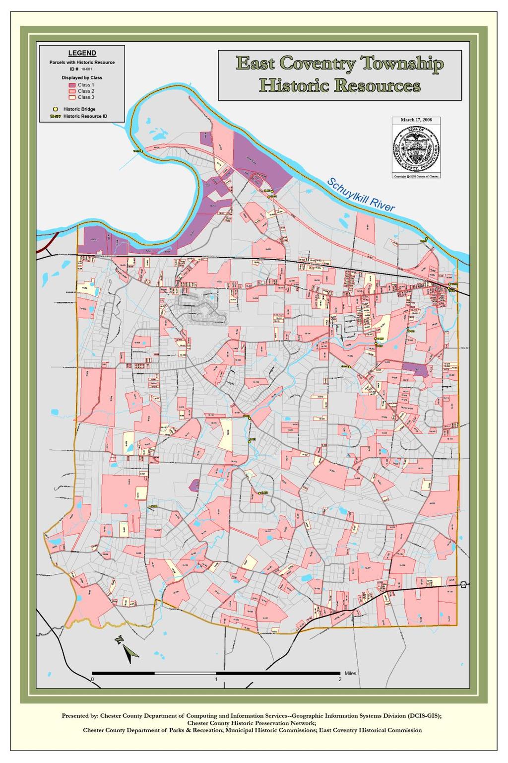
167 .
168 1. Chester County Municipal Open Space, Recreation and Environmental Resource Plans. 2. Municipal Comprehensive Plans. 3. Municipal Subdivision and Zoning Ordinances (as noted above). 4. National Register of Historic Places applications. 5. Federal Highway Administration Section 106 Reviews for bridges and highways. 6. Army Corps of Engineers Section 106 Reviews for all water-related projects including bridges and subdivision approvals. 7. FCC Section 106 Reviews for cell towers. 8. Federal Banking Section 106 Reviews for bank facility changes and ATM machines. 9. HUD Section 106 Review for utility installations and federal housing rehabilitation, etc. 10. Zoning Hearing Board s special exceptions and variances. 11. Appraisers property reports 12. Mortgage applications. 13. Bank loans. 14. Act 167 Pennsylvania certified Historic Districts. 15. Investment Tax Credits for rehabilitation of certified historic resources. 16. Pennsylvania State Historic Resource Survey forms. 17. Chester County agricultural easement applications. 18. Development subdivision applications. 19. Pennsylvania Department of Transportation projects. 20. Pennsylvania DCNR projects and applications. 21 Pennsylvania DEP permits.
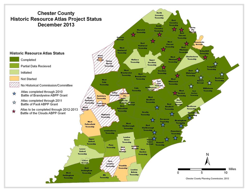
169

170 Battle of Brandywine Battlefield Historic Resource Atlas and Wall Map

171 Battle of the Clouds Battlefield Historic Resource Atlas and Wall Map

172 Battle of Paoli Battlefield Historic Resource Atlas and Wall Map

173
Action Items
 Action Items Report of Nominating Committee Election of 2015 Officers Act 247 Reviews Subdivision & Land Development Act 247 Reviews of Proposed Development during December 2014 8 6 Symbols 8 8 8 9
Action Items
 Action Items Act 247 Reviews Subdivision & Land Development Act 247 Reviews of Proposed Development during June 2014 6 @ Symbols 3 8 Residential Lots/Units 8 1-2 3-50 8 51-600 8 7 @ 8 1 @ 16 12 8 9
W E S T T O W N T O W N S H I P 1039 Wilmington Pike P.O. Box 79 West Chester, PA Westtown, PA PHONE: (610) FAX: (610)
 FAX: (610)") W E S T T O W N T O W N S H I P 1039 Wilmington Pike P.O. Box 79 West Chester, PA 19382 Westtown, PA 19395 PHONE: (610) 692-1930 FAX: (610) 692-9651 APPLICATION FOR APPROVAL OF PRELIMINARY PLAN Plan title:
W E S T T O W N T O W N S H I P 1039 Wilmington Pike P.O. Box 79 West Chester, PA 19382 Westtown, PA 19395 PHONE: (610) 692-1930 FAX: (610) 692-9651 APPLICATION FOR APPROVAL OF PRELIMINARY PLAN Plan title:
LAND USE ASSUMPTIONS REPORT POTENTIAL FUTURE DEVELOPMENT WEST WHITELAND TOWNSHIP, CHESTER COUNTY, PA
 LAND USE ASSUMPTIONS REPORT POTENTIAL FUTURE DEVELOPMENT WEST WHITELAND TOWNSHIP, CHESTER COUNTY, PA Adopted June 17, 2015 by Township Resolution No. 2015-30 Prepared by Theurkauf Design & Planning, LLC
TOWNSHIP OF SALISBURY LEHIGH COUNTY, PENNSYLVANIA. PLANNING COMMISSION MEETING MINUTES September 12, 2017 START TIME 7:30 PM
 TOWNSHIP OF SALISBURY LEHIGH COUNTY, PENNSYLVANIA PLANNING COMMISSION MEETING MINUTES September 12, 2017 START TIME 7:30 PM The regularly scheduled public meeting of the Salisbury Township Planning Commission
REPORT TO THE SHELBY COUNTY PLANNING COMMISSION From the Department of Development Services Planning Services. February 4, 2019
 REPORT TO THE SHELBY COUNTY PLANNING COMMISSION From the Department of Development Services Planning Services February 4, 2019 Case No. Request for Rezoning Approval From E-1 to E-2 SD This is a request
HOPEWELL TOWNSHIP YORK COUNTY PA PLANNING COMMISSION MINUTES FOR MAY 19, 2017 MUNICIPAL BUILDING 7:00 PM
 HOPEWELL TOWNSHIP YORK COUNTY PA PLANNING COMMISSION MINUTES FOR MAY 19, 2017 MUNICIPAL BUILDING 7:00 PM Yost called the May 2017 Planning Commission meeting to order at 7:01 p.m. In attendance were Chairman
SUBDIVISION AND / OR LAND DEVELOPMENT SUBMITTAL REQUIREMENTS
 SUBDIVISION AND / OR LAND DEVELOPMENT SUBMITTAL REQUIREMENTS Please review checklist prior to submittal. Incomplete submittals will delay the review process. Township 90-day time clock begins upon submission
ORDINANCE PROPOSALS. 6/1/2016 to 6/30/2016 REVIEW DATE. Total. The staff reviewed proposals for: Comprehensive Plans
 ORDINANCE PROPOSALS 6/1/2016 to 6/30/2016 The staff reviewed proposals for: Comprehensive Plans Miscellaneous Ordinance (Misc.) Amendments Subdivision and Land Development Ordinance (SLDO) Amendments Zoning
ZRTD , Glenn Drive. M. Tyler Klein, AICP, Project Manager, Planning and Zoning John Merrithew, Acting Director, Planning and Zoning
 DEPARTMENT OF PLANNING Date of Hearing: AND ZONING STAFF REPORT # 4 BOARD OF SUPERVISORS PUBLIC HEARING SUBJECT: ELECTION DISTRICT: ZRTD-2014-0003, 22675 Glenn Drive Broad Run CRITICAL ACTION DATE: September
Open Space Model Ordinance
 Open Space Model Ordinance Section I. Background Open space development has numerous environmental and community benefits, including: 1) Reduces the impervious cover in a development. Impervious cover
THE CITY OF MOBILE, ALABAMA
 THE CITY OF MOBILE, ALABAMA LETTER OF DECISION March 9, 2018 Byrd Surveying, Inc. 2609 Halls Mill Road Mobile, AL 36606 Re: 4439 Rangeline Road (Northwest corner of Rangeline Road and Halls Mill Road).
County of Loudoun. Department of Planning MEMORANDUM
 County of Loudoun Department of Planning MEMORANDUM DATE: September 3, 2013 TO: FROM: Marchant Schneider, Project Manager Land Use Review Marie Genovese, AICP, Planner III, Community Planning SUBJECT:
CHAPTER 6 CHESAPEAKE BAY PRESERVATION AREAS AND STREAM PROTECTION AREAS
 CHAPTER 6 CHESAPEAKE BAY PRESERVATION AREAS AND STREAM PROTECTION AREAS 6.1 INTRODUCTION Virginia s Chesapeake Bay Preservation Area (CBPA) Designation and Management Regulations (9VAC10-20 et seq.) require
Planning Justification Report
 Planning Justification Report, Township of Puslinch FARHI HOLDINGS CORPORATION Updated January 27, 2017 Zelinka Priamo Ltd. Page i TABLE OF CONTENTS Page No. 1.0 1.1 1.2 1.3 2.0 2.1 2.2 2.3 2.4 2.5 3.0
Community Development
 Land Use Petition RZ-16-002 Date of Staff Recommendation Preparation: April 15, 2016 (CEL) Date of Planning Commission Recommendation: May 3, 2016 PROJECT LOCATION: DISTRICT/SECTION/LANDLOT(S): ACREAGE
N. Pottstown Pike Pottstown, PA
 Investment Sale Opportunity 347 N. Pottstown Pike Pottstown, PA Partnership. Performance. FULLY LEASED 11,000 SF OFFICE BUILDING Well located and stabilized asset in the heart of Exton on Pottstown Pike
APPLICATION PROCEDURE
 ANTRIM PLANNING BOARD P. O. Box 517 Antrim, New Hampshire 03440 Phone: 603-588-6785 FAX: 603-588-2969 APPLICATION FORM AND CHECKLIST FOR MINOR OR MAJOR SITE PLAN REVIEW File Date Received By APPLICATION
BUFFALO TOWNSHIP PLANNING COMMISSION REGULAR MONTHLY MEETING AUGUST 2, 2017
 The Regular Monthly Meeting of the Buffalo Township Planning Commission was called to order on August 2, 2017, at 7:40 p.m. in the Buffalo Township Municipal Building by the Chairman, Ray Smetana. This
YCCD EROSION & SEDIMENT POLLUTION CONTROL (E&SPC) PROGRAM SERVICES FEE SCHEDULE, RULES, & GUIDELINES
 PROGRAM SERVICES FEE SCHEDULE, RULES, & GUIDELINES") YCCD EROSION & SEDIMENT POLLUTION CONTROL (E&SPC) PROGRAM SERVICES FEE SCHEDULE, RULES, & GUIDELINES Adopted by the YCCD Board of Directors on December 14, 2018 Effective January 1, 2019. I. Authority
YCCD EROSION & SEDIMENT POLLUTION CONTROL (E&SPC) PROGRAM SERVICES FEE SCHEDULE, RULES, & GUIDELINES Adopted by the YCCD Board of Directors on December 14, 2018 Effective January 1, 2019. I. Authority
Staff Report. Planning Commission Public Hearing: October 17, 2007 Staff Recommendation: Denial
 COUNTY OF PRINCE WILLIAM 5 County Complex Court, Prince William, Virginia 22192-9201 PLANNING (703) 792-6830 Metro 631-1703, Ext. 6830 FAX (703) 792-4401 OFFICE Internet www.pwcgov.org Stephen K. Griffin,
A. ARTICLE 16 - STEEP SLOPE CONSERVATION DISTRICT
 1600. 1601.A. ARTICLE 16 - STEEP SLOPE CONSERVATION DISTRICT SECTION 1600 PURPOSE The purpose of this Article is to expand upon the Community Development Objectives associated with environmental protection
BEFORE THE LANCASTER TOWNSHIP BOARD OF SUPERVISORS BUTLER COUNTY, PENNSYLVANIA FINDINGS OF FACT, CONCLUSIONS OF LAW AND DECISION FINDINGS OF FACT
 BEFORE THE LANCASTER TOWNSHIP BOARD OF SUPERVISORS BUTLER COUNTY, PENNSYLVANIA IN RE: Conditional Use and Preliminary ) and Final Land Development Applications ) for Planned Unit Development by ) Arden
Residential Minor Subdivision Review Checklist
 Residential Minor Subdivision Review Checklist Plan Submittal Requirements: 2 full sets of stamped plans Electric submittal - all plans contained in a single PDF 3 full sets if commercial kitchen or dining
MEMORANDUM. DATE: April 6, 2017 TO: Zoning Hearing Board Jackie and Jake Collas. FROM: John R. Weller, AICP, Zoning Officer
 MEMORANDUM DATE: April 6, 2017 TO: Zoning Hearing Board Jackie and Jake Collas FROM: John R. Weller, AICP, Zoning Officer SUBJECT: Zoning Hearing Board appeal of Jackie and Jake Collas Relief requested
Planning Commission Hearing Date: 2/21/2017 Board of County Commissioners Hearing Date: 3/8/2017
 COMMISSIONERS: DARRYL GLENN (PRESIDENT) MARK WALLER (PRESIDENT PRO TEMPORE) STAN VANDERWERF LONGINOS GONZALEZ PEGGY LITTLETON PLANNING AND COMMUNITY DEVELOPMENT DEPARTMENT CRAIG DOSSEY, EXECUTIVE DIRECTOR
ADAMS COUNTY CONSERVATION DISTRICT S
 Approved by District Board on 12-15-2016 I. Authority & Applicability of Fees for Services A. Authority - The Adams County Conservation District is delegated with the responsibility to administer the Commonwealth
Subdivision and Land Development Reviews 1/1/2018 to 12/31/2018
 Subdivision and Land Development s //08 to /3/08 Municipality Plan # Title Date Acreage Land Lots/Units (, No, ) Birmingham Township SD-0-8-563 Sherry Kerstetter /4/08 Birmingham Township SD-07-8-5503
CHESAPEAKE BAY PRESERVATION AREA EXCEPTION APPLICATION INSTRUCTIONS
 City of Chesapeake Department of Planning Post Office Box 15225 Chesapeake, Virginia 23328-5225 (757) 382-6176 FAX (757) 382-6406 CHESAPEAKE BAY PRESERVATION AREA EXCEPTION APPLICATION INSTRUCTIONS PURPOSE
PRELIMINARY PLAN CHECKLIST Major Land Development Projects. To initiate the application, the applicant shall submit to the Administrative Officer:
 PRELIMINARY PLAN CHECKLIST Major Land Development Projects To initiate the application, the applicant shall submit to the Administrative Officer: 1. The application review fee, as established by the South
Town of Shelburne, Vermont
 Town of Shelburne, Vermont CHARTERED 1763 P.O. BOX 88 5420 SHELBURNE ROAD SHELBURNE, VT 05482 www.shelburnevt.org 802-985-5118 * * Also available in alternate formats in accordance with the Americans With
1. Future Land Use FLU6.6.8 Land uses within the Rural Service Area portion of the Wekiva Study Area shall be limited to very low and low intensity
 1. Future Land Use FLU6.6.8 Land uses within the Rural Service Area portion of the Wekiva Study Area shall be limited to very low and low intensity uses to the greatest extent possible. Existing land uses
Request Conditional Rezoning (R-7.5 Residential to Conditional A-18 Apartment) Staff Recommendation Approval. Staff Planner Jimmy McNamara
 Staff Recommendation Approval. Staff Planner Jimmy McNamara") Applicants Property Owners Baker Villas, LLC; Ocean Rental Properties, LLC; James Edward Sollner; & Linda Susan Sollner Public Hearing November 8, 2017 City Council Election District Kempsville Agenda
Applicants Property Owners Baker Villas, LLC; Ocean Rental Properties, LLC; James Edward Sollner; & Linda Susan Sollner Public Hearing November 8, 2017 City Council Election District Kempsville Agenda
Level III Preliminary and Final Site Plans Development Review Application Portland, Maine Planning and Urban Development Department Planning Division
 Level III Preliminary and Final Site Plans Development Review Application Portland, Maine Planning and Urban Development Department Planning Division Portland s Planning and Urban Development Department
Planning Department Oconee County, Georgia STAFF REPORT
 Planning Department Oconee County, Georgia STAFF REPORT REZONE CASE #: 7332 DATE: November 28, 2017 STAFF REPORT BY: Gabriel Quintas, Planner APPLICANT NAME: Smith Planning Group PROPERTY OWNER: John Hadden
O-I (Office-Institutional) and AG-1(Agricultural)
 and AG-1(Agricultural)") PROPERTY INFORMATION ADDRESS 3503 and 3505 Bethany Bend DISTRICT, LAND LOTS 2/1 973 and 974 OVERLAY DISTRICT State Route 9 PETITION NUMBERS EXISTING ZONING O-I (Office-Institutional) and AG-1(Agricultural)
PROPERTY INFORMATION ADDRESS 3503 and 3505 Bethany Bend DISTRICT, LAND LOTS 2/1 973 and 974 OVERLAY DISTRICT State Route 9 PETITION NUMBERS EXISTING ZONING O-I (Office-Institutional) and AG-1(Agricultural)
Amendment to the Zoning and Subdivision Ordinances; Consider Repeal Cluster Development Standards
 2 Board of Supervisors Meg Bohmke, Chairman Gary F. Snellings, Vice Chairman Jack R. Cavalier Thomas C. Coen L. Mark Dudenhefer Wendy E. Maurer Cindy C. Shelton February 28, 2018 Thomas C. Foley County
DEVELOPMENT PLAN REVIEW CHECKLIST. To initiate the application, the applicant shall submit to the Administrative Officer:
 DEVELOPMENT PLAN REVIEW CHECKLIST To initiate the application, the applicant shall submit to the Administrative Officer: 1. Sixteen (16) copies of the Project Review Application Form, printed double-sided;
Residential Major Subdivision Review Checklist
 Residential Major Subdivision Review Checklist Plan Submittal Requirements: 2 full sets of stamped plans Electric submittal - all plans contained in a single PDF 3 full sets if commercial kitchen or dining
PLANNED UNIT DEVELOPMENT & SUBDIVISION STAFF REPORT Date: April 18, 2019
 PLANNED UNIT DEVELOPMENT & SUBDIVISION STAFF REPORT Date: April 18, 2019 DEVELOPMENT NAME SUBDIVISION NAME Springhill Village Subdivision Springhill Village Subdivision LOCATION 4350, 4354, 4356, 4358,
UPPER MOUNT BETHEL TOWNSHIP NORTHAMPTON COUNTY, PENNSYLVANIA
 UPPER MOUNT BETHEL TOWNSHIP NORTHAMPTON COUNTY, PENNSYLVANIA JOINDER DEED / LOT CONSOLIDATION TOWNSHIP REVIEW PROCESS When accepting proposed Joinder Deeds / Lot Consolidations, review the Joinder Deed
CHAPTER XVIII SITE PLAN REVIEW
 CHAPTER XVIII SITE PLAN REVIEW Section 18.1 Section 18.2 Description and Purpose. The purpose of this chapter is to provide standards and procedures under which applicants would submit, and the Township
SUBDIVISION APPLICATION CHECKLIST SKETCH PLAN PRELIMINARY PLAT FINAL PLAT
 RECEIVED STAMP SUBDIVISION APPLICATION CHECKLIST SKETCH PLAN PRELIMINARY PLAT FINAL PLAT A checklist of background information and submission requirements for processing of a sketch plan, preliminary plat
STRABAN TOWNSHIP PLANNING COMMISSION Alan Zepp, George Mauser, Patt Kimble, Sharon Hamm, John Boblits
 STRABAN TOWNSHIP PLANNING COMMISSION Alan Zepp, George Mauser, Patt Kimble, Sharon Hamm, John Boblits The Straban Township Planning Commission met this date, as publicly advertised, at 7:00 p.m. in the
STAFF REPORT. Arthur and Kathleen Quiggle 4(b)
") STAFF REPORT Application: Requests related to the construction of a 28' x 41' dwelling and 6' wrap-around open deck to replace an existing 24' x 32' cabin and wrap-around open deck and the installation
STAFF REPORT Application: Requests related to the construction of a 28' x 41' dwelling and 6' wrap-around open deck to replace an existing 24' x 32' cabin and wrap-around open deck and the installation
ARTICLE 24 SITE PLAN REVIEW
 ARTICLE 24 SITE PLAN REVIEW 24.1 PURPOSE: The intent of these Ordinance provisions is to provide for consultation and cooperation between the land developer and the Township Planning Commission in order
DAUPHIN CREEK ESTATES SUBDIVISION
 # 12 SUB-000076-2017 DAUPHIN CREEK ESTATES SUBDIVISION Engineering Comments: FINAL PLAT COMMENTS (should be addressed prior to submitting the FINAL PLAT for review and/or signature by the City Engineer):
Hamilton County Regional Planning Commission
 Hamilton County Regional Planning Commission March 1, 2012 Colerain Township Staff Report Zone Map Amendment: Case No.: ZA2012-01 Joseph Toyota Prepared By: Amy Bancroft, Land Use Planner ACTION REQUESTED:
CONCEPTUAL MASTER PLAN CHECKLIST Major Land Development Project
 CONCEPTUAL MASTER PLAN CHECKLIST Major Land Development Project To initiate the application, the applicant shall submit to the Administrative Officer: 1. The application review fee, as established by the
Memorandum To: From: CC: Date: Re:
 Memorandum To: Paul Singer From: Craig M. Bonenberger, SEO/ Jason P. Shaner, PE CC: File 090026 Date: 4/20/2009 Re: 1550 Pottstown Pike Feasibility Study The site under investigation is an 18 acre tract
West Whiteland Township Historical Commission Agenda March 13, 2017
 West Whiteland Township Historical Commission Agenda March 13, 2017 6:30 P.M. WORK SESSION CANCELLED THIS MONTH 7 P.M. Business Meeting I. Call to Order II. III. Public Comment Old Business There is no
The meeting was called to order by Chairman, Neal Camens, at 7:30 p.m. with the Salute to the Flag.
 DRAFT West Nottingham Township Planning Commission Minutes June 7, 2016 The West Nottingham Township Planning Commission held its regular monthly meeting on Tuesday, June 7, 2016, at the Municipal Building,
COMMUNITY MEETING EXHIBITS
 COMMUNITY MEETING EXHIBITS EXHIBIT 1 : Meeting Agenda EXHIBIT 2 : Presentation Posters EXHIBIT 3 : Attendance Sign-In Sheet EXHIBIT 4 : Letters to Property Owners EXHIBIT 5 : Photos of Meeting EXHIBIT
STATE OF ALABAMA SHELBY COUNTY
 STATE OF ALABAMA SHELBY COUNTY Members Present: Members Absent: Staff Present: SHELBY COUNTY PLANNING COMMISSION MINUTES Regular Meeting March 6, 2017 6:00 PM Michael O Kelley, Chairman; Jim Davis, Vice
Request Subdivision Variance to Sections 4.4 (b) & (d) of the Subdivision Regulations. Staff Planner Kevin Kemp
 & (d) of the Subdivision Regulations. Staff Planner Kevin Kemp") Applicant Property Owner Rhae Adams, Jr. Public Hearing June 8, 2016 City Council Election District Lynnhaven Agenda Item 4 Request Subdivision Variance to Sections 4.4 (b) & (d) of the Subdivision Regulations.
Applicant Property Owner Rhae Adams, Jr. Public Hearing June 8, 2016 City Council Election District Lynnhaven Agenda Item 4 Request Subdivision Variance to Sections 4.4 (b) & (d) of the Subdivision Regulations.
Guide to Preliminary Plans
 Guide to Preliminary Plans Introduction The Douglas County is committed to providing open, transparent application processes to the public. This Guide is provided to assist anyone interested in the procedures
Guidelines for Construction of Recreational Buildings and Improvements Greater than 1000 Square Feet Outside Acceptable Development Areas
 Guidelines for Construction of Recreational Buildings and Improvements Greater than 1000 Square Feet Outside Acceptable Development Areas The following guidelines are established by the Easement Committee
Rapid City Planning Commission Conditional Use Permit Project Report
 Rapid City Planning Commission Conditional Use Permit Project Report September 21, 2017 Applicant Request(s) Case # 17UR020 Conditional Use Permit to allow a mini-storage facility Companion Case(s) # Item
5. That the Owner shall agree that all development Blocks shown within the Draft Plan will be connected to full municipal services.
 Conditions Relating to Draft Plan of Subdivision Approval East Fonthill 26T 01014 (Draft Plan dated December 1, 2013, and revised August 28, 2014), the Town of Pelham 1. This approval applies to the Draft
FREQUENTLY USED PLANNING & ZONING TERMS
 City Of Mustang FREQUENTLY USED PLANNING & ZONING TERMS Abut: Having property lines, street lines, or zoning district lines in common. Accessory Structure: A structure of secondary importance or function
SUBJECT PARCEL(S) Property Owner(s) TMS Number Approximate Acreage Carolina Park Development, LLC
 Property Owner(s) TMS Number Approximate Acreage Carolina Park Development, LLC") Staff Report Special Planning Commission Meeting November 19, 2014 For reference, the Zoning Code and Land Development Regulations are available online. AGENDA ITEM 5c. SKETCH PLAN APPROVAL REQUEST: Request
Staff Report Special Planning Commission Meeting November 19, 2014 For reference, the Zoning Code and Land Development Regulations are available online. AGENDA ITEM 5c. SKETCH PLAN APPROVAL REQUEST: Request
1101 MAIN STREET ANDREWS NC PHONE FAX MAYOR NANCY J. CURTIS MEMORANDUM
 1101 MAIN STREET ANDREWS NC 28901 PHONE 828-321-3113 FAX 828-321-4159 MAYOR NANCY J. CURTIS ALDERMAN RAY FRAZIER ALDERMAN JERRY PULLIUM ALDERMAN GARY JAMES ALDERMAN PHIL HORTON MEMORANDUM March 7, 2017
COUNTY OF ALBEMARLE PLANNING STAFF REPORT SUMMARY
 COUNTY OF ALBEMARLE PLANNING STAFF REPORT SUMMARY Project Name: ZMA 2010-00015, Cedar Hill Planning Commission Worksession: February 15, 2011 Public Hearing: Not scheduled Staff: Judith C. Wiegand, AICP
Legal Description Part of the Western Half of the Eastern Half of the Northwest Quarter of Section 30, Le Ray Township
 Owner and Applicant s 20448 State Highway 83 Mankato, MN 56001 Request and Location Request for review and approval of a Conditional Use Permit to allow an Elder Care Residential Unit to be constructed
Article 2 Application Type and Standards Requirements
 Article 1 Article 2 Division 1 Application Type and Standards Requirements General Provisions Sec. 2.1.1 Division 2 Division 3 Division 4 Division 5 Division 6 Division 7 Division 8 Division 9 Sec. 2.9.1
Article 7: Residential Land Use and Development Requirements
 Article 7: Residential Land Use and Section 701: Statement of Intent (A) (B) (C) The intent of Article 7 is to develop certain land use and development requirements for the residential uses within Cumru
ZONING AMENDMENT & SUBDIVISION STAFF REPORT Date: November 3, 2016
 ZONING AMENDMENT & SUBDIVISION STAFF REPORT Date: November 3, 2016 APPLICANT NAME SUBDIVISION NAME David Shumer 5955 Airport Subdivision CITY COUNCIL DISTRICT District 6 5955 Airport Boulevard, 754 Linlen
PLANNING FOR OUR FUTURE
 PLANNING FOR OUR FUTURE ELLSWORTH TOWNSHIP LAND USE AND POLICY PLAN The purpose of this Plan is to serve as a guide for the Township Trustees, Zoning Commission, Board of Zoning Appeals, developers, employers,
MASTER SUBDIVISION FINAL PLAT APPLICATION Town of Apex, North Carolina
 MASTER SUBDIVISION FINAL PLAT APPLICATION Town of Apex, North Carolina This document is a public record under the North Carolina Public Records Act and may be published to the Town s website or disclosed
Financial Impact Statement There are no immediate financial impacts associated with the adoption of this report.
 STAFF REPORT Planning and Development Department Subject: Application by RYC Property to rezone a portion of lands on John Murray Dr. and Megan Lynn Dr. from R2 to R3 and to enter into a Development Agreement
Planning Commission Preliminary Plan LRC Subdivision Montville Township
 Planning Commission Preliminary Plan LRC Subdivision Montville Township Meeting: February 1, 2017 App. No.: 002-2017-PP Owner: Faith & Hope Land Dev. Co. Applicant: Montville Investors LLC Engineer: Weber
Special Use Permit - Planned Unit Development Checklist. Property Address:
 Special Use Permit - Planned Unit Development Checklist Special Use Permit Number. Parcel Code/s #28-11- - - Property Address: Applicant: ARTICLE VIII Ordinance Reference - Section 8.1.2 Permit Procedures:
Napa County Planning Commission Board Agenda Letter
 Agenda Date: 9/20/2017 Agenda Placement: 8C Napa County Planning Commission Board Agenda Letter TO: FROM: Napa County Planning Commission Charlene Gallina for David Morrison - Director Planning, Building
LOWER FREDERICK TOWNSHIP PLANNING COMMISSION
 LOWER FREDERICK TOWNSHIP PLANNING COMMISSION General Meeting Minutes January 18, 2018 53 Spring Mount Rd. Schwenksville, Pa. 19473 Meeting called to order at 7:02 pm. Present for Roll Call: Members: Chuck
CERTIFICATION OF THE APPROVAL OF WATER AND SEWERAGE SYSTEMS
 ARTICLE 9 FORMS AND CHECK LISTS 9.100 On preliminary layout & final subdivision plat CERTIFICATION OF THE APPROVAL OF WATER AND SEWERAGE SYSTEMS I hereby certify that the (...type: private or pubic...)
SUBJECT: Application for Planned Unit Development and Rezoning 1725 Winnetka Road
 TO: FROM: CHAIRMAN BILL VASELOPULOS AND MEMBERS OF THE PLAN & ZONING COMMISSION STEVE GUTIERREZ DIRECTOR OF COMMUNITY DEVELOPMENT MEETING DATE: September 5, 2017 SUBJECT: Application for Planned Unit Development
Purpose: Regulations:
 Administrative Procedures for the Designation and Refinement Of Chesapeake Bay Preservation Area Boundaries Guidance on the Chesapeake Bay Preservation Area Designation and Management Regulations September,
Moore Township Planning Commission 2491 Community Drive, Bath, Pennsylvania Telephone: FAX: Rev:12/23/2013
 2491 Community Drive, Bath, Pennsylvania Telephone: 610-759-9449 FAX: 610-759-9448 Rev:12/23/2013 APPLICATION FORM FOR A SITE PLAN PER MOORE TOWNSHIP ZONING ORDINANCE SECTION 200-58.1 NORTHAMPTON COUNTY,
SIMPLIFIED APPROACH PERMIT PROCEDURES
 SIMPLIFIED APPROACH PERMIT PROCEDURES UPPER ALLEN TOWNSHIP Community Development Department 100 Gettysburg Pike, Mechanicsburg, PA 17055 Phone: 717-766-0756 Fax: 717-796-983 Office Hours: M-F 8:00 AM 4:30
TOWNSHIP OF DOYLESTOWN APPLICATION FOR REVIEW OF SUBDIVISION OR LAND DEVELOPMENT PROPOSAL. Please PRINT; all information MUST be filled out completely
 TOWNSHIP OF DOYLESTOWN APPLICATION FOR REVIEW OF SUBDIVISION OR LAND DEVELOPMENT PROPOSAL Please PRINT; all information MUST be filled out completely Date: Name of Subdivision or Land Development: Location:
Appendix 5 - Track Changed Ordinance
 SCHEDULE 1 TO THE URBAN GROWTH ZONE Shown on the planning scheme map as UGZ1 1.0 The Plan Shepparton North East Plan 1 shows the future urban structure proposed in the Shepparton North East Precinct Structure
Deerfield Township Community Development Department
 STAFF REVIEW Deerfield Township Community Development Department To: From: Hayfaa Wadih, AICP Lois McKnight, AICP Meeting Date: October 20, 2014 Continued from October 13, 2014 Re: Major PUD Modification
ARTICLE 4 MAJOR SUBDIVISION/LAND DEVELOPMENT PLAN REQUIREMENTS
 ARTICLE 4 MAJOR SUBDIVISION/LAND DEVELOPMENT PLAN REQUIREMENTS SECTION 401 LAND SKETCH PLANS FOR MAJOR SUBDIVISIONS AND DEVELOPMENTS 401.1 Sketch Plan Information The following process and procedures shall
WEST WHITELAND TOWNSHIP Planning Commission Agenda Tuesday, March 6, :00 P.M.
 WEST WHITELAND TOWNSHIP Planning Commission Agenda Tuesday, March 6, 2018 7:00 P.M. CALL TO ORDER REVIEW OF MEETING MINUTES 1. Approval of Meeting Minutes: Febraury 20, 2018 PUBLIC COMMENT/CONCERNS/QUESTIONS
MIDDLETOWN TOWNSHIP PLANNING COMMISSION REGULAR MEETING MIDDLETOWN MUNICIPAL BUILDING WEDNESDAY, November 2, 2016
 MIDDLETOWN TOWNSHIP PLANNING COMMISSION REGULAR MEETING MIDDLETOWN MUNICIPAL BUILDING WEDNESDAY, November 2, 2016 PRESENT: ABSENT Sandy Farry George Hyjurick Charles Parkerson Fred Thomas Robert Burnet.
City of Findlay City Planning Commission
 City of Findlay City Planning Commission Thursday, August 9, 2018 9:00 a.m. COMMENTS NEW ITEMS 1. APPLICATION FOR CONDITIONAL USE #CU-05-2018 filed by Terrapin Acquisitions, Ltd., 430 First Street, Findlay
DEVELOPMENT PLAN ORDINANCE
 DEVELOPMENT PLAN ORDINANCE CITY OF GLASGOW Ordinance No. 2026 SECTION A. Section 1. INTENT AND PURPOSE The purpose of this Ordinance is to establish and define development plans, which may be utilized
ARTICLE V PRELIMINARY PLAN SUBMISSION
 ARTICLE V PRELIMINARY PLAN SUBMISSION 501. Plan Requirements a. On or before the 25 th day of the month prior to a regularly scheduled meeting of the Planning Commission, the applicant shall submit two
The Ranches Sketch Plan
 The Ranches Sketch Plan APPLICATION: RURAL LAND USE PROCESS (AKA CLUSTER DEVELOPMENT) HEARING DATES: Planning Commission: 12 July 2017 at 6:30 pm Board of County Commissioners: TBD APPLICANT: REQUEST:
Public Land Dedication & Fee-in-Lieu
 Public Land Dedication & Fee-in-Lieu Introduction What issues does this tool address? Communities need open space for passive and active recreation and natural areas where wildlife can flourish. What does
Section 4 Master Plan Framework
 Section 4 Master Plan Framework 4.1 PURPOSE The Master Plan, as an implementation tool of the SPC District, establishes the primary framework for the overall development of the Property. Detailed site
TOWN OF ORO VALLEY PLANNING & ZONING COMMISSION MEETING DATE: December 6, 2011
 PLANNING & ZONING COMMISSION MEETING DATE: December 6, 2011 TO: FROM: SUBJECT: PLANNING & ZONING COMMISSION Matt Michels, Senior Planner mmichels@orovalleyaz.gov; tel. 229-4822 Public Hearing: Rancho de
TOOELE COUNTY LAND USE ORDINANCE CHAPTER 31 Page 1
 CHAPTER 31 PLANNED COMMUNITY ZONE (P-C) Section 31-1 Definitions. 31-2 Purpose. 31-3 Land use districts. 31-4 P-C zone area minimum requirements. 31-5 Permitted uses. 31-6 Conditional uses. 31-7 Planning
Article XII. R-1 Agricultural-Low Density Residential District
 Article XII R-1 Agricultural-Low Density Residential District Section 1200. Declaration of Legislative Intent In expansion of the Declaration of Legislative Intent and Statement of Community Development
In order to permit maximum applicability of the PUD District, PUD-1 and PUD-2 Districts are hereby created.
 ARTICLE III. PUD ned Unit Development Overlay District 205-128. Purpose. The PUD ned Unit Development Overlay District is intended to provide flexibility in the design of planned projects; to encourage
Boyertown Borough and Colebrookdale and Pike Townships Joint Zoning Ordinance
 Boyertown Borough and Colebrookdale and Pike Townships Joint Zoning Ordinance Berks County, Pennsylvania Effective Date - November 7, 2010 This Ordinance was prepared under the direction of the Boyertown
PLANNED UNIT DEVELOPMENT & SUBDIVISION STAFF REPORT Date: November 17, 2016
 PLANNED UNIT DEVELOPMENT & SUBDIVISION STAFF REPORT Date: November 17, 2016 DEVELOPMENT NAME SUBDIVISION NAME LOCATION Autonation Ford of Mobile Autonation Ford of Mobile Subdivision 901, 909, and 925
Division 5 Residential Low Density Zone: Assessment Criteria and Assessment Tables
 Division 5 Residential Low Density Zone: Assessment Criteria and Assessment Tables 4.5.1 Residential Low Density Zone The provisions in this division relate to the Residential Low Density Zone as follows
HB-S RM8-S RS9 RM18 HB-S RS9 DOCKET #: W2872. PROPOSED ZONING: RM8-S (Child Day Care Center) EXISTING ZONING: RS9 and RM8-S
 EXISTING ZONING: RS9 and RM8-S") 150' 80' RS9 UNIVERSITY PW STANLEYVILLE DR HB-S LB 123' 70' PROPOSED BELTWAY!( RM8-S S 289' NOEL DR 202' NITA AV MILL CREEK DOCKET #: W2872 PROPOSED ZONING: RM8-S (Child Day Care Center) EXISTING ZONING:
150' 80' RS9 UNIVERSITY PW STANLEYVILLE DR HB-S LB 123' 70' PROPOSED BELTWAY!( RM8-S S 289' NOEL DR 202' NITA AV MILL CREEK DOCKET #: W2872 PROPOSED ZONING: RM8-S (Child Day Care Center) EXISTING ZONING:
Planning Department Oconee County, Georgia
 Planning Department Oconee County, Georgia STAFF REPORT REZONE CASE #: 6985 DATE: October 31, 2016 STAFF REPORT BY: Andrew C. Stern, Planner APPLICANT NAME: Williams & Associates, Land Planners PC PROPERTY