Planning Commission Hearing Date: 2/21/2017 Board of County Commissioners Hearing Date: 3/8/2017
|
|
|
- Carmella Perkins
- 6 years ago
- Views:
Transcription


1 COMMISSIONERS: DARRYL GLENN (PRESIDENT) MARK WALLER (PRESIDENT PRO TEMPORE) STAN VANDERWERF LONGINOS GONZALEZ PEGGY LITTLETON PLANNING AND COMMUNITY DEVELOPMENT DEPARTMENT CRAIG DOSSEY, EXECUTIVE DIRECTOR TO: FROM: El Paso County Planning Commission Tim Trowbridge, Chair Kari Parsons, PM/Planner II Jeff Rice, PE Engineer III Craig Dossey, Executive Director RE: Project File #: CC Project Name: Peyton Junction Map Amendment Parcel No.: OWNER: REPRESENTATIVE: Peyton Junction, LLC Mark and Desiree Schultz Pinon Park Road Peyton, CO Peyton Junction, LLC Mark and Desiree Schultz Pinon Park Road Peyton, CO Commissioner District: 2 Planning Commission Hearing Date: 2/21/2017 Board of County Commissioners Hearing Date: 3/8/2017 EXECUTIVE SUMMARY A request by Mark and Desiree Schultz on behalf of Peyton Junction, LLC, for approval of a map amendment (rezoning) of 1.4 acres from the A-35 (Agricultural) zoning district to the CC (Commercial Community) zoning district. The property is located north of Highway 24, south of Main Street in Peyton, Colorado and is within Section 6, Township 12 South, Range 63 West of the 6 th Principal Meridian. The property is also included within the Falcon/Peyton Small Area Master Plan (2008) INTERNATIONAL CIRCLE, SUITE 110 COLORADO SPRINGS, CO PHONE: (719) FAX: (719)
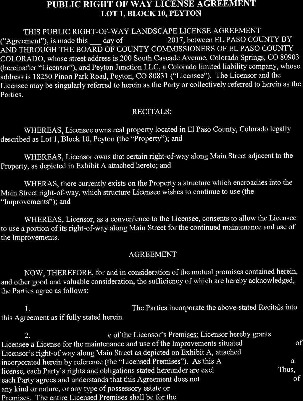
2 The subject property was platted in 1889 as the (Town of) Peyton Mayfield Plat. The property was initially zoned on March 25, 1999, to the A-35 (Agricultural) zoning district, pursuant to the County initiated zoning of eastern El Paso County. Located on the property are a single-family home and three buildings currently being used for commercial (boutique retail) uses. A. REQUEST/WAIVERS/MODIFICATIONS/AUTHORIZATION Request: Approval of a map amendment (rezoning) of 1.4 acres from the A-35 (Agricultural) zoning district to the CC (Commercial Community) zoning district. Waiver(s)/Modification(s): The standard fee for a map amendment (rezoning) is $3,587.00; however, a fee reduction of $ was granted for this application by the Director in The applicants paid $ to the Planning and Community Development for the map amendment (rezoning) application fee. The applicants are now requesting a waiver (refund) of the remaining portion of map amendment (Rezoning) application fee in the amount of $3, Authorization to Sign: A license agreement to allow a portion of the existing garage to encroach into the County right-of-way for Main Street. B. PLANNING COMMISSION SUMMARY Request Heard: Recommendation: Waiver Recommendation: Vote: Vote Rationale: Summary of Hearing: Legal Notice: C. APPROVAL CRITERIA In approving a Map Amendment (rezoning), the following findings shall be made: The application is in general conformance with the El Paso County Master Plan including applicable Small Area Plans or there has been a substantial change in the character of the neighborhood since the land was last zoned; The rezoning is in compliance with all applicable statutory provisions including, but not limited to C.R.S , and ; The proposed land use or zone district is compatible with the existing and permitted land uses and zone districts in all directions; and
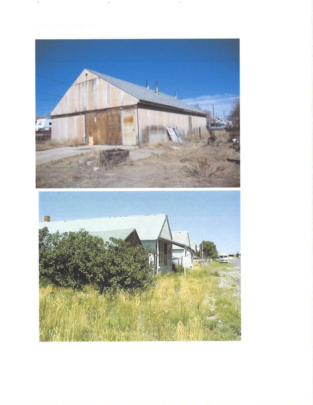
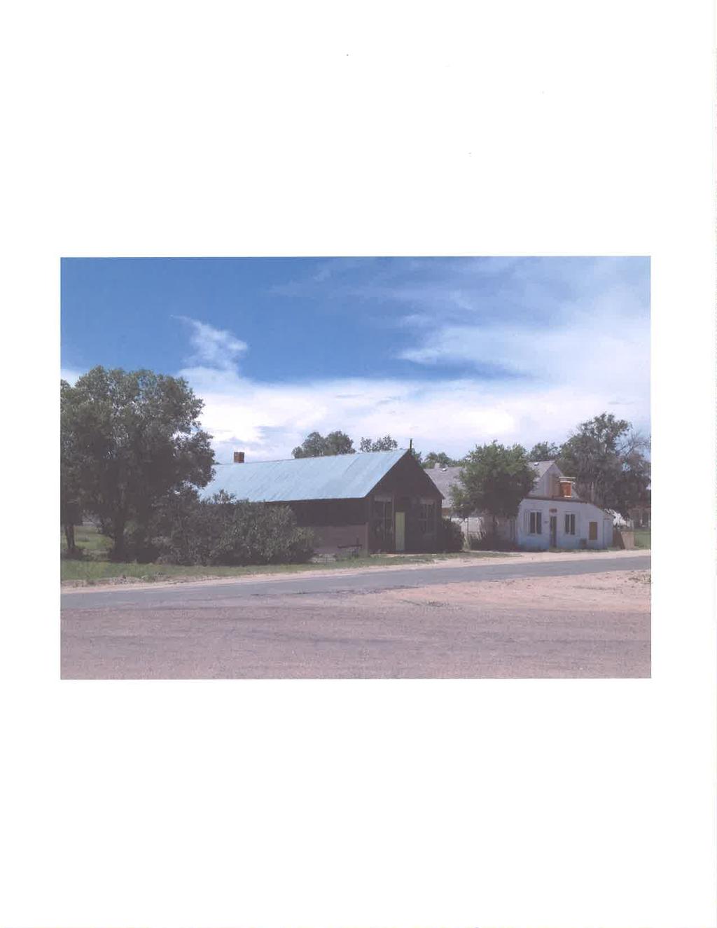
3 The site is suitable for the intended use, including the ability to meet the standards as described in Chapter 5 of the Land Development Code, for the intended zone district. D. LOCATION North A-35 (Agricultural) South A-35 (Agricultural) East A-35 (Agricultural) West A-35 (Agricultural) Utility Building/Single-family residential Public works yard / Single-family residential Single-family residential Single-family residential E. BACKGROUND The subject property was platted in 1889 as (the Town of) Peyton Mayfield Plat. The property was not zoned until March 25, 1999, pursuant to the County initiated zoning of eastern El Paso County. The area was zoned to the A-35 (Agricultural) zoning district, which had the effect of creating legal non-conformities with respect to the applicable dimensional and use standards of the A-35 zoning district. At the time of the County initiated zoning in 1999, the staff report presented to the Board of County Commissioners identified that many of the smaller platted lots would not be in conformance with the use and dimensional standards of the proposed A-35 zoning district. The report also noted that the existing commercial uses in the Peyton town site would be rendered non-conforming. The report concluded that some rural commercial zone changes can be expected. Each of the non-specific commercial uses present on site at the time of the County initiated zoning lapsed at some point after the 1999 zoning, eliminating the legalnonconforming use status for the commercial uses. Retail commercial uses are present today. No complaints have been filed regarding the commercial uses. As the parcel exists today, it consists of 16 platted lots, each 25 feet wide, which were combined for tax purposes through the County Assessor s Office. An existing singlefamily home, which is an allowed use in the A-35 zoning district, is located on and straddles the lot line separating Lots 1 and 2. The single-family residence is served by a well and on-site wastewater treatment system (OWTS). In addition to the single-family residence, there are also three other buildings located on Lots 8-16 of the merged parcel that are currently being used for boutique retail. Two wells serve the retail uses. Each building has a permitted individual on-site wastewater-treatment system (OWTS). The retail uses are not allowed uses in the A-35 zoning district. The proposed map amendment to the CC zoning district, if approved, would legalize the commercial uses, but would also render the single-family residential use non-conforming since it is not an allowed use in the CC zoning district.

4 The applicants also own Lots of the Peyton Mayfield Plat. Those lots are zoned A-35 and are currently vacant. None of the lots are included in this rezone request, which means they will remain zoned A-35. The applicants propose to convert the existing single-family dwelling into a mixed-use building in the future; however, the applicants have stated that the timing is going to be driven by the market. Mixed-use building is defined in the El Paso County Land Development Code (2016) as [a] building, planned, and constructed as a unit, used partially for residential use and partly for commercial uses including, but not limited to, office, retail, public uses, personal service, or entertainment uses, and is identified as a special use in the CC (Community Commercial) zoning district. Garage Residence Shed Shed Retail Retail Retail REZONE MAP
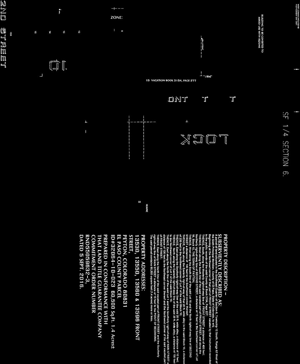
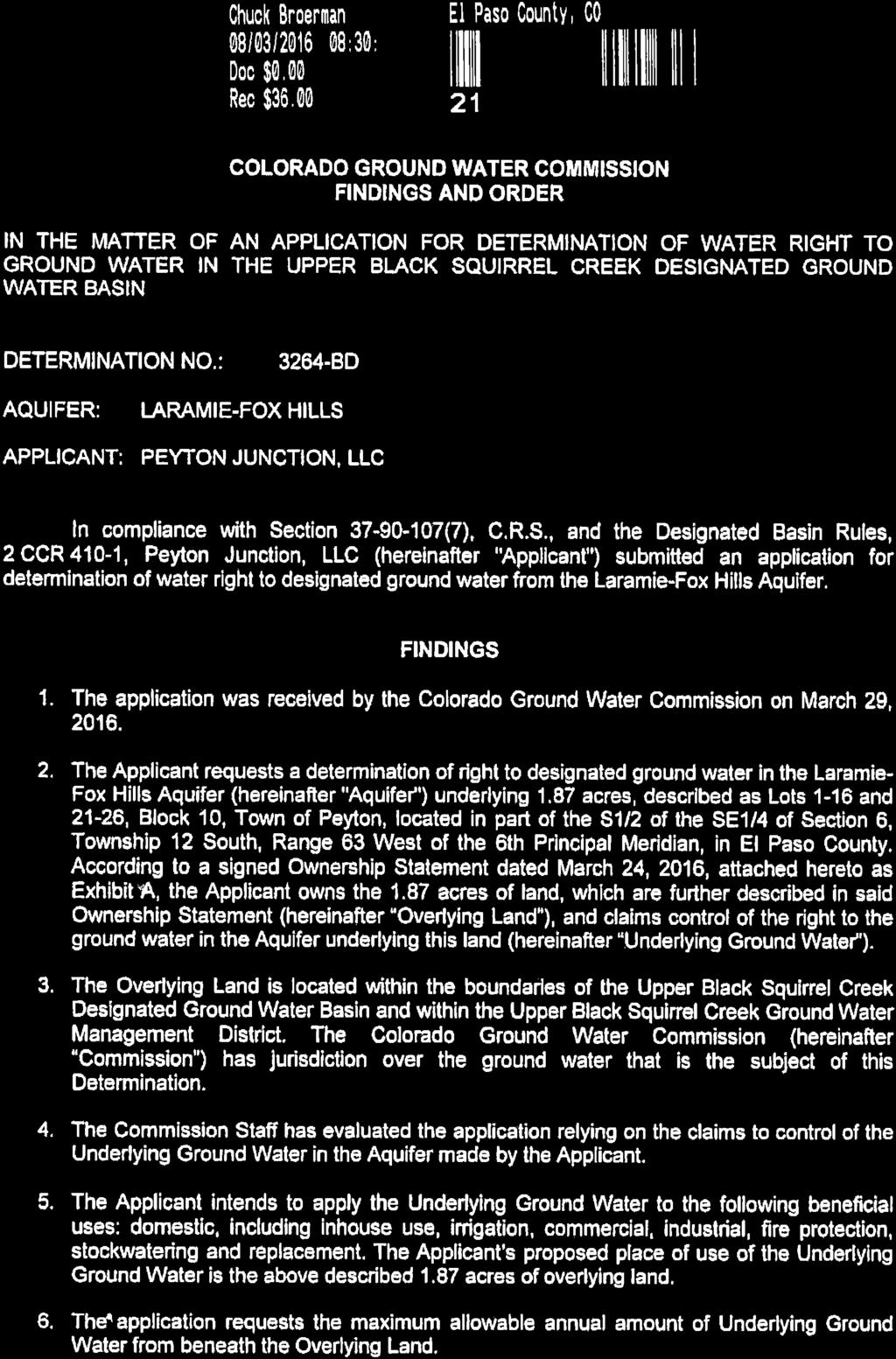
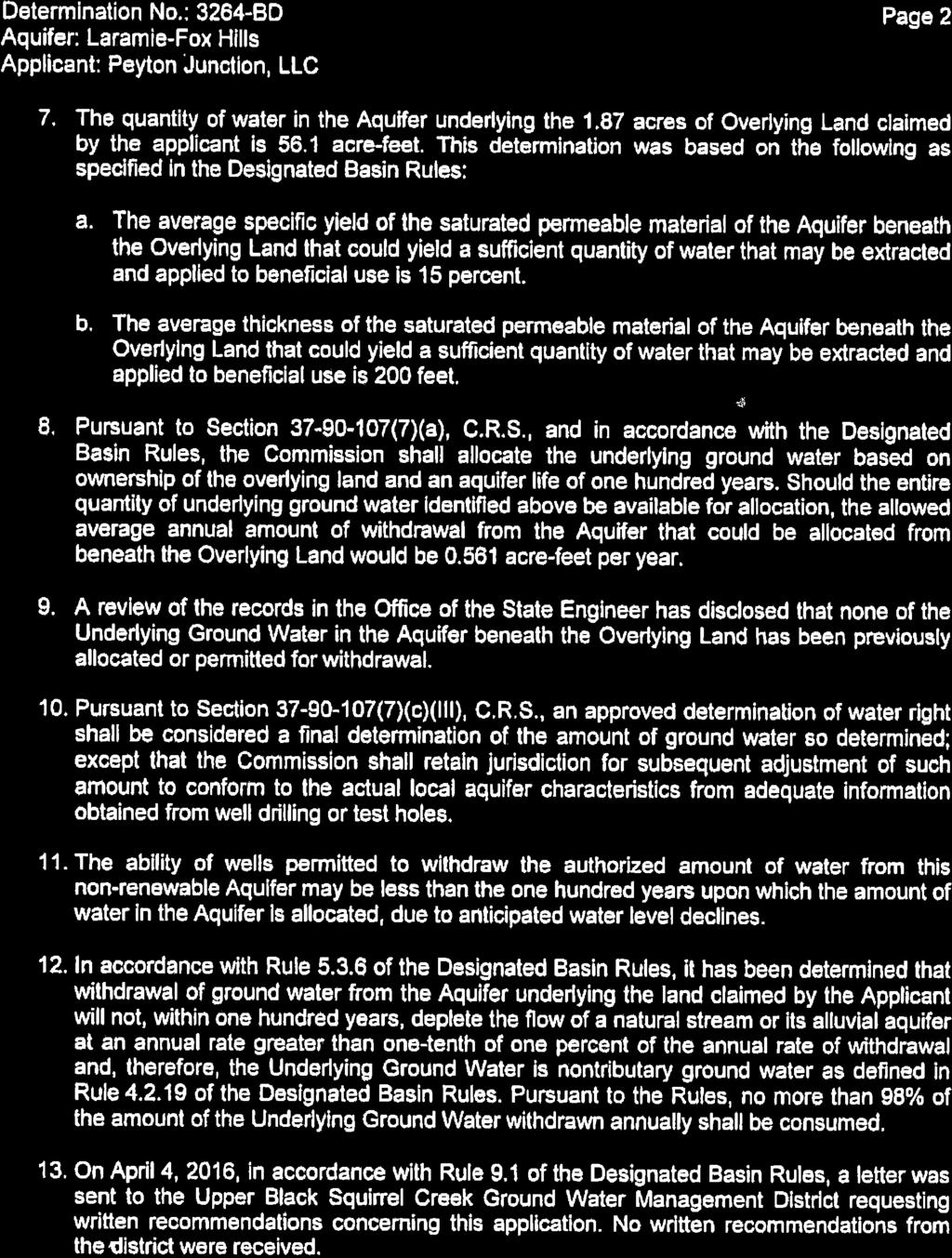
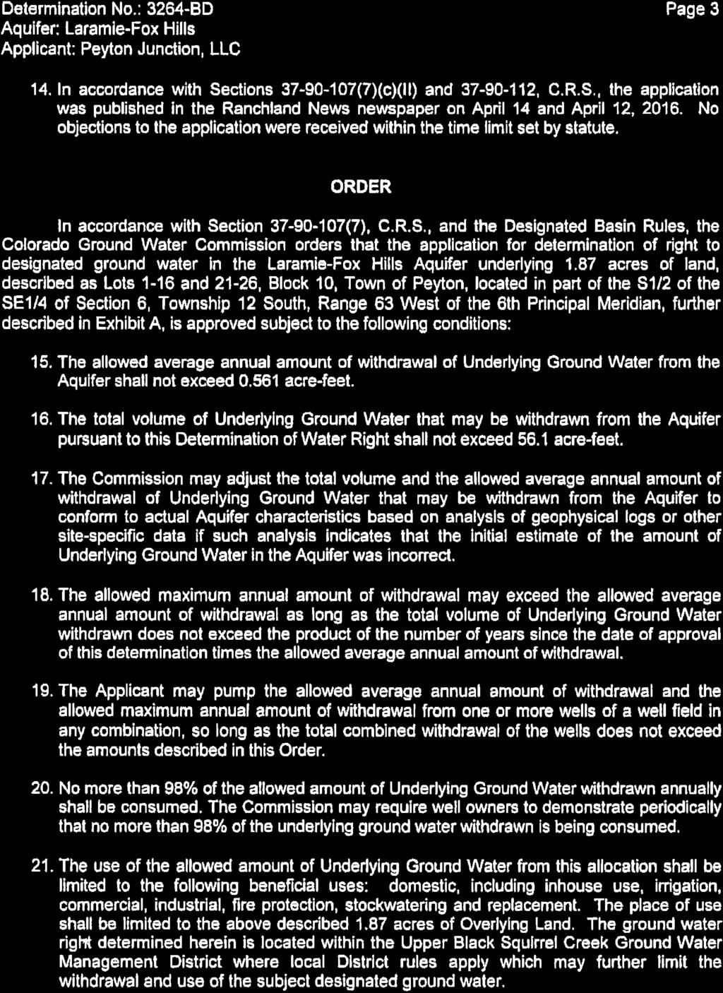
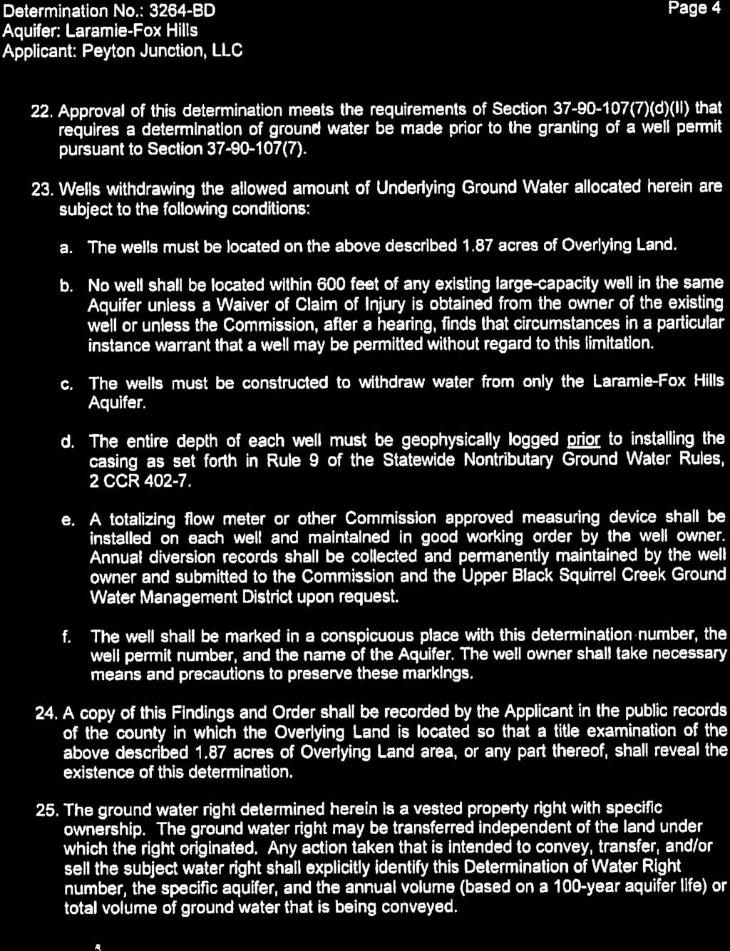
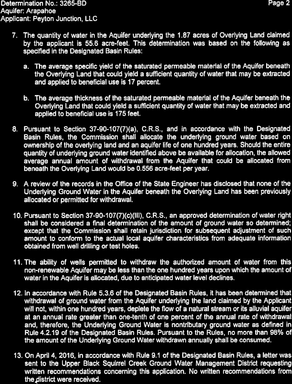
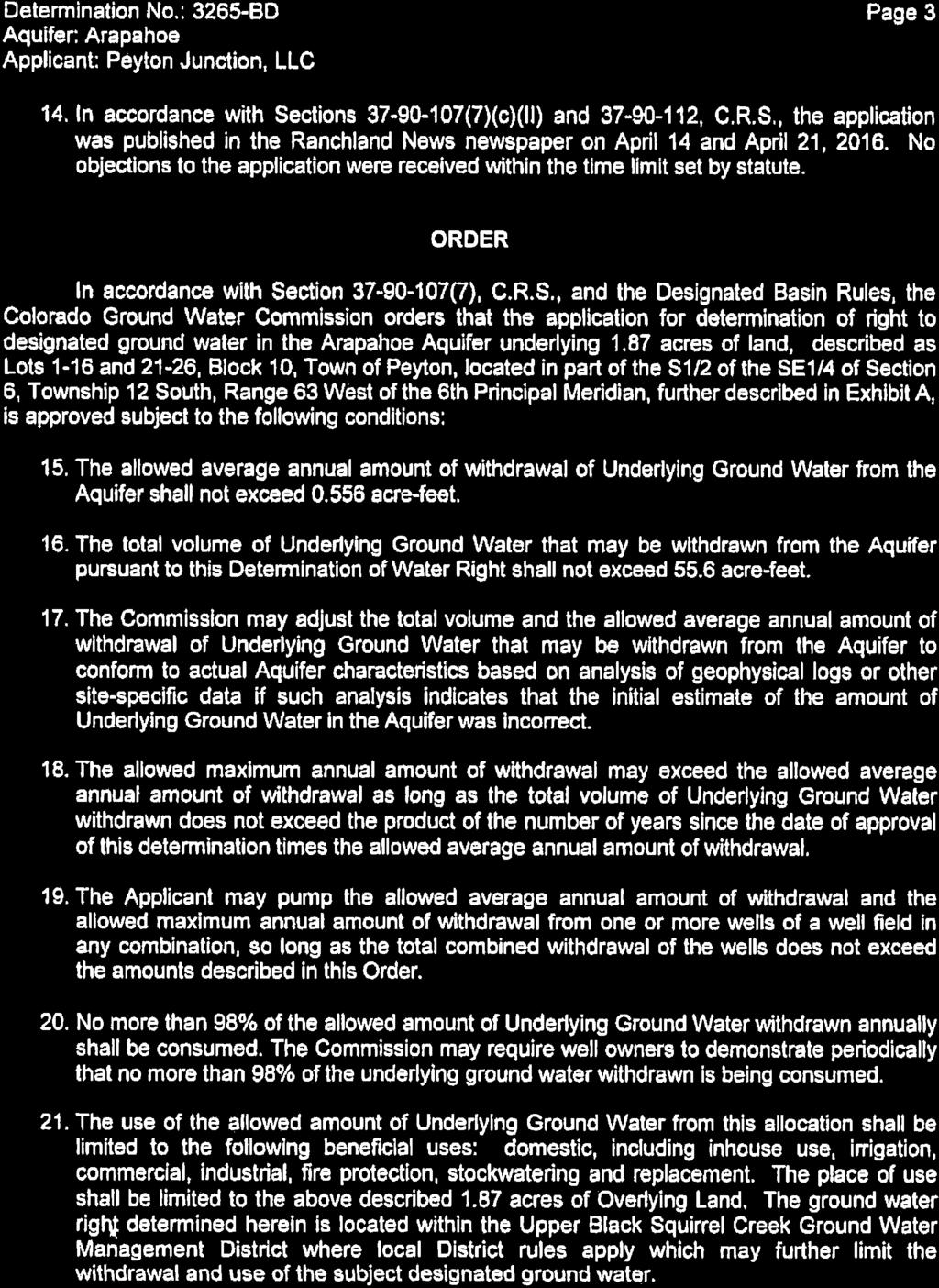
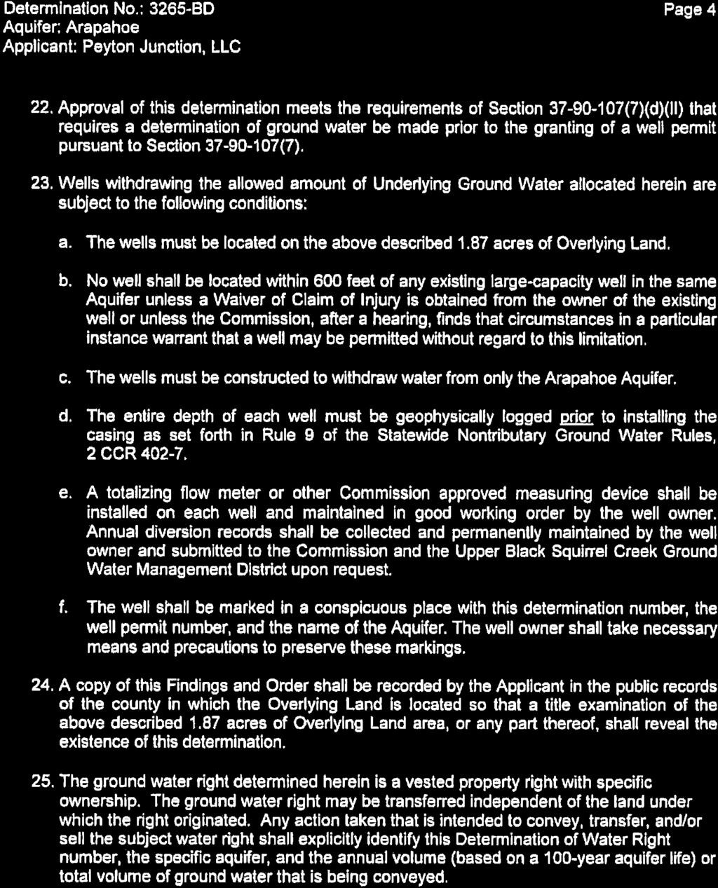
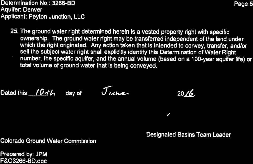
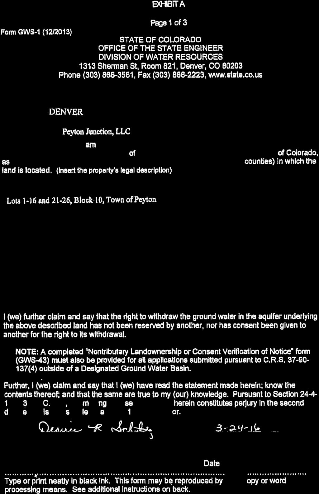
5 The applicants have provided State of Colorado water determinations verifying the allowed commercial and residential well water use. Those documents are attached to this report for information purposes. Water feasibility and sufficiency are not approval criteria for a map amendment (rezoning). The Colorado Groundwater Commission has made a Determination of Water Right for the total acreage of the merged parcel for each underlying groundwater aquifer. The Colorado Groundwater Commission has allocated 1.87 acre feet (Approximately 610,000 gallons per year or 16,710 square feet of building space) of water for Lots 1-16 combined with Lots 21-26, Block 10, Town of Peyton Mayfield, based upon an annual withdrawal over a 100 year period. The rezoning request is for Lots Lots which are under the same groundwater determination would remain zoned as A-35 and, as mentioned above, are vacant with the exception of existing storage sheds. F. ANALYSIS 1. Land Development Code Analysis The map amendment (rezoning) requested is in conformance with the El Paso County Policy Plan (1998), as discussed below. The staff report to the Board of County Commissioners for the 1999 County initiated rezoning stated the following: The town site (Peyton) is recommended for the A-35 district at this time. It is recognized that future site specific rezoning will be appropriate to bring the area more into consistency with the adopted Falcon/Peyton Comprehensive Plan. The staff report also identified that commercial uses were present and would become legal non-conforming uses pursuant to the new A-35 zoning. Nonconforming uses cease to be legal when they are discontinued for a period of two years or more, as was the case with the prior commercial uses on the subject properties. The CC (Commercial Community) zoning district is intended to accommodate retail sales and service establishments that generally require freestanding or small center type buildings and that primarily serve adjoining neighborhoods, as stated in Chapter 3, of the Land Development Code (2016). The existing boutique retail uses on the subject property are within the existing buildings located on merger parcel. The physical characteristics, such as narrow width, shortened length, and petite square footage of the of the original platted lots limit the intensity of potential commercial uses by physically limiting area available to put towards meeting the applicable parking, landscaping, and
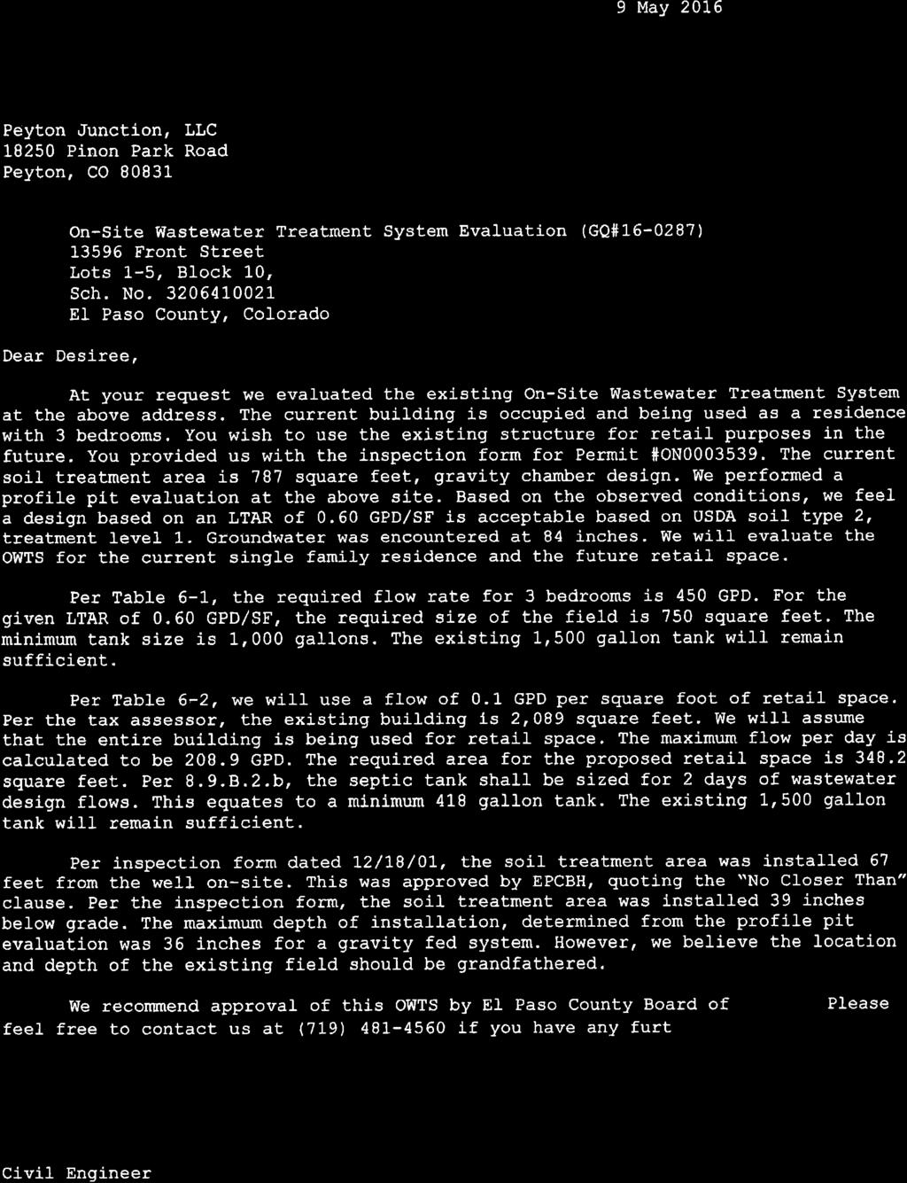
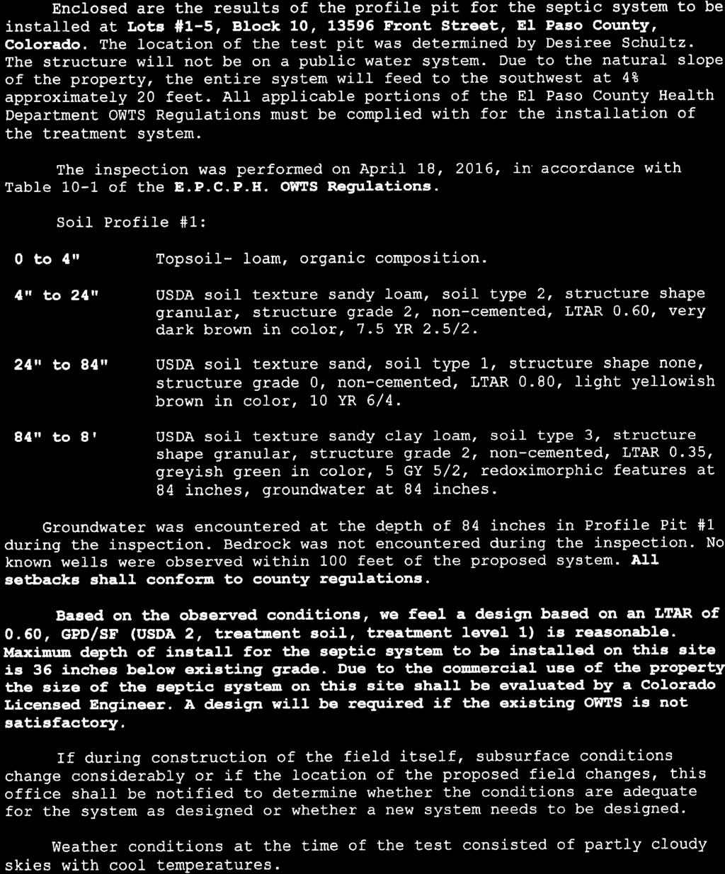
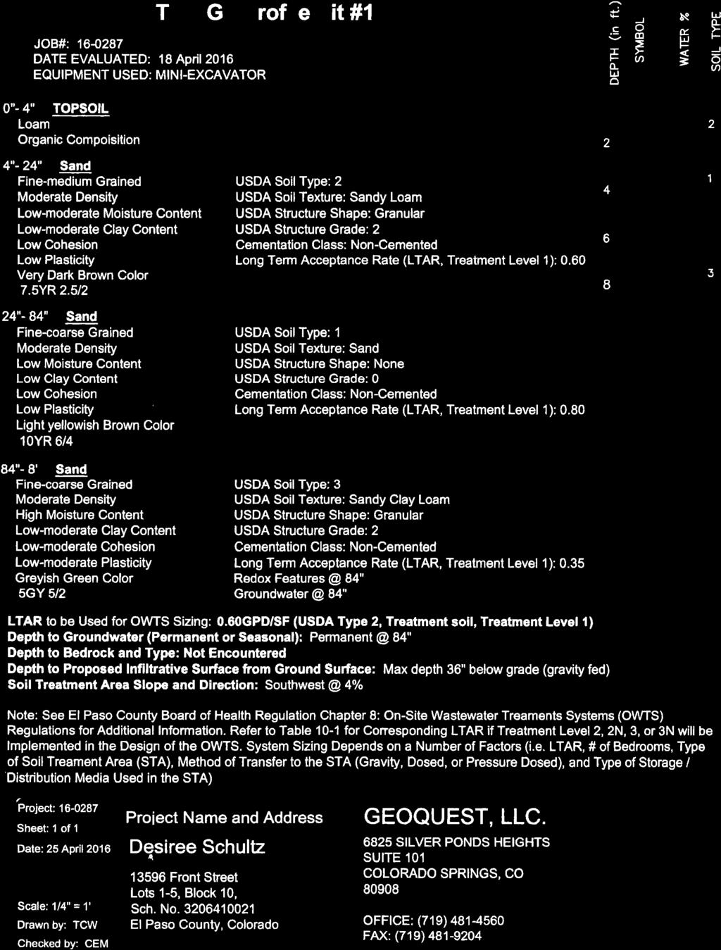
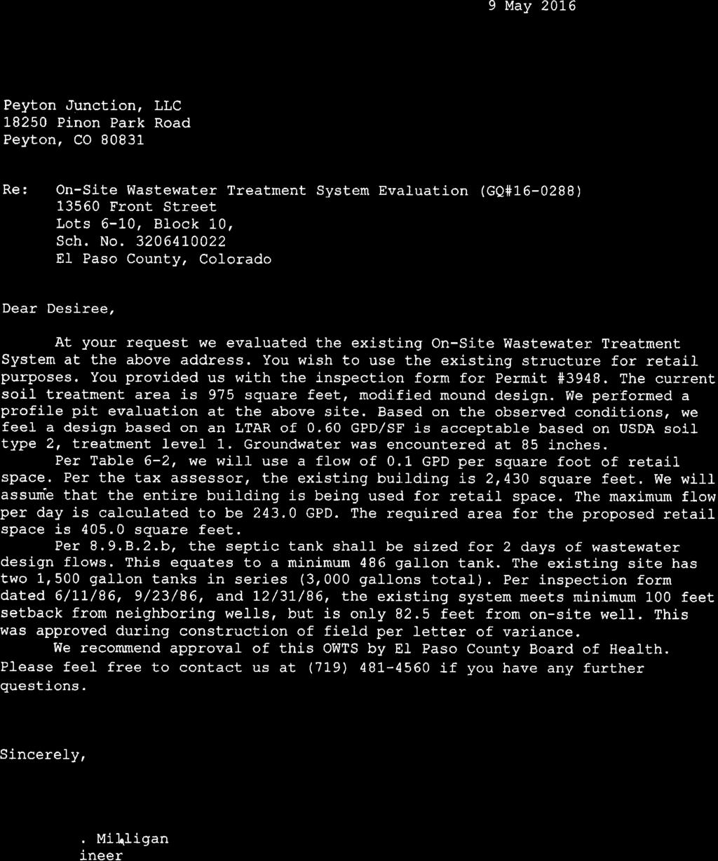
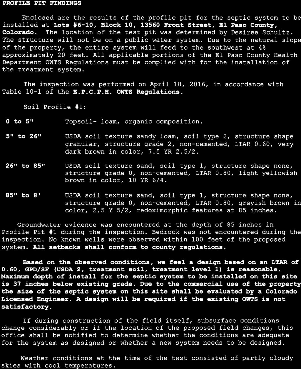
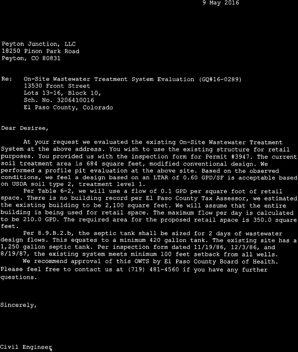
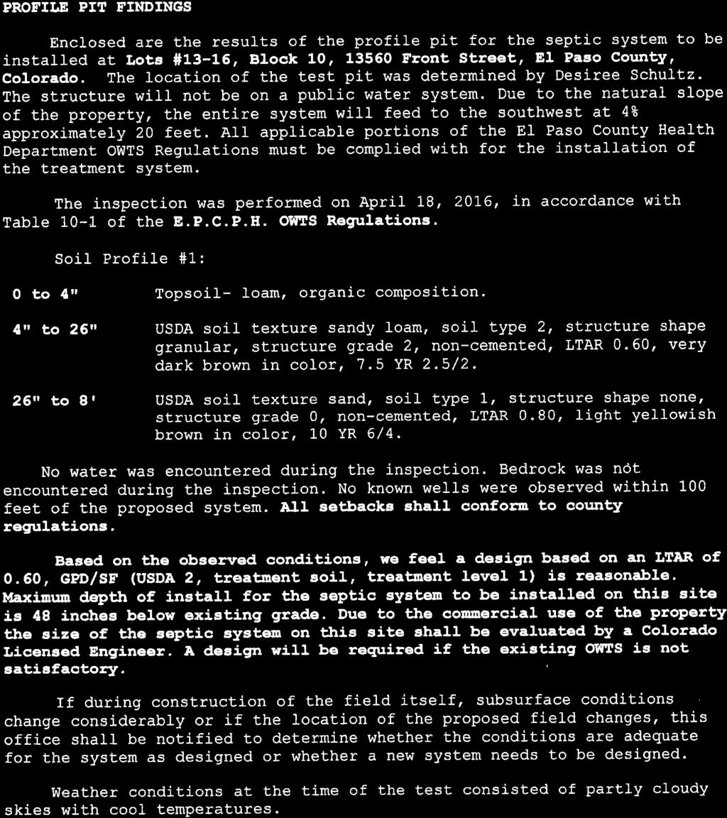
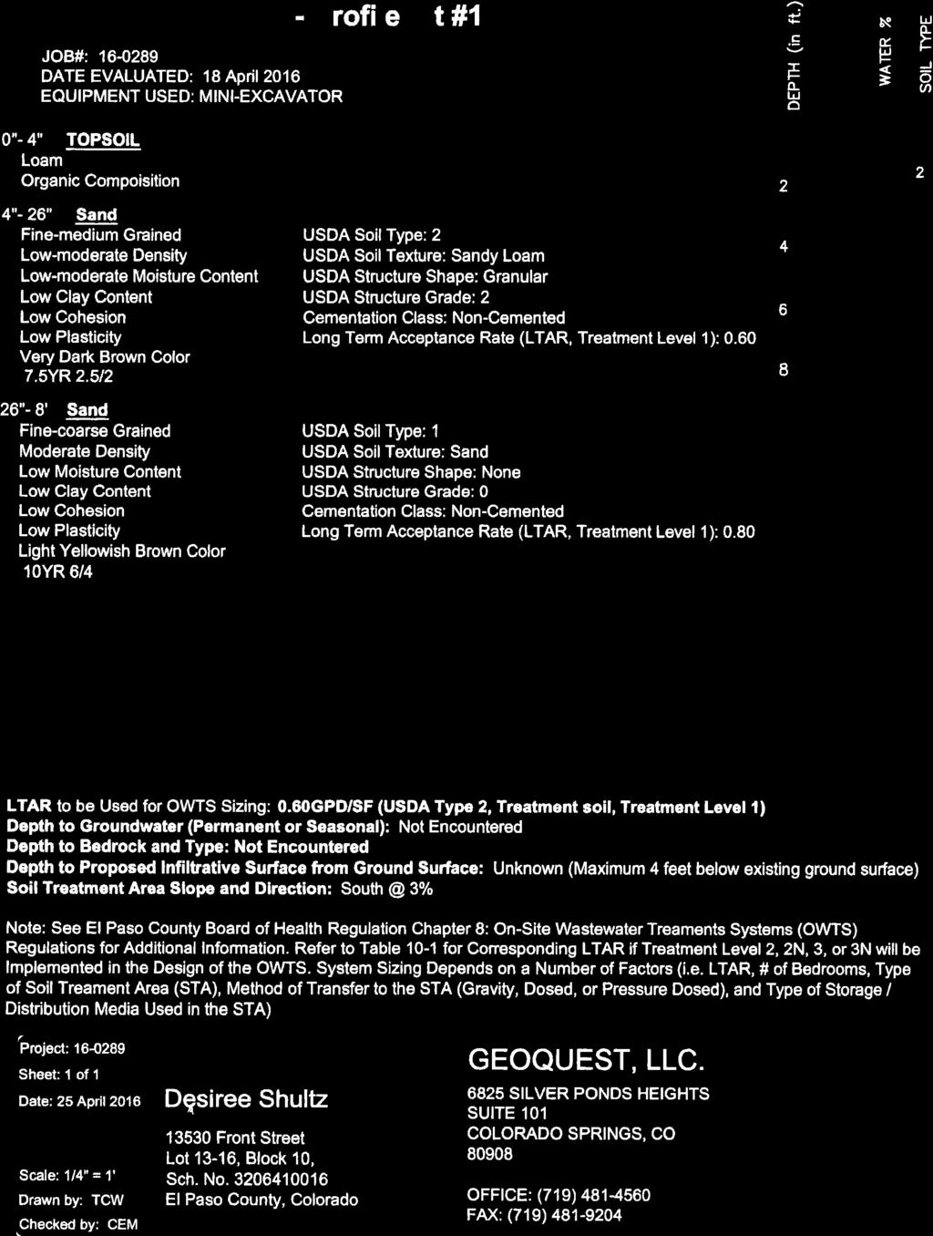
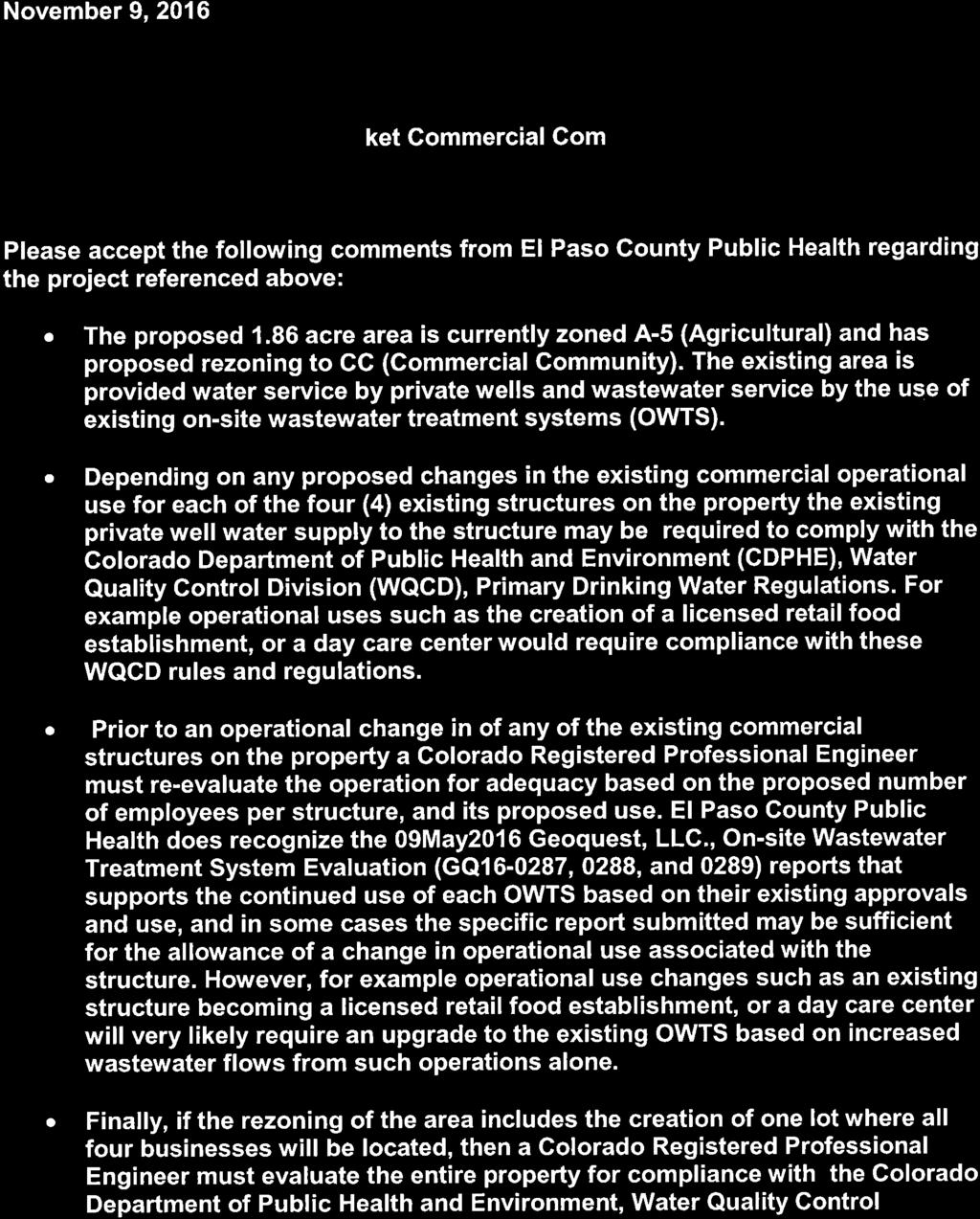
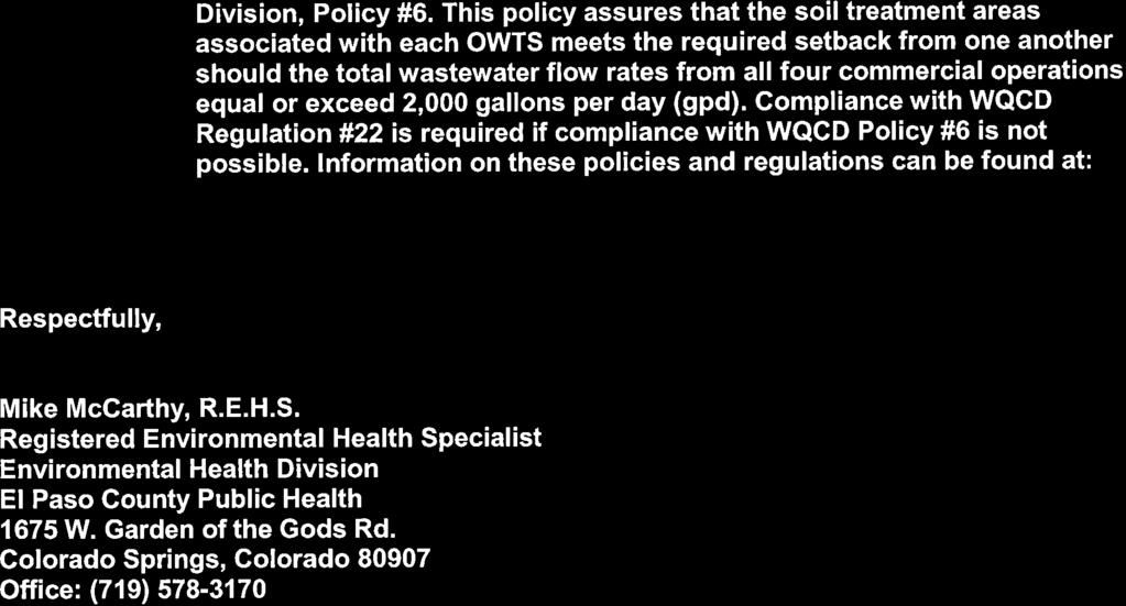
6 building area standards and on-site wastewater treatment system spacing requirements. Recommended Condition No. 4 states that the applicants shall obtain the appropriate permit(s) or approval(s) from El Paso County Public Health for any septic system upgrades or for the construction of any new system(s) necessary to accommodate expansion or changes to the current uses. Documentation for the existing on-site wastewater treatment system and El Paso County Public Health review comments of the application by are attached to this report. The lots are physically suitable for most low-intensity retail or commercial uses allowed in the CC zoning district. Condition No. 1 assures that a site development plan submittal and approval is required prior to establishing a new use. At that time, El Paso County Public Health would also be asked to review the plan for compliance with their regulations. Any expansion of an existing structure or any construction of a new structure will require approval of a site development plan and, depending on the configuration of the parcels at the time of site development plan submittal, may require a Board of Adjustment approval for lot area variance and/or setback variance due the constrained nature of the historic lots and merger parcel. Because of the configuration of the existing lots, approval of a vacation of interior lot lines or merger may also be required for any expansion of an existing structure or for the construction of any new structures to ensure that such expansion or new structure would not straddle an existing lot line. There is an existing garage on Lot 1 that is accessory to the existing single-family home. The garage encroaches into the undeveloped portion of Main Street, a County right-of-way. Approval of a license agreement is required and is being requested by the applicants concurrent with this map amendment (rezoning) request. If approved, the license agreement would authorize the encroachment of the garage into the right-of-way. The proposed license agreement is attached to this report. Water sufficiency is not a listed criterion for approval of a map amendment (rezoning); however, the applicants have submitted documentation from the Colorado Groundwater Commission that identifies that commercial and domestic (residential) uses are allowed under the determination. Recommended Notation No. 4 states that the commercial uses should be limited based on the water allocation by the Groundwater Commission. The County has no effective way of monitoring groundwater withdrawals pursuant to the Commission s allocation.
7 The requested rezoning is in compliance with the approval criterion identified in the Code with exception to the encroachment of the existing buildings into the setbacks, as stated above. 2. Zoning Compliance The density and dimensional standards of the CC (Commercial Community) zoning district, which is the proposed rezoning designation of the parcel, as established in Section 5.4.2, Table 5-5 of the Code are listed below: Minimum zoning district lot size 1 acre Minimum lot size- none Setbacks 25 feet from the perimeter boundary of the zoning district Maximum building height 40 feet Maximum lot coverage none The property is currently zoned A-35 (Agricultural) which requires a 25 foot setback from all property lines and a minimum lot size of 35 acres. None of the lots or existing buildings are in conformance with the A-35 dimensional standards. All the platted lots are less than one acre and all of the structures encroach into the 25 foot setbacks. Lots 1-6 are approximately 25 feet by 145 feet (3,635 square feet) each. Lots 7-16 are 25 feet by 155 feet (3,875 square feet) each. These existing non-conformities were acknowledged at the time of the County initiated zoning and were determined at that time to be legal nonconformities within the A-35 zoning district. This request to rezone from the A-35 zoning district to the CC zoning district will reduce the non-conformities because the CC zoning district does not require internal side yard setbacks or establish a minimum lot size. 3. Policy Plan Analysis The El Paso County Policy Plan (1998) has a dual purpose; it serves as a guiding document concerning broader land use planning issues, and provides a framework to tie together the more detailed sub-area elements of the County Master Plan. Relevant policies are as follows: Policy Encourage the reasonable accommodation of mixed uses within neighborhoods for the purposes of promoting land use efficiency and providing housing options. Policy Commercial, office, industrial, and residential development should be compatible with surrounding land uses in terms of scale, intensity and potential impacts.
8 As discussed above, the existing boutique retail uses on the subject property are within the existing buildings located on the lots. The physical characteristics, such as narrow width, shortened length, and petite square footage of the combined lots limit the intensity, scale and impacts of potential commercial uses by only accommodating a limited amount of parking to serve the commercial businesses, landscaping area, available building area, and on-site wastewater treatment systems. The potential for increased impacts to adjacent properties beyond what is currently present on the site should be minimal due to the selflimiting physical characteristics of the subject lots. Repurposing the single-family building into a mixed use building could prove to be a more efficient use of the land than many of the historical uses as will provide both a housing and employment option, thereby meeting the intent of the Plan. 4. Small Area Plan Analysis The property is within the boundaries of the Falcon/Peyton Small Area Master Plan (2008). More specifically, the property is within the Peyton Town Site subarea. The Plan identifies this area as the historic town center of Peyton. The relevant policies from the Plan are as follows: Policy Allow the potential for development and redevelopment in the vicinity of the existing Peyton town site as rural commercial center if services can be reasonably provided. Policy Encourage any future commercial development in the Peyton town site area to respect and build on the historic town center. The applicants have proposed to retain the historic characteristics of the town by rezoning the subject property to the CC (Commercial Community) zoning district and preserving four (4) of the existing buildings. The applicants previously upgraded the exterior of the four buildings, which should help reintroduce a commercial presence to the historic town center along Front Street and Second Street. The applicants have provided water documentation from the Groundwater Commission and on-site wastewater permit documentation to show that services are reasonably provided.
9 5. Other Master Plan Elements The Master Plan for Mineral Extraction (1996) does not identify mineral deposits of commercial value in the area of the subject property. G. PHYSICAL SITE CHARACTERISTICS 1. Hazards A geology, soils, and hazards report is not required to be submitted with a map amendment (rezone) request. There are no known hazards that would preclude development at this time. 2. Wildlife Potential impact to wildlife is generally low as depicted in the El Paso County Wildlife Descriptors Map (1996). 3. Floodplain The subject property does not contain a designated FEMA 100-year floodplain, as shown on Flood Insurance Rate Map (FIRM) 08041C0375F for El Paso County, dated March 17, Drainage and Erosion The subject property is located within the Upper Brackett Creek Drainage Basin, which does not have a Drainage Basin Planning Study. Any further development of the rezone area will be subject to County drainage, grading, and erosion control requirements at that time. 5. Transportation The site is served from U.S. Highway 24, Bradshaw Road, Railroad Street and the surrounding local roads in Peyton, including Main Street, Second Street, Front Street and Manitou Street. The existing County infrastructure is adequate for the current traffic; however, when additional development occurs in the rezone area roadway improvements may be required. Because the buildings and commercial uses within the rezone area exist and/or have existed in the past, a traffic study was not required with this rezone application. H. SERVICES 1. Water Sufficiency: Quality: N/A Quantity: N/A Dependability: N/A
10 The site is not within a water district. The property is to be served by three onsite wells. Documentation regarding the water allocation is attached for reference. Findings with regards to water sufficiency are not required with rezoning requests. 2. Sanitation The site is not within a wastewater district. Each building on the property is served by an on-site wastewater treatment system. Findings with regards to wastewater disposal are not required with rezoning requests; however, El Paso County Public Health provided comments regarding the rezone request (see attached). Condition No. 4 requires the applicants to meet El Paso County Public Health requirements at the time of building expansion, construction of a new structure, or with a change in use. 3. Emergency Services The property is within the Peyton Fire Protection District. The District was provided a referral and did not provide comment. 4. Utilities Mountain View Electric Association provides electrical service. The site is also served by propane gas. 5. Metropolitan Districts The property is not within a metropolitan district. 6. Parks/Trails The El Paso County Parks Master Plan (2013) shows no open space, park facilities, or trails intersected by or within the project area. A map amendment (rezone) does not require payment of park fees. 7. Schools The subject property is within the boundaries of Peyton School District No. 23. School dedication requirements or fees in lieu of land dedication are not applicable to map amendment (rezone). I. APPLICABLE RESOLUTIONS Approval Page 27 Disapproval Page 28
11 J. STATUS OF MAJOR ISSUES There are no issues associated with this request. K. RECOMMENDED CONDITIONS AND NOTATIONS Should the Planning Commission and the Board of County Commissioners find that the request meets the criteria for approval outlined in Section of the El Paso County Land Development Code (2016), staff recommends the following conditions and notations. 1. Any future expansion of the structures or change in use shall be in accordance with the use, density, and dimensional standards of the CC (Commercial Community) zoning district and with the applicable sections of the Land Development Code and Engineering Criteria Manual (2015). A Board of Adjustment hearing may be required to grant a variance from strict compliance with the zoning dimensional standards in order to facilitate any future building expansion. Any expansion or change in use will also trigger the requirement for submittal and approval of a site development plan. 2. A special use application and site development plan shall be submitted and approved prior to establishing the mixed-use residential use within the existing single-family residence. 3. The expansion of an existing structure or construction of a new structure may require approval from the Board of Adjustment to provide relief from the zoning dimensional standards. Any building expansion or the construction of a new structure will trigger the requirement for approval of a site development plan prior to issuance of a building permit. 4. Approval of a vacation of interior lot lines or merger request is required for any building expansion or for construction of a new structure(s). The configuration of the subsequently created lots (after the vacation of interior lot lines or merger) shall be based on the legal description(s) of the Colorado Ground Water Commission decree. 5. The applicants shall obtain the appropriate permit or approval from the El Paso County Public Health for any onsite wastewater treatment system (OWTS) upgrades or for the construction of any new system(s) necessary to accommodate expansion or changes to the current uses. 6. The applicant shall meet the requirements of the Pikes Peak Regional Building Department at the time of any building expansion, the construction of any additional structure, and/or prior to a change in use.
12 NOTATIONS 1. If a zone or rezone petition has been disapproved by the Board of County Commissioners, resubmittal of the previously denied petition will not be accepted for a period of one (1) year if it pertains to the same parcel of land and is a petition for a change to the same zone that was previously denied. However, if evidence is presented showing that there has been a substantial change in physical conditions or circumstances, the Planning Commission may reconsider said petition. The time limitation of one (1) year shall be computed from the date of final determination by the Board of County Commissioners or, in the event of court litigation, from the date of the entry of final judgment of any court of record. 2. Rezoning requests not forwarded to the Board of County Commissioners for consideration within 180 days of Planning Commission action will be deemed withdrawn and will have to be resubmitted in their entirety. 3. Applicants are hereby on notice that all structures may need to be in conformance with the rules and regulations of the Pikes Peak Regional Building Department at the time of establishing a new use. 4. The Colorado Groundwater Commission has allocated 1.87 acre feet of water for Lots 1-16 combined with Lots 21-26, Block 10, Town of Peyton Mayfield, based on an annual withdrawal over a 100 year period. The applicants are hereby on notice that uses on the property may be constrained by the allocated water as identified in the Colorado Groundwater Commission documents for the property, and by the limitations of the on-site wastewater treatment system(s). L. PUBLIC COMMENT AND NOTICE The Planning and Community Development Department notified eleven (11) adjoining property owners on February 6, 2017, for the Planning Commission meeting. Responses will be provided at the hearing. M. ATTACHMENTS Vicinity Map Letter of Intent Rezone Map Water Documentation Wastewater Documentation El Paso County Public Health Comment Letter License Agreement
13


14

15
16

17

18
19
20
21
22
23
24
25

26
27
28
29
30
31
32
33
34

35
36
37
38
39
40
41
42
43
44
45
46
47

48
49
50
51
52
53
54
55
56
57
58
59
60
61
62
63

64
65

66
67
68
69
70
71
72
REPRESENTATIVE: Centerline Solutions Table Mountain Parkway Golden, CO 80403
 COMMISSIONERS: DARRYL GLENN (PRESIDENT) MARK WALLER (PRESIDENT PRO TEMPORE) STAN VANDERWERF LONGINOS GONZALEZ PEGGY LITTLETON PLANNING AND COMMUNITY DEVELOPMENT DEPARTMENT CRAIG DOSSEY, EXECUTIVE DIRECTOR
Project File #: VA Project Name: Beauperthuy Variance Parcel Nos.: , , , ,
 COMMISSIONERS: DARRYL GLENN (PRESIDENT) MARK WALLER (PRESIDENT PRO TEMPORE) STAN VANDERWERF LONGINOS GONZALEZ PEGGY LITTLETON PLANNING AND COMMUNITY DEVELOPMENT DEPARTMENT CRAIG DOSSEY, EXECUTIVE DIRECTOR
Project File #: SF Project Name: Jackson Ranch Filing No. 4 Parcel Nos.: , and
 COMMISSIONERS: DARRYL GLENN (PRESIDENT) MARK WALLER (PRESIDENT PRO TEMPORE) STAN VANDERWERF LONGINOS GONZALEZ PEGGY LITTLETON PLANNING AND COMMUNITY DEVELOPMENT DEPARTMENT CRAIG DOSSEY, EXECUTIVE DIRECTOR
REPRESENTATIVE: NES, Inc. 619 North Cascade Avenue, Suite 200 Colorado Springs, CO 80903
 COMMISSIONERS: MARK WALLER (CHAIR) LONGINOS GONZALEZ, JR. (VICE-CHAIR) HOLLY WILLIAMS STAN VANDERWERF CAMI BREMER PLANNING AND COMMUNITY DEVELOPMENT DEPARTMENT CRAIG DOSSEY, EXECUTIVE DIRECTOR TO: FROM:
REPRESENTATIVE: Julie & Brad Nicodemus Black Squirrel Road Colorado Springs, CO 80809
 COMMISSIONERS: DARRYL GLENN (PRESIDENT) MARK WALLER (PRESIDENT PRO TEMPORE) STAN VANDERWERF LONGINOS GONZALEZ PEGGY LITTLETON PLANNING AND COMMUNITY DEVELOPMENT DEPARTMENT CRAIG DOSSEY, EXECUTIVE DIRECTOR
Gabe Sevigney, Project Manager/Planner I Gilbert LaForce, Engineer II Craig Dossey, Executive Director Planning & Community Development
 COMMISSIONERS: DARRYL GLENN (PRESIDENT) MARK WALLER (PRESIDENT PRO TEMPORE) STAN VANDERWERF LONGINOS GONZALEZ PEGGY LITTLETON PLANNING AND COMMUNITY DEVELOPMENT DEPARTMENT CRAIG DOSSEY, EXECUTIVE DIRECTOR
Nina Ruiz, Project Manager/Planner II Gilbert LaForce, Engineer II Craig Dossey, Executive Director Planning & Community Development
 COMMISSIONERS: DARRYL GLENN (PRESIDENT) MARK WALLER (PRESIDENT PRO TEMPORE) STAN VANDERWERF LONGINOS GONZALEZ PEGGY LITTLETON PLANNING AND COMMUNITY DEVELOPMENT DEPARTMENT CRAIG DOSSEY, EXECUTIVE DIRECTOR
Project File #: SF Project Name: Meadowbrook Crossing Filing No. 1 Final Plat Parcel No.:
 COMMISSIONERS: DARRYL GLENN (PRESIDENT) MARK WALLER (PRESIDENT PRO TEMPORE) STAN VANDERWERF LONGINOS GONZALEZ PEGGY LITTLETON PLANNING AND COMMUNITY DEVELOPMENT DEPARTMENT CRAIG DOSSEY, EXECUTIVE DIRECTOR
Project File #: SP Project Name: Springs at Waterview Preliminary Plan Parcel No.:
 COMMISSIONERS: DARRYL GLENN (PRESIDENT) MARK WALLER (PRESIDENT PRO TEMPORE) STAN VANDERWERF LONGINOS GONZALEZ PEGGY LITTLETON PLANNING AND COMMUNITY DEVELOPMENT DEPARTMENT CRAIG DOSSEY, EXECUTIVE DIRECTOR
REPRESENTATIVE: Kesti Suggs Holmes Rd Colorado Springs, CO 80908
 COMMISSIONERS: DARRYL GLENN (PRESIDENT) MARK WALLER (PRESIDENT PRO TEMPORE) STAN VANDERWERF LONGINOS GONZALEZ PEGGY LITTLETON PLANNING AND COMMUNITY DEVELOPMENT DEPARTMENT CRAIG DOSSEY, EXECUTIVE DIRECTOR
Planning Commission Hearing Date: 3/6/2018 Board of County Commissioners Hearing Date 3/27/2018
 COMMISSIONERS: DARRYL GLENN (PRESIDENT) MARK WALLER (PRESIDENT PRO TEMPORE) STAN VANDERWERF LONGINOS GONZALEZ PEGGY LITTLETON PLANNING AND COMMUNITY DEVELOPMENT DEPARTMENT CRAIG DOSSEY, EXECUTIVE DIRECTOR
Nina Ruiz, PM/Planner II Mike Hrebenar, Project Management Group Manager Elizabeth Nijkamp, PE Engineering Manager Craig Dossey, Executive Director
 COMMISSIONERS: DARRYL GLENN (PRESIDENT) MARK WALLER (PRESIDENT PRO TEMPORE) STAN VANDERWERF LONGINOS GONZALEZ PEGGY LITTLETON PLANNING AND COMMUNITY DEVELOPMENT DEPARTMENT CRAIG DOSSEY, EXECUTIVE DIRECTOR
Planning Commission Hearing Date: 5/2/2017 Board of County Commissioners Hearing Date 5/23/2017
 COMMISSIONERS: DARRYL GLENN (PRESIDENT) MARK WALLER (PRESIDENT PRO TEMPORE) STAN VANDERWERF LONGINOS GONZALEZ PEGGY LITTLETON PLANNING AND COMMUNITY DEVELOPMENT DEPARTMENT CRAIG DOSSEY, EXECUTIVE DIRECTOR
Planning Commission Hearing Date: 1/2/2018 Board of County Commissioners Hearing Date 1/23/2018
 COMMISSIONERS: DARRYL GLENN (PRESIDENT) MARK WALLER (PRESIDENT PRO TEMPORE) STAN VANDERWERF LONGINOS GONZALEZ PEGGY LITTLETON PLANNING AND COMMUNITY DEVELOPMENT DEPARTMENT CRAIG DOSSEY, EXECUTIVE DIRECTOR
MS MINOR SUBDIVISION TREVITHICK
 MS-02-015 341.12 MINOR SUBDIVISION TREVITHICK A request by Danny Trevithick for a one-lot Minor Subdivision on five acres. The property is zoned A-35 (Agricultural) District and is located ¼ mile south
ARTICLE VII. NONCONFORMITIES. Section 700. Purpose.
 ARTICLE VII. NONCONFORMITIES. Section 700. Purpose. The purpose of this chapter is to regulate and limit the development and continued existence of legal uses, structures, lots, and signs established either
Project File #: P Project Name: Springs at Waterview Residential Rezone Parcel No.:
 COMMISSIONERS: DARRYL GLENN (PRESIDENT) MARK WALLER (PRESIDENT PRO TEMPORE) STAN VANDERWERF LONGINOS GONZALEZ PEGGY LITTLETON PLANNING AND COMMUNITY DEVELOPMENT DEPARTMENT CRAIG DOSSEY, EXECUTIVE DIRECTOR
Project File #: SF Project Name: Redtail Ranch Subdivision Parcel Nos.: , , ,
 COMMISSIONERS: MARK WALLER (CHAIR) LONGINOS GONZALEZ, JR. (VICE-CHAIR) HOLLY WILLIAMS STAN VANDERWERF CAMI BREMER PLANNING AND COMMUNITY DEVELOPMENT DEPARTMENT CRAIG DOSSEY, EXECUTIVE DIRECTOR TO: FROM:
Guide to Preliminary Plans
 Guide to Preliminary Plans Introduction The Douglas County is committed to providing open, transparent application processes to the public. This Guide is provided to assist anyone interested in the procedures
Planning Commission Hearing Date 7/24/2018 Board of County Commissioners Hearing Date 8/14/2018
 COMMISSIONERS: DARRYL GLENN (PRESIDENT) MARK WALLER (PRESIDENT PRO TEMPORE) STAN VANDERWERF LONGINOS GONZALEZ PEGGY LITTLETON PLANNING AND COMMUNITY DEVELOPMENT DEPARTMENT CRAIG DOSSEY, EXECUTIVE DIRECTOR
Guide to Combined Preliminary and Final Plats
 Guide to Combined Preliminary and Final Plats Introduction The Douglas County is committed to providing open, transparent application processes to the public. This Guide is provided to assist anyone interested
Letter of Intent May 2017 (Revised November 2017)
") THE BEACH AT WOODMOOR LETTER OF INTENT MAY 2017 (REVISED NOVEMBER 2017) OWNER/APPLICANT: CONSULTANT: Lake Woodmoor Holdings LLC N.E.S. Inc. 1755 Telstar Drive, Suite 211 619 North Cascade Avenue Colorado
THE BEACH AT WOODMOOR LETTER OF INTENT MAY 2017 (REVISED NOVEMBER 2017) OWNER/APPLICANT: CONSULTANT: Lake Woodmoor Holdings LLC N.E.S. Inc. 1755 Telstar Drive, Suite 211 619 North Cascade Avenue Colorado
Guide to Minor Developments
 Guide to Minor Developments Introduction The Douglas County (DCD) is committed to providing open, transparent application processes to the public. This Guide is provided to assist anyone interested in
PRESENT AND VOTING: JIM EGBERT, ALLAN CREELY, TONY GIOIA, KEVIN CURRY, JOAN LUCIA-TREESE, KEVIN MASTIN, AND JANE DILLON
 COMMISSIONERS: DARRYL GLENN (PRESIDENT) MARK WALLER (PRESIDENT PRO TEMPORE) STAN VANDERWERF LONGINOS GONZALEZ PEGGY LITTLETON PLANNING AND COMMUNITY DEVELOPMENT DEPARTMENT CRAIG DOSSEY, EXECUTIVE DIRECTOR
SUBDIVISION REGULATIONS
 CHAPTER 14 SUBDIVISION REGULATIONS 14-100 Provisions 14-200 Preliminary Plat 14-300 Final Plat 14-400 Replat 14-500 Minor Subdivision 14-600 Administrative Replat 14-700 Vacation of Roadways, Public Easements,
Guide to Replats. Step 1. Step 2. Step 3. Step 4. Step 5. Step 6. Step 7. Step 8. Step 9. Step 10
 Guide to Replats Introduction Douglas County is committed to providing open, transparent application processes to the public. This Guide is provided to assist anyone interested in the procedures and expectations
ZONING ORDINANCE PETITION REVIEW REPORT Amended Site Development Plan
 ZONING ORDINANCE PETITION REVIEW REPORT Amended Site Development Plan Petition Number: Z14-02 Petitioner: Agent: Project Name: Location: Kenn Grasse 2187 White Lane Dr. Chesterfield, MO 63017 314-952-6005
BOUNDARY LINE ADJUSTMENT
 DEPARTMENT OF COMMUNITY DEVELOPMENT 621 Sheridan Street, Port Townsend, WA 98368 Tel: 360.379.4450 Fax: 360.379.4451 Web: www.co.jefferson.wa.us/communitydevelopment E-mail: dcd@co.jefferson.wa.us BOUNDARY
ARTICLE 9: VESTING DETERMINATION, NONCONFORMITIES AND VARIANCES. Article History 2 SECTION 9.01 PURPOSE 3
 ARTICLE 9 VESTING DETERMINATIONS, NONCONFORMITIES, AND VARIANCES Table of Contents Article History 2 SECTION 9.01 PURPOSE 3 SECTION 9.02 LOT OF RECORD AND VESTING DETERMINATIONS FOR NONCONFORMING DEVELOPMENTS
Larimer County Planning Dept. Procedural Guide for 1041 PERMITS
 - Larimer County Planning Dept. Procedural Guide for 1041 PERMITS PLEASE NOTE: A PRE-APPLICATION CONFERENCE IS REQUIRED PRIOR TO SUBMITTING THIS APPLICATION. PURPOSE: State Statutes allow local governments
Expiration of Transportation Certificate of Concurrency for Application for Minor or Major Development; Approval
 Page 1 of 12 CHAPTER 3. CONCURRENCY 3.00.00. GENERALLY 3.00.01. Purpose and Intent The purpose of this chapter is to describe the requirements and procedures necessary to implement the concurrency provisions
WESTON COUNTY FINAL PLAT APPLICATION
 WESTON COUNTY FINAL PLAT APPLICATION Property Owner: Mailing Address of owner: Telephone Number(s) of owner: Property Owner: Mailing Address of owner: Telephone Number(s) of owner: (If subdivider/applicant
TRANSFERABLE DEVELOPMENT RIGHTS PROCESS GUIDE
 TRANSFERABLE DEVELOPMENT RIGHTS PROCESS GUIDE Clear Creek County Planning Department P.O. Box 2000 Georgetown, Colorado 80444 (303) 679-2436 - phone (303) 569-1103 - fax 1 PURPOSE: A Transfer of Development
Planning Department Oconee County, Georgia
 Planning Department Oconee County, Georgia STAFF REPORT REZONE CASE #: 6985 DATE: October 31, 2016 STAFF REPORT BY: Andrew C. Stern, Planner APPLICANT NAME: Williams & Associates, Land Planners PC PROPERTY
ARTICLE FIVE FINAL DRAFT
 ARTICLE FIVE 021218 FINAL DRAFT Sec. 503.6 Open Space Preservation Option Open Space Preservation Option Open Space Preservation developments may be approved in the AR, R-1, R-2 and R-3 zoning districts,
Legal Description Part of the Western Half of the Eastern Half of the Northwest Quarter of Section 30, Le Ray Township
 Owner and Applicant s 20448 State Highway 83 Mankato, MN 56001 Request and Location Request for review and approval of a Conditional Use Permit to allow an Elder Care Residential Unit to be constructed
The Ranches Sketch Plan
 The Ranches Sketch Plan APPLICATION: RURAL LAND USE PROCESS (AKA CLUSTER DEVELOPMENT) HEARING DATES: Planning Commission: 12 July 2017 at 6:30 pm Board of County Commissioners: TBD APPLICANT: REQUEST:
13 NONCONFORMITIES [Revises Z-4]
![13 NONCONFORMITIES [Revises Z-4]](/thumbs/87/97238669.jpg "13 NONCONFORMITIES [Revises Z-4]") Dimensional Standards Building Design Standards Sidewalks Tree Protection & Landscaping Buffers & Screening Street Tree Planting Parking Lot Landscaping Outdoor Lighting Signs 13.1 PURPOSE AND APPLICABILITY
Dimensional Standards Building Design Standards Sidewalks Tree Protection & Landscaping Buffers & Screening Street Tree Planting Parking Lot Landscaping Outdoor Lighting Signs 13.1 PURPOSE AND APPLICABILITY
Residential Project Convenience Facilities
 Standards for Specific Land Uses 35.42.220 E. Findings. The review authority shall approve a Land Use Permit in compliance with Subsection 35.82.110.E (Findings required for approval) or a Conditional
Kitsap County Department of Community Development
 Kitsap County Department of Community Development Staff Report and Recommendation Annual Comprehensive Plan Amendment Process for 2018 George s Corner LAMIRD Boundary Adjustment Report Date 7/16/2018 Hearing
SITE PLAN REVIEW ADMINISTRATIVE REVIEW. Please Note: Once submitted to the County, all application materials become a matter of public record.
 200 W. Oak Street, 3rd Floor Fort Collins, CO 80521 (970) 498-7683 / larimer.org/planning SITE PLAN REVIEW ADMINISTRATIVE REVIEW The submittal requirements listed in this packet are intended to collect
PALM BEACH COUNTY PLANNING, ZONING AND BUILDING DEPARTMENT ZONING DIVISION
 PALM BEACH COUNTY PLANNING, ZONING AND BUILDING DEPARTMENT ZONING DIVISION Petition No.: Z2002-051 Petitioner: Rene & Gina Tercilla Owner: Rene & Gina Tercilla Agent: Rene & Gina Tercilla Telephone No.:
PALM BEACH COUNTY PLANNING, ZONING AND BUILDING DEPARTMENT ZONING DIVISION
 PALM BEACH COUNTY PLANNING, ZONING AND BUILDING DEPARTMENT ZONING DIVISION Application No.: CA-2012-00688 Control No.: 2011-00552 Applicant: Garry Bernardo Owners: Garry Bernardo Agent: Frogner Consulting,
Chapter 9 - Non-Conformities CHAPTER 9 - INDEX
 CHAPTER 9 - INDEX 9-10: GENERAL... 3 9-20: SUBSTANDARD SIZE LOTS OR PARCELS... 3 9-20-10: GENERAL... 3 9-20-20: CUMULATING OF SUBSTANDARD SIZE LOTS OR PARCELS... 3 9-20-30: SEPARATION OF PLATTED SUBSTANDARD
Project File #: VR Project Name: Claremont Ranch Filing 9C Vacate Replat Parcel No.:
 COMMISSIONERS: DARRYL GLENN (PRESIDENT) MARK WALLER (PRESIDENT PRO TEMPORE) STAN VANDERWERF LONGINOS GONZALEZ PEGGY LITTLETON PLANNING AND COMMUNITY DEVELOPMENT DEPARTMENT CRAIG DOSSEY, EXECUTIVE DIRECTOR
TOWNSHIP OF SOLON COUNTY OF KENT, MICHIGAN. Members: Robert Ellick, Fred Gunnell, Mark Hoskins, Mary Lou Poulsen
 As recommended by Planning Commission at its December 27, 2017 meeting TOWNSHIP OF SOLON COUNTY OF KENT, MICHIGAN At a regular meeting of the Township Board of the Township of Solon, Kent County, Michigan,
El Paso County Development Review System Adopted Fee Schedule (2005)
") Special Districts Special District 5 (multiple districts for the same project is one fee) D $6,300 Special District Amendment 5 D $3,950 Master Plans Master Plan, Master Plan Amendment D $11,900 Land Use
Special Districts Special District 5 (multiple districts for the same project is one fee) D $6,300 Special District Amendment 5 D $3,950 Master Plans Master Plan, Master Plan Amendment D $11,900 Land Use
Cover Letter with Narrative Statement
 Cover Letter with Narrative Statement March 31, 2017 rev July 27, 2017 RE: Rushton Pointe Residential Planned Unit Development Application for Public Hearing for RPUD Rezone PL2015 000 0306 Mr. Eric Johnson,
PALM BEACH COUNTY PLANNING, ZONING AND BUILDING DEPARTMENT ZONING DIVISION
 PALM BEACH COUNTY PLANNING, ZONING AND BUILDING DEPARTMENT ZONING DIVISION Application No.: Z2003-094 Control No.: 2003-094 Petitioner: Mark A. & Susan L. Reinhold Owner: Mark A. & Susan L. Reinhold Agent:
DEPARTMENT OF PLANNING SERVICES 1555 N 17 th Ave Greeley CO Phone (970) Fax (970)
 Fax (970)") DEPARTMENT OF PLANNING SERVICES 1555 N 17 th Ave Greeley CO 80631 Phone (970) 400-6100 Fax (970) 304-6498 SITE SPECIFIC DEVELOPMENT PLAN USE BY SPECIAL REVIEW PROCEDURAL GUIDE SOLID WASTE DISPOSAL SITES
DEPARTMENT OF PLANNING SERVICES 1555 N 17 th Ave Greeley CO 80631 Phone (970) 400-6100 Fax (970) 304-6498 SITE SPECIFIC DEVELOPMENT PLAN USE BY SPECIAL REVIEW PROCEDURAL GUIDE SOLID WASTE DISPOSAL SITES
DOUGLAS COUNTY SUBDIVISION RESOLUTION Article 4 Preliminary Plan 10/13/2015
 ARTICLE 4 PRELIMINARY PLAN 401 Intent An in-depth analysis of the proposed subdivision, including a review of the design considering the ability to obtain water and sanitation, identified geologic hazards,
Staff Report: Date: Applicant: Property Identification: Acreage of Request: Current Zoning of Requested Area: Requested Action: Attached:
 Staff Report: Completed by Jeff Palmer Director of Planning & Zoning Date: November 7, 2018, Updated November 20, 2018 Applicant: Greg Smith, Oberer Land Developer agent for Ronald Montgomery ET AL Property
REPORT TO THE SHELBY COUNTY PLANNING COMMISSION From the Department of Development Services Planning Services. February 4, 2019
 REPORT TO THE SHELBY COUNTY PLANNING COMMISSION From the Department of Development Services Planning Services February 4, 2019 Case No. Request for Rezoning Approval From E-1 to E-2 SD This is a request
Community Development Department 333 Broadalbin Street SW, P.O. Box 490 Albany, OR 97321
 SUMMARY Community Development Department 333 Broadalbin Street SW, P.O. Box 490 Albany, OR 97321 STAFF REPORT Application for Tentative Partition Plat Review Planning File PA-06-17 Phone: 541-917-7550
SUBJECT PARCEL(S) Property Owner(s) TMS Number Approximate Acreage Carolina Park Development, LLC
 Property Owner(s) TMS Number Approximate Acreage Carolina Park Development, LLC") Staff Report Special Planning Commission Meeting November 19, 2014 For reference, the Zoning Code and Land Development Regulations are available online. AGENDA ITEM 5c. SKETCH PLAN APPROVAL REQUEST: Request
Staff Report Special Planning Commission Meeting November 19, 2014 For reference, the Zoning Code and Land Development Regulations are available online. AGENDA ITEM 5c. SKETCH PLAN APPROVAL REQUEST: Request
PLANNED UNIT DEVELOPMENT & SUBDIVISION STAFF REPORT Date: April 18, 2019
 PLANNED UNIT DEVELOPMENT & SUBDIVISION STAFF REPORT Date: April 18, 2019 DEVELOPMENT NAME SUBDIVISION NAME Springhill Village Subdivision Springhill Village Subdivision LOCATION 4350, 4354, 4356, 4358,
MINOR SUBDIVISION FINAL PLAT APPLICATION Town of Apex, North Carolina
 MINOR SUBDIVISION FINAL PLAT APPLICATION Town of Apex, North Carolina This document is a public record under the North Carolina Public Records Act and may be published on the Town s website or disclosed
PLANNED UNIT DEVELOPMENTS (Ordinance No.: 3036, 12/3/07; Repealed & Replaced by Ordinance No.: 4166, 10/15/12)
") 159.62 PLANNED UNIT DEVELOPMENTS (Ordinance No.: 3036, 12/3/07; Repealed & Replaced by Ordinance No.: 4166, 10/15/12) A. PURPOSE 1. General. The Planned Unit Development (PUD) approach provides the flexibility
159.62 PLANNED UNIT DEVELOPMENTS (Ordinance No.: 3036, 12/3/07; Repealed & Replaced by Ordinance No.: 4166, 10/15/12) A. PURPOSE 1. General. The Planned Unit Development (PUD) approach provides the flexibility
PALM BEACH COUNTY PLANNING, ZONING AND BUILDING DEPARTMENT ZONING DIVISION ZONING COMMISSION VARIANCE STAFF REPORT 07/05/2012
 PALM BEACH COUNTY PLANNING, ZONING AND BUILDING DEPARTMENT ZONING DIVISION ZONING COMMISSION VARIANCE STAFF REPORT 07/05/2012 APPLICATION NO. CODE SECTION REQUIRED PROPOSED VARIANCE ZV-2012-00690 3.D.1.A
Umatilla County Department of Land Use Planning
 Umatilla County Department of Land Use Planning 216 SE 4 th ST, Pendleton, OR 97801, (541) 278-6252 Property Line Adjustment, Type V Application & Information Packet PROCESSING THE APPLICATION The application
Staff Report: Date: Applicant: Property Identification: Acreage of Request: Current Zoning of Requested Area: Requested Action: Attached:
 Staff Report: Completed by Jeff Palmer Director of Planning & Zoning Date: November 7, 2018 Applicant: Greg Smith, Oberer Land Developer agent for Ronald Montgomery ET AL Property Identification: Frontage
City of Fayetteville, Arkansas Page 1 of 3
 City of Fayetteville, Arkansas 113 West Mountain Street Fayetteville, AR 72701 (479) 575-8323 Legislation Text File #: 2018-0144, Version: 1 ADM 18-6094 (AMEND UDC 164.19/ACCESSORY DWELLING UNITS): AN
IN THE OFFICE OF ADMINISTRATIVE HEARINGS CASE NUMBER S SNYDER DEVELOPMENT CORPORATION THIRD ASSESSMENT DISTRICT DATE HEARD: JULY 2, 2014
 IN THE OFFICE OF ADMINISTRATIVE HEARINGS CASE NUMBER 2014-0039-S SNYDER DEVELOPMENT CORPORATION THIRD ASSESSMENT DISTRICT DATE HEARD: JULY 2, 2014 ORDERED BY: DOUGLAS CLARK HOLLMANN ADMINISTRATIVE HEARING
Town of Cary, North Carolina Rezoning Staff Report 14-REZ-31 Cary Park PDD Amendment (Waterford II) Town Council Meeting January 15, 2015
 Town Council Meeting January 15, 2015") Town of Cary, North Carolina Rezoning Staff Report 14-REZ-31 Cary Park PDD Amendment (Waterford II) Town Council Meeting January 15, 2015 REQUEST To amend the Town of Cary Official Zoning Map by amending
Town of Cary, North Carolina Rezoning Staff Report 14-REZ-31 Cary Park PDD Amendment (Waterford II) Town Council Meeting January 15, 2015 REQUEST To amend the Town of Cary Official Zoning Map by amending
ADUs and You! Common types of ADUs include mother-in-law suite, garage apartments and finished basements.
 ADUs and You! Accessory Dwelling Units Town of Lyons Accessory Dwelling Units (ADUs) are a form of housing that can be an important tool for diversifying and increasing the local housing stock. Lyons lost
ARTICLE 14 PLANNED UNIT DEVELOPMENT (PUD) DISTRICT
 DISTRICT") ARTICLE 14 PLANNED UNIT DEVELOPMENT (PUD) DISTRICT Section 14.01 Intent. It is the intent of this Article to allow the use of the planned unit development (PUD) process, as authorized by the Michigan Zoning
ARTICLE 14 PLANNED UNIT DEVELOPMENT (PUD) DISTRICT Section 14.01 Intent. It is the intent of this Article to allow the use of the planned unit development (PUD) process, as authorized by the Michigan Zoning
Chapter 15: Non-Conformities
 Chapter 15: Non-Conformities Section 15.1 Purpose... 15-2 Section 15.2 Non-Conforming Vacant Lots... 15-2 Section 15.3 Non-Conforming Buildings or Structures... 15-3 Section 15.4 Non-Conforming Uses...
PALM BEACH COUNTY PLANNING, ZONING AND BUILDING DEPARTMENT ZONING DIVISION
 PALM BEACH COUNTY PLANNING, ZONING AND BUILDING DEPARTMENT ZONING DIVISION Application No.: ABN/Z-2010-00656 Control No.: 1988-00109 Applicant: World Saving & Loan Association of Fla Owners: World Sav
Planning Department Oconee County, Georgia STAFF REPORT
 Planning Department Oconee County, Georgia STAFF REPORT REZONE CASE #: 7332 DATE: November 28, 2017 STAFF REPORT BY: Gabriel Quintas, Planner APPLICANT NAME: Smith Planning Group PROPERTY OWNER: John Hadden
PRELIMINARY PLAN CHECKLIST Major Land Development Projects. To initiate the application, the applicant shall submit to the Administrative Officer:
 PRELIMINARY PLAN CHECKLIST Major Land Development Projects To initiate the application, the applicant shall submit to the Administrative Officer: 1. The application review fee, as established by the South
In order to permit maximum applicability of the PUD District, PUD-1 and PUD-2 Districts are hereby created.
 ARTICLE III. PUD ned Unit Development Overlay District 205-128. Purpose. The PUD ned Unit Development Overlay District is intended to provide flexibility in the design of planned projects; to encourage
these areas are compatible with such conditions. [Section (6) (c) C. R. S.]
![these areas are compatible with such conditions. [Section (6) (c) C. R. S.]](/thumbs/83/88180230.jpg "these areas are compatible with such conditions. [Section (6) (c) C. R. S.]") SECTION 14-200 PRELIMINARY PLAT 14-201 INTENT A Preliminary Plat is one of the first documents utilized when owners of a property wish to subdivide their property in accordance with State Statutes and
SECTION 14-200 PRELIMINARY PLAT 14-201 INTENT A Preliminary Plat is one of the first documents utilized when owners of a property wish to subdivide their property in accordance with State Statutes and
FREQUENTLY USED PLANNING & ZONING TERMS
 City Of Mustang FREQUENTLY USED PLANNING & ZONING TERMS Abut: Having property lines, street lines, or zoning district lines in common. Accessory Structure: A structure of secondary importance or function
STAFF REPORT And INFORMATION FOR THE HEARING EXAMINER
 KITSAP COUNTY DEPARTMENT OF COMMUNITY DEVELOPMENT 614 DIVISION STREET MS-36, PORT ORCHARD WASHINGTON 98366-4682 Louisa Garbo, Director (360) 337-7181 FAX (360) 337-4925 HOME PAGE - www.kitsapgov.com/dcd/
MINOR SUBDIVISION INFORMATION
 A. POINTS OF CONTACT: MINOR SUBDIVISION INFORMATION Surveyor: Address: Phone #: Fax # E-Mail Address: Representative (If different from applicant): Address: Phone #: Fax # E-Mail Address: B. GENERAL INFORMATION:
Operating Standards Attachment to Development Application
 Planning & Development Services 2255 W Berry Ave. Littleton, CO 80120 Phone: 303-795-3748 Mon-Fri: 8am-5pm www.littletongov.org Operating Standards Attachment to Development Application 1 PLANNED DEVELOPMENT
Chapter 100 Planned Unit Development in Corvallis Urban Fringe
 100.100 Scope and Purpose. Chapter 100 Planned Unit Development in Corvallis Urban Fringe (1) All applications for land divisions in the Urban Residential (UR) and Flood Plain Agriculture (FPA) zones within
Town of Shelburne, Vermont
 Town of Shelburne, Vermont CHARTERED 1763 P.O. BOX 88 5420 SHELBURNE ROAD SHELBURNE, VT 05482 www.shelburnevt.org 802-985-5118 * * Also available in alternate formats in accordance with the Americans With
INDIAN RIVER COUNTY, FLORIDA. The Honorable Members of the Planning and Zoning Commission DEPARTMENT HEAD CONCURRENCE
 Public Hearing Legislative INDIAN RIVER COUNTY, FLORIDA M E M O R A N D U M TO: The Honorable Members of the Planning and Zoning Commission DEPARTMENT HEAD CONCURRENCE Robert M. Keating, AICP; Community
PLANNING COMMISSION REPORT Regular Agenda - Public Hearing Item
 Z-15-00469 Item No. 6A- 1 PLANNING COMMISSION REPORT Regular Agenda - Public Hearing Item PC Staff Report 11/16/15 ITEM NO. 6A GPI, RM12, & RS40 TO RM12; 14.756 ACRES; 5200 & 5300 CLINTON PKWY (SLD) Z-15-00469:
MASTER SUBDIVISION FINAL PLAT APPLICATION Town of Apex, North Carolina
 MASTER SUBDIVISION FINAL PLAT APPLICATION Town of Apex, North Carolina This document is a public record under the North Carolina Public Records Act and may be published to the Town s website or disclosed
STAFF REPORT VARIANCE FROM LDC CHAPTER 17, SECTION 15(d)(1)(a) CASE NO
(1)(a) CASE NO") STAFF REPORT VARIANCE FROM LDC CHAPTER 17, SECTION 15(d)(1)(a) CASE NO. 16-90000010 REQUEST: OWNER: APPLICANT: LOCATION: RECOMMENDATION: Variance from the Land Development Code (LDC) to allow a minimum
STAFF REPORT VARIANCE FROM LDC CHAPTER 17, SECTION 15(d)(1)(a) CASE NO. 16-90000010 REQUEST: OWNER: APPLICANT: LOCATION: RECOMMENDATION: Variance from the Land Development Code (LDC) to allow a minimum
Town of Cary, North Carolina Rezoning Staff Report 14-REZ-20 Habitat for Humanity Evans Road Town Council Meeting October 16, 2014
 Town of Cary, North Carolina Rezoning Staff Report 14-REZ-20 Habitat for Humanity Evans Road Town Council Meeting October 16, 2014 REQUEST To amend the Town of Cary Official Zoning Map by rezoning 0.53
UPPER MOUNT BETHEL TOWNSHIP NORTHAMPTON COUNTY, PENNSYLVANIA
 UPPER MOUNT BETHEL TOWNSHIP NORTHAMPTON COUNTY, PENNSYLVANIA JOINDER DEED / LOT CONSOLIDATION TOWNSHIP REVIEW PROCESS When accepting proposed Joinder Deeds / Lot Consolidations, review the Joinder Deed
PLANNING AND ZONING COMMISSION ZONE CHANGE
 PLANNING AND ZONING COMMISSION ZONE CHANGE DOÑA ANA COUNTY COMMUNITY DEVELOPMENT DEPARTMENT Doña Ana County Government Center 845 N. Motel Blvd. Las Cruces, New Mexico 88007 Telephone: (575) 647-7350 MEETING
Town of Cary, North Carolina Rezoning Staff Report 14-REZ-24 Indian Wells Road Properties Town Council Meeting November 20, 2014
 Town of Cary, North Carolina Rezoning Staff Report 14-REZ-24 Indian Wells Road Properties Town Council Meeting November 20, 2014 REQUEST To amend the Town of Cary Official Zoning Map by revising a condition
ORDINANCE NO AN ORDINANCE AMENDING THE CODE OF ORDINANCES OF THE CITY OF PORT ARANSAS, TEXAS, BY ADOPTING A NEW CHAPTER
 ORDINANCE NO. 2008-09 AN ORDINANCE AMENDING THE CODE OF ORDINANCES OF THE CITY OF PORT ARANSAS, TEXAS, BY ADOPTING A NEW CHAPTER TWENTY-SIX CONCERNING IMPACT FEES FOR ROADWAY FACILITIES; INCORPORATING
STAFF REPORT. Arthur and Kathleen Quiggle 4(b)
") STAFF REPORT Application: Requests related to the construction of a 28' x 41' dwelling and 6' wrap-around open deck to replace an existing 24' x 32' cabin and wrap-around open deck and the installation
STAFF REPORT Application: Requests related to the construction of a 28' x 41' dwelling and 6' wrap-around open deck to replace an existing 24' x 32' cabin and wrap-around open deck and the installation
Memorandum To: From: CC: Date: Re:
 Memorandum To: Paul Singer From: Craig M. Bonenberger, SEO/ Jason P. Shaner, PE CC: File 090026 Date: 4/20/2009 Re: 1550 Pottstown Pike Feasibility Study The site under investigation is an 18 acre tract
Conditional Use Permit case no. CU 14-06: Bristol Village Partners, LLC
 PLANNING AND ZONING COMMISSION STAFF REPORT August 7, 2014 Conditional Use Permit case no. CU 14-06: Bristol Village Partners, LLC CASE DESCRIPTION: LOCATION: LEGAL DESCRIPTION: EXISTING LAND USE: ZONING:
13-2 SUBDIVISION PLANS AND PLATS REQUIRED EXCEPTIONS Subdivision Plats Required To be Recorded
 ARTICLE XIII SUBDIVISIONS 13-1 INTENT AND PURPOSE 13-1-1 Intent: It is the intent of the County Commission through the adoption of this Article to more fully avail itself of the power granted under 17-27-601
Community Development
 Land Use Petition RZ-15-010 Concurrent Variance VC-15-010-01 Date of Staff Recommendation Preparation: August 14, 2015 Date of Planning Commission Recommendation: September 1, 2015 PROJECT LOCATION: DISTRICT/SECTION/LANDLOT(S):
Waseca County Planning and Zoning Office
 Waseca County Planning and Zoning Office 300 North State Street Waseca, Minnesota 56093 Phone: 507-835-0650 Fax: 507-837-5310 Form no. PZ 081009 Web Site: www.co.waseca.mn.us FEES: 1) CUP FEE- $400.00
PALM BEACH COUNTY PLANNING, ZONING AND BUILDING DEPARTMENT ZONING DIVISION
 PALM BEACH COUNTY PLANNING, ZONING AND BUILDING DEPARTMENT ZONING DIVISION Application No.: Z/CA-2013-00493 Application Name: Trails Charter School Control No.: 2013-00085 Applicant: MG3 ALF Military LLC
Article 6: Planned Unit Developments
 LUDC 2013 GARFIELD COUNTY, COLORADO Article 6: Planned Unit Developments ARTICLE 6 PLANNED UNIT DEVELOPMENTS TABLE OF CONTENTS DIVISION 1. GENERAL.... 1 6-101. GENERAL PROVISIONS.... 1 A. Purpose....
A. Preserve natural resources as identified in the Comprehensive Plan.
 1370.08 Conservation Residential Overlay District. Subd. 1 Findings. The City finds that the lands and resources within the Conservation Residential Overlay District are a unique and valuable resource
3. What is the requested zoning for the property (including intensity designator)? RM1-45 Residential (Multi-Dwelling).
? RM1-45 Residential (Multi-Dwelling).") B. SUBJECT PROPERTY INFORMATION General location of subject property and address (if address has been assigned): Northside- 819 Stoddard St. Missoula, MT 59802 Legal Description - complete and unabbreviated:
B. SUBJECT PROPERTY INFORMATION General location of subject property and address (if address has been assigned): Northside- 819 Stoddard St. Missoula, MT 59802 Legal Description - complete and unabbreviated:
Spirit Lake North, LLC
 BONNER COUNTY PLANNING DEPARTMENT PLANNING AND ZONING COMMISSION STAFF REPORT FOR March 1, 2018 Project Name: Amendment & Zone Change: Spirit Lake North, LLC File Number,Type: AM 162-18/ZC365-18 Request:
CITY OF TARPON SPRINGS Staff Report May 16, 2017
 CITY OF TARPON SPRINGS Staff Report May 16, 2017 TO: FROM: HEARING DATES: SUBJECT: MAYOR & BOARD OF COMMISSIONERS PLANNING & ZONING DEPARTMENT MAY 15, 2017 (PLANNING & ZONING BOARD) JUNE 6, 2017 (BOC 1
COUNTY OF SAN MATEO PLANNING AND BUILDING DEPARTMENT
 COUNTY OF SAN MATEO PLANNING AND BUILDING DEPARTMENT DATE: April 16, 2015 TO: FROM: Zoning Hearing Officer Planning Staff SUBJECT: Consideration of a Coastal Development Permit and Planned Agricultural