PARISH OF ASCENSION OFFICE OF PLANNING AND DEVELOPMENT PLANNING DEPARTMENT
|
|
|
- Aubrey Fox
- 6 years ago
- Views:
Transcription
1 1. Call to Order 2. Roll Call of Members 3. Pledge of Allegiance 4. Introduction of Staff 5. Chairman's Comments 6. General Business (A) 7. Minutes PARISH OF ASCENSION OFFICE OF PLANNING AND DEVELOPMENT PLANNING DEPARTMENT Planning Commission December 11, :00 PM Courthouse East, 2nd Floor, Council Meeting Room Gonzales, Louisiana AGENDA Election of Chairman and Vice-Chairman (A) Approval or Denial of the Minutes of the November 13, 2013 Planning Commission Meeting (B) 8. Consent Agenda (A) Approval or Denial of the Minutes of the November 13, 2013 Joint Planning and Zoning Commission Meeting Affidavit of Mortgage Declaration Ralph T. Brown Property - Lots 1-8 (Simple Division) 9. Public Hearing to Approve or Deny the Following Family Partition: (A) (B) Jimmy Hebert Property - Lots A-4-A-1 and A-4-A-2 Earles and Associates, LLC (Council District 6) Jessie Guedry Property - Lots B-1-C-2-A and B-1-C-2-B Earles and Associates, LLC (Council District 10) 10. Public Hearing to Approve or Deny the Following Preliminary Plats: (A) Woodland Manor Quality Engineering & Surveying, LLC (Council District 10) 11. Public Hearing to Approve or Deny the Following Subdivision Final
2 Plat: (A) (B) Shadows of Ascension, Fifth Filing GWS Engineering, Inc. (Council District 7) The Villas at Sagefield, First and Second Filings McLin & Associates, Inc. (Council District 11) 12. Public Hearing to Approve or Deny the Following Overlay Zone Site Plan Review: (A) ABB, Inc. (18321 Swamp Road, Prairieville) Pre-Development Meeting for Neighborhood Business Overlay Site Plan Deleted from the agenda prior to meeting by applicant 13. Ordinances - Public Hearing to Recommend Approval or Denial to the Parish Council Amendments to the Ascension Parish Unified Land Development Code (A) 14. Staff Report (A) Ordinance SR13-16: Revisions to the Subdivision Regulations of the Unified Land Development Code pertaining to Drainage: Design and Construction Criteria Impact Fees 15. Engineering Staff Report 16. Adjourn
3 Description: Election of Chairman and Vice-Chairman ATTACHMENTS: Name: No Attachments Available Description:
4 Description: Approval or Denial of the Minutes of the November 13, 2013 Planning Commission Meeting ATTACHMENTS: Name: Description: PC_Minutes_ docx Planning Comm Minutes of Nov 13, 2013 Attachment_A.pdf Attachment_B.pdf Attachment_C.pdf Attachment_D.pdf Attachment A Attachment B Attachment C Attachment D
5 The below minutes are taken from the meeting to represent items addressed and actions taken by this board. All meetings are recorded with video and audio for our records. In the event these minutes are ever in question or controversy, the audio/video archive shall be used to determine the actual item or action taken by individuals present at this meeting. MINUTES PLANNING COMMISSION November 13, 2013 The Planning Commission of the Parish of Ascension held a Public Meeting on Wednesday, November 13, 2013 at 6:00 p.m. in the Courthouse East Meeting Room, Gonzales, Louisiana in a regular session convened. I. Meeting Called to Order Meeting was called to order by Chairman Donald Songy. II. Roll Call of Members The following members were present: Gasper Chifici, Robert Burgess, Morrie Bishop, Donald Songy, Paul Nizzo, Jackie Callender The following members were absent: Joshua Ory III. Pledge of Allegiance IV. Introduction of Staff Stacie Webb Secretary, Planning and Development Lindsey Manda Legal Counsel Michael Petty Senior Project Manager Ben Moran Planner Tim Ward Engineer Lance Brock Zoning Official V. Chairman s Comments Chairman Songy stated this is the last meeting that he will preside as chairman and Mr. Morrie Bishop as vice-chairman as these terms have expired. An election will be held at next month s meeting for a chairman and vice-chairman. VI. Approval or Denial of the Minutes of October 9, 2013 Planning Commission minutes as presented. Commission Action: Moved by Mr. Paul Nizzo, seconded by Mr. Gasper Chifici and unanimously adopted, to approve the October 9, 2013 Planning Commission minutes as presented.
6 Planning Commission Minutes November 13, 2013 Page 2 VII. Consent Agenda A) Affidavit of Mortgage Declaration 1) Lummis Norwood Property Lots 1 and 2B (Simple Division) 2) Price LeBlanc Property Lot A-B (Simple Division) Chairman Songy stated there were no letters of objection received for any of the above referenced properties. Commission Action: Moved by Mr. Morrie Bishop, seconded by Mr. Robert Burgess and unanimously adopted, to approve the consent agenda items. VIII. Public Hearing to Approve or Deny the Following Family Partition: A) Thomas N. Sevario, Sr. Property Lots 1, 2, 3 and 4 The subject property is located on the north side of Sam Martin Road one thousand two hundred and eleven (1,211) feet east of LA Highway 937 in Council District 2 and is zoned Rural (R). The application is on behalf of Thomas N. Sevario, Sr. by W.J. Cointment Surveyors. The owner is proposing a Family Partition of an unnamed tract into Lots 1(1.57 acres), 2 (14.63 acres), 3(2.28 acres), and 4 (2.76 acres). Lot 2 will be retained by the applicant, Lot 1 will be donated to his daughter, Sarah S. Melancon, Lot 3 will be donated to his daughter, Amy S. Turner, and Lot 4 will be donated to his son, Thomas Sevario, Jr. All lots will be accessed by Sevario Hill Road, a proposed thirty (30) foot private servitude of passage. The applicant is requesting a variance on the T-turnaround requirement. STAFF REVIEW COMMENTS All comments have been addressed. STAFF RECOMMENDATIONS Staff recommends approval contingent upon variance being granted for the T-Turnaround requirement. Mr. Clint Cointment with W. J. Cointment Surveyors presented this family partition. Public hearing was opened. No comments. Public hearing was closed. Commission Action: Moved by Mr. Gasper Chifici, seconded by Mr. Jackie Callender and unanimously adopted, to approve this family partition as presented.
7 Planning Commission Minutes November 13, 2013 Page 3 IX. Public Hearing to Approve or Deny the Following Preliminary Plat: A) The Villas at Sagefield, First and Second Filings REVISION The Subject property is located on LA Highway 44 approximately 1,409 feet north of Germany Road in Council District 11 and zoned Mixed Use (MU2). The application is on behalf of Ascension Properties, INC by McLin & Associates, Inc. The owner is proposing to remove a portion of the Sage Field Condominiums and revise the Sage Field Townhome Subdivision to create The Villas at Sagefield. This development will include thirty three (33) single family lots, with typical lot sizes ranging from 2,052 to 3,131 square feet. On September 24, 2013, the Board of Adjustments granted variances on minimum lot size, minimum lot frontage, minimum front yard, minimum side yard, and minimum rear lots. Project Timeline: December 14, 2005 The Zoning Commission approved the contract agreement for the Sage Field Condominiums. December 14, 2011 The Planning Commission approved the Preliminary townhouse subdivision plat STAFF REVIEW COMMENTS All comments have been addressed. STAFF RECOMMENDATIONS Staff recommends approval. Mrs. Ellen Jackson with McLin and Associates, Inc. presented this revision to preliminary plat. Public hearing was opened. No comments. Public hearing was closed. Commission Action: Moved Mr. Jackie Callender, seconded by Mr. Gasper Chifici and unanimously adopted, to approve this revision preliminary subdivision plat as presented. X. Public Hearing to Approve or Deny the Following Overlay Zone Site Plan Review: A) Light Industrial Development Standards Jack McDowell Office/Warehouse This property is located at 6089 Highway 73, Lot D2-F, Council District 3, for site plan review for the requirements of Light Industrial Standards by B. M. Aguillard & Associates, LLC.
8 Planning Commission Minutes November 13, 2013 Page 4 Staff Recommendations: Staff recommends approval of the plan review. Mr. Brian Aguillard with B. M. Aguillard & Associates, LLC presented this overlay zone site plan review. Public hearing was opened. No comments. Public hearing was closed. Commission Action: Moved by Mr. Paul Nizzo, seconded by Mr. Robert Burgess and unanimously adopted, to approve this Overlay Zone Site Plan as presented. B) Light Industrial Development Standards Adrian Waguespack (A) Office/Warehouse This property is located at 2981 S. St. Landry Road, Lot B-1-A-4, Council District 3, for site plan review for the requirements of Light Industrial Standards by B. M. Aguillard & Associates, LLC. Staff Recommendations: Staff recommends approval of the plan review. Mr. Brian Aguillard with B. M. Aguillard & Associates, LLC presented this overlay zone site plan review. Public hearing was opened. No comments. Public hearing was closed. Commission Action: Moved Mr. Gasper Chifici, seconded by Mr. Jackie Callender and unanimously adopted, to approve this Overlay Zone Site Plan as presented. C) Light Industrial Development Standards Adrian Waguespack (B) Office/Warehouse This property is located on S. St. Landry Road, Lot B-1-A-5, Council District 3, for site plan review for the requirements of Light Industrial Standards by B. M. Aguillard & Associates, LLC. Staff Recommendations: Staff recommends approval of the plan review.
9 Planning Commission Minutes November 13, 2013 Page 5 Mr. Brian Aguillard with B. M. Aguillard & Associates, LLC presented this overlay zone site plan review. Public hearing was opened. No comments. Public hearing was closed. Commission Action: Moved by Mr. Paul Nizzo, seconded by Mr. Morrie Bishop and unanimously adopted, to approve this Overlay Zone Site Plan as presented. XI. Public Hearing to Recommend Approval or Denial to the Parish Council the of the Following Servitude Revocation: A) Carlino Place, 2 nd Filing Lots 15-A-1 and 15-A-3 To revoke the existing 15-ft. servitude cutting across Lots 15-A-1 and 15-A-3 (Council District 4) Applicant: Johnny Carlino S. Swamp Road, Prairieville, LA Utility Companies: ENTERGY No objection to revocation of servitude as requested. EATEL - No objection to revocation of servitude as requested. COX - No objection to revocation of servitude as requested. DEMCO - No objection to revocation of servitude as requested. ATMOS Objects to complete revocation. Ascension Water Co. - No objection to revocation of servitude as requested. Drainage Department: Engineering Department does not object to revoking the existing 15-ft. servitude cutting across Lots 15-A-1 and 15-A-3. Mrs. Ellen Jackson with McLin & Associates, Inc. presented this revocation of servitude. Public hearing was opened. No comments. Public hearing was closed. Commission Action: Moved by Mr. Paul Nizzo, seconded by Mr. Morrie Bishop and unanimously adopted, to recommend to the Parish Council approval of the revocation of servitude as written, less the 12-ft portion of the existing utility servitude located near S. Swamp Road and Carlino Drive as requested by ATMOS Energy.
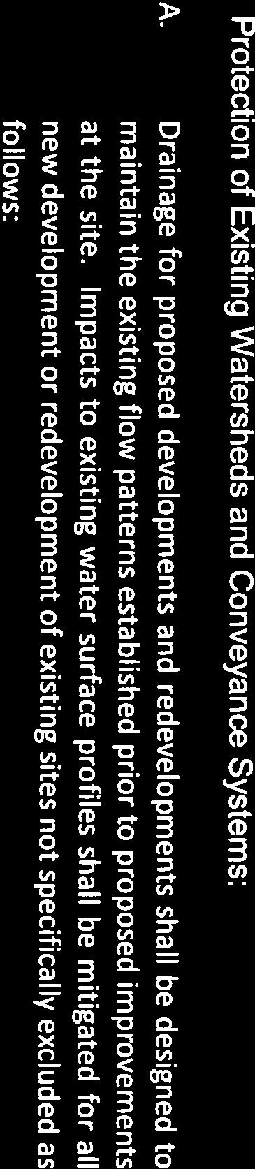
10 Planning Commission Minutes November 13, 2013 Page 6 XII. Ordinances Public Hearing to Recommend Approval or Denial to the Parish Council Amendments to the Ascension Parish Unified Land Development Code: A) Ordinance DR13-11: Revisions to the Drainage Regulations of the Unified Land Development Code pertaining to Placement of Fill Mr. Lance Brock presented and explained the changes that were made to the proposed amendments to Ordinance DR13-11 pertaining to Placement of Fill. See Attachment A Public hearing was opened. No comments. Public hearing was closed. Commission Action: Moved by Mr. Morrie Bishop, seconded by Mr. Jackie Callender and unanimously adopted, to recommend to the Parish Council approval of the proposed ordinance amendments to Ordinance DR13-11 pertaining to Placement of Fill. See Attachment A B) Ordinance SR13-14: Revisions to the Subdivision Regulations of the Unified Land Development Code pertaining to Protection of Existing Watersheds and Conveyance Systems requirements XIII. Staff Report Mr. Tim Ward presented and explained the changes that were made to the proposed amendments to Ordinance SR13-14 pertaining to Protection of Existing Watersheds and Conveyance Systems requirements. See Attachment B Public hearing was opened. Brian Aguillard spoke, asking for clarification. Public hearing was closed. Commission Action: Moved by Mr. Robert Burgess, seconded by Mr. Jackie Callender and unanimously adopted, to recommend to the Parish Council approval of the proposed ordinance amendments to Ordinance SR13-14 pertaining to Protection of Existing Watersheds and Conveyance Systems requirements. See Attachment B A) Impact Fees Chairman Songy expressed some of the Councilmen have asked Mr. Compton to start the process of looking at impact fees in Ascension Parish. He explained what impact fees are for. He said impact fees were previously studied in and a proposed ordinance (See Attachment C) was drafted and presented to
11 Planning Commission Minutes November 13, 2013 Page 7 the Council. Council denied approval of the proposed ordinance at that time. He asked the Commission to review the ordinance and come back at next month s meeting to discuss further and with detailed questions and answers. Chairman Songy asked to have Mr. Charles Landry who drafted the proposed ordinance present at next month s meeting to answer some of the questions the Commission may have. It was requested that this item again be brought before the Commission at next month s meeting under Staff Report. XIV. Engineering Staff Report A) For Consideration: Ordinance SR13-16: Revisions to the Subdivision Regulations of the Unified Land Development Code pertaining to Drainage: Design and Construction Criteria XV. Adjourn Mr. Tim Ward explained the revisions being proposed to Ordinance SR13-16 pertaining to Drainage: Design and Construction Criteria. See Attachment D Commission Action: Moved by Mr. Morrie Bishop, seconded by Mr. Jackie Callender and unanimously adopted, to place the proposed revision to Ordinance SR13-16 pertaining to Drainage: Design and Construction Criteria on next month s Planning Commission agenda for public hearing. A motion was made by Mr. Paul Nizzo and unanimously adopted, meeting adjourned at 6:45 p.m. Donald A. Songy, Chairman


12

13


14

15
16


17


18

19

20


21


22


23
24

25

26

27
28


29


30
31

32

33

34


35


36

37

38

39

40


41

42

43

44

45


46

47

48

49

50

51
52 Description: Approval or Denial of the Minutes of the November 13, 2013 Joint Planning and Zoning Commission Meeting ATTACHMENTS: Name: Description: NOV_13_2013_P_Z_Minutes.docx Jnt Planning & Zoning Comm Minutes of Nov 13, 2013 Attachment_A.docx Attachment A
53 The below minutes are taken from the meeting to represent items addressed and actions taken by this board. All meetings are recorded with video and audio for our records. In the event these minutes are ever in question or controversy, the audio/video archive shall be used to determine the actual item or action taken by individuals present at this meeting. MINUTES JOINT PLANNING AND ZONING COMMISSION November 13, 2013 The Joint Planning and Zoning Commission of the Parish of Ascension held a Public Meeting on Wednesday, November 13, 2013 at 6:00 p.m. in the Courthouse East Meeting Room, Gonzales, Louisiana in a regular session convened: I. Call to Order Meeting was called to order by Chairman Donald Songy. II. Roll Call of Members The following members were present: Gasper Chifici, Robert Burgess, Morrie Bishop, Donald Songy, Paul Nizzo, Jackie Callender The following members were absent: Joshua Ory III. Introduction of Staff Stacie Webb Secretary, Planning and Development Lindsey Manda Legal Counsel Michael Petty Senior Project Manager Ben Moran Planner Lance Brock Zoning Official IV. Chairman s Comments No comments. V. Public Hearing to Recommend Approval or Denial to the Parish Council to Consider the Revised Conceptual Plan for the following Planned Unit Development: A. Keystone of Galvez, PUD The subject property is located on the south side of Louisiana Highway 933, approximately one-half (0.5) mile east of Joe Sevario Road in Council District 5. The site is currently zoned Planned Unit Development (PUD) and Conservation (C). The application is on behalf of Keystone of Galvez, LLC by Quality Engineering & Surveying, LLC. The Conceptual Plan, approved on March 10, 2010 is acres and consists of 485 lots. The proposed revisions will add 8 lots, for a total of 493, and decrease 3.5 acres, total of This will result in the density being increased from 2.8 units/acre to 2.9. The total area donated for recreational/park area is being decreased from 21.6 acres to 5.1 acres. Also, with this revision, a 5.6 acre tract at the southwest corner will be rezoned from PUD to Conservation.
54 Joint Planning and Zoning Commission Minutes November 13, 2013 Page 2 Project Timeline November 11, 2009 Planning Commission approves Keystone of Galvez Preliminary Plat Subdivision. March 10, 2010 April 1, 2010 May 6, 2010 Planning Commission recommends approval of the Keystone of Galvez PUD. Council adopts several amendments to the Keystone of Galvez PUD Council adopts ordinance for Keystone of Galvez PUD, with specific provisions October 13, 2010 Planning Commission holds a hearing for the Final Plat, in consideration for approval. January 6, 2011 July 13, 2011 The Parish Council approves the Development Plan for Keystone of Galvez. Planning commission approves Third Filing, Final Plat Revisions to Conceptual Plan (Staff comments in blue) A. General Land Use Categories Table a. Low Density Residential i. % of Total Acreage: 25 currently 7 (an increase of 18%) ii. Units / SF : 178 currently 46 (an increase of 132 units) iii. Density / Acre or Site Intensity: 4.1 units / acre currently 3.9 (an increase of.2 units/acre) b. Medium Density Residential i. % of Total Acreage: 40 - currently 56 (a decrease of 16%) ii. Units / SF: 315 currently 439 (a decrease of 124 units) iii. Density / Acre or Site Intensity: 4.6 units / acre currently 4.5 (a decrease of.1 units/acre) c. Green Space i. % of Total Acreage: 13 - currently 11 (an increase of 2%) ii. No. of Acres: 22.4 currently 19.2 (an increase of 3.2 acres) d. Pond Area i. % of Total Acreage: 13 - currently 10 (an increase of 3%) ii. No. of Acres: 22.3 currently 17.1 (an increase of 5.2 acres) e. Dry Mitigation Area i. Has been changed to pond f. Recreational i. % of Total Acreage: 2 - currently 6 (a decrease of 4%) ii. No. of Acres: 3.4 currently 10 (a decrease of 6.6 acres) g. Waterway i. New Category and new size h. Totals i. No. of Acres: currently (a decrease of 3.5 acres) ii. Units / SF: 493 Lots currently 485 (an increase of 8 lots) iii. Density / Acre or Site Intensity: 2.9 units / acre currently 2.8 (an increase of.1 units per acre) i. Note : Total Area Donated 5.1 units for recreational / park area currently 21.6 (a decrease of 16.9 acres)
55 Joint Planning and Zoning Commission Minutes November 13, 2013 Page 3 i. Where is the 16.9 acres now being accounted for? 1. From attached letter from engineer: The original 16.9 acres was going to be donated to the parish for recreational use, however the parish chose not to accept this due to increased maintenance cost to the parish. The 11.3 acres that is to remain within the PUD limits will be a common area including the wet pond. The 5.6 acres located east of the ditch will be removed from the PUD and asked to be rezoned to conservation. B. General Notes Table a. Common Open Space i. Required: 34.7 acres (20%) currently 33.8 acres (20%) (an increase of.9 acres) ii. Provided: 55.5 acres (33%) currently 57.9 acres (33%) (a decrease of 2.4 acres) b. Total 493 Lots currently 507 (mistake) c. Total PUD Size: acres currently (a decrease of 3.5 acres) d. Proposed Lots: 493 currently 485 (an increase of 8 lots) e. Overall Density 2.9 units / acre currently 2.8 (an increase of.1 units / acre) C. Lot Breakdown Table a. Platted Lots Within Keystone (9 th Filing): 94 lots i. Currently: Future Lots Outside of Proposed PUD Previously Approved: 91 Lots b. Platted Lots within PUD: 133, Presently Lots Under Construction (4 th & 5 th Filings): 130, Proposed Lots Within PUD: 230 (493 Total) i. Currently: Proposed Lots Within Proposed PUD: 485 D. New General Notes Section E. Notes Missing (All at northern end of property) a. New Connection please revise (comment addressed) b. Fire Department Tract please revise (comment addressed) c. Buffers will be provided, as required by Ascension Parish regulations on parking lots, service areas and transitional areas. please add (comment addressed) F. Area north of Lots a. New Color (Low Density) currently medium density b. Lot 110 has been added, resulting in changed limits c. Trail around small pond at southwest corner has been removed d. 2 parks have been added e. Green space added to northern border f. Missing label Tract K-2-B G. Area east of Lots a. New park added west of Tract CH-1 designated as CH-2 b. Street extended west on Tract K-2-C c. Trail throughout green space has been removed H. Southeast corner a. 3 small parks added through Tract K-2-C b. New road and Lots added c. Dry mitigation area changed to wet pond d. Trail removed and recreational area removed from PUD I. Street names are not shown please revise (comment addressed) J. Please revise proposed PUD limits at SE corner (comment addressed)
56 Joint Planning and Zoning Commission Minutes November 13, 2013 Page 4 Mr. Deric Murphy with Quality Engineering & Surveying, LLC presented this revised conceptual plan on behalf of the developer, Keystone of Galvez, LLC. He expressed they had gone out into the community to do some outreach. A petition was also signed by twenty-eight (28) of the residences agreeing to the changes being made. Public hearing was opened. Mr. Marshall Frank, a resident of Keystone of Galvez, spoke on behalf of all the Keystone of Galvez residences in attendance tonight. All in support of the revisions being made. Public hearing was closed. Commission Action: Moved by Mr. Robert Burgess, seconded by Mr. Morrie Bishop and unanimously adopted, to recommend to the Parish Council approval of the revised conceptual plan for Keystone of Galvez, PUD as presented. VI. Public Hearing to Recommend Approval or Denial to the Parish Council to Consider the Revised Development Agreement for the following Planned Unit Development: A. Keystone of Galvez, PUD The subject property is located on the south side of Louisiana highway 933, approximately one-half (0.5) mile east of Joe Sevario Road in Council District 5. The site is currently zoned Planned Unit Development (PUD) and Conservation (C). The application is on behalf of Keystone of Galvez, LLC by Quality Engineering, LLC. The Developers Agreement was originally approved on January 6, The proposed revisions reflect changes made to the proposed Conceptual Plan and Final Development Plan. Additional revisions suggested by the planning staff are noted below. Development Agreement Suggested revisions from the planning staff (page 2) B. a. The sidewalks shall be constructed.5 from the ROW line but not within the 12 utility servitude. (page 3) b. omit construction of (comment addressed) (page 4) D. Note changes on Revised a. shall be constructed of aggregate or approved other. (comment addressed) E. d. construct a paved pedestrian connection (comment addressed) $50,000 including installation and not be less than $45,000. (comment addressed) F. Omit be (comment addressed)
57 Joint Planning and Zoning Commission Minutes November 13, 2013 Page 5 (page 6) I. This fee shall be $710 per lot (Based on Baton Rouge numbers) (page 7) J. a. In cases where a user changes to a more intense use, the new user shall be responsible for the difference in fee prior to a CO being issued for the new use. b. In no instance will the parish refund fees if the use fee is lower. K. fees will be paid in full by the permit holder for each user. (comment addressed) M. Owner shall not use the portion of Devall Road between the PUD limits and Joe Sevario Road for construction traffic to construct subdivision filings. (comment addressed) (page 8) D. as outlined in the revised Master Plan, Ordinance New #. (page 10) D. Upon full execution (comment addressed) Mr. Deric Murphy with Quality Engineering & Surveying, LLC presented this revised development agreement on behalf of the developer, Keystone of Galvez, LLC. Public hearing was opened. No comments. Public hearing was closed. Commission Action: Moved by Mr. Paul Nizzo, seconded by Mr. Gasper Chifici and unanimously adopted, to recommend to the Parish Council approval of the revised Development Agreement for Keystone of Galvez PUD as presented with the correction to the Traffic Impact Fee of $ per lot being changed to $ per lot. Corrected copy attached hereto. See Attachment A B. Public Hearing to Approve or Deny the Revised Final Development Plan for the following Planned Unit Development: A. Keystone of Galvez, PUD Third through Eighth Filings The subject property is located on the south side of Louisiana Highway 933, approximately one-half (0.5) mile east of Joe Sevario Road in Council District 5. The site is currently zoned Planned Unit Development (PUD) and Conservation (C). The application is on behalf of Keystone of Galvez, LLC by Quality Engineering, LLC. The Final Development Plan was originally approved on January 6, The proposed revisions reflect changes made to the proposed Conceptual Plan.
58 Joint Planning and Zoning Commission Minutes November 13, 2013 Page 6 Revisions to Final Development Plan (Staff comments in blue) Final Development Plan: Sheet 1 A. Missing: a. Drainage servitude lines are missing please revise (comment addressed) B. Filing table and Land-use Chart are revised to reflect changes Final Development Plan: Sheet 2 A. Revision to PUD limits (Lot 110) B. Tract KS-3, KS-4, KS-5 are new C. New pond configuration a. What are the implications to drainage study with the revision to pond in SW corner? i. From attached letter from engineer: The drainage study and calculations were submitted to and approved by the Ascension Parish Engineering Department along with the construction plans for the 4 th and 5 th Filings. These filings are presently under construction. D. Magicstone Drive different name currently Magicstrone (typo) E. Tract K-2-B-1 is new designation common area? a. From Engineer Yes, the Tract K-2-B-1 is a common area. F. Tract CH-2 is currently Tract TP-1 G. Area labeled proposed future park is currently designated as Common Area H. What is the area around the southernmost lake? a. From attached letter from engineer: The area around the southernmost lake is common green space. Final Development Plan: Sheet 3 A. Lots and A F are new B. Label Lots A F as numbers in sequence (comment addressed) C. Common Area between 801 and 802 is bigger D. Is the space between Lots 676 and 677 Common area? Please label common area (comment addressed) a. From attached letter from engineer: Yes the space between Lots 676 and 677 is common area. E. Wet pond rather than dry mitigation area at south east corner a. What are the implications to drainage study with the revision to pond in SE corner? i. From attached letter from engineer: Changing the dry mitigation area to a wet pond will still allow us to meet all the requirements of the approved drainage study while constructing an enhanced amenity. Detailed drainage and mitigation calculations will be included in the construction plans for those filings as with the previous filings. Transforming this area to a wet pond will allow us to reduce the overall surface area while increasing storage volume. F. Area at south east corner below pond is proposed to be removed from PUD need to revise line showing the proposed limits of PUD (centerline of ditch?) (comment addressed) Final Development Plan: Sheet 4 No changes
59 Joint Planning and Zoning Commission Minutes November 13, 2013 Page 7 C. Adjourn Final Development Plan: Sheet 5 A. All trails have been removed with the exception of the trail on KS-1 (Approx. 12,092 LF of trail removed) a. Line type of this trail does not match legend (comment addressed) B. Sign and landscaping removed from area near Lots 511 and 512 C. New detail of park addition D. Lots numbered A- F (Baystone Ave) need to be corrected (changes must reflect Sheet 3) (comment addressed) E. PUD limits at south east corner need to be corrected (changes must reflect Sheet 3) (comment addressed) F. Common open space table needs to be added (comment addressed) Mr. Deric Murphy with Quality Engineering & Surveying, LLC presented this revised final development plan on behalf of the developer, Keystone of Galvez, LLC. Public hearing was opened. No comments. Public hearing was closed. Commission Action: Moved by Mr. Gasper Chifici, seconded by Mr. Morrie Bishop and unanimously adopted, to approve this revised final development plan as presented. Motion was made by Chairman Songy and unanimously adopted, meeting adjourned at 7:10 p.m. Donald A. Songy, Chairman

60 UNITED STATES OF AMERICA STATE OF LOUISIANA PARISH OF ASCENSION DEVELOPMENT AGREEMENT ZM10-01-DA FOR KEYSTONE PUD ORDINANCE NO. ZM10-01 Ver Tommy Martinez Parish President BE IT KNOWN, that on the dates herein as executed by both parties, an agreement was made between the Parish of Ascension, hereafter identified as Parish, and Keystone of Galvez, LLC, hereafter identified as Owner, have come to an agreement to allow construction of a Planned Unit Development, with special stipulations that shall run with the land and be of a personal obligation to each party. WHEREAS: Ascension Parish is a local governmental subdivision as defined by Article VI, Section 44 of the Louisiana Constitution of 1974, and WHEREAS: The Parish of Ascension is the governing and responsible body over the zoning and regulations within this jurisdiction, and WHEREAS: The Development Agreement is prepared consistent with authority of LA. Revised Statues 33: subpart and Appendix VI, Section (B) of the Ascension Parish LDC, and WHEREAS: Keystone of Galvez LLC, the owner of the Keystone of Galvez development property, has submitted and received an approval with conditions on the concept plan identified as Keystone of Galvez PUD by the Parish Council with conditions on May 6, 2010 (Ord. #ZM10-01), and WHEREAS: The Keystone of Galvez PUD was processed and approved consistent with Appendix VI of the Ascension Parish Unified Land Development Code. WHEREAS: The final development plan was reviewed and approved by the Planning Commission on October 13, 2010 and WHEREAS: This final development agreement was reviewed and approved by the Parish Council on January 6, 2011 and ZM10-01-DA Ver Page 1 of 13
61 WHEREAS: Keystone of Galvez LLC, the owner of the Keystone of Galvez development property, has submitted and received an approval with conditions on the revised concept plan identified as Keystone of Galvez PUD by the Parish Council with conditions on date (Ord. #ZM10-01), and WHEREAS: The Keystone of Galvez PUD was processed and approved consistent with Appendix VI of the Ascension Parish Unified Land Development Code. WHEREAS: The revised final development plan was reviewed and approved by the Planning Commission on date and WHEREAS: This revised final development agreement was reviewed and approved by the Parish Council on date and WHEREAS: The Parish and Owner come to an agreement to permit and regulate a large scale development identified as Keystone of Galvez PUD and said agreements, conditions, obligations, and otherwise terms are outlined below. NOW THEREFORE, the following considerations, terms, conditions, and obligations are agreed to, understood, and accepted by the Owner : A. Owner shall construct sidewalks from the PUD limits to common areas as designated on the Final Development Plan. a. These sidewalks (4 wide concrete) shall be constructed prior to and inspected with the final inspection of that filing. b. Each sidewalk stretch will be constructed with the adjacent filing as shown on the Final Development Plan. B. Homebuilders shall construct 4 wide sidewalks with each home prior to C.O. from side property line to property line adjacent to the front boundary within the appropriate sidewalk easement. a. The sidewalks shall be placed 0.5 from the right-of-way line but not within the 12 feet utility servitude. ZM10-01-DA Ver Page 2 of 13
62 b. Home Owners Association documents shall include the necessary language to require that each lot construct sidewalks with the completion of each lot. c. The sidewalks shall be the property of the Home Owners Association and the Home Owners Association documents shall reflect the necessary maintenance and liability language. d. The sidewalks shall be constructed meeting the ADA standards. e. The sidewalks shall be constructed using 3,500 psi concrete, 4 inches thick. f. The sidewalks shall have expansion joints every 24 feet with control joints every 6 feet. C. Developer shall place a 3-foot landscape servitude adjacent to the road / right of way on each plat throughout the development. a. Street trees shall be installed by homebuilders within the 3 feet landscape servitude prior to issuance of a Certificate of Occupancy by the Parish. b. Each lot shall have at least one street tree within the 3 feet landscape servitude. c. Street trees shall be planted as close to center of the lot as the driveway will allow. d. Street trees shall be a minimum of 2.5 inch caliper measured 4 6 above the root ball at time of planting. e. The tree planting schedule shall adhere to the following: i. Shumard Oak (Quercus shumardii) 1. Timberstone Drive, Yellowstone Drive, Baystone Avenue, Pebblestone Avenue, Lakeshore Drive and Keystone Boulevard ii. Swamp Red Maple (Acer rubrum var. drumondii) 1. Heartstone Drive, Carterstone Avenue, Jadestone Avenue and Mossystone Drive iii. Green Ash (Fraxinus pennsylvanica) ZM10-01-DA Ver Page 3 of 13
63 1. Marblestone Avenue, Magicstone Drive, Tigerseye Stone Avenue and Harborstone Avenue D. Walking Trails shall be constructed by Owner prior to final inspection of the applicable filing as depicted on the Revised Final Development Plan. a. Walking Trails shall be 4 feet wide by 3 inches thick and cut into the existing ground and shall be constructed of aggregate or approved other. E. Recreation Park: a. Owner has already donated Tract CH-1 to the public for use as a park recreational area. b. Owner has already donated a sum of $10, to the Parish to be used towards the construction of a recreational playground on Tract CH-1 when their total budget so allows it. c. Prior to the signing of the final plat of the Eighth Filing, the Owner shall donate an additional 2.75 Acres of land located to the east of the original Tract CH-1 to provide additional public park space. d. Prior to the signing of the final plat of the Eighth Filing, The Owner shall construct a paved pedestrian connection between the existing park and proposed improvements, a playground area with equipment, a pavilion, and other ancillary items such as benches and trash cans. The final plans will be approved by the Parish but may not exceed a monetary value of $50,000 including installation and not be less than $45,000. e. Once these improvements are constructed, approved and the property is dedicated and accepted by the Parish, the Owner will receive documentation that the Owner will not be liable for maintenance and/or injury to any residents using said facilities and property. F. Owner has dedicated 2.0 acres of land, as identified in exhibit C, to Fire District 1, for purposes of building a fire station. This was be done by quit claim deed and recorded in the clerk of court. ZM10-01-DA Ver Page 4 of 13
64 G. Owner has completed the following traffic improvements as per the original Traffic Impact Study: a. An east bound right turn lane on LA 933 at Keystone Boulevard has been constructed. b. Stop signs were provided to Ascension Parish Department of Public Works to install at LA 932 and Devall Road when traffic counts warrant the improvements. c. A contribution of $104, was paid to Ascension Parish for the road improvements spelled out in the traffic study that is to be used to fund the installation of a traffic signal at the intersection of LA 933 and LA 932 when traffic counts warrant the improvements. d. Signal timing modifications at LA 44 at Causey Road / Merritt Evans has been implemented. e. A westbound right turn lane on LA 933 and signal timing modifications at LA 933 at LA 44 have been completed. H. Owner shall construct additional roadway improvements on LA 933 at the retail entrance as part of the commercial development permit if required and permitted by LADOTD as part of their DOTD connection permit process. I. The Owner shall pay a Traffic Impact Fee to the Parish for all residential lots in excess of the 749 lots included in the original Traffic Impact study dated October 13, These lots shall be tabulated based on platted lots for the entire development in and out of the PUD limits. This fee shall be $ per lot with the Owner paying said fee prior to the final plats being signed by the Parish for each filing. ZM10-01-DA Ver Page 5 of 13
65 J. The Owner shall pay a Traffic Impact Fee to the Parish for all commercial facilities in accordance to the following table: Land Use Type Unit Fee per Unit Land Use Type Unit Fee per Unit Office Retail/Commercial Office, Medical 1000 Sq FT 2,117 Discount Superstore 1000 Sq FT 926 Bank 1000 Sq FT 1,656 Specialty Retailer 1000 Sq FT 1,077 Bank, Drive-in 1000 Sq FT 1,304 Shopping Center 1000 Sq FT 1,044 Office, General 1000 Sq FT 795 Wholesale Market 1000 Sq FT 211 Day Care Center 1000 Sq FT 846 Discount Club 1000 Sq FT 1,311 Hospital 1000 Sq FT 1,030 Apparel Store 1000 Sq FT 1,614 Church 1000 Sq FT 402 Furniture Store 1000 Sq FT 40 Movie Theater 1000 Sq FT 2,451 Gas Station Pump 464 School, Elementary Student 44 School, Middle Student 55 School, High Student 58 School, University Student 80 K. These commercial traffic impact fees will be paid in full by the permit holder to the Parish prior to receiving the Certificate of Occupancy for each user. L. Owner shall be responsible for maintenance of the common areas until such time a Home Owners Association is created and legally takes over that responsibility. M. Owner shall not use the portion of Devall Road between the PUD limits and Joe Sevario Road for construction traffic to construct subdivision filings. N. Owner shall ensure that each phase or filing adheres to the approved Drainage Impact Study. AND FURTHER, The following considerations, terms, conditions, and obligations are agreed to, understood, and accepted by the Parish : ZM10-01-DA Ver Page 6 of 13
66 A. The recreation park on tract CH-1 will be constructed and maintained, after dedication of property, receipt of $10,000 from owner, and when the additional funds become available for the recreation department. B. The recreation park improvements on the additional 2.75 acres will be maintained, after dedication of property. C. Variances have been granted to from the current Unified Land Development Code as follows: a. Section (A) of the LDC: Block lengths, for the street running north/south adjacent to first filing in the northern portion of the project site. b. Section (B) of the LDC: pedestrian cross-walk between homes every 750, to what deemed appropriate by Parish staff, not to exceed one every 750. c. Lot width: Table B: from minimum 70 wide to 50 wide with curb and gutter, only in locations identified on the master plan. No lot shall be smaller in width than 50 as measured by the code. d. Section (B) any future amendment to the plan shall never contain multifamily dwelling units. e. Section , the Keystone PUD zoning district shall be limited to 507 lots. f. Section (C) There shall be no vehicle connection with Pine Lake Drive D. Parish grants PUD zoning approval contingent with the densities, setbacks, heights, land uses, etc. as outlined in the revised Master Plan, Ordinance. SEVERABILITY: In the event that any portion of this agreement is ever held invalid or unconstitutional for any reason by any court of competent jurisdiction over it, such portion shall be deemed a separate, distinct, and independent provision and shall not affect the validity of the remaining portions of the agreement. DEFAULT / VIOLATION: Any act of violation or lack of fulfillment to any obligation herein shall be deemed a breach of contract and shall nullify the agreement in entirely until such agreement is brought back into compliance by either party. In the event of a default, violation, ZM10-01-DA Ver Page 7 of 13
67 or expiration of the agreement, the Owner shall be notified of such violation and giving 45 days in which to rectify the situation. If such correction is not obtained or pursued by the owner within the 45 days, the Parish may issue a stop work order on any or all active permit(s) for the Keystone PUD until such conflict is brought into compliance with this agreement. No work or permits shall continue or be granted until the agreement is brought into compliance or the work being sought is brought into compliance with this agreement. This section does not preclude any federal, state, or local law of jurisdictional enforcement of the appropriate and applicable regulations in place. EFFECTIVE DATE: This agreement comes into full affect the day the latest signature is executed below. GENERAL PROVISIONS: This agreement shall following the following general provisions: A. This agreement is and shall constitute a contract under and in accordance the laws of the State of Louisiana. B. This agreement may not be changed or terminated orally. C. This agreement and the rights, interest or obligations of Owner under this agreement may be assigned, sold or delegated by Owner to any party (the "Transferee"), without the prior written consent of the Parish, so long as the Transferee recognizes this Agreement in the Act of Transfer and Assumes the obligations of Owner under this Agreement as to the Property so transferred by Owner to Transferee. Upon the assignment, sale of transfer by Owner according to this Agreement, the Owner will be relieved of the responsibility or obligations arising under this Agreement as to the Property and obligations so assigned, sold or transferred." The owner shall provide written notice to the Parish of the change of owner and the applicable property and obligations so transferred. D. Upon full execution of this agreement, the Owner shall have this agreement recorded in the Clerk of Court within 7 business days from final execution of the agreement. ZM10-01-DA Ver Page 8 of 13
68 E. A certified recorded copy shall be provided to the Parish Planning and Development Department within 7 business days from recording. F. Amendments may only be made with both parties agreeing in writing and recording. G. No other change in regulation, jurisdiction, or outside 3 rd party influence shall affect this agreement, including but not limited to relaxation in policy or ordinances, change in political jurisdiction, etc. H. All communication pertaining to this agreement shall be certified mail to the below locations: Parish President President or Managing Member Parish of Ascension Keystone of Galvez, LLC 208 E. Railroad Street 8733 Siegen Lane #378 Gonzales, LA Baton Rouge, LA Copies to Planning and Development Director and the Planning Commissioners at: Churchpoint Rd. Gonzales, LA EXPIRATION: This agreement shall not expire and shall run with the land, the owner, and parish. Modifications to this agreement shall require both parties execution and recordation of agreed action to this agreement. The Parish shall retain the authority to terminate this agreement at such time obligations are met. Official termination shall be filed in the Clerk of Court official records for the parish. EXHIBITS: A. Ord. ZM10-01 B. Draft Home Owners Association documents C. Property Map: Fire District 1 ZM10-01-DA Ver Page 9 of 13
69 IT IS AGREED THAT I HAVE FULLY READ AND UNDERSTAND ALL COVENANTS, RESTRICTIONS, OBLIGATIONS, AND PROVISIONS SET FORTH IN THIS AGREEMENT AND HAVE DULY AND WILLINGLY ACKNOWLEDGED AND EXECUTED THIS AGREEMENT: Attest: Chris Loar, Parish Council Chair Date: Attest: Donald Songy, Planning Commission Chair Date: Attest: Tommy Martinez, Parish President Date: Attest: Kevin Nguyen, Date: Managing Member Keystone of Galvez, LLC ZM10-01-DA Ver Page 10 of 13
70 EXHIBIT A ZM10-01-DA Ver Page 11 of 13
71 EXHIBIT B ZM10-01-DA Ver Page 12 of 13
72 EXHIBIT C ZM10-01-DA Ver Page 13 of 13
73 Description: Affidavit of Mortgage Declaration Ralph T. Brown Property - Lots 1-8 (Simple Division) ATTACHMENTS: Name: Ralph_Brown.pdf Description: Ralph T Brown - Mortgage Declaration


74


75


76


77


78


79
80 Description: Jimmy Hebert Property - Lots A-4-A-1 and A-4-A-2 Earles and Associates, LLC (Council District 6) ATTACHMENTS: Name: Jimmie_Hebert.pdf Description: Jimmy Hebert - Family Partition

81

82

83
84 Description: Jessie Guedry Property - Lots B-1-C-2-A and B-1-C-2-B Earles and Associates, LLC (Council District 10) ATTACHMENTS: Name: Jessie_Guedry.pdf Description: Jessie Guedry - Family Partition


85

86
87
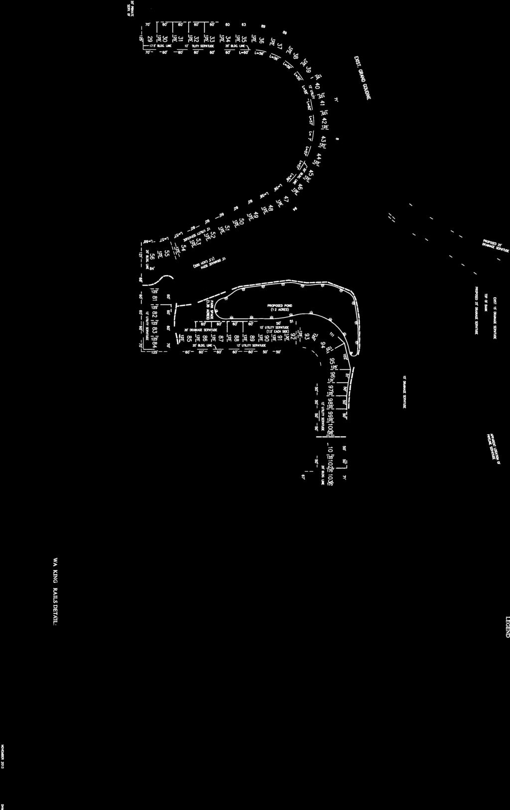
88 Description: Woodland Manor Quality Engineering & Surveying, LLC (Council District 10) ATTACHMENTS: Name: Woodland_Manor_Prelim.pdf Description: Woodland Manor Preliminary Plat

89
90


91
92 Description: Shadows of Ascension, Fifth Filing GWS Engineering, Inc. (Council District 7) ATTACHMENTS: Name: Shadows_of_Asc,_5th_Filing,_Final_Plat.pdf Description: Shadows of Ascension, 5th Filing-Final Plat

93

94


95

96
97 Description: The Villas at Sagefield, First and Second Filings McLin & Associates, Inc. (Council District 11) ATTACHMENTS: Name: The_Villas_at_Sagefield,_1st_and_2nd_Filings.pdf Description: The Villas at Sagefield - Final Plat

98


99
100 Description: ABB, Inc. (18321 Swamp Road, Prairieville) Pre-Development Meeting for Neighborhood Business Overlay Site Plan Deleted from the agenda prior to meeting by applicant ATTACHMENTS: Name: No Attachments Available Description:
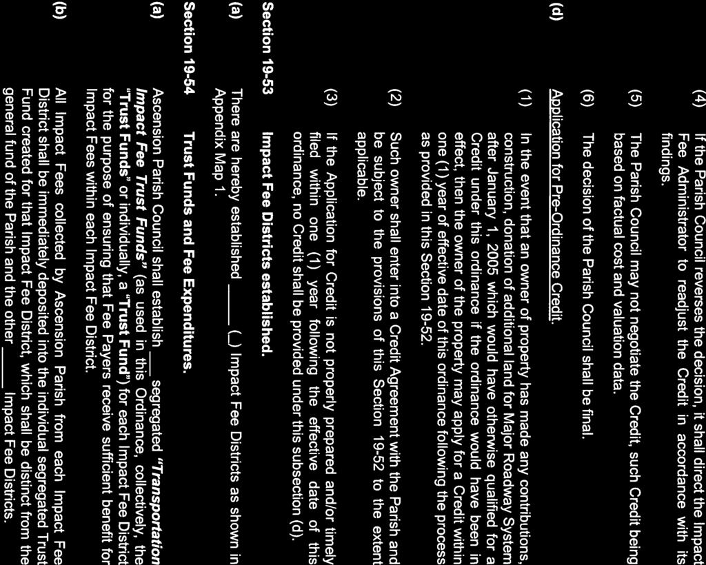
101 Description: Ordinance SR13-16: Revisions to the Subdivision Regulations of the Unified Land Development Code pertaining to Drainage: Design and Construction Criteria ATTACHMENTS: Name: Ord_SR13-16_Design_and_Construction.pdf Description: Ord SR13-16 Design & Construction Criteria


102


103


104
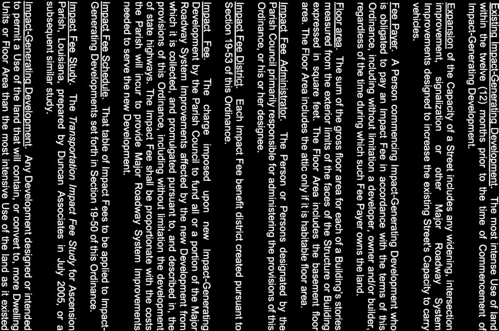
105 Description: Impact Fees ATTACHMENTS: Name: traffic_impact.pdf Description: Transportation Impact Fees
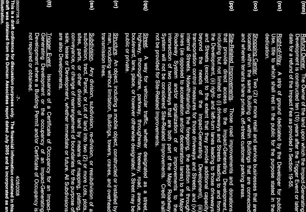
106 AN ORDINANCE TO AMEND CHAPTER 19 OF THE ASCENSION PARISH CODE TO IMPOSE TRANSPORTATION IMPACT FEES WHEREAS, Ascension Parish is presently one of the fastest growing parishes within the State of Louisiana; and WHEREAS, this rapid growth has negatively impacted the capacity of the major street network within Ascension Parish; and WHEREAS, it is the desire of the citizens of Ascension Parish to maintain adequate roadway capacity as one component of the preservation of the quality of life enjoyed by the citizens of the Parish; and WHEREAS, the Parish of Ascension has determined that it is within the best interests of the citizens of Ascension Parish to establish transportation impact fees to maintain the capacity of the major street network within Ascension Parish. THE PARISH OF ASCENSION HEREBY ORDAINS that it amends the Ascension Parish Code of Ordinances, Chapter 19: Roads, Bridges and Other Public Ways, by adding a new article, as follows: ARTICLE IV. TRANSPORTATION IMPACT FEE Section Short title, authority and application (a) (b) (c) Title. This Article IV, TRANSPORTATION IMPACT FEE may be known and cited as the Ascension Transportation Impact Fee Ordinance. The Ascension Transportation Impact Fee Ordinance may be referred to herein as the Ordinance. Authority. The Parish Council has the authority to adopt the Ordinance set forth herein pursuant to the home rule charter of Ascension Parish and the Louisiana Constitution. Applicability. The Ascension Transportation Impact Fee Ordinance shall apply to all of the territory within the limits of Ascension Parish; provided, however, that Impact Fees shall only be assessed in the unincorporated area of the Parish. Section Purpose The intent of this Section is to ensure that Impact-Generating Development bears a Proportionate Share of the cost of improvements to the Parish s Major Roadway Systems; to ensure that the Proportionate Share does not exceed the cost of providing major roadways to the new Development that paid the Impact Fee; to ensure that funds {B } -1-4/28/2008 This is a draft ordinance for discussion purposes only. The financial information contained in this draft was obtained from the Duncan Associates report dated July 2005 and is incorporated as an illustration.
107 collected from Impact-Generating Development are actually used to construct Major Roadway System Improvements that benefit and serve new Development; and to ensure that adequate roadways are available to serve new growth and Development. It is not the purpose and/or intent of this Ordinance to collect any money from any Impact-Generating Development in excess of the actual amount necessary to offset demands generated by that Development for Major Roadway System Improvements for which the Impact Fee was paid. Section Definitions (a) (b) (c) (d) (e) (f) Accessory Building. A Building which is (1) subordinate to and serves a principal Structure or Principal Use; (2) is subordinate in area, extent and purpose to the principal Structure or Principal Use; (3) is located on the same Lot as the principal Structure or Principal Use; and (4) is customarily incidental to the principal Structure or Principal Use. Any portion of a Principal Building which is devoted to an Accessory Use is not an Accessory Building. Accessory Use. A Use which (1) is subordinate to and serves a principal Structure or Principal Use, (2) is subordinate in area, extent, and purpose to the principal Structure or Principal Use served, (3) is located on the same Lot as the principal Structure or Principal Use served except as otherwise expressly authorized by provisions of this Ordinance, and (4) is customarily incidental to the principal Structure or Principal Use. Alternative Fee Calculation. An individual assessment of an Impact Fee based on the provisions and formula set forth in Section herein. Appeal. A means for obtaining review of a decision, determination, order, or failure to act under the terms of this Ordinance. Building. A Structure built, maintained, or intended for Use as a shelter or enclosure of persons, animals, or property. The term includes any part of the Structure. Where independent units with separate entrances are divided by party walls, each unit is a Building. Building Permit. A permit issued by the applicable governmental authority required to erect, construct, enlarge, alter, repair, remove, convert, or demolish any Building, Structure, swimming pool, or parking lot, or additions thereto, pursuant to the Ascension Parish Development Code. (g) Capacity. The maximum number of vehicles that have a reasonable expectation of passing over a given section of a Street during an hour, expressed in terms of vehicles per hour. {B } -2-4/28/2008 This is a draft ordinance for discussion purposes only. The financial information contained in this draft was obtained from the Duncan Associates report dated July 2005 and is incorporated as an illustration.
PARISH OF ASCENSION OFFICE OF PLANNING AND DEVELOPMENT PLANNING DEPARTMENT
 1. Call to Order 2. Roll Call of Members 3. Pledge of Allegiance 4. Introduction of Staff 5. Chairman's Comments 6. Minutes (A) 7. Consent Agenda (A) PARISH OF ASCENSION OFFICE OF PLANNING AND DEVELOPMENT
MINUTES PLANNING COMMISSION July 10, 2013
 The below minutes are taken from the meeting to represent items addressed and actions taken by this board. All meetings are recorded with video and audio for our records. In the event these minutes are
PARISH OF ASCENSION OFFICE OF PLANNING AND DEVELOPMENT PLANNING DEPARTMENT. Joint Planning and Zoning Meeting
 1. Call To Order 2. Roll Call of Members 3. Minutes PLANNING DEPARTMENT Joint Planning and Zoning Meeting March 14, 2018 6:00 PM Courthouse Annex - 828 Irma Blvd Council Meeting Room 2nd Floor (Following
PARISH OF ASCENSION OFFICE OF PLANNING AND DEVELOPMENT PLANNING DEPARTMENT
 PARISH OF ASCENSION OFFICE OF PLANNING AND DEVELOPMENT PLANNING DEPARTMENT 1. Meeting Called to Order by Chairman 2. Roll Call of Members 3. Pledge of Allegiance 4. Introduction of Staff 5. Minutes (A)
MINUTES PLANNING COMMISSION August 10, 2016
 The below minutes are taken from the meeting to represent items addressed and actions taken by this board. All meetings are recorded with video and audio for our records. In the event these minutes are
PARISH OF ASCENSION OFFICE OF PLANNING AND DEVELOPMENT PLANNING DEPARTMENT
 PARISH OF ASCENSION OFFICE OF PLANNING AND DEVELOPMENT PLANNING DEPARTMENT 1. Meeting Called to Order by Chairman 2. Roll Call of Members 3. Pledge of Allegiance 4. Introduction of Staff 5. Minutes (A)
MINUTES Planning Commission October 14, 2015
 The below minutes are taken from the meeting to represent items addressed and actions taken by this board. All meetings are recorded with video and audio for our records. In the event these minutes are
MINUTES PLANNING COMMISSION April 13, 2011
 The below minutes are taken from the meeting to represent items addressed and actions taken by this board. All meetings are recorded with video and audio for our records. In the event these minutes are
MINUTES PLANNING COMMISSION July 13, Meeting was called to order by Chairman Matthew Pryor.
 The below minutes are taken from the meeting to represent items addressed and actions taken by this board. All meetings are recorded with video and audio for our records. In the event these minutes are
MINUTES AND WRITTEN DECISIONS PLANNING COMMISSION DECEMBER 13, Meeting was called to order by Chairman Matthew Pryor.
 The below minutes and written decisions are taken from the meeting to represent items addressed and actions taken by this board. All meetings are recorded with video and audio for our records. In the event
PARISH OF ASCENSION OFFICE OF PLANNING AND DEVELOPMENT PLANNING DEPARTMENT. Planning Commission
 1. Call to Order 2. Roll Call of Members 3. Pledge of Allegiance 4. Introduction of Staff 5. Chairman's Comments 6. General Business 7. Minutes (A) 8. Consent Agenda PARISH OF ASCENSION OFFICE OF PLANNING
MINUTES Planning Commission October 14, 2009
 The below minutes are taken from the meeting to represent items addressed and actions taken by this board. All meetings are recorded with video and audio for our records. In the event these minutes are
PARISH OF ASCENSION OFFICE OF PLANNING AND DEVELOPMENT ZONING DEPARTMENT
 1. Called to Order 2. Roll Call of Members 3. Public Comments 4. Acceptance of the Minutes (A) PARISH OF ASCENSION OFFICE OF PLANNING AND DEVELOPMENT ZONING DEPARTMENT Board of Adjustments April 28, 2015-6:00
AN ORDINANCE TO AMEND SECTION OF THE RAPID CITY MUNICIPAL CODE TO ALLOW FOR ADMINISTRATIVE DISSOLUTION OF PLANNED DEVELOPMENTS
 Ordinance No. 6231 AN ORDINANCE TO AMEND SECTION 17.50.050 OF THE RAPID CITY MUNICIPAL CODE TO ALLOW FOR ADMINISTRATIVE DISSOLUTION OF PLANNED DEVELOPMENTS WHEREAS, the City of Rapid City has adopted a
PARISH OF ASCENSION OFFICE OF PLANNING AND DEVELOPMENT PLANNING DEPARTMENT
 1. Call to Order 2. Roll Call of Members 3. Pledge of Allegiance 4. Introduction of Staff 5. Chairman's Comments 6. General Business 7. Minutes (A) (B) 8. Consent Agenda (A) (B) (C) PARISH OF ASCENSION
PARISH OF ASCENSION OFFICE OF PLANNING AND DEVELOPMENT PLANNING DEPARTMENT. Zoning Meeting
 PARISH OF ASCENSION OFFICE OF PLANNING AND DEVELOPMENT PLANNING DEPARTMENT 1. Meeting Called to Order by Chairman 2. Roll Call of Members 3. Minutes (A) Zoning Meeting February 13, 2019 Courthouse Annex
PARISH OF ASCENSION OFFICE OF PLANNING AND DEVELOPMENT PLANNING DEPARTMENT. Planning Commission
 1. Call to Order 2. Roll Call of Members 3. Pledge of Allegiance 4. Introduction of Staff 5. Chairman's Comments 6. General Business (A) 7. Minutes (A) 8. Consent Agenda (A) (B) (C) (D) PARISH OF ASCENSION
EDGERTON CITY HALL PLANNING COMMISSION MEETING REGULAR SESSION March 12, 2019
 EDGERTON CITY HALL PLANNING COMMISSION MEETING REGULAR SESSION The met in regular session with Chair John Daley calling the meeting to order at 7:00 p.m. All present participated in the Pledge of Allegiance.
CITY OF SARATOGA SPRINGS ZONING ORDINANCE
 Appendix C: 8. The Village At Saratoga Planned Unit Development (formerly 241.8) Chapter 241.8 AN ORDINANCE PROVIDING FOR THE ESTABLISHMENT OF A PLANNED UNIT DEVELOPMENT DISTRICT TO BE KNOWN AS "THE VILLAGE
ORDINANCE WHEREAS, this title is intended to implement and be consistent with the county comprehensive plan; and
 ORDINANCE 2005-015 AN ORDINANCE OF THE BOARD OF COUNTY COMMISSIONERS OF INDIAN RIVER COUNTY, FLORIDA, ADOPTING TITLE X, IMPACT FEES, AND AMENDING CODE SECTION 953, FAIR SHARE ROADWAY IMPROVEMENTS, OF THE
New Private Way Ordinance Westbrook Planning Board Workshop , Planning Board Public Hearing Definitions
 201 Definitions Private Right of Way; Private way A strip of land at least fifty feet wide, meeting the minimum standards for the construction of a gravel base for a public road, over which abutters may
ARTICLE 15 - PLANNED UNIT DEVELOPMENT
 Section 15.1 - Intent. ARTICLE 15 - PLANNED UNIT DEVELOPMENT A PUD, or Planned Unit Development, is not a District per se, but rather a set of standards that may be applied to a development type. The Planned
A. Consideration of the unapproved December 8, 2015 minutes B. Consideration of the unapproved January 12, 2016 minutes
 OFFICIAL AGENDA PLANNING & ZONING COMMISSION CITY OF STARKVILLE, MISSISSIPPI MEETING OF TUESDAY, April 12, 2016 CITY HALL - COURT ROOM, 110 West Main Street, 5:30 PM I. CALL TO ORDER II. III. IV. PLEDGE
M E M O R A N D U M. Planning and Zoning Commission. Daniel Turner, Planner I
 M E M O R A N D U M Meeting Date: Monday, April 10, 2017 Item No. F-4 To: From: Planning and Zoning Commission Daniel Turner, Planner I Subject: Consider a recommendation of a Preliminary Site Evaluation
ARTICLE III GENERAL PROCEDURES, MINOR PLANS AND FEE SCHEDULES
 ARTICLE III GENERAL PROCEDURES, MINOR PLANS AND FEE SCHEDULES 301. Prior to Submission a. Copies of this Ordinance shall be available on request, at cost, for the use of any person who desires information
O-I (Office-Institutional) and AG-1(Agricultural)
 and AG-1(Agricultural)") PROPERTY INFORMATION ADDRESS 3503 and 3505 Bethany Bend DISTRICT, LAND LOTS 2/1 973 and 974 OVERLAY DISTRICT State Route 9 PETITION NUMBERS EXISTING ZONING O-I (Office-Institutional) and AG-1(Agricultural)
PROPERTY INFORMATION ADDRESS 3503 and 3505 Bethany Bend DISTRICT, LAND LOTS 2/1 973 and 974 OVERLAY DISTRICT State Route 9 PETITION NUMBERS EXISTING ZONING O-I (Office-Institutional) and AG-1(Agricultural)
The City Council of the City of Sulphur, Louisiana, met in special session at its
 July 12, 2018 The City Council of the City of Sulphur, Louisiana, met in special session at its regular meeting place in the Council Chambers, Sulphur, Louisiana, on July 12, 2018 at 5:00 p.m., after full
ORDINANCE NO. 41. PRIVATE ROAD ORDINANCE As Amended Through April 10, 2008
 ORDINANCE NO. 41 PRIVATE ROAD ORDINANCE As Amended Through April 10, 2008 An Ordinance to protect the health, safety, and general welfare of the inhabitants of Port Sheldon Township. The Township of Port
CHAPTER 26 PLANNING AND ZONING ARTICLE VII. MOBILE HOMES AND RECREATIONAL VEHICLE (RV) PARKS. Recreational Vehicle (RV) Park Development Standards
 PARKS. Recreational Vehicle (RV) Park Development Standards") CHAPTER 26 PLANNING AND ZONING ARTICLE VII. MOBILE HOMES AND RECREATIONAL VEHICLE (RV) PARKS. Section 26-VII-1. Section 26-VII-2. Section 26-VII-3. Section 26-VII-4. Section 26-VII-5. Purpose Permitted
CHAPTER 26 PLANNING AND ZONING ARTICLE VII. MOBILE HOMES AND RECREATIONAL VEHICLE (RV) PARKS. Section 26-VII-1. Section 26-VII-2. Section 26-VII-3. Section 26-VII-4. Section 26-VII-5. Purpose Permitted
CASCADE CHARTER TOWNSHIP
 CASCADE CHARTER TOWNSHIP Ordinance #11 of 2002 Amended by Ordinance # 1 of 2008 Amended by Ordinance # 2 of 2011 Amended by Ordinance #1 of 2017 Amended by Ordinance #6 of 2017 AN ORDINANCE TO AMEND THE
Staff Report: Date: Applicant: Property Identification: Acreage of Request: Current Zoning of Requested Area: Requested Action: Attached:
 Staff Report: Completed by Jeff Palmer Director of Planning & Zoning Date: November 7, 2018, Updated November 20, 2018 Applicant: Greg Smith, Oberer Land Developer agent for Ronald Montgomery ET AL Property
ALPINE TOWNSHIP ZONING ORDINANCE TABLE OF CONTENTS
 ALPINE TOWNSHIP ZONING ORDINANCE TABLE OF CONTENTS PAGE CHAPTER I - DEFINITIONS 1-1 CHAPTER II - GENERAL PROVISIONS 2-1 2.01 Accessory Buildings 2-1 2.02 Automobiles 2-6 2.03 Prohibited Uses and Undesignated
PUD Ordinance - Caravelle #2 of 2002
 PUD Ordinance - Caravelle #2 of 2002 CASCADE CHARTER TOWNSHIP Ordinance # 2 of 2002 AN ORDINANCE TO AMEND THE CASCADE CHARTER TOWNSHIP ZONING ORDINANCE AND ZONING MAP TO ESTABLISH THE Caravelle Village
MINOR SUBDIVISION PLAT CHECKLIST
 MINOR SUBDIVISION PLAT CHECKLIST Project Name: Tax ID #: Project Number: Date: _ Reviewed By: Telephone: NOTES: All lots on septic systems must comply with the Fulton County Health Department requirements
KASSON TOWNSHIP PRIVATE ACCESS ROAD ORDINANCE ORDINANCE NO (EFFECTIVE: MAY 12, 2007)
") KASSON TOWNSHIP PRIVATE ACCESS ROAD ORDINANCE ORDINANCE NO. 2007-01 (EFFECTIVE: MAY 12, 2007) An ordinance providing for the standards and specifications incident to the development of Private Motor Vehicle
KASSON TOWNSHIP PRIVATE ACCESS ROAD ORDINANCE ORDINANCE NO. 2007-01 (EFFECTIVE: MAY 12, 2007) An ordinance providing for the standards and specifications incident to the development of Private Motor Vehicle
PLANNING COMMISSION Thursday, September 5, :00 p.m. Council Chambers, Administration Building 100 Ribaut Road, Beaufort, South Carolina
 PLANNING COMMISSION Thursday, September 5, 2013 6:00 p.m. Council Chambers, Administration Building 100 Ribaut Road, Beaufort, South Carolina In accordance with South Carolina Code of Laws, 1976, Section
CITY PLAN COMMISSION STAFF REPORT
 CITY PLAN COMMISSION STAFF REPORT SUBJECT: Request for a Change of Zoning and Preliminary Development Plan FROM: Mara Perry, Director of Planning & Development MEETING DATE: November 6, 2017 PETITION:
ADA TOWNSHIP PLANNING COMMISSION MINUTES OF THE JUNE 15, 2017 MEETING
 ADA TOWNSHIP PLANNING COMMISSION MINUTES OF THE JUNE 15, 2017 MEETING A meeting of the was held on Thursday, June 15, 2017, 7:00 p.m. at the Ada Township Offices, 7330 Thornapple River Dr., Ada, MI. I.
PUD Ordinance - Caravelle Village #7 of 1995
 PUD Ordinance - Caravelle Village #7 of 1995 CASCADE CHARTER TOWNSHIP Ordinance #17 of 1995 AN ORDINANCE TO AMEND THE CASCADE CHARTER TOWNSHIP ZONING ORDINANE AND ZONING MAP TO ESTABLISH THE CARAVELLE
Plan nt Plan Filing and
 PARISH OF ASCENSION OFFICE OF PLANNING AND DEVELOPMENT PLANNING DEPARTMENT APPENDIX VI PLANNED UNIT DEVELOPMENT (PUD) CODE Contents: 17-601. General Purpose: Procedures... 3 17-602. General Character:...
Exhibit "A" have applied for a re-zoning and re-classification of that property from OPEN RURAL (OR) to that of a PLANNED UNIT DEVELOPMENT (PUD); and
 to that of a PLANNED UNIT DEVELOPMENT (PUD); and") I NSTR # 200632845 OR BK 61439 PGS 0728-0750 RECORDED 06/24/2066 12:25:50 PR JOHN Q. CRAWFOKD CLERK OF CIRCUIT COURT NASSAU COUNTY, FLORIDA RECORDING FEES 1.37.80 ORDINANCE NO. 2006-65 AN ORDINANCE AMENDING
I NSTR # 200632845 OR BK 61439 PGS 0728-0750 RECORDED 06/24/2066 12:25:50 PR JOHN Q. CRAWFOKD CLERK OF CIRCUIT COURT NASSAU COUNTY, FLORIDA RECORDING FEES 1.37.80 ORDINANCE NO. 2006-65 AN ORDINANCE AMENDING
PUD Ordinance - Cascade Lakes Plat #10 of 1995
 PUD Ordinance - Cascade Lakes Plat #10 of 1995 CASCADE CHARTER TOWNSHIP Ordinance #10 of 1995 AN ORDINANCE TO AMEND THE CASCADE CHARTER TOWNSHIP ZONING ORDINANCE AND ZONING MAP TO ESTABLISH THE CASCADE
WILTON MANORS, Island City 2020 WILTON DRIVE, WILTON MANORS, FLORIDA 33305
 WILTON MANORS, Island City 2020 WILTON DRIVE, WILTON MANORS, FLORIDA 33305 COMMUNITY DEVELOPMENT SERVICES (954) 390-2180 FAX: (954) 567-6069 PLAT APPLICATION PACKAGE This package includes: General Submittal
TO: Glynn County Board of Commissioners. Eric Landon, Planner II. ZM2773 Peppertree Crossing Phase II
 COMMUNITY DEVELOPMENT DEPARTMENT Planning and Zoning Division 1725 Reynolds Street, Suite 200, Brunswick, GA 31520 Phone: 912-554-7428/Fax: 1-888-252-3726 TO: Glynn County Board of Commissioners MEMO FROM:
Office of the Zoning Administrator and Planner. Saugatuck Township Planning and Zoning Applicants. Notice of Information for PC and ZBA Applicants
 From: To: Subject: Office of the Zoning Administrator and Planner Saugatuck Township Planning and Zoning Applicants Notice of Information for PC and ZBA Applicants Land developers, engineers, surveyors,
RESOLUTION NO. RESOLUTION APPROVING ZONING PETITION 84-71, Special Exception. WHEREAS, the Board of County Commissioners, as the governing
 /. ;C- C, i RESOLUTION NO. R-@+-l2?8 RESOLUTION APPROVING ZONING PETITION 84-71, Special Exception WHEREAS, the Board of County Commissioners, as the governing body, pursuant to the authority vested in
ZONING AMENDMENT & SUBDIVISION STAFF REPORT Date: November 3, 2016
 ZONING AMENDMENT & SUBDIVISION STAFF REPORT Date: November 3, 2016 APPLICANT NAME SUBDIVISION NAME David Shumer 5955 Airport Subdivision CITY COUNCIL DISTRICT District 6 5955 Airport Boulevard, 754 Linlen
Enclosed are amended PUD documents for The Grove at Shoal Creek Proposed by
 Enclosed are amended PUD documents for The Grove at Shoal Creek Proposed by The Bull Creek Road Coalition (BCRC) was formed in 2012 and is made up of residents in the six neighborhoods surrounding the
DRAFT PARK COUNTY US HIGHWAY 89 SOUTH EAST RIVER ROAD OLD YELLOWSTONE TRAIL ZONING DISTRICT REGULATIONS
 Formatting: Changes recommended by the Board and accepted by the County Commission are formatted in RED: Changes made by the Park County Commission are formatted in YELLOW highlight: and changes made by
A. CONSIDERATION OF THE UNAPPROVED MINUTES OF DECEMBER 11, 2018
 I. CALL TO ORDER OFFICIAL AGENDA PLANNING & ZONING COMMISSION CITY OF STARKVILLE, MISSISSIPPI MEETING OF TUESDAY, JANUARY 8, 2018 1ST FLOOR CITY HALL COURT ROOM 110 WEST MAIN STREET AT 5:30 PM II. III.
TOWN OF ROME 1156 ALPINE DR. NEKOOSA, WI (715)
") TOWN OF ROME 1156 ALPINE DR. NEKOOSA, WI 54457 (715) 325-8012 For obtaining a Permit for SHEDS AND DECKS the following must be done before the Inspector can issue the permit: 1. County Zoning Permit -
TOWN OF ROME 1156 ALPINE DR. NEKOOSA, WI 54457 (715) 325-8012 For obtaining a Permit for SHEDS AND DECKS the following must be done before the Inspector can issue the permit: 1. County Zoning Permit -
I. Requirements for All Applications. C D W
 108-16.1. Application checklists. Checklist for Required Submissions to the Planning Board or Zoning Board of Adjustment of Monroe Township All required submissions are to be made to the Administrative
SECTION 10.7 R-PUD (RESIDENTIAL PLANNED UNIT DEVELOPMENT) ZONE
 ZONE") Article X Zones 10-20 SECTION 10.7 R-PUD (RESIDENTIAL PLANNED UNIT DEVELOPMENT) ZONE A. PURPOSE AND INTENT: The R-PUD Residential PUD Zone is intended to provide alternative, voluntary zoning procedures
Article X Zones 10-20 SECTION 10.7 R-PUD (RESIDENTIAL PLANNED UNIT DEVELOPMENT) ZONE A. PURPOSE AND INTENT: The R-PUD Residential PUD Zone is intended to provide alternative, voluntary zoning procedures
PLANNED UNIT DEVELOPMENT & SUBDIVISION STAFF REPORT Date: April 18, 2019
 PLANNED UNIT DEVELOPMENT & SUBDIVISION STAFF REPORT Date: April 18, 2019 DEVELOPMENT NAME SUBDIVISION NAME Springhill Village Subdivision Springhill Village Subdivision LOCATION 4350, 4354, 4356, 4358,
THE AREA PLAN COMMISSION OF ST. JOSEPH COUNTY, IN AGENDA
 THE AREA PLAN COMMISSION OF ST. JOSEPH COUNTY, IN AGENDA Tuesday, January 17, 2017 Fourth-Floor Council Chambers 3:30 p.m. County-City Building, South Bend, IN EXECUTIVE SESSION: A. Election of Officers
PINE RIDGE COMMONS PUD AMEND ORDINANCE NUMBER 99-94
 PINE RIDGE COMMONS PUD AMEND ORDINANCE NUMBER 99-94 Title page of the Planned Unit Development Document, previously attached as Exhibit A to the PUD document of Ordinance Number 99-94, the Pine Ridge commons
CITY OF LABELLE ORDINANCE BROWARD AVE LLC PLANNED UNIT DEVELOPMENT REZONE
 CITY OF LABELLE ORDINANCE 2019-04 BROWARD AVE LLC PLANNED UNIT DEVELOPMENT REZONE AN ORDINANCE OF THE CITY OF LABELLE, FLORIDA, AMENDING THE CITY OF LABELLE ZONING MAP FOR PROPERTY LOCATED SOUTH OF BROWARD
PARISH OF ASCENSION OFFICE OF PLANNING AND DEVELOPMENT ZONING DEPARTMENT. Board of Adjustments
 1. Called to Order 2. Roll Call of Members 3. Public Comments 4. Acceptance of the Minutes (A) PARISH OF ASCENSION OFFICE OF PLANNING AND DEVELOPMENT ZONING DEPARTMENT Board of Adjustments July 26, 2016-6:00
S U B D I V I S I O N AGREEMENT
 S U B D I V I S I O N AGREEMENT THIS AGREEMENT made this 17th day of January, 2006, by and between Peachtree Properties, L.L.C., (hereinafter referred to as "Developer"); SANITARY AND IMPROVEMENT DISTRICT
ARTICLE 15. RULES, REGULATIONS AND DEFINITIONS
 ARTICLE 15. RULES, REGULATIONS AND DEFINITIONS Section 1. Interpretation and Construction: The following rules and regulations regarding interpretation and construction of the Ulysses-Grant County, Kansas,
Special Land Use Permit Application Economic Development License Planning Division. Form will not be processed until it is completely filled out.
 Special Land Use Permit Application Economic Development License Planning Division Form will not be processed until it is completely filled out. 1. Applicant Name:_ Address: Phone Number: Fax Number: Email
BY THE CITY COMMISSION ORDINANCE NO.:
 BY THE CITY COMMISSION ORDINANCE NO.: 2005-0868 AN ORDINANCE BY THE CITY COMMISSION OF THE CITY OF DADE CITY, FLORIDA CREATING A DEVELOPMENT REVIEW PROCEDURES ORDINANCE; PROVIDING FOR INTENT, PURPOSE,
AN ORDINANCE AMENDING THE CITY ZONING ORDINANCE AND THE OFFICIAL CODE OF THE CITY OF CLARKSVILLE RELATIVE TO CLUSTER OPTION DEVELOPMENTS
 ORDINANCE 74-2012-13 AN ORDINANCE AMENDING THE CITY ZONING ORDINANCE AND THE OFFICIAL CODE OF THE CITY OF CLARKSVILLE RELATIVE TO CLUSTER OPTION DEVELOPMENTS BE IT ORDAINED BY THE CITY COUNCIL OF THE CITY
Draft Zoning Changes for the 2nd Planning Board Public Hearing, January 22, 2018.
 Draft Zoning Changes for the 2nd Planning Board Public Hearing, January 22, 2018. No changes were made at the 1st Public Hearing. Proposed wording for the 1 st Public Hearing in red, eliminated text in
Medical Marijuana Special Exception Use Information
 Medical Marijuana Special Exception Use Information The Special Exception Use information below is a modified version of the Unified Development Code. It clarifies the current section 5:104 Special Exceptions
The following regulations shall apply in the R-E District:
 "R-E" RESIDENTIAL ESTATE DISTRICT (8/06) The following regulations shall apply in the R-E District: 1. Uses Permitted: The following uses are permitted. A Zoning Certificate may be required as provided
CITY OF LAREDO PLANNING AND ZONING COMMISSION
 CITY OF LAREDO PLANNING AND ZONING COMMISSION MINUTES OF THE PLANNING AND ZONING MEETING OF FEBRUARY 15, 2017 The City of Laredo Planning and Zoning Commission convened in special session open to the public
STATE OF MICHIGAN COUNTY OF BERRIEN ORONOKO CHARTER TOWNSHIP PRIVATE ROAD ORDINANCE ORDINANCE NO. 65
 STATE OF MICHIGAN COUNTY OF BERRIEN ORONOKO CHARTER TOWNSHIP PRIVATE ROAD ORDINANCE ORDINANCE NO. 65 AN ORDINANCE TO REQUIRE THAT ALL LOTS OR PARCELS OF LAND WHICH DO NOT ABUT PUBLIC STREETS ABUT A PRIVATE
Department of Planning & Development Services
 Department of Planning & Development Services S T A F F R E P O R T February 9, 2015 CASE NO: PROJECT: EXECUTIVE SUMMARY: ZA14-154 Plat Revision for Lots 25R-1A, 25R-1B and 25R-1C, Block 1, Woodland Heights
CITY OF LAREDO SPECIAL CITY COUNCIL MEETING
 CITY OF LAREDO SPECIAL CITY COUNCIL MEETING A-2014-SC-01 CITY COUNCIL CHAMBERS 1110 HOUSTON STREET LAREDO, TEXAS 78040 MAY 27, 2014 12:00 NOON DISABILITY ACCESS STATEMENT Persons with disabilities who
Watertown City Council
 City of Watertown Watertown City Council 2/14/2017 Agenda Item: Riverpointe Subdivision 2 nd Replat Request for Action: Sketch Plan Department: Planning Request for Action Request: Paxmar, LLC (Applicant)
ORDINANCE NO AN ORDINANCE AMENDING THE CODE OF ORDINANCES OF THE CITY OF PORT ARANSAS, TEXAS, BY ADOPTING A NEW CHAPTER
 ORDINANCE NO. 2008-09 AN ORDINANCE AMENDING THE CODE OF ORDINANCES OF THE CITY OF PORT ARANSAS, TEXAS, BY ADOPTING A NEW CHAPTER TWENTY-SIX CONCERNING IMPACT FEES FOR ROADWAY FACILITIES; INCORPORATING
ZONING ORDINANCE: OPEN SPACE COMMUNITY. Hamburg Township, MI
 ZONING ORDINANCE: OPEN SPACE COMMUNITY Hamburg Township, MI ARTICLE 14.00 OPEN SPACE COMMUNITY (Adopted 1/16/92) Section 14.1. Intent It is the intent of this Article to offer an alternative to traditional
PARISH OF ASCENSION OFFICE OF PLANNING AND DEVELOPMENT PLANNING DEPARTMENT. Planning Commission
 1. Call to Order 2. Roll Call of Members 3. Pledge of Allegiance 4. Introduction of Staff 5. Chairman's Comments 6. General Business (A) 7. Minutes (A) 8. Consent Agenda (A) (B) PARISH OF ASCENSION OFFICE
CHAPTER 14: DRIVEWAYS, TOWN HIGHWAYS, AND PRIVATE ROADS
 CHAPTER 14: DRIVEWAYS, TOWN HIGHWAYS, AND PRIVATE ROADS TABLE OF CONTENTS CHAPTER 14: PRIVATE DRIVEWAYS, TOWN HIGHWAYS AND PRIVATE ROADS 14-1 14.0100 AUTHORITY... 14-1 14.0200 TITLE... 14-1 14.0300 REGULATION
RESOLUTION NO CITY OF MAPLE GROVE
 RESOLUTION NO. 18-122 CITY OF MAPLE GROVE RESOLUTION GRANTING PLANNED UNIT DEVELOPMENT CONCEPT STAGE PLAN, PLANNED UNIT DEVELOPMENT - DEVELOPMENT STAGE PLAN, AND PRELIMINARY PLAT FOR TERRITORIAL GREENS
A. CONSIDERATION OF THE UNAPPROVED MINUTES OF NOVEMBER 13, 2018
 I. CALL TO ORDER OFFICIAL AGENDA PLANNING & ZONING COMMISSION CITY OF STARKVILLE, MISSISSIPPI MEETING OF TUESDAY, DECEMBER 11, 2018 1ST FLOOR CITY HALL COURT ROOM 110 WEST MAIN STREET AT 5:30 PM II. III.
ZONING AMENDMENT, PLANNED UNIT DEVELOPMENT & SUBDIVISION STAFF REPORT Date: August 8, 2013
 ZONING AMENDMENT, PLANNED UNIT DEVELOPMENT & SUBDIVISION STAFF REPORT Date: August 8, 2013 NAME SUBDIVISION NAME PV-Magnolia, LLC Twelve Trees Subdivision LOCATION 2860, 2862 and 2866 Pleasant Valley Road
NOW THEREFORE, BE IT ORDAINED BY THE BOARD OF COUNTY COMMISSIONERS. Adoption of Transferable Development Rights Land Development
 NOW THEREFORE, BE IT ORDAINED BY THE BOARD OF COUNTY COMMISSIONERS OF ST. LUCIE COUNTY, FLORIDA, AS FOLLOWS: Section 1. Recitals Adopted. Each of the above stated recitals is hereby adopted and confirmed.
ATTACHMENTS: 1. By-law No with proposed amendments 2. Supplementary Report Public Hearing CLEARANCES: DATE: October 5, 2017 APPROVALS:
 TITLE: BY-LAW NO. 7175 DEVELOPMENT CHARGES PRESENTER: Heather Ewasiuk, City Clerk DEPARTMENT: City Clerk s Office ATTACHMENTS: 1. By-law No. 7175 with proposed amendments 2. Supplementary Report Public
A. Location. A MRD District may be permitted throughout the County provided it meets the standards established herein.
 752. Multi-Residential District (MRD) The Multi-Residential (MRD) District is intended to provide opportunities for rural, suburban and urban density mixed-residential developments consistent with the
PUD 42 - Warner Ranch PUD - Amend. 2 Item No. 4B ZONING ZON
 PUD 42 - Warner Ranch PUD - Amend. 2 Item No. 4B ZONING ZON1210-001 CASE PLANNER: Steve Hopkins REQUEST: Approval of PUD 42 - Warner Ranch PUD - Amend. 2 ZONING AT TIME OF APPLICATION: PUD 42 CURRENT USE
ADA TOWNSHIP PLANNING COMMISSION MINUTES OF THE MARCH 16, 2006 MEETING
 ADA TOWNSHIP PLANNING COMMISSION MINUTES OF THE MARCH 16, 2006 MEETING A regular meeting of the Ada Township Planning Commission was held on Thursday, March 16, 2006, at the Ada Township Offices, 7330
MINUTES JOINT MEETING LINCOLN COUNTY and SIOUX FALLS PLANNING COMMISSIONS 7:00 pm August 10, 2011
 MINUTES JOINT MEETING LINCOLN COUNTY and SIOUX FALLS PLANNING COMMISSIONS 7:00 pm August 10, 2011 Commissioners Room - Lincoln County Court House A joint meeting of the Lincoln County and Sioux Falls Planning
ARTICLE 1 GENERAL PROVISIONS
 ARTICLE 1 GENERAL PROVISIONS SECTION 100 TITLE This Ordinance shall be known and cited as the "Rice Township Subdivision and Land Development Ordinance." SECTION 101 AUTHORITY Rice Township is empowered
DAUPHIN CREEK ESTATES SUBDIVISION
 # 12 SUB-000076-2017 DAUPHIN CREEK ESTATES SUBDIVISION Engineering Comments: FINAL PLAT COMMENTS (should be addressed prior to submitting the FINAL PLAT for review and/or signature by the City Engineer):
RP-2, RP-3, RP-4, AND RP-5 PLANNED RESIDENTIAL DISTRICTS
 6.10 - RP-2, RP-3, RP-4, AND RP-5 PLANNED RESIDENTIAL DISTRICTS 6.10.1 GENERAL DESCRIPTION: 6.10.1.1 The regulations established in this Section are intended to provide optional methods of land development
SPECIAL EXCEPTION APPLICATION LEVY COUNTY, FLORIDA. Fee: (see fee schedule) Validation No.
 Validation No.") Filing Date Petition No. SE Fee: (see fee schedule) Validation No. TO THE LEVY COUNTY PLANNING COMMISSION: Special exceptions are intended to provide for land uses and activities not permitted by right
Filing Date Petition No. SE Fee: (see fee schedule) Validation No. TO THE LEVY COUNTY PLANNING COMMISSION: Special exceptions are intended to provide for land uses and activities not permitted by right
Chapter 100 Planned Unit Development in Corvallis Urban Fringe
 100.100 Scope and Purpose. Chapter 100 Planned Unit Development in Corvallis Urban Fringe (1) All applications for land divisions in the Urban Residential (UR) and Flood Plain Agriculture (FPA) zones within
Community Dev. Coord./Deputy City Recorder
 1 2 3 4 5 6 7 8 9 10 11 12 13 14 15 16 17 18 19 20 21 22 23 24 25 26 27 28 29 30 31 32 33 34 35 36 37 38 39 40 41 42 43 44 45 46 NORTH OGDEN PLANNING COMMISSION MEETING MINUTES December 18, 2013 The North
1.94 acres. Gwinnett Prado, L.P. c/o Brogdon Consulting Duluth, GA Contact: Ted Sandler
 Land Use Petition RZ-15-006 Date of Staff Recommendation Preparation: April 21, 2015 Revised to Incorporate Planning Commission Recommendations: 5/6/15 PROJECT LOCATION: 10800 Block of State Bridge Road
Submission Instructions and Requirements for a FINAL DEVELOPMENT PLAN
 An application for Final Development Plan approval submitted to the West Chester Township Community Development Department must comply with the requirements and procedures outlined herein. This packet
ROAD APPROACH ORDINANCE #44 TILLAMOOK COUNTY OREGON. ADOPTED September 18, UPDATED June 23, UPDATED June 28, UPDATED July 24, 1996
 ROAD APPROACH ORDINANCE #44 TILLAMOOK COUNTY OREGON ADOPTED September 18, 1991 UPDATED June 23, 1993 UPDATED June 28, 1995 UPDATED July 24, 1996 UPDATED June 23, 1999 UPDATED January 1, 2009 UPDATED November
Charter Township of Plymouth Zoning Ordinance No. 99 Page 208 Article 21: Residential Unit Developments Amendments: ARTICLE XXI
 Charter Township of Plymouth Zoning Ordinance No. 99 Page 208 ARTICLE XXI RESIDENTIAL UNIT DEVELOPMENTS PURPOSE The purpose of the Residential Unit Development (RUD) is to permit two (2) optional methods
ARTICLE IV: DEVELOPMENT STANDARDS
 ARTICLE IV: DEVELOPMENT STANDARDS IV-53 409 PRIVATE STREETS A private street means any way that provides ingress to, or egress from, property by means of vehicles or other means, or that provides travel
FINAL SPUD APPLICATION
 The Planning & Development Services Department is here to assist you with your development application pursuant to the Community Development Code (CDC). This publication outlines the Final SPUD Development
PLANNED UNIT DEVELOPMENT & SUBDIVISION STAFF REPORT Date: July 20, 2017
 PLANNED UNIT DEVELOPMENT & SUBDIVISION STAFF REPORT Date: July 20, 2017 DEVELOPMENT NAME SUBDIVISION NAME LOCATION Rangeline Crossing III Subdivision Rangeline Crossing III Subdivision 5289 Halls Mill
SUBDIVISION, PLANNED UNIT DEVELOPMENT, ZONING AMENDMENT, & SIDEWALK WAIVER STAFF REPORT Date: July 19, 2018
 SUBDIVISION, PLANNED UNIT DEVELOPMENT, ZONING AMENDMENT, & SIDEWALK WAIVER STAFF REPORT Date: July 19, 2018 NAME SUBDIVISION NAME LOCATION West Mobile Properties, LLC U.S. Machine Subdivision 556, 566,
Appendix A - REQUIRED PLAT CERTIFICATES... A-1
 APPENDICES CONTENTS: Appendix A - REQUIRED PLAT CERTIFICATES... A-1 Appendix B - MINIMUM STREET IMPROVEMENT STANDARDS Standard 1A Minor Residential... B-1 Standard 1B Minor Residential... B-2 Standard
Article 7: Residential Land Use and Development Requirements
 Article 7: Residential Land Use and Section 701: Statement of Intent (A) (B) (C) The intent of Article 7 is to develop certain land use and development requirements for the residential uses within Cumru