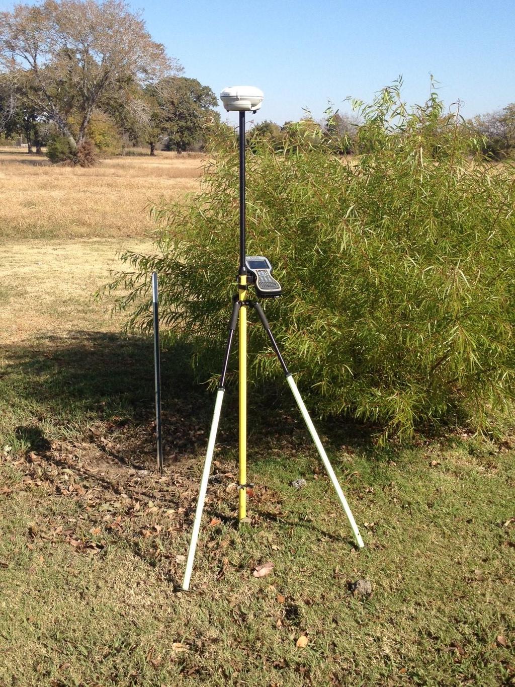
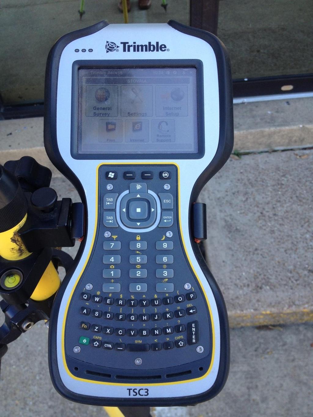
A Surveyor s Debate- GPS Surveying v. Old School Metes & Bounds
|
|
|
- Caren Rachel Marsh
- 6 years ago
- Views:
Transcription
1 A Surveyor s Debate- GPS Surveying v. Old School Metes & Bounds 2012 Texas Land Title Institute Presented by: W. Michael Evans, RPLS, LSLS, Great Southwestern Land Surveyors LLC Jamie Gillis, RPLS, PLS, Geomatic Resources, LLC Bobby Stovall, RPLS, Stovall & Associates Land Surveying and Kincy Abstract & Sabine Title Company Bruce D. Liesman, CAEA, CTIA, National Investors Title Insurance Company
2 W. Michael Evans Registered Professional Land Surveyor Licensed State Land Surveyor Michael Evans earned his Bachelor of Business Administration degree from Baylor University in Waco, Texas, majoring in entrepreneurship. He became a Registered Professional Land Surveyor in 1988 and is also a Licensed State Land Surveyor. His surveying experience includes a broad spectrum of project types, such as, boundary surveys for commercial, urban, and rural tracts, topographic surveying for municipal, architectural and civil engineering applications, construction surveying for commercial buildings, chemical plants and water/wastewater facilities, commercial and residential subdivision planning, oil & gas lease surveys and well permitting. He is also available to consult on surveying issues relating to the ownership of state land, i.e., the location of excess and vacancies in and between Original Texas Land Grants, coastal boundaries, and gradient boundary along the beds of navigable streams. His achievements include serving as Principal and Senior Project Manager to permit all of the Barnett Shale wells in the Fort Worth/Dallas Metroplex for ExxonMobil and Harding Energy Partners. He is currently working on the surveying necessary to develop a 150,000 acre lease block in Deep East Texas. He has also worked for EOG Resources, Pecan Pipeline, Energy Transfer, Devon, and XTO. In addition, he managed several midstream petroleum pipeline surveying projects. He served as the Senior Field Engineer on the construction of the Bass Towers in downtown Fort Worth, Texas and the Oklahoma Natural Gas Tower in Tulsa, Oklahoma, performed a control survey for the mapping of the University of Texas at Arlington campus, and provided construction staking for the Hulen Towers and for the Alcon office building and campus expansion in Fort Worth, Texas. Additional achievements include conducting surveys for the Student Life Center, Sports Complex, George Truett Seminary, and Armstrong Browning Library of Baylor University in Waco, Texas. Also, Mr. Evans oversaw a major portion of the layout for Railport in Midlothian, Texas, including; 10 miles of railroad, 2.5 miles of major drainage improvements, and the Target Distribution Center Warehouse Complex. In addition, Mr. Evans has planned and surveyed many major residential subdivisions all over north central and central Texas. Mr. Evans is a member of the American Congress on Surveying & Mapping, National Society of Professional Surveyors, and Texas Society of Professional Surveyors. He is currently serving as member of the TSPS Board of Directors, and as President of Central Texas Chapter 3. He has served as the TSPS liaison to the Texas Land Title Association for many years, and he serves on the TSPS Governmental Affairs Committee having had a key role in passing many major pieces of surveying legislation through the Texas Legislature. In 1992, TSPS conferred the Young Surveyor of the Year award upon Mr. Evans, and in 1997, he was recognized for his outstanding achievement in community service by receiving the Vern Wayne Hanon Award. Mr. Evans has also served as an Adjunct Professor of Surveying at Texas State Technical College and he is the author of several published articles about surveying.
3 Education: Bachelor of Business Administration Baylor Univeristy, Waco, Texas Registration: Licensed State Land Surveyor State of Texas Registered Professional Land Surveyor State of Texas - No State of Utah - No Professional Affiliation: Texas Society of Professional Surveyors Utah Council of Land Surveyors National Society of Professional Surveyors American Congress on Surveying and Mapping Professional Experience: JEA/HydroTech Inc. Great Southwestern Surveyors of Texas Brown & Root, Inc. Linbeck Construction Corp. Haws and Garrett, Inc. Jones & Carter, Inc.

4 Jamie Gillis, RPLS, PLS is currently the Technical Support Specialist at Geomatic Resources in Irving, Texas. He provides training and technical support for Leica Geosystems GPS, Robotics, Total Stations, and Data Collection to Land Surveying Professionals in North Texas and Oklahoma. Jamie brings a strong background in the surveying industry, and his high level of professionalism and survey knowledge to the Geomatic Resources team. His experience covers a wide range of surveying duties. His background includes serving as Instrument Man, Survey Assistant, Party Chief, Offshore Survey Technician, Project manager, and Professional Land Surveyor. His early surveying experience includes performing numerous field assignments in Nova Scotia, Canada. Jamie has varied International surveying experience, having worked in Eastern and North-western Canada, as well as Bolivia and Argentina, before moving to Texas in Recently, he has served as RPLS/ Project Manager for a number of natural gas gathering pipeline projects, oil & gas lease and location surveys, boundary, topographic, and hydrographic surveys and has been involved with offshore positioning and metrology, monitoring & logging surface & sub-surface positioning data in the Gulf of Mexico. Jamie is a Registered Professional Land Surveyor in Texas and Louisiana, and is very active in the Texas Society of Professional Surveyors, where he is the Chair of the Public Relations Committee and is the President of TSPS North Central Texas Chapter, No. 2. He holds a PBC in Geographic Information Sciences from Texas A&M University in Corpus Christi. He also received a BA in History and Political Science from Dalhousie University in Halifax, Nova Scotia.
5 Bobby Stovall Bobby Stovall is a Registered Professional Land Surveyor and licensed Independent Title Agent and Escrow Officer through the State of Texas. He is the owner of Stovall & Associates, a land surveying company operating out of Hunt County, Texas, since His surveying experience has covered many different areas of the survey practice including boundary, residential, subdivision, commercial, utility, topographical, and street and highway. In 1990, he purchased Kincy Abstract & Sabine Title Company, a land title insurance company in Hunt County, Texas, to complement his existing business interest. Being the owner of both a land surveying company and title company affords Bobby a unique perspective into the requirements and issues both industries deal with on a daily basis. It has also provided the opportunity to work with various county appraisal districts in researching ownership, identifying and mapping each tax parcel, and maintaining the tax databases in each county. This was done manually in the earlier days of technology and progressed today into management through geographic information systems (GIS). Bobby is a graduate of Texas A&M University (Class of 76) with a Bachelor of Science degree in Engineering Technology, Civil Surveying. He is a member of the Texas Society of Professional Land Surveyors, Texas Land Title Association, and American Land Title Association.
6 Bruce D. Liesman, CAEA, CTIA Professional Experience current President of Texas Land Title Association National Investors Title Insurance Company Chief Texas Counsel & Vice President Independence Title Company General Counsel & Vice President Alamo Title Insurance/ Fidelity National Title Insurance San Antonio, Texas Senior Underwriting Counsel Vice President United General Title Insurance Company San Antonio, Texas Chief Divisional Counsel Vice President Education Juris Doctorate University of Texas School of Law BA Drama and Theater Production University of Texas at Austin Achievements current Texas Land Title Association Title Person of the Year Award Professional certification through TLTA CAEA Certified Abstract and Examination Associate CTIA Certified Title Insurance Associate Outstanding Young Title Person Award Peggy Hayes Teaching Excellence Award President s Award for Outstanding Service Frequent Speaker and Teacher at Texas Land Title Association, State Bar, Texas Real Estate Commission (TREC) and other real estate related organizations in Texas
7 Manual of Practice for Land Surveying in Texas created by the Texas Society of Professional Surveyors Category 1A: Land Title Survey. A comprehensive investigation and evaluation of significant factors affecting and influencing the location of the boundaries, ownership lines, rights of way and easements within or immediately surrounding a particular parcel of real estate. The focus is directly on the purpose of insuring title. See info at Also see ALTA (American Land Title Association) and ACSM (American Congress on Surveying and Mapping Survey requirements effective February 23, s.pdf
8 Priority and Dignity of Calls in a Metes and Bounds description Excerpts from Stafford v King 30 Tex 257 Judge: Smith, J. It has been often said by this court that the general rules are, that the location should be governed, first, by natural objects or boundaries, such as rivers, lakes, creeks, etc.; second, artificial marks, such as marked [**20] trees, lines, stakes, etc.; and, third, course and distance. The true and correct location of the land is ascertained by the application of all or any of these rules to the particular case. And when they lead to contrary results or confusion, that rule must be adopted which is most consistent with the intention apparent upon the face of the patent, read in the light of the surrounding facts and circumstances. The identification of the actual survey, as made by the surveyor, is the desideratum of all these rules. The footsteps of the surveyor must be followed, and the above rules are found to afford the best and most unerring guides to enable one to do so.
9 : Texas Administrative Code <<Prev Rule Texas Administrative Code Next Rule>> TITLE 22 PART 29 CHAPTER 663 SUBCHAPTER B RULE EXAMINING BOARDS TEXAS BOARD OF PROFESSIONAL LAND SURVEYING STANDARDS OF RESPONSIBILITY AND RULES OF CONDUCT PROFESSIONAL AND TECHNICAL STANDARDS Boundary Construction (a) When delineating a property or boundary line as an integral portion of a survey, the land surveyor shall respect junior/senior property rights, footsteps of the original land surveyor, the record, the intent as evidenced by the record, the proper application of the rules of dignity or the priority of calls, and applicable statutory and case law of Texas. (b) Appropriate deeds and/or other documents including those for adjoining parcels shall be relied upon for the location of the boundaries of the subject parcel(s). (c) A land surveyor assuming the responsibility of performing a land survey also assumes the responsibility for such research of adequate thoroughness to support the determination of the location of intended boundaries of the land parcel surveyed. The land surveyor may rely on record data related to the determination of boundaries furnished for the registrants' use by a qualified provider, provided the registrant reasonably believes such data to be sufficient and notes, references, or credits the documentation by which it is furnished. (d) All boundaries shall be connected to identifiable physical monuments related to corners of record dignity. In the absence of such monumentation the land surveyor's opinion of the boundary location shall be supported by other appropriate physical evidence which shall be explained in a land surveyor's report. Source Note: The provisions of this adopted to be effective September 1, 1992, 17 TexReg 5544; amended to be effective September 20, 1998, 23 TexReg 9343; amended to be effective July 1, 2008, 33 TexReg 5008 Next Page Previous Page 8:18:57 AM]
10 : Texas Administrative Code <<Prev Rule Texas Administrative Code Next Rule>> TITLE 22 PART 29 CHAPTER 663 SUBCHAPTER B RULE EXAMINING BOARDS TEXAS BOARD OF PROFESSIONAL LAND SURVEYING STANDARDS OF RESPONSIBILITY AND RULES OF CONDUCT PROFESSIONAL AND TECHNICAL STANDARDS Monumentation (a) All monuments set by registered professional land surveyors shall be set at sufficient depth to retain a stable and distinctive location and be of sufficient size to withstand the deteriorating forces of nature and shall be of such material that in the land surveyor's judgment will best achieve this goal. (b) When delineating a property or boundary line as an integral portion of a survey (survey being defined in the Act, (6) or (8)), the land surveyor shall set, or leave as found, sufficient, stable and reasonably permanent survey markers to represent or reference the property or boundary corners, angle points, and points of curvature or tangency. (1) All survey markers shall be shown and described with sufficient evidence of the location of such markers on the land surveyors' plat. If the land surveyor shall prepare a written description of the surveyed premise, he/she shall include in that written description: (A) reference to and a description of the survey markers as shown on the plat; and (B) the seal and signature of a registered or licensed land surveyor. (2) In addition, the land surveyor may furnish an electronic copy of a written description provided that the text is verbatim to that on the certified document retained in the land surveyor's file. (c) All metes and bounds description prepared for easements shall be tied to physical monuments of record related to the boundary of the affected tract. (d) Where practical, all monuments set by Professional Land Surveyors to delineate or witness a boundary corner shall be marked in a way that is traceable to the responsible registrant or associated employer. Source Note: The provisions of this adopted to be effective September 1, 1992, 17 TexReg 5544; amended to be effective September 20, 1998, 23 TexReg 9343; amended to be effective January 10, 1999, 24 TexReg 139; amended to be effective January 27, 2004, 29 TexReg 636; amended to be effective July 1, 2008, 33 TexReg 5009; amended to be effective November 17, 2008, 33 TexReg 9249 Next Page Previous Page 8:19:43 AM]

11

12
13
14
Standards of Practice for Surveying in the State of Alabama
 Standards of Practice for Surveying in the State of Alabama Effective January 1, 2017 RULE NO. 1.01 PURPOSE The purpose of these rules is to establish standards for the practice of surveying in the State
MINOR PLAT. The following documents are provided as required by the City of Conroe for use in the above titled platting submittals:
 Public Works - Engineering Division CITY OF CONROE MINOR PLAT The following documents are provided as required by the City of Conroe for use in the above titled platting submittals: Submittal Questionnaire
Rule 21 STANDARDS OF PRACTICE FOR SURVEYING
 Rule 21 STANDARDS OF PRACTICE FOR SURVEYING 21.1 Whenever a survey is performed, it shall comply with Section 73-13-71 (4) and Section 73-13- 73 and the Standards of Practice for Surveying in Mississippi
Exploring the 2016 ALTA/ACSM NSPS Land Title Survey Standards
 Exploring the 2016 ALTA/ACSM NSPS Land Title Survey Standards Ian Wilson, PLS Central Valley Chapter 2016 Ian Wilson 2/25/2016 Purpose of the LTS History of the Standards What a Land Title Survey is and
Auditor's Office Tuscarawas County
 Auditor's Office Tuscarawas County MATT JUDY, Auditor Telephone 125 E. High Avenue (330) 365-3220 New Philadelphia, Ohio 44663 Fax: (330) 365-3397 TO: FROM: Title Companies, Surveyors, Attorneys & Financial
F.H. WADDILL, C.E F.C. GANDOLFO, JR., SURVEYOR LOUISIANA ENGINEERING SOCIETY 100 YEARS AND GROWING
 GANDOLFO KUHN, L.L.C. Professional Land Surveyors 5413 Powell Street, Suite A Harahan, LA 70123 Ph: (504) 818-2810 Fax: (504) 818-2811 surveys@gandolfokuhn.com AMERICAN CONGRESS OF SURVEYING & MAPPING
ALTA/NSPS Land Title Survey Standards: What Real Estate Counsel Need to Know
 Presenting a live 90-minute webinar with interactive Q&A ALTA/NSPS Land Title Survey Standards: What Real Estate Counsel Need to Know Survey Exceptions and Survey Endorsements in Title Insurance Policies
SECTION SITE SURVEYS
 PART 1 - GENERAL 1.1 DESCRIPTION SECTION 02 21 00 SPEC WRITER NOTES: 1. Use this section only for NCA projects. 2. Delete between //---// if not applicable to project. Also delete any other item or paragraph
CONFLICTING ELEMENTS
 CONFLICTING ELEMENTS Order of importance of conflicting elements that determine land location: A. Unwritten rights. B. Senior right. C. Written intentions of Parties. D. Lines Marked and Run. E. Natural
Land Surveys and Real Property Boundaries
 Land Surveys and Real Property Boundaries There are primarily 5 types of surveys performed on real property in the State of Indiana: Original, Retracement, Route, and Surveyor Location Report (SLR). Lenders
Secret and Forgotten Elements of Rule 12
 Secret and Forgotten Elements of Rule 12 Indiana Society of Professional Land Surveyors Indianapolis, Indiana January 18, 2017 Presented by Gary R. Kent, PS The Schneider Corporation Indianapolis, Indiana
Enforcement of Minimum Survey Standards
 Presented By: F. Anthony Rettke, P.S., Tax Map Supervisor, Franklin County John Greenhalge, Executive Director, State Board of Registration n the Ohio Revised Code, Section 315.251: If a deed conveying
RECERTIFICATION CONFERENCE
 JULY 27-28, 2017 INTERCONTINENTAL HOTEL, NEW ORLEANS, LA RECERTIFICATION CONFERENCE 2017 NID-HCA NATIONAL INVESTMENT DIVISION- HOUSING COUNSELING AGENCY SPONSORED BY A Message from the President Greetings
AMENDING PLAT REQUIREMENTS Revised
 City of University Park AMENDING PLAT REQUIREMENTS Revised 9-3-2014 1. The amending plat is prepared with the appropriate certificates printed on the document and three (3) 24 x 36 paper copies are submitted
AMENDING PLAT REQUIREMENTS Revised
 City of University Park AMENDING PLAT REQUIREMENTS Revised 10-2016 1. The amending plat is prepared with the appropriate certificates printed on the document and three (3) 24 x 36 paper copies are submitted
BOUNDARY SURVEYS RE-SURVEYS
 BOUNDARY SURVEYS RE-SURVEYS One of the difficult tasks for a surveyor is the re-surveying of lands, the re-location of the boundary lines between privately-owned lands or the re-location of the boundary
Surveying and Engineering Ethics and Standards
 Surveying and Engineering Ethics and Standards New Jersey Society ~of~ Professional Land Surveyors Atlantic City, New Jersey February 1, 2017 Presented by Gary R. Kent, PS The Schneider Corporation Indianapolis,
REPLAT REQUIREMENTS Revised
 City of University Park REPLAT REQUIREMENTS Revised 02-2016 1. The replat is prepared with the appropriate certificates printed on the document and three (3) 24 x 36 paper copies are submitted with a completed
APPLICATION FOR FINAL PLAT APPROVAL (Major Subdivision)
") APPLICATION FOR FINAL PLAT APPROVAL (Major Subdivision) CITY OF HOSCHTON, GA PLANNING AND DEVELOPMENT 79 City Square Hoschton, GA 30548 706-654-3034 Applicant Information: Name: Address: City, State, Zip:
APPLICATION FOR FINAL PLAT APPROVAL (Major Subdivision) CITY OF HOSCHTON, GA PLANNING AND DEVELOPMENT 79 City Square Hoschton, GA 30548 706-654-3034 Applicant Information: Name: Address: City, State, Zip:
Montana Land Title Association (MLTA) 2015 Spring Education Seminar ALTA/ACSM Land Title Surveys Speaker Outline Handout
 2015 Spring Education Seminar ALTA/ACSM Land Title Surveys Speaker Outline Handout") Montana Land Title Association (MLTA) 2015 Spring Education Seminar ALTA/ACSM Land Title Surveys Speaker Outline Handout A. What is an ALTA/ACSM Land Title Survey? a. Four different kinds of land title
Montana Land Title Association (MLTA) 2015 Spring Education Seminar ALTA/ACSM Land Title Surveys Speaker Outline Handout A. What is an ALTA/ACSM Land Title Survey? a. Four different kinds of land title
OHIO ADMINISTRATIVE CODE CHAPTER Minimum Standards for Boundary Surveys in the State of Ohio
 OHIO ADMINISTRATIVE CODE CHAPTER 4733-37 Minimum Standards for Boundary Surveys in the State of Ohio Note: Chapter 4733-37 of the Administrative Code was filed pursuant to Chapter 119 of the Revised Code.
 Page 1 of 6 Office of the Professions Land Surveying Practice Guidelines - February 2000 The State Board for Engineering and Land Surveying issued the first draft of its proposed Land Surveying Practice
WHEN DANIEL BOONE led pioneers across the
 Understanding Land Measurement and Legal Descriptions WHEN DANIEL BOONE led pioneers across the Appalachian Mountains in the 1700s, it was an accepted practice for them to establish property boundaries
Appendix C. Real Estate. Brazos Island Harbor, Texas Channel Improvement Project Cameron County, Texas
 Appendix C Real Estate Brazos Island Harbor, Texas Channel Improvement Project Cameron County, Texas U.S. Army Corps of Engineers, Galveston District 2000 Fort Point Road Galveston, Texas 77550 December
Requirements for All Instruments of Conveyance in Logan County, Ohio
 Requirements for All Instruments of Conveyance in Logan County, Ohio Effective Date: April 11, 1997 It is the intent of these requirements to provide a standard method of checking legal descriptions for
BIOGRAPHICAL DATA OF CHARLES J. JACOBUS
 BIOGRAPHICAL DATA OF CHARLES J. JACOBUS EDUCATION LICENSES Bachelor of Science, University of Houston Doctor of Jurisprudence, University of Houston AV Rating - Martindale-Hubbell State Bar of Texas Texas
Plat Reviews. Richard Powell, P.L.S.
 Plat Reviews Richard Powell, P.L.S. 177.011 Purpose and scope of part I. This part shall be deemed to establish consistent minimum requirements, and to create such additional powers in local governing
Map Filing Law. 46: Effective date This act shall take effect January first, one thousand nine hundred and fiftyfour.
 46:23-9.8. Effective date This act shall take effect January first, one thousand nine hundred and fiftyfour. L.1953, c. 358, p. 1941, s. 8. 46:23-9.9. Short title This act shall be known and may be cited
2007 Annual Convention. Real Property Seminar
 2007 Annual Convention Real Property Seminar Real Property Section 3.0 General CLE Hours May 16-18, 2007 Cincinnati CONTRIBUTORS Charles F. Allbery III Allbery Cross & Fogarty Dayton, Ohio B.A., The Ohio
250 CMR: BOARD OF REGISTRATION OF PROFESSIONAL ENGINEERS AND LAND SURVEYORS DRAFT FOR DISCUSSION PURPOSES ONLY
 250 CMR 6.00: LAND SURVEYING PROCEDURES AND STANDARDS Section 6.01: Elements Common to All Survey Works 6.02: Survey Works of Lines Affecting Property Rights All land surveying work is considered work
New Jersey Administrative Code Title 13, Chapter 40 State Board of Professional Engineers and Land Surveyors
 New Jersey Administrative Code Title 13, Chapter 40 State Board of Professional Engineers and Land Surveyors SUBCHAPTER 1. TITLE BLOCKS AND SEALS FOR PROFESSIONAL ENGINEERS AND LAND SURVEYORS 13:40-1.1
DALLAS WATER UTILITIES WATER/WASTEWATER COVENANT
 DALLAS WATER UTILITIES WATER/WASTEWATER COVENANT Procedure for obtaining a water and wastewater covenant, water covenant, or wastewater covenant; Required for initial submittal: 1. One letter from the
SYSTEMS OF PROPERTY DESCRIPTION
 SYSTEMS OF PROPERTY DESCRIPTION Interpretation of Common Real Property Descriptions INTRODUCTION Land surveying includes 1. Surveying operations involved in original surveys to locate and monument the
The Importance of Performing Route Surveys in the State of Indiana. Presented to: March 6 th, 2013
 The Importance of Performing Route Surveys in the State of Indiana Presented to: March 6 th, 2013 Parsons Cunningham & Shartle Engineers 317-837-9900 www.pcsengineers.com Presented By: Chet Parsons, PE
May 2012 Professional (Cadastral) Examination
 Examination") Page 1 of 6 Question 1 a) Name five (5) types of plans for which the limits may be un-dimensioned. (5 marks) b) Name five (5) types of plans that create geographic fabric. (5 marks) Question 2 A client
Page 1 of 6 Question 1 a) Name five (5) types of plans for which the limits may be un-dimensioned. (5 marks) b) Name five (5) types of plans that create geographic fabric. (5 marks) Question 2 A client
New Requirements for Pipeline Projects James D. Bradbury, PLLC
 New Requirements for Pipeline Projects James D. Bradbury, PLLC New Pipeline Requirements City of Fort Worth Pipeline Ordinance (1/09); Texas Midstream v. City of Grand Prairie; Legislative Update on pipelines.
Minimum Requirements. In Carroll County, Ohio
 Minimum Requirements For Instruments of Conveyance In Carroll County, Ohio Revision History: Original Effective Date: June 1, 2000 Revision Effective Date: October 2, 2017 Foreword Section 319.203 of the
MnDOT Contract No Exhibit B. Scope of Work. Scope of Work
 MnDOT Contract No. 1032993 Contract General Description The purpose of this contract is to provide the State with the survey accurate re-establishment of designated Public Land Survey section boundaries
UTAH COUNCIL OF LAND SURVEYORS STANDARDS OF PRACTICE FOR BOUNDARY SURVEYS
 UTAH COUNCIL OF LAND SURVEYORS STANDARDS OF PRACTICE FOR BOUNDARY SURVEYS By the Utah Council of Land Surveyors Committee on Boundary Survey Standards Adopted by the Utah Council of Land Surveyors Executive
Title 46 PROFESSIONAL AND OCCUPATIONAL STANDARDS Part LXI. Professional Engineers and Land Surveyors
 Title 46 PROFESSIONAL AND OCCUPATIONAL STANDARDS Part LXI. Professional Engineers and Land Surveyors Chapter 29. Standards of Practice for Boundary Surveys 2901. Scope and Purpose A. The following standards
New 2016 ALTA/NSPS Land Title Survey Standards: What Attorneys Need to Know
 Presenting a live 90-minute webinar with interactive Q&A New 2016 ALTA/NSPS Land Title Survey Standards: What Attorneys Need to Know Leveraging the Feasibility Assessment Tool for Land Development Deals
Application for Preliminary Plat Checklist
 Application for Preliminary Plat Checklist Note: No portion of an existing parcel may be sold or transferred to another party without first legally subdividing the property according to the City of Richmond
Part 901 Chapter 19: REINSTATEMENT OF LICENSURE OR CERTIFICATION AFTER REVOCATION
 Rule 18.12 - Any person aggrieved by the action of the Board as a result of disciplinary proceedings conducted hereunder may appeal therefrom as provided for in Section 73-13-37(10) Mississippi Code Annotated
Chapter 29. Standards of Practice for Boundary Surveys Scope and Purpose Definitions
 Chapter 29. Standards of Practice for Boundary Surveys 2901. Scope and Purpose A. The following standards of practice for boundary surveying in the state of Louisiana have been adopted to help ensure that
Attendees of the 31 st Annual NARO Convention, Long Beach, California, October 20-22, 2011
 To: Attendees of the 31 st Annual NARO Convention, Long Beach, California, October 20-22, 2011 I ve spent the better part of the past decade in lawsuits against large oil companies. Most of our disputes
Department of Development Services Engineering; Survey Plat Review Group SPRG
 Department of Development Services Engineering; Survey Plat Review Group SPRG CITY OF DALLAS LEGAL DESCRIPTION PREPARATION GUIDELINE AND CHECKLIST The following guideline and checklist are provided to
CFedS Outline Unit 1. Course 1: History, Records & Administrative Systems
 CFedS Outline Unit 1 Course 1: History, Records & Administrative Systems History of U.S. Surveying Historical Perspective Similarities in Surveying Seniority of Calls Lack of Standards A National Debt
PLANNING AND DEVELOPMENT DEPARTMENT PRELIMINARY PLAT APPLICATION
 PLANNING AND DEVELOPMENT DEPARTMENT PRELIMINARY PLAT APPLICATION IT IS INCUMBENT UPON THE APPLICANT TO SUBMIT COMPLETE AND CORRECT INFORMATION. ANY MISLEADING, DECEPTIVE, INCOMPLETE OR INCORRECT INFORMATION
Finding and Prioritizing Boundary Evidence
 Finding and Prioritizing Boundary Evidence THREE PHASES OF A RETRACEMENT SURVEY Collect and Analyze the Record Evidence Perform a Field Survey to Search for Evidence Referenced in the Record and Signs
VACATING PLATS. The following documents are provided as required by the City of Conroe for use in the above titled platting submittals:
 Public Works - Engineering Division CITY OF CONROE VACATING PLATS The following documents are provided as required by the for use in the above titled platting submittals: Submittal Questionnaire (1-page).
GENESEE VALLEY LAND SURVEYORS ASSOCIATION MINIMUM STANDARDS FOR A MAP OF A SURVEY. Effective Date: February 15, 2017
 GENESEE VALLEY LAND SURVEYORS ASSOCIATION MINIMUM STANDARDS FOR A MAP OF A SURVEY Effective Date: February 15, 2017 1. The Land Surveyor shall perform due diligence in their research, maintain proper documentation
CODE OF PRACTICE FOR LAND SURVEYORS
 CODE OF PRACTICE FOR LAND SURVEYORS PREPARED BY DELAWARE-HUDSON PROFESSIONAL LAND SURVEYORS ASSOCIATION P.O. BOX 502 HIGHLAND MILLS, NY 10930 ADOPTED DECEMBER 9, 1987 REVISED FEBRUARY 9, 1988 Preamble
SUBDIVISION APPLICATION
 SUBDIVISION APPLICATION Preliminary Plat Minor Plat Final Plat Amended Plat Applicant Name: Owner (if different from applicant) Name: Company: Company: Address: Address: City, State, Zip City, State, Zip
RULES OF THE GEORGIA STATE BOARD OF REGISTRATION FOR PROFESSIONAL ENGINEERS AND LAND SURVEYORS CHAPTER APPLICATIONS TABLE OF CONTENTS
 RULES OF THE GEORGIA STATE BOARD OF REGISTRATION FOR PROFESSIONAL ENGINEERS AND LAND SURVEYORS CHAPTER 180-7 APPLICATIONS TABLE OF CONTENTS 180-7-.07 Maps and Plats. All maps, plats and similar documents
Section I General Information
 General Information Table of Contents A. Introduction... I-2 1. Purpose... I-2 2. Scope... I-2 3. Maintenance... I-3 4. Units... I-3 B. Public Relations... I-3 1. General Public... I-3 2. Property Owners...
Gates County Planning and Zoning
 Gates County Planning and Zoning PO Box 411, 200 Court Street, Gatesville, NC 27938 phone: 252-357-2411 fax: 252-357-0073 Application for Technical Review Committee For Staff Use Only: Date: Application
RULES, REGULATIONS AND REQUIREMENTS RELATING TO THE APPROVAL AND ACCEPTANCE OF IMPROVEMENTS IN SUBDIVISIONS OR RE-SUBDIVISIONS
 GALVESTON COUNTY RULES, REGULATIONS AND REQUIREMENTS RELATING TO THE APPROVAL AND ACCEPTANCE OF IMPROVEMENTS IN SUBDIVISIONS OR RE-SUBDIVISIONS GALVESTON COUNTY ENGINEERING DEPARTMENT MARCH 3, 1997 Amendment
AGENDA III. PROPERTY AND FACILITIES COMMITTEE. October 28, Board Room
 AGENDA III. PROPERTY AND FACILITIES COMMITTEE October 28, 2005 Board Room Mr. Marty J. Chabert, Chair Mr. Charles V. Cusimano, Vice Chair Dr. Jack A. Andonie Mrs. Laura A. Leach Mrs. Dorothy Reese Mr.
Lake Jordan Overlook Sealed Bid Wetumpka, AL. OFFERED FOR SALE BY SEALED BID BID SUBMISSION DEADLINE: Thursday, September 4, 2014 at 4:00 P.M.
 29-020 Lake Jordan Overlook Sealed Bid Wetumpka, AL OFFERED FOR SALE BY SEALED BID BID SUBMISSION DEADLINE: Thursday, September 4, 2014 at 4:00 P.M. 29-020 Lake Jordan Overlook is offered in three parcels
DOWNTOWN JANESVILLE. Business Improvement District Operating Plan
 DOWNTOWN JANESVILLE Business Improvement District Operating Plan 2019 TABLE OF CONTENTS Introduction..1 District Boundaries. 1 Proposed Operating Plan...1 Method of Assessment 4 Future Year Operating Plans...6
STANDARDS GOVERNING CONVEYANCES OF REAL PROPERTY IN DARKE COUNTY, OHIO
 STANDARDS GOVERNING CONVEYANCES OF REAL PROPERTY IN DARKE COUNTY, OHIO As directed by Section 319.203 of the Ohio Revised Code which states The County Auditor and the County Engineer shall adopt standards
CONDOMINIUMS AND MIXED- USE PROPERTIES
 18 h Annual Robert C. Sneed TEXAS LAND TITLE INSTITUTE CONDOMINIUMS AND MIXED- USE PROPERTIES December 4-5, 2008 Hyatt Regency Hill Country Resort & Spa San Antonio Robert Doc Watson Fidelity National
REQUIREMENTS FOR ALL INSTRUMENTS OF CONVEYANCE IN HARDIN COUNTY, OHIO
 REQUIREMENTS FOR ALL INSTRUMENTS OF CONVEYANCE IN HARDIN COUNTY, OHIO Effective Date: Michael L. Smith, P.E., P.S. Hardin County Engineer Michael T. Bacon Hardin County Auditor 1 I. GENERAL In compliance
VICTORIA COUNTY PROPERTY
 VICTORIA COUNTY PROPERTY (Commercial Potential, Easy Access, Excellent Location) 32.9 ACRES VICTORIA COUNTY, TEXAS LOCATION: Located in central VICTORIA County approximately 3 miles south of Victoria,
What is a land trust? Their mission is to preserve land via conservation easements and/or acquisition.
 Agenda What is a conservation easement? Resources for conservation easements and land trusts Real Property Bundle of Rights Conditions Landowner Benefits Tax deductions Funding Options Required Information
SUBDIVISION PLAT CHECKLIST. The following information shall be include on the plat:
 SUBDIVISION PLAT CHECKLIST Subdivision Name: Land Surveyor: Owner/Developer: Date Submitted: The following information shall be include on the plat: The plat shall be drawn at a scale of one inch equals
Real Estate Course Information Call Buddy Capezio
 Real Estate Course Information www.elaeducation.com Call Buddy Capezio 443-223-7500 Email: Info@elaeducation.com Careers In Real Estate The real estate profession has expanded and offers one of the widest
SUBDIVISION APPLICATION CHECKLIST SKETCH PLAN PRELIMINARY PLAT FINAL PLAT
 RECEIVED STAMP SUBDIVISION APPLICATION CHECKLIST SKETCH PLAN PRELIMINARY PLAT FINAL PLAT A checklist of background information and submission requirements for processing of a sketch plan, preliminary plat
Principles of Real Estate Chapter 16-Title Summary. Overview. Objectives. At the end of this chapter, the student will be able to:
 Principles of Real Estate Chapter 16-Title Summary This chapter will detail the recording and notice processes, explain the importance of title insurance, and explain the processes used to record title.
CAPABILITIES STATEMENT
 Flatirons, Inc., Engineering & Geomatics www.flatironsinc.com CAPABILITIES STATEMENT SBA and ORCA-certified Small Business under the following NAICS codes: 541370 & Mapping 541360 & Mapping, Geophysical
R/W PREQUALIFICATION ODOT, 3/14/2018 PROPERTY MAP SHEET
 R/W PREQUALIFICATION ODOT, 3/14/2018 3A Title Block 3B Sheet Heading 3C Station Limit Flags 3D Revision Block 3E Ownership Name and Number 3F Centerline Stationing 3G Proposed R/W and Pavement 3H Structures
ARTICLE 3 DEFINITIONS
 Sections: 3-1 Rules of Construction 3-2 Definitions ARTICLE 3 DEFINITIONS SECTION 3-1 RULES OF CONSTRUCTION 3-101. a. The language set forth in these regulations shall be interpreted in accordance with
MAJOR RESIDENTIAL AND NONRESIDENTIAL SUBDIVISIONS
 Lawrence-Douglas County MAJOR RESIDENTIAL AND NONRESIDENTIAL SUBDIVISIONS Preliminary Plats The applicant shall schedule a Pre-Application meeting with Planning Staff at least seven (7) working days prior
OTTAWA COUNTY LEGAL DESCRIPTION REVIEW GUIDELINES
 OTTAWA COUNTY LEGAL DESCRIPTION REVIEW GUIDELINES APPROVED BY: RONALD P. LAJTI, JR., P.E., P.S. OTTAWA COUNTY ENGINEER APPROVED BY: LAWRENCE HARTLAUB OTTAWA COUNTY AUDITOR EFFECTIVE DATE: January 1, 2017
Preliminary Plat/Final Plat Application
 Melissa Municipal Center 3411 Barker Avenue Melissa, Texas 75454 Phone: (972) 838-2036 Applicant: Date: Address: Phone: Contact: Fax: E-mail: Propose Addition Name: Acres: Existing Zoning: Propose Zoning:
Methods of Legal Description Metes and Bounds The Rectangular Survey System Recorded Plat Method Describing Elevation
 9 Legal Descriptions Methods of Legal Description Metes and Bounds The Rectangular Survey System Recorded Plat Method Describing Elevation METHODS OF LEGAL DESCRIPTION There are many common ways of describing
I. Requirements for All Applications. C D W
 108-16.1. Application checklists. Checklist for Required Submissions to the Planning Board or Zoning Board of Adjustment of Monroe Township All required submissions are to be made to the Administrative
PREPARING SURVEY TENDER GIS DATABASE OUTCOMES
 PREPARING SURVEY TENDER SPECIFICATIONS FOR PROJECT GIS DATABASE OUTCOMES Presentation by Ian Harper GEODATA AUSTRALIA ESRI User Conference 2009 24 st July 2009 BACKGROUND GIS databases now provide a more
Legal Descriptions INTRODUCTION: WARNING: Writing Legal Descriptions NYSAPLS Conf January Scott Reeser, P.L.S. NYSAPLS 2018 Conference
 Legal Descriptions Scott Reeser, P.L.S. NYSAPLS 2018 Conference INTRODUCTION: Over 25 years experience in the surveying profession Graduate of Penn State survey program Licensed in Pennsylvania, New York,
ASSOCIATION OF NOVA SCOTIA LAND SURVEYORS
 ASSOCIATION OF NOVA SCOTIA LAND SURVEYORS FRPA Review Report Province of Nova Scotia Table of Contents Background of the Regulatory Body... 1 Definition of the Profession... 1 Staffing... 2 Types of Licences/Certificates
PRELMINARY PLAT CHECKLIST
 PRELMINARY PLAT CHECKLIST A. All preliminary plat submitted for approval shall be prepared by a Registered Professional Land Surveyor. B. Preliminary plats must be drawn to a scale of XXX with such accuracy
1. A system used in real estate to define the physical features and boundaries of a piece of property.
 METES AND BOUNDS The system of metes and bounds is one used in real estate to describe land or real property based on the physical features of its geography, as well as directions and distances. These
These requirements are:
 MINIMUM STANDARD DETAIL REQUIREMENTS for ALTA/ACSM LAND TITLE SURVEYS as adopted by American Land Title Association American Congress on Surveying and Mapping and National Society of Professional Surveyors
What Title Insurance Does NOT Cover
 What Title Insurance Does NOT Cover 2012 Texas Land Title Institute Paul McNutt, Jr. Executive Vice President and General Counsel Title Resources Guaranty Company, Dallas INSTRUCTOR PROFILE PAUL MCNUTT,
Pipelines & Eminent Domain THE PROPOSED KINDER MORGAN PERMIAN HIGHWAY PIPELINE OCTOBER 29, 2018 JIM BRADBURY JAMES D.
 Pipelines & Eminent Domain THE PROPOSED KINDER MORGAN PERMIAN HIGHWAY PIPELINE OCTOBER 29, 2018 JIM BRADBURY JAMES D. BRADBURY, PLLC The Kinder Morgan Permian Highway Pipeline Project Permian Highway
MUNICIPAL LAW: Home Rule Cities v. General Law Cities
 MUNICIPAL LAW: Home Rule Cities v. General Law Cities Bojorquez Law Firm, PC (2018) 1 AT A GLANCE: LOCAL GOVERNMENT IN TEXAS As of 2014, 254 Counties in Texas 1,214 Municipalities 862/1,214 are General
Preliminary Subdivision Application (Minor) (Three (3) lots or less)
 (Three (3) lots or less)") Gunnison City Offices www.gunnisoncity.org 38 West Center Gunnison, Utah 84634 (435) 528 7969 Date of Application: Preliminary Subdivision Application (Minor) (Three (3) lots or less) APPLICANT INFORMATION
Gunnison City Offices www.gunnisoncity.org 38 West Center Gunnison, Utah 84634 (435) 528 7969 Date of Application: Preliminary Subdivision Application (Minor) (Three (3) lots or less) APPLICANT INFORMATION
PLANNING AND ZONING COMMISSION MARCH 19, :30 P.M. PLANNING AND ZONING MEMBERS PRESENT Chair Derek Martin COMMISSIONERS:
 PLANNING AND ZONING COMMISSION MARCH 19, 2012 5:30 P.M. PLANNING AND ZONING MEMBERS PRESENT Chair Derek Martin COMMISSIONERS: Chris Magaña Greg Rhoads Mike Pilkington David Jones Will Sears James Staats
CHAPTER 8 - LAND DESCRIPTIONS
 CHAPTER 8 - LAND DESCRIPTIONS Notes: While the location of land is commonly referred to by street number and city, it is necessary to use the legal description in the preparation of those instruments relating
LAND USE PERMIT APPLICATION
 LAND USE PERMIT APPLICATION Date Application No. TYPE OF PERMIT Subdivision Short Plat Conditional Use Binding Site Plan Final Plat Final Short Plat Variance Final Binding Site Plan Plat Amendment Short
Plats and subdivisions; mapping requirements. (a) Size Requirements. All land plats presented to the register of deeds for recording in the
 Size Requirements. All land plats presented to the register of deeds for recording in the") 47-30. Plats and subdivisions; mapping requirements. (a) Size Requirements. All land plats presented to the register of deeds for recording in the registry of a county in North Carolina after September
47-30. Plats and subdivisions; mapping requirements. (a) Size Requirements. All land plats presented to the register of deeds for recording in the registry of a county in North Carolina after September
EXECUTIVE SUMMARY SOUTH BROOK TOWN CENTER
 EXECUTIVE SUMMARY SOUTH BROOK TOWN CENTER EXECUTIVE SUMMARY Holliday GP Corp. ( HFF ) has been exclusively retained by ownership to offer qualified investors the opportunity to purchase South Brook Town
STRATEGIC PLAN
 2018-2020 STRATEGIC PLAN VISION The Greater El Paso Association of REALTORS is the pre-eminent source of real estate information in El Paso for its members, the public, local government, and the media.
STANDARDS GOVERNING CONVEYANCES OF REAL PROPERTY IN SENECA COUNTY OHIO
 STANDARDS GOVERNING CONVEYANCES OF REAL PROPERTY IN SENECA COUNTY OHIO EFFECTIVE July 8, 1996 Seneca County Auditor FIRST HEARING June 14, 1996 SECOND HEARING June 26, 1996 Seneca County Engineer TABLE
COUNTY SUBDIVISION REGULATION IN TEXAS CHANGING TIMES BY: J. GREG HUDSON INTRODUCTION
 COUNTY SUBDIVISION REGULATION IN TEXAS CHANGING TIMES BY: J. GREG HUDSON INTRODUCTION With the return of the "building boom" in Texas during the late 1990 s, county officials have been faced with numerous
FIRST AMENDMENT TO OIL AND GAS LEASE THE STATE OF TEXAS KNOW ALL MEN BY THESE PRESENTS COUNTY OF TARRANT
 FIRST AMENDMENT TO OIL AND GAS LEASE THE STATE OF TEXAS KNOW ALL MEN BY THESE PRESENTS COUNTY OF TARRANT WHEREAS, the CITY OF ARLINGTON, a home rule municipal corporation of the State of Texas located
Preliminary Subdivision Application (Major) (Four (4) lots or more)
 (Four (4) lots or more)") Gunnison City Offices www.gunnisoncity.org 38 West Center Gunnison, Utah 84634 (435) 528 7969 Date of Application: Preliminary Subdivision Application (Major) (Four (4) lots or more) APPLICANT INFORMATION
Gunnison City Offices www.gunnisoncity.org 38 West Center Gunnison, Utah 84634 (435) 528 7969 Date of Application: Preliminary Subdivision Application (Major) (Four (4) lots or more) APPLICANT INFORMATION
HENRY COUNTY CONVEYANCE STANDARDS AND LAND TRANSFER POLICY
 HENRY COUNTY CONVEYANCE STANDARDS AND LAND TRANSFER POLICY REVISED DECEMBER 2013 Approved By: Kevin Garringer - County Auditor Timothy J. Schumm, P.E., P.S. - County Engineer Land Transfer Policy Committee:
Right of Way Plan Development Training Course
 Ohio Department of Transportation Office of Real Estate Right of Way Plan Development Training Course Training Guide RIGHT OF WAY PLAN DEVELOPMENT PREQUALIFICATION COURSE Course Agenda 8:00 Welcome and
Ethical Practice For Land Surveyors in New York. NYSAPLS Conference January Ethics
 Ethical Practice For Land Surveyors in New York NYSAPLS Conference January 2015 Joseph V.R. Paiva CEO - Ethics! discipline dealing with what is good and bad and with moral duty and obligation! Theory or