^_ ^_ MAY 14, 2018 OLATHE PLANNING COMMISSION CASE LOCATIONS WARD 2 WARD 4 WARD 1 WARD 3 FP SU MP RZ RZ VAC
|
|
|
- Audra Conley
- 6 years ago
- Views:
Transcription
1 MAY 14, 2018 OLATHE PLANNING COMMISSION CASE LOCATIONS WARD 2 FP WARD 1 MP ^_ VAC RZ ^_ PR FP ^_ ^_ ^_ ^_ RZ MP ^_ FP RZ ^_ ^_ SU VAC SU PR ^_ ^_ ^_ ^_ WARD 4 RZ ^_ ^_ WARD 3 VAC FP RZ User: JaredMD Date: 05/09/2018 Highway Arterial Street City of Olathe Lakes

2 Planning Commission Meeting May 14, 2018 CALL TO ORDER PLEDGE OF ALLEGIANCE QUORUM ACKNOWLEDGEMENT CONSENT AGENDA FINAL AGENDA REVISED 1. Standing approval of the Minutes as written from the April 9, 2018 Planning Commission meeting. 2. MP : Request approval for a minor plat for Covington Creek, Replat of Lot 28 and 29 on 0.63± acres; located at and S. Roundtree Street. Owner: Tom French, Heartland Development, L.P. Applicant: Stacy Breaker, Phelps Engineering Engineer: Tim Tucker, P.E., Phelps Engineering 3. MP : Request approval for a minor plat for The Landings at Stone Creek, Fourth Plat on 0.29± acres; located north of the intersection of W. 123 rd Terrace and S. Sagebrush Drive. Owner / Applicant: Thane Brethour, Remington Development Group, LLC Engineer: Jerald W. Pruitt, PLS, PS, Pruitt and Dooley Surveying, LLC 4. FP : Request approval for a final plat for Townhomes at Fairfield Village, Forty- First Plat on 0.68± acres; located in the vicinity of 167 th Street and Mur-Len Road. Owner: Gary Jones, Fairfield Courts, LLC Applicant: Tim Tucker, P.E., Phelps Engineering, LLC Engineer: Tim Tucker, P.E., Phelps Engineering, LLC 5. FP : Request approval for a final plat for Arbor Woods, Fifth Plat containing 37 lots and 1 common tract on 11.37± acres; located approximately 500 feet north of the intersection at W. 127 th Street and S. Meadow View Street. Owner / Applicant: Tom Langhofer, Arbor Woods Partners, LLC Engineer: Todd Allenbrand, Payne & Brockway, P.A. In compliance with the Americans with Disabilities Act, the City of Olathe will provide reasonable accommodations for all public meetings. Persons requiring accommodations in attending any of our public meetings should contact the City Clerk s office at a minimum of 48 hours prior to the meeting.
3 6. FP : Request approval for a final plat for Cedar Ridge Estates, Second Plat containing 20 lots and 1 common tract on 8.86± acres; located along the north side of College Boulevard, approximately 1/3 mile west of its intersection with S. Woodland Road. Owner / Applicant: Tom Bickimer, Bickimer Construction, Inc. Engineer: Harold A. Phelps, P.E., Phelps Engineering, Inc. 7. FP : Request approval for a final plat for TVH Industrial Park containing 1 lot on 40.43± acres; located approximately ¼ mile east of the intersection of W. 164 th Street and S. Lone Elm Road. Owner: Frank Carter, Fremato USA, Inc. Applicant: Austin Herndon, RMTA Engineer: Judd D. Claussen, P.E., Phelps Engineering, Inc. 8. PR : Request approval for a revised preliminary site development plan for TVH Industrial on 40.42± acres; located approximately ¼ mile east of the intersection of W. 164 th Street and S. Lone Elm Road. Owner: Frank Carter, Fremato USA, Inc. Applicant: Kenny Miller, RMTA Engineer: Matt Masilionis, RMTA 9. PR : Request approval for a revised preliminary site development plan for Dale s Automotive Building Addition on.99± acres; located at S. Keeler Street. Owner / Applicant: Troy Allenbrand, Dale s Collision Architect: Jeff Schroeder, Scharhag Architects REGULAR AGENDA New Business 1. RZ : Request approval for a rezoning from C-2 and M-1 district to PD (Planned District) on 50.93± acres, and preliminary development plan for Olathe Gateway II; located at the southwest corner of 119 th Street and Renner Boulevard. Owner: Mark Siffin Maegrace, LLC Applicant: John Petersen Polsinelli PC Engineer: Brad Sonner Olsson Associates Architect: Scott Slaggie Slaggie Architecture Applicant has requested a continuance to a future Planning Commission meeting. 2. VAC : Request approval for vacation of existing waterline easement to allow for redevelopment of the site at Santa Rosa Shopping Center; located in the vicinity of Strang Line Road and W. 120 th Place. Owner: Falcon Hospitality Group, LLC Owner / Engineer: Judd D. Claussen, P.E., Phelps Engineering, Inc. Applicant has requested a continuance to a future Planning Commission meeting.
4 PUBLIC HEARING 3. SU : Request approval for the renewal of a Special Use Permit for trailer sales and storage at Smitty s Lawn & Garden Equipment on 1.82± acres; located at 2300 N. Rogers Road. Owners: David & Christin Wood, Magic Wood, Inc. Applicant: David Wood, Magic Wood, Inc. 4. SU : Request for a renewal of a Special Use Permit to allow sales of new and used motorcycles in the C-3 District at Letko Cycle Services; specifically located at S. Rogers Road. Owner / Applicant: Gary Dick Letko Cycle Services Applicant has requested a continuance to a future Planning Commission meeting. PUBLIC HEARING 5. RZ : Request approval for a rezoning from R-3 to C-3 District and preliminary plat for Sam s Tastee Treat on.35± acres; located at 435 S. Parker Street. Owners: Sueko and Hulet Silvernale, Sam s Tastee Treat Applicant: Margie Stark, Reece Nichols Premier Engineer: Chad Porter Payne & Brockway PUBLIC HEARING 6. RZ : Request approval for a rezoning from County RN-1 to City R-1 District for S. Nelson Road. Owner / Applicant: Diana and Jeffrey Francis PUBLIC HEARING 7. RZ : Request approval for a rezoning from AG to R-1 District and preliminary plat for Village Cooperative of Olathe North containing 10 lots on 4.24± acres; located west of W. 131 st Street and north of W. 133 rd Street. Owner: Janice C. Claerhout, Trustee; Paul Schlagel Revocable Trust Applicants: Shane Wright and Andrew Schaefer, Real Estate Equities Development Engineer: Jeffrey Skidmore, P.E., Schlagel & Associates PUBLIC HEARING 8. RZ : Request approval for a rezoning from AG to R-4 District and preliminary site development plan for Village Cooperative of Olathe on 4.87± acres; located at the northwest corner of W. 133 rd Street and S. Greenwood Street. Owner: Janice C. Claerhout, Trustee, Paul Schlagel Revocable Trust Applicants: Shane Wright and Andrew Schaefer, Real Estate Equities Development Engineer: Jeffrey Skidmore, PE, Schlagel & Associates 9. VAC : Request approval for vacation of public street right-of-way for Poplar Street; located on Poplar Street between Kansas Avenue and Cherry Street. Owner: City of Olathe Applicant: Brad Reinhardt, Johnson County A continuance to the June 11, 2018 Planning Commission meeting is requested.
5 PUBLIC HEARING 10. VAC : Request approval for vacation of existing sanitary sewer easement to allow for relocation of the sanitary sewer line for Archer Subdivision; located at 215 and 301 S. Parker Street. Owner / Applicant: 3 Parker Investments, LLC Engineer: Judd D. Claussen, P.E., Phelps Engineering, Inc. ANNOUNCEMENTS ADJOURNMENT
6 MINUTES Opening Remarks Planning Commission Meeting: April 9, 2018 City of Olathe City Planning Division The Planning Commission convened at 7:00 p.m. to meet in regular session with Chairman Dean Vakas presiding. Planning Commissioners Mike Rinke, Barry Sutherland, Ryan Nelson, Jose Munoz, Jr. and Jeremy Fry were present. Commissioners Ryan Freeman and Chip Corcoran were absent. Recited Pledge of Allegiance. The Chair made introductory comments. Regarding ex parte communication, the Chair asked that if a commissioner had something to report, that they specify the nature of the ex parte communication as that item is reached in the agenda. A motion to approve the minutes as written from the March 26, 2018, Planning Commission meeting was made by Commissioner Sutherland and seconded by Commissioner Munoz. The motion was approved 6-0.
7 MINUTES Planning Commission Meeting: April 9, 2018 City of Olathe City Planning Division Application: PR : Revised preliminary site development plan with waiver requests for Harvest Bible Church, Olathe Campus Zachary Moore, Planner II, made a presentation before the Planning Commission, summarizing the request for a revised preliminary site development plan for the Harvest Bible Church, located at the northeast corner of South Ridgeview Road and West 159th Street. Mr. Moore indicated that the area was rezoned from County Zoning District to City R-1 in December 2017 to allow for a church building. Mr. Moore presented the site plan and noted the relocation of the future playground and gymnasium. The location of the future gymnasium has been relocated to next to the main chapel building, and a future sanctuary building addition is being considered. A 2,500 square foot building addition for a children's portion of the church is also being considered. Mr. Moore reported that the applicant is requesting waivers from the original preliminary site development plan. First, the applicant is requesting two waivers to the northern façade, one to reduce the amount of glass required on a primary façade from 30 percent to 15 percent, and a waiver to reduce the requirement of Category 1 materials from 80 percent to 39 percent. Also, the applicant proposes an EIFS material in place of a genuine stucco material, which reduces the amount of Category 1 material. Next, the applicant is requesting to reduce the required amount of glass on the west side from 30 percent to 25 percent, and to reduce the amount of Category 1 materials from 80 percent to 58 percent by using more EIFS materials. Regarding the waiver on the eastern elevation facing residential, the request is to reduce amount of Category 1 materials from 80 percent to 77 percent. Along the southern façade, a waiver is being requested to reduce the amount of Category 1 materials from 80 percent to 63 percent. Mr. Moore presented elevations of the proposed future expansions. He noted the location of the gym addition, incorporating EIFS materials and banded glass towards the top of the building. He noted the elevation for the sanctuary addition to the west of the gym, where the applicant is using high amounts of glass. Mr. Moore presented various elevations and noted the incorporation of the gymnasium and sanctuary. He notes that the building roof slopes from 23 feet to 29 feet, sloping up away from the viewer. Lastly, Mr. Moore stated that there is a waiver requested to eliminate the requirement for roofing material to be made of tile, slate, standing seam metal or textured metal. The applicant is proposing to use Sarnafil roofing, which is a type of polymembrane and looks similar to standing seam metal roofing, but performs at a higher quality. Staff supports this waiver request. Mr. Moore reported that a neighborhood meeting was held on March 19th and was attended by two citizens who had questions about traffic, which were addressed in the original preliminary development plan. The applicant is not proposing any changes to their driveway. The only changes proposed are to the building elevations. Staff is supportive of all waiver requests.
8 PR April 9, 2018 Page 2 Mr. Moore noted that a stipulation needs to be added regarding to the waiver request for the roofing material. Staff recommends approval with the change to the stipulation as presented, and Mr. Moore was available for questions. Comm. Rinke asked Mr. Moore if the waiver would allow for a material other than Sarnafil. Mr. Moore responded that the applicant provided staff with a sample of Sarnafil and that the stipulation added specified Sarnafil, and staff is comfortable with that material. Comm. Fry asked for more background on Sarnafil. Mr. Moore responded that the information that has been provided on the Sarnafil roofing and discussions as staff has led them to feel that Sarnafil could be an option in the future as a high-quality roofing material.. Comm. Fry asked if this material has been used in Olathe. Mr. Moore said he didn't think so, but noted that a member of building code staff is familiar with the material and said they were comfortable with supporting Sarnafil roofing. Chair Vakas asked the applicant to come forward. David Riffel, Architect, Alloy Architecture, Wichita, Kansas, and Doug Besch, Elder Chairman, Harvest Bible Chapel, approached the podium. Mr. Riffel stated that Sarnafil roofing materials have been around for a while and he has seen it used on projects in the past. He said it is unique in the application and appearance of the material and it has performed very well in at least three other buildings in Wichita. Additionally, Mr. Riffel indicated that there was a representative present this evening who could talk about using EIFS. There were no questions of the applicant. Chair Vakas noted that this is not a public hearing, but asked if anyone else wished to speak. Seeing none, and there being no further discussion, he called for a motion. Motion by Commissioner Rinke, seconded by Commissioner Nelson, to approve PR , subject to staff s stipulations, as amended: (1) A final site development plan shall be approved in accordance with UDO requirements prior to building permit application. (2) The Final Plat shall be recorded prior to issuance of building permit. (2) The future sanctuary building addition (Building A) and gymnasium (Building B) shall be reviewed and approved by staff as Administrative Review applications provided that the elevations submitted with the applications match the elevations approved with the revised plan (PR ). The future children s addition to the main church (Building C) shall be subject to Building Design Category C standards. (3) A Waiver shall be granted to permit the minimum amount of glass allowed on the north and west façade to be as follows; north façade 15%; west façade 25%. (4) A Waiver shall be granted to permit the minimum amount of Category 1 building materials on all façades to be as follows; north façade 39%; south façade 63%; east façade 77%; and west façade 58%. (5) The canopy and columns screening the overhead door on the north façade shall match building materials included on the main structure. The columns used to support the canopy shall be a minimum of 18 inches wide.
9 PR April 9, 2018 Page 3 (6) A parking lot lighting plan, in accordance with UDO requirements, shall be submitted and approved with the final site development plan. Details shall be provided for the height and type of all wall mounted and ground mounted light fixtures. (7) As required by the UDO, all exterior ground or building mounted equipment, including but not limited to mechanical equipment, utility meter banks and coolers, shall be screened from public view with landscaping or an architectural treatment compatible with the building architecture. (8) A waiver is granted to eliminate the requirement for roofing material to be made of tile, slate, standing seam metal or textured metal. Sarnafil roofing shall be allowed as the roofing material for the buildings on site. Aye: Sutherland, Nelson, Rinke, Fry, Munoz, Vakas (6) No: (0) Motion was approved 6-0
10 MINUTES Planning Commission Meeting: April 9, 2018 City of Olathe City Planning Division Application: PR Preliminary Site Development Plan for Olathe Commerce Park Zachary Moore, Planner II, appeared before the Planning Commission, summarizing both PR and FP for Olathe Commerce Park. The property is located on the north side of West Dennis Avenue, west of the existing BNSF Railroad right-of-way. The preliminary site development plan consists of five lots on approximately 60 acres. Total square footage of all buildings to be included within the park site is 215,000 square feet. Mr. Moore presented an aerial map of the subject property and noted the railroad right-of-way along the eastern side of the property and a stream corridor along the western portion of the property. He added that there are existing residential neighborhoods to the west and north and industrial to the east. Mr. Moore added that the elevations being considered are only for Lots 1 and 2, which are the two closest to Dennis Avenue. Uses proposed within the project will be consistent with uses allowed in the M-2 Zoning District. Mr. Moore displayed a landscaping plan for the subject property. The applicant is providing street trees along Pine Street and enhanced landscape buffers along the eastern portion of the site. He added that there is an enhanced Type 6 buffer on the northern portion of the property and an existing outdoor storage facility in the northeastern corner of the property, which is also zoned M-2. There is a 25-foot landscape area provided along West Dennis Avenue to the south. Two waivers have been requested. One is to allow Building Category E standards in lieu of Building Design Category C standards, which are set forth by the Urban Center Downtown Future Land Use Map designation. A second waiver is to allow Site Design Category 5 standards in lieu of Site Design Category 3 standards, which are also set forth by that same future land use map designation. The applicant provided justification based on approval criteria for waivers regarding significant buffers provided to adjoining residential properties. He shared that the applicant stated that the regulations without waivers would pose an unnecessary hardship upon the property owner. Staff has taken that into consideration, along with the architecture and site design criteria, and is supportive of the waiver requests. Mr. Moore noted that this property is unique because it maintains an M-2 zoning but has a land use map designation of Urban Center/Downtown, which he noted on the map. Per UDO, it requires architectural and site design criteria that would typically be found in a downtown zoning district or a C-1 neighborhood center type of zoning district. Building Design Category F, which is typically found in an industrial zoning district, would be allowed in the areas noted in gray on the map, located south of the subject property. This application would exceed all requirements of Building Design Category F, which is typically found in an industrial park and would be the lowest design category. The applicant is proposing something more akin to what would be found in an office park. Throughout the pre-application process, staff recommended Building Design Category E because it incorporated higher-quality materials while still allowing for industrial uses.
11 PR April 9, 2018 Page 2 Mr. Moore presented elevations reflecting types of building materials being used. Building A is located at the southwest corner of Lot 1, which is the southeastern-most lot of the proposed development. He noted that this building meets or exceeds all Building Design Category E standards because it incorporates high amounts of Category 1 materials such as stone, stucco and brick, each of which is above 95 percent, as well as incorporates a high amount of glass. Mr. Moore presented a 3D rendering of the building. Mr. Moore presented a rendering of the proposed warehouse, also located on Lot 1 and set back about 235 feet from Dennis Avenue. This building incorporates high amounts of stone, glass, stucco and brick, especially on the western elevation. Other elevations meet or exceed all Building Design Category E criteria. Mr. Moore presented a 3D rendering of the proposed building. He added that on the eastern façade, the applicant is proposing to expand the feature building, taking the footprint and mirroring it. Staff has added a stipulation that the eastern façade of the warehouse building must have a look that is compatible to the western façade. Mr. Moore presented additional elevations and noted high amounts of stone and glass on those facades, as well. Mr. Moore then talked about Lot 2, which is the southwestern-most lot in the development. The building is proposed to be about 75,000 square feet. The eastern elevation does not meet Building Design Category E standards. However, after discussions with the applicant, a stipulation was added, stating that this façade will be upgraded within the final site development plan to meet or exceed all Category E standards. The façade facing Dennis meets and exceeds all Category 1 materials and architectural requirements of Building Design Category E. The northern façade contains loading docks, which will be screened from view from the residential properties. He noted that there is a 100-foot stream corridor setback buffer along the west side of the property, and this particular building will face away from all residential properties. The western façade will face the 100-foot stream corridor buffer, as well, which meets the UDO requirements for Category E as a secondary façade. Mr. Moore stated that there is a final plat associated with the preliminary site development plan. This plat is for two lots and three tracts and is located at the south end of the Olathe Commerce Park. Tracts A and B will be used for stormwater retention purposes. Mr. Moore reported that a neighborhood meeting was held on March 19, 2018, and attended by nine citizens. Primary topics included traffic, uses proposed within the development, the Pine Street extension, trees along western property boundary, stormwater, timeline of development, and whether there have been any financial incentives proposed for the development. Additionally, staff received one phone call from a citizen with questions regarding uses allowed on the property, including stormwater and traffic. Staff supports the waiver request and recommends approval of the final plat as stipulated in the staff report. Staff also recommends approval of the preliminary site development plan as stipulated in the staff report. Comm. Fry asked Mr. Moore to describe the rationale for this being considered Building Design Category E as opposed to Planned Design C Category. Mr. Moore responded that Building Design Category E is the highest-quality design without being a shopping center. He used Olathe Pointe as an example of a Building Design Category D. Comm. Rinke asked how many truck trips are estimated to be generated in a day. Mr. Moore agreed that quite a few trucks could be using the site. However, Lots 3, 4 and 5 are conceptual, and each lot would need to come back for a revised preliminary site development plan. Each use would be analyzed by Traffic at that point. Mr. Moore noted that the applicant is providing left and right turn lanes along West Dennis Avenue in an attempt to mitigate traffic concerns. Regarding Lots 1 and 2, Mr. Moore deferred to Traffic.
12 PR April 9, 2018 Page 3 Beth Wright, Transportation Manager, approached the podium. She said Traffic has looked at this site and notes that Dennis currently carries around 5,100 vehicles per day. Traffic considers capacity for a road like Dennis to be around 16,000 vehicles a day. Comm. Rinke asked if a semi-truck counts for more than one car. Ms. Wright responded that it counts as a single vehicle. She acknowledges that semi-trucks do take up more space and maneuver more slowly, which is why left and right turn lanes were required by Traffic. Ms. Wright said that Traffic also required that the entrance west of the railroad track be closed to allow more storage space for turn lanes. Comm. Rinke wished to go on the record that anything beyond Lots 1 and 2, he will want more detail on how much truck traffic this development could generate. Comm. Nelson asked if the majority of truck traffic is anticipated to head west or east. He noted that the intersection of Dennis and Parker has changed from multifamily to a high traffic area that includes a convenience store. He questions how the railroad tracks affect traffic through the area and asked if the traffic study would take that into consideration. Ms. Wright responded that it would not necessarily. She notes that the west tracks carry about 88 trains per day. Comm. Nelson is concerned about the direction of traffic and questions whether traffic would be directed more to the east. Ms. Wright responded that when the train is across Dennis, it will have to go west. She notes that there is a new traffic signal at Weaver, which means trucks don't have to go all the way to Parker. She notes that there is a segment between Grant and Weaver where there are 10 homes that directly front Dennis. Otherwise, from Weaver to Parker are the back side of homes; driveways are to the street to the north. Comm. Rinke is still concerned that this project will create a great deal of truck traffic. Ms. Wright responded that Dennis is designated an arterial roadway. Comm. Rinke asked what type of trucks will be using the facility on Lot 1. Mr. Moore replied that those would be semitrucks. Comm. Rinke noted that the dock doors on the building do not seem to be typical for a semitruck. Mr. Moore referred back to the site plan and noted that the flow of traffic is proposed with trucks entering the northern façade and exiting the southern façade. Therefore, there will not be any loading through those doors. Comm. Rinke asked what type of facility this is. Mr. Moore responded that it's a storage yard for trucks and a warehouse. Minor truck maintenance would take place within the building. Comm. Rinke asked about trailer parking along Dennis and whether that is appropriate. Mr. Moore said staff is comfortable with allowing trailer parking along Dennis because of the setbacks, landscaping and fencing that will be installed. Fencing materials have not been finalized. Comm. Nelson asked Mr. Moore to explain the term "enhanced buffer." Mr. Moore responded that that term refers to depth and quality of the buffer. Comm. Nelson asked if the greenway is there for water run-off or intended as functional space with trails. Mr. Moore noted that there is a stipulation in the final plat for a 30-foot public recreation easement for a hike and bike trail to be provided along the east side of the stream corridor. Comm. Sutherland noted that the buildings on Lots 1 and 2 look different from each other and asked if staff was comfortable with them not looking more similar. Mr. Moore replied that with the increased architectural quality for a typical industrial park, staff was comfortable supporting the waiver request for both Lots 1 and 2. Although they are not of the same character, both are high-quality buildings. Comm. Fry asked if staff is comfortable with abandoning the design categories because of the buffering. Mr. Moore responded not exactly, as it is one of the waiver request approval criteria provided within the UDO. However, staff continues to seek a higher-quality architectural design. Comm. Fry notes that Building Design Category F is probably the least amount of category necessary for approval; Mr. Moore said that is correct, that it requires a minimum 20 percent Category 1 materials. Comm. Fry notes that this, by default, is Category C, but it is being granted based on what staff believes it should be, which is E, which is somewhere in between.
13 PR April 9, 2018 Page 4 He does not understand why the waiver should be accepted. Aimee Nassif, Chief Planning and Development Officer, responded that the UDO is somewhat conflicting. In this case, the Comprehensive Plan indicates that this is in a downtown area, which is why it was originally designated for Category C. Typically, industrial districts are required only to meet Category F, which is the lowest category. Therefore, when the applicant first came in, because it is zoned industrial, they requested Category C. Staff wants to see the highest standard possible for these types of development, which would bump them to a higher than typical level. Comm. Fry noted that there were some buildings that didn't fit into the E category and are going to require stipulations from staff. He feels that using Category E as a baseline makes sense, but using Category C means that they are not coming close to meeting the criteria. Comm. Fry simply wants to make sure that everything has been thought through. Mr. Moore said that Building Design Category E standards also incorporate a transition area to singlefamily residential areas and they made sure the applicant met those criteria. Ms. Nassif added that the requirements for primary facades in both of those categories are the same. Mr. Moore added that it's 80 percent Category 1 materials for Building Design Category C, and for Building Design Category E, it's 70 percent. There were no further questions for staff. Curtis Holland, Attorney, applicant's representative, approached the podium. He introduced Nick Jones, developer/owner, and Andy Gabbert with Renaissance Infrastructure Consulting. Mr. Holland feels staff gave a good overview of the project. He noted that this property used to be a battery plant and has been an industrial use since the mid-1950s. He added that the single-family homes to the west were also developed in the 1950s. There were some environmental issues when the battery plant closed and there has been some clean-up on the land. Mr. Holland added that the land is actually subject to an environmental use agreement with the Kansas Department of Health and Environment, which severely restricts what the property can be used for. For example, no residential use is permitted on the property. Mr. Holland said the use is not in question. The layout and use of materials being utilized are in question. He notes that there have been long discussions with staff, especially about the area that abuts the neighborhood. He states that design standards will be exceeded. Mr. Holland noted that as Lots 3, 4 and 5 are developed in the future, it is unknown if they will be built exactly as they are situated on the current plan. He anticipates coming in with a revised preliminary plan and a final plan, and issues such as stormwater, traffic and materials will be reexamined. Mr. Holland talked about the streamway on the west side and the buffer requirement that will provide screening to the west. All the trees will remain, providing protection and buffering from the residences to the south. He said some neighbors expressed concern about the open storage marked on the plan, which will be addressed in the future. In summary, Mr. Holland said they are in support of the application and agree to all stipulations. He was available for questions. There were no questions for Mr. Holland or his team. Although this is not a public hearing, Chair Vakas asked if anyone present came expecting to speak on this application. Mary Ann Verhulst, 805 East Kansas City Road, approached the podium. She owns a property on Grant Street, to the west of the proposed development. She expressed concern about the building with 16 bays and the potential for increased truck traffic. She hopes the City will do the best they can to not ruin the residential neighborhood to the west. She worries about fumes and noise generated from idling trucks, as well. Chair Vakas asked for discussion from commissioners. Comm. Nelson said his tension with the project has to do with private property rights of the developer and the affect this
14 PR April 9, 2018 Page 5 development will have on the neighborhood. He is concerned about the impact of what is done there could have on a neighborhood. He is also concerned about the property locating next to the railroad tracks, as well as truck traffic. Comm. Rinke is not disputing the use, but also feels that increased truck traffic needs to be considered in this area. Ms. Nassif noted that if approved, each subsequent phase will have to come to the Planning Commission for review. Also, a traffic analysis will be required with each phase. Mark Verhulst, 805 East Kansas City Road, approached the podium. He owns a house at 409 South Grant. He noted that the trucks may run all night long, which would be disruptive. He suggested turning this property into a park. Chair Vakas asked Ms. Nassif if there is a city ordinance that covers truck idling. Ms. Nassif responded that there are nuisance regulations in the municipal code that could be applied. Chair Vakas asked if there was an ordinance that addressed environmental pollution. Ms. Nassif said there are no stipulations related to that issue currently. Comm. Nelson asked if the developer knew how many people will be employed in this development. Mr. Holland responded that it is premature to discuss that topic. He believes the projection of trucks that have been made tonight have been overstated. Chair Vakas questioned whether this building is one where trucks would drive through, or if it's a warehouse. Mr. Holland believes there will be the ability for storage but does not consider it to be a large warehouse building. He describes it as a place for maintenance of the trucks. Comm. Fry believes protections are in place for the neighbors in terms of noise. He admires the look of the buildings and is in favor of the project. Chair Vakas called for a motion. Motion by Commissioner Fry, seconded by Commissioner Sutherland, to approve PR , subject to staff s stipulations, as follows: a. The final plat shall be recorded prior to issuance of building permit. b. A revised preliminary site development plan shall be submitted prior to final site development plan application for lots 3, 4, and 5. c. A final site development plan shall be approved prior to issuance of building permits for all lots. d. A waiver shall be granted to provide relief from Building Design Category C and Site Design Category 3 for all lots within the Olathe Commerce Park. All lots within the Olathe Commerce Park shall meet or exceed Building Design Category E standards and Site Design Category 5 standards. e. A canopy shall be provided on Building B of Lot 1 prior to approval of a Final Site Development Plan. f. The eastern façade of the future expansion of Building B on Lot 1 shall provide a design compatible with the western façade of Building B on Lot 1 prior to Final Site Development Plan approval. g. Prior to approval of the final site development plan for lot 2, the east elevation of the building shown on lot 2 shall be revised to consist of a minimum of 70% Building Category 1 materials, and a minimum 20% glass. h. The maximum building height on lot 1 shall not exceed 30 feet. i. Prior to building permit issuance, a final stormwater management report, a stream corridor maintenance agreement, and a business association agreement will be required.
15 PR April 9, 2018 Page 6 j. The sidewalk shown on the east side of Pine Street shall be extended to the northernmost lot in the development. k. The existing driveway onto the subject property just west of the BNSF railroad right-of-way shall be closed prior to building permit. l. The parking pod provided on Lot 4 shall be either reduced or divided so as to have a maximum of 160 parking spaces in one parking pod. m. All exterior ground or building mounted equipment, including but not limited to mechanical equipment, utility meter banks, and coolers, shall be screened from public view with landscaping or an architectural treatment compatible with the building architecture. n. All crosswalks provided on site shall be made of decorative material, per UDO, Section D. o. All on-site wiring and cables shall be placed underground. p. Sign permits shall be approved for all signage in accordance with UDO, Section q. All lots shall include perimeter landscaping on side and rear property lines as a Buffer Type 1, per UDO, Section Aye: Sutherland, Rinke, Fry, Munoz, Vakas (5) No: Nelson (1) Motion was approved 5-1.
16 MINUTES Planning Commission Meeting: April 9, 2018 City of Olathe City Planning Division Application: FP , Olathe Commerce Park Please refer to PR for staff presentation and discussion regarding this item. Motion by Commissioner Fry, seconded by Commissioner Sutherland, to approve FP , subject to staff s stipulations, as follows: a. The final plat is subject to a street excise tax of $201, The required excise fee shall be submitted to the City Planning Division prior to recording the final plat. b. The final plat is subject to a traffic signal excise tax of $9, The required excise fee shall be submitted to the City Planning Division prior to recording the final plat. c. The following language shall be added to the Plat prior to recording: A 30 foot Public Recreation Easement (PR/E) shall be provided along the western property line for a future multi-purpose trail. The location of the trail within this easement shall be determined by the City Parks and Recreation Department at the time of installation. Aye: Sutherland, Rinke, Fry, Munoz, Vakas (5) No: Nelson (1) Motion was approved 5-1.
17 City of Olathe City Planning Division MINUTES Planning Commission Meeting: April 9, 2018 Application: RZ Rezoning 22.41± acres from CP-2 to R-2 and preliminary development plan for Boulder Hills Villas Dan Fernandez, Planner II, informed the Planning Commission that this is a request for continuance to an undetermined Planning Commission date, hopefully May 14th. The applicant wishes to internally look at the product they are proposing and review staff comments about the project. Motion by Commissioner Munoz, seconded by Commissioner Nelson, to approve the request to continue RZ to a future Planning Commission meeting. Aye: Sutherland, Nelson, Rinke, Fry, Munoz, Vakas (6) No: (0) Motion was approved 6-0
18 City of Olathe City Planning Division MINUTES Planning Commission Meeting: April 9, 2018 Application: RZ : Rezoning from C-2 and M-1 district to PD (Planned District), 50.9± acres, and preliminary development plan for Olathe Gateway II Sean Pendley, Senior Planner, noted that this is the first request for a continuance. The applicant is working through revisions to address staff comments, Motion by Commissioner Sutherland, seconded by Commissioner Rinke, to approve the request to continue RZ to the May 14, 2018, Planning Commission meeting. Aye: Sutherland, Nelson, Rinke, Fry, Munoz, Vakas (6) No: (0) Motion was approved 6-0
19 MINUTES Planning Commission Meeting: April 9, 2018 City of Olathe City Planning Division Application: SU : Request approval for a renewal of an existing Special Use permit for an amusement and recreation establishment, Stone Pillar Winery Dan Fernandez, Planner II, noted that this is the third renewal for a special use permit for Stone Pillar Vineyards, He stated that the Hoff family has been farming this property for over 150 years and use approximately 14 acres of this site to grow grapes and produce wine. The business is registered as a Kansas agritourism site. The special use permit allows the applicant to have concerts on Friday nights with amplification and acoustic music on Saturdays and Sundays. Additionally, voice amplification for small gatherings is permitted on Saturdays and Sundays. Mr. Fernandez presented an aerial view of the site. He noted that the shelter has been enclosed to house bands that perform. There are stipulations that were included with past approval to address the possibility of loud music disturbing the neighbors. Other stipulations required applicant to position speakers facing west where there are no family homes. The applicant was also required to take decibel readings at the north property line, which is the nearest property line, per the Municipal Code. The applicant has provided staff with information to show that readings are taken at each concert and noted that the decibel readings are within the appropriate limits. Enclosing the shelter seems to have addressed many complaints from neighbors about noise. The applicant has gone above and beyond what is required and has taken additional decibel readings from other parts of the property, with no excessive levels of noise. A neighborhood meeting was held by the applicant; no one attended. Staff has not received any correspondence for or against this proposed renewal. Staff contacted the Olathe Police Department and learned that the last noise complaint was in October Mr. Fernandez reminded commissioners that there were some outstanding building code violations and building permit violations, which were addressed at the 2016 renewal. Mr. Fernandez contacted the City's building codes department and learned that the property continues to be current on all building codes and sign permits. Buildings are inspected annually by the fire department; Stone Pillar was inspected on March 21, Mr. Fernandez then presented pictures of the property from various vantage points. Mr. Fernandez says staff sees no reason to deviate from the standard practice of recommending a five-year time limit for this use. However, per the UDO, the Planning Commission could recommend a longer or shorter time period. Mr. Fernandez noted that there are changes to stipulations d. and e. in the staff report and outlined those for the Planning Commission. Additionally, a stipulation h. has been added, noting that the City could go onto the property at any time and take a decibel reading, if needed.
20 SU April 9, 2018 Page 2 In conclusion, Mr. Fernandez stated that staff recommends approval of the special use permit with stipulations, as modified. Comm. Rinke stated that he is very happy to hear there have been no complaints in the last two years. He questioned removing "south" from stipulation e. He noted that a single-family residence has been approved to the west and questioned how close that will be to the subject property. Mr. Fernandez responded that it is about one-third of a mile away to the west, or about 1,700 feet. Comm. Nelson asked if the applicant is expected to take decibel readings at each event indefinitely. Mr. Fernandez said yes. Comm. Nelson asked how those are being recorded and/or noted. Mr. Fernandez said the applicant s the results to Planning staff and that will continue. Comm. Nelson questioned the addition of stipulation h. and asked for background. Mr. Fernandez said the City's IT department has an acoustic machine that they could use, but it would be a discussion between Ms. Nassif and possibly the City Manager, if it ever got to that point. Comm. Nelson noted that the special use permit could still be denied if there are too many complaints in the future, and the applicant will still be held accountable for noise. Mr. Fernandez said the applicant is aware of those circumstances and has been very responsive to suggestions from staff and area residents. Comm. Nelson is happy that this business seems to be moving in a healthy direction and commends City staff and the applicant for their diligence over the past several years. Comm. Fry agreed and sees this as a win for the applicant, the community, and the City of Olathe. He asked if staff has considered removing the requirement for taking decibel readings at every Friday concert. Mr. Fernandez said no because they see it as an extra level of security, showing that they are meeting the Municipal Code limit of 55 decibels. Comm. Fry would like to see that requirement removed because it seems onerous and unnecessary. Comm. Nelson believes having the routine and ongoing check is a good idea and suggested the records be kept by the applicant and available to staff upon request, rather than being sent to staff on a regular basis. Chair Vakas opened the public hearing and asked the applicant to come forward. George Hoff, Applicant, Hoff Farms, Inc., approached the podium. He appreciates Comm. Fry's sentiments about how much work goes into taking readings every Friday but will continue to do so if the Planning Commission wants him to. He notes that he runs a tight ship and strictly adheres to the decibel level and stop time at the end of the evening. After discussion between the applicant and planning commissioners, it was decided that stipulation e. should be amended to require the applicant to continue to monitor the decibel levels and maintain records for 12 months. Chair Vakas asked if anyone in the audience would like to speak on this application. Seeing no one, he called for a motion to close the public hearing. Motion by Commissioner Nelson, seconded by Commissioner Sutherland, to close the public hearing. Motion passed 6-0. Motion by Commissioner Nelson, seconded by Commissioner Fry, to approve SU , subject to staff s stipulations, as amended: a. The special use permit shall be approved for a five (5) year period and shall expire on May 1, b. Activities and uses of the winery/vineyard shall be limited to those areas designated on the site plan submitted by the petitioner with this Special Use.
21 SU April 9, 2018 Page 3 c. Concerts with speakers shall be limited to Fridays from the hours of 7:00pm to 10:00pm. Acoustic music is permitted Saturdays and Sundays. d. Voice amplification for speeches and announcements is permitted on Saturdays and Sundays until 10 p.m. e. Speakers for any concert must be faced south or west, away from the houses in the residential subdivision to the north. The owners shall take measurements of the decibel level for each concert at the north property line and record the reading to assure noise levels of Olathe Municipal Code Section are met. Records shall be maintained for 12 months by the applicant. f. No tents or temporary structures shall be permitted with winery activities. g. No temporary signs or banners shall be permitted with winery activities unless appropriate permits and approvals have been issued by the Planning Staff. All signs shall have valid sign permits. h. The applicant shall permit City staff onto the subject property to record decibel readings at the nearest property line throughout the entirety of all Friday night concerts. Aye: Sutherland, Nelson, Rinke, Fry, Munoz, Vakas (6) No: (0) Motion was approved 6-0
22 City of Olathe City Planning Division MINUTES Other Matters Planning Commission Meeting: April 9, 2018 Chair Vakas noted that the next Planning Commission meeting is scheduled for Monday, May 14th, at 7:00 p.m There were no other announcements. Meeting adjourned.
23 City of Olathe City Planning Division STAFF REPORT Planning Commission Meeting: May 14, 2018 Application: Location: Owner: Applicant: Engineer: Staff Contact: MP : Covington Creek Lots 28 & 29 Replat & S. Roundtree Street Thomas French, Heartland Development, L.P. Stacy Breaker, Phelps Engineering Inc. Timothy Tucker, Phelps Engineering, Inc. Joshua Gentzler, Planning Intern Acres: 0.63± acres Proposed Use: Recreation (Neighborhood Pool) Current Zoning: R-1 Lots: Tracts: Comments: This is a request for approval of a replat for Covington Creek Lots 28 & 29, on 0.63± acres, located at & S. Roundtree Street. A preliminary and final plat (P ) for Covington Creek and preliminary development plan (RZ ) were approved by the Planning Commission in 2015 and 2014, respectively. The owner is replatting these lots in order to build a neighborhood pool on the property. This property was rezoned from BP to R-1 in 2014 to support the development of the Covington Creek neighborhood. An admin review application will be required for staff s review of the parking, lighting, and landscaping around the pool. No public easement or right-of-way will be dedicated with this replat and therefore the plat will not require City Council approval.

24 MP Staff Report May 14, 2018 Page 2 2. Final Plat Review a. Lots/Tracts The replat includes two (2) lots for one tract to be owned and maintained by the neighborhood association. b. Utilities/Municipal Services The property is located in the WaterOne service area and the City of Olathe sanitary sewer area. c. Streets The lot will have access to S Roundtree Street, which is part of the public street network. d. Amenities The sidewalk in Covington Creek is scheduled to be added across Roundtree Street from the lot. The developer will need to install sidewalks along both sides of Roundtree Street. e. Street and Signal Excise Taxes No excise fees are due with this application since the property has already been platted. 3. Staff Recommendation: Staff recommends approval of MP with the following stipulations: a. Sidewalks shall be installed on both sides of Roundtree Street as required by UDO
25 MP Staff Report May 14, 2018 Page 3 c. The developer is responsible for planting street trees, subject to UDO G. Such trees shall be planted at the completion of each phase of development. d. Prior to recording the plat, a digital file of the final plat (pdf format) shall be submitted to the City Planning Division. e. All above ground electrical and/or telephone cabinets shall be placed within the interior side or rear building setback yards. However, such utility cabinets may be permitted within front or corner side yards adjacent to street right-of-way if cabinets are screened with landscape materials.
26 or SN es to n St SW a te rfo rd Dr Little Cedar Creek Greenway MP Ro u Dr nd tr ee St ire W 115T h Pl S Sunnybrook Blvd S SM ont c la Á? Ä T h Ter? 5 W 11 Ä? Á? $ "! 250 n St Feet S Nore s to 0 o I T h Te r W 11 6 $ "! COVINGTON CREEK, REPLAT OF LOT 28 AND 29 User: jaredmd Date: 05/08/2018 MP ( e & %
27
28 City of Olathe City Planning Division STAFF REPORT Planning Commission Meeting: May 14, 2018 Application: Location: Owner/ Applicant: Engineer: Staff Contact: MP : The Landings at Stone Creek 4 th Plat (A replat of Lot 8, Stone Creek Village, Second Plat) W 123 rd Ter. & S Sagebrush Dr. Thane Brethour, Remington Development Group, LLC. Jerald W. Pruitt, PLS, PS, Pruitt and Dooley Surveying, LLC. Joshua Gentzler, Planning Intern Acres: 0.29± acres Proposed Use: Multifamily Residential Current Zoning: RP-3 Units: Tracts: Comments: This is a request for approval of a minor plat for The Landings at Stone Creek, Fourth Plat, on 0.29± acres, located at W 123 rd Ter. & S Sagebrush Dr. A final plat (P ) for Stone Creek Village, Second Plat was approved by the Planning Commission in Townhome lots are being subdivided (replatted) separate ownership. In 2002, the property was rezoned from R-3 to RP-3 in case RZ-17-02, with a plan to build to row houses on the property. The developer rezoned the property in 2010 (RZ ) in order to increase the density of the neighborhood and replace the row houses with a neighborhood of townhomes, but kept the RP-3 zoning. No public easement or right-of-way will be dedicated with this replat and therefore the plat will not require City Council approval.

29 MP Staff Report May 14, 2018 Page 2 2. Final Plat Review a. Lots/Tracts The proposed replat creates a separate lot for each townhome and a small yard area, along with a common tract. The Homes Association will be responsible for ownership and maintenance of the common tract. b. Utilities/Municipal Services The property is located in the City of Olathe sanitary sewer and water area. c. Streets The townhomes will have access from driveways on 123rd Terrace. d. Amenities Sidewalks will be built on both sides of 123 rd Terrace as this phase of development is completed. e. Street and Signal Excise Taxes No excise fees are due with this application since the property has already been platted.
30 MP Staff Report May 14, 2018 Page 3 3. Staff Recommendation: Staff recommends approval of MP with the following stipulations: a. Prior to recording the plat, a digital file of the final plat (pdf format) shall be submitted to the City Planning Division. b. Prior to certificates of occupancy, all required neighborhood amenities, including landscaping and walking trails, shall be installed by respective phase per the approved final site development plan. c. All above ground electrical and/or telephone cabinets shall be placed within the interior side or rear building setback yards. However, such utility cabinets may be permitted within front or corner side yards adjacent to street right-of-way if cabinets are screened with landscape materials.
31 S Prairie Creek Pkwy W 122Nd St W 122Nd Ter MP W 123Rd Ter Feet S Prairie Creek Rd S Sagebrush Dr S Tallgrass Dr?Ä?Á?Á!"`$ Io?Ä!"`$ %&e( User: jaredmd Date: 05/08/2018 THE LANDINGS AT STONE CREEK, 4TH PLAT MP
32
33 City of Olathe City Planning Division STAFF REPORT Planning Commission Meeting: May 14, 2018 Application: Location: Owner/ Applicant: Engineer: Staff Contact: FP : Townhomes at Fairfield Village 41 st Plat In the vicinity of 167 th St & Mur-Len Rd Gary Jones, Fairfield Courts, LLC. Tim Tucker, Phelps Engineering, Inc. Joshua Gentzler, Planning Intern Site Area: 0.68± acres Proposed Use: Multi-Family Residential Units: 6 Tracts: 1 Current Zoning: RP-3 1. Comments: This is a request for approval of a final plat for Townhomes at Fairfield Village, Forty-First Plat, on 0.68± acres, in the vicinity of 167 th St & Mur-Len Rd. The property was previously platted as Tract G of the Courts at Fairfield Village, Firth Plat (P ) with the understanding that it would be replatted into separate lots or units. This property was previously rezoned in 2006 and In RZ , the property was rezoned from AG to R-1. In RZ , the property was rezoned from R-1 to RP-3 to support the building of townhomes on the property.

34 FP Staff Report May 14, 2018 Page 2 2. Final Plat Review a. Lots/Tracts The plat includes a total of 6 multi-family units and 1 common tract for access, neighborhood amenities, and private open space. The layout of the units and common tracts is consistent with the approved preliminary plat. This phase of Townhomes at Fairfield Village follows the general trend of development for the entire Townhomes at Fairfield Village community. The proposed lots exceed the minimum lot area of 3,000 square feet as required for RP-3 Districts and vary in size from approximately 3,500 square feet to approximately 4,800 square feet. b. Utilities/Municipal Services The property is located in the WaterOne service area and the Johnson County Wastewater sanitary sewer area. c. Streets This phase of Townhomes at Fairfield Village will have access from a common drive extending from 167 th Terrace. Each individual unit will take access from Tract A, which shall be owned and maintained by the Fairfield Courts Homes Association and is intended to be used for a common drive in addition to homeowner amenities, landscaping, monuments, and private open space. d. Landscaping/Tree Preservation The developer is responsible for planting street trees, subject to Unified Development Ordinance (UDO), Section G. Such trees shall be planted at the completion of each phase of development.
35 FP Staff Report May 14, 2018 Page 3 e. Street and Signal Excise Taxes No excise fees are due with this application since the property has already been platted. 3. Staff Recommendation: Staff recommends approval of FP with the following stipulations: a. A street tree plan shall be submitted prior to recording the final plat. The developer is responsible for planting street trees, subject to Unified Development Ordinance Section G.
36 W 16 7Th S t W 16 Ter S Kimble St W 167 Th 7Th C t FP W 16 t e S C h s h ire S W t hc T 8 h 8T 16 Pl Ä? Á? Ä? Á? $ "! W 4 o I Th Te 250 r 500 Feet $ "! TOWNHOMES AT FAIRFIELD VILLAGE, 41ST PLAT User: jaredmd Date: 05/08/2018 FP ( e & %
37
38 STAFF REPORT Planning Commission Meeting: May 14, 2018 City of Olathe City Planning Division Application: FP , Arbor Woods, Fifth Plat Location: Approximately 500 feet north of the intersection at W. 127 th Street and S. Meadow View Street Owner/ Applicant: Engineer: Staff Contact: Tom Langhofer; Arbor Woods Partners, LLC Todd Allenbrand; Payne & Brockway, P.A. Zachary Moore, Planner II Site Area: 11.37± acres Proposed Use: Single Family Residential Lots: 37 Density: 3.25 units/acre Tracts: 1 Current Zoning: R-1 1. Comments: The following application is a final plat for Arbor Woods, Fifth Plat containing 37 singlefamily lots and 1 common tract. The property was rezoned from RP-1 to R-1 in June A final plat for the subject property was approved in 2013, however, that plat was never recorded, and is therefore null and void. This final plat is consistent with the preliminary plat that was approved with the rezoning application in 2013 and the previous final plat that was approved for the subject property. The estimated price range of these homes is $367,000 to $410, Plat Review: a. Lots/Tracts The plat includes a total of 37 single-family lots and 1 common tract. The layout of the streets, lots, and common tract is consistent with the approved preliminary plat. The final plat for Arbor Woods, Fifth Plat follows the general trend of development for the entire Arbor Woods subdivision. The proposed lots exceed the minimum lot area of 7,200 square feet as required for R- 1 Districts and vary in size from approximately 7,490 square feet to approximately 18,824 square feet, with the majority of lots ranging between 8,500 and 11,000 square feet. b. Public Utilities The subject property is served the City of Olathe Water and Sewer services. Utility Easements (U/E), Public Utility Easements (PUB/E), Drainage Easements (D/E), Sanitary Sewer Easements (SS/E), and a Tree Preservation Easement (TP/E) will be dedicated with this final plat.
39 FP May 14, 2018 Page 2 c. Fire Codes - Fire hydrants are required within 400 feet of all residential units (travel distance). Dead-end water mains with fire hydrants are not permitted unless water supply calculations can be provided that demonstrates an adequate water supply is provided; otherwise, the water supply for hydrants is required to be looped to existing mains. If this subdivision was proposed new today, the following three items would apply. These items are provided for information and documentation that the Community Risk Reduction Division has reviewed the conditions and that the final plat, as well as the preliminary plat it was based on, do not comply with the currently adopted Fire Code at the time of building permit submittal (2012 IFC) and will be classified as an existing nonconforming condition. 1. Fire apparatus roads with a dead end greater than 750 feet require special approval. (IFC ) 2. At least 36 lots are north of the intersection of Meadow View Street and 126 th Street; an additional 47 lots are on a single access (Meadow View Street) south of this phase. One or two-family developments, where the number of dwelling units exceeds 30 on a single access road, shall be provided with two separate access points. Access points are required to be provided from separate roads (not two access points from the same road). The access points are required to be separated by at least one-half the diagonal of the greatest site distance per D104.3 (Appendix D). This may be waived if all the dwelling units are provided with automatic sprinklers or a future development plan will provide a separate access point (as determined by the Fire Code official). (IFC Section , D103.4) 3. Fire apparatus access roads with a dead end greater than 150 feet require an approved fire apparatus turnaround per D103.4 (Appendix D) of the Fire Code. Residential developments with dead ends created by phased development plans require a temporary turnaround if dwellings are served by a dead end road greater than 150 feet. Turn arounds can be a cul-de-sac (96 feet in diameter) or other options (Y or a Hammerhead). (IFC Section D107.1) d. Streets/ Right-of-Way This phase of Arbor Woods will have access from existing S. Meadow View Street, which will terminate in a cul-de-sac to the north. 125 th Terrace will intersect with S. Meadow View Street at its current terminus and continue eastward, until it terminates in a cul-de-sac. Hedge Court is a cul-de-sac that will intersect with 125 th Terrace and extend north. All streets meet Unified Development Ordinance (UDO) requirements for public right-of-way. All streets included in this plat are dedicated to public use. e. Landscaping/Tree Preservation All landscaping and related materials that are planted or constructed within the adjacent street right-of-way or on the interior of the lot shall be maintained by the Property Owners and the Developer, or their authorized representatives thereof. Street trees are required along the local streets per UDO requirements. A street tree plan will be submitted to staff prior to recording of the plat.

40 FP May 14, 2018 Page 3 3. Excise Taxes: Site view looking northeast from S. Meadow View Street The subject property is located within a completed Benefit District for 127 th Street and Hedge Lane. Properties within Benefit Districts are exempt from street excise taxes. Final plats are subject to a traffic signal excise tax of $ per square foot of land for single-family residential zoning. The required excise fee shall be submitted to the City Planning Division prior to recording the final plat. Based on the net Plat area, the total excise tax for traffic signals is $1, Staff Recommendation: Staff recommends approval of FP with the following stipulations: a. The final plat is subject to a traffic signal excise tax of $1, The required excise fee shall be submitted to the City Planning Division prior to recording the final plat. b. Prior to recording the plat, a street tree plan shall be submitted, per Unified Development Ordinance (UDO) c. A sidewalk and address plat shall be submitted prior to issuance of building permits. d. Fire hydrants are required within 400 feet of all residential units (travel distance). Dead-end water mains with fire hydrants are not permitted unless water supply calculations can be provided that demonstrates an adequate water supply is
41 FP May 14, 2018 Page 4 provided; otherwise, the water supply for hydrants is required to be looped to existing mains. e. Utility cabinets shall not be placed in the front or side yards, unless first authorized by the Chief Planning and Development Officer and must include landscaping to screen the equipment from view. f. Prior to recording the plat, tree preservation fencing shall be installed around all Tree Preservation Easements in accordance with UDO, Section E.
42 W 123Rd Te r SK Á? dt er S Solom on Rd S r nraven St Du S St on nt Ke W 124 T h Pl W 125T h St r h Te S W W 127Th St St W n N Ca yo r N Su m a c St nd N Dr 0 oyo 250 rr A 500 Feet 126Th St W 127Th St lizabeth WE 4 M e ow View St ad er ht T 6 2 W Tr ail Dr W W il Tra Pi Olathe Yard Waste (Composting Facility) lwood St Haze Dr n tl at N Stonecrest Rd Dr nyon Dr Ca nray Rd 25T W1 W1 FP S S Su leason SG Forest View Elementary Old Landfill Area Á? Ä? $ "! ARBOR WOODS, 5TH PLAT User: jaredmd Date: 05/08/2018 Ä? Á? N Hedge Ln C S N Findley St la re Rd W 124Th Te 1 W 123 R d St 3R 12 W h St St W W 124T Th Ct 24 en n to FP o I $ "! ( e & %
43
44 STAFF REPORT Planning Commission Meeting: May 14, 2018 City of Olathe City Planning Division Application: Location: Owner/ Applicant: Engineer: Staff Contact: FP , Cedar Ridge Reserve, Second Plat Along the north side of College Boulevard, approximately 1/3 mile west of its intersection with S. Woodland Road Tom Bickimer; Bickimer Construction, Inc. Harold A. Phelps; Phelps Engineering, Inc. Zachary Moore, Planner II Site Area: 8.86± acres Proposed Use: Single Family Residential Lots: 20 Density: 2.26 units/acre Tracts: 1 Current Zoning: R-1 1. Comments: The following application is a final plat for Cedar Ridge Reserve, Second Plat containing 20 single-family lots and 1 common tract. A rezoning and preliminary plat (RZ ) was approved in The final plat for Cedar Ridge Reserve, Second Plat is consistent with the approved preliminary plat. The estimated price range of these homes is between the mid $400,000s and mid $600,000s. 2. Plat Review: a. Lots/Tracts The plat includes a total of 20 single-family lots and 1 common tract. The layout of the streets, lots, and common tract is consistent with the approved preliminary plat. The final plat for Cedar Ridge Reserve, Second Plat follows the general trend of development for the entire Cedar Ridge Reserve subdivision. The proposed lots exceed the minimum lot area of 7,200 square feet as required for R- 1 Districts and vary in size from approximately 8,750 square feet to approximately 18,000 square feet, with the majority of lots ranging between 9,500 and 11,000 square feet. b. Public Utilities The subject property is served the City of Olathe Water and Sewer services. Utility Easements (U/E), Sanitary Sewer Easements (S/E), and a Tree Preservation Easement (TP/E) will be dedicated with this final plat. c. Streets/Right-of-Way This phase of Cedar Ridge Reserve will have access from Palisade Street to the south, which was platted with the first plat of Cedar Ridge Reserve. W. 110 th Street extends east and west of Palisade Street, terminating in a
 requirements for public right-of-way. All streets included in this plat are de")
45 FP May 14, 2018 Page 2 cul-de-sac in each direction. Palisade Street will continue to the north and provide access to future phase(s) of the Cedar Ridge Reserve subdivision. All streets meet Unified Development Ordinance (UDO) requirements for public right-of-way. All streets included in this plat are dedicated to public use. d. Landscaping/Tree Preservation All street trees and related materials that are planted or constructed within the adjacent street right-of-way shall be maintained by the Property Owners and the Developer, or their authorized representatives thereof. Street trees are required along the local streets per UDO requirements. A street tree plan will be submitted to staff prior to recording of the plat. A Tree Preservation Easement (TP/E) is dedicated with this plat along the western property line of lots Excise Taxes: Site view looking north from College Boulevard Final plats are subject to a street excise tax of $0.215 per square foot of land area. The required excise fee shall be submitted to the City Planning Division prior to recording the final plat. Based on the net Plat area (8.86± acres), the total excise tax for streets is $82, Final plats are subject to a traffic signal excise tax of $ per square foot of land for single-family residential zoning. The required excise fee shall be submitted to the City Planning Division prior to recording the final plat. Based on the net Plat area (8.86± acres), the total excise tax for traffic signals is $1,
46 FP May 14, 2018 Page 3 4. Staff Recommendation: Staff recommends approval of FP with the following stipulations: a) The final plat is subject to a street excise tax of $82, The required excise fee shall be submitted to the City Planning Division prior to recording the final plat. b) The final plat is subject to a traffic signal excise tax of $1, The required excise fee shall be submitted to the City Planning Division prior to recording the final plat. c) Prior to recording the plat, street tree plans shall be submitted, per Unified Development Ordinance (UDO) d) Fire hydrants are required within 400 feet of all residential units (travel distance. Dead-end water mains with fire hydrants are not permitted unless water supply calculations can be provided that demonstrates an adequate water supply is provided; otherwise, the water supply for hydrants is required to be looped to existing mains. e) A sidewalk and address plat shall be submitted prior to issuance of building permits. f) Utility cabinets shall not be placed in the front or side yards, unless first authorized by the Chief Planning and Development Officer and must include landscaping to screen the equipment from view. g) Prior to recording the plat, tree preservation fencing shall be installed around all Tree Preservation Easements in accordance with UDO, Section E.
47 Meadowlane Greenway Ter 08Th 1 W S Emerald St O lathe N orthwest H igh St W 1 08Th Ter 10 St d or W h 8T S Woodland Rd lf Be St Ln t de S bro ok S Ln S Mill W 107Th Ter ace SR S Pa lisa S Red bu Pl S Brownridge S t W 1 07Th Pl d 07 Th S Theden St W1 08Th St W1 S Harwick St W 107Th Ter College Blvd T W 110 College Blvd S t. M arks Lutheran Chu rch S Crestone St St ac e SR 500 Feet eh all S t eden St Th r Th Te 12 S W h it 0 CEDAR RIDGE ESTATES, 2ND PLAT User: jaredmd Date: 05/08/2018 Á? Ä? Á? S 4 Th Ter W 112 College Blvd Ä? W h St W 110Th Pl S Woodland Rd lisade S S Pa t FP FP o I Ci 12Th r W1 $ "! $ "! ( e & %
48
49 STAFF REPORT Planning Commission Meeting: May 14, 2018 City of Olathe City Planning Division Application: FP , Final Plat for TVH Industrial Park Location: Approximately ¼ mile east of the intersection of W. 164 th Street and S. Lone Elm Road Owner: Applicant: Engineer: Staff Contact: Frank Carter; Fremato USA, Inc. Austin Herndon; RMTA Judd Claussen, P.E.; Phelps Engineering, Inc. Zachary Moore, Planner II Site Area: 40.43± acres Proposed Use: Industrial Lots: 1 Current Zoning: MP-2 Tracts: 0 1. Comments: The following application is a final plat for TVH Industrial Park, containing 1 industrial lot. Approximately 24.67± acres of the subject property were previously platted in 2004 as the SMH Industrial Park. These 24.67± will be replatted as a part of this application, along with approximately 15.76± acres of land that will be platted for the first time. The subject property is zoned MP-2 and was rezoned from County RUR to City MP-2 in 2004, to allow for the development of an industrial park. There is an associated Revised Preliminary Site Development Plan for TVH Industrial Park (PR ) on this agenda as well. 2. Plat Review: a. Lots/Tracts The plat includes one industrial lot and no common tracts. The subject property is partially platted and will be replatted. The new land to be included with this plat is located to the east of the land that was previously platted as the SMH Industrial Park plat. The proposed industrial lot is approximately acres in size. A portion of this property lies within the FEMA Flood Zone X and lies within a protected Stream Corridor. All development proposed on the property lies outside of the protected Stream Corridor Area. b. Public Utilities The subject property is located within the WaterOne and City of Olathe Sewer service areas. The plat includes Utility Easements (U/E), Permanent Water Quality & Quantity Drainage Easements.

50 FP May 14, 2018 Page 2 c. Streets/ Right-of-Way The TVH Industrial Park plat shall take access from existing driveways located along W. 164 th Street. This plat is dedicating a total of approximately acres of right-of-way within this application, for Iowa Street in the northeastern portion of the property. This dedication is for a future collector road. Site view looking northeast from the terminus of W. 164 th Street 3. Excise Taxes: Final plats are subject to a street excise tax of $0.215 per square foot of land. The required excise fee shall be submitted to the City Planning Division to recording the final plat. Based on the net Plat area (15.76± acres), the total excise tax for traffic signals is estimated to be $147, Final plats are subject to a traffic signal excise tax of $ per square foot of land for industrial zoning. The required excise fee shall be submitted to the City Planning Division prior to recording the final plat. Based on the net Plat area (15.76± acres), the total excise tax for traffic signals is estimated to be $6, Staff Recommendation: Staff recommends approval of FP with the following stipulations: a. The final plat is subject to a street excise tax of $147, The required excise fee shall be submitted to the City Planning Division prior to recording the final plat. b. The final plat is subject to a traffic signal excise tax of $6, The required excise fee shall be submitted to the City Planning Division prior to recording the final plat.
51 FP May 14, 2018 Page 3 c. The parking/paving setback provided along the northern property line shall be removed from the plat prior to recording. d. Prior to recording the plat, a digital file (.pdf) shall be submitted to the City Planning Division.
52 Lone Elm Rd Southwest Community Church W 161St St W 162Nd St W 164Th St S Theden St S Lone Elm Rd FP Á? Ä? Á? $ "! o I 500 Feet $ "! TVH INDUSTRIAL PARK User: jaredmd Date: 05/08/2018 Ä? FP ( e & %
53

54 STAFF REPORT Planning Commission Meeting: May 14, 2018 City of Olathe City Planning Division Application: PR Revised Preliminary Site Development Plan for TVH Industrial, an expansion of an existing warehouse Location: Approximately ¼ mile east of the intersection of W. 164 th Street and S. Lone Elm Road Owner: Applicant: Engineer: Staff Contact: Frank Carter; Fremato USA, Inc. Kenny Miller; RMTA Matt Masilionis; RMTA Zachary Moore, Planner II Site Area: 40.42± acres Proposed Use: Warehouse Building Zoning: MP-2 (Planned General Industrial District) Plat: SMH Industrial Park Building Area: 568,950 square feet (existing) 250,000 square feet (addition) Plan Olathe Land Use Category Existing Use Lots: 1 Current Zoning Site Design Category Building Design Category Site North South East Industrial Area/Primary Greenway Industrial Area/Employment Area Industrial Area/Primary Greenway Industrial Area/Primary Greenway Warehouse MP-2 6 F Warehouse M-2/AG - - Warehouse MP Vacant M-2/County - - West Employment Area Vacant County - -
.")
55 PR May 14, 2018 Page 2 1. Comments: The following is a Revised Preliminary Site Development Plan for a 250,000 square foot expansion of an existing industrial building. The expansion proposal qualifies as a Revised Preliminary Site Development Plan because a major change is proposed to the site development plan (UDO, Section A). The major change that is proposed is an increase of the total floor area of nonresidential buildings covered by the plan by greater than 5 percent, as the proposal includes an increase of approximately 44 percent of the total floor area of nonresidential buildings. Revised Preliminary Site Development Plans that include major changes are required to be considered by the Planning Commission for approval. A related final Plat (FP ) is also on this agenda. The site is currently developed as the SMH Industrial Park, housing the TVH Parts Co. warehouse building. The preliminary site development plan for the existing warehouse building was approved in 2004 and the property was platted in 2004 as well. The existing building is approximately 568,000 square feet with approximately 80,000 square feet of that building being office space, and approximately 488,000 square feet being warehouse space. In 2017, there was a revised preliminary site development plan approved for an office addition and parking lot expansion (PR ). The office addition is currently under construction. (View of site, looking northeast from W. 164th Street) 2. Neighborhood Meeting: The applicant held a Neighborhood Meeting for the proposed development on April 17, There were 3 citizens in attendance. Main topics of discussion included the scope of
56 PR May 14, 2018 Page 3 the addition and positive comments on the property maintenance with the currently existing development. 3. Zoning Requirements: a. Setbacks All new buildings and parking areas meet the required building and parking/paving setbacks for MP-2 districts. Buildings that are in areas zoned MP-2, with a future land use map designation of Industrial Area are subject to the following setbacks; front yard setbacks: minimum of 30 feet, side and rear yards: minimum of 10 feet. Parking and paving areas are required to be a minimum of 30 feet from street right-of-way and 10 feet from property lines. b. Building Height The proposed building addition meets the building height requirements for the MP-2 district. The maximum height of the proposed building addition is 39 feet. The maximum building height allowed on MP-2 properties is 55 feet. 4. Development Requirements: a. Access/Streets The subject property currently takes access from the existing W. 164 th Street. No new access is proposed with this application. b. Parking The proposed expansion of the TVH Industrial Park building will eliminate 42 parking spaces along the eastern side of the existing building. A total of 84 new parking spaces will be provided around the building. Parking provided for the total site complies with the required parking standards set forth in UDO, Table The required parking for warehouse buildings is 1 parking stall for each 1,500 square feet of building. A total of 652 parking spaces are required on site. The total number of parking spaces to be provided is 695 parking spaces. Deferred parking is allowed for industrial developments provided that the initial occupancy of the premises is adequately served by the lesser number of spaces. The parking provided on site adequately serves the parking demand for the uses on site, and staff does not anticipate the parking demand to exceed the parking supply for the site. Deferred parking locations are provided at the north and west of the existing building. Construction of deferred parking in the future will comply with all UDO requirements. c. Lighting A parking lot lighting plan has not been submitted with this preliminary site development plan; however, one will be provided upon submittal of the final site development plan. This photometric plan shall comply with the Unified Development Ordinance (UDO), Section , regarding lighting. d. Landscaping The landscape plan includes perimeter landscaping to be provided along W. 164 th Street to the southwest. The applicant is providing landscaped islands in the parking areas around the exterior of the building, which will each contain a deciduous shade tree, as required by the UDO. The UDO requires a Type 1 buffer to be provided where an MP-2 district adjoins an AG district, as is the case in the northeastern portion of the site, where the subject property abuts the Olathe District Activity Center. The applicant has provided a buffer in excess of the required Type 1 buffer to help screen the building from the Activity Center. A Type 1 buffer requires one shade tree, one evergreen tree, and one ornamental tree per 100 linear feet. The applicant is providing a buffer that will include one shade tree per every 78 feet, one evergreen per every 19 feet, and one ornamental tree per every 100 feet. Staff
57 PR May 14, 2018 Page 4 believes that this enhanced buffer will provide appropriate screening of the building from the Activity Center. e. Stormwater/Detention A portion of the property is located within the FEMA Flood Zone X, and there is also a stream corridor that runs along the eastern side of the property. The applicant is relocating a total of 1,700 square feet from the stream corridor area. The stream corridor area that will be relocated will be impacted by an access drive to the rear of the site, and the area that the 1,700 square feet of stream corridor will be relocated to is adjacent to the impacted area and the existing stream corridor. A complete stream restoration plan including all planting, armoring, and clearing specifics will be required for the final site development plan. f. Public Utilities The site is located within the City of Olathe sewer service area. No changes to services are proposed within this application. 5. Site Design Standards: The subject property is located primarily in the future land use designation of Industrial Area according to the Comprehensive Plan and the development is subject to Site Design Category 6 (UDO ). The following is a summary of the composite site requirements. a. Parking Pod Size The Site Design Category 6 standards allows a maximum parking pod size of 320 spaces. This application proposes a total of 84 new parking spaces provided along the exterior of the building. The addition of these parking spaces does not create a parking pod in excess of 320 spaces. b. Natural Drainage Feature Open drainage and detention areas visible to the public shall be incorporated into the design of the site as an attractive amenity or focal point. This is being provided by preserving the natural drainage area that is provided by the stream corridor just east of the new building expansion. A permanent stormwater quality and quantity drainage easement will also be provided in this natural drainage feature. 6. Building Design Standards: The subject property is located primarily in the future land use designation of Industrial Area according to the Comprehensive Plan and the development is subject to Building Design Category F (UDO, Section ). Building Design Standard Primary Façade Expression Overhead Doors UDO Requirement (Category F) Proposed Design Incorporate façade expression to add visual interest Increased material quality is being provided on the primary façade Must provide 3 foot deep canopy or 2 foot clerestory window above A minimum 3 foot deep canopy is provided above all new overhead doors
58 PR May 14, 2018 Page 5 Proposed Building Materials Primary Facades Category 1 (min. 20%) South Elevation Detailed Concrete (91%) Category 2 (max. 60%) None Category 3 (max. 20%) Metal (9%) Secondary Facades Category 1 (min. 20%)* Category 2 (min. 20%)* Category 3 (max. 80%) North Elevation Detailed Concrete/Glass (96.1%) None Metal (3.9%) East Elevation Detailed Concrete (99%) None Metal (1%) 7. Recommendation: Staff recommends approval of the revised preliminary site development plan (PR ) with the following stipulations: a. The final plat shall be recorded prior to issuance of building permit. b. A final site development plan shall be approved prior to issuance of building permit. c. A complete stream restoration plan including all planting, armoring, and clearing specifics will be required for the final site development plan. d. A parking lot permit shall be approved for any deferred parking that is built in the future. The parking areas shall meet all landscaping requirements found in Section of the UDO. e. Landscaping shall be provided per UDO, Section around all deferred parking along the north property line prior to parking lot permit. f. The final site development plans shall include the following note on the landscape plan: All exterior ground or building mounted equipment, including, but not limited to mechanical equipment and utility meter banks shall be screened from public view with landscaping or an architectural treatment compatible with the building architecture in accordance with UDO, Section I.
59 Lone Elm Rd Southwest Community Church W 161St St W 162Nd St W 164Th St S Theden St S Lone Elm Rd PR Á? Ä? Á? $ "! o I 500 Feet $ "! TVH PARTS User: jaredmd Date: 05/08/2018 Ä? PR ( e & %
60 Know what's R
61
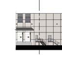


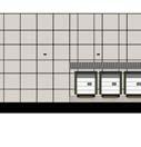
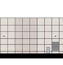

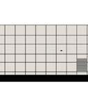

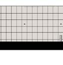
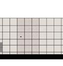
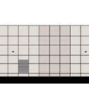
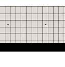


62
63
64
65
66
67 City of Olathe City Planning Division STAFF REPORT Planning Commission Meeting: May 14, 2018 Application: Location: Owner/ Applicant: Architect: Staff Contact: PR : Revised Preliminary Site Development Plan for Dale s Automotive Building Addition S Keeler Street Troy Allenbrand, Dale s Collision Jeff Schroeder, Scharhag Architects Joshua Gentzler, Planning Intern Site Area: 0.99 acres Proposed Use: Industrial (Auto Service) Zoning: M-2 (Industrial District) Plat: Lot 9, Cert of Survey NW ¼ Building Area: 11,760 sq. ft. (total), 6760 sq. ft. addition Plan Olathe Land Use Category Existing Use Current Zoning Site Design Category Building Design Category Site Industrial Area Auto Service M-2 6 F North Industrial Area Industrial/Warehouse M South Industrial Area Industrial/Warehouse M East Mixed Density Neighborhood Storage CP West Industrial Area Industrial/Warehouse M Comments: This application is for a final site development plan for an expansion to an existing auto service business, specifically Dale s Automotive, located at S Keeler Street. The proposal is for a 6,760-square foot addition. This property was built in 1976, and in 1981, with case RZ 1-81, the city rezoned this property to MP-1 to bring the property in line with the comprehensive plan. Later in 1981, the city again rezoned the property, in case RZ 3-81, to M-2.
68 PR Staff Report May 14, 2018 Page 2 2. Zoning Requirements: a. Setbacks The proposed building meets the required building setbacks for M-2 districts. The required setbacks for M-2 zoning is 30 feet for the front yard, 10 feet for both the side and rear yards, and parking is 30 feet from the street right-of-way. The proposed addition maintains the 20 foot set back from the south property line and will sit 39 feet from the north property line and 113 feet from the east property line. b. Building Height The highest point of the building is currently 17 feet which is below the maximum height of 55 feet for the M-2 district. 3. Building/Site Design: Additions to the existing buildings do not have to meet a UDO design category per Section F. The addition will have to be compatible with the existing buildings in terms of materials and color. The proposed plans show an existing 5,000 square foot building with a 6,760 square foot addition.
69 PR Staff Report May 14, 2018 Page 3 The existing building is constructed of brick and metal panels which are the materials shown on the proposed addition. The applicant has included metal paneling on the addition on the west elevation, which is the most visible side of the building. The metal panels match the architectural features of the existing building. The addition will also be located behind a 6 wooden privacy fence and will be located approximately 175 from Keeler Street. Additional landscaping will be added on Keeler Street to screen a portion of the addition. The remaining site already has existing landscaping throughout the property. 4. Streets/Access: The site has one access drive onto Keeler Street. There are not proposed changes to the location of the drives with this application. 5. Fire Department Comments The Fire Department has comments concerning access to the building which will be addressed during the building permit review process. 6. Staff Recommendation: Staff recommends approval of PR with the following stipulations: a. A final development plan shall be submitted and approved prior to obtaining building permits. b. All above ground electrical and/or telephone cabinets shall be placed within the interior side or rear building setback yards. However, such utility cabinets may be permitted within front or corner side yards adjacent to street right-of-way if cabinets are screened with landscape materials.
70 oo S B re n tw d S t S Mahaffie St S Keeler St PR W 153 Rd Ter W Rd C t W 153Rd Pl Ä? Á? Ä? Á? $ "! o I 500 Feet $ "! DALE'S AUTOMOTIVE BUILDING ADDITION User: jaredmd Date: 05/08/2018 PR ( e & %
71
72
73
74 scharhag DALE'S AUTO BODY N FIELD VERIFY ALL DIMENSIONS PRIOR TO ANY CONSTRUCTION


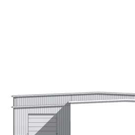

75 scharhag DALE'S AUTO BODY
76 City of Olathe City Planning Division STAFF REPORT Planning Commission Meeting: May 14, 2018 Application: Location: Owner: Applicant: Engineer: Staff Contact: RZ : Rezoning from C-2 and M-1 district to PD (Planned District), 50.9± acres, and preliminary development plan for Olathe Gateway II Southwest corner of 119 th Street and Renner Boulevard Mark Siffin, Maegrace, LLC John Petersen, Polsinelli Brad Sonner, Olsson Associates Sean Pendley, Senior Planner 1. Comments: The proposed rezoning for a mixed-use development was originally scheduled for the April 9, 2018 Planning Commission meeting and the application was continued to the May 14 agenda. The applicant has been working with staff to address comments for the preliminary development plans and there have been additional changes required and the traffic study needed to be revised. Revised plans and studies were submitted to the City for review, however these reviews and future updates are not yet completed, therefore a continuance is necessary. The applicant is requesting a continuance to the June 11, 2018 meeting. However, staff needs to complete the review of the revised information to determine the recommended date for public hearing. To avoid additional continuation requests, staff is recommending that the application be continued to future Planning Commission date in lieu of a specified date. Applicants are permitted one continuance per the Unified Development Ordinance (UDO) and any additional continuances are at the discretion of the Planning Commission. This is the second request for a continuance of this application and the applicant will be in attendance at the meeting to make the request and answer any questions. The Applicant will also mail updated notice letters to the surrounding property owners and post new signs with the new public hearing date per UDO requirements once the new meeting date has been set.
77 RZ May 14, 2018 Page 2 2. Staff Recommendation: Staff recommends continuing the rezoning (RZ ) to a future Planning Commission meeting date to allow both staff and the applicant sufficient time to complete this review prior to the public hearing. While the application may indeed end up being ready for the June 11, 2018 meeting agenda, Staff cannot guarantee or confirm that at this time and recommends a non-specified date in order to limit the amount of continuation meetings and notices that would be sent to property owners so as to avoid any miscommunication or misunderstanding of the process for the public.
78 City of Olathe City Planning Division STAFF REPORT Planning Commission Meeting: May 14, 2018 Application: Location: Engineer: Staff Contact: VAC Vacation of existing waterline easement for Santa Rosa Shopping Center In the vicinity of W. 120 th Place and S. Strang Line Road Judd Claussen, Phelps Engineering Dan Fernandez, Planner II Comments: The Applicant is requesting a continuance to a future Planning Commission meeting. The applicant requested extra time for revisions to an associated preliminary site development plan and wanted to keep all associated applications on one agenda. Applications are permitted one continuance per the Unified Development Ordinance (UDO) and any additional continuances are at the discretion of the Planning Commission. This is the first continuance request for this application. The applicant will send notification to surrounding property owners as required by the UDO. The Applicant is available to answer any questions of the Planning Commission. Staff Recommendation: Staff recommends continuing this application to a future Planning Commission meeting.
79 STAFF REPORT Planning Commission Meeting: May 14, 2018 City of Olathe City Planning Division Application: Location: Owner: Applicant: Staff Contact: SU : Renewal of a special use permit for trailer sales and storage (Smitty s Lawn and Garden Equipment) 2300 N. Rogers Road David and Christin Wood, Magic Wood, Inc. David Wood, Magic Wood, Inc. Dan Fernandez, Planner II Site Area: 1.82± acres Proposed Use: Trailer Sales Land Use Zoning Comprehensive Plan Designation Site Trailer Sales C-3 Regional Commercial Center North Trucking Center C-3 Regional Commercial Center East Trucking Center C-3 Regional Commercial Center South Auto Repair/Manufacturing CP-3/MP-2 Regional Commercial Center West I-35 ROW N/A N/A 1. Comments: This is a request for a renewal of a special use permit to allow trailer sales for Smitty s Lawn & Garden on 1.84± acres. The subject property is located at 2300 North Rogers Road. The first special use permit for trailer sales (SU ) was approved by the Commission on June 23, The permit was renewed (SU ) in August With the 2013 renewal, the City Council removed two stipulations from the 2008 permit that prohibited the display of the trailers in the landscape islands and grassy areas. The applicant was permitted to display the trailers on the grassy areas inside the fencing and not along the grassy area along Rogers Road. The applicant has owned Smitty s Lawn and Garden since 2001 and has occupied the current site since The business sells items such as lawn mowers, landscaping equipment and other lawn and garden items. The business also has a repair shop within

80 SU (Staff Report) May 14, 2018 Page 2 the building. In 2008, the applicant added trailer sales to his business and obtained a special use permit to store and display the trailers in the parking area. The site has existing landscaping that is in good condition and must be maintained on an on-going basis. View of property looking east from Rogers Road 2. Parking/Access Drive: The use requires 1 space per 1,000 square feet of indoor sales area and 1 space per 4,500 sq. ft. of outdoor sales area for the trailer sales and 1 space per 500 sq. ft for the repair shop. The building has a 6,500 square foot showroom, a 5,750 square foot repair shop and approximately 9,000 sq. ft of outdoor sales area. Based on these numbers, the business requires 22 parking spaces. The site plan shows 34 parking spaces. The site does have room to stripe additional parking spaces. A stipulation was added stating that any future parking must be striped. Upon inspecting the site, staff noticed potholes where the access drive meets Rogers Road. The applicant was notified that a stipulation would be added requiring that the potholes be filled and patched prior to the City Council meeting on June 5. However, the applicant has notified staff and sent pictures showing that the potholes have been filled. Therefore, the stipulation has been removed. 3. Neighborhood Meeting/Public Notice: A neighborhood meeting was not required as there is no residential zoning within 500 feet of the subject site and there is no additional development proposed with this renewal. The applicant notified all property owners within 200 feet of the subject site by certified mail, return receipt and posted a sign per UDO requirements. Staff did not receive any correspondence for or against the proposal.
81 SU (Staff Report) May 14, 2018 Page 3 4. Time Limit: The applicant is requesting a 5-year time limit for the renewal request and staff is supportive of this time limit. The expiration date for the special use permit is June 5, Staff Recommendation: a. Staff recommends approval of SU , for the following reasons: (1) The proposal conforms to the Goals, Objectives and Policies of the Comprehensive Plan. (2) The proposal complies with the Unified Development Ordinance (UDO) criteria for considering special use permit requests. b. Staff recommends approval of SU subject to the following stipulations: (1) The Special Use Permit is valid for a period of five (5) years following Governing Body approval, with an expiration date of June 5, (2) Trailers shall not be stored or displayed in drive aisles. (3) Parking spaces shall be maintained in the areas designated on the special use permit plans. If additional parking is needed, the applicant shall provide striped parking spaces to meet current UDO requirements.
82 s S Ro g er s Rd Stra n Ro ge r T gl in Rd 4 11 er d W h T er SU W 116Th St S Str N R ang Line Rd og e rs il Dr a nt a S Fe a Tr Rd $ "! Ä? Á? Ä? s Rd Á? S Bl 500 Feet k ac Bo 250 o I S 0 $ "! 4 Ro g er $ "! b Rd SMITTY'S LAWN AND GARDEN EQUIPMENT User: jaredmd Date: 05/08/2018 SU $ "! ( e & %
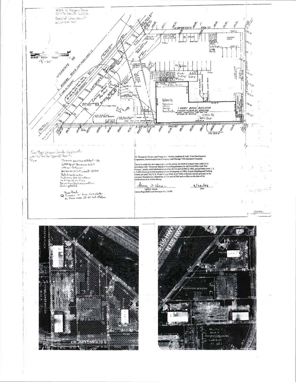
83
84
85 City of Olathe City Planning Division STAFF REPORT Planning Commission Meeting: May 14, 2018 Application: Location: Owner/Applicant: Staff Contact: SU Request for a renewal of a Special Use Permit to allow sales of new and used motorcycles in the C-3 district, specifically located at S. Rogers Road S. Rogers Road Gary Dick; Letko Cycle Services Zachary Moore, Planner II Comments: This application requires a continuance to a future Planning Commission hearing date because the required Public Notice letters were not mailed by the required UDO deadline by the applicant. The request for a continuance to a future Planning Commission date rather than a date certain in June is because the applicant will be out of town the entire month of June and prefers to attend the meetings himself, since he has been involved in the permitting process and is most knowledgeable about the business and its operations. The existing Special Use Permit for Letko Cycles had an initial expiration date of July 2, However, the applicant has requested a time extension of 6 months, which is allowed by the Unified Development Ordinance (UDO) once per application, subject to approval by the Planning Official. This extension request has been approved, and therefore, the new expiration date for the Special Use Permit is January 2, This extension will allow the applicant ample time to complete the planning review process for his renewal request. Applications are permitted one continuance per the UDO and any additional continuances are at the discretion of the Planning Commission. This is the first continuance request for this application. The Public Notice letters to be sent to the surrounding property owners and new public notice signs with the updated meeting date will be placed on-site. Staff Recommendation: Staff recommends continuing this application to a future Planning Commission meeting.
86 STAFF REPORT Planning Commission Meeting: May 14, 2018 City of Olathe City Planning Division Application: RZ : Rezoning from R-3 to C-3 District Location: Owner: Applicant: Engineer/Architect: Staff Contact: 435 S. Parker Street Sueko and Hulet Silvernale, Sam s Tastee Treat Margie Stark, Reece Nichols Premier Chad Porter, Payne & Brockway Dan Fernandez, Planner II Site Area: 0.35 ± acres Proposed Use: Commercial Current Zoning: R-3 Proposed Zoning: C-3 Building Area: N/A Plat: Rolling Ridge Lot F Plan Olathe Land Use Category Existing Use Current Zoning Site Design Category Building Design Category Site North Neighborhood Commercial Center Neighborhood Commercial Center Vacant R-3 4 D Apartment Complex R South Neighborhood Commercial Center Single-family Homes R East Neighborhood Commercial Center Commercial C West Neighborhood Commercial Center Apartment Complex R-3 - -

87 RZ (Staff Report) May 14, 2018 Page 2 1. Comments: The applicant is requesting a rezoning from R-3 Residential Low-Density Multi-family district to C-3 Regional Center district at 435 S. Parker Street. The site is located directly west of the Sam s Tastee Treat property and is currently vacant. The reason for the rezoning is that the property owners would like to combine both lots and have the property under one zoning district for a future sale. The current owners have no plans for any development on the property but have submitted a preliminary plan showing that a parking area could fit on the site. A separate parking lot permit or preliminary site development plan will be required for future development at the subject property. 2. History: The subject site was rezoned to R-3 in June 1970 and was part of the Rolling Ridge Apartments plat, which was recorded in There has not been any development on the property since it was platted. Also, the property is not part of any required open space requirement for the existing apartments. The building for Sam s Tastee Treat is located on property zoned C-3 which was rezoned to this district in June The structure was constructed in The current owners run the restaurant and bought both properties when they took over the business and state that they did not know of the different zoning classifications at the time of the sale. 3. Existing Conditions/Site Photos: The site is currently vacant and has not had any development since the rezoning to residential in 1970.
. No one attended the meeting.")
88 RZ (Staff Report) May 14, 2018 Page 3 View of R-3 zoned property looking east (Sam s Tastee Treat in back of photo) View of existing Sam s Tastee Treat from Parker Street, looking west 4. Public Notice: A neighborhood meeting was held on April 12, 2018 as required by the Unified Development Ordinance (UDO). No one attended the meeting. The applicant also mailed the required public notification letters to surrounding properties within 200 feet and posted signs on the subject property per UDO requirements. Staff has not received any correspondence for or against the proposed rezoning. 5. Zoning Requirements: a. Building Height The maximum building height for C-2 districts is 2 stories or 35 feet with Site Design 4 and Building Design C standards. However, no buildings are proposed with this rezoning. If a structure is proposed for this area, this would be considered a major change and a revised preliminary site development plan would be required to be reviewed by the Planning Commission and neighbors notified of the change. b. Setbacks The minimum building setbacks for this district are 15 feet for the front yard and 7 ½ feet for the side and year yards. However, any development would have to meet the minimum landscape buffer requirement with is 20 feet (Type 3 Landscape Buffer per Section of the UDO).
89 RZ (Staff Report) May 14, 2018 Page 4 6. Development Requirements: a. Access/Streets The site has one access drive onto Parker Street and has a shared access easement with the property to the north that provides additional access to the site. There are no proposed changes to the access drives or access easements with this rezoning. b. Parking There are currently 16 parking spaces on the Sam s Tastee Treat property, which meets the UDO parking requirement. The ordinance requires 1 parking space for every 3 seats for restaurants. Sam s Tastee Treat has 16 seats. There are no plans to change the parking lot with this rezoning. c. Landscaping Any future development on the site would need to meet current UDO requirements for landscaping. There is greenspace along Parker Street; however, staff is not requiring the current owners to plant shrubs in this area due to the construction along Parker Street, which will not be completed until next year. Any improvements to the site will be addressed with a future tenant or redevelopment. 7. Site Design Standards: Any future development would be required to meet the Composite Site Design Category 3 standards. This covers design elements such as open space, parking pod sizes, pedestrian connections and stormwater drainage features. 8. Building Design Standards: Any proposed buildings on this property would be subject to Building Design Category C (UDO ) which includes design requirements such as horizontal and vertical articulation, focal point elements, pedestrian interest and minimum percentages of Category 1 materials and glass. 9. Future Parking Area Although the applicants have no development plans for the subject site, they have submitted a rough plan showing that a parking area could be located on the lot proposed for rezoning. The plan shows a Type 3 landscape buffer, which is required between commercial and residential districts. The Type 3 buffer is 20 feet wide and includes a variety of deciduous, ornamental and evergreen trees, shrubs and a 6-foot tall fence for screening. Any future development that is not a parking lot would require a revised preliminary development plan that would be reviewed by the Planning Commission and require renotification of neighboring property owners per UDO requirements. A parking lot requires a parking lot permit, which would also require a landscape plan.
90 RZ (Staff Report) May 14, 2018 Page Comprehensive Plan Analysis The future land use plan for the Comprehensive Plan identifies the subject area as Neighborhood Commercial Center, which supports commercial uses. The following are criteria for considering rezoning applications as listed in Unified Development Ordinance (UDO) Section G. The conformance of the proposed use to the Comprehensive Plan and other adopted planning policies. Policy LUCC 1.1: Consistency with the Comprehensive Plan: Land use proposals should be consistent with the vision of the Comprehensive Plan, as well as applicable local ordinances and resolutions. The future land use designation for the subject property is Neighborhood Commercial Center, which promotes commercial uses. Any development on the property shall comply with UDO design requirements. B. The character of the neighborhood including but not limited to: land use, zoning, density (residential), architectural style, building materials, height, structural mass, siting, open space and floor-to-area ratio (commercial and industrial). The surrounding area consists of a commercial development, apartments and singlefamily homes. The proposed commercial rezoning is compatible with adjacent commercial development and the size and design of the proposed parking area would meet UDO requirements. C. The zoning and uses of nearby properties, and the extent to which the proposed use would be in harmony with such zoning and uses. The surrounding properties are zoned commercial and residential. The rezoning is appropriate for this site since it is located adjacent to an existing commercial development. D. The suitability of the property for the uses to which it has been restricted under the applicable zoning district regulations. The property is currently zoned R-3 and could be developed with medium-density multi-family buildings. The proposed rezoning to C-3 district allows a variety of commercial uses. As the subject site is adjacent to a commercial use, C-3 zoning would be appropriate for this site. E. The length of time the property has been vacant as zoned. The subject property is currently vacant and has never had any development since the original rezoning to residential in F. The extent to which approval of the application would detrimentally affect nearby properties.
91 RZ (Staff Report) May 14, 2018 Page 6 The proposed rezoning should have no detrimental effect on surrounding properties, as there are existing adjacent commercial properties. G. The extent to which the proposed use would adversely affect the capacity or safety of that portion of the road network influenced by the use, or present parking problems in the vicinity of the property. The rezoning would not adversely affect the capacity or safety of the surrounding road network. There is existing access to Parker Street and access easement to the north. H. The extent to which the proposed use would create air pollution, water pollution, noise pollution or other environmental harm. Staff is not aware of any potential for unlawful levels of air, water or noise pollution with the proposed development. I. The economic impact of the proposed use on the community. The combining of the lots and the rezoning to the commercial district would allow the sale of the property to proceed and continue to be used as a commercial business. J. The gain, if any, to the public health, safety and welfare due to the denial of the application as compared to the hardship imposed upon the landowner, if any, as a result of denial of the application. The proposed rezoning to C-3 does not pose a threat to the public health, safety and welfare. 11. Staff Recommendation: A. Staff recommends approval of RZ for the following reasons: (1) The proposed development complies with the policies and goals of the Comprehensive Plan for Land Use (Principle LUCC 1.1). (2) The requested rezoning to C-3 district meets the Unified Development Ordinance (UDO) criteria for considering zoning applications. B. Staff recommends approval of RZ with the following stipulations to be included in the ordinance. (1) A parking lot permit shall be submitted and approved prior to construction. A landscape plan and photometric plan, if applicable, shall be included and meet all requirements of the UDO. (2) A preliminary site development plan and final site development plan shall be approved prior to any new building on the subject property.
92 Elm Ter W 4 W Wabash St RZ Feet S PARKER ST S PARKER ST W Wabash St?Ä?Á?Á!"`$ S Edgemere Dr Io?Ä!"`$ %&e( User: jaredmd Date: 05/08/2018 SAM'S TASTEE TREAT RZ
93
94
95 STAFF REPORT Planning Commission Meeting: May 14, 2018 City of Olathe City Planning Division Application: RZ : Rezoning from County RN-1 to City R-1 District for S. Nelson Road Location: Owner/Applicant: Staff Contact: S. Nelson Road Diana and Jeffrey Francis Zachary Moore, Planner II Site Area: 2.7± acres Proposed Use: Single-Family Residential Lots: 1 Plat: Timberline Acres Current Zoning: CTY RN-1 Proposed Zoning: City R-1 Plan Olathe Land Use Category Existing Use Current Zoning Site Design Category Building Design Category Site Conventional Neighborhood Single Family CTY RN-1 N/A N/A North Primary Greenway Vacant CTY RN South Conventional Neighborhood Single Family CTY RN East Conventional Neighborhood Single Family CTY RN-1/R- 1/RP West Conventional Neighborhood/Primary Greenway Single Family CTY RN-1/R Proposal: The applicant is requesting a rezoning from CTY RN-1 (County Residential Neighborhood One District) to City R-1 (Single-Family) residential district for S. Nelson Road. The subject property is located along the west side of S. Nelson Road, approximately 1,000 feet south of its intersection with Northgate Street/W. 119 th Street. The property still retains a County zoning designation and must be rezoned to a City zoning district prior to the

96 RZ May 14, 2018 Page 2 issuance of building permits. The property is located within the Timberlane Acres Plat, which was platted in The property is improved with a single-family home, which records show was constructed in The Unified Development Ordinance (UDO) requires that properties located within the City have a City zoning designation prior to the issuance of building permits. This rezoning to the R-1 district will expedite the process of making renovations or additions to the home in the future, should the current or future property owners wish to do so. 2. History: The subject property has maintained its CTY RN-1 zoning since it was annexed into the City in There are no plans for additional subdivision, or development plan of any type of non-residential use that would increase the intensity or density of the uses on the property. 3. Existing Conditions/ Site Photos: The site is currently developed with a single family home and a garage. The lot is densely wooded and there is a stream corridor that runs along the western side of the property. Site view looking southwest from S. Nelson Road
97 RZ May 14, 2018 Page 3 4. Neighborhood Meeting/Public Notice: No Neighborhood Meeting was required for this application due to no new development occurring on the subject property. The applicant mailed the required public notification letters to surrounding properties within 200 feet and posted signs on the subject property per Unified Development Ordinance (UDO) requirements. 5. Zoning Requirements: a. Building Height The maximum building height for residential buildings in R-1 districts are 2 ½ stories or 35 feet. The existing home complies with UDO requirements for building height. b. Setbacks The proposed development meets the required building setbacks for residential buildings in R-1 districts. Setbacks for the proposed development are as follows: Front Yards 30 feet, Side Yards 7 feet, and Rear Yards 25 feet. Any potential future renovations or additions to the existing home shall comply with UDO requirements. 6. Comprehensive Plan Analysis: The future land use map of the Comprehensive Plan identifies the subject property as Conventional Neighborhood. The proposed R-1 zoning and single-family residential development is appropriate for this area. The following are criteria for considering rezoning applications as listed in Unified Development Ordinance (UDO) Section G. The applicant has also provided responses for these items in the project narrative. A. The conformance of the proposed use to the Comprehensive Plan and other adopted planning policies. The property falls within the current Plan Olathe designation for Conventional Neighborhood. The entire property is currently zoned CTY RN-1 (County Residential Neighborhood 1), and is proposed to be rezoned to City R-1 (Single-Family Residential District). Conventional Neighborhoods are intended to be distributed throughout Olathe neighborhoods to provide local access to goods and services, reduce the need for length drives, and promote walkability. The proposed church complies with other goals and principles of the Comprehensive Plan. Principle LUCC-6: Discourage Sprawl. Discourage leap-frog or sprawling land use patterns by encouraging growth in serviceable areas. Promote the infill of vacant parcels and reinvestment in buildable areas. Principle HN-1: Maintain Character. Maintain the character and identity of existing residential neighborhoods.
98 RZ May 14, 2018 Page 4 B. The character of the neighborhood including but not limited to: land use, zoning, density (residential), architectural style, building materials, height, structural mass, siting, open space and floor-to-area ratio (commercial and industrial). The surrounding properties consist of single-family developments and undeveloped residential properties. Surrounding properties are developed with single-family homes and a church. C. The zoning and uses of nearby properties, and the extent to which the proposed use would be in harmony with such zoning and uses. The zoning of surrounding properties includes R-1, RP-1, and CTY RN-1 districts. The proposed R-1 zoning and existing single-family residential development is compatible with surrounding development. D. The suitability of the property for the uses to which it has been restricted under the applicable zoning district regulations. The current zoning of County RN-1 would not allow for building permits to be obtained. The property has maintained a County zoning designation since its annexation in To obtain a building permit would require the property to be rezoned to a City zoning designation, since it is now within City limits. The existing use of a single family home on this property is the most suitable use for the property. The general pattern of development in this region of the City is singlefamily residential development. The Comprehensive Plan s Future Land Use Map has also designated the subject property and surrounding properties as Conventional Neighborhood, of which, single-family residential development is most compatible. E. The length of time the property has been vacant as zoned. The subject property has been improved with a single-family residence, which was constructed in F. The extent to which approval of the application would detrimentally affect nearby properties. The approval of this application should not affect any nearby properties, as the site is presently developed with an existing single family home. G. The extent to which the proposed use would adversely affect the capacity or safety of that portion of the road network influenced by the use, or present parking problems in the vicinity of the property. This application will not increase the number of trips on the road network in the vicinity of the property as the use is not increasing in density or intensity. There is adequate parking provided for the existing single family home on the subject property.
99 RZ May 14, 2018 Page 5 H. The extent to which the proposed use would create air pollution, water pollution, noise pollution or other environmental harm. The existing structure will not create any air pollution, water pollution, noise pollution, or other environmental harm other than what would be standard for a single family home. I. The economic impact of the proposed use on the community. The single family home is existing; therefore, the economic impact on the community will be unaltered. However, should this application be approved, the ability to obtain permits for any potential renovations or expansions in the future would be more streamlined. J. The gain, if any, to the public health, safety and welfare due to the denial of the application as compared to the hardship imposed upon the landowner, if any, as a result of denial of the application. The proposed rezoning to R-1 does not pose a threat to the public health, safety and welfare. There have been no proposals for residential lot subdivision or commercial uses on this site. Denial of this application could be considered a hardship to the property owner. 7. Staff Recommendation: A. Staff recommends approval of RZ for the following reasons: (1) The proposed development complies with the policies and goals of the Comprehensive Plan for Land Use and Housing (Principle LUCC-6 and HN-1). (2) The requested rezoning to R-1 district meets the Unified Development Ordinance (UDO) criteria for considering zoning applications. B. Staff recommends approval of RZ as presented.

100 NH Mill Creek Streamway te r un Dr rth ga te St N Sunset St E 121S t St S Tim be rlan eb S Nelson Rd Oxford Missionary Baptist Church E Ter 1St 2 1 lv 21St Pl E1 E Oakview St No RZ Ä? Á? Ä? d Á? NK rs 500 Feet W 122Nd St t $ "! HOME ADDITION User: jaredmd Date: 05/08/2018 o I le 250 ee 0 4 $ "! RZ ( e & %
101
102
103 STAFF REPORT Planning Commission Meeting: May 14, 2018 City of Olathe City Planning Division Application: RZ : Rezoning from AG to R-1 District and preliminary plat for Village Cooperative of Olathe North Location: Owner: West of W. 131 st Street and north of W. 133 rd Street Janice C. Claerhout, Trustee; Paul Schlagel Revocable Trust Applicants: Engineer: Staff Contact: Shane Wright & Andrew Schaefer; Real Estate Equities Development Jeff Skidmore, P.E.; Schlagel & Associates Zachary Moore, Planner II Site Area: 4.24± acres Proposed Use: Single-Family Residential Lots: 10 Plat: Unplatted Density: 2.36 units per acre Proposed Zoning: R-1 Current Zoning: AG Plan Olathe Land Use Category Existing Use Current Zoning Site Design Category Building Design Category Site Mixed Density Residential Neighborhood Vacant AG (Proposed R-1) N/A N/A North Secondary Greenway Vacant AG - - South Mixed Density Residential Neighborhood Vacant AG (Proposed R-4) - - East Conventional Neighborhood Single Family (Regency Place) R West Secondary Greenway Vacant AG - -
 to R-1 (Single-Family) residential district and a related preliminary plat for Village Cooperative of Olathe North.")
104 RZ May 14, 2018 Page 2 1. Proposal: The applicant is requesting a rezoning from AG (Agricultural) to R-1 (Single-Family) residential district and a related preliminary plat for Village Cooperative of Olathe North. The subject property is located west of the terminus of the existing W. 131 st Street and north of W. 133 rd Street. The proposed rezoning to R-1 is required to allow single-family homes on the subject property. The estimated home values for the new single-family homes is estimated to be in the range of $300,000s to $400,000s. The proposed development consists of a single-family home subdivision with 10 lots and 4 common tracts. 2. History: The subject property has been zoned AG since The property has never been developed, and no previous development plans or plats have been submitted for the subject property. 3. Existing Conditions/ Site Photos: The site is currently vacant and has been since There is an existing tree line, which will have a 15-foot Tree Preservation Easement (TP/E) dedicated with the final plat, along the eastern property line, abutting both the existing single-family residential neighborhood and the Regency Place Elementary School property. Site View looking west from W. 131 st Street
105 RZ May 14, 2018 Page 3 4. Neighborhood Meeting/Public Notice: The applicant held a neighborhood meeting on April 17, 2018 (see attached minutes). Three (3) citizens attended the meeting. Main topics of discussion were notification, road network, declarations, area of the floodplain, other zonings that could be considered, road improvements, timing of development, the existing tree line along the eastern side of the subject property, and components of the adjacent multi-family residential rezoning application (RZ ). A copy of the meeting minutes is provided in this packet. The applicant mailed the required public notification letters to surrounding properties within 200 feet and posted signs on the subject property per Unified Development Ordinance (UDO) requirements. 5. Zoning Requirements: a. Lot Dimensions The minimum lot width in the R-1 district is 60 feet, and the minimum lot size is 7,200 square feet. All lots in the proposed development meet or exceed the minimum 60-foot lot width requirement, and the smallest lot in the proposed development is 8,400 square feet. b. Building Height The maximum building height for residential buildings in R-1 districts are 2 ½ stories or 35 feet. c. Setbacks The proposed development meets the required building setbacks for residential buildings in R-1 districts. Setbacks for the proposed development are as follows: Front Yards 30 feet, Side Yards 7 feet, and Rear Yards 25 feet. 6. Pedestrian Access: Tract C contains a proposed pedestrian access from the right-of-way within the subdivision to the secondary greenway and existing trail just west of the subdivision. The preliminary plat shows this as a 4-foot walk. A stipulation has been added that this walk be the minimum required 5 feet. 7. Streets/Right-of-way: All lots within the proposed subdivision will have access from a public street extension from W. 131 st Street. The proposed street extension meets UDO requirements for public right-of-way and cul-de-sac size. 8. Landscaping: The applicant has provided a preliminary landscape plan depicting the location of street trees along W. 131 st Street. Native grasses will be provided in Tracts B and C to aid in stormwater management, and there shall be a 15-foot Tree Preservation Easement along the eastern property line of lots 2, 3, and 4, in order to preserve the existing tree line providing a buffer between the proposed development and Regency Place Elementary School.
106 RZ May 14, 2018 Page 4 9. Comprehensive Plan Analysis: The future land use map of the Comprehensive Plan identifies the subject property as Mixed Density Residential Neighborhood. The proposed R-1 zoning and single-family residential development is appropriate for this area. The following are criteria for considering rezoning applications as listed in Unified Development Ordinance (UDO) Section G. A. The conformance of the proposed use to the Comprehensive Plan and other adopted planning policies. The property falls within the current Plan Olathe designation for Mixed Density Residential Neighborhood. The entire property is currently zoned AG (Agricultural) and is proposed to be rezoned to R-1 (Single-Family Residential). Mixed Density Residential Neighborhoods feature a carefully integrated mixture of housing of various styles, sizes, and densities generally located within a five to ten-minute walk of neighborhood-scale commercial civic, or open space uses. The proposed single-family home subdivision complies with other goals and principles of the Comprehensive Plan. Principle LUCC-6: Discourage Sprawl. Discourage leap-frog or sprawling land use patterns by encouraging growth in serviceable areas. Promote the infill of vacant parcels and reinvestment in buildable areas. Principle HN-1: Maintain Character. Maintain the character and identity of existing residential neighborhoods. B. The character of the neighborhood including but not limited to: land use, zoning, density (residential), architectural style, building materials, height, structural mass, siting, open space and floor-to-area ratio (commercial and industrial). The surrounding properties consist of single-family developments, multi-family developments, an elementary school, and some commercial uses. Surrounding properties are developed with single-family homes, at a similar density to what is being proposed. Staff finds the proposal to be compatible with the character of the existing neighborhood. C. The zoning and uses of nearby properties, and the extent to which the proposed use would be in harmony with such zoning and uses. The zoning of surrounding properties includes R-1 districts mostly, with some AG, BP, RP-4, and R-4 properties in the vicinity as well. The proposed R-1 zoning and singlefamily residential development is compatible with surrounding development. D. The suitability of the property for the uses to which it has been restricted under the applicable zoning district regulations. The current zoning of AG would allow for limited uses to be allowed by right. One single family home could be built on 40 acres with the current AG zoning, due to the AG district s minimum lot size of 40 acres. Development of one single-family home on the subject property, compliant with the AG zoning district regulations, would not be
107 RZ May 14, 2018 Page 5 compatible with the pattern of existing development that has occurred in this area, nor would it be consistent with the Comprehensive Plan s future land use map designation of Mixed Density Residential Neighborhood. The proposed development is compatible with the pattern of existing development that has occurred in the area, and is generally consistent with the Comprehensive Plan s future land use map designation of Mixed Density Residential Neighborhood. E. The length of time the property has been vacant as zoned. The subject property has been zoned AG (Agricultural) since 1970, when the zoning map was established, and the property has remained vacant, with no development plans or plats proposed since that time. F. The extent to which approval of the application would detrimentally affect nearby properties. The proposed development of a single-family residential development should have no detrimental effect on surrounding properties. G. The extent to which the proposed use would adversely affect the capacity or safety of that portion of the road network influenced by the use, or present parking problems in the vicinity of the property. The addition of the trips generated by the proposed 10-unit single family residential development should not adversely affect capacity or safety of the applicable road network. H. The extent to which the proposed use would create air pollution, water pollution, noise pollution or other environmental harm. The proposed development includes three tracts to be used for stormwater management, two of which will provide native grasses and one dry-bottom detention area. The proposed development will comply with the requirements of Title 17 of the Olathe Municipal Code. I. The economic impact of the proposed use on the community. Construction of the proposed development will create jobs for citizens in the region. Additionally, property taxes will be generated for each home that is built. J. The gain, if any, to the public health, safety and welfare due to the denial of the application as compared to the hardship imposed upon the landowner, if any, as a result of denial of the application. The proposed rezoning to R-1 does not pose a threat to the public health, safety and welfare. There have been no proposals for residential or commercial uses on this site. Denial of this application could be considered a hardship to the property owner.
108 RZ May 14, 2018 Page Staff Recommendation: A. Staff recommends approval of RZ for the following reasons: 1. The proposed development complies with the policies and goals of the Comprehensive Plan for Land Use and Housing (Principle LUCC-6 and HN-1). 2. The requested rezoning to R-1 district meets the Unified Development Ordinance (UDO) criteria for considering zoning applications. B. Staff recommends approval of RZ , with the following stipulations to be included in the ordinance: (1) A final plat shall be approved and recorded prior to development. (2) The proposed trail connection in tract C shall be installed by the developer with the public improvements for 131 st Street. The trail connection shall have a minimum width of five (5) feet per UDO, Section (3) The final plat shall include a note for the pedestrian walkway in tract C to be maintained by the HOA.
109 t 9 12 h l W 130Th P SH aga n 0Th Ter W 13 W1 31 S t St 500 Feet S Greenwood St 250 W 133Rd St VILLAGE COOPERATIVE OF OLATHE, AG TO R-1 User: jaredmd Date: 05/08/2018 RZ t 4 Nd St ns ga Ha W 132 t S Regency Place Elementary Ter tc lle Ha St 13 1 S W RZ Te r T Eastbrooke Beautiful Savior Lutheran Church C ir W od St nwo ree 2 9 Th W1 Ct SG SH a ns ga W l 12 P W 12 9T h 9 T h St Eastbrooke Greenway Ä? Á? Ä? Á? $ "! o I $ "! California Trail Middle ( e & %
110 S01 57'49"E ' E. LINE SW. 1/4,SEC ' 10' U/E 46' 1.84% (EX.) 1.84% PROPOSED PROPOSED STORM SEWER STORM SEWER SAN x SAN x SAN x SAN x SAN x SAN x 120' PROPOSED WATER LINE 4.5% 4.5% PROPOSED STORM SEWER 70' 70' 50.00' 190' W W W W 28.00' 10' PUB/E 10' U/E 131st STREET S01 57'49"E ' 120' 10' PUB/E 30' BLDG. SETBACK 30' BLDG. SETBACK 10' U/E 70' 58' 70' 6.32' 177' PROPOSED WATER LINE PROPOSED WALK 120' 70' 70' 10' PUB/E 10' U/E 94' PLAT BOUNDARY 35.00' 120' 155' DRAWN BY: 27' JTS CHECKED BY: SCH DATE PREPARED: PROJ. NUMBER: REVISION DATE DESCRIPTION CITY PLANNING REVIEW ' VILLAGE COOPERATIVE OF OLATHE NORTH REZONING PLAN/PRELIMINARY PLAT SW 1/4 - SEC. 28, TWP. 13, R. 24 OLATHE, JOHNSON COUNTY, KANSAS SCHLAGEL & ASSOCIATES, P.A. Engineers Planners Surveyors Landscape Architects West 107th Street Lenexa, Kansas (913) Fax: (913) Kansas State Certificates of Authority #E-296 #LA-29 #LS ' 143' 110' POINT OF COMMENCING NE. CORNER, SW. 1/4, SEC FOUND 4"X4" STONE S/E B 7326, 481 EXTG. WALKING TRAIL EX. JCW SAN. MH (33)51 TRAIL EASEMENT B ,,P POINT OF BEGINNING TRACT J N44 56'31"E L= 43.46' R=84.9 4' SAN SAN SAN SAN SAN SAN SAN SAN SAN SAN UNDEVELOPED - FARM / RANCH DF OWNER: SCHLAGEL, PAUL REV TRUST, ETAL Zoning: AG SAN SAN SAN SAN SAN x x x x x SAN x SAN x REGENCY PLACE 3RD PLAT ZONING: R-1 BOOK 94, P 13 TRACT D ' N15 38'08"E 30.00' TRAIL ESMT. R60.00' R71.00' R60.00' SAN SAN SAN STORMWATER MANAGMENT TRACT (NATIVE GRASS AREA) TRACT A R49.00' 60.00' EXISTING 131st STREET S88 02'11"W ' 131st STREET EXTG. 6" WATER PROPOSED WALK EXTG. WALK MAIN S01 57'49"E ' W W x x W W SAN SAN SAN SAN SAN SAN SAN SAN 9 10 REGENCY PLACE FIFTH PLAT ELEMENTARY SCHOOL TRACT "T" W W Zoning: R S88 02'11"W W W 8 6 W W 7 EX SETBACK EX EX ' 50' R/W STREAM CORRIDOR R60.00' R25.00' R71.00' R60.00' 10.00' STREAM CORRIDOR EASEMENT 30.00' TRAIL ESMT. R71.00' R60.00' 60.00' STREAM CORRIDOR SETBACK 10.00' PROPOSED 4' WALK R60.00' R49.00' 60.00' SETBACK 5.00' STREAM CORRIDOR STREAM CORRIDOR EASEMENT STREAM CENTERLINE EXTG. WALKING TRAIL SCALED LIMITS OF ZONE X (FUTURE BASE FLOOD) SCALED LIMITS OF EXTG. WALKING STUDY PER MAPPING TRAIL UNPLATTED 116' 30' BLDG. SETBACK N58 23'10"E 79.73' EXTG. WALKING TRAIL 20' BLDG. SETBACK L=116.46' R=85.00' N20 07'07"W 36.86' STREAM CENTERLINE APPROXIMATE STREAM HIGH WATER MARK STREAM CENTERLINE 15' SAN. ESMT. STREAM CORRIDOR EASEMENT APPROXIMATE STREAM HIGH WATER MARK R=85.00' L=29.77' N78 27'18"E 23.19' R=115.00' L=126.08' 10' U/E ' 23.75' 47.04' 69' 120' 11' 50.20' 5.92' 41.13' 31' ' 42.61' 105' L=233.32' R =265.00' ' 43.80' 42.37' 177' 91.30' 62.15' 6' 85.76' 55.58' 75.33' 70.49' 30.32' 10' PUB/E 10' U/E PLAT BOUNDARY 158' 15' W.L. ESMT. PROPOSED WATER LINE 124' 66.98' N30 19'40"E 30.00' TRAIL ESMT. EXTG. OWNER: OWNER: SCHLAGEL, PAUL EXISTING UNPLATTED PARCEL ELEMENTARY SCHOOL REGENCY PLACE AN x SANx SANx SANx SANx 15' SAN. ESMT PLAT BOUNDARY S87 50'53"W ' WATER LINE TO BE EXTENDED TO 133RD STREET THRU ADJACENT PROPERTY TO THE SOUTH PER APPROVED FUTURE ALIGNMENT WITH DEVELOPMENT AREA TO THE SOUTH REV TRUST, ETAL Zoning: AG PENDING PLAT: VILLAGE COOPERATIVE OF OLATHE - SOUTH PENDING OWNER: REAL ESTATE EQUITY DEVELOPMENT, LLC PENDING ZONING: R-4 EX. JCW SAN. MH (33)50 SITE DATA ACRES GROSS AREA 4.24 PROJECT INTERNAL ROADS 0.75 R/W (131st) OPEN SPACE (4 TRACTS) 0.72 ac 10 RESIDENTIAL LOTS 2.77 ac TOTAL NUMBER OF LOTS 10 LOTS TOTAL NUMBER OF TRACTS 4 TRACTS MIN. LOT SIZE 8,400 s.f. MAX. LOT SIZE 17,068 s.f. AVERAGE LOT SIZE 12,094 s.f. NW1/4 NE1/ TH STREET SW1/4 SE1/4 GREENWOOD EXISTING ZONING: AG (Vacant) PROPOSED ZONING: R-1 (Single Family) SECTION 28-T13-R24 LOCATION MAP SCALE 1" = 2000' BASIS OF BEARINGS: KANSAS STATE PLANE COORDINATE SYSTEM (NAD)1983, KANSAS, NORTH ZONE NOTES: 1. This Property lies within Flood Zone X, defined as areas determined to be outside the 0.2% annual chance floodplain as shown on the Flood Insurance Rate Map 20091C0080G, panel 80 of 161. Prepared by the Federal Emergency Management, revised August 3, TRACTS A, B, C, and D shall be owned and maintained by the H.O.A. and shall be reserved for the stormwater management facilities associated with the proposed development. 3. TRACT C shall also be dedicated as a pedestrian access easement to provide a pedestrian link from the public street right-of-way to the existing walking trail adjacent to the West side of the subdivision. The pedestrian walkway thru Tract C shall be maintained by the City of Olathe. LOT # AREA (SF) LOT # AREA (SF) 12, ROW 32, , TRACT A 6, , TRACT B 11, , TRACT C 3, , TRACT D 9, N 15, , , , ' 80' 10 13, REZONING PLAN & PRELIMINARY PLAT SHEET PP-1 OF BLACKBOB ROAD PFLUMM ROAD 135TH STREET PROPOSED R-1 ZONING DESCRIPTION: A tract of land lying in the Southwest One-Quarter of Section 28, Township 13 South, Range 24 East, in the city of Olathe, Johnson County, Kansas, being more particularly described as follows: Commencing at the Northeast corner of the Southwest One-Quarter of said Section 28; thence South 01 degrees 57 minutes 49 seconds East along the East line of the said Southwest One-Quarter, a distance of feet to the Point of Beginning; thence continuing South 01 degrees 57 minutes 49 seconds East along the East line of the said Southwest One-Quarter, a distance of feet; thence South 87 degrees 50 minutes 53 seconds West a distance of feet; thence North 30 degrees 19 minutes 40 seconds East a distance of feet to a point of curvature; thence Northeasterly, Northerly and Northwesterly on a curve to the left tangent to the previous course, having a radius of feet, a central angle of 50 degrees 26 minutes 47 seconds and an arc length of feet; thence North 20 degrees 07 minutes 07 seconds West a distance of feet to a point of curvature; thence Northeasterly on a curve to the right tangent to the previous course, having a radius of feet, a central angle of 78 degrees 30 minutes 17 seconds and an arc length of feet; thence North 58 degrees 23 minutes 10 seconds East a distance of feet to a point of curvature; thence Northeasterly on a curve to the right tangent to the previous course, having a radius of feet, a central angle of 20 degrees 04 minutes 08 seconds and an arc length of feet; thence North 78 degrees 27 minutes 18 seconds East a distance of feet to a point of curvature; thence Northeasterly on a curve to the left tangent to the previous course, having a radius of feet, a central angle of 62 degrees 45 minutes 51 seconds and an arc length of feet; thence North 15 degrees 38 minutes 08 seconds East a distance of feet to a point of curvature; thence Northeasterly on a curve to the right having an initial tangent bearing of North 15 degrees 38 minutes 49 seconds East, a radius of feet, a central angle of 29 degrees 17 minutes 42 seconds and an arc length of feet; thence North 44 degrees 56 minutes 31 seconds East a distance of feet to the Point of Beginning and containing acres more or less. DEVELOPER/APPLICANT: THE VILLAGE COOPERATIVE OF OLATHE REAL ESTATE EQUITIES DEVELOPMENT, LLC ATTN: SHANE WRIGHT, VICE-PRESIDENT 1400 CORPORATE CENTER CURVE, SUITE 100 EAGAN, MN Phone: (651) swright@reedevelopment.com UNPLATTED
111 S01 57'49"E ' PLAT BOUNDARY E. LINE SW. 1/4,SEC ' 10' U/E 46' (EX.) 1.84% PROPOSED PROPOSED STORM SEWER STORM SEWER SAN x SAN x SAN x SAN x SAN x SAN x 120' ' 70' W W W W 131st STREET 120' 30' BLDG. SETBACK 70' 70' 30' BLDG. SETBACK PROPOSED WALK 120' 70' 70' 70' 120' 155' 27' 156' 143' 110' 190' 5.92' 10' U/E 10' U/E ' 58' ' ' PROPOSED WATER LINE 94' PLAT BOUNDARY DRAWN BY: JTS CHECKED BY: SCH DATE PREPARED: PROJ. NUMBER: REVISION DATE DESCRIPTION CITY PLANNING REVIEW ' VILLAGE COOPERATIVE OF OLATHE NORTH REZONING PLAN/PRELIMINARY PLAT SW 1/4 - SEC. 28, TWP. 13, R. 24 OLATHE, JOHNSON COUNTY, KANSAS SCHLAGEL & ASSOCIATES, P.A. Engineers Planners Surveyors Landscape Architects West 107th Street Lenexa, Kansas (913) Fax: (913) Kansas State Certificates of Authority #E-296 #LA-29 #LS-54 S/E B 7326, 481 TRAIL EASEMENT B ,,P TRACT J REGENCY PLACE 3RD PLAT ZONING: R-1 BOOK 94, P EXISTING 131st STREET W x W x 145 REGENCY PLACE FIFTH PLAT ELEMENTARY SCHOOL TRACT "T" Zoning: R-1 ELEMENTARY SCHOOL REGENCY PLACE S SAN x SAN x SAN x UNPLATTED TRACT D ' TRAIL ESMT. 131st STREET W W BOUNDARY : SQ FT ACRES W 5 W W 6 W W 7 REV TRUST, ETAL Zoning: AG OWNER: SCHLAGEL, PAUL REV TRUST, ETAL UNDEVELOPED - FARM / RANCH DF Zoning: AG SAN SAN x x SAN x W EXTG. OWNER: OWNER: SCHLAGEL, PAUL EXISTING UNPLATTED PARCEL PENDING PLAT: VILLAGE COOPERATIVE OF OLATHE - SOUTH PENDING OWNER: REAL ESTATE EQUITY DEVELOPMENT, LLC PENDING ZONING: R-4 STORMWATER MANAGMENT TRACT (NATIVE GRASS AREA) TRACT A 60.00' SETBACK STREAM CORRIDOR EXTG. WALKING TRAIL 10.00' STREAM CORRIDOR EASEMENT ' TRAIL ESMT ' STREAM CORRIDOR SETBACK 10.00' 8 EXTG. WALK L=43.46' R=84.94' PROPOSED WALK APPROXIMATE STREAM HIGH WATER MARK EXTG. WALKING TRAIL 60.00' SETBACK 5.00' STREAM CORRIDOR STREAM CORRIDOR EASEMENT STREAM CENTERLINE EXTG. WALKING TRAIL EXTG. WALKING TRAIL 30' BLDG. SETBACK 20' BLDG. SETBACK N78 27'18"E 23.19' STREAM CENTERLINE APPROXIMATE STREAM HIGH WATER MARK STREAM CENTERLINE R=85.00' L=29.77' N15 38'08"E ' 116' R=115.00' L=126.08' ' 23.75' 47.04' 50.20' S01 57'49"E ' 30.32' 62.15' 42.61' 43.80' 42.37' 177' 124' PLAT BOUNDARY SCALED LIMITS OF ZONE X (FUTURE BASE FLOOD) SCALED LIMITS OF STUDY PER MAPPING 15' W.L. ESMT. PROPOSED WATER LINE WATER LINE TO BE EXTENDED TO 133RD STREET THRU ADJACENT PROPERTY TO THE SOUTH PER APPROVED FUTURE ALIGNMENT WITH DEVELOPMENT AREA TO THE SOUTH N58 23'10"E 120' 79.73' 11' 69' L=116.46' R=85.00' ' N20 07'07"W 36.86' 15' SAN. 6' ESMT ' 55.58' STREAM CORRIDOR EASEMENT ' 105' L=233.32' R =265.00' 43.85' EX. JCW SAN. MH (33) ' PLAT BOUNDARY 158' 66.98' N30 19'40"E 30.00' TRAIL ESMT. AN x SANx SANx SANx SANx 15' SAN. ESMT S87 50'53"W ' EX. JCW SAN. MH (33)50 EXTG. 6" WATER MAIN PROJECT LOCATION 127TH STREET NW1/4 NE1/ TH STREET SW1/4 SECTION 28-T13-R24 LOCATION MAP SCALE 1" = 2000' BASIS OF BEARINGS: KANSAS STATE PLANE COORDINATE SYSTEM (NAD)1983, KANSAS, NORTH ZONE SHADE TREES QRR 13 EA. Quercus robur x bicolor(aka x warei) 'Long' Regal Prince Oak 2.5" Cal. B&B UXF 3 EA. Ulmus x Frontier Frontier Elm 2.5" Cal. B&B THE VILLAGE COOPERATIVE OF OLATHE N REAL ESTATE EQUITIES DEVELOPMENT, LLC ATTN: SHANE WRIGHT, VICE-PRESIDENT 1400 CORPORATE CENTER CURVE, SUITE 100 EAGAN, MN Phone: (651) ' 80' swright@reedevelopment.com REZONING PLAN & PRELIMINARY PLAT SHEET LP-1 OF BLACKBOB ROAD PFLUMM ROAD GREENWOOD SE1/4 135TH STREET DEVELOPER/APPLICANT: POINT OF COMMENCING NE. CORNER, SW. 1/4, SEC FOUND 4"X4" STONE 10' U/E U/E 10' 10' U/E UNPLATTED
112
113
114 Neighborhood Interact Meeting Summary Neighborhood Interact Meeting Village Cooperative North/Village Cooperative South Rezoning (Case No RZ18-006/RZ18-007) Date/Time: Tuesday, April 17, 2018; 6:00 p.m. Location: - Olathe Community Center, 1205 E. Kansas City, Rd., Olathe, KS Attendees: See attached Log-in Sheet The interact meeting commenced at approximately 6:05 with an introduction from Andrew Schaefer and a short power-point presentation on both re-zoning applications associated with the development. Along with the presentation of the project Mr. Schaefer gave a brief history of REE Development and the cooperative projects that have been and are currently being developed. Due to the minimal number of attendees (3 at the opening of the meeting/4 near the completion), the project was presented with an informal open discussion/question format among the presenters and the attendees. As part of the presentation, the notification process was also clarified to the attendees in regards to the neighborhood meeting notification including all properties within 500 feet of the subject property and it was also clarified that all property owners within 200 feet of the development area would be further notified of the rezoning hearings by a certified mailing notice. The public hearing at the planning commission on May 14, at 7:00 p.m was also re-iterated to the attendees. The following is a brief summary of the open discussions/questions that occurred during the interact meeting. It was asked if the entire Regency Subdivision was notified of the neighborhood meeting. It was clarified that any property owners within 500 feet of the re-zoning development area were notified. It was asked if 131 st Street extension could be extended to Blackbob Street. It was clarified that 131 st Street was not proposed to be extended to Blackbob and would terminate in a cul-de-sac per the proposed preliminary plat. The plan was also clarified to the attendees in terms of the location of the stream and stream corridor, which represents the western boundary of the current re-zoning applications. It was asked when 133 rd Street would be extended Westerly to beyond its current location and to Blackbob. It was clarified that 133 rd Street would be extended Westerly as development occurs to the West. It was also clarified that the next extension of 133 rd would involve a box culvert at the existing creek that runs North/South along the Western boundary of the re-zoning area. It was asked if the single-family phase of the project would be brought into the Regency Subdivision Declarations. It is unknown at this time, but we believe the Regency Subdivision will be approached to see if they would like to have the additional lots brought into their declarations. The
115 proposed lots within the new subdivision are a similar size to what is currently in the Regency Subdivision. It was asked if the multi-family phase would be accessed from 131 st Street and where access to the underground parking would occur. The plan was clarified and shown that access to the multi-family would only occur from 133 rd Street at the South side of the project and the drive location into the underground parking was pointed out on the plan. It was further clarified that there would be no cross-access from the multi-family phase into the proposed single-family phase to the North. It was asked if there were any proposed improvements to Greenwood, at the intersection of 135 th and Greenwood associated with this project. There was concern with added traffic to Greenwood in the morning traffic conditions. It was clarified that there were not any improvements proposed for Greenwood with this re-development. It was also clarified that the multi-family phase was an age-restricted facility and that most of the occupants are retired and typically not contributors to a.m. peak or p.m. peak traffic volumes. It was asked if any of the single family lots were located within the flood plain. It was clarified that an area identified as future base flood plain was identified along the stream corridor, just northwest of the re-zoning area, but none of the single family lots were proposed to be located within the flood plain. It was asked by the eye-brow street configuration was incorporated into the plan of the single-family phase. It was clarified that allowing this circular, intermediate turn-around would minimize the length of travel for fire access between the end of the street and the cul-de-sac and to minimize any length that would require larger fire-access vehicles to backup when accessing the street. It was also commented that trash vehicles currently have to back down 131 st Street due to the fact that there is no turn around area at the existing Western edge of 131s Street. It was asked what other zonings would typically be allowed in the area per the city s current land use plan. It was clarified that single family, multifamily, and villa type units could possibly be allowed, but the property was currently zoned Agriculture and any proposed change in use would require a re-zoning and notification process similar to what we are currently going through. The locations of other Village Cooperative projects were asked. The Lenexa Village Cooperative that has recently been completed and the location of the project that is currently under construction in southern Kansas City, Missouri, in the Verona Hills area was clarified to the attendees.
116 In regards to the ownership of the multi-family units, it was asked if the building was insured by the owners of the property or by the individual property owners within the building. It was clarified that the building was insured by the property owner and individual owners were required to insure their own belongings within each unit. It was asked if the multi-family unit would be fire sprinkled. It was clarified that the building is a fully fire-sprinkled facility. The make-up of the multi-family unit in regards to 1 bedroom and 2 bedroom units as asked. It was clarified that the cooperative is a mix of 1 and 2 bedroom units with some flexibility in some 1 bedroom units and have a den or a 2 nd bedroom, as needed to fit the demand. The timing of both phases was asked. It was clarified that if the re-zoning went thru as currently planned, a best-case scenario would see the multi-family start during the fall/winter of 2018 with an approximate month time frame to construct the project. No set time has been established for the single-family phase but it is not anticipated to start with any new home construction before spring of It was asked what would happen with the tree line along the Eastern boundary of the project. It was clarified that a majority of the tree line and any large, healthy species within the tree line was anticipated to remain. It was also clarified that some clean-up of the hedge row would likely occur with the development in terms of the small undergrowth and scrub that currently exists within the tree line. It was also clarified that a significant landscape buffer is required by the City of Olathe, between the multifamily phase the existing school and is proposed with the multi-family phase It was asked if pets were allowed in the multi-family phase of the project. It was clarified that pets were allowed via a property pet policy. With no additional questions, the attendees were thanked for their interest and participation in this process and the meeting time for the Planning Commission was re-iterated to the attendees. Attendees were also informed that the staff report and agenda would typically be available on-line at the City of Olathe's website ( approximately 3-4 days ahead of the Planning Commission date. The meeting closed as approximately 7:25 p.m. among several additional discussions and clarifications amongst the attendees and representatives of the development team Respectfully submitted Jeffrey T. Skidmore, P.E. Schlagel and Associates
117
118
119
120 STAFF REPORT Planning Commission Meeting: May 14, 2018 City of Olathe City Planning Division Application: RZ : Rezoning from AG to R-4 District and preliminary site development plan for Village Cooperative of Olathe Location: Owner: Northwest corner of W. 133 rd Street and Greenwood Street Janice C. Claerhout, Trustee; Paul Schlagel Revocable Trust Applicants: Engineer: Staff Contact: Shane Wright & Andrew Schaefer; Real Estate Equities Development Jeff Skidmore, P.E.; Schlagel & Associates Zachary Moore, Planner II Site Area: 4.87± acres Proposed Use: Multi-Family Residential Units: 49 Plat: Unplatted Density: units per acre Proposed Zoning: R-4 Current Zoning: AG Plan Olathe Land Use Category Existing Use Current Zoning Site Design Category Building Design Category Site Mixed Density Residential Neighborhood Vacant AG (Proposed R-4) 3 B North Mixed Density Residential Neighborhood Vacant AG (Proposed R-1) - - South Commercial Corridor Vacant R East Conventional Neighborhood Regency Place Elementary School R West Secondary Greenway Vacant AG - -
 to R-4 (Residential Medium- Density Multifamily) district and preliminary site development plan for Village Cooperative of")
121 RZ May 14, 2018 Page 2 1. Proposal: The applicant is requesting a rezoning from AG (Agricultural) to R-4 (Residential Medium- Density Multifamily) district and preliminary site development plan for Village Cooperative of Olathe North. The subject property is located at the northwest corner of the intersection at W. 133 rd Street and Greenwood Street. The preliminary site development plan shows a 3-4 story senior apartment building with 49 units. The building will be approximately 124,400 square feet and will have a footprint of 31,100 square feet. The proposed building will also have a garage on the lower level of the building that will house 55 parking stalls. Rezoning to R-4 is required to allow the development of a multi-family residential building with a height greater than 40 feet. A rezoning to the R-3 district would limit the building to a maximum height of 40 feet. The proposed cooperative housing is a joint ownership and operation of the housing development by those who live in it. The applicant has provided a summary for the proposed development (see attached). 2. History: The subject property has been zoned AG since The property has never been developed, and no previous development plans or plats have been submitted for the subject property. 3. Existing Conditions/ Site Photos: The site is currently vacant and has been since There is an existing tree line, which will have a 15-foot Tree Preservation Easement (TP/E) dedicated with the final plat, along the eastern property line, abutting the Regency Place Elementary School property. Site View looking north from W. 133 rd Street
122 RZ May 14, 2018 Page 3 4. Neighborhood Meeting/Public Notice: The applicant held a neighborhood meeting for this application and the rezoning to R-1 on the adjacent property to the north on April 17, 2018 (see attached minutes). Three (3) citizens attended the meeting. Main topics of discussion were notification, road network, area of the floodplain, location of other Village Cooperative projects, floor plans for the senior apartments, ownership of the senior apartments, other zonings that could be considered, road improvements, timing of development, pet allowances, the existing tree line along the eastern side of the subject property, and components of the adjacent singlefamily residential rezoning application (RZ ). A copy of the meeting minutes is provided in this packet. The applicant mailed the required public notification letters to surrounding properties within 200 feet and posted signs on the subject property per Unified Development Ordinance (UDO) requirements. 5. Zoning/Development Requirements: a. Building Height The maximum building height for residential buildings in R-4 districts are 4 stories or 50 feet. The height of a building with a gabled roof is measured from the average ground level abutting a building or structure to the average height level between eaves and ridge line of a gable roof. The height of the proposed building is approximately 48 ½ feet. b. Setbacks The proposed development meets the required building setbacks for residential buildings in R-4 districts. Setbacks for the proposed development are as follows: Front Yards 20 feet, Side Yards 15 feet (with an increase of 1 foot per 4 feet of building height in excess of 40 feet, and Rear Yards 10 feet. c. Landscaping - The applicant has provided a preliminary landscape plan depicting the location of perimeter landscaping adjacent to the right-of-way for W. 133 rd Street. Type 3 buffers are provided along the northern and eastern property lines to provide an adequate buffer between this multi-family proposal and the proposed single-family development to the north (RZ ) and the existing Regency Place Elementary School to the east. The existing tree line along the eastern property line will be preserved and will be used as part of the applicant s proposed Type 3 buffer to the east, as is allowed by the UDO. Landscaping is provided along the western property line by way of a Type 1 buffer, as is required by the UDO. Parking island landscaping and foundation landscaping also comply with UDO requirements. 6. Site Design Standards: The subject property is located in the future land use designation of Mixed Density Residential Neighborhood according to the Comprehensive Plan and the development is subject to Site Design Category 3 (UDO ). The following is a summary of the composite site requirements. a. Landscaping Adjacent to Sidewalks A 20 foot landscaped area is provided at the sidewalk edge along the southern property boundary. b. Outdoor Amenity Space The applicant is providing two common greens immediately adjacent to the proposed building, one in front of the southeastern façade at the front of the building, and another one to the northwest of the proposed building
123 RZ May 14, 2018 Page 4 at the rear of the building. These common greens will contain a lawn and decorative gardens to be used for resident activities. The proposed total active open space area is 0.43± acres. The minimum required active open space for this proposal is 0.22± per the UDO. c. Parking Pod The maximum parking pod size allowed is 40 parking spaces. The largest parking pod size provided within the proposal is 23 parking spaces. d. Pedestrian Connectivity The proposal contains pedestrian connectivity to adjacent properties to the east, and to a local trail to the west, which connects to the Eastbrooke Park. 7. Streets/Traffic Impact: The proposed development takes access from two points on the existing W. 133 rd Street. There is one existing approach to the subject property, which will be closed prior to issuance of building permit. A traffic impact analysis was not required for this development. 8. Building Design Standards: Building Design Standard Horizontal Articulation Vertical Articulation Ground Floor Pedestrian Interest Entry Element Garage Doors UDO Requirement (Category B) Proposed Design Minimum one horizontal articulation tool must be used a minimum of every 50 feet of linear façade width The primary façades of the proposed structure incorporate several wall offsets and wall projections Minimum one vertical articulation tool must be used a minimum of every 50 feet of linear façade width The proposed building is providing several variations in roof form and variation in height as viewed from the street At least 25% of the ground floor wall area on the primary façade of residential buildings must be covered with a pedestrian interest tool The proposed building incorporates transparent glass and entry elements at the ground floor of the primary façades Must incorporate a front-facing entry element to signal the connection between the sidewalk and the building The applicant is providing a canopy in above the main entry to the building on the primary façade that projects a minimum of 4 feet from the wall and is a minimum 10 feet above the sidewalk below Garage doors must be setback from the primary façade or face the side or rear The door for the garage on the first level of the building has an entrance at the rear of the building
124 RZ May 14, 2018 Page 5 Transparent Glass Minimum 25% transparent glass provided on primary façades The amount of glass provided on the southwestern and southeastern façades ranges from 18% to 23%. A stipulation has been added that on the Final Site Development Plan, these elevations shall meet or exceed the minimum required 25% glass. Proposed Building Materials Primary Facades Category 1 (min. 70%) Category 2 (max. 30%) Southeast Elevation 70% 30% Southwest Elevation 70% 28% Secondary Facades Category 1 (min. 50%) Category 2 (max. 50%) Northwest Elevation 50% 50% Northeast Elevation 53% 47% Category 1 Materials proposed on the building include glass, brick, stone veneer, burnished concrete masonry units. Category 2 Materials proposed on the building include fiber cement panels and lap siding. The building design treatment with dormers and windows on the southeast elevations are recommended by staff to be added to the southwest elevation. 9. Comprehensive Plan Analysis: The future land use map of the Comprehensive Plan identifies the subject property as Mixed Density Residential Neighborhood. The proposed R-4 zoning and multi-family residential development is appropriate for this area. The following are criteria for considering rezoning applications as listed in Unified Development Ordinance (UDO) Section G. A. The conformance of the proposed use to the Comprehensive Plan and other adopted planning policies. The property falls within the current Plan Olathe designation for Mixed Density Residential Neighborhood. The entire property is currently zoned AG (Agricultural) and is proposed to be rezoned to R-4 (Multi Family Medium-Density Residential). Mixed Density Residential Neighborhoods feature a carefully integrated mixture of housing of various styles, sizes, and densities generally located within a five to ten-minute walk of neighborhood-scale commercial civic, or open space uses. The proposed multi-family building complies with other goals and principles of the Comprehensive Plan.
125 RZ May 14, 2018 Page 6 Principle LUCC-6: Discourage Sprawl. Discourage leap-frog or sprawling land use patterns by encouraging growth in serviceable areas. Promote the infill of vacant parcels and reinvestment in buildable areas. Principle HN-1: Maintain Character. Maintain the character and identity of existing residential neighborhoods. B. The character of the neighborhood including but not limited to: land use, zoning, density (residential), architectural style, building materials, height, structural mass, siting, open space and floor-to-area ratio (commercial and industrial). The surrounding properties consist of single-family developments, multi-family developments, an elementary school, and some commercial uses. There is an existing senior housing development across 133 rd Street that varies between 3 and 4 stories in height, which consists of 132 units (approximately 15.2 units per acre). C. The zoning and uses of nearby properties, and the extent to which the proposed use would be in harmony with such zoning and uses. The zoning of surrounding properties includes R-1 districts mostly, with some AG, BP, RP-4, and R-4 properties in the vicinity as well. The proposed R-4 zoning and multifamily residential development is compatible with surrounding development. D. The suitability of the property for the uses to which it has been restricted under the applicable zoning district regulations. The current zoning of AG would allow for limited uses to be allowed by right. One single family home could be built on 40 acres with the current AG zoning, due to the AG district s minimum lot size of 40 acres. Development of one single-family home on the subject property, compliant with the AG zoning district regulations, would not be compatible with the pattern of existing development that has occurred in this area, nor would it be consistent with the Comprehensive Plan s future land use map designation of Mixed Density Residential Neighborhood. E. The length of time the property has been vacant as zoned. The subject property has been zoned AG (Agricultural) since 1970, when the zoning map was established, and the property has remained vacant, with no development plans or plats proposed since that time. F. The extent to which approval of the application would detrimentally affect nearby properties. The proposed development of a multi-family residential development for senior apartments should have no detrimental effect on surrounding properties.
126 RZ May 14, 2018 Page 7 G. The extent to which the proposed use would adversely affect the capacity or safety of that portion of the road network influenced by the use, or present parking problems in the vicinity of the property. The addition of the trips generated by the proposed 49-unit senior apartment building should not adversely affect capacity or safety of the applicable road network. H. The extent to which the proposed use would create air pollution, water pollution, noise pollution or other environmental harm. The proposed development includes a dry detention basin in the northwestern corner of the property, and the proposed development should not create any environmental harm. I. The economic impact of the proposed use on the community. Construction of the proposed development will create jobs for citizens in the region. Additionally, the businesses located in close proximity to the proposed senior apartment development could provide necessary services to the citizens of this development, allowing their tax dollars to remain in the City of Olathe. J. The gain, if any, to the public health, safety and welfare due to the denial of the application as compared to the hardship imposed upon the landowner, if any, as a result of denial of the application. The proposed rezoning to R-4 does not pose a threat to the public health, safety and welfare. There have been no proposals for residential or commercial uses on this site. Denial of this application could be considered a hardship to the property owner. 10. Staff Recommendation: A. Staff recommends approval of RZ for the following reasons: (1) The proposed development complies with the policies and goals of the Comprehensive Plan for Land Use and Housing (Principle LUCC-6 and HN-1). (2) The requested rezoning to R-4 district meets the Unified Development Ordinance (UDO) criteria for considering zoning applications. B. Staff recommends approval of the rezoning to the R-4 district. C. Staff recommends approval of the associated preliminary site development plan for Village Cooperative of Olathe North, subject to the following stipulations. (1) A final plat shall be approved and recorded prior to development. (2) A final site development plan shall be approved prior to issuance of a building permit. (3) The southwestern and southeastern elevations shall meet or exceed the minimum requirement for 25% glass on primary façades.
127 RZ May 14, 2018 Page 8 (4) The existing drive on 133 rd Street shall be removed prior to issuance of building permits. (5) The final plat shall show a tree preservation easement on the eastern property line. (6) A dormer with window(s) shall be added to the southwestern elevation. (7) Any damage to the existing City trail system shall be repaired to City standards. Ramps shall be installed on the trail at all driveways to the development. (8) The 10 Waterline Easement (WL/E) provided shall be increased to a 15 WL/E.
128 ke oo ay br st nw Ea ree G Eastbrooke Beautiful Savior Lutheran Church Regency Place Elementary RZ California Trail Middle Ä? Á? Ä? Á? $ "! o I 500 Feet $ "! VILLAGE COOPERATIVE OF OLATHE, AG TO R-4 User: jaredmd Date: 05/08/2018 RZ ( e & %
129 TRAIL EASEMENT 43' W 40' ROW 55' 45' W ' HATCH, SOLID, LAYER=C-ROAD-PATT-E, ROAD E ENTITY (NOT LAYER) TRANSPARENCY=90 HATCH, SOLID,, LAYER=C-ROAD-PATT, ROAD ENTITY (NOT LAYER) TRANSPARENCY=60 HATCH, AR-CONC, ANNOTATIVE, SCALE=0.05, LAYER=C-ROAD-PATT-E HATCH, SOLID, LAYER=C-ROAD-PATT-E, ROAD E ENTITY (NOT LAYER) TRANSPARENCY=90 HATCH, AR-CONC, ANNOTATIVE, SCALE=0.05, LAYER=C-ROAD-WALK-PATT-E HATCH, AR-CONC, ANNOTATIVE, SCALE=0.05, LAYER=C-ROAD-WALK-PATT LP MH Cleanout Existing Sanitary MH MH EXAI EXCI EXCI EXJB STM EXISTING L, TAL UNPLATTED 33) SAN MH (33)52 TOP EL.= INV. (N)= INV. (S)= SAN x SAN x SANx SAN x SAN x SAN x SAN x SAN x SAN x UNPLATTED SAN x SAN x SAN MH (33)51 TOP EL. = INV. (N)= INV. (S)= B ,,P S/E B 7326, 481 SAN x SANx SAN x SANx SANx SANx DF ' 8" SANITARY SEWER MAIN EXTENSION Zoning: AG UNDEVELOPED - FARM / RANCH R=85.00' L=65.19' Δ=43 56'44" ITB=N13 37'04"W TRAIL EASEMENT B ,,P UNPLATTED OWNER: SCHLAGEL, PAUL REV TRUST, ETAL S. LINE N. 1/2,SW. 1/4,SEC R=265.00' L=102.67' Δ=22 11'51" ITB=N08 34'47"E STREAM SETBACK N08 34'47"E ' N01 57'49"W 45.00' DF OWNER: G-K DEVELOPMENT COMPANY, INC. Zoning: C-2 UNPLATTED N13 37'04"W W x W x 45.21' 30.00' STOx STO x STOx STO x STO STO x STO STOx x x EXIST. 10' ASPH. TRAIL 15' SIDE YARD BL 20' LANDSCAPE BUFFER S87 50'53"W 40.84' W x Wx Wx 47'R 47'R 20'R 20'R 20' 30' W x W x W x Wx Wx W x W x W x 15'R EXTENDED DRY DETENTION BASIN 15'R STO x STO x STO x STO STO STO x STO STO x STO x STO x STO xx STOx STO x STO x 26' 5' CONC. WALK REMOVE DRIVE APPROACH INSTALL NEW CURB AND TRAIL EXIST. 10' ASPH. TRAIL RAMP EXISTING 133RD ST. (PUBLIC) VILLAGE COOPERATIVE NORTH PENDING SINGLE FAMILY PRELIMINARY PLAT EXISTING ZONING AG PROPOSED ZONING R-1 N87 50'53"E ' 30' #1 DECK 489 S.F. 8" SANITARY SEWER SERVICE OPEN SPACE 15,438 S.F. #3COMMON GREEN LAWN AND DECORATIVE GARDENS FOR RESIDENT ACTIVITIES 14,949 S.F. W ' S87 50'53"W 47'R W LOT 1 81' 47' GREENWOOD COMMERCIAL FIRST PLAT BOOK , P ZONING: R-4 W W 20' LANDSCAPE BUFFER (Type 3 Buffer) 21' W 25'R 15' SENIOR HOUSING 3 STORIES RESIDENTAL OVER 1 STORY GARAGE 124,400 S.F. 31,100 S.F. PER FLR. 109' RAMP W FH 14' W W W W W 9' 9' 9' 18' 26' 18' 5' CONC. WALK FH 25'R FDC 25' REAR YARD BL 74' 26' 91' FH 26' 9' 13' 19' 47'R 6' CONC. WALK #2 ENTRY PLAZA 1018 S.F. 108' 109' W W W W W 20' FRONT YARD BL EXIST. 10' TRAIL ESMT. EXIST. ROW PROPOSED W STOx STO x 20' LANDSCAPE BUFFER (Type 3 buffer) 73' 6" FIRE SERVICE 3" DOMESTIC WATER SERVICE 8" PUBLIC WATER MAIN OPEN SPACE 4,020 S.F. #3COMMON GREEN LAWN AND DECORATIVE GARDENS FOR RESIDENT ACTIVITIES 3,002 S.F. 10' W/E PROPOSED 10' U/E 24' 15' SIDE YARD BL N01 57'49"W X X X X X X X X TRACT "T" REGENCY PLACE FIFTH PLAT ELEMENTARY SCHOOL Zoning: R-1 REGENCY PLACE ELEMENTARY SCHOOL TRACT "T" REGENCY PLACE FIFTH PLAT ELEMENTARY SCHOOL Zoning: R-1 W x W x Wx Wx W x STO x STO x W x W x W x W 133RD ST. (PUBLIC) DF OWNER: KLATON REAL ESTATE LLC Zoning: BP # LOT AREA: BUILDING AREA 0.00 (0.00%) PAVEMENT/DRIVE AREA 2,636 S.F. (1.36%) OPEN/LANDSCAPE AREA 190,845 S.F. (98.64%) Site and Zoning Information: Property Address: No Address Assigned Olathe, KS Current Zoning: AG (Agricultural) Proposed Zoning: R-4 (Residential - Medium Density Multi-Family) Plan Olathe Designation: Mixed Use Residential Neighborhood Composite Standard From UDO per Staff: SITE 3/BUILDING B Current Use: Vacant - Agricultural Proposed Use: Multi-family (Senior Apartments) Gross Lot Area: 212, Square Feet (4.87 Ac.) Net Site Area: 193, Square Feet (4.44 Ac.) 133rd Street ROW Area: 18, Square Feet (0.43 Ac.) Building Data: Proposed Building Height: 3 stories on front/4 stories on back Proposed Total Building Area: 124,400 square feet Proposed Number of Units: 49 Allowable Density: 18 Units/Ac. Proposed Density: Units/Ac. N 0 40' 80' SITE DATA TABLE 193,432 SQ. FT. (4.44 AC) EXISTING PROPOSED 31,100 S.F. (16.08%) 37,228 S.F. (19.25%) 125,104 S.F. (64.67%) Parking Data: Required Parking: Mult-Family Apartments Stalls/Unit 49 x 1.5 = Stalls Req'd Proposed Parking: 100 Stalls (4 handicap-accessible stalls) 45 Surface Parking/55 Garage Parking (lower level) Site Coverage Data: Building Footprint Area: 31,100 S.F. Parking Area: 37,228 S.F. Maximum Coverage By Zoning Code: N/A per code Coverage Proposed: 36% 68,328 s.f. Total Open Area Provided(Incl. Setbacks, Paking Islands, Common): 125,153 s.f. Open Space Data: Common Open Space Required By Composite Code(10% of Net Site Area):19, s.f. Common Open Space Required By Zoning Code(5% of Net Site Area):9, s.f. Common Open Space Provided: 19,458 s.f. Designated Active Open Space Required(50% of the Required Open Space): 9,474.3 s.f. Designated Active Open Space Provided: 19,458 s.f. Outdoor Amenity Space Required By Composite Code(10% of Site Area)18,948.6 s.f. Outdoor Amenity Space Provided: 19,458 s.f. Outdoor Amenities Provided: #1 Deck With Furniture 489 s.f. #2 Entry With Benches 1,018 s.f. #3 Common Green 17,951 s.f. NOTE: RIGHT OF WAY EXCL. FROM AREA USED FOR OPEN SPACE CALCULATIONS R-4 DESCRIPTION: A tract of land lying in the Southwest One-Quarter of Section 28, Township 13 South, Range 24 East, in the city of Olathe, Johnson County, Kansas, being more particularly described as follows: Commencing at the Northeast corner of the Southwest One-Quarter of said Section 28; thence South 01 degrees 57 minutes 49 seconds East along the East line of the said Southwest One-Quarter, a distance of feet to the Point of Beginning; thence continuing South 01 degrees 57 minutes 49 seconds East along the East line of the said Southwest One-Quarter, a distance of feet to a point on the South line of the North one half of the said Southwest One-Quarter; thence South 87 degrees 50 minutes 53 seconds West along the said South line of the North one half, a distance of feet; thence North 01 degrees 57 minutes 49 seconds West a distance of feet; thence South 87 degrees 50 minutes 53 seconds West a distance of feet; thence North 08 degrees 34 minutes 47 seconds East a distance of feet to a point of curvature; thence Northwesterly on a curve to the left tangent to the previous course, having a radius of feet, a central angle of 22 degrees 11 minutes 51 seconds and an arc length of feet; thence North 13 degrees 37 minutes 04 seconds West a distance of feet to a point of curvature; thence Northeasterly on a curve to the right tangent to the previous course having a radius of feet, a central angle of 43 degrees 56 minutes 44 seconds and an arc length of feet; thence North 30 degrees 19 minutes 40 seconds East a distance of 9.58 feet; thence North 87 degrees 50 minutes 53 seconds East a distance of feet to the Point of Beginning and containing acres more or less. GENERAL NOTES: 1. FLOOD NOTE: There is no floodplain indicated on Panel 80 of 161 of FEMA map 20091C0080G dated August 3, BENCHMARK: Elevations are from AIMS. Johnson County Benchmark - BM Boundary data by Schlagel and Associates. 4. Topography and adjacent plat and improvements from JOCO AIMS. 5. Water Main illustrated on the plan is a conceptual design. WaterOne will complete the final layout. Fire hydrants will be installed as required by the City Fire Marshal. 6. Existing utilities have been shown to the greatest extent possible based upon field locates by utility companies and information provided to the engineer. 7. Ajdacent parcel information is based upon JOCO AIMS and information provided by consultants for the adjacent projects. 8. All parking lot lighting shall comply with the city codes and ordinances. a photometric plan will be provided with the final site plan submittal. 9. All new on-site wiring and cable shall be placed underground per the city codes and ordinances. 10. All above ground electrical and/or telephone cabinets shall be placed within the interior side or rear building setback yards unless the planning official approves the placement of the cabinets in the front or corner yard as outlined in the city code. 11. All wall and monument signs will require a sign permit through the codes division. OWNER: PROJECT LOCATION PAUL SCHLAGEL REVOCABLE TRUST C/O CLAERHOUT, JANICE C 1723 HWY 59 PRINCETON, KS BLACKBOB ROAD NW1/4 SW1/4 GREENWOOD 127TH STREET TH STREET SECTION 28-T13-R24 LOCATION MAP SCALE 1" = 2000' PAVEMENT LEGEND: ASPHALT PAVEMENT 4" CONCRETE SIDEWALK 7" CONCRETE DRIVE NE1/4 133TH STREET SE1/4 LEGEND: A/E - ACCESS EASEMENT BM - BENCHMARK BL or B.L. - BUILDING LINE D/E - DRAINAGE EASEMENT E/E - ELECTRICAL EASEMENT G/E - GAS LINE EASEMENT L/E - LANDSCAPE EASEMENT MSFE - MINIMUM SERVICEABLE FLOOR ELEVATION PBS - PERIPHERAL BOUNDARY SETBACK P/L - PROPERTY LINE PUB/E - PUBLIC EASEMENT ROW or R/W - RIGHT-OF-WAY S/E - SANITARY SEWER EASEMENT SME - STORM MANAGEMENT EASEMENT S/W - SIDEWALK U/E - UTILITY EASEMENT WSE - WATER SURFACE ELEVATION W/E - WATERLINE EASEMENT ASPHALT PAVEMENT - EXISTING P/L ROW SAN x STO CATV x FOC x T x E x OHP x UGE x G x W x D MH ASPHALT PAVEMENT - PROPOSED CONCRETE PAVEMENT - EXISTING ASPHALT PAVEMENT - EXISTING CONCRETE SIDEWALK - EXISTING STAMPED CONCRETE DRIVE AREA TYPE B CURB & GUTTER TYPE B CURB & GUTTER - DRY 24" WIDE, CONC. RIBBON CURB EXISTING CURB & GUTTER DEVELOPER/APPLICANT: PFLUMM ROAD CONCRETE SIDEWALK - PROPOSED CURB & GUTTER CURB & GUTTER - EXISTING TREELINE EXISTING LOT AND R/W LINES EXISTING PLAT LINES PROPERTY LINES RIGHT-OF-WAY SANITARY SEWER MAIN SANITARY SEWER MAIN - EXIST. STORM SEWER STORM SEWER - EXISTING CABLE TV - EXISTING FIBER OPTIC CABLE - EXISTING TELEPHONE LINE - EXIST. ELECTRIC LINE - EXISTING OVERHEAD POWER LINE - EXIST. UNDERGROUND ELECTRIC - EX. GAS LINE - EXISTING WATERLINE - EXISTING LIGHT - EXISTING EXISTING MANHOLE CLEANOUT EXISTING SANITARY MANHOLE PROPOSED SANITARY MANHOLE EXISTING AREA INLET EXISTING CURB INLET EXISTING GRATE INLET EXISTING JUNCTION BOX STORM MANHOLE THE VILLAGE COOPERATIVE OF OLATHE REAL ESTATE EQUITIES DEVELOPMENT, LLC ATTN: SHANE WRIGHT, VICE-PRESIDENT 1400 CORPORATE CENTER CURVE, SUITE 100 EAGAN, MN Phone: (651) swright@reedevelopment.com REVISION DATE DESCRIPTION SCHLAGEL & ASSOCIATES, P.A. VILLAGE COOPERATIVE OF OLATHE PRELIM. DEVELOPMENT/REZONING PLAN DRAWN BY: DGF SHEET OF CHECKED BY: Engineers Planners Surveyors Landscape Architects West 107th Street Lenexa, Kansas (913) Fax: (913) JTS DATE PREPARED: Kansas State Certificates of Authority #E-296 #LA-29 #LS RD STREET AND GREENWOOD STREET OLATHE, KANSAS PROJ. NUMBER: SITE DIMENSION PLAN C
130 TRAIL EASEMENT W W SAN MH (33)53 TOP EL. = INV. (N)= INV. (S)= UNPLATTED SAN x SAN x SANx SAN x SAN x S/E B 7326, 481 SAN MH (33)52 TOP EL.= INV. (N)= INV. (S)= SAN x SAN x SAN x SAN x SAN x SANx SAN MH (33)51 TOP EL. = INV. (N)= INV. (S)= TRAIL EASEMENT B , B ,,P ,P UNPLATTED 15.00' SAN x SANx SAN x SANx SAN x SANx DF Zoning: AG UNDEVELOPED - FARM / RANCH UNPLATTED OWNER: SCHLAGEL, PAUL REV TRUST, ETAL DF OWNER: G-K DEVELOPMENT COMPANY, INC. Zoning: C-2 UNPLATTED W x W x STOx STOx STO STOx x STO STO x STO STOx x x W x Wx Wx 30.00' EXTENDED DRY DETENTION BASIN W x W x W x Wx Wx Wx Wx Wx STO x STO x STO x STO STO x STO x STO x STO STO x STO x STO x STO x STO x 1st Flr. FFE Garage. Flr. FFE LOT 1 GREENWOOD COMMERCIAL FIRST PLAT BOOK , P ZONING: R-4 W W STO x STO xx STOx STO x W W W W W W W W W STOx STO x (PLATTED N01 58'10"W) X X X X X X X X TRACT "T" REGENCY PLACE FIFTH PLAT ELEMENTARY SCHOOL Zoning: R-1 REGENCY PLACE ELEMENTARY SCHOOL TRACT "T" REGENCY PLACE FIFTH PLAT ELEMENTARY SCHOOL Zoning: R-1 W x W x Wx Wx W x STO x STO x UNPLATTED W x W x W x W 133RD ST. (PUBLIC) REGENCY PLACE 5TH PLAT DF OWNER: KLATON REAL ESTATE LLC Zoning: BP TR ELEME SCH Zoni N 0 50' 100' PROJECT LOCATION BLACKBOB ROAD NW1/4 SW1/4 GREENWOOD 127TH STREET TH STREET NE1/4 133TH STREET SE1/4 SECTION 28-T13-R24 LOCATION MAP SCALE 1" = 2000' GRADING LEGEND: F.F.E PFLUMM ROAD FINISHED FLOOR ELEVATION EXISTING CONTOUR PROPOSED CONTOUR * - ALL SIDEWALKS TO BE INSTALLED WITH A 2.0% MAXIMUM CROSS SLOPE. GRADING NOTES: 1. NO EDGE DRAINS OR UNDERDRAINS ARE INDICATED BEHIND THE CURBS. OWNER SHOULD CONSIDER THE INSTALLATION OF UNDERDRAINS IF GREEN SPACES WILL BE IRRIGATED. 2. RECOMMEND A GEOTECHNICAL ENGINEER REVIEW ALL EARTHWORK ACTIVITY TO MAKE SURE RECOMMENDATIONS IN GEOTECHNICAL REPORT ARE FOLLOWED. 3. PRIOR TO PLACEMENT OF CURB AND GUTTER AND PAVEMENT, GEOTECHNICAL ENGINEER MUST APPROVE SUBGRADE IN WRITTEN FORM TO THE OWNER AND PROJECT ENGINEER. 4. ALL UTILITY INSTALLATIONS UNDER PAVED AREAS MUST BE COMPACTED AS PER THE RECOMMENDATIONS OF THE GEOTECHNICAL ENGINEER AND/OR GEOTECHNICAL REPORT. 5. ALL CONSTRUCTION SHALL COMPLY WITH THE CITY OF LENEXA TECHNICAL SPECIFICATIONS. 6. EXISTING TOPOGRAPHY SHOWN AS ESTABLISHED FROM BASE SURVEY PREPARED BY SCHLAGEL AND ASSOCIATES, P.A. - VERIFY GRADES PRIOR TO COMMENCEMENT OF GRADING AND CONSTRUCTION ACTIVITIES. NO ADDITIONAL MONEY WILL BE PAID FOR HAUL-IN OR HAUL-OFF OF MATERIAL. 7. ALL ROCK, CONCRETE, ASPHALT, TREE, BRUSH, ETC. TO BE REMOVED AS A PART OF THE PROJECT CONSTRUCTION SHALL BE DISPOSED OF BY THE GRADING CONTRACTOR AND SHALL BE A SUBSIDIARY OBLIGATION OF THE CONTRACT. THE GRADING CONTRACTOR IS ALSO RESPONSIBLE FOR ALL GRADING ON THE SITE INCLUDING THE MANIPULATION OF THE EXCESS DIRT MATERIAL THAT WAS LEFT ALONG THE SEWER TRENCHES. THE COST FOR THIS WORK WILL BE INCLUDED IN THE LUMP SUM FEE FOR GRADING. 8. ENTIRE PROJECT SHALL BE LEFT IN A MOWABLE CONDITION. ALL DISTURBED AREAS SHALL BE SEEDED & MULCHED AS PER PROJECT REQUIREMENTS. ALL DISTURBED AREAS WITHIN THE PUBLIC STREET RIGHT-OF-WAY SHALL BE SODDED IN COMPLIANCE WITH THE CITY OF OLATHE TECHNICAL SPECIFICATIONS AND MUNICIPAL CODE. 9. THE CONTRACTOR SHALL PROVIDE FOR POSITIVE DRAINAGE AWAY FROM BUILDINGS AND SIDEWALKS AT ALL TIMES. 10. THE CONTRACTOR IS RESPONSIBLE FOR PROTECTION OF ALL PROPERTY CORNERS. ANY PROPERTY CORNERS DISTURBED OR DAMAGED BY GRADING ACTIVITIES SHALL BE RESET BY A PROFESSIONAL LAND SURVEYOR LICENSED IN THE STATE OF KANSAS, AT THE CONTRACTOR'S EXPENSE. REVISION DATE DESCRIPTION SCHLAGEL & ASSOCIATES, P.A. VILLAGE COOPERATIVE OF OLATHE PRELIM. DEVELOPMENT/REZONING PLAN DRAWN BY: ### SHEET OF CHECKED BY: Engineers Planners Surveyors Landscape Architects West 107th Street Lenexa, Kansas (913) Fax: (913) ### DATE PREPARED: Kansas State Certificates of Authority #E-296 #LA-29 #LS RD STREET AND GREENWOOD STREET OLATHE, KANSAS PROJ. NUMBER: GRADING PLAN C
131 W E 81 SAN x SANx 15.00' SAN x SANx SAN x SAN x SANx DF Zoning: AG UNDEVELOPED - FARM / RANCH UNPLATTED OWNER: SCHLAGEL, PAUL REV TRUST, ETAL N. LINE, SE 1/4, SW. 1/4, SEC DF OWNER: G-K DEVELOPMENT COMPANY, INC. Zoning: C-2 UNPLATTED c c W x W x W x EXTENDED DRY DETENTION BASIN 1st Flr. FFE Garage. Flr. FFE W x W x Wx W x W x W x W x W x STO STO x STO x x STO STO x STO STO x STO STO STO x STO STO x x LOT 1 GREENWOOD COMMERCIAL FIRST PLAT BOOK , P ZONING: R-4 W W W W W W W W W W W STO x STO x W X X X X X X X X C REGENCY PLACE ELEMENTARY SCHOOL TRACT "T" ELEMENTARY SCHOOL REGENCY PLACE FIFTH PLAT STK12.5rb dm2 kscls224 W x W x W x Zoning: R-1 NE. CORNER, SE. 1/4 SW. 1/4, SEC STOx STO x UNPLATTED FOUND 1/2" BAR W/ KS CLS 224 CAP W x W x W x W 133RD ST. (PUBLIC) REGENCY PLACE 5TH PLAT DF OWNER: KLATON REAL ESTATE LLC Zoning: BP STK14 c chsld + fnd EAST PROPERTY LINE FEET LENGTH- TYPE 3 BUFFER 133RD STREET -460 FEET LENGTH (STREET TREES) (PER STAFF SECTION H DOES NOT APPLY SINCE THIS IS NOT A REAR YARD) SHADE TREES REQUIRED(1.5 PER 100 FEET) (496.78/100X1.5) 8 TREES (STREET TREES AND SOME OF THE RESIDENTIAL LOT LANDSCAPE MUST BE ALONG THIS FRONTAGE) EVERGREEN TREES REQUIRED (1.5 PER 100 FEET)(496.78/100X1.5) 8 TREES SHADE TREES REQUIRED (1 PER 40 FEET)(460/40X1) 12 TREES ORNAMENTAL TREES REQUIRED (1 PER 100 FEET)(496.78/100X1) 5 TREES SHADE TREES PROVIDED 12 TREES SHRUBS/ORNAMENTAL GRASSES REQUIRED (35 PER 100 FEET)(496.78/100X35) 174 SHRUBS CONSTRUCTED FEATURE REQUIRED 6' WALL OR BERM SHADE TREES PROVIDED 8 EXISTING TREES EVERGREEN TREES PROVIDED 24 TREES EXISTING SHADE TREES PROVIDED INSTEAD OF 14 EVERGREEN TREES 14 TREES ORNAMENTAL TREES PROVIDED 5 TREES SHRUBS PROVIDED(30 EVERGREEN TREES IN LIEU OF 90 SHRUBS) 84 SHRUBS WEST PROPERTY LINE- 452 FEET LENGTH- TYPE 1 BUFFER EVERGREEN TREES PROVIDED FOR SCREEN INSTEAD OF SHRUBS. SHADE TREES REQUIRED(1 PER 100 FEET) (452/100X1) 5 TREES EVERGREEN TREES REQUIRED (1 PER 100 FEET)(452/100X1) 5 TREES BUILDING FOUNDATION LANDSCAPE ORNAMENTAL TREES REQUIRED (1 PER 100 FEET)(452/100X1) 5 TREES ALL BULDINGS FACADE FRONTING PUBLIC RIGHT OF WAY OR A PARKING LOT SHALL SHRUBS/ORNAMENTAL GRASSES REQUIRED (20 PER 100 FEET)(452/100X20) 90 SHRUBS HAVE A LANDSCAPE AREA WITH A MINIMUM 6 FOOT WIDTH THAT IS A MINIMUM OF CONSTRUCTED FEATURE REQUIRED 6' WALL OR BERM 25% OF EACH BUILDING FACADE. SHADE TREES PROVIDED 5 TREES PLANTS OTHER THAN TURF MUST COVER 75% OF THE REQUIRED LANDSCAPE EVERGREEN TREES PROVIDED 21 TREES AREA. ORNAMENTAL TREES PROVIDED 5 TREES SHRUBS PROVIDED(16 EVERGREEN TREES IN LIEU OF 48 SHRUBS) 42 SHRUBS RESIDENTIAL LOT LANDSCAPE ( K.1) EVERGREEN TREES PROVIDED FOR SCREEN INSTEAD OF SHRUBS. REQUIRED 1 TREE PER UNIT (49 UNITS) 49 TREES TREES PROVIDED 49 TREES NORTH PROPERTY LINE FEET LENGTH- TYPE 3 BUFFER PARKING SHADE TREES REQUIRED(1.5 PER 100 FEET) (409.36/100X1.5) 6 TREES REQUIRED 1 PARKING ISLAND PER 20 SPACES(45 SPACES/20) 2 ISLANDS EVERGREEN TREES REQUIRED (1.5 PER 100 FEET)(409.36/100X1.5) 6 TREES PARKING ISLAND PROVIDED 2 ISLANDS ORNAMENTAL TREES REQUIRED (1 PER 100 FEET)(409.36/100X1) 5 TREES REQUIRED 1 SHADE TREE PER ISLAND 2 TREES SHRUBS/ORNAMENTAL GRASSES REQUIRED (35 PER 100 FEET)(409.36/100X35) 143 SHRUBS SHADE TREES PROVIDED 2 TREES CONSTRUCTED FEATURE REQUIRED 6' WALL OR BERM REQUIRED SCREENING OF PARKING ALONG ARTERIAL STREET 100% SHADE TREES PROVIDED 6 TREES SCREENING PROVIDED 100% EVERGREEN TREES PROVIDED 38 TREES ORNAMENTAL TREES PROVIDED 5 TREES SHRUBS PROVIDED(32 EVERGREEN TREES IN LIEU OF 96 SHRUBS) 47 SHRUBS NOTE:1/3 OF ALL LANDSCAPE PLANTS SHALL BE AN EVERGREEN SPECIES EVERGREEN TREES PROVIDED FOR SCREEN INSTEAD OF SHRUBS. SHADE TREES ARP 4 EA. Acer rubrum 'Frank Jr.' Redpointe Maple 2.5" Cal. B&B ASF 3 EA. Acer saccharum 'Fall Fiesta' Fall Fiesta Sugar Maple 2.5" Cal. B&B ATS 9 EA. Acer truncatum Shantung Maple 2.5" Cal. B&B NSW 5 EA. Nyssa sylvatica 'Wildfire' Wildfire Black Gum 2.5" Cal. B&B QPG 12 EA. Quercus palustris Green Pillar Green Pillar Oak 2.5" Cal. B&B QR 1 EA. Quercus rubra Red Oak 2.5" Cal. B&B QS 4 EA. Quercus shumardii Shumard Oak 2.5" Cal. B&B UXF 5 EA. Ulmus x Frontier Frontier Elm 2.5" Cal. B&B ZSM 10 EA. Zelkova serrata 'Musashino' Musashino Columnar Zelkova 2.5" Cal. B&B ORNAMENTAL TREES AGF 5 EA. Acer ginnala 'Flame' Flame Amur Maple 2" Cal. & B&B 8' ht. AGA 3 EA. Amelanchier x grandiflora 'Autumn Brilliance' Autumn Brilliance Serviceberry 2" Cal. & 8' ht. B&B MPF 2 EA. Malus sp. 'Prairiefire' Prairiefire Crabapple 2" Cal. & 8' ht. B&B MRR 4 EA. Malus sp. 'Royal Raindrops' Royal Raindrops Crabapple 2" Cal. & 8' ht. B&B MXA 3 EA. Magnolia x 'Ann' Ann Magnolia 8' ht. B&B PSB 5 EA. Prunus serotina Black Cherry 8' ht. B&B EVERGREEN TREES JVC 76 EA. Juniperus virginiana 'Canaertii' Canaert Juniper 6' ht. B&B PAC 6 EA. Picea abies 'Cupressina' Cupressina Norway Spruce 6' ht. B&B PPC 17 EA. Picea pungens Colorado Spruce 6' ht. B&B PFV 5 EA. Pinus flixillis 'Vanderwolfs Pyramid' Vanderwolf Limber Pine 6' ht. B&B PS 8 EA. Pinus strobus White Pine 6' ht. B&B TD 12 EA. Taxodium distichum Bald Cypress 6' ht. B&B SHRUBS BGV 33 EA. Buxus x 'Green Velvet' Green Velvet Boxwood 5 gal. Cont. SCHLAGEL & ASSOCIATES, P.A. VILLAGE COOPERATIVE OF OLATHE PRELIM. DEVELOPMENT/REZONING PLAN Engineers Planners Surveyors Landscape Architects West 107th Street Lenexa, Kansas (913) Fax: (913) Kansas State Certificates of Authority #E-296 #LA-29 #LS RD STREET AND GREENWOOD STREET OLATHE, KANSAS NOTES: 1. UTILITY INFORMATION SHOWN IS DESIGNED LOCATION OR LOCATIONS BASED ON UTILITY LOCATES. AS BUILT LOCATIONS MAY VARY. CONTRACTOR SHALL BE RESPONSIBLE FOR LOCATING ALL UTILITIES PRIOR TO COMMENCING LANDSCAPE INSTALLATION. NOTIFY THE LANDSCAPE ARCHITECT OF ANY CONFLICTS OR OBSTRUCTIONS. 2. QUANTITIES INDICATED ON THE PLAN ARE FOR CONVENIENCE ONLY. CONTRACTOR SHALL VERIFY ALL PLANT QUANTITIES PRIOR TO PLANTING. NOTIFY THE LANDSCAPE ARCHITECT OF ANY DISCREPANCIES. THE PLAN QUANTITIES AND NUMBER OF SYMBOLS SHALL SUPERSEDED QUANTITIES IN THE SCHEDULE 3. ALL PLANT MATERIAL SHALL COMPLY WITH THE CITY OF OLATHE STANDARDS AND ANSI A60.1 THE AMERICAN STANDARD FOR NURSERY STOCK. 4. ALL TREES SHALL MEET THE SIZE REQUIREMENTS OF THE OLATHE ORDINANCE. ALL TREES SHALL BE CALLIPERED AND UNDERSIZED TREES SHALL BE REJECTED. 5. ALL SHRUBS TO BE UTILIZED FOR SCREENING SHALL BE 24" HEIGHT AT TIME OF PLANTING. 6. ALL PLANTING BEDS CONTAINING SHRUBS, GROUND COVER, PERENNIALS, ANNUALS SHALL BE IN A PLANTING BED WITH 3" MIN. DEPTH OF MULCH AND A "V-CUT" EDGE. 7. ALL TREES SHALL HAVE A MIN. 3 FT. DIA. AREA THAT HAS 3" MIN. DEPTH OF WOOD MULCH. 8. ALL TURF AREAS SHALL BE SODDED UNLESS INDICATED ON THE PLANS. 9. ANY DEVIATION FROM THE APPROVED LANDSCAPE PLAN SHALL REQUIRE WRITTEN APPROVAL OF THE LANDSCAPE ARCHITECT AND THE CITY OF LENEXA, PRIOR TO INSTALLATION. 10. THE LANDSCAPE ARCHITECT AND OWNER SHALL APPROVE GRADES AND CONDITION OF SITE PRIOR TO SODDING OPERATIONS. 11. INSTALLATION AND MAINTENANCE OF LANDSCAPING SHALL COMPLY WITH THE CITY OF OLATHE STANDARDS 12. ALL PLANT MATERIAL SHALL BE INSTALLED TO ALLOW A MINIMUM CLEARANCE BETWEEN PLANT AND ADJACENT PAVEMENT OF 1 FT. FOR PERENNIALS AND GROUNDCOVER AND 1.5 FT. FOR SHRUBS. A 2 FT. CLEARANCE(4 FEET FROM BACK OF CURB TO THE CENTER OF SHRUB)FOR CAR OVERHANG IS REQUIRED AT ALL PARKING ISLANDS AND PERIMETERS. 13. AFTER COMPLETE INSTALLATION OF ALL PLANT MATERIAL AND SOD THE CONTRACTOR SHALL NOTIFY THE LANDSCAPE ARCHITECT THAT THE WORK IS COMPLETE AND READY FOR REVIEW. THE LANDSCAPE ARCHITECT SHALL REVIEW THE LANDSCAPE INSTALLATION TO DETERMINE COMPLIANCE WITH THE APPROVED PLANS. WHEN THE LANDSCAPE INSTALLATION MEETS THE REQUIREMENTS OF THE APPROVED PLAN, THE LANDSCAPE ARCHITECT SHALL PROVIDE A SIGNED AND SEALED LETTER TO THE CITY STATING THAT ALL LANDSCAPE PLANTINGS HAVE BEEN INSTALLED PER THE APPROVED PLAN. 14. AN IRRIGATION SYSTEM SHALL BE INSTALLED AND OPERATED ON A REGULAR BASIS FOR ALL TURF AREAS. THE NATIVE GRASS AREAS WILL NOT BE IRRIGATED. 15. IN THE EVENT OF WORK IN OR ON THE JCW SANITARY MAIN, ANY TREES OR PLANTINGS PLACED WITHIN THE SEWER EASEMENT MAY BE REMOVED WITHOUT REPLACEMENT OR COMPENSATION THERE-OF AND SHALL BE REPLACED BY THE PROPERTY OWNER AS REQUIRED BY THE CITY. 16. FOUNDATION PLANTING AREAS SHALL HAVE A MINIMUM WIDTH OF EITHER SIX FEET OR THE EQUIVALENT OF TWENTY PERCENT OF THE BUILDING FACADE. 17. ALL ABOVE GROUND MECHANICAL, ELECTRICAL AND/OR TELEPHONE CABINETS, TRANSFORMERS, AIR CONDITIONING UNITS, ETC. SHALL BE SCREENED BY INSTALLING FIVE SEA GREEN JUNIPERS EVENLY SPACED AROUND THE PERIMETER. 18. ALL ROOFTOP EQUIPMENT SHALL BE SCREENED FROM PUBLIC VIEW WITH AN ARCHITECTURAL TREATMENT COMPATIBLE WITH THE BUILDING AND INTEGRAL TO THE OVERALL APPERAANCE OF THE BUILDING. N 0 40' 80' NATIVE SEED MIX BROADCAST SEED AT 15 LBS PLS PER ACRE DRILLED SEED AT 8 LBS PLS PER ACRE OPEN SPACE NATIVE AREAS Common Name Scientific Name % of mix Pure Germination by seed Seed count Bouteloua curtipendula Sideoats Grama 25% 90% 80% Bouteloua gracilis Blue Grama 10% 80% 70% Elymus canadensis Canada Wild Rye 10% 80% 80% Elymus virginicus Virginia Wild Rye 10% 80% 80% Koeleria macrantha June Grass 10% 80% 80% Pascopyrum smithii Western Wheatgrass 15% 85% 70% Schizachyrium scoparium Little Bluestem 20% 80% 70% GRASSES BSW 33 EA. Buxus sinica var. insularis 'Wintergreen' fka a microphylla var. Wintergreen Boxwood 5 gal. Cont. CSB 10 EA. Caryopteris clandonensis Sunshine Blue Sunshine Blue Spirea 5 gal. Cont. CR 121 EA. Cornus racemosa Gray Dogwood 5 gal. B&B IVN 11 EA. Ilex verticillata 'Nana' Red Sprite Red Sprite Winterberry 5 gal. Cont. IVS 5 EA. Itea virginica 'Sprich' P.P. #10,988 Little Henry Sweetspire 5 gal. Cont. JHH 10 EA. Juniperus horizontalis 'Hughes' Hughes Juniper 5 gal. Cont. PSM 3 EA. Philadelphus 'Snowbelle' Snowbelle Mock Orange 5 gal Cont. POS 8 EA. Physocarpus opulifolius 'Summer Wine' Summer Wine Ninebark 5 gal. Cont. RAG 30 EA. Rhus aromatica 'Gro-Low' Fragrant sumac 5 gal. Cont. SXP 3 EA. Syringa x 'Penda' Bloomerang Lilac 5 gal. Cont. VPS 34 EA. Viburnum plicatum tomentosum 'Summer Snowflake' Summer Snowflake Viburnum 5 gal. Cont. CAK 7 EA. Calamagristis x acutifolia 'Karl Foerster' Karl Foerster Grass 2 gal. Cont. EXISTING DECIDUOUS TREE EXISTING DECIDUOUS TREE TO BE REMOVED REVISION DATE DESCRIPTION DRAWN BY: DGF SHEET OF CHECKED BY: JTS DATE PREPARED: LANDSCAPE PLAN PROJ. NUMBER: L
132
133
134
135
136

137
138
139
140 Neighborhood Interact Meeting Summary Neighborhood Interact Meeting Village Cooperative North/Village Cooperative South Rezoning (Case No RZ18-006/RZ18-007) Date/Time: Tuesday, April 17, 2018; 6:00 p.m. Location: - Olathe Community Center, 1205 E. Kansas City, Rd., Olathe, KS Attendees: See attached Log-in Sheet The interact meeting commenced at approximately 6:05 with an introduction from Andrew Schaefer and a short power-point presentation on both re-zoning applications associated with the development. Along with the presentation of the project Mr. Schaefer gave a brief history of REE Development and the cooperative projects that have been and are currently being developed. Due to the minimal number of attendees (3 at the opening of the meeting/4 near the completion), the project was presented with an informal open discussion/question format among the presenters and the attendees. As part of the presentation, the notification process was also clarified to the attendees in regards to the neighborhood meeting notification including all properties within 500 feet of the subject property and it was also clarified that all property owners within 200 feet of the development area would be further notified of the rezoning hearings by a certified mailing notice. The public hearing at the planning commission on May 14, at 7:00 p.m was also re-iterated to the attendees. The following is a brief summary of the open discussions/questions that occurred during the interact meeting. It was asked if the entire Regency Subdivision was notified of the neighborhood meeting. It was clarified that any property owners within 500 feet of the re-zoning development area were notified. It was asked if 131 st Street extension could be extended to Blackbob Street. It was clarified that 131 st Street was not proposed to be extended to Blackbob and would terminate in a cul-de-sac per the proposed preliminary plat. The plan was also clarified to the attendees in terms of the location of the stream and stream corridor, which represents the western boundary of the current re-zoning applications. It was asked when 133 rd Street would be extended Westerly to beyond its current location and to Blackbob. It was clarified that 133 rd Street would be extended Westerly as development occurs to the West. It was also clarified that the next extension of 133 rd would involve a box culvert at the existing creek that runs North/South along the Western boundary of the re-zoning area. It was asked if the single-family phase of the project would be brought into the Regency Subdivision Declarations. It is unknown at this time, but we believe the Regency Subdivision will be approached to see if they would like to have the additional lots brought into their declarations. The
141 proposed lots within the new subdivision are a similar size to what is currently in the Regency Subdivision. It was asked if the multi-family phase would be accessed from 131 st Street and where access to the underground parking would occur. The plan was clarified and shown that access to the multi-family would only occur from 133 rd Street at the South side of the project and the drive location into the underground parking was pointed out on the plan. It was further clarified that there would be no cross-access from the multi-family phase into the proposed single-family phase to the North. It was asked if there were any proposed improvements to Greenwood, at the intersection of 135 th and Greenwood associated with this project. There was concern with added traffic to Greenwood in the morning traffic conditions. It was clarified that there were not any improvements proposed for Greenwood with this re-development. It was also clarified that the multi-family phase was an age-restricted facility and that most of the occupants are retired and typically not contributors to a.m. peak or p.m. peak traffic volumes. It was asked if any of the single family lots were located within the flood plain. It was clarified that an area identified as future base flood plain was identified along the stream corridor, just northwest of the re-zoning area, but none of the single family lots were proposed to be located within the flood plain. It was asked by the eye-brow street configuration was incorporated into the plan of the single-family phase. It was clarified that allowing this circular, intermediate turn-around would minimize the length of travel for fire access between the end of the street and the cul-de-sac and to minimize any length that would require larger fire-access vehicles to backup when accessing the street. It was also commented that trash vehicles currently have to back down 131 st Street due to the fact that there is no turn around area at the existing Western edge of 131s Street. It was asked what other zonings would typically be allowed in the area per the city s current land use plan. It was clarified that single family, multifamily, and villa type units could possibly be allowed, but the property was currently zoned Agriculture and any proposed change in use would require a re-zoning and notification process similar to what we are currently going through. The locations of other Village Cooperative projects were asked. The Lenexa Village Cooperative that has recently been completed and the location of the project that is currently under construction in southern Kansas City, Missouri, in the Verona Hills area was clarified to the attendees.
142 In regards to the ownership of the multi-family units, it was asked if the building was insured by the owners of the property or by the individual property owners within the building. It was clarified that the building was insured by the property owner and individual owners were required to insure their own belongings within each unit. It was asked if the multi-family unit would be fire sprinkled. It was clarified that the building is a fully fire-sprinkled facility. The make-up of the multi-family unit in regards to 1 bedroom and 2 bedroom units as asked. It was clarified that the cooperative is a mix of 1 and 2 bedroom units with some flexibility in some 1 bedroom units and have a den or a 2 nd bedroom, as needed to fit the demand. The timing of both phases was asked. It was clarified that if the re-zoning went thru as currently planned, a best-case scenario would see the multi-family start during the fall/winter of 2018 with an approximate month time frame to construct the project. No set time has been established for the single-family phase but it is not anticipated to start with any new home construction before spring of It was asked what would happen with the tree line along the Eastern boundary of the project. It was clarified that a majority of the tree line and any large, healthy species within the tree line was anticipated to remain. It was also clarified that some clean-up of the hedge row would likely occur with the development in terms of the small undergrowth and scrub that currently exists within the tree line. It was also clarified that a significant landscape buffer is required by the City of Olathe, between the multifamily phase the existing school and is proposed with the multi-family phase It was asked if pets were allowed in the multi-family phase of the project. It was clarified that pets were allowed via a property pet policy. With no additional questions, the attendees were thanked for their interest and participation in this process and the meeting time for the Planning Commission was re-iterated to the attendees. Attendees were also informed that the staff report and agenda would typically be available on-line at the City of Olathe's website ( approximately 3-4 days ahead of the Planning Commission date. The meeting closed as approximately 7:25 p.m. among several additional discussions and clarifications amongst the attendees and representatives of the development team Respectfully submitted Jeffrey T. Skidmore, P.E. Schlagel and Associates

143

144

145
146 City of Olathe City Planning Division STAFF REPORT Planning Commission Meeting: May 14, 2018 Application: Location: Owner: Applicant: Staff Contact: VAC : Vacation of public street right-of-way for Poplar Street Poplar Street, between Kansas Avenue and Cherry Street City of Olathe Johnson County, Brad Reinhardt Sean Pendley, Senior Planner 1. Comments: The following request is for a vacation of public street right-of-way for Poplar Street. The street vacation is related to another application for a preliminary site development plan for the new Johnson County Courthouse. Staff is working with Johnson County on revisions to the preliminary development plans and the applications need to be rescheduled to a later meeting to allow time for additional review. The intent is for these applications to be ready for the June 11, 2018 Planning Commission meeting. Applicants are permitted one continuance per the Unified Development Ordinance (UDO) and any additional continuances are at the discretion of the Planning Commission. This is the first request for a continuance of this application. The Applicant will mail updated notice letters to surrounding property owners with the new date of public hearing per UDO requirements. 2. Staff Recommendation: Staff recommends continuing the public hearing for the street vacation to June 11, The preliminary development plan for the Courthouse will also be on this agenda, however since that does not require a public hearing in which notices were published, a request for continuance before the Planning Commission is not required.

147 STAFF REPORT Planning Commission Meeting: May 14, 2018 City of Olathe City Planning Division Application: VAC Vacation of existing sanitary sewer easement for Archer Subdivision Location: 215, 301 S. Parker Street Owner: Applicant/Engineer: Staff Contact: 3 Parker Investments, LLC Judd Claussen, P.E.; Phelps Engineering, Inc. Sean Pendley, Senior Planner 1. Comments: This is a request to vacate a 12-foot sanitary sewer easement located at 215 and 301 S. Parker Street. The sanitary sewer line is being relocated with the new development for Archer Subdivision. The existing sanitary sewer easement extends from the northern property line near Loula Street to the southern property line for the Archer site. A rezoning, preliminary site development plan and final plat have been approved for the development and a final site development plan (PR ) is pending for the apartments. A new sanitary sewer easement is dedicated with the final plat. View from west property line looking east towards site interior
MINUTES Opening Remarks Planning Commission Meeting: May 14, 2018
 Opening Remarks The Planning Commission convened at 7:00 p.m. to meet in regular session with Chairman Dean Vakas presiding. Planning Commissioners Mike Rinke, Barry Sutherland, Chip Corcoran, Jose Munoz,
Planning Commission Meeting: April 25, 2016
 Planning Commission Meeting: City of Olathe City Planning Division MINUTES Consent Agenda The meeting was called to order by Chairman Dean Vakas, with the following members present: Ryan Nelson, Mike Rinke,
MINUTES Opening Remarks Planning Commission Meeting: August 14, 2017
 MINUTES Opening Remarks City of Olathe City Planning Division The Planning Commission convened at 7:00 p.m. to meet in regular session with Chairman Dean Vakas presiding. Planning Commissioners Ryan Nelson,
MINUTES Consent Agenda Planning Commission Meeting: January 9, MINUTES Planning Commission Meeting: January 9, 2017
 MINUTES Consent Agenda Planning Commission Meeting: City of Olathe City Planning Division The meeting was called to order by Chairman Dean Vakas, with the following members present: Mike Rinke, Barry Sutherland,
MINUTES Opening Remarks Planning Commission Meeting: July 23, 2018
 MINUTES Opening Remarks City of Olathe City Planning Division The Planning Commission convened at 7:00 p.m. to meet in regular session with Chairman Dean Vakas presiding. Planning Commissioners Mike Rinke,
MINUTES Opening Remarks Planning Commission Meeting: November 27, 2017
 MINUTES Opening Remarks Planning Commission Meeting: City of Olathe Planning Division The Planning Commission convened at 7:00 p.m. to meet in regular session with Chairman Dean Vakas presiding. Planning
The Chairman read the standard ex parte statement. No Commissioner reported having any ex parte communications.
 MINUTES - Planning Commission Meeting CONSENT AGENDA: The meeting was called to order by Chairman Dean Vakas, with the following members present: Mike Rinke, Jeremy Fry, Ryan Nelson, Ryan Freeman, Ann
EDGERTON CITY HALL PLANNING COMMISSION MEETING REGULAR SESSION March 12, 2019
 EDGERTON CITY HALL PLANNING COMMISSION MEETING REGULAR SESSION The met in regular session with Chair John Daley calling the meeting to order at 7:00 p.m. All present participated in the Pledge of Allegiance.
** REVISED AGENDA **
 ** REVISED AGENDA ** OLATHE CITY COUNCIL REGULAR SESSION COUNCIL CHAMBER 100 EAST SANTA FE Tuesday, January 9, 2018 7:00 p.m. EVENT: A reception for Newly Elected Council Members at 6:30 p.m. in the lobby
MINUTES CITY OF OLATHE CITY PLANNING DIVISION
 MINUTES CITY OF OLATHE CITY PLANNING DIVISION The meeting was called to order by Chairman Jon Campbell, with the following members present: Paul Ling, Greg Harrelson, Erin Davis, Mike Rinke, Jeremy Fry
OLATHE PLANNING COMMISSION CASE LOCATIONS APPLICATIONS SUBMITTED FOR: JUNE 09, 2014 W 87TH ST PKWY Æ 7 WARD 1 WARD 3 35 W 167TH ST WOODLAND RD
 CLARE RD LACK BOB RD ACKMAN RD LONE ELM RD OLATHE PLANNING COMMISSION De Soto W 87TH ST CEDAR CREEK RD De Soto Æ 10 W 83RD ST Æ 10 WARD 2 CASE LOCATIONS APPLICATIONS SUBMITTED FOR: JUNE 09, 2014 W 87TH
FEBRUARY 8, 2016 OLATHE PLANNING COMMISSION
 FEBRUARY 8, 2016 OLATHE PLANNING COMMISSION CASE LOCATIONS WARD 2 P-15-057 ^_ ^_ P-15-058 RZ-15-009 ^_ ^_ WARD 4 P-15-059 WARD 1 WARD 3 4 User: gradyrm Date: 02/03/2016 ^_ Case Applications Highway Arterial
1. The meeting was called to Order with Roll Call by Chairman Richard Hemphill.
 PLANNING COMMISSION City Hall, 32905 W. 84 th Street 6:00 PM., August 22nd, 2017 MINUTES 1. The meeting was called to Order with Roll Call by Chairman Richard Hemphill. 2. Roll Call: Allenbrand Absent
9. REZONING NO Vicinity of the northwest corner of 143 rd Street and Metcalf Avenue
 9. REZONING NO. 2002-15 Vicinity of the northwest corner of 143 rd Street and Metcalf Avenue 1. APPLICANT: Andrew Schlagel is the applicant for this request. 2. REQUESTED ACTION: The applicant is requesting
Conditional Use Permit case no. CU 14-06: Bristol Village Partners, LLC
 PLANNING AND ZONING COMMISSION STAFF REPORT August 7, 2014 Conditional Use Permit case no. CU 14-06: Bristol Village Partners, LLC CASE DESCRIPTION: LOCATION: LEGAL DESCRIPTION: EXISTING LAND USE: ZONING:
ANOKA PLANNING COMMISSION REGULAR MEETING ANOKA CITY HALL TUESDAY, MAY 16, :00 P.M.
 ANOKA PLANNING COMMISSION REGULAR MEETING ANOKA CITY HALL TUESDAY, MAY 16, 2017 7:00 P.M. CALL TO ORDER: The regular meeting of the Anoka Planning Commission was called to order at 7:00 p.m. ROLL CALL:
MINUTES JOINT MEETING LINCOLN COUNTY and SIOUX FALLS PLANNING COMMISSIONS 7:00 pm August 10, 2011
 MINUTES JOINT MEETING LINCOLN COUNTY and SIOUX FALLS PLANNING COMMISSIONS 7:00 pm August 10, 2011 Commissioners Room - Lincoln County Court House A joint meeting of the Lincoln County and Sioux Falls Planning
Watkinsville First Baptist Church Building and Parking Masterplan Norton Road & Simonton Bridge Road Oconee County Georgia
 Watkinsville First Baptist Church Building and Parking Masterplan Norton Road & Simonton Bridge Road Oconee County Georgia Special Use Approval A-1 CUP to A-1 with Special Use Approval Total Site Area
CITY OF APPLE VALLEY PLANNING COMMISSION MINUTES DECEMBER 7, 2016
 PLANNING COMMISSION MINUTES DECEMBER 7, 2016 1. CALL TO ORDER The City of Apple Valley Planning Commission meeting was called to order by Chair Melander at 7:01 p.m. Members Present: Tom Melander, Ken
PLAINFIELD CHARTER TOWNSHIP COMMUNITY DEVELOPMENT DEPARTMENT PLANNING, ZONING & BUILDING SERVICES MEMORANDUM
 PLAINFIELD CHARTER TOWNSHIP COMMUNITY DEVELOPMENT DEPARTMENT PLANNING, ZONING & BUILDING SERVICES 6161 BELMONT AVENUE N.E. BELMONT, MI 49306 PHONE 616-364-1190 FAX: 616-364-1170 www.plainfieldchartertwp.org
PLANNING DIVISION DEPARTMENT OF COMMUNITY AND NEIGHBORHOODS. Conditional Use
 Staff Report PLANNING DIVISION DEPARTMENT OF COMMUNITY AND NEIGHBORHOODS To: From: Salt Lake City Planning Commission Maryann Pickering, Principal Planner (801) 535-7660 Date: July 27, 2016 Re: Church
MINUTES. Council Members Present: Mayor Sears, Councilmen James Cobb, Tim Sack and Hank Dickson and Councilwomen Linda Hunt-Williams and Cheri Lee.
 Holly Springs Town Council Regular Meeting Sept. 2, 2014 MINUTES The Holly Springs Town Council met in regular session on Tuesday, Sept. 2, 2014 in the Council Chambers of Holly Springs Town Hall, 128
O-I (Office-Institutional) and AG-1(Agricultural)
 and AG-1(Agricultural)") PROPERTY INFORMATION ADDRESS 3503 and 3505 Bethany Bend DISTRICT, LAND LOTS 2/1 973 and 974 OVERLAY DISTRICT State Route 9 PETITION NUMBERS EXISTING ZONING O-I (Office-Institutional) and AG-1(Agricultural)
PROPERTY INFORMATION ADDRESS 3503 and 3505 Bethany Bend DISTRICT, LAND LOTS 2/1 973 and 974 OVERLAY DISTRICT State Route 9 PETITION NUMBERS EXISTING ZONING O-I (Office-Institutional) and AG-1(Agricultural)
CITY OF ALBERT LEA PLANNING COMMISSION ADVISORY BOARD
 CITY OF ALBERT LEA PLANNING COMMISSION ADVISORY BOARD 9/1/2015, 5:30 p.m. City Council Chambers AGENDA A. CALL TO ORDER AND ROLL CALL B. APPROVAL OF THE AGENDA C. APPROVAL OF MINUTES 1. PC Minutes from
Community Dev. Coord./Deputy City Recorder
 1 2 3 4 5 6 7 8 9 10 11 12 13 14 15 16 17 18 19 20 21 22 23 24 25 26 27 28 29 30 31 32 33 34 35 36 37 38 39 40 41 42 43 44 45 46 NORTH OGDEN PLANNING COMMISSION MEETING MINUTES December 18, 2013 The North
Boise City Planning & Zoning Commission Minutes November 3, 2014 Page 1
 Page 1 PUD14-00020 / 2 NORTH HOMES, LLC Location: 2818 W. Madison Avenue CONDITIONAL USE PERMIT FOR A FOUR UNIT PLANNED RESIDENTIAL DEVELOPMENT ON 0.28 ACRES LOCATED AT 2818 & 2836 W. MADISON AVENUE IN
1999 Town Center West Proposal
 Crescent Square June 10, 2014 Page 2 1999 Town Center West Proposal Food-4- Less Retail Not a Part On June 10, 2004, the City Council and Planning Commission conducted a joint workshop to review conceptual
APRIL 25, 2016 OLATHE PLANNING COMMISSION
 APRIL 25, 2016 OLATHE PLANNING COMMISSION CASE LOCATIONS WARD 2 P-16-007 ^_ P-16-006 ^_ P-16-008 P-16-009 WARD 4 WARD 1 ^_ PR-16-009 WARD 3 ^_ P-16-010 4 User: gradyrm Date: 04/20/2016 ^_ Case Applications
Town of Cary, North Carolina Rezoning Staff Report 14-REZ-31 Cary Park PDD Amendment (Waterford II) Town Council Meeting January 15, 2015
 Town Council Meeting January 15, 2015") Town of Cary, North Carolina Rezoning Staff Report 14-REZ-31 Cary Park PDD Amendment (Waterford II) Town Council Meeting January 15, 2015 REQUEST To amend the Town of Cary Official Zoning Map by amending
Town of Cary, North Carolina Rezoning Staff Report 14-REZ-31 Cary Park PDD Amendment (Waterford II) Town Council Meeting January 15, 2015 REQUEST To amend the Town of Cary Official Zoning Map by amending
MINUTES OF THE RAPID CITY ZONING BOARD OF ADJUSTMENT March 22, 2017
 MINUTES OF THE RAPID CITY ZONING BOARD OF ADJUSTMENT March 22, 2017 MEMBERS PRESENT: Erik Braun, Racheal Caesar, Mike Golliher, John Herr, Galen Hoogestraat, Mike Quasney, Kimberly Schmidt, Justin Vangraefschepe
MINUTES OF THE WORK STUDY MEETING OF THE QUEEN CREEK PLANNING AND ZONING COMMISSION AGENDA
 November 14, 2012, Page 1 of 5 MINUTES OF THE WORK STUDY MEETING OF THE QUEEN CREEK PLANNING AND ZONING COMMISSION WHEN: WEDNESDAY, NOVEMBER 14, 2012 WHERE: TOWN HALL COUNCIL CHAMBERS TIME: 6:00 p.m. Pursuant
Village of Lincolnwood Plan Commission
 Village of Lincolnwood Plan Commission Meeting Thursday, January 3, 2019 7:00 P.M. in the Council Chambers Room Lincolnwood Village Hall - 6900 North Lincoln Avenue 1. Call to Order/Roll Call 2. Pledge
Lot Split Application & Process See Unified Development Ordinance
 Lot Split Application & Process See Unified Development Ordinance 18.40.180 Public Works Planning Division PO Box 768, Olathe, Kansas 66051 Phone: 913-971- 8750 Fax: 913-971-8960 www.olatheks.o Public
Also present were Bill Mann, Senior Planner and Senior Secretary Amber Lehman.
 held Monday, August 26, 2013, at 7:00 P.M. in the Council Chambers, 11 North 3 rd Street, Jacksonville Beach, Florida Call to Order The meeting was called to order by Chairman Greg Sutton. Roll Call Greg
SEPTEMBER 14, 2015 OLATHE PLANNING COMMISSION
 SEPTEMBER 14, 2015 OLATHE PLANNING COMMISSION CASE LOCATIONS WARD 2 RZ-15-006 ^_ WARD 4 P-15-031 ^_ WARD 1 ^_ PR-15-022 WARD 3 P-15-041 PR-15-023 ^_ ^_ ^_ P-15-040 RZ-15-005 ^_ P-15-039 4 User: gradyrm
Catherine Dreher; Gerry Prinster; Kevin DeSain; David Bauer; and Vicki LaRose
 MINUTES OF REGULAR MEETING ST. CHARLES COUNTY BOARD OF ZONING ADJUSTMENT DATE: June 1, 2017 TIME: PLACE: 7:00 P.M. COUNTY ADMINISTRATIVE BUILDING 201 NORTH SECOND ST. FIRST FLOOR MULTI-PURPOSE ROOM 116
PALM BEACH COUNTY PLANNING, ZONING AND BUILDING DEPARTMENT ZONING DIVISION ZONING COMMISSION VARIANCE STAFF REPORT 07/05/2012
 PALM BEACH COUNTY PLANNING, ZONING AND BUILDING DEPARTMENT ZONING DIVISION ZONING COMMISSION VARIANCE STAFF REPORT 07/05/2012 APPLICATION NO. CODE SECTION REQUIRED PROPOSED VARIANCE ZV-2012-00690 3.D.1.A
DEWITT CHARTER TOWNSHIP 1401 W. HERBISON ROAD, DeWITT, MI PLANNING COMMISSION MINUTES MONDAY, APRIL 7, 2008
 DEWITT CHARTER TOWNSHIP 1401 W. HERBISON ROAD, DeWITT, MI PLANNING COMMISSION MINUTES MONDAY, APRIL 7, 2008 The regularly scheduled meeting of the DeWitt Charter Township Planning Commission was called
Special Use Permit Application & Process See Unified Development Code
 Special Use Permit Application & Process See Unified Development Code 18.40.100 Public Works Planning Division PO Box 768 100 E. Santa Fe Street Olathe, Kansas 66051 P: 913-971- 8750 F: 913-971-8960 www.olatheks.org
A. Consideration of the unapproved December 8, 2015 minutes B. Consideration of the unapproved January 12, 2016 minutes
 OFFICIAL AGENDA PLANNING & ZONING COMMISSION CITY OF STARKVILLE, MISSISSIPPI MEETING OF TUESDAY, April 12, 2016 CITY HALL - COURT ROOM, 110 West Main Street, 5:30 PM I. CALL TO ORDER II. III. IV. PLEDGE
TOWNSHIP OF INDIANA PLANNING COMMISSION MARCH 22, 2017
 TOWNSHIP OF INDIANA PLANNING COMMISSION MARCH 22, 2017 A regular meeting of the Indiana Township Planning Commission was called to order at 6:00 p.m. by Chairman Cecil Tranquill with the Pledge of Allegiance.
RECOMMENDATION Following the public hearing, consider Zoning Case PD14-16, with a Development Plan.
 Staff Report Zoning Case PD14-16 (Helzer Tract) Planning and Zoning Meeting Date: 12-17-14 Document Being Considered: Ordinance RECOMMENDATION Following the public hearing, consider Zoning Case PD14-16,
MINUTES OF THE VINEYARD TOWN PLANNING COMMISSION MEETING Vineyard Town Hall, 240 East Gammon Road, Vineyard, Utah January 21, 2015, 7:00 PM
 MINUTES OF THE VINEYARD TOWN PLANNING COMMISSION MEETING Vineyard Town Hall, 240 East Gammon Road, Vineyard, Utah January 21, 2015, 7:00 PM PRESENT ABSENT Commission Chair Wayne Holdaway Commissioner Garrett
Village of Glenview Plan Commission
 Village of Glenview Plan Commission STAFF REPORT March 24, 2015 TO: Chairman and Plan Commissioners CASE #: P2015-012 FROM: Community Development Department CASE MANAGER: Michelle House, Planner SUBJECT:
AGENDA PLANNING AND ZONING BOARD CITY OF DEERFIELD BEACH, FLORIDA May 2, 2013
 AGENDA PLANNING AND ZONING BOARD CITY OF DEERFIELD BEACH, FLORIDA May 2, 2013 The following is the agenda of a regular meeting of the Planning and Zoning Board of the City of Deerfield Beach, a municipal
PROPOSED AMENDMENTS TO THE DERBY ZONING REGULATIONS AUGUST 12, 2008
 ARTICLE II Definitions and word usage 195-7. Definitions and word usage. Modify the following: HOUSING FOR THE ELDERLY OLDER PERSONS Housing in accordance with and as defined in the United States Fair
MINUTES OF THE PLANNING AND ZONING COMMISSION CITY OF HAYDEN, KOOTENAI COUNTY, IDAHO. September 17, 2018
 MINUTES OF THE PLANNING AND ZONING COMMISSION CITY OF HAYDEN, KOOTENAI COUNTY, IDAHO September 17, 2018 Regular Meeting: 5:00 PM Council Chambers Hayden City Hall, 8930 N. Government Way, Hayden, ID 83835
NOTICE OF MEETING The City of Lake Elmo Planning Commission will conduct a meeting on Monday December 10, 2018 at 7:00 p.m. AGENDA
 3800 Laverne Avenue North Lake Elmo, MN 55042 (651) 747-3900 www.lakeelmo.org NOTICE OF MEETING The City of Lake Elmo Planning Commission will conduct a meeting on Monday December 10, 2018 at 7:00 p.m.
Request Conditional Rezoning (R-7.5 Residential to Conditional A-18 Apartment) Staff Recommendation Approval. Staff Planner Jimmy McNamara
 Staff Recommendation Approval. Staff Planner Jimmy McNamara") Applicants Property Owners Baker Villas, LLC; Ocean Rental Properties, LLC; James Edward Sollner; & Linda Susan Sollner Public Hearing November 8, 2017 City Council Election District Kempsville Agenda
Applicants Property Owners Baker Villas, LLC; Ocean Rental Properties, LLC; James Edward Sollner; & Linda Susan Sollner Public Hearing November 8, 2017 City Council Election District Kempsville Agenda
SUBDIVISION, PLANNED UNIT DEVELOPMENT, ZONING AMENDMENT, & SIDEWALK WAIVER STAFF REPORT Date: July 19, 2018
 SUBDIVISION, PLANNED UNIT DEVELOPMENT, ZONING AMENDMENT, & SIDEWALK WAIVER STAFF REPORT Date: July 19, 2018 NAME SUBDIVISION NAME LOCATION West Mobile Properties, LLC U.S. Machine Subdivision 556, 566,
URBANDALE PLANNING AND ZONING COMMISSION MINUTES. July 9, 2018
 URBANDALE PLANNING AND ZONING COMMISSION MINUTES The Urbandale Planning and Zoning Commission met in regular session on Monday,, at the Urbandale City Hall, 3600 86th Street. Chairperson Jeff Hatfield
City Council Minutes March 26, 2012 MERRIAM CITY COUNCIL MINUTES CITY HALL 6200 EBY STREET MARCH 26, :00 P.M. Staff Present
 MERRIAM CITY COUNCIL MINUTES CITY HALL 6200 EBY STREET MARCH 26, 2012 7:00 P.M. I. CALL TO ORDER - PLEDGE OF ALLEGIANCE Mayor Ken Sissom called the meeting to order at 7:00 p.m. II. ROLL CALL Pam Bertoncin
PALM BEACH COUNTY PLANNING, ZONING AND BUILDING DEPARTMENT ZONING DIVISION ZONING COMMISSION VARIANCE STAFF REPORT 06/07/2012
 PALM BEACH COUNTY PLANNING, ZONING AND BUILDING DEPARTMENT ZONING DIVISION ZONING COMMISSION VARIANCE STAFF REPORT 06/07/2012 APPLICATION NO. CODE SECTION REQUIRED PROPOSED VARIANCE ZV-2009-03300 Variance
CITY PLANNING AND ZONING COMMISSION ABBREVIATED MEETING MINUTES. October 23, 2018
 CITY PLANNING AND ZONING COMMISSION ABBREVIATED MEETING MINUTES A regular meeting of the City Planning and Zoning Commission was held this date at 4:00 p.m. in the City Council Chambers, 5th Floor, City
City of Peachtree City. Annexation Review Process
 City of Peachtree City Annexation Review Process Page 1 Annexation Review Process Step One: Initial annexation information The following information is to be completed by the property owner and/ or their
Proposed Overland Park Kansas Ordinance RE-1 Residential Estates Community
 18.171 RE-1 Residential Estate Community 18.171.010 Statement of intent. The zoning of property as RE-1, (Residential Estates Community, 1 dwelling unit per Gross acre density), is intended to provide
SUBJECT: Application for Planned Unit Development and Rezoning 1725 Winnetka Road
 TO: FROM: CHAIRMAN BILL VASELOPULOS AND MEMBERS OF THE PLAN & ZONING COMMISSION STEVE GUTIERREZ DIRECTOR OF COMMUNITY DEVELOPMENT MEETING DATE: September 5, 2017 SUBJECT: Application for Planned Unit Development
New Millennium Senior Living Communities, LLC
 Applicant Property Owners Baylake Limited Partnership, W. Heywood Fralin 2012 Revocable Trust, W. Heywood Fralin Irrevocable Children s Trust, & Karen Holly Waldron Trust Public Hearing August 9, 2017
EDMOND PLANNING COMMISSION 20 S. Littler, Edmond, Oklahoma Tuesday, May 6, :30 p.m.
 City of Edmond NOTICE OF PUBLIC MEETING The City of Edmond encourages participation from all its citizens. If participation at any Public meeting is not possible due to a disability, notification to the
RE: 6. GILL/GREEN COMPREHENSIVE PLAN AMENDMENT, REZONING AND PRELIMINARY PLAT
 commission memo DATE: Thursday - August 9, 2018 TO: Marion Planning & Zoning Commission FROM: David N. Hockett, AICP Principal Planner RE: 6. GILL/GREEN COMPREHENSIVE PLAN AMENDMENT, REZONING AND PRELIMINARY
Members present: Burchill, Yacoub, Yoerg, Potter, Rhoades and Casanova
 PLAN COMMISSION Members present: Burchill, Yacoub, Yoerg, Potter, Rhoades and Casanova Others present: Richard Stout, Tim and Betty Caruso, Jim Zeller, Jennifer O Neill, Matt Frisbie, Alan Catchpool, Jeff
April 16, The following persons signed in as being present in the audience:
 April 16, 2013 The East Lampeter Township Board of Supervisors met on Tuesday, April 16, 2013, beginning at 7:30 p.m. in the East Lampeter Township Office, 2250 Old Philadelphia Pike, Lancaster, PA 17602.
REGULAR MEETING OF LURAY PLANNING COMMISSION APRIL 13, 2016
 REGULAR MEETING OF LURAY PLANNING COMMISSION The Luray Planning Commission met on Wednesday, April 13, 2016 at 7:00 p.m. in regular session. The meeting was held in the Luray Town Council Chambers at 45
Development Plan DP13-3 (Arlington Lofts) Planning and Zoning Meeting Date: Document Being Considered: Ordinance
 Planning and Zoning Meeting Date: Document Being Considered: Ordinance") Staff Report Development Plan DP13-3 (Arlington Lofts) Planning and Zoning Meeting Date: 6-19-13 Document Being Considered: Ordinance RECOMMENDATION Following the public hearing, consider Development Plan
Staff Report Development Plan DP13-3 (Arlington Lofts) Planning and Zoning Meeting Date: 6-19-13 Document Being Considered: Ordinance RECOMMENDATION Following the public hearing, consider Development Plan
Rezoning Petition Zoning Committee Recommendation June 29, 2017
 Rezoning Petition 2017-076 Zoning Committee Recommendation June 29, 2017 REQUEST Current Zoning: MUDD-O (mixed use development, optional) and R-4 (single family residential) Proposed Zoning: UR-2(CD) (urban
Planned Residence District (PR) To review a plan to construct 11 single family homes on approximately 4.01 acres.
 To review a plan to construct 11 single family homes on approximately 4.01 acres.") STAFF REPORT PLANNING & ZONING COMMISSION Village Green Municipal Building, Council Chambers 47 Hall Street Wednesday, March 13, 2019 7:00 P.M. 1. FINAL DEVELOPMENT PLAN REVIEW Applicant: Romanelli and
STAFF REPORT PLANNING & ZONING COMMISSION Village Green Municipal Building, Council Chambers 47 Hall Street Wednesday, March 13, 2019 7:00 P.M. 1. FINAL DEVELOPMENT PLAN REVIEW Applicant: Romanelli and
Initial Project Review
 Pierce County Department of Planning and Land Services, 2401 South 35th Street, Tacoma, WA (253) 798-7037 Initial Project Review Major Amendment to Preliminary Plat: Hawks Ridge Division 1 Application
Town of Hamburg. Planning Board Work Session. January 7, Minutes
 Town of Hamburg Planning Board Work Session January 7, 2009 Minutes The Town of Hamburg Planning Board met for a Work Session on Wednesday, January 7, 2009 at 7:30 p.m. in Room 7B of Hamburg Town Hall,
PLANNING COMMISSION MINUTES OF MEETING Wednesday, December 12, :00 p.m.
 0 PLANNING COMMISSION MINUTES OF MEETING Wednesday, December, 0 :00 p.m. A quorum being present at Centerville City Hall, North Main Street, Centerville, Utah, the meeting of the Centerville City Planning
Deerfield Township Community Development Department
 STAFF REVIEW Deerfield Township Community Development Department To: From: Hayfaa Wadih, AICP Lois McKnight, AICP Meeting Date: October 20, 2014 Continued from October 13, 2014 Re: Major PUD Modification
THE CITY OF RAYMORE, MISSOURI Single-Family Residential Zoning Districts
 THE CITY OF RAYMORE, MISSOURI Single-Family Residential Zoning Districts REGULATIONS COMMON TO ALL DISTRICTS: Uses permitted in each district include detached single-family dwellings, manufactured homes
MINUTES OF THE REGULAR MEETING OF. May 08, Staff members present: Jim Hewitt, Ginny Owens, David Mahoney
 -- '" LEAVENWORTH COUNTY PLANNING COMMISSION MINUTES OF THE REGULAR MEETING OF May 08, 1996 Meeting called to order at 6:33p.m. f^ Members present: John Hattok, Peggy Heintzelman, Mark Kole, Sam Maxwell,
PLANNING COMMISSION REPORT Non-Public Hearing Item
 PC Staff Report 09/21/2015 Item No. 2B - 1 PLANNING COMMISSION REPORT Non-Public Hearing Item PC Staff Report 09/212015 ITEM NO. 2B: FINAL PLAT FOR MORGAN ADDITION; 800 MONTEREY WAY (MKM) : Consider a
STAFF REPORT FOR MAJOR SUBDIVISION
 STAFF REPORT FOR MAJOR SUBDIVISION FINAL PLAT CASE NO. FA-14-001 HEARING DATE: January 6, 2016 CASE NAME: Solterra Subdivision Filing No. 16 PROCEDURE: Planning Commission ADDRESS OF MAJOR SUBDIVISION
DEVELOPMENT DEPARTMENT STAFF REPORT DRESDEN HEIGHTS PHASE II DCI
 DEVELOPMENT DEPARTMENT Meeting Date: January 10, 2019 Item #: PZ2019-393 Project Name: Applicant and Owner: Proposed Development: Requests: STAFF REPORT DRESDEN HEIGHTS PHASE II DCI Dresden Heights Phase
DeWITT CHARTER TOWNSHIP 1401 W. HERBISON ROAD, DeWITT, MI PLANNING COMMISSION MINUTES MONDAY, MARCH 6, 2006
 DeWITT CHARTER TOWNSHIP 1401 W. HERBISON ROAD, DeWITT, MI PLANNING COMMISSION MINUTES MONDAY, MARCH 6, 2006 The regularly scheduled meeting of the DeWitt Charter Township Planning Commission was called
MINUTES Dan Fernandez, Planner II, made the following staff presentation: Planning Commission Meeting: August 24, 2015
 MINUTES Dan Fernandez, Planner II, made the following staff presentation: Planning Commission Meeting: City of Olathe City Planning Division Application: Location: Owner: Applicant: Staff Contact: SU-15-009
Application CUP : Application CUP :
 MINUTES OF REGULAR MEETING ST. CHARLES COUNTY PLANNING & ZONING COMMISSION DATE: July 15, 2015 TIME: PLACE: 7:00 P.M. COUNTY EXECUTIVE BUILDING 300 N. THIRD ST. THIRD FLOOR COUNCIL CHAMBERS ST. CHARLES,
PLANNED DEVELOPMENT DISTRICT STANDARDS. Cadence Site
 PLANNED DEVELOPMENT DISTRICT STANDARDS Cadence Site A Planned Development District 1. Statement of General Facts, Conditions and Objectives Property Size: Approximately 57.51 Acres York County Tax Map
BOARD OF ADJUSTMENT TUESDAY, NOVEMBER 13, :00 P.M. COUNCIL CHAMBER, CITY HALL 2401 MARKET STREET, BAYTOWN, TEXAS AGENDA
 CITY OF BAYTOWN NOTICE OF MEETING BOARD OF ADJUSTMENT TUESDAY, NOVEMBER 13, 2018 4:00 P.M. COUNCIL CHAMBER, CITY HALL 2401 MARKET STREET, BAYTOWN, TEXAS 77520 AGENDA CALL TO ORDER AND ANNOUNCEMENT OF QUORUM
Request Conditional Use Permits (Craft Brewery & Open-Air Market) Staff Recommendation Approval. Staff Planner Bill Landfair
 Staff Recommendation Approval. Staff Planner Bill Landfair") Applicant Property Owner Weathersby Properties, LLC Public Hearing March 13, 2019 (Deferred February 13, 2019) City Council Election District Bayside Agenda Item D2 Request Conditional Use Permits (Craft
Applicant Property Owner Weathersby Properties, LLC Public Hearing March 13, 2019 (Deferred February 13, 2019) City Council Election District Bayside Agenda Item D2 Request Conditional Use Permits (Craft
DICKINSON COUNTY PLANNING AND ZONING COMMISSION. Monday, May 18, :00 P.M.
 DICKINSON COUNTY PLANNING AND ZONING COMMISSION Monday, May 18, 2015 1:00 P.M. The Dickinson County Planning and Zoning Commission met Monday, May 18, 2015 at the 1:00 P.M. in the community room of the
MINUTES OF THE REGULAR MEETING BOARD OF ZONING APPEALS. August 2, 2018
 A. Call to Order 7:00 p.m. MINUTES OF THE REGULAR MEETING BOARD OF ZONING APPEALS August 2, 2018 1. Roll Call - the following members were present: M. Coulter; L. Reibel; D. Falcoski; and C. Crane; and
PLANNING AND ZONING COMMISSION MARCH 19, :30 P.M. PLANNING AND ZONING MEMBERS PRESENT Chair Derek Martin COMMISSIONERS:
 PLANNING AND ZONING COMMISSION MARCH 19, 2012 5:30 P.M. PLANNING AND ZONING MEMBERS PRESENT Chair Derek Martin COMMISSIONERS: Chris Magaña Greg Rhoads Mike Pilkington David Jones Will Sears James Staats
CLEARFIELD CITY COUNCIL AGENDA AND SUMMARY REPORT July 31, 2018 SPECIAL POLICY SESSION
 CLEARFIELD CITY COUNCIL AGENDA AND SUMMARY REPORT July 31, 2018 SPECIAL POLICY SESSION Meetings of the City Council of Clearfield City may be conducted via electronic means pursuant to Utah Code Ann. 52-4-207
Town of Bayfield Planning Commission Meeting September 8, US Highway 160B Bayfield, CO 81122
 Planning Commissioners Present: Bob McGraw (Chairman), Ed Morlan (Vice-Chairman), Dr. Rick K. Smith (Mayor), Dan Ford (Town Board Member), Gabe Candelaria, Michelle Nelson Planning Commissioners Absent:
Urban Planning and Land Use
 Urban Planning and Land Use 701 North 7 th Street, Room 423 Phone: (913) 573-5750 Kansas City, Kansas 66101 Fax: (913) 573-5796 Email: planninginfo@wycokck.org www.wycokck.org/planning To: From: City Planning
COMMITTEE MEMBERS: Councillor M. Kalivas, Chair Councillor J. Baker Councillor G. Beach Mayor D. Henderson, Ex-Officio
 COMMITTEE MINUTES Economic Development and Planning Committee Tuesday, April 3, 2007 City Hall Council Chambers ROLL CALL COMMITTEE MEMBERS: Councillor M. Kalivas, Chair Councillor J. Baker Councillor
Planning and Zoning Commission STAFF REPORT REQUEST. DSA : Zone Change from R-3 (Multi-Family Residential) to B-4 (Community Services).
 to B-4 (Community Services).") Planning and Zoning Commission STAFF REPORT AGENDA # TO: FROM: PLANNING AND ZONING COMMISSION Joseph Horn, City Planner MEETING DATES: August 4, 2016 SUBJECT: Gino Tarantini zone change requests REQUEST
Planning and Zoning Commission STAFF REPORT AGENDA # TO: FROM: PLANNING AND ZONING COMMISSION Joseph Horn, City Planner MEETING DATES: August 4, 2016 SUBJECT: Gino Tarantini zone change requests REQUEST
STAFF REPORT FOR MAJOR SUBDIVISION
 STAFF REPORT FOR MAJOR SUBDIVISION FINAL PLAT CASE NO. FA-13-001 HEARING DATE: November 6, 2013 CASE NAME: Solterra Subdivision Filing No. 14 PROCEDURE: Planning Commission ADDRESS OF MAJOR SUBDIVISION
TOWNSHIP OF SALISBURY LEHIGH COUNTY, PENNSYLVANIA. PLANNING COMMISSION MEETING MINUTES September 12, 2017 START TIME 7:30 PM
 TOWNSHIP OF SALISBURY LEHIGH COUNTY, PENNSYLVANIA PLANNING COMMISSION MEETING MINUTES September 12, 2017 START TIME 7:30 PM The regularly scheduled public meeting of the Salisbury Township Planning Commission
4 June 11, 2014 Public Hearing
 4 June 11, 2014 Public Hearing APPLICANT: FRANKLIN JOHNSTON MANAGEMENT DEVELOPMENT, L.L.C. PROPERTY OWNER: TRUSTEES OF FIRST LYNNHAVEN BAPTIST CHURCH STAFF PLANNER: Stephen J. White REQUEST: Change of
REGULAR MEETING BUFFALO GROVE PLAN COMMISSION. April 17, 2013
 REGULAR MEETING BUFFALO GROVE PLAN COMMISSION April 17, 2013 LG USA, 1001 Johnson Drive Review of a Preliminary Plan in the Office & Research District, proposed building addition and Variation of off street
PLANNING COMMISSION REPORT Regular Agenda -Public Hearing Item
 PDP-13-00518 Item No. 3B- 1 PLANNING COMMISSION REPORT Regular Agenda -Public Hearing Item PC Staff Report 2/24/14 ITEM NO. 3B PRELIMINARY DEVELOPMENT PLAN FOR HERE @ KANSAS; 1101 INDIANA ST (SLD) PDP-13-00518:
ARTICLE 143. PD 143.
 ARTICLE 143. PD 143. SEC. 51P-143.101. LEGISLATIVE HISTORY. PD 143 was established by Ordinance No. 17685, passed by the Dallas City Council on February 2, 1983. Ordinance No. 17685 amended Ordinance No.
City of Decatur Planning Commission. March 13, 2018 Meeting Minutes. Decatur City Hall City Commission Room 509 North McDonough Street 7:00 PM
 City of Decatur Planning Commission Meeting Decatur City Hall City Commission Room 509 North McDonough Street 7:00 PM Members Present: Burnette (Chair), Leland-Kirk, Manrow, Travis, Doyon, Ohlandt Members
CHARTER TOWNSHIP OF CANTON PLANNING COMMISSION PROCEEDINGS April 3, Dodson, Engel, Graham-Hudak, Greene, Perkins
 CHARTER TOWNSHIP OF CANTON PLANNING COMMISSION PROCEEDINGS April 3, 2017 A Regular meeting of the Planning Commission of the Charter Township of Canton was held at 1150 South Canton Center Road on Monday,
BYRON TOWNSHIP PLANNING COMMISSION September 18, 2006 MINUTES ADJUSTMENTS MADE NOT APPROVED CALL TO ORDER, ATTENDANCE & PRAYER
 BYRON TOWNSHIP PLANNING COMMISSION September 18, 2006 MINUTES ADJUSTMENTS MADE NOT APPROVED CALL TO ORDER, ATTENDANCE & PRAYER Chairman Seymour Gould called a regular meeting of the Byron Township Planning
MINUTES JOINT MEETING LINCOLN COUNTY and SIOUX FALLS PLANNING COMMISSIONS 7:00 pm July 14, 2010
 MINUTES JOINT MEETING LINCOLN COUNTY and SIOUX FALLS PLANNING COMMISSIONS 7:00 pm July 14, 2010 Commissioners Room - Lincoln County Court House A joint meeting of Lincoln County and Sioux Falls Planning
NOTICE OSHTEMO CHARTER TOWNSHIP Zoning Board of Appeals. Tuesday, April 24 th, :00 p.m. AGENDA
 7275 W. MAIN STREET, KALAMAZOO, MI 49009-9334 269-216-5220 Fax 375-7180 TDD 375-7198 www.oshtemo.org NOTICE OSHTEMO CHARTER TOWNSHIP Zoning Board of Appeals Tuesday, April 24 th, 2018 3:00 p.m. AGENDA