OLATHE PLANNING COMMISSION CASE LOCATIONS APPLICATIONS SUBMITTED FOR: JUNE 09, 2014 W 87TH ST PKWY Æ 7 WARD 1 WARD 3 35 W 167TH ST WOODLAND RD
|
|
|
- Benedict Pearson
- 5 years ago
- Views:
Transcription

1 CLARE RD LACK BOB RD ACKMAN RD LONE ELM RD OLATHE PLANNING COMMISSION De Soto W 87TH ST CEDAR CREEK RD De Soto Æ 10 W 83RD ST Æ 10 WARD 2 CASE LOCATIONS APPLICATIONS SUBMITTED FOR: JUNE 09, 2014 W 87TH ST PKWY Æ 10 Lenexa SANTA FE TRAIL DR 35 W 103RD ST 435 COLLEGE BLVD WAVERLY RD GARDNER RD MOONLIGHT RD P LAKESHORE DR ^_^_ Æ 7 P Æ 7 35 WARD 4 ^_ RZ W 119TH ST W 127TH ST W 135TH ST SANTA FE ST Overland Park W 143RD ST WARD 1 WARD 3 Æ 7 56 W 151ST ST Gardner Olathe 35 W 167TH ST 169 P ^_ W 159TH ST QUIVIRA RD W 175TH ST CEDAR NILES RD CLARE RD HEDGE LN Spring Hill WOODLAND RD RIDGEVIEW RD MUR-LEN RD BLACK BOB RD Overland Park PFLUMM RD W 183RD ST W 191ST ST Ë User: josephma Date: 06/04/2014 ^_ Case Applications Highway Arterial Street Legend WOODLAND RD RIDGEVIEW RD City of Olathe Lakes Stream W 199TH ST UIVIRA RD WITZER RD

2 PLANNING COMMISSION MEETING MONDAY JUNE 09, :00 PM FINAL AGENDA CALL TO ORDER PLEDGE OF ALLEGIANCE QUORUM ACKNOWLEDGEMENT CONSENT AGENDA 1. Standing approval of the Minutes as written from the May 12, 2014 Planning Commission meeting - Cases: PR , P , P , P , P , PR , P , PR , PR , RZ , RZ , SU , RZ , P P : Request approval of a minor plat for three lots on ± acres for the Townhomes at Fairfield Village, Sixteenth Plat, (a replat of a portion of Tract B2, The Courts at Fairfield Village, Second Plat); The Courts at Fairfield Village are located south of 168 th Place and east of Mur-Len Road. Owner/ Applicant: Gary Jones/Fairfield Courts, LLC Engineer: Timothy Tucker, P.E./Phelps Engineering, Inc. REGULAR AGENDA NEW BUSINESS 1. P : Request approval of a final plat for 33 lots on 9.02± acres for Persimmon Hill X; located on the southeast corner of 127 th Street and Persimmon Drive. Owner/ Applicant: Tom Langhofer/Persimmon Partners, LLC Engineer: Todd Allenbrand/Payne and Brockway 2. P : Request approval of a final plat for 36 lots, on 13.99± acres for Hills of Forest View, 4 th Plat, on 13.99± acres; located in the vicinity of Clare Road and West 127 th Street. Owner/ Applicant: Tom Langhofer/119/7 Roadside Partners, LLC Engineer: Todd Allenbrand/Payne and Brockway In compliance with the Americans with Disabilities Act, the City of Olathe will provide reasonable accommodations for all public meetings. Persons requiring accommodations in attending any of our public meetings should contact the City Clerk s office at a minimum of 48 hours prior to the meeting.
3 3. RZ : Request approval of a rezoning from General Business District (C-2) to Planned Community/Corridor Business District (CP-3) on 02.13± acres; located at West 135 th Street. Owner: Applicant: Architect: ANNOUNCEMENTS ADJOURNMENT William Shaw/BJS Enterprises, LLC M.J. Alaga/Crystal Carstar Riad Baghdadi/RB Architecture Engineering PUBLIC HEARING (Continued from May 12, 2014 Planning Commission meeting)
4 MINUTES CITY OF OLATHE CITY PLANNING DIVISION The meeting was called to order by Chairman Jon Campbell, with the following members present: Paul Ling, Greg Harrelson, Erin Davis, Mike Rinke, Jeremy Fry and Ryan Nelson. Absent was John Almeida. Recited Pledge of Allegiance. The Chairman read the standard ex parte statement. No Commissioner reported having any ex parte communications. Commissioner Rinke requested that items 2, 3, 5, 8 and 9 be pulled from the Consent Agenda for further discussion. Commissioner Ling requested that item 6 be pulled from the Consent Agenda for further discussion. Commissioner Harrelson requested that item 7 be pulled from the Consent Agenda for further discussion. A motion to approve the Consent Agenda, as amended, which included items 1, 4, 10 and 11, was made by Commissioner Ling and seconded by Commissioner Nelson. Motion was approved 8-0. MINUTES CASE # PR Planner: Dan Fernandez Planning Commission Meeting Date: May 12, 2014 Request: Location: Owner/Applicant Architect: Final site development plan for Freddy s Frozen Custard and Steakburgers West 151 st Terrace Scott Redler, Vice President, Freddy s Land, L.L.C. Todd Allenbrand, Payne & Brockway, L.L.C. Acres: 1.74± Proposed Use: Restaurant Current Zoning: CP-2 Building Area: 3,350 sq. ft. Streets and Right of way: 151 st Terrace Platted: Existing 40 (1/2 street) Required 40 (1/2 street) Proposed N/A Lot 1, Hall and Roberts Business Park
5 PR (PC Minutes) May 12, 2014 PC Meeting Page 2 1. Proposed Development: The following is a request for a final site development plan for Freddy s Restaurant to be located at W. 151 st Terrace. The proposal calls for the renovation of the former Backyard Burgers site. This property was rezoned (RZ ) from C-2 to CP-2 in 2004 and the final plat (P ) was approved the same year. The plan review (PR ) for Backyard Burgers was also approved in Utilities/Municipal Services: The property is located in the City of Olathe sewer and the Water District #1 water service areas. No water or sewer extensions are required for this proposal. 3. Access/Traffic: The site currently has two existing access points onto W. 151 st Terrace. The western drive will be widened by five (5) feet in order to accommodate two-way traffic. 4. Parking/Circulation: The Unified Development Ordinance (UDO) requires 1 parking space for every 3 seats. Currently there are thirty-nine (39) existing parking spaces. The remodeled restaurant will have 94 seats, which requires a minimum of 31 parking spaces. The plan includes a parking lot reconfiguration and addition which will provide a total of 61 parking spaces, including 3 handicap accessible spaces. The parking spaces will be angled parking and traffic will be one-way. The drive-thru window is to remain in the same location on the south elevation. Freddy s is adding an additional ordering lane which is common at other fast food restaurants. Two additional light poles will be added to the parking lot which will match existing lighting in color, style and height. 5. Architecture/Design: The existing structure consists of a one-story brick building with a primary color of tan. There are tan and gray soldier course brick for accenting. Stucco crown molding and curved parapets extend above the roofline. The Freddy s proposal includes painting the existing brick a khaki shade and painting the building trim white. Red and white awnings will be added to the east, north and south elevations. The proposed color of the brick and awnings are the signature colors of Freddy s. Awning lighting shall be positioned so that the lighting shines downwards and does not cause the awning to glow.
6 PR (PC Minutes) May 12, 2014 PC Meeting Page 3 The awning on the east elevation will be supported by columns and have new outdoor seating underneath. The curved parapets that extend above the roof-line will be changed to square as part of this project. All signage requires separate sign permits. 6. Stormwater: The applicant submitted stormwater detail plans showing that the proposed water quality and detention area will adequately handle the additional impervious area. A stacked block wall is proposed on the south side of the detention basin. The type and color of block shall be submitted with the building permit and a decorative fence is required for any portion of the wall taller than thirty (30) inches. 7. Landscaping: The site currently has existing landscaping consisting of a variety of trees and shrubs throughout the property. The applicant s plans include additional landscaping at the rear of the building on the west elevation and on the east elevation where the outdoor seating is to be located. The new parking islands contain trees and shrubs as required by the UDO and additional shrubbery will be planted along the parking areas. Three trees are included to the west of the new dumpster enclosure located at the northwest corner of the parking lot for additional screening. 8. Staff Recommendation: Staff recommends approval of PR subject to the following stipulations: a. Landscaping shall be provided according to the landscape plan dated April 24, 2014 and the landscaping shall be maintained on an on-going basis. b. The type and color of block for the proposed retaining wall shall be submitted with the building permit and a decorative fence is required for any portion of the wall taller than thirty (30) inches. c. A material sample of the brick and mortar with the proposed paint color shall be submitted with the building permit. d. Lighting behind the awnings shall be positioned so that the light shoots downwards and does not cause the awning to glow. e. Signage requires separate approval of sign permits in accordance with Section of the UDO. f. All above ground electrical and/or telephone cabinets shall be placed within the interior side or rear building setback yards. However, such utility cabinets may be permitted within front or
7 PR (PC Minutes) May 12, 2014 PC Meeting Page 4 corner side yards adjacent to street right-of-way if such cabinets are screened with landscape materials. g. As required by the UDO, all exterior ground or building mounted equipment, including but not limited to mechanical equipment, utility meter banks and coolers, shall be screened from public view with landscaping or an architectural treatment compatible with the building architecture. h. All on-site wiring and cables shall be placed underground. This item was pulled from the Consent Agenda for further discussion at the request of Commissioner Rinke. Comm. Rinke: Mr. Fernandez, the original Freddy s that was built at 119 th and Blackbob, there was some neon banding around the top of that building. I didn t see anything like that in this plan; I just wanted to confirm that. Mr. Fernandez: We did talk to the applicant, that that was prohibited. We can add a stipulation to that effect, if you like. Comm. Rinke: I don t know that we need one. I just wanted to make sure we had it in the record that that is prohibited. Comm. Ling: I noticed in the staff report that the signage package would be for separate approval. I had a question on the renderings. This is the same issue I brought up with the other Freddy s. It s on the ice cream cone that is indicated on the side, about the appropriate signage for that, and that we don t start getting a number of establishments having different types of objects on their signage. I know I ve seen Freddy s elsewhere around the country that had much bigger ice cream cones on the corner of it, and I think that probably wasn t appropriate. I just want special attention paid when that signage package comes in, about the appropriateness of the size and magnitude of the ice cream. That it is appropriately and tastefully done in this area. Mr. Fernandez: We made the applicant aware of that. It is part of the signage, part of the 10 percent that is allowed. Chairman Campbell: Anything else? Is there a motion? Motion by Commissioner Rinke, seconded by Commissioner Ling, to approve PR , subject to the following stipulations: a. Landscaping shall be provided according to the landscape plan dated April 24, 2014 and the landscaping shall be maintained on an on-going basis. b. The type and color of block for the proposed retaining wall shall be submitted with the building permit and a decorative fence is required for any portion of the wall taller than thirty (30) inches.
8 PR (PC Minutes) May 12, 2014 PC Meeting Page 5 c. A material sample of the brick and mortar with the proposed paint color shall be submitted with the building permit. d. Lighting behind the awnings shall be positioned so that the light shoots downwards and does not cause the awning to glow. e. Signage requires separate approval of sign permits in accordance with Section of the UDO. f. All above ground electrical and/or telephone cabinets shall be placed within the interior side or rear building setback yards. However, such utility cabinets may be permitted within front or corner side yards adjacent to street right-of-way if such cabinets are screened with landscape materials. g. As required by the UDO, all exterior ground or building mounted equipment, including but not limited to mechanical equipment, utility meter banks and coolers, shall be screened from public view with landscaping or an architectural treatment compatible with the building architecture. h. All on-site wiring and cables shall be placed underground. Motion passes unanimously.
9 MINUTES CITY OF OLATHE CITY PLANNING DIVISION Case # P Planner: Dave Clements Planning Commission: May12, 2014 Request: Location: Approval of a final plat for twenty-five (25) lots for Foxfield Village, Seventh Plat, on 15.65± acres. 115 th Street and Iowa Street Owner/Applicant: Engineer: Wil Siemens/New Bedford Land Development Co., L.C. Harold Phelps/Phelps Engineering, Inc. Acres: 15.65± Proposed Use: Single-Family Number of Lots/Tracts: 25/4 Current Zoning: RP-1 Streets and Right of way: 115 th Terrace 116 th Street Iowa St. 1. Comments: Required 50 (total) 50 (total) existing Proposed 50 (total 50 (total) This is a request for approval of a final plat of twenty-five (25) lots for Foxfield Village, Seventh Plat, on 15.65± acres, located at 115 th Street and Iowa Street. This Seventh Plat is the result of a recently approved zoning amendment to the Foxfield Village Planned District (RZ ). The subject property is a vacant triangle shaped parcel in the northeast corner of the development, east of Iowa Street at approximately 115th Terrace. At the time of initial approval of Foxfield Village in 1999, the developer was hoping to develop this tract with a school, church or park. The applicant filed the amendment application in 2013 in order to seek approval of a single family subdivision on the property. The Seventh Plat provides for 25 single family lots ranging in size from 9,900 square feet to over 47,000 square feet. The plat is in compliance with the preliminary plat approved with the zoning amendment. The larger lots are on the east side of the proposed plat, abutting the large lots in the Mill Creek Grande Subdivision. The proposed lot sizes meet all requirements
10 P (PC Minutes) May 12, 2014 PC Meeting Page 2 of the RP-1 zoning classification, and are compatible with existing lot sizes in Foxfield Village. A lot area table can be found on the plat detailing all lot sizes, and demonstrates appropriate compliance. 2. Conformance with Official Plans and Policies: The proposed plat, as stipulated, complies with the City s Unified Development Ordinance (UDO). 3. Utilities: This property is located in the City of Olathe sewer service area, and Water District #. Services from these utilities are available to serve the site. A Main 14 Sewer buy-in fee is required with this subdivision. 4. Access: Two new cul-de-sacs will be constructed with the subdivision. 115 th Terrace and 116 th Street will provide access east from existing Iowa Street. 5. Open Space: Four tracts on the plat will be dedicated as common area/open space tracts and will be maintained by the home owners association. These tracts provide areas for stormwater management and master landscaping. 6. Excise Fees: In accordance with Ordinance No , a portion of this development is subject to a street excise tax of $0.215 per square foot of land area. The street excise fee shall be submitted to Planning Services Division prior to recording the final plat. The approximate amount due is $98, In accordance with Ordinance No , a portion of the final plat is subject to a traffic signal excise tax of $.0037 per square foot for single-family zoning. The signal excise fee shall be submitted to Planning Services prior to recording the final plat. The approximate amount due is $ Staff Recommendation: Staff recommends approval of P subject to the following stipulations: a. Prior to and upon recording of the plat, a digital file of the final plat shall be submitted to the Development Services Department. The submission of the digital plat file shall conform to the formatting standards, layering system, and text styles of the City of Olathe Planning Division Digital File Submittal Standards. b. Prior to issuance of a building permit, a performance and maintenance bond or letter of credit in an amount to be determined by the City Engineer, shall be submitted in accordance with UDO D. to ensure that all erosion control measures and water quality features are
11 P (PC Minutes) May 12, 2014 PC Meeting Page 3 installed and maintained and that all of the development s streets and sidewalks remain free of debris during all phases of construction. c. The street tree and master landscaping plan shall be submitted prior to recording of the final plat. d. Improvements such as street trees, trails, landscaping and other subdivision improvements shall be completed according to UDO E & F. e. Line extension, service connections and/or upgrades are subject to review and approval by the Public Works Department and Utilities Technical Support Division. f. Prior to the issuance of a certificate of occupancy, temporary or permanent street signs shall be installed on the streets listed on the building permits. g. All aboveground electrical and/or telephone cabinets shall be placed within the interior side or rear building setback yards. However, such utility cabinets may be permitted within front or corner side yards adjacent to street right-of-way if screened with landscape materials. h. In accordance with Ordinance No , a portion of the final plat is subject to a traffic signal excise tax of $.0037 per square foot for singlefamily zoning. The signal excise fee shall be submitted to Planning Services prior to recording the final plat. The approximate amount due is $ i. The plat is subject to a Main 14 buy in fee of $ an acre for the Main 14 sewer district with a total fee of $26, The fee shall be submitted prior to recording the final plat. This item was pulled from the Consent Agenda for further discussion at the request of Commissioner Rinke. Comm. Rinke: Mr. Clements, when we discussed this item back in January, there was some discussion of having access, having a trail or sidewalk connecting this with the subdivision to the east. In looking at the final plat map, it looks like there is a bit of a tracked [inaudible], that appears, like, maybe that s what that was intended for? Mr. Clements: That s correct. That s the sidewalk connection. Comm. Rinke: Okay. Now, my question is, should we have a stipulation that they would actually install that sidewalk or trail. Mr. Clements: It s part of the plat, so I think it has the same impact as a stipulation. There is a note on the plat what that tract is for. If you want to add a stipulation, we can do that, too.
12 P (PC Minutes) May 12, 2014 PC Meeting Page 4 Comm. Rinke: Okay. Well, when I read that, it talked about kind of generically all these different tracts could be used for different things, and it wasn t specific on that one. Mr. Clements: We can call it out. Comm. Rinke: Yeah, I guess I d like to add a stipulation on that. Chairman Campbell: Are there any other questions on this item? Go ahead. Motion by Commissioner Rinke, seconded by Commissioner Ling, to approve P , subject to the following stipulations, as amended: a. Prior to and upon recording of the plat, a digital file of the final plat shall be submitted to the Development Services Department. The submission of the digital plat file shall conform to the formatting standards, layering system, and text styles of the City of Olathe Planning Division Digital File Submittal Standards. b. Prior to issuance of a building permit, a performance and maintenance bond or letter of credit in an amount to be determined by the City Engineer, shall be submitted in accordance with UDO D. to ensure that all erosion control measures and water quality features are installed and maintained and that all of the development s streets and sidewalks remain free of debris during all phases of construction. c. The street tree and master landscaping plan shall be submitted prior to recording of the final plat. d. Improvements such as street trees, trails, landscaping and other subdivision improvements shall be completed according to UDO E & F. e. Line extension, service connections and/or upgrades are subject to review and approval by the Public Works Department and Utilities Technical Support Division. f. Prior to the issuance of a certificate of occupancy, temporary or permanent street signs shall be installed on the streets listed on the building permits. g. All aboveground electrical and/or telephone cabinets shall be placed within the interior side or rear building setback yards. However, such utility cabinets may be permitted within front or corner side yards adjacent to street right-of-way if screened with landscape materials. h. In accordance with Ordinance No , a portion of the final plat is subject to a traffic signal excise tax of $.0037 per square foot for singlefamily zoning. The signal excise fee shall be submitted to Planning Services prior to recording the final plat. The approximate amount due is $
13 P (PC Minutes) May 12, 2014 PC Meeting Page 5 i. The plat is subject to a Main 14 buy in fee of $ an acre for the Main 14 sewer district with a total fee of $26, The fee shall be submitted prior to recording the final plat. j. A sidewalk shall be constructed on Tract R to provide a pedestrian connection to the existing street stub for 115 th Terrace. Chairman Campbell: Is there any other discussion? Everyone understand the addition? Motion passes unanimously.
14 MINUTES CITY OF OLATHE CITY PLANNING DIVISION CASE # P Planner: Amy Kynard Planning Commission: May 12, 2014 Request: Location: Owner: Applicant: Engineer: Approval of a final plat for 38 lots and 2 tracts on 22.62± acres, for Woodland Manor Second Plat. The west side of Woodland Road, ½ mile north of College Boulevard Riverstone Realty, Inc. / Greg Prieb Riverstone Realty, Inc. / Greg Prieb Phelps Engineering, Inc. / Harold A. Phelps Acres: 22.62± Proposed Use: Single-Family Residential Current Zoning: RP-1 Lots: Tracts: 38 2 Streets and Right of way: Woodland Road Local Streets Existing 60 (Half) 50 (total) Required 60 (Half) 50 (total) Proposed 60 (Half) 50 (total) I. COMMENTS The following is a request for a final plat for Woodland Manor Second Plat on 22.62± acres located on the west side of Woodland Road, ½ mile north of College Boulevard. A rezoning application and associated preliminary development plan for this property were approved by the City Council on August 18, 2009 (RZ ), and with the exception of some minor lot line adjustments, the final plat is generally consistent with the preliminary plan. A neighborhood meeting was not required, but the applicant agreed to send courtesy notice to adjacent property owners and homes associations. II. FINAL PLAT REVIEW A. Lots/Tracts: The plat includes 38 lots and two tracts on 22.62± acres. All the lots meet the minimum area and setback requirements for R-1 districts. The property is within the Woodland Corridor Plan area, and therefore the lots on the north side of 107 th and Belford Streets (Lots 81-96) are subject to the transitional lot policy. Lots are a bit smaller than the 15,000 square foot minimum for transitional lots, but this was allowed as part of an agreement with the subdivision to the north (Mill Creek Farms) during the preliminary development plan approval (discussed further in
15 P (PC Minutes) May 12, 2014 PC Meeting Page 2 Section E, Landscaping/Street Trees). The lots that extend into the edge of the Kansas City Power & Light transmission line easement (Lots 93-96) all meet the minimum size of 15,000 square feet, and this wide easement and proposed berms and extensive landscaping will provide a significant buffer to further assist with the transition between these two subdivisions. Tracts G and H will be used for landscaping, monuments, trails, and private open space. With the exception of a proposed public trail in Tract G (as discussed below in Section C, Streets/Trails) these tracts will be owned and maintained by the Woodland Manor Homes Association. No structures, including accessory structures, are allowed within the transmission line easement. B. Utilities/Municipal Services: The property is located in Johnson County Wastewater and Water District #1 service areas, and utility easements are provided on the plat. C. Streets/Trails: The property takes access from Woodland Road, and provides connections to existing stubs for Harwick and Belford Streets in Woodland Manor First Plat. Belford Street and 107 th Terrace will stub into the unplatted land to the west to serve future phases of Woodland Manor. A 25' wide parks and recreation easement shall be provided along the length of Tract "G" for a future 10' wide multi-purpose trail that will be installed by the City of Olathe. The easement will be defined at the time the trail is to be designed and constructed by the City of Olathe. All maintenance of the trail and easement shall be the responsibility of the City. The rest of Tract "G" shall be maintained by the Woodland Manor Homes Association. Additionally, a 20' wide parks and recreation easement shall be provided between lots 84 & 85 for a future city trail connection into the subdivision. The exact location of the trail will be determined at the time of trail design and layout. D. Street and Signal Excise Taxes: The plat area is not located within any benefit districts, and is therefore subject to street excise tax, which is $0.215 per square foot of land area. In accordance with Ordinance No , final plats for single family zoning are subject to a traffic signal excise tax of $ per square foot of land area. Based on the plat area, acres, the required street excise fee is $211, and the required traffic signal fee is $3, The required excise fee shall be submitted to the Planning Division prior to recording the final plat. E. Landscaping/Street Trees: A street tree plan shall be submitted prior to recording the final plat. The plan shall include details for typical street tree size, type and locations per Unified Development Ordinance (UDO) requirements.
16 P (PC Minutes) May 12, 2014 PC Meeting Page 3 The berms and landscaping along the north property line were a topic of significant discussion during consideration of the preliminary development plan. The subdivision to the north (Mill Creek Farms) agreed to a reduction in the size of transitional lots provided that the berms and landscaping would be installed in accordance with the associated landscape plan. The applicant is aware of the requirements for this landscape buffer and does not propose any changes. The landscaping will be located outside of the Kansas City Power & Light transmission line easement. A Master Landscape/Screening Plan is required along Woodland Road. Berms and landscaping will be installed to be consistent with the first phase of Woodland Manor; however, the landscaping for the second phase will be set back farther from Woodland Road to prevent conflicts with existing overhead power lines and a proposed public utility easement. The tracts along Woodland Road have been widened to accommodate the increased setback. III. STAFF RECOMMENDATIONS A. Staff recommends approval of P with the following stipulations: (1) Prior to recording the plat, a digital file of the final plat (pdf format) shall be submitted to the City Planning Division. (2) The final plat is subject to a street excise tax of $0.215 per square foot of land area and a traffic signal excise tax of $ per square foot. Based on the plat area, acres, the required street excise fee is $211, and the required traffic signal fee is $3, The excise fee shall be submitted to the City Planning Division prior to recording the final plat. (3) A 25' wide parks and recreation easement shall be provided along the length of Tract "G" for a future 10' wide multi-purpose trail that will be installed by the City of Olathe. The easement will be defined at the time the trail is to be designed and constructed by the City of Olathe. All maintenance of the trail and easement shall be the responsibility of the City. The rest of Tract "G" shall be maintained by the developer or homes association of the subdivision. (4) A 20' wide parks and recreation easement shall be provided between lots 84 & 85 for a future city trail connection into the subdivision. The exact location of the trail will be determined at the time of trail design and layout. (5) Prior to the recording the plat, a street tree plan and master landscape plan shall be submitted. Required street trees for each lot shall be planted prior to a certificate of occupancy, and landscaping shall be provided in Tracts G and H in accordance with the approved Landscape Plan and UDO requirements. (6) All neighborhood amenities (i.e. berms, master landscaping and sidewalks) shall be completed with the public improvements. (7) Prior to recording the plat, an affidavit shall be provided identifying the organization that will be the legal entity having permanent responsibility and authority for the installation, maintenance and repair of private greenways or common tracts as indicated on the
17 P (PC Minutes) May 12, 2014 PC Meeting Page 4 final plat, as well as for the payment of all expenses, including taxes and special assessments. The document shall be recorded with the Johnson County Records and Tax Administration office concurrently with recording the final plat. (8) Prior to issuance of a building permit, performance and maintenance bonds or a letter of credit in an amount of the cost of the improvement shall be submitted in accordance with Unified Development Ordinance (UDO) B. to ensure that public improvements, certain easements and related improvements will be installed, approved, and maintained after completion of development. (9) Prior to issuance of a building permit, a performance and maintenance bond or letter of credit in an amount to be determined by the City Engineer, shall be submitted in accordance with the UDO D. to ensure that all erosion control measures and water quality features are installed and maintained and that all of the development s streets and sidewalks remain free of debris during all phases of construction. (10) All above ground electrical and/or telephone cabinets shall be placed within the interior side or rear building setback yards. However, such utility cabinets may be permitted within front or corner side yards adjacent to street right-of-way if cabinets are screened with landscape materials. Motion by Commissioner Ling, seconded by Commissioner Nelson, to approve P , subject to the following stipulations: (1) Prior to recording the plat, a digital file of the final plat (pdf format) shall be submitted to the City Planning Division. (2) The final plat is subject to a street excise tax of $0.215 per square foot of land area and a traffic signal excise tax of $ per square foot. Based on the plat area, acres, the required street excise fee is $211, and the required traffic signal fee is $3, The excise fee shall be submitted to the City Planning Division prior to recording the final plat. (3) A 25' wide parks and recreation easement shall be provided along the length of Tract "G" for a future 10' wide multi-purpose trail that will be installed by the City of Olathe. The easement will be defined at the time the trail is to be designed and constructed by the City of Olathe. All maintenance of the trail and easement shall be the responsibility of the City. The rest of Tract "G" shall be maintained by the developer or homes association of the subdivision. (4) A 20' wide parks and recreation easement shall be provided between lots 84 & 85 for a future city trail connection into the subdivision. The exact location of the trail will be determined at the time of trail design and layout. (5) Prior to the recording the plat, a street tree plan and master landscape plan shall be submitted. Required street trees for each lot shall be planted prior to a certificate of occupancy, and landscaping shall be provided in Tracts G and H in accordance with the approved Landscape Plan and UDO requirements.
18 P (PC Minutes) May 12, 2014 PC Meeting Page 5 (6) All neighborhood amenities (i.e. berms, master landscaping and sidewalks) shall be completed with the public improvements. (7) Prior to recording the plat, an affidavit shall be provided identifying the organization that will be the legal entity having permanent responsibility and authority for the installation, maintenance and repair of private greenways or common tracts as indicated on the final plat, as well as for the payment of all expenses, including taxes and special assessments. The document shall be recorded with the Johnson County Records and Tax Administration office concurrently with recording the final plat. (8) Prior to issuance of a building permit, performance and maintenance bonds or a letter of credit in an amount of the cost of the improvement shall be submitted in accordance with Unified Development Ordinance (UDO) B. to ensure that public improvements, certain easements and related improvements will be installed, approved, and maintained after completion of development. (9) Prior to issuance of a building permit, a performance and maintenance bond or letter of credit in an amount to be determined by the City Engineer, shall be submitted in accordance with the UDO D. to ensure that all erosion control measures and water quality features are installed and maintained and that all of the development s streets and sidewalks remain free of debris during all phases of construction. (10) All above ground electrical and/or telephone cabinets shall be placed within the interior side or rear building setback yards. However, such utility cabinets may be permitted within front or corner side yards adjacent to street right-of-way if cabinets are screened with landscape materials. Motion passes unanimously.
19 MINUTES CITY OF OLATHE CITY PLANNING DIVISION CASE # P Planner: Amy Kynard Planning Commission: May 12, 2014 Request: Location: Owner: Applicant: Engineer: Approval of a final plat for 44 lots and 7 tracts, 21.63± acres, for Brighton s Landing Fourth Plat Iowa Street, ½ mile south of College Boulevard and ½ mile east of Lone Elm Road Brighton s Landing L.L.C. / Mickey Vena Brighton s Landing L.L.C. / Mickey Vena Phelps Engineering, Inc. / Harold A. Phelps Acres: 21.63± Proposed Use: Single-Family Residential Current Zoning: RP-1 Lots: Tracts: 44 7 Streets and Right of way: Iowa Street Local Streets Existing 60 (Total) 50 (Total) Required 60 (Total) 50 (Total) Proposed 60 (Total) 50 (Total) I. COMMENTS The following is a request for a final plat for Brighton s Landing Fourth Plat on 21.63± acres located on Iowa Street, ½ mile south of College Boulevard and ½ mile east of Lone Elm Road. The rezoning application and associated preliminary development plan for this property were approved by the City Council on February 18, 2003 (RZ-22-02). A final development plan for the subdivision was approved on January 12, 2004 (PR ). A final plat for this fourth phase of the subdivision was approved in 2008 (P ), but was never recorded and has since expired. The final plat includes two additional lots in comparison to the preliminary development plan. These lots were able to be added as a result of lot line adjustments and the elimination of a street stub to the College Meadows subdivision to the east (the plat for College Meadows was approved without a corresponding street stub to Brighton s Landing). A neighborhood meeting was not required, but the applicant agreed to send courtesy notice to adjacent property owners and homes associations, and has met with some of these property owners to review the proposed plat.
20 P (PC Minutes) May 12, 2014 (PC Meeting) Page 2 II. FINAL PLAT REVIEW A. Lots/Tracts: The plat includes 44 lots and six tracts on 21.63± acres. All of the lots meet the minimum area and setback requirements for R-1 districts, and the lots on the east side of Redbud Lane all meet the minimum transitional lot policy area of 15,000 square feet within the Woodland Corridor Plan. Additionally, Tract O provides a natural wooded buffer between Mill Creek Grande and Lots Tracts M, N, O, P, Q, R, and S will be used for landscaping, trails, sidewalks, monuments, and private open space. With the exception of future public trails that will be located in some of these tracts (see Section C, Streets/Trails) these tracts will be owned and maintained by the Woodland Manor Homes Association. B. Utilities/Municipal Services: The property is located in Johnson County Wastewater and Water District #1 service areas, and utility easements are provided on the plat. C. Streets/Trails: The plat includes the final connecting piece of Iowa Street, from which it will take access. Redbud Lane will connect Iowa Street to the existing stub for 114 th Place in Brighton s Landing Third Plat, and Longview Road and an eyebrow on Redbud Lane will provide access to the remaining lots. The final development plan includes an extensive trail system throughout the Brighton s Landing subdivision. Originally, it was anticipated that a future public trail would traverse Brighton s Landing at the east edge of the subdivision, adjacent to Mill Creek Grande (Tract O). However, the location of the future public trail has shifted to follow the gas pipeline easement along the northwest edge of this plat area, and adjacent subdivisions have been platted accordingly. Furthermore, adjacent property owners in Mill Creek Grande have requested that there be no trails neither public nor private within Tract O in order to maximize the preservation of existing mature trees within that area. Due to the shifting of the trail location, the easement or license granted to the City for construction and maintenance of future public trails now applies to more tracts than anticipated to be necessary (including Tracts M, O, P, Q, and R). As mentioned above, there are plans to locate a future public trail within the gas pipeline easement that runs through Tracts M, P, and Q; however, any trails within Tracts O and R are now anticipated to be private. The City will maintain the rights to install trails within these tracts in case plans change again in the future, but it is not anticipated that these rights will be exercised. Furthermore, the adjacent property owners in the Mill Creek Grande subdivision have requested that no trails (neither public nor private) be installed within Tract O in order to preserve as many trees as possible. Staff is agreeable to elimination of the trail within Tract O. A private trail shall be required in Tract R to provide a connection to the future public trail and the private trail system for the remainder of the Brighton s Landing subdivision. The
21 P (PC Minutes) May 12, 2014 (PC Meeting) Page 3 sidewalk and address plat shall identify details for proposed private trails. D. Street and Signal Excise Taxes: The plat area is not located within any benefit districts, and is therefore subject to street excise tax, which is $0.215 per square foot of land area. In accordance with Ordinance No , final plats for single family zoning are subject to a traffic signal excise tax of $ per square foot of land area. Based on the plat area, acres, the required street excise fee is $202, and the required traffic signal fee is $3, The required excise fee shall be submitted to the Planning Division prior to recording the final plat. E. Landscaping/Street Trees: A street tree plan shall be submitted prior to recording the final plat. The plan shall include details for typical street tree size, type and locations per Unified Development Ordinance (UDO) requirements. A 10 tree preservation easement was required along the back of the lots adjacent to Tract O in the previous expired version of this final plat. The reason this version does not include a similar easement is because Lots are 10 shallower than the corresponding lots in the expired version, and therefore the tree preservation area is now protected by its location within Tract O. III. STAFF RECOMMENDATIONS A. Staff recommends approval of P with the following stipulations: (1) Prior to recording the plat, a digital file of the final plat (pdf format) shall be submitted to the City Planning Division. (2) The final plat is subject to a street excise tax of $0.215 per square foot of land area and a traffic signal excise tax of $ per square foot. Based on the plat area, acres, the required street excise fee is $202, and the required traffic signal fee is $3, The excise fee shall be submitted to the City Planning Division prior to recording the final plat. (3) A 25' wide parks and recreation easement shall be provided along the length of Tracts M, P, and Q for a future 10' wide multi-purpose trail that will be installed by the City of Olathe. The easement will be defined at the time the trail is to be designed and constructed by the City of Olathe. All maintenance of the trail and easement shall be the responsibility of the City. The rest of Tracts M, P, and Q shall be maintained by the developer or homes association of the subdivision. (4) The sidewalk and address plat shall identify details for private trails. (5) All neighborhood amenities (i.e. trails and sidewalks) shall be completed with the public improvements or respective phase of development. (6) Prior to the recording the plat, a street tree plan shall be submitted. Required street trees for each lot shall be planted prior to a certificate of occupancy and landscaping shall be provided per UDO requirements.
22 P (PC Minutes) May 12, 2014 (PC Meeting) Page 4 (7) Prior to recording the plat, standard orange barricade fencing shall be installed to protect existing trees within Tract O in accordance with tree preservation regulations described in UDO Section (8) Prior to recording the plat, an affidavit shall be provided identifying the organization that will be the legal entity having permanent responsibility and authority for the installation, maintenance and repair of private greenways or common tracts as indicated on the final plat, as well as for the payment of all expenses, including taxes and special assessments. The document shall be recorded with the Johnson County Records and Tax Administration office concurrently with recording the final plat. (9) Prior to issuance of a building permit, performance and maintenance bonds or a letter of credit in an amount of the cost of the improvement shall be submitted in accordance with Unified Development Ordinance (UDO) B. to ensure that public improvements, certain easements and related improvements will be installed, approved, and maintained after completion of development. (10) Prior to issuance of a building permit, a performance and maintenance bond or letter of credit in an amount to be determined by the City Engineer, shall be submitted in accordance with the UDO D. to ensure that all erosion control measures and water quality features are installed and maintained and that all of the development s streets and sidewalks remain free of debris during all phases of construction. (11) All above ground electrical and/or telephone cabinets shall be placed within the interior side or rear building setback yards. However, such utility cabinets may be permitted within front or corner side yards adjacent to street right-of-way if cabinets are screened with landscape materials. This item was pulled from the Consent Agenda for further discussion at the request of Commissioner Rinke. Comm. Rinke: This is actually another trail issue. On page 2 of the report, the bottom of the page says: A private trail shall be required in Tract R to provide a connection... Comm. Rinke: So, I was just wanted to make sure I mean, if you look at the recommendations, item A(5) says all neighborhood amenities shall be completed. But, when I looked at the plat, it didn t appear clear to me that that trail would have to be built in Tract R. So, the question is, do we need another stipulation on that? Amy Kynard, Senior Planner, appeared before the Planning Commission and made the following comments: Ms. Kynard: If you would like to add a stipulation to that effect, I don t see any reason not to. Comm. Rinke: All right. Chairman Campbell: Any further questions? A motion?
23 P (PC Minutes) May 12, 2014 (PC Meeting) Page 5 Motion by Commissioner Rinke, seconded by Commissioner Nelson, to approve P , subject to the following stipulations, as amended: (1) Prior to recording the plat, a digital file of the final plat (pdf format) shall be submitted to the City Planning Division. (2) The final plat is subject to a street excise tax of $0.215 per square foot of land area and a traffic signal excise tax of $ per square foot. Based on the plat area, acres, the required street excise fee is $202, and the required traffic signal fee is $3, The excise fee shall be submitted to the City Planning Division prior to recording the final plat. (3) A 25' wide parks and recreation easement shall be provided along the length of Tracts M, P, and Q for a future 10' wide multi-purpose trail that will be installed by the City of Olathe. The easement will be defined at the time the trail is to be designed and constructed by the City of Olathe. All maintenance of the trail and easement shall be the responsibility of the City. The rest of Tracts M, P, and Q shall be maintained by the developer or homes association of the subdivision. (4) The sidewalk and address plat shall identify details for private trails. (5) All neighborhood amenities (i.e. trails and sidewalks) shall be completed with the public improvements or respective phase of development. (6) Prior to the recording the plat, a street tree plan shall be submitted. Required street trees for each lot shall be planted prior to a certificate of occupancy and landscaping shall be provided per UDO requirements. (7) Prior to recording the plat, standard orange barricade fencing shall be installed to protect existing trees within Tract O in accordance with tree preservation regulations described in UDO Section (8) Prior to recording the plat, an affidavit shall be provided identifying the organization that will be the legal entity having permanent responsibility and authority for the installation, maintenance and repair of private greenways or common tracts as indicated on the final plat, as well as for the payment of all expenses, including taxes and special assessments. The document shall be recorded with the Johnson County Records and Tax Administration office concurrently with recording the final plat. (9) Prior to issuance of a building permit, performance and maintenance bonds or a letter of credit in an amount of the cost of the improvement shall be submitted in accordance with Unified Development Ordinance (UDO) B. to ensure that public improvements, certain easements and related improvements will be installed, approved, and maintained after completion of development.
24 P (PC Minutes) May 12, 2014 (PC Meeting) Page 6 (10) Prior to issuance of a building permit, a performance and maintenance bond or letter of credit in an amount to be determined by the City Engineer, shall be submitted in accordance with the UDO D. to ensure that all erosion control measures and water quality features are installed and maintained and that all of the development s streets and sidewalks remain free of debris during all phases of construction. (11) All above ground electrical and/or telephone cabinets shall be placed within the interior side or rear building setback yards. However, such utility cabinets may be permitted within front or corner side yards adjacent to street right-of-way if cabinets are screened with landscape materials. (12) A private trail shall be provided in Tract R to connect to the future public trail and the private trail system for the subdivision. Motion passes unanimously.
25 MINUTES CITY OF OLATHE CITY PLANNING DIVISION STAFF REPORT CASE # P Planner: Amy Kynard Planning Commission: May 12, 2014 Request: Location: Owner: Applicant: Engineer: Approval of a final plat for 33 lots, 9.02± acres, for Persimmon Hill X Southeast corner of 127 th Street and Persimmon Drive Persimmon Partners, LLC / Tom Langhofer Persimmon Partners, LLC / Tom Langhofer Payne & Brockway, P.A. / Todd Allenbrand Acres: 9.02± Proposed Use: Single-Family Residential Current Zoning: R-1 Lots: 33 Streets and Right of way: Persimmon Drive Local Streets Existing 30 (Half) 50 (Total) Required 30 (Half) 50 (Total) Proposed 30 (Half) 50 (Total) I. COMMENTS The following is a request for a final plat for Persimmon Hill X on 9.02± acres located near the southeast corner of 127 th Street and Persimmon Drive. This would be the tenth (and most likely the final) phase of the Persimmon Hill subdivision, which was preliminary platted in The most recent phase to this point, Persimmon Hill IX, was platted in Portions of the original preliminary plat area have been developed separately from the Persimmon Hill subdivision, including Prairie Center Elementary School, Mission Trail Middle School, Prairie Farms Subdivision, and Shadow Ridge Subdivision. Additionally, a rezoning and preliminary development plan for High School No. 5 (RZ ) will occupy the majority of Persimmon Hill s remaining unplatted acreage on the north side of Santa Fe Street. A neighborhood meeting was not required, but since the subdivision has been inactive for nearly 20 years, the applicant has agreed to send a courtesy letter to adjacent property owners prior to beginning construction. II. FINAL PLAT REVIEW A. Lots/Tracts:
26 P Staff Report May 12, 2014 PC Meeting Page 2 The plat includes 33 lots on 9.02± acres. The final plat adds a few lots in comparison to the preliminary plat, but is otherwise consistent with the preliminary plat. These extra lots were added as a result of minor lot line adjustments. These adjustments do not constitute a significant change, and all of the lots meet the minimum area and setback requirements for R-1 Districts. B. Utilities/Easements: The property is located in the City of Olathe water service and sewer service areas. Utilities will be available to the site with service main extensions. Utility easements and tree preservation easements are identified on the final plat. C. Streets/Benefit District: The plat area is located within the boundaries of benefit district #33604 for 127 th Street, and the street improvements have been constructed. The plat takes access from Persimmon Drive, the main collector street serving the Persimmon Hill subdivision. Cedarcrest Drive and Sumac Street will connect Persimmon Drive to the existing stubs in Persimmon Hill VII. A cul-de-sac and an eyebrow provide access to the remaining lots via Sumac Street and Persimmon Drive, respectively. D. Street and Signal Excise Taxes: The plat area is located within the boundaries of benefit district #33604 (127th Street) and is therefore not subject to street excise tax. In accordance with Ordinance No , final plats for single-family zoning are subject to a traffic signal excise tax of $ per square foot of land area. Based on the plat area, acres, the required traffic signal fee is $1, The required excise fee shall be submitted to the Planning Division prior to recording the final plat. E. Landscaping/Street Trees: A street tree plan shall be submitted prior to recording the final plat. The plan shall include details for typical street tree size, type and locations per Unified Development Ordinance (UDO) requirements. Tree preservation easements have been identified on a portion of the north plat boundary to be consistent with the original preliminary plat. Standard orange barricade fencing shall be installed around all tree preservation areas. Any destruction of trees within preservation areas is subject to the penalties outlined by UDO G. III. STAFF RECOMMENDATIONS A. Staff recommends approval of P with the following stipulations: 1. Prior to recording the plat, a digital file of the final plat (pdf format) shall be submitted to the City Planning Division. 2. Final plats for single-family zoning are subject to a traffic signal excise tax of $ per square foot of land area. Based on the plat area, acres, the required traffic signal fee is $1, The
27 P Staff Report May 12, 2014 PC Meeting Page 3 required excise fee shall be submitted to the Planning Division prior to recording the final plat. 3. Prior to the recording the plat, a street tree plan shall be submitted. Required street trees for each lot shall be planted prior to a certificate of occupancy. 4. Prior to recording the plat, standard orange barricade fencing shall be installed around all tree preservation areas. Any destruction of trees within preservation areas is subject to the penalties outlined by UDO Section G. 5. Prior to issuance of a building permit, performance and maintenance bonds or a letter of credit in an amount of the cost of the improvement shall be submitted in accordance with Unified Development Ordinance (UDO) B. to ensure that public improvements, certain easements and related improvements will be installed, approved, and maintained after completion of development. 6. Prior to issuance of a building permit, a performance and maintenance bond or letter of credit in an amount to be determined by the City Engineer, shall be submitted in accordance with the UDO D. to ensure that all erosion control measures and water quality features are installed and maintained and that all of the development s streets and sidewalks remain free of debris during all phases of construction. 7. All above ground electrical and/or telephone cabinets shall be placed within the interior side or rear building setback yards. However, such utility cabinets may be permitted within front or corner side yards adjacent to street right-of-way if cabinets are screened with landscape materials. This item was pulled from the Consent Agenda for further discussion at the request of Commissioner Ling. Comm. Ling: Ms. Kynard, looking at the street connections onto Permission for Sumac and Cedar Crest, fortunately, I have the opportunity to drive Permission quite often because Mission Trail is right adjacent to it, so I know all of the challenges of the traffic along there. I was wondering if adding those streets there just adds to the congestion, specifically Sumac, connecting that onto Permission so close to 127 th Street. Has Traffic thought through that? The queuing that occurs during school times there? It s not a thru street and it s been like that for many years. Does that need to be a thru street? Those are my thoughts. In addition, I m not able to see on the plat or the map exactly if those thru streets match up with the Mission Trail accesses to the west of there. I know that s a lot of questions, but I think it s all traffic-related questions related to coordination of Mission Trail Middle School. Amy Kynard, Senior Planner, appeared before the Planning Commission and made the following comments: Ms. Kynard: As I recall, Cedar Crest, I believe, lines up with the Mission Trail access point. This entire plat is very much the same as the approved preliminary plat, so we didn t really look in great depth at the situation because it s already approved with the layout as it is. But, because of the way these streets curve, there are a limited number of lots that would take access through those points. I would imagine, at least if I lived on those streets, I would probably go the other
28 P Staff Report May 12, 2014 PC Meeting Page 4 way when the Mission Trail traffic is backed up. I live in that neighborhood so I am familiar with the traffic situation, as well. I know it can get backed up there. I think it will function properly with this connectivity, as shown. Chairman Campbell: When was the preliminary plat filed? Ms. Kynard: The preliminary plat dates back to, I believe Comm. Ling: That s kind of my point. There s been a change in use across the street. Ms. Kynard: Right, but it is still technically an approved preliminary plan. Comm. Ling: I understand. I guess my thought on Sumac would not be so much, although there would be an impact on the residents there, it s the queuing, trying to go on 127 th Street to go north there and having another street block the access. It would just add more queuing and congestion, trying to go northbound on Permission off of 127 th Street. It just seems that maybe times have changed, and maybe we should reconsider that access there. Linda Voss, City of Olathe Traffic Engineer, appeared before the Planning Commission and made the following comments: Ms. Voss: I think Amy pretty well said it when she said that it was already approved, and it was more a cursory review. The plat has already been approved, and this is just the final phase of, I think it s Phase 10, or however many. So, no, we didn t take a closer look at it, to answer your question. Ms. Kynard: I can pull it up on the screen here. Maybe that will help. If you look at the map, you can see Cedar Crest will curve around, so I believe those line up. In fact, the curb cuts are already in, so you can see that it does line up for all of those streets. This, if you don t connect it to Permission Drive, becomes a very long cul-de-sac, and I think that s something that, from a planning perspective, we would not want to see. Comm. Ling: What are the opportunities to connect it into Cedar Crest? Bring Sumac into Cedar Crest somehow so you don t have -? I don t want an engineer here tonight, but I ve expressed my concern. There s a lot of traffic going northbound on that stretch between Mission Trail and 127 th. Adding this, it s an access management issue. I think there s an issue there that needs to be considered. Ms. Kynard: Is your concern with Sumac or Cedar Crest? Comm. Ling: I think Cedar Crest makes sense because that matches up with the exit from Mission Trail. I think adding Sumac on there is questionable as to what benefit it adds to the residents. You could tie Sumac into Cedar Crest somehow before it ties into Permission. Ms. Kynard: From my experience in sitting in traffic at Mission Trail, the traffic really is to this entrance point and south, for the most part, except there is some southbound traffic towards that driveway. I ve not experienced personally as much congestion to the north of Mission Trail. So, just thinking through this, Sumac doesn t strike me as much of a concern to have that connect in there because that then could help people get around the traffic, potentially, if they wanted to access up to Hedge without going through Mission Trail traffic. I see it more as a benefit, personally. Chairman Campbell: Is there anyone here from the engineering -? Payne and Brockway?
29 P Staff Report May 12, 2014 PC Meeting Page 5 Mark Huggins, Payne & Brockway, 426 South Kansas, Olathe, appeared before the Planning Commission and made the following comments: Mr. Huggins: I would say that Sumac would be way too long if it was a cul-desac. When the junior high was put in there, the entrance into the junior high was lined up with Cedar Crest. There was a pretty significant review of this traffic at that time. It was felt like the school would be a major impact, so all that was considered at the time. And we haven t really visited those issues with this plat. I m not sure you could take Somerset and tie it into the south. The radius would be so tight in there that it wouldn t meet city standards. Chairman Campbell: Any specific questions of the engineer? This preliminary plat was filed in 1977, so I think it does bear a little bit of closer examination by staff, and perhaps the engineer. I suggest maybe we do a continuance for 30 days so we can have people look at that. Comm. Ling: I would suggest that. I do drive north out of there, I do see the congestion, and I just think we re creating a situation here that isn t well planned. As to the radiuses, if you come straight south out of that Sumac cul-de-sac, you could do a 90 degree and not have a straight street. You d come to a STOP sign and go straight south and match up with Cedar Crest. Mr. Huggins: The existing cul-de-sac? Comm. Ling: I m sorry, I m looking at the plat. You don t have the advantage of the plat that I have in front of me. There s a proposed Sumac Street cul-de-sac there. Instead of considering Sumac all the way over to Permission, you could put a STOP sign, and then bring it straight south and connect it into Cedar Crest. Again, trying to get away from another access along Permission, which is a queuing issue getting onto 127 th. Mr. Huggins: So we would take all the traffic that s on Sumac and put it on Cedar Crest? Comm. Ling: Yes. Again, it s just a concept of access management like we would do on 135 th or any other big street, eliminating the amount of access points we have onto Permission there, that are close to that congested intersection already. Mr. Clements: Well, let us take a look at that, Mr. Chairman and Mr. Ling. I think we can take a look at that and see if anything can be done and we can bring it back to you on June 9 th. It s a Consent item, not a public hearing, so we don t necessarily need a motion to move it to June 9 th. Chairman Campbell: Any other comments? Questions? So, we will continue this to the June 9 th meeting. Thanks, Mark.
30 MINUTES CITY OF OLATHE CITY PLANNING DIVISION STAFF REPORT CASE # PR Planner: Dan Fernandez Planning Commission Meeting Date: May 12, 2014 Request: Location: Owner/Applicant Architect: Final site development plan for Trans Am Financial Office Building West 156 th Street Trans Am Trucking, Inc. David Davis, icon Architecture Acres: 2.13± Proposed Use: Office Current Zoning: M-2 Building Area: 28,460 sq. ft. Streets and Right of way: 156 th Street Existing Required Proposed 30 (1/2 street) 30 (1/2 street) N/A Platted: Westlake Industrial Park, Second Plat, Lot 3 1. Proposed Development: The following is a request for a final site development plan for Trans Am Financial Office Building to be located on 156 th Street, east of US-169 Highway. The proposal calls for a new two story, 28,460 square foot building on the site. This property was rezoned (RZ-03-85) from County zoning to M-2 in Utilities/Municipal Services: The property is located in the City of Olathe sewer and the Water District #1 water service areas. No water or sewer extensions are required for this proposal. 3. Access/Traffic: The site will have one access drive onto 156 th Street which ends in a culde-sac. A motorized entry gate is proposed at the entrance for additional security after hours. Plans for the entry gate shall be submitted with the building permit for Fire Department review and approval.
31 PR May 12, 2014 Page 2 4. Parking: For office buildings, the Unified Development Ordinance (UDO) requires 3.8 parking spaces for each one thousand (1,000) square feet of floor area. Based on the 28,460 square feet of the proposed building, this development requires 109 parking spaces. The plan provides a total of 173 parking spaces, including 7 handicap accessible spaces. The parking lot will also contain eleven (11) light poles which are twentyfive (25) feet in height. The applicant has submitted a photometric plan for the site showing an average foot-candle of The UDO allows a maximum average foot-candle of 3.0. The photometric plan submitted with the building permit shall show a maximum average foot-candle of Architecture/Design: The building materials consist of precast concrete panels with integral reveals and a green insulated metal wall panel. All four elevations will have two rows of windows with charcoal tinted glazing. Tempered glass awnings will be placed over the entrances on the north and south side of the building. Although located in an industrial area, staff asked for more offsets on the elevations and/or variation in the roofline. The applicant responded that the design of the building maximizes energy efficiency and the interior floor plans have been designed to maximize useable face. As for the green metal panels, which are forest green, the color was chosen since it is the corporate color of Trans Am Financial Services. 6. Stormwater: The applicant submitted a preliminary stormwater report showing that the proposed BMP s and detention will adequately handle the proposed impervious areas. A final stormwater management report shall be submitted with the building permit application. 7. Landscaping: The landscaping plan consists of a variety of trees and shrubs to be planted throughout the site. Deciduous, ornamental and evergreen trees are to be planted along the perimeter of the site as well as within the landscape islands in the parking lot. Shrubs are to be planted for foundation landscaping. The plan also includes a two (2) foot high berm on the north side of the property. The applicant is showing no landscaping along the east boundary line since the property backs up to a railroad line. Staff is recommending that evergreen trees be planted along this property line directly across from the patio area.
32 PR May 12, 2014 Page 3 Currently the landscaping plan shows three street trees within the street right-of-way. The landscaping plan submitted with the building permit shall be revised to remove the trees located within the street right-of-way which is not permitted. The trees shall be relocated within the property lines. 8. Staff Recommendation: Staff recommends approval of PR subject to the following stipulations: a. Plans for the entry gate shall be submitted with the building permit for Fire Department review and approval. b. A photometric plan showing a maximum average foot-candle of 3.0 shall be submitted with the building permit. c. All roof-top units (RTU s) shall be completely screened as required by the Olathe s design guidelines. d. A final stormwater management report shall be submitted with the building permit application. e. The landscaping plan submitted with the building permit shall remove any trees within the street right-of-way and relocate them within the property. f. The landscaping plan submitted at building permit shall include evergreen trees planted directly across from the patio area along the east property line. g. Signage requires separate approval of sign permits in accordance with Section of the UDO. h. All above ground electrical and/or telephone cabinets shall be placed within the interior side or rear building setback yards. However, such utility cabinets may be permitted within front or corner side yards adjacent to street right-of-way if such cabinets are screened with landscape materials. i. As required by the UDO, all exterior ground or building mounted equipment, including but not limited to mechanical equipment, utility meter banks and coolers, shall be screened from public view with landscaping or an architectural treatment compatible with the building architecture. j. All on-site wiring and cables shall be placed underground. This item was pulled from the Consent Agenda for further discussion at the request of Commissioner Harrelson.
33 PR May 12, 2014 Page 4 Comm. Harrelson: Is there a representative here for the project? I have a question for you. The reason I pulled it, I want to be kind in my approach here, but I also want to support our staff. There was a comment in point number 5, which is Architecture and Design, and there was a comment that I wanted to review with you. It says: Although located in an industrial area, staff asked for more offsets on the elevations and variations in the roof line. The applicant responded that the design of the building maximizes energy efficiency and the interior floor plans have been designed to maximize useable space. I m bringing it up because I m supporting our staff for encouraging some variation. The building is really a cube. There s really no variation or undulation on the outside of the building at all. So, I like that our staff has tried to pursue that with you, but it doesn t look like we ve gotten any of it. I know the area, maybe it doesn t present much of a need for it, but I guess, in the future, if you do more buildings in Olathe, I d like to see We re trying to be nicer. So, I m glad that our staff is encouraging that. So, I want to also, as a commissioner, support that, and maybe, in this case, it doesn t fit perfectly, but I d like to see that in future things that we do. Again, I like the project. David Davis, icon Architecture, 506 Grand Boulevard, Kansas City, MO, appeared before the Planning Commission and made the following comments: Mr. Davis: We certainly believe in the ability of architecture to change the built environment. What I really want to reinforce with this is that our client did express a desire for a modern aesthetic. What I want to assure the Commission and staff is that, what we re really hoping to do in simplifying the envelope of the building, we are intending to reduce the surface and volume ratio to improve energy efficiency. The other thing that s allowing us to do by reducing corners in the facility is, this building is built with very high technology materials. We re not using off-the-shelf, inexpensive materials. We re using very high-efficiency curtain wall systems and pre-cast concrete, and a very sophisticated metal panel system for the building. So, we intend to create a very handsome building, and we pay very close attention to proportions and relief in what we are doing with the materials in our buildings. We sure endeavor to create a nice building that s going to be sustainable and reusable for multiple uses in the future. I really hope that you ll have a chance to go out and take a look at the building because we are taking great pains to detail this building in a very sophisticated manner. Comm. Harrelson: I d still like to see something to break it up. We ve got four square walls, and that s it. Maybe that s just a difference of opinion, but I think our staff pursued it, and I m glad they did. So, we want to support them in that. Mr. Davis: I sure hope we responded respectfully as well. Comm. Harrelson: Absolutely. Thank you. Chairman Campbell: Any other questions or comments? Is there a motion? Motion by Commissioner Harrelson, seconded by Commissioner Ling, to approve PR , subject to the following stipulations:
34 PR May 12, 2014 Page 5 a. Plans for the entry gate shall be submitted with the building permit for Fire Department review and approval. b. A photometric plan showing a maximum average foot-candle of 3.0 shall be submitted with the building permit. c. All roof-top units (RTU s) shall be completely screened as required by the Olathe s design guidelines. d. A final stormwater management report shall be submitted with the building permit application. e. The landscaping plan submitted with the building permit shall remove any trees within the street right-of-way and relocate them within the property. f. The landscaping plan submitted at building permit shall include evergreen trees planted directly across from the patio area along the east property line. g. Signage requires separate approval of sign permits in accordance with Section of the UDO. h. All above ground electrical and/or telephone cabinets shall be placed within the interior side or rear building setback yards. However, such utility cabinets may be permitted within front or corner side yards adjacent to street right-of-way if such cabinets are screened with landscape materials. i. As required by the UDO, all exterior ground or building mounted equipment, including but not limited to mechanical equipment, utility meter banks and coolers, shall be screened from public view with landscaping or an architectural treatment compatible with the building architecture. j. All on-site wiring and cables shall be placed underground. Motion passes unanimously.
35 MINUTES CITY OF OLATHE CITY PLANNING DIVISION STAFF REPORT CASE # P Planner: Sean Pendley Planning Commission: May 12, 2014 Request: Location: Owner: Applicant: Engineer: Final plat for one lot, 1.498± acres, for Alden Center, Third Plat Southeast corner of 135 th Street and Alden Street Mike Johnson, Alden Properties, LLC Trip Hereford, Lyman Davidson Dooley, Inc. Todd Allenbrand, Payne and Brockway Acres: 2.29± Proposed Use: Commercial Lots: 1 Current Zoning: C-2 Streets and Right of way: 135th Street Alden Street. Private Street Existing (Total) 60 (total) N/A 1. Comments: The following is a request for a final plat for Alden Center, 3rd Plat at 135 th Street and Alden Street. The plat includes one lot and tract for detention with a total area of 2.01 acres. The plat also includes a dedication for rightof-way for 135 th Street of 12,119 square feet. A related application for Alden Medical Center Building (PR ) is also on this agenda. 2. Utilities: The property is located within the City of Olathe water and sanitary sewer service areas. Water and sanitary sewer are available for the site. 3. Access/Streets: The site has access to two existing streets, Alden Street to the west and a private street to the south. The streets meet Unified Development Ordinance (UDO) requirements for public right-of-way.
36 P May 12, 2014 Page 2 4. Excise Taxes: The property is subject to a street excise tax of $0.215 per square foot and traffic signal excise tax of $ per square foot. Arterial street right-ofway and existing platted property is exempt from excise tax. 5. Staff Recommendation: Staff recommends approval of P with the following stipulations: a. Prior to recording the plat, a digital file of the final plat (pdf format) shall be submitted to the City Planning Division. b. The property is subject to a street excise tax of $0.215 per square foot and traffic signal excise tax of $ per square foot. Arterial street right-of-way and existing platted property is exempt from excise tax. The excise taxes are payable at the time of final plat recording. This item was pulled from the Consent Agenda for further discussion at the request of Commissioner Rinke. Comm. Rinke: Actually items 8 and 9 go together. Mr. Pendley, my question is with regard to the amount of EFIS that s being used on this building. When I look at the east and south elevations, it looks like, at least on the east elevation, just eyeballing it, it s probably 75 percent EFIS. And on the south elevation, it s probably 50 percent EFIS. And I guess I thought we tried to just use EFIS more as an accent. If you could just comment on that. Sean Pendley, Senior Planner, appeared before the Planning Commission and made the following comments: Mr. Pendley: Sure. I think these elevations may have been a little bit deceiving. I see what you re picking up on. I m sorry. I think the older building elevations got inserted into the Planning Commission packet. I looked this up. I knew there were some questions about this building design. I see your point now. It s a miscommunication apparently with what we got. What they re showing here, it does appear as though a majority of the building materials are EFIS. I think this has been revised, though. If I recall, you were asking about the east elevation. We have updated elevations. All of this material generally within here is brick. There are also color renderings. The east elevation is what we re seeing. The majority of the materials are, it s a storefront, it s glass, and the brick pilasters. Anything generally under the awnings, from what I understand, is going to be brick. That is consistent with existing buildings in that shopping center, and also in the previous phase of Alden Center to the west. Most of those have that combination of brick and EFIS. Comm. Rinke: Can you show that earlier view? Do you have a color rendering?
37 P May 12, 2014 Page 3 Mr. Pendley: Yeah, looking at this area here? Comm. Rinke: Yeah, I mean, that looks like it s the same material, which would be consistent with the detail that we received. Mr. Pendley: We re calling this here the southeast I think there s some confusion over what we have in the building elevations and what we have on these color renderings. But I can see your point there. If that is all EFIS, if that was what was changed or not changed, we could probably make a good point for that to be brick. That does seem to be an increase. We had a number of comments on this building design. The applicant did address the comments. We actually just got these renderings last week, right before we completed the staff report, so we didn t have the benefit of these renderings until right before the report went out. However, our initial comments did have a number of things that we asked for, including more detail on the canopies. But, as far as the building materials go, I would agree. This is the updated version for that elevation on that east side. Actually, this may be the south. On that south elevation, I can see that additional brick in that area would be consistent with the other elevations. Mr. Clements: I think that was our goal, Mr. Rinke. We could do one of two things. We can stipulate that the brick be increased on those elevations, or, if you d like to see a revised elevation, we can continue this until June 9 th. I d rather not continue it, but this is important, and we can do that if you feel like you d like to see the revised elevations. Comm. Rinke: I guess I m fine with the stipulation as long as we can make it clear as to what we re after. Mr. Pendley: Just thinking ahead, I know that s something we re looking at, kind of that trial phase, you know, beginning to look at the next round, assuming our new design guidelines are incorporated into the Unified Development Ordinance. It is a long arterial street, so there is high visibility. And we will be looking more specifically at building materials, quantities, the higher-quality materials, which we re going to call Category 1 versus Category 2. Brick and decorative masonry is a Category 1; EFIS would be a Category 2. In a high visibility area like this, we would require more decorative materials and brick. I believe the ratio is 60 percent, versus the Category 2, which is 40 percent. So, there should be more decorative material, so I think it would be consistent with what we re striving to do with our new design guidelines. Comm. Rinke: Would you have some suggested language for a stipulation? Mr. Pendley: I would suggest that anything below, what we call the course line here, to be either brick or storefront windows. I think the elevations that would be most affected would be the south and east elevations. Additional brick be provided below the course line, I would say, or something to that effect. Additional brick in lieu of the EFIS along the course line on the south and east elevations. Comm. Rinke: Okay.
38 P May 12, 2014 Page 4 Chairman Campbell: Any other questions? Let s go back to the plat. Any issues with the plat or questions about the plat? That s P Can I get a motion on that? Comm. Rinke: We can just approve that as-is, right? Motion by Commissioner Rinke, seconded by Commissioner Fry, to approve P , subject to the following stipulations: a. Prior to recording the plat, a digital file of the final plat (pdf format) shall be submitted to the City Planning Division. b. The property is subject to a street excise tax of $0.215 per square foot and traffic signal excise tax of $ per square foot. Arterial street right-of-way and existing platted property is exempt from excise tax. The excise taxes are payable at the time of final plat recording. Motion passes unanimously.
39 MINUTES CITY OF OLATHE CITY PLANNING DIVISION STAFF REPORT CASE # PR Planner: Sean Pendley Planning Commission: May 12, 2014 Request: Location: Owner: Engineer: Architect: Final site development plan for Alden Center Medical Building. Southeast corner of 135 th Street and Alden Street Alden Properties, LLC, Mike Johnson Payne & Brockway, Mark Huggins Lyman Davidson Dooley, Inc., Trip Hereford Acres: 1.35± Proposed Use: Medical Clinic Current Zoning: C-2 Building Area: 10,136 sq. ft. Parking Spaces: Required 41 Proposed 50 Platted: Part of the property is platted as Alden Center, Second Plat, Tract C. A final plat for Alden Center Third Plat is on this agenda. 1. Comments: This is a final site development plan for Alden Center Medical Building. The property is located on the southeast corner of 135 th Street and Alden Street. The plan includes a 10,136 square foot emergency services medical building designed to treat walk-in patients and patients transported by ambulance. The facility is designed to provide care on a 24 hour, 7 day a week basis. The operation can provide emergency treatment required because of the effects of trauma or sudden illness or any illness deemed for immediate care. The applicant states that the average length of stay will be under 2 hours. The applicant has indicated that no overnight care will be provided at the facility. 2. Utilities:
40 PR May 12, 2014 Page 2 The site is located within the City of Olathe water and sewer service area. Line extensions, service connections and/or upgrades are subject to review and approval by the Public Works Department. 3. Access: The site is located at the southeast corner of 135 th Street and Alden Street, in front of the Prairie Life Center. A private east/west driveway provides driveway access to the site. A sidewalk connection shall be provided from this east/west private driveway to the building. 4. Parking: The proposed development includes a total of 50 parking spaces, including accessible spaces per UDO requirements. The parking requirement is 3.8 spaces per 1000 square feet of floor area. The minimum requirement for the proposed building is 41 spaces. A photometric plan has been submitted for parking lot lighting that indicates compliance with lighting requirements. 5. Landscaping: The final landscape plan submitted with the application meets the landscape and screening requirements of Section of the Unified Development Ordinance. The design includes foundation landscaping, perimeter shade trees and parking lot screening. The landscape plan has been sealed by a registered landscape architect. 6. Architecture/Design: The one story building is primarily constructed of face brick with EIFS at higher points on the elevation. There are brick pilasters that project to the roofline across the elevation. A tower on the northwest corner of the building serves as the main focal point for the design. The building height is varied at several points on the building. The tower design includes a red standing seam metal roof, and canopies are proposed to match the tower design. Staff discussed the use of standing seam metal on the roof and canopies, and suggested the applicant consider other materials. Based on the precedent of standing seam metal on other buildings in Alden Center, the applicant believes metal is appropriate. The dumpster enclosure is masonry to match the building. Exposed downspouts on the east elevation will have to be enclosed or screened. Several sign locations are shown on the elevations. All signage is subject to individual sign permits. An interior illuminated box sign is shown on the tower element. Staff would suggest that signage on the tower be
41 PR May 12, 2014 Page 3 limited to individual channel cut letters for an improved appearance of this key focal element on the building. 7. Staff Recommendation: Staff recommends approval of PR with the following stipulations: a. Final development plan by Payne and Brockway, exterior elevations by Lyman, Davidson, Dooley, and landscape plan by Opperman LandDesign, dated 4/28/14 are made part of this approval. b. The building shall comply with the Guidelines for Screening of Rooftop Mechanical Equipment. Exposed downspouts on the east elevation shall be screened or enclosed. c. A sidewalk connection shall be made from the east/west private drive to the subject property. d. Sign permits shall be approved for all wall signs and/or monument sign in accordance with UDO e. Signage on the main tower element shall be limited to channel cut letters. f. Per UDO requirements, all exterior ground or building mounted equipment, including but not limited to mechanical equipment, utility meter banks and coolers, shall be screened from public view with landscaping or an architectural treatment compatible with the building architecture. This item was pulled from the Consent Agenda for further discussion at the request of Commissioner Rinke. Please refer to P for discussion regarding this application. Chairman Campbell: I also wanted to address this one, as well. Is there anyone else from your team here, Mark? The operator, specifically? Mr. Huggins: Mike Johnson, the owner s representative, is here. Mike Johnson, Owner s Representative, 4520 Madison Avenue, Kansas City, MO, appeared before the Planning Commission and made the following comments: Mr. Johnson: We re the developers for the project. Chairman Campbell: I have a question about operation. It appears, since this is a medical facility, some of the plans that we have indicate some sort of imaging -?
42 PR May 12, 2014 Page 4 Maybe some hyperbaric -? I couldn t quite tell from the plans that we got. Who is operating this? Mr. Johnson: HCA Hospital. Chairman Campbell: Okay, so, if we added a stipulation saying that they needed to make sure all the Kansas licenses, for medical facilities, no issues with that? Mr. Johnson: No. Chairman Campbell: Okay. Because I d like to add that as a stipulation, that they obtain all necessary licenses required from the Kansas State Department of Health, or other agencies as appropriate to operate as a healthcare facility. This is more than just a doctor s office. Thank you. Any other questions? Comm. Harrelson: I have one for Mark. I m looking at your truck turning templates. We have, in Olathe, it seems like an overabundance of curb problems, trucks jumping curbs. I don t know if we re trying to cram too much activity onto a piece of property, such that things are getting too tight and people are jumping over curbs. They tear them up, and there are ruts behind them It s just a mess. And related to that, I m looking at where the dumpster is located, and it looks to me, if the driver stays on the concrete apron back at that dumpster area, it makes that an awfully tight turn. So, to me, in my opinon I bring it up just as a question, not telling you what to do I wonder if that concrete could at least be widened so that driver, at the very least, could back out onto the concrete, and then, head into that drive. Then he doesn t have to cut that corner so close. It looks like the way that template s drawn, that driver is going to, he has to be perfect every single time not to take a tire over that curb, on the building side. It looks that way to me. And I know the driver isn t going to be perfect every day. So, to me, it would give us some margin of error if that concrete were widened out. Do you see where I m saying? To the south, I guess it is? That s just my comment. Mr. Huggins: We did have some discussions with staff on this issue. We use a program to do these turning movements, and we actually got it so the trash truck did not get outside the pavement area. Sometimes we use the flat part of the curb in turning movements, but in this case, we didn t. I don t see any problem with widening it out to the south, but that is parking to the south. I m not sure there would be a lot of benefit down there. Comm. Harrelson: So he won t be able to turn into there anyway, is what you re saying? Mr. Huggins: Yes. Comm. Harrelson: Okay. Well, it s a concern. And we have this all over. It isn t just this project. You go to any number of buildings in our town and it s just an ongoing problem. And it s probably our own truck. These guys aren t going to be perfect. I couldn t do it. One day, they re going to hit the curb, and if they re going to do it once a week, that s a lot of times in a year. It s pretty hard on our
43 PR May 12, 2014 Page 5 infrastructure. So, just a comment. It sounds like you have addressed and got it as open as you can, at this point. Mr. Huggins: We have worked on it and massaged it a little bit, and come to terms with Public Works on this. Comm. Harrelson: The area that I m seeing that s 30 x 18, is that a separate building? Is that what I m seeing there? Mr. Huggins: Just north of the dumpster? That s a generator. Comm. Harrelson: So, his front bumper still could hang over that curb. That s just a pad, I take it. Mr. Huggins: Yeah. Comm. Harrelson: Okay. That might help a little bit. Thank you. Chairman Campbell: So, we have an additional stipulation g. that we ve read. Do you have another one, Mr. Rinke? Comm. Rinke: I would add 7 (h), the south and east elevations shall be modified to replace EFIS with brick below the course line. Motion by Commissioner Rinke, seconded by Commissioner Harrelson, to approve PR , subject to the following stipulations, as amended: a. Final development plan by Payne and Brockway, exterior elevations by Lyman, Davidson, Dooley, and landscape plan by Opperman LandDesign, dated 4/28/14 are made part of this approval. b. The building shall comply with the Guidelines for Screening of Rooftop Mechanical Equipment. Exposed downspouts on the east elevation shall be screened or enclosed. c. A sidewalk connection shall be made from the east/west private drive to the subject property. d. Sign permits shall be approved for all wall signs and/or monument sign in accordance with UDO e. Signage on the main tower element shall be limited to channel cut letters. f. Per UDO requirements, all exterior ground or building mounted equipment, including but not limited to mechanical equipment, utility meter banks and coolers, shall be screened from public view with landscaping or an architectural treatment compatible with the building architecture. g. The facility will obtain all necessary licenses required from the Kansas State Department of Health and other agencies, as appropriate, to operate as a health care facility.
44 PR May 12, 2014 Page 6 h. The south and east building elevations shall include additional brick in lieu of EFIS below the middle course line. Motion passes unanimously.
45 MINUTES CITY OF OLATHE CITY PLANNING DIVISION STAFF REPORT CASE # PR Case Planner: Sean Pendley Planning Commission: May 12, 2014 Request: Location: Owner/ Applicant: Architect: Revised site development plan for Mi Ranchito restaurant. 964 South Harrison Street Mi Ranchito Restaurant, Rulber De La Torre Sullivan Palmer Architects, James Sullivan Acres: 0.84± Proposed Use: Restaurant Current Zoning: CP-2/CP-3 Building Area: 4,591 sq. ft. Parking Spaces: Required 51 Proposed 51 Platted: Rulbers No. II, Lot 1 1. Comments: This is a request for a revised site development plan for Mi Ranchito restaurant on the northeast corner of Harrison Street and Dennis Avenue (see attached applicant letter). The owner is proposing to expand the former Super Mercado building on the corner lot and convert it to a new Mi Ranchito restaurant then demolish the existing restaurant on the adjacent lot to accommodate more parking. A revised site development plan (PR ) was approved in 2011 for the market building. The new restaurant will include a drive-up window on the south side of the building. This will only be for pick-up service for call-in orders and it will not be a drive-through with a menu board for ordering on-site. 2. Utilities: The site is located within the City of Olathe water and sewer service area. Utilities are currently available to the site. 3. Access: There are two existing driveways on Harrison Street and one drive on Dennis Avenue. The proposed redevelopment closes the south drive on
46 PR May 12, 2014 Page 2 Harrison Street, which will improve access management on the public street. The remaining north drive will serve the new parking lot and restaurant site. A one-way drive will continue to be used around the building as previously established. The new restaurant will include a drive-through lane on the south side of the building. Since there is no order board, the pick-up window only requires a minimum stacking distance of 80 feet or four vehicle lengths per Unified Development Ordinance (UDO) requirements. Directional signage for the drive-through will be provided with the proposed redevelopment. 4. Parking: The proposed development includes a total of 51 parking spaces, including three accessible spaces per UDO requirements. The parking requirement for restaurants is three (3) spaces per seat. The proposed restaurant has a total of 153 seats so the minimum parking requirement is 51 spaces. A photometric plan was submitted for the new parking lot and the proposed lighting meets UDO requirements. The building permit plans shall include cut-sheets for light fixtures. 5. Pedestrian Access: There are existing sidewalks along Harrison Street and Dennis Avenue. A sidewalk connection will be provided where the south driveway is to be removed. An accessible route is required from the public sidewalk. The site plan shows an accessible ramp next to the ADA parking spaces. A accessible ramp is also required on the sidewalk leading to the building entrance. 6. Landscaping: The landscape plan shows a new ornamental shade tree and shrubs on the west property line where the existing drive will be closed. Additional shade trees are also identified within the landscape island between the building and parking lot. The landscape plan also identifies shrubs along the south and west sides of the building to provide foundation landscaping. 7. Architecture/Design: The existing building will maintain the same architectural design and building materials, including stone, stucco and tile roofing. The proposed dining room addition on the north side of the building will carry the same stone and stucco finish but will also include overhead sectional doors with glass. This will allow the doors to be opened during the summer for a covered patio effect. The proposed building will improve the existing building conditions and follows the commercial building design guidelines. The applicant has also requested the use of artificial palm trees to be installed around the new dining area (see attached brochure). These are unique to this area and do not blend in with any other landscaping. Staff does not support the use of palm trees and recommends an alternative shade tree, ornamental tree or other type of foundation landscaping. The
47 PR May 12, 2014 Page 3 Commercial Building Appearance Guidelines do not address artificial trees but they do state foundation planters and trees should be incorporated around the building exterior to soften the building appearance and to create a place of relief from the summer sun. 8. Staff Recommendation: Staff recommends approval of PR with the following stipulations: a. The building permit shall comply with the 2012 I-Codes and 2011 NEC as adopted by the City of Olathe. b. A demolition permit shall be approved prior to removal of the existing restaurant. c. An accessible route shall be provided from the public sidewalk and parking areas to the building entrance. d. Directional signage shall be provided for the one-way drives and drive-through lane. e. Truck templates shall be submitted for the trash enclosure to verify proper ingress/egress for a trash truck. f. Palm trees shall not be used on the exterior of the building. Alternative shade trees, ornamental trees or other type of foundation landscaping may be provided in lieu of palm trees. g. The building shall comply with the Guidelines for Screening of Rooftop Mechanical Equipment. h. The building permit plans shall include details for the height of light poles and cut-sheets for the light fixtures. i. Sign permits shall be approved for all wall signs and/or monument sign in accordance with UDO j. Per UDO requirements, all exterior ground or building mounted equipment, including but not limited to mechanical equipment, utility meter banks and coolers, shall be screened from public view with landscaping or an architectural treatment compatible with the building architecture. Motion by Commissioner Ling, seconded by Commissioner Nelson, to approve PR , subject to the following stipulations: d. The building permit shall comply with the 2012 I-Codes and 2011 NEC as adopted by the City of Olathe. e. A demolition permit shall be approved prior to removal of the existing restaurant. f. An accessible route shall be provided from the public sidewalk and parking areas to the building entrance. d. Directional signage shall be provided for the one-way drives and drive-through lane.
48 PR May 12, 2014 Page 4 e. Truck templates shall be submitted for the trash enclosure to verify proper ingress/egress for a trash truck. f. Palm trees shall not be used on the exterior of the building. Alternative shade trees, ornamental trees or other type of foundation landscaping may be provided in lieu of palm trees. g. The building shall comply with the Guidelines for Screening of Rooftop Mechanical Equipment. h. The building permit plans shall include details for the height of light poles and cut-sheets for the light fixtures. i. Sign permits shall be approved for all wall signs and/or monument sign in accordance with UDO j. Per UDO requirements, all exterior ground or building mounted equipment, including but not limited to mechanical equipment, utility meter banks and coolers, shall be screened from public view with landscaping or an architectural treatment compatible with the building architecture. Motion passes unanimously.
49 MINUTES CITY OF OLATHE CITY PLANNING DIVISION STAFF REPORT CASE # RZ Planner: Dan Fernandez Planning Commission Meeting Date: May 12, 2014 Request: Location: Applicant: Approval of a rezoning from General Business District (C-2) to Planned Community/Corridor Business District (CP-3) West 135 th Street Riad Baghdadi, RB Architecture 1. Comments: This is a request for an approval of a rezoning from General Business District (C-2) to Planned Community/Community Corridor Business District for Crystal CarStar. The applicant has requested a continuance to the June 9, 2014 Planning Commission agenda in order to review proposed changes to the plan with staff. This is the first continuance request for this application. 2. Recommendation: Staff recommends continuation of RZ to the June 9, 2014 Planning Commission meeting. Motion by Commissioner Harrelson, seconded by Commissioner Rinke, to continue RZ , to the June 9, 2014, Planning Commission meeting. Motion passes unanimously.
50 MINUTES CITY OF OLATHE CITY PLANNING DIVISION CASE # RZ Dan Fernandez, Senior Planner, made the following staff presentation: Planner: Dan Fernandez Planning Commission: May 12, 2014 Request: Location: Owner/ Engineer: Approval of a rezoning from Planned General Business District (CP-2) to Planned Community/Corridor Business District (CP-3) 904 East Santa Fe Street Cliff Carter, Worldwide Motorsports Larry Lisbona/Lisbona Architects, Inc. Acres: 0.42± Proposed Use: Motor vehicle sales Current Zoning: Proposed Zoning: CP-2 CP-3 Land Use Zoning Comp. Plan Designation Site Commercial (Vacant) CP-2 Urban Center/Downtown North Industrial M-2 Urban Center/Downtown East Commercial C-3 Urban Center/Downtown South Commercial C-3 Urban Center/Downtown West Motor Vehicle Sales C-3 Urban Center/Downtown Platted: SANTA FE HEIGHTS N 128' S 138'LTS 2 & 3 & E 2' LT 14 EX S 10' & E 2' LT 13 & E 2' S 38' LT 12 BLK 9 I. COMMENTS The following is a request for approval of a rezoning from Planned General Business District (CP-2) to Planned Community/Corridor Business District (CP-3). The subject lot consists of a single one-story masonry building which is currently vacant. The proposal is to operate a business for motor vehicle sales at this location. Motor vehicle sales require a C-3 or CP-3 zoning and a special use permit. The applicant has also submitted a special use permit application (SU ) that is on tonight s agenda.
51 RZ May 12, 2014 Page 2 II. III. IV. HISTORY The subject property was rezoned from M-2 to CP-2 (RZ-22-79) in 1979 and was originally a convenience store. Most recently the building housed a pawn shop but property has been vacant for approximately eighteen (18) months. EXISTING CONDITIONS A. Public Utilities: The property is located in the City of Olathe water and sewer service area. Utilities are currently available to the site. B. Access/Streets: The site has access from existing access drives onto Santa Fe Street and Church Street. PUBLIC NOTICE/NEIGHBORHOOD MEETING The applicant mailed the required public notification letters to surrounding properties within 200 feet and posted signs on the subject property per Unified Development Ordinance (UDO) requirements. A neighborhood meeting was held on April 18, 2014 for property owners located within 500 feet of the site. No one attended the meeting and staff has not received any correspondence for or against the proposal. V. ANALYSIS The following are the criteria for considering applications as listed in Unified Development Ordinance (UDO) Section and staff findings for each item: A. The conformance of the proposed use to the Comprehensive Plan and other adopted planning policies. The Comprehensive Plan shows the subject property as Urban Center/Downtown which allows for a variety of commercial uses. B. The character of the neighborhood including but not limited to: land use, zoning, density (residential), architectural style, building materials, height, structural mass, siting, open space and floor-toarea ratio (commercial and industrial). The area surrounding this site is zoned industrial and commercial. The use would be consistent with the surrounding properties. An existing dealership is located west of the subject property. C. The zoning and uses of nearby properties, and the extent to which the proposed use would be in harmony with such zoning and uses. The proposed rezoning would be consistent with the nearby properties which consist of C-3 zoning. D. The suitability of the property for the uses to which it has been restricted under the applicable zoning district regulations.
52 RZ May 12, 2014 Page 3 The property is suited for occupancy by a variety of CP-3 uses including motor vehicle sales with a special use permit. The CP-3 district permits a broad range of commercial retail, office, and other uses. E. The length of time the property has remained vacant as zoned. The property has been vacant for approximately eighteen (18) months. F. The extent to which approval of the application would detrimentally affect nearby properties. The proposed development will not have a significant impact on noise, aesthetics, traffic, lighting, or other characteristics of the surrounding area. The neighborhood contains non-residential uses in the immediate vicinity. G. The extent to which the proposed use would substantially harm the values of nearby properties. The proposed development should have no negative impacts on surrounding property values. The use would be harmonious with surrounding properties. H. The extent to which the proposed use would adversely affect the capacity or safety of that portion of the road network influenced by the use, or present parking problems in the vicinity of the property. The proposed rezoning will not adversely affect the capacity of safety of the road network. I. The extent to which the proposed use would create air pollution, water pollution, noise pollution or other environmental harm. Staff is not aware of any potential air or water pollution. J. The economic impact of the proposed use on the community. The proposed business will pay sales taxes on all vehicles sold. K. The gain, if any, to the public health, safety, and welfare due to denial of the application as compared to the hardship imposed upon the landowner, if any, as a result of denial of the application. The plan does not pose a threat to the public health, safety and welfare. VI. STAFF RECOMMENDATIONS Staff recommends approval of RZ for the following reasons: A. The existing development complies with the Principles and Policies of the Comprehensive Plan. B. The rezoning to CP-3 district meets the Unified Development Ordinance (UDO) criteria for considering zoning applications. Following staff presentation, Chairman Campbell opened up the meeting to questions from commissioners:
53 RZ May 12, 2014 Page 4 Comm. Rinke: On the northeast along Church Street, where there was the asphalt between the sidewalk and the curb. Was there any consideration of having them remove that and landscape that? Mr. Fernandez: No, there was not. Comm. Rinke: Because it seems to me that would encourage, if the lot s pretty full, that it would encourage people to park there and block the sidewalk. Mr. Fernandez: That s an excellent point. Staff was fine with the grassy area being as is. I don t see it as an issue with people parking there. There is plenty of parking in front. Comm. Rinke: You think it s okay if they would park along there? Mr. Fernandez: No, no. I don t think there will be an issue with overflow parking. I believe the seven spaces that are provided will be plenty. You can add a stipulation that he can t display a car there. That might be helpful. Comm. Rinke: Obviously, if this was being built today, you wouldn t allow that. Mr. Fernandez: Probably not. Comm. Rinke: I guess my preference would be to have it removed and landscaped. The other question I had, there s a pole sign there in the southeast corner of the lot. I m assuming that the applicant would not be allowed to install a sign on that pole. Is that correct? Mr. Fernandez: I don t believe there is a face on it, correct? Comm. Rinke: There is no face, it s just a pole. Mr. Fernandez: He would not be able to do that. Comm. Rinke: Okay. Any thought about having him remove the pole? Mr. Fernandez: No thoughts, but that could be a stipulation to add. Chairman Campbell: Anything else? Mr. Harrelson? Comm. Harrelson: First of all, the building has been vacant for 18 months. I m glad someone is taking an interest in moving a business there. As staff, does the existence of all these used car lots on Santa Fe start to become a planning issue? Or does it ever? It s kind of an in-fill business, used car sales, whether it s a gas station that s no longer there, a Quik Trip, or what-have-you. Mr. Clements: That s why there s a special use permit required, so we can look at these things on a case-by-case basis. City Council was very diligent several years ago in setting up that special use requirement for that very reason. So, when we look at these requests, we look at the property and see what kind of upgrades can be made to enhance the site, to enhance the building, to re-stripe, to re-pave Whatever the circumstances may be. And if there are people who object to it, have an adverse impact on the neighborhood, then that s something that should be measured by the Planning Commission.
54 RZ May 12, 2014 Page 5 Comm. Harrelson: So at least we have the opportunity to get some upgrades as a part of that. Mr. Clements: Sure. Chairman Campbell: Dan, I have a question about stipulation 11 on the special use permit. Was that the intent there, to allow additional time to build the fence? Mr. Fernandez: Correct. Chairman Campbell: Okay. Mr. Clements: Let them sell a few cars first Chairman Campbell: Yeah. I just wanted to make sure we weren t hampering him with a drop-dead date. Mr. Fernandez: I discussed that with the applicant and he felt he could get the fence up by that time. Chairman Campbell: I assume that he d move faster than that. Okay. Any other questions? Any comments? Comm. Rinke: I would like to see the asphalt removed and that area landscaped. The pole, I m probably okay with as is, just as long as we don t have any violations of our sign ordinance and somebody installing a sign. Mr. Clements: It s probably too close to the lot line. Chairman Campbell: Is the applicant here? Cliff Carter, Garnett, Overland Park, Kansas, appeared before the Planning Commission and made the following comments: Mr. Carter: Thank you for the opportunity to be here. I would like to address the two concerns raised by these gentlemen. I m not sure how to say this since I want to be a used car salesman, but I completely understand the, Oh, another used car dealership in our city. My goal is to make this city glad that they allowed me the opportunity to improve a property. To be quite honest, it s kind of ugly, sitting there in disuse, and not appealing as you drive up and down the main street in and out of this city. My goal is to make it something that catches people s eyes and make them stop and say, I think I would like to do business here. I also want to address the concern. You might be able to park a motorcycle on that east side. I don t see it wide enough to park a car there unless part of the car is actually sitting in the street, which I know wouldn t happen. I don t know how to remedy that. I don t know if that could be dug up and filled in with dirt, or whathave-you. But, I certainly understand your concern that something may end up being parked there. On a lot displaying 14 or 15 vehicles, in my wildest dream, I would love to have more customers than I have parking spaces for. You re talking about having eight customers at one time, because I only have 14 or 15 cars on display, and I have seven spaces for customers. Anybody in the car business would kill to have 50 percent. You have 1,000 cars on display, that means you have 500 customers there. I honestly don t think it s a realistic concern. My job is to answer your questions in a way that you want to approve this, and I ll do I anything I can to improve that property. But I just don t see
55 RZ May 12, 2014 Page 6 people parking on the side of the road when there s going to be ample parking up front. I don t know if that s a satisfactory answer to the concern -? I certainly acknowledge it. Comm. Rinke: It s an aesthetic issue, as well. Mr. Carter: Is part of that the sidewalk, or is there a sidewalk in addition to that? Comm. Rinke: There s a sidewalk, then the asphalt, then the curb. Mr. Carter: Okay, I guess I m picturing it wrong. I thought that was part of the sidewalk. Is there some ordinance that says there needs to be certain space next to the sidewalk before I can put grass in, or something? I don t want to mess up the sidewalk. Any ideas? Chairman Campbell: We ll have to check on that. I don t think there is. It would be an issue for what we determine tonight. Any other questions? We appreciate you doing what you re doing. It is a nice store, and I m glad to see something going in there. We ll circle back to that. Mr. Carter: Can I add one item? Concerning the landscaping, I don t have a green thumb, I have a brown thumb. So, I did stop by Grass Pad in Olathe. The way the timeline is going to work out, the earliest this could be approved is June 3 rd at City Council, I believe. I actually can t start operating the day after that because the State of Kansas Department of Revenue has to issue my dealer s license, which they will not start processing until City Council approves the rezoning. So, if the City Council approves it June 3 rd, I have a four to six week wait after that before the dealership is actually approved with the state. That puts me mid-july, setting out landscaping. Not a botanist, but I stopped by Grass Pad today and they told me that anything I put in the ground in Kansas in mid-july is going to die, and I m going to have to pay somebody to pull it out at the end of August and replant in September. So, I m requesting, respectively, can I plant in September so I don t have to do it twice and pay somebody to pull out what died in July and August? Chairman Campbell: We ll discuss it. This is a public hearing. Is there anyone else wishing to speak in favor of this item? Anyone wishing to speak in opposition? Hearing none, we ll bring it back to the Commission. On the zoning, all of the stipulations technically have to do with the special use permit. Let s discuss RZ Is there discussion, comments, or a motion to close the public hearing? Motion by Commissioner Ling, seconded by Commissioner Harrelson, to close the public hearing. Motion passed unanimously. Chairman Campbell: Now, on the rezoning, is there a motion? Motion by Commissioner Ling, seconded by Commissioner Nelson, to recommend approval of RZ , for the following reasons: A. The existing development complies with the Principles and Policies of the Comprehensive Plan. B. The rezoning to CP-3 district meets the Unified Development Ordinance (UDO) criteria for considering zoning applications.
56 RZ May 12, 2014 Page 7 Motion passes unanimously.
57 MINUTES CITY OF OLATHE CITY PLANNING DIVISION CASE # SU Planner: Dan Fernandez Planning Commission: May 12, 2014 Request: Location: Owner/ Engineer: Special use permit for motor vehicle sales 904 East Santa Fe Street Cliff Carter, Worldwide Motorsports Larry Lisbona/Lisbona Architects, Inc. Acres: 0.42± Proposed Use: Motor Vehicle Sales Current Zoning: CP-2 Building Area: 2,496 square feet Parking: 22 Streets and Right of way: Santa Fe Street Existing 40 (½ Street) Required 60 (½ Street) Proposed N/A Land Use Zoning Comp. Plan Designation Site Commercial (Vacant) CP-2 Urban Center/Downtown North Industrial M-2 Urban Center/Downtown East Commercial C-3 Urban Center/Downtown South Commercial C-3 Urban Center/Downtown West Motor Vehicle Sales C-3 Urban Center/Downtown Platted: SANTA FE HEIGHTS N 128' S 138'LTS 2 & 3 & E 2' LT 14 EX S 10' & E 2' LT 13 & E 2' S 38' LT 12 BLK 9
58 SU (PC Minutes) May 12, 2014 PC Meeting Page 2 I. COMMENTS A. Proposed Development: This is a request for approval of a special use permit for a motor vehicle sales operation, specifically being a used car sales facility for Worldwide Motor Sports. The subject property is an existing building located at 904 E. Santa Fe. The 2,640 square foot building is currently vacant and has been for approximately eighteen (18) months. The site will only be used for motor vehicle sales and will not be used to wash or repair the vehicles. The applicant s plan states that the vehicles will be washed and repaired off-site. A special use permit and C-3/CP-3 zoning is required for motor vehicle sales. The applicant has also submitted a rezoning application for this property which is on tonight s agenda. B. Public Notice: The applicant mailed the required public notification letters to surrounding properties within 200 feet and posted signs on the subject property per Unified Development Ordinance (UDO) requirements. A neighborhood meeting was held on April 18, 2014 for property owners located within 500 feet of the site. No one attended the meeting and staff has not received any correspondence for or against the proposal. II. DEVELOPMENT PLAN A. Public Utilities: The property is located in the City of Olathe water and sewer service areas with utilities existing to the site. Auto repair and washing is not permitted on-site without obtaining building permits for the installation of proper equipment. B. Access/Traffic: The site will has access from existing access drives onto Santa Fe Street and Church Street. C. Parking: For motor vehicle sales, the UDO requires two (2) parking spaces for every one thousand (1,000) square feet of indoor sales space plus one (1) space per four thousand five hundred (4,500) square feet of outdoor sales area. Based on the 2,496 square foot building and approximately 9,000 square feet of outdoor display area, the proposed use requires seven (7) customer parking spaces. The plan shows seven (7) customer parking spaces on-site along with fifteen (15) spaces for vehicle display. The number of display spaces may be reduced since currently the site plan is showing the western parking spaces with a width of 8 9. The UDO requires a minimum width
59 SU (PC Minutes) May 12, 2014 PC Meeting Page 3 of parking spaces to be nine (9) feet. A stipulation has been added requiring that all spaces be at least nine (9) feet in width. Staff did identify a potential conflict with the two northern parking spaces on the west side of the parking lot. The distance from the back of these spaces to the westernmost customer parking space is only sixteen (16) feet. Backing a vehicle out of these display spaces with a customer parked in this parking spot could prove difficult. However, since these are display spaces and customers will probably use the customer spaces closest to the door, staff feels that the conflict will be minimal. All parking spaces shall be striped. D. Building/Site Improvements: The applicant is proposing several improvements to the building and site with this special use permit. The existing structure is a well-maintained brick building with a mansard roof. However, the building does have metal security bars on the front entryway which will be removed along with a wood rail fence located on the west side of the property. The existing masonry dumpster enclosure currently has a chain-link gate. This will be replaced with a steel panel gate to fully screen the dumpster which is required by the City s design guidelines. The proposal also includes shrubs planted along Santa Fe Street and Church Street as well as two additional trees in the grassy area east of the building. Staff is stipulating that a flower/shrub area be planted in between the two new trees. The plan also includes a six (6) foot high cedar privacy fence along the north boundary. The property to the north is zoned industrial and has a storage area with a chain-link fence and vinyl slats. The proposed cedar fence will provide screening. The applicant is requesting that he be given until August 31, 2014 to erect the fence. III. IV. TIME LIMIT Staff recommends an approval period of five (5) years for the special use permit with expiration on June 3, ANALYSIS Staff s analysis of this application is based in part on the criteria established in Golden v. City of Overland Park, which determined factors a Planning Commission and City Council should consider in making decisions on special use applications. The following are the criteria for considering applications as listed in Unified Development Ordinance (UDO) Section and staff findings for each item: A. The conformance of the proposed use to the Comprehensive Plan and other adopted planning policies. The Comprehensive Plan shows the subject property as Urban Center/Downtown which allows for a variety of commercial uses. B. The character of the neighborhood including but not limited to: land use, zoning, density (residential), architectural style, building
60 SU (PC Minutes) May 12, 2014 PC Meeting Page 4 materials, height, structural mass, siting, open space and floor-toarea ratio (commercial and industrial). The area surrounding this site is zoned industrial and commercial. The use would be consistent with the surrounding properties. An existing dealership is located west of the subject property. C. The zoning and uses of nearby properties and the extent to which the proposed use would be in harmony with such zoning and uses. A motor vehicle sales facility would be in harmony and consistent with nearby properties as proposed based on current zoning and the Comprehensive Plan Future Land Use Map. D. The suitability of the property for the uses to which it has been restricted under the applicable zoning district regulations. The property is suited for occupancy by a variety of CP-3 uses including motor vehicle sales with a special use permit. The CP-3 district permits a broad range of commercial retail, office, and other uses. E. The length of time the property has remained vacant as zoned. The existing building has been vacant for approximately eighteen (18) months. F. The extent to which approval of the application would detrimentally affect nearby properties. The proposed development will not have a significant impact on noise, aesthetics, traffic, lighting, or other characteristics of the surrounding area. The neighborhood contains non-residential uses in the immediate vicinity. G. The economic impact of the proposed use on the community. The proposed development should have no negative impacts on surrounding property values. The use would be harmonious with surrounding properties. H. The gain, if any, to the public health, safety, and welfare due to denial of the application as compared to the hardship imposed upon the landowner, if any, as a result of denial of the application. Staff does not believe that there is any threat to the public health, safety and welfare with the Special Use. I. The extent to which the proposed use would create air pollution, water pollution, noise pollution or other environmental harm. Staff is not aware of any potential for unlawful levels of air, water or noise pollution with the proposed development. The proposed development shall be subject to all local, state, and federal environmental regulations. J. The economic impact of the proposed use on the community. The development follows the economic stability goals of the Comprehensive Plan.
61 SU (PC Minutes) May 12, 2014 PC Meeting Page 5 K. The gain, if any, to the public health, safety, and welfare due to denial of the application as compared to the hardship imposed upon the landowner, if any, as a result of denial of the application. The plan does not pose a threat to the public health, safety and welfare. V. STAFF RECOMMENDATIONS A. Staff recommends approval of SU for the following reasons: (1) The proposed development complies with the policies and goals of the Comprehensive Plan. (2) The requested special use permit meets the Unified Development Ordinance (UDO) criteria for considering applications. B. Staff recommends approval of SU with the following stipulations to be included in the ordinance: (1) The special use permit shall be approved for a five (5) year period and shall expire on June 3, (2) The special use permit shall be limited to motor vehicle sales for the building and site at 904 E. Santa Fe. (3) Only vehicle sales are permitted at this site. No motor vehicle repair or detailing shall be permitted at the property. (4) Vehicles shall not be stored or displayed in the customer/employee parking spaces, drive aisles or landscape/open space areas. (5) The security bars shall be removed prior to occupancy. (6) The wood rail fence shall be removed prior to occupancy. (7) A flower/shrub area shall be planted between the two new trees on the east side of the property. (8) All landscaping shall be planted prior to occupancy. (9) Landscaping shall be maintained on an on-going basis. (10) All parking spaces shall be a minimum of nine (9) feet wide and be striped prior to occupancy. (11) The six (6) foot privacy fence shall be built prior to August 31, (12) Signage requires separate approval of sign permits in accordance with Section of the UDO. Please refer to RZ for discussion of this application. Chairman Campbell: Personally, I m okay with changing B.(8) to say that all landscaping shall be planted in 2014 at the appropriate planting season, or something to that effect. We ve done that in the past. Putting it in and tearing it out doesn t make sense to me.
62 SU (PC Minutes) May 12, 2014 PC Meeting Page 6 Mr. Rinke, do you want to address the asphalt issue, or any other issues that you brought up? Comm. Rinke: I would like to add a stipulation, that the existing asphalt between the sidewalk and curb on Church Street shall be removed and landscaped. Comm. Harrelson: I d second that. Comm. Fry: I have a question, though. It s interesting that it s there, first of all. I m not sure what it would be there for in the first place. Comm. Rinke: I speculate they were using it for parking, using the sidewalk and the asphalt for parking. Chairman Campbell: I think it originally went in when it was a Way back when, this building was a 7-11, so I think that s what happened there. Comm. Rinke: It was also a pawn shop. Comm. Fry: I think that we should take some consideration for the expense of taking that out. Is that a burden that he should take on? It s not a huge project, but it s a big project. Comm. Harrelson: It s pretty simple. Just take it out and put some dirt in, put some grass on it. No big deal. Comm. Fry: Is the City not responsible for land that goes from the sidewalk to the street? Chairman Campbell: No. Comm. Fry: It s all the landowner? Okay. Comm. Nelson: I think I share a similar intention with Dr. Fry, in that you hate to put additional expense on a start-up company that we want to see succeed. But, at the same time, we deeply want to enhance. So, I m really torn on those two things. We want to encourage a business, but we also want to encourage the presence of that main drag being improved. So, there is that tension that I have there. Comm. Rinke: As a follow-on, since we re suggesting that he could do the landscaping by the end of the year, I would be okay with having this done by the end of the year, as well. Give him an opportunity to get up and running. Chairman Campbell: I did forget to ask and I apologize the August 31 st date, is that a good date for you, for the privacy fence? Mr. Carter: Yes, sir. Chairman Campbell: All right. Mr. Carter: [Speaking off-microphone] I m going to have to have a land surveyor tell me where the property ends and the property to the north begins, so that I don t end up fencing off someone else s property. I m thinking there s going to be some time involved.
63 SU (PC Minutes) May 12, 2014 PC Meeting Page 7 Chairman Campbell: The applicant has indicated that that date is a good date, so we re fine with that, as well. Again, this is a public hearing. Is there anyone else wishing to speak in favor? Is there anyone wishing to speak in opposition? Seeing or hearing none, we ll bring it back to the Commission. Would you like to add a stipulation? Comm. Rinke: Yes. I d like to add stipulation 13, Existing asphalt between the sidewalk and curb on Church Street shall be removed and landscaped in 2014, during the appropriate planting season. Chairman Campbell: We re suggesting that we re going to change stipulation 8, similar language, that the planting season will be appropriate, but it will be done this year. Motion by Commissioner Ling, seconded by Commissioner Rinke, to close the public hearing. Motion passed unanimously. Motion by Commissioner Rinke, seconded by Commissioner Harrelson, to recommend approval of SU , for the following reasons: (1) The proposed development complies with the policies and goals of the Comprehensive Plan. (2) The requested special use permit meets the Unified Development Ordinance (UDO) criteria for considering applications. Commissioner Rinke s motion included recommending approval with the following stipulations to be included in the ordinance, as amended: (1) The special use permit shall be approved for a five (5) year period and shall expire on June 3, (2) The special use permit shall be limited to motor vehicle sales for the building and site at 904 E. Santa Fe. (3) Only vehicle sales are permitted at this site. No motor vehicle repair or detailing shall be permitted at the property. (4) Vehicles shall not be stored or displayed in the customer/employee parking spaces, drive aisles or landscape/open space areas. (5) The security bars shall be removed prior to occupancy. (6) The wood rail fence shall be removed prior to occupancy. (7) A flower/shrub area shall be planted between the two new trees on the east side of the property. (8) All landscaping shall be planted by the end of (9) Landscaping shall be maintained on an on-going basis. (10) All parking spaces shall be a minimum of nine (9) feet wide and be striped prior to occupancy.
64 SU (PC Minutes) May 12, 2014 PC Meeting Page 8 (11) The six (6) foot privacy fence shall be built prior to August 31, (12) Signage requires separate approval of sign permits in accordance with Section of the UDO. (13) The existing asphalt between the sidewalk and the curb shall be removed and replaced with grass by the end of Motion passes unanimously.
65 MINUTES CITY OF OLATHE CITY PLANNING DIVISION Sean Pendley, Senior Planner, made the following staff presentation: CASE # RZ Planner: Sean Pendley Planning Commission: May 12, 2014 Request: Location: Owner: Applicant: Engineer: Rezoning from RP-3, RP-4 and NC Districts to R-1District and a preliminary development plan for Olathe High School No. 5. Northwest corner of Santa Fe Street and Indian Wells Drive (future Hedge Lane). Unified School District No. 233, Greg Thomason Hollis & Miller Architects, Inc., Greg Schiller Olsson Associates, Seth Reece Acres: 85.1± Proposed Use: High School Current Zoning: RP-3/RP-4/NC Proposed Zoning: R-1 Lots: 1 Building Floor Area: 375,000 sq. ft. Streets and Right of way: Santa Fe Street Hedge Lane 131 st Street Existing 60 (½ Street) 100 (total) 60 (total) Required 60 (½ Street) (total) 60 (total) Proposed n/a (total) n/a Land Use Zoning Comp. Plan Designation Site Vacant RP-3/RP-4/ NC Mixed Use Residential/ Neighborhood Commercial North Single Family/ Two-Family Residential (Persimmon Pointe) R-2/RP-3 Conventional Neighborhood East Single Family/ Multi-Family Residential (New Village at Prairie Haven) RP-1/RP-2/ RP-3/NC Mixed Use Residential South Vacant CP-2 Neighborhood Commercial West Single-family Residential (Persimmon Hill) R-1/ R-2 Conventional Neighborhood
66 RZ (PC Minutes) May 12, 2014 PC Meeting Page 2 I. COMMENTS A. Proposal: The following is a request to rezone 85.1± acres from RP-3 (Low Density Multi-family Residential), RP-4 (Medium Density Multi-family Residential) and NC (Neighborhood Center) to R-1 (Single Family Residential District) and a preliminary development plan for Olathe High School No. 5. The subject property is located on the northwest corner of Santa Fe Street and Indian Wells Drive, extending north to 131 st Street. To accommodate the proposed school development, a portion of Hedge Lane will be relocated to the east to align with Indian Wells Drive. The project will involve extensive utility relocations and modifications to other streets east of Hedge Lane. A benefit district has been formed for Hedge Lane reconstruction and associated improvements. The proposed school is a 3-story building with a total floor area of 375,000 square feet. The outdoor athletic fields consist of football, soccer, baseball, softball, two practice fields and four tennis courts. The fields and courts will not include lighting. The School District anticipates an initial enrollment of 1,600 students at the time the school opens. It is projected that the enrollment will increase to approximately 2,000 students in 3-5 years from opening. The District anticipates construction to begin in summer 2014 with substantial completion in late 2016 to early 2017 and the school to be open for the 2017 fall semester. B. Existing Site Conditions: The subject property is undeveloped with scattered vegetation throughout the site. The site slopes generally east towards a natural drainage area east of Hedge Lane. C. History: The property west of Hedge Lane was zoned RP-3 and RP-4 in 1977 but there has been no development in this area and the property has remained unplatted. The properties east of Hedge Lane were rezoned in 2000 to RP-1 and RP-2 (RZ-35-99) and NC (RZ-36-99) as part of New Village at Prairie Haven. There are existing townhomes, duplexes and vacant lots east of Indian Wells Drive. The RP-2 property was later rezoned to RP-3 in 2004 but this property has not been developed. A zoning amendment for the NC district (RZ ) was approved in 2012 to allow a revised plan for townhomes with front entry garages west of Indian Wells Drive. The School District purchased this property prior to development. D. Neighborhood Meeting/Public Notice: The School District held a neighborhood meeting on April 30, 2014 (see attached minutes and sign-in sheets). Approximately 75 residents attended the meeting. There were several concerns regarding traffic and questions about the changes to Hedge Lane and impacts on
67 RZ (PC Minutes) May 12, 2014 PC Meeting Page 3 surrounding streets. There were also questions about the athletic fields and the School District indicated there will be no lighting on the fields. The applicant mailed the required public notification letters to surrounding properties within 200 feet and posted signs on the property per Unified Development Ordinance (UDO) requirements. II. PRELIMINARY DEVELOPMENT PLAN A. Public Utilities: The property is located in the City of Olathe water and sewer service area. The proposed development will require water and sewer relocation and/or abandonment and new water and sewer main extensions. Some of this work will be done with the Hedge Lane benefit district. WaterOne has a waterline easement on the west side of the school property and they are currently planning for installation of a new main in this easement. The School District has coordinated with WaterOne and waterline is identified on the site plan. B. Benefit District/Street Improvements: A benefit district has been formed to relocate Hedge Lane from its existing location between Santa Fe and Surrey Street to a new alignment which will terminate at the existing intersection of Indian Wells Drive and Santa Fe. This project includes an upgrade to the current intersection at Indian Wells Drive to a signalized intersection with turn lanes as deemed appropriate by the traffic study, and roundabouts at the two main school driveways. Also included are modifications to the existing Hedge Lane and Santa Fe intersection to eliminate northbound traffic movements, minor modifications to residential access roads including Surrey Street, Ferrel Street and Cedar Hills Street, and removal of existing Hedge Lane between Surrey Street and Santa Fe. Spruce Street will also be extended to the east of Ferrel Street to connect with the existing street stub in the adjacent residential subdivision. Staff is working with Olsson Associates on final street design requirements for Hedge Lane and additional details will be provided with the final site development plan and final plat. Existing utilities will be relocated in conjunction with the new Hedge Lane alignment. Utilities include overhead electric transmission lines, AT&T communication lines, gas lines, buried power and miscellaneous utilities that are now along the existing Hedge Lane right-of-way. During the early phases of construction of the high school, the existing Hedge Lane will be kept open with construction entrances on both sides of Hedge Lane with flaggers. In November 2014, the plan is to close the existing Hedge Lane between Surrey Street and Santa Fe with traffic being detoured to surrounding roadways. In May 2015, it is anticipated that substantial completion of the new alignment of Hedge Lane will be completed and open to traffic. C. Access/Traffic:
68 RZ (PC Minutes) May 12, 2014 PC Meeting Page 4 The Olathe School District (USD 233) retained Olsson Associates to prepare a Traffic Impact Study (TIS) for Olathe High School #5. City staff reviewed the TIS and provided USD 233/Olsson Associates a number of comments and questions which they addressed. The applicant confirmed that the estimated number of vehicles entering and exiting the new high school is consistent with other Olathe high schools. USD 233/Olsson Associates confirmed that the parent entrance would provide added safety by separating the bus, parent, and student traffic. Other comments will be addressed in the design phase. The TIS recommends the following improvements: The traffic signal at the existing Hedge Lane and Santa Fe will be removed, with street modifications to convert the four-legged intersection to a three-legged intersection (e.g., removing the eastbound left turn lane and the westbound right turn lane, etc.) A traffic signal will be add to the new Hedge Lane/ Indian Wells Drive, with appropriate geometrics based on the projected traffic volumes At the two main school driveways on Hedge Lane, two roundabouts will be constructed Two additional entrances will be constructed on Hedge Lane, one for parents (to drop off and pick up students) and one for buses Eastbound and westbound turn lanes on Santa Fe at the new intersection for Hedge Lane The roundabout at Hedge Lane and Cedar Hills Street (the north roundabout) will be a single lane (i.e., one lane entering and one lane exiting from each direction). The roundabout at Hedge Lane and Spruce Street (the south roundabout) will be a hybrid (i.e., two lanes entering and exiting northbound and southbound, and one lane entering and exiting eastbound and westbound). D. Drainage: A preliminary stormwater management report was submitted for the proposed development. The report outlines methods to mitigate increases in stormwater peak runoff rates in accordance with Title 17 of the Municipal Code. The improvements include provisions for capturing and treating stormwater runoff with Best Management Practices, detention and bio retention ponds. Additional details will be required with the final site development plan. E. Parking/Lighting: The proposed development includes a total of 1,004 parking spaces with 204 spaces in the faculty parking lot and 800 spaces in the student/faculty parking lots. The minimum parking requirement for high schools is one (1) space per staff member and one (1) space per four (4) students. The proposed parking exceeds the requirements for student enrollment at the time of school opening and with additional capacity for future increases in student population. The site plan also identifies 22 accessible spaces which meets UDO parking requirements for persons with disabilities.
69 RZ (PC Minutes) May 12, 2014 PC Meeting Page 5 Photometric plans for parking lot lighting shall be submitted with the final site development plan in accordance with UDO requirements. F. Landscaping: The site includes a massing of existing trees in the northwest corner of the school property and in scattered areas through the interior of the site. The preliminary landscape plan identifies where the existing tree masses will be preserved. Special attention is given to areas closest to residential development. Where existing trees need to be removed, the School District has identified new deciduous and evergreen trees to provide adequate landscape buffers. The landscape plan also shows a variety of deciduous and evergreen trees along the perimeter of the school property and throughout the interior of the site. There are existing trees east of Hedge Lane that will need to be removed for the proposed dry detention area. Staff recommends new trees around the perimeter of the basin to replace some of the trees and to improve the appearance of this area. G. Architecture/Design: The proposed school has a three-story classroom wing on the south side of the building and auditorium space and physical education areas on the north side. The applicant has submitted preliminary building renderings for proposed school. The primary building materials consist of limestone, thin brick and composite panels. The School District is still reviewing final details for the building and additional details will be submitted with the final site development plan. H. Line-of-Sight Drawings/Cross Sections: The applicant has provided two drawings to show line-of-sight for the surrounding areas. The top drawing is a north-south section showing the school in relation to existing grade for Santa Fe Street. The finished floor of the school will sit approximately 10 feet below the street grade. The east-west section shows the school in relation to the residential area to the west and Hedge Lane to the east. The finished elevation on the west side of the school will be at a similar grade as the residential properties and the west side of the building will be one story. The finished elevation for the school is approximately 30 feet higher than existing grade for proposed Hedge Lane. III. ANALYSIS The following are criteria for considering rezoning applications as listed in Unified Development Ordinance (UDO) Section and staff findings for each item: A. The conformance of the proposed use to the Comprehensive Plan and other adopted planning policies. The future land use map of the Comprehensive Plan identifies the subject property as Mixed Use Residential and Neighborhood Commercial Center. These areas are intended for the development of a variety of multifamily residential and smaller scale commercial uses. Schools are permitted in all residential and commercial districts. However, it was recommended to rezone the subject property to one
70 RZ (PC Minutes) May 12, 2014 PC Meeting Page 6 uniform district and most schools are located in R-1 districts (Single Family Residential). The proposed school development follows Comprehensive Plan policies for land use and environmental sustainability. Principle LUCC-8.2: Compatibility of Adjacent Land Uses. Where a mixture of uses is not appropriate or uses are not complementary, use zoning as a tool to avoid or minimize conflicts between land uses that vary widely in use, intensity, or other characteristics. This may include buffering, landscaping, transitional uses and densities, and other measures. The preliminary development plan includes tree preservation and landscape buffers to minimize negative impacts with new development. B. The character of the neighborhood including but not limited to: land use, zoning, density (residential), architectural style, building materials, height, structural mass, siting, open space and floor-toarea ratio (commercial and industrial). The surrounding area consists of single family homes, multi-family uses and vacant land. The neighborhood to the north and west of the school property is zoned R-1 and R-2. The development east of Hedge Lane is zoned RP-1, RP-2, RP-3 and NC. The properties south of Santa Fe are undeveloped and zoned CP-2. C. The zoning and uses of nearby properties, and the extent to which the proposed use would be in harmony with such zoning and uses. The proposed R-1 zoning is compatible with surrounding residential uses and existing zoning districts. D. The extent to which approval of the application would detrimentally affect nearby properties. The proposed development of a high school should not have negative impacts on surrounding properties since there will be tree preservation and new landscaping to provide natural buffers from existing residential properties. E. The extent to which the proposed use would adversely affect the capacity or safety of that portion of the road network influenced by the use, or present parking problems in the vicinity of the property. According to the Traffic Impact Study, the proposed improvements to Hedge Lane, including roundabouts, and surrounding streets will provide adequate capacity and levels of service. The proposed parking with 1,004 spaces exceeds minimum parking requirements for high schools. F. The extent to which the proposed use would create air pollution, water pollution, noise pollution or other environmental harm. The proposed development includes detention basins and Best Management Practices for water quality to comply with the City s current stormwater requirements. G. The economic impact of the proposed use on the community.
71 RZ (PC Minutes) May 12, 2014 PC Meeting Page 7 The proposed school will have a minimal economic impact on the city. The east portion of the subject property is currently zoned NC (Neighborhood Center) and a rezoning to a residential district will cause a potential loss of future sales taxes and revenues for the City. However, this land has remained vacant since it was zoned in H. The gain, if any, to the public health, safety and welfare due to the denial of the application as compared to the hardship imposed upon the landowner, if any, as a result of denial of the application. The proposed rezoning to R-1 and development of a school does not pose a threat to the public health, safety and welfare. Denial of this application would cause potential overcrowding of other high schools until a new site is identified and approved. IV. STAFF RECOMMENDATIONS A. Staff recommends approval of RZ for the following reasons: (1) The proposed school development complies with the Principles and Policies of the Comprehensive Plan, including Principle LUCC-8.2. (2) The rezoning to R-1 district meets the Unified Development Ordinance (UDO) criteria for considering zoning applications. (3) The proposed R-1 zoning is compatible with surrounding residential districts. (4) The proposed high school is necessary for the growing demands of the Olathe School District and would provide additional education facilities in the City of Olathe. B. Staff recommends approval of RZ with the following stipulations to be included in the zoning ordinance: (1) All public street improvements shall be provided in accordance with the traffic impact study and letter from Olsson Associates and as required by the City Traffic Engineer. (2) Public improvements and utility relocations associated with the Hedge Lane benefit district shall be completed prior to certificate of occupancy for the school. (3) A final site development plan and final plat for the school property shall be submitted and approved in accordance with Unified Development Ordinance (UDO) requirements. C. Staff recommends approval of the preliminary development plan with the following stipulations to be completed with the final site development plan and final plat: (1) Final street design requirements for Hedge Lane and surrounding streets shall be determined with the final site development plan and final plat. (2) Any required public street right-of-way shall be dedicated with the final plat or by separate instrument.
72 RZ (PC Minutes) May 12, 2014 PC Meeting Page 8 (3) A parking lot lighting plan, in accordance with UDO requirements, shall be submitted and approved with the final site development plan. (4) The outdoor athletic fields and courts shall not include lighting. (5) Additional details for the school building design and materials shall be submitted with the final site development plan. (6) A new sidewalk shall be constructed on the east side of Persimmon Drive to connect the existing sidewalk on Santa Fe Street. (7) As required by the UDO, all exterior ground or building mounted equipment, including but not limited to mechanical equipment, utility meter banks and coolers, shall be screened from public view with landscaping or an architectural treatment compatible with the building architecture. (8) All new on-site wiring and cables serving the school and accessory buildings shall be placed underground. John Southard, Hollis+Miller Architects, 8205 West 108 th before the Board and made the following comments: Terrace, appeared Mr. Southard: Tonight, we re going to present on High School No. 5. We have a PowerPoint that we ve put together, very similar to what we had for the neighborhood meeting several weeks ago. As we discussed with the neighbors, the purpose of having a neighborhood meeting was rezoning of this property for the new high school. As you can see on the zoning map, a majority of the site is current zoned either RP-3 or RP-4. There is some NC, and I think there s some CP also that shows on that area. The general site overall, counting some of the neighborhoods adjacent, you can see we re bounded by 135 th Street on the south, Hedge Lane which is going to be relocated into the version shown there on our east; 135 th Street on our North, and we abut the Persimmon neighborhood on the west side. The building shows up as red on this map. Student parking is on the east side, along with the visitor drop-off area. I have a map at the end that will show how we intend to use the bus drive, parent drop-off and student access points for both the morning drop-off and afternoon dismissal. To the north of the building you ll see some athletic fields. The first field to the north is the main junior varsity football/track. It is not a true stadium complex. There is some bleacher seating, but it is modest in size. There is no lighting on that field. To the west of that is a practice field; due north is an additional practice field, along with the softball, baseball and soccer on the north side, also. You can see it s divided by a green area. Currently, that site has a drainage way that s running to the north. There s quite a few existing trees in it. We want to leave those trees in place, and again, any of the trees on the west side that we can maintain, we re going to try to keep them there. There is an easement on that side and some future work associated with the water line relocation. With
73 RZ (PC Minutes) May 12, 2014 PC Meeting Page 9 screening, we ve talked to staff and added additional screening on that west side as an additional buffer. There is a small parking lot on the north side off of 135 th Street. That will be locked off during the day and only opened up if there is an event at the baseball or soccer field. That will also primarily be used as access for emergency vehicles. There s a drive, a widened sidewalk, that would run north and south in that area also. The building size is approximately 375,000 square feet. The classroom area is a three-story classroom. As you go to the north, we switch to a two-story, which has the fine arts area and the physical educational areas. The school is designed for approximately 2,000 students at full capacity. We anticipate that it may open with around 1,600 students. As noted, Hedge Lane is part of a benefit district that s currently being worked on. I think the design is close to being finalized. The City has contracted with Olsson Engineers for that work. We anticipate that construction will begin late this summer, to begin moving some of the earth work. The currently schedule is, the project would open for Fall of This is a view from, if you re on Hedge and looking back towards the building, towards the southwest. The main classroom area is the three-story portion. This is the fine arts portion, which switches to two-story, and this is the athletic/pe area. We have created, similar to what was used at Olathe Northwest High School, which turned out to be pretty successful, was an event entry for nighttime activity. So, we could zone the building so the academic portion could be zoned off if there was a theatrical play or basketball game. So, we re doing something similar in this concept to allow security and zoning of the building. This is an eye-level view from the southwest, looking towards one of the main entry areas. Again, this is the three-story portion of the building. Regarding materials, we are planning on limestone veneer on the lower base of the classroom portion. Then, we re going to be using a masonry product, mostly likely a brick or thin brick, on the upper level. Then, there s a composite panel that will introduce some color at the ends of the educational portions. This is another view, looking at the entry. The main student entry is right off a pathway coming from the parking area. This shows some of the composite panels we plan to use, limestone, and the upper level is going to be a masonry brick product. I ll show the circulation patterns. First is the arrival. We have this in three colors. Red is student arrival and student parking. Green is parent drop-off and existing. Blue is bus arrival and departure. We have a bus drop-off area zoned off of that event entry that I talked about earlier. We worked closely with district staff on trying to separate the different vehicular patterns on the site, specifically trying to keep parents from having cross-traffic with students. A number of the principals and assistant principals that deal with this on a daily basis in front of their schools, waving people around, trying to control traffic, had some pretty strong input, and we re very pleased with the concept that separates the buses from the
74 RZ (PC Minutes) May 12, 2014 PC Meeting Page 10 parents, the parents from the students, and creating a traffic pattern that we think is going to work pretty good. The next version I will show is the after-hours departure. Again, very similar. Red is the student pattern. Green is the parent pick-up. We tried to create a long stacking area. I think we had 75 cars approximately stacking on our site. And then, the bus zone. With that, is Sean going to follow up with a few comments on the City side? Chairman Campbell: Please. Sean Pendley, Senior Planner, presented the staff report. Following staff presentation, Chairman Campbell opened up the meeting to questions from commissioners: Comm. Rinke: Mr. Pendley, with regard to the student parking, I think the report said there would be 800 spaces. Do you know how that compares to our other high schools in town? Mr. Pendley: I believe the applicant indicated that this proposed parking would be very consistent with the other high schools that were most recently developed, with Olathe Northwest and Olathe East. I believe this will be almost identical to the student parking that s provided at those two schools. Comm. Rinke: It seems like 800 spots might be low for 2,000 students. Mr. Pendley: The applicant may answer that better. They would have a better handle on the number of students that are driving. We re told that they do utilize the majority of the parking that is available for students, and that is usually an appropriate number of parking spaces. Comm. Rinke: It looks like they re pretty much using all the land, so if they ever need to expand, they d have to take out a practice field, or something. Mr. Pendley: We asked about that, if there was a possibility for future expansion, if they had a parking shortage. They said there were some areas that they were looking at to make available for additional parking, if needed. They re not showing deferred parking on the plan, but we did ask that question. It would be very minimal, possibly some areas in the far southeast corner, maybe closet to the intersection of Santa Fe and Hedge. I don t know how much you could pick up and meet all the parking and paving setbacks. There are small areas where they could provide additional parking if they had to. Comm. Rinke: While we re on parking, could you pull up the map that showed the traffic flows when they re dismissing? On Lot A, is that for both students and faculty? Because I noticed that Lot A connects to Lot B, directly to the right. I understand in the morning when they re coming in, people are going to have to go all the way up to the north. But it looks like on dismissal, you could have people cut out and go right up to that roundabout as a shortcut. So, I was curious about the connection between Lot A and Lot B. Mr. Pendley: That would be a question for the applicant or our traffic staff.
75 RZ (PC Minutes) May 12, 2014 PC Meeting Page 11 Comm. Rinke: Okay. Was there any thought on pedestrian connectivity to Persimmon Hill to the west? Mr. Pendley: We did ask the school to explore that. One area was where there is an existing street stub to the north that leads to the property. We asked if there was a viable location for a sidewalk location, mainly for the students. The school indicated that that would not be a good location because, again, it does intermingle pedestrian traffic across the bus lanes and parent drop-off. And it wasn t really necessary since there will be sidewalk connections provided along Persimmon Drive. Now, there is one area where there is a small gap, on the east side of Persimmon Drive, where it connects to an existing sidewalk along Santa Fe. I believe we recommended a stipulation for that sidewalk connection. That s something we identified and recommended that that connection be made a sidewalk connection. So, there will be a sidewalk connection along Persimmon Drive to Santa Fe, leading to the front entrance of the school. Comm. Harrelson: It s not really that relevant to the rezoning, but I m curious. A composite panel? Is that like a metal panel? Mr. Pendley: I ll defer that to the applicant, but as I recall, it s something that s consistent with products they ve used at the new technology building at 143 rd and Blackbob. I think it s consistent to that. Comm. Harrelson: And thin brick rather than full-size brick? Mr. Pendley: That s a detail we d also want to explore further with the final development plan. We also had a question about that, why just thin brick versus modular. Comm. Harrelson: When I first looked at the layout, I see that there are many, many options for people to approach the property, come into school, leave school. It looks like there are lots of opportunities to disperse students. It s good, to me, that the student parking is near 135 th because they re going to take that path, rather than go through neighborhoods. I don t know why you would go to the north. Those kids are going to go to the south because 135 th is right there. But, my concern is right up at the top where those turning lanes come off of Hedge, where parents will be approaching from the south and making left turns. I m surprised that there was no discussion about a left-turn lane there to allow traffic to go by. Residents that would use Hedge Lane would be backed up, waiting for not only one person to turn left, but two people. They might encounter someone turning left for a parent and a bus. It seems there s a need there for a left-turn lane. Mr. Pendley: That s a good question and I m sure something that was considered and discussed through the review. I would defer that question to traffic staff. Comm. Nelson: I had a question about parking. Is there any part of our code dealing with the parking counts for a school versus others? Because I believe our number is usually one spot for 300 square feet. Is that correct? Mr. Pendley: Currently, the parking requirement for schools is one space per staff member, and I believe it s one space for every four students. Comm. Nelson: So it s based on the population, not on the square footage.
76 RZ (PC Minutes) May 12, 2014 PC Meeting Page 12 Mr. Pendley: Yes. It s a combination of faculty, staff and students. They exceeded the minimum parking requirements for a high school. Comm. Ling: The question I had was on the existing row houses along Indian Wells Drive. If I m looking at this correctly, it looks like we did propose a court or boulevard to mitigate the impact of Hedge Lane there? Mr. Pendley: Yes, basically, it would be sort of like a slip ramp, is what it is. With the median separating the proposed Hedge Lane and the existing on-street parking for those existing row houses. There will be that protective area there for the on-street parking, and for a bypass lane, essentially, just a way to get back onto the street. So, that existing parking that s there in front of the row houses on the east side of Indian Wells Drive will still be there with the proposed Hedge Lane. The only thing that won t be available is any parking on the west side because that will be part of the proposed street. Now, what is there on the west side today is really just overflow. It s what was designed for the other proposed row houses or townhomes that want to be built. Those are not needed. So, that on-street parking, they would still maintain their required parking for those spaces with this new design. One other thing that s not showing up on this site plan, but there are some additional lots directly to the east here that were proposed duplex lots. And the owner of that land does still intend to develop those lots. They will still have their access. However, there s an existing alley that was constructed with the original Village of Prairie Haven. Essentially, removing the alley. It will become a street, and it will be closed, so there will be no direct access to Indian Wells at that point. They ll have to circle back out to Spruce. But they will have access to those lots. They just won t have direct access. This street will remain. It s this alley closest to Santa Fe that will be removed. So, they will have access to a public street, not a private alley. Comm. Ling: Indian Wells right now, is that a boulevard that has a median down the middle? Is that correct? Mr. Pendley: It could be considered that. It will be a landscape median. Comm. Ling: And going forward, we ll have the same? Is it going to be one or two lanes each way? Mr. Pendley: Leaving this location, one lane northbound, two lanes southbound, but I would want to have Traffic Comm. Ling: But Traffic is reviewing the adequacy of what it needs to be until it gets through those two roundabouts. Mr. Pendley: And as part of the overall benefit district, the improvement of Hedge Lane, staff is working with the consultant on the design, the specific street requirements, and all the final details will be with the final development plan. Comm. Ling: The applicant didn t bring this up, but this site seems tight. What other options were looked at? And why was this site selected over other options? Mr. Pendley: That would be for the applicant, but I can tell you, there was another site that was identified and had been considered by the district. If I recall, that site
77 RZ (PC Minutes) May 12, 2014 PC Meeting Page 13 was too far west. This is more centrally located, closer to the demand for what the school district needed. I think that s how it narrowed down to this site, but I would let Mr. Thomason answer in more detail. Chairman Campbell: Typically, what we have had happen with our schools is, we build a school, and houses come around it. Now we have houses here already. So, one of the things that has happened is the neighbors that have moved in around the schools were used to having the school there already. So, does our noise ordinance apply to school districts, as far as timing is concerned, morning and evening? Mr. Pendley: I would need to check on that. The noise ordinance would apply anywhere, I think. That includes existing schools. I don t know because I know there s no good way to measure that. We do have decibel meters and go out and check that, but it s not something that is routinely investigated unless there is a complaint. Mr. Clements: We can look into that with a final development plan, see what the standards are. It s in the Municipal Code, decibel readings at the property line, etc. It s a good question. We can find that out. Chairman Campbell: I m just thinking about the 6:00 a.m. band practices that sometimes occur. And they get used to that, again, if you ve moved in and you re We probably need to address that at final. This is a preliminary plan. When do we expect final plan? Mr. Pendley: Final site development plan, final plat, and a vacation application for the existing Hedge Lane were submitted last Friday. They are scheduled for the June 9 th Planning Commission meeting, I believe. So, additional details will be forthcoming. It will depend on the discussion tonight, the questions that we have, and certainly, the number of comments we will have on the final. The school district is hoping to start construction this year, so they re working very fast. The City is working with the consultant on the final design details, geometrics for Hedge Lane, so I know there are a number of details that we re still working on. And, how it impacts the surrounding residential. Chairman Campbell: Talk to us a little bit for the sake of the public record about the traffic and the street construction. At this point, we ve created a benefit district, so the City, technically, is responsible for construction of the roads and the design. But the traffic study was done by the actual applicant. So, we re designing to their study based on their usage, correct? Mr. Pendley: Correct. This was all initiated by the school district, identifying this as a site for a high school. The benefit district was formed for the reconstruction of Hedge Lane and utility relocation, and all the surrounding streets. The City is coordinating that benefit district. But the school district commissioned the traffic study for this. That traffic impact study does follow a number of recommendations to fit the proposed development of a high school in this location. Chairman Campbell: The school district is then relying on the City to complete the roads. A little bit of a risk, I think, on their behalf. But, do we need to have stipulations indicating that the road improvements are going to be complete
78 RZ (PC Minutes) May 12, 2014 PC Meeting Page 14 before occupancy, in order to make sure that that happens? Unless these streets are done, we re in trouble. Mr. Pendley: Staff has recommended a stipulation with the zoning ordinance for all public improvements and utility relocations associated with the Hedge Lane benefit district to be completed prior to certificate of occupancy. We had that concern, too. It s obviously two different entities, working on two different things, but they re all related to the same project. But you re right. These improvements absolutely need to be done, but they really need to be concurrently. They can t be done, one, and then hold the other project. They really need to be worked hand and hand. But, we certainly agree that all those necessary improvements need to be done prior to occupancy of the school. Chairman Campbell: Ms. Voss, we had a couple of questions, and I think Mr. Harrelson raised one, about the left turn lanes going to the north. You ve had the advantage of reading the applicant s traffic study. So, I guess we re asking you to comment on somebody else s study. Is the traffic engineer for the applicant here? Perfect. We will ask you. Let s start there. Tom Fulton, Olsson Associates, Senior Project Manager and Traffic Engineering, 7301 West 133 rd Street, Overland Park, appeared before the Planning Commission and made the following comments: Mr. Fulton: Yes, there is a left-turn lane planned for northbound, to turn into both those access points, because we do want to have a bypass lane so no one is backed up. Chairman Campbell: The traffic study indicates moving There s a lot of coordination between what s happening on-site, and there s some off-site improvements. Any issues with timing as far as the schedule is concerned, from your perspective? Mr. Fulton: That s the whole point. As Sean said, they re both going hand in hand. Basically, I have a staff of roadway engineers, and as we were doing the study, I was feeding them information on what we expected, so that there were no surprises throughout the whole ordeal. Chairman Campbell: Any other questions, at this point? Ms. Voss, do you have anything to add? [No audible response.] Chairman Campbell: Thank you. This is a major project, and traffic is always a major issue at the schools. From what I m seeing, this is a major improvement, especially with drop-off issues. It s always a little tense when we think about it because somebody is always waiting at 7:15. It s kind of inevitable. We have heard from staff and the applicant. This is a public hearing. We have one person who has signed up, but that doesn t mean that we can t hear others. Mr. Bird? Jim Bird, 2308 Surrey Street, appeared before the Planning Commission and made the following comments:
79 RZ (PC Minutes) May 12, 2014 PC Meeting Page 15 Mr. Bird: I live on the northwest corner of Surrey and Persimmon Drive. My biggest concern is the traffic. When the middle school was built, we were assured there wouldn t be any additional bus traffic on Persimmon. All you have to do is come out there in the morning and you ll see the bus traffic. There were several comments here about the traffic at the middle school from members here, and also concern about approve Persimmon Hill 10 because of the traffic. I can see the bus traffic from the middle school coming around Hedge, getting tied up with the bus traffic that s at the high school. The question was asked at the neighborhood meeting Is there going to be a light at Persimmon and Santa Fe, or 135 th Street? It s needed now. In the morning when you try to leave, you ll probably be eight or ten cars back, and if you ve got people that are dropping people off and going west on Santa Fe, you ll never get out there. Go over to Forest View. When they re dropping off kids there, you can t get through Forest View. I m fine with the school. I don t have a problem with the school, from what I ve heard. No lights. Hopefully the noise is going to be reasonable. Traffic is my main issue. And I don t even live on Hedge Lane. I can t imagine what those people are thinking at this point. Chairman Campbell: Thank you. Any questions? Is there anyone else wishing to speak? Please come forward. Barbara Bauer, 1908 West Surrey, appeared before the Planning Commission and made the following comments: Ms. Bauer: I live in New Village at Prairie Haven. I expect you know the history there. We ve gotten beat up pretty badly over the last few years. Most of us are really happy about the high school. Because I live on Surrey, I m very concerned about the traffic. When we were at the neighborhood meeting, we asked that we be allowed to meet with the City. That was supposed to have been forwarded to the City, to discuss traffic, and a number of issues around it. In addition to that, I believe Mr. Harrelson mentioned the pedestrian traffic. It doesn t look like it s really been allowed for. We talked about the west side, but if I live on Surrey Street, I m not quite sure how a child would get to the high school. And yet, that just about has to be allowed for. And I know that s oldfashioned, all children should have cars, but we don t have enough parking places for all the children to have cars. So, there is that concern. I m also concerned about what we re doing about our deer that live back behind me at Ernie Miller Nature Park and in the Prairie Center Park. It looks to me like they re going to be pretty cut off. They go through a pretty good path now. I love seeing them; lots of people don t. My final comment is a question, because I don t know the answer. All of the property that s being rezoned was supposed to be part of the New Village of Prairie Haven homeowners association. So, we lose all of that prospective revenue. Everything where houses were supposed to be built, where the lofts were supposed to be built above the commercial. And I understand that hasn t happened. We all thought that it would at some time. I don t know how the homeowner s association gets compensated for that, or if it s going to end up coming out of my pocket someday. Which, because I m close to retirement concerns me a little bit. I really would like to know the plans, when we talk about
80 RZ (PC Minutes) May 12, 2014 PC Meeting Page 16 the street upgrades, the utilities, etc. I work from home full time because of health reasons, and if they take my utilities out, I m going to be in trouble. I asked questions about, how is the street going to be built at the same time as the high school, and was not particularly reassured by the answers. I understand that they may be I don t know, which is fine. We would just like to have a pretty clear idea of how that s all going to happen. Because I love my house, but really don t want to be stuck there 24/7. In terms of noise, I like marching bands, and I live right at the edge of Prairie Center, and I get baseball games, and soccer games, noise until 10:00 or 11:00. That doesn t bother me. But, again, I m a little unusual. So, I would suspect a high school couldn t be any worse than that, particularly since there aren t going to be night games. Much to my distress, because I was looking forward to going to those. Thank you. Chairman Campbell: Thank you. Anyone from the public wishing to speak? Bill Nash, 500 North Persimmon Drive, appeared before the Planning Commission and made the following comments: Mr. Nash: I want to voice my concerns as well about the traffic, especially the light at Persimmon and 135 th Street. Without that light, the traffic coming west on 135 th, if you re sitting at the end of Persimmon Drive and trying to turn left onto Santa Fe/135 th Street, a lot of times you can t see that traffic coming from the west. If you add additional cars with students coming from the west, I understand most of them may from the east, but without that light, I think it s going to be a dangerous situation. That s my only comment. Chairman Campbell: Thank you. Is there anyone else wishing to speak, in favor or opposed? Okay, seeing and hearing none, if we can get the applicant -? We have several questions that have come out. I think the first one I want to talk about is, did the traffic study include the intersection at Persimmon and 135 th Street. Linda Voss, Senior Traffic Engineer, appeared before the Planning Commission and made the following comments: Ms. Voss: No, it did not. Chairman Campbell: Does it need to? Or is that a separate issue? Ms. Voss: The traffic study didn t include it. We didn t ask them to include it. It s certainly something that the City can do, an independent traffic study to see if improvements are needed at Persimmon. Chairman Campbell: What is the process? It s not included in the benefit district at this point? That intersection? Ms. Voss: Correct. Chairman Campbell: So, typically, we would see the property to the south, since it s zoned commercial, that that would be taken into account when that was developed, at some point. But we ve heard several citizens say that there s an issue there now. So, should we talk about having a study done? What s the procedure? How does that work? Ms. Voss: I didn t realize there was an issue with Persimmon until I read the minutes from the public meeting that was held. I looked in the folder, and the latest traffic count we had was from So, the first thing we would do is a traffic count. At that time, southbound, there s 165 lefts in the peak morning. In
81 RZ (PC Minutes) May 12, 2014 PC Meeting Page 17 the evening there weren t very many cars at all, but in the morning, that was their peak. From a safety point of view, of course, I want to have zero accidents. But, in four years, I had nine. So, if we were asked to study Persimmon, the first thing we would do is look at counts. And then, we would look at signal warrants. Basically, a signal warrant, we re looking to see Would it be safer? And it would be less congestion to put in a signal. What lot of people don t realize is, a signal may help you in the morning for 15 minutes, but it may hurt you for 22 hours of the day. There s a lot of times when you pull up to an intersection and you can just turn, whereas, if you pull up to an intersection and you re the side street, we re given priority to main streets. So, we would look at the delay to see, you know, sometimes you have more delay with the signal. So, we look at volumes, delay, and safety. And yes, we could do a traffic study in house for that. That wouldn t be difficult. Chairman Campbell: Is that something that we can implement from this body? Does that take City Council response? Ms. Voss: Anyone can request a traffic study. I ll just do a traffic study of Persimmon. Chairman Campbell: Thank you. Okay. And then, there was a question regarding sidewalk connections from Surrey, and with the roundabout there. Can you address that for us, as well? Ms. Voss: Along Hedge, there will be sidewalks on both sides of the road. There will be pedestrian crossings at both roundabouts. As well as, obviously, the traffic signal down on Santa Fe. Santa Fe and the two roundabouts will have pedestrian access. Chairman Campbell: Okay. This may not be directly for you, but it is a good question. I think Ms. Bauer brought up the comment about the utility construction and potential interruptions. Can you address that for us? Or is that engineering staff -? Or the applicant? I think there is a process in the City where, if there is to be a delay or a closing, that you have to have a permit for that. Ms. Voss: Are you talking about closing of the road? Chairman Campbell: Closing of the road, and there s some concerns that we re going to have to relocate utilities, so if there s going to be utility interruption in there, we have to address that. Ms. Voss: Nate with our office is here as well. Mr. Pendley: Nate Baldwin, the Development Review Manager, has been working on the benefit district, including utility relocation. Nate Baldwin, City Public Works Department, appeared before the Planning Commission and made the following comments: Mr. Baldwin: As far as the utilities, we ll relocate those utilities while keeping the existing ones in service. And then, there will be a switch-over. So, when there s a switch-over, there may be intermittent delays, but for the most part, service will be constant as far as utilities water, sewer, everything throughout the entire construction process. Chairman Campbell: Thank you. Is there anything else for staff? I think that was the majority of the questions. We did have the question about the HOA lost lots. I don t know where to get that answer.
82 RZ (PC Minutes) May 12, 2014 PC Meeting Page 18 Mr. Pendley: We have heard that in the past. Actually, what s remaining in the New Village of Prairie Haven, the majority of that NC zoning is actually being taken away for this R-1. It s really all planned for commercial. I don t know if it was ever going to be included in the residential. There was a small area that was a part of the townhomes, a revised plan that was approved last year, where I believe two new townhome buildings That will be taken away. I don t know the financial impacts, what that is. It s something that we could potentially investigate with the previous owner. That s a question we could follow up on for the final development plan, to see what impact it would have. Ms. Bauer: The original plan for that commercial area is that there would be lofts built above those commercial things, which would be developed and sold. So, they would be part of the HOA, as well. I have all that stuff at home if you need to see it. Chairman Campbell: Thank you. Anyone else wishing to speak? I m going to ask the applicant to come back then. This is probably the best bus and parent circulation we ve seen to date, from all the schools that we ve looked at. So, I think with the left-turn lanes coming in there, I think some of the concerns about bus stacking and bus traffic will be greatly mitigated. But, the question that I have is, how many buses do you intend? And what s the stacking for this? Greg Thomason, Construction Manager, USD NO. 233, appeared before the Planning Commission and made the following comments: Mr. Thomason: Right now, we ve designed for 27 large buses. That s the maximum we would ever anticipate during the entire lifespan of this school. Originally, we looked at only 20 buses, both full-size and smaller. The last thing we want to do is come back five or six years into this site and try to find room for more buses. So, 27 buses is the maximum we would ever expect to see, and we have room for 27 buses within that parking area. Chairman Campbell: With 65-passenger buses, that s almost 1,800 students. Mr. Thomason: Right. And the chances we would ever see that are just It just doesn t exist. But, we didn t want to come back and be two or three buses short five or six years down the road and try to find a place for them on the site. As far as the parking, there are 1,000 parking spaces shown on the drawings. That s comparable to Northwest High School. That s how many parking spaces are there. It s roughly how many parking spaces at East. It s more parking spaces than North. We think 1,000 parking spaces for staff and students is pretty comparable to what we have. At Northwest High School, we ve periodically counted spaces out there during the normal school day. When we get to 100, I just quit counting empty spaces, and they regularly have more than 100 empty spaces out there with the amount of parking they have now. I did want to address this issue about pathways to schools. We ll work with the police department and our own security staff within the school district to develop safe pathways to schools. All of the public streets will have sidewalks associated with them. There has been some request from the staff and neighbors that we look at one of these dead-end cul-de-sacs coming off of Persimmon Drive, and see if we can t connect that by a trail to our high school. Historically, we ve not
83 RZ (PC Minutes) May 12, 2014 PC Meeting Page 19 liked trails as a safe pathway to school. We prefer sidewalks along streets because of the visibility and the lighting. But we ll certainly work with the police department and city staff and our own security staff within the district, and if they feel that s the right way to go, we ll certainly entertain a path sort of coming through Persimmon Hill and onto our property. That s all I have. Chairman Campbell: The parking lot that is encircled by the parent drop-off pathway. Is that intended for student parking as well? Mr. Thomason: What s labeled Parking Lot A will be reserved for staff. Overflow staff parking would then go into Lot B and Lot C. Staff shows up before students, so they have an opportunity to fill that lot up. That s the reason that parents sort of circle that parking lot. Parents should be there after the staff has parked; parents should be gone by the time the staff leaves. So, that s a convenient parking lot there. And they are connected slightly on the drawing. That will be closed during the day. We left that open for evenings, for event parking, so it was easier to connect Lot A and Lot B for a play or a basketball game, etc. That connection will be closed during the day. Chairman Campbell: Thank you. The selection of sites? Mr. Thomason: One of our neighbors asked that. It s very surprising in a place like Olathe and west Olathe, when you look at 80-acre sites that are for sale. There aren t as many as people think there are. We worked very closely with Chris Gralapp and others. He is our long-range planner in the school. We looked at several sites. We do own a site further west, near the western boundary of the school district. At last count, we have less than 100 students within two miles of that location. That area just didn t grow quickly enough to have the density for a high school. And there are also some infrastructure issues with that site out there. As you begin looking for other 80-acre sites, there s just not that many available that were for sale. This is in the right location for a high school. If you were going to pick a location for the western high school in the school district, this is the right place for it. Someone commented that the site looks a little tight. It looks a little tight to me, too. It looks a little odd because the building is so small compared to the other features on the site. It is 85 acres. Most of our sites are 80 acres or less. I think it s the topography and the shape that make it feel tight. Chairman Campbell: John, you might address, too, some of the building materials. I know you re finalizing that, this is a preliminary plan, but Mr. Southard: That s exactly what I wanted to address. Mr. Harrelson asked about two of the materials. One was the thin brick. If you look at Mission Trail down the street, it s 95 percent thin brick material. We first started thinking about using that because of the high spaces of gymnasiums and theaters. We can cast that into either a precast or tilt-up system, which is what Mission Trail is. Mostly 90 percent of that building is constructed like that. And then, we thought about carrying over some of it into the classrooms. So, that s the intent. We can have some samples for you at the final development plan. Same thing for the composite materials. We ve used it on some of our educational facilities over the last 10 years. Again, it s a residence material. We like it because of its lightweight nature. We wanted to use it on the second and third story to control the weight
84 RZ (PC Minutes) May 12, 2014 PC Meeting Page 20 that we re transferring down the building. This became a likely product that we wanted to explore, and we ll have some samples for the final development plan. There are several manufacturers. Chairman Campbell: Any other comments or questions? Seth Reece, Olsson Associates, 7301 West 133 rd Street, appeared before the Planning Commission and made the following comments: Mr. Reece: One quick item I wanted to bring up. One of the questions was about sidewalks, when to address that sidewalks will be on both sides of Hedge Lane. I think one of the stipulations Sean actually put on was a sidewalk connection to connect Persimmon to Santa Fe. We are agreeable to making that connection as well. Just wanted to make you aware of that. Chairman Campbell: Thank you. Any other questions of the applicant or staff? This is a public hearing. Are there any other questions or discussion? Or a motion to close the public hearing? Motion by Commissioner Ling, seconded by Commissioner Rinke, to close the public hearing. Motion passed unanimously. Chairman Campbell: This is a big project. I m pleased that Olathe is growing enough to have a fifth high school. I think the schools that we have seen, at least the traffic flow, appears to be better to me than it has at any other location. I appreciate that. Lessons learned have been applied. Those are my comments at this point. I will be anxious to see the final plan. The new technology center looks great. Any questions or comments? Comm. Harrelson: You made mention that this is different because of existing homeowners and we re moving a school into an area that s already occupied. It really is different in that respect. So, we love our school district, obviously, and I think very highly of them. I hope that they will continue to address the concerns of the folks that are already here. It is a little different in that respect, so I hope that that s the case. I think the zoning is appropriate. It s residential in nature, and I think it is appropriate for a school. But, again, I hope they will continue the concerns of those who are going to be, not disrupted so much, but changed, I think is a better word. Those are my comments. Chairman Campbell: Anyone else? Or is there a motion? Motion by Commissioner Ling, seconded by Commissioner Nelson, to recommend approval of RZ , for the following reasons: (1) The proposed school development complies with the Principles and Policies of the Comprehensive Plan, including Principle LUCC-8.2. (2) The rezoning to R-1 district meets the Unified Development Ordinance (UDO) criteria for considering zoning applications. (3) The proposed R-1 zoning is compatible with surrounding residential districts.
85 RZ (PC Minutes) May 12, 2014 PC Meeting Page 21 (4) The proposed high school is necessary for the growing demands of the Olathe School District and would provide additional education facilities in the City of Olathe. Commissioner Ling s motion included recommending approval with the following stipulations to be included in the ordinance: (1) All public street improvements shall be provided in accordance with the traffic impact study and letter from Olsson Associates and as required by the City Traffic Engineer. (2) Public improvements and utility relocations associated with the Hedge Lane benefit district shall be completed prior to certificate of occupancy for the school. (3) A final site development plan and final plat for the school property shall be submitted and approved in accordance with Unified Development Ordinance (UDO) requirements. Commissioner Ling s motion included recommending approval with the following stipulations to be completed with the final site development plan: (1) Final street design requirements for Hedge Lane and surrounding streets shall be determined with the final site development plan and final plat. (2) Any required public street right-of-way shall be dedicated with the final plat or by separate instrument. (3) A parking lot lighting plan, in accordance with UDO requirements, shall be submitted and approved with the final site development plan. (4) The outdoor athletic fields and courts shall not include lighting. (5) Additional details for the school building design and materials shall be submitted with the final site development plan. (6) A new sidewalk shall be constructed on the east side of Persimmon Drive to connect the existing sidewalk on Santa Fe Street. (7) As required by the UDO, all exterior ground or building mounted equipment, including but not limited to mechanical equipment, utility meter banks and coolers, shall be screened from public view with landscaping or an architectural treatment compatible with the building architecture. (8) All new on-site wiring and cables serving the school and accessory buildings shall be placed underground. Motion passes unanimously.
86 MINUTES CITY OF OLATHE CITY PLANNING DIVISION STAFF REPORT CASE # P Planner: Matt Buchanan Planning Commission: May 12, 2014 Request: Location: Owner/ Applicant: Engineer: Approval of a minor plat for one lot, ± acres, for the Quail Park Villas, Twenty-Eighth Plat (a replat of a portion of Tract C, Block 3, The Villages of Quail Park, Second Plat). The Villages of Quail Park located south of 141 st Street, approximately one-eighth mile west of Pflumm Road. Tom French Tom French Construction, Inc. Thomas D. Phelps, L.S., Phelps Engineering, Inc. Acres: ± Proposed Use: Single-family Current Zoning: RP-1 Lots: 1 Streets and Right of way: W. 141 st Terrace W. 141 st Street Existing Private 50 Required N/A 50 Proposed N/A N/A I. COMMENTS This is a request for approval of a replat of one single-family lot, acres, 4,404 square feet, for Quail Park Villas, Second Plat. The subject property is located south of 141 st Street, approximately one-eighth mile west of Pflumm Road. The final plat of The Villages of Quail Park (P-30-02) was approved by the City Council on July 2, A replat, The Villages of Quail Park, Second Plat (P ), was approved by the Planning Commission on March 8, The Villages of Quail Park, 2 nd Plat (P ) designated a recreation easement to the City of Olathe. Tract C of P states, Tract C as shown hereon shall be replatted as single family homes, the remainder of Tract C not platted as individual home sites shall be used for landscaping, monuments, private open space and for utility service for the replatted lots and shall be owned and maintained by the Villages of Quail Park Homes Association.
87 P May 12, 2014 Page 2 No new right-of-way or easements are being dedicated with this plat; therefore, City Council approval is not required. II. FINAL PLAT REVIEW A. Lots: The proposed replat will transfer 4,404 square feet (0.1011± acres) from Tract C, Block 3, The Villages of Quail Park, Second Plat, to create Quail Park Villas, Twenty-Eights Plat. The plat includes one unit. B. Utilities/Municipal Services: The property is located in the City of Olathe water service area and the Johnson County Wastewater service area. The applicant will need to coordinate with the respective utility providers for required water and sewer connections. C. Streets/Right-of-Way: 141 st Terrace, adjacent to the site, is a private street and shall be owned and maintained by The Villages of Quail Park Homes Association. D. Street and Signal Excise Taxes: Excise fees for The Villages of Quail Park were paid at the time of recording the original plat. Therefore, no additional excise fees will be required for this plat. III. STAFF RECOMMENDATIONS Staff recommends approval of P with the following stipulations: a. Prior to recording the plat, a digital file of the final plat (pdf format) shall be submitted to the City Planning Division. b. All above ground electrical and/or telephone cabinets shall be placed within the interior side or rear building setback yards. However, such utility cabinets may be permitted within front or corner side yards adjacent to street right-ofway if cabinets are screened with landscape materials. c. Prior to issuance of a building permit, a performance and maintenance bond or letter of credit in an amount to be determined by the City Engineer, shall be submitted in accordance with UDO D. to ensure that all erosion control measures and water quality features are installed and maintained and that all of the development s streets and sidewalks remain free of debris during all phases of construction. d. The developer is responsible for planting street trees, subject to UDO Such trees shall be planted at the completion of each phase of development. Motion by Commissioner Ling, seconded by Commissioner Nelson, to approve P , subject to the following stipulations: a. Prior to recording the plat, a digital file of the final plat (pdf format) shall be submitted to the City Planning Division.
88 P May 12, 2014 Page 3 b. All above ground electrical and/or telephone cabinets shall be placed within the interior side or rear building setback yards. However, such utility cabinets may be permitted within front or corner side yards adjacent to street right-ofway if cabinets are screened with landscape materials. c. Prior to issuance of a building permit, a performance and maintenance bond or letter of credit in an amount to be determined by the City Engineer, shall be submitted in accordance with UDO D. to ensure that all erosion control measures and water quality features are installed and maintained and that all of the development s streets and sidewalks remain free of debris during all phases of construction. d. The developer is responsible for planting street trees, subject to UDO Such trees shall be planted at the completion of each phase of development. Motion passes unanimously.
89 Other Matters for May 12, 2014 Mr. Clements: We will not have a second meeting in May due to the Memorial Day holiday. Our next Planning Commission meeting with be June 9 th. Chairman Campbell: Anyone else? With that, we are adjourned. Thank you. Meeting adjourned.
90 CITY OF OLATHE CITY PLANNING DIVISION STAFF REPORT CASE # P Planner: Matt Buchanan Planning Commission: June 6, 2014 Request: Location: Owner/ Applicant: Engineer: Approval of a minor plat for three lots on ± acres for the Townhomes at Fairfield Village, Sixteenth Plat (a replat of a portion of Tract B2, The Courts at Fairfield Village, Second Plat). The Courts at Fairfield Village are located south of 168 th Place and east of Mur-Len Road Gary Jones, Fairfield Courts, LLC Timothy J. Tucker, P.E., Phelps Engineering, Inc. Acres: ± Proposed Use: Townhomes Current Zoning: RP-3 Lots: 3 Streets and Right of way: 168 th Place Bradley Drive Existing 0 0 Required Proposed I. COMMENTS This is a request for approval of a minor plat for Townhomes at Fairfield Village, Sixteenth Plat (a replat of part of Tract B2, Townhomes at Fairfield Village Second Plat), on ± acres, located approximately one-tenth of a mile east of Mur-Len Road, on the south side of W. 168 th Place. The Courts of Fairfield Village, Second Plat (P ) was approved by the Planning Commission on July 23, 2007 and stipulated that the units shall be platted for separate ownership prior to certificates of occupancy being issued. No public easements or right-of-way will be dedicated with this replat and therefore the plat will not require City Council approval.
91 P June 9, 2014 Page 2 II. FINAL PLAT REVIEW A. Lots: The original plat includes two (2) tracts for townhome units, landscaping, open space and neighborhood amenities. The replat includes two (3) individual but attached townhome units. The Fairfield Courts Homes Association will be responsible for ownership and maintenance of the common tract. B. Utilities/Municipal Services: The property is located in the Johnson County WaterOne service area and Johnson County Wastewater sanitary sewer area. C. Streets/Right-of-Way: The proposed development will have access from a collector road: 169 th Place, and local streets: Bradley Drive, 168 th Place, and 168 th Terrace. D. Street and Signal Excise Taxes: The property is included in the benefit districts for 167 th Street and Mur-Len Road, therefore the plat is exempt from the street excise tax. The traffic signal excise tax was paid when the previous final plat (P ) was recorded and no additional fees are applicable. III. STAFF RECOMMENDATIONS Staff recommends approval of P with the following stipulations: A. Prior to recording the plat, a digital file of the final plat (pdf format) shall be submitted to the City Planning Division. B. All above ground electrical and/or telephone cabinets shall be placed within the interior side or rear building setback yards. However, such utility cabinets may be permitted within front or corner side yards adjacent to street right-of-way if cabinets are screened with landscape materials. C. Prior to issuance of a building permit, a performance and maintenance bond or letter of credit in an amount to be determined by the City Engineer, shall be submitted in accordance with UDO D. to ensure that all erosion control measures and water quality features are installed and maintained and that all of the development s streets and sidewalks remain free of debris during all phases of construction. D. Provisions shall be included in the Home Owner s Association restrictions to reference that all City "smart-cart" trash containers will be placed at the curb of public streets or private drives built to City standards. E. The developer is responsible for planting street trees, subject to UDO Such trees shall be planted at the completion of each phase of development.
92 MUR-LEN RD MUR-LEN RD 167TH ST 168TH CT KIMBLE ST 168TH PL P TH TER BRADLEY DR 169TH PL De Soto Lenexa! 7! 10! 10! 7 69 Lenexa Olathe Overland Park Ë Feet Gardner 35 Olathe Olathe Overland Park Spring HillSpring Hill User: josephma Date: 06/04/2014 TOWNHOMES AT FAIRFIELD VILLAGE 16TH PLAT P
93 ËDate: 06/04/2014 User: josephma TOWNHOMES AT FAIRFIELD VILLAGE 16TH PLAT FINAL PLAT VIC OF 167TH ST AND MUR-LEN RD P FINAL PLAT
94 CITY OF OLATHE CITY PLANNING DIVISION STAFF REPORT CASE # P Planner: Amy Kynard Planning Commission: June 9, 2014 Request: Location: Owner/ Applicant: Engineer: Final plat for 33 lots, 9.02± acres, for Persimmon Hill X Southeast corner of 127 th Street and Persimmon Drive Persimmon Partners, LLC / Tom Langhofer Payne & Brockway, P.A. / Todd Allenbrand Acres: 9.02± Proposed Use: Single-Family Residential Current Zoning: R-1 Lots: 33 Streets and Right of way: Persimmon Drive Local Streets Existing 30 (Half) 50 (Total) Required 30 (Half) 50 (Total) Proposed 30 (Half) 50 (Total) A. Comments: The proposed final plat was considered at the May 12, 2014 Planning Commission meeting. The Commission had questions regarding the proposed intersection of Sumac Street and Persimmon Drive and potential conflicts with traffic from Mission Trail Middle School. The Commission continued this application pending additional information from applicant and staff (see attached minutes). B. Access/Streets: The Commission expressed concerns about the close proximity of the proposed intersection of Sumac Street and Persimmon Drive to the existing intersection of 127 th Street and Persimmon Drive, especially due to the middle school across the street. Following the meeting, the applicant considered options for re-aligning Sumac Street to tie into Cedarcrest Drive. However, the applicant is opposed to this alternative since it would result in fewer lots and direct more traffic on another residential street instead of the collector street as proposed (see applicant dated May 30, 2014). The applicant noted that Sumac Street is 240 feet south of 127 th Street. The Access Management Plan includes guidelines for intersection influence areas and streets intersecting a collector street should be at least 300 feet from arterial street intersections. The applicant has also submitted a highlighted
95 P Staff Report June 9, 2014 PC Meeting Page 2 section of the Access Management Plan that they believe supports the proposed intersection. Although Sumac Street is 60 feet short of the recommended distance from 127 th Street, staff can support the proposed plan for the following reasons. At the intersection of Persimmon Drive and 127 th Street there are left turn lanes on all three legs. Persimmon is a collector street and built as a three lane roadway. It is currently carrying approximately 2,000 vehicles per day which is low for a collector roadway. There are backups on the south leg however they are limited to peak school hours. If Sumac Street ties into Cedarcrest Drive, the amount of traffic on the residential street would increase as there would only be two access points to Persimmon Drive. C. Lots/Tracts: The plat includes 33 lots on 9.02± acres. Staff noted that Lot 34 does not meet the minimum lot depth requirement for R-1 Districts. The proposed lot depth is approximately 108 feet and the minimum average is 115 feet. The applicant is aware of the lot requirement and has indicated the lot dimensions will be corrected when the final plat is submitted for recording. Staff also recommends a landscape island within the eyebrow cul-de-sac for Persimmon Drive. There are similar cul-de-sacs along Persimmon with landscape islands so staff recommends this to be consistent with other streets. The island should be within a common tract and owned and maintained by the Homes Association. D. Landscaping/Street Trees: A street tree plan shall be submitted prior to recording the final plat. The plan shall include details for typical street tree size, type and locations per Unified Development Ordinance (UDO) requirements. The plan shall also include trees within the landscape island on Persimmon Drive. Tree preservation easements have been identified on a portion of the north plat boundary to be consistent with the original preliminary plat. Standard orange barricade fencing shall be installed around all tree preservation areas. Any destruction of trees within preservation areas is subject to the penalties outlined by UDO G. E. Staff Recommendation: Staff recommends approval of P with the following stipulations: 1) All lots shall meet minimum R-1 area and setback requirements according to the Unified Development Ordinance (UDO). 2) A landscape island shall be provided within the cul-de-sac for Persimmon Drive. The island shall be included within a common tract to be owned and maintained by the Homes Association. The appropriate language for common tract and street easement shall be identified on the final plat submitted for recording. 3) Final plats for single-family zoning are subject to a traffic signal excise tax of $ per square foot of land area. Based on the plat area, acres, the required traffic signal fee is $1, The required
96 P Staff Report June 9, 2014 PC Meeting Page 3 excise fee shall be submitted to the City Planning Division prior to recording the final plat. 4) Prior to the recording the plat, a street tree plan shall be submitted. The plan shall include trees within the landscape island on Persimmon Drive. Required street trees for each lot shall be planted prior to a certificate of occupancy. 5) Prior to recording the plat, standard orange barricade fencing shall be installed around all tree preservation areas. Any destruction of trees within preservation areas is subject to the penalties outlined by UDO Section G. 6) Prior to recording the plat, a digital file of the final plat (pdf format) shall be submitted to the City Planning Division. 7) Prior to issuance of a building permit, performance and maintenance bonds or a letter of credit in an amount of the cost of the improvement shall be submitted in accordance with Unified Development Ordinance (UDO) B. to ensure that public improvements, certain easements and related improvements will be installed, approved, and maintained after completion of development. 8) Prior to issuance of a building permit, a performance and maintenance bond or letter of credit in an amount to be determined by the City Engineer, shall be submitted in accordance with the UDO D. to ensure that all erosion control measures and water quality features are installed and maintained and that all of the development s streets and sidewalks remain free of debris during all phases of construction. 9) All above ground electrical and/or telephone cabinets shall be placed within the interior side or rear building setback yards. However, such utility cabinets may be permitted within front or corner side yards adjacent to street right-of-way if cabinets are screened with landscape materials.
97 CLARE CLARE RD RD GLEASON RD 126TH TER KENTON KENTON CT CT 127TH ST ELIZABETH ST CANYON P DR PERSIMMON DR LAKESHORE DR LAKESHORE DR ST Ë 129TH TER Feet ST SINGLETREE SUMAC ARROYO ARROYO DR MESA ST OVERLOOK DR De Soto Lenexa Olathe Overland Park Olathe Gardner! 7! 10! 10 35! Spring HillSpring Hill Lenexa 435 Olathe COTHRE LL ST Overland Park User: josephma Date: 06/04/2014 PERSIMMON HILL X P
98 ËDate: 06/04/2014 User: josephma PERSIMMON HILL X FINAL PLAT SE COR OF 127TH ST AND PERSIMMON DR P FINAL PLAT
99
100 From: To: Cc: Subject: Date: Attachments: Mark Huggins Sean Pendley Tom Langhofer; Larry O"Donnell; "Heaven, Pete"; Todd Bleakley Todd Allenbrand RE: Persimmon Hill X Friday, May 30, :08:32 PM image001.png image002.png image003.png Access Management Plan Clips.docx Persimmon Hill HOA amendment.pdf Sheet001.pdf Sean We want to discuss this with the planning commission meeting. We have looked at re-aligning Sumac Street to tie into Cedarcrest Drive, instead of Persimmon Drive. The net result would be a loss of 4 lots and it would concentrate the flow of traffic from Sumac onto another residential street (Cedarcrest). This would create more congestion at the intersection of Cedarcrest and Persimmon Drive, rather than putting it on a residential collector roadway, which has more capacity than Cedarcrest. I have reviewed the access management plan requirements and have attached a couple of excerpts from the plan that support the plan as prepared. The only item in the access management plan that we are not in compliance with, is the requirement that streets intersecting a collector roadway should be 300 feet away from an intersecting arterial roadway. Sumac intersects Persimmon Drive 240 south of 127th Street. If 127th Street was a collector roadway, the separation required would be 150 feet. 127th Street functions like a collector roadway with a pavement width equal to a collector roadway and the intersection with 127th Street is a tee intersection, which results in a significant reduction of the potential traffic and traffic movements at the intersection. Persimmon Drive also has a left turn lane on the approach to 127th Street, which is not required on a residential collector street, such as Persimmon Drive. I have attached a copy of an amendment to the Persimmon Hills Homeowners Association that shows their acceptance of the proposed plat. Todd Bleakley has written a letter ourlining the approval of the current layout when the 2008 developemnt plan for Mission Trial Middle school. I have attached a copy of the plan, for your convenience. I will forward you this letter as soon as I have a signed copy. Please let me know if you have any questions or you need additional information. Thanks. Mark S. Huggins, P.E. Payne & Brockway, P.A. 426 S. Kansas Olathe, Kansas (Office) (Fax) (Mobile)
101
102
103 CITY OF OLATHE CITY PLANNING DIVISION STAFF REPORT CASE # P Planner: Dan Fernandez Planning Commission: June 9, 2014 Request: Location: Owner/ Applicant: Engineer: Approval of a final plat for 36 lots, 13.99± acres, for Hills of Forest View, 4 th Plat In the vicinity of Clare Road and West 127 th Street Tom Langhofer, 119/7 Roadside Partners, L.L.C. Todd Allenbrand, Payne and Brockway, P.S. Acres: 13.99± Proposed Use: Single-family Current Zoning: RP-1 Lots: 36 Streets and Right of way: Clare Road Hasting Street 126 th Street Existing 50 (1/2 Street) N/A N/A Required 50 (1/2 Street) 25 (1/2 Street) 25 (1/2 Street) Proposed 50 (shown on plat) 25 (1/2 Street) 25 (1/2 Street) I. COMMENTS This is a request for approval of a final plat for Hills of Forest View, 4 th Plat on 13.99± acres, located in the vicinity of Clare Road and W. 127 th Street. The rezoning (RZ-17-03) of this property from CTY RUR to RP-1 was approved in The preliminary plat, which included the subject area, was also approved in This application proposes to create thirty-six (36) new single-family lots. II. FINAL PLAT REVIEW A. Lots/Easements: The plat includes thirty-six (36) lots on acres. The lots meet all area and setback requirements for R-1 Districts. The plat contains twenty-five (25) and fifteen (15) foot landscape easements on the lots along Clare Road. Landscaped areas are usually placed in tracts; however, previous plats for the Hills of Forest View used easements for landscaping and this is being continued with this phase of
104 P (continued Staff Report) June 9, 2014 PC Meeting Page 2 the development. A master landscaping/screening and street tree plan shall be submitted prior to recording the plat. B. Utilities/Municipal Services: The property is located in the City of Olathe water and sewer service areas and the development will require water and sewer main extensions. C. Streets/Right-of-Way: The lots will have access to 126 th Street and Hasting Street which will be constructed as part of this plat and will be built to City standards. Hasting Street will connect to Clare Road which is already constructed. D. Street and Signal Excise Taxes: No street excise fees are due with this plat since the area is located within the South Clare Road Benefit District. The final plat is subject to a traffic signal excise tax of $ per square foot of land area. Based on the plat area, the required traffic signal excise fee is $2, The required excise fee shall be submitted to the City Planning Division prior to recording the final plat. E. Sidewalk: There is an existing sidewalk on the north and west side of Clare Road that was installed with the benefit district. Staff is stipulating that a sidewalk be constructed on the south side of Clare Road, along the entire length of the platted property. Once the remaining properties are developed, a sidewalk on the south and east side of Clare Road will extend from 127 th Street to 125 th Street. The sidewalk, once fully built, will allow children to safely walk to the area schools without having them cross Clare Road to get to a sidewalk. The applicant is requesting that this stipulation be removed since a sidewalk already exists on the north side of Clare Road, the grade of the site would make it difficult and costly to construct a sidewalk and the cost would be an unreasonable burden to the thirty-six lot owners (see attached dated 5/23/14). III. STAFF RECOMMENDATIONS Staff recommends approval of P with the following stipulations: a. Prior to recording the plat, a digital file of the final plat (pdf format) shall be submitted to the City Planning Division. b. Prior to recording the final plat, the required traffic signal excise fee of $2, shall be submitted to the City Planning Division. c. A sidewalk shall be constructed on the south side of Clare Road along the entire length of the platted property. d. All above ground electrical and/or telephone cabinets shall be placed within the interior side or rear building setback
105 P (continued Staff Report) June 9, 2014 PC Meeting Page 3 yards. However, such utility cabinets may be permitted within front or corner side yards adjacent to street right-ofway if cabinets are screened with landscape materials. e. Prior to issuance of a building permit, a performance and maintenance bond or letter of credit in an amount to be determined by the City Engineer, shall be submitted in accordance with UDO D. to ensure that all erosion control measures and water quality features are installed and maintained and that all of the development s streets and sidewalks remain free of debris during all phases of construction. f. A master landscaping/screening and street tree plan shall be submitted prior to recording the plat. g. All required street trees for each lot shall be planted prior to a certificate of occupancy per UDO E. In accordance with UDO F, master landscaping, trails and other subdivision improvements must be installed prior to commencing construction on the next phase. If the improvements cannot be constructed prior to the commencing the next phase of construction a financial guarantee will be required in the amount of the full cost of the improvements. The final phase of the development will require a financial guarantee for subdivision improvements prior to issuance of a building permit.
106 124TH ST 124TH TER CLARE RD Future Park Site P GLEASON RD De Soto Lenexa! 7! 10! 10 Lenexa 435! 7 69 Olathe Overland Park Ë Feet 127TH ST PE RSIM MON DR Gardner 35 Olathe Spring HillSpring Hill Olathe Overland Park User: josephma Date: 06/04/2014 HILLS OF FOREST VIEW 4TH PLAT P
107 ËDate: 06/04/2014 User: josephma HILLS OF FOREST VIEW 4TH PLAT FINAL PLAT N OF 127TH ST ON E SIDE OF CLARE RD P FINAL PLAT
108 Dan Fernandez From: Sent: To: Cc: Subject: Attachments: Mark Huggins Friday, May 23, :21 PM Dan Fernandez Tom Langhofer; 'Heaven, Pete'; Todd Allenbrand Hills of Forest View, 4th Plat Hills Sidewalk.pdf Dan We have reviewed the staff report on this plat and we have discussed the staff comment from Traffic Engineering about sidewalks being required along Clare Road. If the existing topography of Clare Road would allow for a sidewalk, it would cost $40,000 to build it on the east/south side of Clare. This fact alone seems to be an unreasonable burden on the 36 Lots in the Hills of Forest View, 4 th Plat, especially when the development is absorbing approximately $5,000,000 in street assessments for the construction of Clare Road, between 127 th Street and 119 th Street. If this development had contributed excise tax funds, instead of doing benefit districts for the improvement of the surrounding roads, the total contribution would have been around $3,750,000 and the city would have been left without a significant corridor for traffic flow, that is becoming more and more critical for the citizens on the west side of Kansas Highway No. 7. Below is a list of items that we feel justify not building a sidewalk along the east/south side of Clare Road before the city at large undertakes to complete the construction of Clare Road, as per the city of Olathe street policy. 1. There is an existing sidewalk along Clare Road, on the west/north side. 2. The sidewalk should be placed near the east/south right-of-way line. The grades at that location would not allow for a sidewalk that is ADA compliant. 3. If the sidewalk is placed along the existing curb on the east/south side of the street, it would need to be removed when the Clare Road is constructed to the ultimate section. We respectfully request that this condition be removed from the staff comments. Please let me know if you have any questions or comments. Thanks. Mark S. Huggins, P.E. Payne & Brockway, P.A. 426 S. Kansas Olathe, Kansas (Office) (Fax) (Mobile) 1
109 CITY OF OLATHE CITY PLANNING DIVISION STAFF REPORT CASE # RZ Planner: Dan Fernandez Planning Commission: June 9, 2014 Request: Location: Owner: Applicant: Architect: Approval of a rezoning from General Business District (C-2) to Planned Community/Corridor Business District (CP-3) W. 135 th Street William Shaw, BJS Enterprises, LLC M.J. Alaga, Crystal Carstar Riad Baghdadi/RB Architecture Engineering Acres: 02.13± Proposed Use: Automotive Repair Current Zoning: C-2 Proposed Zoning: CP-3 Land Use Zoning Comp. Plan Designation Site Commercial C-2 Commercial Corridor North Mini-Storage CP-3 Commercial Corridor East Electric Substation AG Commercial Corridor South Commercial C-2 Commercial Corridor West Commercial C-2 Commercial Corridor Platted: BLACKBOB CORNERS EAST PT LT 1 I. COMMENTS This is a request to rezone the property at W. 135 th St. from C-2, General Business District to CP-3, Planned Community/Corridor Business District in order to operate an automotive repair business at this location.
110 RZ (Staff Report) June 9, 2014 PC Meeting Page 2 Automotive repair and maintenance shops are allowed on properties zoned CP-3 but not C-2. II. HISTORY The subject property was rezoned from AG to C-2 (RZ-12-86) in The subject site was the former Earl May Seed and Nursery and is currently occupied by Jumping Jax. Jumping Jax received a special use permit (SU ) for an amusement/recreation center in February, 2013 for a period of five (5) years but will vacate the site upon approval of this rezoning request. Backyard Specialists submitted an amendment to the special use permit (SU ) to operate an outdoor recreation business in the fencedin area at this location. That application was withdrawn and Backyard Specialists never occupied the site. III. PROPOSED DEVELOPMENT The applicant is proposing to operate an automotive repair shop at the subject site, specifically being Carstar Auto Body Repair Experts. Carstar is headquartered in Leawood and has over 440 locations throughout the United States and Canada. The applicant has operated a franchise in Lenexa for the past eleven years. The plans call for an addition to be built to the west of the existing building at the subject site. The interior will include the repair shop, paint booths, office space and meeting rooms. The Olathe location will repair between 75 and 125 vehicles per month and have a staff of 12 to 16 employees. Damaged or unfinished vehicles will be stored inside the building or on the side of the building behind a privacy fence. These vehicles will not be stored in the parking lot or within the fenced-in area to the west of the building. Improvements to the site include additional landscaping, clean-up of existing debris, on-going site clean-up and maintenance and the repair of an existing wooden fence on the north side of the fenced enclosure. The applicant hopes to expand at this site and the plans include a future addition. IV. EXISTING CONDITIONS A. Public Utilities: The property is located in the City of Olathe water and sewer service area. Utilities are currently available to the site. B. Access/Streets: The site has three existing access drives onto private streets within the commercial development. The private streets connect to Black Bob
111 RZ (Staff Report) June 9, 2014 PC Meeting Page 3 Road and 135 th Street. There are no changes to the access drives with this proposal. C. Parking: According to the Unified Development Ordinance (UDO), the parking requirement for a commercial building is four (4) spaces per one thousand (1,000) square feet of area. The building with the addition will be a total of 16,200 square feet which requires sixty-five (65) parking spaces. The submitted plans show sixty-seven (67) spaces which is sufficient for this use. The applicant states that no inoperable vehicles will be parked in the parking lot. Only vehicles that are ready to be picked after service will be allowed to park in the parking lot along with customer and employee vehicles. Damaged or unfinished vehicles will be stored inside or on the east side of the building behind screening. D. Landscaping: The site currently has existing landscaping throughout the site. There are trees and shrubs along the perimeter of the property. The applicant will plant additional landscaping along the private drive on the south side of the property as well as in front of the building. Additional landscaping will be planted with the building of the second phase. E. Architecture/Design: The existing building is a 10,000 square foot structure consisting of split face CMU and synthetic stucco. The front, or south elevation, has an existing standing seam metal canopy and storefront windows. Part of the existing storefront will be removed and replaced with a glass overhead door to accommodate vehicles entering the building for estimates and repair. The proposal includes a 6,100 square foot addition on the west side of the existing building. The addition will be built of CMU and synthetic stucco to match the existing. The south elevation will consist of additional windows and a continuation of the standing seam metal canopies. The west elevation also has windows and the standing seam metal canopy. The east and north elevations will have overhead doors and canopies to match the rest of the building. The existing building and addition will house the repair shop, paint booths and offices. Building permits shall be required for the addition and equipment. The plans also show a future 5,861 square foot future phase. The future addition will be built on the west of the property and will use the same
112 RZ (Staff Report) June 9, 2014 PC Meeting Page 4 materials and architectural features as the existing building. Staff will have the opportunity to review this addition at the building permit phase. V. PUBLIC NOTICE Per the requirements of the Unified Development Ordinance (UDO), the applicant notified all property owners within two hundred (200) feet of this property via certified mail. The applicant has provided staff with certified mail receipts and staff has verified all property owners have been properly notified. Because the surrounding properties are used for non-residential purposes, staff did not require a neighborhood meeting to be held for the rezoning. A citizen did contact staff with concerns about the rezoning. The issue was the storing of inoperable vehicles out in the parking lot. The applicant states that only employee and customer vehicles as well as fixed cars waiting to be picked up will be allowed to park in the lot. Damaged or unfinished vehicles will be stored inside the building or on the east side of the building behind required screening. A stipulation has also been added that no damaged or unfinished vehicles can be stored in the parking lot. A formal letter/ against this rezoning was not submitted. VI. OTHER CONSIDERATIONS The issue of inoperable vehicles parked at this site was discussed at a previous Planning Commission meeting. The City s Community Enforcement staff was contacted and addressed the situation. Inoperable vehicles are no longer being parked at this location. VII. ANALYSIS The following are the criteria for considering applications as listed in Unified Development Ordinance (UDO) Section and staff findings for each item: A. The conformance of the proposed use to the Comprehensive Plan and other adopted planning policies. The Comprehensive Plan shows the subject property as Commercial Corridor allows for a variety of commercial uses. B. The character of the neighborhood including but not limited to: land use, zoning, density (residential), architectural style, building materials, height, structural mass, siting, open space and floor-toarea ratio (commercial and industrial). The area surrounding this site is zoned commercial, including a CP-3 zoned property. The use would be consistent with the surrounding properties. There are also existing businesses nearby that perform vehicle service.
113 RZ (Staff Report) June 9, 2014 PC Meeting Page 5 C. The zoning and uses of nearby properties, and the extent to which the proposed use would be in harmony with such zoning and uses. The proposed rezoning would be consistent with the nearby properties which consist of commercial zoning. D. The suitability of the property for the uses to which it has been restricted under the applicable zoning district regulations. The property is suited for occupancy by a variety of CP-3 uses including automotive repair. The CP-3 district permits a broad range of commercial retail, office, and other uses. E. The length of time the property has remained vacant as zoned. Jumping Jax currently occupies the site but will vacate the building if the property is rezoned. F. The extent to which approval of the application would detrimentally affect nearby properties. The proposed development will not have a significant impact on noise, aesthetics, traffic, lighting, or other characteristics of the surrounding area. The neighborhood contains non-residential uses in the immediate vicinity. G. The extent to which the proposed use would substantially harm the values of nearby properties. The proposed development should have no negative impacts on surrounding property values. The use would be harmonious with surrounding properties. H. The extent to which the proposed use would adversely affect the capacity or safety of that portion of the road network influenced by the use, or present parking problems in the vicinity of the property. The proposed rezoning will not adversely affect the capacity of safety of the road network. I. The extent to which the proposed use would create air pollution, water pollution, noise pollution or other environmental harm. Staff is not aware of any potential air or water pollution. J. The economic impact of the proposed use on the community. The proposed business will pay sales taxes on all vehicles repaired.
114 RZ (Staff Report) June 9, 2014 PC Meeting Page 6 K. The gain, if any, to the public health, safety, and welfare due to denial of the application as compared to the hardship imposed upon the landowner, if any, as a result of denial of the application. The plan does not pose a threat to the public health, safety and welfare. VIII. STAFF RECOMMENDATIONS a. Staff recommends approval of RZ , for the following reasons: (1) The proposal conforms to the Goals, Objectives and Policies of the Comprehensive Plan. (2) The proposal complies with the Unified Development Ordinance (UDO) criteria for considering rezoning requests. b. Staff recommends approval of RZ subject to the following stipulations: (1) The building permit plans shall follow the building elevations and site development plan stamp dated May 23, (2) Damaged or unfinished vehicles shall be kept within the building or in the storage area behind the privacy fence and are prohibited from the parking lot. (3) Building permits are required for the addition and new equipment such as the sand and grit interceptor and paint booths. (4) The area north of the building shall not be used for storage in order to allow access to the dumpster located at the northeast corner of the property. (5) Landscaping shall be trimmed and maintained on an on-going basis. (6) All signage requires separate approval of sign permits in accordance with Section of the UDO.
115 133RD ST RZ TH PL BLACK BOB RD 135TH ST De Soto Lenexa! 7! 10! 10 Lenexa 435! 7 69 Olathe Overland Park Ë ACCESS RD Feet ALDEN ST ALDEN ST ALDEN ST Olathe Gardner Spring HillSpring Hill Olathe Overland Park User: josephma Date: 06/04/2014 CRYSTAL CAR STAR RZ

116 ËDate: 06/04/2014 User: josephma CRYSTAL CAR STAR ZONING AMENDMENT W 135TH ST RZ SITE PLAN
117 ËDate: 06/04/2014 User: josephma CRYSTAL CAR STAR ZONING AMENDMENT W 135TH ST RZ LANDSCAPE PLAN
118 ËDate: 06/04/2014 User: josephma CRYSTAL CAR STAR ZONING AMENDMENT W 135TH ST RZ BUILDING ELEVATIONS
119 ËDate: 06/04/2014 User: josephma CRYSTAL CAR STAR ZONING AMENDMENT W 135TH ST RZ FUTURE SITE PLAN
120 ËDate: 06/04/2014 User: josephma CRYSTAL CAR STAR ZONING AMENDMENT W 135TH ST RZ FUTURE BUILDING ADDITION
121 STATEMENT OF PURPOSE PREPARED FOR CITY OF OLATHE, KS Planning & Zoning Committee May 23, 2014 MJ Alaga, Newcastle Enterprise, LLC is requesting from city of Olathe to re-zone the building & property at W. 135 th Street Olathe, KS to CP3. The purpose for this request is to allow Mr. Alaga to purchase and extensively renovate the above property to open a new auto body repair shop doing business as CARSTAR, Crystal Collision Service of Olathe. The renovation of this property and the conversion to CARSTAR, Crystal Collision Service of Olathe, will provide the city of Olathe: ABOUT US Provide needed services for the people of Olathe and the surrounding communities An increased property value resulting in increased tax revenues Additional sales revenue resulting in increased local tax revenues A proven local, owner-operator who lives in a nearby community A business that is part of a nationally recognized franchise system and the largest branded operator of body shops in North America I am MJ Alaga and I have been in the body shop business for over 22 years. For the past 11 years I have owned and operating Crystal CARSTAR Collision in Lenexa, KS. Crystal CARSTAR is a member of the Lenexa chamber of commerce and the Better Business Bureau with an A+ business rating. Crystal CARSTAR is a 10,000 square foot facility that employs 12 people and has revenues in excess of $1.7 Million, annually. Both the Lenexa and proposed Olathe body shop are franchised with of CARSTAR Auto Body Repair Experts. ABOUT CARSTAR CARSTAR Franchises Systems, Inc. operating as CARSTAR Auto Body Repair Experts, is North America s largest multi-shop operator network of independently owned and operated collision repair facilities with more than 440 locations in 31 states and 10 Canadian provinces with annual revenues exceeding $640 millions. CARSTAR is celebrating its 25th anniversary in 2014, having been founded in Kansas City in CARSTAR is headquartered in Leawood, KS. CARSTAR stores deliver national scale, consistently high-quality vehicle repairs and maintain the industry s highest customer satisfaction ratings. Most repairs are backed by a limited five-year nationwide warranty and a lifetime warranty at the shop that performing the repair. One of the key tenants of CARSTAR Auto Body Repair Experts and my business philosophy focuses on caring for our customers and the community. We have demonstrated this through our support of the
122 Make-A-Wish Foundation of America, national military recognition month, the National Auto Body Council s Recycled Rides initiatives, SkillsUSA and many other programs across the country. Crystal CARSTAR has done many fundraisings to support Make-A-Wish Foundation and America, National Military month. CARSTAR believes that the long-term success of the CARSTAR System comes from increasing consistency, standardization and professionalism throughout the network of body shops. All CARSTAR locations are governed by a franchise agreement that requires business to operate in a prescribed manner, using proprietary standard operating procedures, and requires facilities be well appointed, equipped with current technology & tools, and branded using the CARSTAR distinctive trademarks. CARSTAR currently has 15 franchise locations in the Kansas City DMA with over 200 employees and $25 Million in annual revenues. PROPOSED BUSINESS With the rezoning approval of the city, I will close on the purchase of the property and immediately begin renovations and an expansion of the building from 10,000 to nearly 16,000 square feet at a total cost of over $500,000. My business plan projects the business to produce annual revenues of $1.5 - $2 million annually within the next 3-5 years, and we will employ highly trained technical employees and 2-4 office staff personnel. The facility will be used solely for the purpose of an auto body repair shop, repairing between 75 and 125 cars each month. Damaged vehicles will be delivered and stored in the shop, unfinished vehicles will always stay in the back of the lot behind a 6 foot privacy fence. No damaged or unfinished vehicles will be stored, or left on the street or the parking lot. The tentative business hours for the shop will be 7:30 a.m. to 5:30 p.m. M-F and open for estimate appointments on Saturday from 9:00 am to 1:00 pm. Shop will be closed on Sunday. Body shops are highly regulated by OSHA rules, local codes, and CARSTAR operating procedures, thus ensuring the facility will be operated with no negative impact to the surrounding businesses. CARSTAR brand imaging requirements, along with my personal business philosophy, ensure the facility will be kept in good repair, clean and free of debris, and professionally managed. Pictures of my current facility in Lenexa (Crystal CARSTAR) are included on the following page - you can see that we take great pride in the appearance of our facility. As a testament to our commitment to quality, Crystal CARSTAR has a customer satisfaction rating of 9.6 out of a possible 10 (Q1 2014) and our shop consistently ranks as one of the top in the CARSTAR franchise system, and well above national averages. I am respectfully requesting that you approve the rezoning of this property to CP3 so that I may complete the acquisition and open for business in I am excited about the opportunity to expand my operation, becoming a part of this community, and providing a necessary service to the citizens of Olathe, KS for many years.

123 PHOTOS OF CRYSTAL CARSTAR COLLISION REPAIR SHOP Address: W 108th St Lenexa, KS 66215
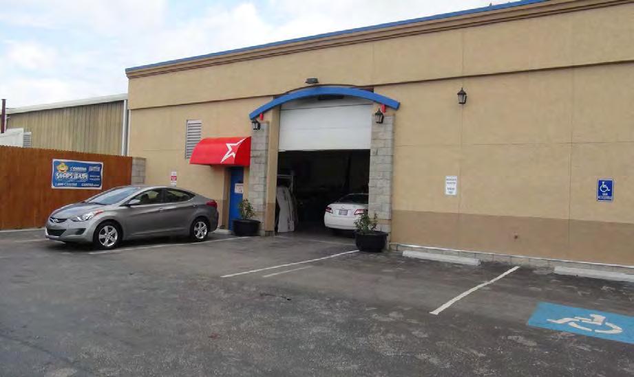
124
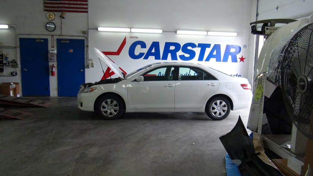
125
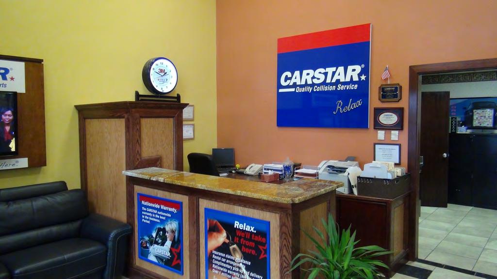
126
MINUTES CITY OF OLATHE CITY PLANNING DIVISION
 MINUTES CITY OF OLATHE CITY PLANNING DIVISION The meeting was called to order by Chairman Jon Campbell, with the following members present: Paul Ling, Greg Harrelson, Erin Davis, Mike Rinke, Jeremy Fry
Planning Commission Meeting: April 25, 2016
 Planning Commission Meeting: City of Olathe City Planning Division MINUTES Consent Agenda The meeting was called to order by Chairman Dean Vakas, with the following members present: Ryan Nelson, Mike Rinke,
MINUTES Consent Agenda Planning Commission Meeting: January 9, MINUTES Planning Commission Meeting: January 9, 2017
 MINUTES Consent Agenda Planning Commission Meeting: City of Olathe City Planning Division The meeting was called to order by Chairman Dean Vakas, with the following members present: Mike Rinke, Barry Sutherland,
MINUTES Opening Remarks Planning Commission Meeting: August 14, 2017
 MINUTES Opening Remarks City of Olathe City Planning Division The Planning Commission convened at 7:00 p.m. to meet in regular session with Chairman Dean Vakas presiding. Planning Commissioners Ryan Nelson,
The Chairman read the standard ex parte statement. No Commissioner reported having any ex parte communications.
 MINUTES - Planning Commission Meeting CONSENT AGENDA: The meeting was called to order by Chairman Dean Vakas, with the following members present: Mike Rinke, Jeremy Fry, Ryan Nelson, Ryan Freeman, Ann
MINUTES Opening Remarks Planning Commission Meeting: November 27, 2017
 MINUTES Opening Remarks Planning Commission Meeting: City of Olathe Planning Division The Planning Commission convened at 7:00 p.m. to meet in regular session with Chairman Dean Vakas presiding. Planning
FEBRUARY 8, 2016 OLATHE PLANNING COMMISSION
 FEBRUARY 8, 2016 OLATHE PLANNING COMMISSION CASE LOCATIONS WARD 2 P-15-057 ^_ ^_ P-15-058 RZ-15-009 ^_ ^_ WARD 4 P-15-059 WARD 1 WARD 3 4 User: gradyrm Date: 02/03/2016 ^_ Case Applications Highway Arterial
MINUTES Opening Remarks Planning Commission Meeting: May 14, 2018
 Opening Remarks The Planning Commission convened at 7:00 p.m. to meet in regular session with Chairman Dean Vakas presiding. Planning Commissioners Mike Rinke, Barry Sutherland, Chip Corcoran, Jose Munoz,
MINUTES Opening Remarks Planning Commission Meeting: July 23, 2018
 MINUTES Opening Remarks City of Olathe City Planning Division The Planning Commission convened at 7:00 p.m. to meet in regular session with Chairman Dean Vakas presiding. Planning Commissioners Mike Rinke,
** REVISED AGENDA **
 ** REVISED AGENDA ** OLATHE CITY COUNCIL REGULAR SESSION COUNCIL CHAMBER 100 EAST SANTA FE Tuesday, January 9, 2018 7:00 p.m. EVENT: A reception for Newly Elected Council Members at 6:30 p.m. in the lobby
Special Use Permit Application & Process See Unified Development Code
 Special Use Permit Application & Process See Unified Development Code 18.40.100 Public Works Planning Division PO Box 768 100 E. Santa Fe Street Olathe, Kansas 66051 P: 913-971- 8750 F: 913-971-8960 www.olatheks.org
FINAL PLAT GUIDE TO SUBDIVIDING PROPERTY. Background
 FINAL PLAT GUIDE TO SUBDIVIDING PROPERTY Background A final plat is the second step in the process of subdividing land into separate parcels for future sale or lease. Once a preliminary plat has been approved
Lot Split Application & Process See Unified Development Ordinance
 Lot Split Application & Process See Unified Development Ordinance 18.40.180 Public Works Planning Division PO Box 768, Olathe, Kansas 66051 Phone: 913-971- 8750 Fax: 913-971-8960 www.olatheks.o Public
PLANNED DEVELOPMENT DISTRICT STANDARDS. Cadence Site
 PLANNED DEVELOPMENT DISTRICT STANDARDS Cadence Site A Planned Development District 1. Statement of General Facts, Conditions and Objectives Property Size: Approximately 57.51 Acres York County Tax Map
EDGERTON CITY HALL PLANNING COMMISSION MEETING REGULAR SESSION March 12, 2019
 EDGERTON CITY HALL PLANNING COMMISSION MEETING REGULAR SESSION The met in regular session with Chair John Daley calling the meeting to order at 7:00 p.m. All present participated in the Pledge of Allegiance.
DEVELOPMENT DEPARTMENT STAFF REPORT THE PARK AT 5 TH
 DEVELOPMENT DEPARTMENT STAFF REPORT ARB Meeting Date: July 3, 2018 Item #: _PZ2018-293_ THE PARK AT 5 TH Request: Site Address: Project Name: Parcel Number: Applicant: Proposed Development: Current Zoning:
MEMORANDUM. DATE: November 9, 2016 PC Agenda Item 3.C
 MEMORANDUM DATE: November 9, 2016 PC Agenda Item 3.C TO: FROM: SUBJECT: Planning Commission Eric Zweber, AICP, Interim City Planner Planning Case #16-029 Public Hearing Required Applicant: Bremer Bank,
ALPINE TOWNSHIP PLANNING COMMISSION REGULAR MEETING August 17, 2017
 Page 1 of 9 ALPINE TOWNSHIP PLANNING COMMISSION REGULAR MEETING 17-37 CALL TO ORDER / APPROVAL OF THE REGULAR MEETING MINUTES OF JULY 20, 2017 AND THE / PUBLIC COMMENT ON NON-AGENDA ITEMS The Alpine Township
EXHIBIT D. Planned Unit Development Written Description April 13, 2016 Rouen Cove Phase II PUD
 1 EXHIBIT D Planned Unit Development Written Description April 13, 2016 Rouen Cove Phase II PUD Development # 8986.001 Developer: Curtis L. Hart Hart Resources LLC 8051 Tara Lane Jacksonville, Florida
1. The meeting was called to Order with Roll Call by Chairman Richard Hemphill.
 PLANNING COMMISSION City Hall, 32905 W. 84 th Street 6:00 PM., August 22nd, 2017 MINUTES 1. The meeting was called to Order with Roll Call by Chairman Richard Hemphill. 2. Roll Call: Allenbrand Absent
LINCOLN COUNTY PLANNING & INSPECTIONS DEPARTMENT
 LINCOLN COUNTY PLANNING & INSPECTIONS DEPARTMENT 302 NORTH ACADEMY STREET, SUITE A, LINCOLNTON, NORTH CAROLINA 28092 704-736-8440 OFFICE 704-736-8434 INSPECTION REQUEST LINE 704-732-9010 FAX To: Board
LOT SPLIT PROCESS. Table of Contents
 LOT SPLIT PROCESS Table of Contents Purpose of Lot Splits Step 1 Pre Application Process Step 2 Application Process Step 3 Applicant Resubmittal Updated: 12/2016 OlatheKS.org Page 1 of 15 Purpose of Lot
O-I (Office-Institutional) and AG-1(Agricultural)
 and AG-1(Agricultural)") PROPERTY INFORMATION ADDRESS 3503 and 3505 Bethany Bend DISTRICT, LAND LOTS 2/1 973 and 974 OVERLAY DISTRICT State Route 9 PETITION NUMBERS EXISTING ZONING O-I (Office-Institutional) and AG-1(Agricultural)
PROPERTY INFORMATION ADDRESS 3503 and 3505 Bethany Bend DISTRICT, LAND LOTS 2/1 973 and 974 OVERLAY DISTRICT State Route 9 PETITION NUMBERS EXISTING ZONING O-I (Office-Institutional) and AG-1(Agricultural)
Cover Letter with Narrative Statement
 Cover Letter with Narrative Statement March 31, 2017 rev July 27, 2017 RE: Rushton Pointe Residential Planned Unit Development Application for Public Hearing for RPUD Rezone PL2015 000 0306 Mr. Eric Johnson,
MINUTES JOINT MEETING LINCOLN COUNTY and SIOUX FALLS PLANNING COMMISSIONS 7:00 pm August 10, 2011
 MINUTES JOINT MEETING LINCOLN COUNTY and SIOUX FALLS PLANNING COMMISSIONS 7:00 pm August 10, 2011 Commissioners Room - Lincoln County Court House A joint meeting of the Lincoln County and Sioux Falls Planning
URBANDALE PLANNING AND ZONING COMMISSION MINUTES. July 9, 2018
 URBANDALE PLANNING AND ZONING COMMISSION MINUTES The Urbandale Planning and Zoning Commission met in regular session on Monday,, at the Urbandale City Hall, 3600 86th Street. Chairperson Jeff Hatfield
SEPTEMBER 14, 2015 OLATHE PLANNING COMMISSION
 SEPTEMBER 14, 2015 OLATHE PLANNING COMMISSION CASE LOCATIONS WARD 2 RZ-15-006 ^_ WARD 4 P-15-031 ^_ WARD 1 ^_ PR-15-022 WARD 3 P-15-041 PR-15-023 ^_ ^_ ^_ P-15-040 RZ-15-005 ^_ P-15-039 4 User: gradyrm
ZONING AMENDMENT & SUBDIVISION STAFF REPORT Date: July 9, 2015
 ZONING AMENDMENT & SUBDIVISION STAFF REPORT Date: July 9, 2015 APPLICANT NAME 2513 Dauphin Street, Inc. SUBDIVISION NAME Audubon Place Extension No. 3, Resubdivision of Lots 1-5 LOCATION 2513 Dauphin Street
City of Brooklyn Park Planning Commission Staff Report
 City of Brooklyn Park Planning Commission Staff Report Agenda Item: 6D Meeting Date: August 9, 2017 Originating Agenda Section: Public Hearing Department: Community Development Resolution: X Ordinance:
MINUTES OF THE WORK STUDY MEETING OF THE QUEEN CREEK PLANNING AND ZONING COMMISSION AGENDA
 November 14, 2012, Page 1 of 5 MINUTES OF THE WORK STUDY MEETING OF THE QUEEN CREEK PLANNING AND ZONING COMMISSION WHEN: WEDNESDAY, NOVEMBER 14, 2012 WHERE: TOWN HALL COUNCIL CHAMBERS TIME: 6:00 p.m. Pursuant
CITY OF ALBERT LEA PLANNING COMMISSION ADVISORY BOARD
 CITY OF ALBERT LEA PLANNING COMMISSION ADVISORY BOARD 9/1/2015, 5:30 p.m. City Council Chambers AGENDA A. CALL TO ORDER AND ROLL CALL B. APPROVAL OF THE AGENDA C. APPROVAL OF MINUTES 1. PC Minutes from
Exhibit D. Tallow Ridge PUD. Written Description. Date: January 5, E. City Development Number:
 Exhibit D Tallow Ridge PUD Written Description Date: January 5, 2016 I. SUMMARY DESCRIPTION OF THE PROPERTY A. Current Land Use Designation: RR B. Current Zoning District: PUD C. Requested Zoning District:
M E M O R A N D U M. Meeting Date: October 23, Item No. F-1. Planning and Zoning Commission. Daniel Turner, Planner I
 M E M O R A N D U M Meeting Date: October 23, 2017 Item No. F-1 To: From: Subject: Planning and Zoning Commission Daniel Turner, Planner I PUBLIC HEARING: Consider a recommendation of a of Planned Development
MIXED USE DEVELOPMENT AGREEMENT
 MIXED USE DEVELOPMENT AGREEMENT THIS MIXED USE DEVELOPMENT AGREEMENT (hereinafter "Agreement") made and entered into this day of, 2007, pursuant to Section 205-30 of the Zoning Ordinances of the City of
ALPINE TOWNSHIP PLANNING COMMISSION REGULAR MEETING June 15, 2017
 Page 1 of 6 ALPINE TOWNSHIP PLANNING COMMISSION REGULAR MEETING 17-26 CALL TO ORDER / APPROVAL OF THE REGULAR MEETING MINUTES OF MAY 18, 2017 AND THE / PUBLIC COMMENT ON NON-AGENDA ITEMS The Alpine Township
ORDINANCE NO. Z REZONING NO
 ORDINANCE NO. Z- 3960 REZONING NO. 2018-00014 AN ORDINANCE RELATING TO ZONING: AMENDING CERTAIN ZONING REGULATIONS SHOWN ON SHEET NO. 15 OF THE ZONING DISTRICT MAP INCORPORATED BY REFERENCE BY OVERLAND
Meeting Announcement and Agenda Mt. Pleasant Zoning Board of Appeals. Wednesday, April 25, :00 p.m. City Hall Commission Chamber
 Meeting Announcement and Agenda Mt. Pleasant Zoning Board of Appeals Wednesday, April 25, 2018-7:00 p.m. City Hall Commission Chamber I. Roll Call: Assmann, Berkshire, Friedrich, Orlik, Raisanen, White
TO: Glynn County Islands Planning Commission. Karl W. Bursa, AICP, Planner II. PP3105 Stillwater Phase III. DATE: November 10, 2015
 COMMUNITY DEVELOPMENT DEPARTMENT Planning and Zoning Division 1725 Reynolds Street, Suite 200, Brunswick, GA 31520 Phone: 912-554-7428/Fax: 1-888-252-3726 TO: Glynn County Islands Planning Commission FROM:
URBANDALE PLANNING AND ZONING COMMISSION MINUTES. November 2, 2015
 URBANDALE PLANNING AND ZONING COMMISSION MINUTES The Urbandale Planning and Zoning Commission met in regular session on Monday,, at the Urbandale City Hall, 3600 86 th Street. Chairperson Julie Roethler
DAVISON TOWNSHIP PLANNING COMMISSION REGULAR MEETING August 8, 2018
 MEMBERS PRESENT: Chairman Bruce Calhoun, Vice Chair Dave Shields, Secretary Travis Howell, Greg Dutkiewicz, Jackie Hoist, Fred Jackson, Rob Hollenback, Pat Miller Zoning/Planning Administrator Charm Healy
PLANNING COMMISSION REPORT Regular Agenda Non Public Hearing Item
 PC Staff Report 3/23/15 FDP-14-00551 Item No. 2-1 PLANNING COMMISSION REPORT Regular Agenda Non Public Hearing Item PC Staff Report 3/23/15 ITEM NO. 2: FINAL DEVELOPMENT PLAN FOR HUTTON FARMS WEST PHASE
Initial Project Review
 Pierce County Department of Planning and Land Services, 2401 South 35th Street, Tacoma, WA (253) 798-7037 Initial Project Review Major Amendment to Preliminary Plat: Hawks Ridge Division 1 Application
Re: Case # ZP Preplanning Application for 8 townhomes at 1526 Ingalls Street in Lakewood, CO.
 Planning Department Civic Center North 480 South Allison Parkway Lakewood, Colorado 80226-3127 303.987.7505 303.987.7057 TTY/TDD Lakewood.org/Planning February 27, 2017 Nathan Taylor 601 S Jason Street
AGENDA ADDITIONS / DELETIONS: REYNOLDS MOVED, SECOND BY JOHNSON, TO APPROVE THE AGENDA. UPON THE VOTE, THERE WERE 4 AYES, 0 NAYS. MOTION CARRIED.
 THE MEETING OF THE PLANNING COMMISSION HELD ON APRIL 16, 2018, AT 7:00 P.M., AT THE CITY HALL COUNCIL CHAMBERS ****************************************************************************** The meeting
Article 6: Planned Unit Developments
 LUDC 2013 GARFIELD COUNTY, COLORADO Article 6: Planned Unit Developments ARTICLE 6 PLANNED UNIT DEVELOPMENTS TABLE OF CONTENTS DIVISION 1. GENERAL.... 1 6-101. GENERAL PROVISIONS.... 1 A. Purpose....
Report to the Plan Commission August 20, 2012
 Report to the Plan Commission Legistar I.D. #27376 5692-5696 Monona Drive Conditional Use Requested Action: Approval of a conditional use for an outdoor eating area for a restaurant and an accessory parking
MINUTES OF THE REGULAR MEETING OF THE PLANNING AND ZONING COMMISSION OF THE CITY OF SUNSET HILLS, MISSOURI HELD ON WEDNESDAY, JANUARY 3, 2018
 MINUTES OF THE REGULAR MEETING OF THE PLANNING AND ZONING COMMISSION OF THE CITY OF SUNSET HILLS, MISSOURI HELD ON WEDNESDAY, JANUARY 3, 2018 BE IT REMEMBERED that the Planning and Zoning Commission of
EDMOND PLANNING COMMISSION 20 S. Littler, Edmond, Oklahoma Tuesday, May 6, :30 p.m.
 City of Edmond NOTICE OF PUBLIC MEETING The City of Edmond encourages participation from all its citizens. If participation at any Public meeting is not possible due to a disability, notification to the
Watertown City Council
 City of Watertown Watertown City Council 2/14/2017 Agenda Item: Riverpointe Subdivision 2 nd Replat Request for Action: Sketch Plan Department: Planning Request for Action Request: Paxmar, LLC (Applicant)
FRANKLIN COUNTY PLANNING BOARD. April 12, 2016
 FRANKLIN COUNTY PLANNING BOARD April 12, 2016 The Franklin County Planning Board held its regular monthly meeting on Tuesday, April 12, 2016 in the Franklin County Administration Building, Commissioners
TOWN OF MINNESOTT BEACH PLANNING BOARD MEETING August 6, 2009
 TOWN OF MINNESOTT BEACH PLANNING BOARD MEETING August 6, 2009 MEMBERS PRESENT: Tim Fowler, Buddy Belangia, Bill Schmidt, Dave Gaskins, and Mac Rubel via telephone. Valerie Calcavecchia arrived after the
ZONING AMENDMENT & SUBDIVISION STAFF REPORT Date: June 18, 2015
 ZONING AMENDMENT & SUBDIVISION STAFF REPORT Date: June 18, 2015 APPLICANT NAME SUBDIVISION NAME EAA LLC / Eryka Rogers Aaiden Place Subdivision LOCATION 2480 Government Boulevard (North side of Government
9. REZONING NO Vicinity of the northwest corner of 143 rd Street and Metcalf Avenue
 9. REZONING NO. 2002-15 Vicinity of the northwest corner of 143 rd Street and Metcalf Avenue 1. APPLICANT: Andrew Schlagel is the applicant for this request. 2. REQUESTED ACTION: The applicant is requesting
UPPER ALLEN TOWNSHIP PLANNING COMMISSION REGULAR MEETING August 27, :00 P.M.
 UPPER ALLEN TOWNSHIP PLANNING COMMISSION REGULAR MEETING August 27, 2018 7:00 P.M. PC MEMBERS TOWNSHIP OFFICIALS - PRESENT R. Wayne Willey, Chairperson Jennifer Boyer, Comm. Dev. Director Philip Cerveny,
STAFF REPORT. Raymond Management Company 8333 Greenway Blvd, Suite 2000 Middleton, WI 53562
 STAFF REPORT Planning and Zoning Case 16-26FDP Staff: Katherine Sharp, Assistant Director of Planning & Development Date: June 27, 2016 GENERAL INFORMATION Application: Applicant: Location: Site Acreage:
MINUTES JOINT MEETING LINCOLN COUNTY and SIOUX FALLS PLANNING COMMISSIONS 7:00 pm July 14, 2010
 MINUTES JOINT MEETING LINCOLN COUNTY and SIOUX FALLS PLANNING COMMISSIONS 7:00 pm July 14, 2010 Commissioners Room - Lincoln County Court House A joint meeting of Lincoln County and Sioux Falls Planning
RP-2, RP-3, RP-4, AND RP-5 PLANNED RESIDENTIAL DISTRICTS
 6.10 - RP-2, RP-3, RP-4, AND RP-5 PLANNED RESIDENTIAL DISTRICTS 6.10.1 GENERAL DESCRIPTION: 6.10.1.1 The regulations established in this Section are intended to provide optional methods of land development
^_ ^_ MAY 14, 2018 OLATHE PLANNING COMMISSION CASE LOCATIONS WARD 2 WARD 4 WARD 1 WARD 3 FP SU MP RZ RZ VAC
 MAY 14, 2018 OLATHE PLANNING COMMISSION CASE LOCATIONS WARD 2 FP18-0013 WARD 1 MP18-0005 ^_ VAC18-0004 RZ18-0004 ^_ PR18-0021 FP18-0016 ^_ ^_ ^_ ^_ RZ18-0005 MP18-0006 ^_ FP18-0014 RZ18-0003 ^_ ^_ SU18-0003
CITY OF WIXOM PONTIAC TRAIL PLANNING COMMISSION MEETING MONDAY, JUNE 25, 2018
 Approved CITY OF WIXOM 49045 PONTIAC TRAIL PLANNING COMMISSION MEETING MONDAY, JUNE 25, 2018 (7/23/2018) The meeting was called to order by Chairman Day of the Planning Commission at 7:30 p.m. at which
CITY OF APPLE VALLEY PLANNING COMMISSION MINUTES DECEMBER 7, 2016
 PLANNING COMMISSION MINUTES DECEMBER 7, 2016 1. CALL TO ORDER The City of Apple Valley Planning Commission meeting was called to order by Chair Melander at 7:01 p.m. Members Present: Tom Melander, Ken
CITY OF DERBY. MEETING OF THE PLANNING COMMISSION REGULAR MEETING June 19, :30 PM
 CITY OF DERBY MEETING OF THE PLANNING COMMISSION REGULAR MEETING June 19, 2014 6:30 PM CALL MEETING TO ORDER ROLL CALL CONSIDERATION OF MINUTES: Planning Commission Meeting of June 5, 2014. PUBLIC FORUM
CHAPTER 29 ARTICLE 8. 20,000 sf 30,000 sf 100,000 sf (with approval by Special Use Permit according to Sec
 CHAPTER 29 ARTICLE 8 (3) Zone Development Standards. The zone development standards for the NC Zone are set forth in Table 29.81(3) below: Table 29.81(3) Neighborhood Commercial (NC) Zone Development Standards
DAUPHIN CREEK ESTATES SUBDIVISION
 # 12 SUB-000076-2017 DAUPHIN CREEK ESTATES SUBDIVISION Engineering Comments: FINAL PLAT COMMENTS (should be addressed prior to submitting the FINAL PLAT for review and/or signature by the City Engineer):
PLANNING COMMISSION MINUTES OF MEETING Wednesday, December 12, :00 p.m.
 0 PLANNING COMMISSION MINUTES OF MEETING Wednesday, December, 0 :00 p.m. A quorum being present at Centerville City Hall, North Main Street, Centerville, Utah, the meeting of the Centerville City Planning
PLANNING & ZONING DEPARTMENT Town Hall Annex, 66 Prospect St., Ridgefield, CT Fax
 PLANNING & ZONING DEPARTMENT Town Hall Annex, 66 Prospect St., Ridgefield, CT 06877 203-431-2766 Fax 203-431-2737 ADOPTED AMENDMENT TO THE ZONING REGULATIONS NEW Section 5.6 Neighborhood Business Zone
AGENDA. EDMOND PLANNING COMMISSION 20 S. Littler, Edmond, Oklahoma Tuesday, February 18, :30 p.m. CITY COUNCIL WORKSHOP
 City of Edmond NOTICE OF PUBLIC MEETING The City of Edmond encourages participation from all its citizens. If participation at any Public meeting is not possible due to a disability, notification to the
Community Development
 Land Use Petition RZ-15-010 Concurrent Variance VC-15-010-01 Date of Staff Recommendation Preparation: August 14, 2015 Date of Planning Commission Recommendation: September 1, 2015 PROJECT LOCATION: DISTRICT/SECTION/LANDLOT(S):
MINUTES CITY OF SUWANEE, GEORGIA PLANNING AND ZONING COMMISSION. February 2, 2016
 MINUTES CITY OF SUWANEE, GEORGIA PLANNING AND ZONING COMMISSION PLANNING AND ZONING MEMBERS: Present: Pete Charpentier, Anthony Manners, Lila Adams, Michelle Budd and Glenn Weyant. Staff members present:
CITY OF DEKALB PLANNING AND ZONING COMMISSION REGULAR MEETING April 22, 2015
 CITY OF DEKALB PLANNING AND ZONING COMMISSION REGULAR MEETING April 22, 2015 The City of DeKalb Planning & Zoning Commission held a regular meeting on April 22, 2015 in the City Council Chambers of the
SARPY COUNTY BOARD OF ADJUSTMENT MINUTES OF MEETING May 14, 2015
 l. CALL MEETING TO ORDER SARPY COUNTY BOARD OF ADJUSTMENT MINUTES OF MEETING May 14, 2015 A meeting of the Board of Adjustment of Sarpy County, Nebraska was convened in open and public session at the call
PALM BEACH COUNTY PLANNING, ZONING AND BUILDING DEPARTMENT ZONING DIVISION
 PALM BEACH COUNTY PLANNING, ZONING AND BUILDING DEPARTMENT ZONING DIVISION Application No.: CA-2012-00688 Control No.: 2011-00552 Applicant: Garry Bernardo Owners: Garry Bernardo Agent: Frogner Consulting,
PLANNING COMMISSION REPORT Regular Agenda -Public Hearing Item
 PDP-13-00518 Item No. 3B- 1 PLANNING COMMISSION REPORT Regular Agenda -Public Hearing Item PC Staff Report 2/24/14 ITEM NO. 3B PRELIMINARY DEVELOPMENT PLAN FOR HERE @ KANSAS; 1101 INDIANA ST (SLD) PDP-13-00518:
PUBLIC NOTICE & AGENDA PLAN COMMISSION City Hall Forum State Street, Beloit, WI :00 PM Wednesday, November 07, 2018
 PUBLIC NOTICE & AGENDA PLAN COMMISSION City Hall Forum - 100 State Street, Beloit, WI 53511 7:00 PM Wednesday, November 07, 2018 1. CALL TO ORDER AND ROLL CALL 2. MINUTES 2.a. Consideration of the Minutes
Plat Checklist PLAT TYPES AND DESCRIPTIONS
 Master Plan / Revision to Master Plan (For Platting Purposes Only) Preliminary/Final Plat Preliminary Plat Final Plat Minor Plat Replat Amended Plat Plat Checklist So that we may efficiently review your
LINCOLN COUNTY PLANNING & INSPECTIONS DEPARTMENT
 LINCOLN COUNTY PLANNING & INSPECTIONS DEPARTMENT 30 NORTH ACADEMY STREET, SUITE A, LINCOLNTON, NORTH CAROLINA 809 704-736-8440 OFFICE 704-736-8434 INSPECTION REQUEST LINE 704-73-900 FAX To: Board of Commissioners
PRELIMINARY PLATS. The following documents are provided as required by the City of Conroe for use in the above titled platting submittals:
 Public Works Engineering Division CITY OF CONROE PRELIMINARY PLATS The following documents are provided as required by the City of Conroe for use in the above titled platting submittals: Submittal Questionnaire
Proposed Overland Park Kansas Ordinance RE-1 Residential Estates Community
 18.171 RE-1 Residential Estate Community 18.171.010 Statement of intent. The zoning of property as RE-1, (Residential Estates Community, 1 dwelling unit per Gross acre density), is intended to provide
MINUTES PARK TOWNSHIP PLANNING COMMISSION Park Township Hall nd Street Holland, MI Regular Meeting September 12, :30 P.M.
 MINUTES PARK TOWNSHIP PLANNING COMMISSION Park Township Hall 52 152 nd Street Holland, MI 49418 Regular Meeting September 12, 2018 6:30 P.M. DRAFT COPY CALL TO ORDER: Chair Pfost called to order the regular
DEVELOPMENT DEPARTMENT STAFF REPORT DRESDEN HEIGHTS PHASE II DCI
 DEVELOPMENT DEPARTMENT Meeting Date: January 10, 2019 Item #: PZ2019-393 Project Name: Applicant and Owner: Proposed Development: Requests: STAFF REPORT DRESDEN HEIGHTS PHASE II DCI Dresden Heights Phase
1999 Town Center West Proposal
 Crescent Square June 10, 2014 Page 2 1999 Town Center West Proposal Food-4- Less Retail Not a Part On June 10, 2004, the City Council and Planning Commission conducted a joint workshop to review conceptual
Perry City Planning Commission Perry City Offices, 3005 South 1200 West April 5, :00 PM
 Perry City Planning Commission Perry City Offices, 3005 South 1200 West April 5, 2012 7:00 PM Members Present: Chairman Jerry Nelson, Commissioner Esther Montgomery, Commissioner Todd Bischoff, Commissioner
LINCOLN COUNTY PLANNING & INSPECTIONS DEPARTMENT
 LINCOLN COUNTY PLANNING & INSPECTIONS DEPARTMENT 302 NORTH ACADEMY STREET, SUITE A, LINCOLNTON, NORTH CAROLINA 28092 704-736-8440 OFFICE 704-736-8434 INSPECTION REQUEST LINE 704-732-9010 FAX To: Board
Exhibit "A" have applied for a re-zoning and re-classification of that property from OPEN RURAL (OR) to that of a PLANNED UNIT DEVELOPMENT (PUD); and
 to that of a PLANNED UNIT DEVELOPMENT (PUD); and") I NSTR # 200632845 OR BK 61439 PGS 0728-0750 RECORDED 06/24/2066 12:25:50 PR JOHN Q. CRAWFOKD CLERK OF CIRCUIT COURT NASSAU COUNTY, FLORIDA RECORDING FEES 1.37.80 ORDINANCE NO. 2006-65 AN ORDINANCE AMENDING
I NSTR # 200632845 OR BK 61439 PGS 0728-0750 RECORDED 06/24/2066 12:25:50 PR JOHN Q. CRAWFOKD CLERK OF CIRCUIT COURT NASSAU COUNTY, FLORIDA RECORDING FEES 1.37.80 ORDINANCE NO. 2006-65 AN ORDINANCE AMENDING
PALM BEACH COUNTY PLANNING, ZONING AND BUILDING DEPARTMENT ZONING DIVISION ZONING COMMISSION VARIANCE STAFF REPORT 07/05/2012
 PALM BEACH COUNTY PLANNING, ZONING AND BUILDING DEPARTMENT ZONING DIVISION ZONING COMMISSION VARIANCE STAFF REPORT 07/05/2012 APPLICATION NO. CODE SECTION REQUIRED PROPOSED VARIANCE ZV-2012-00690 3.D.1.A
ZONING AMENDMENT & SUBDIVISION STAFF REPORT Date: November 3, 2016
 ZONING AMENDMENT & SUBDIVISION STAFF REPORT Date: November 3, 2016 APPLICANT NAME SUBDIVISION NAME David Shumer 5955 Airport Subdivision CITY COUNCIL DISTRICT District 6 5955 Airport Boulevard, 754 Linlen
Also present were Bill Mann, Senior Planner and Senior Secretary Amber Lehman.
 held Monday, August 26, 2013, at 7:00 P.M. in the Council Chambers, 11 North 3 rd Street, Jacksonville Beach, Florida Call to Order The meeting was called to order by Chairman Greg Sutton. Roll Call Greg
PLAINFIELD CHARTER TOWNSHIP COMMUNITY DEVELOPMENT DEPARTMENT PLANNING, ZONING & BUILDING SERVICES MEMORANDUM
 PLAINFIELD CHARTER TOWNSHIP COMMUNITY DEVELOPMENT DEPARTMENT PLANNING, ZONING & BUILDING SERVICES 6161 BELMONT AVENUE N.E. BELMONT, MI 49306 PHONE 616-364-1190 FAX: 616-364-1170 www.plainfieldchartertwp.org
ELK RAPIDS TOWNSHIP ANTRIM COUNTY, MICHIGAN ORDINANCE NO
 ELK RAPIDS TOWNSHIP ANTRIM COUNTY, MICHIGAN ORDINANCE NO. 3-2011 AN ORDINANCE TO REPLACE THE SUBDIVISION CONTROL ORDINANCE WITH A NEW SUBDIVISION DEVELOPMENT ORDINANCE, IN ACCORD WITH THE LAND DIVISION
610 LAND DIVISIONS AND PROPERTY LINE ADJUSTMENTS OUTSIDE A UGB
 ARTICLE VI: LAND DIVISIONS AND PROPERTY LINE ADJUSTMENTS VI-21 610 LAND DIVISIONS AND PROPERTY LINE ADJUSTMENTS OUTSIDE A UGB 610-1 Property Line Adjustments (Property Line Relocation) A property line
MAJOR SUBDIVISION PRELIMINARY PLAT CHECKLIST
 TOWNSHIP OF EGG HARBOR PLANNING BOARD/ZONING BOARD OF ADJUSTMENT 3515 BARGAINTOWN ROAD EGG HARBOR TOWNSHIP, NJ 08234 MAJOR SUBDIVISION PRELIMINARY PLAT CHECKLIST The following checklist is designed to
NORMAN, OKLAHOMA OWNER: RCB BANK APPLICATION FOR 2025 PLAN CHANGE PLANNED UNIT DEVELOPMENT PRELIMINARY PLAT. 12 December 2011 Revised 5 January 2012
 THE VILLAGE AT OAKHURST ADDITION NORMAN, OKLAHOMA OWNER: RCB BANK APPLICATION FOR 2025 PLAN CHANGE PLANNED UNIT DEVELOPMENT PRELIMINARY PLAT 12 December 2011 Revised 5 January 2012 PREPARED BY: THE RIEGER
ADA TOWNSHIP PLANNING COMMISSION MINUTES OF THE JUNE 15, 2017 MEETING
 ADA TOWNSHIP PLANNING COMMISSION MINUTES OF THE JUNE 15, 2017 MEETING A meeting of the was held on Thursday, June 15, 2017, 7:00 p.m. at the Ada Township Offices, 7330 Thornapple River Dr., Ada, MI. I.
PLANNED UNIT DEVELOPMENT & SUBDIVISION STAFF REPORT Date: November 17, 2016
 PLANNED UNIT DEVELOPMENT & SUBDIVISION STAFF REPORT Date: November 17, 2016 DEVELOPMENT NAME SUBDIVISION NAME LOCATION Autonation Ford of Mobile Autonation Ford of Mobile Subdivision 901, 909, and 925
ARTICLE 15. RULES, REGULATIONS AND DEFINITIONS
 ARTICLE 15. RULES, REGULATIONS AND DEFINITIONS Section 1. Interpretation and Construction: The following rules and regulations regarding interpretation and construction of the Ulysses-Grant County, Kansas,
Planning and Zoning Commission STAFF REPORT
 TO: FROM: Planning and Zoning Commission STAFF REPORT CASA GRANDE PLANNING AND ZONING COMMISSION James Gagliardi, AICP, City Planner MEETING DATE: September 1, 2016 REQUEST AGENDA # Request by Marshall
Rezoning Petition Zoning Committee Recommendation June 29, 2017
 Rezoning Petition 2017-076 Zoning Committee Recommendation June 29, 2017 REQUEST Current Zoning: MUDD-O (mixed use development, optional) and R-4 (single family residential) Proposed Zoning: UR-2(CD) (urban
PLN : - Request for approval of the 2016 Olathe Planning Commission Meeting Schedule and Development Review Schedule
 City of Olathe City Planning Division MINUTES - Consent Agenda Planning Commission Meeting: November 9, 2015 The meeting was called to order by Chairman Greg Harrelson, with the following members present:
M E M O R A N D U M. Meeting Date: May 1, Item No. H-4. Steve Polasek, Interim City Manager. David Hawkins, Senior Planner
 M E M O R A N D U M Meeting Date: May 1, 2012 Item No. H-4 To: From: Subject: Steve Polasek, Interim City Manager David Hawkins, Senior Planner PUBLIC HEARING: Consider an ordinance approving a planned
MINUTES OF THE REGULAR MEETING BOARD OF ZONING APPEALS. August 2, 2018
 A. Call to Order 7:00 p.m. MINUTES OF THE REGULAR MEETING BOARD OF ZONING APPEALS August 2, 2018 1. Roll Call - the following members were present: M. Coulter; L. Reibel; D. Falcoski; and C. Crane; and
EDMOND PLANNING COMMISSION MEETING. Tuesday, October 5, 2004
 124 EDMOND PLANNING COMMISSION MEETING Tuesday, 5:30 P.M. The Edmond Planning Commission Meeting was called to order by Chairperson David Woods at 5:30 p.m., Tuesday,, in the City Council Chambers at 20