The phased 3D Cadastre implementation in the Netherlands
|
|
|
- Branden Bridges
- 5 years ago
- Views:
Transcription

1 The phased 3D Cadastre implementation in the Netherlands Jantien Stoter 1,2, and Peter van Oosterom 1 and Hendrik Ploeger 1 1 OTB TU Delft 2 Kadaster, Apeldoorn Delft University of Technology Challenge the future
2 3D Cadastre implementation in the Netherlands Several studies have been carried out by the authors (my PhD defense on 3D Cadastre was in 2004) Now actual implementation within legal, institutional, organisational context Why now? Technically it has become possible to accept 3D drawings Practice has asked for support 3D cadastre implementation requires close collaboration between academics and practitioners from several disciplines 2
3 Overview Current legal and cadastral framework of Case studies Solution Conclusions 3


4 Ownership registration in The Netherlands Main registration entity is 2D parcel Although it is possible to establish property rights with 3D boundaries 5
5 Space of property Ownership of the land: Space above and below the surface Property reaches as high/low as user has interest Third parties can use parcel-column as long as user has no reason to object 6

6 3D situations occur 2D registration for a 3D world? 7
7 Vertical separation of ownership Apartment rights Only appropriate for homogenous units Right of superficies Relates to physical construction Right of long lease Right may be limited in space Easement Also to safeguard line-of-sight and free wind streams Cables and pipelines 8
8 Boundaries of 3D units in the land administration, apartments Requirements for apartment units: separate plan per floor Mental exercise to understand real world situation 9
9 Boundaries of 3D units in the land administration, not apartments Property should be identifiable Deeds may contain: Sketches Detailed drawings (3D PDF, cross sections) Description is left to the parties In practise: drawings are not legally binding Registrar will refuse deed if description of boundaries is missing 2D parcels need subdivision if right is established on part of parcel Conclusion: Legal basis can be diverse 3D in text, sketches, drawings, references to objects, 10
10 Overview Legal and cadastral framework of Case studies Solution Conclusions 11


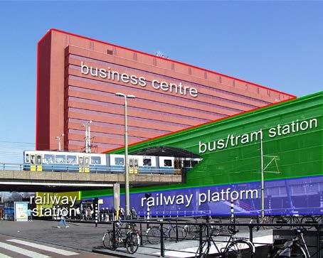
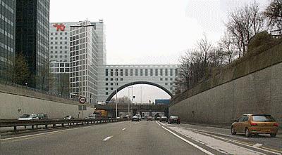
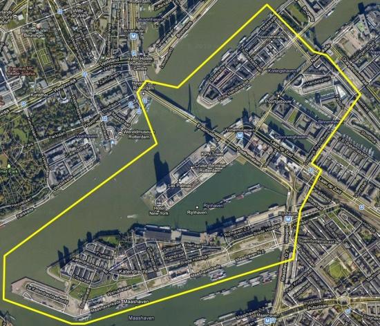
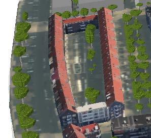
11 Case 1 Relatively simple apartment (on multiple floors) Garden 1 a b: First floor c: Second + Third floor 12

12 Case 2 One object, superficies Note parcel fragmentation 13

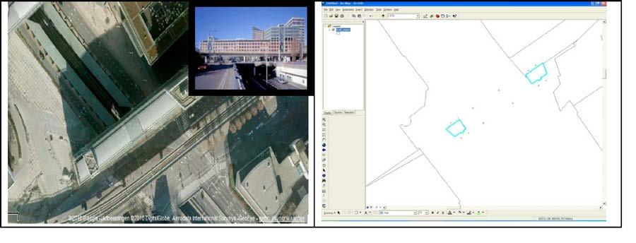
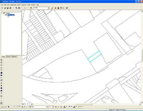
13 Case 3 Land by municipality Two 3D objects, long lease: 1. Parking garage 2. Office tower on 80 pillars Note again parcel fragmentation 14
14 Findings from the case studies (many more than 3 presented) Registration and publication of rights on 3D property is possible But: 1. Registration is not clear: Hard to understand if more than one object/part is involved 2. Objects are divided over several parcels: Hard to maintain 15
15 Overview Legal and cadastral framework of Case studies Solution Conclusions 16
16 Solution in two phases Phase I: Phase II: Within current cadastral and legal framework Long-term solution 17

17 Phase I No dramatic change Principle: refuse fragmented parcel creation Require a registration of 3D representation that reflects the space to which right applies 3D PDF (is already possible!) Courtesy of Kees van Prooijen, Bentley 18

18 Phase I in more detail Notification of 3D registration in cadastral map Original 2D parcels can be kept; but legal connection should be visible Projection 3D representation in separate layer Link to 3D drawing No 3D parcel in a 3D cadastral map Requirements/guidelines for 3D drawing 19
19 Requirements for content 3D PDF 2D ground parcels that overlap with legal volumes 3D (graphical) description of legal space: 3D extent and overlap with ground parcels Legally required 2D cross sections with accompanying annotations Objects needed for reference/orientation in 3D environment: large scale topography 2D geometry of buildings 3D constructions and earth surface (with ground parcels) as reference Length/areavolume measures of the legal space Z: 3D PDF should identify origin in local coordinates (and relate this to national height datum) 20

20 Example 3D PDF by a company: VDNDP Bouwingenieurs 21
21 Vertical cross section 22
22 Floor plan of 1st floor 23

23 3D legal spaces 24
24 Assessment Phase I Fits within current technical, legal and cadastral framework But: is new to notaries Also new: encouraging uniformity in consultation with notaries Pros: More insight Parcel need not to be subdivided Con: Voluntary 3D data not available: No checking possible (single valid volume, no overlap neighbour) Modifications not easy 3D overview not possible (multiple registrations in one area) 26
25 Next, Phase II Obligatory in specific situations: Multi-level property; complex property rights; apartments Still related to one or more ground parcels 3D graphical representation is always required 3D data itself: XML-encoding (CityGML, IFC?) Kadaster checks on geometry, topology, overlap: Requirements for allowed geometries Possible to establish legal space that overlaps several ground parcels with own identification 27
26 How to get a 3D representation? 3D survey (physical objects - legal spaces) Semi-automatic conversion of existing floor plans to 3D units Via design files (CAD): standardised workflow possible via IFC (BIM) 28
27 Overview Legal and cadastral framework of Case studies Solution Conclusions 29
28 Conclusions and future work Conslusion Studying 3D cadastre in theory is different than putting it into practice Implemented phase I: for new objects, cost to generate 3D units in this format are similar to costs for generating the traditionally obliged maps/cross sections Both Phase I and II are LADM compliant Future work: Studying BIM/IFC to 3D PDF workflow with architects Based on (near future) experiences, further define Phase II Result: 3D registration that extends the frameworks No dramatic changes; but major improvement 30
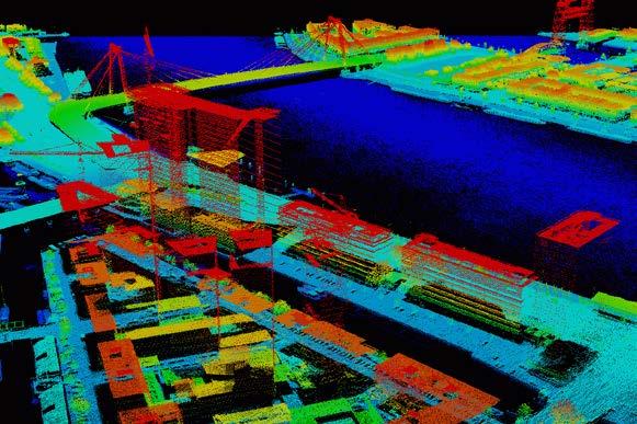
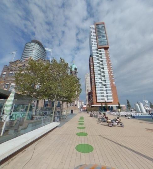
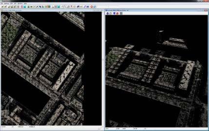
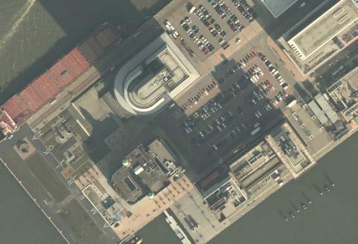
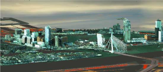
29 AHN2 3D topography in The Netherlands Fugro, in opdracht van Rotterdam Topcon Sokkia TNO Mobiele laserscanning; Horus Surround Vision Image GBKN m Cyclomedia DTB, RWS GBKN 31 TOP10N L


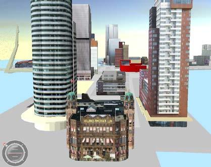
30 Agreeing on 3D specs in NL Bentle y idelf t Bentley Kadaster Toposcopie Bentle y U Twente Toposcopie Gemeente Rotterdam 32 U Twente

31 Questions? Jantien Stoter 35
3D aspects of cadastral data modelling
 3D aspects of cadastral data modelling Jantien E. Stoter and Hendrik D. Ploeger Department of Geodesy, Faculty of Civil Engineering and Geosciences Delft University of Technology, The Netherlands (j.e.stoter
Registration of 3D Situations in Land Administration in the Netherlands
 Registration of 3D Situations in Land Administration in the Netherlands Jantien STOTER, Hendrik PLOEGER, Wim LOUWMAN, Peter VAN OOSTEROM and Barbara WÜNSCH, the Netherlands Key words: 3D Registration,
REGISTRATION OF PROPERTIES IN STRATA
 REGISTRATION OF PROPERTIES IN STRATA REPORT ON THE WORKING SESSIONS INTRODUCTION A cadastre is usually, and in most countries, a parcel-based, and up-to-date land information system containing records
Questionnaire 3D-Cadastres: status September 2014 Norway
 Questionnaire 3D-Cadastres: status September 2014 rway This questionnaire is an activity of the FIG working group 3D-Cadastres 2014-2018. The purpose of the survey is to make a world-wide inventory of
Registration of 3D Objects Crossing Parcel Boundaries
 Registration of 3D Objects Crossing Parcel Boundaries Jantien E. STOTER and Hendrik D. PLOEGER, the Netherlands Key words: 3D cadastre, cross-boundary objects, cables and pipes, tunnels. SUMMARY Property
The European Common Agricultural Policy (CAP) after 1992
 after 1992") On the Level of Cooperation between Agricultural & Cadastral Parcel Registration Halil Ibrahim INAN (presenter) & Tahsin YOMRALIOGLU, Turkey Peter van OOSTEROM & Jaap ZEVENBERGEN, The Netherlands 1 OTB
On the Level of Cooperation between Agricultural & Cadastral Parcel Registration Halil Ibrahim INAN (presenter) & Tahsin YOMRALIOGLU, Turkey Peter van OOSTEROM & Jaap ZEVENBERGEN, The Netherlands 1 OTB
PROCESSES IN CADASTRE: PROCESS MODEL FOR SERBIAN 3D CADASTRE
 UNIVERSITY IN NOVI SAD, SERBIA FACULTY OF TECHNICAL SCIENCES PROCESSES IN CADASTRE: PROCESS MODEL FOR SERBIAN 3D CADASTRE Dubravka SLADIĆ, Aleksandra RADULOVIĆ and Miro GOVEDARICA 6th International FIG
Amalia Velasco Carlos Alonso Luis Virgos Fernando Serrano
 Inspire services of the Spanish Directorate General for Cadastre and its use to resolve an old problem of coordination between Spanish Cadastre and Land Registry. Amalia Velasco Carlos Alonso Luis Virgos
The Multi Purpose Cadastre, a network approach
 The Multi Purpose Cadastre, a network approach Peter Laarakker, Kadaster NL 1 Content 1. Introduction 2. Multi purpose cadastre 3. Definitions 4. Cadastral boundaries 5. Real property right 6. Conclusions
Content and message. 3D registration of real property in Denmark. Content and message. Introduction. Cadastral register
 Content and message 3D of real property in Denmark Jantien Stoter Section GIS technology, Delft University of Technology (NL) Esben Munk Sørensen and Lars Bodum GeoInformation and MediaTechnologi, Aalborg
Utilizing 3D Building and 3D Cadastre Geometries for Better Valuation of Existing Real Estate
 Utilizing 3D Building and 3D Cadastre Geometries for Better Valuation of Existing Real Estate Umit ISIKDAG Beykent U., Turkey Mike HORHAMMER Oracle, USA Sisi ZLATANOVA, Peter VAN OOSTEROM TU Delft, The
Value Chain Mapping. 3D Cadastre and Valuation The Added Value of 3D Geo-information Richard Witmer, Kadaster NL, 30 March 2017
 Value Chain Mapping 3D Cadastre and Valuation The Added Value of 3D Geo-information Richard Witmer, Kadaster NL, 30 March 2017 Agenda Purpose: why look at 3D cadastre and valuation? Approach: what we did.
CHAPTER 2 OVERVIEW OF 3D PROPERTY
 16 CHAPTER 2 OVERVIEW OF 3D PROPERTY 2.1 Introduction The aim of this chapter is to give an overview of property development by looking at properties in general, followed by a discussion on property rights,
LADM-based Crowdsourced 3D Cadastral Surveying Potential and Perspectives
 National Technical University Of Athens School of Rural and Surveying Engineering LADM-based Crowdsourced 3D Cadastral Surveying Potential and Perspectives Maria Gkeli, Surveying Engineer, PhD student
Russian-Dutch Project 3D Cadastre Modelling in Russia
 Galina ELIZAROVA, Sergey SAPELNIKOV, Natalia VANDYSHEVA, Sergey PAKHOMOV, Russian Federation, Peter VAN OOSTEROM, Marian DE VRIES, Jantien STOTER, Hendrik PLOEGER, Boudewijn SPIERING, Rik WOUTERS, Andreas
Integration of Landregistry and Cadastre in the Netherlands. Presentation by Wim Louwman Chief registrar
 Integration of Landregistry and Cadastre in the Netherlands Presentation by Wim Louwman Chief registrar Programme Legal system in the Netherlands. History: - 1832: seperated public registers (Landregistry)
LIS a motivation for SDI initiative
 Eric Mwaikambo Ardhi University Dar es Salaam Tanzania Overview Status of LIS in Tanzania Relationship between SDI and LIS Spatial Standards LIS a motivation for SDI initiative Conclusion & Recommendations
Current developments in 3D-cadastre with examples from the Netherlands and the Russian Federation
 Keynote paper First Serbian Geodetic Congress, Belgrade, 1-3 December 2011 Current developments in 3D-cadastre with examples from the Netherlands and the Russian Federation Jantien Stoter abc, Peter van
Topographic Signs Important Context of 3D Cadastre
 STATE GEODETIC ADMINISTRATION Gruška 20,10 000 Zagreb, Croatia Delft University of Technology Faculty of Architecture and the Built Environment Department OTB GIS Technology Section Topographic Signs Important
Questionnaire 3D-Cadastres: status September 2014 Canada, Quebec
 Questionnaire 3D-Cadastres: status September 2014 Canada, Quebec This questionnaire is an activity of the FIG working group 3D-Cadastres 2014-2018. The purpose of the survey is to make a world-wide inventory
From 2D representation of the buildings into cadastral maps towards 3D GIS applications and BIM a case study for Prishtina
 From 2D representation of the buildings into cadastral maps towards 3D GIS applications and BIM a case study for Prishtina This is a Peer Reviewed Paper Fisnik LOSHI, Kosovo Keywords: 3D cadastre, property
Legal framework and organisation of 3D cadastre
 3D Cadastre Modelling in Russia G2G10/RF/9/1 Report Work Package 1 Legal framework and organisation of 3D cadastre Version 1.0 (18 oct 11) Auteurs Hendrik Ploeger & Peter van Oosterom Page: 2 Report summary
The Development Strategy for Cadastre and Land Register in Finland
 1 2 The Development Strategy for and Land in Finland Arvo Kokkonen Ministry of Agriculture and Forestry Facts and figures of Finland - land area 304 530 km² - water area 33 615 km² - total area 338 195
INSPIRE Thematic Working. Cadastral parcels. September 2008
 INSPIRE Thematic Working Cadastral parcels September 2008 The INSPIRE context The INSPIRE Directive Its aim is to build the INfrastructure for Spatial InfoRmation in Europe The INSPIRE Directive has been
LADM Implementation Prototype for 3D Cadastre Information System of Multi-Level Apartment in Indonesia
 LADM Implementation Prototype for 3D Cadastre Information System of Multi-Level Apartment in Indonesia Yanto Budisusanto Trias Aditya Rochmad Muryamto IDEA Limitations of land supply for infrastructure
Spatial Representation of Condominium/Co-ownership - Comparison of Quebec and French Cadastral System based on LADM Specifications
 Spatial Representation of Condominium/Co-ownership - Comparison of Quebec and French Cadastral System based on LADM Specifications Dr. Jacynthe POULIOT, a.-g. Marc VASSEUR, Graduate student, INSA, Strasbourg,
3D CADASTRES IN THE WORLD
 FIG - 06.05.2009 Eilat 1 WORLD OF 3D CADASTRE How is the development in the world of cadastre towards more than two dimensions? This presentation will give some details on both cadastre and dimensions
Spatial Data Infrastructure for knowledge sharing
 , THE NETHERLANDS Key words: SDI, knowledge sharing, people profit planet, Kadaster, system of key registers, good governance, e-government, spatially enabled society, GIDEON SUMMARY Today s global challenges
Standardization in the Cadastral Domain. Sub Working Group 1: Legal Aspects
 Standardization in the Cadastral Domain Sub Working Group 1: Legal Aspects Framework 10 participants 8 countries 2 sessions Updates from the different countries (mainly as to the legal aspects of cadastre)
City of Surrey s Digital Plan Submission Process
 City of Surrey s Digital Plan Submission Process Cadastral Update Karen Stewart, B.Tech. (GIS) Spatial Information Manager Peter Mueller, B.C.L.S., C.L.S. Survey Manager City of Surrey, British Columbia,
EXPLORING OPTIONS FOR STANDARDISATION OF PROCESSES AND TRANSACTIONS IN LAND ADMINISTRATION
 EXPLORING OPTIONS FOR STANDARDISATION OF PROCESSES AND TRANSACTIONS IN LAND ADMINISTRATION CHRISTIAAN LEMMEN (1),(2), EVA-MARIA UNGER (2), PETER VAN OOSTEROM (3), MOHSEN KALANTARI (4) AND KEES DE ZEEUW
Digitalisation of the Real Property Rights Towards Spatially enabled E-Government
 Digitalisation of the Real Property Rights Towards Spatially enabled E-Government Lise Schroeder, Bent Hulegaard Jensen, Esben Munk Soerensen & Line Hvingel Istanbul, Turkey 25 june 201 Overview Introduction
A Complete, Free Solution for Cadastral Map Management
 A Complete, Free Solution for Cadastral Map Management Gyula IVÁN Institute of Geodesy, Cartography & Remote Sensing (FÖMI) HUNGARY FIG Commission 7, Annual Meeting 11-15 September 2008., Verona, ITALY
Country Profile for the Cadastre of the Czech Republic Based on LADM
 Country Profile for the Cadastre of the Czech Republic Based on LADM Karel Janečka 1, Petr Souček 2 1 University of West Bohemia, Pilsen, Czech Republic 2 Czech Office for Surveying, Mapping and Cadastre,
How to read different Plan Formats & definitions of Lots & Common Property Presentation Notes
 How to read different Plan Formats & definitions of Lots & Common Property Presentation Notes This presentation provides a basic understanding of community titles schemes and the plans that generally accompany
The LADM and the Continuum of Land Rights
 CheeHai TEO, Malaysia and Christiaan Lemmen, the Netherlands Key words: LADM, Continuum of Land Rights, Voluntary Guidelines, Spatial Enabled Societies SUMMARY The development of the Land Administration
INTERNATIONAL JOURNAL OF GEOMATICS AND GEOSCIENCES Volume 2, No 2, 2011
 INTERNATIONAL JOURNAL OF GEOMATICS AND GEOSCIENCES Volume 2, No 2, 2011 Copyright 2010 All rights reserved Integrated Publishing services Case study ISSN 0976 4380 Property formation-change in land related
ParcelMap BC Compiling a Parcel Fabric for the Province of British Columbia. Presented by: Ellen Styner (General Manager) and Wendy Amy (GIS Manager)
 and Wendy Amy (GIS Manager)") ParcelMap BC Compiling a Parcel Fabric for the Province of British Columbia Presented by: Ellen Styner (General Manager) and Wendy Amy (GIS Manager) Who is MNC? MNC is a geomatics engineering firm with
ParcelMap BC Compiling a Parcel Fabric for the Province of British Columbia Presented by: Ellen Styner (General Manager) and Wendy Amy (GIS Manager) Who is MNC? MNC is a geomatics engineering firm with
The Challenge to Implement International Cadastral Models Case Finland 1
 The Challenge to Implement International Cadastral Models Case Finland 1 Tarja MYLLYMÄKI and Tarja PYKÄLÄ, Finland Key words: cadastre, modelling, LADM, INSPIRE SUMMARY Efforts are currently made to develop
ParcelMap BC. Compiling a Parcel Fabric for the Province of British Columbia. WENDY AMY and ELLEN STYNER
 ParcelMap BC Compiling a Parcel Fabric for the Province of British Columbia WENDY AMY and ELLEN STYNER Who is MNC? Established in 1997, MNC is a geomatics engineering firm located in Calgary, Alberta.
Ownership Data in Cadastral Information System of Sofia (CIS Sofia) from the Available Cadastral Map
 from the Available Cadastral Map") Ownership Data in Cadastral Information System of Sofia (CIS Sofia) from the Available Cadastral Map Key words: ABSTRACT Lydmila LAZAROVA, Bulgaria CIS Sofia is created and maintained by GIS Sofia ltd,
Ownership Data in Cadastral Information System of Sofia (CIS Sofia) from the Available Cadastral Map Key words: ABSTRACT Lydmila LAZAROVA, Bulgaria CIS Sofia is created and maintained by GIS Sofia ltd,
Possible integration of Information via a system of KEY REGISTERS. IMOLA PROJECT WS 1-2nd Seminar Athens, 6th October 2014
 Possible integration of Information via a system of KEY REGISTERS IMOLA PROJECT WS 1-2nd Seminar Athens, 6th October 2014 OUTPUT QUESTIONNAIRE Questions only partly understood unclear LR belong to system
Chapter 9: 3D Visualisation as a Tool to Facilitate Managing Land and Properties
 Chapter 9: 3D Visualisation as a Tool to Facilitate Managing Land and Properties Davood Shojaei Overview The rapid population growth and decrease of natural resources have concerned decision makers about
3D DIGITAL CADASTRE JOURNEY IN VICTORIA, AUSTRALIA. Dr Davood Shojaei, Land Use Victoria
 3D DIGITAL CADASTRE JOURNEY IN VICTORIA, AUSTRALIA Dr Davood Shojaei, Land Use Victoria Cadastral System in Victoria Land Use Victoria More than 3.5 million land parcels Population: more than 6.2 million
Initial inventory of 3D Cadastre use cases in the Caribbean
 Initial inventory of 3D Cadastre use cases in the Caribbean Presented at the FIG Working Week 2017, May 29 - June 2, 2017 in Helsinki, Finland Freddy Every (Aruba), Charisse Griffith-Charles (Trinidad
A Vision for a Fully Digital Cadastral Survey System
 A Vision for a Fully Digital Cadastral Survey System Anselm HAANEN, Trent GULLIVER, New Zealand Key words: cadastral survey system, digital cadastre, survey plans SUMMARY Surveyors have traditionally prepared
Towards LADM Victoria country profile modelling the spatial information
 Towards LADM Victoria country profile modelling the spatial information Mohsen KALANTARI, Australia and Eftychia KALOGIANNI, Greece Key words: LADM, eplan, Australia, Victoria, Cadastre, Vicmap SUMMARY
Development of 3D Cadastre in Hungary
 Development of 3D Cadastre in Hungary András OSSKÓ Gyula IVÁN CLGE General Assembly 22 March 2013, Budapest, HUNGARY Content Introduction Problems in development of 3D cadastre and registration Hungarian
The Register of the Domain of the State, Cadastre 2014 and LADM
 The Register of the Domain of the State, Cadastre 2014 and LADM Bruno Gilbert, Christian Lord, Daniel Roberge Foncier Québec 29 e réunion ISO/TC 211 Québec, 4 novembre 2009 Presentation plan Context Modernization
Towards the Introduction of Workflow Management at the Netherlands Cadastre. WFM at NL Cadastre. Basic datamodel. Den Bosch G 7625
 Towards the Introduction of Workflow Management at the Netherlands Cadastre Berry van Osch Christiaan Lemmen Wednesday, May 26 2004 FIG Working Week Athens WFM at NL Cadastre Basic datamodel Nothing really
Cadastral Parcels in INSPIRE. Lisbon, 27 February 2013
 Cadastral Parcels in INSPIRE Lisbon, 27 February 2013 Dominique.laurent@ign.fr Plan INSPIRE context The modeling approach for theme Cadastral Parcels Implementation of INSPIRE theme Cadastral Parcels Context
Country report, HUNGARY
 Country report, HUNGARY Gyula IVÁN Institute of Geodesy, Cartography & Remote Sensing (FÖMI) HUNGARY FIG Commission 7 Annual Meeting 2009 12-16 October, 2009, Kuala Lumpur, Malaysia Institute of Geodesy,
Hungarian Cadastre and its relation to LADM
 Hungarian Cadastre and its relation to LADM Gyula IVÁN CLGE General Assembly 22 March 2013, Budapest, HUNGARY Content Historical background Evolution of Cadastral modeling in Hungary LADM issues Conclusion
Cadastral Systems IV
 Computers, Environment and Urban Systems 30 (2006) 523 528 www.elsevier.com/locate/compenvurbsys Editorial Cadastral Systems IV This is the fifth of a series of theme issues on Cadastral Systems in Computers,
A CADASTRAL GEODATA BASE FOR LAND ADMINISTRATION USING ARCGIS CADASTRAL FABRIC MODEL A CASE STUDY OF UWANI ENUGU, ENUGU STATE, NIGERIA
 A CADASTRAL GEODATA BASE FOR LAND ADMINISTRATION USING ARCGIS CADASTRAL FABRIC MODEL A CASE STUDY OF UWANI ENUGU, ENUGU STATE, NIGERIA BY Ndukwu, Raphael. Ike Department of Geoinformatics & Surveying University
Can Data from BIMs be Used as Input for a 3D Cadastre?
 Jennifer OLDFIELD, Peter van OOSTEROM, Wilko QUAK, Jeroen van der VEEN and Jakob BEETZ, the Netherlands Key words: BIM, Open BIM, Industry Foundation Classes (IFC), Business Process Modelling Notation
Land Cadastre Act. Chapter 1. Passed RT I 1994, 74, 1324 Entry into force (except 3 which entered into force on 1.01.
 Issuer: Riigikogu Type: act In force from: 01.01.2011 In force until: 31.12.2014 Translation published: 24.10.2014 Passed 12.10.1994 RT I 1994, 74, 1324 Entry into force 08.11.1994 (except 3 which entered
Progress Report on Green Paper. Dr. Paddy Prendergast. on behalf of the. IIS Commission on Land Registration
 Progress Report on Green Paper By Dr. Paddy Prendergast on behalf of the IIS Commission on Land Registration Paddy Prendergast - Chair Brendan Sweeny - Hempenstall Surveys Paul Corrigan - P Corrigan Associates
IT aspects of the SCHEDULE. IMOLA PROJECT WS 1-2nd Seminar Athens, 6th October 2014
 IT aspects of the SCHEDULE IMOLA PROJECT WS 1-2nd Seminar Athens, 6th October 2014 Question 1.2.b. Form of LR info delivered by the national system Paper information (non-)certified Electronic information
Common Vision Conference Tradition meets Innovation Vienna, Austria,October 5-6, 2017
 The impact of digitization: how participatory will the cadastre function be in the future? Martin Salzmann Cadastre, Land Registry and Mapping Agency The Netherlands Common Vision Conference Tradition
Challenge to Implement International Cadastral Models Case Finland
 FIG Articleof the Month April 20 Challenge to Implement International Cadastral Models Case Finland Tarja Myllymäki and Tarja Pykälä 200-04-5 The topics are In European level INSPIRE Experiences, similarities,
The Development of the Austrian Cadastre from Documentation to an Integrated Planning and Decision Support System
 The Development of the Austrian Cadastre from Documentation to an Integrated Planning and Decision Support System WPLA - Working Party on Land Administration 15-17 October 2014, Vienna, Austria Wernher
Country Report SWITZERLAND
 armasuisse Federal Office of Topography, swisstopo Country Report SWITZERLAND Dr. Daniel Steudler Swiss Annual Meeting 2013, FIG-Commission 7 22 October 2013, Yaoundé, Cameroon Basic Dimensions SWITZERLAND
Layer approach to ownership in 3D cadastre a subway case
 Dimitrios KITSAKIS National Technical University of Athens, Greece 6 th International FIG Workshop on 3D Cadastres 2-4 October 2018, Delft,The Netherlands Jesper PAASCH University of Gävle & Lantmäteriet,
Advanced Principles of 3D Cadastral Data Modelling. 2 nd International Workshop on 3D Cadastres 16 th 18 th November 2011
 Advanced Principles of 3D Cadastral Data Modelling 2 nd International Workshop on 3D Cadastres 16 th 18 th November 2011 Agenda Introduction to the project Drivers for land and property information in
Agenda Project Overview Project Objectives Registration Service Re-Engineering System Overview
 Agenda Project Overview Project Objectives Registration Service Re-Engineering System Overview Sydney, Australia, 11 16 April 2010 1 Project Overview Future Vision There is a vision within senior levels
GIS and Land Records Integration A PRIA White Paper
 110 Horizon Drive, Suite 210, Raleigh, NC 27615 919.459.2081 GIS and Land Records Integration A PRIA White Paper Adopted by the PRIA Board on December 20, 2017 www.pria.us/ GIS and Land Records Integration
Legal Aspects of 3D Property Rights, Restrictions and Responsibilities in Greece and Cyprus
 Legal Aspects of 3D Property Rights, Restrictions and Responsibilities in Greece and Cyprus Efi DIMOPOULOU, National Technical University of Athens, Greece and Elikkos ELIA, Cyprus Department of Lands
Parcel Boundaries in the Czech Republic
 Parcel Boundaries in the Czech Republic CZECH REPUBLIC Jiri Rydval, Libor Tomandl Czech Office for Surveying, Mapping and Cadastre inhabitants - 10.3 million territory 78,865 km 2 2 Contents: 1. A parcel
Egyptian Nationwide Title Cadastre System
 Kholoud SAAD, Egypt Key words: Cadastre, Registration, Urban, Rural, National Cadastre, Automation, reengineering. SUMMARY With growing need for integrated information, Enterprise Solutions has become
Sir Robert Torrens. Extract of Register. E-Land Conveyancing and Registration Vision and Risks
 E-Land Conveyancing and Registration Vision and Risks Prof. Haim Sandberg Law School, College of Management, Rishon Le-Zion, Israel Extract of Register Sir Robert Torrens 1 Generating documents Signing
UTILITY CADASTER, ESTONIA
 Smeceres Smeceres UTILITY CADASTER, ESTONIA Mairolt Kakko CLGE, Association of Estonian Surveyors (EGÜ) 26.11.2015 CLGE Seminar, Zagreb LEGAL BASIS By the Estonian Building Act buildings are divided to
Marine Spatial Data Infrastructure (MSDI) & The Marine Cadastre Application. April 10, 2018
 & The Marine Cadastre Application. April 10, 2018") Marine Spatial Data Infrastructure (MSDI) & The Marine Cadastre Application April 10, 2018 A Collaborative Pilot Project Vision of CHS: A framework of geographic data, metadata, users and tools Intent
Marine Spatial Data Infrastructure (MSDI) & The Marine Cadastre Application April 10, 2018 A Collaborative Pilot Project Vision of CHS: A framework of geographic data, metadata, users and tools Intent
The list below shows the errors that can occur during submission, as well as some details about each one.
 Identifying s Version: 1.5 Publish Date: 09/09/2013 When an appraisal is submitted to UCDP, the XML data will immediately be checked for errors. Some of these errors can cause the submission to fail, while
Questionnaire 3D-Cadastres: status November 2010
 Questionnaire 3D-Cadastres: status November 2010 Canada, Quebec IMPORTANT PRELIMINARY NOTES: This questionnaire was fulfilled by Jacynthe Pouliot, professor at Laval University- Geomatics Department and
E-Government and E-Land Administration As an example: The Netherlands.
 E-Government and E-Land Administration As an example: The Netherlands. Paul VAN DER MOLEN and Martin WUBBE Key words: e-governance and e-land administration SUMMARY NO E-GOVERNMENT WITHOUT LAND INFORMATION
Cadastral Template 2003
 PCGIAP-Working Group 3 "Cadastre" FIG-Commission 7 "Cadastre and Land Management" Cadastral Template 2003 The establishment of a cadastral template is one of the objectives of Working Group 3 "Cadastre"
Reliability of the Italian cadastral system data quality and improvement prospects
 Reliability of the Italian cadastral system data quality and improvement prospects Eng. Franco MAGGIO (Central Director for Cadastral, Cartographic and Land Registration Services) Eng. Arturo ANGELINI
A new era: Dynamic Information Management
 A new era: Dynamic Information Management Professional and Institutional Developments Kees de Zeeuw MSc Director Kadaster International The Netherlands Affiliate member s perspective 45 affiliates from
TOWARDS E-LAND ADMINISTRATION - ELECTRONIC PLANS OF SUBDIVISIONS IN VICTORIA
 TOWARDS E-LAND ADMINISTRATION - ELECTRONIC PLANS OF SUBDIVISIONS IN VICTORIA Mohsen Kalantari 1, Chris Lester 2, David R Boyle 3, Neil Coupar 4 1 eplan Coordinator 2 SPEAR Manager 3 Deputy Surveyor General
Recent Developments in Use and Dissemination of Geospatial Data in Germany - Example Lower Saxony
 Recent Developments in Use and Dissemination of Geospatial Data in Germany - Example Lower Saxony Conference Permanent Committee on Cadastre Lithuanian Presidency Vilnius, 22 October 2013 Peter Creuzer
Interoperability in surveying
 Interoperability in surveying Ron Bloksma Kadaster Dutch Land Registry Thread in my career Law Organisation Processes Information Legal interoperability Organisational interoperability Semantic interoperability
South African Council for Town and Regional Planners
 TARIFF OF FEES South African Council for Town and Regional Planners PLEASE NOTE : THE TARIFF OF FEES WAS APPROVED BY THE COUNCIL CHAPTER 10 : TARIFF OF FEES 10.1 INTRODUCTION 10.1.1 General This tariff
Basic view. View of the report View of Cadastre 2014
 Basic view Standardized core cadastral domain model serves to: Avoid reinventing and reimplementing th same functionality again and again Enabel involved parties to communicate based on an shared ontology
Guide to Private Water Schemes
 Guide to Private Water Schemes This guide provides a summary of the background to private water schemes (syndicates), options for legal structures, types of schemes, and an overview about establishing
Solutions for 4D cadastre with a case study on utility networks
 International Journal of Geographical Information Science Vol. 25, No. 7, July 2011, 1173 1189 Solutions for 4D cadastre with a case study on utility networks Fatih Döner a *, Rod Thompson b,d, Jantien
UNECE Working Party on Land Administration. Report on the Activities Carried Out by the UNECE WPLA Since the Committee's 72nd Session
 UNECE Working Party on Land Administration Report on the Activities Carried Out by the UNECE WPLA Since the Committee's 72nd Session Damir Pahic, dipl.ing. UNECE WPLA Chair 73rd Session 25th September
BIM and 3D property visualisation
 BIM and 3D property visualisation Martin ANDRÉE, Jesper M. PAASCH, Jenny PAULSSON and Stefan SEIPEL, Sweden Key words: 3D Real Property, Property Formation, BIM, Cadastre, standardization, Sweden SUMMARY
Cadastre and Other Public Registers: Multipurpose Cadastre or Distributed Land Information System?
 Cadastre and Other Public Registers: Multipurpose Cadastre or Distributed Land Information System? Ivan PESL, Czech Republic Key words: Cadastre, Land Registry, Property, Taxes, Land Use, Territorial Planning,
Challenges for the multi purpose cadastre
 Jens RIECKEN, Markus SEIFERT, Germany Key words: Multi purpose cadastre, 3d-cadastre, land use, SDI, solar cadastre SUMMARY Over the past 30 years, with the progress of information technologies the development
Development Approvals Process (Development Permits)
") Development Approvals Process (Development Permits) 4.1 Introduction Once land has been re-designated (or re-zoned) through the Land Use Redesignation process, subdivided, and serviced it is possible to
Development Approvals Process (Development Permits) 4.1 Introduction Once land has been re-designated (or re-zoned) through the Land Use Redesignation process, subdivided, and serviced it is possible to
An Overview of 3d Cadastre from a Physical Land Parcel and a Legal Property Object Perspective
 An Overview of 3d Cadastre from a Physical Land Parcel and a Legal Property Object Perspective Sudarshan KARKI, Kevin MCDOUGALL, Rod THOMPSON, Australia Key words: 3D Cadastre, property object, land parcel
The Cadastral Template 2.0, From Design to Implementation
 Abbas RAJABIFARD (Australia), Daniel Steudler (Switzerland), Ali AIEN, and Mohsen KALANTARI, Australia Key words: Cadastral Template 2.0, Cadastral Template Project, Land Administration, PCGIAP SUMMARY
Initial Design to Develop a Cadastral System that Supports Digital Cadastre, 3D and Provenance for Singapore
 Initial Design to Develop a Cadastral System that Supports Digital Cadastre, 3D and Provenance for Singapore Kean Huat SOON, Derick TAN and Victor KHOO, Singapore Key words: SG LandXML, SG LADM, 3D, Provenance
Section I General Information
 General Information Table of Contents A. Introduction... I-2 1. Purpose... I-2 2. Scope... I-2 3. Maintenance... I-3 4. Units... I-3 B. Public Relations... I-3 1. General Public... I-3 2. Property Owners...
UN-GGIM Expert Group on Land Administration and Management Expert Group Meeting, Delft, The Netherlands 14 & 15 March, 2017
 UN-GGIM Expert Group on Land Administration and Management Expert Group Meeting, Delft, The Netherlands 14 & 15 March, 2017 BACKGROUND DOCUMENT The Delft Expert Group Meeting This two-day meeting of the
KEY REGISTERS AS BASE OF THE DUTCH SDI
 CO-151 KEY REGISTERS AS BASE OF THE DUTCH SDI BAKKER N.J. Kadaster, APELDOORN, NETHERLANDS This paper reports on the realisation of the Key Registers in the Netherlands as the foundation of the Dutch National
Issues Arising in Mixed-Use Developments
 Issues Arising in Mixed-Use Developments Simon Libbis Principal Subdivision Lawyers www.legalwiseseminars.com.au 1 ISSUES ARISING IN MIXED-USE DEVELOPMENTS By SIMON LIBBIS SUBDIVISION LAWYERS www.subdivisionlawyers.com
Functional system for cadastral plans
 , Republic of Macedonia Key words: Cadastre, Digital plans, Data, System SUMMARY The analysis shows that the real estate market in Republic of Macedonia grows daily. With the expansion of this market increases
Ordinance on Official Cadastral Surveying
 English is not an official language of the Swiss Confederation. This translation is provided for information purposes only and has no legal force. Ordinance on Official Cadastral Surveying 211.432.2 of