KEY REGISTERS AS BASE OF THE DUTCH SDI
|
|
|
- Ross Anthony
- 5 years ago
- Views:
Transcription
1 CO-151 KEY REGISTERS AS BASE OF THE DUTCH SDI BAKKER N.J. Kadaster, APELDOORN, NETHERLANDS This paper reports on the realisation of the Key Registers in the Netherlands as the foundation of the Dutch National Spatial Data Infrastructure (NSDI) and role that the INSPIRE Directive fulfills in this process. Introduction The Cadastre, Land Registry and Mapping Agency (Kadaster) is responsible for maintaining the different Key Registers in the Netherlands. A Key Registers is a system that houses data information essential for the public sector. After several years of preparation the Dutch government has defined 13 Key Registers. They are from both the geo-information field as the non- geo-information field. The first 6 Registers are: Register of Persons, Cadastral Register, Register of Companies, Register of Addresses, Register of Buildings and Register of Topography. In the coming years other Registers will follow including the Register of Large Scale Topography (1:1,000) and Register of Subsoil (geology and soil). The public agency that is most appropriate for the type of data in question will be legally acknowledged and responsible for the administration. The Dutch Cadastre is responsible for the Registers Cadastral Parcels and Topography. The municipalities are responsible for the Registers of Natural Persons, Addresses and Buildings and also in the future mainly for the Large Scale Topography. The Chamber of Commerce is responsible for the Register of Companies. Another stimulating factor that must be taken into account whilst realising a national spatial data infrastructure, is the European Directive INSPIRE. It is required by law that all European Union countries implement INSPIRE into national legistation and in order to do so some requirements need to be fulfilled. Geographical datasets need to be harmonised and a webportal to house 34 datasets in Europe needs to be realised. In addition and perhaps the most challenging is the fact that governmental organisations which use and/or produce geographic information need to work together. The Dutch Key Registers have special requirements. The use of the data will be mandatory throughout the entire government sector, as there are several ministries, provinces, municipalities and water boards. Also the users have obligations. They have to report back when they find errors in the dataset. This paper reports on the realisation of the Key Registers in the Netherlands as the foundation of the Dutch National Spatial Data Infrastructure (NSDI), their principles and the consequences for each organisation for updating and delivering data to the users. National Spatial Data Infrastructure Over the last few years Spatial Data Infrastructures (SDIs) have become an important aspect of Geo- Information applications in all kinds of society. All over the world countries and regions are formalizing National Spatial Data Infrastructures (NSDI s). The goal of this Infrastructure is to reduce duplication of effort among agencies, improve quality and reduce costs related to geographic information, to make geographic data more accessible to the public, to increase the benefits of using available data, and to establish key partnerships with countries, cities, academia and the private sector to increase data availability. GIDEON Key geo-information facility for the Netherlands In recent years, spatial data (or geo-information) has become increasingly important to society as a whole. Geo-information is used in electronic applications regarding agricuture, spatial planning, navigation, water management, environmental management, and many others (see figure 1).

2 Therefore, geo-information has a prominent place in governmental public services as it reduces administrative burdens on the public and industry. The Dutch Governement has produced an implementation strategy for geo-information in The Netherlands, known as Gideon. The Gideon document explains how public sector parties have created a key geo-information facility enabling them to be responsible for managing and using spatial information for the Netherlands. The objective is to achieve optimum utilization of geo-information by public authorities, business and citizens in the Netherlands. The objectives of Gideon include: - Public and businesses are able to retrieve and use all relevant geo-information; - Businesses are able to add economic value to public sector geo-information; - Government will use information for location related work processes and services; - Continuing development and innovation of the key facility. - Embedding geo in E-Government - Reduce administrative burden - Service for companies and citizens - Effective and efficient government The report defines 7 strategies for implementing the Dutch national spatial data infrastructure (see figure 2).

3 The seven strategies of Gideon are to: 1. Give geo-information an appropriately prominent place within e-services; 2. Encourage the use of the existing Key Geo-Registers, and to set up new ones; 3. Embed the INSPIRE Directive into Dutch legislation and to implement the technical infrastructure; 4. Optimize supply by forming a government-wide geo-information facility, which is to include geo-data standardization, new infrastructure, and collaborative maintenance; 5. Encourage the use of geo-information in numerous government policy and implementation chains, such as safety, the sustainable living environment, mobility, and area development; 6. Create a favourable climate for adding economic value to available public authority geo-information; 7. Encourage collaboration in knowledge, innovation and education, for the permanent development and renewal of the key geo-information facility for the Netherlands. One of the strategies of Gideon is the establishing of Key Registers. Key Registers in the Netherlands In the 1990 s, initiatives were started to realise Key Registers for essential administrations of the Netherlands. Both geographical and non-geographical (administrative) data were defined. Information exchange is very important in the direct contact between government and citizens and businesses. Reliable and accurate data are necessary for reacting to questions from citizens and companies, for adequate policy development and for maintaining security. One goal is that citizens and businesses provide data to the government only one time. The national and local authorities then have the obligation to exchange the data within their administrations. Another reason for establishing Key Registers is the fact that there are innumerable governmental databases, all being controlled by their own authority, without possibilities to exchange data between these authorities. Now different public organisations are working hard to set up Key Registers. There are 12 general conditions for establishing a Key Register: Key Registers are regulated and established under Dutch law. Governmental organisations are obligated by law to use them. Governmental users are obligated by law to report errors or other irregularities. Liability Financing is arranged. Content of the datasets is well defined and catalogues are available. Procedures and standards for data distribution are clear.

4 Accessibility is guaranteed. Quality of the data is assuranced. Involvement by governmental organisations is obliged. Relations between Key Registers are defined by keeping in mind Capture data once, use many times Control and responsibilities are covered by reliable organisations. Key Registers contain the most requested and used data such as personal data, addresses, company names and coordinates of a location. Key Registers help national governments to avoid asking citizens or companies to provide the same data many times. Examples include address change, company name changes or the sale of a parcel. Authorities gather this data once in the Key Register of Registrations and use as necessary. There are 13 Key Registers, which together make up the System of Key Registers (see figure 3). All municipalities, provinces and for example water boards must use these Registers for their public tasks. Governments can view this data through the national provision of the Kadaster. Key Registers with a geographical component Key Register Cadastral Parcels (BRK) The Key Register Cadastre consists of the cadastral registration and cadastral map. Many customers use cadastral data as a basis for their own work processes. The Register can be linked to other Registers in order to exchange data. Key Register Topography (BRT) The Key Register Topography consists of digital topographic data sets at different scales. TOP10NL, the digital topographic dataset at the scale 1: 10,000 is the most used. The derived/generalised topographic data sets at the scales 1:50,000, 1:100,000, 1: 250,000, 1: 500,000 and 1:1,000,000 are a part of the Key Register Topography since 1st January With the introduction of TOP10NL, a large number of technical and substantive renewals are realised in the field of topographical data. It is one of the first object-oriented topographical databases in Europe.
5 Key Register Addresses and Buildings (consists of two Key Registers) (BAG) The Key Register Addresses and Buildings (BAG) is also part of the System of Key Registers. The law determines that municipalities register basic information about buildings and addresses in an automated system. All municipalities make these data available through a national provision (BAGLV). Kadaster manages the national provision and makes the information available to various customers. The BAG improves governmental service to citizens and businesses. By sharing information between authorities, citizens and companies only have to pass a change of address to a municipality once. Also the BAG ensures that information of a property is fast and unambiguously available for example for emergency services and municipal institutions. Municipalities are source managers of the BAG. They are responsible for recording data into the BAG in the required quality. The Key Register Adresses and Buildings (originally two separate Registers) was completed in The addresses contain all information about the municipality, place of residence (place name), street, house number and some other details. The municipality and place of residence (within the municipality) have geometrical coordinates. The other objects contain administrative information only. In the Key Register, addresses the buildings have detailed geometric information. New Commercial Register (NHR) The NHR Register contains information on companies, social activities and their locations. The NHR provides a better service to entrepreneurs. They need to deliver their data only once to the Chamber of Commerce. Key Register Large-scale Topography (BGT) In the Key Register Large-scale Topography (BGT), all objects present in a terrain are captured such as houses, roads and water courses. The BGT is a new Register based on the current Large-scale Base Map of the Netherlands (GBKN), but in order to meet the specification demands of a Key Register the content, structure and production organisation still has to be changed. The Register will probably be ready in Then all governments will be able to use the same basic set large-scale topography of the Netherlands. Key Register Subsoil (BRO) The Key Register Subsoil is a combination of two existing registrations: the Registration Data and Information from the Dutch subsoil (deeper subsoil) (DINO) and the Soil Information System (BIS). It contains information about the geological and soil structure, underground infrastructure and usage rights. In a later stage information about archaeology and environmental quality will be added to the BRO. Key Registers with no geographical component. Municipal Register of Persons/Inhabitants (GBA) The GBA is the Municipal Key Register for personal data on each member of the Dutch population. This includes birth, marriage, moving, leaving for abroad, and death. The GBA contains all common personal data and amendments thereto, from the cradle to the grave. Key Register of Vehicles (vehicle registration) (BRV) In this data base vehicles and the owners are recorded. The National Agency for Road Traffic provides information to citizens and businesses. Key Register Wages, Labour and Benefits (BLAU) The current policy administration will be developed in this Key Register. Key Register Incomes (BRI) The Key Register Income (BRI) contains approximately the authentic income of thirteen million citizens. This is the total income, or if not available, the taxable year wage over the last calendar year. The tax authorities are responsible for the BRI. Key Register Value Immovable Property (WOZ) The WOZ contains information about the value of immovable property. Additional data can be recorded in this WOZ, such as the valuation date, specification of the object and the name of the person that recevied the WOZ value. Registration Non-Residents (RNI) The RNI records the non-residents in one registration. The RNI will work together with the GBA. The first six Key Registers that have been developed and are appointed legal status include: Population Register, Commercial Register, Key Register Cadastre, Key Register Topography, Key Register Addresses and Key Register Buildings. Other national registers
6 There are other Registers not belonging to the Key Registers, but serve as a national provision, managed by the Kadaster. Spatial Plans RO-Online is the portal through which the government makes digital spatial plans available. All spatial plans can be requested via RO-Online. The spatial plans are displayed as one image so that the user can see which spatial plans are available for a certain region. Recognised Restrictions Immovable Property (WKPB) The law Recognised Restrictions to Immovable Property (WKPB) has been prepared to ensure that it is easier to get complete information about the legal situation of a real estate at any given time. All non-municipal restrictions that fall under the WKPB, will be registered by the Kadaster in its own administration. All municipal restrictions that fall under the WKPB, must be recorded in the municipal Registers. Kadaster manages the national provision. Cables and Pipelines (KLIC) The Dutch subsoil is full of cables and pipes. To prevent damage from digging and for the safety of the digger and the surrounding area, the Law Information-Exchange Subsoil Networks (WION), has been adopted. Kadaster is designated as the Service Provider. This means that Kadaster is the link between excavators and operators for the exchange of information about cables and pipes. The term KLIC is derived from the Cables and Pipes Information Centre '. Key Registers and INSPIRE Relevant for speeding up the realisation of the Dutch Key Registers is the European INSPIRE Directive, which enables spatial information to be harmonised among all European Union member states. INSPIRE has 34 themes (see column 1, in figure 4) and some of them can be directly linked to existing Dutch Key Registers. Data for the themes Geographical names, Administrative units, Addresses, Buildings, Cadastral parcels, Transport networks, Hydrography, and later Geology and Soil will be delivered from existing Key Registers. (see column 2, figure 4)

7 As we can see in figure 4 not all information for the INSPIRE themes is available in the key registers. There are a lot of other datasets with thematical geographical information available in the Netherlands. They need to be made in line with INSPIRE. The Key Registers together with the data for INSPIRE form the solid base of the National Spatial Data Infrastructure (NSDI). The portal for finding and exploring the NSDI is the National Georegistry for Discovery. The National Georegistry for Discovery, the metadata portal In this Registry, governments and companies can publish meta information to and from their own geographic databases. It is a place to find and explore all geo-information available in the Netherlands. The datasets of the Key Registers are only one part of all available geographical data in the Netherlands.

8 Governmental organisations such as ministries, provinces, water boards, and municipalities will share data for general use, and combine it with their own data and for different applications. Also datasets which will become available for the INSPIRE Directive, can be found via this portal. Many data providers have published metadata in recent years on their data sets and services. At the beginning of 2011 more than 2600 datasets are listed (see figure 5). The National Georegistry provides the most comprehensive central list of public sector information. Initiatives such as the introduction of the European INSPIRE Directive and the programme Mapping Service for the Public (PDOK) give a further boost to the portal. INSPIRE helps the availability, quality, organisation, access to and exchange of geo-information in Europe. It also links The Netherlands national provision, the National Georegistry, to a European network. The PDOK ensures that the National Georegistry will further be developed and managed. After searching for a special theme, the results are shown with some icons. These icons give more information on the datasets in terms of availability, costs, restrictions, et cetera (see figures 6 and 7).
 For a faster implementation of the National Spatial Data Infrastructure, some governmental organisations have started the project Mapping Services for the")
9 Figure 7 Explanation of icons, used in the national georegistry. Mapping Services for the Public (PDOK) For a faster implementation of the National Spatial Data Infrastructure, some governmental organisations have started the project Mapping Services for the Public (PDOK) (in Dutch Publieke Dienstverlening op de Kaart ). PDOK aims at shaping a better cooperation, service, lower management costs, and more common use of geo-information by developing a supply around geo-information. Participants are Ministry
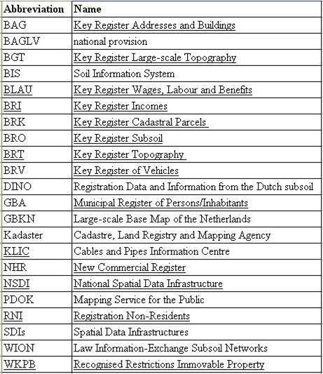
10 of Infrastructure and Environment, Ministry of Economics, Agriculture and Innovation, TNO Geological Service of the Netherlands, Kadaster and Geonovum. The objective is to provide geo-services internally between partners and externally to the public sector. Nation-wide front offices like MijnOverheid.nl and Geozet Spatial Search and Portrayal Service (Dutch: GEOgrafische Zoek- En Toondienst), are the first launching public customers of PDOK. In the future other national, regional, and local government agencies and services are expected to make use of PDOK services. PDOK fits well in government-wide initiatives like the Gideon strategy. The implementation of PDOK is envisioned to be a growing system which will increasingly serve more datasets in the coming years. PDOK is a data-delivery service. The datasets maintenance is the responsibility of the PDOK partners. The Dutch Kadaster is the prospective maintenance organization of the central PDOK core service (including the access layer and the National Georegistry). In the coming years PDOK services will become more and more in conformance with the INSPIRE Directive. To fulfill the expectations of future users, the system should provide good looking maps, be highly responsive, always available (7 x 24 hrs.) and provide meaningful services to its launching customers. Conclusion The Key Registers in the Netherlands are a solid base for the National Spatial Data Infrastructure (NSDI). The Gideon report sets out the strategies to speed up the realisation of the Dutch NSDI. Also the link with the European INSPIRE Directive is a part of this strategy. The Cadastre, Land Registry and Mapping Agency (Kadaster) plays a central role in producing the Key Registers Cadastre and Topography and is also responsible for distributing other Key Registers as a national provision, for example Key Register Addresses and Buildings. In addition to the geographical Key Registers, there are more regsisters and datasets available. Together with the finished and development of other Key Registers, the Dutch NSDI becomes mature. References GIDEON Key geo-information facility for the Netherlands, Ministry of Housing, Spatial Planning and the Environment, Den Haag, 2008 Report Technical Design PDOK Motor Phase 1, Geonovum, 2010 Napoleon s registration principles in present times: The Dutch System of Key Registers, Yvette Ellenkamp, Bart Maessen. Published as paper in GSDI Website: Website: Website: Website Abbreviations
11
Building a national SDI. Approach and strategy in The Netherlands
 Agenda 1. NSDI vision and implementation strategy 2. NSDI playing field 3. Standards framework for the NSDI 4. National SDI components for IM Information model public safety SDI Portal for public safety
NSDI assessment for the Netherlands
 for the Netherlands Ruby Beltman, Geonovum May 24 2007 Presentation the Dutch public geo-information playing field Geonovum and the Dutch NSDI need for results The Dutch public geo-information playing
National Spatial Data Infrastructure development in Republic of Macedonia
 National Spatial Data Infrastructure development in Republic of Macedonia Sonja Dimova, state advisor for geomatics AGENCY FOR REAL ESTATE CADASTRE September 6-th, 2017, Strasbourg AREC competence for
E-Government and E-Land Administration As an example: The Netherlands.
 E-Government and E-Land Administration As an example: The Netherlands. Paul VAN DER MOLEN and Martin WUBBE Key words: e-governance and e-land administration SUMMARY NO E-GOVERNMENT WITHOUT LAND INFORMATION
Preparing Kadaster for the future and contribute to sustainable economic development
 Preparing Kadaster for the future and contribute to sustainable economic development, The Netherlands Key words: Data collection, Information services, Cadastre, Land registry, Sustainable economic development,
Cadastre and Land Registration in Europe
 Annex A: Questionnaire 2007 for Information Resource Cadastre and Land Registration in Europe Introduction This questionnaire is based on the EuroGeographics vision document 'Cadastre and Land Registration
Recent Developments in Use and Dissemination of Geospatial Data in Germany - Example Lower Saxony
 Recent Developments in Use and Dissemination of Geospatial Data in Germany - Example Lower Saxony Conference Permanent Committee on Cadastre Lithuanian Presidency Vilnius, 22 October 2013 Peter Creuzer
Advances in Modern Land Administration Cadastre 2014 in the Year 2006
 Advances in Modern Land Administration Cadastre 2014 in the Year 2006 Winfried HAWERK, Germany Key words: E-Land Administration, IT renewal strategies SUMMARY FIG Commission 7 Working Group 7.3 deals with
Value Chain Mapping. 3D Cadastre and Valuation The Added Value of 3D Geo-information Richard Witmer, Kadaster NL, 30 March 2017
 Value Chain Mapping 3D Cadastre and Valuation The Added Value of 3D Geo-information Richard Witmer, Kadaster NL, 30 March 2017 Agenda Purpose: why look at 3D cadastre and valuation? Approach: what we did.
Spatial Data Infrastructure for knowledge sharing
 , THE NETHERLANDS Key words: SDI, knowledge sharing, people profit planet, Kadaster, system of key registers, good governance, e-government, spatially enabled society, GIDEON SUMMARY Today s global challenges
How Dutch registrars use PLR information to enrich the data from Cadastre
 How Dutch registrars use PLR information to enrich the data from Cadastre 12-11-2015 Presentation topics Introduction Two methods of registration of PL Restrictions Shaping the future method, current discussions
Challenges for the multi purpose cadastre
 Jens RIECKEN, Markus SEIFERT, Germany Key words: Multi purpose cadastre, 3d-cadastre, land use, SDI, solar cadastre SUMMARY Over the past 30 years, with the progress of information technologies the development
Spatial Data Infrastructure in Sweden
 Spatial Data Infrastructure in Sweden Hans-Erik WIBERG, Sweden Key words: ABSTRACT Sweden was one of the first countries to address Data Infrastructure matters and have during several decades developed
Use of data in Ukraine for sustainable economic growth. Oleksandr Maliuk State Service of Ukraine for Geodesy, Cartography and Cadastre
 Use of data in Ukraine for sustainable economic growth Oleksandr Maliuk State Service of Ukraine for Geodesy, Cartography and Cadastre Kehl, 2017 Content of the presentation Ukraine & StateGeoCadastre:
BULGARIAN CADASTRE A GUARANTEE FOR THE OWNERSHIP RIGHTS IN IMMOVABLE PROPERTIES
 4 TH INTERNATIONAL CONFERENCE RECENT PROBLEMS IN GEODESY AND RELATED FIELDS WITH INTERNATIONAL IMPORTANCE February 28 - March 2, 2007, Inter Expo Centre, Sofia, Bulgaria BULGARIAN CADASTRE A GUARANTEE
International funding projects in Republic Geodetic Authority
 International funding projects in Republic Geodetic Authority Serbia: Republic Geodetic Authority Workshop Exploring Funding Instruments for NMCA 7-8 November 2012 Republic Geodetic Authority Republic
Test and Implementation of DATR System in Hungary
 Test and Implementation of DATR System in Hungary, Hungary Key words: unified land registry, cadastral map, Hungary SUMMARY During the last years there has been an important development in the Hungarian
Croatian SDI: a Tool for Accelerated Development of the Geo-Conscious Society
 STATE GEODETIC ADMINISTRATION Croatian SDI: a Tool for Accelerated Development of the Geo-Conscious Society Prof.Dr.Sc. Željko Bačić, Mr.Sc. Ljerka Rašić FIG Working Week 2009 - Surveyors Key Role in Accelerated
Possible integration of Information via a system of KEY REGISTERS. IMOLA PROJECT WS 1-2nd Seminar Athens, 6th October 2014
 Possible integration of Information via a system of KEY REGISTERS IMOLA PROJECT WS 1-2nd Seminar Athens, 6th October 2014 OUTPUT QUESTIONNAIRE Questions only partly understood unclear LR belong to system
Building a European Spatial Data Infrastructure: The Role of EuroGeographics
 Building a European Spatial Data Infrastructure: The Role of EuroGeographics Richard Kirwan President of EuroGeographics 1st Congress on Cadastre in the EU 1 Presentation overview EuroGeographics - the
Quality Improvement of the Real Estate Cadastre in Serbia
 , Serbia Key words: quality improvement, real estate information, quality assurance, Serbia SUMMARY The concept of cadastral modernization in the Republic of Serbia was defined in 1992, and it is being
Report and update from Working Group A on Core Data
 JOINT UN-GGIM: EUROPE ESS MEETING ON THE INTEGRATION OF STATISTICAL AND GEOSPATIAL INFORMATION LUXEMBOURG 31 MARCH 2017 Report and update from Working Group A on Core Data François Chirié, Dominique Laurent,
LIS a motivation for SDI initiative
 Eric Mwaikambo Ardhi University Dar es Salaam Tanzania Overview Status of LIS in Tanzania Relationship between SDI and LIS Spatial Standards LIS a motivation for SDI initiative Conclusion & Recommendations
Digitalisation of the Real Property Rights Towards Spatially enabled E-Government
 Digitalisation of the Real Property Rights Towards Spatially enabled E-Government Lise Schroeder, Bent Hulegaard Jensen, Esben Munk Soerensen & Line Hvingel Istanbul, Turkey 25 june 201 Overview Introduction
Lessons for federated countries that have state land registries the Australian experience
 Lessons for federated countries that have state land registries the Australian experience Ian Williamson Centre for SDI and Land Administration Department Infrastructure Engineering University of Melbourne
Status and Perspectives of the Geodesy, Cartography and Cadastre Authority Availability of Geographic Information in Slovakia.
 Status and Perspectives of the Geodesy, Cartography and Cadastre Authority Availability of Geographic Information in Slovakia Hedviga Májovská Geodesy, Cartography and Cadastre Authority of the Slovak
Land Administration In Public Private Partnerships
 Land Administration In Public Private Partnerships Workshop Customers - Co-operation - Services Vienna, 12-13 September 2002 Peter Creuzer Content Land Administration - Tasks History Spatial Data Infrastructure
INTEGRATED LAND ADMINISTRATION SYSTEM PROJECT PREPARATION (IBRD Advance no. P459-HR) TERMS OF REFERENCE
 TERMS OF REFERENCE") INTEGRATED LAND ADMINISTRATION SYSTEM PROJECT PREPARATION (IBRD Advance no. P459-HR) TERMS OF REFERENCE SERVICE PROVISION FOR THE SUPPORT TO THE NATIONAL SPATIAL DATA INFRASTRUCTURE (NSDI) DEVELOPMENT
INTEGRATED LAND ADMINISTRATION SYSTEM PROJECT PREPARATION (IBRD Advance no. P459-HR) TERMS OF REFERENCE SERVICE PROVISION FOR THE SUPPORT TO THE NATIONAL SPATIAL DATA INFRASTRUCTURE (NSDI) DEVELOPMENT
(UNECE) John Manthorpel
 John Manthorpel") Lanc Registration and Land Valuation in the United Kingdom and in the countries of the United Nations Economic Commission for Europe (UNECE) John Manthorpel Introduction This paper is in two parts and
Lanc Registration and Land Valuation in the United Kingdom and in the countries of the United Nations Economic Commission for Europe (UNECE) John Manthorpel Introduction This paper is in two parts and
Egyptian Nationwide Title Cadastre System
 Kholoud SAAD, Egypt Key words: Cadastre, Registration, Urban, Rural, National Cadastre, Automation, reengineering. SUMMARY With growing need for integrated information, Enterprise Solutions has become
The Challenge to Implement International Cadastral Models Case Finland 1
 The Challenge to Implement International Cadastral Models Case Finland 1 Tarja MYLLYMÄKI and Tarja PYKÄLÄ, Finland Key words: cadastre, modelling, LADM, INSPIRE SUMMARY Efforts are currently made to develop
Croatian NSDI - An example of AGISEE country web-page. Vlado Cetl and Miljenko Lapaine
 Croatian NSDI - An example of AGISEE country web-page Vlado Cetl and Miljenko Lapaine Introduction 2/18 Guidelines AGISSE Country Pages should provide an overview of the situation of SDIs in the countries
Proposals for Best Practice
 WPLA Fees & Charges in Cadastre and Registration Proposals for Best Practice Neil King United Kingdom WPLA Fees and Charges Study Best Practice This presentation offers an overview of a draft report that
EXPANDING AVAILABILITY OF BROADBAND ACCESS AND ADOPTION
 Single point information Ilija Kepevski Agency for Electronic Communications Regional Conference for Europe EXPANDING AVAILABILITY OF BROADBAND ACCESS AND ADOPTION 28-29 September 2015 - Budva, Montenegro
Role of Republic Geodetic Authority in the Serbian geo-sector
 Role of Republic Geodetic Authority in the Serbian geo-sector Republic Geodetic Authority, Serbia www.rgz.gov.rs EuroGeographics General Assembly 2014 Moldova, Chisinau, 28 th 30 th September 2014 The
LAND ADMINISTRATION IN LITHUANIA: CHALLENGES AND PERSPECTIVES
 UNECE WPLA Workshop Influence of Land Administration on People and Business, Cavtat, Croatia, October 2-3, 2008 LAND ADMINISTRATION IN LITHUANIA: CHALLENGES AND PERSPECTIVES Kestutis Sabaliauskas, Director
INSPIRE Thematic Working. Cadastral parcels. September 2008
 INSPIRE Thematic Working Cadastral parcels September 2008 The INSPIRE context The INSPIRE Directive Its aim is to build the INfrastructure for Spatial InfoRmation in Europe The INSPIRE Directive has been
Aspect of preliminary activities in the function of supporting NSDI
 Sonja DIMOVA, Republic of Macedonia Key words: e-governance, geospatial data, NSDI, INSPIRE, metadata SUMMARY The successful establishment of the NSDI in the true sense of the word cannot be performed
Support to Implementation of Multipurpose Cadastral Information system in Vietnam
 Support to Implementation of Multipurpose Cadastral Information system in Vietnam Lennart JOHANSSON and Per SÖRBOM, Sweden Key words: Land Registration, Land Information, Land Administration, SWOT analyse,
Land and Geographic Information, an Important Part of the Infrastructure in Sweden
 Land and Geographical Information Land and Geographic Information, an Important Part of the Infrastructure in Sweden Land and Geographic Information, an Important Part of the Infrastructure In Sweden Bo
A CADASTRAL GEODATA BASE FOR LAND ADMINISTRATION USING ARCGIS CADASTRAL FABRIC MODEL A CASE STUDY OF UWANI ENUGU, ENUGU STATE, NIGERIA
 A CADASTRAL GEODATA BASE FOR LAND ADMINISTRATION USING ARCGIS CADASTRAL FABRIC MODEL A CASE STUDY OF UWANI ENUGU, ENUGU STATE, NIGERIA BY Ndukwu, Raphael. Ike Department of Geoinformatics & Surveying University
AREC responsibilities, data and registries and the way of their distribution
 Data as a basis of the digital society PCC, 13-15 March 2018, Sofia AREC responsibilities, data and registries and the way of their distribution Vlatko Dimovski Agency for Real Estate Cadastre (AREC) the
Cadastral Survey in the 21 st Century. Gavin Adlington. Land Program Team Leader Europe and Central Asia Region (ECA)
") E-learning Series Cadastral Survey in the 21 st Century June 3, 2010 Gavin Adlington. Land Program Team Leader Europe and Central Asia Region (ECA) The World Bank Content : Purpose of cadastral survey
E-learning Series Cadastral Survey in the 21 st Century June 3, 2010 Gavin Adlington. Land Program Team Leader Europe and Central Asia Region (ECA) The World Bank Content : Purpose of cadastral survey
The Multi Purpose Cadastre, a network approach
 The Multi Purpose Cadastre, a network approach Peter Laarakker, Kadaster NL 1 Content 1. Introduction 2. Multi purpose cadastre 3. Definitions 4. Cadastral boundaries 5. Real property right 6. Conclusions
Meeting the Changing National Geospatial Information Needs. Palitha Udayakantha Surveyor General - Sri Lanka
 Meeting the Changing National Geospatial Information Needs Palitha Udayakantha Surveyor General - Sri Lanka Sri Lanka Location Latitude 5 55 10-9 50 6 North Longitude 79 31 19-81 52 36 East Area 65610
Design and Determine 3D Cadastral Systems: A Case Study of Turkey Hicret GURSOY SURMENELI* and Mehmet ALKAN* (Turkey)
") Design and Determine 3D Cadastral Systems: A Case Study of Turkey Hicret GURSOY SURMENELI* and Mehmet ALKAN* (Turkey) *Yildiz Technical University, Civil Engineering Faculty, Department of Geomatics CONTENTS
Design and Determine 3D Cadastral Systems: A Case Study of Turkey Hicret GURSOY SURMENELI* and Mehmet ALKAN* (Turkey) *Yildiz Technical University, Civil Engineering Faculty, Department of Geomatics CONTENTS
Geoinformation Technologies in Land Management and Beyond: Case of Georgia
 Geoinformation Technologies in Land Management and Beyond: Case of Georgia Joseph SALUKVADZE Professor, Department of Human Geography, Co-team Leader, Cadastre and Land Register Project, Co-financed by
Rights Responsibilities Restrictions (RRRs)
") 37 th Australasian Conference of Registrars of Title 26-29 October 2010, Perth WA Rights Responsibilities Restrictions (RRRs) Any factor which affects the use of public or private land below, or on, or
37 th Australasian Conference of Registrars of Title 26-29 October 2010, Perth WA Rights Responsibilities Restrictions (RRRs) Any factor which affects the use of public or private land below, or on, or
Information contained
 Government Information (Public Access) Act 2009 (GIPA Act) LPI Information Guide 1. Introduction and contents of this guide The Land and Property Information s (LPI) Information Guide tells you in general
GIDEON Key geo-information facility for the Netherlands
 www.vrom.nl GIDEON Key geo-information facility for the Netherlands Approach and implementation strategy (2008 2011) GIDEON Key geo-information facility for the Netherlands Approach and implementation
PROJECT INFORMATION DOCUMENT (PID) APPRAISAL STAGE Report No.: PIDA Project Name. Region Country Sector(s) Theme(s)
 APPRAISAL STAGE Report No.: PIDA Project Name. Region Country Sector(s) Theme(s)") Public Disclosure Authorized Public Disclosure Authorized Public Disclosure Authorized Public Disclosure Authorized Project Name Region Country Sector(s) Theme(s) Lending Instrument Project ID Borrower(s)
Public Disclosure Authorized Public Disclosure Authorized Public Disclosure Authorized Public Disclosure Authorized Project Name Region Country Sector(s) Theme(s) Lending Instrument Project ID Borrower(s)
1st Regional INSPIRE Forum 4th Croatian NSDI and INSPIRE Day
 1st Regional INSPIRE Forum 4th Croatian NSDI and INSPIRE Day State of Play EULIS Rik Wouters Managing Director EULIS Programme What is EULIS EULIS is renewed: LINE For who is EULIS? Why EULIS? Projects
Unified Land Administration for a Better Spatial Infrastructure
 Unified Land Administration for a Better Spatial Infrastructure Gyula IVÁN Institute of Geodesy, Cartography & Remote Sensing FÖMI (HUNGARY) Open Symposium 30th Korean Cadastral Seminar & FIG Commission
Securing Land Rights for Broadband Land Acquisition for Utilities in Sweden
 Securing Land Rights for Broadband Land Acquisition for Utilities in Sweden Marija JURIC and Kristin LAND, Sweden Key words: broadband, land acquisition, cadastral procedure, Sweden SUMMARY The European
Preprint.
 http://www.diva-portal.org Preprint This is the submitted version of a paper presented at 10th EC GI & GIS Workshop, ESDI State of the Art, Warsaw, Poland, 23-25 June 2004. Citation for the original published
Demonstrate knowledge of, and extract, cadastral data from Landonline
 Page 1 of 5 Demonstrate knowledge of, and extract, cadastral data from Landonline Level 3 Credits 5 Purpose This unit standard is for people who are working in the surveying industry in jobs which involve
Chapter 3: A Framework for a National Land Information Infrastructure
 Chapter 3: A Framework for a National Land Information Infrastructure Brian Marwick Overview As a federated county, Australia s land administration systems are state and territory based. These systems,
New Danish e-cadastre and its role in the Danish e-government
 New Danish e-cadastre and its role in the Danish e-government PCC Budapest 2011 Pia Dahl Højgaard, pdh@kms.dk Cadastre and Legal Authority, National Survey and Mapping, Denmark The danish context Neighbours
PROTOCOL ASDI ARCTIC SPATIAL DATA INFRASTRUCTURE PROJECT KICK-OFF MEETING
 1(9) Friday, 15 October 2010 PROTOCOL ASDI ARCTIC SPATIAL DATA INFRASTRUCTURE PROJECT KICK-OFF MEETING Point of time: 09.00 October 14 11.15 October 15, 2010 Locality: Rue du Nord 76, 1000 Brussels, BELGIUM
Re-engineering engineering the cadastre to support e-governmente
 Centre for SDIs and Land Administration Department of Geomatics Re-engineering engineering the cadastre to support e-governmente Ian Williamson UN sponsored Third Land Administration Forum, Tehran, 2009
SECTOR PUBLIC CADASTRES AND REGISTERS MARKET PARTICIPANTS
 E-SERVICES TO CITIZENS, GOVERNMENT AND BUSINESSES. LITHUANIA EXPERIENCE Arvydas Bagdonavičius State Enterprise Centre of Registers Arvydas.Bagdonavicius@registrucentras.lt REGISTERS AND IS MANAGED BY THE
Cadastre and the crowd: a brief encounter or a long-lasting marriage?
 Cadastre and the crowd: a brief encounter or a long-lasting marriage? Martin Salzmann Cadastre, Land Registry and Mapping Agency The Netherlands PCC Conference Towards Digital Europe and Spatially Enabled
The Cadastral Parcel Rejuvenated: Evolving from Property Unit to Core Element in Spatial Data Infrastructures
 The Cadastral Parcel Rejuvenated: Evolving from Property Unit to Core Element in Spatial Data Infrastructures Martin SALZMANN, the Netherlands Julius ERNST, Austria Key words: Cadastre; e-governance;geoinformation/gi;gsdi;land
Legal aspects of the Cadastre. 05.Seminary 4. The Cadastre of 9/12/02 20:33 Página 274
 05.Seminary 4. The Cadastre of 9/12/02 20:33 Página 274 of Kadaster employs specialised account managers to keep in touch with the individual municipalities. Large scale base map In the past the Dutch
Interoperability in surveying
 Interoperability in surveying Ron Bloksma Kadaster Dutch Land Registry Thread in my career Law Organisation Processes Information Legal interoperability Organisational interoperability Semantic interoperability
Presented at the FIG Working Week 2016, May 2-6, 2016 in Christchurch, New Zealand
 Presented at the FIG Working Week 2016, May 2-6, 2016 in Christchurch, New Zealand The IMPULS Project Is a Project About Cooperation, Coordination, Transparency and Data Sharing A SDI project in the Western
Smart Infrastructure Benefits and Key Players from a Global Perspective
 Smart Infrastructure Benefits and Key Players from a Global Perspective Spatial@gov 2010 October 5-7 Canberra Jude Wallace and Abbas Rajabifard Centre for Spatial Data Infrastructures and Land Administration
PROJECT INFORMATION DOCUMENT (PID) CONCEPT STAGE Report No.: AB3229 Project Name. Land Registry and Cadastre Modernization Project Region
 CONCEPT STAGE Report No.: AB3229 Project Name. Land Registry and Cadastre Modernization Project Region") PROJECT INFORMATION DOCUMENT (PID) CONCEPT STAGE Report No.: AB3229 Project Name Land Registry and Cadastre Modernization Project Region EUROPE AND CENTRAL ASIA Sector Central government administration
PROJECT INFORMATION DOCUMENT (PID) CONCEPT STAGE Report No.: AB3229 Project Name Land Registry and Cadastre Modernization Project Region EUROPE AND CENTRAL ASIA Sector Central government administration
The Digital Cadastral Database and the Role of the Private Licensed Surveyors in Denmark
 IRISH INSTITUTE OF SURVEYORS, DUBLIN INSTITUTE OF TECHNOLOGY, 23 NOVEMBER 2005 PUBLISHED IN IIS NEWS, WINTHER 2006. The Digital Cadastral Database and the Role of the Private Licensed Surveyors in Denmark
Regional Cadastral Study Reforms in the Region
 UNECE WORKING PARTY ON LAND ADMINISTRATION Workshop on the Influence of Land Administration on People and Business Cavtat, Croatia 2-3 October 2008 Regional Cadastral Study Reforms in the Region Miodrag
Improvement of Effectiveness Present Developments in Hungarian Land Administration
 Improvement of Effectiveness Present Developments in Hungarian Land Administration Gyula IVÁN and András OSSKÓ, Hungary Key words: Land Administration, Cadastre, Land Registry SUMMARY New Act on Surveying
Content. Development and Potential for Improvements of the Austrian Land Administration System. Introduction. Dynamic Framework of Land Administration
 Development and Potential for Improvements of the Austrian Land Administration System Reinfried MANSBERGER, BOKU Vienna Gerhard MUGGENHUBER, BEV Vienna Gerhard NAVRATIL, TU Vienna Christoph TWAROCH, TU
Common Vision Conference Tradition meets Innovation Vienna, Austria,October 5-6, 2017
 The impact of digitization: how participatory will the cadastre function be in the future? Martin Salzmann Cadastre, Land Registry and Mapping Agency The Netherlands Common Vision Conference Tradition
Presented by: Stewart Information International, Inc. Jack McKenna
 Presented by: Stewart Information International, Inc. Jack McKenna Held at the: 2007 ESRI Survey & Engineering GIS Summit San Diego Convention Center San Diego, California June 16-19, 2007 Integrating
Property Transactions in the Digital Age. The Property Cadastre in the Context of Spatial. Dr. Jens Riecken, NRW Ministry of the Interior
 Property Transactions in the Digital Age The Property Cadastre in the Context of Spatial Data Infrastructure (SDI) Dr. Jens Riecken, NRW Ministry of the Interior Property Transactions in the Digital Age
The New Swiss Law on Geoinformation and the Ordinance. on thecadastre on Public Law Restrictions (4064)
") on thecadastre on Public Law Restrictions (4064) 1. INTRODUCTION 2. STARTING CONDITIONS 3. TIME FRAME 4. RESULTs OF THE WORK 5. CONTENT OF THE ACT ON GEOINFORMATION 6. CADASTRE OF THE PUBLIC-RIGHT RESTRICTIONS
on thecadastre on Public Law Restrictions (4064) 1. INTRODUCTION 2. STARTING CONDITIONS 3. TIME FRAME 4. RESULTs OF THE WORK 5. CONTENT OF THE ACT ON GEOINFORMATION 6. CADASTRE OF THE PUBLIC-RIGHT RESTRICTIONS
Cadastral Parcels in the context of INSPIRE
 Cadastral Parcels in the context of INSPIRE Gyula IVÁN Institute of Geodesy, Cartography & Remote Sensing, HUNGARY Open Symposium on Environment and Land Administration Big Works for the Defence of Territory
The Development of the Austrian Cadastre from Documentation to an Integrated Planning and Decision Support System
 The Development of the Austrian Cadastre from Documentation to an Integrated Planning and Decision Support System WPLA - Working Party on Land Administration 15-17 October 2014, Vienna, Austria Wernher
KHANALIBAYLI UNECE WPLA
 UNECE Working Party on Land Administration The role of the UNECE Working Party on Land Administration (WPLA) in the promotion and improvement of land administration and land management in the UNECE region
LAND REGISTRATION SYSTEM OF THE REPUBLIC OF CROATIA
 "On the last day of the Creation God desired to crown His work, and thus created Kornati Islands out of tears, stars and breath." (George Bernard Shaw) LAND REGISTRATION SYSTEM OF THE REPUBLIC OF CROATIA
Cadastral Parcels in INSPIRE. Lisbon, 27 February 2013
 Cadastral Parcels in INSPIRE Lisbon, 27 February 2013 Dominique.laurent@ign.fr Plan INSPIRE context The modeling approach for theme Cadastral Parcels Implementation of INSPIRE theme Cadastral Parcels Context
ABSTRACT Land Administration System in Lithuania
 ABSTRACT Land Administration System in Lithuania 1. General introduction to the Lithuanian Land Administration System and State Enterprise Centre of Registers ( shortly SECR) Lithuania has established
REGISTRATION OF PROPERTIES IN STRATA
 REGISTRATION OF PROPERTIES IN STRATA REPORT ON THE WORKING SESSIONS INTRODUCTION A cadastre is usually, and in most countries, a parcel-based, and up-to-date land information system containing records
Spatial Data Warehouse Ltd. Cadastral Mapping INITIATIVE 1: CADASTRAL MAPPING. Version Spatial Data Warehouse Ltd. & AltaLIS Ltd.
 Spatial Data Warehouse Ltd. Initiative 1: Cadastral Mapping INITIATIVE 1: CADASTRAL MAPPING 29 P3 The SDW/AltaLIS Model Background The Government of Alberta started a mapping program, the Municipal Integrated
e-land Administration in Hungary
 e-land Administration in Hungary Piroska Zalaba senior counsellor, project manager Ministry of Agriculture and Rural Development Department of Lands and Mapping FIG SEMINAR Innsbruck, 2-4 June 2004 Land
Results of Central European Land Knowledge Center (CELK) Activities
 Activities") Results of Central European Land Knowledge Center (CELK) Activities András OSSKÓ, Hungary Key words :CELK Center, Property Rights and Land Market Development, Networking, direct knowledge transfer SUMMARY
Results of Central European Land Knowledge Center (CELK) Activities András OSSKÓ, Hungary Key words :CELK Center, Property Rights and Land Market Development, Networking, direct knowledge transfer SUMMARY
ENVIRONMENT CANTERBURY S WEB-BASED CONTAMINATED LAND INFORMATION TRANSFER SYSTEM
 ENVIRONMENT CANTERBURY S WEB-BASED CONTAMINATED LAND INFORMATION TRANSFER SYSTEM Davina McNickel 1, Helen Davies 2, Vincent Salomon 2 1 Environment Canterbury, PO Box 345, Christchurch. Telephone: 03 365
UNECE Working Party on Land Administration. Report on the Activities Carried Out by the UNECE WPLA Since the Committee's 72nd Session
 UNECE Working Party on Land Administration Report on the Activities Carried Out by the UNECE WPLA Since the Committee's 72nd Session Damir Pahic, dipl.ing. UNECE WPLA Chair 73rd Session 25th September
LAND CADASTRE AND BUILDING CADASTRE IN SLOVENIA: CURRENT SITUATION AND POTENTIAL OF 3D DATA
 3D Cadastres Organizational and Governmental Aspects LAND CADASTRE AND BUILDING CADASTRE IN SLOVENIA: CURRENT SITUATION AND POTENTIAL OF 3D DATA EMA POGORELČNIK AND MARINA KOROŠEC Surveying and Mapping
A Vision for a Fully Digital Cadastral Survey System
 A Vision for a Fully Digital Cadastral Survey System Anselm HAANEN, Trent GULLIVER, New Zealand Key words: cadastral survey system, digital cadastre, survey plans SUMMARY Surveyors have traditionally prepared
Participants of the Ministerial Meeting on Housing and Land Management on 8 October 2013 in Geneva
 Summary At its meeting on 2 April 2012, the Bureau of the Committee on Housing and Land Management of the United Nations Economic Commission for Europe agreed on the need for a Strategy for Sustainable
A Geocoded Cadastral Fabric as a Precondition for a Sustainable Land Management System
 A Geocoded Fabric as a Precondition for a Sustainable Land Management System Gottfried KONECNY, Germany; J.P. LAUZON, Canada; Abdul Salam MOHAMMED, India Key words: SDI,, Parcel Boundaries, GPS-GNSS, Land
Implementation Status & Results Croatia Integrated Land Administration System Project (P122219)
") Public Disclosure Authorized Public Disclosure Authorized The World Bank Implementation Status & Results Croatia Integrated Land Administration System Project (P122219) Operation Name: Integrated Land
Public Disclosure Authorized Public Disclosure Authorized The World Bank Implementation Status & Results Croatia Integrated Land Administration System Project (P122219) Operation Name: Integrated Land
The Role of National Mapping and Cadastre Agencies in Establishment of NSDI: Croatian Example
 The Role of National Mapping and Cadastre Agencies in Establishment of NSDI: Croatian Example Ljerka RAŠIĆ and Željko BAČIĆ, Croatia Key words: spatial data infrastructure, NSDI, NMCA, Inspire SUMMARY
Analyses of the Results of Land Consolidation Studies by GIS
 Analyses of the Results of Land Consolidation Studies by GIS Fatih ISCAN, Turkey Key words: Land consolidation, GIS, landholding, planning, spatial analyse SUMMARY Rural development generally refers to
STATUS REPORT
 Working Group 3 Land Administration STATUS REPORT 2006-2009 2009 Prof Ian Williamson (Chair) Mr Ahmad Fauzi Nordin (Vice Chair) Assoc. Prof Abbas Rajabifard (Vice Chair) 18th UNRCC-AP Conference Bangkok
Challenge to Implement International Cadastral Models Case Finland
 FIG Articleof the Month April 20 Challenge to Implement International Cadastral Models Case Finland Tarja Myllymäki and Tarja Pykälä 200-04-5 The topics are In European level INSPIRE Experiences, similarities,
Property Based Land Information Systems of Turkey
 Property Based Land Information Systems of Turkey Mehmet Fatih DİRİ, Bilgehan ÖZSOY, Ünsal ERGÜN, Turkey Key words: Cadaster, Land Registry, GIS, Property, TURKEY SUMMARY The property, addition to the
REFORM OF LAND CADASTRE IN LITHUANIA
 REFORM OF LAND CADASTRE IN LITHUANIA Romualdas KASPERAVICIUS, Lithuania Key words: ABSTRACT Main aim for every Government is to create legal, financial and organisational circumstances for real property.
EVOLUTION TOWARDS THE DIGITAL LAND OFFICES
 EVOLUTION TOWARDS THE DIGITAL LAND OFFICES Szabolcs MIHÁLY, Piroska ZALABA Budapest, Hungary 1. INTRODUCTION 2. CURRENT STATUS OF THE UNIFORM LAND REGISTRATION 2.1. Management Features of the Hungarian