OVERVIEW AND PROGRESS DEPARTMENT OF LANDS, THAILAND
|
|
|
- Helen Payne
- 5 years ago
- Views:
Transcription
1 OVERVIEW AND PROGRESS OF DEPARTMENT OF LANDS, THAILAND presented by PEERA YOMWAN Division of Mapping Technology, DOL The Asean Federation of Land Surveying and Geomatics (AFLAG) : April 11, BKK
2 OUTLINE Missions and progress of DOL DOL Highlight: CORS GNSS Network Supervision of Private Surveyors
3 DOL ORGANIZATION STRUCTURE PMO MOF MCom. MOAC MEd MTS MOC MOJ MInd. MOL MOT MOD MNRE MOST MOI MFA MPH MSDHS MICT Central DOL Regional 7 Bureaus 865 Regional Land Offices 9 Divisions 1 BKK LO 16 BKK LO Branches 75 Provincial LO 322 Provincial LO Branch 37 Sub-Branch LO 431 District LO
4 Organization Chart of Department of Lands DOL Director General Advisor on Performance Deputy Director General Advisor on Surveying (Surveyor General) Land Inspectors Efficiency Centre Performance Central Administration Public Land Management Bureau The office of Secretary of The Department Provincial Administration Provincial of Land Office And Branch Division of Mapping Technology Cadastral Survey Administration and Promotion Bureau Standard Registry Bureau Bureau of Standard Land Document Issuance Finance Division Printing Division Personal Division Supply Division Training Division Legal Affairs Division District Land Office Pre-District Land Office Pre-Branch Land Office Estate Business Promotion Bureau Information Technology Bureau Bangkok Metropolis Land Office Planning Division The Private Surveyor Board Office Internal Auditor Cadastral Information Center Department of Lands

5 DOL MAN POWER


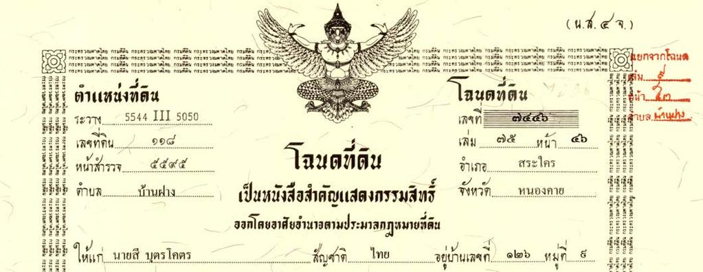
6 NUMBER OF LAND RIGHT DOCUMENT
7 DOL VISION "To be core mechanism in driving land management for the utmost benefit for the people and country development with standard management and service" The registration of rights and juristic acts in each year are in between 6-8 million cases and can collect revenue for the Government at the average of 70,000-90,000 million Bath (2,200-2,800 million USD)
8 DOL CORE FUNCTIONS Protecting right in private land Managing public land Conducting land survey and mapping Issuing land right document Registering of rights and juristic acts on land and immovable property Promoting real estate business Managing land information
 becoming to First Class")
9 DOL RECENT HIGHLIGHTS The National Land Information and Mapping Centre Project aims to be the central integrated organization of the utilization of land and mapping information The Improvement of Land Surveying by RTK GNSS Network aim to improve land surveying method from the Second Class Survey (no geographical coordinate) becoming to First Class Survey


")

10 Import land documents & Linkage Land Parcel (C) Registration Record (A) Land Right Document (B) เช อมโยงก นได เช อมโยงก นได C A B เช อมโยงก นได 10
11

12 1. Cadastral Map Ground Survey Map Aerial Photo Map
13 Cadastral Map Ground Survey Map 50 cm.


14 Cadastral Map Ground Survey Map 16 GPS Control marks 3 Traverse lines Department of Lands

15 Cadastral Map Aerial Photomap 50 cm.

16 Cadastral Map Aerial Photomap Department of Lands
17 Cadastral Map 50 cm. (2 km.) Map Scale 1:4, cm. (2 km.) Most area of land parcels are greater than 16 rai. (25,600 sq.m)
18 Cadastral Map 50 cm. 50 cm. 1 2 Map Scale 1:2, km. 2 km. Most area of land parcels are in between 4-16 (6,400-25,600 sq.m)
19 Cadastral Map 50 cm. 50 cm Map Scale 1:1, km km. Most area of land parcels are in between 1-4 rai (1,600-6,400 sq.m)
20 Cadastral Map Map Scale 1: cm. 50 cm km. 2 km. Most area of land parcels are less than 1 rai (1,600 sq.m)


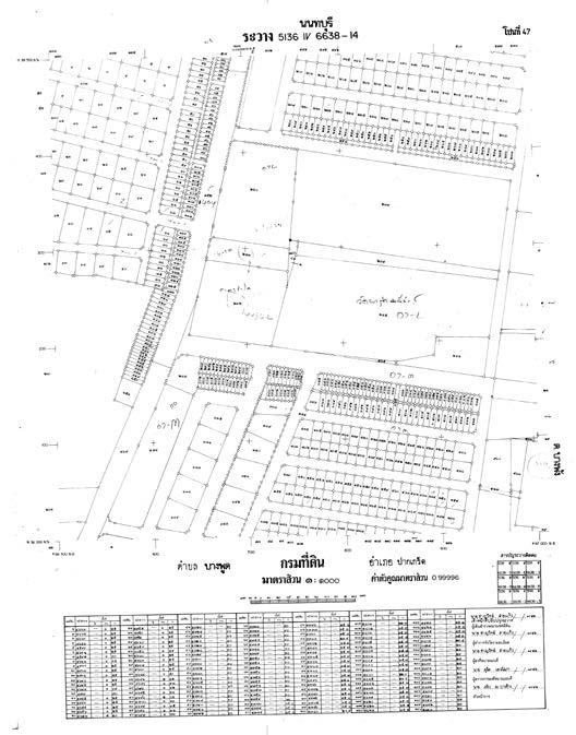
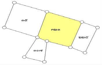
21 Cadastral Map Registration Database Sheet Name + UTM Parcel Number
22 Cadastral Survey In the Department of Lands two classes of cadastral survey are classified The First Class Survey The Second Class Survey According to the Ministerial regulation No. 6 and No. 49 (B.E. 2554) issued under the Land Code Act (B.E. 2497)
23 Cadastral Survey First Class Survey N1, E1 N2, E2 Area from UTM Coordinates N4, E4 N3, E3 Observation of distances and angles from control points (with geographical coordinate) to boundary marks Mathematical methods are used to calculate boundary marks coordinates and area.
24 First Class Survey Cadastral Survey Survey Instruments Theodolite / Chain Theodolite / EDM Total Station = Theodolite + EDM GPS RTK GPS Total Station + GPS = Smart Station Department of Lands


25 First Class Survey Cadastral Survey Total Station


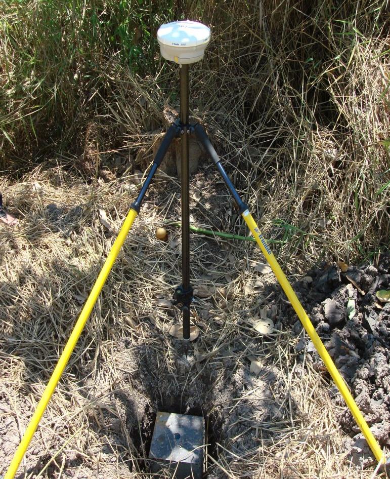
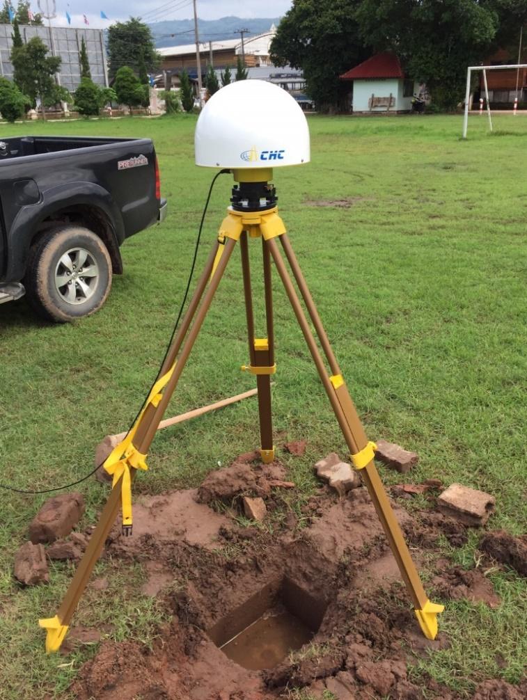
26 First Class Survey Cadastral Survey RTK GPS
27 Second Class Survey Cadastral Survey The second class survey is done by offsetting method by chains or steel tapes from control points to boundary marks or by using aerial photomap to identify land corners Survey instruments and material used : chain or steel tape; aerial photomap. Department of Lands


28 Second Class Survey Cadastral Survey CHAIN Survey Department of Lands
29 Cadastral Survey Second Class Survey By aerial photomap identification Department of Lands
30 Cadastral Survey CADASTRAL MAP GROUND SURVEY MAP AERIAL PHOTO MAP FIRST CLASS SURVEY SECOND CLASS SURVEY Department of Lands
31 Surveying System for Cadastral Survey Control network by RTSD stations (GPS) Major control network (Static GPS) Minor control network (Static GPS) RTK GPS Major traverses Minor traverses Traverse for detailed survey Cadastral Map Cadastral Survey

32 GPS Survey Framework 3 Fixed Stations 325 Stations in Network Everest Spheroid 1830 Indian1975 Datum Framework Fixed Stations WGS1984 Datum 3402 Major Control Network 370 Stations in Network WGS1984 Ellipsoid Department of Lands 32


 = 3,953 Stations")
33 Surveying System for Cadastral Survey GPS Survey - Control Station by RTSD = 18 Stations - Major Control Network (GPS) = 370 Stations - Static GPS = 8,322 Stations - Fast Static GPS = 15,200 Stations - RTK GPS = 94,100 Stations - Permanent Pillar Mark (Static GPS) = 3,953 Stations Department of Lands

34 Minor Control Marks 30,000 Marks
35 RTK Control Marks 100,000 Marks

36 GPS Control Marks Conditions!?
37 Solution of RTK GNSS Network
38 Typical RTK GNSS method RTK Base Station at known position Rover Station (user)

39 Q: What is CORS? A: Continuous Operational Reference System Running for 24 hours High precision coordinates Variable service 24h static observation of reference station Centimeter accuracy Accuracy independent from rover-tobase distance

")
40 RTK GNSS NETWORK (VRS concept) CORS CORS CORS M9U<XP1U+PW+ MDZP< / WF4B JPF4"6 "PU( UFFT+JT7aHS: mua? <: Xh"%FD: Xh7W< ( 0UAW%T7b7E>FSDU6 CORS RTK GNSS Network component CORS (Continuously Operating Reference Station) Control Center Rover


41 Thailand RTK GNSS Network Total 222 CORS in 2018 DOL 121 Installed 61 # 30 # 30 CORS Department of Public Works and Town & Country Planning 15 Installed Royal Thai Survey Department # 80 CORS Hydro and Agro Informatics Institute 6 Installed


42 DOL CORS Network are looking for cooperation!
43 Organization Chart of Department of Lands DOL Director General Advisor on Performance Deputy Director General Advisor on Surveying (Surveyor General) Land Inspectors Efficiency Centre Performance Central Administration Public Land Management Bureau The office of Secretary of The Department Provincial Administration Provincial of Land Office And Branch Division of Mapping Technology Cadastral Survey Administration and Promotion Bureau Standard Registry Bureau Bureau of Standard Land Document Issuance Finance Division Printing Division Personal Division Supply Division Training Division Legal Affairs Division District Land Office Pre-District Land Office Pre-Branch Land Office Estate Business Promotion Bureau Information Technology Bureau Bangkok Metropolis Land Office Planning Division The Private Surveyor Board Office Internal Auditor Cadastral Information Center Department of Lands
44 Private Surveyor Act 2535 According to the Private Surveyors Act 2535, the Private Surveyor Board was set up with the main activities as follows: - To set the qualifications and background of the person who will be private surveyor. - To Issue a license to a private surveyor and give permit the establishment of private surveyor office. - To set the standard of surveying equipments. - To set up regulations and practices for the private surveyors and private surveyor offices. A Private surveyor office s performance is limited only to land with title deeds (resurveys, subdivision and consolidation surveys).
45 Private Surveyor Each year there are approximately 500,000 cases for boundary and cadastral survey with approximately 90% of these undertaken directly by government There are 174 private surveyors office (at April 2016) which have a license issued by the Department of Land There are 1,340 private surveyors (at April 2016) however the majority of these are likely to only have a diploma level qualification Only Thai nationals (over 20 years of age) or Thai juridical persons are allowed under the Act to be licensed (or, similarly, foreign equity/shareholders less than 50%)
46 (1) being of Thai nationality; (2) being not less than twenty years of age; ISSUANCES OF PRIVATE SURVEYOR LICENCES (3) being qualified as prescribed by the Committee and published in the Government Gazette; (4) not being a government official receiving salary and holding a permanent position; not being an official of a State enterprise; (5) not being of unsound mind or mental infirmity; not suffering from any disease as specified by the Minister and published in the Government Gazette; (6) not being incompetent or quasi-incompetent; (7) not having disgraceful behaviour or moral deficiency; and having are ference person certify that the applicant s behaviour is in accordance with the rules prescribed by the Committee; (8) having never been expelled, dismissed, discharged or disemployed by the Government or a State enterprise due to dishonest performance of duties; (9) having never been sentenced to imprisonment in a case relating to professional honesty; (10) not being a person whose private surveyor licence has been revoked pursuant to section 61 (4) unless a period of five years has since the date of revocation of such private surveyor licence.

47
Field surveying inspection using tablets
 Field surveying inspection using tablets Rami Farraj, Ahmad Sghyyer Survey of Israel, Lincoln 1, Tel-Aviv, Israel rami@mapi.gov.il ahmad@mapi.gov.il Key words: Field Surveying, Cadastre, Mapping Procedures
The Boundary and the Effects of Cadastral Surveying in Cyprus
 The Boundary and the Effects of Cadastral Surveying in Cyprus Aristi Louca, Margarita Fani Surveyor Engineers, Cyprus Association of Rural and Surveying Engineers The History of Cyprus goes back 11000
Reporting Thailand Cadastral System in Cadastre 2014 Trends BY VUTTINAN UTESNAN. Rajamangala University of Technology Krungthep
 Reporting Thailand Cadastral System in Cadastre 2014 Trends BY VUTTINAN UTESNAN Rajamangala University of Technology Krungthep Faculty of Engineering, Bangkok, THAILAND Topics INTRODUCTION THAILAND CADASTRAL
Building Fit for Purpose Land Administration Systems - World Bank Experience
 Building Fit for Purpose Land Administration Systems - World Bank Experience Gavin Adlington Lead Land Administration Specialist The World Bank Fit For Purpose The only way to establish a successful land
Establishing Efficient Cadastral Surveying Plan in Accordance with Introducing World Geodetic Reference System in Korea
 Modern Environmental Science and Engineering (ISSN 2333-2581) December 2015, Volume 1, No. 6, pp. 299-303 Doi: 10.15341/mese(2333-2581)/06.01.2015/003 Academic Star Publishing Company, 2015 www.academicstar.us
BULGARIAN CADASTRE A GUARANTEE FOR THE OWNERSHIP RIGHTS IN IMMOVABLE PROPERTIES
 4 TH INTERNATIONAL CONFERENCE RECENT PROBLEMS IN GEODESY AND RELATED FIELDS WITH INTERNATIONAL IMPORTANCE February 28 - March 2, 2007, Inter Expo Centre, Sofia, Bulgaria BULGARIAN CADASTRE A GUARANTEE
BHUMIBOL ADULYADEJ, REX. Given on the 4 th day of May B.E (2000) Being the 55 th Year of the Present Reign
 Being the 55 th Year of the Present Reign") Unofficial Translation LAND DEVELOPMENT ACT B.E. 2543 (2000) 1 BHUMIBOL ADULYADEJ, REX. Given on the 4 th day of May B.E. 2543 (2000) Being the 55 th Year of the Present Reign By Royal Command, His Majesty
Unofficial Translation LAND DEVELOPMENT ACT B.E. 2543 (2000) 1 BHUMIBOL ADULYADEJ, REX. Given on the 4 th day of May B.E. 2543 (2000) Being the 55 th Year of the Present Reign By Royal Command, His Majesty
INDIAN INSTITUTE OF TECHNOLOGY ROORKEE. Presentation on REAL TIME CADASTRAL SURVEYING SOLUTION WITH A SPECIAL IMPHESIS TO MODERN GPS TECHNOLOGY.
 INDIAN INSTITUTE OF TECHNOLOGY ROORKEE Presentation on REAL TIME CADASTRAL SURVEYING SOLUTION WITH A SPECIAL IMPHESIS TO MODERN GPS TECHNOLOGY By: Prof. Kamal Jain, Dept. of Civil Engg. IIT-Roorkee AIM
THE AMENDMENTS TO THE CONDOMINIUM ACT
 LSH Newsletter September 2008 Issue THE AMENDMENTS TO THE CONDOMINIUM ACT The Condominium Act (No. 4) B.E. 2551 (2008) ( Act No. 4 ), 4 which amends the Condominium Act B.E. 2522 (1979) (the Condominium
Ⅱ-2. The Resurvey Project
 Presenter : JANG, Bong-Bae MLTM Ministry of land,transport and Maritime Affairs KIM, Soon-Tae KCSC Korea Cadastral Survey Corp., JANG, Bong-Bae Ⅰ. INTRODUCTION The Korean modern cadastral system was established
THE COOPERATIVES ACT B.E BHUMIBOL ADULYADEJ REX.
 (Translation) THE COOPERATIVES ACT B.E. 2542 --------------------- BHUMIBOL ADULYADEJ REX. Given on the 12 th day of April, B.E. 2542; Being the 54 th year of the Present Reign. His Majesty King Bhumibol
Land Information System as new instrument for Land Administration: Case Examples. Mike Cheremshynskyi Consultant, Land Administration Expert
 Land Information System as new instrument for Land Administration: Case Examples Mike Cheremshynskyi Consultant, Land Administration Expert Background Growth of population and fast urbanization in many
The Digital Cadastral Database and the Role of the Private Licensed Surveyors in Denmark
 IRISH INSTITUTE OF SURVEYORS, DUBLIN INSTITUTE OF TECHNOLOGY, 23 NOVEMBER 2005 PUBLISHED IN IIS NEWS, WINTHER 2006. The Digital Cadastral Database and the Role of the Private Licensed Surveyors in Denmark
LAND READJUSTMENT ACT B.E BHUMIBOL ADULYADEJ, REX., Given on the 11th day of December B.E. 2547, Being the 59th Year of the Present Reign.
 LAND READJUSTMENT ACT B.E. 2547 BHUMIBOL ADULYADEJ, REX., Given on the 11th day of December B.E. 2547, Being the 59th Year of the Present Reign. Whereas it is deemed appropriate to promulgate the law governing
FIG/FAO International Seminar on State and Public Land Management
 FIG/FAO International Seminar on State and Public Land Management State Land Distribution for the Poor: State Land Identification, Mapping, Classification and Registration By Dr. Sareth Boramy Deputy General
A Geocoded Cadastral Fabric as a Precondition for a Sustainable Land Management System
 A Geocoded Fabric as a Precondition for a Sustainable Land Management System Gottfried KONECNY, Germany; J.P. LAUZON, Canada; Abdul Salam MOHAMMED, India Key words: SDI,, Parcel Boundaries, GPS-GNSS, Land
Establishing a Land policy reform and GPS Technology implementation in Burkina Faso
 Annual World Bank Conference on Land and Poverty 2013 Establishing a Land policy reform and GPS Technology implementation in Burkina Faso Presentation made by Moha EL-AYACHI, IAV Hassan 2, Morocco Paper
CONDOMINIUM ACT, B.E (1979)
") Unofficial Translation CONDOMINIUM ACT, B.E. 2522 (1979) 1 --------------- BHUMIBOL ADULYADEJ, REX. Given on the 21 st Day of April B.E.2522; Being the 34 th Year of the Present Reign. His Majesty King
Unofficial Translation CONDOMINIUM ACT, B.E. 2522 (1979) 1 --------------- BHUMIBOL ADULYADEJ, REX. Given on the 21 st Day of April B.E.2522; Being the 34 th Year of the Present Reign. His Majesty King
Direction Concerning Preparation of Survey Plans In the Emirate of Dubai. Chapter One General Provisions
 Direction Concerning Preparation of Survey Plans In the Emirate of Dubai Chapter One General Provisions Article (1) Terms used in the Jointly Owned Properties Law In these Regulations, the terms and expressions
National Spatial Data Infrastructure development in Republic of Macedonia
 National Spatial Data Infrastructure development in Republic of Macedonia Sonja Dimova, state advisor for geomatics AGENCY FOR REAL ESTATE CADASTRE September 6-th, 2017, Strasbourg AREC competence for
78th OREGON LEGISLATIVE ASSEMBLY Regular Session. Enrolled. Senate Bill 297
 78th OREGON LEGISLATIVE ASSEMBLY--2015 Regular Session Enrolled Senate Bill 297 Printed pursuant to Senate Interim Rule 213.28 by order of the President of the Senate in conformance with presession filing
Hybrid Cadastre Pilot Project Guidelines for Public Land Disposition Surveys Operations Division
 Hybrid Cadastre Pilot Project Guidelines Operations Division January 12, 2015 Version Update Version No. Date Summary of Changes 2.0 January 12, Table of Contents 2015 Table of Contents added to Guidelines.
Aspect of preliminary activities in the function of supporting NSDI
 Sonja DIMOVA, Republic of Macedonia Key words: e-governance, geospatial data, NSDI, INSPIRE, metadata SUMMARY The successful establishment of the NSDI in the true sense of the word cannot be performed
A Method For Building Legal Digital Cadastre Without Using Cadastral Measurements Field Book Data Is It Accurate Enough?
 A Method For Building Legal Digital Cadastre Without Using Cadastral Measurements Field Book Data Is It Jad JARROUSH, Dmitri BRICKMAN, Israel Key words: Digital Cadastre, Least Squares Cadastral Computations,
Association of Ontario Land Surveyors
 Association of Ontario Land Surveyors Interpretive Guide and Supplement to The Performance Standards for the Practice of Cadastral Surveying (Ontario Regulation 216/10) March 15, 2015 Page 1 Contents Introduction...
Cadastre in Addis Ababa. Status and future development
 Status and future development Dr.-Ing. Paul Hartfiel Mülheim, 1. Oct. 2010-1 - Addis Ababa Capital of Ethiopia Area population 540 km² > 3,200,000 (rapidly growing) 2,300,000 in 1994 > 22% of all urban
PRESENTATION TO THE 2004 ANNUAL MEETING OF FIG COMMISSION 7. Apie van den Berg and James Mudau SOUTH AFRICA SEPTEMBER 2004
 PRESENTATION TO THE 2004 ANNUAL MEETING OF FIG COMMISSION 7 Apie van den Berg and James Mudau SOUTH AFRICA SEPTEMBER 2004 HISTORICAL OVERVIEW Pre 1994 Tenure Systems: Full ownership Permission to Occupy
Condominium Housing in Thailand - Legal Analysis
 Condominium Housing in Thailand - Legal Analysis Roi Bak, Advocate 1 Introduction Condominium housing projects have been developing in Thailand (mainly Bangkok) during the recent years. The limited land
STATE OF RHODE ISLAND AND PROVIDENCE PLANTATIONS
 STATE OF RHODE ISLAND AND PROVIDENCE PLANTATIONS RHODE ISLAND CONTRACTORS REGISTRATION LICENSING BOARD Department of Administration HOME INSPECTORS LICENSING LAW CHAPTER 65.1 [Effective July 1, 2013] 5-65.1-1
FIG-WB Forum on Land Administration and reform in Sub-Sahara Africa
 FIG-WB Forum on Land Administration and reform in Sub-Sahara Africa Chris Mnyanga Ministry of Lands UNITED REPUBLIC OF TANZANIA] FIG WORKING WEEK, Abuja, NIGERIA 2013-6-10 MAY 2013 Country at Glance UNITED
Quality Improvement of the Real Estate Cadastre in Serbia
 , Serbia Key words: quality improvement, real estate information, quality assurance, Serbia SUMMARY The concept of cadastral modernization in the Republic of Serbia was defined in 1992, and it is being
Condominium Act B.E page 1 CONDOMINIUM ACT B.E (1979) BHUMIBOL ADULYADEJ REX
 BHUMIBOL ADULYADEJ REX") Condominium Act B.E. 2522 page 1 CONDOMINIUM ACT B.E. 2522 (1979) -------------- BHUMIBOL ADULYADEJ REX. -------------- His Majesty King Bhumibol Adulyadej has been graciously pleased to proclaim that:
Condominium Act B.E. 2522 page 1 CONDOMINIUM ACT B.E. 2522 (1979) -------------- BHUMIBOL ADULYADEJ REX. -------------- His Majesty King Bhumibol Adulyadej has been graciously pleased to proclaim that:
GLOBAL GEOSPATIAL MANAGEMENT INFORMATION
 GLOBAL GEOSPATIAL MANAGEMENT INFORMATION SEOUL, KOREA 24 th to 26 th October 2011 COUNTRY REPORT - REPUBLIC OF BOTSWANA 1. INTRODUCTION 1.1. SOCIAL, ECONOMIC AND POLITICAL BACKGROUND Botswana attained
The New Technology of a Survey Data Model and Cadastral Fabric as the Foundation for a Future Land Administration System.
 The New Technology of a Survey Data Model and Cadastral Fabric as the Foundation for a Future Land Ian HARPER, Australia Key words: cadastral modelling, survey data model, Survey Accuracy, Cadastre 2014
ABSTRACT Land Administration System in Lithuania
 ABSTRACT Land Administration System in Lithuania 1. General introduction to the Lithuanian Land Administration System and State Enterprise Centre of Registers ( shortly SECR) Lithuania has established
Senate Bill 297 Ordered by the Senate March 2 Including Senate Amendments dated March 2
 th OREGON LEGISLATIVE ASSEMBLY-- Regular Session A-Engrossed Senate Bill Ordered by the Senate March Including Senate Amendments dated March Printed pursuant to Senate Interim Rule. by order of the President
Designing for transparency and participation in the Hellenic Cadastral Project
 Designing for transparency and participation in the Hellenic Cadastral Project Dr. Dimitris Rokos Director of Planning and Investments, Hellenic National Cadastre and Mapping Agency S.A. Table of Contents
THE THAI BUSINESS SECURITY ACT
 THE THAI BUSINESS SECURITY ACT 1. BACKGROUND The Business Security Act B.E. 2558 (2015) (the BSA ), which came into effect as of 1 July 2016, is intended to address the need to facilitate a business enterprise
IMPLEMENTATION OF LEGAL DIGITAL CADASTRE IN ISRAEL
 IMPLEMENTATION OF LEGAL DIGITAL CADASTRE IN ISRAEL Dr. Gershon STEINBERG, Israel INTRODUCTION The Survey of Israel (SOI), Israel s national surveying and mapping agency, plans to implement full legal digital
REFORM OF LAND CADASTRE IN LITHUANIA
 REFORM OF LAND CADASTRE IN LITHUANIA Romualdas KASPERAVICIUS, Lithuania Key words: ABSTRACT Main aim for every Government is to create legal, financial and organisational circumstances for real property.
PART 2.7 DEPARTMENT OF GOVERNMENT SERVICES REAL ESTATE REGULATION
 PART 2.7 DEPARTMENT OF GOVERNMENT SERVICES REAL ESTATE REGULATION Executive Summary The Financial Services Regulation Division (the Division) within the Consumer and Commercial Affairs Branch of the Department
ELECTRONIC DEEDS REGISTRATION SYSTEMS BILL
 REPUBLIC OF SOUTH AFRICA ELECTRONIC DEEDS REGISTRATION SYSTEMS BILL (As introduced in the National Assembly (proposed section 75); explanatory summary of Bill published in Government Gazette No. 41308
Participants of the Ministerial Meeting on Housing and Land Management on 8 October 2013 in Geneva
 Summary At its meeting on 2 April 2012, the Bureau of the Committee on Housing and Land Management of the United Nations Economic Commission for Europe agreed on the need for a Strategy for Sustainable
Thailand. Auditing Department and Cooperative
 ICA Committee on Consumer Cooperation for Asia and the Pacific Thailand Highlights of consumer co-ops Fierce competition with private retailers Striving to rebuild a Community co-op 1. Co-operative movement
Vietnam Land Administration - the Past, Recent and for the Future
 Mr. Ton Gia Huyen, Former Director General of General Department of Land Administration and Mrs. Tran Thi Minh Ha, Director of International Relation Department, Ministry of Natural Resources and Environment,
STATE LAND AUDIT REPORT
 STATE LAND AUDIT REPORT 1 Presentation to the Portfolio Committee on Rural Development and Land Reform M514 Marks Building 30 March 2011 CHIEF SURVEYOR GENERAL Mr M RIBA Content 2 Background Project Objectives
Department of Lands and Survey
 Cadastral System in Jordan Department of Lands and Survey Eng. Nedal Al-Sagarat/ Director General Eng. Mouen Sayegh/ IT Manager November, 2011 General Information Historical Background Main Duties Organizational
STATE OF RHODE ISLAND AND PROVIDENCE PLANTATIONS
 STATE OF RHODE ISLAND AND PROVIDENCE PLANTATIONS HOME INSPECTORS LICENSING LAW TITLE 5 CHAPTER 65.1 Department of Administration BUILDING CODE COMMISSION CONTRACTORS REGISTRATION BOARD One Capitol Hill
General Instructions For Surveys and Plans Outside the Provincial Survey System
 May 15, 2018 General Instructions For Surveys and Plans Outside the Provincial Survey System NOTE: This document is a Controller of Surveys Policy manual to be used as a general guideline for the Legal
CADASTRAL WORKS in TURKEY AND GDLRC (TKGM)
") CADASTRAL WORKS in TURKEY AND GDLRC (TKGM) NOVEMBER 2011 SOME NUMBERS ABOUT TURKEY Area :783.600 Km 2 Population : 747 millions (2008) Number of land parcels : 555 millions Villages and quarters : 52.437
CADASTRAL WORKS in TURKEY AND GDLRC (TKGM) NOVEMBER 2011 SOME NUMBERS ABOUT TURKEY Area :783.600 Km 2 Population : 747 millions (2008) Number of land parcels : 555 millions Villages and quarters : 52.437
A Radical Solution for the Cadastre Problem in Egypt Using Integrated GPS-GIS System
 A Radical Solution for the Cadastre Problem in Egypt Using Integrated GPS-GIS System Dr. Ehab NABIL NASSIF, Egypt Key words: ABSTRACT During the period 1897-1907 the cadastral surveying of Egypt was established.
FOREIGN OWNERSHIP OF CONDOMINIUMS IN THAILAND
 FOREIGN OWNERSHIP OF CONDOMINIUMS IN THAILAND 1 Legal Nature of Condominiums and Foreign Ownership Rules A. Definition "Condominium", a relatively recent development in Thailand, is the term used to describe
THE ROLE OF ORGANISATIONS AND SECTORS. By: Mohammad Azmi Mohd Zin President The ASEAN Federation of Land Surveying and Geomatics.
 THE ROLE OF ORGANISATIONS AND SECTORS By: Mohammad Azmi Mohd Zin President The ASEAN Federation of Land Surveying and Geomatics. About The ASEAN Federation of Land Surveying and Geomatics A Federation
Crown Land Leasing Policy
 Management Manual 25 Chapter: Section: Approved By: Implementation: 6 (Licenses, Leases, Permits, Sales, Land Exchanges) 4 () Duff Montgomerie Deputy Minister Land Administration Division Land Services
Section I General Information
 General Information Table of Contents A. Introduction... I-2 1. Purpose... I-2 2. Scope... I-2 3. Maintenance... I-3 4. Units... I-3 B. Public Relations... I-3 1. General Public... I-3 2. Property Owners...
FIG Congress 2010 Facing the Challenges Building the Capacity Sydney, Australia, April
 Setting up the infrastructure for improving the development of Cadastre in Greece Dr. Dimitris ROKOS, Dr. Konstantinos KYRIAZIS and Dr. Panos LOLONIS KTIMATOLOGIO S.A. (Hellenic Cadastre) Source: wikipedia
Official language is Thai language
 Page 7 MINISTERIAL REGULATION Prescribing Criteria for Calculating the Value of Assets Subject to Inheritance Tax B.E. 2559 (2016) By virtue of Section 5 and Section 15 (3) of the Inheritance Tax Act,
CHAPTER LAND SURVEY ACT and Subsidiary Legislation
 CHAPTER 8.09 LAND SURVEY ACT and Subsidiary Legislation Revised Edition showing the law as at 1 January 2013 This is a revised edition of the law, prepared by the Law Revision Commissioner under the authority
Ministry of Mines, Industry and SME
 Republic of Senegal Ministry of Mines, Industry and SME User Conference 2010 08/02/2010 COPYRIGHT 2010. SPATIAL DIMENSION (PTY) LTD. A MINING CADASTRE IN SENEGAL: IMPLEMENTATION PROCESS AND ORGANIZATIONAL
PROJECT INFORMATION DOCUMENT (PID) APPRAISAL STAGE Report No.: PIDA Project Name. Region Country Sector(s) Theme(s)
 APPRAISAL STAGE Report No.: PIDA Project Name. Region Country Sector(s) Theme(s)") Public Disclosure Authorized Public Disclosure Authorized Public Disclosure Authorized Public Disclosure Authorized Project Name Region Country Sector(s) Theme(s) Lending Instrument Project ID Borrower(s)
Public Disclosure Authorized Public Disclosure Authorized Public Disclosure Authorized Public Disclosure Authorized Project Name Region Country Sector(s) Theme(s) Lending Instrument Project ID Borrower(s)
20:12 PREVIOUS CHAPTER
 TITLE 20 Chapter 20:12 TITLE 20 PREVIOUS CHAPTER LAND SURVEY ACT Acts 12/1932, 37/1938 (s. 3), 35/1957 (ss. 20, 21 and 22), 80/1959, 14/1962 (s. 2), 45/1969, 80/1971 (s. 33), 5/1972 (Part II), 22/1976,
Cadastre: definitions
 Introduction New vision towards a multipurpose cadastral system to support land management in Morocco Moha EL-AYACHI, El Hassane SEMLALI, Mohamed ETTARID, Driss TAHIRI, Institut Agronomique et Vétérinaire
Key Registers in Finland and some views of Cadastre 2035
 Presented at the FIG Working Week 2016, May 2-6, 2016 in Christchurch, New Zealand Key Registers in Finland and some views of Cadastre 2035 FIG Working Week, Christchurch New Zealand May, the 3rd, 2016
Land Cadastre Act. Chapter 1. Passed RT I 1994, 74, 1324 Entry into force (except 3 which entered into force on 1.01.
 Issuer: Riigikogu Type: act In force from: 01.01.2011 In force until: 31.12.2014 Translation published: 24.10.2014 Passed 12.10.1994 RT I 1994, 74, 1324 Entry into force 08.11.1994 (except 3 which entered
Cadastral Framework Standards
 Cadastral Framework Standards The goal of the Data Standards and Recommendations Committee is to provide recommendations and guidelines to Indiana GIS user communities to facilitate the collection, maintenance
Land Information Management in Southern Africa Focus on technology management training in Surveying and Mapping in Namibia
 Land Information Management in Southern Africa Focus on technology management training in Surveying and Mapping in Namibia Chris Paresi, Urban and Regional Planning and Geo-Information Management Department,
ක ර ය ස ධන ව ර ත ව nrayhw;wif mwpf;if
 ඉඩම ම න ම සභ ව epy msitr;rig 2011 ක ර ය ස ධන ව ර ත ව nrayhw;wif mwpf;if PERFORMANCE REPORT CONTENTS 1. Chairman s Message 63 2. Vision and Mission 64 3. The Functions of the 65 4. The powers of the 66
ROYAL GOVERNMENT OF CAMBODIA. Ministry of Land Management, Urban Planning and Construction
 ROYAL GOVERNMENT OF CAMBODIA Urban Planning and Construction Land Registration and Constriction service In Cambodia Presented: H.E Sar Sovann General Director of GDGC Director of LMAP/ LASSP 1. Land Policy
Sustainable and Effective Land Management
 Sustainable and Effective Land Management Mehmet Fatih DİRİ, Turkey Key words: Cadaster, Land registry, Land Administration, GIS, Property, Real Estate, TURKEY SUMMARY The property, addition to the economic
It was MOVED by Mr. Sullivan, seconded by Mr. Benson, that the proposal submitted by Drs. Ballantyne and Chapman be approved.
 AGM REPORT Alberta Land Surveyors' Association April 1999 The Council of the Alberta Land Surveyors Association met on Friday, April 23rd prior to the business meeting of the Annual General Meeting. Here
Responsible and Innovative Land Administration
 Responsible and Innovative Land Administration An Example from Ethiopia 3 RD DECEMBER 2018 Outline A few words about NIRAS Fit-for-purpose: A low-tech disruptive approach? The REILA Project in Ethiopia
NORTH DAKOTA REAL ESTATE APPRAISER QUALIFICATIONS & ETHICS BOARD Received : PO Box 1336 Bismarck, ND Telephone/Fax: (701)
") NORTH DAKOTA REAL ESTATE APPRAISER QUALIFICATIONS & ETHICS BOARD Received : PO Box 1336 Bismarck, ND 58502-1336 Telephone/Fax: (701) 222-1051 Approved: Registration of Apprentice Appraiser / Termination
NORTH DAKOTA REAL ESTATE APPRAISER QUALIFICATIONS & ETHICS BOARD Received : PO Box 1336 Bismarck, ND 58502-1336 Telephone/Fax: (701) 222-1051 Approved: Registration of Apprentice Appraiser / Termination
Land Administration and Spatial Enablement Victoria s Experience. Chris McRae, Executive Director Land Victoria
 Land Administration and Spatial Enablement Victoria s Experience Chris McRae, Executive Director Land Victoria 4 th UN Land Administration Forum, October 2011 Outline About Land Victoria Land Victoria
ARKANSAS DEPARTMENT OF TRANSPORTATION REQUEST FOR LETTERS OF INTEREST
 ARKANSAS DEPARTMENT OF TRANSPORTATION REQUEST FOR LETTERS OF INTEREST Notice is hereby given that the Arkansas Department of Transportation (Department) is seeking letters of interest from qualified consulting
Student Manual (Persons not licensed in any jurisdiction)
") Student Manual (Persons not licensed in any jurisdiction) Association of Newfoundland Land Surveyors For The Use of the Members and Articling Students Reviewed By Board of Examiners July 9, 2013 Approved
Student Manual (Persons not licensed in any jurisdiction) Association of Newfoundland Land Surveyors For The Use of the Members and Articling Students Reviewed By Board of Examiners July 9, 2013 Approved
Croatian SDI: a Tool for Accelerated Development of the Geo-Conscious Society
 STATE GEODETIC ADMINISTRATION Croatian SDI: a Tool for Accelerated Development of the Geo-Conscious Society Prof.Dr.Sc. Željko Bačić, Mr.Sc. Ljerka Rašić FIG Working Week 2009 - Surveyors Key Role in Accelerated
Condominium Act, (No. 4), B. E (2008)
, B. E (2008)") Condominium Act, (No. 4), B. E. 2551 (2008) Translation BHUMIBOL ADULYADEJ, REX. Given on the 27 th February B. E. 2551 (2008); Being the 63 rd year of the present Reign. His Majesty King Bhumibol Adulyadej
Condominium Act, (No. 4), B. E. 2551 (2008) Translation BHUMIBOL ADULYADEJ, REX. Given on the 27 th February B. E. 2551 (2008); Being the 63 rd year of the present Reign. His Majesty King Bhumibol Adulyadej
Official Gazette of the Federation of Bosnia and Herzegovina, number 85, as of LAW ON LEASING. Article 1.
 Official Gazette of the Federation of Bosnia and Herzegovina, number 85, as of 26.12.2008. LAW ON LEASING PART ONE INTRODUCTORY NOTES Article 1. Application scope of the Law (1) This Law defines: the conditions
Application Form for Elite Property Partnership Membership Please use capital letters and black or blue ink only
 Application Form for Elite Property Partnership Membership Please use capital letters and black or blue ink only For TPC use only Membership No.: Membership ID. No.: Approval No.: Agent Code: SR17029 Application
Parcel Boundaries in the Czech Republic
 Parcel Boundaries in the Czech Republic CZECH REPUBLIC Jiri Rydval, Libor Tomandl Czech Office for Surveying, Mapping and Cadastre inhabitants - 10.3 million territory 78,865 km 2 2 Contents: 1. A parcel
CFedS Outline Unit 1. Course 1: History, Records & Administrative Systems
 CFedS Outline Unit 1 Course 1: History, Records & Administrative Systems History of U.S. Surveying Historical Perspective Similarities in Surveying Seniority of Calls Lack of Standards A National Debt
CADASTRAL STUDIES (MGU1014 / MGHU1514)
") CADASTRAL STUDIES (MGU1014 / MGHU1514) WEEK 8-LAW AND REGULATIONS (FIELD) SR DR. TAN LIAT CHOON 07-5530844 016-4975551 1 OUTLINE Field Survey Practice 2 FIELD SURVEY PRACTICE 3 Survey Datum For new survey
CADASTRAL STUDIES (MGU1014 / MGHU1514) WEEK 8-LAW AND REGULATIONS (FIELD) SR DR. TAN LIAT CHOON 07-5530844 016-4975551 1 OUTLINE Field Survey Practice 2 FIELD SURVEY PRACTICE 3 Survey Datum For new survey
C.17. Report of the CADASTRAL SURVEYORS LICENSING BOARD OF NEW ZEALAND. For the year ending 30 June 2005
 C.17 Report of the CADASTRAL SURVEYORS LICENSING BOARD OF NEW ZEALAND For the year ending 30 June 2005 Presented to the House of Representatives Pursuant to section 20 of the Cadastral Survey Act 2002
Cadastre and Land Registration A System currently experiencing modernization in ROMANIA
 NATIONAL AGENCY FOR CADASTRE AND LAND REGISTRATION Mihai BUSUIOC Cadastre and Land Registration A System currently experiencing modernization in Agenda Historical Background Institutional organization
GNSS NETWORKS & CADASTRE GNSS AND THE INTERSECTION OF GEODESY AND THE CADASTRE IN KINGDOM OF SAUDI ARABIA SUBJECT TO TALKS
 GNSS NETWORKS & CADASTRE GPS GALILEO GLONASS COMPASS (BEIDOU-2) GNSS AND THE INTERSECTION OF GEODESY AND THE CADASTRE IN KINGDOM OF SAUDI ARABIA 1 SUBJECT TO TALKS GNSS NETWORK From local to global datum
PROCUREMENT OF IMMOVABLE PROPERTY FOR PUBLIC TRANSPORTATION ENTERPRISES ACT, B.E (1997)
") 1 Unofficial Translation PROCUREMENT OF IMMOVABLE PROPERTY FOR PUBLIC TRANSPORTATION ENTERPRISES ACT, B.E. 2540 (1997) BHUMIBOL ADULYADEJ, REX. Given on the 14 th Day of November B.E. 2540; Being the 52
1 Unofficial Translation PROCUREMENT OF IMMOVABLE PROPERTY FOR PUBLIC TRANSPORTATION ENTERPRISES ACT, B.E. 2540 (1997) BHUMIBOL ADULYADEJ, REX. Given on the 14 th Day of November B.E. 2540; Being the 52
Application for a Permit to Construct or Demolish This form is authorized under subsection 8(1.1) of the Building Code Act,1992
 of the Building Code Act,1992") Application for a Permit to Construct or Demolish This form is authorized under subsection 8(1.1) of the Building Code Act,1992 For use by Principal Authority Application number: Permit number (if different):
Application for a Permit to Construct or Demolish This form is authorized under subsection 8(1.1) of the Building Code Act,1992 For use by Principal Authority Application number: Permit number (if different):
Urban-Rural Interrelationship for Sustainable Environment
 Urban-Rural Interrelationship for Sustainable Environment Marrakech 2-52 5 December 2003 Department of Lands and Survey - The Modernization Journey A Paper presented by Eng. Sameer Abbadi Surveying and
TOWARDS E-LAND ADMINISTRATION - ELECTRONIC PLANS OF SUBDIVISIONS IN VICTORIA
 TOWARDS E-LAND ADMINISTRATION - ELECTRONIC PLANS OF SUBDIVISIONS IN VICTORIA Mohsen Kalantari 1, Chris Lester 2, David R Boyle 3, Neil Coupar 4 1 eplan Coordinator 2 SPEAR Manager 3 Deputy Surveyor General
CHAPTER 207 THE VALUATION SURVEYORS ACT
 CHAPTER 207 THE VALUATION SURVEYORS ACT ARRANGEMENT OF SECTIONS Section 1. Short title 2. Interpretation 3. Prohibition of unregistered persons from practising 4. Establishment of Board 5. Tenure, duties,
(10) The Board has the powers and duties of an arbitrator under sections 29(3) and 43 of the Arbitration Act.
 The Board has the powers and duties of an arbitrator under sections 29(3) and 43 of the Arbitration Act.") Surveys Act [Fall 2014 STATUTE LAW] Under section 9 survey error investigation of the Surveys Act. The Minister may appoint a Board consisting of three (3) members. a. List two (2) of the three (3) members.
Surveys Act [Fall 2014 STATUTE LAW] Under section 9 survey error investigation of the Surveys Act. The Minister may appoint a Board consisting of three (3) members. a. List two (2) of the three (3) members.
Germany on the way to a 4D-Cadastre
 Germany on the way to a 4D-Cadastre Dr. Jens Riecken (DVW Vicepresident), Ulrich Gruber, Dr. Markus Seifert (DVW WG Geoinformation) TS 9.1 4D Cadastre, Land Domain Models & Concepts 1 Content About my
The Cadastral Modelling Future and The Land Surveyors Role
 The Cadastral Modelling Future and The Land Surveyors Role Ian Harper Geodata Australia ESRI Survey Summit July 2013 The Land Surveyors Future Role From Custodians of the Cadastre to Custodians of the
Charter: Surveyor. Objectives and Standards
 Objectives and Standards 1. Survey Operations To provide survey services as requested by County Officials and Departments. a. To respond in a timely manner to the Planning & Development Committee's instructions
Information contained
 Government Information (Public Access) Act 2009 (GIPA Act) LPI Information Guide 1. Introduction and contents of this guide The Land and Property Information s (LPI) Information Guide tells you in general
BY THE GRACE OF GOD ALMIGHTY MINISTER OF ENERGY AND MINERAL RESOURCES
 DEPARTMENT OF ENERGY AND MINERAL RESOURCES REPUBLIC OF INDONESIA REGULATION OF MINISTER OF ENERGY AND MINERAL RESOURCES NUMBER 02 YEAR 2009 CONCERNING GUIDANCE IN THE ASSIGNMENT OF GEOTHERMAL PRELIMINARY
Amalia Velasco Carlos Alonso Luis Virgos Fernando Serrano
 Inspire services of the Spanish Directorate General for Cadastre and its use to resolve an old problem of coordination between Spanish Cadastre and Land Registry. Amalia Velasco Carlos Alonso Luis Virgos
Control of Dwelling Place and Land Lease Act, B.E (1961) Translation Section 1 Section 2 Section 3 Section 4 Section 5
 Translation Section 1 Section 2 Section 3 Section 4 Section 5") Control of Dwelling Place and Land Lease Act, B.E. 2504 (1961) Translation BHUMIBOL ADULYADEJ, REX. Given on the 6th Day of October B.E. 2504; Being the 16th Year of the Present Reign. His Majesty King
Control of Dwelling Place and Land Lease Act, B.E. 2504 (1961) Translation BHUMIBOL ADULYADEJ, REX. Given on the 6th Day of October B.E. 2504; Being the 16th Year of the Present Reign. His Majesty King
Analytical Cadastre in Israel: Restoring Land Boundaries Based on Photogrammetric Tools
 Analytical Cadastre in Israel: Restoring Land Boundaries Based on Photogrammetric Tools Yohanan GAVISH and Prof. Yerach DOYTSHER, Israel Key words: analytical cadastre; photogrammetry; restoring land boundaries;
GLOBAL POSITIONING SYSTEM ON CADASTRAL SURVEY OF NEPAL
 GLOBAL POSITIONING SYSTEM ON CADASTRAL SURVEY OF NEPAL Krishna Raj Adhikary Chief Survey Officer Geodetic Survey Branch, Survey Department Minbhawan Kathmandu Nepal Email : astrogeo@htp.com.np, krishna_adhikary@hotmail.com