CITY OF COLORADO SPRINGS ANNEXATION PLAN
|
|
|
- Asher Hopkins
- 5 years ago
- Views:
Transcription
1 CITY OF COLORADO SPRINGS ANNEXATION PLAN May 9, 2006
2
3 ACKNOWLEDGEMENTS CITY COUNCIL Lionel Rivera,Mayor Larry Small, Vice Mayor Scott Hente Daryl Glenn Jerry Heimlicher Margaret Radford Tom Gallagher Randy Purvis Bernie Herpin CITY PLANNING COMMISSION Steve Obering, Chair Mark Cunningham, Vice Chair Richard Guy Robert Wignall Steven Val Snider Jan Winkler Robert Null Jonathan Kamins Richard Hansen CITY ADMINISTRATION Lorne Kramer, City Manager Mike Anderson, Deputy City Manager Pat Kelley, City Attorney Jeff Litchfield, City Auditor Kathryn Young, City Clerk Jerry Forte, Colorado Springs Utilities Executive Director TECHNICAL ADVISORY COMMITTEE Mike Anderson, Budget & Financial Analysis Wynetta Massey, City Attorney Jerry Bentrott, Police Lisa Bigelow, Budget & Financial Analysis Craig Blewitt, Transportation Planning Tom Bonifas, City Planning Bill Davis, Colorado Springs Utilities Dave Lethbridge, Public Works Tim Mitros,Public Works Rick O Connor, City Planning Mike McCauley, Parks and Recreation Nina Rikoski, Fire Carl Schueler, El Paso Countgy Planning PROJECT TEAM Bill Healy, Planning and Community Development Director Ira Joseph, Comprehensive Planning Manager David Litzelman, Senior Planner Steve N. Vigil, GIS Analyst Christine Gross, Administrative Technician
4 CITY OF COLORADO SPRINGS 2006 ANNEXATION PLAN TABLE OF CONTENTS CONTENTS PAGE INTRODUCTION 1 CHAPTER 1 Annexation Framework 1 State Requirements 2 Types of Annexation 3 Annexation Policy and City Code 4 CHAPTER 2 Land Use Map Three Mile Plan 7 Land Use Designations 7 CHAPTER 3 Extra-Territorial Annexation 10 City-County Cooperation 10 City Setting 11 Annexation Classification 13 Extra-Territorial Annexation Categories 14 Territorial Limits 15 CHAPTER 4 Enclaves 20 Enclave Classification 21 APPENDICES Table of Contents ANNEXATION PLAN-TABLE OF CONTENTS i
5 CITY OF COLORADO SPRINGS 2006 ANNEXATION PLAN INTRODUCTION Annexation is the process by which municipalities incorporate new territory, and is one of the most dramatic and lasting actions a municipality takes. The Colorado Revised Statutes establish the basic rules for the annexation of territory into a municipality. Additional regulations are found in Chapter Seven of the Code of the City of Colorado Springs. In 1987 the Governor signed legislation (Senate Bill 45) into law requiring that municipalities have a three mile plan in place before they could extend their territory by annexation. On March 8, 1988 with their approval of Resolution the City of Colorado Springs adopted the initial annexation plan and with the adoption of Resolution City Council adopter the 2002 Annexation Plan. The Annexation Plan establishes the framework for decisions concerning annexation of land into the City of Colorado Springs. Coupled with the Comprehensive Plan's policies, the 2020 Land Use Map and the City s Strategic Plan, this document will guide future applicants who seek to annex property into the City. Also, this plan will communicate the City s annexation policies and intentions to interested citizens, public interest groups and special interest groups. There are two basic types of annexations: extra-territorial annexations extend the municipal boundaries and enclave annexations that consolidate municipal boundaries. Issues associated with both types of annexations and recommendations are found in Chapters 3 and 4 respectively. The impact of growth on our community is not only a local issue; it is regional as well. The Annexation Plan was developed with the participation of El Paso County, the City of Fountain, Colorado Springs Utilities, and other municipal agencies. This document will facilitate cooperation between the various jurisdictions and agencies in the matter of annexation, both within the three mile extra-territorial zone and for enclaves. Without better coordination between governmental entities in our region we will see more haphazard patterns of development, greater increases in traffic congestion, duplication of services, fiscal inequalities, and uneven standards for infrastructure and services. Coordinating actions of the City with other governments and agencies in the Pikes Peak region is a step toward more effective planning. The Annexation Plan is not law in the sense of an ordinance; it is however an official public document for the annexation of land that expresses the growth, annexation, and land use recommendations for the areas of potential annexation. It is advisory, adopted by resolution, and has no mandatory compliance or enforcement provisions. This document does satisfy the statutory requirements of the Colorado Revised Statutes, which require a Three-Mile Plan be in place prior to extra-territorial annexation. This plan functions as the City s official three mile plan as required by Section (1)(e) C.R.S ANNEXATION PLAN INTRODUCTION 1
6 CITY OF COLORADO SPRINGS 2006 ANNEXATION PLAN CHAPTER 1-ANNEXATION FRAMEWORK Annexation is the legal process by which a City adds land to its jurisdiction. The most common form of annexation is voluntary annexation where 100% of the property owners petition for annexation. There are limited circumstances when the City can annex territory by unilateral action. Generally the area is an enclave or City owned property. STATE STATUTORY REQUIREMENTS The City s authority to annex land is established by Section 30 of Article II of the Colorado Constitution and the Colorado Revised Statues (C.R.S et. Seq.) ( here to for CRS). The Annexation Law section of the CRS sets out the legal requirements and procedures which municipalities must follow in order to annex territory. Listed below are key provisions of the CRS relating to municipal annexations. Eligibility There are several factors that make an area eligible for annexation. Contiguity is the key factor. For areas that are not surrounded by the municipality, enclaves, not less than one-sixth of the perimeter of the area proposed for annexation must be contiguous with the annexing municipality. There must also be a finding of community interest between the annexing municipality and the property to be annexed. Generally this is taken to be that the area to be annexed is urban or will be urbanized in the future. Section (1)(b) of the CRS presents the criteria for compliance. Three Mile Plan The CRS require that a municipality have a plan in place prior to the completion of any annexation of land within a three-mile area of a municipality s boundaries. This required plan is a document that generally describes the proposed location, character and extent of land use, public facilities and public utilities within this designated planning area. The City of Colorado Springs Annexation plan is intended to meet the CRS requirement for a three mile plan. No annexation may take place which has the effect of extending the municipal boundary beyond this three-mile limit. The exceptions are if a parcel or enterprise zone is split by the three-mile limitation, the entire piece may be annexed. The detailed requirements for the plan in place are found in Section (1)(e) C.R.S ANNEXATION PLAN CHAPTER 1: ANNEXATION FRAMEWORK 2
7 Annexation Impact Report A municipality must prepare an impact report concerning a proposed annexation. This report must be completed twenty-five days prior to the annexation hearing by the City Council and must be presented to the Board of County Commissioners twenty days prior to the annexation hearing. It is the responsibility of the party or parties petitioning for annexation to prepare the Annexation Impact Report. An impact report is not required for an area less than ten acres or if the Board of County Commissioners and the City Council agree the report may be waived. The report at a minimum shall include: A map or maps showing the following: 1. Present and proposed boundaries of the municipality in the vicinity of the proposed annexation; and 2. Streets, major trunk water lines, sewer interceptors and outfalls, other utility lines and ditches, and proposed extensions of such streets and utility lines in the vicinity of the proposed annexation; and 3. Existing and proposed land use pattern in the areas to be annexed. A copy of any draft of final preannexation agreement, if available; A statement of the City s plans for extending or providing municipal services within the area to be annexed; The method under which the City plans to finance the extension of the municipal services; and A statement identifying existing districts within the area to be annexed; A statement of the effect of annexation upon local-public school district systems, including the estimated number of students generated and the capital construction required to educate such students. TYPES OF ANNEXATION Petition (Voluntary Annexation) Landowners seeking annexation must petition the municipality to request annexation into the City. The most common type of annexation is voluntary where all the property owners sign the annexation petition. It is also possible for the landowners of more than fifty percent but less than one hundred percent of an area to petition the municipality to annex the entire area. The petition is filed with the City Clerk and the process of determining compliance with the CRS begins. A determination of eligibility for annexation is made by the City Council. Petition for Annexation Election The lesser of seventy-five qualified electors or ten percent of the qualified electors, may request that the governing body of the municipality commence proceeding to hold an annexation election for a specified area. If the City determines that an annexation election is required based upon its review of the annexation petition, an election shall be called. The district court administers the election. If the majority of votes cast are for annexation the court shall decree that the area may be annexed to the municipality ANNEXATION PLAN CHAPTER 1: ANNEXATION FRAMEWORK 3
8 City Initiated Enclave When an unincorporated area is surrounded by the boundaries of a municipality, the City Council may annex that area to the municipality without the consent of the property owners if the area has been surrounded for a period of not less than three years and the boundary has not changed. Municipally-owned Land If a municipality is the sole owner of land it desires to annex and the area meets the contiguity requirements of the CRS the municipality may annex the area without the notice and hearing provisions in and of the CRS. The entire area cannot consist solely of a public street or right-of-way. ANNEXATION POLICY AND CITY CODE The annexation of property into the City is a legislative, discretionary policy decision made by the City Council (see of the City Code in Appendix II). Annexations must be determined to be a benefit to the City and occur in a manner that ensures a logical and sequential extension of the City s boundary. The Comprehensive Plan and the City Code define what constitutes a benefit to the community. Objective CIS 2 of the Comprehensive Plan and Section of the City Code detail the policy and legal aspects of annexation. Both the Comprehensive Plan policies and the applicable portions of the City Code are found in Appendix I and Appendix II. The cornerstone of the annexation evaluation is Comprehensive Plan Strategy CIS 202a. which states that annexations will be analyzed to determine if they are a benefit to the community. Listed below are the evaluation criteria. The short and long-term fiscal impact of extending City services; The impact a development area may have upon the City if it is not annexed; Any necessary capital improvements and anticipated revenues generated by the proposed development; Employment opportunity; Consistency with the Colorado Springs Utilities Water Resources Plan; Improved stormwater management including stormwater quality controls; Improved public transportation; Diversification of the economic base; The City s ability to accommodate projected population increases; The efficiencies of adding the annexation to the City; Effect on air quality; and Impact on environmental quality. A 10 year estimate of the costs and benefits of servicing the new area is carried out prior to the approval of an annexation. However, a strict adherence to the fiscal evaluation is not the only reason for adding land to the City. Most annexations require that a companion master plan accompany the annexation request be reviewed concurrently. A 2006 ANNEXATION PLAN CHAPTER 1: ANNEXATION FRAMEWORK 4
9 master plan is an advisory document for such issues as land use, transportation, and utilities and is used as a guide in the review of applications for rezoning. The master plan is evaluated using criteria to judge the fiscal impact, the transportation network, environmental impact, and land use relationships. Annexation Agreements An annexation agreement is a contractual agreement between the City and the annexor. This document is used to define the responsibilities and obligations of both the City and the landowner(s) relating to issues such as utility extensions, construction of public facilities, road construction, land dedication and construction of off-site public facilities. The Colorado Supreme Court in City of Colorado Springs v. Kittyhawk Development Co., 154 Colo. 535, 392 P.2d 467 (1964) made the following comment concerning annexation agreements: A municipality is under no legal obligation in the first instance to annex contiguous territory, and may reject a petition for annexation for no reason at all. It follows then that if the municipality elects to accept such territory solely as a matter of its discretion, it may impose such conditions by way of agreement as it sees fit. If the party seeking annexation does not wish to annex under the conditions imposed, he is free to withdraw his petition to annex and remain without the City. Annexation can take place only when the minds of the City and the owners on the land contiguous to the City agree that the property shall be annexed and upon the terms upon which such annexation can be accomplished. The current structure of negotiated development exactions using annexation agreements grew out of the user pay approach in the City s initial Comprehensive Plan adopted by the City Council in This concept posits that new development will not place any excessive fiscal burden on existing taxpayers. Examples of these negotiated exactions through annexation agreements are: Construction of off-site infrastructure Over sizing of on-site infrastructure Foregoing arterial street reimbursement Land dedication for: 1. Public safety facilities 2. Major utility transmission and distribution systems 3. Public Parks Annual cash payments to the City General Fund to offset personnel and operating expenses incurred in providing municipal services Since the 2002 update to the Annexation Plan there have been significant changes to the structuring of annexation agreements. These changes continue 2006 ANNEXATION PLAN CHAPTER 1: ANNEXATION FRAMEWORK 5
10 the user pay philosophy. Among the major changes that have occurred through recent annexations are: Addition of a Fire Facility Fee on a per gross acre basis, to fund the construction of fire stations necessitated by development in newly annexed areas Increased use of special districts in newly annexed areas for construction of major public improvements, construction of certain improvements required through the Subdivision Ordinance, construction of major water and wastewater system components, ownership and maintenance of amenities for a particular development, and in some cases construction, operation, administration and maintenance of public parks and recreation facilities Intergovernmental Agreements (IGAs) between the City of Colorado Springs, El Paso County and the District requiring or permitting annexors to join an existing special district created for the purpose of financing and constructing public improvements. The City and the annexor are bound by the terms of the annexation agreement unless both parties agree to modify the terms of the agreement. Property owners who are considering annexation are required to have a preapplication meeting with the City Planning Department. After discussions with various agencies if the landowner wants to seek annexation, the formal process begins with the submission of a petition and annexation plat. After a determination by the City staff that the property meets the eligibility requirements, the request is sent to the City Council. The City Council then determines that the area is eligible for annexation and refers the request to the City staff for review and processing. As a result of the staff review, issues are identified. The resolution of these issues is addressed in the annexation agreement. The City and the annexor will enter into an Annexation Agreement prior to the final approval by City Council of the annexation petition and plat. This agreement is a legal document used to define the responsibilities and obligations of both the City and the landowners relating to issues such as utility extensions, construction of public facilities and road construction. The public process continues with a review and recommendation to City Council by the Planning Commission. Final action occurs at a City Council Public Hearing. If the City Council approves the annexation request, the plat and signed annexation agreement are recorded ANNEXATION PLAN CHAPTER 1: ANNEXATION FRAMEWORK 6
11 CITY OF COLORADO SPRINGS 2006 ANNEXATION PLAN CHAPTER 2 - LAND USE MAP THREE MILE PLAN The Colorado Revised Statutes, Section (1)(e) requires that there be a plan in place for an area extending three miles beyond a municipality s boundaries prior to the annexation of territory into the municipality. The Annexation Plan Land Use Map is intended to meet the requirement for a Three Mile Plan, (see Map 2.1). The Annexation Plan Land Use Map is designed to work in conjunction with the 2020 Land Use Map of the City s Comprehensive Plan. The Annexation Plan Land Use Map serves as the graphic representation of the City s annexation policies, future land use patterns and provides a land use context for annexation decisions. Created in consideration of El Paso County s Small Area Plans and the City of Fountain s Comprehensive Plan, the land use map represents a framework for the future growth of the Colorado Springs metropolitan area. The land use map also provides a context for the examination of enclaves. This map should not be considered a fixed determination of land use patterns. As the region continues to grow and develop the map will amended. The Annexation Plan Land Use Map will be updated annually along with the 2020 Land Use Map as part of the Comprehensive Plan Annual Report. LAND USE DESIGNATIONS The map uses the twelve land use classifications identified in the City of Colorado Springs Comprehensive Plan 2020 Land Use Map, and adds State Lands and US Forest Service and Conservation designations. Each of the land use designations contains a characterization of primary uses and accompanying complementary secondary uses. State Land Land owned by the State of Colorado and administered by the State Board of Land Commissioners. The majority of the land in this category is privately leased to ranchers for grazing. US Forest Service and Conservation These are areas either owned by the Federal Government or in private ownership that have significant constraints associated with any development. Examples of these constraints are steep slopes, poor access, lack of urban infrastructure and difficulty in providing for public safety and adequate fire protection. Generally residential densities are very low and any individual lots that have been created are substantial in area. Low Residential Areas of existing large lot residential developments and undeveloped areas where this pattern will continue because of past trends, zoning regulations or environmental constraints. In El Paso County the general residential densities are very low with a lot size of 2.5 acres or greater ANNEXATION PLAN CHAPTER TWO: LAND USE MAP THREE MILE PLAN 7
12 General Residential There are areas that include a variety of residential uses, including single family detached, townhouses and apartments, as well as nonresidential uses that serve and support neighborhoods. Community Activity Center Areas of commercial retail and service uses that meet consumer demands for frequently needed goods and services. The service areas for these centers are the surrounding residential areas. Commercial Center Areas for large scale commercial uses that serve a wider community. New/Developing Commercial Corridor Existing major retail areas that are primarily accessible by the automobile. Primary uses are big box retail. Mature/Redevelopment Corridor Small existing retail corridors with opportunities to change into a mixed-use center through infill and redevelopment. Employment Center Areas of major concentrations of employment including corporate campuses and industrial areas. Also included are supporting uses such as residential, commercial and services. Regional Center A combination of commercial and employment uses that function as a regional market for both employment and commercial services. Institutional Large-scale institutional uses such as the Colorado Springs Airport, military bases, colleges and universities, hospitals and non-profits. Candidate Open Space Areas of high natural and scenic value identified through the City Open Space Plan. The areas so designated have high potential value for wildlife habitat, significant vegetation, natural drainage features and scenic quality. Parkland and Open Space Areas of existing parkland such as neighborhood and community parks, and open space areas that are permanently protected from future development. Golf Courses and Cemeteries Existing public and private golf courses and cemeteries. The Three Mile Plan land use map illustrates what the metro region might look like if future annexations and development occurred in conformance with the policies of the Comprehensive Plan and the El Paso County s Small Area Plans. The Potential Urban Growth Area is shown on the Three Mile Plan Land Use Map for reference only ANNEXATION PLAN CHAPTER TWO: LAND USE MAP THREE MILE PLAN 8


13 2006 ANNEXATION PLAN CHAPTER TWO: LAND USE MAP THREE MILE PLAN 9
14 CITY OF COLORADO SPRINGS 2006 ANNEXATION PLAN CHAPTER 3 - EXTRA-TERRITORIAL ANNEXATION The most common method by which a municipality adds land area is voluntary extra-territorial annexation. The property under consideration must have one-sixth contiguity with the annexing municipality. This chapter will classify and prioritize areas that are likely to be considered for extra-territorial annexation. CITY-COUNTY COOPERATION Regional cooperation in matters of growth and development is emphasized in the Land Use Chapter of the Comprehensive Plan. Objective LU 1 of the Comprehensive Plan focuses on improved regional planning and cooperation and Strategy LU 101d promotes cooperation between the City of Colorado Springs, El Paso County and other municipalities in updating the City s Annexation Plan. The policies and strategies from the Land Use Chapter are in Appendix I. In 1985, the City of Colorado Springs, the City of Fountain, and El Paso County entered into a Cooperative Planning Agreement (CPA). The intent of the CPA was to create an area wide comprehensive plan to provide a planning framework in the urban and urbanizing fringe areas of the respective jurisdictions, which in turn would enable a more cogent and unified approach to land use planning within the planning area. The CPA outlined a process for addressing issues within a defined area, from inventorying planning parameters to developing policy statements for the CPA, and ultimately to preparing a CPA Plan. The CPA inventory was completed in In early 1987, after a joint cities/ county meeting, City Council discussed the urban form issue and prepared a draft of Suggestions for Urban Growth Policy, intended to be a further refinement of how growth should be addressed within the Cooperative Planning Area. This document contained a proposal for the city s Potential Urban Growth Area (PUGA), a defined geographic area in which City Council believed urban growth to the year 2000 would primarily occur. City Council s rationale for the PUGA rested on the belief that urban density development should occur within municipal areas, as cities were best equipped to address urban-level infrastructure and service delivery needs. Both the 1991 and the 2001 City Comprehensive Plans contain policies concerning intergovernmental cooperation within the Potential Urban Growth Area. As a concept the Potential Urban Growth Area is outdated for two major reasons. First, much of the Potential Urban Growth Area located north of the City has been, annexed, master planned and is being developed. This area includes the Flying Horse Ranch and areas north of Northgate Road. Much of the PUGA located east of Black Forest Road is annexing into the city or is being developed with urban densities in El Paso County. Second, there has been a proliferation of special purpose districts within the Potential Urban Growth Area approved by El Paso County to support the provision of water and wastewater service for urban density developments outside of Colorado Springs (see 2006 ANNEXATION PLAN CHAPTER 3: EXTRA-TERRITORIAL ANNEXATION 10
15 Map 3.2). These circumstances have the effect of making the PUGA moot as a mechanism for guiding urban density development in the region. El Paso County uses its Small Area Planning process to determine where development will occur. These Small Area Plans ring the City s perimeter and are listed in Appendix IV. The City of Fountain s Comprehensive Plan was also consulted in determining annexation priorities. Comprehensive Plan Strategy LU 102a recommends that the boundaries of the Potential Urban Growth Area be adjusted to reflect current and projected development patterns. The focus of this chapter is to review the current growth boundaries and recommend adjustments. Map 3.1 illustrates the prioritized potential annexation areas. One of the recommendations of the Annexation Plan is to abandon the concept of the Potential Urban Growth Area. CITY SETTING Introduction At present, Colorado Springs contains about 194 square miles of land, of which about 121 square miles are developed. Residentially developed land is about 24%of the land area of the City and vacant land comprises 37% of all land within the City. Approximately 58 % of the population growth in El Paso County from 2000 to 2005 occurred within the City of Colorado Springs. Based upon population estimates by the Colorado Department of Local Affairs, 69% of El Paso County s population lives within the municipal boundaries of Colorado Springs. The focus of current annexation activity is along the Powers Boulevard corridor, the Woodmen Road corridor east of Powers Boulevard, and an area north of Old Ranch Road to Northgate Road. Several large annexations have occurred since The Flying Horse Annexation which is located southwest of the intersection of State Highway 83 and Northgate Road added 1565 acres to the City. The Woodmen Heights annexations, located generally east of Black Forest Road and north of Woodmen Road, added 826 acres. El Paso County Small Area Plans The El Paso County Policy Plan, A Land Use Guide for the Future, is the County s comprehensive plan. The policy plan is refined by developing Small-Area Plans for identified sub-areas of the unincorporated County. These plans function as the overall guiding document and master plan for the specific area. They are more detailed planning documents covering topics such as land use, transportation, natural environment, public facilities and drainage control. These Small-Area Plans ring the exterior boundary of the City. For a list of these plans see Appendix IV. The 2000 Tri-Lakes Plan, and the Black Forest Preservation Plan are the Small Area Plans that have the most direct impact on the areas northeast of Colorado Springs recommended for annexation. Of these two plans, the Black Forest Preservation Plan influences the largest unincorporated area adjacent to the City. The Black Forest Preservation Plan, adopted by the County in 1987, sets forth goals and policies for the area within El Paso County defined as the Black Forest. The 2006 ANNEXATION PLAN CHAPTER 3: EXTRA-TERRITORIAL ANNEXATION 11
16 preservation plan is divided into ten planning units which address each unit s distinct characteristics. Two of these planning units, Number 1 and Number 10, are adjacent to northeasterly portions of the City. The Briargate and Wolf Ranch master plans which are adjacent to Unit 1 (Timbered Area) specifically address issues of transition into the timbered areas that are adjacent to their property. Unit 10 (The Southern Transitional Area) is located north and east of the intersection of Black Forest Road and Woodmen Road and extends north to the timbered area. The focus of Unit Ten s policies is the proper land use and transportation infrastructure transition from urban to rural. The interface policies cover the type, the location and the intensity of development north of the intersection of Banning Lewis Parkway, Briargate Parkway and Stapleton Road. Special Purpose and Metropolitan Districts as Annexation Constraints Opportunities for physical expansion of the City through annexation are limited partly because of the increasing number of special purpose districts being created outside the city limits. (See Map 3._) Urban density development that is occurring just beyond the City s borders within El Paso County is provided with urban services such as central water and wastewater, parks and fire protection by either special purpose districts or metropolitan districts. The presence of urban development on the City s borders makes annexation difficult because the public improvements within these developments are not constructed to City and or Colorado Springs Utilities standards. For the reasons listed below these existing special purpose and metropolitan districts make annexation unlikely in these urbanizing portions of El Paso County. Compensation for the loss of revenue because the annexation has reduced the size of the service area of the special purpose or metropolitan district. The city has not reviewed the service plans of the districts prior to formation as they were created in El Paso County, and thus has no say in their administration. Infrastructure not developed to City of Colorado Springs standards Falcon This is an unincorporated area located adjacent to the northeast portion of Colorado Springs included in the Banning Lewis Ranch. Urban residential development and commercial activity are rapidly expanding in the vicinity of Falcon and will be provided urban services such as utilities, parks and fire protection by a number of special purpose districts or metropolitan districts. Numerous service districts make this an unlikely area for annexation. (See Map 3.2) Waterview This is an area of approximately 740 acres located south and east of Powers Boulevard in the vicinity of the Big Johnson Open Space. A metropolitan district has been created to accommodate the approved PUD zoning, Sketch Plan and subdivision plat for residential development. Stratmoor Hills and Security This area in the vicinity of South Circle Drive, Interstate 25 and Academy Boulevard is generally referred to as Stratmoor Hills and the northern reaches of Security. Two major highways, I-25 and Academy Boulevard, and Fountain 2006 ANNEXATION PLAN CHAPTER 3: EXTRA-TERRITORIAL ANNEXATION 12
17 Creek split the area. There is an established land use pattern and several special districts provide water and wastewater services and fire protection. Annexation in this area is unlikely. Potential Incorporation of Falcon and Black Forest Areas Continued development activity in the unincorporated area northeast of the City, roughly between Briargate and Falcon, has had the additional effect of prompting citizens from two unincorporated areas in El Paso County to evaluate the possibility of incorporation. As citizens from Falcon and Black Forest explore the incorporation option, city staff will work to assess the effect of possible incorporation boundaries on annexation planning activities. Incorporation efforts can impact the city s annexation process, could necessitate changes to the CPA, and could affect which areas the city might want to designate as recommended for annexation in an updated annexation plan Utility Service The availability of a reliable water supply is a major influence on growth. Estimates from Colorado Springs Utilities indicate the City owns enough water rights to accommodate a potential population of approximately 605,000 which is their projected population for the City for the year It is estimated that the existing water delivery system has adequate capacity until the year 2010 or a population of 409,500, and that the completion of the Southern Delivery System there will be enough water to accommodate Colorado Springs Utilities most likely population growth estimate until ANNEXATION CLASSIFICATIONS Evaluation factors such as location and service provision are used to establish the City s intent (policies) towards extra-territorial voluntary annexation. Listed below are the four evaluation factors: Location A parcel s relationship to the existing City boundary is the key factor in the determination of its eligibility for annexation. One-sixth is the minimum amount of contiguity required by Colorado Revised Statutes for annexation to occur. There are areas adjacent to the City, particularly along the eastern edge, that meet the 1/6 th requirement for annexation but are costly to serve due to distance from existing public facilities and services. There are peninsulas of land remaining within El Paso County that could conceivably be served with a full range of urban level services if they were within the City. Currently the El Paso County Sheriff and the fire protection districts have to travel through the municipality to provide service. This situation is inefficient and confusing to emergency service providers and their dispatchers ANNEXATION PLAN CHAPTER 3: EXTRA-TERRITORIAL ANNEXATION 13
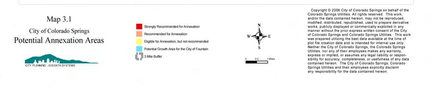
18 Existing Services and Service Provision The proximity of county land to existing Colorado Springs Utilities service lines primarily water and wastewater is a key factor in determining annexation classification. There are portions of El Paso County adjacent to the City that do not have structural fire protection because they are not located within a fire protection district. Occasionally the City s fire department responds to emergencies in these areas. Since these areas do not pay city property tax, when the service is provided it is done without compensation. Most of these areas are too small to individually form a fire protection district. When special districts provide utility services as water, wastewater and electricity and the city subsequently annexes portions of their service area there is the potential cost to Colorado Springs Utilities for the buy out of service area and facilities from the current service provider. Existing Land Development Patterns Several areas adjacent to the City are developing with single family homes on large lots particularly east of the Banning Lewis Ranch. From a financial perspective the cost of providing services to areas of very low residential density development is not balanced by tax revenues, and is worsened when the existing improvements are not designed to the City of Colorado Springs standards. Relationship to El Paso County's Small Area Plans El Paso County s focus for its comprehensive planning efforts has been to develop Small-Area Plans for various geographic areas and then incorporate these plans into the County s Comprehensive Plan by reference. The small-area plans are a component of the classification system of the Annexation Plan and the land use map (See map 2.1). These plans vary greatly in their detail concerning land use and transportation expectations. As such, certain latitude was taken in developing a composite future land use pattern implied by these small-area plans. EXTRA-TERRITORIAL ANNEXATION CATEGORIES Extra-territorial annexations are divided into three categories. See Map 3.1 for the specific locations. Strongly recommended for annexation Land within this classification is either optimal for urban development or functions as an enclave. If urban development is to occur it should be under the jurisdiction of Colorado Springs ANNEXATION PLAN CHAPTER 3: EXTRA-TERRITORIAL ANNEXATION 14
19 Recommended for annexation Urban level services could reasonably be extended and urban development is appropriate. Eligible for annexation but not recommended TERRITORIAL LIMITS This category identifies areas that are statutorily eligible for voluntary annexation, but for various reasons such as existing service districts and development patterns, are not recommended for annexation. The Potential Annexation Areas are numbered 1-11 and placed in one of the three extraterritorial annexation categories. Area 12 is a potential growth area for the City of Fountain as shown in that City s comprehensive plan. Map 3.1 illustrates these twelve areas. Areas Strongly Recommended for Annexation The 2002 version of the Annexation Plan identified Areas, 1 and 2 as strongly recommended for annexation. Area 1 was located west of Voyager Parkway between Middle Creek parkway and InterQuest Parkway. The Allison Valley Annexation and the Stout Allen Addition Number 2 annexation brought all but five acres of Area 1 into the city. The remainder of Area 1 has been reclassified as Recommended for Annexation. Area 2 was located north and south of Woodmen Road between Powers Boulevard and Black Forest Road. With the Woodmen Heights Annexations in September of 2004 two new enclaves L and M (See Chapter 4) were created out of Area 2. Ten annexations have been completed within Area 2 since 2002 consisting of approximately 465 acres. These include the Reel Annexation, Powerwood 1, 2, 3, 4, 5, and 6, Dublin North, Dublin North 1A and Greenbriar 1 and 2. There are no additional areas classified as strongly recommended for annexation. Areas Recommended for Annexation Area 1. This is a five acre parcel located at the northeast corner of I-25 and Interquest parkway. Area 4. This area located adjacent to the Northgate development and west of State Highway 83 and south of Northgate Road has undergone significant changes since preparation of the 2002 Annexation Plan. The Flying Horse annexation completed in January of 2004 added 1,565 acres to the City. The remaining 285 acres are enclaves or property located in the vicinity of Northgate 2006 ANNEXATION PLAN CHAPTER 3: EXTRA-TERRITORIAL ANNEXATION 15
20 Road. The development east of State Highway 83 is low density residential on individual water and wastewater systems. State Highway 83 is the logical eastern edge of the City in this section of El Paso County. Area 5. This area has been reduced to approximately 700 acres after the annexation of Woodmen Heights 1-6 and the creation of Enclave L (see Chapter 4 page 27). The remainder is located north and south of Woodmen Road and east of Black Forest Road. The remaining northerly portion is adjacent to the proposed extension of Markscheffel Road easterly from Black Forest Road to Woodmen Road. The area also extends easterly from Marksheffel Road along the south side of Woodmen Road to the eastern limits of the City. The westerly portion of this area is characterized by low-density residential development and scattered commercial and industrial development, mainly sand mining and processing and construction yards. It is anticipated that as urbanization intensifies in the vicinity of these industrial and commercial uses property owners will petition for annexation and propose land use plans with urban patterns similar to the adjoining uses to the south and west. Area 6. This area is located south of State Highway 24 east of the City of Manitou Springs and south of Colorado Avenue. The annexation of the Red Rocks Canyon Park site, consisting of 751 acres, reduced the area to 141 acres. This remaining area is a mix of older residential and commercial land uses and vacant land. Colorado Springs Utilities provides water service to a limited number of properties within this remaining acreage. Incremental annexation by individual property owners will be the most likely method by which annexation occurs within this area. Area 7. This is an area of about 120 acres located west of the NORAD and Fort Carson Interchange on State Highway 115. The NORAD access road crosses the site from east to west. Development north and south of the site is planned at urban intensities. There are two access points from the City onto the site, one from the north and one from the west. If the property develops at urban densities it should be within the jurisdiction of the City. Eligible for Annexation But Not Recommended Area 3. This area of approximately 406 acres is located south of Old Ranch Road along the east side of I-25. The area functions as an enclave but does not meet the statutory requirements, as the United States Air Force Academy borders the property on the west. This area is characterized by low-density residential development on individual water and wastewater systems. Most of the land is developed and thus the land use pattern is established. It is anticipated that this land use pattern will continue and redevelopment is unlikely. In general the City s policy has been to not annex these very low density residential areas. Area 8. This area is located south and west of Powers Boulevard and just south of the Colorado Springs Airport and north of Fontaine Boulevard. It is positioned between the municipal airport and the Big Johnson Open Space. This area is within Sub-Area 4 of the 2003 Highway 94 Comprehensive Plan, one of El Paso County s Small Area Plans. The plan recognizes that a portion of the area within 2006 ANNEXATION PLAN CHAPTER 3: EXTRA-TERRITORIAL ANNEXATION 16
21 Sub-Area 4 along Powers Boulevard and Bradley Road has potential for urban level development, and if developed at urban densities should be annexed into the City. Subsequent to the 2003 update to the Highway 94 Plan the Waterview Metropolitan District 1 was formed to provide urban services such as water and wastewater to the potential residential and commercial development. The formation of this district is the reason this area is no longer recommended for annexation. Area 9. This is the Woodmen Valley area and is covered by a Small Area Plan approved by El Paso County in It is approximately 1100 acres and is characterized by low-density residential development on 2.5 and 5 acre lots. The major land use policy of the Woodmen Valley Small Area Plan is to maintain the area s low-density rural residential character. The Woodmen Valley area shares a lengthy border with the City of Colorado Springs and for that reason the area is eligible for annexation. The very low density residential character of the area makes the provision of city services, such as police, fire and street maintenance expensive. In general the City s policy has been to not annex these very low density residential areas. Area 10. This area is generally along the City s eastern boundary between Falcon on the north and the southern point of the City limits. Rural Residential development is occurring in this area, creating a disincentive to eastward expansion of the City. Colorado Springs Utilities has purchased about 400 acres just east of the proposed reservoir site for the Southern Delivery System. The recommendation is to annex Colorado Springs Utilities ownership so that its entire facility will be located within the municipal boundary of the City of Colorado Springs. Area 11. This area is located between Powers Boulevard on the east and State Highway 115 on the west. It includes Stratmoor Hills, Garden Valley and Security. Given the established land use pattern and the special districts that are providing municipal services, such as water, wastewater and fire protection, this area is not recommended for annexation. City of Fountain Area 12. This is an area generally south of Fontain Boulevard from Powers Boulevard east to the three-mile limit line. Much of this area is within the proposed growth area for the City of Fountain. In addition, with the expansion of Fort Carson several large urban level developments are under review by El Paso County. Over 12,000 dwelling units are proposed. The short term utility service in this location will be accommodated by either the City of Fountain or by special purpose districts. RECOMMENDATION Delete the Potential Urban Growth Area as an Annexation Plan element. Much of the area that was designated in the PUGA in the mid 1980 s has been annexed into the City and is undergoing development. In addition, there is significant urban level development 2006 ANNEXATION PLAN CHAPTER 3: EXTRA-TERRITORIAL ANNEXATION 17
22 occurring in the county outside of the PUGA which renders the conceptual boundary moot. Do not annex unincorporated areas for which a special purpose district or metropolitan district has been created to provide water and or wastewater service. Continue to work with El Paso County on matters of annexation ANNEXATION PLAN CHAPTER 3: EXTRA-TERRITORIAL ANNEXATION 18

23 2006 ANNEXATION PLAN CHAPTER 3: EXTRA-TERRITORIAL ANNEXATION 19
24 CENTENNIALBD NEVADAAV CIRCLE DR UNION BD HANCOCK EX ACADEMY BD POWERS BD ACADEMY BD BLACK FOREST RD LACK FOREST RD HERRING RD VOLLMER RD MERIDIAN RD MERIDIAN RD EBLANEYRD EASTONVILLE RD BLANEY RD HIGBY RD HODGEN RD HODGEN RD BAPTISTRD GLENEAGLEDR STELLADR SUNHILLSDR ROLLER COASTER RD MURPHY RD NORTH GATE RD HWY 83 HOLMES RD SWAN RD SHOUP RD SHOUP RD LATIGO BLVD United States Air Force Academy I-25 MILAM RD BURGESS RD OLDRANCHRD BLACK FOREST RD VOLLMER RD Pike National Forest NCHRD FLYINGWRA 30TH ST WOODMENRD VINDICATORDR ROCKRIMM GARDENOFTHEGODSRD ONBD NEVADAAV BRIARGATEBD WOODMEN RD UNION BD DUBLIN BD VICKERS ACADEMYBD DR DR FLINTRIDGE RANGEWOODDR WOODMEN RD BARNES RD TEMPLETONGAPRD US HIGHWAY 24 FALCON HWY GARRETT RD FILLMORE ST TEMPLETONGAPRD AUSTINBLUFFSPY NCAREFREECR SCAREFREECR PETERSONRD MARKSHEFFEL RD SBLANEYRD Manitou Springs 31STST UINTAHSTW COLORADOAV US24 MESARD I-25 CASCADEAV NEVADAAV ELPASO ST PLATTEAV UINTAHSTE CACHE LAPOUDRE ST CONSTITUTIONAV CHELTON RD MURRAYBD US24 HWY94 HANCOCKAV PIKES PEAKAV AIRPORTRD Peterson A.F.B. 21STST PALMERPARKBD GALLEY RD PLATTEAV CONSTITUTIONAV HWY94 DAVIS RD CIMARRON ST Pike National Forest CHEYE 8THST CHEYENNERD LAKEAV NNEMTNBD CHEYENNEMEADOWS BST ACADEMY BD FOUNTAINBD ASTROZONBD BRADLEY RD Security POWERS BD Municipal Airport DRENNAN RD POWERS BD MARKSHEFFEL RD BRADLEY RD FRANCEVILLE COALMINE RD BRADLEY RD Copyright 2006CityofColoradoSpringsonbehalfofthe Colorado Springs Utilities. All rights reserved. This work, and/or the data contained hereon, may not be reproduced, modified, distributed, republished, used to prepare derivative works, publicly displayed or commercially exploited in any manner without the prior express written consent NORAD of the City of Colorado Springs and Colorado Springs Utilities. This work was prepared utilizing the best data available at the time of plot file creation date and is intended for internal use only. Neither the City of Colorado Springs, the Colorado Springs Utilities, nor any of their employees makes any warranty, express or implied, or assumes any legal liability or responsibility for accuracy, completeness, or usefulness of any data contained hereon. The City of Colorado Springs, Colorado Springs Utilities and their employees explicitly disclaim any responsibility for the data contained hereon. HWY 115 Ft. Carson I-25 MAINST OLDHY85-87 FONTAINE BD Widefield POWERS BD Miles Map 3.2 City of Colorado Springs Annexation Plan Special& Metropolitan Districts Legend 1. Forest Lakes Metropolitan District 2. Triview Metropolitan District 3. Donala Water& Sanitation District 4. Academy Water& Sanitation District 5. Metex Metropolitan District 6. Paint Brush Hills Metropolitan District 7. Meridian Service Metropolitan District 8. Meridian Ranch Metropolitan District 9 Woodmen Road Metropolitan District 10. Falcon Regional Trans Metropolitan District 11. Woodmen Hills Metropolitan District 12. Falcon Highlands Metropolitan District 13. Central Marksheffel Metropolitan District 14. Cherokee Metropolitan District 15. Colorado Centre Metropolitan District Glen Metropolitan District 1,2,3 19. Cross Creek Metropolitan District 20. Waterview 21. Stratmoor Hills Water& Wastewater Metro Dist.
25 CITY OF COLORADO SPRINGS 2006 ANNEXATION PLAN CHAPTER 4 ENCLAVES As the City has expanded, enclaves, remnants of land that are surrounded by the City, have remained within the jurisdiction of El Paso County. Comprehensive Plan Policy CIS 204 states that no additional enclaves be created and that a sequential process be undertaken to eliminate existing enclaves. For existing enclaves, the Comprehensive Plan strategies advocate a cooperative approach with the property owners and governmental entities to systematically eliminate enclaves. There are 38 enclaves ranging in size from 2,500 square feet (0.057of an acre) to 4,865 acres. Significant portions of the enclaves are developed at urban densities and are provided with a range of urban services by special purpose districts, El Paso County and Mountain View Electric. Colorado Springs Utilities provides portions of some enclaves with water and wastewater service on a case by case basis with the agreement of the property owner to annex to the city. The issues associated with enclaves are varied and are described below: Provision of Emergency Services Law enforcement is provided by the El Paso County Sheriff and emergency medical service is by means of private service providers. Some enclaves are without structural fire protection. Many times the residents of these enclaves do not realize that the police and fire departments of the City Colorado Springs do not provide emergency response assistance. This confusion about jurisdiction can cause delays in emergency response times. When the City does provides emergency service to these areas there is no accompanying revenue through city property tax to help offset the cost of service. Provision of Utility Service When Colorado Springs Utilities provides water and/or wastewater service to property within an enclave, the property owner is required to sign an agreement to annex and pay all the appropriate Colorado springs Utilities development fees. Annexation prior to service is the focus of current policy relating to the extension of water service into enclaves. If the property for which annexation is requested meets the contiguity requirements the property owner must complete the annexation before service is granted. The City Code does allow for an exception to annexation prior to service policy. Section , Service Without Annexation, allows the City Council using its legislative discretion to provide service. Upgrading Infrastructure The property owner by signing the agreement to annex also agrees to build surface infrastructure, such as curb, gutter and sidewalks, to City standards when the property is formally annexed. As part of the agreement to annex, the City may grant a time delay in lieu of the construction of some or all of the improvements. However, since this new construction generally takes place in areas where the initial development was not constructed to City standards it can be impractical to enforce the more stringent urban infrastructure standards on a lot by lot basis. The result is urban intensity development 2006 ANNEXATION PLAN CHAPTER 4: ENCLAVES 20
26 constructed to county infrastructure standards. The responsibility, cost and timing for the upgrading of the infrastructure becomes the major issue when annexation is necessary or desired by a majority of residents within the enclave. A major consideration associated with the annexation of enclaves is determining how to finance the upgrades to the infrastructure. This issue may be less applicable for the unincorporated areas developed more recently, as some county infrastructure standards now more closely reflect city standards. State law allows the unilateral annexation of an enclave by the municipality. The configuration of the enclave s boundary must remain unchanged for three years before the municipality can begin the annexation process. Current city policy is to annex eligible properties within an enclave when the owner requests annexation. Generally these properties need City water service in order to be developed. This policy promotes the continuation of enclaves, because once a piece of the enclave is annexed the three-year clock is reset. ENCLAVE CLASSIFICATIONS Enclaves are divided into two classifications, simple and complex, based upon the types of issues associated with their potential applications. The more difficult and numerous the issues, the more likely it is that an area will remain unannexed. Cimarron Hills, a 4,796 acre enclave located north of Colorado Springs Airport between Marksheffel Road and Powers Boulevard is unique. Land use and urban service issues all require separate consideration of the area. Eleven enclaves remain from the City s very active period of annexation in the 1980 s and seven new enclaves have been created since the Annexation Plan update in These new enclaves created since 2002 are a result of the Flying Horse, the Woodmen Heights and Red Rocks annexations. In addition early in the 1980 s a major change to the Colorado annexation law eliminated the municipality s ability to unilaterally annex territory. This change made it more difficult, both practically and politically, to annex property without the consent of the property owner. Simple Enclaves There are 24 enclaves classified as simple as shown on Map 4.1. and listed on Table 4.1. The average size of these enclaves is 10.6 acres with the smallest (#11 and 24) being acres and the largest (#13) being 57 acres. The simple enclaves are generally small in area with single a single owner. The simple enclaves are concentrated in four areas of the City. Seven are located in an east-west corridor between Woodmen Road and Dublin Boulevard. Eight are located in a north/south corridor in the far eastern part of the City and were created by the 1988 annexation of the Banning Lewis Ranch. Many of these are small and owned by a public utility or a railroad. The third area is in the southwest portion of the City and is a result of several annexations from the early 1980 s. Finally with the annexation of Flying Horse Ranch three additional enclaves were created in the north portion of the City ANNEXATION PLAN CHAPTER 4: ENCLAVES 21
27 Table 2 indicates which of the simple enclaves is provided with services by a special district. It is anticipated that most of the simple enclaves would have limited additional service needs and therefore could be provided with City services without significant additional costs. Issues If the City initiates the annexation process the cost for the preparation of annexation map and recording would be paid by the City. It is estimated that based on the level of difficulty an annexation plat may cost between 1,500 and 5,000 dollars. It is possible that enclave property owners would be unreceptive to annexation and therefore the annexation of the enclave would be unilateral. Without the cooperation of the property owner a negotiated annexation agreement would be unlikely. There are limited revenue gains but there are also limited service costs associated with the annexation of certain enclaves. Based on location, a specific annexation may improve efficiencies in emergency service, but could increase general city infrastructure maintenance costs, and could require Colorado Springs Utilities to pay any affected special district or utility for its reduction in service area ANNEXATION PLAN CHAPTER 4: ENCLAVES 22
28 Map Number TABLE 4.1 Simple Enclaves Tax ID Number Owner Land Use Zone Acres Woodmen Valley Chapel Vacant A El Paso County Vacant Mohl, Richard Residential A City of Colo Spgs Utility R Colorado Interstate Corp Vacant RR Colorado Interstate Corp Vacant RR Colorado Interstate Corp Vacant RR Markwell, Inc Residential RR Banning Lewis Ranch Utility Company, LLC Chicago Pacific Corp & C/O Vacant RR Union Pacific Railroad Banning Lewis Ranch Vacant RR Company, LLC Premier Properties Llc Industrial PID Firebaugh, Steven Industrial C Sokal, Ralph Residential UND Maytag, Cornellia Residential A Mcgrew Robert B Residential A Knox, Barton Residential R Seva Holdings L L C Commercial C , State Highway Dept., Commercial, RR , Jovenchi-I LLC, International Bible Society Government and Right-of-way and Pulpit Rock Investments LLC Residential and RR Vacant Western Museum of & Mining Commercial RR3 21 & Industry City of Colorado Springs Utility RR Spinnaker Properties vacant PBP Total Source: El Paso County Assessor s Records, ANNEXATION PLAN CHAPTER 4: ENCLAVES 23
29 TABLE 4.2 Simple Enclaves within Special Districts Map Number Tax ID Number Fire Protection District Water District Sanitation District Metro District Metex Falcon Falcon Falcon Ellicott Rec Ellicott Rec Ellicott Rec Colorado Center Stratmoor Hills Broadmoor Broadmoor Donald Wescott Stratmoor Hills Donald Wescott Donald Wescott Donald Wescott Falcon Source: El Paso County Assessor s Records, 2005 Stratmoor Hills 2006 ANNEXATION PLAN CHAPTER 4: ENCLAVES 24
30 Recommendation Comprehensive Plan Policy CIS 204 supports the elimination of enclaves. Many of the simple enclaves have existed in the current shape for a number of years without creating any problems to the City in terms of service delivery. At this time there is no apparent need to annex most of the simple enclaves. Two of the simple enclaves are owned by the City of Colorado Springs (4 and 24) and one by El Paso County(3). These could be annexed and the anticipated cost for the preparation of the annexation maps, other legal documents and recording fees is approximately $2,000 per property. It is anticipated that at the time of development the largest of the enclaves in the Banning Lewis Ranch will be annexed by the land owners in order to assure a synchronized development process. Complex Enclaves There are 15 enclaves classified as complex. They are shown on map 4.1 and listed in Table 4.3 and Table 4.4 Cimarron Hills. These areas range in size from 20 acres to 4865 acres. Multiple ownership, multiple land uses, and infrastructure not built to city standards characterize these areas. With these enclaves are located throughout the City, there are two areas of concentration. The first area is in the north central portion of the City along the Austin Bluffs Parkway corridor east of Academy Boulevard in an area commonly known as Park Vista. The second area is along Marksheffel Road north of US Highway 24. The largest in this second area is Cimarron Hills. ENCLAVE TOTAL ACRES RESIDENTIAL ACRES TABLE 4.3 Complex enclaves COMMERCIAL OFFICE ACRES ACRES INDUSTRIAL ACRES VACANT ACRES (OTHER) ACRES A B C D E F G H I J K L M N Total Source: El Paso County Assessor s Records, ANNEXATION PLAN CHAPTER 4: ENCLAVES 25
31 These areas do not fall neatly into any distinct categories. Land use patterns within the various enclaves vary widely, and range from vacant to typical urban development patterns. The types are listed below: Rural large lot single family detached residential. Urban density single family detached residential. Strip commercial along an arterial with single family detached residential on the remainder. Educational retreat facilities Vacant Issues Some enclaves are without structural fire protection. There are times when the City does respond to emergencies within enclaves. Since these areas do not pay property tax to the City, the service is being provided without compensation. There is potential confusion related to proper jurisdiction for emergency response. Some enclaves are provided with emergency response and utility service through special districts. Modifications to the boundaries of these service districts can be complicated, labor intensive and expensive. Utility extension without land use control and infrastructure built to City standards. There are various costs associated with the annexation of enclaves. In the enclaves where Colorado Springs Utilities provides service, property owners have signed agreements to annex. As part of the agreement the property owner consents to participate in the cost of annexation, which could include plat preparation and other legal documents plus participation in improvement districts for infrastructure. Current city policy is to extend utilities service in conjunction with annexation. If the property for which owners requests utility service is eligible for voluntary annexation the property owner must annex prior to the provision of service. One result of this policy is that much of the higher valued nonresidential property is annexed into the City leaving the lower valued property within El Paso County. This practice creates a disincentive for annexation of the remainder of the enclave. In order for the City to be able to unilaterally annex an enclave, the perimeter boundary of the enclave must remain unchanged for three years. Current policy requires annexation before utility extension. Each time a portion of the enclave is annexed the three year clock is reset. Recommendation Current policy, with some exceptions, requires annexation of property prior to the extension of water service. This policy causes the three year clock to be reset each time a portion of an enclave is annexed. Given the budget constraints and minimal revenue gain from the additional city property tax, the unilateral annexation of the complex enclaves by the city is not recommended ANNEXATION PLAN CHAPTER 4: ENCLAVES 26
32 Cimarron Hills Cimarron Hills is unique because of its size and the scale of urban development. This area of 4,796 acres became an enclave with the annexation of the Banning-Lewis Ranch in Development of Cimarron Hills began in the early 1970 s. There is the full range of development from single family detached to commercial and industrial. Table 4.4 lists the land use categories and the total acreage for each category. Also included in the land use mix are some parks and two golf courses. Most of the urban services are provided by the Cherokee Metropolitan District, including: Water Wastewater Street Lights Parks Golf Course Two fire protection districts, Falcon and Cimarron Hills, provide service within this enclave. In general the Cimarron Hills service district is west of Marksheffel Road and Falcon serves the area east of Marksheffel Road. In a broad sense Cimarron Hills functions as a City without a police department. TABLE 4.4 Cimarron Hills ENCLAVE TOTAL ACRES RESIDENTIAL ACRES COMMERCIAL ACRES OFFICE ACRES INDUSTRIAL ACRES VACANT ACRES (OTHER) ACRES Cimarron Hills 4,796 1, ,634 1,173 Source: El Paso County Assessor s Records, 2005 Issues Of all the enclaves Cimarron Hills contains the greatest variety and intensity of development. Because of the level of existing development the cost of integrating and upgrading the infrastructure to city standards would likely be considerable. Because of its size, Cimarron Hills will make the efficient provision of emergency services to the extreme eastern portions of the City difficult. This can cause particular problems for the police department with their need for backup. The cost to takeover or buyout the Mountain View services territory and the Cherokee Metropolitan District by the Colorado Springs Utilities could be prohibitive. Recommendation Cimarron Hills Should remain as an enclave ANNEXATION PLAN CHAPTER 4: ENCLAVES 27

33 2006 ANNEXATION PLAN CHAPTER 4: ENCLAVES 28
CITY OF COLORADO SPRINGS 2006 ANNEXATION PLAN CHAPTER 4 ENCLAVES
 CITY OF COLORADO SPRINGS 2006 ANNEXATION PLAN CHAPTER 4 ENCLAVES As the City has expanded, enclaves, remnants of land that are surrounded by the City, have remained within the jurisdiction of El Paso County.
EXHIBIT A. City of Corpus Christi Annexation Guidelines
 City of Corpus Christi Annexation Guidelines Purpose: The purpose of this document is to describe the City of Corpus Christi s Annexation Guidelines. The Annexation Guidelines provide the guidance and
CITY PLANNING COMMISSION AGENDA ITEM NOS: 15,16,17,18,19 STAFF: PATRICIA PARISH
 Page 185 CITY PLANNING COMMISSION AGENDA ITEM NOS: 15,16,17,18,19 STAFF: PATRICIA PARISH FILE NOS: CPC A 05-00193 LEGISLATIVE CPC ZC 05-00194 LEGISLATIVE CPC ZC 05-00195 LEGISLATIVE CPC CP 05-00196 QUASI-JUDICIAL
MIDWAY CITY Municipal Code
 MIDWAY CITY Municipal Code TITLE 9 ANNEXATION CHAPTER 9.01 PURPOSE CHAPTER 9.02 GENERAL REQUIREMENTS CHAPTER 9.03 PROPERTY OWNER INITIATION OF ANNEXATION CHAPTER 9.04 PROCEDURES FOR CONSIDERATION OF PETITION
ANNEXATION PLAN Fountain, Colorado
 City of Fountain ANNEXATION PLAN ADOPTED: NOVEMBER 13,, 2007 ANNEXATION PLAN Fountain, Colorado Prepared for CITY OF FOUNTAIN, COLORADO Prepared by Community Matters, Inc. Littleton, Colorado (303)730-0397
CITY PLANNING COMMISSION AGENDA ITEM NOS: B.1-B.3 STAFF: MEGGAN HERINGTON
 Page 17 CITY PLANNING COMMISSION AGENDA ITEM NOS: B.1-B.3 STAFF: MEGGAN HERINGTON FILE NO(S): CPC MP 87-00381-A13MN14 QUASI-JUDICIAL CPC PUZ 14-00101 QUASI-JUDICIAL CPC PUP 05-00139-A1MJ14 QUASI-JUDICIAL
STAFF REPORT FOR ANNEXATION AND ZONING. CASE NAME: Taylor Annexation and Zoning PC DATE: August 7, 2013
 STAFF REPORT FOR ANNEATION AND ZONING ANNEATION CASE NO: A-13-001 ZONING CASE NO: RZ-13-002 REPORT DATE: July 30, 2013 CASE NAME: Taylor Annexation and Zoning PC DATE: August 7, 2013 ADDRESS OF PROPOSAL:
PROVO CITY MUNICIPAL ANNEXATION GUIDE
 COMMUNITY DEVELOPMENT PROVO CITY MUNICIPAL ANNEXATION GUIDE This guide has been prepared to outline the procedures and requirements of annexing unincorporated territory into Provo City. Annexations are
ANNEXATION IMPACT REPORT
 ANNEXATION IMPACT REPORT Project: RED MOUNTAIN RANCH ANNEXATION 17500 Hwy 6 (unincorporated Eagle County) Eagle, CO 81631 Prepared By: Town of Eagle Morgan Landers, Town Planner 200 Broadway St Eagle,
Planning Commission Hearing Date: 2/21/2017 Board of County Commissioners Hearing Date: 3/8/2017
 COMMISSIONERS: DARRYL GLENN (PRESIDENT) MARK WALLER (PRESIDENT PRO TEMPORE) STAN VANDERWERF LONGINOS GONZALEZ PEGGY LITTLETON PLANNING AND COMMUNITY DEVELOPMENT DEPARTMENT CRAIG DOSSEY, EXECUTIVE DIRECTOR
13 Sectional Map Amendment
 13 Sectional Map Amendment Introduction This chapter reviews land use and zoning policies and practices in Prince George s County and presents the proposed zoning in the sectional map amendment (SMA) to
Project File #: SF Project Name: Jackson Ranch Filing No. 4 Parcel Nos.: , and
 COMMISSIONERS: DARRYL GLENN (PRESIDENT) MARK WALLER (PRESIDENT PRO TEMPORE) STAN VANDERWERF LONGINOS GONZALEZ PEGGY LITTLETON PLANNING AND COMMUNITY DEVELOPMENT DEPARTMENT CRAIG DOSSEY, EXECUTIVE DIRECTOR
LINCOLN COUNTY CODE TITLE 8 - HEALTH AND SAFETY
 LINCOLN COUNTY CODE TITLE 8 - HEALTH AND SAFETY Chapter 8.40 - E 911 Addressing System ADOPTED APRIL 19, 2004 Lincoln County Planning Services 27234 SR 25 N Davenport, WA 99122 (509) 725-7041 www.co.lincoln.wa.us
REPRESENTATIVE: NES, Inc. 619 North Cascade Avenue, Suite 200 Colorado Springs, CO 80903
 COMMISSIONERS: MARK WALLER (CHAIR) LONGINOS GONZALEZ, JR. (VICE-CHAIR) HOLLY WILLIAMS STAN VANDERWERF CAMI BREMER PLANNING AND COMMUNITY DEVELOPMENT DEPARTMENT CRAIG DOSSEY, EXECUTIVE DIRECTOR TO: FROM:
(c) County board of commissioners means 1 of the following, as applicable: (ii) In all other counties, 1 of the following:
 County board of commissioners means 1 of the following, as applicable: (ii) In all other counties, 1 of the following:") TOWNSHIP PLANNING Act 168 of 1959, as amended, (including 2001 amendments, 2006 amendments) AN ACT to provide for township planning; for the creation, organization, powers and duties of township planning
TOWNSHIP PLANNING Act 168 of 1959, as amended, (including 2001 amendments, 2006 amendments) AN ACT to provide for township planning; for the creation, organization, powers and duties of township planning
To achieve growth, property development, redevelopment and an improved tax base in the cities and boroughs in the Lehigh Valley.
 Most growth in property valuation is in townships. Between 1991 and 2004, the assessed valuation of the townships in the Lehigh Valley increased by more than $2.8 billion, an increase of 41%. At the same
Canyons South. Annexation Impact Report. September 1, 2015
 Canyons South Annexation Impact Report September 1, 2015 1 Introduction This Annexation Impact Report has been prepared to meet the statutory requirements set forth in Colorado Revised Statutes 31 12 108.5
Title 6 - Local Government Provisions Applicable to Special Purpose Districts and Other Political Subdivisions
 Title 6 - Local Government Provisions Applicable to Special Purpose Districts and Other Political Subdivisions CHAPTER 29. SOUTH CAROLINA LOCAL GOVERNMENT COMPREHENSIVE PLANNING ENABLING ACT OF 1994 1994
CITY OF ELK GROVE CITY COUNCIL STAFF REPORT
 AGENDA ITEM NO. 9.2 CITY OF ELK GROVE CITY COUNCIL STAFF REPORT AGENDA TITLE: A public hearing to consider a Specific Plan Amendment to the Laguna Ridge Specific Plan and a Rezone of approximately 4.14
REZONING GUIDE. Zone Map Amendment (Rezoning) - Application. Rezoning Application Page 1 of 3. Return completed form to
 - Application. Rezoning Application Page 1 of 3. Return completed form to") Zone Map Amendment (Rezoning) - Application COMMUNITY PLANNING & DEVELOPMENT REZONING GUIDE Rezoning Application Page 1 of 3 PROPERTY OWNER INFORMATION* CHECK IF POINT OF CONTACT FOR APPLICATION Property
Zone Map Amendment (Rezoning) - Application COMMUNITY PLANNING & DEVELOPMENT REZONING GUIDE Rezoning Application Page 1 of 3 PROPERTY OWNER INFORMATION* CHECK IF POINT OF CONTACT FOR APPLICATION Property
4.2 LAND USE INTRODUCTION
 4.2 LAND USE INTRODUCTION This section of the EIR addresses potential impacts from the Fresno County General Plan Update on land use in two general areas: land use compatibility and plan consistency. Under
Town of Onalaska. A scale map depicting the portion of Pineview Drive to be officially laid out as a Town highway is attached hereto as Exhibit A.
 Town of Onalaska Special Meeting Minutes for March 31, 2011 The Town Board met on site of the Pineview Road and County OT in Onalaska for the purpose of viewing the lay out of the road as required by law.
REPRESENTATIVE: Julie & Brad Nicodemus Black Squirrel Road Colorado Springs, CO 80809
 COMMISSIONERS: DARRYL GLENN (PRESIDENT) MARK WALLER (PRESIDENT PRO TEMPORE) STAN VANDERWERF LONGINOS GONZALEZ PEGGY LITTLETON PLANNING AND COMMUNITY DEVELOPMENT DEPARTMENT CRAIG DOSSEY, EXECUTIVE DIRECTOR
URBANIZATION ELEMENT. PREPARED BY CITY OF MEDFORD PLANNING DEPARTMENT 200 SOUTH IVY STREET MEDFORD, OREGON
 PREPARED BY CITY OF MEDFORD PLANNING DEPARTMENT 200 SOUTH IVY STREET MEDFORD, OREGON 97501 plnmed@ci.medford.or.us ROBERT O. SCOTT, AICP, PLANNING DIRECTOR COMPREHENSIVE PLANNING SECTION MARK GALLAGHER,
Implementation. Approved Master Plan and SMA for Henson Creek-South Potomac 103
 Implementation Approved Master Plan and SMA for Henson Creek-South Potomac 103 104 Approved Master Plan and SMA for Henson Creek-South Potomac Sectional Map Amendment The land use recommendations in the
H-POLICY 1: Preserve and improve existing neighborhoods. Ensure that Prince William County achieves new neighborhoods with a high quality of life.
 HOUSING Intent The intent of the Housing Plan is to provide a framework for providing for the housing needs of all residents of Prince William County. These needs are expressed in terms of quality, affordability,
REPRESENTATIVE: Centerline Solutions Table Mountain Parkway Golden, CO 80403
 COMMISSIONERS: DARRYL GLENN (PRESIDENT) MARK WALLER (PRESIDENT PRO TEMPORE) STAN VANDERWERF LONGINOS GONZALEZ PEGGY LITTLETON PLANNING AND COMMUNITY DEVELOPMENT DEPARTMENT CRAIG DOSSEY, EXECUTIVE DIRECTOR
Project File #: VA Project Name: Beauperthuy Variance Parcel Nos.: , , , ,
 COMMISSIONERS: DARRYL GLENN (PRESIDENT) MARK WALLER (PRESIDENT PRO TEMPORE) STAN VANDERWERF LONGINOS GONZALEZ PEGGY LITTLETON PLANNING AND COMMUNITY DEVELOPMENT DEPARTMENT CRAIG DOSSEY, EXECUTIVE DIRECTOR
Subject: Ordinance 1657, Annexation of 3.55 acres of land at 3015 and 3001 Parker Road.
 Agenda Report 2016-12-12-09 Date: December 8, 2016 To: From: Russ Axelrod, Mayor Members, West Linn City Council Jennifer Arnold, Planning Department Through: John Boyd, Interim Community Development Director
Pueblo Regional Development Plan, Addendum
 Pueblo Regional Development Plan, Addendum August 2014 Table of Contents Factual Foundation.1 Land Demand Analysis....1 Population Trends 2 Housing Trends..3 Employment Trends 4 Future Land Demand Summary.5
LEGISLATIVE PURPOSES. 2. Provide sources of agricultural products within the state for the citizens of the state
 LEGISLATIVE PURPOSES 1. Assist in sustaining the farming community 2. Provide sources of agricultural products within the state for the citizens of the state 3. Control the urban expansion which is consuming
CITY COUNCIL STUDY SESSION MEMORANDUM
 City and County of Broomfield, Colorado To: From: Prepared by: Owner Applicant Property Size Property Location: CITY COUNCIL STUDY SESSION MEMORANDUM Mayor and City Council Charles Ozaki, City and County
A Guide to the Municipal Planning Process in Saskatchewan
 A Guide to the Municipal Planning Process in Saskatchewan A look at the municipal development permit and the subdivision approval process in Saskatchewan May 2008 Prepared By: Community Planning Branch
MASTER INTERLOCAL AGREEMENT FOR GROWTH MANAGEMENT ACT IMPLEMENTATION IN YAKIMA COUNTY TABLE OF CONTENTS
 MASTER INTERLOCAL AGREEMENT FOR GROWTH MANAGEMENT ACT IMPLEMENTATION IN YAKIMA COUNTY TABLE OF CONTENTS I. PREAMBLE A. Purpose... 1 B. Background... 2 II. AGREEMENT A. Parties to Agreement... 3 B. Authority...
DRAFT Subject to Modifications
 TREASURE COAST REGIONAL PLANNING COUNCIL M E M O R A N D U M DRAFT Subject to Modifications To: Council Members AGENDA ITEM 5L From: Date: Subject: Staff September 17, 2010 Council Meeting Local Government
The Basics of Boundary Agreements. May 29, 1997
 The Basics of Boundary Agreements May 29, 1997 Wisconsin Statutes provide structures for cooperative action between municipalities including general agreements, cooperative plans, and municipal revenue
Comprehensive Plan /24/01
 IV The is a central component of the Comprehensive Plan. It is an extension of the general goals and policies of the community, as well as a reflection of previous development decisions and the physical
CHAPTER IV IMPLEMENTATION
 CHAPTER IV IMPLEMENTATION Chapter Outline IV. Implementation Page A. Public Works Projects/Public Infrastructure IV-1 1. Facilities Master Plan Overview IV-1 2. Facilities Master Plan Service Standards
Existing Land Use. Typical densities for single-family detached residential development in Cumberland County: 1
 Existing Land Use A description of existing land use in Cumberland County is fundamental to understanding the character of the County and its development related issues. Economic factors, development trends,
ORDINANCE NO AN ORDINANCE AMENDING THE CODE OF ORDINANCES OF THE CITY OF PORT ARANSAS, TEXAS, BY ADOPTING A NEW CHAPTER
 ORDINANCE NO. 2008-09 AN ORDINANCE AMENDING THE CODE OF ORDINANCES OF THE CITY OF PORT ARANSAS, TEXAS, BY ADOPTING A NEW CHAPTER TWENTY-SIX CONCERNING IMPACT FEES FOR ROADWAY FACILITIES; INCORPORATING
Resolution adopting City of Corpus Christi Annexation Guidelines
 Resolution adopting City of Corpus Christi Annexation Guidelines WHEREAS, stakeholder meetings were held on May 12, 2017; June 1, November 10, 2017 to discuss the guidelines; 2017; and WHEREAS, a public
Attachment 4. Planning Commission Staff Report. June 26, 2017
 Planning Commission Staff Report June 26, 2017 Agenda #: Regular Agenda - 2 Title: Applicant: Request: Location: Existing Zoning: Proposed Use: Staff Planner: The Brands and The Brands West Eagle Crossing
Development Program Report for the Alamo Area of Benefit
 Julia R. Bueren, Director Deputy Directors Brian M. Balbas, Chief Mike Carlson Stephen Kowalewski Carrie Ricci Joe Yee ADOPTED BY BOARD OF SUPERVISORS ON Development Program Report for the Alamo October,
ANNEXATION. The Handbook for Georgia Mayors and Councilmembers 1
 ANNEXATION Growing and prosperous Georgia cities create a growing and prosperous Georgia. Although cities comprise only 6.8% of Georgia s land area, approximately 40% of the state s population lives in
Goals and Policies Concerning Use of MELLO-ROOS COMMUNITY FACILITIES ACT OF 1982
 Goals and Policies Concerning Use of MELLO-ROOS COMMUNITY FACILITIES ACT OF 1982 Section TABLE OF CONTENTS Page Introduction 1 1 Policy & Goals 1 2 Definitions 2 3 Eligible Public Facilities 3 4 Value-to-Lien
Burlington Unincorporated Community Plan
 Burlington Unincorporated Community Plan June 30, 2010 Meeting Page 1 of 24 Table of Contents (Page numbers to be inserted) I. Background a. Location and Community Description b. Planning of Unincorporated
ESTES VALLEY STORMWATER MANAGEMENT PROGRAM
 ESTES VALLEY STORMWATER MANAGEMENT PROGRAM Phase I. Stormwater Master Plan Phase II. Stormwater Utility Feasibility Study Board of Realtors Meeting May 3, 2018 Stormwater Master Plan Summary Stormwater
Appendix A. Factors Affecting City Current Expenditures
 Appendix A Factors Affecting City Current Expenditures Factors Affecting City Current Expenditures Every city faces a unique situation based upon its demographic composition, location, tax base, and many
LAFCO APPLICATION NO LINDE CHANGE OF ORGANIZATION TO KEYES COMMUNITY SERVICES DISTRICT
 EXECUTIVE OFFICER S AGENDA REPORT MARCH 27, 2019 TO: FROM: SUBJECT: LAFCO Commissioners Javier Camarena, Assistant Executive Officer LAFCO APPLICATION NO. 2019-01 LINDE CHANGE OF ORGANIZATION TO KEYES
STAFF REPORT. Permit Number: Porter. Kitsap County Board of Commissioners; Kitsap County Planning Commission
 STAFF REPORT Permit Number: 15 00461 Porter DATE: November 9, 2015 TO: FROM: Kitsap County Board of Commissioners; Kitsap County Planning Commission Katrina Knutson, AICP, Senior Planner, DCD and Jeff
3. FISCAL IMPACT ANALYSIS FISCAL IMPACT ANALYSIS 29
 3. FISCAL IMPACT ANALYSIS FISCAL IMPACT ANALYSIS 29 The purpose of fiscal impact analysis is to estimate the impact of a development or a land use change on the budgets of governmental units serving the
CHAPTER 35 PARKS AND RECREATION
 35.01 INTRODUCTION CHAPTER 35 PARKS AND RECREATION Latest Revision 1994 Local park and recreation activities are becoming more important in the lives of Ohioans. Many residents are "rediscovering" the
Land Use Planning Analysis. Phase 2 Drayton Valley Annexation Proposal
 Land Use Planning Analysis Phase 2 Drayton Valley Annexation Proposal Prepared for Town of Drayton Valley Prepared by Mackenzie Associates Consulting Group Limited March, 2011 TABLE OF CONTENTS 1.0 INTRODUCTION...
Bylaw No , being "Official Community Plan Bylaw, 2016" Schedule "A" DRAFT
 Bylaw No. 2600-2016, being "Official Community Plan Bylaw, 2016" Schedule "A" Urban Structure + Growth Plan Urban Structure Land use and growth management are among the most powerful policy tools at the
CONTRA COSTA LOCAL AGENCY FORMATION COMMISSION EXECUTIVE OFFICER'S REPORT August 12, 2015 (Agenda)
") CONTRA COSTA LOCAL AGENCY FORMATION COMMISSION EXECUTIVE OFFICER'S REPORT PROPONENTS ACREAGE & LOCATION Laurel Place/Pleasant View Annexation to the City of Concord Curt Blomstrand, Lenox Homes landowner/petitioner
CONTRA COSTA LOCAL AGENCY FORMATION COMMISSION EXECUTIVE OFFICER'S REPORT PROPONENTS ACREAGE & LOCATION Laurel Place/Pleasant View Annexation to the City of Concord Curt Blomstrand, Lenox Homes landowner/petitioner
Chapter 100 Planned Unit Development in Corvallis Urban Fringe
 100.100 Scope and Purpose. Chapter 100 Planned Unit Development in Corvallis Urban Fringe (1) All applications for land divisions in the Urban Residential (UR) and Flood Plain Agriculture (FPA) zones within
Reading Plats and the Complexities of Antiquated Subdivisions Presented by: David W. Depew, PhD, AICP, LEED AP Morris-Depew Associates, Inc.
 Presented by: David W. Depew, PhD, AICP, LEED AP Morris-Depew Associates, Inc. Introduction Plat is a term for a survey of a piece of land to identify boundaries, easements, flood zones, roadway, and access
Ann Item # AGENDA MEMORANDUM
 Ann Item # AGENDA MEMORANDUM Meeting Date: January 7, 2014 To: From: Title: Honorable Mayor and Members of Town Council Mark Stevens, Town Manager Ordinance No. 2013 37: An Ordinance Approving a Public
APPENDIX A FACTORS INFLUENCING COUNTY FINANCES
 APPENDIX A FACTORS INFLUENCING COUNTY FINANCES Appendix A Factors Influencing County Finances The finances of counties are affected by many different factors. Some of the variation results from decisions
Midwest City, Oklahoma Zoning Ordinance
 2010 Midwest City, Oklahoma Zoning Ordinance 9/2/2010 Table of Contents Section 1. General Provisions... 5 1.1. Citation... 5 1.2. Authority... 5 1.3. Purpose... 5 1.4. Nature and Application... 5 1.5.
Oregon Statutes Relevant to Quiet Water Home Owners Association
 Oregon Statutes Relevant to Quiet Water Home Owners Association 1 1 1 1 0 1 0 1 0 1 PLANNED COMMUNITIES (General Provisions).0 Definitions for ORS.0 to.. As used in ORS.0 to.: (1) Assessment means any
Eastern Corridor Planning Area Workshop No April 2016
 Eastern Corridor Planning Area Workshop No. 3 28 April 2016 Agenda 1. Visual Aids 2. Guiding Principles 3. Preferred Alternative Concept Plan 4. Fiscal Impact Analysis 5. Findings 6. Recommendations 7.
STAFF REPORT FOR MAJOR SUBDIVISION
 STAFF REPORT FOR MAJOR SUBDIVISION FINAL PLAT CASE NO. FA-13-001 HEARING DATE: November 6, 2013 CASE NAME: Solterra Subdivision Filing No. 14 PROCEDURE: Planning Commission ADDRESS OF MAJOR SUBDIVISION
Town of Cary, North Carolina Rezoning Staff Report 14-REZ-20 Habitat for Humanity Evans Road Town Council Meeting October 16, 2014
 Town of Cary, North Carolina Rezoning Staff Report 14-REZ-20 Habitat for Humanity Evans Road Town Council Meeting October 16, 2014 REQUEST To amend the Town of Cary Official Zoning Map by rezoning 0.53
17.0 NONCONFORMITIES CHAPTER 17: NONCONFORMITIES Purpose and Applicability
 17.0 NONCONFORMITIES 17.1 Purpose and Applicability The purpose of this section is to regulate and limit the continued existence of uses and structures established prior to the effective date of this Ordinance
2030 General Plan. December 6, 7 pm
 2030 General Plan GPAC Meeting #9 GPAC Meeting #9 December 6, 7 pm City Council Input on Working Draft Land Use Map Council discussed GPAC & PC versions of the working draft land use map 11/28 Council
From Policy to Reality
 From Policy to Reality Updated ^ Model Ordinances for Sustainable Development 2000 Environmental Quality Board 2008 Minnesota Pollution Control Agency Funded by a Minnesota Pollution Control Agency Sustainable
Metropolitan Planning Commission. DATE: April 5, 2016
 TO: FROM: Metropolitan Planning Commission MPC Staff DATE: April 5, 2016 SUBJECT: Petition of Nine Line Inc. Robert McCorkle, Agent PIN: 2-1034-01-002 380.5 Acres Aldermanic District: 5 (Shabazz) County
Appendix A. Factors Affecting City Expenditures
 Appendix A Factors Affecting City Expenditures Factors Affecting City Expenditures The finances of cities are affected by many different factors. Some of the variation results from decisions made by city
Draft Zoning Changes for the 2nd Planning Board Public Hearing, January 22, 2018.
 Draft Zoning Changes for the 2nd Planning Board Public Hearing, January 22, 2018. No changes were made at the 1st Public Hearing. Proposed wording for the 1 st Public Hearing in red, eliminated text in
SUBDIVISION REGULATIONS
 CHAPTER 14 SUBDIVISION REGULATIONS 14-100 Provisions 14-200 Preliminary Plat 14-300 Final Plat 14-400 Replat 14-500 Minor Subdivision 14-600 Administrative Replat 14-700 Vacation of Roadways, Public Easements,
Attachment A First Submittal JAZB Safety Zones A and B
 Attachment A First Submittal JAZB Safety Zones A and B Attachment B Second Submittal JAZB Safety Zones A and B Attachment C Flying Cloud Airport (FCM) Draft Airport Zoning Ordinance Social and Economic
CITY OF BELLINGHAM 2018 ANNEXATION STRATEGY
 CITY OF BELLINGHAM 2018 ANNEXATION STRATEGY I. Introduction There are a number of areas adjacent to the city limits that are designated urban growth areas (UGAs). UGAs are areas that have been designated
Planning Department Oconee County, Georgia
 Planning Department Oconee County, Georgia STAFF REPORT REZONE CASE #: 6985 DATE: October 31, 2016 STAFF REPORT BY: Andrew C. Stern, Planner APPLICANT NAME: Williams & Associates, Land Planners PC PROPERTY
Report and Recommendations of the Chelsea City Study Committee
 Report and Recommendations of the Chelsea City Study Committee To the Honorable The Village President and Trustees The Village of Chelsea, Michigan Preamble By resolution dated June 9 1992 the Chelsea
Generic Environmental Impact Statement. Build-Out Analysis. City of Buffalo, New York. Prepared by:
 Generic Environmental Impact Statement Build-Out Analysis City of Buffalo, New York 2015 Prepared by: TABLE OF CONTENTS 1.0 INTRODUCTION 1 2.0 METHODOLOGY 2 3.0 EXISTING LAND USE 3 4.0 EXISTING ZONING
APPENDIX C-1 DEVELOPING FINDINGS OF FACT & CONCLUSIONS OF LAW FOR PLANNING AND ZONING
 APPENDIX C-1 DEVELOPING FINDINGS OF FACT & CONCLUSIONS OF LAW FOR PLANNING AND ZONING Amended: 9/2011; 9/2014; Page! i DEVELOPING FINDINGS OF FACT, AND CONCLUSIONS OF LAW 1. Developing the following information
STAFF REPORT. January 25, North York Community Council. Director, Community Planning, North District
 STAFF REPORT January 25, 2005 To: From: Subject: Purpose: North York Community Council Director, Community Planning, North District Refusal Report OPA & Rezoning Application 04 194214 NNY 33 OZ Applicant:
APPENDIX A FACTORS INFLUENCING CITY FINANCES
 APPENDIX A FACTORS INFLUENCING CITY FINANCES This page left blank intentionally Appendix A Factors Influencing City Finances The finances of cities are affected by many different factors. Some of the variation
WILLIAMSON ACT CONTRACTS GUIDELINES
 NEVADA COUNTY COMMUNITY DEVELOPMENT AGENCY PLANNING DEPARTMENT ERIC ROOD ADMINISTRATION BUILDING 950 Maidu Avenue Nevada City, California 95959-8617 Phone: (530) 265-1222 FAX : (530) 265-9851 WILLIAMSON
CONTRA COSTA LOCAL AGENCY FORMATION COMMISSION EXECUTIVE OFFICER'S REPORT. May 12, 2010 (Agenda)
") CONTRA COSTA LOCAL AGENCY FORMATION COMMISSION EXECUTIVE OFFICER'S REPORT LAFCO 10-01: Annexation 174 to Central Contra Costa Sanitary District (CCCSD) PROPONENT: CCCSD by Resolution No. 2009-027 adopted
CONTRA COSTA LOCAL AGENCY FORMATION COMMISSION EXECUTIVE OFFICER'S REPORT LAFCO 10-01: Annexation 174 to Central Contra Costa Sanitary District (CCCSD) PROPONENT: CCCSD by Resolution No. 2009-027 adopted
PLANNING COMMISSION REPORT Regular Agenda Public Hearing Item
 PC Staff Report 11/12/12 Item No. 2B- 1 PLANNING COMMISSION REPORT Regular Agenda Public Hearing Item ITEM NO. 2B: A TO GPI; 110 ACRES; E OF K-10 & N OF W 6 TH ST (MKM) : Consider a request to rezone approximately
ORDINANCE NO
 Item 4 Attachment A ORDINANCE NO. 2017-346 AN ORDINANCE OF THE CITY COUNCIL OF THE CITY OF CALABASAS, CALIFORNIA AMENDING CHAPTER 17.22 OF THE CALABASAS MUNICIPAL CODE, AFFORDABLE HOUSING, TO BRING INTO
PLANNED UNIT DEVELOPMENT (PUD) AREA PLAN/REZONING REVIEW PROCEDURE
 AREA PLAN/REZONING REVIEW PROCEDURE") PLANNED UNIT DEVELOPMENT (PUD) AREA PLAN/REZONING REVIEW PROCEDURE Professional inquiries will be made to our Township Planning Consultant, Township Engineer, and Township Attorney to get their opinions
PLANNED UNIT DEVELOPMENT (PUD) AREA PLAN/REZONING REVIEW PROCEDURE Professional inquiries will be made to our Township Planning Consultant, Township Engineer, and Township Attorney to get their opinions
STAFF REPORT FOR REZONE #R JANUARY 15, 2015 PAGE PC-1 CVH INVESTMENTS LLC 455 E. GOBBI ST UKIAH, CA 95482
 STAFF REPORT FOR REZONE #R 4-2014 JANUARY 15, 2015 PAGE PC-1 OWNERS: JACK L. COX TTEE ET AL PO BOX 1389 UKIAH, CA 95482 CVH INVESTMENTS LLC 455 E. GOBBI ST UKIAH, CA 95482 APPLICANT: SUBJECT: PROPOSAL:
Project File #: SF Project Name: Meadowbrook Crossing Filing No. 1 Final Plat Parcel No.:
 COMMISSIONERS: DARRYL GLENN (PRESIDENT) MARK WALLER (PRESIDENT PRO TEMPORE) STAN VANDERWERF LONGINOS GONZALEZ PEGGY LITTLETON PLANNING AND COMMUNITY DEVELOPMENT DEPARTMENT CRAIG DOSSEY, EXECUTIVE DIRECTOR
ARTICLE IX. DEVELOPMENT FEES
 ARTICLE IX. DEVELOPMENT FEES ARTICLE IX. DEVELOPMENT FEES DIVISION 1: GENERAL PROVISIONS Sec. 21-9100. Purpose Sec. 21-9110. Methods of Satisfaction Sec. 21-9120. Development Fee Accounts Sec. 21-9130.
Land Use. Land Use Categories. Chart 5.1. Nepeuskun Existing Land Use Inventory. Overview
 Land Use State Comprehensive Planning Requirements for this Chapter A compilation of objectives, policies, goals, maps and programs to guide the future development and redevelopment of public and private
Annexation Policy Plan of the City of Logan, Utah
 Annexation Policy Plan of the City of Logan, Utah July 2007 In order to provide a geographical boundary to permit long term, comprehensive planning and growth for the City of Logan, this plan establishes
Urban Fringe Development Area Project Update And Staff Recommendation
 Urban Fringe Development Area Project Update And Staff Recommendation July 30, 2008 July 30, 2008 Urban Fringe Development Area Project Table of Contents Introduction, Background, and Next Steps 3 Constraints:
A Guide to Establishing Additional Service Areas in Rural Municipalities
 A Guide to Establishing Additional Service Areas in Rural Municipalities February 2014 Contents Introduction... 3 Purpose of this Guide... 3 Background... 3 What are the benefits to Rural Municipalities
LARAMIE COUNTY PLANNING & DEVELOPMENT DEPARTMENT
 LARAMIE COUNTY PLANNING & DEVELOPMENT DEPARTMENT Planning Building MEMORANDUM TO: FROM: Laramie County Planning Commission Brett Walker, Planner DATE: January 25, 2018 TITLE: Review and action of a Subdivision
Section 4 Master Plan Framework
 Section 4 Master Plan Framework 4.1 PURPOSE The Master Plan, as an implementation tool of the SPC District, establishes the primary framework for the overall development of the Property. Detailed site
Town of Yucca Valley GENERAL PLAN 1
 Town of Yucca Valley GENERAL PLAN 1 This page intentionally left blank. 3 HOUSING ELEMENT The Housing Element is intended to guide residential development and preservation consistent with the overall values
COMMISSION ON ANNEXATION REPORT RIVERLEA AND WORTHINGTON
 COMMISSION ON ANNEXATION REPORT RIVERLEA AND WORTHINGTON July 21, 2011 Commissioners: Dr. Kirk M. McHugh Co-Chair, Commission on Annexation President, Riverlea Village Council Dr. Louis J.R. Goorey Co-Chair,
Findings and Recommendations of the Dover Planning Commission And Annexation Report Information
 PETITION FOR Annexation Plan Amendment to Comprehensive Plan Update 2003 and PETITION TO ANNEX AND ZONE PROPERTY Before The Dover City Council November 8, 2004 Owner: Equitable Owner: Location: Tax Map
BYLAW a) To impose and provide for the payment of Off-site development levies;
 To impose and provide for the payment of Off-site development levies;") BYLAW 2018-3388 A Bylaw of the City of Weyburn, in the Province of Saskatchewan to establish an Off-Site Development Levy in respect of land that is to be subdivided, developed or redeveloped within the
BYLAW 2018-3388 A Bylaw of the City of Weyburn, in the Province of Saskatchewan to establish an Off-Site Development Levy in respect of land that is to be subdivided, developed or redeveloped within the
Appendix A: Guide to Zoning Categories Prince George's County, Maryland
 Appendix A: Guide to Zoning Categories Prince George's County, Maryland RESIDENTIAL ZONES 1 Updated November 2010 R-O-S: Reserved Open Space - Provides for permanent maintenance of certain areas of land
ORDINANCE NO. 208 BE IT ORDAINED BY THE CITY COUNCIL OF THE CITY OF UNIVERSITY HEIGHTS, JOHNSON COUNTY, IOWA:
 ORDINANCE NO. 208 AN ORDINANCE AMENDING ORDINANCE NO. 79 (ZONING) TO CREATE A COMMERCIAL HOTEL ZONE AND PERMIT DEVELOPMENT PURSUANT TO A COMMERCIAL HOTEL PUD BE IT ORDAINED BY THE CITY COUNCIL OF THE CITY
Urban Services Report For Annexation of East Lake Area
 Urban Services Report For Annexation of East Lake Area Prepared Pursuant to: Chapter 171.044 Florida Statutes And Pinellas Planning Council Resolution No.98-2 And meeting the Guidelines and Procedures