Strathcona Area Redevelopment Plan Bylaw Adopted on December 15, 1998
|
|
|
- Amelia Hodge
- 5 years ago
- Views:
Transcription

1 Office Consolidation June 2018
2 Strathcona Area Redevelopment Plan Bylaw Adopted on December 15, 1998 Office Consolidation June 2018 Prepared by: Sustainable Development Department City of Edmonton Bylaw (as amended) was adopted by Council in December In June 2018, this document was consolidated by virtue of the incorporation of the following bylaws which were amendments to the original Bylaw Bylaw Bylaw Approved December 15, 1998 (To adopt the Strathcona ARP) Approved October 11, 2000 (Replace Map 6 - Residential Statutory Plan Overlays ) Bylaw Approved May 30, 2001 (Omnibus Bylaw, Chapter 7) Bylaw Approved January 9, 2002 (Policy Change, Chapter 3) Bylaw Approved September 10, 2002 (Deleting Low and Medium Density Policy 5, Chapter 3) Bylaw Approved October 17, 2002 (Deleting Whyte Avenue Cultural and Community Policy 2, 2a, 2c and renumbering Policy 2d) Bylaw Approved November 21, 2003 (Added a new policy to Whyte Avenue Commercial) Bylaw Approved November 2, 2004 (Amending the DC1 Provision for the Strathcona Library; replace Map 8) Bylaw Approved December 8, 2004 (Replace Map 3 and Map 8, and Adding the DC1 Provision for the Canadian Pacific Railway Station, Strathcona) Bylaw Approved March 12, 2007 (Replace Map 8, and Adding the DC1 Provision for the Connaught Armoury) Bylaw Approved December 12, 2007 (Change to Policy 5, Chapter 3) Bylaw Approved May 11, 2009 (Replace Map 8, change to Policy 5, Chapter 3, and Adding the DC1 Provision for Duggan House) Bylaw Approved October 13, 2009 (Replace Map 6, Advice to Development Officer Residential Areas Subject to Modified Zoning Regulations) Bylaw Approved December 14, 2009 (Change to Mixed Low and Medium Density Residential Area, Policy 3, Chapter 3) Bylaw Approved December 13, 2010 (Policy Change, Bylaw Approved July 4, 2011 (Add new West Ritchie Area to Chapter 3, revise maps to reflect West Ritchie sub-area, as well as apply custom DC1 Zoning, apply Medium Scale Residential Overlay to West Ritchie), update maps. Bylaw Approved June 18, 2012 (revise maps 3, 4, 6, 7 and 8). Bylaw Approved August 26, 2013 (Replace maps 1, 2, 3, 4, 5 and 8; replace Figure 5) Bylaw Approved September 3, 2013 (Replace Policy 3 of Mixed Low and Medium Density Residential Area) Bylaw Approved September 16, 2013 (Replace DC1 Historical Commercial Direct Development Control Provision) Bylaw Approved September 22, 2014 (Change to Policy 2, Chapter 3, replace Policies 4a and 5, Chapter 3, replace Map 8, insert Map 9, replace DC1 Historical Commercial Direct Development Control Provision) Bylaw Approved October 20, 2014 (Replace Policies 4b, 4c, 4d, 4g and 5c, Chapter 3, replace Maps 8 and 9, replace DC1 Historical Commercial Direct Development Control Provision) Bylaw Approved November 17, 2014 (Replace Policy 4a, Chapter 3, replace Maps 4, 8 and 9, replace DC1
3 Historical Commercial Direct Development Control Provision) Bylaw Approved January 26, 2015 (Replace Maps 2, 6, Figures 1, 3) Bylaw Bylaw Bylaw Bylaw Bylaw Bylaw Bylaw Bylaw Bylaw Bylaw Bylaw Bylaw Bylaw Approved March 2, 2015 (Administrative Amendment to update the existing DC1Historical Commercial Direct Development Control Provision) Approved July 6, 2015 (Replace Maps 8 and 9, replace DC1 Historical Commercial Direct Development Control Provision) Approved April 18, 2016 (Replace Policy 1 and 4.a of Chapter 3, Section Mixed Low and Medium Density Residential Area) Approved April 20, 2016 (Replace Chapter 2 Residential Objective 6, Commercial Objective 2, Historic Preservation and Urban Design Objective 2, Chapter 3, Policy 2 and 4.a Whyte Avenue Commercial Area) Approved November 28, 2016 (Deleting and replacing Built Form Policy 1 of the West Ritchie Area) Approved March 20, 2017 (Amending Chapter 2, Residential Objective 6, Chapter 2, Commercial Objective 2, Chapter 3, Section Whyte Avenue Commercial Area, Policy 2 [Whyte Avenue General], Chapter 3, Section Whyte Avenue Commercial Area, Policy 4.a [Whyte Avenue General], replacing Maps 1, 2, 3, 4, 5, 6, 7, 8 and Figure 5) Approved July 10, 2017 (Amending Chapter 3, Section Walk Up Apartment Area, Policy 2(a)) Approved July 10, 2017 (Amending Chapter 3, Section Mixed Low and Medium Density Residential Area, Policies 1 and 4.a) Approved September 11, 2017 (Replace Map 8 and replace DC1Historical Commercial Direct Development Control Provision) Approved November 15, 2017 (Administrative Amendment to update the existing DC1Historical Commercial Direct Development Control Provision) Approved January 22, 2018 (Replace Maps 4, 8 and 9, and replace DC1Historical Commercial Direct Development Control Provision) Approved April 9, 2018 (Amending Chapter 2, Residential Objective 6; Chapter 2, Historic Preservation and Urban Design Objective 2; Chapter 3, High Rise Apartment Area Policy 3; replacing maps 2, 6 and 7; replacing figures 3 and 4). Approved June 11, 2018 (adding Cannabis Retails Sales to the DC1Historical Commercial Direct Development Control Provision) Editor s Note: This is an office consolidation edition of the Strathcona Area Redevelopment Plan, Bylaw 11890, as approved by City Council on December 15, This edition contains all subsequent amendments and additions to Bylaw For the sake of clarity, new maps and a standardized format was utilized in this Plan. Furthermore, all reasonable attempts were made to accurately reflect the original Bylaws. This office consolidation is intended for convenience only. In case of uncertainty, the reader is advised to consult the original Bylaws, available at the office of the City Clerk. City of Edmonton Sustainable Development
4 TABLE OF CONTENTS Chapter 1 Introduction... 1 Description of the Area... 1 Planning Policy in the Area... 1 History of the Plan Area... 2 Character of the Area Today... 3 Chapter 2 Vision, Goals and Objectives... 4 Vision... 4 Goals... 4 Objectives Residential Commercial Whyte Avenue Commercial Parks, Open Space, and Institutional Historic Preservation and Urban Design Transportation Parking Pedestrian and Bicycle Network... 8 Chapter 3... Land Use Development Strategy... 9 Basic Strategy... 9 Low Density Residential Area Mixed Low and Medium Density Residential Area Walk Up Apartment Area High Rise Apartment Area Whyte Avenue Commercial Area West Ritchie Area Chapter 4... Parks, Public, and Institutional Lands Chapter 5 Historic Preservation Chapter 6 Transportation Chapter 7 Statutory Plan Overlays, Direct Development Control Provisions, and Advice to the Development Officer Low Density Residential Districts Overlay Stacked Row Housing and Apartment Overlay Apartment District Overlay Local Commercial Overlay Whyte Avenue Commercial Overlay Historical Commercial Direct Control District Historical Institutional Direct Control District (DC1) Direct Development Control Provision Strathcona Library (DC1) Direct Development Control Provision for the Canadian Pacific Railway Station, Strathcona (DC1) Direct Development Control for the Connaught Armoury (DC1) Direct Development Control for the Duggan House Strathcona (DC1) Direct Control Provision Historic West Ritchie 94 List of Maps 1. Boundary Land Use Concept Parks, Public and Institutional Use Historic Buildings Bicycle Circulation, Major Arterials, and Parking Advice to Development Officer - Residential Areas Subject to Modified Zoning Regulations Commercial Statutory Plan Overlays Historic DC1 Areas Sub Areas of the Historic Commercial Direct Development Control Provision List of Figures 1. Low Density Residential Area Mixed Low and Medium Density Residential Area Walk Up Apartment Area High Rise Apartment Area Whyte Avenue Commercial Area West Ritchie Future Land Use Concept Pedestrian Priority Network Note: Amended by Editor June 2018 PAGE ii

5 Chapter 1 INTRODUCTION DESCRIPTION OF THE AREA Note: The following paragraph was amended by Bylaw 15813, July 4, 2011 The plan area for Strathcona consists of the neighbourhood of Strathcona, east of 106 Street, plus portions of the adjoining communities of Garneau, Ritchie, Queen Alexandra and CPR Irvine as shown on Map 1. It is bounded on the north and east by the North Saskatchewan River and Mill Creek, and extends to 106 Street on the west. It includes those parts of the neighbouring communities that are integrally connected to the historic commercial and industrial core of Old Strathcona PLANNING POLICY IN THE AREA At the writing of this Plan, the Strathcona Community was divided into two planning areas. The Scona East Plan adopted in 1986, included the area east of 101 Street, and the Old Strathcona Plan, adopted in 1981, covered the area between 101 Street and 106 Street. Note: Map 1 was amended by Bylaw 17846, March 20, 2017 PAGE 1


6 Both Plans recognized the uniqueness of Strathcona in terms of its historical importance, it s desirability as a residential area, the need to retain some areas of single family and apartment housing, and to contain commercial development, while reinforcing the strength of the viable commercial area along Whyte Avenue. The new plan for Strathcona embraces the goals and objectives of the Scona East and Old Strathcona Plans, and has made some modifications to allow for current trends and circumstances. It provides more consistency in the treatment of the two areas, introduces some new objectives and provides tools to effectively implement the policies of the Plan. In addition to combining the Old Strathcona and Scona East Plans, the new plan area has been expanded to cover all of the Whyte Avenue commercial area, including portions that were previously located in the Garneau Plan. HISTORY OF THE PLAN AREA Strathcona is one of Edmonton s oldest communities. Situated on the south side of the North Saskatchewan River, it was the north terminus of the early railroad and overland trail routes to Calgary and points beyond, and was located at the mid point of the principal eastwest roadway, Whyte Avenue. Development began in the 1880s at the intersections of the CPR tracks and Whyte Avenue and spread in a circular pattern from there. The centre consisted primarily of commercial and government buildings, with railroad related industries to the south. Residential development occurred mainly north of Whyte Avenue. In 1891, the area east of 99 Street was annexed and subdivided for residential uses. The creation of the University of Alberta at the western end of Whyte Avenue added another dimension to Strathcona s character and prominence. With its status as the centre for government, commerce, culture, and transportation south of the river, Strathcona was also the place of choice for the prestigious homes of business and community leaders. The economic booms of 1913 to 1915 and 1946 to 1950 saw the construction of over half the current housing stock, including the grand homes of the wealthy and influential and more modest dwellings of workers, merchants and professionals. Businesses grew to the south along the Calgary Trail and CPR corridors, and east and west along Whyte Avenue. In the 1960s the character of the neighbourhood began to change. The area west of 99 Street was rezoned to allow walk up apartments, which were until then limited to sites on Whyte Avenue and on 99 Street north of 89 Avenue. The economic boom of the 1970s was marked by Historic photo: A business on Whyte Avenue considerable apartment development, with the bulk of apartment construction taking place between 99 and 101 Streets. Conversely, with the shift of government and commerce to PAGE 2
7 Edmonton s Downtown, the decline of the importance of rail transport and related enterprises, Strathcona s business community experienced a period of some recession. The Old Strathcona and Scona East Plans which took affect in the early and mid 1980s attempted to re-establish portions of the neighbourhood for single family housing, and revitalize the area s commercial core. CHARACTER OF THE AREA TODAY The Strathcona area continues to be highlighted by its historic buildings, the traditional character of the streetscapes, a diversity of housing types and the attraction of Whyte Avenue as a unique commercial area in the city. Within Strathcona there are a number of different environments. East of 99 Street remains a solidly single family area, with attractive streetscapes, interesting old housing, and more recently a number of new or renovated single family homes. The areas abutting the arterials including 99 Street, and Whtye Avenue east of 99 Street, and the area immediately north of Whyte Avenue on 83 Avenue, have been largely developed with walk up apartments. Along Saskatchewan Drive, a number of high rise apartments continue to dominate the landscape. These areas of apartment development have provided an opportunity for a variety of people and household types to live in the area, including students, seniors and young adults. The middle portion of Strathcona, west of 99 Street and north of 83 Avenue, accommodates a variety of housing types including apartments and single family dwellings. This area has experienced some conflicts, which can be attributed to a number of factors, including the mixture of uses, the presence of more traffic on residential streets, and the proximity of the Whyte Avenue commercial area. Note: The following paragraph was added by Bylaw 15813, July 4, 2011 Similarly, the West Ritchie area west of 99 Street and south of Whyte Avenue, also accommodates a variety of housing types and includes a mixture of uses. It has also experienced some conflicts due to the mixtures of uses and has had some recent redevelopment that is not compatible with the character or scale of the area. It is an area in transition and needs more guidance Finally, the commercial area along Whyte Avenue has undergone the most significant change since the previous plans were approved in the early and mid 1980s. Whyte Avenue continues to operate as an active pedestrian oriented commercial strip with a unique historical flavour. The area has experienced extensive commercial development activity in recent years. It has been transformed from an area providing local goods and services, into a popular entertainment area, attracting clientele from various parts of the city. This has had some impact on local residents. Strathcona reflects patterns of change that have occurred city wide in the 10 to 15 years since adoption of the previous plans. However as a neighbourhood it continues to be valued for its historical character, aesthetic qualities, proximity to the river valley and ravine, opportunity for small commercial enterprises, and it s excellent environment and location as a place to live and do business. PAGE 3
8 Chapter 2 VISION, GOALS, AND OBJECTIVES VISION The physical environment of Strathcona both natural and historical, is intrinsically valuable, and vital to the life of the community. The important qualities of the community include its proximity to the North Saskatchewan River and Mill Creek Ravine, the abundance of historically significant residential and commercial structures, the attractive streetscapes, the diversity of housing types, and the presence of a thriving commercial area. Future development will maintain these qualities, to retain the attractiveness of the residential environment and the viability of the commercial district. GOALS 1. Preserve the existing character and structure of the community, by retaining its residential and commercial functions and its historic qualities. 2. Recognize the city wide importance of the Strathcona community as a focal point for historic, cultural, and entertainment activities and events. 3. Maintain a diversity of housing types in the community, including single family, semi detached, row housing and apartments, to provide opportunity for people of different age groups, lifestyles, and incomes, to live in the community. 4. Maintain existing commercial areas, and encourage reinvestment in these areas, recognizing some of the physical restraints and the need to be sensitive to surrounding residential communities. 5. Protect the residential environment in Strathcona from the negative impacts of excessive traffic and long term on street parking on residential streets, and from the impacts of arterial roads running through the community, while maintaining reasonable vehicular access to activity nodes within the area. 6. Provide safe and attractive bicycle and pedestrian access to activity nodes within the community, and also through the community to regional activity nodes such as the Downtown and the University 7. Retain and promote awareness of historically significant areas and structures. 8. Maintain existing park and school sites for public use and recreation. OBJECTIVES Residential Objectives 1. Maintain the integrity of residential environments, by preventing the expansion of non residential use into residentially designated areas. 2. Accommodate apartment development on the perimeters of the community, where there is better access to arterial roads, and less opportunity to increase traffic in the internal portions of the community. 3. Maintain a homogeneous low density residential environment east of 99 Street. 4. Maintain a balance of residential development in the central part of the community, west of 99 Street, by ensuring that existing areas of low density housing will continue to be developed for low density use. 5. Maintain the pedestrian friendly character of the street, defined by such things as treed boulevards, sidewalks PAGE 4

9 uninterrupted by vehicular access, consistent front setbacks, and features such as porches, and verandahs that add interest and activity on the street. Note: Objective 6 was amended by Bylaw 18328, April 9, Require apartment development to be sensitive in scale with the existing development and retain the character and pattern of low density development. Notwithstanding the above: a) the Site located on the northwest corner of 105 Street NW and 81 Avenue NW (legally described as Lots 32 36, Block 63, Plan I) which shall be permitted to be developed as a high rise building, not exceeding 53.5 m in height, due to: i. The built form of the high rise which will be comprised of three distinct vertical sections: the Podium, the Mid-Tower, and the Tower and the associated stepbacks between the vertical elements which will provide a transition in height for the building and surrounding built forms; and ii. The location of the Site within the Whyte Avenue Commercial Area and the separation distance of the Site from existing residential uses, which are predominately low rise apartment buildings, provides for a transition in height and density with surrounding residential areas. b) the Sites located east and west of 106 Street NW between 82 (Whyte) Avenue NW and 81 Avenue NW (legally described as Lots 6 & 7, Block 64, Plan 5809KS, Lots 13-18, Part of Lot 20 and Lots 21-31, Block 63, Plan I and Lots 1-5, Part of Lot 27 and Lots 28-32, Block 64, Plan I) which shall be permitted to be developed as taller buildings, not exceeding 56 m in height due to: i. The built form of the high rise being comprised of three distinct sections (the Podium, the Midtower and the Tower top) and the associated stepbacks and articulation between the vertical elements which will provide a transition in height for the building and surrounding built forms; and ii. The location of the Sites being within the Whyte Avenue Commercial Area and the separation distances of the Sites from existing residential uses, which are predominately low rise apartments, provides for a transition in height and density with surrounding areas. c) the Site located at the northwest corner of 99 Street NW and 89 Avenue NW (legally described as lots 1-5, Block 122, Plan RN27 and Lots 26-28, Block 122, Plan RN27) which shall be permitted to be developed as a mixed use development with two (2) buildings due to the built form of each building being comprised PAGE 5
10 of a podium, a tower and the associated stepbacks that provide for a transition in height with the surrounding residential area. The east building shall not exceed a height of 54 m and the west building shall not exceed a height of 63 m. 7. Require new low density residential development to be compatible with the mass and scale of existing housing, and to maintain sunlight and privacy on adjacent properties. Commercial Objectives 1. Prevent expansion of new commercial development into adjacent residential areas. Note: Objective 2 was amended by Bylaw 17846, March 20, Maintain the existing low scale of built forms in the commercial area, and provide a transition of heights and densities abutting residential areas. Notwithstanding the above: a) The Site located on the northwest corner of 105 Street NW and 81 Avenue NW (legally described as Lots 32 36, Block 63, Plan I) which shall be permitted to be developed as a high rise building, not exceeding 53.5 m in height, due to: i. The built form of the high rise which will be comprised of three distinct vertical sections: the Podium, the Mid-Tower, and the Tower and the associated stepbacks between the vertical elements which will provide a transition in height for the building and surrounding built forms; and ii. The podium of the building is pedestrian friendly, compatible in scale, function and design continuity with the historical and architectural character of the Whyte Avenue Commercial Area in which the Site is located; and iii. The location of the Site within the Whyte Avenue Commercial Area and the separation distance of the Site from existing residential uses, which are predominately low rise apartment buildings, provides for a transition in height and density with surrounding residential areas. b. The Sites located east and west of 106 Street NW between 82 (Whyte) Avenue NW and 81 Avenue NW (legally described as Lots 6 & 7, Block 64, Plan 5809KS, Lots 13-18, Part of Lot 20 and Lots 21-31, Block 63, Plan I and Lots 1-5, Part of Lot 27 and Lots 28-32, Block 64, Plan I) which shall be permitted to be developed as taller buildings, not exceeding 56 m in height due to: i. The built form of the high rise being comprised of three distinct sections (the Podium, the Midtower and the Tower top) and the associated stepbacks and articulation between the vertical elements which will provide a transition in height for the building and surrounding built forms; and ii. The location of the Sites being within the Whyte Avenue Commercial Area and the separation distances of the Sites from existing residential uses, which are predominately low rise apartments, provides for a transition in height and density with surrounding areas. 3. Require commercial development outside of the Whyte Avenue Commercial Area to be of low scale and intensity, and to maintain a pedestrian orientation onto the street by emphasizing retail and service uses at ground level. 4. Support use of an integrated theme for redevelopment of local commercial streetscapes and structures. PAGE 6


11 Whyte Avenue Commercial Objectives 1. Promote diversity, uniqueness and a full range of businesses and services for all residents and visitors to the area, while maintaining the compatible and balanced mix of businesses currently existing in the Whyte Avenue Commercial Area. 2. Maintain and enforce the comprehensive shopping function of Whyte Avenue by maintaining pedestrian oriented retail shopping in the core area and emphasizing retail uses at ground level. 3. Encourage development of general office space in locations and amounts which are compatible with the retail and residential functions of Strathcona 4. Encourage the establishment and maintenance of a consistent theme for renovation and future development in the Whyte Avenue commercial area, emphasizing the early commercial buildings along Whyte Avenue, and the pedestrian and human scale nature of the area, through the use of such mechanisms as; a comprehensive streetscape improvement program renovation/restoration of existing older structures regulation of advertising, signage, frontage, building massing, and access controls to respect the architectural themes and predominant existing built form found in the area. 5. To provide a level of commercial parking which will adequately service this pedestrian oriented area, in conjunction with the public transit service, alternate modes of transportation, and the availability of a significant amount of parking in the area. Parks, Open Space and Institutional Objectives 1. Provide direction for future development of the CP rail right of way. 2. Provide opportunity for redevelopment of sites zoned for institutional use, in a manner that is compatible with adjacent uses. 3. Program the use of local park sites to allow some opportunity for major events to occur in the community, while minimizing the impact on local residents, and ensuring adequate opportunity for neighbourhood level use of park sites. Historic Preservation and Urban Design Objectives 1. Promote identification, designation and preservation of historic sites, and encourage the rehabilitation of other sites which add to the distinctive character of Strathcona by permitting a more flexible range of uses for such buildings, and the application of other available incentives. PAGE 7

12 Note: Objective 2 was amended by Bylaw 18328, April 9, Encourage the architectural and urban design elements of major new development to be harmonious with the traditional forms of existing development, by reflecting the basic proportions, materials, mass and height of existing structures. Notwithstanding the above: a) The Site located on the northwest corner of 105 Street NW and 81 Avenue NW (legally described as Lots 32-36, Block 63, Plan I) which shall be permitted to be developed as a high rise building, not exceeding 53.5 m in height. The podium of the building is compatible in scale, function and design continuity with the historical and architectural character of the Whyte Avenue Commercial Area in which the Site is located. The portion of the building located above the podium steps back so as to not be a dominant feature at the pedestrian level adjacent to the building. b) the Site located at the northwest comer of 99 Street NW and 89 Avenue NW (legally described as lots 1-5, Block 122, Plan RN27 and Lots 26-28, Block 122, Plan RN27) which shall be permitted to be developed as a mixed use development with two (2) towers due to the built form of each building being comprised with a podium and associated stepbacks that provide for a transition in height with the surrounding residential area with the podiums reflecting roportions, materials, mass and height of existing structures. 3. Maintain prominent views and familiar landmarks, buildings, period architecture, streetscapes and natural features, associated with Strathcona and ensure they are not obscured from view, or significantly shaded by new development. 4. Ensure that improvements to the public infrastructure will consider the historic character of the area, and where possible use historic materials, street furniture, and fixtures that reflect the historic character. Transportation Objectives 1. Minimize the divisive effect of arterials and their negative impacts on the community 2. Promote the safety and privacy of residential areas by discouraging through traffic on local roadways and lanes. 3. Address the traffic impacts of future development in the community. 4. Encourage and support use of public transit on arterial and collector roadways. Parking Objectives 1. Require the provision of adequate off-street parking for medium and high density residential uses. 2. Discourage long-term parking by customers and employees of adjacent commercial enterprises on residential streets. 3. Provide an adequate level of commercial parking in the Whyte Avenue commercial area, given the pedestrian oriented flavour of the district and the availability of alternative modes of transportation. 4. Conserve and promote the use of existing public parking in the area. 5. Promote the availability and use of public transit to the area, especially during major events. Pedestrian and Bicycle Network Objectives 1. Increase the quantity and improve the quality of pedestrian and bicycle routes. 2. Increase safety for pedestrians and cyclists by reducing potential conflicts with vehicles and increasing visibility and potential surveillance of pedestrian and bicycle routes. 3. Improve awareness of existing and future pedestrian and cycling facilities. PAGE 8
13 Chapter 3 LAND USE DEVELOPMENT STRATEGY BASIC STRATEGY Note: Sub-area (6) below was added through Bylaw 15811, July 4, 2011 The development strategy generally confirms the existing pattern of development. For the purpose of applying land use policies, the area has been divided into 6 sub areas as shown on Map 2. The five areas are: 1) Low Density Residential Area 2) Mixed Low and Medium Density Residential Area 3) Walk Up Apartment Area 4) High Rise Apartment Area 5) Whyte Avenue Commercial Area 6) West Ritchie Area The low density residential area east of 99 Street consists of single family development, and some duplex and semi-detached housing. This area is to be maintained as a homogenous low density residential area. Currently there is a variety of housing styles in the area ranging from bungalows, to 2 1 / 2 storey homes. The area has a very traditional quality, with many attractive older homes. The desirable location close to Whyte Avenue, and to Mill Creek Ravine, has made this area a popular choice for new infill single family development. The plan encourages new housing to maintain the traditional character of the streetscape and to be compatible in mass and scale with existing housing. The mixed low and medium density residential area occupies the middle portion of the community, west of 99 Street. The entire area was once zoned for apartments, and some apartment development occurred sporadically throughout the area, leaving a mixture of single family and apartment housing. There is a concern that apartment development will eventually dominate the area, pushing out single family housing, minimizing the opportunity for a diversity of housing types and lifestyles and changing the traditional character of the area. This plan proposes that the area be retained for mixed residential use. Steps should be taken to ensure existing areas of single family and low density housing are retained, and that redevelopment of apartments in the area is more compatible with single family housing and maintains the traditional characteristics of the streetscape. The walk up apartment area is located north of the Whyte Avenue commercial area, and along the arterials of 99 Street and 82 Avenue, east of 99 Street. Much of this area has been developed for walk up apartments, and includes some low intensity commercial uses on 99 Street and Whyte Avenue. Traditionally, walk up apartments have been occupied by students, seniors, and young adults, seeking the amenities of Strathcona and affordable housing costs. This area provides good housing options for a number of people who need proximity to transportation, the university, downtown, and commercial and entertainment services on Whyte Avenue. There is some opportunity for more walk up apartment development within this area, but expansion of the area is not desired. The high rise apartment area on Saskatchewan Drive is almost fully developed with high and medium density apartments. It is a unique area in the city in terms of the concentration of high rises, and it is considered to be a desirable location by those seeking high rise apartment living. However, because high rise development can significantly impact adjacent low density areas, and block views of the river valley and downtown for adjacent properties, there is a desire to contain the area, and not allow further expansion of high rise development. The Whyte Avenue commercial area blends an attractive mix of commercial uses ranging from retail, hospitality, entertainment, and business services, to community and cultural uses. There is a central park, which acts as a community meeting place, a farmers market, a number of theatres, theatre companies, art and music venues and the annual hosting of festivals, parades, and special events. A number of commercial historic buildings have been renovated, including the former bus barns which is used for community and cultural purposes. Residential uses are a small but important component, contributing to the area s diversity, augmenting local trade, enhancing transit ridership potential, and adding an element of security through informal surveillance after businesses close in the evening. A good supply of public parking is available, on street and in parking lots, to serve visitor needs. The plan proposes that the commercial area be contained, the existing diversity of uses and business types be encouraged, and the historic character be preserved. There will be some additional regulation of uses, such as nightclubs and bars that have an adverse affect on the adjacent residential area, and some relaxation of parking requirements, in recognition of the physical constraints of existing development, and the supply of PAGE 9

14 public parking. Note: The following text was added through Bylaw 15811, July 4, 2011 West Ritchie is located between 99 Street and the CP rail line and between the alley south of Whyte Avenue and roughly 79 Avenue. Isolated from adjacent neighbourhoods by arterial roadways and rail facilities, it has a unique mix of commercial, industrial, residential and institutional land uses; a collection of false front architecture; and a history of German establishments. This plan encourages West Ritchie s transition into a vibrant, historically-referenced urban village with quality urban design and architecture. The village will be focused on an improved 81 Avenue and will complement the character of the larger Strathcona area. 1. full map and text amendments along with a discussion outlining the new planning rationale for the land use rezoning or other planning decision; and 2. circulation of the proposed Plan amendment and notification to the affected property owners and the Community League. Note: The following text was added through Bylaw 12925, January 9, 2002 The Planning and Development Department will be responsible for the preparation of amendments to this Area Redevelopment Plan for Council approval, after a general meeting in the community, prior to Council s consideration of: 1. any development that substantially changes any objective or policy of the Plan; 2. any major new civic projects undertaken for arterial roadways or parks and recreation facilities which have not been described already in this Plan: and 3. where directed by Council. The Plan amendment will be comprised of the following components: Note: Map 2 was amended by Bylaw 18328, April 9, 2018 PAGE 10


15 LOW DENSITY RESIDENTIAL AREA Background The low density residential area includes the area north of 82 Avenue to 97 Avenue, and east of 99 Street to the Mill Creek Ravine. It also includes an area known locally as Lavigne located north of Saskatchewan Drive between 100 Street and Lavigne Road. The low density residential district is developed primarily for single family housing, although there are some two family units. There is a variety of housing styles in the area, ranging from small bungalows, raised bungalows, semi bungalows, two storey, and two and a half storey houses. Most of the lots have a narrow 10 m (33 ft.) width. The area is characterized by treed boulevards, back lane access, and an absence of front drive garages. Many of the houses have traditional architectural features, including front porches and steeper pitched roofs, gables and dormers. In recent years there has been a significant amount of renovation and redevelopment of single family homes. Prior to the 1986 Scona East Plan, the low density residential district was zoned RF3, which allowed single family, semi detached duplex, fourplex and row housing up to 4 units. Under this zoning a number of homes developed basement suites. There was very little development of semi detached housing, as a 50 ft. lot width is required, and most of the Scona East lots have only 10 m (33 ft.) widths. The 1986 Scona East Plan redistricted this area to RF2, which no longer allowed duplexes, basement suites, fourplexs, and row housing. The Note: Figure 1 was amended by Bylaw January 26, 2015 PAGE 11

16 purpose of the rezoning was to ensure that this area retained its single family character. The RF2 zone included some special regulations to relax side yard requirements and allow a slight increase in site coverage. These additional regulations were intended to make it easier to build and renovate single family housing on the narrow 10 m (33 ft.) lots. Since the 1986 Plan there has been a strong interest in developing new single family housing in the area. The desirable location next to Mill Creek Ravine, Whyte Avenue and the downtown, has maintained good property values in the area, and new development has generally taken the form of larger upscale single family homes. The RF2 zone and the desirable location of the area have combined to effectively implement the intent of the 1986 Scona East Plan which was to encourage retention of single family housing as the predominant form of development. Presently there is a concern in this area that new development be more compatible in mass and scale with the existing housing and retain the pedestrian oriented character of the streetscape in the area. General Intent of the Area The general intent of the area is to maintain single family housing, to provide opportunity for a variety of architectural styles and designs, and to ensure that new and renovated housing is compatible in mass and scale with existing housing, maintains sunlight and privacy on adjacent properties, and retains the pedestrian oriented character of the front street. Issues 1. New development and renovation sometimes appears out of proportion relative to the existing housing, and breaks the continuity of scale along the front street. The demands of the housing market today are much different from when the majority of homes in Scona East were built. Most of the existing homes did not maximize the development potential on the lot, whereas many new houses come close to the maximum height and site coverage. There is also a tendency towards features which may accentuate height, such as higher basements, double height entrance and window features, and large dormers on the upper half storey of 2 1 / 2 storey homes. 2. Some new development does not respect the pedestrian oriented character of the front street New development may have features that detract from the pedestrian oriented character of the front street. Modern market trends favour the development of an attached double garage. Front access garages take away those characteristics of the neighbourhood that create a comfortable and attractive pedestrian, environment, including such things as: - an unbroken boulevard of large trees; - sidewalks uninterrupted by driveway access; - housing facades where the dominant features are porches, overhangs, windows and front entranceways, rather than a large protruding garage. In addition to the use of front drive garages, new development may not follow the established pattern of development on the front street created by features such as: - consistent front entry levels, 3 or 4 ft. above grade; - consistent setback of houses along the front street; - relatively uniform roof line heights at the first storey level. 3. Some new development takes away privacy and sunlight from adjacent properties. The existing pattern of development in this area consists of PAGE 12

17 houses at the front of the lot, green space or amenity area in the middle of the lot, and a detached garage at the rear of the lot. Existing housing generally provides a more generous rear yard than the 7.5 m required by zoning regulation. New housing tends to take up more of the lot depth. If a rear attached garage is developed, the end result may be a structure that extends almost to the back of the lot, which blocks sunlight and interferes with privacy of the adjacent properties. 4. Residents would like to be informed before new development occurs, and have some opportunity to influence the builder and Development Officer if the proposed development does not fit in with the scale of existing homes or the character of the front street. Under the regulations of the current Land Use Bylaw, adjacent property owners are advised of new development only if a relaxation of the regulations has been granted, and only after the development has been approved subject to the right of appeal. Residents are concerned that there is no opportunity to become aware of new development, or to influence the form of development until very late in the process, when it is difficult to negotiate any change. Many residents in Strathcona have made a long term social and financial commitment to the community. They would like more opportunity to be informed and to influence future development, particularly if what is proposed does not fit into the existing pattern of development. 5. Expansion of commercial development on 99 Street or 82 Avenue, into the residential area, could impact the character of the area and create conflicts, due to inadequate screening, and inappropriate uses that generate noise or shortcutting traffic. Policies (Low Density Residential) 1. Redevelopment for low density residential uses, limited to single family, and semidetached housing will be supported in this area. 2. New low density residential development will be compatible in mass and scale with existing single family housing, respect the traditional pedestrian oriented character of the front street and maintain sunlight and privacy on adjacent properties. This may be achieved by: a) Compatible alignment along the front street; b) Requiring front entrances, and accommodating features such as porches and verandahs; c) Prohibiting front drive garages; d) Reducing height and introducing regulations that reduce the appearance of height; e) Increasing rear yard requirements; and f) Requiring placement of rear detached garage at the back of the lot. 3. Expansion of commercial development into the low density residential area will not be supported. PAGE 13
, RF6, (stacked row housing), RF3 (semi detached, fourplex, and row housing),")
 zone was applied to the area north of the CP tracks, to preserve low density housing and encourage redevelopment to be compatible with the historic architecture in the")
18 MIXED LOW AND MEDIUM DENSITY RESIDENTIAL AREA Background The mixed low and medium density residential area, includes the interior part of Strathcona, west of 99 Street. The Old Strathcona and Scona East Plans accommodated a mixture of zoning in this area, including RA7 (walk up apartments), RF6, (stacked row housing), RF3 (semi detached, fourplex, and row housing), RF5 ( row housing), and RF2 (single family and semi detached housing). A special Direct Control (DC1) zone was applied to the area north of the CP tracks, to preserve low density housing and encourage redevelopment to be compatible with the historic architecture in the area. Generally there are two types of development that have occurred in a scattered fashion throughout the area. About half the area is developed for low density housing which may include single family, semi-detached, duplex, fourplex and row housing. The remaining half of the area is developed for walk up apartments. Many of the walk up apartments were developed in the 1960s and 1970s. They are generally small, and are not developed to the full 4 storeys allowed under current zoning. The appearance of the older apartments tends to be very basic and uninteresting, but generally they are not out of scale with single family housing. There has also been some more recent apartment development. These tend to be architecturally more appealing, but they are also larger, with more height, and appear out of scale with the existing apartments and single family development in the area. There has been virtually no development of stacked row housing in the area, which was encouraged by the 1981 Old Strathcona Plan through the use of an RF6 zone in the area north of 84 Avenue, west of 104 Street. The RF6 zone was intended to provide more family oriented apartment housing. This form of development has not materialized, and most families continue to prefer single family or other forms of low density housing. The area north of the CP tracks, which was zoned DC1 under the 1981 Strathcona Plan, has experienced some new single family development, as well as some row housing and fourplex development. There has also been conversion of single family dwellings to commercial use in this area. The existing housing in the area includes a few homes with historic value, as well as a number of basic bungalows and semi detached housing. In some locations the area abuts the high PAGE 14

19 rise apartment district. It has been difficult to enforce the architectural guidelines put in place by the DC1 district because of the existing architectural diversity of the area. General Intent of the Area The general purpose of this area is to preserve a mixture of residential uses, accommodating the apartments that already exist, and maintaining single family and low density residential development, so that a variety of housing can continue to be provided in the area. The secondary purpose is to encourage greater compatibility of physical form between the two types of housing, to provide more consistent scale and maintain the interesting qualities and character of the streetscape. Issues 1. If existing areas of single family housing are redeveloped for apartments, or stacked row housing, low density housing in the area could eventually be eliminated. Over the long term, this would reduce the number of families, and change the physical character of the area. 2. Conversion of single family homes for commercial use in the area zoned DC1, north of the CP tracks, has impacted the residential character of the area. In addition, the architectural requirements of the DC1 district are not always appropriate in this area. The regulations of the DC1 zone allowed conversion of single family housing to commercial use. There have been a number of commercial conversions in the area, and there is a concern that further conversions may start to erode the residential character of the area. The DC1 zone provided architectural guidelines, to ensure new development included traditional architectural features. The guidelines have been difficult to enforce as there is not a strong precedent for traditional architecture throughout the DC1 area. The DC1 district did not include regulations to ensure new development is compatible with the overall character of the streetscape, or with the mass and scale of existing housing. These aspects are considered to be important, and there is a desire to change the zoning in the DC1 area, to remove regulations that have proven ineffective, and to provide an opportunity for new regulation to address these more critical issues. There is still a strong desire to maintain single family and low density housing. 3. New single family and low density development may not be compatible in terms of mass and scale with existing single family development and may not respect the traditional pedestrian oriented character of the front street. There is an extensive discussion of this issue in the previous section on Low Density Residential Development. (See issues 1, 2, 3, and 4) These same concerns apply to single family housing in the Mixed Low and Medium Density Residential Area. 4. Existing apartment development is often incompatible with the character of the front street, and with the mass and scale of single family development in the area Many of the existing apartments lack compatibility with single family housing and with the overall character of the area. If existing apartments are renovated or redeveloped, they should be compatible with the pattern and scale of lower density housing, and preserve the existing character of the street. 5. In the 1981 Old Strathcona Plan, a number of properties were zoned RF6 to encourage family oriented apartment PAGE 15
20 housing. Most of the RF6 zoned properties continue to support low density single family housing. The provision of family housing in the area will be met most effectively by retaining existing low density housing. 6. Expansion of commercial uses into this area is not desired. There is adequate commercial development in the Whyte Avenue Commercial District. Exceptions could be along 104 Street. There are a number of larger homes on 104 Street which is a major arterial. Some of these homes have already converted to commercial use. This street presents a unique opportunity for conversions of single family dwellings to commercial use. Commercial conversions on 104 Street would have minimal impact on the interior residential area, and would allow the character of the street to be maintained while providing an opportunity to develop a different kind of commercial space. Policies (Low and Medium Density) Note: Policy 1 was amended by Bylaw 18113, July 10, Properties that are developed for low density residential use will retain their current zoning, and redevelopment for single family dwellings will be encouraged except at the following locations where Apartment Housing development up to 4 storeys may be supported if done through a (DC2) Site Specific Development Control Provision to ensure a sensitive and compatible fit: i Avenue NW, legally described as Lot 33, Block 78, Plan ; and ii , 10115, and Avenue NW, legally described as Lots 28-31, Block 114, Plan 2340HW. 2. New low density residential development will be compatible in mass and scale with existing single family housing. New development will respect the traditional pedestrian oriented character of the front street and will maintain sunlight and privacy on adjacent properties. This may be achieved by: a) Compatible alignment along the front street b) Requiring front entrances, and accommodating features such as porches and verandahs. c) Prohibiting front drive garages d) Reducing height and introducing regulations that reduce the appearance of height; e) Increasing rear yard requirements; and f) Require placement of rear detached garage at the back of the lot. Note: Policy 3 was amended by Bylaw 16566, September 3, Properties currently zoned for medium density residential use may be redeveloped for apartments or stacked row housing but rezoning to accommodate additional medium density development in the mixed use residential area will not be supported except at the following locations: a) Avenue NW which may be rezoned to RF5 and where stacked row housing is encouraged; b) The area between 102 Street NW and 103 Street NW, north of 83 Avenue NW. This area could be rezoned to allow medium density residential use with a maximum 3 storey height and a maximum density of 99 units/hectare (40 units/acre). There will be units fronting onto both 102 Street NW and 103 Street NW and pedestrian access shall be provided at 83 Avenue NW, 84 Avenue NW and 85 Avenue NW between 102 Street NW and 103 Street NW; and c) Lot 16 and a portion of Lot 17, Block 88, Plan I1 located at Street NW where a rezoning to a (DC2) Site Specific Development Control Provision may be supported to accommodate stacked row housing consisting of no more than 4 dwellings. 4. Future apartment development will be sensitive to the scale of adjoining single family development and reflect the interesting qualities and character of the street cape that is currently present in the community. This will be achieved by: Note: Policy 4.a was amended by Bylaw 18113, July 10, a) Reducing the height of apartments to 3 storeys, including habitable PAGE 16
21 basement development except at the following locations where Apartment Housing development up to 4 Storeys may be supported via a (DC2) Site Specific Development Control Provision provided the remaining clauses of Policy 4 below are followed: i Avenue NW, legally described as Lot 33, Block 78, Plan ; and ii , 10115, and Avenue NW, legally described as Lots 28-31, Block 114, Plan 2340HW. b) Requiring articulation of the front facade and regular placement of front entrances; c) Reducing side yard requirements to provide a pattern of breaks in development that is more consistent with single family housing; and d) Accommodating features at the first storey level to create interest on the street and reduce the appearance of height and mass. family home to commercial use could be supported, providing that there is minimal impact on adjacent residents and the residential character of the structure and property is maintained. At Street development of a professional, financial and office support service use shall be supported provided that the development is compatible with the surrounding residential land uses in terms of yards, building height, building orientation, scale and massing, parking and other features. At Saskatchewan Drive, development of Health Services and Professional Financial and Office Support Services will be supported provided that the development is compatible with surrounding residential land uses, the residential and historical character of the property is maintained, and sufficient parking is provided within the overall DC1 site (Lots A and B) At Saskatchewan Drive, development of Professional, Financial and Office Support Services will be supported provided that the development is compatible with surrounding residential land uses, the residential and historic character of the property is maintained, and sufficient parking is provided within the site. Note: Policy 5 was amended by Bylaw 15174, May 11, Expansion or development of commercial use into this area will not be supported, except on 104 Street and at Street, Saskatchewan Drive and Saskatchewan Drive. On 104 Street the conversion of a single PAGE 17

22 WALK UP APARTMENT AREA Background Note: Second sentence deleted by Bylaw 15811, July 4, 2011 The walk up apartment area includes the properties on both sides of 83 Avenue, west of 99 Street, on both sides of 99 Street north of 82 Avenue, and on both sides of 82 Avenue, east of 99 Street. Most of this area was zoned for walk up apartments before the 1981 Old Strathcona Plan and the 1986 Scona East Plan. Although the area is largely developed for walk up apartments, there are still a few remaining properties that are developed for single family or low density housing. There are also some properties on 99 Street and on Whyte Avenue that are developed for low intensity commercial use. The following sentence replaces two sentences deleted by Bylaw 15811, July 4, 2011 The walk up apartment area, except for the commercial development on 99 Street and 82 Avenue, is zoned RA8, which allows construction of 6 storey apartments.. Most of the existing apartments in the area are only 2 and 3 storeys in height. Generally the walk up apartment area abuts low density residential use. Most of the apartment development in the area, especially the older 1950 and 1960 apartments, have very basic architecture, and have not contributed positively to the traditional character of the street. Recently, some of the older apartments have been expanded and rsenovated. There is some potential for additional apartment development, and if the market for Note: Figure 3 was amended by Bylaw 18328, April 9, 2018 (Above) Six storey apartment is not compatible with single family housing PAGE 18


23 apartment housing expands there could be more renovations and redevelopment of existing apartments. This area contains some commercially zoned properties on 99 Street and on 82 Avenue, east of 97 Street. Most of the commercially zoned areas are developed for neighbourhood convenience types of use. They are generally pedestrian oriented buildings that abut the street with parking at the side or at the back of the property. There are eight properties on the east side of 99 Street between 90 and 89 Avenues, that are zoned but not developed for commercial use, although some of these are single family homes occupied by a business. The 1986 Scona East Plan recommended retention of existing areas of commercial zoning on 99 Street, but did not support further commercial zoning on 99 Street. The 1986 plan also recognized the commercially zoned properties on 82 Avenue east of 97 Street, and recommended that the low intensity character and pedestrian orientation of this commercial strip be maintained. General Intent of the Area The general intent of this area is to continue to accommodate walk up apartment development and to ensure that future apartment development or redevelopment maintains the pedestrian friendly character of the streetscape, is compatible with the scale of apartments that have been built to date, and has minimal impact on adjacent single family development. Existing low intensity commercial development on 99 Street and on Whyte Avenue east of 97 Street should continue to provide neighbourhood level commercial services. Future commercial redevelopment should ensure that buildings abut the street to provide a pedestrian friendly environment. Expansion of commercial uses into the residential area should be discouraged, except under specific conditions. Issues Front entrances, facade treatment and set back of the upper storey maintains street character 1. Areas currently zoned RA8 could accommodate construction of 6 storey apartments. This scale of development would not be compatible with adjacent low density residential uses, or with the scale of existing apartments in the area. In the past, walk up apartments have been developed to 2 and 3 stories in height, although current regulations would allow larger and more intense development. Innovations in construction technology, and changing market trends, indicate that future apartment development may be larger scale than what has occurred to date, and may in fact be built to the maximum 6 storey height allowed under the current zoning. This type of development could have more impact on adjacent single family housing, and would change the character of the existing streetscapes. 2. Existing apartment development appears to be architecturally very basic, and lacks the character and amenities of the single family housing it has replaced. Many of the apartments built in the 1950s and 1960s, have very plain facades, characterized by balconies and minimal entranceways onto the street. Where a number of apartments (Above) Typical older apartment PAGE 19

24 have been built on the block, the street has lost its traditional character, due to the lack of front entries, building facades without architectural detail, and front yards that lack definition and landscaping. Apartments are recognized as being an important form of housing in the community, and there is a need to ensure that they maintain the desirable qualities that have made Strathcona an interesting area for pedestrians and residents who live there. 3. Commercial development on 99 Street and on 82 Avenue east of 97 Street, is low intensity and pedestrian oriented, which complements the residential area and maintains the traditional historic character of the community There is a desire to preserve these characteristics and protect the area from more intense and auto oriented redevelopment. 4. There has been pressure for more commercial development on 99 Street. Additional commercial development would increase potential for conflict with the residential area in terms of traffic shortcutting, noise, and the need for physical separation between residential and commercial use. Note: Issue 5 and following paragraph deleted by Bylaw 15811, July 4, 2011 Policies (Walk Up Apartment) 1. Additional apartment development will be supported in this area. 2. Future apartment development will be compatible with the existing scale of development and will reflect the interesting qualities and character of the streetscape that is currently present in the community. This may be achieved by: a) Reducing the height of apartments to 3 storeys, including habitable basement development, or requiring that the building is stepped back above the 3rd storey; b) Requiring articulation of the front facade, and regular placement of front entrances; c) Reducing side yard requirements to provide a pattern of breaks in development that is more consistent with single family housing; and d) Accommodating features at the first storey level to provide interest on the front street and reduce the appearance of height and mass. 3. Future commercial redevelopment on 99 Street and 82 Avenue will be geared to neighbourhood convenience use and will be pedestrian oriented. This may be achieved by: a) Buildings constructed to the property line with parking at the side or rear of the development; b) Features along the street facing facade, including large window areas, canopies, entrance features, and outdoor sitting areas, to promote the pedestrian character of the street; c) Vehicular access from the back lane or flanking street. 4. Rezoning to accommodate commercial development in residentially designated areas, not located on 99 Street or 82 Avenue, will not be supported. 5. Rezoning to accommodate additional commercial development on 99 Street or 82 Avenue could be supported when the following conditions Note: Policy 2.a was amended by Bylaw 18077, July 10, Local street oriented commercial development PAGE 20
25 are met: a) the property has a history of commercial use; b) the development will have frontage on 99 Street or 82 Avenue, and will be within 41 m of 99 Street or 82 Avenue; c) the proposed commercial zoning accommodates uses that are geared to neighbourhood convenience and would create minimal disruption to adjacent residents especially during evening hours; d) the proposed commercial development will be pedestrian oriented, and meet with the same requirements as other commercially zoned areas on 99 Street and 82 Avenue; and e) a traffic impact assessment may be requested and the developer may be required to implement traffic controls to discourage short cutting through the adjacent residential area. Note: Issue 6 deleted by Bylaw 15811, July 4, 2011 PAGE 21

26 HIGH RISE APARTMENT AREA Background: The high rise apartment area includes pockets of medium to high density apartments, located along Saskatchewan Drive between 106 and 99 Street. The area has been developed for apartments ranging from 4 to 24 storeys. This area was zoned for high density residential use prior to the approval of the 1981 Old Strathcona Plan, and the zoning in this area did not change as a result of the 1981 plan. Many of the apartment units in this area are owner occupied condominium dwellings. The high rise apartment area is developed almost exclusively for residential use, although there are some exceptions including a commercial development in the historical Ritchie Mill on Saskatchewan Drive and 102 Street. There is also some small scale commercial development on the ground floor of high rise developments, which is allowed under the current zoning. High rise units are providing an opportunity for affordable ownership, low maintenance, and recreation amenities for residents, not generally available in other forms of housing. The area is almost fully developed for apartments and there is very limited opportunity for new high rise development. Note: Figure 4 was amended by Bylaw 18328, April 9, 2018 General Intent of the Area The general intent of the area is to provide an area for high and medium density apartment living at a location that offers good views of the river valley, and good access to the university, downtown, and the retail, office and entertainment services on Whyte Avenue. PAGE 22

27 being comprised of a podium, tower and the associated stepbacks that provide for a transition in height with the low density residential to the south. The east building shall not exceed a height of 54 m and the west building shall not exceed a height of 63 m. 4. Further commercial development in this area will not be supported, except in so far as it is accessory to high rise residential development. Issues 1. Expansion of the high rise apartment district would block sunlight and views of the river valley, impact adjacent low density dwellings, and generate more traffic in the area. 2. In some places the high rise residential area abuts an area of low density use, creating an abrupt change of mass and scale. 3. Stand alone commercial development is not appropriate in the area as it would draw more traffic into the area and impact the residential character. There is good access to commercial services on Whyte Avenue. Policies (High rise Apartment) 1. Medium and high density residential development will be supported in this area. 2. The high rise apartment area will not expand into the mixed low and medium density residential area. Note: Policy 3 was amended by Bylaw 18328, April 9, Within the high rise apartment area, rezoning to allow development over 6-storeys will not be supported adjacent to areas zoned for low density residential use except for the site located at the northwest corner of 99 Street NW and 89 Avenue NW (legally described as lots 1-5, Block 122, Plan RN27 and Lots 26-28, Block 122, Plan RN27) which shall be permitted to be developed as a mixed use development with two (2) buildings due to the built form of each building PAGE 23


28 WHYTE AVENUE COMMERCIAL AREA Background Note: last sentence in following paragraph revised by Bylaw 15811, July 4, 2011 The Whyte Avenue Commercial Area contains the historic commercial and social centre of one of Edmonton s first urban settlements, and consequently has a unique concentration of older buildings and a rich railroad heritage. Development was characterized by small individual shops compactly arranged, a strong sidewalk orientation between pedestrians and buildings, a concentration of public meeting places, and the low scale and density reminiscent of early twentieth century architecture. Two major inner city arterial routes traverse the area, providing a high level of public transit and vehicular service, exposure and accessibility. Subsequent commercial growth occurred east and west along Whyte Avenue and north and south of the core area, often involving auto-oriented uses. In the 1980s, trendy shops started moving into the area and increased the interest of property owners, residents and interest groups in rehabilitating the commercial area. The Old Strathcona Area Redevelopment Plan was approved in 1981, and by the mid-80s, core area property owners had expressed their commitment to the future by funding streetscape improvements, maintained by the City, and setting the trend for streetscape improvement programs elsewhere in the commercial area. In the 1990s, with the growth Note: Figure 5 amended by Bylaw 17846, March 20, 2017 in people visiting, working, living and opening businesses in the area, new forms of entertainment and service industries were attracted in increasing numbers. These changes have resulted in increased traffic, parking and pedestrian congestion, and further pressure for even more redevelopment in the area. Since the 1980s, separate planning studies have given rise to a number of regulatory differences governing uses and parking standards in different parts of the area. This often led to complexity, uncertainty, inconsistency in granting variances, and occasionally competitive disadvantages for new businesses. General Intent of the Area The General Intent of the area is to maintain and strengthen the multi- PAGE 24
29 faceted role of the Whyte Avenue Commercial Area and preserve and reinforce its scale, diversity, urban design and architectural character, within the confines of its existing location. This commercial area s role is to: provide a full range and variety of convenience and special purpose shopping, commercial, dining and entertainment services to meet the needs of surrounding residents and the larger city and regional market areas; preserve the opportunities for continuation of the unique and small independent businesses traditionally found in this area; provide an environment where commercial activities retain a strong sidewalk relationship between pedestrians and buildings; provide an environment where historically significant commercial buildings are compatibly integrated with present day architectural creations; provide a venue for arts, cultural and entertainment events and operations accessible to the broader public; and provide a unique and attractive tourist destination within the city; Note: following two bullets added by Bylaw 15811, July 4, 2011 provide a framework for an environment where commercial activities can develop a strong sidewalk relationship between pedestrians and buildings (for auto-oriented low density development in south-central portion of area); re-image Gateway Boulevard as a major City entrance. General Issues: Note: bullets 6,7 and 8 added by Bylaw 15811, July 4, potential encroachment/ expansion of the commercial area into surrounding residential areas 2. potential incompatibility of commercial buildings with adjacent residential buildings 3. the loss of historical buildings due to demolition or renovation 4. the lack of development and architectural guidelines to ensure architectural and massing compatibility of infill development, including preservation of historical resources in the core area 5. incomplete pedestrian streetscape design on Whyte Avenue and in the Whyte Avenue Commercial area 6. incompatibility of one-way street designation for 104 Street with a pedestrian main street character, and possible transformation of the 104 Street contra-flow lane between Whyte Avenue and University Avenue 7. the appearance of Gateway Boulevard south of Whyte Avenue lacks aesthetic appeal and does not make a positive impression as a prime entrance to the City 8. the CP tracks act as a barrier and inhibits connectivity between the PAGE 25
30 commercial area south of Whyte Avenue (along 104 Street and Gateway Boulevard) and West Ritchie Policies: (Whyte Avenue General) Notes: Policy 2 amended by Bylaw 17846, March 20, Policy 4a amended by Bylaw 17846, March 20, Policies 4b, 4c, 4d, 4g and 5c amended by Bylaw Oct. 20, Policies 7, 8 and 9 added by Bylaw 15811, July 4, The Whyte Avenue Commercial Area will not be permitted to encroach upon or expand into the surrounding residential areas. 2. Intensification or growth of businesses is encouraged within the Whyte Avenue Commercial Area provided building height is compatible with the low rise characteristic of the commercial area and the surrounding residential development. Notwithstanding the above: a) The Site located on the southeast corner of 105 Street NW and Whyte Avenue NW (legally described as Lots Block 62, Plan I) shall be permitted to be developed as a medium rise building, not exceeding 6 storeys in height, due to its unique characteristics as a former brownfield gas station site; and b) The Site located on the northwest corner of 105 Street NW and 81 Avenue NW (legally described as Lots 32-36, Block 63, Plan I) which shall be permitted to be developed as a high rise building, not exceeding 53.5 m in height, due to the building s podium which is pedestrian friendly, compatible in scale, function and design continuity with the historical and architectural character of the Whyte Avenue Commercial Area. c) The site located north of 81 Avenue NW and east of 106 Street NW, described legally as Part of Lot 20 and Lots 21-31, Block 63, Plan I shall be permitted to be developed to a height not exceeding 56 m due to the building's podium which is pedestrian friendly, compatible in scale, function and design continuity with the Whyte Avenue Commercial Area; d) The site located on the northwest corner of 106 Street NW and 81 Avenue NW, described legally as Part of Lot 27 and Lots 28-32, Block 64, Plan I shall be permitted to be developed to a height not exceeding 56 m due to the building's podium which is pedestrian friendly, compatible in scale, function and design continuity with the Whyte Avenue Commercial Area. 3. The owners of buildings on the Register of Historical Resources in Edmonton will be encouraged to undertake designation and preservation of these heritage resources as defined by the City of Edmonton Historic Resource Management Program. 4. New developments and renovations will respect, complement and be compatible with the surrounding architectural and site development styles of the immediate area by: a) limiting maximum building height to 4 storeys, except for the following: Hotel developments on 82 (Whyte) Avenue NW shall not exceed 6 storeys in height; The Site located on the southeast corner of 105 Street NW and 82 (Whyte) Avenue NW (legally described as Lots Block 62, Plan I) shall not exceed 6 storeys in height; The areas north of 79 Avenue NW and east of 101 Street NW (Plan 117, Block 41, Lots 24-30) shall not exceed 6 storeys in height; and The site west of Gateway Boulevard NW between 82 Avenue NW and 83 Avenue NW (Lots 26 and 27, Block 68, Plan I) shall not exceed 5 storeys in height; The Site located on the northwest corner of 105 Street NW and 81 Avenue NW (legally described as Lots 32 36, Block 63, Plan I) shall not exceed 53.5 m in height;. The site located north of 81 Avenue NW and PAGE 26
31 east of 106 Street NW, described legally as Part of Lot 20 and Lots 21-31, Block 63, Plan I shall be permitted to be developed to a height not exceeding 56 m; The site located on the southeast corner of 106 Street NW and 82 (Whyte) Avenue NW described legally as Lots 13-18, Block 63, Plan I shall be permitted to be developed to a height not exceeding 21 m; The site located on the southwest corner of 106 Street NW and 82 (Whyte) Avenue NW described legally as Lots 1-5, Block 64, Plan I and Lots 6-7 Block 64, Plan 5809KS shall be permitted to be developed to a height not exceeding 21 m; and The site located on the northwest corner of 81 Avenue NW and 106 Street NW, described legally as Part of Lot 27 and Lots 28-32, Block 64, Plan I shall be permitted to be developed to a height not exceeding 56 m. b) providing building frontage widths consistent with small individual shops (approximately 10 m) or incorporating façade treatments reflecting this appearance, except for Spectator Entertainment Establishments on the site legally described as Lots 19-21, Block 68, Plan I provided the development continues to respect, compliment and is compatible with the surrounding architectural style in the immediate area to the satisfaction of the Development Officer in consultation with the Heritage Officer; c) locating buildings to front and side property lines except for Spectator Entertainment Establishments on the site legally described as Lots 19-21, Block 68, Plan I, where buildings do not need to be built to side property lines provided the development continues to respect, compliment and is compatible with the surrounding architectural style in the immediate area to the satisfaction of the Development Officer in consultation with the Heritage Officer; d) incorporating architectural elements such as windows on all storeys and facade wraparound treatments for consistent appearance on corners except for Spectator Entertainment Establishments on the site legally described as Lots 19-21, Block 68, Plan I, provided the development continues to respect, compliment and is compatible with the surrounding architectural style in the immediate area to the satisfaction of the Development Officer in consultation with the Heritage Officer; e) designing signage which is oriented to pedestrian rather than vehicular traffic; f) restricting vehicular access to abutting lanes and prohibiting direct vehicular access from avenues and streets; and g) locating accessory and non-accessory vehicle parking at the rear of the site adjacent to the lane, except for Spectator Entertainment Establishments on the site legally described as Lots 19-21, Block 68, Plan I, where accessory vehicular parking may be located to the side of the site adjacent to the flanking lane. 5. In addition to the above, new development and renovations in the historic commercial core will respect, complement and be compatible with the architectural and site development styles and heritage characteristics of this area by: a) incorporating horizontal and vertical architectural elements such as size and location of windows and entranceways, and building proportions; b) utilizing traditional building materials for exterior finishes; and c) limiting adornments and signage on buildings to styles, placement and orientations traditional to the core area and its early twentieth century period of development, except for Spectator Entertainment Establishments on the site legally described as Lots 19-21, Block 68, Plan I, provided the signage continues to respect, compliment and is compatible with the surrounding building styles in the immediate PAGE 27
32 area to the satisfaction of the Development Officer in consultation with the Heritage Officer. 6. Improvements to the pedestrian environment and streetscape of this commercial area, including the completion of the Whyte Avenue Streetscape Program to 109 Street, will continue to be emphasized, with the enhancements to be paid by a Local Improvement Levy or similar contribution. Commercial Issues: 1. the pressure for development of large commercial operations such as chain stores and large hospitality and entertainment establishments, which are not consistent with the small scale commercial establishments prevalent in the area 2. inconsistent regulation of uses allowed throughout the area promoting concentrations of uses and limiting opportunities for diversity and balance 3. the interruption to the pedestrian shopping experience of the area caused by replacement of street level retail establishments with alternate uses 4. impacts of the numbers and concentrations of patrons frequenting large restaurant and bar operations upon adjacent businesses and residents Policies (Whyte Avenue Commercial) Note: Policy 5 was amended by Bylaw Sept. 22, Commercial development will include a broad range of retail, general commercial, entertainment, professional, financial and limited industrial businesses and services to serve both the neighbourhood and the larger trade area. 2. Retail uses will be encouraged to develop at street level. 3. Office developments will be encouraged on upper storeys above commercial uses at street level to allow for intensification of the commercial area with minimal impact on parking and good public transit accessibility. 4. Uses which are primarily automobile oriented will not be accommodated in the historic commercial core. 5. Nightclubs, Restaurants, Bars and Neighbourhood Pubs and Specialty Food Services will be limited to a maximum occupant load of 200 or a maximum size of 240 m 2 of Public Space except for the Site located on the southeast corner of 105 Street NW and 82 (Whyte) Avenue NW (legally described as Lots 21 27, Block 62, Plan I) where one (1) Restaurant Use shall be permitted to have a maximum occupant load of 260 and a maximum size of 375 m 2 of Public Space only when the gross Floor Area of the Restaurant Use is less than 5% of the gross Floor Area within a building. All other Restaurant Uses located on this Site shall each be limited to a maximum occupant load of 200 and a maximum size of 240 m 2 of Public Space. 6. The size of commercial establishments in the historic core area will be limited. Note: Policy 7 was added by Bylaw 13436, November 21, Notwithstanding any other policies of this Plan, new Bars and Neighbourhood Pubs, and Nightclubs shall be prohibited within the Whyte Avenue Commercial Area. Further, existing Bars and Neighbourhood Pubs, and Nightclubs shall be prohibited from expanding within the Whyte Avenue Commercial Area. A periodic review of the effectiveness of this policy may be undertaken to determine whether such issues as land use, social and community impacts are being adequately addressed through the implementation measures. Note: Light Industrial section deleted in its entirety, by Bylaw 15811, July 4, 2011 Residential Policies (Whyte Avenue Residential) 1. Non-family residential uses will be allowed only in the upper storeys of buildings to ensure an uninterrupted retail and service environment at street level and to add a safety presence to the area after regular business hours. Cultural and Community Issues: 1. low emphasis on and promotion of the arts, cultural and community amenities of the area 2. potential sale of the Cityowned Old Strathcona Bus Barns Building which could force important cultural elements, namely the Farmers Market and Fringe Theatre (formerly Chinook Theatre), to PAGE 28
 1.")
33 relocate out of this area 3. McIntyre Park s design deficiencies resulting in high maintenance and safety concerns for the cultural venue and community meeting place Policies (Whyte Avenue Cultural and Community) 1. Cultural and community uses such as libraries, cultural attractions, art galleries, museums and theatres which complement the area s commercial function will be encouraged, particularly near the existing cultural enclave north of the historic commercial core. Note: Policy 2 was amended by Bylaw 13184, October 17, The Old Strathcona Bus Barns Building will be retained and leased, allowing three important community and cultural elements to remain in the area, pursuant to the following three conditions: a) The Bus Barns may be redeveloped and upgraded to accommodate cultural and community uses, such as a farmers market, theatre, and railway exhibition, which complement the area s cultural and community amenities, its commercial and tourism functions, and which are architecturally sensitive to adjacent historical buildings. b) the vacant City-owned parcel east of the Barns, located in the Mixed Low and Medium Density residential area, will be retained to provide a public parking lot for community and cultural uses for the duration of the lease of the Bus Barn Building; c) the lease should encourage the provision of pedestrian access/ linkages from the Bus Barns to public amenities to increase the integration of this building and it s tenants with the surrounding community of Old Strathcona. Issues: 3. Emphasis will be placed upon redeveloping McIntyre Park to increase the functional space and reduce safety and maintenance concerns. Parking 1. high parking requirements (considering public parking availability) conflicting with pedestrian priority and commercial intensification objectives 2. the application of different parking standards, causing inequity and discouraging new businesses 3. lack of assurance of continued future availability of public parking facilities 4. on-street parking in residential areas by visitors unable or unwilling to use parking facilities within the commercial area Policies (Whyte Avenue Parking) 1. In recognition of the pedestrian nature of the area, the desirability of retaining existing structures throughout the area, and the availability of a significant amount of public parking and adequate transit service in the area, parking requirements are reduced so as not to prevent the development of new commercial and service uses in this built inner city commercial area. 2. Public parking facilities in the road rights-of-way and properties owned by the City, including the parking lot east of the Bus Barns across 103 Street, will be retained for public parking uses in order to augment private parking facilities. Before such facilities are removed or considered for sale, a public review will be required to ascertain the implications and impacts upon the community of such a removal or sale; including consultation with the historical, community, business and special interest groups in the Old Strathcona Area. 3. Parking Restrictions may be implemented in residential areas affected by on-street PAGE 29

34 parking related to the Whyte Avenue Commercial Area where supported by the City and the residents. Note: West Ritchie Area was added by Bylaw 15811, July 4, WEST RITCHIE AREA Background West Ritchie is a unique part of Edmonton. Separated from adjacent neighbourhoods by arterial roadways and rail facilities, the area has an interesting mix of commercial, industrial, residential and institutional land uses. Along 81 Avenue there is a collection of false front commercial facades and a special vista westward of the historic Canadian Pacific Railway station. Trinity Evangelical Lutheran Church dates from 1914 and is a handsome reminder of the area s German heritage. Angle parking and treed boulevards further add to West Ritchie s character. This character underlies the area s potential. Proximity to Strathcona and excellent transportation options make it a place where people want to live. Relatively low land values attract businesses with lower rent thresholds than required along Whyte Avenue. As a result, residential infill and commercial revitalization are expected to continue. The rail yard where trains are currently assembled may one day be part of the route of a highspeed rail line between downtown Edmonton and Calgary. General Intent for the Area The general intent for the area is to build on West Ritchie s existing qualities so that it can become a vibrant, historically-referenced urban village with quality urban design and architecture. The future land use concept for the area is illustrated in Figure 6 and detailed in the policies that follow. Land Use Issues 1. West Ritchie s fine-grained mix of land uses will ultimately be lost unless a fine-grained mix of zoning is allowed. 2. Land intended for a future public park on 81 Avenue is currently zoned for institutional or community service land uses. 3. Land west of 102 Street and south of Whyte Avenue that should be part of a future Edmonton Calgary passenger rail corridor is currently zoned for commercial development. In 2007 a development permit was granted for a four storey commercial/residential development on the site but the building has not been built. Figure 6. West Ritchie Future Land Use Concept PAGE 30
35 4. West Ritchie has a significant collection of heritage buildings that may be threatened by redevelopment. 5. There has been pressure for residential development in West Ritchie with minimal variety in housing types and sizes. Policies 1. A mix of commercial and residential land uses will be supported in West Ritchie. 2. On both sides of 81 Avenue between 100 and 102 Streets, development will have ground-floor commercial uses. Commercial or residential uses will be supported on the upper floors of buildings. 3. Residential, commercial or mixed commercial / residential land uses will be supported on the north side of 81 Avenue between 99 and 100 Streets and from the alley north of 80 Avenue to 79 Avenue between 100 and 102 Streets. 4. Only residential land uses will be supported from the alley south of 79 Avenue to 81 Avenue between 99 and 100 Streets. 5. The City will initiate rezoning of land at the southwest corner of 81 Avenue and 100 Street to the (AP) Public Parks Zone if land is acquired for a public park. 6. The City will initiate rezoning of the property immediately south of Whyte Avenue and west of 102 Street to the (AJ) Alternative Jurisdiction Zone if it is acquired by the Government of Alberta for a future passenger rail corridor. 7. The rezoning of properties on the Register of Historical Resources in Edmonton to the (DC1) Direct Development Control Provision as part of the Municipal Historic Resource designation process will be supported. 8. In any residential DC2 rezoning applications and in development permit applications where they have the discretion, City Planners and Development Officers will ensure that there is a reasonable variety of dwelling sizes and styles including family-oriented dwellings in each apartment development with more than 10 dwellings. 9. The support referred to in preceding policies is subject to quality architecture and design (see the following Built Form section) and environmental clearance where required. Built Form Issues 1. There has been inconsistency regarding building heights permitted within West Ritchie Avenue between 101 and 102 Streets has a unique character due to its vista to the historic CPR Station and its concentration of buildings with historic false front façades. Development pressures threaten this character. 3. Some existing buildings in West Ritchie may be demolished that, if creatively retrofitted, could contribute a sense of place and diversity and a reduction of waste. 4. On their own, standard commercial and residential zones do not ensure that new development will feature good architecture and pedestrianoriented urban design. Policies Note: Policy 1 was amended by Bylaw Nov. 28, Building heights will be limited to four storeys through any future rezoning applications in West Ritchie except for the lots legally described as Lots 8-12, Block 40, Plan 117, located at 9909, 9913, 9917, 9921 and Avenue NW where a rezoning to a (DC2) Site Specific Development Control Provision shall be allowed to a maximum height of 5 storeys. 2. An historical (DC1) Direct Development Control Provision based on the (CB2) General Business Zone as modified by the Pedestrian Commercial Shopping Street Overlay will be applied to maintain the unique character of 81 Avenue between 101 and 102 Streets. The DC1 Provision will maintain the false front façade character of this area and seek to preserve the view to the historic CPR station to the west. 3. Any future rezoning of the DC2 site at the northwest corner of 81 Avenue and 101 Street should be an extension and application of the historical DC1 Provision applying to the rest of the block unless it is to a separate DC1 Provision as part of the Municipal Historic Resource designation process. PAGE 31
36 4. The creative retrofitting of existing buildings is encouraged. 5. The Pedestrian Commercial Shopping Street Overlay will be applied in conjunction with rezoning to a standard commercial zone and fundamental elements of this overlay will be included in any commercially-based (DC2) Site Specific Development Control Provision rezoning. 6. The Medium Scale Residential Infill Overlay will be applied in conjunction with rezoning to a standard residential zone and fundamental elements of this overlay will be included in any residentially-based (DC2) Site Specific Development Control Provision rezoning. Sidewalks and Streetscapes Issues 1. The sidewalk network in West Ritchie is incomplete. 2. Developers have not been required to construct a quality streetscape (public sidewalk, street trees, etc.) abutting their developments. 3. The existing streetscape along 81 Avenue is not adequate to serve the more intense commercial / residential development and pedestrian activity envisioned for the area. Policies 1. All streets in this area should have, at minimum, a 1.5 meter wide unobstructed sidewalk provided or restored on each side of the roadway. 2. Provision of a high-quality pedestrian walkway system abutting and / or adjacent a site will be a requirement of development within West Ritchie. The following specific requirements will apply: a. the pedestrian walkway system must be within public road right-of-way; b. existing boulevards will be retained and missing boulevard trees will be replaced as determined by City departments; c. missing sidewalks (see Figure 6) will be constructed and sidewalks in poor condition will be replaced as determined by the Transportation Services Department; and d. where there is not currently a boulevard, street trees may be required as determined by the Development Officer and City departments; and e. construction of a sidewalk on the west side of 101 Street between 79 and 80 Avenues will be a requirement of redevelopment of the adjacent portion of the CPR rail yard. 3. In the absence of development, the City will construct the following sidewalks as funding permits: a. on the west side of 100 Street between 79 Avenue and 80 Avenue; b. on the east side of 100 Street between the lane south of 79 Avenue and Whyte Avenue; and c. on the west side of 101 Street between 80 and 81 Avenue. 4. The City will prepare, in consultation with business and property owners, a streetscape improvement plan for 81 Avenue between 100 and 102 Streets designed to achieve an enhanced pedestrian environment (e.g. improved sidewalk, street trees, street furniture) while ensuring adequate on-street parking. Transportation Issues 1. Recent development in West Ritchie has not respected the area s fine-grained network of roads and alleys. 2. Bicycle infrastructure is lacking in West Ritchie. 3. On-site parking requirements in the Zoning Bylaw discourage the reuse of existing buildings and may be excessive given West Ritchie s proximity to Strathcona-area services and amenities and level of transit service. 4. Whyte Avenue and 101 Street is the only fully-signalized intersection giving vehicular access to and from West Ritchie. Pedestrian crossing facilities of 99 Street are limited to Whyte Avenue and 79 Avenue. 5. In a list appended to the Traffic Bylaw, West Ritchie is currently designated as an industrial area in which all roads are truck routes. This is incompatible with the area s PAGE 32
37 future as a mixed use urban village. Policies 1. Existing roads and alleys within West Ritchie will be retained as the area redevelops. Any missing alleys will be reintroduced with redevelopment. 2. The construction of 79 Avenue between 101 and 102 Streets will be a requirement of development of the adjacent portions of the CPR yard. Construction of a road or a wide shared-use pathway within the 102 Street right-ofway between 79 and 80 Avenues will also be a requirement of such development (Figure 5). 3. As identified in the 2009 Bicycle Transportation Plan, a city-wide bicycle facility will be provided on 100 Street. 4. Reductions in on-site parking requirements will be considered given West Ritchie s level of transit service and proximity to Strathcona-area services and amenities. The sharing of parking spaces will be encouraged for uses that have peak parking demands at different times of the day, such as offices and restaurants. 5. Pedestrian and vehicular accesses to and from West Ritchie via Whyte Avenue and 99 Street will be maintained and/or enhanced. Additional pedestrian crossings should be considered as warranted. 6. The industrial area designation allowing roads to be used by heavy trucks should be removed from West Ritchie north of 79 Avenue in the list appended to the Traffic Bylaw. Trucks will still need access to and from the CPR yard until freight service within the yard is terminated. Dispersal of this truck traffic between 101 Street and 79 Avenue / 100 Street (not 79 Avenue between 99 and 100 Street truck use is prohibited there) is encouraged. Open Space Issue 1. There is no public open space within West Ritchie to serve existing and future residential development. Policies 1. The City will work to acquire land to develop a small public park on the southwest corner of 81 Avenue at 100 Street. 2. The park, which should be designed to serve the needs of residents and visitors of all ages, could celebrate one or more cultural communities important to the area. Rail Operations Issues 1. Proximity to the CPR yard and truck traffic to and from the yard is a potential risk due to hazardous materials being shipped as well as operations causing noise, vibration and exhaust. [A Risk Assessment that included the West Ritchie area, by MMM Group, Strathcona Junction Planning Area Risk Assessment Report (June 2009) concluded that risk from the CPR yard involving a worst-case scenario at the yard is low and within acceptable limits. Potential mitigation measures related to potential noise and vibration in proximity to the CPR yard for new development in the West Ritchie area have been identified in the Assessment]. 2. The existing width of the rail corridor south of Whyte Avenue limits the viability of its future use for passenger rail between downtown Edmonton and Calgary. 3. An appropriate and aesthetic transition from the rail corridor to development east of 102 Street is required. Policies 1. Preparation of noise and vibration studies may be a requirement of rezoning within West Ritchie as long as the CPR yard is operational. New development with a residential use should be designed to mitigate noise and vibration to acceptable levels. 2. The Government of Alberta will be encouraged to acquire the property immediately south of Whyte Avenue and west of 102 Street to achieve a sufficiently wide corridor for future intercity passenger rail service. 3. An appropriate buffer with landscaping that does not obscure the 81 Avenue vista to the historic CPR railway station and that includes a sidewalk or shared-use pathway will be an expectation should the rail corridor be used for intercity passenger rail service. This buffer would PAGE 33
38 require the eastern edge of the property immediately south of Whyte Avenue and west of 102 Street and the eastern edge of the rail corridor from 79 Avenue to just north of 80 Avenue. Plan Implementation - West Ritchie Direct Development Control Provision (DC1) The City of Edmonton will apply to rezone properties on 81 Avenue between 101 and 102 Streets, excepting the existing DC2.129 site on the northwest corner of 101 Street and 81 Avenue, from the (CB2) General Business Zone to a new (DC1) Direct Development Control Provision to establish a pedestrian oriented, mixed use area that builds on the historic false facade character of the area. The DC1 Provision will be based on the CB2 Zone as modified by the Pedestrian Commercial Shopping Street Overlay. The DC1 would also apply to the property immediately south of Whyte Avenue and west of 102 Street in order to maintain the vista to the historic CPR train station west of 81 Avenue in the event that the development approved for the property is not constructed and the property is not purchased by the Government of Alberta. Medium Scale Residential Infill Overlay The City of Edmonton will propose to apply this overlay to the area between 99 and 100 Streets and 81 Avenue and the alley south of 79 Avenue, as well as to the existing RA7-zoned site on the northwest corner of 100 Street and 80 Avenue. The overlay would allow the construction of four-storey apartments while maintaining a pedestrian-friendly streetscape and requiring architectural improvements. The overlay would replace the existing Medium Density Residential Overlay. Additional Rezonings The West Ritchie sub-area policies will also be implemented through additional rezonings initiated by private land owners and the City. The Pedestrian Commercial Shopping Street Overlay will be applied in conjunction with any rezoning to a standard commercial zone and the Medium Scale Residential Infill Overlay will be applied in conjunction with any rezoning to a standard residential zone. Preparation of noise and vibration studies will be a requirement of rezoning within West Ritchie as long as the CP rail yard is operational. New development with a residential use shall have a strategy to mitigate noise and vibration to meet City and Canadian Mortgage and Housing Corporation noise and vibration standards. This may include additional noise attenuation and the use of air conditioning for properties impacted by the operations of the CP rail yard. Potential mitigation measures related to potential noise and vibration in proximity to the CPR yard for new development in the West Ritchie area have been identified in the Strathcona Junction Planning Area Risk Assessment Report (June 2009) by MMM Group. Industrial Area Designation Traffic Bylaw The industrial area designation allowing roads to be used by heavy trucks should be removed from West Ritchie north of 79 Avenue in the list appended to the Traffic Bylaw. Trucks will still need access to and from the CPR yard until freight service within the yard is terminated. Dispersal of this truck traffic between 101 Street and 79 Avenue / 100 Street (not 79 Avenue between 99 and 100 Street truck use is prohibited there) is encouraged. This removal will be done administratively following approval of the Strathcona Area Redevelopment Plan amendments. Park The park planned for West Ritchie would be on four lots currently owned by the Trinity Evangelical Lutheran Church. Presently, two of the lots function as open space and two as church parking. A preliminary concept for the park has been prepared that shows how the land could be transformed into an attractive public square without significantly reducing the number of parking stalls in the area. The park would be implemented through partnership with the church and the broader community: The City would work to acquire the land from the church. The City has conducted a preliminary appraisal of land values in the area. The purchase price could be discounted as a result of the church s desire for a long-term lease on parking stalls that could be located adjacent to the alley south of 81 Avenue. The required funds to purchase the land would be requested as a one-time capital budget allocation or could be amortized over a number of years in agreement with the church. Construction of the park could be funded by the community through fund raising and matching grant programs. The PAGE 34
39 City would design the park in consultation with affected stakeholders. Some costs that may be ancillary to construction of the park (e.g. new sidewalk and parking along 81 Avenue, alley repaving if required, alley lighting, burial of overhead utilities) could be paid as part of the planned 81 Avenue streetscape construction or through local improvement. 81 Avenue Streetscaping Two blocks of 81 Avenue are proposed for streetscape improvements that would enhance business activity, complement the avenue s unique architecture and vista to the historic CPR train station and tie in with the park on 100 Street. The streetscape design and construction, estimated to cost $2 3 million, would be paid through the City s capital budget. PAGE 35

40 Chapter 4 PARKS, PUBLIC AND INSTITUTIONAL LANDS Background Currently there are three school sites, a Community League building and park site, and a number of passive parks in the Strathcona area. Some of the park space remains undeveloped, including the space between 102 and 103 Street, north of 85 Avenue. McIntyre Park on 83 Avenue and 104 Street, is used intensively for a variety of festivals and events that are not community based. Other community park and open space is generally used for neighbourhood recreation except for major events such as the Fringe Festival. The community s location adjacent to Mill Creek Ravine and the River valley, provides a unique opportunity for residents to access trails and city wide facilities. Currently there are a number of pedestrian access points to the ravine and river valley although they are not all clearly signed and marked. The former CP rail right of way that runs diagonally through the west portion of Strathcona is a prominent local feature, allowing for relatively unobstructed linkage through the community, connecting many heritage sites, public spaces and activity nodes along its length. These characteristics have led to competing proposals over the years including residential and commercial development, public transit, parks, pathways, parking, and gardens. At present, the portion west of 103 Street is owned by the Province but leased to the city. The Province acquired the route to protect the option of an intra-city rail link in the future. The city limits current use of the rail right of way to a seasonal trolley line and certain special festivals and has planned for a pedestrian and bicycle pathway. The city also owns several parcels adjacent to the right of way which could be consolidated to create sites suitable for alternative uses. Strathcona has a number of churches and municipal service buildings, currently zoned US (Urban Service) District. Parks, school sites, institutional uses, and the CP right of way are shown on Map 3. PAGE 36

41 Note: Map 3 amended by Bylaw 17846, March 20, 2017 Issues Note: Issue 5 added by Bylaw 15811, July 4, McIntyre Park currently suffers from intensive use that results in high maintenance and some safety concerns about use of the park. 2. Heavy demands on McIntyre Park for non local recreation activity could result in overflow activity on other park sites in the community that are currently functioning as local parks. 3. If an institutional use, (e.g. church), is discontinued, there is often pressure to replace it with a more intensive development. The current zoning (US Urban Service District) provides few options for other types of development. Without a change in zoning, there may be limited opportunity for continued use of the site. 4. There is a need to provide direction for the interim use of the CP right of way lands and for their future development should they be released from provincial ownership, and for the remnant city owned parcels located adjacent to the CP right of way. 5. There is no public park or plaza within the West Ritchie area, which is isolated from adjacent PAGE 37

42 neighbourhoods. Policies (Schools, Parks and Institutional Use) Note: Policy 8 added by Bylaw 15811, July 4, School sites and areas currently designated as park land will be retained for recreational and public use 2. If McIntyre Park is redeveloped, the emphasis will be placed on increasing the functional space and reducing safety and maintenance concerns. 3. Priority will be given to programming park sites for neighbourhood activity, except during special annual events such as the Fringe. Future programming of park sites, especially McIntyre Park, will consider the impact on adjacent residential areas. 4. If sites zoned for institutional use are to be redeveloped, they may be rezoned only for uses that are compatible with abutting properties, and comply with the Plan policies for the area within which they are located. 5. Interim uses of the CP right of way could include development of a pedestrian or bicycle path, passive recreation development, and uses which encourage public recreation and promotion of the Strathcona area. Should the right of way no longer be required for rail purposes, it may be developed for: a) A permanent pedestrian bike way b) Passive recreation space c) Commercial, residential or institutional uses when consolidated with adjacent parcels, and when such uses are compatible with development on adjacent properties, and comply with the Plan policies for the area in which they are located. 6. City owned remnant parcels adjacent to the CP right of way will not be sold until such time as the long term future of the CP right of way has been determined. However the short term lease of these remnant parcels to adjacent owners is encouraged. Alternatively these parcels could be developed on a temporary basis for community use. (e.g. passive park, community gardens, etc.) 7. Properties owned by the City of Edmonton adjacent to Mill Creek Ravine, that are currently developed as part of the river valley parks system will be maintained as part of the river valley parks system. 8. Land will be acquired and developed for a small ( ha) public park or plaza that is conveniently located in the West Ritchie area and is designed to serve the needs of residents of all ages. PAGE 38

43 Chapter 5 HISTORIC PRESERVATION Background Between 1891 and 1912 Strathcona existed as a separate community on the south side of the North Saskatchewan River, directly across from Edmonton. In 1890 the Calgary and Edmonton Railway was incorporated to build a railway from Calgary to near Edmonton. By July 1891 the tracks had reached the south bank of the North Saskatchewan River, in Strathcona, where construction stopped. Whyte Avenue and 104 Street were graded and construction of a train station, hotel and other buildings commenced. By 1899, when the Town of Strathcona was incorporated, the characteristic development pattern of Strathcona had evolved, with the commercial area centred on Whyte Avenue and to a lesser extent on 104 Street. The residential area centred around the school at 84 Avenue and 105 Street. By the end of 1902 a rail link connected Edmonton to Strathcona. At the peak of it s physical development between 1907 and 1912, Strathcona had constructed a new City Hall, Fire Hall, Library, and Hospital. Many of the earlier buildings still hold a prominent place in Strathcona, and lend to its atmosphere as a distinct place. Map 4 shows buildings on the historic registry. Issues 1. The historic character of Strathcona may be diluted if: - Historically significant buildings are replaced or altered. - New development in the area does not respect the special qualities and character of existing streetscapes, urban design, and the traditional functions of the area. 2. The conversion of single family homes to commercial uses in order to ensure their preservation, may negatively impact on the integrity of residential areas. There are some single family homes that have been identified as historic buildings, and converted into commercial use. While it may PAGE 39

44 Note: Map 4 amended by Bylaw 18238, January 22, 2018 PAGE 40
 1.")
45 be acceptable to allow some commercial function in these structures, complete removal of a residential component can undermine the social fabric of the neighbourhood and reduce the sense of security derived from occupancy of the structure at night. Policies (Historic Preservation) 1. The city will support designation and preservation of structures on the historic registry within the residential areas. Major home occupations are encouraged in these structures and a broader range of residential uses may be accommodated providing that the historic aspect of the structure and site are retained. 2. The city will support the official designation and preservation of community and cultural buildings on the historic registry, such that the historic aspect of the structure and site are maintained. The structure should preferably continue to be used for public functions, although commercial functions may also be accommodated where adjacent properties are zoned for commercial use. 3. The city will support designation and preservation of structures on the historic registry in commercial areas. New development and renovations in the Whyte Avenue historic commercial core will respect, complement and be compatible with the architectural and site development styles and heritage characteristics of this area by: a) incorporating horizontal and vertical architectural elements such as size and location of windows and entranceways, and building proportions; b) utilizing traditional building materials for exterior finishes; and c) limiting adornments and signage on buildings to styles, placement, and orientations that are traditional to the core area and its early twentieth century period of development. PAGE 41
46 Chapter 6 TRANSPORTATION Background The Strathcona neighbourhood is located adjacent to major river crossings and experiences considerable impact from traffic moving to and from Edmonton s Downtown. Its location in the inner ring of older residential neighbourhoods encourages traffic pressure from outlying communities. Strathcona also sits adjacent to Whyte Avenue, the only major east west route between 63 Avenue and the River, providing the most direct link between Highway 14 and the University of Alberta. The community is penetrated by a number of arterials, including 99 Street, 104 Street, and 103 Street. (Map 5 shows major arterials) Other factors have had an impact on the residential streets in Strathcona. The proximity of the Whyte Avenue commercial area, the popularity of area attractions and events in the community, the intensity of residential development, and the grid pattern of roadways which may encourage shortcutting through the community to reach outside destinations, or avoid arterial congestion, all contribute to traffic and on-street parking on local streets. Strathcona is a major destination area for pedestrians and cyclists, as well as an area where commuter cyclists are likely to pass through en route to the University and Downtown. It is also an area where pedestrians and cyclists are likely to live, taking advantage of a location where it may not be necessary to use a car to reach major destinations. The proximity of the area to city-wide bicycle trails in the river valley and Mill Creek Ravine, give further motivation to walk or cycle into the area. Issues 1. The number of arterial roadways that penetrate the community, the high volumes of traffic on arterial roads, and the designation of some arterial roads as truck routes, has negative impacts on the community. Arterial roads divide the Strathcona community, creating both a physical and social barrier. Heavy volumes of traffic on arterials inhibits accessibility to community focal points, create a less desirable living environment in terms of dirt, noise and pollution, and may lead to shortcutting through the neighbourhood, to avoid arterial congestion. 2. General traffic congestion and amounts of traffic on residential roadways negatively impacts residents. Residents perceive an excessive amount of traffic on some local roads. This may be attributed to a number of factors including the intensity of development within the community, the concentration of commercial attractions in the area, vehicles circulating through the area to access parking, and traffic shortcutting through the area to get to other destinations. 3. Long term parking on residential streets negatively impacts residents. Long term use of on street parking may be attributed to a number of factors, including commercial clients seeking free parking close to the Whyte Avenue shopping area, lack of adequate off-street parking for apartments, and apartment PAGE 42

47 dwellers and visitors using onstreet parking because it is more convenient. The use of residential streets for parking by Whyte Avenue customers may also cause traffic congestion, as vehicles circulate through the area looking for a parking space. Commercial parking on residential streets is especially a problem in the evenings and late night, when residents are more likely to be disturbed by vehicles leaving and are more likely to want access to parking in front of their own properties. There are a number of commercial parking lots in the Whyte Avenue area. At times they are not fully utilized as customers find free parking elsewhere. However, during peak shopping hours they are used extensively, and provide a vital service in the area. If parking on residential streets is restricted, the commercial parking lots will become even more important. 4. Lack of sidewalks may impede pedestrian circulation. There are a number of roadways in Strathcona particularly north/south streets, where there are no sidewalks. Some of these streets such as the east side of 103 Street, experience a lot of pedestrian traffic, particularly during special events. Because there is no sidewalk on the east side of 103 Street, pedestrians using the bus barns parking lot may cross 103 Street without the benefit of a traffic light. Sidewalks are also absent along 102 Street between 82 Avenue and Saskatchewan Drive, and there are no connecting sidewalks between 103 Street and 102 Street. The lack of sidewalks in this area is an issue because the area is heavily used by pedestrians. Because 103 Street is a major arterial entering into the city centre, the provision of a sidewalk along the east side would improve the aesthetics of the entranceway, especially if the sidewalk were to be separated from traffic by a treed boulevard. The area east of 99 Street does not have any north south sidewalks, and the sidewalk on 99 Street is narrow, with little separation from the traffic. North south pedestrian access needs to be improved on 99 Street, and/or east of 99 Street. 5. Multiple activities create sidewalk congestion. Congestion occurs particularly in the Whyte Avenue area, as sidewalks are shared with pedestrians, bicycle parking, in-line skaters, vendors, outdoor seating areas, and signs. 6. There is a need to maintain safe access for pedestrians and bicycles crossing arterial roadways in and around the community. Major arterials running through the community, separate people from activity areas. For example, 99 Street separates the local school from the bulk of family dwellings in the community. A major parking facility on the east side of 103 Street is separated from heart of the commercial area, by 103 Street. Access to bicycle trails in Mill Creek Ravine and in the river valley require a crossing of Saskatchewan Drive or 99 Street. Currently there are a number of pedestrian lights to facilitate access across these arterials, but residents continue to have some concerns about safety and the need to cross arterials to access community recreation facilities and services. 7. There is a need to increase awareness, safety, convenience, and visibility of bicycle and pedestrian routes. Provision of safe, attractive and well marked pedestrian and bike routes may encourage use of these alternate transportation forms and reduce traffic congestion and parking problems. Where the opportunity exists, vehiclefree bicycle and pedestrian paths should be developed through Strathcona, to connect PAGE 43

48 with Whyte Avenue, the University and Downtown. Consideration should be given to separating pedestrians and bicycles where possible, as the combined use of trails for pedestrians and bikes may also present a safety concern. Pedestrian and bike crossings, and access to the river valley, need to be well marked. 8. Events such as the Fringe and Farmers Market increase traffic congestion, on street parking and demand for pedestrian access during the event. The impacts of special events cannot be completely eliminated but there may be some innovative ways to reduce the traffic and parking impacts on the community, while making it easier for people to attend these events. Policies (Transportation) Note: Policy 1 was deleted and replaced by Bylaw 15811, July 4, Consider the impact of heavy traffic volumes, and truck traffic on arterials that dissect the Strathcona Community and local roads within the West Ritchie community when exploring city-wide transportation initiatives and rezoning applications. This includes the consideration of re-routing truck traffic, to the CP yard, away from 101 Street. 2. Support initiatives that will reduce the amount of traffic on residential streets 3. Consider ways to mitigate traffic and parking impacts in approving new development in the community. 4. Support initiatives that will reduce the amount of longterm parking on local residential streets. 5. Encourage the provision of adequate and accessible parking for new development. 6. Encourage the retention and use of existing public parking areas. 7. Support improvements that will increase the quantity and improve the quality and convenience of pedestrian and bicycle routes. 8. Support improvements that will increase pedestrian and cyclist safety and public awareness of pedestrian and bicycle routes. Note: Policy 9 was amended by adding (f) below by Bylaw 15811, July 4, Improve north/south pedestrian access between 82 Avenue and Saskatchewan Drive, when adjacent properties are developed, or as the opportunity arises, at the following locations: a) On the east side of 103 Street between 83 Avenue and Saskatchewan Drive; b) On 102 Street between 82 Avenue and Saskatchewan Drive; c) Between 102 and 103 Street, north of 82 Avenue to Saskatchewan Drive; d) On 99 Street, between 82 Avenue and Saskatchewan Drive; e) East of 99 Street between 82 Avenue and Saskatchewan Drive. f) On 100 Street, between Saskatchewan Drive and 76 Avenue.10. Support programs that will increase transit use and provide parking outside the area during special events such as the Fringe Festival. PAGE 44

49 Note: Map 5 amended by Bylaw 17846, March 20, 2017 PAGE 45
50 Figure 7 Pedestrian Priority Network Note: Figure 6 was re-numbered as Figure 7 and amended by Bylaw 15811, July 4, 2011 PAGE 46
51 Note: Chapter 7 was amended in its entirety except for those portions titled DC1 Historical Commercial Direct Control District and DC1 Historical Institutional Direct Control District, by Bylaw 12801, May 30, Chapter 7 PLAN IMPLEMENTATION - DEVELOPMENT GUIDELINES AND DIRECT CONTROL SECTION 1 GUIDELINES FOR LOW DENSITY RESIDENTIAL (RF2, RF3, RF4, AND RF5) ZONES ADVICE TO THE DEVELOPMENT OFFICER Rationale To ensure that new low density development is sensitive in scale with existing development, and maintains the traditional character and pedestrian friendly design of the streetscape, and respects privacy and sunlight on adjacent properties. Area of Application Note: 1 below was amended by Bylaw 15811, July 4, ) These Guidelines serve as advice to the Development Officer and apply to all lands zoned RF2, RF3, RF4, and RF5 located within the Strathcona Area Redevelopment Plan area. 2) The provisions of the Mature Neighbourhood Overlay will be applied in conjunction with the regulations of the underlying Zones and any other applicable Sections of the Zoning Bylaw. 3) The Development Officer should only consider a variance to the regulations contained in the Zoning Bylaw in cases where it can be demonstrated to the satisfaction of the Development Officer that the application of the regulations will cause practical difficulties or unnecessary hardships. In such instances the Development Officer would treat the proposed development as a Discretionary Development. 4) Notwithstanding that a development does not conform to these Guidelines, where a Development Permit was issued for the development prior to the adoption of this Plan, such development should be deemed to conform to the Guidelines. If at any time an addition is made to the existing development, the addition should conform to the applicable Guidelines. Uses The uses for the lands affected by these Guidelines should be as specified by the underlying Zone. Development Guidelines Regulations of the Zoning Bylaw pertaining to the underlying zone apply except as specified by means of the Overlay. The Guidelines apply to all Residential and Residential Related uses. The following Guidelines should be applied to all development to maintain pedestrian friendly streetscapes in the neighbourhood: 1) The required Front Yard should be consistent with the average Front Yard on the block face, and as much as possible, align with the front setback of adjacent dwellings, but in no case should be less than 3.0 m. 2) A single storey unenclosed front porch may project a maximum of 2.0 m into the Front Yard provided that a minimum of 3.0 m is maintained between the front property line and the projected space, and the height of the front porch or entry does not exceed 4.3 m. 3) A single storey unenclosed porch may project a maximum of 2.0 m into a Side Yard abutting a flanking street, provided there is at least 1.5 m between the property line and the projected space, and the height of the porch or entrance does not exceed 4.3 m 4) On corner lots, the facade of a structure that faces the front and flanking streets should have consistent design elements in terms of building materials and architectural features. 5) Front entranceways should be located such that a door or entrance feature, such as a front porch, deck or landing area, is located at the front of the structure and oriented to the front street. PAGE 47
52 6) There should be no vehicular access from the front or flanking street where a rear lane exists, and a treed, landscaped boulevard is present or where a rear lane exists and a lot is less than 15.5 m in width. 7) If vehicular access is provided from the front street, a garage may protrude a maximum of 1.0 m beyond the front wall of the principal building, and have a maximum width of 7.3 m, but in no case should the garage be located less than 3.0 m from the front property line The following guidelines should be applied to reduce the appearance of height and mass and to ensure that development is sensitive in mass and scale with existing development: 8) The maximum building Height should not exceed 8.6 m or 2 1 / 2 storeys. 9) The floor area of the upper half storey of a 2 1 / 2 storey structure should be no more than 50% of the second storey floor area. 10) When a structure is more than 7.5 m in height, there should be no dormer or gable roof on the side of the structure where the side yard is less than 2.0 m. An exception should be made for dormers which accommodate a stairwell to the upper half storey, providing that the dormer does not exceed the width of the stairway, and provides only the minimum required headroom for a staircase as outlined in the Alberta Building Code. 11) The basement elevation of structures 2 or more storeys in Height should be no more than 1.2 m above grade. The basement elevation should be measured as the distance between grade level and the floor of the first storey. 12) Where the lot width is 12.0 m or less: i. the minimum interior Side Yard should be 1.2 m, regardless of building height; and ii. a Side Yard abutting a flanking street should be a minimum of 1.5 m. 13) Where a lot width is greater than 12.0 m and less than 18.3 m the Side Yard requirements of the underlying zone should apply. 14) Where a lot width is 18.3 m or wider: i. the Side Yards should total 20% of the lot width, but should not be required to exceed 6.0 m in total. The minimum interior Side Yard should be 2.0 m. ii. on corner sites, the Side Yard on the flanking public roadway other than a lane should meet the requirements of the underlying residential zone. 15) Where a structure is 2 or more storeys in Height, and an interior Side Yard is less than 2.0 m the applicant may be required to provide information regarding the location of windows and amenity areas on the adjacent property, and the windows of the proposed development should be located to minimize overlook into the adjacent property, to the satisfaction of the Development Officer. The following Guidelines should be applied to ensure development maintains privacy and sunlight on adjacent properties: 16) The minimum Rear Yard should be 40% of lot depth. Row Housing not oriented to a public roadway is exempt from this guideline. 17) Decks and balconies greater than 1.0 m above grade may project up to 3.0 m into the Rear Yard, providing that privacy screening prevents overlook into the yards of adjacent properties. 18) A rear detached garage may be located a minimum of 1.2 m from the rear property line, and should be fully contained within the rear 12.8 m of the lot. 19) A principal building should be separated from a rear detached garage by a minimum of 3.0 m. The following Guidelines should be applied to ensure that abutting owners are advised of any potential variances to the Overlay regulations in advance of the Development Officer s decision on the development application: 20) Where an application for a development permit does not comply with the guidelines contained in the Overlay, notices should be sent by the applicant to all owners of property located within 60 m of the proposed development and to the Community League, 14 days prior to any decision on the development application, in order to provide an opportunity for abutting property owners and the Community League to provide comments to the applicant. The Development Officer may consider any input received in response to this notification when making a decision on the Development Permit application. PAGE 48
53 Further Advice to the Development Officer Regarding Application of the Mature Neighbourhood Overlay 1. The Development Officer is encouraged to grant a variance to allow a dormer on a structure that is more than 7.5 m in height where the side yard is less than 2.0m, if the proposed dormer meets the following criteria: a) The dormer has been recessed from the outside wall of the structure. b) The roof ridge of the dormer is lower than the main roof ridge of the structure. c) The dormer does not infringe on the privacy of adjacent properties, or contribute to the appearance of mass and height. 2. Front access garages are discouraged wherever there is a back lane. SECTION 2 GUIDELINES FOR STACKED ROW HOUSING AND APARTMENT (RF6 AND RA7) ZONES - ADVICE TO THE DEVELOPMENT OFFICER Rationale To accommodate stacked row housing and walk up apartment development that is sensitive in scale with low density housing in the area, and maintains the traditional character and pedestrian friendly design of streetscapes in the area. Area of Application These Guidelines serve as advice to the Development Officer and apply to all lands zoned RA7 and RF6 and regulated by the Medium Density Residential Overlay within the Strathcona Area Redevelopment Plan area as shown on Map 6. The provisions of the Overlay will be applied in conjunction with the regulations of the underlying Zones and any other applicable Sections of the Zoning Bylaw. Development Guidelines The Overlay Regulations and these Guidelines will apply to all Apartment and Stacked Row Housing development. Development of other Residential or Residential Related uses within this Overlay area should comply with the Mature Neighbourhood Overlay and the Guidelines for Low Density Residential Zones of this Plan. The following guidelines should be applied to maintain the pedestrian oriented character and continuity of scale along the front street: 1) The front yard setback should be generally consistent with adjacent properties and with other properties on the block face but should not be less than 5 m. 2) The maximum Height should not exceed 11 m or 3 storeys. This height requirement should also apply to Apartment or Stacked Row Housing located adjacent to property where single family housing is a permitted use. 3) Any habitable basement development should be counted as a storey of development. Where the basement consists of non habitable development, the floor of the 1 st storey should not be constructed more than 1.2 m above grade. 4) Access to parking should be from the rear lane. Where there is no rear lane, parking access should be designed to minimize disruption to the yard, sidewalk, and existing trees. The following guidelines should be applied to maintain a consistent rhythm of development along the street that retains the pattern of single family development, using breaks in the facade and a regular pattern of front entrances: 5) There should be a regular pattern of front entrances along the street. This can be achieved through such means as: i) All street facing ground floor units should have a direct street entrance; or ii) All dwelling units should have direct access to a front entrance hall. A front entrance hall should serve only those units on either side of the entrance, with each front entrance serving no more than 12 units. 6) The street facing facades of a building should define vertical blocks of units, through such means as: i) articulation of the facade such that there is a regular pattern of projection or recession of the facade; and ii) architectural detail such as roof line features, porches, bay windows, and entrance features. PAGE 49
54 7) One storey features such as bay windows, front porches, entrance features, etc. should be allowed to project into a front yard or Side Yard abutting a flanking roadway to a maximum of 2 m provided that a minimum setback of 2 m (6.56 ft.) is maintained between the property line and the projection. Separation space may be relaxed to accommodate these projections. 8) Where the basement consists of non habitable development, that portion of the basement above grade, which faces onto a street, should be concealed through such means as extension of the facade treatment, use of planters, and landscaping. 9) Balconies should not comprise more than 50% of a street facing facade. Balconies fronting onto a street should appear to be recessed or partially recessed. 10) A minimum Side Yard of 1.5 m should be required. These Side Yard requirements should also apply to Apartment or Stacked Row Housing located adjacent to a property where single family housing is a permitted use. Where the Side Yard abuts a flanking street, a minimum Side Yard of 3 m should be required. Separation space should be reduced to accommodate these side yard requirements. The following guidelines should be applied to encourage design that provides an aesthetic view to adjoining residents at the back and sides of the development: 11) The back and sides of a development should provide visual interest using the following methods: i) articulation of the facade; ii) use of a variety of building materials and colour to match the front facade; iii) use of architectural detail to break up the mass of the facade. The following guidelines should be applied to increase community awareness of a new development, prior to the Development Officer s decision, and to provide an opportunity for interaction between the community league or adjacent property owners and the developer: 12) Where an application for a development permit does not conform to the regulations contained in the Overlay, notices should be sent by the applicant to all owners of property located within 60 m of the proposed development and to the Community League, 14 days prior to any decision on the development application, in order to provide an opportunity for property owners and the Community League to provide comments to the applicant. The Development Officer may consider any input received in response to this notification when making a decision on the Development Permit application. SECTION 3 GUIDELINES FOR MID-RISE APARTMENT (RA8) ZONE - ADVICE TO THE DEVELOPMENT OFFICER Rationale To accommodate walk up apartment development that is sensitive in scale with low density housing in the area, and maintains the traditional character and pedestrian friendly design of streetscapes in the area. Area of Application These Guidelines serve as advice to the Development Officer and apply to all areas zoned RA8 and regulated by the Medium Density Residential Overlay within the Strathcona Area Redevelopment Plan area as shown on Map 6. The provisions of the Overlay will be applied in conjunction with the regulations of the underlying Zone and any other applicable Sections of the Zoning Bylaw. Uses The uses for the lands affected by these Guidelines should be as specified by the underlying zone. Development Guidelines The Overlay Regulations and these Guidelines will apply to all Apartment and Stacked Row Housing development. Development of other Residential and Residential Related uses within this Overlay area should comply with the Mature Neighbourhood Overlay and the Guidelines for Low Density Residential Zones of this Plan. The following guidelines should be applied to maintain the pedestrian oriented character and continuity of scale along the front street: PAGE 50
55 1) The front yard setback should be generally consistent with adjacent properties and with other properties on the block face but should not be less than 5 m. 2) The maximum Height should not exceed 14 m or 4 storeys. Where a 4 th storey is constructed, at least 50% of the upper storey should be set back a minimum of 2 m from the front wall of the building. In the case of a corner lot, this setback should apply to both street facing facades. Where the apartment abuts a property where single family housing is a permitted use, the 4 th storey should be set back a minimum of 2 m adjacent to the property where single family housing is a permitted use. 3) Any habitable basement development should be counted as a storey of development. Where the basement consists of non habitable development, the floor of the 1 st storey should not be constructed more than 1.2 m above grade. 4) Access to parking should be from the rear lane. Where there is no rear lane, parking access should be designed to minimize disruption to the yard sidewalk, and existing trees. The following guidelines should be applied to maintain a consistent rhythm of development along the street that retains the pattern of single family development, using breaks in the facade and a regular pattern of front entrances: 5) There should be a regular pattern of front entrances along the street. This can be achieved through such means as: i) all street facing ground floor units should have a direct street entrance; or ii) all dwelling units should have direct access to a front entrance hall. A front entrance hall should serve only those units on either side of the entrance with each front entrance serving no more than 12 units. 6) The street facing facades of a building should define vertical blocks of units, through such means as: i) articulation of the facade such that there is a regular pattern of projection or recession of the facade; and ii) architectural detail such as roofline features, porches, bay windows, and entrance features. 7) One storey features such as entranceways, bay windows, and verandahs may project up to 2 m into a front yard or into a Side Yard that abuts a flanking road (other than a lane), provided that a minimum setback of 2 m is maintained between the property line and the projection. Required separation space should be reduced to accommodate such projections. 8) Where the basement consists of non habitable development, that portion of the basement above grade, which faces onto a street, should be concealed through such means as extension of the facade treatment, use of planters, and landscaping. 9) Balconies should not comprise more than 50% of a street facing facade. Balconies fronting onto a street should appear to be recessed or partially recessed. 10) A minimum Side Yard of 1.5 m should be required. Where the Side Yard abuts a flanking street a minimum Side Yard of 3 m should be required, except that a minimum yard of 4.5 m should be required adjacent to 99 Street. Separation space requirements should be reduced to accommodate these Side Yard requirements. These Side Yard requirements should also apply to Apartment or Stacked Row Housing located adjacent to a property where single family housing is a permitted use. The following guidelines should be applied to encourage design that provides an aesthetic view to adjoining residents at the back and sides of the development: 11) The back and sides of a development should provide visual interest using the following methods: i) articulation of the facade; ii) use of a variety of building materials and colour to match the front facade; and use of architectural detail (roofline features, recessed balconies, bay windows) to break up the mass of the facade. 12) Where an application for a development permit does not conform to the regulations contained in the Overlay, notices should be sent by the applicant to all owners of property located within 60 m of the proposed development and to the Community League, 14 days prior to any decision on the development application, in order to provide an opportunity for property owners and the Community League to provide comments to the applicant. The Development Officer may consider any input received in response to this notification when making a decision on the Development Permit application. PAGE 51
56 SECTION 4 GUIDELINES FOR THE LOCAL COMMERCIAL (CNC, CB1 AND CB2) DISTRICTS - ADVICE TO THE DEVELOPMENT OFFICER Rationale To accommodate commercial development that is compatible in scale and character with existing commercial development and promotes a pedestrian oriented shopping street environment. Area of Application These Guidelines serve as advice to the Development Officer and apply to all lands zoned CNC, CB1 or CB2, located on 99 Street north of 82 Avenue and on 82 Avenue east of 97 Street and regulated by the Pedestrian Commercial Shopping Street Overlay within the Strathcona Area Redevelopment Plan area as shown on Map 7. The provisions of the Overlay will be applied in conjunction with the regulations of the underlying Zones and any other applicable Sections of the Zoning Bylaw. Uses The uses for the lands affected by these Guidelines should be as specified by the underlying Zone. Development Guidelines 1) Where there is street frontage, buildings should be built to the front and side property lines. The Development Officer may allow building set backs up to 2.5 m to accommodate street related activities such as sidewalk cafes, architectural features and landscaping that contribute to the pedestrian oriented shopping character of the street. 2) Where there is an abutting lane, vehicular access to properties from a public roadway should be to the abutting lanes to maintain uninterrupted breaks in the street facade and strengthen the pedestrian oriented character of the street. Where there is a flanking street and no abutting lane, vehicular access should be from the flanking street. 3) Parking Areas that abut 99 Street or 82 Avenue, should have a maximum frontage of 20 m on 82 Avenue or 99 Street. Where a parking area abuts the street, a minimum yard of 2.5 m should be provided, to be landscaped in accordance with the regulations of the Zoning Bylaw. 4) All new development should include features to create a pedestrian friendly environment on 99 Street and 82 Avenue. This may include such things as i) entrance features ii) outdoor sitting areas iii) canopies iv) architectural features that lend visual interest and create a human scale of development along street frontages v) landscaping 5) Architectural treatment of new developments and or renovations should ensure that each floor has windows on the front facade of the building, and the placement and type of windows should promote a positive pedestrian oriented shopping street. 6) On corner lots the facade treatment should wrap around the side of the building to provide a consistent profile. SECTION 5 GUIDELINES FOR WHYTE AVENUE COMMERCIAL (CB2) ZONE ADVICE TO THE DEVELOPMENT OFFICER Rationale To maintain the existing low scale of built forms and ensure that redevelopment is in proportion with the existing commercial development and promotes a pedestrian oriented shopping street environment. Area of Application These Guidelines serve as advice to the Development Officer and apply to all lands zoned CB2 and regulated by the Pedestrian Commercial Shopping Street Overlay within the Whyte Avenue Commercial Area of the Strathcona Area Redevelopment Plan as shown on Map 7. Uses The uses for the lands affected by these Guidelines should be as specified by the underlying Zone., with the following exception: PAGE 52
57 Specialty Food Services, Restaurants, Bars and Neighbourhood Pubs, and Nightclubs, should not exceed an occupant load of 200 nor 240 m 2 in public space. Development Guidelines a) the following definitions should apply: occupant load means the maximum number of people that may occupy a space; and public space means space within an establishment which is open to the public and not restricted to employees only; for example, public space does not include kitchens, administrative offices, food or drink preparation areas. b) the maximum frontage for lots abutting Whyte Avenue should be m and where the frontage for lots abutting Whyte Avenue exceeds m the front facade of the building should be designed to break the appearance of a building into modules of approximately m; c) buildings should be built to the front and side property lines. The Development Officer, in consultation with the Heritage Officer, may allow building setbacks up to 2.5 m to accommodate street related activities such as sidewalk cafes, architectural features and landscaping that contribute to the pedestrianoriented shopping character of the area; d) the maximum building Height for Hotel and Apartment Hotel developments should not exceed 23 m nor 6 storeys for buildings fronting onto Whyte Avenue, and should not exceed 15 m nor 4 storeys for buildings fronting onto streets and avenues other than Whyte Avenue; e) at grade frontage should be developed for commercial uses and where a Hotel is to be developed, a maximum 30% of the first storey frontage should be used for lobbies, with the remaining floor space used for commercial uses; f) a minimum setback of the principal front wall of a residential development above the second storey for buildings on all sites not fronting onto Whyte Avenue should be 4.5 m; g) vehicular access to properties from a public roadway should be restricted to the abutting lanes to maintain uninterrupted breaks in the street facade and strengthen the pedestrianoriented character of the area; h) the minimum number of off-street parking spaces required should be in accordance with the provisions of the Zoning Bylaw, except that: i) for Professional, Financial and Office Support Services at grade, parking should be provided on the basis of 1.1 spaces per 100 m 2 of gross floor area, and no parking spaces should be required for this use on upper floors; ii) for Commercial Use Classes not listed separately in the Vehicular Parking Requirement Schedule of the Zoning Bylaw, spaces should be provided on the basis of 1.1 spaces per 100 m 2 of gross floor area; iii) for Specialty Food Services, Restaurants, Bars and Neighbourhood Pubs, and Nightclubs, spaces should be provided on the basis of 1 space per 4 occupants or 4.8 m 2 of gross floor area, whichever is less; iv) no site fronting onto Whyte Avenue should be developed for non-accessory parking; and v) accessory vehicular parking should be located at the rear of the building. i) architectural treatment of new developments and/or renovations will ensure that each floor has windows on the front facade of the building, and that the placement and type of windows should promote a positive pedestrian oriented shopping street; j) on corner lots the facade treatment should wrap around the side of the building to provide a consistent profile; k) signage should be provided with the intent to compliment the pedestrian-oriented commercial environment, except that: i) the maximum height of a Freestanding Sign should be 6 m; ii) a Projecting Sign may be used to identify businesses which are located entirely at or PAGE 53
 A Comprehensive Sign Design Plan and Schedule should be prepared for each development and submitted with the development application,")
58 above the second storey level; and iii) the top of a Projecting Sign on a building two storeys or higher should not extend more than 75 cm above the floor of the second or third storey nor higher than the window sill level of the second or third floor; and l) A Comprehensive Sign Design Plan and Schedule should be prepared for each development and submitted with the development application, to be approved by the Development Officer. Note: Map 6 amended by Bylaw 18328, April 9, 2018 PAGE 54

59 Note: Map 7 amended by Bylaw 18328, April 9, 2018 PAGE 55

60 Note: Map 8 amended by Bylaw 18238, January 22, 2018 PAGE 56
61 Note: Map 9 amended by Bylaw 18238, January 22, 2018 PAGE 57
62 DC1 HISTORICAL COMMERCIAL DIRECT DEVELOPMENT CONTROL PROVISION Note: This section was amended by Bylaw 18431, June 11, Introduction: This Provision comprises the original, core commercial area of the town of Strathcona. This Provision is required in order to preserve the 19 buildings which are on the Register of Historic Resources in Edmonton (6 of which are designated by the Province) as they have significant architectural and historic value, and to ensure that future renovation and redevelopment of surrounding buildings result in developments which are compatible in architectural and built form with the historic buildings of the area. This Provision also contains five Sub-Areas as described in Sections 6, 7, 8, 9 and Area of Application: Those Lots, located generally between 103 Street NW and 105 Street NW between 81 Avenue NW and 83 Avenue NW within the Strathcona Area Redevelopment Plan as shown on Map 8 of this Plan. 3. Rationale: This Provision is intended to: a) apply detailed and sensitive control of development and redevelopment within the core historic commercial area of Strathcona; b) encourage a highly pedestrian, retail commercial environment with offices and others Uses on the upper floors; c) emphasize and retain the original, historic architectural and urban design characteristics of this area in future renovations and redevelopments; and d) provide detailed control over specific Sites, which are or may be in future designated as historic resources under the Alberta Historical Resources Act, in an area which is 4. Uses used for primarily commercial purposes. The following Uses are prescribed pursuant to Section of the Zoning Bylaw, not to exceed m 2 per floor nor a total of 929 m 2 per building, except as otherwise stated as follows: a) Animal Hospitals and Shelters b) Apartment Housing (above the ground floor only) c) Bars and Neighbourhood Pubs, not to exceed 200 Occupants nor 240 m 2 of Public Space d) Breweries, Wineries and Distilleries e) Business Support Services f) Cannabis Retail Services g) Child Care Services h) Commercial Schools i) Creation and Production Establishments j) Fascia On-premises Signs k) General Retail Stores up to a maximum gross Floor Area of 929 m 2 l) Government Services m) Health Services n) Hotels o) Household Repair Services p) Indoor Participant Recreation Services q) Limited Contractor Services r) Media Studios s) Major Alcohol Sales t) Minor Alcohol Sales u) Major Amusement Establishments v) Minor Amusement Establishments w) Major Home Based Business x) Minor Home Based Business y) Nightclubs, not to exceed 200 Occupants nor 240 m 2 of Public Space z) Personal Service Shops aa) Private Clubs bb) Projecting Signs cc) Professional, Financial and Office Support Services dd) Public Libraries and Cultural Exhibits ee) Residential Sales Centre ff) Restaurants, not to exceed 200 Occupants nor 240 m 2 of Public Space PAGE 58
63 gg) Secondhand Stores hh) Specialty Food Services, not to exceed 200 Occupants nor 240 m 2 of Public Space ii) Spectator Entertainment Establishments jj) Veterinary Services kk) Uses consistent with the rationale of this Provision and where applicable, with designation as a historic resource under the Alberta Historical Resources Act. 5. Development Regulations: a) Maximum Floor Area Ratio shall be 2.5; b) Maximum building Height shall not exceed four Storeys nor 15 m; c) Notwithstanding Section 54 of the Zoning Bylaw, there shall be no requirement for off-street vehicular Accessory parking within this Provision. Any ground level offstreet Accessory vehicular parking that is provided shall be located at the rear of the building. Access to off-street Accessory vehicular parking shall be restricted to the rear Lane; d) Development that consists of the construction of an entirely new principal building, including the removal and replacement of a principal building, shall be required to provide Bicycle Parking Facilities in accordance with Section 54.3 of the Zoning Bylaw. Notwithstanding Section 54.3, Schedule 2, the number of Bicycle Parking spaces required shall be calculated as 0.25 Bicycle Parking spaces per 100 m 2 of gross Floor Area, regardless of Use; e) Notwithstanding Section 54 of the Zoning Bylaw, only existing off-street vehicular loading facilities in place at the time of the adoption of this Provision shall be required for existing buildings. Development that consists of the construction of an entirely new principal building, including the removal and replacement of a principal building, shall be required to provide off-street vehicular loading facilities which must be accessed from the rear Lane; f) Notwithstanding other regulations of the Zoning Bylaw or this Provision, buildings which are designated Provincial Historic Resources or are included on the Inventory and Register of Historic Resources in Edmonton shall only be required to maintain existing off-street loading and unloading facilities; and g) In all cases, the Development Officer has the authority to vary the number and size of spaces for off-street vehicular loading facilities. h) All Development Permits relating to exterior alterations, signs, renovation to existing buildings or new construction within this area will be reviewed by the Development Officer in consultation with the Heritage Officer. i) During renovation or restoration, architectural treatment of properties included on the Inventory and Register of Historic Resources in Edmonton shall follow the General Guidelines for Rehabilitation from City Policy C-450B, A Policy to Encourage the Designation and Rehabilitation of Municipal Historic Resources in Edmonton. j) New construction or renovation of properties not included on the Inventory and Register Of Historic Resources In Edmonton shall conform with the visual continuity of the historic Strathcona streetscapes which is characterized by buildings which are similar in scale, alignment and Setbacks; k) New structures shall be built to the Front and Side Lot Lines. Setbacks are strongly discouraged. The Development Officer, in consultation with the Heritage Officer, may allow building Setbacks up to 2.5 m to accommodate street related activities such as sidewalk cafes, architectural features and Landscaping that contribute to the historical and pedestrian-oriented shopping character of the area; PAGE 59
64 l) The traditional, historic building materials in Strathcona were quite limited. They included: brick, wood, pressed metal and cast stone. New construction should emphasize the use of these traditional materials. Reflective glass windows are NOT permitted; m) Colour schemes appropriate to the era of Strathcona s historic buildings are recommended. Exterior finishes should primarily emphasize subdued colours; n) Horizontal Elements: i. New construction should respect and enhance horizontal alignments where feasible; ii. Decorative details and façade articulations should respect or make continuous, the horizontal features of neighbouring buildings; and iii. Sign bands, cornices, windows, canopies and awnings should be aligned with similar features on neighbouring buildings. o) Vertical Elements i. Major vertical elements should be introduced into the Façade design of new buildings at approximately 10 m intervals to maintain the traditional vertical pattern of building Façade design; and ii. Upper windows should reflect the repetitive, vertical pattern along the street and maintain a width to height ratio of 2:3. p) Building Façades i. The historic building Façades in Strathcona had similar features: recessed entries, large display windows, punched design upper window openings, transom glazing, fascia sign bands, and strong cornices; ii. Storefronts and Entrances should incorporate the historic pattern of recessed entries, transom glazing and large display windows with minimum partitioning at eye level. Window sills shall be between 45 cm and 75 cm above the level of the sidewalk and allow for a bulkhead panel below; and PAGE 60

65 iii. Upper Storey Window openings shall be of punched design, vertically proportioned (2:3 - width:height). Horizontal strip windows are prohibited. q) Awnings i. The original, traditional awnings found in Strathcona were 3 or 4 point retractable awnings with a skirt or valance; ii. New awnings shall have the traditional profile and may be fixed or retractable with a skirt (valance) utilizing canvas or material similar in appearance; iii. New awnings shall provide weather protection for pedestrians with a minimum projection of 1.5 m from the building face; iv. Backlit or bubble awnings and awnings less than 1.5 m deep, whose primary function is signage, are not permitted; and v. New awnings shall be mounted between the wood or masonry piers which frame the storefront and shall align horizontally (where structurally possible) with neighbouring awnings. r) Signs i. Notwithstanding the Sign Use Classes listed in Section 4 of this Provision, other types of Signs may be permitted at the discretion of the Development Officer in consultation with the Heritage Officer if, in their opinion, such Signs would not diminish the historical nature of a building or the area. Section 59, Schedule H of the Zoning Bylaw shall apply to the installation of Signs within this Provision, unless altered as follows: a) As a general rule, for buildings listed on the Inventory and PAGE 61
66 Register of Historic Resources in Edmonton, Signs should be limited to those which were originally present on the building. In instances where new Uses or interpretive functions dictate the use of additional Signs, these new elements should be integrated into the general design of the building and follow the traditional pattern of locating Signs. The size, typeface, graphics, and materials should be chosen to suit the period of the original building wherever possible. Avoid installing new Signs such that the repair, replacement or removal of the Signs damages the original fabric of the structure. Signs should be designed with a clear emphasis on pedestrians rather than automobile oriented Signs; b) For buildings not on the Inventory and Register of Historic Resources in Edmonton and for new buildings, Signs should follow, as much as is practicable, the traditional pattern of locating Signs; c) A Sign may be backlit provided the lettering is translucent, so that only the lettering is backlit with the remainder of the sign being opaque; d) Projecting On-premises Signs: 1. Projecting On-premises Signs project outward from the building wall by more than 14.5 cm; 2. Specialty Projecting Onpremises Signs are encouraged. These are Signs where the shape and details of the Sign are reflective of the nature of the business referred to on the Sign. Examples are optometrist Signs in the shape of eyeglasses, shoe repair Signs in the shape of shoes, etc.; 3. No Projecting On-premises Sign shall be located such that, in the opinion of the Development Officer, it PAGE 62
 above the building roof or parapet wall; 6.")
67 significantly obstructs existing, approved Signs; 4. A Projecting On-premises Sign shall have a vertical clearance of at least 2.4 m; 5. The top of a Projecting Onpremises Sign on a one- Storey building shall not extend more than 30 cm (13 in.) above the building roof or parapet wall; 6. The top of a Projecting Onpremises Sign on a building two Storeys or higher shall not extend more than 75 cm above the floor of the third Storey nor higher than the window sill level of the third floor; 7. The horizontal separation distance between a Projecting On-premises Sign and the curb line of a public roadway shall be not less than 0.6 m; 8. The maximum projection from the building face shall not exceed 2.5 m; 9. The maximum projection for a corner Projecting Onpremises Sign shall not exceed 2.5 m; 10. Corner Projecting Onpremises Signs shall be placed at equal angles to the two Frontages at the corner of the building; 11. Except in the case of corner Signs, a Projecting Onpremises Sign shall be placed at right angles to the building face to which it is attached; 12. If illuminated, projecting Signs shall be lit from an external source. Internally lit, or backlit projecting Signs are not permitted, except where only the lettering is backlit; and 13. The maximum permitted size of a projecting Sign is 7.5 m2 in area. e) Projecting On-premises Signs attached to an awning shall comply with the following: 1. Signs shall be non-illuminated Signs painted or stencilled on the fabric surface of an awning; 2. Signs shall be located on awnings on the main floor of a building to provide pedestrian protection and to shade display windows but may also be located on awnings above upper floor windows; PAGE 63
68 3. Signs shall be painted on, or directly affixed to, the awning covering. No Sign shall be suspended from an awning covering or support structure; 4. The copy on the sloping portion of awning Signs shall be restricted to the name or Logogram of the business conducted within the premises, and shall not include local advertising; 5. Local advertising copy on awning Signs shall be limited to the valance or end panels of the awning; f) Fascia On-premises Signs: 1. shall not extend more than 14.5 cm out from the wall nor beyond the horizontal limits of the wall; 2. if illuminated, Signs shall be lit from an external source. Backlit or internally illuminated Fascia Onpremises Signs are prohibited, except where only the lettering is backlit; 3. if feasible, Fascia Onpremises Signs shall be located in the traditional locations as follows: 4. Sign band above the display or transom windows; 5. Sign band below upper cornice; and 6. Sign band immediately above an awning. 7. A Fascia On-Premises Sign shall not extend more than 14.5 cm beyond a building wall; and 8. Fascia On-Premises Signs which consist only of a company Logogram, or an Identification Sign formed of individual letters, shall be allowed. Not more than one such Sign per business shall be allowed per building face and the Sign shall only be used to identify the tenants of the building. g) Fascia On-Premises or Off Premises Signs may be painted directly on walls provided that: 1. Signs are painted directly onto the exterior wall of a building or onto a plywood-type (solid) material which is affixed directly to the exterior wall of a building; 2. The total Sign area per location shall not exceed 65 m2. The Development Officer may increase the Sign area at his or her discretion, in consultation with the Heritage Officer; h) Fascia On-Premises Signs PAGE 64
69 may be put on windows and be considered Window Signs. Window Signs must comply with the following: 1. The area of the Window Sign shall not exceed twenty-five percent (25%) of the window on the ground floor in which it is located; and 2. A business may display permanent Window Signs in any or all windows. i) A Comprehensive Sign Design Plan, Schedule and coloured rendering showing the Sign and the complete Façade of the building on which the Sign shall be located, consistent with the overall intent of Section 59.3 of the Zoning Bylaw, shall be prepared for the development and submitted with the development or sign permit application to be approved by the Development Officer in consultation with the Heritage Officer. s) Notwithstanding the development regulations of this Provision, the Development Officer, in consultation with the Heritage Officer, may vary any regulation within this Provision if, in their opinion, such variances would not diminish the historical nature of a building or the area. 6. Sub Area 1 a) General Purpose The General Purpose of Sub Area 1 of the DC1 Historical Commercial Direct Development Control Provision is to allow for the redevelopment of a former brownfield service station site into a mixed use development. Unless specifically excluded or modified in the following sections, all Uses and Development Regulations in section 4 and 5 of the DC1 Historical Commercial Direct Development Control Provision shall apply to Sub Area 1. b) Area of Application As shown on Map 9, this Sub Area is located on the southeast corner of 82 (Whyte) Avenue NW and 105 Street NW and is legally described as Lots 21 27, Block 62, Plan I. c) Development Regulations i. Unless specifically excluded or modified in the following sections, all development regulations in section 5 of the DC1 Historical Commercial Direct Development Control Provision shall apply to Sub Area 1. ii. If required by the Development Officer, remediation work shall be undertaken and verified to the satisfaction of the Development Officer in consultation with the Environmental Planning Unit prior to the issuance of any Building Permit within the Sub Area, excepting any excavation Building Permit. The Development Officer shall not release the Development Permit for the purposes of a Building Permit other than an excavation Building Permit until this regulation has been adequately satisfied. If required, the Development Officer shall impose any conditions necessary to ensure the area that is subject to the Development Permit application is suitable for the full range of Uses contemplated in the Development Permit application. iii. Notwithstanding Section 4 of this Provision, Apartment Housing shall be restricted to above the ground floor only and limited to a gross Floor Area within the Sub Area no greater than 8,775 m 2 ; PAGE 65
70 iv. Notwithstanding Section 4 of this Provision, Professional, Financial and Office Support Services, Commercial Schools and Health Services shall each be limited to a gross Floor Area within the Sub Area no greater than 5,575 m 2 with each Professional, Financial and Office Support Services, Commercial Schools or Health Services Use limited to a maximum Floor Area of 280 m 2 at ground level; v. Notwithstanding Section 4 of this Provision, General Retail Stores and Personal Service Shops shall each be limited to a gross Floor Area within the Sub Area no greater than 5,575 m 2 with each General Retail Store or Personal Service Shop Use limited to a maximum Floor Area of 929 m 2 ; vi. Notwithstanding Section 4 of this Provision, Hotels shall be limited to a gross Floor Area within the Sub Area no greater than 8,775 m 2 with each Hotels Use limited to a maximum Floor Area of 500 m 2 at ground level; vii. Notwithstanding Section 4 of this Provision, Restaurants shall be limited to a gross Floor Area within the Sub Area no greater than 2,500 m 2. One (1) Restaurant Use shall be permitted to have a maximum of 260 occupants and 375 m 2 of Public Space only when the gross Floor Area of the Restaurant Use is less than 5% of the gross Floor Area within a building. All other Restaurant Uses shall each have a maximum of 200 occupants and 240 m 2 of Public Space; viii. Notwithstanding Section 4 of this Provision, Specialty Food Services shall be limited to a gross Floor Area within the Sub Area no greater than 2,500 m 2 with each Specialty Food Services Use having a maximum of 200 occupants and 240 m 2 of Public Space. ix. Notwithstanding Section 5.a of this Provision, the maximum Floor Area Ratio shall be 5.0. x. Notwithstanding Section 5.b of this Provision, the maximum Height shall not exceed 27 m nor 6 Storeys. xi. Notwithstanding Section 52.1 of the Zoning Bylaw all features identified in Section 52.1 except for elevator housings and mechanical equipment shall be considered for the purpose of Height determination. Elevator housings and mechanical equipment located on the roof shall not be included in any Height calculation and shall be screened and setback so as not to be a predominately visible feature of the east, north or west rooflines to the satisfaction of the Development Officer. xii. The podium/street Wall of the building shall be a minimum of 2 storeys to a maximum of 3 storeys in Height. The minimum Height of the podium/street Wall shall be m and the maximum Height of the podium/street Wall shall be 13.5 m. xiii. The portion of the building located above the podium/street Wall shall Stepback a minimum of 3 m from the podium/street Wall facing 82 Avenue NW and facing 105 Street NW. No Stepbacks shall be required on the east and south Façades of the building. xiv. Balconies shall only be permitted above the podium/street Wall level. Balconies shall Stepback a minimum of 2.5 m from the podium/street Wall facing 82 PAGE 66
71 Avenue NW and facing 105 Street NW. No Stepbacks shall be required on the east and south Façades of the building. Where Balconies project from the building they shall be cantilevered and designed in a manner such that they are not a prominent architectural feature to the satisfaction of the Development Officer in consultation with the Heritage Officer. xv. Terraces/patios on top of the podium / Street Wall shall be permitted and shall be required to Stepback from the podium/street Wall a minimum of 1 m. If safety railing is required for terraces/patios facing 82 Avenue NW or 105 Street NW, it shall be screened from view by the podium/street Wall parapet so as not to be observed at street level directly across from the site on the north side of 82 Avenue NW or the west side 105 Street NW. xvi. A minimum Amenity Area of 7.5 m 2 per Dwelling shall be provided and can be private and/or communal. This may be achieved through the use of balconies, terraces/patios on the top of the podium base, rooftop terraces/patios, and indoor communal amenity spaces such as communal lounges and fitness rooms. Notwithstanding Sections 46 and 47 of the Zoning Bylaw, there shall be no dimension requirements for Amenity Area. xvii. Notwithstanding Section 5.j of this Provision, the development shall be compatible with the visual continuity of the historic Strathcona streetscapes which is characterized by buildings which are similar in rhythm, alignment and Setbacks. xviii. Notwithstanding Section 5.l of this Provision, the podium/street Wall shall emphasize the use of traditional materials such as brick, wood, pressed metal and cast stone on all Façades. That portion of the building located above the podium/street Wall should be differentiated from the podium/street Wall through the use of more contemporary architecture but shall use compatible exterior materials such as, but not limited to, brick, wood, pressed metal, cast stone, metal, acrylic stucco and glass. Elements of the design character of the podium/street Wall shall be expressed on the floors above the podium/street Wall to ensure compatibility between the two portions of the building. Reflective glass windows shall only be permitted on the south Façade of the building. xix. Notwithstanding Section 5.n(ii) of this Provision, decorative details and façade articulations on the podium/street Wall should respect or make continuous, the horizontal features of neighbouring buildings. That portion of the building located above the podium/street Wall while being differentiated from the podium/street Wall should reflect elements of the decorative details and facade articulations of the podium/street Wall to ensure compatibility between the two portions of the building. xx. Notwithstanding Section 5.o(ii) of this Provision, podium/street Wall windows above the first Storey of the building should reflect the repetitive, vertical pattern along the street. xxi. Notwithstanding Section 5.p(iii) of this Provision, podium/street Wall window openings above the first Storey shall be of a punched window design and vertically PAGE 67
72 proportioned to respect the 2:3 width: height ratio found in the area. Horizontal strip windows are prohibited. Windows located in the portion of the building above the podium/street Wall should also account for such traditional detailing but shall only be required to give the appearance of vertical portioning through architectural features such as muntins and/or mullions. xxii. Notwithstanding Section 5.s of this Provision, the Development Officer shall not be permitted to vary Height or Floor Area Ratio. 7. Sub Area 2: Spectator Entertainment Establishment 83 rd Avenue NW a) General Purpose The General Purpose of Sub Area 2 of the DC1 Historical Commercial Direct Development Control Provision is to address design regulations for the specific Use of a Spectator Entertainment Establishment, to ensure that development is architecturally sensitive to the historic buildings within this Provision, while ensuring consistency and functionality of this particular Use. Unless specifically excluded or modified in the following sections, all Uses and Development Regulations in Section 4 and 5 of the DC1 Historical Commercial Direct Development Control Provision shall apply to Sub Area 2. b) Area of Application As shown on Map 9, this Sub Area comprises land legally described as Lots 19-22, Block 68, Plan I. As shown on Appendix I of this Sub Area, the Sub Area is further divided into Area A, being Lots 19, 20 and the westerly 6.1 metres of Lot 21, and Area B, being the remaining eastern portion of Lot 21 and Lot 22. Area B contains the Strathcona Public Market building, a building on the Inventory of Historic Resources in Edmonton. The following Uses and Clauses of this Sub Area apply to Area A and not Area B which remains subject to the broader DC1 Provision. c) Rationale Notwithstanding Section 3 of this Provision, recognizing that 83 Avenue NW is not the primary pedestrian oriented shopping street that is 82 Avenue NW, this Sub Area allows for the redevelopment of the Varscona Theatre with architectural and design regulations more fitting of this Use, but still reflecting the scale and historic nature of the area. d) Development Regulations i. Unless specifically excluded or modified in the following sections, all development regulations in section 5 of the DC1 Historical Commercial Direct Development Control Provision shall apply to Sub Area 2. ii. Notwithstanding Section 4 of this Provision, Spectator Entertainment Establishments shall be limited to a maximum gross Floor Area of 1,600m2 and a spectator capacity of 350. iii. Development of the site shall be in general conformance with Appendices I and II of this Sub Area. iv. Notwithstanding Section 5.b of this Provision, the maximum building Height shall not exceed 14.0m with the exception of the tower feature in existence at the time of the passing of this Bylaw amendment. v. Notwithstanding Section 5.k of this Provision, development Setbacks shall comply with those PAGE 68
73 shown on Appendix I. The development shall not be required to build to the Side Lot Lines as necessitated by the pre-existing utility right of way on the west, and the pre-existing building on the east. vi. Notwithstanding Section 5.d of this Provision, 12 bicycle parking spaces shall be provided as generally shown on Appendix I of this Sub Area. vii. Notwithstanding Section 5.e and 5.f of this Provision, one off-street vehicular loading space shall be provided in general accordance with Appendix I of this Sub Area to the satisfaction of the Development Officer and Transportation Services. viii. The garbage enclosure area shall be located in general accordance with Appendix I of this Sub Area and shall be screened from view from adjacent Sites and public roadways in accordance with the provisions of Section 55 of the Zoning Bylaw. The garbage enclosure area shall be designed to the satisfaction of the Development Officer in consultation with Waste Management and Transportation Services. ix. Notwithstanding Section 5.r of this Provision, fascia signage shall be allowed as generally shown in appendix II of this Sub Area. x. Notwithstanding Section 5.q of this Provision, an awning/canopy shall be allowed to serve as weather protection projecting no more than 2.0m from the main façade as shown on Appendices I and II of this Sub Area. An Encroachment Agreement shall be required for that portion of the projection that extends into road right-of-way. This awning/canopy shall be provided in a manner consistent with the architectural character of the building to the satisfaction of the Development Officer in consultation with the Heritage Officer. Notwithstanding Section 5.r of this Provision, the awning/canopy may also serve as a surface for projecting or fascia signs which may be illuminated from an external source or backlit if only the lettering is backlit; xi. Notwithstanding Section 5.r of this Provision, a Fascia On-premises Sign shall be allowed on windows as shown on Appendix II of this Sub Area. This signage shall be provided integrated into the architectural character of the building to the satisfaction of the Development Officer and Heritage Officer. xii. Decorative and security lighting shall be designed and finished in a manner consistent with the design and finishing of the development. It may include a combination of building mounted and landscape lighting fixtures and shall be provided to ensure a well-lit and safe environment for pedestrians and to highlight the development at night time, to the satisfaction of the Development Officer in consultation with the Heritage Officer. xiii. With the exception of roof scuppers and air ducts extending from the upper rear portion of the east and north Façades, all mechanical equipment, including roof mechanical units, shall be concealed by screening in a manner compatible with the architectural character of the building or concealed by incorporating it within the building, to the satisfaction of the Development Officer in consultation with the Heritage Officer. PAGE 69
74 xiv. Notwithstanding Section 5.o(i) of this Provision, major vertical elements are not required at 10 m intervals in the Façades. xv. Notwithstanding Section 5.p of this provision, building facades in the sub area shall comply with the following: E. The entry shall be distinct from the Façade by incorporating features such as pediments, elevational changes in height and brick articulation. A. The architectural style shall reflect the function of the building and the character of the street as service oriented. B. The street level portion of the building facing 83 Avenue NW and the flanking lane to the west shall be of unified design and be a cohesive element along the street and lane. C. Traditional materials like brick, wood, pressed metal and cast stone shall be used at street level, facing 83 Avenue NW and on the portion of the west façade near the main entrance of the building to ensure consistency with the rest of the DC1 Provision. This shall contribute to the historical nature of the area to the satisfaction of the Development Officer in consultation with the Heritage Officer. D. The 83 Avenue NW façade shall have architectural treatments, including clear glass windows, that allows viewing into the building to promote a positive pedestrian-oriented street. This may include large window openings, full height windows and/or windows that physically open to ensure a pedestrian connection to the lobby and foyer of the building. PAGE 70
75 PAGE 71
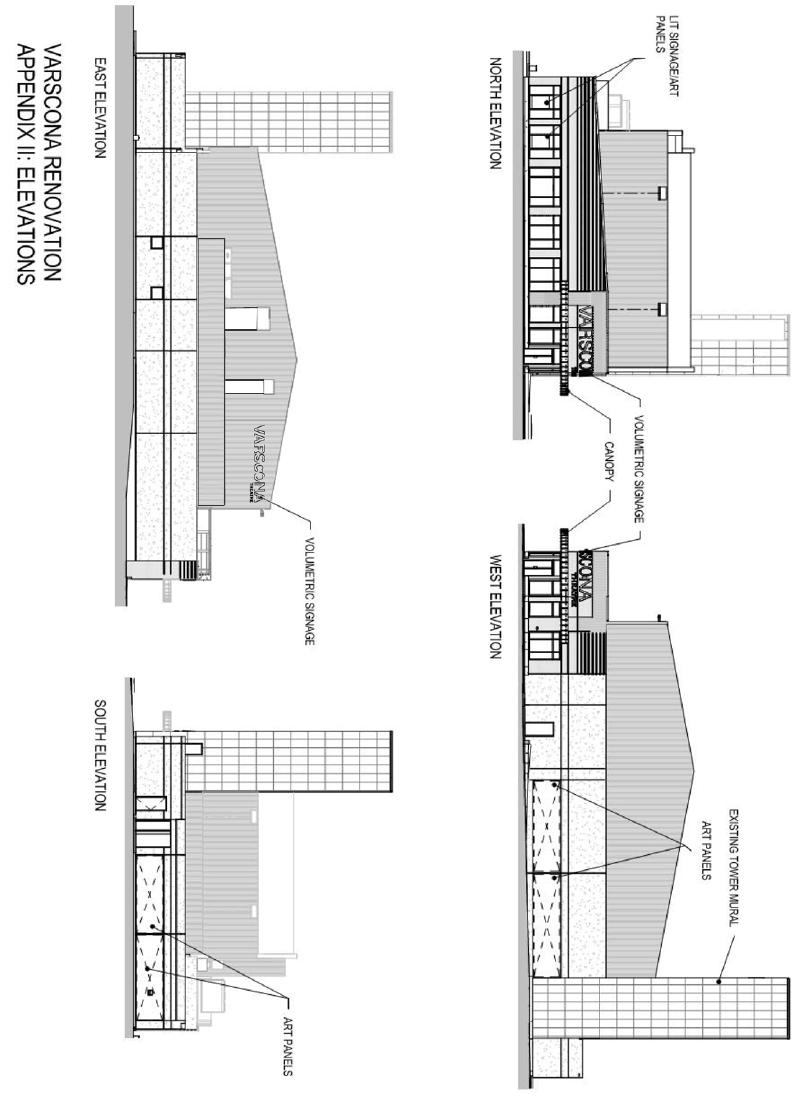
76 PAGE 72
77 8. Sub Area 3 Crawford Block a) General Purpose The General Purpose of Sub Area 3 of the DC1 Historical Commercial Direct Development Control Provision is to accommodate an addition to the Crawford Block building that ensures the redevelopment is architecturally sensitive to the existing building and adjacent historical buildings. Unless specifically excluded or modified in the following sections, all Uses and development regulations in section 4 and 5 of the DC1 Historical Commercial Direct Development Control Provision shall apply to Sub Area 3. b) Area of Application As shown on Map 9, this Sub Area is located west of Gateway Boulevard between 82 and 83 Avenues and is legally described as Lots 26 and 27, Block 68, Plan I. c) Development Regulations i. Unless specifically excluded or modified in the following sections, all development regulations in section 5 of the DC1 Historical Commercial Direct Development Control Provision shall apply to Sub Area 3. v. Notwithstanding Section 5.b of this Provision, the Maximum building Height shall not exceed five storeys nor 17 m. d) Heritage Regulations i. The Crawford Block and associated lands are a Designated Municipal Historic Resource. Exterior alterations and additions shall be sympathetic to and compatible with the historic facades of the Crawford Block to the satisfaction of the Development Officer in consultation with the Heritage Officer. The following standards and guidelines shall be applied when reviewing development applications for the Crawford Block: a. The General Guidelines for Rehabilitation contained in The City of Edmonton Bylaw 16916, Bylaw to Designate the Crawford Block a Municipal Historic Resource; and b. The Standards and Guidelines for the Conservation of Historic Places in Canada. ii. Notwithstanding Section 4 of this Provision, Apartment Housing shall be limited to 700 m 2 per floor and 2300 m 2 per building. iii. Development of the site shall be in general conformance with Appendices I and II of this Sub Area. iv. Notwithstanding Section 5.a. of this Provision, the Maximum Floor Area Ratio shall be 4.0. PAGE 73
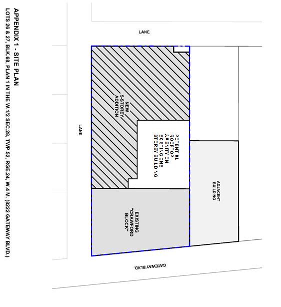
78 PAGE 74
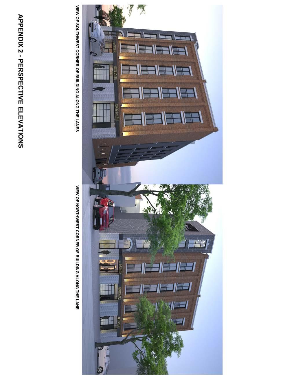
79 PAGE 75
80 9. Sub Area 4 Active Lane Area a) General Purpose The General Purpose of Sub Area 4 of the DC1 Historical Commercial Direct Development Control Provision is to provide the opportunity for programmable public amenity space that respects the heritage character of the surrounding buildings and area, while providing pedestrian connectivity between 82 Avenue NW and the Lane. Unless specifically excluded or modified in the following sections, all Uses and development regulations in section 4 and 5 of the DC1 Historical Commercial Direct Development Control Provision shall apply to Sub Area 4. b) Area of Application As shown on Map 9, this Sub Area is located on a portion of former Lane running north-south on the north side of 82 (Whyte) Avenue NW between 104 Street NW and 105 Street NW. c) Uses Notwithstanding Section 4 of this Provision, only the following Uses shall be permitted within this Sub Area: i. Carnivals ii. Creation and Production Establishments iii. Flea Markets iv. General Retail Stores v. Greenhouses, Plant Nurseries and Market Gardens vi. Outdoor Participant Recreation Services vii. Public Libraries and Cultural Exhibits viii. Public Parks ix. Restaurants x. Specialty Food Services xi. Freestanding Off-premises Signs xii. Freestanding On-premises Signs xiii. Temporary On-premises Signs d) Development Regulations i. Unless specifically excluded or modified in the following sections, all development regulations in Section 5 of the DC1 Historical Commercial Direct Development Control Provision shall apply to Sub Area 4. ii. All Development Permits, with the exception of those for Temporary On-premises Signs, issued within this Sub Area shall carry out notification in accordance with Section 20 of the Zoning Bylaw. iii. The Development Officer shall consider the impact of proposed developments on surrounding properties and may, when it is determined that a negative impact could occur, instruct the applicant to: a. contact the affected parties, being each assessed owner of land wholly or partly located within a distance of 60.0 m of the Site of the proposed development and the President of each affected Community League and Business Revitalization Zone Association; b. outline, to the affected parties, the details of their proposed development and solicit their comments on the application; c. document any opinions or concerns, expressed by the affected parties, and what modifications were made to address concerns; and d. submit this documentation to the Development Officer who shall then use the information provided to impose any conditions deemed necessary PAGE 76
81 to address the concerns or potential negative impacts. iv. Carnivals shall be developed in conformance with Section 73 of the Zoning Bylaw. v. Creation and Production Establishments, Flea Markets, General Retail Stores, Greenhouses, Plant Nurseries and Market Gardens, Outdoor Participant Recreation Services, Restaurants and Specialty Food Services shall be limited to a maximum area within the Sub Area of 100 m 2. vi. Section 91 of the Zoning Bylaw shall not apply to Flea Markets in this Sub Area. vii. No development within this Sub Area shall include a permanent building or structure, except for general projections such as awnings or signs from buildings abutting this Sub Area. viii. Notwithstanding Section 54 of the Zoning Bylaw or other Regulations within this Provision, no development in this Sub Area shall require any form of Off-street Vehicular Accessory Parking, Bicycle Parking Facilities or Offstreet Vehicular Loading Facilities. ix. No formal, permanent waste collection bins or area shall be required. Any proposed temporary development shall have appropriate methods of waste accumulation and collection, depending on Use at the discretion of the Development Officer in consultation with Waste Management Services. and a clearly delineated pedestrian pathway a minimum of 1.5m in width shall be maintained through the Site linking 82 Avenue NW, the rear Lane and entryways of the directly abutting buildings that open onto the Sub Area. xi. Development shall provide adequate lighting to ensure a safe pedestrian environment to the satisfaction of the Development Officer. No direct rays of light shall be directed at any adjoining properties, or interfere with the effectiveness of any traffic control devices in accordance with Sections 51 and 58 of the Zoning Bylaw. xii. Section 55 shall not apply to development within this Sub Area. xiii. Signs within this Sub Area shall conform with Section 5(r) of this Provision and with the following: a. Temporary On-premises Signs shall not include trailer mounted signs or signs with changeable copy; b. Digital Signs shall not be permitted; and c. Freestanding Off-premises Signs and Freestanding Onpremises Signs shall only be developed in a permanent nature if the Copy of such signs is displaying public information such as wayfinding, maps or information about public areas. These Signs shall not display private advertisement for a product, business or service either on or off Site. x. The Sub Area shall remain publically accessible to pedestrians through both the Front Lot Line and Rear Lot Line PAGE 77
82 10. Sub Area 5 - Hulbert Block a) General Purpose The General Purpose of Sub Area 5 of the DC1 Historical Commercial Direct Development Control Provision is to provide detailed, site specific control to ensure ongoing viability of the Hulbert Block, a designated Municipal Historic Resource and ensure any changes are architecturally sensitive to the existing building and adjacent historic buildings. Unless specifically excluded or modified in the following sections, all Uses and development regulations in section 4 and 5 of the DC1 Historical Commercial Direct Development Control Provision shall apply to Sub Area 5. ii. iii. In the event that the existing Hulbert Block building is destroyed, redevelopment shall be in accordance with Section 5 of the Provision but shall not be required to be in accordance with Appendix I of this Sub Area, to the satisfaction of the Development Officer in consultation with the Heritage Officer. Notwithstanding section 10(d)(ii) of this provision, any portion of the designated building remaining shall be incorporated and retained to the satisfaction of the Development Officer in consultation with the Heritage Officer. b) Area of Application c) Uses As shown on Map 9, this Sub Area is located south of 82 Avenue NW between Gateway Boulevard NW and 104 Street NW and is legally described as Lot 14, Block 61, Plan I. As per Section 4 of this Provision DC1 Historical Commercial Direct Development Control Provision. d) Development Regulations i. All development regulations in section 5 of this Provision shall apply to Sub Area 5 except that development shall be in general conformance with Appendix I of this Sub Area. iv. e) Heritage Regulations Notwithstanding Section 5.r.i.h.2 of this Provision a Fascia On-Premises Sign on a window (ie. A Window Sign ) above the ground Storey shall not exceed 10% of the window area and the remainder of the window area shall remain free from obstruction allowing viewing from the exterior to the interior of the building. i. The Hulbert Block and associated lands are a Designated Municipal Historic Resource. Exterior alterations and additions shall be sympathetic to and compatible with the historic facades of the Hulbert Block to the satisfaction of the Development Officer in PAGE 78
83 consultation with the Heritage Officer. The following standards and guidelines shall be applied when reviewing development applications for the Hulbert Block: A. The General Guidelines for Rehabilitation contained in The City of Edmonton Bylaw 17480, Bylaw to Designate the Hulbert Block a Municipal Historic Resource; and B. The Standards and Guidelines for the Conservation of Historic Places in Canada. PAGE 79
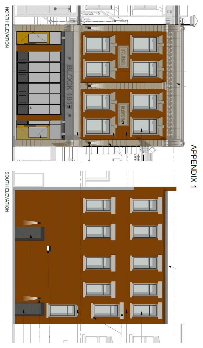
84 PAGE 80
85 DC1 HISTORICAL INSTITUTIONAL DIRECT DEVELOPMENT CONTROL PROVISION 1. Area of Application Note: This section was amended by Bylaw 13838, November 2, 2004 This district will apply to designated historic structures which were originally and or are presently used for a use other than residential or commercial. This includes churches, schools, libraries, government facilities, or rail road uses. Those historic resources which come under this district at the date of passage of this Bylaw are: a) the No. 6 Fire Hall Avenue b) the Knox Metropolitan Church Street c) the Ritchie Mill...Saskatchewan Drive at 103 Street 2. Rational This district is intended to provide sensitive restoration and rehabilitation of some historic resources within the Plan area. 3. Uses a) minor eating and drinking establishments b) spectator entertainment establishments c) indoor participant recreation services d) private clubs e) private education services f) public education services g) public libraries and cultural exhibits h) public park i) religious assembly j) uses consistent with the purpose of this district and where applicable with designation as an historic resource under the Alberta Historical Resources Act. 4. Development Criteria a) Parking shall be provided in accordance with the provisions of Section 66 of the Land Use Bylaw, with the following exception i) any requirement of Section 66 may be relaxed, at the discretion of the Development Officer, if meeting the regulations would jeopardize the integrity of a site as an historic resource. b) Development shall be accommodated within existing structures c) Modifications to interiors/exteriors of existing structures shall only be made in the event of necessary structural reinforcement or repairs. Cosmetic alterations shall maintain the architectural theme and components of the existing structure. PAGE 81
86 Note: The following section, including Appendices I, II and III, was added by Bylaw 13838, November 2, (DC1) Direct Development Control Provision Strathcona Library 1. Purpose This Provision accommodates an addition to the Strathcona Library, a Municipal and Provincial Registered Historic Resource, and ensures that its redevelopment is architecturally sensitive to the existing building and adjacent historical buildings. 2. Area of Application Lots 22, 23 and 24, Block 79, Plan I, located east of 104 Street and south of 84 Avenue, Strathcona. 3. Uses a) Public Libraries and Cultural Exhibits b) Public Park c) Fascia On-premises Signs d) Freestanding On-premises Signs 4. Development Regulations a) Development of the Site shall generally reflect the design concept illustrated by the Site Plan, Landscaping Concept Plan, and Elevations, as shown on Appendix I, II, and III of this Bylaw. b) The maximum building Height shall not exceed 14m. c) The Yards shall comply with the dimensions shown on Appendix I of this Bylaw. d) 2 parking spaces shall be provided in the location shown on Appendix II of this Bylaw, in accordance with Section 54.2 of the Edmonton Zoning Bylaw. e) 30 Bicycle Parking spaces shall be provided in the location shown on Appendix II of this Bylaw, in accordance with Section 54.3 of the Edmonton Zoning Bylaw. f) Loading facilities shall be provided in the location shown on Appendix II of this Bylaw, to the satisfaction of the Development Officer, and the Transportation and Streets Department. g) The trash collection area shall be screened and provided in accordance with the provisions of Section 55 of the Zoning Bylaw and located in accordance with the site plan, as shown on Appendix II. h) Signs shall comply with the regulations found in Schedule 59H of the Edmonton Zoning Bylaw, and the applicant shall provide a Comprehensive Sign Design Plan, as per Section 59.3 of the Edmonton Zoning Bylaw with any Development Permit application. i) Ornamental lighting of the building will be provided in order to ensure safety and shall be designed to be complementary to the historic design context, and may include a combination of building mounted and landscape lighting fixtures, to the satisfaction of the Development Officer, in consultation with the City s Heritage Officer. j) The 8 existing mature trees on the site will be maintained to integrate the site into the surrounding context and historical fabric of the Old Strathcona area, specifically McIntyre Park. Additional landscaping of the site shall be provided in accordance with Appendix II, and to the satisfaction of the Development Officer. The Plan will include an earthbermed, and mixed hard and grass-surfaced amphitheatre on the south side of the library. k) All mechanical equipment, including roof mechanical units, shall be concealed by screening in a manner compatible with the architectural character of the building or concealed by incorporating it within the building, to the satisfaction of the Development Officer, in consultation with the City s Heritage Officer. PAGE 82
87 5. Heritage Development Regulations These regulations ensure that the design of the addition will be sympathetic to the historical and architecturally significant facades of the Strathcona Library, and will complement the building s original 1913 English Renaissance Revival Style architecture design. The Development Officer shall have regard to the following regulations when reviewing Development Permit applications: a) This Site includes the Strathcona Library Building which, together with the lands on which the building is located, are designated as a Provincial Registered Historic Resource as per the Alberta Historic Resources Act. b) The Strathcona Library building and associated lands are also designated as a Municipal Historic Resource as per Bylaw approved by Council on July 27, c) All future development shall conform to the Guidelines for Rehabilitation published by Alberta Community Development and requires the approval by the Minister of Alberta Community Development. d) All future development shall conform to the requirements of the City of Edmonton Designation Bylaw and Policy C-450A s General Guidelines for Rehabilitation. e) All development shall be complementary to the scale, materials, proportions, details and design elements of the regulated portions of the building defined in the Designation Bylaw as existing at the time of adoption of this Bylaw to the satisfaction of the Development Officer in consultation with the Heritage Officer. PAGE 83
88 PAGE 84
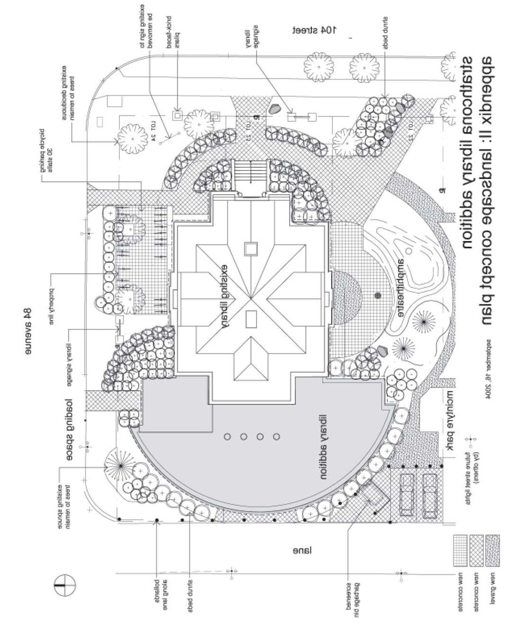
89 PAGE 85
90 PAGE 86
91 Note: The following section was added by Bylaw 13859, December 8, (DC1) Direct Development Control Provision Canadian Pacific Railway Station, Strathcona 1. Purpose This provision is designed to accommodate the use and preservation of the Canadian Pacific Railway Station, Strathcona. The Station, constructed in 1907, is a reminder of Edmonton s historical development patterns, settlement in Alberta, the integration of agriculture and commerce, and an architectural example of early 20 th century railway station design. This provision encourages a range of commercial uses within the existing Station and patio, while ensuring that any future restoration and rehabilitation is architecturally sensitive to the existing building as specified under its designation as a Municipal and Provincial Historic Resource. 2. Area of Application A portion of Block L, Plan I, located east of Gateway Boulevard and south of Whyte Avenue, Strathcona. 3. Uses a) Bars and Neighbourhood Pubs b) Broadcasting and Motion Picture Studios c) Business Support Services d) Commercial Schools e) Convenience Retail Stores f) Custom Manufacturing g) General Retail Stores h) Government Services i) Health Services j) Household Repair Services k) Indoor Participant Recreation Services l) Limited Contractor Services m) Major and Minor Amusement Establishments n) Mobile Catering Food Services o) Nightclubs p) Personal Service Shops q) Private Clubs r) Professional Financial and Office Support Services s) Public Libraries and Cultural Exhibits t) Restaurants u) Specialty Food Services v) Fascia On-premises Signs w) Projecting On-premises Signs x) Freestanding On-premises Signs y) Temporary On-premises Signs 4. Development Regulations a) Development of the Site shall generally reflect the Site Plan, as shown on Appendix I of this Bylaw. b) Development shall be accommodated within the existing Station and the existing patio. Development shall not encroach upon the concrete pad to the north of the patio, excepting its redevelopment with landscaping, to the satisfaction of the Development Officer. c) Modifications or renovations to the interiors/exteriors of the former CPR Station shall only be made in the event of necessary structural reinforcement or repairs, and shall conform to the provisions of the Municipal Designation Bylaw 13470, and the Heritage Development Regulations in Section 5 of this Provision. d) Development Permit Applications shall be reviewed by the Development Officer in consultation with the Municipal Heritage Officer and Alberta Community Development. e) The total capacity of the following uses Bar and Neighbourhood Pub, Nightclub, Restaurant, or Specialty Food Services shall not exceed 200 occupants and 240 m 2 of Public Space. There shall be no variances to this regulation. f) The Yards shall comply with the dimensions shown on Appendix I of this Bylaw. g) Parking shall be provided in accordance with the provisions of Section 54 of the Edmonton Zoning Bylaw. h) Loading facilities shall be provided to the satisfaction of the Development Officer, and the Transportation and Streets Department. i) Landscaping shall comply with Section 55 of the Edmonton Zoning Bylaw. j) The trash collection area shall be screened and provided in accordance with the provisions of Section 55 of the Zoning Bylaw, and located on the site to the satisfaction of the Development Officer. k) Signs shall comply with the regulations found in Schedule 59H of the Edmonton Zoning Bylaw, and the applicant shall provide a Comprehensive Sign Design Plan, as per Section 59.3 of the Edmonton Zoning Bylaw with any Development Permit application. PAGE 87
92 5. Heritage Development Regulations These regulations ensure that the design of modifications or renovations will be sympathetic to the historic and architecturally significant facades of the Canadian Pacific Railway Station, and will complement the building s original 1907 architecture. a) The Site includes the CPR Station and associated lands on which the building is located, and are designated as a Provincial Registered Historic Resource as per the Alberta Historic Resources Act. All future development shall conform to the Guidelines for Rehabilitation published by Alberta Community Development and requires the approval by the Minister of Alberta Community Development. b) The CPR Station and associated lands are also designated as a Municipal Historic Resource as per Bylaw approved by Council on November 4, All future development shall conform to the requirements of the City of Edmonton Designation Bylaw and Policy C-450A s General Guidelines for Rehabilitation. PAGE 88
93 PAGE 89
94 Note: The following section was added by Bylaw 14507, March 12, (DC1) Direct Development Control Provision Connaught Armoury 1. Purpose This provision is designed to accommodate the use and preservation of the Connaught Armoury, a Provincial Historic Resource and a Municipal Historic Resource. The Connaught Armoury, built in 1911, is one of the oldest remaining armouries in Alberta and is one of Edmonton s notable buildings. The Armoury is constructed with brick and accented with limestone string courses, and features entrance details and crenellation in the parapet which define the buildings military theme. The Provision allows an appropriate mix of residential, community oriented, institutional, and commercial uses and includes regulations that ensure any use in the building and future renovations are both sensitive to the adjacent residential development and sympathetic to the original historic characteristics of the building as specified under its designation as a Municipal and Provincial Historic Resource. 2. Area of Application Lots 1, 2, 3 and portion of Lot 4, Block 97, Plan I, located between 85 and 86 Avenues, west of Gateway Boulevard, Strathcona 2. Uses a) Apartment Housing b) Broadcasting and Motion Picture Studios c) Child Care Services d) Commercial Schools e) Community Recreation Services f) Government Services g) Health Services, excluding an addictions counseling service h) Indoor Participant Recreation i) Private Education Service and Public Education Service j) Public Libraries and Cultural Exhibits k) Professional, Financial and Office Support Services l) Spectator Entertainment Establishment m) Veterinary Services n) Freestanding On-premises Signs, limited to one Sign, at the southeast corner of the site. 4. Development Regulations a) Development shall be accommodated within the existing Connaught Armoury structure. b) Parking, Loading and Bicycle Parking shall be provided in accordance with Section 54 and Section 88 of the Edmonton Zoning Bylaw; however any requirement of Section 54 and Section 88 may be relaxed at the discretion of the Development Officer, if meeting the regulations would not jeopardize the integrity of the subject site as an historic resource. c) Landscaping shall be provided in accordance with Section 55 of the Edmonton Zoning Bylaw to the satisfaction of the Development Officer in consultation with the Planning and Policy Services Branch. d) A trash and recycling collection area shall be provided and shall be screened in accordance with Section 55 of the Edmonton Zoning Bylaw. e) Signs, and Lighting for Signs shall be designed and integrated into the historical character of the Connaught Armoury, and shall comply with the following regulations to the satisfaction of the Development Officer in consultation with the City of Edmonton Heritage Officer: (i) The Freestanding On-premises Sign shall not exceed 6.0 m² with no portion of the sign projecting beyond the property line. The maximum Height of the Sign shall be 3.0 m, including embellishments. (ii) If illuminated, the Sign shall be lit from an external source. Backlit or internally illuminated fascia signs are prohibited, except where only the lettering is backlit. (iii) The size, typeface, graphics, and material shall be chosen to suit the period of the building. (iv) Entrance canopy or window canopies with or without signage is not permitted. f) Child Care Services shall be developed in accordance with Section 80 of the Edmonton Zoning Bylaw. g) Broadcasting and Motion Picture Studios shall be developed such that no nuisance is created PAGE 90
95 or apparent outside the Connaught Armoury building. All broadcasting equipment shall be limited to the interior of the building, or located on the roof providing the equipment is concealed by screening in a manner compatible with the architectural character of the building. h) All mechanical equipment, including roof mechanical units shall be concealed by screening in a manner compatible with the architectural character of the building and Policy C-450A s General Guidelines for Rehabilitation; and, d) All modification and/or alteration shall be reviewed and approved by the Municipal Heritage Officer, in consultation with the government agency responsible for the subject site s historic designation, Alberta Community Development. i) Access and egress to the site shall be restricted to Gateway Boulevard and 85 Avenue. There shall be no vehicular access to the adjacent laneway. j) Development of the site shall conform to the Alberta Building Code and the principles of Barrier Free Design. k) Any modification and/or alteration to the interior and exterior of the Connaught Armoury shall only be made if the work is necessary for structural reinforcement or repairs, sympathetic to the heritage character of the building, and does not change its character defining spaces and identified character-defining elements. The modification and/or alteration shall conform to the Heritage Development & Design Regulations in Section 5 of this Provision. 5. Heritage Development & Design Regulation These regulations ensure that the design of structural reinforcement or repairs, and cosmetic alterations will be sympathetic to the historic and the architecturally significant facades of the Connaught Armoury. The Development Officer, in consultation with the Municipal Heritage Officer shall have regard to the following standards and guidelines when reviewing development applications: a) The Standards and Guidelines for the Conservation of Historic Places in Canada published by Parks Canada and the Minister of Alberta Community Development; b) The Statements of Significance for the Connaught Armoury; c) The City of Edmonton Designation Bylaw approved by City Council on March 6, PAGE 91
96 Note: The following section was added by Bylaw 15174, May 11, (DC1) Direct Development Control Provision Duggan House Strathcona Saskatchewan Drive 1. Purpose This Provision is designed to accommodate the use and preservation of the John Joseph Duggan Residence (the House), a Municipal Historic Resource. This provision allows Professional, Financial and Office Support Services within the House, while ensuring that any future alterations or the construction of additional office space shall maintain the architectural theme prescribed by the Municipal Historic Resource designation. 2. Area of Application This DC1 Provision shall apply to Plan I-2, Block 103, West Half of Lot 5, located at Saskatchewan Drive, Edmonton as shown on Schedule A attached to the Bylaw adopting this DC1 Provision. 3. Uses a. Professional, Financial and Office Support Services b. Freestanding On-premises Signs, limited to one Sign, in the Front Yard 4. Development Regulations a. Modifications to the exteriors of the House shall only be made in the event of necessary structural reinforcement or repairs, and shall conform to the provisions of the approved Municipal Designation Bylaw, and receive prior approval from the City of Edmonton Planning and Development Department s Heritage Officer. b. Modifications to the interior of the House shall maintain the architectural theme of the House, to the satisfaction of the Development Officer in consultation with the City of Edmonton Heritage Officer. c. Notwithstanding Clause 4(a), expansion of the House will be limited to 50.0 m 2 per storey at the rear, will not exceed the height of the existing structure, and shall maintain the architectural theme of the House, to the satisfaction of the Development Officer in consultation with the City of Edmonton Heritage Officer. d. A loading space shall not be required. e. Vehicular access to the site shall be from 87 Avenue only. f. Vehicle and bicycle parking shall be provided in accordance with Section 54 of the Zoning Bylaw except that a minimum of two bicycle parking spaces shall be provided in any case. Any deficiencies in parking shall require a Parking Impact Assessment to be reviewed and approved by the Transportation Department and Development Officer. g. Landscaped Yards shall be provided in accordance with Section 55 of the Zoning Bylaw and to the satisfaction of the Development Officer in consultation with the Heritage Officer. h. The Freestanding On-premises Signs shall: i. not exceed 1.5 m² in area, with no portion of the sign projecting beyond the property line. ii. have a maximum height of 1.2 m, including embellishments and support. iii. be integrated into the historical character of the House, and shall comply with the regulations to the satisfaction of the Development Officer in consultation with the City of Edmonton Heritage Officer. i. If for any reason the land and/or associated building lose their historical significance (i.e. the loss or deterioration of the House), the uses and regulations of the most restrictive Zone on the adjacent lands shall apply. 5. Heritage Development & Design Regulations a. These regulations ensure that the design of structural reinforcement or repairs, cosmetic alterations, and rear expansion will be sympathetic to the historical and PAGE 92
97 architecturally significant facades of the House. The Development Officer shall have regard to the following regulations when reviewing development applications: i. Any future development shall conform to the Standards and Guidelines for the Conservation of Historic Places in Canada published by Parks Canada. ii. Any development shall conform to the requirements of the City of Edmonton Designation Bylaw and Policy C-450A s General Guidelines for Rehabilitation. iii. All development must be sympathetic to the original building s architectural style, detail and materials and retain a residential appearance. iv. As much of the original building s fabric and structure must be included in any development. v. No new development shall exceed the height of the existing structure. PAGE 93
98 Note: DC1 Direct Control Provision Historic West Ritchie was added by Bylaw 15811, July 4, 2011 (DC1) DIRECT DEVELOPMENT CONTROL PROVISION HISTORIC WEST RITCHIE 1. Purpose The purpose of this Provision is to preserve the unique architectural character of a portion of 81 Avenue, provide for new commercial and compatible mixed use development opportunities and if possible preserve the view of the historic Canadian Pacific Railway (CPR) station to the west. This provision creates a unique pedestrian commercial shopping district while ensuring future development is compatible with the character of buildings with historic false Façades. 2 Area of Application This Provision applies to those lots indicated on Schedule A of the Bylaw adopting this DC1 Provision, as well as Map A below, located on 81 Avenue between 101 and 102 Streets and south of Whyte Avenue as well as the lot on the west side of 102 Street at 81 Avenue (Lot 4, Block L, Plan ) within the Ritchie and CPR Irvine neighbourhoods and the boundaries of the Strathcona Area Redevelopment Plan. 3. Permitted and Discretionary Uses Permitted and Discretionary Uses in this Provision shall be as prescribed in the (CB2) General Business Zone with the addition of Live Work Units as a Permitted Use. 4. Development and Design Regulations Map A. DC1 West Ritchie Historic Area a. Except as modified below, development regulations in this PAGE 94

99 Provision shall be as prescribed in the (CB2) General Business Zone and as modified by the Pedestrian Commercial Shopping Street Overlay, notwithstanding subsection 800.2(2)(a) of the Zoning Bylaw. b. Historic View Corridor Canadian Pacific Railway (CPR) Station i. A 20.2 m wide historic view corridor, defined as the equivalent of an extension of 81 Avenue through Lot 4, Block L, Plan , on the west side of 102 Street, with the centre of the extension being aligned with the centre of the existing 81 Avenue right-of-way, is established as shown on Map A and Figure A. ii. Within the 20.2 m historic view corridor, no buildings shall be constructed, however limited development may be allowed as follows: outdoor Amenity Areas, pedestrian Figure A. Historic View Corridor - Restricted Development Area pathways, street furniture, landscaping provided no trees exceed a height of 3.0 m, driveways, drive aisles and surface parking may be developed provided that the view of the Strathcona CPR Station is unimpeded to the satisfaction of the City of Edmonton s Development Officer and Heritage Officer (see Figure A). c. Exemption to Clause 4(b): west side of 102 Street at 81 Avenue, Avenue NW (Plan Blk L Lot 4) i. Notwithstanding Clause 4(b) in this Provision, the development as approved at the time of the Bylaw adopting this Provision located on the west side of 102 Street at 81 Avenue, Avenue NW (Plan Blk L Lot 4), comprising a four-storey, commercial-residential mixed use building, including General Retail PAGE 95
100 Uses on the first floor and Apartment Housing on the upper three floors, along with underground parking, is deemed to conform to the regulations of this Provision. iv. Notwithstanding subsection 819.3(6) of this Bylaw, in multi-storey buildings there shall be a minimum 2.5 m Stepback above the first Storey to give prominence to the false Façade. ii. iii. d. Historic False Façades Any future development permit applications on this Site that do not comply with clause 4(b) in this Provision shall be required to comply with the development as approved at the time of the Bylaw adopting this Provision. Any subsequent development permit applications on the same Site that do not comply with the development as approved on this Site as of the time of the Bylaw adopting this Provision shall be required comply with clause 4(b) and all other regulations of this Provision. i. Historic false Façades shall be maintained, renovated or reconstructed as part of new development within existing buildings with historic false Façades within the area shown as False Façades Area as contained within the DC1 West Ritchie Historic Area Map A, (examples, Figure B). ii. iii. One or more new false Façades in character with the historic false Façades of the area shall be requirement of development of new buildings. New false Façades should be 1 ½ to 2 Storeys in height. v. Multi-Storey development should be designed such that upper floors relate to the ground floor in style, material and/or architecturally to ensure the building reads as a cohesive unit. vi. vii. viii. ix. Symmetrical false Façades, using stucco or cementious finishes, are encouraged. The design of new false Façades and the renovation or reconstruction of existing buildings with historic false Façades shall be to the satisfaction of the City of Edmonton s Development Officer and Heritage Planner. Alternative architecture that is not completely compliant with Clauses 4(d)(ii vi) above shall be considered at the discretion of the City of Edmonton s Development Officer and Heritage Planner, provided that it compliments and otherwise does not conflict with the existing character of the historic false Façades within this area. Where the Frontage of a Site exceeds 20.2 m, the front of the building shall be designed to break the appearance into sections with a maximum width of 20.2 m. PAGE 96


101 Figure B. False Façades in West Ritchie x. 7 xi. xii. x. The Development Officer shall consult with the Heritage Planner on any development permit application for a Sign prior to rendering a decision to ensure compatibility with the false Façades within this area. e. The following additional regulation shall apply to Live Work Unit developments: i. Where a development contains two or more Live Work Units, a minimum of 7.5 m2 of Amenity Area per Unit is required, in accordance with the provisions of Section 46 of this Bylaw f. The following additional regulations shall apply to Apartment Housing and Live Work Unit developments: i. Housing applications within 75 m of the CP Rail Yard and within 75 m of the CP railway shall include a noise and vibration study and any Development Permits shall include any required noise mitigation measures to meet standards as prescribed in the Community Standards Bylaw as well as by Canada Mortgage and Housing Corporation, as updated from time to time, to the satisfaction of the Development Officer, as ii. long as the CP Rail Yard is operational. Housing applications that are within areas greater than 75 m of the CP Rail Yard and greater than 75 m of the CP railway shall consider measures to mitigate any potential impacts of noise and vibration. PAGE 97
York Neighbourhood Area Structure Plan
 York Neighbourhood Area Structure Plan Office Consolidation March 2006 Prepared by: Planning and Policy Services Branch Planning and Development Department City of Edmonton Bylaw 7064 was adopted by Council
8.5.1 R1, Single Detached Residential District
 8.5.1 R1, Single Detached Residential District The purpose of this district is to provide for residential development in the form of single detached dwellings. Dwelling, Single Detached Home Business,
3.1. OBJECTIVES FOR RESIDENTIAL LAND USE DESIGNATIONS GENERAL OBJECTIVES FOR ALL RESIDENTIAL DESIGNATIONS
 3. RESIDENTIAL LAND USE DESIGNATIONS INTRODUCTION The Residential land use designations provide for housing and other land uses that are integral to, and supportive of, a residential environment. Housing
Rule of corner may need to be flexible i.e. context school, park. With a clustered approach. Should row housing go where fourplexes are?
 Fourplex Privacy Traffic issues by school (don t locate next to school) Highest density is furthest from park and school. Is this best? Family friendly (i.e. private green space, nicely designed, etc.)
Montreal Road District Secondary Plan [Amendment #127, October 9, 2013]
![Montreal Road District Secondary Plan [Amendment #127, October 9, 2013]](/thumbs/72/66783104.jpg "Montreal Road District Secondary Plan [Amendment #127, October 9, 2013]") [Amendment #127, October 9, 2013] 1.0 General The following policies are applicable to the Montreal Road District as set out in Schedule 1. 1.1 District Objectives The objective of this Plan is to guide
[Amendment #127, October 9, 2013] 1.0 General The following policies are applicable to the Montreal Road District as set out in Schedule 1. 1.1 District Objectives The objective of this Plan is to guide
6. RESIDENTIAL ZONE REGULATIONS
 6. RESIDENTIAL ZONE REGULATIONS PART 6A PURPOSE OF CHAPTER (1) The purpose of this Chapter is to provide detailed regulations and requirements that are relevant only to residential zones and specific residential
CASTLES OF CALEDON URBAN DESIGN REPORT
 CASTLES OF CALEDON URBAN DESIGN REPORT PROPOSED RESIDENTIAL DEVELOPMENT CALEDON, ONTARIO 10 JULY, 2015 TABLE CONTENTS: 1.0 DEVELOPMENT 4.0 CONCLUSION 1.1 Introduction 1.2 Castles of Caledon- Urban Design
S U B D I V I S I O N A N D D E V E L O P M E N T A P P E A L B O A R D A G E N D A
 S U B D I V I S I O N A N D D E V E L O P M E N T A P P E A L B O A R D A G E N D A Wednesday, 9:00 A.M. March 15, 2017 Hearing Room No. 2 Churchill Building, 10019-103 Avenue NW, Edmonton, AB Hearing
LITTLE MOUNTAIN ADJACENT AREA REZONING POLICY
 LITTLE MOUNTAIN ADJACENT AREA REZONING POLICY JANUARY 2013 CONTENTS 1.0 INTENT & PRINCIPLES...1 2.0 APPLICATION...2 3.0 HOUSING TYPES, HEIGHT & DENSITY POLICIES...3 3.1 LOW TO MID-RISE APARTMENT POLICIES...4
Control % of fourplex additions on a particular street. Should locate to a site where there are other large buildings
 Fourplex Ensure privacy of adjacent back yards window Location on the edge of neighbourhood is more Consistent design to blend in with existing street placement: minimal overlook Closer to arterial road
PLANNING REPORT Gordon Street City of Guelph. Prepared on behalf of Ontario Inc. March 17, Project No. 1507
 PLANNING REPORT 1131 Gordon Street City of Guelph Prepared on behalf of 1876698 Ontario Inc. March 17, 2016 Project No. 1507 423 Woolwich Street, Suite 201, Guelph, Ontario, N1H 3X3 Phone (519) 836-7526
Article 3. SUBURBAN (S-) NEIGHBORHOOD CONTEXT
 NEIGHBORHOOD CONTEXT") Article 3. SUBURBAN (S-) NEIGHBORHOOD CONTEXT this page left intentionally blank Contents ARTICLE 3. SUBURBAN (S-) NEIGHBORHOOD CONTEXT DIVISION 3.1 NEIGHBORHOOD CONTEXT DESCRIPTION...3.1-1 Section 3.1.1
Article 3. SUBURBAN (S-) NEIGHBORHOOD CONTEXT this page left intentionally blank Contents ARTICLE 3. SUBURBAN (S-) NEIGHBORHOOD CONTEXT DIVISION 3.1 NEIGHBORHOOD CONTEXT DESCRIPTION...3.1-1 Section 3.1.1
DRAFT FOR DISCUSSION PURPOSES ONLY. Port Credit Local Area Plan Built Form Guidelines and Standards DRAFT For Discussion Purposes
 Port Credit Local Area Plan Built Form Guidelines and Standards DRAFT For Discussion Purposes 1 Local Area Plan - Project Alignment Overview Directions Report, October 2008 (General Summary Of Selected
Belmead Neighbourhood Structure Plan
 Belmead Neighbourhood Structure Plan Office Consolidation November 2005 Prepared by: Planning and Policy Services Branch Planning and Development Department City of Edmonton Bylaw 6619 was adopted by Council
Highland Green Estates Neighbourhood Area Structure Plan
 Highland Green Estates Neighbourhood Area Structure Plan Original Outline Plan approved by Council: March 10, 1997 Outline Plan amended by Council: March 24, 1997 Converted to a Neighbourhood Area Structure
5. Housing. Other Relevant Policies & Bylaws. Several City-wide policies guide our priorities for housing diversity at the neighbourhood level: Goals
 5. Housing Other Relevant Policies & Bylaws Several City-wide policies guide our priorities for housing diversity at the neighbourhood level: Goals 1. Encourage more housing diversity while maintaining
Plan Dutch Village Road
 Plan Dutch Village Road Objective: The lands around Dutch Village Road are a minor commercial area that services the larger Fairview community. Maintaining the vibrancy of the area by planning for redevelopment
TOTTENHAM SECONDARY PLAN
 TOTTENHAM SECONDARY PLAN AMENDMENT NO. 11 TO THE OFFICIAL PLAN OF THE TOWN OF NEW TECUMSETH The following text and schedules to the Official Plan of the Town of New Tecumseth constitute Amendment No. 11
BYLAW NO. 15/026 A BYLAW OF THE REGIONAL MUNICIPALITY OF WOOD BUFFALO TO AMEND THE LAND USE BYLAW NO. 99/059
 Attachment 2 BYLAW NO. 15/026 A BYLAW OF THE REGIONAL MUNICIPALITY OF WOOD BUFFALO TO AMEND THE LAND USE BYLAW NO. 99/059 WHEREAS Section 639 of the Municipal Government Act requires every municipality
PLANNING RATIONALE REPORT CODEAU BUILDING LTD RIDEAU STREET OTTAWA DECEMBER 2013
 PLANNING RATIONALE REPORT CODEAU BUILDING LTD 541-545 RIDEAU STREET OTTAWA DECEMBER 2013 1 This report has been prepared on behalf of Codeau Building Ltd. in support of a Zoning By-law Amendment Application
Bylaw No , being "Official Community Plan Bylaw, 2016" Schedule "A" DRAFT
 Bylaw No. 2600-2016, being "Official Community Plan Bylaw, 2016" Schedule "A" Urban Structure + Growth Plan Urban Structure Land use and growth management are among the most powerful policy tools at the
Planning Justification Report
 Planning Justification Report 101 Kozlov Street, Barrie, Ont. Destaron Property Management Ltd. November 2015 Revised February 2017 TABLE OF CONTENTS Page 1.0 INTRODUCTION... 1 2.0 DESCRIPTION OF SUBJECT
Yonge Street and 3 Gerrard Street East - Zoning Amendment Application - Preliminary Report
 STAFF REPORT ACTION REQUIRED 363-391 Yonge Street and 3 Gerrard Street East - Zoning Amendment Application - Preliminary Report Date: May 22, 2015 To: From: Wards: Reference Number: Toronto and East York
Planning Rationale. 224 Cooper Street
 Submitted by: Robertson Martin Architects Tel 613.567.1361 Fax 613.567.9462 216 Pretoria Ave, Ottawa, Ontario, K1S 1X2 Planning Rationale 224 Cooper Street Planning Rationale Application to City of Ottawa
Appendix1,Page1. Urban Design Guidelines. Back to Back and Stacked Townhouses. DRAFT September 2017
 Appendix1,Page1 Urban Design Guidelines DRAFT September 2017 Back to Back and Stacked Townhouses Appendix1,Page2 Table of Contents 1 Introduction 1 1.1 Purpose 1 1.2 Urban Design Objectives 1 1.3 Building
Jasper 115 Street DC2 Urban Design Brief
 Jasper 115 Street DC2 Urban Design Brief Greenlong Construction Ltd. Stantec Consulting Ltd. 2017 Overview The proposed rezoning application supports the development of two mixed-use high-rise buildings
SUBJECT: Character Area Studies and Site Plan Approval for Low Density Residential Areas. Community and Corporate Services Committee
 Page 1 of Report PB-70-16 SUBJECT: Character Area Studies and Site Plan Approval for Low Density Residential Areas TO: FROM: Community and Corporate Services Committee Planning and Building Department
Planning Justification Report
 Planning Justification Report Kellogg s Lands City of London E&E McLaughlin Ltd. June 14, 2017 Zelinka Priamo Ltd. Page i TABLE OF CONTENTS Page No. 1.0 2.0 2.1 2.2 3.0 4.0 5.0 5.1 5.2 5.3 5.4 5.5 5.6
Director, Community Planning, Toronto and East York District
 STAFF REPORT September 1, 2005 To: From: Subject: Toronto and East York Community Council Director, Community Planning, Toronto and East York District Further Report Applications to amend Official Plan
GEORGE / GROSVENOR AREA STUDY RECOMMENDATIONS PLANNING CITY OF LONDON DEPARTMENT OF. MAY 1985 r----q
 GEORGE / GROSVENOR AREA STUDY RECOMMENDATIONS CITY OF LONDON DEPARTMENT OF PLANNING MAY 1985 r----q PREFACE On April 9, 1985, the Planning Committee held a public meeting regarding the St. George/Grosvenor
Infrastructure, Development and Enterprise Services
 Staff Report To Service Area City Council Infrastructure, Development and Enterprise Services Date Monday, April 9, 2018 Subject Report Number Statutory Public Meeting 671 Victoria Road North Proposed
Bridgeland-Riverside Area Redevelopment Plan (ARP)
") Bridgeland-Riverside Area Redevelopment Plan (ARP) The current Bridgeland-Riverside Area Redevelopment Plan (ARP) was approved in 1980. Since then, a lot of changes have taken place in the city and the
Bridgeland-Riverside Area Redevelopment Plan (ARP) The current Bridgeland-Riverside Area Redevelopment Plan (ARP) was approved in 1980. Since then, a lot of changes have taken place in the city and the
Sherwood Forest (Trinity) Housing Corporation. Urban Design Brief
 Housing Corporation. Urban Design Brief") Sherwood Forest (Trinity) Housing Corporation Sherwood Place Affordable Housing Apartments Trinity Presbyterian Church Orchard Park Nursery School 590 Gainsborough Road, London Urban Design Brief REVISED
Sherwood Forest (Trinity) Housing Corporation Sherwood Place Affordable Housing Apartments Trinity Presbyterian Church Orchard Park Nursery School 590 Gainsborough Road, London Urban Design Brief REVISED
Side Setback Amendments to the (RF3) Small Scale Infill Development Zone Options to amend side setbacks for Row Housing
 Small Scale Infill Development Zone Options to amend side setbacks for Row Housing") Side Setback Amendments to the (RF3) Small Scale Infill Development Zone Options to amend side setbacks for Row Housing Recommendation: That Administration prepare amendments to Zoning Bylaw 12800, as
Side Setback Amendments to the (RF3) Small Scale Infill Development Zone Options to amend side setbacks for Row Housing Recommendation: That Administration prepare amendments to Zoning Bylaw 12800, as
Residential. Infill / Intensification Development Review
 Residential Infill / Intensification Development Review How Best to Manage The Compatible Integration of New Housing Within Established Residential Neighbourhoods Identification of Issues Privacy/overlook/height
Urban Design Brief Dundas Street. London Affordable Housing Foundation. November Zelinka Priamo Ltd.
 Urban Design Brief 1039-1047 Dundas Street London Affordable Housing Foundation November 2017 Zelinka Priamo Ltd. TABLE OF CONTENTS Page No. INTRODUCTION... 3 SECTION 1 LAND USE PLANNING CONTEXT... 3 1.1
Residential Intensification in Established Neighbourhoods Study (RIENS)
") Residential Intensification in Established Neighbourhoods Study (RIENS) EXECUTIVE SUMMARY In December 2015, the City of Kitchener retained Meridian Planning Consultants to undertake the Residential Intensification
Residential Intensification in Established Neighbourhoods Study (RIENS) EXECUTIVE SUMMARY In December 2015, the City of Kitchener retained Meridian Planning Consultants to undertake the Residential Intensification
Groat Estate Implementation Plan
 Groat Estate Implementation Plan Office Consolidation, July 2017 Prepared by: Current Planning Branch Sustainable Development City of Edmonton The Groat Estate Implementation Plan was approved by resolution
ADMINISTRATION RECOMMENDATION(S) 2017 May 04. That Calgary Planning Commission recommends APPROVAL of the proposed Land Use Amendment.
 2017 May 04. That Calgary Planning Commission recommends APPROVAL of the proposed Land Use Amendment.") Page 1 of 14 EXECUTIVE SUMMARY This proposed Land Use Amendment seeks to redesignate the subject parcel from Residential Contextual One/Two Dwelling (R-C2) District to a DC Direct Control District to accommodate
Page 1 of 14 EXECUTIVE SUMMARY This proposed Land Use Amendment seeks to redesignate the subject parcel from Residential Contextual One/Two Dwelling (R-C2) District to a DC Direct Control District to accommodate
AGENDA SLOT HOME EVALUATION & TEXT AMENDMENT. 5:30 - Welcome
 AGENDA 5:30 - Welcome Please sign-in, put a sticker on the map, grab snacks, materials and a seat 5:45 - Staff Presentation 6:15 - Open House Stations Background Information Mixed Use Districts Multi Unit
Urban Design Brief. Proposed Medical / Dental Office 1444 Adelaide Street North. Vireo Health Facility Ltd.
 Urban Design Brief Proposed Medical / Dental Office Vireo Health Facility Ltd. November 27, 2013 TABLE OF CONTENTS Page No. INTRODUCTION... 1 SECTION 1 LAND USE PLANNING CONTEXT... 1 1.1 The Subject Lands...
900 BURRARD STREET CD-1 GUIDELINES (BY-LAW NO. 6421) (CD-1 NO. 229) CONTENTS. 1 Application and Intent... 1
 (CD-1 NO. 229) CONTENTS. 1 Application and Intent... 1") 50 City of Vancouver Land Use and Development Policies and Guidelines Community Services, 453 W. 12th Ave Vancouver, BC V5Y 1V4 F 604.873.7344 fax 873.7060 planning@city.vancouver.bc.ca 900 BURRARD STREET
50 City of Vancouver Land Use and Development Policies and Guidelines Community Services, 453 W. 12th Ave Vancouver, BC V5Y 1V4 F 604.873.7344 fax 873.7060 planning@city.vancouver.bc.ca 900 BURRARD STREET
3.1 Existing Built Form
 3.1 Existing Built Form There is a wide variety of built form in the study area, generally comprising 2 and 3 storey buildings. This stretch of Queen Street East is somewhat atypical of Toronto's main
Chairman and Members of the Planning and Development Committee. Thomas S. Mokrzycki, Commissioner of Planning and Building
 Exhibit 1 Port Credit DATE: TO: FROM: SUBJECT: Chairman and Members of the Planning and Development Committee Thomas S. Mokrzycki, Commissioner of Planning and Building Proposed Heritage Conservation District
H6 Residential Terrace Housing and Apartment Buildings Zone
 H6. Residential Terrace Housing and Apartment Buildings Zone [CIV-2016-404-002333: Franco Belgiorno-Nettis]-Note: The properties affected by this appeal are identified on the Auckland Unitary Plan viewer.
Ann Arbor Downtown Zoning Evaluation
 Ann Arbor Downtown Zoning Evaluation Options Workbook ENP & Associates in cooperation with the City of Ann Arbor September, 2013 Photo Courtesy of Andrew Horne, February 9, 2013 Introduction Thank you
H4. Residential Mixed Housing Suburban Zone
 H4. Residential Mixed Housing Suburban Zone H4.1. Zone description The Residential Mixed Housing Suburban Zone is the most widespread residential zone covering many established suburbs and some greenfields
Goal 1 - Retain and enhance Cherry Creek North s unique physical character.
 Introduction This document summarizes the proposed new zoning for the area of roughly bordered by University Boulevard, Steele Street, 3rd Avenue, and 1st Avenue. It provides a high-level review of the
Kassner Goodspeed Architects Ltd.
 Kassner Goodspeed Architects Ltd. 29 & State Street Developments Ltd. The Promenade at Robie South Case 20761: Application for Development Agreement Design Rationale The land assembly is a 1.3 Acre parcel
DIVISION 1 PURPOSE OF DISTRICTS
 ARTICLE 2 ZONING DISTRICTS AND MAP DIVISION 1 PURPOSE OF DISTRICTS Section 2.101 Zoning Districts. For the purpose of this Ordinance, the City of Richmond is hereby divided into districts as follows: DISTRICT
Salem HNA and EOA Advisory Committee Meeting #6
 Salem HNA and EOA Advisory Committee Meeting #6 Residential Land Policies Employment Land Policies Policy Discussions with the Committee Outcome of today s meeting Direction from this Committee on proposed
200 St. Clair Ave W - Official Plan Amendment and Zoning Amendment Applications - Preliminary Report
 STAFF REPORT ACTION REQUIRED 200 St. Clair Ave W - Official Plan Amendment and Zoning Amendment Applications - Preliminary Report Date: December 15, 2014 To: From: Wards: Reference Number: Toronto and
Urban Design Brief 6233, 6237, 6241 and 6245 Main Street, Stouffville Pace Savings and Credit Union June 15, 2012
 Pace Savings and Credit Union June 15, 2012 1.0 Introduction 3 2.0 The Proposal 4 3.0 Site and Development Context 5 4.0 Planning Background 7 5.0 Design Rationale 8 5.1 Limited Opportunities 5.2 Overall
Public Review of the Slot Home Text Amendment
 Public Review of the Slot Home Text Amendment The proposed amendments to the Denver Zoning Code have been informed by the Slot Home Strategy Report. This document has been developed out of a robust process
Planning Rationale in Support of an Application for Plan of Subdivision and Zoning By-Law Amendment
 Planning Rationale in Support of an Application for Plan of Subdivision and Zoning By-Law Amendment The Kilmorie Development 21 Withrow Avenue City of Ottawa Prepared by: Holzman Consultants Inc. Land
PIN , Part 1, Plan SR-713 in Lot 2, Concession 5, Township of McKim (1096 Dublin Street, Sudbury)
") STAFF REPORT Applicant: Dalron Construction Limited Location: PIN 02124-0103, Part 1, Plan SR-713 in Lot 2, Concession 5, Township of McKim (1096 Dublin Street, Sudbury) Official Plan and Zoning By-law:
STAFF REPORT Applicant: Dalron Construction Limited Location: PIN 02124-0103, Part 1, Plan SR-713 in Lot 2, Concession 5, Township of McKim (1096 Dublin Street, Sudbury) Official Plan and Zoning By-law:
66 Isabella Street Rezoning Application - Preliminary Report
 STAFF REPORT ACTION REQUIRED 66 Isabella Street Rezoning Application - Preliminary Report Date: November 15, 2010 To: From: Wards: Reference Number: Toronto and East York Community Council Director, Community
City of Reno October 30, 2012 Draft Midtown Zoning Text Amendments 1
 Section 18.08.405 Regional Center and Transit Corridor Overlay Districts (i) SVTC South Virginia Street Transit Corridor Overlay Zoning District. (1) Applicability. This Section 18.08.405(l)'s standards
3390, 3392, 3394, 3396 and 3398 Bayview Avenue - Official Plan Amendment, Zoning By-law Amendment Application - Preliminary Report
 STAFF REPORT ACTION REQUIRED 3390, 3392, 3394, 3396 and 3398 Bayview Avenue - Official Plan Amendment, Zoning By-law Amendment Application - Preliminary Report Date: March 14, 2016 To: From: Wards: Reference
40-58 Widmer Street - Zoning Amendment Application - Preliminary Report
 STAFF REPORT ACTION REQUIRED 40-58 Widmer Street - Zoning Amendment Application - Preliminary Report Date: April 19, 2013 To: From: Wards: Reference Number: Toronto and East York Community Council Director,
Indicates Council-recommended changes Introduced by: Mr. Tackett Date of introduction: June 14, 2016 SUBSTITUTE NO. 1 TO ORDINANCE NO.
 Indicates Council-recommended changes Introduced by: Mr. Tackett Date of introduction: June 14, 2016 SUBSTITUTE NO. 1 TO ORDINANCE NO. 16-067 TO AMEND NEW CASTLE COUNTY CODE CHAPTER 40 (ALSO KNOWN AS THE
50 and 52 Finch Avenue East - Official Plan and Zoning By-law Amendment Applications - Preliminary Report
 STAFF REPORT ACTION REQUIRED 50 and 52 Finch Avenue East - Official Plan and Zoning By-law Amendment Applications - Preliminary Report Date: August 16, 2016 To: From: Wards: Reference Number: North York
1.0 Introduction. November 9, 2017
 November 9, 2017 Andrew Bone, Planner III Regional Planning Policy and Strategic Initiatives Halifax Regional Municipality 40 Alderney Drive Dartmouth, NS, B2Y 2N5 Subject: Application to amend the Bedford
History of Broadview Avenue
 History of Broadview Avenue Broadview Avenue was commissioned in 1799. It was originally called the Mill Road and subsequently Don Mills Road because of the mills and brickwork industries located in the
2. Rezone a portion of the lot from R2 (Small Lot Residential) to RD2 (Duplex: Housing Lane).
 to RD2 (Duplex: Housing Lane).") Public Notice September 6, 2018 Subject Property Subject Property: 337 Hastings Ave Lot 24, District Lot 1, Group 7, Similkameen Division Yale (Formerly Yale-Lytton) District, Plan 932 Application: The
Public Notice September 6, 2018 Subject Property Subject Property: 337 Hastings Ave Lot 24, District Lot 1, Group 7, Similkameen Division Yale (Formerly Yale-Lytton) District, Plan 932 Application: The
1417, , 1427 & 1429 Yonge Street - Official Plan Amendment and Zoning Amendment Applications - Preliminary Report
 STAFF REPORT ACTION REQUIRED 1417, 1421-1425, 1427 & 1429 Yonge Street - Official Plan Amendment and Zoning Amendment Applications - Preliminary Report Date: March 24, 2015 To: From: Wards: Reference Number:
H5. Residential Mixed Housing Urban Zone
 H5. Residential Mixed Housing Urban Zone [ENV-2016-AKL-000197: Robert Adams] Addition sought H5.1. Zone description The Residential Mixed Housing Urban Zone is a reasonably high-intensity zone enabling
770 BROOKFIELD ROAD Site Plan Control Atlantis Investments November 2017
 770 BROOKFIELD ROAD Site Plan Control Atlantis Investments November 2017 Prepared for: Atlantis Investments Inc. Prepared by: Fotenn Planning + Design 223 McLeod Street Ottawa, ON K2P 0Z8 fotenn.com October
POLICY AMENDMENT AND LAND USE AMENDMENT RICHMOND (WARD 8) RICHMOND ROAD SW AND 24 STREET SW BYLAWS 10P2018 AND 52D2018
 RICHMOND ROAD SW AND 24 STREET SW BYLAWS 10P2018 AND 52D2018") Page 1 of 12 EXECUTIVE SUMMARY This land use amendment proposes to redesignate two parcels of approximately 0.30 hectares ± (0.74 acres ±) located in the community of Richmond from DC Direct Control District
Page 1 of 12 EXECUTIVE SUMMARY This land use amendment proposes to redesignate two parcels of approximately 0.30 hectares ± (0.74 acres ±) located in the community of Richmond from DC Direct Control District
Richmond Street West Zoning Amendment Application - Preliminary Report
 STAFF REPORT ACTION REQUIRED 543-553 Richmond Street West Zoning Amendment Application - Preliminary Report Date: April 24, 2015 To: From: Wards: Reference Number: Toronto and East York Community Council
Washington-Hillside Small Area Study
 Washington-Hillside Small Area Study City of Naperville Planning Services Team March 1, 2004 PRELIMINARY REPORT Executive Summary The Downtown Plan, adopted by City Council in August 2000, strives to articulate
PLANNING REPORT THE CORPORATION OF THE TOWN OF COBOURG
 THE CORPORATION OF THE TOWN OF COBOURG PLANNING REPORT TO: Planning & Sustainability Advisory Committee FROM: Desta McAdam, MCIP, RPP Planner I Development DATE OF MEETING: May 8 th, 2018. REPORT TITLE/SUBJECT:
Composition of traditional residential corridors.
 Page 1 of 7 St. Petersburg, Florida, Code of Ordinances >> PART II - ST. PETERSBURG CITY CODE >> Chapter 16 - LAND DEVELOPMENT REGULATIONS >> SECTION 16.20.060. CORRIDOR RESIDENTIAL TRADITIONAL DISTRICTS
Section Low Density Residential (R1) Land Use District
 Land Use District") (1) Application This section applies to the District designated as Low Density Residential (R1) on the Land Use District Map, Schedule A, of this Bylaw. Additional requirements are outlined in the Established
(1) Application This section applies to the District designated as Low Density Residential (R1) on the Land Use District Map, Schedule A, of this Bylaw. Additional requirements are outlined in the Established
APPENDIX D: DEFINITIONS
 D APPENDIX D: DEFINITIONS Terms used throughout the 2040 Comprehensive Plan should be interpreted using the definitions provided in this appendix. For interpretation of any term not defined, defer to the
April 3 rd, Monitoring the Infill Zoning Regulations. Review of Infill 1 and 2 and Proposed Changes
 April 3 rd, 2018 Monitoring the Infill Zoning Regulations Review of Infill 1 and 2 and Proposed Changes Presentation Overview Background Monitoring Findings (Committee of Adjustment) Infill 1 Concerns
Poughkeepsie City Center Revitalization Plan
 Purpose and Need Purpose Increase job and educational opportunities for all residents Maximize fiscal productivity of downtown land uses Diversify retail mix Eliminate surface and building vacancies Create
Chapter URBAN VILLAGE ZONING DISTRICTS
 Chapter 20.16 Sections: 20.16.010 Purpose of the Urban Village Zoning Districts 20.16.020 Land Use Regulations for the Urban Village Zoning Districts 20.16.030 Development Standards & Guidelines for the
LAND USE AMENDMENT ITEM NO: 05
 REPORT TO CALGARY PLANNING COMMISSION LAND USE AMENDMENT ITEM NO: 05 FILE NO: LOC2012-0069 CPC DATE: 2013 February 14 COUNCIL DATE: BYLAW NO: HILLHURST (Ward 7 - Alderman Farrell) ISC: Protected Page 1
INFILL DEVELOPMENT. Elective Course January 14, 2017 Derek Pomreinke Tammy Henry Nazim Virani
 INFILL DEVELOPMENT Elective Course January 14, 2017 Derek Pomreinke Tammy Henry Nazim Virani Agenda 9:05 What is infill? 9:20 How is it regulated? 9:45 How do developers view infill? Break 10:30 Applications
H5. Residential Mixed Housing Urban Zone
 H5. Residential Mixed Housing Urban Zone H5.1. Zone description The Residential Mixed Housing Urban Zone is a reasonably high-intensity zone enabling a greater intensity of development than previously
FEASIBILITY REPORT. 1486, 1490 and 1494 Clementine. Prepared by: Lloyd Phillips & Associates Ltd. For: Ottawa Salus
 DRAFT FEASIBILITY REPORT 1486, 1490 and 1494 Clementine Prepared by: Lloyd Phillips & Associates Ltd. For: Ottawa Salus LPA File No. 1008 Lloyd Phillips & Associates June 9, 2010 Feasibility Report Page
TO: Mayor & Council DATE: July 19, FROM: General Manager, Planning & Development FILE:
 CORPORATE REPORT NO: L002 COUNCIL DATE: July 24, 2017 REGULAR COUNCIL LAND USE TO: Mayor & Council DATE: July 19, 2017 FROM: General Manager, Planning & Development FILE: 5480 01 SUBJECT: Proposed Amendments
REZONING GUIDE. Zone Map Amendment (Rezoning) - Application. Rezoning Application Page 1 of 3. Return completed form to
 - Application. Rezoning Application Page 1 of 3. Return completed form to") Zone Map Amendment (Rezoning) - Application COMMUNITY PLANNING & DEVELOPMENT REZONING GUIDE Rezoning Application Page 1 of 3 PROPERTY OWNER INFORMATION* CHECK IF POINT OF CONTACT FOR APPLICATION Property
Zone Map Amendment (Rezoning) - Application COMMUNITY PLANNING & DEVELOPMENT REZONING GUIDE Rezoning Application Page 1 of 3 PROPERTY OWNER INFORMATION* CHECK IF POINT OF CONTACT FOR APPLICATION Property
Urban Design Brief. Italian Seniors Project 1090, 1092, 1096 Hamilton Road City of London
 Urban Design Brief Italian Seniors Project City of London October 1, 2017 TABLE OF CONTENTS Page No. INTRODUCTION... 2 1.0 LAND USE PLANNING CONCEPT... 2 1.1 Subject Lands... 2 1.2 Official Plan and Zoning
P. H. Robinson Consulting Urban Planning, Consulting and Project Management
 PLANNING RATIONALE REPORT FOR SITE PLAN AND DRAFT PLAN OF CONDOMINIUM APPLICATIONS 73-75 HARVEY STREET CITY OF OTTAWA PREPARED BY: P H ROBINSON CONSULTING AUGUST 2012 1 This report has been prepared on
PLANNING RATIONALE 680 BRONSON AVENUE OTTAWA, ONTARIO PROPOSED ZONING BY-LAW AMENDMENT
 PLANNING RATIONALE 680 BRONSON AVENUE OTTAWA, ONTARIO PROPOSED ZONING BY-LAW AMENDMENT FRANK PARAVAN APRIL 2014 Planning Rationale Introduction FOTENN Consultants Inc. has been engaged by Frank and Michael
SUBJECT: Official Plan and Zoning By-law Amendment Applications for 4853 Thomas Alton Boulevard
 Page 1 of Report PB-100-16 SUBJECT: Official Plan and Zoning By-law Amendment Applications for 4853 Thomas Alton Boulevard TO: FROM: Development and Infrastructure Committee Planning and Building Department
City of Coral Gables Planning and Zoning Staff Report
 City of Coral Gables Planning and Zoning Staff Report Applicant: Application: Public Hearing: Date & Time: Location: City of Coral Gables Zoning Code Text Amendment Giralda Plaza Overlay District Planning
ARTICLE 3: Zone Districts
 ARTICLE 3: Zone Districts... 3-1 17.3.1: General...3-1 17.3.1.1: Purpose and Intent... 3-1 17.3.2: Districts and Maps...3-1 17.3.2.1: Applicability... 3-1 17.3.2.2: Creation of Districts... 3-1 17.3.2.3:
Self-Guided Walking Tours Ground-oriented Housing Types. Cedar Cottage Tour Cambie Corridor Phase 3
 Self-Guided Walking Tours Ground-oriented Housing Types Cedar Cottage Tour Cambie Corridor Phase 3 City of Vancouver September 2015 Self-guided Walking Tours Ground-oriented Housing Types Take this self-guided
GENERAL PLAN UPDATE SPECIFIC AREAS OF THE CITY
 GENERAL PLAN UPDATE SPECIFIC AREAS OF THE CITY Background There are a total of 14 specific areas that are being reviewed as part of the update of the General Plan. Requests to review these areas came from
Multi-unit residential uses code
 9.3.11 Multi-unit residential uses code 9.3.11.1 Application (1) This code applies to assessable development identified as requiring assessment against the Multi-unit residential uses code by the tables
Accessory Coach House
 Updated July 2018 Accessory Coach House Development Permit Guidelines 1 Accessory Coach House Development Permit Guidelines Zoning Bylaw, 1995 DIVISION VII C. Contents Part I General Reglations 1 Introduction
AGENDA 1. CALL TO ORDER :00 P.M.
 MUNICIPAL PLANNING COMMISSION REGULAR MEETING CITY HALL COUNCIL CHAMBERS SEPTEMBER 24, 2015 AGENDA 1. CALL TO ORDER ------------------------------------------------------------------------ 7:00 P.M. 2.
COMMITTEE OF ADJUSTMENT CASE
 COMMITTEE OF ADJUSTMENT CASE 30 Clubhouse Road, Woodbridge October 19, 2017 Prepared for: Jason Gabriele 78 Rushworth Cres Kleinburg, Ontario LOJ1C0 Prepared by: FRANKFRANCO ARCHITECTS T 647.749.0557 E
THE REDEVELOPMENT PLAN
 PAGE 37 THE REDEVELOPMENT PLAN FUTURE LAND USE The Silver Terrace Redevelopment Area is currently designated as Redevelopment Area #4 on the City of Delray Beach Future Land Use Map (FLUM). This designation
APPENDIX E PAGE 1 of 25 NOTE: ITALICS INDICATE ADDITIONS OR ALTERATIONS RM-9, RM-9A, RM-9N AND RM-9AN GUIDELINES DRAFT
 PAGE 1 of 25 NOTE: ITALICS INDICATE ADDITIONS OR ALTERATIONS RM-9, RM-9A, RM-9N AND RM-9AN GUIDELINES DRAFT PAGE 2 of 25 Contents Page 1 Application and Intent... 4 1.1 Intent... 4 1.2 Application... 5
6040 Bathurst Street and 5 Fisherville Road Zoning Bylaw Amendment Application Preliminary Report
 STAFF REPORT ACTION REQUIRED 6040 Bathurst Street and 5 Fisherville Road Zoning Bylaw Amendment Application Preliminary Report Date: January 24, 2017 To: From: Wards: Reference Number: North York Community
LAND USE AMENDMENT SOUTHWOOD (WARD 11) MACLEOD TRAIL S AND ANDERSON ROAD SW BYLAWS 140D2018 AND 141D2018
 MACLEOD TRAIL S AND ANDERSON ROAD SW BYLAWS 140D2018 AND 141D2018") Page 1 of 30 EXECUTIVE SUMMARY This land use amendment application is to redesignate the parcel currently containing the Anderson Light Rail Transit (LRT) Station s Park N Ride surface parking lots from
Page 1 of 30 EXECUTIVE SUMMARY This land use amendment application is to redesignate the parcel currently containing the Anderson Light Rail Transit (LRT) Station s Park N Ride surface parking lots from