Washington-Hillside Small Area Study
|
|
|
- Andrea George
- 6 years ago
- Views:
Transcription


1 Washington-Hillside Small Area Study City of Naperville Planning Services Team March 1, 2004 PRELIMINARY REPORT
2 Executive Summary The Downtown Plan, adopted by City Council in August 2000, strives to articulate the community s vision for downtown Naperville over the next 10 to 15 years. To achieve this vision, the Plan identifies an implementation agenda, which highlights actions to be undertaken to implement this plan. The Downtown Plan Implementation Committee that was appointed by the Mayor in August 2001 oversees and directs these implementation activities. Included in the implementation agenda is to conduct a land use and development study in the area south of Downtown between Aurora Avenue and Hillside Avenue. This is identified as a Priority 1 (to be implemented in 0-5 Years) within the Downtown Plan. This small area study focuses on broad land use and zoning issues and opportunities within the Washington-Hillside area. Its objective is to provide analysis of existing conditions and guidance on future development and land use policies for this area. Recommendations were identified based on land use analysis and information and guidance from community participation meetings, the Downtown Plan, the Downtown Plan Implementation Committee, and the City of Naperville. The Washington-Hillside area is bounded by Aurora Avenue on the north, Hillside Road on the south, Webster Street on the west, and Washington Street to the river on the east. For ease of analysis and discussion, the study area has been divided into four sub-areas within this report. These sub-areas are as follows: Area 1: South Side of Aurora Avenue between Webster Street and Main Street; Area 2: West side of Washington Street between Aurora Avenue and Hillside Road; Area 3: East Side of Webster Street and East and West Sides of Main Street between Aurora Avenue and Hillside Road; and Area 4: East Side of Washington Street between Aurora Avenue and Hillside Road. Discussion on existing conditions, issues and opportunities, and recommendations for future actions are contained within each sub-area section. This report is organized as follows: Section Page Goals of the 3 Introduction 4 Planning Process and Community Participation 8 Land Use Analysis and Recommendations 9 Areas 1 and 2 10 Area 3 15 Area 4 18 Summary of Options for Future Action 22 Summary of Public Comment, Attachment 1 24 Summary of Existing Requirements for R2, TU, 26 and OCI Districts - 2 -
3 Goals of the The scope of this study includes conducting a broad land use/zoning study of this area. The goals, objectives and policies contained in this study will provide guidance on future development and land use policies in the Washington-Hillside area. They have been established using information and guidance from community participation meetings, the Downtown Plan, the Downtown Plan Implementation Committee, and the City of Naperville. Overall, this study seeks to respond to the following issues: What types of land uses are appropriate given the current and anticipated future conditions? How can these work to promote appropriate reinvestment in the area? What special conditions need to be applied to ensure that the residential neighborhood is protected and promoted? What are the appropriate building heights and densities of properties on Washington and Aurora that bound this neighborhood? How can we best facilitate access and circulation within this area? Due to the broad nature of this study, site-specific redevelopment options are not considered within this report. This study will serve as an update to the South Washington Street Guidelines (Ord. # ) and the South Aurora Avenue Study (Ord. # 89-90). Please note that, though adopted by ordinance, neither of these previous studies are currently listed as controlling master plans within the City s Municipal Code
4 Introduction The Washington Hillside area is bounded by Aurora Avenue on the north, Hillside Road on the south, Webster Street on the west, and Washington Street to the river on the east. It is located directly south of Naperville s downtown and possesses a unique character that makes it distinct from other areas of Naperville. This area has a variety of land uses including four blocks of residential surrounded by office, institutional, service, and small-scale commercial uses. Major roadways bound the area on both the east (Washington Street major arterial) and on the north (Aurora Avenue - minor arterial), both serving as gateways to the downtown area. A map of the study area is shown below: Figure 1: Study Area - 4 -

5 The East Sector Future Land Use Map identifies desired patterns and appropriate locations of specified land use activities as adopted by the City in The goal is to promote compatible land uses--whether residential, commercial, or office while maintaining the integrity of the Community. As shown below, the future land use plan for this area is comprised primarily of office and residential land uses, and reflects current development patterns. Additionally, the Downtown Plan adopted in 2000 covers a small portion of this area - the south side of Aurora Avenue between Washington Street and Webster Street. The Downtown Plan identifies this area with a transitional use designation, which was established in other areas surrounding the Downtown through map amendments and the development of the Transitional Use zoning district in January Figure 2: 1998 East Sector Comprehensive Master Plan (Map Section) - 5 -
 The Washington-Hillside area consists of approximately 34.4 acres of land. Residential development makes up approximately 76 percent of the land uses.")
6 The south side of Aurora Avenue was included in the Downtown Plan. This area was designated as Transitional use. Figure 3: Downtown Plan (Map Section) The Washington-Hillside area consists of approximately 34.4 acres of land. Residential development makes up approximately 76 percent of the land uses. Home-to-office conversions and office developments comprise 20 percent of the land, and 4 percent are commercial land uses. The residential neighborhood within the study area is primarily comprised of single-family and two-family homes that are diverse in age with homes dating from 1858 to 2003, as well as some current construction activity. It is a compact yet stable residential neighborhood, with trends of reinvestment in the properties, located within walking distance of the downtown area. The majority of properties fronting the south side of Aurora Avenue and the west side of Washington Street are zoned residentially, but are eligible to convert from single-family homes to office uses through the conditional use process so long as the existing house is preserved. The majority of the homes in these locations have done so, though a limited number of residential properties still do exist. These structures are also diverse in age with construction dates between 1895 and Only one new structure has been constructed on either of these street frontages since

7 Properties on the east side of Washington are more intensely developed than others in the study area. Lot sizes are larger and the zoning allows for office and services uses by right, as well as retail and residential development through the conditional use process. These lots front Washington Street and are adjacent to the DuPage River. The age of the structures are not as diverse as in other areas of the study, with construction dates ranging from There is a trend of redevelopment in this area, including one recently approved project for a seven-story residential condominium building. The study area includes the R2, OCI, B5 and B3 zoning districts. Figure 4: Existing Zoning (Map Section) - 7 -
8 Planning Process and Community Participation The planning process for the development of this study included data collection, analysis of alternatives, and public involvement. A flow-chart of the process for the development of this Study is provided below: Project Initiation Data Collection Public Meeting Evaluate Evalua Input te Input Develop Alternatives Public Meeting Develop Final Report DPIC Review Plan Commission City Council Implement Strategies Public Forum Public Comment Figure 5: Planning Process and Community Participation Community participation in the planning process was an important element of the development of this study. This participation provided insight into community perceptions and attitudes regarding planning issues while adding valuable input to the development of the study. Two public meetings were held during the planning process, the first of which was with property owners within the study area. The purpose was to solicit and receive comments from those who live and work in this area on a daily basis. This included a brainstorming session of issues and concerns and a walking tour of the study area, which allowed for additional on-site discussion. Issues that were raised at this meeting by community participants are summarized in Attachment 1. The second public meeting was open to the entire community to provide feedback on preliminary recommendations and alternatives that had been developed by the Planning Services Team. Issues that were raised at this meeting by community participants are also summarized in Attachment 1. The feedback received from the public meetings was varied in viewpoint depending on the interest represented, without a clear consensus on future action. As such, planning goals and strategies contained in this study may not always be consistent with all citizen directives

9 However, the staff has strived to respond to as many issues as possible. Continued research and strategy formulation may also reveal more appropriate methods of responding to desired goals. The City of Naperville is constantly changing, as are the processes that create the City s form. In determining future action, local interest must be blended with the interest of city-wide policies and concerns. Additionally, future development of this area must be considered in the context both of the immediate vicinity covered within this study, as well as the broader good of the City of Naperville in order to result both in harmonious development and land use patterns. Land Use Analysis and Recommendations As previously described, the Washington-Hillside area is comprised of a variety of land uses. For ease of analysis and discussion, the study area has been divided into four sub-areas. These sub-areas are as follows: Area 1: South Side of Aurora Avenue between Webster Street and Main Street; Area 2: West side of Washington Street between Aurora Avenue and Hillside Road; Area 3: East Side of Webster Street and East and West Sides of Main Street between Aurora Avenue and Hillside Road; and Area 4: East Side of Washington Street between Aurora Avenue and Hillside Road. A map graphically depicting these areas is provided below: Figure 6: Study Areas - 9 -
 presently consists of four (4) residential homes (photo at right).")
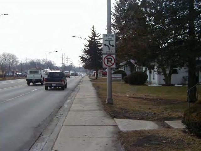
10 Area 1 and Area 2: Transitional Areas Analysis of Existing Conditions Properties within Area 1 and Area 2 face onto major roadways (Aurora Avenue minor arterial and Washington Street major arterial) and abut a residential neighborhood. The south side of Aurora Avenue (Area 1) presently consists of four (4) residential homes (photo at right). The Downtown Plan adopted in August 2000 identifies Area 1 as Transitional Use. Along the west side of Washington Avenue (Area 2), the majority of the structures along the west side of Washington Street have converted to office uses as allowed by conditional use under the existing zoning. Other land uses along this corridor include a bank, a gas station, and three (3) residential homes. The majority of the properties are zoned residentially (R2) and all are within the eligible boundary to be converted from homes to offices within the existing R2 zoning designation. Two structures are zoned OCI. As previously noted, structures within these areas are diverse in age with construction dates between 1895 and Only one new structure has been constructed in these areas since Land Use Goals Encourage properly regulated new growth in areas of anticipated development along Washington Street and Aurora Avenue. Evaluate land use patterns and options that maximize property potential and minimize land use conflicts. Identify policies and practices that preserve and protect the existing character and related land use patterns in the residential area of the Washington-Hillside area. Issues and Opportunities Land Use and Zoning The predominate land use in the areas are home to office conversions and single-family homes. Most properties, with the exception of the gas station (659 S. Washington) zoned B3, the bank (507 S. Washington) zoned OCI and a hair salon zoned OCI, are zoned residentially (R2) and all properties are within a boundary identified to allow for home-to-office conversions through the conditional use process. When a home is converted to an office within these boundaries, the zoning requires that the existing house be maintained, allowing for only a 25% demolition or expansion. Additionally, the ability to retrofit the existing home to meet current ADA
11 accessibility standards, parking requirements for office uses, and stormwater detention requirements for new impervious surface are also required. Office development along this corridor is an appropriate land use given its location along a major arterial roadway, proximity to downtown, and relatively small lot sizes. However, there are both benefits and challenges to the home to office conversion designation and requirements. As a benefit, once converted, these areas provide space for small office uses within walking distance of the downtown area. Particularly for owner-occupied office space, this is a niche that is not often served in areas with more intensive zoning designations. Additionally, it guarantees that the residential character of the home is maintained and the size of the structure is controlled, reducing the potential impact on adjacent residential uses. Finally, the conditional use process allows for public review and input of proposals to convert residential structures from homes to offices. As a challenge, however, structures that are relatively small in size are somewhat restricted given the 25% limitation for expansion. Additionally, applying current day commercial building code requirements to existing residential structures can be difficult and costly, resulting in project costs beyond what was originally contemplated by property owners. Finally, as evidenced by the fact that only one new structure has been built since 1971 in these areas, re-investment beyond interior renovations is not common. In the event that a property owner did want to construct a new building on one of these properties for anything other than the permitted single-family or two-family residential use, a variance would be needed from the requirement that allows for only a 25% demolition and a hardship would be required to be demonstrated. The fact that the properties are zoned residentially is an issue to be explored. This zoning allows by right single-family and two-family homes. Though there are currently plans pending for a two-family home on the Washington Street frontage, this will be the first residential structure to be developed in the past 25 years on these properties. As such, it is evident that the location has not been preferable for residential development. Low-intensity office use, however, is appropriate and desirable in this location, however an extensive review process is required and as previously discussed, a number of restrictions are applied. This results in a more difficult review process for the more preferable land use (office) than the less preferable land use (residential). The intent of the home-to-office conversion district is to maintain the residential appearance of an office use, thereby lessening its impact on adjacent properties. As discussed later in this section, an opportunity for future action would be to apply the Transitional Use zoning designation, and to include appropriate restrictions to ensure that the adjacent residential neighborhood is protected from the impacts of any new development. The intent of the transitional use district is to serve as a mixed-use transitional area between the downtown commercial areas and the adjoining residential neighborhoods. The land-uses in this district are intended to be uses that are compatible with both the commercial areas and the residential districts that they are adjacent to. While the home-to-office conversion district plays a similar role, the limitation placed on properties with this designation that expansion or demolition of the property cannot exceed 25% of the structure makes redevelopment difficult, particularly for the areas surrounding the downtown where the size of many of the existing structures are relatively small and many of the existing structures are relatively older in age. A chart summarizing the regulations of R2, TU, and OCI zoning is included as Attachment 2 to this report

12 Comments expressed during the public meetings as well as during the public process for the downtown zoning amendments in 2002 suggested that the Transitional Use district boundary should be in the middle of Aurora Avenue and should not cross over to the south side of Aurora Avenue. Unlike traditional subdivisions where streets are a natural boundary, the Downtown Plan strives to create gateways and corridors by placing like-type uses across from one another. Aurora Avenue is one of these important gateways to the downtown area. In order to mitigate these concerns, potential restrictions could be applied to the Transitional Use zoning designation in this area including requirements that new developments be residentially styled. Design guidelines similar to what is established for the central business district within the Downtown Plan could be developed and adopted for the Transitional Use zoning district to further define the style of future development. These design guidelines could address items such as building bulk and proportion, building placement and orientation, architectural style, building materials, rear yards and facades, rooflines, lighting, signs, and parking facilities. Additionally, application of the City s existing photometric requirements (which can be applied to new construction or significant remodels) will help to minimize lighting impacts. An increase in fence height requirements could be considered to further screen properties from adjacent residential uses. These provisions may serve as opportunities to promote appropriate reinvestment in these areas, while protecting the integrity of the adjacent residential area. Building Height During the public meetings, there was concern expressed by adjacent residential property owners over the height of future development. The existing building heights in Areas 1 and 2 are primarily one and two stories, with a height restriction in the R2 zoning district of three stories not to exceed 40 feet. Given that the adjacent residential neighborhood has this same height requirement, it is recommended that the 40-foot height restriction be maintained, regardless of zoning on the property. The maximum height in the Transitional Use district is also 40 feet. Though both have a height restriction of 40 feet, the difference between the Transitional Use and R2 zoning district regulations with relation to allowable building height is that Transitional Use is not proposed to have a story restriction while properties in the R2 zoning district cannot exceed 3 stories, though both districts adhere to the 40-foot maximum. The 40-foot height restriction was intentionally applied to the Transitional Use district in order to maintain a consistency with the adjacent residential neighborhoods while still allowing for flexibility through ceiling heights, etc. on the total number of stories. Major Arterial Setback for Buildings and Parking Lots Washington Street is identified as a major arterial roadway in the City s Master Thoroughfare Plan. The zoning code requires special setbacks for properties located along major arterial roadways of 70 feet from the centerline of the roadway, or 20 feet from the edge of the right-of-way, whichever is greater. In the case of the properties fronting Washington Street in this area, the 70-foot requirement would be greater and would therefore apply. As these properties were platted prior to this requirement
 is")
 may be necessary, however, to accommodate parkway improvements and to move sidewalks away from the curb of the 5-lane")
13 being in place, the existing right-of-way of Washington Street in this location does not match ordinance standards for major arterial roadway width. Additionally, as Washington Street bisects the downtown just north of the study area, future roadway expansion to the established ordinance standards for major arterial roadways (120 feet) is unrealistic. Expansion of the rightof-way to a lesser extent (likely to a width of 90 feet) may be necessary, however, to accommodate parkway improvements and to move sidewalks away from the curb of the 5-lane major arterial. As such, consideration needs to be given to appropriate building setbacks along Washington, taking into account these future scenarios. Along the West side of Washington Street in this area, staff is recommending that a 25-foot setback from the property line be established to accommodate an additional 10 feet of right-ofway on this half of Washington Street and a 15-foot front yard setback consistent with the Transitional Use zoning district. On the east side of Washington Street, staff is recommending a 30-foot setback from the property line be established to accommodate an additional 10 feet of right-of-way on this half of Washington Street and a 20-foot front yard setback consistent with the OCI zoning district. Staff would recommend that an amendment be made to the section of the zoning code (Major Arterial Setback Requirements) to formally adopt these requirements for this section of Washington Street. Vehicular Access and Circulation Properties within Area 1 all have individual access points onto Aurora Avenue. As these properties are currently used residentially, the traffic impacts of these access points are not significant. However, at such time that these properties are converted or developed more intensively (i.e. office, multifamily, etc.), consolidation of these access points will be important. In 1989, the City adopted the South Aurora Avenue Study (Ord. #89-90), which identified a plan for access point consolidation and cross-access between properties as redevelopment occurred. As these properties have not been redeveloped to date, this plan has not been implemented. Please note that the South Aurora Avenue Study, though approved by ordinance, is not listed as a controlling master plan within the City s Municipal Code. Properties within Area 2 have numerous access points onto Washington Street. Multiple access points pose a challenge for vehicular ingress and egress and are a safety concern. The Washington Street Corridor Plan, adopted in 1981, recognized this need and recommended that rear parking lots be connected together in this area through easements, forming a common exitway onto Porter Avenue. To implement this, the City has historically requested that property owners provide crossaccess between adjoining parcels as new development or redevelopment is approved and that access points are consolidated wherever possible. The majority of the parking lots are now connected with the exception of the remaining residential structures. Overall, the goal is to consolidate the number of access points to better control ingress and egress,
14 thereby improving safety. There is an ongoing opportunity to continue this standard practice in the future as well as an opportunity to formalize this standard practice into ordinance requirements. Staff would recommend that where feasible, the parking lots and cross-access be located a minimum of five feet off the property line to allow for appropriate screening for any adjacent residential properties. Stormwater Management Many of the properties within Areas 1 and 2 were developed prior to existing stormwater management ordinances and a regional stormwater management facility was not provided for them. Therefore, new development and redevelopment of property within Areas 1 and 2 must comply with the City of Naperville and DuPage County Stormwater Ordinance requirements. Due to the small lot sizes, providing on-site stormwater management is challenging however can be achieved through alternatives to traditional basins through such designs as underground chambers and storage in parking areas. In the case of home-to-office conversions, stormwater management is only required for the new impervious surface area. For new development, stormwater management is required for all impervious surfaces, which captures the stormwater run-off from these properties and controls the release rate to the DuPage River. Gateway to Downtown Naperville The intersection of Washington Street and Hillside Road, and Aurora Avenue and Webster Street can be considered as one of the entrances or gateways into the Downtown. The Downtown Plan acknowledges the importance of the Washington Street Corridor by stating, Improvements within this area should enhance the image and appearance of Washington Street as a major entranceway to Downtown Additionally, the Downtown Plan identifies Aurora Avenue for a boulevard streetscape to help establish this area as an entryway to downtown. The boulevard streetscape has been defined through the City of Naperville Streetscape standards adopted in 2003 and has most recently been applied to Van Buren Avenue downtown. When considering new development, the City has an opportunity to work with property owners and developers to design and construct buildings that reflect consistent and sensitive design. Additionally, issues relating to traffic movement and signage should be considered to further enhance this area as a gateway to the downtown. Options for Future Action Staff presents the following options for future action in Area 1 and Area 2: Consistent with the Downtown Plan, initiate a zoning amendment to rezone the properties currently zoned R2 within this area to Transitional Use (TU) including a requirement that the properties be residentially styled (as defined by design guidelines see below), and that appropriate landscaping be provided in excess of the City s requirements if necessary to maintain the residential character and to fit harmoniously with adjacent residential properties
.")
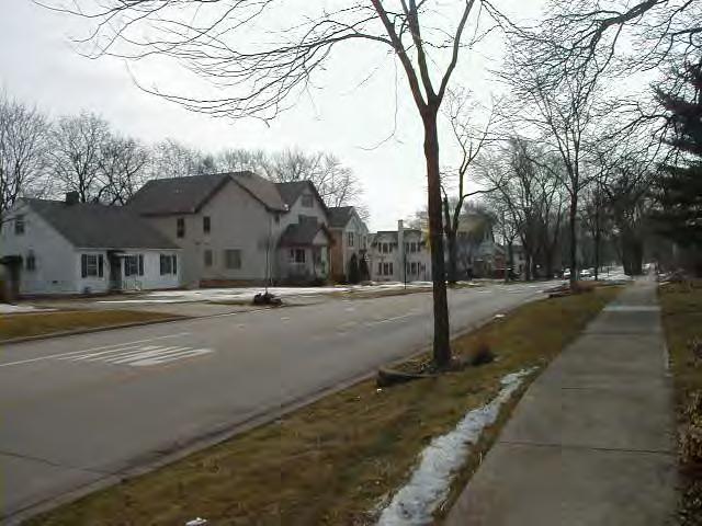
15 Develop and adopt design guidelines for the Transitional Use district (including items such as building bulk and proportion, building placement and orientation, architectural style, building materials, rear yards setbacks, façade modulation, rooflines, lighting, signs, and parking facilities). Initiate a zoning amendment to the Transitional Use zoning district and/or the fence provisions (6-2-12) to allow an increase in fence heights of up to eight (8) feet for rear property lines adjacent to properties zoned and utilized for a residential use. Develop an ordinance requirement for cross-access and consolidated access points along Washington Street and Aurora Avenue to formalize this standard practice. Initiate a zoning amendment to section of the zoning code (Major Arterial Setback Requirements) to formally adopt a requirement for a 30-foot setback from the property line for the east side of Washington Street and a 25-foot setback from the property line for the west side of Washing ton Street (from Hillside to Aurora Avenue). Evaluate signage and traffic movement improvements for the gateway locations into the downtown as identified. Area 3: Residential Neighborhood Analysis of Existing Conditions Area 3 represents a stable residential neighborhood that is comprised of single-family and two-family homes. The area is zoned R2 (Low Density Single-Family and Medium-Density Multiple Family Residence District) and is designated for lowdensity residential use in the East Sector Future Land Use Plan. Both the existing zoning and existing land uses are consistent with the future land use designation of the subject property. There are 62 existing lots within Area 3, with an average lot size of approximately 9,450 square feet and an average home size of approximately 1,612 square feet. Homes within Area 3 vary in age, with construction dates ranging from 1858 to The average residential home in this area is approximately 70 years old. Access to these homes is provided from the residential streets, with a few homes having additional or alternate access from a rear alley. Since 2000, Area 3 has experienced trends of reinvestment with the construction of at least six demolition/new single-family construction projects (i.e., teardowns ). Of the new homes constructed, the average home size is approximately 2,198 square feet
16 Land Use Goals Evaluate land use patterns and options that maximize property potential and minimize land use conflicts. Identify policies and practices that will preserve and protect the existing character, promoting stability within Area 3. Issues and Opportunities Land Use Currently within this area, there is a mix of single-family and two-family residential dwellings. The neighborhood is stable with multiple examples of re-investment in renovating existing homes and new construction. While the neighborhood is geographically small, its location is within walking distance of the downtown area, which is both attractive to residents of the area as well as adding stability to the downtown area. Given these issues, staff is not recommending any change to the existing zoning of R2. Rather, staff recommends that options be explored as defined in Area 1 and 2 to protect and promote this area for residential use, particularly to minimize the impacts of the transitional properties along Washington and Aurora of this neighborhood. Historic Interest As the age of construction of some of the homes within this area range from , staff believes there may be some homes of historic interest. While the entire neighborhood does not lend itself to the creation of a historic district, staff would recommend that the property owners within this area be educated in opportunities for voluntary landmark status that is available through the Historic Sites Commission and the City of Naperville. Property owners with an interest in pursuing this can work with City of Naperville staff to determine if their property is eligible for landmark designation. Additionally, as is current practice, staff will continue to notify Naper Settlement of any residential demolitions, in order to document and/or salvage any historically or architecturally significant items or structures within this neighborhood. Traffic Neighborhood residents had mixed feedback on whether they felt traffic was a major concern in the neighborhood. At the public meeting, staff encouraged the residents to participate in the City s Friendly Streets program if it is determined to be a concern for the majority of residents. This program is set up to assess, prioritize, and address specific traffic issues within Naperville. Use of the program is voluntary and is initiated by neighborhood residents. A request was made during the public meeting to consider a stop sign at Porter Avenue and Main Street. The Transportation, Engineering, and Development Business Group performed an allway stop study for the intersection of Porter Avenue and Main Street in The study falls under the City of Naperville s Residential All-Way Stop Program. An intersection must meet warrants to justify the installation of an all-way stop based on traffic volumes and intersection layout. The intersection of Porter Avenue and Main Street only received less than half of the points required to meet warrants when evaluated (scoring 203 out of a necessary 500 points);

17 therefore, an all-way stop was not determined to be warranted. Factors that were included in making this determination include that the current two-way stop has crosswalks, stop bars, and Cross Traffic Does Not Stop Signs on Porter Avenue. In addition, the intersection does not have any sight distance obstructions. Staff will continue to work with the residents as traffic issues arise. We are not, however, recommending any changes to the existing two-way streets, on-street parking locations or restrictions, or access be made at this time. Pedestrian Circulation Currently there are no sidewalks on the east side of Webster Street and on the south side of Porter Avenue (west of Main Street). Staff would recommend that sidewalks be installed in these locations as redevelopment occurs, per the City s sidewalk policy. Stormwater Management Many of the properties within Areas 3 were developed prior to existing stormwater management ordinances and a regional stormwater management facility was not provided for them. Therefore, new development and redevelopment of property within Areas 3 must comply with the City of Naperville and DuPage County Stormwater Ordinance requirements. The City of Naperville s Ordinance requires a detailed grading plan to be submitted and approved for issuance of a building permit for a new home or addition, as this area does not have a corresponding master grading plan. Options for Future Action Staff presents the following options for future action in Area 3 as identified: Continue to work with Area 3 residents to evaluate traffic-related concerns on a case-by-case basis. Encourage residents to participate in the established City s Friendly Streets Program. Develop an action plan to educate property owners of voluntary opportunities to landmark structures of historical or architectural significance. Continue to notify Naper Settlement of any residential demolitions, in order to document and/or salvage any historically or architecturally significant items or structures. As teardowns occur, encourage the use of sensitive infill development strategies (such as utilizing Community First s Workbook for Successful Redevelopment )


18 Area 4: Office/Commercial Corridor Analysis of Existing Conditions Area 4 is located on the east side of Washington Street, between Aurora Avenue and Hillside Road, and abuts the DuPage River. Properties located within Area 4 are used for office and commercial purposes under the existing B5, OCI and B3 zoning classifications. There are ten existing buildings in Area 4, dating from 1962 through As mentioned previously in this report, properties on the east side of Washington are more intensely developed than other areas of the study, with larger lot sizes and zoning allowing for office and commercial uses by right, as well as retail and residential development through the conditional use process. There is evidence of development and reinvestment in this area, including one recently approved project for a seven-story residential condominium. Lastly, most of the properties in Area 4 have direct access to the Riverwalk, which is located along the west bank of the DuPage River. This close proximity provides a neighborhood amenity and unique opportunities for future development and redevelopment. Land Use Goals Encourage properly regulated new growth in areas of anticipated development and redevelopment along Washington Street. Evaluate land use patterns and options that will maximize property potential and minimize land use conflicts. Identify policies and practices that will enhance and protect the existing character and related land use patterns in Area 4. Encourage continued focus on maintaining pedestrian connections between these properties and the Riverwalk. Issues and Opportunities Land Use The predominant land use in this area is office space, including general and medical offices. Other uses include two fast food restaurants, a funeral home, and a proposed mid-rise (7-story) residential condominium building that was recently approved as a conditional use in the underlying OCI zoning district (though construction has not begun as of the date of this report). The City needs to carefully consider future land use decisions for Area 4 so that there is a balance of residential and non-residential uses. The Downtown Plan designates Area 4 as a Secondary Commercial Area, stating that the primary intent is to provide sites for a mix of
![retail, office and service uses, as well as parking facilities to support the adjacent [Downtown] Core area. In looking at the recently approved residential condominium at 520 S.](/docs-images/74/71435407/images/19-0.jpg "Washington Street, and other examples of medium to high density multi-family projects either planned or proposed in and around the Downtown Core, it appears that there is a demand and trend for more")
19 retail, office and service uses, as well as parking facilities to support the adjacent [Downtown] Core area. In looking at the recently approved residential condominium at 520 S. Washington Street, and other examples of medium to high density multi-family projects either planned or proposed in and around the Downtown Core, it appears that there is a demand and trend for more residential opportunities in downtown Naperville. While these land use considerations pose a challenge for the City to appropriately locate such uses, they also present an opportunity to increase the vitality of the downtown area and surrounding neighborhoods by generating pedestrian activity in close proximity to existing businesses. Building Height The existing buildings in Area 4 range from one to three stories to an estimated maximum height of 45 feet. The existing B5, OCI and B3 zoning classifications establish a maximum height through a maximum floor area ratio (F.A.R.). The Downtown Plan does not reference a specific height limitation for this area. Once constructed, the recently approved Washington Street Condos project at 520 S. Washington Street will have seven stories and a maximum height of 76.8 feet. This is substantially higher than other buildings in the neighborhood, even though it satisfies the F.A.R. requirements of the OCI zoning district. Based on staff s review of existing building heights and surrounding land uses in this area, staff recommends establishing a maximum height of five stories not to exceed 50 feet for those properties that are zoned OCI and are located within the designated boundaries of this area. This is consistent with staff s recommendation that was provided to City Council for the condominium building at 520 S. Washington Street. This would require a text amendment to the OCI District, something which can be explored and potentially folded into the pending conditional use text amendments, which we anticipate will be scheduled for Plan Commission and City Council consideration in mid Access points along Washington Street Properties within Area 4 have numerous access points along Washington Street. This poses a challenge for vehicular ingress and egress and is a safety concern. To address this situation, the City has required property owners to provide cross-access between adjoining parcels as new development or redevelopment is approved. The City s goal is to consolidate the number of access points to better control ingress and egress, thereby improving safety. There is an ongoing opportunity to continue this standard practice in the future. Parking Placement A majority of the properties in Area 4 have parking lots in which the most of the parking spaces are located behind or on the side of the buildings. This existing condition is generally consistent with the Downtown Plan that states, In general, parking lots should be located behind buildings or in mid-block locations; parking lots in front of buildings and at corner sites should be avoided if possible. There are a few exceptions to this condition. Many of the properties in Area 4 have a limited amount of parking in front of the building. Examples include the office building at 568 S. Washington, the Naperville Medical Center Building, and the Brown s Chicken and Pasta. It
 for screening of parking in the")

20 should be noted, however, that when parking is placed in the rear of these properties, it is then visible from the Riverwalk. As an option for future action, staff is recommending that additional standards be developed (above and beyond the minimum requirements of the Landscape Ordinance) for screening of parking in the rear of these properties. New standards will help ensure consistent and appropriate screening of parking areas that are adjacent to the Riverwalk, which is an important community amenity. Pedestrian Connectivity Pedestrian connectivity to the Riverwalk should be a prime consideration in redevelopment plans. Public access should be promoted along this corridor to both the Riverwalk as well as the adjacent Fredenhagen Park. Staff believes that as properties in this block are redeveloped, there is a potential to develop a mid-block public access easement (running east-west), which would allow for a pedestrian connection between the sidewalk along Washington Street and the Riverwalk. Major Arterial Setback for Buildings and Parking Lots As stated previously in this report, staff is recommending that no less than a 30-foot building setback be maintained from the front property line for properties in Area 4 to accommodate an additional 10 feet of roadway on the east half of Washington Street and a 20-foot front yard setback consistent with the OCI zoning district. The additional right-of-way could accommodate parkway improvements and move sidewalks away from the curb of the 5-lane major arterial. Staff would recommend that an amendment be made to the section of the zoning code (Major Arterial Setback Requirements) to formally adopt these requirements for this section of Washington Street. Stormwater Management New development and redevelopment on the properties that are located within Area 4 must satisfy the City of Naperville and DuPage County Stormwater Ordinance requirements. Although the eastern property lines of these lots extend to DuPage River, much of this area is encumbered by floodway and floodplain. Properties that have recently redeveloped have been able to comply with these ordinances, while maximizing their buildable area by designing underground chambers for stormwater storage, which can also provide for floodplain compensatory storage where applicable. The City should continue to enforce current regulations with new development and redevelopment of properties as it provides an opportunity to improve the existing stormwater management situation in this area. Floodplain/Floodway Constraints Redevelopment of properties that are located within Area 4 can be complicated due to the floodway and floodplain that encumbers the eastern portions of each parcel. The buildable area is limited by these designations and additional permitting is required due to local, state, and federal requirements
21 Gateway to Downtown Naperville Staff considers the intersection of Washington Street and Hillside Road as one of the entrances or gateways into the Downtown. The Downtown Plan acknowledges the importance of the Washington Street Corridor by stating, Improvements within this area should enhance the image and appearance of Washington Street as a major entranceway to Downtown. When considering new development, the City has an opportunity to work with property owners and developers to design and construct buildings that reflect the design guidelines that are presented in the Downtown Plan. Such building design guidelines focus on height, bulk, placement/orientation, architectural style, materials, doors/entrances, windows, rear yards, facades, rooflines/parapets, paint/color, awnings/canopies, lighting, signs, and parking facilities. Additionally, issues such as signage and traffic movement should be explored to further denote this area as a gateway to downtown Naperville. Options for Future Action Develop standards for appropriate screening of rear parking areas adjacent to the Riverwalk. Develop a policy for cross-access and consolidated access points along Washington Street to formalize this recommended practice. Evaluate signage and traffic movement improvements for gateway locations into the Downtown as identified
22 Summary of Options for Future Action The successful implementation of the goals identified within the Washington-Hillside Study Small Area Study depends on the efforts of neighborhood residents, elected officials, City staff, and private developers/property owners. Through a combined effort, the goals can be realized. The following chart provides a summary of future actions as recommended in the Washington- Hillside Small Area Study: Municipal Code Text Changes Requiring Initiation/Adoption by Council Proposed Action Initiate a zoning amendment to rezone the properties currently zoned R2 to Transitional Use (TU) including a requirement that the properties be residentially styled, (as defined by design guidelines see below), and that appropriate landscaping be provided in excess of the City s requirements if necessary to maintain the residential character and to fit harmoniously with adjacent residential properties. Develop and adopt design guidelines for the Transitional Use district (including items such as building bulk and proportion, building placement and orientation, architectural style, building materials, rear yards and facades, rooflines, lighting, signs, and parking facilities). Initiate a zoning amendment to the Transitional Use zoning district to allow an increase in fence heights of up to eight (8) feet for rear property lines adjacent to properties zoned and utilized for a residential use. Develop an ordinance requirement for cross-access and consolidated access points along Washington Street and Aurora Avenue to formalize this standard practice. Item # Area Initiator Endorsed by DPIC Endorsed by Plan Commission 1 1 and 2 City Council X Tabled, pending outcome and finalization of Item and 2 City Council X X 3 1 and 2 City Council X X 4 1, 2, and 4 City Council X X Endorsed by City Council
23 Proposed Action Item # Area Initiator Endorsed by DPIC Endorsed by Plan Commission Endorsed by City Council Develop standards for appropriate screening of rear parking areas and public access adjacent to the Riverwalk. 5 4 City Staff/City Council X X Municipal Code Text Changes, Continued Initiate a zoning amendment to section of the zoning code (Major Arterial Setback Requirements) to formally adopt a requirement for a 30- foot setback from the property line for the east side of Washington Street and a 25- foot setback from the property line for the west side of Washing ton Street (from Hillside to Aurora Avenue). 6 2 City Council X X Administrative Actions Evaluate signage and traffic movement improvements for the gateway locations into the downtown as identified. Develop an action plan to educate property owners of voluntary opportunities to landmark structures of historical or architectural significance. 7 1, 2, and 4 City Staff/City Council 8 3 City Staff/ City Council/ Residents X X X X Ongoing Activities No Action Required Continue to notify Naper Settlement of any residential demolitions, in order to document and/or salvage any historically or architecturally significant items or structures. As teardowns occur, encourage the use of sensitive infill development strategies (such as utilizing Community First s Workbook for Successful Redevelopment ). Continue to work with residents to evaluate traffic-related concerns on a case-by-case basis. Encourage residents to participate in the established City s Friendly Streets Program to resolve traffic-related issues. 9 3 City Staff Identified as ongoing 10 3 City Staff Identified as ongoing 11 3 Residents Identified as ongoing Identified as ongoing Identified as ongoing Identified as ongoing
24 - 24 -
25 ATTACHMENT 1 SUMMARY OF PUBLIC COMMENT RECEIVED Issues & Discussion Topics at the October 11 Neighborhood Meeting The following list is a summary of discussion topics raised by property owners at the October 11 neighborhood meeting. The order does not imply any particular ranking or assignment of importance. The value of the residential area and the need to protect this area from the impacts of commercial development; The appropriateness of the existing home-to-office conversion district on Aurora Avenue and Washington Street; Impact of sign restrictions on home to office conversions to maintain residential character; Issues associated with redevelopment of properties along Washington and Aurora Avenue (including density, parking, and traffic). Cross-access along Washington Street properties; Cut-through traffic in the residential area; The need for a 4-way stop at Main and Porter; Impacts of stormwater management and the need for improvements to existing stormwater facilities; Age, size, and condition of existing buildings on Washington and Aurora; Trend of reinvestment (teardowns) in residential area; Impact of approved 7-story condo building on the existing and future fabric of Washington Street; Parking locations in rear of properties facing Washington Street; Importance of the quaintness of downtown; The need for residents to help direct the change instead of reacting to the changes; Potential for reserving on-street parking for residents of the area; Opportunities for traffic calming in the residential area; and Need for compatibility of residential and non-residential land uses. Written and Verbal Public Comments at the December 4 Public Meeting The following list is a verbatim listing of comments provided at the December 4 public meeting. Again, the order does not imply any particular ranking or assignment of importance. Area 1 (South Side of Aurora Avenue) should remain residential and should not have any home-to-office conversions. Speed limit and crosswalks should be enforced. Trash removal should take place in alleys. No change to the South side of Aurora Avenue. The dividing line should be down the middle of Aurora Avenue. The conditional use process better protects residents abutting them. It is unfair to the owner-occupied residents who had to fight to establish the R2g conditional use and still live in their homes to have to fight a zoning change again. TU should maintain signage restriction as currently exists in R2g. Setbacks and screening need to be improved to minimize impacts of TU district
Montreal Road District Secondary Plan [Amendment #127, October 9, 2013]
![Montreal Road District Secondary Plan [Amendment #127, October 9, 2013]](/thumbs/72/66783104.jpg "Montreal Road District Secondary Plan [Amendment #127, October 9, 2013]") [Amendment #127, October 9, 2013] 1.0 General The following policies are applicable to the Montreal Road District as set out in Schedule 1. 1.1 District Objectives The objective of this Plan is to guide
[Amendment #127, October 9, 2013] 1.0 General The following policies are applicable to the Montreal Road District as set out in Schedule 1. 1.1 District Objectives The objective of this Plan is to guide
Composition of traditional residential corridors.
 Page 1 of 7 St. Petersburg, Florida, Code of Ordinances >> PART II - ST. PETERSBURG CITY CODE >> Chapter 16 - LAND DEVELOPMENT REGULATIONS >> SECTION 16.20.060. CORRIDOR RESIDENTIAL TRADITIONAL DISTRICTS
Planning Justification Report
 Planning Justification Report Kellogg s Lands City of London E&E McLaughlin Ltd. June 14, 2017 Zelinka Priamo Ltd. Page i TABLE OF CONTENTS Page No. 1.0 2.0 2.1 2.2 3.0 4.0 5.0 5.1 5.2 5.3 5.4 5.5 5.6
Financial Impact Statement There are no immediate financial impacts associated with the adoption of this report.
 STAFF REPORT Planning and Development Department Subject: Application by RYC Property to rezone a portion of lands on John Murray Dr. and Megan Lynn Dr. from R2 to R3 and to enter into a Development Agreement
THE REDEVELOPMENT PLAN
 PAGE 37 THE REDEVELOPMENT PLAN FUTURE LAND USE The Silver Terrace Redevelopment Area is currently designated as Redevelopment Area #4 on the City of Delray Beach Future Land Use Map (FLUM). This designation
6. RESIDENTIAL ZONE REGULATIONS
 6. RESIDENTIAL ZONE REGULATIONS PART 6A PURPOSE OF CHAPTER (1) The purpose of this Chapter is to provide detailed regulations and requirements that are relevant only to residential zones and specific residential
3.1. OBJECTIVES FOR RESIDENTIAL LAND USE DESIGNATIONS GENERAL OBJECTIVES FOR ALL RESIDENTIAL DESIGNATIONS
 3. RESIDENTIAL LAND USE DESIGNATIONS INTRODUCTION The Residential land use designations provide for housing and other land uses that are integral to, and supportive of, a residential environment. Housing
ARTICLE 3: Zone Districts
 ARTICLE 3: Zone Districts... 3-1 17.3.1: General...3-1 17.3.1.1: Purpose and Intent... 3-1 17.3.2: Districts and Maps...3-1 17.3.2.1: Applicability... 3-1 17.3.2.2: Creation of Districts... 3-1 17.3.2.3:
M-43 CORRIDOR OVERLAY ZONE
 ARTICLE 26.00 M-43 CORRIDOR OVERLAY ZONE Section 26.01 Findings A primary function of the M-43 state highway is to move traffic through the Township and to points beyond. As the primary east-west arterial
ZONING AMENDMENT & SUBDIVISION STAFF REPORT Date: November 3, 2016
 ZONING AMENDMENT & SUBDIVISION STAFF REPORT Date: November 3, 2016 APPLICANT NAME SUBDIVISION NAME David Shumer 5955 Airport Subdivision CITY COUNCIL DISTRICT District 6 5955 Airport Boulevard, 754 Linlen
Chapter 10: Implementation
 Chapter 10: Introduction Once the Comprehensive Plan has been adopted by the City of Oakdale, the City can begin to implement the goals and strategies to make this vision a reality. This chapter will set
SUBJECT: Application for Planned Unit Development and Rezoning 1725 Winnetka Road
 TO: FROM: CHAIRMAN BILL VASELOPULOS AND MEMBERS OF THE PLAN & ZONING COMMISSION STEVE GUTIERREZ DIRECTOR OF COMMUNITY DEVELOPMENT MEETING DATE: September 5, 2017 SUBJECT: Application for Planned Unit Development
TRANSIT-ORIENTED DEVELOPMENT PLAN EXISTING CONDITIONS REPORT LAWRENCE TO BRYN MAWR MODERNIZATION
 TRANSIT-ORIENTED DEVELOPMENT PLAN EXISTING CONDITIONS REPORT LAWRENCE TO BRYN MAWR MODERNIZATION March 2018- FINAL DRAFT SITE SPECIFIC DEVELOPMENT CONCEPTS SITE SPECIFIC DEVELOPMENT CONCEPTS This report
Article 3. SUBURBAN (S-) NEIGHBORHOOD CONTEXT
 NEIGHBORHOOD CONTEXT") Article 3. SUBURBAN (S-) NEIGHBORHOOD CONTEXT this page left intentionally blank Contents ARTICLE 3. SUBURBAN (S-) NEIGHBORHOOD CONTEXT DIVISION 3.1 NEIGHBORHOOD CONTEXT DESCRIPTION...3.1-1 Section 3.1.1
Article 3. SUBURBAN (S-) NEIGHBORHOOD CONTEXT this page left intentionally blank Contents ARTICLE 3. SUBURBAN (S-) NEIGHBORHOOD CONTEXT DIVISION 3.1 NEIGHBORHOOD CONTEXT DESCRIPTION...3.1-1 Section 3.1.1
FREQUENTLY USED PLANNING & ZONING TERMS
 City Of Mustang FREQUENTLY USED PLANNING & ZONING TERMS Abut: Having property lines, street lines, or zoning district lines in common. Accessory Structure: A structure of secondary importance or function
WESTMINSTER PARK SUBDIVISION
 WESTMINSTER PARK SUBDIVISION Engineering Comments: FINAL PLAT COMMENTS (should be addressed prior to submitting the FINAL PLAT for review and/or signature by the City Engineer): A. Provide all of the required
COMMISSION ACTION FORM SUBJECT: ZONING TEXT AMENDMENT FOR LINCOLN WAY CORRIDOR PLAN DOWNTOWN GATEWAY COMMERCIAL ZONING DISTRICT STANDARDS
 ITEM #: 7 DATE: _02-07-18 COMMISSION ACTION FORM SUBJECT: ZONING TEXT AMENDMENT FOR LINCOLN WAY CORRIDOR PLAN DOWNTOWN GATEWAY COMMERCIAL ZONING DISTRICT STANDARDS BACKGROUND: The Downtown Gateway area
DEVELOPMENT DEPARTMENT STAFF REPORT THE PARK AT 5 TH
 DEVELOPMENT DEPARTMENT STAFF REPORT ARB Meeting Date: July 3, 2018 Item #: _PZ2018-293_ THE PARK AT 5 TH Request: Site Address: Project Name: Parcel Number: Applicant: Proposed Development: Current Zoning:
PLANNED UNIT DEVELOPMENT & SUBDIVISION STAFF REPORT Date: April 18, 2019
 PLANNED UNIT DEVELOPMENT & SUBDIVISION STAFF REPORT Date: April 18, 2019 DEVELOPMENT NAME SUBDIVISION NAME Springhill Village Subdivision Springhill Village Subdivision LOCATION 4350, 4354, 4356, 4358,
Control % of fourplex additions on a particular street. Should locate to a site where there are other large buildings
 Fourplex Ensure privacy of adjacent back yards window Location on the edge of neighbourhood is more Consistent design to blend in with existing street placement: minimal overlook Closer to arterial road
Hamilton County Regional Planning Commission
 Hamilton County Regional Planning Commission March 1, 2012 Colerain Township Staff Report Zone Map Amendment: Case No.: ZA2012-01 Joseph Toyota Prepared By: Amy Bancroft, Land Use Planner ACTION REQUESTED:
Downtown Development Focus Area: I. Existing Conditions
 Downtown Development Focus Area: I. Existing Conditions The Downtown Development Focus Area is situated along Route 1, south of the train tracks, except for the existing Unilever property. It extends west
DEVELOPMENT DEPARTMENT STAFF REPORT STAFF REPORT MCDONALD S ZONING MAP AMENDMENT AND CONCURRENT VARIANCES
 DEVELOPMENT DEPARTMENT STAFF REPORT Meeting Date: October 12, 2017 Item #: _PZ2017-172_ STAFF REPORT MCDONALD S ZONING MAP AMENDMENT AND CONCURRENT VARIANCES Request: Rezone property from MU-BC to CC,
Cover Letter with Narrative Statement
 Cover Letter with Narrative Statement March 31, 2017 rev July 27, 2017 RE: Rushton Pointe Residential Planned Unit Development Application for Public Hearing for RPUD Rezone PL2015 000 0306 Mr. Eric Johnson,
Be linked by an internal circulation system (i.e., walkways, streets, etc.) to other structures within the IPUD;
 to other structures within the IPUD;") 2. HALIFAX ACTIVITY CENTER A. DESCRIPTIONS OF FUTURE LAND USE DESIGNATIONS Each of the future land use designations specified by Phase I of the Halifax Activity Center Plan, and the relationship of these
2. HALIFAX ACTIVITY CENTER A. DESCRIPTIONS OF FUTURE LAND USE DESIGNATIONS Each of the future land use designations specified by Phase I of the Halifax Activity Center Plan, and the relationship of these
ARTICLE 23 CONDOMINIUM STANDARDS
 ARTICLE 23 CONDOMINIUM STANDARDS Section 23.01 Intent. The intent of this Article is to provide regulatory standards for condominiums and site condominiums similar to those required for projects developed
CITY OF FARMERSVILLE CITIZEN ADVISORY COMMITTEE AGENDA November 17, :30 P.M. 1, COUNCIL CHAMBERS, CITY HALL
 I. PRELIMINARY MATTERS CITY OF FARMERSVILLE CITIZEN ADVISORY COMMITTEE AGENDA November 17, 2014 6:30 P.M. 1, COUNCIL CHAMBERS, CITY HALL Call to Order, Roll Call, Prayer and Pledge of Allegiance Welcome
DRAFT FOR DISCUSSION PURPOSES ONLY. Port Credit Local Area Plan Built Form Guidelines and Standards DRAFT For Discussion Purposes
 Port Credit Local Area Plan Built Form Guidelines and Standards DRAFT For Discussion Purposes 1 Local Area Plan - Project Alignment Overview Directions Report, October 2008 (General Summary Of Selected
SECTION 7000 LAND DEVELOPMENT REQUIREMENTS
 SECTION 7000 LAND DEVELOPMENT REQUIREMENTS 7000 LAND DEVELOPMENT REQUIREMENTS... 1 7001 LEGISLATIVE AUTHORITY... 1 7001.1 LAND DEVELOPMENT... 1 7001.1.1 Title 40, Idaho Code... 1 7001.1.2 Idaho Code 40-1415
8.5.1 R1, Single Detached Residential District
 8.5.1 R1, Single Detached Residential District The purpose of this district is to provide for residential development in the form of single detached dwellings. Dwelling, Single Detached Home Business,
Chapter 22 PLANNED UNIT DEVELOPMENT.
 Chapter 22 PLANNED UNIT DEVELOPMENT. Sec. 22.1 INTENT. The use of land and the construction and use of buildings and other structures as Planned Unit Developments in Georgetown Township may be established
RESIDENTIAL DISTRICTS
 RESIDENTIAL DISTRICTS RESIDENTIAL DISTRICTS The residential district standards have been revised to reflect on-the-ground development conditions, while continuing to respect the use patterns established
Planning Justification Report
 Planning Justification Report 101 Kozlov Street, Barrie, Ont. Destaron Property Management Ltd. November 2015 Revised February 2017 TABLE OF CONTENTS Page 1.0 INTRODUCTION... 1 2.0 DESCRIPTION OF SUBJECT
PLANNING COMMISSION REPORT Regular Agenda -Public Hearing Item
 PDP-13-00518 Item No. 3B- 1 PLANNING COMMISSION REPORT Regular Agenda -Public Hearing Item PC Staff Report 2/24/14 ITEM NO. 3B PRELIMINARY DEVELOPMENT PLAN FOR HERE @ KANSAS; 1101 INDIANA ST (SLD) PDP-13-00518:
13 Sectional Map Amendment
 13 Sectional Map Amendment Introduction This chapter reviews land use and zoning policies and practices in Prince George s County and presents the proposed zoning in the sectional map amendment (SMA) to
Public Review of the Slot Home Text Amendment
 Public Review of the Slot Home Text Amendment The proposed amendments to the Denver Zoning Code have been informed by the Slot Home Strategy Report. This document has been developed out of a robust process
Truax Park Apartments
 Truax Park Apartments Master Planning and Site Development Study Prepared by The Community Development Authority of the City of Madison In association with SMITH & SMITH ASSOCIATES, Inc CONSTRUCTION COST
COMMERCIAL ELEMENT AND CODE ENFORCEMENT
 COMMERCIAL ELEMENT AND CODE ENFORCEMENT The Commercial Element identifies and describes the existing characteristics that are desired by the neighborhood. The existing conditions will determine appropriate
City of Reno October 30, 2012 Draft Midtown Zoning Text Amendments 1
 Section 18.08.405 Regional Center and Transit Corridor Overlay Districts (i) SVTC South Virginia Street Transit Corridor Overlay Zoning District. (1) Applicability. This Section 18.08.405(l)'s standards
2. Rezone a portion of the lot from R2 (Small Lot Residential) to RD2 (Duplex: Housing Lane).
 to RD2 (Duplex: Housing Lane).") Public Notice September 6, 2018 Subject Property Subject Property: 337 Hastings Ave Lot 24, District Lot 1, Group 7, Similkameen Division Yale (Formerly Yale-Lytton) District, Plan 932 Application: The
Public Notice September 6, 2018 Subject Property Subject Property: 337 Hastings Ave Lot 24, District Lot 1, Group 7, Similkameen Division Yale (Formerly Yale-Lytton) District, Plan 932 Application: The
ARLINGTON COUNTY, VIRGINIA
 ARLINGTON COUNTY, VIRGINIA County Board Agenda Item Meeting December 9, 2006 DATE: November 20, 2006 SUBJECT: GP-302-05-2 Adoption of General Land Use Plan Amendments for the Clarendon Metro Station Area:
NORTHWEST QUADRANT NEIGHBORHOOD STUDY
 City of Novato General Plan 2035 Focus Area NORTHWEST QUADRANT NEIGHBORHOOD STUDY May, 2015 Why a Neighborhood Study? The Northwest Quadrant Neighborhood, north of the Grant Avenue business district,
ZONING ORDINANCE: OPEN SPACE COMMUNITY. Hamburg Township, MI
 ZONING ORDINANCE: OPEN SPACE COMMUNITY Hamburg Township, MI ARTICLE 14.00 OPEN SPACE COMMUNITY (Adopted 1/16/92) Section 14.1. Intent It is the intent of this Article to offer an alternative to traditional
Glades County Staff Report and Recommendation Unified Staff Report for Small Scale Plan Amendment and Rezoning
 Glades County Staff Report and Recommendation Unified Staff Report for Small Scale Plan Amendment and Rezoning CASE NUMBERS: COMP17-02 and RZ17-02 DATE of STAFF REPORT: May 1, 2017 CASE TYPE: Application
density framework ILLUSTRATION 3: DENSITY (4:1 FSR) EXPRESSED THROUGH BUILT FORM Example 1
 EXPRESSED THROUGH BUILT FORM Example 1") density framework 4 ILLUSTRATION 3: DENSITY (4:1 FSR) EXPRESSED THROUGH BUILT FORM INTRODUCTION The Downtown Core Area contains a broad range of building forms within its relatively compact area. These
density framework 4 ILLUSTRATION 3: DENSITY (4:1 FSR) EXPRESSED THROUGH BUILT FORM INTRODUCTION The Downtown Core Area contains a broad range of building forms within its relatively compact area. These
PLANNED UNIT DEVELOPMENT STAFF REPORT Date: October 19, 2017
 PLANNED UNIT DEVELOPMENT STAFF REPORT Date: October 19, 2017 DEVELOPMENT NAME LOCATION Custom Boat Storage 3975 Demetropolis Road (East side of Demetropolis Road, 0.2± miles South of Halls Mill Road.)
Bylaw No , being "Official Community Plan Bylaw, 2016" Schedule "A" DRAFT
 Bylaw No. 2600-2016, being "Official Community Plan Bylaw, 2016" Schedule "A" Urban Structure + Growth Plan Urban Structure Land use and growth management are among the most powerful policy tools at the
PLANNING REPORT Gordon Street City of Guelph. Prepared on behalf of Ontario Inc. March 17, Project No. 1507
 PLANNING REPORT 1131 Gordon Street City of Guelph Prepared on behalf of 1876698 Ontario Inc. March 17, 2016 Project No. 1507 423 Woolwich Street, Suite 201, Guelph, Ontario, N1H 3X3 Phone (519) 836-7526
DEPARTMENT OF COMMUNITY PLANNING, HOUSING AND DEVELOPMENT Planning Division
 DEPARTMENT OF COMMUNITY PLANNING, HOUSING AND DEVELOPMENT Planning Division #1 Courthouse Plaza, 2100 Clarendon Boulevard, Suite 700 Arlington, VA 22201 TEL 703.228.3525 FAX 703.228.3543 www.arlingtonva.us
CASTLES OF CALEDON URBAN DESIGN REPORT
 CASTLES OF CALEDON URBAN DESIGN REPORT PROPOSED RESIDENTIAL DEVELOPMENT CALEDON, ONTARIO 10 JULY, 2015 TABLE CONTENTS: 1.0 DEVELOPMENT 4.0 CONCLUSION 1.1 Introduction 1.2 Castles of Caledon- Urban Design
ARTICLE 887. PD 887. Valley View - Galleria Area Special Purpose District
 ARTICLE 887. PD 887. Valley View - Galleria Area Special Purpose District SEC. 51P-887.101. LEGISLATIVE HISTORY. PD 887 was established by Ordinance No. 29032, passed by the Dallas City Council on June
ARTICLE I ZONE BASED REGULATIONS
 ARTICLE I ZONE BASED REGULATIONS RZC 21.08 RESIDENTIAL REGULATIONS 21.08.290 Cottage Housing Developments A. Purpose. The purpose of the cottage housing requirements is to: 1. Provide a housing type that
Community Advisory Committee (CAC) Meeting #7 West Anaheim Youth Center May 26, 2016
 Meeting #7 West Anaheim Youth Center May 26, 2016") Community Advisory Committee (CAC) Meeting #7 West Anaheim Youth Center May 26, 2016 1 Project Team City: David Belmer Planning and Building Director Jonathan Borrego, AICP Planning Services Manager Gustavo
Community Advisory Committee (CAC) Meeting #7 West Anaheim Youth Center May 26, 2016 1 Project Team City: David Belmer Planning and Building Director Jonathan Borrego, AICP Planning Services Manager Gustavo
1202 & 1204 Avenue Road Zoning By-law Amendment Application - Preliminary Report
 STAFF REPORT ACTION REQUIRED 1202 & 1204 Avenue Road Zoning By-law Amendment Application - Preliminary Report Date: March 17, 2017 To: From: Wards: Reference Number: North York Community Council Director,
O-I (Office-Institutional) and AG-1(Agricultural)
 and AG-1(Agricultural)") PROPERTY INFORMATION ADDRESS 3503 and 3505 Bethany Bend DISTRICT, LAND LOTS 2/1 973 and 974 OVERLAY DISTRICT State Route 9 PETITION NUMBERS EXISTING ZONING O-I (Office-Institutional) and AG-1(Agricultural)
PROPERTY INFORMATION ADDRESS 3503 and 3505 Bethany Bend DISTRICT, LAND LOTS 2/1 973 and 974 OVERLAY DISTRICT State Route 9 PETITION NUMBERS EXISTING ZONING O-I (Office-Institutional) and AG-1(Agricultural)
Board of Zoning and Planning Members. Justin A. Milam, AICP, Planning Officer. Positive recommendation of a rezoning to City Council.
 To: From: Board of Zoning and Planning Members Justin A. Milam, AICP, Planning Officer Prepared for Meeting Dated: Tuesday, February 19, 2013 Subject: Action Requested: Master Plan Objective: BZAP review
Place Type Descriptions Vision 2037 Comprehensive Plan
 Place Type Descriptions Vision 2037 Comprehensive Plan The Vision 2037 Comprehensive Plan establishes a range of place types for Oxford, ranging from low intensity (limited development) Rural and Natural
TOTTENHAM SECONDARY PLAN
 TOTTENHAM SECONDARY PLAN AMENDMENT NO. 11 TO THE OFFICIAL PLAN OF THE TOWN OF NEW TECUMSETH The following text and schedules to the Official Plan of the Town of New Tecumseth constitute Amendment No. 11
PLANNED UNIT DEVELOPMENT & SUBDIVISION STAFF REPORT Date: July 20, 2017
 PLANNED UNIT DEVELOPMENT & SUBDIVISION STAFF REPORT Date: July 20, 2017 DEVELOPMENT NAME SUBDIVISION NAME LOCATION Rangeline Crossing III Subdivision Rangeline Crossing III Subdivision 5289 Halls Mill
Village of Glenview Zoning Board of Appeals
 Village of Glenview Zoning Board of Appeals STAFF REPORT August 20, 2012 TO: Chairman and Zoning Board of Appeals Commissioners FROM: Planning and Economic Development Department CASE #: Z2012-025 LOCATION:
REGULATING PLAN for the Plaza Saltillo TOD Station Area Plan (SAP)
") REGULATING PLAN for the Plaza Saltillo TOD Station Area Plan (SAP) Adopted: December 11, 2008 Effective: March 1, 2009 REGULATING PLAN for the Plaza Saltillo TOD Station Area Plan (SAP) CONTENTS BACKGROUND...iv
REGULATING PLAN for the Plaza Saltillo TOD Station Area Plan (SAP) Adopted: December 11, 2008 Effective: March 1, 2009 REGULATING PLAN for the Plaza Saltillo TOD Station Area Plan (SAP) CONTENTS BACKGROUND...iv
DEVELOPMENT DEPARTMENT STAFF REPORT STAFF REPORT EASTSIDE CHAMBLEE LINK DCI
 DEVELOPMENT DEPARTMENT STAFF REPORT Public Hearing Date: April 12, 2018 Item #: PZ-2018-248 STAFF REPORT EASTSIDE CHAMBLEE LINK DCI Request: Development of Community Compact (DCI), ten concurrent variances,
DAUPHIN CREEK ESTATES SUBDIVISION
 # 12 SUB-000076-2017 DAUPHIN CREEK ESTATES SUBDIVISION Engineering Comments: FINAL PLAT COMMENTS (should be addressed prior to submitting the FINAL PLAT for review and/or signature by the City Engineer):
1. Cuyler-Brownsville planned neighborhood conservation (P-N-C) districtphase I (section ). (2) Single-family semiattached dwellings;
 districtphase I (section ). (2) Single-family semiattached dwellings;") Sec. 8-3035. Planned unit development multifamily (PUD-M). A. Purpose. The PUD-M district is intended to allow a variety of residential development including single-family residential, two-family residential,
Sec. 8-3035. Planned unit development multifamily (PUD-M). A. Purpose. The PUD-M district is intended to allow a variety of residential development including single-family residential, two-family residential,
Draft Model Access Management Overlay Ordinance
 Draft Model Access Management Overlay Ordinance This model was developed using the City of Hutchinson and the Trunk Highway 7 corridor. The basic provisions of this model may be adopted by any jurisdiction
WESTMINSTER PARK PLACE SUBDIVISION
 WESTMINSTER PARK PLACE SUBDIVISION Engineering Comments: FINAL PLAT COMMENTS (should be addressed prior to submitting the FINAL PLAT for review and/or signature by the City Engineer): A. Provide all of
Residential Intensification in Established Neighbourhoods Study (RIENS)
") Residential Intensification in Established Neighbourhoods Study (RIENS) EXECUTIVE SUMMARY In December 2015, the City of Kitchener retained Meridian Planning Consultants to undertake the Residential Intensification
Residential Intensification in Established Neighbourhoods Study (RIENS) EXECUTIVE SUMMARY In December 2015, the City of Kitchener retained Meridian Planning Consultants to undertake the Residential Intensification
Address: 2025 Agassiz Road Applicant: Cristian Anca. RM5 Medium Density Multiple Housing
 REPORT TO COUNCIL Date: February 20, 2017 RIM No. 1250-30 To: From: City Manager Community Planning Department (TB) Application: Z16-0052 Owner: Exceling Investments Inc. No. BC1062096 Address: 2025 Agassiz
DEVELOPMENT DEPARTMENT STAFF REPORT STAFF REPORT DRESDEN DRIVE TOWNHOMES DCI
 DEVELOPMENT DEPARTMENT STAFF REPORT Meeting Date: September 13, 2018 Item #: PZ2018-319 STAFF REPORT DRESDEN DRIVE TOWNHOMES DCI Request: Project Name: Development of Community Compact (DCI) and six concurrent
Richmond Street West - Zoning Amendment Application - Preliminary Report
 STAFF REPORT ACTION REQUIRED 457-457 Richmond Street West - Zoning Amendment Application - Preliminary Report Date: March 10, 2017 To: From: Wards: Reference Number: Toronto and East York Community Council
APPLICANT NAME SUBDIVISION NAME DEVELOPMENT NAME LOCATION. CITY COUNCIL DISTRICT Council District 4 PRESENT ZONING PROPOSED ZONING
 SUBDIVISION, PLANNED UNIT DEVELOPMENT, PLANNING APPROVAL, ZONING AMENDMENT, & SIDEWALK WAIVER REQUEST STAFF REPORT Date: February 17, 2010 APPLICANT NAME SUBDIVISION NAME DEVELOPMENT NAME LOCATION David
PLANNED DEVELOPMENT DISTRICT STANDARDS. Cadence Site
 PLANNED DEVELOPMENT DISTRICT STANDARDS Cadence Site A Planned Development District 1. Statement of General Facts, Conditions and Objectives Property Size: Approximately 57.51 Acres York County Tax Map
Primary Districts Established 4
 4.1 GENERAL PURPOSE SECTION 4 PRIMARY DISTRICTS ESTABLISHED The Town of Waxhaw, North Carolina is hereby divided into PRIMARY ZONING DISTRICTS as designated herein and as shown on the Official Zoning Map.
Proposed Changes to Conservation District Regulations. Quality of Life Committee March 25, 2013
 Proposed Changes to Conservation District Regulations Quality of Life Committee March 25, 2013 Purpose To discuss aspects of the current Conservation District ordinance that need improvement To summarize
REPORT TO THE SHELBY COUNTY PLANNING COMMISSION From the Department of Development Services Planning Services. February 4, 2019
 REPORT TO THE SHELBY COUNTY PLANNING COMMISSION From the Department of Development Services Planning Services February 4, 2019 Case No. Request for Rezoning Approval From E-1 to E-2 SD This is a request
NOTICE OF MEETING AND AGENDA FOR THE PLANNING COMMISSION OF SPRINGVILLE, UTAH... JANUARY 23, 2018
 NOTICE OF MEETING AND AGENDA FOR THE PLANNING COMMISSION OF SPRINGVILLE, UTAH............................ JANUARY 23, 2018 Notice is hereby given that the Planning Commission will hold a public meeting
Zoning Code Amendments Completed and Proposed As of September 2014
 Zoning Code Amendments Completed and Proposed As of September 2014 PROPOSED CODE AMENDMENTS High Priority Amendment/Issue Comments Exterior Lighting Standards Section 26-503 establishes states that exterior
PLANNING COMMISSION STAFF REPORT
 PLANNING COMMISSION STAFF REPORT REZONING CASE: RZ-16-001 REPORT DATE: March 8, 2016 CASE NAME: Trailbreak Partners Rezoning PLANNING COMMISSION DATE: March 16, 2016 ADDRESSES OF REZONING PROPOSAL: 5501
LAND USE AND ZONING OVERVIEW
 OVERVIEW OF PLANNING POLICIES LAND USE AND ZONING OVERVIEW The Minneapolis Plan for Sustainable Growth and Other Adopted Plans Community Planning and Economic Development Development Services Division
WALNUT CREEK DESIGN REVIEW COMMISSION STAFF REPORT. AGENDA: July 6, 2016 ITEM 4b.
 WALNUT CREEK DESIGN REVIEW COMMISSION STAFF REPORT Attachment 3 AGENDA: July 6, 2016 ITEM 4b. ORIGINATED BY: COMMUNITY AND ECONOMIC DEVELOPMENT DEPARTMENT PLANNING PROJECT NAME APPLICATION TYPE APPLICATION
GENERAL PLAN UPDATE SPECIFIC AREAS OF THE CITY
 GENERAL PLAN UPDATE SPECIFIC AREAS OF THE CITY Background There are a total of 14 specific areas that are being reviewed as part of the update of the General Plan. Requests to review these areas came from
Section 1: US 19 Overlay District
 Section 1: US 19 Overlay District Section 1.1 Intent and Purpose The purpose of the US Highway 19 Overlay District is to manage access to land development along US Highway 19 in a manner that preserves
LAKE MERRITT STATION AREA PLAN
 LAKE MERRITT STATION AREA PLAN Emerging Plan Open House Summary October 2011 2 1 Introduction The City of Oakland, Bay Area Rapid Transit (BART), and the Peralta Community College District, through a grant
Puyallup Downtown Planned Action & Code Changes. January 10, 2017
 Puyallup Downtown Planned Action & Code Changes January 10, 2017 Purpose & Location Purpose Promote economic development and downtown revitalization Tools: Municipal Code amendments Change development
SUBDIVISION, PLANNED UNIT DEVELOPMENT, ZONING AMENDMENT, & SIDEWALK WAIVER STAFF REPORT Date: July 19, 2018
 SUBDIVISION, PLANNED UNIT DEVELOPMENT, ZONING AMENDMENT, & SIDEWALK WAIVER STAFF REPORT Date: July 19, 2018 NAME SUBDIVISION NAME LOCATION West Mobile Properties, LLC U.S. Machine Subdivision 556, 566,
Urban Design Brief Dundas Street. London Affordable Housing Foundation. November Zelinka Priamo Ltd.
 Urban Design Brief 1039-1047 Dundas Street London Affordable Housing Foundation November 2017 Zelinka Priamo Ltd. TABLE OF CONTENTS Page No. INTRODUCTION... 3 SECTION 1 LAND USE PLANNING CONTEXT... 3 1.1
STAFF REPORT. January 25, North York Community Council. Director, Community Planning, North District
 STAFF REPORT January 25, 2005 To: From: Subject: Purpose: North York Community Council Director, Community Planning, North District Refusal Report OPA & Rezoning Application 04 194214 NNY 33 OZ Applicant:
Questions and Answers about Neighborhood Conservation Districts
 Questions and Answers about Neighborhood Conservation Districts NEIGHBORHOOD CONSERVATION Planning Department Housing and Neighborhood Services NCD@townofchapelhill.org (919) 968-2728 Questions about Neighborhood
United States Post Office and Multi-Family Residential; and, Single- Family Residence with an Apartment
 Planning Commission File No.: AME2013 0009 January 9, 2014 Page 2 of 9 Existing Land Use: United States Post Office and Multi-Family Residential; and, Single- Family Residence with an Apartment Surrounding
Land Use, Transportation, and Infrastructure Committee of Denver City Council FROM: Scott Robinson, Senior City Planner DATE: December 6, 2018 RE:
 Community Planning and Development Planning Services 201 W. Colfax Ave., Dept. 205 Denver, CO 80202 p: 720.865.2915 f: 720.865.3052 www.denvergov.org/cpd TO: Land Use, Transportation, and Infrastructure
1 September 9, 2015 Public Hearing
 1 September 9, 2015 Public Hearing APPLICANT & PROPERTY OWNER: HOLLOMON- BROWN FUNERAL HOME, INC. STAFF PLANNER: Carolyn A.K. Smith REQUEST: Change of Zoning (R-5D Residential District to Conditional O-2
Chapter 7 Riverfront District
 Chapter 7 Riverfront District Downtown Capital District Master Plan Trenton, New Jersey Riverfront District Trenton will reclaim its connection with the Delaware River to enhance the experience of living,
AGENDA SLOT HOME EVALUATION & TEXT AMENDMENT. 5:30 - Welcome
 AGENDA 5:30 - Welcome Please sign-in, put a sticker on the map, grab snacks, materials and a seat 5:45 - Staff Presentation 6:15 - Open House Stations Background Information Mixed Use Districts Multi Unit
DEVELOPMENT DEPARTMENT STAFF REPORT DRESDEN HEIGHTS PHASE II DCI
 DEVELOPMENT DEPARTMENT Meeting Date: January 10, 2019 Item #: PZ2019-393 Project Name: Applicant and Owner: Proposed Development: Requests: STAFF REPORT DRESDEN HEIGHTS PHASE II DCI Dresden Heights Phase
LITTLE MOUNTAIN ADJACENT AREA REZONING POLICY
 LITTLE MOUNTAIN ADJACENT AREA REZONING POLICY JANUARY 2013 CONTENTS 1.0 INTENT & PRINCIPLES...1 2.0 APPLICATION...2 3.0 HOUSING TYPES, HEIGHT & DENSITY POLICIES...3 3.1 LOW TO MID-RISE APARTMENT POLICIES...4
Conditional Use Permit case no. CU 14-06: Bristol Village Partners, LLC
 PLANNING AND ZONING COMMISSION STAFF REPORT August 7, 2014 Conditional Use Permit case no. CU 14-06: Bristol Village Partners, LLC CASE DESCRIPTION: LOCATION: LEGAL DESCRIPTION: EXISTING LAND USE: ZONING:
DIVISION 1 PURPOSE OF DISTRICTS
 ARTICLE 2 ZONING DISTRICTS AND MAP DIVISION 1 PURPOSE OF DISTRICTS Section 2.101 Zoning Districts. For the purpose of this Ordinance, the City of Richmond is hereby divided into districts as follows: DISTRICT
The Miramar Santa Monica
 The Miramar Santa Monica Project Description The Santa Monica Miramar Hotel (the Miramar or the Hotel ) has been an institution in the City of Santa Monica since originally opening on the site in 1920.
CHAPTER 14 PLANNED UNIT DEVELOPMENTS
 9-14-1 9-14-1 CHAPTER 14 PLANNED UNIT DEVELOPMENTS SECTION: 9-14-1: Purpose 9-14-2: Governing Provisions 9-14-3: Minimum Area 9-14-4: Uses Permitted 9-14-5: Common Open Space 9-14-6: Utility Requirements
Evolution of the Vision for NE 181st Street Study Area
 City Council Action on NE 181 St Street Study Area Evolution of the Vision for NE 181st Street Study Area such uses to ensure neighborhood compatibility. More intense uses may be allowed through a conditional