CITY OF PAPILLION MAYOR AND CITY COUNCIL REPORT SEPTEMBER 5, 2017 AGENDA. Subject: Type: Submitted By: Ordinance #1787.
|
|
|
- Garey Newton
- 5 years ago
- Views:
Transcription
1 CITY OF PAPILLION MAYOR AND CITY COUNCIL REPORT SEPTEMBER 5, 2017 AGENDA Subject: Type: Submitted By: A request for a Change of Zone from Agricultural (AG) to Rural Residential Estates (RE) for the property legally described as a tract of land located in part of the NE1/4 of the NE1/4 of Section 14, T13N, R12E of the 6th P.M., Sarpy County, NE, generally located on the southwest corner of Fairview Road and S. 72 nd Street. The applicant is the Thomas Pribil. (Lee Lynn) Ordinance #1787 (Introduction) Mark A. Stursma, AICP Planning Director SYNOPSIS This is a request for approval of an ordinance for a change of zone from Agricultural (AG) to Rural Residential Estates (RE) for Lee Lynn. The change in zone will only apply to Lot 1, which is the single-family home site. Lot 1 (3.024 acres) is proposed to be zoned Residential Estate (RE) and Outlot A ( acres) is proposed to remain Agriculture (AG). No development of Lot 1 or Outlot A is proposed at this time. In order for Outlot A to continue to retain the rights for farming the property and the ability to construct agricultural accessory structures as permitted within Sections & 43; a Subdivision Agreement outlining the permitted uses will be required prior to consideration of the final plat at City Council. The current Future Land Use designation is Urban Reserve. Land within the Urban Reserve area should generally be preserved in current agricultural and open space uses, with extension of urban services programmed in the future. Appropriate uses identified within the Urban Reserve zone include agricultural uses and rural estate development (large acreage); therefore this request is consistent with the Comprehensive Plan. FISCAL IMPACT None. RECOMMENDATION Introduction. On 07/26/17, the Planning Commission unanimously recommended approval of the Lee Lynn change of zone contingent upon resolution of staff comments. The conditions required to introduce the change of zone have been addressed. BACKGROUND The applicant held pre-application meeting with staff. ATTACHMENTS: Ordinance #1787 Revised Change of Zone Exhibit 07/26/17 Planning Commission Staff Report 07/26/17 Planning Commission minutes
2 ORDINANCE NO AN ORDINANCE TO APPROVE THE CHANGE OF ZONE OF CERTAIN REAL PROPERTY WITHIN THE ZONING JURISDICTION OF THE CITY OF PAPILLION, SARPY COUNTY, NEBRASKA, LEGALLY DESCRIBED AS A TRACT OF LAND LOCATED IN PART OF THE NE1/4 OF THE NE1/4 OF SECTION 14, T13N, R12E OF THE 6 TH P.M., SARPY COUNTY, NE, GENERALLY LOCATED ON THE SOUTHWEST CORNER OF FAIRVIEW ROAD AND S. 72 ND STREET, FROM AGRICULTURAL (AG) TO RE RURAL RESIDENTIAL ESTATES (RE), TO AMEND THE OFFICIAL ZONING MAP OF THE CITY OF PAPILLION BY CHANGING THE ZONING DISTRICT BOUNDARIES OF THE ZONING MAP IN ACCORDANCE WITH SECTION OF THE PAPILLION MUNICIPAL CODE, AND TO PROVIDE FOR AN EFFECTIVE DATE THEREOF. WHEREAS, Neb. Rev. Stat provides that the City may, by ordinance, designate its jurisdiction over territory outside of the corporate limits of the City under or of the Nebraska Revised Statutes by reference to an official zoning map; and WHEREAS, pursuant to of the Papillion Municipal Code, the City of Papillion adopted a zoning map depicting boundaries of zoning districts established by the City, which map, together with legends, references, symbols, boundaries, and other information, is prominently displayed in the City Council chambers; and WHEREAS, it is anticipated that the following described real property generally located on the southwest corner of Fairview Road and S. 72 nd Street will be platted into Lee Lynn which shall be comprised of Lot 1 and Outlot A, as depicted in Exhibit A, the latter of which shall remain zoned Agricultural (AG); and WHEREAS, the City Council of the City of Papillion has received a recommendation from the Papillion Planning Commission to approve the Change of Zone Application to rezone the real property from Agricultural (AG) to RE Rural Residential Estates (RE). BE IT ORDAINED by the Mayor and City Council of the City of Papillion, Nebraska, as follows: Section 1. That the Change of Zone Application be and the same is approved to rezone Lot 1 only, as depicted on Exhibit A, of the following described real property from Agricultural (AG) to RE Rural Residential Estates (RE): A TRACT OF LAND LOCATED IN PART OF THE NE1/4 OF THE NE1/4 OF SECTION 14, TOWNSHIP 13 NORTH, RANGE 12 EAST OF THE 6 TH P.M., SARPY COUNTY, NEBRASKA, MORE PARTICULARLY DESCRIBED AS FOLLOWS:
3 BEGINNING AT THE NORTHWEST CORNER OF SAID NE1/4 OF THE NE1/4 OF SECTION 14; THENCE N E (ASSUMED BEARING) ALONG THE NORTH LINE OF SAID NE1/4 OF THE NE1/4 OF SECTION 14, A DISTANCE OF FEET TO A POINT ON THE WEST RIGHT- OF-WAY LINE OF FAIRVIEW ROAD; THENCE S E ALONG SAID WEST RIGHT-OF-WAY LINE OF FAIRVIEW ROAD, A DISTANCE OF FEET TO THE POINT OF INTERSECTION OF SAID WEST RIGHT-OF-WAY LINE OF FAIRVIEW ROAD AND THE SOUTH RIGHT- OF-WAY LINE OF SAID FAIRVIEW ROAD; THENCE N E ALONG SAID SOUTH RIGHT-OF-WAY LINE OF FAIRVIEW ROAD A DISTANCE OF FEET TO THE POINT OF INTERSECTION OF SAID SOUTH RIGHT-OF-WAY LINE OF FAIRVIEW ROAD AND THE WEST RIGHT-OF-WAY LINE OF 72 ND STREET; THENCE S E ALONG SAID WEST RIGHT-OF-WAY LINE OF 72 ND STREET, A DISTANCE OF 1, FEET TO A POINT ON THE SOUTH LINE OF SAID NE1/4 OF THE NE1/4 OF SECTION 14; THENCE S W ALONG SAID SOUTH LINE OF THE NE1/4 OF THE NE1/4 OF SECTION 14, A DISTANCE OF 1, FEET TO THE SOUTHWEST CORNER OF SAID NE1/4 OF THE NE1/4 OF SECTION 14; THENCE N W ALONG THE WEST LINE OF SAID NE1/4 OF THE NE1/4 OF SECTION 14, A DISTANCE OF 1, FEET TO THE POINT OF BEGINNING. Section 2. That the zoning district boundaries of the official zoning map, which is prominently displayed in the City Council chambers pursuant to of the Papillion Municipal Code, be and the same is changed, modified, and amended in accordance with of the Papillion Municipal Code to reflect the change of zone for the above described real property. Section 3. Effective Date. This Ordinance shall be in full force and effect fifteen (15) days after its passage. The City Clerk is directed to effectuate the publishing of this Ordinance for at least one (1) week in a newspaper in general circulation within the City of Papillion, which publication must take place within fifteen days after the passage of this Ordinance by the City Council. The City Clerk shall cause this Ordinance to be published in book or pamphlet form. That this Ordinance shall have the same force and effect as though it had been published at large. That a copy of said Ordinance shall be filed for use and examination by the public in the office of the City Clerk. PASSED AND APPROVED this day of, CITY OF PAPILLION, DAVID P. BLACK, Mayor
4 Attest: NICOLE L. BROWN, City Clerk Planning Commission: First Reading: Second Reading: Third Reading: (SEAL)
5 33' 33' 50' NORTHWEST CORNER NE1/4 OF THE NE1/4 SEC. 14-T13N-R12E SOUTHWEST CORNER NE1/4 OF THE NE1/4 SEC. 14-T13N-R12E 50' 369' 1277' 286' 133' PRIVATE ACCESS DRIVE DRIP LINE HOUSE 1126 BUILDING AC. 123' 1124 EXISTING WELL ' 1114 EXISTING SEPTIC TANK & LATERALS ' ' 902' ' ADDITIONAL RIGHT-OF-WAY DEDICATION ' OUTLOT "A" AC ' ' DRAINAGE & MAINTENANCE EASEMENT INST. No ' 50' 1276' 50' 50' 50' 50' NORTHEAST CORNER NE1/4 OF THE NE1/4 SEC. 14-T13N-R12E 50' 50' SOUTHEAST CORNER NE1/4 OF THE NE1/4 SEC. 14-T13N-R12E ' SIDE YARD 1 inch = 100 ft. LEGEND BOUNDARY LINE RIGHT OF WAY LINE LOT LINE BUILDING STREET EASEMENTS 20' SIDE YARD 20' SIDE YARD EXIST. MAJOR CONTOURS EXIST. MINOR CONTOURS 35' REAR YARD 35' FRONT YARD RE ZONING SETBACK REQUIREMENTS STREET 96TH STREET 25' STREET CORNER SIDE YARD LEGAL DESCRIPTION 84TH STREET FAIRVIEW ROAD PROJECT SITE CAPEHART ROAD PLATTEVIEW ROAD VICINITY MAP A TRACT OF LAND LOCATED IN PART NE1/4 OF NE1/4 OF SECTION 14, TOWNSHIP 13 NORTH, RANGE 12 EAST OF THE 6TH P.M., SARPY COUNTY, NEBRASKA. SAID TRACT OF LAND CONTAINS 1,676,150 SQUARE FEET OR ACRES, MORE OR LESS. DEVELOPER / OWNER THOMAS L. PRIBIL SOUTH 125TH AVENUE PAPILLION, NE ZONING: EXISTING AG PROPOSED: RE, LOT 1 AG, OUTLOT "A" NOTES: 25' SIDE YARD STREET 72ND STREET 25' SIDE YARD 25' SIDE YARD 50' REAR YARD 63RD ST 50' FRONT YARD AG ZONING SETBACK REQUIREMENTS 1. DIRECT VEHICULAR ACCESS WILL NOT BE ALLOWED TO 72ND STREET FROM ANY LOTS ABUTTING SAID STREETS. 2. TYPICAL UTILITY EASEMENTS WILL BE DEDICATED WITH THE FINAL PLAT. 3. LOT 1 IS BEING SERVED BY A WELL AND SEPTIC TANK. OUTLOT "A" HAS NO WELL OR SEPTIC TANK. OUTLOT "A" DOES NOT SHARE A WELL OR SEPTIC TANK WITH LOT THE EXISTING HOME SITUATED ON LOT 1 IS SERVED WITH A PRIVATE WELL FOR WATER SERVICE AND AN ON-SITE WASTEWATER TREATMENT SYSTEM FOR SANITARY SEWER. THE LOCATIONS OF THESE FACILITIES HAS BEEN SHOWN ON THE PRELIMINARY PLAT. AT SUCH TIME AS MUNICIPAL WATER AND/OR SANITARY SEWER SERVICE BECOMES AVAILABLE TO THE PROPERTY, CONNECTION(S) SHALL BE MADE TO THE MUNICIPAL SYSTEMS. THE COST OF ABANDONING AND REMOVING THE EXISTING PRIVATE SYSTEMS SHALL BE BORNE BY THE PROPERTY OWNER OF RECORD AT THE TIME MUNICIPAL SERVICES BECOME AVAILABLE TO THE SITE. STREET 60TH STREET 25' STREET CORNER SIDE YARD Revisions Date Description E & A CONSULTING GROUP, INC. Engineering Planning Environmental & Field Services LEE LYNN LOT 1 & OUTLOT "A" Date Description PRELIMINARY PLAT PAPILLION, NEBRASKA Mill Valley Road, Suite 100 Omaha, NE Phone: Fax: K:\Projects\2017\103\p01\Plat\Preliminary Design\PP-000.dwg Exhibit A P No 07/25/17 Proj No: Date: JRS Designed By: JRS Drawn By: 1" = 100' Scale: Sheet: 1 of 1 8/14/2017 2:21 PM Brian Herr
6 33' 33' 50' NORTHWEST CORNER NE1/4 OF THE NE1/4 SEC. 14-T13N-R12E SOUTHWEST CORNER NE1/4 OF THE NE1/4 SEC. 14-T13N-R12E 50' 369' 1277' 286' 133' AC. 123' 94' 45' 399' 902' 50' ADDITIONAL RIGHT-OF-WAY DEDICATION 1279' OUTLOT "A" AC. 865' 50.0' DRAINAGE & MAINTENANCE EASEMENT INST. No ' 50' 1276' 50' 50' 50' 50' NORTHEAST CORNER NE1/4 OF THE NE1/4 SEC. 14-T13N-R12E 50' 50' SOUTHEAST CORNER NE1/4 OF THE NE1/4 SEC. 14-T13N-R12E inch = 100 ft. LEGEND BOUNDARY LINE RIGHT OF WAY LINE LOT LINE EASEMENTS LEGAL DESCRIPTION 96TH STREET 84TH STREET FAIRVIEW ROAD PROJECT SITE CAPEHART ROAD PLATTEVIEW ROAD VICINITY MAP A TRACT OF LAND LOCATED IN PART OF THE NE1/4 OF THE NE1/4 OF SECTION 14, TOWNSHIP 13 NORTH, RANGE 12 EAST OF THE 6TH P.M., SARPY COUNTY, NEBRASKA. MORE PARTICULARLY DESCRIBED AS FOLLOWS: BEGINNING AT THE NORTHWEST CORNER OF SAID NE1/4 OF THE NE1/4 OF SECTION 14; THENCE N87 08'22"E (ASSUMED BEARING) ALONG THE NORTH LINE OF SAID NE1/4 OF THE NE1/4 OF SECTION 14, A DISTANCE OF FEET TO A POINT ON THE WEST RIGHT-OF-WAY LINE OF FAIRVIEW ROAD; THENCE S02 51'13"E ALONG SAID WEST RIGHT-OF-WAY LINE OF FAIRVIEW ROAD, A DISTANCE OF FEET TO THE POINT OF INTERSECTION OF SAID WEST RIGHT-OF-WAY LINE OF FAIRVIEW ROAD AND THE SOUTH RIGHT-OF-WAY LINE OF SAID FAIRVIEW ROAD; THENCE N87 08'22"E ALONG SAID SOUTH RIGHT-OF-WAY LINE OF FAIRVIEW ROAD A DISTANCE OF FEET TO THE POINT OF INTERSECTION OF SAID SOUTH RIGHT-OF-WAY LINE OF FAIRVIEW ROAD AND THE WEST RIGHT-OF-WAY LINE OF 72ND STREET; THENCE S02 44'17"E ALONG SAID WEST RIGHT-OF-WAY LINE OF 72ND STREET, A DISTANCE OF 1, FEET TO A POINT ON THE SOUTH LINE OF SAID NE1/4 OF THE NE1/4 OF SECTION 14; THENCE S87 05'59"W ALONG SAID SOUTH LINE OF THE NE1/4 OF THE NE1/4 OF SECTION 14, A DISTANCE OF 1, FEET TO THE SOUTHWEST CORNER OF SAID NE1/4 OF THE NE1/4 OF SECTION 14; THENCE N02 37'05"W ALONG THE WEST LINE OF SAID NE1/4 OF THE NE1/4 OF SECTION 14, A DISTANCE OF 1, FEET TO THE POINT OF BEGINNING. SAID TRACT OF LAND CONTAINS 1,676,150 SQUARE FEET OR ACRES, MORE OR LESS. 72ND STREET 63RD ST 60TH STREET K:\Projects\2017\103\p01\Plat\Preliminary Design\PP-000.dwg Brian Herr 8/11/ :12 AM Revisions Date Description E & A CONSULTING GROUP, INC. Engineering Planning Environmental & Field Services LEE LYNN LOT 1 & OUTLOT "A" Date Description CHANGE OF ZONE EXHIBIT PAPILLION, NEBRASKA Mill Valley Road, Suite 100 Omaha, NE Phone: Fax: Proj No: Date: P No 06/12/2017 Designed By: JRS Drawn By: JRS Scale: 1" = 100' Sheet: 1 of 1
7 I. GENERAL INFORMATION A. APPLICANT: Thomas Pribil S. 125 th Ave. Papillion, NE CITY OF PAPILLION PLANNING COMMISSION STAFF REPORT July 26, 2017 AGENDA LEE LYNN PRELIMINARY PLAT, CHANGE OF ZONE PP ; CZ B. PROPERTY OWNER: Thomas & Margaret Pribil S. 125 th Ave Papillion. NE C. LOCATION: Southwest corner of Fairview Road and S. 72 nd Street D. LEGAL DESCRIPTION: A tract of land located in part of the NE ¼ of the NE ¼ of Section 14, T13N, R12E of the 6 th PM, Sarpy County, NE E. REQUESTED ACTION: Approval of a Preliminary Plat and a Change of Zone from AG (Agricultural) to RE-Rural Estate. F. EXISTING ZONING AND LAND USE: Zoned AG, Farmstead G. SIZE OF SITE: Acres II. BACKGROUND INFORMATION A. COMPREHENSIVE PLAN SPECIFICATIONS: The Future Land Use map of the City of Papillion Comprehensive Plan identifies this site as Urban Reserve. B. EXISTING CONDITION OF SITE: There is an existing single-family residence on the site which was built in 1995, along with an outbuilding. The remaining acreage is used for agricultural purposes.
8 2 C. GENERAL VICINITY AND LAND USE: Surrounding the property, in all directions, consists of property used for agricultural related services and farmsteads. The surrounding properties are zoned AG-Agricultural. D. RELEVANT CASE HISTORY: The applicant held pre-application meeting with staff. E. APPLICABLE ORDINANCES AND REGULATIONS: Zoning and Subdivision Regulations and Comprehensive Plan. III. ANALYSIS AND DEVELOPMENT ALTERNATIVES STAFF COMMENTS: A. REQUEST: 1. This is a request for a Preliminary Plat and Change of Zone from Agricultural (AG) to Residential Estate (RE). The change in zone will only apply to Lot 1, which is the single-family home site. 2. Lot 1 (3.024 acres) is proposed to be zoned Residential Estate (RE) and Lot 2 ( acres) is proposed to remain Agriculture (AG). 3. No development of Lot 1 or Lot 2 is proposed at this time. 4. Lot 2 will need to be classified as Outlot A on the preliminary plat. In order for Outlot A to continue to retain the rights for farming the property and the ability to construct agricultural accessory structures as permitted within Sections & 43; a Subdivision Agreement outlining the permitted uses will be required prior to consideration of the final plat at City Council. 5. A conceptual site plan was submitted to the Department as a discussion item only. The conceptual site provided to the Department illustrated a street and lot layout for the undeveloped agricultural lot (Outlot A ). Approval of this Preliminary Plat does not warrant approval of the conceptual site plan received by the Department. The Department has concerns with the large acreage lots fronting Fairview Road and the layout of the street network. Future development of Outlot A will require a rezoning and replat, in which a full review of the proposed subdivision will occur. Additional pre-application discussions with staff for the development of Outlot A are encouraged. B. LAND USE/COMPREHENSIVE PLAN: 1. The current Future Land Use designation is Urban Reserve. Land within the Urban Reserve area should generally be preserved in current agricultural and open space uses, with extension of urban services programmed in the future. Appropriate uses identified within the Urban Reserve zone include agricultural uses and rural July 26, 2017 Planning Commission PP /CZ
9 3 estate development (large acreage); therefore this request is consistent with the Comprehensive Plan. C. TRAFFIC AND ACCESS: 1. Access to the proposed lots will be provided from Fairview Drive. 2. The Preliminary Plat includes a 50 foot right-of-way dedication for Fairview Drive. 3. The applicant will need to confirm with Sarpy County Public Works that no additional right-of-way or easements are required for S. 72 nd Street. 4. There is a 50 foot wide tract of land to the west of Lot 1, which is included with Lot 2 (Outlot A ). This will provide the minimum required width for right-of-way required for public street access when Lot 2 (Outlot A ) is developed in the future. 5. No direct access to 72 nd Street will be permitted from any lots abutting said street. 6. The new right-of-way will not be improved until the surrounding areas are developed and street improvements are warranted. As such, the Subdivision Agreement will need to detail the following responsibilities: a. The applicant (or subsequent property owner) shall contribute proportionately to future street improvements. b. The applicant (or subsequent property owner) shall maintain the right-of-way until it is improved. D. WATER/SANITARY SEWER: 1. The applicant has identified on the application that water service is provided by a private well and sanitary sewer is provided by a septic system. 2. The preliminary plat needs to identify that the well and septic systems are confined to Lot The applicant needs to be confirm whether the outbuilding identified on Lot 2 (Outlot A ) is or is not sharing a well and septic system with Lot At the time of redevelopment or a City Utility connection is required; the lots will be required to pay sewer, water and any other connection fees. E. UTILITIES/EASEMENTS: 1. Standard utility easements shall be provided along all lot lines. 2. All proposed easements shall be by separate instruments including a prescription outlining the rights and terms of the easements. Copies of the recorded documents shall be provided to the City of Papillion. July 26, 2017 Planning Commission PP /CZ
10 4 F. PRELIMINARY PLAT: 1. The applicant shall revise the Preliminary Plat as follows: a. Rename Lot 2 to Outlot A. b. Per C(4), Identify the locations all existing utilities including well and septic systems and add a note that identifies when such systems will be removed and who will be responsible for removal at the time when City services become available. G. GENERAL: 1. No development is proposed with this Preliminary Plat request. The existing single-family residence will remain in its current configuration on Lot 1. Lot 2 (Outlot A ) contains the remaining acres which will continue to be used for agricultural purposes. 2. Lot 2 will be required to be designated as Outlot A at this time. Outlot A has no development plans at this time therefore it is more appropriate to leave this property as an outlot. In the future, when development of Outlot A is contemplated, the property will be required to be rezoned and platted accordingly. 3. In order to allow for the continued operation of agricultural uses and any future accessory agricultural structures, a Subdivision Agreement will need to provide language stipulating the allowable uses for Outlot A. 4. The Subdivision Agreement must be approved by the developer and city staff prior to consideration of the final plat at City Council. IV. RECOMMENDATION The Planning Department recommends approval of the Lee Lynn Preliminary Plat (PP ) and Change of Zone (CZ ) based on: 1. General consistency with the Comprehensive Plan. 2. Compatibility with adjacent uses. 3. Compliance with the Subdivision Regulations. 4. Compliance with the Zoning Regulations. The recommendation for approval is contingent upon the applicant: 1. Renaming Lot 2 to Outlot A on the Preliminary Plat per Section III, F, 1a. 2. Revising the Preliminary Plat per Section III, F, 1b. 3. Identifying on the Preliminary Plat that the well and septic system is confined to Lot 1 per Section III, D, Confirming whether the outbuilding is not sharing a well and septic system with Lot 1 per Section III, D, 3. V. COPIES OF REPORT TO: Applicant Public upon request July 26, 2017 Planning Commission PP /CZ
11 5 VI. ATTACHMENTS: Preliminary Plat Application Preliminary Plat Change of Zone Application Change of Zone Exhibit Aerial Report prepared by: Travis Gibbons, Assistant Planning Director Jeffrey Thompson, City Engineer July 26, 2017 Planning Commission PP /CZ
12
13
14
15 LEGAL DESCRIPTION A TRACT OF LAND LOCATED IN PART OF THE NE1/4 OF THE NE1/4 OF SECTION 14, TOWNSHIP 13 NORTH, RANGE 12 EAST OF THE 6TH P.M., SARPY COUNTY, NEBRASKA. MORE PARTICULARLY DESCRIBED AS FOLLOWS: BEGINNING AT THE NORTHWEST CORNER OF SAID NE1/4 OF THE NE1/4 OF SECTION 14; THENCE N87 08'22"E (ASSUMED BEARING) ALONG THE NORTH LINE OF SAID NE1/4 OF THE NE1/4 OF SECTION 14, A DISTANCE OF FEET TO A POINT ON THE WEST RIGHT-OF-WAY LINE OF FAIRVIEW ROAD; THENCE S02 51'13"E ALONG SAID WEST RIGHT-OF-WAY LINE OF FAIRVIEW ROAD, A DISTANCE OF FEET TO THE POINT OF INTERSECTION OF SAID WEST RIGHT-OF- WAY LINE OF FAIRVIEW ROAD AND THE SOUTH RIGHT-OF-WAY LINE OF SAID FAIRVIEW ROAD; THENCE N87 08'22"E ALONG SAID SOUTH RIGHT-OF-WAY LINE OF FAIRVIEW ROAD A DISTANCE OF FEET TO THE POINT OF INTERSECTION OF SAID SOUTH RIGHT-OF-WAY LINE OF FAIRVIEW ROAD AND THE WEST RIGHT-OF-WAY LINE OF 72ND STREET; THENCE S02 44'17"E ALONG SAID WEST RIGHT-OF-WAY LINE OF 72ND STREET, A DISTANCE OF 1, FEET TO A POINT ON THE SOUTH LINE OF SAID NE1/4 OF THE NE1/4 OF SECTION 14; THENCE S87 05'59"W ALONG SAID SOUTH LINE OF THE NE1/4 OF THE NE1/4 OF SECTION 14, A DISTANCE OF 1, FEET TO THE SOUTHWEST CORNER OF SAID NE1/4 OF THE NE1/4 OF SECTION 14; THENCE N02 37'05"W ALONG THE WEST LINE OF SAID NE1/4 OF THE NE1/4 OF SECTION 14, A DISTANCE OF 1, FEET TO THE POINT OF BEGINNING. SAID TRACT OF LAND CONTAINS 1,676,150 SQUARE FEET OR ACRES, MORE OR LESS.
16 SOUTHWEST CORNER NE1/4 OF THE NE1/4 SEC. 14-T13N-R12E ' 50' RIGHT-OF-WAY DEDICATION 50' ADDITIONAL 1279' ' ' 94' ' ' AC. 286' 399' NORTHWEST CORNER NE1/4 OF THE NE1/4 SEC. 14-T13N-R12E PRIVATE ACCESS DRIVE DRIP LINE HOUSE BUILDING 50' 369' ' 50' ' ' 50' AC ' ' ' DRAINAGE & MAINTENANCE EASEMENT INST. No ' 50' 1276' 50' 50' NORTHEAST CORNER NE1/4 OF THE NE1/4 SEC. 14-T13N-R12E SOUTHEAST CORNER NE1/4 OF THE NE1/4 SEC. 14-T13N-R12E STREET 35' FRONT YARD RE ZONING SETBACK REQUIREMENTS inch = 100 ft. LEGEND BOUNDARY LINE RIGHT OF WAY LINE LOT LINE EASEMENTS BUILDING EXIST. MAJOR CONTOURS EXIST. MINOR CONTOURS STREET 35' REAR YARD 20' SIDE YARD 20' SIDE YARD 20' SIDE YARD PROJECT SITE PLATTEVIEW ROAD VICINITY MAP 63RD ST FAIRVIEW ROAD 96TH STREET 84TH STREET 72ND STREET 60TH STREET CAPEHART ROAD 25' STREET CORNER SIDE YARD 25' STREET CORNER SIDE YARD STREET 50' FRONT YARD AG ZONING SETBACK REQUIREMENTS LEGAL DESCRIPTION A TRACT OF LAND LOCATED IN PART NE1/4 OF NE1/4 OF SECTION 14, TOWNSHIP 13 NORTH, RANGE 12 EAST OF THE 6TH P.M., SARPY COUNTY, NEBRASKA. SAID TRACT OF LAND CONTAINS 1,676,150 SQUARE FEET OR ACRES, MORE OR LESS. DEVELOPER / OWNER THOMAS L. PRIBIL SOUTH 125TH AVENUE PAPILLION, NE ZONING: EXISTING AG PROPOSED: RE, LOT 1 AG, LOT 2 NOTES: 1. DIRECT VEHICULAR ACCESS WILL NOT BE ALLOWED TO 72ND STREET FROM ANY LOTS ABUTTING SAID STREETS. 2. TYPICAL UTILITY EASEMENTS WILL BE DEDICATED WITH THE FINAL PLAT. STREET 50' REAR YARD 25' SIDE YARD 25' SIDE YARD 25' SIDE YARD Proj No: Date: P /12/2017 Designed By: Drawn By: Scale: JRS JRS 1" = 100' Sheet: 1 of 1 No Revisions Date Description E & A CONSULTING GROUP, INC. Date Description PRELIMINARY PLAT LEE LYNN LOTS 1 & 2 PAPILLION, NEBRASKA Engineering Planning Environmental & Field Services Mill Valley Road, Suite 100 Omaha, NE Phone: Fax: Brian Herr 6/9/2017 9:26 AM K:\Projects\2017\103\p01\Plat\Preliminary Design\PP-000.dwg
17 CHANGE OF ZONE APPLICATION The following items must be submitted for consideration: 1. Five folded site plan drawings including; a. Legal description of the property with site layout (1 "=20'); b. Metes and bounds description with lot size; c. Floodplain/floodway boundaries; d. Existing easements; e. Relation to City Limits; f. Elevations or other supporting materials. 2. Description of operating characteristics and reason for request; 3. Written description of use or occupancy of building(s); 4. PDF files for all exhibits submitted; 5. Title Company certified property owners list, and two sets of mailing labels, within 300' of request (unless the application is submitted with a Preliminary Plat application); 6. Application fee (See Master Fee Schedule - Fee is variable depending on requested zone and parcel size); and 7. A list with contact information for applicant consultants not listed in the application such as the surveyor, engineer, attorney, etc. The followinci information must be provided for the aoplication to be considered complete: APPLICANT INFORMATION: Name: Thomas Pribil tlp5555(a)hotmail.com Address: S 125th Ave. Citv/State/ZiD: Papillion, NE Phone Number: Fax Number: PROPERTY OWNER INFORMATION: (Attach a separate sheet if multiple properties. Name: Thomas & Margaret Pribil E-MaiI: tlp5555@hotmail.com Address: S 125th Ave. Citv/State/ZiD: Papillion, NE Phone Number: Fax Number: PROPERTY INFORMATION: (Attach a separate sheet if needed.) General Location: 7445 Fairview Road Acres: Legal Description: See attached sheet
18 Current Zoning: AG Requested Zoning: RE Source of Services: Water: Well Sewer: Septic Tank Gas: Propane Tank School: SorinQfield/Platteview Please note the followinq procedures: 1. The Planning Commission will hold a public hearing and make a recommendation to the City Council. 2. The City will prepare the ordinance for consideration by the City Council. 3. The ordinance will have three readings at City Council, the second of which will be a public hearing. Any request to waive the three separate readings must be made in writing with the initial Change of Zone Application. 4. If a Mixed Use Agreement is required, the agreement will be recorded with the Sarpy County Register of Deeds, the cost of which will be borne by the final plat applicant or property owner. 5. Please see the Planning Department's fee policy regarding revision/resubmittal fees. I, the undersigned, understand a sign will be posted on my property and will remain until the public hearing process at Planning Commission and City Council is complete. I further understand the rezoning process as stated above and I authorize City Stgff to enter the propertyjor inspection related to the specific request during this process. ^ L^M^ ^^- ^^- ^^r Owner Signature (or authorized agent) Date
19 LEGAL DESCRIPTION A TRACT OF LAND LOCATED IN PART OF THE NE1/4 OF THE NE1/4 OF SECTION 14, TOWNSHIP 13 NORTH, RANGE 12 EAST OF THE 6TH P.M., SARPY COUNTY, NEBRASKA. MORE PARTICULARLY DESCRIBED AS FOLLOWS: BEGINNING AT THE NORTHWEST CORNER OF SAID NE1/4 OF THE NE1/4 OF SECTION 14; THENCE N87 08'22"E (ASSUMED BEARING) ALONG THE NORTH LINE OF SAID NE1/4 OF THE NE1/4 OF SECTION 14, A DISTANCE OF FEET TO A POINT ON THE WEST RIGHT-OF-WAY LINE OF FAIRVIEW ROAD; THENCE S02 51'13"E ALONG SAID WEST RIGHT-OF-WAY LINE OF FAIRVIEW ROAD, A DISTANCE OF FEET TO THE POINT OF INTERSECTION OF SAID WEST RIGHT-OF- WAY LINE OF FAIRVIEW ROAD AND THE SOUTH RIGHT-OF-WAY LINE OF SAID FAIRVIEW ROAD; THENCE N87 08'22"E ALONG SAID SOUTH RIGHT-OF-WAY LINE OF FAIRVIEW ROAD A DISTANCE OF FEET TO THE POINT OF INTERSECTION OF SAID SOUTH RIGHT-OF-WAY LINE OF FAIRVIEW ROAD AND THE WEST RIGHT-OF-WAY LINE OF 72ND STREET; THENCE S02 44'17"E ALONG SAID WEST RIGHT-OF-WAY LINE OF 72ND STREET, A DISTANCE OF 1, FEET TO A POINT ON THE SOUTH LINE OF SAID NE1/4 OF THE NE1/4 OF SECTION 14; THENCE S87 05'59"W ALONG SAID SOUTH LINE OF THE NE1/4 OF THE NE1/4 OF SECTION 14, A DISTANCE OF 1, FEET TO THE SOUTHWEST CORNER OF SAID NE1/4 OF THE NE1/4 OF SECTION 14; THENCE N02 37'05"W ALONG THE WEST LINE OF SAID NE1/4 OF THE NE1/4 OF SECTION 14, A DISTANCE OF 1, FEET TO THE POINT OF BEGINNING. SAID TRACT OF LAND CONTAINS 1,676,150 SQUARE FEET OR ACRES, MORE OR LESS.
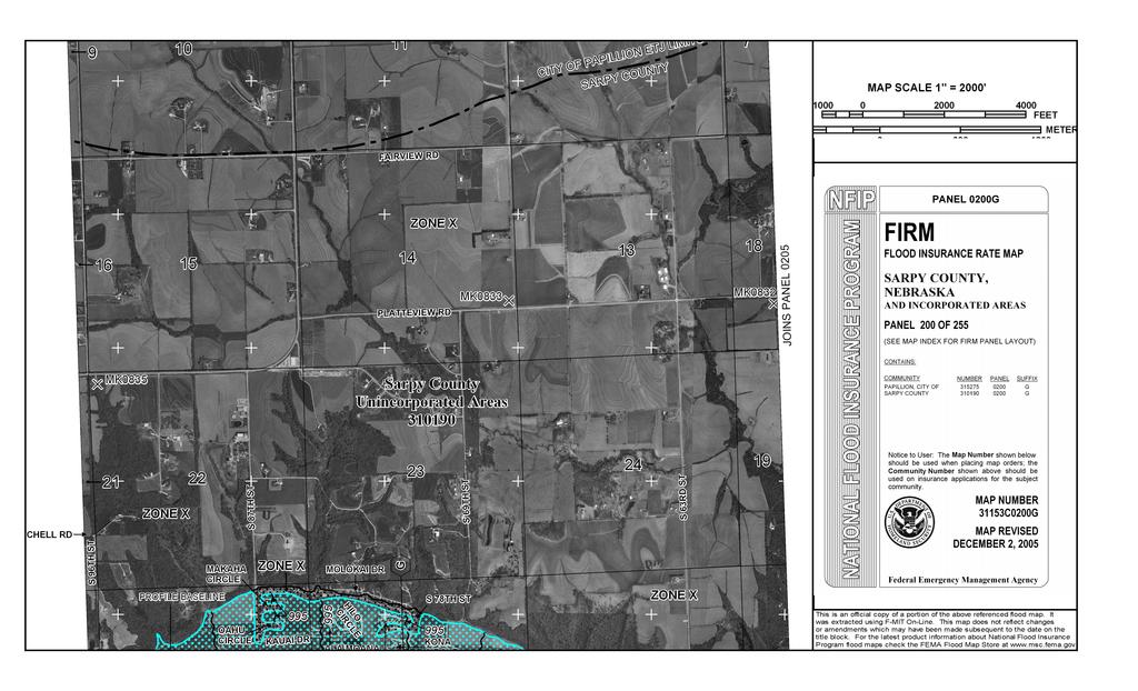
20 Change of Zone Application 1) Site plan drawings: a) Legal description (see attached) b) Metes and bounds description (See attached Exhibit) c) Floodplain/floodway boundaries (FEMA map 31153C0200G has been supplied) d) Existing Easements (preliminary plat has been supplied) e) Relation to City Limits: i) Property located just southeast of City Limits. ii) Property located within City Jurisdiction 2) Description of operating characteristics and reason for request: This 38 acre site is currently zoned AG and is being farmed. A 3 acre piece of this site will be spilt off and be used as a residential acreage, to be zoned as RE. The rest of the 35 acre site will remain to be used as farm land. The rezoning requested is compatible with adjacent land uses and is consistent with the City of Papillion Master Plan. 3) Written description of use or occupancy of building(s): See above 4) PDF Files for all exhibits submitted: FEMA Map, metes and bounds, preliminary plat PDF s have been supplied. 5) Title Company certified property owners list: 2 sets of mailing labels have been supplied with the Preliminary Plat application. 6) Application fee: See attached. 7) A list with contact information for applicant consultants not listed in the application such as the surveyor, engineer, attorney, etc. Mark Westergard E & A Consulting Group, Inc Mill Valley Road, Suite 100 Omaha, NE (402) mwestergard@eacg.com
21
22 33' 33' 50' NORTHWEST CORNER NE1/4 OF THE NE1/4 SEC. 14-T13N-R12E SOUTHWEST CORNER NE1/4 OF THE NE1/4 SEC. 14-T13N-R12E 50' 369' 1277' 286' 133' AC. 123' 94' 45' 399' 902' 50' ADDITIONAL RIGHT-OF-WAY DEDICATION 1279' AC. 865' 50.0' DRAINAGE & MAINTENANCE EASEMENT INST. No ' 50' 1276' 50' 50' 50' 50' NORTHEAST CORNER NE1/4 OF THE NE1/4 SEC. 14-T13N-R12E 50' 50' SOUTHEAST CORNER NE1/4 OF THE NE1/4 SEC. 14-T13N-R12E inch = 100 ft. LEGEND BOUNDARY LINE RIGHT OF WAY LINE LOT LINE EASEMENTS LEGAL DESCRIPTION 96TH STREET 84TH STREET FAIRVIEW ROAD PROJECT SITE CAPEHART ROAD PLATTEVIEW ROAD VICINITY MAP A TRACT OF LAND LOCATED IN PART OF THE NE1/4 OF THE NE1/4 OF SECTION 14, TOWNSHIP 13 NORTH, RANGE 12 EAST OF THE 6TH P.M., SARPY COUNTY, NEBRASKA. MORE PARTICULARLY DESCRIBED AS FOLLOWS: BEGINNING AT THE NORTHWEST CORNER OF SAID NE1/4 OF THE NE1/4 OF SECTION 14; THENCE N87 08'22"E (ASSUMED BEARING) ALONG THE NORTH LINE OF SAID NE1/4 OF THE NE1/4 OF SECTION 14, A DISTANCE OF FEET TO A POINT ON THE WEST RIGHT-OF-WAY LINE OF FAIRVIEW ROAD; THENCE S02 51'13"E ALONG SAID WEST RIGHT-OF-WAY LINE OF FAIRVIEW ROAD, A DISTANCE OF FEET TO THE POINT OF INTERSECTION OF SAID WEST RIGHT-OF-WAY LINE OF FAIRVIEW ROAD AND THE SOUTH RIGHT-OF-WAY LINE OF SAID FAIRVIEW ROAD; THENCE N87 08'22"E ALONG SAID SOUTH RIGHT-OF-WAY LINE OF FAIRVIEW ROAD A DISTANCE OF FEET TO THE POINT OF INTERSECTION OF SAID SOUTH RIGHT-OF-WAY LINE OF FAIRVIEW ROAD AND THE WEST RIGHT-OF-WAY LINE OF 72ND STREET; THENCE S02 44'17"E ALONG SAID WEST RIGHT-OF-WAY LINE OF 72ND STREET, A DISTANCE OF 1, FEET TO A POINT ON THE SOUTH LINE OF SAID NE1/4 OF THE NE1/4 OF SECTION 14; THENCE S87 05'59"W ALONG SAID SOUTH LINE OF THE NE1/4 OF THE NE1/4 OF SECTION 14, A DISTANCE OF 1, FEET TO THE SOUTHWEST CORNER OF SAID NE1/4 OF THE NE1/4 OF SECTION 14; THENCE N02 37'05"W ALONG THE WEST LINE OF SAID NE1/4 OF THE NE1/4 OF SECTION 14, A DISTANCE OF 1, FEET TO THE POINT OF BEGINNING. SAID TRACT OF LAND CONTAINS 1,676,150 SQUARE FEET OR ACRES, MORE OR LESS. 72ND STREET 63RD ST 60TH STREET K:\Projects\2017\103\p01\Plat\Preliminary Design\PP-000.dwg Brian Herr 6/9/2017 9:38 AM Revisions Date Description E & A CONSULTING GROUP, INC. Engineering Planning Environmental & Field Services LEE LYNN LOTS 1 & 2 Date Description CHANGE OF ZONE EXHIBIT PAPILLION, NEBRASKA Mill Valley Road, Suite 100 Omaha, NE Phone: Fax: Proj No: Date: P No 06/12/2017 Designed By: JRS Drawn By: JRS Scale: 1" = 100' Sheet: 1 of 1


23 S 72nd St Fairview Rd Area of Application Platteview Rd Lee Lynn PP ; CZ S 75th St -
24 DRAFT MINUTES PAPILLION PLANNING COMMISSION MEETING JULY 26, 2017 The Papillion Planning Commission met in open session at the Papillion City Hall Council Chambers on Wednesday, July 26, 2017 at 7:00 PM. Chairwoman Rebecca Hoch called the meeting to order. Planning Assistant Andrea Blevins called the roll. Planning Commission members present were David Barker, Howard Carson, Raymond Keller Jr., John E. Robinson III, Judy Sunde, Herb Thompson, and Wayne Wilson. Jim Masters and Leanne Sotak were absent. Planning Director Mark Stursma, City Attorney Karla Rupiper, Assistant Planning Director Travis Gibbons, City Planner Michelle Romeo, and Staff Engineer Derek Goff were also present. Chairwoman Hoch led those present in the Pledge of Allegiance. Notice of the meeting was given in advance by publication in the Papillion Times on July 12, A copy of proof of publication is on file at the office of the City Clerk. Chairwoman Hoch announced that a copy of the Open Meetings Act is posted in the City Council Chambers. Mayor David Black administered the Oath of Office to new Planning Commission member Wayne Wilson. Approval of Agenda Motion was made by Mr. Barker, seconded by Ms. Sunde, to approve the agenda as presented. Roll call: Eight yeas, no nays. Motion carried. Motion was made by Ms. Sunde, seconded by Mr. Barker, to amend the approved agenda to allow agenda items D4a and D4b to be moved up on the agenda to items D3a and D3b. Roll call: Eight yeas, no nays. Motion carried. Approval of the Planning Commission Minutes Motion was made by Mr. Robinson III, seconded by Mr. Barker, to approve the June 28, 2017 minutes. Roll Call: Eight yeas, no nays. Motion carried. FINAL PLATS Final Plat A Final Plat for the property legally described as a tract of land being part of Tax Lot 1, Tax Lot 2A, Tax Lot 2B, and Tax Lot 3A, all located in part of the NE1/4 of the NW1/4 and part of the SE1/4 of the NW1/4, Section 28, T14N, R12E of the 6 th P.M., Sarpy County, NE, generally located northeast of S 108 th St. and Lincoln Rd. The applicant is Woodland Homes, Inc. (Granite Lake (Phase 2)) FP Mark Westergard, Mill Valley Road #100 (Omaha), stepped forward to represent the applicant. He explained that the second phase of the Granite Lake subdivision contemplates 120 single-family residential lots. He noted that Wittmus Drive would not be extended with this phase. Mr. Westergard offered to address any questions or concerns. 1 Planning Commission July 26, 2017
25 Chairwoman Hoch called for discussion amongst the Commission. Mr. Carson expressed that he would not be willing to support projects from the applicant until the silting issue caused by grading within North Shore Commercial is fully repaired. Mr. Westergard stressed that the applicant has been doing his due diligence to correct the issue at North Shore Commercial. Chairwoman Hoch inquired about the lack of a park site on the proposed plan. Mr. Westergard noted the need for a park within this development was eliminated due to Granite Lake s proximity to the proposed WP-7 dam site and a contribution to a splash pad east of Liberty Middle School. Chairwoman Hoch asked staff to address the subdivision s plan for a recreational facility if dam site WP-7 is not constructed. Mr. Stursma explained that staff is confident that dam site WP-7 will be constructed as the land has been acquired and the project is funded. Mr. Barker asked whether a timeline for the construction of WP-7 is in place. Mr. Stursma stated that he was unsure of the construction schedule. With no further discussion, Motion was made by Mr. Robinson III, seconded by Mr. Barker, to recommend approval of the Granite Lake (Phase 2) Final Plat (FP ) because it is generally consistent with the Comprehensive Plan, compatible with adjacent uses, and compliant with the Zoning and Subdivision Regulations, contingent upon the resolution of staff comments. Roll Call: Six yeas, two nays by Mr. Carson and Mr. Thompson. Motion carried. PUBLIC HEARINGS Change of Zone A Change of Zone from GC (General Commercial) to AG (Agricultural) for the property legally described as Tax Lot 6B located in Section 9, T13N, R12E of the 6 th P.M., Sarpy County, NE, generally located on the at S 105 th St. The applicant is Ryan Anderson (Tax Lot 6B ). CZ Property owner Tim Barrett, 811 Maple Street (Springfield), stepped forward to represent the applicant. He was joined by Ryan Anderson, 525 E 2nd Street (Alvo, NE). Mr. Barrett explained that the change of zone would allow him to build an outbuilding on the property. Chairwoman Hoch called for proponents and opponents. Kirk and Sonya Holmes, S 105 th Street (Richfield), stepped forward to ask what uses would be allowed on the property with the change of zone. Mr. Stursma reported that changing the zoning from General Commercial (GC) to Agricultural (AG) restricts the number of uses allowed on the property. Mr. Holmes asked whether the change would allow the property owner to build several storage buildings on the property. Mr. Stursma explained that the uses would move from commercial to agricultural. Ms. Holmes asked whether a concrete crushing business would be allowed under the agricultural zoning district. Mr. Stursma answered that a concrete batch plant would not be permitted by right, and that the owner would need a Temporary Use Permit to allow such a use. Seeing no further public input, Chairwoman Hoch closed the public hearing and called for Commission Discussion. 2 Planning Commission July 26, 2017
26 Mr. Barker asked staff how the land came to be commercially zoned. Mr. Stursma explained that the zoning was converted to commercial when the Richfield was still incorporated as a town site. He added that when Richfield came into Sarpy County s jurisdiction, the zoning was converted to the most similar zoning jurisdiction. The same happened when the area came into Papillion s extraterritorial jurisdiction. He noted the use of the site is agricultural in nature even through it is zoned for commercial use. With no further discussion, Motion was made by Mr. Keller, seconded by Ms. Sunde, to recommend approval of the Tax Lot 6B Change of Zone (CZ ) from GC (General Commercial) to AG (Agricultural) because it is generally consistent with the Comprehensive Plan, compatible with adjacent uses, and compliant with the Subdivision Regulations and Zoning Regulations, contingent upon the resolution of staff comments. Roll Call: Eight yeas, no nays. Motion carried. Change of Zone A Change of Zone from GC (General Commercial) to R-1 (Single-Family Residential (Low Density)) for the property legally described as Lots 8 12, Block 6 Richfield, generally located on the NW corner of S 105 th St. and Walnut St. The applicant is Ryan Anderson. (Lots 8-12, Block 6 Richfield) CZ Property owner Tim Barrett, 811 Maple Street (Springfield), stepped forward to represent the applicant. He was joined by Ryan Anderson, 525 E 2nd Street (Alvo, NE). Mr. Barrett explained that he intends to build a home on the property in question. Chairwoman Hoch called for proponents and opponents. Kirk Holmes, S 105 th Street (Richfield), stepped forward express concern about the possibility of an additional home overloading the neighboring well systems. He suggested that the applicant consult a well professional prior to building the home. Seeing no further public input, Chairwoman Hoch closed the public hearing and called for Commission Discussion. With no further discussion, Motion was made by Mr. Keller, seconded by Ms. Barker, to recommend approval of Lots 8 12, Block 6 Richfield Change of Zone (CZ ) from GC (General Commercial) to RE (Rural Residential Estates) because it is generally consistent with the Comprehensive Plan, compatible with adjacent uses, and compliant with the Subdivision Regulations and Zoning Regulations, contingent upon the resolution of staff comments. Roll Call: Eight yeas, no nays. Motion carried. Preliminary Plat A Preliminary Plat for the property legally described as a tract of land located in part of the NE1/4 of the NE1/4 of Section 14, T13N, R12E of the 6 th P.M., Sarpy County, NE, generally located at 7445 Fairview Rd. The applicant is Thomas Pribil. (Lee Lynn) PP Mark Westergard, Mill Valley Road #100 (Omaha), stepped forward to represent the applicant. He noted that Thomas Pribil, the applicant, and Pat Sullivan, the applicant s attorney, were also present. Mr. Westergard explained that Mr. Pribil wishes to sell the homestead and three surrounding acres and keep the surrounding farmland. He added that the applicant was asked to show what future development may look like at the site. He reported that the three acre 3 Planning Commission July 26, 2017
27 tract in the northwestern portion of the lot would be rezoned to RE (Rural Residential Estates), and the remainder would stay AG (Agricultural) and be converted to an outlot on the final plat. Chairwoman Hoch called for proponents and opponents. Pat Sullivan, 1246 Golden Gate Drive, stepped forward to express that the homestead being platted contains a $500,000 home, and as such he does not believe that the house would be demolished to make room for development. He added that the property is being platted in such a way that the home would not disrupt new development. He explained that the plat will allow for a road on the northwestern side of the plat. Mr. Sullivan added that the applicant has no issues with the contingencies listed in the Planning Commission Staff Report. John Werthmann, 1002 S Madison Street, stepped forward to express concern about a different agenda item. He was notified that the item he was speaking on would be heard later in the meeting. Seeing no further public input, Chairwoman Hoch closed the public hearing and called for Commission Discussion. With no further discussion, Motion was made by Mr. Robinson III, seconded by Mr. Carson, to recommend approval of the Lee Lynn Preliminary Plat (PP ) because it is generally consistent with the Comprehensive Plan, compatible with adjacent uses, and compliant with the Subdivision Regulations and Zoning Regulations, contingent upon the resolution of staff comments. Roll Call: Eight yeas, no nays. Motion carried. Change of Zone A Change of Zone from AG (Agricultural) to RE (Rural Residential Estates) for the property legally described as a tract of land located in part of the NE1/4 of the NE1/4 of Section 14, T13N, R12E of the 6 th P.M., Sarpy County, NE, generally located at 7445 Fairview Rd. The applicant is Thomas Pribil. (Lee Lynn) CZ Mark Westergard, Mill Valley Road #100 (Omaha), stepped forward to represent the applicant. He reiterated that the rezoning will only apply to the three acre tract to Rural Residential Estates (RE) and that the rest of the property will remain Agricultural (AG). Chairwoman Hoch called for proponents and opponents. Seeing no further public input, Chairwoman Hoch closed the public hearing and called for Commission Discussion. Mr. Carson asked Mr. Westergard to confirm whether the three acre parcel was the only portion of the property being rezoned. Mr. Westergard answered in the affirmative. With no further discussion, Motion was made by Mr. Barker, seconded by Mr. Robinson III, to recommend approval of the Lee Lynn Change of Zone (CZ ) from AG (Agricultural) to RE (Rural Residential Estates) because it is generally consistent with the Comprehensive Plan, compatible with adjacent uses, and compliant with the Subdivision Regulations and Zoning Regulations, contingent upon the resolution of staff comments. Roll Call: Eight yeas, no nays. Motion carried. 4 Planning Commission July 26, 2017
28 Preliminary Plat A Preliminary Plat for the property legally described as part of the NE1/4 of Section 34, T14N, R12E of the 6 th P.M., Sarpy County, NE, generally located on the NW corner of Washington St. and HWY 370. The applicant is Royce Enterprises, Inc. (Papillion Commons) PP Larry Jobeun, W Center Road (Omaha), stepped forward to represent the applicant. He noted that Chip James and Bob Begley of Royce Enterprises were in attendance. He also noted that Katie Underwood, Kellen Heideman, and Chris Rolling of Olsson Associates were in attendance. Mr. Jobeun noted that the 110 acre property is located on the northwest corner of 84 th Street and HWY 370. He established that the property has a rolling topography. Mr. Jobeun indicated that the applicant considers the proposed plan to be generally consistent with Papillion s City Center Concept. He noted that the City Center Concept contemplates office, retail, civic, and residential uses, as well as a mixed use building, plaza space, and a park expansion. He pointed out that the development will connect 84 th Street to 90 th Street with the continuation of Cedardale Road. Mr. Jobeun emphasized that the proposed development will be pedestrian friendly with a continuation of the existing trail system on the north side of the development and sidewalks. Mr. Jobeun noted that the project would be developed in two phases. The first phase encompasses a 25 lot mixed use area with three outlots that will provide for detention facilities, trail, and park space. He reported that phase two would encompass Lot 26 (approximately 8.87 acres) on the northwest corner of the development. He summarized that the applicant intends to rezone this lot to Urban Family Residential (R-3) and the owner will possibly donate the lot to a civic entity. Mr. Jobeun presented the site plan and noted that the proposal envisions a mix of commercial retail uses on the east half of the property that are intended to attract mid-range, new to market retailers. He added that the plan also contemplates two hotels with approximately units each, a senior living facility, and apartments with up to 350 units. He suggested that the applicant will likely develop the commercial and office portions of the plan, and sell the multifamily and assisted living components to a different developer. Mr. Jobeun noted that there is approximately 123,000 square feet of office space anticipated on the western portion of the plan and 297,000 square feet of commercial retail. He expressed that the plan also shows three distinct plaza spaces within the development. He shared some examples of the architecture that may be used at the site. Mr. Jobeun indicated that there is a significant sanitary sewer issue to the east and north of the development and that the developer plans replace said sewer with the buildout of this development. He noted that the developer would seek cost sharing from the appropriate agencies to cover the approximately two million dollar cost. Mr. Jobeun confirmed that 90 th Street would be improved to a three lane section from HWY 370 to the edge of the development just south of Woodland Avenue. He explained that the intersection at 90 th Street and HWY 370 would also be improved. He added that the intersection of Cedardale Road and 84 th Street would be improved to allow two left hand turn lanes into the development. Mr. Jobeun pointed out that there are nearly 2,622 residential lots in Papillion s extraterritorial jurisdiction that this development would serve. Chairwoman Hoch called for proponents and opponents. 5 Planning Commission July 26, 2017
29 Eric Borst, 1120 Delmar Street, Unit 4F, stepped forward to express concern about the increased traffic from the site putting too much stress on the culverts running underneath 84 th Street on the north end of the development. He also expressed that there is a need for a buffer between the existing residential and the development. John Werthmann, 1002 S Madison Street, stepped forward to express that he would prefer that the developer not include hotels and apartments in the concept. He noted that the apartments might overload the local school system and increase his taxes. Mr. Werthmann also expressed concern about the potential increase in traffic. Chelsey Kastrup, 1001 S Adams Street, stepped forward to express concern about the potential traffic increase. She added that she would prefer that the development were less dense and that the hotels and apartments be developed in such a way to mitigate the impact to the existing residential. Katie Rainbolt, 1307 Scott Road, stepped forward to express concern about the amount of light, noise, and traffic that would be generated by the development. She voiced that there is a need for a buffer to the existing residential. ShirLee Walsh, 105 Valley Road, stepped forward to express concern about drainage, traffic, and buffers at the site. Leo R. Rivard, 1105 Locust Avenue, stepped forward to express concern about the traffic generation on 90 th Street. He also asked whether his taxes would increase as a result of the sewer upgrade. Patty Falcone, 800 Devon Drive, stepped forward to comment on the density and increased traffic. She noted that the hotels and fast food were unnecessary as similar uses exist nearby. She also expressed the need for a buffer to the existing residential. Gary France, 909 S Fillmore Street, stepped forward to express concern about the additional traffic near Trumble Park Elementary School and possible tax implications. He also asked what type of signalization would be added along 90 th Street. Elizabeth Garvey, 909 Woodland Avenue, stepped forward and expressed concerns about the light pollution, traffic, and density that would be generated by the proposed project. Frederick J. Skinner, 1301 Devon Circle, stepped forward to express concerns about traffic, density, school congestion, tax implications, sewer, and drainage. He expressed opposition to the multiple-family residential, retail, and hotel components. Larry Jobes, 1313 Scott Road, stepped forward to express concern about the additional traffic generation. Seeing no further public input, Chairwoman Hoch closed the public hearing and called for Commission Discussion. Mr. Jobeun reiterated that the proposed hotels are relatively small, and that the presented plan is conceptual in nature. He noted that the Mixed Use Development Agreement will help to 6 Planning Commission July 26, 2017
CITY OF PAPILLION MAYOR AND CITY COUNCIL REPORT JUNE 19, 2018 AGENDA. Subject: Type: Submitted By: Resolution #R (Public Hearing)
") CITY OF PAPILLION MAYOR AND CITY COUNCIL REPORT JUNE 19, 2018 AGENDA Subject: Type: Submitted By: A request for a Special Use Permit to allow Automotive Rental and Sales as an accessory use on the property
CITY OF PAPILLION MAYOR AND CITY COUNCIL REPORT JUNE 19, 2018 AGENDA Subject: Type: Submitted By: A request for a Special Use Permit to allow Automotive Rental and Sales as an accessory use on the property
CITY OF PAPILLION MAYOR AND CITY COUNCIL REPORT APRIL 3, 2018 AGENDA. Subject: Type: Submitted By: Resolution #R
 CITY OF PAPILLION MAYOR AND CITY COUNCIL REPORT APRIL 3, 2018 AGENDA Subject: Type: Submitted By: A request for a Final Plat for the property legally described as Tax Lot 3 located in the NE 1/4 of the
CITY OF PAPILLION MAYOR AND CITY COUNCIL REPORT MAY 16, 2018 AGENDA
 CITY OF PAPILLION MAYOR AND CITY COUNCIL REPORT MAY 16, 2018 AGENDA Subject: Type: Submitted By: A request to vacate the Final Plat for Prairie Queen First Subdivision, a subdivision legally described
CITY OF PAPILLION PLANNING COMMISSION STAFF REPORT MAY 31, 2017 AGENDA REVISE ZONING MAP 2017 ANNEXATION NO. 2 MISC
 I. GENERAL INFORMATION A. APPLICANT: 122 East Third St. Papillion, NE 68046 CITY OF PAPILLION PLANNING COMMISSION STAFF REPORT MAY 31, 2017 AGENDA REVISE ZONING MAP 2017 ANNEXATION NO. 2 MISC-17-0005 B.
CITY OF PAPILLION MAYOR AND CITY COUNCIL REPORT OCTOBER 2, 2018 AGENDA. Subject: Type: Submitted By:
 CITY OF PAPILLION MAYOR AND CITY COUNCIL REPORT OCTOBER 2, 2018 AGENDA Subject: Type: Submitted By: A request for a Revised Preliminary Plat for the property legally described as a tract of land located
CITY OF PAPILLION PLANNING COMMISSION STAFF REPORT MAY 27, 2015 AGENDA REVISE ZONING MAP MISC
 PLANNING COMMISSION STAFF REPORT MAY 27, 2015 AGENDA REVISE ZONING MAP MISC-15-0006 I. GENERAL INFORMATION A. APPLICANT: City of Papillion 122 East Third St. Papillion, NE 68046 B. REQUESTED ACTION: Approval
CITY OF PAPILLION PLANNING COMMISSION STAFF REPORT MAY 31, 2017 AGENDA SHADOW LAKE 2 FINAL PLAT FP
 I. GENERAL INFORMATION CITY OF PAPILLION PLANNING COMMISSION STAFF REPORT MAY 31, 2017 AGENDA SHADOW LAKE 2 FINAL PLAT FP-17-0006 A. APPLICANT: Shadow Lake 2, LLC 15950 West Dodge Road, Suite 300 Omaha,
CITY OF PAPILLION PLANNING COMMISSION STAFF REPORT MAY 31, 2017 AGENDA I COMMERCE PRELIMINARY PLAT & CHANGE OF ZONE PP ; CZ
 I. GENERAL INFORMATION CITY OF PAPILLION PLANNING COMMISSION STAFF REPORT MAY 31, 2017 AGENDA I 80-370 COMMERCE PRELIMINARY PLAT & CHANGE OF ZONE PP-17-0003; CZ-17-0004 A. APPLICANT: Dowd Grain Co. 220
EDGERTON CITY HALL PLANNING COMMISSION MEETING REGULAR SESSION March 12, 2019
 EDGERTON CITY HALL PLANNING COMMISSION MEETING REGULAR SESSION The met in regular session with Chair John Daley calling the meeting to order at 7:00 p.m. All present participated in the Pledge of Allegiance.
CITY OF PAPILLION MAYOR AND CITY COUNCIL REPORT JANUARY 16, 2018 AGENDA. Subject: Type: Submitted By: Resolution #R (Public Hearing)
") CITY OF PAPILLION MAYOR AND CITY COUNCIL REPORT JANUARY 16, 2018 AGENDA Subject: Type: Submitted By: A request for a Special Use Permit to allow Bed-and-breakfast as a permitted use on the property legally
CITY OF PAPILLION MAYOR AND CITY COUNCIL REPORT JANUARY 16, 2018 AGENDA Subject: Type: Submitted By: A request for a Special Use Permit to allow Bed-and-breakfast as a permitted use on the property legally
CITY OF PAPILLION MAYOR AND CITY COUNCIL REPORT FEBRUARY 20, 2018 AGENDA. Subject: Type: Submitted By: Resolution #R
 CITY OF PAPILLION MAYOR AND CITY COUNCIL REPORT FEBRUARY 20, 2018 AGENDA Subject: Type: Submitted By: A request for a Final Plat for the property legally described as Lot 79A, Cotton-Wood, generally located
CITY OF PAPILLION PLANNING COMMISSION STAFF REPORT DECEMBER 17, 2014 AGENDA
 CITY OF PAPILLION PLANNING COMMISSION STAFF REPORT DECEMBER 17, 2014 AGENDA PAPILLION JUNIOR HIGH SOUTH PAPILLION REPLAT 1 PRELIMINARY PLAT, FINAL PLAT & SPECIAL USE PERMIT PP-14-0007; FP-14-0012; SUP-14-0005
RECOMMENDATION REPORT
 SARPY COUNTY PLANNING & BUILDING DEPARTMENT RECOMMENDATION REPORT CHANGE OF ZONE (CZ 18-005) PRELIMINARY PLAT (PP 18-007) FINAL PLAT (FP 18-008) SCHOLTING ESTATES APPLICANT: DIANE SCHOLTING PLANNING COMMISSION
CITY OF PAPILLION PLANNING COMMISSION STAFF REPORT FEBRUARY 26, 2014 AGENDA KINGSBURY HILLS REPLAT TWO PRELIMINARY PLAT PP
 I. GENERAL INFORMATION A. APPLICANT: Stone Creek Plaza LLC 11205 S. 150 th St., Ste. #100 Omaha, NE 68138 B. PROPERTY OWNER: BHI Development LLC 11205 S. 150 th St., Ste. #100 Omaha, NE 68138 SID 275 11440
CITY OF PAPILLION PLANNING COMMISSION STAFF REPORT NOVEMBER 18, 2015 AGENDA BUCKY S CONVENIENCE STORES SPECIAL USE PERMIT SUP
 I. GENERAL INFORMATION A. APPLICANT: Jeffery Guyette 7315 Mercy Road Omaha, NE 68124 CITY OF PAPILLION PLANNING COMMISSION STAFF REPORT NOVEMBER 18, 2015 AGENDA BUCKY S CONVENIENCE STORES SPECIAL USE PERMIT
ROYAL VIEW DEVELOPMENT
 GRETNA BUILDING FOR LEASE ROYAL VIEW DEVELOPMENT PROPOSED RENDERING AVAILABLE FOR LEASE + + LEASE RATE AND AVAILABILITY MINIMUM SPACE: MAXIMUM SPACE: LEASE RATE: 1,162 SF 14,675 SF + + Retail building
RECOMMENDATION REPORT
 SARPY COUNTY PLANNING & BUILDING DEPARTMENT RECOMMENDATION REPORT CHANGE OF ZONE (CZ 18-003) PRELIMINARY PLAT (PP 18-005) FINAL PLAT (FP 18-004) NIELSEN ADDITION APPLICANT: RODNEY AND MAUREEN NIELSEN PLANNING
SARPY COUNTY PLANNING COMMISSION MINUTES OF MEETING. December 18, 2018
 SARPY COUNTY PLANNING COMMISSION MINUTES OF MEETING l. CALL MEETING TO ORDER A meeting of the Planning Commission of Sarpy County, Nebraska was convened in open and public session at the call of Chairman
CITY OF PAPILLION PLANNING COMMISSION STAFF REPORT DECEMBER 13, 2017 AGENDA LINCOLN WAY PRELIMINARY PLAT & CHANGE OF ZONE PP ; CZ
 I. GENERAL INFORMATION CITY OF PAPILLION PLANNING COMMISSION STAFF REPORT DECEMBER 13, 2017 AGENDA LINCOLN WAY PRELIMINARY PLAT & CHANGE OF ZONE PP-17-0013; CZ-17-0017 A. APPLICANT: Jeff Elliott 17007
BOARD OF COUNTY COMMISSIONERS SARPY COUNTY, NEBRASKA. APPROVE FINAL PLAT Palisades West (Lots 1-177, Outlots A - M)
") 2017-352 BOARD OF COUNTY COMMISSIONERS SARPY COUNTY, NEBRASKA APPROVE FINAL PLAT Palisades West (Lots 1-177, Outlots A - M) WHEREAS, pursuant to Neb. Rev. at. 23-104, the County has the power to do all
2017-352 BOARD OF COUNTY COMMISSIONERS SARPY COUNTY, NEBRASKA APPROVE FINAL PLAT Palisades West (Lots 1-177, Outlots A - M) WHEREAS, pursuant to Neb. Rev. at. 23-104, the County has the power to do all
ACTION FORM BRYAN CITY COUNCIL
 ACTION FORM BRYAN CITY COUNCIL DATE OF COUNCIL MEETING: July 8, 2014 DATE SUBMITTED: June 17, 2014 DEPARTMENT OF ORIGIN: Development Services SUBMITTED BY: Maggie Dalton MEETING TYPE: CLASSIFICATION: ORDINANCE:
COUNCIL COMMUNICATION
 Meeting Date: October 24, 2017 COUNCIL COMMUNICATION Agenda Item: Agenda Location: Public Hearings Work Plan # Legal Review: X 1 st Reading 2 nd Reading Subject: A public hearing regarding Zoning and a
AN ORDINANCE TO CREATE THE ALDEN RIDGE PUD As Recommended to the Lowell Township Board by the Lowell Township Planning Commission January 11, 2016
 CHARTER TOWNSHIP OF LOWELL COUNTY OF KENT, MICHIGAN AN ORDINANCE TO CREATE THE ALDEN RIDGE PUD As Recommended to the Lowell Township Board by the Lowell Township Planning Commission January 11, 2016 At
1. Roll Call. 2. Minutes a. September 26, 2016 Regular Meeting. 3. Adoption of the Agenda. 4. Visitors to Be Heard
 1. Roll Call City of Vermillion Planning Commission Agenda 5:30 p.m. Regular Meeting Tuesday, October 11, 2016 Large Conference Room 2 nd Floor City Hall 25 Center Street Vermillion, SD 57069 2. Minutes
CITY OF WILDOMAR PLANNING COMMISSION Agenda Item #2.3 PUBLIC HEARING Meeting Date: January 6, 2016
 CITY OF WILDOMAR PLANNING COMMISSION Agenda Item #2.3 PUBLIC HEARING Meeting Date: January 6, 2016 TO: FROM: Chairman and Members of the Planning Commission Matthew C. Bassi, Planning Director SUBJECT:
LOCATION MAP: AERIAL PHOTOGRAPH, 2015:
 LOCATION MAP: AERIAL PHOTOGRAPH, 2015: ORDINANCE NO. AN ORDINANCE OF THE CITY OF BRYAN, TEXAS, AMENDING CHAPTER 130, ZONING, OF THE CITY OF BRYAN CODE OF ORDINANCES, BY CHANGING THE ZONING CLASSIFICATION
CHECKLIST FOR DEVELOPMENT REVIEW
 CHECKLIST FOR DEVELOPMENT REVIEW Petitions and related documents and plans for land development or other proposals regulated by Title 16 of the Municipal Code (Development Ordinance) and Title 17 of the
Preliminary Plat/Final Plat Application
 Melissa Municipal Center 3411 Barker Avenue Melissa, Texas 75454 Phone: (972) 838-2036 Applicant: Date: Address: Phone: Contact: Fax: E-mail: Propose Addition Name: Acres: Existing Zoning: Propose Zoning:
PLANNED UNIT DEVELOPMENT (PUD) AREA PLAN/REZONING REVIEW PROCEDURE
 AREA PLAN/REZONING REVIEW PROCEDURE") PLANNED UNIT DEVELOPMENT (PUD) AREA PLAN/REZONING REVIEW PROCEDURE Professional inquiries will be made to our Township Planning Consultant, Township Engineer, and Township Attorney to get their opinions
PLANNED UNIT DEVELOPMENT (PUD) AREA PLAN/REZONING REVIEW PROCEDURE Professional inquiries will be made to our Township Planning Consultant, Township Engineer, and Township Attorney to get their opinions
NOTICE OF A REGULAR MEETING OF THE ENID-GARFIELD COUNTY METROPOLITAN AREA PLANNING COMMISSION
 NOTICE OF A REGULAR MEETING OF THE ENID-GARFIELD COUNTY METROPOLITAN AREA PLANNING COMMISSION Notice is hereby given that the Enid-Garfield County Metropolitan Area Planning Commission will meet in regular
Watertown City Council
 City of Watertown Watertown City Council 2/14/2017 Agenda Item: Riverpointe Subdivision 2 nd Replat Request for Action: Sketch Plan Department: Planning Request for Action Request: Paxmar, LLC (Applicant)
SUBMISSION REQUIREMENTS AND INSTRUCTIONS FOR MINOR REVISIONS TO PUD PLANS
 WEST CHESTER TOWNSHIP, BUTLER COUNTY, OHIO COMMUNITY DEVELOPMENT DEPARTMENT 9577 Beckett Road, Suite 100, West Chester, Ohio 45069 TELEPHONE: (513) 777-4214 www.westchesteroh.org SUBMISSION REQUIREMENTS
NOTICE OF A REGULAR MEETING OF THE ENID-GARFIELD COUNTY METROPOLITAN AREA PLANNING COMMISSION
 NOTICE OF A REGULAR MEETING OF THE ENID-GARFIELD COUNTY METROPOLITAN AREA PLANNING COMMISSION Notice is hereby given that the Enid-Garfield County Metropolitan Area Planning Commission will meet in regular
SUBMISSION REQUIREMENTS AND INSTRUCTIONS FOR REVISED PRELIMINARY DEVELOPMENT PLAN
 WEST CHESTER TOWNSHIP, BUTLER COUNTY, OHIO COMMUNITY DEVELOPMENT DEPARTMENT 9577 Beckett Road, Suite 100, West Chester, Ohio 45069 TELEPHONE: (513) 777-4214 www.westchesteroh.org SUBMISSION REQUIREMENTS
Planned Residence District (PR) To review a plan to construct 11 single family homes on approximately 4.01 acres.
 To review a plan to construct 11 single family homes on approximately 4.01 acres.") STAFF REPORT PLANNING & ZONING COMMISSION Village Green Municipal Building, Council Chambers 47 Hall Street Wednesday, March 13, 2019 7:00 P.M. 1. FINAL DEVELOPMENT PLAN REVIEW Applicant: Romanelli and
STAFF REPORT PLANNING & ZONING COMMISSION Village Green Municipal Building, Council Chambers 47 Hall Street Wednesday, March 13, 2019 7:00 P.M. 1. FINAL DEVELOPMENT PLAN REVIEW Applicant: Romanelli and
CHARTER TOWNSHIP OF CALEDONIA COUNTY OF KENT, MICHIGAN. at the Township and Village Hall, 8196 Broadmoor Avenue, Caledonia, Michigan on the
 First Reading CHARTER TOWNSHIP OF CALEDONIA COUNTY OF KENT, MICHIGAN At a regular meeting of the Township Board of the Charter Township of Caledonia, held at the Township and Village Hall, 8196 Broadmoor
AGENDA HAYDEN PLANNING COMMISSION
 AGENDA HAYDEN PLANNING COMMISSION THURSDAY, DECEMBER 14, 2017 7:00 P.M. HAYDEN TOWN HALL 178 WEST JEFFERSON AVENUE REGULAR MEETING 1. CALL TO ORDER, MOMENT OF SILENCE & PLEDGE OF ALLEGIANCE 2. ROLL CALL
PLANNING AND ZONING COMMISSION FEBRUARY 20, :30 P.M. PLANNING AND ZONING MEMBERS PRESENT MEMBERS ABSENT: STAFF PRESENT:
 PLANNING AND ZONING COMMISSION FEBRUARY 20, 2018 5:30 P.M. PLANNING AND ZONING MEMBERS PRESENT Chair Lester Fettig Omar Crisp Paulino Castillo Lydia Alaniz Bryant Ward Jessica Walker Jeremy Langley MEMBERS
Oakland County Michigan Register of Deeds Plat Engineering, GIS, & Remonumentation Dept. Ph: (248) Fax (248)
 Fax (248)") Oakland County Michigan Register of Deeds Plat Engineering, GIS, & Remonumentation Dept. Ph: (248)-858-1447 Fax (248)-858-7466 Requirements Needed for Final Plat Approval No. General Requirements. 1 Routing
Oakland County Michigan Register of Deeds Plat Engineering, GIS, & Remonumentation Dept. Ph: (248)-858-1447 Fax (248)-858-7466 Requirements Needed for Final Plat Approval No. General Requirements. 1 Routing
SECTION 10 STANDARD PLATS
 SECTION 10 - STANDARD PLATS Subdivision 1: Purpose Standard Plats allow the subdivision of land into lots smaller than the minimum metes and bounds size in the zoning district, and control road development
PLANNED UNIT DEVELOPMENT & SUBDIVISION STAFF REPORT Date: April 18, 2019
 PLANNED UNIT DEVELOPMENT & SUBDIVISION STAFF REPORT Date: April 18, 2019 DEVELOPMENT NAME SUBDIVISION NAME Springhill Village Subdivision Springhill Village Subdivision LOCATION 4350, 4354, 4356, 4358,
ZONING AMENDMENT, PLANNED UNIT DEVELOPMENT & SUBDIVISION STAFF REPORT Date: August 8, 2013
 ZONING AMENDMENT, PLANNED UNIT DEVELOPMENT & SUBDIVISION STAFF REPORT Date: August 8, 2013 NAME SUBDIVISION NAME PV-Magnolia, LLC Twelve Trees Subdivision LOCATION 2860, 2862 and 2866 Pleasant Valley Road
ELK RAPIDS TOWNSHIP ANTRIM COUNTY, MICHIGAN ORDINANCE NO
 ELK RAPIDS TOWNSHIP ANTRIM COUNTY, MICHIGAN ORDINANCE NO. 3-2011 AN ORDINANCE TO REPLACE THE SUBDIVISION CONTROL ORDINANCE WITH A NEW SUBDIVISION DEVELOPMENT ORDINANCE, IN ACCORD WITH THE LAND DIVISION
Cover Letter with Narrative Statement
 Cover Letter with Narrative Statement March 31, 2017 rev July 27, 2017 RE: Rushton Pointe Residential Planned Unit Development Application for Public Hearing for RPUD Rezone PL2015 000 0306 Mr. Eric Johnson,
PLANNING BOARD AGENDA Disposition Agenda
 PLANNING BOARD AGENDA Disposition Agenda Public Hearing and Administrative Meeting Wednesday,, 1:30 P.M. Omaha/Douglas Civic Center 1819 Farnam Street Legislative Chamber Planning Board Members: Greg Rosenbaum,
The City Council of the City of Sulphur, Louisiana, met in special session at its
 July 12, 2018 The City Council of the City of Sulphur, Louisiana, met in special session at its regular meeting place in the Council Chambers, Sulphur, Louisiana, on July 12, 2018 at 5:00 p.m., after full
PUD, HPUD, OSC Rezoning & Conceptual Plan Application (Planned Unit Development, Haggerty Road Planned Unit Development, Open Space Community)
") Township Use Only RZ #: Date: Hearing Date: Fee Paid: PUD, HPUD, OSC Rezoning & Conceptual Plan Application (Planned Unit Development, Haggerty Road Planned Unit Development, Open Space Community) Project
Township Use Only RZ #: Date: Hearing Date: Fee Paid: PUD, HPUD, OSC Rezoning & Conceptual Plan Application (Planned Unit Development, Haggerty Road Planned Unit Development, Open Space Community) Project
COUNCIL COMMUNICATION
 Meeting Date: January 22, 2019 COUNCIL COMMUNICATION Agenda Item: Agenda Location: Consent Calendar Goal(s): Legal Review: 1 st Reading X 2 nd Reading Subject: An ordinance approving a Rezoning of approximately
PLANNING AND ZONING DEPARTMENT
 Town of Minturn Development Review Process: Guide To Planned Unit Developments (Concept Plan) This guide describes the Planned Unit Development Process. This guide should be utilized in conjunction with
SARPY COUNTY BOARD OF ADJUSTMENT MINUTES OF MEETING May 14, 2015
 l. CALL MEETING TO ORDER SARPY COUNTY BOARD OF ADJUSTMENT MINUTES OF MEETING May 14, 2015 A meeting of the Board of Adjustment of Sarpy County, Nebraska was convened in open and public session at the call
PLANNING COMMISSION REPORT Regular Agenda Public Hearing Item
 PC Staff Report 11/12/12 Item No. 2B- 1 PLANNING COMMISSION REPORT Regular Agenda Public Hearing Item ITEM NO. 2B: A TO GPI; 110 ACRES; E OF K-10 & N OF W 6 TH ST (MKM) : Consider a request to rezone approximately
CONDITIONAL USE PERMIT (CUP)
") CONDITIONAL USE PERMIT (CUP) LAND DEVELOPMENT APPLICATION FORM DEPARTMENT OF PLANNING 300 East Main Street, Sun Prairie, WI 53590-2227 (608)825-1107 FAX (608)825-1194 Applications will not be processed
CONDITIONAL USE PERMIT (CUP) LAND DEVELOPMENT APPLICATION FORM DEPARTMENT OF PLANNING 300 East Main Street, Sun Prairie, WI 53590-2227 (608)825-1107 FAX (608)825-1194 Applications will not be processed
City Council Agenda Item #13_ Meeting of March 6, 2017
 City Council Agenda Item #13_ Meeting of March 6, 2017 Description Recommendation Resolution vacating a sump easement and drainage and utility easements located at 1555 Linner Road. Hold the public hearing
Tentative Map Application Review Procedures
 FOR REFERENCE ONLY This page is not part of the application. Tentative Map Application Review Procedures The tentative map process in Churchill County is designed to provide a mechanism in order to divide
A G E N D A. BOARD OF ADJUSTMENT PUBLIC HEARING June 6, :00 PM GROWTH MANAGEMENT TRAINING FACILITY 2710 E. SILVER SPRINGS BLVD.
 A. Call to Order and Roll Call B. Invocation and Pledge of Allegiance A G E N D A BOARD OF ADJUSTMENT PUBLIC HEARING June 6, 2016 2:00 PM GROWTH MANAGEMENT TRAINING FACILITY 2710 E. SILVER SPRINGS BLVD.
CONDOMINIUM REGULATIONS
 ARTICLE 37 CONDOMINIUM REGULATIONS SECTION 37.01. Purpose The purpose of this Article is to regulate projects that divide real property under a contractual arrangement known as a condominium. New and conversion
I. Requirements for All Applications. C D W
 108-16.1. Application checklists. Checklist for Required Submissions to the Planning Board or Zoning Board of Adjustment of Monroe Township All required submissions are to be made to the Administrative
City of Fort Lupton Amended Plat Process
 City of Fort Lupton Amended Plat Process Purpose The Amended Plat process is an administrative process to amend a recorded Plat. An Amended Subdivision is an administrative revision to a recorded Subdivision
Planner Ken Jaworski. Approval of Minutes: A. Approval of the minutes of the Wednesday, July 8 th, 2015 Regular Plan Commission Meeting.
 Approved 09/09/2015 TOWN OF CLAYTON Town Plan Commission Meeting Minutes 7:00 P.M. on Wednesday, August 12 th, 2015 Town Office Meeting Room, 8348 County Road T, Larsen, WI 54947 I. Call to Order: A. Notice
APPLICATION PROCEDURE
 ANTRIM PLANNING BOARD P. O. Box 517 Antrim, New Hampshire 03440 Phone: 603-588-6785 FAX: 603-588-2969 APPLICATION FORM AND CHECKLIST FOR MINOR OR MAJOR SITE PLAN REVIEW File Date Received By APPLICATION
BOARD OF COUNTY COMMISSIONERS SARPY COUNTY, NEBRASKA RESOLUTION PRELIMINARY PLAT- LAZY R FARM (AMENDED)
") ~OII-139 BOARD OF COUNTY COMMISSIONERS SARPY COUNTY, NEBRASKA RESOLUTION PRELIMINARY PLAT- LAZY R FARM (AMENDED) WHEREAS, pursuant to Neb. Rev. Stat. 23-104 (Reissue 2007), the County has the power to
~OII-139 BOARD OF COUNTY COMMISSIONERS SARPY COUNTY, NEBRASKA RESOLUTION PRELIMINARY PLAT- LAZY R FARM (AMENDED) WHEREAS, pursuant to Neb. Rev. Stat. 23-104 (Reissue 2007), the County has the power to
MINUTES OF THE RAPID CITY ZONING BOARD OF ADJUSTMENT March 22, 2017
 MINUTES OF THE RAPID CITY ZONING BOARD OF ADJUSTMENT March 22, 2017 MEMBERS PRESENT: Erik Braun, Racheal Caesar, Mike Golliher, John Herr, Galen Hoogestraat, Mike Quasney, Kimberly Schmidt, Justin Vangraefschepe
SUBJECT PARCEL(S) Property Owner(s) TMS Number Approximate Acreage Carolina Park Development, LLC
 Property Owner(s) TMS Number Approximate Acreage Carolina Park Development, LLC") Staff Report Special Planning Commission Meeting November 19, 2014 For reference, the Zoning Code and Land Development Regulations are available online. AGENDA ITEM 5c. SKETCH PLAN APPROVAL REQUEST: Request
Staff Report Special Planning Commission Meeting November 19, 2014 For reference, the Zoning Code and Land Development Regulations are available online. AGENDA ITEM 5c. SKETCH PLAN APPROVAL REQUEST: Request
CITY COUNCIL SPECIAL MEETING THURSDAY, SEPTEMBER 1, :00 P.M. CITY COUNCIL CHAMBER, CITY HALL 2401 MARKET STREET BAYTOWN, TEXAS AGENDA
 CITY OF BAYTOWN NOTICE OF MEETING CITY COUNCIL SPECIAL MEETING THURSDAY, SEPTEMBER 1, 2016 5:00 P.M. CITY COUNCIL CHAMBER, CITY HALL 2401 MARKET STREET BAYTOWN, TEXAS 77520 AGENDA CALL TO ORDER AND ANNOUNCEMENT
CITY OF DECATUR, TEXAS
 Final Plat or Amending Plat / Replat Checklist A submittal of a complete application will facilitate a timely review. Failure of the applicant to provide required information or obtain a waiver from the
MAJOR SUBDIVISION PRELIMINARY PLAT CHECKLIST
 TOWNSHIP OF EGG HARBOR PLANNING BOARD/ZONING BOARD OF ADJUSTMENT 3515 BARGAINTOWN ROAD EGG HARBOR TOWNSHIP, NJ 08234 MAJOR SUBDIVISION PRELIMINARY PLAT CHECKLIST The following checklist is designed to
To provide for the review of the final engineering plans, the subdivision improvement agreement, public dedications, and other legal agreements.
 ARTICLE 5 FINAL PLAT 501 Intent DOUGLAS COUNTY SUBDIVISION RESOLUTION To provide for the review of the final engineering plans, the subdivision improvement agreement, public dedications, and other legal
Planning Commission Application Summary
 Planning Commission Application Summary Project Name: Academy Office Park Plat Amendment Request Address: 339 West 13490 South Current Zoning: CSD-DPMU Hearing Date: August 11, 2016 Summary of Request
ZONING AMENDMENT & SUBDIVISION STAFF REPORT Date: July 9, 2015
 ZONING AMENDMENT & SUBDIVISION STAFF REPORT Date: July 9, 2015 APPLICANT NAME 2513 Dauphin Street, Inc. SUBDIVISION NAME Audubon Place Extension No. 3, Resubdivision of Lots 1-5 LOCATION 2513 Dauphin Street
Perry City Planning Commission Perry City Offices, 3005 South 1200 West April 5, :00 PM
 Perry City Planning Commission Perry City Offices, 3005 South 1200 West April 5, 2012 7:00 PM Members Present: Chairman Jerry Nelson, Commissioner Esther Montgomery, Commissioner Todd Bischoff, Commissioner
S U B D I V I S I O N AGREEMENT
 S U B D I V I S I O N AGREEMENT THIS AGREEMENT made this 17th day of January, 2006, by and between Peachtree Properties, L.L.C., (hereinafter referred to as "Developer"); SANITARY AND IMPROVEMENT DISTRICT
CITY OF SPRINGDALE, OHIO SPRINGDALE BUILDING DEPARTMENT SPRINGFIELD PIKE SPRINGDALE, OHIO TELEPHONE: (513)
") CITY OF SPRINGDALE, OHIO SPRINGDALE BUILDING DEPARTMENT 11700 SPRINGFIELD PIKE SPRINGDALE, OHIO 45246 TELEPHONE: (513) 346-5730 SUBMISSION REQUIREMENTS AND INSTRUCTIONS FOR MAJOR CHANGE TO A PRELIMINARY
CITY OF SPRINGDALE, OHIO SPRINGDALE BUILDING DEPARTMENT 11700 SPRINGFIELD PIKE SPRINGDALE, OHIO 45246 TELEPHONE: (513) 346-5730 SUBMISSION REQUIREMENTS AND INSTRUCTIONS FOR MAJOR CHANGE TO A PRELIMINARY
MINOR SUBDIVISION INFORMATION
 A. POINTS OF CONTACT: MINOR SUBDIVISION INFORMATION Surveyor: Address: Phone #: Fax # E-Mail Address: Representative (If different from applicant): Address: Phone #: Fax # E-Mail Address: B. GENERAL INFORMATION:
City and County of Broomfield, Colorado
 City and County of Broomfield, Colorado CITY COUNCIL AGENDA MEMORANDUM To: From: Mayor and City Council George Di Ciero, City and County Manager Teri Malies, Principal Planner Terrance Ware, Planning Director
AGENDA ITEM SUMMARY GLADES COUNTY BOARD OF COUNTY COMMISSIONERS
 AGENDA ITEM SUMMARY GLADES COUNTY BOARD OF COUNTY COMMISSIONERS SUBJECT: Case Number COMP17-02, RFYC, LLC This is a Legislative Hearing. DEPARTMENT REQUEST: The Community Development Department requests
E L M E R B O R O U G H L A N D U S E B O A R D APPLICATION COVER SHEET (to be completed for all applications and appeals)
") E L M E R B O R O U G H L A N D U S E B O A R D APPLICATION COVER SHEET (to be completed for all applications and appeals) 1. Name(s): 2. Address: 3. Telephone Number(s): 4. E-mail: 5. Owner Name(s) (if
E L M E R B O R O U G H L A N D U S E B O A R D APPLICATION COVER SHEET (to be completed for all applications and appeals) 1. Name(s): 2. Address: 3. Telephone Number(s): 4. E-mail: 5. Owner Name(s) (if
MAPLE GROVE PLANNING COMMISSION May 26, 2015
 MAPLE GROVE PLANNING COMMISSION CALL TO ORDER A meeting of the Maple Grove Planning Commission was held at 7:00 p.m. on at the Maple Grove City Hall, Hennepin County, Minnesota. Chair Colson called the
ARTICLE 14 PLANNED UNIT DEVELOPMENT (PUD) DISTRICT
 DISTRICT") ARTICLE 14 PLANNED UNIT DEVELOPMENT (PUD) DISTRICT Section 14.01 Intent. It is the intent of this Article to allow the use of the planned unit development (PUD) process, as authorized by the Michigan Zoning
ARTICLE 14 PLANNED UNIT DEVELOPMENT (PUD) DISTRICT Section 14.01 Intent. It is the intent of this Article to allow the use of the planned unit development (PUD) process, as authorized by the Michigan Zoning
City State Zip City State Zip. 1. Proposed Amendment Modifies Article or Section Numbers. 4. Describe the purpose of the proposed amendment
 APPLICATION FOR ZONING TEXT AMENDMENT (Subject to O.R.C. Section 519.12) Application # -ZC- Liberty Township Zoning Commission Date Filed: 2095 Reynoldsburg Baltimore Rd. NW Baltimore, OH 43105 Fee Paid:
Exhibit "A" have applied for a re-zoning and re-classification of that property from OPEN RURAL (OR) to that of a PLANNED UNIT DEVELOPMENT (PUD); and
 to that of a PLANNED UNIT DEVELOPMENT (PUD); and") I NSTR # 200632845 OR BK 61439 PGS 0728-0750 RECORDED 06/24/2066 12:25:50 PR JOHN Q. CRAWFOKD CLERK OF CIRCUIT COURT NASSAU COUNTY, FLORIDA RECORDING FEES 1.37.80 ORDINANCE NO. 2006-65 AN ORDINANCE AMENDING
I NSTR # 200632845 OR BK 61439 PGS 0728-0750 RECORDED 06/24/2066 12:25:50 PR JOHN Q. CRAWFOKD CLERK OF CIRCUIT COURT NASSAU COUNTY, FLORIDA RECORDING FEES 1.37.80 ORDINANCE NO. 2006-65 AN ORDINANCE AMENDING
Staff Report: Date: Applicant: Property Identification: Acreage of Request: Current Zoning of Requested Area: Requested Action: Attached:
 Staff Report: Completed by Jeff Palmer Director of Planning & Zoning Date: November 7, 2018, Updated November 20, 2018 Applicant: Greg Smith, Oberer Land Developer agent for Ronald Montgomery ET AL Property
DAUPHIN CREEK ESTATES SUBDIVISION
 # 12 SUB-000076-2017 DAUPHIN CREEK ESTATES SUBDIVISION Engineering Comments: FINAL PLAT COMMENTS (should be addressed prior to submitting the FINAL PLAT for review and/or signature by the City Engineer):
The following regulations shall apply in the R-E District:
 "R-E" RESIDENTIAL ESTATE DISTRICT (8/06) The following regulations shall apply in the R-E District: 1. Uses Permitted: The following uses are permitted. A Zoning Certificate may be required as provided
ARTICLE 13 CONDOMINIUM REGULATIONS
 ARTICLE 13 CONDOMINIUM REGULATIONS Section 13.01 Purpose. The purpose of this Article is to regulate projects that divide real property under a contractual arrangement known as a condominium. New and conversion
AGENDA STATEMENT NO BUSINESS OF THE PLANNING COMMISSION City of Victoria, Minnesota STAFF REPORT. Casco Ventures (Developer)
") AGENDA STATEMENT NO. 17-1 BUSINESS OF THE PLANNING COMMISSION City of Victoria, Minnesota STAFF REPORT TO: Planning Commission PREPARED BY: Erin Smith, Senior Planner RE: Waterford Landing Project Rezoning
AGENDA STATEMENT NO. 17-1 BUSINESS OF THE PLANNING COMMISSION City of Victoria, Minnesota STAFF REPORT TO: Planning Commission PREPARED BY: Erin Smith, Senior Planner RE: Waterford Landing Project Rezoning
LETTER OF APPLICATION
 Description of Proposed Land Division: LETTER OF APPLICATION The proposed land division would split a 1.94 acres rectangular lot into two lots. The general configuration would have one lot in front of
NOTICE OF THE REGULAR MEETING OF THE PLANNING & ZONING COMMISSION Tuesday, April 4, 2017 REGULAR MEETING AGENDA 6:30 PM
 NOTICE OF THE REGULAR MEETING OF THE PLANNING & ZONING COMMISSION Tuesday, April 4, 2017 Notice is hereby given of the Regular Meeting of the Planning & Zoning Commission beginning at 6:30 p.m. Tuesday,
ORDINANCE NO. 208 BE IT ORDAINED BY THE CITY COUNCIL OF THE CITY OF UNIVERSITY HEIGHTS, JOHNSON COUNTY, IOWA:
 ORDINANCE NO. 208 AN ORDINANCE AMENDING ORDINANCE NO. 79 (ZONING) TO CREATE A COMMERCIAL HOTEL ZONE AND PERMIT DEVELOPMENT PURSUANT TO A COMMERCIAL HOTEL PUD BE IT ORDAINED BY THE CITY COUNCIL OF THE CITY
WESTMINSTER PARK PLACE SUBDIVISION
 WESTMINSTER PARK PLACE SUBDIVISION Engineering Comments: FINAL PLAT COMMENTS (should be addressed prior to submitting the FINAL PLAT for review and/or signature by the City Engineer): A. Provide all of
CITY OF ALBERT LEA PLANNING COMMISSION ADVISORY BOARD
 CITY OF ALBERT LEA PLANNING COMMISSION ADVISORY BOARD 9/1/2015, 5:30 p.m. City Council Chambers AGENDA A. CALL TO ORDER AND ROLL CALL B. APPROVAL OF THE AGENDA C. APPROVAL OF MINUTES 1. PC Minutes from
PRELIMINARY PLAT CHECK LIST
 PRELIMINARY PLAT CHECK LIST Name of Proposed Subdivision: The following items must be included with the initial submittal of a Preliminary Plat: Application, filled out completely Project Narrative Pre-application
Condominium Unit Requirements.
 ARTICLE 19 CONDOMINIUM REGULATIONS Section 19.01 Purpose. The purpose of this Article is to regulate projects that divide real property under a contractual arrangement known as a condominium. New and conversion
ORDINANCE NO. NOW, THEREFORE, BE IT ORDAINED BY THE CITY COUNCIL OF THE CITY OF BRYAN, TEXAS:
 LOCATION MAPS: ORDINANCE NO. AN ORDINANCE OF THE CITY OF BRYAN, TEXAS, AMENDING CHAPTER 130, ZONING, OF THE CITY OF BRYAN CODE OF ORDINANCES, BY CHANGING THE ZONING CLASSIFICATION FROM AGRICULTURAL - OPEN
RESOLUTION NO CITY OF MAPLE GROVE
 RESOLUTION NO. 18-122 CITY OF MAPLE GROVE RESOLUTION GRANTING PLANNED UNIT DEVELOPMENT CONCEPT STAGE PLAN, PLANNED UNIT DEVELOPMENT - DEVELOPMENT STAGE PLAN, AND PRELIMINARY PLAT FOR TERRITORIAL GREENS
ORDINANCE NO. Z REZONING NO
 ORDINANCE NO. Z- 3960 REZONING NO. 2018-00014 AN ORDINANCE RELATING TO ZONING: AMENDING CERTAIN ZONING REGULATIONS SHOWN ON SHEET NO. 15 OF THE ZONING DISTRICT MAP INCORPORATED BY REFERENCE BY OVERLAND
FINAL PLAT. Community Development Department 8101 Ralston Road Arvada, Colorado 80002
 FINAL PLAT Community Development Department 8101 Ralston Road Arvada, Colorado 80002 September 2015 FINAL SUBDIVISION PLAT Final Subdivision Plat Review Applications for a Final Plat shall be submitted
EXHIBIT D. Planned Unit Development Written Description April 13, 2016 Rouen Cove Phase II PUD
 1 EXHIBIT D Planned Unit Development Written Description April 13, 2016 Rouen Cove Phase II PUD Development # 8986.001 Developer: Curtis L. Hart Hart Resources LLC 8051 Tara Lane Jacksonville, Florida
SUBJECT: CONSIDERATION OF CENTRAL PARK VILLAGE BREA ENTITLEMENT DOCUMENTS FOR A PROPOSED MIXED USE PROJECT AT W.
 City of Brea Agenda Item: 18 COUNCIL COMMUNICATION Date: July 17, 2012 TO: FROM: Honorable Mayor and City Council City Manager SUBJECT: CONSIDERATION OF CENTRAL PARK VILLAGE BREA ENTITLEMENT DOCUMENTS
CONCEPTUAL MASTER PLAN CHECKLIST Major Land Development Project
 CONCEPTUAL MASTER PLAN CHECKLIST Major Land Development Project To initiate the application, the applicant shall submit to the Administrative Officer: 1. The application review fee, as established by the
PLANNED UNIT DEVELOPMENT & SUBDIVISION STAFF REPORT Date: July 20, 2017
 PLANNED UNIT DEVELOPMENT & SUBDIVISION STAFF REPORT Date: July 20, 2017 DEVELOPMENT NAME SUBDIVISION NAME LOCATION Rangeline Crossing III Subdivision Rangeline Crossing III Subdivision 5289 Halls Mill