BOARD OF COUNTY COMMISSIONERS SARPY COUNTY, NEBRASKA. APPROVE FINAL PLAT Palisades West (Lots 1-177, Outlots A - M)
|
|
|
- Christine Carter
- 6 years ago
- Views:
Transcription
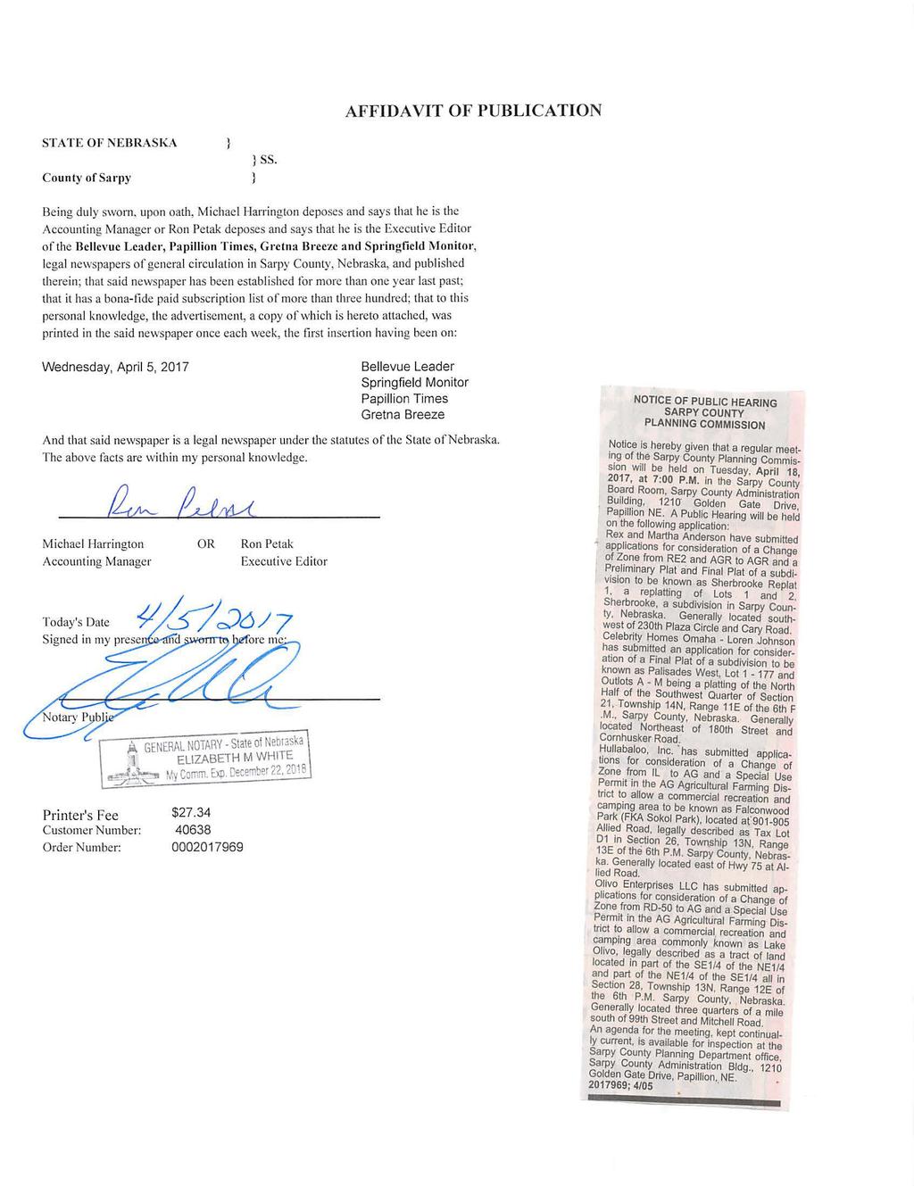
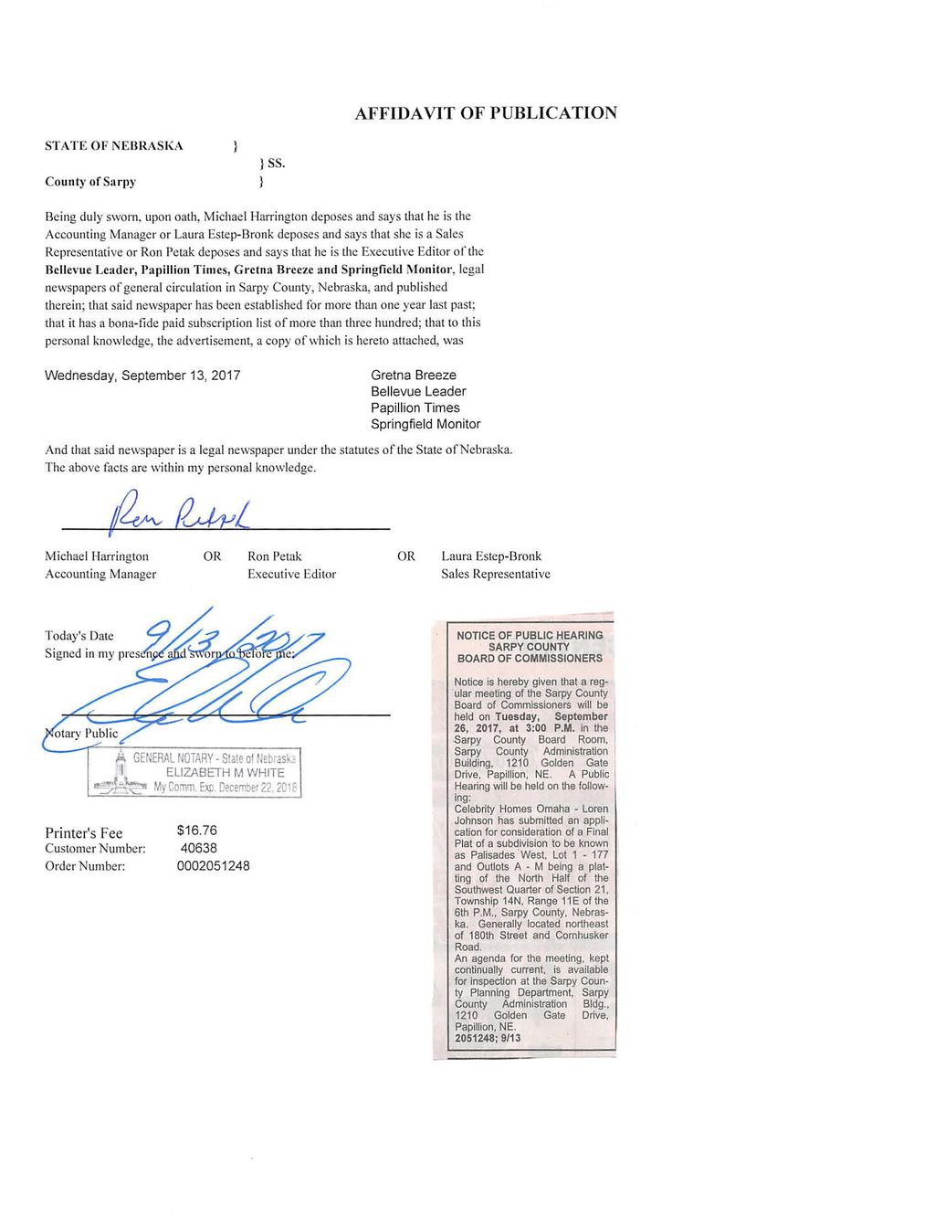
1 BOARD OF COUNTY COMMISSIONERS SARPY COUNTY, NEBRASKA APPROVE FINAL PLAT Palisades West (Lots 1-177, Outlots A - M) WHEREAS, pursuant to Neb. Rev. at , the County has the power to do all acts in relation to the concerns of the County necessary to the exercise of its corporate powers; and, WHEREAS, pursuant to Neb. Rev. at , the powers of the County as a body are exercised by the County Board of Commissioners (County Board); and, WHEREAS, the County Board has the authority to adopt Subdivision Regulations, which shall have the force and effect of law pursuant to Neb. Rev. at.' ; and, WHEREAS, said Subdivision Regulations require the County Board to approve applications for Final plats; and WHEREAS, the applicant, Celebrity Homes, Inc., applied for approval of a Final plat on property generally located on the east side of 180 th reet, approximately ¼ mile north of Cornhusker Road and legally described as follows, hereinafter the Property : N ½ of SW ¼ of Section 21, Township 14N, Range 11E of the 6 th P.M., Sarpy County, Nebraska. WHEREAS, the Sarpy County Planning Department staff reviewed the application of the Final plat of a subdivision to be known as Palisades West (Lots 1-177, Outlots A - M) for compliance with the Subdivision Regulations and made a recommendation of approval as noted in Exhibit A, attached hereto and incorporated by reference, which Exhibit A includes the Planning Department reports, the aerial map of the Property and a copy of the Final plat of the subdivision to be known as Palisades West (Lots 1-177, Outlots A - M). NOW, THEREFORE, BE IT RESOLVED BY THE SARPY COUNTY BOARD OF COMMISSIONERS THAT this County Board makes the following findings of fact: I. A public hearing regarding the approval of the Final plat was held on April 18, 2017, before the Sarpy County Planning Commission. The Planning Commission provided their recommendation to the County Board. II. A public hearing regarding the approval of the Final plat was held by this County Board. III. Notice of each of the public hearings described above was published at least ten (10) days prior to each respective public hearing and the proof of publication has been filed in the Office of the Sarpy County Clerk. IV. The Planning Department staff recommends approval. Resolution FP -Palisades West (Lots 1-177, Outlots A - M) Sept 2017
 is in conformity with the Zoning Regulations, the Subdivision Regulations, and the Sarpy")


2 V. The proposed Final plat of a subdivision to be known as Palisades West (Lots 1-177, Outlots A - M) is in conformity with the Zoning Regulations, the Subdivision Regulations, and the Sarpy County Comprehensive Plan. BE IT FURTHER RESOLVED THAT the Final Plat of a subdivision to be known as Palisades West (Lots 1-177, Outlots A - M) and as further described in the attached Exhibit A is hereby approved subject to the comments within the Planning Department report. The above Resolution was approved by a vote of the Sarpy County Board of Commissioners at a public meeting duly held in accordance with applicable law on the 26th day of, September Attest SEAL Sarpy County Board Chairman County Clerk Resolution FP -Palisades West (Lots 1-177, Outlots A - M) Sept 2017
3
4
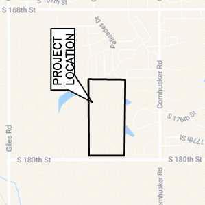
5 Sarpy County Board of Commissioners Exhibit A Planning Department Report County Board Meeting Date: September 26, 2017 Subject Type By Approval of a Final Plat of a Subdivision to be known as Palisades West Lots and Outlots A-M inclusive, located on the east side of 180 th reet, approximately ¼ mile north of Cornhusker Road. Public Hearing and Resolution Bruce Fountain, AICP, EDFP Director, Planning & Building I. GENERAL INFORMATION II. A. APPLICANT: Celebrity Homes Omaha Loren Johnson L reet Omaha, NE B. PROPERTY OWNER: Celebrity Homes Omaha L reet Omaha, NE C. SUBJECT PROPERTY LOCATION: Subject property is located on the east side of 180 th reet, approximately ¼ mile north of Cornhusker Road D. LEGAL DESCRIPTION: N ½ of SW ¼ of Section 21, Township 14N, Range 11E of the 6 th P.M., Sarpy County, Nebraska. E. SUBJECT PROPERTY SIZE: approximately 80 acres F. EXISTING FUTURE LAND USE AND ZONING DESIGNATIONS: Future Land Use Designation: Urban Residential (2005 Sarpy County Comp. Plan) Zoning: currently (Agricultural); A Change of Zone application was approved by the County Board for this property on February 14, 2017 (Resolution ) designating it RS-72 (Single-family Residential) to become effective with the approval and filing of the Final Plat. G. REQUESTED ACTION(S): Approval of a Final Plat of a Subdivision to be known as Palisades West. BACKGROUND INFORMATION A. EXISTING CONDITION OF SITE: Farmstead with agricultural accessory buildings and tillable farm ground.
6 III. B. GENERAL VICINITY FUTURE LAND USE (FLU) AND CURRENT ZONING (CZ) DIRECTION FROM SUBJECT PROPERTY NORTH FUTURE LAND USE DESIGNATION (reference attached map) Based on previous 2005 Comprehensive Plan in effect when application was submitted Urban Residential & Park/School CURRENT ZONING DESIGNATION (reference attached map) SOUTH Urban Residential RS-100 & RS-72 EAST Urban Residential RD-50 WEST Civic and Urban Residential RD-50 = Two-family residential (5,000 sq. ft. minimum lot size) RS-72 = Single-family residential (7,200 sq. ft. minimum lot size) RS-100 = Single-family residential (10,000 sq. ft. minimum lot size) = Agricultural (20 plus acres) SURROUNDING DEVELOPMENT Farmsteads with tillable farm ground; Future NRD WP-2 dam site Tiburon - single-family residential subdivision w/golf course Palisades - single-family residential subdivision Tillable farm ground; OPPD electrical substation C. RELEVANT CASE INFORMATION: The Final Plat application is consistent with the approved Preliminary Plat and proposes 177 single-family lots and 13 outlots. Development will be served with utilities as follows: water by MUD, natural gas by Black Hills Energy, sanitary sewer by City of Gretna, and electrical power by OPPD. Proposed access points to the subdivision are as follows: One access point from 180 th reet on the west One access point from Palisades Drive to the east No access is available to the south due to the existing Tiburon Golf Course development A traffic analysis of the subdivision and access to 180 th reet was conducted by Lamp Rynearson Associates traffic engineer. A copy of that analysis memo is attached for your information. D. APPLICABLE REGULATIONS: 2005 Sarpy County Comprehensive Development Plan Sarpy County Zoning Regulations Section 15, RS-72 Single-family Residential District Sarpy County Subdivision Regulations ANALYSIS / STAFF COMMENTS A. COMPREHENSIVE PLAN: The 2005 Sarpy County Comprehensive Plan, under which this application was submitted shows the area as UR - Urban Residential. The proposed development is consistent with this future land use designation. The recently adopted 2017 Sarpy County Comprehensive Plan designates the property as LMDR Low to Medium Density Residential. This application is also consistent with the new plan s designation.
7 B. OTHER ENCY REVIEW/COMMENTS: The applications were sent to various jurisdictional agencies and departments within Sarpy County that may have an interest. Comments received are attached for your review. Should any additional comments be received, they will be provided to you at the public hearing. IV. C. GENERAL COMMENTS: Final Plat - The Final Plat application is proposing 177 single-family dwelling lots. The development also has proposed 13 outlots that will serve as wetlands, drainage areas, storm water detention, and future NRD dam site/park area. - Pursuant to Section a 20 foot landscape buffer is provided along the 180 th reet frontage. A detailed landscape plan for this area has also been submitted with the Final Plat application. - The applicant needs to continue to coordinate with the NRD on the future proposed NRD Dam site and issues such as utilities and land acquisition. - Palisades Drive will generally connect 168 th reet to 180 th reet, and therefore may act more as a local collector street than a local interior road. This issue should be reviewed and traffic calming practices may need to be discussed and/or implemented. Sarpy County Public Works Department will not recommend approval of ALL-WAY stop sign configurations for the purposes of traffic calming. Applicant has agreed to implement traffic calming practices along Palisades Drive. - The applicant has provided a final sidewalk/trail layout which shows a 5 wide sidewalk along the south side of Palisades Drive which will provide connections to the Palisades neighborhood to the east and to a potential future trail along 180 th reet. A 10 wide trail is also shown running from Palisades Drive north through Outlots H and G and connecting to future trails around the planned NRD dam site/park area. An additional 10 wide trail is shown running from S. 177 th reet east through Outlot C and connecting to future trails around the planned NRD dam site/park area as well. - Applicant has uploaded the Post Construction ormwater Management Plan to the Omaha Permix Website and is awaiting review and approval. - A final Wastewater Sewer Agreement with the City of Gretna has been approved and a copy of the Agreement has been submitted to the Sarpy County Planning Department. PLANNING COMMISSION RECOMMENDATION: The Planning Commission held public hearings on these applications at their April 18, 2017 meeting and recommended APPROVAL to the County Board. MOTION: Giff moved, seconded by Korth, to recommend APPROVAL of the Final Plat of a subdivision to be known as Palisades West, Lot and Outlots A M inclusive), subject to the comments contained within the Planning Department s Recommendation Report. This recommendation is being made as the Final Plat is consistent with the approved Preliminary Plat and meets the requirements of the Sarpy County Zoning and Subdivision Regulations. Ballot: Ayes Torczon, George, Ackley, Huddleston, Giff, Korth, Malmquist, and Lichter. Nays: None. Absent: Sotak, Davis and Whitfield. Motion carried.
8 V. STAFF RECOMMENDATIONS: VI. VII. aff recommends APPROVAL of the Final Plat of a subdivision to be known as Palisades West (Lots inclusive and Outlots A through M inclusive), subject to the comments contained herein, as the proposal is consistent with the approved Preliminary Plat and meets the requirements of the Sarpy County Zoning and Subdivision Regulations. ATTACHMENTS TO REPORT: 1. Final Plat Exhibit 2. Traffic Analysis Memo from Matthew Kruse, PE, PTOE 3. Comments Received 4. Vicinity Map - Current Zoning (showing subject property area) 5. Future Land Use Map (Development ructure Plan Figure 5.1 of the 2005 Sarpy County Comprehensive Plan) COPIES OF REPORT SENT TO: 1. Loren Johnson, Celebrity Homes of Omaha (Applicant) 2. Aaron Grote, Lamp, Rynearson & Associates (Applicant s Agent) 3. Public Upon Request
9
10 INTEROFFICE MEMORANDUM TO: JOHN COOLIDGE, PE FROM: MATTHEW KRUSE, PE, PTOE SUBJECT: PALISADES WEST 180 TH STREET ACCESS DATE: APRIL 6, 2017 CC: AARON GROTE, PE Summary: This report analyzes the impact of a second entrance to 180 th reet from the new 196 lot subdivision Palisades West. Only 20% of the new traffic generated would use this second intersection. When the system was modeled with a single entrance, there are no anticipated capacity or safety concerns for the present year or future year scenarios. A second entrance creates an additional conflict point along 180 th reet which isn t preferred for a major roadway. Based on these factors, the findings of this analysis shows no need for the second access along 180 th reet for the Palisades West development. Report: Lamp Rynearson was asked to provide traffic analysis for the proposed Palisades West development proposed to be located on the east side of 180 th reet and ¼ mile north of Cornhusker Road. The Palisades West development is currently planned to have approximately 196 single family lots. The current layout for the proposed development has two access points one to the west that intersects with 180 th reet and one to the east that is proposed to tie into the existing Palisades Drive. The proposed access along 180 th reet is approximately 1,450 feet north of Cornhusker Road and Palisades Drive, the roadway proposed for the east access to tie into, continues east to 168 th reet. As part of the platting process an additional access point has been mentioned for the development. This access would be located also along 180 th reet and approximately 700 feet to the north of the other proposed 180 th reet access point. Lamp Rynearson was asked to complete analysis regarding traffic generated from the proposed development and the proposed layout. The current layout has 196 single family lots planned as part of the development. Based on the amount of single family lots, the following traffic is anticipated to be generated from the entire development: Average Daily Traffic: 1951 trips AM Peak Hour Traffic: 147 total trips (37 entering, 110 exiting) PM Peak Hour Traffic: 193 total trips (122 entering, 71 exiting)
11 With the current proposed layout and the relation of the development within the surrounding roadway networks, it is estimated that approximately 20% of the traffic generated would use Palisades Drive to access 168 th reet. The remaining 80% of the traffic generated from the site is anticipated to use 180 th reet. Using these percentages the amount of traffic in the AM peak using 180 th reet would be 118 vehicles, 30 entering vehicles and 88 exiting vehicles. In the PM peak hour the amount of traffic generated from the site using 180 th reet is estimated to be a total 154 vehicles, 98 entering and 56 exiting vehicles. With the current trip distribution of the traffic on 180 th reet, 180 th reet being an existing paved road south to Highway 370, and the proposed Gretna School campus along 180 th reet south of this proposed development, a majority of the traffic using 180 th reet from the Palisades West development will be traveling to and from the south of the proposed development to the school campus and Highway 370. With this distribution, the proposed intersection of 180 th reet and Palisades Drive was analyzed in the exiting layout as the only proposed access for the development along 180 th reet. There are no anticipated capacity or safety concerns for the present year or future year scenarios with the development only having one proposed access along 180 th reet. With a second access point along 180 th reet mentioned in discussions during the platting phase, analysis was completed for the proposed Palisades West development having two access points along 180 th reet. The second access point would be approximately 700 feet north of the proposed Palisades Drive intersection. Given the current proposed layout, this second access point would serve approximately 40 lots, or twenty percent of the development, at the most. It is highly likely that not all of the 40 lots would only use this access point, thus the amount of traffic using this intersection would be less than 20 percent of the overall estimated traffic. As was previously mentioned, the majority of traffic on 180 th reet from the proposed Palisades West development is anticipated to be heading to and from the south of the development. 180 th reet is a major arterial and will continue to see increase of traffic and development along the corridor in this vicinity, a second access from the development would in turn add an additional conflict point along 180 th reet which isn t preferred for a major roadway. This second access would actually increase the amount of traffic traveling on 180 th reet past the proposed Palisades Drive intersection and in turn could lead to potentially more conflicts at the Palisades Drive intersection. The location of the second possible access point is also shown to align with the OPPD property on the west of 180 th reet. There is the potential for when the undeveloped land on the west side of 180 th reet and south of this OPPD property develops that another access could be proposed between the two possible access points for Palisades West, which creates more possible conflict points along 180 th reet. 2
12 Conclusion: Based on these factors, the findings of this analysis shows no need for the second access along 180 th reet for the Palisades West development and would recommend only one access be allowed for the development along 180 th reet as opposed to two access points. The analysis supports the current proposed layout of Palisades West with only one access along 180 th reet at the proposed Palisades Drive intersection. If you have any questions or comments, please let me know. 3

13
14

15

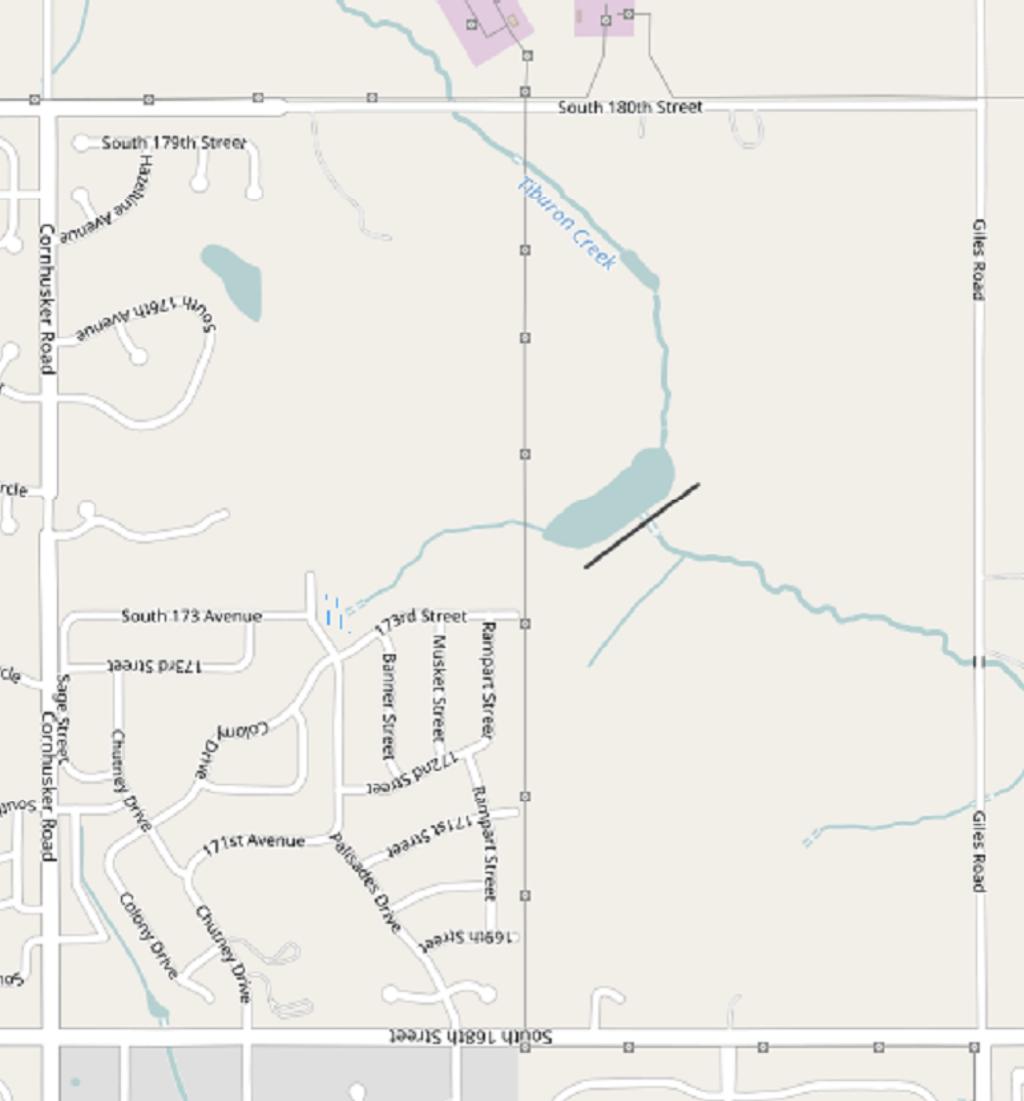
16 S 180th S 173rd Ave S 173rd S 168th RE2 Heather Virginia Cary Ave S 168th Portal Giles Rd Cary Plz Virginia Plz BG Rose Lane Rd RE1 Subject Property (Outlined in red) Aurora Centennial Rd S 169th Meridian RS-72 RE2 RD-50 Loop RD-50 S 179th Sawgrass Cir S 179th Ave Bel Air Cir S179th S 178th Pebble Cir S177th Colonial Ave Ave S 176th Troon Cir Pinehurst Cir Ventana Cir Riviera Dr S 175th Cir RS-72 RS-100 Riviera Dr Pa S 173 rd lisades Dr Soldier RD-50 Sage S 172nd Camp S 171st Greenfield S 167th Plz S 167th S 179th Hazeltine Ave Grenelefe Ave Camelback Ave Prestwick Ave Spygl ass Dr RS-100 S 176th S17 5th Cir Rampart Musket Banner S 173rd Cir S 172nd Colony Dr S 172nd Gretna Cypress RD-50 t Oakmon S 172nd Cir S 171st Ave S 170th S 170th Cir Springfield S 169th BG A venue Cir S 168th Cornhusker Rd S168th Ave La Vista Papillion RE1 Cinnamon Dr RE1 Chutney Dr Tarragon Cir Sage RS-100 Cheyenne Rd Bellevue S168th Ave Longbow Ca n Ty on rl Loop Vicinity Map - Current Zoning North ½ of the SW ¼ of (parcel # ) Northeast of 180th reet and Cornhusker Road Palisades West
17 S 180th S S 173rd Ave S 171s S 168th 165th Ave Robin Dr h S185t S 180th Giles Rd Heather S 169th S 1 68th Ave Cary Aurora Meridian S 167th S 167th Plz S Virginia Pl z S 166th S 165th Virginia Portal S 164th S 163rd Lo op S t Rampart Musket S 171st S 170th Cinnamon Dr Subject Property (Outlined in blue, Urban Residential) S 1 73rd Banner S 172nd Palisades Dr S 179th Hazeltine Ave S 176th Ave 175th Cir t Ave Colony Dr Chutney Dr Sage S 163rd Ave Cornhusker Rd S 176th Current FLU - Sarpy Co Miles North ½ of the SW ¼ of (parcel # ) Northeast of 180th reet and Cornhusker Road Palisades West Legend Highway Corridor Overlay Land Use Proposed Bellevue Future Growth Business Park Civic Conservation Residential Estate Residential Greenway Industrial Light Industrial/orage LongbowLoop Long Term Residential Growth Mixed Use Mixed Use Center New Richfield Village Park/School Site Pflug Interchange Development Residential - Community Systems Urban Residential Urban Residential II Comprehensive Development Plan Figure 5.1: Development ructure Plan Sarpy County, Nebraska Cross County Arterial City Limit City ETJ Amended
BOARD OF COUNTY COMMISSIONERS SARPY COUNTY, NEBRASKA
 2017-200 BOARD OF COUNTY COMMISSIONERS SARPY COUNTY, NEBRASKA RESOLUTION: SPECIAL USE PERMIT Robert Kyle Hibbitts Lot 12 Meadow Oaks Replat 1, (20407 Meadow Ridge Drive) Sarpy County, Nebraska WHEREAS,
BOARD OF COUNTY COMMISSIONERS SARPY COUNTY, NEBRASKA
 BOARD OF COUNTY COMMISSIONERS SARPY COUNTY, NEBRASKA 2018-324 RESOLUTION: SPECIAL USE PERMIT HAROLD AND SUSAN KEEFER 10302 Platteview Road, Sarpy County, Nebraska WHEREAS, pursuant to Neb. Rev. Stat. 23-104,
RECOMMENDATION REPORT
 ARPY COUNTY PLANNING & BUILDING DEPARTMENT RECOMMENDATION REPORT CHANGE OF ZONE (CZ 17-010) PRELIMINARY PLAT (PP 17-009) FINAL PLAT (FP 17-013) DIVINE HEPHERD APPLICANT: DIVINE HEPHERD LUTHERAN CHURCH
SARPY COUNTY PLANNING COMMISSION MINUTES OF MEETING. December 18, 2018
 SARPY COUNTY PLANNING COMMISSION MINUTES OF MEETING l. CALL MEETING TO ORDER A meeting of the Planning Commission of Sarpy County, Nebraska was convened in open and public session at the call of Chairman
RECOMMENDATION REPORT
 SARPY COUNTY PLANNING & BUILDING DEPARTMENT RECOMMENDATION REPORT CHANGE OF ZONE (CZ 18-003) PRELIMINARY PLAT (PP 18-005) FINAL PLAT (FP 18-004) NIELSEN ADDITION APPLICANT: RODNEY AND MAUREEN NIELSEN PLANNING
RECOMMENDATION REPORT
 SARPY COUNTY PLANNING & BUILDING DEPARTMENT RECOMMENDATION REPORT CHANGE OF ZONE (CZ 18-005) PRELIMINARY PLAT (PP 18-007) FINAL PLAT (FP 18-008) SCHOLTING ESTATES APPLICANT: DIANE SCHOLTING PLANNING COMMISSION
SARPY COUNTY PLANNING COMMISSION MINUTES OF MEETING November 21, 2017
 SARPY COUNTY PLANNING COMMISSION MINUTES OF MEETING l. CALL MEETING TO ORDER A meeting of the Planning Commission of Sarpy County, Nebraska was convened in open and public session at the call of Chairman
BOARD OF COUNTY COMMISSIONERS SARPY COUNTY, NEBRASKA RESOLUTION PRELIMINARY PLAT- LAZY R FARM (AMENDED)
") ~OII-139 BOARD OF COUNTY COMMISSIONERS SARPY COUNTY, NEBRASKA RESOLUTION PRELIMINARY PLAT- LAZY R FARM (AMENDED) WHEREAS, pursuant to Neb. Rev. Stat. 23-104 (Reissue 2007), the County has the power to
~OII-139 BOARD OF COUNTY COMMISSIONERS SARPY COUNTY, NEBRASKA RESOLUTION PRELIMINARY PLAT- LAZY R FARM (AMENDED) WHEREAS, pursuant to Neb. Rev. Stat. 23-104 (Reissue 2007), the County has the power to
BOARD OF COUNTY COMMISSIONERS SARPY COUNTY, NEBRASKA. RESOLUTION FLOOD PLAIN DEVELOPMENT Greg Ryba, Ivy Circle, Bellevue, NE
 2012-309 BOARD OF COUNTY COMMISSIONERS SARPY COUNTY, NEBRASKA RESOLUTION FLOOD PLAIN DEVELOPMENT Greg Ryba, 17302 Ivy Circle, Bellevue, NE WHEREAS, pursuant to Neb. Rev. Stat. 23-104 (Reissue 2007), the
CITY OF PAPILLION PLANNING COMMISSION STAFF REPORT FEBRUARY 26, 2014 AGENDA KINGSBURY HILLS REPLAT TWO PRELIMINARY PLAT PP
 I. GENERAL INFORMATION A. APPLICANT: Stone Creek Plaza LLC 11205 S. 150 th St., Ste. #100 Omaha, NE 68138 B. PROPERTY OWNER: BHI Development LLC 11205 S. 150 th St., Ste. #100 Omaha, NE 68138 SID 275 11440
CITY OF PAPILLION PLANNING COMMISSION STAFF REPORT MAY 31, 2017 AGENDA SHADOW LAKE 2 FINAL PLAT FP
 I. GENERAL INFORMATION CITY OF PAPILLION PLANNING COMMISSION STAFF REPORT MAY 31, 2017 AGENDA SHADOW LAKE 2 FINAL PLAT FP-17-0006 A. APPLICANT: Shadow Lake 2, LLC 15950 West Dodge Road, Suite 300 Omaha,
SARPY COUNTY PLANNING COMMISSION MINUTES OF MEETING. July 18, 2017
 SARPY COUNTY PLANNING COMMISSION MINUTES OF MEETING l. CALL MEETING TO ORDER A meeting of the of Sarpy County, Nebraska was convened in open and public session at the call of Chairman Tom Ackley at 7:00
RECOMMENDATION REPORT
 SARPY COUNTY PLANNING & BUILDING DEPARTMENT RECOMMENDATION REPORT REVISED SPECIAL USE PERMIT (SUP 18-002) CHALCO HILLS ANIMAL HOSPITAL TO ALLOW FOR NON-MEDICAL BOARDING OF ANIMALS WITHIN FACILITY PLANNING
BOARD OF COUNTY COMMISSIONERS SARPY COUNTY, NEBRASKA RESOLUTION TO APPROVE PARK LAND ACQUISITION FOR SID 297, SOUTHERN PINES
 2017-389 BOARD OF COUNTY COMMISSIONERS SARPY COUNTY, NEBRASKA RESOLUTION TO APPROVE PARK LAND ACQUISITION FOR SID 297, SOUTHERN PINES WHEREAS, Sanitary and Improvement District No. 297 of Sarpy County,
CITY OF PAPILLION PLANNING COMMISSION STAFF REPORT MAY 27, 2015 AGENDA REVISE ZONING MAP MISC
 PLANNING COMMISSION STAFF REPORT MAY 27, 2015 AGENDA REVISE ZONING MAP MISC-15-0006 I. GENERAL INFORMATION A. APPLICANT: City of Papillion 122 East Third St. Papillion, NE 68046 B. REQUESTED ACTION: Approval
RECOMMENDATION REPORT
 SARPY COUNTY PLANNING & BUILDING DEPARTMENT RECOMMENDATION REPORT SPECIAL USE PERMIT (SUP 17-008) FRANK SLADEK COMMERCIAL RECREATION AND CAMPING AREA IN THE AG/FP ZONING DISTRICT PLANNING COMMISSION HEARING
SARPY COUNTY BOARD OF ADJUSTMENT MINUTES OF MEETING May 14, 2015
 l. CALL MEETING TO ORDER SARPY COUNTY BOARD OF ADJUSTMENT MINUTES OF MEETING May 14, 2015 A meeting of the Board of Adjustment of Sarpy County, Nebraska was convened in open and public session at the call
BOARD OF COUNTY COMMISSIONERS SARPY COUNTY, NEBRASKA
 BOARD OF COUNTY COMMISSIONERS SARPY COUNTY, NEBRASKA RESOLUTION APPROVING AND AUTHORIZING EXECUTION OF THE FUNDING AGREEMENT FOR CONSTRUCTION OF HIGHWAY GRADE SEPARATION BNSF RAILWAY COMPANY CAPEHART ROAD-SARPY
CITY OF PAPILLION MAYOR AND CITY COUNCIL REPORT APRIL 3, 2018 AGENDA. Subject: Type: Submitted By: Resolution #R
 CITY OF PAPILLION MAYOR AND CITY COUNCIL REPORT APRIL 3, 2018 AGENDA Subject: Type: Submitted By: A request for a Final Plat for the property legally described as Tax Lot 3 located in the NE 1/4 of the
City of Ferndale CITY COUNCIL STAFF REPORT
 SUBJECT: Final Plat Approval DATE: January 19, 2016 FROM: Haylie Miller, Assistant Planner PRESENTATION BY: Haylie Miller City of Ferndale CITY COUNCIL STAFF REPORT MEETING DATE: January 19, 2016 AGENDA
BOARD OF COUNTY COMMISSIONERS SARPY COUNTY, NEBRASKA
 2017-199 BOARD OF COUNTY COMMISSIONERS SARPY COUNTY, NEBRASKA RESOLUTION: SPECIAL USE PERMIT Joe Olivo Lake Olivo, ¾ of a mile south of 99 th Street and Mitchell Road along the Platte River, Sarpy County,
BOARD OF COUNTY COMMISSIONERS SARPY COUNTY, NEBRASKA
 2015-440 BOARD OF COUNTY COMMISSIONERS SARPY COUNTY, NEBRASKA RESOLUTION FLOOD PLAIN DEVELOPMENT Kenneth & Sharon Meyer, 9900 S 252"d ST, Unit 39, Vencils Island, Tax Lot 12 Sec 28- T14N-R10E, Sarpy County,
BOARD OF COUNTY COMMISSIONERS SARPY COUNTY, NEBRASKA APPROVE PRELIMINARY PLAT- SUNRIDGE WEST
 2011-353 BOARD OF COUNTY COMMISSIONERS SARPY COUNTY, NEBRASKA APPROVE PRELIMINARY PLAT- SUNRIDGE WEST WHEREAS, pursuant to Neb. Rev. Stat. 23-104 (Reissue 2007), the County has the power to do all acts
BOARD OF COUNTY COMMISSIONERS SARPY COUNTY, NEBRASKA
 2013-136 BOARD OF COUNTY COMMISSIONERS SARPY COUNTY, NEBRASKA RESOLUTION: SPECIAL USE PERMIT - CHALCO HILLS ANIMAL HOSPITAL 10208 S 16S th Ave, Sarpy County, Nebraska WHEREAS, pursuant to Neb. Rev. Stat.
CITY OF PAPILLION PLANNING COMMISSION STAFF REPORT MAY 31, 2017 AGENDA REVISE ZONING MAP 2017 ANNEXATION NO. 2 MISC
 I. GENERAL INFORMATION A. APPLICANT: 122 East Third St. Papillion, NE 68046 CITY OF PAPILLION PLANNING COMMISSION STAFF REPORT MAY 31, 2017 AGENDA REVISE ZONING MAP 2017 ANNEXATION NO. 2 MISC-17-0005 B.
~ I~J<~~ n --rl. :JS\cf.-~ ~-= ='-==-_,
 2010-222 BOARD OF COUNTY COMMISSIONERS SARPY COUNTY, NEBRASKA RESOLUTION APPROVING AGREEMENT WITH OMAHA PUBLIC POWER DISTRICT FOR UNDERGROUND ELECTRICAL SERVICE TO THE SARPY COUNTY STADIUM PROJECT WHEREAS,
SARPY COUNTY PLANNING COMMISSION MINUTES OF MEETING. June 19, 2018
 SARPY COUNTY PLANNING COMMISSION MINUTES OF MEETING l. CALL MEETING TO ORDER A meeting of the Planning Commission of Sarpy County, Nebraska was convened in open and public session at the call of Chairman
RESOLUTION NO CITY OF MAPLE GROVE
 RESOLUTION NO. 18-122 CITY OF MAPLE GROVE RESOLUTION GRANTING PLANNED UNIT DEVELOPMENT CONCEPT STAGE PLAN, PLANNED UNIT DEVELOPMENT - DEVELOPMENT STAGE PLAN, AND PRELIMINARY PLAT FOR TERRITORIAL GREENS
CITY OF PAPILLION PLANNING COMMISSION STAFF REPORT DECEMBER 17, 2014 AGENDA
 CITY OF PAPILLION PLANNING COMMISSION STAFF REPORT DECEMBER 17, 2014 AGENDA PAPILLION JUNIOR HIGH SOUTH PAPILLION REPLAT 1 PRELIMINARY PLAT, FINAL PLAT & SPECIAL USE PERMIT PP-14-0007; FP-14-0012; SUP-14-0005
BOARD OF COUNTY COMMISSIONERS SARPY COUNTY, NEBRASKA
 217-312 BOARD OF COUNTY COMMISSIONERS SARPY COUNTY, NEBRASKA RESOLUTION FLOOD PLAIN DEVELOPMENT Ryan Steele with Cornerstone Storage LLC, 8787 S 192 nd Street, (Lot 1, Red Addition), Sarpy County, NE WHEREAS,
BOARD OF COUNTY COMMISSIONERS SARPY COUNTY, NEBRASKA
 2017-309 BOARD OF COUNTY COMMISSIONERS SARPY COUNTY, NEBRASKA RESOLUTION FLOOD PLAIN DEVELOPMENT Nebraska Game and Parks, River Access Point at 21502 S Highway 31, (Tax Lot O, 12-12-10), Sarpy County,
WHEREAS, the staff of The Maryland-National Capital Park and Planning Commission recommended APPROVAL of the application with conditions; and
 R E S O L U T I O N WHEREAS, Redeemed Christian Church of God is the owner of a 2.83-acre parcel of land known as Lot 9, Lot 19, P/O Lot 1 and P/O Lot 18, Block B, Plat Book A, Plat 5, said property being
RECOMMENDATION REPORT
 SARPY COUNTY PLANNING & BUILDING DEPARTMENT RECOMMENDATION REPORT CHANGE OF ZONE (CZ 17-007) SPECIAL USE PERMIT (SUP 17-003) JOE OLIVO FOR OLIVO ENTERPRISES COMMERCIAL RECREATION AND CAMPING AREA IN THE
April 19, Planning and Land Development Regulation Commission (PLDRC)
") Page 1 of 15 GROWTH AND RESOURCE MANAGEMENT DEPARTMENT PLANNING AND DEVELOPMENT SERVICES DIVISION 123 W. Indiana Avenue, DeLand, FL 32720 (386) 736-5959 PLDRC HEARING: CASE NO: SUBJECT: LOCATION: APPLICANT:
Page 1 of 15 GROWTH AND RESOURCE MANAGEMENT DEPARTMENT PLANNING AND DEVELOPMENT SERVICES DIVISION 123 W. Indiana Avenue, DeLand, FL 32720 (386) 736-5959 PLDRC HEARING: CASE NO: SUBJECT: LOCATION: APPLICANT:
RECOMMENDATION Following the public hearing, consider Zoning Case PD14-16, with a Development Plan.
 Staff Report Zoning Case PD14-16 (Helzer Tract) Planning and Zoning Meeting Date: 12-17-14 Document Being Considered: Ordinance RECOMMENDATION Following the public hearing, consider Zoning Case PD14-16,
BOARD OF ADJUSTMENT MEETING March 22, 2018 SUBJECT:
 SARPY COUNTY, NE BOARD OF ADJUSTMENT STAFF REPORT VARIANCE REQUEST FROM SANITARY & IMPROVEMENT DISTRICT #261 BOARD OF ADJUSTMENT MEETING March 22, 2018 SUBJECT: Application # BOA 18-001: Variance of the
CITY OF PAPILLION PLANNING COMMISSION STAFF REPORT DECEMBER 13, 2017 AGENDA LINCOLN WAY PRELIMINARY PLAT & CHANGE OF ZONE PP ; CZ
 I. GENERAL INFORMATION CITY OF PAPILLION PLANNING COMMISSION STAFF REPORT DECEMBER 13, 2017 AGENDA LINCOLN WAY PRELIMINARY PLAT & CHANGE OF ZONE PP-17-0013; CZ-17-0017 A. APPLICANT: Jeff Elliott 17007
CITY OF PAPILLION PLANNING COMMISSION STAFF REPORT NOVEMBER 18, 2015 AGENDA BUCKY S CONVENIENCE STORES SPECIAL USE PERMIT SUP
 I. GENERAL INFORMATION A. APPLICANT: Jeffery Guyette 7315 Mercy Road Omaha, NE 68124 CITY OF PAPILLION PLANNING COMMISSION STAFF REPORT NOVEMBER 18, 2015 AGENDA BUCKY S CONVENIENCE STORES SPECIAL USE PERMIT
CITY OF PAPILLION MAYOR AND CITY COUNCIL REPORT JUNE 19, 2018 AGENDA. Subject: Type: Submitted By: Resolution #R (Public Hearing)
") CITY OF PAPILLION MAYOR AND CITY COUNCIL REPORT JUNE 19, 2018 AGENDA Subject: Type: Submitted By: A request for a Special Use Permit to allow Automotive Rental and Sales as an accessory use on the property
CITY OF PAPILLION MAYOR AND CITY COUNCIL REPORT JUNE 19, 2018 AGENDA Subject: Type: Submitted By: A request for a Special Use Permit to allow Automotive Rental and Sales as an accessory use on the property
CITY OF PAPILLION PLANNING COMMISSION STAFF REPORT MAY 31, 2017 AGENDA I COMMERCE PRELIMINARY PLAT & CHANGE OF ZONE PP ; CZ
 I. GENERAL INFORMATION CITY OF PAPILLION PLANNING COMMISSION STAFF REPORT MAY 31, 2017 AGENDA I 80-370 COMMERCE PRELIMINARY PLAT & CHANGE OF ZONE PP-17-0003; CZ-17-0004 A. APPLICANT: Dowd Grain Co. 220
BOARD OF COUNTY COMMtSSIONERS SARPY COUNTY, NEBRASKA , APPROVE PRELIMINARY PLAT - HANSON'S LAKES REPLA T 5
 2012-113 BOARD OF COUNTY COMMtSSIONERS SARPY COUNTY, NEBRASKA, APPROVE PRELIMINARY PLAT - HANSON'S LAKES REPLA T 5 WHEREAS, pursuant to Neb. Rev. Stat. 23-104 (Reissue 2007), the County has the power to
S U B D I V I S I O N AGREEMENT
 S U B D I V I S I O N AGREEMENT THIS AGREEMENT made this 17th day of January, 2006, by and between Peachtree Properties, L.L.C., (hereinafter referred to as "Developer"); SANITARY AND IMPROVEMENT DISTRICT
Boyd moved, seconded by Doyle, to approve the Consent Agenda. Ayes: Cook, Gay, Boyd, Doyle & Schram. Nays: None.
 MINUTES OF MEETING BOARD OF COUNTY COMMISSIONERS OF SARPY COUNTY, NEBRASKA May 9, 2006 A meeting of the Board of County Commissioners of Sarpy County, Nebraska was convened in open and public session at
when the following proceedings, among others were held and done, to-wit:
 STATE OF COLORADO ) COUNTY OF ADAMS ) At a regular meeting of the Board of County Commissioners for Adams County, Colorado, held at the Administration Building in Brighton, Colorado on the 2 nd day of
DeWITT CHARTER TOWNSHIP 1401 W. HERBISON ROAD, DeWITT, MI PLANNING COMMISSION MINUTES MONDAY, MARCH 6, 2006
 DeWITT CHARTER TOWNSHIP 1401 W. HERBISON ROAD, DeWITT, MI PLANNING COMMISSION MINUTES MONDAY, MARCH 6, 2006 The regularly scheduled meeting of the DeWitt Charter Township Planning Commission was called
CITY OF PAPILLION MAYOR AND CITY COUNCIL REPORT SEPTEMBER 5, 2017 AGENDA. Subject: Type: Submitted By: Ordinance #1787.
 CITY OF PAPILLION MAYOR AND CITY COUNCIL REPORT SEPTEMBER 5, 2017 AGENDA Subject: Type: Submitted By: A request for a Change of Zone from Agricultural (AG) to Rural Residential Estates (RE) for the property
CITY OF ALBERT LEA PLANNING COMMISSION ADVISORY BOARD
 CITY OF ALBERT LEA PLANNING COMMISSION ADVISORY BOARD 9/1/2015, 5:30 p.m. City Council Chambers AGENDA A. CALL TO ORDER AND ROLL CALL B. APPROVAL OF THE AGENDA C. APPROVAL OF MINUTES 1. PC Minutes from
COUNCIL ACTION FORM. 1. The City Council can approve the Preliminary Plat for Menards Ames Subdivision
 ITEM #: 49 DATE: 03-27-18 COUNCIL ACTION FORM SUBJECT: PRELIMINARY PLAT FOR MENARDS BACKGROUND: Menards Ames Subdivision is a proposed 41-acre development on SE 16 th Street just west of the Skunk River.
CITY OF PAPILLION MAYOR AND CITY COUNCIL REPORT MAY 16, 2018 AGENDA
 CITY OF PAPILLION MAYOR AND CITY COUNCIL REPORT MAY 16, 2018 AGENDA Subject: Type: Submitted By: A request to vacate the Final Plat for Prairie Queen First Subdivision, a subdivision legally described
ORDINANCE NO L02, D. Wormser/L.R. Roberts/Et. Al Page 1 of 9 Adoption Ordinance
 ORDINANCE NO. 17- AN ORDINANCE OF THE BOARD OF COUNTY COMMISSIONERS OF MARION COUNTY, FLORIDA; ADOPTING THE FOLLOWING LARGE-SCALE AMENDMENT TO THE FUTURE LAND USE MAP SERIES AND TEXT OF THE MARION COUNTY
MAJOR RESIDENTIAL AND NONRESIDENTIAL SUBDIVISIONS
 Lawrence-Douglas County MAJOR RESIDENTIAL AND NONRESIDENTIAL SUBDIVISIONS Preliminary Plats The applicant shall schedule a Pre-Application meeting with Planning Staff at least seven (7) working days prior
PLANNING COMMISSION REPORT Regular Agenda Public Hearing Item
 PC Staff Report 11/12/12 Item No. 2B- 1 PLANNING COMMISSION REPORT Regular Agenda Public Hearing Item ITEM NO. 2B: A TO GPI; 110 ACRES; E OF K-10 & N OF W 6 TH ST (MKM) : Consider a request to rezone approximately
ZRTD , Glenn Drive. M. Tyler Klein, AICP, Project Manager, Planning and Zoning John Merrithew, Acting Director, Planning and Zoning
 DEPARTMENT OF PLANNING Date of Hearing: AND ZONING STAFF REPORT # 4 BOARD OF SUPERVISORS PUBLIC HEARING SUBJECT: ELECTION DISTRICT: ZRTD-2014-0003, 22675 Glenn Drive Broad Run CRITICAL ACTION DATE: September
AGENDA ITEM. Two Separate Public Hearings relating to the Eighth Avenue S./Orange Place Enclave Annexation
 DATE PREPARED: May 20, 2015 AGENDA ITEM PREPARED BY: Marisa M. Barmby, AICP, Senior Planner Central Florida Regional Planning Council AGENDA DATE: June 1, 2015 and June 8, 2015 REQUESTED ACTION: Two Separate
MEMORANDUM. TERESA McCLISH, COMMUNITY DEVELOPMENT DIRECTOR
 MEMORAND MEMORANDUM TO: FROM: BY: PLANNING COMMISSION TERESA McCLISH, COMMUNITY DEVELOPMENT DIRECTOR MATTHEW DOWNING, PLANNING MANAGER SUBJECT: CONSIDERATION OF LOT LINE ADJUSTMENT NO. 17-005; LOCATION
PALM BEACH COUNTY PLANNING, ZONING AND BUILDING DEPARTMENT ZONING DIVISION
 PALM BEACH COUNTY PLANNING, ZONING AND BUILDING DEPARTMENT ZONING DIVISION Application No.: Z-2014-01627 Application Name: Dazco Center Control No.: 2003-00040 Applicant: 4730 Hypoluxo LLC Owners: 4730
Lincoln County Board of Commissioner s Agenda Item Cover Sheet
 Lincoln County Board of Commissioner s Agenda Item Cover Sheet Board Meeting Date: Agenda Item Type: Consent Agenda: Public Hearing: Regular Agenda: Presentation Time (est): Submitting Person: Phone Number/Ext:
Item 3 5/30/17. Mahesh Sharma, County Administrator. From: Timothy Huey, Planning Director. Date: May 22, 2017
 PLANNING & DEVELOPMENT 600 West Fourth Street Davenport, Iowa 52801-1106 E-mail: planning@scottcountyiowa.com Office: (563) 326-8643 Fax: (563) 326-8257 Item 3 5/30/17 To: Mahesh Sharma, County Administrator
RESOLUTION NO ( R)
") RESOLUTION NO. 2013-06- 088 ( R) A RESOLUTION OF THE CITY COUNCIL OF THE CITY OF McKINNEY, TEXAS, APPROVING THE LAND USE ASSUMPTIONS FOR THE 2012-2013 ROADWAY IMPACT FEE UPDATE WHEREAS, per Texas Local
RESOLUTION NO. 2013-06- 088 ( R) A RESOLUTION OF THE CITY COUNCIL OF THE CITY OF McKINNEY, TEXAS, APPROVING THE LAND USE ASSUMPTIONS FOR THE 2012-2013 ROADWAY IMPACT FEE UPDATE WHEREAS, per Texas Local
STAFF REPORT. Planning and Zoning Case 16-20FP Staff: Michael Peterman, City Planner Date: May 23, 2016
 STAFF REPORT Planning and Zoning Case 16-20FP Staff: Michael Peterman, City Planner Date: May 23, 2016 GENERAL INFORMATION Application: Applicant: Location: Existing Land Use/Zoning: Future Land Use Designation:
RECOMMENDATION REPORT
 SARPY COUNTY PLANNING & BUILDING DEPARTMENT RECOMMENDATION REPORT SPECIAL USE PERMIT (SUP 8-008) TO ALLOW FOR COMMERCIAL RECREATIONAL AREA IN THE AG ZONING DISTRICT FOR AN ANNUAL HAUNTED ATTRACTION KNOWN
CHARTER TOWNSHIP OF CALEDONIA COUNTY OF KENT, MICHIGAN. at the Township and Village Hall, 8196 Broadmoor Avenue, Caledonia, Michigan on the
 First Reading CHARTER TOWNSHIP OF CALEDONIA COUNTY OF KENT, MICHIGAN At a regular meeting of the Township Board of the Charter Township of Caledonia, held at the Township and Village Hall, 8196 Broadmoor
VILLAGE OF LAKE ZURICH ORDINANCE NO
 VILLAGE OF LAKE ZURICH ORDINANCE NO. 2018-05-257 AN ORDINANCE GRANTING APPROVAL FOR A PLANNED UNIT DEVELOPMENT, DEVELOPMENT CONCEPT PLAN, SPECIAL USE PERMITS, AND MODIFICATIONS TO THE ZONING AND LAND DEVELOPMENT
PROFFER STATEMENT FAIRFAX MARBLE & GRANITE SUMMIT AT DULLES ZRTD
 PROFFER STATEMENT FAIRFAX MARBLE & GRANITE SUMMIT AT DULLES ZRTD 2016-0009 December 13, 2016 Dulles Summit LLC, the owner (hereinafter, the "Owner") of the parcel described as Loudoun County Tax Map Number
PGCPB No File No R E S O L U T I O N
 R E S O L U T I O N WHEREAS, Jemal s Calvert II, LLC is the owner of a 1.69-acre parcel of land known as Greenhorne & O Mara s Addition to Riverdale Gardens, Parcel 1, said property being in the 19th Election
Agenda Information Sheet
 Page 90 Agenda Information Sheet December 13, 2018 Agenda Item Z-18-10 - Conduct a public hearing and consider approval of an ordinance rezoning a 33.4 tract of land out of the H. Teal Survey Abstract
Regular Agenda / Public Hearing for Board of Commissioners meeting May 4, 2016
 Kent Goldthorpe, President Paul Woods, Vice President Rebecca W. Arnold, Commissioner Sara M. Baker, Commissioner Jim D. Hansen, Commissioner TO: FROM: ACHD Board of Commissioners & Bruce S. Wong, Director
CITY OF PALMDALE. REPORT to the Mayor and Members of the City Council from the City Manager
 CITY OF PALMDALE REPORT to the Mayor and Members of the City Council from the City Manager DATE: SUBJECT: May 4, 2016 Adopt Resolution No. CC 2016-055, a Resolution of the City Council of the City of Palmdale
Marion County Board of County Commissioners
 Marion County Board of County Commissioners Date: 6/4/217 P&Z: 9/25/217 BCC Transmittal: 1/17/217 BCC Adopt: TBD Amendment No: 217-L6 Type of Application Large-Scale Comp Plan Amendment Request: Change
BOARD OF COUNTY COMMISSIONERS SARPY COUNTY, NEBRASKA APPROVE PRELIMINARY PLAT- PEBBLEBROOKE
 2011-333 BOARD OF COUNTY COMMSSONERS SARPY COUNTY, NEBRASKA APPROVE PRELMNARY PLAT- PEBBLEBROOKE WHEREAS, pursuant to Neb. Rev. Stat. 23-104 (Reissue 2007), the County has the power to do all acts in relation
STAFF REPORT. Raymond Management Company 8333 Greenway Blvd, Suite 2000 Middleton, WI 53562
 STAFF REPORT Planning and Zoning Case 16-26FDP Staff: Katherine Sharp, Assistant Director of Planning & Development Date: June 27, 2016 GENERAL INFORMATION Application: Applicant: Location: Site Acreage:
CITY OF WEST PALM BEACH PLANNING BOARD Meeting Date: July 17, 2018 Planning Board Case No. 1670I
 CITY OF WEST PALM BEACH PLANNING BOARD Meeting Date: July 17, 2018 Planning Board Case No. 1670I Palms Gateway Commercial Planned Development (CPD) Southeast Corner of Belvedere Road and Australian Avenue
BOARD OF COUNTY COMMISSIONERS SARPY COUNTY, NEBRASKA
 2018-124 BOARD OF COUNTY COMMSSONERS SARPY COUNTY, NEBRASKA RESOLUTON: SPECAL USE PERMT FOR COMMERCAL RECREATONAL AREA Tasting event VALA S PUMPKN PATCH; 12102 S 180 th Street WHEREAS, pursuant to Neb.
LARAMIE COUNTY PLANNING & DEVELOPMENT DEPARTMENT
 LARAMIE COUNTY PLANNING & DEVELOPMENT DEPARTMENT Planning Building MEMORANDUM TO: FROM: Laramie County Planning Commission Bryan Nicholas, Associate Planner DATE: April 11, 2019 TITLE: Review and action
TOWNSHIP OF SOLON COUNTY OF KENT, MICHIGAN. The following preamble and ordinance were offered by Member Poulsen and seconded by ORDINANCE NO.
 Final TOWNSHIP OF SOLON COUNTY OF KENT, MICHIGAN At a regular meeting of the Township Board of the Township of Solon, Kent County, Michigan, held at the Township Hall, 15185 Algoma Avenue, N.E., Cedar
PLAINFIELD CHARTER TOWNSHIP COMMUNITY DEVELOPMENT DEPARTMENT PLANNING, ZONING & BUILDING SERVICES MEMORANDUM
 PLAINFIELD CHARTER TOWNSHIP COMMUNITY DEVELOPMENT DEPARTMENT PLANNING, ZONING & BUILDING SERVICES 6161 BELMONT AVENUE N.E. BELMONT, MI 49306 PHONE 616-364-1190 FAX: 616-364-1170 www.plainfieldchartertwp.org
Department of Planning & Development Services
 Department of Planning & Development Services S T A F F R E P O R T June 9, 2015 CASE NO: ZA15-048 PROJECT: Preliminary Plat for Southlake Town Square Phase IV (Granite Place) EXECUTIVE SUMMARY: Cooper
BOARD OF COUNTY COMMISSIONERS DATE: October 8, 2013 AGENDA ITEM NO. 20v-C,
 BOARD OF COUNTY COMMISSIONERS DATE: October 8, 2013 AGENDA ITEM NO. 20v-C, Consent Agenda D Regular Agenda D Public Hearing ~ County Administrator's Signature".\~ Vf7 ~,_,v Subject: Proposed Regular Amendments
NOTICE OF A REGULAR MEETING OF THE ENID-GARFIELD COUNTY METROPOLITAN AREA PLANNING COMMISSION
 NOTICE OF A REGULAR MEETING OF THE ENID-GARFIELD COUNTY METROPOLITAN AREA PLANNING COMMISSION Notice is hereby given that the Enid-Garfield County Metropolitan Area Planning Commission will meet in regular
There was no further discussion. Secretary Warren presented the following resolution: RESOLUTION NO
 FENTON TOWNSHIP CIVIC COMMUNITY CENTER 12060 MANTAWAUKA DRIVE, FENTON, MICHIGAN Chairperson McGuirk called the meeting to order at 7:00 p.m. Present: Cypher, Marko, McGuirk, Mustola, Tucker, Warren, Westbrook
RIVER VALE MASTER PLAN PZ CITY COUNCIL PUBLIC HEARING JULY 19, 2017 CITY OF BEND
 RIVER VALE MASTER PLAN PZ-16-0954 CITY COUNCIL PUBLIC HEARING JULY 19, 2017 RIVER VALE MASTER PLAN Master Plan process Required for developments over 20 acres Application submitted under old Master Plan
RC ; Reclassification The Garrison at Stafford Proffer Amendment (formerly Stafford Village Center)
") Board of Supervisors Robert Bob Thomas, Jr., Chairman Laura A. Sellers, Vice Chairman Meg Bohmke Jack R. Cavalier Wendy E. Maurer Paul V. Milde, III Gary F. Snellings Anthony J. Romanello, ICMA CM County
Board of Supervisors Robert Bob Thomas, Jr., Chairman Laura A. Sellers, Vice Chairman Meg Bohmke Jack R. Cavalier Wendy E. Maurer Paul V. Milde, III Gary F. Snellings Anthony J. Romanello, ICMA CM County
12. Public Hearing and Resolution : Award bid for low profile concrete deck truck scale for Landfill. Beth Cunard, Purchaser
 Regular Agenda 12. Public Hearing and Resolution 2011-178: Award bid for low profile concrete deck truck scale for Landfill. Beth Cunard, Purchaser MOTION: After a public hearing, Nekuda moved, seconded
Town of Onalaska. A scale map depicting the portion of Pineview Drive to be officially laid out as a Town highway is attached hereto as Exhibit A.
 Town of Onalaska Special Meeting Minutes for March 31, 2011 The Town Board met on site of the Pineview Road and County OT in Onalaska for the purpose of viewing the lay out of the road as required by law.
Regular Agenda / Public Hearing for Board of Commissioners meeting January 7, 2015
 Rebecca W. Arnold, Commissioner Sara M. Baker, Commissioner Jim D. Hansen, Commissioner Kent Goldthorpe, Commissioner Paul Woods, Commissioner TO: FROM: ACHD Board of Commissioners & Bruce S. Wong, Director
VILLAGE OF ORLAND PARK
 14700 Ravinia Avenue Orland Park, IL 60462 www.orlandpark.org Ordinance No: File Number: 2016-0865 ORDINANCE REZONING CERTAIN REAL ESTATE FROM E-1 ESTATE RESIDENTIAL DISTRICT TO COR MIXED USE DISTRICT
Planning Commission Application Summary
 Planning Commission Application Summary Project Name: Creekside Estates Zone Change and Land Use Amendment Address: 571 West 11400 South Current Zoning: RA1 Hearing Date: July 14, 2016 Summary of Request
ACTION FORM BRYAN CITY COUNCIL
 ACTION FORM BRYAN CITY COUNCIL DATE OF COUNCIL MEETING: July 8, 2014 DATE SUBMITTED: June 17, 2014 DEPARTMENT OF ORIGIN: Development Services SUBMITTED BY: Maggie Dalton MEETING TYPE: CLASSIFICATION: ORDINANCE:
MEMORANDUM CITY COUNCIL TERESA MCCLISH, COMMUNITY DEVELOPMENT DIRECTOR ROBIN DICKERSON, CITY ENGINEER
 MEMORANDUM TO: FROM: BY: CITY COUNCIL TERESA MCCLISH, COMMUNITY DEVELOPMENT DIRECTOR ROBIN DICKERSON, CITY ENGINEER SUBJECT: CONSIDERATION TO ADOPT RESOLUTIONS ACCEPTING EASEMENTS AND PUBLIC IMPROVEMENTS;
Camelback Village. Minor General Plan Amendment. A acre Master Planned Community Northeast of 84th Lane and Camelback Road Glendale, Arizona
 Camelback Village Minor General Plan Amendment A 14.73-acre Master Planned Community Northeast of 84th Lane and Camelback Road Glendale, Arizona 1st Submittal June 30, 2017 2nd Submittal August 29, 2017
31, Township 29 South, Range 25 East, Polk County, Florida, as depicted by the Land Use Plan attached
 ORDINANCE NO. 2013-04 AN ORDINANCE AMENDING THE ZONING MAP OF THE CITY OF BARTOW, FLORIDA, REZONING APPROXIMATELY 2. 2 ACRES OF LAND OWNED BY BALA3I OF POLK COUNTY, LLC AND LOCATED IN SECTION 31, TOWNSHIP
RS9 LB-S RSQ-S RS9 RS9 DOCKET: W2822 PROPOSED ZONING: LB EXISTING ZONING: RS-9. PETITIONER: J&J Properties of W-S, LLC, for property owned by Same
 HAYMOUNT ST RS9 IP DOCKET: W2822 PROPOSED ZONING: LB POPE RD CLEMMONSVILLE RD EXISTING ZONING: RS-9 RSQ-S LB-S OLD SALISBURY RD WINSTON-SALEM ZONING FORSYTH COUNTY ZONING PETITIONER: J&J Properties of
MINNETONKA PLANNING COMMISSION June 2, A conditional use permit for 2,328 square feet of accessory structures at 4915 Highland Road
 MINNETONKA PLANNING COMMISSION June 2, 2016 Brief Description A conditional use permit for 2,328 square feet of accessory structures at Recommendation Recommend the city council adopt the resolution approving
Regular Agenda / Public Hearing for Board of Commissioners meeting September 24, 2014
 John S. Franden, President Mitchell A. Jaurena, Vice President Rebecca W. Arnold, Commissioner Sara M. Baker, Commissioner Jim D. Hansen, Commissioner TO: FROM: ACHD Board of Commissioners & Bruce S. Wong,
CITY OF OCALA CITY COUNCIL REPORT Council Meeting Date: 06/06/17
 CITY OF OCALA CITY COUNCIL REPORT Council Meeting Date: 06/06/17 Subject: Large Scale Land Use Map Amendment Submitted By: David Boston Department: Growth Management STAFF RECOMMENDATION (Motion Ready):
PLANNING BOARD MEETING MINUTES APRIL 4, 2002
 Chairman Christian Jensen called the Planning Board meeting of April 4, 2002 to order at 8:00 p.m. announcing that this meeting had been duly advertised according the Chapter 231, Open Public Meetings
Department of Planning Services Division of Planning SARAH E. KEIFER, AICP Phone: 302/ Director of Planning Services FAX: 302/
 Kent County Department of Planning Services Division of Planning SARAH E. KEIFER, AICP Phone: 302/744-2471 Director of Planning Services FAX: 302/736-2128 KRISTOPHER S. CONNELLY, AICP Assistant Director
PLANNING COMMISSION BRIEFING ITEM Land Development Application July 24, 2018, Planning Commission Public Hearing
 PLANNING COMMISSION BRIEFING ITEM Land Development Application July 24, 2018, Planning Commission Public Hearing ZRTD-2017-0011, Loudoun Tech Center Date of Meeting: July 12, 2018 Election District: Staff
RP-2, RP-3, RP-4, AND RP-5 PLANNED RESIDENTIAL DISTRICTS
 6.10 - RP-2, RP-3, RP-4, AND RP-5 PLANNED RESIDENTIAL DISTRICTS 6.10.1 GENERAL DESCRIPTION: 6.10.1.1 The regulations established in this Section are intended to provide optional methods of land development
RESOLUTION NO
 RESOLUTION NO. 2009 233 A RESOLUTION OF THE CITY COUNCIL OF THE CITY OF ELK GROVE QUITCLAIMING A PORTION OF ABANDONED EAST STOCKTON BOULEVARD TO ELK GROVE V PARTNERS, LLC PURSUANT TO AN AGREEMENT WHEREAS,