CITY OF PAPILLION MAYOR AND CITY COUNCIL REPORT OCTOBER 2, 2018 AGENDA. Subject: Type: Submitted By:
|
|
|
- Dana Malone
- 5 years ago
- Views:
Transcription
1 CITY OF PAPILLION MAYOR AND CITY COUNCIL REPORT OCTOBER 2, 2018 AGENDA Subject: Type: Submitted By: A request for a Revised Preliminary Plat for the property legally described as a tract of land located in the S ½ of the NE ¼ of Section 35, T14N, R11E of the 6th P.M., Sarpy County, NE, generally located on the NW corner of HWY 50 and Gold Coast Rd. The applicant is Development Services Corp. (R & R Commerce Park) Resolution #R Mark A. Stursma, AICP Planning Director SYNOPSIS This is a request for a Revised Preliminary Plat for R & R Commerce Park. The Preliminary Plat is being revised from the Preliminary Plat approved by City Council on June 20, 2017 with Resolution #R under the name Crossroads Commerce Park due to a change in the configuration of South 146 th Street. The change in street alignment will impact the property to the south in that the connection to Gold Coast Road is being shifted to the west. The change will benefit the property to the south as the original location of S 146 th Street aligned with a drainageway, making a street connection more challenging and costly to construct. R & R Commerce Park is proposed to be developed as four lots and three outlots. The four lots are proposed to develop as industrial spec buildings. Such a building is currently under construction on Lot 1, R & R Commerce Park with Phase 1. The three outlots are to be utilized and maintained as follows: Outlots A and B - Post-Construction Stormwater Management to be owned and maintained by the developer, the SID, a business association, or owners of lots that have exclusive use of the outlots. Any outlots owned by the SID shall be deeded to the developer, a business association, or owners of lots that have exclusive use of the outlots prior to annexation Outlot C Wetland Mitigation to be owned by the SID shall be deeded to the developer, a business association, or owners of lots that have exclusive use of the outlot. It should be noted that the revised Outlot C (1.8 acres) is significantly reduced in size compared to Outlot C of Preliminary Plat approved by City Council (8.1 acres). Outlot C was previously proposed to be extend along the S 150 th Street right-of-way. This allowed for an increase in the size of the buildable lots. FISCAL IMPACT Estimated Valuation (95%): Proposed General Obligation Debt: Phase 1 Phase 2 Phase 3 Phase 4 Total All Phases $11,875,000 $13,062,500 $15,675,000 $17,100,000 $57,475,000 $670, $671, $739, $496, $2,578, Debt Ratio: 5.65% 5.14% 4.72% 2.90% 4.49%
2 RECOMMENDATION Approval. On 08/29/18, the Planning Commission unanimously recommended approval of the R & R Commerce Park Revised Preliminary Plat contingent upon resolution of staff comments. The conditions required to approve the Revised Preliminary Plat have been addressed. BACKGROUND In May 2001, the Sarpy County Board of Commissioners approved the Highway Crossing Final Plat. In July 2015, the Papillion City Council approved ORD #1715 for the City s 2015 Annexation and ORD #1716 to extend the City s corresponding extra-territorial jurisdiction. As a result of ORD #1716, the proposed development area is now within the City of Papillion s extra-territorial jurisdiction. In August 2015, the Schram Place Final Plat for the property to the immediately to the south was considered at Planning Commission. The applicant subsequently withdrew the application. In December 2016, City Council adopted the Sarpy County Future Land Use Map for the HWY 50 and HWY 370 Sub-Area. The proposed development is located within said sub-area. In June 2017, City Council approved the Crossroads Commerce Preliminary Plat and the related Comprehensive Plan Amendment that depicts the termination of 145th Street and 147th Street. In August 2017, the applicant formally requested the name of the project to be changed from Crossroads Commerce Park to R & R Commerce Park. In October 2017, City Council approved the R & R Commerce Park Final Plat for Phase 1. City Council also approved the Change of Zone ordinance for all phases of R & R Commerce Park. Pursuant to ORD #1775, the zoning change for each phases will only go into effect if the City Council determines that the corresponding Final Plat is consistent with the approved Crossroads Commerce Park Preliminary Plat. In February 2018, City Council approved the Large Project Special Use Permit for R & R Commerce Park. A Large Project Special Use Permit is required because the project exceeds the 30 acres and/or 400,000 square feet of building area limitations in the LI District. ATTACHMENTS: RES. #R Revised Preliminary Plat 08/29/18 Planning Commission Staff Report 08/29/18 Planning Commission minutes
3 RESOLUTION NO. R BE IT RESOLVED by the Mayor and City Council of the City of Papillion that the R & R Commerce Park Revised Preliminary Plat, formerly known as Crossroads Commerce Park, for the property legally described as a tract of land located in the S ½ of the NE ¼ of Section 35, T14N, R11E of the 6th P.M., Sarpy County, NE, generally located on the NW corner of HWY 50 and Gold Coast Road, is hereby approved. PASSED AND APPROVED THIS DAY OF, CITY OF PAPILLION, NEBRASKA Attest: David P. Black, Mayor Nicole Brown, City Clerk (SEAL)
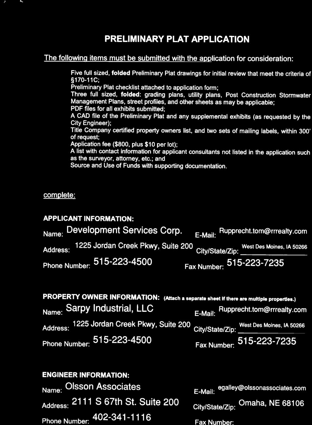
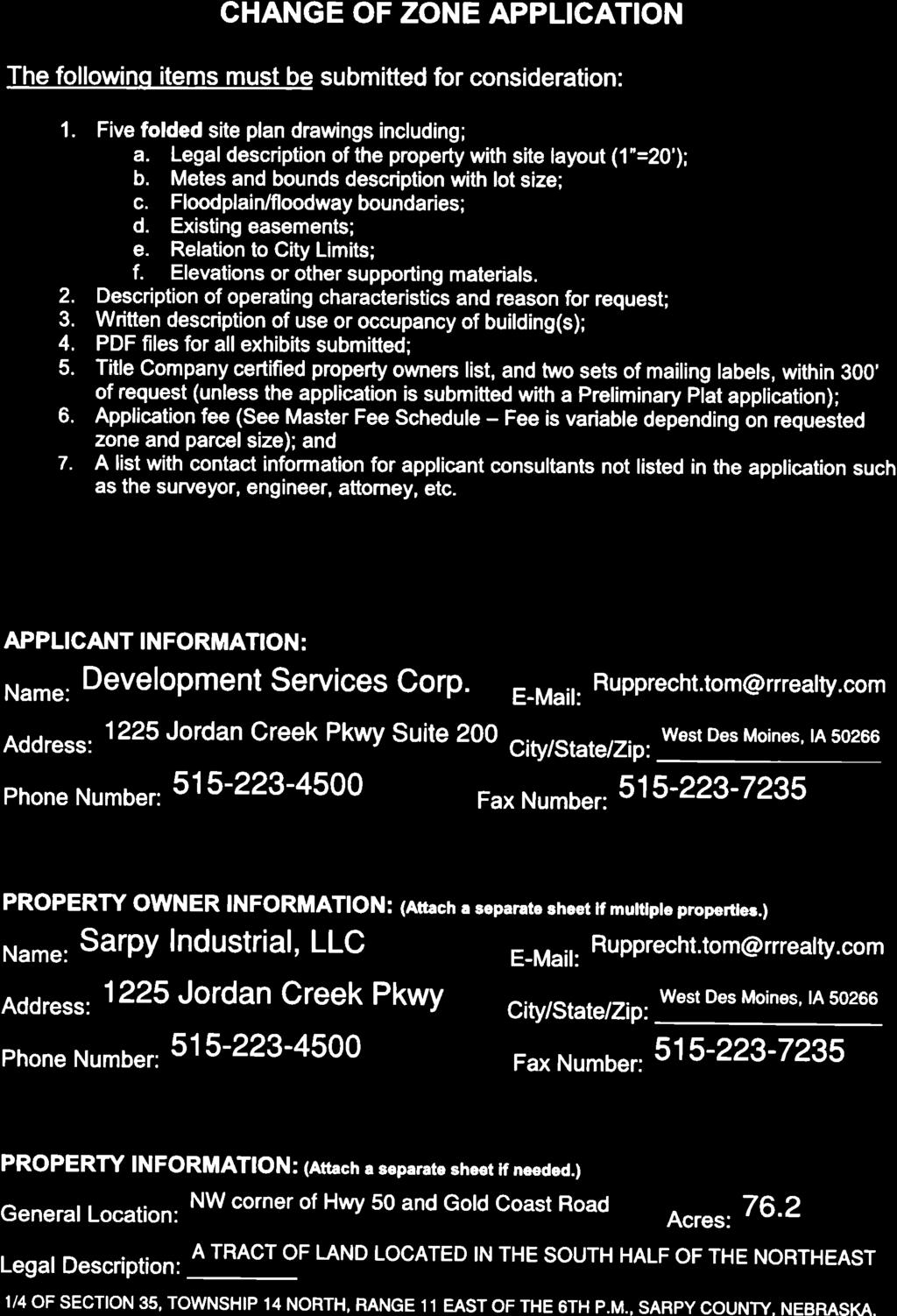
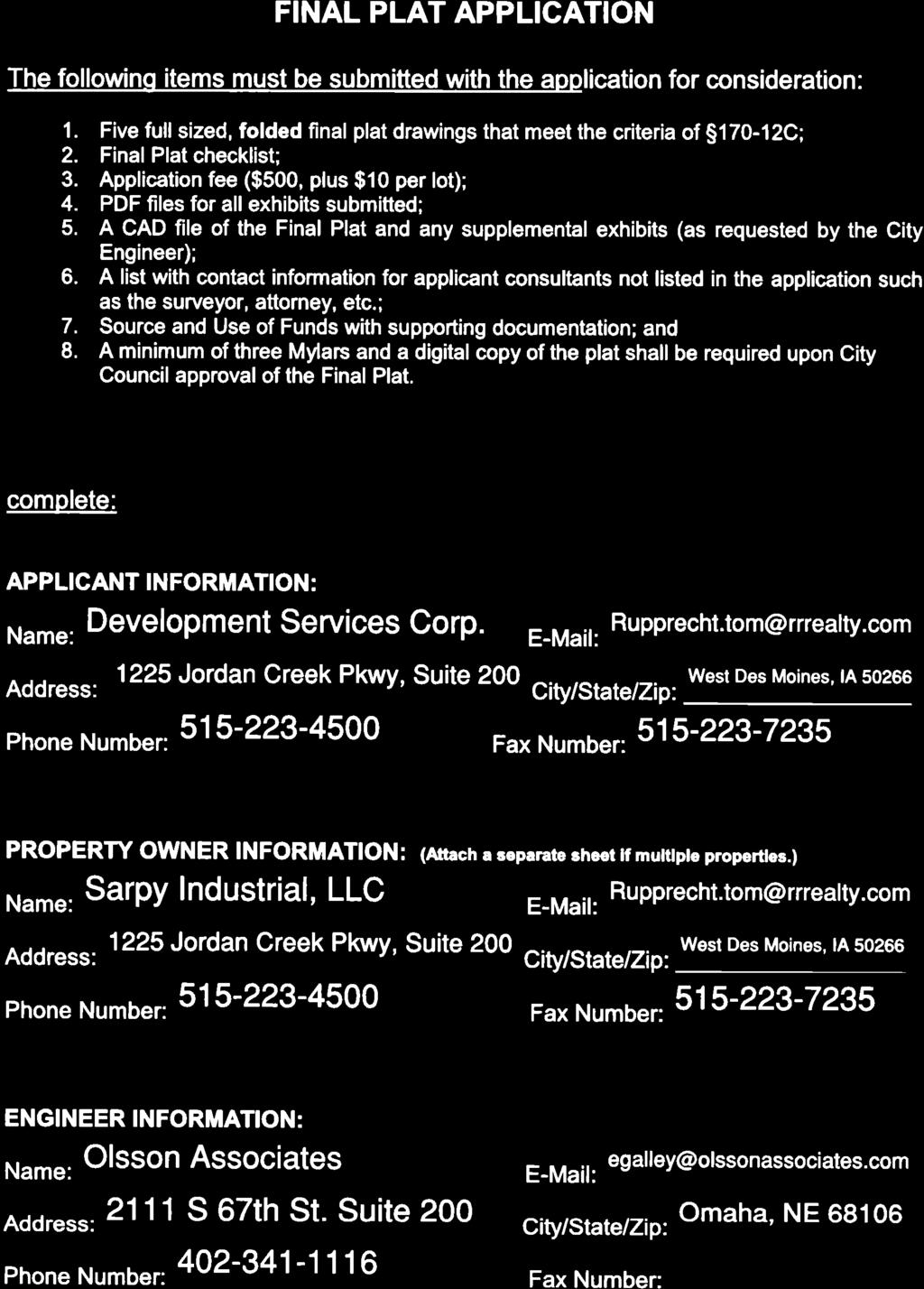
4 CITY OF PAPILLION PLANNING COMMISSION STAFF REPORT AUGUST 29, 2018 AGENDA R & R COMMERCE PARK REPLAT 1 REVISED PRELIMINARY PLAT (ALL PHASES), CHANGE OF ZONE (PHASES 2 4), & FINAL PLAT (PHASES 1 2) PP R; CZ ; FP I. GENERAL INFORMATION A. APPLICANT: Development Services Corp Jordan Creek Pkwy, Suite #200 West Des Moines, IA B. PROPERTY OWNER: Sarpy Industrial, LLC 1225 Jordan Creek Pkwy, Suite #200 West Des Moines, IA C. LOCATION: Northwest corner of HWY 50 and Gold Coast Road D. LEGAL DESCRIPTION: A tract of land located in the S ½ of the NE ¼ of Section 35, T14N, R11E of the 6th PM, Sarpy County, NE E. REQUESTED ACTION: Approval of a Revised Preliminary Plat for all Phases, a Change of Zone from AG (Agricultural) to LI (Limited Industrial) for Phases 2 4, and Final Plat for Phases 1 and 2 F. EXISTING ZONING AND LAND USE: Lot 1: Zone LI (Limited Industrial), commercial/industrial building under construction Proposed Lots 2 4: Zoned AG (Agricultural), undeveloped G. SIZE OF SITE: 76.2 acres (All Phases) II. BACKGROUND INFORMATION A. COMPREHENSIVE PLAN SPECIFICATIONS: The Future Land Use Map adopted by the City of Papillion, as amended by RES. #R for the HWY 50 and HWY 370 Sub-Area, identifies the proposed development area as Light Industrial/Storage.
5 2 B. EXISTING CONDITION OF SITE: Phase 1: A flex building is under construction. It is anticipated that the tenants will be classified as either commercial or industrial use types. Proposed Phases 2 4: Undeveloped. C. GENERAL VICINITY AND LAND USE: The area to the north consists of Highway Crossing, which is zoned LI (Limited Industrial). The area is partially developed with a mix of commercial and industrial uses. The area to the east, across HWY 50 is zoned R-4 (Multiple-Family Residential). It is identified as the future location of a Metro Community College Campus but it is currently undeveloped. The area to the west is unplatted and zoned LI (Limited Industrial). The use of the site is classified as Horticulture. The area to the south is zoned AG (Agricultural) and undeveloped. D. RELEVANT CASE HISTORY: In May 2001, the Sarpy County Board of Commissioners approved the Highway Crossing Final Plat. In July 2015, the Papillion City Council approved ORD #1715 for the City s 2015 Annexation and ORD #1716 to extend the City s corresponding extraterritorial jurisdiction. As a result of ORD #1716, the proposed development area is now within the City of Papillion s extra-territorial jurisdiction. In August 2015, the Schram Place Final Plat for the property to the immediately to the south was considered at Planning Commission. The applicant subsequently withdrew the application. In December 2016, City Council adopted the Sarpy County Future Land Use Map for the HWY 50 and HWY 370 Sub-Area. The proposed development is located within said sub-area. In June 2017, City Council approved the Crossroads Commerce Preliminary Plat and the related Comprehensive Plan Amendment that depicts the termination of 145 th Street and 147 th Street. In August 2017, the applicant formally requested the name of the project to be changed from Crossroads Commerce Park to R & R Commerce Park. In October 2017, City Council approved the R & R Commerce Park Final Plat for Phase 1. City Council also approved the Change of Zone ordinance for all phases of R & R Commerce Park. Pursuant to ORD #1775, the zoning change for each phases will only go into effect if the City Council determines that the corresponding Final Plat is consistent with the approved Crossroads Commerce Park Preliminary Plat. In February 2018, City Council approved the Large Project Special Use Permit for R & R Commerce Park. A Large Project Special Use Permit is required because the project exceeds the 30 acres and/or 400,000 square feet of building area limitations in the LI District. August 29, 2018 Planning Commission PP R/CZ /FP
6 3 E. APPLICABLE ORDINANCES AND REGULATIONS: Zoning and Subdivision Regulations and Comprehensive Plan. III. ANALYSIS AND DEVELOPMENT ALTERNATIVES STAFF COMMENTS: A. REQUEST: 1. This is a request for a Revised Preliminary Plat (for all Phases), a Change of Zone from AG (Agricultural) to LI (Limited Industrial) for Phases 2 4, and approval of a Final Plat to replat Phase 1 and plat Phase The approved Crossroads Commerce Park Preliminary Plat consists of four lots and three outlots. The revised R & R Commerce Park Preliminary Plat also consists of four lots and three outlots. A revised Preliminary Plat is required because the alignment of S 146 th Street is proposed to be changed. The change in street alignment will impact the property to the south in that the connection to Gold Coast Road is being shifted to the west. The change will benefit the property to the south as the original location of S 146 th Street aligns with a drainageway on the property to the south. 3. The Change of Zone ordinance approved with the R & R Commerce Park Final Plat for Phase 1 requires that all future phases of the subdivision be consistent with the original Preliminary Plat approved by City Council. Further, it requires a separate Change of Zone application for any Final Plat that is not consistent with said Preliminary Plat. Given that a revised Preliminary Plat is being requested to supersede the original Preliminary Plat, a Change of Zone application is required for that part of R & R Commerce Park that was not platted as part of Phase The Final Plat proposes to replat the original Lot 1 to increase the lot size, plat the lot required for Phase 2, plat Outlots A and B, and dedicate S 146 th Street. 5. Outlots A and B are proposed for Post-Construction Stormwater Management. Said outlots are to be owned and maintained by the developer, the SID, a business association, or owners of lots that have exclusive use of the outlots. Any outlots owned by the SID shall be deeded to the developer, a business association, or owners of lots that have exclusive use of the outlots prior to annexation. Provisions related to the ownership and maintenance responsibility for the outlots are details in the R & R Commerce Park Subdivision Agreement. 6. Outlot C is proposed to be platted as part of the final phase of R & R Commerce Park. Per the revised Preliminary Plat, it is reserved for wetland mitigation and will be owned by the SID shall be deeded to the developer, a business association, or owners of lots that have exclusive August 29, 2018 Planning Commission PP R/CZ /FP
7 4 use of the outlot. It should be noted that the revised Outlot C (1.8 acres) is significantly reduced in size compared to Outlot C of Preliminary Plat approved by City Council (8.1 acres). Outlot C was previously proposed to be extend along the S 150 th Street right-of-way. This allowed for an increase in the size of the buildable lots. B. LAND USE/COMPREHENSIVE PLAN: 1. The current future land use designation is Light Industrial/Storage. Industrial areas include business parks, accommodating developments that combine office, warehousing and distribution, and limited industrial uses in flex buildings, and more conventional industrial uses. (Comprehensive Plan, page 28) 2. The Highway 370 corridor west of S 114 th Street is identified as a location for office, major commercial development, and industrial development completed to high design standards. (Comprehensive Plan, Page 28) 3. In June 2017, City Council approved a Comprehensive Plan Amendment to revise the street system layout depicted on the Sarpy County Future Land Use Plan to be consistent with the proposed street layout, which includes the termination of S 145 th Street and S 147 th Street within Highway Crossing. C. TRAFFIC AND ACCESS: 1. Access to the subdivision will be provided from Gold Coast Road and S 146 th Street and possibly a future extension of S 150 th Street. A portion of Gold Coast Road was dedicated as part of Phase 1. Additional right-of-way for Gold Coast Road is being dedicated with Phase 2. Each subsequent phase is anticipated to dedicate part of Gold Coast Road. S 146 th Street will be dedicated with Phase 2. Half of the right-of-way required for S 150 th Street will be dedicated with Phase The construction of S 146 th Street is important because Highway Crossing, the subdivision to the north, essentially functions as a cul-desac. Currently, the intersection of S 150 th Street and Shepard Street is the sole point of access to the lots within Highway Crossing. S 150 th Street between HWY 370 and Shepard Street, including the intersections, has been identified as an area that needs to be reconstructed. Construction of S 146 th Street will provide an alternate travel route that will be necessary for S 150 th Street to be reconstructed. 3. Dedication of S 150 th Street and Gold Coast Road will occur with the final platting of the future phases of R & R Commerce Park. Dedication of right-of-way is not required for HWY It should be noted that the west half of right-of-way for S 150 th Street has not been dedicated. It will need to be dedicated when the property to the west is platted for redevelopment. Given that the applicant is not proposing access to S 150 th Street, the construction of S 150 th Street is August 29, 2018 Planning Commission PP R/CZ /FP
8 5 anticipated to be delayed until the abutting property develops. It is shown as part of Phase Based on Sarpy County s Internet Map Service, it appears that the south half of the right-of-way for Gold Coast Road has been dedicated. It should be noted that City Council approval is required for the dedication of right-of-way within the City of Papillion s jurisdiction pursuant to Neb. Rev. Stat (1). 6. The applicant is proposing that S 145 th Street and S 147 th Street terminate within Highway Crossing. The Highway Crossing Final Plat dedicated temporary turnaround easements at the end of S 145 th, S 146 th, and S 147 th Streets because all three streets were anticipated to extend to Gold Coast Road. The applicant shall be required to construct cul-de-sacs at the termination of both streets. An off-set culde-sac will be required for S 147 th Street. Both cul-de-sacs shall meet the requirements of the Engineering and Fire Departments. 7. As part of the original Preliminary Plat application process, the applicant provided a Traffic Impact Study (TIS) that projects the potential need for roadway improvements, turn lanes, or intersection signalization on the adjacent roadways due to the development of this land. The TIS was reviewed by a third party consultant hired by the City and by the Nebraska Department of Roads (NDOR). 8. Per Mr. Denney s analysis of the TIS: a. Gold Coast Road should be constructed from the driveway of the first building to HWY 50 as part of Phase 1. Additionally an offset southbound right-turn lane should be constructed on HWY 50 at Gold Coast Road. b. A traffic signal at HWY 50 and Gold Coast Road will be required as an opening day improvement. c. Gold Coast will be required to be extended as the buildings in the future phases are constructed. d. S 150 th Street will be required to be improved as part of the final phase. 9. Cost sharing for improvements to Gold Coast Road and S 150 th Street is addressed within the Subdivision Agreement. 10. A commitment to cost share for potential future signalization of Gold Coast Road at HWY 50 is a provision in the Subdivision Agreement. 11. Prior to construction or improvements within the right-of-way approval from Sarpy County and the City, as applicable, will be required for all public roadway improvements to S 146 th Street, S 150 th Street, and Gold Coast Road. D. WATER/SANITARY SEWER: 1. The proposed subdivision is located within Sarpy County s sewer service area and Metropolitan Utilities District s (MUD s) water service August 29, 2018 Planning Commission PP R/CZ /FP
9 6 area. As such, the developer will be required to work with those entities for sanitary sewer and water services. The obligations related to this requirement are detailed in the Subdivision Agreement. 2. The applicant will be required to enter into an agreement with Sarpy County for sanitary sewer service. Any fees that are due to Sarpy County in conjunction with the final plat shall be paid prior to signature of the final plat mylars. E. UTILITIES/EASEMENTS: 1. Standard utility easements are provided along all lot lines. 2. All proposed easements shall be by separate instruments including a prescription outlining the rights and terms of the easements. Copies of the recorded documents shall be provided to the City of Papillion. 3. Per the applicant, the easement holders for the standard utility easement have been notified that the applicant intends to request that the easements dedicated with the Final Plat for Phase 1 be released. This includes the standard utility easement along the original western boundary of Lot 1. The location of said western lot line is proposed to be shifted as part of Replat 1. F. GENERAL: 1. The applicant shall revise the Preliminary Plat as follows: a. Identify all existing easements (including standard utility easements dedicated by the Final Plat for Phase 1) with a notation that the easements are shown for reference only and are not being rededicated. b. Identify the storm sewer drainage easements required between Lots 1 and 2 to cover the storm sewer indicated on the utility exhibit. Be sure to include easements for both the flow into the basin on Outlot A and the flow out of the basin. 2. The applicant shall revise the Final Plat as follows: a. Identify all existing easements (including standard utility easements dedicated by the Final Plat for Phase 1) with a notation that the easements are shown for reference only and are not being rededicated. b. Identify the storm sewer drainage easements required between Lots 1 and 2 to cover the storm sewer indicated on the utility exhibit. Be sure to include easements for both the flow into the basin on Outlot A and the flow out of the basin. 3. The applicant shall participate in the Subdivision Agreement Amendment process and provide all necessary exhibits for said agreement amendment. IV. RECOMMENDATION The Planning Department recommends approval of the R & R Commerce Park Revised Preliminary Plat for all Phases (PP R), the R & R Commerce Park August 29, 2018 Planning Commission PP R/CZ /FP
10 7 Change of Zone for Phases 2 4 (CZ ), and the R & R Commerce Park Replat 1 Final Plat for Phases 1 2 (FP ) based on: 1. General consistency with the Comprehensive Plan as amended. 2. Compatibility with adjacent uses. 3. Compliance with the Subdivision Regulations. 4. Compliance with the Zoning Regulations. The recommendation for approval is contingent upon the applicant: 1. Revising the Preliminary Plat per Section III, F, Revising the Final Plat per Section III, F, Completing the Subdivision Agreement process. (Section III, F, 3) V. COPIES OF REPORT TO: Applicant Public upon request VI. ATTACHMENTS: Revised Preliminary Plat Application Revised Preliminary Plat Approved Preliminary Plat Change of Zone Application Final Plat Application Final Plat Aerial Report prepared by: Michelle Romeo, City Planner Derek Goff, Staff Engineer August 29, 2018 Planning Commission PP R/CZ /FP
11

12
13


14 HWY 50 R&R COMMERCE PARK LOTS 1 THRU 4 AND OUTLOTS A THRU C PRELIMINARY PLAT A TRACT OF LAND LOCATED IN THE SOUTH HALF OF THE NORTHEAST 1/4 OF SECTION 35, TOWNSHIP 14 NORTH, RANGE 11 EAST OF THE 6TH P.M., SARPY COUNTY, NEBRASKA R TEL FAX South 67th Street, Suite 200 Omaha, NE NOTE THIS DOCUMENT HAS BEEN RELEASED BY OLSSON ASSOCIATES ONLY FOR REVIEW BY REGULATORY AGENCIES AND OTHER PROFESSIONALS, AND IS SUBJECT TO CHANGE. THIS DOCUMENT IS NOT TO BE USED FOR CONSTRUCTION. VICINITY MAP NOT TO SCALE OLSSON ASSOCIATES ASSUMES NO RESPONSIBILITY FOR EXISTING UTILITY LOCATIONS (HORIZONTAL OR VERTICAL). THE EXISTING UTILITIES SHOWN ON THIS DRAWING HAVE BEEN PLOTTED FROM THE BEST AVAILABLE INFORMATION. IT IS HOWEVER THE RESPONSIBILITY OF THE CONTRACTOR TO FIELD VERIFY THE LOCATION OF ALL UTILITIES PRIOR TO THE COMMENCEMENT OF ANY CONSTRUCTION ACTIVITIES. S 150TH STREET S 146TH STREET EXISTING MUD EASEMENT INSTRUMENT NO CALL 811 SEVENTY-TWO HOURS PRIOR TO DIGGING, GRADING OR EXCAVATING FOR THE MARKING OF UNDERGROUND MEMBER UTILITIES LOT ± AC LOT ± AC LOT ± AC LOT ± AC Sheet List Table DATE REVISIONS DESCRIPTION REV. NO. 1 06/25/2018 REVISED PRELIM PLAT REVISIONS HWY 50 ZONING SETBACK TABLE OUTLOT C 1.771± AC EXISTING ZONING NOTE: OUTLOT B 1.445± AC PUBLIC ROW 5.229± AC GOLD COAST ROAD OUTLOT A 1.621± AC LEGEND PROPERTY OWNER DEVELOPER SURVEYOR ENGINEER CITY OF PAPILLION PLAT APPROVAL R&R COMMERCE PARK PRELIMINARY PLAT PAPILLION, NE 2018 ZONING SETBACK TABLE PROPOSED ZONING SURVEY CERTIFICATION drawn by: checked by: approved by: QA/QC by: project no.: drawing no.: date: CH MM EG EG C_PPT_61079.dwg SHEET C1.1

15 CROSSROADS COMMERCE PARK LOTS 1 THRU 4 AND OUTLOTS A THRU C PRELIMINARY PLAT A TRACT OF LAND LOCATED IN THE SOUTH HALF OF THE NORTHEAST 1/4 OF SECTION 35, TOWNSHIP 14 NORTH, RANGE 11 EAST OF THE 6TH P.M., SARPY COUNTY, NEBRASKA R TEL FAX South 67th Street, Suite 200 Omaha, NE NOTE THIS DOCUMENT HAS BEEN RELEASED BY OLSSON ASSOCIATES ONLY FOR REVIEW BY REGULATORY AGENCIES AND OTHER PROFESSIONALS, AND IS SUBJECT TO CHANGE. THIS DOCUMENT IS NOT TO BE USED FOR CONSTRUCTION. VICINITY MAP NOT TO SCALE OLSSON ASSOCIATES ASSUMES NO RESPONSIBILITY FOR EXISTING UTILITY LOCATIONS (HORIZONTAL OR VERTICAL). THE EXISTING UTILITIES SHOWN ON THIS DRAWING HAVE BEEN PLOTTED FROM THE BEST AVAILABLE INFORMATION. IT IS HOWEVER THE RESPONSIBILITY OF THE CONTRACTOR TO FIELD VERIFY THE LOCATION OF ALL UTILITIES PRIOR TO THE COMMENCEMENT OF ANY CONSTRUCTION ACTIVITIES. S 150TH STREET S 146TH STREET CALL 811 SEVENTY-TWO HOURS PRIOR TO DIGGING, GRADING OR EXCAVATING FOR THE MARKING OF UNDERGROUND MEMBER UTILITIES 50' HALF ROW DEDICATION 1.526± AC OUTLOT C 8.081± AC LOT ± AC LOT ± AC LOT ± AC LOT ± AC HWY 50 Sheet List Table DATE REVISIONS DESCRIPTION REVISIONS REV. NO. HWY 50 ZONING SETBACK TABLE EXISTING ZONING NOTE: OUTLOT B 1.418± AC PUBLIC ROW 4.166± AC GOLD COAST ROAD OUTLOT A 1.311± AC LEGEND PROPERTY OWNER DEVELOPER SURVEYOR ENGINEER CITY OF PAPILLION PLAT APPROVAL CROSSROADS COMMERCE PARK PRELIMINARY PLAT PRELIMINARY PLAT PAPILLION, NE 2017 ZONING SETBACK TABLE PROPOSED ZONING SURVEY CERTIFICATION drawn by: checked by: approved by: QA/QC by: project no.: drawing no.: date: CH MM EG EG C_PLAT_61079.dwg SHEET C1.1

16

17
18

19

20
21 R & R COMMERCE PARK REPLAT ONE LOTS 1 THRU 2 AND OUTLOTS "A" & "B" BEING A REPLAT OF LOT 1, R & R COMMERCE PARK, A PLATTED AND RECORDED SUBDIVISION, TOGETHER WITH A PART OF THE SOUTH HALF OF THE NORTHEAST QUARTER OF SECTION 35, TOWNSHIP 14 NORTH, RANGE 11, EAST OF THE 6TH P.M., SARPY COUNTY, NEBRASKA. R TEL FAX LOT 27 SOUTH 147TH STREE N03 05'08"W ' 35' LOT 29 SOUTH HALF OF SECTION OF THE NORTHEAST QUARTER 35.00' RIGHT-OF-WAY DEDICATION N86 54'52"E ' ' OUTLOT "B" 1.45 AC ' WEST 1/2 OF THE SOUTHEAST 1/4 OF LOT 19 R=87.50' L=68.72' T=36.25' CB=N19 25'41"E CH=66.97' N41 55'44"E 75.84' R=137.50' L=108.03' T=56.98' CB=N19 25'18"E CH=105.27' S86 54'52"W ' SECTION 35-T14N-R11E ' N03 05'08"W ' 25' ZONING SETBACK TABLE NOTES C1 25' SOUTH 146TH STREET ' 35' 68.74' L1 L ' ' 25' STREET 68.72' 25' 75.84' ' 146TH SOUTH 50.00' C ' R87.50' R137.50' LOT ' RIGHT-OF-WAY DEDICATION ' 50.00' RIGHT-OF-WAY DEDICATION 35' 35.00' RIGHT-OF-WAY DEDICATION HIGHWAY CROSSING N86 55'39"E ' LOT AC ' OUTLOT "A" 1.62 AC ' ' S86 54'52"W ' S03 05'08"E 35.00' LOT 14 ALIGNMENT CURVES N86 55'39"E ' ' 33.78' ' 24.26' 15.00' PART OF TAXLOT 4A IN THE STREET 145TH S03 05'08"E 15.00' GOLD COAST ROAD (RIGHT-OF-WAY WIDTH VARIES) EAST 1/2 OF THE SOUTHEAST 1/4 OF SECTION 35-T14N-R11E CURVE ID # RADIUS LENGTH TANGENT CHORD BEARINGCHORD LENGTH C1 C ' ' 88.39' 88.36' 46.62' 46.60' N19 25'18"E N19 25'41"E 1. ALL INTERNAL LINES ARE RADIAL/PERPENDICULAR UNLESS OTHERWISE NOTED AS NON-RADIAL (NR). 2. ALL INTERNAL ANGLES ARE 90 UNLESS OTHERWISE NOTED. 3. ANGLES MEASURED ADJACENT TO CURVES ARE MEASURED TO THE CHORD OF SAID CURVE. 4. NO DIRECT ACCESS SHALL BE PERMITTED ONTO HIGHWAY 50 FROM LOT EXISTING EASEMENTS ARE SHOWN FOR REFERENCE ONLY AND ARE NOT BEING REDEDICATED. 6. OUTLOTS A AND B WILL BE RESERVED FOR STORMWATER MANAGEMENT AND WILL BE OWNED AND MAINTAINED BY THE DEVELOPER, THE SID, A BUSINESS ASSOCIATION, OR OWNERS THAT HAVE EXCLUSIVE USE TO THE OUTLOTS ' 86.11' SOUTH ' LOT 2 S86 54'52"W ' REPLAT 3 HIGHWAY CROSSING EXISTING MUD EASEMENT INSTRUMENT NO LOT AC. EXISTING LIMITATIONS OF ACCESS INSTRUMENT NO LINE ID # L1 L ' ALIGNMENT LINES ' S86 55'39"W ' S02 13'10"E 'S05 14'21"E ' COMMENCING POINT SOUTHEAST CORNER OF THE NORTHEAST QUARTER OF SECTION 35-T14N-R11E 1" SURVEY MARKER DIRECTION LENGTH N3 05'08"W N41 55'44"E ' 75.84' ' (R.O.W. WIDTH VARIES) S86 42'35"W ' HIGHWAY 50 N03 17'25"W ' N03 05'08"W 50.00' S86 54'52"W ' N03 17'25"W ' POINT OF BEGINNING LEGEND TAXLOT G SECTION PART OF TAXLOT H SECTION TAXLOT G SECTION LEGAL DESCRIPTION BEING A REPLAT OF LOT 1, R & R COMMERCE PARK, A PLATTED AND RECORDED SUBDIVISION AND A TRACT OF LAND LOCATED IN THE SOUTHEAST QUARTER OF THE NORTHEAST QUARTER OF SECTION 35, TOWNSHIP 14 NORTH, RANGE 11 EAST OF THE 6TH P.M., SARPY COUNTY, NEBRASKA, BEING MORE PARTICULARLY DESCRIBED AS FOLLOWS: COMMENCING AT THE SOUTHEAST CORNER OF SAID SOUTHEAST QUARTER OF THE NORTHEAST QUARTER; THENCE ON THE SOUTH LINE OF SAID NORTHEAST QUARTER ON AN ASSUMED BEARING OF S86 54'52"W, FEET; THENCE N03 05'08"W, FEET TO A POINT INTERSECTING THE NORTH RIGHT-OF-WAY LINE OF GOLD COAST ROAD AND THE WEST RIGHT-OF-WAY LINE OF HIGHWAY 50, SAID POINT ALSO BEING THE POINT OF BEGINNING; THENCE ON SAID NORTH RIGHT-OF-WAY LINE OF GOLD COAST ROAD FOR THE FOLLOWING THREE (3) DESCRIBED COURSES; (1) S86 54'52"W, FEET; (2) S03 05'08"E, FEET; (3) THENCE S86 54'52"W, FEET; THENCE S03 05'08"E, FEET TO A POINT ON SAID SOUTH LINE OF THE NORTHEAST QUARTER; THENCE ON SAID SOUTH LINE OF THE NORTHEAST QUARTER, S86 54'52"W, FEET; THENCE N03 05'08"W, FEET; THENCE S86 54'52"W, FEET; THENCE N03 05'08"W, FEET; THENCE N86 54'52"E, FEET; THENCE N03 05'08"W, FEET TO A POINT OF CURVATURE; THENCE ON A FOOT RADIUS CURVE TO THE RIGHT, AN ARC LENGTH OF FEET (LONG CHORD BEARS N19 25'18"E, FEET); THENCE N41 55'44"E, FEET TO A POINT OF CURVATURE; THENCE ON A FOOT RADIUS CURVE TO THE LEFT, AN ARC LENGTH OF FEET (LONG CHORD BEARS N19 25'41"E, FEET) TO A POINT ON THE SOUTH LINE OF HIGHWAY CROSSING, A PLATTED AND RECORDED SUBDIVISION IN SARPY COUNTY, NEBRASKA; THENCE ON SAID SOUTH LINE OF HIGHWAY CROSSING N86 55'39"E, FEET TO A POINT ON SAID WEST RIGHT-OF-WAY LINE OF HIGHWAY 50; THENCE ON SAID WEST RIGHT-OF-WAY LINE OF HIGHWAY 50 FOR THE FOLLOWING TWO (2) DESCRIBED COURSES; (1) S02 13'10"E, FEET; (2) S05 14'21"E, FEET TO THE POINT OF BEGINNING. SAID TRACT OF LAND CONTAINS A CALCULATED AREA OF 1,622, SQ. FT. OR ACRES MORE OR LESS. APPROVAL BY CITY OF PAPILLION ENGINEER THE PLAT OF R & R COMMERCE PARK REPLAT ONE, LOTS 1 THRU 2 AND OUTLOTS "A" & "B", WAS APPROVED BY THE PAPILLION CITY ENGINEER, ON THIS DAY OF, JEFFREY L. THOMPSON, PE, CPESC, CFM APPROVAL BY CITY OF PAPILLION PLANNING COMMISSION THE PLAT OF R & R COMMERCE PARK REPLAT ONE, LOTS 1 THRU 2 AND OUTLOTS "A" & "B", WAS APPROVED BY THE PAPILLION CITY PLANNING COMMISSION, ON THIS DAY OF, REBECCA HOCH, PLANNING COMMISSION CHAIRMAN APPROVAL BY CITY OF PAPILLION COUNCIL THE PLAT OF R & R COMMERCE PARK REPLAT ONE, LOTS 1 THRU 2 AND OUTLOTS "A" & "B", WAS APPROVED AND ACCEPTED BY THE PAPILLION CITY COUNCIL, ON THIS DAY OF, NICOLE BROWN, CITY CLERK SARPY COUNTY TREASURER'S CERTIFICATE I HEREBY CERTIFY THAT THE RECORDS OF MY OFFICE SHOW NO REGULAR OR SPECIAL TAXES DUE OR DELINQUENT AGAINST THE LAND DESCRIBED IN THE SURVEYOR'S CERTIFICATE AS APPEARS ON THIS PLAT, ON THIS DAY OF, SARPY COUNTY TREASURER DAVID P. BLACK, MAYOR SURVEYOR'S CERTIFICATION I, TERRY L. ROTHANZL, DO HEREBY CERTIFY THAT I HAVE MADE A BOUNDARY SURVEY OF THE SUBDIVISION HEREIN AND THAT PERMANENT MONUMENTS AS NOTED HEREON HAVE BEEN PLACED ON THE BOUNDARY OF THE PLAT AND AT ALL CORNERS, ANGLE POINTS, AND ENDS OF ALL CURVES ON THE BOUNDARY AND ON THE LOTS IN THE SUBDIVISION TO BE KNOWN AS R & R COMMERCE PARK REPLAT ONE, LOTS 1 THRU 2 AND OUTLOTS "A" & "B", BEING A REPLAT OF LOT 1, R & R COMMERCE PARK, A SUBDIVISION, AS SURVEYED, PLATTED, AND RECORDED, TOGETHER WITH A PART OF THE SOUTH HALF OF THE NORTHEAST QUARTER OF SECTION 35, TOWNSHIP 14 NORTH, RANGE 11, EAST OF THE 6TH P.M., IN SARPY COUNTY, NEBRASKA. TERRY L. ROTHANZL NEBRASKA L.S. 607 DEDICATION KNOW ALL MEN BY THESE PRESENTS THAT WE, SARPY INDUSTRIAL, LLC, AN IOWA LIMITED LIABILITY COMPANY, OWNERS OF THE PROPERTY DESCRIBED IN THE CERTIFICATION OF SURVEY AND EMBRACED WITHIN THE PLAT, HAVE CAUSED SAID LAND TO BE SUBDIVIDED INTO LOTS AND STREETS TO BE NUMBERED AS SHOWN, AND WE DO HEREBY DEDICATE TO THE PUBLIC FOR PUBLIC USE, THE STREETS AS SHOWN HEREON, SAID SUBDIVISION TO BE HEREAFTER KNOWN AS R & R COMMERCE PARK REPLAT ONE, LOTS 1 THRU 2 AND OUTLOTS "A" & "B", AND WE DO HEREBY RATIFY AND APPROVE THE DISPOSITION OF OUR PROPERTY AS SHOWN ON THE PLAT. PERPETUAL EASEMENTS SHALL BE GRANTED TO THE OMAHA PUBLIC POWER DISTRICT AND ANY TELECOMMUNICATIONS ENTITY OR OTHER CORPORATION TRANSMITTING COMMUNICATION SIGNALS AUTHORIZED TO USE THE CITY STREETS, TO ERECT, OPERATE, MAINTAIN, REPAIR AND RENEW POLES, WIRES, CABLES, CONDUITS, AND OTHER RELATED FACILITIES, AND TO EXTEND THEREON WIRES OR CABLES FOR THE CARRYING AND TRANSMISSION OF ELECTRIC CURRENT FOR LIGHT, HEAT AND POWER AND FOR THE TRANSMISSION OF SIGNALS AND SOUNDS OF ALL KINDS AND THE RECEPTION ON, OVER, THROUGH, UNDER AND ACROSS A (5') FIVE-FOOT-WIDE STRIP OF LAND ABUTTING ALL FRONT AND SIDE BOUNDARY LOT LINES, AN (8') EIGHT-FOOT-WIDE STRIP OF LAND ABUTTING THE REAR BOUNDARY LINES OF ALL INTERIOR LOTS, AND A 16-FOOT-WIDE STRIP OF LAND ABUTTING THE REAR BOUNDARY LINES OF ALL EXTERIOR LOTS. THE TERM "EXTERIOR LOTS" IS HEREIN DEFINED AS THOSE LOTS FORMING THE OUTER PERIMETER OF THE ABOVE DESCRIBED ADDITION. SAID 16-FOOT-WIDE EASEMENT WILL BE REDUCED TO AN (8') EIGHT FOOT-WIDE STRIP WHEN THE ADJACENT LAND IS SURVEYED, PLATTED AND RECORDED. NO PERMANENT BUILDINGS OR RETAINING WALLS SHALL BE PLACED IN SAID EASEMENT WAYS, BUT THE SAME MAY BE USED FOR GARDENS, SHRUBS, LANDSCAPING AND OTHER PURPOSES THAT DO NOT THEN OR LATER INTERFERE WITH THE AFORESAID USES OR RIGHTS HEREIN GRANTED, AND WE DO FURTHER GRANT A PERPETUAL EASEMENT TO METROPOLITAN UTILITIES DISTRICT OF OMAHA AND BLACK HILLS/NEBRASKA GAS UTILITY, LLC, THEIR SUCCESSORS AND ASSIGNS, TO ERECT, INSTALL, OPERATE, MAINTAIN, REPAIR AND RENEW, PIPELINES, HYDRANTS, VALVES AND OTHER RELATED FACILITIES AND TO EXTEND THEREON PIPES FOR THE TRANSMISSION OF GAS AND WATER ON, THROUGH, UNDER AND ACROSS A (5') FIVE-FOOT-WIDE STRIP OF LAND ABUTTING ALL CUL-DE-SAC STREETS. NO PERMANENT BUILDINGS OR RETAINING WALLS SHALL BE PLACED IN THE SAID EASEMENT WAYS, BUT THE SAME MAY BE USED FOR GARDENS, SHRUBS, LANDSCAPING AND OTHER PURPOSES THAT DO NOT THEN OR LATER INTERFERE WITH THE AFORESAID USES OR RIGHTS HEREIN GRANTED. IN WITNESS HEREOF, WE DO SET OUR HANDS SARPY INDUSTRIAL, LLC, AN IOWA LIMITED LIABILITY COMPANY BY: RRANGL, LLC, AN IOWA LIMITED LIABILITY COMPANY, SOLE MEMBER BY: R&R REAL ESTATE INVESTORS II, LLC, AN IOWA LIMITED LIABILITY COMPANY, MANAGING MEMBER STEVEN K. GAER EXECUTIVE VICE PRESIDENT ACKNOWLEDGEMENT OF NOTARY STATE OF ) ) SS COUNTY OF ) ON THIS DAY OF, 2018, BEFORE ME, A NOTARY PUBLIC, DULY COMMISSIONED AND QUALIFIED FOR SAID COUNTY AND STATE, PERSONALLY APPEARED STEVEN K. GAER, WHO IS PERSONALLY KNOWN TO ME TO BE THE IDENTICAL PERSON WHOSE NAME IS AFFIXED TO THE ABOVE INSTRUMENT AS INDIVIDUALS, AND HE ACKNOWLEDGED THE SIGNING OF THE SAME TO BE HIS VOLUNTARY ACT AND DEED AND THE VOLUNTARY ACT AND DEED OF SAID CORPORATION. WITNESS MY HAND AND OFFICIAL SEAL THE DATE LAST AFORESAID. NOTARY PUBLIC REVIEW BY SARPY COUNTY PUBLIC WORKS THIS PLAT OF R & R COMMERCE PARK REPLAT ONE, LOTS 1 THRU 2 AND OUTLOTS "A" & "B", WAS REVIEWED BY THE SARPY COUNTY SURVEYOR'S OFFICE THIS DAY OF, COUNTY SURVEYOR/ENGINEER DATE DATE REVISIONS DESCRIPTION REV. NO. FINAL PLAT drawn by: checked by: approved by: QA/QC by: project no.: drawing no.: date: R & R COMMERCE PARK REPLAT ONE LOTS 1 THRU 2 AND OUTLOTS "A" & "B" SHEET 1 of South 67th Street, Suite 200 Omaha, NE REVISIONS PAPILLION, NEBRASKA 2018 DSH MDB TLR MDB

 PP-17-0002R;")
22 S 156th St S 154th St S 153rd St S 144th St S 152nd St S 150th St S 149th St S 148th St S 147th St S 147th St S 146th St S 144th St Cornhusker Rd S 147th St Hwy 50 To I80 WB Ramp Hwy 50 To I80 EB Ramp S 142nd St S 140th St Cornhusker Rd I80 WB S 136th St Wills Cir Sapp Brothers Dr Frontier Rd Conestoga Rd Conestoga Rd Lynam Dr Prairie Corners Rd Schooner Rd S 156th St Custer Rd I80 WB To Hwy 370 Ramp I80 EB I80 EB To Hwy 370 Ramp Hwy 370 WB Shepard St S 150th St Hwy 50 To Hwy 370 WB Ramp Hwy 50 To Hwy 370 EB Ramp Hwy 370 EB Glenn St S 145th St Carpenter St Hwy 50 Westmont Dr Cooper St Area of Application Gold Coast Rd Schram Rd R & R Commerce Park (Phase 2) PP R; CZ
23 DRAFT MINUTES PAPILLION PLANNING COMMISSION MEETING AUGUST 29, 2018 The Papillion Planning Commission met in open session at the Papillion City Hall Council Chambers on Wednesday, August 29, 2018 at 7:00 PM. Chairwoman Rebecca Hoch called the meeting to order. Planning Assistant Andrea Blevins called the roll. Planning Commission members present were David Barker, Raymond Keller Jr., John E. Robinson III, Leanne Sotak, Judy Sunde, and Wayne Wilson. Howard Carson, Jim Masters, and Herb Thompson were absent. Planning Director Mark Stursma, Assistant City Attorney Amber Rupiper, Assistant Planning Director Travis Gibbons, and Staff Engineer Derek Goff were also present. Chairwoman Hoch led those present in the Pledge of Allegiance. Notice of the meeting was given in advance by publication in the Papillion Times on August 15, A copy of proof of publication is on file at the office of the City Clerk. Chairwoman Hoch announced that a copy of the Open Meetings Act is posted in the City Council Chambers. Approval of Agenda Motion was made by Mr. Robinson III, seconded by Mr. Barker, to approve the agenda as presented. Roll call: Seven yeas, no nays. Motion carried. Approval of the Planning Commission Minutes Motion was made by Mr. Keller, seconded by Ms. Sotak, to approve the July 25, 2018 minutes. Roll Call: Seven yeas, no nays. Motion carried. FINAL PLATS Final Plat A Final Plat for the property legally described as a tract of land located in part of the SE ¼ of Section 24, T14N, R11E of the 6 th P.M., Sarpy County, NE, generally located on the NW corner of S 132 nd Street and Cornhusker Road. The applicant is Tribedo, LLC (I-80 Logistics Hub) FP Larry Jobeun, W Center Road (Omaha), stepped forward to represent the applicant and offered to answer any questions that the Commission may have. He asserted that the Final Plat is consistent with the approved Preliminary Plat. Chairwoman Hoch called for discussion amongst the Commission. Ms. Sotak inquired as to the nature of the comments provided by Felsburg, Holt & Ullevig (FHU) regarding the Traffic Impact Study (TIS). Mr. Jobeun noted that the necessary right-of-way is being dedicated, and that there are not many off-site improvements contemplated. Mr. Stursma clarified that a revised TIS was submitted to the City after the Planning Commission Staff Report was published and distributed. Mr. Goff added that shoulders are contemplated along S 132 nd Street for the left turning movements. He explained that FHU s comments regarding the TIS generally addressed signalization and improvements at the intersection of S 132 nd Street and Cornhusker Road. Mr. Goff recollected that Sarpy County might have provided comments
24 regarding the improvement of Cornhusker Road to an urban section with curb, gutter, and storm sewer. Mr. Goff and Mr. Jobeun confirmed that the necessary revisions for the TIS were minor. Mr. Jobeun added that necessary public infrastructure would also be addressed in the Subdivision Agreement. With no further discussion, Motion was made by Mr. Keller, seconded by Ms. Sunde, to recommend approval of the I-80 Logistics Hub Final Plat (FP ) because it is generally consistent with the Comprehensive Plan, compatible with adjacent uses, and compliant with Subdivision and Zoning Regulations, contingent upon the resolution of staff comments. Roll Call: Seven yeas, no nays. Motion carried. Final Plat A Final Plat for the property legally described as a tract of land located in the S ½ of the NE ¼ of Section 35, T14N, R11E of the 6 th P.M., Sarpy County, NE, generally located on the NW corner of HWY 50 and Gold Coast Road. The applicant is Development Services Corporation. (R & R Commerce Park (Phase 2) FP Chairwoman Hoch noted that discussion and consideration of this item would occur after the Motion and Vote for the R & R Commerce Park Revised Preliminary Plat and Change of Zone. Upon completion of the Motion and Vote on the R & R Commerce Park Revised Preliminary Plat and Change of Zone, Chairwoman Hoch called for consideration of the R & R Commerce Park (Phase 2) Final Plat. Larry Jobeun, W Center Road (Omaha), stepped forward to represent the applicant. Chairwoman Hoch called for discussion amongst the Commission. With no further discussion, Motion was made by Ms. Sunde, seconded by Mr. Barker, to recommend approval of the R & R Commerce Park (Phase 2) Final Plat (FP ) because it is generally consistent with the Comprehensive Plan as amended, compatible with adjacent uses, and compliant with Subdivision and Zoning Regulations, contingent upon the resolution of staff comments. Roll Call: Seven yeas, no nays. Motion carried. PUBLIC HEARINGS Change of Zone A Change of Zone from Urban Family Residential (R-3) to Multiple Family Residential (R-4) for the property legally described as Lot 1, Mosaic Addition, generally located at 530 E 1 st Street. The applicant is Mosaic. (Lot 1, Mosaic Addition) CZ Chairwoman Hoch opened the public hearing. Aaron Andrud, 4980 S 118 th Street (Omaha), stepped forward to represent the applicant. Chairwoman Hoch called for proponents and opponents. Charlene Marchand, 146 N Grandview Ave, stepped forward to express concerns about the use of the gravel access to 530 E 1 st Street from Grandview Avenue. She expressed that the use of the property may cause more traffic on this gravel road, which is already used by the surrounding neighborhood for access to and from E 1 st Street. She added that this access is not in any condition to be driven on regularly. 2 Planning Commission August 29, 2018
25 Seeing no further public input, Chairwoman Hoch closed the public hearing and called for Commission Discussion. Mr. Keller inquired to the proposed hours of operation. Mr. Andrud noted that drop off would be at 8:00 AM and pick up would be at or before 5:00 PM. Mr. Andrud explained that the gravel access that Ms. Marchand referenced is not part of the Mosaic property. He suggested that Mosaic would like to block this access off at the edge of the property to keep people from using their driveway to access Grandview Avenue. He stated that use of this access point could create a safety risk for Mosaic s clients. He noted that Mosaic employees would not be using this access point. Mr. Keller asked whether Mosaic would be permitted to block the gravel access. Ms. Sotak asked whether blocking the gravel access would create an access issue for emergency services. Mr. Andrud noted that he intended to use a chain to block the access which would not be locked. Mr. Goff noted that there are other places where private roads are blocked and emergency services typically have a key to access such locations. He added that there is not an easement providing public access through the lot; therefore, the use of said access to cut through to Grandview is not currently permitted and there was likely nothing to prevent Mosaic from blocking the access. Mr. Keller asked whether there was traffic going utilizing the gravel access now even though Mosaic is not currently utilizing the building. Ms. Marchand noted that the facility has been closed since 2016; however, the public utilizes Mosaic s driveway and the gravel access to enter and exit the neighborhood via Grandview Avenue. Mr. Barker noted that commencing operations at the site may discourage the public from utilizing the gravel access. He asked whether a Dead End sign could be added to prevent the use of the gravel access. Mr. Goff confirmed that a Dead End sign at 2 nd Street would likely be helpful. Mr. Keller asked Mr. Andrud to show a picture of the aerial. Mr. Andrud disclosed Mosaic s property lines and indicated where the applicant intends to place a barricade to the gravel access. Mr. Keller asked the applicant to expand on the proposed operations. Mr. Andrud explained that the facility would offer day services for adults with disabilities. He added that there is only one such facility located in Sarpy County currently, and there is a need for more. He noted that the building was previously utilized as a residential program for adults with disabilities; however, that program ended in Ms. Sunde asked for clarification on why the gravel access onto the property exists. Mr. Stursma noted that the house to the west of the Mosaic property utilizes the gravel access to access his or her home. He added that the applicant has the right to barricade the access, as it extends onto private property. Mr. Goff noted that the gravel access was once utilized as a driveway for a home that was on the Mosaic property before it was redeveloped. Chairwoman Hoch reminded the Commission that the Change of Zone was the only item currently being discussed. Mr. Wilson asked why the Change of Zone was necessary. Mr. Stursma noted that the Day care services (adult) use type is not permitted under the current Urban Family Residential (R-3) zoning district, however, is permitted with a Special Use Permit in the Multiple Family Residential (R-4) zoning district. Mr. Andrud explained that Day care center (adult) use types are typically located 3 Planning Commission August 29, 2018
26 in commercial areas; however, placing such uses in residential areas is more beneficial for the clients. With no further discussion, Motion was made by Mr. Robinson III, seconded by Mr. Barker, to recommend approval of the Lot 1, Mosaic Addition Change of Zone (CZ ) because it is generally consistent with the zoning and compatible with surrounding uses. Roll Call: Seven yeas, no nays. Motion carried. Special Use Permit A Special Use Permit to allow Day care services (adult) as a permitted use on the property legally described as Lot 1, Mosaic Addition, generally located at 530 E 1 st Street. The applicant is Mosaic. (Lot1, Mosaic Addition) SUP Chairwoman Hoch opened the public hearing. Aaron Andrud, 4980 S 118 th Street (Omaha), stepped forward to represent the applicant. He reiterated that Sarpy County is lacking in adult day care services. Chairwoman Hoch called for proponents and opponents. Seeing no further public input, Chairwoman Hoch closed the public hearing and called for Commission Discussion. With no further discussion, Motion was made by Mr. Keller, seconded by Ms. Sotak, to recommend approval of the Lot 1, Mosaic Addition Special Use Permit (SUP ) because it is generally consistent with the zoning and compatible with surrounding uses, contingent upon the applicant agreeing to the conditions outlined in the Planning Commission Staff Report. Roll Call: Seven yeas, no nays. Motion carried. Revised Preliminary Plat A Revised Preliminary Plat for the property legally described as a tract of land located in the S ½ of the NE ¼ of Section 35, T14N, R11E of the 6 th P.M., Sarpy County, NE, generally located on the NW corner of HWY 50 and Gold Coast Road. The applicant is Development Services Corporation. (R & R Commerce Park) PP R Larry Jobeun, W Center Road (Omaha), stepped forward to represent the applicant. He explained that the revised preliminary plat enlarges the four lots by eliminating Outlot C on the west side of the development and shifting all of the lot lines approximately 100 feet to the west. He added that this adjustment shifts the alignment of S 146 th Street to the west, thus requiring the revised preliminary plat. He added that this revision benefits R & R Commerce Park by creating larger lots, and benefits the property to the south because the alignment of S 146 th Street no longer aligns with a drainage way. Chairwoman Hoch called for proponents and opponents. Seeing no further public input, Chairwoman Hoch closed the public hearing and called for Commission Discussion. Mr. Barker asked Mr. Jobeun to clarify which direction the lots are being shifted. Mr. Jobeun confirmed that the western lot lines are being shifted 100 feet to the west. Mr. Barker asked whether this would impact the proposed through streets. Mr. Jobeun noted that S 146 th Street would still be a through street; however, it would be shifted to the west. Mr. Barker asked Mr. Jobeun to confirm whether the shift would impact S 150 th Street. Mr. Jobeun noted that S 150 th Street is contemplated for construction when the property to the west develops. With no further discussion, Motion was made by Mr. Robinson III, seconded by Mr. Barker, to recommend approval of the R & R Commerce Park Revised Preliminary Plat (PP R) 4 Planning Commission August 29, 2018
27 because it is generally consistent with the Comprehensive Plan as amended, compatible with adjacent uses, and compliant with Subdivision and Zoning Regulations, contingent upon the resolution of staff comments. Roll Call: Seven yeas, no nays. Motion carried. Change of Zone A Change of Zone from Agricultural (AG) to Limited Industrial (LI) for the property legally described as a tract of land located in the S ½ of the NE ¼ of Section 35, T14N, R11E of the 6 th P.M., Sarpy County, NE, generally located on the NW corner of HWY 50 and Gold Coast Road. The applicant is Development Services Corporation. (R & R Commerce Park (Phases 2-4) CZ Larry Jobeun, W Center Road (Omaha), stepped forward to represent the applicant. He explained that approval of the change of zone from Agricultural (AG) to Limited Industrial (LI) on the property was contingent upon each phase of the project being consistent with the original preliminary plat. A new change of zone is needed for the remaining phases of R & R Commerce Park because the Preliminary Plat is being revised. He added that the need for this application is a technicality. Chairwoman Hoch called for proponents and opponents. Seeing no further public input, Chairwoman Hoch closed the public hearing and called for Commission Discussion. Ms. Sunde asked staff to expound on the need for a change of zone. Mr. Stursma reflected that the need for the change of zone application is a technicality because of the need for a revised preliminary plat. He explained that the revised preliminary plat is necessary because the change in alignment of S 146 th Street affects adjacent properties, and therefore needs to be amended through a public process. He added that the original change of zone is contingent upon consistency with the original preliminary plat approved by City Council; therefore, a revised preliminary plat requires a new change of zone for the remaining phases. With no further discussion, Motion was made by Mr. Keller, seconded by Ms. Sunde, to recommend approval of the R & R Commerce Park (Phases 2-4) Change of Zone (CZ ) because it is generally consistent with the Comprehensive Plan as amended, compatible with adjacent uses, and compliant with Subdivision and Zoning Regulations, contingent upon the resolution of staff comments. Roll Call: Seven yeas, no nays. Motion carried. Preliminary Plat A Preliminary Plat for the property legally described as a replatting of Lot 1, Seibold Acres, a subdivision, as surveyed, platted and recorded in Sarpy County, NE, together with Tax Lots 3 and 4 in the S ½ of the SW ¼ of Section 32, T14N, R12E of the 6 th P.M., Sarpy County, NE, generally located NW of S 114 th Street and Schram Road. The applicant is Pinecrest Homes, LLC. (Ashbury Creek 2) PP Pat Hillyer, W Dodge Road, Suite 100 (Omaha), stepped forward to represent the applicant. He stated that Ashbury Creek 2 is a single-family residential project located on the northwest corner of S 114 th Street and Schram Road just south of Ashbury Creek. He explained that this project is being proposed by a different developer and will develop with a different product. He added that the project is proposed to develop as 190 single family lots. Chairwoman Hoch called for proponents and opponents. Seeing no further public input, Chairwoman Hoch closed the public hearing and called for Commission Discussion. Ms. Sotak noted that the proposed lots in Ashbury Creek 2 are smaller than those in Ashbury Creek, and asked Mr. Hillyer to talk about the proposed average square footage and valuation of 5 Planning Commission August 29, 2018
CITY OF PAPILLION MAYOR AND CITY COUNCIL REPORT JUNE 19, 2018 AGENDA. Subject: Type: Submitted By: Resolution #R (Public Hearing)
") CITY OF PAPILLION MAYOR AND CITY COUNCIL REPORT JUNE 19, 2018 AGENDA Subject: Type: Submitted By: A request for a Special Use Permit to allow Automotive Rental and Sales as an accessory use on the property
CITY OF PAPILLION MAYOR AND CITY COUNCIL REPORT JUNE 19, 2018 AGENDA Subject: Type: Submitted By: A request for a Special Use Permit to allow Automotive Rental and Sales as an accessory use on the property
CITY OF PAPILLION MAYOR AND CITY COUNCIL REPORT FEBRUARY 20, 2018 AGENDA. Subject: Type: Submitted By: Resolution #R
 CITY OF PAPILLION MAYOR AND CITY COUNCIL REPORT FEBRUARY 20, 2018 AGENDA Subject: Type: Submitted By: A request for a Final Plat for the property legally described as Lot 79A, Cotton-Wood, generally located
CITY OF PAPILLION PLANNING COMMISSION STAFF REPORT MAY 31, 2017 AGENDA I COMMERCE PRELIMINARY PLAT & CHANGE OF ZONE PP ; CZ
 I. GENERAL INFORMATION CITY OF PAPILLION PLANNING COMMISSION STAFF REPORT MAY 31, 2017 AGENDA I 80-370 COMMERCE PRELIMINARY PLAT & CHANGE OF ZONE PP-17-0003; CZ-17-0004 A. APPLICANT: Dowd Grain Co. 220
CITY OF PAPILLION PLANNING COMMISSION STAFF REPORT MAY 31, 2017 AGENDA SHADOW LAKE 2 FINAL PLAT FP
 I. GENERAL INFORMATION CITY OF PAPILLION PLANNING COMMISSION STAFF REPORT MAY 31, 2017 AGENDA SHADOW LAKE 2 FINAL PLAT FP-17-0006 A. APPLICANT: Shadow Lake 2, LLC 15950 West Dodge Road, Suite 300 Omaha,
CITY OF PAPILLION MAYOR AND CITY COUNCIL REPORT APRIL 3, 2018 AGENDA. Subject: Type: Submitted By: Resolution #R
 CITY OF PAPILLION MAYOR AND CITY COUNCIL REPORT APRIL 3, 2018 AGENDA Subject: Type: Submitted By: A request for a Final Plat for the property legally described as Tax Lot 3 located in the NE 1/4 of the
CITY OF PAPILLION MAYOR AND CITY COUNCIL REPORT SEPTEMBER 5, 2017 AGENDA. Subject: Type: Submitted By: Ordinance #1787.
 CITY OF PAPILLION MAYOR AND CITY COUNCIL REPORT SEPTEMBER 5, 2017 AGENDA Subject: Type: Submitted By: A request for a Change of Zone from Agricultural (AG) to Rural Residential Estates (RE) for the property
CITY OF PAPILLION PLANNING COMMISSION STAFF REPORT FEBRUARY 26, 2014 AGENDA KINGSBURY HILLS REPLAT TWO PRELIMINARY PLAT PP
 I. GENERAL INFORMATION A. APPLICANT: Stone Creek Plaza LLC 11205 S. 150 th St., Ste. #100 Omaha, NE 68138 B. PROPERTY OWNER: BHI Development LLC 11205 S. 150 th St., Ste. #100 Omaha, NE 68138 SID 275 11440
CITY OF PAPILLION MAYOR AND CITY COUNCIL REPORT MAY 16, 2018 AGENDA
 CITY OF PAPILLION MAYOR AND CITY COUNCIL REPORT MAY 16, 2018 AGENDA Subject: Type: Submitted By: A request to vacate the Final Plat for Prairie Queen First Subdivision, a subdivision legally described
BOARD OF COUNTY COMMISSIONERS SARPY COUNTY, NEBRASKA RESOLUTION TO APPROVE PARK LAND ACQUISITION FOR SID 297, SOUTHERN PINES
 2017-389 BOARD OF COUNTY COMMISSIONERS SARPY COUNTY, NEBRASKA RESOLUTION TO APPROVE PARK LAND ACQUISITION FOR SID 297, SOUTHERN PINES WHEREAS, Sanitary and Improvement District No. 297 of Sarpy County,
CITY OF PAPILLION PLANNING COMMISSION STAFF REPORT DECEMBER 17, 2014 AGENDA
 CITY OF PAPILLION PLANNING COMMISSION STAFF REPORT DECEMBER 17, 2014 AGENDA PAPILLION JUNIOR HIGH SOUTH PAPILLION REPLAT 1 PRELIMINARY PLAT, FINAL PLAT & SPECIAL USE PERMIT PP-14-0007; FP-14-0012; SUP-14-0005
ABBREVIATION LEGEND SITE INFORMATION:
 SITE INFORMATION: Current Zone: R-3 PUD, governed by Fox Hollow 2nd MDA Basis of Elevations: Northeast Corner of Section 13, T6S, R1W, S.L.B. & M Elevation: 4599.26 (Benchmark) ABBREVIATION LEGEND Owners:
COUNCIL AGENDA MEMO ITEM NO. III - #1
 COUNCIL AGENDA MEMO ITEM NO. III - #1 FROM: Anton Jelinek, Director of Utilities MEETING: October 24, 2017 SUBJECT: PRESENTER: Permanent Utility and Right-of-Way Easement Anton Jelinek Discussion: At the
FINAL PLAT. Community Development Department 8101 Ralston Road Arvada, Colorado 80002
 FINAL PLAT Community Development Department 8101 Ralston Road Arvada, Colorado 80002 September 2015 FINAL SUBDIVISION PLAT Final Subdivision Plat Review Applications for a Final Plat shall be submitted
CITY OF PAPILLION MAYOR AND CITY COUNCIL REPORT JANUARY 16, 2018 AGENDA. Subject: Type: Submitted By: Resolution #R (Public Hearing)
") CITY OF PAPILLION MAYOR AND CITY COUNCIL REPORT JANUARY 16, 2018 AGENDA Subject: Type: Submitted By: A request for a Special Use Permit to allow Bed-and-breakfast as a permitted use on the property legally
CITY OF PAPILLION MAYOR AND CITY COUNCIL REPORT JANUARY 16, 2018 AGENDA Subject: Type: Submitted By: A request for a Special Use Permit to allow Bed-and-breakfast as a permitted use on the property legally
S U B D I V I S I O N AGREEMENT
 S U B D I V I S I O N AGREEMENT THIS AGREEMENT made this 17th day of January, 2006, by and between Peachtree Properties, L.L.C., (hereinafter referred to as "Developer"); SANITARY AND IMPROVEMENT DISTRICT
FINAL PLAT APPLICATION
 FINAL PLAT APPLICATION (Page 1 of 3) LEGAL OWNER(s): NAME: STREET ADDRESS OWNER(s): CITY, STATE, ZIP CODE: PHONE NUMBER: BILLING ADDRESS: NAME OF ENGINEER/SURVEYOR: Engineer/Surveyor Address, Phone: PROPERTY
CITY OF PAPILLION PLANNING COMMISSION STAFF REPORT NOVEMBER 18, 2015 AGENDA BUCKY S CONVENIENCE STORES SPECIAL USE PERMIT SUP
 I. GENERAL INFORMATION A. APPLICANT: Jeffery Guyette 7315 Mercy Road Omaha, NE 68124 CITY OF PAPILLION PLANNING COMMISSION STAFF REPORT NOVEMBER 18, 2015 AGENDA BUCKY S CONVENIENCE STORES SPECIAL USE PERMIT
Oakland County Michigan Register of Deeds Plat Engineering, GIS, & Remonumentation Dept. Ph: (248) Fax (248)
 Fax (248)") Oakland County Michigan Register of Deeds Plat Engineering, GIS, & Remonumentation Dept. Ph: (248)-858-1447 Fax (248)-858-7466 Requirements Needed for Final Plat Approval No. General Requirements. 1 Routing
Oakland County Michigan Register of Deeds Plat Engineering, GIS, & Remonumentation Dept. Ph: (248)-858-1447 Fax (248)-858-7466 Requirements Needed for Final Plat Approval No. General Requirements. 1 Routing
The City Council of the City of Sulphur, Louisiana, met in special session at its
 July 12, 2018 The City Council of the City of Sulphur, Louisiana, met in special session at its regular meeting place in the Council Chambers, Sulphur, Louisiana, on July 12, 2018 at 5:00 p.m., after full
VICINITY MAP SCALE 1'' = 2000'
 CITY CREEK ANNEXATION TO THE CITY OF THORNTON LOCATED IN THE SOUTHWEST QUARTER OF SECTION 11 AND THE WEST HALF OF SECTION 14, TOWNSHIP 1 SOUTH, RANGE 68 WEST OF THE 6TH PRINCIPAL MERIDIAN, COUNTY OF ADAMS,
Preliminary Plat/Final Plat Application
 Melissa Municipal Center 3411 Barker Avenue Melissa, Texas 75454 Phone: (972) 838-2036 Applicant: Date: Address: Phone: Contact: Fax: E-mail: Propose Addition Name: Acres: Existing Zoning: Propose Zoning:
SUBDIVISION APPLICATION
 SUBDIVISION APPLICATION Preliminary Plat Minor Plat Final Plat Amended Plat Applicant Name: Owner (if different from applicant) Name: Company: Company: Address: Address: City, State, Zip City, State, Zip
A Final Plat will be reviewed concurrently with any other development review application(s) that is required.
 that is required.") RELATED FACTS TO KNOW: Adams County Recording Requirements, Annexation, Common Wall Subdivision, Development Plan (PUD Development Permit), Fees, Helpful Contact Information, Lot Line Adjustment, Neighborhood
RELATED FACTS TO KNOW: Adams County Recording Requirements, Annexation, Common Wall Subdivision, Development Plan (PUD Development Permit), Fees, Helpful Contact Information, Lot Line Adjustment, Neighborhood
MAJOR RESIDENTIAL AND NONRESIDENTIAL SUBDIVISIONS
 Lawrence-Douglas County MAJOR RESIDENTIAL AND NONRESIDENTIAL SUBDIVISIONS Preliminary Plats The applicant shall schedule a Pre-Application meeting with Planning Staff at least seven (7) working days prior
MINOR SUBDIVISION PLAT
 MINOR SUBDIVISION PLAT Community Development Department 8101 Ralston Road Arvada, Colorado 80002 MINOR SUBDIVISION PLAT Subdivisions consisting of five (5) or fewer lots are eligible for the minor subdivision
MINOR SUBDIVISION PLAT
 MINOR SUBDIVISION PLAT Community Development Department 8101 Ralston Road Arvada, Colorado 80002 September 2015 MINOR SUBDIVISION PLAT Subdivisions consisting of five (5) or fewer lots are eligible for
610 LAND DIVISIONS AND PROPERTY LINE ADJUSTMENTS OUTSIDE A UGB
 ARTICLE VI: LAND DIVISIONS AND PROPERTY LINE ADJUSTMENTS VI-21 610 LAND DIVISIONS AND PROPERTY LINE ADJUSTMENTS OUTSIDE A UGB 610-1 Property Line Adjustments (Property Line Relocation) A property line
A lot line or terminology adjustment will be reviewed concurrently with any other development review application(s) that are required.
 that are required.") RELATED FACTS TO KNOW: Adams County Recording Requirements, Annexation, Common Wall Subdivision, Development Plan (PUD Development Permit), Fees, Helpful Contact Information, Neighborhood Meeting, Park
RELATED FACTS TO KNOW: Adams County Recording Requirements, Annexation, Common Wall Subdivision, Development Plan (PUD Development Permit), Fees, Helpful Contact Information, Neighborhood Meeting, Park
Final Plat Mapping Requirements
 CURRENT PLANNING DIVISION 410 E. 5 th Street Loveland, CO 80537 970-962-2523 eplan-planning@cityofloveland.org cityofloveland.org/dc Final Plat Mapping Requirements All Final plats shall comply with the
CITY OF PAPILLION PLANNING COMMISSION STAFF REPORT MAY 31, 2017 AGENDA REVISE ZONING MAP 2017 ANNEXATION NO. 2 MISC
 I. GENERAL INFORMATION A. APPLICANT: 122 East Third St. Papillion, NE 68046 CITY OF PAPILLION PLANNING COMMISSION STAFF REPORT MAY 31, 2017 AGENDA REVISE ZONING MAP 2017 ANNEXATION NO. 2 MISC-17-0005 B.
RECOMMENDATION REPORT
 SARPY COUNTY PLANNING & BUILDING DEPARTMENT RECOMMENDATION REPORT CHANGE OF ZONE (CZ 18-005) PRELIMINARY PLAT (PP 18-007) FINAL PLAT (FP 18-008) SCHOLTING ESTATES APPLICANT: DIANE SCHOLTING PLANNING COMMISSION
SUBDIVISION AND LAND DEVELOPMENT. 185 Attachment 20
 185 Attachment 20 APPENDIX S Plat No. Date of Submission Twp. Fee $ Dauphin Co. Fee $ TOWNSHIP OF DERRY SUBDIVISION OR LAND DEVELOPMENT PLAN SUBMISSION APPLICATION This block for Twp. use only 1. Title
CERTIFIED SURVEY MAP
 SCONSIN STATE PLANE N:389676.12 E:2130390.15 Center of Section 23 CERTIFIED SURVEY MAP 734.06' THE (PRITCHETTE) ORIGINAL PLAT OF ALL IN THE NW 1 4 OF THE SE 1 4 OF FRACTIONAL SECTION 23, T7N, R9E, IN THE
65.00 Right-of-Way, Easements, Subordination Agreements and Licenses
 65.00 Subordination Agreements and Licenses Right-of-way, easements, subordination agreements and licenses are located as follows: Subject Name Page Number Single Lot Development... 65.00-1 Subdivision
STANDARDIZED LEGAL DESCRIPTIONS AND EXHIBITS
 STANDARDIZED LEGAL DESCRIPTIONS AND EXHIBITS Public Works Department, Engineering Division June 14, 2004 UNIFIED GOVERNMENT STANDARDIZED LEGAL DESCRIPTIONS AND EXHIBITS For: Roads, Bridges, Short Span
APPENDIX C: PLAT SPECIFICATIONS AND CERTIFICATES
 APPENDIX C: PLAT SPECIFICATIONS AND CERTIFICATES A. Drawing. All plats for recording must be submitted on photographically reproducible and dimensionally stable polyester sheets such as Mylar, Cronar or
MAPLETON CITY CORPORATION. Step 7: Upon final approval and prior to plat recording the applicant shall provide the following:
 MAPLETON CITY CORPORATION Subdivision Process The City s subdivision requirements are designed to facilitate orderly, safe and efficient development and to implement the adopted General Plan. Below is
Preliminary Subdivision Application (Major) (Four (4) lots or more)
 (Four (4) lots or more)") Gunnison City Offices www.gunnisoncity.org 38 West Center Gunnison, Utah 84634 (435) 528 7969 Date of Application: Preliminary Subdivision Application (Major) (Four (4) lots or more) APPLICANT INFORMATION
Gunnison City Offices www.gunnisoncity.org 38 West Center Gunnison, Utah 84634 (435) 528 7969 Date of Application: Preliminary Subdivision Application (Major) (Four (4) lots or more) APPLICANT INFORMATION
ARTICLE 15. RULES, REGULATIONS AND DEFINITIONS
 ARTICLE 15. RULES, REGULATIONS AND DEFINITIONS Section 1. Interpretation and Construction: The following rules and regulations regarding interpretation and construction of the Ulysses-Grant County, Kansas,
ARTICLE 3 DEFINITIONS
 Sections: 3-1 Rules of Construction 3-2 Definitions ARTICLE 3 DEFINITIONS SECTION 3-1 RULES OF CONSTRUCTION 3-101. a. The language set forth in these regulations shall be interpreted in accordance with
MINOR PLAT. The following documents are provided as required by the City of Conroe for use in the above titled platting submittals:
 Public Works - Engineering Division CITY OF CONROE MINOR PLAT The following documents are provided as required by the City of Conroe for use in the above titled platting submittals: Submittal Questionnaire
SUBMITTAL REQUIREMENTS: The number indicates the number of copies for submittal (if applicable).
.") Office Use Only Preliminary Long Plat Long Subdivision Applicant Checklist PLANNING, COMMUNITY, & ECONOMIC DEVELOPMENT DEPARTMENT PRELIMINARY LONG PLAT LONG SUBDIVISION CHECKLIST Mailing Address: P.O.
Office Use Only Preliminary Long Plat Long Subdivision Applicant Checklist PLANNING, COMMUNITY, & ECONOMIC DEVELOPMENT DEPARTMENT PRELIMINARY LONG PLAT LONG SUBDIVISION CHECKLIST Mailing Address: P.O.
Planning Commission Application Summary
 Planning Commission Application Summary Project Name: Academy Office Park Plat Amendment Request Address: 339 West 13490 South Current Zoning: CSD-DPMU Hearing Date: August 11, 2016 Summary of Request
Planning Commission Work Meeting Minutes Thursday, October 18, 2018 City Council Chambers 220 East Morris Avenue Time 6:45 p.m.
 Planning Commission Work Meeting Minutes Thursday, October 18, 2018 City Council Chambers 220 East Morris Avenue Time 6:45 p.m. Commission Members Present: Jeremy Carter Susan Dickstein Chad Ewell Beth
CITY OF PAPILLION PLANNING COMMISSION STAFF REPORT DECEMBER 13, 2017 AGENDA LINCOLN WAY PRELIMINARY PLAT & CHANGE OF ZONE PP ; CZ
 I. GENERAL INFORMATION CITY OF PAPILLION PLANNING COMMISSION STAFF REPORT DECEMBER 13, 2017 AGENDA LINCOLN WAY PRELIMINARY PLAT & CHANGE OF ZONE PP-17-0013; CZ-17-0017 A. APPLICANT: Jeff Elliott 17007
BOARD OF COUNTY COMMISSIONERS SARPY COUNTY, NEBRASKA. APPROVE FINAL PLAT Palisades West (Lots 1-177, Outlots A - M)
") 2017-352 BOARD OF COUNTY COMMISSIONERS SARPY COUNTY, NEBRASKA APPROVE FINAL PLAT Palisades West (Lots 1-177, Outlots A - M) WHEREAS, pursuant to Neb. Rev. at. 23-104, the County has the power to do all
2017-352 BOARD OF COUNTY COMMISSIONERS SARPY COUNTY, NEBRASKA APPROVE FINAL PLAT Palisades West (Lots 1-177, Outlots A - M) WHEREAS, pursuant to Neb. Rev. at. 23-104, the County has the power to do all
CITY OF PAPILLION PLANNING COMMISSION STAFF REPORT MAY 27, 2015 AGENDA REVISE ZONING MAP MISC
 PLANNING COMMISSION STAFF REPORT MAY 27, 2015 AGENDA REVISE ZONING MAP MISC-15-0006 I. GENERAL INFORMATION A. APPLICANT: City of Papillion 122 East Third St. Papillion, NE 68046 B. REQUESTED ACTION: Approval
RULES, REGULATIONS AND REQUIREMENTS RELATING TO THE APPROVAL AND ACCEPTANCE OF IMPROVEMENTS IN SUBDIVISIONS OR RE-SUBDIVISIONS
 GALVESTON COUNTY RULES, REGULATIONS AND REQUIREMENTS RELATING TO THE APPROVAL AND ACCEPTANCE OF IMPROVEMENTS IN SUBDIVISIONS OR RE-SUBDIVISIONS GALVESTON COUNTY ENGINEERING DEPARTMENT MARCH 3, 1997 Amendment
MINOR SUBDIVISION PLAT CHECKLIST
 MINOR SUBDIVISION PLAT CHECKLIST Project Name: Tax ID #: Project Number: Date: _ Reviewed By: Telephone: NOTES: All lots on septic systems must comply with the Fulton County Health Department requirements
PLANNING DIRECTOR. Approved by the Planning Director on this day of, A.D. 20. day of, A.D. 20. Approved by the Fire Chief on this
 Located in a portion of the West Half of Section 19, Township 5 South, Range 1 East, Salt Lake Base and Meridian. SURVEYOR'S CERTIFICATE I, the undersigned surveyor, do hereby certify that I am a registered
BOARD OF COUNTY COMMISSIONERS SARPY COUNTY, NEBRASKA
 BOARD OF COUNTY COMMIIONERS SARPY COUNTY, NEBRASKA RESOLUTION APPROVING AGREEMENT AND AUTHORIZING CHAIRMAN TO SIGN THE SEWER AND WATER CONNECTION AGREEMENT WITH B.H.I. DEVELOPMENT, INC., WOODLAND HOMES,
CITY OF DECATUR, TEXAS
 Final Plat or Amending Plat / Replat Checklist A submittal of a complete application will facilitate a timely review. Failure of the applicant to provide required information or obtain a waiver from the
DIVISION 2 - CONSTRUCTION PLAN AND MISCELLANEOUS REQUIREMENTS
 DIVISION 2 - CONSTRUCTION PLAN AND MISCELLANEOUS REQUIREMENTS 2.1 Required Plan Sheets 2.2 Drawing Requirements 2.3 Graphic Standards 2.4 Easements 2.5 Utility Locations 2.6 Private Facility Locations
SUBDIVISION PLAT CHECKLIST. The following information shall be include on the plat:
 SUBDIVISION PLAT CHECKLIST Subdivision Name: Land Surveyor: Owner/Developer: Date Submitted: The following information shall be include on the plat: The plat shall be drawn at a scale of one inch equals
USE BY SPECIAL REVIEW HOULIHAN PIPELINE PROJECT 5 OF 6 6 OF 6 E. CO RD 6 / E. 6TH AVE. S. CO RD113 / S. MANILLA RD.
 USE BY SPECIAL REVIEW LOCATED IN SECTIONS, 4,,, &, TOWNSHIP 4 SOUTH RANGE 64 WEST OF THE 6TH P.M. 1 4 STANDARD NOTES THE OPERATOR, OF THE PROJECT KNOWN AS, THEIR RESPECTIVE SUCCESSORS, HEIRS AND/OR ASSIGNS
PLANNING SERVICES MEMORANDUM
 PLANNING SERVICES MEMORANDUM March 13, 2017 TO: FROM: SUBJECT: City Council Brian Schweigl, Associate Planner Consideration and action on final Certified Survey Map (CSM) 17002-C, City of Janesville, 2
SECTION SITE SURVEYS
 PART 1 - GENERAL 1.1 DESCRIPTION SECTION 02 21 00 SPEC WRITER NOTES: 1. Use this section only for NCA projects. 2. Delete between //---// if not applicable to project. Also delete any other item or paragraph
Preliminary Subdivision Application (Minor) (Three (3) lots or less)
 (Three (3) lots or less)") Gunnison City Offices www.gunnisoncity.org 38 West Center Gunnison, Utah 84634 (435) 528 7969 Date of Application: Preliminary Subdivision Application (Minor) (Three (3) lots or less) APPLICANT INFORMATION
Gunnison City Offices www.gunnisoncity.org 38 West Center Gunnison, Utah 84634 (435) 528 7969 Date of Application: Preliminary Subdivision Application (Minor) (Three (3) lots or less) APPLICANT INFORMATION
ADMINISTRATIVE HEARING STAFF REPORT Country Club Acres Second Amended Subdivision Amendment PLNSUB E Parkway Avenue December 12, 2013
 ADMINISTRATIVE HEARING STAFF REPORT Country Club Acres Second Amended Subdivision Amendment PLNSUB2013-00925 2167 E Parkway Avenue December 12, 2013 Planning Division Department of Community & Economic
R/W PREQUALIFICATION ODOT, 3/14/2018
 R/W PREQUALIFICATION ODOT, 3/14/2018 BRETT SHEARER, C.O. REAL ESTATE PROPOSED RIGHT OF WAY DESIGN 172 PROPOSED RIGHT OF WAY DESIGN PROPOSED RIGHT OF WAY DESIGN Section 3200 Types of Title 173 PROPOSED
Subdivision of existing two lots into three lots.
 PP-15-00189 Item No. 4-1 PC Staff Report 06/22/2015 PLANNING COMMISSION REPORT NON PUBLIC HEARING ITEM PUBLIC HEARING ON THE VARIANCE ONLY ITEM NO 4: PRELIMINARY PLAT FOR DEERFIELD WOODS SUBDIVISION NO.
SUBDIVISION DESIGN PRINCIPLES AND STANDARDS
 SECTION 15-200 SUBDIVISION DESIGN PRINCIPLES AND STANDARDS 15-201 STREET DESIGN PRINCIPLES 15-201.01 Streets shall generally conform to the collector and major street plan adopted by the Planning Commission
EDGERTON CITY HALL PLANNING COMMISSION MEETING REGULAR SESSION March 12, 2019
 EDGERTON CITY HALL PLANNING COMMISSION MEETING REGULAR SESSION The met in regular session with Chair John Daley calling the meeting to order at 7:00 p.m. All present participated in the Pledge of Allegiance.
TOWN OF LEWISTON PLANNING BOARD APPLICATION
 TOWN OF LEWISTON PLANNING BOARD APPLICATION DESCRIPTION OF PROPOSED REQUEST: Name of Property Owner: Phone #: Name of Applicant:Phone #: Address or Location of Proposal:_SBL# Size of Parcel or Structure:Existing
SARPY COUNTY PLANNING COMMISSION MINUTES OF MEETING. December 18, 2018
 SARPY COUNTY PLANNING COMMISSION MINUTES OF MEETING l. CALL MEETING TO ORDER A meeting of the Planning Commission of Sarpy County, Nebraska was convened in open and public session at the call of Chairman
SUBMITTAL REQUIREMENTS: The number indicates the number of copies for submittal (if applicable).
.") Office Use Only Preliminary Long Plat Long Subdivision Applicant Checklist PLANNING, COMMUNITY, & ECONOMIC DEVELOPMENT DEPARTMENT FINAL LONG PLAT LONG SUBDIVISION CHECKLIST Mailing Address: P.O. Box 547,
Office Use Only Preliminary Long Plat Long Subdivision Applicant Checklist PLANNING, COMMUNITY, & ECONOMIC DEVELOPMENT DEPARTMENT FINAL LONG PLAT LONG SUBDIVISION CHECKLIST Mailing Address: P.O. Box 547,
City of Shenandoah Development Package
 Upon completion return application to Development@shenandoahtx.us City of Shenandoah Development Package Documentation includes the following: Fee Schedule Platting Development Check List & Outline Development
ORDINANCE NO. Z REZONING NO
 ORDINANCE NO. Z- 3960 REZONING NO. 2018-00014 AN ORDINANCE RELATING TO ZONING: AMENDING CERTAIN ZONING REGULATIONS SHOWN ON SHEET NO. 15 OF THE ZONING DISTRICT MAP INCORPORATED BY REFERENCE BY OVERLAND
CHAPTER XIX ANNEXATION ARTICLE 1. ANNEXATION
 CHAPTER XIX ANNEXATION ARTICLE 1. ANNEXATION 19.0101 JABORSKY ADDITION: WHEREAS, The City of Belfield pursuant to Section 40-51.2-07 of the North Dakota Century Code has amended having passed a Resolution
ELK RAPIDS TOWNSHIP ANTRIM COUNTY, MICHIGAN ORDINANCE NO
 ELK RAPIDS TOWNSHIP ANTRIM COUNTY, MICHIGAN ORDINANCE NO. 3-2011 AN ORDINANCE TO REPLACE THE SUBDIVISION CONTROL ORDINANCE WITH A NEW SUBDIVISION DEVELOPMENT ORDINANCE, IN ACCORD WITH THE LAND DIVISION
Ballard City Final Plat Check List
 Ballard City Final Plat Check List TO BE COMPLETED BY BOTH THE DEVELOPER AND THE CITY Design: Check: Check each of the following items for compliance with adopted City Standards, Titles, General Plans
Section Preliminary Plat Checklist and Application Forms
 Section 201 - Preliminary Plat Checklist and Application Forms PRELIMINARY SUBDIVISION PLAT REVIEW PROCESS CHART PRELIMINARY SUBDIVISION PLAT APPLICATION PRELIMINARY PLAT REVIEW CHECKLIST CITY OF NAMPA
BOARD OF COUNTY COMMISSIONERS SARPY COUNTY, NEBRASKA
 BOARD OF COUNTY COMMISSIONERS SARPY COUNTY, NEBRASKA 2018-324 RESOLUTION: SPECIAL USE PERMIT HAROLD AND SUSAN KEEFER 10302 Platteview Road, Sarpy County, Nebraska WHEREAS, pursuant to Neb. Rev. Stat. 23-104,
MEMBERS PRESENT: Darrin Buskirk, Buan Smith, Chris Cobbler, Mitzi Delius, Jeri Hartley, J. Smith, Bruce Southworth, Pattie Wilson
 ON TUESDAY, JANUARY 19, 2016 THE TECHNICAL REVIEW COMMITTEE HELD THEIR MEETING AT 10:00 A.M. IN THE 2 ND FLOOR COURTROOM OF THE WOODFORD COUNTY COURTHOUSE. MEMBERS PRESENT: Darrin Buskirk, Buan Smith,
CITY OF LARKSPUR Staff Report
 DATE: August 29, 2011 CITY OF LARKSPUR Staff Report September 7, 2011 City Council Meeting TO: FROM: SUBJECT: Larkspur City Council Hamid Shamsapour, Director of Public Works A Resolution of the City Council
APPLICATION FOR PRELIMINARY PLAT CERRO GORDO COUNTY, IOWA
 APPLICATION FOR PRELIMINARY PLAT CERRO GORDO COUNTY, IOWA Before subdividing any tract of land and previous to the filing of an Application for conditional approval of the Preliminary Plat, the subdivider
City of Ferndale CITY COUNCIL STAFF REPORT
 SUBJECT: Final Plat Approval DATE: January 19, 2016 FROM: Haylie Miller, Assistant Planner PRESENTATION BY: Haylie Miller City of Ferndale CITY COUNCIL STAFF REPORT MEETING DATE: January 19, 2016 AGENDA
CERTIFICATION OF THE APPROVAL OF WATER AND SEWERAGE SYSTEMS
 ARTICLE 9 FORMS AND CHECK LISTS 9.100 On preliminary layout & final subdivision plat CERTIFICATION OF THE APPROVAL OF WATER AND SEWERAGE SYSTEMS I hereby certify that the (...type: private or pubic...)
AGENDA HAYDEN PLANNING COMMISSION
 AGENDA HAYDEN PLANNING COMMISSION THURSDAY, DECEMBER 14, 2017 7:00 P.M. HAYDEN TOWN HALL 178 WEST JEFFERSON AVENUE REGULAR MEETING 1. CALL TO ORDER, MOMENT OF SILENCE & PLEDGE OF ALLEGIANCE 2. ROLL CALL
UPPER ALLEN TOWNSHIP PLANNING COMMISSION REGULAR MEETING August 27, :00 P.M.
 UPPER ALLEN TOWNSHIP PLANNING COMMISSION REGULAR MEETING August 27, 2018 7:00 P.M. PC MEMBERS TOWNSHIP OFFICIALS - PRESENT R. Wayne Willey, Chairperson Jennifer Boyer, Comm. Dev. Director Philip Cerveny,
Time Extension Staff Report
 Time Extension Staff Report Subdivision Name Lunara Subdivision File Number SUB07-00019 Approval Time Extension for Lead Agency Boise City Certification Signature of Boise City Engineer Annexation Date
Residential Major Subdivision Review Checklist
 Residential Major Subdivision Review Checklist Plan Submittal Requirements: 2 full sets of stamped plans Electric submittal - all plans contained in a single PDF 3 full sets if commercial kitchen or dining
STAFF REPORT. Raymond Management Company 8333 Greenway Blvd, Suite 2000 Middleton, WI 53562
 STAFF REPORT Planning and Zoning Case 16-26FDP Staff: Katherine Sharp, Assistant Director of Planning & Development Date: June 27, 2016 GENERAL INFORMATION Application: Applicant: Location: Site Acreage:
CHAPTER 5. Subdivisions Regulations
 CHAPTER 5 Subdivisions Regulations 10-5-1 Introduction and Purpose 10-5-2 Definitions 10-5-3 General Provisions 10-5-4 Procedure for Submitting Subdivisions 10-5-5 Design Standards; Streets and Lots 10-5-6
PLANNING AND DEVELOPMENT DEPARTMENT PRELIMINARY PLAT APPLICATION
 PLANNING AND DEVELOPMENT DEPARTMENT PRELIMINARY PLAT APPLICATION IT IS INCUMBENT UPON THE APPLICANT TO SUBMIT COMPLETE AND CORRECT INFORMATION. ANY MISLEADING, DECEPTIVE, INCOMPLETE OR INCORRECT INFORMATION
CHAPTER 26 PLANNING AND ZONING ARTICLE VII. MOBILE HOMES AND RECREATIONAL VEHICLE (RV) PARKS. Recreational Vehicle (RV) Park Development Standards
 PARKS. Recreational Vehicle (RV) Park Development Standards") CHAPTER 26 PLANNING AND ZONING ARTICLE VII. MOBILE HOMES AND RECREATIONAL VEHICLE (RV) PARKS. Section 26-VII-1. Section 26-VII-2. Section 26-VII-3. Section 26-VII-4. Section 26-VII-5. Purpose Permitted
CHAPTER 26 PLANNING AND ZONING ARTICLE VII. MOBILE HOMES AND RECREATIONAL VEHICLE (RV) PARKS. Section 26-VII-1. Section 26-VII-2. Section 26-VII-3. Section 26-VII-4. Section 26-VII-5. Purpose Permitted
Condominium Unit Requirements.
 ARTICLE 19 CONDOMINIUM REGULATIONS Section 19.01 Purpose. The purpose of this Article is to regulate projects that divide real property under a contractual arrangement known as a condominium. New and conversion
Easements, Establishments, Abandonments and Vacations
 Easements, Establishments, Abandonments and Vacations A highway easement conveys, in perpetuity, the right to construct and maintain a highway facility on the land of the fee holder. (Property owner) The
MAJOR RESIDENTIAL AND NONRESIDENTIAL SUBDIVISIONS
 MAJOR RESIDENTIAL AND NONRESIDENTIAL SUBDIVISIONS Final Plats The applicant shall schedule a Pre-Application meeting with Planning Staff at least seven (7) working days prior to submittal of the application.
DAUPHIN CREEK ESTATES SUBDIVISION
 # 12 SUB-000076-2017 DAUPHIN CREEK ESTATES SUBDIVISION Engineering Comments: FINAL PLAT COMMENTS (should be addressed prior to submitting the FINAL PLAT for review and/or signature by the City Engineer):
I. Requirements for All Applications. C D W
 108-16.1. Application checklists. Checklist for Required Submissions to the Planning Board or Zoning Board of Adjustment of Monroe Township All required submissions are to be made to the Administrative
URBANDALE PLANNING AND ZONING COMMISSION MINUTES. June 11, 2018
 URBANDALE PLANNING AND ZONING COMMISSION MINUTES The Urbandale Planning and Zoning Commission met in regular session on Monday,, at the Urbandale City Hall, 3600 86th Street. Vice-chairperson Paul Pick
TOWN OF ROXBURY PLANNING BOARD
 UPDATED: APRIL 2011 TOWN OF ROXBURY PLANNING BOARD Applicant s Guide for Subdivision Review The Town Planning Board administers the subdivision review process. This guide has been prepared in order to
City of Edwardsville, Kansas Special Benefit District Policy
 City of Edwardsville, Kansas Special Benefit District Policy Date Adopted: September 12, 2011 Section 1. Objective The objective is to establish a policy to finance public streets, sanitary sewers, water
QUEBEC STREET EAST 130TH AVENUE ONEIDA STREET E. 130TH AVE. VALENTIA ST TAMARAC ST EAST 128TH AVENUE MOACO STREET BACHMAN DR. SITE QUINCE ST.
 SHEET OF CASE NO.: SUBA - PURPOSE STATEMENT: THIS PLAT IS INTENDED TO SUBDIVIDE. ACRES INTO SINGLE FAMILY LOTS, AND TRACTS FOR PARKS, OPEN SPACE, DRAINAGE AND DETENTION, DEDICATE RIGHT-OF-WAY AND GRANT
Division of Land Application
 FOR PLANNING USE ONLY Application # DIV Application Fee Receipt No. Filing Date Completeness Date Division of Land Application A. PROJECT INFORMATION 1. Project Name: 2. Address of Subject Property: 3.
GREENWAY EASEMENT AGREEMENT
 GREENWAY EASEMENT AGREEMENT This greenway access easement is entered into by and between the Laramie County School District Number One ( Grantor ), a corporate body organized under the laws of the State
APPLICATION FOR FINAL PLAT APPROVAL
 APPLICATION FOR FINAL PLAT APPROVAL Section 1. General. The undersigned Applicant (Applicant is synonymous with owner) makes this Application for Final Plat Approval in accordance with Chapter 21, Port
CITY OF ALBERT LEA PLANNING COMMISSION ADVISORY BOARD
 CITY OF ALBERT LEA PLANNING COMMISSION ADVISORY BOARD 9/1/2015, 5:30 p.m. City Council Chambers AGENDA A. CALL TO ORDER AND ROLL CALL B. APPROVAL OF THE AGENDA C. APPROVAL OF MINUTES 1. PC Minutes from
ARTICLE 900 PLAT AND PLAN REQUIREMENTS
 ARTICLE 900 PLAT AND PLAN REQUIREMENTS SEC. 900.1 ITEMS TO BE SHOWN ON PLAT OR PLAN General (1) Property lines of all property owners adjacent to the exterior boundaries of the project shall be located