The California. Protected Areas Database (CPAD)
|
|
|
- Merry Eaton
- 5 years ago
- Views:
Transcription

1 The California Protected Areas Database (CPAD) Larry Orman, Executive Director November, 2013
2 Roadmap 1. What are "protected areas"? 2. How CPAD works 3. Uses for CPAD data 4. Easement data 5. Next steps for CPAD 6. Q&A


3 GreenInfo Network Nonprofit GIS support group, U.S. focus 16 years, 600+ organizations 12 staff, projects at a time Wide range of geospatial capacities Works as consultant, no independent funding
4 Learn more about CPAD


5 Protected Open Space Parks, preserves, wilderness Owned in fee by agency or NGO... for primary purpose of maintaining for open space uses

 Regional")


6 Protected Open Space City and neighborhood parks (but not facilities) Regional and county parks, preserves Watersheds and acquired flood management areas Ecological preserves State, national parks National forests and BLM lands


7 But Not Public Land Generally Not civic centers, dumps, wastewater, other such public lands/sites Not military lands Not tribal lands (sovereign)
 www.")
8 The CPAD Database GIS data 49+ million acres 14,000 parks 1,000 agencies Highly accurate v. 2013b (Sept, 2013)
9 The CPAD Database Top 100 agencies > 99% of acres Other 800+ agencies > 65% of units (mostly urban parks) 57,000 Holdings; 13,700 Super Units ( parks ) BY OWNERSHIP LEVEL (acres) Federal 44,088,000 State 2,876,000 County 330,000 City 705,000 Special District 603,000 Non-Profit 629,000 Private* 3,000 BY ACCESS (acres) Open 47,100,000 Restricted 1,635,000 Closed 415,000 Unknown 121,000


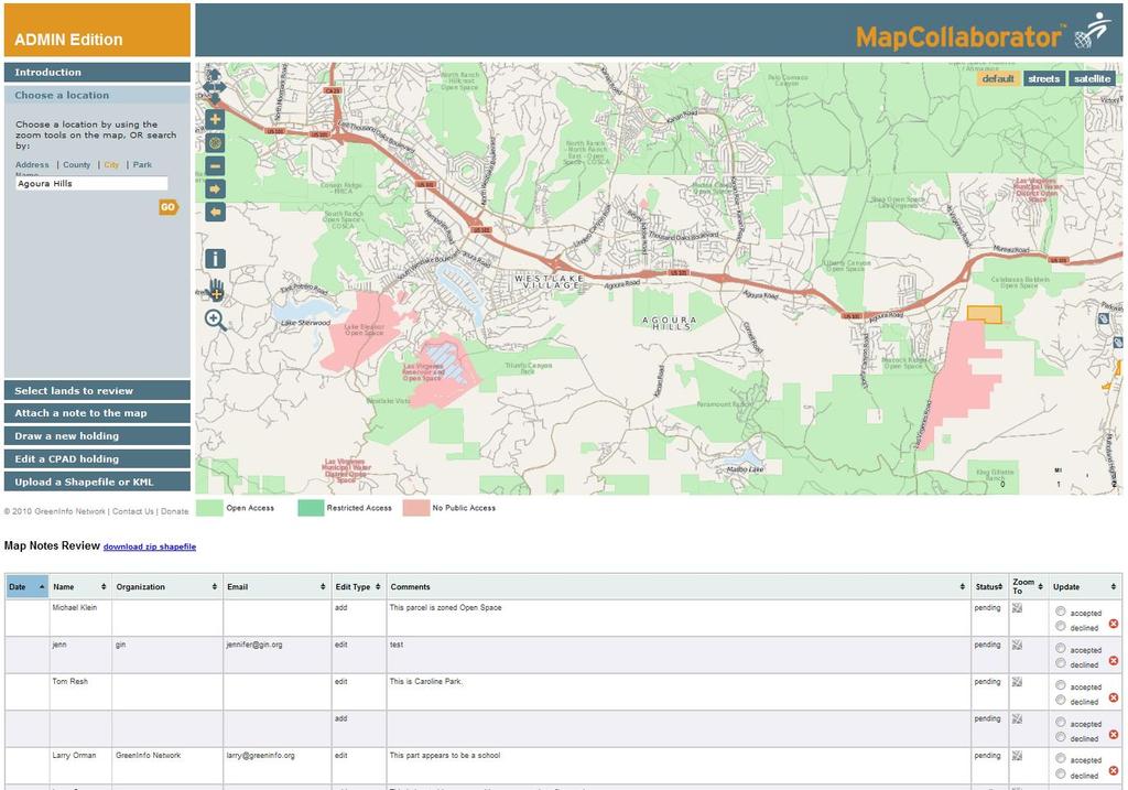
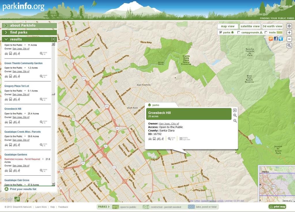
10 Here s What We re Trying to Create


11 Why a Good Inventory Matters 1 Lands owned in fee Lands with easements


12 Why a Good Inventory Matters


13 Where did CPAD come from? Bay Area, regional databases Some state inventory Full statewide database in 2008 Many funding partners State parks, CalFire, Coastal Conservancy Foundations Others

14 CPAD Improvement Project Strategic Growth Council Through USGS GAP $265,000, 20 months > April 2014 Objectives: Sustainability Improve data Improve systems Educate users
15 How CPAD Works Detailed documentation in the CPAD user manual - see
16 How CPAD is structured Geodatabase - Holdings and Units/Super Units Key attributes Agency Access Ownership Designation Size Dates, county, etc. Kennedy Park Jones Regional Preserve

17 How CPAD is structured Structure example:
18 CPAD Data Issues 1. Use of parcel data vs. source agency boundaries 2. Ownership/management determinations 3. Updates how best connect to 1,000 agencies Correction of older data accuracy/errors 5. Define holding designations ("watershed", "park", etc.) 6. Regional data aggregators (COGs, NCCPs, etc.) 7. HOAs, and others


19 CPAD Data Quality Issues


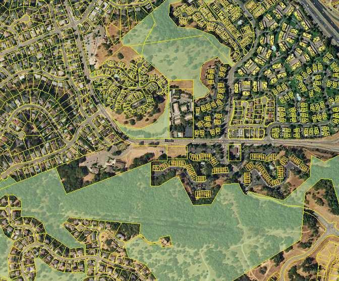
20 CPAD Data Quality Issues (parcel alignment USFS or Marin..)

21 1


22 CPAD Nationally - PAD-US Link Protected Areas Database of the U.S. USGS GAP State by state + federal CPAD is Calif. element in PADUS

23 PAD-US Key attributes: Agency Level Size Access Designation Gap rank gapanalysis.usgs.gov/padus
24 CPAD Uses Guidelines 1. Best use: multi-jurisdictional plans/programs/analyses Regional, county, some cities, watershed, bi-state, statewide, special project areas 2. Use caveats: 1. Does not replace source agency data 2. Updates do not canvass all 1,000 agencies for changes (focus on top 50+) 3. Alignments may differ from source agencies (parcels)
25 CPAD Uses 1. Sustainable Community Strategies (SCSs) 2. General Plans (mainly county), LAFCos, consultants 3. Land conservation planning, climate adaptation 4. Recreation needs analysis including tourism 5. Transportation facility siting (state, national, regional) 6. Flood, fire & other emergency planning and response 7. Researchers (social, conservation, political, accountability) 8. Law (Megan s law, other parole, regulation) 9. Utilities siting, routing, etc. (renewable energy siting) 10. more
26 CPAD Use Examples 1. Data assessment 2. Maps/display 3. Geospatial analysis 4. Web applications

27

28

29 1


30 1


31


32

33

34
35 1

36


37 Easements Conservation Easement removes development options retains private ownership Land ownership fee


38 Easement Data Coverage matters
39 Easements Who, what Conservation/open space easements Not utility or other types Permanent/very long term (vs. short term) Key agencies - governments, nonprofits... + private? Federal, state, some others Land trusts, other NGOs Home Owners Associations? Mitigation businesses?
 National Conservation Easement Database (NCED)")
40 Easement GIS Data CCED, NCED California Conservation Easement Database (CCED) National Conservation Easement Database (NCED) conservationeasement.us
41 Easement Data CCED is in process: 700,000 NCED easement acres in California 1,100,000+ easement acres in draft CCED GIS inventory 135 agencies/land trusts 1.4+ million total easement acres exist permissions challenge
42 Easement Data CCED in process - key issues: Cooperation in including easement data in CCED o o Privacy? Trespass? RESOLUTION: No names, No public access Many kinds of easements how account for? Alignment of easements to parcels
43 Directions for CPAD/CCED Funding/sustainability most important $125k/yr? funding, depends on institutional home Partnerships with key agencies/organizations Data improvement more reviews by agencies Parcels, alignment Connections to national PAD-US Expand users, get feedback
44 What YOU Can Do Use the data download at Submit changes Identify contacts at land owning agencies Describe your experience with using CPAD (online survey, through CALands.org ) CONTACT: cpad@calands.org
45 1 Information and Mapping in the Public Interest For CPAD:
46 1
D A T A B A S E M A N U A L
 D A T A B A S E M A N U A L Version 2014a Revised: March 3, 2014 For more information about CPAD, see www.calands.org BEFORE USING DATA, see Data Disclaimer inside CPAD is Published by GreenInfo Network
C P A D D A T A B A S E M A N U A L
 C P A D D A T A B A S E M A N U A L Version 2018a Released: December 2018 BEFORE USING DATA, see Data Disclaimer inside CPAD is published by GreenInfo Network Contents Acknowledgements 3 Disclaimer 4 Summary
Development and Updates of Protected Lands Databases in the US (PAD-US, NCED, CARL)
") Development and Updates of Protected Lands Databases in the US (PAD-US, NCED, CARL) Robb Macleod, National GIS Coordinator at Ducks Unlimited rmacleod@ducks.org 734-623-2004 Overview 1. What is the NCED,
Development and Updates of Protected Lands Databases in the US (PAD-US, NCED, CARL) Robb Macleod, National GIS Coordinator at Ducks Unlimited rmacleod@ducks.org 734-623-2004 Overview 1. What is the NCED,
Chesapeake Bay Program Indicator Analysis and Methods Document Protected Lands Updated September 2016 (Data current through 2015_16)
") 1 Chesapeake Bay Program Indicator Analysis and Methods Document Protected Lands Updated September 2016 (Data current through 2015_16) Indicator Title: Protected Lands Relevant Outcome(s): Protected Lands
1 Chesapeake Bay Program Indicator Analysis and Methods Document Protected Lands Updated September 2016 (Data current through 2015_16) Indicator Title: Protected Lands Relevant Outcome(s): Protected Lands
PADUS Metadata Schema
 PADUS Metadata Schema Category Field properties: Category, Category Domain, Text, 10 General category of protection mechanism associated with the protected area or public land parcel. Fee is the most common
Theme Strategic Plan for Cadastral Theme
 Theme Strategic Plan for Cadastral Theme Bureau of Land Management Cadastral Survey Federal Geographic Data Committee (FGDC) 2017 2021 April 2017 - Progress and Update Cadastral Theme Implementation Plan
PAD-US (CBI Edition) Version 2. Metadata: Metadata also available as
 Version 2. Metadata: Metadata also available as") PAD-US (CBI Edition) Version 2 Metadata also available as Metadata: Identification_Information Data_Quality_Information Spatial_Data_Organization_Information Spatial_Reference_Information Entity_and_Attribute_Information
PAD-US (CBI Edition) Version 2 Metadata also available as Metadata: Identification_Information Data_Quality_Information Spatial_Data_Organization_Information Spatial_Reference_Information Entity_and_Attribute_Information
Bureau of Land Management
 Bureau of Land Management MAPPS Federal Update Donald Buhler Cadastral, Lands, and Realty Management April 1, 2014 Division of Cadastral, Lands and Realty Management 1 BLM Mission Manages 247 million surface
Conservancy Mission. Leveraging GIS Technologies in Chesapeake Conservation and Restoration 10/17/2018
 Leveraging GIS Technologies in Chesapeake Conservation and Restoration Rachel Soobitsky Geospatial Project Manager Chesapeake Conservancy Conservation Innovation Center Kristin Kirkwood Executive Director
Sample Renewal Additional Information Request
 Sample Renewal Additional Information Request February 25, 2015 Jim Smith Green Acres Land Trust 123 Main Street Anywhere, NY 12345 Dear Jim: Thank you for submitting your organization s application for
Cadastral PLSS Stewardship December 2010 Updated December 2013
 Cadastral PLSS Stewardship December 2010 Updated December 2013 Compiled by Bob Ader, Ben Knott, and Nancy von Meyer for the FGDC Cadastral Subcommittee Table of Contents 1. Overview... 2 2. Underlying
Module 2. Chesapeake Bay Trust Watershed Restoration Project Management Training. Owners & Stakeholders Jim Morris, P.E.
 Chesapeake Bay Trust Watershed Restoration Project Management Training Module 2 Project Planning Andrew Birmingham, P.E. Owners & Stakeholders Jim Morris, P.E. Learning Objectives Learn how to find property
Bureau of Land Management MAPPS Federal Update Donald Buhler Cadastral, Lands, and Realty Management April 14, 2015
 Bureau of Land Management MAPPS Federal Update Donald Buhler Cadastral, Lands, and Realty Management April 14, 2015 Division of Cadastral, Lands and Realty Management 1 BLM Mission Manages 247 million
3.23 LANDS AND SPECIAL USES
 3.23 LANDS AND SPECIAL USES Introduction This section addresses those aspects of SJPLC management relating to public land ownership and use. Special Use Permits, rights-of-way (ROW) grants, easements,
Introduction to INRMP Implementation Options
 El Dorado County Integrated Natural Resources Management Plan Introduction to INRMP Implementation Options 1 Our approach to the options evaluation is based on the INRMP components as they are currently
State of Washington Project Luke Rogers, University of Washington March 2010
 State of Washington Project Luke Rogers, University of Washington March 2010 Rural Technology Initiative (RTI) developed an online tutorial on how to use the Washington State Parcel and Forestland Databases
CATALOGING, MONITORING AND MANAGING INVASIVE SPECIES ON POST LANDS. PSU Geog596A Capstone Proposal Dale Jantzen Dec 17, 2015
 CATALOGING, MONITORING AND MANAGING INVASIVE SPECIES ON POST LANDS PSU Geog596A Capstone Proposal Dale Jantzen Dec 17, 2015 PROJECT OUTLINE AND PURPOSE Define a particular need within a non-profit land
F I N A L REPORT MEET ME AT THE CORNER A P R I L 2 5, : : R O T H S C H I L D, W I
 MEET ME AT THE CORNER UNCOVERING/DISCOVERING THE PUBLIC LAND SURVEY SYSTEM IN WISCONSIN A P R I L 2 5, 2 0 1 8 : : R O T H S C H I L D, W I F I N A L REPORT OVERVIEW A one-day forum entitled Meet Me at
The Multipurpose Marine Cadastre A Tool for Planning & Decision Making in the Marine Environment
 The Multipurpose Marine Cadastre A Tool for Planning & Decision Making in the Marine Environment Christine Taylor Minerals Management Service (MMS) Brian Smith NOAA Coastal Services Center Maurice Hill
PROJECT SCORING GUIDANCE. Introduction: National Proiect Selection:
 FOREST LEGACY PROGRAM PROJECT SCORING GUIDANCE Introduction: This document provides guidance to the National Review Panel on how to score individual Forest Legacy Program (FLP) projects, including additional
Program Data Table Item 13. Adjusted Special Flood Hazard Area (asfha) GOAL:
 GOAL:") Community Rating System analysis procedure Wednesday, September 15, 2015 Prepared by Laura Gibson, reviewed by Mike Dumais and Beth Yang Program Data Table Item 13. Adjusted Special Flood Hazard Area (asfha)
Community Rating System analysis procedure Wednesday, September 15, 2015 Prepared by Laura Gibson, reviewed by Mike Dumais and Beth Yang Program Data Table Item 13. Adjusted Special Flood Hazard Area (asfha)
CFPB Implementation of Parcels Provision in HMDA Under Dodd-Frank
 CFPB Implementation of Parcels Provision in HMDA Under Dodd-Frank Land ownership is the foundation of the financial, legal, and real estate systems in our society Parcel Data vs. Census Data + Census data
Protected Lands Outcome Management Strategy
 Protected Lands Outcome Management Strategy Photo Courtesy Tom Lussier/Paris, VA in Springtime Introduction In 2015, we stand at a critical juncture relative to land protection in the Chesapeake watershed.
FGDC Cadastral Data Subcommittee. December 2008
 FGDC Cadastral Data Subcommittee Annotated Bibliography: Foundational Documents for Building a Cadastral National Prepared by David Stage and Nancy von Meyer for the FGDC Cadastral Data Subcommittee Annotated
What s New in FEMA Mapping?
 Discussion Topics What s New in FEMA Mapping? Eric Simmons September 6, 2018 FEMA Initiatives & Evolving Risk MAP FEMA s Flood Map Service Center National Flood Hazard Layer (NFHL) Draft NFHL and Changes
TransNet Environmental Mitigation Program: Land Acquisition and Restoration Process and Criteria
 TransNet Environmental Mitigation Program: Land Acquisition and Restoration Process and Criteria On September 26, 2008, the San Diego Association of Governments Board of Directors (BOD) approved the attached
Land Tenure and Geospatial Data and Technology
 Land Tenure and Geospatial Data and Technology Ioana Bouvier E3/Land and Urban, USAID Senior Geospatial Analyst January 23, 2018 January 23, 2018 1 OUTLINE 1. Overview of geospatial data and technology
THE MARIN COUNTY HOUSING ELEMENT AND TAM VALLEY
 THE MARIN COUNTY HOUSING ELEMENT AND TAM VALLEY The Marin County Community Development Agency is currently working toward completion of the Housing Element of the County s general plan (the Marin Countywide
PREPARING SURVEY TENDER GIS DATABASE OUTCOMES
 PREPARING SURVEY TENDER SPECIFICATIONS FOR PROJECT GIS DATABASE OUTCOMES Presentation by Ian Harper GEODATA AUSTRALIA ESRI User Conference 2009 24 st July 2009 BACKGROUND GIS databases now provide a more
Protected Lands Outcome
 Protected Lands Outcome Management Strategy 2015 2025, v.2 The headwaters of the Rapidan River are seen near Skyline Drive in Shenandoah National Park. (Photo by Will Parson/Chesapeake Bay Program) I.
11 Teranet Easement Mapping Data Acquisition
 Clause 11 in Report No. 18 of Committee of the Whole was adopted, without amendment, by the Council of The Regional Municipality of York at its meeting held on November 19, 2015. 11 Teranet Easement Mapping
Regional Conservation Partnerships
 Regional Conservation Partnerships How they benefit land trusts and other partners Presented by Bill Labich, Senior Conservationist, Highstead Foundation 2017 Maryland Land Conservation Conference June
NEW YORK CITY WETLANDS TRANSFER TASK FORCE PROPERTY ASSESSMENT FORM
 NEW YORK CITY WETLANDS TRANSFER TASK FORCE PROPERTY ASSESSMENT FORM SITE DESCRIPTION CB BLOCK(S) LOT(S) JURISDICTION MGMT ACREAGE RECOMMENDED ACTION FOR PROPERTY: TRANSFER TO PARKS? TRANSFER TO OTHER AGENCY?
California Office 2001 N Street Suite 110 Sacramento, CA VIA
 California Office 2001 N Street Suite 110 Sacramento, CA 95811 VIA EMAIL June 20, 2016 Mary Piepho, Chair, Contra Costa County LAFCO 651 Pine Street, 6th Floor Martinez, California 94553 Re: Comments to
PUBLIC OPEN HOUSE September 19, 2018
 PUBLIC OPEN HOUSE September 19, 2018 Board 1 BACKGROUND Council direction was given to develop a The is looking at new housing in mature and recent communities, as outlined in the City of Winnipeg s planning
Surveyor General s Report
 Surveyor General s Report Susan F. MacGregor O.L.S. Surveyor General Mapping and Information Resources Branch Ministry of Natural Resources and Forestry Queen s Printer for Ontario, 2017 The Ministry of
2018 Assessment Roll Edit Guide for Parcel-Level Geographical Information System (GIS) Information
 Information") 2018 Assessment Roll Edit Guide for Parcel-Level Geographical Information System (GIS) Information Florida Department of Revenue Property Tax Oversight January 2, 2018 Intended Users This edit guide is
2018 Assessment Roll Edit Guide for Parcel-Level Geographical Information System (GIS) Information Florida Department of Revenue Property Tax Oversight January 2, 2018 Intended Users This edit guide is
Before the meeting starts: Please circle the area your land trust works on the wall poster and note the land trust name
 Before the meeting starts: Please circle the area your land trust works on the wall poster and note the land trust name GIS in land conservation. Brian Hall brianhallconservation@gmail.com 10/3/2017 What
GIS After the Conversion. Mid West ESRI Utility Users Group 2007
 GIS After the Conversion Mid West ESRI Utility Users Group 2007 Presented by: A Jeffrey A. Grussing Leader, GIS Development jgrussing@usgweb.com Background Kandiyohi Power Cooperative Worked two years
How to find your home s required finished floor elevation according to City s proposed new Floodplain Ordinance
 City of Mexico Beach New Floodplain Ordinance How to find your home s required finished floor elevation according to City s proposed new Floodplain Ordinance This Ordinance only affects the following property
Land Conservation 101. Chris LaPointe, Director of Land Conservation Essex County Greenbelt Association
 Land Conservation 101 Chris LaPointe, Director of Land Conservation Essex County Greenbelt Association Greenbelt 34 cities and towns of Essex County 17,500 acres of land since 1961 Nearly 6,000 acres comprise
Land Details. Bridging the Gap between Assessor Acres and GIS Acres
 Land Details Bridging the Gap between Assessor Acres and GIS Acres What are Assessor Acres? It is a legally agreed upon approximation of size Applies to larger parcels Has deep historical roots. Thomas
ASSESSMENT OF STATE AGENCIES WITH RESPONSIBILITIES FOR LANDS AND OTHER REAL PROPERTIES
 ASSESSMENT OF STATE AGENCIES WITH RESPONSIBILITIES FOR LANDS AND OTHER REAL PROPERTIES LAND ADMINISTRATION DIVISION MINISTRY OF AGRICULTURE, LAND AND MARINE RESOURCES Prepared for LAND USE POLICY AND ADMINISTRATION
PAST, PRESENT AND FUTURE OF LAND CONSERVATION IN THE WEST: HOW LAND CONSERVATION IS CHANGING THE LANDSCAPE IN THE WEST. March 4, :00 5:15
 PAST, PRESENT AND FUTURE OF LAND CONSERVATION IN THE WEST: HOW LAND CONSERVATION IS CHANGING THE LANDSCAPE IN THE WEST Rocky Mountain Land Use Institute 20 th Annual Land Use Conference March 4, 2011 4:00
Carson River Floodplain Protection Progress Map, 2014 A project of the River Corridor Working Group. University of Nevada Cooperative Extension
 Carson River Floodplain Protection Progress Map, 2014 A project of the River Corridor Working Group of the CRC by Steve Lewis and John Cobourn University of Nevada Cooperative Extension Premise Protect
PROJECT INFORMATION DOCUMENT (PID) APPRAISAL STAGE Report No.: PIDA Project Name. Region Country Sector(s) Theme(s)
 APPRAISAL STAGE Report No.: PIDA Project Name. Region Country Sector(s) Theme(s)") Public Disclosure Authorized Public Disclosure Authorized Public Disclosure Authorized Public Disclosure Authorized Project Name Region Country Sector(s) Theme(s) Lending Instrument Project ID Borrower(s)
Public Disclosure Authorized Public Disclosure Authorized Public Disclosure Authorized Public Disclosure Authorized Project Name Region Country Sector(s) Theme(s) Lending Instrument Project ID Borrower(s)
Developing a Prototype Marine Cadastre for Chedabucto Bay, Nova Scotia, Canada or is it St. Margaret s Bay?
 Developing a Prototype Marine Cadastre for Chedabucto Bay, Nova Scotia, Canada or is it St. Margaret s Bay? Dr. Michael Sutherland, CANADA Chair-Elect, Commission 4 FIG EILAT 2009, FIG WORKING WEEK, EILAT,
Implementation of Permanent Easements and Associated Nutrient Load Reductions
 1 Minnesota Nutrient Reduction Strategy Agricultural Sector/BWSR RIM Program Measure Implementation of Permanent and Associated Nutrient Load Reductions Measure Background Visual Depiction The map in Figure
2018 JMGBL Awards Application
 2018 JMGBL Awards Application Submission Date 2018-06-21 10:41:59 This application is for: Project Title County/Counties Staff Contact Job Title E-mail Address J. Mitchell Graham Memorial Award The Independent
Capital Regional District. Regional Parks Land Acquisition Strategy 2015 to 2017
 Capital Regional District Regional Parks Land Acquisition Strategy 2015 to 2017 CRD Board Approved July 8, 2015 Table of Contents EXECUTIVE SUMMARY.... iv 1.0 BACKGROUND... 1 2.0 PURPOSE.... 1 3.0 REGIONAL
Visitor and Guest Policy
 Item 6 May 31, 2013 Resident Services Committee To: Resident Services Committee From: President and Chief Executive Officer Date: May 6, 2013 Page 1 of 2 PURPOSE: Provide the Resident Services Committee
APPENDIX B COMPLIANCE WITH THE GOVERNMENT CODE
 APPENDIX B COMPLIANCE WITH THE GOVERNMENT CODE A. GENERAL PLAN AMENDMENT PROCEDURE In general, local governments may not amend any of the mandatory elements of the General Plan (e.g. Land Use, Open Space,
Welcome. Tax & Ecology Seminar. presented by The Georgian Bay Land Trust
 Welcome Tax & Ecology Seminar presented by The Georgian Bay Land Trust There are significant income and capital gains tax benefits available for Georgian Bay land owners who want to help protect the bay
SAN MATEO COUNTY SUBDIVISION REGULATIONS UPDATE
 SAN MATEO COUNTY SUBDIVISION REGULATIONS UPDATE Discussion Topics: Purpose of the Update Participants and Stakeholders County Subdivision Regulations Issues Identified So Far content issues process issues
HUD Multifamily Utility Benchmarking Webinar Series Webinar 2: Creating a Plan and Managing Data for Multifamily Utility Benchmarking
 HUD Multifamily Utility Benchmarking Webinar Series Webinar 2: Creating a Plan and Managing Data for Multifamily Utility Benchmarking April 20, 2017 Webinar Logistics Submit content related questions via
What You Can Plan For
 February 2017 Alliance Board Approves Revised Standards March 2017 New Standards Available Online for Download June 2017 Every Alliance Member Land Trust Must Pass a Resolution Adopting the Revised Standards
MONTE SERENO HOUSING ELEMENT
 MONTE SERENO 2015-2023 HOUSING ELEMENT PURPOSE OF THE WORKSHOP Understand Housing Element goals and requirements Share critical time lines and actions Solicit your ideas Identify ways for you to be involved
Cadastral NSDI Reference Document
 Cadastral NSDI Reference Document Version 12 October 2012 FGDC Subcommittee for Cadastral Data Cadastral NSDI Reference Document Table of Contents 1. Purpose... 1 2. Business Applications... 1 3. Terminology
20 International Conference of The Coastal Society FROM LAND TO SEA: LAND TRUSTS AND MARINE PROTECTION
 th 20 International Conference of The Coastal Society FROM LAND TO SEA: LAND TRUSTS AND MARINE PROTECTION Michelle Portman, University of Massachusetts, Boston Environmental policy analysts have frequently
Real Estate Market Intelligence. Thorough Research Sound Decisions Greater Profits
 Real Estate Market Intelligence Thorough Research Sound Decisions Greater Profits DataMap Intelligence, LLC 5018 Route 9 South Howell, NJ 732.534.5458 www.datamapintel.com Location Research: Critical in
Cadastral Framework Standards
 Cadastral Framework Standards The goal of the Data Standards and Recommendations Committee is to provide recommendations and guidelines to Indiana GIS user communities to facilitate the collection, maintenance
Forest Service Role CHAPTER 2
 CHAPTER 2 Forest Service Role Implementation of the Management Plan charters a federal presence with an expanded focus beyond traditional Forest Service roles. In addition to administration of the National
DEVELOPMENT PLAN REVIEW CHECKLIST. To initiate the application, the applicant shall submit to the Administrative Officer:
 DEVELOPMENT PLAN REVIEW CHECKLIST To initiate the application, the applicant shall submit to the Administrative Officer: 1. Sixteen (16) copies of the Project Review Application Form, printed double-sided;
TOWN OF HOLLIS, NEW HAMPSHIRE
 TOWN OF HOLLIS, NEW HAMPSHIRE BUILDOUT ANALYSIS NOVEMBER 20, 2001 Prepared by the NASHUA REGIONAL PLANNING COMMISSION TABLE OF CONTENTS I. INTRODUCTION...1 II. GOAL OF THE BUILDOUT ANALYSIS...1 III. METHODOLOGY...1
Hinesburg Natural Resources/Land Conservation Trust Fund. Introduction
 Hinesburg Natural Resources/Land Conservation Trust Fund Introduction The Hinesburg Land Trust requests funding to conserve the 307 acre Lafreniere Farm located 8472 Route 116 in Hinesburg. The property
CHAPTER 8. IMPLEMENTATION COSTS AND FUNDING SOURCES
 Working Draft Content Subject to Change Implementation Costs and Funding Sources Chapter 1 1 1 1 1 1 1 1 0 1 0 1 CHAPTER. IMPLEMENTATION COSTS AND FUNDING SOURCES Table of Contents Page.1 Introduction...
Project Initiation Plan
 Project Initiation Plan Contents 1 INTRODUCTION... 4 1.1 PURPOSE OF THIS DOCUMENT... 4 2 TERMS OF REFERENCE... 5 2.1 OBJECTIVES... 5 2.2 GEOGRAPHIC SCOPE... 5 2.3 EXTENT OF THE PROJECT S CONSIDERATIONS...
County of Sonoma Agenda Item Summary Report
 County of Sonoma Agenda Item Summary Report Agenda Item Number: 29 (This Section for use by Clerk of the Board Only.) Clerk of the Board 575 Administration Drive Santa Rosa, CA 95403 To: Sonoma County
ALREADY SUBMITTED FOR HIGHLANDS COUNCIL PRE
 Highlands Preservation Area Approval Application Checklist Items Block 15901 Lot 1, West Milford See Highlands Council Review at: http://www.highlands.state.nj.us/njhighlands/projectreview/ **For advisory
AGENDA ITEM 6B. MEETING: March 21, 2018
 MEETING: March 21, 2018 TO: FROM: SUBJECT: AGENDA ITEM 6B Humboldt LAFCo Commissioners Colette Metz, Administrator Humboldt Community Services District Extension of Water and Wastewater Services Outside
4.2 LAND USE INTRODUCTION
 4.2 LAND USE INTRODUCTION This section of the EIR addresses potential impacts from the Fresno County General Plan Update on land use in two general areas: land use compatibility and plan consistency. Under
Tejon Ranch Conservation and Land Use Agreement Executive Summary
 Tejon Ranch Conservation and Land Use Agreement Executive Summary The Tejon Ranch Company (TRC) and Audubon California, the Endangered Habitats League, Natural Resources Defense Council, Planning and Conservation
Installation Boundary Mapping and the DoD Real Property Inventory Program
 Installation Boundary Mapping and the DoD Real Property Inventory Program 11 October 2007 SAME Mid-Atlantic Regional Conference Jeff Swallow Real Property History Real Property data reported to the Office
COMMUNITY DEVELOPMENT DEPARTMENT
 AGENDA ITEM I-1 COMMUNITY DEVELOPMENT DEPARTMENT Council Meeting Date: June 3, 2014 Agenda Item #: I-1 INFORMATIONAL ITEM: Update on Multi-City Affordable Housing Nexus Study and Impact Fee Feasibility
INDOT s Non-Marketable Property Program
 INDOT s Non-Marketable Property Program Kathy Heistand Director of Real Estate Services Laura Hilden Director of Environmental Services March 6, 2019 Key Points INDOT can transfer old mitigation sites
Land Matters Regarding the Pipeline
 Land Matters Regarding the Pipeline Leigh Youngblood Executive Director Mount Grace Land Conservation Trust 1461 Old Keene Road, Athol, MA 01331 www.mountgrace.org January 13, 2015 1 Outline Introduction
CHALLENGES IN MANAGING MULTIPLE USE LANDS & TOOLS TO ENABLE SUCCESS
 CHALLENGES IN MANAGING MULTIPLE USE LANDS & TOOLS TO ENABLE SUCCESS Rocky Mountain Land Use Institute Conference March 13, 2015 Susan Culp Principal, NextWest Consulting, LLC Challenges to Achieving Conservation
Egyptian Nationwide Title Cadastre System
 Kholoud SAAD, Egypt Key words: Cadastre, Registration, Urban, Rural, National Cadastre, Automation, reengineering. SUMMARY With growing need for integrated information, Enterprise Solutions has become
Kent Land Trust Strategic Reassessment Project Final Report
 Kent Land Trust Strategic Reassessment Project Final Report Prepared For: Connecticut Institute for Resilience and Climate Adaptation (CIRCA) Prepared by: Michael A. Benjamin, Land Steward, Kent Land Trust
TO: MEMBERS, FORMATION COMMISSION FROM: DAVID CHURCH, EXECUTIVE OFFICER (DC)
") LAFCO - San Luis Obispo - Local Agency Formation Commission SLO LAFCO - Serving the Area of San Luis Obispo County COMMISSIONERS Chairman MARSHALL OCHYLSKI Special District Member TO: MEMBERS, FORMATION
LAFCO - San Luis Obispo - Local Agency Formation Commission SLO LAFCO - Serving the Area of San Luis Obispo County COMMISSIONERS Chairman MARSHALL OCHYLSKI Special District Member TO: MEMBERS, FORMATION
Final Report WI Flood Map Maintenance Project. Prepared For. The Wisconsin Department of Natural Resources Flood Map Maintenance Project
 Final Report WI Flood Map Maintenance Project Prepared For The Wisconsin Department of Natural Resources Flood Map Maintenance Project December 2007 TABLE OF CONTENTS INTRODUCTION 1 GIS DATA INVENTORY
Updated - A Report on the County of Arlington s Existing and Possible Urban Tree Canopy
 Updated - A Report on the County of Arlington s Existing and Possible Urban Tree Canopy Key Terms UTC: Urban tree canopy (UTC) is the layer of leaves, branches, and stems of trees that cover the ground
Chesapeake Bay Program s Current Zoning and Conservation Plus Scenarios
 Chesapeake Bay Program s Current Zoning and Conservation Plus Scenarios Peter Claggett, Research Geographer U.S. Geological Survey Land Use Workgroup Call November 8, 2017 U.S. Department of the Interior
THE 2030 AGENDA, CITIES AND URBAN GOVERNANCE A CENTRAL ROLE FOR LAND AND GEOSPATIAL INFORMATION
 THE 2030 AGENDA, CITIES AND URBAN GOVERNANCE A CENTRAL ROLE FOR LAND AND GEOSPATIAL INFORMATION Abbas Rajabifard Immediate Past President and Executive Board Member, GSDI Association Director, Centre for
Short Term Rental Ordinance
 Short Term Rental Ordinance Considerations For Proposed Revisions to Zoning Regulations Midcoast Community Council August 26, 2015 Jennifer Stalzer Kraske, Deputy County Counsel San Mateo County Counsel
PRELIMINARY PLAN CHECKLIST Major Land Development Projects. To initiate the application, the applicant shall submit to the Administrative Officer:
 PRELIMINARY PLAN CHECKLIST Major Land Development Projects To initiate the application, the applicant shall submit to the Administrative Officer: 1. The application review fee, as established by the South
Mission Planning for a GPS Control Survey Using ESRI ArcMap. August 8, 2004 Mickie Warwick, PLS
 Mission Planning for a GPS Control Survey Using ESRI ArcMap August 8, 2004 Mickie Warwick, PLS Using ArcMap for GPS Mission Planning Surveyors are not tapping into the benefits that can be derived from
Statewide Parcel Data Exploratory Meeting Minutes
 Statewide Parcel Data Exploratory Meeting Minutes Wednesday, October 18, 2006 10:00 AM to Noon WA Dept. of Ecology, 300 Desmond Dr., Lacey Room R3A-19 Updated: Nov.7, 2006 Attendees: Sam Bardelson, USGS;
Leveraging Oak Woodland Rancher Investment in Ranching: Matching Funds from Working Woodlands
 Leveraging Oak Woodland Rancher Investment in Ranching: Matching Funds from Working Woodlands I. Public Lands in California II. California s Mediterranean Oak Woodlands III. Working Landscapes Rancher
Protecting Wild & Scenic River Values Through Land Conservation
 Protecting Wild & Scenic River Values Through Land Conservation RMS & NARRP Symposium Bridging Conservation and Recreation May 20, 2010 Portland, Oregon Phil Kincare Skagit Wild & Scenic River Mt. Baker-Snoqualmie
Land Dedication (Reserves)
") Land Dedication (Reserves) This technical document is part of a series of draft discussion papers created by Municipal Affairs staff and stakeholders to prepare for the Municipal Government Act Review.
Land Dedication (Reserves) This technical document is part of a series of draft discussion papers created by Municipal Affairs staff and stakeholders to prepare for the Municipal Government Act Review.
CITY COUNCIL OF THE CITY OF NOVATO
 CITY COUNCIL OF THE CITY OF NOVATO ORDINANCE NO. 1555 AN ORDINANCE OF THE NOVATO CITY COUNCIL, AMENDING SECTION 4-17 OF THE NOVATO MUNICIPAL CODE TO PROVIDE GREEN BUILDING STANDARDS FOR NON-RESIDENTIAL
The Social Tenure Domain Model STDM-Online
 Land and Poverty Conference 2016 Scaling up Responsible Land Governance 14-18 March, 2016 Washington, DC The Social Tenure Domain Model STDM-Online Arnulf Christl: metaspatial Cyprian Celebalo: UN Habitat
Land Conservation Agreements Project Guidance
 Land Conservation Agreements Project Guidance Stakeholder Informed OTHER OPTIONS Introduction Enhanced or permanent protection of corporate lands through land conservation agreements means that companies
LEGAL NOTICE PLANNING COMMISSION PUBLIC HEARING
 LEGAL NOTICE PLANNING COMMISSION PUBLIC HEARING NOTICE IS HEREBY GIVEN that the Planning Commission of the City of Oceanside, California, will on Monday, August 27, 2018, at 6:00 p.m. in the Council Chambers
Institutional Arrangements In Geoinformation: Influence of Legal and Policy Issues **
 ADVANCE UNEDITED VERSION UNITED NATIONS E/CONF.103/24 ECONOMIC AND SOCIAL COUNCIL Tenth United Nations Regional Cartographic Conference for the Americas New York, 19-23, August 2013 Item 6 (a) of the provisional
City of Novato CANNABIS WORKSHOP
 City of Novato CANNABIS WORKSHOP ABOUT HDL Serves: 303 cities 48 counties 108 transaction districts Partnered with over 125 local agencies to develop cannabis policies Team consists of former policymakers,
Conservation & Development Policies: The Plan for Connecticut
 2013-2018 Conservation & Development Policies: The Plan for Connecticut CT Land Conservation Council March 21, 2015 www.ct.gov/opm/cdplan CT s Planning Framework State statutes include three separate,
SPECIAL PUBLIC NOTICE
 SPECIAL PUBLIC NOTICE U.S. ARMY CORPS OF ENGINEERS BUILDING STRONG LOS ANGELES DISTRICT APPLICATION FOR PERMIT Coachella Valley In-Lieu Fee Program Public Notice/Application No.: SPL-2013-00324-TOB Project:
FOURTH QUARTER 2013 MARIN COUNTY OFFICE SPACE
 FOURTH QUARTER 2013 MARIN COUNTY OFFICE SPACE MARIN OFFICE SANTA ROSA OFFICE 1101 Fifth Avenue, Suite 230 San, CA 94901 2455 Bennett Valley Road, C200, Santa Rosa, CA 95404 Tel: 415.526.7676 Fax 415.526.7679