Parkland-Spanaway-Midland LUAC - Agenda
|
|
|
- Wesley Park
- 5 years ago
- Views:
Transcription
1 1. 6:30 P.M. Parkland-Spanaway-Midland LUAC - Agenda Documents: PSMAC Agenda.pdf 2. Parkland-Spanaway-Midland LUAC Initial Project Review Documents: Lincoln Court PP IPR PSMAC-RJ.pdf

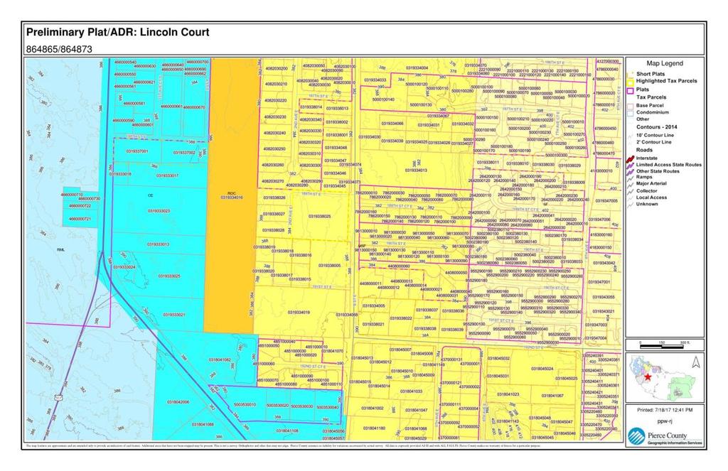
2 Department of Planning and Public Works MEETING AGENDA PARKLAND-SPANAWAY-MIDLAND LAND USE ADVISORY COMMISSION August 2, 2017, 6:30 p.m. SE Tacoma Community Center, th Street East, Tacoma Public comment is limited to 3 minutes per speaker. If possible, please have a spokesperson for people with similar views. Preliminary Plat/Administrative Design Review: Lincoln Court Application Number Applicants: Presidential Homes Planner: Robert Jenkins, rjenkin@co.pierce.wa.us Request: Applicant requests Preliminary Plat approval to divide a 3.08 acre one-parcel site into 14 single-family lots, with a minimum single-family lot size of 4,765 sq. ft. and an average lot size of 6,093 sq. ft. The plat includes the following elements: 1) a 14,421 sq. ft. storm drainage tract in the southeast corner; and 2) a private road tract. The plat will be served by public water, sanitary sewers, and a private road. Minutes (June 7, 2017) PSMAC Agenda
 Public Meeting: August 2, 2017, at 6:30 p.m., at the Southeast Tacoma Community Center, 1614 99 th Street East, Tacoma, WA 98445 Proposal: Applicant requests Preliminary Plat approval to divide a 3.")
3 Initial Project Review Preliminary Plat / Administrative Design Review: Lincoln Court Application Numbers: / Tax Parcel Number: Parkland-Spanaway-Midland Land Use Advisory Commission (PSMAC) Public Meeting: August 2, 2017, at 6:30 p.m., at the Southeast Tacoma Community Center, th Street East, Tacoma, WA Proposal: Applicant requests Preliminary Plat approval to divide a 3.08 acre one-parcel site into 14 single-family lots, with a minimum single-family lot size of 4,765 square feet and an average lot size of 6,093 square feet. The plat includes the following elements: 1) a 14,421-square foot storm drainage tract in the southeast corner; and 2) a private road tract. The plat will be served by public water, sanitary sewers, and a private road. The plat will be accessed from B Street East. Three existing single-family home lots to the east will continue to access B Street East through an altered private road alignment in the proposed plat. Project Location: B Street East, Spanaway, WA, in the SE 1/4 of Section 33, T19N, R3E, W.M., in Council District #3. Review Summary: County staff has reviewed this proposal for compliance with all applicable policies, codes, and regulations. The County finds, based on an initial project review, that the proposal appears to be consistent with the applicable codes and regulations and that staff will be recommending approval of the proposal, subject to conditions. Zone Classification: Moderate Density Single-Family (MSF) Community Plan Area: Parkland-Spanaway-Midland State Environmental Policy Act (SEPA): Pursuant to the State Environmental Policy Act and the Pierce County Environmental Regulations, Title 18E, the Pierce County Environmental Official designate has reviewed this project and determined that the project is exempt from SEPA provisions since there are fewer than 21 dwelling units proposed. County Contact: Robert Jenkins, Senior Planner, , rjenkin@co.pierce.wa.us Pierce County Online Permit Information: Page 1 of 9
4 Project Data: Complete Application Date: June 16, 2017 IPR Mailed Date: July 25, 2017 Property Owner: Applicant: Agent: Edward G. Knoben, Jr th Street East Puyallup, WA Presidential Homes Attn: Terry Folden nd Avenue East Puyallup, WA Contour Engineering LLC Attn: Stephen Bridgeford P.O. Box 949 Gig Harbor, WA Public and Legal Notice June 21, 2017: Notice of Application and Public Meeting Notice, was sent to property owners within a radius of 300 feet, but not less than two parcels deep, around the exterior boundaries of the subject property. June 23, 2017: The site was posted with a Public Notice sign, confirmed with a Declaration of Posting. July 18, 2017, Legal Notice was published in the official County newspaper (Tacoma News Tribune), advertising the public meeting to be held by the Parkland-Spanaway-Midland Advisory Commission. Page 2 of 9


5 2014 County Aerial Photo Site Photos Page 3 of 9

6 Zoning Map Page 4 of 9

7 Proposed Preliminary Plat Map for Lincoln Court Proposed Site Plan for Lincoln Court Page 5 of 9
8 Tree Inventory and Tree Conservation Plan Public and Agency Review Comments No comments have been received from surrounding property owners or the public to date. Comments have been received to date on the plat from the following departments and agencies: Pierce County Fire Prevention Bureau, requested a fire hydrant plan and water system permit. Sewer Division of Planning and Public Works (PPW), stated that sanitary sewers are located in B Street East with sufficient capacity to serve the plat. Development Engineering Division of PPW, in a Memorandum dated July 18, 2017, requests the following items to be addressed: o Roadway section needs to be revised to adhere to Standard Drawing PC.A.3.1 o A shared access facility is required for access to Lots 2-4 of SP to the west boundary of the proposed plat o Provide curb, gutter, and sidewalk on both sides of the proposed private road o Revise the minor driveway approach for the stormwater facility to a residential approach o The ADR site plan indicates impervious surface coverage of 43%. Per 18E A, the maximum impervious surface for Moderate Density Single Family is 35%, unless you can demonstrate the effective impervious on the site is less than 35%. Indicate if the proposed driveways will be constructed with permeable pavement. It also appears the areas indicated for the proposed driveway are undersized. Resource Management Sections of PPW, stated there were no wetlands or fish and wildlife habitat areas present or abutting the site. Page 6 of 9

9 Pierce Transit, had no specific concerns and does not provide nearby service. Tacoma Pierce County Health Department, requested that the existing well be located on the site plan and that it be decommissioned as part of the plat process. Nisqually Tribe. Comments received on this proposal may be found by accessing the Online Permit Information referenced on page 1. The substance of these comments is reflected, where appropriate, in the conditions at the end of this report. Background Use History: The plat site is Lot 1 of a 4 lot short plat, recorded in 1983, i.e., AFN A Short Plat Alteration to Short Plat will be required to alter the alignment of the 30- foot private road shared by the subject property and three additional lots to the west. A Short Plat Alteration may also be required to eliminate the stormwater runoff natural buffer area on Lot 4 of the 1983 short plat depending on where stormwater from the private road on the three lots to the west is designed to drain to. Site Inspection: The site is a rectangle and 3.08 acres in size. The site contains an abandoned house and detached garage. The site is characterized by a stand of evergreen trees, mostly Douglas fir, and a mostly grass understory. The larger fir trees are located in the western and southern portions of the site, with younger trees in the northeast portion. Page 7 of 9
10 Surrounding Land Use / Zoning Designation: LAND USE ZONING (Title 18A) North Urban density single-family homes Moderate Density Single-Family (MSF) South 4-plex multi-family and vacant land MSF East Urban density single-family homes, MSF Across B Street East West Large-lot single-family homes MSF Utilities/Public Facilities: Utility service and public facilities are proposed as follows: Water - Sewer- Power - School- Spanaway Water Pierce County Tacoma Power Bethel School District Governing Regulations The proposal has been reviewed for conformance with the following goals, policies and requirements in effect on the June 16, 2017 complete application date of this proposal: Title 19A Comprehensive Plan - January 1, 1995, as amended Title 17A Construction and Infrastructure Regulations Site Development and Stormwater Drainage Title 17B Construction and Infrastructure Regulations Road and Bridge Design and Construction Standards Title 18 Development Regulations - General Provisions Title 18A Development Regulations Zoning Title 18D Development Regulations - Environmental Title 18E Development Regulations - Critical Areas Title 18F Development Regulations - Land Division and Boundary Changes Title 18H Development Regulations - Forest Practices Title 18J Design Standards and Guidelines Initial PPW Staff Review for Consistency with Land Use Policies and Regulations State Environmental Policy Act (SEPA) Since there are fewer than 21 dwelling units, no environmental review is required. Title 18A, Development Regulations - Zoning The site is zoned Moderate Density Single-Family (MSF). The MSF zone is intended for low and moderate density single- and two-family residential activities and compatible civic uses in areas with a mixed residential pattern. The MSF zone allows single-family residential uses with a minimum density of 4 and up to 6 dwelling units per net developable acre, when sanitary sewers are available, as they are in this case. There are 2.38 net developable acres. The applicant is requesting 14 single-family dwelling units, i.e., 5.89 dwelling units per net developable acre. Page 8 of 9
11 Title 18J, Development Regulations Design Standards and Guidelines Street trees will be provided internally along the private road and externally along B Street East. Curbs, gutters, sidewalks, and street lights will be required within the plat and along the frontage of B Street East. Effective May 1, 2017, residential developments with 30 dwelling units or less are not required to provide active or passive on-site recreation. In lieu of on-site improvements, park impact fees are required prior to building permit issuance. The impact fee will rise in three steps from an initial $1, in May 2017, to $2, on July 1, 2018, and then will be adjusted upward for inflation. According to the tree conservation plan, there are 26 significant Douglas fir trees and one significant western red cedar tree. The applicant is proposing to retain eight (29.6%) of the 27 significant trees on site all Douglas fir. The significant trees are proposed to be retained as follows: three trees along the western edge of the plat in rear yards of two lots (11 and 14), one tree along B Street frontage of Lot 1 and 4 trees in the stormwater facility tract. It is unclear whether the trees would be allowed to remain in the storm drainage tract since they could impact the operation of the facility. The plat will be required to preserve or plant a minimum of 71 tree units. The trees currently proposed to remain count toward 24 tree units. It is likely that through street trees and L3 buffer trees, the tree unit requirement will be met or exceeded. Is unclear what type of storm drainage facility design is proposed. Unless designed as an amenity per Section 18J D.2.a., the facility will need to be placed underground or screened from view. Formal infill compatibility, per Section 18J , is required from the three 2/3 acre single-family homes to the west. A 30-foot rear yard setback is required along the west property line, along with a 6-foot high board fence. The 30-foot setback is required on all the lots abutting the western property line, including flag Lot 9. Lincoln Court PP IPR PSMAC-RJ.docx Page 9 of 9
Parkland-Spanaway-Midland Advisory Commission Meeting Agenda. Parkland-Spanaway-Midland Advisory Commission Handout - Pacific Ridge
 1. 6:30 P.M. Parkland-Spanaway-Midland Advisory Commission Meeting Agenda Documents: 6 20 18 PSMAC Agenda.pdf 2. 6:30 P.M. Estates IPR Parkland-Spanaway-Midland Advisory Commission Handout - Pacific Ridge
Initial Project Review
 Pierce County Department of Planning and Land Services, 2401 South 35th Street, Tacoma, WA (253) 798-7037 Initial Project Review Major Amendment to Preliminary Plat: Hawks Ridge Division 1 Application
Staff Report. State Environmental Policy Act (SEPA): The proposal requires review under the State Environmental Policy Act.
: The proposal requires review under the State Environmental Policy Act.") Staff Report Major Amendment to Preliminary Plat / Planned Development District: Oakpointe at Sunrise PDD, Phase 1 (aka Emerald Ridge PDD) Application Number: 865995 Tax Parcel Number: 6026455560 South
Staff Report Major Amendment to Preliminary Plat / Planned Development District: Oakpointe at Sunrise PDD, Phase 1 (aka Emerald Ridge PDD) Application Number: 865995 Tax Parcel Number: 6026455560 South
Initial Project Report Appl # Brink/Harrison
 1. 6:30 P.M. 2018-02-21 KPAC Agenda Documents: 2 21 18 KPAC Agenda.pdf 2018-02-21 Initial Project Report Appl #876518 Brink/Harrison Documents: Brink-Harrison IPR KPAC-DB.pdf MEETING AGENDA KEY PENINSULA
Staff Report. Conditional Use Permit: Williams Tree and Stump Removal. Application Number: Tax Parcel Numbers:
 Pierce County Department of Planning and Land Services, 2401 South 35th Street, Tacoma, WA (253) 798-7037 Staff Report Conditional Use Permit: Williams Tree and Stump Removal Application Number: 836154
Initial Project Review
 Initial Project Review Shoreline Substantial Development Permit: Hilger, Nicholas and Maria Application Numbers: 897733, 897734 Parcel Number: 2160000010 Gig Harbor Peninsula Advisory Commission (PAC)
WESTMINSTER PARK PLACE SUBDIVISION
 WESTMINSTER PARK PLACE SUBDIVISION Engineering Comments: FINAL PLAT COMMENTS (should be addressed prior to submitting the FINAL PLAT for review and/or signature by the City Engineer): A. Provide all of
WESTMINSTER PARK SUBDIVISION
 WESTMINSTER PARK SUBDIVISION Engineering Comments: FINAL PLAT COMMENTS (should be addressed prior to submitting the FINAL PLAT for review and/or signature by the City Engineer): A. Provide all of the required
TULSA PARK ESTATES SUBDIVISION, RESUBDIVISION OF LOT 6
 TULSA PARK ESTATES SUBDIVISION, RESUBDIVISION OF LOT 6 Engineering Comments: FINAL PLAT COMMENTS (should be addressed prior to submitting the FINAL PLAT for review and/or signature by the City Engineer):
EXHIBIT D. Planned Unit Development Written Description April 13, 2016 Rouen Cove Phase II PUD
 1 EXHIBIT D Planned Unit Development Written Description April 13, 2016 Rouen Cove Phase II PUD Development # 8986.001 Developer: Curtis L. Hart Hart Resources LLC 8051 Tara Lane Jacksonville, Florida
BEFORE THE HEARINGS EXAMINER FOR THE CITY OF BREMERTON
 BEFORE THE HEARINGS EXAMINER FOR THE CITY OF BREMERTON In the Matter of the Application of ) NO. PL03-0017 ) Rainier Vista Bill Bakker ) ) FINDINGS, CONCLUSIONS For Approval of a Preliminary Plat. ) AND
Report to the Plan Commission February 4, 2013
 Report to the Plan Commission Legistar I.D. #28789 Conditional Use Requested Actions: Approval of a conditional use for a structure exceeding 10,0000 square feet of total floor area and an accessory building
DAUPHIN CREEK ESTATES SUBDIVISION
 # 12 SUB-000076-2017 DAUPHIN CREEK ESTATES SUBDIVISION Engineering Comments: FINAL PLAT COMMENTS (should be addressed prior to submitting the FINAL PLAT for review and/or signature by the City Engineer):
Industrial Road Cross Dock Subdivision Minor Subdivision Preliminary Plat PLNSUB South Industrial Road Hearing date: May 9, 2013
 ADMINISTRATIVE HEARING STAFF REPORT Industrial Road Cross Dock Subdivision Minor Subdivision Preliminary Plat PLNSUB2013-00158 1900 South Industrial Road Hearing date: May 9, 2013 Applicant: Corbin Bennion
REPORT TO PLANNING AND DESIGN COMMISSION City of Sacramento
 REPORT TO PLANNING AND DESIGN COMMISSION City of Sacramento 915 I Street, Sacramento, CA 95814-2671 www.cityofsacramento.org 9 PUBLIC HEARING December 10, 2015 To: Members of the Planning and Design Commission
PLANNING COMMISSION REPORT REGULAR AGENDA
 PP-4-4-11 Item No. 9-1 PLANNING COMMISSION REPORT REGULAR AGENDA PC Staff Report 06/22/11 ITEM NO 9: PRELIMINARY PLAT; KASOLD WATER TOWER ADDITION; SE OF TAM O SHANTER & KASOLD DR (MKM) PP-4-4-11: Consider
R E S O L U T I O N. 2. Development Data Summary:
 R E S O L U T I O N WHEREAS, the Prince George s County Planning Board has reviewed Special Permit Application No. SP-170001, Mama s Care Assisted Living Facility, requesting to expand an existing congregate
Initial Project Review
 Initial Project Review Shoreline Substantial Development Permit / Shoreline Conditional Use Permit: Bear/Pai Joint-Use Dock, Boathouse, and Living Space within Detached Shop Application Numbers: 894574,
Initial Project Review
 Pierce County Department of Planning and Land Services, 2401 South 35th Street, Tacoma, WA (253) 798-7037 Initial Project Review Shoreline Substantial Development Permit: Miller Application Numbers: 832023,
JOHNNY S RV PARK SUBDIVISION
 # 11 SUB2016-00001 JOHNNY S RV PARK SUBDIVISION Engineering Comments: The following comments should be addressed prior to submitting the FINAL PLAT for acceptance and signature by the City Engineer: A.
Planning Department Oconee County, Georgia
 Planning Department Oconee County, Georgia STAFF REPORT REZONE CASE #: 6985 DATE: October 31, 2016 STAFF REPORT BY: Andrew C. Stern, Planner APPLICANT NAME: Williams & Associates, Land Planners PC PROPERTY
COMMUNITY DEVELOPMENT. Staff Report. Site Plan Review. SP June 19, 2018
 COMMUNITY DEVELOPMENT 333 Broadalbin Street SW, PO Box 490, Albany, Oregon 97321-0144 BUILDING 541-917-7553 PLANNING 541-917-7550 Staff Report Site Plan Review SP-18-18 June 19, 2018 Summary On May 1,
ZONING AMENDMENT & SUBDIVISION STAFF REPORT Date: July 9, 2015
 ZONING AMENDMENT & SUBDIVISION STAFF REPORT Date: July 9, 2015 APPLICANT NAME 2513 Dauphin Street, Inc. SUBDIVISION NAME Audubon Place Extension No. 3, Resubdivision of Lots 1-5 LOCATION 2513 Dauphin Street
Proposed Overland Park Kansas Ordinance RE-1 Residential Estates Community
 18.171 RE-1 Residential Estate Community 18.171.010 Statement of intent. The zoning of property as RE-1, (Residential Estates Community, 1 dwelling unit per Gross acre density), is intended to provide
ZONING AMENDMENT & SUBDIVISION STAFF REPORT Date: November 3, 2016
 ZONING AMENDMENT & SUBDIVISION STAFF REPORT Date: November 3, 2016 APPLICANT NAME SUBDIVISION NAME David Shumer 5955 Airport Subdivision CITY COUNCIL DISTRICT District 6 5955 Airport Boulevard, 754 Linlen
STAFF REPORT MARYHILL PLAZA APARTMENTS
 STAFF REPORT MARYHILL PLAZA APARTMENTS TO: Douglas County Hearing Examiner FROM: Douglas County Land Services Staff RE: Selland Construction, DATE: July 19, 2018 I. GENERAL INFORMATION Requested Action:
4.2 RESIDENTIAL ZONING DISTRICTS
 4.2 RESIDENTIAL ZONING DISTRICTS A. Purpose: To define regulations and standards for each residential zoning district in the City. The following sections identify uses, regulations, and performance standards
UPPER MOUNT BETHEL TOWNSHIP NORTHAMPTON COUNTY, PENNSYLVANIA
 UPPER MOUNT BETHEL TOWNSHIP NORTHAMPTON COUNTY, PENNSYLVANIA JOINDER DEED / LOT CONSOLIDATION TOWNSHIP REVIEW PROCESS When accepting proposed Joinder Deeds / Lot Consolidations, review the Joinder Deed
City of Ferndale CITY COUNCIL STAFF REPORT
 SUBJECT: Final Plat Approval DATE: January 19, 2016 FROM: Haylie Miller, Assistant Planner PRESENTATION BY: Haylie Miller City of Ferndale CITY COUNCIL STAFF REPORT MEETING DATE: January 19, 2016 AGENDA
City of Sanibel. Planning Department STAFF REPORT
 City of Sanibel Planning Department STAFF REPORT Planning Commission Meeting: July 23, 2013 Planning Commission Agenda Item: No 7b. Application Number: 13-7438DP Applicant Name: Attorney Beverly Grady
May 12, Chapter RH HILLSIDE RESIDENTIAL ZONES REGULATIONS Sections:
 May 12, 2017 Chapter 17.13 RH HILLSIDE RESIDENTIAL ZONES REGULATIONS Sections: 17.13.010 Title, intent, and description. 17.13.020 Required design review process. 17.13.030 Permitted and conditionally
COMMUNITY DEVELOPMENT DEPARTMENT 333 Broadalbin Street SW, P.O. Box 490 Albany, OR 97321
 COMMUNITY DEVELOPMENT DEPARTMENT 333 Broadalbin Street SW, P.O. Box 490 Albany, OR 97321 STAFF REPORT Application for Site Plan Review (SP-02-18) Residential Accessory Building Ph: 541-917-7550 Fax: 541-917-7598
Staff Report for Town Council
 Staff Report for Town Council Meeting Date: June 22, 2017 16-REZ-24 Trimble Avenue Residential Rezoning Purpose: Consider action on proposed rezoning request Prepared by: Katie Drye, Planning Speaker:
Planning & Development. Background. Subject Properties
 Planning & Development APPLICATION BRIEFING Prepared For: Planning Advisory Committee Submitted by: Jason Fox, Director of Planning & Development Date: Subject: Application by Meech Holdings Limited to
BEFORE THE HEARING EXAMINER FOR THURSTON COUNTY
 COUNTY COMMISSIONERS Cathy Wolfe District One Diane Oberquell District Two Robert N. Macleod District Three HEARING EXAMINER BEFORE THE HEARING EXAMINER FOR THURSTON COUNTY In the Matter of the Application
COUNCIL COMMUNICATION
 Meeting Date: October 24, 2017 COUNCIL COMMUNICATION Agenda Item: Agenda Location: Public Hearings Work Plan # Legal Review: X 1 st Reading 2 nd Reading Subject: A public hearing regarding Zoning and a
City of Midland Application for Site Plan Review
 City of Midland Application for Site Plan Review Submission Date: Property Owner: Mailing Address: Phone number: ( ) Cell phone: ( ) Email address: Fax: ( ) Owner s Signature: Applicant Name (if not owner):
Berry/University Form Based Code and Urban Residential Development
 Berry/University Form Based Code and Urban Residential Development Presented to the City Council by the Planning and Development Department October 11, 2016 Purpose Review proposed Berry/University formbased
DINKINS ESTATE FAMILY SUBDIVISION
 # 9 SUB2015-00122 DINKINS ESTATE FAMILY SUBDIVISION Engineering Comments: The following comments should be addressed prior to submitting the FINAL PLAT for acceptance and signature by the City Engineer:
PREPARED FOR THE URBAN DESIGN COMMISSION AND PLAN COMMISSION
 PLANNING DIVISION STAFF REPORT PREPARED FOR THE URBAN DESIGN COMMISSION AND PLAN COMMISSION Project Address: Application Type: Prepared By: Demolition Permit and Conditional Use Kevin Firchow, AICP, Planning
Community Development Department 333 Broadalbin Street SW, P.O. Box 490 Albany, OR 97321
 SUMMARY Community Development Department 333 Broadalbin Street SW, P.O. Box 490 Albany, OR 97321 STAFF REPORT Application for Tentative Partition Plat Review Planning File PA-06-17 Phone: 541-917-7550
In order to permit maximum applicability of the PUD District, PUD-1 and PUD-2 Districts are hereby created.
 ARTICLE III. PUD ned Unit Development Overlay District 205-128. Purpose. The PUD ned Unit Development Overlay District is intended to provide flexibility in the design of planned projects; to encourage
PLANNED DEVELOPMENT DISTRICT STANDARDS. Cadence Site
 PLANNED DEVELOPMENT DISTRICT STANDARDS Cadence Site A Planned Development District 1. Statement of General Facts, Conditions and Objectives Property Size: Approximately 57.51 Acres York County Tax Map
PUBLIC HEARING* N/A. C I T Y O F T A C O M A Planning & Development Services Department 747 Market St, Rm 345 Tacoma, WA 98402
 C I T Y O F T A C O M A Planning & Development Services Department 747 Market St, Rm 345 Tacoma, WA 98402 PUBLIC HEARING* Date of Notifcation: 10/5/2018 Application Received: 04/19/2018 Application Complete:
CITY OF OAK HARBOR Development Services Department
 CITY OF OAK HARBOR Development Services Department Shortt Subdiiviisiions Shorrtt Pllatt Reviiew Prrocess IIII What is a Short Plat, and when is it necessary? A short plat is a map that represents a short
PLANNED UNIT DEVELOPMENT & SUBDIVISION STAFF REPORT Date: April 18, 2019
 PLANNED UNIT DEVELOPMENT & SUBDIVISION STAFF REPORT Date: April 18, 2019 DEVELOPMENT NAME SUBDIVISION NAME Springhill Village Subdivision Springhill Village Subdivision LOCATION 4350, 4354, 4356, 4358,
Waterford Owners Association Construction Guidelines
 Waterford Owners Association Construction Guidelines 1. A $5,000.00 construction deposit on any new home will be required before clearing or construction can commence. These funds will be refunded, without
Planned Residence District (PR) To review a plan to construct 11 single family homes on approximately 4.01 acres.
 To review a plan to construct 11 single family homes on approximately 4.01 acres.") STAFF REPORT PLANNING & ZONING COMMISSION Village Green Municipal Building, Council Chambers 47 Hall Street Wednesday, March 13, 2019 7:00 P.M. 1. FINAL DEVELOPMENT PLAN REVIEW Applicant: Romanelli and
STAFF REPORT PLANNING & ZONING COMMISSION Village Green Municipal Building, Council Chambers 47 Hall Street Wednesday, March 13, 2019 7:00 P.M. 1. FINAL DEVELOPMENT PLAN REVIEW Applicant: Romanelli and
Initial Subdivision Applications Shall Include the Following:
 Initial Subdivision Applications Shall Include the Following: 1) Subdivision Application Form: completely filled out (12 copies) 2) Plat: The Plat must adhere to the requirements set forth in the Town
Initial Project Review
 Initial Project Review Shoreline Substantial Development Permit / Shoreline Variance Permit: McLaughlin Application Numbers: 897416, 897562, 897418 Parcel Number: 3445000046 Gig Harbor Peninsula Advisory
ARTICLE FIVE FINAL DRAFT
 ARTICLE FIVE 021218 FINAL DRAFT Sec. 503.6 Open Space Preservation Option Open Space Preservation Option Open Space Preservation developments may be approved in the AR, R-1, R-2 and R-3 zoning districts,
GWINNETT COUNTY CSO CONSERVATION SUBDIVISION OVERLAY DISTRICT REQUIREMENTS
 GWINNETT COUNTY CSO CONSERVATION SUBDIVISION OVERLAY DISTRICT REQUIREMENTS Section 1316. CSO Conservation Subdivision Overlay District. 1. Purposes. The purposes of this overlay district are as follows:
DATE: February 28, Marilynn Lewis, Principal Planner
 DATE: February 28, 2007 TO: FROM: RE: Salt Lake City Planning Commission Marilynn Lewis, Principal Planner Planning Commission Hearing for Petition 400-06-41 Zoning Map Amendment to Rezone 6 Properties,
MEMORANDUM. TERESA McCLISH, COMMUNITY DEVELOPMENT DIRECTOR
 MEMORANDUM TO: FROM: BY: PLANNING COMMISSION TERESA McCLISH, COMMUNITY DEVELOPMENT DIRECTOR MATTHEW DOWNING, ASSISTANT PLANNER SUBJECT: CONSIDERATION OF TENTATIVE PARCEL MAP CASE NO. 14-002; SUBDIVISION
Cover Letter with Narrative Statement
 Cover Letter with Narrative Statement March 31, 2017 rev July 27, 2017 RE: Rushton Pointe Residential Planned Unit Development Application for Public Hearing for RPUD Rezone PL2015 000 0306 Mr. Eric Johnson,
ARTICLE IV: DEVELOPMENT STANDARDS
 ARTICLE IV: DEVELOPMENT STANDARDS IV-53 409 PRIVATE STREETS A private street means any way that provides ingress to, or egress from, property by means of vehicles or other means, or that provides travel
COMMUNITY DEVELOPMENT DEPARTMENT 333 Broadalbin Street SW, P.O. Box 490 Albany, OR 97321
 COMMUNITY DEVELOPMENT DEPARTMENT 333 Broadalbin Street SW, P.O. Box 490 Albany, OR 97321 Ph: 541-917-7550 Fax: 541-917-7598 www.cityofalbany.net STAFF REPORT Application for Site Plan Review SP-07-18 and
Approval of a conditional use to allow construction of a rehabilitation hospital at 5115 N. Biltmore Lane in the American Center.
 Department of Planning & Community & Economic Development Planning Division Katherine Cornwell, Director Madison Municipal Building, Suite LL-100 215 Martin Luther King, Jr. Boulevard P.O. Box 2985 Madison,
16 February 9, 2011 Public Hearing APPLICANT: GEO I, L.L.C.
 16 February 9, 2011 Public Hearing APPLICANT: GEO I, L.L.C. PROPERTY OWNER: GEO I, L.L.C., DONALD K. PILAND, AND BOOTSIE LORAINE TERRY STAFF PLANNER: Faith Christie REQUEST: Conditional Change of Zoning
FINAL DRAFT 12/1/16, Rev. to 7/18/17
 FINAL DRAFT 12/1/16, Rev. to 7/18/17 (As Adopted 8/8/17 Effective 9/1/17) SHELTON PLANNING AND ZONING COMMISSION Proposed Amendments to Zoning Regulations I. Amend Section 23 PERMITTED USES by inserting
PLANNING COMMISSION REPORT Regular Agenda Non Public Hearing Item
 PC Staff Report 3/23/15 FDP-14-00551 Item No. 2-1 PLANNING COMMISSION REPORT Regular Agenda Non Public Hearing Item PC Staff Report 3/23/15 ITEM NO. 2: FINAL DEVELOPMENT PLAN FOR HUTTON FARMS WEST PHASE
Planning Department Oconee County, Georgia STAFF REPORT
 Planning Department Oconee County, Georgia STAFF REPORT REZONE CASE #: 7332 DATE: November 28, 2017 STAFF REPORT BY: Gabriel Quintas, Planner APPLICANT NAME: Smith Planning Group PROPERTY OWNER: John Hadden
Cobb County Community Development Agency Zoning Division 1150 Powder Springs St. Marietta, Georgia 30064
 Cobb County Community Development Agency Zoning Division 1150 Powder Springs St. Marietta, Georgia 30064 Case # Z-63 Public Hearing Dates: PC: 11-06-18 BOC: 11-20-18 SITE BACKGROUND Applicant: Loyd Development
Section Preliminary Plat Checklist and Application Forms
 Section 201 - Preliminary Plat Checklist and Application Forms PRELIMINARY SUBDIVISION PLAT REVIEW PROCESS CHART PRELIMINARY SUBDIVISION PLAT APPLICATION PRELIMINARY PLAT REVIEW CHECKLIST CITY OF NAMPA
Rezoning Petition Final Staff Analysis July 16, 2018
 Rezoning Petition 2018-041 Final Staff Analysis July 16, 2018 REQUEST LOCATION Current Zoning: R-5 (single family residential, and UR-2(CD) (urban residential, conditional) Proposed Zoning: UR-2(CD) (urban
Chapter 100 Planned Unit Development in Corvallis Urban Fringe
 100.100 Scope and Purpose. Chapter 100 Planned Unit Development in Corvallis Urban Fringe (1) All applications for land divisions in the Urban Residential (UR) and Flood Plain Agriculture (FPA) zones within
Appendix J - Planned Unit Development (PUD)
") Appendix J - Planned Unit Development (PUD) Intent and Purpose The purpose of the PUD is: 1. To provide development that is consistent with the Comprehensive Land Use Plan and promote the goals and objectives
Appendix J - Planned Unit Development (PUD) Intent and Purpose The purpose of the PUD is: 1. To provide development that is consistent with the Comprehensive Land Use Plan and promote the goals and objectives
DIVISION 7. R-6 AND R-6A RESIDENTIAL ZONES* The purpose of the R-6 residential zone is:
 Date of Draft: March 6, 2015 DIVISION 7. R-6 AND R-6A RESIDENTIAL ZONES* Sec. 14-135. Purpose. The purpose of the R-6 residential zone is: (a) To set aside areas on the peninsula for housing characterized
CITY COUNCIL STAFF REPORT
 CITY COUNCIL STAFF REPORT TO: Honorable Mayor and City Council DATE: May 7, 2018 FROM: PREPARED BY: SUBJECT: Matthew Bronson, City Manager A. Rafael Castillo, AICP, Senior Planner Cassandra Mesa, Building
Staff Report: Date: Applicant: Property Identification: Acreage of Request: Current Zoning of Requested Area: Requested Action: Attached:
 Staff Report: Completed by Jeff Palmer Director of Planning & Zoning Date: November 7, 2018, Updated November 20, 2018 Applicant: Greg Smith, Oberer Land Developer agent for Ronald Montgomery ET AL Property
Staff Report for Council Public Meeting
 Agenda Item 3.3 Staff Report for Council Public Meeting Date of Meeting: September 27, 2017 Report Number: SRPRS.17.134 Department: Division: Subject: Planning and Regulatory Services Development Planning
BEFORE THE HEARING EXAMINER FOR THURSTON COUNTY
 COUNTY COMMISSIONERS Cathy Wolfe District One Diane Oberquell District Two Robert N. Macleod District Three HEARING EXAMINER BEFORE THE HEARING EXAMINER FOR THURSTON COUNTY In the Matter of the Application
PERMITTED USES: Within the MX-1 Mixed Use Neighborhood District the following uses are permitted:
 6.25 MX-1 - MIXED USE NEIGHBORHOOD 6.25.1 INTENT: The purpose of the MX-1 Mixed Use Neighborhood District is to accommodate the development of a wide-range of residential and compatible non-residential
THE REDEVELOPMENT PLAN
 PAGE 37 THE REDEVELOPMENT PLAN FUTURE LAND USE The Silver Terrace Redevelopment Area is currently designated as Redevelopment Area #4 on the City of Delray Beach Future Land Use Map (FLUM). This designation
Introduction. Background DEPARTMENT OF COMMUNITY DEVELOPMENT SERVICES. Planning Division. m e m o r a n d u m TO: The Urbana Zoning Board of Appeals
 DEPARTMENT OF COMMUNITY DEVELOPMENT SERVICES Planning Division m e m o r a n d u m TO: FROM: The Urbana Zoning Board of Appeals Christopher Marx, AICP, Planner I DATE: March 16, 218 SUBJECT: ZBA Case ZBA-218-C-2:
CITY OF FERNDALE HEARING EXAMINER
 CITY OF FERNDALE HEARING EXAMINER RE: Planned Unit Development ) 16001-PUD Preliminary Plat ) 16018-SE Plat Variance ) 16002-VAR Application by ) ) MD General, L.L.C. ) FINDINGS OF FACT, Malloy Heights
MTC ALABAMA SUBDIVISION
 # 2 SUB-000370-2017 MTC ALABAMA SUBDIVISION Engineering Comments: FINAL PLAT COMMENTS (should be addressed prior to submitting the FINAL PLAT for review and/or signature by the City Engineer): A. Provide
MAJOR SUBDIVISION PRELIMINARY PLAT CHECKLIST
 TOWNSHIP OF EGG HARBOR PLANNING BOARD/ZONING BOARD OF ADJUSTMENT 3515 BARGAINTOWN ROAD EGG HARBOR TOWNSHIP, NJ 08234 MAJOR SUBDIVISION PRELIMINARY PLAT CHECKLIST The following checklist is designed to
Request for Recommendation
 Request for Recommendation Application for site specific rezoning in order to permit a four-storey multiple dwelling with 55 units in a C2, General Commercial zone, 6150, 6160, 6166 Highway 69 North &
A GUIDE TO PROCEDURES FOR: SUBDIVISIONS & CONDOMINIUM CONVERSION
 A GUIDE TO PROCEDURES FOR: SUBDIVISIONS & CONDOMINIUM CONVERSION A GUIDE TO PROCEDURES FOR: SUBDIVISIONS (TENTATIVE MAPS) PURPOSE Definition: A subdivision is defined as the division of any improved or
PLANNING RATIONALE REPORT
 PLANNING RATIONALE REPORT Zoning By-law Amendment Application 2920 Danbury Way Prepared for: Bravar Custom Builders Inc. and Village View Estates Ltd. by: 6393 Roslyn Street Ottawa (Orleans), Ontario K1C
BEFORE THE HEARING EXAMINER FOR CITY OF VANCOUVER
 BEFORE THE HEARING EXAMINER FOR CITY OF VANCOUVER In the Matter of the Application of ) NO. PRJ-151162/LUP-53608 ) ) Irina Leschuk, DL Design Group, Inc., ) 136th Avenue Subdivision On behalf of Omega
Marion County Board of County Commissioners
 Marion County Board of County Commissioners Date: 12/29/2015 P&Z: 12/28/2015 BCC: 1/12/2016 Item Number 160113Z Type of Application Rezoning Request From: A-1 (General Agriculture) To: PUD (Planned Unit
(a) Commercial uses on Laurel Avenue, abutting the TRO District to the
 Commercial uses on Laurel Avenue, abutting the TRO District to the") 32X Zoning Code 150.36 TRANSITIONAL RESIDENTIAL OVERLAY DISTRICT. (A) Intent and purpose. (1) It is the intent of the Transitional Residential Overlay District (hereinafter referred to as the "TRO District")
32X Zoning Code 150.36 TRANSITIONAL RESIDENTIAL OVERLAY DISTRICT. (A) Intent and purpose. (1) It is the intent of the Transitional Residential Overlay District (hereinafter referred to as the "TRO District")
FURTHER THAT Consent B-19/16 be subject to the following conditions:
 September 21, 2016 Page 1 of 6 Report No.: PDSD-P-53-16 Meeting Date: September 21, 2016 Submitted by: Ben Puzanov, Senior Planner Subject: Application for Consent (B-19/16); Steven Yarkovsky 13295 Ilderton
FINAL SUBDIVISION AND LAND DEVELOPMENT PLAN CHECKLIST. Plan Name. Applicant's Name:
 TOWNSHIP OF UPPER ST. CLAIR FINAL SUBDIVISION AND LAND DEVELOPMENT PLAN CHECKLIST Date Filed Plan Name PLC Applicant's Name: Phone Filing Date for Final Application Final Plat 114.22. FINAL APPLICATION
Accessory Dwelling Units (ADUs)
") Community Development Department Planning Division 14177 Frederick Street PO Box 8805 Moreno Valley, CA 92552-0805 (951) 413-3206 Fax (951) 413-3210 Accessory Dwelling Units (ADUs) Completed Project Application
Community Development Department Planning Division 14177 Frederick Street PO Box 8805 Moreno Valley, CA 92552-0805 (951) 413-3206 Fax (951) 413-3210 Accessory Dwelling Units (ADUs) Completed Project Application
TOWN OF EASTCHESTER BUILDING AND PLANNING DEPARTMENT PLANNING BOARD APPLICATION PACKAGE SUBDIVISIONS
 TOWN OF EASTCHESTER BUILDING AND PLANNING DEPARTMENT 40 Mill Road (914) 771-3317 building@eastchester.org Eastchester, NY 10709 (914) 771-3322 Fax www.eastchester.org TABLE OF CONTENTS PLANNING BOARD APPLICATION
2013 APPLICATION FOR URBAN GROWTH AREA AMENDMENT TO PIERCE COUNTY COMPREHENSIVE PLAN
 2013 APPLICATION FOR URBAN GROWTH AREA AMENDMENT TO PIERCE COUNTY COMPREHENSIVE PLAN An Urban Growth Area Amendment (UGA) is a proposed change or revision to the designated Comprehensive Urban Growth Area
Re: Case # ZP Preplanning Application for 8 townhomes at 1526 Ingalls Street in Lakewood, CO.
 Planning Department Civic Center North 480 South Allison Parkway Lakewood, Colorado 80226-3127 303.987.7505 303.987.7057 TTY/TDD Lakewood.org/Planning February 27, 2017 Nathan Taylor 601 S Jason Street
Chapter Plat Design (LMC)
") Chapter 18.14 Plat Design (LMC) Sections: 18.14.010 Lot width 18.14.020 Right-of-way requirements 18.14.030 Pipe stem lots 18.14.040 Division resulting in minimum lot sizes 18.14.050 Flood prone and bad
Chapter 18.14 Plat Design (LMC) Sections: 18.14.010 Lot width 18.14.020 Right-of-way requirements 18.14.030 Pipe stem lots 18.14.040 Division resulting in minimum lot sizes 18.14.050 Flood prone and bad
Members of the City of Brantford Committee of Adjustment. 1.0 TYPE OF REPORT Committee of Adjustment Decision Regarding an Application for Consent
 DATE: October 18 th 2017 REPORT NO. CD2017-168 TO: Members of the City of Brantford Committee of Adjustment FROM: Brandon Kashin, Current Development Planner 1.0 TYPE OF REPORT Committee of Adjustment
2. Rezone a portion of the lot from R2 (Small Lot Residential) to RD2 (Duplex: Housing Lane).
 to RD2 (Duplex: Housing Lane).") Public Notice September 6, 2018 Subject Property Subject Property: 337 Hastings Ave Lot 24, District Lot 1, Group 7, Similkameen Division Yale (Formerly Yale-Lytton) District, Plan 932 Application: The
Public Notice September 6, 2018 Subject Property Subject Property: 337 Hastings Ave Lot 24, District Lot 1, Group 7, Similkameen Division Yale (Formerly Yale-Lytton) District, Plan 932 Application: The
31, Township 29 South, Range 25 East, Polk County, Florida, as depicted by the Land Use Plan attached
 ORDINANCE NO. 2013-04 AN ORDINANCE AMENDING THE ZONING MAP OF THE CITY OF BARTOW, FLORIDA, REZONING APPROXIMATELY 2. 2 ACRES OF LAND OWNED BY BALA3I OF POLK COUNTY, LLC AND LOCATED IN SECTION 31, TOWNSHIP
FREQUENTLY USED PLANNING & ZONING TERMS
 City Of Mustang FREQUENTLY USED PLANNING & ZONING TERMS Abut: Having property lines, street lines, or zoning district lines in common. Accessory Structure: A structure of secondary importance or function
MONTGOMERY COUNTY PLANNING DEPARTMENT THE MARYLAND-NATIONAL CAPITAL PARK AND PLANNING COMMISSION
 MONTGOMERY COUNTY PLANNING DEPARTMENT THE MARYLAND-NATIONAL CAPITAL PARK AND PLANNING COMMISSION MCPB Item No. 8 Date: 03-07-13 Sonoma, Preliminary Plan, 120130040 Melissa Williams, Senior Planner, Melissa.williams@montgomeryplanning.org,
STAFF REPORT FOR MAJOR SUBDIVISION
 STAFF REPORT FOR MAJOR SUBDIVISION FINAL PLAT CASE NO. FA-12-003 HEARING DATE: November 6, 2013 CASE NAME: Solterra Subdivision Filing No. 13 PROCEDURE: Planning Commission ADDRESS OF MAJOR SUBDIVISION
Town of Cary, North Carolina Rezoning Staff Report 12-REZ-27 Morris Branch Town Council Public Hearing January 24, 2013
 Town of Cary, North Carolina Rezoning Staff Report 12-REZ-27 Morris Branch Town Council Public Hearing January 24, 2013 REQUEST To amend the Town of Cary Official Zoning Map to rezone approximately 9.0
HAWTHORNE PLACE SUBDIVISON, RESUBDIVISION OF LOT 15 REVISED
 # 10 SUB-000336-2017 HAWTHORNE PLACE SUBDIVISON, RESUBDIVISION OF LOT 15 REVISED Engineering Comments: FINAL PLAT COMMENTS (should be addressed prior to submitting the FINAL PLAT for review and/or signature
MINERAL COUNTY PLANNING STAFF FINDINGS OF FACT Proposed Elk Run at St. Regis. February 12, 2017
 MINERAL COUNTY PLANNING STAFF FINDINGS OF FACT Proposed The proposed is a five-lot subdivision and is located approximately one mile east of St. Regis on Old Highway 10 East. The property is located in