Annual Report Of the Czech Office for Surveying, Mapping and Cadastre For 2017
|
|
|
- Kory Walters
- 5 years ago
- Views:
Transcription
1
2 Annual Report Of the Czech Office for Surveying, Mapping and Cadastre For 2017 Prague,
3 CONTENT Introduction 1. Surveying, Mapping and Cadastre Sector in the Czech Republic 2. Administration of the Cadastre of Real Estate 3. eservices in the Real Estate Cadastre 4. Registry of Territorial Identification, Addresses and Real Estate 5. Land Surveying Activities in the Public Interest 6. Human Resources and Economics 7. Inspection Activity 8. International Cooperation 9. Research and Development 2
4 INTRODUCTION State administrative bodies of the real estate cadastre managed by the Czech Office for Surveying, Mapping and Cadastre (ČÚZK) provide state administration of the real estate cadastre in the Czech Republic and ensure performance of surveying activities in the public interest given by the law. In 2017 cadastral offices performed the records of ownership and other rights to real estate the fourth year according to new legal regulations of the real estate cadastre that occurred as a result of new Civil Code. Despite the short time since renewal of the principle that a building is a part of a parcel, since introduction of the right of building, increase of the number of registered types of material rights to 20 as well as increase of the number of notice types, can be said that accommodation to new cadastral services succeeded. In the daily practice application problems occur only rarely and they do not concern those most often solved cases. Registrations of rights to real estate were therefore performed without significant problems in Cadastral offices received in total proposals for entry of owners and other rights to real estate in 2017 which is 2 % less than in Registrations of rights were performed in 23 days from the submission of the application on average similar as in The time between proposal submission and its realization cannot be reduced more because of the legal rule, containing a 20- day period during which the entry cannot be permitted as a measure for improving the security of real estate business. The number of completed registrations or deletions based on record and notation reached The number of delivered requests regarding the verification of the survey sketches reached Data provision was realized mainly by the electronic way using the remote access to the real estate cadastre. Nearly million requests for information were performed, representing yearly increase 21 %. At counters of the cadastral offices the decrease of requests was 15 % in comparison to In 99 % of all cadastral units are the cadastral maps in digital form. Only 1 % of all cadastral units are in the phase of finalization of land consolidation or new cadastral mapping and so the digitization could not be carried out there. The digital map will be the result of these land consolidation projects or new mapping. State administration of land surveying and real estate cadastre is responsible beside the cadastre for important land surveying products and services which co-create the national geoinformation infrastructure necessary for task fulfilment of the state and local administration. In 2017 the care for classic ground and gravimetric control points has been carried out together with all planned land surveying works on the state borders. Both continuous and periodical update of the Fundamental base of geographical data (ZABAGED ) went on being provided both to the public administration and commercial use and serving also as a data source for state map series. In 2017 the Orthophoto ČR was updated on the western half of the state territory. Most products are provided via remote access from Geoportal ČÚZK. More information on results of work of land surveying and cadastral offices in 2017 brings this detailed annual report. 3
5 1. Surveying, Mapping and Cadastre Sector in the Czech Republic The real estate cadastre of the Czech Republic is a set of data about real estate in the Czech Republic, including their inventory and description and their geometric specification and position. Parts of it are records of property and other material rights and other legally stipulated rights to real estate. State administration of land surveying ensures chosen land surveying products and connecting services from the whole territory of the state as stipulated by the Act No. 359/1992 Coll., on land surveying and cadastral bodies and by the Act No. 200/1994 Coll., on land surveying. ČÚZK governs 14 regional cadastral offices, which have 94 cadastral branch offices in larger towns and executes state administration of the real estate cadastre; it further manages 7 survey and cadastral inspectorates that control cadastral offices and supervise some commercial activities, whose results are applied to the real estate cadastre and state documentation funds, and finally the Land Survey Office (ZÚ), which focuses on other land survey activities that are provided in the public interest. ČÚZK is also the founder of the Research Institute of Geodesy, Topography and Cartography, p.r.i (VÚGTK, v.v.i.). Administration authorities in the branch of land surveying and cadastre have been set up by the Act No. 359/1992 Coll., on land surveying and cadastral bodies, which also specifies their subjectmatter and territorial competence. 14 cadastral offices have the territorial scope as of the single regions. Cadastral offices set out their cadastral branch offices. The number of them has been step by step reduced to 94. Survey and cadastral inspectorates have usually the territory scope of two regions. Land survey office has the national coverage. 2. Administration of the Real Estate Cadastre Current Czech real estate cadastre was established in 1993 and integrates the function of Land Registry Book (registration of rights) and former Cadastre of Lands (records of real estate) into one tool. On the Act No. 256/2013 Coll., on the Real estate cadastre (Cadastral Act) came into force, having replaced not only the Cadastral Act No. 344/1992 Coll., but also the Act No. 265/1992 Coll., on Registration of rights into the real estate cadastre. Both issues - real estate cadastre and registration of rights to the real estate cadastre - are now regulated in one act. With force from 1 st January 2014 the private law has been recodified and Cadastral Act came into force taking into account many new provisions regarding real estates. The principal change is the brand new definition of the term real estate and application of the principle superficies solo cedit, according to which the building is a part of the parcel. The new Civil Code also introduced many other material rights not existing yet, which have to be registered into the real estate cadastre from As from the same day the implementing rules of the Cadastral Act came into force, i.e. Decree No. 357/2014 Coll., on the Real estate cadastre (Cadastral Decree), the Decree No. 358/2013 Coll., on Information provision from the real estate cadastre and the Decree No. 359/2013 Coll., on Specimen form specification for submission of the proposal for institution of proceeding on entry permission. 4

6 Since its adoption, the Cadastral Act has been amended 8 times, but it was only a minor change due to the adoption of other laws. Two changes were made in 2017, which were implemented by Act No. 183/2017 Coll., amending certain laws in connection with the adoption of the Act on Liability for Offenses and Proceedings and the Act on Certain Misdemeanors, and by the Act No. 225/2017 Coll., amending Act No. 183/2006 Coll., On Spatial Planning and Building Regulations (Building Act), as amended, and other related acts. In 2017, the cadastral decree has been amended for the first time since 2014, by Decree No. 87/2017 Coll., effective as of April 1, Due to the relatively large amendment of the cadastral decree, it was necessary to respond to the practical findings that emerged from the application of new legal institutes and other changes in the area of private law. During the three years of effectiveness of the Civil Code and the new cadastral regulations, there were identified situations for which the cadastral ordinance in its original version offered no solution or the solution resulting from the current text was inappropriate. The amendment introduced the requirements of cadastral offices and the professional public to clarify certain procedures for the registration of data into real estate cadastre, taking into account Regulation (EU) No 910/2014 of the European Parliament and of the Council on electronic identification and trust-building services for electronic transactions in the internal market, and was reacted to the adoption of Act No. 297/2016 Coll., on Confidence- Building Services for Electronic Transactions and the related amendment to the Cadastral Act concerning authentication of signatures. The legislation on entries in the Land Registry, including the implementing decrees, can be considered as successful and does not require substantial changes in the near future. Real estate cadastre in the Czech Republic is administered with help of the information system. The Information system of the real estate cadastre - ISKN - is an integrated information support system for state administration of the real estate cadastre and for providing user services of the cadastre. Since 2012 ISKN has been interconnected to the Information system of territorial identification ISÚI together representing the key agenda information systems serving for editing of the Registry of territorial identification, addresses and real estate RÚIAN, which is one of the four basic registries of state administration. Launch of the system of basic registries has brought tangible results into the administration of real estate cadastre particularly in the area of checking up data on physical and legal persons compared to the registries of inhabitants and persons so as in the possibility of taking over the data changes from these registries (changes of addresses, surnames etc.). 5
 in which both electronic and scanned paper documents used")

7 ISKN is interconnected via web services to other registers, f.i. to insolvency register, which enables verification of the participants of the proceeding. ISKN also uses interconnection with Document management system (DMS) in which both electronic and scanned paper documents used for registration to the real estate cadastre have been stored. Main Tasks of Cadastral Offices and Their Statistics Main task of cadastral offices is recording of proprietary and other rights to real estate and other data. 6
8 Nnumber of completed entry proceedings Average time for settlement [in months] Entries of Proprietary Rights into the Real Estate Cadastre Registration of all material rights, rights agreed as material so as lease and tenure are being performed in the way of entry regardless of its constitution either based on the contract or other way. It includes at present ownership right, right of building, easement, right of lien, future right of lien, right of sub-mortgage, pre-emptive right, future possibility of using the property after its transfer (type of easement), supplementary co-ownership, administration of trust fund, reservation of ownership right, reservation of the right to purchase back, reservation of the right of back sale, prohibition of alienation or encumbrance, reservation of the right of better purchaser, trial purchase arrangement, lease (based on the request of the owner or leaseholder with the approval of the owner), tenure (based on the request of the owner or the tenant with the approval of the owner) and surrender the right for damage compensation on the estate. Further the distribution of right to real estate into single ownership rights to units is registered by entry. In 2017 the number of accepted proposals for entries of rights by cadastral offices was which means decrease of 2 % in comparison to The share of mortgages on the total number of entries decreased slightly, by 1 %. Number of completed proposals for entry of proprietary right was and yearly average time for completing of application for entry has not changed. The 30 day-time was exceeded only in cases containing some defects. Registration of Rights to the Cadastre (Fig 1) , , ,8 0,8 0,8 0,8 0, ,7 0, ,6 0,4 0,4 0,4 0, ,

9 Share of Different Types of Rights Recorded by Entry into the Real Estate Cadastre (Fig 2) Right of Easement 11 % Ban on Alienation or Encumbrance 9 % Pre-emptive Right and Others 2 % Right of Lien 34 % Ownership Right 44 % From the total number of yearly requests for entry in 2017, 95 % entries of rights were approved, the rest of administrative proceedings were refused or interrupted. In 2017 the number of refused entries decreased (from 6.3 % to 5.6 %), as you can see in Fig 3. Development in the Number of Approved and Refused Entries (Fig 3) (5,4 %) (5,6 %) (6,3 %) (7,2 %) (4,9 %) (5,3 %) (6,2 %) (5,9 %) (6,2 %) ( 5,7 %) Number of Approved Entries Number of Refused Entries
10 Number of Entries in Single Regions of the Czech Republic in 2017 (Fig 4) Hlavní město Praha Jihočeský kraj Jihomoravský kraj Karlovarský kraj Královéhradecký kraj Liberecký kraj Moravskoslezský kraj Olomoucký kraj Pardubický kraj Plzeňský kraj Středočeský kraj Ústecký kraj Vysočina Zlínský kraj Registration by Record and Note and Others Cadastral offices performed also other registrations into the real estate cadastre. It is primarily the competence of the state and state organizations to manage state property, the right to manage state property, state property management, property of the capital city of Prague and statutory cities entrusted to urban areas or districts, property owned by local self-governing units etc. Other types of records are notes serving for record of legally important facts relating to a real estate or person. Following data are recorded into the real estate cadastre regarding e.g. change of land type, real estate protection etc. In submissions for registration by record and by note were delivered to cadastral offices, which means that the number of these records decreased yearly by 9 %. In total submissions were completed in average time of only 6 days, which means that it decreased slightly. 9
11 Number of completed proceedings Average time for settlement [in months] Number of Completed Submissions for Registration by Record and Notes (Fig 5) , , , ,3 0,2 0,4 0,3 0,3 0,3 0,4 0,3 0,3 0,2 0,4 0, ,0 Provision of Information from the Real Estate Cadastre Individual workplaces of cadastral offices provide clients with information from the cadastre over the counter during office hours. All outputs from the cadastre (extracts from the real estate cadastre, copies of cadastral maps, copies of documents stored in document funds in case they are digitized) are provided by cadastral branch offices from the whole state territory. Since 2001 internet services have been made available allowing outputs from the cadastre by remote access, without visiting the cadastral office. These services satisfy today most of continually growing demands for information from the real estate cadastre. The number of completed requests for information provision at the counters of cadastral offices decreased yearly on 15 % in 2017, while the total increase of completed requests for information from the real estate cadastre including remote access was more than 21 %. Therefore in % of applicants for information from the real estate cadastre were satisfied by electronic services. Big share on this high number of electronically provided services have permanently court executors, notaries, municipalities, regions and governmental bodies, because of free of charge remote access to the data from the real estate cadastre. On contact points of public administration (Czech POINT) more than 290 thousand outputs from the real estate cadastre and more than 8.5 thousand of map copies were issued in Professional users, such as banks and real estate agencies have been more and more oriented towards acquiring information by means of remote access via internet services, and so the trend of continuous decrease of information provided at the desks of cadastral offices goes on. The electronic statements from the real estate cadastre are since 2006 marked with an electronic mark and are considered as public documents. 10
12 Information Provision from the Cadastre (Fig 7) Information Provided in Cadastral Offices Included Information Provided Electronically Certification of Survey Sketches Survey sketches represent land parcel division, position of a building or change of its external outline in the real estate cadastre and some other changes depicted in cadastral maps. They are made solely by private geodetic companies. They create important part of documentation for maintaining of cadastral maps, thus every survey sketch must be certified by an authorised surveyor who is officially authorised to certify the results of surveying activities by the ČÚZK under Section 14 of Act No. 200/1994 Coll., on Surveying and mapping. Survey sketch is created in electronic form; for the purpose of document creation the paper counterpart is created according to the before mentioned Act on Surveying and mapping. The number of survey sketches is still very high in the Czech Republic. The average time for checking and certification of survey sketches by the cadastral offices was 7 days in 2017, one day shorter than in Since 2016 web services are for disposal enabling automatic acquisition of documentation for survey sketch creation, which has to be delivered into ISKN in electronic form. 11
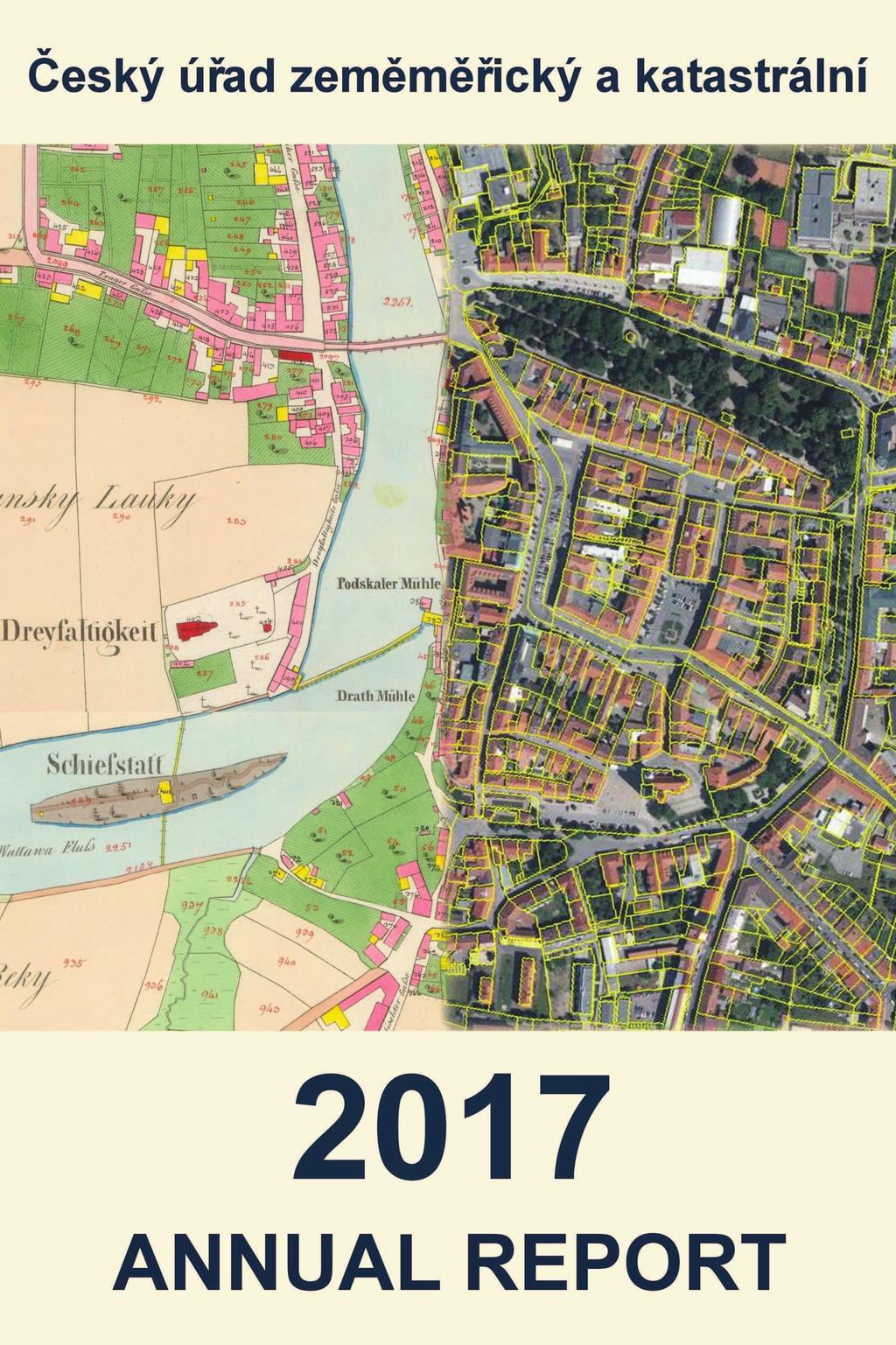
13 Number of completed requests for certification of survey sketches Average time for settlement [in months] Development in the Number of Requests for Certification of Survey Sketches (Fig 6) , ,3 0,3 0,3 0,4 0, ,2 0,2 0,2 0,2 0,2 0,2 0,2 0, , Digitization of the Real estate cadastre Digitization of the real estate cadastre is a basis for effective operation and administration of the real estate cadastre and for operative satisfaction of the users of the cadastral information. Cadastral maps in digital form are fundamental for administration and area decision-making. They serve not only for overview on the territorial range of material rights, but they are important as a basis for creation of information systems and applications relating to the territory as f.i. digital technical maps, spatial plans, price maps etc. Digitization of the file of descriptive information of the real estate cadastre was realized in years , having created basic conditions for the transition to a higher version of the information system equipped with remote access to data in the central database of the cadastre. Computerization of all important processes within the administration of the real estate cadastre was carried out gradually. Ongoing is the digitization of further parts of cadastral documentation such as the file of documents or results of land surveying activities. Digitization of cadastral maps started after the completion of digitization of descriptive information of the cadastre. The capacities that cadastral offices could give to map digitization were very limited in view of the growth of volume of other activities and the pace of digitization was till 2009 only 2 to 3 % of the territory yearly. 12

14 Development of Digitization of Cadastral Maps between Year Till * Digitization Completed Total in Digital Form Yearly Growth from the Total of c.u.(%) 2,4 5,9 8,5 8,5 8,7 8,4 7,0 6,7 4,7 2,7 % from the Total Number , ,6 77,9 84,9 91,6 96,3 99 In 2009 the reversal occurred thanks to the provisions for acceleration of the digitization, accepted by the government in That is why the number of cadastre units covered by the digital form of map was exceeding 8 % of the territory till In 2017 the cadastral maps were digitized in 349 cadastral units, which represents 2.7 % from their total number. The results of 163 land consolidation projects were used for digitization of cadastral maps. Digitization of cadastral maps was carried out in accordance with the long-term plan in 2017 and was practically completed. Accurate digital cadastral maps (DKM) surveyed after 1927 in national coordinate system JTSK cover 49 % of cadastral units by , cadastral maps digitized (KMD) from graphic maps based on the Stabile cadastre in the first half of 19 th century cover 50 % of cadastral units. By only in 130 cadastral units the digital form of cadastral map was not for disposal, which is 1 % from their total number. In these cadastral units new mapping or land consolidation is ongoing and will in a very short time replace the existing cadastral map. It is impossible to carry out the digitization in these cadastral units because the map would be replaced in a short time by a new map. Such a procedure could not be considered economical. State of Digitization of Cadastral Maps on
15 New Cadastral Mapping and Cadastre Revision State administration of the real estate cadastre of the Czech Republic was carrying out long-term development concept since its establishment in Its goal was to fulfil the basic mission of the modern land registration based on ensuring reliable information on real estates and legal relations to them. High level of cadastral data reliability is necessary for rights protection, development of real estate market and mortgages, territorial development and support of decision-making processes in the public administration. In the registration of rights to real estate and data connected with these rights the conceptual changes have been realized on in accordance with acceptance of the new Civil Code and Cadastral Law. New legislation proves its quality and fulfils all the requirements of a modern registration of legal relations to real estates. Digitization of the real estate cadastre has solved easy accessibility of cadastral information as well as dealing with electronic submissions for registration of rights and other data. In the area of the technical data of the cadastre it is necessary to build on forthcoming completion of digitization of cadastral maps with further innovations. The users of cadastral information are pointing to two areas of shortcomings of existing real estate cadastre at present. The first one is lack of accuracy of the parcel boundaries in those areas where cadastral maps digitized (KMD) based on original maps with geometry from the 1 st half of the 19 th century are still used and the second one is insufficient updating of registered technical data as f.i. nature and mode of land use or real estate protection. Lack of boundaries accuracy complicates construction preparations to investors so as the activity of construction offices in the territorial or construction proceeding. It also brings problems in real estate transactions because of unclear area which is important parameter for setting the price and does not help to keep good neighbour relations regarding the boundary surveying in the field the discrepancies can be in some cases in meters. Obsoleteness of technical data complicates the use of cadastral data, especially in some decision-making processes of public administration, in property valuation and administration of property taxes. Before mentioned insufficiencies can be solved by the tools embedded in the existing Cadastral Law, by the renewal of cadastral documentation based on new mapping and cadastral revisions, thus procedures not being used in practice sufficiently in previous years because of the digitization priority. In the frame of the cadastre revision the content of the cadastral map will be updated based on the investigated discrepancies after negotiation with the owners and based on their documentation; moreover renewal of the cadastral documentation based on the new mapping includes investigation of updated parcel boundaries in the field and their precise surveying. New Mapping and Use of Land Consolidation Results till 2023 In 2017 the digital form of cadastral map was for disposal at 99 % of cadastral units or at major part of them. Only in 130 cadastral units (from the total number of ) digital cadastral map has not been completed at the whole cadastral unit. Nearly all cases refer to cadastral units with land consolidation in rural areas in process or where the renewal of cadastral documentation will be in progress based on the new mapping and where the bad quality of original maps did not enable mere digitization. Cadastral offices will follow the progress in land consolidation and the excluded part will be renewed by new mapping. It will prevent ineffective repeated renewal of the cadastral documentation in built-up area and real estate owners in these areas will not be burdened by similar administration acts (connected usually with submission of new real estate tax return) in a short time interval. 14
16 In further 519 cadastral units the digital maps have to be completed in smaller parts of them. It relates to areas touched recently by land consolidation where either land consolidation will have to be completed or the renewal by the new mapping finalized in parts of cadastral units excluded from land consolidation, and thus by the end of Cadastral Office for Prague-City South Bohemia region South Moravia region Karlovy Vary region Hradec Králové region Liberec region Moravia-Silesia region Olomouc region Pardubice region Plzeň region Central Bohemia region Ústí region Vysočina region Zlín region Total Total number of c. u. Without digital map Digital map only at a part of c. u. In process by % % % % % % % % % % % % % % % % % % % % % % % % % % % % % % % % % % % % % % % % % % % % % New Mapping and Use of Land Consolidation Results Long-term Outlook Digitization of cadastral maps enables wide accessibility of maps ensures full conformity with descriptive data on real estates and high comfort in work with map was achieved included combination with other maps via web services. Nevertheless approximately 60 % of the territory of the Czech Republic will still be covered by cadastral map originated from the Stable cadastre surveying in the 1 st half of the 19 th century after Neither continuous adding changes nor realized digitization did not improve the accuracy of most boundary break points in comparison to national coordinate system, which remained on the level of 1 to 2 meters. In these cadastral units it will be necessary to perform gradually new cadastral mapping. The new mapping will cover virtually all built-up areas and forest complexes, thus areas excluded from the land consolidation. Those parts of cadastral units already solved during land consolidation will be renewed based on their results. This method enables to reach needed accuracy of all cadastral maps in comparison to national coordination system which is characterized by the coordinate positional accuracy m xy = 14 cm. Above mentioned long-term plan will be realized supposing that land consolidation will proceed in the present range of approximately 200 to 250 cadastral units per year so as new cadastral mapping should. This work amount can be financed without extra budget claims provided the expenditure of state budget dedicated to these activities remains at the same level. Approximately two thirds of capacities of cadastral offices currently performing digitization of cadastral maps will be transferred to these activities. 15
17 The result of renewal of cadastral documentation by the new mapping will be the cadastral map depicting accurate parcel boundaries surveyed in the field with owners participation. Real estate owners involvement enables to use the renewed cadastral documentation even for property settlement of various discrepancies (not solved changes of communications location and parameters, water courses regulation, water constructions or small constructions registered in the cadastre). In the frame of new mapping updating of nature and mode of land use will be realized and so the cadastral map can better serve for many decision-making processes of the public administration regarding the territorial administration. Removing Discrepancies between the Cadastral Data and the Existing State of Real Estates Real estate cadastre is based on the principle of data registration according to the submitted documents. For registration of legal rights moreover the constitutional principle applies (the right arises only after registration) and Bona fide protection is applied on these registrations and so the owners motivation not to postpone the registration is very strong. For other records (nature of land, its mode of use, preservation) only simple registration principle applies and so up-todatedness of this information is negatively influenced because real estate owners do often not fulfil their notification duty. Sometimes it is even more advantageous for the owners not to update this information in the cadastre (f.i. because of lower property tax). It limits use of the cadastral data for many activities which should reflect the situation in the terrain. With regard to existing capacities of cadastral offices it is possible at the beginning of 2018 to transfer up to 1/3 of employees performing digitization at present to the area of cadastre revision according to the 43 of the Cadastral Act. In this way it would be possible to complete revisions in all cadastral units not included in renewal of the cadastral documentation by new mapping or based on land consolidation results by the end of Time schedule will be designed focusing on territories with greatest development. Updating of Tax Data and Real Estate Data Protection Real estate cadastre contains at present some data regarding the property tax, the real estate evaluation so as some selected data on real estate protection (protection of monuments, spas protection, nature conservation).registration of this data are based on documents from the public administration organs responsible for these land specifications. In practice this notification duty seems to be not very practical and does not ensure sufficient consistency of registered data and real state. For example comparison of the real estate cadastre data and database of the Nature Conservation Agency of the Czech Republic showed that only at 75 % of parcels with stated nature conservation this information has been registered. To improve this situation it is necessary to implement more efficient procedures for this data updating. It could be realized with help of the basic Registry for territorial identification, addresses and real estate. Its launch in 2013 created the technical conditions for crucial innovation of these registration procedures. The public authorities responsible for tax data or real estate conservation can directly register these changes into the RÚIAN. Any possible taking over of these data into the cadastre or its provision from RÚIAN in one output together with the cadastral data is technically manageable. 16
18 3. Electronic Services of the Real Estate Cadastre Some eservices have been launched in the area of the real estate cadastre, which enable to get a wide range of information from the cadastre to our customers. There are both free of charge services enabling to get some chosen data without any restrictions, as well as paid services providing verified documents serving as public documents, that is from the whole territory of the Czech Republic. Except for this, some other applications are for disposal facilitating the access to cadastral data and communication of inhabitants with cadastral offices. Entry Proposals From 2013 there is a legal obligation to submit the entry proposal on the given form. The objective of this measure is to reduce errors that still occurred in the proposals for entry of right and get structured data for further use within record of changes into the database. In order to facilitate completing the form to the applicants an internet application is in operation enabling creation of the entry proposal, which is interconnected to the cadastral database and leads the user through the entire process. The application is very intensively used; in 2017 more than 820 thousands entry proposals were created via it. In 2017 use of these web services of this application went on, mostly by the bank institutions who incorporated the application entry for right of lien into their information systems. Service for Monitoring of Changes The Service for monitoring of changes in data about real estates is provided by the Czech office for surveying, mapping and cadastre according to 55, art.6 of the Act No. 256/2013 Coll., about the Real estate cadastre (Cadastral Act) to those persons who have real right to particular real estate or to participants of proceeding about such a right. The service automatically informs the user about the fact, that there occurred a change in the real estate cadastre regarding the monitored real estate. Number of its users reached already in 2017.The service is used not only by some natural persons but also by legal ones or banks because of the information about those real estate transactions securing the provided mortgages. Remote Access to the Real Estate Cadastre Remote access (DP) enables to get the data from the real estate cadastre from the whole territory of the Czech Republic via internet. Outputs from the real estate cadastre, such as extract from the real estate cadastre and other compositions provided in this way, are formally and materially identical to the documents issued with the same timestamp by the cadastral office and are considered public documents. The application enables provision of outputs not only based on input of basic parameters but it also supports the visual search based on digital cadastral maps, so as with help of orthophotomaps and topographic maps as navigation tools. 17

19 The outputs are charged, but numerous groups of users from public and local administrations receive the information from the real estate cadastre in this way free of charge. DP has been in operation since 2001 and since that the number of customers actively using it has been constantly growing. The yearly increase of users was 6 %. The number of accounts for users was by , out of which were free of charge and accounts were for verifiers, particularly in the frame of CzechPOINT project. From it is possible to provide the documents from the file of documents via DP. In 2017 more than documents were downloaded via this application, in total from its launch more than documents. Digital part of the file of documents contains more than 10.8 million documents for disposal (completely available are documents from years ). In case the document has not been scanned yet, it is possible to ask for it via inquiry form. Nearly of such requests were solved in This process enables to deliver the document in digital form to the applicant within 2 working days. Main users of this service are financial offices. Development of the Number of DP Users as for the Type of Account (Fig 8) Verifiers Free of Charge Paying Customers The verified extract from the real estate cadastre can be acquired at the contact points of state administration CzechPOINTs. In 2017 it was more than 290 thousand outputs. Another 51 thousand outputs were provided via service CzechPOINT@office. At present it is possible to issue the extract from the real estate cadastre, overview of rights registered per an individual person and the cadastral map copy at CzechPOINTs. 18

20 The Biggest DP Users as for the Data Value in Million CZK (Fig 9) Verifiers 22,6 Financial services 89,6 Production and Trade 17,8 Real Estate 13,1 Legal Services 11,7 Other 17,2 Public Administration 1 394,7 The number of DP users has been growing constantly, so as the income for data provision via DP service. Income of the state budget from charged customers reached in total million CZK. The biggest charged user of DP service is the bank sector, which uses it for acquiring of necessary documentation for mortgage provision. However, 89 % of data are provided to the public administration. Free of charge DP is for disposal not only to municipalities and regions for performing their competency but also to governmental bodies, notaries and executors carrying out the distraints so as to insolvency administrators. The executors were provided with outputs in the amount of million CZK. It is approximately 10 times more than number of outputs provided to all banks and financial institutions. Viewing the Real Estate Cadastre Probably the best-known egovernment service, operated in the ČÚZK branch, is Viewing the cadastre. This internet service allows provision of selected technical data and data concerning ownership of parcels, buildings and flats. By means of viewing it is possible to find information on the state of particular proceeding. The viewing application is very intensively used by a wide range of users and has contributed in a significant way to increasing the transparency of the course of individual administrative proceedings. For real estate valuation purposes the application enables easily find out which real estates in the selected area have price recorded since Since 2017 the application serves also for data provision to registered users creators and verifiers of survey sketches enabling them access to previous surveying results (ZPMZ) which should be taken into account during creation of the survey sketch in the given area. Approximately 4.5 million ZPMZ are made available at present, in 2017 more than 290 thousand were downloaded. It is 19
21 possible to ask for historical document with help of the request form and their provision does not usually take more than two days. Development of the Number of Accesses via Viewing the Cadastre (Fig 10) Viewing the cadastre is one of the most visited websites of the Czech state administration. Since 2014 the application has been achieving a constant growth in the number of users with a mild decrease in 2015, which was caused by implementing strict rules against prohibited automated data harvesting. In 2017 the number of accesses increased mildly in comparison to 2016 to 26 million visits. Web Map Services for Cadastral Maps Web map services for cadastral maps enable further possibility of work with cadastral maps; the user can combine the cadastral maps layer in his computer with other datasets. In that way he gets access to brand updated data via internet and has to take care neither about the storage of map copies in his data storage nor about their updating. This service is also free of charge. The volume of provided data increased yearly by 80 %. 20
22 Web Services for Survey Sketches (WSGP) Web services for creators and verifiers of survey sketches (WSGP) represent programme interface enabling access to cadastral data to creators of survey sketches (GP). It enables them to ask for documentation for creation of GP via internet and GP verifiers can send the verified GP directly to the particular cadastral branch office for its authorization. Web service for data delivery (measurement documentation, VF data export) was launched in August 2015, and web service for data reception (application and GP authorization) was launched in October customers accounts for these free of charge services were created by Registry of Territorial Identification, Addresses and Real Estate (RÚIAN) ČÚZK is the administrator of the registry of territorial identification, addresses and real estate (RÚIAN), which is one of the four basic registries of the public administration. The content of basic registries is defined in the Act Nr.111/2009 Coll., on Basic Registries, stating also rights and obligations connected with creation, use and operation of basic registries. RÚIAN is edited by ČÚZK in cooperation with municipalities, building offices, Czech statistical office and cadastral offices. In 2017 two RÚIAN updates were carried out, focused also on Information system of territorial identification (ISÚI), which is used mainly by the editors from municipalities and building offices. The main goal was to simplify the editors work. At the same time extensive preparatory work for the technological change to upgrade to the Oracle database system was ongoing. Preparatory work for introduction of new purposeful territorial elements (protected areas of immovable cultural monuments, mining areas, and protected natural areas) including preparation of the technical solution in cooperation with the Nature and Landscape Protection Agency went on. The Content of RÚIAN at for Chosen Items was Following: Subject Number 2016 Number 2017 Municipality Part of municipality Cadastral unit Building object Building object with the orientation/registry number Address point Parcel Street
23 In the frame of editors support particularly from municipalities and building offices intensive RÚIAN editors training went on. Two workshops were organized for editors from local administration with participation of 170 editors. Continuously trainings were ongoing in the ČÚZK computer training room, in frame of which further 180 editors were instructed. Trainings for local administration editors were complemented by two special seminars for workers at cadastral offices dealing with RÚIAN problems and one seminar for representatives from regional offices supervising data registration into RÚIAN in municipalities. More than 600 persons participated in trainings and seminars. Detailed information about RÚIAN project including detailed methodical instructions for editors are published and continuously updated on the website Methodological support is given a big attention because unification of processes eliminates occurrence of errors in the RÚIAN database. ČÚZK went on in 2017 in checking of the RÚIAN data quality. Their results are published at the web site via application for RÚIAN data inspection. The number of errors has yearly decreased; f.i. the number of address points without definition points decreased by 24 %, number of buildings with duplicated definition points decreased by 20 % and the number of buildings without identification parcel decreased by 23 %. Errors Removal in RÚIAN (Fig 11) Address point without definition point Building object with number without parcel Cooperation with external users helps to decrease the number of incorrectly entered data in RÚIAN. Such a company is Seznam who takes RÚIAN data to its maps and draws attention to found discrepancies. 22

24 5. Land Surveying Activities in the Public Interest Main task of the state land surveying service is administration of national geodetic control and creating basic standardized geographic datasets and map products particularly for support of activities of the state and local administration of the Czech Republic. Fulfilling this task in the ČÚZK branch is in responsibility of the Land survey office (ZÚ). Geodetic Control Geodetic control is a set of theories, equipment, technologies and services enabling spatial and time assignment and documentation of geographical objects and features in binding reference systems with defined accuracy. Basic frame for the geodetic control of the Czech Republic are fundamental geodetic control points (ZBP) being divided into horizontal, vertical and gravity geodetic control. Taking into account the development of technologies of global navigation satellite systems (GNSS) the fundamental geodetic control comprises also the points of the network of permanent stations GNSS CR (CZEPOS) that create the fundamental reference frame for horizontal and time assignment of geodetic surveying by means of satellite geodesy. By the end of 2017 the database of geodetic control points included centres of trigonometric and densification points and associated points, further levelling lines of the Czech state levelling network being in total km long, levelling points ( out of them are fundamental vertical control points and 463 gravimetric points). In the area of ZBP administration ZÚ focuses at present particularly on so called dynamic maintenance based on defects reporting on single ZBP points sent to ZÚ by private surveyors. In 2017 in total cooperating surveyors were registered. Dynamical maintenance was carried out in range of 344 points. Dynamical Maintenance of ZBP Points in Past Years 23
25 In the frame of fundamental vertical control, resp. levelling networks, the reconnaissance of the fundamental levelling network (ZNS) Kladno was realized in length of 230 km. Administration and development of the fundamental gravity geodetic control points (ZTBP) was ensured by completing the Uniform gravimetric network with the results of relative gravimetric surveying from 2016; the maintenance of 70 gravimetric points was realized. For purpose of densification and inspection of gravimetric mapping relative gravimetric measurements were carried out on 802 points.14 historically significant gravity points (ZTBP) were labelled with an information table serving for popularization of these points for public and informing about the newly created website Using new technologies of satellite geodesy enables continuous accuracy improving of reference systems both at the continental and global levels. Parallel activities occurred for integration of national reference systems with the goal of realization of unified reference frames both at the European and global levels. ZÚ as the administrator of geodetic control in the CR ensures both theoretical and practical activities, some supporting documents and data with the goal of positioning points of geodetic control in new reference systems, particularly, in the frame of European projects, publishes information about realized reference systems and provides the development of transformation services that enable precise transformation of points coordinates between geodetic reference systems, which are mandatory in the state territory, and reference frames in European Union. In 2017 new version of transformation tables was completed enabling more accurate global transformation between coordinate systems ETRS89 and S-JTSK. In the frame of international relations and cooperation ZÚ participates in projects dealing both with geodetic control initiated by the sub-commission of International geodetic association for European reference systems (EUREF) and with European network of permanent stations GNSS (EUPOS). For purpose of unified adjustment of coordinates of EUPOS stations the EUPOS processing centre was regularly provided with bulk data from GNSS surveying (SINEX) from the CR territory based on the CZEPOS monitoring. ZÚ participates significantly in this way on the definition and accuracy improvement of the European geodetic frame. Czech Positioning Network GNSS - CZEPOS CZEPOS is the network of GNSS permanent stations spread on the whole territory of the Czech Republic. CZEPOS stations are installed on roofs of buildings in which cadastral offices are located and record the data from GNSS signals in the interval of 1s for 24 hours a day. Users are provided with them in the form of corrections enabling to specify GNSS measurements. CZEPOS services are provided in continuous operation since 2005.The network solution uses data from together 55 stations, 28 of them located on the territory of the Czech Republic and 27 in the crossborder areas of neighbouring countries. CZEPOS services are at present compatible with all accessible satellite systems, i.e. American navigation satellite system NAVSTAR GPS, Russian global navigation satellite system GLONASS, European navigation satellite system GALILEO so as with Chinese BeiDou system. In the frame of international cooperation the data exchange between border GNSS CZEPOS stations and state GNSS networks of surrounding countries (Austrian APOS, Polish ASG- EUPOS, German SAPOS and Slovak SKPOS) has been carried. 24


26 Overview CZEPOS Map Availability and quality of the provided CZEPOS services and products can be verified on the internet website in on-line regime by the users. There were registered CZEPOS network users by , it means grow of 68 users in comparison to the end of Database of Geodetic Control Points Database of geodetic control points (DBP) contains geodetic data on points of fundamental horizontal, vertical and gravimetric control, data on densification and minor vertical control points. Database serves either as the basic tool for CR geodetic control administration or for the geodetic public providing them with basic reference data for follow-up geodetic surveys and setting-out in the territory of the CR. 25

27 The database is published on the internet; access to data is public and free. Users can also inform about the defected points of horizontal and vertical control via implemented application so as view the Statistic of provided geodetic data according to the categories of respective points in another application. Maintenance and Documentation of the State Border Land survey activities for maintenance and verification of state borders are carried out based on agreement with the state border documentation administrator, which is the Ministry of Interior. The actual performance of surveying activities, their scope and specific material content is different for state borders with individual neighbouring states. They are completely subject to tasks arising from international agreements on state borders and their documentation, which is administered in agreement between both partners. The international border commission coordinates processing of documentation for maintenance, signalling and verifying state borders and updating border documentation. All state borders have just been under regular examination. Besides regular examination of the stability of state borders according to international agreements precise geodetic surveying with the goal of interconnection of geodetic data on state borders into a uniform geodetic reference system ETRS89 is in the process. In the frame of the project State Boundaries of Europe (SBE) led by EuroGeographics association are the state boundaries data handed over in the reference system ETRS89 to the SBE centre. 26

28 Fundamental Base of Geographic Data (ZABAGED ) ZABAGED is a digital geographic model of the territory of the Czech Republic. ZABAGED content represents at present 120 types of features represented by vector graphic and descriptive part with more than 350 types of descriptive and qualitative attributes. Selected types of features (hydrography, communications) contain in its descriptive part the identifiers (integration keys) for the connection to the databases of their expert administrators. Regular updating of ZABAGED at the whole territory of the state using orthophotos and aerial photos went on together with investigation of selected information at the public administration bodies. In 2017 together 777 map sheets of the Base map CR in the scale of 1 : (ZM 10) were updated in this way. The updating cycle of ZABAGED is less than six years, in 2017 already 4 th cycle was completed. The ZABAGED content was also being improved by continuous updating of more significant types of features at least once a year, some of them even four times a year. Information about changes are collected from their cooperating administrators. In 2017 systematic accuracy improvement of the position of roads, highways, railroads, watercourses and further ZABAGED elements based on the data of a new altimetry model of the Czech Republic went on. Roads were improved on 719 map sheets of ZM 10, watercourses on 801 map sheets and chosen points and lines of the terrain on 925 map sheets of ZM 10. Improvement of the building accuracy was carried out based mainly on ISKN data, orthophoto and airborne laser scanning data. State of Aerial Updating of ZABAGED by the End of
, Digital terrain model of the 5 th generation (DMR 5G) and Digital")
29 Altimetry The newest and most accurate altimetry data at the whole Czech Republic territory are result of the multiannual common project of Ministry of Agriculture and Ministry of Defence. Based on the airborne laser scanning data three altimetry models were created, Digital terrain model of the 4 th generation (DMR 4G), Digital terrain model of the 5 th generation (DMR 5G) and Digital surface model of the 1 st generation (DMP 1G). DMR 4G is a raster digital terrain model represented by the network of altimetry points with space resolution of 5 x 5 m and is used preferably for orthophotos. DMR 5G is the digital terrain model in the form of knot points in the irregular triangular network (TIN), which is used f.i. for creation of contour lines in state map series, for improving of ZABAGED topography or for creation of flood maps. DMP 1G represents the Earth surface including the objects above it and is used mostly for visibility analyses and further military applications. Altimetry data are published via web application Altimetry analyses, which enables expressing of the terrain in different way, as for instance slope steepness, orientation towards cardinals or different kinds of shaded terrain. The possibility of reading the point height in the map and dynamic function of altimetry profile of chosen route or visibility between two points is also for disposal. Illustrations from the Application Altimetry Analyses 28

30 State Map Series Apart from cadastral maps state map series represent sets of basic and thematic map series. The base state map series is a cartographic work with a widely usable content, coherently showing the territory according to unified principles, created and issued by the state administration body in the public interest. The sources of topographic content of the base state map series are ZABAGED and Geonames, in particular. Modern technology of database cartography and digital print ensures processing of the quality of map outputs and gradual reduction of their updating cycle. Base maps of the Czech Republic (ZM) at scales 1 : to 1 : have been created since 2010 from two digital databases, Data 10 and Data 50, which are part of the modern information system of state map series. In 2017 following map sheets were created: map sheets of ZM 10, 209 map sheets of ZM 25, 59 map sheets of ZM 50 and 16 map sheets of ZM 100. In accordance with the publishing plan following map sheets were updated: 26 map sheets of Overview of trigonometric and densification points, 26 map sheets of Overview of the levelling points, 10 map sheets of the Road map of the CR all in the scale of 1 : and finally 58 map sheets of the Map of municipalities with enlarged administrative competencies in scale of 1 : In accordance with regular updating of data bases of small scales the Map of the CR 1 : and the Map of administrative division of the Czech Republic in scales 1 : and 1 : were issued in renewed edition. 29

31 Overview of Raster ZM 10 and Raster ZM 25 Publishing Overview of Raster ZM 50 30

32 In 2017 production of the new edition of the State map 1: (SM 5) was going on with the intention of serving especially for the purposes of urban planning. The conception of the new SM 5 is an automate visualisation of chosen object types based on the data from the real estate cadastre, ZABAGED and Geonames. In 2017 in total update map sheets were published with the validity of The preparation of the new map series Basic topographic map in the scale of 1 : (ZTM 5) went on based on the Development concept of land surveying in Orthophotographic Representation of the Czech Republic Orthophoto CR created by the orthogonalization of aerial photographs has been widely used in various information systems. Aerial photography is being carried out by the private subjects based on the frame agreement. Orthophoto processing is ensured by the ZÚ in cooperation with the Military geographic and hydro-meteorological office (VGHMÚř). At present the aerial photographs have been taken solely by means of digital scanning, which enables simplification of data processing and improvement of their photo interpreting quality. Since 2012 the aerial photographing of the CR territory has been realized in two-year cycle, in 2017 the west half of the CR was completed. Orthophoto CR is provided in datasets on map sheets of the State map 1 : (5 sq. km) via viewing services and in print form. Data are in raster format JPEG or TIFF since 2016 with the resolution of 0.20 m on the ground and are georeferenced in the coordinate system S-JTSK. The data sets for coordinate system WGS 84 are also provided. Beside the up-to-date orthophoto also file data of the archival black-and-white orthophotos from years and colour orthophotos from 2003 are provided. Archival orthophotos are published via WMS viewing service as well. Orthophoto CR with Detail 31
33 Since 2011 ZÚ cooperates with VGHMÚř in the area of scanning of old aerial photographs besides provision of updated aerial photos and Orthophoto CR. Meanwhile aerial photographs from years 1936 to 1949, 1963 so as from 2003 to 2009 were scanned. For their searching and viewing serves the application Archives of aerial photographs. Geonames Database The Geonames database provides a complete set of information on standardized geographical names and names of territorial units (in total 165 types of designated objects) and names of settlement units. The Geonames database facilitates the access to terminological data, allows their analysis for the needs of onomastic and historical research. It is increasingly used in map portals, web applications and search services. Alongside with the ZABAGED data it provides users with an integrated view of the territory of the Czech Republic. It is a source for publishing state map series in different scales. In 2017 updating of the Geonames database was going on harmonized with updating of ZABAGED together with digitization of cadastral maps. After completing the data integration in both mentioned applications geographical names have been connected directly to the objects and set into the database only once and not in the number of their occurrence in the map. In accordance with ZABAGED updating were geographic names updated on 690 map sheets ZM 10 in Archival maps Central archives of land surveying and cadastre (ÚAZK) is a public specialized archive, the main activity of which is taking over and registration of branch archival documents, their proceeding and systematic digitization which enables making them public in the largest range both to the professional and non-professional public. Funds and collections of the ÚAZK were enriched by many valuable pieces not only from the current ZÚ production (mandatory copies) but also from the discarding procedures or as gifts from institutions and private persons. In 2017 in total maps were scanned, out of them being original Stable cadastre maps. Scanning of cadastral maps 1 : from years 1865 to 1959 was completed, State map 1 : single sheets went on. The archival documents can be viewed via application Archival maps ÚAZK and archival documents are available in the data file as well. The most used archival documents are still imperial mandatory prints of the Stable cadastre from 1824 to 1843 in scale of 1 : 2880, included the comparison records of areas between 1845 and 1948, prints of topographical sections of the third military mapping between 1872 and 1853 in scale of 1 : , collection of maps and plans from the second half of the 16 th century until Even so called indication sketches are available there, which are physically stored in other archives. Via Geoportal of the ČÚZK it is possible to order copies of archival documents or digital sets in printing quality. Part of the ÚAZK creates also a public research room enabling to study the archivals directly from the originals. In 2017 there were 145 visitors in the research room visiting the archive for 312 times. In the frame of their visits 715 archival copies in total were created for them at place and further 299 copies were sent to the customers based on their written request. Storage of the archivals transported to the newly reconstructed depositary in Pardubice in 2015 was completed in An important benefit for the ÚAZK work is the transition to database 32

34 system within archival processing. In 2017 the development of database system Vademecum was completed in cooperation with the external supplier, which solves also data publication on internet via link to application Archival maps. Extract from the Map of Crops of Stable cadastre INSPIRE ČÚZK branch is a key provider of basic datasets for infrastructure for spatial information in the EU INSPIRE (see Directive 2007/2 / EC). According to the Act No. 123/1998 Coll., and 4 of the Act No. 200/1994 Coll., ČÚZK provides basic data sets, which are harmonized in accordance with the INSPIRE data specification in GML format. Above these datasets network services are created enabling searching, viewing, downloading or transformation and provided via Geoportal ČÚZK. Datasets and services are described in metadata which are shared both on National and European geoportal. Data sets and services handed over by ČÚZK in frame of his obligations to both mentioned portals are in accordance with the existing quality requirements and are successfully validated by available tools. From the ISKN database the theme parcels is published, from RÚIAN database buildings, addresses and administration units, from the ZABAGED transport network and hydrology datasets, from Geonames the geographic names, from DMR 4G the theme altimetry and orthophotos from Orthophoto CR database. The themes reference systems and coordinate networks are being prepared from the data of geodetic control. All datasets are continuously updated. Based on the approved INSPIRE strategy ČÚZK is gestor of approximately one third of National INSPIRE datasets. 33
35 Network services are provided in accordance with the requirements for performance, availability and capacity. INSPIRE data and services are the first step in building the European Location Framework (ELF) described in more detail in Chapter 9. In 2016 new schemas 4.0 were implemented in the whole range of provided themes. Further new download services were created for the pre-prepared data ATOM in accordance with the technical instructions. ČÚZK has enlarged the INSPIRE data content for chosen specifications based on his participation in the ELF project; more in the chapter 9. This data were further provided in 2017 based on the agreement conditions. ČÚZK Geoportal The ČÚZK Geoportal enables centralized access to map products and services of the branch. It is possible to find information (metadata) on spatial data, services and applications in responsibility of the branch in one place, enables viewing and ordering of electronic or printed data and services. Network services are used also in geographic information systems, map portals and web applications of other providers. Via ČÚZK Geoportal the results of the obligations resulting from the INSPIRE Directive are provided to the National INSPIRE Geoportal and from it information is being harvested to the European INSPIRE Geoportal. Viewing Services in 2017 Shares of Single Groups from all Requests (Fig 12) WMTS (SMD, orthophoto, ZABAGED) 8 % WMS ZABAGED 17 % WMS others 8 % WMS overview maps 1 % WMS SMD 12 % WMS orthophoto 54 % 34
36 By means of the internet shop it is possible to order data not only in existing vector and raster formats, but also, for example, in GML format (ZABAGED, Geonames and INSPIRE themes data). The client has the possibility to select required data according to the sheet line system or according to square units for direct files. The most demanded data sets are ZABAGED,Orthophoto CR and raster form of the Base map of the Czech Republic 1 : The biggest data amount is provided to users from the public administration. To simplify the processing of orders or their payment the payment portal is for disposal to users. Data can be provided based on a license agreement agreed simply by clicking on the published use conditions. Use of data via network services and applications has been growing during last years. Available data are provided with maximum up-to-date content and defined service quality (SLA). In 2017 upgrade of publication software for map services from raster maps was carried out. This measure significantly accelerated the mention services, among others the most used branch application Viewing the Real Estate Cadastre. The infrastructure for Esri ArcGIS Server was also strenghtened, particularly to ensure stabile service operation for data publication in the application Altimetry analyses. This application was enlarged by other functions as f. i. profile calculation between two points given by coordinates or profile export into various data formats. Services for spatial visualisation of altimetry with help of 3D image services were adjusted as well. 6. Economics and Human Resources Employees and Education By together persons were employed in the ČÚZK branch, out of them were civil servants and 383 employees. Neither educational and age structure nor the share of women in the branch has significantly changed in the long-term perspective. Traditionally prevailing share in educational structure have employees, who reached the secondary school education (58.3 %), second place belongs to the employees with University degree (36.9 %).The most numerous age group was created by the employees aged (36.7 % from the total number) and further by employees aged (32.0 % from the total number). Physical State of Employees by ČÚZK Branch Civil Servants Age Structure do and more In total Women Graduated % 38.9 % Employees % 13.6 % Total % 36.9 % 35
37 One of crucial tasks in the area of human resources management was to carry out the tenders for vacant posts in accordance with the Act on Civil service. In 2017 in total 557 tenders were announced in the ČÚZK for vacant service positions (at some positions repeatedly); based on their results 345 successful candidates for civil service were chosen either for civil service position or appointed to the civil service position head. Together 61.9 % of all tenders announced in 2017 were successful and the applicant was chosen. Relatively low success rate of tenders is caused both by low rate of unemployment or further by the complexity of the tender process itself. During civil servants and 102 ordinary employees terminated their employment. The rate of fluctuation was 8.7 % in 2017 that is more about 1.3 % than in Fluctuation Rate in Previous Years Year Terminated Employment Rate of Fluctuation % % % By the number of women in managerial positions was 337 (55.2 %) in the ČÚZK branch from the total number of 611. Share of Women in Leading Positions by Management Type Head of the Staff Office Number of Heads Civil Servants Women out of Them Women Share Number of Heads Employees Women out of Them Women Share Section Director Department Director ,0 Division Director Total In accordance with 155 and 156 of the Act the first official assessment of civil servants for the calendar year 2016 was carried out in the first quarter of In the ČÚZK service offices civil servants were evaluated, who performed the civil service in 2016 for more than six months. Two thirds of them have been evaluated for the first time % of them were assessed, with excellent evaluation results, 64.3 % with good results and 21.6 % of the total number of evaluated public servants with sufficient results. 5 civil servants were evaluated with unsatisfactory results 36
38 Official Assessment of Civil Servants for the Year 2016 Civil Servants Number of Assessed Assessment Results Excellent Good Satisfactory Unsatisfactory Superiors Other Civil Servants In total Another main priority in the area of the human resources was education of employees. It was carried out in 2017 based on the approved plan of education in the Czech Office for Surveying, Mapping and Cadastre in accordance with stated individual goals for personal development of civil servants. Personal departments of individual administrative offices prepared a lot of educational activities for their employees focused on the problems of real estate cadastre, human resources management, legislation and law, economics and accounting, IT and other areas of professional education. Moreover the ČÚZK personal department realized 19 specialized team workshops for chosen workers from all branch offices. The crucial part of educational activities in 2017 was realized with use of internal lecturers from the ČÚZK staff who are familiar with the trained branch issues. In the period from January 1 to December 31, 2017 in total 167 tests from general part of civil service tests were carried out in the ČÚZK, 4 of them were employees from other administrative offices and 1 was a person meeting the requirements of the civil service. In comparison with 2016 it can be seen, that the number of general civil service tests was only one 25 % from the total number in the same period of the previous year. It is not surprising, because all the employees appointed to civil service positions based on the Act on the Civil service had to pass the exam by the end of June 2017 and most of them did so even during In the same period, namely in 2017, 143 tests in total were carried out from the professional part of civil service tests namely branch No. 70, land surveying and real estate cadastre which falls within the scope of ČÚZK; 3 applicants were not successful and 1 had to repeat the test. Another 17 employees (12 of them together with the general part) passed civil service tests from other branches in other offices during the year; two of them passed the tests from two branches of these tests. At present 81 employees appointed based on tenders have not passed the test yet or miss the civil servant test from another service branch. These employees are going to pass the tests mostly in Granting Official Authorization for Verification of Results of Land Surveying Activities Within granting official authorization for certification of the results of surveying activities professional competence exams for authorization were held in four terms in 2017 in accordance with section 14 of the Act on surveying and mapping (March, June, September, and November). In the year 2017 the total number of completed applications was 62 (10 of them from 2016). Based on the professional competence exams official authorization was newly granted to 29 applicants and 6 applicants enhanced their existing authorization. The other cases were solved as follows: 1 37
39 applicant did not meet the legal requirements for granting official authorization, 4 applicants did not pass the exam repeatedly, 1 applicant took the application back. 16 participants did not succeed but are going to repeat the exam in Five applicants submitted the application in the end of 2017and will be invited to the exam in February In 2017 two official authorization were deleted from the registry persons have been registered on the updated list of officially authorized land surveying engineers administered by the ČÚZK by the end of Economics Approved state budget of the Czech Republic for 2017 specified revenue of CZK 700 million and expenditure of CZK million for the chapter 346 ČÚZK. Revenue collection, coming to the budget from the administrative fees, was prescribed in the amount of CZK 550 million; its fulfilment reached CZK million which is %. Non-tax revenues were in 2017 approved in the amount of CZK 150 million and were fulfilled by the amount of CZK 238 million, meaning % fulfilment. These revenues contained also EU revenues from completed project European Location Framework (ELF) realized within the Communitarian programme CIP in the amount of CZK 0.2 million. The budget for expenditure was modified in 2017 by nine budgetary measures of the Ministry of finance (MF). The budget was increased by CZK 42 million in total. The increase dealt in particular with the salaries and connected expenditures in the amount of CZK 34 million, which enabled to increase the salaries in November and December. Further it was CZK 8.5 million moved from the Ministry of agriculture and Ministry of defence for ensuring aerial survey photographing. On the other hand CZK 0.7 million were moved from the ČÚZK budget to the budget of Ministry of interior. Beside the measures in competence of MF in total eight budgetary measures were carried out in the branch competence used mainly for shifting expenditures between programmed actions. Total expenditure in 2017 was CZK million. The biggest part was used for the salaries of employees including the insurance and FKSP (Fund for cultural and social needs) in the total amount of CZK million. These expenditures created 74.6 % of the total expenditure. The average monthly income achieved in 2017 reached CZK per civil servant and CZK per employee. The second biggest expenditure group of the chapter 346 ČÚZK were other material expenditure in the amount of CZK 587 million; postal services were received in the amount of CZK and showed yearly increase of CZK 2 million in 2017 after previous year decrease. Quantity discount could not be compensated in 2017 and will be in shown in the 2018 income. Except for postal services mainly further services were purchased in 2017 included particularly data processing services and services related to information and communication technologies (CZK million), acquisition of small SW (CZK 53.4 million), data and voice telecommunication services (CZK 21.4 million), further on building and computers lease (CZK 29.6 million) and for catering allowance of all employees (CZK 24.5 million). Further expenditure were given to energy purchases, heating, gas, fuel and water in the amount of CZK 62.1 million, to property repair and maintenance in the amount of CZK 31.8 million, and for purchase of material (CZK 31.8 million), travel costs (CZK 12.2 million), and compensations during illness (CZK 8.1 million). Significant part of the expenditure (CZK million) were those used on financing of programmes administered in the information system of programmed financing, it means the expenditure allotted for procuring and modernisation of sector tangible and non-tangible property. 38
40 The share of these expenditure has been yearly mildly decreasing, in 2017 it was 6.5 % particularly due to the priorities given to the operational expenditure of the branch. Further important part of the programme expenditure were those used for ICT; in total it was CZK million, from it especially SW acquisition (CZK 69.6 million), HW acquisition (CZK 16.3 million) and data processing and services for DMS, RÚIAN and ISKN (CZK 39 million). Other items were the programme investments for building reconstructions (CZK 58.8 million) and renewal of the transport (CZK 7.9 million) and surveying means (CZK 8.9 million). Index/ Year Income of the chapter Out of it: revenues for administration fees Income from EU budget Total expenditure of chapter Out of it: projects co-financed from EU budget Current expenses without non-investment Including: wage resources 1) Insurance and FKSP Other material expenditure Program expenditure Including: non-investment Investment Number of employees in Sector 2) ČÚZK Cadastral Offices Land Survey Office Survey and Cadastral Inspectorates
41 7. Inspection Activity Professional Inspection and Supervision Inspection of state administration of the real estate cadastre, supervision over the certification of results of land survey activities used for the real estate cadastre and state map series, and decision-making on appeals against first instance decisions of cadastral offices (KÚ) are delegated by law to the 7 surveying and cadastral inspectorates (ZKI). Only some data from the complete ZKI activities statistics for the year 2017 are published here. ZKI received in total 43 complaints and 416 other submissions. The extent of decision-making agenda on appeals against decisions of KÚ remained practically the same as in 2016 (507 appeals delivered in 2017 as opposed to 506 appeals delivered in 2016). The quality of decision making activities of cadastral offices as first step authorities improved slightly in 2017 (only 37.3 % KÚ decision were proved illegal as opposite to 43.1 % in 2016). The number of appeals in matters regarding correction in cadastral documentation increased on 5.8 % (275 appeals delivered in 2017 as opposed to 260 delivered in 2016), the number of appeals in matters regarding objections against the content of renewed cadastral documentation decreased on 12.0 % (139 in 2017 as opposed to 158 in 2016) and the number of delivered appeals against procedural decisions of KÚ increased by 9.0 % in 2017 in comparison to 2016 (85 in 2017 as opposed to 78 in 2016). ZKI performed in total documented inspection actions (the increase of 6.1 % occurred in comparison to 2016, when inspections were performed). In the framework of supervisory activity regarding certification of the results of land survey activities ZKI performed in total 267 documented supervisory actions in 2016 (decrease by 11.6 % in comparison to 2016, when 302 actions were performed). In 11 cases (18 in 2016) in the subsequently conducted administrative proceedings ZKI decided that the verifier of the result of land surveying activities had committed an administrative offence of infringement of order in the sphere of surveying and imposed fines at a total of CZK 155 thousand (CZK 259 thousand in 2016). ZKI also received 16 applications for measures against inaction, 5 requests for renewal of proceedings, 10 requests for review proceedings, 2 requests for information pursuant to Act No. 106/1999 Coll., On free access to information, 46 requests for extradition authorization to verify the results of surveying activities, 33 applications for the issue of an official entry permit and 2 applications for the issue of a service card for entry to real estate. Particular cases of discovered insufficiencies were specified and commented in ZKI half year analyses which are systematically organized according to unified concept and regularly handed over to other ČÚZK departments for further utilization. Internal branch publicity has been ensured via branch intranet. Systematic inspection activity of ZKI in 2017 focused mainly on: Checking that the cadastral offices consistently follow the system of entry proceedings stated in the ISKN, Quality control of justification non-validation of survey sketches, Knowledge collection regarding registration of price data into the cadastre, Checking the implementation of the updating of the geodetic information dataset based on the documentation on parcel boundary demarcation, 40
42 Checking the implementation of cadastre revisions together with methodological assistance provision to KÚ, Checking the implementation of cadastral documentation renewal by new mapping together with methodological assistance provision to KÚ. ČÚZK (as relevant central administrative office) performed in 2017 inspection in 6 ZKI (Brno, České Budějovice,Liberec, Opava, Plzeň and Prague). Complaints Inspectorates Not resolved at 1.1. Received after 1.1. In total Forwarded Legitimate Not legitimate Still being resolved in Brno in Č. Budějovice in Liberec in Opava in Pardubice in Plzeň in Praha In total Other Submissions according to the Part IV of the Inspection Rules ZKI Not resolved at Received after In total Referral for no jurisdiction Resolved Still being resolved in Brno in Č. Budějovice in Liberec in Opava in Pardubice in Plzeň in Prague In total
43 ZKI Decisions on Appeals against KÚ Decisions Matters Not resolved at 1.1. Received after 1.1. In total Appeal rejected KÚ decision changed KÚ decision repealed and proceeding terminated KÚ decision repealed and returned to KÚ Decision annulled Still being resolved Faulty and Forwarded proceedings Correction of errors in the cadastre Objections to revised cadastral Infringements of order in the sphere of the Procedural Changes in the boundaries Administrative fees Rejection of applications Other In total ČÚZK (as relevant central administrative office) performed in 2017 inspection of delegated powers conferred on the regional institutions and Prague-city in the area of RÚIAN in 4 regional offices (Karlovy Vary, Vysočina, South Bohemia and Central Bohemia). General information on their results are published on the ČÚZK website in accordance with the 26 of the Inspection Rules. Financial Inspection Financial inspections is directed by the Act No. 320/2001 Coll. on financial inspection in public administration (further only Act), and by its implementing Decree Nr. 416/2004 Coll. In CÚZK, an internal control system is in place, which creates conditions for the efficient, performance of public administration. It is competent to identify, evaluate and minimize operational, financial, legal and other risks arising in connection with the fulfilment of the approved objectives and goals of the public administration. It also includes procedures for timely reporting to relevant management levels on the occurrence of serious deficiencies and on the measures taken to remedy them. Internal regulations are, in accordance with section 5 of the Act, defining the organizational units of the state that provide both the control and the internal audit functions. The scope of the corresponding powers and responsibilities of management and other staff in the management of public funds is determined. Internal directives specify the functions of the operator, budget administrator and principal accountant signature specimen and their updating. Procedures for control management for performance of financial operations are described and set out. 42
44 Permanent part of the ČÚZK financial inspection system are public administration inspections carried out in its subordinated bodies. According to the approved plan of public administration inspections for the year 2017 č.j.: ČÚZK-00742/ the inspection group of ČÚZK carried out public administration inspections at following 12 inspected bodies: KÚ for the Region Hradec Králové, KÚ for the Region Plzeň, KÚ for the Region Liberec, KÚ for the Region South Bohemia, Land survey office, and all seven ZKI, in which performing of internal audit is substituted by performing of public administration inspection in compliance with the section 29, art. 5 of the Act. Inspection authorization and order was issued by the president of the ČÚZK. The main goal of realized inspections was to verify the financial management of inspected persons, following the binding legislation, economic and internal rules, functioning of internal managing systems and creation of the conditions for economical and efficient performance of the public administration. Inspection of accounting documents verified not only their requirements as of material and formal point of view. The inspection included checking of the call for public tenders and their realization, the correct amount of administration fees, payments and prices for provision of data from the real estate cadastre and results of land surveying activities. In 2017 the inspections focused further on fulfilment of provisions, being adopted to eliminate insufficiencies from previous inspections and inspections performed in the ČÚZK branch by external audit organizations. Part of public administration inspections was fulfilment of the tasks of the ČÚZK Anticorruption programme and dealing with damage caused within exercising of the public power. Public administration inspections of some inspected persons in 2017 found less serious formal and objective shortcomings emerging from the inconsistent compliance with some provisions of ČÚZK economic rules, some partial shortcomings in records of assets and in provision of information from the real estate cadastre. Written reports from realized inspections were together with proposed measures submitted to the president of the ČÚZK and he then imposed measures to inspected persons to eliminate existing insufficiencies and prevent them from repetition. Measures taken mainly concerned the management inspection, accounting correctness, budgetary adjustments, property management and inventory, compliance with the terms of the tender documentation, reimbursement of travel expenses for business trips of employees and data provision from the real estate cadastre. After information about measures taken by the inspected persons were the public administration inspections terminated properly by the ČÚZK president. No serious shortcomings were discovered that would unfavourably affect the activities of inspected persons in 2017.Final report about results of financial inspections in the CUZK branch for the year 2017 was submitted to the Ministry of finance. Internal Audit Internal audit is a part of the system of financial inspection in the ČÚZK branch. Internal audit is carried out by authorized employees - internal auditors. Systemized job positions are established in ČÚZK, Land Survey Office and in all 14 cadastral offices. Organizational rules ensure full independence of the auditors and their separation from managerial and executive structures. The function of internal audit has not been set up in cadastral inspectorates, because it was substituted there by yearly public administration inspection. The internal auditors are directly subordinated to heads of particular offices. The main task of performed internal audits is independent inspection 43
45 and evaluation of appropriateness and efficiency of the managerial inspection, including verification of accuracy of chosen operations. The activity of internal auditors results from the medium-term and yearly plans. Planning of audits is based on the risk evaluation and is focused on priority processes in activities of particular offices. The parts of the plans of internal audits are also further tasks in compliance with Standards for the professional practice of internal auditors. Internal auditors carry out methodical and consultation activities and take part in the creation and amending of internal regulations. Integral part of auditors activities is their professional development. 10 out of the 15 internal auditors in the branch hold the certificate on passing the basic training class of the unified system of professional training of public administration employees in the area of financial inspection and internal audit. In accordance with approved plans for 2017 internal auditors performed together 85 internal audits. From this total number of internal audits 20 were financial ones focused on the proof of the economy of particular offices, 35 were audits of systems proving the administration of public resources and property, 11 were audits of operation dealing mainly with the functioning of the internal inspection system and 19 were other audits. Performed audits inspected the functionality and efficiency of the internal inspection system, existing state of the fulfilment of suggested recommendations stemming from completed audits and inspections in previous year. Further the audits evaluated whether the standards and internal regulations have been issued and whether the anticorruption measures have been implemented and monitored. Internal auditors evaluated also corruption risks in ČÚZK and job positions with higher corruption risk based on the task of Departmental internal anti-corruption program (RIPP).In 2017 the internal auditors focused also on the quality of public tenders procurement. The reports of internal auditors proved, that the activities of subordinated offices in the branch were provided fluently without bigger problems even using the economic measures. Performed audits were completed in the written reports with recommendations, most of which were accepted. In 2017 performed audits proved that internal inspection system is effective, identifies possible risks and diminishes probability of their occurrence in ČÚZK activities. Internal system of inspection is able to inform about possible insufficiencies at all managerial levels thus meaning limitation of necessity to realize measures for their improvement. 8. International Cooperation ČÚZK actively participates in the work of international organizations being active in the field of the real estate cadastre, land registration and land surveying administration. Beside that it also actively cooperates with all neighbouring countries in the area of mutual data and information exchange based on bilateral agreements. ČÚZK is an active member of the organization EuroGeographics (EG), which associates mapping agencies and cadastral offices of European countries. EG enables experience exchange and mutual cooperation; it systematically develops the cooperation with the European Union bodies at building of the united infrastructure for spatial data in Europe. EG contributes to it by creating of pan-european products with harmonized parameters for all European countries, f.i. EuroRegionalMap, EuroBoundaryMap, EuroGeoNames, ESDIN, and EuroSpec. EG negotiates experts involvement from member organizations into preparations of harmonization provisions included implementing rules of the Directive of the European Parliament and the Council for 44
46 establishing of the Infrastructure of Spatial Information (INSPIRE) and helps to implement them on the particular member states level. Since March 2013 the project European Location framework (ELF) was in operation. Its goal was to prepare the unified frame for provision of European reference geoinformation data and services. ČÚZK actively participated on activities of some working groups as a project partner, provided sample data for pilot testing. The project was successfully completed in October 2016 and parallel Programme Board for transition to the European Location Service (ELS) was launched with ČÚZK representative incorporated. ČÚZK hosted the meeting of EG Management Board in November 2017 as well. The activity of European section of UN-GGIM went on in 2017 with the 4 th plenary meeting held in Brussels under auspices of EG. In 2017 implementation of the INSPIRE Directive went on and ČÚZK participated in some conferences and workshops of specialized groups dealing with updating of implementing rules and experience from current implementation progress. One of the events was 11 th INSPIRE international conference that was held in Strasbourg and Kehl. ČÚZK regularly monitors the activities of the Working Party on Land Administration (WPLA), working under the auspices of UNECE, which is engaged in land and real estate information and related thematic. In 2017 the representatives from the ČÚZK took part in one WPLA meeting being organized in cooperation of UN European Economic Commission and Swisstopo as part of a multiday conference with participation of EG and CLGE. The meetings of the Permanent Committee for Cadastre in EU (PCC) in 2017 were held at Malta and Estonia. The ČÚZK was represented only in Estonian Tallinn with the presentation about the outlook of the cadastral offices activities in the area of technical data administration for the period ending in th meeting of cadastral service providers of succession state of the former Austro-Hungarian Empire, namely Croatia, the South Tyrol, Austria, Slovakia, Trentino, Hungary and the Czech Republic was held in Vienna in Austria in May 2017 celebrating the 200 th anniversary of the issue of the emperor decree On the land tax and land surveying. The main theme of this meeting was Influence of the tradition and need for innovation in the real estate cadastre. In the area of geographical names ČÚZK was represented in the 11 th Conference on the Standardization of Geographical Names UNCSGN and the 30 th Session of the United Nations Group of Experts on Geographical Names UNGEGN. The aim of these sessions is to raise awareness about standardization of geographical names, to support collection and authorization of geographical names and contribute to the international and regional cooperation in this area. In 2017 a working visit of main geodesist of Poland was also held at the invitation of the ČÚZK president, following up previous successful collaboration with her predecessors. In addition, ČÚZK prepared several excursions for foreign students from the field of surveying and cadastre from Turkey. 45
. 9.")
47 Further international activities dealt with participation on professional seminars, scientific-technical conferences, information technologies conferences and preparation of the scientific professional magazine Geodetic and Cartographic Review (GaKO). 9. Research and Development ČÚZK performs the function of the founder of the Research Institute of Geodesy, Topography and Cartography (VÚGTK), v.v.i. The main activity of the VÚGTK is applied and basic research in the land surveying and cadastre branch, development and testing of new methods, procedures and programs and specialized consultations in the area of creation and management of the ISKN, photogrammetry and remote sensing of the Earth, geodesy, geodynamics, engineering, metrology and standardization, state map series creation and maintenance, development of special tools, equipment and measuring systems. In the frame of metrological requests for the ČÚZK branch and activities connected with its membership in international association EURAMET accredited calibrating laboratory is in operation in VÚGTK together with the authorized metrological centre. The Institute is also the accredited educational body and operator of the Land surveying library. During 2017 VÚGTK participated on solution of 18 projects from 10 providers within the main scope of its activities. One of the most important projects is the project H2020 EPOS Implementation Phase EPOS ip, EU projekt GNSS4SWEC Advanced GNSS tropospheric products for monitoring sever weather events and climate as well as the ESA project GOCE utilization for study of the Earth gravity field. 46
Annual Report Of the Czech Office for Surveying, Mapping and Cadastre For 2016
 Annual Report Of the Czech Office for Surveying, Mapping and Cadastre For 2016 Prague, 2017 1 CONTENT Introduction 1. Surveying, Mapping and Cadastre Sector in the Czech Republic 2. Administration of the
Czech Office for Surveying, Mapping and Cadastre. Annual Report
 Czech Office for Surveying, Mapping and Cadastre Annual Report 2011 Content Introduction 2 1. Surveying, Mapping and Cadastre Sector in the Czech Republic 4 2. Administration of the Cadastre of Real Estates
The Multi-Purpose Information System of Real Estates in the Czech Republic. Vladimíra ŽUFANOVÁ, Czech Republic
 The Multi-Purpose Information System of Real Estates in the Czech Republic Vladimíra ŽUFANOVÁ, Czech Republic Key words: Cadastre; Land management SUMMARY The Cadastre of Real Estate and Land administration,
COOPERATION BETWEEN PUBLIC AND PRIVATE SECTOR - PROJECT OF DIGITALIZATION OF THE CADASTRAL MAPS IN THE CZECH REPUBLIC
 COOPERATION BETWEEN PUBLIC AND PRIVATE SECTOR - PROJECT OF DIGITALIZATION OF THE CADASTRAL MAPS IN THE CZECH REPUBLIC Keywords: Cadastre of Real Estate, Czech Office for Surveying, Mapping and Cadastre
ABSTRACT Land Administration System in Lithuania
 ABSTRACT Land Administration System in Lithuania 1. General introduction to the Lithuanian Land Administration System and State Enterprise Centre of Registers ( shortly SECR) Lithuania has established
BULGARIAN CADASTRE A GUARANTEE FOR THE OWNERSHIP RIGHTS IN IMMOVABLE PROPERTIES
 4 TH INTERNATIONAL CONFERENCE RECENT PROBLEMS IN GEODESY AND RELATED FIELDS WITH INTERNATIONAL IMPORTANCE February 28 - March 2, 2007, Inter Expo Centre, Sofia, Bulgaria BULGARIAN CADASTRE A GUARANTEE
Quality Improvement of the Real Estate Cadastre in Serbia
 , Serbia Key words: quality improvement, real estate information, quality assurance, Serbia SUMMARY The concept of cadastral modernization in the Republic of Serbia was defined in 1992, and it is being
Land Cadastre Act. Chapter 1. Passed RT I 1994, 74, 1324 Entry into force (except 3 which entered into force on 1.01.
 Issuer: Riigikogu Type: act In force from: 01.01.2011 In force until: 31.12.2014 Translation published: 24.10.2014 Passed 12.10.1994 RT I 1994, 74, 1324 Entry into force 08.11.1994 (except 3 which entered
INSPIRE implementation as a link between egovernment and environmental purposes
 INSPIRE implementation as a link between egovernment and environmental purposes Jiří Poláček Czech Office for Surveying, Mapping and Cadastre (ČÚZK) What s to Come Role of ČÚZK branch in the INSPIRE implementation.
Ownership Data in Cadastral Information System of Sofia (CIS Sofia) from the Available Cadastral Map
 from the Available Cadastral Map") Ownership Data in Cadastral Information System of Sofia (CIS Sofia) from the Available Cadastral Map Key words: ABSTRACT Lydmila LAZAROVA, Bulgaria CIS Sofia is created and maintained by GIS Sofia ltd,
Ownership Data in Cadastral Information System of Sofia (CIS Sofia) from the Available Cadastral Map Key words: ABSTRACT Lydmila LAZAROVA, Bulgaria CIS Sofia is created and maintained by GIS Sofia ltd,
INSPIRE implementation as a link between egovernment and environmental purposes
 INSPIRE implementation as a link between egovernment and environmental purposes Jiří Poláček Czech Office for Surveying, Mapping and Cadastre (ČÚZK) Agenda Role of ČÚZK branch in the INSPIRE implementation.
Refinement of Cadastral Maps
 Acta Montanistica Slovaca Ročník 16(2011), číslo 4, 242-248 Refinement of Cadastral Maps Alena Berková 1 Making cadastral maps more precise The amended cadastral ordinance takes effect from 1.7. 2009.
Country report, HUNGARY
 Country report, HUNGARY Gyula IVÁN Institute of Geodesy, Cartography & Remote Sensing (FÖMI) HUNGARY FIG Commission 7 Annual Meeting 2009 12-16 October, 2009, Kuala Lumpur, Malaysia Institute of Geodesy,
Unified Land Administration for a Better Spatial Infrastructure
 Unified Land Administration for a Better Spatial Infrastructure Gyula IVÁN Institute of Geodesy, Cartography & Remote Sensing FÖMI (HUNGARY) Open Symposium 30th Korean Cadastral Seminar & FIG Commission
The Challenge to Implement International Cadastral Models Case Finland 1
 The Challenge to Implement International Cadastral Models Case Finland 1 Tarja MYLLYMÄKI and Tarja PYKÄLÄ, Finland Key words: cadastre, modelling, LADM, INSPIRE SUMMARY Efforts are currently made to develop
Recent development in Land Administration in the Czech Republic
 Recent development in Land Administration in the Czech Republic Contribution to discussion prepared by the Czech delegation 5th session of UNECE WPLA Item 3 of agenda Geneva, 19-20 November 2007 Czech
LAND CADASTRE AND BUILDING CADASTRE IN SLOVENIA: CURRENT SITUATION AND POTENTIAL OF 3D DATA
 3D Cadastres Organizational and Governmental Aspects LAND CADASTRE AND BUILDING CADASTRE IN SLOVENIA: CURRENT SITUATION AND POTENTIAL OF 3D DATA EMA POGORELČNIK AND MARINA KOROŠEC Surveying and Mapping
New Cadastral Mapping in the Czech Republic
 New Cadastral Mapping in the Czech Republic Karel Štencel, Svatava Dokoupilová, Jan Kmínek Czech Office for Surveying, Mapping and Cadastre Basic Data about the Czech Republic Area: 78 866 km 2 Population:
LAND REGISTRATION SYSTEM OF THE REPUBLIC OF CROATIA
 "On the last day of the Creation God desired to crown His work, and thus created Kornati Islands out of tears, stars and breath." (George Bernard Shaw) LAND REGISTRATION SYSTEM OF THE REPUBLIC OF CROATIA
WHAT IS NEW IN CADASTRE OF CZECH REPUBLIC. Libor Tomandl FIG Annual Meeting 2005, Madison
 WHAT IS NEW IN CADASTRE OF CZECH REPUBLIC Libor Tomandl FIG Annual Meeting 2005, Madison 1 Milestones of CzechCadastre 1993 -Establishment ofthe Czech Republic, -cadastral reform, Czech Cadastre of Real
HOUSING AND PROPERTY MARKET IN LITHUANIA CONTENTS
 HOUSING AND PROPERTY MARKET IN LITHUANIA Kęstutis Sabaliauskas, Director General State Enterprise Centre of Registers, Lithuania Kestutis.Sabaliauskas@registrucentras.lt CONTENTS Legal environment Real
DATR towards e-land Administration in Hungary
 DATR towards e-land Administration in Hungary Gyula IVÁN-Gábor SZABÓ-Zoltán WENINGER-Piroska Zalaba Institute of Geodesy, Cartography and Remote Sensing, Budapest, HUNGARY XXIV. FIG Congress Facing the
NEW DEVELOPMENTS IN THE REAL PROPERTY REGISTER AND CADASTRE IN LITHUANIA
 NEW DEVELOPMENTS IN THE REAL PROPERTY REGISTER AND CADASTRE IN LITHUANIA Jaunius Grigas E-mail: jaunius.grigas@registrucentras.lt Verona, 2008 FUNCTIONS OF STATE ENTERPRISE CENTRE OF REGISTERS Registration
Field surveying inspection using tablets
 Field surveying inspection using tablets Rami Farraj, Ahmad Sghyyer Survey of Israel, Lincoln 1, Tel-Aviv, Israel rami@mapi.gov.il ahmad@mapi.gov.il Key words: Field Surveying, Cadastre, Mapping Procedures
Land Administration System in Russian Federation
 Sergey VOLKOV, Russia Key words: land administration, market economy, land management, land resources. SUMMARY Principle source of economic and social development of Russian Federation in XXI century will
REFORM OF LAND CADASTRE IN LITHUANIA
 REFORM OF LAND CADASTRE IN LITHUANIA Romualdas KASPERAVICIUS, Lithuania Key words: ABSTRACT Main aim for every Government is to create legal, financial and organisational circumstances for real property.
Cadastre and Other Public Registers: Multipurpose Cadastre or Distributed Land Information System?
 Cadastre and Other Public Registers: Multipurpose Cadastre or Distributed Land Information System? Ivan PESL, Czech Republic Key words: Cadastre, Land Registry, Property, Taxes, Land Use, Territorial Planning,
GAUSSCAD A WEBGIS APPLICATION FOR COLLECTING CADASTRAL DATA
 M.M. Moise GaussCAD a WebGIS Application for Collecting Cadastral Data GAUSSCAD A WEBGIS APPLICATION FOR COLLECTING CADASTRAL DATA Mihai-Mircea MOISE, S.C. GAUSS S.R.L., mihai.moise@gauss.ro Abstract:
Cadastral Information System of Sofia
 Alexander LAZAROV and Hristo DECHEV, Bulgaria Key words: ABSTRACT A new Cadastre and Property Register Act (CPRA) was passed in April 2000, setting up rules for the maintenance of these two registers.
Designing for transparency and participation in the Hellenic Cadastral Project
 Designing for transparency and participation in the Hellenic Cadastral Project Dr. Dimitris Rokos Director of Planning and Investments, Hellenic National Cadastre and Mapping Agency S.A. Table of Contents
Aspect of preliminary activities in the function of supporting NSDI
 Sonja DIMOVA, Republic of Macedonia Key words: e-governance, geospatial data, NSDI, INSPIRE, metadata SUMMARY The successful establishment of the NSDI in the true sense of the word cannot be performed
The Digital Cadastral Database and the Role of the Private Licensed Surveyors in Denmark
 IRISH INSTITUTE OF SURVEYORS, DUBLIN INSTITUTE OF TECHNOLOGY, 23 NOVEMBER 2005 PUBLISHED IN IIS NEWS, WINTHER 2006. The Digital Cadastral Database and the Role of the Private Licensed Surveyors in Denmark
PROJECT INFORMATION DOCUMENT (PID) CONCEPT STAGE Report No.: AB3229 Project Name. Land Registry and Cadastre Modernization Project Region
 CONCEPT STAGE Report No.: AB3229 Project Name. Land Registry and Cadastre Modernization Project Region") PROJECT INFORMATION DOCUMENT (PID) CONCEPT STAGE Report No.: AB3229 Project Name Land Registry and Cadastre Modernization Project Region EUROPE AND CENTRAL ASIA Sector Central government administration
PROJECT INFORMATION DOCUMENT (PID) CONCEPT STAGE Report No.: AB3229 Project Name Land Registry and Cadastre Modernization Project Region EUROPE AND CENTRAL ASIA Sector Central government administration
A Geocoded Cadastral Fabric as a Precondition for a Sustainable Land Management System
 A Geocoded Fabric as a Precondition for a Sustainable Land Management System Gottfried KONECNY, Germany; J.P. LAUZON, Canada; Abdul Salam MOHAMMED, India Key words: SDI,, Parcel Boundaries, GPS-GNSS, Land
How a Cadaster Might Look Like in Finland in the Year 2035?
 How a Cadaster Might Look Like in Finland in the Year 2035? Mr. MARKKU Eino Olavi MARKKULA, Finland Key words; Cadastre, Coordinates, Digitised Process, Key Registers, Land Register Summary The Finnish
Building Integrated Land Information Systems and Development of NSDI
 Stig JÖNSSON, Sweden Key words: Land administration, land information systems, property formation, spatial data infrastructure, Inspire, institutional cooperation SUMMARY Lantmäteriet the Swedish agency
Challenges for the multi purpose cadastre
 Jens RIECKEN, Markus SEIFERT, Germany Key words: Multi purpose cadastre, 3d-cadastre, land use, SDI, solar cadastre SUMMARY Over the past 30 years, with the progress of information technologies the development
Parcel Boundaries in the Czech Republic
 Parcel Boundaries in the Czech Republic CZECH REPUBLIC Jiri Rydval, Libor Tomandl Czech Office for Surveying, Mapping and Cadastre inhabitants - 10.3 million territory 78,865 km 2 2 Contents: 1. A parcel
Quality Improvement to Cadastral Information in Sweden
 Gunnar BLIXT, Sweden Key words: digital cadastre, quality, cadastral index map, real property register. SUMMARY Lantmäteriet is a governmental agency which gives support for creating an efficient and sustainable
SOURCES OF INFORMATION ON FIRMS
 5 Ing. Katarína Šebejová, Československá obchodná banka, a. s. Continued from 2/2004 Cadastral Real Estate Register The real estate register (or cadastre ) 1 contains a set of geodetic information and
EXPANDING AVAILABILITY OF BROADBAND ACCESS AND ADOPTION
 Single point information Ilija Kepevski Agency for Electronic Communications Regional Conference for Europe EXPANDING AVAILABILITY OF BROADBAND ACCESS AND ADOPTION 28-29 September 2015 - Budva, Montenegro
Geoinformation Technologies in Land Management and Beyond: Case of Georgia
 Geoinformation Technologies in Land Management and Beyond: Case of Georgia Joseph SALUKVADZE Professor, Department of Human Geography, Co-team Leader, Cadastre and Land Register Project, Co-financed by
The (Legal) Reliability of the Cadastre from the Perspective of the Czech Republic. Mgr. Martina Hercegová Ing. Karel Štencel
 Reliability of the Cadastre from the Perspective of the Czech Republic. Mgr. Martina Hercegová Ing. Karel Štencel") The (Legal) Reliability of the Cadastre from the Perspective of the Czech Republic Mgr. Martina Hercegová Ing. Karel Štencel PCC - Conference Vienna 20. 21. 11. 2018 Basic information about the CR Area:
The (Legal) Reliability of the Cadastre from the Perspective of the Czech Republic Mgr. Martina Hercegová Ing. Karel Štencel PCC - Conference Vienna 20. 21. 11. 2018 Basic information about the CR Area:
The Multipurpose Hungarian Unified Land Registry System
 The Multipurpose Hungarian Unified Land Registry System András Osskó FIG Working Week Integrating Generation Stockholm, Sweden 14-19 June 2008 Republic of Hungary is located in Central Europe Neighbouring
Preprint.
 http://www.diva-portal.org Preprint This is the submitted version of a paper presented at 10th EC GI & GIS Workshop, ESDI State of the Art, Warsaw, Poland, 23-25 June 2004. Citation for the original published
COMPUTERIZED SYSTEM SUPPORTING DEVELOPMENT OF LAND MARKET IN GEORGIA
 COMPUTERIZED SYSTEM SUPPORTING DEVELOPMENT OF LAND MARKET IN GEORGIA S. G. TSIRAMUA, I. S. MELASHVILI Land Registration Unit of Government of Georgian, World Bank and IFAD Agriculture Development Project.
Status and Perspectives of the Geodesy, Cartography and Cadastre Authority Availability of Geographic Information in Slovakia.
 Status and Perspectives of the Geodesy, Cartography and Cadastre Authority Availability of Geographic Information in Slovakia Hedviga Májovská Geodesy, Cartography and Cadastre Authority of the Slovak
The Register of the Domain of the State, Cadastre 2014 and LADM
 The Register of the Domain of the State, Cadastre 2014 and LADM Bruno Gilbert, Christian Lord, Daniel Roberge Foncier Québec 29 e réunion ISO/TC 211 Québec, 4 novembre 2009 Presentation plan Context Modernization
Experience in Innovative Technologies Application to Change Urban Space for Sustainable Territory Development
 IOP Conference Series: Materials Science and Engineering PAPER OPEN ACCESS Experience in Innovative Technologies Application to Change Urban Space for Sustainable Territory Development To cite this article:
Land Reform Act. Passed RT 1991, 34, 426 Entry into force
 Issuer: Riigikogu Type: act In force from: 01.07.2015 In force until: 31.08.2015 Translation published: 17.06.2015 Amended by the following acts Passed 17.10.1991 RT 1991, 34, 426 Entry into force 01.11.1991
REGISTRATION OF PROPERTIES IN STRATA
 REGISTRATION OF PROPERTIES IN STRATA REPORT ON THE WORKING SESSIONS INTRODUCTION A cadastre is usually, and in most countries, a parcel-based, and up-to-date land information system containing records
Securing Land Rights for Broadband Land Acquisition for Utilities in Sweden
 Securing Land Rights for Broadband Land Acquisition for Utilities in Sweden Marija JURIC and Kristin LAND, Sweden Key words: broadband, land acquisition, cadastral procedure, Sweden SUMMARY The European
First Steps and Further Steps: Creation of Property Market Estonia Case Study
 First Steps and Further Steps: Creation of Property Market Estonia Case Study Aivar TOMSON and Ülleke EERIK, Estonia Key words: land and ownership reform, property market SUMMARY This paper describes the
LADM in the Republic of Croatia making and testing country profile
 STATE GEODETIC ADMINISTRATION Gruška 20,10 000 Zagreb, Croatia LADM in the Republic of Croatia making and testing country profile Nikola Vučić Danko Markovinović Blaženka Mičević CONTENTS INTRODUCTION
The Development of the Austrian Cadastre from Documentation to an Integrated Planning and Decision Support System
 The Development of the Austrian Cadastre from Documentation to an Integrated Planning and Decision Support System WPLA - Working Party on Land Administration 15-17 October 2014, Vienna, Austria Wernher
Directorate of Survey and Mapping NAMIBIA. Cadastral Information System. Vehupisa Kasuko Tjatindi Surveyor Directorate of Survey and Mapping NAMIBIA
 Vehupisa Kasuko Tjatindi Directorate of Survey and Mapping NAMIBIA Tel: +64 61 965000 Directorate of Survey and Mapping NAMIBIA Cadastral Information System Introduction Over the past few decades cadastral
Results of Central European Land Knowledge Center (CELK) Activities
 Activities") Results of Central European Land Knowledge Center (CELK) Activities András OSSKÓ, Hungary Key words :CELK Center, Property Rights and Land Market Development, Networking, direct knowledge transfer SUMMARY
Results of Central European Land Knowledge Center (CELK) Activities András OSSKÓ, Hungary Key words :CELK Center, Property Rights and Land Market Development, Networking, direct knowledge transfer SUMMARY
Information Quality - A Critical Success Factor How to make it all right!
 Information Quality - A Critical Success Factor How to make it all right! Anders Svensson, Sweden Key words: Cadastre, information quality, property information, property boundaries SUMMARY Sweden has
LAND ADMINISTRATION IN LITHUANIA: CHALLENGES AND PERSPECTIVES
 UNECE WPLA Workshop Influence of Land Administration on People and Business, Cavtat, Croatia, October 2-3, 2008 LAND ADMINISTRATION IN LITHUANIA: CHALLENGES AND PERSPECTIVES Kestutis Sabaliauskas, Director
Republic of Bulgaria
 Geodesy, Cartography and Cadastre Agency Republic of Bulgaria www.cadastre.bg 24. 01. 2018 г., гр. София The Cadastre Legislation in Bulgaria - historical reference 1908 г. The Cadastre Act The objective
The principal tasks or competencies of the General Directorate of Cadastre are:
 4th Quality Conference 1/7 1) Title of the case. Spanish e Cadastre ( Virtual Office of Cadastre, or OVC). An open space for sustainable quality in cadastral data, working with land management administrations.
Use of data in Ukraine for sustainable economic growth. Oleksandr Maliuk State Service of Ukraine for Geodesy, Cartography and Cadastre
 Use of data in Ukraine for sustainable economic growth Oleksandr Maliuk State Service of Ukraine for Geodesy, Cartography and Cadastre Kehl, 2017 Content of the presentation Ukraine & StateGeoCadastre:
Annual Meeting 2006 SLOVENIA, BLED RASAS GOFMANAS JAUNIUS GRIGAS RIMANTAS RAMANAUSKAS KESTUTIS TRECIOKAS
 Annual Meeting 2006 SLOVENIA, BLED LAND ADMINISTRATION IN LITHUANIA RASAS GOFMANAS JAUNIUS GRIGAS RIMANTAS RAMANAUSKAS KESTUTIS TRECIOKAS ADMINISTRATIVE STRUCTURE OF LITHUANIA HISTORY OF LAND ADMINISTRATION
Progress Report on Green Paper. Dr. Paddy Prendergast. on behalf of the. IIS Commission on Land Registration
 Progress Report on Green Paper By Dr. Paddy Prendergast on behalf of the IIS Commission on Land Registration Paddy Prendergast - Chair Brendan Sweeny - Hempenstall Surveys Paul Corrigan - P Corrigan Associates
CLGE Working for a Profession
 CLGE Working for a Profession 15. November 2017 Tallinn (ES) The public-private partnership in cadastre in Switzerland SWITZERLAND 41'290 km 2 8 million people 26 cantons ~2600 municipalities ~4.0 million
Advances in Modern Land Administration Cadastre 2014 in the Year 2006
 Advances in Modern Land Administration Cadastre 2014 in the Year 2006 Winfried HAWERK, Germany Key words: E-Land Administration, IT renewal strategies SUMMARY FIG Commission 7 Working Group 7.3 deals with
Challenge to Implement International Cadastral Models Case Finland
 FIG Articleof the Month April 20 Challenge to Implement International Cadastral Models Case Finland Tarja Myllymäki and Tarja Pykälä 200-04-5 The topics are In European level INSPIRE Experiences, similarities,
Development of Mobile Cadastral Surveying System for Korean Cadastral Resurvey Project
 Development of Mobile Cadastral Surveying System for Korean Cadastral Resurvey Project Joon-Sik, KIM, Sang-Gu, KANG, Yun-Soo, CHOI, Republic of Korea Key words: Mobile Cadastral Surveying System, RTK-GPS,
Large scale maps from Regions point of view. RNDr. Ivo Skrášek Head of IT department Zlín Region
 Large scale maps from Regions point of view RNDr. Ivo Skrášek Head of IT department Zlín Region Table of Content 1.Short characteristic of Digital cadastral map and Digital technical map 2. Experience
Tradition and Innovation in Czech Cadastre. Karel Večeře Martina Hercegová Jan Kmínek Czech Office for Surveying, Mapping and Cadastre
 Tradition and Innovation in Czech Cadastre Karel Večeře Martina Hercegová Jan Kmínek Czech Office for Surveying, Mapping and Cadastre Land Registration and Cadastre History 13 th cent. Land Tables - predecessor
The Development Strategy for Cadastre and Land Register in Finland
 1 2 The Development Strategy for and Land in Finland Arvo Kokkonen Ministry of Agriculture and Forestry Facts and figures of Finland - land area 304 530 km² - water area 33 615 km² - total area 338 195
Spatial Data Infrastructure in Sweden
 Spatial Data Infrastructure in Sweden Hans-Erik WIBERG, Sweden Key words: ABSTRACT Sweden was one of the first countries to address Data Infrastructure matters and have during several decades developed
The Use of Cadastral Information in Projects Financed by the EU: The Hellenic Cadastre
 The Use of Cadastral Information in Projects Financed by the EU: The Hellenic Cadastre Prof. D. Balodimos Vice-President of Ktimatologio S.A. (Hellenic Cadastre) Acknowledgements Dr. Panos Lolonis, Coordinator
Functional system for cadastral plans
 , Republic of Macedonia Key words: Cadastre, Digital plans, Data, System SUMMARY The analysis shows that the real estate market in Republic of Macedonia grows daily. With the expansion of this market increases
Legislative changes in the department of geodesy, cartography and cadastre of real estates since 1st September 2009
 Acta Montanistica Slovaca Ročník 16 (2011), číslo 4, 328-336 Legislative changes in the department of geodesy, cartography and cadastre of real estates since 1st September 2009 Silvia Gašincová and Juraj
AREC responsibilities, data and registries and the way of their distribution
 Data as a basis of the digital society PCC, 13-15 March 2018, Sofia AREC responsibilities, data and registries and the way of their distribution Vlatko Dimovski Agency for Real Estate Cadastre (AREC) the
Registration of Rights and the State Real Estate Cadastre in Russia
 Registration of Rights and the State Real Estate Cadastre in Russia Daria BOLSHAKOVA, Russia Key words: Registration of rights, the State Real Estate Cadastre, Russia SUMMARY The present report covers
Improvement of Effectiveness Present Developments in Hungarian Land Administration
 Improvement of Effectiveness Present Developments in Hungarian Land Administration Gyula IVÁN and András OSSKÓ, Hungary Key words: Land Administration, Cadastre, Land Registry SUMMARY New Act on Surveying
Participants of the Ministerial Meeting on Housing and Land Management on 8 October 2013 in Geneva
 Summary At its meeting on 2 April 2012, the Bureau of the Committee on Housing and Land Management of the United Nations Economic Commission for Europe agreed on the need for a Strategy for Sustainable
Land Registers Interconnection Gabriel Sima European Commission, DG Justice and Consumers
 Land Registers Interconnection Gabriel Sima European Commission, DG Justice and Consumers Contents Context LRI Project status System implementation National establishments for land registration Electronic
New Developments in the Hellenic Cadastre
 New Developments in the Hellenic Cadastre Prof. M. Kavouras Vice-president Ktimatologio S.A. (Hellenic Cadastre) The Hellenic Cadastre Background The Hellenic National Cadastre Organizational and institutional
A Complete, Free Solution for Cadastral Map Management
 A Complete, Free Solution for Cadastral Map Management Gyula IVÁN Institute of Geodesy, Cartography & Remote Sensing (FÖMI) HUNGARY FIG Commission 7, Annual Meeting 11-15 September 2008., Verona, ITALY
Cadastre 2020 a Vision for a Future Cadastral System in Poland
 Cadastre 2020 a Vision for a Future Cadastral System in Poland Wojciech Wilkowski, Marcin Karabin, Poland Key words: model of cadastre, cadastral system, land register SUMMARY The paper presents results
Information contained
 Cadastral Integrity Unit Audit Survey Procedures August 2012 Table of Contents Introduction... 2 2. Objectives... 3 3. Roles, responsibilities and delegations... 4 3.1 Ethical conduct... 4 3.2 Workplace
 Apostolos Arvanitis, Associate Professor Asterios Asteriadis, Rural - Surveying Engineer Thomai Sotireli, Rural - Surveying Engineer Aristotle University School of Rular and Surveying Engineering Department
Hungary is a landlocked, Central European country in the Carpathian Basin
 Brief Overview on Hungarian Land Administration MSc. György Domokos Hungarian Geodetic Surveying Liaison Group CLGE GA Hannover 12 13 October 2012 Hungary is a landlocked, Central European country in the
Development of e-land Administration in Sweden
 Development of e-land Administration in Sweden Roger EKMAN, Sweden Key words: e-land Administration, e-cadastre, delivery times, process development SUMMARY A characteristic of the Swedish cadastral procedure
Simplifying Land Transactions It can be done
 Simplifying Land Transactions It can be done Key words: land registration, cadastre, IT-systems 1. SUMMARY Starting from January 2012, the Government of Armenia has implemented a big reform to their cadastre.
Cadastral Template 2003
 PCGIAP-Working Group 3 "Cadastre" FIG-Commission 7 "Cadastre and Land Management" Cadastral Template 2003 The establishment of a cadastral template is one of the objectives of Working Group 3 "Cadastre"
Problems and Solution Proposals in Integration of Cadastral Data into Geographical Information System (GIS) in Turkey
 in Turkey") Problems and Solution Proposals in Integration of Cadastral Data into Geographical Information System (GIS) in Turkey Gülgün OZKAN, S. Savas DURDURAN, Ali ERDI and Bilal GIRGIN, Turkey Key words: Cadastre,
Problems and Solution Proposals in Integration of Cadastral Data into Geographical Information System (GIS) in Turkey Gülgün OZKAN, S. Savas DURDURAN, Ali ERDI and Bilal GIRGIN, Turkey Key words: Cadastre,
Surveying in Austria. Congress Maanmittauspäivät Seinäjoki, 20 th March 2014
 Surveying in Austria Congress Maanmittauspäivät Seinäjoki, 20 th March 2014 Topics Facts, figures Organisational issues of surveying Role of the BEV Products, services The Cadastre Surveying Education
Digitalisation of the Real Property Rights Towards Spatially enabled E-Government
 Digitalisation of the Real Property Rights Towards Spatially enabled E-Government Lise Schroeder, Bent Hulegaard Jensen, Esben Munk Soerensen & Line Hvingel Istanbul, Turkey 25 june 201 Overview Introduction
Test and Implementation of DATR System in Hungary
 Test and Implementation of DATR System in Hungary, Hungary Key words: unified land registry, cadastral map, Hungary SUMMARY During the last years there has been an important development in the Hungarian
The Contribution of Forest Owners Associations for the Forest Cadastre Implementation. João Gaspar Ana Navarro Ferreira PORTUGAL
 The Contribution of Forest Owners Associations for the Forest Cadastre Implementation João Gaspar Ana Navarro Ferreira PORTUGAL Motivation Lack of forestry cadastre; Unify all FOAs databases with common
The Danish Digital Cadastral Map A Tool for Land Management
 The Danish Digital Cadastral Map A Tool for Land Management Søren CHRISTENSEN, Denmark Key words: Digital cadastre, restrictions pertaining to public law, land management. ABSTRACT The establishments of
Egyptian Nationwide Title Cadastre System
 Kholoud SAAD, Egypt Key words: Cadastre, Registration, Urban, Rural, National Cadastre, Automation, reengineering. SUMMARY With growing need for integrated information, Enterprise Solutions has become
IMPLEMENTATION OF FLEXICADASTRE IN ZAMBIA
 IMPLEMENTATION OF FLEXICADASTRE IN ZAMBIA Presented by: Simon M. Mwalimu Head of Mining Cadastre and Secretary of The Mining Advisory Committee Mining Cadastre Office-Zambia 16 th February 2009 Part A
International funding projects in Republic Geodetic Authority
 International funding projects in Republic Geodetic Authority Serbia: Republic Geodetic Authority Workshop Exploring Funding Instruments for NMCA 7-8 November 2012 Republic Geodetic Authority Republic
THINK BIG do little. Start an avalanche
 1 Recent activities on land consolidation in Serbia Stevan Marosan, Mladen Soskic University of Belgrade, Faculty of Civil Engineering Department for Geodesy and Geoinformatics Zoran Knezevic Ministry
DIRECTORATE DEEDS REGISTRATION SUB-SECTOR PROGRAMME. Title security of tenure to real property. Description
 DIRECTORATE DEEDS REGISTRATION SUB-SECTOR PROGRAMME Title security of tenure to real property Description Throughout the world and from early times, countries have endeavoured to have a system of land