Property Records Industry Association. PRIA GIS Workshop. PRIA Winter Symposium 2011 Washington, DC March 2, 2011
|
|
|
- Amelia Gilbert
- 5 years ago
- Views:
Transcription
1 Property Records Industry Association PRIA GIS Workshop PRIA Winter Symposium 2011 Washington, DC March 2, 2011
2 Welcome! Introductions Housekeeping
3 Property Records Industry Association Overview of a Contemporary Recorder s Office Kay Wrucke Martin County, MN

4 Multiple Duties for Recorders Types of jurisdictions and titles Multiple functions & combination offices Torrens, abstract & other documents
5 County Workflow Example Workflow Document recording Time frame
6
7
8
9
10
11 erecording erecording is a different process that just happens to be very efficient for any side jurisdiction. Issues with internal connectivity Solutions
12
13
14 erecording Martin County Style Process ACH Submitters
15 Creative Problem Solving Issues with internal connectivity Solutions Document routing GIS benefits
16
17
18
19
20 Online Access Subscription Searching Credit Card Searching Fee Structure
21
22
23 MN Flat Recording Fee Involvement of business partners Title association Attorney association Banker association Technology funds
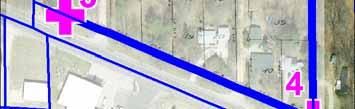
24 What is the difference? Why does a county with 15,322 parcels push for erecording, internal connectivity, and change the past county model of recording documents? What is the difference between a county with 15,322 parcels and a county with 153,220 parcels?
25 What is the difference? a ZERO
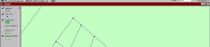
26 Property Records Industry Association Contact Info Kay Wrucke (507)
27 Property Records Industry Association A Brief History of GIS Brent Jones ESRI
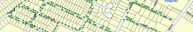
28 Mr. Jones slides are in a separate PowerPoint presentation. This presentation is also posted on the PRIA website.
29 Property Records Industry Association Contact Info Brent Jones

30 Property Records Industry Association GIS and Land Records Integration Joyce A. Watts and Valdis J. Kalnins Allegan County, Michigan
31 Processing Land Records Land Record Treasury Tax Certification Clerk Register Recording & Scanning Add Parcel ID to Land Record & Index Equalization GIS Parcel Mapping Assign Parcel ID Update Property Info


32 GIS Parcels from Legal Descriptions


33 GIS Parcels from Scanned Images Plat Outline in GIS Scanned Image of Plat


34 GIS Parcels from Scanned Images Georeference Plat Trace Lots and Parcels
35 Allegan County Parcel Layer 66,000 Parcels!
36 Laying a Good Foundation Section corners are extremely important!
37 Laying a Good Foundation Use sub-meter or survey-grade GPS!


38 Laying a Good Foundation Michigan Remonumentation Program Locate and re-establish section corners GPS is optional, not required GPS collection requirements have not kept up with advances in GPS technology.
39 What about GIS and Land Records? Original Doc Land Records Search Text Form Recording Doc Index Database Results List Scanning Doc Image Doc Image Doc Image
40 Search using Text Form Problem: Still need a map to locate the property described in the land record.
41 Linking Land Records to GIS Land Records Search Text Search Map Search Doc Index Database 1. Enable GIS Map based search For Land Records & 2. View Property Described in Land Record on Map Results List Doc Image Doc Image Doc Image Doc Image
42 Linking the Land Record to GIS Possible links between Land Records and GIS Address: - Vacant parcels don t have addresses - Address quality (too much variability) - Single address may cover multiple parcels - Single parcel may have multiple addresses (Mobile Homes) Section or Quarter Section - Geography is too broad, search returns too many documents. Plat (Lot) - Most areas of the county are not platted. Legal Description - Very time consuming and requires tools & skills to read and map legal.


43 GIS Integration with Workflows Tax Roll Appraisals & Sales Studies Tax Certification Drain Assessment GIS Planning & Zoning Link to GIS Using PID Forfeiture & Foreclosure Permits & Inspections
44 Issues and Challenges Redacting before allowing public access for older records. Documents may be recorded with incorrect legal descriptions Michigan is a race state. Parcel IDs are reused by county and may represent different areas over time. Legal description associated with Parcel_ID is only valid for the historical period of the land instrument. Level of geography to which record is indexed Need Parcel_ID to link with GIS Parcels.
45 Issues and Challenges Recorded Warranty Deeds Deeds Recorde ed Warranty PID Missing PID Recorded County-wide GIS Parcel Layer Completed Year
46 Treasury Get Tax Info The Public Experience Health Dept Get Address Land Information Services Get Maps Address Map KEY Location INFO! Road Commission Get Road Name Parcel ID Owner Equalization Get Parcel ID Map Legal Land Records Local Govt. Get Assessment &ZoningInfo Register of Deeds Get Land Records
47 Benefits Internal / External Goal is to develop a unified, publicly accessible web-based environment for retrieving all Key Info and Land Records related to parcels in the county. Address Owner Map KEY Location INFO! Parcel ID Land Records Cost savings to the county, the public and the private sector are enormous.


48 Property Records Industry Association Contact Info Joyce A. Watts - Clerk-Register (269) jwatts@allegancounty.org Valdis J. Kalnins GIS Director (269) vkalnins@allegancounty.org
49 Property Records Industry Association Common Denominators and Sample Applications Franklin Peirce Eichelberger International Land Systems
50 Session Agenda Status on the PRIA LR/GIS Initiative Common Denominators Land Records GIS/Mapping Sample Applications Demonstrate the power and utility of Integration Some Other Thoughts and Ideas
51 Status on PRIA s LR/GIS Integration Initiative Three-year work plan approved by Board Briefs overview, revenue, keys, state initiatives, 12- steps of LR Modernization, time slice mapping Workshops four, one-half day with components to mix and match (PREP style local gatherings) Podcasts, wikis, Blogs, FAQ s Case studies White papers and standards


52 Initiative Schedule
53 LR Updates Triggers GIS Actions Property boundary updates Subdivision plats and development Other GIS layer maintenance, i.e. pipelines Condominiums, residential and commercial Parking Cell towers Tax exempt properties--eleemosynary
54 GIS A Major Consumer of LR Review instruments for map/record update Read legal descriptions Map legal description Update maps Correct maps Maps are a model Only real map is what s on earth s surface!
55 Transfers Trigger Assessment
56 LR Feed to Assessment/CAMA
57
58 GIS Common Denominators PIN s, AIN s (Unique or not? Over time?) Tax map ids GPINs, centroids (different kinds) UPI Uniform/Universal Property/Parcel Identifier X-Y-Z coordinates (State Plane Coordinates) Flat map Latitude/Longitude Round globe Subdivision Names Property Owner(s) Name(s) (who gets the tax bill?) Situs (Location) Address Vs. Mailing Address Place names and landmarks
59 Monuments in Legals on Maps A H N M referenced on both G F E M1 B Current Situation C J D M1 I K M L A H N G B I M F Preferred Situation C J D E K L
60 Common Denominators Only Some are Geographic Instrument numbers Deed Book and Page Grantor/Grantee names (Unique names) Jose Gonzales Legal descriptions (Coordinates attached?) SSN (Redaction time) Over time
61 Why Timing is Good for Land Records/GIS Integration Maturing Technologies GIS and land records, www GIS and CAMA--major consumers of your records Geography and ownership are major determinants of almost all other things Need to provide more and better services to the title community and the general public Reduced backlogs and improved efficiencies Value added, greater information content, ease of record access synergy Increased record accuracy and need to minimize i i errors Substantial new revenue possibilities--$$
62 Slide format 6
63 Ideal Situation (12 Steps) LR/GIS integration (over time too) Monuments referenced in legal descriptions State Plane Coordinates in all legals Full ASCII text for legals, not just scanned pixels!
64 Land Record Modernization in Chester County-- 12 Steps Electronic Submission of Records Tax Roll 1st Quarter Deed Full Parse Legal Descriptions 2nd Quarter Time Sensitive GIS Mapping Recorder of Deeds UPI Numbers Legal Description Reference Legal Descriptions/ Vector Flow Geodetic Control Network GIS Map Building + Historical Data Conversion Total Record Integration Clean Keys, Names and Addresses Assessments ecommerce/eland Records
65 Time-slice View of Land Records PIN Numbers UPI Numbers Recorded Instruments Over time GIS Maps Point in time Census Oblique First Photos Photos Photos Photos Census Photos


66 GIS/Mapping Staff w/ GPS


67 CORS Site w/ University


68


69 Which is the Real Corner?


70 GPS Capture of Street Trees
71
72 Org. Chart
73 Parent/Child Queries by UPI
74 Property Records Industry Association Questions? Thank You.. F. Peirce Eichelberger International Land Systems (610)
75 Property Records Industry Association The Case for Integration Diane Swoboda Peterson Sioux City, Iowa
76 LR/GIS Integration What it s NOT One office taking over or being subsumed by another office Blending of records series to the point of being indistinguishable Making g things more complicated than they need to be just because we can
77 LR/GIS Integration What it IS Cooperation between government agencies for the benefit of the citizens of our communities Best practices and standards that facilitate the flow of data between offices
78 Why integrate? Citizens, becoming aware of the power of the internet will no longer accept the idea that government services have to be slow or inefficient. Bill Gates the Speed of Thought
79 Why integrate? We can improve the quality of data We can improve the quality various processes: Lending Zoning Planning & Development Human Services Law Enforcement
80 Why integrate? It makes sense Our customers {spelled v-o-t-e-r-s} expect it
81 What can PRIA do? Compare our data standards to those of other organizations No need to recreate the wheel Draft white papers to educate our members about issues and benefits Present t workshops and webinars Leverage the PREP network
82 What Next? FAQ & Work Plan documents are completed Monthly Workgroup conference calls to work on deliverables in Work Plan for details
83 Property Records Industry Association The Case for Integration Diane Swoboda Peterson
84 Property Records Industry Association PRIA GIS Workshop Thanks for coming! Enjoy the Conference!
Questions and Answers For Recorders About Land Records And GIS Integration
 2501 Aerial Center Parkway, Suite 103, Morrisville, NC 27560 877.997.7742 Questions and Answers For Recorders About Land Records And GIS Integration Adopted by the PRIA Board on March 15, 2011 http://www.pria.us
GIS and Land Records Integration A PRIA White Paper
 110 Horizon Drive, Suite 210, Raleigh, NC 27615 919.459.2081 GIS and Land Records Integration A PRIA White Paper Adopted by the PRIA Board on December 20, 2017 www.pria.us/ GIS and Land Records Integration
PRIA Geographic Information Systems (GIS) Workgroup Work Plan
 Workgroup Work Plan") 2501 Aerial Center Parkway, Suite 103, Morrisville, NC 27560 877.997.7742 PRIA Geographic Information Systems (GIS) Workgroup Work Plan http://www.pria.us PRIA Copyright Notice, Disclaimer and Evaluation
2501 Aerial Center Parkway, Suite 103, Morrisville, NC 27560 877.997.7742 PRIA Geographic Information Systems (GIS) Workgroup Work Plan http://www.pria.us PRIA Copyright Notice, Disclaimer and Evaluation
New Models for Property Data Verification and Valuation
 New Models for Property Data Verification and Valuation for 2006 IAAO Councils and Sections Joint Seminar May 9-11, 2006 Charleston, South Carolina Presented by George Donatello, CMS Principal Consultant
Fit-for Purpose Approaches to Land Administration
 Fit-for Purpose Approaches to Land Administration Brent Jones, PE, PLS Global Manager, Casastre/Land Records bjones@esri.com Land Administration GIS is the platform for land administration Land administration
Cadastral Framework Standards
 Cadastral Framework Standards The goal of the Data Standards and Recommendations Committee is to provide recommendations and guidelines to Indiana GIS user communities to facilitate the collection, maintenance
Accounts in Brazoria County have two primary Identification numbers. The two forms of Identification are as follows:
 Accounts in Brazoria County have two primary Identification numbers. The two forms of Identification are as follows: Property ID: This is a six digit number that is generated sequentially as accounts are
GAUSSCAD A WEBGIS APPLICATION FOR COLLECTING CADASTRAL DATA
 M.M. Moise GaussCAD a WebGIS Application for Collecting Cadastral Data GAUSSCAD A WEBGIS APPLICATION FOR COLLECTING CADASTRAL DATA Mihai-Mircea MOISE, S.C. GAUSS S.R.L., mihai.moise@gauss.ro Abstract:
PROPERTY TAX IS A PRINCIPAL REVENUE SOURCE
 TAXABLE PROPERTY VALUES: EXPLORING THE FEASIBILITY OF DATA COLLECTION METHODS Brian Zamperini, Jennifer Charles, and Peter Schilling U.S. Census Bureau* INTRODUCTION PROPERTY TAX IS A PRINCIPAL REVENUE
Kandiyohi County Recorder s Office
 Kandiyohi County Recorder s Office Presentation for Department Head Meeting March 11, 2010 And Updated November 1, 2011, By Julie Kalkbrenner Kandiyohi County Recorder/Registrar of Titles Office Location
An Evaluative Approach for Creating Digital Torrens Abstract Boundaries: A Case Study for Hennepin County, MN
 An Evaluative Approach for Creating Digital Torrens Abstract Boundaries: A Case Study for Hennepin County, MN Andrew King-Scribbins Saint Mary s University of Minnesota, Department of Resource Analysis,
Using GIS To Manage Surface Ownership and Right-Of-Way
 Using GIS To Manage Surface Ownership and Right-Of-Way Jeff Bute - Sr. Land Maintenance Rep. / GIS Analyst Jeff was formerly a Property Tax Right of Way and Claims field agent for the company. Now he uses
Schedule A. Citation 1 These regulations may be cited as the Land Registration Administration Regulations. Definitions 2 (1) In these regulations,
 In these regulations,") Schedule A Regulations Respecting Administration of the Land Registration Act made by the Minister of Service Nova Scotia and Municipal Relations under Section 94 of Chapter 6 of the Acts of 2001, the
Schedule A Regulations Respecting Administration of the Land Registration Act made by the Minister of Service Nova Scotia and Municipal Relations under Section 94 of Chapter 6 of the Acts of 2001, the
A CADASTRAL GEODATA BASE FOR LAND ADMINISTRATION USING ARCGIS CADASTRAL FABRIC MODEL A CASE STUDY OF UWANI ENUGU, ENUGU STATE, NIGERIA
 A CADASTRAL GEODATA BASE FOR LAND ADMINISTRATION USING ARCGIS CADASTRAL FABRIC MODEL A CASE STUDY OF UWANI ENUGU, ENUGU STATE, NIGERIA BY Ndukwu, Raphael. Ike Department of Geoinformatics & Surveying University
Reassessment / GIS Project
 Reassessment / GIS Project Harry D. Lindsay, Director Department of Planning & Economic Development June 12, 2008 Background History Project initiated in 2001 Existing parcel maps vs. digital parcel maps
FGDC SUBCOMMITTEE FOR CADASTRAL DATA. October 2004 Albuquerque, New Mexico Meeting
 FGDC SUBCOMMITTEE FOR CADASTRAL DATA October 2004 Albuquerque, New Mexico Meeting The National Spatial Data Infrastructure is the means to assemble geographic information that describes the arrangements
City of Surrey s Digital Plan Submission Process
 City of Surrey s Digital Plan Submission Process Cadastral Update Karen Stewart, B.Tech. (GIS) Spatial Information Manager Peter Mueller, B.C.L.S., C.L.S. Survey Manager City of Surrey, British Columbia,
Field surveying inspection using tablets
 Field surveying inspection using tablets Rami Farraj, Ahmad Sghyyer Survey of Israel, Lincoln 1, Tel-Aviv, Israel rami@mapi.gov.il ahmad@mapi.gov.il Key words: Field Surveying, Cadastre, Mapping Procedures
Cadastral NSDI Reference Document
 Cadastral NSDI Reference Document Version 12 October 2012 FGDC Subcommittee for Cadastral Data Cadastral NSDI Reference Document Table of Contents 1. Purpose... 1 2. Business Applications... 1 3. Terminology
Assessor. Mission Statement: Functions: Long Term Goals: Page 1 of 6
 Assessor Mission Statement: The mission of the Assessor s Office is to create accurate, equitable, and timely property tax assessments to fund public services; and to be a source of current, accurate property
A Geocoded Cadastral Fabric as a Precondition for a Sustainable Land Management System
 A Geocoded Fabric as a Precondition for a Sustainable Land Management System Gottfried KONECNY, Germany; J.P. LAUZON, Canada; Abdul Salam MOHAMMED, India Key words: SDI,, Parcel Boundaries, GPS-GNSS, Land
Real Estate Transaction Method And System
 ( 1 of 1 ) United States Patent Application 20060282378 Kind Code A1 Gotfried; Bradley L. December 14, 2006 Real Estate Transaction Method And System Abstract A method and system for brokering real estate
QUESTIONNAIRE. 1. Authorizing statute(s) citation West Virginia Code and 11-1C-4(d)
 citation West Virginia Code and 11-1C-4(d)") QUESTIONNAIRE (Please include a copy of this form with each filing of your rule: Notice of Public Hearing or Comment Period; Proposed Rule, and if needed, Emergency and Modified Rule.) DATE: 6/8/15 TO:
QUESTIONNAIRE (Please include a copy of this form with each filing of your rule: Notice of Public Hearing or Comment Period; Proposed Rule, and if needed, Emergency and Modified Rule.) DATE: 6/8/15 TO:
Directorate of Survey and Mapping NAMIBIA. Cadastral Information System. Vehupisa Kasuko Tjatindi Surveyor Directorate of Survey and Mapping NAMIBIA
 Vehupisa Kasuko Tjatindi Directorate of Survey and Mapping NAMIBIA Tel: +64 61 965000 Directorate of Survey and Mapping NAMIBIA Cadastral Information System Introduction Over the past few decades cadastral
Egyptian Nationwide Title Cadastre System
 Kholoud SAAD, Egypt Key words: Cadastre, Registration, Urban, Rural, National Cadastre, Automation, reengineering. SUMMARY With growing need for integrated information, Enterprise Solutions has become
Contents. & equitable. 16 Cover illustration by Chris Bennett and Daniel Anzaldi, RES FAIR. 3 Appraiser-Friendly GIS: Cover Story
 Contents AUGUST 2006 VOLUME 4. NUMBER 8 Cover Story 3 Appraiser-Friendly GIS: Keeping the Focus on the User by Daniel Anzaldi, RES Feature Article 7 A Partnership in Integration: The State of Wyoming and
MEMORANDUM OF UNDERSTANDING (MOU) Between Oakland County Register of Deeds and
 Between Oakland County Register of Deeds and") MEMORANDUM OF UNDERSTANDING (MOU) Between Oakland County Register of Deeds and THIS MEMORANDUM OF UNDERSTANDING (hereinafter MOU ) is made and executed as of this day of, 20 by and between the Oakland
MEMORANDUM OF UNDERSTANDING (MOU) Between Oakland County Register of Deeds and THIS MEMORANDUM OF UNDERSTANDING (hereinafter MOU ) is made and executed as of this day of, 20 by and between the Oakland
ERER Pilot Measurements County & Trusted Submitter
 ERER Pilot Measurements County & Trusted Submitter ERER Task Force Consideration 1. Cost / Benefit - Consider studying existing system configurations, hardware types, outsourcing practices, and vendor
BULGARIAN CADASTRE A GUARANTEE FOR THE OWNERSHIP RIGHTS IN IMMOVABLE PROPERTIES
 4 TH INTERNATIONAL CONFERENCE RECENT PROBLEMS IN GEODESY AND RELATED FIELDS WITH INTERNATIONAL IMPORTANCE February 28 - March 2, 2007, Inter Expo Centre, Sofia, Bulgaria BULGARIAN CADASTRE A GUARANTEE
Internet Data Exchange TM
 Internet Data Exchange TM PUTTING BROKERS IN CONTROL OF THEIR LISTINGS ON THE WEB Revised: August 2018 For Questions & Concerns Contact: J Stepp Data Distribution Director Phone: 919-654-5400 Fax: 919-654-5401
CFPB Implementation of Parcels Provision in HMDA Under Dodd-Frank
 CFPB Implementation of Parcels Provision in HMDA Under Dodd-Frank Land ownership is the foundation of the financial, legal, and real estate systems in our society Parcel Data vs. Census Data + Census data
"WORKING TOGETHER" Property Records Education Partners (PREP)
") "WORKING TOGETHER" Property Records Education Partners (PREP) PREP Newsletter Volume 20 - mid-june 2011 Land Records and GIS Integration - why do we care? In the last issue of the PREP Newsletter, we posted
"WORKING TOGETHER" Property Records Education Partners (PREP) PREP Newsletter Volume 20 - mid-june 2011 Land Records and GIS Integration - why do we care? In the last issue of the PREP Newsletter, we posted
Pictou has a New LRO!
 Issue 12 Pictou has a New LRO! March 2009 It takes a great team effort and organization to move a Land Registration Office, and that s what happened in Pictou when the old office closed on Thursday, January
Cadastral Information System of Sofia
 Alexander LAZAROV and Hristo DECHEV, Bulgaria Key words: ABSTRACT A new Cadastre and Property Register Act (CPRA) was passed in April 2000, setting up rules for the maintenance of these two registers.
Employing a GIS-based Approach to Developing. Student Generation Rates
 Employing a GIS-based Approach to Developing Presented by: Elisabeth Schuck, AICP Tindale-Oliver & Associates, Inc. Overview of Presentation 1 2 3 Demand Component Overview Traditional SGR Approach GIS
PROJECT INFORMATION DOCUMENT (PID) APPRAISAL STAGE Report No.: PIDA Project Name. Region Country Sector(s) Theme(s)
 APPRAISAL STAGE Report No.: PIDA Project Name. Region Country Sector(s) Theme(s)") Public Disclosure Authorized Public Disclosure Authorized Public Disclosure Authorized Public Disclosure Authorized Project Name Region Country Sector(s) Theme(s) Lending Instrument Project ID Borrower(s)
Public Disclosure Authorized Public Disclosure Authorized Public Disclosure Authorized Public Disclosure Authorized Project Name Region Country Sector(s) Theme(s) Lending Instrument Project ID Borrower(s)
Modernizing Land Administration Systems
 Presented at the FIG Congress 2018, May 6-11, 2018 in Istanbul, Turkey Modernizing Land Administration Systems B r e n t J o n e s P E, PLS E s r i Land Administration Systems GIS is the Technology Platform
Jack McKenna, Director of Business Development, Africa and the Caribbean
 Presented at the FIG Working Week 2016, May 2-6, 2016 in Christchurch, New Zealand Jack McKenna, Director of Business Development, Africa and the Caribbean FIG WORKING WEEK 2016 Fit for Purpose Parcel
SECTION 2 REPUBLICATION OF BROKER RECIPROCITY DATABASE ON INTERNET PERMITTED..
 MICHIGAN REGIONAL INFORMATION CENTER, LLC BROKER RECIPROCITY/INTERNET DATA DISPLAY (IDX) RULES AND REGULATIONS SECTION 1 - DEFINITIONS Broker Reciprocity Broker Reciprocity affords MLS Participants the
MANAGEMENT OCCUPANCY REVIEW
 MANAGEMENT OCCUPANCY REVIEW Presented by: Kristy Yeadon kyeadon@cms-results.com 2017 Contract Management Services Who is CMS? Located in Bremerton, WA,Contract Management Services (CMS) is a division of
REQUEST FOR PROPOSALS NEW HAMPSHIRE HOUSING FINANCE AUTHORITY FOR ACCESSORY DWELLING UNITS IN NEW HAMPSHIRE: A GUIDE FOR HOMEOWNERS
 REQUEST FOR PROPOSALS NEW HAMPSHIRE HOUSING FINANCE AUTHORITY FOR ACCESSORY DWELLING UNITS IN NEW HAMPSHIRE: A GUIDE FOR HOMEOWNERS About New Hampshire Housing Finance Authority (NHHFA): As a self-supporting
ASSESSOR'S OFFICE I. DEPARTMENT MISSION OR MANDATE OR GOAL
 ASSESSOR'S OFFICE I. DEPARTMENT MISSION OR MANDATE OR GOAL The purpose of the Assessor's Office is to produce a timely roll of all property subject to local assessment; administer legally permissible exemptions;
The Strategic Plan can be viewed by clicking this link.
 What is the purpose of the Land Information Office? Many of Brown County's most basic services rely on accurate and up-to-date land information. Emergency response, resource conservation, infrastructure
MnDOT Contract No Exhibit B. Scope of Work. Scope of Work
 MnDOT Contract No. 1032993 Contract General Description The purpose of this contract is to provide the State with the survey accurate re-establishment of designated Public Land Survey section boundaries
Sherburne County, Minnesota expands their erecording Services
 Page 1 of 5 PREP Newsletter Volume 41 - April 2012 Newsletter Sponsors Sherburne County, Minnesota expands their erecording Services Congratulations to Sherburne County and its customers in the Elk River,
002 - Assessor GENERAL GOVERNMENT SERVICES ASSESSOR Assessor. At a Glance:
 GENERAL GOVERNMENT SERVICES 002 - ASSESSOR Operational Summary Mission: To serve the citizens of Orange County by valuing all legally assessable property with uniformity and impartiality, producing property
Sir Robert Torrens. Extract of Register. E-Land Conveyancing and Registration Vision and Risks
 E-Land Conveyancing and Registration Vision and Risks Prof. Haim Sandberg Law School, College of Management, Rishon Le-Zion, Israel Extract of Register Sir Robert Torrens 1 Generating documents Signing
Finding and Prioritizing Boundary Evidence
 Finding and Prioritizing Boundary Evidence THREE PHASES OF A RETRACEMENT SURVEY Collect and Analyze the Record Evidence Perform a Field Survey to Search for Evidence Referenced in the Record and Signs
What is the fee for the UPI Certification and where is it collected?
 What is a Uniform Parcel Identification Number/UPI Number? A UPI Number is a 14-digit number series, that contains (-), (,) and (.), which identifies each separate tract, lot or parcel of real estate in
Revenue. Major part of ULB's revenue comes by means of:
 Revenue Major part of ULB's revenue comes by means of: Collecting property tax Issuing trade licenses Alloting its land and buildings to carry out business Collecting usage charges and service fees for
2019 New Homes Tour Important Dates & Contact Information
 2019 New Homes Tour Important Dates & Contact Information BIA Staff: Danielle Kilian, Events Director danielle@biaofclarkcounty.org Phone: 360-694-0933 Tour Dates: June 1-2 & 8-9, 2019 Entry Fees: Due
Correcting Coverage Deficiencies in Address-Based Frames: The Use of Enhanced Listing
 Correcting Coverage Deficiencies in Address-Based Frames: The Use of Enhanced Listing Ned English, Katie Dekker, and Colm O Muircheartaigh NORC at the University of Chicago Presented at FCSM 2013 Outline
Table of Contents SECTION 1. Overview... ix. Course Schedule... xiii. Introduction. Part 1. Introduction to the Income Capitalization Approach
 Table of Contents Overview... ix Course Schedule... xiii SECTION 1 Introduction Part 1. Introduction to the Income Capitalization Approach Preview Part 1... 1 Market Value... 3 Anticipation and Other Relevant
105 parkway drive - unit c lease
 105 parkway drive - unit c lease table of contents section I property brochure & market data property flyer additional photos section II property maps location map aerial imagery map survey standard site
2018 Assessment Roll Edit Guide for Parcel-Level Geographical Information System (GIS) Information
 Information") 2018 Assessment Roll Edit Guide for Parcel-Level Geographical Information System (GIS) Information Florida Department of Revenue Property Tax Oversight January 2, 2018 Intended Users This edit guide is
2018 Assessment Roll Edit Guide for Parcel-Level Geographical Information System (GIS) Information Florida Department of Revenue Property Tax Oversight January 2, 2018 Intended Users This edit guide is
PART ONE - GENERAL INFORMATION
 Corrected Date: Page 7 Date of Submittal Changed to Coincide with Submittal Date on Page 5 PART ONE - GENERAL INFORMATION A. INTRODUCTION B. Background Miami Shores Village is soliciting responses to this
Implementation Status & Results Croatia Integrated Land Administration System Project (P122219)
") Public Disclosure Authorized Public Disclosure Authorized The World Bank Implementation Status & Results Croatia Integrated Land Administration System Project (P122219) Operation Name: Integrated Land
Public Disclosure Authorized Public Disclosure Authorized The World Bank Implementation Status & Results Croatia Integrated Land Administration System Project (P122219) Operation Name: Integrated Land
KCAA Agenda... 8:00 9:00 9:00 12:00. David Harper, Director Roger Hamm, Deputy Director 6/11/2015. Opening remarks.
 KCAA 2015 David Harper, Director Roger Hamm, Deputy Director Agenda... 8:00 9:00 Opening remarks RMA presentations director s update 9:00 12:00 Round Table Sessions (repeating ½ hour sessions) 1 Round
Land Administration and Spatial Enablement Victoria s Experience. Chris McRae, Executive Director Land Victoria
 Land Administration and Spatial Enablement Victoria s Experience Chris McRae, Executive Director Land Victoria 4 th UN Land Administration Forum, October 2011 Outline About Land Victoria Land Victoria
Ohio Department of Transportation. Division of Engineering. Office of Real Estate. Synergy. Real Estate Business Analysis
 Ohio Department of Transportation Division of Engineering Office of Real Estate Synergy Real Estate Business Analysis Appraisal System Specification Version 1.02 Revision History Date Version Modified
LIS Development Project and Measures Proposed to Enhance Trust in the Land Administration System in Uganda
 Project for Design, Supply, Installation and Implementation of the Land Information System and Securing of Land Records (DeSILISoR) LIS Development Project and Measures Proposed to Enhance Trust in the
Online Cadastre and Tantalis GATOR
 Online Cadastre and Tantalis GATOR Online Cadastre Free, public online access to BC Crown land cadastral information and other geographic data LTSA is responsible for maintenance of and enhancements to
Table of Contents. Introduction/Background 1. Project Introduction Background. Project Scope of Services 2. Project Overview Project Specifications
 Scott County GPS Corner Survey Request for Proposals March 12, 2007 Revised March 22, 2007 Project Scope of Services 5.b., p. 3. Table of Contents Introduction/Background 1 Project Introduction Background
Agenda Project Overview Project Objectives Registration Service Re-Engineering System Overview
 Agenda Project Overview Project Objectives Registration Service Re-Engineering System Overview Sydney, Australia, 11 16 April 2010 1 Project Overview Future Vision There is a vision within senior levels
Reviewing a Timberland Appraisal for Accuracy and Credibility
 Reviewing a Timberland Appraisal for Increase your confidence in understanding and reviewing appraisal reports for your clients and company. April 18 19, 2017 Holiday Inn Portland South Wilsonville, OR
GSE FOCUS. Visit WorkflowGeeks.com for more free titles. Sponsored by Mercury Network
 GSE FOCUS Visit WorkflowGeeks.com for more free titles. Sponsored by Mercury Network The SaaS Vendor Management Platform chosen by over 600 of the nation s lenders and AMCs to power more than 20,000 appraisals
RPR Product Overview RPR National Property Data Sets Reporting Features... 3
 Table of Contents RPR Product Overview... 2 RPR National Property Data Sets... 3 Reporting Features... 3 Features only available with MLS/CIE data included in RPR... 4 Why Include MLS/CIE Data into RPR?...
Automated Land Development Applications
 Automated Land Development Applications AGENDA Yarra Valley Water Land Development Process GIS Automation Business Rules Engine Automated Spatial Analysis Questions.Encourage GIS community to embrace GIS
Minnesota Electronic Real Estate Recording Industry Submission Guide Compiled by MCRA/MLTA erecord Work Group Subcommittee
 Minnesota Electronic Real Estate Recording Industry Submission Guide Compiled by MCRA/MLTA erecord Work Group Subcommittee Endorsed by Minnesota Electronic Real Estate Recording Commission Version -1 08/16/2012
Functional system for cadastral plans
 , Republic of Macedonia Key words: Cadastre, Digital plans, Data, System SUMMARY The analysis shows that the real estate market in Republic of Macedonia grows daily. With the expansion of this market increases
2401 S. E. Monterey Road, Stuart, FL Plat Application Martin County Growth Management Department
 Martin County, Florida Growth Management Department DEVELOPMENT REVIEW DIVISION PLAT APPLICATION A. Identification of the applicant or agent: Applicant (property owner): Address: Telephone: Applicant's
WHAT YOUR REALTOR DOES FOR YOU IN 181 STEPS
 WHAT YOUR REALTOR DOES FOR YOU IN 181 STEPS Surveys show that many homeowners and homebuyers are not aware of the true value a REALTOR provides during the course of a real estate transaction. The list
Geoinformation Technologies in Land Management and Beyond: Case of Georgia
 Geoinformation Technologies in Land Management and Beyond: Case of Georgia Joseph SALUKVADZE Professor, Department of Human Geography, Co-team Leader, Cadastre and Land Register Project, Co-financed by
Progress Report on Green Paper. Dr. Paddy Prendergast. on behalf of the. IIS Commission on Land Registration
 Progress Report on Green Paper By Dr. Paddy Prendergast on behalf of the IIS Commission on Land Registration Paddy Prendergast - Chair Brendan Sweeny - Hempenstall Surveys Paul Corrigan - P Corrigan Associates
Parcel Identifiers for Cadastral Core Data: Concepts and Issues
 Parcel Identifiers for Cadastral Core Data: Concepts and Issues Nancy von Meyer, Bob Ader, Zsolt Nagy, David Stage, Bill Ferguson, Katie Benson, Bob Johnson, Stu Kirkpatrick, Robert Stevens, Dan Mates
The Buyer Consultation: Demonstrating & Articulating Value. Interactive Workshop. Student Workbook
 The Buyer Consultation: Demonstrating & Articulating Value Interactive Workshop Student Workbook The Buyer Consultation: Demonstrating and Articulating your Value What is a Buyer Consultation? What is
Developing a Consumer-Run Housing Co-op in Hamilton: A Feasibility Study
 Developing a Consumer-Run Housing Co-op in Hamilton: EXECUTIVE SUMMARY December, 2006 Prepared for: Hamilton Addiction and Mental Health Network (HAMHN): c/o Mental Health Rights Coalition of Hamilton
Indiana Regional MLS General Information Talking Points June 2012
 The following 15 leading boards are engaged in the initiative to create the Indiana Regional MLS. They are the Founders representing about 5,000 REALTORS with the intention of creating a new streamlined
Will County GIS Product Distribution Policy January, 2008
 Will County GIS Product Distribution Policy January, 2008 Background: The goal of this policy is to provide GIS products to users in a reasonable manner and to ensure that products released are of sufficient
Esri Middle East and Africa User Conference. December Abu Dhabi, UAE. Land Administration. Mark Baker
 Esri Middle East and Africa User Conference December 10 12 Abu Dhabi, UAE Land Administration Mark Baker Our Agenda 0900 0930 Welcome Mark Baker, Esri 0930 1030 New Directions The New Addressing System
Marketing PACE to Commercial Property Owners
 Monthly Municipal Forum Marketing PACE to Commercial Property Owners January 18, 2011 1 Together, providing a platform for sharing PACE experience, education and information with others. Today s agenda:
New Technology for Cadastral Systems. Brent Jones, PE, PLS
 New Technology for Cadastral Systems Brent Jones, PE, PLS Benefits of Good Land Administration Key to addressing global challenges.. Secure Tenure Equitable Land and Property Taxation Support for Government
Using Geographical Information Systems to Enhance Public Finance Analyses
 Using Geographical Information Systems to Enhance Public Finance Analyses Presented by: Bob Wallace, P.E., AICP November 5, 2009 Presentation Overview 1 2 3 4 Introduction 2008 Recap New Application: GIS
11 Teranet Easement Mapping Data Acquisition
 Clause 11 in Report No. 18 of Committee of the Whole was adopted, without amendment, by the Council of The Regional Municipality of York at its meeting held on November 19, 2015. 11 Teranet Easement Mapping
Public Lands Formal Disposition Application Process
 April 19, 2018 List of Documents and Webpages To access the AEP documents referenced in this schedule, search one of the following document titles at aep.alberta.ca Associated Dispositions, Access Roads
Arlington County, Virginia. Internal Audit of the Real Estate Assessment Appeals Process Calendar Year Ended December 31, 2014
 Arlington County, Virginia Internal Audit of the Real Estate Assessment Appeals Process Calendar Year Ended December 31, 2014 Table of Contents Transmittal Letter... 1 Executive Summary... 2-9 Background...
Difficulties in Creating a Notice filing System for Immovable Property
 Difficulties in Creating a Notice filing System for Immovable Property Professor Tom Johnson, Osgoode Hall Law School EBRD Secured Lending in Commercial Transactions: Trends and Perspectives 4 5 November
RPSV4 Users ORPTS Regional Directors and Managers ORPTS Customer Relationship Managers ORPTS Regional V4 Support Staff
 TO: FROM: RPSV4 Users ORPTS Regional Directors and Managers ORPTS Customer Relationship Managers ORPTS Regional V4 Support Staff Michael Griffen, RPS Support Group DATE: December 5 2016 SUBJECT: RPSV4
WEST BEND SALE LEASEBACK OPPORTUNITY
 WEST BEND SALE LEASEBACK OPPORTUNITY 3.65 ACRE PARCEL OF CONTIGUOUS VACANT LAND AVAILABLE OFFERING MEMORANDUM 3014-3020 E Progress Dr West Bend, WI 53095 West Bend Sale Leaseback Opportunity CONTENTS 01
WSSC EASEMENT PREPARATION AND SUBMITTAL GUIDELINES
 WSSC EASEMENT PREPARATION AND SUBMITTAL GUIDELINES PREPARED BY THE LAND SERVICES SECTION ENGINEERING AND ENVIRONMENTAL SERVICES DIVISION UPDATED SEPTEMBER, 2017 Page 1 TABLE OF CONTENTS TABLE OF CONTENTS...
East Volusia Cities Just West Volusia Cities Just
 Volusia s Real Estate Market Recovery & other mind of morgan sorts of things. Presented to: VCARD Daytona Regional Chamber of Commerce Daytona Beach Area Association of Realtors Volusia Building Industry
The Real Estate Transaction in 180 Steps What Your REALTOR Does for You
 REALTOR ASSOCIATION OF PIONEER VALLEY, INC. The Western New England Center for Real Estate Services 221 Industry Avenue Springfield, MA 01104 413-785-1328 phone 877-854-6978 toll-free 413-731-7125 fax
ADDENDUM #2_RFP # Computer Mass Appraisal (CAMA) Software for HC Assessor Department
 Software for HC Assessor Department") Horry County Government PROCUREMENT DEPARTMENT www.horrycounty.org Horry County Office of Procurement 3230 Hwy. 319 E. Conway, South Carolina 29526 Phone 843.915.5380 Fax 843.365.9861 TO: FROM: ALL INTERESTED
Horry County Government PROCUREMENT DEPARTMENT www.horrycounty.org Horry County Office of Procurement 3230 Hwy. 319 E. Conway, South Carolina 29526 Phone 843.915.5380 Fax 843.365.9861 TO: FROM: ALL INTERESTED
ACCELERATING OUR MOMENTUM. Analyst and Investor Day 2014 May 22, Move, Inc. All rights reserved. Do not copy or distribute.
 ACCELERATING OUR MOMENTUM Analyst and Investor Day 2014 May 22, 2014 JESSICA THORSHEIM DIRECTOR OF INVESTOR RELATIONS Analyst and Investor Day 2014 May 22, 2014 Statements made in this presentation or
Proposed Information Collection; Comment Request; 2017 New York City Housing and
 This document is scheduled to be published in the Federal Register on 11/05/2015 and available online at http://federalregister.gov/a/2015-28150, and on FDsys.gov DEPARTMENT OF COMMERCE U.S. Census Bureau
Development of e-land Administration in Sweden
 Development of e-land Administration in Sweden Roger EKMAN, Sweden Key words: e-land Administration, e-cadastre, delivery times, process development SUMMARY A characteristic of the Swedish cadastral procedure
Registering Property
 Registering Property Delhi 1. Description of Reform: For procedure 3 Conduct charges search at the Registrar of Companies, Doing Business 2018 records that the buyer must conduct a search in office of
Overview of Public Improvement Districts (PIDs)
") Contact: Boyd London Managing Director 325 North Saint Paul Street Suite 800 Dallas, Texas 75201 214.953.4013 boyd.london@firstsw.com Jim Sabonis Managing Director 325 North Saint Paul Street Suite 800
Contact: Boyd London Managing Director 325 North Saint Paul Street Suite 800 Dallas, Texas 75201 214.953.4013 boyd.london@firstsw.com Jim Sabonis Managing Director 325 North Saint Paul Street Suite 800
DATA DISTRIBUTION FACILITY (DDF ) POLICY AND RULES
 POLICY AND RULES") DATA DISTRIBUTION FACILITY (DDF ) POLICY AND RULES DATA DISTRIBUTION FACILITY (DDF ) POLICY Data Distribution Facility (DDF ) Overview CREA has created a Data Distribution Facility (DDF ) to enable CREA
DATA DISTRIBUTION FACILITY (DDF ) POLICY AND RULES DATA DISTRIBUTION FACILITY (DDF ) POLICY Data Distribution Facility (DDF ) Overview CREA has created a Data Distribution Facility (DDF ) to enable CREA
Title: Land Records Technician. Burnett County Job Description
 Land Records Technician Burnett County Job Description Name: Date: July 7, 2010 Employer: Burnett County Title: Land Records Technician Department: Land Information and Work Location: Government Center