Modernizing Land Administration Systems
|
|
|
- Rudolf Simpson
- 5 years ago
- Views:
Transcription

1 Presented at the FIG Congress 2018, May 6-11, 2018 in Istanbul, Turkey Modernizing Land Administration Systems B r e n t J o n e s P E, PLS E s r i


2 Land Administration Systems GIS is the Technology Platform Digital Cadastre Mapping Property Valuation Transaction Analysis Integrated Land Management Field Data Collection Address Systems Resource Leases National Data Portal Powering Land Administration Systems Worldwide


3 Collect, Manage, Analyze and Securely Share Land Information ArcGIS is the platform for land administration systems Tax Map Land Registration Predicting Vacancy Interagency Collaboration Cadastral Public Land Use Portal Russia Pennsylvania City of Philadelphia The Netherlands Provincie Noord-Holland Canadian County, Oklahoma Austria SynerGIS Sales Density Revenue vs. Expenditures Jamaica National Land Agency Assessed Value Tax Appeals Change in Property Value Illinois GISRDC Ohio DEVNET Incorporated Ohio Cleveland State University Houston HCAD
4 GIS The Platform for Land Administration Tenure Valuation Land Use Land Development Land Market Cadaster Titling Surveying Addressing Census ROW Valuation Taxation Subsidies Land Use Permitting Land Consolidation Eviction Permitting Acquisition Expropriation Preemption Land Market Trading Land Applications Portal Land Services Land Information Data


5 System of Record Organizes and Manages the Legal Record of Ownership, Value and Location Cadastral History Quebec, Canada Parcel Query Tax Parcels Auckland, New Zealand Wisconsin


6 System of Insight Understand the factors impacting property value and use Parcel Values Historic District Property Values Trade Market Area Analysis Tax Assessment Nebraska Maui Georgia Operations Dashboard Value Analysis Dashboard


7 System of Engagement Growing with public expectations and capabilities Engaging taxpayers, businesses and citizens with government Portal Story Maps Mobile Comparable Sales/Analytics Open Data Engaging with the public is now a two-way conversation

8 ArcGIS Enables Multiple Types of Systems System of Engagement System of Record System of Insight
9 Modern Architecture GIS Enabling Platform How You Integrate What You Integrate Why You Integrate Client / Server Stand-Alone Desktop Data Models Static Data Single Server Custom Applications Proprietary Data 2D Features Spatial Analysis Digital Cartography Web Services & Apps Connected Desktop Web Maps & Layers Real-Time Distributed Computing Configurable Templates & Apps Open Data & Shared Services 3D Features Spatiotemporal & Big Data Analytics Smart Mapping

10 Web Services Organizes and Securely Sharing Data.. Secure/Identity Standards-based Controlled Access via Identity Control Who Does What - View - Query - Edit Monitor/Track b642840e39cf e0b
11 Web GIS WebGIS is a Transformational Architecture Desktop Apps Server Portal Web Maps Web Scenes Layers Bringing Together Systems with Modern Architecture


12 Web GIS Simplifies Working With All Types of Data Using Web Maps, Scenes, and Layers Creating A Common Language Apps Distributed Lidar Imagery Tabular Vector 3D Real-Time (IoT) Big Data


13 Apps Are Bringing the Power of GIS to Everyone Extending the Reach of GIS Design Apps Viewer Apps Social Media Business Apps Story Maps Dashboards Field Apps Across Organizations and Beyond


14 GIS Content Ready-to-Use Maps and Data Tens of Thousands of Open Datasets & Curated Living Atlas Basemaps Demographics and Lifestyle Imagery Landscape Transportation Oceans Urban Systems Earth Observations Boundaries and Places


15 Apps Extending GIS Capabilities Everywhere Field Office Community Collector Navigator ArcGIS Earth Explorer Story Maps Workforce Maps for Office Maps for SharePoint Operations Dashboard Initiatives Open Data Survey123 Drone2Map Maps for Adobe Creative Cloud Maps for Power BI Photo Survey Quick Report CityEngine GeoPlanner Business Analyst Crowdsource Polling Focused, Powerful, and Ready-to-Use


16 What Apps to Use? Powered by Services Collector Survey123 Explorer Operations Dashboard Drone2Map Maps for Office Insights Support your workforce and workflows..


17 GIS for Cadastral Agencies Supporting All Requirements Parcel Management Field Operations Value Analytics Public Relations Quality Control Parcel Editing Foreclosure Mapping Construction Permit Visualization Modern Public Access Property Appraisal Map Production Mobile Access to View & Edit Identify Flood Risk Visualize Property Value File Assessment Appeals Address Management Workforce CAMA Visualization Residential Comp Finder My Tax Distribution
18 Support Data/Parcel Aggregation Web GIS solution for parcel aggregation Authoritative Parcel Data Community Parcel Layer Information Products Revenue Audit Health Transportation Econ/Dev Environment. + = Contributor Tools Aggregation Model Maps and Apps COTS Tools for aggregating and sharing

19 GIS for the Field Field Data Collection and Field Force Management Workforce Navigator Markup Explorer High Accuracy Collector Survey123 Collecting Data Coordinating Work Advanced Navigation Mapping and Markup New Connected and Disconnected Connecting the Field with the Enterprise


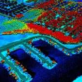
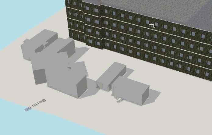
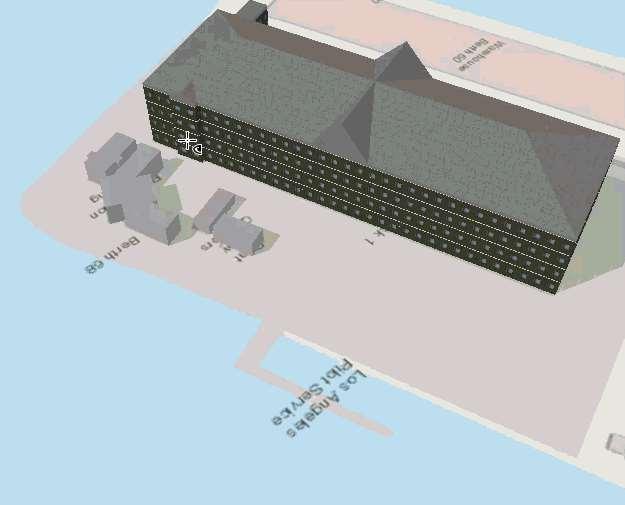
20 3D Cadastre Analysis, Visualization, Maps and Apps Uncovering value locked in your data..
21
22
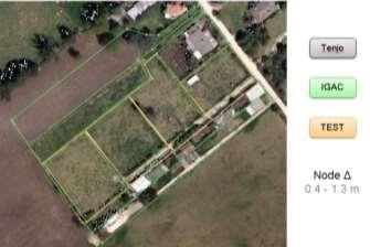
23 Colombia


24 Collaborative Partnering for the Future of Colombia IGAC National Mapping Agency Kadaster International Trimble Esri Esri Colombia.

25 Standards-based Solution Requirement ISO 19152

26 Typical Situation


27 Methodology


28 LADM in ArcGIS Online Apps Base Maps and Data Browser Capabilities Many More Reports
29 Fit For Purpose LA & GIS FFP processes with FFP technology LADM Hosted Services Browser Editing Collector App
30 Collector/ArcGIS Online Enabling New Workflows with High Accuracy LADM Android Choose your own GPS
31 Scalable Systems Desktop Web Device Server Online Content and Services

32 Modern Cadastral Platform Web GIS GIS Supporting Global Cadastre Requirements Portal

33
Fit-for Purpose Approaches to Land Administration
 Fit-for Purpose Approaches to Land Administration Brent Jones, PE, PLS Global Manager, Casastre/Land Records bjones@esri.com Land Administration GIS is the platform for land administration Land administration
New Technology for Cadastral Systems. Brent Jones, PE, PLS
 New Technology for Cadastral Systems Brent Jones, PE, PLS Benefits of Good Land Administration Key to addressing global challenges.. Secure Tenure Equitable Land and Property Taxation Support for Government
Esri Middle East and Africa User Conference. December Abu Dhabi, UAE. Land Administration. Mark Baker
 Esri Middle East and Africa User Conference December 10 12 Abu Dhabi, UAE Land Administration Mark Baker Our Agenda 0900 0930 Welcome Mark Baker, Esri 0930 1030 New Directions The New Addressing System
Cloud GIS Real Estate Management, Appraisal and Development Service USING ESRIs ARCGIS SERVER
 Cloud GIS Real Estate Management, Appraisal and Development Service USING ESRIs ARCGIS SERVER INFODIM: Was founded on 1992 and is internationally certified as a GIS company from D&B Dun & Bradstreet Global
GOVERNMENT. Case Study Ville de Trois Rivières streamlines property assessment
 GOVERNMENT Case Study Ville de Trois Rivières streamlines property assessment GIS-generated parcel basemap provides powerful visualization & analysis capabilities With a population of just over 130,000,
LADM-based Crowdsourced 3D Cadastral Surveying Potential and Perspectives
 National Technical University Of Athens School of Rural and Surveying Engineering LADM-based Crowdsourced 3D Cadastral Surveying Potential and Perspectives Maria Gkeli, Surveying Engineer, PhD student
The Multipurpose Marine Cadastre A Tool for Planning & Decision Making in the Marine Environment
 The Multipurpose Marine Cadastre A Tool for Planning & Decision Making in the Marine Environment Christine Taylor Minerals Management Service (MMS) Brian Smith NOAA Coastal Services Center Maurice Hill
Egyptian Nationwide Title Cadastre System
 Kholoud SAAD, Egypt Key words: Cadastre, Registration, Urban, Rural, National Cadastre, Automation, reengineering. SUMMARY With growing need for integrated information, Enterprise Solutions has become
ParcelMap BC. Compiling a Parcel Fabric for the Province of British Columbia. WENDY AMY and ELLEN STYNER
 ParcelMap BC Compiling a Parcel Fabric for the Province of British Columbia WENDY AMY and ELLEN STYNER Who is MNC? Established in 1997, MNC is a geomatics engineering firm located in Calgary, Alberta.
What s Next for Commercial Real Estate Leveraging Technology and Local Analytics to Grow Your Commercial Real Estate Business
 What s Next for Commercial Real Estate Leveraging Technology and Local Analytics to Grow Your Commercial Real Estate Business - A PUBLICATION OF GROWTH MAPS- TABLE OF CONTENTS Intro 1 2 What Does Local
EXPLORING OPTIONS FOR STANDARDISATION OF PROCESSES AND TRANSACTIONS IN LAND ADMINISTRATION
 EXPLORING OPTIONS FOR STANDARDISATION OF PROCESSES AND TRANSACTIONS IN LAND ADMINISTRATION CHRISTIAAN LEMMEN (1),(2), EVA-MARIA UNGER (2), PETER VAN OOSTEROM (3), MOHSEN KALANTARI (4) AND KEES DE ZEEUW
Presented at the FIG Congress 2018, May 6-11, 2018 in Istanbul, Turkey
 Presented at the FIG Congress 2018, May 6-11, 2018 in Istanbul, Turkey 5 Bibliometric Analysis of Articles Presented Under Commission 7: A Case of the 25th Fig Congress in Malaysia in 2014 Zeynel Abidin
Estonian e-cadastre as basis for efficient land management
 Estonian e-cadastre as basis for efficient land management Priit Kuus Estonian Land Board November 14, 2017 Tallinn Scope of data Cadastral parcels (as of October 2017) 693 026 cadastral parcels, i.e.
CLICK HERE TO KNOW MORE
 CLICK HERE TO KNOW MORE LANDS AND SURVEYS DEPARTMENT SABAH, MALAYSIA GEO-CADASTRE IN LAND ADMINISTRATION: SABAH S EXPERIENCE Sr Hj SAFAR B UNTONG, FISM, MRICS Director, Lands & Surveys Department Sabah,
Using ArcGIS Server for National Property Information System
 Using ArcGIS Server for National Property Information System Shota Chachkhunashvili (National Agency of Public Registry, Georgia) Mikheil Tsiklauri (Geographic, Georgia) San Diego, 2008 About us National
ParcelMap BC Compiling a Parcel Fabric for the Province of British Columbia. Presented by: Ellen Styner (General Manager) and Wendy Amy (GIS Manager)
 and Wendy Amy (GIS Manager)") ParcelMap BC Compiling a Parcel Fabric for the Province of British Columbia Presented by: Ellen Styner (General Manager) and Wendy Amy (GIS Manager) Who is MNC? MNC is a geomatics engineering firm with
ParcelMap BC Compiling a Parcel Fabric for the Province of British Columbia Presented by: Ellen Styner (General Manager) and Wendy Amy (GIS Manager) Who is MNC? MNC is a geomatics engineering firm with
Cadastral services and virtual office in e-cadastre
 Cadastral services and virtual office in e-cadastre Priit Kuus Estonian Land Board October 26, 2016 Coimbra Scope of data Cadastral parcels (as of September 2016) 674 383 cadastral parcels, i.e. 97,7 %
GIS & GPS Applications in Valuation/Appraisal Assessments
 GIS & GPS Applications in Valuation/Appraisal Assessments Simon ADCOCK, Australia Key words: GIS, GPS, mass assessments, 3-dimensional, modelling. SUMMARY The development of GIS and GPS systems has substantially
The agenda for a Group of Experts on Land Administration and Management within the United Nations
 Presented at the FIG Working Week 2016, May 2-6, 2016 in Christchurch, New Zealand The agenda for a Group of Experts on Land Administration and Management within the United Nations Kees de Zeeuw, Kadaster
Trimble Land Solutions -Transforming the way land
 Sanjeev Trehan Regional Manager - SAARC MARCH 2016 Trimble Land Solutions -Transforming the way land tenure is secured and land assets are managed. Government Opportunity Challenge Implementation of secure
Presented by: Stewart Information International, Inc. Jack McKenna
 Presented by: Stewart Information International, Inc. Jack McKenna Held at the: 2007 ESRI Survey & Engineering GIS Summit San Diego Convention Center San Diego, California June 16-19, 2007 Integrating
Land Tenure and Geospatial Data and Technology
 Land Tenure and Geospatial Data and Technology Ioana Bouvier E3/Land and Urban, USAID Senior Geospatial Analyst January 23, 2018 January 23, 2018 1 OUTLINE 1. Overview of geospatial data and technology
GAUSSCAD A WEBGIS APPLICATION FOR COLLECTING CADASTRAL DATA
 M.M. Moise GaussCAD a WebGIS Application for Collecting Cadastral Data GAUSSCAD A WEBGIS APPLICATION FOR COLLECTING CADASTRAL DATA Mihai-Mircea MOISE, S.C. GAUSS S.R.L., mihai.moise@gauss.ro Abstract:
ArcCadastre Implementations within the Middle East
 ArcCadastre Implementations within the Middle East Kholoud Saad SALAMA, Egypt Key words: Cadastre, GIS, Survey, Data Conversion, Workflow SUMMARY In recent years, cadastre systems have developed from manual
NEW DEVELOPMENTS IN THE REAL PROPERTY REGISTER AND CADASTRE IN LITHUANIA
 NEW DEVELOPMENTS IN THE REAL PROPERTY REGISTER AND CADASTRE IN LITHUANIA Jaunius Grigas E-mail: jaunius.grigas@registrucentras.lt Verona, 2008 FUNCTIONS OF STATE ENTERPRISE CENTRE OF REGISTERS Registration
Annual Meeting II/2016 FIG Commission 7 Cadastre & Land Management. Report
 Annual Meeting II/2016 FIG Commission 7 Cadastre & Land Management Report 1 Structure Chair G. Schennach (AT) V-Chair for communications, social media, web Hyunsook LEE (KR) WG 7.1 Fit-For-Purpose LA Ch.
Cadastre a role model for Private-Public-People-Partnership
 Cadastre 4.0 - a role model for Private-Public-People-Partnership Gerda Schennach, Austria Chair of FIG Commission 7 1 Who owns... buildings? the mountains? land? forests? the sea? infrastructure? 2 From
CFPB Implementation of Parcels Provision in HMDA Under Dodd-Frank
 CFPB Implementation of Parcels Provision in HMDA Under Dodd-Frank Land ownership is the foundation of the financial, legal, and real estate systems in our society Parcel Data vs. Census Data + Census data
LRIMS Cadastre Module
 LRIMS Cadastre Module User Requirements and Functionality (Seychelles Case Study) John Latham, NRL Renato Cumani, NRL Luigi Simeone, NRL Summary Background User Requirements Business Model Application
7,446 MEMBERS BENEFITS
 2018 Year in Review The International Association of Assessing Officers (IAAO) is a nonprofit, educational, and research association. We are the premiere professional membership organization of government
Geo-information for Disaster Management: 9/11 Lessons & Developments Since
 Geo-information for Disaster Management: 9/11 Lessons & Developments Since Michael J. Kevany Senior Vice President PlanGraphics, Inc. mkevany@plangraphics.com Introduction World Trade Center perspective
aurelis Real Estate GmbH & Co. KG
 www.aurelis-real-estate.com aurelis Real Estate GmbH & Co. KG IBB GIS the information platform for real-estate related data AED-SYNERGIS has implemented a pilot project for the Region South of the real-estate
In Conversation with Charles Young Bringing Government Cadastres Online
 In Conversation with Charles Young Bringing Government Cadastres Online Spatial Dimension Background Founded in 1999 with 4 staff Currently 50 staff (business analysts, programmers, database specialists,
Use of data in Ukraine for sustainable economic growth. Oleksandr Maliuk State Service of Ukraine for Geodesy, Cartography and Cadastre
 Use of data in Ukraine for sustainable economic growth Oleksandr Maliuk State Service of Ukraine for Geodesy, Cartography and Cadastre Kehl, 2017 Content of the presentation Ukraine & StateGeoCadastre:
Georgia Department of Revenue. WinGAP. Georgia CAMA Software
 WinGAP Georgia CAMA Software Presenter Tracy Thomas Business Operations Specialist Georgia Department of Revenue Local Government Services tracy.thomas@dor.ga.gov Public Utility Appraisal Eight DOR field
2016 LANDU Course Descriptions. Agricultural Land Brokerage and Marketing
 2016 LANDU Course Descriptions Agricultural Land Brokerage and Marketing Gain an understanding of the basics of agricultural land brokerage process s well as insights on how to best market these types
A CADASTRAL GEODATA BASE FOR LAND ADMINISTRATION USING ARCGIS CADASTRAL FABRIC MODEL A CASE STUDY OF UWANI ENUGU, ENUGU STATE, NIGERIA
 A CADASTRAL GEODATA BASE FOR LAND ADMINISTRATION USING ARCGIS CADASTRAL FABRIC MODEL A CASE STUDY OF UWANI ENUGU, ENUGU STATE, NIGERIA BY Ndukwu, Raphael. Ike Department of Geoinformatics & Surveying University
PROCESSES IN CADASTRE: PROCESS MODEL FOR SERBIAN 3D CADASTRE
 UNIVERSITY IN NOVI SAD, SERBIA FACULTY OF TECHNICAL SCIENCES PROCESSES IN CADASTRE: PROCESS MODEL FOR SERBIAN 3D CADASTRE Dubravka SLADIĆ, Aleksandra RADULOVIĆ and Miro GOVEDARICA 6th International FIG
Map Modernization Modernization Program
 FEMA Map Modernization Program Presented to Maryland Association of Floodplain and Stormwater Managers October 27, 2005 Map Modernization Program Autorun.exe 2 Map Modernization Program Outline Map Mod
1-2 November 2018, Amsterdam Theme: Enabling Tomorrow s Connected Infrastructure #GEODESIGNBIM. www. geo-bim.org
 1-2 November 2018, Amsterdam Theme: Enabling Tomorrow s Connected Infrastructure #GEODESIGNBIM Report www. geo-bim.org Overview The second edition of GEO Design+BIM, the one of its kind event focusing
Massive Collection of Cadastral Data in Greece Using Web-enabled GIS Technologies
 Massive Collection of Cadastral Data in Greece Using Web-enabled GIS Technologies Lefteris LYKOUROPOULOS and George MOURAFETIS, Greece Key words: Cadastre, Web services, applications, GIS, data collection
The ISO/TC 211 Land Administration Domain Model (LADM)
") Geographic information/geomatics The ISO/TC 211 Land Administration Domain Model (LADM) Harry Uitermark/Editor LADM Kadaster/ITC, The Netherlands International Organization for Standardization (ISO) A
Geographic information/geomatics The ISO/TC 211 Land Administration Domain Model (LADM) Harry Uitermark/Editor LADM Kadaster/ITC, The Netherlands International Organization for Standardization (ISO) A
The Multi Purpose Cadastre, a network approach
 The Multi Purpose Cadastre, a network approach Peter Laarakker, Kadaster NL 1 Content 1. Introduction 2. Multi purpose cadastre 3. Definitions 4. Cadastral boundaries 5. Real property right 6. Conclusions
G. Schennach / Chair Commission 7. Common Vision Conference 5-6 Oct 2017, Vienna, Austria
 Cadastre 4.0 - Integrating the community for global security on land tenure Gerda Schennach, Austria Chair of FIG Commission 7 1 200 years of innovation Fiscal Legal Local Digital Taxation Land Tenure
Lessons for federated countries that have state land registries the Australian experience
 Lessons for federated countries that have state land registries the Australian experience Ian Williamson Centre for SDI and Land Administration Department Infrastructure Engineering University of Melbourne
LAND ADMINISTRATION IN LITHUANIA: CHALLENGES AND PERSPECTIVES
 UNECE WPLA Workshop Influence of Land Administration on People and Business, Cavtat, Croatia, October 2-3, 2008 LAND ADMINISTRATION IN LITHUANIA: CHALLENGES AND PERSPECTIVES Kestutis Sabaliauskas, Director
The Survey Data Model Technology A practical survey solution to generate all levels of spatial and e-governance outcomes.
 Land Governance in a Rapidly Changing Environment Annual World Bank Conference on Land and Poverty April 24 & 25, 2012 The Survey Data Model Technology A practical survey solution to generate all levels
Homes.com Fusion Portal. Connect Your Members with Quality Leads ALLIANCE NETWORK MEMBER
 Homes.com Fusion Portal Connect Your Members with Quality Leads ALLIANCE NETWORK MEMBER We re very excited to expand the reach of the Homes.com enterprise-level products to CoreLogic clients in the real
CATALOGING, MONITORING AND MANAGING INVASIVE SPECIES ON POST LANDS. PSU Geog596A Capstone Proposal Dale Jantzen Dec 17, 2015
 CATALOGING, MONITORING AND MANAGING INVASIVE SPECIES ON POST LANDS PSU Geog596A Capstone Proposal Dale Jantzen Dec 17, 2015 PROJECT OUTLINE AND PURPOSE Define a particular need within a non-profit land
Commission 7 Cadastre and Land Administration. Work Plan
 Commission 7 Cadastre and Land Administration Work Plan 2011 2014 Appendix to item 17.7 1. Title Cadastre and Land Administration 2. Terms of Reference Commission 7 deals with land administration and land
A Geocoded Cadastral Fabric as a Precondition for a Sustainable Land Management System
 A Geocoded Fabric as a Precondition for a Sustainable Land Management System Gottfried KONECNY, Germany; J.P. LAUZON, Canada; Abdul Salam MOHAMMED, India Key words: SDI,, Parcel Boundaries, GPS-GNSS, Land
Development of Cadastral Survey and Land Ownership Registration System in Mongolia
 Development of Cadastral Survey and Land Ownership Registration System in Mongolia M.Saandar,, Ph. D Vice President, the Mongolian Association of Surveying and Mapping, ( As National Member of FIG ) MonMap
LISC Land Data Initiative. Presented by Teal Horsman, The Catalytic Fund
 LISC Land Data Initiative Presented by Teal Horsman, The Catalytic Fund LAND BANKING A TOOL FOR URBAN PLANNING AND COMMUNITY DEVELOPMENT WHAT IS A LAND BANK? Public or community-owned entities created
The Strategic Plan can be viewed by clicking this link.
 What is the purpose of the Land Information Office? Many of Brown County's most basic services rely on accurate and up-to-date land information. Emergency response, resource conservation, infrastructure
Fit-For-Purpose what is it?
 FIG Commission 7 Annual Meeting 2016 Working Group 7.1 Fit-For-Purpose Land Administration Christiaan Lemmen October, 24th 2016 Coimbra, Portugal Fit-For-Purpose what is it? Fit-for-purpose: The systems
THE NEED FOR APPROACHES AND TECHNOLOGY OF TOMORROW
 THE NEED FOR APPROACHES AND TECHNOLOGY OF TOMORROW KEES DE ZEEUW, CHRISTIAAN LEMMEN and BERNY KERSTEN Cadastre, Land Registry and Mapping Agency - Kadaster, The Netherlands Kees.dezeeuw@kadaster.nl Paper
Serbia Should Have Online Cadastre for Property Like Other Countries in the Region
 Serbia Should Have Online Cadastre for Property Like Other Countries in the Region Tamara Borovcanin USAID Business Enabling Project The online real estate registry allows citizens to quickly and easily
Low Cost Cadastral Data Aquisition?
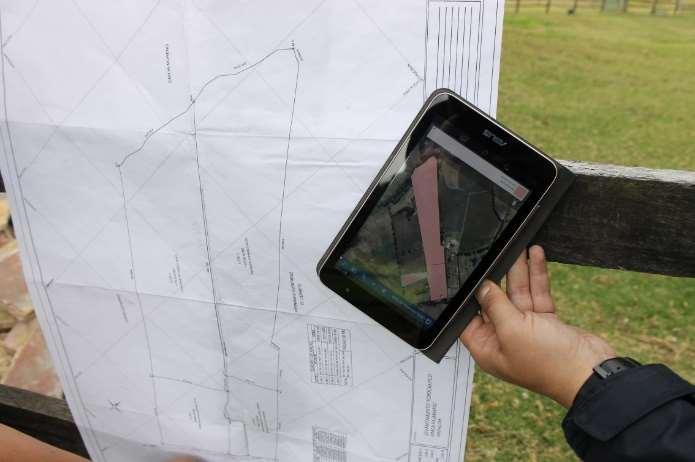
 Low Cost Cadastral Data Aquisition? Jacobus Meijer and Christiaan Lemmen (Netherlands): 21 May 2011 Abstract Spatial Cadastral Data (Mapping) Participatory Development Some low cost approaches in cadastral
Development and Updates of Protected Lands Databases in the US (PAD-US, NCED, CARL)
") Development and Updates of Protected Lands Databases in the US (PAD-US, NCED, CARL) Robb Macleod, National GIS Coordinator at Ducks Unlimited rmacleod@ducks.org 734-623-2004 Overview 1. What is the NCED,
Development and Updates of Protected Lands Databases in the US (PAD-US, NCED, CARL) Robb Macleod, National GIS Coordinator at Ducks Unlimited rmacleod@ducks.org 734-623-2004 Overview 1. What is the NCED,
SECTOR PUBLIC CADASTRES AND REGISTERS MARKET PARTICIPANTS
 E-SERVICES TO CITIZENS, GOVERNMENT AND BUSINESSES. LITHUANIA EXPERIENCE Arvydas Bagdonavičius State Enterprise Centre of Registers Arvydas.Bagdonavicius@registrucentras.lt REGISTERS AND IS MANAGED BY THE
Open Title: a Low Cost Tool for Inventorying Property Rights - Experiences from Ghana
 Open Title: a Low Cost Tool for Inventorying Property Rights - Experiences from Ghana Nigel EDMEAD, USA Key words: Open Title, Paralegal Title, Ghana, ESRI SUMMARY As part of an ongoing program to formalize
Mobile and Tablet. Ready
 Realtors are demanding newer and more accurate solutions to assist them in client communications. These solutions need to be able to deliver accurate property information both in and outside the office.
New Models for Property Data Verification and Valuation
 New Models for Property Data Verification and Valuation for 2006 IAAO Councils and Sections Joint Seminar May 9-11, 2006 Charleston, South Carolina Presented by George Donatello, CMS Principal Consultant
National Land Cadastre in Mozambique SiGIT as a lever to success
 in Mozambique SiGIT as a lever to success Marisa Balas EXI Lda MOZAMBIQUE Mozambique is located on the south eastern part of the African Continent Territory > than 800 000 km 2 in 11 provinces Population
LOW-COST LAND INFORMATION SYSTEM FOR SUSTAINABLE URBAN DEVELOPMENT
 Presented at the FIG Congress 2018, May 6-11, 2018 in Istanbul, Turkey LOW-COST LAND INFORMATION SYSTEM FOR SUSTAINABLE URBAN DEVELOPMENT Case Examples in Kenya and Zambia Presented by John Gitau Land
How Big is Global Insecurity of Tenure?
 Presented at the FIG Working Week 2016, May 2-6, 2016 in Christchurch, New Zealand Know Edge Limited Location Information Innovation How Big is Global Insecurity of Tenure? Dr Robin McLaren Know Edge Ltd,
2017 Reappraisal. March 10, 2017
 2017 Reappraisal March 10, 2017 Today s Presenters Cheyenne Johnson, Assessor Charles Blow, CAE Robert Trouy, TMA David Baker, Certified General Appraiser Joshua Forbes Shawn Lynch, JD Together, as professional
SiGIT Land Information System and the Challenges Imposed by the Fit for Purpose Approach to Land Administration
 SiGIT Land Information System and the Challenges Imposed by the Fit for Purpose Approach to Land Administration Marisa BALAS, Mozambique; Simão JOAQUIM, Mozambique; José Almeirim CARVALHO, Mozambique;
Progress in modern cadastre Challenging existing models and paradigms
 Progress in modern cadastre Challenging existing models and paradigms Gerda Schennach, Austria Chair of FIG Commission 7 Federal Office of Metrology and Surveying, Austria The Value of Cadastre for Society
ASE ABSTRACTS ARGUS MODELING EXCEL UNDERWRITING FINANCIAL ANALYSIS DUE DILIGENCE CAM RECONCILIATION VESTOR WATERFALLS PORTFOLIO MODELING EQUITY
 ASE ABSTRACTS ARGUS MODELING EXCEL UNDERWRITING FINANCIAL ANALYSIS DUE DILIGENCE CAM RECONCILIATION VESTOR WATERFALLS PORTFOLIO MODELING EQUITY STRUCTURES DEBT ANALYSIS LOAN ABSTRACTS LEASE ABSTRACTS GUS
Maconomy Property Solution better insight and control over your real estate portfolio
 Maconomy Property Solution better insight and control over your real estate portfolio Maconomy Property Solution IT solution for real estate lease management Standard & custom reports Dashboards and KPIs
For personal use only
 DateTix Group Ltd - ASX:DTX 29 January 2016 A quarter of major milestones for DateTix DateTix Group Limited (ASX: DTX) is pleased to present its quarterly cash flow report for the quarter ending 31 December
NEWS CORPORATION (Exact name of registrant as specified in its charter)
") UNITED STATES SECURITIES AND EXCHANGE COMMISSION Washington, D.C. 20549 FORM 8-K CURRENT REPORT Pursuant to Section 13 or 15(d) of The Securities Exchange Act of 1934 Date of Report (Date of earliest event
UNITED STATES SECURITIES AND EXCHANGE COMMISSION Washington, D.C. 20549 FORM 8-K CURRENT REPORT Pursuant to Section 13 or 15(d) of The Securities Exchange Act of 1934 Date of Report (Date of earliest event
Owners and Investors
 Owners and Investors Confident real estate investing starts with knowing everything. See the commercial real estate market top down and ground up. You have the money, but how do you know where to invest
Key Registers in Finland and some views of Cadastre 2035
 Presented at the FIG Working Week 2016, May 2-6, 2016 in Christchurch, New Zealand Key Registers in Finland and some views of Cadastre 2035 FIG Working Week, Christchurch New Zealand May, the 3rd, 2016
1st Regional INSPIRE Forum 4th Croatian NSDI and INSPIRE Day
 1st Regional INSPIRE Forum 4th Croatian NSDI and INSPIRE Day State of Play EULIS Rik Wouters Managing Director EULIS Programme What is EULIS EULIS is renewed: LINE For who is EULIS? Why EULIS? Projects
The Cadastral Template 2.0, From Design to Implementation
 Abbas RAJABIFARD (Australia), Daniel Steudler (Switzerland), Ali AIEN, and Mohsen KALANTARI, Australia Key words: Cadastral Template 2.0, Cadastral Template Project, Land Administration, PCGIAP SUMMARY
Land Administration and Spatial Enablement Victoria s Experience. Chris McRae, Executive Director Land Victoria
 Land Administration and Spatial Enablement Victoria s Experience Chris McRae, Executive Director Land Victoria 4 th UN Land Administration Forum, October 2011 Outline About Land Victoria Land Victoria
SAP FIORI UX DESIGN & BUILD CHALLENGE
 Background Story A real estate company implemented sap modules for Finance, real estate, plant maintenance, Material management, sales and distribution, EHSM and GRC. There are total 1200 properties across
Marine Spatial Data Infrastructure (MSDI) & The Marine Cadastre Application. April 10, 2018
 & The Marine Cadastre Application. April 10, 2018") Marine Spatial Data Infrastructure (MSDI) & The Marine Cadastre Application April 10, 2018 A Collaborative Pilot Project Vision of CHS: A framework of geographic data, metadata, users and tools Intent
Marine Spatial Data Infrastructure (MSDI) & The Marine Cadastre Application April 10, 2018 A Collaborative Pilot Project Vision of CHS: A framework of geographic data, metadata, users and tools Intent
GIS & Mobile Technology: It s Not Just For Real Property Tangible Technology for Tangible Personal Property Valuation
 GIS & Mobile Technology: It s Not Just For Real Property Tangible Technology for Tangible Personal Property Valuation Steve Weissman, RES, CFE, MBA Manager, Personal Property Appraisal Section Palm Beach
Rights Responsibilities Restrictions (RRRs)
") 37 th Australasian Conference of Registrars of Title 26-29 October 2010, Perth WA Rights Responsibilities Restrictions (RRRs) Any factor which affects the use of public or private land below, or on, or
37 th Australasian Conference of Registrars of Title 26-29 October 2010, Perth WA Rights Responsibilities Restrictions (RRRs) Any factor which affects the use of public or private land below, or on, or
Economic and Social Council 6 July 2018
 1 ADVANCE UNEDITED VERSION UNITED NATIONS E/C.20/2018/12/Add.1 Economic and Social Council 6 July 2018 Committee of Experts on Global Geospatial Information Management Eighth session New York, 1-3 August
Seventh Session of the United Nations Committee of Experts on Global Geospatial Information Management
 Report of the Forum P a g e 1 Seventh Session of the United Nations Committee of Experts on Global Geospatial Information Management Report of the Forum Secure Land Rights and Smart Cities - Making It
The programme is implemented
 Surveying Property valuation and spatial data tools to assist in land restitution by Jaco de Kock, GISCOE Land and tenure reform in the South African government context are beyond talk and have received
Land Information System for Revenue Planning, Estimates and Collection
 Land Information System for Revenue Planning, Estimates and Collection Hardi FADILLAH HAMZAH, Malaysia Key words: valuation, land revenues SUMMARY With the emerging trend of State Government implementing
LISTING DISTRIBUTION WORLDWIDE PROPERTY MARKETING EXPOSURE
 LISTING DISTRIBUTION WORLDWIDE PROPERTY MARKETING EXPOSURE Powered by PropGoLuxury: Hong Kong Tatler, lp-luxuryproperties.com, lpdibiao.com This real estate portal includes United States and United States
I ROC 2017 Financial Administrators Section Conference
 I ROC 2017 Financial Administrators Section Conference September 9, 2017 kpmg.ca Presenters Chris Cornell KPMG Partner, Financial Services Steven Sharma KPMG Partner, Financial Services 2 IIROC 2017 Financial
OGC Land Administration Domain Working Group
 Land Administration Domain Working Group Denise McKenzie Open Geospatial Consortium dmckenzie@opengeospatial.org Functions of a Domain Working Group Provide a forum for discussion Develop Change Requests
LIS a motivation for SDI initiative
 Eric Mwaikambo Ardhi University Dar es Salaam Tanzania Overview Status of LIS in Tanzania Relationship between SDI and LIS Spatial Standards LIS a motivation for SDI initiative Conclusion & Recommendations
MULTIFAMILY PROPERTY MANAGERS
 Suite TM MULTIFAMILY PROPERTY MANAGERS Move Your Business Forward REAL-TIME INFORMATION TO OPTIMIZE YOUR RENTS AND OCCUPANCIES 3,000 multifamily owners and property management firms use CoStar because
INDIAN INSTITUTE OF TECHNOLOGY ROORKEE. Presentation on REAL TIME CADASTRAL SURVEYING SOLUTION WITH A SPECIAL IMPHESIS TO MODERN GPS TECHNOLOGY.
 INDIAN INSTITUTE OF TECHNOLOGY ROORKEE Presentation on REAL TIME CADASTRAL SURVEYING SOLUTION WITH A SPECIAL IMPHESIS TO MODERN GPS TECHNOLOGY By: Prof. Kamal Jain, Dept. of Civil Engg. IIT-Roorkee AIM
Real Estate Technology Sector Summary Q Review
 Real Estate Technology Sector Summary Q3 2017 Review 1 DEAL DASHBOARD Real Estate Technology Sector Summary Quarterly Financing Activity (2)(3) Select Q3 2017 Financing Transactions ($MM) 60 69 Number
Welcome Session warm welcome by BEV, celebrating 200 years of the Austrian cadastre CVC2017 supported by 7 organizations: WPLA EuroGeographics PCC EUL
 Swiss Federal Office of Topography swisstopo Federal Directorate for Cadastral Surveying Common Vision Conference 2017 Wrap-up CVC 2017 "Tradition meets Innovation" Vienna, Austria, 5/6 Oct. 2017 Dr. Daniel
Buyers Guide for the Data Service Syndicated Contract
 Buyers Guide for the Data Service Syndicated Contract Date: March 2017 CONTENTS Why use this syndicated contract? 3 Benefits 3 The strategic case 3 About the Lead Agency 4 About the Supplier 4 Roles and
PANAFRICA GEOINFORMATION SERVICES PLC ETHIOPIA
 PANAFRICA GEOINFORMATION SERVICES PLC ETHIOPIA Tenets PanafricaGIS is a technology-enthusiast company operated by experienced professionals in the field of geo-information. We believe a sustained and inclusive
Real Estate Technology
 The State of Real Estate Technology Commercial and multifamily real estate industries still rely on antiquated technology for critical business processes February 2018 Executive Summary In recent years,
Lead Generation Analytics & Automation Investment Tools
 Advanced Technology for the Successful Investor Lead Generation Analytics & Automation Investment Tools www.realestateiq.co REAL ESTATEIQ Advanced Technology that Works for All Investors Residential Real
Web Based Land Information System for Nintavur Divisional Secretariat Division (DSD), Sri Lanka
, Sri Lanka") Journal of Geography, Environment and Earth Science International 5(4): 1-6, 2016; Article no.jgeesi.20748 ISSN: 2454-7352 SCIENCEDOMAIN international www.sciencedomain.org Web Based Land Information System
Journal of Geography, Environment and Earth Science International 5(4): 1-6, 2016; Article no.jgeesi.20748 ISSN: 2454-7352 SCIENCEDOMAIN international www.sciencedomain.org Web Based Land Information System
The Challenge to Implement International Cadastral Models Case Finland 1
 The Challenge to Implement International Cadastral Models Case Finland 1 Tarja MYLLYMÄKI and Tarja PYKÄLÄ, Finland Key words: cadastre, modelling, LADM, INSPIRE SUMMARY Efforts are currently made to develop