PDP DESCRIBED HEREIN; PROPERTY LOCATED AT 3000 DEL PRADO BOULEVARD NORTH; GRANTING REPLAT OF LOTS 7 THROUGH 122, BLOCK 8018; GRANTING
|
|
|
- Samantha Tucker
- 5 years ago
- Views:
Transcription

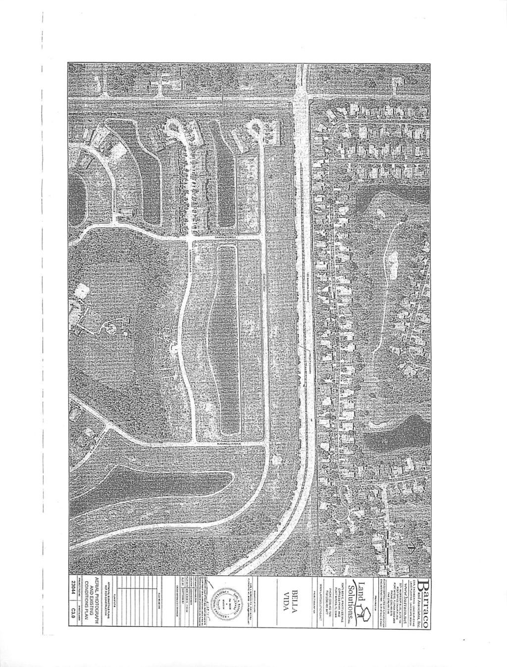
1 PDP ORDINANCE AN ORDINANCE AMENDING ORDINANCE 84-04, AS AMENDED BY ORDINANCE 88-05, APPROVING A PLANNED DEVELOPMENT PROJECT IN THE CITY OF CAPE CORAL, FLORIDA ENTITLED "ENGLE AT ENTRADA" NOW KNOWN AS "BELLA VIDA" FOR CERTAIN PROPERTY DESCRIBED AS BELLA VIDA SUBDIVISION LYING IN SECTION 21, TOWNSHIP 43 SOUTH, RANGE 24 EAST, CITY OF CAPE CORAL, LEE COUNTY, FLORIDA, AS MORE PARTICULARLY DESCRIBED HEREIN; PROPERTY LOCATED AT 3000 DEL PRADO BOULEVARD NORTH; GRANTING REPLAT OF LOTS 7 THROUGH 122, BLOCK 8018; GRANTING DEVIATIONS FROM THE CITY OF CAPE CORAL LAND USE AND DEVELOPMENT REGULATIONS, SECTION D, TABLE R-3, FOR MINIMUM LOT AREA AND WIDTH, AND MINIMUM FRONT AND SIDE SETBACK REQUIREMENTS; GRANTING SUBDIVISION PLAN APPROVAL PURSUANT TO SECTION 4.2 OF THE CITY OF CAPE CORAL LAND USE AND DEVELOPMENT REGULATIONS; PROVIDING FOR FINDINGS OF FACT AND CONCLUSIONS OF LAW; PROVIDING FOR ACTION ON REQUEST AND CONDITIONS OF APPROVAL; PROVIDING FOR LEGAL EFFECT AND LIMITATIONS OF THIS PDP DEVELOPMENT ORDER AND ADMINISTRATIVE REQUIREMENTS; PROVIDING SEVERABILITY AND AN EFFECTIVE DATE. WHEREAS, the "Engle at Entrada" Planned Development Project was approved by the City Council of the City of Cape Coralby Ordinance and later amended by Ordinance under the name "Bella Vida"; and WHEREAS, an application from Brookwood Bella Vida, LLC, has been received requesting approval of a Planned Development Project (PDP) for "Bella Vida"; requesting amendment to Ordinances and 88-05, including a replat of a portion of the subdivision and deviations to the Land Use and Development Regulations; and WHEREAS, said application received is by parties holding title to ownership of one hundred percent (100%) of the property included in the requested amendment; and WHEREAS, the request has been reviewed by the Cape Coral Planning and Zoning Commission/Local Planning Agency; and WHEREAS, the City Council has considered the recommendations of the Planning and Zoning Commission/Local Planning Agency. NOW, THEREFORE, THE CITY OF CAPE CORAL, FLORIDA, HEREBY ORDAINS PURSUANT TO THE LAWS OF FLORIDA, AND OTHER APPLICABLE LAWS, THIS ORDINANCE: SECTION I. PDP APPROVAL, SUBDIVISION, REPLAT, AND DEVIATIONS. Having reviewed the application requesting approval of a Planned Development Project for "Bella Vida" PDP, requesting replat of Lots within Block 8018, requesting a deviation of 21 feet from the minimum lot width requirement of 80 feet pursuant to Section 2.7.2, Table R-3, of the Land Use and Development Regulations to allow a minimum lot width of 59 feet; a deviation of 2,301 square feet from the minimum lot area of 10,000 square feet pursuant to Section 2.7.2, Table R-3, of the Land Use and Development Regulations to allow a minimum lot area of 7,699 square feet; a deviation of 2.5 feet from the minimum side setback requirement of 7.5 feet pursuant to Section 2.7.2, Table R-3, of the Land Use and Development Regulations to allow a minimum side setback requirement of 5.0 feet; a deviation of five feet from the minimum front setback requirement of 25 feet pursuant to Section 2.7.2, Table R-3, of the Land Use and Development Regulations to allow a triinimum front setback of 20 feet; and having considered the recommendations of the Planning and Zoning Commission and the Local Planning Agency, the City Council of the City of Cape Coral, Florida, does hereby grant the aforesaid PDP approval, and approve subdivision plan, in accordance with plan set, Sheet C1.0, dated June 29, 2015, entitled "Retro-Fit Plans for Bella Vida," Sheet C3.0, dated June 29, 2015, entitled "Aerial Photograph and Existing Conditions," and Sheet 1, dated August 10, 2015, entitled "Subdivision Plan." All sheets were prepared by Barraco and Associates, Inc. and constitute composite Exhibit "A" for purposes

2 of development plan approval pursuant to Section 4.2 of the City of Cape Coral Land Use and Development Regulations from the date of adoption of this ordinance. Approval ofthe PDP shall be subject to the terms and conditions set forth below. SECTION II. FINDING OF FACT/CONCLUSION OF LAW A. The "Bella Vida" development is a mixed-use Planned Development Project (PDP). This PDP amendment involves replatting Lots 7-122, within Block 8018, previously approved for conjoined residential structures into 48 lots for supporting single-family residential development. The entire subject property consists of approximately acres of land located at 3000 Del Prado Boulevard North. B. The name(s) ofthe legal and equitable owner(s) is Brookwood Bella Vida, LLC. C. The legal description of the property subject to the extant "Bella Vida" PDP and described as subsequendy platted is as follows: A TRACT OF LAND SITUATED IN CAPE CORAL UNIT 86 ACCORDING TO PLAT BOOK 24, PAGES 144 THROUGH 161 OF THE PUBLIC RECORDS OF LEE COUNTY, LYING IN SECTION 21, TOWNSHIP 43 SOUTH, RANGE 24 EAST, CITY OF CAPE CORAL, LEE COUNTY, FLORIDA, BEING MORE PARTICULARLY DESCRIBED AS FOLLOWS: COMMENCING AT THE NORTHWESTERLY CORNER OF SAID SECTION 21, THENCE RUN N89 04'55"E ALONG THE NORTHERLY LINE OF SAID SECTION 21 FOR FEET TO THE NORTHWESTERLY CORNER OF SAID CAPE CORAL UNIT 86; THENCE RUN S00 07'30E ALONG THE WESTERLY LINE OF SAID CAPE CORAL UNIT 86 FOR FEET TO THE TRUE POINT OF BEGINNING; THENCE RUN N.89 04'55"E. FOR FEET TO THE POINT OF CURVATURE OF A CURVE CONCAVE TO THE SOUTHWEST; THENCE RUN ALONG SAID CURVE HAVING A RADIUS OF FEET AND A CENTRAL ANGLE OF 43 46'26" (CHORD=S69 01'52"E, FEET) FOR FEET TO A NON- TANGENT INTERSECTION WITH A LINE THAT BEARS S00 29'41"W; THENCE RUN S.00 29'41"W. ALONG SAID LINE FOR FEET; THENCE RUN S.00 00'00"E. FOR FEET TO THE POINT OF CURVATURE OF A CURVE CONCAVE TO THE NORTHEAST; THENCE RUN ALONG SAID CURVE HAVING A RADIUS OF FEET AND A CENTRAL ANGLE OF 20 56'54" (CHORD=S10 28"27"E, FEET) FOR FEET TO A NON-TANGENT INTERSECTION WITH A LINE WHICH BEARS S.20 21'01"E; THENCE RUN S.20o21'01"E. ALONG SAID LINE FOR FEET TO AN INTERSECTION WITH THE NORTHWESTERLY RIGHT-OF-WAY LINE OF DEL PRADO EXTENSION (140 FOOT R/W), BEING ALSO A POINT ON A CURVE CONCAVE TO THE SOUTHEAST; THENCE RUN ALONG SAID NORTHWESTERLY RIGHT-OF-WAY ON SAID CURVE HAVING A RADIUS OF FEET AND A CENTRAL ANGLE OF 07 53,28" (CHORD=S46 51'49"W, FEET) FOR FEET TO THE POINT OF TANGENCY; THENCE CONTINUE RUNNING ALONG SAID NORTHWESTERLY RIGHT-OF-WAY LINE FOR THE FOLLOWING TWO COURSES: S.42 55'05"W. FOR FEET TO THE POINT OF CURVATURE OF A CURVE CONCAVE TO THE NORTHWEST; THENCE RUN ALONG SAID CURVE HAVING A RADIUS OF FEET AND A CENTRAL ANGLE OF 42 05'46" (CHORD=S63 57'58"W, FEET) FOR FEET TO AN INTERSECTION WITH THE WESTERLY LINE OF SAID CAPE CORAL UNIT 86, BEING ALSO THE EASTERLY RIGHT-OF-WAY LINE OF GARDEN BOULEVARD (100 FOOT R/W); THENCE RUN ALONG SAID WESTERLY LINE AND SAID EASTERLY RIGHT-OF-WAY LINE FOR THE FOLLOWING TWO COURSES: N.00 02,02"W. FOR FEET AND N.00 07'30"W. FOR FEET TO THE POINT OF BEGINNING. PARCEL CONTAINS ACRES, MORE OR LESS. D. The legal description of the portion of Bella Vida that is being replatted as a result of the PDP amendment is described as follows:
3 A REPLAT OF LOTS 7 THROUGH 122, BLOCK 8018, BELLA VIDA, AS RECORDED IN INSTRUMENT NO , OF THE PUBLIC RECORDS OF LEE COUNTY, FLORIDA. A SUBDIVISION LYING IN SECTION 21, TOWNSHIP SOUTH, RANGE 24 EAST, CITY OF CAPE CORAL, LEE COUNTY, FLORIDA. E. The "Bella Vida" PDP subject parcel has approximately acres with a Future Land Use designation of Mixed Use. The subject property has acres zoned Multi-Family Residential (R-3), acres zoned Single-Family Residential (R-1B), and acres zoned Professional Office (P-l) pursuant to the authority of Chapter 166, Florida Statutes, and the Land Use and Development Regulations, Cape Coral, Florida, as same may hereafter be amended. F. DEVIATIONS The following deviations are hereby approved: 1. A deviation of 21 feet from the minimum lot width requirement of 80 required by Section 2.7.2, Table R-3, Dimensional Regulations, to allow a minimum lot width of 59 feet. 2. A deviation of 2,301 square feet from the minimum lot area of 10,000 square feet required by Section 2.7.2, Table R-3, Dimensional Regulations, to allow a minimum lot area of 7,699 square feet. 3. A deviation of 2.5 feet from the minimum side setback requirement of 7.5 feet required by Section 2.72, Table R-3, Dimensional Regulations, to allow a minimum side setback requirement of 5.0 feet. 4. A deviation of five feet from the minimum front setback requirement of 25 feet required by Section 2.7.2, Table R-3, Dimensional Regulations, to allow a minimum front setback of 20 feet. G. All future structures and uses, population density, building intensity, and building height and any other dimensional regulations shall conform to the provisions of the respective zoning district of the Land Use and Development Regulations, Cape Coral, Florida, as same may hereafter be amended. In addition, the development shall obtain all local development permits from the City of Cape Coral, Florida, and other governmental jurisdictions. Failure of this agreement to address a particular permit, condition, term, restriction, or zoning regulation shall not relieve the Developer of the necessity of complying with the law governing said permitting requirements, conditions, terms, restrictions, or zoning regulations. H. The proposed development does not unreasonably interfere with the achievement of the objectives of the adopted State Land Development Plan applicable to the area. I. The proposed development, as noted, is consistent with the adopted City of Cape Coral Comprehensive Plan, and the City of Cape Coral Land Use and Development Regulations. J. The term Developer for purposes of this development order shall mean and refer to Brookwood Bella Vida, LLC, its successors in interest, lessees, and/or assigns. SECTION III. ACTION ON REQUEST AND CONDITIONS OF APPROVAL NOW, THEREFORE, be it ordained by the City Council of Cape Coral, Florida, in public meeting duly advertised, constituted and assembled, that the Planned Development Project application for Development Approval submitted by Brookwood Bella Vida, LLC, is hereby ordained approved, subject to the following conditions, restrictions, and limitations deemed necessary for the public health, safety, and welfare. A. WETLANDS, VEGETATION, AND WILDLIFE In the event all or a portion of the subject property is located within an Eagle Nest Management Zone, the developer shall comply with all City laws, regulations, and guidelines
4 that are currendy in effect or that may be hereafter adopted by the City concerning the protection and management of bald eagle nests including, but not limited to Chapter 23 of the City Code of Ordinances. No development shall occur on any portion of the subject property that is within an Eagle Nest Management Zone except in accordance with a Bald Eagle Management Plan that has been approved by the City. Once an Eagle Management Plan has been approved by the City for all or a portion of the property, the Developer's ability to develop in accordance with such Plan shall not be affected by any amendment to the City's regulations concerning eagle nests, so long as no additional or "new" eagle nest need to be accommodated. In the event, however, that one or more eagle nests are hereafter established or determined to be active in locations that result in all or a portion of the subject property being located in a new or expanded Eagle Nest Management Zone, then no development shall occur in such new zone except in accordance with an Eagle Management Plan that has been approved by the City for such zone. B. WASTEWATER MANAGEMENT Sewer impact fees, betterment fees, and/or all other applicable fees shallbe paid as specified by City Ordinance(s). C. WATER SERVICE Water impact fees, betterment fees, and/or all other applicable fees shall be paid as specified by City Ordinances(s). D. IRRIGATION SERVICE Irrigation betterment fees and/or all other applicable fees shall be paid as specified by City Ordinance(s). E. TRANSPORTATION 1. The traffic impacts of this development do not degrade roadway and intersection level of service (LOS) below LOS standards adopted in the City of Cape Coral Comprehensive Plan. 2. The Developer shall provide the City of Cape Coral all appropriate Road Impact Fees at the time ofapplication for each buildingpermit. F. SUBDIVISION 1. The Developer shall meet all requirements of Section , Minimum Design Standards, City of Cape CoralLand Use and Development Regulations. 2. The Director shall submit the Subdivision Plat for the Mayor's signature after all required site improvements have been satisfactorily completed or the City has received a surety bond or certified check in an amount of the estimated cost to complete of all required site improvements. Such Plat shall then be recorded with the Lee County Clerk pursuant to Chapter 177, Florida Statutes. A duplicate recorded mylar copy of the Plat shallbe submitted to the City. G. GENERAL CONSIDERATIONS 1. All provisions and conditions contained in the "Engle at Entrada" and "BellaVida" PDPs as approved by Ordinances 84-04and 88-05, respectively, shall remain in full force and effect, except as otherwise stated in this Development Order. 2. The deviation of 2.5 feet to Section 2.7.2, Table R-3, of the Land Use and Development Regulations, requiring a minimum side setback of 7.5 feet, to allow a minimum side setback of 5.0 feet shall be limited to Lots 19, 26, and 38-43, within Block 8018.
5 H. CONCURRENCY The "Bella Vida" PDP is concurrent for roads, sewer, water, drainage, solid waste, and parks based on the analysis of the proposed development and specific mitigation programs specified herein. SECTION IV. LEGAL EFFECT AND LIMITATIONS OF THIS DEVELOPMENT ORDER, AND ADMINISTRATIVE REQUIREMENTS A. This Development Order shall constitute an ordinance of the City of Cape Coral, adopted by this Council in response to the Planned Development Project application filed for the "Bella Vida" PDP. B. This Development Order shall be binding on the Developer. Those portions of this Development Order which clearly apply only to the project Developer shall not be construed to be binding upon future owners of the project lots. It shall be binding upon any builder/developer who acquires any tract of land within the PDP. C. The terms and conditions set out in this document constitute a basis upon which the Developer and City may rely in future actions necessary to implement fully the final development contemplated by this Development Order. D. All conditions, restrictions, stipulations, and safeguards contained in this Development Order may be enforcedby eitherparty hereto by action at law or equity, and all costs of such proceedings, includingreasonable attorney's fees, shallbe paid by the defaulting party. E. Any references herein to any governmental agency shall be construed to mean to include any future instrumentality which may be created and designated as successor in interest to or which otherwise possesses any of the powers and duties of any referenced governmental agency in existence on the effective date of this Development Order. F. The approval granted by this Development Order is limited. Such approval shall not be construed to obviate the duty of the Developer to comply with all applicable local or state review and permitting procedures, except where otherwise specifically provided. Such approval shall also not obviate the duty of the Developer to comply with any City Ordinance or other regulations adopted after the effective date of this Development Order. G. Subsequent requests for local development permits shall not require further review, unless it is found by the City Council, after due notice and hearing, that one or more substantial deviation(s), or other changes to the approved development plans which create a reasonable likelihood of adverse impacts which were not evaluated in the review by the City have occurred. Substantial deviations include but are not limited to: 1. Any change which requires a variance to code and above those specifically incorporated herein. 2. An increase of more than five (5) percent in density, parking requirements, trip generation rates, water or sewer usage, or building square footage. 3. An expiration of the period of effectiveness of this Development Order as herein provided. 4. If development order conditions and applicant commitments incorporated within the Development Order to mitigate impacts are not carried out as indicated to the extent or in accordancewith the Development Order, then this shall be presumed to be a substantial deviation from the Development Order. Upon a finding that any of the above is present, the City Council may ordera termination of all development activity until such time as a new PDP Application for Development Approval has been submitted, reviewed and approved and all local approvals have been obtained.
6 H. The physical development authorized under this Development Order shall terminate in two years from the date of adoption of this Development Order, unless an extension is approved by this Council. The Council may grant an extension if die project has been developing substantially in conformance with the original plans and approved conditions, and if no substantial adverse impacts not known to Cape Coral at the time of dieir review and approval, or arising due to the extension, have been identified. For purposes of determining when the buildout date has been exceeded, the time shall be tolled during the pendency of administrative and judicial proceedings relating to development permits. All conditions imposed on the subject development shall remain in full force and effect throughout the life of the development unless rescinded or amended by the City and shall not be affected by any termination of the authorization for physical development. I. The Director of the Cape Coral Department of Community Development or his/her designee, shall be the local official responsible for assuring compliance with this Development Order. Upon reasonable notice by the City and at all reasonable times, the Developer shall allow the City of Cape Coral, its agents, employees, and/or representatives, access to the project site for the purpose of assuring compliance with this Development Order. J. This Development Order shall be recorded with the Office of the Lee County Clerk of Court by the City of Cape Coral. The Developer shall be responsible for reimbursing the City for all recording fees within 30 days after being notified by the City that the Development Order has been recorded. SECTION V. SEVERABILITY. In the event that any portion or section of this Ordinance is determined to be invalid, illegal, or unconstitutional by a court of competent jurisdiction, such decision shall in no manner affect the remaining portions or sections of this Ordinance which shall remain in full force and effect. SECTION VI. EFFECTIVE DATE. This ordinance shall take effect immediately upon its adoption by the Cape Coral City Council. Permits issued prior to or after the effective date of this Ordinance are obtained solely at the risk of the Developer. ADOPTED BY THE COUNCIL OF THE CITY OF CAPE CORAL AT ITS REGULAR SESSION THIS DAY OF, MARNI L. SAWICKI, MAYOR VOTE OF MAYOR AND COUNCILMEMBERS: SAWICKI BURCH CARIOSCIA STOUT LEON ERBRICK WILLIAMS COSDEN ATTESTED TO AND FILED IN MY OFFICE THIS DAY OF REBECCA VAN DEUTEKOM CITY CLERK APPR BRIANR. BARTOS ASSISTANT CITY ATTORNEY ORD/pdp Bella Vida 10/08/15 10/19/15 11/04/15
7 ' :. PROJECT DATA HtCCKD PLAT UOOOiONL STRAP NUUBBU PtKUiT REQUIREMENTS I C^.IIHLCTCH/XTr.T DESIGN TEAM PROJECT ENGINEER PROJECT WANAGTLTNI DCSK1NBMWUII PROJECT SURVEYOR LEAO DESIGN TECHNICIAN SITL PLANNING 01 SIGN SIW I IANO PLA».N-J<'J QUAHTY CONTROL RECORD ORJW.NiS THESE PLAHS MAY HAVE BEEN MODIFIED IN SIZE OY REPRODUCTION. WIS MUST BE COHSIDEIIED WHEH OBTAINING SCALED DATA. ALL DIMENSIONS ARE IN FEET. EXHIBIT A RETRO-FIT PLANS FOR BELLA VIDA SECONDARY DESCRIPTION ARTOFSECTION 21, TOWNSHIP 43 SOUTH, RANGE 24 HAST CAPE CORAL, LEE COUNTY, FLORIDA syp isshhh.-,. /.;. " ' - "...,'.' '.- *'; "'" :..'.'..' -.' _ ':' '-' 'J t..'.. '. ' ' - :.'-! '-,- - '- ^ s. >.. ; i. *,'» -,.' "1*.*'.-» 1 1 ". '# LOCATION MAP MM*wrap iii;n,»npw UO'AVf CAli.tll WQMYOODM LNDEXOF DRAWINGS C"c:.". jj t i h i t..v r> :m»*:«,;» Xi«l U)_'.tClMl'iK.<j IHMA-NOHAIIC luitpia'isawt acowoninto* ii-ecokim>citxx--«jir3fchit^i<tfmi»,ctopmo-ict. HC»0' CAL5PCC».CATONJ AMOANr tl'pouutntl IO TM6 COJTHACT GOCUUI HT» UKUD bc vxrtto'on WAtrniAi. constauction, tcstiwg and rt«*t Hn>jj»iu;hia,-hoi to Et-c >,a miwueibw «irauotoncck5n»j=tio«i3ifistmcjxajiv«x>rtoio»<t>.i ANtt»tus-paMio' mnmiiool conik*ctc*ii>aa.viwrimaii*t»as:nc latest PIAJ.S v>yvo* HAVEftilN A/4-ACAfO ANDACCfPTrO fcv T>^ W*.l«WCfl iocc.»t»r_cnc*< APPROVAL SUBMITTALS PLANS NOT FOR CONSTRUCTION B ariaco todaiaoculm, Inc. wwwaaxtaoo.net Land t^j? Solutions,. BELLA VIDA v& j-b4y COVER SI ICIiT AND LOCATION MAP C1.0
8
9 BMjBMaty^nrmm.IJB OIMAVAWU PAAXWAT "Ri arraco aadaaoditei. Inc. THAI tfrtslrdroas Land^. Solutions,. wvitut.nuttitaku nraumn.m MmurtnLfiiaM tmrnimojeuirniomt BELLA VIDA MtuMsraaeoictPiwAt nautoi/itounaun UtMAI«rC(MTMMTI NOTFOR CONSTRUCTION SUBDMSON PLAN
WHEREAS, the Petition was filed by PATRICK AND KIMBERLY SHULER for the vacation of plat on property described herein; and
 VP 15-0003 RESOLUTION 2-16 A RESOLUTION PROVIDING FOR THE VACATION OF PLAT FOR A PUBLIC UTILITY AND DRAINAGE EASEMENT UNDERLYING A PREVIOUSLY VACATED RIGHT-OF-WAY BEING A PART OF SW 28 PLACE ADJACENT TO
ORDINANCE NO AN ORDINANCE To Be Entitled:
 3808 AN ORDINANCE To Be Entitled: AN ORDINANCE OF THE CITY COUNCIL OF THE CITY OF FORT MYERS, FLORIDA, REZONING FROM COMMERCIAL GENERAL TO PLANNED UNIT DEVELOPMENT AND APPROVING THE DEVELOPMENT PLAN FOR
approval of the Release and Satisfaction of Property Donation Requirements (Burnt Store Road
 RESOLUTION 38-16 A RESOLUTION OF THE CITY OF CAPE CORAL ACCEPTING A QUIT CLAIM DEED FROM ZREV FARM, LLC, FOR A 2.07 ACRE PARCEL LYING WITHIN SECTION 20, TOWNSHIP 43 SOUTH, RANGE 23 EAST; APPROVING AND
CITY OF OCALA CITY COUNCIL REPORT Council Meeting Date: 06/06/17
 CITY OF OCALA CITY COUNCIL REPORT Council Meeting Date: 06/06/17 Subject: Large Scale Land Use Map Amendment Submitted By: David Boston Department: Growth Management STAFF RECOMMENDATION (Motion Ready):
ORDINANCE WHEREAS, the Planning and Zoning Board of the City of Belleview has been designated as the Local Planning Agency; and
 Page 1 of 9 ORDINANCE 2019-03 AN ORDINANCE OF THE CITY OF BELLEVIEW, FLORIDA RELATING TO AN AMENDMENT OF 8.87 +/- ACRES OF LAND TO THE CITY OF BELLEVIEW COMPREHENSIVE PLAN; AMENDING THE FUTURE LAND USE
Tarpon Point Amendment PDP (PDP )
") Tarpon Point Amendment PDP (PDP -00) Planning Division Final Project Staff Report Prepared by Chad Boyko, AICP, Planner II Reviewed by Mike Struve, AICP Planning Team Coordinator Approved by Derek C.S.
Tarpon Point Amendment PDP (PDP -00) Planning Division Final Project Staff Report Prepared by Chad Boyko, AICP, Planner II Reviewed by Mike Struve, AICP Planning Team Coordinator Approved by Derek C.S.
CONSENT ACTION BY THE BOARD OF DIRECTORS OF VENETO IN MIRAMAR CONDOMINIUM ASSOCIATION, INC.
 CONSENT ACTION BY THE BOARD OF DIRECTORS OF VENETO IN MIRAMAR CONDOMINIUM ASSOCIATION, INC. The undersigned, being all of the members of the Board of Directors of Veneto in Miramar Condominium Association,
Sketch & Legal Description of Mitigation Bank and Ingress/Egress Access Easements
 Appendix H: Sketch & Legal Description of Mitigation Bank and Ingress/Egress Access Easements Tippen Bay Wetland Mitigation Bank DeSoto County, Florida Prepared by: September, 2017 Original file
AGENDA UPDATE ECONOMIC DEVELOPMENT & FINANCE STANDING COMMITTEE MEETING MONDAY, AUGUST 10, 2015 III. COMMITTEE AGENDA
 AGENDA UPDATE ECONOMIC DEVELOPMENT & FINANCE STANDING COMMITTEE MEETING MONDAY, AUGUST 10, 2015 III. COMMITTEE AGENDA REVISED ITEM NO. 4 150217.ORDINANCE: VACATION VILLAGE AREAS 1 AND 2A Synopsis: A revised
RESOLUTION R EAST COUNTY MIDDLE SCHOOL SCHOOL SITE PLAN SSP DTS
 RESOLUTION R-18-003 EAST COUNTY MIDDLE SCHOOL SCHOOL SITE PLAN SSP-17-02 DTS20170502 A RESOLUTION OF THE BOARD OF COUNTY COMMISSIONERS OF MANATEE COUNTY, FLORIDA, REGARDING LAND DEVELOPMENT; ALLOWING FOR
UNOPPOSED ORDER GRANTING RECEIVER'S MOTION TO APPROVE THE SALE OF REAL PROPERTY OWNED BY MAMC EMERALD CAY, LLC
 IN THE CIRCUIT COURT OF THE ELEVENTH JUDICIAL CIRCUIT IN AND FOR MIAMI-DADE COUNTY, FLORIDA STATE OF FLORIDA, OFFICE OF FINANCIAL REGULATION, Plaintiff, v. BERMAN MORTGAGE CORPORATION, a Florida corporation,
ORDINANCE NO. Z REZONING NO
 ORDINANCE NO. Z- 3960 REZONING NO. 2018-00014 AN ORDINANCE RELATING TO ZONING: AMENDING CERTAIN ZONING REGULATIONS SHOWN ON SHEET NO. 15 OF THE ZONING DISTRICT MAP INCORPORATED BY REFERENCE BY OVERLAND
GeoPoint 1403 E. 5th Avenue Tampa, Florida
 AIRPORT ROAD PINELAND P.R.D. SUBDIVISION - PHASE 1 DEDICATION: CERTIFICATE OF REVIEW BY SURVEYOR, CITY OF ORMOND BEACH DEDICATION: THIS IS TO CERTIFY THAT FORESTAR (USA) REAL ESTATE GROUP INC., A DELAWARE
There is no fiscal impact associated with this Individual Development Approval.
 CRP-06-01 R2/13-97500005 Citibank Temporary Drive-Through 700-998 South Federal Highway The Via Mizner property is approximately 6.8 acres in area and is situated on the north side of Camino Real, east
BILL NO (Emergency Measure) ORDINANCE NO. 5072
 ORDINANCE NO. 5072") BILL NO. 5210 (Emergency Measure) ORDINANCE NO. 5072 AN ORDINANCE AUTHORIZING THE MAYOR TO EXECUTE WITH MICHELSON-HADLEY HEIGHTS DEVELOPMENT, LLC, A CONTRACT AND QUIT CLAIM DEED CONVEYING CERTAIN PROPERTIES
BILL NO. 5210 (Emergency Measure) ORDINANCE NO. 5072 AN ORDINANCE AUTHORIZING THE MAYOR TO EXECUTE WITH MICHELSON-HADLEY HEIGHTS DEVELOPMENT, LLC, A CONTRACT AND QUIT CLAIM DEED CONVEYING CERTAIN PROPERTIES
BY BOARD OF COUNTY COMMISSIONERS
 BY BOARD OF COUNTY COMMISSIONERS ORDINANCE NO. AN ORDINANCE CREATING THE PLANTATION PALMS MUNICIPAL SERVICE BENEFIT UNIT; PROVIDING FOR BOUNDARIES; PROVIDING FOR LEVY OF NON AD-VALOREM SPECIAL ASSESSMENTS;
LANDSCAPE AND MAINTENANCE EASEMENT. THIS LANDSCAPE AND MAINTENANCE EASEMENT, (hereinafter Easement )
") Prepared by and return to: Parcel ID # LANDSCAPE AND MAINTENANCE EASEMENT THIS LANDSCAPE AND MAINTENANCE EASEMENT, (hereinafter Easement ) is made and entered into this day of, 2009, by and between THIRD
Prepared by and return to: Parcel ID # LANDSCAPE AND MAINTENANCE EASEMENT THIS LANDSCAPE AND MAINTENANCE EASEMENT, (hereinafter Easement ) is made and entered into this day of, 2009, by and between THIRD
GeoPoint 213 Hobbs Street Tampa, Florida
 AIRPORT ROAD PINELAND P.R.D. SUBDIVISION - PHASES 2 & 3 DESCRIPTION: A parcel of land lying in Sections 13 and 24, Township 14 South, Range 31 East, Volusia County, Florida, and being more particularly
RESOLUTION NO. R
 RESOLUTION NO. R-2012-0778 RESOLUTION APPROVING ZONING APPLICATION ZV/DOA-2011-02350 (CONTROL NO. 1984-00139) a Development Order Amendment APPLICATION OF SPBC Federation Housing Inc BY Land Design South,
PROPERTY EXCHANGE & CONVEYANCE AGREEMENT RECITALS
 PROPERTY EXCHANGE & CONVEYANCE AGREEMENT This Property Exchange and Conveyance Agreement ( Agreement ) is entered into as of the date of execution by and between Laramie Church of Christ, Inc., a Wyoming
Cape Coral Planning & Zoning Commission/Local Planning. Agency AGENDA. Wednesday, October 5, :00 AM Council Chambers
 Cape Coral Planning & Zoning Commission/Local Planning Agency 1. CALL TO ORDER A. Chair Read 2. MOMENT OF SILENCE AGENDA Wednesday, October 5, 2016 9:00 AM Council Chambers 3. PLEDGE OF ALLEGIANCE TO THE
RESOLUTION NO. R
 RESOLUTION NO. R-2016-1832 RESOLUTION APPROVING ZONING APPLICATION ZV/DOAlR-2016-00660 (CONTROL NO. 1998-00089) a Requested Use APPLICATION OF 2860 Ranch House Road LLC, Scotts Gas LLC, Ranch House Prop
MAJOR RESIDENTIAL AND NONRESIDENTIAL SUBDIVISIONS
 MAJOR RESIDENTIAL AND NONRESIDENTIAL SUBDIVISIONS Final Plats The applicant shall schedule a Pre-Application meeting with Planning Staff at least seven (7) working days prior to submittal of the application.
RESOLUTION NO. ZR
 RESOLUTION NO. ZR-2015-004 RESOLUTION APPROVING ZONING APPLICATION SV/ZV/Z-2014-01624 (CONTROL NO. 2009-02465) TYPE II VARIANCE (CONCURRENT) APPLICATION OF MPC 3 LLC BY CPH, Inc, Baker & Hostetler LLP,
COUNCIL AGENDA MEMO ITEM NO. III - #1
 COUNCIL AGENDA MEMO ITEM NO. III - #1 FROM: Anton Jelinek, Director of Utilities MEETING: October 24, 2017 SUBJECT: PRESENTER: Permanent Utility and Right-of-Way Easement Anton Jelinek Discussion: At the
to St. Louis County by deed recorded in Book 7954, Page 235 in the St. Louis County, Missouri
 Recommendation of Planning Commission BILL NO. 4032 ORDINANCE NO. 2015-3971 AN ORDINANCE ENACTING A CONDITIONAL USE PERMIT FOR AN ELECTRICAL SUBSTATION AT 11520 DORSETT ROAD Petition of Ameren Missouri)
DECLARATION OF UNITY OF CONTROL
 PREPARED BY AND RETURN TO: Scott Backman, Esq. Dunay, Miske! and Backman, LLP 14 SE 4th Street, Suite 36 Boca Raton, FL 33432 DECLARATION OF UNITY OF CONTROL THIS DECLARATION of Unity of Control ("Declaration")
Map Filing Law. 46: Effective date This act shall take effect January first, one thousand nine hundred and fiftyfour.
 46:23-9.8. Effective date This act shall take effect January first, one thousand nine hundred and fiftyfour. L.1953, c. 358, p. 1941, s. 8. 46:23-9.9. Short title This act shall be known and may be cited
ORDINANCE NO
 DRAFT NO. 09-90 ORDINANCE NO. 2009-81 AN ORDINANCE ACCEPTING FOR DEDICATION PURPOSES, A SANITARY SEWER EASEMENT FROM THE STATE OF OHIO FOR THE GREEK VILLAGE ON KENT STATE UNIVERSITY PROPERTY AND DECLARING
WATERFORD LANDING COMMUNITY DEVELOPMENT DISTRICT REGULAR MEETING AGENDA
 WATERFORD LANDING COMMUNITY DEVELOPMENT DISTRICT REGULAR MEETING AGENDA January 31, 2019 Waterford Landing Community Development District OFFICE OF THE DISTRICT MANAGER 2300 Glades Road, Suite 410W Boca
RESOLUTION WHEREAS, the City Manager recommends that the City Council approve the Agreement for Subordination of City Utility Interests.
 RESOLUTION 149-15 A RESOLUTION OF THE CITY COUNCIL OF THE CITY OF CAPE CORAL, FLORIDA, APPROVING A SUBORDINATION OF CITY UTILITY INTERESTS AGREEMENT BE1WEEN THE STATE OF FLORIDA DEPARTMENT OF TRANSPORTATION
CHAPTER XIX ANNEXATION ARTICLE 1. ANNEXATION
 CHAPTER XIX ANNEXATION ARTICLE 1. ANNEXATION 19.0101 JABORSKY ADDITION: WHEREAS, The City of Belfield pursuant to Section 40-51.2-07 of the North Dakota Century Code has amended having passed a Resolution
PLANNING AND DEVELOPMENT DEPARTMENT PRELIMINARY PLAT APPLICATION
 PLANNING AND DEVELOPMENT DEPARTMENT PRELIMINARY PLAT APPLICATION IT IS INCUMBENT UPON THE APPLICANT TO SUBMIT COMPLETE AND CORRECT INFORMATION. ANY MISLEADING, DECEPTIVE, INCOMPLETE OR INCORRECT INFORMATION
ABBREVIATION LEGEND SITE INFORMATION:
 SITE INFORMATION: Current Zone: R-3 PUD, governed by Fox Hollow 2nd MDA Basis of Elevations: Northeast Corner of Section 13, T6S, R1W, S.L.B. & M Elevation: 4599.26 (Benchmark) ABBREVIATION LEGEND Owners:
SECOND AMENDMENT TO LOCAL DEVELOPMENT AGREEMENT [Amazon] WITNESSETH:
![SECOND AMENDMENT TO LOCAL DEVELOPMENT AGREEMENT [Amazon] WITNESSETH:](/thumbs/89/99824086.jpg "SECOND AMENDMENT TO LOCAL DEVELOPMENT AGREEMENT [Amazon] WITNESSETH:") SECOND AMENDMENT TO LOCAL DEVELOPMENT AGREEMENT [Amazon] This SECOND AMENDMENT TO LOCAL DEVELOPMENT AGREEMENT ("Second Amendment") is made and entered into this 6 1 h day of April, 2017, by and between
SECOND AMENDMENT TO LOCAL DEVELOPMENT AGREEMENT [Amazon] This SECOND AMENDMENT TO LOCAL DEVELOPMENT AGREEMENT ("Second Amendment") is made and entered into this 6 1 h day of April, 2017, by and between
----':c RESOLUTION NO. ZR
 RESOLUTION NO. ZR-2018-015 RESOLUTION APPROVING ZONING APPLICATION ZV-2017-02395 CONTROL NO. 1980-00215 TYPE II VARIANCE (STAND ALONE) APPLICATION OF Gleneagles Country Club Inc BY WGINC, AGENT (GLENEAGLES
Exhibit A: REAL ESTATE TRANSFER AGREEMENT
 Exhibit A: REAL ESTATE TRANSFER AGREEMENT This agreement is made between the City of Urbana, Illinois, a municipal corporation of the State of Illinois (the Seller ), and Homestead Corporation of Champaign-Urbana,
RESOLUTION NO. R
 RESOLUTION NO. R-2009-0485 RESOLUTION APPROVING ZONING APPLICATION Z-2008-01745 (CONTROL NO. 2003-00062) OFFICIAL ZONING MAP AMENDMENT (REZONING) WITH A CONDITIONAL OVERLAY ZONE (COZ) APPLICATION OF Habitat
[SPACE ABOVE THIS LINE FOR RECORDING INFORMATION]
![[SPACE ABOVE THIS LINE FOR RECORDING INFORMATION]](/thumbs/74/69889180.jpg "[SPACE ABOVE THIS LINE FOR RECORDING INFORMATION]") INSTRUMENT#: 2010398579, BK: 20216 PG: 1321 PGS: 1321-1326 11/23/2010 at 04:03:44 PM, DEPUTY CLERK:LPERTUIS Pat Frank,Clerk of the Circuit Court Hillsborough County ~l=~ntff~e' ~ F ~ E [] (~ 0 ~)) Y Donald
INSTRUMENT#: 2010398579, BK: 20216 PG: 1321 PGS: 1321-1326 11/23/2010 at 04:03:44 PM, DEPUTY CLERK:LPERTUIS Pat Frank,Clerk of the Circuit Court Hillsborough County ~l=~ntff~e' ~ F ~ E [] (~ 0 ~)) Y Donald
EASEMENT AGREEMENT. WHEREAS, Hall Brothers owns certain real property located in Weber County, Utah ( Hall Brothers Property );
;") When Recorded Return to: Parcel No. EASEMENT AGREEMENT THIS EASEMENT AGREEMENT ( Agreement ) is entered into this day of, 2016 by and between VALLEY DREAMS PROPERTIES, LLC, a Utah limited liability company
When Recorded Return to: Parcel No. EASEMENT AGREEMENT THIS EASEMENT AGREEMENT ( Agreement ) is entered into this day of, 2016 by and between VALLEY DREAMS PROPERTIES, LLC, a Utah limited liability company
INTERGOVERNMENTAL AGREEMENT
 INTERGOVERNMENTAL AGREEMENT This Intergovernmental Agreement (this Agreement) is made and entered into as of December 1, 2010, by and between the VILLAGE OF BIG ROCK, an Illinois municipal corporation
GREENWAY EASEMENT AGREEMENT
 GREENWAY EASEMENT AGREEMENT This greenway access easement is entered into by and between the Laramie County School District Number One ( Grantor ), a corporate body organized under the laws of the State
PROCEDURE LIST FOR LARGE-SCALE FUTURE LAND USE AMENDMENT
 DEPARTMENT OF COMMUNITY DEVELOPMENT Case # PROCEDURE LIST FOR LARGE-SCALE FUTURE LAND USE AMENDMENT 1. Applicant s portion of request shall be typewritten and signature notarized. a) All forms (Application,
DRAINAGE AND UTILITY EASEMENT. That Bruce Conrad, a single adult, hereinafter referred to as Grantor for good and
 DRAINAGE AND UTILITY EASEMENT KNOW ALL PERSONS BY THESE PRESENTS: That Bruce Conrad, a single adult, hereinafter referred to as Grantor for good and valuable consideration, the receipt and sufficiency
RESOLUTION NO. R
 RESOLUTION NO. R-2012-1055 RESOLUTION APPROVING ZONING APPLICATION ABN/DOAlRITDR-2011-03177 (CONTROL NO. 2004-00458) TRANSFER OF DEVELOPMENT RIGHTS (TOR) APPLICATION OF Hypoluxo Acquisition LLC, Trinacria
ORDINANCE NO. CID-3087
 ORDINANCE NO. CID-3087 AN ORDINANCE MAKING FINDINGS AS TO THE NATURE AND ADVISABILITY OF CREATING A COMMUNITY IMPROVEMENT DISTRICT AT THE NORTHEAST CORNER OF 91 ST STREET AND METCALF AVENUE; CREATING SAID
CITY OF PUNTA GORDA ORDINANCE NO.
 CITY OF PUNTA GORDA ORDINANCE NO. AN ORDINANCE OF THE CITY OF PUNTA GORDA, FLORIDA, REZONING PROPERTIES GENERALLY DESCRIBED AS 901, 1001, AND 1101 AQUI ESTA DRIVE, PUNTA GORDA, FLORIDA, AND MORE PARTICULARLY
;:ft{n Siegel, City Manager
 5/17/2016 03 City of San Juan Capistrano Agenda Report TO: FROM: Honorable Mayor and Members of the City Council ;:ft{n Siegel, City Manager SUBMITTED BY: Steve May, Public Works and Utilities Director
FLATS AT 146. Replat and Amendment to a Multi-family Planned Development DOMO DEVELOPMENT, LLC PRESENTED BY STEVEN D. HARDIN, ESQ.
 Replat and Amendment to a Multi-family Planned Development DOMO DEVELOPMENT, LLC PRESENTED BY STEVEN D. HARDIN, ESQ. NOBLESVILLE PLAN COMMISSION JUNE 16, 2014 TABLE OF CONTENTS Petitioner DOMO Development
MINOR SUBDIVISION PLAT
 MINOR SUBDIVISION PLAT Community Development Department 8101 Ralston Road Arvada, Colorado 80002 September 2015 MINOR SUBDIVISION PLAT Subdivisions consisting of five (5) or fewer lots are eligible for
Plats and subdivisions; mapping requirements. (a) Size Requirements. All land plats presented to the register of deeds for recording in the
 Size Requirements. All land plats presented to the register of deeds for recording in the") 47-30. Plats and subdivisions; mapping requirements. (a) Size Requirements. All land plats presented to the register of deeds for recording in the registry of a county in North Carolina after September
47-30. Plats and subdivisions; mapping requirements. (a) Size Requirements. All land plats presented to the register of deeds for recording in the registry of a county in North Carolina after September
Add on item to regular section of agenda: FDOT Draft Tentative Work Program
 MEMORANDUM To: Robin Meyer, AICP, Planning Section Manager From: Bobbi Roy, Planning Coordinator Date: December 3, 2014 Subject: Agenda Update for the December 4, 2014 Board of County Commissioners Land
Kitg of North port. The Commission of the City of North Port hereby makes the following findings of fact and conclusions of law:
 Kitg of North port ORDINANCE NO. 2011-33 (Development Order for Heron Creek a Development of Regional Impact) AN ORDINANCE OF THE CITY OF NORTH PORT, FLORIDA, ADOPTING AN AMENDED AND RESTATED DEVELOPMENT
VILLAGE OF LAKE ZURICH ORDINANCE NO
 VILLAGE OF LAKE ZURICH ORDINANCE NO. 2018-05-257 AN ORDINANCE GRANTING APPROVAL FOR A PLANNED UNIT DEVELOPMENT, DEVELOPMENT CONCEPT PLAN, SPECIAL USE PERMITS, AND MODIFICATIONS TO THE ZONING AND LAND DEVELOPMENT
RESOLUTION NO. ZR-200S-007
 RESOLUTION NO. ZR-200S-007 RESOLUTION APPROVING ZONING APPLICATION ZV-2007-1799 CONTROL NO. 1975-068 TYPE II VARIANCE (STAND ALONE) APPLICATION OF KARIM DEVELOPMENT LLC BY MILLER LAND PLANNING CONSULTANTS,
MINOR SUBDIVISION PLAT
 MINOR SUBDIVISION PLAT Community Development Department 8101 Ralston Road Arvada, Colorado 80002 MINOR SUBDIVISION PLAT Subdivisions consisting of five (5) or fewer lots are eligible for the minor subdivision
RESOLUTION NO. R
 RESOLUTION NO. R-2002-1962 RESOLUTION APPROVING ZONING PETITION DOAI 995-087B DEVELOPMENT ORDER AMENDMENT PETITION OF LAWRENCE FISHER BY KIM GLAS-CASTRO & BONNIE MISKEL, AGENT (SMITH DAIRY EAST PUD) WHEREAS,
CHAPTER FINAL AND PARCEL MAPS
 CHAPTER 19.48 FINAL AND PARCEL MAPS Section Page 19.48.010 General... IV-25 19.48.020 Phasing... IV-25 19.48.030 Survey Required... IV-26 19.49.040 Form... IV-26 19.48.050 Contents... IV-27 19.48.060 Preliminary
CITY OF BONITA SPRINGS ZONING ORDINANCE NO A ZONING ORDINANCE OF THE CITY OF BONITA SPRINGS, FLORIDA;
 PARKLANDS; AMENDING CONDITION FOUR AND ADDING A DEVIATION; AMENDING ZONING ORDINANCE NO. 03-03, PALMIRA RPD/CPD F/K/A A ZONING ORDINANCE OF THE CITY OF BONITA SPRINGS, FLORIDA; u:\city Attorney\Zoning
ORDINANCE NO
 ORDINANCE NO. 2014-160 AN ORDINANCE OF THE CITY COUNCIL OF THE CITY OF MENIFEE, CALIFORNIA, REPEALING SECTION 10.35 OF RIVERSIDE COUNTY LAND USE ORDINANCE NO. 460.152 AS ADOPTED BY THE CITY OF MENIFEE
PROCEDURE. Chapter 12: Subdivision Regulations
 SECTION 14-600 ADMINISTRATIVE REPLAT PROCEDURE 14-601 INTENT These procedures are to provide an abbreviated process for Replat applications that demonstrate compliance with the criteria contained herein.
RESOLUTION NO. ZR
 RESOLUTION NO. ZR-2018-018 RESOLUTION APPROVING ZONING APPLICATION ZV/ABN/DOA/CA-2017-00354 (CONTROL NO. 1984-00058) TYPE II VARIANCE (CONCURRENT) APPLICATION OF Regions Bank BY Gunster, Yoakley & Stewart,
RESOLUTION NO. R
 RESOLUTION NO. R-2008-1394 RESOLUTION APPROVING ZONING APPLICATION Z2008-00294 (CONTROL NO. 1995-00044) OFFICIAL ZONING MAP AMENDMENT (REZONING) APPLICATION OF FLORIDA SEVASHRAM SANGHA INC. BY JON E. SCHMIDT
LOCATION MAP: AERIAL PHOTOGRAPH, 2015:
 LOCATION MAP: AERIAL PHOTOGRAPH, 2015: ORDINANCE NO. AN ORDINANCE OF THE CITY OF BRYAN, TEXAS, AMENDING CHAPTER 130, ZONING, OF THE CITY OF BRYAN CODE OF ORDINANCES, BY CHANGING THE ZONING CLASSIFICATION
ARTICLE III GENERAL PROCEDURES, MINOR PLANS AND FEE SCHEDULES
 ARTICLE III GENERAL PROCEDURES, MINOR PLANS AND FEE SCHEDULES 301. Prior to Submission a. Copies of this Ordinance shall be available on request, at cost, for the use of any person who desires information
BYRON TOWNSHIP ZONING APPLICATION
 BYRON TOWNSHIP ZONING APPLICATION Phone: (616) 878-9104 * Fax: (616) 878-3980 * Website: www.byrontownship.org This application will not be accepted if incomplete. APPLICATION FOR & REQUIRED COPIES Private
SUBDIVISION APPLICATION INSTRUCTIONS
 SUBDIVISION APPLICATION INSTRUCTIONS APPLICATION FORM The application form must be fully completed, signed by the property owner and shall be properly notarized. AGENT AUTHORIZATION FORM If the applicant
SECTION 6 - APPROVAL OF PLATS. Whenever any subdivision of land is proposed, and before any permit for the
 SECTION 6 - APPROVAL OF PLATS 6-1 APPROVAL REQUIRED BEFORE SALE Whenever any subdivision of land is proposed, and before any permit for the erection of a structure shall be granted, the subdivider or his
ORDINANCE 2014-_. WHEREAS, Santa Rosa Island of Escambia County is unique in both usage and geography; and,
 ORDINANCE 2014-_ AN ORDINANCE RELATING TO ESCAMBIA COUNTY, FLORIDA; AMENDING CHAPTER 42, ARTICLE III, SECTIONS 42-63 AND 42-67 OF THE CODE OF ORDINANCES; DEFINING THE CORE AREA OF SANTA ROSA ISLAND; MODIFYING
City Council Information Form
 City Council Information Form DATE: 08/13/2014 ASSIGNED STAFF: Robert McKay DEPARTMENT: Planning&Development TYPE OF FORM: Ordinances Form No.: 4490 APPROVALS: None ISSUE/REQUEST: AN ORDINANCE VACATING
ORDINANCE NO (PROPOSED)
") ORDINANCE NO. 1603 (PROPOSED) AN ORDINANCE OF THE CITY OF COCOA BEACH, BREVARD COUNTY, FLORIDA; AMENDING THE COCOA BEACH COMPREHENSIVE PLAN BY AMENDING THE FUTURE LAND USE MAP 2025 (FLUE 2) BY CHANGING
ORDINANCE NO. 1603 (PROPOSED) AN ORDINANCE OF THE CITY OF COCOA BEACH, BREVARD COUNTY, FLORIDA; AMENDING THE COCOA BEACH COMPREHENSIVE PLAN BY AMENDING THE FUTURE LAND USE MAP 2025 (FLUE 2) BY CHANGING
RESOLUTION NO WHEREAS, William Parrott and Peggy Parrott, his wife ("Applicants"), the owners of
, the owners of") ". fcf 1 Resolution 595 Page 1 INSTR # 1696524 OR BK 1822 PG 717 RECORDED 9/3/23 11:12:41 AM MARSHA EWING CLERK OF MARTIN COUNTY FLORIDA RECORDED BY C Burkey RESOLUTION NO. 595 A RESOLUTION OF THE TOWN
". fcf 1 Resolution 595 Page 1 INSTR # 1696524 OR BK 1822 PG 717 RECORDED 9/3/23 11:12:41 AM MARSHA EWING CLERK OF MARTIN COUNTY FLORIDA RECORDED BY C Burkey RESOLUTION NO. 595 A RESOLUTION OF THE TOWN
CITY OF WACONIA RESOLUTION
 CITY OF WACONIA RESOLUTION 2014-212 TOWNSHIP OF LAKETOWN RESOLUTION~~- \0 JOINT RESOLUTION STIPULATING TO THE AMENDMENT OF ORDERLY ANNEXATION AGREEMENT NO. 76-47 AND TO THE ORDERLY ANNEXATION OF THE RYLAND
FINAL PLAT. Community Development Department 8101 Ralston Road Arvada, Colorado 80002
 FINAL PLAT Community Development Department 8101 Ralston Road Arvada, Colorado 80002 September 2015 FINAL SUBDIVISION PLAT Final Subdivision Plat Review Applications for a Final Plat shall be submitted
CITY OF PAPILLION MAYOR AND CITY COUNCIL REPORT MAY 16, 2018 AGENDA
 CITY OF PAPILLION MAYOR AND CITY COUNCIL REPORT MAY 16, 2018 AGENDA Subject: Type: Submitted By: A request to vacate the Final Plat for Prairie Queen First Subdivision, a subdivision legally described
SUBDIVISION PLAT CHECKLIST. The following information shall be include on the plat:
 SUBDIVISION PLAT CHECKLIST Subdivision Name: Land Surveyor: Owner/Developer: Date Submitted: The following information shall be include on the plat: The plat shall be drawn at a scale of one inch equals
MAJOR RESIDENTIAL AND NONRESIDENTIAL SUBDIVISIONS
 Lawrence-Douglas County MAJOR RESIDENTIAL AND NONRESIDENTIAL SUBDIVISIONS Preliminary Plats The applicant shall schedule a Pre-Application meeting with Planning Staff at least seven (7) working days prior
DECLARATION OF DEED RESTRICTIONS
 Drawn by and Mail to: { Attorney or law firm) DECLARATION OF DEED RESTRICTIONS THIS DECLARATION OF DEED RESTRICTIONS (the Declaration ), made and entered into this the day of, 2014 by and between NAME
E WASHINGTON COUNTY OREGON. Andy Back, Planning and Development Services Manager
 Exhibit A E WASHINGTON COUNTY OREGON August 8, 2016 To: From: Subject: Board of Commissioners Andy Back, Planning and Development Services Manager MINOR BOUNDARY CHANGE CASEFILE NOS. 16-029 LRP/BC - ANNEXATION
Case JMC-7A Doc 1133 Filed 01/31/17 EOD 01/31/17 13:25:18 Pg 1 of 10 SO ORDERED: January 31, 2017.
 Case 16-07207-JMC-7A Doc 1133 Filed 01/31/17 EOD 01/31/17 13:25:18 Pg 1 of 10 SO ORDERED: January 31, 2017. James M. Carr United States Bankruptcy Judge UNITED STATES BANKRUPTCY COURT SOUTHERN DISTRICT
MEETING AGENDA PLANNING AND ZONING COMMISSION
 CALL MEETING TO ORDER: CLERK TO CALL ROLL: READING OF MINUTES: April 23, 2018 MEETING AGENDA PLANNING AND ZONING COMMISSION Monday, May 14, 2018 5:30 P.M. (EST) or As Soon Thereafter As Possible 450 North
ORDINANCE NO day of September, 1983, the Board of. County Commissioners did adopt Ordinance 83-19, an Ordinance
 ORDINANCE NO 85-14 AN ORDINANCE AMENDING ORDINANCE NO. 83-19. THIS ORDINANCE RE-ZONES AND,RE-CLASSIFIES THE PROPERTY HEREIN AFTER DESCRIBED, IN NASSAU COUNTY, FLORIDA, ON THE SOUTH END OF AMELIA ISLAND,
Submittal Requirements: Subdivision Plat (Final)
") s Planning and Zoning Submittal Requirements: Subdivision Plat (Final) 1. Application form, APO fees, and filing fee. Transportation Development Review Fee please contact Engineering at (970) 221-6605
s Planning and Zoning Submittal Requirements: Subdivision Plat (Final) 1. Application form, APO fees, and filing fee. Transportation Development Review Fee please contact Engineering at (970) 221-6605
CITY OF BELLEVIEW REGULAR COMMISSION MEETING AGENDA
 CITY OF BELLEVIEW REGULAR COMMISSION MEETING AGENDA BELLEVIEW CITY HALL Commission Room Mayor CHRISTINE K. DOBKOWSKI Seat 1 MICHAEL J. GOLDMAN Seat 2 GARY W. ERNST 1/15/2019 Seat 3 RONALD T. LIVSEY 6:00
Preliminary Plat/Final Plat Application
 Melissa Municipal Center 3411 Barker Avenue Melissa, Texas 75454 Phone: (972) 838-2036 Applicant: Date: Address: Phone: Contact: Fax: E-mail: Propose Addition Name: Acres: Existing Zoning: Propose Zoning:
BY THE CITY COMMISSION ORDINANCE NO.:
 BY THE CITY COMMISSION ORDINANCE NO.: 2005-0868 AN ORDINANCE BY THE CITY COMMISSION OF THE CITY OF DADE CITY, FLORIDA CREATING A DEVELOPMENT REVIEW PROCEDURES ORDINANCE; PROVIDING FOR INTENT, PURPOSE,
Planning Division Case Report VP
 Planning Division Case Report VP 15-0001 Review Date: June 3, 2015 Applicant: Property Owner: Premier Properties of Cape Coral, Inc. Premier Properties of Cape Coral, Inc. Owner Address: 4235 SE 20 th
CONTRACT FOR SALE AND PURCHASE
 CONTRACT FOR SALE AND PURCHASE THIS Contract for Sale and Purchase ( Contract ) is made this day of, 20, by and between the Southwest Florida Water Management District, a public corporation of the State
ATTACHMENT B GRANT DEED. This deed is in satisfaction of the Eminent Domain Action Case No. GRANT DEED
 GRANT DEED RECORDING REQUESTED BY AND WHEN RECORDED MAIL TO: County of Orange County Executive Office CEO Real Estate 333 W. Santa Ana Blvd. Bldg. 10 Santa Ana, California 92701 AND MAIL TAX STATEMENTS
PRELIMINARY TITLE SEARCH REPORT
 PRELIMINARY TITLE SEARCH REPORT Prepared By: Security 1 st Title 727 N. Waco, Suite 300 Wichita, KS 67203 Phone: (316) 267-8371 Fax: (316) 267-8115 Contact: David Herd Email: dherd@security1st.com Prepared
Ordinance DRAFT An ordinance amending Clallam County Code, Chapter 29.20, Final Plan Requirements and Process, to (fill-in)
") Ordinance DRAFT 07-03 An ordinance amending Clallam County Code, Chapter 29.20, Final Plan Requirements and Process, to (fill-in) BE IT ORDAINED BY THE BOARD OF CLALLAM COUNTY COMMISSIONERS: Section 1.
Ordinance DRAFT 07-03 An ordinance amending Clallam County Code, Chapter 29.20, Final Plan Requirements and Process, to (fill-in) BE IT ORDAINED BY THE BOARD OF CLALLAM COUNTY COMMISSIONERS: Section 1.
1~1~ 1i i11mmi ~m
 1~1~ 1i1111111111i11mmi111111111~m 20180521-0006702 5/ 21/ 2018 Pages: 10 F : $0. 00 2 : 11 PM Register of Deeds T20180026529 COVER SHEET TITLE OF DOCUMENT: Ordinance No. 18-17 (Creation of The Olathe
ARTICLE 1 GENERAL PROVISIONS AUTHORITY AND ADMINISTRATION RESPONSIBILITIES OF DEVELOPER AND PLANNING COMMISSION
 ARTICLE 1 GENERAL PROVISIONS 103.101. TITLE 103.102. AUTHORITY AND ADMINISTRATION 103.103. PURPOSE 103.104. INTERPRETATION 103.105. RESPONSIBILITIES OF DEVELOPER AND PLANNING COMMISSION 103.106. JURISDICTION
City of Shenandoah Development Package
 Upon completion return application to Development@shenandoahtx.us City of Shenandoah Development Package Documentation includes the following: Fee Schedule Platting Development Check List & Outline Development
As Introduced. 131st General Assembly Regular Session H. B. No
 131st General Assembly Regular Session H. B. No. 239 2015-2016 Representative Sears A B I L L To amend section 5120.092 and to enact section 5120.80 of the Revised Code to allow the Director of Budget
31, Township 29 South, Range 25 East, Polk County, Florida, as depicted by the Land Use Plan attached
 ORDINANCE NO. 2013-04 AN ORDINANCE AMENDING THE ZONING MAP OF THE CITY OF BARTOW, FLORIDA, REZONING APPROXIMATELY 2. 2 ACRES OF LAND OWNED BY BALA3I OF POLK COUNTY, LLC AND LOCATED IN SECTION 31, TOWNSHIP
A. Appropriate agency responsible for transportation review for the subject property.
 7.8.10 Procedure Any person desiring to create a minor subdivision shall submit to the Commission for approval an application on forms provided by the Division, and a record plat in conformance with the
DEED AND DEDICATION FOR PUBLIC RIGHT OF WAY
 TO : BOARD OF DIRECTORS FROM : GARY PLATT, EXEC. DIRECTOR BUSINESS AND OPERATIONS SUBJECT : CITY OF STANWOOD CONSTRUCTION EASEMENT AND RIGHT-OF-WAY DEDICATION DATE : MARCH 17, 2009 TYPE : ACTION NEEDED
AGENDA MEMORANDUM. An Ordinance Amending the Town s Zone District Map by Approving the Calvary Chapel Castle Rock Planned Development Plan (PD)
") Meeting Date: April 27, 2017 AGENDA MEMORANDUM To: From: Title: Planning Commission Kathy Marx, Senior Planner, Development Services An Ordinance Amending the Town s Zone District Map by Approving the
Meeting Date: April 27, 2017 AGENDA MEMORANDUM To: From: Title: Planning Commission Kathy Marx, Senior Planner, Development Services An Ordinance Amending the Town s Zone District Map by Approving the
ORDINANCE N0.18-ll6. WHEREAS, City has prepared a Service Plan for said tract which is attached as Exhibit "A" to this ordinance; &
 c: 0 ORDINANCE N0.18-ll6 AN ORDINANCE ANNEXING THE HEREINAFTER DESCRIBED TERRITORY TO THE CITY OF FORT STOCKTON, PECOS COUNTY, TEXAS, AND EXTENDING THE BOUNDARY LIMITS OF SAID CITY SO AS TO INCLUDE SAID