Affordable Housing and Open Space: Creative Partnerships for Success. Citizens Housing and Planning Association
|
|
|
- Myles Porter
- 5 years ago
- Views:
Transcription
1 Affordable Housing and Open Space: Creative Partnerships for Success Citizens Housing and Planning Association
2 Dual Crisis Between 1985 and 1999, 40 acres/day were lost to development in Massachusetts. (1) From 1980 to 2003, MA home prices increased 463%, the highest percentage increase in the nation in that time period. (2) Sources: (1) Mass Audubon, Losing Ground: At What Cost?,, (2) U.S. Office of Federal Housing Enterprise Oversight. 2

3 Large Lot Subdivisions Consume Land with High-Priced Homes 3
4 Is it possible to address affordable housing needs and open space protection together? YES!
5 13 Case Studies Lincoln Battle Road Farm Amherst Cherry Hill Co-Housing Misty Meadows Easthampton Whitebrook Farm Norwell Jacobs Pond West Tisbury Island Co-Housing Northampton Ryan Road Westhampton Road Garfield Avenue Wayland Paine Estate Nike Site Newton Forte Property Kesseler Woods 5
6 Land Protection/Affordable Housing Strategies Community Preservation Act Projects Open Space Residential Design/Cluster Bylaws Chapter 40B Non-Profit Groups Creative combination of municipal goals Other Creative Partnerships 6
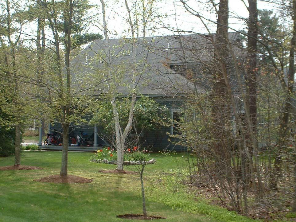
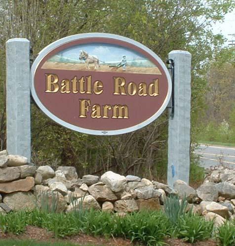
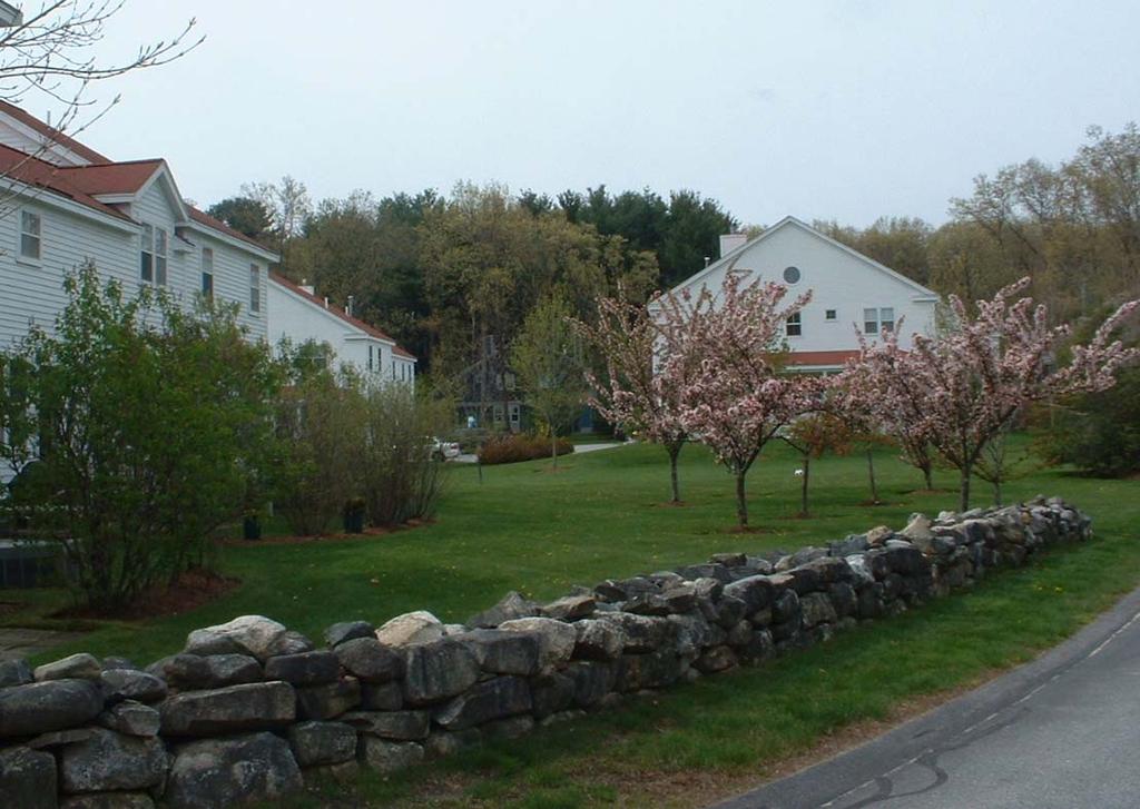
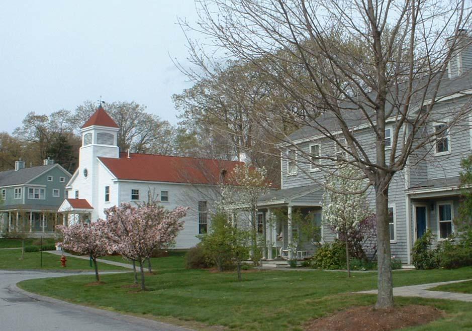
7 Battle Road Farm Lincoln Town purchased 47 acre parcel for $1.4 million Sold 23 acres for business park Rezoned 24 acres as a Planned Unit Development Keen Development Corporation built 120 homes, 48 affordable 12 acres of open space preserved 7
8 8
9 9
10 90-acre site Cherry Hill Co-Housing Amherst acre 9-hole 9 golf course 24 adjacent acres Town purchased land for appraised $2.2m Retained golf course Sold remaining acreage for $400,000 Non-Profit Developer created Cherry Hill Co-Housing 32 Condominium units clustered on 5 acres 19 acres retained as open space 10

11 Housing Component 32 Condominiums 2-33 family units 8 units targeted for families making <80% area median income Perpetual deed restrictions Community building, public open space 11


12 Open Space Component Golf Course Cherry Hill Golf Course 66-acre golf course owned by Town 19 acres within development owned by condo association Community gardens Woodlands Wetlands Building permit prohibits development of woodlands Community Gardens 12

13 Cherry Hill Co-Housing Community Center 13
14 Misty Meadows Amherst acre Wentworth Farm, adjacent to Town open space, on market Local developers (Robert and Judith Rivard) ) want to build affordable housing Purchase land for $750,000 Town buys 97 acres for $310, acre development constructed under Town s s Cluster Development Bylaw 14
")
15 Housing Component 41 units on 18 acres 37% affordable Density bonus for affordable units Two lots set aside for Amherst Housing Authority 4 units planned (<50% median) 15


16 Open Space Component Town purchased 97 acres of open space 25 acres of open space within development Community Open Space 16
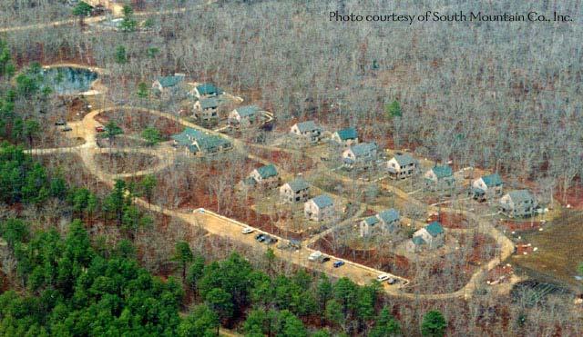
17 Whitebrook Meadow Easthampton Proposed multi-generational, mixed income development Goal Provide affordable homes for foster families, and integrate with seniors Partners Non-profit Treehouse Foundation Beacon Properties, Inc. Town of Easthampton 17

18 Easthampton Middle School Development Site 18

19 Housing Component 48-acre parcel - $875,000 Subdivided into two lots 8-acre, 8-unit 8 cluster subdivision 40-acre, 104-unit Comprehensive Permit 60 affordable units 19 Schematics courtesy of Dodson Associates

20 Courtesy of Dodson Associates 20


21 Open Space Component 17 acres of permanent open space Also includes large common meadow Abuts 100-acre Town- owned park Rendering courtesy of Dodson Associates 21

22 Jacobs Pond Norwell acre site on Jacobs Pond Comprehensive Permit to allow 44 condominiums on a 9-acre site 3.6 acres set aside as open space 22


23 Housing Component Restricted: over age 62 Eleven units reserved for hhlds making <80% of the median area income 99-year deed restrictions 23


24 Open Space Component 3.6 acres conveyed to Conservation Commission to protect pond Adjacent to Jacobs Pond Conservation Area 24
25 Island Co-Housing West Tisbury acre site purchased by South Mountain Company Subdivided into four parcels 30 acres for 16-unit co-housing development Pedestrian-oriented Streets and vehicles on perimeter only Community center, communal responsibilities Comprehensive permit to cluster housing on 6 acres 24 acres left as open space 25

26 Private Business Parcel Open Space Private Home Parcel


27 Housing Component 16 single family homes 4 affordable to hhlds making less than 80% of median, 4 others set aside for moderate income 27

28 Open Space Component 24 acres Village Common Community garden Pond Playing fields Wooded area Owned by homeowners association 28
29 29
30 Ryan Road Northampton acre parcel with limited frontage, single family home for sale City paid $60,000 to purchase land for conservation purposes Used $45,000 CDBG funds Additional money from Open Space Fund and DPW fund (for well protection) 30


31 Housing Component Used cluster bylaw Habitat for Humanity built duplex on 23,000 sf lot Units available to hhlds making <50% area median income Existing single family home on 13,600 sf rehabbed and sold at market-rate rate 31


32 Open Space Component Trail easement In proximity to Saw Mill Hill, a priority area for open space protection Adjacent to 24 acres of conservation land in cluster development Development added 59 acres, including land for well protection Includes 10 foot wide easement by housing 32
33 Westhampton Road Northampton acre parcel slated for development Development plan encroached on land needed for buffer around planned land fill expansion Endangered species and threat of eminent domain convinced developer to sell land to the City for market value plus sunk costs Total cost to City - $385,000 33
34 Westhampton Rd-Limited Development HABITAT MARKET RECREATION CONSERVATION MARKET 34

35 Housing Component Comprehensive permit Homes affordable for 99 years Habitat has first right of refusal, City second Affordable units will sell for $65-75,000 35
36 Garfield Avenue Northampton 5.5-Acre Urban Infill Development Goal: Resolve landfill issue, create affordable housing and urban park Seven homes clustered on 1.5 acres Comprehensive permit 6 Affordable, 1 Market-Rate 4 acres for urban park 36
37 Garfield Avenue-Limited Development conservation area Market Lot Habitat for Humanity Habitat for Humanity Habitat for Humanity 37
38 Paine Estate Wayland acres overlooking Sudbury River Includes stately Greenways Mansion Town purchased land for $5.2 million $3.3 million from Town override $1.2 million from Sudbury Valley Trustees $700,000 from MA Dept. of Environmental Management Management (includes $200,000 for trail easement and Conservation Restriction) 38


39 Housing Mix Independent over 55 Paine Estate Mixed income subdivision - 4 affordable units Assisted living in re-used Greenways Mansion - 15% earmarked for lower income residents 39
40 Open Space 99 acres owned by Town and Sudbury Valley Trustees Abuts existing conservation land, and overlooks Sudbury River 40
41 Nike Site Wayland 13.5-acre surplus military installation Across from moderate-income military housing Adjacent to cluster open space Site available at no cost for open space under the National Park Service (NPS) Lands to Parks program Town wants site for affordable housing Town Nike Reuse Committee negotiates with NPS to subdivide property 10.7 acres for open space at no cost 2.75 acres for affordable housing at market value of $395,000, paid with CPA funds 41

42 Housing Component Expect to use non-profit developer Zoning allows only one home on parcel, so will use a Comprehensive Permit Plan for 16 home ownership units, of which at least 8 will be affordable to hhlds making <80% area median income Remaining units restricted to hhlds making <110% area median income 42


43 Open Space Component 10.7 acres owned by Town protected in perpetuity under NPS program Handicapped- accessible trails will be built 43

44 Forte Property Newton Currently under development Town purchased 1 acre lot with home for $1.1 million using CPA money Development will include three affordable units on.33 acres, and.66 acres of conservation land Abuts conservation land 44


45 Housing Component Existing Single Family home Transferred to Newton Housing Authority for rental to families making <50% median area income New duplexes Habitat for Humanity Hhlds making <80% median area income Perpetual deed restriction, Habitat first right of refusal Original Concept Plan Proposed Duplex Current Plan Existing Home 45


46 Open Space Component Forte Property.66 acres conserved Adjacent to 4-acre 4 Dolan Pond Conservation area Provides overlook for wildlife viewing Provides parking area 46
47 Kesseler Woods Newton 43-acre parcel for sale largest undeveloped open space parcel in the City City partnered with Cornerstone Development Single family, 7-unit, 7 market-rate rate subdivision 63 townhouses on 14 acres, 20% affordable 22 acres of conservation land protected 47

48 Single family Subdivision Mixed income development Existing conservation land Kesseler Woods Land Plan, Newton 48
49 Case Study Summary 682 acres in 13 Developments 585 housing units 180 affordable to those making <80% area median income (31% of total) 205 affordable to those making <120% area median income (35%) 6 hospice beds (not included in total) 474 acres of open space protected (69% of total) 49
ARTICLE FIVE FINAL DRAFT
 ARTICLE FIVE 021218 FINAL DRAFT Sec. 503.6 Open Space Preservation Option Open Space Preservation Option Open Space Preservation developments may be approved in the AR, R-1, R-2 and R-3 zoning districts,
Chapter Planned Residential Development Overlay
 Chapter 19.29 Planned Residential Development Overlay Sections 010 Purpose 020 Scope 030 Definitions 030 Minimum Size 040 Allowable Uses 050 Minimum Development Standards 060 Density Bonus 070 Open Space
Article 3 - Rural Districts
 rticle 3 - Rural Districts Div. 3.1. -40: griculture 40 (OI Only) 3-2 3.1.1. Intent... 3-2 3.1.2. Lot Dimensions... 3-2 3.1.3. uilding Placement... 3-3 3.1.4. uilding Height... 3-3 Div. 3.2. -20: griculture
Hennepin County Economic Analysis Executive Summary
 Hennepin County Economic Analysis Executive Summary Embrace Open Space commissioned an economic study of home values in Hennepin County to quantify the financial impact of proximity to open spaces on the
FINAL DRAFT 10/23/06 ARTICLE VI
 FINAL DRAFT 10/23/06 ARTICLE VI 185-41.1. Planned Residential Development A. Purpose and Intent. The purposes of the Planned Residential Development (PRD) bylaw are to maintain the rural character of Dover,
OPEN SPACE RESIDENTIAL DEVELOPMENT (OSRD) MODEL SITE PLAN BYLAW
 MODEL SITE PLAN BYLAW") OPEN SPACE RESIDENTIAL DEVELOPMENT (OSRD) MODEL SITE PLAN BYLAW 1) PURPOSE AND INTENT a) The Primary Purposes for OSRD are the following: i) To allow for greater flexibility and creativity in the design
OPEN SPACE RESIDENTIAL DEVELOPMENT (OSRD) MODEL SITE PLAN BYLAW 1) PURPOSE AND INTENT a) The Primary Purposes for OSRD are the following: i) To allow for greater flexibility and creativity in the design
Conservation Partnering Opportunities for Military Departments, Public Agencies, and Private Conservators
 Conservation Partnering Opportunities for Military Departments, Public Agencies, and Private Conservators Richard A. Engel Naval Facilities Engineering Command April 9, 2003 1 INTRODUCTION Military departments,
4. facilitate the construction of streets, utilities and public services in a more economical and efficient manner;
 PVPC MODEL BYLAW BY-RIGHT CLUSTER ZONING BYLAW Prepared by Pioneer Valley Planning Commission Revised: October 2001 1.00 Development 1.01 Development Allowed By Right Development in accordance with this
PLANNED RESIDENTIAL DEVELOPMENT (PRD)
") PLANNED RESIDENTIAL DEVELOPMENT SECTION 10. PLANNED RESIDENTIAL DEVELOPMENT (PRD) 10.1 Purpose Planned Residential Development allows by special permit from the Board an alternative pattern of residential
PLANNED RESIDENTIAL DEVELOPMENT SECTION 10. PLANNED RESIDENTIAL DEVELOPMENT (PRD) 10.1 Purpose Planned Residential Development allows by special permit from the Board an alternative pattern of residential
GWINNETT COUNTY CSO CONSERVATION SUBDIVISION OVERLAY DISTRICT REQUIREMENTS
 GWINNETT COUNTY CSO CONSERVATION SUBDIVISION OVERLAY DISTRICT REQUIREMENTS Section 1316. CSO Conservation Subdivision Overlay District. 1. Purposes. The purposes of this overlay district are as follows:
KEY DEVELOPMENT AREA BIG MOUNTAIN RD. Wisconsin Avenue Corridor Plan Steering Committee
 KEY DEVELOPMENT AREA BIG MOUNTAIN RD. Wisconsin Avenue Corridor Plan Steering Committee 5-17-17 SITE FEATURES Lakeshore frontage Extensive tree cover open space Single Owner Water & Sewer in East Lakeshore
REPORT OF THE PLANNING AND DEVELOPMENT DEPARTMENT FOR APPLICATION FOR REZONING ORDINANCE TO PLANNED UNIT DEVELOPMENT APRIL 21, 2016
 BEL REPORT OF THE PLANNING AND DEVELOPMENT DEPARTMENT FOR APPLICATION FOR REZONING ORDINANCE TO PLANNED UNIT DEVELOPMENT APRIL 21, 2016 The Planning and Development Department hereby forwards to the Planning
RHODE ISLAND HOUSING Application for Letter of Eligibility
 RHODE ISLAND HOUSING Application for Letter of Eligibility GENERAL INFORMATION 1. Name of Development: 2. Address of Site: Plat, Lot(s) 3. City/Town: Zip Code: 4. Development Entity: Name of Principal:
Streamlining Affordable Housing Approvals Proposed Trailer Bill
 Streamlining Affordable Housing Approvals Proposed Trailer Bill The Governor s proposal for streamlining affordable housing approvals requires cities and counties to approve: A certain type of housing
GREAT BARRINGTON COMMUNITY PRESERVATION COMMITTEE. APPLICATION FOR CPA FUNDING Step 1
 GREAT BARRINGTON COMMUNITY PRESERVATION COMMITTEE APPLICATION FOR CPA FUNDING Step 1 Date Received (for office use only) Applicant Name The Great Barrington Municipal Affordable Housing Trust Project Name
DRAFT FOR PUBLIC HEARING (rev. March, 2016)
") Chapter 200. ZONING Article VI. Conservation/Cluster Subdivisions 200-45. Intent and Purpose These provisions are intended to: A. Guide the future growth and development of the community consistent with
Chapter 200. ZONING Article VI. Conservation/Cluster Subdivisions 200-45. Intent and Purpose These provisions are intended to: A. Guide the future growth and development of the community consistent with
CHARTER TOWNSHIP OF CALEDONIA COUNTY OF KENT, MICHIGAN. at the Township and Village Hall, 8196 Broadmoor Avenue, Caledonia, Michigan on the
 First Reading CHARTER TOWNSHIP OF CALEDONIA COUNTY OF KENT, MICHIGAN At a regular meeting of the Township Board of the Charter Township of Caledonia, held at the Township and Village Hall, 8196 Broadmoor
A. Location. A MRD District may be permitted throughout the County provided it meets the standards established herein.
 752. Multi-Residential District (MRD) The Multi-Residential (MRD) District is intended to provide opportunities for rural, suburban and urban density mixed-residential developments consistent with the
Special Use Permit - Planned Unit Development Checklist. Property Address:
 Special Use Permit - Planned Unit Development Checklist Special Use Permit Number. Parcel Code/s #28-11- - - Property Address: Applicant: ARTICLE VIII Ordinance Reference - Section 8.1.2 Permit Procedures:
DRAFT Plan Incentives. Part A: Basic Discount
 DRAFT 2030 Plan Incentives July 26, 2006 Part A: Basic Discount In order for a development to be eligible for any 2030 Land Resource Management Plan Discounts it must be located in the Urban Corridor and
Town of Falmouth s Four Step Design Process for Subdivisions in the Resource Conservation Zoning Overlay District
 Town of Falmouth s Four Step Design Process for Subdivisions in the Resource Conservation Zoning Overlay District All subdivisions shall be designed in accordance with the following four-step process.
Highland Green Estates Neighbourhood Area Structure Plan
 Highland Green Estates Neighbourhood Area Structure Plan Original Outline Plan approved by Council: March 10, 1997 Outline Plan amended by Council: March 24, 1997 Converted to a Neighbourhood Area Structure
ARTICLE 12 PLANNED UNIT DEVELOPMENT DISTRICTS (PUDS) Sec Intent CHARTER TOWNSHIP OF BRIGHTON ZONING ORDINANCE
 Sec Intent CHARTER TOWNSHIP OF BRIGHTON ZONING ORDINANCE") ARTICLE 12 PLANNED UNIT DEVELOPMENT DISTRICTS (PUDS) Sec. 12-01 Intent 1 2 (a) The intent of this Article is to permit the coordinated development on larger sites, protect significant natural features
ARTICLE 12 PLANNED UNIT DEVELOPMENT DISTRICTS (PUDS) Sec. 12-01 Intent 1 2 (a) The intent of this Article is to permit the coordinated development on larger sites, protect significant natural features
Conservation Design Subdivision Option
 Sheridan County, Wyoming Conservation Design Subdivision Option Recent Amendments to Zoning and Subdivision Rules and Regulations Adopted November 2010 Mark Reid, County Planner 1 County Road #255 traffic
FINAL DRAFT 12/1/16, Rev. to 7/18/17
 FINAL DRAFT 12/1/16, Rev. to 7/18/17 (As Adopted 8/8/17 Effective 9/1/17) SHELTON PLANNING AND ZONING COMMISSION Proposed Amendments to Zoning Regulations I. Amend Section 23 PERMITTED USES by inserting
TOWN OF MIDDLEBOROUGH COMMUNITY PRESERVATION PLAN
 TOWN OF MIDDLEBOROUGH COMMUNITY PRESERVATION PLAN Vision The residents of Middleborough desire a community which is family-oriented and which retains its small town character while preserving an abundance
Cover Letter with Narrative Statement
 Cover Letter with Narrative Statement March 31, 2017 rev July 27, 2017 RE: Rushton Pointe Residential Planned Unit Development Application for Public Hearing for RPUD Rezone PL2015 000 0306 Mr. Eric Johnson,
1. Multi-family dwellings, including town homes, apartments, or condominiums.
 Sec. 4-6.67 Planned Unit Development (PUD-M). a. Definition. A planned multi-family zoning district of three acres or more, consisting of townhouses, apartments, condominiums, single-family detached, single-family
Article 7: Residential Land Use and Development Requirements
 Article 7: Residential Land Use and Section 701: Statement of Intent (A) (B) (C) The intent of Article 7 is to develop certain land use and development requirements for the residential uses within Cumru
PIN , Part 1, Plan SR-713 in Lot 2, Concession 5, Township of McKim (1096 Dublin Street, Sudbury)
") STAFF REPORT Applicant: Dalron Construction Limited Location: PIN 02124-0103, Part 1, Plan SR-713 in Lot 2, Concession 5, Township of McKim (1096 Dublin Street, Sudbury) Official Plan and Zoning By-law:
STAFF REPORT Applicant: Dalron Construction Limited Location: PIN 02124-0103, Part 1, Plan SR-713 in Lot 2, Concession 5, Township of McKim (1096 Dublin Street, Sudbury) Official Plan and Zoning By-law:
EAST GOSHEN TOWNSHIP CHESTER COUNTY, PENNSYLVANIA ORDINANCE NO.
 EAST GOSHEN TOWNSHIP CHESTER COUNTY, PENNSYLVANIA ORDINANCE NO. AN ORDINANCE AMENDING THE EAST GOSHEN TOWNSHIP ZONING ORDINANCE OF 1997, AS AMENDED, WHICH IS CODIFIED IN CHAPTER 240 OF THE EAST GOSHEN
Bylaw No , being "Official Community Plan Bylaw, 2016" Schedule "A" DRAFT
 Bylaw No. 2600-2016, being "Official Community Plan Bylaw, 2016" Schedule "A" Urban Structure + Growth Plan Urban Structure Land use and growth management are among the most powerful policy tools at the
ZONING ORDINANCE. Calvert County, MD. Department of Planning and Zoning ARTICLE 5 DEVELOPMENT REQUIREMENTS
 ZONING ORDINANCE Calvert County, MD Department of Planning and Zoning ARTICLE 5 DEVELOPMENT REQUIREMENTS 5-0 Development Requirements 5-1 Lot Area, Lot Width, Setback & Height Requirements B All Zones
Marion County Board of County Commissioners
 Marion County Board of County Commissioners Date: 6/4/217 P&Z: 9/25/217 BCC Transmittal: 1/17/217 BCC Adopt: TBD Amendment No: 217-L6 Type of Application Large-Scale Comp Plan Amendment Request: Change
UPDATE Board of Selectmen June 20, 2017
 MAPLE STREET I-1 AREA DRAFT ZONING BYLAW & DEVELOPMENT STANDARDS Town of Danvers, MA UPDATE Board of Selectmen June 20, 2017 The Danvers Team: Brovitz Community Planning & Design Dodson & Flinker Danvers
STAFF REPORT. Guttman Development Group, LLC. PUD-R (Residential Planned Unit Development Plan)
") P a g e 1 STAFF REPORT CASE: APPLICANT: LOCATION: ZONED: REQUEST: ZC09-2017 Guttman Development Group, LLC 4990 Wilmington Pike PUD-R (Residential Planned Unit Development Plan) A Major Change to an Approved
P a g e 1 STAFF REPORT CASE: APPLICANT: LOCATION: ZONED: REQUEST: ZC09-2017 Guttman Development Group, LLC 4990 Wilmington Pike PUD-R (Residential Planned Unit Development Plan) A Major Change to an Approved
OPEN SPACE PRESERVATION. Reflections on the Value of Acquiring Property for Preservation Purposes
 OPEN SPACE PRESERVATION Reflections on the Value of Acquiring Property for Preservation Purposes What is open space and what does it do? The Town Plan of Conservation and Development defines it as follows:
Protecting what Matters: Prioritizing Lands for Protection in the North River Corridor
 Protecting what Matters: Prioritizing Lands for Protection in the North River Corridor Deborah Lenahan North & South Rivers Watershed Association P.O. Box 43 Norwell, MA 02061 April 22, 2004 Table of Contents
PROJECT NARRATIVE FOR BRIDGEWATER CPA APPLICATION 10/5/11 (Revised per 10/6/11 CPC Vote) CALTHROP TRUST C.61A LAND ACQUISITION PROJECT PROPOSAL 1) WHA
 CALTHROP TRUST C.61A LAND ACQUISITION PROJECT PROPOSAL 1) WHA") PROJECT NARRATIVE FOR BRIDGEWATER CPA APPLICATION 10/5/11 (Revised per 10/6/11 CPC Vote) CALTHROP TRUST C.61A LAND ACQUISITION PROJECT PROPOSAL 1) WHAT IS THE PURPOSE AND SCOPE OF THE PROJECT? The project
PROJECT NARRATIVE FOR BRIDGEWATER CPA APPLICATION 10/5/11 (Revised per 10/6/11 CPC Vote) CALTHROP TRUST C.61A LAND ACQUISITION PROJECT PROPOSAL 1) WHAT IS THE PURPOSE AND SCOPE OF THE PROJECT? The project
TREASURE COAST REGIONAL PLANNING COUNCIL M E M O R A N D U M
 TREASURE COAST REGIONAL PLANNING COUNCIL M E M O R A N D U M To: Council Members AGENDA ITEM 6A From: Date: Subject: Staff May 20, 2011 Council Meeting Local Government Comprehensive Plan Review Draft
Policy Issues City of Knoxville Zoning Code Update
 Policy Issues City of Knoxville Zoning Code Update ADU's (Accessory Dwelling Units) The draft zoning ordinance update permits ADU s as an accessory use in all single-family residential zoning districts.
Case 3:91-cv HRH Document 385 Filed 03/13/17 Page 1 of 6
 Case 3:91-cv-00083-HRH Document 385 Filed 03/13/17 Page 1 of 6 Case 3:91-cv-00083-HRH Document 385 Filed 03/13/17 Page 2 of 6 Case 3:91-cv-00083-HRH Document 385 Filed 03/13/17 Page 3 of 6 Case 3:91-cv-00083-HRH
Land Acquisition Strategy and Implementation Policy Public Opinion Survey Results
 Land Acquisition Strategy and Implementation Policy Public Opinion Survey Results Presentation to Council and Parks & Planning Commissions May 9, 2017 Background Parks CIP: - Allocated $13 million to Land
Conservation Design Development Amendment to Zoning Ordinance as adopted by Town Council December 8, 2010
 Conservation Design Development Amendment to Zoning Ordinance as adopted by Town Council December 8, 2010 Definitions Add: Cluster- A site planning technique that concentrates buildings in specific areas
LAND USE INTRODUCTION EXISTING CONDITIONS
 INTRODUCTION This chapter describes land use in the Lemon Creek area using maps and data that show designations of all properties by the 2013 Comprehensive Plan, zoning code, and locations of developed
Inclusionary Housing. The what, where, when, and how of affordable housing choices
 Inclusionary Housing The what, where, when, and how of affordable housing choices What is Affordable Housing? Affordable Housing there are many definitions. One example: Affordable Housing shall be a residential
EXHIBIT D. WRITTEN DESCRIPTION For. TOWNSEND VILLAGE PUD December 23, 2015 (Revised)
") I. PROJECT DESCRIPTION EXHIBIT D WRITTEN DESCRIPTION For TOWNSEND VILLAGE PUD December 23, 2015 (Revised) A. This 7.2 acre single-family residential project is located on the East side of Townsend Boulevard,
I. PROJECT DESCRIPTION EXHIBIT D WRITTEN DESCRIPTION For TOWNSEND VILLAGE PUD December 23, 2015 (Revised) A. This 7.2 acre single-family residential project is located on the East side of Townsend Boulevard,
1. an RSF-R, RSF-1, RSF-2, RSF-4, RMF-5, or RMF-8 zoning district; or
 Chapter 9 INCENTIVES 9.1 General 9.1.1 Review and Approval Procedure Projects requesting bonuses under this chapter for land that has not been platted, or for land that is being voluntarily replatted,
Applying Open Space Design Techniques Lowell, MA 5/21/13
 Applying Open Space Design Techniques Lowell, MA 5/21/13 An Introduction to the State s Open Space Design / Natural Resource Protection Zoning Model Bylaw Kurt Gaertner Massachusetts Executive Office of
Section Intent
 Section 246. 1. Intent 2. Authority a. It is the intent of these Transfer of Development Rights (TDR s) regulations to encourage the preservation of natural resources and facilitate orderly growth in the
CZMP Workshop Preserving Your Community & The Environment From Development Impacts
 CZMP Workshop Preserving Your Community & The Environment From Development Impacts Sponsored By Community & Environmental Defense Services 410-654-3021 www.ceds.org/bcmd Help@ceds.org Greater Baltimore
4.7 MODEL RESIDENTIAL CLUSTER DEVELOPMENT ORDINANCE
 4.7 MODEL RESIDENTIAL CLUSTER DEVELOPMENT ORDINANCE Residential cluster development is a form of land development in which principal buildings and structures are grouped together on a site, thus saving
NANTUCKET ISLANDS LAND BANK AFFORDABLE HOUSING POLICY Adopted by the vote of the Land Bank Commission on November 10, 2015
 NANTUCKET ISLANDS LAND BANK AFFORDABLE HOUSING POLICY Adopted by the vote of the Land Bank Commission on November 10, 2015 In recent history, the island of Nantucket has experienced a shortage of affordable,
MORAGA COUNTRY CLUB SUMMARY DISCLOSURE FOR PROSPECTIVE GOLF ASSOCIATE MEMBERS (Approved by the Board of Directors November 18, 1999)
") MORAGA COUNTRY CLUB SUMMARY DISCLOSURE FOR PROSPECTIVE GOLF ASSOCIATE MEMBERS (Approved by the Board of Directors November 18, 1999) Thank you for considering the purchase of a proprietary Golf Associate
MORAGA COUNTRY CLUB SUMMARY DISCLOSURE FOR PROSPECTIVE GOLF ASSOCIATE MEMBERS (Approved by the Board of Directors November 18, 1999) Thank you for considering the purchase of a proprietary Golf Associate
1. Cuyler-Brownsville planned neighborhood conservation (P-N-C) districtphase I (section ). (2) Single-family semiattached dwellings;
 districtphase I (section ). (2) Single-family semiattached dwellings;") Sec. 8-3035. Planned unit development multifamily (PUD-M). A. Purpose. The PUD-M district is intended to allow a variety of residential development including single-family residential, two-family residential,
Sec. 8-3035. Planned unit development multifamily (PUD-M). A. Purpose. The PUD-M district is intended to allow a variety of residential development including single-family residential, two-family residential,
Title 5: ADMINISTRATIVE PROCEDURES AND SERVICES
 Title 5: ADMINISTRATIVE PROCEDURES AND SERVICES Chapter 353: LAND FOR MAINE'S FUTURE Table of Contents Part 15-A. LAND FOR MAINE'S FUTURE... Section 6200. FINDINGS... 3 Section 6201. DEFINITIONS... 3 Section
Report to: Development Services Committee Report Date: April 21, 2015
 SUBJECT: Preliminary Report Applications for Draft Plan of Subdivision, Zoning By-law Amendment, Plan of Condominium and Site Plan Approval by Urbancorp Inc. 9064-9110 Woodbine Avenue File No s: SU/ZA/CU/SC
PROPOSED FINDINGS OF FACT BENDER URBAN GROWTH BOUNDARY EXPANSION AND ANNEXATION REQUEST April 3, Background
 PROPOSED FINDINGS OF FACT BENDER URBAN GROWTH BOUNDARY EXPANSION AND ANNEXATION REQUEST April 3, 2016 Background The owners of TL300, 301, 302, 303, and 304, 3N1027BD - properties abutting the City Limits
CITY OF PORT ORCHARD
 CITY OF PORT ORCHARD ZONING DESIGNATIONS (Adapted from POMC Chapter 20.34 Zoning Districts, as adopted 6/13/2017) 20.34.110 Greenbelt zone (Gb). (1) Purpose. It is the purpose of the greenbelt zone to
Rule 80. Preservation of Primary Agricultural Soils Revised and approved by the Land Use Panel during its public meeting on January 31, 2006.
 Rule 80. Preservation of Primary Agricultural Soils Revised and approved by the Land Use Panel during its public meeting on January 31, 2006. (A) Purpose. In accordance with 10 V.S.A. Sections 6025(b)
PALM BEACH COUNTY PLANNING, ZONING AND BUILDING DEPARTMENT ZONING DIVISION. Preferred Realty and Development
 PALM BEACH COUNTY PLANNING, ZONING AND BUILDING DEPARTMENT ZONING DIVISION Application No.: PDD-2015-00746 Application Name: Orchid Bend Control No.: 2014-00194 Applicant: Verzaal Family Ltd Partnership
Windermere Estates Land Opportunity
 Windermere Estates Land Opportunity 497 acres development land, Bath, Ontario, Canada RealtySource Inc., Brokerage Windermere Estates Land Opportunity 497 acres development land, Bath, Ontario, Canada
3390, 3392, 3394, 3396 and 3398 Bayview Avenue - Official Plan Amendment, Zoning By-law Amendment Application - Preliminary Report
 STAFF REPORT ACTION REQUIRED 3390, 3392, 3394, 3396 and 3398 Bayview Avenue - Official Plan Amendment, Zoning By-law Amendment Application - Preliminary Report Date: March 14, 2016 To: From: Wards: Reference
Washington Park Housing Development
 Washington Park Housing Development Presented by April 5, 2014 Our Mission To foster nonprofits that create quality housing and strong neighborhoods; to work collaboratively; and to create decent housing
Central Pennsylvania Conservancy Project Selection Criteria Form
 Central Pennsylvania Conservancy Project Selection Criteria Form The following criteria guide the actions of the Central Pennsylvania Conservancy s Land Protection Committee and Board of Directors in selecting
IRS FORM 8283 SUPPLEMENTAL STATEMENT DONATION OF CONSERVATION EASEMENT
 Name(s) shown on income tax return Identifying Number Robert T. Landowner 021-34-1234 Susan B. Landowner 083-23-5555 IRS FORM 8283 SUPPLEMENTAL STATEMENT DONATION OF CONSERVATION EASEMENT On November 12,
ARTICLE XI - CONSERVATION SUBDIVISIONS
 ARTICLE XI - CONSERVATION SUBDIVISIONS Section 1101: Purpose and Intent. This Article is intended to provide for residential subdivisions that are designed based first and foremost on the preservation
Unified Zoning Ordinance-Technical Committee Meeting Metropolitan Planning Commission Arthur Mendonsa Hearing Room January 21, :00-5:00 PM
 MEETING NOTES Unified Zoning Ordinance-Technical Committee Meeting Metropolitan Planning Commission Arthur Mendonsa Hearing Room January 21, 2009 3:00-5:00 PM Members Present: Bill Dawers, MarRonde Lumpkin-Lotson,
CHAPTER34 PRUD - PLANNED RESIDENTIAL UNIT DEVELOPMENT
 CHAPTER34 PRUD - PLANNED RESIDENTIAL UNIT DEVELOPMENT 17-34-1 17-34-2 17-34-3 17-34-4 17-34-5 17-34-6 17-34-7 17-34-8 17-34-9 Purpose Planned Residential Unit Development Defined Planned Residential Unit
Comprehensive Plan Amendment #PLN , Reserve at Cannon Branch (Coles Magisterial District)
") COUNTY OF PRINCE WILLIAM 5 County Complex Court, Prince William, Virginia 22192-9201 PLANNING (703) 792-7615 FAX (703) 792-4758 OFFICE Internet www.pwcgov.org Christopher M. Price, AICP Director of Planning
COUNTY OF PRINCE WILLIAM 5 County Complex Court, Prince William, Virginia 22192-9201 PLANNING (703) 792-7615 FAX (703) 792-4758 OFFICE Internet www.pwcgov.org Christopher M. Price, AICP Director of Planning
Staff Report & Recommendation Rezoning Case RZ Date of Report: June 6, 2014 Report by: Doug Stacks
 Staff Report & Recommendation Rezoning Case RZ-2014-02 Date of Report: June 6, 2014 Report by: Doug Stacks Hearing Dates: Planning Commission June 26, 2014 Mayor and Council July 14, 2014 GENERAL INFORMATION
COUNTY COUNCIL OF PRINCE GEORGE'S COUNTY, MARYLAND SITTING AS THE DISTRICT COUNCIL 2017 Legislative Session
 DR- COUNTY COUNCIL OF PRINCE GEORGE'S COUNTY, MARYLAND SITTING AS THE DISTRICT COUNCIL 0 Legislative Session Resolution No. Proposed by Introduced by CR--0 Council Member Turner Council Members Turner,
CHAPTER 6 Low Density Residential Zoning Districts
 CHATER 6 Low Density Residential Zoning Districts Section 6.1 Description and urpose: This Chapter presents the regulations of two Zoning Districts: the RL-14 Single Family Residential and the RL-10 Residential.
LEGISLATIVE PURPOSES. 2. Provide sources of agricultural products within the state for the citizens of the state
 LEGISLATIVE PURPOSES 1. Assist in sustaining the farming community 2. Provide sources of agricultural products within the state for the citizens of the state 3. Control the urban expansion which is consuming
Article XII. R-1 Agricultural-Low Density Residential District
 Article XII R-1 Agricultural-Low Density Residential District Section 1200. Declaration of Legislative Intent In expansion of the Declaration of Legislative Intent and Statement of Community Development
Where Will Our Workers (or Children) Live? Maintaining a Balanced Community and Meeting Downers Grove s Housing Needs
 Live? Maintaining a Balanced Community and Meeting Downers Grove s Housing Needs") Where Will Our Workers (or Children) Live? Maintaining a Balanced Community and Meeting Downers Grove s Housing Needs Introduction What is affordable housing? What is the housing shortage facing Downers
Where Will Our Workers (or Children) Live? Maintaining a Balanced Community and Meeting Downers Grove s Housing Needs Introduction What is affordable housing? What is the housing shortage facing Downers
RECOMMENDATION: Approval subject to the following conditions:
 RECOMMENDATION: Approval subject to the following conditions: 1) Approval under this preliminary plan is limited to 2 lots for 2 dwelling units 2) The record plat must note that the preliminary plan is
Town of Qualicum Beach M E M O R A N D U M
 Town of Qualicum Beach M E M O R A N D U M TO: Advisory Planning Commission FOR: APC Meeting April 18, 2012 FROM: Luke Sales, Director of Planning RE: Land Use Bylaw and Official Community Plan Bylaw Amendments
a. It is the intent of these regulations to encourage the preservation of natural resources and facilitate orderly growth in the County.
 Part V Transfer of Development Rights Section 246. 1. Intent a. It is the intent of these regulations to encourage the preservation of natural resources and facilitate orderly growth in the County. b.
The Maryland Rural Legacy and CREP Easement Programs
 The Maryland Rural Legacy and CREP Easement Programs The Points Based Method: The EVS Saving America s Farms and Farmland National Conference May 12, 2014 WHAT IS AN EVS? A method of awarding points to
B. Subarea Provisions, including the Design Elements and Area of Special Concern and Potential Park/Open Space/Recreation Requirements;
 ARTICLE III: LAND USE DISTRICTS III-1 300 INTRODUCTION Article III of the Washington County Community Development Code consists of the primary and overlay districts which apply to the unincorporated areas
1. Future Land Use FLU6.6.8 Land uses within the Rural Service Area portion of the Wekiva Study Area shall be limited to very low and low intensity
 1. Future Land Use FLU6.6.8 Land uses within the Rural Service Area portion of the Wekiva Study Area shall be limited to very low and low intensity uses to the greatest extent possible. Existing land uses
NEW CONSTRUCTION 55 PLUS CONDOS IN MASSACHUSETTS
 NEW CONSTRUCTION 55 PLUS CONDOS IN MASSACHUSETTS Massachusetts 55 plus condos and townhouses have become very popular with developers, rapidly building large developments in the metro Boston area based
ARTICLE IV R-1A, R-1B, R-1C, R-1, R-2, R-3, AND R-4, ONE FAMILY RESIDENTIAL DISTRICTS
 ARTICLE IV R-1A, R-1B, R-1C, R-1, R-2, R-3, AND R-4, ONE FAMILY RESIDENTIAL DISTRICTS PREAMBLE These residential districts are designed to provide for one family low density dwelling sites and residentially
Conservation Subdivisions: Planning for Green Development. Susan Greenfield, Business Development Applied Ecological Services, Inc.
 Conservation Subdivisions: Planning for Green Development Susan Greenfield, Business Development Applied Ecological Services, Inc. Case Study: Village of Caledonia A bedroom community located between Chicago
Warren County, New Jersey
 679 Washington Street w P.O. Box 768 Hackettstown, New Jersey 07840 (908) 850-1216 m Fax (908) 850-1334 MASER SOSINSKI & ASSOCIATES, F?A. Township of Washington Warren County, New Jersey PROTECTED OPEN
TREASURE COAST REGIONAL PLANNING COUNCIL M E M O R A N D U M. To: Council Members AGENDA ITEM 10A
 TREASURE COAST REGIONAL PLANNING COUNCIL M E M O R A N D U M To: Council Members AGENDA ITEM 10A From: Date: Subject: Staff April 20, 2007 Council Meeting Local Government Comprehensive Plan Review Draft
REPORT OF THE PLANNING AND DEVELOPMENT DEPARTMENT FOR APPLICATION FOR REZONING ORDINANCE TO PLANNED UNIT DEVELOPMENT MAY 18, 2017
 BEL REPORT OF THE PLANNING AND DEVELOPMENT DEPARTMENT FOR APPLICATION FOR REZONING ORDINANCE 2016-805 TO PLANNED UNIT DEVELOPMENT MAY 18, 2017 The Planning and Development Department hereby forwards to
Site Selection and Acquisition
 Site Selection and Acquisition School site selection and acquisition involve a diligent team effort by District staff, appropriate facility planning individuals and real property professionals in cooperation
CHARLOTTE CODE. PART 1: PURPOSE AND PART 2: MIXED USE DISTRICTS (MX-1, MX-2, and MX-3) CHAPTER 11:
 CHAPTER 11:") PART 1: PURPOSE AND PART 2: MIXED USE DISTRICTS (MX-1, MX-2, and MX-3) Section 11.101. Purpose. CHAPTER 11: CONDITIONAL ZONING DISTRICTS PART 1: PURPOSE The Conditional Zoning Districts allow for the establishment
PART 1: PURPOSE AND PART 2: MIXED USE DISTRICTS (MX-1, MX-2, and MX-3) Section 11.101. Purpose. CHAPTER 11: CONDITIONAL ZONING DISTRICTS PART 1: PURPOSE The Conditional Zoning Districts allow for the establishment
COMMUNITY PRESERVATION ACT Town of Hatfield OPEN SPACE PROJECT GUIDELINES
 COMMUNITY PRESERVATION ACT Town of Hatfield OPEN SPACE PROJECT GUIDELINES CPA Open Space Projects: The Act requires that a participating community shall spend, or set aside for later spending, not less
HOUSING & RESIDENTIAL AREAS
 CHAPTER 10: HOUSING & RESIDENTIAL AREAS OVERVIEW With almost 90% of Ridgefield zoned for residential uses, the patterns and form of residential development can greatly affect Ridgefield s character. This
Demographics Review Multi-family Housing Data & Characteristics. Triplexes, quadplexes, and apartments. Development Potential Future Considerations
 Horizon Discussion: Arlington 2012 Multi-Family Housing Profile City Council Meeting September 17, 2013 6 Overview Demographics Review Multi-family Housing Data & Characteristics Triplexes, quadplexes,
INCLUSIONARY ZONING GUIDELINES FOR CITIES & TOWNS. Prepared for the Massachusetts Housing Partnership Fund By Edith M. Netter, Esq.
 INCLUSIONARY ZONING GUIDELINES FOR CITIES & TOWNS Prepared for the Massachusetts Housing Partnership Fund By Edith M. Netter, Esq. September 2000 Massachusetts Housing Partnership Fund Two Oliver Street
CHAPTER 1268 R-1-F (SINGLE FAMILY RESIDENTIAL, GOLF COURSE COMMUNITY)
") CHAPTER 1268 R-1-F (SINGLE FAMILY RESIDENTIAL, GOLF COURSE COMMUNITY) 1268.01 PURPOSE: The R-1-F (Single Family Residential - Golf Course Community) zoning district has been established to permit residential
CHAPTER 1268 R-1-F (SINGLE FAMILY RESIDENTIAL, GOLF COURSE COMMUNITY) 1268.01 PURPOSE: The R-1-F (Single Family Residential - Golf Course Community) zoning district has been established to permit residential
FY19 DCS GRANT ROUND ANNOUNCED
 FY19 DCS GRANT ROUND ANNOUNCED o LAND and PARC Grant deadline is Thursday, July 12, 2018 at 3:00 pm o Two LAND and PARC grant workshops o May 16, 2018 at 11:00 am in Amherst at the DAR Offices at 101 University
AGENDA STATEMENT NO BUSINESS OF THE PLANNING COMMISSION City of Victoria, Minnesota STAFF REPORT. Casco Ventures (Developer)
") AGENDA STATEMENT NO. 17-1 BUSINESS OF THE PLANNING COMMISSION City of Victoria, Minnesota STAFF REPORT TO: Planning Commission PREPARED BY: Erin Smith, Senior Planner RE: Waterford Landing Project Rezoning
AGENDA STATEMENT NO. 17-1 BUSINESS OF THE PLANNING COMMISSION City of Victoria, Minnesota STAFF REPORT TO: Planning Commission PREPARED BY: Erin Smith, Senior Planner RE: Waterford Landing Project Rezoning
OFFICIAL COMMUNITY PLAN. PART B.1 Northeast Area Neighbourhood Plan
 OFFICIAL COMMUNITY PLAN PART B.1 Northeast Area Neighbourhood Plan 1) Context The Design Regina Plan, under the authority of The Planning and Development Act, 2007 (as amended), provides for the adoption
Staff Report General Development Plan/Group Development Aldermanic District: 2 County Commission District: 2 MPC File No PLAN April 3, 2013
 Staff Report General Development Plan/Group Development Aldermanic District: 2 County Commission District: 2 MPC File No. 13-001387-PLAN April 3, 2013 Ramona Riley Lofts 1108 East Anderson Street RIP-B
Larimer County Planning Dept. Procedural Guide for 1041 PERMITS
 - Larimer County Planning Dept. Procedural Guide for 1041 PERMITS PLEASE NOTE: A PRE-APPLICATION CONFERENCE IS REQUIRED PRIOR TO SUBMITTING THIS APPLICATION. PURPOSE: State Statutes allow local governments