Dollar Tree PUD. Development Criteria R(PUD)-12-01
|
|
|
- Leonard Brice Carr
- 6 years ago
- Views:
Transcription
-12-01 June 28, 2013")
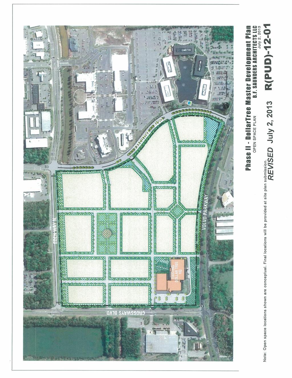
1 Dollar Tree PUD Development Criteria R(PUD) June 28, 2013 R(PUD)-12-01
2 TABLE OF CONTENTS TABLE OF CONTENTS PURPOSE & GOALS REGULATORY PLAN BUILDING FORM STANDARDS PERMITTED AND ACCESSORY USES GENERAL DESIGN REQUIREMENTS STREETSCAPE STANDARDS PUBLIC FACILITIES & INFRASTRUCTURE PARKING URBAN LANDSCAPING COMMON AREAS, OPEN SPACE AND PRESERVATION REQUIREMENTS PROPERTY OWNERS ASSOCIATION ARCHITECTURAL DESIGN GUIDELINES PHASING Draft date 6/26/2013 (WM rpud-12-01_development criteria_062813)
3 1. PURPOSE & GOALS 1.1. Purpose. The purpose of this Development Criteria is to create a flexible urban zoning that creates a mixed use pedestrian-oriented project (the Development ) in the City, as hereinafter defined, and to establish the guidelines and standards to be followed in the achievement of those goals. This Development Criteria will regulate the Development through the creation of a structured regulatory plan, which includes, without limitation, building form standards, streetscape standards and architectural design criteria Definitions. All capitalized terms defined herein shall have the meaning as defined in the Chesapeake Code. Additional Transportation Improvements: Any transportation facilities or improvements shown on an amendment to the Traffic Impact Study, to the extent defined as Transportation Improvements nor otherwise required by the Chesapeake City Code or Public Facilities Manual. Applicant: Dollar Tree, Inc., a Virginia corporation, its successors and assigns. Application: The Planned Unit Development Creation Application for Urban PUD submitted by the Applicant for approval by the City Council. Association: A Property Owners Association formed pursuant to Section 11. Business: All uses which are permitted or which may be allowed through the granting of a conditional use permit by City Council, in the Urban Business District (B-5) and the Office and Industrial District (O&I) of the Zoning Ordinance. Building Form Standards: These areas govern the physical form of the building components comprising the Development, as more specifically defined in Section 3. Chesapeake Code: The Code of Ordinances of the City of Chesapeake, Virginia, as amended. City: The City of Chesapeake, Virginia. City Council: The City Council of the City. Code of Virginia: The Code of Virginia of 1950, as amended. Concept Drawings: The Land Use Concept and Pre-PUD Facilities Drawing, as provided in Section 2.2 hereof. Conditional Use Permit: As defined in Article 17 of the Zoning Ordinance, entitled Conditional Use Permits. 2
4 Corporate Offices: The corporate offices of Dollar Tree, Inc. and its affiliates presently located in the District together with any appurtenant structures related thereto, as such structures may be expanded, contracted, renovated, or rebuilt. Design Criteria: Detailed urban design standards proposed by the Owner/Applicant and implementing these Development Criteria for all future development within the Development and approved by the Director of the Department of Development and Permits, or designee, pursuant to Section 5.1 hereof. Development: A mixed-use, urban development concept, as may be proposed by the Owner/Applicant within the District. Development Criteria: These Development Criteria approved by City Council in connection with the approval of the Application. Distribution Center: The distribution center facility presently located in the District and operated by Dollar Tree Distribution, Inc., together with any appurtenant structures related thereto, as such structures may be expanded, contracted, renovated, or rebuilt. District: The Greenbrier Mixed Use PUD District, being the area proposed for rezoning subject to these Development Criteria, as further described in the Application. Final Site/Subdivision Plan: A plan submitted to the City for approval showing the lots or portions thereof comprising the property to be included in either (i) the final site plan, pursuant to the provisions of Section et seq. of the Zoning Ordinance, or (ii) the final subdivision plan, pursuant to the provisions of Chapter 70 et seq. of the Subdivision Ordinance, as. Industrial: All uses which are permitted or which may be allowed otherwise pursuant to the Zoning Ordinance, including, without limitation, through the granting of a conditional use permit by City Council, in the General Industrial District (M-2) of the Zoning Ordinance. Improved Lots: Any subdivided lot within the Development upon the issuance of a Certificate of Occupancy by the City. Land Use Concept: That certain concept plan labeled Street and Block Plan, prepared by H&A Architect s & Engineers, which by this reference is made a part hereof. Master Development Plan: The Concept Drawing and Development Criteria approved in connection with the Application. 3
5 Master Utility Plan: That certain Master Utility Plan dated June prepared by Kimley-Horn Associates and on file with the Planning Department, having been submitted to the City as a component of the Application. Owner: Together, Dollar Tree Distribution, Inc., a Virginia corporation, and Dollar Tree Properties, Inc., a Virginia corporation, and each of their respective successors and assigns. Pre-PUD Facilities Drawing: That certain drawing labeled Pre-PUD Facilities, prepared by H&A Architect s & Engineers shown as Diagram herein. Preliminary Site/Subdivision Plan: A plan submitted to the City for approval showing the proposed lots or portions thereof comprising the property to be included in either (i) the proposed site plan, pursuant to the provisions of Section et seq. of the Zoning Ordinance, or (ii) the proposed subdivision plan, pursuant to the provisions of Chapter 70 et seq. of the Subdivision Ordinance, as. Property: That certain real property consisting of approximately acres, 1 together with all improvements located thereon, known as 500 Volvo Parkway, located within the Urban Overlay District of the City 2 and more particularly described in the Application. Public Facilities Manual: The Public Facilities Manual approved by the Director of Development and Permits of the City, as it may be hereafter amended or modified. Public Utility Improvements: Those public facility improvements shown on the Master Utility Plan, as it may be amended or supplemented. PUD Approval: Final approval by City Council of the Application to create the Greenbrier Mixed Use PUD. Residential: Use of property for Multifamily and/or Mixed Use dwellings, as that term is defined in Section et seq. of the Zoning Ordinance. Subdivision Ordinance: Chapter 70 of the Chesapeake Code. Total Developable Area: The total area of the Development less any portion thereof used for rights of way, alleys, open space, utilities, drainage impoundments, or other public or common facilities. 1 Reference: CHESAPEAKE CODE (2011) (requiring that PUD-U districts be a minimum of fifteen (15) acres in size). 2 Reference: CHESAPEAKE CODE (2011) ( No portion of a PUD-U shall be located in or approved for the suburban and rural overlay districts. ). 4
6 Traffic Impact Study: That certain Traffic Impact Study dated December 2011, prepared by Kimley-Horn Associates and on file with the Planning Department, having been submitted to the City as a component of the Application. Transect Zones: Areas that govern the intensity of use of the building components comprising the Development by utilizing specific principles of urban form, as more specifically defined in Section 2. Transportation Improvements: Those transportation improvements listed in Section through hereof. Zoning Ordinance: Appendix A of the Chesapeake Code Administration and Enforcement. This Development Criteria shall be interpreted, administered and enforced in accordance with the Zoning Ordinance Effect of Regulations. This Development Criteria shall implement the Design Criteria and the Concept Drawings, which together, constitute the Master Development Plan, as provided by the Zoning Ordinance and the Code of Virginia. Notwithstanding anything in this Development Criteria to the contrary, the Concept Drawing, together with all site concept plans, exhibits, diagrams and other drawings prepared in connection with the Application, are expressly conceptual in nature and shall be construed to restrict or otherwise bind the Owner/Applicant in the future development of the District. Unless otherwise specifically provided in this Development Criteria, the provisions of the Chesapeake Code shall govern the development of the Development. The development shall conform to all other requirements of the Chesapeake City Code, Zoning Ordinance, Subdivision Ordinance and Public Facilities Manual unless such requirements are expressly waived or modified in the Development Criteria. In the event of any conflict between any of the components of this Development Criteria, the following hierarchy shall govern all matters of interpretation (in descending order of supremacy): The Regulatory Plan, which shall be defined as Section 2 hereof. These regulations govern the density and use of lots The Building Form Standards, which shall be defined as Section 3 hereof. These are the standards administered to control building form within developed lots The General Design Standards, which shall be defined as Section 5 hereof. These are the design standards of general application within all Transect Zones and to all Lot Types; provided, however, that these standards do apply to any present or future buildings constructed within the Corporate Headquarters Lot and Distribution Center Lot. 5
7 The Streetscape Standards, which shall be defined as Section 6 hereof. These are the design principles relating streets to buildings The Design Criteria, as defined in Section 1.2 above. These are the detailed standards related to the materials, elevations, architectural style, landscape improvements and overall appearance of all components of the Development Chesapeake City Code, Zoning Ordinance and Public Facilities Manual. 6
8 2. REGULATORY PLAN 2.1. Structure Intent. These Development Criteria represent regulations designed to foster an urban form of development by allowing a mixture of uses along urban streetscapes that are designed to enhance the pedestrian experience. This Chapter 2 of the Development Criteria (the Regulatory Plan ) will encourage diverse uses that are complimentary to each other within the Development. This Regulatory Plan provides standards for the disposition of each portion of the property or lot within the Development and designates how each relates to adjacent property and streets. The graphics provided in this section serve as a reference when examining the specific urban forms. This chapter is the principal tool for regulating the Development and governs the basic physical characteristics of each streetscape and building form Transect Zones. Each zone is an urban form governing streetscape and building types for the Development. The allocation of transect zones produces desirable variations within each building phase including a mix of land uses, streetscapes and building forms. Zone Core General Edge Distribution Center Description* The Core Transect Zone is designed to be the main economic center for the Development, consisting of uses in a high density setting, as depicted in Section 2.3 hereof. This area is projected to be the most intensely occupied zone within the District, with primarily attached buildings that create a continuous street façade within walking distance of surrounding mixed-use areas. The General Transect Zone is designed to be an urban environment with a higher density than the Edge Zone and a lesser density than the Core Zone. This area is projected to include buildings that may be attached as depicted in Section 2.4 or detached and are typically separated from the street with small street yards The Edge Transect Zone is designed to be located along the perimeter portions of the Development, consisting of small and medium scale Business use space, as depicted in Section 2.4 hereof. This area is projected to consist of buildings typically comprised of Business uses that may have a lower density that those located in the Core Transect Zone and General Transect Zone. The Distribution Center Transect Zone is the area surrounding the Distribution Center, as it may be expanded, contracted, renovated, or rebuilt, that permits its continued use while other phases of the Development are developed, as depicted on the Pre-PUD Facilities Drawing. This Pre-PUD Facilities Drawing dees the area within the District where the distribution center owned and operated by Dollar Tree Distribution, Inc. is located and will remain until such time as the Owner or Applicant may choose to file and the City shall approve a Preliminary and Final Site/Subdivision Plan, as, depicting its complete removal. * The foregoing descriptions are for illustrative purposes only and shall be construed to restrict or otherwise regulate uses or building form, except as provided in Sections 3.1 and 4.1 hereof. 7

9 2.2. Diagrams of Transect Zones. Diagram 2.2.1: Transect Zone Diagram Diagram 2.2.2: Pre-PUD Facilities 8
10 2.3. Continuation of Corporate Offices and Distribution Center Use Notwithstanding anything to the contrary in this Development Criteria, no term or provision herein shall be construed so as to prohibit the continued operation of the Corporate Offices or the Distribution Center, each of which shall be lawful conforming uses In the event that (i) the Owner/Applicant, in its sole discretion, should choose to submit a Final Site/Subdivision Plan reflecting the development of any portion of the District designated as the Distribution Center Transect Zone, and (ii) such Final Site/Subdivision Plan is duly approved by the City, then such portion of the Distribution Center Transect Zone included in the Final Site/Subdivision Plan shall be reclassified to the corresponding Transect Zone designated on the Master Development Plan. Any portion of the Distribution Center Transect Zone designated for redevelopment on such Final Site/Subdivision Plan shall continue to be designated as the Distribution Center Transect Zone Lot Standards. Rather than plan in advance the precise size and shape for use of each building to be constructed on every lot for the Development, the following character examples describe the form of Lot Types permitted within each of the Transect Zones: [see chart on following page] 9
11 Lot Type Building Form Description* Permitted Transect Zones Core General Edge DC Business Lot Building(s) comprised primarily of X X X Business uses. Multifamily Lot Building(s) comprised primarily of X X X Residential uses Mixed-Use Lot Building(s) with Business uses X X X vertically and/or horizontally configured with Residential uses Plaza Lot Building(s) typically located on or X X X around open space, such as a common element, parking lot or other amenity Lined Lot Building(s) typically lined around X X X a large footprint structure, such as structured parking Civic Lot Building(s) and open space designed to accommodate recreation and common areas and X X X Corporate Offices Lot Distribution Center Lot open space The corporate offices of Dollar Tree, Inc. and its affiliates, successors and assigns, presently located in the District together with any appurtenant structures related thereto, as such structures may be expanded, contracted, renovated, or rebuilt The distribution center facility presently located in the District and operated by Dollar Tree Distribution, Inc., and its affiliates, successors and assigns, together with any appurtenant structures related thereto, as such structures may be expanded, contracted, renovated, or rebuilt. X X X X * The building form description provided above for each lot type is for illustration purposes only and shall be construed to restrict or otherwise regulate the uses allowed for each respective lot type Civic Lot Regulations. These areas may be privately owned and maintained, but will be available for use by the general public (subject to reasonable regulations). Buildings or structures appropriate in scale shall be prohibited within any Civic Lot, subject to the X 10
12 approval of the Architectural Review Committee as provided in Chapter 12 herein. Parking facilities shall be allowed within any Civic Lot; provided, however, that the area of the footprint dedicated to parking shall exceed ten percent (10%) of the total area of such lot. 11
13 3. BUILDING FORM STANDARDS 3.1. Form Matrix. Each building form is governed by the table below. Lot Type Business Lot Multifamily Lot Mixed-Use Lot Plaza Lot Lined Lot Civic Lot Corporate Offices Lot Distribution Center Lot Lot Area no min. / no max. no min. / no max. no min. / no max. no min. / no max. no min. / no max. no min. / no max. no min. / no max. no min. / no max. Lot Width (min. / max. in feet) Frontage Percentage Lot Coverage by All Buildings Yard Dimensions Street Height Restrictions (min/max. stories; max. feet) Side Rear (min. / max.) (max.) (min. / max. in feet) (min.) (min.) Core General Edge DC Core General Edge DC 100 / 1,700 60% / 100% 100% 0 / 10 0 / 10 0 / / % / 100% 100% 0 / 10 0 / 10 0 / 10 no min. / % / 100% 100% 0 / 10 0 / 10 0 / / % 20 / / / / % / 100% 100% 0 / 10 0 / 10 0 / 10 no min. / no max. 10% no min. / no max. 100% 0 / 10 no min. / no max. 100% no min. / no max. no min. / no max ' 30' / 4 stories; 75' 3 / 5 stories; 75' 3 / 12 stories; 180' 1 / 3 stories; 50 3 / 8 stories; 125' N/A N/A 1 story; 20' 0 0 no min. / no max / 4 stories; 75' 3 / 5 stories; 75' 3 / 12 stories; 180' 1 / 3 stories; 50 5 / 8 stories; 125' 1 story; 20' 1 / 4 stories; 75' 3 / 7 stories; 100' 2 / 12 stories; 180' 1 / 3 stories; 50 3 / 7 stories; 100' 1 story; 20' no min. / no max. 12
14 4. PERMITTED AND ACCESSORY USES 4.1. Use Categories. The following table sets out all uses which are permitted or which may be allowed through the granting of a conditional use permit by city council in the Transect Zones of the Development. Transect Zone Core Transect Zone General Transect Zone Edge Transect Zone Distribution Center Transect Zone Use Regulations Residential uses (e.g. all uses which are permitted or which may be allowed through the granting of a conditional use permit by City Council, in the R-MF-2 multifamily residential district of the Zoning Ordinance). Business uses (e.g. all uses which are permitted or which may be allowed through the granting of a conditional use permit by City Council, in the Urban Business District (B-5) and the Office and Industrial District (O&I) of the Zoning Ordinance). Business uses (e.g. all uses which are permitted or which may be allowed through the granting of a conditional use permit by City Council, in the Urban Business District (B-5) and the Office and Industrial District (O&I) of the Zoning Ordinance). Industrial uses (e.g. all uses which are permitted or which may be allowed through the granting of a conditional use permit by City Council, in the General Industrial District (M-2) of the Zoning Ordinance) Unspecified Use. Where a use is listed in the chart above, the use shall be allowed as either a permitted or conditional use in the District; provided, however, that, in those instances where a proposed use listed in the chart above is determined by the Zoning Administrator to be of a similar nature or character as a listed use, such proposed use may be treated in the same manner as the listed use Accessory Uses. Accessory uses and structures shall be permitted only in connection with and incidental to a permitted principal use or structure and in compliance with the restrictions of Section et seq. of the Zoning Ordinance. 13
15 5. GENERAL DESIGN REQUIREMENTS The standards set out below shall apply to all buildings constructed within the District: 5.1. Design Criteria. The Owner/Applicant shall propose the Design Criteria, which shall be submitted for review and approval by the Director of Development and Permits and the Director of Planning, or their respective Designee. No Preliminary Site/Subdivision Plan shall be approved for any portion of the District prior to the approval of the Design Criteria Covenants required. Each tract of land shown on any approved Final Site/Subdivision Plan shall be under the supervision or control of a unified, central authority for the life of the District. To this end, restrictive covenants shall be recorded for each tract to be developed. Proposed restrictive covenants shall be submitted to the Planning Office for review and approval as to form satisfactory to the City Attorney prior to approval of a corresponding Preliminary Site/Subdivision Plan concerning such tract of land, and they shall be recorded prior to any building permit approval. The covenants shall, at a minimum, provide for the creation of a Property Owners' Association; maintenance of individual sites, common area, open space, landscaping, and private streets; and minimum development and operational standards for each tract Permitted Density Overall. 3 The maximum number of dwelling units in the District shall exceed thirty (30) dwellings units per acre. Notwithstanding the foregoing, in the event that the Zoning Ordinance shall be amended to permit greater density of dwellings within a PUD, this Section shall incorporate by reference such greater density. Calculations for determining density in the District shall be made according to Section of the Zoning Ordinance. 3 Reference: CHESAPEAKE CODE (2011, as amended). 14
16 6. STREETSCAPE STANDARDS 6.1. Streets. Notwithstanding any regulations in the Public Facilities Manual to the contrary, specific street types are allowed within the corresponding Transect zones as identified by X in the following table. TABLE 4: STREET MOVEMENT Street Type Movement Transect Zones Core General Edge DC Boulevard Slow X Avenue Free X X X Street Free X X Drive Yield X X Service Yield Corridor X X 6.2. Movement. Street designs within the Transect Zone shall promote developmentappropriate driver and pedestrian movement according to the following categories: Free: Drivers can expect to travel generally without delay at the design speed; street design supports safe pedestrian movement at the higher design speed. This movement type is appropriate for thoroughfares designed to transfer longer distance or connect to higher intensity locations Slow: Drivers can proceed carefully with an occasional stop to allow a pedestrian to cross or aher car to park. The character of the street should ensure drivers will feel uncomfortable exceeding design speed due to the presence of parked cars, enclosure, tight turn radii, and other design elements Yield: Drivers must proceed slowly and with extreme care and must yield in order to pass a parked car or approaching vehicle (the functional equivalent of traffic calming). Movement MPH Free Slow Yield (Drive) < 20 Yield (Service Corridor) < Typical Street Cross-Sections. The following diagrams depict typical street cross-sections by street type, which are provided for descriptive purposes only; actual street cross-sections may vary. 15
17 16
18 17
19 6.4. Intersection Sight Distance No Preliminary Site/Subdivision Plan shall be submitted that includes any right of way intersection without a sight distance triangle as provided herein. The sight distance triangle shall include the area between the lines of an intersecting street or private drive and a straight line connecting them at a point 20 feet distant from the existing or proposed right-of-way line or private drive intersection. No trees, shrubs, or other planting or structure shall be placed where they will impede visibility above two and one-half feet or below a height of eight feet above the established curb grade within a sight distance triangle Exceptions. An exception to the above requirements may be permitted by the Director of Development and Permits, or designee, where terrain features present substantial obstacles to providing and maintaining the required clearance dimensions, but the clearance which is approved by the Director of Development and Permits, or designee, shall be the maximum which, in his/her professional judgment, is reasonably practical to provide and maintain Loading and trash collection. Loading and trash collection facilities located near the street shall be screened from the street as much as practicable. Screening materials should be similar to or similar quality to the predominant material used for buildings and landscape in the immediate area. 18
20 6.6. Lot and Block Lengths. Street sections, and fire hydrant locations and appurtenances shall be addressed and approved by the development review process as then in effect Street Signage. Notwithstanding the provisions of the Public Facilities Manual, non-standard signage may be used in accordance with the provisions of the Design Criteria, subject to approval by the development review process as then in effect Street Materials. Street improvements may be constructed using alternative type roadway paving materials in accordance with the provisions of the Design Criteria, subject to approval by the development review process then in effect. 19
21 7. PUBLIC FACILITIES & INFRASTRUCTURE 7.1. Public Facilities. All public facilities shall be constructed and maintained in accordance with the Public Facilities Manual of the City, unless superseded by the terms of this Development Criteria, as more particularly detailed in the Design Criteria Street lights. Street lights shall be installed by the Applicant/Owner and shall comply with the following: Street lighting shall maintain an average illumination as required by the Public Facilities Manual unless an alternative level of illumination is approved by the Director of Planning or City traffic engineer for safety purposes Street light poles shall be designed and placed in accordance with the standards of Dominion Power and the Department of Development and Permits. Placement of the street light poles shall be coordinated to be on or near the side property lines of residential dwelling units Parking Lot Lighting Requirements. Adequate lighting shall be provided for surface parking facilities used at night. The minimum required lighting intensity to be provided in all parking areas is 1.0 footcandle; provided, however, that the lighting intensity for parking lots adjoining a right-of-way or residential area shall exceed 1.0 footcandle ten feet outside the property line unless otherwise approved by the Director of Planning Sidewalks. Conventional public sidewalks, as required in the Public Facilities Manual, shall be provided on both sides of all public streets, except in such cases where, as a part of a Preliminary Site/Subdivision Plan, the development review process as then in effect approves an alternative pedestrian circulation system, with the concurrence Director of Development and Permits or designee, and Director of Planning or designee, pursuant to Section 70-86(d) of the Subdivision Ordinance. Such alternative pedestrian circulation system may include sections where a conventional sidewalk shifts outside the right-of-way, or it may include alternative materials such as a raised walks, brick pagers, aggregate, or materials of the like Utility lines underground. All new utility lines such as electric, telephone, CATV or other similar lines shall be installed underground. This requirement shall apply to lines serving individual sites as well as to utility lines necessary within the Development. All necessary underground utility improvements shall be coordinated with all proposed right-of-way improvements. All junction and access boxes shall be screened with appropriate landscaping or by buildings Pro-Rata Payments: Prior to the approval of any Preliminary Site/Subdivision Plan for any portion of the Development, Applicant/Owner shall pay to the City its pro-rata share of the cost of utility improvements located off the Property installed by previous developers pursuant to the requirements of Section of the Subdivision Ordinance. 20
22 7.7. Public Facilities Contributions. The Applicant/Owner hereby makes the following voluntary contributions for (i) specific roadway improvements, (ii) dedication of real property, and (iii) voluntary cash contributions to the City for capital improvements to public transportation facilities, public school facilities, public libraries and public emergency service facilities Transportation Improvements. The transportation facilities and improvements identified in Section through below (the Transportation Facilities ) shall be constructed by the Applicant/Owner, but only to the extent that the need for such Transportation Facilities is substantially generated by the portion of the Development shown on an approved Preliminary Site/Subdivision Plan. The need for such Transportation Improvements shall be identified and calculated by the Traffic Impact Study, as it may be amended or supplemented as provided in Section hereof Volvo Parkway at The Greenbrier Mixed Use PUD Channelized Left-In/RI/RO Access Driveway. The following improvements are anticipated in connection with the construction of channelized left-in/right-in/right-out site driveway along Volvo Parkway approximately 600 feet east of the Volvo Parkway/Crossways Boulevard signalized intersection: Southbound RI/RO Access Driveway o Provide stop sign control on outbound (driveway) approach o Construct one inbound lane (16 feet in width) and one outbound lane (14 feet in width) through channelized section o Curb radii through the channelized section should be a minimum of 50 feet o Provide raised concrete island to delineate left-in and right-out movements Eastbound Volvo Parkway o Construct channelized left-in turn lane with 280 feet of storage Westbound Volvo Parkway o Construct an exclusive right-turn lane with 250 feet of storage Volvo Parkway at The Greenbrier Mixed Use PUD Main Entrance Driveway (Driveway B )/Site Driveway. The following improvements are anticipated in connection with the construction of a full movement signalized intersection located along Volvo Parkway approximately 1,100 feet east of the existing Volvo Parkway/Crossways Boulevard signalized intersection. Construct a traffic signal at this intersection o Interconnect traffic signal with adjacent signals along Volvo Parkway 21
23 o Optimize traffic signal phasing and timing plans to accommodate peak hour traffic volumes along Volvo Parkway and The Greenbrier Mixed Use PUD Entrance Driveway (Driveway B ) o Signal coordination improvements should facilitate the progression of traffic along Volvo Parkway o Coordinated signal timing optimization should occur upon construction and occupancy of early phase(s) to account for the change in traffic volumes Southbound The Greenbrier Mixed Use PUD Entrance Driveway (Driveway B ) o Construct one exclusive left-turn lane to consist of 150 feet of storage o Construct one shared through/left-turn lane (this will be a drop/trap lane for the inside travel lane approaching the intersection from the north) o Construct one exclusive right-turn lane (this will be a drop/trap lane for the outside travel lane approaching the intersection from the north) o Stripe pedestrian crosswalks across all approaches of the intersection and install countdown heads and pedestrian push button activation Eastbound Volvo Parkway o Construct one exclusive left-turn lane with 300 feet of storage Westbound Volvo Parkway o Construct one exclusive right-turn lane with 280 feet of storage Executive Boulevard at The Greenbrier Mixed Use PUD Entrance Driveway (Driveway C )/Liberty Executive Park. The following improvements are anticipated in connection with the construction of a full movement signalized intersection located along Executive Boulevard approximately 700 feet north of the existing Volvo Parkway/Executive Boulevard signalized intersection. Construct a traffic signal at this intersection when warrants are met o Interconnect traffic signal with signal Volvo Parkway/Executive Boulevard intersection o Optimize traffic signal phasing and timing plans to accommodate peak hour traffic volumes along Executive Boulevard o Signal coordination improvements should facilitate the progression of traffic along Executive Boulevard o Coordinated signal timing optimization should occur upon construction and occupancy of early phase(s) to account for the change in traffic volumes o Stripe pedestrian crosswalks along all approaches of the intersection and install countdown heads and pedestrian push button activation 22
24 Northbound Executive Boulevard o Construct one exclusive left-turn lane to consist of 280 feet of storage Southbound Executive Boulevard o Construct one exclusive right-turn lane with 200 feet of storage Eastbound The Greenbrier Mixed Use PUD Entrance Driveway (Driveway C ) o Construct one exclusive left-turn lane (this will be a drop/trap lane for the inside travel lane approaching the intersection from the west) o Construct one shared through/right-turn lane (this will be a drop/trap lane for the outside travel lane approaching the intersection from the north) o Construct two inbound receiving lanes Executive Boulevard at Greenbrier Mixed Use PUD Access (Driveway D )/Towne Place South. Improvements proposed at this site access driveway will be modified and/or changed over time based on the progression of the development and associated traffic volume demand. Implementation of these initial improvements or subsequent modifications will be triggered by development-related traffic demand and the need to sustain acceptable traffic operations and access management strategies. Initially, the Greenbrier Mixed Use PUD Access Driveway (Driveway D ) shall be modified to consist of a right-in/right-out site driveway along Executive Boulevard approximately 350 feet south of the Executive Boulevard/Towne Place North/Dollar Tree Distribution Center Truck Entrance intersection and approximately 750 feet north of the Executive Boulevard/Liberty Executive Park intersection, which shall consist of the following improvements: Executive Boulevard o Close existing median crossover in vicinity of proposed RI/RO access driveway Southbound Executive Boulevard o Modify/restripe approach to reflect two exclusive through travel lanes o Construct one exclusive right-turn lane with 100 feet of storage Eastbound RI/RO Access Driveway (Driveway D ) o Provide STOP control on outbound (driveway) approach o Construct one inbound lane and one outbound lane 14 feet in width o Curb radii through the channelized sections should be a minimum of 50 feet o Provide raised concrete island to delineate right-in/right-out movements only Traffic demand associated with the development at this location will progress over time, resulting in the need to further enhance or modify site access at Executive Boulevard at 23
25 Greenbrier Mixed Use PUD Access Driveway (Driveway D )/Towne Place South intersection, which shall consist of the following improvements. Construct a traffic signal at this intersection when warrants are met and if a traffic signal has been constructed at the Executive Boulevard at Greenbrier Mixed Use PUD Access Driveway (Driveway C )/Liberty Executive Park o Interconnect traffic signal with signals at the Volvo Parkway/Executive Boulevard and Eden Way/Executive Boulevard/Kristina Way intersections o Optimize traffic signal phasing and timing plans to accommodate peak hour/off peak traffic volumes along Executive Boulevard o Coordinated signal timing optimization should occur upon construction and occupancy of Full Build-out to account for the change in traffic volumes Stripe pedestrian crosswalks across all approaches of the intersection and install countdown heads and pedestrian push button activation Northbound Executive Boulevard Construct one exclusive left-turn lane with 280 feet of storage Maintain two exclusive through lanes Maintain one exclusive, channelized right-turn lane Movement entering the Towne Place Development should be converted to yield control Southbound Executive Boulevard o Construct one exclusive left-turn lane with 280 feet of storage o Maintain two exclusive through lanes o Maintain one exclusive right-turn lane with 100 feet of storage Eastbound Greenbrier Mixed Use PUD Access Driveway (Driveway D ) Provide stop sign control on outbound (driveway) approach Construct one 16 foot wide inbound lane Construct one exclusive left-turn lane Construct one shared through/right-turn lane with 150 feet of storage Westbound Towne Place South o Provide stop sign control on outbound (driveway) approach o Construct one 16 foot wide inbound lane o Construct one shared through/left-turn lane with approximately 50 feet of storage 24
26 o Maintain one exclusive, channelized right-turn lane Executive Boulevard at Greenbrier Mixed Use PUD Access (Driveway E )/Town Place North. The configuration of this site access driveway will be modified and/or changed over time based on the progression of the development and associated traffic volume demand. Implementation of these initial improvements or subsequent modifications shall be clearly triggered by development related traffic demand and the need to sustain acceptable traffic operations and access management strategies. The existing Executive Boulevard/Towne Place North/Dollar Tree Distribution Center Truck Entrance intersection is located approximately 400 feet south of the Executive Boulevard/Eden Way intersection. No improvements are proposed for this site driveway initially, as the driveway currently serves as the primary means of truck access to/from the Dollar Tree Distribution Center. As the development progresses and should the Distribution Center be moved to an off-site location, the following improvements shall be constructed for the Executive Boulevard/Towne Place North/Dollar Tree Distribution Center Truck Entrance (Driveway E ) intersection: Executive Boulevard o Close existing median crossover in vicinity of proposed RI/RO access driveway Northbound Executive Boulevard o Restripe inside travel lane to reflect one exclusive through lane o Restripe outside travel lane to reflect one shared through/right-turn lane Southbound Executive Boulevard o Restripe inside travel lane to reflect one exclusive through lane o Restripe outside travel lane to reflect one shared through/right-turn lane Eastbound RI/RO Access Driveway (Driveway E ) o Provide stop sign control on outbound (driveway) approach o Construct one inbound lane 16 feet in width and one outbound lane 14 feet in width Eden Way at The Greenbrier Mixed Use PUD Channelized Left-In/RI/RO Access Driveway. The following improvements are anticipated in connection with the construction of a left-in right-in/right-out site driveway along Eden Way located approximately 700 west of the existing Eden Way/Executive Boulevard signalized intersection at the existing median access/intersection for the secondary access to Cox Communications. Eastbound Eden Way o Modify existing left-turn lane to provide left-turn channelization 25
27 Westbound Eden Way GREENBRIER MIXED USE PUD o Construct channelized left-in turn lane with 280 feet of storage Northbound RI/RO Access Driveway o Provide stop sign control on outbound (driveway) approach o Construct one inbound lane and one outbound lane 14 feet in width through channelized section o Curb radii through the channelized section should be a minimum of 50 feet o Provide raised concrete island to delineate left-in and right-out movements Eden Way at The Greenbrier Mixed Use PUD RI/RO Access Driveways. The following improvements are anticipated in connection with the construction of two (2) right-in/right-out only site access driveways along Eden Way between the Crossways Boulevard and Executive Boulevard signalized intersections. Northbound RI/RO Access Driveways o Provide stop sign control on outbound (driveway) approach o Construct one inbound lane and one outbound lane 14 feet in width through channelized sections o Curb radii through the channelized sections should be a minimum of 50 feet o Provide raised concrete island to delineate right-in/right-out movements only The foregoing does supersede the Applicant s/owner s obligations to make transportation improvements required by the Chesapeake City Code or Public Facilities Manual Additional Transportation Improvements. The City may require the Applicant/Owner to contribute its proportionate share of the cost of any Additional Transportation Improvements, but only to the extent the need for such Additional Transportation Improvements are substantially generated by the portion of the Development shown on an approved Preliminary Site/Subdivision Plan. The Owner/Applicant s proportionate share shall be identified and calculated by the appropriate amendment of or supplement to the Traffic Impact Study, as further provided in Section hereof, and subject further to such credits for the prior construction of, dedication of or contribution toward any Additional Transportation Improvements previously constructed as determined by the Director of Development and Permits Right of Way for Volvo Parkway Expansion Dedication Area. The Owner agrees to dedicate to the City, at no cost to the City, the following: (A) a portion of the Property running along the length of the entire northern boundary of the right of way of Volvo Parkway sufficient to accommodate 26
28 a compressed 8-lane section for Volvo Parkway, which portion of the Property shall be of a width that is equal to one half of the total distance measured from the right of way centerline to the existing outer boundary line (the Right of Way Expansion Area ), together with (B) such additional portions of the Property immediately adjacent to the Right of Way Expansion Area as is necessary to accommodate right turn deceleration lanes and public street appurtenances such as sidewalks, curbs and gutters into the Development (the Deceleration Lane Area ), as determined by the Director of Development and Permits or designee. Together the Volvo Parkway Expansion Area and the Deceleration Lane Area are defined as the Dedication Area Timing of Dedication. The Owner shall dedicate by deed of dedication the Dedication Area to the City later than sixty (60) days following written ice to the Applicant/Owner by the Director of Development and Permits or designee requesting such dedication Permitted Use of Dedication Area. Until the time of such dedication, Owner/Applicant may install temporary landscaping within the Dedication Area. No buildings, structures or facilities shall be constructed or placed in the Dedication Area. The City shall be responsible for any costs incurred by the Applicant/Owner or its successors or assigns in interest in removing landscaping or any other items constructed or placed in the Dedicated Area Public Utility Improvements. The Public Utility Improvements shall be constructed by the Applicant/Owner, but only to the extent that existing facilities serving the Development are inadequate to serve the demands generated by the portion of the Development shown on an approved Preliminary Site/Subdivision Plan as conforming to and/or as required by the Master Utility Plan, Chesapeake City Code and/or the Zoning Ordinance. Notwithstanding the foregoing, pro rata contributions shall be made and credits received for Public Utility Improvements pursuant to, and to the extent such Public Utility Improvements qualify under, Section of the Subdivision Ordinance Future Dedications. All new public infrastructure improvements, including, without limitation, traffic or transportation facility improvements and right of way sections, water and sewer facilities and all other public utility infrastructure, shall be evaluated, modified and/or approved only in connection with and pursuant to Preliminary and Final Site Plan or Subdivision review. 27
29 7.8. Cash Contributions. The amount of the voluntary cash contribution shall be Two Thousand and No/100 Dollars ($2,000.00) per multifamily residential dwelling unit, which shall be paid to the City prior to the issuance of any Certificate of Occupancy for any Dwelling Unit but before the City s approval of a final inspection, and allocated by the City as provided below. Total Potential Contribution Liability Service Allocation Cash Contribution Per Dwelling Unit ($) Upon Full Build-Out ($) Schools , Transportation ,027, Libraries , Emergency Services , Total ,826, The Applicant/Owner acknowledges and agrees that the Cash Contributions may be deposited into the City of Chesapeake s lock box, also known as the General Fund Reserve for Future Capital Needs and shall be subject to City Council approval prior to appropriation and used for capital improvements as permitted by the City of Chesapeake. The Cash Contributions shall only be allocated to each service (schools, transportation, libraries and emergency services) in the respective amount provided above Funding of Improvements. The cost of any improvements required to be constructed by the Applicant/Owner pursuant to this Section 7 shall be paid for by the Applicant/Owner or such sources as may otherwise be allocated. The Applicant/Owner acknowledges and understands that the City has yet approved nor committed the use of any funds from the Greenbrier Tax Increment Financing District Fund (the TIF ) or any other discretionary source for this project. The sole discretion for the allocation of TIF or any other discretionary source funds remains with the City Council. 28
30 8. PARKING 8.1. Intent. The Development is designed as a walkable urban community minimizing the need for an automobile while maintaining efficient traffic patterns. The street pattern promotes pedestrian access without burdening drivers. Retail blocks will be designed around urban streetscapes with on-street storefront parking, wide sidewalks, planters, benches, and other pedestrian-friendly elements. Parking structures will be removed from the street front to the interior of blocks behind multi-story facades. As contemplated by the Zoning Ordinance Section , the mixture of uses allows for the maximizing of parking spaces during hours when capacity would otherwise be under-utilized in a single-use environment Regulations. Notwithstanding the minimum parking requirements of Section et seq. of the Zoning Ordinance, the following regulations expressly supersede these restrictions: On-Street Parking. Parking is permitted throughout the Development and, unless specifically designated for use by specific buildings, shall be considered in connection with the off-street parking requirements set below Off-Street Parking. Off-street parking will be provided according to the following Parking Schedule: PARKING SCHEDULE USE RATIO Residential 1 per dwelling unit Business 3 per 1,000 g.f.a. Hotel 1 per guestroom Other Non-Residential Use As required by Chesapeake Code and Parking within a garage or within an enclosed or covered space may be counted toward meeting off-street parking requirements. parallel Parking along alleys or lanes may be 90-degree, angle, or Parking Plan Reductions. Notwithstanding the foregoing, parking requirements may be further reduced based upon the recommendations of a Shared Parking Plan, as defined below, upon approval by the Director of Development and Permits or designee Parking Design. 4 Section (A) permits the following: Parking spaces required under the provisions of this ordinance may be provided cooperatively for two or more uses in a development or for two or more individual uses, subject to arrangements that will assure the permanent availability of such space as such arrangements are approved by the planning commission. 29
31 Nature and Size of Parking Spaces. For computation purposes only, an off-street parking space shall be considered to consist of an identified and marked space of at least eight feet nine inches (8 9 ) wide (in surface parking) or eight feet six inches (8 6 ) wide (in structured parking) by twenty-two feet (22 ) deep, with drive aisles of twenty-four feet (24 ) in width and adequate related access. Notwithstanding the foregoing, modifications in the actual dimensions of parking spaces below those set about herein may be approved by the Director of Development and Permits or designee Alternative Parking Surfaces. Alternative parking surfaces may be approved, subject to prior review and approval by the Director of the Department of Development and Permits, or designee Location of Parking Off-street parking may be provided on the lot it serves or within fifteen hundred (1,500) feet, measured along the path of pedestrian access, of the building it serves. Off-site parking accessible by walking and located within fifteen hundred (1,500) feet of building it serves may be used in the calculation of the required parking for a nonresidential use. If valet parking is used within the Development, parking within three thousand (3,000) feet, measured along the path of pedestrian access, of the building may be included At the time of erection, alteration, enlargement or change in use of any structure, the Owner/Applicant shall supply to the Zoning Administrator a parking plan showing evidence, deemed acceptable in the discretion of the Zoning Administrator, of control over sufficient parking as required pursuant to this Chapter 8. If any change is planned for the use existing on the site or any expansion is planned for the occupied structures on the site which results in an increase in the required parking for the site under the standards provided in Section hereof, a site plan must first be submitted to and approved by the Director of the Department of Development and Permits, or designee, before such change or expansion may occur Parking lots in front and side yards may be permitted provided the buildings such lots serve can meet the lot width and frontage percentage required by Section Access to Off-Street Parking Alleys may be incorporated into parking lots as if they were standard parking access aisles Cross-access is required between adjoining rear parking lots Parking Enforcement The Zoning Administrator shall be vested with all requisite authority to enforce the parking regulations of this Section 8. 30
32 All shared parking plans and/or agreements for the use of any off-site parking facility within the District shall designate the Property Owner s Association as being authorized to receive ice from the Zoning Administrator of any violation of the parking regulations provided in these Development Criteria or the Zoning Ordinance, as. A copy of any shared parking plan and off-site parking agreement shall be supplied to the Property Owner s Association within thirty (30) days following ratification or any subsequent amendment, and shall be made available to the Zoning Administrator upon request in connection with Zoning Ordinance compliance. 31
33 9. URBAN LANDSCAPING 9.1. Purpose. The purpose of the District landscaping standards is to provide visual enhancement of the District; protect and promote the appearance, character and economic value of property; reduce visibility of parking areas and other unattractive areas from adjacent properties, adjacent rights-of-way and public lands; moderate climatic effects; minimize noise and glare; enhance public safety; reduce stormwater runoff; and provide visual transition between neighboring properties Landscape Regulations. The Owner/Applicant shall propose standards concerning landscaping concurrently with the Design Criteria (the Landscape Standards ), which shall be submitted for review and approval by the Director of Development and Permits and the Director of Planning, or their respective designee(s) prior to the approval of any Preliminary Site/Subdivision Plan for the District. Except as expressly provided herein, the landscape standards approved in connection with the Design Criteria shall meet the requirements of the Chesapeake Landscape Ordinance, being Section et seq. of the Zoning Ordinance Landscape Plan. The Owner/Applicant shall submit a preliminary landscape plan in conformance with the Landscape Standards and this Section 9 as a component of any Preliminary Site/Subdivision Plan for the District. A final landscape plan, prepared by a landscape designer, shall be submitted as part of any Final Subdivision/Site Plan for the District General landscaping requirements. Plant materials shall be selected from the Approved Plant List, which shall be developed and disseminated by the Applicant/Owner prior to the approval of any Preliminary Site/Subdivision Plan. The Approved Plant List and all modifications shall be approved by the Director of Development and Permits in accordance with the substitutions or modifications section of the Chesapeake Landscape Specifications Manual Deviations from the Landscape Ordinance Green Space and Structured Parking. Parking areas covered with a structure or incorporated into a building shall be excluded from the calculation of required green space pursuant to Section (D)(1) of the Zoning Ordinance Landscaping Plan Requirements. The area of any building wholly or partially comprised with off-street parking shall be excluded from the calculation area for the purposes of calculating a canopy preservation area in connection with a Landscape Plan under Section of the Zoning Ordinance Buffer Yard Requirements. No parcel developed within the District shall be required to maintain a buffer yard separating such parcel from any other parcel within the District Tree Canopy Requirement. No Preliminary Site/Subdivision Plan for any portion of the District shall be required to comply with the tree preservation and tree canopy requirements set forth in Section (A), (B), (C), (D) and (F) of the Zoning Ordinance. A 32
34 credit toward canopy requirements will be given for the preservation of any outstanding tree, as defined in the Chesapeake Landscape Specification Manual, or for the preservation of a cluster of trees, approved by the Director of Development and Permits, or designee, pursuant to the provisions of Section (E). 33
35 10. COMMON AREAS, OPEN SPACE AND PRESERVATION REQUIREMENTS Minimum Area At such time as the Owner/Applicant submits for approval a Preliminary Site/Subdivision Plan reflecting (i) fifty percent (50%) or greater, (ii) ninety percent (90%) or greater, and (iii) one hundred percent (100%), of the Total Developable Area of the District, at least fifteen percent (15%) of the area shown on such Preliminary Site/Subdivision Plan shall consist of dedicated conservation, hardscapes, streetscapes, outdoor recreation and open space areas for the common use and enjoyment of residents, visitors and employees within the District and shall be clearly delineated in Preliminary and Final Site/Subdivision Plans. These areas shall be distributed throughout the Development, and may include bodies of water, historic sites, works of art, outdoor recreation and public meeting areas, landscaping, streetscapes, and buffer areas, if any. Pedestrian walkways and internal bikeways shall connect open space areas. Common areas may be conveyed and shall be controlled in accordance with the covenants required by this Section For the purposes of calculating minimum open space requirements, area dedicated to streetscapes shall be calculated as the area from the building façade to the curb, less the area of public pedestrian access way. For the purposes of the foregoing, the area of public pedestrian access way shall be the product of (i) the length of the hardscape, and (ii) a width of five feet (5 ), being the width of the required public pedestrian access way Environmental protection, wetland, floodplain, and other environmentally sensitive areas and stormwater management and best management practices (BMP) areas are excluded from minimum open space area requirements unless they are designated on the Preliminary Site/Subdivision Plan as a design feature or recreational amenity Common areas and areas designated for open space and recreation shall be designed and arranged in order to provide maximum use and accessibility to all owners and residents of the Development or by the public if dedicated for public use Maintenance of Common Area Common areas shall be protected and maintained during the development process as required by the provisions of this Development Criteria. During the development process, common areas shall be used for storing, filling or dumping of any materials and shall be denuded, defaced or otherwise disturbed without the prior approval of the appropriate city department and the Property Owners Association. If disturbed, such areas shall be restored by the Applicant/Owner to the condition existing prior to the disturbance, including the removal of dead or damaged trees, stumps, and remnants in accordance with an appropriate plan containing performance guarantees approved by the Property Owners Association Common areas shall be maintained by the Owner/Applicant until they are conveyed to a Property Owners Association. The common areas shall be held by the Property 34
36 Owners Association for use and enjoyment of its residents, visitors and employees. If the Owner/Applicant conveys the common area to a Property Owners Association, deed restrictions and covenants, in form and substance satisfactory to the City Attorney, may provide that any assessments, charges or costs of maintenance of the common areas constitute a pro rata lien upon the individual properties inferior in lien and dignity only to taxes and bona fide duly recorded first deeds of trust on each property or lot. Property Owners Association will comply with the requirements of Section of the Chesapeake Zoning Ordinance Dedications. Areas dedicated to the City for public use, other than streets dedicated by recorded subdivision plat, shall be conveyed to the City only in such manner and form approved by the City Attorney Improvements. Improvements including, but limited to, private streets, street lights, sidewalks, and encroachments, together with any non-standard appurtenances constructed within a public right-of-way, including but limited to specialized street lighting, specialized sidewalk and street paving materials, any furniture, specialized street signage and street plantings (collectively, the Improvements ), shall be maintained by the Owner/Applicant until they are conveyed to a Property Owners Association, which shall thereafter assume such maintenance obligation. If the Owner/Applicant conveys the Improvements to a Property Owners Association, deed restrictions and covenants, in form and substance satisfactory to the City Attorney, shall provide that any assessments, charges, and costs of maintenance constitute a pro rata lien upon the individual properties inferior in lien and dignity only to taxes and bona fide duly recorded first deeds of trust on each property or lot. Additionally, any privately owned Improvements that would located in the public right-of-way would need to comply with the requirements of Section of the Chesapeake City Code and obtain a permit prior to the installation of the improvement. Improvements and requirements as set out and described in this section shall only apply to privately owned improvements and shall apply to publicly owned improvements nor publicly owned facilities. 35
37 11. PROPERTY OWNERS ASSOCIATION A Property Owners Association shall be established to own, operate and maintain all common areas to be dedicated to public ownership. The Declaration, Bylaws and Articles of Incorporation establishing the Property Owners Association shall be reviewed and approved prior to recordation by the City Attorney s Office to be in compliance with and consistent with the Application and the requirements of the Zoning Ordinance. Each private owner of real property shall be a member of the Association, with one vote for every unimproved recorded lot and one vote for every dwelling unit occupied and/or completed and ready for occupancy. The documents creating the Association shall also provide for an orderly transition of control of the functions of the Architectural Review Committee from the Applicant/Owner to the Property Owners Association. 36
38 12. ARCHITECTURAL DESIGN GUIDELINES Architectural Design Guidelines. Prior to the approval of any Preliminary Site/Subdivision Plan, the Applicant/Owner shall prepare and promulgate Architectural Design Guidelines governing application and review procedures, which shall be a component of the Design Criteria. The Architectural Design Guidelines shall incorporate all restrictions and standards relating to development and construction contained in the Design Criteria as well as restrictions, guidelines and conditions with respect to permissible materials and architectural style, etc Review and Control by Architectural Review Committee. No building, fence, garage or other structure shall be erected, placed or altered, nor shall a building permit for such improvement be applied for on any unimproved property in the District until one (1) complete set of professionally drawn and prepared building plans (including elevations), specifications, exterior color and finish samples, site plan (showing the proposed location of such building, drives and parking areas), shall have been reviewed and approved in writing by the Architectural Review Committee. In reviewing such materials, the Architectural Review Committee shall consider such things as aesthetic appearance, harmony with surrounding improvements, compliance with this Development Criteria, the approved Design Criteria, and any additional criteria approved by City Council in connection with the PUD Application or adopted by the Architectural Review Committee. Approval or disapproval of plans, locations or specifications may be based by the Architectural Review Committee upon any grounds incorporated within the Development Criteria and/or Design Criteria, including purely aesthetic considerations, which in the sole and uncontrolled discretion of the Architectural Review Committee shall be sufficient. If approval of such plans and specifications is neither granted nor denied within sixty (60) days following receipt by the Architectural Review Committee of written request for approval, the plans and specifications shall be deemed to be approved. The Architectural Review Committee shall have exclusive jurisdiction over all original construction, modifications, additions or alterations made on or to all existing improvements and the open space, if any, appurtenant thereto, on all property within the District; provided, however, that the Architectural Review Committee shall have no jurisdiction over any construction, modifications, additions, alterations or other improvements concerning any property comprising a Corporate Offices Lot or Distribution Center Lot. Upon approval by the Director of Development and Permits of a Final Site/Subdivision plan designating a portion of a Corporates Offices Lot or Distribution Center Lot as aher lot type permitted hereunder, the ARC shall have jurisdiction of that portion of the District no longer designated as Corporate Offices Lot or Distribution Center Lot Amendment of Architectural Design Guidelines. Upon the appointment of members of the Architectural Review Committee, the sole and full 37
39 authority to amend the Architectural Design Guidelines shall be transferred from the Owner/Applicant, as, to the Architectural Review Committee. The Architectural Review Committee shall make the Architectural Design Guidelines available to owners, builders, and developers who seek to engage in development of or construction upon property within the District, and such owners, builders and developers shall conduct their operations strictly in accordance therewith Approval. No construction, which term shall include within its definition, staking, clearing, excavation, grading, and other site work, and no plantings or removal of plants, trees, or shrubs shall take place except in strict compliance with this Article, until the requirements thereof have been fully met, and until the approval of the Architectural Review Committee has been obtained Declarant to Retain Architectural Control. Until ninety percent (90%) of all property area within the District has been developed as Improved Lots, and conveyed to purchasers in the normal course of development and sale, the Applicant shall retain the right to appoint all members of the Architectural Review Committee, which shall consist of at least three (3) but no more than five (5) persons. There shall be no surrender of this right prior to that time except pursuant to a written instrument in recordable form executed by the Applicant. 5 Upon the expiration of such right, the Board of Directors of the Association shall appoint the members of the Architectural Review Committee No Waiver of Future Approvals. The approval of the Architectural Review Committee of any proposals or plans and specifications or drawings for any work done or proposed, or in connection with any other matter requiring the approval and consent of such committee, shall be deemed to constitute a waiver of any right to withhold approval or consent as to any similar proposals, plans and specifications, drawings, or matters subsequently or additionally submitted for approval or consent Variance. The Architectural Review Committee may authorize variances from compliance with any of the provisions of the Architectural Design Guidelines when circumstances such as topography, natural obstructions, hardship, aesthetic, or environmental considerations require, but only in accordance with duly adopted rules and regulations. Such variances may only be granted, however, when unique circumstances dictate and no variance shall (a) be effective unless in writing, (b) be contrary to the restrictions set forth in this Development Criteria, or (c) prevent the committee from denying a variance in other circumstances. For purposes of this Section, the inability to obtain approval of any governmental agency, the issuance of any permit, or the terms of any financing shall be considered a hardship warranting a variance. 5 For the purposes of this Chapter 12 of the Development Criteria, Applicant and Owner shall mean the Applicant or Owner, as, together its respective successor(s) or assign(s), but only to the extent that the Applicant s or Owner s rights hereunder are transferred pursuant to written instrument recorded in the land records of the City. 38
40 12.8. Enforcement. Until ninety percent (90%) of all property area within the District has been developed as Improved Lots, the Applicant shall have the authority and standing, on behalf of the Association, to enforce decisions of the Committee in any court of competent jurisdiction. Otherwise, the Association shall enforce decisions of the Committee in any court of competent jurisdiction Amendment. For so long as the Owner owns any property within the District, this Section shall be amended without the Applicant s written consent. Otherwise, this Section shall be amended only with the written consent of as many lot owners as collectively owning property comprising greater than fifty percent (50%) of the improved lots in the District, evidence of which shall be recorded in the land records of the City. 39
41 13. PHASING Phasing. No Preliminary Site/Subdivision Plan shall be approved except according to the following requirements: No greater than one thousand four hundred thirteen (1,413) dwelling units shall be permitted within the District (each, a Dwelling Unit ) Prior to the approval of any Preliminary Site/Subdivision Plan, the City shall have issued Certificates of Occupancy for Total Business Area in excess of twenty percent (20%) of the aggregate floor area of the portion of the Development previously approved. For the purposes of this Section 13.1, Total Business Area shall be defined as the aggregate floor area within the Development used as Business, expressly including the Corporate Offices, except as provided below, but including any parking decks and lots and the Distribution Center. In the event that the Corporate Offices are either (a) removed with the consent of the Applicant/Owner, (b) substantially destroyed, by fire or other casualty and rebuilt or replaced within five (5) years of such substantial destruction, or (c) deemed to have been abandoned, which shall have occurred if the Corporate Offices are fully unoccupied for a continuous period of five (5) years or more, then in any such instance the floor area of the Corporates Offices shall be included in the definition of Total Business Area for any subsequent Preliminary Site/Subdivision Plan review, unless and until the Corporates Offices are thereafter rebuilt, replaced or occupied in any way Components of Preliminary Site/Subdivision Plan. At the time of submission of each tentative subdivision plan or site plan proposing the development of a portion of the District, the Owner/Applicant shall submit a Preliminary Site/Subdivision Plan showing the proposed lot(s) or portion thereof comprising the property to be included in the proposed subdivision or site plan. In addition to the requirements provided in the Subdivision Ordinance, Zoning Ordinance and any other requirements promulgated by the Director of Development and Permits, or designee, the Preliminary Site/Subdivision Plan shall show or be submitted with the following: The specific types and locations of all uses proposed for such lot(s) or portion thereof; A phasing schedule showing that adequate utilities, pedestrian access ways and roadways that then exist or will be constructed as part of the proposed development to serve the proposed uses or level of development within the lot or portion thereof; 40
42 A ratio of the Residential dwelling units to square footage of Business uses; A ratio of preserved open space to the Total Developable Area of the District; If desired by the Owner/Applicant or required by the Director of Development and Permits, an amendment to the Traffic Impact Study, which shall include the aggregate trip general numbers of existing uses and each proposed use in the Preliminary Site/Subdivision Plan. Any and all amendments to the Traffic Impact Study shall be submitted to and approved by the Director of Development and Permits before they become effective; If desired by the Owner/Applicant or required by the Director of Public Utilities, an update to the Master Utility Plan, which shall include existing public utilities and any improvements necessary to serve the portion of the Development proposed by the Preliminary Site/Subdivision Plan. Any and all amendments to the Master Utility Plan shall be submitted to and approved by the Director of Public Utilities before they become effective; Any lot(s) (i) previously approved in connection with a prior Preliminary Site/Subdivision Plan, or (ii) the Corporate Offices and the Distribution Center (collectively, Approved Facilities ), which such Approved Facilities shall be subject to additional subdivision or site plan review by the City by reason of being included in a subsequent Preliminary Site/Subdivision Plan; and Other information for tentative subdivision or site plan submissions, as required by the Chesapeake City Code and/or the Zoning Ordinance. The proposed uses shown on each subdivision plan or site plan within each lot or portion thereof will be consistent with the uses contained in this Development Criteria Conditions and Approval. Upon submission of a Preliminary Site/Subdivision Plan, all conditions and approval shall be according to the procedure for Development Site Plan approval provided in Section et seq. of the Zoning Ordinance. 41

43
44
45
M-43 CORRIDOR OVERLAY ZONE
 ARTICLE 26.00 M-43 CORRIDOR OVERLAY ZONE Section 26.01 Findings A primary function of the M-43 state highway is to move traffic through the Township and to points beyond. As the primary east-west arterial
Article 3. SUBURBAN (S-) NEIGHBORHOOD CONTEXT
 NEIGHBORHOOD CONTEXT") Article 3. SUBURBAN (S-) NEIGHBORHOOD CONTEXT this page left intentionally blank Contents ARTICLE 3. SUBURBAN (S-) NEIGHBORHOOD CONTEXT DIVISION 3.1 NEIGHBORHOOD CONTEXT DESCRIPTION...3.1-1 Section 3.1.1
Article 3. SUBURBAN (S-) NEIGHBORHOOD CONTEXT this page left intentionally blank Contents ARTICLE 3. SUBURBAN (S-) NEIGHBORHOOD CONTEXT DIVISION 3.1 NEIGHBORHOOD CONTEXT DESCRIPTION...3.1-1 Section 3.1.1
SUBDIVISION DESIGN PRINCIPLES AND STANDARDS
 SECTION 15-200 SUBDIVISION DESIGN PRINCIPLES AND STANDARDS 15-201 STREET DESIGN PRINCIPLES 15-201.01 Streets shall generally conform to the collector and major street plan adopted by the Planning Commission
Draft Model Access Management Overlay Ordinance
 Draft Model Access Management Overlay Ordinance This model was developed using the City of Hutchinson and the Trunk Highway 7 corridor. The basic provisions of this model may be adopted by any jurisdiction
ARTICLE 3: Zone Districts
 ARTICLE 3: Zone Districts... 3-1 17.3.1: General...3-1 17.3.1.1: Purpose and Intent... 3-1 17.3.2: Districts and Maps...3-1 17.3.2.1: Applicability... 3-1 17.3.2.2: Creation of Districts... 3-1 17.3.2.3:
Section 1: US 19 Overlay District
 Section 1: US 19 Overlay District Section 1.1 Intent and Purpose The purpose of the US Highway 19 Overlay District is to manage access to land development along US Highway 19 in a manner that preserves
ARTICLE IV: DEVELOPMENT STANDARDS
 ARTICLE IV: DEVELOPMENT STANDARDS IV-53 409 PRIVATE STREETS A private street means any way that provides ingress to, or egress from, property by means of vehicles or other means, or that provides travel
a. provide for the continuation of collector streets and thoroughfare streets between adjacent subdivisions;
 Section 7.07. Intent The requirements of this Section are intended to provide for the orderly growth of the Town of Holly Springs and its extra-territorial jurisdiction by establishing guidelines for:
DEVELOPMENT STANDARDS FOR RESIDENTIAL PROJECTS RESIDENTIAL BUILDING TYPES: APPROPRIATE ZONES AND DENSITIES 2-1
 2 DEVELOPMENT STANDARDS FOR RESIDENTIAL PROJECTS RESIDENTIAL BUILDING TYPES: APPROPRIATE ZONES AND DENSITIES 2-1 This Chapter presents the development standards for residential projects. Section 2.1 discusses
Composition of traditional residential corridors.
 Page 1 of 7 St. Petersburg, Florida, Code of Ordinances >> PART II - ST. PETERSBURG CITY CODE >> Chapter 16 - LAND DEVELOPMENT REGULATIONS >> SECTION 16.20.060. CORRIDOR RESIDENTIAL TRADITIONAL DISTRICTS
SPECIAL ZONING DISTRICTS
 SPECIAL ZONING DISTRICTS 5.01 5.99 RESERVED 5.100 PLANNED DEVELOPMENTS: Purpose: This district is intended to accommodate unified design of residential, commercial, office, professional services, retail
SECTION 23 PLANNED RESIDENTIAL DEVELOPMENT FOR ELDERLY PERSONS
 SECTION 23 PLANNED RESIDENTIAL DEVELOPMENT FOR ELDERLY PERSONS 23.1 General: In order to provide for the special needs of elderly and handicapped persons who may require multifamily type living accommodations,
TOTTENHAM SECONDARY PLAN
 TOTTENHAM SECONDARY PLAN AMENDMENT NO. 11 TO THE OFFICIAL PLAN OF THE TOWN OF NEW TECUMSETH The following text and schedules to the Official Plan of the Town of New Tecumseth constitute Amendment No. 11
Washington County, Minnesota Ordinances
 Washington County, Minnesota Ordinances Ordinance No. 153 Text Amendment to the Washington County Development Code - Chapter One, Section 2 and Chapter Two, Part 1, Part 2, Part 3, of the Development Code
CHAPTER 14 PLANNED UNIT DEVELOPMENTS
 9-14-1 9-14-1 CHAPTER 14 PLANNED UNIT DEVELOPMENTS SECTION: 9-14-1: Purpose 9-14-2: Governing Provisions 9-14-3: Minimum Area 9-14-4: Uses Permitted 9-14-5: Common Open Space 9-14-6: Utility Requirements
Be linked by an internal circulation system (i.e., walkways, streets, etc.) to other structures within the IPUD;
 to other structures within the IPUD;") 2. HALIFAX ACTIVITY CENTER A. DESCRIPTIONS OF FUTURE LAND USE DESIGNATIONS Each of the future land use designations specified by Phase I of the Halifax Activity Center Plan, and the relationship of these
2. HALIFAX ACTIVITY CENTER A. DESCRIPTIONS OF FUTURE LAND USE DESIGNATIONS Each of the future land use designations specified by Phase I of the Halifax Activity Center Plan, and the relationship of these
May 12, Chapter RH HILLSIDE RESIDENTIAL ZONES REGULATIONS Sections:
 May 12, 2017 Chapter 17.13 RH HILLSIDE RESIDENTIAL ZONES REGULATIONS Sections: 17.13.010 Title, intent, and description. 17.13.020 Required design review process. 17.13.030 Permitted and conditionally
ARTICLE 15 - PLANNED UNIT DEVELOPMENT
 Section 15.1 - Intent. ARTICLE 15 - PLANNED UNIT DEVELOPMENT A PUD, or Planned Unit Development, is not a District per se, but rather a set of standards that may be applied to a development type. The Planned
Table of Contents ARTICLE 5A CHARACTER-BASED ZONING 1
 Table of Contents ARTICLE 5A CHARACTER-BASED ZONING 1 SECTION 10.5A10 GENERAL... 1 10.5A11 Purpose and Intent... 1 10.5A12 Applicability... 1 10.5A13 Compliance with Regulating Plan... 1 10.5A14 Relationship
ORDINANCE NO. Be it ordained by the City Council of the City of Abilene, Texas:
 ORDINANCE NO. An ordinance repealing Chapter 23, Subpart B of the Code of the City of Abilene, Texas, entitled Mobile Homes and Vacation Travel Trailers; stating the authority; setting forth the scope
CITY PLAN COMMISSION STAFF REPORT
 CITY PLAN COMMISSION STAFF REPORT SUBJECT: Request for a Change of Zoning and Preliminary Development Plan FROM: Mara Perry, Director of Planning & Development MEETING DATE: November 6, 2017 PETITION:
CHAPTER 4 IMPACT FEES
 Change 1, March 11, 2014 12-6 SECTION 12-401. Title, authority, applicability. 12-402. Definitions. 12-403. Intent and purposes. 12-404. Basis for fees. 12-405. Use of fees. 12-406. Fee calculations. 12-407.
The following regulations shall apply in the R-E District:
 "R-E" RESIDENTIAL ESTATE DISTRICT (8/06) The following regulations shall apply in the R-E District: 1. Uses Permitted: The following uses are permitted. A Zoning Certificate may be required as provided
DIVISION 1.3 OFFICIAL ZONING MAP
 Article 1. General Provisions Division 1.3 Official Zone Map DIVISION 1.3 OFFICIAL ZONING MAP SECTION 1.3.1 ADOPTION OF OFFICIAL MAP The digital maps created and maintained by the Department of Community
ARTICLE 23 CONDOMINIUM STANDARDS
 ARTICLE 23 CONDOMINIUM STANDARDS Section 23.01 Intent. The intent of this Article is to provide regulatory standards for condominiums and site condominiums similar to those required for projects developed
8.5.1 R1, Single Detached Residential District
 8.5.1 R1, Single Detached Residential District The purpose of this district is to provide for residential development in the form of single detached dwellings. Dwelling, Single Detached Home Business,
ARTICLE 11. NAMEPLATES AND SIGNS Signs in all districts.
 //Culpeper County, Virginia/CODE OF ORDINANCES COUNTY OF CULPEPER, VIRGINIA Codified through Ordinance of November 7, 2007. (Supplement No. 3)/APPENDIX A ZONING ORDINANCE*/ARTICLE 11. NAMEPLATES AND SIGNS
ZONING ORDINANCE: OPEN SPACE COMMUNITY. Hamburg Township, MI
 ZONING ORDINANCE: OPEN SPACE COMMUNITY Hamburg Township, MI ARTICLE 14.00 OPEN SPACE COMMUNITY (Adopted 1/16/92) Section 14.1. Intent It is the intent of this Article to offer an alternative to traditional
a. To insure compatible relationships between land use activities;
 PART B SECTION VIII INSTITUTIONAL DISTRICTS Article 1 Planned Institutional District 1. Purpose and Intent: It is the purpose and intent of this district to permit and encourage the orderly, cooperative
In order to permit maximum applicability of the PUD District, PUD-1 and PUD-2 Districts are hereby created.
 ARTICLE III. PUD ned Unit Development Overlay District 205-128. Purpose. The PUD ned Unit Development Overlay District is intended to provide flexibility in the design of planned projects; to encourage
ARTICLE 887. PD 887. Valley View - Galleria Area Special Purpose District
 ARTICLE 887. PD 887. Valley View - Galleria Area Special Purpose District SEC. 51P-887.101. LEGISLATIVE HISTORY. PD 887 was established by Ordinance No. 29032, passed by the Dallas City Council on June
9. REZONING NO Vicinity of the northwest corner of 143 rd Street and Metcalf Avenue
 9. REZONING NO. 2002-15 Vicinity of the northwest corner of 143 rd Street and Metcalf Avenue 1. APPLICANT: Andrew Schlagel is the applicant for this request. 2. REQUESTED ACTION: The applicant is requesting
DIVISION 9. PLANNED URBAN DEVELOPMENT CLASSIFICATION BY SPECIAL USE FOR ALL ZONING DISTRICTS Sec Statement Of Purpose: (a) Planned
 Planned") DIVISION 9. PLANNED URBAN DEVELOPMENT CLASSIFICATION BY SPECIAL USE FOR ALL ZONING DISTRICTS Sec. 12-169. Statement Of Purpose: (a) Planned developments are such substantially different character from
DIVISION 9. PLANNED URBAN DEVELOPMENT CLASSIFICATION BY SPECIAL USE FOR ALL ZONING DISTRICTS Sec. 12-169. Statement Of Purpose: (a) Planned developments are such substantially different character from
ARTICLE SCHEDULE OF REGULATIONS
 ARTICLE 21.00 SCHEDULE OF REGULATIONS FOOTNOTES TO ARTICLE 21.00 SCHEDULE OF REGULATIONS a. If one or both public sanitary sewers and/or public water supply are not available minimum lot size shall be
Introduction. General Development Standards
 Introduction The development standards will set the zoning regulations for the East Park development. This section will illustrate lot standards, approximate open space locations and road standards. The
PLANNED DEVELOPMENT DISTRICT STANDARDS. Cadence Site
 PLANNED DEVELOPMENT DISTRICT STANDARDS Cadence Site A Planned Development District 1. Statement of General Facts, Conditions and Objectives Property Size: Approximately 57.51 Acres York County Tax Map
ORDINANCE NO The Town Council of the Town of Yucca Valley does ordain as follows:
 ORDINANCE NO. 141 AN ORDINANCE OF THE TOWN COUNCIL OF THE TOWN OF YUCCA VALLEY, CALIFORNIA, AMENDING TITLE 8, DIVISION 12, CHAPTER 1 RELATING TO DEFINITIONS AND TITLE 8, DIVISION 8, CHAPTER 3, RELATING
B. The Plan is in conformity with the Comprehensive Plan.
 ARTICLE 17 PLANNING UNIT DEVELOPMENT 17.01 INTENT The purpose of this Section is to permit the creation of new Planned Unit Developments, permitted as Conditional Uses where maximum variations of design
PLANNED UNIT DEVELOPMENT & SUBDIVISION STAFF REPORT Date: April 18, 2019
 PLANNED UNIT DEVELOPMENT & SUBDIVISION STAFF REPORT Date: April 18, 2019 DEVELOPMENT NAME SUBDIVISION NAME Springhill Village Subdivision Springhill Village Subdivision LOCATION 4350, 4354, 4356, 4358,
DRAFT -- PROPOSED EXPANSION AND REVISIONS TO DIVISION 24. SPECIAL DISTRICT--COLLEGE AND UNIVERSITY NEIGHBORHOODS DISTRICT
 DRAFT -- PROPOSED EXPANSION AND REVISIONS TO DIVISION 24. SPECIAL DISTRICT--COLLEGE AND UNIVERSITY NEIGHBORHOODS DISTRICT Sec. 28-831. Purpose. The college and university neighborhoods district purposes
Planning Commission Report
 cjly City of Beverly Hills Planning Division 455 N. Rexford Drive Beverly Hills, CA 90210 TEL. (310) 285-1141 FAX. (370) 858-5966 Planning Commission Report Meeting Date: April 28, 2016 Subject: Project
ORDINANCE NO AN ORDINANCE AMENDING THE CODE OF ORDINANCES OF THE CITY OF PORT ARANSAS, TEXAS, BY ADOPTING A NEW CHAPTER
 ORDINANCE NO. 2008-09 AN ORDINANCE AMENDING THE CODE OF ORDINANCES OF THE CITY OF PORT ARANSAS, TEXAS, BY ADOPTING A NEW CHAPTER TWENTY-SIX CONCERNING IMPACT FEES FOR ROADWAY FACILITIES; INCORPORATING
DIVISION 2 - CONSTRUCTION PLAN AND MISCELLANEOUS REQUIREMENTS
 DIVISION 2 - CONSTRUCTION PLAN AND MISCELLANEOUS REQUIREMENTS 2.1 Required Plan Sheets 2.2 Drawing Requirements 2.3 Graphic Standards 2.4 Easements 2.5 Utility Locations 2.6 Private Facility Locations
Article 7: Residential Land Use and Development Requirements
 Article 7: Residential Land Use and Section 701: Statement of Intent (A) (B) (C) The intent of Article 7 is to develop certain land use and development requirements for the residential uses within Cumru
AN ORDINANCE OF THE CITY OF MINNEAPOLIS. By Palmisano
 AN ORDINANCE OF THE CITY OF MINNEAPOLIS By Palmisano Amending Title 20, Chapter 520 of the Minneapolis Code of Ordinances relating to Zoning Code: Introductory Provisions. The City Council of the City
Exhibit D. Tallow Ridge PUD. Written Description. Date: January 5, E. City Development Number:
 Exhibit D Tallow Ridge PUD Written Description Date: January 5, 2016 I. SUMMARY DESCRIPTION OF THE PROPERTY A. Current Land Use Designation: RR B. Current Zoning District: PUD C. Requested Zoning District:
Coding For Places People Love Main Street Corridor District
 Coding For Places People Love Main Street Corridor District 1) Scope a) District boundaries are assigned according to the District Boundary Map. b) The Primary Retail Corridor is assigned according to
ARTICLE 15. RULES, REGULATIONS AND DEFINITIONS
 ARTICLE 15. RULES, REGULATIONS AND DEFINITIONS Section 1. Interpretation and Construction: The following rules and regulations regarding interpretation and construction of the Ulysses-Grant County, Kansas,
4.2 RESIDENTIAL ZONING DISTRICTS
 4.2 RESIDENTIAL ZONING DISTRICTS A. Purpose: To define regulations and standards for each residential zoning district in the City. The following sections identify uses, regulations, and performance standards
Table of Contents ARTICLE 5A CHARACTER-BASED ZONING 1
 Table of Contents ARTICLE 5A CHARACTER-BASED ZONING 1 SECTION 10.5A10 GENERAL... 1 10.5A11 Purpose and Intent... 1 10.5A12 Applicability... 1 10.5A13 Compliance with Regulating Plan... 1 10.5A14 Relationship
PINE CANYON PD ZONING REGULATIONS
 Review Notes: Green highlight = blanks to be completed before recording. 1. DEFINITIONS For purposes of the PD Plan and these Zoning Regulations: (1) capitalized terms used but not defined in the PD Plan
CHAPTER 5 ZONING SECTION 5.1 PURPOSE
 CHAPTER 5 ZONING SECTION 5.1 PURPOSE The purpose of this Chapter is to regulate the nature and extent of uses of land, and of buildings and structures thereon, in order to promote the purposes of this
Section 4 Master Plan Framework
 Section 4 Master Plan Framework 4.1 PURPOSE The Master Plan, as an implementation tool of the SPC District, establishes the primary framework for the overall development of the Property. Detailed site
F l e x c o d e. T o w n o f L e l a n d, N C
 T1 T2 T3 T4 F l e x c o d e T o w n o f L e l a n d, N C T5 Town of Leland North Carolina TABLE OF CONTENTS ARTICLE 1. GENERAL TO ALL PLANS... 2 1.1 AUTHORITY... 2 1.2 APPLICABILITY... 2 1.3 INTENT...
ML-4 MULTIFAMILY RESIDENTIAL ZONE. [Added by Ord. No ]
![ML-4 MULTIFAMILY RESIDENTIAL ZONE. [Added by Ord. No ]](/thumbs/90/103301433.jpg "ML-4 MULTIFAMILY RESIDENTIAL ZONE. [Added by Ord. No ]") 55-26. ML-4 MULTIFAMILY RESIDENTIAL ZONE. [Added 2-2-98 by Ord. No. 1998-1 2] The following regulations apply in the ML-4 Zone. A. Permitted Uses. (1) Garden apartments, together with accessory structures
55-26. ML-4 MULTIFAMILY RESIDENTIAL ZONE. [Added 2-2-98 by Ord. No. 1998-1 2] The following regulations apply in the ML-4 Zone. A. Permitted Uses. (1) Garden apartments, together with accessory structures
Public Review of the Slot Home Text Amendment
 Public Review of the Slot Home Text Amendment The proposed amendments to the Denver Zoning Code have been informed by the Slot Home Strategy Report. This document has been developed out of a robust process
City of Dade City, Florida Land Development Regulations ARTICLE 5: DENSITY, INTENSITY & DIMENSIONAL STANDARDS
 City of Dade City, Florida Land Development Regulations ARTICLE 5: DENSITY, INTENSITY & DIMENSIONAL STANDARDS ADOPTED AUGUST 12, 2014 ARTICLE 5: DENSITY, INTENSITY & DIMENSIONAL STANDARDS SECTION 5.1 DIMENSIONAL
Approved 58 Unit Residential Condo Development for Sale. For Sale: Price Upon Request
 Approved 58 Unit Residential Condo Development for Sale 185 Thorpe Street Fairfield, 06824 For Sale: Price Upon Request u u u u Approved 58 Unit Residential Condo Development For Sale on 6.7 Acres in Fairfield
Appendix A: Guide to Zoning Categories Prince George's County, Maryland
 Appendix A: Guide to Zoning Categories Prince George's County, Maryland RESIDENTIAL ZONES 1 Updated November 2010 R-O-S: Reserved Open Space - Provides for permanent maintenance of certain areas of land
SECTION 822 "R-1-A" AND "R-1-AH" - SINGLE FAMILY RESIDENTIAL DISTRICTS
 SECTION 822 "R-1-A" AND "R-1-AH" - SINGLE FAMILY RESIDENTIAL DISTRICTS The "R-1-A" and "R-1-AH" Districts are intended to provide for the development of single family residential homes at urban standards
Staff Report: Date: Applicant: Property Identification: Acreage of Request: Current Zoning of Requested Area: Requested Action: Attached:
 Staff Report: Completed by Jeff Palmer Director of Planning & Zoning Date: November 7, 2018, Updated November 20, 2018 Applicant: Greg Smith, Oberer Land Developer agent for Ronald Montgomery ET AL Property
STAFF REPORT. Guttman Development Group, LLC. PUD-R (Residential Planned Unit Development Plan)
") P a g e 1 STAFF REPORT CASE: APPLICANT: LOCATION: ZONED: REQUEST: ZC09-2017 Guttman Development Group, LLC 4990 Wilmington Pike PUD-R (Residential Planned Unit Development Plan) A Major Change to an Approved
P a g e 1 STAFF REPORT CASE: APPLICANT: LOCATION: ZONED: REQUEST: ZC09-2017 Guttman Development Group, LLC 4990 Wilmington Pike PUD-R (Residential Planned Unit Development Plan) A Major Change to an Approved
SECTION PLANNED RESIDENTIAL UNIT DEVELOPMENT
 SECTION 1609. PLANNED RESIDENTIAL UNIT DEVELOPMENT It is the purpose of this section to encourage more imaginative and livable housing environments within the Residential Districts, as noted, through a
PLANNED UNIT DEVELOPMENT (PUD)
") SECTION 38.01. ARTICLE 38 PLANNED UNIT DEVELOPMENT (PUD) Purpose The purpose of this Article is to implement the provisions of the Michigan Zoning Enabling Act, Public Act 110 of 2006, as amended, authorizing
SECTION 38.01. ARTICLE 38 PLANNED UNIT DEVELOPMENT (PUD) Purpose The purpose of this Article is to implement the provisions of the Michigan Zoning Enabling Act, Public Act 110 of 2006, as amended, authorizing
Midwest City, Oklahoma Zoning Ordinance
 2010 Midwest City, Oklahoma Zoning Ordinance 9/2/2010 Table of Contents Section 1. General Provisions... 5 1.1. Citation... 5 1.2. Authority... 5 1.3. Purpose... 5 1.4. Nature and Application... 5 1.5.
Cover Letter with Narrative Statement
 Cover Letter with Narrative Statement March 31, 2017 rev July 27, 2017 RE: Rushton Pointe Residential Planned Unit Development Application for Public Hearing for RPUD Rezone PL2015 000 0306 Mr. Eric Johnson,
Site Plan Application
 Site Plan Application City of St. Pete Beach Community Development Department 155 Corey Avenue St. Pete Beach, Florida 33706 (727) 367-2735 www.stpetebeach.org Case Number: PROPERTY OWNER: Name: Address:
ORDINANCE WHEREAS, the adoption of this Ordinance shall not be construed as an admission that the aforesaid claim has merit or is correct; and
 ORDINANCE 12-24 AN ORDINANCE OF THE CITY OF WINTER GARDEN, FLORIDA, REPEALING ORDINANCE 12-02 AND REPLACING IT WITH THE AMENDMENTS TO ARTICLE V OF CHAPTER 118 OF THE WINTER GARDEN CODE OF ORDINANCES CONTAINED
SECTION 10.7 R-PUD (RESIDENTIAL PLANNED UNIT DEVELOPMENT) ZONE
 ZONE") Article X Zones 10-20 SECTION 10.7 R-PUD (RESIDENTIAL PLANNED UNIT DEVELOPMENT) ZONE A. PURPOSE AND INTENT: The R-PUD Residential PUD Zone is intended to provide alternative, voluntary zoning procedures
Article X Zones 10-20 SECTION 10.7 R-PUD (RESIDENTIAL PLANNED UNIT DEVELOPMENT) ZONE A. PURPOSE AND INTENT: The R-PUD Residential PUD Zone is intended to provide alternative, voluntary zoning procedures
PLANNING ANALYSIS ZONING CASE 18-TOD-Z-026 NAK S CROSSING PUD AMENDMENT. GC-3-A (General Commercial) GC-3-A (General Commercial)
 GC-3-A (General Commercial)") PLANNING ANALYSIS ZONING CASE 18-TOD-Z-026 NAK S CROSSING PUD AMENDMENT GENERAL INFORMATION Applicant/Owner: Current Zoning: Bruce Nakfoor PUD/TOD (Planned Unit Development/Transit Oriented Development
PLANNING ANALYSIS ZONING CASE 18-TOD-Z-026 NAK S CROSSING PUD AMENDMENT GENERAL INFORMATION Applicant/Owner: Current Zoning: Bruce Nakfoor PUD/TOD (Planned Unit Development/Transit Oriented Development
this page left intentionally blank DENVER ZONING CODE
 Article 1. GENERAL PROVISIONS this page left intentionally blank Contents ARTICLE 1. GENERAL PROVISIONS DIVISION 1.1 GENERAL...1.1-1 Section 1.1.1 Purpose...1.1-1 Section 1.1.2 Intent...1.1-1 Section 1.1.3
,._. December 16, Mayor Krasnoff, Vice Mayor West and Members of the City Council
 DOCKET ITEM: CM - 3(A) Citesapeake City of Chesapeake 1RGIN1A ;;.:, w a.,,._. a.;.. }:,. r key i.: ; Tt: Office of the City Attorney 306 Cedar Road Chesapeake, Virginia 23322 757) 382-6586 Fax( 757) 382-8749
MIXED USE DEVELOPMENT AGREEMENT
 MIXED USE DEVELOPMENT AGREEMENT THIS MIXED USE DEVELOPMENT AGREEMENT (hereinafter "Agreement") made and entered into this day of, 2007, pursuant to Section 205-30 of the Zoning Ordinances of the City of
Figure 5-1, Land Use Plan, establishes the boundaries of each land use districts in the Boronda Community
 APPENDIX A DEVELOPMENT STANDARDS This Appendix provides development standards and regulations for the majority of the land use districts within the Community of Boronda. This section describes the allowed
Proposed Overland Park Kansas Ordinance RE-1 Residential Estates Community
 18.171 RE-1 Residential Estate Community 18.171.010 Statement of intent. The zoning of property as RE-1, (Residential Estates Community, 1 dwelling unit per Gross acre density), is intended to provide
PERMITTED USES: Within the MX-1 Mixed Use Neighborhood District the following uses are permitted:
 6.25 MX-1 - MIXED USE NEIGHBORHOOD 6.25.1 INTENT: The purpose of the MX-1 Mixed Use Neighborhood District is to accommodate the development of a wide-range of residential and compatible non-residential
PLANNING AND DEVELOPMENT DEPARTMENT STAFF REPORT STAFF REPORT PREMIER AUTO SERVICES, INC. VARIANCES
 PLANNING AND DEVELOPMENT DEPARTMENT STAFF REPORT Meeting Date: February 14, 2019 Item #: PZ2019-402 STAFF REPORT PREMIER AUTO SERVICES, INC. VARIANCES Project Name: Premier Auto Services, Inc. Applicant:
Affordable Housing Plan
 Affordable Housing Plan CORDOVA HILLS SPECIAL PLANNING AREA 1 Proposed Project Conwy LLC is the master developer ( Master Developer ) of that certain real property in the County of Sacramento ( County
PLANNED RESIDENTIAL DEVELOPMENT (PRD)
") PLANNED RESIDENTIAL DEVELOPMENT SECTION 10. PLANNED RESIDENTIAL DEVELOPMENT (PRD) 10.1 Purpose Planned Residential Development allows by special permit from the Board an alternative pattern of residential
PLANNED RESIDENTIAL DEVELOPMENT SECTION 10. PLANNED RESIDENTIAL DEVELOPMENT (PRD) 10.1 Purpose Planned Residential Development allows by special permit from the Board an alternative pattern of residential
Article 6. GENERAL URBAN (G-) NEIGHBORHOOD CONTEXT
 NEIGHBORHOOD CONTEXT") Article 6. GENERAL URBAN (G-) NEIGHBORHOOD CONTEXT this page left intentionally blank Contents ARTICLE 6. GENERAL URBAN (G-) NEIGHBORHOOD CONTEXT DIVISION 6.1 NEIGHBORHOOD CONTEXT DESCRIPTION...6.1-1 Section
Article 6. GENERAL URBAN (G-) NEIGHBORHOOD CONTEXT this page left intentionally blank Contents ARTICLE 6. GENERAL URBAN (G-) NEIGHBORHOOD CONTEXT DIVISION 6.1 NEIGHBORHOOD CONTEXT DESCRIPTION...6.1-1 Section
PLANNED UNIT DEVELOPMENTS (Ordinance No.: 3036, 12/3/07; Repealed & Replaced by Ordinance No.: 4166, 10/15/12)
") 159.62 PLANNED UNIT DEVELOPMENTS (Ordinance No.: 3036, 12/3/07; Repealed & Replaced by Ordinance No.: 4166, 10/15/12) A. PURPOSE 1. General. The Planned Unit Development (PUD) approach provides the flexibility
159.62 PLANNED UNIT DEVELOPMENTS (Ordinance No.: 3036, 12/3/07; Repealed & Replaced by Ordinance No.: 4166, 10/15/12) A. PURPOSE 1. General. The Planned Unit Development (PUD) approach provides the flexibility
b) Tangerine Corridor Overlay District 1) Tangerine Corridor District Regulations
 Tangerine Corridor Overlay District 1) Tangerine Corridor District Regulations") Attachment 1 Tangerine Road Corridor Overlay District Section 27.10.D.3.f.vi.b Initiation of Code Amendment September 2, 2014, Planning and Zoning Commission b) Tangerine Corridor Overlay District 1) Tangerine
Attachment 1 Tangerine Road Corridor Overlay District Section 27.10.D.3.f.vi.b Initiation of Code Amendment September 2, 2014, Planning and Zoning Commission b) Tangerine Corridor Overlay District 1) Tangerine
Improvement District (T.I.D.) Document Last Updated in Database: November 14, 2016
 Document Last Updated in Database: November 14, 2016") Land Use Law Center Gaining Ground Information Database Topic: Resource Type: State: Jurisdiction Type: Municipality: Year (adopted, written, etc.): 1999 Community Type applicable to: Impact Fees; Transportation
Land Use Law Center Gaining Ground Information Database Topic: Resource Type: State: Jurisdiction Type: Municipality: Year (adopted, written, etc.): 1999 Community Type applicable to: Impact Fees; Transportation
 Page 1 of 8 Laguna Beach Municipal Code Up Previous Next Main Collapse Search Print No Frames Title 25 ZONING Chapter 25.10 R-1 RESIDENTIAL LOW DENSITY ZONE 25.10.002 Intent and purpose. This zone is intended
ARTICLE 12 PLANNED UNIT DEVELOPMENT DISTRICTS (PUDS) Sec Intent CHARTER TOWNSHIP OF BRIGHTON ZONING ORDINANCE
 Sec Intent CHARTER TOWNSHIP OF BRIGHTON ZONING ORDINANCE") ARTICLE 12 PLANNED UNIT DEVELOPMENT DISTRICTS (PUDS) Sec. 12-01 Intent 1 2 (a) The intent of this Article is to permit the coordinated development on larger sites, protect significant natural features
ARTICLE 12 PLANNED UNIT DEVELOPMENT DISTRICTS (PUDS) Sec. 12-01 Intent 1 2 (a) The intent of this Article is to permit the coordinated development on larger sites, protect significant natural features
Zoning Regulations of the Town of Redding Connecticut
 Zoning Regulations of the Town of Redding Connecticut Statutory zoning authority was adopted for the Town of Redding, and a Zoning Commission established as provided by law, at a Town Meeting held May
Short Title: Performance Guarantees/Subdivision Streets. (Public) April 28, 2016
 April 28, 2016") GENERAL ASSEMBLY OF NORTH CAROLINA SESSION S SENATE BILL Transportation Committee Substitute Adopted // House Committee Substitute Favorable // Fourth Edition Engrossed // Short Title: Performance Guarantees/Subdivision
GENERAL ASSEMBLY OF NORTH CAROLINA SESSION S SENATE BILL Transportation Committee Substitute Adopted // House Committee Substitute Favorable // Fourth Edition Engrossed // Short Title: Performance Guarantees/Subdivision
ARTICLE XVII SCHEDULE OF REGULATIONS
 ARTICLE XVII SCHEDULE OF REGULATIONS SECTION 1700. LIMITING HEIGHT, BULK, DENSITY, AND AREA BY DISTRICT TYPE Use Minimum Size Lot Per Unit Maximum Height of Structures Minimum Yard Setback (Per Lot in
DEVELOPMENT DEPARTMENT STAFF REPORT THE PARK AT 5 TH
 DEVELOPMENT DEPARTMENT STAFF REPORT ARB Meeting Date: July 3, 2018 Item #: _PZ2018-293_ THE PARK AT 5 TH Request: Site Address: Project Name: Parcel Number: Applicant: Proposed Development: Current Zoning:
Chapter 21 MOBILE HOME PARK REGULATIONS.
 Chapter 21 MOBILE HOME PARK REGULATIONS. Sec. 21.1 SCOPE. For the preservation of the interests of various types of residential developments which should be permitted in every community and for the protection
SECTION 73 CHESTER VILLAGE DISTRICT REGULATIONS
 SECTION 73 CHESTER VILLAGE DISTRICT REGULATIONS 73.1 AUTHORITY 73.1.1 Authority and Uniformity. It is the intention of the Commission to adopt use regulations and design standards for the area known as
Chapter CC COMMUNITY COMMERCIAL ZONES REGULATIONS
 Effective April 14, 2011 Chapter 17.35 CC COMMUNITY COMMERCIAL ZONES REGULATIONS SECTIONS: 17.35.010 Title, Intent, and Description 17.35.020 Required Design Review Process 17.35.030 Permitted and Conditionally
DEVELOPMENT DEPARTMENT STAFF REPORT STAFF REPORT VARIANCE AND WAIVER THE ROSALYNN APARTMENTS
 DEVELOPMENT DEPARTMENT STAFF REPORT Meeting Date: September 14, 2017 Item #: _PZ-2017-153_ STAFF REPORT VARIANCE AND WAIVER THE ROSALYNN APARTMENTS Request: Variance and Waiver Project Name: The Rosalynn
CHAPTER IV IMPLEMENTATION
 CHAPTER IV IMPLEMENTATION Chapter Outline IV. Implementation Page A. Public Works Projects/Public Infrastructure IV-1 1. Facilities Master Plan Overview IV-1 2. Facilities Master Plan Service Standards
DISCUSSION DRAFT 1 INTRODUCTORY PROVISIONS
 1 INTRODUCTORY PROVISIONS 1.1 GENERAL...3 Title 3 Authority 3 Applicability 3 Purpose 3 Regulatory Scope 4 Compliance 4 Fines and Penalties 4 Conflicting Provisions 5 Meaning & Intent 5 Text & Graphics
DEVELOPMENT DEPARTMENT STAFF REPORT
 DEVELOPMENT DEPARTMENT STAFF REPORT Meeting Date: January 11, 2018 Item #: PZ2017-151 STAFF REPORT VARIANCES RESTAURANT WITH DRIVE-THROUGH Request: Multiple Variances for a new restaurant with drive-through
6. RESIDENTIAL ZONE REGULATIONS
 6. RESIDENTIAL ZONE REGULATIONS PART 6A PURPOSE OF CHAPTER (1) The purpose of this Chapter is to provide detailed regulations and requirements that are relevant only to residential zones and specific residential
Ridge Road Elverson, PA
 2578 Ridge Road Elverson, PA Partnership. Performance. PERFECT OPPORTUNITY FOR COMMERCIAL OWNER OCCUPIER > 8.26 acre development site in Warwick Township > 8.321 VPD > Zoning: R2/B2 - Residential/Business
THE CITY COUNCIL OF NORTH ROYALTON, OHIO
 THE CITY COUNCIL OF NORTH ROYALTON, OHIO ORDINANCE NO. 16-113 INTRODUCED BY: Nickell, Kasaris, Antoskiewicz AN ORDINANCE AMENDING THE CODIFIED ORDINANCES OF THE CITY OF NORTH ROYALTON, PART 12 PLANNING
ARTICLE 5 R-1 SINGLE FAMILY RESIDENTIAL ZONE (R-1 ZONE)
") ARTICLE 5 R-1 SINGLE FAMILY RESIDENTIAL ZONE (R-1 ZONE) Section 500: PURPOSE. The purpose of a Single Family Residential Zone is to classify and set standards for the orderly development of single family
ARTICLE 5 R-1 SINGLE FAMILY RESIDENTIAL ZONE (R-1 ZONE) Section 500: PURPOSE. The purpose of a Single Family Residential Zone is to classify and set standards for the orderly development of single family