COUNTY OF SANTA CRUZ PLANNING DEPARTMENT. September 11,2006
|
|
|
- Reynard Carpenter
- 6 years ago
- Views:
Transcription
 454-2123 TOM BURNS, PLANNING DIRECTOR September 11,2006 Planning Commission County of Santa Cruz 701 Ocean Street Santa Cruz.")
1 COUNTY OF SANTA CRUZ PLANNING DEPARTMENT 701 OCEAN STREET- qth FLOOR, SANTA CRUZ, CA (831) FAX (831) TDD. (831) TOM BURNS, PLANNING DIRECTOR September 11,2006 Planning Commission County of Santa Cruz 701 Ocean Street Santa Cruz. CA Agenda Date: October 11,2006 Item #: 7 Time: After 9 AM APN: Application: Subject: A public hearing to consider an appeal of the Zoning Administrator's decision to approve application ; a proposal to recognize an existing commercial building and to establish a Master Occupancy Program to allow commercial service uses. Members of the Commission: This item is an appeal of the Zoning Administrator's 11/18/05 decision to approve the above listed application and was heard before your Commission on 1/11/06. At that time, you decided to hear the appeal but continued consideration of the appeal to 2/22/06 and directed staff to assemble all of the information available regarding the site and the development permit proposal. At the 2/22/06 public hearing your Commission continued the item to the 3/8/06 agenda at the applicant's request. At the 3/8/06 public hearing your Commission reviewed the information and the item was continued to the 7/26/06 public hearing to allow for adequate time for the preparation of a geotechnical investigation to address slope stability issues and for Planning Depment staff to review this technical information. The item has subsequently been continued to 10/11/06 allow for additional time for the completion of required testing due to an abnormally wet rainy season and for Planning Department staff to review the geotechnical investigation. The applicant submitted a geotechnical investigation with a slope stability analysis on 8/29/06 (Exhibit 4B). This technical report has been reviewed by Planning Department staff (Exhibit 4A). The submitted report indicates that there is evidence of settling and down-slope creep of existing fill material that has been placed on the project site over time. The report notes that the existing retaining wall appears to be failing, with some piers already undermined and the lagging between the piers appears to be bowed out due to loads from behind the wall. Pavement cracking and separation are also noted as a result of downslope creep or settlement. I The report recommends replacement of the portions of the existing wall that have failed or complete replacement with a wall of improved design. A drainage trench is also recommended behind the existing wall to allow the slope the drain and to increase site stability. Erosion control and hrther drainage improvements are also recommended. -1-
2 Appeal of Application Number Agenda Date: October 11, 2006 Page 2 Planning Department Review The geotechnical investigation has been reviewed by Planning Department staff (Exhibit 4A). This review has identified that the report does not properly evaluate the stability of the project site or the slopes relative to the existing structure. Standard methods exist for determining static and pseudo-static factors of safety, and these methods were not adhered to in the preparation of this report. The report bases the factor of safety on an assumption that the site must have a factor of safety at or near one because it is not currently failing at a rapid rate. Regardless of the methods used to prepare the report, the results of the report indicate that the slopes on the project site do not meet the factors of safety typically accepted by the County. Even with the inclusion of a deep drainage trench, as recommended by the project geotechnical engineer, the factors of safety do not increase to an acceptable level. A memo has been prepared by Planning Department staff which describes the deficiencies in the geotechnical investigation (Exhibit 4A). Additional geotechnical analysis, using proper methods for determining static and pseudo-static slope stability, with additional recommendations for the repair of the failing retaining wall is necessary to properly complete the review of the geotechnical investigation. Recommendation Planning staff recommends that your Commission CONTINUE the public hearing for Application Number to /06 allow for the completion of further geotechnical review and recommendations, with review of the revised information by Planning Department staff. Sincerely. -// Randall Adams Project Planner Development Review Reviewed By: Exhibits: Assistant Director I/ Planning Department 4A. 4B. 4C. Soils Report Review Comments, prepared by Joe Hanna (County Geologist) &Kent Edler (Civil Engineer), dated 9/20/06 Soils Report with Slope Stability Analysis (Summary), prepared by Tem Firma Engineering & Science, dated 8/25/06. Letter to the Planning Commission, 7/26/06 public hearing, with Exhibits. -2-
3 MEMORANDUM Date: September 20,2006 To: From: Re: Randall Adams, Planner Joe Hanna, County Comments on Soils Report by Terra Firma Engineering and Science Application Zar Alvin Sr Trustees Eta1 We have reviewed the subject report and have the following comments: 1. The soils report does not provide an assessment of the existing building or correlate affects of slope stability in relation to the structure. 2. Additional sampling and testing should be done in the vicinity of x-sections C-C, D-D, and E-E, in order to aid in both stability analyses and recommendations for possible site mitigations (i.e. retaining wall(s)). Note: The report also recommends additional sampling and testing to better assess slope stability. Terra Firma needs to more clearly define where and what additional sampling and testing is needed. 3. The slope stabilii analyses should be based upon the sampling and test results of existing soil conditions to provide existing static and pseudo-static factors of safety (f.s.). Once the existing factors of safety have been determined, mitigation measures (retaining wall(s), subdrains, etc.) can be inserted to analyze their affects on increasing the overall slope stability to acceptable levels (static f.s. >I 5, pseudo static f.s. > 1.2). The stability analyses should be based upon the methods outlined in Recommended Procedures for Implementation of DMG Special Publication 117 published by SCEC. Instead, the Terra Firma report bases the stability analyses on an assumption that the site is stable and adjusts strength parameters and water levels to obtain a factor of safety of 1.0, then analyzes the affects of a deep drainage trench on the overall stability. This method is inherently flawed in that the existing slope may (and most likely does) have a factor of safety less than 1.O (a slope with a factor of safety of less than 1.O may not be actively failing). Additionally, Terra Firma s report states creep, and/or settlement, and/or deflection of the retaining wall may continue in the future, thus indicating that an assumption of an existing factor of safety of 1.O is not a reasonable assumption. In addition, even if we were to accept the stabiiity analyses with an assumption of a factor of safety of 1.0, the addition of the proposed deep drainage trench would not bring the -3-
4 Subject: ApplicaQon Zar Aivin Sr Trustees Page2of2 factors of safety up to the static factor of safety of 1.5 which is required by the County of Santa CNZ. (Note: the Terra Firrna report did not provide pseudo-static slope stability analyses and must do so) 4. The soils profiles (for instance -the inflection points in bedrock profile) used in the stability analyses shown on pages do not appear to match the soils profiles indicated on Plates 2,3, 4, and The soils report should provide more reconynendations (foundation design considerations, anticipated active and passive pressures, ti&ack requirements, etc.) to repair the failing retaining walls. 6. The report must evaluate the sutficial stability of the face of the slope and demonstrate that face is stable during both dry and wet conditions. A typical method of examining the stability of the face of the slope would be to conduct an infinite slope procedure with seepage parallel to the slope s surface (see Taylor, D. W. (1948) Fundamentals of Soils Mechanics, Wiley, Hoboken, NJ.) -4-

5 August 24, McGregor Drive Dear Mr. Zar, at your request I conducted a field investigation and office analysis for the site at 2000 McGregor Drjve during the spring and summer of The scope of work you requested was to assess site slope stability and the 1996 Grading Plan. The scope of work did not include any assessment of the existing building. Site Descrbtion The portion of the property investigated is the developed part of the parcel. Figure 1 is a site vicinity map and Plate 1 is a topographic map of the site showing the existing slopes, parking area, terraced areas and the office building. McGregor Drive provides access to the site. McGregor is a wide two lane frontage road that parallels Highway 1. Highway 1 is four lanes and about 100 feet from the property. Highway 1 and McGregor intersects Borregas Creek at approximately a 90 degree angle with the creek traveling under both roads in culverts. The site is located on the slopes above Borregas Creek, on the east side of the Creek. The slopes of the creek bank, to the retaining wall above, range in steepness from 40 to 50" degrees; or horizontal to vertical ratio of 0.8 : 1 to 1.2 : 1. Above the retaining wall are a parking lot on the north, and terraced areas to the south. The office building is located along the eastern edge of the site The upper portions of-the slopes are primarily vegetated with grasses and low plants. The lower slopes have low plants, briars, and at some locations low trees. Site Historv and the 1996 Grading Plan A sewer line was constructed on the slope, in the 1950.s, and was later buried under 12 feet to 15 feet of fill. The site was used as a nursery during the 1960.s through the 1980,s which included office / sales area with a bathroom. During the 1990,s the site was used for mixed commercial purposes and living units. In 1996 the County of Santa Cruz contracted your company J.R. Zar Contracting to undertake a grading project to locate and raise the buried sewer manhole and to restore access, via the manhole to the sewer. The project was completed on February 22, 1997 and signed off by the County of Santa Cruz in June of In 2004 all living units were removed and the property is being used for mixed commercial. TEL (831) * FAX (831) Wesron Road Scoffs Valley * California e-mil rirvnnoferra-finna.org - 5-1
6 August 24, McGregor Drive The County of Santa Cruz 1996-Plan sheets are comprised of two pages; copies are in Appendix 1. The extent of the proposed grading and the location of a proposed retaining wall are also shown on Plate 1. When the1996-plan was prepared the exact location of the sewer access manhole was not known as indicated by the note on the plan Manhole To be Found & Raised As Neceassry. Tbe difference between the 1996-Plan location of the manhole and the actual location can be seen on Plate 1 as 13 feet from the assumed location; 10 feet different parallel to Section 3. The 1996-Plan therefore appears to he conceptual, showing an intended result, rather than being a carefully detailed construction document. The location of the 1996-Plan retaining wall is therefore also inferred to be conceptual. It is not possible to say at this time what happened during construction. There may have been many reasons, besides the uncertain location of the manhole, why the scope of work changed during construction. The search for the manhole almost certainly required much more excavation than was originally intended or planned to locate the manhole. Soft soils may have been encountered that needed to be replaced in order to gain access to the missing manhole. Simple expediency in completing the project may have resulted in the changed height and location of the retaining wall. The project was completed in Reynolds and Associates conducted a site investigation and made recommendation for site grading in their letter report dated April 17, 1996, at the time the 1996-Plan was prepared by the County of Santa Cruz. Reynolds and Associates conducted construction inspections of the 1996 grading project and concluded (letter of May 27, 1997) It is our opinion that the slope reconstruction has been adequately compacted and completed. Reynolds did not conduct observation of the construction of the retaining wall or final compaction for pavement. Cone Penetrometer (CFT) Soundings were conducted in the parking lot in May of 2006 and identified a contact between upper compacted soils and looser soils below. The depth of the contact appears to fits with the profile Reynolds recommended for benching and placement of compacted. The CPT logs are in Appendix 2. TEL 1831) FAX (831) Weston Road Scotrs Valley * California e-mil ritr--~.erra-frm.org
7 August 24,2006 ZOO0 McGregor Drive Soils StratieraDhv Based on Field Data Based on the sub-surface soil investigation conducted in 2006 (described in Appendix 2), the site has a history of having fill materials placed (or dumped) on the creek bank and slopes. Underlying the loose surface soils or colluvium is firm native soil or bedrock. The soil profiles encountered during field work and the nature of the site indicate that present site was formed by: 1) In geologic time the creek was incised by natural processes into native soils comprised of clays, silty-clays, silty-sands, and sands. Firm bedrock is likely to be near the bottom of the creek, and appears to be comprised of silt and sand and is partially indurated, and firm. Native soil forming the surficial layer of the banks and slopes above the creek are/were probably comprised of soft weathered soil, colluvium, and possibly channel andfor flood plain deposits. 2) During more recent times, un-controlled fills of a substantial thickness appears to have been place or dumped onto the creek bank over the native soils. The fill materials appear to be comprised of soils similar to the native soil. It seems possible, if not likely, that the fill could easily have been derived from nearby areas. Spoils from the construction of McGregor Drive or Highway 1, from sewer construction, or from grading of residential or commercial projects could have ended up at the site. From the fieldwork done, it is not possible to tell where the boundary between soft native soils and fill is as all the soils are fine grained and no distinctive marker beds were observed. Also, it was not possible to determine if the fill or nativeweathered-topsoils are layered, or form irregular zones without lateral continuity. 3) In 1996 an engineered fill was constructed creating the upper-most portion of the soil profile comprised of compacted silty-clayey sands and silty-sandy clays. These compacted soils are approximately 3 feet to12 feet thick with the thickest part being closest to the top of the slope and being thinner closer to the existing building and McGregor Drive. The soils compacted in 1996 are denser and stronger than the underlying soils; until the depth of the lower firm native sands (described above) are encountered. 4) One soil boring was constructed at the back of the office building. Soils at this location were considerably different than those found at the front of the building. The soils observed were generally lighter in color and contained considerably more sand below a depth of 6 feet. These soils were saturated and soft. Sandy soils were identified during the soil investigation conducted on the adjacent parcel, by Jacobs I Raas and Associates (March 2, 1988, Geotechnical TEL (831) FAX (831) Weston Road Scotrs Valley - California * e-maii ri-p--"terra-frrmo.org -7-3
8 August 24, McGregor Drive Investigation First Alarm Building). Reynolds and Associates also identified sandy soils at the southern end of the site during their 1996 investigation. It appears possible that clayey fill soils identified on the opposite side of the building may end toward the southern end of the property and along the property line. Groundwater present in the sandy soils on the flatter adjacent parcel appears to be held back by the finer grained (generally clayey) fill soils on the creek-bank-slope. The finer grained fill soils on the subject property may be acting like a dam. Existing Site SloDe-Stabilitv- Based on Visual Observations From March through August of 2006 field observations were made at the site. For analysis, the site has been divided into five cross-sections lines as shown on Plates 1 to 5. The locations where visual observations were made are identified by the cross-section lines. 1) Sections 1 to 2- a) In the parking lot there are indications that down-slope creep (or settlement) occurred sometime during the last 10 years. These indications include: b) The protrusion of dead-man piers in the parking area. The dead-man are set-back 12 to 18 feet from the face of the existing retaining wall. The protrusion of the piers indicates that the soil around the dead-men has moved down either due to consolidation of the underlying soils, vertical down-slope displacement, or a combination of both. c) There are arctuate cracks in the pavement (parallel to the top of slope) starting at the retaining wall and progressing back to near the office building. Most of the cracking and vertical offset is within the space from the retaining wall to the dead-men, with a smaller amount of pavement cracking and vertical offset from the dead-men to the building. It appears that possibly 3 to 12 inches of vertical movement may have occurred at the retaining wall, but quantification is uncertain as the as-built grades are not known. d) Sections of the existing retaining-wall lagging were bowed outward, indicating the wall lagging is approaching its capacity to retain the soil behind the wall. e) Down-slope of the site, above the creek bank, and near the head wall for the culvert (under McGregor Drive), a surficial slope failure had occurred. The slip is 2 to 3 feet deep and extends about 1/4 to 1/3 of the slope distance up the hill. Other suficial slips may be present in the slopes under the vegetation f) At the base of the existing wood retaining wall along the length of the parking area is a concrete footing extends beyond the face of the wood piers about a foot, and extends behind the wall 3 to 4 feet (based on photographs made during construction). Although there is some separation of the soil below the footing from the footing, the separation does not extend more than 6 to 8 inches back and is at most about 1 inch and typically about TEL (831) * FAX (831) Wesron Road * Scotts Valley - California - 9S066 rir--~rerra-firma.org -8-4
9 August 24, McGregor Drive 1/4 inch. The lack of greater separation seems to indicates surficial slope failure at the face of the wall has not occurred. 2) Section 2 to 3 - From the parking lot to the sewer manhole the concrete flat-work slopes down-slope slightly at several locations. The slope may have been built-in, or may be due to settlement, or due to slope-movement. The sewer manhole flatwork appears to be intact, with little or no settlement having occurred around the manhole and attached pipe. 3) Section 3 to 4- From the sewer manhole to across a garden terrace above the existing retaining wall, one of the wood post supporting the retaining wall has completely lost its embedment and an adjacent post has partially lost its embedment. The retaining wall in this area has failed. Gravel backfill behind the failed wall has move down-slope. The embedment of the two post was only about 4 feet, based on the observed bottom of the failed post. 5) Section 4 to 5- evidence of surface movement was not observed. Overall. Section 1 to 5- The existing wood retaining wall vanes in height from ground surface to about feet, with the typical height being about 3 to 3 1/2 feet to the top of the concrete footing. The wall appears to have been constructed at one time, as the materials used are uniform in type and dimensions. The materials also appear to be uniformly weathered and deteriorated. Most of the wood piers are close to vertical. However, wood lagging between the piers is bowed at many locations. Based on the field observations, the field data collected, and the laboratory tests conducted the following conclusions can be inferred: 7) The site currently appears to be stable but may have, in the past experienced, slow downslope creep and/or vertical consolidation of the soil, along the extent of the retaining wall. This creep, andor settlement, andor deflection of the retaining wall may continue in the future or the soils may have already stabilized. TEL (831) FAX (831) Weston Road *Scotts Valley * California * rit---~terra-firma.org -9-5
 is likely to need reinforcement or replacement at some locations in the near future; and d) is likely to need complete replacement at some time in the not to")
10 TERRA FIRMA Engineering and Science August 24, McGregor Drive 8) The existing retaining wall: a) was not adequately constructed at some locations; b) may be contributing to the pavement cracking by deflecting outward; c) is likely to need reinforcement or replacement at some locations in the near future; and d) is likely to need complete replacement at some time in the not to distant future (5 to 10 years) due to the limited life expectancy of wood embedded in soil. Slo~e Stability Analvses Slope stability analyses were conducted to compare mitigation alternatives. The analyses discussed are for the overall site. The analyses done show that shallow surface failures of the slopes below the retaining wall are possible. Shallow slope failures could undermine the existing retaining wall and cause local failures of the wall. Also, there is insufficient information about the construction of the existing wall to do stability analyses for the portion of the slopes immediately adjacent the retaining wall. The defining assumdtion for the analyses done is that the site is presently subject to slope movement. Although there is evidence that slope movement occurred in the past as discussed in the previous section of this report, it is not certain the movement is occumng now. Thus the assumdtion is a starting point that may underestimate the true slope. At the present time, even after the very heavy rainfall in the spring of 2006 which triggered many landslides in the County, the subject site does not appear to show signs of further movement. If long term monitoring of the site to assess slope movement is conducted, and the results found that movement was not happening, then the slope models could be adjusted to show at least 10% more stability. The modeling analyses done compare the slope stability of the existing site to a mitigated site. The proposed mitigation is the installation of a drainage trench system. The affect of the mitigation is to provide a physical short-cut to what probably happens naturally at the site. What presently appears to occur is that during periods of precipitation groundwater accumulates at the site and on the adjacent parcel and then migrates slowly through the fine-grained soils at the site. In August of 2006 the slopes below the site retaining wall were still mostly green indicating that water is still moving through the site and provideding water to the vegetation. The low vegetation on the slopes on the opposite side of the creek is mostly brown, dried, and dead. The proposed drainage trench is expected reduce the total seasonal increase in TEL (831) * FAX (831) Weston Road * Scorrs Valley - California * rf..-.. a. *ria-f irma.org EXHIBIT 4B 6
11 August 24, McGregor Drive groundwater in the fill, and reduce the duration of higher water levels, thus reducing settlement, and slope movement. The comparison tool used to assess slope stability is the Factor of Safety (FS). The Factor of Safety is the ratio of resisting forces to driving forces. A Factor of Safety of one (FS=l) indicates mathematically that the forces tending to move the slope down hill are balanced by the forces tending to keep the slope in place. A Factor of Safety of slightly less than one does not mean that the site slopes will fail catastrophically; rather it is likely to mean that some creep down the hill will occur. Similarly, a Factor of Safety of greater than one does not mean that no creep will occur; rather it is likely to mean that slower creep down the hill will occur. The true Factor of Safety for this site is indeterminate due to a number of factors including: a) highly variable subsurface soils; b) difficulty in assessing long-term cohesive strength of soils; and c) difficulty in assessing the nature of groundwater migration through the soils. The starting points, for doing the comparative slope analyses in ths report, was to derive site models that had FS=l. The existing site conditions were input into a computer program, and then the parameters such as soil strength, subsurface orientation of soil layers, and groundwater elevation were adjusted until an FS =1 was calculated for each section. Very little changing of the data was needed to get to a FS=1 once a uniform method of adjusting field data to drained soil strength was determined. The assumed difference between field strength measured and drained shear strength used in the analyses was to divide the average field strength determined by Cone Penetrometer (CPT) soundings in half. The reduction by 1/2 was based on the laboratory testing done for the project and the modeling results. At locations where collecting CPT data was not possible, the Standard Penetration Test (SPT) data was correlated to the CPT data and shear strengths based on the corresponding values were used. Although this procedure sounds complicated, the data derived from the C T soundings is virtually continuous through the soil profile, is substantially more accurate than SIT data, and substantially more reproducible, in the my professional opinion. CPT logs are shown in Appendix 2. Soils strength were adjusted in a manner which tended to minimized the potential benefit of the proposed drainage trench. Specifically cohesion was increased rather than friction angle, or friction angle was decreased to a minimum realistic value before cohesion was decreased. TEL (831) FAX (831) Weston Road *Scoffs Valley * California * rizson@rerra-firma.org -11-7
12 - 12-
13 August 24,2006 2oM) McGregor Drive Based on the models which have a starling points of FS =1, the following improvements occur if a deep drainage trench is installed. The assumed drainage trench is about 16 feet deep in the parking lot area and 12 feet deep elsewhere. Pages 12 to 23 show the stability analyses. Section 1-- Section 2-- Section 3- Section 4.- Section 5.- FS=1.00 goes to FS= 1.32 FS=1.00 goes to FS= 1.34 FS=I.OO goes to FS= 1.24 FS= 0.99 goes to FS= 1.24 FS=l.00 goes to FS= The least certainty is for Section 5 where no subsurface investigation was conducted. The work done but Reynolds and Associates (1996) and Jacobs and Associates (1988), tends to indicate that the underlying firm bedrock is closer to the surface at the south end of the site and therefore the stability for Section 5 may be better than what has been calculated in this report. Factors of safety for earthquake loads are higher than 1.2 if the full short-term undrainedstrength is used for the analyses. The higher short-term strength is likely to be available for the short term loading applied during an earthquake. RECOMENDATlONS 1) A control-point survey-program could be conducted to monitor whether the site is still subject to down-slope movement, or consolidation. If long term monitoring found that movement was not happening the Factor of Safety could be adjusted to show at least 10% more stability, in my opinion. 2) Additional subsurface soil sampling and testing could provide a better basis for assessing slope stability. This would be an expensive program as the sampling and testing would have to be extensive and sophisticated. 3) A drainage trench could be installed to a depth of about 16 feet in the parking lot, as close to the building as feasible. The trench would angle toward the sewer manhole to a final depth 2 to 3 feet above the sewer pipe. The drainage trench should also extend to the south end of the building and would drain toward the sewer manhole with a depth of 10 to 12 feet. Deeper trenches could be constructed further increasing site stability, but would be more difficult to construct due to the location of the sewer pipe. TEL (831) * FAX (831) Wesron Road * Scons Valley * California * rir:--m'--ra-firma.orz -13-8
14 August 24, McGregor Drive 4) The existing retaining wall should be repaired where it has failed. Deeper piers, possibly with tie-backs should be installed at the location of the failed piers and probably extend at least a distance of two-piers on either side of the failed part of the wall. Stronger lagging should be also be installed. The remainder of the wall should probably be replaced during the next 5 to 10 years with deeper piers and tie-backs. 5) The parking area should be sealed and maintained to prevent water from infiltrating into, the soil below. 6) Permeable surfaces elsewhere on the site should be covered with impermeable flatwork wherever possible. 7) Drainage should be improved and the water canied to a location near the creek where it will not erode the slope. Erosion control measures will be needed at the outlets of drainage pipes. 8) The slope below the retaining wall should be vegetated with Redwood trees or some other type of vegetation with extensive root systems and high evapo-transporation rates. If redwood trees are planted, they should be watered for several years until established and then pruned to maintain a maximum height of 10 to 15 feet. 9) If you require greater certainty for overall slope stability a system of deep piers extending 10 to 15 feet into bedrock with tie-backs could be installed. You will need to have access to the slopes below the retaining wall to construct an access road sufficiently wide to install the tiebacks. This will be an expensive repair. The cost will probably be in access of $300,000 and could much higher. The actual cost will depend on the final design for the wall, which will require further investigation to optimize the depth of embedment of the deep piers and to determine the depth of embedment of tie-backs. The above recommendations are eeneral and not sufficient for construction or design. Please contact Terra Firma for specific recommendations. TEL (831) * FAX (831) Weston Road -Scoffs Valley * California rii -.wa-firma.org 14-9
15 August 24, McGregor Drive LIMITATIONS AND UNIFORMITY OF CONDITIONS 1. The recommendations of this report are based upon professional opinions about site conditions. For the purpose of preparing this report, the findings, and the recommendations it has been assumed that the soil conditions do not deviate from those identified during the subsurface investigation. If any variations or undesirable conditions are encountered in the future from that described in this report, our firm should be notified so that supplemental recommendations can be given. 2. This report is issued with the understanding that it is the responsibility of the owner, or his representative, to insure that the information and recommendations contained herein are called to the attention of the Architects and Engineers for the project and incorporated into the plans, and that the necessary steps are taken to insure that the Contractors and Subcontractors carry out such recommendations in the field. 3. The findings of this report are valid as of the present date. However, changes in the conditions of a property can occur with the passage of time, whether they are due to natural process or the works of man, on this or adjacent properties. In addition, changes in applicable or appropriate standards occur, whether they result from legislation or the broadening of knowledge. Accordingly, the findings of this report may be invalidated, wholly or partially, by changes outside of the control. This report should therefore be reviewed in light of future planned construction and then current applicable codes. 4. This report was prepared upon your request for our services in accordance with currently accepted standards of professional engineering practice. No warranty as to the contents of this report is intended, and none shall be inferred form the statements or opinions expressed. 5. The scope of our services was mutually agreed upon responsible if problems arise for conditions encountered that for the project. Marc Ritson Registered Civil Engineer TEL (831) FAX (831) Weston Road - Scotrs Valley California * %
16 COUNTY OF SANTA CRUZ PLANNING DEPARTMENT Planning Commission Meeting Date: 1 Oil 1/06 Agenda Item: ## 7 Time: After 9:OO a.m. APPLICATION NO STAFF REPORT TO THE PLANNING COMMISSION EXHIBIT 4C 16-

17 COUNTY OF SANTA CRUZ PLANNING DEPARTMENT 701 OCEAN STREET - qth FLOOR, SANTACRUZ, CA (831) FAX (831) TDD (831) TOM BURNS, PLANNING DIRECTOR July 12,2006 Planning Commission County of Santa Cruz 701 Ocean Street Santa Cnu, CA Agenda Date: July 26,2006 item #: 7 Subject: A public hearing to consider an appeal of the Zoning Administrator's decision to approve application ; a proposal to recognize an existing commercial building and to establish a Master Occupancy Program to allow commercial service uses. Members of the Commission: This item is an appeal of the Zoning Administrator's 11/18/05 decision to approve the above listed application and was heard before your Commission on 1 /I 1/06. At that time, you decided to hear the appeal but continued consideration of the appeal to 2/22/06 and directed staff to assemble all of the information available regarding the site and the development permit proposal. At the 2/22/06 public hearing your Commission continued the item to the 3/8/06 agenda at the applicant's request. Your Commission reviewed the information provided at the 3/8/06 public hearing and the item was continued to the 7/26/906 public hearing to allow for adequate time for the preparation of a geotechnical investigation to address slope stability issues and for Planning Department staff to review this technical information. Due to the abnormally wet rainy season it was not possible to perfom the required borings and lab analysis in a timely manner, per the applicant's geotechnical engineer (Exhibit 3A). As a result of the delay in borings and lab analysis, the applicant's geotechnical engineer has not been able to complete the geotechnical investigation and the applicant has requested a continuance to August or September. Per the correspondence received from the applicant's engineer it appears as though progress has been made in preparing the geotechnical investigation requested by your Commission. Due to the need for Planning Department staff to review the geotechnical investigation and a prior scheduling conflicts for the appellant's attorney, it is recommended that this item be continued until the fxst meeting in October. Recommendation Planning staff recommends that your Commission CONTINUE the public hearing for Application Number to ]Oil 1/06 allow for the completion of the geotechnical investigation and review by Planning Department staff. Sincerely, Randall Adams Project Planner Development Review Exhibits: ReviewedBy: L!LLAsL Cathy Graves Principal Planner Development Review 3A. 3B. Letter from Randy Zar, dated 7/10/06, with attachments & Correspondence from appellant's attorney, dated 7/12/06 Letter to the Planning Commission, 3/8\06, with ExF''."- -1-,
18 Santa Cruz County Planning Commission County of Santa Cruz Planning Department 701 Ocean Street, 4'h floor Santa Cruz, CA July 10,2006 SUBJECT: Appeal of Application (Randy Zar & Aviar Trust) Dear Members of the Commission, I am requesting that you continue this matter for these reasons stated in this letter. You last heard this appeal at your hearing of March 8,2006. At that time you continued your consideration of this appeal to your meeting of July 26,2006. You also directed that 1 have a Geotechnical Report completed for Planning staff review and cost estimates prepared for any slope stabilization work 6 weeks prior to the next meeting. I jmmediately hired a geotechnical engineer but we encountered record rainfalls in March and April that slowed our progress. 1 also understand that the work of County Planning's geologist has been similarly affected by the effects of the high rainfall events during the beginning of the year and he may need more time to review the geotechnical report when it is submitted. Please find the attached letter from the geotechnical engineer explaining where we are with the reports. For these reasons, I am requesting that the Planning Commission continue this matter to one of its meetings in August or September Thank you very much for your consideration. Very truly yours, Randy Zar Trustee, Aviar Living Trust Attachment: 1 cc: Randall Adams Kim Tschantz Dave Imai -2

19 July 6,2006 Randy Zar 2000 McGregor Drive, Aptos, Ca Dear Randy, at your request I have prepared a description of the project progress. The project was slowed significantly by the almost continuous rainfall during March and April of 2006, and the lack of availability of drillers after the rains ended. Also, the laboratory testing progam has taken a long time as a) the laboratory also had a rush after the rains ended; and b) the samples needed to be tested drained. The samples tested have a significant clay content and the time required to drain the samples during testing was long. 1) I met with you at the site in March of 2006 and you requested me to work on the project.. 2) Due to continued rainfall during March and April of 2006, field work could not be conducted until the end of April. 3) On April 26, field work started and we were able to do Cone Penetrometer Testing. 4) At the beginning of May, Cenozoic Drilling augered and collected samples in the parking lot. 5) Cenozoic returned in the middle of May to use there hand-operated portable drilling-rig in areas inaccessible to the truck mounted drilling-rig. 6) Soil Sample were submitted to Copper Testing Laboratory shortly thereafter. The testing of the samples is almost completed and results should be available in the next day or two. 7) Carey Edmonson (surveyor) prepared a topographic map of the site which was completed in the middle of May. When I have the test results back I will be able to do detailed slope stability analyses and complete a written report for the project. Unfortunately this is the busiest part of the year for me. I expect that 1 will need about a month to do engineering analyses of the site, possible remediation schemes, and complete the report. Marc Ritson Regstered Civil Engineer No TEL (831) * FAX (831) Weston Road - Scotts Valley - California ritson@terra-frna.org -3-
.")
20 Randall Adams From: J.R. ZAR INC Sent: Thursday, May 25, :05 PM To: Randall Adams; Joseph Hanna cc: Kim T; Dave Imai; Marc Ritson Subject: 2000 McGregor Drive At cost project #13918 lab May 25th 2006 Randall Adams Santa Cruz County Planning Dept Hi Randall Here is an update to what is going on with the soils testing on the 2000 McGregor Drive, Aptos CA project ENGINEERS: Geotechnical: Terra Firma Engineering and Science (Marc Ritson) Please see attached letter. The geotechnical testing has been completed. The core samples are still being tested at the lab. I will be sending a attached letter explaining why it is taking so long for these samples to be processed. Civil: Terra Firma Engineering and Science. No drawing yet we are waiting for the lab work to be complete. CPT Testing was done by Fisch Drilling They did a total of six Geoprobes in parking area Core samples were were completed by Cenozoic Exploration Total of four borings were done two in front and two in the the rear portion of the property. A additional two boring were done by Terra Firma Engineering and Science in the rear. Land Surveying: Cary Edmundson & Associates: Land surveying of the slope County Right of way & the Parcel is complete and has been turned over to soils engineer. As per Marc's letter we are just waiting on the lab testing which should be done well before the July 21st meeting but short of the six weeks prior that the planning Dept requested. Also I want to let you know that all of this work has been done by the watchful eye of Jar1 Saal. I have invited him to watch and have been talking with him. We are going the extra mile with this to make sure we have plenty of data to backup the engineering that will be done when all the test results are in. We want to be able to go into this next meeting with everything that was asked of us. Please keep me updated if you need anything else from me Thank You, Randy Zar Trustee Aviar Living Trust -4-
. So,... three weeks seems like a reasonable guess.")
21 To: RandyZar P.O. Box 1282 Aptos, Ca Tel Hi Randy, the soil-laboratory testing will delay the final report. The soil laboratory, where the samples are being tested, tell me that definitely results will be available within one month (possibly in two weeks). So,... three weeks seems like a reasonable guess. The samples are being tested at Copper Testing Laboratories, which does high quality work. Given the sensitivity of the project, accurate results are important. I trust Cooper to do a good job. I should have preliminary data analysis completed in the next two weeks, based on the cone penetrometer and Standard Penetration testing we did. But the confirmation step, via the lab tests, will have to wait until the lab-tests are done. The final report, I hope, will be completed within a week of getting the laboratory tests. Marc Ritson Registered Civil Engineer Iofl TEL(831) * FAX (831) Weston Road * Scotts Valley California * ritson@terra-tinna.org -5-
22 KENT G. WASHBURN ATTORNEY AT LAW VOICE: (8JIl FAS: (831) JeweII SI. SANTA CRUZ. CALIFORNIA 9SD6D July 12, 2006 MI-. Randall Adams Santa Cniz County Planning Depaitnient 701 Ocean St. Santa Cruz. Ca Re: 2000 McGregor Dr./application Dear Mr. Adams: This letter confimls out conversation of July 11, 2006 in this matter. You forwarded to me the recent correspondence from the applicant including his request for a continuance. Thank you. 1 informed you, and this confirms, that my client would have no objection to a continuance. Since I ani set for trial during the last week of September on a case that is not likely to settle I have asked that the continuance date be the first meeting in October. Given the expert's difficulties in bringing the report to a conclusion this should allow county staff and our expert a full opportunity to review the findings and give the Planning Commission their input as well. Kent G. Washburn -6- EXHIBIT 3a
23 COUNTY OF SANTA CRUZ PLANNING DEPARTMENT Planning Commission Meeting Date: 07/26/06 Agenda Item: ## 7 Time: After 9:OO a.m. APPLICATION NO: STAFF REPORT TO THE PLANNING COMMISSION EXHIBIT 3B -7-
24 COUNTY OF SANTA CRUZ PLANNING DEPARTMENT 701 OCEAN STREET - qth FLOOR, SANTA CRUZ, CA (831) FAX (831) TOD (831) TOM BURNS, PLANNING DIRECTOR February 28,2006 Planning Commission County of Santa Cruz 701 Ocean Street Santa Cruz, CA Agenda Date: March 8,2006 Subject: A public hearing to consider an appeal of the Zoning Administrator's decision to approve application ; a proposal to recognize an existing commercial building and to establish a Master Occupancy Program to allow commercial service uses. Members of the Commission: This item is an appeal of the Zoning Administrator's 1 1/18/05 decision to approve the above listed application and was heard before your Commission on 1/11/06. At that time, you decided to hear the appeal but continued consideration of the appeal to 2/22/06 and directed staff to assemble all of the information available regarding the site and the development permit proposal. Your Commission also directed staff to meet with the applicant and appellant. The item was subsequently continued kom the 2/22/06 agenda at the applicant's request. As requested by your Commission, this report provides a history of activities on the parcel. A discussion of the issues raised by the appellant in the appeal letter submitted on 12/2/05 follows. Additional concerns that have been identified by County staff since the Zoning Administrator's action on 11/18/05 are also presented. This application was submitted on 12/22/04 to recognize an existing commercial building and associated improvements. The building itself is the subject of a lengthy Code Compliance case because of construction and additions without benefit of development or building permits. History A detailed chronology of the grading, violation, and permits issued on the subject property is included as Exhibit 2A. In summary, a sanitary sewer line was installed along the slope above Borregas Creek between late 1960 and The sewer line and manhole covers along this section of Borregas Creek were subsequently buried by grading activity which was performed soon after installation (in the early 1960s) possibly in association with the construction of Highway One or the frontage road (McGregor Drive). In 1967 a building permit was issued for a garden sales building and a number of attached shade structures and greenhouses for a plant nursery (Aptos Gardens). The greenhouse area was expanded between 1967 and 1972 without benefit of permits - this is the -8-
25 Appeal of Application Number Agenda Date: March 8,2006 Page 2 general footprint upon which the current proposal is based. Between 1965 and 1989 a small amount of additional fill was placed between the structure and Borregas Creek, with evidence of erosion in later photographs. The plant nursery was converted into a bird aviary during this time. Starting in the early 199Os, a series of complaints regarding additional grading and construction were made. Site visits by County staff indicated that the greenhouse structures had been converted to buildings, a large deck had been constructed, and additional fill had been placed in the riparian comdor. The tenant of the property, Brent Byard, was conducting commercial uses without the required permits from the illegally converted structure. Further complaints were received by the County regarding commercial activity on the property. No permits were obtained for the Commercial uses or the structures. The current co-owner, Randy Zar, purchased an interest in the property in the mid 1990s. Mr. Zar made an agreement with the Department of Public Works to uncover the buried sewer manhole and to construct retaining walls and a temporary access road. This work was performed under Riparian Exception , issued to the Department of Public Works by the Planning Department. From the mid 1990s until , no permits were obtained for additional commercial activities (including a drinking water company, a deli/grocery store, and trailer/mobile home repair business) and portions of the structure were illegally converted to residential units. The lack of compliance with applicable codes and County requirements resulted in a court judgment in 2004 which ordered a cessation of all residential uses and required the property owners to obtain all required permits for the commercial uses and conversion of the greenhouse structures to buildings. At this time, the Zar family acquired ownership of the entire property, eliminating Byards interest in the property. All residential units were vacated as a result of the Zar acquisition. The Zar family has since cleaned up the property and an application was made for a Commercial Development Permit ( ) to recognize the commercial building and establish the allowed commercial uses. This Commercial Development Permit application was approved by the Zoning Administrator and is now before your Commission on appeal. Appeal of Zoning Administrator's Action The attorney for the neighboring property owner (appellant) raised the following issues in the appeal letter, dated 12/2/05 (Attachment 1 to Exhibit 2H). Each issue is addressed below in the same order as raised in the appellant's letter. Soil Stability & Grading Activity The appellant has stated that earthwork was improperly performed on the applicant's property and that the neighboring property may have been adversely affected. The Zoning Administrator considered this issue and discussed the prior earthwork (performed under Riparian Exception ) with Environmental Planning staff. Based on the evidence presented at that time, it was determined that the prior earthwork and associated improvements were installed as required by County staff. Despite this determination, the Zoning Administrator addressed the neighbor's concerns and included a condition of approval to require the preparation of a geotechnical report with a slope stability analysis prior to the approval of a building permit -9-
26 Appeal of Application Number Agenda Date: March 8, 2006 Page 3 for the proposed commercial building. The preparation and review of this report, and the requirements imposed by such a review, were intended to address any slope stability issues that may exist on the subject property. In response to the Zoning Administrator's request for a geotechnical report prior to building permit issuance, the applicant requested estimates from geotechnical engineers, prior to choosing a firm to prepare the required report. Although their review of the site was preliminary, and soils borings were not taken, the geotechnical engineers noted what appears to be a significant soil stability issue on the project site. This information was relayed by a geotechnical engineer to the County geologist by telephone shortly after the final action was appealed. Further analysis has since been performed by the County Geologist, who has identified evidence of additional earthwork and potential slope failures on the subject property (Exhibit 2C). The extent of the potential slope failures will require additional geotechnical review in order to identify the appropriate measures to stabilize the project site. Additionally, any gading or additional disturbance needed to remedy stability issues below the existing retaining walls will require a Riparian Exception for the additional encroachment into the riparian corridor of Borregas Creek. Fairness and Impartiality of the Public Hearing The appellant has stated that the public hearing was not held in a fair and impartial manner. The Zoning Administrator held the public hearing according to established procedures. The applicant was provided an opportunity to testify, and the neighbor and other members of the public were allowed a similar duration of time to testify as well. After hearing the testimony of the neighbor, the applicant was given an opportunity to rebut and clarify points raised by the neighbor and the neighbor's representative. The public hearing was then closed. In order to clarify points raised by the applicant and the neighbor's representative, the Zoning Administrator asked questions of Environmental Planning staff regarding the prior earthwork. The Zoning Administrator amended the conditions of approval based on the testimony at the public hearing. Therefore, staff does not believe that this issue would be an appropriate reason for supporting the appeal. CEOA Exemption The appellant has stated that the proposed project is not eligible for a categorical exemption from the California Environmental Quality Act. Staff believes that the project is exempt from further environmental review under the California Environmental Quality Act (CEQA). Either a Class 1 (Existing Facilities) exemption or a Class 3 (Small Structures) exemption would apply to the proposed development. Both categorical exemptions would allow a commercial structure up to 10,000 square feet in size within an urbanized area if all urban services are available and the site is not environmentally sensitive. In this case, the proposed development is considered as being located within an existing disturbed area even though portions of the project site contain a riparian resource. This is due to -10-
27 Appeal of Application Number Agenda Date: March 8, 2006 Page 4 the fact that a prior Riparian Exception ( ) was issued for grading and retaining walls within the riparian corridor of Borregas Creek. This work was performed under the direction of the Department of Public Works to uncover a sanitary sewer manhole which had been previously buried on the project site. This earthwork, which was performed for utilities purposes, was exempt from the requirement of a grading permit or other review. This grading activity was ministerial in nature and was, therefore, exempt fiom the requirements of the California Environmental Quality Act. The possibility that additional work occurred within the riparian conidor after the work authorized by Riparian Exception was completed and signed off (or that additional work may be required within the riparian corridor to stabilize the site) does not necessarily disqualify the proposed development from an exemption to the California Environmental Quality Act. Planning Department staff will assess potential impacts to the riparian corridor which may be necessary to stabilize the project site and determine if the project requires further review, or is exempt, per the provisions of the California Environmental Quality Act. Variance and Coastal Develoument Permit Findings The appellant has stated that the necessary findings could not be made for the Variance and the Coastal Development Permit. The findings were reviewed by the Zoning Administrator and considered as appropriate and valid for the project site and the proposed development given the limited area of the commercial site and the requirement to minimize additional impacts to the riparian comdor. However, if the sewer line is located below the existing building (see discussion below), it would not be in harmony with zoning objectives (Variance Finding #2) to allow the construction of a building over an existing sanitary sewer line. Additional investigation is necessary to determine the exact location of the existing sanitary sewer line relative to the building and other improvements on the subject property. Additional Concerns Sanitary Sewer Line Location Although the earthwork authorized by Riparian Exception was for the purpose of uncovering a sanitary sewer manhole, the location of this main sewer line relative to the existing building is still not known. From the information available from the Department of Public Works (Exhbit 2F) it appears as though the sewer line may pass under the southern portion of the building and tie into a second manhole which has yet to be uncovered. Further analysis using cameras, sound, or other locating devices will be necessary to determine the exact location of the existing sanitary sewer main and the second manhole cover relative to the existing building on the project site. If the building has been constructed over the sanitary sewer line, those portions of the building above the sewer line would likely need to be removed in order to ensure access to the sewer line for maintenance or repair. Although the prior nursery use of the property may have resulted in temporary structures (such as decks, green houses, and screened plant storage and display areas) located over the sewer line, the installation of a permanent building over the sewer line is not in conformance with Department of Public Works standards. -11-
28 Appeal of Application Number Agenda Date: March 8,2006 Page 5 Parking Area The majority of the parking for the proposed commercial use is located within the County right of way for McGregor Drive. The permit conditions envisioned the property owner needing to acquire the land from the County to have adequate on-site parking outside of the vehicular right of way in order to justify the size of the commercial building. From the more recent analysis performed by the County Geologist (after the Zoning Administrator s action) it appears as though a portion of the parking area may be located on unstable fill material. If this material cannot be properly supported without cutting the slope back into the parking area, the parking for the proposed commercial development would likely need to be reduced. If the parking is reduced in order to stabilize the project site, the scale of the commercial use (and the associated square footage of the commercial building) will need to be reduced accordingly. Summary The issues raised by the appellant were appropriately addressed by the Zoning Administrator prior the decision to approve the application on 11/18/05, based upon the available information. Since that time, however, additional site specific information regarding additional earthwork and the stability of the soils on the project site has been received. Further geotechnical analysis will be required to determine the best methods to stabilize the project site and parking area. Additionally, the location of the sewer line relative to the existing building must be determined in order to make an appropriate recommendation regarding the variance. While the overall project may have merit, it is not possible to make that determination without additional technical information. The stability of the project site and the location of the sanitary sewer line will determine the amount of commercial space and associated parking that is appropriate on the subject property. As a result of the receipt of additional information relative to these two issues, a reduction in the overall size of the proposed commercial development may be necessary. Until that information is available, it is not possible to recommend an action relative to the propo~ed project. -12-
29 Appeal of Application Number Agenda Date: March 8,2006 Page 6 Recommendation Planning staff recommends that your Commission CONTINUE the public hearing for Application Number to a future date, pending receipt of the following information for review by County staff, and direct staff to re-notice the public hearing: I. A geotechnical investigation per the guidelines in the memorandum prepared by the County Geologist, dated 1/30/ A determination of the existing sanitary sewer main line relative to the existing improvements on the project site. 3. Revised plan sets with the sewer main line and any existing easements for the sanitary sewer clearly displayed. Sincerely. Randall Adams Project Planner Development Review Principal Planner Development Review Exhibits: 2A. 2B. 2c. 2D. 2E. 2F. 2G. 2H. Grading, Violation, and Permit History Letter to the Planning Commission, 2/22/06, with Exhibits. Memorandum from Joseph Hanna, County Geologist, dated 1/30/06. Letter from Haro, Kasunich & Associates, dated 1/27/06. Letter from appellant, Kent Washbum, dated 1/18/06, Sanitary Sewer System Diagram, Department of Public Works. Exhibit &om Riparian Exception Letter to the Planning Commission, 1/11/06 agenda date, with attachments
30 Zar/McGregor - Grading, Violation and Permit History APN One property before parcel was split to create existing Zar and First Alarm properties Sewer Line: Sewer line installed (October 1960 date on plans for sewer line installation) 1962 Building Permit(s) #: 1594 & 1474 issued to Eva Bernard for relocating a building to be used as a real estate office. This structure was located on what is now the First Alarm property and is not associated with the existing construction on the Zar property : Initial grading of subject property and adjacent parcel (possibly in conjunction with freeway construction or the construction of McGregor Drive) prior to 1963 as determined from aerial photographs. Most of the grading occurred around the parking area. Sewer manholes likely buried during this time B: Some additional gradingnear McGregor Drive between 1963 and 1965 evident in aerial photographs. 6113/67 Building PermitbW: 3732 & 4617 to erect a garden sales area 5 feet from property line, install 1 hour fire wall on an existing structure whch is closer than 5 feet to the property line, and install plastic over existing lath house and walkway. These buildings wer built on the current Zar property for an existing nursery use (Aptos Gardens). Nurseries were an allowed use in the zone district with no use permit required. APN was divided into MNs & 08 prior to this date by deed. Although the BP was issued on APN , the property line referred to is the boundary between parcels -07 & -08. APN Subject property (after division from larger parcel) 9/12/67 1/9/ /27/91 1/29/93 7/14/ /22/93 11/29/93 11/30/93 Assessor Records: 926 square feet of office and greenhouse and 887 square feet of covered area. There is 405 square feet of office, 521 square feet of greenhouse and 887 square feet of covered area indicated on appraiser drawing. Assessor Records: 1,189 square feet of office and greenhouse and 887 square feet of covered area. Increase of 261 square feet of greenhouse, identified in 1973 appraisal. Grading: Small amount of grading between buildings and Borregas Creek between 1965 and Erosion of fill evident in later aerial photographs. Building Permit #: issued for relocating a gas meter for a bird aviary. Code Comuliance: Complaint received. Construction of 2,044 square foot commercial building and a 400 square foot deck without permits. Code Com~liance: Brent Byard (lessee) states that an application will be made for a produce stand. The trucks will be moved when space opens in Aptos Warehouse (approx 2 weeks). The structure did not appear to be habitable but the tenant stated that it had been habitable in the past. Code Compliance: Complaint received. Substantial development in riparian comdor including parking lot built on fill material, retaining walls, and deck. Assessor Records: Byard's purchase property. Grading: Departmeni of Fish and Game concerned regarding 11 truckloads of dirt and debris that were dumped into riparian corridor. Code Compliance: Site visit identified extensive fill with asphalt and concrete debris on slope between existing building and Borregas Creek. Correction notice issued requiring a Grading Permit and Riparian Exception application by , further grading was also prohibited. -14-
31 /95 10/10/95 1 Oil 6/95 11/1/ /96 6/25/96 7/1/ /14/ / /28/ /01 2/27/01 3/13/01 11/ /25/03 6/4/04 Grading: Phone call &om complainant regarding additional grading and a retaining wall under construction within the riparian comdor. Code Compliance: Phone calls from complainant stating that structure was converted to residential uses. Code Compliance: Re-roofing permit held up due to environmental violation. Byard operating Napa Springs Water Company from existing structure. Code Compliance: Staff conducted, a site inspection and verified environmental violations; partial foundation upgrade and/or replacement and deck. Also, identified the addition completed in 1972, with no permit on file. Staff agreed to approve a re-roof permit to protect the structure, with a hold to be placed on the permit until all environmental violations are resolved. Building Permit #: I issued for re-roofing on existing singlefamily dwellingkommercial building. This was an over the counter permit that required no routing. Assessor Records: Randy Zar purchases interest in property. Discretionary Permit: Application made by the Department of Public Works for a Riparian Exception to uncover existing sewer manhole buried on the property. Discretionarv Permit: Riparian Exception issued with approximately 50 cubic yards of grading and 3 foot high retaining walls authorized to construct an access road and to uncover and raise the existing sanitary sewer manhole. Grading: In order to access the sanitary sewer manhole, more than 50 cubic yards of earth were required to be removed and replaced. Additional fill material may have been placed in the parking lot area during k s time. Several retaining walls constructed as well. Building Permit #: (for re-roofing) voided for lack of compliance - permit expired. Discretionarv Permit: Riparian Exception finaled. Department of Public Works project to raise manhole complete. Code ComDliance: Delilgrocery store operating without permits. Code Compliance: Complaint received. Conversion of existing building to a single family dwelling without permits. Code Compliance: Complaint received. Tenant has placed a single wide mobile home trailer on the property. 12' x 32' modular mobile trailer. Code Compliance: Site inspection. Trailer on property. Byard stated that he refurbishes the trailers on site and then sells them. There were no utility connections to the trailer at the time of the inspection. Code Compliance: Complaint received. Conversion of structure to multiple residential units. Code Compliance: Site inspection. Evidence of construction to convert to multiple units. Interior inspection refused. Trailer on site connected to utilities. Code Compliance: Site inspection. Zar and Byard present. Interior inspection identified 4 complete residential units plus two additional rooms with bathrooms. Code Compliance: Site inspection. Small addition to enclose a concrete patio at the rear of the existing structure (approx. 8 x feet). An inflatable dough boy pool was also installed on the project site. Code Compliance: Complaint received. Interior work without a permit. Complaint determined to not be valid. Work was only interior remodeling and cleanup which did not require a permit EXHIRiT7a
32 8/24/04 11/15/04 12/22/04 2/1/05 5/27/05 8/25/05 10/7/05 11/18/05 12/2/05 12/05 1/11/06 1/13/06 Code Comoliance: Court judgment. Superior Court Judge Robert Atack ruled that all residential uses must cease and tenants must vacate by Settlement agreement generated for commercial uses to obtain all required development and building permits. Assessor Records: Byard transfers all remaining interest in property to Zar family. Discretionarv Permit: Intake for Coastal and Commercial Development Permit application Application lacked required number of plans. Plans and fees submitted later for a formal application date of 1/3/05. Discretionarv Permit: Application incomplete. Additional informatiodclarification required on plans and to satisfy Department of Public Works Drainage and Road Engineering requirements. Discretionarv Permit: Application incomplete. Additional informatiodclarification required on plans and to satisfy Department of Public Works Drainage and Road Engineering requirements. Discretionarv Permit: Application complete. Discretionarv Permit: Zoning Administrator hearing. Item continued to /05. Discretionarv Permit: Zoning Administrator hearing. Coastal and Commercial Development Permit application approved with revised findings and conditions, including the requirement of a geotechnical (soils) report with a slope stability analysis prior to the issuance of a Building Permit. Discretionary Permit: Coastal and Commercial Development Permit appealed by attorney representing neighboring property owner Jar1 Saal. Discretionary Permit: Applicant's representative contacts geotechnical engineers to evaluate site. Issues of slope instability are identified. This information is conveyed to County geologist by telephone. Further review of project site by County geologist identifies slope instability and extensive grading work within riparian corridor. Discretionary Permit: Planning Commission hearing. Recommendation to remand back to Zoning Administrator to consider new information regarding slope instability and the location of the sanitary sewer line relative to the existing building. Commission determines that they must hear the appeal and continues the item to 2/22/06 for a full report. Discretionarv Permit: Site inspection with County geologist and civil engineer. Retaining walls appear to be failing on project site and soil slumps appear to exist on the slope between the walls and Borregas Creek EXH I B i T 2~
33 COUNTY OF S4NTA CRUZ PLANNING DEPARTMENT 701 OCEAN STREET- qth FLOOR, SANTACRLJZ, CA (831) FAX (831) TOD (831) TOM BURNS, PLANNING DIRECTOR February 13,2006 Planning Commission County of Santa Cruz 701 Ocean Street Santa Cruz, CA Agenda Date: February 22,2006 Subject: A public hearing to consider an appeal of the Zoning Administrator's decision to app, ove application ; a proposal to recognize an existing canmercial building and to establish a Master Occupancy Program to allow commercial service uses. Members of the Commission: This item is an appeal of the Zoning Administrator's 11/18/05 decision to approve the above listed application and was heard before your Commission on 1/25/06. At that time, your Commission decided to hear the appeal after consulting with County Counsel regarding appeal procedures, and the actual public hearing was continued until today's agenda. Request for Continuance The applicant's representative has been out of state due to a family emergency and has not been able to prepare materials in response to the appellant's concerns in time for this meeting of your Commission. The applicant requests a continuance to 3/8/06 so that he can meet with planning staff and his representative can prepare a response to these issues. 1. Planning Department staff recommends that your Commission CONTINUE the public hearing for Application Number to March 8th, Sincerely, Randall Adams Project Planner Development Review Exhibits: Reviewed By: L 1A. Letter requesting continuance, prepared by Randy Zar, dated 2/13/06, -17- Cathy Graves Principal Planner Development Review
34 February 13,2006 Santa Cruz County Planning Commission County of Santa Cruz Planning Department 701 Ocean Street, 4" floor Santa Cruz, CA SUBJECT: Appeal of Application (Randy Zar & Aviar Trust) Dear Members of the Commission, I am requesting that you continue this matter for the reasons stated in this letter. You fust heard this appeal at your hearing of January 11,2006. At that time you continued your consideration of this appeal to your meeting of February 22,2006. You also directed Planning staff to meet with me and members of my project team prior to completion of the next staff report for this item. Prior to January 11, I was scheduled to be out of the country for three weeks beginning January 25. Planning staffwould not meet with us prior to my January 25 departure even though we had requested to meet prior to that date. Therefore, I left my planning consultant, Kim Tschantz, in charge of matters in my absence. I understand a meeting was fmally scheduled for Planning staff to meet with Mr. Tschantz on February 7. Unfortunately, Mr. Tschantz had ai unexpected family emergency and had to leave the state on February 4. I have just returned ftom my trip on February 10. This situation makes it impossible for Planning staff to meet with us in a meaninghl way prior to preparation ofthe staffreport for the February 22 hearing. For these reasons, I am requesting that the Planning Commission continue this matter to one of its meetings in March Thank you very much for your consideration. cc: Randall Adams Kim Tschantz Dave Imai - 18-
35 MEMORANDUM Date: Monday, January 30,2006 To: Randall Adams, Planner From: Joe Hanna, County Geologist, CEG 1313 Re: ZarProperty The following are conclusions based upon site reconnaissance, file research, and aerial photographs. 1. The time frame for the basic elements of the grading that has occurred on this property is as follows: a. The initial site grading occurred before 1963 with most of the grading occurring around the parking area. b. Some additional grading occurred on the property before 1965 near McGregor Drive. c. A small amount of grading occurred between 1965 and 1989 between the buildings and Borregas Creek as identified through the viewing of four aerial photos. The fill is already starting to rill in some of the aerial photos. d. Between 1989 and the mid-1990's a small fill pad was constructed between the building and Borregas Creek. e. Additional grading occurred between the structures and Borregas Creek since the mid 1990's. 2. Several episodes of grading have occurred in and around the time the sewer manhole was raised and included the construction of several retaining walls. Repairs to the retaining walls have occurred within the last two or so years. 3. The whole length of the Borregas Creek embankment on the Zar property is unstable. Slopes range in gradient fotm 3/4:1 to approximately 1%:1, and the slope failures range from a few feet to nearly 6 feet or more in depth. 4. None of the new on site retaining walls meet appropriate engineering standards, and most have visible signs of distress. In addition to the shallow failures, the walls do not function properly to restrain the brow of the slope, and the brow of the new fill slope is creeping, and/or settling. In response to these forces, the retaining vertical beams have tilted, and near the manhole, the retaining wall lagging is failing as well EXHiRITul
36 Subject: Zar Property Page 2 of 2 5. The majority of the fill appears to be between the structure and Borregas Creek. Some additional grading appears to have occurred beneath the structure, but I cannot determine the amount of grading beneath the structure. Conclusions: Substandard grading and retaining wall construction have resulted in unstable slopes adjacent to Borregas Creek. The characteristics of the subsurface conditions beneath the existing building are unclear. Consequently, the geotechnical engineering investigation and analysis must first assess the existing site conditions to develop a strategy to repair the slope, and, if necessary, stabilize the structure. After this strategy is developed, a meaningful slope stability analysis can be completed. The stability analysis must assume that the improvements are in place to assure that the repair strategy will work. The repair strategy must include the following: 1. All of the retaining walls must be replaced with permitted engineered retaining walls. 2. The fill along the face of the fill slope must be stabilized to reduce the amount of slope failure. 3. The toe of the fill will need to be protected from water erosion. 4. The geotechnical engineer must complete a geotechnical analysis that demonstrates both deep and sutficial slope stability after the site has been repaired. 5. An engineered grading plan, erosion control plan, and planting plan must be developed for the repair strategy plan. A note regarding the need for a Riparian Exception: The riparian comdor would be marked from the bottom of the remaining wall lagging. Essentially, the riparian area would be set outside the area of permanent disturbance. Work along the creek below the wall would require a riparian exception.
37 Hmo, KASUNICH AND ASSOCIATES, INC. - CONSULTINO GEOTECHNCAI & COASTAL Project No.SC January 2006 END^^^^^^ TOM BURNS, PLANNING DIRECTOR RANDALL ADAMS SANTA CRUZ COUNTY PLANNING DEPARTMENT 701 Ocean Street Santa Cruz, California Subject: Reference: Geotechnical Assessment of Fillslope Bounding east side of Drainage Ravine Estates Drive and McGregor Drive Santa Cruz County, California Dear Mr. Burns and Mr. Adams: At the request of our client, Jar1 Saal we would like to present our observations and conclusions regarding the fillsl~pe which bounds the ravine adjacent to the reference properties. We have worked.xiih Mr. Saal and been to the property off and on for the past six years. Fifteen months ago Mr. Saal cornrnissio!ied LIS to begin a geotechnical investigation of the fillslope which bounds his prokierty and his neighbor's property off McGregor Drive. 'We had outiined the scope of work that would allows us to bring a rubber tird power driven auger exploratory drill rig to the back of his building on his vacai4 lot adjxent to the top of the slope. We were in the process of getting permission to drill along the top of the ravine in the County right-of-way, in a paved parking area adjacent to McGregor Drive. The puipose of this subsurface exploration was to determine the aepin and consistency of the oilersteepen fill soil adjacent the drainage ravine west of the reference properties. Visual observations from field reconnaissances of the fillslope indicate a large volume of fill has been placed on the East side of the drainage gully. The fill has an approximate gradient steeper than 1:l. The fill is approximately 20 feet (?) deep. A number of slump slides dot the face of the fill slope. In order to determine the consistency and extent of the oversteepen fill wedge, exploratory borings must be drilled just off of McGregor Drive on the Santa Cruz County right-of-way easement as well as in the back of 111 Estates Drive adjacent to the top of the fill slope. We must also drill on the fill slope with hand augers or portable drilling equipment. Cross-sectional profiles from the flow line at the bottom of the drainage gully to the top of the fill slope and across portions of the reference properties and then the County's easement must be prepared. Appropriate laboratory work will then be performed on select samples of the fill material to aid iri stability analysis of the fill slope, This will allow us to
38 Tom Burns Randall Adams Project No. SC Estates Drive and McGregor Drive 27 January 2006 Page 2 - determine the critical geometry of the fill wedge and present measures to stabilize the fill for long term performance. Stabilization measures may include over-excavation and redensification of existing fill materials to proper compaction at a flatter gradient and/or using reinforcing such as tensor grids to allow steeper fill slope gradient. Retaining structures at the base or at the top of the fill slope may be necessary to accommodate flattening the slope gradients and attaining compaction requirements. At present tension cracks can be seen in the parking pavement area within the County right-of-way indicating lateral movement of the fill and the wood retaining walls constructed at the top of the fillslope adjacent to the parking lot. We had been working with Rich Strauss of Earthworks, a general grading contractor to assess stabilization feasibility related to construction and to estimate cost to stabilize the fillslope. We had met with the Santa Cruz County Sanitary District to determine locations of the sanitary sewer line which crosses the upper regions of the ravine in proximity of the unstable fill. Due to administrative complications and the onset of continuous winter rains, the geotechnical investigation ;*<as postponed untilfurther notice by Mr. Saal. Based on our history wi?h Mr. Saal's property, our initial observations and evaluation of the fillslope on the east side of the ravine, and discussions with Earthworks regarding stabilization we extend the following professional opinions and recommendations: 1, It will be necessary to investigate the fi!l wedge along the east side oi' the 'ravine. This can be accomplished with deep exploratory boriiigs ai the top in the vacant lot behind Mr. Saal's commercial building and in the paved parking area, County right-of-way. These borings may be as deep as 25 to 40 feet. A portable drill rig will then be carried onto the slope in select areas to determine the depth of fill and consistency of fill in the lower bounds of the oversteepen fillslope Cross-sectional profiles across the fill should be constructed to aid in determining the volume and stability of the fill wedge. These crosssections will also allow an evaluation of how best to remediate and stabilize the fillslope permanently. Some geotechnical slope stability analysis will be done to try to determine the gradients that can be reconstructed either from the base of the fill or utilizing retaining walls to maintain long term stability EXHIBITZD

39 Tom Burns Randall Adam Project No. SC Estates Drive and McGregor Drive 27 January 2006 Page 3-4. A geotechnical investigation presenting the results of field and laboratory work and the geotechnical evaluation with recommendations and design parameters can then be utilized by a civil engineer to prepare a stabilization plan. The cost of the geotechnical engineering work will be in the range of $7, to $10, Civil engineering profiles (survey work) and a final plan could cost as much as $10, to $15, Based on our visual observations, the fillslope is deep, it encompasses the ravine from the frontage road to beyond the vacant Lot of Jar1 Saal's and is unstable as evident by the tension cracks in the pavement and recent slump sliding which has occurred since multiple periods of fill placement. 6. The civil engineering plan should also present drainage improvements along the top to collect accumulated storm water and carry it to the bottom of the ravine in a controlled manner to maximize long term stability. We have been infoimed that the County is contemplating sale of the excess right of way area which WE- have described above as showing clear signs of failure. We do not see how the C.ounty can possibly Contemplate liability free sale of this property i)r resolution of red tag issues involving the person who appesrs to admit he placed ih:? fiil there, paves it over, and then used it without permission as his parking area, without a clear answer to the geotechnical questions raised by the history and current failure profile at the site. If you have ar;y questions, please call our office. Very truly yours, C. \ JEWdk Copies : 1 to Each Addressee 2 to Jar1 Saal -23-
40 KENT G. WASHBURN ATTORNEY AT LAW VOICE: (831) FAX: (831) January 18,2006 Mr. Tom Bums, Planning Director Mr. Randall Adams. Staff Planner County of Santa Cruz 701 Ocean St. Santa Cruz, Ca Re: 2000 McGregor Dr., Application Dear Mr. Bums and Mr. Adams: One of the strongest messages I heard from the Planning Commissioners last Wednesday is that they are very concerned about the lack of clarity in the evidence in this matter. They seemed to be directing staff, the applicant and the appellant all to work together to identify issues and come up with as much solid information and agreement as possible, as opposed to mere allegations, in advance of the February hearing. For the moment the most important way we can cooperate in carrying out the will of the commission, it seems to me, is for me and my client to be full participants in the process. It sounded to me both on the record Wednesday and after the hearing that Mr. Tschantz and his client would prefer to have a series of closed-door meetings with staff from which my client and I are excluded. I believe, to the contrary, that only by careful collaboration of all parties in stating their positions and cooperating to test the evidence, will there be a) intelligent definition of the issues and b) comprehensive marshalling of the facts. To avoid the kind of conflict that clearly frustrated the commission last Wednesday all must be invited in to the table, not just staff and the applicant. My client and I will do all possible to make ourselves available on short notice to meet with you and any other county representatives to take the next steps. Please include us ASAP, The second purpose of this letter is to list the main problems and issues at this jnncture as we see them, and to give some recoinmendations for making progress toward the truth. Here they are: 1. Is there evidence that a large quantity of fill was placed on the applicant's property and the adjoining part of the McGregor Dr. right of way in violation of the law after the riparian exception work was done? The conflict in the evidence could not be stronger. Zar and his wife categorically deny it, but not under oath. My client and the three witnesses whose statements we submitted categorically affirm it z/nderpena/g~ ofperjzmy. -24-
41 We recommend that my client and his witnesses meet with planning staff and the county geologist on the site to point out where they saw the unengineered fill placed after the riparian exception was signed off. By having all parties together in one place - literally on the site -the chances for missed communication and ambiguity will be reduced insofar as it is in our power to do so. We will try to coordinate such a meeting at staffs convenience. 2. Is there evidence of slope failure and soil instability on a) the applicant s property and b) the portion of the County s McGregor Dr. right of way he has been allowed to take over as his parking lot? In my opinion both properties must be addressed. It is clear that the application cannot be successful unless Mr. Zar acquires the portion of the right of way, so we cannot do a meaningful job of laying out the issues and needed information for the commission without checking to see if there are signs of soil problems on that parcel as well as Zar s. 3. Is there evidence that the applicant has taken over a portion of the County right of way and made extensive alterations to it in violation of the law without any encroachment or other permits from the Public Works Department? It is clear from the materials submitted by the applicant and the statements made at the hearings that he is responsible for whatever was done. 4. Does the evidence - including but not limited to aerial photographs, building permit records, Santa Cruz County Planning Department enforcement files, and Santa Cruz County Assessor s records - show that the 1963 building permit for an 800 square foot structure which Zar claims as being for his structure was actually for a demolished structure that was actually on the appellant s parcel? We believe the best way to address this would be to have a meeting in your offices in the very near future, and to include Jessie Mudgett of the Assessor s office and Kevin Fitzpatrick of Code Enforcement to sort out what the records, diagrams and photos mean. 5. Does the evidence show that the county sewer line or a lateral thereof runs underneath the structure? I believe the best way to address this is to ask Public Works to designate someone to search their files completely and come tip with all the evidence they can about the location, and then to make that available to all sides for analysis and comment. 6. What percentage of the existing structure and other improvements on the Zar property was built ns it now exists with the county permits required by law at the time of construction? It should be easy to tell from ground level and aerial photos and the Assessor s records just when the building acquired its present configuration and when the other amenities were added. We believe it will show that very, very little of the structure and surrounding site as it now exists was built with permits. This bears directly on whether it is possible in all intellectual honesty to give this project an existing facilities categorical CEQA exemption. The facilities cannot be said to be pre-existing for CEQA purpose if they were built after CEQA took effect and in violation. I will be in touch very shortly to try to schedule the first meeting. Very truly yours, CC: Mr. Iinai -25-
42
43
44 COUNTY OF SANTA CRUZ PLANNING DEPARTMENT Planning Commission Date: 3/8/06 Agenda Items #: 7.1 Time: After 9:OO a.m. Item 7.1: STAFF REPORT TO THE PLANNING COMMISSION EXHIBIT 2H Letter to the Planning Commission, 1/11/06 agenda date, with attachments - 28-
45 COUNTY OF SANTA CRUZ PLANNING DEPARTMENT 701 OCEAN STREET - 4TH FLOOR, SANTA CRUZ, CA (831) FAX (831) TDD (831) TOM BURNS, PLANNING DIRECTOR December 16,2005 Planning Commission County of Santa Ciuz 701 Ocean Street Santa Cmz, CA Agenda Date: January 11,2006 Subject: A,mbiic hearing to considcr an appeal of the Zcnhg Administrator s decision to approve application ; a proposal to recognize an existing commercial building and to establish a Master Occupancy Program to allow commercial service uses. Members ofthe Commission: The above listed project for a Commercial Developnient Permit was reviewed at the 10/7/05 Zoning Administrator hearing. At that hearing, the attorney representing the neighbor requested additional time to prepare written materials related to the proposed development. The hearing was continued to 1 1/18/05 allow for the neighbor's representative to perform additional research and to prepare additional documentation. The attorney representing the neighbor provided additional information during the week of the rescheduled public hearing. The applicant's representative provided additional information during this time, as well. Planning Department staff and the Zoning Administrator reviewed the additional information and modified the conditions for the proposed development prior to granting an approval for this item on 11/18/05. The Zoning Administrator heard and considered each of the concerns stated by the neighbor and his representing attorney prior to modifying the project conditions and taking final action on this proposal. The neighbor did not feel that each of the concerns were adequately addressed and an appeal of the Zoning Administrator's decision was formally made on 12/2/05 by the attorney representing the neighboring property owner. Soil Stability & Environmental Concerns The appellant has stated that earthwork has been improperly performed on the applicant's property and that the neighboring property may have been adversely affected. The Zoning Administrator considered thn issue and discussed the prior earthwork (performed under Riparian Exception ) with Environmental Planning staff. Based on the evidence preseiited at that time, it was determined that the prior earthwork and associated improvements were installed as required by County staff and that the prior earthwork was not a component of the current proposal. Even with this determination, the Zoning Administrator addressed the neighbor's concerns and required the preparation of a geotechnical report with a slope stability -29- I
46 Appeal of ApplicationNumber Agenda Date: January 11,2006 Page 2 analysis prior to the approval of a building permit for the proposed commercial building. The preparation and review of this report, and the requirements imposed by such a review, was intended to address any slope stability issues that may exist on the subject property. Additional Information Received In response to the Zoning Administrator's request for a geotechnical report prior to building permit issuance, the applicant had the subject property analyzed by geotechnical engineers. Although their analysis was preliminary, and soils borings were not taken, the geotechnical engineers were able to determine that a significant soil stability issue exists on the project site. This information was relayed from the project applicant to the County geologist by telephone shortly after the final action was appealed. In order to determine what measures are necessary to stabilize the site, further geologic and geotechnical reviews will be necessary. This additional information was not available to Planning Department staff or the Zoning Aaministrator when the final action was taken on 11/18/05. If Planning Department staff (or the Zoning Administrator) had this additional information at the time that the review was conducted the staff recommendation (and final action by the Zoning Administrator) would have differed and additional geologic and geotechnical review would have been required. Summary The issues raised by the appellant were addressed by the Zoning Administrator prior the decision to approve the application on 1 1/18/05. Since that time, additional site specific information regarding the stability of the soils on the project site has been received. Further geologic and geotechnical analysis will be required to determine the best methods to stabilize the project site. Given the need for hrther review, the Zoning Administrator would like another opportunity to review this application and to modify the findings and/or conditions as necessary. Recommendation Planning Department staff recommends that your Commission REMAND Application Number back to the Zoning Administrator for reconsideration. Sincerely, Rkdall Adams Project Planner Development Review Reviewed By: Deputy Zoning County of Santa -30 A
47 Appeal of Application Number Agenda Date: January 11,2006 Page 3 Attachments: Appeal letter, prepared by Kent Washbum, dated 12/2/05. Letter from neighbor's representative, prepared by Kent Washbum, dated 11/17/05, Letter from applicant's representative, prepared by Kim Tschantz, dated 11/15/05. Staff report to the Zoning Administrator, originally heard on 10/7/05 and continued to 11/18/
48 mm G. WASHBURN ATTORNEY AT LAW VOICE: (831) FAY: ( DEC 2 Am kmtpv:mh I,ul-n~ronll,ulrrv~.~~", 113 Jcuell Slrtrf PANTAC&U& C.4LlFONI December 2,2005 Santa Cruz County Planning Commission 701 Ocean St. Santa Cruz, Ca Re: Notice of Appeal/Application # O6(67 Dear Commission: I represent Jar1 Saal. Mr. Saal hereby appeals the decision of the Zoning Administrator on November 18, 2005 to approve the above-referenced application. Mr. Saal is beneficially interested in this matter in that hz owns two parcels adjoining the subject property. One of his parcels, at Estates Dr. is improved with the First Alarm building which serves the private security needs of so many local individuals, agencies, and businesses. - There are signs of cracking in the improvements on Mr. Saal's First Alarm property, along its boundary with the parcel of the applicant. -There is significant evidence that this may be the result of unauthorized construction and unengineered soil placement on the applicant's properry. - There is significant evidence of environmental degradation in the Rorregas Creek arroyo, both on, and downstream of, the applicant's parcel. Mr. Saal owns the parcel immediately downstream from the applicant. - There is significant evidence, in the form of sworn statements from three disinterested local professionals, including the former county employee who was responsible for inspecting work on the applicant's parcel, evidence which the Zoning Administrator disregarded, of the unsupervised and unpermitted placement of hundreds, and perhaps thousands, of cubic yards of unengineered fill on county right of way property and on the applicant's own parcel. The decisions taken by the Zoning Administrator are appealed because they constituted: a prejudicial abuse of discretion, there was not a fair and impartial hearing, the decision made was not supported by the facts, did not follow the law, and rested in part on mere speculation
49 The fairness and impartiality of the hearing is challenged on two grounds in particular: - after the public hearing was closed and the appellant s opportunity to respond to evidence had been cut off, the Zoning Administrator invited and permitted new testimony but refused to give the appellant a chance to question or rebut that new testimony - county staff members were present to supply information to the Zoning Administrator, but they refused, despite express requests from appellant, to consider or respond to the evidence that was presented by the appellant. The following grounds of appeal are asserted as to the particular determinations the ZA made: As to the CEQA Notice of Exemption the applicant was not eligible for a categorical exemption as existing facilities because all the evidence showed that about 95% of the existing structure was built totally without perinits. It stands the entire logic of land use approval completely on its head to say that the careful application of CEQA analysis IU an illegally built 2,400 square foot structure built after CEQA was enacted can be avoided altogether because the applicant and his predecessors were so bold as to build the structure in violation of CEQA and all other applicable law! The clear intent of categorical exemption under CEQA, as declared by both the Legislatui-e and the appellate touts, was to exempt existing facilities whose actual development came before CEQA. Since all the evidence shows that this structure was built largely without permits after CEQA then CEQA must be applied. No other categorical exemption applies either. As to the Variance, the necessary findings could not be made and should not have been made on the basis of the evidence presented. The variance seeks to legalize unpermitted construction which invades the setbacks from the riparian cori-idor and the underdeveloped residential parcel to the rear owned by Mr. Saal. The key fact is that the offending portion of the structure was built without permits. Thus the first finding, that the variance is needed because of special circumstances which would otherwise deprive the property of privileges enjoyed by others, cannot be made. In reality it is illegal construction on the property within county mandated setbacks which makes a variance needed. The other variance findings cannot be made either. It is a grant of special privilege to exempt unlawful construction from the strictures met by owners who developed in conformity with the law. It is not harmonious with the purposes or intent of the law to permit illegal commercial development to encroach on the setbacks for adjoining residential land because it is sure to impact the. level of future use and developability of the adjoining residential land; when commercial use invades the setbacks then either the future residents deal with noise intrusion or the future residential development is cut back to provide more setback on its side of the line. Coastal Development findings could not and should not have been made. The project: -conflicts with residential and riparian setbacks, -affects a parcel where existing environmental and grading violations are unaddressed, -does not meet normal site coverage and other design criteria
50 Development Permit approval was improper because: the proposed site coverage and impervious surfaces result in site overdevelopment, the proposed development conflicts with significant riparian & open space policies, it conflicts with General Plan standards on development proportional to usable area. In summary please let me say a few candid words about the process and my client s position. This is not a vendetta or grudge match on our part though other will tiy to make it seem so; my client recognizes that the applicant has as much right to beneficial use of his property as my client does, and we are not proceeding under the illusion that such use can or should be prevented or delayed. Instead our position is that starting from the standpoint of the more than twelve year history of building, zoning, coastal, grading, environmental health and General Plan violations, nobody should be bending over backwards to smooth the applicant s path or exempt him from the standards applicable to those who obey the law. We invite cynical disrespect for the law if equally situated and law abiding applicants receive unequal treatment. What does it do when a deliberate violator, even if some of the violations were inherited from a predecessor or spearheaded by a former partner, receives special treatment? It can only be expected to severely damage confidence in the integrity of the entire decision-making process. All the declarations of legislative intent for CEQA, the Subdivision Map Act, and the other leading land use standards of the State of California, to say nothing of the appellate court decisions which construe them, speak in terms of good-faith reasoned analysis on the basis of gathering and consideling all relevant information. The decision we challenge would turn that around 180 degrees. Three sworn statements from a) disinterested professionals with b) direct knowledge of what was done to this parcel by c) the applicant himself d) after the riparian exemption was signed off were submitted into the record. Taken together they show that hundreds if not thousands of yards of fill were imported and placed, largely on county property and spilling into a protected riparian conidor, with no proper engineering or supervision. Gocd faith reasoned analysis and informed decision making required that ths extremely reliable information and the serious questions it raised be addressed before giving the applicant CEQA, variance, development, aiid coastal sign offs. Giving the approval first, before the information is known, hands the applicant an approval which may be contradicted when the soils analysis is completed. More important, handing the applicant an approval before the soils information is in violates both the letter and spirit of the law by depriving the appellant and all other interested members of the public of a significant right afforded them by the law, the right to take a meaningful part in the process by analyzing and responding in public debate to such key information as a report on hundreds or thousands of yards of illegally placed soils. Approval before information is gathered truncates, and even prevents, such informed public debate and decision making, The only way to respect the spirit and letter of land use law is to withdraw the approval of until all the facts are in and have been made lcnown to applicant, appellant and county staff, so that due deliberation and informed decision making, not a rush to judgment, results. Sincerely yours. -34-
51 NOV :29 PM P. ia November 17,2005 Mr. Don Bussey Zoning Administrator 701 Ocean St. County of Santa Cruz, Ca Re: 2000 McGregor Dr. APN Application +# Dear Mc. Bussey: Several weeks ago I was contacted by the applicant's neighbor to analyze this application and the staff report which recommended its approval. I believe Supervisor Pirie had previously been approached by both the applicant and opponents of the project, especially in regard to possible purchase of the adjoining county right of way. When she learned that I had been retained to look into the matter she asked me to be sure to forward my conclusions to her attention. Hence this letter is copied to her. My apologies to ali, including the applicant, because the press of court business has made the time between this letter and the hearing on November 18 so short. I. Executive Summary The parcel and its owner have an extensively documented, twelve plus year history of some of the most egregious, consistent. and bold violations ol'county building, zoning and environmental regulations ever seen in a parcel of this size in Sanra Cruz County! 'They now seek to legitimize these violations through the present application. My client and other neighbors of this parcel oppose the application because it rests on: -false statements, concealment of the truth and a refusal to cooperate in essential fact finding, -failure to expose the site improvements to the same scrutiny a law abiding applicant faces, -issuance of a variance to legitimize illegal construction, -failure to address the environmental impacts of illegal activity by the owners of this site,.hypotheticd acquisition of public property the applicant has damaged and wrongfully used. For these reasons the application should be denied outright or at least deferred until the applicant cooperates at his own expense in finding out the truth ATTACHMENT 2
52 Nov :2s pm P Foundntional Misrepresentations The touchstone of the application is site plan sheet A 1 ~ dated December 22,2004 and revised BS of July 27, It is divided into two halves, the existing site plan and the proposed site plan, On the existing site plan there is a note which states Note: all features represented on this plan are existing and permined except 160 sq. fr. room (shown hatched). A second note just below the first one states All impervious areas on this plan are existing and permitted except 160 sq. fl. room. See permit numbers and dates below. These statements are false. The county s enforcement files contain detailed review of the permit history showing that the one building pennit mentioned was in 1967 for some minor changes to a small nursery building. Over the years that roughly 400 sq, fi. office building was gradually and without benefit of any building pennits whatsoever turned into a 2042 sq. A. building as shown on the plans. The statements are false in their indication that the riparian exception of 1996 authorized all the impervious surfaces shown on the plan sheet. In point of fact that riparian exception waa not issued to the property owner, but rather to the County of Santa Cruz Public Works. The purpose of that riparian exception was not to address the legitimacy of the various improvements on this site, which Public Works had no jurisdiction whatsoever to seek or obtain, but rather to facilitate locating and resetting a manhole and sewer line which had been buried by past illegal grading on this site around 1993 Ill. Significant New Evidence Enclosed under Tab f of the attached materials is a set of three separate declarations under penalty of perjuq on the subject of post-riparian exception grading violations. The declarations are accompanied by the unsworn letter of a fourth expert. Several things are noteworthy about these three declarations. I, They come fiom totally disinterested parties, not partisan expects hired by my client. 2, Each man is an expert in a some aspect of soils placement or testing: one is an engineer another an engineering conwactor, and the third is a sails technician. 3. Each man had direct knowledge of the parcel in question at the time in question: one tested the riparian exception soils work, the second refused to sign ir off, and the third thinks he contributed excess soil to the site. The three witnesses conclusively rebut the suggestion that the applicant s site work was completely tested and legitimized by the I996 riparian exception and has remained unaltered since. It is respectfully submitted that such categorical and reliable contradiction of the key statements on which this application rests requires that the application be stopped in its tracks until a) the applicant s property and b) the portion of county right of way the applicant has turned into his parking area can be tested at applicant expense for the quality of the underlying roil placement, and the results interpreted. N. Applicant Refusal of Cooperation -36- I
53 NOV E3 :25 PI1 P.02 Tab 2 contains an exchange of letters between the applicant and the undersigned. The applicant was asked for voluntary cooperation in soil testing af my clienl's sule expense in light ofthe evidence that was coming to light. The applicant refused, and attempted to justify the denial on the theory that the applicant is the victim of a baseless vendetta, Also under Tab 2 are county records showing past broken promises to comply by the applicant and such resistance of the legitimate exercise of inspection authority that two levels of inspection warrants had IO be obtained and the present applicant had to be forced tot he brink of a Superior Court trial before agreeing to make this application. V. Past Hlstory of Violations As discussed below this application seeks special treatment of various kinds. In light of the false statements in the applicafion, the clear evidence from the witnesses, and the refusal of cooperation in information gathering. it is important to summarize the history of violations so that the decision maker has a complete pictire. Tab 3 of the accompanying documents contains reams of reports and memoranda in which various county employees document h e history of violations, largely by applicant and his fomw partner. The following is a bullet-point summary ofthese violations: - turning R small nursery offke and shed with covered plant sales area into a finished 2042 sq. ft. commercial s?ructurc without permiis - dumping ofmany wckloads of concrete and soil onto and down the Borregas Creek Canyon embankment in or before! 993, causing serious erosion and siltation. covering county sewer line manholes with unengineered fill - illegal residential uses inside allegedly commercial structure in violation of C 4 zoning - illegal food service establishment opened in violation of C 4 zoning food service establishment with no permit and numerous environmental health violations lengthy (more than one year) refusal to close food service or bring into compliance unpermitted encroachment onto & appropriation of county right ofway for parking are8 - placement of unengineered fill on site d o permits after riparian exception work completed - construction of deck in riparian corridor without permits.' I installation of residential trailers on site %do perinits in violation of zoning - further recent retaining wall and drainage work in riparian corridor without permits converting commercial structure in C 4 z,one to unpermitted office uses - construction of an illegal substandard shed which encroached on the adjacent parcel to the rear and was used for human habitation. The staff report practically ignores these violations and describes this as an application to "recognize" or "retain" an existing structure as if its existence was somehow legitimate and deserved recognition or retention. The failure to list, frankly discuss, and deal with the violation is fatal to objective consideration of the application at this time. The whole idea of the public hearing system in the land use context is for decisions to be made in the open and the full scrutiny of the press and cny citizen who wishes IO participate -37 Q
54 NOV :26 PI1 P When there is an omission of this magnitude - a twelve year effort to enforce compliance cvii multiple violations - it is impossible to fulfill the true purpose of public decision making without considering the whole, unpleasant truth. VI. Current Application The foregoing summary of the history and the supporting documents me essential to an intelligent, fact and policybased evaluation of the application as opposed to some conclusory decision not to fully enforce the law against the applicant. On its face the staff report says that this application seeks to "recognize" an existing commercial building. Nowhere in the staff report is there any discussion as to how site development standards would or should apply to this sire if the owner were coming in with a vacant parcel he seeks to develop. There should be at least some effort to compare the existing conditions to what the law would allow a law-abiding applicant to develop on a similar site. One interpretation of applicant's position, and this could be incorrect, is to see it as saying that since the building and improvements are already there and are upslope of the work which the County was permitted to do under its 1996 riparian exception, it is fine to just treat these improvements as if they were legitimately in existence. I have looked at the riparian exception file and it did not address the applicant's improvements. It was an exception sought by the county at county expense to fulfill a county purpose. Other than the work expressly addressed in the work authorization, nothing on the site was legitimized. A far more piincipled approach would be to require staff to include in the report an analysis of the application as if it were a new one, applying the same riparian setbacks, site coverage. circulation and parking standards as a law tibiding applicant would have to meet for new development on such a constrained site. County law requires a thirty foot setback of all commercial development from the boundary of a residential parcel, Staff recommends that this be cut in half to accommodate the applicant's illegally constructed building. Once again the history of this parcel and applicant, and the cumnt failure to a) tell or b) cooperate in discovery of the truth call into most serious question whether this is a site or application deserving of special treatment. The staff report is artfully phrased on this point, but when the facts are boiled down it comes to this: in breaking &e law to build without permits in the first place the applicant or his partner or predecessor ignored the rear yard site setback standards too, and the applicant now does not want to suffer the expense or inconvenience of complying. It is not at all as the staff report suggests a function ofthe sire f constraints - the parcel easily could have been developed with a smaller building with proper setbacks in better overall proportion to the developable square footage of the lot. Rather the variance is sought and recommended afier the fact to legitimize one of a long List of individually and cumulatively egregious violations. The variance therefore would be a grant of special privilege to a property that was deliberately developed without permits and proper setbacks. The variance should be denied. The staffreport glosses over the Coastal Plan consistency issues as if visual impacts were the sole question. The County's enforcement file as far back as 1993 shows without a -38-
55 ~ NOV-17-2B05 03:26 PM P.04 doubt that illegal activity on this site has caused major deterioration of the riparian habitat of Boregas Canyon. This issue of substance mst be assessed and addressed in order to state there is or will be LCP compliance. especially where John Kasunich and other reliable witnesses are telling the county that the signs of slope failure continue to this day. The history of this parcel and applicant are relevant to another issue that seems to be glossed over in the staff report - the master occupancy program. The staff report recognizes that even if the applicant should succeed in acquiring the adjacent portion of McGregor Dr. the parking for such a large building will be marginal. As detailed in tab 3 above and the county s enforcement file the history of this parcel is full of structures and uses which were built, used and maintained in complete defiance of the law. What reason is there, in view of the misleading statements on which this application is based and the refusal to cooperate in fact gathering, to suppose that the applicant will limit himself or his future tenants only to uses which need the bare minimum parking proposed? None. If the site were being used for approved C 4 zone purposes now it might be possible to argue that the applicant might continue to do so in the future. The staff report is silent on this issue, so it is not possible for the public andlor opponents of this project to be sure. The staff report should be extensively revised to discuss the present uses, compare them to what is allowed in this zone, and explain why the county should - or does - iillow unlawful uses to continue while an application that is supposed to cure violations is being processed. VII. McGregor Drive County Right of Way One of the more significant and telling omissions from the staff report is the fact that the area proposed for abandonment has been encroached upon, improved without permits and used for parking purposes for many years by the applicant without any encroachment permit or other government approval. The complete failure to address this aspect of the past history is further suggestion that the staff analysis partakes more of justifying a predetermined conclusion than a reasoned, objective, and complete, fact and policy-based evaluation. Since the last hearing October 7 the undersigned has diligently sought from the County Public Works Department any and all information about the proposed abandonment, including the price. At first it took days to hear back from staff. Then it took time to locate the file. Next County Counsel s approval for me to look at the file was needed. When I was shown what was supposed to be the file it contained a few form notices and responses and drawings. There was no reference of any kind whatsoever to the issue of valuation. Weeks ago I wrote a pointed confirming letter pointing out the dearth of valuation information. There has been no reply at all, not even to say that they have no value information. Thus the public remains completely in the dark about one of the lynchpins of this proposal -acquisition of the necessary area for parking. It is impossible for the Zoning Administrator to fulfill his duties ofreasoned, fact and poljcy based analysis without such information. It is also impossible for the public hearing process to fulfill the intended purpose of open decision making that withstands cou~t scrutiny if such key Facts are not dealt with. The applicant, seemingly supported by staf. wants the county to put the car - or cart
56 NOV :27 Pll P.05 before the horse and approve the site and structure for commercial use before car parking availability is known. On behalf of my clients I would respecthlly submit that in view of the past history of this parcel and applicant it would be most unwise to baptize what has been done with approval before the key requirement can be met. Where there has been so much deiay and bootlegging of uses it would make far more policy sense to see if the parking can be gained first before approving a plan that totally depends on it. VIII. Conclusion The applicant s desire to solve his problems as quickly and cheaply as possible is perfectly understandable. In view of the egregious slring of violations which was first identified more than 12 years ago and still remains unresolved while the property continues to be used unlawfully, troubling and unresolved obstacles to objective approval remain. 1, It is obvious that the truth is not known about the amount of fill or degree of stability of that fill brought to the site a$er the riparian exception. It is respectfully submitted that soil testing in the area proposed for ahandonnient and the portion of the site adjacent thereto must be required and the results known and interpreted before an intelligent approval can be given. 2. A manifestly incomplete staff report should be rewritten to address such issues as the rear setback variance, the riparian setback, current uses, damage to and wrongful occupancy of the county right of way, and the degree to which the County-sought riparian exception actually addressed 01 legitimized the applicant s building or improvements in addition to the sewer line. The staffreport does not even discuss the degree LO which present use of the site violates C 4 zoning or why those uses have not been terniinated. 3. Action should be deferred on this application until after the abandonment is decided, This has been as difficult and unpleasant a letter to write BS it no doubt has been to read. Hopefully most if not all people who will participate in the hearing process at the county or coastal commission levels, the road abandonment process, or any court review will at least endorse the beneficial use of land and regret the necessity for enforcing rules and regulations. Nevertheless to the extent our land use system has and maintains its objective integrity, an application such as this cannot simply be rushed forward before deaf ears and blind eyes. If anything it ought to be subjected to much stricter scrutiny because of all the violations. The applicant will doubtless seek to distract the scrutiny from where it belongs - on a compiele look at this property, past and present, before a decisions are made. My clients are confident that if, but only if, such scrutiny is given, it will yield a reasonable result. Very truly yours, Cc: Supervisor Pirie, Mr. Imai, Mr. Adams, client Kent G. Washburn -40- I I- I
57 ~ov-i7--2a05 03:27 PM P.06 1, Dennis Hurley, say: I, I am a resident of Santa Cruz County, Ca. 1 have personal knowledge of the following. 2. I have been employed full time in the profession of soils engineering in the Santa Cniz County area for approximately sixteen consecutive years. During that time I have specialized in field work for a number of the leading soils engineers and engineering firms in the Santa Cruz area: Myron Jacobs, Reynolds & Associates, Don Tharp &.Associates.and Mike Kleames of Pacific Crest. I began in the lower levels of field work and have risen to the position of Field Engineer. sometimes known as Senior Engineering Soils Technician. /lmo (Lu5ur:rh 3. My expertise is in the field operations portion of the soils engineering profession. (I should make it clear that I myself am not a sails engineer: I perform skilled field work for the engineer.) The work I do can he divided into the following nmin categories: a. making field observations, conducting tests, and gathering data for the soils engineer to use in formulating a plan to accomplish the work for which he was hired, b. further observations, tests, data gathering and work observation to ensure contractor compliance with the soil engineer s specifications and the requirements of any government entities with jurisdiction. 4. My professional field responsihilities have always placed a preniium on skilled observation, careful taking and recording of data, and accurate recollection, If my observations, measurements or other data collection are sloppy or vague there is a high chance that the soils engineer s work wifl be defective and the structure will fail was asked by Jar1 Saal and his attorney Kent G. Washburn to visit 2000 McGregor Dr., APN on Thursday, October 13,2005 at 1130 a.m. I was asked to do so because in my capacity as a soils field technician while employed with Reynolds and Associates in the time frame, I was assigned to perform extensive workon that precise parcel of property itt conjunction with a riparian exception permit that had been approved by the County of Santa Cruz for the parcel in question. My duties for the Reynolds firm on that project included pre-construction observation and testing, construction observation, and post-completion verification of compliance. My recollection is that the riparian exception work was completed to the satisfaction of our firm and the county and signed off. 6. I made the October 13,2005 visit as requested. Mr. Saal. Mr. Wnshburn and I observed the property at 2000 McGregor from two separate angles, from the Sad parcel at the rear of 2000 McGregor and from the front, the excess county land along McGregor Dr. which has been paved over for parking. A3 far a3 I know our observations did not involve crossing the boundary onto 2000 McGregor. Along with the vixial observations 1 made, I was shown a copy of the one-page site plan submitted by the property owner which claims -41-
58 NOV :28 PM P.07 that all features as shown are existing and permitted with the exception of a small, crosshatched portion of the rear of the structiire 7, The sile which 1 observed on October 13,2005 was and is radically different from the site as I observed it at the conclusion of the work ~uthorizcd for the cocnty ripxien exception back in My conclusion from comparing the October 13 site conditions with what I remember seeing when I was the field technician for the soils engineer responsible for the work is that a very large quantity of soil has been imported to the site and now rlnderlies the parking aren that has been installed on county propeny. 9. On October 13 I made two observations ofwhat I believe to he signs of failure in the parking lot area. (I my this on the basis ofmy practical experience in the field and with the caveat that I am not a soils or geotechnical engineer.') a. One such set dobservations consists of signs of soil erosion and slumping on the banks of the riparian corridor below the parking lot. b. The other observation is that there are multiple lines of parallel cracking in several different locations in the paved pa?king lot area on county property. Taken together and based on my experience these are signs of improper underlying soil placement or drainage and potential failure, and should be investigated by a licensed professional to assess the extent and causes of problems underlying these observations and io recommend remedial measures. I declare under penalty of perjury tinder the laws oflhe Stale of California that the + Foregoing is lrue and correct and is executed a1 Santn Cruz Count, Ca. on Oct. &, Drnnis I-lurley -42-, fy
59 NOV- 17-2W05 W3:28 PI1 P. 08 I, Jeff Mill, say: 1, I have personal knowledge of the facts stated herein. 2. I hold an engineering degree from the University of California. I was employed for about ten years in the Santa Cruz County Public Works Deportment. 3. In the course of my duties with Public Works 1 wa5 assigned to a project near McGregor Dr. in Aptos, Ca. There was a sewer line across this property and the I manhole had been buried by fill Because the project was on the edge of the Borregas Creek riparian corridor the County applied for and authorized a riparian exception to correctly place and engineer fill and CI retaining wall in the vicinity of the manhole and the sewer line. 4. The scope of work specified in the riparian exception was done and signed off by County Planning. I did not sign off the site for Public Works, however, because it became apparent to me that the ower was going to far exceed the scope of work tlint had been authorized by the ripnrian exception. 5. I returned to the project location after the planning department sign-off. TO the best of my recollection it was about IO days later. I observed that large quantities of additional fill had been brought to tlie site in the intervening time and an additional retaining wall had been constructed. This added 511 and new retaining wail were not within the scope of the riparian exception. It should be possible to accurately calculate how much was hroilght in because the riparian exception plans showed a slope of about 10% but the finished grade after the excess fill was brought in was essentially level. 1 observed some signs of failure and inadequate drainage which the property owner later seemed to correct. The added fill was placed on or adjacent to the slopes down into the Borregas Creek canyon, and nearer to the as-traveled portion of McGregor Dr. than the authorized riparian exception work. This area is basically used for parking. I declare cinder penalty of peijury under the laws of the Stote of Calif~rnia that the foregoing is true and COIT~CL and IS executed at Santa Cruz Coiinly. Ca. October a
60 HOV-17-20E5 63:28 PI1 OcT-l1-20aJ as:12 Prn P. 89 P.Pl I, Rick strnm, Bay: 1. I havs pononal knowl6dgc of the facts stated henin. 2, 1 M th? ow! of a llccr.sod gcnclal enk!b~ecrlng cantmctlng Arm called Eatthworks located ai 310 A K mdy Dr., Capltola, Ca. I havc been Involved fill the profwgldy In p ond mglnasdag conatrudon aince 1979 and have been the rclrpoadblc rmnrpkrg oerctr of my own Ilcsnwd gennral englnaarirq contracting company dnca My company dow site work, soil prcparatlon, and pvlng work Ihrou&out the Smta Crur County area. Much of our buslnssa consisin of d l excavation and placammt unda rvlct envimmmlal i-qtdatlon hy government agenciea and the supnvi$ton of soile engineen. In the COUTIC id my daily acnvlllas it is quite common fnr rns whan 1 UMS a consmation die lo tlop by nnd obsrrvc the kind of work we speclnlizo in when it ir beinp done by othem. By dolng so it Is pmible to make useful eontnclct9 aid gain lldditiorwl knowledge whlch I urn then able to UI in my own work. 4. About 8 yam sgc 1 observed n vcry large 5011 placement pjtct taking place dong McOragor Dr, bctwaen thc FIrst Alarm building nnd Uorregu Creek canyon. 1 met B mnn who wag opet.acg an old wheel londer and aoomad to be in charge of tho plncemcnt ofthls lelgc quantity or fill Several thin@ srtuck me Rboui the work It 19 not approved ut good conatruclion pructice, for example, to u60 h t klnd of equlpmmt 10 plecc and compact englncmd fill bccauu it is,w dlficult and tlme consuming top nchisvc propor compaclion with it. It CM be done if the person IS pdlent and csmful mwgh. hut It Is not llkely that peopk will bc. The work WBS on rha 040 of the Bomgos Creek canyon. The flll wae king placed to raiac the ma adjacent to Mcmgor Dr. to the level of McOrogat nr. Thli mpcg 1 am describing is now oecuplcd by n parking lot I om told is bchullly on rho cnturty rlghf of way. I bchsveht we may have wntrlbotrd somc of (he eoil that was placed there from n job we were Joinerhat nacded ud to export soll. 5 I am not makingthirr ~tatemcnt beaal~sc of uny MhOSify to the owner or S~CCIUI friandahip wlth tho@ who mny oppose him. 1 was just askcd to tell wha 1 rcrnernbw 90 rhot county officials and/or the court8 cnn mrkc thcir dcciaion, based on the tntth. 1 declare under p dty of pcjury under Uic IBWS of tho Rtato of California thal the foragolag is true and c omf Executed at Santb Cmz Coiinty, Cs, on I
61 CYPRESS ENVIRONMENTAL AND LAND USE PLANNING P.O. BOX 1844 APTOS CALIFORNIA Don Bussey, Deputy Zoning Administrator Randall Adams, Assistant Planner County of Santa Cruz Planning Department 701 Ocean Street, 4 floor Santa Cruz, CA November 15; SUBJECT: Application (Randy Zar & Aviar Trust) Dear Messrs. Bussey and Adams, As you know, application for a Master Occupancy Program for commercial uses at 2000 McGregor Drive, Aptos, will be heard as a continued item at the Zoning Administrator meeting scheduled for November 18. Approval of the project will one of the final steps in the long road of rehabilitating this property to make it a commercial site Aptos residents can appreciate. On behalf of the project applicants. Randy Zar and the Aviar Trust, I am responding to the issues raised in the letter from Kent Washburn, dated October 6,2005 and commenting on certain items in the staff report. I hope you will carefully consider the comments below towards making a decision on this project. Issues Raised by Kent Washburn Mr. Kent Washbum is the attorney for Jar1 Saal, the owner of the First Alarm property which adjoins the Zar/Aviar parcel. Mr. Washburn raises four issues in his letter to you dated October 6 regarding the project and the staff report. They are the bulleted statements below. The issues raised by Mr. Washburn are not germane to a determination for this project as I explain below each one of the buueted statements. * Significant omissions &om the staff reuort about the history of violations on this parcel The staffreport does contain a historical land use summary of the parcel, including a summary of land use violations that have occurred on the property in the past. I have been informed by Cathy Graves, Principal Planner, that the staff report was prepared with full input &om Planning s Code Compliance staff regarding past zoning and building violations. It should be understood that the vast majority of building violations associated with converting the nursery business building to the current building were done prior to 1972, several years before ZariAviar purchased the property. Since purchasing the property, Mr. Zar has been Environmental Planning and Analysis, Land Use Consulting and Permitting
62 Application (Randy Zar & Aviar Trust) November 15,2005 Page 2 of 5 engaged in a long and costly process of rectifying the building and zoning violations. Most of the violations are now resolved. The final step in this process is approval of application and follow though with obtaining Building Permit and building inspections for renovation of the commercial building on the site. Failure to analyze the conformity of this application with the riparian corridor policy As discussed in the following paragraph, a Riparian Exception was approved for the subject propem in Permit , issued to the County Public Works Department on the ZariAviar parcel, allowed grading and installation of a retaining wall along the western edge ofthe Borregas Creek riparian corridor and its associated buffer area to provide access to a sewer manhole and help stabilize a portion of the slope of the corridor. Exhibit A of that permit is: attached as Exhibit A to this letter. It shows t k location of project work, Zar s main building and the uncovered deck on the parcel. The current project conforms to that shown by Permit in that no new encroachments into the riparian corridor have occurred or will occur by the approval ofapplication This is consistent with the General PladLocal Coastal Plan policies to protect riparian corridors. e Failure ~- to compare the as built structure and current slopes with conditions ofthe approval of the previous Riparian Exception granted in 1996 As noted above, the current project conforms to the approval of Permit I have learned more about MI. Washburn s position on slopes fiom discussions with him and expect him to bring this issue up at the hearing; so let me respond to it in advance. Mr. Washbum and his client make the preposterous claim that minor wall cracking at two locations on the adjoining SaYFirst Alarm property are due to grading of the slope on the ZariAviar property done under Permit They claim the grading done under Permit was not done according to the permit conditions and fbrther want a full geotechnical analysis of the entire riparian slope on the Zar/Aviar parcel. The location of the wall cracks on the Saal property and previous grading work on the Zar/Aviar property are shown on Exhibit B. As shown on this exhibit, the 1997 grading work was not in the proximity of MI. Sal s building. It should be noted that no wall cracking or ground instability has occurred on the ZarIAviar property. County records show that all work done under Permit was completed according to the required permit conditions within 11 months of permit approval. A geotechnical report was prepared by the civil engineering firm of Reynolds Associates for the project in 1996 (Exhibit C) and accepted by the County. Retaining wall construction and grading work for the project was inspected and approved by Reynolds Associates in May 1997 (Exhibit D). The project planner, Cathleen Carr, inspected the site in June 1997 and determined all permit conditions were successfully met (Exhibit E). Mr. Washburn also states that Mr. Zar has done grading along this slope since final -46- /s
63 Application (Randy Zar & Aviar Trust) November 15,2005 Page 3 of 5 inspections for Permit , but he cannot provide any proof of such grading because there has not been any grading at the site since the permit was fmaled in Clearly, this is an example of project opponent attempting to misuse the permit process by obhscating the issues Failure to gain meaningful access to Countv records I understand Mr. Washburn s requests for copies of file records and plans have all been met by County staff. Recommended, Permit Conditions in the Staff Report There are certain recomnended permit conditions in the staff report that need to be reviscd to make this a viable commercial project in the C-4 zone. They are discussed below. e Condition II.A.4 (Plans to be Prepared by a Civil Engineer) This condition requires grading, drainage and erosion control plans to be prepared by a civil engineer. However, the project does not require these types of plans. Therefore, we ask that this condition be deleted or, as an alternative, revised to state: If grading/erosion control or drainage plans W are prepared, they shall be wet-stamped and signed by a licensed civil engineer. (Bold indicates added wording and strike-outs indicates deleted wording). 0 Condition 1V.A (Hours of Operation) The recommended wording of this condition limits staff use of the building to the hours of 7:OO a.m. to 6:OO p.m. This is not consistent with most other service commercial uses and cenainly not consistent with the adjoining First Alarm business whch has 24 hour employee use. We ask that this condition be revised to state: No use of equipment that can generate noise beyond the site and no deliveries can occur beyond the hours of 7:OO a.m. to 6:OO p.m. We believe that ttns new wording retains the intent of the condition, while not unduly preventing minimal or occasional later hours office work at the site. e Condition 1V.A (No outdoor Storage) This condition prevents any outdoor storage on this service commercial site. The property owner proposes using a minor area for outdoor storage of materials which is totally screened from off site views. This would restrict outdoor storage to inside the screened area shown on Exhibit F. We ask that this condition be revised to state: Outdoor storage shall be Limited to the screened area shown on Exhibit A of the permit. This storage area shall be visually screened at all times as shown on Exhibit A I?
64 Application (Randy Zar & Aviar Trust) November 15,2005 Page 4 of 5 Conditions I. II.A.2 & 1II.B f Variance to Rear Yard SetbacWRemoval of Building) These conditions allow a Variance to reduce the required 30 foot rear yard setback to 16 feet but also require the demolition of a 163 square foot portion of the existing building that extends to about 5 feet fiom the rear property line. While the 163 sq. ft. portion of the building was constructed without a Building Permit, County Tax Assessor records show it was constructed in 1972 long before Mr. Zar purchased the property. (See Exhibit G). The staff report provides findings to justlfy the granting a Variance to reduce the rear yard setback, but the recommended conditions limit the Variance to only a portion of the building. There is no language in the Variance findings that support reducing the rear yard setback for the main part ofthe building while finding it problematic to for the 163 sq. A. addition. In other words, the Variance findings and corresponding permit conditions are contradictory. Unusual circumstances exist on the subject parcel and adjoining parcels that justify the granting of Variancr to reduce the rear yard setback to at least 5 feet, as explained below. The developable area of the site is unusually small for a C-4 zonedparcel, yet the County has designated it for service commercial uses. The parcel is severely constrained by both size and riparian comdor which limit any development on the site. Nevertheless, the County has zoned the property C-4 (Service Commercial)-a zoning reserved for larger commercial uses wiuch typically require large site areas for development (e.g. kennels; automobile sales; boat building; contractor shops). The total site area of the parcel is 10,454 sq. ft., just 454 sq. A. more than the minimum parcel size for the C-4 zone district. However, when the riparian corridor portion ofthe parcel is deducted, only a net developable area of 6,212 sq. ft. remains for any project. Even when the excess right-of-way is added to the site to provide parking, as proposed, the total net developable area only increases to 9,157 sq. ft. (Computation: 6,212 sq. ft. + 2,945 sq. A. ofr/w = 9,157 sq. ft.). Reducing the setback io about 5 feet would nllow commercial USE and activio siinilar to that occurring on the adjoining C-4 zonedparcel (First Alarm) and thereby would not constitute a special privilege to the Zar/Aviarproject. Development Permit approved the First Alarm project with a building located 30 feet fiom the same rear propem line but with a parking lot and other commercial activities up to the rear property line with no setback for these uses. Not only does regular traffic occur in the First Alarm parking lot 24 hourdday, but the main entrance to the building is located within the rear yard setback. In addition the trash area and a large generator are located just a few feet fiom the rear property line (Exhibit H). The office activities enclosed inside the 163 sq. fi. addition to the Zar building will generate far less impacts to the adjoining residential parcel than are now occurring by outdoor commercial related activities at First Alarm. In allowing these uses in the rear yard setback, Permit also required First Alarm to construct a 6 foot high masonry wall along its rear property line; the same property line that separates First Alarm with an adjoining residential parcel. Mr. Zar would also be wiuing to
65 Application (Randy Zar & Aviar Trust) November 15,2005 Page 5 of 5 constnict the same type of wall if allowed to retain the 163 sq. fi. addition. Buflers and barriers currently exist which protect adjoiningparcels,fiom any potential impacts or land use conflicts that could be generated by the 163 sq. ft. addition. Therefore a rediiction ofthe rear yard setback to 5 feet will not be detrimental or injurious to these properties. The 6 foot masonry wall described above also extends along a segment of the side yard of the First Alarm parcel. It provides a substantial barrier between the rear yard of the Zar/Aviar parcel and the proximate portion of the First Alarm site (See Exhibit 1). The riparian comdor provides a distance of 63 feet with mature trees between the 163 sq. ff. addition and the parkland on the other side of the forested riparian corridor. The residentially zoned parcel to the rear to ZarlAviar and First Alarm also contains a segment of the same riparian corridor. The riparian buffer required by the County s Riparian Comdor and Wetlands Protection Ordinance (Code Section 16.30; results Ln the area directly zdjaceot to the common property line of Zar and the residential parcel being left in open space. This is further illustrated on Exhibit 1. This situation underscores that fact that reduction of the rear yard setback to allow use of the 163 sq. fi. addition will not result in off-site impacts. The purpose of Variances is to allow variations to the site standards for situations just like those which occur at and proximate to the project. I offer revised fmdings in Exhibit J, which have been prepared to acknowledge the information in the preceding paragraphs. (Bold and strike-out text to show new and deleted wording). We hope you will use these fmdings in the approval of this project.,,/ Km Tschantz, MSP, CEP Attachments: Exhibit A -Exhibit A of Permit Exhibit B - Site Plan showing disturbance zone under Permit and location of cracks on First Alarm parcel Exhibit C - Geotechnical report for Permit Exhibit D - Geotechnical engineer s inspection letter for Permit Exhibit E - County Planning final inspection memo for Permit Exhibit F - Site Plan showing area proposed for outdoor storage Exhibit G - Tax Assessor record showing date of construction of building addition Exhibit H -Photo of commercial activities in the rear yard of First Alarm Exhibit I - Site plan showing buffering between the project and adjoining parcels Exhibit J - Revised Variance findings cc: Randy Zar Alvin Zar David Imai -49- zr
66 Exhibit A \ \ -. i 1 % c,- is W I
67 Site Plan Showing Disturbance Zone under Permit and Location of Cracks on First Alarm Parcel...~ Exhibit B m rn m -4- m l-4 23

68 Exhibit C Mr. Randy Zar P.O. Box 1282 Aptos, CA Subject: Retaining Wall Failure Zar Residence, McGregor Drive Santa Cruz County, California Dear Mr. Zar: S61-G6 17 April 1996 As requested, we have observed the near surface soil conditions in the vicinity of wood retaining wall failure on the subject site. The purpose of our investigation was to determine from a geotechnical standpoint the criteria for the repair and replacement of the existing slope and retaining wall. It is our understanding that the slope failure occurred during the inclement. weather experienced this winter. Based upon our observations, the failure appears to have been caused by saturated soil and excessive hydrostatic pressures.behind the retaining wall which exceeded the passive resisting capabilities of the vertical posts. In addition, the embedment depth of the v.ertica1 members was probably inadequate due to the relatively loose fill and native soil which' comprised approximately the upper five feet (5') of the embedment depth. Our investigation included the drilling of one boring immediately to the south of the retaining wall, in order to determine the approximate depth of loose fill and the depth to competent native soil. The boring was advanced using hand operated equipment. Based upon our bqrings, there is approximately five feet (5') of loose fill and native soil underlain by medium dense yellow-orange sand with clay binder. Based upon our investigation, we recommend the following criteria for the repair of the retaining wall and slope: 1. It is recommended that the existing fill on the slope below the retaining wall be removed and replaced as engineered fill, followed by the construction of a new retaining wall which will subsequently be backfilled. 2. The observation of any grading or placement of compacted fill at the site.should be done as outlined in the recommendations of., ~. this report. These recommendations and/or specifications set....,,.; Z+
69 G6 17 April 1996 forth the minimum standards needed to satisfy the other requirements of this report. 3. The Geotechnical Engineer should be notified at least four (4) working days prior to any site' clearing or grading operations on the property in order to coordinate his work with the Grading Contractor. This time will allow for the necessary laboratory testing (compaction curves) that should be completed prior to the start of grading operations ,~,,i,..... ~.,. +...'.....,,.,. : : ~ il..._....., 4. Site preparation should initially consist of stripping all vegetation and debris from the slope below the wall. Based upon our boring, the existing fill soil on the slope is adequate to be replaced as engineered fiil. 5, Should the use of imported fill soil be necessary on this project, this material should: a. be free of organics and all deleterious materials, b. be free of rocks in excess of two inches (2") in size, c. have not more than 15% passing the 200 sieve, d. have a sand equivalent of twenty (20) or more, and e. have a resistance "R" Value in excess of thirty (30). 6. Initially a keyway should be excavated at the toe of the' fill. It is anticipated that this keyway will be located approximately twenty feet (20') below the failed wall (approximately where the pile of oak branches are located). This keyway should have a minimum width of ten feet (IO') and the downslope edge should have a minimum embedment depth of two feet (2') into the firm original ground as determined by the geotechnical engineer at the time of excavation, based upon our boring it is anticipated that the keyway will have a total depth of approximately seven feet (7'). The base of the keyway should be excavated at a negative gradient of 2% into the hillside. 7. Subsequent keyways should be constructed by benching into the native hillside as the fill section is progresses upslope. These bench keys should have a minimum width as required by the configuration of the new fill section, and should be sloped between 1% to 2% into the hillside. These benches will effectively lead to the removal and replacement of the existing unsuitable fill soil and loose top soil on the slope. 8. The fill soil required to achieve the required elevation grades should be placed in uniform lifts not exceeding eight inches (8") in loose thickness or six inches (6") in compacted thickness, moisture conditioned to within '2% i of the optimuin 2 25
70 S April 1996 moisture content, and compacted to the minimum required compactive effort o f 90% If this work is undertaken during or soon after the rainy season the on-sjte soils may be too wet to be used as compacted engineered fill. The percentage of relative compactive effort must be based upon the maximum dry density obtained from a laboratory compaction curve performed in accordance with the procedure set forth in A.S.T.M. Test Procedure # This test will also establish the optimum moisture content. The fill slopes should be graded no steeper than 2:l to vertical). (horizontal The use of heavy compaction equipment adjacent to the retaining wall after construction is not recommended. The volume of backfill to be placed behind the wall after its construction will be reduced if the fill slope is extended to the parking area elevation prior to the construction of the wall. The following design criteria for the retaining wall are based on the use of granular material for bac.kfil1 behind the wall. Should backfill soil consist of non-granular soil these criteria may need to be revised. The retaining walls should be fully drained and may be designed to the following criteria: a. Where walls are "flexible," +.e., free to yield in an amount sufficient to develop an active earth pressure condition (about 1/2% of height) design for an active pressiure of 36 p.s.f./ft. b. For resisting passive earth pressure having a 2:1 slope below the wall use 250 p.s.f./ft., of depth within the fill; and 350 p.s.f./ft., of depth within the underlying native soil. Neglect the upper two and one-half feet (2%') of embedment. Passive pressures can be considered to act over 1.5 times the pier diameter. c. Any live or dead loading surcharge which will transmit a force to the wall, i.e. automobile loads. d. The retaining wall should be designed for a peak average ground acceleration (PAGA) of 0.429, and a repeatable high ground acceleration (RHGA) of
71 April The above criteria are based on fully drained conditions existing behind the walls. Therefore, we recommend that either Class 2 Permeable Material, meeting CALTRAN Standard Specifications Section , or clean rounded/crushed pea-sized gravel (3/8" by No. 6) be placed behind the wall, for a minimum continuous width of twelve inches (12") and extend the full height of the wall t-o within one foot (1') of the ground surface. A layer of filter fabric (e.g., Mirafi 140N, or equal) should be place underneath the bottom of the permeable material up the back face of the wall and over the top of the gravel followed by twelve incies (12") of compacted backfill. A four inch (4") diameter rigid perforated (pciforations placed downward) plastic pip2 should be installed within three inches (3") of t k bottom of the granular backfill and be discharged to a suitable approved location. Suitable clean-outs should also be installed in the sys tern The retaining wall drain and any other existing drains should discharge into energy dissipators located beyond the fill slope near the existing drainage swale. After completion of the slope construction, proper erosion protection must be provided. This should include track rolling of the slope and the planting of the -exposed surface slopes with erosion and drought resistant vegetation. The fill slopes should be constructed so that surface water will not be allowed to accumulate above the slope face or drain over the top of the slope. The recommended gradients do not preclude periodic maintenance of the slope, as minor sloughing and erosion may occur. We respectfully request an opportunity to review the grading plans before bidding to ensure that the recommendations of this report have been included and to provide additional recommendations, if needed. EXCLUSIONS OF WARRANTIES: Our services are to consist of professional opinion only. NO WARRANTY, EXPRESSED OR IMPLIED, INCLUDING ANY IMPLIED WARRANTY OF MERCHANTABILITY OF FITNESS FOR THE PURPOSE is made or intended in connection with our work or by the proposal for consulting or other services or by the furnishing of oral or written reports or findings. If the Owner (client) desires assurances against project failure, Owner agrees to obtain the appropriate insurance through his own insurance broker, which shall include a waiver of subrogation clause as to Reynolds Associates
72 C,g--,,~~34-S61-G6 17 April 1996 Should you have any further questions, please contact this office. JRS : js Copies: 4 to Mr. Randy Zar....~.: : c 2%
73 Reynolds Associates FIGURE NO. 1-Keyway Detail.

74 Exhibit D 1 Mr. Randy Zar P.O. Box 1282 Aptos, CA ' S61-G6 27 May 1997 Subject: COMPACTION TEST RESULTS Permit No , Residence, McGregor Drive Santa Cruz County, California Dear Mr. Zar: As requested, we have observed thc base keyway and have conducted testing services for the rough grading of the slope reconstruction on the subject site. Field moisture/density tests were compared as a percentage of relative cornpactive effort to the laboratory tests performed upon the potential fill and native soils in accordance with test procedure ASTM #D The results of the laboratory compaction curves and field in-place moisture/density tests are shown on the enclosed Tables I and 11. In addition, the relative compactive effort is shown as a percentage of each of the field tests. It is our opinion that the slope reconstruction has been adequately compacted and is completed. It should be noted that compaction testing associated with the finished driveway and parking area, and observation or testing associated with the new retaining wall construction was outside the scope of the services provided by our office. Should you have any further question;? please contact this office. Very truly yours, REYNSLDS ASSOCIATES JRS: js Copies: 4 to Mr. Randy Zahr 805 East Lake Avenue, Watsonville, CA (408) Fax (408) Monterey (406) ias (408)
75 i ~LL- -S61-Gb 27 May 1997 TABLE 1 Summary of Lsboratory Test Results Sample Dcscripcion Hsx. Dry Density No. p.c.f. 1 Grey brown SILT wigravels f" to 1:" Opc. Moisture Content " z Light brown Sandy SILT wigravels t" to L" Brow:! Silty SAND w/ grey hinder & some gravels TABLE I1 Summary of Field Density Test Results e5 t KO. Date Locztion h Lift Hcisture Dry Description COntCnK Density x p.c.f. Relative Compact ion x Soil Ty b Rcmar /18 7i15 7/ /30 7/ /13 8/15 8/15 Center of Key & fill Center of Key & fill West side Center of fill are3 parking lot New parking Lot Key fill South end New pakring Lot Key fill Center Center of Key & fill East of Manhole Center Parking Northwest edge North edge Parking lot South end 10' west of Hanhole Center of Parking lot BSG -4.0 BSG -4.0 BSG +5.O -2.0 BSG -2.0 BSG -1.0 BSG -1.0 BSG
76 i IUNI Y Wl- 3AIUIA LKi INTER-OFFICE CORRESPONDENCE Exhibit E '
77 Site Plan Showing Area Proposed for Outdoor Storage Exhibit F -1

78 ~ I+, 5., 7.5 _- - CAIIIUIL U..~.. ~... ~ : I..... I I....,..~..,...
79


80 View of 30 foot rear yard setback area of the First Alarm parcel EXHTBIT Trash area Main building entry Residential parcel Trash area andgenerator
81 Site Plan Showing Buffering Between the Project and Adjoining Parcels Exhibit I Heavy dashed line shows the regular 30 ft. rear yard setback. LRWARIAN BUFFER BEWEEN 'BUFFER t Residential parcel continues to the east for an additional 236 ft. beyond the riparian protection zones ' -65- Y/ m!wi 3
82 Application No.: APN: Owner: Alvin Zar, et al EXHIBIT J VARIANCE FINDINGS 1. THAT BECAUSE OF SPECIAL CIRCUMSTANCES APPLICABLE TO THE PROPERTY, INCLUDING SIZE, SHAPE, TOPOGRAPHY, LOCATION, OR SURROUNDINGS, THE STRICT APPLICATION OF THE ZONING ORDINANCE DEPRIVES SUCH PROPERTY OF PRIVILEGES ENJOYED BY OTHER PROPERTY IN THE VICINITY AND UNDER IDENTICAL ZONING CLASSIFICATION Thj, finding can be made, in that the commercial development is constraned by the ripaian corridor and associated steep slopes, at the west side of the project site. This riparian corridor results in a net developable area of approximately 6,212 square feet. Even if the excess right-of-way area is added to the site, as proposed, the net developable area would only increase to 9,157 sq. ft. The minimum parcel for a new "C-4" (Service Commercial) zoned parcel is 10,000 sq. ft. Both the General Plan/Local Coastal Plan and zoning designate this parcel for service commercial land uses. 2. THAT THE GRANTING OF THE VARIANCE WILL BE IN HARMONY WITH THE GENERAL INTENT AND PURPOSE OF ZONING OBJECTIVES AND WILL NOT BE MATERIALLY DETRIMENTAL TO PUBLIC HEALTH, SAFETY, OR WELFARE OR INJURIOUS TO PROPERTY OR IMPROVEMENTS IN THE VICINITY This finding can be made, in that the required 30 foot setback is intended to provide a separation between commercial and residential uses and the majority of commercial activities (including parking, loading and unloading) will be located at the front portion of the subject property. The location of the commercial development and use is sufficiently separated fiom the adjacent residential development to avoid commerciavresidentia1 use conflicts. The reduction of the rear yard setback will allow a use limited to a 400 sq. ft. extension of a one-story building. In addition, no development can occur on that portion of the, adjacent residential parcel that adjoins the rear property line of the subject parcel due to the presence of a riparian corridor, riparian buffer and 10 foot separation between the buffer and building construction. These factors ensure that there will not be any negative impacts to the adjacent residential parcel not any other adjoining parcel. 3. THAT THE GRANTING OF SUCH VARIANCES SHALL NOT CONSTITUTE A GRANT OF SPECIAL PRIVILEGES INCONSISTENT WITH THE LIMITATIONS UPON OTHER PROPERTIES IN THE VICINITY AND ZONE IN WHICH SUCH IS SITUATED. This &ding can be made, in that the useable area of the subject property is constrained due to the presence of the riparian corridor and the encroachment of the existing structure into the 30 foot yard setback will allow a similar level of commercial use as found on similarly zoned parcel ofthe same size. The granting of the variance to reduce the rear yard setback to about 5 feet will not c0nstitute.a grant of special privileges in that the adjoining commercial property contains a higher level of commercial activities within its 30 foot rear yard setback than will occur at the subject parcel. (Note: Bold text indicates recommended new wording)

83 Staff Report to the Zoning Administrator Application Number: Applicant: Randy Zar Owner: Alvin Zar, etal. APN: Agenda Date: 11/18/05 Agenda Item: 2 Time: After 8:30 am Project Description: Proposal to recognize an existing commercial building and to establish a Master Occupancy Program to allow commercial service uses. Requires a Coastal Development Permit, a Commercial Development Pennit, and a Variance to reduce the required 30 foot rear yard to about 5 feet. Location: Property located on the south side of McGregor Drive 200 feet west of the intersection with Estates Drive. (2000 McGregor Drive) Supeirisoral District: 2nd District (District Supervisor: Ellen Pine) Permits Required: Coastal Development Permit, Commerical De\zelopment Permit, Variance Staff Recommendation: e Exhibits Approval of Application , based on the attached findings and conditions, Certification that the proposal is exempt from further Environmental Review under the California Environmental Quality Act. A. Project plans B. Findings C. Conditions D. Categorical Exemption (CEQA determination) E. Assessor s parcel map F. Zoningmap G. Comments & Correspondence Parcel Information Parcel Size: Existing Land Use - Parcel: Existing Land Use - Surrounding: 10,454 square feet (+ 2,945 square feet of WW) Commercial businesses Commercial business, residential development. Highway One, and ripariadopen space. County of Santa Cruz Planning Department 701 Ocean Street, 4th Floor, Santa Cruz CA
84 Application # APN, Owner: Alvin Zar, etal. Page 2 Project Access: Planning Area: Land Use Designation: Zone District: McGregor Drive Aptos C-S (Service Commercial) C-4 (Commercial Service) Coastal Zone: X Inside - Outside No Appealable to Calif. Coastal Comm. X Yes - Environmental Information Geologic Hazards: Soils: Fire Hazard: Slopes: Env. Sen. Habitat: Grddiiig : Tree Removal: Scenic: Drainage: Archeology: Not niappedno physical evidence on site No report required Not a mapped constraint 2-10 'Yo at building site & l5-40% in ripanan corridor Riparian woodland (Borregas Creek) No grading proposed No trees proposed to be removed Highway One scenic corridor Existing drainage adequate Not mappedho physical evidence on site Services Information UrbadRural Services Line: X hide - Outside Water Supply: Sewage Disposal: Fire District: Drainage District: Soquel Creek Water District Santa Cruz County Sanitation District AptosiLa Selva Fire Protection District Zone 6 Flood Control District History The subject property had been,used as a commercial nursery which was an allowed use on the subject property at the time the nursery was established. Building Permits were issued to allow the nursery buildings and no use approval was required at that time. As the nursery was in operation some additional construction occurred, with no evidence of the required permits for such expansion. Over time, the nursery use transitioned to other commercial and residential uses, again without evidence of the required permits. The property owners' were notified of their lack of compliance with County regulations and, as a result of this action, the use of the property and structures has been modified to reflect the current proposal. The applicant is now seeking a development approval to recognize the existing commercial building and to establish a Master Occupancy Program for the commercial use of the property. Project Setting The subject property is located along McGregor Drive, a frontage mad adjacent to the Highway One comdor to the north. Borregas Creek passes through the western half of the subject property, which significantly limits the development potential of the property. Vacant land is located to the west of Borregas Creek, with commercial development to the east and residential -68-
85 Application #: APN: Ouna-. Alvin Zar, elal. Page 3 development to the south of the subject property Zoning & General Plan Consistency The subject property is an approximately 10,500 square foot lot, located in the C-4 (Commercial Service) zone district, a designation which allows commercial uses. The proposed commercial service development is composed of allowed uses within the zone district and the project, as conditioned, is consistent with the site s (C-S) Service Commercial General Plan designation, Road Abandonment - McGregor Drive The proposed development relies upon the abandonment of approximately 3000 square feet of excess right-of-way of McGregor Drive by the County to the property owner for parking puvoses. This road abandonment is currently in process with the Department of Public Works. The staff rewmmendation for this application is based on the granting of the excess right-of-way to the property owner. If the County ultimately decides not to grant the excess right-of-way to the property owner; the proposed development would not be feasible as it is currently proposed. Commercial Development Permit - Master Occupancy Program The proposed commercial development is general in nature. The applicant is proposing to conduct commercial services allowed within the C-4 (Commercial Service) zone district. Three commercial units are within an existing commercial to be recognized through this development application) and 9 parking spaces will be provided to serve the proposed commerci a1 development. Many of the uses allowed in the C-4 (Commercial Service) zone district may not be appropriate on the project site without further regulation, due to the limited parking available. The number of units further complicates the types and intensities of commercial uses that would be appropriate on the project site. It is recommended that the commercial uses be restricted to those which are small in scale and which do not have significant parking generation. Uses which do not require customers to visit the project site, or serviceidelivery vehicles to be stored on the project site are recommended. This results in a situation where the uses that are allowed in the C-4 zone district can be considered, if a strict parking program is observed. Staff recommends that the parking for each commercial unit be limited to no more than two vehicles for each unit (including service vehicles and/or employee parking) and each unit have one parking space available for customers and deliveries. This results in a total of 3 parking spaces for each unit and a total of 9 parking spaces which are all provided on the project site. Variance This application includes a variance request to encroach into the required 30 foot yard setback from the rear property line. A 30 foot setback is required from the rear property boundary due to the adjacent residentially zoned parcel. Due to the small size of the property and the location of the riparian comdor, it is appropriate to allow some reduction of the required setback. Portions of the prior commercial nursery were constructed in the required setback, but more recent additions have been built. Staff recommends that the newer additions be removed and the -69- GI A~~~~~~~ A
86 Application #: APN: Owner: Alvin Zar, etal. Page 4 structure be cut back to about 16 feet eom the rear property boundary. Local Coastal Program Consistency The proposed commercial development is in conformance with the County's certified Local Coastal Program, in that the structure is sited and designed to be visually compatible, in scale with, and integrated with the character of the surrounding neighborhood. The project site is located between the shoreline and the first public road, with public beach access at New Bnghton and Seacliff State Beaches, and is not identified as a priority acquisition site in the County's Local Coastal Program. Consequently, the proposed project will not interfere with public acc.ess to the beach, ocean, or other nearby body of water. Design Review & Scenic Resources The subject property is located within the ->-iewshed of the Highway One scenic corridor. The proposed development is set back from the roadway and is adjacent to other existing commercial development. The proposed commercial development complies with the requirements of the County Design Review Ordinance and General Plan policies related to scenic resource protection, in that the existing structure uses muted natural tones and materials to blend with the surrounding development and landscape. The existing sign-located along the property frontage is not inccmpliance with the requirements of the sign ordinance (due to a height over 7 feet ) and creates an unnecessary visual impact to the Highway One scenic corridor. It is recommended that this sign be removed and a revised sign plan submitted which complies with the requirements for signs in commercial zone districts. Conclusion As proposed and conditioned, the project is consistent with all applicable codes and policies of the Zoning Ordinance and General PladLCP. Please see Exhibit "B" ("Findings") for a complete listing of findings and evidence related to the above discussion. Staff Recommendation 0 APPROVAL of Application Number , based on the attached findings and conditions. Certification that the proposal is exempt from further Environmental Review under the California Environmental Quality Act. Supplementary reports and information referred to in this report are on fde and available for viewing at the Santa Csuz County Planning Department, and are hereby made a part of the administrative record for the proposed project. The County Code and General Plan, as well as hearing agendas and additional information are available online at: A ~ A
87 Application #: APN: Owner: Alvin Zar, etal. Page 5 Report Prepared By: Randall Adams Santa Cruz County Planning Department 701 Ocean Street, 4th Floor Santa Cruz CA PhoneNumber: (831) randall.adams@,co.santa-cruz.ca.us
88 Application #: APN: Owner: Alvin Zar, eta!. Coastal Development Permit Findings 1. That the project is a use allowed in one of the basic zone districts, other than the Special Use (SU) district, listed in section (d) as consistent with the General Plan and Local Coastal Program LUP designation. This finding can be made, in that the property is zoned C-4 (Commercial Service), a designation which allows commercial uses. The proposed commercial service development is composed of allowed uses within the zone district, consistent with the site s (C-S) Service Commercial General Plan designation. 2. That the project does not conflict with any existing easement or development restrictions such as public access: utility, or open space easements. This finding can be made, in that the proposal does not conflict with any existing easement or developnent restriction such as prblic access, utility, or open space easements in that the development is sited away from the existing sanitary sewer line which passes through the property. 3. That the project is consistent with the design criteria and special use standards and conditions of this chapter pursuant to section et seq. Ths finding can be made, in that the development is consistent with the surrounding commercial development in terms of architectural style; the site is adjacent to other commercial development; the colors shall be muted natural tones and complementary to the site; the development site is not on a prominent ridge, beach, or bluff top. 4. That the project conforms with the public access, recreation, and visitor-serving policies, standards and maps of the General Plan and Local Coastal Program land use plan, specifically Chapter 2: figure 2.5 and Chapter 7, and, as to any development between and nearest public road and the sea or the shoreline of any body of water located within the coastal zone, such development is in conformity with the public access and puhlic recreation policies of Chapter 3 of the Coastal Act commencing with section This finding can be made, in that the project site is located between the shoreline and the first public road with public beach access at New Brighton and Seacliff State Beaches. Consequently, the commercial development will not interfere with public access to the beach, ocean, or any nearby body of water. Further, the project site is not identified as a priority acquisition site in the County Local Coastal Program. 5. That the proposed development is in conformity with the certified local coastal program. This finding can be made, in that the structure is sited and designed to be visually compatible, in scale with, and integrated with the character of the surrounding commercial development. Additionally, commercial uses are allowed uses in the C-4 (Commercial Service) zone district of the area, as well as the General Plan and Local Coastal Program land use designation EXHIBIT B 4Y
89 Application #: APN: Owner: Alvin Zar. rtal. Variance Findings 1. That because of special circumstances applicable to the property, including size, shape, topography, location, and surrounding existing structures, the strict application of the Zoning Ordinance deprives such property of privileges enjoyed by other property in the vicinity and under identical zoning classification. This finding can be made, in that the commercial development is constrained by the riparian comdor, and associated steep slopes, at the west side of the project site. 2. That the granting of the variance will be in harmony with the general intent and purpose of zoning objectives and will not be materially detrimental to public health, safety, or welfare or injurious to property or improvements in the vicinity. This finding can be made, in that the required 30 foot setback is intended to provide a separation bctween comzercial and residential uses??d the majority of the commercial activities (including parking, loading, and unloading) will be located at the front portion of the subject property. The location of the commercial development and use is sufficiently separated from the adjacent residential development to avoid commercialiresidential use conflicts. 3. That the granting of such variances shall not constitute a grant of special privileges mconsis?ent with the limitations upon other properties in the vicinity and zone in which such IS situated. This finding can be made, in that the usable area of the subject property is constrained due to the presence of the rip~an corridor, and the encroachment of the existing structure into the 30 foot yard setback will allow a similar level of commercial use as found on similarly zoned parcels of the same size. -73-, u5
90 Application #: APN: Owner: Alvin Zar, etal. Development Permit Findings 1. That the proposed location of the project and the conditions under which it would be operated or maintained will not be detrimental to the health, safety, or welfare of persons residing or working in the neighborhood or the general public, and will not result in inefficient or wasteful use of energy, and will not be materially injurious to properties or improvements in the vicinity. This finding can be made, in that the project is located in an area designated for commercial uses. Construction will comply with prevailing building technology, the Uniform Building Code, and the County Building ordinance to insure the optimum in safety and the conservation of energy and resources. 2. That the proposed location of the project and the conditions under which it would be operated or maintained will be consistent with all pertinent County ordinances and the purpme of the zone district in which the site is located. This finding can be made, in that the proposed location of the commercial development and the conditions under which it would be operated or maintained will be consistent with all pertinent County ordinances and the purpose of the C-4 (Commercial Service) zone district in that the primary use of the property will be for commercial service uses and a parking program will be established to prevent parking or traffic impacts to adjacent properties. 3. That the proposed use is consistent with all elements of the County General Plan and with any specific plan which has been adopted for the area. Ths finding can be made, in that the proposed commercial use is consistent with the use requirements specified for the Service Commercial (C-S) land use designation in the County General Plan. The proposed commercial development will not adversely impact the light, solar opportunities, air, and/or open space available to other structures or properties, a d meets all current site and development standards for the zone district as specified in Policy (Residential Site and Development Standards Ordinance), in that the commercial development will not adversely shade adjacent properties, and will meet current setbacks with the exception offhe proposed variances for the zone district that ensure access to light, air, and open space in the neighborhood. (Amended af ZA 11/18/05) The proposed commercial development will not be improperly proportioned to the parcel size or the character of the neighborhood as specified in General Plan Policy (Maintaining a Relationship Between Structure and Parcel Sizes), in that the proposed commercial development will comply with the site standards for the C-4 zone district (including sehe& lot coverage, floor area ratio, height, and number of stones) and will result in a structure consistent with a design that could be approved on any similarly sized lot in the vicinity.(amended at 24 11/18/05) A specific plan has not been adopted for this portion of the County Lfb

91 Application #: APN: Owner: Alvin Zar, etal. 4. That the proposed use will not overload utilities and will not generate more than the acceptable level of traffic on the streets in the vicinity. This finding can be made, in that the proposed commercial development is to be recognized in place of an existing prior commercial use. No increase in traffic generation or use of utilities will result from the proposed development. 5. That the proposed project will complement and harmonize with the existing and proposed land uses in the vicinity and will be compatible with the physical design aspects, land use intensities, and dwelling unit densities of the neighborhood. This finding can be made, in that the proposed structure is located in a mixed neighborhood containing a variety of architectural styles, and the proposed commercial development is consistent with the land use intensity and density of the neighborhood. 6..i'iie proposed development project is consistent with the Design Standards and Guidelines (sections through ), and any other applicable requirements of this chapter. This finding can be made, in that the proposed commercial development will be of an appropriate scale and type of design that will enhance the aesthetic qualities of the surrounding properties and will not reduce or visually impact available open space in the surrounding area y/
92 Recording requested by: COUNTY OF SANT,4 -CF.UZ When recorded, return to: Planning Department Am: Randall Adams County of Santa CNZ 701 Ocean Street Santa CNZ, CA Conditions of Approval Development Permit No Property Owner: Alvin Zar, etal. Assessor s Parcel No.: Exhibit A: Project plans,! Existing Building at McGregor Drive ; 8 sheets, dated I. This permit authorizes the construction of a commercial building, and the installation of a parking area and associated improvements per the approved Exhibit A for this project; and a variance to reduce the required rear yard setback from 30 feet to about 44 5 feet. (Amended at ZA 11/18/05} Prior to exercising any rights granted by this permit including, without limitation, any construction or site disturbance, the applicanb owner shall: A. B. C. D. E. F. G. Sign, date, and return to the Planning Department one copy of the approval to indicate acceptance and agreement with the conditions thereof. Obtain a Building Permit from the Santa Cruz County Building Officialfor all structures on the site. (Added at ZA 11/I8/05) Obtain an Encroachment Permit from the Department of Public Works for all offsite work performed in the County road right-of-way. Obtain final water service approval from the Soquel Creek Water District. Obtain final sewer service approval from the Santa Cruz County Sanitation District. Obtain clear title (or long term lease, of a term acceptable to County Planning stafl which includes aparking indenture) for the excess right of wayfiom the County as note on Exhibit A. (Added at ZA 11/18/05) No grading which would require a permit is authorized by this permit. (Added at ZA I I N 8/05) 11. Prior to issuance of a Building Permit the applicanb owner shall:.. Conditions of Approval - Application Number APN Page
93 A. Submit final arclntectural plans for review and approval by the Planning Department. The final plans shall be in substantial compliance with the plans marked Exhibit "A" on file with the Planning Department. Any changes from the approved Exhibit "A" for this development permit on the plans submitted for the Building Permit must be clearly called out and labeled by standard architectural methods to indicate such changes. Any changes that are not properly called out and labeled will not be authorized by any Building Permit that is issued for the proposed development. The final plans shall include the following additional information: 1. Identify finish of exterior materials and color of roof covering for Planning Department approval. Any color boards must be in 8.5" x 11" format (Removed at ZA I 1 /I 8/05) 3. A final sign plan for the proposed commercial buildmg shall be submitted for staff review and approval. Signage for the proposed commercial building must comply with the current requirements of the County Code. The existing monument sign along the property frontage must be removed and the supporting pole taken down Grading, drainage, and erosion control plans, that are prepared, wetstamped, and signed by a licensed civil engineer. Grading and drainage plans must include estimated earthwork, cross sections through all improvements, existing and proposed cut and fill areas, existing and proposed drainage facilities, and details of devices such as back drains, culverts, energy dissipaters, detention pipes, etc. Verify that the detention facilities are adequate to meet County requirements for release rates. Engineered improvement plans for all on-site and off-site improvements. All improvements shall be submitted for the review and approval by the Department of Public Works. A lighting plan for the proposed development. Lighting for the proposed development must comply with the following conditions: a. b. All site, building, security and landscape lighting shall be directed onto the site and away from adjacent properties. Light sources shall not be visible &om adjacent properties. Light sources can be shielded by landscaping, structure, fixture design or other physical means. Building and security lighting shall be integrated into the building design. All lighted parking and circulation areas shall utilize low-rise light standards or light fixtures attached to rhe building. Light standards to a maximum height of 15 feet are allowed. Conditions of Approval - Application Number: APN Page 2-77-
94 c. Area lighting shall be high-pressure sodium vapor, metal halide, fluorescent, or equivalent energy-efficient fixtures. 7. All rooftop mechanical and electrical equipment shall be designed to be an integral part of the building design, and shall be screened Utility equipment such as electrical and gas meters, electrical panels, junction boxes, and backflow devices shall not be located on exterior wall elevations -facing streets unless screened from streets and buildmg entries using architectural screens, walls, fences, and/or plant material. Details showing compliance with fire department requirements. The wall at the south side of the structure shall have no opening or windows other than one solid door. (Added at ZA 11/18/05) B. Submit four copies of the approved Discretionary Permit with the Conditions of Approval attached. The Conditions of Approval shall be recorded prior to submittal, if applicable. C. D. Meet all requirements of and pay all applicable fees to the Soquel Creek Water District. Meet all requirements of and pay all applicable fees to the Santa Cruz County Sanitation District. E. Meet all requirements of and pay Zone 6 drainage fees to the County Department of F ublic Works, Drainage. Drainage fees will be assessed on the net increase in impervious area. F. Meet all requirements and pay any applicable plan check fee of the AptosiLa Selva Fire Protection District. G. Pay the current fees for Chdd Care mitigation for 910 square feet of general commercial space. Currently, these (Category II) fees are $0.23 per square foot, but are subject to change. H. Pay the current Aptos Transportation Improvement Area (TIA) fees for Roadside and Transportation improvements. Currently, these fees can be calculated as follows, but are subject to change: 1. The development is subject to Aptos Transportation Improvement (TIA) fees at a rate of $400 per daily trip-end generated by the proposed use with a credit of 1.8 trips ends from the prior nursery use. The Department of Public Works Road Engineering staff will determine the appropriate number of trip ends for the type of proposed use, or will require a traffic report to establish the number of trip ends. The total TIA fee is to be split evenly between transportation improvement fees and roadside improvement fees. Conditions of Approval -Application Nurnba: APN. ma Page 3-78-
95 I. Provide required off-street parking for a minimum of 9 cars. Parking spaces must be 8.5 feet wide by 18 feet long and must be located entirely outside vehicular rights-of way. Parking must be clearly designated on the plot plan. J. K. L,. Submit a written statement signed by an authorized representative of the school district in which the project is located confirming payment in full of all applicable developer fees and other requirements lawfully imposed by the school district. For any parlung lot drain inlets, complete and file a silt and grease trap maintenance agreement with the Department of Public Works. The final plans shall specify the location of an EPA approved silt and grease trap on site, through which storm runoff must pass. The trap shall be inspected to determine if it needs cleaning or repair prior to October 15 of each year, at minimum intervals of one year. A brief annual report shall be prepared by the trap inspector at the conclusion of each inspection and submitted to the Drainage Section of the Department of Public Works within 5 days of the inspection. The report shall specify any repairs that have been done or that are needed to allow the trap to function adequately. A soils report for theproject site including the former right of wa-v area which includes a slope stabiliv analysis shall be submitted to the County for review and acceptance. All recommendations of the approved report shall be incorporated into the project design. (Added at ZA 11/18/05) 111. All constmction shall be performed according to the approved plans for the Building Permit. Frior to final building inspection, the applicanvowner must meet the following conditions: A. All site improvements shown on the final approved Building Permit plans shall be installed. B. - - %xt.. - r p. (Removed at ZA 11/18/05) C. All new utilities to serve the proposed development shall be installed underground. 1. Pad-mounted transformers (as part of the underground electrical service distribution system) shall not be located in the front setback or area visible ffom public view, unless they are completely screened by walls and/or thxk landscaping, and shall not obstruct views of traffic from tenant spaces or driveways, or views to monument signs. Underground vaults may be located in the front setback area for aesthetic purposes. D. Back flow devices and other landscape imgation valves shall not be located in the fioont setback or area visible from public view, unless they are completely screened by walls and/or thick landscaping, and shall not obstruct views of traffic from tenant spaces or driveways, or views to monument signs. Conditions of Approval -Application Number: Ar_ 7< Page 4 rt
96 E. All inspections required by the building permit shall be completed to the satisfaction of the County Building Official. F. Pursuant to Sections and of the County Code, if at any time during site preparation, excavation, or other ground disturbance associated with this development, any artifact or other evidence of an historic archaeological resource or a Native American cultural site is discovered, the responsible persons shall immediately cease and desist from all further site excavation and notify the Sheriff-Coroner if the discovery contains human remains, or the Planning Director if the discovery contains no human remains. The procedures established in Sections and , shall be observed. N. Operational Conditions A. Master Occupancy Program: Given the location of the project with respect to existing residential and commercial uses, only the uses listed below may be processed at Level 1, based on the parking available on site: All of the uses listed in the in the current C-4 (Service Commercial) use charts with the parking restrictions listed below. The following additional restrictions apply to all uses: Parking is restricted to only 2 parking spaces for each of the three commercial units (including service vehicles and/or employee parking) and 1 parking space available for each unit for customers and deliveries. This results in a total of 3 parking spaces for each of the three commercial units, which is a total of 9 parking spaces which must all be provided on the project site. Parking or storage of vehicles associated with the commercial service uses off of the subject property is not allowed. All parking of vehicles associated with the commercial services uses authorized by this permit must occur on the project site and may not occur on surrounding streets or parcels. No trailers are allowed to be stored or parked on the project site. (Added at 24 11/18/05) Businesses occupying any of the three commercial units must comply with the parking requirements as established by this Master Occupancy Program. No use of equipment that can generate noise beyond the project site and/or no deliveries can occur beyond the hours of 7 AM to 6 PM. (Added at ZA 11/18/05) Retail uses that are not ancillary to an approved commercial service use are prohibited. All noise generated by or associated with the allowed commercial service uses may not exceed 65db at the property boundary. Conditions of Approval - Application Number: AF'N: L
97 Outdoor storage is limited to screened areas surrounding the storage box shown on Exhibit A of this permit. All outdoor storage must be screenedfrom public view. (Added at 24 11/18/05) B. C. In the event that future County inspections of the subject property disclose noncompliance with any Conditions of this approval or any violation of the County Code, the owner shall pay to the County the full cost of such County inspections, including any follow-up inspections and/or necessary enforcement actions, up to and including permit revocation. This permit will be reviewed ifany lease agreement with the County ofsanta Cruz of the excess right of way held by the County of Santa Cruz is terminated. (Added at z /05) V. As a condition of this development approval, the holder of this development approval ( Development Approval Holder ), is required to defend, indemnify, and hold harmless the COUNTY, its officers, employees, and agents, from and against any claim (including attorneys fees), against the COUNTY, it officers, employees, and agents to attack, set aside, void, or annul ths development approval of the COUNTY or any subsequent amendment of this development approval which is requested by the Development Approval Holder. A. COUNTY shall promptly notify the Development Approval Holder of any claim, action, or proceeding against which the COUNTY seeks to be defended, indemnified, or held harmless. COUNTY shall cooperate fully in such defense. If COUNTY fails to notify the Development Approval Holder within sixty (60) days of any such claim, action, or proceeding, or fails to cooperate fully in the defense thereof, the Development Approval Holder shall not thereafter be responsible to defend; indemnify, or hold harmless the COUNTY if such failure to notify or cooperate was significantly prejudicial to the Development Approval Holder. B. Nothing contained herein shall prohibit the COUNTY Gom participating in the defense of any claim, action, or proceeding if both of the following occur: COUNTY bears its own attorney s fees and costs; and COUNTY defends the action in good faith. C. D. Settlement. The Development Approval Holder shall not be required to pay 01 perform any settlement unless such Development Approval Holder has approved the settlement. When representing the County, the Development Approval Holder shall not enter into any stipulation or settlement modifymg or affecting the interpretation or validity of any of the terms or conditions of the development approval without the prior written consent of the County. Successors Bound. Development Approval Holder shall include the applicant and the successor (s) in interest, transferee(s), and assign(s) of the applicant. Conditions of Approval - Application Number: APN: Page 6 4
98 Minor variations to this permit which do not affect the overall concept or density may he approved by the Planning Director at the request of thc aijpiicant or staff in accordance with Chapter of the County Code. Please note: This permit expires twe one year3 from the effective date unless you obtain the required permits and P '. allfinal clearances shall be obtained in a timely manner. (Added at ZA 11/18/05) Approval Date: 11/18/05 Effective Date: 12/2/05 - Expiration Date: 12/2/06 Deputy Zoning Administ Project?lanner Appeals: Any property owner, or other person aggrieved, or any other person whose interests are adversely affected by any act or determination of the Zoning Adrmoistrator, may appeal the act or determination to the Planning Commission in accordance with chapter of the Santa Cruz County Code. Conditions of Approval - Application Numba: AF" 8"i; Page 7
99 CALIFORNIA ENVIRONMENTAI I QUALITY ACT NOTICE OF EXEMPTION The Santa Cruz County Planning Department has reviewed the project described below and has determined that it is exempt fiom the provisions of CEQA as specified m Sections of CEQA for the reason(s) which have been specified in ths document. Application Number: Assessor Parcel Number: Project Location: 2000 Mc Gregor Drive Project Description: Proposal to recognize an existing commerical building and establish a master occupancy program. Person or Agency Proposing Project: Randy Zar Contact Phone Number: (831) A. - B. - c. I_ D. - The proposed activity is not a project under CEQA Guidelines Section The proposed activity is not subject to CEQA as specified under CEQA Guidelines Section (c). Ministerial Proiect involving only the use of fixed standards or objective measurements without personal judgment. Statutory Exemption other than a Ministerial Project (CEQA Guidelines Section to 15285). Specify type: E. - X Catezorical Exemption Specify type: Class 1 - Existing Facilities (Section 15301) F. Reasons why the project is exempt: Recognizing an existing commercial facility in an area designated for commercial uses 2L d RKdall Adams, Project Planner In addition, none of the conditions described in Section apply to this project EXHIBIT D 4
100 a Y" vl 0 w 0 a

101 - Zoning Map Feet 0 7 Legend APN Parcel boundaries n/ Streets NState Highway,,.~ I Intermittent Stream R-1-10 RM c-4 VA PR a PF N
102 C O U N T Y O F S A N T A C R U Z DISCRETIONARY APPLICATION COMMENTS Pro.iect Planner: Randal 1 P,dams Appiication No.: APN: Date: September Time: 11: 33: 23 Page: I Environmental Planning Completeness Comments - REVIEW ON JANUARY 25, 2005 BY ROBIN M BOLSTER ========= Although the development covered by this application encroaches into the 30-foot riparian corridor. the Riparian Exception Permit ( ) granted to grade and constructa retaining wall. contained mit:gation measures which adequately protected riparian resources. The current applicarion does not propose any new development and thus does not constitute a negative inpact t3 riparian resources. 4ny new development within the corndot. or tluffer area will require a Riparian Excepti on Environmental Planning Miscellaneous Comments - - REVIEW ON JAtlU4QY 25, 2005 BY POBIN IJ BOLSTER ========= NO COMMENT Code Compliance Completeness Comments LATEST COMMENTS HAVE NOT YET EEEN SEI$- TO PLANNER FOR THIS AGENCY REVIEW DN JANUARY E,'/ KEVIN M FITLPATRICK ========= NO COMMENT ~..The present structure was built Without btrilding permits. This application is to recognize the existing commercial use Sui not the structure. Building permits for the structure will be i-equired after rhe Cevelcpment Permit is approved. This fully addresses the posted v5olation of a use witout a development permit. (KMF) Code Compliance Miscellaneous Comments LATEST COMMENTS HAVE NOT YET BEEN SENT TO PLANNER FOR THIS AGENCY - -_-_ REVIEW ON JANUARY 4, 2005 F'i KEVIN M FITZPATRICK ========= NO COMMENT As part of a settlement agreement the deck is recognized as legal. (KMF) Dpw Drainage Completeness Comments LATEST COMMENTS HAVE NOT YET BEEN SElO TU PLANNER FOR THIS AGENCY -_- ---_ REVIEW ON JAI\IIIARY 20, 2005 E'{ P,IYSON B TOM ========= Plans dated 12/22/04 have been received. Please address t"le following: 1) Please clarify on the plans what features are permitted. Al: impervious surfaces (roof, concrete, asphalt, etc.) should he labelled either existing and permitted, existing and unperrni tted, or proposed 2) Please provide a drainage plan that describes how ail of the proposed or unpermitted impervious areas are to drain. Descl-ihe the downztream flow paths (on and
 and demonstrate that they are adequate to handle the added runoff.")
103 Discretionary Comments - Continued Project Planner: Randal 1 Adarns App; ication No. : APN: Date: September 2, 2005 Tirile: 11:33:23 Page: 2 off-site) and demonstrate that they are adequate to handle the added runoff. If the runoff from these areas will flow into the drains showri on the plans additional information describing where these drains lead and demonstrating that the facilities are in good working order and are adequate to handle the added rmoff. 3) All runoff from parlcing and driveway areas must go through water quality treatment prior to discharge from the site. A recorded maintenance agreement will be required if a structural device is Lised for treatment. 4) Describe how this project minimizes proposed impervious areas and mitigates for any added impervious areas 5) Zone 6 fees will be a5,sessed on the net increase in impervious area due to the project. For credit foi- existing. permitted impervious areas documentation demonstrating that the area was permitted (or instal1ed:built. prior to 1986) is requi red. All submittals for this project should be made through the Plarining Department. For questions regarding this review Public Works stormwater management staff is available from 8-12 Monday through Friday Additional issues/details may be required at the building permit stage _- - - revised on 4/25/05 has bein recieved. Please address the following: UPDATED ON MAY 10, 2005 BY ALYSON E TOM ========= Application with plans 1) Previous comment No. 2 has not been addressed. How will the proposed/unperrnitted building area drain? The gutter systm was showri on the roof detaiis, but there are no notes on the site plan describing where the newiunpermitted roof area discharges 2) Previous comment No. 3 has not been addresscd. All runoff from parkingldriveway areas should go through water quality treatment prioi- to discharge to the creek. The inlet to the most northerly 4-inch di-a-in should be retrofitted to include water quality treatment such as the county st.andard s?lt and grease trap or other type of device. A recorded maintenance agreement fcr this device will be required prior to building permit issuance UPDATED ON AUGUST E.Y P.LY5ON B TOM ========= Application with plans revised on July has been recieved and is complete with regards to drainage for the discretionary stage. The application now includes adding water quality treatment for the parkingidriveway i-imofi and per converasation with applicant on 8/2/05. roof runoff from the unpernitted :,ection drains to a downspout and splashblock that overflows to the creek via a concrete and rock section without impacting adjacent properties. Please see miscellaneous comments for issues to be addressed prior to building permit issuance. Dpw Drainage Miscellaneous Comments LATEST COMMENTS HAVE NOT YET GEEN SENT TO PL.4NNER FOR THIS AGENCY -_. ~ ments. REVIEW ON JANUARY 20, 2005 BY ALYSON B TOM ========= See completeness com- &-87-4'
 Please add notes to tlie plans describing the irunoff path for the roof discharge of the")
104 Discretionary Comments - Continued Project Planner: Randal 1 Adams Application No.: APN: Date: September Time: 11:33:23 Page: 3 -- UPDATED ON PLGUST BY P,LYSON B TOM ========= The following should be addressed prior to building permit issuance: 1) Please add notes to tlie plans describing the irunoff path for the roof discharge of the unpermitted section of buildirq 2) Please submit a copy of a notorizcj, recordec maintenance agreement for the proposed silt and grezse trap. 3) Please provide documentation.that, a ll of t.hc paved areas on site are permitted. Zone 6 fees will be 5sse:;sed on the net ircrease in permitted impervious area due to this project. For questions regarding this review 3ublic Works storm water management staff is available from 8-12 Monday through F?day. All submittals should be made through the P1 anni ng Department Dpw Road Engineering Completeness Commects LATEST COMMENTS HAVE NOT YET BEEN SENT TO PLANNER FOR THIS AGENCY -- REVIEW ON JANUARY BV GFEG J MARTIN =:======== The project proposes perpendicular parking directly off of McGregor Drive. Perpendicular parking off an arterial such as McG?egoi- Drive with its existing limited ac cess and rela.tively hiqh speeds is not recommended. A standard commercial driveway aligned with the existing curb face 2s recommended. A sidewalk should wrap around.the back of the driveway ranip. asph6.x concrete transition shall be necessary from the end of the sidewaikthe pavement. If you have any questions please contact Greg MEirtin at ========= UP- DATED ON MAY 16, 2005 BY GREL J MARTiN ========= Previous coments still apply. ========= LIPDATED ON AUGUST 15, 2005 BY GREG J MARTIN - The proposed plan shows a driveway :2 iept wide. The minimum width required is 24 feet. The existing quai-drail shall need to be ntodified to accomodate a sidewalk transition to properly terminate the proposed sidewalk. A licensed civil engineer is required to.evaluate and design the nodificati0ns.a four foot landscaping strip is recommended behind the sidewalk. The pi-cposed plan is contingent upon acquisition ofthe underlying right,-of-way from tlie County. The new right-of-way line shall go behind.the sidewalk. ========= UPDATED ON AUGYST 15, 2005 BY GREG J MARTIN ========= Dpw Road Engineering Misce'l laneous Comments LATEST COMMENTS HAVE NOT YET BEEN SENT TO PLANNER FOR THIS AGENCY REVIEW ON JANUAR'Y 27, 2005 B'f GhEG J MARTIN ========= UPDATED ON MAY '; GREG J MARTIN ========= UPDATED ON AIIGLIST 15, 2005 B! GREG J MARTIN ========= Environmental Health Completeness Commeiits

105 Project Planner: Randal 1 Adams Application No.: APN: Discretionary Comments - Continued -- LATEST COMMENTS HAVE NOT YET BEEN SENT TO PLANNER FOR THIS AGENCY REVIEW ON JANUARY 24, 2005 Ei' JIM G SAFRANEK ========= NO COMMENT Environmental Health Miscellaneous Comments LATEST COMMENTS HAVE NOT YET BEEN SElJT TO PLANNER FOR THIS AGENCY - $231, not $462. for Comnercial Dev. w, Public 5tirvices. Date: September 2, 2005 T-,me: 11:33:23 Page: 4 REVIEW ON JANUARY 24, 2005 BY JIM G SBFRANEK ========= EHS review fee is Aptos-La Selva Beach Five Prot Dist Completeness C LATEST COMMENTS HAVE NOT YET BEEN ShT TO PI-ANNER FOR THIS AGENCY ~ ---- REVIEW ON MkPCH 23, 2005 E',' ERIN K STOW ========= DEPARTMENT NAME:Aptos/La Se1 va Fi re Cept. APPROVED The fire alarm system ;hall be evaluated and upgraded or repzired as necessary in accordance with the Uniform Fire Code Section 1007 and NFPA Pamphlet 72. Plans shall be submitted to the AptosiLa Selva Fire Oepartment and approval obtained prior to submittal. All Fire Department building requirement: and fees will be addressed in the Building Permit phase. Plan check is based upon plans submitted to this office. Any chariges or alterations shall be re-subrnitt.ed fw ireview pr'w tc: construction. Aptos-La Selva Beach Fire Prot Dist Miscellaneous LATEST COMMENTS HAVE NOT YET eeen SENT TO PLANNER FOR THIS AGENCY _ REVIEW ON MARCH E'i ERIN K STOW ========= NO COMMENT -89- /af
106 COUNTY OF SANTA CRUZ PLANNING DEPARTMENT 701 OCEAN STREET, SUITE310, SANTACRUZ, (831) FAX (831) TDD (831) February 26,2004 Randy Zar 2000 McGregor Drive Aptos, CA Dear Mr. Zar, Thank you for the opportunity to discuss methods to rectify the Code Compliance issues on your property located on McGregor Drive. As a result of that meeting, it is clear that there is a way to resolved - the outstanding issues, based on: Bringing the uses into conformance with the C4 zone district, including removing residential uses from the property; * Providing adequate parking on the site to meet the required needs of the remaining uses; and = Meeting the setbacks and other site standards. The purpose ofthis letter is to follow up on a couple of issues discussed at that meeting. You requested a fee estimate for processing an application for a Commercial Development permit to recognize a contractor s business ofice and associa,ted storage. Commercial Development permit applications are processed at-cost which means that the Planning Department collects a deposit against which the actual cost of processing the application is billed. The actual costs include analysis, site visits, staff report production and other tasks that are necessary to complete the total processing of the permit, including the public hearing and any required follow-up for compliance with conditions of approval (should the application be approved). The estimated fees as of today (fees are subject to change upon approval by the Board of Supervisors) are as follows: Commercial Development Permit & Variance (deposit) $5, Environmental Health review fee Application Intake B Records Management Fee DPW Road Planning review fee W A 2/27/2004
107 DPW Drainage review fee Total $6,951.OO Please note, however, that the deposit may or may not cover the actual cost to process the application. A review of recent Commercial DeveIopFment?emits Lcdicate that between $5,000 and $6,000 of staff time is required to process an application that includes almost all of the necessary information at the time of submittal. Missing or incomplete information at submittal will result in additional staff time and additional expense to the applicant. In addition to the fees noted above, OUT records indicate that approximately $8, of Code Enforcement charges have also accrued. It is our practice to require payment of those charges at the time an application is submitted. There will also be fees associated with your building permit application, if the Commercial Development Permit is approved. Those fees can be calculated later, as the existing structure may be altered in response to issues raised during processing of the development permit. At building permit issuance, Capital Improvement fees will be assessed for the change in use and increase in building area, to a current size of 2,000 square feet. At this time, we estimate the following Capital Improvement fees would apply. As with all County fees, these fees are subject to change upon action by the Board of Supervisors.. Drainage. Approximately $ based on 1,070 square feet of new impervious area.. Roadway & Transportation Improvements. Approximately $3,280.00, based on the change of use fiom plant nursery (1.8 trip ends for 1,810 $400 per tr;p end) to industrial office (10 trip ends for 2,000 $400 per trip end). 1 Child Care. Approximately $ based on 1,070 square feet of new enclosed structures. You indicated that you would be meeting with Scott Loichinger in Real Property to discuss acquisition of a portion of the McGregor Drive right-of-way. Clearly, a positive outcome from those discussions would greatly assist us in resolving the pending issues. I think that it would be helpful if we met again, in two months, after you have had an opporhmity to meet with Scott. Please call Bernice Romero, at to set up an appointment. I would like to meet again on or about April 26,2004 to discuss your progress. Planning Director cc: David Imai 3 11 Bonita Drive Aptos, CA /27/2004
![1972 additions Office Area F]](/docs-images/74/70105146/images/108-0.jpg "Greenhouse Oven Area I 887sf")
108 1972 additions Office Area F] Greenhouse Oven Area I 887sf IPY

109 COUNTY OF SANTA CRUZ INTER-OFFICE CORRESPONDENCE Date: April 30, 2004 To: From: Mark Oemi ng, P1 anni ng Department Real Property, Scott Loichinger gg Subject: MCGREGOR DRIVE ROAD RIGHT OF WAY - PROPOSED SALE AND ABANDONMENT ADJACENT TO APN MCGREGOR DRIVE, APTOS The owners of the above referenced parcel have requested purchasing the excess right of way shown on the attached map. They have paved the area in question and use it for parking. Please make a determination whether the sale is in conformance with the General Plan. We believe that it is categorically exempt from CEQA under exemption 12 (Surplus Government Property Sale). Your help in expediting this matter would be appreciated. SCL Attachments
110

111 COUNTY OF SANTA CRUZ INTER-OFFICE CORRESPONDENCE Date: April 30, 2004 To: From: Advanced P1 anni ng Real Property, Scott Loichinger g4 Subject: MCGREGOR DRIVE ROAD RIGHT OF WAY - PROPOSED SALE AND ABANDONMENT ADJACENT TO APN ZOO4 MCGREGOR DRIVE, APTOS We have received a request from the owner of the above referenced APN to acquire a portion of excess road right of way on McGregor Drive (see attached map). Please indicate on the attached maps or on the memo whether you have any objections to the sale or if the County should retain all or any portion of the right of way. Please notify us as soon as possible of your determi nation. SCL Attachments
112
113 COUNTY OF SANTA CRUZ INTER-OFFICE CORRESPONDENCE DATE: May 4,2004 TO: FROM: SUBJECT: Scott Loichinger, Real Property, DPW Mark Deming, McGregor Drive Right of Way The sale of this piece of property withtn the McGregor Drive Right of Way is consistent with the County General Plan. The land use designation of the adjacent property (APN ) is Service Commerciai, with a zoning of C-4. The minimum parcei size in this zone district is 10,000 square fcet. Although the parcel size exceeds this minimum (10,454 sf), much of the property is located with the Borregas Gulch riparian area and is unavailable for commercial use. The addition of the excess County property to the adjacent property will make the property more conforming to the General Plan and zoning designation '
114 COUNTY OF SANTA CRUZ PLANNING DEPARTMENT Planning Coininission Date: 1/11/06 Agenda Items #: 10 Time: After 9:00 a.m. ADDITIONS TO THE STAFF REPORT FOR THE PLANNING COMMISSION Item 10: ADDITIONAL CORRESPONDENCE
115 CYPRESS ENVIRONMENTAL AND LAND USE PLANNING P.O. BOX 1844 APTOS CALIFORNIA Members of the Planning Commission County of Santa Cruz 701 Ocean Street, 4m floor Santa Cruz, CA (831) December 23; 2005 SUBJECT: Application (Randy Zar & Aviar Trust) Dear Members of the Commission, I represent Randy Zar and the Aviar Trust who are the applicants for a commercial project on McGregor Drive, Aptos ( ). The appeal ofthe Zoning Administrator s approval of has been scheduled for your Commission s meeting of January 11,2006. We are requesting a continuance ofthis item to your meeting of February 22, 2006 This request is being made for several reasons. We leamed on December 2 1 that Planning staff was changing their recommendation on the project to one recommending its return to the Zoning Administrator for additional consideration of soils issues on the site. We also learned on the same day that staff has new concerns about soils issues that we believed were resolved during the Zoning Administer hearing on November 18. It is important that the small project team have an opportunity to discuss these issues before the project is back in the public hearing arena. Due to the holidays and associated vacations, the project team cannot meet in a meaningful way until February 8. In addition, the resurgence of soils issues requires the applicant to hue a geotechnical engineer. We do not believe that a geotechnical engineer can be hired and become minimally familiar with the site by the January 11 hearing date. I will return fiom a brief vacation on December 30. Please have Planning staff contact me if you have concerns regarding this request. cc: Randy Zar David Imai Randall Adam Environmental Planning and Analysis, Land Use Consulting and Permitting -99- /I
116 DAVID Y. IMAI, ESQ. ATTORNEY AT LAW December 28,2005 Re: Appeal re Application # Applicant: Aviar Trust, Zar Santa Ciuz County Planning Commission 701 Ocean Street Santa Cruz, California Dear Members of the Commission, introduction My office represents permit applicants Aviar Trust and Randy Zar regarding the above matter. I am writing regarding the Notice of Appeal filed by attorney Kent G. Washbum, who represents third party Jar1 Saal. The appeal is taken from the Zoning Administrator hearing held November 18: 2005, in which Coastal Zone and Variance Permit was granted for property at 2001 MacGregor Drive Aptos, with conditions, While Planning staff has decided to refund the appellant's appeal fees and is apparently recommending the project be remanded back to the Zoning Administrator, we nonetheless write to correct some misunderstandings in Mr. Washbum's letter and to make sure that the Commission has before it all the pertinent information regarding the property and this application. The project is currently under appeal under the provisions of County Code Section and Mr. Washburn and Mr. Saal remain the appellants. Many of Mr. Washbum's allegations were addressed by the letter from Kim Tschantz, Cypress Environmental and Land Use Planning, dated November 15,2005 when the project was before the Zoning Administrator. I understand Mr. Tschantz' letter will be attached to the staff report to your Commission regarding this appeal. However, since Mr. Washburn has repeated his positions and added additional allegations in his letter of appeal, it is necessary to provide you with this letter to provide a record of the real facts regarding the project
117 Planning Commission December 20,2005 Page 2 Background Histow Of The Structure Contrary to Mr. Saal s allegation, the building in question was not 95% built totally without permits. In fact, Building Permits and 3732 were issued for most of the footprint of the existing building in 1962 and 1967 respectively. (See Exhibit A), Plumbing Permit was issued in 1991 to relocate a gas line to the building (Exhibit B). This permit acknowledges there was a store on the parcel in The County Planning Department s code inspector Kevin Fitzpatrick determined that permits for 1,813 sf of the existing footprint of the building were properly issued after he had closely reviewed the issued permits and relevant tax assessor s records. Mr. Fitzpatrick provided his analysis and conclusions under oath during deposition taken June 29, I provide herewith relevant portions of Mr. Fitzpatrick s deposition taken last year, along with exhibits thereto. (Exhibit C, p. 20:9-13) Admittedly, the building looks different than it did at the time of its completion in the 196O s, and the proposed usage is also different. Of course, this is the reason MI. Zar submitted Auplication Nonetheless, the validity of 1,813 sf of the basic footprint of the building is not reasonably in dispute. Countv LitiPation Against The ProDerty My clients Randy ZariAviar Trust purchased a one-half interest in the subject property in or about The other co-owner of the land was Mr. Brent Byard. By contract, Byard had complete control of the back half of the property. Prior to 1996 MI. Byard remodeled the structure which included converting the rear portion of the building to two residential units without permits. When my clients purchased a half interest in the property, Byard maintained residential tenants which were solely his responsibility and under his exclusive control. Mr. Zar had nothing to do with those tenants. The County of Santa Cruz sued both Mr. Zar and Mr. Byard, for lack of building permits and for the unlawful maintenance of the residential units in contradiction to allowed uses in the C-4 (Service Commercial) zone district. After discovery and investigation by the parties, it was agreed that valid Building Permits were issued for most of the footprint of the building in question in 1962 and A portion of the permitted building included a partially enclosed structure for nursery plants. The roofing and walls of this portion were altered without permit to enclose the structure. New nonpermitted additions were no more than 263 square feet. Mr. Zar agreed to submit applications for permits for the changes to f d Ilding since 1967, and a settlement -73
118 Planning Commission December 20,2005 Page 3 agreement was signed by County which specifically recognized building permit no issued in The County s case went to tnal in August of 2004 on the issue of Mr. Byard s illegal tenants (which he had refused to give up), and on Zar s cross action against Byard for indemnity against expenses ard any penalties incurred as a result of Byard s tenants and other damages relating to his co-ownership.as a result of the judgment favoring Zar and County against Byard, Zar was able to remove the illegal tenancies and to gain sole ownership of the property. Mr. Zar is now attempting to obtain permits for the property,?s per the settlement agreement with County. Mr. Zar is in good faith in trylng to bring the property into compliance, starting with the elimination of Mr. Byard s illegal tenants, and applyng for a project that contains uses allowed in the C-4 zone district. The Appellants Concerns Alleged Damage To Saal Building In 2001, When Mr. Saal first alleged that his building may have suffered cracks because of work on Mr. Zar s land, his attorney at the time was provided with a copy of a soils report prepared for a 1996 project on the Zar parcel and the subsepent inspection report showing adequate soil compaction at the top of the slope. Neither MI. Saal nor his attorney took any action on his complaint and the statute of limitations on any such action has long passed. Mr. Sua1 has neverprovided any support for such a claim, and it has only ever been offered as conjecture. If Mr. Saal s complaint held any validity, it begs the question as to why he took no action, given that he has unsuccessfully sued the Zars no less than three times in the past on unrelated matters. Mr. Washbuni was provided a copy of the August 8: 2001 letter and soils report prior to the Zoning Administrator s hearing on November 18,2005 (Exhibit D). It is also important to understand that at no time during the several County inspections that have occurred on the property during has anyone ever observed evidence of similar crachng to the Zar building or soil settlement problems under the Zar building (which is the alleged cause of the cracking at the Saal building). Rational logic would dictate that any stmc+aral cracking caused by slope instability at the top of the Borregas Creek arroyo would not be limited to the First Alarm building constructed in 1992, but would also occur at the Zar building located between the First Alarm building and the arroyo slope.
119 Planning Commission Deceniber 20,2005 Page 4 Soil Placement on the Zar Parcel Contrary to Mr. Washburn s statement, there has never been any evidence that structural problems with the First Alarm building have been caused by activities or natural processes on my client s property. As stated previously in this letter and supported by research done by County staff, the vast majority of unpermided building construction did not include new foundation work or manipulation of the substrate, but rather new walls and roofing of a permitted partially enclosed structure. A retaining wall was also constructed at the top of the Borregas Creek arroyo on my client s property, but this violation was corrected during the implementation of Riparian Exception Pzmit (Exhibit E). All grading or related soils work that have occurred on the Zar property and the adjoining right-of-way in recent years was done under Riparian Exception This permit also included a defacto grading approval for the Sanitation District, a division of the County Public Works Department. County Code Section (k) exempts the Public Works from the need to obtain a Grading Permit for most grading work. 4s discussed in Mr. Tschantz November 15 letter, this Riparian Exception was approved in 1996 to allow the County Sanitation District to grade, refill and recompact a strip of land at the top of the arroyo on the County right-0-way and my client s parcel to locate a sewer manhole that had been buried for several years. A geotechnical report was prepared for the project as required by the bparian Exception and the grading work was inspected by the geotechnical engineer as required by conditions 6 and 1 1 of the permit. The compaction test results (which are attached to the forementioned Tschantz letter) show that the excavation and refilling work was inspected by the project engineer. County Planning staff signed off the 1996 permit in June 1997 demonstrating that all requirements of that permit have been met. Now the appellant is attempting to re-open a permit that was finaled 8 years ago to frustrate the process on a current project unrelated to the previous Sanitation District project. Environmental Demadation in Borregas Creek The appellant fails to state what degradation problem he feels exists in Borregas Creek. This creek is an ephemeral stream in a naturally incised arroyo. The slope on both sides of this arroyo are extremely steep. Some erosional slumping has occurred on the slope, which is a process that can and does occur as part of a natural process. The stream comdor is totally vegetated with both native and non-native species. Otherwise, it is a natural stream comdor without any limitations to its functioning as a wildlife habitat, recipient of surface runoff and conveyance channel for flood waters.
120 Planning Commission December 20, 2005 Page 5 CEOA Determination As stated above, the appellants contention that 95% of the existing structure was built without permits is not true. Section of the California Environmental Quality Act Guidelines allow a Class 1 categorical exemption for a project consisting of minor alterations of an existing facility, including negligible expansion of use. (See Exhibit F). Section provides 16 examples of types ofprojects that fit the Class I exemption from Environmental Review. They include: a) b) Interior or exterior alteration involving such things as interior partitions, plumbing and electrical conveyances; and Additions to existing structures provided the addition will not result in an increase of more than 50% the floor area or 2,500 square feet, whichever is less, The project meets these two examples and therefore Planning staffs CEQA determination for a Class 1 Categorical Exemption is appropriate. The floor area of the entire structure is approximately 2,044 square feet. Expansion of the permitted building footprint was restricted to an approximately 263 foot addition to the rear of the building. The remainder of the building footprint was constructed in two phases under Building Permits that were issued by the County in 1962 and 1967 as discussed above. CEQA was enacted by the California legislature in Variance Findines Variance findings were made for this project as specified in County Code Section The findings made in the Zoning Administrator staff report recognize that any project on the subject parcel would be severely constrained due to the physical characteristics of the parcel. These characteristics include a undevelopable riparian corridor covering approximately 4,242 square feet which reduce the net developable site area ofthe parcel to about 6,212 square feet. Even when the adjoining excess right-ofway area is added to the site, as proposed, the net site area is only increased to 9,157 square feet. Section of the County Zoning Ordinance requires a minimum parcel size of 10,000 square feet for new C-4 zoned properties. The types of uses allowed in the C-4 (Service Commercial ) zone are the types of commercial uses that typically require large site areas such as automobile sales, kennels, boat building and contractor shops. Clearly, the County s designation of the small site for C-4 uses by both the Zoning Ordinance and the General Plan/Local Coastal Plan necessitates approval of a Variance to permit a viable C-4 use. The Variance approval is limited to allowing building encroachment into the rear yard setback. Both the findings and Tschantz November 15 letter explain why th;. *n--oachment will not affect surrounding 7G1 O4 -
121 Planning Commission December 20, 2005 Page 6 properties and how it generates less off-site impacts than the approved site design of the adjoining First Alarm property Coastal Zone Findings The Washburn letter makes several claims regarding a second set of findings made to approve the project. These claims are blatantly false. Similar to the Variance findings, findings for the approval of a Coastal Zone Pemt for this project were made by Planning staffin accordance with County Code Section Contrary to Mr. Washbum s letter! there are no residential setbacks associated with the project. The project proposes only commercial uses. There is no need for a Riparian Exception as the project will not place development within the Borregas Creek riparian corridor or buffer beyond that approved by Riparian Exception in The adopted site standards for the C-4 zoning district (Section ) do not include lot coverage standards. The project was reviewed by Planning staff for consistency with the County s Design Review Ordinance (Code Chapter ). Develoomei~t Permit Findings Similar to other claims made by the Washburn letter pertaining to findings, there is no substantiation provided for statements disagreeing with Development Permit findings made to approve the project. Planning staff made findings as required by Code Sections and to approve a Development Permit for the project. As stated in these findings, there are no conflicts with adopted County policies and standards as the Washbuqletter purports. The project is consistent with the Riparian Exception approved in As shown on the project plans 41% of the parcel will be retained in open space to conserve the riparian corridor. Conclusion When Mr. Zar first bought into this property it was nearly a blighted site, with buildings in partial decay and badly in need of repair. He has since successfully removed unlawful residences at his own expense and made great improvements and repairs to the point that the structures are now clean, modem and ready for lawful usage within the parameters of the current zoning. The County of Santa Cmz, in settlement of their litigation has encouraged the current permit application and has agreed to recommend the necessary actions to allow granting of the permits. Mr. Saal is incorrect when he claims that the building was never permitted. To the contrary, it was stipulated during litigation thnf n-nnits were issued for the basic
122 Planning Commission December 20,2005 Page 7 footprint of the vast majority f the building. Furtk Mr. Saal has never; in five years, offered any shred of evidence that alleged damage to his building is related to the Zar property in any way. Granting permits for this building cannot be held to be a prejudicial abuse of discretion under any standard, and is fully supported by the facts. Thank you for your attention Exhibits: A - Building Permit B -Building Permit C - Portion of Fitzpatrick Deposition D - Letters To K. Washburn: R. Boroff regarding geotechnical report & inspections E -Riparian Exception Permit F - CEQA Guidelines, Section DYIw CC: R. Zar Kim Tschantz Randall Adams Kent Washburn pc.y~ g
123 DECLARATIOY IN SUPPORT OF APPLICATION I, David Y. Imai, declare as follows: 1. I am an attorney at law duly licensed to practice before all the courts of the State of California, and am an attorney for ALVIN ZAR, Sr., TRUSTEES, RANDY ZAR, TRUSTEES, AVIAR REVOCABLE TRUST. 2. I make this declaration on facts known to me personally, except as to those matters stated on information and belief, and as to those matters I believe them to be true. 3. Attached hereto as exhibit A is a true and correct copy of Building Permits and 3732 issued by the County of Santa Cruz for the property in issue in County of Santa Cruz application number Attached hereto as exhibit B is a true and correct copy of Plumbing Permit , issued in 1991 to relocate a gas line to the building in issue. 5. Attached hereto as exhibit C is a true and correct copy of releva~~t portions of County of Santa Cruz Code Compliance Officer Mr. Kevin Fitzpatrick s deposition taken June 29,2004, along with exhibits thereto. 6. Attached hereto as exhibit D is a true and correct copy of a letter to Mr. Kent Washburn dated November 7; 2005 from myself, which had enclosed a copy of an August 8, 2001 letter to Mr. Ralph Boroff and a soils report regarding the subject property. 7. Attached hereto as exhibit E is a true and correct copy of Riparian Exception Permit regarding the subject property. 8. Attached hereto as exhibit F is a true and correct copy of Section of the California Environmental Quality Act Guidelines regarding Class 1 categorical exemptions for a project consisting of minor alterations of an existing facility, including negligible expansion of use. I declare under penalty of perjury under the forgoing is true and correct. e State of California that the DATED: ( 2h& 1 Attorney for ZAWAVIAR TRUST
124 EXHIBIT A

125

126
127 RL,Um / PACIFIC AVENUE DEPARTMENT OF PUBLIC WORKS PHONE , EXT. 157 Building lnspecffon Division Gz Applicant:, Location 01 Job: A. N. Lenhart L. G. Thompson Ewell ljrm kptos kptos f BUILDING,m,roct=. I.. G. Thlmpson Lic. No. AS,=S.Or'l Frontage 33. Nr. Parcei No !istales Total J Total 4 Total I I DRlYEWAr OR ROAD OPENING - Road No. Rd. B.P.: :onlioctor Dole
128 EXHIBIT B Y


129 SANTA CRUZ COUNTY PLANNING DEPARTMENT 701 OCEAN STREET = SANTA CRUZ, CA * FAX '7139 DO NW COVER WALLS OA CEILINGS UNTIL THE DONLIT dccupy OUILDING.UNTIL THE BELOW HAS '' BELQW INSUUIT1I)A HAS'BEEN ItlSPEClEO AND REENSIGNED AND IJTlLlTlES HAVE BEEN CLERnED SIGNED OFF.. '..'. '' :STRUCT FINAL.SHEAR.. '. -I Pl,UMB FINAL wtmoowtqs.$,: ELECT,Fl,NAL ' "." ROUGH FRAME '..!MEGH FINAL. GAS PT ROUGH FIRE SPRK UNDERGROUND FIRE SPRK L 00 NUT COWEll WALLS On CEIUNGS UNTIL.THE BELW INSULRTIUN HAS BEEN INSPECTED At4D SIGHEU OFF., WA.LL CEILING - RbOF ~ SI-IEET FIOCK STUCCO 'NlRE SCRATCH COAT,..R~uGH'PLUMB ROUGH EkECT.. PREPLASTER FENCE - GAS PT FINAL:.. MHER TPP.. PROGRESS SERV. UPGRADE GAS METER.. DEMOLITION i
130 EXHIBIT C 114- Ulp
131 Gertified Copy SUPERIOR C3bP.T O? C?.LI:ORNIA COUNTY OF SANTF. CRLlZ COUNTY OF SANTA.CRUZ, 6 pollticei ) subdivision of the State of ; California,! vs. ) ) ALVIN ZAR, Sr., TRUSTEES, RANDY ZAR, TRUSTEES, AVIAR REVGCAELE ), Nc. CV TRUST, SRE?:T 2YARD and DOZS 1 t*ql=ough 50, INCLUSIVE, j i Def endanis ) ~ - 1 AND RELATED CROSS-ACTION. DEPOSiTION OF KEVIN FITZFATRICK Aptos, Cslifcrnie June 29, 2004 Taken on behalf of the Decense a: 311 Bonlia Dri~~e; Autos, Californiz, before Melindz Munley, CCR itc332, 2 Notcry Public within and for :he County of Monterey, Sta;e of Cslifornia, pursuant t o Nolice. 87
132 Kevin F 1 t zpe t r i c k, 6 / C 4 1 staies MR. IMAI: The witness I;ad zn opportunity t3 quzlify 2nd answer how he wisned when he answered the quest ion. MS. COSTA: Well, I -- 6 MR. IMP.:: So I don't know if you wan1 tc testlfy 7 8 or not, but I'll -- :he been answered. question has been asked 2nd it's BY MR. 1MP.I: Q. The building itself, 2 s fzr as building permits, is legal SC least ap EO 1813 square feet; is that correct? A. As of the under permic Q. Correct. A. Yes. izte of Lhat permit, as constructed 16 Q. Okay. Ai right. And I'll allow you tc qualify this however you like, but qiven tnat that -- given thar, what 1s ic about the building itself, other than the residences, is the councy complaining of: A. The building w2s constructed under permit 3132 as a garden sales area and described as plastic over lach house, ana the building now is a fully finished commercial and residential building, block walls is -- -I Q. Okay. Can you explain to me what the difference McBRZDE L ASSOCIATES - (8311 CZfi-5767?n
133 - nevin ticzparricr., ~ / L Y / U ~ ~. A.. Yes. Q. -- as what you describe wha7's permit:eci as to wihat it LS currently? A. Yes. I would do it by example. San iorenzo ill..rr Lumber on River Street has a qarden ares. 1: you lock at thzt garden ares, there's a little area That has a roof cver it :hat is the sales arsa and :he rest of it is nursery area and greenhouse area. constr'dcled 2s as Aptos Gardens. That's what this wzs What it is now is a full 2nclosed structure. Q. So you're saying that the permitted square footage zf 1613 square feet was not completely enclosed at that clsle? PA. That is correct. Q. And what parts were not enclosed? A. I need to review. Q. Please. A. There was excuse me. There were 405 square feet of enclosed office area, there were 521 square feet of areenhouse area, and there was 887 square foot described as open area. Q. I'm sorry. 405 square feet cf office area? A. Yes. Q. This is at the time That the permits were issued? A. This is at the rime :hat the permits were fins1,.... P McBRIDE & P.SS3CI.9TE.S - (831)
134 Kevin Fitzpzrrlcn, 0, P.. I n sarr;. Would you repeat that again? Q. Yeah. As a result of your icspection of the suiidinq in q~estion, I zssurnf that yoil are alleging thar Lhe floor of che bcilding is no longer gravel, correct? A. That is carrect. Q. SO at sone point you re saylng that the flooring was changed? A. Ths: is ccrrecr. Q. And ;hac the change was unlswful -- unpermitted I should say? A. Yes. Q. Do you have sny infornstion that any defendant in this action made those changes7 A. I do nor. Q. Do you know who did? A. I do not. -. Do you know when i: was made? A. I don t know when it was made. MR. IMAI: Do We have -- here. BY MR. IMAI: 0. I m looking at page 1 of ExhiSi 1, Determination of Appeai on Notice o~f.-v..i~als.tion which waz -. ~~.~ --...~ drafted by~.you. The botz3rn of the first page, it s&ys~,.~ e office and greenhouse zrea was increased from 926 square feec t: 1,189 square feet zs noted on the property i assessment on 1/9/73. Do you see that? --~_~...~..~. -_ ~- MCBRIDE & ASSOCIATES - (8~31)
135 I n Yes, I do. Q. kiow did you arrive at thsr con.clns:on? Strike that. First of zll, were you reviewing Exhibirr 2, the bsck 3f page 3 that sa;~s "Miscellaneous Building Record?" Were you referring to t his doccmen, when YOU xade That stat erne n t? n rl. - I don't believe i was. Q. Okay. What were you referrin? to, if anything? F.. I would have TO.. research my notes. Q. Would you like to do that now? MS. COSTA: Do you mean does he want to go back to the office'and research it? Eeczuse he does look at his computer files too. MR. imp.1: WeiL, I'm askinq bin. if he has -- if he believes he has the record which he relied on in making that statement in his file today. If so, 1'11 give him all the time he needs to find it. MS. COSTA: Let the record reflect that he is looking through his planning file. (Recess taken. ) THE WITNESS: Yes it is. It's page 3 of the assessor's records is wnzt I was referring cc with that. BY MR. TMAI: Q. Peaning page 3 of Exhibit?? A. Yes. Q. Which szys "Miscellaneous Euilding Record"?
136 " Kevin Fitzparrick, 6/2?/04 c.. Yes... Q. Whas is it about that docemen; which led YOU t3 believe there was an increase in Jznuary C: 1973 of Building Number I from 326 square fee; to 1,189 square fzet? A. tinder the second row of computation in t;7e second column which says "13?3," &nd then you go back to t he firsr column wnere it has 926 feet crossed out and the ne!? ainounil is 1,189 square feet The -- I 'rn sc_r=y;-~.60 ahead. --' *- A. If YOU divide the 2972 by 2.50, you should come close to the C. Where ic say5 "Cost"? A. Yes. Q. Why wocld that be divided by 50? A. $2.50. They do the cost and then they have a nit cost. The unit cost would be $2.50. (Recess taken. ) ME. IMAI: it does come very close to that. 1 just ran :hose numbers through a calculator. They came out to about 1,169 rounded off. BY MR. IMAI: Q. This part of the document that YOU referred to where it says 926 scratched out to 1169, that's ac the -- under -,he subheading "computation," and on the far left part of chzt subheading "Building Number 1," McBRIDE & KSSOCIP.TES - (831)
137 it says "area," bur then it says "Appraiser Bate" above rhat and it says "9/12/67." Do you see thct?! A. Yes, I do. Q. Wouldn't that indicate rezsonably chat -- that the 1199 square footage wzs existeic in i967? A. If you -- if you divide ehe cos:, 2313, by the,jnic cost of 2.50 as of 9/12/67, I belisve you're coins eo come up with close t; 926. Q. Do you know why this would have been sczatched off as rather as showing 1189 under the 1967 headins and not designated somewhere under the '73 heading? A. That would be best answered by the county assesscr. It appezrs chat's how they do ir. Q. So if there's a chznge made at some poinc down the road, they go back and change the square footage for all prior assessments, even those that were of smaller square footage than the subsequent change? A. That is -- Q. Do you kndw? A. It's a procedure of the assessors. I don't know. Q. Okay. A. The assessor's office. Q. Going further to the right under this same computation subheading, there's also a -- ic szys "1977 McBRIDE & ASSOCIP.TES - (831)
138 index" for an assessrnenr zpparently made in 1978, and it locks iike :here's one ti->at was made also on the far right i3 December of Is it possible t hst those cha?ges could have been made -- chanaes to the square footage could have been made ir 2n:i of those years as well? I mean I dcn'c think so Secsuse the change -- the change came -- accorjing co t he cost and the unit cost, rhe chance occurred in Zanuary i973. C;. Okzy. Do yo^ have an idea of whzt -- strike chat. Do y o ~ have an ides of where the additions to the square footage were made? A. Going to the back of page 3 in the assessor's records -- Q. Uh-huh. Going to this diagram??.. Yes, gcfng to the diagram, I believe the addition vlas at the cop of the pace where ir says -- excuse me, iineteen -- "1972 Addicion." Q. 7 see. A. And I believe it tc be the top recrangle and the right triangle. Q. It says -- locks like it's "16 by 12"? A. "16 by 12" a t the top, and the triangle I'm referring to is 9 by 1 4 I believe..ittle -- Q. Wirh a 2-and-a-half by -- at the top there, a ' I
139 Kevin fitzpscrick, 6/??/00 P.. 2-and-a-half at rhe T G ~, yes. Q. Okay. I want you to tell mf wirh as much detaii as you can muscer specifically whzt it is :hac you are alieglng 1 1 was improved upon this property from its permitted state to its current state. %. Specifically this property wen: from what \.;as permittec as a Garden szles area tnat, accordir.g to the records, had approximately 400 squzre ise: of office, the.rest being greenhouse and open area, 10 2 c~tally enclosed what I would consider commercial building. It has the normal construcrion of a bliilding s;ich as we're in here, camplete roof and complete wzlls, flocr. Q. Okay. soof, wzlls, r- LIOCZ. We know thzc t:here was at least roofing on some of the buildirg zfid walls 2nd floor on some of the building as it existed in 15167, '58. I'm asking for you to t ell me specirically wk.at ir is thzt is not permitted 2s it currently stands 05 those 3 things, roof, walls and flocr. A. As The building currently stands, nothing out there is permitted. Q. Okay. In light of the fact that we have evidence of permits for some roof, some walls, some floors, why is none or' it permitted? A. Beczuse it's a change. It's 2 change of use. - It's a change of structure. It's a change of Suiiding..?. McERiDE & ASSOCZATES - (831) ry-
140 Kevin Fitzpatrick, 6/29/04 Although there may be some old framing left over here and I :here, it's a completely new srructure, completely -- Einished Q. Well, in fact the records show thar i189 squsre feet was permitted, correct, in 1967, correct? A. Correct, as constructed then. Q. At some poin: we know that odditions vier? made tc the property, I guess ic's the north end of the prdpfrty, in 1973, corricr? A. That's CCZL Ct. Q. Sc the only -- at least in terms of squzre footage, rhe only tkiing that's different is ticse adcitio;qs that were made in 1973, correct? -7 A. in terms of square footage '. entire structere illegal? MS. COSTA: The question has been asked and answered. He said as ir was constructed back theri, ir was.~. permitted as constructed back then 2nd permitted. It's on entirely different structure right now. He's zlreaay answered that. MR. IMAI: Well, I'm tryinc; to point out to him that it's not an entirely different struccure, that there were -- - MS. COSTA: appreciate you wanring to cry to MCERIDE h ASSOCIATES - (831)
141 Q. Do you know what t he dz-ces of ownership were for Mr. O'Neill and Mr. Kiderowski? A. It looks like Mr. Kiderowski boughr it in Augusr of 197E and owned it through May cf 1.987, 2nd Mr. O'Neill owned it from May of 1987 throush Ncvember of Q. Okay. Going back to Exhibit 2, the second page, front of the second page says "Commercial Building Record" at the LOP and describes parcel Do you know how the dara on this page wis obtained? A. I don't know exactly. Q. The -- the bottom section of this page says "Computation" as a subheading, 2nd it s iys "ls95s," and it i?dicates an area, a square footage area apparently of 2,044. Do you see that? - A. Yes, i do. 0. Do you know how that was arrived at? F.. Generaliy it would be from an appxaisal visit, an assessment you know how they obrained the square footage? - 1s it just by asking the owners or did they actually neasuze it off or how? A. I don't know that answer. Q. And you've never actually u or anybody working with Lou on your investigation, have yoc ever measured it off,?he square footage of the building? MCBRIDE & ~~~~~~~~TES - (831)
142 Kevin Fit zcat ric k. 6/29 /04 A. I be1~2ve I did measur= it off. Q. And ycu came co t he?,076? A. I might hatzs come dcwn to -- wel', somewh.ere becween 2,044 and 2,076. Q. You don't remember exactly? '*.. L I dcn't remember ~:.:actly. 3. P.11 righr. L.et's do this: I'm locking zt the docurnen:s which the county produced pursuant TO CUT P.equest for Procccr,icn Set 1 in this actlon, and I see chat rhere wzs some nctes, handwritten notes produced to us. Ir says "Zar" a: the tsp. I' -1 : show rhem to you. FS. COSTA: Which ones? EY HF,. IMP.;: MS. CGSTP.: Q. Do you recognize rhe writins? is :his wher. you made a copy of the code enforcemen: file, you obtained these? - MR. IYFI: No, L go: 2hese from you. MS. C?STA: You did? MR. IMAI: Yeah. THE NZTNESS: YY MR. IMAI: I don't recognize it. 9. So rrhis is not your writing? A. Thzt's not my writing, no. Q. And you don't know wno ir might be? A. _"cssisly aave Lacghlin. n u. I'm nor going to ask you to specula:e as to what Mr. Laughlin might be thinkinq, but I'm qoing to read off McBRigE L ASSOCIATES - (831) 42E E
143 ~ Kevin Ficzoatrick, 6/29/01-1 A. i ITI sorry. Wculd :JOU r ~ p e ~ ts.ar? t Q. LEL me pur iz rh~s way: Permit Number 1594 which is Exhibit 4, do you see ExhiCit 4 wnfre it says typed "for noved building"? A. Yes. Q. Do you understand that ro mear, chat an existing structure was relocazed ont.2 the property?... n Yes, - L do understand that. Q. Going back tc pernit Number 3732, It says "ersct4- Garder. Sales Area, " correc:? A. Yes. Q. Do YOU understand that to rnezn chat a new structure wa-s heing builx pursuant ro this permit? A. Yes. Q. So is it your understanding that rhis permit would not necessarily be limited In square footzge ts the previous permit Number 1594? A. That is correct. MR. IMAI: Next in order. (Deposition Exhibit 7, marked and indexed.) BY MR. IMAI: Q. Next is number This is dated 3/14/67. Do you see this? A. Yes. 0. It says "permlt to install plzscic cover over lath house and walkway." The lath house that this is McBRTDE & ASSOCIATES - (831)

144
145 .. _ , BUILDING INSPEZTCR S CIVI5ICP.I
146 :.,.., ~ ~.~ ~.., ~..i_ ~
147
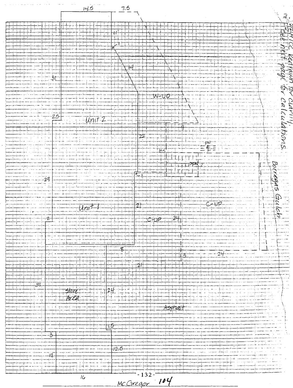
148
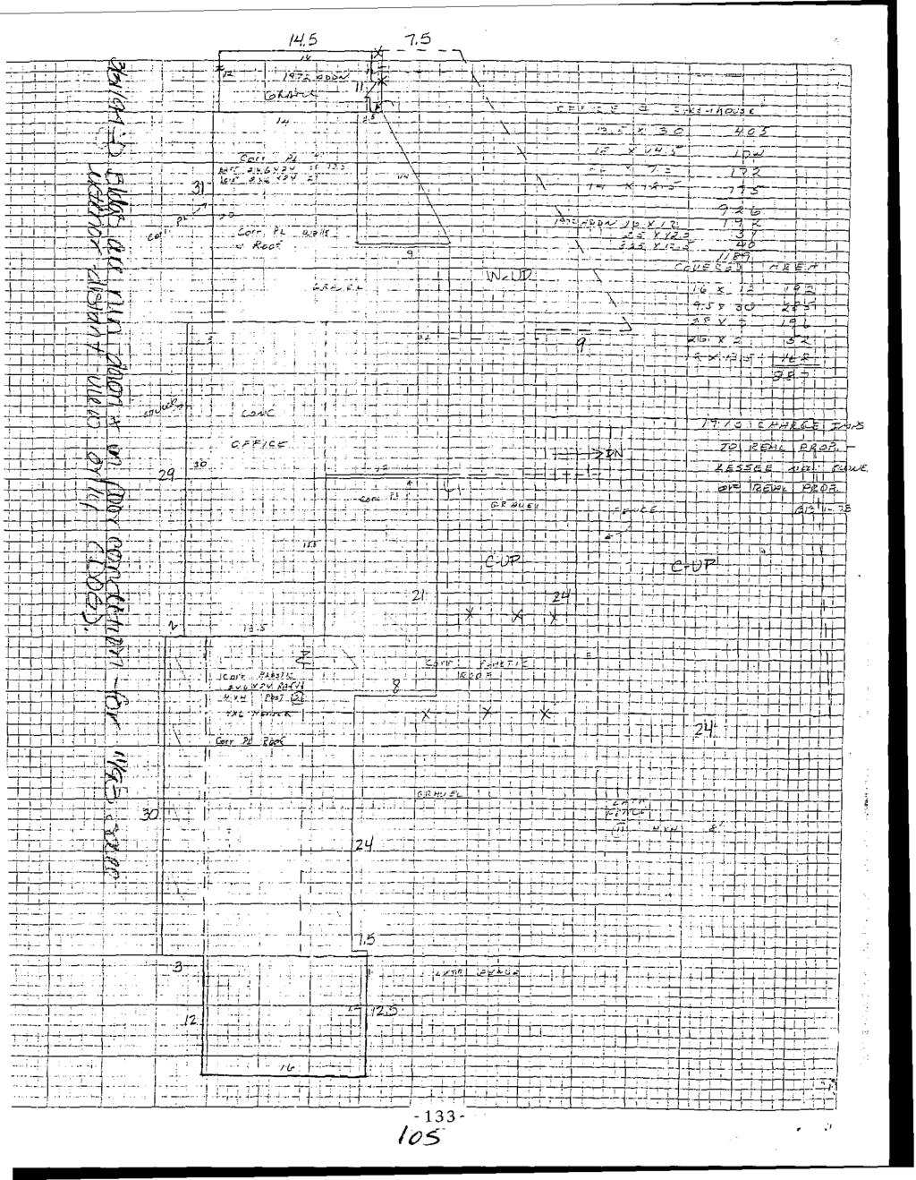
149

150
151 EXHIBIT D

152 311 EOYITA D RM AFTOS. CALIFOKNI.4 S5003 November 7, 2005 Re: 2000 MacGregor Road Rent G. Washburn Attorney at Law 123 Jewel1 Street Santa Cmz: California Dear Mr. Washburn: Thank YOE for your letter of October 3 1 regarding your client MI. Jar1 Saal s interest in my client Randy Zar s attempt to obtain County permits regarding 2000 MacGregor Road. At the outset, I would like to correct some misunderstandings about our telephone conversation whch are cited in your letter. We take all allegations made against Mr. zar 01 the property very seriously and will deal with them appropriately. That applies to &e charges made in your letter, just as it applied to the three pre\tious lawsuits brought by Mr. Saal against the Zars. All three of those actions ended in favor of the ZZS, two by way of judgment and one which was voluntarily dismissed after Mr. Saal failed to produce any supporting evidence during a site inspection. I mention these previous lawsuits not necessarily to suggest a vendetta, but for a number of reasons. First, as you note, we are indeed refusing YOUT request for destructive testing on my client s property. You have not provided any evidence to support your claim that damage to your client s property was due to any condition on Mr. Zar s land. I cannot imagine why we should allow drilling on the land merely to indulge an unsupported desire by Mr. Saal to hunt for a reason to sue hm again. More importantly, as I stated there has already been a site inspection of the properties during one of Mr. Saal s previous lawsuits. During that inspection Mr. Saal first mentioned his belief that his property was damaged by subsidence of my ciient s land, jxst as he alleges now per your letter. I provided Mr. Saal s then attorney Ralph Boroff with the County s permit and a soils report regarding the work done on the property. Although he did not diwlge his specific reasons, Mr. Boroff dismissed the /U 2s
153 K. Washbum November 7,2005 P: complaint and did not refile to include lack of subjacent support or damage to Saai s property. I include herewith a letter dated Piugust 3,2001 from me to Mr. Boroff in which these issues are discussed and a copy of the dismissal dated October 15, s you know, there is a three year statute of limitations for damage to realty under CCP sec nus, not only is there no evidence justifyme your request to drill on my client s land.,, VOVT client would have no legal claim even if there were. Although he had full knowiedge of any potential claim by at least August of 2001, Mr. Saal has chosen not to act until now, when Mr. Zar is attempting to clear permits on his properry more than four years later. Some of your other claims regarding illegal dwellings and zoning violations appear to be based on activities by the former co-owner of the building, Brent Byard. Mr..Byard had contracmal rights to half of the property and did indeed maintain unpermitted tenants for a period. We sued him for indemnity against the County s suit and for other matters regarding his ownership. We prevailed at trial last summer and as a result were able to remove MI. Byard from the property and extinguish I s ownership. No residences have been mainrained since then, and to my knowledge the County has had no any further complaint about that. By removing Mr. Byard and his tenants and by filing for permits at his great expense: Mr. Zar is attempting to bring the property into compliance. Conversely, I cannot see how Mr. Saal s intervention here helps to resolve any of the issues cited in your letter. As I told you in our phone conversation, it is my practice. to attempt informal resolution of any issues before a matter is forced into litigation. I believe such a policy is good for the client, and good for our small community in general. I sincerely hop:: that this matter does not become a bloodbath, as you stated, but I do believe that Mr. Zar is on solid legal footing to defend this matter should legal action be taken. I ask that you assist me in avoiding another needless, time consuming and expensive litigation and contact me with suggestions as to how Mr. Saal s concerns might be assuaged in good faith outside of the court. Thank you for your professional courtesy and cooperation. P DY1:wp Em. Itr, dismissal CC R.Zar; K. Tschantz kw (09
154 ATTQRNEY LAW 311 BONITA DRIVE APTOS, CALIFORNIA 9w5 August 3,2001 Ralph W. Boroff, Esq. Bo~off, Jensen? Klein & Smith 55 Riwr Street. Suite 230 Smg Cnu, CalifcmiE Dear!vir. Sorof? This leaer wiil memorialize my understanding ofthe issues in this case, bas& on statements and observations made a: the site inspecxion or hlr. Sml s and my client s properties yesrerday. The First Amended Complain: alleges under the cause of action for %Gsance, paragraph 9. that sewage is being dischxged onto plaintify s prop-. m. Saa! was unable to show LIS where this condition existed, and specifically rerracted +his allegatian at the inspection yesterday. By my understanding, this charge is no longer operarive. The cause of action for Trespass alleges ar paragraph 21 Ahat outbuildings were construcred on plaintiffs land without consenr. Mr. Sail and Mr. Byard acknowledged that the building in question WLS improved, and hs been Bed exclusively by Mr. Byard with Mr. Saal s permission which was given some time ago. Mr. Sad claims that permission had bsen revoked. This issue is solsly between E. Byard and M. Saal. Any oral or written comas regarding Mr. Byard s use of Mr. Sd s imd h nomg to QG with my clients. Mr, Saa! s idenrification of the exposed electricd condiiiozs consisred of the extension cor6 running from the nain building tc the ofifkmilding described above, and is solely Mi. Byard s responsibi!ity. Mr. Sal also claimed that the power lines rnqing to the main building are a danger to his building. However, these lines predate the consmction of Mr. Saal s building and therefore, as yo3 -know, cannot cons~tute a nuisance by law //a
155 Ralph PI. Boroff, Esq. Allgust 03,2001 Page 2 of 3 There uy?s no iddfication Of any problematic narurai gas lines, paragraph 8 of the FAC described at Mr. Saal s chief complaint against my clients appezs to be that ihe riparian lateral sllpport provided by fill created by n?? clients has somehow caused settling on property, leading io cracks and leveling prgbkms in his bui!ding. As you know, this complaint is not slieged io h e complaint or tile FAC anywhere, mnd was cornpieielv udeard of by me until yexerday. It is difficult for me to conprehend how providing support to the ripl<,ian are2 could have caused soil movemenr On your client s propeny, which does not even abut fie filled area, but is insread separated and buttressed by my client s land. Nonetheless, in fie spirit of informal resolutior! of? he matters, I have agreed to provide tc you with copies of permits which were obtained from the COUP when the ripriar. fill was done, along with a soils report. YOU have agreed to provide to me any documentation regarding the suit filed by Mr. Saa! againsr Reber Consrruction, in which settling and soil movement was apparently an issue. in all honesty, md with as much objectiviry as I c29 muste:, I see absolutei4; nothing here which might constitute a viable cirh against the Zars. Indeed, it is clear that Some of the claim made in the FkC were. made without the requisite good faith belief in their validity. I refer you to Code of civil Procedure segion (b), which requires that, by signing a cornpkim an attorney is certifying to?he court thar %is &gations md other factual contentiom are warranted on the. eiridence (CCP sec @)(4)), and are not being presented primady fa an imuroper purpose, such as to haass or to cause unnecess?q delay (CCP sec. l28.7(b)( 1)). IT has already been.. admitted that, ai Ieast as TO the dahs of sewage dischwge, the farmer rule has been violated. Based on my LderStandhg ofthe histor? between the?&?ties, 1 suspect that the 1&er ruie has been violated as well. With that in mbd, I would advise that you look dosely at whether you will pursue this new claim that the lmdfill caused soil movw4nerlt ofi your clieot s 13ncl. Resolving claim would be. exrremely costly, involving experr wi-mess research and sesrimony on bo& Sides. Mr. Saal adviitedly b,a.sed his claim solely on an undocumented OB-hand Rmk made by an expert in the Reber case, with no indication that ii was other than pure fii?pant speculation. Since my clients have never consented to my expert inspection of that area during the Rebx matter, I suspect that ii was precisely that /I 1
156 Ralph W. Boroff> Esq. Augus~ 03,2001 Page 3 of 3 Moreover, given thz? Mr. saa! was apparently aware of kis chin against my clients during the pendency of the Reber litigation, the questior? must be asked why they were not joined in that action under CCP section XS(a), and whether they are -Drooerly - phes to a wholly new action. Without having done extensive research as of yet, 1 can of numerous reasons why thtty are no$ including the rule qainst double I.P,COV~T and &e requirement foi compulsot joindei under CC? 389: above, an-icng others. Finally, since we were shown nothing a: the inspectior! which could possiblv constir;,e a tmpass or a clnuissi1ce as to the interests of.4pros Warehouse, I conclude that the same analysis and observations made above apply equally to the? claims. Indeed, since P-pros Warelmuse s property is separated from my ciient s property by the Sad prapep, I fail to see how any oftbe sllegations coiild possibly be valid s to them. At ths point, we =e happy io allow you to review GUT documenxs 2nd would diov, dismissal of rhe ZZS ana -4viar Trust from the complaint wirhaui penalty Unfortunately. 1 have seen nothing that would dissuade me from seeking sanctions should we be forced to respond to the FAC and bcur cos% litigating the matter. %pefuliy, WE can resolve these issues summarily, and without undue delay. Thank yo3 for yo= anticipated courtesy and cooperation. DYI:wp CC: Rma? Lu rb.doc
157 ..-._ DEFENDANTRESPONDENT: The Avia- Recovable Living Tmt, et al. REQUEST FOR DISMISSAL personal Injury, Property Damage, or Wrongful Death I3 Mntor Vehicle 0 Other I3 FarnilyLaw Eminent Domain Ofher (specfiui: N~smce.....,.. himctive R ~ E ~ ~ CASE NUMBER: C'J i4075l - -.A conformed copywi!!.not be returned by the-cierlalnless a method of return-is provided with the document, - 7..~ ~. _._.-... Petition Cross-cornpiaint filed by (name): (4) (3) I3 Cross-complaint filed by (name): (5) D Entire action of ail pariies 2nd all causes of action (6) a Other {specify):' b. (1) [3 Cbmplaint (2) 0 Dste: October 12: 2001 '>,. #$ w-*c /- A1 causes of action as to defendits Re Living Trust,.4lvi.n Zar SI., cause of action ONLY......,....,.. Ralph w: BO?@....,...,..,,. ATORN=\IO PARTYMTHOLTATORNEYO(! WE OR PRINT NAME o=. li dismissal requested 159 o specced pafoes only. G! speciried causes G: adiw mu, or c: specified mss-complaints only. so nate and identiiy me parties. =us% of &ion, or cmss-u)mplbirn= to DE dismzssee. 2. TO THE CLERK: Consent to the above dismissal is hereby given.- Date:... I El PiaintiffiPetitioner D Cross-complainant b on (date): or, (daie): rr(p5 OR PRINT NAME OF h.tmrnc( n PARTY WrmOUT AiTOXNW s (SIGNATURE] rent Byard, the ksr I=] Defendant/Respon&nf sion this asen: if requlred b 2. u d ssai entered as requested n a e& 4, mismissal entered on fdaie!: 67 i" i s to only (name);&> &&&< 5. a Dismissal not entered as requested for the mliowinp rezsons (speciiyl: 6 a. AtDmey or party without attorney notrried on (date): b. Atromey or party without auorney not notlfied Filing parly faiied to provice E copy to conform [3 means IC return conformed copy
158 A _- -. DAVTD Y. IMAI, ESQ. ATTORNEY AT LAW 311 BONITA DRIYE APTOS, CALIFORNIA August 8,2001 TELEPIIONP: (531) 66i1701 FACSIMlLE (831) EMAU. drvidimai&oinrmc Raiph V. Boroff, Esq. Boroff, Jensen, Klein & Smith 55 kver Street, Suite 230 Sanra Cruz: California Dear Mr. Boroff: Re: Aptos Warehouse Complex, el. al. v. Zar, Aviar Trust Santn Crur Counly Superior Civil NO Per our discusion, and my letter of -4ugst 3: enclosed you will find copies of : 1). Permit issued by the County of Sansa Cruz regarding the construction and development of support for the riparian comdor abutting my clients- property; 2). Soils report from Reynolds Associates indicatine I their opinior, that the slope reconstruction is adequateiy compacted. W-e note thar we are not in any way obligated to disprove you case. Tire are prnvidinp I these materials as a courtesy; in the hope that you will strongiy consider them before deciding to proceed with Mr. Sad s allegation againsr the Zars regarding settling and compaction on his property. I ask thar you lcindly respond to this, and my August 3 letter prior to Aqqst 3 1: which is the date now ser for ow response to your first amended complaint. Thank you for your continuing courtesy. DT7:wp Enc. CC: Randy Zar Xrb.doc

159 Mr. Randy Zar P.C. Box 1282 Aptos. CA S May I997 Subject: COMPACTION TEST RESULTS Permit No , Residence, McGreaor Drive Santz Cruz County. California Dear MY. 2ar: P.s requested, we have observed the base keyway and have CCndUCtEd testing services for the rough aradina of the slope reconstruction on the subject site. Fjeld mcisture/density tests were compared as a percentage of relative campactive effort to the laboratory tests performed upon the potential fill and native soils in accordance with test procedure ASTM #D The results of the laboratory compaction curves and field in-place moisture/density tests are shown on the enclosed Tables 1 and I!. In addition, the relative compactive effort is shown as a percentage of each of the field tests.!t is our opinion that the siopf reconstruction has been adeqtiately compacted and is compieted. It should be noted that compaction testina associated with the finished driveway and parking area. and observation or testing associated wi:h the new rexaining waii construction was outside the scope of the services provided by our office. Should you have any further questions, please contact this office. Very truly yours, R EYNDLDS A$SOC.!.ATE S JRS : j s Copies: 4 to Mr. Randy Zahr Easi Lake kvenue. Watsonville. CA :3e) Fax (4flx) 77?.-1:.?.1
160 ~ 9A?,23 4 -S 6 1 -G b 4ay 1?9i TABLE I Summary of Laboratory Tcsc P.cr;clts.ample No., - Dcs ZiFption Hax. Dry Dcnsiry p.c.f. Grey brown SILT i I, wlgravels 1'' io 15 Lizht brown Sandy SILT w/gravels I" Z@ 1" li6.4 Out. MoLsture Content Y '. 0.j 13.5 Brown Silty SAND w/ grey binder h some gravels 121.2!2.6 Sumarv of Field Density ics;: Remits 'L - Date Relarive Compaction u i. Soil Typ h Rcmzrir 7iiS 7/25 7/30 7/ !8 St8 8/13 8/15 8/15 Center of Key & fill CenCer of Key d fill West side Center of fill area parking iot New parking Lot Key fiil South end i+ew pakring Lot Key fiil Center Center of Key E :ill East of Manhole C r n t ~ r Parking Northwe5: edge North edge Farking lot Sou:li end 10' west of Manhole itnier of Parking lot ~.~ BSG -4.0 BSG -<.O BSG +j.o -2.0 BSG -2.0 BSG -1.0 ESG -1.0 BSG -i.il b.8 ili ios.5 i1.a ii !go., i ~ ~. 9c so G.3
 45A-2580 FAX 1408) 454-2131 TDD (408) 454-2123 Clepartrnent of Pub1 ic Works 701 Ocean St.")
161 .. ;.- PLANNING DEPARTMENT C O U N T Y O F S k N T A C R U Z SOVERNMENTAL CENTER 701 CLEAN STREEi ROOM 400 SANTA CRUZ. CALIFORNlA (408) 45A-2580 FAX 1408) TDD (408) Clepartrnent of Pub1 ic Works 701 Ocean St. Santa Cruz, CA ATTN: JEFF MILL June 28, 1996 SUBJECT: RIPARIAN EXCEPTION PERMIT -- LEVEL III PROJECT: APN: APPLICATION: PROJECT DESCRIPTION: Proposal to remove fill and an unpermitted retaining wall from the riparian corridor to resolve a code violation by private property and to grade and fill approximately 50 cubic yards and construct a 3 foot high retaining wall to create an access road to locate and raise an existing Sewer manhole cover. Requires a Riparian Exception. LOCATION: Property located on the south side of McGregor Drive about 200 feet west of Estates Drive at McEregor. Your application has been reviewed as follows: Several site visits and conferences with Planning, Code Compliance and Sanitation Distrjct Stafi. Analysis and Discussion: The property owner placd additional fill and constructed a retaining wall within the buffer and into the corridor of an arroyo to create a level parking area. The work was subsequently red-tagged by Code Compliance for a Riparian Violation. An existing sewer line ran underneath the ffl; at an undetermined location. The exact location and manhole access was unknown due to age and because the manhole had been buried under fill for a significant number of years. The Sanitation District needs to locate the manhole in order to maintain the sewer line which currently is partially clogged in the -vicinity of McGregor Drive. The property owners' contractor will remove the unpermitted fill and failed retaining wall and excavate the historic fill to locate the manhole cover under the supervision and direction of Sanitation District Staff. All. new encroachments into the corridor will 'be removed and the area restored to its historic condition, which will consist of an access road at approximately 11% grade and a raised manhole cover. All fill placement will be directed and tested by a soil engineer. Findings to approve this Riparian Exception have been made according to County Code Section The findings are attached " 1
162 _. -. bi.ll ill PROJECT: APN s7 APPLICATION: 96-G296 1 Reouired Conditions: I Prior t o exercising any rights granted by this permit including, without limitation, any construction or site disturbance, the applicant/owner shall sign, date and return to the Planning Department one copy of the approvai to indicate acceptance and agreement with the conditions thereof. Responsible party shall contact Environmental Planning ( ) prior to site disturbance. The retaining wall and uncontrolled fill shall be removed from the riparian corridor and buffer areas and disposed o f at an approved site. All work shall conform to the plans marked Exhibit A. The new retaining wall shall not exceed 3 feet in height unless a biiilding permit is obtained. Malls over 4 feet are not permitted unless a variation for this Riparian Exception is obthined. Ail work shall be completed under the direction of Sanitation District Staff. All iiil placement shall be under the direction oi the project soil engineer. The project soils engineer shall test compaction for all fill and submit compaction test reports to Environmental Planning - attention Cathleen Carr. A sediment barrier shall be in place at all times between the arroyo and site grading. Erosion control measures must be in place at all times during construction. All disturbed soils shall be seeded and mulched to prevent soil erosion and siltation in the watercourse. All slough and spoils shall be removed from the corridor. 10. All works prohibited between October 15 and April A site inspection is required prior to final Planning Department approval of the proposed work; notify Environmental Planning at upon project completion for final inspection and clearance in the event that future County inspections of the subject property disclose noncompliance with any conditions of this Approval or any uiolation OF the County Code, the owner shall pay to the County the full cost of such County inspections, including any foilow-up inspections and/or necessary enforcement actions, up to and inci udinq permit revocation. This permit shall expire one year after' approvz! on h e 28, 1997.
163 LtUBJECT: RIPARIAN W-FP7IOI.I PERMIT -- LEVEL I II - PROJECT: APN 038-0( 17 APPLICATION: > RIPARIAN EXCEPTION FINDINGS 1. THAT THERE ARE SPECIAL ClRCUMSTANCES OR CONDITIONS AFFECTING THE PROPER- TY. An existing sewer line lies within the riparian corridor at this site. The manhole has been covered by fill predating the riparian ordinance. 2. THAT THE EXCEPTION IS NECESSARY FOR THE PROPER DESIGN AND FUNCTION OF SOME PERMITTED OR EXISTING ACTIVITY ON THE PROPERTY; The removal of :he fill over the manhole and reconstruction of a servics road is necessary to service and maintain the sewer line. 3. THAT THE GRANTING OF THE EXCEPTION WILL NOT BE DETRIMENTAL TO THE PUBLIC WELFARE OR INJURIOUS TO OTHER PROPERTY DOWNSTREAM OR IN THE AREA IN WHICH THE PROJECT IS LOCATED; The granting of this exception will be beneficial to downstream properties in that a problematic sewer system can be maintained avoiding a potential sewaae spill. 4. THAT THE GRANTING OF THE EXCEPTION, IN THE COASTAL ZONE, WILL NOT REDUCE OR ADVERSELY IMPACT THE RIPARIAN CORRIDOR, AND THERE IS NO FUSIBLE LESS ENVIRONMENTALLY DAMAGING ALTERNATIVE; AND The granting of this exception will not reduce the corridor in that the sewer line is pre-existing and the former access road has been observed by historic filling and xnat 2 violation that is damaging the corridor will be resolved. 5. THAT THE GRANTING OF THE EXCEPTiON IS IN ACCORDANCE WITH THE PURPOSE OF THIS CHAPTER, AND WITH THE OBJECTIVES OF THE GENERAL PLAN AND ELEMENTS THERE9F, AND THE LOCAL COASTAL PROGRAM LAND USE PLAN. The grantino of this exception is in accordance with the purpose of Chapter and the objectives of the General Plan and local coastal program in that the exception is necessary.for hsalth and safety to maintain an existing sewer line in the corridor.
164 c,i SUBJECT: RIPARIAN LXCEPTION PERMIT -- LEVEL IS! - PROJECT: APN APPLICATION: Staff Recommendation: The Environmental Planning Principal Planner has acted on your application as foll ows: XXX APPROVED (IF NOT APPEALED.) - DENIED for the following reasons: THIS PERMIT WILL EXPIRE ONE YEAR FROM THE DATE OF ISSUANCE. If you have any questions, please contact Cathleen Carr Sincerely, RACHEL LATHER Principal P',anner/Senior Civil Engineer Environmental Planninq Section Resource PI anner By signing.this permit below, the owner agrees to accept responsibility for payment of the County's cost for inspections and all other action related to noncompliance with the permit conditions. This permit i s null and void in the absence of the owner's signature below. cc: Code Compliance Randy Zar APPEALS in accordance with Section of the Santa Cruz County Code, the applicant may appeal an action or decision taken under the provisions of such County Code. Appeals o f decisions of the Principal Planner of Environmenxal Planning on your application are made t o the Planning Director. All appeals shall be made in writing and shall state the nature of the application ana the basis upon which the decision is considered t o be in error. Appeals must be made not later than ten (10) working days following the date of the action from which the appeal is being taken.
165 EXHIBIT E /4
166 June 28, 1996 Department of Pub1 ic Works 701 Ocean St. Santa Cruz, CA ATTN: JEFF MILL SUEJECT: RIPARIAN EXCEPTION PERMIT -- LEVEL I11 PROJECT: APN: C APPLICATION: PROJECT DESCRIPTION: Proposal to remove fill and an unpermitted retaining wall from the riparian corridor to resolve a code violation by private property and to grade and fill approximately 50 cubic yards and construct 2 3 foot high retaining wall to create an access road to locate and raise an existing sewer manhole cover. Requires a Riparian Exception. LOCP.TION: Property located on the south side of NcGi-egor Drive about 200 feet west of Estates Drive at KcGregor. Your application has been reviewed as fo!?owsr Several site visits and conferences with Planning, Code Camp1 iance and Sanitation District Staff. knalvsis and Discussion: The property owner placed additional fill and con;tructed a retaining wall within the buffer and into the corridor of an arroyo to create a level parking area. The work w2s subsequently red-tagged by Cod. Compliance for a Riparian Violation. An existing sewer line ran underwain the fill at an undcdermined location. The exact location and manhole access waj unknown due to age and because the manhole had been buried under fill for a significant number of years. The Sanitation District needs tc iocate ths manhole in order to maintain the sewer line which currently is partially clogged in the vicinity of McGregor Drive. The property owners contractor will remove the unpermitted fill and failed retaining wall and excavate the historic fill to locate the manhole cover under the supervision and direction of Sanitation D.istrict Staff. All new encroachments into the corridor will be removed and the area restored to its historic condition, which wili consist of an access road at approximately 11% grade and a raised manhole cover. All fill placement will be directed and tested by a soil enoineer. Findings to approire this Riparian Exception haw been made according to County Code Section The findings are actacned.
167 - A;JBJECl : HIPARIAN EXCEPTION PERMiT -- LEVEL 111 PROJECT: APPLICATION: Reauired Conditions: 1. Prior to exercising any rights granted by this permit including, without limitation, any construction or site disturbance, the applicanx/owner shall sign, date and return to the Planning Department one copy of the approval to indicate acceptance and agreement with the conditions thereof. z. Responsible party shai 1 contact Environmental P1 anning ( ) prior to site disturbance. 3. The retaining wall and uncontrolled fill shall be removed from the riparian corridor and buffer ai-fzs and dispcsed of at an approvrd site. 4. Ail work shall conform to the plans marked Exhibit k. The new retaining wall shall not exceed 3 feet in height unless a building permit is obi ained. Walls over 4 feet are not permitted unless a variation for this Riparian Exception is obtained. 5. All work shall be completed under the direction of Sanitation District Staff. 6. All fill placement shall be under the direction of the project soil engineer. The prcject soils engineer shall test compaction for all fill and submit compaction test reports to Environmental Planning - attention Lath? een Carr. 7. A sediment barrier shall be in place at all times between the arroyo ana site grading. 8. Erosion control measures must be in place at ill times during construction. All ajsturbed scils shall be seeded and mulched to prevent soil erosion and siltation in the watercourse. 0. All slough and spoils sha11 be removed from the corridor -r 10. All works prohibited between October 12 and April P. site inspection is required prior to final Pianning Department approv- 2.1 of the proposed work; notify Environmental Planning at upon project completion for final inspection and clearance. 12. In the event that future County inspection: of the subject property disclose noncompliance with any conditions of this Approval or any \/io- lation of the County Code, the owner shall pay to the County the full COST of such County inspections, including any ioliow-up inspections and/or necessary enforcement actions, up to anti including permit revociltion. 11. This perm!: shall expire one year after adprova1 on June 2B! I23
168 .~...&UBJECT: RJ DARIAN EXCEPTION PERMIT -- LEVEL i I I PROJECT: APN APPLICATION: RIPARIAN EXCEPTION FiNOINGS 1. THAT THERE ARE SPECIAL CIRCUMSTANCES OR CONDITIONS AFFECTING THE PROPER- TY. An existing sewer line lies within the riparian corridor at this site. The manhole has been covered by fill predaiing The riparian ordinance. 2. THAT THE EXCEPTION IS NECESSARY FOR THE PROPER DESIGN AND FUNCTION OF SOME PERMITTED OF( EXISTING ACTIVITY ON THE PROPERTY; The removal Of the fill over the rranhole and reconstruction of a service road is necessary to service and maintain ;he sewer line. & i _ THkT THE GRANTING OF THE EXCEPTION WiLL NOT BE DETRIMENTAL Ti: THE PUBLIC WELFARE OR INJURIOUS TO OTHER PROPERTY DOWNSTREAM OR IN THE AREF IN WHICH THE PROJECT IS LOCATED; The granting of this exception will be beneficiti YO downstream nroder. I ties in thbt a problematic sewer system can be maintzined avoiding 2 potential sewage spill. 4. THAT THE GRANTING OF THE EXCEPTION, IN THE COASTAL ZONE, UILL NDT REDUCE OR ADVERSELY impac1 THE RIPARIAN CORRIDOR, AND THEPL IS NO FEASIBLE LESS ENVIRONMENTALLY DAMAGING ALTERNATIVE; AND The grantins of this exception will not reduce the corridor in that the sewer line is pre-existing and the io:mer acters road nas been observed by historic filling and thzt a violation :ha1 is damaging the corridor vriil be resolved. 5. THAT THE GRANTING OF THE EXCEPTION IS IN ACCORDANCE VlTH THE PURPOSE OF THIS CHAPTER, AND WITH THE OBJECTIVES OF THE GENERAL PLAN AND ELEMENTS THEREOF, AND THE LOCAL COPSTAL PROGRAM LAND USE PLAN. The grantina of thij Exception is in accorganco with the purpo;e of Chapter and the objectives of the Generzl Plan and local coastal program in that the exception is necesssry for health and safety to maintain an existing sewer line in the corridor r/ jar
169 SUBJECT: RIPARIAN EXCEPTION PERMIT -- LEVEL IIi PROJECT: APN APPLICATION: Staff Recommendation: The Environmental Planning Principal Planncir has acted on your application as fd1ows: XKX APPROVED (IF NOT APPEALFD.) DENIED for the foilowing reasons: THIS PERMIT WILL EXPIRE ONE YEAR FROM THE DATE OF ISSUANCE. If you have any questions, please contact Cathleen Carr I r II Cathleen Carr Resource P1 anner 5 i ncerel y, RACHEL LATHER Principal Pianner/Senior Civil Engineer Environmental Planning Section By signing.this permit below, the owner agrees to accept responsibility for payment of the County s cost f or inspections and all other action related to noncompliance with the permit conditions. This permit is null and void in the absence of the owner s signature below. cc: Code Compl iance Randy Zar APPEALS In accordance with Section 1&.!0.320 of the Santz Cxz County Code, the acplicant may appeel an action or decision taken under the provi;ions of such County Code. Appeals of decisions of the Principal Planner of Environmental Planning on your application are made to the Planning Director. All appeals shall be made in writing anc shall state the nature of the application and the basis upon which the decision is ccnsidered to be in error. Appsals must be made not later than ten (10) working days following the dare of the action from which the appeal is beins taken.
170 EXHIBIT F
171 14 CCR s Cal. Admin. Code tit. 14, s BARCLAYS OFFICIAL CALIFORNIA CODE OF REGULATIONS TITLE 14. NATURAL RESOURCES DIVISION 6. RESOURCES AGENCY CHAPTER 3. GUIDELINES FOR IMPLEMENTATION OF THE CALIFORNIA ENVIRONMENTAL QUALITY ACT ARTJCLE 19. CATEGORICAL EXEMPTIONS This database is current through 12/09/2005, Register 2005, No. 49 s Existing Facilities. Class 1 consists of the operation, repair, maintenance, permitting, leasing, licensing, or minor alteration of existing public or private structures, facilities, mechanical equipment, or topographical features, involving negligible or no expansion of use beyond that existing at the time of the lead agency's determination. The tses of "existing facilities" itemized below are not intended to be all-inclusive of the types of projects which might fall within Class 1. The key consideration is whether the project involves negligible or no expansion of an existing use. Examples include but are not limited to: (a) Interior or exterior alterations involving such things as interior partitions, plumbing, and electrical conveyances; (b) Existing facilities of both investor and publicly-owned utilities used to provide electric power, natural gas, sewerage, or other public utility services; (c) Existing highways and streets, sidewalks, gutters, bicycle and pedestrian trails, and similar facilities (this includes road grading for the purpose of public safety). (d) Restoration or rehabilitation of deteriorated or damaged structures, facilities, or mechanical equipment to meet current standards of public health and safety, unless it is determined that the damage wis substantial and resulted from an environmental hazard such as earthquake, landslide, or flood: (e) Additions to existing structures provided that the addition will not result in an increase of more than: I& /
172 (1) 50 percent of the floor area of the structures before the addition, or 2,500 square feet, whichever is less; or (2) 10,000 square feet if (A) The project is in an area where all public services and facilities are available to allow for maximum development permissible in the General Plan and (B) The area in which the project is located is not environmentally sensitive (f) Addition of safe.ty or health protection devices for use during construction of or in conjunction with existing structures, facilities, or mechanical equipment, or topographical features including navigational devices; (g) New copy on existing on and off-premise signs; (h) Maintenance of existing landscaping, native growth, and water supply reservoirs (excluding the use ofpesticides, as defined in Section 12753, Division 7, Chapter 2, Food and Agicultural Code); (i) Maintenance of fish screens, fish ladders, wildlife habitat areas, artificial wildlife watenvay devices, streamflows, springs and waterholes, and stream channels (clearing of debris) to protect fish and wildlife resources; (j) Fish stockmg by the California Department of Fish and Game; (k) Division of existing multiple family or single-family residences into common-interest ownership and subdivision of existing commercial or industrial buildings, where no physical changes occur which are not otherwise exempt; (1) Demoiition and removal of individual small structures listed in this subdivision; (2) A duplex or similar multifamily residential structure. In urbanized areas, this exemption applies to duplexes and similar structures where not more than six dwelling units will be demolished. (3) A store, motel, office, restaurant, and similar small commercial structure if designed for an occupant load of 30 persons or less. In urbanized areas, the exemption also applies to the demolition of up to three such commercial buildings on sites zoned for such use. (4) Accessory (appurtenant) structures including garages, carports, patios, swimming pools, and fences (m) Minor repairs and alterations to existing dams and appurtenant structures under the supervision of the Department of Water Resources. (n) Conversion of a single family residence to office use.
173 (0) Installation, in an existing facility occupied by a medical waste generator, of a steam sterilization unit for the treatment of medical waste generated by that facility provided that the unit is installed and operated in accordance with the Medical Waste Management Act (Section , et seq., ofthe Health and Safety Code) and accepts no offsite waste. Cp) Use of a single-family residence as a small family day care home, as defined in Section of the Health and Safety Code. Note: Authority cited: Section , Public Resources Code. Reference: Section 21084, Public Resources Code; Bloom v. McGurlc (1994) 26 Cal.App.4th HISTORY 1. Amendment of subsections (c), (k)! (1)(1)-(3) and (o), and amendment of Notefiled ; operative pursuant to Government Code section (d) (Register 97, No. 22). 2. Amendment of section and Notefiled ; operative pursuant to Public Resources Code section (Register 98, No. 44). 3. Change without regulatory effect amending subsection (h) filed pursuant to section 100, title 1, California Code of Regulations (Register 2001, No. 5). 4. Change without regulatory effect amending subsection (k)(l) andnotefiled pursuant to section 100, title 1, California Code of Regulations (Register 2005, No. 40). 14 CAADC s END OF DOCUMENT (C) 2005 ThornsodWest. No Claim to Orig. US. Govt. Works.
174 COUNTY OF SANTA CRUZ PLANNING DEPARTMENT Planning Commission Date: 1/11/06 Agenda Items #: 10 Time: After 9:OO a.m. ADDITIONS TO THE STAFF REPORT FOR THE PLANNING COMMISSION Item 10: MATERIALS SUBMITTED BY SPEAKER DURING THE PUBLIC HEARING 1/11/

175 ,
176 Time Line of Zero slope failures for 2000 McCreeor Drive, Aptos Sewer line was put in before the freeway around 28 feet below grade in the parking lot and 23 feet below grade at the manhole. The sewer line follows the same line as the retaining wall and the slope. From the manhole it doglegs up about 45 degrees towards the rear of property line. The point I am trying to make is the sewer line is in front of the building by the slope. In or around the 1950 s the Sewer Line was installed along with the manhole located on the McGregor property. When the Manhole was installed it was a large excavation to install, not just a trench. We are talking a solid concrete bottom 23 feet below grade and located along the slope side and center of the building s The building was built No failure anywhere that I have seen s Floods No problems 1989 Earthquake No problems, No Red tags, No Yellow tags and No Landslides 1992 Jar1 Builds First Alarm two feet from our building No Problem 1996 The County Sanitation project was done. No Problems 2006 No Problems There is no sign of structural cracking of our building. I am trying to make the point that the same area of the slope that is coming under scrutiny has had no problems for approx the last 56 years. If any slope failure had happened the sewer line would have been compromised

177

178 Concrete Grade Beam, Dr;-162-~0rk, Drain Rock, Dead Men Ssnitstinn Pmkrt Permit Wfi-0396,
179 -163-
180 ORIGlW BUIWINGARMIT: 19hl m n DATA OISlING LOT 5UE: FT. MWlNhl GWNG + R I P W $ WIT: JUNE % P&K TOWNViuR WlWlNG AKA: 2042 M.n

181 A- 7
182 COUNTYOFSANTACRUZ PLANNING DEPARTMENT Planning Commission Meeting Date: 07/26/06 Agenda Item: # 7 Time: After 9:OO a.m. APPLICATION NO: STAFF REPORT TO THE PLANNING COMMISSION REQUEST FOR CONTINUANCE 2/22/06-166
183 COUNTY OF SANTA CRUZ PLANNING DEPARTMENT 701 OCEAN STREET - qth FLOOR, SANTACRUZ, CA (831) FAX' (831) TDD: (831) TOM BURNS, PLANNING DIRECTOR February 13,2006 Planning Commission County of Santa Cruz 701 Ocean Street Santa Cruz, CA Agenda Date: February 22,2006 Subject: A public hearing to consider an appeal of the Zoning Administrator's decision to approve application ; a proposal to recognize an existing commercial building and to establish a Master Occupancy Program to allow commercial service uses. Members of the Commission: This item is an appeal of the Zoning Administrator's 11/18/05 decision to approve the above listed application and was heard before your Commission on 1/25/06. At that time, your Commission decided to hear the appeal after consulting with County Counsel regarding appeal procedures, and the actual public hearing was continued until today's agenda. Request for Continuance The applicant's representative has been out of state due to a family emergency and has not been able to prepare materials in response to the appellant's concerns in time for this meeting of your Commission. The applicant requests a continuance to 3/8/06 so that he can meet with planning staff and his representative can prepare a response to these issues. Recommendation 1. Planning Department staff recommends that your Commission CONTINUE the public hearing for Application Number to March 8th, Sincerely, Randall Adams Project Planner Development Review Exhibits: Reviewed By: L 1A. Letter requesting continuance, prepared by Randy Zar, dated 2/13/ Cathy Graves Principal Planner Development Review
184 February 13,2006 Santa Cruz County Planning Commission County of Santa Cruz Planning Department 701 Ocean Street, 4 floor Santa Cm, CA SUBJECT: Appeal of Application (Randy Zar 81 Aviar Trust) Dear Members of the Commission, I am requesting that you continue this matter for the reasons stated in this letter. You fist heard this appeal at your hearing of January At that time you continued your consideration of this appeal to your meeting of February 22,2006. You also directed Planning staff to meet with me and members of my project team prior to completion of the next staff report for this item. Prior to January 11, I was scheduled to be out of the country for three weeks beginning January 25. Planning staff would not meet with us prior to my January 25 departure even though we had requested to meet prior to that date. Therefore, I left my planning consultant, Km Tschantz, in charge of matters in my absence. I understand a meeting was finally scheduled for Planning staff to meet with Mr. Tschantz on February 7. Unfortunately, Mr. Tschantz had an unexpected family emergency and had to leave the state on February 4.1 have just returned fiom my trip on February 10. This situation makes it impossible for Planning staff to meet with us in a meaningful way prior to preparation of the staff report for the February 22 hearing. For these reasons, I am requesting that the Planning Commission continue this matter to one of its meetings in March Thank you very much for your consideration. W cc: Randall Adams Kim Tschantz Dave Imai -168-
185 COUNTY OF SANTA CRUZ PLANNING DEPARTMENT Planning Commission Meeting Date: Agenda Item: # 7 Time: After 9:OO a.m. APPLICATION NO: STAFF REPORT TO THE PLANNING COMMISSION MATERIALS SUBMITTED AT THE 3/8/06 PLANNING COMMISSION HEARING
186 CYPRESS ENVIRONMENTAL AND LAND USE PLANNING P.O. BOX 1844 APTOS CALIFORNIA Members of the Planning Commission County of Santa Cruz Planning Department 701 Ocean Street, 4 floor Santa Cruz, CA (831) kim@cvdressenv.com March 8,2006 SUBJECT Application (Randy Zar & Aviar Trust) Dear Members of the Commission, Introduction I understand the primary purpose of your Commission s March 8 deliberations on the Zar project will be to receive information about the project and the project site so direction can be provided to Planning staff on the next steps for the project. With that same objective, this letter and its packet of exhibits provides supplementary information for your Commission as well as addressing some issues in the staff report and concerns raised by the appellants. As no action to approve or deny the project is anticipated during the March 8 meeting, the information contained herein can be used by your Commission in hture deliberations on the project. Slope Stability No grading is proposed for the project. However, the Zoning Administrator s approval of the project was conditioned to require preparation of a soils report and a slope stability analysis and implementation of County approved recommendations of the soils report. The only slope on the property is the eastern bank of an arroyo slope located west of the building on the site. (Exhibit A) County Planning re-inspection of the site since the Zoning Administrator s action last November has resulted in recommendations for repair of this slope and replacement of the retaining wall constructed at the top of it. Grading previously occurred on the site during under Riparian Exception Permit for a County project. This permit, issued to the County Public Works Department, approved grading at the top of the arroyo slope within the Borregas Creek riparian corridor to excavate and locate a buried sewer manhole and construct an access to the unearthed manhole. (Refer to page 122 of the staff report for March 8, 2006). Although essentially a grading project, only a Riparian Exception was issued for the project since the County s Grading Ordinance (Code Chapter 16.20) exempts the County Public Works Department fiom needing Grading Permits. However, Public Works is not exempted fiom the Geologic Hazards Ordinance (Chapter 16.10). In accordance Environmental Planning and Analysis, Land Use Consulting and Permitting
187 Application (Randy Zar & Aviar Trust) March 8, 2006 Page 2 of 5 with the Chapter 16.10, a soils report was prepared for grading activities associated with the project and Permit was conditioned to require all fill placement be done under the supervision of the project geotechnical engineer who would also conduct soil compaction testing to ensure the reconstructed slope was stable. As stated in the staff report, the prior earthwork and associated improvements were installed as required by County staff. The grading and construction work was done by Randy Zar, who was hired as a contractor by the Public Works Department to carryout the 1996 project. (Exhibit B). Mr. Zar spent about $1 00,000 to perform grading activities and to construct a retaining wall at the top of the arroyo slope with no monetary compensation l?om the County. (See Exhibit B, paragraph 2). Permitted grading occurred on both the Zar parcel and the County s excess right-of-way area. (See pages 19 and 23 of the staff report). There are serious legal questions regarding County s condition to now require more geotechnical study and redo the slope stabilization measures that were approved in Legal issues pertaining to this matter are discussed.in the letter liom David Imai to County Counsel, dated March 6, Several allegations have been made by the project appellant regarding past grading activities on the site. As a result, several new issues have been raised by Planning staff. These issues are addressed in this paragraph and those that follow. In addition to the Reynolds soils report provided on pages of the staff report, the 1996 project engineer also prepared a soils report addendum (Exhibit C). This addendum provides for a finished slope with a 1S:l gradient. The Planning staff memo on pages of the staff report appears to equate the finished slope gradient with slope instability. However, a finished slope of 1.5:l was approved by the project geotechnical engineer and the project subsequently signed-off by Planning staff in Some discussion has also occurred regarding the configuration of the accessway to the manhole constructed under the I996 Permit. The appellant s attorney has testified in previous public hearings that h4r. Zar continued grading activities on the site afler the 1996 project was signed-off by the County. He even stated in his letter dated November 17, 7-12 of the staff report) that the County s excess right-of-way area has been encroached upon, improved without permits... without any governmental approval. This theory is based On the appellant s misunderstanding (or misinterpretation) of grading work that occurred under the 1996 permit. The original design of the previous project included completion of a ramp &om the level parking area along McGregor Drive to the unearthed manhole. While the unearthed manhole was raised, the new vertical extension could not raise it enough to allow a ramp to be constructed at less than the design slope of 11%. For this reason, a change was made in the field to convert the ramp access to a stepped access (Exhibit D). Photographs of completed concrete steps near the manhole with dates inscribed in the concrete (Exhibit E) show the alternative access was completed in January A dated photo of the project completion party (Exhibit F) clearly shows all earthwork was completed prior to March 22, The project was signed-off as completed by County Planning staff on June 12, 1997 (Exhibit G). It is common for minor design changes to be made in the field to address unforeseen events during grading activities with staff approval. This evidence shows that this one change in the project design was initiated and completed prior to project sign-off.
188 Application (Randy Zar & Aviar Trust) March 8,2006 Page 3 of 5 The current condition of the site remains as shown in the 1997 photo. Adequate Parking for the Commercial Use The Zoning Administrator s approval of the project in November included a condition that 9 parking spaces must be provided. (Page 52 of the staff report). Both Ivk. Zar and Planning staff realm that the narrow shape and limited size of the developable portion of the Zar parcel, make it necessary to located 7 of the spaces on the adjoining County excess right-of-way area. The project had also been conditioned to require purchase or long-term lease of the right-of-way area by Mr. zar. (Page 48 of staff report). Planning has recommended the Board of Supervisors either sell or lease this excess right-of-way area to the project proponent (Exhibit H). Public Works, Real Estate Division has echoed this recommendation to the Board. This sale or lease is appropriate because the owner of the project parcel was deeded perpetual access to McGregor Drive in 1962 when Highway 1 was improved (Exhibit I). This grant deed also specifies the project property shall always adjoin the fiontage road (McGregor Drive). The slope stability issues discussed above are tied to this excess right-of-way area as the grading that was approved for the County s 1996 project included grading on both the Zar property and the excess right-of-way parcel. If additional geotechnical work is required for the slope on the Zar property, the same requirement must be placed on the slope that continues on the County s property. As the property owner, if repairs are needed on the County property, this would be the responsibility of the County prior to sale or lease. This complex situation is best resolved by a negotiated compromise by the two parties involved. We hope your Commission can assist in this effort and direct County Counsel to negotiate with the Zar project team to provide a fair cost sharing approach for any geotechnical work your Commission may require. Location of the Sewer Recently staff raised the issue that the sewer lie traversing the Zar property might be located beneath part of the Zar building. Other manholes in the area remain buried, so it is not easy to determine where underground sewers are located in this area. To address this concern, Mr. Zar hired Duncan Plumbing to video tape the sewer line with a cable fed video camera that used the previously discussed unearthed manhole for sewer access. This video taping occurred on March 1, 2006 and was observed by Sean Mathis, line crew supervisor for the County Sanitation District. The video taping concluded the next downstream manhole was located 70 feet south &om the access manhole. Electrical soundings were also taken above ground to determine the location of the buried downstream manhole. Then a 70 foot tape measure was pulled between these to points in the field. This analysis shows the sewer is not located underneath the Zar building but rather to the west ofthe building (Exhibits J and K). Exhibits J and K show the sewer line is partially located under an elevated deck on the Zar property. This deck, supported by post and piers, provides substantial clearance between the ground surface and the deck for any repair work that might need to occur there. According to
189 Application (Randy Zar & Aviar Trust) March 8,2006 Page 4 of 5 Rachkl Lather, P.E., Sanitation District Principal Supervisor, the sewer location below the elevated deck will be acceptable if the Zars enter into a hold harmless agreement with the County for any fhre sewer repair or maintenance work that may occur below the deck. It is anticipated that a memo addressing this will be provided to the Planning Commission by the Sanitation District. A declaration from Duncan Plumbing regarding the adequacy of the video work is attached to this letter (Exhibit L). Issues Raised by Kent Washburo Letters from the appellant s attorney include his stated position that the project now under consideration should have undergone Environmental Review pursuant to the California Environmental Quality Act (CEQA). His position is based on a misunderstanding of CEQA. Section 15301, et seq. of the CEQA Guidelines allow certain projects to be exempt from Environmental Review. The Class 1 categorical exemption is for the operation, repair, permitting and minor alteration of existing facilities. The Class 3 categorical exemption is for the construction of new facilities, including the construction of a new store, office or similar structure not exceeding 2,500 square feet and not using significant amounts of hazardous substances. In urbanized areas, such as the project site, the Class 3 exemption allows up to 10,000 sq. A. of commercial building floor space where public services are available. The project under Application complies with the Class 3 exemption. According to Tax Assessor records, the original 926 square foot building that was constructed in 1967, has been increased in size over the years; first prior to 1973 to 1,189 sq. A. and later prior to 1997 to 2,044 sq. A. (Pages of the staff report). This is a total increase of 1,118 sq. A. or new construction of less that 2,500 sq. ft. Soquel Creek Water District records show the building has been provided with domestic water service since prior to 1964 (Exhibit M). The 1967 Building Permit included Plumbing Permit #I4490 and Electrical Permit #3861 (Page 82 of the staff report). It could also be argued that the Class 1 categorical exemption also applies since the majority of the building is an enclosure (alteration) of the pre-1973 footprint with two minor rear additions totalling 263 sq. A. The appellant also makes the argument that the building has been greatly expanded in recent years without benefit of permit. However, this allegation is not supported by County Tax Assessor records. Even fire alarm plans prepared by the appellant for the Zar building in 1994 show a floor plan identical to today s floor plan! (Exhibit N). A comparison of photographs of the property between the 1970 s and present establish a uniform building footprint, except for the 263 sq. A. addition (Exhibit 0). These fallacious claims of the appellant show that he is attempting to misuse the permit process for his own personal gains. We are convinced that his real objective is to stop the Zar project 6om going ahead so he can purchase the County excess right-of-way area for himself. We realize that the appellant s attorney has made statements to the contrary. But if ths is the case, why is the appellant s other attorney trying to convince the Board of Supervisors to sell the excess right-of-
190 Application (Randy Zar & Aviar Trust) March 8,2006 Page 5 of 5 way to Mr. Saal, the appellant, rather than to Mr. Zar? (Exhibit Q). Kim Tschantz, MSP, CEP Attachments: Exhibit A - Site Plan of Projec Exhibit B - County Contract with Randy Zar Exhibit C - Reynolds Associates Geotechnical Report Addendum, dated April 25, 1996 Exhibit D - Cross-section Diagram showing Change of Access to Manhole under Permit Exhibit E - Photographs of Zar Children Signatures in Access Steps to Manhole Exhibit F - Photograph of Work Completion Party, dated March 22, 1997 Exhibit G - County Planning Sign-off Document for Permit Exhibit H - Memo from Planning to Board of Supervisors Recommending Sale of Excess Right-of-way to Zar, dated January 5,2006 Exhibit I - Grant Deed Providing Owner of Project Parcel Perpetual Access to McGregor Drive Exhibit J - Photographs of Sewer Location Exhibit K - Site Map of Sewer Location Exhibit L - Declaration of Scott Duncan regarding Video Taping of Sewer Line Exhibit M - Letter &om Soquel Creek Water District regarding prior Water Service, dated June 12, 1992 Exhibit N-1 -Fire Alarm Plan prepared by First Alarm, dated December 16,1994 Exhibit N-2 - Photograph of Fire Wire Installation Exhibit Photograph of the Property Frontage during the 1970 s Exhibit Photograph of the Property Frontage in 2006 Exhibit P - CEQA Notice of Exemption for Application Exhibit Q - Letter &om Jar1 Saal s Attorney Requesting Bid Sale of Excess Rightof-way cc: RandyZar, David lmai county Counsel Planning staff Kent Washburn letr to PC
191 March 8 h, 2006 Table of Exhibits For Application Aviar Trust Randy Zar Trustee 2000 McGregor Drive Aptos CA Exhibit A - Site Plan of Project Property Exhibit B - County Contract with Randy Zar for permit Exhibit C - Reynolds Associates Geotechnical Report Addendum dated Exhibit D - Cross -section Diagram showing Change of Access to Manhole under Permit # Exhibit E - Photographs of Zar Children Signatures in Access Steps to Manhole Exhibit F - Photograph of work completion Party, dated Exhibit G - County Planning Sign-off Document for Permit Exhibit H - Memo from Planning to Board of Supervisors Recommended Sale of Excess Right - of-way to Zar, dated Exhibit I - Grant Deed Providing Owner of Project Parcel Perpetual Access to McGregor Drive Exhibit J - Photograph of Sewer Location Exhibit K - Site Plan Showing Approximant Location of 8 Sewer Pipe Exhibit L - Exhibit M - Letter from Soquel Creek Water District regarding prior Water Service, Dated June 12, 1992 Exhibit N- 1 - Fire Alarm Plans prepared by First Alarm, dated Exhibit N-2 - Photos of Fire Alarm Wire Installation of Alarm Exhibit Photograph of the Property Frontage during the 1970 s Exhibit Photograph of the Property Frontage in 2006 Exhibit P - CEQA Notice of Exemption for Application Exhibit Q - Letter from Jar1 Saal s Attorney Requesting Bid Sale of Excess Right-of- way
192 - 174 Exhibit A
193 ~ ~~ ~~ Site Plan of the Zar Project Site 6 -- f I Grading area under Permit ,r N I
194 - 176 Exhibit B
195 Contract No. This contract is entered into this 16th day of July, 19=, by and between the SANTA CRUZ COUNTY SANITATION DISTRICT, hereinafter called "DISTRICT" and,randy Zar,l4992 McGregor Dr. Aptos CA, hereinafter called t i ~ ~ ~ ~ ~ The ~ C parties ~ O R agree ". as follows: 1. DUTIES. CONTRACTOR agrees to exercise special skill to accomplish the following result: To raise an existing Sanitary manhole off Mcgregor drive in Aptos in an existing sanitary sewer easement per the attached plan and permit. 2. COMPENSATION. In consideration for CONTRACTOR accomplishing said result, DISTRICT agrees to pay CONTRACTOR as follows: No charge to the District. 3. TERM. The term of this contract shall be: complete or October 15, 1996, whichever is earlier. 4. EARLYTERMINATION. Either party hereto may terminate this contract at any time by giving 30 days written notice to the other party. 5. INDEMNIFICATION FOR DAMAGES. TAXES, AND CONTRIBUTIONS. CONTRACTOR shall exonerate, indemnify, defend, and hold harmless DISTRICT (which for the purpose of paragraphs 5 and 6 of this agreement shall include, without limitation, its officers, agents, employees, and volunteers) from and against: A. Any and all claims, demands, losses, damages, defense costs, or liability of any kind or nature which DISTRICT may sustain or incur or which may be imposed upon it for injury to, or death of, persons, or damage to property as a result of, arising out of, or in any manner connected with, the CONTRACTOR'S performance under the terms of this agreement, excepting any liability arising out of the sole negligence of the DISTRICT. Such indemnification includes any damage to the person(s), or property(ies) of CONTRACTOR and third persons
196 B. Any and all Federal, State, and local taxes, charges, fees, or contributions required to be paid with respect to CONTRACTOR and CONTRACTOR'S officers, employees and agents engaged in the performance of this Agreement (including, without limitation, unemployment insurance, social security, and payrcll tax withholding). 6. INSURANCE. CONTRACTOR, at its sole cost and expense, for the full term of this Agreement (and any extensions thereof), shall obtain and maintain at minimum compliance with all of the following insurance coverage(s) and requirements. Such insurance coverage shall be primary coverage as respects DISTRICT and any insurance or self-insurance maintained by DISTRICT shall be excess of CONTRACTOR'S insurance Coverage and shall not contribute to it. If CONTRACTOR utilizes one or more subcontractors in the performance of this Agreement, CONTRACTOR shall obtain and maintain Independent Contractor's Insurance as to each subcontractor or otherwise provide evidence of insurance coverage for each subcontractor equivalent to that required of CONTRACTOR in this Agreement, unless CONTRACTOR and DISTRICT both initial here / A. TVDes of Insurance and M inimum Limits (1) Worker's Compensation in the minimum statutorily required coverage amounts. This insurance coverage shall not be required if the CONTRACTOR has no employees and certifies to this fact by initialing here (2) Automobile Liability Insurance for each of CONTRACTOR'S vehicles used in the performance of this Agreement, including owned, non-owned (e.9. owned by CONTRACTOR'S employees), leased or hired vehicles, in the minimum amount of S500,OOO combined single limit per occurrence for bodily injcry and property damage. This insurance coverage shall not be required if vehicle use by CONTRACTOR is not a material part of performance of this Agreement and CONTRACTOR and DISTRICT both certify to this fact by initialing here / (3) Comprehensive or Commercial General Liability Insurance coverage in the minimum amount of $1,000,000 combined single limit, inciuding coverage for: (1) bodily injury, (b) personal injury, (c) broad form property damage, (d) contractual liability, and (e) cross-liability. (4) Professional Liability Insurance in the minimum amount of $ combined single limit, if, and only if, this Subparagraph is initialed by CONTRACTOR and DISTRICT /
197 B. Other insurance Provisions (1) If any insurance coverage required in this Agreement is provided on a "Claims Made" rather than "Occurrence" form, CONTRACTOR agrees to maintain the required coverage for a period of three ( 3) years after the expiration of this Agreement (hereinafter "post agreement coverage") and any extensions thereof. CONTRACTOR may maintain the required post agreement coverage by renewal or purchase of prior acts or tail coverage. This provision is contingent upon post agreement coverage being both available and reasonably affordable in relation to the coverage provided during the term of this.agreement. For purposes of interpreeing this requirement, a cost not exceeding 100% of the last annual policy premium during the term of this Agreement in order to purchase prior acts or tail coverage for post agreement coverage shall be deemed to be reasonable. (2) All required Automobile and Comprehensive or commercial General Liability Insurance shall be endorsed to contain the following clause: "The Santa Cruz County Sanitation District, its officials, employees, agents, and volunteers are added as an additional insured as respects the operations and activities of, or on behalf of, the named insured performed under Agreement with the Santa Cruz County Sanitation District." (3) All required insurance policies shall be endorsed to contain the following clause: "This insurance shall not be canceled until after thirty (30) days prior written notice has been given to: Mr. John A. Fantham. District Enoineer, 701 Ocean Street. Santa Cr uz, CA 9506Q." ( 4 ) CONTRACTOR agrees to provide its insurance broker(s) with a full copy of these insurance provisions and provide DISTRICT on, or before, the effective date of this Agreement with Certificates of Insurance for all required coverages. A l l Certificates of Insurance shall be delivered or sent to: Mr. John A. Fantham, District Enoineer, 701 Ocean Street. Santa Cruz. CA
198 7. EOUAL EM PLOYMENT OP PORTU NITY. During and in relation to the performance of this Agreement, CONTRACTOR agrees as follows: A. The CONTRACTOR will not discriminate against any employee or applicant for employment because of race, color, religion, national origin, ancestry, physical or mental disability, medical condition (cancer related), marital status, sex, sexual orientation, age (over 40), veteran status, or any other non-merit factor unrelated to job duties. Such action shall include, but not be limited to the following: recruitment; advertising; layoff or termination; rates of pay or other forms of compensation; and selection for training (including apprenticeship), employment, upgrading, demotion, or transfer. The CONTRACTOR agrees to post in conspicuous places, available to employees and applicants for employment, notice setting forth the provisions of this non-discrimination clause. B. If this Agreement provides compensation in excess of $50,000 to CONTRACTOR and if CONTRACTOR employs fifteen (15) or more employees, the following requirements shall apply: (1) The CONTRACTOR shall, in all solicitations or advertisements for employees placed by or on behalf of the CONTRACTOR, state that all qualified applicants will receive consideration for employment without regard to race, color, religion, national origin, ancestry, physical or mental disability, medical condition (cancer related), marital status, sex, sexual orientation, age (over 40), veteran status, or any other non-merit factor unrelated to job duties. In addition, the CONTRACTOR shall make a good faith effort to consider Minority/Women/Disabled Owned Business Enterprises in CONTmCTOR'S solicitation of goods and services. Definitions for Minority/Women/Disabled Business Enterprises are available from the County General Services Purchasing Division. (2) The CONTRACTOR shall furnish DISTRICT Affirmative Action Office information and reports in the prescribed reporting format (PER 4012) identifying the sex, race, physical or mental disability, and job classification of its employees and the names, dates and methods of advertisement and direct solicitation efforts made to subcontract with Minority/Women/Disabled Business Enterprises. (3) In the event the CONTRACTOR'S non-compliance with the non-discrimination clauses of this Agreement or with any of the said rules, regulations, or orders said CONTRACTOR may be declared ineligible for further agreements with the DISTRICT
199 RACT CONT (4) The CONTRACTOR shall cause the foregoing provisions of this Subparagraph 7B to be inserted in all subcontracts for any work covered under this Agreement by a subcontractor compensated more than $50,000 and employing more than fifteen (15) employees, provided that the foregoing provisions shall not apply to contracts or subcontracts for standard commercial supplies or raw materials. 8.. OR - CONTRACTOR and DISTRICT have reviewed and considered the principal test and secondary factors below and agree that CONTRACTOR is an independent contractor and not an employee of DISTRICT. CONTRACTOR is responsible for all insurance (workers compensation, unemployment, etc.) and all payroll related taxes. CONTRACTOR is not entitled to any employee benefits. DISTRICT agrees that CONTRACTOR shall have the right to control the manner and means of accomplishing the result contracted for herein. (1) PRINCIPAL TEST: The CONTRACTOR, rather than DISTRICT, has the right to control the manner and means of accomplishing the result contracted for. (2) SECONDARY FACTORS: (a) The extent 0: control which, by agreement, DISTRICT may exercise over the details of the work is slight rather than substantial; (b) CONTRACTOR is engaged in a distinct occupation or business; (c) In the locality, the work to be done by CONTRACTOR is usually done by a specialist without supervision, rather than under the direction of an employer; (d) The skill required in the particular occupation is substantial rather than slight; (e) The CONTRACTOR rather than the DISTRICT supplies the instrumentalities, tools, and workplace; (f) The length Of time for which CONTRACTOR is engaged is of limited duration rather than indefinite; (9) The method of payment of CONTRACTOR is by job rather than by time; (h) The work is part of a special or permissive activity, program, or project, rather than part of the regular business of DISTRICT; (I) CONTRACTOR and DISTRICT believe they are creating an independent contractor relationship rather than an employer-employee relationship; and (j) The DISTRICT conducts public business. It is recognized that it is not necessary that all secondary factors support creation of an independent contractor relationship, but rather that overall there are significant secondary factors which indicate that CONTRACTOR is an independent contractor. By their signatures to this Agreement, each of the undersigned certifies that it is his or her considered judgment that the CONTRACTOR engaged under this Agreement is in fact an independent contractor
200 9. CONTRACTOR represents that its operations are in compliance with applicable County Planning, environmental and other laws or regulations. 10. CONTRACTOR is responsible to pay prevailing wages and maintain records as required by Labor Code Section 1770 and following. 11. NONASSIG NM ENT. CONTRACTOR shall not assign this Agreement without the prior written consent of the DISTRICT R C. CONTRACTOR shall retain records pertinent to this Agreement for a period of not less than five (5) years after final payment under this Agreement or until a final audit report is accepted by DISTRICT, whichever occurs first. CONTRACTOR hereby agrees to be subject to the examination and audit by the Santa Cruz County Auditor- Controller, the Auditor General of the State of California, or the designee of either for a period of five (5) years after final payment under this Agreement. 13. PRESENTATION OF CLAIW. Presentation and processing of any or all claims arising out of, or related to, this Agreement shall be made in accordance with the provisions contained in Chapter 1.05 of the Santa Cruz County Code, which by this reference is incorporated herein. 14. ATTACHMENTS. This Agreement includes the following attachments: site plan & Permit from Planning Department. IN WITNESS WHEREOF, the parties hereto have set their hands the day and year first above written. SANTA CRUZ COUNTY CONTRACTOR mc 4m- I Telephone : DISTRIBUTION: Distrlct Counsel Auditor-Controller Business Services Risk Management Contractor Document: agrmnt4 (Revised 03/94)
201 tv: FoWERS a CQ...*...' ; 07/10/96 2:38PM;&m #JD; rage I I I..... I CERTIFICATE OF INSURANCE ' " ~ROUUCER Cam 3782 POWERS a co PROFESSIONALOR. STE 230 ROSEVILLE. CA (916) 7e3-7m INsUkEo J.R ZAR CONTRACTING PO BOX 1282 APTOS. CA issue DATE JUL io m ITHIS CERTIFICATE IS ISSbED AS A MATTER OF INFORMATION ONLY AND!CONFERS NO RIGHTS UPON THE CERTIFICATE HOLDER. THIS CERTIFICATE i WES NO7 AMEND, EXTEND OR ALTER THE COVERAGE AFFORDED BY THE lpollcles BELOW. FAX (916) ;!... COMPANIES AFFORDING COVERAGE....:COMPANY A CREOIT GENERAL INSURANCE CO ~.... ~... I COMPANY ~COMPANV C i.company n cl _. ---.%' : C&+aSmlbn"~.p103_ ~ _ i
202
203 */+ eynoids -_L ssociat Geotechnical 8 es civil Engineers Mr. Randy Zar P.O. Box 1282 Aptos, CA Subject: ADDENDUM, Retaining Wall Failure Zar Residence, McGregor Drive Santa Cruz County, California Reference: Dear Mr. Zar: S April 1996 REYNOLDS ASSOCIATES, Letter, Dated 17 April 1996 It is our understanding that the retaining wall may be deleted from the project plan and instead the slope will be continued to daylight at the edge of the parking area, therefore the follow recommendations are an addendum t o the reference letter: 1. The maximum slope gradient may be increased to 1.5:l (horizontal to vertical) provided: a. A lined "V"-ditch be constructed along the upper edge of the slope. b. The import fill material should consist of Class 4, base or other approved material. c. The slope will be vegetated immediately follow completion of the construction. d. The recommended gradients do not preclude periodic maintenance of the slopes, as minor sloughing and erosion may occur. JRS: js
204 Exhibit D
205 I.
206 188 Exhibit E

207
208

209
210 Exhibit G
211 .. COUNTY OF SANTA CRUZ INTER-OFFICE CORRESPONDENCE
212 Exhibit H
213 MEMORANDUM Date: Januaty 5,2006 To: Board of Supervisors From: Tom Bums, Planning Re: Zar Settlement In August of 2004, the County entered into a settlement agreement with Alvin Zar, Sr., Randy Zar and Aviar Revocable Trust regarding litigation arising out of APN: (2000 McGregor Drive). As part of the settlement agreement, the Planning Department agreed to recommend to your Board the sale of a portion of the County right-of-way adjacent to the Zar property. The Zat's need this right of way to provide additional parking if they are to be allowed to expand the existing commercial use on their property. I understand that the Board will be considering a closed litigation item on January 10, 2006 regarding the County right-of-way adjacent to the Zar property. Consistent with the County's settlement agreement with the Zar's, I recommend that your Board authorize the sale of the portion of the County right-of-way adjacent to the Zat's property. 195-
214 Exhibit I

215 Y/-#.IIVlr GRANT DEED (INDrWUN).. \ COEPIAI:?II.IG O.l?S of an acre, in6re 07 less. This conveyance is made for the purposes or a f.-ee;~;ay and adjacent frontaze road and the gantor hereby releases and relhquisnes io the X-rantee any and all abutter's rights, inclsdinj access ri;hts,appurtenant to g ~ t O. r '. a. ~ l n i nproperty g in and t3 said freexajr, provided, however, that such.remainitu progerty shall abut cpon and have access to said frontage road which will be connected to the freeixay only at Srlch 2oints aa may be established by public authority... Grantor ALSO releases and relinquishes co grantee any a.:d all rights of access in and to said freeway over and across all that portion of the easterly Pmlongation Prolongation of the course described above as "5.73'1S'03" "5.73'1S'O3" E., feet" lyiw lyin xithin the bc7inds of Seacllrf Estate :state D.-~I'P. Provided, 3~wever. :hat. &raqfo;pj ~IJ~~j!su~~essors ozsi&ns, shall... mi456 m516 have the right of access in and to said fr2nta;e acmss said easterly pie.x:gation. road O'Jer af.d......( _
216 Exhibit Photographs of Sewer Location -198-
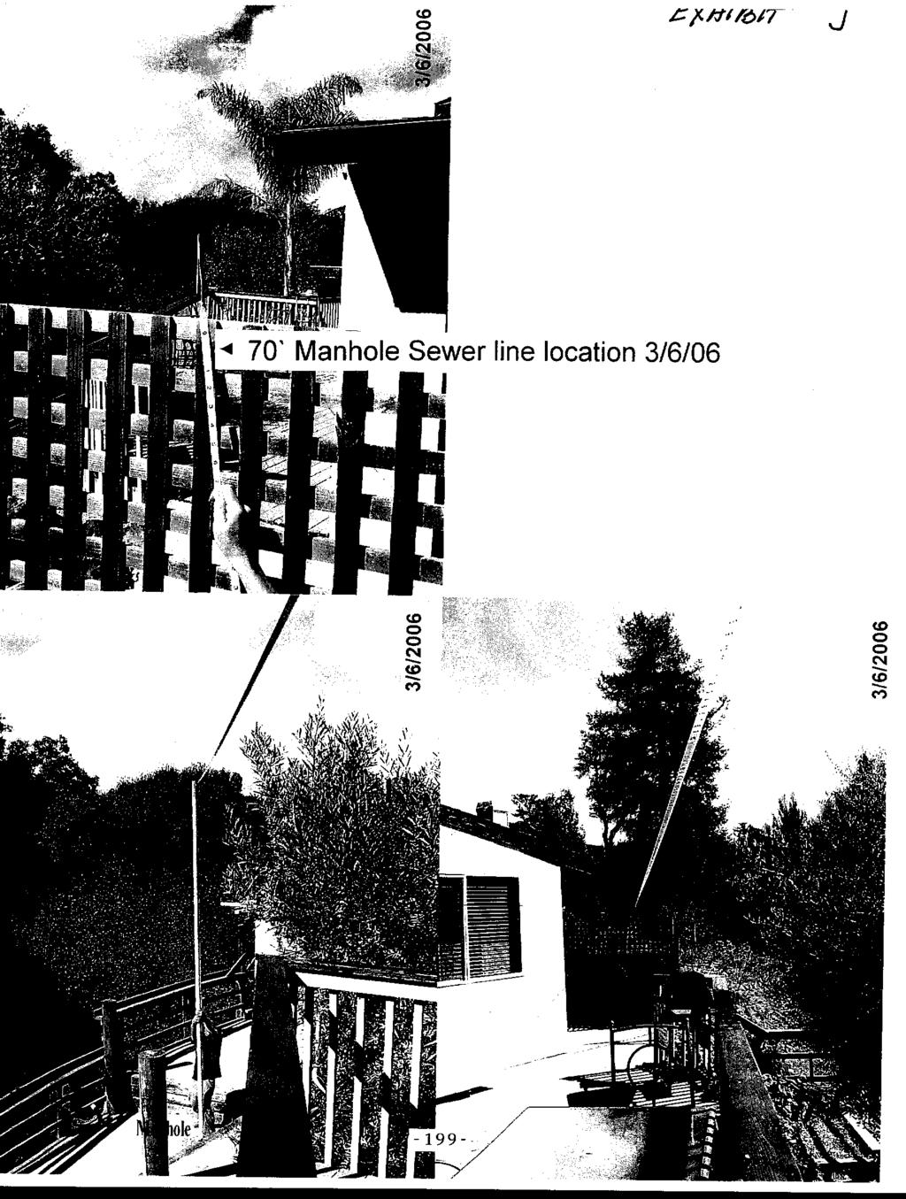
217
218 Exhibit K Approx. Location of Sewer Line
219 .....I,... I $ N W WGmON 5TAlT De*M -- land5capc PROPOSED SITE PLAN 4 PROPOSEDPAWNG North Approx. Location of Sewer line based on video conducted on March 3d,
220 Exhibit L Declaration Scott Duncan Duncan Plumbing -202-
221 Exhibit M

222 I SOQUEL CREEK WATER DISTRICT 5180 SWUEL DR DA4ECTaRS IMNiEL F KRIEGE Pr sm x7hn W BEEBE JAMES M BARGETTO htxa P PIERCE GARYE HAIELTON ROBERTM XWNSON, X GcWI*cnqa Url E- June 12, 1992 Mr. W. F. O Neil P. 0. Box 1414 capitola, California Subject: Water Service at McGregor Drive, Aptos Dear Mr. O Neil: After a great deal of research on the subject property s water service history, a conclusion has been reached. It is our determination that this was a pre-existing service line prior to 1964 when the District accepted the water system in this area. Therefore, you shall receive a water service line and meter provided by this District at no additional cost to you. The water line easement crossing Jar1 Saal s property cannot be provided by the District and shall be your responsibility. The District shall reserve the right to relocate r water meter so that it fronts on the property at McGregor Drive. This would be done in the future if the McGregor Drive main is extended. It is ag,ainst current District Policy to serve one parcel through another, but your case is an exception. Sincerely, SOQUEL CREEK WATER DISTRICT Jeffery N. Gailey Engineering Manager JNG: j jy
223
224 . + I +!
225

226
227 Exhibit 0-1

228 i
229

230
231 -213 Exhibit P
232 . - NOTICE OF EXEMPTION FROM THE CALIFORNIA ENVIRONMENTAL QUALITY ACT The County of Santa Cruz has reviewed the project described below and has determined that it is exempt from the provisions of CEQA as specified in Sections of CEQA for the reason(s) which have been checked on this document. Application No.: Assessor Parcel No.: Project Location: McGregor Drive, Aptos Project Description: Proposal to remove fill and an unpermitted retaining wall from the riparian corridor to resolve a code violation by private property and to grade and fill approximately 50 cubic yards and construct 3 foot high retaining wall to create an access road to locate and raise an existing sewer manhole cover. Requires a Riparian Exception. Person or Agency Proposing Project: Phone Number: (408) Santa Cruz County Department of Public Works A. The proposed activity is not a project under CEQA Guidelines, Sections 1928 and 501. B. Ministerial Project involving only the use of fixed standards or objective measurements without personal judgement. C. Statutory Exemption other than a Ministerial Project. Specify type: D. Cateqorical Exemption - 1. Existing Facility - XXX 2. Replacement or Reconstruction - 3. New Construction of Small Structure - 4. Minor Alterations to Land - 5. Alterations in Land Use Limitation - 6. Information Collection - 7. Actions by Regulatory Agencies for Protection of the Environment - 8. Actions by Regulatory Agencies for Protection of Nat. Resources - 9. Inspection Loans Accessory Structures Surplus Govt. Property Sales Acquisition of Land for Wild- Life Conservation Purposes Minor Additions to Schools Functional Equivalent to EIR Transfer of Ownership of Land to Create Parks Open Space Contracts or Easements Designation of Wilderness Areas Annexation of Existing Facilities/ Lots for Exempt Facilities Changes in Organization of Local + Agencies Enforcement Actions by Regulatory Age nc i e s Educational Programs Normal Operations of Facilities for Public Gatherings Regulation of Working Conditions Transfers of Ownership of Interestsin Land to Preserve Open Space Acquisition of Housing for Housing Assistance Programs Leasing New Facilities Small Hydrolelectric Projects at Existing Facilities Cogeneration Projects at Existing Facilities
233 -215- Exhibit Q
234 JOHNSON & JAMES LLP Robert K Johnson Attorneys at Law Telephone (831) Omar F. James 311 Bonita Drive Facsimile (831) P.O. Box 245 Aptos, CA December 14,2005 SCOTT LUCINGER, c/o RE& PROPERTY DMSION COUNTY OF SANTA CRUZ PLANNING DEPARTMENT 701 Ocean Street, 4 h Floor Santa Cruz, CA Re: Jarl Saal Dear Mr. Lucinger: On May 23, 2005, I wrote to you regarding Jarl Saal and the County s intent to sell a parcel of real property it owns to Mr. Saal s neighbor, Randy Zar without competitive bidding. I advised you that Mr. Saal was willing to pay $25,000 for the same properly the county intended to sell to Mr. Zar for S20,OOO and that Mr. Saal was willing to pay more than $25,000 through competitive bidding. I received no response to my letter Mr. Saal has now been advised that the County intends to lease the property to Mr. Zar as a way of avoiding the competitive bidding process required by law, This letter is intended as notice to the County that Mr. Saal is willing to lease the property fiom the County. m. Saal is certain that he will pay more for a lease than Mr. Zar is willing to pay since Mr. Saal is willing to pay full market value and is not seeking any special treatment [Mr. Saal does not know the terms of the contemplated lease since the negotiations were apparently held in secrecy]. Mr. Saal hereby demands that the County comply with law and that any lease or sale of the subject property be put up for competitive bidding Thai& you for your attention to this matter. Please do not hesitate to contact me if you have any questions or require any additional information. Very truly yours, $BERT KJOHNSON Wimo cc: Supervisor Ellen Pine - County Board of Tom Bums - County Planning Director Jar1 Saal -216
235 MEMORANDUM Date: March 2,2006 To: Planning Commissioners 8 From: Cathy Graves, Secretary._ L Re: Additiinal Correspondence for it& 7.1 of March 8 Agenda Attached is a copy of a letter dated February 7, 2006 from the appellant for this appeal. This letter was inadvertently omitted from the packet and we are now forwarding it to your Commission. Please contact myself at (831) or the project Planner, Randall Adam, at (831) if you have any questions about this information
236 KENT G. WASMBURN ATTORKEY AT LAW March 2,2006 Mr. Dennis Osmer, Chairperson Santa Cruz County Planning Commission 701 Ocean St. Santa Cruz, Ca Re: 2000 McGregor Dr./March 8 agenda App # for hand delivery with letter of February 7 Rr enclosures Dear Chairperson Osiner and Commissioners: One of the key issues in this case is whether or not the structure in question was built wit11 permits. In a seeming effort to minimize culpability, the applicant: as recently as opposing counsel s letter of December 28,2005 and the oral ar.ynients presented to the Commission in January, has alleged that at least 800 sq. ft. of the basic structure was built under permit # Subsequent to that January hearing we went to some lengths to obtain and place before staff very convincing evidence from the county s own files together with private photos which, taken all together, conclusively refute the claim that Mr. Zar s building was the subject of permit #3732. We appreciate that staff now seems to agree with our position, but were very surprised and disappointed to learn this morning, when we got our first cliance to review the staff report for the March 8 hearing and found my February 7 letter and exhibits were completely omitted from the materials furnished to you. Because the applicant s effoits with your Coinmission to date have consisted so substantially of claims that my client is acting from bad motives and/or not telling the truth, we feel it essential to brins this evidence to your attention well in advance of the hearing. When we approached staff this morning with the request that the omission be cured immediately, they said they would try but could not promise LIS prompt delivery to you. Hence our efforts to hand deliver to you even though it may duplicate what you also belatedly receive from staff. We hope this will not inconvenience you. Very truly yours, f%d-~k51- Kent G. Washburn -218-
237 KENT G. WASHBURN ATTORNEY AT LAW VOICE I FAS: 1831) Jewrll Strcrt SANTA CRIIZ. CALIFONIA Mi-. Mark Deming Santa Cruz County Planning Department 701 Ocean St. Santa Cruz, Ca Re: , APN Dear Mr. Deming: Febiuary 7,2006 Thank you for responding last week to my attempts to get in touch with staff about this file. Our intention is to provide staff and the Planning Commission with reliable information in advance of the next public hearing. You and I discussed several key questions which remain unanswered. Single Issue Addressed This letter addresses one such question: the permit history of Mr. Zar s building. In his written and oral submittals to both the Zoning Administrator and the Planning Commission, this applicant and his representatives have falsely claimed that county building permits 1474/1594 are the proof of their claims that the building exists legitimately. See for example the section entitled History of The Structure in attorney David Y. Imai s letter of December 28,2005 to the Commission. This letter and attachments refute counsel s contention with five categories of evidence: 1. County building pennit records 2. County Assessor s information cards for both parcel s, Zar s and Saal s 3, Private historic photographs of the site 4. Mr. Saal s sworn statement. 5. CalTrans aerial photography County Building Permits A single record exists of permit 1594, Ex. A attached. Please note the following points: 1. The applicant s name, Eva Bernard, in the upper left. 2. The address, 799 Estates Dr. rather than the Zar address on McGregor Dr. 3, The APN , Mr. Saal s parcel number, not Mr. Zar s. 4. The notation. for moved bldg. 5. The exact size of the building, 20 x The precise use of the structure - for office and slab. 7. Dates in 1962, before most zoning regulations or CEQA applied to this property
238 It is clear why the applicant would like this building permit record to refer to his structure. If it was built before the current laws were enacted he can argue it should be exempt from their application. This permit record and the evidence submitted in and with subsequent sections of this letter make it clear that the permit was for a now-demolished structure on the Saal parcel, not Zar s. That leaves the applicant with only building permit 3732 from which to argue his building s legitimacy. Please note the following points from the face of the two pages of permit documents fol 3732, copy enclosed as Exhibit B: 1, Location of structure is the frontage road near Estates Dr. 2. Type of construction is garden sales area and fire-resistant wall on existing structure. 3. There was no toilet on the property, so issuance of the permit was conditioned on gaining permission to use the facilities in the building next door, the building moved in permit These facts will tie in later in this letter with photo evidence and the Assessor s records to show in more detail just what was built on the Zar parcel and just what property line was being referred to. Santa Cruz County Assessor s Parcel Information Cards There are information cards for both the Zar property and the Saal property. Clarity emerges only from examining both sets of records. Because at first the planning staff only had access to the 2% records, it is easy to understand why staffs picture was incomplete. Please note the following ten points from the three pages of Saal s assessor cards, Exhibit C: 1. Owner s name in upper left comer, Eva Bernard (same as on permit 1594) 2. Notation of type of use, real estate office. 3. APN in upper right corner, , the Saal parcel number. 4. Middle left of page one under Appr. Year the card shows This dovetails with adjacent columns showing Age and Remaining Life of structure. 6. Bottom left of page one shows the total are of the main structure as 800 square feet, which is confirmed in a computation on the reverse side, 20 x 40 = Notation on reverse side that the building was moved farther back on site and put on slab. 8, The third page corroborates the APN and square footage. 9. The Construction Record notes permit # 1594 with the comment moved building. 10. Two separate notes refer to demolition of the building. In the lower right corner the estimated date of 7/1/92 for demolition appears, and the diagonal slash is labeled Denio d This information harmonizes completely with the building permit records of permit A substantial pre-existing structure was moved back from the frontage road and put on a foundation on the Saal parcel in It was destroyed in 1992 when the First Alarm building was constructed, and thus does nothing to legitimize the Zar structure. It could be argued that this information substantially detracts from the applicant s plea of innocence, victimhood, and an honest attempt to get right with the law today because it shows that he has been giving the county misinformation all along and still is. The Assessor s cards on the Zar parcel, , Exhibit D hereto, line up perfectly with the building permit records for permit They show that as of 1968 a small office and greenhouse -220-
239 with an adjoining covered plant storage area had been built. The note on the reverse side shows that as of the date of Mr. Zar s purchase, however, the Assessor suddenly picked up the value of such substantial and recent improvements to the property that a special note was made of it. Private Historic Photographs of the Site We attach three separate pages of photos most of which 1 believe appear in copy foim in the county s enforcement file on the Zar parcel. 1 will bring with me to our meeting many more photos which are not attached to this letter because they do not seem to add anything of substance. The first photo, enlarged to 8 % by 1 I size shows the frontage of the Zar property as it existed in the late 1960s, the 1970s, and into the 1980s. It is clearly an open air nursery business, consistent with what pemiit 3272 authorized and assessment infornlation shows for the period. The second page consists of two black and white photos. They show the Aptos Gardens sign and improvements on the Zar parcel in the background and the building on the Saal property in the foreground. The original real estate office use by Eva Bernard has changed to a beauty shop. In the background one can clearly see tlie open latticework under the hip roof structure on the Zar parcel, just as the peimit authorized, and just as the deputy assessors had recorded. The close proximity of the structure on the Zar parcel and the beauty shop on the Saal parcel explains the reference on building permit 3732 to the Zar structure s closeness to the property line. It also dovetails with the reference on pemiit 3732 to the need for permission to use sanitary facilities on the adjoining parcel -had both buildings been located on tlie Zar parcel, as counsel and his client and their consultant seek to argue. there would have been no need to ask anyone else s permission The third page, consisting of four photos, shows tlie interior of the Aptos Gardens complex, and how it consisted basically, as noted by the assessment office and the building department, of gravel floor, plastic roofing, and walls largely open to the elements. This bears no resemblance whatsoever to the present structure on the applicant s site, and no permit since 3272 has authorized such changes. Statement under Penalty of Perjury In my experience it is somewhat unusual for parties to a county land use dispute to submit their statements under penalty of perjury. Why did we submit the previous affidavits of Mssrs. Mill, Hurley and Straws, and the attached statement of Saal, Exhibit E, in this fashion? We want our statements to stand out in stark relief as con~pletely tiuthful and reliable in the best way possible. Mr. Saal is not just making an unfounded or self-serving statement in this matter - he is willing to put it in such a way that he is subject to criminal prosecution if it is false. MI-. Saal s statement is based on over forty years acquaintance with the Zar and Saal parcels. As a youth he even worked on the Zar property His recollections are congruent with the photos, the building records, and the Assessor. Zar s statements are not. There is a complete conflict in their statements which we believe the objective coitoborating evidence resolves in Mr. Saa ls favor. -221
240 Aerial Photography We are bringing to the meeting some aerial photos of the site which corroborate the statements made by Mr. Saal and lend no support to the applicant s version. Conclusion I want to clearly restate that our position is nor that Mr. Zar s attempts to come into compliance with the law should be rejected outright or that he should have no beneficial use of his property. That would be a vindictive and extreme position which the county would presumably find distasteful. My client instead takes the position that the applicant s efforts to come into compliance should be based on the truth as opposed to misstatements. My client also contends that in view of the extensive history of violations and illegal construction and illegal uses, there should be dispassionate application of the law and enviromnental standards to the project, not a hurried effort to whitewash broken laws and actual and threatened environmental harm because, after 12 + years of resistance, the applicant wants the trouble to go away. We have gone io the trouble of showing that the applicant has submitted misinfoi-mation to the Zoning Administrator and the Planning Coinmission for several reasons. First and most obvious, if the building lacks any permits since 3732 the path to compliance must be much different and tougher than if the building had legally existed since the 1967 permit as Mr. Zar has contended. Second, I believe that CEQA review cannot be avoided on the pre-existing facilities exception if the building and improvements have been installed in violation of CEQA and other land use laws. Third, the lack of candor about the building permit history should make staff and the Planning Commission extremely cautious about accepting the applicant s unsworn testimony that he never brought in any more fill. In this letter and its attachments, over the applicant s strong and categorical denials, we have demonstrated that the building essentially lacks any permits for what is out there now. We also contend against the applicant s feverish denials that huge quantities of unengineered fill have been placed on the applicant s property and (he County s own adjacenl surplus righr ofway area subsequent to the riparian exception work. As Mr. Kasukh s recent letter strongly urges, careful study of both the Zar parcel and the county right of way which Zar filled, paved and now uses for parking is essential before the project can be approved or the county can contemplate selling the excess right of way free of liability for future slope failures. Very truly yours, Kent G. Washbum

241

242 - 224-
243

244
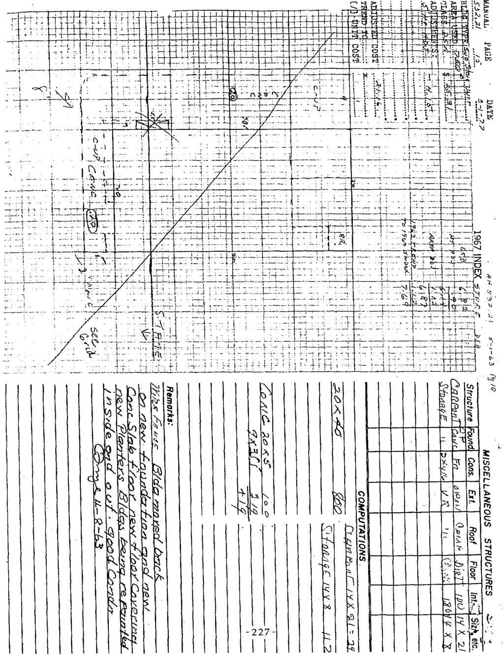
245
246

247 i..,

248

249

250

251

252
253 I, Jar1 Saal, say: 1. I have personal knowledge of the facts stated herein. I was raised in Aptos and have spent almost all my adult life in the Aptos area. In my teen years I worked on the property in question doing odd jobs. 2. The photographs attached to MI. Washburn's February 7 letter are a true and correct depiction of the nursery improvements on what is now the Zar property in the late 1960s and the 1970s. On the Zar land there was a small shed-like office and a lot of open nursery and greenhouse area nearby with gravel floors, open to the elements. The structure now on the Zar property was gradually built since the late 1980s with no building permits. 3. The photographs also show a twenty by forty foot building on what IS now my property. It started out as a real estate office and then became a beauty emporium as shown in the pictures. The common boundary between what is now the Zar and the Sad parcels ran along the side of the beauty shop between it and the nursery structures. 4. The beauty shop building on my property was moved back away froin the highway onto a concrete foundation in the 1960s as the county records confirni. This building was demolished when the First Alarm building was constructed. I declare under penalty of perjury under the laws of the State of California that the foregoing is true and correct and is executed at Santa Cruz, Ca. on February 8,2006..~
254 COUNTY OF SANTA CRUZ PLANNING DEPARTMENT Planning Commission Meeting Date: 07/26/06 Agenda Item: # 7 Time: After 9:00 a.m. ADDITIONS TO THE STAFF REPORT FOR THE PLANNING COMMISSION ITEM 7: MATERIALS SUBMITTED BY APPLICANT DURING THE PUBLIC HEARING 07/2 6/06

255 TERRA FIRMA Engineering and Science July 26,2006 Dear Randy, at your request I have prepared a description of the project progress. The project was slowed significantly by the almost continuous rainfall during March and April of 2006, and the lack of availability of drillers after the rains ended. Also, the laboratory testing program has taken a long time as a) the laboratory also had a rush after the rains ended; and b) the samples needed to be tested drained. The samples tested have a significant clay content and the time required to drain the samples during testing was long. 1) I met with you at the site in March of 2006 and you requested me to work on the project.. 2) Due to continued rainfall during March and April of 2006, fjeld work could not be conducted until the end of April. 3) On April 26, field work started and we were able to do Cone Penetrometer Testing. 4) At the beginning of May, Cenozoic Drilling augered and collected samples in the parking lot. 5) Cenozoic returned in the middle of May to use there hand-operated portable drilling-rig in areas inaccessible to the truck mounted drilling-rig. 6) Soil Sample were submitted to Copper Testing Laboratory shortly thereafter. The testing of the samples is almost completed and results should be available in the next day or two. 7) Carey Edmonson (surveyor) prepared a topographic map of the site which was completed in the middle of May. 8) Lab testing Complete 7/ ) Preliminary comparison of CE, Lab-data, and Standard Penetration Test data, 7/26/ ) Preliminary comparison of testing and field data with historical site history/conditions, 7/26/ ) Preliminary slope-stability analyses of existing site and remedial measures use acquired data, Marc Ritson Registered Civil Engineer No TEL (831) * FAX (831) Weston Road Scolts Valley * California ritson@tem-firma.org

256 TERRA FIRMA Engineering and Science July 26,2006 Site HistorylCondition McGregor Site is located on creek bank with about 36 feet of elevation change from creek to parking lot. Slope of bank is about 1: 1 or less. Cone penetrometer sounding indicate that at the outboard side of the parking lot there is about 12 feet of compacted fill over 14 feet of un-compacted soil. The un-compacted or weathered soil is likely to be comprised of 1) weathered native soil; 2) colluvium; and 3) un-compacted dumped fill. The comdacted fill was DIaced B d on th ting done by Reynolds and Associat&, the soils thaf Reynolds tested were adequately compacted. The soil conditions identified fit the known history of the site in that: 1) A creek-bank is likely to have a surface layer of weathered soil and colluvium; 2) a sewer line was constructed and apparently spoils from the trench and the soil along the construction path were not compacted; 3) Uncontrolled dumping would have be convenient as the site is located near freeway construction and other land development projects. The uncontrolled dumping may have occurred at any tiome prior to or after the sewer line construction; 4) A compacted fill was placed in TEL (831) * FAX (831) Weston Road Scolts Valley - California * ritson@terra-firma.org

257 i
258 utlnv.l
259

260

261
DIVISION 2 - CONSTRUCTION PLAN AND MISCELLANEOUS REQUIREMENTS
 DIVISION 2 - CONSTRUCTION PLAN AND MISCELLANEOUS REQUIREMENTS 2.1 Required Plan Sheets 2.2 Drawing Requirements 2.3 Graphic Standards 2.4 Easements 2.5 Utility Locations 2.6 Private Facility Locations
Prospective Builders, Utilities, Public Agencies, and Engineering Firms
 MEMORANDUM To: Prospective Builders, Utilities, Public Agencies, and Engineering Firms Subject: District Procedures for Plan Review and Approval This document was prepared to provide guidance to developers,
CHAPTER 24 F FLOOD ZONE OVERLAY DISTRICT
 CHAPTER 24 OVERLAY DISTRICT SECTION 24.01 PURPOSE It is the intent of this district to apply special regulation to the use of land in those areas subject to periodic inundation. Such regulation is deemed
February 29, To: Sarah Absher Senior Planner Tillamook County Department of Community Development
 February 29, 2016 To: Sarah Absher Senior Planner Tillamook County Department of Community Development From: Richard Hook Chair, Neskowin Citizen Advisory Committee Subject: Application 851-15-000265-PLNG:
Chapter 136. SOIL EROSION
 1 of 8 12/19/2011 4:17 PM Township of Andover, NJ Monday, December 19, 2011 Chapter 136. SOIL EROSION [HISTORY: Adopted by the Township Committee of the Township of Andover by Ord. No. 77-11 (Ch. XVII
CITY UTILITIES DESIGN STANDARDS MANUAL
 CITY UTILITIES DESIGN STANDARDS MANUAL () September 2017 Page Chapter 1 Acronyms and Definitions 1.01 Purpose 1 1.02 Acronyms 1 1.03 Definitions 2 Chapter 2 Introduction 02.01 Purpose 1 2.02 City Utilities
Lake of the Woods County Land Use Permit Instruction Sheet
 Lake of the Woods County Land Use Permit Instruction Sheet PROPERTY DATA SECTION Legal Description: Please write out your complete legal description. A written description on a separate sheet of paper
PLANNING & BUILDING REGULATIONS
 SCANDIA-HUS FACT SHEET NO. 10 PLANNING & BUILDING REGULATIONS DATE: 1 ST JANUARY 2018 ISSUE NO: 4 THE PLANNING SYSTEM Scandia-Hus will, as part of the service, handle all aspects of design, planning and
A. Land Use Designations: General Plan: Single-Family Residential Zoning: R-1H, Single-Family Residential, Hillside District
 Z O N I N G A D J U S T M E N T S B O A R D S t a f f R e p o r t FOR BOARD ACTION SEPTEMBER 9, 2010 2956 Shasta Road Appeal of the Zoning Officer s decision to approve Administrative Use Permit #09-20000088
Lake of the Woods County Land Use Permit Instruction Sheet
 Lake of the Woods County Land Use Permit Instruction Sheet PROPERTY DATA SECTION Legal Description: Please write out your complete legal description. A written description on a separate sheet of paper
SANTA CRUZ COUNTY ACCESSORY DWELLING UNIT ADU BASICS
 SANTA CRUZ COUNTY ACCESSORY DWELLING UNIT ADU BASICS JUNE 2018 Use this guide with its companion documents Santa Cruz County ADU Basics and ADU Design Guide and the resources provided at sccoplanning.com/adu
8Land Use. The Land Use Plan consists of the following elements:
 8Land Use 1. Introduction The Land Use Plan consists of the following elements: 1. Introduction 2. Existing Conditions 3. Opportunities for Redevelopment 4. Land Use Projections 5. Future Land Use Policies
Napa County Planning Commission Board Agenda Letter
 Agenda Date: 9/20/2017 Agenda Placement: 8C Napa County Planning Commission Board Agenda Letter TO: FROM: Napa County Planning Commission Charlene Gallina for David Morrison - Director Planning, Building
BRIDGETON SUBDIVISION APPLICATION CHECKLIST
 APPLICATION NAME AND # CHECKLIST COMPLETED BY: DATE: Signature and printed name BRIDGETON SUBDIVISION APPLICATION CHECKLIST TO SUBDIVISION APPLICANTS: The attached checklist is to assist you in the submission
SPRING BROOK TOWNSHIP 966 STATE ROUTE 307 SPRING BROOK TOWNSHIP, PA PHONE (570) FAX (570)
 FAX (570)") PERMIT # - D SPRING BROOK TOWNSHIP 966 STATE ROUTE 307 SPRING BROOK TOWNSHIP, PA 18444 PHONE (570) 842-7028 FAX (570) 842-0633 Date: PART I APPLICATION DRIVEWAY INSTALLATION APPLICATION AND PERMIT Name:
PERMIT # - D SPRING BROOK TOWNSHIP 966 STATE ROUTE 307 SPRING BROOK TOWNSHIP, PA 18444 PHONE (570) 842-7028 FAX (570) 842-0633 Date: PART I APPLICATION DRIVEWAY INSTALLATION APPLICATION AND PERMIT Name:
5. That the Owner shall agree that all development Blocks shown within the Draft Plan will be connected to full municipal services.
 Conditions Relating to Draft Plan of Subdivision Approval East Fonthill 26T 01014 (Draft Plan dated December 1, 2013, and revised August 28, 2014), the Town of Pelham 1. This approval applies to the Draft
Staff Report PLANNED DEVELOPMENT. Salt Lake City Planning Commission. From: Lauren Parisi, Associate Planner; Date: December 14, 2016
 Staff Report PLANNING DIVISION COMMUNITY & NEIGHBORHOODS To: Salt Lake City Planning Commission From: Lauren Parisi, Associate Planner; 801-535-7932 Date: December 14, 2016 Re: 1611 South 1600 East PLANNED
Planning Commission Report
 cjly City of Beverly Hills Planning Division 455 N. Rexford Drive Beverly Hills, CA 90210 TEL. (310) 285-1141 FAX. (370) 858-5966 Planning Commission Report Meeting Date: April 28, 2016 Subject: Project
A GUIDE TO PROCEDURES FOR: SUBDIVISIONS & CONDOMINIUM CONVERSION
 A GUIDE TO PROCEDURES FOR: SUBDIVISIONS & CONDOMINIUM CONVERSION A GUIDE TO PROCEDURES FOR: SUBDIVISIONS (TENTATIVE MAPS) PURPOSE Definition: A subdivision is defined as the division of any improved or
CITY OF EAU CLAIRE, WISCONSIN. SPECIAL ASSESSMENT POLICY (Dated: November 8, 2016)
") CITY OF EAU CLAIRE, WISCONSIN SPECIAL ASSESSMENT POLICY (Dated: November 8, 2016) (Adopted by reference by Ordinance No. 7207 adopted November 8, 2016) PURPOSE The purpose of this Policy is to assure fair
CITY OF EAU CLAIRE, WISCONSIN SPECIAL ASSESSMENT POLICY (Dated: November 8, 2016) (Adopted by reference by Ordinance No. 7207 adopted November 8, 2016) PURPOSE The purpose of this Policy is to assure fair
PRELIMINARY PLAT CHECK LIST
 PRELIMINARY PLAT CHECK LIST Name of Proposed Subdivision: The following items must be included with the initial submittal of a Preliminary Plat: Application, filled out completely Project Narrative Pre-application
Staff Report to the Zoning Administrator Application Number:
 Staff Report to the Zoning Administrator Application Number: 04-0523 Applicant: Stephen Graves & Associates Owner: Douglas Groom APN: 037-161-07 Agenda Date: 2/4/05 Agenda tem #: / Time: After 1O:OO a.m.
Tentative Map Application Review Procedures
 FOR REFERENCE ONLY This page is not part of the application. Tentative Map Application Review Procedures The tentative map process in Churchill County is designed to provide a mechanism in order to divide
Planning Commission Report
 Beverly Hills Planning Division 455 N. Rexford Drive Beverly Hills, CA 90210 TEL. (310) 458-1140 FAX. (310) 858-5966 Planning Commission Report Meeting Date: September 27, 2012 Subject: 366 North Rodeo
CITY OF CITRUS HEIGHTS Planning Department 6237 Fountain Square Drive Citrus Heights, CA (916)
") CITY OF CITRUS HEIGHTS Planning Department 6237 Fountain Square Drive Citrus Heights, CA 95621 (916) 725-2448 DATE: May 17, 2005 TO: Mike Evans Mike Williams 3111 Sunset Blvd. Suite One Baker-Williams
CITY OF CITRUS HEIGHTS Planning Department 6237 Fountain Square Drive Citrus Heights, CA 95621 (916) 725-2448 DATE: May 17, 2005 TO: Mike Evans Mike Williams 3111 Sunset Blvd. Suite One Baker-Williams
APPLICATION PROCESSING
 MAJOR SUBDIVISION 1810 E. HAZELTON AVENUE, STOCKTON CA 95205 BUSINESS PHONE: (209) 468-3121 BUSINESS HOURS: 8:00 A.M. TO 5:00 P.M..(Monday through Friday) APPLICATION PROCESSING STEPS STEP 1 STEP 2 CHECK
 Page 1 of 6 Office of the Professions Land Surveying Practice Guidelines - February 2000 The State Board for Engineering and Land Surveying issued the first draft of its proposed Land Surveying Practice
KASSON TOWNSHIP PRIVATE ACCESS ROAD ORDINANCE ORDINANCE NO (EFFECTIVE: MAY 12, 2007)
") KASSON TOWNSHIP PRIVATE ACCESS ROAD ORDINANCE ORDINANCE NO. 2007-01 (EFFECTIVE: MAY 12, 2007) An ordinance providing for the standards and specifications incident to the development of Private Motor Vehicle
KASSON TOWNSHIP PRIVATE ACCESS ROAD ORDINANCE ORDINANCE NO. 2007-01 (EFFECTIVE: MAY 12, 2007) An ordinance providing for the standards and specifications incident to the development of Private Motor Vehicle
CHARLES CITY COUNTY SITE PLAN ORDINANCE. This Ordinance shall be known as the Charles City County Site Plan Ordinance.
 CHARLES CITY COUNTY SITE PLAN ORDINANCE Section 1. Title This Ordinance shall be known as the Charles City County Site Plan Ordinance. Section 2. Authority. This Ordinance is enacted pursuant to the authority
Appendix 4 Agency Approval Letters
 Appendix 4 Agency Approval Letters 55 Appendix4.a. Appendix 4.b. Appendix 4.c. Appendix 4.d. 3/10/2016 Clarksburg Mews, LLC c/o Michael Fisher 4938 Hampden Lane Bethesda, MD 20814 Re: Phase
HOME ENROLLMENT NOTIFICATION OF CONSTRUCTION AND INSPECTION BUILDER/SELLER APPLICATION FOR HOME ENROLLMENT
 HOME ENROLLMENT You should have now completed the necessary documents for your registration. On the following pages you will find the forms needed for the enrollment process of our program. NOTIFICATION
DEVELOPMENT POLICY INFRASTRUCTURE GUIDELINES FOR NEW DEVELOPMENT
 CITY OF HAYS SUBJECT DEVELOPMENT POLICY INFRASTRUCTURE GUIDELINES FOR NEW DEVELOPMENT ISSUED BY LAST REVISION DATE POLICY MANUAL REVISION DATE City Commission 3-13-08 10-22-09 POLICY STATEMENT: The City
CHAPTER 3 PRELIMINARY PLAT
 10-3-1 10-3-3 SECTION: CHAPTER 3 PRELIMINARY PLAT 10-3-1: Consultation 10-3-2: Filing 10-3-3: Requirements 10-3-4: Approval 10-3-5: Time Limitation 10-3-6: Grading Limitation 10-3-1: CONSULTATION: Each
1.0 REQUEST. SANTA BARBARA COUNTY ZONING ADMINISTRATOR Coastal Zone Staff Report for Vincent New Single-Family Dwelling & Septic System
 SANTA BARBARA COUNTY ZONING ADMINISTRATOR Coastal Zone Staff Report for Vincent New Single-Family Dwelling & Septic System Hearing Date: February 26, 2007 Supervisorial District: First Staff Report Date:
Guide Note 15 Assumptions and Hypothetical Conditions
 Guide Note 15 Assumptions and Hypothetical Conditions Introduction Appraisal and review opinions are often premised on certain stated conditions. These include assumptions (general, and special or extraordinary)
PLANNING COMMISSION STAFF REPORT
 106 William Avenue PC Meeting: 8/26/14 Agenda Item: 3 PLANNING COMMISSION STAFF REPORT DATE: August 26, 2014 RE: DR/FAR 14-26, Geoffrey Butler, Applicant; House Properties 77 LLP, Property Owner; 106 William
WASCO COUNTY PRELIMINARY SUBDIVISION APPLICATION
 WASCO COUNTY PRELIMINARY SUBDIVISION APPLICATION DETAILED SPECIFIC WRITTEN REQUEST File Number: SDV- Number of Proposed Lots & their Dimensions: PRELIMINARY SUBDIVISION PLAN REQUIREMENTS The approval of
CITY OF GROVER BEACH COMMUNITY DEVELOPMENT DEPARTMENT Tentative Map Checklist
 CITY OF GROVER BEACH COMMUNITY DEVELOPMENT DEPARTMENT Tentative Map Checklist The following list includes all of the items you must submit for a complete application. Some specific types of information
GENERAL PLANNING APPLICATION FORM
 PLANNING DEPARTMENT 525 San Anselmo Avenue, San Anselmo, California 94960 Tel. (415)-258-4616/FAX 454-4683 GENERAL PLANNING APPLICATION FORM Job Site Address: Assessor Parcel No.: Zone: Property Owner(s)
Application for Sketch Plan Review
 Town of Standish 175 Northeast Road Standish, ME - 04084 Phone: (207)642-3461 Fax: (207) 642-5181 Application for Sketch Plan Review Applicant & Owner Information 1) Name of Applicant: Address: Phone:
Chapter 35. The Appraiser's Sales Comparison Approach INTRODUCTION
 Chapter 35 The Appraiser's Sales Comparison Approach INTRODUCTION The most commonly used appraisal technique is the sales comparison approach. The fundamental concept underlying this approach is that market
How to Read a Real Estate Appraisal Report
 How to Read a Real Estate Appraisal Report Much of the private, corporate and public wealth of the world consists of real estate. The magnitude of this fundamental resource creates a need for informed
Prepared by: Nick Lagura, Associate Planner
 CITY OF CITRUS HEIGHTS PLANNING DIVISION STAFF REPORT PLANNING COMMISSION MEETING May 25, 2016 Prepared by: Nick Lagura, Associate Planner REQUEST The applicant requests approval of a Tentative Parcel
EL DORADO COUNTY PLANNING AND BUILDING DEPARTMENT ZONING ADMINISTRATOR STAFF REPORT VARIANCE
 EL DORADO COUNTY PLANNING AND BUILDING DEPARTMENT ZONING ADMINISTRATOR STAFF REPORT Agenda of: April 18,2018 Item No.: Staff: 5.a. Emma Carrico VARIANCE FILE NUMBER: APPLICANT: REQUEST: LOCATION: V17-0003/La
HAMILTON COUNTY SECONDARY ROAD DEPARTMENT DRIVEWAY AND ENTRANCE POLICY EFFECTIVE NOVEMBER 28, 2017
 Updated November 28, 2017 HAMILTON COUNTY SECONDARY ROAD DEPARTMENT DRIVEWAY AND ENTRANCE POLICY EFFECTIVE NOVEMBER 28, 2017 POLICY INTENT This policy is intended to govern all aspects of access from Hamilton
Appendix F - Earth Materials Extraction, Processing and Site Reclamation
 Appendix F - Earth Materials Extraction, Processing and Site Reclamation Intent It is the purpose of this Article to establish regulations and standards for surface mining operations and to provide for
A. Land Use Designations: General Plan: LDR Low Density Residential Zoning: R-1H Single Family Residential - Hillside Overlay
 Z O N I N G A D J U S T M E N T S B O A R D S t a f f R e p o r t FOR BOARD ACTION FEBRUARY 26, 2015 1229 Oxford Street Use Permit #UP2014-0009 to 1) add a 1,171 square-foot third story which would result
CHAPTER 14: DRIVEWAYS, TOWN HIGHWAYS, AND PRIVATE ROADS
 CHAPTER 14: DRIVEWAYS, TOWN HIGHWAYS, AND PRIVATE ROADS TABLE OF CONTENTS CHAPTER 14: PRIVATE DRIVEWAYS, TOWN HIGHWAYS AND PRIVATE ROADS 14-1 14.0100 AUTHORITY... 14-1 14.0200 TITLE... 14-1 14.0300 REGULATION
CHARTER TOWNSHIP OF FENTON SEWER SYSTEM FINANCIAL OVERVIEW MARCH, 2018
 CHARTER TOWNSHIP OF FENTON SEWER SYSTEM FINANCIAL OVERVIEW MARCH, 2018 Fenton Township continues to receive inquiries regarding the relatively high sewer use fees that Township residents have been paying
Rarity Pointe Commercial Recreation and Residential Development on Tellico Reservoir, Loudon and Monroe Counties, TN
 ======================================================================= Federal Register: September 10, 2003 (Volume 68, Number 175) =======================================================================
LOWER LAKE GIRARD DAM THE BREACHING OF AN AMBURSEN DAM GIRARD, OHIO. by Brian H. Greene
 LOWER LAKE GIRARD DAM THE BREACHING OF AN AMBURSEN DAM GIRARD, OHIO by Brian H. Greene PRESENTATION OUTLINE PROJECT FEATURES GEOLOGIC SETTING PROJECT HISTORY PRIOR AMBURSEN DAM FAILURES & SUCCESSES DAM
JEFFERSON COUNTY, ALABAMA
 JEFFERSON COUNTY, ALABAMA Major Development Checklist, Notes and Information A Major Development is any proposed new structure or addition to an existing structure which will cause a change in the topography
STAFF REPORT. Arthur and Kathleen Quiggle 4(b)
") STAFF REPORT Application: Requests related to the construction of a 28' x 41' dwelling and 6' wrap-around open deck to replace an existing 24' x 32' cabin and wrap-around open deck and the installation
STAFF REPORT Application: Requests related to the construction of a 28' x 41' dwelling and 6' wrap-around open deck to replace an existing 24' x 32' cabin and wrap-around open deck and the installation
ALREADY SUBMITTED FOR HIGHLANDS COUNCIL PRE
 Highlands Preservation Area Approval Application Checklist Items Block 15901 Lot 1, West Milford See Highlands Council Review at: http://www.highlands.state.nj.us/njhighlands/projectreview/ **For advisory
KINGWOOD TOWNSHIP BOARD OF ADJUSTMENT. MINUTES May 11, :30 PM
 KINGWOOD TOWNSHIP BOARD OF ADJUSTMENT MINUTES May 11, 2016 7:30 PM CALL TO ORDER The meeting was called to order by M.L. Haring at 7:31 PM. PRESENT: T. Ciacciarelli ABSENT: L. Frank M.L. Haring J. Laudenbach
RELOCATION ASSISTANCE PROGRAM (RAP) BOOKLET THE 10 MINUTE MANAGER
 BOOKLET THE 10 MINUTE MANAGER") RELOCATION ASSISTANCE PROGRAM (RAP) BOOKLET THE 10 MINUTE MANAGER WHAT IS THE 10 MINUTE MANAGER? The 10 Minute Manager is an overview of the much more detailed Relocation Assistance Handbook (insert link)
RELOCATION ASSISTANCE PROGRAM (RAP) BOOKLET THE 10 MINUTE MANAGER WHAT IS THE 10 MINUTE MANAGER? The 10 Minute Manager is an overview of the much more detailed Relocation Assistance Handbook (insert link)
APPLICATION OF ENRON OIL & GAS COMPANY FOR A RULE 37 EXCEPTION TO DRILL WELL NO. 12, JONES 97 LEASE, SAWYER (CANYON) FIELD, SUTTON COUNTY, TEXAS
 FIELD, SUTTON COUNTY, TEXAS") ************************************************************ * KEY ISSUES: Confiscation * * R37 location necessary even though regular * * location on tract * * R37 location reasonable due in large part
************************************************************ * KEY ISSUES: Confiscation * * R37 location necessary even though regular * * location on tract * * R37 location reasonable due in large part
New Private Way Ordinance Westbrook Planning Board Workshop , Planning Board Public Hearing Definitions
 201 Definitions Private Right of Way; Private way A strip of land at least fifty feet wide, meeting the minimum standards for the construction of a gravel base for a public road, over which abutters may
Staff Report. Variance
 Staff Report PLANNING DIVISION COMMUNITY & ECONOMIC DEVELOPMENT To: Appeals Hearing Officer From: Doug Dansie (801) 535-6182, doug.dansie@slcgov.com Date: June 9, 2014 Re: PLNZAD2014-00143 1680 South Main
(Chapter Flood Damage Prevention)
") Chapter 13.10 Flood Damage Prevention Section: 13.10.010 Purpose and Policy 13.10.020 Definitions 13.10.030 Applicability and Areas of Special Flood Hazard 13.10.040 Administration 13.10.050 Provisions
Chapter 13.10 Flood Damage Prevention Section: 13.10.010 Purpose and Policy 13.10.020 Definitions 13.10.030 Applicability and Areas of Special Flood Hazard 13.10.040 Administration 13.10.050 Provisions
TOWN OF LEWISTON PLANNING BOARD APPLICATION
 TOWN OF LEWISTON PLANNING BOARD APPLICATION DESCRIPTION OF PROPOSED REQUEST: Name of Property Owner: Phone #: Name of Applicant:Phone #: Address or Location of Proposal:_SBL# Size of Parcel or Structure:Existing
Municipality of Anchorage, Alaska Parks & Recreation Department
 Municipality of Anchorage, Alaska Parks & Recreation Department 632 W. 6 th Avenue, Suite 630 P.O. Box 196650 Anchorage, AK 99519 Tel 907-343-4355 URL www.muni.org/departments/parks MEMORANDUM Date: September
TOWN OF SAN ANSELMO STAFF REPORT May 3, 2017
 TOWN OF SAN ANSELMO STAFF REPORT May 3, 2017 For the meeting of May 9, 2017 TO: FROM: SUBJECT: Town Council Sean Condry, Public Works Director Summary Abatement of a Public Nuisance to demolish the existing
SITE PLAN REVIEW PROCEDURES SECTION DEVELOPMENTS REQUIRING SITE PLAN APPROVAL
 SECTION 22.01 PURPOSE ARTICLE XXII PROCEDURES The purpose of this Article is to establish uniform requirements of procedure for all developments in the Township. Certain specific types of minor development
7. EASEMENTS Label Established Lines Affecting Tract and/or Mentioned in its Legal Description:
 7. EASEMENTS 7.010 General All sewers shall be constructed in easements with working room. Existing easements without working room may only be used if revised to include working room. All public sewers,
812 Page Street. Item 10 June 21, Staff Report
 Item 10 Department of Planning & Development Land Use Planning Division Staff Report 812 Page Street Tentative Map #8355 to allow condominium ownership in a five (5) unit project with four (4) residential
DEVELOPMENT PLAN ORDINANCE
 DEVELOPMENT PLAN ORDINANCE CITY OF GLASGOW Ordinance No. 2026 SECTION A. Section 1. INTENT AND PURPOSE The purpose of this Ordinance is to establish and define development plans, which may be utilized
Article 3. SUBURBAN (S-) NEIGHBORHOOD CONTEXT
 NEIGHBORHOOD CONTEXT") Article 3. SUBURBAN (S-) NEIGHBORHOOD CONTEXT this page left intentionally blank Contents ARTICLE 3. SUBURBAN (S-) NEIGHBORHOOD CONTEXT DIVISION 3.1 NEIGHBORHOOD CONTEXT DESCRIPTION...3.1-1 Section 3.1.1
Article 3. SUBURBAN (S-) NEIGHBORHOOD CONTEXT this page left intentionally blank Contents ARTICLE 3. SUBURBAN (S-) NEIGHBORHOOD CONTEXT DIVISION 3.1 NEIGHBORHOOD CONTEXT DESCRIPTION...3.1-1 Section 3.1.1
COUNTY OF SAN MATEO PLANNING AND BUILDING DEPARTMENT
 COUNTY OF SAN MATEO PLANNING AND BUILDING DEPARTMENT DATE: April 16, 2015 TO: FROM: Zoning Hearing Officer Planning Staff SUBJECT: Consideration of a Coastal Development Permit and Planned Agricultural
Fraser River Escarpment Policy
 Fraser River Escarpment Policy Building Permit Requirements Page 1 of 2 This summary has been prepared by Inspections Services to assist property owners/builders in understanding the policies relating
REPORT HUTT CITY COUNCIL. Preliminary Land Development Assessment 8 Harold Grove, Stokes Valley. Report prepared for: HUTT CITY COUNCIL
 REPORT HUTT CITY COUNCIL Preliminary Land Development Assessment 8 Harold Grove, Stokes Valley Report prepared for: HUTT CITY COUNCIL Report prepared by: TONKIN & TAYLOR LTD Distribution: HUTT CITY COUNCIL
Implementation Tools for Local Government
 Information Note #5: Implementation Tools for Local Government This Information Note is a guide only. It is not a substitute for the federal Fisheries Act, the provincial Riparian Areas Regulation, or
CITY OF FORT COLLINS NATURAL AREAS AND CONSERVED LANDS EASEMENT POLICY
 CITY OF FORT COLLINS NATURAL AREAS AND CONSERVED LANDS EASEMENT POLICY Adopted January 3, 2012 PURPOSE: The purpose of the policy statement is to clarify the policies and procedures of the City of Fort
Attached is a Clinton Township Zoning Permit Application and requirements for issuance of a permit.
 To Whom It May Concern: Attached is a Clinton Township Zoning Permit Application and requirements for issuance of a permit. The fee for the permit application is $75.00, which shall be made payable to
SUBJECT: The Appraisal of Real Property That May Be Impacted by Environmental Contamination
 1 ADVISORY OPINION 9 (AO-9) 1 2 3 4 This communication by the Appraisal Standards Board (ASB) does not establish new standards or interpret existing standards. Advisory Opinions are issued to illustrate
Eric Feldt, Planner II, CFM Community Development Department
 DATE: August 28, 2014 TO: FROM: Board of Adjustment Eric Feldt, Planner II, CFM Community Development Department FILE NO.s: VAR2014 0017 & VAR2014 0018 PROPOSAL: A Variance to reduce two side yard setbacks
Present Harmoning Oleson Naaktgeboren: T
 CORINNA TOWNSHIP MINUTES BOARD OF ADJUSTMENT / PLANNING AND ZONING COMMISSION January 13, 2015 7:00 PM Charlotte Quiggle called meeting to order at 7:00 PM on January 13, 2015. Roll Call: Board of Adjustment/Planning
ADMINISTRATIVE GUIDANCE
 11 ADMINISTRATIVE GUIDANCE ON CONTAMINATED SITES Effective date: April 1, 2013 Version 1.1 May 2013 Expectations and Requirements for Contaminant Migration Introduction This guidance focusses on the ministry
PROJECT SCOPE OF WORK CITY OF TOWN AND COUNTRY STORMWATER PROGRAM
 PROJECT SCOPE OF WORK CITY OF TOWN AND COUNTRY STORMWATER PROGRAM Project ID Number: 2-2 Problem: The backyards at 962, 97, and 978 Delvin Drive are located in a low area of shallow ponding that takes
Guideline to Site Alteration in the Town of Whitby
 Guideline to Site Alteration in the Town of Whitby Public Works Department The Corporation of the Town of Whitby 575 Rossland Road East Whitby, Ontario L1N 2M8 Telephone: 905.4307 Page 2 of 40 Table of
Construction & Earthwork Request Form (CERF)
") ShoreLand Traditions Construction & Earthwork Request Form (CERF) SECTION 1 SECTION 2 SECTION 3 Definitions and Points to Remember Requirements and Process Site Sketch Requirements and Sample If you have
ShoreLand Traditions Construction & Earthwork Request Form (CERF) SECTION 1 SECTION 2 SECTION 3 Definitions and Points to Remember Requirements and Process Site Sketch Requirements and Sample If you have
TOWN OF ROXBURY PLANNING BOARD
 UPDATED: APRIL 2011 TOWN OF ROXBURY PLANNING BOARD Applicant s Guide for Subdivision Review The Town Planning Board administers the subdivision review process. This guide has been prepared in order to
Guide to Subdivision and Land Development
 Guide to Subdivision and Land Development Fraser Thomas Ltd......is an engineering and surveying consulting firm based in Highbrook which has provided Surveying, Engineering, Planning and Resource Management
APPLICATION SUBMITTAL REQUIREMENTS FOR Tentative Parcel or Subdivision Maps
 CITY OF EL CERRITO Community Development Department Planning and Building Division 10890 San Pablo Avenue, El Cerrito, CA 94530 (510) 215-4330 FA (510) 233-5401 planning@ci.el-cerrito.ca.us APPLICATION
FREQUENTLY ASKED QUESTIONS about on-site wastewater (septic) systems. I want to build a new home served by a septic system. What do I need to do?
 systems. I want to build a new home served by a septic system. What do I need to do?") FREQUENTLY ASKED QUESTIONS about on-site wastewater (septic) systems CONTENTS: Part One: New Construction, Adding Bedrooms Part Two: Buying and Selling Property Part Three: Complaints and Enforcement Part
FREQUENTLY ASKED QUESTIONS about on-site wastewater (septic) systems CONTENTS: Part One: New Construction, Adding Bedrooms Part Two: Buying and Selling Property Part Three: Complaints and Enforcement Part
Applying for a Conditional Use Permit
 What is it? What conditions might be applied? Alameda County is divided into zoning districts, which govern the land uses permitted on properties in each district. Some uses are prohibited, some are allowed
Chapter Sidewalk Construction and Improvement Standards
 Chapter 19.22 Sidewalk Construction and Improvement Standards 19.22.010 Intent and policy. 19.22.020 Construction of this chapter, statement of purpose, fundamental principle. 19.22.030 Simultaneous construction
RESPONSIBILITY AND PROCEDURE FOR IMPROVEMENT AND MAINTENANCE OF DRAINS, DITCHES AND WATERCOURSES
 RESPONSIBILITY AND PROCEDURE FOR IMPROVEMENT AND MAINTENANCE OF DRAINS, DITCHES AND WATERCOURSES FORWARD The Offices of the County Engineer and County Commissioners of Greene County are inundated yearly
Regression Estimates of Different Land Type Prices and Time Adjustments
 Regression Estimates of Different Land Type Prices and Time Adjustments By Bill Wilson, Bryan Schurle, Mykel Taylor, Allen Featherstone, and Gregg Ibendahl ABSTRACT Appraisers use puritan sales to estimate
Preliminary Subdivision Application (Major) (Four (4) lots or more)
 (Four (4) lots or more)") Gunnison City Offices www.gunnisoncity.org 38 West Center Gunnison, Utah 84634 (435) 528 7969 Date of Application: Preliminary Subdivision Application (Major) (Four (4) lots or more) APPLICANT INFORMATION
Gunnison City Offices www.gunnisoncity.org 38 West Center Gunnison, Utah 84634 (435) 528 7969 Date of Application: Preliminary Subdivision Application (Major) (Four (4) lots or more) APPLICANT INFORMATION
BEAR CREEK TOWNSHIP EMMET COUNTY, MICHIGAN. PRIVATE ROAD ORDINANCE Ordinance No. 11A-99. (to replace prior Private Road Ordinance No.
 BEAR CREEK TOWNSHIP EMMET COUNTY, MICHIGAN PRIVATE ROAD ORDINANCE Ordinance No. 11A-99 (to replace prior Private Road Ordinance No. 11-99) An Ordinance to protect the health, safety, and general welfare
Draft Zoning Changes for the 2nd Planning Board Public Hearing, January 22, 2018.
 Draft Zoning Changes for the 2nd Planning Board Public Hearing, January 22, 2018. No changes were made at the 1st Public Hearing. Proposed wording for the 1 st Public Hearing in red, eliminated text in
ASC 842 (Leases)
") ASC 842 (Leases) On February 25, 2016 the Financial Accounting Standards Board of the United States (FASB) issued substantial new guidance on the treatment of leases for both lessees and lessors. The FASB
ASC 842 (Leases) On February 25, 2016 the Financial Accounting Standards Board of the United States (FASB) issued substantial new guidance on the treatment of leases for both lessees and lessors. The FASB
DEVELOPMENT DEPARTMENT STAFF REPORT STAFF REPORT DRESDEN DRIVE TOWNHOMES DCI
 DEVELOPMENT DEPARTMENT STAFF REPORT Meeting Date: September 13, 2018 Item #: PZ2018-319 STAFF REPORT DRESDEN DRIVE TOWNHOMES DCI Request: Project Name: Development of Community Compact (DCI) and six concurrent
Mass Appraisal of Income-Producing Properties
 Chapter 10 Mass Appraisal of Income-Producing Properties Whether valuing income-producing property or residential property, you can use similar information and methods for collecting and analyzing data
NOTICE OF DECISION CITY OF CASCADE LOCKS PLANNING COMMISSION SUB 04-04
 NOTICE OF DECISION CITY OF CASCADE LOCKS PLANNING COMMISSION SUB 04-04 The City of Cascade Locks Planning Commission held a public hearing on June 10, 2004 to consider the application. The Commission s
KETCHUM PLANNING AND ZONING
 IN RE: ) Barrow Variance and ) Fence Design Review ) KETCHUM PLANNING AND ZONING ) COMMISSION - FINDINGS OF FACT, ) CONCLUSIONS OF LAW AND DECISION Permit Number: 13-122 ) BACKGROUND FACTS OWNER: Strada
Build Over Easement Guidelines
 Build Over Easement Guidelines Document Owner Creation Date 13/04/2015 Revision Date 20/04/2015 Manager Engineering Services Engineering Services Please check Council s Intranet to ensure this is the latest
INFORMATIONAL HANDOUT
 OPEN HOUSE PUBLIC INVOLVEMENT MEETING ROOTSTOWN ELEMENTARY SCHOOL 4190 STATE ROUTE 44, ROOTSTOWN, OHIO Thursday, May 11, 2017 5:00 PM to 7:00 PM ODOT Project: POR-SR44-7.71; PID 102204 Rootstown Township,
By-Law of The Corporation of the City of Oshawa
 By-Law 85-2006 of The Corporation of the City of Oshawa being a by-law to control the dumping of fill, removal of topsoil and alteration of grades. WHEREAS s. 142 of the Municipal Act, 2001, S.O. 2001,