INFORMATIONAL HANDOUT
|
|
|
- Robert Gordon
- 5 years ago
- Views:
Transcription
1 OPEN HOUSE PUBLIC INVOLVEMENT MEETING ROOTSTOWN ELEMENTARY SCHOOL 4190 STATE ROUTE 44, ROOTSTOWN, OHIO Thursday, May 11, :00 PM to 7:00 PM ODOT Project: POR-SR ; PID Rootstown Township, Portage County, Ohio INFORMATIONAL HANDOUT Ohio Department of Transportation District South Arlington Road Akron, Ohio The environmental review, consultation, and other actions required by applicable Federal environmental laws for this project are being, or have been, carried-out by ODOT pursuant to 23 U.S.C. 327 and a Memorandum of Understanding dated December 11, 2015, and executed by FHWA and ODOT.
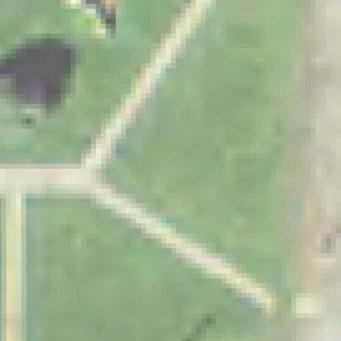
2 The purpose of this open-house public involvement meeting is to present information and solicit public comment on proposed improvements at the intersection of State Route 44 and County Road 18 (Tallmadge Road) in Rootstown Township, Portage County, Ohio. No formal presentation will be made. However, project representatives from the Ohio Department of Transportation (ODOT) are available to discuss the proposed project, environmental considerations as well as address any questions and concerns you may have regarding this proposed transportation improvement project. You are invited to comment regarding the project s design and social, economic and environmental impacts on residences, businesses and the community. In compliance with Section 106 of the National Historic Preservation Act of 1966, as amended (codified as 36 CFR 800), ODOT also requests information regarding the presence of any cultural resources in the vicinity of the project. Cultural resources include prehistoric and historic archaeological sites, historic bridges and buildings sites and historic districts. The State Route 44/Tallmadge Road intersection experiences heavy traffic volumes during peak hours with queues developing on State Route 44 contributing to congestion and rear end crashes. Between , seventeen crashes were recorded at the intersection; 9 rear end, 5 left turn, and 3 angle crashes. Fifty-three percent of all reported crashes were rear end crashes, sixty-five percent of all crashes involved injuries, and all occurred on dry pavement between 7 AM and 7 PM. Rear end crashes are likely due to congestion as they all occurred during peak times. In 2015, eleven crashes were recorded at the intersection; 5 Rear end; 4 Angle; 1 Fixed Object; and 1 Sideswipe Passing. Forty-five percent of all reported crashes were rear end crashes and forty-five percent of all crashes reported in 2015 involved injuries. Due to numerous appearances on the safety program and previous safety studies completed, several intersection improvements have been implemented over the years. These improvements include the installation of an eastbound left turn lane on Tallmadge Rd in 2004 and numerous signal improvements, which include protected/permissive left turn phases and pedestrian signal heads with pushbuttons. Proposed intersection improvements include the installation of a new southbound right turn lane on State Route 44, lengthening the existing southbound left turn lane on State Route 44 by restriping, and replacement of the existing intersection traffic control signal and appurtenances. The new signal installation will also include back plates to increase the visibility of the signal heads. The project includes installation of new curb and gutter and storm drainage along State Route 44 and pavement repair and resurfacing within the established project limits. The purpose of the proposed project is to reduce traffic congestion on State Route 44 and improve safety at the intersection of State Route 44 and Tallmadge Road in Rootstown Township, Portage County, Ohio. A preferred alternative will be selected following completion of public involvement and preliminary environmental studies. Currently, construction of the project is anticipated to begin in summer The project estimate is $490,000 with funding from federal and state sources.
3 Traffic will be maintained in each direction on State Route 44 and Tallmadge Road during pavement widening operations. However, it will be necessary to institute short duration daily lane closures to accommodate installation of a new traffic control signal and during pavement resurfacing operations. Construction and detour information will be posted prior to the start of construction and access shall be maintained to all intersecting roads and adjacent properties at all times during project construction. Various environmental studies have been or will be conducted for the proposed project. The purpose of these studies is to identify potential environmentally sensitive resources or areas of concern that may be affected by the project. Impacts to these features must be assessed and mitigated in accordance with the National Environmental Policy Act of 1969 (NEPA) and other pertinent federal, state and local regulations. Below is a summary of these studies: Cultural Resources: Section 106 of the National Historic Preservation Act of 1966 requires federal agencies to take into account the effects of their actions on historic properties. In compliance with Section 106 of the National Historic Preservation Act of 1966, as amended (codified as 36 CFR 800), ODOT requests information regarding the presence of any known cultural resources in the vicinity of the project. Cultural resources include prehistoric and historic archaeological sites, historic bridges, historic buildings, sites and districts. As part of the identification phase of the Section 106 process, a Combined Phase I/II History/Architecture Report (ODOT, 2016) was prepared for the POR intersection improvement project (PID ) study area. Three architectural properties within the project study area of potential effects (APE) were determined eligible for inclusion on the National Register of Historic Places (NRHP): 4193 Tallmadge Road (POR ); 4220 Tallmadge Road (POR ); and 4136 Tallmadge Road (POR ). The remaining architectural properties within the APE were determined not eligible for inclusion on the NRHP. The project will not require right-of-way from within the historic boundaries of the identified historic properties or otherwise result in impacts to the identified historic properties. No contributing features will be removed or altered and land from within the historic boundary of the three identified historic properties will not be incorporated into the project undertaking. On July 15, 2013, the project was coordinated with the Ohio State Historic Preservation Office (SHPO). No archaeological resources were reported in the project APE and no further archaeological investigations were recommended for the project undertaking. Based on the results the history/architecture survey, previous consultation, magnitude of the undertaking, and in accordance with 36 CFR Section 800.4(d)(1), the ODOT Office of Environmental Services (ODOT-OES) has determined a finding of no historic properties affected is applicable to the subject undertaking based on the following: No contributing features of an architectural property listed on the NRHP or eligible for listing on the NRHP will be removed or altered by the project undertaking. No further archaeological investigations are warranted due to previous disturbance and modern development.
4 Hazardous Materials/Wastes: Environmental Site Assessment (ESA) screening was performed on the project study area to determine the presence of sites with potential hazardous material concerns. This ESA Screening included a review of readily available historical land use information, regulatory database information, and a visual inspection to identify any properties within the project study area, or any adjacent properties, that would pose potential environmental concerns to the project. Four (4) sites, all likely former gasoline stations, were recommended for additional investigation in the form of a Phase I ESA. One (1) of the four (4) properties (Site 13) was identified as containing recognized environmental conditions (RECs) during the Phase I ESA process, therefore, further assessment in the form of a Phase II ESA was recommended. Based on the findings of this Phase II ESA, petroleum constituents were identified above applicable soil and groundwater action levels at Site 13. Field observations and analytical results are suggestive of a past release of gasoline at Site 13 and further recommendations for Site 13 include petroleum contaminated soils (PCS) plan notes for contaminated soil and/or groundwater encountered during construction activities; plan notes for possible underground storage tank removal as per Construction and Material Specifications (CMS) , and plan notes for low strength mortar backfill for new subsurface storm drainage at 4169 Tallmadge Road (Site No. 13). Social and Economic/Community Impacts: State Route 44 and Tallmadge Road will be improved in a positive manner with enhanced capacity and safety features. The project will not result in impacts to human health and educational facilities, recreational facilities/activities, religious institutions, public transportation, pedestrian and bicycle facilities, and/or connectivity between the neighborhoods. Coordination with police/fire/emergency medical services and other public services will continue throughout project development. Environmental Justice: Environmental Justice is defined as the fair treatment and meaningful involvement of all people regardless of race, color, national origin, or income with respect to the development, implementation and enforcement of environmental laws, regulations, and policies. There are three fundamental environmental justice principles: To avoid, minimize, or mitigate disproportionately high and adverse human health and environmental effects, including social and economic effects, on minority populations and low-income populations. To ensure the full and fair participation by all potentially affected communities in the transportation decision-making process. To prevent the denial of, reduction in, or significant delay in the receipt of benefits by minority and low-income populations. The project team is working to identify and address potential impacts to low income and minority populations through public involvement outreach efforts involving community resources/activities, local business outreach, public meetings and by addressing public comments received. Traffic Noise (analysis of traffic noise and feasibility/reasonableness of noise abatement): The project will be evaluated to ensure compliance with NEPA, the FHWA Highway Act of 1970 and the USEPA Noise Control Act, as appropriate.
5 Air Quality: The project will be evaluated to ensure compliance with the Clean Air Act, NEPA, and state plans for meeting and maintaining national ambient air quality standards, as appropriate. Ecological Resources: A Level I Ecological Survey was conducted for the project study area to determine whether the project will potentially impact wetlands, streams, aquatic and terrestrial habitats, and/or threatened and endangered species/habitats. Based on the results of the Level I Ecological Survey, the ODOT Office of Environmental services determined the project will not impact any streams, wetlands, other waters of the U.S., known populations of state or federally listed threatened or endangered species, or suitable habitat for state or federally listed species and that no further ecological coordination is required for the project. To accommodate the roadway widening and utility relocations, the purchase of additional permanent right-ofway and/or construction easements and temporary right-of-way will be required. The extent of additional rightof-way takes will be determined during the detailed design phase. ODOT operates under the Uniform Relocation Assistance and Acquisition Policies Act of 1970 and amendments of The main objective of this Act is to ensure that every effort is made to acquire the needed right-of-way in a fair and equitable manner. This Act provides advice and financial assistance to persons whose residence, business, farm, and/or non-profit organization may be acquired as part of a project. Operated in accordance with Chapter 163 of the Ohio Revised Code and Public Laws and , the Relocation Assistance Program (RAP) ensures fair and equitable treatment of each individual, family, business, farm, and non-profit organization. Basic policies have been established in this effort by the Federal Highway Administration and ODOT. All property must be appraised before acquisition is started. This is done by qualified appraisers who are familiar with real estate values in the area. Upon determination of the fair market value, an ODOT Real Estate representative will contact the owner for an appointment. At this time, the representative will explain a project to the owner and the effect of a project on the property, and will present the offer based on the appraisal, both orally and in writing. It is hoped that any needed right-of-way would be acquired through successful negotiations. However, if an agreement cannot be reached, property owners have recourse through the local judicial system where compensation will be determined by a jury, if necessary. This is a basic overview of the right-of-way procedures. It is the intent of ODOT that every effort will be made to obtain a mutual agreement with the owner and to see that the owner is justly compensated for the property. This will be accomplished by consistent and fair treatment of all owners.
6 Your comments are an important part of the planning process for this project. Comments may be spoken or submitted in writing during the public meeting or ed / mailed to: to Brian.Peck@dot.ohio.gov Brian Peck, Environmental Specialist ODOT District S. Arlington Road Akron, Ohio (Telephone: ) Please submit written comments by June 12, Project information, including this meeting handout and the meeting exhibits, will be available on the ODOT District 4 website home page: (scroll down, and select Public Meetings / Public Involvement from the list in the left margin. A summary of public comments received during the public comment period and responses to comments will be prepared and will be posted on the ODOT District 4 website.
7 OPEN HOUSE PUBLIC INVOLVEMENT MEETING Rootstown Elementary School, 4190 State Route 44, Rootstown, Ohio Thursday, May 11, :00 PM to 7:00 PM ODOT Project: POR-SR ; PID COMMENT SHEET -Please Print- Name: Address: Phone / Please write comments in the space provided below. To assist us with implementation of the project, we would like to know what you like about the project and what you think could be improved. Use additional sheets if necessary. Please return this comment sheet during the meeting, to Brian.Peck@dot.ohio.gov, or mail by Monday, June 12, 2017 to: Brian Peck, Environmental Specialist ODOT District S. Arlington Road Akron, Ohio (Telephone: ) The environmental review, consultation, and other actions required by applicable Federal environmental laws for this project are being, or have been, carried-out by ODOT pursuant to 23 U.S.C. 327 and a Memorandum of Understanding dated December 11, 2015, and executed by FHWA and ODOT. A summary of comments received and responses to comments will be prepared and posted to the ODOT District 4 website. To view the summary of public comments received and responses to comments, go to the ODOT District 4 website home page, (scroll down, and select Public Meetings / Public Involvement from the list in the left margin.


8
CHAPTER 3: IDENTIFYING SECTION 4(f) PROPERTIES
 PROPERTIES") CHAPTER 3: IDENTIFYING SECTION 4(f) PROPERTIES Section 4(f) and its provisions state that publicly owned parks, recreation areas, wildlife and waterfowl refuges, and publicly and privately owned historic
CHAPTER 3: IDENTIFYING SECTION 4(f) PROPERTIES Section 4(f) and its provisions state that publicly owned parks, recreation areas, wildlife and waterfowl refuges, and publicly and privately owned historic
PROJECT: P 0037(129)207 PCN: 039K BROWN COUNTY. S.D. Highway 37 From Aspen Ave to U.S. Highway 12 in Groton
207 PCN: 039K BROWN COUNTY. S.D. Highway 37 From Aspen Ave to U.S. Highway 12 in Groton") Public Meeting/ Open House September 4, 2014 PROJECT: P 0037(129)207 PCN: 039K BROWN COUNTY S.D. Highway 37 From Aspen Ave to U.S. Highway 12 in Groton Grading, Storm Sewer, Curb & Gutter, Sidewalk, Roadway
Public Meeting/ Open House September 4, 2014 PROJECT: P 0037(129)207 PCN: 039K BROWN COUNTY S.D. Highway 37 From Aspen Ave to U.S. Highway 12 in Groton Grading, Storm Sewer, Curb & Gutter, Sidewalk, Roadway
DESIGN PUBLIC HEARING
 DESIGN PUBLIC HEARING October 25, 2016 AT STEVENS MEMORIAL LIBRARY 345 MAIN STREET NORTH ANDOVER, MASSACHUSETTS 7:00 PM FOR THE PROPOSED Chickering Road (Route 125) & Massachusetts Avenue Intersection
The University of Texas System Systemwide Policy. Policy: UTS Title. Environmental Review for Acquisition of Real Property. 2.
 1. Title 2. Policy Environmental Review for Acquisition of Real Property Sec. 1 Sec. 2 Policy Statement. It is the policy of The University of Texas System to minimize its potential for exposure to claims
PROJECT NH 0050(99)381 PCN 6926 YANKTON COUNTY. SD HWY 50 (4 th Street) from Broadway Ave to Archery Road in Yankton, SD
381 PCN 6926 YANKTON COUNTY. SD HWY 50 (4 th Street) from Broadway Ave to Archery Road in Yankton, SD") Public Meeting/ Open House April 4, 2013 PROJECT NH 0050(99)381 PCN 6926 YANKTON COUNTY SD HWY 50 (4 th Street) from Broadway Ave to Archery Road in Yankton, SD Grading, PCC Pavement, Asphalt Concrete
Public Meeting/ Open House April 4, 2013 PROJECT NH 0050(99)381 PCN 6926 YANKTON COUNTY SD HWY 50 (4 th Street) from Broadway Ave to Archery Road in Yankton, SD Grading, PCC Pavement, Asphalt Concrete
CITY OF FORT COLLINS NATURAL AREAS AND CONSERVED LANDS EASEMENT POLICY
 CITY OF FORT COLLINS NATURAL AREAS AND CONSERVED LANDS EASEMENT POLICY Adopted January 3, 2012 PURPOSE: The purpose of the policy statement is to clarify the policies and procedures of the City of Fort
DESIGN PUBLIC HEARING JANUARY 12, 2017 TOWN HALL SULLIVAN MEETING ROOM 558 SOUTH MAIN STREET RAYNHAM, MASSACHUSETTS 7:00 PM FOR THE PROPOSED
 DESIGN PUBLIC HEARING JANUARY 12, 2017 AT TOWN HALL SULLIVAN MEETING ROOM 558 SOUTH MAIN STREET RAYNHAM, MASSACHUSETTS 7:00 PM FOR THE PROPOSED REPLACEMENT OF BRIDGE NO. R-02-013 US ROUTE 44 OVER STATE
DESIGN PUBLIC HEARING NOVEMBER 15, 2017 CARLTON M. VIVEIROS ELEMENTARY SCHOOL COMMUNITY ROOM 525 SLADE STREET FALL RIVER, MA :00 PM
 DESIGN PUBLIC HEARING NOVEMBER 15, 2017 AT CARLTON M. VIVEIROS ELEMENTARY SCHOOL COMMUNITY ROOM 525 SLADE STREET FALL RIVER, MA 02724 7:00 PM FOR THE PROPOSED CARLTON M. VIVEIROS ELEMENTARY SCHOOL SAFE
PROJECTS: P 0083(74)56; 036E; JONES COUNTY NH 0083(79)45; 04E7; MELLETTE COUNTY NH 0083(80)44; 04E8; MELLETTE COUNTY
56; 036E; JONES COUNTY NH 0083(79)45; 04E7; MELLETTE COUNTY NH 0083(80)44; 04E8; MELLETTE COUNTY") Public Meeting/ Open House October 16, 2014 PROJECTS: P 0083(74)56; 036E; JONES COUNTY NH 0083(79)45; 04E7; MELLETTE COUNTY NH 0083(80)44; 04E8; MELLETTE COUNTY U.S. Highway 83 From White River to South
Public Meeting/ Open House October 16, 2014 PROJECTS: P 0083(74)56; 036E; JONES COUNTY NH 0083(79)45; 04E7; MELLETTE COUNTY NH 0083(80)44; 04E8; MELLETTE COUNTY U.S. Highway 83 From White River to South
DESIGN PUBLIC HEARING JULY 7, 2016 CITY COUNCIL HEARING ROOM, FIRST FLOOR ONE GOVERNMENT CENTER FALL RIVER, MASSACHUSETTS 6:30 PM FOR THE PROPOSED
 DESIGN PUBLIC HEARING JULY 7, 2016 AT CITY COUNCIL HEARING ROOM, FIRST FLOOR ONE GOVERNMENT CENTER FALL RIVER, MASSACHUSETTS 6:30 PM FOR THE PROPOSED AIRPORT ROAD OVER ROUTE 24, BRIDGE DECK REPLACEMENT
Welcome to the Location Public Hearing for Highway 89 Improvements
 Welcome to the Location Public Hearing for Highway 89 Improvements AHTD Job 080457 April 6, 2017 How do I get involved? Please sign in at the registration table. Gather information, view the displays,
State, County, or Municipal Agency or instrumentality thereof, applying for authorization
 Application for Project Authorization Under the New Jersey Register of Historic Places Act NJ Department of Environmental Protection Natural & Historic Resources Historic Preservation Office Date September
DESIGN PUBLIC HEARING FEBRUARY 28, 2018 KENNEDY MIDDLE SCHOOL, AUDITORIUM SPRINGFIELD, MASSACHUSETTS 6:30 PM FOR THE PROPOSED
 DESIGN PUBLIC HEARING FEBRUARY 28, 2018 AT KENNEDY MIDDLE SCHOOL, AUDITORIUM SPRINGFIELD, MASSACHUSETTS 6:30 PM FOR THE PROPOSED BAY STREET AND BERKSHIRE AVENUE INTERSECTION IMPROVEMENTS PROJECT NO. 608411
FINDING OF NO SIGNIFICANT IMPACT TENNESSEE VALLEY AUTHORITY DISPOSAL FEE OWNERSHIP OF YELLOW CREEK INDUSTRIAL PARK PROPERTIES
 FINDING OF NO SIGNIFICANT IMPACT TENNESSEE VALLEY AUTHORITY DISPOSAL FEE OWNERSHIP OF YELLOW CREEK INDUSTRIAL PARK PROPERTIES In 1971, the Tennessee Valley Authority (TVA) partnered with the Mississippi
TOWN OF BRISTOL. Ontario County, New York APPLICATION FOR LOT LINE ADJUSTMENT
 TOWN OF BRISTOL Ontario County, New York APPLICATION FOR LOT LINE ADJUSTMENT Lot Line Adjustment: The adjusting of common property line(s) or boundaries between adjacent lots, tracts, or parcels for the
5.5 Relocations and Displacements
 I-70 East Supplemental Draft EIS 5.5 Relocations and Displacements 5.5 Relocations and Displacements This section investigates the impacts to residential units, businesses, and non-profit associations
DESIGN PUBLIC HEARING MAY 18, 2017 GROVELAND TOWN HALL GROVELAND, MASSACHUSETTS 7:00PM FOR THE PROPOSED
 DESIGN PUBLIC HEARING MAY 18, 2017 AT GROVELAND TOWN HALL GROVELAND, MASSACHUSETTS 7:00PM FOR THE PROPOSED GROVELAND COMMUNITY TRAIL PROJECT Roadway Project Management Section IN THE TOWN OF GROVELAND,
Project NH 0018(179)402 PCN 036L Hutchinson and Turner County. US18 From US81 to SD19. Grading, Structure (Bridge), and Interim Surfacing
402 PCN 036L Hutchinson and Turner County. US18 From US81 to SD19. Grading, Structure (Bridge), and Interim Surfacing") Public Meeting/ Open House 2/12/2015 Project NH 0018(179)402 PCN 036L Hutchinson and Turner County US18 From US81 to SD19 Grading, Structure (Bridge), and Interim Surfacing The South Dakota Department
Public Meeting/ Open House 2/12/2015 Project NH 0018(179)402 PCN 036L Hutchinson and Turner County US18 From US81 to SD19 Grading, Structure (Bridge), and Interim Surfacing The South Dakota Department
5.5 Relocations and Displacements
 I-70 East Final EIS 5.5 Relocations and Displacements 5.5 Relocations and Displacements This section investigates the impacts from the project alternatives resulting from land acquisition of residential
Ruth M. Borrelli Nevada Department of Transportation Chief Right-of-Way Agent
 Ruth M. Borrelli Nevada Department of Transportation Chief Right-of-Way Agent The 5 th Amendment to the US Constitution states... nor shall private property be taken for public use, without just compensation.
Welcome to the Location & Design Public Hearing for: Baymont Inn & Suites, Lake Hamilton, Arkansas Thursday, June 25, How do I become involved?
 Welcome to the Location & Design Public Hearing for: AHTD JOB NO. 060432 HIGHWAY 7 WIDENING HIGHWAY 290-OUACHITA RIVER BRIDGE Baymont Inn & Suites, Lake Hamilton, Arkansas Thursday, June 25, 2015 How do
Boot Camp Breakout Session #3. September 19, 2018 Carolyn France Moderator Transportation Alternatives Program Manager, Central Office
 Boot Camp Breakout Session #3 September 19, 2018 Carolyn France Moderator Transportation Alternatives Program Manager, Central Office Environmental Overview Kevin Bradley Lynchburg District Environmental
DESIGN PUBLIC HEARING FEBRUARY 9, ABIGAIL ADAMS MIDDLE SCHOOL Auditorium WEYMOUTH, MASSACHUSETTS 7:00 PM FOR THE PROPOSED
 DESIGN PUBLIC HEARING FEBRUARY 9, 2012 AT ABIGAIL ADAMS MIDDLE SCHOOL Auditorium WEYMOUTH, MASSACHUSETTS 7:00 PM FOR THE PROPOSED FORE RIVER BRIDGE REPLACEMENT ROUTE 3A (WASHINGTON STREET/BRIDGE STREET)
1.1 Purpose. The purpose of this chapter is to summarize guidance on those requirements generally applicable to grant programs.
 523 FW 1 Summary FWM#: 061 (new) Date: December 17, 1992 Series: State Grant Programs Part 523: Federal Aid Compliance Requirements Originating Office: Division of Federal Aid 1.1 Purpose. The purpose
Purpose of the Public Hearing
 Purpose of the Public Hearing To provide you with Information on the proposed sidewalk project(s) Opportunities to review plans and exhibits The ability to ask questions and get answers about each project
FM 1626 Public Hearing - January 14, 2016
 FM 1626 Public Hearing - January 14, 2016 Travis County, in conjunction with the Texas Department of Transportation (TxDOT), welcomes you to tonight s public hearing concerning proposed improvements to
ENVIRONMENTAL SITE ASSESSMENT (AAI COMPLIANT PHASE I)
") ENVIRONMENTAL SITE ASSESSMENT (AAI COMPLIANT PHASE I) IPP.MORELAND AVENUE ASSEMBLAGE 785-793 MORELAND AVENUE ATLANTA, GEORGIA, 30316 ONE GROUP PROJECT #A6092 JANUARY 28, 2008 PREPARED FOR: FAIRVIEW COMMERCIAL
ENVIRONMENTAL SITE ASSESSMENT (AAI COMPLIANT PHASE I) IPP.MORELAND AVENUE ASSEMBLAGE 785-793 MORELAND AVENUE ATLANTA, GEORGIA, 30316 ONE GROUP PROJECT #A6092 JANUARY 28, 2008 PREPARED FOR: FAIRVIEW COMMERCIAL
PUBLIC HEARING FM 2499 Section 4
 PUBLIC HEARIG FM 2499 Section 4 From FM 47 to FM 2181 October 4, 2 University of orth Texas Coliseum 6 orth Texas Boulevard Denton, Texas Tonight s Agenda Purpose of Tonight s Hearing Welcome & Introduction
Programmatic Agreement for Minor Transportation Projects. Operating Procedures
 Programmatic Agreement for Minor Transportation Projects Operating Procedures PennDOT Bureau of Environmental Quality Revised June 8, 1999 Table of Contents I. Overview 3 II. Introduction 6 III. Whereas
I-820 / SH 121 INTERCHANGE IN NE TARRANT COUNTY
 / SH 121 INTERCHANGE IN NE TARRANT COUNTY / SH 121 Interchange Public Hearing October 5, 2017 1 PUBLIC HEARING / SH 121 INTERCHANGE from approximately 2,000 feet north of Pipeline Road/Glenview Drive to
Land Use Application
 Land Use Application Check all permits you are applying for in the boxes provided. Submit this application form, the applicable materials listed in the corresponding permit application packet(s) and application
PUBLIC INFORMATION MEETING JULY 19, 2017 HOLYOKE COMMUNITY COLLEGE KITTREDGE CENTER HOLYOKE, MASSACHUSETTS 7:00 PM FOR THE PROPOSED
 PUBLIC INFORMATION MEETING JULY 19, 2017 AT HOLYOKE COMMUNITY COLLEGE KITTREDGE CENTER HOLYOKE, MASSACHUSETTS 7:00 PM FOR THE PROPOSED Improvements to Lower Westfield Road on I-91 (Interchange 15) Project
ARTICLE 23 CONDOMINIUM STANDARDS
 ARTICLE 23 CONDOMINIUM STANDARDS Section 23.01 Intent. The intent of this Article is to provide regulatory standards for condominiums and site condominiums similar to those required for projects developed
RIGHT OF WAY DATA SHEET (Form #)
") STATE OF CALIFORNIA DEPARTMENT OF TRANSPORTATION RIGHT OF WAY DATA SHEET (Form #) Date 07/16/2015 Dist 03 Co PLA Rte 80 P/M 0.1/2.2 and 4.1/6.0 EA 03-3F230 EXHIBIT 4-EX-1 (REV 3/2004) Page 1 of 6 Project
STATE OF CALIFORNIA DEPARTMENT OF TRANSPORTATION RIGHT OF WAY DATA SHEET (Form #) Date 07/16/2015 Dist 03 Co PLA Rte 80 P/M 0.1/2.2 and 4.1/6.0 EA 03-3F230 EXHIBIT 4-EX-1 (REV 3/2004) Page 1 of 6 Project
Right of Way Acquisition
 Right of Way Acquisition LPA Days Scott Recker, Realty Specialist Manager Shell Miller, Real Estate Administrator R/W DESIGN PHASE R/W Plan Manual LPA RX forms for legal descriptions Designer to use R/W
Public Notice U.S. ARMY CORPS OF ENGINEERS, GALVESTON DISTRICT AND TEXAS COMMISSION ON ENVIRONMENTAL QUALITY
 Public Notice U.S. Army Corps Permit Application No: SWG-2016-00384 Of Engineers Date Issued: 27 December 2018 Galveston District Comments Due: 29 January 2019 U.S. ARMY CORPS OF ENGINEERS, GALVESTON DISTRICT
ARTICLE 24 SITE PLAN REVIEW
 ARTICLE 24 SITE PLAN REVIEW 24.1 PURPOSE: The intent of these Ordinance provisions is to provide for consultation and cooperation between the land developer and the Township Planning Commission in order
content chapter Section 4(f) Parks, Recreation Areas, Historic Sites, Wildlife and Waterfowl Refuges
 Parks, Recreation Areas, Historic Sites, Wildlife and Waterfowl Refuges") chapter Section 4(f) Parks, Recreation Areas, Historic Sites, Wildlife and Waterfowl Refuges 22 content 22.1 Summary of Key Legislation, Regulations, and Guidance 22.2 Agency Roles 22.3 General Methodology
chapter Section 4(f) Parks, Recreation Areas, Historic Sites, Wildlife and Waterfowl Refuges 22 content 22.1 Summary of Key Legislation, Regulations, and Guidance 22.2 Agency Roles 22.3 General Methodology
ENFORCEMENT POLICY INCLUDING INDUSTRIAL AND COMMERCIAL ACTIVITIES DISCHARGE MANAGEMENT
 ENFORCEMENT POLICY INCLUDING INDUSTRIAL AND COMMERCIAL ACTIVITIES DISCHARGE MANAGEMENT 1.0 Re: NPDES Permit Requirements Permit No. HI S000001 Under the requirements of the Oahu Municipal Separate Storm
Phase I Environmental Site Assessments for Corridors
 Phase I Environmental Site Assessments for Corridors Prepared by: Kimberly Perkins and Jill Biesma 1 Environmental Advisors and Engineers 19211 W. 64 th Terrace, Shawnee, KS 66218 (913) 599-4326 Goal Of
RELOCATION ASSISTANCE PROGRAM (RAP) BOOKLET THE 10 MINUTE MANAGER
 BOOKLET THE 10 MINUTE MANAGER") RELOCATION ASSISTANCE PROGRAM (RAP) BOOKLET THE 10 MINUTE MANAGER WHAT IS THE 10 MINUTE MANAGER? The 10 Minute Manager is an overview of the much more detailed Relocation Assistance Handbook (insert link)
RELOCATION ASSISTANCE PROGRAM (RAP) BOOKLET THE 10 MINUTE MANAGER WHAT IS THE 10 MINUTE MANAGER? The 10 Minute Manager is an overview of the much more detailed Relocation Assistance Handbook (insert link)
Town of Lisbon, Maine SUBDIVISION REVIEW APPLICATION
 Date Received: Fee Paid (amount): Applicant: Town of Lisbon, Maine SUBDIVISION REVIEW APPLICATION Subdivision Name/Title: This application must be received at the Town Office by close of business on the
Section 4(f) Why don t we build the road through this green space over here?
 Why don t we build the road through this green space over here?") Section 4(f) Why don t we build the road through this green space over here? Objectives Section 4(f) What is Section 4(f)? understand the basics of the law and applicability; Is this a Section 4(f) situation?--develop
Section 4(f) Why don t we build the road through this green space over here? Objectives Section 4(f) What is Section 4(f)? understand the basics of the law and applicability; Is this a Section 4(f) situation?--develop
3.3 Acquisitions and Displacements/Relocations
 Chapter 3 Social Effects 3.3 Acquisitions and Displacements/Relocations This section discusses property displacements, relocations, and acquisitions (partial or full) that might occur due to implementation
Preliminary Subdivision Application (Minor) (Three (3) lots or less)
 (Three (3) lots or less)") Gunnison City Offices www.gunnisoncity.org 38 West Center Gunnison, Utah 84634 (435) 528 7969 Date of Application: Preliminary Subdivision Application (Minor) (Three (3) lots or less) APPLICANT INFORMATION
Gunnison City Offices www.gunnisoncity.org 38 West Center Gunnison, Utah 84634 (435) 528 7969 Date of Application: Preliminary Subdivision Application (Minor) (Three (3) lots or less) APPLICANT INFORMATION
Short Title: Performance Guarantees/Subdivision Streets. (Public) April 28, 2016
 April 28, 2016") GENERAL ASSEMBLY OF NORTH CAROLINA SESSION S SENATE BILL Transportation Committee Substitute Adopted // House Committee Substitute Favorable // Fourth Edition Engrossed // Short Title: Performance Guarantees/Subdivision
GENERAL ASSEMBLY OF NORTH CAROLINA SESSION S SENATE BILL Transportation Committee Substitute Adopted // House Committee Substitute Favorable // Fourth Edition Engrossed // Short Title: Performance Guarantees/Subdivision
Tiered Environmental Review Format (2017)
") Tiered Environmental Review Format (2017) This tiered review format [per 24CFR 58.15] is designed to be used for activities that are categorically excluded [per 24CFR 58.35(a)] subject to the laws and
Tiered Environmental Review Format (2017) This tiered review format [per 24CFR 58.15] is designed to be used for activities that are categorically excluded [per 24CFR 58.35(a)] subject to the laws and
Displacement and Relocation A. INTRODUCTION B. METHODOLOGY
 Appendix F: Displacement and Relocation A. INTRODUCTION This appendix provides additional information to support the analyses provided in Chapter 8, Displacement and Relocation. The focus of Chapter 8,
SITE PLAN REVIEW PROCEDURES SECTION DEVELOPMENTS REQUIRING SITE PLAN APPROVAL
 SECTION 22.01 PURPOSE ARTICLE XXII PROCEDURES The purpose of this Article is to establish uniform requirements of procedure for all developments in the Township. Certain specific types of minor development
Interstate I-10/County Road 255 Madison County, Florida 32341
 Love s Truck Stop Red Onion Truck Stop Interstate I-10/County Road 255 Madison County, Florida 32341 Property Features 57.73 Acres Zoning: Mixed Use Tax ID: 261S101316002004, 261S121316002000 & 261S101316002003
SITE PLAN REVIEW ADMINISTRATIVE REVIEW. Please Note: Once submitted to the County, all application materials become a matter of public record.
 200 W. Oak Street, 3rd Floor Fort Collins, CO 80521 (970) 498-7683 / larimer.org/planning SITE PLAN REVIEW ADMINISTRATIVE REVIEW The submittal requirements listed in this packet are intended to collect
5. That the Owner shall agree that all development Blocks shown within the Draft Plan will be connected to full municipal services.
 Conditions Relating to Draft Plan of Subdivision Approval East Fonthill 26T 01014 (Draft Plan dated December 1, 2013, and revised August 28, 2014), the Town of Pelham 1. This approval applies to the Draft
Evaluating and Processing Road and Utility Easement Proposals on Corps Lands and Flowage Easements
 Evaluating and Processing Road and Utility Easement Proposals on Corps Lands and Flowage Easements Don Wiese Natural Resources Manager Fort Worth District September 13, 2017 US Army Corps of Engineers
DOUGLAS COUNTY SUBDIVISION RESOLUTION Article 4 Preliminary Plan 10/13/2015
 ARTICLE 4 PRELIMINARY PLAN 401 Intent An in-depth analysis of the proposed subdivision, including a review of the design considering the ability to obtain water and sanitation, identified geologic hazards,
Phase I Environmental Site Assessment Update Memorandum Vacant Property 1585 Santa Clara Avenue Santa Ana, California 92507
 March 1, 2011 Mr. Vincent C. Fregoso, AICP City of Santa Ana 20 Civic Center Plaza Santa Ana, CA 92702 Re: Phase I Environmental Site Assessment Update Memorandum Vacant Property 1585 Santa Clara Avenue
Medical Marijuana Special Exception Use Information
 Medical Marijuana Special Exception Use Information The Special Exception Use information below is a modified version of the Unified Development Code. It clarifies the current section 5:104 Special Exceptions
MINOR BOUNDARY LINE ADJUSTMENT PROCESS GUIDE
 MINOR BOUNDARY LINE ADJUSTMENT PROCESS GUIDE Clear Creek County Planning Department P.O. Box 2000 Georgetown, Colorado 80444 (303) 679-2436 phone (303) 569-1103 fax 1 PURPOSE To establish criteria and
CHAPTER 10 Planned Unit Development Zoning Districts
 CHAPTER 10 Planned Unit Development Zoning Districts Section 10.1 Intent and Purpose The Planned Unit Development (PUD) districts are intended to offer design flexibility for projects that further the
Due Diligence for Property Acquisitions
 Due Diligence for Property Acquisitions Presenters: Mary Guinee Principal, Due Diligence Services Ray Sinagra, AIA Sr. Project Manager, Property Condition Assessment Services April 28, 2009 Conference
CHECKLIST FOR DEVELOPMENT REVIEW
 CHECKLIST FOR DEVELOPMENT REVIEW Petitions and related documents and plans for land development or other proposals regulated by Title 16 of the Municipal Code (Development Ordinance) and Title 17 of the
Application Procedures for Easements or Rights of Way on City of Fort Collins Natural Areas and Conserved Lands March 2012
 Application Procedures for Easements or Rights of Way on City of Fort Collins Natural Areas and Conserved Lands March 2012 IMPORTANT NOTE: This document was created to accompany the City of Fort Collins
Preliminary Subdivision Application (Major) (Four (4) lots or more)
 (Four (4) lots or more)") Gunnison City Offices www.gunnisoncity.org 38 West Center Gunnison, Utah 84634 (435) 528 7969 Date of Application: Preliminary Subdivision Application (Major) (Four (4) lots or more) APPLICANT INFORMATION
Gunnison City Offices www.gunnisoncity.org 38 West Center Gunnison, Utah 84634 (435) 528 7969 Date of Application: Preliminary Subdivision Application (Major) (Four (4) lots or more) APPLICANT INFORMATION
Guide to Combined Preliminary and Final Plats
 Guide to Combined Preliminary and Final Plats Introduction The Douglas County is committed to providing open, transparent application processes to the public. This Guide is provided to assist anyone interested
TOWN OF WHITBY REPORT RECOMMENDATION REPORT
 TOWN OF WHITBY REPORT RECOMMENDATION REPORT REPORT TO: Planning and Development Committee REPORT NO: PL 4-08 DATE OF MEETING: January 21, 2008 FILE NO(S): MI-01-07 (SW- 2002-03) PREPARED BY: Planning Department
APPENDIX B. SUBMISSION REQUIREMENTS
 Master Major Site Minor Site Landscape Section B.1 Table of /Plat Requirements Proposed or approved name of development, project, subdivision, and/or phase. Location, including township, county, and state.
SUBDIVISION DESIGN PRINCIPLES AND STANDARDS
 SECTION 15-200 SUBDIVISION DESIGN PRINCIPLES AND STANDARDS 15-201 STREET DESIGN PRINCIPLES 15-201.01 Streets shall generally conform to the collector and major street plan adopted by the Planning Commission
content chapter Section 6(f) Land and Water Conservation Fund Areas 23.1 Summary of Key Legislation, Regulations, and Guidance 23.
 Land and Water Conservation Fund Areas 23.1 Summary of Key Legislation, Regulations, and Guidance 23.") chapter 23 Section 6(f) Land and Water Conservation Fund Areas content 23.1 Summary of Key Legislation, Regulations, and Guidance 23.2 Agency Roles 23.3 General Methodology for Evaluation 23.4 Format and
chapter 23 Section 6(f) Land and Water Conservation Fund Areas content 23.1 Summary of Key Legislation, Regulations, and Guidance 23.2 Agency Roles 23.3 General Methodology for Evaluation 23.4 Format and
Grand Mesa, Uncompahgre and Gunnison National Forests Region 2, USDA Forest Service
 Decision Memo Taylor River Land Exchange Under the General Exchange Act of March 20, 1922 as Amended, The Federal Land Policy and Management Act of 1976 as Amended and the Federal Land Exchange Facilitation
Robert Street Gateway, West St. Paul, Minnesota. A Premier Development Opportunity at the Gateway to West St. Paul and Dakota County
 Robert Street Gateway, West St. Paul, Minnesota A Premier Development Opportunity at the Gateway to West St. Paul and Dakota County Robert Street Gateway, West St. Paul, Minnesota A Premier Development
Record of Decision Mt. Hood National Forest Geothermal Leases August Record of Decision. Mt. Hood National Forest Geothermal Leases
 Summary Record of Decision Mt. Hood National Forest Geothermal Leases USDA Forest Service Mt. Hood National Forest Hood River and Barlow Ranger Districts Hood River County, Oregon It is my recommendation
TOWNSHIP SERVICES POLICY PREPARED BY: ALAN BRUBAKER, P.E., P.S. SUMMIT COUNTY ENGINEER
 TOWNSHIP SERVICES POLICY PREPARED BY: ALAN BRUBAKER, P.E., P.S. SUMMIT COUNTY ENGINEER ISSUED JUNE 8, 2011 Summit County Engineer Policy for Township Services The Summit County Engineer endeavors to provide
ARTICLE XI - CONSERVATION SUBDIVISIONS
 ARTICLE XI - CONSERVATION SUBDIVISIONS Section 1101: Purpose and Intent. This Article is intended to provide for residential subdivisions that are designed based first and foremost on the preservation
ORDINANCE NO. 41. PRIVATE ROAD ORDINANCE As Amended Through April 10, 2008
 ORDINANCE NO. 41 PRIVATE ROAD ORDINANCE As Amended Through April 10, 2008 An Ordinance to protect the health, safety, and general welfare of the inhabitants of Port Sheldon Township. The Township of Port
Submittal of the Minutes from the March 9, 2011, April 5, 2011, and April 19, 2011 Cabinet Meetings.
 AGENDA BOARD OF TRUSTEES OF THE INTERNAL IMPROVEMENT TRUST FUND JUNE 16, 2011 Attachments to the items below can be viewed at the following link: http://www.dep.state.fl.us/secretary/cab/public_notices.htm
PLANNED UNIT DEVELOPMENT (East), PLANNED UNIT DEVELOPMENT (West) STAFF REPORT Date: September 18, 2014
, PLANNED UNIT DEVELOPMENT (West) STAFF REPORT Date: September 18, 2014") PLANNED UNIT DEVELOPMENT (East), PLANNED UNIT DEVELOPMENT (West) STAFF REPORT Date: September 18, 2014 DEVELOPMENT NAME LOCATION McGowin Park, LLC PLANNED UNIT DEVELOPMENT (East) 1401 Satchel Paige Drive
PLANNED UNIT DEVELOPMENT (East), PLANNED UNIT DEVELOPMENT (West) STAFF REPORT Date: September 18, 2014 DEVELOPMENT NAME LOCATION McGowin Park, LLC PLANNED UNIT DEVELOPMENT (East) 1401 Satchel Paige Drive
Town of Shelburne, Vermont
 Town of Shelburne, Vermont CHARTERED 1763 P.O. BOX 88 5420 SHELBURNE ROAD SHELBURNE, VT 05482 www.shelburnevt.org 802-985-5118 * * Also available in alternate formats in accordance with the Americans With
MAJOR BOUNDARY LINE ADJUSTMENT PROCESS GUIDE
 MAJOR BOUNDARY LINE ADJUSTMENT PROCESS GUIDE Clear Creek County Planning Department P.O. Box 2000 Georgetown, Colorado 80444 (303) 679-2436 - phone (303) 569-1103 - fax PURPOSE To establish criteria and
6.5 LAND AND WATER CONSERVATION FUND ACT SECTION
 along the Trinity River Corridor are given the opportunity to review and comment upon them. The proposed project would be required to obtain a CDC from the floodplain/cdc administrators of Dallas and Irving.
Rule 80. Preservation of Primary Agricultural Soils Revised and approved by the Land Use Panel during its public meeting on January 31, 2006.
 Rule 80. Preservation of Primary Agricultural Soils Revised and approved by the Land Use Panel during its public meeting on January 31, 2006. (A) Purpose. In accordance with 10 V.S.A. Sections 6025(b)
Commercial Land Development
 Commercial Land Development A Basic Step-by-Step Guide by Ida Buckles, P.E. Introduction This course presents basic steps in the development of a parcel of land for commercial purposes. At the completion
BYRON TOWNSHIP ZONING APPLICATION
 BYRON TOWNSHIP ZONING APPLICATION Phone: (616) 878-9104 * Fax: (616) 878-3980 * Website: www.byrontownship.org This application will not be accepted if incomplete. APPLICATION FOR & REQUIRED COPIES Private
NATIONAL HISTORIC PRESERVATION ACT, SECTION 106 PROGRAMMATIC AGREEMENT AMONG
 NATIONAL HISTORIC PRESERVATION ACT, SECTION 106 PROGRAMMATIC AGREEMENT AMONG THE DEPARTMENT OF TRANSPORTATION FEDERAL HIGHWAY ADMINISTRATION, VIRGINIA DIVISION; THE VIRGINIA STATE HISTORIC PRESERVATION
GLOSSARY. Acquisition The process of obtaining right of way necessary to construct or support your project.
 GLOSSARY Access Rights Power of Government to restrict/control a property owner s right to create entrances and exits on a public road. After a roadway is designed, built, and in use, there will be instances
STAFF REPORT. To: Planning Commission Meeting date: January 11, 2017 Item: UN Prepared by: Marc Jordan. Schoolhouse Development, LLC
 STAFF REPORT # 9 ) UN-05-17 AMERICAN LEADERSHIP ACADEMY SPECIAL USE PERMIT CHARTER SCHOOL PUBLIC HEARING To: Planning Commission Meeting date: January 11, 2017 Item: UN-05-17 Prepared by: Marc Jordan GENERAL
City of Peachtree City. Annexation Review Process
 City of Peachtree City Annexation Review Process Page 1 Annexation Review Process Step One: Initial annexation information The following information is to be completed by the property owner and/ or their
PACIFIC REGION LAND ACQUISITION REQUIREMENTS
 PACIFIC REGION LAND ACQUISITION REQUIREMENTS The following is an outline of the filing requirements for tribal land acquisition requests and timeframes involved for various steps of the process: 1) All
TABLE OF CONTENTS General Legal Authority for Certification of Right of Way Control 24-2
 TABLE OF CONTENTS 2400 CERTIFICATION OF RIGHT OF WAY CONTROL PAGE 2401 General 24-1 2402 Legal Authority for Certification of Right of Way Control 24-2 2403 Right of Way Certification and Advertising for
Welcome! Sarpy Transmission Project. Public Hearing October 23, 2018
 Welcome! Sarpy Transmission Project Public Hearing October 23, 2018 Agenda Safety Introductions Purpose of Hearing Explain the project need Present the project timeline Describe rights of each property
5. Land Acquisition and Displacement
 Northern Branch Corridor SDEIS March 2017 5. Land Acquisition and Displacement 5.1. Chapter Overview 5.1.1. Introduction Implementation of the Preferred Alternative would require the acquisition of property
EASEMENT AGREEMENT. hereinafter called Grantor, (whether grammatically singular or plural) and the:
 and the:") EASEMENT AGREEMENT THIS EASEMENT AGREEMENT, made and entered into as of the day of,, by and between: hereinafter called Grantor, (whether grammatically singular or plural) and the: hereinafter called Distributor.
EASEMENT AGREEMENT THIS EASEMENT AGREEMENT, made and entered into as of the day of,, by and between: hereinafter called Grantor, (whether grammatically singular or plural) and the: hereinafter called Distributor.
until amended, superseded, or rescinded.
 U.S. Department of Housing and Urban Development Community Planning and Development Special Attention of: Notice: CPD-13-05 All Regional Administrators All CPD Division Directors Issued: July 30, 2013
PUBLIC HEARING. Loop 88 Segment 3 Thursday, October 12, 2017 Lubbock-Cooper Performing Arts Center at 6:00p.m. Date. Footer Text
 PUBLIC HEARING Loop 88 Segment 3 Thursday, October 12, 2017 Lubbock-Cooper Performing Arts Center at 6:00p.m. KYLAN FRANCIS, P.E. Director of Transportation Planning & Development Convene Public Hearing
Plan nt Plan Filing and
 PARISH OF ASCENSION OFFICE OF PLANNING AND DEVELOPMENT PLANNING DEPARTMENT APPENDIX VI PLANNED UNIT DEVELOPMENT (PUD) CODE Contents: 17-601. General Purpose: Procedures... 3 17-602. General Character:...
IRS FORM 8283 SUPPLEMENTAL STATEMENT DONATION OF CONSERVATION EASEMENT
 Name(s) shown on income tax return Identifying Number Robert T. Landowner 021-34-1234 Susan B. Landowner 083-23-5555 IRS FORM 8283 SUPPLEMENTAL STATEMENT DONATION OF CONSERVATION EASEMENT On November 12,
SECTION B - GUIDELINES
 SECTION B - GUIDELINES APPLICATION KIT FOR SUBDIVISION RESOURCE CONSENT UNDER SECTION 88 OF THE RESOURCE MANAGEMENT ACT 1991 CONTENTS: PLEASE READ AND COMPLETE 1. Making an Application for a Subdivision
SECTION 23 PLANNED RESIDENTIAL DEVELOPMENT FOR ELDERLY PERSONS
 SECTION 23 PLANNED RESIDENTIAL DEVELOPMENT FOR ELDERLY PERSONS 23.1 General: In order to provide for the special needs of elderly and handicapped persons who may require multifamily type living accommodations,
M-43 CORRIDOR OVERLAY ZONE
 ARTICLE 26.00 M-43 CORRIDOR OVERLAY ZONE Section 26.01 Findings A primary function of the M-43 state highway is to move traffic through the Township and to points beyond. As the primary east-west arterial
SEQRA (For Land Surveyors) Purpose of this Presentation
 Purpose of this Presentation") SEQRA (For Land Surveyors) Purpose of this Presentation Understand the basics and legal requirements of SEQRA Recognize the role that Land Surveyors play in the SEQRA Identify the problems posed by SEQRA
SEQRA (For Land Surveyors) Purpose of this Presentation Understand the basics and legal requirements of SEQRA Recognize the role that Land Surveyors play in the SEQRA Identify the problems posed by SEQRA
JEFFERSON COUNTY, ALABAMA
 JEFFERSON COUNTY, ALABAMA Major Development Checklist, Notes and Information A Major Development is any proposed new structure or addition to an existing structure which will cause a change in the topography
CITY OF PETALUMA HOUSING PROGRAM REQUEST FOR PROPOSALS FY
 CITY OF PETALUMA HOUSING PROGRAM REQUEST FOR PROPOSALS FY 2018-2019 I. INTRODUCTION The City of Petaluma has two sources of revenue for the purpose of providing funds to assist the City in meeting the