Tool for Land Consolidation
|
|
|
- Scarlett Underwood
- 6 years ago
- Views:
Transcription


 Demetris")
, MSc (Eng.")
1 LandSpaCES * : A Spatial Planning The Empowerment of Local Authorities: Spatial Information and Spatial Planning Tools October, Paris, France Tool for Land Consolidation Demetris Demetriou **, John Stillwell, Linda See Centre for Spatial Analysis and Policy School of Geography (LandSpaCES * = Land Spatial Consolidation Expert System) Demetris Demetriou **, District Land Consolidation Officer of Larnaca and Famagusta, Cyprus Dipl. (Eng.), MSc (Eng.), MSc, PhD (Cand.)
2 Contents o 1. Land consolidation concepts o 2. LACONISS o 3. LandSpaCES o 4. Design module o 5. Evaluation module o 6. Conclusions
3 Land fragmentation
4 Land consolidation
5 Land consolidation = 1. Land consolidation concepts Land reallocation + Infrastructure o The problem: How to optimally rearrange the existing land tenure structure in a certain rural area so as to fulfill the aims of a particular land consolidation project? o It is the most important and complex process of land consolidation Land redistribution + Land partitioning
6 1. Land consolidation concepts Land redistribution o Design problem : decision making owhich landowners will take property in the new plan and which not? o What is the total area and value of the property which will receive each landowner in the new plan? o How many parcels will receive each landowner in the new plan? o What is the area and value of each new parcel? o What is the approximate location of the new parcel(s) will take each landowner? o Evaluation problem o Once we have a set of alternative solutions which one is the best?

7 LACONISS LAnd CONsolidation 2. LACONISS Integrated Support System for planning and decision making
 Intelligence phase Land Fragmentation module (GIS+MADM) Design phase I Land redistribution design module (GIS+ES) LandSpaCES (Land Spatial")
8 The operational framework of LACONISS LACONISS (Land Consolidation Integrated Support System for planning and decision making) 2. LACONISS LandFragmentS (Land Fragmentation System) Intelligence phase Land Fragmentation module (GIS+MADM) Design phase I Land redistribution design module (GIS+ES) LandSpaCES (Land Spatial Consolidation Expert System) Choice phase I Land redistribution evaluation module (GIS+MADM) LandParcelS (Land Parcelling System) Design II & Choice II Land partitioning module (GIS+ GAs+ MODM) Alternative land redistribution plans Best land redistribution plan Final land reallocation plan
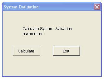
9 The scope of the system 3. LandSpaCES o automate the process of land redistribution o be used as a decision support tool o structure the process in a systematic and transparent way o considerably diminish the time needed to carry out the process o be capable of evaluating a set of alternative land redistributions
10 LandSpaCES integration tools GIS 3. LandSpaCES ES Solutions MCDM Best solution
11 Expert systems (ES) 4. Design module IF this condition (or premise or antecedent) occurs THEN some action (or results or conclusion, or consequence) will or should occur.

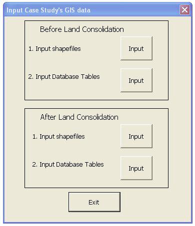

12 4. Design module Interface

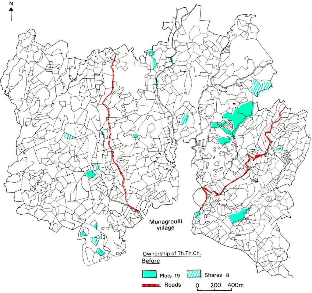
13 Input data: GIS layers 4. Design module Cadastral plan Roads and streams

14 4. Design module Inputs data: cadastral databases
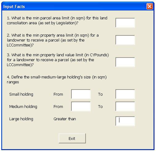
 for this land consolidation area as set by legislation The minimum holding's size limit (in m 2 ) for a")
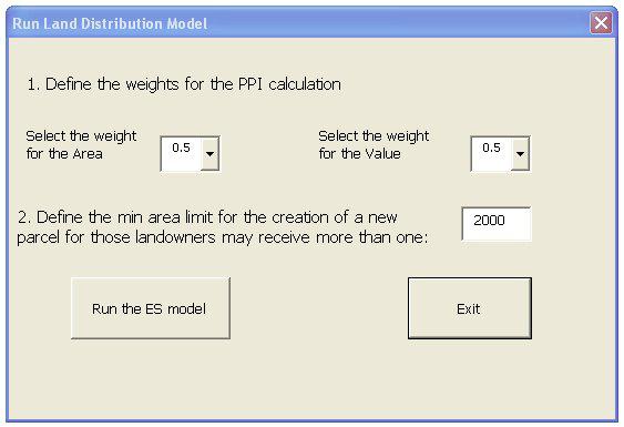
15 Facts: decision variables 4. Design module F1 F2 F3 F4 F5 F6 F7 F8 F9 F10 F11 The minimum parcel area limit (in m 2 ) for this land consolidation area as set by legislation The minimum holding's size limit (in m 2 ) for a landowner to receive a parcel in the new plan as set by the Committee The minimum holding's land value limit (in CyP) for a landowner to receive a parcel in the new plan as set by the Committee The lower limit (in m 2 ) of a "small" holding size The upper limit (in m 2 ) of a "small" holding size The lower limit (in m 2 ) of a "medium" holding size The upper limit (in m 2 ) of a "medium" holding size The lower limit (in m 2 ) of a "large" holding size The weight for parcel area for the calculation of the PPI (Parcel Priority Index) The weight for parcel land value for the calculation of the PPI (Parcel Priority Index) The minimum residual area limit (in m 2 ) for the creation of a new parcel for those landowners may receive more than one Note: the number in brackets represents the area in donums (1 donum=1338 m 2 ) o Parcel priority index (PPI) defines: o the priority of a landowner-parcel pair in terms of allocating a parcel in a certain location or not o the location preferences for the landowner s new parcels


16 4. Design module Outputs: GIS layers


17 4. Design module Outputs: database tables
18 System Vs Human experts System performance based on nine validation criteria C Design module Criteria C8 C7 C6 C5 C4 C3 C2 C Percentage
19 System Vs Human Experts 4. Design module o A human expert needs about 30 working days to prepare the case study s land redistribution problem o Study area: 200 hectares o Number of parcels/shares: 480 o Number of landowners: 253 o LandSpaCES needs only 6 minutes
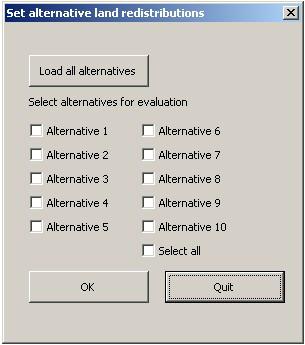


20 5. Evaluation module Evaluation module interface
")
21 Multi-attribute decision methods (MADM) 5. Evaluation module (Sharifi et al., 2004)


22 Set of alternative options Alt-1 Alt-6 4. Design module Alt-8 Alt-10
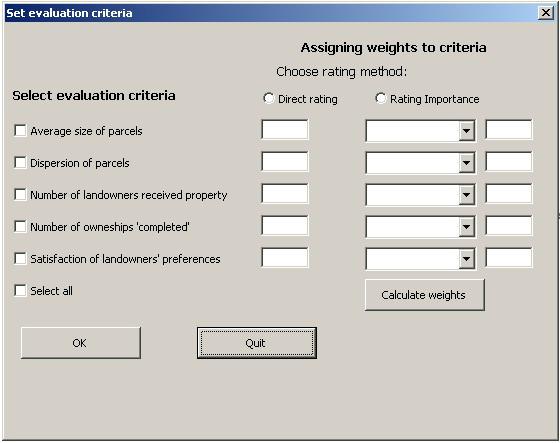
23 Set of evaluation criteria 5. Evaluation module DoP = size of new parcels (C1) parcel concentration coefficient-pcc (C2) New! number of landowners (C3) landowner satisfaction rate-lsr (C4) New! ownerships completed (C5) PCC calculation n n 2 (xi xhmc) + i= 1 i= 1 LSR calculation mi = n ROi + 1 n (y y ' Maxmi = n n + 1 i hmc ) 2 PSR If DoPb = DoPa then PCC = 0 P If DoPb > DoPa If DoPb< DoPa i = 100 ' n n + 1 ( n RO + 1) 100 = ' n n i + 1 LSR j LSR = = PCC = DoPb DoPa DoP b n' DoPa DoP DoPa PCC = n ' n i= 1 l j= 1 PSR n ' LSR l i j b


24 5. Evaluation module Impact table
25 5. Evaluation module Standardisation process: Value functions

26 5. Evaluation module Decision table

27 Assign weights to criteria: Qualitative rating method Rank order Scale of importance Score Classes 1 Extremely high Very high 80 Upper 3 High 60 4 Intermediate 40 Middle 5. Evaluation module 5 Moderate 30 6 Low 20 7 Very low 10 Criterion Scale of importance Score Weight C1 Extremely high C2 Very high C3 High C4 Intermediate C5 Moderate C6 Low C7 Very low Lower N i= 1 w i = 1
28 Value function approach V j = N i= 1 w i v ij 5. Evaluation module V j is the overall value i.e. performance score of the j th alternative (j =1 to M) V ij is the standardised value of the score α ij in the the j th alternative with respect to the i th criterion (i =1 to N) measured by utilising an appropriate value function W i is the weight for criterion i
29 Ranking alternative solutions Alternatives 5. Evaluation module Ranking order A1 A2 A3 A4 A5 A6 A7 A8 A9 A10


")
30 Sensitivity analysis 5. Evaluation module Triantaphyllou, 1997 SA of weights D ' k = min 1 i< j M i k R = k δ ' k,i, j SA of performance scores (P P W ) 100 a ij sens (C ) = k 1 D ' k
31 Case study: 10 alternatives Alternative Description 5. Evaluation module A1 A2 A3 A4 A5 A6 A7 A8 A9 A10 Experts solution (Irrigated project) Medium area and land value minimum limits High area and land value minimum limits Unequal PPI weights for area and land value Low small-medium-large holdings sizes High minimum area of new parcels with high area and land value minimum limits Low minimum area of new parcels with high area and land value minimum limits Low area and land value minimum limits with low small-medium-large holdings sizes Inverse unequal PPI weights for area and land value (comparing to alt-4) Arid project
32 Ranking alternative solutions 1 Alt-1 Alt-2 Alt-3 Alt-4 Alt-5 Alt-6 Alt-7 Alt-8 Alt-9 Alt Evaluation module Alt-1=Experts solution Scenario-1 Scenario-2 Scenario-3 Scenario-4
33 Conclusions o LandSpaCES is a powerful planning tool for land consolidation o High system performance of the Design module 5. Evaluation module o Integration of GIS with ES is still valuable for solving complex spatial planning problems o Evaluation module provides a comprehensive and flexible evaluation of alternative land redistribution plans o Value functions is an excellent manner to incorporate experts knowledge in the evaluation process o Potential applicability to other countries
34 Many thanks for your attention and patience!
A NOMINAL ASSET VALUE-BASED APPROACH FOR LAND READJUSTMENT AND ITS IMPLEMENTATION USING GEOGRAPHICAL INFORMATION SYSTEMS
 A NOMINAL ASSET VALUE-BASED APPROACH FOR LAND READJUSTMENT AND ITS IMPLEMENTATION USING GEOGRAPHICAL INFORMATION SYSTEMS by Tahsin YOMRALIOGLU B.Sc., M.Sc. A thesis submitted for the Degree of Doctor of
The Analytic Hierarchy Process. M. En C. Eduardo Bustos Farías
 The Analytic Hierarchy Process M. En C. Eduardo Bustos Farías Outline of Lecture Summary MADM ranking methods Examples Analytic Hierarchy Process (AHP) Examples pairwise comparisons normalization consistency
Cube Land integration between land use and transportation
 Cube Land integration between land use and transportation T. Vorraa Director of International Operations, Citilabs Ltd., London, United Kingdom Abstract Cube Land is a member of the Cube transportation
Agrarian Structure Reform
 The key elements Draft of the new law on Agrarian Structure Reform Alejandro Vázquez Moliní Sub-director of Agrarian Infraestructures Ministry of Rural Affairs of Galicia INTRODUCTION A new legislation
Creation Land Administration in Formal and Informal Environment. FIG Commission 7 Working Group 1
 Creation Land Administration in Formal and Informal Environment András OSSKÓ, Hungary Key words: land administration, informal land tenure, customary tenure, sustainable Development. SUMMARY FIG Commission
Land policies and land reforms in China: current situation and lessons to be learned for the future Dr. Michael Klaus
 Land policies and land reforms in China: current situation and lessons to be learned for the future Dr. Michael Klaus Presentation at 6 th International Summer School 2014 - Comprehensive Land Policy -
New Developments in the Hellenic Cadastre
 New Developments in the Hellenic Cadastre Prof. M. Kavouras Vice-president Ktimatologio S.A. (Hellenic Cadastre) The Hellenic Cadastre Background The Hellenic National Cadastre Organizational and institutional
Rohan Bennett (PhD) Jaap Zevenbergen (Prof.)
 Jaap Zevenbergen (Prof.)") Developing an integrated conceptual model to understand land governance continuum Berhanu K. Alemie (PhD) Rohan Bennett (PhD) Jaap Zevenbergen (Prof.) Presentation outline Background Research objective
Developing an integrated conceptual model to understand land governance continuum Berhanu K. Alemie (PhD) Rohan Bennett (PhD) Jaap Zevenbergen (Prof.) Presentation outline Background Research objective
Results of Central European Land Knowledge Center (CELK) Activities
 Activities") Results of Central European Land Knowledge Center (CELK) Activities András OSSKÓ, Hungary Key words :CELK Center, Property Rights and Land Market Development, Networking, direct knowledge transfer SUMMARY
Results of Central European Land Knowledge Center (CELK) Activities András OSSKÓ, Hungary Key words :CELK Center, Property Rights and Land Market Development, Networking, direct knowledge transfer SUMMARY
LAND REFORM IN MALAWI
 LAND REFORM IN MALAWI Presented at the Annual Meeting for FIG Commission 7 In Pretoria, South Africa, Held From 4 th 8 th November, 2002 by Daniel O. C. Gondwe 1.0 BACKGROUND Malawi is a landlocked country
ISSUES OF EFFICIENCY IN PUBLIC REAL ESTATE RESOURCES MANAGEMENT
 Alina Zrobek-Rozanska (MSC) Prof. Ryszard Zrobek University of Warmia and Mazury in Olsztyn, Poland rzrobek@uwm.edu.pl alina.zrobek@uwm.edu.pl ISSUES OF EFFICIENCY IN PUBLIC REAL ESTATE RESOURCES MANAGEMENT
Egyptian Nationwide Title Cadastre System
 Kholoud SAAD, Egypt Key words: Cadastre, Registration, Urban, Rural, National Cadastre, Automation, reengineering. SUMMARY With growing need for integrated information, Enterprise Solutions has become
UNECE workshop on: Cadastral and real estate registration systems: Economic information for real estate markets in the UNECE region
 UNECE workshop on: Cadastral and real estate registration systems: Economic information for real estate markets in the UNECE region Roma, 5-65 6 May 2011 Maurizio Festa Agenzia del Territorio Head of Statistics
DEPARTMENT OF LAND AFFAIRS
 DEPARTMENT OF LAND AFFAIRS Land Reform and Black Economic Empowerment By Dr Gilingwe Mayende Director General 7/27/2004 1 Land Reform A systematic process characterized by a series of interventions to
Application of Innovative Techniques in Multi Purpose Land Development
 Martijn J. RIJSDIJK, The Netherlands Key words: Rural planning, innovative techniques, objective design process, reallocation. ABSTRACT The Netherlands is a densely populated country with an ever-increasing
R E Q U E S T F O R P R O P O S A L S REQUEST FOR PROPOSAL TO DEVELOP A LAND HOLDING AND RELEASE STRATEGY FOR THE HOUSING DEVELOPMENT AGENCY
 P.O. Box 3209, Houghton, 2041 Block A, Riviera Office Park, 6-10 Riviera Road, Riviera R E Q U E S T F O R P R O P O S A L S REQUEST FOR PROPOSAL TO DEVELOP A LAND HOLDING AND RELEASE STRATEGY FOR THE
Land Consolidation in Sweden and Land
 From chaos to order... Land Consolidation in Sweden and Land Reform in Romaniasimilarities and discrepancies a comparison Mats Backman June 16 th 2008 Personal presentation Land Consolidation work in Sweden
Participants of the Ministerial Meeting on Housing and Land Management on 8 October 2013 in Geneva
 Summary At its meeting on 2 April 2012, the Bureau of the Committee on Housing and Land Management of the United Nations Economic Commission for Europe agreed on the need for a Strategy for Sustainable
The Development of a Performance Assessment Model for Cadastral Survey Systems
 The Development of a Performance Assessment Model for Cadastral Survey Systems Haodong ZHANG and Conrad TANG, Hong Kong Key words: Cadastral survey system, performance assessment, fit-for-purpose, multi-stakeholder
86 years in the making Caspar G Haas 1922 Sales Prices as a Basis for Estimating Farmland Value
 2 Our Journey Begins 86 years in the making Caspar G Haas 1922 Sales Prices as a Basis for Estimating Farmland Value Starting at the beginning. Mass Appraisal and Single Property Appraisal Appraisal
The computerised land reallotment process in Turkey and the Netherlands in multi-purpose land consolidation projects
 The computerised land reallotment process in Turkey and the Netherlands in multi-purpose land consolidation projects FIG Conference, 15 April 2010, Sydney Louisa J. M. Jansen (Netherlands), Mustafa Karatas,
A. K. Alexandridis University of Kent. D. Karlis Athens University of Economics and Business. D. Papastamos Eurobank Property Services S.A.
 Real Estate Valuation And Forecasting In Nonhomogeneous Markets: A Case Study In Greece During The Financial Crisis A. K. Alexandridis University of Kent D. Karlis Athens University of Economics and Business.
2011 AICP Review Course
 2011 AICP Review Course March 2011 Alex Dambach, AICP, PP Director of Policy, Planning, and Development City of East Orange Exam Content A. Strategic planning/visioning B. Goal setting C. Research methods
Support to Implementation of Multipurpose Cadastral Information system in Vietnam
 Support to Implementation of Multipurpose Cadastral Information system in Vietnam Lennart JOHANSSON and Per SÖRBOM, Sweden Key words: Land Registration, Land Information, Land Administration, SWOT analyse,
THINK BIG do little. Start an avalanche
 1 Recent activities on land consolidation in Serbia Stevan Marosan, Mladen Soskic University of Belgrade, Faculty of Civil Engineering Department for Geodesy and Geoinformatics Zoran Knezevic Ministry
Assessing Affordable Housing Need A Practical Toolkit. Jenni Easton, AICP Nick Fedorek
 Assessing Affordable Housing Need A Practical Toolkit Jenni Easton, AICP Nick Fedorek Research questions: What should communities know about their housing markets? What can various types of analysis tell
Tracking the progress in land policy formulation in francophone Africa countries. Claire GALPIN, France
 Tracking the progress in land policy formulation in francophone Africa countries Presented at the FIG Working Week 2016, May 2-6, 2016 in Christchurch, New Zealand Case of Algeria, Senegal, Cote d Ivoire
Analyses of the Results of Land Consolidation Studies by GIS
 Analyses of the Results of Land Consolidation Studies by GIS Fatih ISCAN, Turkey Key words: Land consolidation, GIS, landholding, planning, spatial analyse SUMMARY Rural development generally refers to
A Performance Assessment Model for Cadastral Survey System Evaluation
 A Performance Assessment Model for Cadastral Survey System Evaluation * *Department of Land Surveying and Geo-Informatics, The Hong Kong Polytechnic University, Hung Hom, Kowloon, Hong Kong hd.zhang@connect.polyu.com
Land Tools for Tenure Security for All
 Land Tools for Tenure Security for All PROF. JAAP ZEVENBERGEN UNIVERSITY OF TWENTE - ITC 1 ST JUNE 2017 HELSINKI, FINLAND GLOBAL LAND CHALLENGES 70 % Dealing with the affordability issue - how to modernize
Cadastre and Other Public Registers: Multipurpose Cadastre or Distributed Land Information System?
 Cadastre and Other Public Registers: Multipurpose Cadastre or Distributed Land Information System? Ivan PESL, Czech Republic Key words: Cadastre, Land Registry, Property, Taxes, Land Use, Territorial Planning,
Developing a Performance Review Questionnaire for Hong Kong Cadastral Survey System
 Developing a Performance Review Questionnaire for Hong Kong Cadastral Survey System Haodong ZHANG and Conrad TANG, Hong Kong SAR, CHINA Key words: Fit-for-Purpose, Cadastral Surveying, Land Administration,
GI support for land consolidation
 Problems GI support for land consolidation Bela MARKUS University of West Hungary College of Geoinformatics Technology??? Legislation Organization Financial Awareness Ill-structured process 2 Past Present
Development of 3D Cadastre in Hungary
 Development of 3D Cadastre in Hungary András OSSKÓ Gyula IVÁN CLGE General Assembly 22 March 2013, Budapest, HUNGARY Content Introduction Problems in development of 3D cadastre and registration Hungarian
E fficient L and A dministr ation E ncour ages P r oper ty M ar k ets. surveying companies at Project commencement. Key Messages
 Secur ing Pr oper ty R ights and I ncr easing R eal E state Pr oductivity in F Y R M acedonia Victoria Stanley, Denis Boskovski and Samantha De Martino Key Messages Before 2005, FYR Macedonia did not have
Geoinformation Technologies in Land Management and Beyond: Case of Georgia
 Geoinformation Technologies in Land Management and Beyond: Case of Georgia Joseph SALUKVADZE Professor, Department of Human Geography, Co-team Leader, Cadastre and Land Register Project, Co-financed by
Community Housing Federation of Victoria Inclusionary Zoning Position and Capability Statement
 Community Housing Federation of Victoria Inclusionary Zoning Position and Capability Statement December 2015 Introduction The Community Housing Federation of Victoria (CHFV) strongly supports the development
The Added Value of Geospatial Information in Disaster and Risk Management: A Case Study on the 2009 Flooding in Namibia
 The Added Value of Geospatial Information in Disaster and Risk Management: A Case Study on the 2009 Flooding in Namibia Summary Tessa Anne Belinfante, M.Sc. VU University Amsterdam Objective and Approach
PROBLEMS IN REGISTRATION IN THE THIRD VERTICAL DIMENSION IN THE UNIFIED LAND REGISTRY IN HUNGARY, AND POSSIBLE SOLUTION
 3D Cadastres Technical and Legal Aspects II PROBLEMS IN REGISTRATION IN THE THIRD VERTICAL DIMENSION IN THE UNIFIED LAND REGISTRY IN HUNGARY, AND POSSIBLE SOLUTION ANDRÁS Osskó Budapest Land Office Hungary
RAPID ANALYTICS INTERACTIVE SCENARIO EXPLORER (RAISE) A tool for analysing and visualising land valuation in different development scenarios
 A tool for analysing and visualising land valuation in different development scenarios") RAPID ANALYTICS INTERACTIVE SCENARIO EXPLORER (RAISE) A tool for analysing and visualising land valuation in different development scenarios RAISE PROJECT COLLABORATION RAISE DATA DRIVEN APPROACH Rapid
RAPID ANALYTICS INTERACTIVE SCENARIO EXPLORER (RAISE) A tool for analysing and visualising land valuation in different development scenarios RAISE PROJECT COLLABORATION RAISE DATA DRIVEN APPROACH Rapid
7 th international LANDNET Conference 5-7 October 2015, Ankara, Turkey. Land banks and land funds an overview and presentation of FAO publication
 7 th international LANDNET Conference 5-7 October 2015, Ankara, Turkey Land banks and land funds an overview and presentation of FAO publication With contributions from Frank van Holst, Francisco Onega
PREPARING SURVEY TENDER GIS DATABASE OUTCOMES
 PREPARING SURVEY TENDER SPECIFICATIONS FOR PROJECT GIS DATABASE OUTCOMES Presentation by Ian Harper GEODATA AUSTRALIA ESRI User Conference 2009 24 st July 2009 BACKGROUND GIS databases now provide a more
LRIMS Cadastre Module
 LRIMS Cadastre Module User Requirements and Functionality (Seychelles Case Study) John Latham, NRL Renato Cumani, NRL Luigi Simeone, NRL Summary Background User Requirements Business Model Application
A FIRST ATTEMPT FOR USING VOLUNTEERED GEOGRAPHIC INFORMATION AND CROWD SOURCING TECHNIQUES IN CADASTRE
 A FIRST ATTEMPT FOR USING VOLUNTEERED GEOGRAPHIC INFORMATION AND CROWD SOURCING TECHNIQUES IN CADASTRE Sofia Basiouka National Technical University of Athens PhD student s.basiouka@gmail.com Chryssy Potsiou
The New Technology of a Survey Data Model and Cadastral Fabric as the Foundation for a Future Land Administration System.
 The New Technology of a Survey Data Model and Cadastral Fabric as the Foundation for a Future Land Ian HARPER, Australia Key words: cadastral modelling, survey data model, Survey Accuracy, Cadastre 2014
International Workshop Land Banking/Land Funds as an Instrument for Improved Land Management for CEEC and CIS March 2004 Tonder,, Denmark
 MINISTRY OF AGRICULTURE AND FORESTRY SOFIA, BULGARIA International Workshop Land Banking/Land Funds as an Instrument for Improved Land Management for CEEC and CIS 17-20 March 2004 Tonder,, Denmark BULGARIAN
Innovative Local Government Land Conservation Techniques
 Innovative Local Government Land Conservation Techniques Three new successful land conservation programs used in Maryland by Baltimore and Carroll Counties are worthy of further examination. Baltimore
Designing for transparency and participation in the Hellenic Cadastral Project
 Designing for transparency and participation in the Hellenic Cadastral Project Dr. Dimitris Rokos Director of Planning and Investments, Hellenic National Cadastre and Mapping Agency S.A. Table of Contents
PROCEDURE (Essex) / Linked SOP (Kent) Estate Management. Number: U Date Published: 22 July 2015
 / Linked SOP (Kent) Estate Management. Number: U Date Published: 22 July 2015") 1.0 Summary of Changes 1.1 This is a new joint procedure/sop for Essex Police and Kent Police. 2.0 What this Procedure/SOP is about 2.1 The Estate Services Department at Headquarters is responsible for
1.0 Summary of Changes 1.1 This is a new joint procedure/sop for Essex Police and Kent Police. 2.0 What this Procedure/SOP is about 2.1 The Estate Services Department at Headquarters is responsible for
Individual and Mass Valuation Present and Future Practices
 Individual and Mass Valuation Present and Future Practices Arvydas BAGDONAVIČIUS and Steponas DEVEIKIS, Lithuania Key words: Individual valuation, Mass valuation, Lithuania, GIS SUMMARY The aim of this
On the Rights of Landowners to Compensation for Restrictions on Economic Activities in Specially Protected Nature Territories and Microreserves
 Disclaimer: The English language text below is provided by the Translation and Terminology Centre for information only; it confers no rights and imposes no obligations separate from those conferred or
Land Markets and Land Rights in support of the Millennium Development Goals
 Land Markets and Land Rights in support of the Millennium Development Goals A Global Perspective Prof. Stig Enemark President Aalborg University, Denmark 3rd LAND ADMINISTRATION FORUM FOR THE ASIA AND
Fiscal Cadastral Reform and the Implementation of CAMA in Cape Town: financing transformation
 Fiscal Cadastral Reform and the Implementation of CAMA in Cape Town: financing transformation Jennifer WHITTAL, South Africa Mike BARRY, Canada Policies and Innovations Expert Group Meeting on Secure Land
Comparables Sales Price (Old Version)
") Chapter 486 Comparables Sales Price (Old Version) Introduction Appraisers often estimate the market value (current sales price) of a subject property from a group of comparable properties that have recently
Chapter 486 Comparables Sales Price (Old Version) Introduction Appraisers often estimate the market value (current sales price) of a subject property from a group of comparable properties that have recently
Land Consolidation Thesaurus finding common ground. 9 th International LANDNET workshop 3-5 October 2017 Budapest, Hungary
 Land Consolidation Thesaurus finding common ground 9 th International LANDNET workshop 3-5 October 2017 Budapest, Hungary Maxim Gorgan, Land Tenure and Rural Development Specialist, FAO Regional Office
Asset valuation. Advancing Methodology on Measuring Asset Ownership from a Gender Perspective
 Advancing Methodology on Measuring Asset Ownership from a Gender Perspective Asset valuation Workshop on the Production of Statistics on Asset Ownership from a Gender Perspective through Household Surveys
WORKSHOP ON TAX POLICY FOR DOMESTIC RESOURCE MOBILIZATION AND SEMINAR ON PROPERTY TAX REFORM: THE PHILIPPINE REGALA EXPERIENCE
 WORKSHOP ON TAX POLICY FOR DOMESTIC RESOURCE MOBILIZATION AND SEMINAR ON PROPERTY TAX REFORM: THE PHILIPPINE REGALA EXPERIENCE ADBI, Tokyo 20-23 February 2018 The Philippines is at a critical juncture.
Demonstration Properties for the TAUREAN Residential Valuation System
 Demonstration Properties for the TAUREAN Residential Valuation System Taurean has provided a set of four sample subject properties to demonstrate many of the valuation system s features and capabilities.
TIMOR-LESTE EXPROPRIATIONS LEGAL FRAMEWORK APPROVED
 TIMOR-LESTE EXPROPRIATIONS LEGAL FRAMEWORK APPROVED INTRODUCTION After approximately 8 years of discussions, the Timor-Leste Parliament recently approved the Country s Expropriations Law (the Law ) by
Introduction to INRMP Implementation Options
 El Dorado County Integrated Natural Resources Management Plan Introduction to INRMP Implementation Options 1 Our approach to the options evaluation is based on the INRMP components as they are currently
Land Reform and Land Fragmentation
 Land Reform and Land Fragmentation Land reform and land fragmentation and consequences for rural development in the CEE/CIS countries By Christian Graefen Planning Officer Land Management Deutsche Gesellschaft
LADM-based Crowdsourced 3D Cadastral Surveying Potential and Perspectives
 National Technical University Of Athens School of Rural and Surveying Engineering LADM-based Crowdsourced 3D Cadastral Surveying Potential and Perspectives Maria Gkeli, Surveying Engineer, PhD student
Implementing Innovative Land Tenure Tools In East-Africa: SWOT-Analysis Of Land Governance
 Presented at the FIG Working Week 2017, May 29 - June 2, 2017 in Helsinki, Finland Implementing Innovative Land Tenure Tools In East-Africa: SWOT-Analysis Of Land Governance Ine BUNTINX, Joep CROMPVOETS,
Arvo Vitikainen An Overview of Land Consolidation in Europe
 VOLVIC, 10.-11.9.2004 Arvo Vitikainen An Overview of Land Consolidation in Europe Remembrement Flurbereinigung [ The Land Development Act an Outline] Ruilverkaveling Omarrondering p ORGANISATION p OBJECTIVES
The Influence of Single Criteria Based Valuation to The Land Evaluation in Land Consolidation Projects
 The Influence of Single Criteria Based Valuation to The Land Evaluation in Land Consolidation Projects Fatih ISCAN and Tayfun CAY Email: tcay@selcuk.edu.tr, fiscan@selcuk.edu.tr University of Selcuk, Faculty
MASS VALUATION DATA FOR GOVERNMENT, CITIZENS AND BUSINESS
 Permanent Committee on Cadastre in the European Union Lithuanian Presidency PCC Conference 22-23 October 2013, Vilnius MASS VALUATION DATA FOR GOVERNMENT, CITIZENS AND BUSINESS Arvydas Bagdonavičius Deputy
COMMISSION 7 CADASTRE AND LAND MANAGEMENT WORK PLAN
 Appendix to item 34.7 FIG Congress in Washington, 19-26 April 2002 COMMISSION 7 CADASTRE AND LAND MANAGEMENT WORK PLAN 2002 2006 1. Title Cadastre and Land Management 2. Terms of Reference Commission 7
Preprint.
 http://www.diva-portal.org Preprint This is the submitted version of a paper presented at 10th EC GI & GIS Workshop, ESDI State of the Art, Warsaw, Poland, 23-25 June 2004. Citation for the original published
RUV Registro Único de Vivienda
 RUV Registro Único de Vivienda (National Housing Registry) Technology for a Sustainable Housing Policy March 7, 2013 RUV Key Events - Timeline Infonavit announces creation of National Housing Registry
RWANDA NATURAL RESOURCES AUTHORITY Department of Lands and Mapping
 RWANDA NATURAL RESOURCES AUTHORITY Department of Lands and Mapping National Land Use and Development Master Plan Presentation to National Forum on Sustainable Urbanisation in Support of EDPRS 2 Eng. Didier
Property Based Land Information Systems of Turkey
 Property Based Land Information Systems of Turkey Mehmet Fatih DİRİ, Bilgehan ÖZSOY, Ünsal ERGÜN, Turkey Key words: Cadaster, Land Registry, GIS, Property, TURKEY SUMMARY The property, addition to the
TABLE OF CONTENTS CHAPTER TITLE PAGE DECLARATION DEDICATION ACKNOWLEDGEMENT ABSTRACT ABSTRAK
 vii TABLE OF CONTENTS CHAPTER TITLE PAGE DECLARATION DEDICATION ACKNOWLEDGEMENT ABSTRACT ABSTRAK TABLE OF CONTENTS LIST OF TABLES LIST OF FIGURES LIST OF ABBREVIATIONS LIST OF APPENDICES ii iii iv v vi
Digitalisation of the Real Property Rights Towards Spatially enabled E-Government
 Digitalisation of the Real Property Rights Towards Spatially enabled E-Government Lise Schroeder, Bent Hulegaard Jensen, Esben Munk Soerensen & Line Hvingel Istanbul, Turkey 25 june 201 Overview Introduction
Actual Developments of Land Consolidation in Finland. Mikko UIMONEN, Finland
 Actual developments of land consolidation in Finland Mikko UIMONEN, Finland Key words: Land consolidation, Land rearrangement, Reallotment of parcels, Quality management SUMMARY This paper describes the
Implementation Guidance for The Sustainable Growth and Agricultural Preservation Act of 2012 Senate Bill 236
 Implementation Guidance for The Sustainable Growth and Agricultural Preservation Act of 2012 Senate Bill 236 May 22, 2012 Version 1.0 Table of Contents 1. Executive Summary... 1 1.1 Bill Highlights...
 Affordable Housing Information for landowners, builders and developers: Guide to Section 106 delivery of Affordable Homes What are Housing Section 106 Agreements? Section 106 (S106) of the Town and Country
Cadastral Template 2003
 PCGIAP-Working Group 3 "Cadastre" FIG-Commission 7 "Cadastre and Land Management" Cadastral Template 2003 The establishment of a cadastral template is one of the objectives of Working Group 3 "Cadastre"
Finding Common Ground: Smart Growth and Affordable Housing in Rhode Island
 Finding Common Ground: Smart Growth and Affordable Housing in Rhode Island Edgar Adams, Roger Williams University, Bristol RI with: Brian Boisvert, Bradley Shapiro, Fenton Bradley Finding Common Ground:
Scenic Nepal. Land Administration Systems. Outline of Presentation. Interests in land. Rights: Registration and security of tenure positions
 Scenic Nepal Land Administration Systems Managing Rights, Restrictions, and Responsibilities in Land Prof. Stig Enemark President Aalborg University, Denmark SURVEY DEPARTMENT KATHMANDU, NEPAL. 16 FEBRUARY
NATIONAL PLANNING AUTHORITY. The Role of Surveyors in Achieving Uganda Vision 2040
 NATIONAL PLANNING AUTHORITY The Role of Surveyors in Achieving Uganda Vision 2040 Key Note Address By Dr. Joseph Muvawala Executive Director National Planning Authority At the Annual General Meeting and
Galicia 2009 Regional Workshop on Land Tenure and Land Consolidation. FAO s Experience with Land Development Instruments in Europe
 Galicia 2009 Regional Workshop on Land Tenure and Land Consolidation FAO s Experience with Land Development Instruments in Europe Santiago de Compostela Galicia 9-11 of February 2009 Richard Eberlin Land
Public Disclosure Copy
 Public Disclosure Authorized EUROPE AND CENTRAL ASIA Tajikistan Agriculture and Rural Development Global Practice IBRD/IDA Specific Investment Loan FY 2005 Seq No: 27 ARCHIVED on 01-Jun-2015 ISR19129 Implementing
Development of Multipurpose Land Administration Systems
 Development of Multipurpose Land Administration Systems Hrvoje MATIJEVIĆ, Miodrag ROIĆ, Hrvoje TOMIĆ, Croatia Keywords: Land Administration, Land Management, Transformation, Land Governance SUMMARY Today
NOVEMBER 2017 PHASE II: PRIVATE LAND OWNERSHIP BY RACE, GENDER AND NATIONALITY
 NOVEMBER 2017 PHASE II: PRIVATE LAND OWNERSHIP BY RACE, GENDER AND NATIONALITY South Africa belongs to all who live in it, united in our diversity. Constitution of the Republic of South Africa Act, 1996
Land consolidation and rural development in Serbia
 1 Land consolidation and rural development in Serbia Stevan Marosan University of Belgrade, Faculty of Civil Engineering, Department for Geodesy and Geoinformatics Maja Trajkovic Ministry of Finance Vladan
Land Management Procedures and Informal Constructions in Cyprus. Marilena Theodorou, Land Surveyor, Cyprus, Dr Chryssy Potsiou, Lecturer NTUA, Greece
 Land Management Procedures and Informal Constructions in Cyprus Marilena Theodorou, Land Surveyor, Cyprus, Dr Chryssy Potsiou, Lecturer NTUA, Greece FIG Working Week 2008 Integrating Generations Objectives
Title: Land Records Technician. Burnett County Job Description
 Land Records Technician Burnett County Job Description Name: Date: July 7, 2010 Employer: Burnett County Title: Land Records Technician Department: Land Information and Work Location: Government Center
COMPUTERIZED SYSTEM SUPPORTING DEVELOPMENT OF LAND MARKET IN GEORGIA
 COMPUTERIZED SYSTEM SUPPORTING DEVELOPMENT OF LAND MARKET IN GEORGIA S. G. TSIRAMUA, I. S. MELASHVILI Land Registration Unit of Government of Georgian, World Bank and IFAD Agriculture Development Project.
Multi-Paths of Colleges Performance Appraisal and Comparison Hui PENG 1,a, Lian-Sen WANG 2,3,4,b,*
 2016 2 nd International Conference on Modern Education and Social Science (MESS 2016) ISBN: 978-1-60595-346-5 Multi-Paths of Colleges Performance Appraisal and Comparison Hui PENG 1,a, Lian-Sen WANG 2,3,4,b,*
Kent Land Trust Strategic Reassessment Project Final Report
 Kent Land Trust Strategic Reassessment Project Final Report Prepared For: Connecticut Institute for Resilience and Climate Adaptation (CIRCA) Prepared by: Michael A. Benjamin, Land Steward, Kent Land Trust
ABSTRACT Land Administration System in Lithuania
 ABSTRACT Land Administration System in Lithuania 1. General introduction to the Lithuanian Land Administration System and State Enterprise Centre of Registers ( shortly SECR) Lithuania has established
R E Q U E S T F O R P R O P O S A L S
 P.O. Box 3209, Houghton, 2041 Block A, Riviera Office Park, 6-10 Riviera Road, Riviera R E Q U E S T F O R P R O P O S A L S M A R K E T S U R V E Y T O I N F O R M R E S I D E N T I A L H O U S I N G
An Overview of the eplan Journey with a Focus on the Victorian eplan 2025 Roadmap Dr Hamed Olfat
 An Overview of the eplan Journey with a Focus on the n eplan 2025 Roadmap Dr Hamed Olfat eplan Coordinator Land Use Chairman of Technical Committee ICSM eplan Working Group Outline eplan Overview ICSM
UN-HABITAT s Mission and Vision. Sustainable urban development Adequate shelter for all
 GLTN contributes to the implementation of pro poor land policies to achieve secure land rights for all www.gltn.net GLTN Secretariat, facilitated by PO Box 30030, Nairobi 00100, Kenya Tel: +254 20 762
Advancing Methodology on Measuring Asset Ownership from a Gender Perspective
 Advancing Methodology on Measuring Asset Ownership from a Gender Perspective Workshop on the Production of Statistics on Asset Ownership from a Gender Perspective through Household Surveys Tbilisi, Georgia,
Figure 1. The chart showing how the effort and cost of the design changes are affected as the project progresses (Anon.) Simulation tools are a key co
 Simulation tools are a key co") Survey for the Development of an Early Design Tool for Architects H.Rallapalli 1*, V.Garg 1, and R.Rawal 3 1 Centre for IT in Building Science, International Institute of Information Technology, Hyderabad,
Survey for the Development of an Early Design Tool for Architects H.Rallapalli 1*, V.Garg 1, and R.Rawal 3 1 Centre for IT in Building Science, International Institute of Information Technology, Hyderabad,
The New Starts Grant and Affordable Housing A Roadmap for Austin s Project Connect
 The New Starts Grant and Affordable Housing A Roadmap for Austin s Project Connect Created for Housing Works by the Entrepreneurship and Community Development Clinic at the University of Texas School of
The programme is implemented
 Surveying Property valuation and spatial data tools to assist in land restitution by Jaco de Kock, GISCOE Land and tenure reform in the South African government context are beyond talk and have received
The Boundary Concept Land Management Opportunities for Sustainable Development Provided by the Cadastre 2014 Approach. Jürg KAUFMANN, Switzerland
 The Boundary Concept Opportunities for Sustainable Development Provided by the Cadastre 2014 Approach Jürg KAUFMANN, Switzerland THE BOUNDARY CONCEPT AS A CHANCE FOR SURVEYORS OPPORTUNITIES CREATED BY
Click to edit Master title style
 Click to edit Master title style Modern Cadastre and Land Administration Session 5a. The toolbox approach Jude Wallace 2007 Click to edit Overview Master title style Objectives To understand the circumstances