Montrose, Colorado. PROPERTY INFORMATION PACKET John Renfrow Jim Renfrow Renfrow Realty
|
|
|
- Marion Porter
- 5 years ago
- Views:
Transcription


1 & Road PROPERTY INFORMATION PACKET John Renfrow Jim Renfrow Renfrow Realty Member of: Rocky Mountain Commercial Brokers Page 1


!")

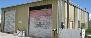
2 COMMERCIAL/AG with RESIDENCE * MONTROSE, Colorado * $269,000 This property has it ALL! 6.92 acres zoned Gen Ag in Montrose County. Buildings consist of a 2bd/1ba farmhouse, barn/utility building, warehouse and large commercial building with many possibilities. Commercial Building has office spaces and has everything needed for employee/ranch hand housing (Individual rooms, kitchen, bathrooms and common area)! Property is largely l fenced for livestock. Large pond located in livestock yard. 7.2 shares irrigation water, pump and pipe included in sale! Property is bank owned, sold As-Is, Where-Is with no guarantee, representation, or warranty. Contact John or Jim Renfrow at (970) Page 2
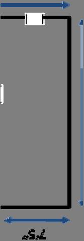
3 Parcel Map Subject property Page 3

4 Aerial Photo Subject property Page 4
5 Soils Map Subject property Data Taken from USDA Natural Resources Conservations Services Web Soil Survey site Page 5


")
6 Directions to Property Starting from Renfrow Realty at 1832South Townsend Ave., Montrose, CO Office number (970) Page 6
7 Montrose County Assessor Property Account Detail* Account: R Owner Name ALPINE BANK Owner Information Owner Address 2770 ALPINE DR MONTROSE, CO Tax Year Account Detail Version End MAX Parcel Number Tax Area Id Situs Address RD RD Legal Description City MONTROSE 2012 Tax Information MONTROSE Taxes Legal Summary Subd: STEELE EXEMPTION Lot: 2 S: 25 T: 49 R: 10 *2012 $9, *Estimated 2011 Assessment Information Tax Area: Mill Levy: Actual (2011) $655,180 Assessed $158,860 Type Actual Assessed Acres SQFT Units Improvements $535,180 $129, Land $120,000 $29, *For more information please contact the Montrose County Assessor at (970) Page 7
8 Montrose County Assessor Property Account Detail* NeighborhoodSPR ING CREEK Mixed Use Percent77 Total Area Actual Area Size Property Characteristics Land Abstract CodeSPEC.PURP OSE-LAND Acres6.92 Land Code550 (5-9.9AC) Square Feet0 Assessment History Type Land $120,000 $120,000 $150,000 $150,000 Land Assessed $29,000 $29,000 $36,560 $36,560 Improvements $535,180 $535,180 $548,300 $548,300 Improvements Assessed $129,860 $129,860 $133,760 $133,760 Total Actual Value $655,180 $655,180 $698,300 $698,300 Total Assessed Value $158,860 $158,860 $170,320 $170,320 Tax History Tax Year Type Effective Date Amount 2011 Tax Charge 01/03/2012 $9, Tax Charge 01/03/2011 $10, Tax Charge 01/04/2010 $9, Tax Charge 01/02/2009 $9, Tax Charge 01/01/2008 $9, *For more information please contact the Montrose County Assessor at (970) Page 8
9 Montrose County Assessor Property Account Detail* Property Characteristics i Farm House Comm Building with Additional Housing Abstract CodeSINGLE FAM.RES- NeighborhoodSPRING CREEK Abstract CodeSPEC.PURPOSE- IMPROVEMTS IMPROVEMENTS NeighborhoodWEST COUNTY Building TypeSFR Architecture StyleONE STORY Building TypeINDUST/MANUF S Architecture StyleINDUST/MANUF StoriesSTORIES 1.0 Construction QualityCLASS 3 LOW 35 BLDG Bedrooms2 Baths1 QualityAVERAGE ConditionAVERAGE Roof StructureGABLE/HIP Roof CoverCOMP SHINGLE Room HeightIND WHS HT = 8 FT Roof CoverPRO PANEL METAL SFR DepreciationYEAR Heating FuelELECTRIC Roof StructureSHED Heating FuelNATURAL GAS Heating TypeRADIANT ELECTRIC Air ConditioningNONE Heating TypeSUSPENDED SPACE Air ConditionROOF/WALL FrameWOOD FRAME Actual Year Built1950 HEATERS EVAPORATIVE COOLER Floor 1 FrameSTEEL FRAMING FoundationCONCRETE SLAB TypeSTD FLOOR Percent100.0 Units1 Stories1 Interior Wall 1 PerimeterWARE/IND P=350 Actual Year Built1982 TypeDRYWALL Percent100.0 A=10000 Exterior Wall 1 Depreciation35YR-1990 TypeALM / VINL Percent100.0 Total Area Exterior Wall 1TypeMETAL Interior Wall 1Type Percent100.0 Percent Heated Area 1168 SubAreasCWD - Covered Wood Floor Cover 1TypeCONCRETE ONE - 1 Story1,168 Deck200 FINISH Percent100 Total Area Heated Area13432 COP - Covered Open Porch304 SubAreasBAS - Base Area13,432 *For more information please contact the Montrose County Assessor at (970) Page 9
10 Montrose County Assessor Property Account Detail* Abstract CodeSPEC.PURPOSE- IMPROVEMENTS Building TypeOFFICE S LOW 40 QualityAVERAGE Room HeightOFFICE HT = 8 FT Roof StructureGABLE Heating TypeFORCED AIR SYSTEM FrameSTEEL FRAMING Units1 PerimeterOFFICE P=175 A=2000 Depreciation40YR-1988 Exterior Wall 1TypeMETAL Percent Floor Cover 1TypeCONCRETE FINISH Percent Total Area Heated Area1920 Barn/Utility Building NeighborhoodWEST COUNTY Architecture StyleOFFICE ConditionAVERAGE Roof CoverPRO PANEL METAL Heating FuelNATURAL GAS Air ConditionROOF/WALL EVAPORATIVE COOLER FoundationCONCRETE SLAB Stories1 Actual Year Built1982 Interior Wall 1Type Percent SubAreasBAS - Base Area1,920 Property Characteristics i Warehouse Building Abstract CodeSPEC.PURPOSE- NeighborhoodWEST COUNTY IMPROVEMENTS Building TypeWAREHSE S AVG 40 Architecture StylePAINT/AUTO BODY QualityAVERAGE ConditionAVERAGE Room HeightIND WHS HT = 14 FT Roof CoverPRO PANEL METAL Roof StructureFLAT Heating FuelNATURAL GAS Heating TypeSUSPENDED SPACE Air ConditionNONE HEATERS FrameSTEEL FRAMING FoundationCONCRETE SLAB Units1 Stories1 PerimeterWARE/IND P=150 Actual Year Built1978 A=1500 Depreciation40YR-1978 Exterior Wall 1TypeMETAL Percent100 Floor Cover 1TypeCONCRETE FINISH Percent100 Total Area Heated Area1440 Interior Wall 1TypeINSULATION ONLY Percent100 SubAreasBAS - Base Area1,440 *For more information please contact the Montrose County Assessor at (970) Page 10

11 Map of Vicinity Montrose City Limits Montrose Regional Airport Hw wy 90 Hwy 550 Spring Creek Subject property Uncompahgre River Downtown Montrose Page 11


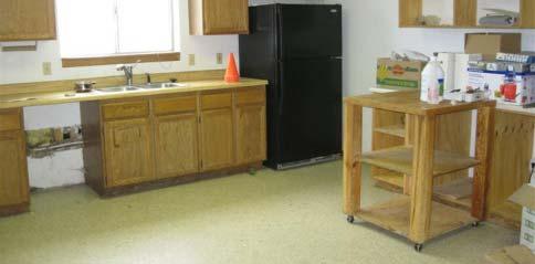
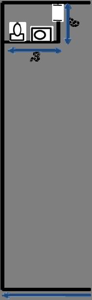
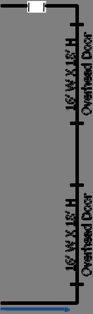
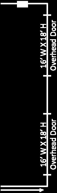
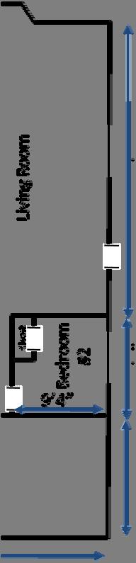
12 Layout Large Office/Commercial Building 19 3 Ground Floor nd Floor Dining Kitchen Open Large Open with supporting columns Wide Door Open Office/ Conference Room Office Office Office Office Office Large Commercial Building 13,342 sq.ft. Office space Commercial space with overhead door Extra living/office space in rear and upstairs Page 12
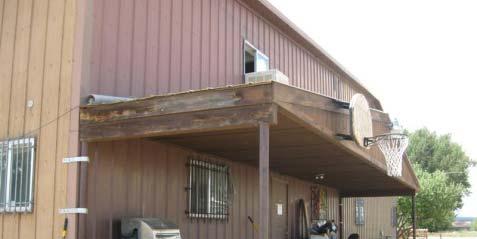
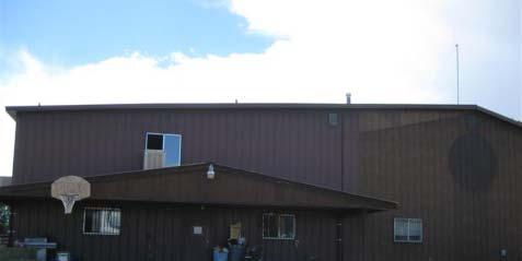


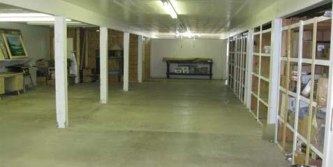
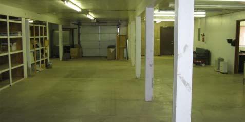

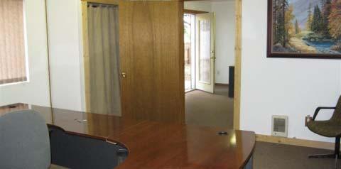

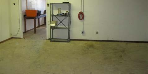

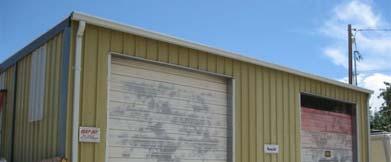
13 Photographs Large Office/Commercial Building Page 13


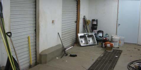


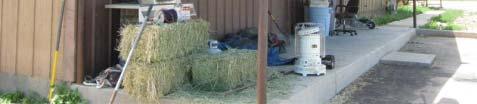
14 Photographs/Layout - Barn 1,920 sq.ft. barn Upgraded septic 2 (two) 2,000 gallon tanks New water heater * Page 14


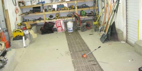
15 Photographs/Layout Mechanic Shop Car Lift Air Compressor 1,440 sq.ft. mechanic shop Car Lift Air Compressor Page 15


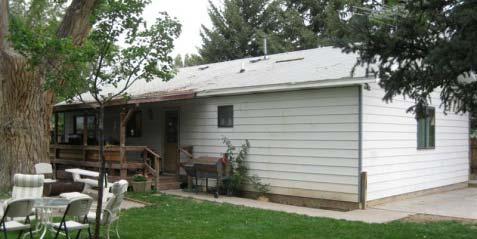
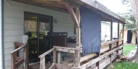

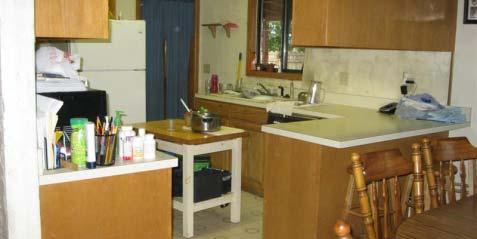


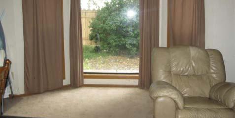
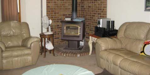
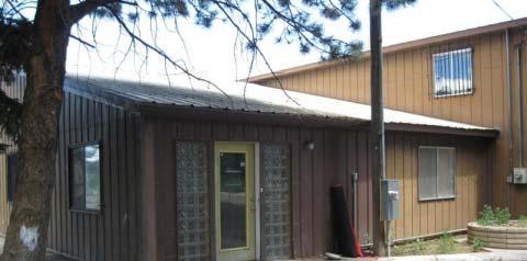
16 Photographs/Layout - House 1,168 sq.ft. residence Washer/Dryer hookups in Utility room * Page 16
 249-9543 Page")
17 Improvement Location Certificate ILC Completed by Rocky Mountain Surveying Steve Ylt Yelton (970) Page 17
18 Zoning Breakdown* - A General Agricultural District A. GENERAL AGRICULTURAL DISTRICT "A": 1. Purpose: Agriculture is considered to be a highly valued resource in Montrose County. The primary intent of this district is to provide for the conduct of agriculture related to ranching, farming, and forestry production; and maintaining and promoting agriculture as an essential and economic factor in the County. 2. Uses-By-Right: a. Agricultural and agribusiness uses, operations, and related activities, including but not limited to: (1) Elevators and feed grain storage and mixing operations. (2) Storage and sale of motorized and non-motorized farm and ranching equipment and structures, other than dwelling units. (3) Animal stables, training, and boarding facilities. (4) Livestock or equipment auction yards and facilities. (5) Truck and sod farms, nursery stock and green houses without retail sales. (6) Dairies (milk and dairy product processing). (7) Poultry hatcheries and production facilities, fish hatcheries, specialty domestic animal production farms, dairy farms, fur farms, bee keeping operations. (8) Feedlots (livestock owned by operator) (9) Custom feedlots (livestock owned by third parties) existing at the time of adoption of Zoning Amendment No (10/13/94) or subsequent expansion of existing operations within existing property boundaries. (10) Farm machinery manufacture and assembly. (11) Timber production and farming, including raising i of trees for any purpose. (12) Veterinary clinics, hospitals, small animal kennels, and large animal holding facilities for medical purposes. (13) Wineries without retail sales b. One single family dwelling manufactured for residential use (site built or manufactured home). c. State licensed group home for the aged, developmentally disabled, or mentally ill having not more than eight (8) persons pursuant to C.R.S., if not located within 750 feet of another such group home. A "Registration of Day- Care, Foster-Care, or Group Home" form shall be filed with the Land Use Office. d. Mining of minerals other than sand and gravel existing at the time of adoption of Zoning Amendment No (10/13/94) or subsequent expansion of existing operations within existing property lines. e. Sand and gravel mining operations with a permitted acreage of less than ten (10) acres pursuant to an active division of Minerals and Geology Reclamation Permit existing on the date of adoption of Zoning Amendment (10/20/97). f. Existing sand and gravel mining operations with a permitted acreage of ten (10) acres or more pursuant to an active Division of Minerals and Geology Reclamation permit shall adhere to the Mitigation Standards and the Administration & Enforcement Procedures contained in Section XII of these regulations, pursuant to Zoning Amendment (10/20/97). g. Oil and gas exploration, drilling, and production facilities. h. Mineral resource exploration. i. Multifamily, residential, office, commercial, industrial, and associated accessory uses existing at the time of adoption of Zoning Amendment No (10/13/94). j. Bed & Breakfast or guest lodging facilities operated by the property owner, not to exceed five (5) guests rooms. k. State licensed family day-care home for not more than 6 children. A "Registration of Day-Care, Foster-Care, or Group Home" form shall be filed with the Land Use Office. l. County certified family foster-care home for not more than 6 children. A "Registration of Day-Care, Foster-Care, or Group Home" form shall be filed with the Land Use Office. m. Utility distribution and service lines, transformers, service pedestals, and pump stations. n. One recreational vehicle for temporary occupancy on property comprising a minimum 35 acres with an approved ISDS and placed on the property for a period not to exceed 180 days in any one calendar year. A "Registration of Temporary Occupancy" form shall be filed with the ISDS Permit Application. i o. Ast p. Accessory Uses: (1) Ham radio and/or television tower and satellite TV dish. (2) Additional living quarters for farm and ranch workers or immediate family members (site built or manufactured home); with payment of the School Fee-In-Lieu pursuant to Section 3.27, Montrose County Subdivision Regulations. A "Registration ti of Accessory Living i Quarters" form shall be filed with the Land Use Office. (3) Farm and/or ranch and associated business offices. (4) Garages, parking, and other equipment storage and supply buildings for use in all agricultural and agribusiness uses, operations and related activities. (5) Roadside stands for the seasonal sale of locally grown vegetables, fruits and farm products if accessed via a secondary public road. * Taken from Montrose County Zoning Resolution Revised Dec. 1, 2003 Contact Montrose County Planning for more information (970) Page 18
19 Zoning Breakdown* - A Cont d. (6) Farm and ranch buildings, storage sheds, and silos for storage and protection of farm and ranch products and livestock. (7) Household pets when confined to the premises. astronomical observatory not open to the public. [Amended 9/25/03] (8) Petroleum, fertilizer and chemical storage for personal use and commercial sale (9) Home occupations and offices associated with home occupations. Montrose County Zoning Resolution 12 (10) Storage of equipment, supplies and vehicles related to home occupations. (11) Recreational vehicles owned by the property owner and stored on the property when not in use. (12) One recreational vehicle for temporary occupancy by visiting family or friends placed on the property for a period not to exceed 90 days in any one calendar year. (13) One recreational vehicle for temporary occupancy during construction of a primary residence pursuant to an active building permit when connected to an approved ISDS or community sewer system and placed on the property for a period not to exceed 12 months. A "Registration of Temporary Occupancy" form shall be filed with the Building Permit Application. (14) Agribusiness and/or home occupation sign, pursuant to Section V. A. (15) Yard and garage sales of a temporary and infrequent nature. 3. Special Uses: a. Schools, if accessed via a secondary public road. b. Churches, if accessed via a secondary ypublic road. c. Golf courses, if accessed via a secondary public road. d. Utility transmission lines and associated buildings, substations, storage tanks, and pump stations.. e. Recreation facilities, if accessed via a secondary public road. f. New custom feedlot operations (livestock owned by third parties). g. Airstrips and heliports. h Cemeteries and crematoriums. i. Campgrounds and recreational vehicle (RV) parks, if accessed via a secondary public road. j. Custom feed lots (livestock owned by third parties). k. Dude ranches, retreats, and convalescent centers. l. New mineral resource development and extraction operations and facilities. All new sand and gravel mining operations (irrespective of their size) shall adhere to the Mitigation Standards and the Administration & Enforcement Procedures contained in Section V.C. and V. D. of these regulations. m. Solid waste disposal site/land fill, incinerator, or processing facility, if accessed via a secondary public road; with an APPROVED Certificate of Designation (CD) pursuant to C.R.S et seq. Not including hazardous waste disposal. n. Water and sewer treatment and storage facilities. o. Indoor/outdoor shooting ranges and courses, if accessed via a secondary public road. p. Greenhouses and nurseries with retail sales, if accessed via a secondary public road. q. Housed commercial swine feeding operations, when developed and operated pursuant to C.R.S and r. Vehicular and animal race tracks, if accessed via a secondary public road. s. State Licensed day-care centers and Group homes for persons not covered pursuant to C.R.S t. State licensed large day-care home for not more than 12 children if not located within 750 feet of another such home. u. Communication and telecommunication facilities and associated antenna support structure if not located in an aviation restriction area, not to exceed 150 feet in height, with or without occupied studios or offices. v. Areas and activities of state interest covered under Title 24, Article 65.1 of Colorado Revised Statutes, as amended (Ref. Appendix 4). w. Waste transfer station, if accessed via a secondary public road. x. Food processing and packaging, but excluding the killing and dressing of any meat or fowl product. y. Wineries with tasting room and/or retail sales, if accessed via a secondary public road. 4. Prohibited Uses: a. Commercial uses that do not meet the definition of a Home Occupation. b. Industrial use 5. Development Standards: a. Lot Size: There shall be a minimum lot size of a net one (1) contiguous acre or a gross three (3) contiguous acres, as defined in Section 3.1.1, Montrose County Board of Health Resolution. b. Sewer and Water: All uses shall conform to the state and county health and sanitation requirements regarding potable water supply and sewage disposal. c. Setbacks: A front setback of 25 feet from property line, or 55 feet from center line of a public road when the road is not a dedicated right-of-way, shall be required for all buildings and structures. All buildings shall be a minimum of 10 feet from side and rear property lines * Taken from Montrose County Zoning Resolution Revised Dec. 1, 2003 Contact Montrose County Planning for more information (970) Page 19
20 Zoning Breakdown* - A Cont d d. Signs: All uses shall conform to the sign standards of Section V. A. e. Parking: All uses shall conform to the parking requirements of Section V. B. f. Density: The maximum density allowed for Additional Living Quarters shall be 1 dwelling unit for each three acre segment as designated on a dimensioned plot plan filed with the Land Use Department. g. Buffering: When a special use is located adjacent to a residential zone district or an approved residential subdivision, provide any combination of setbacks, berms, fencing, landscaping, and arrangement of uses on the site that will effectively insulate the adjacent residential uses from the adverse impacts of the special use. h. Design Guidelines for Development Which Affects Agricultural Lands: Before issuing a building permit or special use for any land use change adjoining or affecting agricultural lands, assurance must be established that adequate provisions are included which minimize or eliminate impact on agricultural lands, including compliance with the following guidelines: Montrose County Zoning Resolution 14 (1) Dogs and other pets shall not be permitted to interfere with livestock or the care of livestock on adjoining agricultural lands and suitable and enforceable protective covenants or deed restrictions will be provided therefore. (2) Roads will be located a sufficient distance back from property boundaries so that normal maintenance of such roads, including snow removal, will not damage boundary fences. (3) Fences shall be constructed cted which separate the development elopment from adjoining agricultural lands or stock drives. Such newly constructed fences and existing fences serving the same purpose shall be maintained and any breaks in such fences shall be at a properly maintained metal or wood gates or cattle guards. A method of notification of the lot owner's duty to maintain such fences shall be provided on subdivision plats. (4) Where irrigation ditches cross or adjoin the land proposed to be developed, adequate provisions shall be made to insure that the use of such ditches, including the maintenance thereof, can continue uninterrupted. Ditch rights of way shall not be interfered with and a maintenance easement of at least twenty-five (25) feet from the edges of the ditch banks shall be preserved. No one shall impede any irrigation system in any way, including but not limited to irrigation water, waste (return or tail) water, structures, ditches, etc. (5) (e) If the land will not be permanently occupied by the land use change applicant, provision shall be made for a person or institution to represent the owner and act on behalf of said owner in case of a ditch washout or similar emergency. (6) New and existing culverts are to be maintained in such a manner so as to allow continual flow of irrigation water, return water, waste water and onand-off site run-off. (7) Existing historical easements utilized to gain access to ditches, headgates and fences for maintenance or operational purposes shall be preserved or replaced with alternate easements suitable for a continuation of the historic use. 6. Site Plan Review: a. Before any building or structure is constructed or erected in this District pursuant to an approved special use, a site plan (including elevation plan, utility plan, drainage plan, sign plan, etc.) shall have been reviewed and approved by the Land Use Department. Such review shall be for the purpose of determining that the proposed development is in compliance with the terms and conditions of the approved special use. Prior to issuance of a certificate of occupancy pursuant tto a building permit itfor the approved special use, the site and building(s) shall be improved and constructed in compliance with the terms and conditions of the approved special use and the applicable development standards of the District. b. Any determination made by the Land Use Department may be appealed to the Board of Adjustment pursuant to Section VII. * Taken from Montrose County Zoning Resolution Revised Dec. 1, 2003 Contact Montrose County Planning for more information (970) Page 20
")
 249-4572 Telephone Qwest (800) 743-3793 Well Permit")


21 General Information UTILITIES Water Chipeta Water District (970) tap Sewer West Montrose Sanitation District (970) Natural Gas SourceGas (800) Electricity DMEA (970) Telephone Qwest (800) Well Permit # A Uncompahgre Valley Water Users Association (970) shares irrigation water 2011 fees - $ Pond in Livestock Yard INCLUSIONS Stove Refrigerator Irrigation Pump Irrigation Pipe Air Compressor Car Lift EXCLUSIONS Personal Property Livestock Yard Page 21
, Crested Butte (~95 miles) Ridgway (~29 miles), Ouray (~40 miles), Telluride (~62 miles) Page")
22 Highway and Road Accesses Subject property Delta (~28 miles), Grand Junction (~65 miles) Gunnison (~68 miles), Crested Butte (~95 miles) Ridgway (~29 miles), Ouray (~40 miles), Telluride (~62 miles) Page 22
23 Pricing and General information Property Acres MOL Bldg. Sq.Ft. MOL* Listing Price $/Acre $/Bldg. Sq.Ft ,960 $269,000 $38,873 $14.98 * Buildings include 1,168 Sq.Ft. Farmhouse with 2 bd/1 ba 13,432 Sq.Ft. Commercial building with offices and additional housing 1,920 Barn/Utility Building 1,440 Warehouse Large fenced livestock yard Pond 7.2 shares irrigation water, pump and pipe all included Property is bank owned, sold As-Is, Where-Is with no guarantee, representation, or warranty. Contact John or Jim Renfrow at (970) Page 23
105 Merchant Drive Montrose, Colorado 81401
 105 Merchant Drive 81401 COMMERCIAL LEASE INFORMATION PACKET John Renfrow * Joey Huskey Renfrow Realty Co-listed with Art Schwadron with Re/Max of Boulder, Inc, Jim Lucarelli with Real Estate Affiliates
West Main Spring Creek Rd River Development Montrose, Colorado 81401
 West Main Spring Creek Rd River Development Property Information Packet John Renfrow / Joey Huskey Renfrow Realty Page 1 Executive Summary 82+ ACRES OF DEVELOPMENT LAND WITH INCREDIBLE POTENTIAL Montrose,
1919 N Townsend Ave Montrose, Colorado 81401
 1919 N Townsend Ave 81401 VACANT INDUSTRIAL LAND INFORMATION John Renfrow * Jim Renfrow Renfrow Realty M b f Member of: Rocky Mountain Commercial Brokers www.rmcbrokers.com Page 1 Executive Summary 22
610 North Townsend Avenue
 610 North Townsend Avenue Montrose, CO John Renfrow * Jim Renfrow Renfrow Realty Page 1 Executive Summary EXCELLENT VISIBILITY! 610 N. Townsend Ave. *MONTROSE, Colorado* MLS# Property Acres Bldg. Sq.Ft.
MONTROSE COUNTY COMMERCE PARK
 MONTROSE COUNTY COMMERCE PARK South Highway 550 and Vernal Road 81403 Vernal Road Entrance South Hwy 550 Frontage Paved Streets with Utilities Commercial Development Information Packet John Renfrow * Joey
Otter Rd. & Woodgate Rd. Montrose, Colorado. Residential Development Information Packet
 Estates at Stone Ridge Otter Rd. & Woodgate Rd. Residential Development Information Packet John Renfrow * Joey Huskey Renfrow Realty Member of: Rocky Mountain Commercial Brokers www.rmcbrokers.com Information
1432 North Highway 50 Delta, Colorado 81416
 1432 North Highway 50 81416 Commercial Property Information John Renfrow * Jim Renfrow Renfrow Realty Page 1 Executive Summary LOCATION, LOCATION 1432 N. HWY 50 *DELTA,,COLORADO* O O $498,888888 Vacant
1435 Hawk Pkwy Units C, D & E Montrose, Colorado 81401
 1435 Hawk Pkwy Units C, D & E 81401 COMMERCIAL INFORMATION SALE PACKET John Renfrow * Joey Huskey Renfrow Realty Member of: www.rmcbrokers.com Page 1 Executive Summary Outstanding Retail/Office Building
2. Second dwellings and medical hardships per Article 10.
 Article 7: Zoning Districts and Zoning Map Section 135: NON-URBAN ZONING DISTRICT (NU) A. Purpose The intent of this district is to allow agricultural, recreational, wildlife, forestry, open space, farming
5513 Hwy 348 Delta, CO 81416
 5513 Hwy 348 Commercial Property Information Packet John Renfrow * Joey Huskey Renfrow Realty Member of: www.rmcbrokers.com Information deemed reliable, but not guaranteed and should be verified. Page
John Renfrow * Joey Huskey Renfrow Realty
 1521 Ogden Road 81401 Commercial Property Information Packet John Renfrow * Joey Huskey Renfrow Realty Member of: www.rmcbrokers.com Page 1 Executive Summary COMMERCIAL LOT ON SOUTH TOWNSEND! 1521 Ogden
1340 Ogden Road Montrose, Colorado 81401
 1340 Ogden Road 81401 COMMERCIAL PROPERTY INFORMATION PACKET John Renfrow * Joey Huskey Renfrow Realty Member of: www.rmcbrokers.com Page 1 Executive Summary FUTURE COMMERCIAL DEVELOPMENT MLS# 578207 /
1150 N. San Juan Ave Montrose, Colorado 81401
 1150 N. San Juan Ave 81401 Commercial Property Information Packet John Renfrow * Joey Huskey Renfrow Realty Information deemed reliable, but not guaranteed and should be verified. Member of:: www.rmcbrokers.com
ARTICLE PERMISSIVE USES. A building or premises shall be permitted to be used for the following purposes in the A-1 Agricultural District:
 ARTICLE 3.00 A-1 AGRICULTURAL SECTIONS: 3.01 Intent 3.02 Permissive Uses 3.03 Permitted Special Uses 3.04 Conditional Uses 3.05 Accessory Uses 3.06 Parking Regulations 3.07 Sign Regulations 3.08 Density,
Montrose, Colorado. Commercial Property Information Packet. John Renfrow * Joey Huskey Renfrow Realty
 1595 E Oak Grove Rd. Commercial Property Information Packet John Renfrow * Joey Huskey Renfrow Realty Member of: www.rmcbrokers.com Page 1 Executive Summary LOCATION! LOCATION! 1595 E Oak Grove Rd. $499,888
SECTION 9.7: "AE-40" EXCLUSIVE AGRICULTURAL ZONE 40 ACRE MINIMUM (Added by Ord. No. 1946, effective )
") SECTION 9.7: "AE-40" EXCLUSIVE AGRICULTURAL ZONE 40 ACRE MINIMUM (Added by Ord. No. 1946, effective 8-12-76) PURPOSE A. The AE-40 Zone is an exclusive zone for intensive and extensive agricultural uses
SECTION 9.7: "AE-40" EXCLUSIVE AGRICULTURAL ZONE 40 ACRE MINIMUM (Added by Ord. No. 1946, effective 8-12-76) PURPOSE A. The AE-40 Zone is an exclusive zone for intensive and extensive agricultural uses
Article 10. R-S Rural Single Family Residential District
 Article 10. R-S Rural Single Family Residential District Section 10.01 Purpose and Intent Section 10.02 Permitted Land Uses Section 10.03 Land Uses Permitted by Condition Section 10.04 Height, Yard, and
1201 N. San Juan Ave Montrose, Colorado 81401
 1201 N. San Juan Ave 81401 Commercial Property Information Packet John Renfrow * Joey Huskey Renfrow Realty Information deemed reliable, but not guaranteed and should be verified. Member of:: www.rmcbrokers.com
2303 & 2305 S. Townsend Ave. Montrose, Colorado 81401
 2303 & 2305 S. Townsend Ave. 81401 Commercial Information Sale Packet John Renfrow * Joey Huskey Renfrow Realty Member of: www.rmcbrokers.com Page 1 Executive Summary FULLY LEASED S TOWNSEND SHOPPING CENTER!
R-40 RESIDENTIAL ZONE. [Amended by Ord. No ; by Ord. No ]
![R-40 RESIDENTIAL ZONE. [Amended by Ord. No ; by Ord. No ]](/thumbs/77/74652058.jpg "R-40 RESIDENTIAL ZONE. [Amended by Ord. No ; by Ord. No ]") 55-10. R-40 RESIDENTIAL ZONE. [Amended 8-5-96 by Ord. No. 1996-28 2; 10-5-98 by Ord. No. 1998-22 2] The following regulations apply in the R-40 Zone. A. Permitted Uses. (1) Detached single-family dwelling
55-10. R-40 RESIDENTIAL ZONE. [Amended 8-5-96 by Ord. No. 1996-28 2; 10-5-98 by Ord. No. 1998-22 2] The following regulations apply in the R-40 Zone. A. Permitted Uses. (1) Detached single-family dwelling
SAGINAW CHARTER TOWNSHIP PLANNING COMMISSION SAGINAW CHARTER TOWNSHIP HALL FEBRUARY 18, Members Present Members Absent Others Present
 SAGINAW CHARTER TOWNSHIP PLANNING COMMISSION SAGINAW CHARTER TOWNSHIP HALL FEBRUARY 18, 2015 Members Present Members Absent Others Present B. Gombar B. Smith, Planner B. Nelson M. Mahlberg, Attorney C.
CHAPTER 5A A-1 AGRICULTURAL CONSERVATION DISTRICT
 CHAPTER 5A A-1 AGRICULTURAL CONSERVATION DISTRICT SECTION 5A.01 DESCRIPTION AND PURPOSE. It is recognized that the public health and welfare of the citizens of Salem Township, Allegan County, the state
ARTICLE 5 AG AGRICULTURAL AND RURAL DISTRICT Updated
 ARTICLE 5 AG AGRICULTURAL AND RURAL DISTRICT Updated 2-24-14 Sec. 5.01 DESCRIPTION AND PURPOSE. This zone is intended for tracts of land within the township that are best suited and located for agricultural
ARTICLE III: LAND USE DISTRICTS AGRICULTURE AND FOREST DISTRICT (AF-10)
") ARTICLE III: LAND USE DISTRICTS III-153 346 AGRICULTURE AND FOREST DISTRICT (AF-10) 346-1 Intent and Purpose The AF-10 District is intended to retain an area s rural character and conserve the natural
ARTICLE III: LAND USE DISTRICTS III-153 346 AGRICULTURE AND FOREST DISTRICT (AF-10) 346-1 Intent and Purpose The AF-10 District is intended to retain an area s rural character and conserve the natural
SECTION 817 "AL" - LIMITED AGRICULTURAL DISTRICT
 SECTION 817 "AL" - LIMITED AGRICULTURAL DISTRICT The "AL" District is a limited agricultural district. It is intended to protect the general welfare of the agricultural community by limiting intensive
301. Zoning Districts. C-D A-1 R-1 R-V B-1 I-1
 301. Zoning Districts. The Township is divided into the districts set forth by this chapter and as shown by the district boundaries on the Official Zoning District Map. The zoning districts are: C-D Conservation
Article 9. A-1 Agricultural Zoning District
 Article 9. A-1 Agricultural Zoning District Section 9.01 Purpose and Intent Section 9.02 Exempt Land Uses Section 9.03 Permitted Land Uses Section 9.04 Land Uses Permitted by Condition Section 9.05 Height,
(1) Single-family or mobile home dwelling with their customary accessory uses.
 Single-family or mobile home dwelling with their customary accessory uses.") Sec. 3-13. AGRICULTURAL/RESIDENTIAL DISTRICT (Zone AR) (a) (b) Intent. All land designated as Zone AR is subject to the requirements of this Section as well as the appropriate density and intensity in
Sec. 3-13. AGRICULTURAL/RESIDENTIAL DISTRICT (Zone AR) (a) (b) Intent. All land designated as Zone AR is subject to the requirements of this Section as well as the appropriate density and intensity in
BILL JOHNSON & ASSOCIATES REAL ESTATE COMPANY WILL CO-BROKER IF BUYER IS ACCOMPANIED BY HIS OR HER AGENT AT ALL PROPERTY SHOWINGS
 WITTE ROAD RANCH For more information: Bill Johnson & Associates Real Estate Company 420 East Main, Bellville, Texas 77418 979-865-5969 281-463-3791 979-992-2636 www.bjre.com This 36.7820 acres is conveniently
> Electric: Shenandoah Valley. > Gas: No underground gas available; > Potential Uses: Retirement, Business Convention,
 Washington, DC Property Overview > Area: Luray, Virginia Page County > Improvements: 4,000 SF Clubhouse 2 Tennis Courts 18-Hole Golf Course > Parcel Size: 331 acres > Price: $9,000,000 > Water/Sewer: Town
Lane Code CHAPTER 10 CONTENTS
 Lane Code CHAPTER 10 CONTENTS AGRICULTURAL LAND DISTRICT (A-2) 10.107-05 Purpose. 10.107-10 Uses. 10.107-12 Review Process. 10.107-20 Land Division Requirements. 10.107-30 Land s. 10.107-40 Setback Requirements.
Part 4, C-D Conservation District
 The Township is divided into the districts set forth by this chapter and as shown by the district boundaries on the Official Zoning District Map. The zoning districts are: C-D Conservation District A-1
OFFERING CIRCULAR Acres Rural Industrial Zone 6855 NW Cornelius-Schefflin Rd. Cornelius, Oregon. Presented by:
 OFFERING CIRCULAR 16.54 Acres Rural Industrial Zone 6855 NW Cornelius-Schefflin Rd. Cornelius, Oregon Presented by: The information contained in this offering circular was provided to Agri-Investment Services
ARTICLE C. ZONING TEXT, DISTRICT CLASSIFICATIONS AND BOUNDARIES
 ARTICLE C. ZONING TEXT, DISTRICT CLASSIFICATIONS AND BOUNDARIES Sec. 10-2054. ZONING TEXT, DISTRICT CLASSIFICATIONS AND BOUNDARIES. In order to regulate the location of structures, the height and bulk
DOUGLAS COUNTY ZONING RESOLUTION Section 4 LRR - Large Rural Residential District 3/10/99. -Section Contents-
 SECTION 4 LRR LARGE RURAL RESIDENTIAL DISTRICT -Section Contents- 401 Intent... 4-2 402 Principal Uses... 4-2 403 Accessory Uses... 4-3 404 Uses Permitted by Special Review... 4-4 405 Land Dedication...
ARTICLE III: LAND USE DISTRICTS 348 AGRICULTURE AND FOREST DISTRICT (AF 5)
") ARTICLE III: LAND USE DISTRICTS III 159 348 AGRICULTURE AND FOREST DISTRICT (AF 5) 348 1 Intent and Purpose The AF 5 District is intended to retain an area s rural character and conserve the natural resources
ARTICLE III: LAND USE DISTRICTS III 159 348 AGRICULTURE AND FOREST DISTRICT (AF 5) 348 1 Intent and Purpose The AF 5 District is intended to retain an area s rural character and conserve the natural resources
1825 Launa Dr Montrose, Colorado 81401
 1825 Launa Dr 81401 Commercial Lease Information Packet John Renfrow * Joey Huskey Renfrow Realty Member of: www.rmcbrokers.com Page 1 Executive Summary COMMERCIAL WAREHOUSE & OFFICES FOR LEASE MLS# 754255
SECTION 8 - GENERAL RURAL DISTRICT
 SECTION 8 - GENERAL RURAL DISTRICT Subdivision 1. Purpose The purpose of the General Rural District is to provide locations for agriculture, agriculturallyrelated development, and housing on lots without
AGRICULTURAL (A1) ZONE REGULATIONS
 ZONE REGULATIONS") SECTION 5 AGRICULTURAL (A1) ZONE REGULATIONS The General Agricultural (A1) Zone is intended to apply to all lots designated Agricultural Resource Area in the Official Plan. 5.1 PERMITTED USES No land shall
SECTION 5 AGRICULTURAL (A1) ZONE REGULATIONS The General Agricultural (A1) Zone is intended to apply to all lots designated Agricultural Resource Area in the Official Plan. 5.1 PERMITTED USES No land shall
Brune Family Farm Acres
 Brune Family Farm 1.577 Acres 2078 FM 109, COLUMBUS TX Ranch Style Home 1.577 Acres 3 Bedroom 2 Bath Beautiful trees Fenced yard This beautiful ranch style home sits on 1.577 acres located approximately
ARTICLE 6 RU, RURAL ZONING DISTRICTS. RU (Rural) Zoning Districts are established to achieve the following purposes:
 Zoning Districts are established to achieve the following purposes:") ARTICLE 6 RU, RURAL ZONING DISTRICTS 601 Purpose RU (Rural) Zoning Districts are established to achieve the following purposes: 601.01 To preserve the character of areas designated as "Rural" in the Cochise
ARTICLE 6 RU, RURAL ZONING DISTRICTS 601 Purpose RU (Rural) Zoning Districts are established to achieve the following purposes: 601.01 To preserve the character of areas designated as "Rural" in the Cochise
Ensure that the rural economy uses are compatible with any existing permitted residential development.
 ection 2-100 Agricultural Rural-1 The provisions of this ection apply only to the areas now zoned Agricultural Rural-1 that were added to the corporate limits of the Town of Round Hill by the Boundary
1. Permitted Uses of Land, Buildings, and Structures
 803 Non-Urban Zone (.) 1. Permitted Uses of Land, Buildings, and Structures Subject to the provisions of Divisions Three and Four of this bylaw, the following uses and no others shall be permitted in the
SECTION 5: ACCESSORY USES
 SECTION 5: ACCESSORY USES A. In Any District Subject to the restrictions of the Zoning Resolution, a use, equipment or item customarily incidental to an existing permitted use on a lot shall also be permitted
ZONE TITLE: RESIDENTIAL MEDIUM DENSITY (RMD)
") ZONE TITLE: RESIDENTIAL MEDIUM DENSITY (RMD) RMD USE CLASSIFICATIONS Permitted Use Classes (see Regulation 101) Single Dwelling, Recreational Open Space, Conservation (see Schedules A and B for definitions
ZONE TITLE: RESIDENTIAL MEDIUM DENSITY (RMD) RMD USE CLASSIFICATIONS Permitted Use Classes (see Regulation 101) Single Dwelling, Recreational Open Space, Conservation (see Schedules A and B for definitions
95 Merchant Drive Unit B1, D&E Montrose, Colorado 81401
 95 Merchant Drive Unit B1, D&E 81401 COMMERCIAL LEASE INFORMATION PACKET John Renfrow * Joey Huskey Renfrow Realty Member of: www.rmcbrokers.com Page 1 Executive Summary Large Upstairs Office Space or
2-1 TITLE 4 ZONING CODE 2-2
 2-1 TITLE 4 ZONING CODE 2-2 Chapter 2 RESIDENTIAL ZONING DISTRICTS Sec. 2-1: Sec. 2-2: Sec. 2-3: Sec. 2-4: Sec. 2-5: Sec. 2-6: Sec. 2-7: Sec. 2-8: Purpose Agriculture/Forestry Zoning District (AF) Farm,
C.R. 802 Country Residential Zone (C.R.) 1. Permitted Uses of Land, Buildings, and Structures
 1. Permitted Uses of Land, Buildings, and Structures") 802 Country Residential Zone (.) 1. Permitted Uses of Land, Buildings, and Structures Subject to the provisions of Divisions Three and Four of this bylaw, the following uses and no others shall be permitted
802 Country Residential Zone (.) 1. Permitted Uses of Land, Buildings, and Structures Subject to the provisions of Divisions Three and Four of this bylaw, the following uses and no others shall be permitted
ZONING BYLAW NO OF THE RURAL MUNICIPALITY OF MERVIN NO. 499
 ZONING BYLAW NO. 94-4 OF THE RURAL MUNICIPALITY OF MERVIN NO. 499 Being Schedule B to Bylaw No. 94-4 of the Rural Municipality of Mervin No. 499 Consolidated version including the following Amendments:
Chapter 420 TIMBER-GRAZING ZONE (TG)
") Chapter 420 TIMBER-GRAZING ZONE (TG) 420.01 Purpose 420.02 Uses Permitted Through a Type I Procedure 420.03 Uses Permitted Through a Type II Procedure 420.04 Uses Permitted Through a Type III Procedure
Chapter 420 TIMBER-GRAZING ZONE (TG) 420.01 Purpose 420.02 Uses Permitted Through a Type I Procedure 420.03 Uses Permitted Through a Type II Procedure 420.04 Uses Permitted Through a Type III Procedure
ARTICLE III: LAND USE DISTRICTS 302 R 5 DISTRICT
 ARTICLE III: LAND USE DISTRICTS III 7 302 R 5 DISTRICT (RESIDENTIAL 5 UNITS PER ACRE) 302 1 Intent and Purpose The R 5 District is intended to implement the policies of the Comprehensive Plan for areas
ARTICLE III: LAND USE DISTRICTS 304 R 9 DISTRICT
 ARTICLE III: LAND USE DISTRICTS III 23 304 R 9 DISTRICT (RESIDENTIAL 9 UNITS PER ACRE) 304 1 Intent and Purpose The R 9 District is intended to implement the policies of the Comprehensive Plan for areas
Pasco County, FL. COMMUNITY FARM & GARDEN ORDINANCE v7. Food Policy Advisory Council. Formatted: Different first page header
 Formatted: Different first page header Food Policy Advisory Council Pasco County, FL Formatted: Font: 32 pt, Bold Formatted: Font: 32 pt Formatted: Centered COMMUNITY FARM & GARDEN ORDINANCE v7 December
SECTION 819 "A-2" - GENERAL AGRICULTURAL DISTRICT
 SECTION 819 "A-2" - GENERAL AGRICULTURAL DISTRICT The "A-2" District is intended to be a district which will protect those areas desiring more protection than the "A-1" District provides and which do not
AGENDA. a. Carol Crews Special Exception Hair Salon (Continued from February) b. James Barber Special Exception Horse
 b. James Barber Special Exception Horse") Baker County Land Planning Agency (LPA) Thursday, April 23, 2015 Baker County Administration Building 55 North Third Street Macclenny, FL 32063 (904) 259-3354 AGENDA 5:OO P.M. LDR Mining Workshop A. Draft
Baker County Land Planning Agency (LPA) Thursday, April 23, 2015 Baker County Administration Building 55 North Third Street Macclenny, FL 32063 (904) 259-3354 AGENDA 5:OO P.M. LDR Mining Workshop A. Draft
SECTION 817 "AL" - LIMITED AGRICULTURAL DISTRICT
 SECTION 817 "AL" - LIMITED AGRICULTURAL DISTRICT The "AL" District is a limited agricultural district. It is intended to protect the general welfare of the agricultural community by limiting intensive
Chapter RESIDENTIAL ZONING DISTRICTS
 Chapter 18.16 RESIDENTIAL ZONING DISTRICTS Sections: 18.16.010 Purpose of Chapter 18.16.020 Purpose of Residential Zoning Districts 18.16.030 Regulations for Residential Zoning Districts 18.16.040 Residential
Multiple Use Forest District (MUF)
") This district is defined as Multiple Use Forest District with a minimum lot size of 20 acres. 11.15.2162 Purposes The purposes of the Multiple Use Forest District are to conserve and encourage the use
This district is defined as Multiple Use Forest District with a minimum lot size of 20 acres. 11.15.2162 Purposes The purposes of the Multiple Use Forest District are to conserve and encourage the use
Town of Fishkill Zoning Map
 3 HRWRD R-1 R-0 R-1 3 R-0 DMUD RMF R-0 Village of Fishkill RMF 8 R-1 3 R-0 R-1 R-1 D LH D 2 Map Prepared By Dutchess ounty Department of Planning and Development March 201 R-A Zoning boundaries are enacted
ARTICLE 14 BUILDINGS, STRUCTURES, AND USES ACCESSORY TO SINGLE-FAMILY RESIDENTIAL DWELLINGS
 ARTICLE 14 BUILDINGS, STRUCTURES, AND USES ACCESSORY TO SINGLE-FAMILY RESIDENTIAL DWELLINGS Sec. 14.1. Sec. 14.2. Sec. 14.3. Sec. 14.4. Sec. 14.5. Sec. 14.6. Sec. 14.7. Sec. 14.8. Sec. 14.9. Sec. 14.10.
 Page 1 of 9 Escondido Municipal Code Up Previous Next Main Collapse Search Print No Frames Chapter 33 ZONING ARTICLE 8. RESIDENTIAL ESTATES (R-E) ZONE Sec. 33-120. Purpose. The purpose of the residential
SECTION 10 AGRICULTURAL ZONES
 10.1 Agricultural (A) Zone (1) Permitted Uses: abattoir agricultural use cemetery communications facility conservation use farm equipment dealer farm produce outlet farm produce storage feed mill forestry
Chapter 210 CONDITIONAL USES
 Chapter 210 CONDITIONAL USES 210.01 Purpose 210.02 Authorization 210.03 Process Type 210.04 Determination of Major or Minor Conditional Use Review 210.05 Approval Criteria 210.06 Conditions of Approval
2447 Peters San Felipe Road, Sealy TX
 2447 Peters San Felipe Road, Sealy TX If you're looking for an intact farmstead with lots of personality and charm, just 30 minutes from Houston, you might take a look at this 169.522 acre cattle ranch
1803 S. Townsend Ave. Montrose, Colorado 81401
 1803 S. Townsend Ave. 81401 Commercial Property Information Sale Packet John Renfrow * Joey Huskey Renfrow Realty Member of: www.rmcbrokers.com Page 1 Executive Summary Highly Visible Corner Retail/Office
2400 E Main St. # G Montrose, Colorado 81401
 2400 E Main St. # G 81401 COMMERCIAL LEASE INFORMATION PACKET John Renfrow * Joey Huskey Renfrow Realty Member of: www.rmcbrokers.com Page 1 Executive Summary EXCELLENT COMMERCIAL CONDOMINIUM! 2400 E Main
Multiple Use Agriculture (MUA-20)
") Multiple Use Agriculture (MUA-20) 11.15.2122 Purposes The purposes of the Multiple Use Agriculture District are to conserve those agricultural lands not suited to full-time commercial farming for diversified
Multiple Use Agriculture (MUA-20) 11.15.2122 Purposes The purposes of the Multiple Use Agriculture District are to conserve those agricultural lands not suited to full-time commercial farming for diversified
Horse Camp Water Hole Edwards County Acres 24x34 cabin Water Well Electricity is Available
 Horse Camp Water Hole Edwards County 272.67 Acres 24x34 cabin Water Well Electricity is Available REPRESENTATIONS OR WARRANTIES EITHER EXPRESSED OR IM PLIED ARE M ADE AS TO THE ACCURACY OF THE INFORM ATION
JAY COUNTY ZONING & SUBDIVISION ORDINANCE
 JAY COUNTY ZONING & SUBDIVISION ORDINANCE WITH RULES AND PROCEDURES ORDINANCES 1991-4 AND 1991-5 AMENDED ORD. 2000-4 MAY 2000 AMENDED ORD. 2002-04 MAY 2002 AMENDED ORD. 2007-8 MAY 2007 AMENDED ORD. 2009-8
CHAPTER 7 WR WATERFRONT RESIDENTIAL DISTRICT
 SECT ION 7.01 SECT ION 7.02 SECT ION 7.03 SECT ION 7.04 CHAPTER 7 WR WATERFRONT RESIDENTIAL DISTRICT DESCRIPTION AND PURPOSE This District is intended for medium density single family residential development
1.300 ZONING DISTRICT REGULATIONS
 1.205 VACANT LOT SPECIAL REQUIREMENTS: On lots less than 1.5 acres, only one garage allowed with a maximum size of 672 square feet in area. 1.300 ZONING DISTRICT REGULATIONS 1.301 ESTABLISHMENT OF DISTIRCTS:
For Sale. Development Opportunity Jolon and Pine Canyon Roads, King City, California
 PROPERTY PROFILE Location: 50351-50381 Pine Canyon Road, King City Jurisdiction: Monterey County APN/Zoning: 221-181-001 F/40 - UR (Urban Reserve) 221-181-003 Heavy Industrial Land Area: 221-181-001 3.24±
CHAPTER 6 RESIDENTIAL DISTRICTS LOW DENSITY RESIDENTIAL DISTRICT (R-1)
") TYPE OF DISTRICT: TRADITIONAL CHAPTER 6 RESIDENTIAL DISTRICTS LOW DENSITY RESIDENTIAL DISTRICT (R-1) ARTICLE 1: LOW DENSITY RESIDENTIAL DISTRICT (R-1) SECTION 6-1.01: PURPOSE The regulations of the R-1
TYPE OF DISTRICT: TRADITIONAL CHAPTER 6 RESIDENTIAL DISTRICTS LOW DENSITY RESIDENTIAL DISTRICT (R-1) ARTICLE 1: LOW DENSITY RESIDENTIAL DISTRICT (R-1) SECTION 6-1.01: PURPOSE The regulations of the R-1
ARTICLE 7 R-1 ONE FAMILY RESIDENTIAL DISTRICT
 ARTICLE 7 R-1 ONE FAMILY RESIDENTIAL DISTRICT SECTION 700 STATEMENT OF PURPOSE This district classification is designed to be the most restrictive of the residential districts intended to encourage an
6389 Miller Road-New Ulm
 6389 Miller Road-New Ulm Farm House- 2 bedroom 1 bath Metal Roof 1200 Square Feet School House- One open room 640 Square Feet 30.286 ACRES 1 Pond Bellville ISD With approximately 1203 feet of road frontage
252 Main St. Delta, Colorado Commercial Lease Information Packet John Renfrow * Joey Huskey Renfrow Realty
 252 Main St 81416 Commercial Lease Information Packet John Renfrow * Joey Huskey Renfrow Realty Member of: www.rmcbrokers.com Page 1 Executive Summary Excellent Visibility Downtown Delta! Bldg. Sq. Ft.
DECLARATION OF COVENANTS, CONDITIONS, AND RESTRICTIONS OF MAPLE TREE HOMES ASSOCIATION, INC.
 DECLARATION OF COVENANTS, CONDITIONS, AND RESTRICTIONS OF MAPLE TREE HOMES ASSOCIATION, INC. (A Missouri Non-Profit Corporation) KNOW ALL PERSONS BY THESE PRESENTS: That Maple Tree Homes Association, Inc.,
ARTICLE VI. SPECIAL EXCEPTION REGULATIONS
 ARTICLE VI. SPECIAL EXCEPTION REGULATIONS SECTION 601. GENERAL DESCRIPTION Special exceptions are deemed to be permitted uses in their respective districts, subject to the satisfaction of the requirements
LAT Activity Code Table
 S/N Disposition Type Purpose Type Activity Type Activity Code Agency 1 (ALR) Aggregate Land Review Request Surface Materials Gravel SRMT02ALRP AEP 2 (ALR) Aggregate Land Review Request Surface Materials
ARTICLE 5 ZONING DISTRICT REGULATIONS
 ARTICLE 5 ZONING DISTRICT REGULATIONS SECTION 501 - C-1 CONSERVATION DISTRICT 501.1 PERMITTED USES Agriculture, (as defined in Article 2) but excluding concentrated animal feeding operations as defined
LAT Activity Code Table
 S/N Disposition Type Purpose Type Activity Type Activity Code Agency 1 (ALR) Aggregate Land Review Request Surface Materials Gravel SRMT02ALRP AEP 2 (ALR) Aggregate Land Review Request Surface Materials
GC General Commercial District
 Section 712. GC General Commercial District 712.1 Intent of District. It is the intent of this section that the GC Zoning District be developed and reserved for general business purposes. The regulations
CHAPTER 1: RESIDENTIAL-OPEN SPACE LAND USE TABLE
 CHAPTER 1: RESIDENTIAL-OPEN SPACE LAND USE TABLE ARTICLE 1: PURPOSE 01-01. Purpose The purpose of the Residential-Open Space Land Use Table is to designate the uses permitted within each of the following
ARTICLE 7 (A-1) AGRICULTURAL PRESERVATION DISTRICT
 AGRICULTURAL PRESERVATION DISTRICT") ARTICLE 7 (A-1) AGRICULTURAL PRESERVATION DISTRICT 7TCC 1-7 (a) Purpose. The A-1 Zoning District is established to benefit and protect agricultural uses throughout the County. The intent of the Agriculture
ARTICLE 7 (A-1) AGRICULTURAL PRESERVATION DISTRICT 7TCC 1-7 (a) Purpose. The A-1 Zoning District is established to benefit and protect agricultural uses throughout the County. The intent of the Agriculture
Chapter 8 The Residential District Requirements
 Chapter 8 The Residential District Requirements ECTION: 9-8-1 General Purpose tatement 9-8-2 General Cross-reference Guide for Additional Regulations. 9-8-3 Residential District Regulations 9-8-4 E-1 Estate
UPPER MOUNT BETHEL TOWNSHIP NORTHAMPTON COUNTY, PENNSYLVANIA
 UPPER MOUNT BETHEL TOWNSHIP NORTHAMPTON COUNTY, PENNSYLVANIA JOINDER DEED / LOT CONSOLIDATION TOWNSHIP REVIEW PROCESS When accepting proposed Joinder Deeds / Lot Consolidations, review the Joinder Deed
2.110 COMMERICAL MIXED USE (CM)
") CITY OF KEIZER DEVELOPMENT BULLETIN 2.110.01 Purpose 2.110 COMMERICAL MIXED USE (CM) The Commercial Mixed Use (CM) zone is the primary commercial zone within the City. The zone is specifically designed
CITY OF KEIZER DEVELOPMENT BULLETIN 2.110.01 Purpose 2.110 COMMERICAL MIXED USE (CM) The Commercial Mixed Use (CM) zone is the primary commercial zone within the City. The zone is specifically designed
LAT Activity Code Table
 S/N Disposition Type Purpose Type Activity Type Activity Code Agency 1 (ALR) Aggregate Land Review Request Surface Materials Gravel SRMT02ALRP AEP 2 (ALR) Aggregate Land Review Request Surface Materials
2001 REVISED JOINT ZONING ORDINANCE FOR MINNEHAHA COUNTY AND THE CITY OF DELL RAPIDS
 2001 REVISED JOINT ZONING ORDINANCE FOR MINNEHAHA COUNTY AND THE CITY OF DELL RAPIDS 2001 REVISED JOINT ZONING ORDINANCE FOR MINNEHAHA COUNTY AND THE CITY OF DELL RAPIDS Ordinance MC28-01 (revisions included)
STATE PREEMPTION OF COUNTY REGULATORY AUTHORITY
 STATE PREEMPTION OF COUNTY REGULATORY AUTHORITY Revised 10/10/16 Areas over which the Legislature has preempted counties from acting. Note, in some cases preemption is complete. In other cases, it is partial.
ARTICLE 6. GREER ZONES
 ARTICLE 6. GREER ZONES Section 601. Definitions and application of Greer Zones A. In this Article, unless otherwise specified: GA-2 means Greer Agricultural Zone GR-1 means Greer Residential Zone GC means
ORDINANCE NO. 5 CASE NO. ORA THIRD SET OF OMNIBUS AMENDMENTS TO THE KOOTENAI COUNTY LAND USE AND DEVELOPMENT CODE
 ORDINANCE NO. 5 CASE NO. ORA18-0003 THIRD SET OF OMNIBUS AMENDMENTS TO THE KOOTENAI COUNTY LAND USE AND DEVELOPMENT CODE AN ORDINANCE OF KOOTENAI COUNTY, IDAHO, A POLITICAL SUBDIVISION OF THE STATE OF
RURAL GENERAL RG 1. PERMITTED USES DISCRETIONARY USES
 RURAL GENERAL RG PURPOSE: To protect the agricultural land base of the municipality while allowing nonagricultural developments which complement the area's economy. 1. PERMITTED USES DISCRETIONARY USES
(B) On lots less than 1.5 acres, accessory buildings shall have a maximum size of 672 square feet in area.
 On lots less than 1.5 acres, accessory buildings shall have a maximum size of 672 square feet in area.") Setbacks in Commercial Districts: (1) Downtown Business District: Setbacks from State Highways 70 and 155 shall be the lesser of a minimum of 100 feet or the footprint of the present principal building
Setbacks in Commercial Districts: (1) Downtown Business District: Setbacks from State Highways 70 and 155 shall be the lesser of a minimum of 100 feet or the footprint of the present principal building
4.2 RESIDENTIAL ZONING DISTRICTS
 4.2 RESIDENTIAL ZONING DISTRICTS A. Purpose: To define regulations and standards for each residential zoning district in the City. The following sections identify uses, regulations, and performance standards
SUMMARY OF AMENDMENTS TO THE AGENDA Monroe County Planning Commission October 11, 2017
 SUMMARY OF AMENDMENTS TO THE AGENDA Monroe County Planning Commission October 11, 2017 8. New Business: A. Consent Agenda: Additions Township Zoning Reviews 200.1-10-17-32 Whiteford Township (map) This
202 Main St. Delta, Colorado 81416
 202 Main St. 81416 Commercial Property Information Packet John Renfrow * Joey Huskey Renfrow Realty Member of: www.rmcbrokers.com Page 1 Executive Summary Excellent Visibility Downtown Delta! 202 Main
SECTION 3 DISTRICT REGULATIONS
 SECTION 3 DISTRICT REGULATIONS 3.1 USE REGULATIONS It shall be unlawful to use or permit the use of any building or premises within the City of Chaska for any purpose other than as listed or described
SUMMIT COUNTY DEVELOPMENT CODE CHAPTER 3: Zoning Regulations : Accessory Apartments
 3809.03: Accessory Apartments A. Where Permitted: Accessory apartments are allowed as a permitted use only in single-family dwelling units in County zoning districts as specified in Figure 3-2, and may
Sample Interim Development Control Bylaw For a Rural Municipality
 Sample Interim Development Control Bylaw For a Rural Municipality Note: This document provides a sample of an Interim Development Control (IDC) Bylaw for use by a Rural Municipality. This sample may be