The Developing Role of the Surveyor in a Developing World
|
|
|
- Hester Kelly
- 5 years ago
- Views:
Transcription
1 The Developing Role of the Surveyor in a Developing World Paula DIJKSTRA FIG Seminar Cadastre in a digital world Nordic and Global Perspective Developing World requires reliable geospatial information Expected by society Needed after Disasters Inspired by rapidly evolving technologies Driven by global goals 2 1

2 Are your colleagues ready and equipped to deal with these challenges? Are students educated to address these issues? 3 Hong Kong - Typhoon Mangkhut Officials and utility companies appeal for public understanding as they race against time to repair train tracks, ferry piers and power lines while removing 1,500 toppled trees blocking critical transport arteries Source: South China Morning Post 4 2
 Conflict Article 10 The Syrian law empowers local administrations to re-register property ownership within their areas, a move that requires landowners to")

3 Lombok, Indonesia earthquake About 350,000 have been displaced as a result of the tremors. Source: Aljazeera 5 Syria (Post) Conflict Article 10 The Syrian law empowers local administrations to re-register property ownership within their areas, a move that requires landowners to be present. Source: Volkskrant For millions of internally displaced and refugees, such proof [of ownership] will most likely be mission impossible, said Maha Yahya, director of the Carnegie Middle East Centre in Beirut. Many left without title deeds, some lived in informal settlements, therefore without legally recognised proof of ownership and for others mainly refugees going back to Syria to provide such proof is tantamount to a suicide mission. Source: The Guardian 6 3


4 Sweden - Forest Fire Maps of areas affected by forest fires are difficult to keep updated, as the situation can change rapidly. Source: Krisinformation 7 Thailand Cave rescue Source: Dominica News Online Early maps shared by others on social media were found to lack the accuracy needed for a real operation. The first task of the GIS and mapping team was to gather topographic maps, high-resolution Digital Elevation Model data from SRTM and other sources, and essential GIS Layers including the 2D shape of the cave. Geological and mapping experts considered the absolute and relative accuracy of all topographic data together. Source: GIMInternational 8 4


5 LA and SDG s 9 Land administration and SDG s GLTN: Transparent, inclusive, participatory spatial planning and creating tenure security for all segments of society are pre-requisites for almost all if not all issues of the New Urban Agenda
6 Need for Tenure Security Formal land tenure in the world Total SSA ECA LAC MNA OECD SAS EAP Private plots in city registered Private plots in city mapped Private plots in country registered Private plots in country mapped No. of countries SSA Sub-Sahara Africa ECA Europe and Central Asia LAC Latin America and the Caribbean MNA Middle East and North-Africa SAS South Asia EAP East Asia and the Pacific Source: K. Deininger World Bank (2017) 11 Perspectives on the developing role of the Surveyor 12 6
7 FIG Definition of the Functions of the Surveyor Summary A surveyor is a professional person with the academic qualifications and technical expertise to conduct one, or more, of the following activities; to determine, measure and represent land, three-dimensional objects, point-fields and trajectories; to assemble and interpret land and geographically related information, to use that information for the planning and efficient administration of the land, the sea and any structures thereon; and, to conduct research into the above practices and to develop them Call for Change No development will take place without having a spatial dimension No sustainable development will happen without the footprint of the surveyor Stig Enemark, Honorary President of FIG 14 7
8 Surveyor 2.0 Advisor Information Manager Land Manager Surveyor 2.0 Geodesist Data Acquirer Presented in 2012 by Christiaan Lemmen, Claire Galpin, Richard Grover, David Mitchell, Daniel Roberge, Gerda Schennach, CheeHai TEO, Peter van Oosterom and Jaap Zevenbergen System designer Quality Manager Field Officer Measure Model Manage 15 Land Manager Advisor Geodesist Information Manager Surveyor 2.0 Data Acquirer System designer Field Officer Quality Manager Measure 16 8
9 Land Manager Advisor Geodesist Information Manager Surveyor 2.0 Data Acquirer System designer Field Officer Model Quality Manager Manage Advisor Land Manager Geodesist Information Manager Surveyor 2.0 Data Acquirer System designer Field Officer Quality Manager 9

10 Cadastre 4.0 Cadastre 4.0 is a system based on fully automatically processing within a network surrounding of people and devices embedded in technological intelligence Initiated and presented by Gerda Schennach, chair FIG commission 7, Cadastre 4.0 Cadastre for society gets created by society Stakeholders become decisionmakers Citizen become shareholders 20 10
 Broader perspective and understanding 21 FIG President, Chryssy Potsiou FIG Congress, Istanbul, May 2018 It is the mandate of FIG")
11 Cadastre 4.0 Professionals working with Cadastre 4.0 require High level qualification New skills (soft / technological) Broader perspective and understanding 21 FIG President, Chryssy Potsiou FIG Congress, Istanbul, May 2018 It is the mandate of FIG to create global surveyors capable to contribute to the sustainable development agenda. Surveyors who will have a global education that covers all fields of surveying but also who will have an understanding of the global challenges and who will be capable to develop the profession and work efficiently everywhere in order to improve every part of our world, so that nobody will be left behind. Surveyors all over the world are committed and encouraged to test and take advantage of the current and emerging technological developments in order to improve their service to Society

12 Chryssy Postsiou FIG President Importance of the SDGs Use of the crowd Increase usability of the data Secure property rights for all 23 Robin McLaren in GIM International To be relevant, we must educate our students and continue to develop the capacity of our professionals to be as creative in business as they are in capturing, managing and analysing geospatial information. The current limited scope of surveyors is largely a result of being taught what to think rather than how to think about the geospatial business. To survive, surveyors will need to embrace profound change, move up the food chain by adding considerable value and be proactive in creating new, innovative markets. Otherwise we will become irrelevant and extinct. 24 Source: GIM International 12

13 Call for action to assess our role and to enable the change 25 Colombia - Post Conflict


14 Nepal Post disaster 27 14


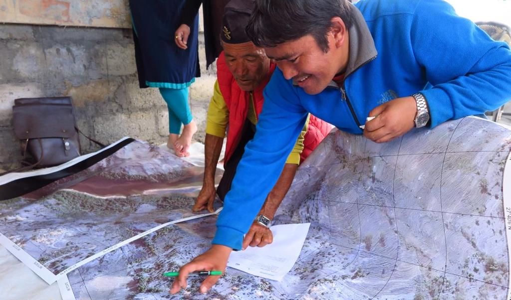
15 Role of the (grassroot) surveyor Table describes different roles of the surveyors and grass root surveyor while applying Fit-For-Purpose Land Administration. Based on experiences in Nepal, Indonesia, Mozambique and Colombia. Drafted by Eva Unger and Christiaan Lemmen,


16 Automated Feature Extraction Visual interpretation of complete cadastral parcels in Ethiopia, Nepal, Rwanda and Ghana (clockwise from top-left). An approach like this will greatly enhance the application of FFP approach in Land Administration for cadastral mapping in areas where no reliable data exists, for e.g. even if a small amount of boundaries could be automatically generated (e.g. 30 percent), potentially large cost reductions in cadastral surveying and mapping could be achieved Source; Divyani Kohli, et al, Increasing legal certainty and reliability of the Cadastral Map Source: Libor Tomandl, Czech Office for Surveying, Mapping and Cadastre,


17 Blockchain and Ledger Technologies & LADM Packages: Party Package Administrative Package Spatial Unit Package with sub-package Surveying and Representation 33 Influence and potential of Lidar Source: Prof. Dr. Juha Hyyppä, Director, Remote Sensing and Photogrammetry, Finnish Geospatial Research Institute
18 Curriculum on Responsible Land Administration The general objective of the curriculum is to strengthen the capacity of higher education and other relevant networks or institutions globally and provide quality undergraduate and post-graduate courses on the theme of pro-poor, gender responsive land tools. Learning objects will include knowledge of international conventions and guidelines, as well as good local and regional case studies that illustrate the importance of responsible approaches to land administration. Source: David Mitchell, et all, If we want to Contribute to the SDGs & Urban Agenda Achieve land rights for all Apply Fit-For-Purpose Land Administration Add value to society Establish Cadastre 4.0 Involve society Use LADM Work with efficient and smart tools Develop our profession..than 36 18
19 We need smart and creative surveyors who can adapt to the developing world and can contribute to a sustainable environment 37 The Developing Role of the Surveyor in a Developing World We all have a responsibility to ensure that our colleagues are ready and equipped to deal with these challenges and that students are educated to address these issues 38 19

20 Proposal + = FIG Publication on the role and responsibility of the surveyor towards the SDGs Workshop Spring 2019 Publication May
Commission 7 Cadastre and Land Administration. Work Plan
 Commission 7 Cadastre and Land Administration Work Plan 2011 2014 Appendix to item 17.7 1. Title Cadastre and Land Administration 2. Terms of Reference Commission 7 deals with land administration and land
Fit-For-Purpose what is it?
 FIG Commission 7 Annual Meeting 2016 Working Group 7.1 Fit-For-Purpose Land Administration Christiaan Lemmen October, 24th 2016 Coimbra, Portugal Fit-For-Purpose what is it? Fit-for-purpose: The systems
Annual Meeting II/2016 FIG Commission 7 Cadastre & Land Management. Report
 Annual Meeting II/2016 FIG Commission 7 Cadastre & Land Management Report 1 Structure Chair G. Schennach (AT) V-Chair for communications, social media, web Hyunsook LEE (KR) WG 7.1 Fit-For-Purpose LA Ch.
Good Land Governance for the 2030 Agenda
 Good Land Governance for the 2030 Agenda Addis Ababa, Ethiopia 20-22 April, 2014 Role of Geospatial Information in Good Land Policy and Governance Oumar Sylla UN-Habitat/GLTN oumar.sylla@unhabitat.org
FIG and FIG Commission 7 Topics of interest
 FIG and FIG Commission 7 Topics of interest Chair FIG Commission 7 Cadastre & Land Management 1 What is FIG? Interna tiona l Fed era tion of Surveyors Féd éra tion Interna tiona le d es Géom ètres Interna
The Profession between Cadastre and Citizen
 The Profession between Cadastre and Citizen Gerda Schennach, Austria Chair of FIG Commission 7 1 A human right UN DECLARATION OF HUMAN RIGHTS Article 17 par (1) Everyone has the right to own property alone
GLTN LAND TOOLS -SOME EXAMPLES-
 GLTN LAND TOOLS -SOME EXAMPLES- Dr. Jaap Zevenbergen University of Twente What are GLTN Land Tools? GLTN considers that a tool is a practical method to achieve a defined objective in a particular context.
Presented at the FIG Congress 2018, May 6-11, 2018 in Istanbul, Turkey
 Presented at the FIG Congress 2018, May 6-11, 2018 in Istanbul, Turkey 5 Bibliometric Analysis of Articles Presented Under Commission 7: A Case of the 25th Fig Congress in Malaysia in 2014 Zeynel Abidin
AFRICA REGIONAL NETOWORK
 Facing the Global Agenda - The Role of Land Professionals Prof. Stig Enemark FIG Honorary President Aalborg University, Denmark AFRICA REGIONAL NETOWORK Challenges and Opportunities in Facing the SDG s:
Land Tools for Tenure Security for All
 Land Tools for Tenure Security for All PROF. JAAP ZEVENBERGEN UNIVERSITY OF TWENTE - ITC 1 ST JUNE 2017 HELSINKI, FINLAND GLOBAL LAND CHALLENGES 70 % Dealing with the affordability issue - how to modernize
DOING BUSINESS Frederic Meunier EDBI Conference, Nairobi
 DOING BUSINESS 2016 Frederic Meunier EDBI Conference, Nairobi May 3 rd, 2016 How has the Registering Property indicator changed over time? Efficiency of land administration systems has always been measured:
The Message FIG-WB Partnership on Land Governance in Support of the Global Agenda
 FIG-WB Partnership on Land Governance in Support of the Global Agenda Prof. Stig Enemark, Denmark President 2007-2010 Mr. Teo Chee Hai, Malaysia President Elect 2011-2014 WORLD BANK LAND GROUP, WASHINGTON,
Implementation of Fit for Purpose Land Administration in Nepal, in a post disaster context.
 Implementation of Fit for Purpose Land Administration in Nepal, in a post disaster context. Paula Dijkstra, Raja Ram Chhatkuli, Danilo Antonio, Eva-Maria Unger, Chrit Lemmen Wondimagegm Tesfaye, Shristee
Cadastre a role model for Private-Public-People-Partnership
 Cadastre 4.0 - a role model for Private-Public-People-Partnership Gerda Schennach, Austria Chair of FIG Commission 7 1 Who owns... buildings? the mountains? land? forests? the sea? infrastructure? 2 From
Flying high and Keeping the feet on the ground
 Building the Capacity The Agenda and Achievements 2007-2010 FIG handover ceremony, FIG headquarters, Copenhagen, 26 November 2010 The Agenda Building the Capacity through Flying high and Keeping the feet
MEMORANDUM OF UNDERSTANDING between THE UNITED NATIONS HUMAN SETTLEMENTS PROGRAMME (UN-HABITAT) and THE INTERNATIONAL FEDERATION OF SURVEYORS (FIG)
 and THE INTERNATIONAL FEDERATION OF SURVEYORS (FIG)") Appendix to item 20.2 MEMORANDUM OF UNDERSTANDING between THE UNITED NATIONS HUMAN SETTLEMENTS PROGRAMME (UN-HABITAT) and THE INTERNATIONAL FEDERATION OF SURVEYORS (FIG) WHEREAS the United Nations Human
Appendix to item 20.2 MEMORANDUM OF UNDERSTANDING between THE UNITED NATIONS HUMAN SETTLEMENTS PROGRAMME (UN-HABITAT) and THE INTERNATIONAL FEDERATION OF SURVEYORS (FIG) WHEREAS the United Nations Human
G. Schennach / Chair Commission 7. Common Vision Conference 5-6 Oct 2017, Vienna, Austria
 Cadastre 4.0 - Integrating the community for global security on land tenure Gerda Schennach, Austria Chair of FIG Commission 7 1 200 years of innovation Fiscal Legal Local Digital Taxation Land Tenure
Fit-For-Purpose Land Administration: Guiding Principles FACILITATED BY:
 Fit-For-Purpose Land Administration: Guiding Principles 1. GLTN overview - GLTN BRIEFING AND PROGRAMME 2. Geospatial Data - Sustainable Development - 3. Fit-for-purpose Land Administration Guiding Principles
Economic and Social Council 6 July 2018
 1 ADVANCE UNEDITED VERSION UNITED NATIONS E/C.20/2018/12/Add.1 Economic and Social Council 6 July 2018 Committee of Experts on Global Geospatial Information Management Eighth session New York, 1-3 August
THE NEED FOR APPROACHES AND TECHNOLOGY OF TOMORROW
 THE NEED FOR APPROACHES AND TECHNOLOGY OF TOMORROW KEES DE ZEEUW, CHRISTIAAN LEMMEN and BERNY KERSTEN Cadastre, Land Registry and Mapping Agency - Kadaster, The Netherlands Kees.dezeeuw@kadaster.nl Paper
Land surveying is probably the (second) oldest profession in the world
 oldest profession in the world") Land Surveying and Land Management in an International Perspective Prof Stig Enemark Honorary President Aalborg University, Denmark CADASTRE IN A DIGITAL WORLD NORDIC AND GLOBAL PRESPECTIVES INTERNATIONAL
Land Surveying and Land Management in an International Perspective Prof Stig Enemark Honorary President Aalborg University, Denmark CADASTRE IN A DIGITAL WORLD NORDIC AND GLOBAL PRESPECTIVES INTERNATIONAL
The Intelligent Cadastre
 The Intelligent Cadastre Rohan Bennett, Kwabena Asiama, and Jaap Zevenbergen FIG Commission 7/3 Workshop on Crowdsourcing of Land Information St Juliens, Malta 16-20 November 2015 What is intelligent?
Progress in modern cadastre Challenging existing models and paradigms
 Progress in modern cadastre Challenging existing models and paradigms Gerda Schennach, Austria Chair of FIG Commission 7 Federal Office of Metrology and Surveying, Austria The Value of Cadastre for Society
Global Eradication of Infectious Diseases
 Global Security of Tenure Campaign the Time of Rights Dr Robin McLaren Land Professional Know Edge Limited Location Information Innovation COMMISSION 7 ANNUAL MEETING, COIMBRA, PORTUGAL OCTOBER 2016 1
Introduction to Land Tenure Administration
 Introduction to Land Tenure Administration Karol Boudreaux Land Tenure & Resource Rights Practice Lead, The Cloudburst Group January 22, 2018 January 22, 2018 1 WHAT WE LL COVER Background and Definitions
Working Group 3 Application of Innovative Technology
 COMMISSION 7 Working Group 7.3 Annual Meeting Seoul, 18-23 May 2007 Working Group 3 Application of Innovative Technology Dr. Daniel Steudler Swiss Federal Directorate of Cadastral Surveying Table of Content
THE XXV FIG INTERNATIONAL CONGRESS IN MALAYSIA Kuala Lumpur, Malaysia, June 2014 at Kuala Lumpur Convention Centre
 CALL FOR PAPERS TO THE XXV FIG INTERNATIONAL CONGRESS IN MALAYSIA Kuala Lumpur, Malaysia, 16 21 June 2014 at Kuala Lumpur Convention Centre Dear Friend and Colleague, It is our privilege and honour to
National Technical University of Athens School of Rural and Surveying Engineering
 National Technical University of Athens School of Rural and Surveying Engineering INFORMAL SETTLEMENTS REAL ESTATE MARKET NEED FOR GOOD LAND ADMINISTRATION AND PLANNING FIG COM3, UNECE CHLM & WPLA JOINT
GLTN Tools and Approaches in Support of Land Policy Implementation in Africa
 GLTN Tools and Approaches in Support of Land Policy Implementation in Africa Jamal Browne (UN-Habitat), Jaap Zevenbergen (ITC), Danilo Antonio (UN-Habitat), Solomon Haile (UN-Habitat) Land Policy Development
Land Markets and Land Rights in support of the Millennium Development Goals
 Land Markets and Land Rights in support of the Millennium Development Goals A Global Perspective Prof. Stig Enemark President Aalborg University, Denmark 3rd LAND ADMINISTRATION FORUM FOR THE ASIA AND
LOW-COST LAND INFORMATION SYSTEM FOR SUSTAINABLE URBAN DEVELOPMENT
 Presented at the FIG Congress 2018, May 6-11, 2018 in Istanbul, Turkey LOW-COST LAND INFORMATION SYSTEM FOR SUSTAINABLE URBAN DEVELOPMENT Case Examples in Kenya and Zambia Presented by John Gitau Land
CONCEPT NOTE EFFECTIVE LAND ADMINISTRATION IN AFRICA TRAINING WORKSHOP
 CONCEPT NOTE EFFECTIVE LAND ADMINISTRATION IN AFRICA TRAINING WORKSHOP Innovative Concepts, Tools and Practices for Effective Land Administration Land Conference Pre-Conference Workshop Advocating & Implementing
Seventh Session of the United Nations Committee of Experts on Global Geospatial Information Management
 Report of the Forum P a g e 1 Seventh Session of the United Nations Committee of Experts on Global Geospatial Information Management Report of the Forum Secure Land Rights and Smart Cities - Making It
FIG Commission 7 Cadastre and Land Management
 1. Title Appendix to item 13 FIG Commission 7 Cadastre and Land Management Cadastre and Land Management 2. Terms of Reference Work Plan 2015 2018 Commission 7 deals with all issues of land rights and land
The Fit- for-purpose Concept
 The Fit- for-purpose Concept Building Spatial Frameworks for Sustainable Land Governance in Sub-Sahara Africa Prof. Stig Enemark Honorary President Aalborg University, Denmark LAND POLICIES AND LAND GOVERNANCE,
UNPLANNED URBAN DEVELOPMENT
 National Technical University of Athens School of Rural and Surveying Engineering UNPLANNED URBAN DEVELOPMENT Chryssy A Potsiou, Lecturer NTUA chryssyp@survey.ntua.gr UNECE WPLA WORKSHOP EFFECTIVE AND
COMMISSION 7 CADASTRE AND LAND MANAGEMENT WORK PLAN
 Appendix to item 34.7 FIG Congress in Washington, 19-26 April 2002 COMMISSION 7 CADASTRE AND LAND MANAGEMENT WORK PLAN 2002 2006 1. Title Cadastre and Land Management 2. Terms of Reference Commission 7
A beautiful setting. The Evolving Role of Cadastral Systems in Support of Good Land Governance. Setting the scene
 The Evolving Role of Cadastral Systems in Support of Good Land Governance Prof. Stig Enemark President Aalborg University, Denmark THE DIGITAL CADASTRAL MAP FIG COMMISSION 7 OPEN SYMPOSIUM KARLOVY VARY,
Land and the New Urban Agenda EGM June 2016
 EGM June 2016 Filiep Decorte Deputy Director New York Liaison Office UN-Habitat 2 August 2016 ROLE OF LAND IN URBAN DEVELOPMENT The New Urban Agenda is about people People need a place to live. Place means
FIG Commission 3 Spatial Information Management. Report of Activities 2009
 Appendix to item 10.3 Report to the 33 rd General Assembly FIG Congress in Sydney, Australia 2010 FIG Commission 3 Spatial Information Management Report of Activities 2009 1. General Since 2007, FIG Commission
Land Governance in Support of The Millennium Development Goals. Stig Enemark Paul van der Molen Robin McLaren
 Land Governance in Support of The Millennium Development Goals Stig Enemark Paul van der Molen Robin McLaren INV 1 - Land Governance in Support of the Millennium Development Goals Sydney, Australia, 11-16
Challenges and Opportunities in Developing Innovative Geospatial Tools for Fit-For-Purpose Land Rights Mapping
 Challenges and Opportunities in Developing Innovative Geospatial Tools for Fit-For-Purpose Land Rights Mapping This project has received funding from the European Union's Horizon 2020 research and innovation
Fit-For-Purpose Land Administration, Standards and Interoperability
 Fit-For-Purpose Land Administration, Standards and Interoperability Christiaan Lemmen Kadaster International University of Twente/ITC UN GGIM Seminar Effective Land Administration Deqing China September,
Key Concepts, Approaches and Tools for Strengthening Land Tenure Security
 Key Concepts, Approaches and Tools for Strengthening Land Tenure Security Dr. Samuel Mabikke Land & GLTN Unit / UN-Habitat Urban CSO Cluster Learning Exchange on Strengthening Land Tenure Security for
International Training Program (ITP) Coordinated Mentor Training Program
 Coordinated Mentor Training Program") Coordinated Mentor Training Program Presented at the FIG Congress 2018, May 6-11, 2018 in Istanbul, Turkey International Training Program (ITP) Paper no 9587: Peter Wasström, Head of International Services
Coordinated Mentor Training Program Presented at the FIG Congress 2018, May 6-11, 2018 in Istanbul, Turkey International Training Program (ITP) Paper no 9587: Peter Wasström, Head of International Services
EXPLORING OPTIONS FOR STANDARDISATION OF PROCESSES AND TRANSACTIONS IN LAND ADMINISTRATION
 EXPLORING OPTIONS FOR STANDARDISATION OF PROCESSES AND TRANSACTIONS IN LAND ADMINISTRATION CHRISTIAAN LEMMEN (1),(2), EVA-MARIA UNGER (2), PETER VAN OOSTEROM (3), MOHSEN KALANTARI (4) AND KEES DE ZEEUW
Challenges in technology, society and policy - how they influence Cadastre and Land Management
 Challenges in technology, society and policy - how they influence Cadastre and Land Management Gyula IVÁN, Hungary Key words: Cadastre, Land Administration, GIS SUMMARY During the last years there has
Flying high and Keeping the feet on the ground
 Building the Capacity The FIG Agenda and Achievements 2007-2010 Prof. Stig Enemark President FACING THE CHALLENGES BUILDING THE CAPACITY FIG CONGRESS, SYDNEY, AUSTRALIA, 11-16 APRIL 2010 The Agenda Building
Land Administration in support of the Global Agenda: Current FIG Policies
 Land Administration in support of the Global Agenda: Current FIG Policies Prof. Stig Enemark President Aalborg University, Denmark FIG COMMISSION 7 ANNUAL MEETING VERONA, ITALY, SEPTEMBER 2008 Current
Importance of Spatial Data Infrastructure in the UNECE Region. Amie Figueiredo INSPIRE Conference 2016 Barcelona, 26 September 2016
 Importance of Spatial Data Infrastructure in the UNECE Region. Amie Figueiredo INSPIRE Conference 2016 Barcelona, 26 September 2016 United Nations Economic Commission for Europe 56 member States in Europe,
The Bathurst Declaration on Land Administration for Sustainable Development
 United Nations and International Federation of Surveyors The Bathurst Declaration on Land Administration for Sustainable Development The Story The cumulative evolution of society s land administration
Scenic Nepal. Land Administration Systems. Outline of Presentation. Interests in land. Rights: Registration and security of tenure positions
 Scenic Nepal Land Administration Systems Managing Rights, Restrictions, and Responsibilities in Land Prof. Stig Enemark President Aalborg University, Denmark SURVEY DEPARTMENT KATHMANDU, NEPAL. 16 FEBRUARY
EXPERT GROUP MEETING ON SUSTAINABLE URBAN DEVELOPMENT IN ASIA
 SUSTAINABLE URBAN DEVELOPMENT IN ASIA AND THE PACIFIC: 2-3 DECEMBER 2014, UNITED NATIONS CONFERENCE CENTRE, BANGKOK, THAILAND SESSION #3 PRIORITY ISSUES FOR SUSTAINABLE DEVELOPMENT IN ASIA AND THE PACIFIC
ACADEMIC AGENDA. Capilla del Mar Hotel - Cartagena (Colombia) December 5 th 7 th of 2017
 December 5 th 7 th of 2017") ACADEMIC AGENDA FIG s 7 th and 9 th Commission Annual Meeting and Conference Cadastre for Emergencies and Disasters Challenges and opportunities for islands and coastlines Capilla del Mar Hotel - Cartagena
ACADEMIC AGENDA FIG s 7 th and 9 th Commission Annual Meeting and Conference Cadastre for Emergencies and Disasters Challenges and opportunities for islands and coastlines Capilla del Mar Hotel - Cartagena
The agenda for a Group of Experts on Land Administration and Management within the United Nations
 Presented at the FIG Working Week 2016, May 2-6, 2016 in Christchurch, New Zealand The agenda for a Group of Experts on Land Administration and Management within the United Nations Kees de Zeeuw, Kadaster
Esri Middle East and Africa User Conference. December Abu Dhabi, UAE. Land Administration. Mark Baker
 Esri Middle East and Africa User Conference December 10 12 Abu Dhabi, UAE Land Administration Mark Baker Our Agenda 0900 0930 Welcome Mark Baker, Esri 0930 1030 New Directions The New Addressing System
Cadastral Template 2003
 PCGIAP-Working Group 3 "Cadastre" FIG-Commission 7 "Cadastre and Land Management" Cadastral Template 2003 The establishment of a cadastral template is one of the objectives of Working Group 3 "Cadastre"
Greetings from Denmark. Property Rights, Restrictions and Responsibilities - A Global Land Management Perspective. Wonderful Copenhagen
 Property Rights, Restrictions and Responsibilities - A Global Land Management Perspective Greetings from Denmark 43,000 sq km Prof. Stig Enemark President Aalborg University, Denmark Aalborg Copenhagen
A new era: Dynamic Information Management
 A new era: Dynamic Information Management Professional and Institutional Developments Kees de Zeeuw MSc Director Kadaster International The Netherlands Affiliate member s perspective 45 affiliates from
Land Tenure and Geospatial Data and Technology
 Land Tenure and Geospatial Data and Technology Ioana Bouvier E3/Land and Urban, USAID Senior Geospatial Analyst January 23, 2018 January 23, 2018 1 OUTLINE 1. Overview of geospatial data and technology
Danish Multipurpose Cadastre Experiences so Far
 Danish Multipurpose Cadastre Experiences so Far Jørgen SKRUBBELTRANG, Denmark Key words: Multipurpose cadastre, restrictions pertaining to public law, new users, top down implementation, quality of the
FIG Working group Valuation and Real estate management through Fin-tech. Manohar Velpuri
 FIG Working group 9.2 - Valuation and Real estate management through Fin-tech Manohar Velpuri Introduction Projects Timeline and working group project updates II plenary - ISO TC 307 report Integration
UN-HABITAT s Mission and Vision. Sustainable urban development Adequate shelter for all
 GLTN contributes to the implementation of pro poor land policies to achieve secure land rights for all www.gltn.net GLTN Secretariat, facilitated by PO Box 30030, Nairobi 00100, Kenya Tel: +254 20 762
The Digital Cadastral Database and the Role of the Private Licensed Surveyors in Denmark
 IRISH INSTITUTE OF SURVEYORS, DUBLIN INSTITUTE OF TECHNOLOGY, 23 NOVEMBER 2005 PUBLISHED IN IIS NEWS, WINTHER 2006. The Digital Cadastral Database and the Role of the Private Licensed Surveyors in Denmark
Participants of the Ministerial Meeting on Housing and Land Management on 8 October 2013 in Geneva
 Summary At its meeting on 2 April 2012, the Bureau of the Committee on Housing and Land Management of the United Nations Economic Commission for Europe agreed on the need for a Strategy for Sustainable
Ignition for Fit For Purpose Land Administration in Nepal
 Presented at the FIG Working Week 2017, May 29 - June 2, 2017 in Helsinki, Finland Ignition for Fit For Purpose Land Administration in Nepal Paula Dijkstra (Netherlands), David Mitchell, Rohan Bennett
Spatial Enablement and the Response to Climate Change and the Millennium Development Goals
 Spatial Enablement and the Response to Climate Change and the Millennium Development Goals Prof. Stig Enemark President Aalborg University, Denmark 18th UNITED NATIONS REGIONAL CARTOGRAPHIS CONFERENCE
PCC Conference and Plenary Meeting "Data as a basis of the digital society March 2018, Sofia. Activity of the geodetic NGOs in Bulgaria
 PCC Conference and Plenary Meeting "Data as a basis of the digital society 13-15 March 2018, Sofia Activity of the geodetic NGOs in Bulgaria Union of Surveyors and Land Managers in Bulgaria Chamber of
UN-GGIM Expert Group on Land Administration and Management Expert Group Meeting, Delft, The Netherlands 14 & 15 March, 2017
 UN-GGIM Expert Group on Land Administration and Management Expert Group Meeting, Delft, The Netherlands 14 & 15 March, 2017 BACKGROUND DOCUMENT The Delft Expert Group Meeting This two-day meeting of the
Landmanagement in support of SDG About Surveyors Role and Profile
 Landmanagement in support of SDG About Surveyors Role and Profile Univ.Prof. EoE Dr.-Ing. Holger Magel FIG Honorary President Founding Director TUM International Master Program Land Management and Land
Coastal Zone Management Land Administration Capacity Building
 Closing Address Prof. Stig Enemark President 6th FIG Regional Conference Coastal Areas and Land Administration - Building the Capacity San José, Costa Rica, 12 15 November 2007 Three Main Themes Coastal
Providing access to land: challenges and solutions Lessons learnt by members of the International Land Coalition
 Providing access to land: challenges and solutions Lessons learnt by members of the International Land Coalition CSD17 Capacity Building Workshop Bangkok, 28-30 January 2009 Dr Michael Taylor, Programme
TURKISH CHAMBER OF SURVEY AND CADASTRE ENGINEERS (HKMO)
") TURKISH CHAMBER OF SURVEY AND CADASTRE ENGINEERS (HKMO) Capital : Ankara Largest City : İstanbul Area : 783,562 km 2 Population : 78,741,053 Population increase ratio : %1,3 Provinces : 81 The Chamber
TURKISH CHAMBER OF SURVEY AND CADASTRE ENGINEERS (HKMO) Capital : Ankara Largest City : İstanbul Area : 783,562 km 2 Population : 78,741,053 Population increase ratio : %1,3 Provinces : 81 The Chamber
LAND TENURE IN ASIA AND THE PACIFIC CHALLENGES, OPPORTUNITIES AND WAY FORWARD
 LAND TENURE IN ASIA AND THE PACIFIC CHALLENGES, OPPORTUNITIES AND WAY FORWARD Workshop on Land Administration and Management 20th United Nations Regional Cartographic Conference for Asia and the Pacific
From Measurement to Management
 From Measurement to Management The changing role of the land surveyors Prof. Stig Enemark Aalborg University, Denmark LAND MANAGEMENT AND HUMAN RIGHTS INTERNATIONAL SEMINAR, HØGSKOLEN I BERGEN, 8 9 SEPTEMBER
UN GGIM LAUNCHES A GROUP OF EXPERTS ON LAND ADMINISTRATION AND MANAGEMENT. KEES DE ZEEUW 1
 UN GGIM LAUNCHES A GROUP OF EXPERTS ON LAND ADMINISTRATION AND MANAGEMENT KEES DE ZEEUW 1 Kees.dezeeuw@kadaster.nl MAHASHE CHAKA 2 Mahashe.Chaka@laa.org.ls CECILLE BLAKE 3 Blake1@un.org 1 Kadaster - Cadastre,
Challenges for the multi purpose cadastre
 Jens RIECKEN, Markus SEIFERT, Germany Key words: Multi purpose cadastre, 3d-cadastre, land use, SDI, solar cadastre SUMMARY Over the past 30 years, with the progress of information technologies the development
A Quantitative Comparison of Completely Visible Cadastral Parcels Using Satellite Images: A Step towards Automation
 A Quantitative Comparison of Completely Visible Cadastral Parcels Using Satellite Images: A Step towards Automation Divyani KOHLI, Netherlands, Rohan BENNETT, Australia, Christiaan LEMMEN, Kwabena ASIAMA,
Creation Land Administration in Formal and Informal Environment. FIG Commission 7 Working Group 1
 Creation Land Administration in Formal and Informal Environment András OSSKÓ, Hungary Key words: land administration, informal land tenure, customary tenure, sustainable Development. SUMMARY FIG Commission
Spatially Enabled Society Role of the Cadastre
 armasuisse Bundesamt für Landestopografie swisstopo Swiss Federal Directorate for Cadastral Surveying Spatially Enabled Society Role of the Cadastre XXIV FIG International Congress 2010 FIG-Task Force
The importance of changes in land surveyors education
 András OSSKÓ Key words: land administration, roles of land surveyors, extended education, lifelong learning SUMMARY It s a world wide experience, especially in developed countries that the interest in
A Geocoded Cadastral Fabric as a Precondition for a Sustainable Land Management System
 A Geocoded Fabric as a Precondition for a Sustainable Land Management System Gottfried KONECNY, Germany; J.P. LAUZON, Canada; Abdul Salam MOHAMMED, India Key words: SDI,, Parcel Boundaries, GPS-GNSS, Land
Deqing International Seminar on United Nations Global Geospatial Information Management Effective Land Administration September 2018
 Provisional Annotated Agenda 08:00 a.m. 09:00 a.m. Registration of Participants Thursday, 27th September 2018 09:00 a.m. 10:00 a.m. Joint Official Opening Session Joint official opening session of the
Implementing Innovative Land Tenure Tools In East-Africa: SWOT-Analysis Of Land Governance
 Presented at the FIG Working Week 2017, May 29 - June 2, 2017 in Helsinki, Finland Implementing Innovative Land Tenure Tools In East-Africa: SWOT-Analysis Of Land Governance Ine BUNTINX, Joep CROMPVOETS,
REGISTRATION OF PROPERTIES IN STRATA
 REGISTRATION OF PROPERTIES IN STRATA REPORT ON THE WORKING SESSIONS INTRODUCTION A cadastre is usually, and in most countries, a parcel-based, and up-to-date land information system containing records
Modernizing Land Administration Systems
 Presented at the FIG Congress 2018, May 6-11, 2018 in Istanbul, Turkey Modernizing Land Administration Systems B r e n t J o n e s P E, PLS E s r i Land Administration Systems GIS is the Technology Platform
A Fit For Purpose approach to Land Administration in Africa in support of the new 2030 Global Agenda *
 2017 CONFERENCE ON LAND POLICY IN AFRICA UN ECONOMIC COMMISISON FOR AFRICA, ADDIS ABABA, ETHIPOIA, 14 17 NOVEMBER 2017 A Fit For Purpose approach to Land Administration in Africa in support of the new
Facing the global agenda Outline of presentation
 The global surveying profession Global Trends towards a Spatially Enabled Society Prof. Stig Enemark President Aalborg University, Denmark AREAL OG EJENDOM 2009 - NORGES JORDSKIFTEKANDIDATFORENING VESTBY
BOOSTING THE REGISTRATION OF LAND RIGHTS IN STEP WITH THE SUSTAINABLE DEVELOPMENT GOALS
 BOOSTING THE REGISTRATION OF LAND RIGHTS IN STEP WITH THE SUSTAINABLE DEVELOPMENT GOALS KEES DE ZEEUW Cadastre, Land Registry and Mapping Agency - Kadaster, The Netherlands Kees.dezeeuw@kadaster.nl CHRISTIAAN
Self-Regulation in Colombian Securities Markets
 Self-Regulation in Colombian Securities Markets SEMINAR ON SRO STRUCTURE January 31, 2006 International Securities Consultancy Agenda 1. Background Project objectives Key Findings Key Issues 2. International
Lessons for federated countries that have state land registries the Australian experience
 Lessons for federated countries that have state land registries the Australian experience Ian Williamson Centre for SDI and Land Administration Department Infrastructure Engineering University of Melbourne
The doughnut of social and planetary boundaries for development Chemical pollution Greenhouse gases Atmospheric particle loading Transformation within
 Are We Embracing the Global Transformative Forces? FUTURE 12 Fredrik Zetterquist, Chair UN-ECE WPLA The doughnut of social and planetary boundaries for development Chemical pollution Greenhouse gases Atmospheric
PCC conference Tällberg. Aspects on development cooperation
 PCC conference Tällberg Aspects on development cooperation PCC conference Tällberg WHO I AM Anders Åberg, Project Leader Posted over seas 10 years Tanzania 1978 1980 Vietnam 1987 1990 Laos 2004 2008 Now
NELGA GOOD PRACTICES. Training Workshop on Effective Land Administration in Africa
 Training Workshop on Effective Land Administration in Africa Training workshop on effective land administration in Africa A training workshop on effective land administration in Africa was held at United
STATUS REPORT
 Working Group 3 Land Administration STATUS REPORT 2006-2009 2009 Prof Ian Williamson (Chair) Mr Ahmad Fauzi Nordin (Vice Chair) Assoc. Prof Abbas Rajabifard (Vice Chair) 18th UNRCC-AP Conference Bangkok
SHELTER PROGRAM UN-HABITAT ARCADIS SHELTER PARTNERSHIP UN-HABITAT ARCADIS PARTNERSHIP JANUARY 5, 2017 JANUARY 5, 2017
 SHELTER PROGRAM UN-HABITAT ARCADIS SHELTER PARTNERSHIP PROGRAM 2016-2017 UN-HABITAT ARCADIS PARTNERSHIP 2016-2017 JANUARY 5, 2017 JANUARY 5, 2017 2 Shelter in 2016 As a global company, Arcadis understands
ARCHITECTURE (ARCH) ARCH Courses. Architecture (ARCH) 1
 ARCH Courses. Architecture (ARCH) 1") Architecture (ARCH) 1 ARCHITECTURE (ARCH) ARCH Courses ARCH 101. Survey of Architectural Education and Practice. 1 unit, W, SP Exploration of the major paradigms which have guided the development of architectural
Architecture (ARCH) 1 ARCHITECTURE (ARCH) ARCH Courses ARCH 101. Survey of Architectural Education and Practice. 1 unit, W, SP Exploration of the major paradigms which have guided the development of architectural
Land Administration Projects Currently there are more than 70 land administration projects being implemented Many donors involved, including NGOs Thes
 Governance in Land Administration: Conceptual Framework Tony Burns and Kate Dalrymple Land Equity International FIG Working Week Stockholm, Sweden June 16-19, 2008 Rationale for better LA Secure land tenure
What Lessons can we learn from the Mexican Customary Land Registration System for African Customary Areas?
 What Lessons can we learn from the Mexican Customary Land Registration System for African Customary Areas? Grenville Barnes (Univ. of Florida) Maria Digiano (Earth Innovation Institute) Clarissa Augustinus
New Technology for Cadastral Systems. Brent Jones, PE, PLS
 New Technology for Cadastral Systems Brent Jones, PE, PLS Benefits of Good Land Administration Key to addressing global challenges.. Secure Tenure Equitable Land and Property Taxation Support for Government