Size of Lot Required Existing Minimum Lot Size 12,500 sq.ft. 5.0 acres Minimum Lot Width 100 ft. ~227 ft. Minimum Lot Depth 100 ft. ~970 ft.
|
|
|
- Ami Owen
- 5 years ago
- Views:
Transcription

 and Office & Professional (OP) zoning districts to Single-Family Residential-3 (R-3) zoning district; on approximately 25.0 acres of land.")
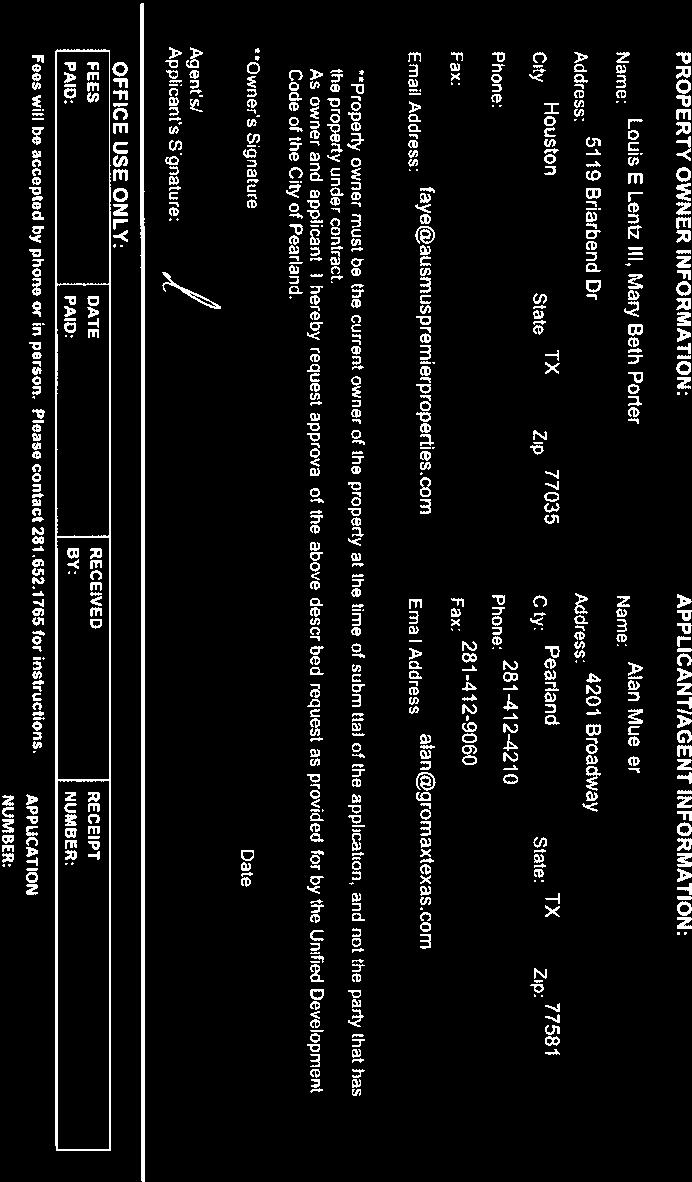
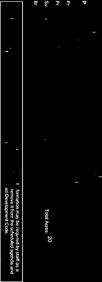
1 AIR AGENDA REQUEST BUSINESS OF THE CITY COUNCIL CITY OF PEARLAND, TEXAS AGENDA OF: Joint Public Hearing - Jun DATE SUBMITTED: 03 May 2018 DEPT. OF ORIGIN: Community Development PREPARED BY: Martin Griggs SUBJECT: Zone Change Application No. ZONE A request of Alan Mueller, applicant, on behalf of Louis E Lentz III, Mary Beth Porter, Barbara Brogen, Billy Long, and Brian Long, owners; for approval of a change in the zoning classification from the General Commercial (GC) and Office & Professional (OP) zoning districts to Single-Family Residential-3 (R-3) zoning district; on approximately 25.0 acres of land. Legal Description: Tract 1: 10.0 acres, Tract 61, Section 9, HT&BRR Company Survey, Abstract 234,Brazoria County, Texas, according to the recorded map or plat thereof in Volume 2, Page 23, of the Plat Records of Brazoria County, Texas. Tract 2: 10.0 acres, Tract 62, Section 9, HT&BRR Company Survey, Abstract 234, Brazoria County, Texas, according to the recorded map or plat thereof in Volume 2, Page 23, of the Plat Records of Brazoria County, Texas. Tract 3: 5.0 acres, south 1/2 of Tract 60, Section 9, HT&BRR Company Survey, Abstract 234, Brazoria County, Texas, according to the recorded map or plat thereof in Volume 2, Page 23, of the Plat Records of Brazoria County, Texas. Being acres of land, more or less, being Lot 24 of the George W. Jenkins Subdivision in the W.D.C. Hall League, Abstract Number 70, Brazoria County Texas. General Location: North of the intersection of Roy Road and Broadway Street, on the west side of Roy Road, immediately north of 2614 Roy Road, Pearland TX. ATTACHMENTS: Zoning and Aerial Map Future Land Use Plan Map Notification List Notification Map Page 1 of 29
2 Applicant Packet FUNDING: Grant Developer/Other Cash G.O. Bonds To Be Sold G.O. Bonds - Sold Rev. Bonds to Be Sold Rev. Bonds - Sold C.O.'s To Be Sold C.O.'s - Sold. EXECUTIVE SUMMARY BACKGROUND This request is for approval of a change in zoning from the Office Professional (OP) and General Commercial (GC) zoning to a Single-Family Residential-3 (R-3) zoning district on approximately 25.0 acres of land, located North of the intersection of Roy Road and Broadway Street, on the west side of Roy Road, immediately north of 2614 Roy Road. The ownership is split between two ten acre tracts owned by Louis E Lentz III and Mary Beth Porter and one five acre tract owned by Barbara Brogan, Billy Long, and Brian Long. The property is currently developed with a residence, barn, and a horse training track. The applicant. Alan Muller, proposes the change in zoning to develop the 25 acres for a residential subdivision development. Recommendation Staff does not recommend approval of the requested change in zoning from OP and GC to R-3 on the approximately 25.0 acre site for the following reasons: 1. The proposed change in zoning is not in conformance with the Comprehensive Plan or the Future Land Use Plan. The FLUP indicates that the property is for Business Commercial development which is in conformance with the current zoning designation. 2. The proposed use of the property for a residential subdivision is not appropriate to the existing development surrounding area of land to be reclassified. Rezoning the subject property would disrupt the potential for a large format commercial development to be developed on the 20 acre parcel. 3. The proposed change in zoning is not in conformance with existing public services and utilities. The intersection of Roy Road and Broadway Street is not a signalized intersection. A public sanitary sewer line would need to be installed for the development of this property. Site History The subject property remains in the same state that it was when it was rezoned in 2005; developed with a residence, barn, and horse training track. The site was annexed into the City in The two ten acre tracts were rezoned in 2005 from Suburban Development to GC for possible commercial development. The OP tract was has maintained an OP designation since 2006 with the adoption of the UDC. The below table identifies surrounding uses and zoning districts: Zoning Land Use North Office-Professional (OP) Single-Family Homes South General Business (GB) and General undeveloped and warehouse with Commercial (GC) an office East Office-Professional and General Commercial Servopro and Counseling Page 2 of 29
3 West (GC) Office-Professional (OP) and General Business (GB) Connections for Change Gartner Coatings, 5M rope Supply, Superior LMS, and undeveloped Conformance with the Comprehensive Plan The proposed zoning of R-3 on the subject property is not in conformance with the future land use designation of the Comprehensive Plan. The Future Land Use Plan (FLUP) indicates this property and all properties in the vicinity to be Business Commercial which is intended for properties that have conduct retail business. The current zoning of the property is in accordance with the FLUP. Amending the current zoning designation would not be in conformance with the FLUP or comprehensive plan. Conformance with the Thoroughfare Plan According to City records, Roy Road is a Major Collector street that is to be widened. The right-of-way for Roy Road is approximately 60 feet. Major Collectors are defined as having a minimum right-of-way of 80 feet. Conformance with the Unified Development Code The subject property is not currently developed with a residence, barn, and a horse training track. At this time, the property has a non-conforming use (single-family residence) to its zoning classification. If the proposed R-3 were approved then a cluster plan could be approved lowering the density to 4.7 residences per gross acre. If the property were to be developed for a conforming use today, it's dimensions exceed the minimum requirements for both the OP and GC zoning districts, as indicated in the in the following table. Existing Office Professional (OP) Area Regulations Size of Lot Required Existing Minimum Lot Size 12,500 sq.ft. 5.0 acres Minimum Lot Width 100 ft. ~227 ft. Minimum Lot Depth 100 ft. ~970 ft. Existing General Commercial (GC) Area Regulations Size of Lot Required Existing Minimum Lot Size 22,500 sq.ft acres Minimum Lot Width 150 ft. ~876 ft. Minimum Lot Depth 125 ft. ~970 ft. Proposed Single-Family Residential-3 (R-3) Area Regulations Size of Lot Required Minimum Lot Size 6,000 sq.ft. Minimum Lot Width 60 ft. Minimum Lot Depth 90 ft. Platting Status The subject property is not currently platted. A preliminary and final plat would be required due to public infrastructure needs and the development of more than four lots. Availability of Utilities Page 3 of 29
4 According to City records, the subject property does have access to City water but does not currently have access to City sanitary sewer infrastructure. A sewer line would need to be extended to Broadway Street for this development. Impact on Existing and Future Development The proposed development will add significant number of daily trips onto Roy Road. Roy Road is currently an underutilized two-lane local road which is the only access to the subject property. The intersection of Roy Road and Broadway Street is not a signalized intersection. The development of a residential subdivision will be required to maintain a landscape reserve to buffer from the existing commercial properties to mitigate potential impacts by their land use to the residences. Rezoning the subject property would disrupt the potential for a large format commercial development such as an office or medical end user who would need a larger area for development. Additional Comments The request has been reviewed by the City s Development Review Committee (DRC) and there were no additional comments. Public Notification Staff sent public notices, comment forms and a vicinity map to the applicant, the owner of the property and to property owners within 200 feet of the subject property under consideration for the zone change. Additionally, a legal notice of the public hearing was published in the local newspaper, and a notification sign was placed on the property by the applicant. Opposition to or Support of Proposed Request Staff has received one comment form in favor and none in opposition of the proposed change in zoning request. Page 4 of 29

5 MH Exhibit 1 R-1 ROY RD SR-12 SR-12 Zoning and Aerial Map 2510 Roy Road ZONE GC GC B QUIET AR Legend OP PUD Subject Property GB MAX RD GC OP REID BLVD GB FMOP R-1 R-1 GB R-1 N AFTO DR GB GB GC PIPER RD R-1 GC GB MANVEL RD GB GB LVD GB DB REI Page 5 of 29 R-1 GC OP GC GB City Limits OP OP OR LN ETJ G/O-MU GB GB BROADWAY ST GB R-1 GC GB GC This product is for informational purposes and may not have been prepared for or be suitable for legal, engineering, or surveying purposes. It does not represent an on-the-ground survey and represents only the approximate relative location of property boundaries. 1 inch = 500 feet MAY 2018 PLAN NI NG DE PARTMENT
6 ROY RD Park Low Density Residential Exhibit 2 Future Land Use Plan 2510 Roy Road ZONE QUIET ARBOR LN MAX RD Legend Subject Property City Limits ETJ Garden/O'Day Mixed Use Dist Page 6 of 29 REID BLVD Retail, Offices and Services REID BLVD MANVEL RD FM 1128 Business Commercial PIPER RD AFTON DR BROADWAY ST This product is for informational purposes and may not have been prepared for or be suitable for legal, engineering, or surveying purposes. It does not represent an on-the-ground survey and represents only the approximate relative location of property boundaries. 1 inch = 500 feet MAY 2018 PLANNING DEPARTMENT
7 Notification List ZONE Property_Owner Address City State Zip_Code 2ML REAL ESTATE INTEREST INC 952 ECHO LN STE 314 HOUSTON TX ADAMS FRANCES P FAMILY INT PARTNERSHIP LTD 3305 CHURCHILL ST PEARLAND TX ALE LAND INVESTMENTS LLC 2413 ROY RD PEARLAND TX ALMEDA GENOA LLC 4548 BISSONNET STREET #300 BELLAIRE TX BAHAM INTERESTS LIMITED PARTNERSHIP 407 LAUREL DR FRIENDSWOOD TX BARBEE HURST S 2537 MAX RD PEARLAND TX BOGAN BARBARA ANN & BILLY CLIFTON LONG JR & BRIAN KEITH LONG 2579 W 108TH ST W JENKS OK CITY OF PEARLAND 3519 LIBERTY DR PEARLAND TX CPI GROUP INC % LORI JOHNSON PO BOX 1710 PEARLAND TX GARTNER INTERESTS LTD 2433 MAX RD PEARLAND TX LENTZ LOUIS E III & MARYBETH PORTER 5119 BRIARBEND DR HOUSTON TX MAI RICKY S 6911 BELTON DR MANVEL TX MOHAN MERRILL 2421 ROY RD PEARLAND TX MORGAN LARRY J 2430 ROY RD PEARLAND TX MP & CP LLC 95 DOLPHIN LANE FREEPORT TX MUELLER ALAN 4201 BROADWAY ST PEARLAND TX PREBILSKY LILLIAN 915 MORNINGSIDE CT FRIENDSWOOD TX PT & SONS INVESTMENTS P O BOX 2754 PEARLAND TX TRINH THU BRIGHTON LN HOUSTON TX YOUNG LOYE & MARY REVCBLE TRUST 2525 MAX RD PEARLAND TX Page 7 of 29
8 Exhibit 3 Notification Area Map 2510 Roy Road ROY RD ZONE QUIET ARBOR LN MAX RD Legend Subject Property Notification Area City Limits ETJ REID BLVD REID BLVD This product is for informational purposes and may not have been prepared for or be suitable for legal, engineering, or surveying purposes. It does not represent an on-the-ground survey and represents only the approximate relative location of property boundaries. Page 8 of 29 MANVEL RD FM 1128 BROADWAY ST PIPER RD AFTON DR 1 inch = 500 feet MAY 2018 PLANNING DEPARTMENT


9 Page 9 of 29


10 DocuSign Envelope ID: 8B2C65B5-89B6-472E-A2B4-8200F824E /2/2018 4/2/2018 4/2/2018 Page 10 of 29
11 25-Acre Roy Road Owner Contact Information There are multiple owners for the tracts involved with this application that would not fit within the form on the application portal. The contact info entered on the portal is for the buyer s representative. Louis E. Lentz III and Marybeth Porter 5119 Briarbend Dr Houston TX Real Estate Broker: Faye Ausmus faye@ausmuspremierproperties.com Barbara Brogan, Billy Long, Brian Long 2579 West 108 th Street West Jenks OK Real Estate Broker: Carla Nettles Carla@summitrealtors.com Page 11 of 29
12 Date: 4/1/18 City of Pearland 3519 Liberty Dr. Pearland TX RE: Zoning Representation To Whom It May Concern: The undersigned affirms that I/we am the owner of a 5-acre tract of land (Tax ID# ) on Roy Road in Pearland, Texas. I/we hereby authorize Alan Mueller and Paul Grohman of Gromax Development, to act on my/our behalf regarding the zone change application on said tract. This representation may be withdrawn at any point prior to final approval of the action by the city of Pearland. Sincerely, Barbara Brogan Billy Long Brian Long By: Name: Brian K Long 2579 W. 108 th Street West Jenks OK Page 12 of 29
 on Roy Road in")
13 DocuSign Envelope ID: 9CDC290D-3F56-44A9-A644-ABA9DD71407D 4/2/2018 Date City of Pearland 3519 Liberty Dr. Pearland TX RE: Zoning Representation To Whom It May Concern: The undersigned affirms that I/we am the owner of a 20-acre tract of land (Tax ID# and ) on Roy Road in Pearland, Texas. I/we hereby authorize Alan Mueller and Paul Grohman of Gromax Development, to act on my/our behalf regarding the zone change application on said tract. This representation may be withdrawn at any point prior to final approval of the action by the city of Pearland. Sincerely, Louis E. Lentz III Mary Beth Porter By: Louis E Lentz Marybeth III Porter Name: 5119 Briarwood Dr. Houston TX Page 13 of 29
14 LEGAL DESCRIPTION ROY ROAD TRACTS Tract 1: 10.0 acres, Tract 61, Section 9, HT&BRR Company Survey, Abstract 234, Brazoria County, Texas, according to the recorded map or plat thereof in Volume 2, Page 23, of the Plat Records of Brazoria County, Texas. Tract 2: 10.0 acres, Tract 62, Section 9, HT&BRR Company Survey, Abstract 234, Brazoria County, Texas, according to the recorded map or plat thereof in Volume 2, Page 23, of the Plat Records of Brazoria County, Texas. Tract 3: 5.0 acres, south ½ of Tract 60, Section 9, HT&BRR Company Survey, Abstract 234, Brazoria County, Texas, according to the recorded map or plat thereof in Volume 2, Page 23, of the Plat Records of Brazoria County, Texas. Page 14 of 29

15 Parcel Map Printed from City Website Site Page 15 of 29
16 Gromax Development April 3, 2018 Planning and Zoning Commission City of Pearland 3519 Liberty Dr. Pearland TX RE: Zoning letter of intent 25 acres Roy Road Zone change from GC & OP to R3 Planning and Zoning Commission Members: We are submitting this letter of intent in support of the proposed rezoning of the referenced property. The purpose of this zone change is to allow development of a quality deed-restricted residential community. Ascertaining an appropriate zoning and land use for this property is challenging due to the existing mixture of uses surrounding the tract. Prior to annexation of this property in 1996 and 1997, this area of Pearland was on the rural outskirts of what was then Pearland; prior to that time, the city limits extended no further west than Harkey/O Day Road. Consequently, many of the existing commercial uses surrounding this tract developed in the ETJ with no zoning or building permit controls. Similar to Garden Road, O Day Road, and Cullen Parkway, which have mixed-use zoning designations, uses in this area were and are a jumble of small commercial, rural acreage homes, and vacant land. The current zoning of these tracts was largely based on existing uses at the time of annexation or whatever was requested by the owners immediately after the annexation. The debate as to appropriate land uses continued through the advisory committee for the most recent Comprehensive Plan update, ultimately concluding to leave the Business Commercial future land use plan designation because of the puzzling nature of this area. However, as major residential development in Pearland is ramping down, it is becoming more evident that there is an over-abundance of commercially designated land in this no man s land in the middle of the City. There is ample commercially zoned property with FM 518 frontage that remains undeveloped, meaning that small properties situated in inferior locations such as the subject tract are not viable for non-residential development. Better-situated commercial tracts remain vacant or underutilized. As development in Pearland shifts more toward smaller infill tracts, small, quality residential neighborhoods will often be the highest and best. Residential infill allows marginal tracts to be put to Page 16 of 29
17 Gromax Development productive use, while at the same time creating the additional demand that can drive commercial development on the better-situated tracts on major thoroughfares such as FM 518. Detailed land planning is still in progress by the applicant, but we expect this land will support approximately 75 single family homes. The average home will likely be in the 2,500 square foot range valued at approximately $340,000. The neighborhood will have a quality amenity package to serve the residents and appropriate buffering and fencing on the edges. The applicant would entertain submission of a cluster plan to provide more surety on the plan of development if that is a concern for the Commission. In summary: The property is a minimum of 875 feet off of FM 518, well beyond the typical depth of successful commercial properties. Even big box uses typically have a depth of no more than 660 feet. Other than a few scattered commercial uses developed over 30 years ago prior to annexation, Roy Road is not a commercial corridor. The surrounding patchwork development mostly developed prior to annexation and would not be replicated in today s environment. The correct use for this property is puzzling, but it is not well situated for commercial development; there is an over-abundance of better-situated tracts available for commercial development. Infill residential development on this tract is the highest and best use that will put the property to productive use while helping to create the demand for development of better-situated commercial tracts directly facing FM 518. We appreciate your time with this process and request your favorable consideration of this request. Sincerely, Alan R. Mueller Alan R. Mueller Gromax Development Page 17 of 29
18 March 30, 2018 City of Pearland 3519 Liberty Dr. Pearland TX RE: Sign Placement Acknowledgement To Whom It May Concern: We acknowledge that we are responsible for placing the required zone change notification sign on the property at least 10 days prior to the public hearing. Sincerely, Alan R. Mueller Alan R. Mueller Page 18 of 29
19 CAD Account #'s (1): Order Notes Texas taxes are usually billed for the calendar year on or around October 1st. Taxes are delinquent on February 1st. Additional penalties apply to current year delinquencies on July 1st. Property ID/CAD #: Geo ID/Assessor Acct #: Situs Address: Owner(s): ROY RD PEARLAND, TX BOGAN BARBARA ANN & BILLY CLIFTON LONG JR & BRIAN KEITH LONG Mailing Address: 2579 W 108TH ST W, JENKS OK American Property Guard Certified Tax Certificate Page 1 of 3 Certificate Fee: $54.00 Order #: /02/2018 Legal Description A0234 H T & B R R TRACT 60 (S/2) ACRES 5.00 Deed: VOL 09/ Assessed As: Acres Assessment Impr Market (+) $0.00 Not Available Land Market (+) $114, Not Available Homestead Cap (-) $0.00 Not Available Market Total (=) $114, Not Available Assessed Total (=) $114, Not Available Certified Yes Not Available Exemptions None Not Available 2017 W/O Exemptions Estimate: $3, Summary for Account #: Entity Year Base Tax Due 4/2018 Due 5/2018 Brazoria County 2017 $ $0.00 $0.00 City of Pearland 2017 $ $0.00 $0.00 Pearland Independent School District 2017 $1, $0.00 $0.00 Totals $3, $0.00 $0.00 Checks Due for Account #: Entity Year Tax Rate Due 4/2018 Due 5/2018 Status Brazoria County $0.00 $0.00 Paid Totals $0.00 $0.00 support@americanpg.com 1123 Park View Drive Covina, CA Page 19 of 29
20 Brazoria County Payable To: Ro'Vin Garrett, PCC Account #: Tax Rate W/O Exemption Not Available $ Tax Year Exemptions Base Tax Due 4/2018 Due 5/ None $ $0.00 $0.00 Subtotals $ $0.00 $0.00 City of Pearland Payable To: Ro'Vin Garrett, PCC Account #: Tax Rate W/O Exemption Not Available $ Tax Year Exemptions Base Tax Due 4/2018 Due 5/ None $ $0.00 $0.00 Subtotals $ $0.00 $0.00 Pearland Independent School District Payable To: Ro'Vin Garrett, PCC Account #: Tax Rate W/O Exemption Not Available $1, Tax Year Exemptions Base Tax Due 4/2018 Due 5/ None $1, $0.00 $0.00 Subtotals $1, $0.00 $0.00 Brazoria County Drainage District #4 (Pearland) Payable To: Ro'Vin Garrett, PCC American Property Guard Certified Tax Certificate Page 2 of 3 Certificate Fee: $54.00 Order #: /02/2018 Account #: Tax Rate W/O Exemption Not Available $ Tax Year Exemptions Base Tax Due 4/2018 Due 5/ None $ $0.00 $0.00 Subtotals $ $0.00 $0.00 support@americanpg.com 1123 Park View Drive Covina, CA Page 20 of 29
21 Road & Bridge Fund Payable To: Ro'Vin Garrett, PCC Account #: Tax Rate W/O Exemption Not Available $68.80 Tax Year Exemptions Base Tax Due 4/2018 Due 5/ None $68.80 $0.00 $0.00 Subtotals $68.80 $0.00 $0.00 Exemption Information American Property Guard Certified Tax Certificate Certificate Fee: $54.00 Order #: /02/2018 Disabled Veteran Page 3 of 3 Entity HOM OV65 DP 10-30% 31-50% 51-70% % Brazoria County +20% 100K 100K 5K 7.5K 10K 12K City of Pearland +2.5% 40K 40K 5K 7.5K 10K 12K Pearland Independent School District 25K 13.8K 10K 5K 7.5K 10K 12K Brazoria County Drainage District #4 (Pearland) +20% 75K 75K 5K 7.5K 10K 12K Road & Bridge Fund 3K+20% 100K 100K 5K 7.5K 10K 12K CONDITIONS AND DISCLAIMERS THIS REPORT IS PROVIDED SUBJECT TO THE LIMITATIONS AND EXCLUSIONS CONTAINED WITHIN THE AMERICAN PROPERTY GUARD SUPPLIER AGREEMENT ("AGREEMENT"), AS MODIFIED FROM TIME TO TIME. IT IS EXPRESSLY UNDERSTOOD THAT THIS REPORT DOES NOT CONSTITUTE A REPORT UPON THE SUBJECT PROPERTY ON (i) THE STATUS OF TITLE, (ii) LIENS, (iii) MINERAL (WHETHER WORKING OR ROYALTY) INTERESTS, TAXES OR LEASES, (iv) PERSONAL PROPERTY TAXES, OR (v) OTHER FORMS OF NON-AD VALOREM TAXES WHICH MAY BE, OR HAVE BEEN, ASSESSED (EX. PAVING ASSESSMENTS AND/OR LIENS, HOMEOWNER ASSESSMENTS, MAINTENANCE ASSESMENT) AND NO REPRESENTATION OR WARRANTY IS PROVIDED WITH REGARD TO ANY OF SUCH MATTERS. ANY INFORMATION CONTAINED WITHIN ANY REPORT PROVIDED BY APG REGARDING ANY OF FOREGOING IS PROVIDED FOR INFORMATIONAL PURPOSES ONLY AND MAY NOT BE COMPLETE, ACCURATE OR RELIED UPON BY ANY PARTY. support@americanpg.com 1123 Park View Drive Covina, CA Page 21 of 29
22 American Property Guard Certified Tax Certificate Certificate Fee: $54.00 Order #: /14/2018 CAD Account #'s (2): , Order Notes Texas taxes are usually billed for the calendar year on or around October 1st. Taxes are delinquent on February 1st. Additional penalties apply to current year delinquencies on July 1st. Page 1 of 7 Summary of All Accounts Entity Tax Year Base Tax Due 3/2018 Due 4/2018 Brazoria County 2017 $ $0.00 $0.00 City of Pearland 2017 $ $0.00 $0.00 Pearland Independent School District 2017 $1, $0.00 $0.00 Brazoria County Drainage District #4 (Pearland) 2017 $ $0.00 $0.00 Road & Bridge Fund 2017 $50.15 $0.00 $0.00 Total $2, $0.00 $0.00 support@americanpg.com 1123 Park View Drive Covina, CA Page 22 of 29
23 American Property Guard Certified Tax Certificate Certificate Fee: $54.00 Order #: /14/2018 Property ID/CAD #: Geo ID/Assessor Acct #: Situs Address: ROY RD PEARLAND, Owner(s): LENTZ LOUIS E III & MARYBETH PORTER Mailing Address: 5119 BRIARBEND DR HOUSTON, TX Page 2 of 7 Legal Description A0234 H T & B R R, TRACT 62, ACRES Deed: VOL 11/ Assessed As: Acres Account Comments This property may be subject to Ag Rollback taxes. Assessment Impr Market (+) $1, Not Available Land Market (+) $0.00 Not Available AG Market (+) $390, Not Available AG Loss (-) $389, Not Available AG Assessed (=) $ Not Available Capped Values (-) $0.00 Not Available Market Total (=) $391, Not Available Assessed Total (=) $1, Not Available Certified Yes Not Available Exemptions AG Not Available 2017 W/O Exemptions Estimate: $10, Summary for Account #: Entity Tax Year Base Tax Due 3/2018 Due 4/2018 Brazoria County 2017 $10.61 $0.00 $0.00 City of Pearland 2017 $12.40 $0.00 $0.00 Pearland Independent School District 2017 $25.62 $0.00 $0.00 Total $48.63 $0.00 $0.00 Checks Due for Account #: Entity Tax Year Tax Rate Due 3/2018 Due 4/2018 Status Brazoria County $0.00 $0.00 Paid Totals $0.00 $0.00 support@americanpg.com 1123 Park View Drive Covina, CA Page 23 of 29
24 American Property Guard Certified Tax Certificate Certificate Fee: $54.00 Order #: /14/2018 Brazoria County Payable to: Ro'Vin Garrett, PCC Account #: Tax Rate W/O Exemption Not Available $1, Tax Year Exemptions Base Tax Due 3/2018 Due 4/ AG $6.88 $0.00 $0.00 City of Pearland Payable to: Ro'Vin Garrett, PCC Subtotal $6.88 $0.00 $0.00 Account #: Tax Rate W/O Exemption Not Available $2, Tax Year Exemptions Base Tax Due 3/2018 Due 4/ AG $12.40 $0.00 $0.00 Pearland Independent School District Payable to: Ro'Vin Garrett, PCC Subtotal $12.40 $0.00 $0.00 Account #: Tax Rate W/O Exemption Not Available $5, Tax Year Exemptions Base Tax Due 3/2018 Due 4/ AG $25.62 $0.00 $0.00 Brazoria County Drainage District #4 (Pearland) Payable to: Ro'Vin Garrett, PCC Page 3 of 7 Subtotal $25.62 $0.00 $0.00 Account #: Tax Rate W/O Exemption Not Available $ Tax Year Exemptions Base Tax Due 3/2018 Due 4/ AG $2.64 $0.00 $0.00 Subtotal $2.64 $0.00 $0.00 support@americanpg.com 1123 Park View Drive Covina, CA Page 24 of 29
25 American Property Guard Certified Tax Certificate Certificate Fee: $54.00 Order #: /14/2018 Road & Bridge Fund Payable to: Ro'Vin Garrett, PCC Page 4 of 7 Account #: Tax Rate W/O Exemption Not Available $ Tax Year Exemptions Base Tax Due 3/2018 Due 4/ AG $1.09 $0.00 $0.00 Subtotal $1.09 $0.00 $0.00 support@americanpg.com 1123 Park View Drive Covina, CA Page 25 of 29
26 American Property Guard Certified Tax Certificate Certificate Fee: $54.00 Order #: /14/2018 Property ID/CAD #: Geo ID/Assessor Acct #: Situs Address: 2510 ROY RD PEARLAND, Owner(s): LENTZ LOUIS E III & MARYBETH PORTER Mailing Address: 5119 BRIARBEND DR HOUSTON, TX Page 5 of 7 Legal Description A0234 H T & B R R, TRACT 61, ACRES Deed: VOL 11/ Assessed As: Acres Account Comments This property may be subject to Ag Rollback taxes. Assessment Impr Market (+) $42, Not Available Land Market (+) $39, Not Available AG Market (+) $351, Not Available AG Loss (-) $350, Not Available AG Assessed (=) $ Not Available Capped Values (-) $0.00 Not Available Market Total (=) $432, Not Available Assessed Total (=) $81, Not Available Certified Yes Not Available Exemptions AG Not Available 2017 W/O Exemptions Estimate: $11, Summary for Account #: Entity Tax Year Base Tax Due 3/2018 Due 4/2018 Brazoria County 2017 $ $0.00 $0.00 City of Pearland 2017 $ $0.00 $0.00 Pearland Independent School District 2017 $1, $0.00 $0.00 Total $2, $0.00 $0.00 Checks Due for Account #: Entity Tax Year Tax Rate Due 3/2018 Due 4/2018 Status Brazoria County $0.00 $0.00 Paid Totals $0.00 $0.00 support@americanpg.com 1123 Park View Drive Covina, CA Page 26 of 29
27 American Property Guard Certified Tax Certificate Certificate Fee: $54.00 Order #: /14/2018 Brazoria County Payable to: Ro'Vin Garrett, PCC Account #: Tax Rate W/O Exemption Not Available $1, Tax Year Exemptions Base Tax Due 3/2018 Due 4/ AG $ $0.00 $0.00 City of Pearland Payable to: Ro'Vin Garrett, PCC Subtotal $ $0.00 $0.00 Account #: Tax Rate W/O Exemption Not Available $2, Tax Year Exemptions Base Tax Due 3/2018 Due 4/ AG $ $0.00 $0.00 Pearland Independent School District Payable to: Ro'Vin Garrett, PCC Subtotal $ $0.00 $0.00 Account #: Tax Rate W/O Exemption Not Available $6, Tax Year Exemptions Base Tax Due 3/2018 Due 4/ AG $1, $0.00 $0.00 Brazoria County Drainage District #4 (Pearland) Payable to: Ro'Vin Garrett, PCC Page 6 of 7 Subtotal $1, $0.00 $0.00 Account #: Tax Rate W/O Exemption Not Available $ Tax Year Exemptions Base Tax Due 3/2018 Due 4/ AG $ $0.00 $0.00 Subtotal $ $0.00 $0.00 support@americanpg.com 1123 Park View Drive Covina, CA Page 27 of 29
28 American Property Guard Certified Tax Certificate Certificate Fee: $54.00 Order #: /14/2018 Road & Bridge Fund Payable to: Ro'Vin Garrett, PCC Page 7 of 7 Account #: Tax Rate W/O Exemption Not Available $ Tax Year Exemptions Base Tax Due 3/2018 Due 4/ AG $49.06 $0.00 $0.00 Subtotal $49.06 $0.00 $0.00 CONDITIONS AND DISCLAIMERS THIS REPORT IS PROVIDED SUBJECT TO THE LIMITATIONS AND EXCLUSIONS CONTAINED WITHIN THE AMERICAN PROPERTY GUARD SUPPLIER AGREEMENT ("AGREEMENT"), AS MODIFIED FROM TIME TO TIME. IT IS EXPRESSLY UNDERSTOOD THAT THIS REPORT DOES NOT CONSTITUTE A REPORT UPON THE SUBJECT PROPERTY ON (i) THE STATUS OF TITLE, (ii) LIENS, (iii) MINERAL (WHETHER WORKING OR ROYALTY) INTERESTS, TAXES OR LEASES, (iv) PERSONAL PROPERTY TAXES, OR (v) OTHER FORMS OF NON-AD VALOREM TAXES WHICH MAY BE, OR HAVE BEEN, ASSESSED (EX. PAVING ASSESSMENTS AND/OR LIENS, HOMEOWNER ASSESSMENTS, MAINTENANCE ASSESMENT) AND NO REPRESENTATION OR WARRANTY IS PROVIDED WITH REGARD TO ANY OF SUCH MATTERS. ANY INFORMATION CONTAINED WITHIN ANY REPORT PROVIDED BY APG REGARDING ANY OF FOREGOING IS PROVIDED FOR INFORMATIONAL PURPOSES ONLY AND MAY NOT BE COMPLETE, ACCURATE OR RELIED UPON BY ANY PARTY. support@americanpg.com 1123 Park View Drive Covina, CA Page 28 of 29

29 Cash Register Receipt City of Pearland Receipt Number R21878 DESCRIPTION ACCOUNT QTY PAID ProjectTRAK $1, ZONE Address: 2510 ROY RD Apn: $1, ZONING $1, ZONING CHANGE SUBMITTAL $1, TOTAL FEES PAID BY RECEIPT: R21878 $1, Date Paid: Thursday, April 05, 2018 Paid By: paul gomer Cashier: 0227 Pay Method: CREDIT CARD Printed: Thursday, April 05, :23 AM 1 of 1 Page 29 of 29
General Location: Southeast corner of Liberty Drive and East Broadway Street, Pearland, TX.
 JOINT PUBLIC HEARING THE CITY COUNCIL CITY AND THE PLANNING AND ZONING COMMISSION OF THE CITY OF PEARLAND, TEXAS, MONDAY, MARCH 20, 2017 6:30 PM COUNCIL CHAMBERS-PEARLAND CITY HALL-3519 LIBERTY DRIVE I.
RESPONSIVE RESULTS-ORIENTED TRUST-BUILDERS ACCOUNTABLE
 RESPONSIVE RESULTS-ORIENTED TRUST-BUILDERS ACCOUNTABLE PZ - 0015 Staff Report City of Pearland TO: Planning and Zoning Commission FROM: Planning and Community Development MEETING: Planning & Zoning - 20
RESPONSIVE RESULTS-ORIENTED TRUST-BUILDERS ACCOUNTABLE
 RESPONSIVE RESULTS-ORIENTED TRUST-BUILDERS ACCOUNTABLE PZ - 0019 Staff Report City of Pearland TO: Planing and Zoning Commission FROM: Planning and Community Development MEETING: Regular Meeting - Dec.
Planning & Zoning Commission
 Planning & Zoning Commission Planning & Development Department August 14, 01 Zoning Map Amendment MAP-1-0001 (Bay View Section 4) Request Rezone approximately 1.19 acres from OS (Open Space) to RSF- (Residential
PLANNING AND ZONING COMMISSION
 PLANNING AND ZONING COMMISSION CITY OF PEARLAND REGULAR MEETING Thursday, October 26, 2017 6:00 PM PUBLIC SAFETY BUILDING 2555 CULLEN PARKWAY SECOND FLOOR TRAINING ROOM (Please park and enter on south
PLANNING AND ZONING COMMISSION
 PLANNING AND ZONING COMMISSION CITY OF PEARLAND REGULAR MEETING Monday, October 2, 2017 6:30 PM PUBLIC SAFETY BUILDING 2555 CULLEN PARKWAY SECOND FLOOR TRAINING ROOM (Please park and enter on south side
M E M O R A N D U M. Meeting Date: October 23, Item No. F-1. Planning and Zoning Commission. Daniel Turner, Planner I
 M E M O R A N D U M Meeting Date: October 23, 2017 Item No. F-1 To: From: Subject: Planning and Zoning Commission Daniel Turner, Planner I PUBLIC HEARING: Consider a recommendation of a of Planned Development
Town of Cary, North Carolina Rezoning Staff Report 14-REZ-20 Habitat for Humanity Evans Road Town Council Meeting October 16, 2014
 Town of Cary, North Carolina Rezoning Staff Report 14-REZ-20 Habitat for Humanity Evans Road Town Council Meeting October 16, 2014 REQUEST To amend the Town of Cary Official Zoning Map by rezoning 0.53
Planning and Development Department. City of La Porte. Zoning Board of Adjustment Agenda
 City of La Porte Established 1892 Planning and Development Department Director Richard Mancilla City of La Porte Zoning Board of Adjustment Agenda Notice is hereby given of a Meeting of the La Porte Zoning
BARROW COUNTY, GEORGIA
 BARROW COUNTY, GEORGIA Application For Rezoning, Special Use, and Change in Conditions BARROW COUNTY DEPARTMENT OF PLANNING AND DEVELOPMENT 30 North Broad Street Winder, Georgia 30680 770-307-3034 APPLICATION
APPLICATION PROCEDURES FOR A MAJOR SUBDIVISION PRELIMINARY PLAT
 APPLICATION PROCEDURES FOR A DEFINITION: The subdivision of a tract of land into at least three (3) residential, commercial, or industrial parcels, including the remainder of the original parcel, fronting
RECOMMENDATION Following the public hearing, consider Zoning Case PD14-16, with a Development Plan.
 Staff Report Zoning Case PD14-16 (Helzer Tract) Planning and Zoning Meeting Date: 12-17-14 Document Being Considered: Ordinance RECOMMENDATION Following the public hearing, consider Zoning Case PD14-16,
Marion County Board of County Commissioners
 Marion County Board of County Commissioners Date: 12/29/2015 P&Z: 12/28/2015 BCC: 1/12/2016 Item Number 160113Z Type of Application Rezoning Request From: A-1 (General Agriculture) To: PUD (Planned Unit
Agenda Information Sheet
 Page 90 Agenda Information Sheet December 13, 2018 Agenda Item Z-18-10 - Conduct a public hearing and consider approval of an ordinance rezoning a 33.4 tract of land out of the H. Teal Survey Abstract
31, Township 29 South, Range 25 East, Polk County, Florida, as depicted by the Land Use Plan attached
 ORDINANCE NO. 2013-04 AN ORDINANCE AMENDING THE ZONING MAP OF THE CITY OF BARTOW, FLORIDA, REZONING APPROXIMATELY 2. 2 ACRES OF LAND OWNED BY BALA3I OF POLK COUNTY, LLC AND LOCATED IN SECTION 31, TOWNSHIP
APPLICATION PROCEDURES FOR A PLAT AMENDMENT OR REVISION
 APPLICATION PROCEDURES FOR A PLAT AMENDMENT OR REVISION DEFINITION: Any revision or amendment to an approved recorded or unrecorded final plat. A revision (not recorded) does not require a public hearing
M E M O R A N D U M. Planning and Zoning Commission. Daniel Turner, Planner I
 M E M O R A N D U M Meeting Date: April 27, 2015 Item No. E-1 To: From: Planning and Zoning Commission Daniel Turner, Planner I Subject: Consider approval of a Final Plat for Gean Estates, Phase I, a proposed
LOT LINE ADJUSTMENT GENERAL INFORMATION AND
 LOT LINE ADJUSTMENT GENERAL INFORMATION AND APPLICATION Mariposa County Planning Department 5100 Bullion Street, P.O. Box 2039 Mariposa, CA 95338 Telephone (209) 966-5151 FAX (209) 742-5024 www.mariposacounty.org
CITY OF DECATUR, TEXAS
 Final Plat or Amending Plat / Replat Checklist A submittal of a complete application will facilitate a timely review. Failure of the applicant to provide required information or obtain a waiver from the
R e z o n i n g A p p l i c a t i o n S u b m i s s i o n R e q u i r e m e n t s
 H O R R Y C O U N T Y P L A N N I N G & Z O N I N G 1 3 0 1 2 N D A V E., S U I T E 1 D - 0 9 C O N W A Y, S. C. 2 9 5 2 6 P H O N E : 8 4 3. 9 1 5. 5 3 4 0 F A X : 8 4 3. 9 1 5. 6 3 4 1 R e z o n i n
Cover Letter with Narrative Statement
 Cover Letter with Narrative Statement March 31, 2017 rev July 27, 2017 RE: Rushton Pointe Residential Planned Unit Development Application for Public Hearing for RPUD Rezone PL2015 000 0306 Mr. Eric Johnson,
The requested rezoning would be consistent with the City of Wilmington Focus Area of Welcoming Neighborhoods and Public Spaces.
 ITEM PH3 OFFICE OF THE CITY MANAGER (910) 341-7810 FAX(910)341-5839 TDD (910)341-7873 1/6/2015 City Council City Hall Wilmington, North Carolina 28401 Dear Mayor and Councilmembers: Attached for your consideration
ACTION FORM BRYAN CITY COUNCIL
 ACTION FORM BRYAN CITY COUNCIL DATE OF COUNCIL MEETING: July 8, 2014 DATE SUBMITTED: June 17, 2014 DEPARTMENT OF ORIGIN: Development Services SUBMITTED BY: Maggie Dalton MEETING TYPE: CLASSIFICATION: ORDINANCE:
MINOR PLAT. The following documents are provided as required by the City of Conroe for use in the above titled platting submittals:
 Public Works - Engineering Division CITY OF CONROE MINOR PLAT The following documents are provided as required by the City of Conroe for use in the above titled platting submittals: Submittal Questionnaire
PLANNING COMMISSION APPLICATION - INSTRUCTIONS AND CHECKLIST
 City of North Royalton Mayor Robert A. Stefanik Community Development, Building Division Dan Kulchytsky Building Commissioner 11545 Royalton Road, North Royalton, OH 44133 Phone: 440-582-3000 Fax: 440-582-3089
Leon County APPLICATION FOR PUD REZONING REVIEW
 APPLICATION FOR PUD REZONING REVIEW The undersigned, owner of the hereinafter-described property, hereby petitions Leon County for the following amendment to the Official Zoning Map: Change in Zoning District
Planned Residential Development ( PRD ) Application
 Application") FOR PLANNING USE ONLY Application # PRD Application Fee $ Receipt No. Filing Date Completeness Date Planned Residential Development ( PRD ) Application A. PROJECT INFORMATION 1. Project Name: 2. Address
FOR PLANNING USE ONLY Application # PRD Application Fee $ Receipt No. Filing Date Completeness Date Planned Residential Development ( PRD ) Application A. PROJECT INFORMATION 1. Project Name: 2. Address
M E M O R A N D U M. Meeting Date: April 9, Item No. F-1. Planning and Zoning Commission. Scott Bradburn, Planner I
 M E M O R A N D U M Meeting Date: April 9, 2018 Item No. F-1 To: From: Subject: Planning and Zoning Commission Scott Bradburn, Planner I PUBLIC HEARING: Consider a recommendation for a Specific Use Permit
Planning & Zoning Commission
 Zoning Change 13-03 (FM 646) Planning & Zoning Commission Planning & Development Department June 3, 2013 Request Permitted Uses Rezone approximately 24.89 acres of undeveloped land from RSF-7 (Residential
LAND USE PERMIT APPLICATION
 LAND USE PERMIT APPLICATION Date Application No. TYPE OF PERMIT Subdivision Short Plat Conditional Use Binding Site Plan Final Plat Final Short Plat Variance Final Binding Site Plan Plat Amendment Short
MAJOR RESIDENTIAL AND NONRESIDENTIAL SUBDIVISIONS
 Lawrence-Douglas County MAJOR RESIDENTIAL AND NONRESIDENTIAL SUBDIVISIONS Preliminary Plats The applicant shall schedule a Pre-Application meeting with Planning Staff at least seven (7) working days prior
1 S Central Ave, PO Box 2286 Umatilla, FL (352) Fax# (352)
 Fax# (352)") Applications go through the following steps: Technical Review Committee CITY OF UMATILLA TIMETABLE FOR PLANNING & ZONING APPLICATIONS Applications can take anywhere from 60 to 90 days for approval, depending
Applications go through the following steps: Technical Review Committee CITY OF UMATILLA TIMETABLE FOR PLANNING & ZONING APPLICATIONS Applications can take anywhere from 60 to 90 days for approval, depending
SUBJECT PARCEL(S) Property Owner(s) TMS Number Approximate Acreage Carolina Park Development, LLC
 Property Owner(s) TMS Number Approximate Acreage Carolina Park Development, LLC") Staff Report Special Planning Commission Meeting November 19, 2014 For reference, the Zoning Code and Land Development Regulations are available online. AGENDA ITEM 5c. SKETCH PLAN APPROVAL REQUEST: Request
Staff Report Special Planning Commission Meeting November 19, 2014 For reference, the Zoning Code and Land Development Regulations are available online. AGENDA ITEM 5c. SKETCH PLAN APPROVAL REQUEST: Request
Town of Cary, North Carolina Rezoning Staff Report 12-REZ-27 Morris Branch Town Council Public Hearing January 24, 2013
 Town of Cary, North Carolina Rezoning Staff Report 12-REZ-27 Morris Branch Town Council Public Hearing January 24, 2013 REQUEST To amend the Town of Cary Official Zoning Map to rezone approximately 9.0
2835 Overpass Road, Tampa, FL 33619
 2835 Overpass Road, Tampa, FL 33619 FOR SALE $6,1, LEASE $4.95 PSF NNN BLDG 3 4,55 SF BLDG 1 87,19 SF 11.22 Acres BLDG 2 OFFICE 5,88 SF 3 building complex on 11.22 paved and fenced acres. Covered loading
Planning & Zoning Commission
 Zoning Change Z15-08 (2103 ) Planning & Zoning Commission Planning & Development Department May 18, 2015 Request Applicant /Owner Rezone approximately 2.844 acres of land from OS (Open Space) to RSF-20
SPECIAL ZONING DISTRICTS
 SPECIAL ZONING DISTRICTS 5.01 5.99 RESERVED 5.100 PLANNED DEVELOPMENTS: Purpose: This district is intended to accommodate unified design of residential, commercial, office, professional services, retail
CITY OF SPRINGDALE, OHIO SPRINGDALE BUILDING DEPARTMENT SPRINGFIELD PIKE SPRINGDALE, OHIO TELEPHONE: (513)
") CITY OF SPRINGDALE, OHIO SPRINGDALE BUILDING DEPARTMENT 11700 SPRINGFIELD PIKE SPRINGDALE, OHIO 45246 TELEPHONE: (513) 346-5730 SUBMISSION REQUIREMENTS AND INSTRUCTIONS FOR MAJOR CHANGE TO A PRELIMINARY
CITY OF SPRINGDALE, OHIO SPRINGDALE BUILDING DEPARTMENT 11700 SPRINGFIELD PIKE SPRINGDALE, OHIO 45246 TELEPHONE: (513) 346-5730 SUBMISSION REQUIREMENTS AND INSTRUCTIONS FOR MAJOR CHANGE TO A PRELIMINARY
CITY OF DURHAM DURHAM COUNTY NORTH CAROLINA. Zoning Map Change Report. RR Existing Zoning. Rural Rural Density Residential Site Characteristics
 CITY OF DURHAM DURHAM COUNTY NORTH CAROLINA Zoning Map Change Report Meeting Date: February 26, 2007 Reference Name Arrowhead () Jurisdiction County Proposed Zoning RR Existing Zoning RS-20 Request Proposed
Town of Cary, North Carolina Rezoning Staff Report 14-REZ-31 Cary Park PDD Amendment (Waterford II) Town Council Meeting January 15, 2015
 Town Council Meeting January 15, 2015") Town of Cary, North Carolina Rezoning Staff Report 14-REZ-31 Cary Park PDD Amendment (Waterford II) Town Council Meeting January 15, 2015 REQUEST To amend the Town of Cary Official Zoning Map by amending
Town of Cary, North Carolina Rezoning Staff Report 14-REZ-31 Cary Park PDD Amendment (Waterford II) Town Council Meeting January 15, 2015 REQUEST To amend the Town of Cary Official Zoning Map by amending
APPLICATION REVIEW CHECKLISTS
 APPLICATION REVIEW CHECKLISTS The following must be submitted with and are part of each application. No application is complete until all required documentation has been submitted to the Community Development
Preliminary Plat/Final Plat Application
 Melissa Municipal Center 3411 Barker Avenue Melissa, Texas 75454 Phone: (972) 838-2036 Applicant: Date: Address: Phone: Contact: Fax: E-mail: Propose Addition Name: Acres: Existing Zoning: Propose Zoning:
SUBDIVISION APPLICATION: RECOMBINATION PLAT or EXEMPT PLAT
 SUBDIVISION APPLICATION: RECOMBINATION PLAT or EXEMPT PLAT Pursuant to Article 7, Section 155.706 of the Unified Development Code, an owner of land within the jurisdiction of the Town (or a duly authorized
Request for Action form is also defined as an application to be considered by the Planning Commission.
 CITY OF NORTH RIDGEVILLE INSTRUCTIONS FOR FILING REQUEST FOR ACTION APPLICATIONS WITH THE PLANNING COMMISSION (Please read the full instruction as it will help in providing a full complete application)
APPLICATION PACKET SUBDIVISION PLAT REVIEW TENTATIVE PRELIMINARY PLAT
 APPLICATION PACKET SUBDIVISION PLAT REVIEW TENTATIVE PRELIMINARY PLAT COMMUNITY DEVELOPMENT DEPARTMENT CHARTER TOWNSHIP OF PLYMOUTH 9955 N. Haggerty Road Plymouth, MI 48170 Fees Revised 7/01/2012 APPLICATION
PRELIMINARY PLATS. The following documents are provided as required by the City of Conroe for use in the above titled platting submittals:
 Public Works Engineering Division CITY OF CONROE PRELIMINARY PLATS The following documents are provided as required by the City of Conroe for use in the above titled platting submittals: Submittal Questionnaire
STAFF REPORT FOR REZONE #R JANUARY 15, 2015 PAGE PC-1 CVH INVESTMENTS LLC 455 E. GOBBI ST UKIAH, CA 95482
 STAFF REPORT FOR REZONE #R 4-2014 JANUARY 15, 2015 PAGE PC-1 OWNERS: JACK L. COX TTEE ET AL PO BOX 1389 UKIAH, CA 95482 CVH INVESTMENTS LLC 455 E. GOBBI ST UKIAH, CA 95482 APPLICANT: SUBJECT: PROPOSAL:
TOWN OF LERAY PLANNING BOARD Minor Subdivision Application Packet
 This Packet is designed to assist applicants in providing the forms needed for submission of a 1 to 4 lot subdivision to the Planning Board for approval. The following should be filled out to ensure the
M E M O R A N D U M. Meeting Date: May 1, Item No. H-4. Steve Polasek, Interim City Manager. David Hawkins, Senior Planner
 M E M O R A N D U M Meeting Date: May 1, 2012 Item No. H-4 To: From: Subject: Steve Polasek, Interim City Manager David Hawkins, Senior Planner PUBLIC HEARING: Consider an ordinance approving a planned
Plat Checklist PLAT TYPES AND DESCRIPTIONS
 Master Plan / Revision to Master Plan (For Platting Purposes Only) Preliminary/Final Plat Preliminary Plat Final Plat Minor Plat Replat Amended Plat Plat Checklist So that we may efficiently review your
Marion County Board of County Commissioners
 Marion County Board of County Commissioners Office of the County Engineer 412 SE 25th Ave. Ocala, FL 34471 Phone: 352-671-8686 Fax: 352-671-8687 DEVELOPMENT REVIEW COMMITTEE A G E N D A February 25, 2013
Parkland-Spanaway-Midland LUAC - Agenda
 1. 6:30 P.M. Parkland-Spanaway-Midland LUAC - Agenda Documents: 8 2 17 PSMAC Agenda.pdf 2. Parkland-Spanaway-Midland LUAC Initial Project Review Documents: Lincoln Court PP IPR PSMAC-RJ.pdf Department
CONCEPT PLAN SUBMISSION REQUIREMENTS:
 STAFF STRONGLY RECOMMENDS A PRE-DEVELOPMENT MEETING BEFORE THE SUBMITTAL OF ANY APPLICATION FOR ZONING, REZONING, CONDITIONAL USE PERMIT (CUP), OR FOR A TEXT AMENDMENT TO A PROVISION(S) OF THE ZONING ORDINANCE.
PRELIMINARY PLAT APPLICATION INFORMATION
 CHARLOTTE COUNTY COMMUNITY DEVELOPMENT DEPARTMENT PRELIMINARY PLAT APPLICATION INFORMATION Sufficiency Review Supply a copy of the completed Application form plus Supporting Materials (see checklist below).
CHANGE OF ZONING Fee: $100 APPLICATION
 ROGERS COUNTY 200 S. Lynn Riggs Blvd., Claremore, OK 74017 918-923-4874 County staff to complete this section Case # Payment Received: Hearing Date: Time: 4:00 PM Meeting Location: City of Claremore-City
CITY OF LANCASTER CITY ENGINEERING DIVISION FINAL MAP SUBMITTAL PACKAGE FINAL MAP APPLICATION
 CONTENTS Page 1 - Final Map Application Page 2 - Financial Interest Disclosure Page 3-1 st Submittal Checklist Page 4 - Required Easement Tracking Sheet Page 5 - Easement Submittal Requirements Checklist
FUTURE LAND USE MAP AMENDMENT AND ZONE CHANGE STAFF REPORT
 2017-14-LUM & 2017-79-Z-CO / WB Page 1 of 12 UTURE LAND USE MAP AMENDMENT AND ZONE CHANGE STA REPORT Docket Numbers: 2017-14-LUM and 2017-79-Z-CO/WB Public Hearing Date: November 16, 2017 Pre-Application
Regular Session. Public Wishing to Address the Board. Consent Agenda
 Notice of Meeting for the Planning and Zoning Commission of the City of Georgetown May 20, 2014 at 6:00 PM at City Council Chambers, 101 East 7th Street, Georgetown, TX The City of Georgetown is committed
CITY OF SPRINGDALE, OHIO SPRINGDALE BUILDING DEPARTMENT SPRINGFIELD PIKE SPRINGDALE, OHIO TELEPHONE: (513)
") CITY OF SPRINGDALE, OHIO SPRINGDALE BUILDING DEPARTMENT 11700 SPRINGFIELD PIKE SPRINGDALE, OHIO 45246 TELEPHONE: (513) 346-5730 SUBMISSION REQUIREMENTS AND INSTRUCTIONS FOR FINAL PUD/TRANSITION DISTRICT
CITY OF SPRINGDALE, OHIO SPRINGDALE BUILDING DEPARTMENT 11700 SPRINGFIELD PIKE SPRINGDALE, OHIO 45246 TELEPHONE: (513) 346-5730 SUBMISSION REQUIREMENTS AND INSTRUCTIONS FOR FINAL PUD/TRANSITION DISTRICT
SITE DEVELOPMENT PLAN REQUIREMENTS CHECKLIST
 SITE DEVELOPMENT PLAN REQUIREMENTS CHECKLIST Completed DRC Application for Review Required for Application Process DRC Processing Fee 1 Commercial $2,500.00 Fire Department Review Fee 150.00 Total $2,650.00
BOSSIER CITY PARISH METROPOLITAN PLANNING COMMISSION 620 Benton Rd. Bossier City, LA Phone: Fax: PRELIMINARY PLAT
 (OFFICE USE ONLY) Application Fee: Paid: Date: CASE # Project Information BOSSIER CITY PARISH METROPOLITAN PLANNING COMMISSION 620 Benton Rd. Bossier City, LA 71111 Phone: 318-741-8824 Fax: 318-741-8827
Department of Planning & Development Services
 Department of Planning & Development Services S T A F F R E P O R T February 9, 2015 CASE NO: PROJECT: EXECUTIVE SUMMARY: ZA14-154 Plat Revision for Lots 25R-1A, 25R-1B and 25R-1C, Block 1, Woodland Heights
APPLICATION PACKET SINGLE FAMILY CLUSTER HOUSING OPTION REVIEW
 APPLICATION PACKET SINGLE FAMILY CLUSTER HOUSING OPTION REVIEW COMMUNITY DEVELOPMENT DEPARTMENT CHARTER TOWNSHIP OF PLYMOUTH 9955 N. Haggerty Road Plymouth, MI 48170 Fees Revised 7/01/2012 1. PURPOSE APPLICATION
REZONING, COMPREHENSIVE PLAN AMENDMENT, & UDO AMENDMENT PACKET
 TOWN OF HOLLY SPRINGS REZONING, COMPREHENSIVE PLAN AMENDMENT, & UDO AMENDMENT PACKET General Use Rezoning, Conditional Use Rezoning, Comprehensive Plan Amendment, and Unified Development Ordinance Amendment
Planned Residence District (PR) To review a plan to construct 11 single family homes on approximately 4.01 acres.
 To review a plan to construct 11 single family homes on approximately 4.01 acres.") STAFF REPORT PLANNING & ZONING COMMISSION Village Green Municipal Building, Council Chambers 47 Hall Street Wednesday, March 13, 2019 7:00 P.M. 1. FINAL DEVELOPMENT PLAN REVIEW Applicant: Romanelli and
STAFF REPORT PLANNING & ZONING COMMISSION Village Green Municipal Building, Council Chambers 47 Hall Street Wednesday, March 13, 2019 7:00 P.M. 1. FINAL DEVELOPMENT PLAN REVIEW Applicant: Romanelli and
Residential Major Subdivision Review Checklist
 Residential Major Subdivision Review Checklist Plan Submittal Requirements: 2 full sets of stamped plans Electric submittal - all plans contained in a single PDF 3 full sets if commercial kitchen or dining
APPLICATION PACKET SINGLE FAMILY CLUSTER HOUSING OPTION REVIEW
 APPLICATION PACKET SINGLE FAMILY CLUSTER HOUSING OPTION REVIEW COMMUNITY DEVELOPMENT DEPARTMENT CHARTER TOWNSHIP OF PLYMOUTH 9955 N. Haggerty Road Plymouth, MI 48170 Fees Revised 9.13.2017 1. PURPOSE APPLICATION
MANUFACTURED HOUSING UNIT PLACEMENT Article 11.2 of the Zoning Ordinance
 MANUFACTURED HOUSING UNIT PLACEMENT Article 11.2 of the Zoning Ordinance Application, instructions and information PZ MHU 100610.2 Troup County Planning & Zoning Office PLEASE READ BEFORE APPLYING First,
COMPREHENSIVE PLAN FUTURE LAND USE MAP AMENDMENT APPLICATION
 COUNTY STAFF DATA ONLY Date Received: Project No. CPA-20 - GADSDEN COUNTY DEPARTMENT OF PLANNING & COMMUNITY DEVELOPMENT 1-B East Jefferson Street, Post Office Box 1799, Quincy, FL 32353-1799 PLANNING
Preliminary Replat. Application No. List of Required Submittals Only complete applications will be accepted:
 Preliminary Replat Application No. List of Required Submittals Only complete applications will be accepted: Included in this packet: Pre-Application Meeting Notes Application Affidavit to Authorize Agent
RS9 LB-S RSQ-S RS9 RS9 DOCKET: W2822 PROPOSED ZONING: LB EXISTING ZONING: RS-9. PETITIONER: J&J Properties of W-S, LLC, for property owned by Same
 HAYMOUNT ST RS9 IP DOCKET: W2822 PROPOSED ZONING: LB POPE RD CLEMMONSVILLE RD EXISTING ZONING: RS-9 RSQ-S LB-S OLD SALISBURY RD WINSTON-SALEM ZONING FORSYTH COUNTY ZONING PETITIONER: J&J Properties of
City of Fayetteville, Arkansas Page 1 of 1
 City of Fayetteville, Arkansas 113 West Mountain Street Fayetteville, AR 72701 (479) 575-8323 Legislation Text File #: 2018-0288, Version: 1 RZN 18-6176 (714 S. COLLEGE AVE./CAMERON): AN ORDINANCE TO REZONE
CITY OF SPRINGDALE, OHIO SPRINGDALE BUILDING DEPARTMENT SPRINGFIELD PIKE SPRINGDALE, OHIO TELEPHONE: (513)
") CITY OF SPRINGDALE, OHIO SPRINGDALE BUILDING DEPARTMENT 11700 SPRINGFIELD PIKE SPRINGDALE, OHIO 45246 TELEPHONE: (513) 346-5730 SUBMISSION REQUIREMENTS AND INSTRUCTIONS FOR MINOR REVISIONS TO PUD/TRANSITION
CITY OF SPRINGDALE, OHIO SPRINGDALE BUILDING DEPARTMENT 11700 SPRINGFIELD PIKE SPRINGDALE, OHIO 45246 TELEPHONE: (513) 346-5730 SUBMISSION REQUIREMENTS AND INSTRUCTIONS FOR MINOR REVISIONS TO PUD/TRANSITION
Platting Application Requirements
 Revised 11/16/2017 Platting Application Requirements Basic Requirements more information is available in the Subdivision Rules & Regulations of Johnson County as Amended through July 10, 2017 Page 1 [See
East Main Street, Bellville 424 Cedar St., New Ulm
 Property Details http://txls.com/members/bjre/detail.asp?propid=102239 979-865-5969 979-992-2636 kzapalac@bjre.com 420 East Main Street, Bellville 424 Cedar St., New Ulm Price: $365,250 Type: Acreage Address:
City of Edwardsville, Kansas Special Benefit District Policy
 City of Edwardsville, Kansas Special Benefit District Policy Date Adopted: September 12, 2011 Section 1. Objective The objective is to establish a policy to finance public streets, sanitary sewers, water
SUBMISSION REQUIREMENTS AND INSTRUCTIONS FOR MINOR REVISIONS TO PUD PLANS
 WEST CHESTER TOWNSHIP, BUTLER COUNTY, OHIO COMMUNITY DEVELOPMENT DEPARTMENT 9577 Beckett Road, Suite 100, West Chester, Ohio 45069 TELEPHONE: (513) 777-4214 www.westchesteroh.org SUBMISSION REQUIREMENTS
CITY OF TYLER CITY COUNCIL COMMUNICATION
 CITY OF TYLER CITY COUNCIL COMMUNICATION Agenda Number: Z-2 Date: January 23, 2019 Subject: PD18-035 FAIR NANCY WOOD (2801 AND 2835 SOUTH BROADWAY AVENUE) Request that the City Council consider approving
CITY OF SPRINGDALE, OHIO SPRINGDALE BUILDING DEPARTMENT SPRINGFIELD PIKE SPRINGDALE, OHIO TELEPHONE: (513)
") CITY OF SPRINGDALE, OHIO SPRINGDALE BUILDING DEPARTMENT 11700 SPRINGFIELD PIKE SPRINGDALE, OHIO 45246 TELEPHONE: (513) 346-5730 SUBMISSION REQUIREMENTS AND INSTRUCTIONS FOR DEVELOPMENT PLAN APPROVAL An
CITY OF SPRINGDALE, OHIO SPRINGDALE BUILDING DEPARTMENT 11700 SPRINGFIELD PIKE SPRINGDALE, OHIO 45246 TELEPHONE: (513) 346-5730 SUBMISSION REQUIREMENTS AND INSTRUCTIONS FOR DEVELOPMENT PLAN APPROVAL An
East Main Street, Bellville 424 Cedar St., New Ulm
 Property Details http://txls.com/members/bjre/detail.asp?propid=102218 979-865-5969 979-992-2636 kzapalac@bjre.com 420 East Main Street, Bellville 424 Cedar St., New Ulm Price: $157,500 Type: Acreage Address:
Application for Preliminary Plat Checklist
 Application for Preliminary Plat Checklist Note: No portion of an existing parcel may be sold or transferred to another party without first legally subdividing the property according to the City of Richmond
CITY OF BELLEVIEW PLANNING & ZONING BOARD AGENDA
 CITY OF BELLEVIEW PLANNING & ZONING BOARD AGENDA BELLEVIEW CITY HALL COMMISSION ROOM 5:30 PM IF A PERSON SHOULD DESIRE TO APPEAL ANY DECISION MADE BY THE BOARD, A VERBATIM RECORD OF THE PROCEEDINGS WHICH
Proposed Use(s) Company. Contact. Address. Telephone. Fax. *
 Company. Contact. Address. Telephone. Fax. *") City of Southlake ZONING APPLICATION Department of Planning & Development Services, 1400 Main Street, Suite 310, Southlake, TX 76092 Phone: (817) 748-8069 : (817) 748-8077 Website: www.cityofsouthlake.com
City of Southlake ZONING APPLICATION Department of Planning & Development Services, 1400 Main Street, Suite 310, Southlake, TX 76092 Phone: (817) 748-8069 : (817) 748-8077 Website: www.cityofsouthlake.com
The Realtor's Choice for Country Real Estate
 The Realtor's Choice for Country Real Estate BILL JOHNSON AND ASSOC. REAL ESTATE CO. Office: Bellville (979) 865-5466 New Ulm (979) 992-2636 Fax: Bellville (979) 865-5500 New Ulm (979) 992-2637 Located
3 First American Way, Santa Ana, California Phone: (800) * Fax (800) FAACS GRADE REPORT
 * Fax (800) FAACS GRADE REPORT") 3 First American Way, Santa Ana, California 92707 Phone: (800) 369-3559 * Fax (800) 367-9552 FAACS GRADE REPORT Wintrack Order #: 10499967 Lender: FAY SERVICING, LLC./FAACS Asset #: 0000138002 Property
3 First American Way, Santa Ana, California 92707 Phone: (800) 369-3559 * Fax (800) 367-9552 FAACS GRADE REPORT Wintrack Order #: 10499967 Lender: FAY SERVICING, LLC./FAACS Asset #: 0000138002 Property
SUBDIVISION, PLANNED UNIT DEVELOPMENT, ZONING AMENDMENT, & SIDEWALK WAIVER STAFF REPORT Date: July 19, 2018
 SUBDIVISION, PLANNED UNIT DEVELOPMENT, ZONING AMENDMENT, & SIDEWALK WAIVER STAFF REPORT Date: July 19, 2018 NAME SUBDIVISION NAME LOCATION West Mobile Properties, LLC U.S. Machine Subdivision 556, 566,
Town of Waxhaw Board of Commissioners. Waxhaw Police Department Community Meeting Room Tuesday January 12, 2016
 Town of Waxhaw Board of Commissioners Waxhaw Police Department Community Meeting Room Tuesday January 12, 2016 Petition RZ-003994-2015 A request by the Town of Waxhaw Planning & Community Development Department,
PLANNING COMMISSION SUBDIVISION PLAT APPLICATION
 PLANNING COMMISSION SUBDIVISION PLAT APPLICATION Economic Development Department 3468 North Fulton Avenue Hapeville, Georgia 30354 Phone - 404.669.8269 Fax 404.669.3302 Rev. 09/23/16 1 The following information
ZONING BOARD OF ADJUSTMENTS (ZBOA) MEETING AGENDA
 MEETING AGENDA") ZONING BOARD OF ADJUSTMENTS (ZBOA) MEETING AGENDA Notice is hereby given of a Regular Meeting of the La Porte Zoning Board of Adjustments to be held on Thursday, April 27, 2017 at 6:00 p.m. at City Hall
ZONING BOARD OF ADJUSTMENTS (ZBOA) MEETING AGENDA Notice is hereby given of a Regular Meeting of the La Porte Zoning Board of Adjustments to be held on Thursday, April 27, 2017 at 6:00 p.m. at City Hall
Submission Instructions and Requirements for a FINAL DEVELOPMENT PLAN
 An application for Final Development Plan approval submitted to the West Chester Township Community Development Department must comply with the requirements and procedures outlined herein. This packet
PLANNED UNIT DEVELOPMENT (PUD)
") SECTION 38.01. ARTICLE 38 PLANNED UNIT DEVELOPMENT (PUD) Purpose The purpose of this Article is to implement the provisions of the Michigan Zoning Enabling Act, Public Act 110 of 2006, as amended, authorizing
SECTION 38.01. ARTICLE 38 PLANNED UNIT DEVELOPMENT (PUD) Purpose The purpose of this Article is to implement the provisions of the Michigan Zoning Enabling Act, Public Act 110 of 2006, as amended, authorizing
Description. Theobold & Company Realty, LLC, a Broker Entity, Broker Opinion of Value for buyers purchase and investment
 Prospectus Brokers Opinion of Value Buyers Purchase & Investment Value Proposal Prepared for: Brokers Opinion of Value Buyers Purchase & Investment Value Prepared by: Prepared for: Owner: Owner: Buyers
341 Kings Route 322. Woolwich Township. Gloucester County, NJ F F FOX & ROACH, REALTORS. Exclusively presented by: LAND DEVELOPMENT
 DEVELOPMENT LAND 341 Kings Highway @ Route 322 Woolwich Township Gloucester County, NJ F F FOX & ROACH, REALTORS Exclusively presented by: ED RITTI & JIM BOYLE SR Berkshire Hathaway Fox & Roach, Realtors
VACATING PLATS. The following documents are provided as required by the City of Conroe for use in the above titled platting submittals:
 Public Works - Engineering Division CITY OF CONROE VACATING PLATS The following documents are provided as required by the for use in the above titled platting submittals: Submittal Questionnaire (1-page).
Initial Subdivision Applications Shall Include the Following:
 Initial Subdivision Applications Shall Include the Following: 1) Subdivision Application Form: completely filled out (12 copies) 2) Plat: The Plat must adhere to the requirements set forth in the Town
Planning & Zoning Commission
 Planning & Zoning Commission Preliminary Plat Tuscan Lakes, SF 55-3 and 60-3 SE Planning & Development Department May 4, 2015 Request Applicant Owner Zoning Location Attachments Subdivide approximately
Preliminary Plat & Layout Plan Submittal Guidelines
 Preliminary Plat & Layout Plan Submittal Guidelines PRELIMINARY PLAT & LAYOUT PLANS is typically the first step in the platting process. The purpose of the PRELIMINARY PLAT & LAYOUT PLANS is for the Applicant
Preliminary Re-Plat Application & Submittal Checklist
 City of Live Oak Planning & Zoning Department 8001 Shin Oak Drive Live Oak, Texas 78233 (210) 653-9140, ext. 2219 www.liveoaktx.net CC/Cash/Check No.: Amount: $ Receipt No.: Submittal date office use only
SUBMISSION REQUIREMENTS AND INSTRUCTIONS FOR REVISED PRELIMINARY DEVELOPMENT PLAN
 WEST CHESTER TOWNSHIP, BUTLER COUNTY, OHIO COMMUNITY DEVELOPMENT DEPARTMENT 9577 Beckett Road, Suite 100, West Chester, Ohio 45069 TELEPHONE: (513) 777-4214 www.westchesteroh.org SUBMISSION REQUIREMENTS
Planning and Zoning Commission STAFF REPORT
 TO: FROM: Planning and Zoning Commission STAFF REPORT CASA GRANDE PLANNING AND ZONING COMMISSION James Gagliardi, AICP, City Planner MEETING DATE: September 1, 2016 REQUEST AGENDA # Request by Marshall