ORANGE COUNTY REGULAR CONTINUED AMENDMENTS
|
|
|
- Deirdre Malone
- 5 years ago
- Views:
Transcription


1 ORANGE COUNTY PLANNING DIVISION REGULAR CONTINUED AMENDMENTS COMPREHENSIVE PLAN BOARD OF COUNTY COMMISSIONERS NOVEMBER 13, 2018 ADOPTION PUBLIC HEARING PREPARED BY: ORANGE COUNTY COMMUNITY, ENVIRONMENTAL AND DEVELOPMENT SERVICES PLANNING DIVISION COMPREHENSIVE PLANNING SECTION
2

3
4 TABLE OF CONTENTS Introduction... Tab 1 Regular Cycle Amendments... Tab 2 Privately Initiated Regular Cycle Future Land Use Map (FLUM) Amendments Amendment A 1 1 Hubbard Place Lake Tibet Butler and Rezoning LUP Rural/Agricultural (R) to Low Density Residential (LDR) and Urban Service Area (USA) Expansion R 1AA (Single Family Dwelling District) to PD (Planned Development District) (Hubbard Place PD/LUP) Page 1 Staff Initiated Regular Cycle Future Land Use Map and Text Amendments...Tab B FLUE 1 USA Expansion Text amendment to Future Land Use Element Policy FLU1.2.4 regarding allocation of additional lands to the Urban Service Area (USA) 35 State Agencies Comments/ORC Report and Response..Tab 4 Community Meeting Summaries..Tab 5 Facilities Analyses...Tab 6 Transportation Analyses.Tab 7 Environmental Analyses.Tab 8 BCC Adoption 1 November 13, 2018
5 2018 FIRST REGULAR CYCLE CONTINUED AMENDMENTS AMENDMENTS TO THE COMPREHENSIVE PLAN BOARD OF COUNTY COMMISSIONERS ADOPTION BOOK INTRODUCTION This is the Board of County Commissioners (BCC) adoption public hearing book for the continued proposed First Regular Cycle Amendments (2018-1) to the Future Land Use Map (FLUM) and Comprehensive Plan (CP). The adoption public hearings for these amendments were conducted before the Planning and Zoning Commission (PZC)/Local Planning Agency (LPA) on October 18, 2018 for Amendment A-1-1 (Hubbard Place) and Amendment B-FLUE-1 (USA Expansion). Amendments A-4-1 (Bishop Landing) and B-FLUE-3 (PD Densities) also had LPA adoption hearings by the LPA on October 18, 2018, but are scheduled to be heard by the BCC on December 18, 2018 and therefore not included in this book. The amendments scheduled for BCC consideration on November 13 were heard by the PZA/LPA at a transmittal public hearing on December 21, 2017, and by the BCC at a transmittal public hearing on January 23, These Regular Cycle State-Expedited Review Amendments have been reviewed by the Department of Economic Opportunity (DEO), as well as other state and regional agencies. On March 16, 2018, DEO issued a comment letter, which did not contain any concerns about the requested amendments. Pursuant to s , F.S., the proposed amendments must be heard for adoption within 180 days of the comment letter. However, this date was extended until February 19, Please note the following modifications to this report: KEY TO HIGHLIGHTED CHANGES Highlight When changes made Light Blue Following the DEO transmittal (by staff) Pink At the LPA adoption hearing (by staff) The proposed Future Land Use Map Amendment for November 13 entails a change to the Future Land Use Map for property more than ten acres in size, thus requiring Regular Cycle review. The text amendment may include changes to the Goals, Objectives, and/or Policies of the Comprehensive Plan. If adopted, these amendments are expected to become effective 31 days after DEO notifies the County that the plan amendment package is complete, expected in December 2018, provided no challenges are filed for any of the amendments. Any questions concerning this document should be directed to Alberto A. Vargas, MArch, Manager, Planning Division, at (407) or Alberto.Vargas@ocfl.net or Greg Golgowski, AICP, Chief Planner, Comprehensive Planning Section, at (407) or Gregory.Golgowski@ocfl.net.
6 Continued Regular Cycle State Expedited Review Comprehensive Plan Amendments Privately Initiated Future Land Use Map and Text Amendments Amendment Number Concurrent Rezoning or Substantial Change Owner Agent Tax ID Number(s) General Location / Comments Future Land Use Map Designation FROM: Future Land Use Map Designation TO: Zoning Map Designation FROM: Zoning Map Designation TO: Acreage Project Planner Staff Rec LPA Rec District A-1-1 LUP Ruth S. Hubbard 2011 Irrevocable Family Trust, L. Evans Hubbard Trust, Linda S. Hubbard Trust, Michael Evans Hubbard Trust, 2012 Hubbard Family Trust, Leonard Evans Hubbard, and Linda S. Hubbard Jennifer J. Stickler, P.E., Kimley-Horn and Associates, Inc /019/020/ , 9000, 9001, and 9100 Hubbard Pl.; Generally located west of Hubbard Pl. and Lady Bet Dr., east of Lake Tibet Butler Rural/Agricultural (R) Low Density Residential (LDR) and Urban Service Area (USA) Expansion R-1AA (Single-Family Dwelling District) PD (Planned Development District) (Hubbard Place PD) gross ac./13.79 net developable ac. Jennifer DuBois Adopt Do Not Adopt & Do Not Approve (7-2) District A-4-1 LUPA Carter-Orange Ward Road Land Trust Doug Kelly, AICP, GAI Consultants, Inc / and Ward Rd.; Generally located north of Simpson Rd. (Osceola County line), east of Gold Bridge Dr., south of Stoneywyck St., and west of Ward Rd. Rural/Agricultural (R) Planned Development-Low Density Residential (PD-LDR) and Urban Service Area (USA) Expansion A-2 (Farmland Rural District) PD (Planned Development District) (Bishop PD) gross ac. Misty Mills Adopt Adopt (7-0) Continued Regular Cycle State Expedted Review Comprehensive Plan Amendments Staff Initiated Comprehensive Plan Map and Text Amendments Amendment Number Sponsor Description of Proposed Changes to the Comprehensive Plan (CP) Project Planner Staff Rec B-FLUE-1 Planning Division Text amendment to Future Land Use Element Policy FLU1.2.4 regarding allocation of additional lands to the Urban Service Area (USA) Jennifer DuBois Adopt Do Not Adopt (6-2) B-FLUE-3 Planning Division Text amendments to Future Land Use Element Policy FLU8.1.4 establishing the maximum densities and intensities for proposed Planned Developments within Orange County Misty Mills Adopt Adopt (7-0) ABBREVIATIONS INDEX: ABBREVIATIONS INDEX: IND-Industrial; C-Commercial; O-Office; LDR-Low Density Residential; LMDR-Low-Medium Density Residential; MDR-Medium Density Residential; HDR-High Density Residential; PD-Planned Development; EDU-Educational; CONS- Wetland/Conservation; PR/OS-Parks/Recreation/Open Space; OS-Open Space; R-Rural/Agricultural; RS-Rural Settlement; ACMU-Activity Center Mixed Use; RCID-Reedy Creek Improvement District; GC-Growth Center; PD-Planned Development; USA-Urban Service Area; WB-Water Body; CP-Comprehensive Plan; FLUM-Future Land Use Map; FLUE-Future Land Use Element; TRAN-Transportation Element; GOPS-Goals, Objectives, and Policies; OBJ-Objective; LUP-Land Use Plan; : LUPA-Land Use Plan Amendment; A- 2-Farmland Rural District; R-1AA-Single-Family Dwelling District; PD- Planned Development District; SR-State Road; AC-Acres Updated on 11/2/ Continued Regular Cycle State Expedited Amendments - Summary Chart Pg. 1 of 1


7 Subject Property Applicant/Owner: Jennifer J. Stickler, P.E., Kimley Horn and Associates, Inc. / Ruth S. Hubbard 2011 Irrevocable Family Trust, L. Evans Hubbard Trust, Linda S. Hubbard Trust, Michael Evans Hubbard Trust, 2012 Hubbard Family Trust, Leonard Evans Hubbard, and Linda S. Hubbard Location: 8997, 9000, 9001, and 9100 Hubbard Place; generally located west of Hubbard Place and Lady Bet Drive, east of Lake Tibet Butler Existing Use: Three single family homes and orange grove Parcel ID Numbers: /019/ 020/022 Tract Size: gross/14.01 net developable acres The following meetings and hearings have been held for this proposal: Project Information Report/Public Hearing Outcome Request: Rural/Agricultural (R) to Low Density Residential (LDR) and Urban Service Area (USA) expansion A community meeting was held November 29, 2017, with eleven (11) attendees. Positive Proposed Development Program: Residential subdivision featuring up to thirteen (13) single family homes Staff Report Recommend Transmittal Public Facilities and Services: Please see the Public Facilities & Services Appendix for specific analyses of each public facility. LPA Transmittal Recommend Transmittal (9 0) Historical Resources: The State Division of Historical Resources December 21, 2017 has informed staff that a prehistoric Native American burial BCC Transmittal January 23, 2018 Transmit (7 0) mound (8OR10313 Macey Mound) is located on the subject property. Details are provided in the body of this staff report. Environmental: Class I wetlands and surface waters are located onsite, including a portion of Lake Tibet Butler. Conservation Area Determination #CAD has been completed. Conservation Area Impact Permit #CAI is in progress. Transportation: A traffic study will be required prior to the issuance of a Capacity Encumbrance Letter and building permits. Schools: Capacity Enhancement Agreement (CEA) #OC was approved by the Orange County School Board May 22, State Agency Comments LPA Adoption October 18, 2018 March 2018 Do Not Adopt and Do Not Approve (7 2) BCC Adoption November 13, 2018 Concurrent Rezoning: LUP R 1AA (Single Family Dwelling District) to PD (Planned Development District) (Hubbard Place PD/LUP) November 13, 2018 Commission District 1 Page 1

8 SITE AERIAL November 13, 2018 Commission District 1 Page 2

 and Urban Service Area (USA) Expansion Staff Initiated Text Amendment 2018 1 B FLUE 1, entailing the proposed")
9 FUTURE LAND USE CURRENT Current Future Land Use: Rural/Agricultural (R) Special Area Information: Overlay District: The subject property is located within the Dr. Phillips Urban Preservation District. The site is located within the Rural Service Area. Rural Settlement: N/A JPA: N/A Airport Noise Zone: N/A Other: The subject property is located on Lake Tibet Butler, part of the Butler Chain of Lakes and designated Outstanding Florida Waters. FUTURE LAND USE PROPOSED Proposed Future Land Use: Low Density Residential (LDR) and Urban Service Area (USA) Expansion Staff Initiated Text Amendment B FLUE 1, entailing the proposed incorporation of the subject property into the County s Urban Service Area, will be considered concurrently with this requested amendment. November 13, 2018 Commission District 1 Page 3
 (Hubbard Place PD/LUP) November 13, 2018 Commission District 1")
10 ZONING CURRENT Current Zoning District: R 1AA (Single Family Dwelling District) Existing Uses: North: Single family homes South: Lake Tibet Butler East: Single family homes West: Lake Tibet Butler ZONING PROPOSED Proposed Zoning District: PD (Planned Development District) (Hubbard Place PD/LUP) November 13, 2018 Commission District 1 Page 4
11 Staff Recommendations If the requested Future Land Use Map Amendment is approved, the Board will then take action on the requested rezoning. These items must be addressed as two separate motions by the Board. Staff notes that there are two recommendations for PD/LUP Rezoning Case LUP : the August 22, 2018, DRC recommendation and staff s alternative recommendation, presented during the October 18, 2018, LPA adoption hearing. 1. FUTURE LAND USE MAP AMENDMENT: Make a finding of consistency with the Comprehensive Plan (see Future Land Use Element Goal FLU2, Objectives FLU1.3, FLU6.5, and FLU8.2, and Policies FLU1.1.1, FLU1.3.1(A) and (C), FLU1.3.2, FLU6.4.14, FLU6.4.16, FLU6.5.2, FLU6.5.4, FLU6.5.5, and FLU8.2.1; and Housing Element Goal H1 and Objective H1.1), determine that the amendment is in compliance, and ADOPT, Rural/Agricultural (R) to Low Density Residential (LDR) and Urban Service Area (USA) Expansion. 2. REZONING (August 22, 2018, DRC Recommendation): Make a finding of consistency with the Comprehensive Plan and APPROVE Case LUP , Hubbard Place Planned Development/Land Use Plan (PD/LUP) dated Received August 24, 2018, subject to the following twenty three (23) conditions: 1. Development shall conform to the Hubbard Place Land Use Plan (LUP) dated "Received August 24, 2018," and shall comply with all applicable federal, state, and county laws, ordinances, and regulations, except to the extent that any applicable county laws, ordinances, or regulations are expressly waived or modified by any of these conditions. Accordingly, the PD may be developed in accordance with the uses, densities, and intensities described in such Land Use Plan, subject to those uses, densities, and intensities conforming with the restrictions and requirements found in the conditions of approval and complying with all applicable federal, state, and county laws, ordinances, and regulations, except to the extent that any applicable county laws, ordinances, or regulations are expressly waived or modified by any of these conditions. If the development is unable to achieve or obtain desired uses, densities, or intensities, the County is not under any obligation to grant any waivers or modifications to enable the developer to achieve or obtain those desired uses, densities, or intensities. In the event of a conflict or inconsistency between a condition of approval and the land use plan dated "Received August 24, 2018," the condition of approval shall control to the extent of such conflict or inconsistency. 2. This project shall comply with, adhere to, and not deviate from or otherwise conflict with any verbal or written promise or representation made by the applicant (or authorized agent) to the Board of County Commissioners ("Board") at the public hearing where this development received final approval, where such promise or representation, whether oral or written, was relied upon by the Board in approving the development, could have reasonably been expected to have been relied upon by the Board in approving the development, or could have reasonably induced or otherwise influenced the Board to approve the development. In the event any such promise or representation is not complied with or adhered to, or the project deviates from or otherwise conflicts with such promise or representation, the County may withhold (or postpone issuance of) development permits and / or postpone the recording of (or refuse to record) the plat for the project. For purposes of this condition, a "promise" or "representation" shall be deemed to have been made to the Board by the applicant (or authorized agent) if it was expressly made to the Board at a public hearing where the development was considered and approved. November 13, 2018 Commission District 1 Page 5
12 3. Pursuant to Section , Florida Statutes, issuance of this development permit by the County does not in any way create any rights on the part of the applicant to obtain a permit from a state or federal agency and does not create any liability on the part of the County for issuance of the permit if the applicant fails to obtain requisite approvals or fulfill the obligations imposed by a state or federal agency or undertakes actions that result in a violation of state or federal law. Pursuant to Section , the applicant shall obtain all other applicable state or federal permits before commencement of development. 4. Developer / Applicant has a continuing obligation and responsibility from the date of approval of this land use plan to promptly disclose to the County any changes in ownership, encumbrances, or other matters of record affecting the property that is subject to the plan, and to resolve any issues that may be identified by the County as a result of any such changes. Developer / Applicant acknowledges and understands that any such changes are solely the Developer's / Applicant's obligation and responsibility to disclose and resolve, and that the Developer's / Applicant's failure to disclose and resolve any such changes to the satisfaction of the County may result in the County not issuing (or delaying issuance of) development permits, not recording (or delaying recording of) a plat for the property, or both. 5. Property that is required to be dedicated or otherwise conveyed to Orange County (by plat or other means) shall be free and clear of all encumbrances, except as may be acceptable to County and consistent with the anticipated use. Owner / Developer shall provide, at no cost to County, any and all easements required for approval of a project or necessary for relocation of existing easements, including any existing facilities, and shall be responsible for the full costs of any such relocation prior to Orange County's acceptance of the conveyance. Any encumbrances that are discovered after approval of a PD Land Use Plan shall be the responsibility of Owner / Developer to release and relocate, at no cost to County, prior to County's acceptance of conveyance. As part of the review process for construction plan approval(s), any required offsite easements identified by County must be conveyed to County prior to any such approval, or at a later date as determined by County. Any failure to comply with this condition may result in the withholding of development permits and plat approval(s). 6. The following Education Condition of Approval shall apply: a. Developer shall comply with all provisions of the Capacity Enhancement Agreement entered into with the Orange County School Board [and Orange County] as of May 22, b. Upon the County's receipt of written notice from Orange County Public Schools that the developer is in default or breach of the Capacity Enhancement Agreement, the County shall immediately cease issuing building permits for any residential units in excess of the four (4) residential units allowed under the zoning existing prior to the approval of the PD zoning. The County may again begin issuing building permits upon Orange County Public Schools' written notice to the County that the developer is no longer in breach or default of the Capacity Enhancement Agreement. The developer and its successor(s) and/or assign(s) under the Capacity Enhancement Agreement, shall indemnify and hold the County harmless from any third party claims, suits, or actions arising as a result of the act of ceasing the County's issuance of residential building permits. c. Developer, and its successor(s) and/or assign(s) under the Capacity Enhancement Agreement, agrees that it shall not claim in any future litigation that the County's November 13, 2018 Commission District 1 Page 6
13 enforcement of any of these conditions are illegal, improper, unconstitutional, or a violation of developer's rights. d. Orange County shall be held harmless by the developer and its successor(s) and/or assign(s) under the Capacity Enhancement Agreement, in any dispute between the developer and Orange County Public Schools over any interpretation or provision of the Capacity Enhancement Agreement. Prior to or concurrently with the County's approval of the plat, documentation shall be provided from Orange County Public Schools that this project is in compliance with the Capacity Enhancement Agreement. 7. Unless the property is otherwise vested or exempt, the applicant must apply for and obtain a Capacity Encumbrance Letter prior to construction plan submittal and must apply for and obtain a Capacity Reservation Certificate prior to approval of the plat. Nothing in this condition, and nothing in the decision to approve this Land Use Plan / Preliminary Subdivision Plan, shall be construed as a guarantee that the applicant will be able to satisfy the requirements for obtaining a Capacity Encumbrance Letter or a Capacity Reservation Certificate. 8. Lake Tibet Butler has an established Municipal Service Taxing Unit for the purpose of funding lake management services. This project shall be required to be a participant. 9. All acreages identified as conservation areas and wetland buffers are considered approximate until finalized by a Conservation Area Determination (CAD) and a Conservation Area Impact (CAI) Permit. Approval of this plan does not authorize any direct or indirect conservation area impacts. 10. Approval of this plan does not constitute approval of a permit for the construction of a boat dock, boardwalk, observation pier, fishing pier, community pier, or other similar permanently fixed or floating structures. Any person desiring to construct any of these structures shall apply to the Orange County Environmental Protection Division, as specified in Orange County Code Chapter 15 Environmental Control, Article IX Dock Construction, prior to installation, for an Orange County Dock Construction Permit, as well as to any other Orange County Division(s) for any other applicable permits. 11. Approval of this plan does not constitute approval of a permit for the construction of a boat ramp. Any person desiring to construct a boat ramp shall apply to the Orange County Environmental Protection Division as specified in Orange County Code Chapter 15 Environmental Control, Article XV Boat Ramps, prior to installation, for an Orange County Boat Ramp Facility Permit, as well as to any other Orange County Division(s) for any other applicable permits. 12. The applicant shall comply with the Florida Department of Environmental Protection Rule Special Protection, Outstanding Florida Waters, Outstanding Natural Resource Waters. No degradation of water quality, other than that allowed in Rule (2) and (3), F.A.C., is to be permitted in Outstanding Florida Waters and Outstanding national Resource Waters, respectively, notwithstanding any other Department rules that allow water quality lowering. 13. Prior to mass grading, clearing, grubbing, or construction, the applicant is hereby noticed that this site must comply with habitat protection regulations of the U.S. Fish and Wildlife Service (USFWS) and the Florida Fish & Wildlife Conservation Commission (FWC). November 13, 2018 Commission District 1 Page 7
14 14. No activity will be permitted on the site that may disturb, influence, or otherwise interfere with areas of soil or groundwater contamination, or any remediation activities, or within the hydrological zone of influence of any contaminated area, unless prior approval has been obtained through the Florida Department of Environmental Protection (FDEP) and such approval has been provided to the Environmental Protection Division of Orange County. An owner/operator who exacerbates any existing contamination or does not properly dispose of any excavated contaminated media may become liable for some portion of the contamination pursuant to the provisions in Section , F.S. 15. A waiver from Section is granted to utilize R 1AA building and site setbacks in lieu of R CE building and site setbacks for lots greater than or equal to one acre in size. 16. A waiver from Section is granted to allow a rear building setback of fifteen (15) feet in lieu of thirty (30) feet for the northeast corner of the property adjacent to Lady Bet Drive. 17. Neither a Preliminary Subdivision Plan (PSP), nor any permit that authorizes ground disturbance in areas of the property subject to review according to Section 106 of the National Historic Preservation Act due to federal agency involvement shall be approved before the Section 106 process is complete and a mitigation plan or Memorandum of Agreement is executed by the Section 106 consulting parties. The Macey Mound site boundary must be clearly delineated on any permit application and permit that proposes ground disturbance. All development involving ground disturbing activities on the property, except in areas substantially filled with the pond dredge spoil, shall be monitored by an archaeologist meeting the Secretary of the Interior s Professional Qualification Standards for Archaeology and with experience identifying human remains. Any discovery of human remains shall require all work to stop immediately in the vicinity of the discovery and the notification of proper authorities in accordance with Chapter , Florida Statutes. 18. The developer shall obtain wastewater service from Orange County Utilities subject to County rate resolutions and ordinances. 19. A Master Utility Plan (MUP) for the PD shall be submitted to Orange County Utilities at least thirty (30) days prior to submittal of the first set of construction plans. The MUP must be approved prior to Construction Plan approval. 20. Pole signs and billboards shall be prohibited. Ground and fascia signs shall comply with Chapter 31.5 of the Orange County Code. 21. All existing structures shall be removed prior to Certificate of Completion (C of C). 22. Tree removal/earthwork shall not occur unless and until construction plans for the first Preliminary Subdivision Plan and/or Development Plan with a tree removal and mitigation plan have been approved by Orange County. 23. Unless otherwise specified to the County s satisfaction in the PSP, a Development Plan, in conformance with the requirements of Section (b) (20), including the appropriate group type, is required for the park / recreation tract(s) within this Preliminary Subdivision Plan (PSP), or phase thereof, as appropriate. Regardless of whether the park / recreation tract is included November 13, 2018 Commission District 1 Page 8
15 in the PSP or approved via a separate Development Plan, the park / recreation area tract(s) shall be constructed as part of the subdivision infrastructure and completed prior to issuance of the Certificate of Completion (C of C) for the infrastructure for the phase in which the park / recreation tract(s) is located. Temporary addressing must be provided for permits and the C of C must be issued prior to approval and recording of a plat. 3. REZONING (Alternative Staff Recommendation): Make a finding of consistency with the Comprehensive Plan and APPROVE Case LUP , Hubbard Place Planned Development/Land Use Plan (PD/LUP) dated Received August 24, 2018, subject to the following twenty four (24) conditions: 1. Development shall conform to the Hubbard Place Land Use Plan (LUP) dated "Received August 24, 2018," and shall comply with all applicable federal, state, and county laws, ordinances, and regulations, except to the extent that any applicable county laws, ordinances, or regulations are expressly waived or modified by any of these conditions. Accordingly, the PD may be developed in accordance with the uses, densities, and intensities described in such Land Use Plan, subject to those uses, densities, and intensities conforming with the restrictions and requirements found in the conditions of approval and complying with all applicable federal, state, and county laws, ordinances, and regulations, except to the extent that any applicable county laws, ordinances, or regulations are expressly waived or modified by any of these conditions. If the development is unable to achieve or obtain desired uses, densities, or intensities, the County is not under any obligation to grant any waivers or modifications to enable the developer to achieve or obtain those desired uses, densities, or intensities. In the event of a conflict or inconsistency between a condition of approval and the land use plan dated "Received August 24, 2018," the condition of approval shall control to the extent of such conflict or inconsistency. 2. This project shall comply with, adhere to, and not deviate from or otherwise conflict with any verbal or written promise or representation made by the applicant (or authorized agent) to the Board of County Commissioners ("Board") at the public hearing where this development received final approval, where such promise or representation, whether oral or written, was relied upon by the Board in approving the development, could have reasonably been expected to have been relied upon by the Board in approving the development, or could have reasonably induced or otherwise influenced the Board to approve the development. In the event any such promise or representation is not complied with or adhered to, or the project deviates from or otherwise conflicts with such promise or representation, the County may withhold (or postpone issuance of) development permits and / or postpone the recording of (or refuse to record) the plat for the project. For purposes of this condition, a "promise" or "representation" shall be deemed to have been made to the Board by the applicant (or authorized agent) if it was expressly made to the Board at a public hearing where the development was considered and approved. 3. Pursuant to Section , Florida Statutes, issuance of this development permit by the County does not in any way create any rights on the part of the applicant to obtain a permit from a state or federal agency and does not create any liability on the part of the County for issuance of the permit if the applicant fails to obtain requisite approvals or fulfill the obligations imposed by a state or federal agency or undertakes actions that result in a violation of state or federal law. Pursuant to Section , the applicant shall obtain all other applicable state or federal permits before commencement of development. November 13, 2018 Commission District 1 Page 9
16 4. Developer / Applicant has a continuing obligation and responsibility from the date of approval of this land use plan to promptly disclose to the County any changes in ownership, encumbrances, or other matters of record affecting the property that is subject to the plan, and to resolve any issues that may be identified by the County as a result of any such changes. Developer / Applicant acknowledges and understands that any such changes are solely the Developer's / Applicant's obligation and responsibility to disclose and resolve, and that the Developer's / Applicant's failure to disclose and resolve any such changes to the satisfaction of the County may result in the County not issuing (or delaying issuance of) development permits, not recording (or delaying recording of) a plat for the property, or both. 5. Property that is required to be dedicated or otherwise conveyed to Orange County (by plat or other means) shall be free and clear of all encumbrances, except as may be acceptable to County and consistent with the anticipated use. Owner / Developer shall provide, at no cost to County, any and all easements required for approval of a project or necessary for relocation of existing easements, including any existing facilities, and shall be responsible for the full costs of any such relocation prior to Orange County's acceptance of the conveyance. Any encumbrances that are discovered after approval of a PD Land Use Plan shall be the responsibility of Owner / Developer to release and relocate, at no cost to County, prior to County's acceptance of conveyance. As part of the review process for construction plan approval(s), any required offsite easements identified by County must be conveyed to County prior to any such approval, or at a later date as determined by County. Any failure to comply with this condition may result in the withholding of development permits and plat approval(s). 6. The following Education Condition of Approval shall apply: a. Developer shall comply with all provisions of the Capacity Enhancement Agreement entered into with the Orange County School Board [and Orange County] as of May 22, b. Upon the County's receipt of written notice from Orange County Public Schools that the developer is in default or breach of the Capacity Enhancement Agreement, the County shall immediately cease issuing building permits for any residential units in excess of the four (4) residential units allowed under the zoning existing prior to the approval of the PD zoning. The County may again begin issuing building permits upon Orange County Public Schools' written notice to the County that the developer is no longer in breach or default of the Capacity Enhancement Agreement. The developer and its successor(s) and/or assign(s) under the Capacity Enhancement Agreement, shall indemnify and hold the County harmless from any third party claims, suits, or actions arising as a result of the act of ceasing the County's issuance of residential building permits. c. Developer, and its successor(s) and/or assign(s) under the Capacity Enhancement Agreement, agrees that it shall not claim in any future litigation that the County's enforcement of any of these conditions are illegal, improper, unconstitutional, or a violation of developer's rights. d. Orange County shall be held harmless by the developer and its successor(s) and/or assign(s) under the Capacity Enhancement Agreement, in any dispute between the developer and Orange County Public Schools over any interpretation or provision of the Capacity Enhancement Agreement. November 13, 2018 Commission District 1 Page 10
17 Prior to or concurrently with the County's approval of the plat, documentation shall be provided from Orange County Public Schools that this project is in compliance with the Capacity Enhancement Agreement. 7. Unless the property is otherwise vested or exempt, the applicant must apply for and obtain a Capacity Encumbrance Letter prior to construction plan submittal and must apply for and obtain a Capacity Reservation Certificate prior to approval of the plat. Nothing in this condition, and nothing in the decision to approve this Land Use Plan / Preliminary Subdivision Plan, shall be construed as a guarantee that the applicant will be able to satisfy the requirements for obtaining a Capacity Encumbrance Letter or a Capacity Reservation Certificate. 8. Lake Tibet Butler has an established Municipal Service Taxing Unit for the purpose of funding lake management services. This project shall be required to be a participant. 9. All acreages identified as conservation areas and wetland buffers are considered approximate until finalized by a Conservation Area Determination (CAD) and a Conservation Area Impact (CAI) Permit. Approval of this plan does not authorize any direct or indirect conservation area impacts. 10. Approval of this plan does not constitute approval of a permit for the construction of a boat dock, boardwalk, observation pier, fishing pier, community pier, or other similar permanently fixed or floating structures. Any person desiring to construct any of these structures shall apply to the Orange County Environmental Protection Division, as specified in Orange County Code Chapter 15 Environmental Control, Article IX Dock Construction, prior to installation, for an Orange County Dock Construction Permit, as well as to any other Orange County Division(s) for any other applicable permits. 11. Approval of this plan does not constitute approval of a permit for the construction of a boat ramp. Any person desiring to construct a boat ramp shall apply to the Orange County Environmental Protection Division as specified in Orange County Code Chapter 15 Environmental Control, Article XV Boat Ramps, prior to installation, for an Orange County Boat Ramp Facility Permit, as well as to any other Orange County Division(s) for any other applicable permits. 12. The applicant shall comply with the Florida Department of Environmental Protection Rule Special Protection, Outstanding Florida Waters, Outstanding Natural Resource Waters. No degradation of water quality, other than that allowed in Rule (2) and (3), F.A.C., is to be permitted in Outstanding Florida Waters and Outstanding national Resource Waters, respectively, notwithstanding any other Department rules that allow water quality lowering. 13. Prior to mass grading, clearing, grubbing, or construction, the applicant is hereby noticed that this site must comply with habitat protection regulations of the U.S. Fish and Wildlife Service (USFWS) and the Florida Fish & Wildlife Conservation Commission (FWC). 14. No activity will be permitted on the site that may disturb, influence, or otherwise interfere with areas of soil or groundwater contamination, or any remediation activities, or within the hydrological zone of influence of any contaminated area, unless prior approval has been obtained through the Florida Department of Environmental Protection (FDEP) and such approval has been provided to the Environmental Protection Division of Orange County. An owner/operator who exacerbates any existing contamination or does not properly dispose of November 13, 2018 Commission District 1 Page 11
18 any excavated contaminated media may become liable for some portion of the contamination pursuant to the provisions in Section , F.S. 15. A waiver from Section is granted to utilize R 1AA building and site setbacks in lieu of R CE building and site setbacks for lots greater than or equal to one acre in size. 16. A waiver from Section is granted to allow a rear building setback of fifteen (15) feet in lieu of thirty (30) feet for the northeast corner of the property adjacent to Lady Bet Drive. 17. No development permit that authorizes ground disturbance in the areas of the property that are subject to review by the Division of Historical Resources of the Florida Department of State (the State ) under Chapter 872, Florida Statutes, shall be approved before the State s review process is complete, the boundary of the Macey Mound site has been formally delineated and approved by the State, and a mitigation plan (if deemed necessary by the State) has been reviewed and approved by the State. The Macey Mound site boundary, as delineated and approved by the State, must be clearly depicted on the PSP and on any other development permit application that proposes ground disturbance within twenty five feet (25 ) of the approved Macey Mound site boundary. Additionally, should the State approve a mitigation plan that requires the protection of the Macey Mound site in perpetuity, the Macey Mound site shall be clearly depicted on the plat for the property along with a note clearly stating such requirement. Once the State formally approves the mitigation plan (if such a plan was deemed necessary), development permits may be issued for the entire property, provided such permits (and the development proposed thereby) are consistent with the State approved mitigation plan. If the State did not deem a mitigation plan necessary, no ground disturbance may occur inside of or within twenty five (25 ) feet of the delineated Macey Mound site boundary. 18. All development involving ground disturbing activities on the property, except in areas substantially filled with the pond dredge spoil, shall be monitored by an archaeologist, as defined in Section , Florida Statutes, and with experience identifying human remains. Any discovery of human remains shall require all work stop immediately in the vicinity of the discovery and the notification of proper authorities in accordance with Chapter , Florida Statutes. 19. The developer shall obtain wastewater service from Orange County Utilities subject to County rate resolutions and ordinances. 20. A Master Utility Plan (MUP) for the PD shall be submitted to Orange County Utilities at least thirty (30) days prior to submittal of the first set of construction plans. The MUP must be approved prior to Construction Plan approval. 21. Pole signs and billboards shall be prohibited. Ground and fascia signs shall comply with Chapter 31.5 of the Orange County Code. 22. All existing structures shall be removed prior to Certificate of Completion (C of C). 23. Tree removal/earthwork shall not occur unless and until construction plans for the first Preliminary Subdivision Plan and/or Development Plan with a tree removal and mitigation plan have been approved by Orange County. 24. Unless otherwise specified to the County s satisfaction in the PSP, a Development Plan, in conformance with the requirements of Section (b) (20), including the appropriate group November 13, 2018 Commission District 1 Page 12
19 type, is required for the park / recreation tract(s) within this Preliminary Subdivision Plan (PSP), or phase thereof, as appropriate. Regardless of whether the park / recreation tract is included in the PSP or approved via a separate Development Plan, the park / recreation area tract(s) shall be constructed as part of the subdivision infrastructure and completed prior to issuance of the Certificate of Completion (C of C) for the infrastructure for the phase in which the park / recreation tract(s) is located. Temporary addressing must be provided for permits and the C of C must be issued prior to approval and recording of a plat. Analysis 1. Background and Development Program The applicant, Jennifer Stickler, is seeking to change the Future Land Use Map (FLUM) designation of the acre subject property from Rural/Agricultural (R) to Low Density Residential (LDR), with a corresponding Urban Service Area (USA) expansion. The parcel comprised of approximately upland acres and 2.58 acres of surface water and wetlands, is presently the site of three singlefamily homes and an orange grove. The applicant is requesting the LDR designation to allow for the redevelopment of the property for a residential subdivision featuring up to thirteen (13) singlefamily homes and a recreation/open space tract with a community dock. As shown on the aerial photograph, the subject parcel is bounded to the west and south by Lake Tibet Butler, part of the Butler Chain of Lakes, designated Outstanding Florida Waters (OFW) by the Florida Department of Environmental Protection (FDEP). The property is situated in an area characterized by single family residential development and lies within close proximity to the Bay Hill Golf Club & Lodge. At the November 29, 2017, community meeting held for this request, the applicant and the prospective developer, Chuck Whittall of Unicorp National Developments, Inc., stated that the project is expected to consist of eight (8) lakefront lots and one (1) lot with frontage on the canal on the southeast side of the property. Each of these waterfront lots will have a minimum lot area of one (1) acre, consistent with Future Land Use Element Policy FLU6.4.14, which mandates that all new residential developments shall provide for a minimum lot size of at least one (1) acre for all lots fronting on any lake within the Butler Chain. As presented at the meeting, there will be four (4) additional interior lots, each with a minimum lot area of one half (1/2) acre. Since October 10, 1960, the subject site has possessed the R 1AA (Single Family Dwelling District) zoning classification a category that is inconsistent with its current Rural/Agricultural future land use designation, which permits residential development at a minimum net density of one (1) dwelling unit per ten (10) acres. At this time, the applicant wishes to bring the future land use designation of the property into conformance with its residential zoning classification and attain the same LDR future land use designation which allows development at a maximum net density of four (4) dwelling units per acre as neighboring residential properties to the north and east. As the site lies within the County s Rural Service Area (RSA), a concurrent expansion of the County s USA boundary will be needed to allow an LDR classification. Macey Mound Following the Board of County Commissioners (BCC s) January 23, 2018, transmittal of this requested amendment to the State for review and comment, the Division of Historical Resources (DHR) notified staff of the presence of a prehistoric Native American burial mound, known as the November 13, 2018 Commission District 1 Page 13
20 Macey Mound (Site 8OR10313), on the subject property. In their letter dated March 14, 2018, attached to this staff report, DHR wrote that their review of the amendment data and the Florida Master Site File indicates that the archaeological site has evidence that it contains human remains and that any future plans for this area should be sensitive to potential adverse impacts to the mound. DHR added that Chapter 872, Florida Statutes, makes it illegal to willfully and knowingly disturb human remains. On August 21, 2018, DHR informed staff that as the Macey Mound is a cultural resource eligible for listing in the National Register of Historic Places, it is subject to the provisions of Section 106 of the National Historic Preservation Act of 1966, as amended. DHR noted that the U.S. Army Corps of Engineers (USACE) controls the timeline for the Section 106 review process and that the proposed Hubbard Place PD was the subject of a pending USACE permit application (SAJ ). DHR emphasized the critical importance of avoiding ground disturbing activities within the Permit Area established by the USACE and likely including a larger area than the limits of the Macey Mound site boundary that may interfere with the review process. DHR stated that the Section 106 review process would require consultation between the USACE, DHR, the applicant, and Native American tribes to explore measures to avoid, minimize, or mitigate adverse effects to the Macey Mound. DHR added that unless adverse effects to the site can be fully avoided, the Section 106 process would require the execution of a Memorandum of Agreement (MOA) signed by all appropriate stakeholders to formalize mitigation measures. Given the significance of the Macey Mound, which likely contains unmarked human remains and funerary cultural material, the Orange County Development Review Committee (DRC) unanimously recommended the following Condition of Approval (Condition 17), as suggested by DHR, during their August 22, 2018, meeting: 17. Neither a Preliminary Subdivision Plan (PSP), nor any permit that authorizes ground disturbance in areas of the property subject to review according to Section 106 of the National Historic Preservation Act due to federal agency involvement shall be approved before the Section 106 process is complete and a mitigation plan or Memorandum of Agreement is executed by the Section 106 consulting parties. The Macey Mound site boundary must be clearly delineated on any permit application and permit that proposes ground disturbance. All development involving ground disturbing activities on the property, except in areas substantially filled with the pond dredge spoil, shall be monitored by an archaeologist meeting the Secretary of the Interior s Professional Qualification Standards for Archaeology and with experience identifying human remains. Any discovery of human remains shall require all work to stop immediately in the vicinity of the discovery and the notification of proper authorities in accordance with Chapter , Florida Statutes. Subsequent to the DRC s August 22, 2018, recommendation of the twenty three (23) aforementioned Conditions of Approval for the Hubbard Place PD/LUP, the USACE determined that the Permit Area, and the Section 106 Area of Potential Effect, do not extend into the northern portions of the property where Site 8OR10313 (the Macey Mound) exists. In an August 31, 2018, to the applicant and his archaeologist, Betsy Carlson of SEARCH, Inc., the USACE wrote that the Corps revision of their Determination of Effects based upon this more limited scope would be necessary. Furthermore, the State Historic Preservation Officer s (SHPO s) office would now be the agency responsible for developing and approving an avoidance/preservation/mitigation plan for Site 8OR10313, as the Corps does not have jurisdiction in this area of the property. November 13, 2018 Commission District 1 Page 14
21 Following the USACE s determination, DHR and the County Attorney s Office recommended the modification of Condition 17 as follows, which would result in the creation of two new proposed conditions, which staff recommends numbering as Conditions 17 and 18, with the previous Conditions 18 through 23 to be renumbered as Conditions 19 through No development permit that authorizes ground disturbance in the areas of the property that are subject to review by the Division of Historical Resources of the Florida Department of State (the State ) under Chapter 872, Florida Statutes, shall be approved before the State s review process is complete, the boundary of the Macey Mound site has been formally delineated and approved by the State, and a mitigation plan (if deemed necessary by the State) has been reviewed and approved by the State. The Macey Mound site boundary, as delineated and approved by the State, must be clearly depicted on the PSP and on any other development permit application that proposes ground disturbance within twenty five feet (25 ) of the approved Macey Mound site boundary. Additionally, should the State approve a mitigation plan that requires the protection of the Macey Mound site in perpetuity, the Macey Mound site shall be clearly depicted on the plat for the property along with a note clearly stating such requirement. Once the State formally approves the mitigation plan (if such a plan was deemed necessary), development permits may be issued for the entire property, provided such permits (and the development proposed thereby) are consistent with the State approved mitigation plan. If the State did not deem a mitigation plan necessary, no ground disturbance may occur inside of or within twenty five (25 ) feet of the delineated Macey Mound site boundary. 18. All development involving ground disturbing activities on the property, except in areas substantially filled with the pond dredge spoil, shall be monitored by an archaeologist, as defined in Section , Florida Statutes, and with experience identifying human remains. Any discovery of human remains shall require all work stop immediately in the vicinity of the discovery and the notification of proper authorities in accordance with Chapter , Florida Statutes. Staff finds Conditions 17 and 18, as recommended, consistent with Future Land Use Element Objective FLU6.5 of the Comprehensive Plan, which establishes that Orange County shall ensure the preservation of significant historic and archeological sites and structures through their identification, designation and protection. This proposed conditions are further consistent with related Policy FLU6.5.2, which states that the County shall preserve and protect significant historic and archeological resources, sites, and structures in unincorporated Orange County listed in the Florida Master Site File; Policy FLU6.5.4, which mandates that the County shall regulate and evaluate proposed developments to minimize adverse impacts of such developments on historic and archeological sites and structures; and Policy FLU6.5.5, which stipulates that the County shall require that any proposed developments within archeological sensitivity areas undergo additional archeological investigation with the Department of State, Division of Historical Resources, to determine if significant sites are present. 2. Future Land Use Map Amendment Analysis Consistency The requested FLUM amendment appears to be consistent with the applicable Goals, Objectives, and Policies of the Comprehensive Plan. November 13, 2018 Commission District 1 Page 15
22 The subject property is located in an urbanized area characterized by single family residential and golf course development. The site also lies in close proximity to several major employers, including Walt Disney World, the Orlando Health Dr. P. Phillips Hospital, Universal Orlando, Sea World, Lockheed Martin, and the Orange County Convention Center. As discussed above, the applicant is seeking the LDR future land use designation to allow for the development of a 13 unit residential subdivision. The requested FLUM Amendment and associated residential development program are consistent with Orange County s commitment to ensuring that sufficient land is available to meet the identified housing needs of its present and future residents. The prospective developer s intent to construct up to 13 single family homes is consistent with Housing Element GOAL H1 and Objective H1.1, which state that the County will promote and assist in the provision of an ample housing supply, within a broad range of types and price levels, and will support private sector housing production capacity sufficient to meet current and anticipated housing needs. It is staff s belief that the proposed single family community will contribute to available housing options in an area of the County deemed appropriate for urban uses, as set forth in Future Land Use Element Policy FLU As noted above, the subject parcel is bounded to the west and south by Lake Tibet Butler, part of the Butler Chain of Lakes. In addition to the project s aforementioned consistency with Future Land Use Element Policy FLU6.4.14, which mandates that all new residential developments shall provide for a minimum lot size of at least one (1) acre for all lots fronting on any lake within the Butler Chain, the request is compatible with Future Land Use Element Policy FLU6.4.16, which states that all rezonings within the Urban Service Area with frontage on the Butler Chain of Lakes shall be restricted to residential with accessory recreational uses. Non residential zonings shall be prohibited. As also discussed previously, the portion of the Butler Chain of Lakes adjacent to the property has been designated as Outstanding Florida Waters by the Florida Department of Environmental Protection (FDEP). In their March 28, 2018, to staff, FDEP stated that they had conducted a detailed review of the proposed amendment and found no provision that, if adopted, would result in adverse impacts to important state resources subject to the Department s jurisdiction. Staff further finds this request consistent with Future Land Use Element Goal FLU2, which states that Orange County will encourage urban strategies such as infill development, coordinated land use and transportation planning, and mixed use development, which promote efficient use of infrastructure, compact development, and an urban experience with a range of choices and living options. Staff notes that if approved, the residential project will use infrastructure that is already in place. Per Orange County Utilities (OCU), potable water will be supplied by the Orlando Utilities Commission (OUC), and central sewer service will be provided by OCU, with no facility improvements necessary to maintain level of service standards. Moreover, the project will use the existing transportation network, which serves pedestrians and bicyclists, as well as automobile drivers. The neighborhood is proposed to have gate controlled access to the present road network at the western terminus of Hubbard Place, which is within the Bay Hill neighborhood; also gated. Sidewalks are in place throughout the surrounding neighborhood to help provide for the safety of pedestrians and bicyclists. In addition, the property is located in the immediate vicinity of two major collector roads, Apopka Vineland Road and Sand Lake Road, which provide direct connection to Interstate 4. November 13, 2018 Commission District 1 Page 16
23 In conjunction with the requested FLUM Amendment and Urban Service Area expansion, the applicant is seeking a concurrent rezoning of the subject property from R 1AA to PD (Planned Development District) to create the Hubbard Place PD, featuring the proposed 13 single family homesites and an open space/recreation tract with a community dock (Case LUP ). On August 22, 2018, the DRC recommended approval of the associated Hubbard Place PD Land Use Plan (LUP), subject to the twenty three (23) conditions listed above. However, as discussed in the Macey Mound analysis, staff now recommends approval of the Hubbard Place PD/LUP, subject to twentyfour (24) conditions, including the new State proposed language, to be incorporated as Conditions 17 and 18, with the previous Conditions 18 through 23 to be renumbered as Conditions 19 through 24. Urban Service Area Expansion The corresponding Urban Service Area (USA) expansion request, encompassing the entirety of the acre subject property, appears to be consistent with the applicable Goals, Objectives, and Policies of the Comprehensive Plan. Future Land Use Element Objective OBJ FLU1.3 and its associated policies outline the process by which proposed expansions of the USA shall be evaluated. Future Land Use Element Policy FLU1.3.1 calls for a comprehensive review to ensure that proposed amendments would allow for the efficient provision of infrastructure, protection of the environment, and land use compatibility with adjacent land development. Future Land Use Element Policy FLU1.3.2 provides additional procedural steps and criteria required for consideration of USA expansion requests. It is staff s position that the proposed USA expansion does not encourage the proliferation of urban sprawl, as required per Policies FLU1.3.1 and FLU As mandated by Policy FLU1.3.2(f), the total linear footage of the perimeter of the property to be added to the USA shall be at least 25 percent contiguous (excluding wetlands and surface water) to the existing USA boundary, as shown on the County s Future Land Use Map. As illustrated on the current future land use map included in this report, the majority of the subject property is surrounded by surface water. Of the site s approximately 1,250 linear feet along dry land, roughly 920 are adjacent to the present USA boundary, yielding a contiguity figure of 73.6 percent. As previously discussed, the development pattern of the immediate area within the current USA boundary is characterized by suburban single family residential and golf course development. As such, adoption of this proposed amendment and the subseqent development of a 13 unit singlefamily residential subdivision would allow for a continuation of the present development trend without creating an enclave or pocket of land within the RSA, as further required by Policy FLU1.3.2(f). Furthermore, the sprawl indicators outlined in Policy FLU1.3.1(A) address the efficient use, availability, and cost of providing infrastructure and services. Staff has determined that the location and proposed intensity of development coincide with the availability of infrastructure and services and do not constitute an inefficient extension. Potable water will be supplied by the Orlando Utilities Commission (OUC), while sanitary sewer service will be provided by Orange County Utilities (OCU). A six inch OUC potable water main and an eight inch OCU gravity sewer main are located immediately east of the site on Hubbard Place, which will allow for the efficient provision of utility service. Moreover, as mentioned earlier, the project will connect to the existing road network at the present terminus of Hubbard Place, and a system of interconnected sidewalks is in place throughout the surrounding residential community. November 13, 2018 Commission District 1 Page 17
24 In addition, Orange County Fire Station 31 is located approximately 1.6 miles from the subject property, with an estimated emergency response time of six minutes, per the Orange County Fire Rescue Department. The Orange County Sheriff s Department has also informed staff that the proposed development of 13 single fmaily homes would result in the need for 0.02 new sworn and 0.01 civilian personnel. Staff notes, though, that the elementary school (Dr. Phillips Elementary), middle school (Southwest Middle), and high school (Dr. Phillips High) that would currently serve the project are operating over capacity. Per Orange County Public Schools (OCPS), developer will be required to enter into a Capacity Enhancement Agreement (CEA) with the Orange County School Board. Staff has further concluded that the requested amendment is consistent with the requirements in Policies FLU1.3.1 and FLU1.3.2 that call for proposed development to protect and conserve natural lands and resources. As discussed previously, Lake Tibet Butler, part of the Butler Chain of Lakes, is designated as Outstanding Florida Waters (OFW) by the Florida Department of Environmental Protection (FDEP) per Rule of the Florida Administrative Code (F.A.C.). The project must comply with all applicable regulations to prevent the degradation of water quality. In addition, Lake Tibet Butler has an established Municipal Service Taxing Unit (MSTU) for the purpose of funding lake management services. Per the Orange County Environmental Protection Division (EPD), this project shall be required to participate. As noted above, the proposed subdivision is being designed in accordance with the County s Comprehensive Plan policies pertaining to development on the Butler Chain. Finally, Future Land Use Element Policy FLU1.3.1(C) requires the County to consider additional factors when evaluating development proposals for inclusion within the Urban Service Area. Consistent with the components of this policy, staff has previously discussed how the proposed development program would contribute to the achievement of the urban goals and strategies of the Comprehensive Plan. Future Land Use Element Policy FLU1.2.4 lists all USA expansions approved since October 15, The requested USA expansion is proposed for incorporation into Policy FLU1.2.4 as follows, via concurrent Staff Initiated Text Amendment B FLUE 1. Amendment Number Name Acreage Ordinance A 1 1 Hubbard Place Compatibility The requested FLUM amendment appears to be compatible with the development trend of the surrounding area. Future Land Use Element Objective FLU8.2 states that compatibility will continue to be the fundamental consideration in all land use and zoning decisions, while Policy FLU8.2.1 requires land use changes to be compatible with the existing development pattern and trend of the area. As discussed earlier, the subject property is located in an urbanized area characterized by single family residential and golf course development. In addition, it is situated in close proximity to several major employers and regional transportation corridors, adding to its suitability for residential development. It is staff s belief that the proposed single family residential project would contribute to the County s larger goals of promoting infill within the Urban Service Area, providing for a range of living options, efficiently using existing infrastructure, and reducing trip lengths. Staff November 13, 2018 Commission District 1 Page 18
25 therefore, recommends adoption of this requested amendment. Division Comments: Environmental, Public Facilities, and Services Environmental Protection Division The Environmental Protection Division (EPD) has noted that Class I wetlands and surface waters are located onsite, including a portion of Lake Tibet Butler. Conservation Area Determination #CAD was issued for this project on June 18, 2018, and is binding for a period of five (5) years. The removal, alteration or encroachment within a Class I conservation area shall only be allowed in cases where no other feasible or practical alternatives exist, impacts are unavoidable to allow a reasonable use of the land, or where there is an overriding public benefit, as determined before the Orange County Board of County Commissioners (BCC). Approval of this request does not grant permission for the construction or alteration of boat ramps, docks, boardwalks, observation piers, lakeshore vegetation, or seawalls on the lake. Any person desiring these types of structures or to perform shoreline alterations shall first apply for a permit from EPD prior to commencement of such activities. Until wetland permitting is complete, the net developable acreage is only an approximation. The net developable acreage is the gross acreage less the wetlands and surface waters acreage. The buildable area is the net developable acreage less protective buffer areas if required to prevent adverse secondary impacts. The applicant is advised not to make financial decisions based upon development within the wetland or the upland protective buffer areas. Any plan showing development in such areas without Orange County and other jurisdictional governmental agency wetland permits is speculative and may not be approved. Staff notes that Conservation Area Impact Permit #CAI is currently in progress to allow the impact of 0.22 acre of Class III surface waters and 0.07 acre of Class III wetlands. Density and Floor Area Ratio (FAR) calculations are determined by dividing the total number of units and the square footage by the net developable area. In order to include Class I, II, and III conservation areas in the density and FAR calculations, the parcels shall have an approved Conservation Area Determination (CAD) and an approved Conservation Area Impact (CAI) permit from EPD. Please reference Comprehensive Plan Policy FLU1.1.2 C. The Normal High Water Elevation (NHWE) of Lake Tibet Butler was established at feet NAVD 88 in the Lake Index of Orange County. The developer shall clearly label and indicate the NHWE contour of the lake on all development plans or permit applications, in addition to any wetland, floodplain, and setback lines. All development is required to pretreat stormwater runoff for pollution abatement purposes, per Orange County Code Section Discharge that flows directly into wetlands or surface waters without pretreatment is prohibited. Lake Tibet Butler (in the Butler Chain of Lakes) is designated as Outstanding Florida Waters (OFW) by the Florida Department of Environmental Protection (FDEP) per Rule of the Florida Administrative Code (F.A.C.). No degradation of water quality is to be permitted, other than that allowed in F.A.C., notwithstanding any other FDEP rules that allow water quality lowering. Lake Tibet Butler has an established Municipal Service Taxing Unit (MSTU) for the purpose of funding lake management services. This project shall be required to participate. November 13, 2018 Commission District 1 Page 19
26 Development of the subject properties shall comply with all state and federal regulations regarding wildlife or plants listed as endangered, threatened, or species of special concern. The applicant is responsible for determining the presence of listed species and obtaining any required habitat permits from the U.S. Fish and Wildlife Service (USFWS) and/or the Florida Fish & Wildlife Conservation Commission (FWC). Prior to commencement of any earthwork or construction, if one acre or more of land will be disturbed, the developer shall provide a copy of the completed National Pollutant Discharge Elimination System (NPDES) Notice of Intent (NOI) form for stormwater discharge from construction activities to the Orange County Environmental Protection Division, NPDES Administrator. The original NOI form shall be sent to the Florida Department of Environmental Protection by the developer. Prior to demolition or construction activities associated with existing structures, please provide EPD with a Notice of Asbestos Renovation or Demolition form. For more information or to determine if an exemption applies, contact the EPD Air Quality Management staff at Any existing septic tanks or wells (potable or irrigation water supply wells) onsite shall be properly abandoned prior to earthwork or construction. Permits shall be applied for and issued by the appropriate agencies. Please contact the Department of Health (DOH) for the septic system and both DOH and the Water Management District for wells. The subject properties had a prior agricultural land use that may have resulted in soil or groundwater contamination due to spillage of petroleum products, fertilizer, pesticide or herbicide. Prior to the earlier of platting, demolition, site clearing, grading, grubbing, review of mass grading, or construction plans, the applicant shall provide documentation to ensure compliance with the Florida Department of Environmental Protection (FDEP) Regulation , Contaminant Cleanup Target Levels, and any other contaminant cleanup target levels found to apply during further investigations, to EPD and the Development Engineering (DE) Division. If an Environmental Site Assessment (ESA) has been completed for this project, please submit a copy to EPD. Transportation Planning Division Based on the current Rural/Agricultural (R) future land use designation of the subject property, the maximum allowable development of four (4) single family homes would generate five (5) new p.m. peak hour trips. The thirteen (13) single family homes proposed under the Low Density Residential (LDR) future land use designation will generate fourteen (14) p.m. peak hour trips, resulting in a net increase of nine (9) p.m. peak hour trips. Per the Transportation Planning Division, the subject site is not located within the County s Alternative Mobility Area (AMA) or along a backlogged/constrained facility or multimodal corridor. The trip generation of the proposed project does not exceed one (1) percent of the maximum volume at the adopted Level of Service on the affected transportation facilities. However, based on the Concurrency Management System database dated November 27, 2017, there is one failing roadway segment within a one mile radius of this project. Apopka Vineland Road from Wallace Road to Palm Lake Drive currently has no available capacity and is operating at Level of Service F. As a result, a traffic study will be required prior to issuance of an approved Capacity Encumbrance Letter and building permits. This information is dated and is subject to change. November 13, 2018 Commission District 1 Page 20
27 Analysis of the short term or interim Year 2022 conditions indicates deficient roadway conditions on both Apopka Vineland Road from Sand Lake Road to Palm Lake Drive and Wallace Road from Apopka Vineland Road to Dr. Phillips Boulevard. Final permitting of any development on this site will be subject to review and approval under the capacity constraints of the County s Transportation Concurrency Management System. Such approval will not exclude the possibility of a proportionate share payment to mitigate any transportation deficiencies. Finally, to ensure that there are no revisions to the proposed development beyond the analyzed use, the land use will be noted on the County s Future Land Use Map or as a text amendment to the Comprehensive Plan. Utilities The subject property lies within the Orlando Utilities Commission s potable water service area and Orange County Utilities (OCU s) wastewater and reclaimed water service areas. Per OCU, there is an 8 inch gravity sewer main on Hubbard Place, and they presently have sufficient plant capacity to serve the project. Reclaimed water, however, is currently unavailable in the vicinity of the site. Orange County Public Schools Per Orange County Public Schools (OCPS), the elementary school (Dr. Phillips Elementary), middle school (Southwest Middle), and high school (Dr. Phillips High) that would currently serve the project are operating over capacity. Per OCPS, the developer will be required to enter into a Capacity Enhancement Agreement (CEA) with the Orange County School Board. CEA #OC was approved by the School Board on May 22, Rezoning Analysis Tract Size: gross acres Impact Analysis Land Use Compatibility The applicant is seeking to rezone the acre subject property, comprised of four (4) individual parcels, from R 1AA (Single Family Dwelling District) to PD (Planned Development District) to construct thirteen (13) single family detached residential dwelling units. The applicant is also seeking approval of two (2) waivers from the Orange County Code related to the reduction of setbacks. The proposed development program is compatible with existing development in the area and would not adversely impact any adjacent properties. Comprehensive Plan (CP) Consistency The subject property has an underlying Future Land Use Map (FLUM) designation of Rural/Agricultural (R), but a requested amendment of the FLUM to Low Density Residential (LDR) which allows for a maximum residential density of four (4) dwelling units per net developable acre is running concurrently with this rezoning. The proposed PD zoning classification and development program are consistent with the LDR FLUM designation and the following CP provisions: FLU1.4.1 states Orange County shall promote a range of living environments and employment opportunities in order to achieve a stable and diversified population and community. FLU1.4.2 states that Orange County shall ensure that land uses changes are compatible with and serve existing neighborhoods. November 13, 2018 Commission District 1 Page 21
28 GOAL FLU2 states that Orange County will encourage urban strategies such as infill development, coordinated land use and transportation planning, and mixed use development, which promote efficient use of infrastructure, compact development and an urban experience with a range of choices and living options. FLU states that all new residential developments shall provide for a minimum lot size of at least one (1) acre for all lots fronting on any lake within the Butler Chain. This shall not include any existing manmade waterbodies connected to the Butler Chain. This development must be consistent with the future land use designation, FLU1.2.7 or FLU6.1.9, or have vested rights. OBJ FLU6.5 states that Orange County shall ensure the preservation of significant historic and archeological sites and structures through their identification, designation and protection. FLU6.5.2 states that Orange County shall preserve and protect significant historic and archeological resources, sites and structures in unincorporated Orange County, which are listed in the Florida Master Site File (See Appendix). FLU6.5.4 states that Orange County regulate and evaluate proposed developments to minimize adverse impacts of such developments on historic and archeological sites and structures. FLU6.5.5 states that Orange County shall require that any proposed developments within archeological sensitivity areas undergo additional archeological investigation with the Department of State, Division of Historic Resources, to find out if significant sites are present. FLU8.1.1 states that the zoning and future land use correlation shall be used to determine consistency with the Future Land Use Map. Land use compatibility, the location, availability and capacity of services and facilities, market demand, and environmental features shall also be used in determining which specific zoning district is most appropriate. Density is restricted to the maximum and minimum allowed by the Future Land Use Map designation regardless of zoning. OBJ FLU8.2 states that compatibility will continue to be the fundamental consideration in all land use and zoning decisions. FLU8.2.1 states that land use changes shall be required to be compatible with existing development and development trend in the area. Performance restrictions and/or conditions may be placed on property through the appropriate development order to ensure compatibility. No restrictions or conditions shall be placed on a Future Land Use Map change. FLU states that compatibility may not necessarily be determined to be a land use that is identical to those uses that surround it. Other factors may be considered, such as the design attributes of the project, its urban form, the physical integration of a project and its function in the broader community, as well its contribution toward the Goals and Objectives in the CP. The CP shall specifically allow for such a balance of considerations to occur. Community Meeting Summary A community meeting was required for the requested Future Land Use Map Amendment associated with this application. The meeting was held November 19, 2017, at Dr. Phillips Elementary School. Eleven (11) residents attended the meeting and expressed their concerns regarding school capacity and speeding watercraft on Lake Tibet Butler. Site Data Existing Use Undeveloped land / single family dwellings / farmland November 13, 2018 Commission District 1 Page 22
29 Adjacent Zoning N: R 1AA (Single Family Dwelling District) (1960) E: R 1AA (Single Family Dwelling District) (1960) W: R 1AA (Single Family Dwelling District) (1960) S: R 1AA (Single Family Dwelling District) (1960) Adjacent Land Uses N: Single Family Residential E: Single Family Residential W: Lake Tibet Butler S: Lake Tibet Butler Applicable PD Development Standards PD Perimeter Setback: 25 feet Maximum Building Height: Minimum Lot Size: Minimum Lot Width: Minimum Living Area: Minimum Building Setbacks: Front Setback: 25 feet Rear Setback: 30 feet Side Setback: 7.5 feet Side Street Setback: 15 feet Special Information Subject Property Analysis 35 feet / 2 stories 10,000 Square Feet (1 acre required along Lake Tibet Butler) 85 feet 1,200 Square Feet (under HVAC) The applicant is seeking to rezone four (4) parcels containing gross acres from R 1AA (Single Family Dwelling District) to PD (Planned Development District) to construct thirteen (13) single family detached dwelling units. Additionally, two (2) waivers from the Orange County Code are requested relating to setbacks. The developer is requesting impacts to Class III surface waters and wetlands to construct the subdivision road. Additionally, the developer has stated that the subdivision is proposed to be gated, which is similar to the majority of the subdivisions within the immediate area. The applicant is concurrently proceeding with a Future Land Use Map (FLUM) Amendment to change the site s Future Land Use Map (FLUM) designation from Rural/Agricultural (R) to Low Density Residential (LDR) and a corresponding Urban Service Area (USA) expansion to permit the number of units requested. During the State s review of this proposed FLUM Amendment upon transmittal, the Florida Division of Historical Resources (FDHR) identified that the subject property is known to contain an historical Indian mound site, known as the Macey Mound (DHR Project # ). As the entirety of the subject property is proposed for development, the mound must be surveyed, excavated, any remains interred, and properly remediated before any groundwork can take place. Per the FDHR, A Memorandum of Agreement (MOA) must be signed by all appropriate stakeholders explaining the responsibilities of each stakeholder in dealing with this mound site. Given the unique situation of the property, the DRC has recommended the inclusion of a Condition of Approval pertaining to the Macey Mound (Condition 17), as listed in this staff report. As discussed earlier, though, staff now recommends approval of the Hubbard Place PD/LUP, subject to twenty four (24) conditions, including the new State proposed language, to be incorporated as Conditions 17 and 18, with the previous Conditions 18 through 23 to be renumbered as Conditions 19 through 24. November 13, 2018 Commission District 1 Page 23
30 Comprehensive Plan (CP) Amendment The property has an underlying Future Land Use Map (FLUM) designation of Rural/Agricultural (R), but the applicant is presently proceeding with a concurrent Future Land Use Map Amendment to Low Density Residential (LDR) (Case # A 1 1) and a corresponding Urban Service Area (USA) expansion. The proposed use is consistent with the requested FLUM designation and all applicable CP provisions. Rural Settlement The subject property is not located within a Rural Settlement. Joint Planning Area (JPA) The subject property is not located within a JPA. Overlay District Ordinance The subject property is not located within an overlay district. Environmental The subject property had a Conservation Area Determination (CAD) issued on June 18, 2018 (CAD ). The CAD determined that 0.37 acre of Class I and 0.10 acre of Class III wetlands exist on the property and that 0.48 acre of Class I and 1.92 acres of Class IIII surface waters are located on the site. A Conservation Area Impact (CAI) Permit (CAI ) is currently in progress to permit the impact of 0.22 acre of Class III surface waters and 0.07 acre of Class III wetlands. Transportation / Concurrency Based on the Concurrency Management System (CMS) database dated December 22, 2017, there is one failing roadway segment within a one mile radius of this project. Apopka Vineland Road from Wallace Road to Palm Lake Drive is currently operating at Level of Service F, and there is no available capacity. This information is dated and is subject to change. A traffic study may be required prior to obtaining a Capacity Encumbrance Letter (CEL) and building permits. Unless the property is otherwise vested or exempt, the applicant must apply for and obtain a Capacity Encumbrance Letter (CEL) prior to construction plan submittal and must apply for and obtain a Capacity Reservation Certificate (CRC) prior to approval of the plat. Nothing in this condition, and nothing in the decision to approve this Land Use Plan, shall be construed as a guarantee that the applicant will be able to satisfy the requirements for obtaining a CEL or a CRC. Water / Wastewater / Reclaimed Water Water: Schools Wastewater: Reclaimed water: Existing service or provider Orlando Utilities Commission Orange County Utilities Presently unavailable A Capacity Enhancement Agreement (CEA) application, #OC , has been reviewed by Orange County Public Schools and was approved by the Orange County School Board on May 22, November 13, 2018 Commission District 1 Page 24
31 Specific Project Expenditure Report and Relationship Disclosure Forms The original Specific Project Expenditure Report and Relationship Disclosure Form are currently on file with the Planning Division. 4. Policy References Goal FLU2 URBAN STRATEGIES. Orange County will encourage urban strategies such as infill development, coordinated land use and transportation planning, and mixed use development, which promote efficient use of infrastructure, compact development and an urban experience with a range of choices and living options. OBJ FLU1.3 APPLICATION FOR URBAN SERVICE AREA EXPANSION. No new expansions to the Urban Service Area boundary, except for those planned for Horizon West and the Innovation Way Overlay (Scenario 5), shall be permitted unless supported by data and analysis demonstrating consistency with Objectives FLU1.2 and FLU1.3 and associated policies. Orange County shall use the following process to evaluate Urban Service Area expansions, and as a means for achieving its goals with respect to accommodating growth within the USA and implementing the Comprehensive Plan. OBJ FLU8.2 Compatibility will continue to be the fundamental consideration in all land use and zoning decisions. For purposes of this objective, the following policies shall guide regulatory decisions that involve differing land uses. FLU1.1.1 Urban uses shall be concentrated within the Urban Service Area, except as specified for the Horizon West Village and Innovation Way Overlay (Scenario 5), Growth Centers, and to a limited extent, Rural Settlements. FLU1.3.1 All amendments to the Urban Service Area shall include a comprehensive review to ensure the efficient provision of infrastructure, protection of the environment, and land use compatibility with adjacent development. FLU1.3.1(A) Per Section (6)(a)(9)(a), Florida Statutes, amendments to the Comprehensive Plan, including Urban Service Area expansion requests, shall discourage urban sprawl. The primary indicators used to evaluate whether a plan or plan amendment encourages the proliferation of urban sprawl are listed below. 1. Promotes, allows, or designates substantial areas of the jurisdiction to develop as lowintensity, low density, or single use development or uses in excess of demonstrated need; 2. Promotes, allows, or designates significant amounts of urban development to occur in rural areas at substantial distances from existing urban areas while not using undeveloped lands that are available and suitable for development; 3. Promotes, allows, or designates urban development in radial, strip, isolated or ribbon patterns generally emanating from existing urban developments; 4. Fails to adequately protect and conserve natural resources, such as wetlands, floodplains, native vegetation, environmentally sensitive areas, natural groundwater aquifer recharge areas, lakes, rivers, shorelines, beaches, bays, estuarine systems, and other significant natural systems; 5. Fails to adequately protect adjacent agricultural areas and activities, including active agricultural and silvicultural activities, passive agricultural activities, and dormant, unique, and prime farmlands and soils; November 13, 2018 Commission District 1 Page 25
32 6. Fails to maximize use of existing public facilities and services; 7. Fails to maximize use of future public facilities and services; 8. Allows for land use patterns or timing that disproportionately increase the cost in time, money, and energy of providing and maintaining facilities and services, including roads, potable water, sanitary sewer, stormwater management, law enforcement, education, health care, fire and emergency response, and general government; 9. Fails to provide a clear separation between rural and urban uses; 10. Discourages or inhibits infill development or the redevelopment of existing neighborhoods and communities; 11. Fails to encourage a functional mix of uses; 12. Results in poor accessibility among linked or related land uses; 13. Results in the loss of significant amounts of functional open space. FLU1.3.1(C) In addition to the sprawl criteria outlined in FLU1.3.1A and FLU1.3.1B, the County shall consider the following factors when evaluating development proposals for inclusion within the Urban Service Area: 1. The extent to which the proposed development contributes to the urban strategies and urban form identified in the CP; 2. Whether the proposal will consist of a Traditional Neighborhood Development (TND), sector plan, or mixed use planned development that uses traditional neighborhood development, including minimum residential densities, school centered design, diversity of housing types, and price ranges that reduce vehicle dependency, protect natural environmental features, and create a sense of community and place through urban design principles and the arrangement of land uses; 3. The supply of vacant land within the Urban Service Area, the rate of building permit approvals as compared to the absorption of committed and pending land use inventory supply, and the timing and need for development with respect to the current building inventory and supply approved to date; 4. Whether the project demonstrates the ability to meet Orange County s adopted Level of Service (LOS) standards as required by the Concurrency Management provisions of Article XII, Sec of the Orange County Code. Adequate public facilities and services to support the development shall include, but not be limited to, roads, water and sewer facilities, solid waste, recreational lands, stormwater, and schools; 5. Whether the proposal can be deemed to have a prevailing public benefit such as: a. establishment of a new major employer or relocation or expansion of an existing major employer, where such establishment, relocation or expansion is endorsed and/or sponsored by the State of Florida, or b. consistent with Activity Center provisions as identified in the Future Land Use, Urban Design, or Economic elements; 6. The extent to which the proposal furthers workforce housing and the transit readiness of the County; November 13, 2018 Commission District 1 Page 26
33 7. Compatibility with the targeted urban densities/intensities provided for in FLU1.1.4 and provision of the following: a. a sustainable development program allowing for a balanced mix of residential/nonresidential uses; b. appropriate timing of development complementing and coinciding with surrounding developments allowing for adequate provision of infrastructure and services; c. jobs to housing balance; and, d. adequate assessment of the environmental impacts of the project as well as how the site integrates with the surrounding built environment at the time of the application. FLU1.3.2 An application to expand the Urban Service Area shall be approved only when the application is found to be consistent with the Comprehensive Plan and complies with the following procedural steps and additional criteria, with the exception of those planned for Horizon West and the Innovation Way Overlay (Scenario 5). a. The applicant demonstrates that the proposed development is needed to satisfy acreage demands of the projected population and land use needs identified in the CP and will not detract from the CP s urban strategies of infill, mixed use and transit oriented development. b. The provision of infrastructure/services to the proposed development shall be a logical and fiscally prudent extension of existing lines, and shall not deplete capacity allocated or reserved for vacant, vested developable land within the Urban Service Area. c. The application shall detail existing and planned availability of services and facilities, how these services and facilities will be funded and an accounting for the development potential of vacant land within the Urban Service Area. Services and facilities shall include, but not limited to, potable water provision, wastewater disposal, law enforcement, fire protection/emergency medical service, road capacity, transit service, stormwater management, parks and open space, solid waste disposal, libraries and health care and schools. The identified funding strategies must be consistent with the County s CIP and CIE processes. d. To ensure new development can be accommodated, an applicant wishing to request a USA expansion must submit a Small Area Study, whose methodology is based on professionally accepted standards. This Small Area Study must demonstrate the growthrelated impacts as it relates to concurrency requirements and the fiscal sustainability of a project over its lifetime. Such information must be submitted as part of a Large Scale or Small Scale Future Land Use Map amendment application process to request an expansion to the USA. For any Urban Service Area expansion or phased large scale Future Land Use amendment, the County may require the applicant to demonstrate the capacity to provide the necessary infrastructure over the entire build out period. The developer shall pay the full cost of initial services and facility expansion, unless excess uncommitted infrastructure/service capacity exists. e. To discourage urban sprawl, the travel distance between proposed residential development and identified employment centers shall not exceed a ten miles/twenty minute travel distance standard as referenced in Section 73C (2)(r), Florida Administrative Code (the Adequate Housing Uniform Standard Rule); or the project will November 13, 2018 Commission District 1 Page 27
34 include a mix of uses that allows a jobs/housing balance keeping with planning standards, which typically recommends a 1.5:1 jobs to housing balance. f. The total linear footage of the perimeter of the property to be added to the USA shall be at least 25% contiguous (excluding wetlands and surface water) to the existing USA boundary as shown on the County s Future Land Use Map. The perimeter of the property shall be measured as a percentage of the total linear footage of the perimeter of the property proposed for inclusion as compared to the perimeter of the parcel that is contiguous. To discourage urban sprawl and reduce enclaves, the proposed development shall not extend into the Rural Service Area in a ribbon like manner or create enclaves or pockets of Rural Service Area. If the property is contiguous but the contiguity is less than 25%, the following additional criteria must be met: The subject property shall not leave intervening parcels of developable property between the subject property and the Urban Service Area; The proposed development shall meet the minimum required site and building placemaking design standards for Mixed Use Development Activity Centers, consistent with Policy FLU3.2.6; (Amended 10/10, Ord ). The subject property is located within five miles of a regional employment center containing no less than 5,000 existing employees; The proposed development shall meet the design requirements for a Multimodal Transportation District (MMTD) as outlined in FDOT s Multimodal Transportation Districts and Areawide Quality of Service Handbook, and the property owner/developer agrees to be included within a proposed MMTD boundary if and when the County proposes an MMTD; The application demonstrates that the proposed development will not adversely affect the County s ability to provide public safety services. This shall include a demonstration that adequate police and fire protection facilities are available (consistent with Policies FR1.2.2 and FR1.2.3), that adequate fire flows are or will be available, and that reflex time for fire and EMS response will be consistent with Policy FR1.2.1; The application contributes to the County s desired urban form strategies and urban form, consistent with Policy FLU1.3.1C(1); and The application meets all other requirements addressed in Policies FLU1.3.1A, FLU1.3.1B, and FLU1.3.1C. g. In addition, an application for a USA expansion may be required to include a Listed Species survey. If Listed Species are identified, the application must include information as to whether there have been adequate provisions to protect those species. h. The application for a USA expansion should include a commitment to nationally recognized Green Building standards, water and energy conservation measures and as well as to meet other sustainability criteria. Sustainability criteria can include, but are not limited to, the mix and balance of uses, the timing of development (with respect to the Capital Improvements Program (CIP)), the jobs to housing balance, the November 13, 2018 Commission District 1 Page 28
35 environmental impacts of the project, as well as how the site integrates with the surrounding built environment at the time of the application. FLU All new residential developments shall provide for a minimum lot size of at least one (1) acre for all lots fronting on any lake within the Butler Chain. This shall not include any existing manmade waterbodies connected to the Butler Chain. This development must be consistent with the future land use designation, FLU1.2.7 or FLU6.1.9, or have vested rights. FLU All rezonings within the Urban Service Area with frontage on the Butler Chain of Lakes shall be restricted to residential only with accessory recreational uses. Nonresidential zonings shall be prohibited. OBJ FLU6.5 Orange County shall ensure the preservation of significant historic and archeological sites and structures through their identification, designation and protection. FLU6.5.2 The County shall preserve and protect significant historic and archeological resources, sites and structures in unincorporated Orange County, which are listed in the Florida Master Site File (See Appendix). FLU6.5.4 The County shall regulate and evaluate proposed developments to minimize adverse impacts of such developments on historic and archeological sites and structures. FLU6.5.5 The County shall require that any proposed developments within archeological sensitivity areas undergo additional archeological investigation with the Department of State, Division of Historic Resources, to find out if significant sites are present. FLU8.2.1 Land use changes shall be required to be compatible with the existing development and development trend in the area. Performance restrictions and/or conditions may be placed on property through the appropriate development order to ensure compatibility. No restrictions or conditions shall be placed on a Future Land Use Map change. GOAL H1 Orange County's goal is to promote and assist in the provision of an ample housing supply, within a broad range of types and price levels, to meet current and anticipated housing needs so that all our residents have the opportunity to purchase or rent standard housing. OBJ H1.1 The County will continue to support private sector housing production capacity sufficient to meet the housing needs of existing and future residents. November 13, 2018 Commission District 1 Page 29


36 Site Visit Photos Subject Site North of Subject Site South of Subject Site West of Subject Site East of Subject Site November 13, 2018 Commission District 1 Page 30

37 PUBLIC NOTIFICATION MAP Notification Area 700 feet plus neighborhood and homeowners associations within a one mile radius of the subject site 259 notices sent November 13, 2018 Commission District 1 Page 31

38 Hubbard Place PD Land Use Plan Cover Sheet November 13, 2018 Commission District 1 Page 32
39 Hubbard Place PD Land Use Plan Land Use Plan November 13, 2018 Commission District 1 Page 33
40 Division of Historical Resources Letter Dated March 14, 2018 November 13, 2018 Commission District 1 Page 34
")
41 Amendment B FLUE 1 The following meetings and hearings have been held for this proposal: Project/Legal Notice Information Report/Public Hearing Outcome Title: Amendment B FLUE 1 Staff Report Recommend transmittal Division: Planning LPA Transmittal December 21, 2017 BCC Transmittal January 23, 2018 Agency Comments March 2018 LPA Adoption October 18, 2018 Recommend transmittal (8 0) Recommend transmittal (7 0) No comments or concerns Do Not Adopt (6 0) BCC Adoption November 13, 2018 Revision: (FLU1.2.4) Request: Text amendment to Future Land Use Element Policy FLU1.2.4 regarding allocation of additional lands to the Urban Service Area (USA) Staff Recommendation Make a finding of consistency with the Comprehensive Plan, determine that the plan amendment is in compliance, and ADOPT Amendment B FLUE 1, which would amend Future Land Use Element Policy FLU1.2.4 to include the subject property of in the Urban Service Area (USA), expanding the USA boundary by acres. November 13, 2018 Countywide Page 35
42 Amendment B FLUE 1 A. Explanation The proposed amendment, if adopted, would increase the Urban Service Area s (USA s) size by acres. Staff is recommending that the Board of County Commissioners (BCC) make a finding of consistency with the Comprehensive Plan and adopt Amendment B FLUE 1, which would incorporate the subject property associated with requested Future Land Use Map (Hubbard Place) into the USA. Applications to expand the Urban Service Area (USA), as specified in Policy FLU1.2.4, may be considered by the BCC through amendments to the Comprehensive Plan, when demonstrating consistency with Future Land Use Element Objectives OBJFLU1.2 and OBJFLU1.3 and associated policies. It is staff s position that requested and corresponding USA expansion are consistent with the County s goals for managing development over the next planning period. However, on October 18, 2018, the Local Planning Agency (LPA) recommended denial of and the exclusion of the acre subject site from the initially proposed acre USA expansion, which, at the time, also included the acre subject parcel associated with requested Future Land Use Map Amendment A 4 1 (Bishop Landing Ph. 3). Although the LPA voted to recommend adoption of Amendment A 4 1 and the corresponding expansion of the USA by acres, these two petitions are now scheduled for public hearings before the BCC on December Staff notes that the proposed Bishop Landing Ph. 3 USA expansion will be considered as Amendment B FLUE 4. As the LPA elected to remove the acre Hubbard Place site from the originallyrequested acre USA expansion and the acre Bishop Landing Ph. 3 subject parcel has been eliminated from Amendment B FLUE 1, the LPA s 6 0 recommendation to adopt Amendment B FLUE 1 is now a de facto recommendation of denial. Although the LPA voted against the incorporation of the subject property into the USA boundary, staff supports its inclusion. The application to expand the USA is discussed below: Hubbard Place The subject property associated with proposed for inclusion within the USA is generally located west of Hubbard Place and Lady Bet Drive and east of Lake Tibet Butler and consists of four parcels totaling gross acres. The applicant, Jennifer Stickler, is seeking approval of this amendment to allow for the redevelopment of the site for a residential subdivision featuring up to thirteen (13) single family homes and a recreation/open space tract with a community dock. The proposed Low Density Residential (LDR) Future Land Use designation and Urban Service Area (USA) Expansion would allow land uses that staff believes are compatible with the existing development pattern and trend of the surrounding area, characterized by single family residential and golf course activity. Please refer to the staff report for for specific policy consistency references. November 13, 2018 Countywide Page 36
43 B. Policy Amendments Amendment B FLUE 1 Following are the policy changes proposed by this amendment. The requested amendment is shown in underlined/strikethrough format. Staff recommends adoption of the amendment. Future Land Use Element Policies FLU1.2.4 The County will continue to monitor the Urban Service Area allocation. Through this process, the following applicants have satisfied these requirements and are recognized as expansions to the Urban Service Area. Amendment Number Name Size (acres) Ordinance Number * * * * * * * * * * * * A 1 1 Hubbard Place November 13, 2018 Countywide Page 37
44
45 DRAFT ORDINANCE NO AN ORDINANCE PERTAINING TO COMPREHENSIVE PLANNING IN ORANGE COUNTY, FLORIDA; AMENDING THE ORANGE COUNTY COMPREHENSIVE PLAN, COMMONLY KNOWN AS THE COMPREHENSIVE PLAN, AS AMENDED, BY ADOPTING AMENDMENTS PURSUANT TO SECTION (3), FLORIDA STATUTES, FOR THE 2018 CALENDAR YEAR (FIRST CYCLE); AND PROVIDING EFFECTIVE DATES. BE IT ORDAINED BY THE BOARD OF COUNTY COMMISSIONERS OF ORANGE COUNTY: 18 Section 1. Legislative Findings, Purpose, and Intent a. Part II of Chapter 163, Florida Statutes, sets forth procedures and requirements for a local government in the State of Florida to adopt a comprehensive plan and amendments to a comprehensive plan; b. Orange County has complied with the applicable procedures and requirements of Part II of Chapter 163, Florida Statutes, for amending Orange County s Comprehensive Plan; c. On December 21, 2017, the Orange County Local Planning Agency ( LPA ) held a public hearing on the transmittal of the proposed amendments to the Comprehensive Plan, as described in this ordinance; and d. On January 23, 2018, the Orange County Board of County Commissioners ( Board ) held a public hearing on the transmittal of the proposed amendments to the Comprehensive Plan, as described in this ordinance; and 1
46 e. On March 16, 2018, the Florida Department of Economic Opportunity ( DEO ) issued a letter to the County relating to the DEO s review of the proposed amendments to the Comprehensive Plan, as described in this ordinance; and f. On October 18, 2018, the LPA held a public hearing at which it reviewed and made recommendations regarding the adoption of the proposed amendments to the Comprehensive Plan as described in this ordinance; and g. On November 13, 2018, the Board held a public hearing on the adoption of the proposed amendments to the Comprehensive Plan as described in this ordinance, and decided to adopt them. 40 Section 2. Authority. This ordinance is adopted in compliance with and pursuant to Part II of Chapter 163, Florida Statutes. Section 3. Amendments to Future Land Use Map. The Comprehensive Plan is hereby amended by amending the Future Land Use Map designations as described at Appendix A, attached hereto and incorporated herein. 45 Section 4. Amendments to the Text of the Future Land Use Element. The Comprehensive Plan is hereby further amended by amending the text of the Future Land Use Element to read as follows, with underlines showing new numbers and words, and strikethroughs indicating repealed numbers and words. (Words, numbers, and letters within brackets identify the amendment number and editorial notes, and shall not be codified.) * * * [Amendment B-FLUE-1:] FLU1.2.4 The County will continue to monitor the Urban Service Area allocation. Through this process, the following applicants have satisfied these requirements and are recognized as expansions to the Urban Service Area. 2
47 Amendment Number Name Size (acres) Ordinance Number * * * * * * * * * * * * A-1-1 Hubbard Place [insert ordinance number] Section 5. * * * Effective Dates for Ordinance and Amendments (a) (b) This ordinance shall become effective as provided by general law. In accordance with Section (3)(c)4., Florida Statutes, no plan amendment adopted under this ordinance becomes effective until 31 days after the DEO notifies the County that the plan amendment package is complete. However, if an amendment is timely challenged, the amendment shall not become effective until the DEO or the Administration Commission issues a final order determining the challenged amendment to be in compliance. 68 (c) No development orders, development permits, or land uses dependent on any of 69 these amendments may be issued or commence before the amendments have become effective {Signature Page Follows} 74 3
48 ADOPTED THIS 13th DAY OF NOVEMBER, ORANGE COUNTY, FLORIDA By: Board of County Commissioners By: Teresa Jacobs Orange County Mayor ATTEST: Phil Diamond, CPA, County Comptroller As Clerk to the Board of County Commissioners By: Deputy Clerk 4
49 APPENDIX A FUTURE LAND USE MAP AMENDMENTS Appendix A* Privately Initiated Future Land Use Map Amendments Amendment Number Future Land Use Map Designation FROM: Future Land Use Map Designation TO: A-1-1 Rural/Agricultural (R) Low Density Residential (LDR) and Urban Service Area (USA) expansion *The Future Land Use Map (FLUM) shall not depict the above designations until such time as they become effective

50 Community Meeting Memorandum DATE: December 5, 2017 TO: FROM: Alberto A. Vargas, MArch., Planning Manager Jennifer DuBois, Senior Planner SUBJECT: Amendment A-1-1 (Jennifer J. Stickler, P.E., Kimley-Horn and Associates, Inc., for Ruth S. Hubbard 2011 Irrevocable Family Trust, L. Evans Hubbard Trust, Linda S. Hubbard Trust, Michael Evans Hubbard Trust, 2012 Hubbard Family Trust, Leonard Evans Hubbard, and Linda S. Hubbard) Community Meeting Synopsis C: Project File Location of Project: 8997, 9000, 9001, and 9100 Hubbard Place; generally located west of Hubbard Place and Lady Bet Drive, east of Lake Tibet Butler Meeting Date and Location: Wednesday, November 29, 2017, at 6:00 PM at Dr. Phillips Elementary School, 6909 Dr. Phillips Boulevard, Orlando, FL Attendance: Commissioner Commissioner s Aide PZC/LPA Commissioners Orange County Staff Applicant Team Residents District 1 Commissioner Betsy VanderLey District 1 Commissioner s Aide Amy Berman District 1 Commissioner Jimmy Dunn and At-Large Commissioner Paul Wean Greg Golgowski and Jennifer DuBois, Planning Division; Tim Hull, Environmental Protection Division; Diana Almodovar, Development Engineering Division Jennifer J. Stickler, P.E., Kimley-Horn and Associates, Inc., and Chuck Whittall of Unicorp National Developments, Inc. 259 notices sent; 11 residents in attendance Overview of Project: The applicant, Jennifer Stickler, is seeking to change the Future Land Use Map (FLUM) designation of the acre subject property from Rural/Agricultural (R) to Low Density Residential (LDR), with a corresponding Urban Service Area (USA) expansion. The parcel comprised of approximately upland acres and 2.8 acres of surface water and wetlands, is presently the site of three single-family homes and an orange grove. The applicant is requesting the LDR designation to allow for the redevelopment of the property for a residential subdivision featuring up to thirteen (13) single-family homes and a recreation/open space tract with a community dock. Meeting Summary: Senior Planner Jennifer DuBois opened the meeting at 6:00 p.m. and provided an overview of the proposed Future Land Use Map Amendment and the public hearing process. She informed the meeting attendees of the upcoming December 21, 2017, Local Planning Agency -1-
51 (LPA) and January 23, 2018, Board of County Commissioners (BCC) transmittal public hearing dates. Ms. DuBois explained that if this requested amendment is transmitted to the Florida Department of Economic Opportunity (DEO), it will return for an adoption public hearing before the LPA April 19, 2018, and before the BCC in June 2018, with the date to be determined. She added that if the BCC votes to transmit this amendment application to the DEO, staff anticipates that a PD (Planned Development District) rezoning request will be considered concurrently with the amendment during the adoption hearing stage. Ms. DuBois asked the citizens if they had any questions. As none were raised, she turned the meeting over to the applicant team. The applicant, Ms. Jennifer Stickler, and the prospective developer of the property, Chuck Whittall of Unicorp National Developments, Inc., presented a conceptual layout for the thirteen (13)-unit single-family residential subdivision, which will also feature an open space/recreation tract with a community dock, boathouse, and gazebo. Mr. Whittall stated that the project is expected to consist of eight (8) lakefront lots and one (1) lot with frontage on the canal on the southeast side of the property. Each of these waterfront lots will have a minimum lot area of one (1) acre, consistent with the County s Comprehensive Plan policies which mandate that all new residential developments shall provide for a minimum lot size of at least one (1) acre for all lots fronting on any lake within the Butler Chain. Mr. Whittall noted that the four (4) proposed interior lots will have a minimum lot area of one-half (1/2) acre. Mr. Whittall stated that the project will be a high-end residential community. The project will feature brick roads and lighting resembling gas lamps. Entry to the community will be achieved via a gate near the present entrance to the property, at the western terminus of Hubbard Place. He added that he has offered to upgrade the existing gated entrance to the Pointe Tibet neighborhood through which residents of his subdivision will also pass to incorporate a new guardhouse with a virtual guard. In answer to a meeting attendee, staff verified that any waterfront home or accessory building will be required to maintain a minimum setback of fifty (50) feet from the Normal High Water Elevation (NHWE). In response to a neighboring resident, Mr. Whittall confirmed that the subdivision will have an HOA. With respect to boat docks, Mr. Whittall stated that in addition to the proposed community dock, each home will likely have an individual dock. In response to a question regarding maximum dock length, Tim Hull from the Orange County Environmental Protection Division (EPD) explained that docks are generally not permitted to extend beyond the point where the water depth exceeds five (5) feet. However, Mr. Hull emphasized that each dock application is reviewed on a case-bycase basis. One meeting attendee expressed concern about boat traffic and speeding on Lake Tibet Butler. He asked whether the area around the shoreline could be designated a no-wake zone. Mr. Hull answered that such designations are granted by the Florida Fish and Wildlife Conservation Commission (FWC). Mr. Hull stated that the Butler Chain of Lakes Advisory Board has an FWC liaison. He informed the neighboring resident that the board meets monthly and encouraged him to participate in the meetings. Ms. DuBois provided the attendee with a copy of Section , Boating-restricted areas, of the Florida Statutes for reference. -2-
52 In response to a meeting participant, Mr. Whittall noted that he is presently working on a tree survey with the Florida Department of Environmental Protection (FDEP). He noted that the subdivision is being designed to preserve as many trees as possible. In regard to infrastructure, Ms. Stickler confirmed that potable water will be supplied by the Orlando Utilities Commission (OUC), and wastewater service will be provided by Orange County Utilities (OCU). Mr. Whittall informed the meeting attendees that the project is expected to feature underground stormwater retention beneath the brick streets. One meeting attendee voiced concern that the elementary school (Dr. Phillips Elementary), middle school (Southwest Middle), and high school (Dr. Phillips High) that would currently serve the project are operating over capacity. Ms. Stickler answered that Mr. Whittall will be required to enter into a Capacity Enhancement Agreement (CEA) with the Orange County School Board and verified that a CEA application will be submitted to Orange County Public Schools (OCPS). Ms. DuBois again noted the upcoming public hearing dates and times and provided the contact information for the Mayor and District Commissioners. She encouraged the attendees to contact the Mayor, Commissioners, and staff with any questions or concerns. Commissioner VanderLey thanked the meeting attendees for their participation. The meeting concluded at 6:45 p.m. The tone of the meeting was POSITIVE. -3-
53
54 Potable Water and Wastewater Facilities Analysis for Regular Cycle Comprehensive Policy Plan Amendments Amendment Number Parcel ID Service Type and Provider Main Size and General Location Proposed Land Use Maximum Density, Dwelling Units Maximum Density, Hotel Rooms Maximum Density Nonresidential SF PW Demand (MGD) WW Demand (MGD) Available PW Capacity (MGD) Available WW Capacity (MGD) Reclaimed Water Required for Irrigation OCU Service Area A-1-1 PW: Orlando Utilities Commisssion PW: Contact Orlando Utilities Commission WW: Orange County Utilities* WW: 8-inch gravity main located on Hubbard Place RW: Orange County Utilities* RW: Not Currently Available PW: City of Mount Dora PW: Contact City of Mount Dora Growth Center- Planned Development A WW: City of Mount Dora WW: Contact City of Mount Dora Commercial/Low ,000 N/A N/A N/A N/A Medium Density RW: City of Mount Dora RW: Contact City of Mount Dora Residential (GC-PD- C/LMDR) PW: Orange County Utilities* PW: 12-inch main on Phifer Lane and 12-inch main on Ward Road A , , , , WW: Orange County Utilities* WW: RW: Orange County Utilities* RW: 4-inch forcemain located at the intersection of Ward Road and Bishop Landing Way, 8- inch gravity main on Phifer Lane 6-inch main on Phifer Lane and 8-inch main on Ward Road Low Density Residential (LDR) and Urban Service Area (USA) Expansion Planned Development-Low Density Residential (PD-LDR) and Urban Service Area (USA) Expansion N/A N/A Yes South No N/A South N/A NOTES: No plant improvements are needed to maintain LOS standards. This evaluation pertains solely to water and wastewater treatment plants. Connection points and transmission system capacity will be evaluated at the time of Master Utility Plan review and permitting, or at the request of the applicant. *The site is outside the Urban Service Area, but water and wastewater mains are located in the vicinity of the site. If the Urban Service Area boundary is expanded to encompass this site, or if the extension of water and wastewater mains outside the Urban Service Area to serve this site is already compatible with Policies PW1.4.2, PW1.5.2, and the equivalent wastewater policies, water and wastewater demands and connection points to existing OCU transmission systems will be addressed as the project proceeds through the DRC and construction permitting process. Abbreviations: PW - Potable Water; WW - Wastewater; RW - Reclaimed Water; WM - Water Main; FM - Force Main; GM - Gravity Main; MUP - Master Utility Plan; TBD - To be determined as the project progresses through Development Review Committee, MUP and permitting reviews; TWA - Toho Water Authority; RCID - Reedy Creek Improvement District O:\Dev_Engineering\CompPlanAmendments & Planning Areas\2018 Amendments\ R\ R Utilities FacilitiesAnalysis

55
56

57 Orange County Public Schools School Capacity Report DATE ISSUED JURISDICTION CASE PROPERTY ID November 20, 2017 ORANGE COUNTY A , , , ACREAGE +/ NET LAND USE CHANGE PROPOSED USE R TO LDR Single Family Units: 13 Multi Family Units: 0 Mobile Homes Units: 0 Town Homes Units: 0 CONDITIONS AT AFFECTED SCHOOLS (AS OF OCTOBER 16, 2017) School Information Dr. Phillips ES Southwest MS DR. PHILLIPS HS Capacity ( ) 660 1,215 2,761 Enrollment ( ) 706 1,412 3,806 Utilization ( ) 107.0% 116.0% 138.0% Adopted LOS Standard 110.0% 100.0% 100.0% Students Generated COMMENTS/CONDITIONS OF APPROVAL: APPLICANT SHOULD CONTACT OCPS TO OBTAIN A FORMAL SCHOOL CAPACITY DETERMINATION. For more information on this analysis, please contact: Julie Salvo, AICP at x SCR OC
58 Interoffice Memorandum DATE: October 27, 2017 TO: Alberto Vargas, Manager Planning Division THROUGH: John Geiger, PE, Sr. Engineer Environmental Protection Division FROM: SUBJECT: Sarah Bernier, REM, Sr. Environmental Specialist Environmental Protection Division Facilities Analysis and Capacity Report Request for the Regular Cycle Comprehensive Plan Amendments As requested, Environmental Protection Division staff reviewed the subject Comprehensive Plan Amendments. We understand that the first public hearing for these requests will be on December 21, 2017 before the Local Planning Agency. Attached are summary charts with the environmental analysis results. If you have any questions regarding the information provided, please contact Sarah Bernier at or John Geiger at Attachment SB/JG cc: Greg Golgowski, Chief Planner, Comprehensive Planning Nicolas Thalmueller, Planner, Comprehensive Planning David Jones, Manager, Environmental Protection Division Elizabeth Johnson, Environmental Programs Administrator, Natural Resource Management
59 Orange County Environmental Protection Division Comments to the Local Planning Agency for the Regular Cycle Comprehensive Plan Amendments 1) Amendment # A-1-1 Hubbard Place PSP FLU from: Rural (R) to Low Density Residential (LDR) and Urban Service Area (USA) Expansion Rezoning from: R-1AA (Single-Family Dwelling District) to PD (Planned Development) Proposed Development: Thirteen (13) single family dwelling units Owner: Ruth S Hubbard 2011 Irrevocable Family Trust, L Evans Hubbard Trust, Linda S Hubbard Trust, Michael Evans Hubbard Trust, 2012 Hubbard Family Trust, Leonard Evans Hubbard & Linda S. Hubbard Agent: Jennifer J. Stickler, P.E. Kimley-Horn Parcels: , 022, 019, 020 Address: 8997, 9100, 9001, 9000 Hubbard Place District: 1 Area: gross / developable acres EPD Comments: Class I wetlands and surface waters are located on site, including a portion of Lake Tibet. Conservation Area Determination application CAD was submitted for this project and it is in progress. The CAD must be completed with a certified wetland boundary survey approved by the Environmental Protection Division (EPD) prior to approval of this request, in accordance with Orange County Code Chapter 15, Article X Wetland Conservation Areas. The removal, alteration or encroachment within a Class I conservation area shall only be allowed in cases where: no other feasible or practical alternatives exist, impacts are unavoidable to allow a reasonable use of the land, or where there is an overriding public benefit, as determined before the Orange County Board of County Commissioners (BCC). Approval of this request does not grant permission for the construction or alteration of boat ramps, docks, boardwalks, observation piers, lake shore vegetation, or seawalls on the lake. Any person desiring these types of structures or to perform shoreline alterations shall first apply for a permit from the Orange County EPD prior to commencement of such activities. Until wetland permitting is complete, the net developable acreage is only an approximation. The net developable acreage is the gross acreage less the wetlands and surface waters acreage. The buildable area is the net developable acreage less protective buffer areas if required to prevent adverse secondary impacts. The applicant is advised not to make financial decisions based upon development within the wetland or the upland protective buffer areas. Any plan showing development in such areas without Orange County and other jurisdictional governmental agency wetland permits is speculative and may not be approved. Density and Floor Area Ratio (FAR) calculations are determined by dividing the total number of units and the square footage by the net developable area. In order to include Class I, II and III conservation areas in the density and FAR calculations, the parcels shall have an approved Conservation Area Determination (CAD) and an approved Conservation Area Impact (CAI) 10/27/17 Page 1 of 6 S:\Engineering Support\Comprehensive_Policy_Plan\Regular Cycle\2018-1\ Regular Cycle EPD Comments.doc
60 Orange County Environmental Protection Division Comments to the Local Planning Agency for the Regular Cycle Comprehensive Plan Amendments permit from the Orange County EPD. Reference Comprehensive Plan Policy FLU1.1.2 C. The Normal High Water Elevation (NHWE) of Lake Tibet was established at feet NAVD 88 in the Lake Index of Orange County. Clearly label and indicate the NHWE contour of the lake on all development plans or permit applications, in addition to any wetland, floodplain and setback lines. All development is required to pretreat storm water runoff for pollution abatement purposes, per Orange County Code Section Discharge that flows directly into wetlands or surface waters without pretreatment is prohibited. Lake Tibet (in the Butler Chain of Lakes) is designated as Outstanding Florida Waters (OFW) by the Florida Department of Environmental Protection (FDEP) per rule of the Florida Administrative Code (F.A.C.). No degradation of water quality is to be permitted, other than that allowed in F.A.C., notwithstanding any other FDEP rules that allow water quality lowering. Lake Tibet has an established Municipal Service Taxing Unit (MSTU) for the purpose of funding lake management services. This project shall be required to participate. Development of the subject properties shall comply with all state and federal regulations regarding wildlife or plants listed as endangered, threatened, or species of special concern. The applicant is responsible to determine the presence of listed species and obtain any required habitat permits from the U.S. Fish and Wildlife Service (USFWS) and/or the Florida Fish & Wildlife Conservation Commission (FWC). Prior to commencement of any earth work or construction, if one acre or more of land will be disturbed, the developer shall provide a copy of the completed National Pollutant Discharge Elimination System (NPDES) Notice of Intent (NOI) form for stormwater discharge from construction activities to the Orange County Environmental Protection Division, NPDES Administrator. The original NOI form shall be sent to the Florida Department of Environmental Protection by the developer. Prior to demolition or construction activities associated with existing structures, provide Orange County Environmental Protection Division (EPD) with a Notice of Asbestos Renovation or Demolition form. For more information or to determine if an exemption applies, contact the EPD Air Quality Management staff at Any existing septic tanks or wells (potable or irrigation water supply wells) onsite shall be properly abandoned prior to earthwork or construction. Permits shall be applied for and issued by the appropriate agencies. Contact the Department of Health (DOH) for the septic system and both DOH and the Water Management District for wells. The subject properties had a prior agricultural land use that may have resulted in soil or 10/27/17 Page 2 of 6 S:\Engineering Support\Comprehensive_Policy_Plan\Regular Cycle\2018-1\ Regular Cycle EPD Comments.doc
61 Orange County Environmental Protection Division Comments to the Local Planning Agency for the Regular Cycle Comprehensive Plan Amendments groundwater contamination due to spillage of petroleum products, fertilizer, pesticide or herbicide. Prior to the earlier of platting, demolition, site clearing, grading, grubbing, review of mass grading or construction plans, the applicant shall provide documentation to assure compliance with the Florida Department of Environmental Protection (FDEP) regulation Contaminant Cleanup Target Levels, and any other contaminant cleanup target levels found to apply during further investigations, to the Orange County Environmental Protection Division (EPD) and the Development Engineering (DE) Division. If an Environmental Site Assessment (ESA) has been completed for this project, please submit a copy to EPD. 2) Amendment # A-2-1 (fka A-2-2) Parks of Mt. Dora FLU from: Growth Center-Planned Development-Office/Low-Medium Density Residential (GC-PD-O-LMDR) to Growth Center-Planned Development-Commercial/Low-Medium Density Residential (GC-PD-C/LMDR) Rezoning from: A-1 (Citrus Rural District) to PD (Planned Development) Proposed Development: Up to 75,000 sq. ft. of commercial and up to 500 multi-family units Owner: Parks Of Mt Dora LLC Agent: Timothy Green, Green Consulting Group Parcels: Address: 6989 N Orange Blossom Trail District: 2 Area: gross acres EPD Comments: Wetlands and surface waters are located on site. Conservation Area Determination application CAD was submitted for this property and it is in progress. The CAD must be completed with a certified wetland boundary survey approved by the Environmental Protection Division (EPD) prior to approval of this request, in accordance with Orange County Code Chapter 15, Article X Wetland Conservation Areas. Until wetland permitting is complete, the net developable acreage is only an approximation. The net developable acreage is the gross acreage less the wetlands and surface waters acreage. The buildable area is the net developable acreage less protective buffer areas if required to prevent adverse secondary impacts. The applicant is advised not to make financial decisions based upon development within the wetland or the upland protective buffer areas. Any plan showing development in such areas without Orange County and other jurisdictional governmental agency wetland permits is speculative and may not be approved. Density and Floor Area Ratio (FAR) calculations are determined by dividing the total number of units and the square footage by the net developable area. In order to include Class I, II and III conservation areas in the density and FAR calculations, the parcels shall have an approved Conservation Area Determination (CAD) and an approved Conservation Area Impact (CAI) permit from the Orange County EPD. Reference Comprehensive Plan Policy FLU1.1.2 C. 10/27/17 Page 3 of 6 S:\Engineering Support\Comprehensive_Policy_Plan\Regular Cycle\2018-1\ Regular Cycle EPD Comments.doc
62 Orange County Environmental Protection Division Comments to the Local Planning Agency for the Regular Cycle Comprehensive Plan Amendments This site is located within the Wekiva Study Area, as established by the Wekiva Parkway and Protection Act, Section F.S. Special area regulations apply. These requirements may further reduce the total net developable acreage. Regulations include, but are not limited to: septic tank criteria, open space requirements, stormwater treatment, upland preservation, setbacks related to karst features and the watershed, and aquifer vulnerability. In addition to the state regulations, local policies are included in Orange County Comprehensive Plan , Future Land Use Element (but not limited to) Objective FLU6.6 Wekiva and the related policies. Development of the subject properties shall comply with all state and federal regulations regarding wildlife or plants listed as endangered, threatened, or species of special concern. The applicant is responsible to determine the presence of listed species and obtain any required habitat permits from the U.S. Fish and Wildlife Service (USFWS) and/or the Florida Fish & Wildlife Conservation Commission (FWC). If a septic system is required or in use, the applicant shall notify the Florida Department of Health (FDOH), Environmental Health Division ( ), about the septic system permit application, modification or abandonment. Also refer to Orange County Code Chapter 37, Article XVII for details on Individual On-Site Sewage Disposal as well as the FDOH. All development is required to pretreat storm water runoff for pollution abatement purposes, per Orange County Code Section Discharge that flows directly into wetlands or surface waters without pretreatment is prohibited. The site discharges into the Wolf Branch stream, a body of water designated as impaired by the Florida Department of Environmental Protection (FDEP impairment: mercury in fish tissue). The Impaired Waters Rule, Chapter of the Florida Administrative Code may increase the requirements for pollution abatement treatment of stormwater as part of the Upper Ocklawaha and Wekiva Basin Management Action Plans (BMAP). Prior to commencement of any earth work or construction, if one acre or more of land will be disturbed, the developer shall provide a copy of the completed National Pollutant Discharge Elimination System (NPDES) Notice of Intent (NOI) form for stormwater discharge from construction activities to the Orange County Environmental Protection Division, NPDES Administrator. The original NOI form shall be sent to the Florida Department of Environmental Protection by the developer. The subject properties had a prior agricultural land use that may have resulted in soil or groundwater contamination due to spillage of petroleum products, fertilizer, pesticide or herbicide. Prior to the earlier of platting, demolition, site clearing, grading, grubbing, review of mass grading or construction plans, the applicant shall provide documentation to assure compliance with the Florida Department of Environmental Protection (FDEP) regulation Contaminant Cleanup Target Levels, and any other contaminant cleanup target levels found to apply during further investigations, to the Orange County Environmental Protection Division (EPD) and the Development Engineering (DE) Division. 10/27/17 Page 4 of 6 S:\Engineering Support\Comprehensive_Policy_Plan\Regular Cycle\2018-1\ Regular Cycle EPD Comments.doc
63 Orange County Environmental Protection Division Comments to the Local Planning Agency for the Regular Cycle Comprehensive Plan Amendments 3) Amendment # A-4-1 Carter-Orange Ward Road FLU from: Rural (R) to Planned Development-Low Density Residential (PD-LDR) and Urban Service Area (USA) Expansion Rezoning from: A-2 (Farmland Rural District) to PD (Planned Development) Proposed Development: Forty-seven (47) single family dwelling units Owner: Carter-Orange Ward Road Land Trust Agent: Doug Kelly, AICP, GAI Consultants, Inc. Parcels: , 046 Address: & Ward Road District: 4 Area: gross acres EPD Comments: Prior to demolition or construction activities associated with existing structures, provide Orange County Environmental Protection Division (EPD) with a Notice of Asbestos Renovation or Demolition form. For more information or to determine if an exemption applies, contact the EPD Air Quality Management staff at If a septic system is required or in use, the applicant shall notify the Florida Department of Health (FDOH), Environmental Health Division ( ), about the septic system permit application, modification or abandonment. Also refer to Orange County Code Chapter 37, Article XVII for details on Individual On-Site Sewage Disposal as well as the FDOH. All development is required to pretreat storm water runoff for pollution abatement purposes, per Orange County Code Section Discharge that flows directly into wetlands or surface waters without pretreatment is prohibited. The site discharges into Boggy Creek, a body of water designated as impaired by the Florida Department of Environmental Protection (FDEP impairment: bacteria fecal coliform). The Impaired Waters Rule, Chapter of the Florida Administrative Code may increase the requirements for pollution abatement treatment of stormwater as part of the Lake Okeechobee Basin Management Action Plan (BMAP). Prior to commencement of any earth work or construction, if one acre or more of land will be disturbed, the developer shall provide a copy of the completed National Pollutant Discharge Elimination System (NPDES) Notice of Intent (NOI) form for stormwater discharge from construction activities to the Orange County Environmental Protection Division, NPDES Administrator. The original NOI form shall be sent to the Florida Department of Environmental Protection by the developer. This project site has a prior agricultural land use that may have resulted in soil and/or groundwater contamination due to spillage of petroleum products, fertilizer, pesticide or herbicide. Prior to the earlier of platting, demolition, site clearing, grading, grubbing, review of 10/27/17 Page 5 of 6 S:\Engineering Support\Comprehensive_Policy_Plan\Regular Cycle\2018-1\ Regular Cycle EPD Comments.doc
64 Orange County Environmental Protection Division Comments to the Local Planning Agency for the Regular Cycle Comprehensive Plan Amendments mass grading or construction plans, the applicant shall provide documentation to assure compliance with the Florida Department of Environmental Protection (FDEP) regulation Contaminant Cleanup Target Levels, and any other contaminant cleanup target levels found to apply during further investigations, to the Orange County Environmental Protection and Development Engineering Divisions. 10/27/17 Page 6 of 6 S:\Engineering Support\Comprehensive_Policy_Plan\Regular Cycle\2018-1\ Regular Cycle EPD Comments.doc
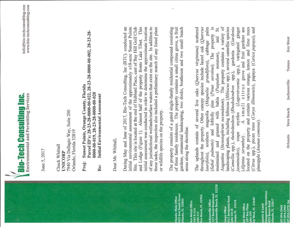
65
66

67
CASE # LUP Commission District: # 3
 CASE # LUP-15-02-038 Commission District: # 3 GENERAL INFORMATION APPLICANT OWNER PROJECT NAME HEARING TYPE REQUEST Richard Frucci Lingo Lane, LLC Lingo Lane Planned Development / Land Use Plan (PD/LUP)
ORANGE COUNTY PLANNING AND ZONING COMMISSION / LOCAL PLANNING AGENCY MEETING OF March 17, 2016
 ORANGE COUNTY PLANNING AND ZONING COMMISSION / LOCAL PLANNING AGENCY MEETING OF March 17, 2016 The Orange County Planning and Zoning Commission (PZC) / Local Planning Agency (LPA) met at 9:00 a.m. on March
ORANGE COUNTY A-1-3 ADOPTION AMENDMENT
 ORANGE COUNTY PLANNING DIVISION 2018-2-A-1-3 ADOPTION AMENDMENT 2010-2030 COMPREHENSIVE PLAN BOARD OF COUNTY COMMISSIONERS JANUARY 15, 2019 ADOPTION PUBLIC HEARING PREPARED BY: ORANGE COUNTY COMMUNITY,
ORANGE COUNTY REGULAR & SMALL SCALE CYCLE AMENDMENTS
 ORANGE COUNTY PLANNING DIVISION 2018-2 REGULAR & SMALL SCALE CYCLE AMENDMENTS 2010-2030 COMPREHENSIVE PLAN BOARD OF COUNTY COMMISSIONERS NOVEMBER 13, 2018 SESSION I ADOPTION PUBLIC HEARING PREPARED BY:
Receiving Water Body:
 62-330 ENVIRONMENTAL RESOURCE PERMIT INDIVIDUAL - TECHNICAL STAFF REPORT 23-Nov-2016 APPLICATION #: IND-005-9658-2 Applicant: Agent: Charles Commander CCSH, LLC 2708 Highway 77 Lynn Haven, FL 32444 850-819-5850
Proposed 2.53 Acres Park Plan Designation: Regional Activity Center: See attached comments from the Planning Council.
 Page 1 of 17 Board of County Commissioners, Broward County, Florida Environmental Protection and Growth Management Department Planning and Development Management Division DEVELOPMENT REVIEW REPORT PROJECT
PALM BEACH COUNTY PLANNING, ZONING AND BUILDING DEPARTMENT ZONING DIVISION
 PALM BEACH COUNTY PLANNING, ZONING AND BUILDING DEPARTMENT ZONING DIVISION Application No.: Z2003-094 Control No.: 2003-094 Petitioner: Mark A. & Susan L. Reinhold Owner: Mark A. & Susan L. Reinhold Agent:
PALM BEACH COUNTY PLANNING, ZONING AND BUILDING DEPARTMENT ZONING DIVISION
 PALM BEACH COUNTY PLANNING, ZONING AND BUILDING DEPARTMENT ZONING DIVISION Application No.: CA-2012-00688 Control No.: 2011-00552 Applicant: Garry Bernardo Owners: Garry Bernardo Agent: Frogner Consulting,
CITY OF ELK GROVE PLANNING APPLICATION AND AGREEMENT
 Development Services - Planning 8401 Laguna Palms Way Elk Grove, California 95758 Tel: 916.478.2265 Fax: 916.691.3175 www.elkgrovecity.org CITY OF ELK GROVE PLANNING APPLICATION AND AGREEMENT Type of application:
BY BOARD OF COUNTY COMMISSIONERS AN ACT TO BE ENTITLED
 BY BOARD OF COUNTY COMMISSIONERS ORDINANCE NO. AN ACT TO BE ENTITLED AN ORDINANCE AMENDING THE PASCO COUNTY LAND DEVELOPMENT CODE, ARTICLE 700, BY REPEALING EXISTING SECTION 702, ENVIRONMENTALLY SENSITIVE
STAFF REPORT Strok Plat 058-MP-89
 Page 1 of 13 STAFF REPORT Strok Plat 058-MP-89 A request to amend the note on the plat has been filed with the Planning and Development Management Division. This plat was approved by the County Commission
This is a New Findings of Adequacy for a Recorded Plat (Plat Book 179, Page 131) LAND USE Vacant Effective Plan: Pompano Beach
 LAND USE Vacant Effective Plan: Pompano Beach") Page 1 of 11 Board of County Commissioners, Broward County, Florida Environmental Protection and Growth Management Department Planning and Development Management Division DEVELOPMENT REVIEW REPORT PROJECT
Page 1 of 11 Board of County Commissioners, Broward County, Florida Environmental Protection and Growth Management Department Planning and Development Management Division DEVELOPMENT REVIEW REPORT PROJECT
This is a New Finding of Adequacy for a Recorded Plat (Plat Book 179, Page ) Replat: LAND USE Guard House Effective Plan: Davie.
 Replat: LAND USE Guard House Effective Plan: Davie.") Page 1 of 19 Board of County Commissioners, Broward County, Florida Environmental Protection and Growth Management Department Planning and Development Management Division DEVELOPMENT REVIEW REPORT PROJECT
Page 1 of 19 Board of County Commissioners, Broward County, Florida Environmental Protection and Growth Management Department Planning and Development Management Division DEVELOPMENT REVIEW REPORT PROJECT
FLORIDA TURNPIKE FLORIDA TURNPIKE
 Orange County Community, Environmental & Development Services Department, Planning Division Orange County, Florida Planning and Zoning Commission/ Local Planning Agency 2 5 FLORIDA TURNPIKE FLORIDA TURNPIKE
PALM BEACH COUNTY PLANNING, ZONING AND BUILDING DEPARTMENT ZONING DIVISION
 PALM BEACH COUNTY PLANNING, ZONING AND BUILDING DEPARTMENT ZONING DIVISION Petition No.: Z2002-051 Petitioner: Rene & Gina Tercilla Owner: Rene & Gina Tercilla Agent: Rene & Gina Tercilla Telephone No.:
The applicant is requesting to amend the note to allow for 18 townhouse units in lieu of the commercial use. The requested note reads as follows:
 Page 1 of 27 STAFF REPORT Davie 39 Street Addition 133-MP-83 A request to amend the plat note has been filed with the Planning and Redevelopment Division. This plat was approved by the County Commission
TREASURE COAST REGIONAL PLANNING COUNCIL M E M O R A N D U M. To: Council Members AGENDA ITEM 10A
 TREASURE COAST REGIONAL PLANNING COUNCIL M E M O R A N D U M To: Council Members AGENDA ITEM 10A From: Date: Subject: Staff April 20, 2007 Council Meeting Local Government Comprehensive Plan Review Draft
APPLICATION. Telephone Fax Address. Telephone Fax Address FOR MARTIN COUNTY USE ONLY
 APPLICATION PRESERVE AREA MANAGEMENT PLAN/ ABBREVIATED PRESERVE AREA MANAGEMENT PLAN Growth Management Department Environmental Division PART 1: Applicant Information A. Land Owner(s) Name Title and Company
RESOLUTION NO. R
 RESOLUTION NO. R-2017-0004 RESOLUTION APPROVING ZONING APPLICATION ZlCA-2016-00849 (CONTROL NO. 2016-00079) a Class A Conditional Use APPLICATION OF George Moraitis BY iplan and Design LLC, AGENT (Children's
LONG RANGE AGENDA DECEMBER 30, 2014
 DECEMBER 23, 2014 DECEMBER 30, 2014 JANUARY 6, 2015 2:00 Board of Zoning Adjustment Recommendations; December 4, 2014 Preliminary Subdivision Plan Public Hearings 1. Applicant: Matt Young, IBI Group, Inc.,
EXHIBIT "A" THE PRESERVE AT WILDERNESS LAKE COMMUNITY DEVELOPMENT DISTRICT 5844 Old Pasco Road, Suite 100, Wesley Chapel, Florida 33544
 EXHIBIT "A" THE PRESERVE AT WILDERNESS LAKE COMMUNITY DEVELOPMENT DISTRICT 5844 Old Pasco Road, Suite 100, Wesley Chapel, Florida 33544 NATURAL AREAS POLICY STATEMENT The following is the policy statement
Plans shall be drawn at a readable scale, signed, and sealed by a Florida Registered Engineer. The application package shall include:
 CHAPTER 400. SECTION 403. PERMIT TYPES AND APPLICATIONS SITE DEVELOPMENT 403.3. Preliminary Site Plans (PSP) A. Intent and Purpose PSPs are used to identify existing site conditions and demonstrate general
Project File #: SF Project Name: Jackson Ranch Filing No. 4 Parcel Nos.: , and
 COMMISSIONERS: DARRYL GLENN (PRESIDENT) MARK WALLER (PRESIDENT PRO TEMPORE) STAN VANDERWERF LONGINOS GONZALEZ PEGGY LITTLETON PLANNING AND COMMUNITY DEVELOPMENT DEPARTMENT CRAIG DOSSEY, EXECUTIVE DIRECTOR
AMENDED DEED OF CONSERVATION EASEMENT
 Prepared by: Wayne E. Flowers Lewis, Longman & Walker, P.A. 245 Riverside Ave. Suite 150 Jacksonville, FL 32202 Return recorded original to: Mitigation Marketing 1091 W. Morse Blvd. Suite 101 Winter Park,
ARTICLE 1 GENERAL PROVISIONS
 ARTICLE 1 GENERAL PROVISIONS SECTION 100 TITLE This Ordinance shall be known and cited as the "Rice Township Subdivision and Land Development Ordinance." SECTION 101 AUTHORITY Rice Township is empowered
ARTICLE III GENERAL PROCEDURES, MINOR PLANS AND FEE SCHEDULES
 ARTICLE III GENERAL PROCEDURES, MINOR PLANS AND FEE SCHEDULES 301. Prior to Submission a. Copies of this Ordinance shall be available on request, at cost, for the use of any person who desires information
SETTLEMENT AGREEMENT. and Department of Transportation and Public Facilities (collectively, the State ), hereby
, hereby") SETTLEMENT AGREEMENT Ahtna, Inc. ( Ahtna ) and the State of Alaska, Department of Natural Resources and Department of Transportation and Public Facilities (collectively, the State ), hereby agree to the
SETTLEMENT AGREEMENT Ahtna, Inc. ( Ahtna ) and the State of Alaska, Department of Natural Resources and Department of Transportation and Public Facilities (collectively, the State ), hereby agree to the
Submittal of the Minutes from the March 9, 2011, April 5, 2011, and April 19, 2011 Cabinet Meetings.
 AGENDA BOARD OF TRUSTEES OF THE INTERNAL IMPROVEMENT TRUST FUND JUNE 16, 2011 Attachments to the items below can be viewed at the following link: http://www.dep.state.fl.us/secretary/cab/public_notices.htm
LONG RANGE AGENDA NOVEMBER 11, 2014
 NOVEMBER 11, 2014 1:30 Consent and Discussion Agenda 2:00 Planning and Zoning Commission Recommendations; October 16, 2014 Planning and Zoning Commission Appeal 1. Appellant: Lee JV Investments, LLC Applicant:
PALM BEACH COUNTY PLANNING, ZONING AND BUILDING DEPARTMENT ZONING DIVISION
 PALM BEACH COUNTY PLANNING, ZONING AND BUILDING DEPARTMENT ZONING DIVISION Application No.: DOA-2014-01111 Application Name: World Class Academy Control No.: 1998-00052 Applicant: World Class Academy Inc
DEVELOPMENT REVIEW COMMITTEE APPROVED MEETING MINUTES SEPTEMBER 24, 2014 PROJECTS PREVIOUSLY REVIEWED
 DEVELOPMENT REVIEW COMMITTEE APPROVED MEETING MINUTES PROJECT NAME PAGE PROJECTS PREVIOUSLY REVIEWED... 1-37 * Perrihouse PD *Zen Luxury Living Land Use Plan * Granada PD I Trader Joe's at Parkside DP
Thurston County Planning Department BOARD OF COUNTY COMMISSIONERS PUBLIC HEARING DRAFT AMENDMENTS TO THE CRITICAL AREAS REGULATIONS. Chapter 24.
 Thurston County Planning Department BOARD OF COUNTY COMMISSIONERS PUBLIC HEARING DRAFT AMENDMENTS TO THE CRITICAL AREAS REGULATIONS Chapter 24.01 GENERAL PROVISIONS Chapter 24.01 6/4/2012 GENERAL PROVISIONS
NOTE: SUBMITTAL OF NON-STANDARD DOCUMENTS MAY RESULT IN LONGER REVIEW TIMES
 NOTE: SUBMITTAL OF NON-STANDARD DOCUMENTS MAY RESULT IN LONGER REVIEW TIMES This instrument prepared by and after recording return to: Tax Parcel I.D. No(s): 3 3 3 3 ADEQUATE PUBLIC FACILITIES AGREEMENT
INDIAN RIVER COUNTY, FLORIDA. The Honorable Members of the Planning and Zoning Commission DEPARTMENT HEAD CONCURRENCE
 Public Hearing Legislative INDIAN RIVER COUNTY, FLORIDA M E M O R A N D U M TO: The Honorable Members of the Planning and Zoning Commission DEPARTMENT HEAD CONCURRENCE Robert M. Keating, AICP; Community
RESOLUTION NO. R
 RESOLUTION NO. R-2017-1127 RESOLUTION APPROVING ZONING APPLICATION Z-2017-00823 CONTROL NO. 2016-00109 an Official Zoning Map Amendment APPLICATION OF Belvedere Westgate, Palm Beach County BY Jon E Schmidt
Draft Zoning Changes for the 2nd Planning Board Public Hearing, January 22, 2018.
 Draft Zoning Changes for the 2nd Planning Board Public Hearing, January 22, 2018. No changes were made at the 1st Public Hearing. Proposed wording for the 1 st Public Hearing in red, eliminated text in
Town of Bristol Rhode Island
 Town of Bristol Rhode Island Subdivision & Development Review Regulations Adopted by the Planning Board September 27, 1995 (March 2017) Formatted: Highlight Formatted: Font: 12 pt Table of Contents TABLE
CURRENT THROUGH PL , APPROVED 11/11/2009
 CURRENT THROUGH PL 111-98, APPROVED 11/11/2009 TITLE 10. ARMED FORCES SUBTITLE A. GENERAL MILITARY LAW PART IV. SERVICE, SUPPLY, AND PROCUREMENT CHAPTER 159. REAL PROPERTY; RELATED PERSONAL PROPERTY; AND
Thurston County Planning Department PUBLIC HEARING DRAFT. AMENDMENTS TO THE CRITICAL AREAS REGULATIONS Chapter /18/2011 GENERAL PROVISIONS
 Thurston County Planning Department PUBLIC HEARING DRAFT AMENDMENTS TO THE CRITICAL AREAS REGULATIONS Chapter 24.01 11/18/2011 Chapter 24.01 GENERAL PROVISIONS GENERAL PROVISIONS Sections: 24.01.005 Short
TRANSFERABLE DEVELOPMENT RIGHTS PROCESS GUIDE
 TRANSFERABLE DEVELOPMENT RIGHTS PROCESS GUIDE Clear Creek County Planning Department P.O. Box 2000 Georgetown, Colorado 80444 (303) 679-2436 - phone (303) 569-1103 - fax 1 PURPOSE: A Transfer of Development
RESOLUTION NO. ZR
 RESOLUTION NO. ZR-2016-004 RESOLUTION APPROVING ZONING APPLICATION SD-155 CONTROL NO. 2003-055 SUBDIVISION VARIANCE (STAND ALONE) APPLICATION OF FIRST AND TEN REAL ESTATE CORP. BY JON E. SCHMIDT AND ASSOCIATES,
CONTRACT FOR SALE AND PURCHASE
 CONTRACT FOR SALE AND PURCHASE THIS Contract for Sale and Purchase ( Contract ) is made this day of, 20, by and between the Southwest Florida Water Management District, a public corporation of the State
FACT SHEET Brownfields Cleanup Program (BCP) KEY DEFINITIONS (see also ECL )
 KEY DEFINITIONS (see also ECL )") KEY DEFINITIONS (see also ECL 27-1405) Brownfield A Brownfield is any real property where redevelopment or re-use may be complicated by the presence or potential presence of a hazardous waste, petroleum,
KEY DEFINITIONS (see also ECL 27-1405) Brownfield A Brownfield is any real property where redevelopment or re-use may be complicated by the presence or potential presence of a hazardous waste, petroleum,
PALM BEACH COUNTY PLANNING, ZONING AND BUILDING DEPARTMENT ZONING DIVISION
 PALM BEACH COUNTY PLANNING, ZONING AND BUILDING DEPARTMENT ZONING DIVISION Petition No.: Z2003-017 Petitioner: Palm Beach County BCC Owner: Palm Beach County BCC Agent: Kilday and Associates Telephone
Planning Commission Staff Report August 6, 2015
 Commission Staff Report August 6, 2015 Project: Capital Reserve Map File: EG-14-008A Request: Tentative Parcel Map Location: 8423 Elk Grove Blvd. APN: 116-0070-014 Staff: Christopher Jordan, AICP Sarah
CHAPTER 3: IDENTIFYING SECTION 4(f) PROPERTIES
 PROPERTIES") CHAPTER 3: IDENTIFYING SECTION 4(f) PROPERTIES Section 4(f) and its provisions state that publicly owned parks, recreation areas, wildlife and waterfowl refuges, and publicly and privately owned historic
CHAPTER 3: IDENTIFYING SECTION 4(f) PROPERTIES Section 4(f) and its provisions state that publicly owned parks, recreation areas, wildlife and waterfowl refuges, and publicly and privately owned historic
Existing Zoning: Commercial (C-1) Proposed Zoning: Commercial (C-1)
 Proposed Zoning: Commercial (C-1)") Page 1 of 12 Board of County Commissioners, Broward County, Florida Environmental Protection and Growth Management Department Planning and Development Management Division DEVELOPMENT REVIEW REPORT PROJECT
Page 1 of 12 Board of County Commissioners, Broward County, Florida Environmental Protection and Growth Management Department Planning and Development Management Division DEVELOPMENT REVIEW REPORT PROJECT
DECLARATION OF RESTRICTIVE COVENANTS
 DECLARATION OF RESTRICTIVE COVENANTS The Declarant,, is the fee simple owner of the certain real property located in County, Kansas, as described on Exhibit A, which is attached hereto and incorporated
FUTURE LAND USE. City of St. Augustine Comprehensive Plan EAR-Based Amendments
 FUTURE LAND USE City of St. Augustine Comprehensive Plan EAR-Based Amendments Future Land Use Element FLU Goal To create an environment within the City and adjacent areas in which its residents have the
Guide to Combined Preliminary and Final Plats
 Guide to Combined Preliminary and Final Plats Introduction The Douglas County is committed to providing open, transparent application processes to the public. This Guide is provided to assist anyone interested
PALM BEACH COUNTY PLANNING, ZONING AND BUILDING DEPARTMENT ZONING DIVISION
 PALM BEACH COUNTY PLANNING, ZONING AND BUILDING DEPARTMENT ZONING DIVISION Application No.: Z/CA-2013-00493 Application Name: Trails Charter School Control No.: 2013-00085 Applicant: MG3 ALF Military LLC
CITY AND COUNTY OF BROOMFIELD SUBDIVISION IMPROVEMENT AGREEMENT FOR (PROPERTY NAME - ALL CAPS)
") CITY AND COUNTY OF BROOMFIELD SUBDIVISION IMPROVEMENT AGREEMENT FOR (PROPERTY NAME - ALL CAPS) THIS AGREEMENT, made and entered into this day of, 20, by and between The CITY AND COUNTY OF BROOMFIELD, a
CITY AND COUNTY OF BROOMFIELD SUBDIVISION IMPROVEMENT AGREEMENT FOR (PROPERTY NAME - ALL CAPS) THIS AGREEMENT, made and entered into this day of, 20, by and between The CITY AND COUNTY OF BROOMFIELD, a
Marion County Board of County Commissioners
 Marion County Board of County Commissioners Date: 6/4/217 P&Z: 9/25/217 BCC Transmittal: 1/17/217 BCC Adopt: TBD Amendment No: 217-L6 Type of Application Large-Scale Comp Plan Amendment Request: Change
Cover Letter with Narrative Statement
 Cover Letter with Narrative Statement March 31, 2017 rev July 27, 2017 RE: Rushton Pointe Residential Planned Unit Development Application for Public Hearing for RPUD Rezone PL2015 000 0306 Mr. Eric Johnson,
Cartersville Code of Ordinances Historic Preservation Commission
 Cartersville Code of Ordinances Historic Preservation Commission Sec. 9.25-31. Purpose Sec. 9.25-32. Historic preservation commission. Sec. 9.25-33. Recommendation and designation of historic districts
Marion County Board of County Commissioners
 Marion County Board of County Commissioners Date: 12/29/2015 P&Z: 12/28/2015 BCC: 1/12/2016 Item Number 160113Z Type of Application Rezoning Request From: A-1 (General Agriculture) To: PUD (Planned Unit
MS MINOR SUBDIVISION TREVITHICK
 MS-02-015 341.12 MINOR SUBDIVISION TREVITHICK A request by Danny Trevithick for a one-lot Minor Subdivision on five acres. The property is zoned A-35 (Agricultural) District and is located ¼ mile south
PALM BEACH COUNTY PLANNING, ZONING AND BUILDING DEPARTMENT ZONING DIVISION
 PALM BEACH COUNTY PLANNING, ZONING AND BUILDING DEPARTMENT ZONING DIVISION Application No.: PDD/R-2014-02095 Application Name: Lake Worth Storage 2 Control No.: 2009-02300 Applicant: Michael Gilley Owners:
EXHIBIT A LEGAL DESCRIPTION
 EXHIBIT A LEGAL DESCRIPTION DESCRIPTION LOTS 59 AND 60, BLOCK 24, THE PALM BEACH FARMS CO. PLAT NO. 3, ACCORDING TO THE MAP OR PLAT THEREOF, AS RECORDED IN PLAT BOOK 2, PAGE(S) 45 THROUGH 54, INCLUSIVE,
CASH SALE PURCHASE AGREEMENT
 CASH SALE PURCHASE AGREEMENT THIS AGREEMENT TO PURCHASE ( Agreement ) is entered into the last date signed below ( Effective Date ), by and between the UNIVERSITY OF ALASKA, a corporation created under
Chapter 100 Planned Unit Development in Corvallis Urban Fringe
 100.100 Scope and Purpose. Chapter 100 Planned Unit Development in Corvallis Urban Fringe (1) All applications for land divisions in the Urban Residential (UR) and Flood Plain Agriculture (FPA) zones within
COMPREHENSIVE PLAN FUTURE LAND USE MAP AMENDMENT APPLICATION
 COUNTY STAFF DATA ONLY Date Received: Project No. CPA-20 - GADSDEN COUNTY DEPARTMENT OF PLANNING & COMMUNITY DEVELOPMENT 1-B East Jefferson Street, Post Office Box 1799, Quincy, FL 32353-1799 PLANNING
RESOLUTION NO. R
 RESOLUTION NO. R-2016-0554 RESOLUTION APPROVING ZONING APPLICATION ABN/CBIZlCA-2015-00538 (CONTROL NO. 1988-00039) a Class A Conditional Use APPLICATION OF Treatment Center of The Palm Beaches LLC BY Land
Mohave County General Plan
 63 64 65 66 67 68 69 70 71 The Land Use Diagram is not the County's zoning map. 13 It is a guide to future land use patterns. Zoning and area plan designations may be more restrictive than the land use
CITY OF RIO VISTA PLANNING COMMISSION STAFF REPORT
 MEETING DATE: January10, 2018 CITY OF RIO VISTA PLANNING COMMISSION STAFF REPORT AGENDA ITEM #4.2 PREPARED BY: Lamont Thompson, Planning Manager SUBJECT: Vesting Tentative Tract No. 2017-001: To consider
REGULATORY AND RESTRICTIVE COVENANTS FOR LAND USE AGREEMENT
 LIHTCP-8 WVHDF (7/14/05) REGULATORY AND RESTRICTIVE COVENANTS FOR LAND USE AGREEMENT Low-Income Housing Tax Credit Program West Virginia Housing Development Fund APPENDIX F THIS REGULATORY AND RESTRICTIVE
PLANNED UNIT DEVELOPMENT (PUD)
") SECTION 38.01. ARTICLE 38 PLANNED UNIT DEVELOPMENT (PUD) Purpose The purpose of this Article is to implement the provisions of the Michigan Zoning Enabling Act, Public Act 110 of 2006, as amended, authorizing
SECTION 38.01. ARTICLE 38 PLANNED UNIT DEVELOPMENT (PUD) Purpose The purpose of this Article is to implement the provisions of the Michigan Zoning Enabling Act, Public Act 110 of 2006, as amended, authorizing
CHAPTER Committee Substitute for Committee Substitute for Senate Bill No. 2188
 CHAPTER 2004-372 Committee Substitute for Committee Substitute for Senate Bill No. 2188 An act relating to land development; amending s. 197.502, F.S.; providing for the issuance of an escheatment tax
RESOLUTION NO. ZR
 RESOLUTION NO. ZR-2013-034 RESOLUTION APPROVING ZONING APPLICATION ZV-2013-02127 CONTROL NO. 1985-00007 TYPE II VARIANCE (STAND ALONE) APPLICATION OF BW-PC, LLC BY Urban Design Kilday Studios, BW-INV-
IV. REVIEW PROCEDURES FOR MINOR SUBDIVISIONS
 IV. REVIEW PROCEDURES FOR MINOR SUBDIVISIONS IV-A. General Minor subdivisions create five or fewer lots from a tract of record, each lot of which has legal and physical access. If the tract of record proposed
CONTRACT FOR SALE AND PURCHASE
 CONTRACT FOR SALE AND PURCHASE THIS Contract for Sale and Purchase ( Contract ) is made this day of, 20, by and between the Southwest Florida Water Management District, a public corporation of the State
DEVELOPMENT AGREEMENT
 STATE OF NORTH CAROLINA COUNTY OF CHATHAM DEVELOPMENT AGREEMENT This Development Agreement (this Agreement ) is made and entered into as of the day of, 2009 (the Effective Date ), by and between the COUNTY
SPECIAL EXCEPTION APPLICATION LEVY COUNTY, FLORIDA. Fee: (see fee schedule) Validation No.
 Validation No.") Filing Date Petition No. SE Fee: (see fee schedule) Validation No. TO THE LEVY COUNTY PLANNING COMMISSION: Special exceptions are intended to provide for land uses and activities not permitted by right
Filing Date Petition No. SE Fee: (see fee schedule) Validation No. TO THE LEVY COUNTY PLANNING COMMISSION: Special exceptions are intended to provide for land uses and activities not permitted by right
This is a sample form for information ONLY. UTILITY INFRASTRUCTURE CONVEYANCE AND SERVICE AGREEMENT
 This is a sample form for information ONLY. A CSA will be tailored to your project at the appropriate time during the development process. Please contact the Development Services Team for additional information.
LARGE- AND SMALL-SCALE COMPREHENSIVE PLAN AMENDMENT INSTRUCTIONS AND INFORMATION PACKET
 LARGE- AND SMALL-SCALE COMPREHENSIVE PLAN AMENDMENT INSTRUCTIONS AND INFORMATION PACKET MARION COUNTY GROWTH SERVICES 2710 E. Silver Springs Blvd. Ocala, FL 34470 Phone 352-438-2600 Fax 352-438-2601 http://www.marioncountyfl.org/planning.htm
CONTRACT FOR SALE AND PURCHASE
 Page 1 of 5 CONTRACT FOR SALE AND PURCHASE THIS ( Contract ) is made this day of, 20, by and between the Southwest Florida Water Management District, a public corporation of the State of Florida, having
AGREEMENT TO ACQUIRE LANDS BETWEEN THE DEPARTMENT OF THE ARMY ST. PAUL DISTRICT, CORPS OF ENGINEERS AND. THE CITY OF City, State
 AGREEMENT TO ACQUIRE LANDS BETWEEN THE DEPARTMENT OF THE ARMY ST. PAUL DISTRICT, CORPS OF ENGINEERS AND THE CITY OF City, State FOR CONDEMNATION ON BEHALF OF THE SPONSOR BY THE CORPS OF ENGINEERS FOR THE
RESIDENTIAL ACCESS AGREEMENT. ( Owner ) and Butte-Silver Bow County ( BSB ) enter into this Residential Access Agreement ( Agreement ) this day of.
 and Butte-Silver Bow County ( BSB ) enter into this Residential Access Agreement ( Agreement ) this day of.") RESIDENTIAL ACCESS AGREEMENT ( Owner ) and Butte-Silver Bow County ( BSB ) enter into this Residential Access Agreement ( Agreement ) this day of. RECITALS A. BSB has received funding to conduct certain
RESIDENTIAL ACCESS AGREEMENT ( Owner ) and Butte-Silver Bow County ( BSB ) enter into this Residential Access Agreement ( Agreement ) this day of. RECITALS A. BSB has received funding to conduct certain
PRELIMINARY SUBDIVISION PLAN APPLICATION INSTRUCTIONS
 City of Chesapeake Department of Planning Post Office Box 15225 Chesapeake, Virginia 23328-5225 (757) 382-6176 FAX (757) 382-6406 PRELIMINARY SUBDIVISION PLAN APPLICATION INSTRUCTIONS PURPOSE A preliminary
Staff Report: Date: Applicant: Property Identification: Acreage of Request: Current Zoning of Requested Area: Requested Action: Attached:
 Staff Report: Completed by Jeff Palmer Director of Planning & Zoning Date: November 7, 2018, Updated November 20, 2018 Applicant: Greg Smith, Oberer Land Developer agent for Ronald Montgomery ET AL Property
VACANT LAND SALES CONTRACT
 VACANT LAND SALES CONTRACT 1. Mutual Covenants. DAVID L. ANDERSON and SUSAN B. ANDERSON ( ANDERSON ), MICHAEL D. UNZICKER and CHRISTY J. UNZICKER ( UNZICKER ), and DARIN S. HOFFMIRE and JANE ANN HOFFMIRE
ENCROACHMENT AGREEMENT
 THIS INSTRUMENT PREPARED BY: Roy K. Payne, Esq. Chief Assistant City Attorney City of Orlando 400 S. Orange Avenue Orlando, Florida 32801 (407) 246-3495 ENCROACHMENT AGREEMENT THIS ENCROACHMENT AGREEMENT,
PALM BEACH COUNTY PLANNING, ZONING AND BUILDING DEPARTMENT ZONING DIVISION
 PALM BEACH COUNTY PLANNING, ZONING AND BUILDING DEPARTMENT ZONING DIVISION Application No.: Z-2014-01627 Application Name: Dazco Center Control No.: 2003-00040 Applicant: 4730 Hypoluxo LLC Owners: 4730
LAKE NONA PARCEL 10 & 11
 October 17, 2017 Staff Report to the Municipal Planning Board CASE #DRI2017-10003 GMP2017-10012 GMP2017-10013 ZON2017-10005 Item #2 LAKE NONA PARCEL 10 & 11 Location Map Subject Site SUMMARY Owner James
PALM BEACH COUNTY PLANNING, ZONING AND BUILDING DEPARTMENT ZONING DIVISION
 PALM BEACH COUNTY PLANNING, ZONING AND BUILDING DEPARTMENT ZONING DIVISION Application No.: ZV/DOA/R-2013-01069 Application Name: Wharfside at Boca Pointe Control No.: 1973-00085 Applicant: Boca Wharfside,
AN ORDINANCE AMENDING AND SUPPLEMENTING THE REVISED GENERAL ORDINANCES OF THE CITY OF BAYONNE THE, CHAPTER 33 PLANNING AND DEVELOPMENT REGULATIONS
 AN ORDINANCE AMENDING AND SUPPLEMENTING THE REVISED GENERAL ORDINANCES OF THE CITY OF BAYONNE THE, CHAPTER 33 PLANNING AND DEVELOPMENT REGULATIONS WHEREAS, pursuant to N.J.S.A. 40:48-2, the Legislature
CITY OF FORT COLLINS NATURAL AREAS AND CONSERVED LANDS EASEMENT POLICY
 CITY OF FORT COLLINS NATURAL AREAS AND CONSERVED LANDS EASEMENT POLICY Adopted January 3, 2012 PURPOSE: The purpose of the policy statement is to clarify the policies and procedures of the City of Fort
ORDINANCE NO AN ORDINANCE AMENDING THE CODE OF ORDINANCES OF THE CITY OF PORT ARANSAS, TEXAS, BY ADOPTING A NEW CHAPTER
 ORDINANCE NO. 2008-09 AN ORDINANCE AMENDING THE CODE OF ORDINANCES OF THE CITY OF PORT ARANSAS, TEXAS, BY ADOPTING A NEW CHAPTER TWENTY-SIX CONCERNING IMPACT FEES FOR ROADWAY FACILITIES; INCORPORATING
HIGHLANDS TRANSFER OF DEVELOPMENT RIGHTS PROGRAM DEED OF EASEMENT (For Non-Agricultural Property with Bonus Highlands Development Credit Allocation)
") SAMPLE DRAFT EASEMENT PREPARED BY Signature Typed or Printed Name HIGHLANDS TRANSFER OF DEVELOPMENT RIGHTS PROGRAM DEED OF EASEMENT (For Non-Agricultural Property with Bonus Highlands Development Credit
SAMPLE DRAFT EASEMENT PREPARED BY Signature Typed or Printed Name HIGHLANDS TRANSFER OF DEVELOPMENT RIGHTS PROGRAM DEED OF EASEMENT (For Non-Agricultural Property with Bonus Highlands Development Credit
UTILITY EASEMENT AGREEMENT
 THIS INSTRUMENT PREPARED BY AND RETURN TO: Roy K. Payne, Esq. Chief Assistant City Attorney 400 S. Orange Avenue Orlando, FL 32801 Roy.Payne@CityofOrlando.Net UTILITY EASEMENT AGREEMENT THIS UTILITY EASEMENT
DRAFT FOR PUBLIC HEARING (rev. March, 2016)
") Chapter 200. ZONING Article VI. Conservation/Cluster Subdivisions 200-45. Intent and Purpose These provisions are intended to: A. Guide the future growth and development of the community consistent with
Chapter 200. ZONING Article VI. Conservation/Cluster Subdivisions 200-45. Intent and Purpose These provisions are intended to: A. Guide the future growth and development of the community consistent with
CONSERVATION EASEMENT INCLUDING MITIGATION
 After recording return to: GRANTOR: GRANTEE: GRANTEE (Trustee): LEGAL DESCRIPTION: TAX PARCEL I.D. #: REFERENCE # s: WHATCOM COUNTY N/A CONSERVATION EASEMENT INCLUDING MITIGATION This grant of a conservation
RESOLUTION NO. R
 RESOLUTION NO. R-2012-1349 RESOLUTION APPROVING ZONING APPLICATION DOAlR-2012-01263 (CONTROL NO. 1978-00220) a Development Order Amendment APPLICATION OF Weingarten Nostat Inc BY Jon E Schmidt & Associates,
PUTNAM COUNTYCOMPREHENSIVE PLAN
 COMPREHENSIVE PLAN EXHIBIT AA COMPREHENSIVE PLAN A. Future Land Use Element Goals, Objectives, Policies This section proposed objectives and policies, which will assist Putnam County Commissioners and
Application for Conservation Area Impact Permit
 Application for Conservation Area Impact Permit (In accordance with Orange County Code Chapter 15 Article X, Orange County Code) Mail or Orange County Environmental Protection Division Deliver To: 3165
STATE OF SOUTH CAROLINA ) AGREEMENT ) OF COUNTY OF RICHLAND ) PURCHASE AND SALE
 AGREEMENT ) OF COUNTY OF RICHLAND ) PURCHASE AND SALE") STATE OF SOUTH CAROLINA ) AGREEMENT ) OF COUNTY OF RICHLAND ) PURCHASE AND SALE THIS AGREEMENT (the Agreement ) executed the day of, 2010 (the Effective Date ), by and between COLUMBIA VENTURE, LLC, a
STATE OF SOUTH CAROLINA ) AGREEMENT ) OF COUNTY OF RICHLAND ) PURCHASE AND SALE THIS AGREEMENT (the Agreement ) executed the day of, 2010 (the Effective Date ), by and between COLUMBIA VENTURE, LLC, a
EXHIBIT A ENVIRONMENTAL COVENANT AND ACCESS AGREEMENT
 ENVIRONMENTAL COVENANT AND ACCESS AGREEMENT AFTER RECORDING RETURN TO: Laura Wishik, Esq. Director, Environmental Protection Section P. O. Box 94769 Seattle, WA 98124-4769 GRANTOR AND OWNER: City of Seattle
ORDINANCE NO L02, D. Wormser/L.R. Roberts/Et. Al Page 1 of 9 Adoption Ordinance
 ORDINANCE NO. 17- AN ORDINANCE OF THE BOARD OF COUNTY COMMISSIONERS OF MARION COUNTY, FLORIDA; ADOPTING THE FOLLOWING LARGE-SCALE AMENDMENT TO THE FUTURE LAND USE MAP SERIES AND TEXT OF THE MARION COUNTY
NC General Statutes - Chapter 106 Article 61 1
 Article 61. Agricultural Development and Preservation of Farmland. Part 1. General Provisions. 106-735. Short title, purpose, and administration. (a) This Article shall be known as "The Agricultural Development
Easement Grant of Easement for Habitat Protection
 Date: Grantor(s): XXXXXXXXXX Grantee: Tri-Basin Natural Resources District, (hereinafter referred to as Tri-Basin NRD)1308 2 nd St., Holdrege NE 68949 Protected Property: See Exhibit A attached for legal