Surveyor General Branch
|
|
|
- Sandra Carson
- 5 years ago
- Views:
Transcription


1 Surveyor General Branch sgb.nrcan.gc.ca Beyond Boundaries Annual Review
2 Her Majesty the Queen in Right of Canada, 2011 Cat. No.: M ISSN (Print) Cat. No.: M E-PDF ISSN (Online) Cat. No.: M F-PDF ISSN (Online) Natural Resources Canada Surveyor General Branch 605, 9700 Jasper Avenue Edmonton, Alberta T5J 4C3 Telephone: (780) For an electronic version of this report, visit: TTY: (Teletype for the hearing-impaired) Information contained in this publication or product may be reproduced, in part or in whole, and by any means, for personal or public non-commercial purposes, without charge or further permission, unless otherwise specified. You are asked to: Exercise due diligence in ensuring the accuracy of the materials reproduced; Indicate both the complete title of the materials reproduced, as well as the author organization; and Indicate that the reproduction is a copy of an official work that is published by the Government of Canada and that the reproduction has not been produced in affiliation with, or with the endorsement of the Government of Canada. Commercial reproduction and distribution is prohibited except with written permission from the Government of Canada s copyright administrator, Public Works and Government Services of Canada (PWGSC). For more information, please contact PWGSC at: or at: copyright.droitdauteur@pwgsc-tpsgc.gc.ca. DISCLAIMER Her Majesty is not responsible for the accuracy or completeness of the information contained in the reproduced material. Her Majesty shall at all times be indemnified and held harmless against any and all claims whatsoever arising out of negligence or other fault in the use of the information contained in this publication or product.
3 Surveyor General Branch Natural Resources Canada ANNUAL REVIEW
4 Table of Contents 1 Purpose 2 NRCan strategic outcomes and SGB responsibility 3 SGB delivers Canada s legal boundaries 4 Other strategic outcomes and responsibilities 5 The mandate 6 Responsibilities on the Canada US international boundary 7 Responsibilities on the Alberta British Columbia boundary 8 Association of Canada Lands Surveyors (ACLS) 9 Four important initiatives 10 A look ahead SGB priorities for Results and performance measures Appendixes ANNUAL REVIEW 1. Canada Lands 2. SGB web of relationships Standards updates ii Surveyor General Branch
5 1 Purpose This is the first Annual Review of the Surveyor General Branch (SGB) of Natural Resources Canada (NRCan). 1 It describes the work of SGB by focusing on what we do (as set by legislation), why we do it (vis-à-vis Government of Canada objectives), and how well we do it (measured in terms of volumes and efficiency). SGB is a regional organization, closely linked and aligned with users, be they First Nations or Inuit communities, Territorial Governments or National Parks. Services are delivered through four regional operation centres (in Edmonton, Ottawa, Yellowknife and Whitehorse) and eight client liaison units (serving Atlantic Canada, Quebec, Ontario, Manitoba, Saskatchewan, Alberta, British Columbia and Nunavut). 2 NRCan strategic outcomes and SGB responsibility A key NRCan strategic outcome in the Program Activity Architecture 2 is safety, security and stewardship. This means having natural resource knowledge, landmass and management systems that strengthen the safety and security of Canadians and the stewardship of Canada s natural resources and lands. Such knowledge and systems are supported by essential geographic information, which has Canada s legal boundaries as one of its fundamental components. 3 SGB delivers Canada s legal boundaries 3 Canada United States International Boundary Commission: SGB maintains the international boundary between Canada and the United States for many purposes: law enforcement, customs, immigration, provincial/territorial/municipal jurisdiction and resource management. Canada s survey programs: SGB manages boundary surveys of Aboriginal settlement lands to meet Canada s obligations in land claim settlement agreements and legislation and other boundary surveys as required by the Government of Canada. 1 SGB is one of six substantive branches within the Earth Sciences Sector of NRCan. 2 NRCan programs deliver strategic outcomes within the Program Activity Architecture. 3 Program Activity Architecture: Sub element See Appendix 1 for the definition of Canada Lands. 5 As of March 31, Canada s survey registries: SGB registers plans of survey to allow parcels to be created on Canada Lands. 4 There are now 265,770 parcels in the cadastral dataset. 5 There are also historical documents from the International Boundary and legal surveys dating to pre-confederation Canada in this public archive. To effectively carry out this work, SGB manages a complex web of relationships between administrators with responsibilities for Canada Lands. Refer to Appendix Annual Review
6 4 Other strategic outcomes and responsibilities Establishing and re-establishing boundaries of Canada Lands is an essential condition to permitting rights in parcels of land to be enjoyed. Rights take two forms. Sovereign rights require that administering government departments are confident as to the limits of jurisdiction; real property rights require that possessors and users of land know the spatial extent of their parcels. Such certainty and confidence enable economic and social development and mesh well with the strategic outcomes of other government departments. For example, SGB is closely linked with Aboriginal Affairs and Northern Development Canada (AANDC) in the North and on First Nations Reserves. Thus, managing boundaries, parcels and surveys aligns with at least two principles within the Canada First Nation Joint Action Plan enabling strong, self-sufficient communities and creating conditions to accelerate economic development opportunities. Both principles inform the Plan s goal of economic development. 6 SGB also works closely with other Government of Canada departments, such as Parks, Environment, Fisheries and Oceans, Public Works and Justice. ANNUAL REVIEW 5 The mandate The Minister of Natural Resources has the administration, direction and control of surveys under the Canada Lands Surveys Act (CLS Act). 7 Subject to the direction of the Minister, the Surveyor General has two broad responsibilities: the management of surveys under the CLS Act; and the custody of all the original plans, journals, field notes and other papers connected with those surveys. 8 In addition, the Surveyor General has responsibilities under land claim agreements between Aboriginal peoples and Canada. For example, the Nunavut Agreement sets out that surveys of Inuit Owned Lands shall only be conducted in accordance with the instructions of the Surveyor General and the CLS Act; 9 the Tlicho Agreement sets out that the boundaries of Tlicho lands shall be surveyed in accordance with the instructions of the Surveyor General and the CLS Act. 10 SGB focuses on setting standards, developing policies, issuing instructions for and examining plans of survey, recording plans in and providing information from Canada s Survey Registries, providing boundary opinions, advising other government departments, liaising with First Nations and managing contracts. Most surveys are contracted to the private sector to Canada Lands Surveyors. Parts of the CLS Act apply to surveys under any other Act of Parliament, or under any territorial legislation (NWT, Nunavut, Yukon) if the Act or legislation requires the surveys to be made by a CLS. 11 The CLS Act also allows a survey to be made of any other lands belonging to Canada or of which Canada has power to dispose AANDC and AFN. Canada First Nations Joint Action Plan. June 9, There are seven other sections of the CLS Act that speak to the role of the Minister; all deal with the circumstances in which Canada Lands or any federal Crown lands shall be surveyed. 8 Canada Lands Surveys Act, s.3. 9 Agreement between the Inuit of the Nunavut Settlement Area and Canada. s Land Claims and Self-Government Agreement among the Tlicho and the Government of the Northwest Territories and the Government of Canada. s Canada Lands Surveys Act, s Canada Lands Surveys Act, s Surveyor General Branch
.")
7 Figure 1. Tlicho Land Claim. 6 Responsibilities on the Canada US international boundary The Surveyor General is appointed by Order in Council as the Canadian Commissioner to the International Boundary Commission (IBC). The boundary between Canada and the United States from Atlantic to Pacific and from Pacific to Beaufort came into being through 20 treaties, conventions, protocols, decisions and awards between 1783 and The IBC dates itself to the 1908 Treaty of Washington, which appointed two Commissioners one each from Canada and the United States to mark the boundary between the two countries. A permanent IBC, established by the 1925 International Boundary Treaty, has the mandate to continue to maintain the boundary under the supervision of the two Commissioners. The IBC s mandate is thus found in the 1908 and 1925 treaties and, for the Canadian section only, in the 1960 International Boundary Commission Act. Field operations of the IBC are carried out by Canadian and United States sections, with each section reporting to its respective Commissioner. For operational purposes the Canadian section is embedded within SGB; the Canadian Commissioner also reports to the Department of Foreign Affairs and International Trade (DFAIT) pursuant to the 1925 treaty. 7 Responsibilities on the Alberta British Columbia boundary The Surveyor General also participates on interprovincial/territorial boundary commissions when active. Currently he is appointed by Order in Council as the Canadian Commissioner to the Alberta-British Columbia Boundary Commission. Canada and the two 13 Alberta-British Columbia Boundary Act, 1974, s.4. provinces established the Boundary Commission in 1974, with powers to resurvey the sinuous boundary line, settle disputes respecting the boundary and establish and maintain survey monuments and other physical evidence of the boundary Annual Review

8 8 Association of Canada Lands Surveyors (ACLS) The ACLS 14 is a critical partner with SGB in surveying Canada Lands. The Minister of Natural Resources has oversight of the ACLS, which is the only federally-regulated profession in Canada. 15 The ACLS establishes and maintains standards of qualifications, conduct, knowledge and skill among its members and its member companies. It provides continuing professional development and through its practice review program inspects licensed members projects every three years. Figure 2. Precise Point Positioning (PPP) and Real Time Kinematic (RTK) GPS for legal surveys Banff National Park. ANNUAL REVIEW 9 Four important initiatives i. Facilitating economic development activity on Canada Lands through a more efficient land survey system MyCLSS (My Canada Lands Surveys System) is a joint venture between the ACLS and SGB that resulted in the development of a web portal integrating respective statutory processes. The objective is to bring efficiencies in the delivery of both organizations mandates by: eliminating duplication and sharing common information between both organizations; improving access to the information of the SGB; Canada Lands Surveyors Act, ss. 7 and 15. providing tools to support CLSs with the delivery of their mandates; providing the ACLS Practice Review Department with the tools and information it requires to effectively carry out its mandate; providing consistent quality control processes within the surveying profession; reducing timelines for plan reviews and registration; creating the backbone of a fully on-line survey management system. 4 Surveyor General Branch

9 Figure 3. Opening screen of MyCLSS. ii. Providing an enabling foundation for community and economic development Parcel fabric renewal: In partnership with AANDC and five First Nations, pilot projects were undertaken at Eel Ground, Uashat, Akwesasne, Brokenhead and Mount Currie First Nations to renew parcel fabric within each reserve. The initiative had four goals: 1. To demonstrate the critical importance of land parcels to land use planning and property rights; 2. To enhance boundary infrastructure and the ability to use it; 3. To ascertain the causes and implications of poor fabric; 4. To allow SGB to develop survey standards and faster more cost effective parcel creation processes. Work is now underway on developing coordinate-only Community Parcel Plans and monumented Individual Parcel Plans, and on linking the next phase to AANDC s land use planning initiative Annual Review


10 Before After Figure 4. Uashat Reserve: before and after parcel renewal. ANNUAL REVIEW iii. Communicating how Canada Lands work Understanding a complex land management system Canada Lands handbook: To assist with the difficult exercise of surveying a few acres of snow, 16 SGB wrote and published a 160-page handbook entitled Surveys, Parcels and Tenure on Canada Lands. Set out in 10 chapters, rigorously supported by reference to legislation, case law, policy, practice and secondary sources, and lavishly illustrated with photographs and maps, the handbook is a beacon for those working on or with Canada Lands. It is available in English and French in both hard-copy and pdf formats (the latter from the SGB and ACLS web sites), and is already much in demand from other government departments, such as AANDC and Justice Canada. It is intended to assist such departments and others surveyors, land administrators, students, Aboriginal peoples, land developers, and resource extractors. 16 Paraphrasing Voltaire s description of Canada: Candide, iv. Managing key jurisdictional boundaries Alberta British Columbia boundary: After significant effort, the Alberta BC Boundary Commission completed and approved a Policy and Procedural Manual for inter-provincial boundary maintenance. This manual will help provide direction to future commissioners regarding management and demarcation of the watershed (height of land) boundary separating the two provinces. Also, in conjunction with Parks Canada and to commemorate the 200 th anniversary of David Thompson s exploration of the rockies, the Alberta British Columbia Boundary Commission re-established boundary monument 1N in Howse Pass. The monument was erected in 1917, had not been maintained since, and was in disrepair. 6 Surveyor General Branch


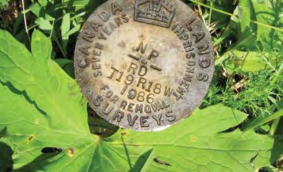
11 Figure 5. SGB s Jim Mackenzie taking GPS measurements on monument 1N of the Alberta British Columbia boundary. Nunavut Northwest Territories boundary: The 2,100 km boundary between Nunavut and NWT was defined in the 1993 Nunavut Act but never marked on the ground. There are now many mineral claims and much exploration and development activity (cumulatively valued in the billions of dollars) that straddle the boundary. A clearly marked boundary links the description to the ground. Such certainty is required to determine which jurisdiction has the right to administer the lands and resources. were developed to minimize costs. For example, monuments were set every 10 km, rather than every kilometre as is the norm for interprovincial boundary surveys. Boundaries of adjacent mineral claims were connected to the survey to provide clear direction for land administration. In addition, the provisions of the Nunavut and Tlicho land claims agreements were followed. Other active parts of the boundary will be surveyed over the next few years as required. Consequently, 668 km of the boundary were surveyed and 312 monuments were set. Special standards Figure 6. Survey of Nunavut Northwest Territories boundary Annual Review

12 10 A look ahead SGB priorities for MyCLSS implementation Complete on-line access and quality control applications; develop options for the implementation of legal signatures for survey plans. 2. Parcel fabric phase 2 Develop a road map for renewal of the survey system on First Nations Reserves. 3. Managing boundaries Ensure Canada s legal and treaty commitments for boundary surveys are met. Revise the 15-year boundary maintenance plan of the IBC. 4. Developing cadastral systems Answer the question How can we use geomatics and cadastral systems to help unlock the economic potential of Canada s ocean space? 5. Collaborate with the Mapping Information Branch and the Canada Centre for Remote Sensing towards the re-vitalization of Geomatics Canada through the six-point Pan-Canadian Geomatics Action Plan. 17 ANNUAL REVIEW Figure 7. Marine cadastre Geospatial rights management in Canada s offshore. 17 Pan-Canadian Geomatics Action Plan Geomatics Roundtable, Calgary 2010, and the Canadian Council on Geomatics (CCOG). 8 Surveyor General Branch
13 11 Results and performance measures Results and performance measures are based on the Natural Resources Canada Program Activity Architecture (PAA) and Performance Management Framework (PMF) Expected result: Stakeholders use geographic information, expertise and services to make evidence based decisions Performance indicators: The obligations of the Government of Canada are met to a high level of user satisfaction related to: Defining legal boundaries of real properties on Canada Lands; and A well defined international boundary with the United States. Outputs: 1. A framework for legal surveys on Canada Lands that includes a land surveying profession, standards for legal surveys, demarcated boundaries, access to official records of surveys and an inventory of real property parcels 2. Demarcated parcels of Aboriginal Land Claims and lands for other government departments having control and administration of property rights on Canada Lands 3. International boundary line maintenance where the Vista 19 was cleared, surveyed and demarcated with monuments Summary: The volume of work continues to increase with activity on Canada Lands. All obligations to Aboriginal land claims were met. The Yukon Claim is nearing completion as are the comprehensive land claims in the Northwest Territories and Nunavut. Several claims under negotiation in the NWT are forecasted to generate ongoing demand for legal surveys for at least another 7 years. Aboriginal self-government initiatives in southern Canada are increasing the demand for the surveyed parcels needed to support economic and community development. The IBC is returning to a 15 year maintenance plan as a result of increased resources from the US Section. Currently the plan is at 73% completion of the scheduled 15 year plan. This gap is expected to close within 3 years. 18 Results outcomes and outputs have been redefined for the fiscal year. 19 The Vista is a zone 3 metres wide on each side of the international boundary to be kept clear of vegetation and obstructions Annual Review
14 ANNUAL REVIEW Results: Output Parcels created in cadastral dataset 4,773 5,480 Documents registered 1,943 2,206 Instructions issued Direct Indirect Total Plans reviewed/signed by SG Direct Indirect Total 1,277 1,297 Saskatchewan treaty land entitlement Area of parcels described 5,365ha (13,258 A.) 8,803ha (21,754 A.) Progress 36% 37% Manitoba treaty land entitlement Area surveyed 21,823ha (53,927 A.) 10,313ha (25,485 A.) Progress 44% 46% Tlicho land claim agreement 20 Boundary surveyed 95 km 300 km Progress 60% 90% Nunavut land claim agreement Boundaries surveyed km Parcels created 0 14 Progress 99% 100% Nunavik land claim agreement 21 Boundaries surveyed 65 km Progress 100 % Yukon land claims agreements Boundaries surveyed 426 km 400 km Parcels created Progress 90% 97% IBC 15 year maintenance plan Actual progress against expected 64% 73% FNLMA Legal description reports drafted Surveys contracted Inter-departmental letters of agreement Number Value $6.3 M $8.7 M Survey contracts issued to the private sector 22 Number Value $12.2 M $13.8 M Benchmarks: Client satisfaction (scale of 1-5) First Nations and Inuit ( ) 4.1 Other government departments ( ) 4.6 Canada Lands Surveyors ( ) 4.1 Staff satisfaction ( ) Proportion who like their job 86% Proportion who are satisfied in their work 79% New service standard targets: 23 Time for SGB to review a plan 20 calendar days Time for SGB to prepare a LDR 200 calendar days Proportion of plans with critical errors 24 Less than 5% 20 Of one very large parcel. 21 Surveying of the four parcels only began in Includes IBC vista clearing (B-Base), land claim surveys (C-Base) and surveys for other government departments (such as INAC and Parks). 23 To be applied to projects starting in As identified in the plan review process and part of the continuous improvement cycle implemented through MyCLSS to ensure integrity of the survey system. 10 Surveyor General Branch
15 Appendix 1 Canada Lands Canada Lands are defined in the Canada Lands Surveys Act (CLS Act). In the terrestrial environment, they are any lands belonging to the federal Crown (Canada) or of which Canada has power to dispose, that are situated in Yukon, the Northwest Territories, Nunavut or in any National Park and any lands that are: (i) (ii) (iii) (iv) (v) (vi) surrendered lands or a reserve, as defined in the Indian Act, Category IA land or IA-N land, as defined in the Cree-Naskapi (of Quebec) Act, Sechelt lands, as defined in the Sechelt Indian Band Self-Government Act, settlement land, as defined in the Yukon First Nations Self-Government Act, and lands in which an interest is transferred or recognized under s.21 of that Act, lands in the Kanesatake Mohawk interim land base, as defined in the Kanesatake Interim Land Base Governance Act (other than Doncaster Reserve No. 17), or Tlicho lands, as defined in s.2 of the Mackenzie Valley Resource Management Act. Canada Lands are also any lands under water belonging to the federal Crown (Canada) or in respect of any rights in which Canada has power to dispose. 25 Lincoln Sea Mer de Lincoln CANADA LANDS TERRES DU CANADA May 2011 Edition / mai 2011 édition UNITED STATES OF AMERICA ÉTATS-UNIS D'AMÉRIQUE ALASKA ARCTIC OCEAN OCÉAN ARCTIQUE Beaufort Sea Mer de Beaufort KALAALLIT NUNAAT (DENMARK) Produced by Surveyor General Branch, Geomatics Canada, Natural Resources Canada. Préparé par la Direction de l'arpenteur général, Géomatique Canada, Ressources naturelles Canada Her Majesty the Queen in Right of Canada. Natural Resources Canada Sa Majesté la Reine du chef du Canada, Ressources naturelles Canada. LEGEND LÉGENDE Territorial Land Terres territoriale Offshore Area Terres au large des còte National Park Parc national Indian Reserve Réserve indienne Office of the Surveyor General Bureau de l'arpenteur général Provincial, Territorial Boundary Limite provinciale ou territoriale International Boundary Frontière internationale 200 Mile Limit Limite de 200 Mile YUKON Note : The lines on this map represent approximate boundaries for illustrative purposes. Note: Les lignes sur cette carte représentent les limites approximatives à des fins d'illustration. Whitehorse Labrador Sea Mer du Labrador NORTHWEST TERRITORIES TERRITOIRES DU Copies of this map may be obtained from the Surveyor General Branch of Natural Resources Canada website at Iqaluit Des copies de cette carte peuvent être obtenues sur le site web de la Direction de l'arpenteur général de Ressources naturelles Canada à BRITISH COLUMBIA NORD-OUEST Yellowknife NUNAVUT COLOMBIE- BRITANNIQUE NEWFOUNDLAND AND LABRADOR TERRE-NEUVE-ET-LABRADOR PACIFIC ALBERTA Hudson Bay Baie d'hudson OCEAN OCÉAN PACIFIQUE Vancouver 25 Canada Lands Surveys Act, s.24. Edmonton SASKATCHEWAN Regina MANITOBA Winnipeg UNITED STATES OF AMERICA ÉTATS-UNIS D'AMÉRIQUE ONTARIO QUÉBEC QUEBEC Ottawa Toronto Québec N B N-B P E I Î - P -É Amherst N S N -É Saint-Pierre et Miquelon FRANCE ATLANTIC OCEAN OCÉAN ATLANTIQUE Sources: Department of Natural Resources Canada, Geomatics Canada, GeoAccess Division, : base map. Références: Le ministère des Ressources naturelles Canada, Géomatique Canada, Division GéoAccès, Carte de base 1: Annual Review
16 Appendix 2 SGB web of relationships CLS Geosptial info users Cadastral dataset Land developers First Nations AFN FN4LM LAB Property rights modernization ACLS DOJ NALMA AANDC Researchers CLSR CLS First Nations First Nations Managing Parcels First Nations IOGC Yukon LTO Aboriginal Groups CLS AANDC Comprehensive land claims AANDC EC First Nation Reserve fabric CLS Free simple land Nunavut LTO CLS NWT LTO Provinces Specific land claims ATR/TLE) AANDC Provinces Territories CLS Managing Surveys ACLS CLS NRCAN Sectors First Nations Industry Landowners Parks Canada fabric Communities Nunavut - NWT Boundary AANDC First Nations NRCAN Sectors Jurisdictional boundary opinions TC LAB DOJ AANDC Parks Other countries PWGSC Offshore fabric CAPP DFO Journalists Utilities Police Offshore Accord Areas Inter - territorial bounds Managing Boundaries IBC Landowners ANNUAL REVIEW AB-BC Boundary Commission Statistics Canada Electorates Elections Canada Municipalities DFAIT Border Agencies 12 Surveyor General Branch
17 Acronyms: AANDC Department of Aboriginal Affairs and Northern Development Canada 26 ACLS AFN ATR CAPP CLS CLSR DFAIT DFO DOJ EC FN FN4LM FNCIDA FNLMA IBC INAC IOGC LAB LDR LTO NALMA PAA PWGSC SG SGB TC TLE Association of Canada Lands Surveyors Assembly of First Nations Additions to Reserves Canadian Association of Petroleum Producers Canada Lands Surveyor Canada Lands Surveys Records Department of Foreign Affairs and International Trade Canada Department of Fisheries and Oceans Canada Department of Justice Canada Department of Environment Canada First Nations First Nations for Land Management First Nations Commercial and Industrial Development Act First Nations Land Management Act International Boundary Commission Department of Indian and Northern Affairs Canada Indian Oil and Gas Canada Lands Advisory Board (to implement FNLMA) Legal description reports (pursuant to FNLMA) Land Titles Office (Nunavut, NWT and Yukon) National Aboriginal Lands Managers Association Program Activity Architecture (Government of Canada) Department of Public Works and Government Services Canada Surveyor General Surveyor General Branch, Earth Sciences Sector, NRCan Department of Transport Canada Treaty Land Entitlement 26 As used since since June 9, Annual Review
18 Appendix Standards updates Chapter D8 Mineral Claim Surveys in the Northwest Territories and Nunavut is now available at: The specimen plan of Chapter D8 Mineral Claim Surveys in the Northwest Territories and Nunavut, as well as Schedule E3-3, Abbreviations, of Appendix E3, were updated accordingly. ANNUAL REVIEW 14 Surveyor General Branch
Manual of Instructions for the Survey of Canada Lands Revitalization, Phase 1. Draft July 12, 2013
 Survey of Canada Lands Revitalization, Phase 1 July 12, 2013 TO À Association of Canada Lands Surveyors (ACLS) FROM DE Peter Sullivan, Surveyor General of Canada Lands SUBJECT OBJET Revitalization of the
Marine Spatial Data Infrastructure (MSDI) & The Marine Cadastre Application. April 10, 2018
 & The Marine Cadastre Application. April 10, 2018") Marine Spatial Data Infrastructure (MSDI) & The Marine Cadastre Application April 10, 2018 A Collaborative Pilot Project Vision of CHS: A framework of geographic data, metadata, users and tools Intent
Marine Spatial Data Infrastructure (MSDI) & The Marine Cadastre Application April 10, 2018 A Collaborative Pilot Project Vision of CHS: A framework of geographic data, metadata, users and tools Intent
National Aboriginal Lands Managers Association (NALMA) NALMA Survey Program Overview
 NALMA Survey Program Overview") National Aboriginal Lands Managers Association (NALMA) NALMA Survey Program Overview NALMA Location Survey Project Background LAND SURVEYS ARE ESSENTIAL TO THE EFFECTIVE MANAGEMENT AND DEVELOPMENT OF LANDS!
National Aboriginal Lands Managers Association (NALMA) NALMA Survey Program Overview NALMA Location Survey Project Background LAND SURVEYS ARE ESSENTIAL TO THE EFFECTIVE MANAGEMENT AND DEVELOPMENT OF LANDS!
Modern Treaties in Quebec and the Eeyou Marine Region Land Claims Agreement
 Modern Treaties in Quebec and the Eeyou Marine Region Land Claims Agreement Monique Lucie Sauriol, Aboriginal Affairs and Northern Development Canada Eeyou Marine Region Symposium March 25, 2014 Overview
Overview of Legal Matters to be Considered in the Development of Reserve Lands
 September 4, 2014 Overview of Legal Matters to be Considered in the Development of Reserve Lands INTRODUCTION This paper provides a brief overview of the legal matters to be considered in connection with
FIG Marrakech WW2011. TSO1J Land Registration. Contents. FIG Working Week 2011 Bridging the Gap between Cultures Marrakech, Morocco, May
 FIG Marrakech WW2011 Geospatial architecture for the Cree/Naskapi Land Registry System as an economic development mechanism for Canadian aboriginal people Presenter: Gabriel S. Arancibia, Canada 19 May,
Canadian Generally Accepted Land Sur veying Principles
 Canadian Council on Geomatics Conseil canadien de géomatique Canadian Generally Accepted Land Sur veying Principles Part 1 Principles to guide the development of Land Surveying governance models and legal
Hybrid Cadastre Pilot Project Guidelines for Public Land Disposition Surveys Operations Division
 Hybrid Cadastre Pilot Project Guidelines Operations Division January 12, 2015 Version Update Version No. Date Summary of Changes 2.0 January 12, Table of Contents 2015 Table of Contents added to Guidelines.
AGREEMENT CONCERNING THE IMPLEMENTATION OF THE JAMES BAY AND NORTHERN QUÉBEC AGREEMENT ON HOUSING IN NUNAVIK
 AGREEMENT CONCERNING THE IMPLEMENTATION OF THE JAMES BAY AND NORTHERN QUÉBEC AGREEMENT ON HOUSING IN NUNAVIK This day of, 2015 BETWEEN: MAKIVIK CORPORATION, a corporation incorporated by An Act respecting
Land Designation & Leasing
 Land Designation & Leasing CANDO Workshop March 2017 Presented by: Emilie Garnier Colleen Thomas Overview Economic Activities $$$ LEASE DESIGNATION RESERVE LAND USE PLANNING 2 Economic Activities = $$$
Core Housing Need. Data from the 2006 Census. Presentation to the NHRC Working Group on Housing Data
 Core Housing Need Data from the 2006 Census Presentation to the NHRC Working Group on Housing Data Roger Lewis Policy and Research Division Canada Mortgage and Housing Corporation May 5, 2009 Introduction
Surveyor General Branch
 Surveyor General Branch nrcan.gc.ca Beyond Boundaries Parcel Fabric Renewal Towards a community based, cost-effective and timely land development framework Before After Her Majesty the Queen in Right of
INDEX TO CHAPTER 10 ADDITIONS TO RESERVE
 INDEX TO CHAPTER 10 ADDITIONS TO RESERVE INDEX OF DIRECTIVES DIRECTIVE TITLE AND NUMBER PAGES Directive 10-1: Contents Additions to Reserves / Introduction Annex A Annex B Annex C Annex D 3-5 5-20 21-30
The First Nations Property Ownership Initiative and Alternatives
 The First Nations Property Ownership Initiative and Alternatives November 1, 2010 The proposed First Nations Property Ownership Act (FNPO) is an initiative that would permit First Nations who wish to hold
INTEGRATED LAND SURVEYS
 INTEGRATED LAND SURVEYS Final Report to the Canadian Council on Geomatics January 2002 Dr Brian Ballantyne Table of contents Recommendations 4 Executive Summary 5 Part I Introduction 1. Purpose & overview
Jurisdictional Responsibilities for Land Resources, Land Use and Development in the Yukon Territory and Northwest Territories
 Jurisdictional Responsibilities for Land Resources, Land Use and Development in the Yukon Territory and Northwest Territories Book one Northwest Territories First Nations Settlement Areas Land Management
Wiikwemkoong Surveying Capacity Building Project
 Wiikwemkoong Surveying Capacity Building Project Presentation to the Association of Canada Lands Surveyors Conference- Technical Session Indigenous People Advancing through Collaboration and Capacity Building
The Register of the Domain of the State, Cadastre 2014 and LADM
 The Register of the Domain of the State, Cadastre 2014 and LADM Bruno Gilbert, Christian Lord, Daniel Roberge Foncier Québec 29 e réunion ISO/TC 211 Québec, 4 novembre 2009 Presentation plan Context Modernization
The Canadian Real Estate Association News Release
 The Canadian Real Estate Association News Release Canadian home sales fall further in February Ottawa, ON, March 15, 2018 Statistics 1 released today by The Canadian Real Estate Association (CREA) show
R esearch Highlights LEVIES, FEES, CHARGES AND TAXES ON NEW HOUSING (2002) Introduction. Municipal Levies, Fees and Charges
 Introduction. Municipal Levies, Fees and Charges") R esearch Highlights December 2002 Socio-economic Series 115 LEVIES, FEES, CHARGES AND TAXES ON NEW HOUSING (2002) Introduction Government-imposed costs on new housing can be substantial. They have a direct
R esearch Highlights December 2002 Socio-economic Series 115 LEVIES, FEES, CHARGES AND TAXES ON NEW HOUSING (2002) Introduction Government-imposed costs on new housing can be substantial. They have a direct
Indigenous Land Title Registry & First Nations Infrastructure Institution. Presented by the First Nations Tax Commission
 Indigenous Land Title Registry & First Nations Infrastructure Institution Presented by the First Nations Tax Commission Saskatchewan Links to Learning September 27, 2017 Overview Economically and Fiscally
The Canadian Real Estate Association News Release
 The Canadian Real Estate Association News Release Canadian home sales activity strengthens in July Ottawa, ON, August 15, 2018 Statistics 1 released today by The Canadian Real Estate Association (CREA)
The Canadian Real Estate Association News Release
 The Canadian Real Estate Association News Release Canadian home sales drop again in June Ottawa, ON, July 17, 2017 According to statistics 1 released today by The Canadian Real Estate Association (CREA),
Spatial Data Warehouse Ltd. Cadastral Mapping INITIATIVE 1: CADASTRAL MAPPING. Version Spatial Data Warehouse Ltd. & AltaLIS Ltd.
 Spatial Data Warehouse Ltd. Initiative 1: Cadastral Mapping INITIATIVE 1: CADASTRAL MAPPING 29 P3 The SDW/AltaLIS Model Background The Government of Alberta started a mapping program, the Municipal Integrated
The Canadian Real Estate Association News Release
 The Canadian Real Estate Association News Release Canadian home sales post solid gain in November Ottawa, ON, December 14, 2017 According to statistics 1 released today by The Canadian Real Estate Association
The Canadian Real Estate Association News Release
 The Canadian Real Estate Association News Release Canadian home sales push higher in February Ottawa, ON, March 15, 2016 According to statistics 1 released today by The Canadian Real Estate Association
Guide for Submitting Land Claims to Ontario
 Ministry of Aboriginal Affairs Guide for Submitting Land Claims to Ontario Ministry of Aboriginal Affairs 160 Bloor Street East Toronto, Ontario, Canada M7A 2E6 Ontario.ca/Aboriginal 1-866-381-5337 TTY
City of Winnipeg Housing Policy Implementation Plan
 The City of Winnipeg s updated housing policy is aligned around four major priorities. These priorities are highlighted below: 1. Targeted Development - Encourage new housing development that: a. Creates
The Canadian Real Estate Association News Release
 The Canadian Real Estate Association News Release Canadian home sales rebound in January Ottawa, ON, February 16, 2016 According to statistics 1 released today by The Canadian Real Estate Association (CREA),
Information contained
 Government Information (Public Access) Act 2009 (GIPA Act) LPI Information Guide 1. Introduction and contents of this guide The Land and Property Information s (LPI) Information Guide tells you in general
News Release. Canadian home sales edge up in February Ottawa, ON, March 13, The Canadian Real Estate Association
 The Canadian Real Estate Association News Release Canadian home sales edge up in February Ottawa, ON, March 13, 2015 According to statistics 1 released today by The Canadian Real Estate Association (CREA),
DECLARATION OF CLAIM
 SPECIFIC CLAIMS TRIBUNAL B E T W E E N: PASQUA FIRST NATION Claimant v. HER MAJESTY THE QUEEN IN RIGHT OF CANADA As represented by the Minister of Indian Affairs and Northern Development Respondent DECLARATION
News Release. Canadian home sales little changed in November Ottawa, ON, December 16, The Canadian Real Estate Association
 The Canadian Real Estate Association News Release Canadian home sales little d in November Ottawa, ON, December 16, 2013 According to statistics 1 released today by The Canadian Real Estate Association
A New Beginning: A National Non-Reserve Aboriginal Housing Strategy
 14 A New Beginning: A National Non-Reserve Aboriginal Housing Strategy Steve Pomeroy, on behalf of The National Aboriginal Housing Association/ Association Nationale d Habitation Autochtone (NAHA/ANHA)
How to Set Up & Run a First Nation Lands Office
 How to Set Up & Run a First Nation Lands Office Quick Reference Guide September 2017 1. Introduction 2 The Quick Reference Guide to Set-up and run a Lands Office is intended to be a resource and tool for
Surveyor General s Report
 Surveyor General s Report Susan F. MacGregor O.L.S. Surveyor General Mapping and Information Resources Branch Ministry of Natural Resources and Forestry Queen s Printer for Ontario, 2017 The Ministry of
Chapter 19. Water, Riparian, and Foreshore Rights. Key Terms. Water Rights. Riparian Rights. Chapter 19: Water, Riparian, and Foreshore Rights
 207 Chapter 19 Water, Riparian, and Foreshore Rights This chapter provides some basic background information and lists resources for research projects relating to water, riparian and foreshore rights.
News Release. Canadian home sales ease back in September Ottawa, ON, October 15, The Canadian Real Estate Association
 The Canadian Real Estate Association News Release Canadian home sales ease back in September Ottawa, ON, October 15, 2014 According to statistics 1 released today by The Canadian Real Estate Association
The Canadian Real Estate Association News Release
 The Canadian Real Estate Association News Release Canadian home sales surge in December Ottawa, ON, January 15, 2018 Statistics 1 released today by The Canadian Real Estate Association (CREA), show national
GOVERNMENT. Case Study Ville de Trois Rivières streamlines property assessment
 GOVERNMENT Case Study Ville de Trois Rivières streamlines property assessment GIS-generated parcel basemap provides powerful visualization & analysis capabilities With a population of just over 130,000,
The Canadian Real Estate Association News Release
 The Canadian Real Estate Association News Release Canadian home sales fall further in July Ottawa, ON, August 15, 2017 According to statistics 1 released today by The Canadian Real Estate Association (CREA),
ACLS Annual Report Contents
 ASSOCIATION OF CANADA LANDS SURVEYORS Annual Report For the year ending on December 31st, 2017 ACLS Annual Report Contents ACLS Introduction/Vision and Mission 01 Welcome to the World of Land Surveying
The Canadian Real Estate Association News Release
 The Canadian Real Estate Association News Release Canadian home sales fall in April Ottawa, ON, May 15, 2018 Statistics 1 released today by The Canadian Real Estate Association (CREA) show national home
ParcelMap BC. Compiling a Parcel Fabric for the Province of British Columbia. WENDY AMY and ELLEN STYNER
 ParcelMap BC Compiling a Parcel Fabric for the Province of British Columbia WENDY AMY and ELLEN STYNER Who is MNC? Established in 1997, MNC is a geomatics engineering firm located in Calgary, Alberta.
The Canadian Real Estate Association News Release
 The Canadian Real Estate Association News Release Canadian home sales drop in January Ottawa, ON, February 15, 2018 Statistics 1 released today by The Canadian Real Estate Association (CREA) show national
MINERAL RIGHTS COMPENSATION REGULATION
 Province of Alberta MINES AND MINERALS ACT MINERAL RIGHTS COMPENSATION REGULATION Alberta Regulation 317/2003 With amendments up to and including Alberta Regulation 55/2015 Office Consolidation Published
The Canadian Real Estate Association News Release
 The Canadian Real Estate Association News Release Canadian home sales activity eases in October Ottawa, ON, November 15, 2018 Statistics 1 released today by the Canadian Real Estate Association (CREA)
The Canadian Real Estate Association News Release
 The Canadian Real Estate Association News Release Canadian home sales improve slightly in March Ottawa, ON, April 13, 2018 Statistics 1 released today by The Canadian Real Estate Association (CREA) show
The Canadian Real Estate Association News Release
 The Canadian Real Estate Association News Release Canadian home sales edge down from December to January Ottawa, ON, February 15, 2017 According to statistics 1 released today by The Canadian Real Estate
Economic and Social Council 6 July 2018
 1 ADVANCE UNEDITED VERSION UNITED NATIONS E/C.20/2018/12/Add.1 Economic and Social Council 6 July 2018 Committee of Experts on Global Geospatial Information Management Eighth session New York, 1-3 August
The Canadian Real Estate Association News Release
 The Canadian Real Estate Association News Release Canadian home sales activity softens further in November Ottawa, ON, December 17, 2018 Statistics 1 released today by the Canadian Real Estate Association
Cadastral Template 2003
 PCGIAP-Working Group 3 "Cadastre" FIG-Commission 7 "Cadastre and Land Management" Cadastral Template 2003 The establishment of a cadastral template is one of the objectives of Working Group 3 "Cadastre"
Closing at Noon, Mountain Time on May 17, 2005
 2005 CENTRAL MACKENZIE VALLEY CALL FOR BIDS Closing at Noon, Mountain Time on May 17, 2005 The management of oil and gas resources North of 60 0 latitude offshore and in the Northwest Territories and Nunavut
Crown Land Use Operational Policy: Land and Management Transfers. Summary of Changes:
 APPROVED AMENDMENTS: Effective Date Briefing Note /Approval Summary of Changes: June 1, 2011 BN 175892 Policy and Procedure update to reflect reorganization of resource ministries April 2011 FILE: 11730-000
News Release. Canadian home sales fall back in October Ottawa, ON, November 15, The Canadian Real Estate Association
 The Canadian Real Estate Association News Release Canadian home sales fall back in October Ottawa, ON, November 15, 2013 According to statistics 1 released today by The Canadian Real Estate Association
Chapter 3: A Framework for a National Land Information Infrastructure
 Chapter 3: A Framework for a National Land Information Infrastructure Brian Marwick Overview As a federated county, Australia s land administration systems are state and territory based. These systems,
Crown Land Leasing Policy
 Management Manual 25 Chapter: Section: Approved By: Implementation: 6 (Licenses, Leases, Permits, Sales, Land Exchanges) 4 () Duff Montgomerie Deputy Minister Land Administration Division Land Services
Inuit South of 60 Settlement Efforts
 Inuit South of 60 Settlement Efforts................... Presented to Hudson s Bay Regional Roundtable March 30, 2017 Overview 2 Since 2010, Manitoba (led by IMR) has been engaged in without prejudice negotiations
Subject. Date: January 12, Chair and Members of Planning and Development Committee 2016/02/01
 Originator s files: Date: January 12, 2016 CD 06 AFF To: From: Chair and Members of Planning and Development Committee Edward R. Sajecki, Commissioner of Planning and Building Meeting date: 2016/02/01
January 23, Sutton Place Hotel, Toronto, Ontario
 PREMIERS MEETING January 23, 2003 Sutton Place Hotel, Toronto, Ontario No public agenda issued. The subject discussed was: Health care First Ministers Attending Prince Edward Island Hon. Patrick G. Binns
ParcelMap BC Compiling a Parcel Fabric for the Province of British Columbia. Presented by: Ellen Styner (General Manager) and Wendy Amy (GIS Manager)
 and Wendy Amy (GIS Manager)") ParcelMap BC Compiling a Parcel Fabric for the Province of British Columbia Presented by: Ellen Styner (General Manager) and Wendy Amy (GIS Manager) Who is MNC? MNC is a geomatics engineering firm with
ParcelMap BC Compiling a Parcel Fabric for the Province of British Columbia Presented by: Ellen Styner (General Manager) and Wendy Amy (GIS Manager) Who is MNC? MNC is a geomatics engineering firm with
The Canadian Real Estate Association News Release
 The Canadian Real Estate Association News Release Canadian home sales activity edges lower in September Ottawa, ON, October 15, 2018 Statistics 1 released today by The Canadian Real Estate Association
News Release. Canadian home sales moderate further in January Ottawa, ON, February 14, The Canadian Real Estate Association
 Canadian home sales moderate further in January Ottawa, ON, February 14, 2014 According to statistics 1 released today by The Canadian Real Estate Association (CREA), national home sales activity posted
This is a summary of the Northwest Territories Lands and Resources Devolution Agreement (called the Agreement in this summary).
.") NWT Lands and Resources Devolution Agreement Plain Language Summary This is a summary of the Northwest Territories Lands and Resources Devolution Agreement (called the Agreement in this summary). The Agreement
NWT Lands and Resources Devolution Agreement Plain Language Summary This is a summary of the Northwest Territories Lands and Resources Devolution Agreement (called the Agreement in this summary). The Agreement
The Canadian Real Estate Association News Release
 The Canadian Real Estate Association News Release Canadian home sales edge up in September Ottawa, ON, October 14, 2016 According to statistics 1 released today by The Canadian Real Estate Association
Student Manual (Persons not licensed in any jurisdiction)
") Student Manual (Persons not licensed in any jurisdiction) Association of Newfoundland Land Surveyors For The Use of the Members and Articling Students Reviewed By Board of Examiners July 9, 2013 Approved
Student Manual (Persons not licensed in any jurisdiction) Association of Newfoundland Land Surveyors For The Use of the Members and Articling Students Reviewed By Board of Examiners July 9, 2013 Approved
The Rules and Regulations of the Board of Examiners for Candidates Applying to Become Manitoba Land Surveyors Pursuant to the Labour Mobility
 The Rules and Regulations of the Board of Examiners for Candidates Applying to Become Manitoba Land Surveyors Pursuant to the Labour Mobility Provisions Under the Agreement on Internal Trade (AIT) November
South African Council for Town and Regional Planners
 TARIFF OF FEES South African Council for Town and Regional Planners PLEASE NOTE : THE TARIFF OF FEES WAS APPROVED BY THE COUNCIL CHAPTER 10 : TARIFF OF FEES 10.1 INTRODUCTION 10.1.1 General This tariff
Appraiser. Third-Party Service Provider Program. Canadian Government Services Division
 Third-Party Service Provider Program Appraiser o Extension for the existing Integrated Relocation Program for the Government of Canada (GoC), Royal Canadian Mounted Police (RCMP) and the Canadian Armed
Changes of Ownership Manual DISCLAIMER
 Who Can Be an Owner? DISCLAIMER The materials in this training manual are for demonstration purposes only. The forms are subject to change at any time without notice. Use of outdated forms may result in
Market Value Assessment and Administration
 Market Value and Administration This technical document is part of a series of draft discussion papers created by Municipal Affairs staff and stakeholders to prepare for the Municipal Government Act Review.
COUNTY GOVERNMENT OF LAMU Department of Land, Physical Planning, Infrastructure & Urban Development
 1 COUNTY GOVERNMENT OF LAMU Department of Land, Physical Planning, Infrastructure & Urban Development TERMS OF REFERENCE FOR OUTSOURCING OF CONSULTANCY SERVICES FOR SURVEY & REGULARIZATION OF KATSAIKAIKAIRU
NORTHWEST TERRITORIES HOUSING CORPORATION
 NORTHWEST TERRITORIES HOUSING CORPORATION OVERVIEW MISSION The mission of the Northwest Territories Housing Corporation (NWTHC) is to ensure, where appropriate and necessary, that there is a sufficient
A Guide to the Municipal Planning Process in Saskatchewan
 A Guide to the Municipal Planning Process in Saskatchewan A look at the municipal development permit and the subdivision approval process in Saskatchewan May 2008 Prepared By: Community Planning Branch
The Canadian Real Estate Association News Release
 The Canadian Real Estate Association News Release Canadian home sales at five-year low in May Ottawa, ON, June 15, 2018 Statistics 1 released today by The Canadian Real Estate Association (CREA) show national
ACLS PRACTICE MANUAL. A professional guide for Canada Lands Surveyors. The Association of Canada Lands Surveyors
 ACLS PRACTICE MANUAL A professional guide for Canada Lands Surveyors The Association of Canada Lands Surveyors July 2015 Table of Contents Part 1: PROFESSIONAL PRACTICE... 1 INTRODUCTION... 1 1.1 Terms
Cadastre: definitions
 Introduction New vision towards a multipurpose cadastral system to support land management in Morocco Moha EL-AYACHI, El Hassane SEMLALI, Mohamed ETTARID, Driss TAHIRI, Institut Agronomique et Vétérinaire
FOUR POINT SURVEY LAW 1 (ESSE 4660) Cadastral Surveys and Land Registration Systems. Syllabus & Info for Fall, 2018 L E A R N I N G
 Cadastral Surveys and Land Registration Systems. Syllabus & Info for Fall, 2018 L E A R N I N G") FOUR POINT L E A R N I N G CONTINUOUS LEARNING FOR LAND PROFESSIONALS SURVEY LAW 1 (ESSE 4660) Cadastral Surveys and Land Registration Systems Syllabus & Info for Fall, 2018 OVERALL GOALS AND PURPOSE The
FOUR POINT L E A R N I N G CONTINUOUS LEARNING FOR LAND PROFESSIONALS SURVEY LAW 1 (ESSE 4660) Cadastral Surveys and Land Registration Systems Syllabus & Info for Fall, 2018 OVERALL GOALS AND PURPOSE The
MINISTRY OF SUSTAINABLE RESOURCE MANAGEMENT
 The mission of the Ministry of Sustainable Resource Management is to provide provincial leadership, through policies, planning and resource information, to support sustainable economic development of the
REGISTERED PLANS AND TAX FREE SAVINGS ACCOUNTS. Mortgage/Hypothec Investment Details
 REGISTERED PLANS AND TAX FREE SAVINGS ACCOUNTS Mortgage/Hypothec Investment Details Annuitant/Holder/Subscriber/Client (referred to herein as the undersigned, I, or me ): Olympia Account Number (referred
FIRST NATION URBAN DEVELOPMENT AREA
 FIRST NATION URBAN DEVELOPMENT AREA Commonly referred to as Urban Reserves based on the SK Experience. Sandy Trudel, Economic Development Brandon s.trudel@brandon.ca or 204.729.2131 August 2016 In order
Superintendent of Real Estate Ministry of Finance Vancouver
 Superintendent of Real Estate Ministry of Finance Vancouver A challenging and exciting opportunity to enhance British Columbia s reputation for effective regulation of the real estate sector The newly
Modernizing the Land Titles System in Yukon. What We Heard Report
 What We Heard Report Yukon Department of Justice Fall, 2012 What We Heard Report Table of Contents What We Heard Report... 2 1. What We Heard about the Appropriate System for Recording Land Interests in
ALC Bylaw Reviews. A Guide for Local Governments
 2018 ALC Bylaw Reviews A Guide for Local Governments ALC Bylaw Reviews A Guide for Local Governments This version published on: August 14, 2018 Published by: Agricultural Land Commission #201-4940 Canada
Understanding the Consent Application Process
 Understanding the Consent Application Process Your Step-By-Step Guide for Consent-Granting Authorities 1 2 3 4 5 6 7 8 9 10 11 Section 53 of the Planning Act ontario.ca/municipallearning Understanding
Parliamentary Information and Research Service. Legislative Summary BILL C-63: FIRST NATIONS CERTAINTY OF LAND TITLE ACT
 Legislative Summary LS-668E BILL C-63: FIRST NATIONS CERTAINTY OF LAND TITLE ACT James Gauthier Tonina Simeone Social Affairs Division 11 January 2010 Library of Parliament Bibliothèque du Parlement Parliamentary
Shoowahtlans Indian Reserve No. 4 Metlakatla
 Land Description for Shoowahtlans Indian Reserve No. 4 Metlakatla British Columbia Prepared under First Nations Land Management (S.C. 1999, C.24) Prepared on: October 7 th, 2015 October 7, 2015 Table of
Land Dedication (Reserves)
") Land Dedication (Reserves) This technical document is part of a series of draft discussion papers created by Municipal Affairs staff and stakeholders to prepare for the Municipal Government Act Review.
Land Dedication (Reserves) This technical document is part of a series of draft discussion papers created by Municipal Affairs staff and stakeholders to prepare for the Municipal Government Act Review.
MVLWB/INAC/GNWT. Guidelines for Closure and Reclama on Cost Es mates for Mines. November 2017
 MVLWB/INAC/GNWT Guidelines for Closure and Reclama on Cost Es mates for Mines Mackenzie Valley Land and Water Board Gwich in Land and Water Board Sahtu Land and Water Board Wek èezhìi Land and Water Board
Proponent s Guide to the NCC s Federal Land Use, Design and Transaction Approvals Process
 Proponent s Guide to the NCC s Federal Land Use, Design and Transaction Approvals Process September 2018 Table of Contents 1. INTRODUCTION 3 2. WHAT IS THE NATIONAL CAPITAL REGION? 4 3. WHEN IS APPROVAL
2006 Census Housing Series: Issue 9 Inuit Households in Canada
 December 2010 Socio-economic Series 10-019 2006 Census Series: Issue 9 Inuit in Canada introduction This Research Highlight examines the housing conditions of Inuit 1 in Canada using data from the 2006
PROPERTY ASSESSMENT KNOWLEDGE
 A P E N DE UM NOUN A COLLECTION OF CONCISE BUT DETAILED INFORMATION ABOUT APPRAISAL AND APPRAISAL MANAGEMENT, ESPECIALLY IN THE PROPERTY ASSESSMENT INDUSTRY. PROPERTY ASSESSMENT KNOWLEDGE KNOWLEDGE AREAS
The parties have agreed to continue the program for this fiscal year of 2012/2013 subject to modifications.
 TO: FROM: Association of Manitoba Municipalities (AMM) Lindsay Thomson City of Winnipeg Steve Bossenmaier, Robert Robinson and Rick. Sherby Professional Land Surveyors Group Wilson Phillips AMLS/LTO Liaison
OVERVIEW OF HOUSING DEVELOPMENT CORPORATION, LONDON (HDC)
") OVERVIEW OF HOUSING DEVELOPMENT CORPORATION, LONDON (HDC) Information for Persons Interested in Applying to Serve on the HDC Board of Directors STEPHEN GIUSTIZIA EXECUTIVE LEAD SGIUSTIZIA@HDCLONDON.CA
OVERVIEW OF HOUSING DEVELOPMENT CORPORATION, LONDON (HDC) Information for Persons Interested in Applying to Serve on the HDC Board of Directors STEPHEN GIUSTIZIA EXECUTIVE LEAD SGIUSTIZIA@HDCLONDON.CA
An Overview of the eplan Journey with a Focus on the Victorian eplan 2025 Roadmap Dr Hamed Olfat
 An Overview of the eplan Journey with a Focus on the n eplan 2025 Roadmap Dr Hamed Olfat eplan Coordinator Land Use Chairman of Technical Committee ICSM eplan Working Group Outline eplan Overview ICSM
ABSTRACT Land Administration System in Lithuania
 ABSTRACT Land Administration System in Lithuania 1. General introduction to the Lithuanian Land Administration System and State Enterprise Centre of Registers ( shortly SECR) Lithuania has established
CONSERVATION EASEMENT REGISTRATION REGULATION
 Province of Alberta ALBERTA LAND STEWARDSHIP ACT CONSERVATION EASEMENT REGISTRATION REGULATION Alberta Regulation 129/2010 With amendments up to and including Alberta Regulation 67/2015 Office Consolidation
Nomination Template for Chair Elect
 Nomination Template for Chair Elect Commission 7 Cadastre and Land Management Nominee Name Country Daniel Roberge Canada Contact Address E-mail address Tel. Fax Age 48 5700, 4e Avenue Ouest Québec (Québec)
CLGE Working for a Profession
 CLGE Working for a Profession 15. November 2017 Tallinn (ES) The public-private partnership in cadastre in Switzerland SWITZERLAND 41'290 km 2 8 million people 26 cantons ~2600 municipalities ~4.0 million
Overview 7/6/2016. Agenda. Introduction to ParcelMap BC LGMA Annual Conference Nanaimo, BC. ParcelMap BC Primary Goal
 Agenda Overview ParcelMap BC Primary Goal ParcelMap BC Key Benefits ParcelMap BC Advisory Committee BC Assessment Grant Program Introduction to ParcelMap BC LGMA Annual Conference Nanaimo, BC Mike Thomson