JULY 22, Prepared by:
|
|
|
- Madeleine Hampton
- 5 years ago
- Views:
Transcription


1 MASTER PLAN - LAND USE PLAN UPDATE TOWNSHIP OF MIDDLE CAPE MAY COUNTY, NEW JERSEY JULY 2010 Adopted by the Middle Township Planning Board on: JULY 22, 2010 Prepared by: Marcia R. Shiffman, PP, AICP, LLA NJ Professional Planner s License #02428 The original of this document has been signed and sealed in accordance with New Jersey Law.
2 ACKNOWLEDGEMENTS The development of the Land Use Plan Element of the Middle Township Master Plan would not be possible without the collaboration and cooperation of the Middle Township Committee, the Middle Township Planning Board, the Middle Township Master Plan Committee, Middle Township Staff and Professionals, Maser Consulting, P.A., and of course the various members of the public who participated in public outreach sessions. MIDDLE TOWNSHIP COMMITTEE Susan De Lanzo, Mayor F. Nathan Doughty, Deputy Mayor Dan Lockwood, Committeeman MIDDLE TOWNSHIP PLANNING BOARD Members Anthony Anzelone, Chairman James Mc Laughlin, Vice Chairman Dan Lockwood, Committeeman Michael Butterfield Sue Copson Paul Ekstrom Sandra Jensen Pat Leahy Peter Lomax Nancy Sittineri Eric Thomas Executive Staff John Ludlam, Attorney Vincent Orlando, Engineer David May, Secretary MIDDLE TOWNSHIP MASTER PLAN COMMITTEE Current Members Bob Noel, Chairman David Burke, Public Dan Lockwood, Committeeman Peter Lomax, Planning Board Member John Ludlam, Planning Board Solicitor Mark Mallett, Administrator David May, Zoning Officer James McLaughlin, Planning Board Vice Chairman Vincent Orlando, Township Engineer C. Michael Parker, Public Jim Pickering, Township Solicitor Former Members Steve Barry, Committeeman Stephen Bradway, Public Bruce Doherty, Public Donna Soffe, Public Steve Wilson, Public MASTER PLAN CONSULTANT Maser Consulting, P.A. Marcia R. Shiffman, AICP, PP, LLA, Project Manager Daniel N. Bloch, PP, Project Planner Susan Herits-Escott, Planning Assistant MASER CONSULTING, P.A. Page i
3 TABLE OF CONTENTS INTRODUCTION... 1 MASTER PLAN PROCESS... 4 LAND USE PLAN STATUTORY AUTHORIZATION... 4 STATEMENT OF POPULATION DENSITY AND DEVELOPMENT INTENSITY... 5 MASTER PLAN GOALS AND OBJECTIVES... 6 OTHER JURISDICTIONAL AUTHORITIES... 9 STATE DEVELOPMENT AND REDEVELOPMENT PLAN... 9 COASTAL AREA FACILITIES REVIEW ACT (CAFRA) COASTAL ZONE PINELANDS MANAGEMENT AREA NEW JERSEY GROUNDWATER QUALITY AND WATER QUALITY MANAGEMENT PLANNING LAND USE PLAN OVERVIEW EXISTING LAND USE EXISTING LAND USE PATTERNS RETAIL TRADE ESTABLISHMENTS AGRICULTURAL USES VACANT PROPERTIES CAMPGROUNDS MOBILE HOMES HISTORIC DEVELOPMENT PATTERNS POPULATION, HOUSING AND EMPLOYMENT CHARACTERISTICS POPULATION HOUSING EMPLOYMENT STATEMENT OF ASSUMPTIONS ASSUMPTIONS FUTURE LAND USE PLAN INTRODUCTION LAND USE PLAN GOALS FUTURE LAND USES ENVIRONS Business Area Residential Business Suburban Residential Area MASER CONSULTING, P.A. Page ii
4 Coastal Residential Area Coastal Development Area Rural Conservation Area Cape May Tributaries and Bays East Overlay Zone CENTERS REGIONAL CENTER LAND USE RECOMMENDATIONS Town Center Area (TC) Town Business Area (TB) Town Professional Area (TP) Town Residential Area (TR) Residential Area (R) CAPE MAY COURT HOUSE REGIONAL CENTER Cape May Court House Land Use Recommendations RIO GRANDE-WHITESBORO-BURLEIGH REGIONAL CENTER Whitesboro-Burleigh Rio Grande Rio Grande-Whitesboro-Burleigh Land Use Recommendations VILLAGE AND HAMLET CENTER LAND USE RECOMMENDATIONS Village Residential Area Village Commercial Area DEL HAVEN VILLAGE CENTER Del Haven Land Use Recommendations GREEN CREEK VILLAGE CENTER Green Creek Land Use Recommendations SWAINTON VILLAGE CENTER Swainton Land Use Recommendations HILDRETH VILLAGE CENTER Hildreth Village Land Use Recommendations GOSHEN HAMLET CENTER Goshen Land Use Recommendations DEVELOPMENT TOOLS Planned Residential Open Space Cluster Development Planned Noncontiguous Parcel Density Cluster (NCPDC) RECOMMENDED ZONING AMENDMENTS ENVIRONMENTAL ASSESSMENT REGULATIONS AND PERFORMANCE STANDARDS BUILDOUT ANALYSIS WASTEWATER ESTIMATION MODEL STUDY RESULTS MASER CONSULTING, P.A. Page iii
5 BUILDOUT ANALYSIS OF SEPTIC AREAS BUILDOUT ANALYSIS OF FUTURE SEWER SERVICE AREAS TOTAL BUILDOUT OF MIDDLE TOWNSHIP Approved Development Approved Development, New Development and Redevelopment Non-Contiguous Parcel Density Cluster Summary of Full Buildout POTENTIAL DEMOGRAPHIC IMPACTS OF BUILDOUT DEVELOPMENT INFRASTRUCTURE ASSESSMENT WATER WASTEWATER TREATMENT RELATIONSHIP TO OTHER JURISDICTIONS COMPATIBILITY WITH CONTIGUOUS MUNICIPALITIES Dennis Township Avalon Borough Stone Harbor Borough North Wildwood City West Wildwood Borough Wildwood City Lower Township CAPE MAY COUNTY COMPREHENSIVE PLAN STATE DEVELOPMENT AND REDEVELOPMENT PLAN CAPE MAY COUNTY SOLID WASTE MANAGEMENT PLAN APPENDIX MIDDLE TOWNSHIP NATURAL RESOUE INVENTORY... (SEPARATE DOCUMENT) LIST OF FIGURES FIGURE 1 LOCATION MAP... 1 FIGURE STATE DEVELOPMENT AND REDEVELOPMENT POLICY MAP FIGURE 3 CAFRA LAND USE REGULATIONS FIGURE 4 NJDEP CAFRA CENTERS AND PROPOSED COASTAL CENTERS MAP (2004) FIGURE 5 NEW JERSEY PINELANDS LAND CAPABILITY MAP FIGURE 6 EXISTING LAND USE MAP FIGURE 7 ENVIRONMENTAL CONSTRAINTS MAP FIGURE 8 EXISTING LAND USE CLASSIFICATIONS FIGURE 9 RETAIL TRADE ESTABLISHMENTS AND ANNUAL SALES FIGURE 10 ASSESSED FARMLAND MASER CONSULTING, P.A. Page iv
6 FIGURE 11 FARMLAND ACTIVITY AND USES FIGURE 12 VACANT PROPERTIES FIGURE 13 CAMPGROUNDS FIGURE 14 MOBILE HOME PARKS FIGURE 15 HISTORIC LAND USE COMPARISON BY NJDEP LAND USE / LAND COVER CATEGORY (2002, 1995, 1986) FIGURE 16 DETAILED HISTORIC LAND USE COMPARISON BY NJDEP LAND USE / LAND COVER (2002, 1995, 1986) FIGURE 17 HISTORIC CHANGE IN URBAN LAND USES (1986, 1995, AND 2002) FIGURE 18 TEN-YEAR COMPARISON OF HISTORIC TAX DATA PROPERTY VALUE CLASSIFICATION (1999 VS. 2009) FIGURE 19 PERMANENT POPULATION TRENDS ( ) FIGURE 20 POPULATION PROJECTIONS ( ) FIGURE 21 SUMMER POPULATION PROJECTIONS ( ) FIGURE 22 SENIOR POPULATION (2000) FIGURE 23 POPULATION BY AGE (2000) FIGURE 24 EDUCATIONAL ATTAINMENT (2000) FIGURE 25 HOUSING TRENDS ( ) FIGURE 26 HISTORIC TREND OF RESIDENTIAL CERTIFICATES OF OCCUPANCY ( ) FIGURE 27 HOUSING OCCUPANCY (2000) FIGURE 28 EMPLOYMENT BY INDUSTRY SECTOR AND NUMBER OF EMPLOYEES (2003) FIGURE 29 EMPLOYMENT PROJECTIONS ( ) FIGURE 30 FUTURE LAND USES FIGURE 31 FUTURE LAND USE PLAN MAP FIGURE 32 PROPOSED CENTERS FIGURE 33 PROPOSED CENTERS MAP FIGURE 34 PROPOSED CAPE MAY COURT HOUSE REGIONAL CENTER MAP FIGURE 35 PROPOSED RIO GRANDE-WHITESBORO-BURLEIGH REGIONAL CENTER MAP FIGURE 36 PROPOSED DEL HAVEN VILLAGE CENTER MAP FIGURE 37 PROPOSED GREEN CREEK VILLAGE CENTER MAP FIGURE 38 PROPOSED SWAINTON VILLAGE CENTER FIGURE 39 PROPOSED HILDRETH VILLAGE CENTER FIGURE 40 PROPOSED GOSHEN HAMLET CENTER FIGURE 41 REVISED LAND USE CLASSIFICATIONS- REVISED LAND USE CLASSIFICATIONS FIGURE 42 RECOMMENDED ZONING CHANGES FIGURE 43 PROPOSED ZONING MAP FIGURE 44 WASTEWATER ESTIMATION MODEL STUDY - SUMMARY RESULTS FIGURE 45 BUILDOUT ANALYSIS OF SEPTIC AREAS - SUMMARY RESULTS FIGURE 46 BUILDOUT ANALYSIS OF FUTURE SEWER SERVICE AREAS - SUMMARY RESULTS FIGURE 47 SUMMARY OF APPROVED DEVELOPMENT FIGURE 48 SUMMARY OF APPROVED DEVELOPMENT, NEW DEVELOPMENT AND REDEVELOPMENT MASER CONSULTING, P.A. Page v
7 FIGURE 48 SUMMARY OF FULL BUILDOUT FIGURE 49 DEMOGRAPHIC IMPACT ANALYSIS RESULTS OF FULL BUILDOUT FIGURE 51 WASTEWATER DEMAND OF FULL BUILDOUT FIGURE 52 WASTEWATER IMPACT ANALYSIS RESULTS OF FULL BUILDOUT \\Njncad\projects\2006\ G\Reports\Land Use Plan\0715dnb Middle Land Use Plan Final.docx MASER CONSULTING, P.A. Page vi
.")
8 INTRODUCTION Middle Township is located on the mainland of Cape May County, a peninsula at the southern tip of the State of New Jersey. The Township, incorporated in 1798, originally encompassed an area of approximately 10 miles by 10 miles wide (100 square miles). However, due to the creation of other municipalities, the Township decreased in size and now occupies a land area of approximately 82.8 square miles. Middle Township is surrounded to the north by Dennis Township, to the south by Lower Township, to the east by the barrier island municipalities of Avalon Borough, Stone Harbor Borough, North Wildwood City and Wildwood City, and to the west by the Delaware Bay. (See Figure 1 Location Map). Major roadways that run through Middle Township include the Garden State Parkway (with access at Exits 4, 6, 9, 10, 11 and 13), US Route 9, State Route 47 and State Route 147. Figure 1 Location Map MASER CONSULTING, P.A. Page 1
9 As a popular tourist destination, Cape May County experiences dramatic population growth during the summer season each year, Middle Township not excluded. Based on 2008 population estimates, Middle Township has a yearround population of 16,278 persons, which increases to over 60,000 persons each summer. With the resort communities now being heavily developed and with limited remaining vacant land, Middle Township is the focus of new development where there is more vacant land and lower costs. Growth trends increased with the construction of the Garden State Parkway, when the Township s population rose significantly between 1970 and 1990 from 8,725 to 14,771 permanent residents. Middle Township s development pattern has been molded by three factors: environmental constraints, availability of public utilities (sewer, water, etc.) and access to the road network. The Centers, especially Cape May Court House and Rio Grande-Whitesboro-Burleigh, have been the focus of higher density residential and non-residential development because there is suitable roadway access via US Route 9 and the Garden State Parkway, water and sewer availability and a lack of environmental constraints. The areas immediately adjacent to the US Route 9 Centers have developed primarily with single-family dwellings on moderately-sized lots (35,000 square feet) in a suburban type setting. In the Del Haven area, along State Route 47 and the Delaware Bay at the western edge of the Township, moderate density housing was developed on generally smaller sized lots (12,000 square feet). The Goshen area is a historic rural village, which was the center of Middle Township in centuries past. There are 13 active campgrounds containing a total of over 4,400 campsites. Many of the campsites have been condominiumized and sold to private owners, which could present difficulties for future redevelopment of these lands as land assemblage is often difficult to achieve. There are 14 mobile home parks containing just fewer than 1,500 mobile home units, which provide higher density affordable housing in the Township. Nearly 70 percent of Middle Township is environmentally constrained by freshwater or coastal wetlands, floodplains, Category One waterways or other open water bodies. Much of this land corresponds to the 18,780 acres of preserved open space, including the Beaver Swamp Wildlife Management Area, Dennis Creek Wildlife Management Area, Cape May National Wildlife Refuge, Cape May County Park and Zoo, and Cape May County Park South. These sensitive lands continue to be acquired by federal, state, county, and not-for-profit interest groups in an effort to preserve the critical wildlife habitat and rich natural resources they contain. According to the New Jersey Department of Environmental Protection (NJDEP), over 50 percent of the Township (26,807 acres) is constrained by freshwater or coastal wetlands, with an additional 16 percent containing open waters (8,880 acres). These lands are primarily lower in elevation and located along the Delaware Bay to the west and the intercoastal waterways to the east, including Stites Sound, Great Sound, Jenkins Sound, Grassy Sound and Richardson Sound. The highest elevations are found along the US Route 9 corridor and at various locations along State Route 47. The Township also contains 1,764 acres of preserved farmland. Middle Township is almost completely encompassed within the NJDEP Coastal Zone, subject to the Coastal Area Facility Review Act (CAFRA) N.J.S.A. 13:19, with the exception of approximately 240 acres of land adjacent to the Cape May Airport and Industrial Park at the southerly border of the Township, to the south of State Route 47 and west of US Route 9. Additionally, approximately 10,200 acres of the Township lie within the Pinelands National Reserve. Middle Township is classified by the 2001 New Jersey State Development and Redevelopment Plan ( SDRP or State Plan ) into Fringe, Rural, Environmentally Sensitive Planning Areas and Environmentally Sensitive Barrier Island Planning Areas. MASER CONSULTING, P.A. Page 2
10 Middle Township adopted its Master Plan on August 12, 2003, which set forth the Township s goals and objectives and recommended a series of zoning changes to help implement the above objectives. The 2003 Master Plan includes the following elements: Land Use Plan, Housing Plan, Transportation Plan, Infrastructure Plan, Community Facilities Plan, Open Space and Recreation Plan, Conservation Plan, Economic Plan, Historic Preservation Plan, Recycling Plan and Farmland Preservation Plan. The purpose of this Master Plan - Land Use Plan Update is to provide a center-based land use policy where growth is focused into Centers and the surrounding Environs are protected from the impacts of sprawling development. This Plan refines and updates the goals and objectives to support the Master Plan efforts. Middle Township includes the communities of Cape May Court House, Rio Grande, Whitesboro, Burleigh, Swainton, Green Creek, Del Haven and Goshen, which are proposed by the Township to be designated as Centers in the SDRP through the Plan Endorsement process. The purpose of the Plan Endorsement process is to achieve consistency among municipal, county, regional and State agency plans and with the State Plan, and to facilitate the implementation of these plans (N.J.A.C. 5:85-7.1(b)). This Land Use Plan has been carefully crafted considering existing development patterns, jurisdictional authorities and regulatory controls, the need to meet Township defined policy goals and objectives and those of the State regulatory authorities and to address the policies and planning goals of the SDRP. The Land Use Plan utilizes the 2010 Natural Resources Inventory as an updated source of information on the ecological and cultural resources in the Township. It also considers many, but not all, of the results and findings of the 2008 Housing Element and Fair Share Plan (HEFSP). MASER CONSULTING, P.A. Page 3
11 MASTER PLAN PROCESS Public involvement is a vital component in the development of a comprehensive Master Plan. The input, comments, questions and concerns of the various Committee Members, Planning and Zoning Board Members, staff, professional and personnel of Middle Township, as well as residents, business owners and other stakeholders were a high priority in the development of the Land Use Plan Update. The Middle Township Master Plan Committee (MPC) was formed in 2006 and was charged with the task of helping to guide development of the Master Plan Land Use Plan and the update of the Plan Endorsement Petition. The MPC has held over 30 meetings between 2007 and 2010 to discuss issues related to the Land Use Plan and Plan Endorsement Petition. State agencies were also involved in the development of this Land Use Plan. The Center boundaries, which are the foundation of this Land Use Plan, were negotiated with the New Jersey Office of Smart Growth (NJOSG) and NJDEP for over five years before they were finally agreed upon by both agencies on July 21, A Wastewater / Nitrate Dilution Modeling Study and a Buildout of Septic Areas of Middle Township were performed, with guidance from the NJDEP, to ensure that the proposed zoning in the Environs the unsewered areas outside of the Center would not result in a degradation of groundwater quality within a given watershed by exceeding the 2 mg/l nitrate limit at full buildout. (This is discussed in greater detail in the New Jersey Groundwater Quality and Water Quality Management Planning section of Other Jurisdictional Authorities). In July and August 2009, the Township held a series of four Visioning Workshops with the public to gain a sense of the community s vision for the future of Middle Township and its Centers. Each workshop focused on a different Center. The first workshop covered the Villages (Del Haven, Green Creek, Swainton and Goshen), next was the Cape May Court House, then Rio Grande, and the final workshop reviewed Whitesboro-Burleigh. A PowerPoint presentation was provided at the beginning of each session, to introduce the public to the planning process for Middle Township. The zoning scheme and recommendations (at that time) were discussed with a focus on the Center being discussed. Afterwards, attendees were asked to participate in a series of three exercises designed to gain insight on the public s interests and ideas for Middle Township. One exercise involved attendees illustrating ideas for the respective Center on a map with markers and photo examples. Prior to these Visioning Workshops, the Middle Vision 2030 Community Questionnaire was distributed to residents and business owners in the Township. It was also available online. The Questionnaire contained a series of 41 questions related to demographics, vision for the future, parks and open space, transportation and mobility, economic development and physical transformation, historic resources, existing characteristics, housing, and other comments. The Township received 88 completed Questionnaires. The results of the Visioning Workshops and Questionnaires were reviewed and incorporated into this Land Use Plan, where appropriate. LAND USE PLAN STATUTORY AUTHORIZATION The statutory authority for adoption of the Master Plan by the Planning Board is N.J.S.A. 40:55D-28. The purpose of a master plan is to guide the use of lands within the municipality in a manner which protects public health and safety and promotes the general welfare. MASER CONSULTING, P.A. Page 4
12 In accordance with the New Jersey Municipal Land Use Law (MLUL), the land use plan element must take into account the underlying objectives, principals, assumptions, policies and standards on which the plan is based. It must also consider other master plan elements and natural conditions. The land use plan must show the existing and proposed location, extent and intensity of development of land to be used in the future for varying uses and state the relationship to the existing and any proposed zone plan and zoning ordinance. The land use plan must also include a statement of the standards of population density and development intensity recommended for the municipality. The master plan must also include a specific policy statement indicating the relationship of the proposed development in the municipality to other affected jurisdictions. STATEMENT OF POPULATION DENSITY AND DEVELOPMENT INTENSITY N.J.S.A. 40:55D-28b(2)(d) requires that the Land Use Plan Element provide a statement on the standards of population density and development intensity recommended for the municipality. Middle Township expects that the lands within the Township Centers will continue to be developed at a scale and intensity that will encourage development in keeping with the established goals of protecting rural and environmentally sensitive lands and concentrating development within compact Centers. Such development reflects existing development patterns in the Township. The lands in the Environs outside of the Centers is proposed as low density development ranging from 1 residential unit per acre in the Suburban Residential Zone to 1 residential unit per 3.5 acres in the Rural Conservation Zone. The Rural Conservation Zone is primarily public and environmentally constrained lands, appropriate only for lower density residential development. MASER CONSULTING, P.A. Page 5
13 MASTER PLAN GOALS AND OBJECTIVES The following are the policy goals and objectives which support the Master Plan efforts. These goals and objectives update Township Master Plan goals and policy statements as set forth in the 2003 Master Plan to reflect the new direction toward Centers based development and to further protect lands in the Environs outside of the Centers. Overall Goals Improve quality of life through sound land use planning. Provide for sustainable development. Balance development with the necessary infrastructure and land to support growth. Promote smart development and redevelopment in Centers. Protect environmentally sensitive lands and farmlands with appropriate development techniques. Identify transportation improvements to support planned growth. Support existing businesses and new initiatives to expand economic opportunities. Land Use Promote a balanced land use pattern compatible with the natural environment. Maintain the character and integrity of each community within the Township. Promote a balanced variety of residential, commercial, light industrial, recreational, public and conservation land uses. Maintain the residential character and scale of established residential neighborhoods though appropriate design standards reflecting specific area qualities. Identify creative development techniques to minimize impact of new development. Encourage redevelopment within Township Centers that supports higher density mixed-uses. Encourage mixed-use development including residential and commercial uses within the Center core areas. Promote conservation and preservation of sensitive lands outside of the Centers at a lower density through open space residential cluster and density transfer of non-contiguous parcels. Ensure that negative impacts of commercial and industrial development are addressed through appropriate performance standards to minimize residential impacts. Encourage sustainable development patterns. Economy Promote a balanced diverse and strong economic tax base. Promote the diversification and expansion of the local economy through appropriate development and redevelopment techniques. Provide for a diverse and balanced community with a mix of commercial and residential land uses which are guided into compact Centers. Promote design controls to support high quality commercial development. Update sign standards that promote safety while discouraging sign proliferation. Work with the business community to support and sustain a year-round economy through appropriate marketing efforts. Support existing coastal development and the water-based recreation industry as a component of the Township s economy. MASER CONSULTING, P.A. Page 6
14 Explore alternative land use options outside of the Township's Centers to protect land use values. Environment Preserve the unique natural resources and habitat that are an integral aspect of the Township s quality of life. Provide environmental protection regulations to ensure protection of critical resources. Protect the quality of the environment such as groundwater resources and wetlands and encourage cooperation with organizations that promote the same. Encourage the conservation of the area s natural resources including water supply and open spaces. Protect critical environmental resources by limiting development in these areas and using creative zoning options to support cluster and density transfer to the Township Centers. Establish controls to limit disturbance of critical resources during land development. Provide measures to retain and preserve existing natural vegetation during new construction. Identify and prioritize farmlands as an important component of the Township s economy and develop appropriate mechanisms to retain these lands. Pursue state and federal funding for protection of open space and natural resources. Encourage renewable energy systems and energy conservation measures. Infrastructure Provide adequate infrastructure to promote sustainable development within the Centers. Promote adequate infrastructure and public services to enable development in the Centers. Maintain adequate public services for the projected growth of the Township. Develop and maintain adequate services to meet the transportation, economic and social needs of senior citizens and low/moderate income families. Promote green development and identify appropriate regulations to encourage use of sustainable building construction and materials and design. Minimize storm water runoff impacts by encouraging the use of best management practices and protection of natural drainage systems. Encourage conservation practices to reduce use of resources and to promote recycling. Encourage the modernization of existing facilities and infrastructure. Housing Provide housing to meet the needs of current and future Township residents by providing a full range of housing opportunities for all income levels and housing needs. Encourage and provide opportunities for market-based affordable housing options. Support housing rehabilitation activities to maintain housing stock and housing affordability. Provide senior housing opportunities at all ability levels including independent living, assisted housing, congregate care, and nursing care. Provide for higher density housing within mixed-use structures that will encourage vibrant active Town Centers. Encourage innovative development options to cluster or transfer residential development to the Centers. Encourage affordable housing close to the job centers. MASER CONSULTING, P.A. Page 7
15 Transportation Provide a transportation network that is safe, provides efficient traffic flow, pedestrian and bicyclist-friendly, and multimodal. Provide the opportunity for the improvement of the highways and alternative transportation networks (i.e. bicycle and pedestrian facilitates) to provide safe and efficient access through the region. Encourage public transportation Promote expansion of transit services (rail, bus, and jitney). Promote summer shuttle bus services to support summer visitors and reduce congestion through coordination with the County and other municipalities. Encourage campground, hotel and motel owners to work with the Township and County to develop alternative transportation programs such as shuttle operations to service visitors and to reduce summer vehicular traffic activity. Encourage the elimination of at-grade crossings on the Garden State Parkway. Evaluate the creation of Transportation Development Districts (TD Districts) to support needed transportation improvements. Promote bicycle facilities for commuting and recreational use in coordination with other transportation modes and regional and state facilities. Update design standards to support bicycle, pedestrian and transit facilities within the Centers to provide connectivity between neighborhoods and to services. Update regulations to provide consistency with State Access Management Code. Historic, Cultural and Aesthetic Resources Preserve the unique historic and cultural resources of the Township that provide historical continuity. Preserve and enhance the historic and cultural and recreational aspects and visual environment of the Township. Promote design guidelines to preserve the Township s unique historic structures and districts. Identify and protect scenic local and county roadways with appropriate setback and buffer requirements and vegetation preservation measures. Provide for open space buffers to protect adjacent land uses from the negative impacts of traffic along rural roadways and to protect the scenic appearance of these corridors. Recreation Provide both active and passive recreation facilities and programs to serve Township residents. Plan for and provide active recreational facilities and programs that meet the needs of current Township residents. Identify and plan for future recreation needs consistent with forecasted growth. MASER CONSULTING, P.A. Page 8
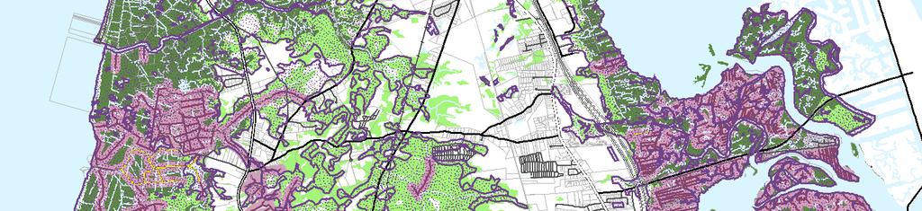
16 OTHER JURISDICTIONAL AUTHORITIES As required by N.J.S.A. 40:55D-28d(3), the Land Use Plan must consider other agencies that have regulatory jurisdiction on development within the Township. STATE DEVELOPMENT AND REDEVELOPMENT PLAN The New Jersey State Planning Commission (NJSPC) adopted the State Plan in 2001, which established eight policy planning goals to guide development activity in the State. Of these eight goals, a number of these goals are particularly relevant to the physical conditions of Middle Township and the Township s focus on its Centers and protection of the Environs through smart growth planning tools. The specific policy goals with particular relevance to Middle Township are as follows: Conserve the State s natural resources and systems.by promoting ecologically sound development and redevelopment and accommodating environmentally designed development and redevelopment in Centers in the Fringe, Rural and Environmentally Sensitive Planning Areas. Plan, design, invest in and manage the development and redevelopment of Centers and the use of land, water, soil, plant and animal resources to maintain biodiversity and the viability of ecological systems. Provide adequate public facilities and services at a reasonable cost.purchasing land and easements to prevent development, to protect flood plains and sustain agriculture where appropriate. Provide adequate housing at a reasonable cost Create and maintain housing in Centers in the Fringe, Rural and Environmentally Sensitive Planning areas Preserve and enhance areas with historic, cultural, scenic, open space and recreational value by comprehensive planning, design, investigation and management techniques The SDRP established planning areas throughout the State that share common development and environmental characteristics. These planning areas serve as the framework for application of the policies of the State Plan. Each planning area has policy objectives that guide growth. These objectives are intended to guide local and regional planning, to establish Centers, and to encourage livable neighborhoods with a variety of housing types, price ranges, multi-modal forms of transportation, and preserved green space. The five planning areas are as follows: Metropolitan Planning Area: PA1 Provide for much of the state s future redevelopment; revitalize cities and towns; promote growth in compact forms; stabilize older suburbs; redesign areas of sprawl; and protect the character of existing stable communities. Suburban Planning Area (PA2) Provide for much of the state s future development; promote growth in Centers and other compact forms; protect the character of existing stable communities; protect natural resources; redesign areas of sprawl; reverse the current trend toward further sprawl; and revitalize cities and towns. MASER CONSULTING, P.A. Page 9
17 Fringe Planning Area (PA3) Accommodate growth in Centers; protect the Environs primarily as open lands; revitalize cities and towns; protect the character of existing stable communities; protect natural resources; provide a buffer between more developed Metropolitan and Suburban Planning Areas and less developed Rural and Environmentally Sensitive Planning Areas; and confine programmed sewers and public water services to Centers. Rural Planning Area (PA4) and Rural/Environmentally Sensitive Planning Area (PA4B) Maintain the Environs as large contiguous areas of farmland and other lands; revitalize cities and towns; accommodate growth in Centers; promote a viable agricultural industry; protect the character of existing stable communities; and confine programmed sewers and public water services to Centers. Environmentally Sensitive Planning Area (PA5) and Environmentally Sensitive/Barrier Islands Planning Area PA5B) Protect environmental resources through the protection of large contiguous areas of land; accommodate growth in Centers; protect the character of existing stable communities; confine programmed sewers and public water services to Centers; and revitalize cities and towns. Like most of Cape May County, a large portion of Middle Township is designated as PA5 due to coastal or tidal wetlands, Wildlife Management Areas, and other state or federal lands. The bulk of the Township development areas, which are located along the US Route 9 Corridor, are designated as PA3. PA4 designations are located along State Route 47 and other connecting county roads. (See Figure State Development and Redevelopment Policy Map for Middle Township). The SDRP guides development and economic expansion in each of the planning areas and encourages compact forms of development that consume less land, deplete fewer natural resources and are more efficient in the delivery of public services. These areas are known as Centers and are categorized as Regional Centers, Towns, Villages and Hamlets. The New Jersey Office of Smart Growth (NJOSG) classifies each of these Centers as Designated, Proposed or Identified in the 2001 State Plan. Six Centers were proposed in Middle Township: Cape May Court House Regional Center, Rio Grande Regional Center, Whitesboro-Burleigh Village, Del Haven-Green Creek Village, Goshen Village and Swainton Hamlet. These areas represent the greatest concentration of development within the Township. Only through the Plan Endorsement Process are Designated Centers formally adopted and officially recognized by the NJOSG. The SDRP is currently undergoing the Cross Acceptance Process, which began in 2004 and will ultimately update the SDRP and the Policy Map. In 2004, Middle Township was awarded a grant, together with Dennis and Upper Townships, to undertake the US Route 9 Corridor Smart Growth Study. This study culminated in the Township submitting a Petition for Plan Endorsement to the NJOSG in February This Petition was reviewed by the State Planning Commission, which determined that the Petition was not consistent with the State Plan. A Memorandum of Understanding (MOU) was adopted between the Township and the State Planning Commission on December 20, 2006, which established an Action Plan of planning activities required to complete their petition and to obtain Plan Endorsement. Through Plan Endorsement, boundaries may be established as Designated Centers where future development and redevelopment activities could take place. These boundaries would represent the areas most compatible for growth, with minimal environmental constraints and existing public services. As identified in the Township s Action Plan with the State Planning Commission, the Township Plan Endorsement Petition will be updated to provide for refined Centers and MASER CONSULTING, P.A. Page 10
18 changes within the Planning Areas. This Action Plan required a number of planning activities including adoption of a Natural Resources Inventory, an updated Land Use Plan, and a Housing Element and Fair Share Plan. The Township adopted an updated Housing Element and Fair Share Plan in December A Natural Resource Inventory was prepared in November 2007, revised in May 2010, and will be adopted concurrently with this 2010 Land Use Plan Update. MASER CONSULTING, P.A. Page 11
19 Townsend Sound D e nn i s Cr eek De Denn nnis is Town Townsh ship ip Sea Sea Isl Islee Ci City ty 619 Stites Sound Towns In Great Sound Av Avalo alonn Borou Borough gh Delaware Bay Jenkins Sound 620 Ston Stonee Ha Harbo rborr Borou Borough gh Hereford Inlet 642 Rishardson Sound We West st Wild Wildwood wood Borou Borough gh Lowe Lowerr To Towns wnship hip No North rth Wild Wildwood wood Wild Wildwood wood Borou Borough gh Municipal Boundary 613 Planning Areas Garden State Parkway PA3 - Fringe US Route PA4 - Rural NJ State Route 647 Atlantic Ocean PA5 - Environmentally Sensitive 639 County Route Wild Wildwood wood Cre Crest st Borou Borough gh PA5B - Env. Sensitive Barrier Island Local Road Parks & Natural Areas Railroad Open Water Bodies 648 Jarvis Sound Parcels ,000 10,000 15,000 Feet 2001 STATE DEVELOPMENT & REDEVELOPMENT PLAN - POLICY MAP 1 inch = 5,500 feet THIS MAP WAS DEVELOPED USING CAPE MAY COUNTY AND NJDEP DIGITAL DATA. THIS SECONDARY PRODUCT HAS NOT BEEN VERIFED AND IS NOT COUNTY OR STATE AUTHORIZED. TOWNSHIP OF MIDDLE CAPE MAY COUNTY NEW JERSEY FEBRUARY 2009 \\njnarchive1\gis\state\newjersey\counties\capemay\municipal\middletwp\ g\figuremaps\stateplan.mxd Grassy Sound
20 COASTAL AREA FACILITIES REVIEW ACT (CAFRA) COASTAL ZONE Middle Township is almost completely encompassed within the NJDEP Coastal Zone, subject to CAFRA (N.J.S.A. 13:19), with the exception of approximately 240 acres of land adjacent to the Cape May Airport and Industrial Park at the southerly border of the Township, to the south of State Route 47 and west of US Route 9. CAFRA administers restrictions on the intensity of development in each of the various Planning Areas. Consistent with the State Plan, CAFRA regulations encourage growth within Centers and minimize development potential outside these Centers by imposing more stringent regulations. As of February 2006, the CAFRA Centers were to be eliminated and incorporated into the NJOSG Centers via the Plan Endorsement process. In 2006, municipalities who were in the NJOSG Plan Endorsement Petition process were given an additional year until March 2007 to complete the Plan Endorsement Petition process, which has been extended. In 2008, the NJ Permit Extension Act (P.L. 2008, c.78) temporarily extended the Coastal Centers designation for those municipalities that were in the NJOSG Plan Endorsement Process. These Coastal Centers are now extended until the end of 2010, except for those portions of the Centers located in environmentally sensitive areas. However, these Centers will be replaced by the proposed Centers through the Plan Endorsement process. After completion of the Action Plan and approval of its Petition the State Planning Commission, the NJDEP will review the Centers within the Coastal Zone for consistency with the NJDEP CAFRA guidelines. With its approval, the Centers will then be officially designated. This Land Use Plan is being prepared to respond to NJOSG and NJDEP requirements to achieve Plan Endorsement. Once the Township has adopted the Land Use Plan, any zoning amendments required to implement the plan recommendations within the Township must be adopted prior to NJDEP acting on and approving the Township s Centers. Under the earlier CAFRA regulations, seven CAFRA Centers were identified in the NJDEP regulations as follows 1 : Cape May Court House and Rio Grande Coastal Regional Centers, Whitesboro/Burleigh Coastal Village, and Swainton Coastal Hamlet were located within the Coastal Fringe Planning Area Green Creek and Goshen Coastal Hamlets were located within the Coastal Rural Planning Area Del Haven Coastal Village was located within the Coastal Rural Planning Area On February 20, 2007, Hildreth Village was exempted from the Bay Islands rule (N.J.A.C. 7:7E-3.21) contained in the Coastal Zone Management Rules (N.J.A.C. 7:7E). Figure 3 provides CAFRA restrictions for impervious cover and tree preservation. Figure 4 illustrates the NJDEP CAFRA Centers and Proposed Coastal Centers in the Cape May County CAFRA Zone as of Coastal Zone Management Rules N.J.A.C. 7:7E, February 2, 2004 MASER CONSULTING, P.A. Page 13
21 This Land Use Plan has refined these Centers in coordination with NJDEP and NJOSG oversight. The Centers boundaries were approved by the NJOSG and NJDEP on July 21, They are described in greater detail in the latter sections of this Land Use Plan. Cape May Court House, Rio Grande-Whitesboro-Burleigh and Swainton are located within the Coastal Fringe Planning Area. This planning area is primarily suburban and served by a two-lane road network, with areas of higher density development. These areas generally lack public wastewater treatment systems, except in existing Centers. The policy objectives of the Coastal Fringe Planning Areas are as follows 2 : 1) Encourage development in more compact, deliberately designed community patterns to minimize land conflicts and to accommodate growth that would otherwise occur elsewhere, encourage development that does not exceed the carrying capacity of natural or built systems and that maintains or enhances the character of existing communities, and maintain existing low-density and low-intensity development patterns that do not exceed the carrying capacity of natural systems and are consistent with the existing landscape; 2) Encourage rural economic activities, such as agriculture and recreation, and guide higher intensity activities to the Centers; 3) Encourage transportation systems that link Centers in the Coastal Fringe Planning Area to each other and to the Coastal Metropolitan and Coastal Suburban Planning Areas; and 4) Encourage infrastructure that supports development in Centers. Green Creek and Goshen are located within the Coastal Rural Planning Area. This Planning Area contains prime agriculture lands and large tracts of forested areas. It is usually served by rural road network and on-site well water and wastewater systems. The policy objectives of the Coastal Rural Planning Area are as follows 3 : 1) Protect and enhance the rural character and agricultural viability of the Coastal Rural Planning Area by guiding growth into Centers, maintain existing low-density and low-intensity development patterns that are supporting rather than conflicting with the rural landscape, encourage creative land use techniques to minimize the impact of new development on rural features, and ensure that development does not exceed the capacity of natural and built systems; 2) Encourage a transportation network that accommodates agriculture and access to markets; 3) Encourage economic activities in Centers that complement and support rural and agricultural communities and that provide diversity in the rural economy, accommodate economic activities outside of Centers in ways that maintain or enhance the rural environment, have minimal impact on agricultural resources, and minimize the need for infrastructure improvements; and 4) Protect and preserve large contiguous areas of farmland and open space, and protect the critical resources and environmentally sensitive features of the coastal ecosystem, including water resources and wildlife habitat, by maintaining development outside of Centers at low densities, and minimize conflicts between development, agricultural practices, resource based activities, and sensitive coastal resources. 2 Coastal Zone Management Rules N.J.A.C. 7:7E, January 20, Ibid. MASER CONSULTING, P.A. Page 14
22 The Coastal Environmentally Sensitive Planning Area encompasses large areas in the tidal lands between the barrier islands and the mainland and along the Delaware Bay. The policy objectives of the Coastal Rural Planning Area are as follows 4 : 1) Protect environmentally sensitive features by guiding development into Centers and maintaining low intensity development patterns elsewhere, carefully link the location, character and magnitude of development to the capacity of natural and built environments to support new growth, accommodate development at higher intensities in the Coastal Environmentally Sensitive Planning Area barrier island Centers, compatible with development patterns in existing Centers, and discourage the development of public infrastructure facilities outside of Centers; 2) Encourage transportation systems that link Centers and support the travel and tourism industry, recreational and natural resource-based activities, and address the special seasonal demands of travel and tourism to barrier islands; 3) Locate economic development opportunities in Centers that serve the surrounding region and the travel and tourism industry and accommodate in other areas appropriate seasonal, recreational, and natural resource based-activities that have a minimal impact on environmental resources; and 4) Protect sensitive natural resources critical to the maintenance of coastal ecosystems by maintaining large contiguous areas of undisturbed habitat, open space and undeveloped land, maintain the balance of ecological systems and growth, and protect the areas outside of Centers from the effects of development by maintaining it as open space. Figure 3 CAFRA Land Use Regulations Impervious Tree Preservation Planting For Site Location Coverage For Forested Unforested Percentage Portion of Site Portion of Site CAFRA Urban Center 90% 10% 0% CAFRA/Coastal Regional Center 80% 10% 0% CAFRA Core 80% 10% 0% CAFRA Node 80% 10% 0% CAFRA/Coastal Town 70% 25% 5% Military Installation 70% 10% 0% CAFRA/Coastal Village 60% 30% 5% CAFRA/Coastal Hamlet 50% 40% 5% Coastal Metropolitan Planning Area 80% 10% 0% Coastal Suburban Planning Area within sewer service area 30% 35% 5% outside sewer service area 5% 70% 5% Coastal Fringe Planning Area 5% 70% 5% Coastal Rural Planning Area 3% 70% 5% Coastal Environmentally Sensitive Planning Area 3% 70% 5% Source: Coastal Zone Management Rules N.J.A.C. 7:7E, January 20, Ibid. MASER CONSULTING, P.A. Page 15
 MASER CONSULTING, P.A. Page 16")
23 Figure 4 NJDEP CAFRA Centers and Proposed Coastal Centers Map (2004) Source: New Jersey Department of Environmental Protection ( MASER CONSULTING, P.A. Page 16

24 PINELANDS MANAGEMENT AREA The Pinelands Management Area represents a partnership between the State and Federal government to preserve, protect and enhance the natural and cultural resources of the Pinelands National Reserve. The Township of Middle is completely outside of the Pinelands Management Area, and is not subject to the provisions of the Pinelands Comprehensive Management Plan. The regulated Pinelands Area is within the Pinelands National Reserve, which extends beyond the limits of Pinelands Area. In Middle Township, the Pinelands National Reserve overlaps the Coastal Zone. It is actually a federally designated area, consisting of approximately one million acres of land. This area was established under Section 502 of the National Parks and Recreation Act of 1978 (PL ). Under a Memorandum of Agreement between the NJ Pinelands Commission and the NJDEP Land Use Regulation Program, the NJDEP is the lead agency in review of development applications in the Pinelands National Reserve Area. The NJ Pinelands Commission is a reviewing agency and may provide comments on development in this area. The Pinelands National Reserve Area in the Township is located to the west of the Garden State Parkway and north of Goshen Swainton Road (CR-646), containing about 10,200 acres. (See Figure 5 New Jersey Pinelands Land Capability Map). Figure 5 New Jersey Pinelands Land Capability Map Source: New Jersey Pinelands Commission ( MASER CONSULTING, P.A. Page 17
25 NEW JERSEY GROUNDWATER QUALITY AND WATER QUALITY MANAGEMENT PLANNING The NJDEP Division of Water Quality has primary responsibility for protecting New Jersey's surface and ground waters from pollution caused by improperly treated wastewater and its residuals. Revisions to the Groundwater Quality Standards (GWQS), (N.J.A.C. 7:9c) and Water Quality Management Planning Rule (WQMP), (N.J.A.C. 7:15) were adopted by the State of New Jersey on July 8, The GWQS establishes the designated uses of the State's ground waters, classifies ground waters based on those uses, and specifies the water quality criteria and other policies and provisions necessary to attain those designated uses. The amended anti-degradation policy extends the 2 mg/l target nitrate concentration previously established for groundwater aquifers in Category I watersheds to include all Class II-A, Class II-B, and Class III ground water aquifers (N.J.A.C. 7: (e)). The amended WQMP Rule requires zoning statewide to specify average lot sizes that meet the amended anti-degradation rule nitrate target concentration in groundwater for all septic system discharges. Required lot sizes to meet the mandated nitrate target concentration are determined on a watershed basis through the use of a nitrate dilution model developed by the NJDEP. To help in preparation of Water Quality Management Plans that address the requirements of the new rules, the NJDEP developed a Wastewater Estimation Model that provides a process for calculating the allowable number of lots within each municipality based on the lot sizes calculated for that portion of each watershed within the municipality boundaries. Middle Township was one of the first municipalities to conduct a Wastewater / Nitrate Dilution Modeling Study under the new WQMP Rules. The WQMP Rule does not mandate uniform minimum lot sizes at the calculated densities across the watershed. Rather, the equivalent residential zoning density represents the maximum number of units that, if built, would not result in a degradation of groundwater quality within a given watershed by exceeding the 2 mg/l nitrate limit. The NJDEP advocates zoning to allow for center-based development, clustering, and protection of environmental features and agriculture land. Middle Township conducted a Buildout Analysis of the Septic Areas to determine the zoning standards required to meet the septic density established in the Wastewater / Nitrate Dilution Modeling Study. The purpose of this buildout analysis was to assess the amount of remaining developable lands and distribute the allowable septic units throughout the non-sewered areas of each HUC11 Watershed within Township, in accordance with the WQMP Rule. Within existing or proposed sewer service areas, the WQMP Rule requires a buildout analysis to be performed to demonstrate that the estimated future wastewater flows from future development at full buildout and existing development that is not currently connected will not exceed the capacity allocated to the municipality (N.J.A.C. 7: (d)). If the projected wastewater flows exceed the allocated capacity, the municipality is required to reduce projected wastewater flows by reducing the sewer service area boundaries or reducing the intensity of the zoning. Middle Township performed a Buildout Analysis of the Future Sewer Service Area, which found that projected future development under the proposed zone plan (in addition to existing development) would exceed the allocated capacity at full buildout. Middle Township has opted to reduce the intensity of the zoning in certain areas to meet the allocated wastewater capacity. The results of these buildout studies are discussed in greater detail later in this report, under the Buildout Analysis section. MASER CONSULTING, P.A. Page 18
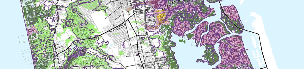
26 LAND USE PLAN OVERVIEW This Land Use Plan has been carefully crafted considering existing development patterns, jurisdictional authorities and regulatory controls; the need to meet Township defined policy goals and objectives as well as those of the State regulatory authorities; and to address the policies and planning goals of the SDRP. This Land Use Plan utilizes the 2007 Middle Township Natural Resources Inventory, which is being adopted concurrently as part of this Land Use Plan Amendment, as an updated source of information on the ecological and cultural resources in the Township. The adopted 2008 Middle Township Housing Element and Fair Share Plan was also utilized as a resource. This Land Use Plan has also been written to address the Centers, including updated land use requirements to better direct growth into the Centers, and encourage development that will create walkable and diverse community Centers with mixed-uses and multimodal transportation facilities (motor vehicles, bicycles and pedestrians connections) to create attractive places to live and work. It also addresses the need to better protect the Township areas outside of the Centers (the Environs ) to provide natural buffers or green areas around the Centers and to limit development within the Environs through various regulatory and zoning provisions, including updated environmental assessment regulations. EXISTING LAND USE PATTERNS EXISTING LAND USE The existing land use patterns within Middle Township are illustrated based on tax class parcel data. (See Figure 6 Existing Land Use Map). Over 40 percent of the Township (18,118 acres) falls into the public property category, which is made up of environmentally constrained land and Wildlife Management Areas. Of the 53,000 acres of total land area in Middle Township, only about 14,500 acres (30 percent) are not constrained with environmental features (wetlands, floodplains or C-1 riparian stream corridor). However, some of this unconstrained land may contain habitat for threatened and endangered species or critical wildlife through CAFRA. Nearly 70 percent of Middle Township is environmentally constrained by freshwater or coastal wetlands, floodplains, Category One waterways or other open water bodies. Much of this land corresponds to the 18,780 acres of preserved open space. These lands sensitive lands continue to be acquired by Federal, State, County, municipal and not-forprofit interest groups in an effort to preserve the critical wildlife habitat and rich natural resources they contain. The Environmental Constraints Map (Figure 7) includes lands falling under defined environmental regulations which include wetlands, Category One (C-1) streams (which are considered pristine and as either trout production or trout management) and Federal Emergency Management Agency (FEMA) designated floodplains. This map does not show wetlands transitional areas, which may range from O feet to 300 feet, depending on the classified resource value of the wetlands. The Township has approximately 15,982 acres or 20 percent of its total land mass covered by freshwater wetlands and another 10,290 acres or 30 percent constrained by tidal wetlands. A 300-foot wide buffer is also required along all C-1 streams and their tributaries. There are a significant number of C-1 streams within Middle Township, primarily located within the floodplain of the intercoastal waterways along the eastern portion of the Township and within the Dennis Creek floodplains at the northwestern corner of the Township. Other environmentally sensitive lands are mapped and described in the 2007 Natural Resources Inventory. MASER CONSULTING, P.A. Page 19
27 «Û Townsend Sound Dennis Township D e nn Sea Isle City eek is Cr Û 619 Stites Sound Û Townsend's Inlet Û Û [ h 646 Û 652 [ h Û Û Û 609 Û 657 Û 655 Delaware Bay Great Sound [ h Avalon Borough Û 658 Û Middle Township 612 [ h Û 619 [ h Û 643 Jenkins Sound 620 «Stone Harbor Borough 47 Û [ h «147 [ h Hereford Inlet Û 642 Grassy Sound Rishardson Sound West Wildwood Bor ough 614 Û 634 Û Û 603 [ h Û Û 624 Wildwood City 624 Û 613 Commercial Cemetery Industrial Crest Public Property Farmland Open Space Residential Preserved Farmland Other Public/Quasi-Public Apartment Vacant Railroad Mobile Home Park School Campground Church/Charitable Lower Township Open Water Bodies Û ÛParcels 647 Garden State Parkway 639 NJ State Route Municipal Boundary US Route Û Û Railroad County Boundary Û 644 County Route Û Local Road North Wildwood City Û 654 Wildwood Atlantic Ocean Bor ough Jarvis Sound Unknown 648 h [ Marina Û Cape M an al ay C 5,000 10,000 15,000 Feet 1 inch = 5,500 feet THIS MAP WAS DEVELOPED USING CAPE MAY COUNTY AND NJDEP DIGITAL DATA. THIS SECONDARY PRODUCT HAS NOT BEEN VERIFED AND IS NOT COUNTY OR STATE AUTHORIZED. M Cape ay H arbo r EXISTING LAND USE TOWNSHIP OF MIDDLE pe M ay ± Ca t CAPE MAY NEW JERSEY In lecounty JULY 2010 \\njnarchive1\gis\state\newjersey\counties\capemay\municipal\middletwp\ g\figuremaps\landuse.mxd Û


28 \\njnarchive1\gis\state\newjersey\counties\capemay\municipal\middletwp\ g\figuremaps\envconstraints.mxd Townsend Sound Dennis Creek Dennis Township Sea Isle City Stites Sound 619 Towns In Great Sound Avalon Borough 655 Delaware Bay Jenkins Sound Stone Harbor Borough Hereford Inlet Grassy Sound Rishardson Sound West Wildwood Borough 614 North Wildwood 603 Lower Township Wildwood Borough 621 Municipal Boundary 613 Environmental Constraints Garden State Parkway US Route NJ State Route County Route Local Road Railroad Parcels Open Water Bodies 626 C-1 Stream Tributary to C-1 Stream 300' Riparian Stream Corridor Floodprone Areas Non-Tidal (Freshwater) Wetlands Tidal (Saline) Wetlands Jarvis Sound Wildwood Crest Borough Atlantic Ocean ,000 10,000 15,000 1 inch = 5,500 feet Feet THIS MAP WAS DEVELOPED USING CAPE MAY COUNTY AND NJDEP DIGITAL DATA. THIS SECONDARY PRODUCT HAS NOT BEEN VERIFED AND IS NOT COUNTY OR STATE AUTHORIZED. ENVIRONMENTAL CONSTRAINTS TOWNSHIP OF MIDDLE CAPE MAY COUNTY NEW JERSEY FEBRUARY 2009
29 There are two significant regions of undevelopable land in Middle Township: the eastern portion along the intercoastal waterways (including Stites Sound, Great Sound, Jenkins Sound, Grassy Sound and Richardson Sound) and the western portion along the Delaware Bay. These lands are primarily lower in elevation. These areas are primarily encumbered with tidal wetlands with limited development. The highest elevations are found along the US Route 9 corridor and at various locations along State Route 47. The Township also contains 1,764 acres of preserved farmland. There are large areas of land within the Township that are owned and managed by Federal, State and not-for-profit agencies for the protection of threatened and endangered species and wildlife habitats. These areas represent a significant amount of undeveloped land consisting of the Beaver Swamp Wildlife Management Area, Dennis Creek Wildlife Management Area and Cape May National Wildlife Refuge. As shown in Figure 8, residential uses account for about 30 percent of the uplands within the Township. The existing residential development consists primarily of single-family and two-family homes with the most concentrated areas located in the Centers of Cape May Court House, Rio Grande-Whitesboro-Burleigh, Swainton, Green Creek, Del Haven and Goshen. Commercial uses are limited to only 12 percent of the Township s uplands. These businesses are primarily located along the US Route 9 corridor within the Cape May Court House and Rio Grande-Whitesboro- Burleigh Centers and along State Route 47 in Rio Grande. Other commercial properties include marinas, campgrounds and golf courses. Remaining developable farmland and vacant lands encompass around 27 percent of the Township s uplands. Figure 8 Existing Land Use Classifications Land Use Total Lot Area Total Uplands Area Acres Percent Acres Percent Vacant (1) 9, % 3, % Residential (2) 8, % 5, % Farm Regular (3A) % % Farm Qualified (3B) 2, % 1, % Commercial (4A) 3, % 2, % Industrial (4B) % % Apartment (4C) 7 0.0% 6 0.0% Public School (15A) % % Other School (15B) 7 0.0% 2 0.0% Public Property (15C) 18, % 4, % Church (15D) 1, % % Cemetery (15E) % % Other Exempt (15F) % % Right-of-Way % % Water 8, % - 0.0% Total 51, % 17, % Source: Municipal Property Code Classification Information, 2008 (modified) MASER CONSULTING, P.A. Page 22
30 RETAIL TRADE ESTABLISHMENTS As shown in Figure 9, Middle Township contained 133 individual retail establishments in This was an 18 percent increase in the number of establishments in 2002 but a 6 percent loss in the number of establishments in Middle Township generally contains a balanced mix of retail establishments, where each retail trade makes up less than 20 percent of the overall retail establishments in 1997, 2002 and No single trade type dominates the retail market in Middle Township. This is evidence of Middle Township s status as the regional retail and service center for Cape May County, for which there is a demand for a wide variety of retail goods. Despite the ebb and flow in number of establishments, the overall annual retail sales for the Township increased during each 5-year period. Historically, building material & garden equipment & supplies dealers has represented the highest percentage of retail establishments in 1997 and 2002, making up around 15 percent of the total number of retail establishments in Middle Township. However, miscellaneous stores (such as florists, used merchandise stores, office supply stores and pet supply stores) were the largest retail trade in 2002 (19 establishments), making up almost 17 percent of the total establishments. Although the number of motor vehicle and parts dealers increased from 12 to 15 establishments in the 5-year period between 2002 and 2007, it fell in total annual sales during the same period (from $133.2 million to $ million), losing its spot as the highest total sales and highest average sales per establishment. Food and beverage stores took its place at the top with $140 million in total sales in 2007, and general merchandise stores had the highest average sales ($12 million) per establishment. NAICS Figure 9 Retail Trade Establishments and Annual Sales Number of Establishments Total Sales (millions) Motor vehicle & parts dealers $68.34 $ $ Furniture & home furnishings stores $5.15 D $ Electronics & appliance stores $1.95 $2.85 $ Building material & garden equipment & supplies dealers $36.33 $32.15 $ Food & beverage stores $66.48 $ $ Health & personal care stores $19.42 $22.78 $ Gasoline stations $11.88 $12.33 $ Clothing & clothing accessories stores $19.60 $13.73 $ Sporting goods, hobby, book, & music stores $2.48 $1.68 $ General merchandise stores D $49.35 $ Miscellaneous store retailers D $19.09 D Nonstore retailers D D D Total $ $ $ D = Data withheld to avoid disclosing data of individual companies, but data are included in higher level totals. Source: 1997, 2002 and 2007 Economic Census MASER CONSULTING, P.A. Page 23
31 AGRICULTURAL USES According to the parcel tax data, as shown on Figure 10, there are 80 properties with farmland assessment in Middle Township with a total area of 2,216 acres. The vast majority of this land is within the RR Rural Residential District. Approximately half of all farm assessed land in the Township is environmentally constrained, leaving only 1,091 acres of uplands. The uplands acreage is an estimate and is subject to site-specific evaluation. The data shows that there are 53 properties with Class 3A (Regular) Farm assessment, containing 65 acres. There are also 76 properties with Class 3B Farm (Qualified) assessment, containing 2,151 acres. According to the MODIV User Manual, published by the New Jersey Department of the Treasury, Division of Taxation, Class 3B Farm (Qualified) includes vacant land only and any farm buildings, such as silos, barns or other accessory farm buildings are assessed within the 3A Farm (Regular) classifications. As such, many properties contain both 3A and 3B assessments. Cape May County has established a trust fund to preserve open space and agricultural lands. The trust is funded by a County property tax of 1 cent per 100 dollars of assessed valuation and currently generates approximately $1.3 million each year. Since its inception, the program has preserved approximately 3,000 acres of open space and farmland (almost 5 square miles) in the County. There are currently 32 preserved farms in Middle Township totaling approximately 1,765 acres. Figure 10 Assessed Farmland Zone District Farm Regular (3A) Farm Qualified (3B) TOTAL Lot Area Uplands Lot Area Uplands Lot Area Uplands CB Community Business 4 ac 4 ac 47 ac 18 ac 51 ac 22 ac CD Coastal Development 1 ac 1 ac 21 ac 8 ac 22 ac 9 ac RB Residential-Business 8 ac 8 ac 362 ac 24 ac 370 ac 32 ac RGB Regional General Business 14 ac 14 ac 27 ac 17 ac 41 ac 31 ac RI Restricted Industrial 0 ac 0 ac 31 ac 9 ac 31 ac 9 ac RR Rural Residential 28 ac 28 ac 1,428 ac 811 ac 1,456 ac 839 ac SL Sensitive Lands 10 ac 10 ac 235 ac 139 ac 245 ac 149 ac Total 65 ac 65 ac 2,151 ac 1,026 ac 2,216 ac 1,091 ac Source: Municipal Property Code Classification Information, 2007 The 2007 Farmland Application Summary from the Township Tax Assessor provides a breakdown of the uses of farmland in Middle Township, which is shown in Figure 11. Over 86 percent of farmland is actively used, while only 14 percent of farmland is not actively devoted. Of active farmland uses, 39 percent of total active farmland or 1,295 acres is harvested cropland, while 25 percent (835 acres) of actively devoted farmland is appurtenant woodland or wetland. MASER CONSULTING, P.A. Page 24
32 Figure 11 Farmland Activity and Uses Farmland Activity and Uses Acres Percent Actively Devoted Farmland 2, % Harvested Cropland 1, % Pastured Cropland % Permanent Pastured % Non-Appurtenant Woodland % Appurtenant Woodland or Wetland % Acres Used for Boarding, etc % Farmland Not Actively Devoted % Land Under and Land Used in Connection with Farmhouse % All Other Land not Devoted to Agricultural/Horticultural Use % Total Farmland Acreage 3, % Source: 2007 Tax Assessor Farmland Application Summary VACANT PROPERTIES The parcel tax data also shows properties assessed as Class 1 Vacant, which includes privately-owned properties with no structures erected and no deed restrictions precluding future development. A total of 3,926 properties are assessed as Class 1 Vacant in Middle Township, with a total area of over 9,000 acres. The uplands acreage shown in Figure 12 is an estimate and is subject to site-specific evaluation. Approximately 60 percent of the assessed vacant acreage is constrained, leaving 3,712 acres of uplands. Approximately 680 acres of this vacant land have vested development approvals as of 2008, which could amount to 478 residential units and 19,000 square feet of nonresidential area if developed. Figure 12 Vacant Properties Zone District Lot Area Uplands AE Amusement and Entertainment 81 1 CB Community Business CD Coastal Development 60 7 CR Coastal Residential PD Planned Development RB Residential-Business RGB Regional General Business RI Restricted Industrial RR Rural Residential 3,494 1,903 SL Sensitive Lands 2, SR Suburban Residential 1, TB Town Business 2 1 TP Town Professional 5 4 TR Town Residential TRB Town Residential-Business 6 5 Total 9,083 3,712 Source: Municipal Property Code Classification Information, 2008 (modified) MASER CONSULTING, P.A. Page 25
33 CAMPGROUNDS Campgrounds make up a significant portion of the commercial sector in the Township, not only in terms of land consumption but also economically, as these areas accommodate the influx of summer residents. As shown in Figure 13, there are currently 13 active campgrounds in Middle Township, containing a total of over 4,400 campsites on nearly 830 acres of land. Figure 13 Campgrounds Name Acres Campsites Ponderosa Acorn Adventure Bound Camping Resorts Bay Cove Big Timberlake Cape Shores Resort Inc Delsea Woods Community LLC Green Holly Hideaway Beach King Nummy Old Stagecoach Sea Pines Campground Shellbay Total 826 4,408 Source: Township Tax Assessor, December 2009 MARINAS Marinas are an important component of the economy. Eight of the 55 marinas in Cape May County are located within Middle Township, with several others located adjacent to the Township. Most of these marinas are located along the intercoastal waterway along the east side of the Township; some are also located along the Delaware Bay. The majority of the marinas in Middle Township are located within the CD Coastal Development District, where they are a permitted use. One marina is an existing non-conforming use in the CR Coastal Residential District. These marinas provide recreational fishing and boating opportunities. They also support harbor and tourist amenities that offer other synergistic options for seasonal visitors to Cape May. MASER CONSULTING, P.A. Page 26
34 MOBILE HOMES Mobile home parks in Middle Township provide an affordable housing option for Township residents. Many of these units are occupied year-round, although some may be used as seasonal housing by summer residents. As shown in Figure 14, there are currently 14 active mobile home parks in Middle Township, containing just fewer than 1,500 mobile home units on about 218 acres of land. According to US Census data, there were 1,308 mobile homes in Middle Township in 2000, representing over 17 percent of the total residential units in the Township. Figure 14 Mobile Home Parks Name Acres Mobile Homes Supplemental Sites Total Sites A & J MHP Briarwood Captain Walt's Cedar Springs Delsea Woods Community Edgewood Village Garden Lake Grande Woods North Grande Woods South Park View Presidential Courts Rio Grande Shellbay Village Total ,491 Source: Township Tax Assessor, December 2009 MASER CONSULTING, P.A. Page 27

35 HISTORIC DEVELOPMENT PATTERNS Historic development patterns can be assessed by reviewing changes in Land Use/Land Cover data published by the NJDEP. Land Use/Land Cover data files are based on interpretations of infrared aerial photography using the NJDEP Modified Anderson System 5. Figures 15 and 16 compare the amount of area dedicated to each land use or land cover type in 1986, 1995 and The comparison shows there have been many changes in land use over this sixteen year period. Figure 17 illustrates the historic changes in urban land uses. Residential uses increased their land coverage by 1,207 acres (42.8 percent) from 1986 to 2002, most of which consists of rural and low density single-family dwellings. Commercial and Industrial uses increased in land coverage by more than 50 percent in sixteen years but still make up a relatively small portion of the Township (less than 2 percent of the total land area). The Township lost 769 acres of Agricultural lands and 717 acres of Forested lands since Transportation, Communication and Utility areas have expanded by 202 acres (32 percent) during the sixteen year period. Figure 15 Historic Land Use Comparison by NJDEP Land Use / Land Cover Category (2002, 1995, 1986) 5 New Jersey Department of Environmental Protection (NJDEP), Office of Information Resources Management (OIRM), Bureau of Geographic Information and Analysis (BGIA) < 6 Note: Since these data series are based upon interpretations of aerial photographs, advances in technology allow each series to be more accurate than the previous series. During the 2002 mapping sessions, NJDEP updated areas in the 1995 data where the classification was deemed to be incorrect previously. However, this update did not include 1986 designations and, therefore, the 2002 and 1995 data series have similar margins of error whereas the 1986 data series is based on different mapping standards and may have a greater margin of error. This analysis is meant to be illustrative and should not be relied upon for regulatory purposes. MASER CONSULTING, P.A. Page 28
36 Figure 16 Detailed Historic Land Use Comparison by NJDEP Land Use / Land Cover (2002, 1995, 1986) Land Use / Land Cover Classification Acres % of Twp Acres % of Twp Acres % of Twp Urban Lands 7, % 6, % 5, % Residential 4, % 3, % 2, % Residential, High Density (Multiple Dwelling) % % % Residential, Medium Density (Single Dwelling) 1, % % % Residential, Low Density (Single Dwelling) 1, % 1, % % Residential, Rural Density (Single Dwelling) 1, % 1, % % Residential (Density not specified) % Commercial / Services % % % Industrial % % % Mixed Urban Lands % % % Transportation/Communication/Utilities % % % Cemetery % % % Military Installations % % % Recreational Lands 1, % % % Stadium Theaters Cultural Centers And Zoos % % % Other Urban Land % % % Agricultural Lands 1, % 1, % 2, % Cropland And Pastureland 1, % 1, % 2, % Orchards/Vineyards/Nurseries/Horticultural Areas % % % Confined Feeding Operations % % % Other Agriculture % % % Barren Lands % % % Extractive Mining % % % Beaches % % % Barren Lands % % % Forests 7, % 8, % 8, % Brush/Shrubland (height < 20 feet) 1, % 1, % 1, % Coniferous Forest 1, % 1, % 1, % Deciduous Forest 1, % 2, % 2, % Mixed Forest (>50% Coniferous) 1, % 1, % 1, % Mixed Forest (>50% Deciduous) 1, % 1, % 1, % Water 8, % 8, % 8, % Artificial Lakes % % % Atlantic Ocean % % % Bridge Over Water % % Dredged Lagoon % % % Natural Lakes % % % Open Tidal Bays % % % Streams And Canals % % % Tidal Rivers, Inland Bays, And Other Tidal Waters 8, % 8, % 7, % Wetlands 26, % 26, % 28, % Coastal Wetlands 16, % 15, % 16, % Saline Marsh 15, % 15, % 16, % Freshwater Tidal Wetlands % % % Vegetated Dune Communities % % % Phragmites Dominate Coastal Wetlands % Interior Wetlands 10, % 11, % 11, % Herbaceous Wetlands % % % Scrub / Shrub Wetlands 1, % 5, % 5, % Wooded Wetlands 7, % 4, % 4, % Managed / Modified / Built-Up Wetlands % % % Middle Township Total Area 52, % 52, % 52, % Category not classified in data series Source: New Jersey Department of Environmental Protection (NJDEP), Office of Information Resources Management (OIRM), Bureau of Geographic Information and Analysis (BGIA), MASER CONSULTING, P.A. Page 29
, Division of Local Government Services (DLGS) which includes statistical information for all New Jersey municipalities.")
37 Figure 17 Historic Change in Urban Land Uses (1986, 1995, and 2002) Changes in land use can also be evaluated by reviewing tax information compiled by the New Jersey Department of Community Affairs (NJDCA), Division of Local Government Services (DLGS) which includes statistical information for all New Jersey municipalities. Figure 18 provides information on number of tax parcels and total assessed value for each property tax code, such as residential, vacant and non-residential and the combined value of the parcels within each property classification code. Please note that this table does not include all property classifications, such as public properties. Unfortunately, acreage is not available through this data, which would provide for a more meaningful value-per-acre analysis. Nonetheless, the data shows that in the past ten years, there was a net increase of 522 new parcels created through subdivision, representing a 5 percent increase over the number of parcels in Property values, on the other hand, have skyrocketed in comparison. The total value of privately-held properties increased by $2.397 billion in the past ten years, nearly three times the 1999 value, according to DGLS data. Although there was a loss of 1,619 vacant parcels (33 percent loss) in the past ten years, the total value of the remaining vacant properties increased by $136.7 million (183 percent increase). The average assessed value for vacant properties in 2009 was about $64,000 per property, as compared to about $15,000 in MASER CONSULTING, P.A. Page 30
38 Between farmland and farm homesteads, there was a total loss of 77 farm properties during this period. More than half of undeveloped farmland properties in 1999 were lost by Consistent with other tax classes, farmland and farm homesteads increased in aggregate value despite the loss in number of parcels, albeit at a much lower rate than other developed categories. A decrease in vacant and farmland parcels with a comparable increase in residentially and non-residentially developed properties is expected for a developing municipality. Middle Township saw an increase of 2,143 residential properties (37 percent) in the past ten years, which is about 30 percent greater than the number of vacant and farmland parcels lost. This indicates that the vacant parcels were likely larger in area in 1999 and were subsequently subdivided to form smaller lots suitable for residential development. The overall value of residential properties increased by 328 percent or $1.831 billion over this period. With an aggregate value of $2.390 billion in 2009, residential uses hold the highest value of all other classifications. This is primarily due to residential uses occupying more than two-thirds of all privately-held properties in the Township in The average assessed value for residential properties in 2009 was about $300,000 per property, as compared to about $100,000 in As the retail and service center for Cape May County, Middle Township s commercial properties make up the vast majority of its non-residential properties. Commercial properties increased by 76 properties (17 percent) with an increase in overall value almost double (196 percent) the overall value in The average assessed value for commercial properties in 2009 was about $1.2 million per property, as compared to less than $0.5 million in Figure 18 Ten-Year Comparison of Historic Tax Data Property Value Classification (1999 vs. 2009) Property Class Number of Parcels Total Value (millions of dollars) year Change year Change Vacant 4,915 3,296-1,619-33% $ $ $ % Residential 5,849 7,992 2,143 37% $ $ 2, $ 1, % Farm % $ 7.12 $ $ % Farm Homestead % $ 6.18 $ $ % Farmland % $ 0.95 $ 1.81 $ % Non-Residential % $ $ $ % Commercial % $ $ $ % Industrial % $ 2.71 $ 5.36 $ % Apartment % $ 2.12 $ 5.12 $ % Total 11, , % $ 859 $ 3,256 $ 2, % SOUE: NJDCA, Division of Local Government Services, Property Tax Information, Current Property Tax Data, Property Value Classification 2009 SOUE: NJDCA, Division of Local Government Services, Property Tax Information, Historical Data, Property Value Class 1999 MASER CONSULTING, P.A. Page 31
39 POPULATION, HOUSING AND EMPLOYMENT CHARACTERISTICS This section documents existing and projected demographic, housing and employment conditions in the Township. Historic growth trends are provided. In addition, future population, housing and employment projections are provided, utilizing generally accepted data sources. Where appropriate, Cape May County and New Jersey data has been provided for comparison purposes. The 2008 Middle Township Housing Element and Fair Share Plan (HEFSP) provides additional information on population and housing characteristics and employment conditions and projections. Future projections of population, housing or employment growth are provided from the Center for Regional and Business Research (CRBR) at Atlantic Cape Community College for the South Jersey Transportation Planning Organization (SJTPO). In June 2006, the SJTPO released its 2030 Population and Employment Projections by Municipality. These projections were created for the purpose of preparing a regional travel demand model for the SJTPO 2008 Regional Transportation Plan update. SJTPO projections were based on demographic trends and do not account for available land capacity. Any population, housing or employment growth projection is a prediction of the future based on certain assumptions. Since the future is unknowable, there is an unequivocal margin of error associated with any demographic projection. However, despite the indefinite accuracy of the projections, they do present a valuable tool for informing the local planning process. SJTPO projections were prepared prior to the Great Recession and may have already been shown to be inaccurate for the short term. MASER CONSULTING, P.A. Page 32
40 POPULATION As indicated in Figure 19, the population of Cape May County has significantly increased since 1950 and has consistently grown at a rate higher than that of the State. During the period between 1970 and 1980, the County experienced its largest growth increment of over 38 percent or 22,712 new residents. The County s total population has more than doubled since 1950 and has only begun to level off in the recent years in terms of percent change. During the period between the years of 1990 through 2000, the County grew at a 7.6 percent increase, compared to an increase of 8.9 percent statewide. This represented the first time in forty years that Cape May County population had growth below the State average. Population levels for 2004 and 2008 are US Census estimates. According to these estimates, Middle Township and Cape May County saw a 2 percent loss of population while the State continued to grow by 2 percent between 2000 and Between 2004 and 2008, Cape May County saw an even greater population loss of 4 percent, while Middle Township and the State grew at 1 percent. In the 58-year period between 1950 and 2008, Middle Township grew by more than 3.5 times its 1950 population. This is a much higher growth rate than the County (2.5 times) and State (1.8 times) for the same period. Figure 19 Permanent Population Trends ( ) Year Middle Township Cape May County New Jersey ,599 37,131 4,835, ,119 (+46%) +11,424 (+31%) +1,232,083 (+25%) ,718 48,555 6,067, ,007 (+30%) +10,999 (+23%) +1,100,752 (+18%) ,725 59,554 7,168, ,648 (+30%) +22,712 (+38%) +196,659 (+3%) ,373 82,266 7,364, ,398 (+30%) +12,823 (+16%) +365,365 (+5%) ,771 95,089 7,730, ,634 (+11%) +7,237 (+8%) +684,162 (+9%) , ,326 8,414, (-2%) -2,411 (-2%) +206,423 (+2%) ,087 99,915 8,620, (+1%) -4,077 (-4%) +61,888 (+1%) ,278 95,838 8,682, ,679 (+254%) +58,707 (+158%) +3,847,332 (+80%) SOUE: Cape May County Data Book, January 2003 & US Census Bureau MASER CONSULTING, P.A. Page 33
41 As shown on Figure 20, growth is still projected in Middle Township and the rest of the County between 2005 and 2035; however, SJTPO forecasts indicate that this growth will occur at a slower rate than seen historically. The Township is projecting that a majority of the growth will take place within the two Regional Centers of Cape May Court House and Rio Grande-Whitesboro-Burleigh along the US Route 9 corridor. This anticipated growth is due in part by the accessibility to major roads, utilities and other services within the Township Centers. The population of Middle Township has increased by 11 percent or 1,634 new residents from 1990 to 2000 but decreased by 1 percent or 127 residents from 2000 to The Township ranked fifth in rate of growth within the County behind Lower Township, Wildwood, Avalon, Dennis Township and Upper Township during the period. The Township was only behind Lower Township, in terms of actual population growth. In 2008, Middle had a total estimated population of 16,278 residents. The SJTPO has projected Middle Township s population will increase to approximately 20,661 persons through the year This increase will account for an additional 4,383 residents or a 27 percent increase. Comparatively, the SJTPO only projects a 21 percent increase in Cape May County overall for the same period. Figure 20 Population Projections ( ) Year Middle Township Cape May County ,278 95, ,491 (+9%) +7,232 (+8%) , , ,036 (+6%) +2,690 (+3%) , , (+2%) +2,440 (+2%) , , (+2%) +2,380 (+2%) , , (+2%) +2,530 (+2%) , , (+3%) +2,900 (+3%) , , ,383 (+27%) +20,172 (+21%) SOUE: South Jersey Transportation Planning Organization 2030 Population and Employment Projections By Municipality, June 2006 The total countywide population increases over six times during the months of May through September. Much of this growth is concentrated within the barrier island resort communities. The County anticipates a 15.7 percent increase in the summer population by the year This increase will result in an additional 96,440 summer residents (Figure 21). This indicates that Cape May County and its surrounding communities will continue to be an important part of the New Jersey tourist industry for the years to come. MASER CONSULTING, P.A. Page 34
42 Middle Township s population increases by approximately 42,000 additional residents during the summer months. The County has projected an increase of 9,171 additional summer residents in Middle Township by the year Many of the summer residents are attracted to the numerous campgrounds and mobile home parks located along the US Route 9 and State Route 47 corridors or own homes or cottages for seasonal use. Figure 21 Summer Population Projections ( ) Year Middle Township Cape May County , , ,928 (+3%) +40,576 (+7%) , , ,930 (+3%) +20,305 (+3%) , , ,868 (+3%) +19,645 (+3%) , , ,796 (+3%) +18,885 (+3%) , , ,649 (+3%) +17,334 (+2%) , , ,171 (+16%) +96,440 (+16%) SOUE: Cape May County Data Book, January 2003 According to the 2000 Census, approximately one out of five residents of Cape May County was age 65 or older. The County will continue to be a popular retirement destination and the senior citizen population should continue to account for more than twenty percent of the population through the year Senior citizens make up 17.8 percent of Middle Township s population, which is slightly lower than the County s average of 20.2 percent (Figure 22). The Township s senior s population increased by 218 people between 1990 and 2000, which represents a decrease of 0.5 percent of the total population. Figure 22 Senior Population (2000) Persons % of Total Persons % of Total Middle Township 2, % 2, % Cape May County 19, % 20, % New Jersey 1,032, % 1,113, % SOUE: 1990 and 2000 US Census 7 Source: County Population and Labor Force Projections for New Jersey: 2000 to 2020 Division of Market and Demographic Research, May 2006 MASER CONSULTING, P.A. Page 35

43 Population by age cohort in 2000 is shown in Figure 23. The largest age cohort in Middle Township was the 40 to 44 years with over 1,400 residents falling into this category. 35 to 39 years is second largest cohort with just under 1,400 residents. The age cohort with the fewest residents is the 80 to 84 years range with only 406 residents. Figure 23 Population by Age (2000) MASER CONSULTING, P.A. Page 36
44 In regards to educational attainment, in 2000 there were 1,097 persons between the ages of 18 and 24 years old in Middle Township and 11,252 that were older than 24 years. Of the 18 to 24 year old age group, 27 percent had not yet achieved a high school diploma, which is comparable to the rest of the County and the slightly higher than the State. Only 3 percent of this age group had achieved a bachelor s degree or higher, which is a significantly lower than both the County and the State. Persons over the age of 24 residing in Middle Township in 2000 also had a lower overall education attainment than the County and State. Persons 25 and older with no high school diploma were limited to only 18 percent throughout the County and the State, whereas 22 percent of this age group in Middle Township had not graduated. The data also shows that about 1 out of 3 people who did graduate high school went on to attain a bachelor s degree, which is at a slightly higher rate than the County and State (Figure 24). Figure 24 Educational Attainment (2000) Middle Township Cape May County New Jersey Population 18 to 24 years 1, % 6, % 675, % Less than high school graduate % 1, % 159, % High school graduate (incl. equivalency) % 2, % 186, % Some college or associate degree % 2, % 249, % Bachelor's degree or higher % % 79, % Population 25 years and over 11, % 72, % 5,657, % Less Than High School Diploma 2, % 13, % 1,014, % Less than 5th grade % % 105, % 5th to 8th grade % 2, % 268, % 9th to 12th grade, no diploma 1, % 9, % 641, % High School Diploma or Higher 6, % 43, % 2,958, % High school graduate (incl. equivalency) 4, % 26, % 1,661, % Some college credit, less than 1 year % 4, % 345, % 1 or more years of college, no degree 1, % 8, % 653, % Associate degree % 3, % 298, % Bachelor's Degree or Higher 1, % 16, % 1,684, % Bachelor's degree 1, % 11, % 1,063, % Master's degree % 3, % 414, % Professional degree % 1, % 140, % Doctorate degree % % 65, % SOUE: 2000 US Census MASER CONSULTING, P.A. Page 37
45 HOUSING In recent years, Cape May County has experienced a significant level of new residential construction, most built as vacation or rental homes. This is further apparent, since the rate of residential construction has exceeded the population growth in the last four decades. The 2000 Census indicated that 47 percent of new construction within the County was built as seasonal rental or vacation home. Between 1990 and 2000, Upper, Middle and Lower Townships accounted for more than 72 percent of the population growth, but only 35 percent of the County s total increase in housing units 8. This indicates that a large portion of the County s development has targeted the coastal communities. This is not a surprising trend since the tourist industry is the cornerstone of the County s economy. The increased demand of summer rental properties within the barrier islands has caused these communities to be almost completely developed. This development pressure has forced many older homes to be demolished and replaced with new construction. As shown in Figure 25, there were 7,510 housing units in Middle Township in The Census Bureau estimates that there were 8,286 units in 2004 and 9,144 units in Overall, Middle Township saw an increase of 1,634 units or 22 percent during the eight-year period. This is a much higher housing growth rate as compared to both the County (13 percent) and the State (6 percent). Figure 25 Housing Trends ( ) Middle Cape May Year New Jersey Township County ,510 91,047 3,310, (+10%) +5,358 (+6%) +104,641 (+3%) ,286 96,405 3,414, (+10%) +6,390 (+7%) +102,377 (+3%) , ,795 3,517, ,634 (+22%) +11,748 (+13%) +207,018 (+6%) SOUE: US Census 8 New Jersey Department of Labor Atlantic Region Regional Labor Market Review December 2002 MASER CONSULTING, P.A. Page 38
46 Middle Township s housing stock consists predominantly of single-family and two-family homes. The residential development pattern of the Township varies in density and lot size, from the small lot, high-density development of the Centers to the larger lot and rural developments of the Environs. There were over 2,000 certificates of occupancy permits issued for residential uses in Middle Township between 1996 and 2009, as shown on Figure 26. According to the NJ Construction Reporter data, no certificates of occupancy were issued for multifamily residential dwellings from 2003 to 2009, which further reinforces the single-family residential character of the municipality. However, the data does show 31 units certified as part of mixed-use developments between 2003 and The data did not indicate the types of residential uses for1996 through Figure 26 Historic Trend of Residential Certificates of Occupancy ( ) Year Middle Township Cape May County New Jersey Units % of Total Units % of Total Units % of Total % 584 4% 22,239 6% % 1,162 7% 34,670 9% % 957 6% 28,008 8% % 1,203 7% 28,109 8% % 1,219 7% 29,705 8% % 1,447 9% 30,054 8% % 1,439 9% 29,174 8% % 1,345 8% 26,932 7% % 1,729 11% 27,950 7% % 1,670 10% 31,049 8% % 1,506 9% 28,564 8% % 908 6% 23,138 6% % 725 4% 18,699 5% % 463 3% 14,411 4% Total 2, % 16, % 372, % SOUE: "New Jersey Construction Reporter" - New Jersey Department of Community Affairs SOUE: Certificate Activity Report - Middle Township Office of the Construction Official, 01/01/04-09/30/08 The issues of availability of land, market demand and infrastructure capacity may affect the amount and type of housing being built in the future. The Township s affordable housing obligation required by COAH may increase housing growth over the next ten years. MASER CONSULTING, P.A. Page 39
47 Middle Township s housing occupancy is shown in Figure 27, with 20 percent of total housing units vacant in Of this 20 percent vacancy, 66.5 percent of all vacant dwelling units are seasonal units. The high percentage of vacant housing units is due to the Township s seasonal tourist industry. The data also shows that homeowner vacancy rates have decreased slightly since 1990, while rental vacancy rates increased during the same period. Figure 27 Housing Occupancy (2000) Units Percent Units Percent Occupied Housing Units 5, % 6, % Vacant Housing Units 1, % 1, % For Seasonal, Recreational, or Occasional Use 1, % 1, % Total Housing Units 6, % 7, % Homeowner Vacancy Rate 2.8% 2.5% Rental Vacancy Rate 8.6% 9.6% Source: 2000 US Census, DP-1 MASER CONSULTING, P.A. Page 40
48 EMPLOYMENT Cape May County s economy is dependent on the seasonal tourist industry, most of which is concentrated along its coastline. The County s main source of employment is the service industry, which includes tourism. The Middle Township labor market is similar to the County in the type of occupations and employment opportunities available. The service and tourism industries have historically provided the most jobs within the municipality, which includes the Cape Regional Medical Center, government offices and regional shopping centers in Cape May Court House and Rio Grande. According to the New Jersey Department of Labor and Workforce Development (NJDLWD), in 2003 Middle Township contained 658 business establishments in the private sector (see Figure 28). Retail and Construction establishments made up over one-third of the private sector. However, the health care industry employed the highest number of people in Figure 28 Employment by Industry Sector and Number of Employees (2003) Industry Establishments Employees Total Percent Total Percent Wages Agriculture, forestry, fishing and hunting 7 1% 22 0% $38,690 Construction % 366 4% $33,121 Manufacturing 18 3% 215 2% $32,989 Wholesale trade 24 4% 126 1% $31,049 Retail trade % 1,852 19% $24,449 Transportation and warehousing 15 2% 118 1% $16,308 Information 11 2% 98 1% $36,417 Finance and insurance 18 3% 91 1% $38,185 Real estate and rental and leasing 23 3% 138 1% $23,185 Professional and technical services 44 6% 292 3% $33,667 Administrative and waste services 40 6% 193 2% $27,813 Educational services 7 1% 106 1% $14,304 Health care and social assistance 94 14% 2,200 22% $36,165 Arts, entertainment, and recreation 12 2% 235 2% $20,440 Accommodation and food services 57 8% 648 7% $13,451 Other services, except public administration 48 7% 376 4% $22,990 Unclassified entities 15 2% 17 0% $44,767 PRIVATE SECTOR TOTAL % 7,267 74% $29,168 FEDERAL GOVERNMENT TOTAL 9 1% 64 1% $41,482 LOCAL GOVERNMENT TOTAL 13 2% 2,468 25% $36,810 TOTAL % 9, % Source: NJ Department of Labor and Workforce Development, Employment and Wages, 2003 Annual Report MASER CONSULTING, P.A. Page 41
49 Figure 29 indicates the projected employment growth within the County. Based on the SJTPO data, Middle Township is projected to increase by 12.7 percent or 1,527 new jobs between the years 2008 and This projection is higher than the County s projected employment growth of 3.5 percent during the same period. The Great Recession beginning in 2007 will likely affect these projections. Figure 29 Employment Projections ( ) Year Middle Township Cape May County ,029 49, (+5%) -569 (-1%) ,593 49, (+8%) +2,318 (+5%) ,556 51, (+3%) +1,555 (+3%) ,985 53, (+3%) +1,384 (+3%) ,351 54, (+2%) +1,298 (+2%) ,693 55, (+2%) +876 (+2%) ,924 56, ,887 (+24%) +6,862 (+14%) SOUE: 2006 South Jersey Transportation Planning Organization 2030 Population and Employment Projections By Municipality MASER CONSULTING, P.A. Page 42
50 STATEMENT OF ASSUMPTIONS The New Jersey Municipal Land Use Law [N.J.S.A. 40:55D-28.b(1)] requires a statement of the assumptions, policies and standards upon which the constituent proposals for the physical, economic and social development of the municipality are based. These assumptions are based upon a review of development trends, an assessment of land use and development activities, regulatory agency standards and current land use conditions. ASSUMPTIONS 1. Growth will continue, but at a slower pace due to lack of available vacant and developable lands and due to regulatory constraints that limit development and redevelopment. Since 1970, the Township s population has increased from 8,725 to 16,278 persons. Population projections show a significant tapering of growth. This is due to the following reasons: a. The NJDEP has adopted new ground water quality standards, which requires average lot sizes that meet the amended 2 mg/l anti-degradation rule nitrate target concentration in groundwater for all septic system discharges. This Land Use Plan recommends that the density of the septic areas of Middle Township be increased to 1 unit per 3.5 acres in the District and 1 unit per acre in B, RB, SR and VR zones to comply with the anti-degradation policy. This will limit the amount of development that can occur within the septic management areas of Middle Township. b. NJDEP regulatory jurisdiction under CAFRA currently limits development outside of the proposed Township Centers to low density uses under the CAFRA development thresholds. To effectuate the Township s CAFRA Centers, regulations affecting lands outside of the Centers will be revised in terms of lot impervious coverage standards to minimize site disturbance. This will further protect and preserve the critical environmental resources within these areas. c. The supply of developable vacant lands and farmlands is becoming more limited and remaining lands have regulatory and development constraints that affect the ultimate buildout potential. 2. Continuing public acquisition of additional lands for conservation and farmland preservation will further reduce large available properties for large scale development. 3. Environmental Assessment regulations would protect environmental resources by requiring greater oversight during the planning and development process of environmentally sensitive lands. 4. Future development will be focused in the Township Centers: a. The two Regional Centers of Cape May Court House and Rio Grande-Whitesboro-Burleigh will develop as mixed-use areas, including residential uses together with retail and service facilities. These Centers will be designed to provide a walkable community with attractive streetscape amenities. b. The Hamlet Center of Goshen will retain its unique historic character as an enclave of single-family residential uses with a mix of limited commercial services and civic facilities along State Route 47. c. The Village Centers of Del Haven, Green Creek and Swainton will continue to be residential centers with limited infill residential growth and possibly expanded mixed-use commercial and residential uses along US Route 9 and State Route Campgrounds will continue to be an important economic element of the Township with summer visitors as a primary support of retail and service businesses in the Township. The 13 active campgrounds with over 4,400 campsites are expected to continue to thrive in the Cape May resort economy. 6. Middle Township will continue to support preservation of its historic heritage as an important element of its character in Goshen and Cape May Court House. MASER CONSULTING, P.A. Page 43
51 7. The Township provides a variety of market-based affordable housing options. The Township will continue to offer such housing, as well as addressing affordable housing obligations. 8. Revitalization of train service in Cape May Court and Rio Grande could provide the opportunity to encourage future business opportunities, help reduce dependency on the automobile, and promote the pedestrian-friendly Centers. 9. Middle Township will continue to be a desirable location to live, work and visit. a. Its unique protected ecological features and location along the Jersey shore will continue to support the Township s position as a desirable tourist and residential community. b. Its many campgrounds and related tourism activities and businesses will continue to draw summer visitors and provide increased seasonal commerce. It will also cause related traffic issues that are being addressed through comprehensive multi-modal transportation program. c. The development of its proposed Centers along US Route 9 will provide year-round opportunities for expanded mixed-use development. 10. Regional shopping areas will be revitalized with new mixed-use development to address community and regional shopping needs and provide employment opportunities. 11. Cape May County facilities will continue to be located within the Crest Haven Complex in Cape May Court House, making Middle Township the regional center for Cape May County services. Many facilities are currently planned for improvements and/or expansions, including the Cape May County Park & Zoo, Cape May County Correctional Facility, and Cape May County Library. 12. Sustainable development, energy conservation measures and renewable energy facilities will be spurred by State and Federal incentives. MASER CONSULTING, P.A. Page 44
52 INTRODUCTION FUTURE LAND USE PLAN The Future Land Use Plan refines the Township expectations for future development patterns, population density and environmental protection. It incorporates the Township s planning goals and objectives as part of the land use recommendations, which will form the foundation for the Township s development patterns in the future. A number of documents were utilized to assess current conditions and to guide the planning process. The Township s 2003 Master Plan provided a strong framework for environmental protection, which has been refined in this Future Land Use Plan. Also, the Natural Resource Inventory, which documents the high preponderance of critical natural resources, was incorporated into the assessment. These include, but are not limited to, Natural Heritage Priority Sites, threatened and endangered species habitat, wetlands and C-1 waters. Cultural resources are also an important element of the Township s landscape. LAND USE PLAN GOALS The Township s planning goals and objectives that specifically address land use considerations are described below. The key concepts detailed in the Future Land Use Plan recommendations are summarized under the specific land use goal being addressed. Land Use Promote a balanced land use pattern compatible with the natural environment. Maintain the character and integrity of each community within the Township. Promote a balanced variety of residential, commercial, light industrial, recreational, public and conservation land uses. Maintain the residential character and scale of established residential neighborhoods through appropriate design standards reflecting specific area qualities. Identify creative development techniques to minimize impact of new development. Encourage redevelopment within Township Centers that supports higher density mixed-uses. Encourage mixed-use development including residential and commercial uses within the Center core areas. Promote conservation and preservation of sensitive lands outside of the Centers at a lower density through open space residential cluster and density transfer of non-contiguous parcels. Ensure that negative impacts of commercial and industrial development are addressed through appropriate performance standards to minimize residential impacts. Encourage sustainable development patterns. The Future Land Use Plan continues the existing development and zoning framework for many areas of the Township. Certain land use areas are expanded or refined to better reflect the existing conditions and opportunities for future development that would be consistent with the surrounding uses. New land use categories are recommended where appropriate. A wide range of residential and non-residential uses are recommended in the various zoning districts throughout the Township. Mixed-use development is recommended within the Town Center, Town Professional and Town Business areas along US Route 9 and State Route 47. MASER CONSULTING, P.A. Page 45
53 Lands within the Environs outside of the Center reflect the extensive natural resources within the Township. Development is concentrated within the upland areas, which historically reflect settlement patterns around the towns, villages and hamlets of the Township. The extensive environmental constraints, especially wetlands and C1 waters, are reflected in the Rural Conservation area, which requires greater lot area for development in environmentally sensitive areas. Currently the Township has 1,221 acres of lands in farmland preservation and 16,759 acres of preserved open space lands. Over 3,500 upland acres of vacant land or farmland are still under private ownership and not protected. The zoning recommendations include tools, such as conservation residential cluster and density cluster of non-contiguous lands, to provide greater opportunities to preserve the remaining vacant land and farmlands in the Township. The Township Centers are existing concentrations of development activity. These are further augmented with the Future Land Use Plan and proposed zoning policies recommended in this plan. Economy Promote a balanced diverse and strong economic tax base. Promote the diversification and expansion of the local economy through appropriate development and redevelopment techniques. Provide for a diverse and balanced community with a mix of commercial, residential land uses which are guided into compact Centers. Promote design controls to support high quality commercial development. Update sign standards that promote safety while discouraging sign proliferation. Work with business community to support and sustain the year round economy through appropriate marketing efforts. Support water-based recreation industry as a component of the Township s economy. Explore alternative land use options outside of the Township's Centers to protect land use values. The Township Centers are recommended to accommodate future development and private redevelopment into compact mixed-use type development. Future retail uses are recommended to include residential uses to increase economic viability and to promote walkable neighborhoods. Non-contiguous clustering of development between the Environs and the Centers will be encouraged. Environment Preserve the unique natural resources and habitat that are an integral aspect of the Township s quality of life. Provide environmental protection regulations to ensure protection of critical resources. Protect the quality of the environment such as groundwater resources and wetlands and encourage cooperation with organizations that promote the same. Encourage the conservation of the area s natural resources including water supply and open spaces. Protect critical environmental resources by limiting development in these areas and using creative zoning options to support cluster and density transfer to the Township Centers. Establish controls regulating disturbance of critical resources during land development. Provide measures to retain and preserve existing natural vegetation during new construction. MASER CONSULTING, P.A. Page 46
54 Identify and prioritize farmlands as an important component of the Township s economy and develop appropriate mechanisms to retain these lands. Pursue state and federal funding for protection of open space and natural resources. Encourage renewable energy systems and energy conservation measures. A Natural Resource Inventory was prepared to guide development and protect sensitive environmental features. This inventory is being adopted concurrently with the Land Use Plan. The Future Land Use Plan provides for additional environmental regulations to protect sensitive environmental resources. These include performance standards for all development and environmental assessment checklist tools. The Land Use Plan recommends refined development standards that include impervious coverage limits to address CAFRA limitations. Lands in the Environs outside of the Centers are recommended to be zoned for larger lot sizes to help protect environmental resources and to meet the statewide 2 mg/l target nitrate concentration anti-degradation policy in each HUC11 Watershed within the Township. Infrastructure Provide adequate infrastructure to promote sustainable development within the Centers. Promote adequate infrastructure and public services to enable development in the Centers. Maintain adequate public services for the projected growth of the Township. Develop and maintain adequate services to meet the transportation, economic and social needs of senior citizens and low/moderate income families. Promote green development and identify appropriate regulations to encourage use of sustainable building construction and materials and design. Minimize storm water runoff impacts by encouraging the use of best management practices and protection of natural drainage systems. Encourage conservation practices to reduce use of resources and to promote recycling. Encourage the modernization of existing facilities and infrastructure. The Township Centers are primarily developed and contain roadway to support development and redevelopment of these areas. Public water and wastewater infrastructure are present throughout the majority of the Centers with plans to expand each system to serve the Centers, excluding Goshen. Infrastructure systems should be examined to determine if there is adequate capacity to serve future development. Wastewater capacity is being addressed through the Cape May County Wastewater Management Plan. Increased bus and light rail transit opportunities are promoted. Concentrating development in the Regional Centers along Route 9 promotes the feasibility for transit, including light rail service and bike path extensions to accommodate seasonal visitors and possibly year-round residents in the future. Housing Provide housing to meet the needs of current and future Township residents by providing a full range of housing opportunities for all income levels and housing needs. Encourage and provide opportunities for affordable housing. Support housing rehabilitation activities to maintain housing stock and housing affordability. MASER CONSULTING, P.A. Page 47
55 Provide senior housing opportunities at all ability levels including independent living, assisted housing, congregate care, and nursing care. Provide for higher density housing within mixed-use structures that will encourage vibrant active Town Centers. Encourage innovative development options to cluster or transfer residential development to the Centers. Encourage affordable housing close to the job centers. The Housing Element & Fair Share Plan (HEFSP) was adopted in 2008 to address the Township s affordable housing obligations. The Future Land Use Plan accommodates the recommendations of the HEFSP by promoting opportunities for water and sanitary sewer infrastructure to accommodate the density needed to support affordable housing within the Centers. Within the Centers, alternative housing configurations, including multifamily apartments, duplexes and attached housing, can provide for a diversity of housing options. The Future Land Use Plan recommends that affordable housing be included in mixed-use and multifamily residential developments. Establishment of floor area ratios for those mixed-use and multifamily residential uses is also recommended to promote a variety of unit sizes that can support affordable and workforce housing. Historic, Cultural and Aesthetic Resources Preserve the unique historic and cultural resources of the Township that provide historical continuity. Preserve and enhance the historic and cultural and recreational aspects and visual environment of the Township. Promote design guidelines to preserve the Township s unique historic structures and districts. Identify and protect scenic local and county roadways with appropriate setback and buffer requirements and vegetation preservation measures. Provide for open space buffers to protect adjacent land uses from the negative impacts of traffic along rural roadways and to protect the scenic appearance of these corridors. The Future Land Use Plan recommends the establishment of a Goshen Overlay District and Cape May Court House Overlay District, which would be congruent to the respective historic district. Design guidelines are recommended to be established in these overlay zones to protect the existing historic character from potential negative impacts future development. The Township should consider appointment of a Historic Advisory Committee to provide guidance on development applications affecting historic structures within these overlay zone districts. MASER CONSULTING, P.A. Page 48
56 FUTURE LAND USES The Future Land Use Plan is based on smart growth and center-based zoning principles. It is the refinement of the current land use patterns of the Township to better direct growth into appropriate areas within Centers and to protect and preserve the environmentally sensitive lands outside of the Centers. Through this process, the Center boundaries were defined and refined to accommodate current development patterns and to provide opportunities for additional growth. The boundary between more intensive urbanized development and the rural and environmentally sensitive Environs outside of the Centers is better defined. The Future Land Use Plan breaks out the Township into 14 different land use categories. Eight of those districts are designated specifically for the Township Centers and the other six are for the Environs outside of the Centers. Historically, development in Middle Township has largely occurred at the highest upland areas, which is primarily at the spine of the Township where US Route 9 and the Garden State Parkway run. The earliest settlements of the Township occurred in this area, including Cape May Court House, Burleigh, and Rio Grande, and later Whitesboro and Swainton. The secondary high point of uplands occurs along the State Route 47 corridor, where the historic hamlet of Goshen developed, and later Green Creek. Del Haven was developed just west of State Route 47. Development in these areas has been converted from seasonal to year-round uses over the years. Hildreth is located in the southeastern portion of the Township between State Route 47 and the intercoastal waterways, which is a former amusement park. These areas of historic development have become the Township Centers. The Future Land Use Plan recommends zoning the Centers to reflect the more intensive development that has occurred there. These areas should be the focus of new development, redevelopment and revitalization efforts in the Township. The most intensive development is proposed in the Town Center areas, where mixed-use commercial, office and residential uses are recommended. These areas are envisioned to continue to support the civic, retail and service needs of the greater Cape May region. Between these core Town Center areas, Town Business areas are recommended along US Route 9 to serve the local civic, retail and service needs of Middle Township. Town Professional areas are recommended in Cape May Court House to accommodate small professional and medical offices associated with the Cape May County offices and Cape Regional Medical Center. Directly adjacent to these nonresidential areas are the Town Residential and Residential areas. These areas have historically developed with singlefamily and two-family residential development. Although each area is unique in some way, the existing land use patterns are very similar in Del Haven, Green Creek, Goshen and Swainton. These Village and Hamlet Centers are primarily recommended for Village Residential land uses with a small area of Village Commercial at the core. Swainton is slightly different because it is recommended primarily for Village Commercial with a smaller area of Village Residential. The Future Land Use Plan recommends that the Hildreth Village land use category encompass the entire Hildreth Village Center to promote redevelopment of the former amusement park as a new mixed-use village focused on water related uses, such as marinas and other waterfront development, at this bay island location. Land use categories recommended for the Environs include Rural Conservation, Suburban Residential, Business, Residential Business, Coastal Residential and Coastal Development. Outside of the Centers, development becomes sparser the further the distance from the arterials. Suburban Residential areas are generally located along the spine of the Township, surrounding the Centers along US Route 9, where single-family residential served by on-site septic systems has developed historically. Business and Residential Business areas are located within limited areas adjacent to US Route 9 and State Route 47. MASER CONSULTING, P.A. Page 49
57 Select areas along the Delaware Bay and the intercoastal waterways have been developed with water-oriented type uses, such as piers and marinas, and small-lot or multifamily residential uses. The existing Coastal Residential and Coastal Development Districts are recommended to continue in these areas to accommodate existing development. The largest and most environmentally constrained land use category recommended by the Future Land Use Plan is the Rural Conservation area. The land uses here reflect the high level of environmentally sensitive features and public lands in the Township, with over 20,000 acres of lands in county, state, federal or not-for-profit ownership. These areas are recommended for rural density residential uses. Figure 30 shows a breakdown of the recommended land use categories by acreage. Vacant and developable lands are also shown, which indicates the amount of vacant and unconstrained land within each land use category that is suitable for development. Properties planned or approved for development are included. These areas were analyzed as part of the buildout analysis. Figure 31 shows the Future Land Use Plan Map. Future Land Use Figure 30 Future Land Uses Total Area Total Unconstrained Area Vacant and Developable (Unconstrained) Area Acres Percent Acres Percent Acres Percent Town Center % % % Town Business % % % Town Professional % % 2 0.1% Town Residential % % % Residential 2, % 1, % % Village Residential % % % Village Commercial % % % Hildreth Village % 1 0.0% 1 0.1% Business % % 8 0.5% Residential Business % % % Suburban Residential 3, % 2, % % Rural Conservation 42, % 5, % % Coastal Residential % % 0 0.0% Coastal Development % % 0 0.0% Total 52, % 12, % 1, % Source: Proposed Zoning spatial data, March 2010 Source: Municipal Property Code Classification Information, 2008 (modified) MASER CONSULTING, P.A. Page 50
58 \\hqgis1\gisprojects\municipal\m-p\middletwp\ g\figuremaps\landuse.mxd Dennis Creek «83 Dennis Township Û 608 Townsend Sound Sea Isle City Stites Sound Û 619 Townsend's Inlet Û 650 Û 646 Û 601 Û 652 «47 Û 663 Û 615 Û 657 Great Sound Û 655 Û 609 Avalon Borough Delaware Bay Û 658 Middle Township Û 612 Û 619 Û 643 Û 618 Û 620 Jenkins Sound Stone Harbor Borough ± «147 Û 642 Hereford Inlet Û 603 County Boundary Û Future Land Use Û 634 Hildreth Village Rishardson Sound Û 624 Û 624 Grassy Sound West Wildwood Borough Û 614 Wildwood City Goshen Overlay Zone North Wildwood City Municipal Boundary Û 613 Garden State Parkway US Route NJ State Route County Route Û 639 Û 647 Û 626 Residential Town Residential Lower Township Town Professional Town Business Town Center Rural Conservation Suburban Residential Residential Business Business Coastal Residential Û 621 Cape May Court House Overlay Zone Cape May Bays and Tribs East Overlay Zone Wildwood Atlantic Ocean Crest Borough Local Road Railroad Parcels Û 648 Û 644 Village Residential Village Commercial Coastal Development Jarvis Sound Open Water Bodies Û ,000 10,000 15,000 Cape May Canal Feet THIS MAP WAS DEVELOPED USING CAPE MAY COUNTY AND NJDEP DIGITAL DATA. THIS SECONDARY PRODUCT HAS NOT BEEN VERIFED AND IS NOT COUNTY OR STATE AUTHORIZED. Cape May Harbor FUTURE LAND USE PLAN TOWNSHIP OF MIDDLE CAPE MAY COUNTY NEW JERSEY Cape May Inlet JULY 2010
59 ENVIRONS The area outside of the proposed Township Centers is known as the Environs. The Environs contain the vast majority of the environmentally sensitive features and publicly owned lands within the Township. Existing development within the Environs consists primarily of single-family residential uses on large lots. There are also limited commercial establishments located along the major roadways. Existing development within the Environs is primarily served by on-site subsurface wastewater disposal (septic) systems and no sewer service is proposed to be extended to the Environs unless in special cases for public health reasons. The NJDEP requires new development served by individual on-site septic systems to meet the 2 mg/l target nitrate concentration antidegradation policy on a watershed basis. Middle Township was one of the first municipalities in New Jersey to conduct a Wastewater / Nitrate Dilution Modeling Study under the new WQMP Rules to address the 2 mg/l target nitrate concentration antidegradation policy. The results of the study are discussed in greater detail later in this report, under the Buildout Analysis. The WQMP Rules allow for varying densities within a zone plan to promote center-based development, clustering, and protection of environmental features and agricultural land, provided that the total development capacity, if built, would not result in a degradation of groundwater quality within a given watershed by exceeding the 2 mg/l nitrate limit. As such, Middle Township s approach to zoning the Environs to comply with the WQMP Rules was to downzone decrease the density in the Rural Conservation areas, as necessary, while maintaining a slightly higher density in the other land use areas within the Environs. Business Area The Future Land Use Plan recommends the former CB Community Business District be retained as Business areas in limited areas along State Route 47 and US Route 9 outside of the proposed Centers. These areas are primarily located at intersections along State Route 47 and US Route 9 and would encompass a total of 146 acres of land (or 0.3 percent of Middle Township s land area). These areas are primarily developed. Existing uses include single-family dwellings, small-scale retail and personal service establishments, warehouse and storage uses, and motels. Future development within the Business areas is expected to be limited as vacant and developable (unconstrained) lands total about 8 acres. The purpose of the Business area is to provide areas outside of the Centers that permit a variety of business uses to serve both the local residents and general public. The size of individual retail and service uses are recommended to be limited to promote smaller locally-oriented businesses within local business nodes. Shopping centers, large retail uses, and indoor commercial facilities should be prohibited. The Business area is recommended to require a minimum lot size of one acre to meet the overall 2 mg/l target nitrate concentration antidegradation policy. Impervious coverage requirements should be established compatible with the intent of CAFRA regulations. MASER CONSULTING, P.A. Page 52
60 Residential Business Residential Business areas are recommended to be retained in select areas along State Route 47 and US Route 9 outside of the proposed Centers. These areas would encompass a total of 370 acres of land. These areas are primarily developed with single-family dwellings, with a limited number of civic and business uses. There are approximately 22 acres of vacant unconstrained land in the Residential Business areas. The intent of the Residential Business area is to continue to provide unique opportunities for highly restricted business uses associated with residential uses outside of the Centers along the major highways. To meet the overall 2 mg/l target nitrate concentration antidegradation policy, the Residential Business area would permit single-family residential dwellings on minimum one-acre lots. Two-family dwellings should be prohibited because sewer service will not be extended to these areas, which would be needed to support the higher density. Professional offices, home occupations and antique, arts, and crafts shops would continue to be permitted. The existing residential character of these areas should be maintained. Non-residential structures should be designed to be compatible with the character of the surrounding residential uses. Impervious coverage requirements should be established compatible with the intent of CAFRA regulations. Suburban Residential Area The Future Land Use Plan recommends retaining the SR Suburban Residential Zone outside of the proposed Centers. These areas are primarily located adjacent to the Regional Centers between the Garden State Parkway and the Atlantic City Electric right-of-way, which run parallel north-south through the central spine of the Township. As the second largest district proposed in the Township, Suburban Residential areas would include a total of 3,270 acres of land (or 6.2 percent of Middle Township s land area). These areas are primarily developed with single-family dwellings on minimum 35,000-square foot lots, consistent with the present SR Suburban Residential zoning. However, there are some larger lots containing non-residential uses, including golf establishments, campgrounds, and a supermarket. Smaller retail, personal service, and office uses also exist to a limited extent. There are over 200 acres of vacant and developable (unconstrained) land within the Suburban Residential areas. However, more than half of that land is already approved for development. The purpose of the Suburban Residential area is to recognize developed residential neighborhoods located outside of the Centers that are not sewered and to act as a transitional residential area between higher density development within Centers and rural density development within Environs. Suburban Residential areas are recommended to require a minimum lot size of one acre to meet the overall 2 mg/l target nitrate concentration antidegradation policy. Age-restricted housing uses with a density of 6 units per acre should no longer be permitted since the recommended Suburban Residential area is not within the future sewer service area and, therefore, cannot support the higher density. Coastal Residential Area Coastal Residential areas are recommended to be retained. Existing residential development fronting on the Delaware Bay within the current TR Town Residential and located outside of the proposed Del Haven Village Center is recommended to be included in the Coastal Residential area. The Coastal Residential area would contain a total of 207 acres of land area. These areas are predominately developed and any new development would be primarily infill. Any future residential development is intended to be consistent with the character and scale of existing development. MASER CONSULTING, P.A. Page 53
61 The purpose of the Coastal Residential area is to recognize the unique characteristics of these waterfront tracts and the importance of residential development within the guidelines of the NJDEP Division of Coastal Resources. The Coastal Residential areas are located outside of the proposed future sewer service areas, which are congruent to the Center boundaries; however, much of the existing development is already connected to the sewer system. New development is not expected to be connected to public sewer. There may be existing unsewered properties that would connect to the sewer system due to public health issues of failing septic systems. Unsewered properties would require one acre minimum of lot area to meet the overall 2 mg/l target nitrate concentration antidegradation policy. Coastal Development Area Coastal Development areas are recommended to be retained. The former HMM Hotel, Motel, Marina District is recommended to be eliminated and incorporated into the Coastal Development area. The Coastal Development areas would encompass a total of 263 acres of land area. These areas are predominately developed and any new development would be primarily infill. Any future residential development is intended to be consistent with the character and scale of existing development. The purpose of the Coastal Development area is to recognize the unique characteristics of these waterfront tracts and the importance of residential, restaurant and marina development within the guidelines of the NJDEP Division of Coastal Resources. The Coastal Development areas are located outside of the proposed future sewer service areas, which are congruent to the Center boundaries; however, much of the existing development is already connected to the sewer system. New development is not expected to be connected to public sewer. There may be existing unsewered properties that would connect to the sewer system due to public health issues of failing septic systems. The Coastal Development area would continue to permit moderate density single-family residential uses where they are served by sewer. Unsewered properties would require one acre minimum of lot area to meet the overall 2 mg/l target nitrate concentration antidegradation policy. Restaurants and marinas would also continue to be permitted on minimum one-acre lots. Rural Conservation Area The former SL Sensitive Lands District and RR Rural Residential District within the Environs outside of the Centers are recommended to be combined to form the new Rural Conservation area. The Rural Conservation area would contain almost 82 percent or nearly 43,000 acres of the Township s land area. These areas contain 37,800 acres of environmentally sensitive lands, including freshwater or coastal wetlands, floodplains, Category One Waterways or other open water bodies. The majority of the publicly-owned lands in the Township are also located in the Rural Conservation Area, including the Beaver Swamp Wildlife Management Area, Dennis Creek Wildlife Management Area, Cape May National Wildlife Refuge, and the Cape May County Parks. Environmentally sensitive lands continue to be acquired by federal, state, county, not-for-profit interest groups in an effort to preserve the critical wildlife habitat and rich natural resources they contain. The intent of the Rural Conservation area is to permit single-family residential development and related agricultural and recreational uses at a density that will ensure that the water quality of the three HUC11 Watersheds within the Township will not be substantially degraded by potential future development. This area is recommended to permit single-family residential uses at a density of 1 dwelling unit per 3.5 acres with a minimum of 25,000 square feet of contiguous unconstrained land for each dwelling unit to meet the 2 mg/l target nitrate concentration antidegradation policy. Existing vacant undersized lots with a minimum of 35,000 square feet of gross lot area and a MASER CONSULTING, P.A. Page 54
62 minimum of 15,000 square feet of contiguous unconstrained area are recommended to be grandfathered to permit one single-family dwelling. The intent of the Rural Conservation is also to recognize that portion of the municipality that is within the Airport Hazard Area of the Cape May Airport. The existing Rural Development (RD) zone specifically acknowledges this portion of the Township that is within the airport hazard area of Cape May Airport. This Rural Development (RD) zone permits low density residential development on 3 acre lots and farms. This area is now recommended for Rural Conservation, which would require minimum 3.5 acre lots for low density development. The purpose of the Rural Conservation area is to retain the essential rural character of the Township and encourage the continuation of agricultural uses and protection of vital natural resources. In furtherance of this purpose, the Rural Conservation area is recommended to permit Planned Residential Open Space Cluster Development and Planned Residential Noncontiguous Parcel Density Cluster Development. (See Development Tools section for further discussion.) Cape May Tributaries and Bays East Overlay Zone At full buildout, the Cape May Bays & Tributaries East HUC11 Watershed is projected to exceed the 2 mg/l target nitrate concentration anti-degradation policy. To protect the water quality of this HUC11 Watershed from degradation, the NJDEP is requiring that a Cape May Bays & Tributaries East Overlay Zone be adopted, which would allow for properties to be developed in accordance with the proposed zoning, except that any future subdivision will be required to meet the Nitrate Dilution Model at the property limits. A Model Nitrate Dilution Ordinance is to be provided by the NJDEP for Middle Township to consider for this Overlay Zone. MASER CONSULTING, P.A. Page 55
63 CENTERS The Future Land Use Plan proposes seven Centers. The Regional Centers of Cape May Court House and Rio Grande- Whitesboro-Burleigh are proposed along the US Route 9 corridor to provide for future growth of commercial and residential uses. The three Villages of Del Haven, Green Creek and Swainton and the Hamlet of Goshen reflect the historic development patterns in the Township. The proposed Village of Hildreth is proposed to provide redevelopment opportunities for a new planned village with higher density mixed-use commercial and residential development. (See Figure 33 Proposed Centers Map.) The two Regional Centers are proposed in areas where existing commercial development is prominent and redevelopment potential is the greatest. As shown in Figure 32 Proposed Centers, Cape May Court House and Rio Grande-Whitesboro-Burleigh, together, contain 390 properties that total over 700 acres in the commercial sector. Of all of the proposed Centers, these Regional Centers also contain the greatest amount of vacant land (938 acres). The proposed Village Centers are generally developed, with limited redevelopment potential. Two of the Village Centers (Del Haven and Green Creek) are primarily residential in nature with small commercial districts at the core. Green Creek, the largest of all of the proposed Centers (201 acres), contains only 21 acres of vacant or non-preserved agricultural lands. This is indicative of the fairly built-out nature of these areas. Swainton is primarily developed with commercial uses due to its prominent location along US Route 9 and Avalon Boulevard, which provides access to the Garden State Parkway. Figure 32 Proposed Centers Vacant/ Public/ Residential Commercial Center Farmland Quasi-Public Other Total Acres Parcels Acres Parcels Acres Parcels Acres Parcels Acres Parcels Acres Parcels Cape May Court House , ,048 2,165 Rio Grande- Whitesboro-Burleigh , ,853 2,766 Del Haven Green Creek Swainton Hildreth Goshen Total 1,004 1,275 1,894 4, ,566 6,120 Source: Municipal Property Code Classification Information, 2008 (modified) Note: Total acreage does not include public rights-of-way. MASER CONSULTING, P.A. Page 56


64 \\hqgis1\gisprojects\municipal\m-p\middletwp\ g\figuremaps\landuse.mxd «83 Dennis Township Û 608 Townsend Sound Dennis Creek Sea Isle City Goshen Swainton Stites Sound Û 619 Townsend's Inlet Û 650 Û 615 Û 646 Û 601 Û 657 Û 652 Û 663 Û609 Cape May Court House Great Sound Avalon Borough Û 655 Delaware Bay Û 658 Û 612 Û 619 Û 643 «47 Û 618 Û 620 Jenkins Sound Rio Grande - Whitesboro - Burleigh Stone Harbor Borough ± Û 642 Del Haven Green Creek Middle Township «147 Hereford Inlet Û 603 Û Û 634 Rishardson Sound Û 624 Û 624 Grassy Sound West Wildwood Borough Hildreth Û 621 Û 614 Wildwood City North Wildwood City County Boundary Municipal Boundary Û 648 Û 613 Û 639 Garden State Parkway US Route NJ State Route County Route Local Road Û 644 Û 647 Lower Township Railroad Û 626 Open Water Bodies Parcels Proposed Centers Jarvis Sound Wildwood Crest Borough Atlantic Ocean Û ,000 10,000 15,000 Cape May Canal Feet THIS MAP WAS DEVELOPED USING CAPE MAY COUNTY AND NJDEP DIGITAL DATA. THIS SECONDARY PRODUCT HAS NOT BEEN VERIFED AND IS NOT COUNTY OR STATE AUTHORIZED. Cape May Harbor PROPOSED CENTERS TOWNSHIP OF MIDDLE CAPE MAY COUNTY NEW JERSEY Cape May Inlet MAH 2010
65 REGIONAL CENTER LAND USE RECOMMENDATIONS Two Regional Centers are proposed along the US Route 9 corridor: the Cape May Court House Regional Center and the Rio Grande-Whitesboro-Burleigh Regional Center. Both Regional Centers have similar land use recommendations, except that the Town Professional areas are proposed in Cape May Court House and not in Rio Grande-Whitesboro- Burleigh. The following describes the proposed goals and the land uses with these two Centers and recommended land use standards. Town Center Area (TC) The Future Land Use Plan recommends developing the Town Center areas for compact mixed-use development at three major intersections along US Route 9 within the Cape May Court House and Rio Grande-Whitesboro-Burleigh Regional Centers. The proposed Town Center areas are primarily developed, with limited vacant land available for further development. There are only about 60 acres of vacant and developable (unconstrained) lands within the three Town Center areas. Although these Town Center areas encompass only about 1.5 percent of the Township s land area, these areas would the primary area targeted for future growth and private redevelopment or revitalization. The intent of the Town Center area is to maintain the existing RGB Regional General Business District within the newly created TC Town Center land use category to accommodate the regionally-oriented commercial development that exists in Cape May Court House and Rio Grande. A new Town Center area is recommended in Burleigh at the US Route 9/Indian Trail Road area, as a new mixed-use core of the Rio Grande-Whitesboro-Burleigh Center. In certain areas, the Town Center area should be expanded to include existing commercial development and larger parcels with potential to accommodate appropriate mixed-use development. All three Town Center areas are within the existing and proposed sewer service areas. The purpose of the Town Center area is to promote a desirable mix of commercial, office, civic and residential land uses within a compact, vibrant, pedestrian-friendly, town center environment, with an emphasis on uses that service community and regional needs in areas where there is adequate access to the road network and infrastructure. The Town Center area will encourage pedestrian flow throughout the area by generally permitting stores, restaurants, shops and business service establishments on the ground floor of buildings and the upper floors for professional or business offices and residential units to enhance the orientation of land uses toward pedestrian shopping and circulation within a mixed-use environment. It is also expected to provide affordable housing to meet the Township s housing obligations. The Town Center area should ensure design compatibility with existing development that considers building height, materials, colors, landscaping and signage, sharing off-street parking and stormwater detention opportunities, providing off-street parking that is well screened from public view. By encouraging more intense development in the Town Center area, it is expected that environmentally sensitive areas in the Environs outside of the Centers would be better protected from development pressures. The Future Land Use Plan also envisions permitting non-contiguous parcel density cluster to help focus development into the more appropriate areas, such as the Town Center area. A density bonus should be provided to encourage non-contiguous parcel density cluster. Mixed-use development, including non-residential (retail, service, civic and office) uses on the ground floors and residential uses with an affordable housing component on upper floors, should be permitted and promoted as the desirable form of development. Single use development should be discouraged. To establish a desirable pedestrian- MASER CONSULTING, P.A. Page 58
66 oriented streetscape, buildings should be located closer to the road frontage with sidewalks provided. A build-to line is recommended, which would require a minimum and maximum front yard setback. Permitted non-residential uses should be required along the entire street level frontage with the only interruption in non-residential uses allowed for driveway access to off-street parking areas or residential access. Driveways should be limited, especially along the principal arterials and major collector roads, to encourage walkability. Wherever feasible, driveway access should be provided via minor collectors and local streets. A minimum height of 2 stories (or 25 feet) is recommended to provide a sense of enclosure; a maximum building height of 3 stories is recommended to ensure that future development or redevelopment is compatible with the existing scale of development, while providing opportunities for increased density or intensity over the existing land uses. Design guidelines should be developed for the Town Center areas to ensure design compatibility with existing development. Parking areas should be set back from the street frontage behind the building whenever feasible. A limited percentage of the overall parking requirement may be permitted within the front setback, but it must be suitably screened from public view. Parking located behind the building is preferred and strongly encouraged. Sufficient parking should be provided for commercial uses based on an assessment of parking demand for individual uses, shared parking potential and on-street parking opportunities. Required parking for new redevelopment uses can also be accommodated with off-site parking in on-grade or structured parking areas. Parking lots as the principal use on a property are discouraged along US Route 9, State Route 47 and any other principal or minor arterial or collector as they would interrupt the continuous non-residential building frontage desired along these corridors. To promote development and redevelopment of the Town Center areas, these areas should permit the highest residential density and impervious coverage in the Township. Although the maximum impervious coverage in the RGB Regional General Business District is currently 80 percent (consistent with CAFRA requirements for Regional Centers), the Future Land Use Plan recommends it be reduced to 70 percent in the Town Center areas to ensure that the sewer demand at full buildout will not exceed Middle Township s current wastewater allocations. If the Township is able to increase its allocation at some point in the future, it should consider increasing the maximum impervious coverage up to 80 percent. A maximum floor area ratio should be established for residential uses to encourage a range of unit sizes that could support affordable and working class housing. All permitted principal uses of the former RGB Regional General Business District should continue to be permitted in the Town Center areas. Multifamily residential uses should be permitted only on the upper floors of mixed-use buildings, unless part of a planned unit development with multiple buildings. A percentage of multifamily dwellings should be required to be affordable to low and moderate-income households, in accordance with the Township s affordable housing regulations. The Township envisioned a maximum residential density of 8 dwelling units per acre for mixed-use development in the Town Center areas. However, the buildout analysis indicated that the allocated wastewater capacity would be exceeded at full buildout by the sewer demand generated from this density. Therefore, the Future land Use Plan recommends a maximum residential density of 6 units per acre to meet the allocated capacity. If the Township is able to increase its allocation at some point in the future, it should consider increasing the maximum residential density up to 8 units per acre. To accommodate increased residential density and preserve open space in the Environs outside of the Centers, noncontiguous parcel density cluster should be permitted on non-contiguous tracts of 10 acres or greater, provided that a minimum of 2 acres are located within the Town Center area. An increase in residential density should be permitted as a bonus to encourage non-contiguous clustering between the Centers and the Environs. The Future Land Use Plan MASER CONSULTING, P.A. Page 59
67 recommends a density bonus of up to 4 units per acre. To ensure that the sewer demand at full buildout will not exceed the allocated wastewater capacity, the Future Land Use Plan recommends that an expiration clause be included in the zoning ordinance to limit the number of units clustered into the Center through NCPDC. The conditional uses of the former RGB Regional General Business District should continue to be permitted conditional uses in the Town Center areas. Drive-thru facilities (including banking and fast-food) should be permitted as conditional uses to assure that they have no adverse impacts on the overall purpose and intent of the Town Center areas. Drive-thru lanes typically require additional driveways or increased curb-cuts, which interrupts the walkability of the area. The conditional use standards should be crafted to reduce the visibility of the drive-thru windows, signage, canopies, stacking lanes or other elements associated with the drive-thru facility. These elements should be hidden or screened from public view by locating in the rear of the structure. Banking facilities could utilize remote teller and/or ATM drive-thru facilities. Driveway access should be limited as much as possible. Shared driveway access between adjacent properties is preferred and strongly recommended. Planned Unit Development (PUD) should be permitted on tracts containing a minimum of 10 acres of unconstrained land area. A maximum floor area ratio should be established. Freestanding residential structures should be permitted as part of a PUD provided that the residential structure is not located along the primary street frontage to accommodate commercial and mixed-use along the walkable frontage. PUD provisions should ensure that nonresidential uses will be included in each PUD, rather than an all-residential development. All future development or redevelopment should reflect traditional town center planning and design principles, including: A mix of residences, stores and shops, personal service establishments, offices, workplaces and civic uses that are interwoven within a traditional mixed-use neighborhood, all in close proximity; A mix of uses that provide for predominately retail stores, offices, restaurants and personal service uses on the first floor or street level with office and residential uses located on upper floors; The design and arrangement of buildings in a manner that advances green building concepts to achieve sustainability; The creation of a district with architectural facade design and building scale typical for a mixed-use neighborhood and representative of elements of Middle Township s historic character; Cross access and shared access to reduce the number of driveways along US Route 9; Focal points such as small parks or squares and other open spaces, as appropriate, such that a sense of place is enhanced and strengthened; A layout of buildings, open spaces and parking lots that encourage sidewalk and pathway interconnections; and A district that offers a feeling of security. Town Business Area (TB) Town Business areas are proposed to be retained and expanded along US Route 9 and State Route 47 within the Cape May Court House and Rio Grande-Whitesboro-Burleigh Regional Centers. Areas currently zoned as CB Community Business along US Route 9 and a portion of the existing RGB Regional General Business District along State Route 47 in Rio Grande would be incorporated into the Town Business land use category. These areas would encompass a total of 557 acres of land (or 1.1 percent of Middle Township s land area), primarily consisting of existing business uses on a range of lot sizes, from 5,000-square foot lots in the existing TB Town Business District to 1-acre lots or greater in the existing CB Community Business District and RGB Regional General Business District. There are only about 65 MASER CONSULTING, P.A. Page 60
68 acres of vacant and developable (unconstrained) lands within the proposed Town Business areas, which represents less than 12 percent of the total land within the Town Business area. Since the Town Business area contains such a wide range in lot sizes, different bulk and area standards should be created for large-lot and small-lot development. The minimum lot size should be 15,000 square feet for individual uses, consistent with the existing TB Town Business Zone. The purpose of the Town Business area is to accommodate locally or community-oriented retail sales and service businesses and professional offices and service uses at a scale compatible with the surrounding community and at a reduced intensity compared to the Town Center area. Appropriate uses currently permitted within the TB Town Business and CB Community Business Districts that serve the local needs should continue to be permitted in the Town Business areas. Local and community-oriented businesses, personal service and similar types of establishments are typically smaller than those that are oriented toward regional needs. As such, a maximum gross floor area should be established for each individual business use to ensure that the Town Business area is community-oriented rather than regionally-oriented. The Town Business land use category is also intended to enhance the orientation of land uses toward pedestrian shopping and circulation within a mixed-use environment. In furtherance of this goal, a single dwelling unit should continue to be permitted on each property in conjunction with any principal permitted use, as currently permitted in the CB Community Business and TB Town Business Districts. Permitting multifamily residential units within mixeduse buildings would also help achieve this goal; however, the Buildout Analysis found that the development associated with mixed-use development in the future Town Business area would exceed the current wastewater allocations for Middle Township. If the Township is able to increase their wastewater allocation at some point in the future, it should consider permitting multifamily residential units in mixed-use building, provided that the lot is two acres or greater. The residential density should be lower than the density of the Town Center area. The Township originally envisioned 6 dwelling units per acre. If permitted in the future, a percentage of multifamily dwellings should be required to be affordable to low and moderate-income households, in accordance with the Township s affordable housing regulations. Bed and breakfast establishments should also be permitted. Although the maximum impervious coverage in the CB Community Business District is currently 80 percent (consistent with CAFRA requirements for Regional Centers), the Future Land Use Plan recommends it be reduced to 60 percent in the future Town Business areas to ensure that the sewer demand at full buildout will not exceed Middle Township s current wastewater allocations. This is consistent with the current TB Town Business District s maximum impervious coverage of 60 percent. If the Township is able to increase its allocation at some point in the future, it should consider increasing the maximum impervious coverage up to 70 percent. A maximum floor area ratio should be established for residential uses to encourage a range of unit sizes that could support affordable and working class housing. To establish a desirable pedestrian-oriented streetscape, buildings should be located closer to the road frontage with sidewalks provided. A build-to line is recommended, which would require a minimum and maximum front yard setback. Commercial uses should be required along the entire street level frontage with the only interruption in nonresidential uses allowed for driveway access to off-street parking and lobby area or residential access. Driveways should be limited, especially along the principal arterials and major collector roads, to encourage walkability. Wherever feasible, driveway access should be provided via minor collectors and local streets. Parking located behind the building is preferred and strongly encouraged. Sufficient parking should be provided for commercial uses based MASER CONSULTING, P.A. Page 61
69 on an assessment of parking demand for individual uses, shared parking potential and on-street parking opportunities. Town Professional Area (TP) Town Professional areas are proposed to be retained and refined within the Cape May Court House Regional Center to accommodate small professional office uses. These areas would encompass a total of 112 acres of land (or 0.2 percent of Middle Township s land area). These areas generally include areas of existing small-lot residential and professional (medical and non-medical) offices. Town Professional areas are typically accessible from the principal arterials or major collector roads. The proposed Town Professional areas are primarily built-out with very limited vacant and developable (unconstrained) land remaining (less than 2 acres). New development is expected to occur in the form of private redevelopment or revitalization. It is also expected that existing residential dwellings in the vicinity of the Cape Regional Medical Center will be converted into professional and/or medical office uses in the future. The purpose of the Town Professional area is to provide for limited areas within the Cape May Court House Center for the placement of selected professional uses together with residential uses in a manner that minimizes the impact on adjacent residential uses. The Town Professional area would continue to permit small-lot single-family and twofamily dwellings. Professional office uses would continue to be permitted; however, the minimum lot size should be increased from 10,000 to 15,000 square feet for single uses. A minimum of 2 acres should be required for multiple uses on one lot. For parcels containing less than 2 acres, it is recommended that not more than one type of professional use may utilize the building and only one type of medical specialty involving one medical practice may utilize the building. Home occupations may be permitted, provided that the use does not involve extensive visitors, deliveries or traffic. The Town Professional land use category is also intended to enhance the orientation of land uses toward pedestrian circulation within the Regional Center. The Future Land Use Plan envisions permitting multifamily residential units within mixed-use buildings to achieve this goal; however, the Buildout Analysis found that the development associated with mixed-use development in the future Town Professional area would exceed the current wastewater allocations for Middle Township. If the Township is able to increase their wastewater allocation at some point in the future, it should consider permitting multifamily residential units in mixed-use building, provided that the lot is two acres or greater. If permitted in the future, a percentage of multifamily dwellings should be required to be affordable to low and moderate-income households, in accordance with the Township s affordable housing regulations. To establish a desirable pedestrian-oriented streetscape, buildings should be located closer to the road frontage with sidewalks provided. Setbacks should be consistent with the existing character of the area. Parking and loading areas should be located to the rear or side of principal buildings and appropriately screen from public view. Sufficient parking should be provided for office uses based on an assessment of parking demand for individual uses, shared parking potential and on-street parking opportunities. Buffer screening should be required to ensure compatibility with adjacent residential uses. Town Residential Area (TR) The Future Land Use Plan recommends retaining and expanding the fully-developed TR Town Residential Districts within the Cape May Court House and Rio Grande-Whitesboro-Burleigh Regional Centers to continue the existing small-lot residential development pattern. The existing TRB Town Residential Business Districts within Cape May Court House along Railroad Avenue should be eliminated and incorporated into the Town Residential area. Existing MASER CONSULTING, P.A. Page 62
70 TR Town Residential Districts and TRB Town Residential Business Districts outside of the Centers should be eliminated and incorporated into the appropriate zone in the Environs. Town Residential areas are proposed to encompass a total of 806 acres of land (or 1.5 percent of Middle Township s land area), generally including existing small-lot residential neighborhoods located adjacent to the dense areas of the Centers along the principal arterials. The Town Residential areas typically front on local streets with direct access to the principal arterials or major collector roads. There are approximately 135 acres of vacant and developable (unconstrained) land within the proposed Town Residential areas (or 17 percent of the Town Residential areas). However, more than two-thirds of this vacant land is already planned or approved for development. The purpose of the Town Residential area is to recognize those areas where small-lot and multifamily residential development exists and where the presence of adequate infrastructure permits additional development compatible with existing development. The Town Residential area would continue to permit single-family detached dwellings and two-family dwellings (in sewered areas only). However, the Buildout Analysis found that the projected wastewater flow associated with future development of the Town Residential area would exceed the Township s allocated wastewater capacity. To ensure that the capacity will not be exceeded at full buildout, the Future Land Use Plan recommends that the minimum lot size for single-family dwellings be increased from 5,000 to 10,000 square feet. Similarly, the minimum lot size for two-family dwellings is recommended to be increased from 9,000 to 15,000 square feet. Grandfather provisions should be amended to allow existing vacant parcels with between 5,000 and 10,000 square feet of area to be developed with a single-family dwelling. The Town Residential land use category is intended to promote private redevelopment of larger lots, especially along rail line, for residential development. It is also intended to encourage directed growth within the Centers to protect the Environs through non-contiguous clustering for multifamily housing on larger tracts. Multifamily residential units should be permitted if the lot is two acres or greater. A maximum residential density of 6 dwelling units per acre is recommended by the Future land Use Plan. A percentage of multifamily dwellings should be required to be affordable to low and moderate-income households, in accordance with the Township s affordable housing regulations. Retention of historic properties in Cape May Court House should be a priority. Productive conversion and adaptive reuse should be encouraged to increase the vitality of these important historic resources (see Cape May Court House Overlay Zone under the Cape May Court House Land Use Recommendations section). To accommodate increased residential density and preserve open space in the Environs outside of the Centers, noncontiguous parcel density cluster should be permitted through planned unit residential development (PURD) on noncontiguous tracts of 5 acres or greater, provided that a minimum of 2 acres are located within the Town Residential area. PURD could consist of a combination of single-family detached, two-family attached, townhouse and multifamily dwellings. An increase in residential density should be permitted as a bonus to encourage non-contiguous clustering and to accommodate the additional development being clustered from the Environs. To ensure that the sewer demand at full buildout will not exceed the allocated wastewater capacity, the Future Land Use Plan recommends a maximum density bonus of 2 units per acre and an expiration clause limiting the number of units that can be clustered into the Center. A maximum floor area ratio should be established for residential uses to promote a variety of unit sizes that could support affordable and workforce housing. Multifamily housing and PURD should be prohibited within the Cape May Court House Overlay District to protect the character of the historic area. Building design MASER CONSULTING, P.A. Page 63
71 standards should be developed for multifamily and PURD to ensure compatibility with the character of the surrounding neighborhood. The Town Residential areas are located within existing or proposed sewer service areas, although not all properties are connected to public sewer at this time. It is expected that many of these properties currently served by private septic systems would be connected to the public sewer in the future. Lot standards should be provided for unsewered lots only for those areas not yet sewered. Once sewered, these lots shall be subject to the sewered lot standards. Residential Area (R) Residential areas are proposed at the outskirts of the Cape May Court House and Rio Grande-Whitesboro-Burleigh Regional Centers and also in select areas in the Green Creek Village Center. The intent is to accommodate the former SR Suburban Residential District within the Centers into this new land use category. These areas generally encompass existing neighborhoods with larger residential lots (ranging in size from 10,000 square feet to over one acre) in the Centers. They also include a limited area of existing larger lots within Green Creek, east of State Route 47. These areas are proposed to encompass a total of 2,347 acres of land (or 4.5 percent of Middle Township s land area). They are typically located away from the higher density core areas of the Centers. Access into the Residential areas is typically limited to collector roads or local roads. There just under 300 acres of vacant and developable (unconstrained) lands within the Residential areas, including lands already approved for development. The purpose of the Residential area is to accommodate existing residential development patterns within these Centers and allow for future development compatible with the existing neighborhoods. The Residential area would permit single-family detached dwellings and two-family dwellings at a reduced density compared to the Town Residential areas. The Residential area originally considered establishing residential densities consistent with the current provisions for sewered properties in the existing SR Suburban Residential Zone. However, the Buildout Analysis found that the projected wastewater flow associated with future development of the Residential area at those densities would exceed the Township s allocated wastewater capacity. To ensure that the capacity will not be exceeded at full buildout, the Future Land Use Plan recommends that the minimum lot size for single-family dwellings be increased from 12,000 to 20,000 square feet. Similarly, the minimum lot size for two-family dwellings is recommended to be increased from 20,000 to 30,000 square feet. Grandfather provisions should be amended to allow existing vacant parcels with between 12,000 and 20,000 square feet of area to be developed with a single-family dwelling. The Residential land use category is intended to promote private redevelopment of larger lots for residential development, but at a reduced scale and density compared to the Town Residential area. It is also intended to encourage directed growth within the Centers to protect the Environs through non-contiguous clustering for townhouses on larger tracts. Townhouses should be permitted if the lot is two acres or greater. A percentage of townhouse dwellings should be required to be affordable to low and moderate-income households, in accordance with the Township s affordable housing regulations. Initially, a maximum residential density of 4 dwelling units per acre for townhouses was envisioned in the Residential areas. However, the buildout analysis indicated that the allocated wastewater capacity would be exceeded at full buildout by the sewer demand generated from this density. Therefore, the Future Land Use Plan recommends a maximum residential density of 3 units per acre to meet the allocated capacity. If the Township is MASER CONSULTING, P.A. Page 64
72 able to increase its allocation at some point in the future, it should consider increasing the maximum residential density up to 4 units per acre. To accommodate increased residential density and preserve open space in the Environs outside of the Centers, noncontiguous parcel density cluster should be permitted through planned unit residential development (PURD) on noncontiguous tracts of 5 acres or greater, provided that a minimum of 2 acres are located within the Residential area. PURD could consist of a combination of single-family detached, two-family attached, and townhouse dwellings. An increase in residential density should be permitted as a bonus to encourage non-contiguous clustering and to accommodate the additional development being clustered from the Environs. To ensure that the sewer demand at full buildout will not exceed the allocated wastewater capacity, the Future Land Use Plan recommends a maximum density bonus of 3 units per acre and an expiration clause limiting the number of units that can be clustered into the Center. A maximum floor area ratio should be established for residential uses to promote a variety of unit sizes that could support affordable and workforce housing. The Residential areas are located within existing or proposed sewer service areas, although not all properties are connected to public sewer at this time. It is expected that many of these properties currently served by private septic systems would be connected to the public sewer in the future. Lot standards should be provided for unsewered lots only for those areas not yet sewered. Once sewered, these lots shall be subject to the sewered lot standards. MASER CONSULTING, P.A. Page 65
 owned a 700-acre plantation in Cape May Court House, which was named Rumney Marsh at that time. It was later renamed Middletown.")


73 CAPE MAY COURT HOUSE REGIONAL CENTER Cape May Court House is a census-designated place and unincorporated historic area of Middle Township, focused at Mechanic Street and US Route 9. In 1696, Shamager Hand (for whom Hand Avenue is named) owned a 700-acre plantation in Cape May Court House, which was named Rumney Marsh at that time. It was later renamed Middletown. It was surveyed and laid out in 1703 by Jeremiah Hand. The Court of Cape May County was established in 1693, but it was not until 1745 when Cape May Court House was designated as the county seat. In 1704, the general sessions of the County Court were ordered to be held at Shamager Hand s house, and thus the hamlet began to be known as Cape May Court House. The County continued to hold court in private homes and the First Baptist Church until 1774, when Daniel Hand (grandson of Shamager) donated an acre of land for a court house and jail. By 1840, Cape May Court House was developed with twelve stores, two grist mills, two saw mills, five schools, a court house and jail, county offices, two churches and thirty to forty houses. The third court house was constructed here in , 10, 11 Cape May Court House continued to develop around the grid-pattern streets with a mix of residential, non-residential and civic uses. A number of historic structures still exist in Cape May Court House. In 1993, the Cape May Court House Historic District received an opinion of eligibility issued by the State Historic Preservation Officer (SHPO) to be listed on the National Register of Historic Places. The historic district has yet to be officially designated on the State or National Register. Today, Cape May Court House remains the county seat and the primary concentration of civic institutions (such as the County Courthouse, County Library, County offices, County nursing home, and Middle Township Municipal Building), businesses, retail services and professional offices, that serve not just the Township, but residents from all over the County. The core of the Center is concentrated around US Route 9 between Stone Harbor Boulevard/South Dennis Creek Road (CR-657) and Hand Avenue (CR-658), which is a walkable older developed center including historic residences on small lots. The Cape Regional Medical Center is the largest County employer, with many associated medical professional offices concentrated in this area. South of this area is downtown Cape May Court House, with many historic properties used for professional offices, small-scale commercial businesses and residential uses. Cape May Court House is also home to the Cape May County Park and Zoo and all four Middle Township Master Plan. 10 The Society of Colonial Wars in the State of New Jersey (1928). Historic Roadsides of New Jersey. 11 Stevens, L. T. (1897). The History of Cape May County, New Jersey: from the Aboriginal Times to the Present Day (Volume 2). MASER CONSULTING, P.A. Page 66

 of land, located at the heart of the Township.")
 sewer")

.")
74 of Middle Township s primary schools (Elementary Schools #1 and #2, Middle School and High School). The Atlantic Cape County College is also located along South Dennisville Road within the proposed Residential area of the Regional Center. The Cape May Court House Regional Center establishes the boundaries where there is existing development and potential for future development at a higher density than the surrounding Environs. The Cape May Court House Regional Center encompasses a total of 2,370 acres (3.7 square miles) of land, located at the heart of the Township. It is traversed north-to-south by US Route 9 and the Garden State Parkway, spanning a total of 4.5 miles from end to end. On the east side of the Parkway, the northernmost boundary encompasses all of the County properties along Crest Haven Road, including the Cape May County Municipal Utilities Authority (MUA) sewer treatment plant. The Center also includes the Cape May County Park and Zoo on the west wide of the Garden State Parkway. The eastern boundary is generally consistent with the inland edge of the tidal wetlands, as mapped by the NJDEP. The southernmost edge of the Center is formed by the wetlands transitional buffer line for the Canterbury Subdivision, approximately 1,500 feet south of Johnston Lane (as verified by an NJDEP Letter of Interpretation). To the west, the Center extends in a radial pattern along Shunpike Road (CR-620), Dias Creek Road (CR-612), Hand Avenue (CR-658), Goshen Road (CR-615) and South Dennisville Road (CR-657). The westernmost point of the Center is approximately 1.4 miles west of US Route 9, along CR-658. (See Figure 34 Proposed Cape May Court House Regional Center Map.) The Garden State Parkway provides access to the Center via two signalized intersections, at Crest Haven Road (Exit 11) and Stone Harbor Boulevard (CR- 657) (Exit 10). Both of these intersections are planned to become gradeseparated interchanges providing access in all directions due to the high level of accidents occurring at these intersections. US Route 9 is the major transportation route through the Center, along with the various County roads. CR-657 is a primary collector, which provides access to Stone Harbor Borough to the east and Dennisville (Dennis Township) to the northwest of Cape May Court House. CR- 612 and CR-615 are secondary collectors that provide access from Cape May Court House to State Route 47 to the west. CR-620 is a local county road that connects Cape May Court House south to Burleigh. CR-658 is also a local county road that connects west to State Route 47. The Cape May Court House CDP encompasses 9.04 square miles (5,787 acres), a much larger area than the proposed Regional Center. Nonetheless, as of the 2000 US Census, there were 4,704 people living in 1,732 households in the CDP. Comparatively, in 1990 there were 4,426 people living in 1,577 households in the CDP. This is indicative of the development that continues to occur in the Cape May Court House area; however, it is likely that much of this new development had occurred in what is now outside of the proposed Regional Center. MASER CONSULTING, P.A. Page 67
 of the Center remains as vacant, unconstrained and developable land.")


 The Future Land Use Plan recommends developing and redeveloping the Town Center area of Cape May Court House for compact mixed-use")

75 Based on gross lot area, approximately 70 percent of the proposed Regional Center is developed. However, only about 195 acres (or less than 10 percent) of the Center remains as vacant, unconstrained and developable land. Future development is expected to take place in the form of infill residential development on existing small lots and private redevelopment or revitalization of existing development, especially in the Town Center areas. Approximately 750 new residential units and 313,000 square feet of non-residential space could be constructed within the Cape May Court House Regional Center at maximum buildout. This includes a net gain of 157 residential units and 165,000 square feet of non-residential space through redevelopment of existing development in the proposed Town Center, Town Business, Town Professional and Town Residential areas in Cape May Court House. Cape May Court House Land Use Recommendations Town Center Area (TC) The Future Land Use Plan recommends developing and redeveloping the Town Center area of Cape May Court House for compact mixed-use development. The proposed Cape May Court House Town Center encompasses a total of 203 acres along the US Route 9 and CR-657 corridors, which is divided into two zones separated by the Garden State Parkway right-of-way. The Town Center area is almost entirely developed with a variety of uses that primarily serve the civic and professional service needs of the greater Cape May region. Existing uses include the Cape Regional Medical Center, numerous medical and professional offices, the County nursing home, various retail and service establishments (including restaurants, service stations, banks, and service stations), and two regional shopping centers (Court House Village and Acme Shopping Center). Within the shopping centers are several large-scale retail stores, such as Acme, Super Fresh, Marshall s, Home Goods, CVS and Staples, to name a few. There is only about 2 acres of vacant, unconstrained and developable land in the Cape May Court House Town Center area, most of which is already approved for new development. A number of existing homes would be non-conforming under the Town Center designation, which may present an opportunity for future redevelopment. MASER CONSULTING, P.A. Page 68


76 Town Business Area (TB) Town Business areas are proposed to be retained and expanded along US Route 9 within the Cape May Court House Regional Center. The Town Business expansion would include the area currently zoned as CB Community Business to the south and a portion of the existing TP Town Professional area to the north. The smaller Town Business area off of US Route 9, between CR-615 and CR-658 is proposed to remain as existing. In total, the Town Business area is proposed to encompass 225 acres, spanning up to 1,300 feet along both sides of US Route 9 with a length of approximately 2 miles, from Brighton Road to the southern boundary of the Center, which is just south of Johnstown Lane. The majority of the proposed Town Business area is developed. Existing development primarily consists of existing business uses on a range of lot sizes, from 5,000-square foot lots in the existing TB Town Business District to 1-acre lots or greater in the existing CB Community Business District. Existing uses in the Cape May Court House Town Business area include civic institutions (such as the Cape May County Court House, the Middle Township Municipal Building, Middle Township Elementary Schools #1 and #2 and churches), numerous retail and personal service business (such as banks, gas stations, salons, restaurants, etc.), business and professional offices, and residential uses. Vacant and developable lands amount to about 17 acres. To accommodate the wide range in lot sizes, separate bulk and yard standards are proposed for large-lot and smalllot development. Town Professional Area (TP) The Cape May Court House Town Professional areas are proposed to be retained and refined to accommodate small professional offices. These areas would encompass a total of 112 acres of land. Town Professional land uses are proposed at five locations in Cape May Court House. The area just south of the Cape Regional Medical Center is proposed to be expanded south to Brighton Road to incorporate the existing residential neighborhood zoned for TR Town Residential. The purpose of this expansion is to encourage conversion of residential uses to medical office uses near the hospital. The northernmost TP Town Professional District is recommended to be changed to R Residential or TC Town Center along the westerly side of US Route 9. This area is also proposed to be expanded to the north to encompass a portion of the existing RB Residential Business District that is within the Center. This refinement attempts to include existing professional offices in the area and existing residential uses on US Route 9 that could be converted into professional offices. These proposed Town Professional areas are primarily developed with existing small-lot residential and professional (medical and non-medical) offices. Vacant and developable lands are limited to less than 2 acres. Future development is expected to occur in the form of private redevelopment, revitalization or conversion of existing structures. MASER CONSULTING, P.A. Page 69


 Residential areas are proposed at the outskirts of the Cape May Court House Regional Center.")

77 Town Residential Area (TR) The Future Land Use Plan recommends retaining the fully-developed TR Town Residential Districts within the Cape May Court House Regional Center to continue the existing small-lot residential development pattern. The existing TRB Town Residential Business Districts are eliminated and absorbed into the Town Residential land use category. Existing TR Town Residential Districts falling outside of the Centers are to be eliminated. In general, the Town Residential area has been refined to better reflect the existing character of the residential neighborhoods. Cape May Court House Town Residential areas are proposed to encompass a total of 195 acres. Remaining vacant and developable (unconstrained) land amounts to less than 10 acres. Single-family and two-family homes are the predominant land use in these areas. However, there are a limited number of existing civic and commercial uses included as well. Future development of these areas is primarily expected to take place as infill development. Residential Area (R) Residential areas are proposed at the outskirts of the Cape May Court House Regional Center. As the largest land use category proposed in Cape May Court House, the Residential areas encompass 1,535 acres (or nearly two-thirds of the Center). The former SR Suburban Residential District within the Center is eliminated and incorporated into this new land use category. These areas generally encompass existing neighborhoods with larger residential lots (ranging in size from 10,000 square feet to over one acre) in the Centers. With nearly 1,000 existing homes in the Cape May Court House Residential area, single-family residential uses are the predominant existing land use. However, there are a limited number of existing civic and commercial uses included as well. Future development of these areas is primarily expected to take place as infill development. Cape May Court House Overlay District The Future Land Use Plan recommends a Cape May Court House Overlay District, consistent with the boundaries of the Cape May Court House Historic District, which would encompass 98 acres in the core of Cape May Court House. It would include portions of the Town Business, Town Professional and Town Residential areas. The purpose of the overlay district would be to limit density and height to protect the character of the historic area. Maximum building height should be 35 feet. Multifamily residential uses should be prohibited. Architectural design guidelines should be established to ensure that any future development within the Cape May Court House Overlay District is aesthetically compatible with the existing development. MASER CONSULTING, P.A. Page 70


78 WHITING LN SR RB SR BIH DR 9 R Û 663 Û 609 B ACORN LN Û 657 R SR TP Û 615 EASY ST TIMOTHY LN TIMBERLEA DR OLIN DR HERITAGE DR SHADOW LN TP TC HOME S LANDINGRD WINDING WAY TP TR ORBIT DR ELLA AV Û 658 L N BARBIE Û 612 C-1 Waters SOLAR WAY DOMI DR DYARS MILL RD STAGECOACH RD DORY DR SR RITA AV Proposed Center Boundaries WJOHNSTOWN LN Proposed Zoning Boundaries CREEK RD FISHING SHELLBAY AV Cape May Court House Overlay Zone Environmental Constraints C-1 Waters 300 foot Buffer Wetlands Open Water Bodies TR HONEYSUCKLE LN R ASPEN DR Û 620 MECHANIC ST TR 4TH AV KINGS LEE LN LN ATLANTIC AV HEREFORD AV JOHNSTOWN LN TB MAGNOLIA DR CREST AV CHUH ST SCHOOLHOUSE LN SR SR TP FRONT ST TB COLONIAL AV LOCUST LN TR R 1ST AV CREST RD TR TP E MECHANIC ST STEEL RD TR 3RD AV TP GOLF CLUB RD BAYBERRY DR NNP BENNETT RD E PA TC CIFIC A V CR CR Jenkins Sound ± 0 1,000 2,000 3,000 4,000 Feet THIS MAP WAS DEVELOPED USING CAPE MAY COUNTY AND NJDEP DIGITAL DATA. THIS SECONDARY PRODUCT HAS NOT BEEN VERIFED AND IS NOT COUNTY OR STATE AUTHORIZED. PROPOSED CAPE MAY COURT HOUSE REGIONAL CENTER TOWNSHIP OF MIDDLE CAPE MAY COUNTY NEW JERSEY APRIL 2010 \\hqgis1\gisprojects\municipal\m-p\middletwp\ g\figuremaps\center_swainton.mxd
 in the southern part of the Township.")


79 RIO GRANDE-WHITESBORO-BURLEIGH REGIONAL CENTER Smallest of the two Regional Centers, in terms of land area, is the Rio Grande- Whitesboro-Burleigh Regional Center. This Center encompasses a total of 2,222 acres (3.5 square miles) in the southern part of the Township. The Regional Center is the combination of three existing unincorporated areas (listed from north to south): Burleigh at US Route 9 and Indian Trail Road (CR-618), Whitesboro at US Route 9 and Main Street, and Rio Grande at US Route 9 and State Route 47. The Rio Grande-Whitesboro-Burleigh Regional Center itself is made up of two larger areas (Whitesboro-Burleigh and Rio Grande) connected by a 1,500- foot wide by 2,000-foot long strip of land along US Route 9. (See Figure 35 Proposed Rio Grande-Whitesboro-Burleigh Regional Center Map.) The Garden State Parkway provides two full interchanges to the Regional Center, at South Delsea Drive/South Wildwood Boulevard (US-47) (Exit 4) and North Wildwood Boulevard (SR-147) (Exit 6). US Route 9 and State Route 47 are the major transportation routes through the Center, along with the various County Routes, which provide access to east to and west to other areas of the Township. State Route 147 provides access from Burleigh east to North Wildwood Borough. CR-618 is a secondary collector, which provides access from Burleigh west to State Route 47. CR-626 is another secondary collector that provides access from US Route 9 in Rio Grande to Lower Township to the south. CR-620 is a local county road that parallels US Route 9, connecting Burleigh north to Cape May Court House. Based on gross lot area, approximately 60 percent of the proposed Rio Grande- Whitesboro-Burleigh Regional Center is developed. About 470 acres of the Center remains as vacant and developable (unconstrained) land, of which 170 acres are already committed for development. Approximately 3,113 new residential units and 1,234,000 square feet of non-residential space (including planned and approved development) could be constructed within the Rio Grande-Whitesboro- Burleigh Regional Center at maximum buildout. This includes a net gain of 406 residential units and 309,000 square feet of non-residential space through redevelopment of existing development in the proposed Town Center, Town Business, and Town Residential areas. It also includes almost 1,700 units and 90,000 square feet of floor area that is planned or approved. Whitesboro-Burleigh Whitesboro-Burleigh is a census-designated place and unincorporated area within Middle Township. Burleigh was originally established as Mayville. At the US Census of 1880, there were 273 residents of Mayville. In 1886, the Burleigh post- MASER CONSULTING, P.A. Page 72
80 office was established. 12 Whitesboro was founded in the early 1900s by the Colored American Equitable Industrial Association (CAEIA), established by a group of wealthy southern African-American investors. Whitesboro derives its name from George Henry White, the leading investor, a former North Carolina educator and state legislator, Washington, D.C. lawyer, and the last post-reconstruction Era ( ) African-American to hold a seat in the U.S. House of Representatives. The CAEIA purchased acres of land from Robert E. Hand to form Whitesboro as a self-reliant community for African-Americans, without the discrimination faced the southern states and in other areas of Cape May County. Shares in the planned community were sold to African-Americans from North and South Carolina and Virginia. 13, 14 The Whitesboro-Burleigh area of the Regional Center is somewhat rectilinear in shape, extending lengthwise from Oyster Road, southward approximately 2,500 feet along either side of US Route 9, to King Street. Generally, the eastern boundary follows the Garden State Parkway and the western boundary follows the Atlantic City Electric rightof-way. In Burleigh, the Center extends westward beyond the Atlantic City Electric right-of-way along the north side of Indian Trail Road (CR-618) to include the planned inclusionary development on the 150-acre Tower/Carpino tract, of which approximately 60 acres are within the Center. The Whitesboro-Burleigh census-designated place (CDP) encompasses 4.15 square miles (2,657 acres), a much larger area than the proposed Whitesboro-Burleigh portion of the Regional Center, which is about 1,225 acres. As of the 2000 US Census, there were 1,836 people living in 759 households in the CDP. Comparatively, in 1990 there were 2,080 people living in 821 households in the CDP. The 2000 Census shows that there were 646 African-Americans living in the CDP, over 35 percent of the CPDs total population. In comparison, only 1,781 persons about 10 percent of Middle Township s 2000 population were African-American. Nearly half of Middle Township s African- American population was residing in the Whitesboro-Burleigh CDP in Rio Grande Rio Grande is another census-designated place and unincorporated area within Middle Township. Rio Grande originally name Hildreth was founded in the mid-1800s around a country store owned by the Hildreth family. 15 According to Boyer and Cunningham 16, three prominent landowners (the Leamings, the Hildreths and the Cresses) had plantations in the Rio Grande area, where the King s Highway crossed the road coming from Dennisville and Goshen. With the development of a stage coach terminal, the area became a center for trade. At one point, the area was also known as Leamings. Boyer and Cunningham state that "The name, Rio Grande, was suggested by the seventh Aaron Leaming who thought this southern United States river had an attractive sound (p ). At the US Census of 1880, there were 241 residents of Rio Grande. 17 The Rio Grande area of the proposed Regional Center is also fairly rectilinear in shape, extending lengthwise from the Garden State Parkway, westward along either side of State Route 47, and ending just west of the intersection with 12 Stevens, L. T. (1897). The History of Cape May County, New Jersey: from the Aboriginal Times to the Present Day (Volume 2). 13 Dorwart, Jeffery M. (1992). Cape May County, New Jersey: The Making of an American Resort Community. 14 Whitesboro for Colored Folk. (1902, June 16). The New York Times. 15 Dorwart, Jeffery M. (1992). Cape May County, New Jersey: The Making of an American Resort Community. 16 Boyer, George F. and J. Pearson Cunningham. (1975). Cape May County Story. 17 Stevens, L. T. (1897). The History of Cape May County, New Jersey: from the Aboriginal Times to the Present Day (Volume 2). MASER CONSULTING, P.A. Page 73


81 The Rio Grande census-designated place (CDP) encompasses 2.37 square miles (1,516 acres), a slightly larger area than the Rio Grande portion of the proposed Regional Center, which is about 925 acres. As of the 2000 US Census, there were 2,444 people living in 1,029 households in the CDP. Comparatively, in 1990 there were 2,505 people living in 970 households in the CDP. Rio Grande-Whitesboro-Burleigh contains businesses, retail services and professional offices, which serve the regional needs of not just the Township but residents from all over the County. Large-scale retail stores are located along Routes 9 and 47 within Burleigh and Rio Grande, such as Wal-Mart, Shop Rite, Home Depot, Lowe s, Kmart and others. Rio Grande-Whitesboro-Burleigh Land Use Recommendations Town Center Area (TC) Mixed-use Town Center land uses are recommended at two locations in the Rio Grande-Whitesboro-Burleigh Regional Center. The proposed Burleigh Town Center area encompasses a total of 168 acres focused around the intersection of Indian Trail Road (CR-618) and Shunpike Road (CR-620). This area is currently zoned for PD Planned Development and CB Community Business. The Burleigh Town Center area would be a new town center as about two-thirds of the land is currently undeveloped. Existing development is predominantly of warehouse and storage type uses. Some recent development has occurred in this area, including the new Home Depot. There is about 43 acres of vacant, unconstrained and developable land in the Burleigh Town Center area; however, about 11 acres have already been approved for new development. The intent of the Burleigh Town Center area is to provide a compact mixed-use environment to accommodate the needs of the surrounding existing and future residential neighborhoods. The Burleigh Town Center is expected to accommodate approximately 450 additional residential units and 417,000 additional square feet of non-residential space at maximum buildout, which includes the redevelopment of several large properties currently developed with warehouse/storage type uses. Encompassing a total of 400 acres, the proposed Rio Grande Town Center area is the largest of the three proposed Town Center areas. This L shaped Town Center area is focused around the US Route 9/State Route 47 intersection. It extends approximately 3 miles north-to-south along Route 9, between Church Road and Edgewood Avenue; and approximately 1.6 miles east-to-west along Route 47, between the Garden State Parkway and Railroad Avenue. Current zoning for the Town Center area is primarily RGB Regional General Business and CB Community Business. The area has also been expanded to include limited areas zoned for RI Restricted Industrial and TR Town Residential. MASER CONSULTING, P.A. Page 74
82 The Rio Grande Town Center area is almost entirely developed with a variety of uses that serve the retail needs of the greater Cape May region. There are a significant number of large-scale retail establishments, such as Wal-Mart, Lowe s, K-Mart, Shop Rite, and PetSmart, for example. Other prominent land uses include single-family residences, apartments, motels, restaurants, offices and smaller retail establishments. There is about 80 acres of vacant, unconstrained and developable land in the Rio Grande Town Center area, most of which has already been approved for new development. The intent of the Rio Grande Town Center area is to permit mixed-use development to create a compact walkable environment that would continue to support the local and regional retail needs. The Rio Grande Town Center is expected to accommodate approximately 700 additional residential units and 310,000 additional square feet of nonresidential space at maximum buildout, which includes the redevelopment of underutilized or dilapidated properties. Town Business Area (TB) Town Business land uses are proposed at several locations in the Rio Grande-Whitesboro-Burleigh Regional Center. These areas generally include the existing CB Community Business and RGB Regional General Business Districts along the US Route 9 and State Route 47 corridors. The Whitesboro-Burleigh Town Business area is proposed to encompass 230 acres, spanning approximately 2 miles along both sides of US Route 9, from the northern Center boundary at Oyster Road to Edgewood Avenue. The Town Business area is interrupted about midway along US Route 9 by the TR Town Residential Area. The northern (Burleigh) portion is generally consistent with the existing CB Community Business, except for areas recommended for Town Center land uses. The Burleigh Town Business area is primarily developed, with about 35 acres of vacant and developable (unconstrained) lands remaining. Existing uses generally include a mix of single-family residential dwellings and community business retail uses. The southern (Whitesboro) portion of the Town Business area represents an expansion of the existing CB Community Business District to include approximately 1,000 feet in depth on each side of US Route 9. The intent of this expansion is to provide adequate depth for Town Business land uses to develop in this area. There are only about 6 acres of vacant and developable (unconstrained) land in this area. Wetlands and other environmentally sensitive features exist along the outer edges of this Town Business area, which will limit future development and redevelopment to the frontage. For the most part, the Rio Grande Town Business area is consistent with the existing RGB Regional General Business District along Route 47, west of Railroad Avenue. This Town Business designation encompasses 80 acres of land and includes approximately 6,000 feet of State Route 47 frontage. It is almost entirely developed with community business and residential uses. Vacant and developable land is limited to about 3.5 acres. The intent is to continue to provide for businesses that serve the local community while permitting limited expansion for mixed-uses. Another smaller Town Business area is recommended in Rio Grande, which encompasses about 13 acres west of Railroad Avenue and north of Diamond Road. This area is currently zoned RI Restricted Industrial, which is recommended to be eliminated by the Future Land Use Plan. This area is completely developed with warehouse and storage type uses. The intent is to accommodate these existing uses while prohibiting industrial activities in the area. MASER CONSULTING, P.A. Page 75
83 Town Residential Area (TR) The Future Land Use Plan recommends Town Residential at six locations within the Rio Grande-Whitesboro-Burleigh Regional Center. These areas are generally adjacent to the proposed Town Center areas, where there are existing or planned small-lot residential neighborhoods. Existing TR Town Residential Districts falling outside of the Centers are to be eliminated. In general, the Town Residential area has been refined to better reflect the existing character of the residential neighborhoods. The Town Residential north of Indian Trail Road (CR-619) and west of the Burleigh Town Center is primarily vacant and is planned for the Tower/Carpino inclusionary development. In Rio Grande, the easternmost Town Residential area consists of several properties currently being developed for small-lot or multifamily residential uses, such as the Carel-Jobin affordable housing site. In total, the Rio Grande-Whitesboro-Burleigh Town Residential areas would encompass 590 acres. These areas would contain 174 acres of vacant and developable (unconstrained) land, of which 126 acres are already planned or approved for development, including the Tower/Carpino tract in Whitesboro, the Diocese of Camden affordable housing site in Rio Grande, the Carel-Jobin affordable housing site along US Route 9 in Rio Grande, and other residential developments in Rio Grande that are already under construction. It is expected that approximately 1,600 new units could be accommodated into these Town Residential areas at maximum buildout (including planned and approved development, and redevelopment of existing underutilized properties). Residential Area (R) Residential areas are proposed in four locations at the outskirts of the Rio Grande-Whitesboro-Burleigh Regional Center. In total, the Residential areas encompass 729 acres. The former SR Suburban Residential District within the Center is eliminated and incorporated into this new land use category. These areas generally encompass existing neighborhoods with larger residential lots (ranging in size from 10,000 square feet to over one acre) in the Centers. With over 650 existing homes in the Rio Grande-Whitesboro-Burleigh Residential areas, single-family residential uses are the predominant existing land use. There is still a significant amount of vacant and developable land in these Residential areas, which is mostly within the two Residential areas in Whitesboro. However, these areas are typically unsewered at the present time, which limits the potential for new development, especially in the Whitesboro area where lots are too small to support septic systems. These areas are expected to receive sewer service in the future. Main Street provides the only access across the railroad into the Residential area west of US Route 9 in Whitesboro. This area is currently a developed residential neighborhood with a community center and other retail and service uses that serve the local neighborhood. A gateway entrance along Main Street is envisioned for this area. MASER CONSULTING, P.A. Page 76


84 ± \\hqgis1\gisprojects\municipal\m-p\middletwp\ g\figuremaps\center_rgwb.mxd SR Û 620 R GOLF CLUB RD Û 618 TR OYSTER RD TB TC CEDARMEADOWDR SR NEWARK RD PENNSYLVANIA AV TR JOFFRE AV PERSHING AV SR TR «147 B CEDAR AV SR R MAIN ST WILEY ST E LENA ST ANNA ST NNP R BUR LEIGH AV FIS H BOURNE ST GIBBS ST SUMMER ST LANGSTON ST GEORGE ST TB COCHRAN ST VC BAYVIEW RD VR R 2ND AV 3RD AV 10TH AV 4TH AV 5TH AV 6TH AV POPLAR AV R SR EDGEWOOD AV KING ST SR SR «47 S R E CLUDED LN DIAMOND RD TB RAILROAD AV TC TEAL RD TB DAVIS RD Û 654 KIMBLE AV R CENTENNIAL DR WILLIAMS ST MIMOS A DR Proposed Center Boundaries HAWTH O RNE DR TR SHUNPIKE RD CHUH RD SCHOOL LN WALSH AV 1ST ST MARYLAND AV VERMONT AV PENNA AV LINDEN LN 4TH ST TR Û 634 MARLYN DR SIXTH AV Proposed Zoning Boundaries Environmental Constraints C-1 Waters C-1 Waters 300 foot Buffer Wetlands Û 626 WILLOW DR 9 L o w e r T o w n s h i p MYRTLE AV TR Open Water Bodies LINDEN ST SHIRLEY AV 0 1,000 2,000 3,000 4,000 Feet THIS MAP WAS DEVELOPED USING CAPE MAY COUNTY AND NJDEP DIGITAL DATA. THIS SECONDARY PRODUCT HAS NOT BEEN VERIFED AND IS NOT COUNTY OR STATE AUTHORIZED. PROPOSED RIO GRANDE-WHITESBORO -BURLEIGH REGIONAL CENTER TOWNSHIP OF MIDDLE CAPE MAY COUNTY NEW JERSEY JULY 2010
85 VILLAGE AND HAMLET CENTER LAND USE RECOMMENDATIONS Four Village Centers are proposed in Middle Township: the Del Haven, Green Creek, Hildreth and Swainton Village Centers. Del Haven, Green Creek and Swainton are existing villages with very similar land use recommendations, except that the Green Creek Village Center includes an area recommended for R Residential land uses, whereas Del Haven and Swainton do not. Hildreth Village Center is a smaller Center geared toward redevelopment at a density higher than the other Village Centers. The Goshen Hamlet Center is also proposed in Middle Township. Although a Hamlet, Goshen would include land use recommendations similar to the other Villages. The following describes the proposed land use categories within these Village and Hamlet Centers and recommended land use standards. Village Residential Area The Future Land Use Plan recommends that developed residential areas currently zoned for TR Town Residential, SR Suburban Residential or RR Rural Residential within the Del Haven, Green Creek and Swainton Village Centers and the Goshen Hamlet Center be rezoned Village Residential. Village Residential areas are proposed to encompass a total of 363 acres of land (or 0.7 percent of Middle Township s land area). These areas are predominately developed and any new development would be primarily infill. Future residential development is intended to be consistent with the character and scale of existing development within these villages. Overall, there are approximately 47 acres of vacant and developable land within the Village Residential areas. The purpose of the Village Residential area is to accommodate existing residential development pattern within Village Centers and allow for limited infill development, consistent with existing character of the surrounding residential neighborhoods. The Village Residential area would permit village density residential uses. Two-family dwellings would be permitted in sewered areas only. Home occupations should continue to be permitted as a conditional use. The Residential area was intended to permit densities consistent with the current provisions for sewered properties in the existing TR Town Residential Zone. However, the Buildout Analysis found that the projected wastewater flow associated with future development of the Village Residential area would exceed the Township s allocated wastewater capacity. To ensure that the capacity will not be exceeded at full buildout, the Future Land Use Plan recommends that the minimum lot size for single-family dwellings be increased from 5,000 to 9,000 square feet. Similarly, the minimum lot size for two-family dwellings is recommended to be increased from 9,000 to 15,000 square feet. Grandfather provisions should be amended to allow existing vacant parcels with between 5,000 and 9,000 square feet of area to be developed with a single-family dwelling. The Village Residential areas are generally located within existing or proposed sewer service areas, although not all properties are connected to public sewer at this time. It is expected that many of these properties currently served by private septic systems would be connected to the public sewer in the future. Lot standards should be provided for unsewered lots only for those areas not yet sewered. Once sewered, these lots shall be subject to the sewered lot standards. Goshen is not planned for sewer service at this time. To meet the NJDEP 2 mg/l target nitrate concentration antidegradation policy, the unsewered lots in the Village Residential area shall have a minimum lot size of 1 acre for single-family residential uses, which is consistent with the current RR Rural Residential District. Village Commercial Area MASER CONSULTING, P.A. Page 78
86 Village Commercial Area The Future Land Use Plan recommends the existing CB Community Business Districts within the Green Creek, Del Haven and Swainton Village Centers and the Goshen Hamlet Center to be retained and expanded as Village Commercial areas. These areas would encompass a total of 296 acres of land (or 0.6 percent of Middle Township s land area), primarily consisting of existing business uses on small lots. Village Commercial areas are intended to retain present business areas within the villages and provide for limited expansion of commercial uses along major arterials. The purpose of the Village Commercial area is to promote a desirable mix of commercial, office, civic and residential land uses within a vibrant, pedestrian-friendly village center environment with an emphasis on uses that serve local and community needs. Village Commercial uses that service the local community and seasonal needs should be encouraged. The Village Commercial area would permit a variety of business uses on a range of lot sizes (20,000 square feet or greater). One single dwelling unit per lot should continue to be permitted in conjunction with any principal permitted use, as currently permitted in the CB Community Business District. The Village Commercial area is recommended to limit the gross floor area of individual retail commercial uses, to be compatible with the existing village scale. The Township envisioned permitting multifamily residential units within mixed-use buildings in the Village Commercial areas; however, the Buildout Analysis found that the development associated with mixed-use development in the future Village Commercial area would exceed the current wastewater allocations for Middle Township. If the Township is able to increase their wastewater allocation at some point in the future, it should consider permitting multifamily residential units in mixed-use building, provided that the lot is two acres or greater. If permitted in the future, a percentage of multifamily dwellings should be required to be affordable to low and moderate-income households, in accordance with the Township s affordable housing regulations. All principal and conditional uses currently permitted within the existing CB Community Business District shall continue to be permitted in the Village Commercial area. Drive-thru facilities (including banking and fast-food) should be permitted as conditional uses to assure that they have no adverse impacts on the overall purpose and intent of the Town Center areas. Drive-thru lanes typically require additional driveways or increased curb-cuts, which interrupts the walkability of the area. The conditional use standards should be crafted to reduce the visibility of the drive-thru windows, signage, canopies, stacking lanes or other elements associated with the drive-thru facility. These elements should be hidden or screened from public view by locating in the rear of the structure. Banking facilities could utilize remote teller and/or ATM drive-thru facilities. Driveway access should be limited as much as possible. Shared driveway access between adjacent properties is preferred and strongly recommended. MASER CONSULTING, P.A. Page 79
 bounded by environmentally sensitive lands and the Delaware Bay.")
 Bay Shore Road (CR-603) is the primary road access road to the Center, which provides access to State Route 47 and south the Lower Township. Del Haven is within an existing sewer service area.")


.")
87 DEL HAVEN VILLAGE CENTER The proposed Del Haven Village Center, located west of State Route 47 along the Delaware Bay, encompasses a total area of 182 acres. The areas is predominantly residential development on small lots (minimum 5,000 square feet) bounded by environmentally sensitive lands and the Delaware Bay. There are approximately 600 existing homes within the Village Center, most of which were constructed between 1950 and (See Figure 36 Proposed Del Haven Village Center Map.) Bay Shore Road (CR-603) is the primary road access road to the Center, which provides access to State Route 47 and south the Lower Township. Del Haven is within an existing sewer service area. It is surrounded by extensive freshwater wetland areas along the Delaware Bay. South of Del Haven is the Fishing Creek County Park. Vacant and developable (unconstrained) land amounts to only about 1.5 acres overall. Future development will likely include redevelopment or rehabilitation of existing dwelling units and infill development on selected upland areas as determined through on-site investigation. The Village Center is projected to have adequate land capacity for the development of 15 additional residential units at full buildout. Del Haven Land Use Recommendations Village Residential Area The Future Land Use Plan recommends that developed residential areas currently zoned for TR Town Residential within the Del Haven Village Center be rezoned for Village Residential. Village Residential areas are proposed to encompass a total of 167 acres of land (or 92 percent of the Del Haven Village Center). These areas are predominately developed and any new development would be primarily infill. All of the 1.5 acres of vacant and developable lands in Del Haven are within the Village Residential area. Future residential development is intended to be consistent with the character and scale of existing development within. Village Commercial Area The existing CB Community Business District within Del Haven is recommended to be retained as Village Commercial areas. It is recommended to be expanded slightly to include all of Block 414, rather than just the frontage as is currently. It would encompass a total of 15 acres located along CR-603. Existing development consists primarily of single-family residential uses with a limited number of business uses. The intent is to allow for the development of village scale retail and personal service uses as properties redevelop. MASER CONSULTING, P.A. Page 80


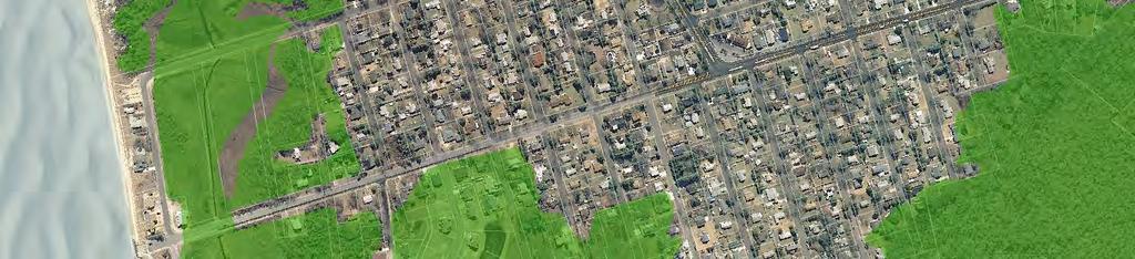

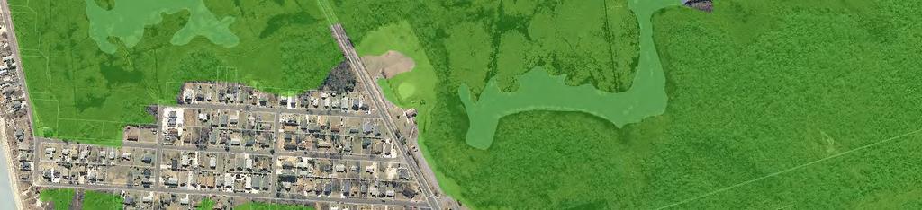
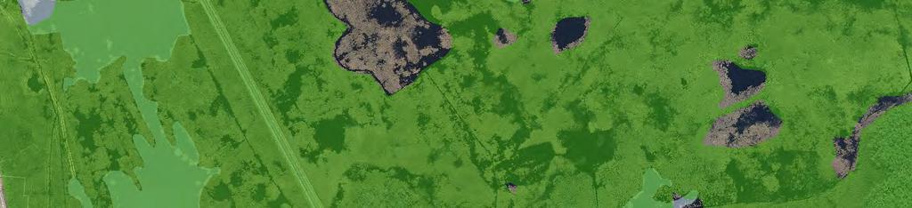
88 ± Delaware Bay CR Û 642 VR 10TH ST 11TH ST 12TH ST PARK AV LEHIGH AV 5TH ST 6TH ST VC 15TH ST 16TH ST 7TH ST 9TH ST 14TH ST 8TH ST GENEVA AV LAFAYETTE AV DELAWARE AV CR SUNRAY RD RUTLEDGE RD VR Û 603 \\hqgis1\gisprojects\municipal\m-p\middletwp\ g\figuremaps\center_delhaven.mxd Proposed Center Boundaries Proposed Zoning Boundaries Environmental Constraints C-1 Waters C-1 Waters 300 foot Buffer Wetlands Open Water Bodies ,000 1,500 Feet THIS MAP WAS DEVELOPED USING CAPE MAY COUNTY AND NJDEP DIGITAL DATA. THIS SECONDARY PRODUCT HAS NOT BEEN VERIFED AND IS NOT COUNTY OR STATE AUTHORIZED. PROPOSED DEL HAVEN VILLAGE CENTER TOWNSHIP OF MIDDLE CAPE MAY COUNTY NEW JERSEY APRIL 2010


 The village is predominantly residential development with scattered small businesses and commercial establishments along the State Route 47/CR-603 intersection.")
89 GREEN CREEK VILLAGE CENTER Largest of the four Village Centers, in terms of land area, is the Green Creek Village Center. This Center encompasses a total of 225 acres in the southwestern part of the Township. Green Creek is an unincorporated historic village in Middle Township, with its origins dating back to the early 1800s. It was originally a summer resort and gateway to several other vacation resorts along the Delaware Bay. A post office was established in Green Creek in Green Creek was a stop on the Bridgeton stage, which ran along the natural highway by the Bay now known as State Route 47 from Cape Island to Bridgeton. At the US Census of 1880, there were 362 residents of Green Creek. 18, 19 The Green Creek Village Center includes about 1 mile of frontage along State Route 47. Bay Shore Road (CR-603) and Burleigh Avenue intersect with State Route 47 in the Center, providing access to Del Haven and Whitesboro-Burleigh, respectively. Several local roads also intersect with State Route 47, providing access to the residential areas of the Center. The Center spans up to 1,000 feet on the west side of State Route 47 and up to 3,000 feet on the east side. (See Figure 37 Proposed Green Creek Village Center Map.) The village is predominantly residential development with scattered small businesses and commercial establishments along the State Route 47/CR-603 intersection. There are approximately 240 existing homes within the Village Center, most of which were constructed after Population in Green Creek was approximately 564 in Vacant and developable (unconstrained) land amounts to about 12 acres overall. The Village Center is projected to have adequate land capacity for the development of 11 additional residential units and 65,000 square feet of nonresidential space at full buildout. There are currently developed properties that are underutilized, which can be expected to be redeveloped for more contemporary uses in the future. Green Creek Land Use Recommendations Village Residential Area The Future Land Use Plan recommends that two developed residential neighborhoods within the Green Creek Village Center be rezoned for Village Residential. The Burleigh Avenue neighborhood is currently zoned for SR Suburban Residential and the Linda Lane/Paula Lane neighborhood is currently zoned for CB Community Business. Village Residential areas are proposed to 18 Federal Writers Project. (1939). New Jersey: A Guide to Its Present and Past. New York: Viking Press. 19 Stevens, L. T. (1897). The History of Cape May County, New Jersey: from the Aboriginal Times to the Present Day (Volume 2). MASER CONSULTING, P.A. Page 82
90 encompass a total of 43 acres of land (or 19 percent of the Green Creek Village Center). There are currently three vacant properties in the Green Creek Village Residential areas, containing less than 1 acre of combined unconstrained land. Residential Area The Future Land Use Plan also recommends that two other developed residential neighborhoods within the Green Creek Village Center be rezoned for Residential. The Lomurno Lane neighborhood is currently zoned for RR Rural Residential and the Ridge Road neighborhood is currently zoned for SR Suburban Residential. However, development of these neighborhoods has occurred on larger lot sizes (about 35,000 square feet), which would make the Residential land use category more appropriate than Village Residential. Residential areas are proposed to encompass a total of 81 acres of land (or 36 percent of the Green Creek Village Center). There are currently three vacant properties in the Green Creek Residential areas, containing about 3 acres of combined unconstrained land. Village Commercial Area The existing CB Community Business District within Green Creek is recommended to be retained and refined as Village Commercial areas. It would span the entire length of the State Route 47 frontage, encompassing a total of 101 acres. Existing development consists primarily of single-family residential uses with a limited number of business uses, including auto-related and civic/quasi-public uses. Vacant unconstrained and developable land amounts to approximately 8 acres in the Green Creek Village Commercial area. MASER CONSULTING, P.A. Page 83


91 B VC LOMURNO LN R Û 603 VR BURLEIGH AV N BLUEBERRY LN R RIDGE RD ± LOLA LN SUSAN LN VR PAULA LN \\hqgis1\gisprojects\municipal\m-p\middletwp\ g\figuremaps\center_greencreek.mxd Proposed Center Boundaries Proposed Zoning Boundaries «47 Environmental Constraints C-1 Waters C-1 Waters 300 foot Buffer Wetlands Open Water Bodies ,000 1,500 Feet THIS MAP WAS DEVELOPED USING CAPE MAY COUNTY AND NJDEP DIGITAL DATA. THIS SECONDARY PRODUCT HAS NOT BEEN VERIFED AND IS NOT COUNTY OR STATE AUTHORIZED. PROPOSED GREEN CREEK VILLAGE CENTER TOWNSHIP OF MIDDLE CAPE MAY COUNTY NEW JERSEY APRIL 2010


92 SWAINTON VILLAGE CENTER The Swainton Village Center encompasses a total of 193 acres in the northeastern part of the Township. Swainton is an unincorporated historic village in Middle Township, with its origins dating back to the early 1800s. A post office was established in Swainton in The village was originally known as Townsends Inlet. However, due to a nearby community also adopting the name Townsends Inlet, the local postmaster, Luther Swain, circulated a petition to change the village s name. On July 1, 1896, it was officially renamed Swainton. Swainton was a stop on the Tuckahoe stage, which ran along the natural highway parallel with the seashore now known as US Route 9 from Cape Island to Tuckahoe. At the US Census of 1880, there were 309 residents of Swainton, which at that time also included the area now known as Clermont in Dennis Township. 20, 21 The Swainton Village Center is traversed north to south by US Route 9, with about 1 mile of frontage along the major arterial. Avalon Boulevard (CR-601) intersects with US Route 9 in the Center, providing access east to the Garden State Parkway (Exit 13) and beyond to Avalon Borough. Several local roads also intersect with US Route 9, providing access to residential areas within and outside of the Center. The Center spans up to 1,300 feet on the west side of State Route 9 and up to 1,800 feet on the east side, along CR-601. (See Figure 38 Proposed Swainton Village Center Map.) Swainton has small retail and service uses and residential dwellings. There are about 250 residents and 46 housing units within the Center. A 85,000-square foot shopping center was approved with a supermarket, retail stores and other businesses is located along south side CR-601 between the Parkway and US Route 9. At this time, only the supermarket has been constructed. The wetlands transition buffer established as part of this development makes up the Center boundary on the south side of CR-601. Scattered retail and service uses are located along the US Route 9 and CR-601 frontages, including a car dealer, automobile repair shop, and gas station. Vacant and developable (unconstrained) land, including oversized residential and commercial properties capable of future subdivision, amounts to about 60 acres overall. The Village Center is projected to have adequate land capacity for the development of 106 additional residential units and 210,000 square feet of nonresidential space at full buildout. A portion of Swainton is currently within the sewer service area. Sewer service is expected to be extended to serve all properties in the Center in the future. 20 Federal Writers Project. (1939). New Jersey: A Guide to Its Present and Past. New York: Viking Press. 21 Stevens, L. T. (1897). The History of Cape May County, New Jersey: from the Aboriginal Times to the Present Day (Volume 2). MASER CONSULTING, P.A. Page 85
93 Swainton Land Use Recommendations Village Residential Area The Future Land Use Plan recommends approximately 43 acres to be rezoned for Village Residential land uses. This includes the Lord Lane residential neighborhood, which is currently zoned for SR Suburban Residential. It also includes approximately 10 acres of undeveloped land at the rear of the South Jersey Gas Company property, which is currently zoned RR Rural Residential. Including the rear of the South Jersey Gas Company property, there are approximately 13.7 acres of vacant land in the Swainton Village Residential area, which has an estimated development capacity of about 70 new residential units altogether. Village Commercial Area The majority of the Swainton Village Center is recommended for Village Commercial land uses. This area would encompass a total of 149 acres, including lands currently zoned as RB Residential Business and CB Community Business. It would include all of the properties fronting on US Route 9 and CR-601. Vacant unconstrained and developable land amounts to approximately 32 acres in the Swainton Village Commercial area. The Swainton Village Commercial area is projected to have adequate land capacity for the development of 37 additional residential units and 210,000 square feet of non-residential space at full buildout. MASER CONSULTING, P.A. Page 86


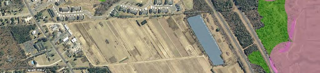
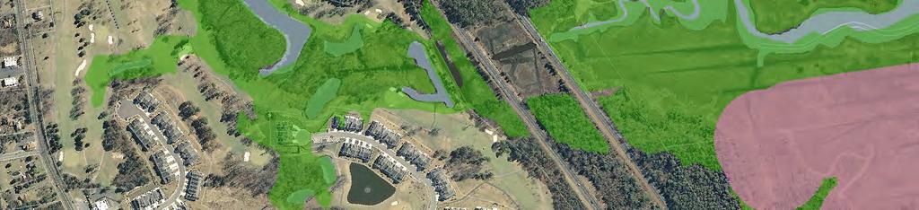
94 ± \\hqgis1\gisprojects\municipal\m-p\middletwp\ g\figuremaps\center_swainton.mxd CONOVER LN RB SR BAY ACRES DR SR PINEWOOD CT ROYAL OAKS DR 9 BROOKRIDGE RD VR LORD LN VC Û 601 AVALON WOODS CT SR FAITH RUN RB Û 646 Proposed Center Boundaries Proposed Zoning Boundaries Environmental Constraints C-1 Waters C-1 Waters 300 foot Buffer Wetlands Open Water Bodies ,000 1,500 Feet THIS MAP WAS DEVELOPED USING CAPE MAY COUNTY AND NJDEP DIGITAL DATA. THIS SECONDARY PRODUCT HAS NOT BEEN VERIFED AND IS NOT COUNTY OR STATE AUTHORIZED. PROPOSED SWAINTON VILLAGE CENTER TOWNSHIP OF MIDDLE CAPE MAY COUNTY NEW JERSEY APRIL 2010
95 HILDRETH VILLAGE CENTER Hildreth Village is the proposed name for a new designated center area. Hildreth Village is approximately 26 acres in area. State Route 47, a filled roadway and a bridge to the barrier island of Wildwood, connects Hildreth Village to the mainland. On the south side of State Route 47, across from Hildreth Village is a densely developed area with residential, business and marina uses in Lower Township. (See Figure 39 Proposed Hildreth Village Center.) The proposed Village encompasses a property commonly known as the Cardile Tract (Block 1438, Lots 4.01 through 4.04, 5 and 9). Of the 26 acres, about 17.5 acres have been disturbed through filling or by development for amusement and entertainment uses. An additional 8.5 acres of the site have been classified and used as a Class III sanitary landfill. The property was formerly developed with an amusement park, gas station, mobile home park, communication tower, open-field containing abandoned trucks and automobiles, and a commercial dock. Structures associated with the former amusement park still remain, including a mini-golf course, go-cart track and arcade. The Cardile Tract is presently located within the AR Amusement Entertainment zone. The property is currently served by public sewer, gas, electric and water. The property is a brownfield site; the closure and remediation of the sanitary landfill and other identified areas of concern on the property will be undertaken has part of this planned development. It is desired that the site be developed residential units, water related and water dependant uses, and light commercial uses, such as a hotel, restaurant and small shops and stores. The boundaries of the Hildreth Village Center are consistent with the Shawcrest/Hildreth Island area mapped by the NJDEP for the purposes of permitting under CAFRA and more specifically, applying the Bay island rule (N.J.A.C. 7:7E- 3.21) contained in the Coastal Zone Management (CZM) Rules (N.J.A.C. 7:7E) as adopted on April 8, Hildreth is exempt from the Bay island rule since it has significant filled water s edge areas, high intensity of residential and/or commercial development, access to a major transportation corridor and emergency evacuation route, proximity to an intensely developed barrier island, and utility infrastructure (gas, electric, sewer and water) available to service development. The desired residential, commercial and recreation uses are within an area that has already been intensely developed. The closure and remediation of the sanitary landfill and other areas of concern of the property, as well as a redevelopment design that will be in compliance with the CZM Rules will ensure that the tidal wetlands will be preserved and protected. Additionally, the desired use will revitalize this part of Middle Township, conserve its natural resources and ecosystem, promote beneficial economic growth and development, protect the environment, and facilitate the remediation of the Cardile Tract. MASER CONSULTING, P.A. Page 88
96 Hildreth Village Land Use Recommendations Hildreth Village Area The Hildreth Village area is proposed to encompass the entire Hildreth Village Center. The intent of the Hildreth Village area is to promote redevelopment and revitalization of the existing AR Amusement and Entertainment District with uses that will encourage development for mixed residential and commercial uses appropriate to the bay island location as a Village Center. The purpose of the Hildreth Village area is to provide for a location of higher density residential, light commercial and public waterfront access uses. The Hildreth Village area should permit a variety of residential, retail, and service uses that would serve the local residents of the Center, including single-family dwellings, townhouses, multifamily dwellings, apartments, retail, office, banks, restaurants, services uses, hotels, motels, marinas, studios, spas, fitness centers and other similar uses. To meet the allocated wastewater capacity, the Future Land Use Plan recommends a maximum residential density of 6 dwelling units per acre and a non-residential floor area ratio (FAR) of The residential density and/or nonresidential FAR could be increased if additional wastewater allocation becomes available for this area. To accommodate increased residential density and preserve open space in the Environs outside of the Centers, NCPDC should be permitted on the 26-acre Cardile Tract. An increase in residential density should be permitted as a bonus to encourage non-contiguous clustering between the Centers and the Environs. The Future Land Use Plan recommends a density bonus of up to 4 units per acre. To ensure that the sewer demand at full buildout will not exceed the allocated wastewater capacity, the Future Land Use Plan recommends that an expiration clause be included the ordinance to limit the number of units clustered into the Center through NCPDC. MASER CONSULTING, P.A. Page 89


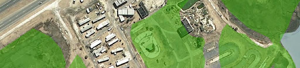
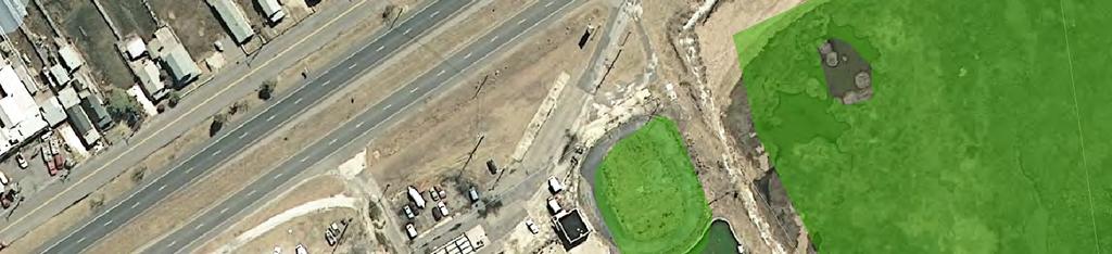
97 \\hqgis1\gisprojects\municipal\m-p\middletwp\ g\figuremaps\center_hildreth.mxd HV ± Proposed Center Boundaries Proposed Zoning Boundaries Environmental Constraints C-1 Waters C-1 Waters 300 foot Buffer Wetlands Open Water Bodies Û 624 « Feet THIS MAP WAS DEVELOPED USING CAPE MAY COUNTY AND NJDEP DIGITAL DATA. THIS SECONDARY PRODUCT HAS NOT BEEN VERIFED AND IS NOT COUNTY OR STATE AUTHORIZED. PROPOSED HILDRETH VILLAGE CENTER TOWNSHIP OF MIDDLE CAPE MAY COUNTY NEW JERSEY APRIL 2010


. It is comprised of primarily historic single family dwellings with a post office, church and small community businesses at the cross roads of the hamlet.")

98 GOSHEN HAMLET CENTER Goshen is an unincorporated historic hamlet located in the northwest section of Middle Township. Goshen was first settled in 1693 by Aaron Leaming, a cattle farmer who later became a justice of the peace, clerk and assemblyman at Cape May. It became known as Goshen Village as early as A post office was established in Goshen in Goshen s first industry was a crab mill and a canning factory. Shipbuilding and lumbering industries were also prominent there. Goshen Village was a stop on the Bridgeton stage, which ran along the natural highway parallel to the Bay now known as State Route 47 from Cape Island to Bridgeton. In 1830, Goshen contained a tavern, two stores, a steam saw mill, 12 or 15 dwellings, a school house, in which religious meetings are held". By 1840, a total of 20 dwellings were in Goshen. At the US Census of 1880, there were 464 residents of Goshen. 22 The Goshen Hamlet Center is a compact historic settlement area of about 142 acres, located along State Route 47 at the Goshen Swainton Road (CR-646) intersection (see Figure 40 Proposed Goshen Hamlet Center). It is comprised of primarily historic single family dwellings with a post office, church and small community businesses at the cross roads of the hamlet. Goshen has an identified historic district with a SHPO opinion of eligibility; but it is not yet officially listed on the State or National Historic Register. The hamlet is a rural area of the Township surrounded primarily by farmlands. There are about 213 residents in Goshen with 78 homes. Vacant and developable (unconstrained) land, including oversized residential and commercial properties capable of future subdivision, amounts to about 30 acres overall, which could potentially yield about 30 new residential units. This developable land is solely within the Village Residential area. There are no vacant and developable lands within the Village Commercial area. The Hamlet is not sewered and none is planned for this Center. Existing development within the Center is served by on-site septic systems. As such, Goshen is subject to the NJDEP 2 mg/l target nitrate concentration antidegradation policy. The recommended zoning standards for Goshen to meet the antidegradation policy are discussed in greater detail under each land use category. 22 Stevens, L. T. (1897). The History of Cape May County, New Jersey: from the Aboriginal Times to the Present Day (Volume 2). MASER CONSULTING, P.A. Page 91
99 Goshen Land Use Recommendations Village Residential Area The Future Land Use Plan recommends approximately 109 acres be rezoned for Village Residential land uses. This area is currently zoned RR Rural Residential. To meet the NJDEP 2 mg/l target nitrate concentration antidegradation policy, the Goshen Village Residential area is recommended to require a minimum lot size of 1 acre for single-family residential uses, which is consistent with the current RR Rural Residential District. There are approximately 30 acres of vacant and developable (unconstrained) land, including oversized residential and commercial properties capable of future subdivision, in the Goshen Village Residential area. The estimated development capacity is about 30 new residential units. Village Commercial Area The existing CB Community Business District in Goshen, located at the intersection of State Route 47 and CR-646, is recommended to be rezoned to Village Commercial. The Future Land Use Plan recommends the Village Commercial District to be expanded to the north and south along State Route 47. This area would encompass a total of 33 acres, including lands currently zoned as RR Rural Residential and CB Community Business. To meet the NJDEP 2 mg/l target nitrate concentration antidegradation policy, the Goshen Village Commercial area is recommended to require a minimum lot size of 1 acre for single commercial uses, a slight increase above the existing CB Community Business District (35,000 square feet). There are no vacant unconstrained and developable lands in the Goshen Village Commercial area. Future development is expected in the form of redevelopment and revitalization of existing uses. Goshen Overlay District Goshen has an identified historic district with a SHPO opinion of eligibility; but it is not yet officially listed on the State or National Historic Register. The Middle Township Planning Board has designated a larger area as the Historic District, which is similar to but not exactly the same as the proposed Hamlet Center boundaries. The Future Land Use Plan recommends a Goshen Overlay District, congruent with the Goshen Hamlet Center boundaries. The purpose of the overlay district would be to establish architectural design guidelines to encourage future development within the Goshen Overlay District to be aesthetically compatible with the existing development to preserve and enhance the character of this area. As recommended in the 2003 Master Plan, the Goshen Historic District should be surveyed and a possible historic district submitted for listing on the State and National Register of Historic Places. The redevelopment or rehabilitation of the properties in the Hamlet will be likely as development pressures increase. MASER CONSULTING, P.A. Page 92

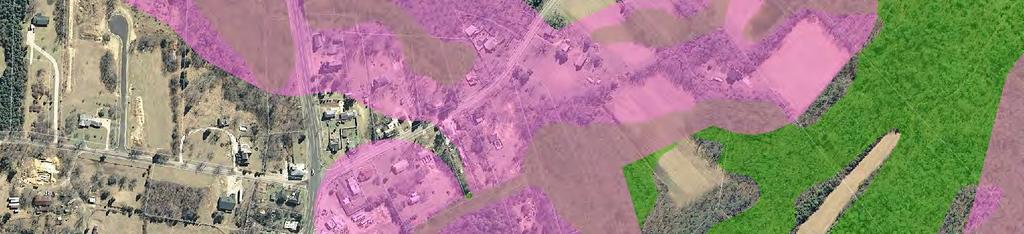
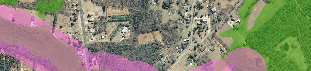


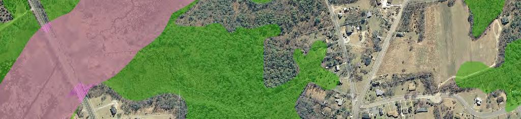
100 \\hqgis1\gisprojects\municipal\m-p\middletwp\ g\figuremaps\center_goshen.mxd GOSHEN LANDING RD VC VR VR Û 650 Û 646 Û 615 ± «47 BUCKS AV Proposed Center Boundaries Proposed Zoning Boundaries Proposesd Goshen Overlay Zone Environmental Constraints C-1 Waters C-1 Waters 300 foot Buffer Wetlands Open Water Bodies ,000 1,250 Feet THIS MAP WAS DEVELOPED USING CAPE MAY COUNTY AND NJDEP DIGITAL DATA. THIS SECONDARY PRODUCT HAS NOT BEEN VERIFED AND IS NOT COUNTY OR STATE AUTHORIZED. PROPOSED GOSHEN HAMLET CENTER TOWNSHIP OF MIDDLE CAPE MAY COUNTY NEW JERSEY APRIL 2010
101 DEVELOPMENT TOOLS Planned Residential Open Space Cluster Development Planned Residential Open Space Cluster (PROSC) Development is the grouping of residential units on a site to preserve a large portion of land as open space, recreation or agriculture. Although the residential lots would be smaller, the overall density of the tract would be the same as under a traditional subdivision design. Residential cluster is permitted under the planned development provisions of the Municipal Land Use Law (N.J.S.A. 40:55D-65c) for properties at least 5 acres in size. PROSC is recommended as a permitted use within the proposed Rural Conservation District, provided that the tract contains a total gross area of 10 acres. Clustered parcels should be permitted to be reduced from 3.5 acres to 1 acre. Maximum lot area should be 5 acres. Yard, setback and bulk requirements should be consistent with the SR Suburban Residential District standards. To determine the underlying lot yield, a conventional sketch plat should be required as part of the application submission for subdivision approval. Standards for minimum contiguous unconstrained lot area should be established for each residential lot to ensure that there is adequate buildable area to accommodate the dwelling, well and septic areas, and other associated improvements. A minimum of 25,000 square feet of contiguous unconstrained land is recommended. A minimum percentage of the tract to be deed-restricted for open space conservation should be established. Standards should also be established pertaining to the ownership of the open space lot(s). All land not included in the net residential sites should be preserved in open space through deed-restriction or dedicated to the public. Developers should have the option of offering the open space lot(s) for dedication to a public entity (such as the Township of Middle, Cape May County, State and/or Federal government). If the lands are not considered suitable for dedication by these governmental entities, the open space should be encumbered by a permanent conservation easement and designated as a separate lot under the subdivision homeowner s association or alternatively the property may be incorporated into one residential lot with a permanent conservation easement prohibiting any further subdivision. Planned Noncontiguous Parcel Density Cluster (NCPDC) In 1995, the State Legislature amended the Municipal Land Use Law to permit clustering of planned unit development between non-contiguous parcels (see N.J.S.A. 40:55D-65c). It is a development tool that can be used to preserve open space by clustering all development on one parcel and deed-restricting for open space on the other non-contiguous parcel. Density cluster relies solely on the private sector for implementation, once permitted by the municipal zoning ordinance. Planned Noncontiguous Parcel Density Cluster (NCPDC) is recommended within the Rural Conservation, TR Town Residential, R Residential, and TC Town Center Districts. Different standards should be established for NCPDC involving lands in both the Environs and the Centers, as opposed to lands only within the Environs. MASER CONSULTING, P.A. Page 94
102 NCPDC within Rural Conservation District Lots under common ownership or control that are not contiguous may be utilized as part of a PROSC within the Rural Conservation Districts. Standards for NCPDC in the Rural Conservation District should follow the same standards as PROSC. NCPDC between Rural Conservation and TR Town Residential, R Residential, or TC Town Center Districts NCPDC should be permitted between lands within the Rural Conservation and TR Town Residential, R Residential, or TC Town Center Districts. The intent is to cluster development potential from the Environs into the Centers to conserve, preserve, and protect the sensitive environmental features prominently found in the Environs while encouraging increased development in more suitable areas. A minimum total tract area and minimum building lot area should be established for each district. For NCPDC involving lands within the Rural Conservation District and the TC Town Center District, the Land Use Plan recommends a minimum total tract area of 10 acres with a minimum of 5 acres in the TC District. For NCPDC involving lands within the Rural Conservation District and either the TR Town Residential or R Residential District, the Land Use Plan recommends a minimum total tract area of 5 acres with a minimum of 2 acres in the TR or R District. A density bonus should be established based on the amount of unconstrained land that is preserved in the Rural Conservation District. This density bonus is recommended at 1 dwelling unit per acre of unconstrained land to be preserved. To establish the number of units to be clustered, unconstrained lands should be verified through an NJDEP Letter of Interpretation (LOI) and a site map that documents the location of unconstrained areas on the tract. Fractions of lots may be considered in the calculation; however, the lot density should only be rounded downward to establish the ultimate lot density for cluster. An oversized parcel containing an existing residential dwelling may be permitted to subdivide a portion of the property for the existing dwelling (in accordance with the Rural Conservation standards), with the remainder to be preserved as part of the noncontiguous cluster. A maximum density increase of 2 to 4 units per acre is recommended to be established above the base density for the respective zone district to be developed in the Center. To encourage NCPDC within the more desired zone districts, a hierarchy should be established. The Land Use Plan recommends a maximum density of 10 dwelling units per acre in the TC Town Center District, 8 dwelling units per acre in the TR Town Residential District, and 6 dwelling units per acre in the R Residential District. The same standards established for PROSC pertaining to the ownership of the open space lot(s) should apply under the NCPDC provisions. A minimum of 1 acre of contiguous unconstrained lot area should be required within the Rural Conservation District to ensure that lands to be preserved are adequately sized to have open space value. To ensure that the sewer capacity is not exceeded by NCPDC provisions, an expiration clause should be included in the ordinance, limiting the number of units that could be clustered to 341. If, at some point in the future, the Township is able to increase its wastewater allocation, the expiration clause could be extended or possibly removed altogether. MASER CONSULTING, P.A. Page 95
103 RECOMMENDED ZONING AMENDMENTS This Future Land Use Plan recommends a variety of zoning amendments to implement the recommended centerbased land use goals and policies, where growth is focused into Centers and the surrounding Environs are protected from the impacts of sprawling development. These zoning amendments can be classified into three categories: contextual, nominal, and locational changes. Contextual changes are revisions to the permitted use, bulk, area and/or yard standards of the zone. Nominal changes are changes to the name of the zone, which better reflects the intent and purpose of the zone. Locational changes are alterations to the zone boundaries. Contextual and nominal changes are listed in Figure 41, which identifies the proposed zoning district classifications, related guidelines and recommended standards, where applicable. These zoning amendments are recommended to address or clarify zoning issues that have been identified during the course of this master plan process. Nominal changes are indicated when the zone status is New. The SDRP Center Guidelines and Policy Map Planning Area criteria, CAFRA Center and Planning Area guidelines, as well as the NJDEP Wastewater Management Planning Rules (N.J.A.C. 7: ) and Groundwater Quality Standards (N.J.A.C. 7:9c) were consulted to revise the zoning. (These are discussed in greater detail under each land use category of the Future Land Use Plan.) Figure 41 Revised Land Use Classifications- Revised Land Use Classifications Status Land Use Classifications Related Guidelines Recommended Standards New R Residential SDRP Center Guidelines SDRP Policy Map PA3 CAFRA Regional Center / CAFRA Village Center NJDEP Wastewater Management Planning Rules (N.J.A.C. 7: ) NJDEP Groundwater Quality Standards (N.J.A.C. 7:9c) Single-family, two-family and townhouse residential uses. Lot size and density revised to meet allocated sewer capacity: 20,000 sq. ft. for single-family; 30,000 sq. ft. for twofamily; 3 du/ac for townhouses. Permit NCPDC with 3 du/ac density bonus to encourage environmental conservation. Coverage standards generally compatible with intent of CAFRA Regional Center guidelines. Revised TR Town Residential SDRP Center Guidelines SDRP Policy Map PA3 CAFRA Regional Center NJDEP Wastewater Management Planning Rules (N.J.A.C. 7: ) NJDEP Groundwater Quality Standards (N.J.A.C. 7:9c) Single-family, two-family and multifamily residential uses. Lot size and density revised to meet allocated sewer capacity: 10,000 sq. ft. for single-family; 15,000 sq. ft. for twofamily; 6 du/ac for multifamily. Permit NCPDC with 2 du/ac density bonus to encourage environmental conservation. Coverage standards generally compatible with intent of CAFRA Regional Center guidelines. Revised TB Town Business SDRP Center Guidelines SDRP Policy Map PA3 CAFRA Regional Center NJDEP Wastewater Management Planning Rules (N.J.A.C. 7: ) NJDEP Groundwater Quality Standards (N.J.A.C. 7:9c) Commercial uses expanded and refined. Impervious coverage standards reduced to 60% to meet allocated sewer capacity. Minimum lot size 15,000 sq. ft. Coverage standards generally compatible with intent of CAFRA Regional Center guidelines. MASER CONSULTING, P.A. Page 96
104 Status Land Use Classifications Related Guidelines Recommended Standards Revised TP Town Professional SDRP Center Guidelines SDRP Policy Map PA3 CAFRA Regional Center NJDEP Wastewater Management Planning Rules (N.J.A.C. 7: ) NJDEP Groundwater Quality Standards (N.J.A.C. 7:9c) Professional office and residential uses consistent with current standards. Lot size and density revised to meet allocated sewer capacity: 15,000 sq. ft. for single-use office. Coverage standards generally compatible with intent of CAFRA Regional Center guidelines. New TC Town Center SDRP Center Guidelines SDRP Policy Map PA3 CAFRA Regional Center NJDEP Wastewater Management Planning Rules (N.J.A.C. 7: ) NJDEP Groundwater Quality Standards (N.J.A.C. 7:9c) Mixed uses, including retail, office, services, civic uses on ground floor; office and residential on upper floors. Permit up to 3 stories. Maximum density of 6 units per acre. Permit NCPDC with 4 du/ac density bonus to encourage environmental conservation. Impervious coverage standards reduced to 70% to meet allocated sewer capacity. Coverage standards generally compatible with intent of CAFRA Regional Center guidelines. New design standards needed. New VR Village Residential SDRP Center Guidelines SDRP Policy Map PA4 CAFRA Village Center NJDEP Wastewater Management Planning Rules (N.J.A.C. 7: ) NJDEP Groundwater Quality Standards (N.J.A.C. 7:9c) Single-family and two-family residential uses. Lot size and density revised to meet allocated sewer capacity and antidegradation policy: 10,000 sq. ft. for singlefamily (sewer), 1 acre for single-family (septic), 15,000 sq. ft. for two-family. Coverage standards generally compatible with intent of CAFRA Village Center guidelines. New VC Village Commercial SDRP Center Guidelines SDRP Policy Map PA4 CAFRA Village Center NJDEP Wastewater Management Planning Rules (N.J.A.C. 7: ) NJDEP Groundwater Quality Standards (N.J.A.C. 7:9c) Commercial uses. New lot size standards to meet allocated sewer capacity and NJDEP anti-degradation policy: 20,000 sq. ft. (sewer) or 1 acre (septic). Coverage standards generally compatible with intent of CAFRA Village Center guidelines. Limit gross floor area of individual business. New HV Hildreth Village SDRP Center Guidelines SDRP Policy Map PA5/PA5B CAFRA Village Center NJDEP Wastewater Management Planning Rules (N.J.A.C. 7: ) NJDEP Groundwater Quality Standards (N.J.A.C. 7:9c) Mixed uses, including retail, office, services, civic, residential and water-based uses. Maximum density of 6 units per acre and maximum non-residential FAR of Permit NCPDC to encourage environmental conservation. Coverage standards generally compatible with intent of CAFRA Village Center guidelines. New Rural Conservation SDRP Policy Map PA4/PA5 CAFRA Rural /Environmentally Sensitive Planning Areas NJDEP Wastewater Management Planning Rules (N.J.A.C. 7: ) NJDEP Groundwater Quality Standards (N.J.A.C. 7:9c) Rural density single-family residential uses. Lot size and density consistent with NJDEP anti-degradation policy: 3.5-acre minimum lot size with 25,000 sq. ft. unconstrained land. Permit PROSC and NCPDC to encourage environmental conservation. Coverage standards generally compatible with intent of CAFRA Rural Planning Area guidelines. MASER CONSULTING, P.A. Page 97
105 Status Revised Land Use Classifications SR Suburban Residential Related Guidelines SDRP Policy Map PA3 CAFRA Fringe Planning Area NJDEP Wastewater Management Planning Rules (N.J.A.C. 7: ) NJDEP Groundwater Quality Standards (N.J.A.C. 7:9c) Recommended Standards Single-family residential uses consistent with current standards. Lot size and density revised to meet NJDEP anti-degradation policy: 1-acre minimum. Coverage standards generally compatible with intent of CAFRA Fringe Planning Area guidelines. Revised RB Residential Business SDRP Policy Map PA3 CAFRA Fringe Planning Area NJDEP Wastewater Management Planning Rules (N.J.A.C. 7: ) NJDEP Groundwater Quality Standards (N.J.A.C. 7:9c) Residential and limited business uses consistent with current standards. Lot size and density revised to meet NJDEP antidegradation policy: 1-acre minimum. Coverage standards generally compatible with intent of CAFRA Fringe Planning Area guidelines. New Revised Revised B Business CR Coastal Residential CD Coastal Development SDRP Policy Map PA4/PA5 CAFRA Rural /Environmentally Sensitive Planning Areas NJDEP Wastewater Management Planning Rules (N.J.A.C. 7: ) NJDEP Groundwater Quality Standards (N.J.A.C. 7:9c) SDRP Policy Map PA4/PA5 CAFRA Rural /Environmentally Sensitive Planning Areas NJDEP Wastewater Management Planning Rules (N.J.A.C. 7: ) NJDEP Groundwater Quality Standards (N.J.A.C. 7:9c) SDRP Policy Map PA4/PA5 CAFRA Rural /Environmentally Sensitive Planning Areas NJDEP Wastewater Management Planning Rules (N.J.A.C. 7: ) NJDEP Groundwater Quality Standards (N.J.A.C. 7:9c) Commercial uses. New lot size standards to meet NJDEP anti-degradation policy: 1-acre minimum. Coverage standards generally compatible with intent of CAFRA Rural Planning Area guidelines. Limit gross floor area of individual business. Single-family residential uses consistent with current standards. Lot size and density revised to meet NJDEP anti-degradation policy: 5,000 sq. ft. (sewer) or 1 acre (septic). Coverage standards generally compatible with intent of CAFRA Fringe Planning Area guidelines. Single-family residential and commercial uses consistent with current standards. Revised lot size and coverage standards to meet NJDEP anti-degradation policy: 5,000 sq. ft. for (sewer), 1 acre for septic or commercial. Coverage standards generally compatible with intent of CAFRA Rural Planning Area guidelines. Locational changes are shown on Figure 42 - Recommended Zoning Changes Map, which illustrates the recommended zoning changes based on the Future Land Use Plan. The existing zoning underlies the areas recommended to be rezoned. In summary, the following land use and zoning changes are recommended: Create Regional Centers with the following zone districts: o R Residential District o TR Town Residential District o TB Town Business District o TP Town Professional District o TC Town Center District Create Village and Hamlet Centers with the following zone districts: o VR Village Residential District o VC Village Commercial District MASER CONSULTING, P.A. Page 98
106 o HV Hildreth Village District Create the Rural Conservation District in the Environs Create the B Business District from the CB Community Business District outside of the Centers Amend the SR Suburban Residential District boundaries and standards Amend the RB Residential Business District boundaries and standards Amend the CR Coastal Residential District boundaries and standards Amend the CD Coastal Development District boundaries and standards Eliminate the following zone districts: o RI Restricted Industrial District o RGB Regional General Business District o SL Sensitive Lands District o RR Rural Residential District o RD Rural Development District o PD Planned Development District o AR Amusement And Entertainment District o HMM Hotel/Motel/Marina District Amend ordinance to permit planned residential open space cluster under planned development. Amend ordinances to permit noncontiguous parcel density cluster under planned development. Create Cape May Bays and Tributaries East Overlay Zone. Create Cape May Court House Overlay Zone. Create Cape May Goshen Overlay Zone. Figure 43 shows the Proposed Zoning Map, which is based on the Future Land Use Plan. MASER CONSULTING, P.A. Page 99


107 \\hqgis1\gisprojects\municipal\m-p\middletwp\ g\figuremaps\zonechange.mxd Dennis Creek «83 Dennis Township Û 608 Townsend Sound Sea Isle City SR VC VC SR VC VR VC VR VC SR SR CR Stites Sound Û 619 Townsend's Inlet VC VR VC Û 646 Û 601 Û 652 Delaware Bay Û 642 VR VC VR VR Û 603 CD Û 648 County Boundary Municipal Boundary Û 654 Û 613 Û 639 Û 615 Û 655 RB B RB B VC VR VC Garden State Parkway US Route NJ State Route County Route Local Road Railroad Parcels B B R Û 644 B R Û 618 VC VR R «47 Û 647 Û 612 TB R Û 643 TR 9 Û 658 TC TC TR TR Û 620 Û 657 Jarvis Sound Rishardson Sound Û 609 Jenkins Sound Û Û 626 RR - Rural Residential 621 Lower TRB Township - Residential Business SR TB R TC TR TR SR TC TC TR TR TC TC R TC TR TC TB TB TC TR TC TC TC TC SR TC TB TB SR TB TB TR SR SR TB TR Area Recommended to be Rezoned Existing Zoning TR - Town Residential TP - Town Professional TB - Town Business RGB - Regional General Business AE - Amusement and Entertainment PD - Planned Development RD - Rural Development R R R R R R B R R TB TR SR R TP TC R R TC R TR TR TB TB TB TR TB R R TB R TC TP TP R Û 630 TC TC TC R B Û 663 R Middle Township «147 HV Û 624 Û 624 CR RI - Restricted Industrial SL - Sensitive Lands CD Grassy Sound SR - Suburban Residential Wildwood Crest RB - Residential Business Borough CB - Community Business CR - Coastal Residential CD - Coastal Development HMM - Hotel Motel Marina Open Water Bodies Great Sound CD West Wildwood Borough Û 614 Wildwood City Hereford Inlet CD North Wildwood City Avalon Borough Stone Harbor Borough Atlantic Ocean Û 619 ± 0 5,000 10,000 15,000 Cape May Canal Feet THIS MAP WAS DEVELOPED USING CAPE MAY COUNTY AND NJDEP DIGITAL DATA. THIS SECONDARY PRODUCT HAS NOT BEEN VERIFED AND IS NOT COUNTY OR STATE AUTHORIZED. RECOMMENDED ZONING CHANGES Cape May Harbor TOWNSHIP OF MIDDLE CAPE MAY COUNTY NEW JERSEY Cape May Inlet JULY 2010

 Town Residential (TR)")
 Û 624 Grassy Sound West Wildwood Borough Û 614 Wildwood City Û 621 North Wildwood City Suburban Residential (SR) Cape May Bays and Tribs East Overlay Zone Wildwood Atlantic Ocean")

108 Dennis Creek «83 Dennis Township Û 608 Townsend Sound Sea Isle City VC VR VR SR VC RB SR VR Stites Sound Û 619 Townsend's Inlet Û 650 Û 646 SR CR RB Û 601 Û 652 CD CD «47 Û 615 Û 657 SR B Û 663 R Great Sound CD Û 655 R TP Û 609 Avalon Borough CR Delaware Bay B Û 658 TR TP TB TP TR TC TP TP TC TR TP Middle Township CD RB B RB B RB Û 643 Û 618 Û 612 SR TR R Û 620 TB SR TR TR R CR Jenkins Sound CR Û 619 CD Stone Harbor Borough ± CR Û 642 VC VR CR VR B R VC VR VR R SR SR R TC TB SR TR B TR SR TB R SR SR «147 CR CR CD CD Hereford Inlet TB TB R TC TR TR R TR Û 634 Û 654 Û 603 County Boundary Municipal Boundary Û 648 Û 613 Garden State Parkway US Route NJ State Route County Route Local Road Railroad Parcels Û 639 Û 647 Û 644 Û Proposed Zoning Residential (R) Town Residential (TR) Lower Township Town Professional (TP) Town Business (TB) Town Center (TC) Village Residential (VR) Village Commercial (VC) Jarvis Sound CD Û 630 Rishardson Sound Hildreth Village (HV) HV Û 624 Rural Conservation () Û 624 Grassy Sound West Wildwood Borough Û 614 Wildwood City Û 621 North Wildwood City Suburban Residential (SR) Cape May Bays and Tribs East Overlay Zone Wildwood Atlantic Ocean Residential Business (RB) Crest Borough Business (B) Coastal Residential (CR) Coastal Development (CD) Open Water Bodies Goshen Overlay Zone Cape May Court House Overlay Zone \\hqgis1\gisprojects\municipal\m-p\middletwp\ g\figuremaps\proposedzoning.mxd 0 5,000 10,000 15,000 Cape May Canal Feet THIS MAP WAS DEVELOPED USING CAPE MAY COUNTY AND NJDEP DIGITAL DATA. THIS SECONDARY PRODUCT HAS NOT BEEN VERIFED AND IS NOT COUNTY OR STATE AUTHORIZED. Cape May Harbor PROPOSED ZONING MAP TOWNSHIP OF MIDDLE CAPE MAY COUNTY NEW JERSEY Cape May Inlet JULY 2010
CHAPTER Committee Substitute for Committee Substitute for Senate Bill No. 2188
 CHAPTER 2004-372 Committee Substitute for Committee Substitute for Senate Bill No. 2188 An act relating to land development; amending s. 197.502, F.S.; providing for the issuance of an escheatment tax
Land Use. Land Use Categories. Chart 5.1. Nepeuskun Existing Land Use Inventory. Overview
 Land Use State Comprehensive Planning Requirements for this Chapter A compilation of objectives, policies, goals, maps and programs to guide the future development and redevelopment of public and private
FUTURE LAND USE. City of St. Augustine Comprehensive Plan EAR-Based Amendments
 FUTURE LAND USE City of St. Augustine Comprehensive Plan EAR-Based Amendments Future Land Use Element FLU Goal To create an environment within the City and adjacent areas in which its residents have the
Appendix A: Guide to Zoning Categories Prince George's County, Maryland
 Appendix A: Guide to Zoning Categories Prince George's County, Maryland RESIDENTIAL ZONES 1 Updated November 2010 R-O-S: Reserved Open Space - Provides for permanent maintenance of certain areas of land
8Land Use. The Land Use Plan consists of the following elements:
 8Land Use 1. Introduction The Land Use Plan consists of the following elements: 1. Introduction 2. Existing Conditions 3. Opportunities for Redevelopment 4. Land Use Projections 5. Future Land Use Policies
Comprehensive Plan /24/01
 IV The is a central component of the Comprehensive Plan. It is an extension of the general goals and policies of the community, as well as a reflection of previous development decisions and the physical
FRESHWATER WETLANDS PROTECTION IN NEW JERSEY Tools for Municipal Action
 FRESHWATER WETLANDS PROTECTION IN NEW JERSEY Tools for Municipal Action The Freshwater Wetlands Protection Act INTENT OF FRESHWATER WETLANDS LAW The New Jersey legislature passed the Freshwater Wetlands
IRS FORM 8283 SUPPLEMENTAL STATEMENT DONATION OF CONSERVATION EASEMENT
 Name(s) shown on income tax return Identifying Number Robert T. Landowner 021-34-1234 Susan B. Landowner 083-23-5555 IRS FORM 8283 SUPPLEMENTAL STATEMENT DONATION OF CONSERVATION EASEMENT On November 12,
STAFF REPORT. Permit Number: Porter. Kitsap County Board of Commissioners; Kitsap County Planning Commission
 STAFF REPORT Permit Number: 15 00461 Porter DATE: November 9, 2015 TO: FROM: Kitsap County Board of Commissioners; Kitsap County Planning Commission Katrina Knutson, AICP, Senior Planner, DCD and Jeff
Burlington Unincorporated Community Plan
 Burlington Unincorporated Community Plan June 30, 2010 Meeting Page 1 of 24 Table of Contents (Page numbers to be inserted) I. Background a. Location and Community Description b. Planning of Unincorporated
MIDWAY CITY Municipal Code
 MIDWAY CITY Municipal Code TITLE 9 ANNEXATION CHAPTER 9.01 PURPOSE CHAPTER 9.02 GENERAL REQUIREMENTS CHAPTER 9.03 PROPERTY OWNER INITIATION OF ANNEXATION CHAPTER 9.04 PROCEDURES FOR CONSIDERATION OF PETITION
Residential Capacity Estimate
 Residential Capacity Estimate Montgomery County Department of Park & Planning Research & Technology Center January 2005 Current plans allow 75,000 more housing units. by Matthew Greene, Research Planner
Palmerton Area Comprehensive Plan
 DRAFT Palmerton Area Comprehensive Plan Bowmanstown Borough, Lower Towamensing Township, Palmerton Borough and Towamensing Township Carbon County, Pennsylvania Draft - With Minor Revisions - March 2008
Washington Township Wastewater Management Plan. January 27, 2012
 Washington Township Wastewater Management Plan Prepared by the State of New Jersey Highlands Water Protection and Planning Council in support of Washington Township s approved Petition for Plan Conformance
Open Space Model Ordinance
 Open Space Model Ordinance Section I. Background Open space development has numerous environmental and community benefits, including: 1) Reduces the impervious cover in a development. Impervious cover
SENATE, No STATE OF NEW JERSEY. 217th LEGISLATURE INTRODUCED SEPTEMBER 8, 2016
 SENATE, No. 0 STATE OF NEW JERSEY th LEGISLATURE INTRODUCED SEPTEMBER, 0 Sponsored by: Senator BOB SMITH District (Middlesex and Somerset) Senator CHRISTOPHER "KIP" BATEMAN District (Hunterdon, Mercer,
MARK TWAIN LAKE MASTER PLAN CLARENCE CANNON DAM AND MARK TWAIN LAKE MONROE CITY, MISSOURI
 MARK TWAIN LAKE MASTER PLAN CLARENCE CANNON DAM AND MARK TWAIN LAKE MONROE CITY, MISSOURI CHAPTER 4 LAND ALLOCATION, LAND CLASSIFICATION, WATER SURFACE, AND EASEMENT LANDS This Master Plan is a land use
LAND USE Inventory and Analysis
 LAND USE Inventory and Analysis The land use section is one of the most important components of the comprehensive plan as it identifies the location and amount of land available and suitable for particular
HOUSING ELEMENT GOALS, OBJECTIVES, AND POLICIES
 HOUSING ELEMENT GOALS, OBJECTIVES, AND POLICIES GOAL 1: To promote the preservation and development of high-quality, balanced, and diverse housing options for persons of all income levels throughout the
Scattered Sites Redevelopment Plan
 Scattered Sites Redevelopment Plan Township of Woodbridge Middlesex County, New Jersey Prepared by: Township of Woodbridge Department of Planning & Development January 2017 Amended September 2018 ENDORSED
4 Hope Township. 407 Hope-Great Meadows Road P.O. Box 284 Hope, New Jersey 07~44 Phone: / Fax:
 TO: FROM: New Jersey Highlands Council 100 North Road Chester, NJ 07930 Hope Township Planning Board Hope Township Committee 4 Hope Township 407 Hope-Great Meadows Road P.O. Box 284 Hope, New Jersey 07~44
PLANNING FOR OUR FUTURE
 PLANNING FOR OUR FUTURE ELLSWORTH TOWNSHIP LAND USE AND POLICY PLAN The purpose of this Plan is to serve as a guide for the Township Trustees, Zoning Commission, Board of Zoning Appeals, developers, employers,
REPORT OF THE PLANNING AND DEVELOPMENT DEPARTMENT FOR APPLICATION FOR REZONING ORDINANCE TO PLANNED UNIT DEVELOPMENT SEPTEMBER 22, 2016
 BEL REPORT OF THE PLANNING AND DEVELOPMENT DEPARTMENT FOR APPLICATION FOR REZONING ORDINANCE 2016-576 TO PLANNED UNIT DEVELOPMENT SEPTEMBER 22, 2016 The Planning and Development Department hereby forwards
2014 Plan of Conservation and Development. Development Plan & Policies
 The Town of Hebron Section 3 2014 Plan of Conservation and Development Development Plan & Policies C. Residential Districts I. Residential Land Analysis This section of the plan uses the land use and vacant
Kitsap County Department of Community Development
 Kitsap County Department of Community Development Staff Report and Recommendation Annual Comprehensive Plan Amendment Process for 2018 George s Corner LAMIRD Boundary Adjustment Report Date 7/16/2018 Hearing
Conservation & Development Policies: The Plan for Connecticut
 2013-2018 Conservation & Development Policies: The Plan for Connecticut CT Land Conservation Council March 21, 2015 www.ct.gov/opm/cdplan CT s Planning Framework State statutes include three separate,
HOUSING ELEMENT GOALS, OBJECTIVES, & POLICIES
 HOUSING ELEMENT GOALS, OBJECTIVES, & POLICIES GOAL H-1: ENSURE THE PROVISION OF SAFE, AFFORDABLE, AND ADEQUATE HOUSING FOR ALL CURRENT AND FUTURE RESIDENTS OF WALTON COUNTY. Objective H-1.1: Develop a
Comprehensive Plan Amendment #PLN , Reserve at Cannon Branch (Coles Magisterial District)
") COUNTY OF PRINCE WILLIAM 5 County Complex Court, Prince William, Virginia 22192-9201 PLANNING (703) 792-7615 FAX (703) 792-4758 OFFICE Internet www.pwcgov.org Christopher M. Price, AICP Director of Planning
COUNTY OF PRINCE WILLIAM 5 County Complex Court, Prince William, Virginia 22192-9201 PLANNING (703) 792-7615 FAX (703) 792-4758 OFFICE Internet www.pwcgov.org Christopher M. Price, AICP Director of Planning
Comprehensive Plan 2030
 Introduction Land use, both existing and future, is the central element of a Comprehensive Plan. Previous chapters have discussed: Projected population growth. The quality housing available in the Township
Town of Yucca Valley GENERAL PLAN 1
 Town of Yucca Valley GENERAL PLAN 1 This page intentionally left blank. 3 HOUSING ELEMENT The Housing Element is intended to guide residential development and preservation consistent with the overall values
STAFF REPORT. Permit Number: Laurier Enterprises, Inc. Kitsap County Board of Commissioners; Kitsap County Planning Commission
 STAFF REPORT Permit Number: 15 00740 Laurier Enterprises, Inc. DATE: November 9, 2015 TO: FROM: Kitsap County Board of Commissioners; Kitsap County Planning Commission Katrina Knutson, AICP, Senior Planner,
Chapter 10: Implementation
 Chapter 10: Introduction Once the Comprehensive Plan has been adopted by the City of Oakdale, the City can begin to implement the goals and strategies to make this vision a reality. This chapter will set
4. facilitate the construction of streets, utilities and public services in a more economical and efficient manner;
 PVPC MODEL BYLAW BY-RIGHT CLUSTER ZONING BYLAW Prepared by Pioneer Valley Planning Commission Revised: October 2001 1.00 Development 1.01 Development Allowed By Right Development in accordance with this
STAFF REPORT. Permit Number: Laurier Enterprises, Inc. Kitsap County Board of Commissioners; Kitsap County Planning Commission
 STAFF REPORT Permit Number: 15 00740 Laurier Enterprises, Inc. DATE: December 18, 2015 TO: FROM: Kitsap County Board of Commissioners; Kitsap County Planning Commission Katrina Knutson, AICP, Senior Planner,
Rule 80. Preservation of Primary Agricultural Soils Revised and approved by the Land Use Panel during its public meeting on January 31, 2006.
 Rule 80. Preservation of Primary Agricultural Soils Revised and approved by the Land Use Panel during its public meeting on January 31, 2006. (A) Purpose. In accordance with 10 V.S.A. Sections 6025(b)
Village of Perry Zoning Ordinance Update Draft Diagnostic Report
 Village of Perry Zoning Ordinance Update Draft Diagnostic Report Background The Village of Perry began work on a new comprehensive plan in 2014. After a year of committee meetings and public outreach,
EVALUATION AND APPRAISAL REPORT OF THE CITY OF FELLSMERE COMPREHENSIVE PLAN APPENDIX D HOUSING ELEMENT
 OBJECTIVE H-A-1: ALLOW AFFORDABLE HOUSING AND ADEQUATE SITES FOR VERY LOW, LOW, AND MODERATE INCOME HOUSING. The City projects the total need for very low, low, and moderate income-housing units for the
Generic Environmental Impact Statement. Build-Out Analysis. City of Buffalo, New York. Prepared by:
 Generic Environmental Impact Statement Build-Out Analysis City of Buffalo, New York 2015 Prepared by: TABLE OF CONTENTS 1.0 INTRODUCTION 1 2.0 METHODOLOGY 2 3.0 EXISTING LAND USE 3 4.0 EXISTING ZONING
FINAL DRAFT 12/1/16, Rev. to 7/18/17
 FINAL DRAFT 12/1/16, Rev. to 7/18/17 (As Adopted 8/8/17 Effective 9/1/17) SHELTON PLANNING AND ZONING COMMISSION Proposed Amendments to Zoning Regulations I. Amend Section 23 PERMITTED USES by inserting
Salem HNA and EOA Advisory Committee Meeting #6
 Salem HNA and EOA Advisory Committee Meeting #6 Residential Land Policies Employment Land Policies Policy Discussions with the Committee Outcome of today s meeting Direction from this Committee on proposed
Nassau County Department of Planning & Economic Opportunity Nassau Place Yulee, Florida 32097
 Nassau County Department of Planning & Economic Opportunity 96161 Nassau Place Yulee, Florida 32097 APPLICATION AND INSTRUCTIONS FOR FUTURE LAND USE MAP AMENDMENT (TEN (10) ACRES OR MORE) NOTICE: Florida
Planning Justification Report
 Planning Justification Report, Township of Puslinch FARHI HOLDINGS CORPORATION Updated January 27, 2017 Zelinka Priamo Ltd. Page i TABLE OF CONTENTS Page No. 1.0 1.1 1.2 1.3 2.0 2.1 2.2 2.3 2.4 2.5 3.0
Township of Tay Official Plan
 Township of Tay Official Plan Draft for Consultation (v.3) March 2016 Contents 1. INTRODUCTION... 1 1.1 Content, Title and Scope... 1 1.2 Basis and Purpose of this Plan... 1 1.3 Plan Structure... 2 2.
Section 4 Master Plan Framework
 Section 4 Master Plan Framework 4.1 PURPOSE The Master Plan, as an implementation tool of the SPC District, establishes the primary framework for the overall development of the Property. Detailed site
2018 Highlands Region Land Preservation Status Report
 2018 Highlands Region Land Preservation Status Report Highlands Development Credit (HDC) properties (l to r): Tewksbury Township, Hunterdon County; Mount Olive, Morris County; Independence Township, Warren
Implementation TOWN OF LEON COMPREHENSIVE PLAN 9-1
 9 Implementation 9.1 Implementation Chapter Purpose and Contents This element includes a compilation of regulatory and non-regulatory measures to implement the objectives of this comprehensive plan. The
Draft for Public Review. The Market and Octavia Neighborhood Plan
 Draft for Public Review The Market and Octavia Neighborhood Plan San Francisco Planning Department As Part of the Better Neighborhoods Program December 00 . Housing People OBJECTIVE.1 MIXED-USE RESIDENTIAL
Planning Department Oconee County, Georgia
 Planning Department Oconee County, Georgia STAFF REPORT REZONE CASE #: 6985 DATE: October 31, 2016 STAFF REPORT BY: Andrew C. Stern, Planner APPLICANT NAME: Williams & Associates, Land Planners PC PROPERTY
Town of. River Falls. Land Use Element Vierbicher Associates, Inc
 Town of River Falls 2005 Vierbicher Associates, Inc Contents Contents s. 66.1001(2)(h) Wis. Stats................................................. ii Introduction................................................................
North Qu Appelle No. 187 Bylaw Basic Planning Statement - Table of Contents
 - Table of Contents Section1 Introduction 2 Section 2 - The Rural Municipality of North Qu Appelle No. 187 3 Section 3 Municipal Goals.... 3 Section 4 Agriculture and Natural Resources.. 4 Section 5 Residential
BY BOARD OF COUNTY COMMISSIONERS AN ACT TO BE ENTITLED
 BY BOARD OF COUNTY COMMISSIONERS ORDINANCE NO. AN ACT TO BE ENTITLED AN ORDINANCE AMENDING THE PASCO COUNTY LAND DEVELOPMENT CODE, ARTICLE 700, BY REPEALING EXISTING SECTION 702, ENVIRONMENTALLY SENSITIVE
To achieve growth, property development, redevelopment and an improved tax base in the cities and boroughs in the Lehigh Valley.
 Most growth in property valuation is in townships. Between 1991 and 2004, the assessed valuation of the townships in the Lehigh Valley increased by more than $2.8 billion, an increase of 41%. At the same
REPORT OF THE PLANNING AND DEVELOPMENT DEPARTMENT FOR APPLICATION FOR REZONING ORDINANCE TO PLANNED UNIT DEVELOPMENT MAY 18, 2017
 BEL REPORT OF THE PLANNING AND DEVELOPMENT DEPARTMENT FOR APPLICATION FOR REZONING ORDINANCE 2016-805 TO PLANNED UNIT DEVELOPMENT MAY 18, 2017 The Planning and Development Department hereby forwards to
PLANNING COMMISSION STAFF REPORT
 PLANNING COMMISSION STAFF REPORT West Capitol Hill Zoning Map Amendment Petition No. PLNPCM2011-00665 Located approximately at 548 W 300 North Street, 543 W 400 North Street, and 375 N 500 West Street
b. providing adequate sites for new residential development
 DIVISION 2.200 SECTION 2.201 INTRODUCTION A. Purpose The purpose of the Housing Element is to establish the goal, objectives, and policies to guide housing development within Polk County over the next
891941, , : COMPREHENSIVE PLAN AMENDMENT, COMMUNITY PLAN AMENDMENT, AND AREA-WIDE MAP AMENDMENT
 Application Nos. 891941, 891909, 891940: COMPREHENSIVE PLAN AMENDMENT, COMMUNITY PLAN AMENDMENT, AND AREA-WIDE MAP AMENDMENT Amendments to designate five parcels as Rural Industrial Center in the Alderton
PROPOSED METRO JOINT DEVELOPMENT PROGRAM: POLICIES AND PROCESS July 2015 ATTACHMENT B
 PROPOSED METRO JOINT DEVELOPMENT PROGRAM: POLICIES AND PROCESS ATTACHMENT B TABLE OF CONTENTS I. INTRODUCTION / PURPOSE............................ 3 II. OBJECTIVES / GOALS..................................
TREASURE COAST REGIONAL PLANNING COUNCIL M E M O R A N D U M
 TREASURE COAST REGIONAL PLANNING COUNCIL M E M O R A N D U M To: Council Members AGENDA ITEM 5F From: Date: Subject: Staff July 16, 2010 Council Meeting Local Government Comprehensive Plan Review Draft
TOWN OF MIDDLEBOROUGH COMMUNITY PRESERVATION PLAN
 TOWN OF MIDDLEBOROUGH COMMUNITY PRESERVATION PLAN Vision The residents of Middleborough desire a community which is family-oriented and which retains its small town character while preserving an abundance
INDIAN RIVER COUNTY, FLORIDA. The Honorable Members of the Planning and Zoning Commission DEPARTMENT HEAD CONCURRENCE
 Public Hearing Legislative INDIAN RIVER COUNTY, FLORIDA M E M O R A N D U M TO: The Honorable Members of the Planning and Zoning Commission DEPARTMENT HEAD CONCURRENCE Robert M. Keating, AICP; Community
Existing Land Use. Typical densities for single-family detached residential development in Cumberland County: 1
 Existing Land Use A description of existing land use in Cumberland County is fundamental to understanding the character of the County and its development related issues. Economic factors, development trends,
LAND USE. As such, the Township has estasblished the following statement of objectives for future development within its borders:
 LAND USE When creating a land use plan, a municipality should consider a process which firsts determines future population figures, whether growth or decline, and its targeted areas within the municipal
Housing Characteristics
 CHAPTER 7 HOUSING The housing component of the comprehensive plan is intended to provide an analysis of housing conditions and need. This component contains a discussion of McCall s 1990 housing inventory
4.2 LAND USE INTRODUCTION
 4.2 LAND USE INTRODUCTION This section of the EIR addresses potential impacts from the Fresno County General Plan Update on land use in two general areas: land use compatibility and plan consistency. Under
STAFF SUMMARY OF Z17-10 CONDITIONAL ZONING DISTRICT APPLICATION
 STAFF SUMMARY OF Z17-10 CONDITIONAL ZONING DISTRICT APPLICATION APPLICATION SUMMARY Case Number: Z17-10 Request: Conditional B-2 Zoning District in order to expand an existing retail and warehousing business
Cover Letter with Narrative Statement
 Cover Letter with Narrative Statement March 31, 2017 rev July 27, 2017 RE: Rushton Pointe Residential Planned Unit Development Application for Public Hearing for RPUD Rezone PL2015 000 0306 Mr. Eric Johnson,
Mohave County General Plan
 63 64 65 66 67 68 69 70 71 The Land Use Diagram is not the County's zoning map. 13 It is a guide to future land use patterns. Zoning and area plan designations may be more restrictive than the land use
OPEN SPACE & RECREATION PLAN
 OPEN SPACE & RECREATION PLAN HOPEWELL TOWNSHIP Cumberland County, New Jersey Prepared by: Hopewell Township Environmental Commission Final October 2011 (THIS PAGE INTENTIONALLY LEFT BLANK) PUBLIC MEETINGS
MAJOR SUBDIVISION PRELIMINARY PLAT CHECKLIST
 TOWNSHIP OF EGG HARBOR PLANNING BOARD/ZONING BOARD OF ADJUSTMENT 3515 BARGAINTOWN ROAD EGG HARBOR TOWNSHIP, NJ 08234 MAJOR SUBDIVISION PRELIMINARY PLAT CHECKLIST The following checklist is designed to
CHAPTER 2 VACANT AND REDEVELOPABLE LAND INVENTORY
 CHAPTER 2 VACANT AND REDEVELOPABLE LAND INVENTORY CHAPTER 2: VACANT AND REDEVELOPABLE LAND INVENTORY INTRODUCTION One of the initial tasks of the Regional Land Use Study was to evaluate whether there is
2030 General Plan. December 6, 7 pm
 2030 General Plan GPAC Meeting #9 GPAC Meeting #9 December 6, 7 pm City Council Input on Working Draft Land Use Map Council discussed GPAC & PC versions of the working draft land use map 11/28 Council
STAFF REPORT. Permit Number: Lee. Kitsap County Board of Commissioners; Kitsap County Planning Commission
 STAFF REPORT Permit Number: 15 00689 Lee DATE: March 2, 2016 TO: FROM: Kitsap County Board of Commissioners; Kitsap County Planning Commission Katrina Knutson, AICP, Senior Planner, DCD and Jeff Arango,
Pierce County Comprehensive Plan Review
 2015-2016 Pierce County Comprehensive Plan Review March 16, 2016 Introduction Planning and Management Policies Some of the policies governing both the planning and management of growth and change within
Land Use. Existing Land Use
 8 Land Use 8.1 Land Use Chapter Purpose and Contents This element includes a brief summary of existing land use conditions and trends followed by a series of goals, objectives, and recommendations to guide
City of Winnipeg Housing Policy Implementation Plan
 The City of Winnipeg s updated housing policy is aligned around four major priorities. These priorities are highlighted below: 1. Targeted Development - Encourage new housing development that: a. Creates
Urban Fringe Development Area Project Update And Staff Recommendation
 Urban Fringe Development Area Project Update And Staff Recommendation July 30, 2008 July 30, 2008 Urban Fringe Development Area Project Table of Contents Introduction, Background, and Next Steps 3 Constraints:
STAFF REPORT. Permit Number: Unlimited. Kitsap County Board of Commissioners; Kitsap County Planning Commission
 STAFF REPORT Permit Number: 15 00550 Unlimited DATE: March 2, 2016 TO: FROM: Kitsap County Board of Commissioners; Kitsap County Planning Commission Katrina Knutson, AICP, Senior Planner, DCD and Jeff
CCC XXX Rural Neighborhood Conservation (NC)
") CCC 33.10.XXX Rural Neighborhood Conservation (NC) Purpose: Maintain low density rural residential areas and associated uses commonly found in rural areas consistent with the local character of the distinctive
CCC 33.10.XXX Rural Neighborhood Conservation (NC) Purpose: Maintain low density rural residential areas and associated uses commonly found in rural areas consistent with the local character of the distinctive
A. Preserve natural resources as identified in the Comprehensive Plan.
 1370.08 Conservation Residential Overlay District. Subd. 1 Findings. The City finds that the lands and resources within the Conservation Residential Overlay District are a unique and valuable resource
Article XII. R-1 Agricultural-Low Density Residential District
 Article XII R-1 Agricultural-Low Density Residential District Section 1200. Declaration of Legislative Intent In expansion of the Declaration of Legislative Intent and Statement of Community Development
TREASURE COAST REGIONAL PLANNING COUNCIL M E M O R A N D U M
 TREASURE COAST REGIONAL PLANNING COUNCIL M E M O R A N D U M To: Council Members AGENDA ITEM 6A From: Date: Subject: Staff May 20, 2011 Council Meeting Local Government Comprehensive Plan Review Draft
Jacobs Landing Rehabilitation Plan
 Jacobs Landing Rehabilitation Plan Township of Woodbridge Prepared by: Township of Woodbridge Department of Planning & Development June 2015 ADOPTED by Township of Woodbridge Planning Board ADOPTED by
HOUSING ELEMENT OF THE CITY OF PEMBROKE PINES COMPREHENSIVE PLAN ADOPTION DOCUMENT
 HOUSING ELEMENT OF THE CITY OF PEMBROKE PINES COMPREHENSIVE PLAN RULES 9J-5.010, FAC City of Pembroke Pines, Florida ADOPTION DOCUMENT HOUSING ELEMENT HOUSING ELEMENT ADOPTION DOCUMENT VI. GOALS, OBJECTIVES
SENATE, No STATE OF NEW JERSEY. 218th LEGISLATURE INTRODUCED JANUARY 22, 2018
 SENATE, No. STATE OF NEW JERSEY th LEGISLATURE INTRODUCED JANUARY, 0 Sponsored by: Senator BOB SMITH District (Middlesex and Somerset) Senator CHRISTOPHER "KIP" BATEMAN District (Hunterdon, Mercer, Middlesex
ALREADY SUBMITTED FOR HIGHLANDS COUNCIL PRE
 Highlands Preservation Area Approval Application Checklist Items Block 15901 Lot 1, West Milford See Highlands Council Review at: http://www.highlands.state.nj.us/njhighlands/projectreview/ **For advisory
Town of Cary, North Carolina Rezoning Staff Report 14-REZ-31 Cary Park PDD Amendment (Waterford II) Town Council Meeting January 15, 2015
 Town Council Meeting January 15, 2015") Town of Cary, North Carolina Rezoning Staff Report 14-REZ-31 Cary Park PDD Amendment (Waterford II) Town Council Meeting January 15, 2015 REQUEST To amend the Town of Cary Official Zoning Map by amending
Town of Cary, North Carolina Rezoning Staff Report 14-REZ-31 Cary Park PDD Amendment (Waterford II) Town Council Meeting January 15, 2015 REQUEST To amend the Town of Cary Official Zoning Map by amending
Title 6 - Local Government Provisions Applicable to Special Purpose Districts and Other Political Subdivisions
 Title 6 - Local Government Provisions Applicable to Special Purpose Districts and Other Political Subdivisions CHAPTER 29. SOUTH CAROLINA LOCAL GOVERNMENT COMPREHENSIVE PLANNING ENABLING ACT OF 1994 1994
Eleven Tindall Road Middletown, New Jersey 07748
 MASTER PLAN REVISION TO THE HOUSING PLAN ELEMENT AND FAIR SHARE PLAN AMENDMENT MANALAPAN TOWNSHIP MONMOUTH COUNTY, NEW JERSEY NOVEMBER 24, 2008 REVISED APRIL 9, 2010 PREPARED FOR: MANALAPAN TOWNSHIP PLANNING
City of Peachtree City. Annexation Review Process
 City of Peachtree City Annexation Review Process Page 1 Annexation Review Process Step One: Initial annexation information The following information is to be completed by the property owner and/ or their
Chapter 6 Future Land Use and Housing Plan
 Chapter 6 Future Land Use and Housing Plan The Future Land Use Plan is one of the most important elements of the Comprehensive Plan. It graphically brings together all of the chapters of the plan and evaluates
General Development Plan Background Report on Agricultural Land Preservation
 General Development Plan 2008 Background Report on Agricultural Land Preservation February 2008 I. Introduction Anne Arundel County has been an agricultural community for over 350 years, beginning with
SECTION I - INTRODUCTION
 - INTRODUCTION 1 2 - INTRODUCTIONION THE MASTER PLAN State law requires every community to have a Master Plan establishing an orderly guide to the use of lands in the community to protect public health
1. Future Land Use FLU6.6.8 Land uses within the Rural Service Area portion of the Wekiva Study Area shall be limited to very low and low intensity
 1. Future Land Use FLU6.6.8 Land uses within the Rural Service Area portion of the Wekiva Study Area shall be limited to very low and low intensity uses to the greatest extent possible. Existing land uses
Re: Preliminary Draft of the Technical Report on the Transfer of Development Rights
 July 26, 2006 Mr. Dante DiPirro Executive Director New Jersey Highlands Council 100 North Road Chester, NJ 07930 Re: Preliminary Draft of the Technical Report on the Transfer of Development Rights Dear
HHLT Educational Forum: Conservation Subdivisions and the Open Space Overlay. February 5th 2018 Winter Hill
 HHLT Educational Forum: Conservation Subdivisions and the Open Space Overlay February 5th 2018 Winter Hill 1 Topics Covered SECTION I II III IV V TOPIC Comprehensive Plan Open Space Index Conservation
DRAFT. Amendment to the Master Plan Land Use Element for Block 5002, Lot Township of Teaneck, Bergen County, New Jersey.
 DRAFT Amendment to the Master Plan Land Use Element for Block 5002, Lot 18.01 Township of Teaneck, Bergen County, New Jersey Prepared for: Township of Teaneck Planning Board Prepared by: Janice Talley,
L. LAND USE. Page L-1
 L. LAND USE 1. Purpose This section discusses current and likely future land use patterns in Orland. An understanding of land use trends is very important in determining Orland's ability to absorb future
Comparison of Highlands Plan Conformance versus Non-Conformance for Oakland s Highlands Planning Area
 Comparison of Highlands Plan Conformance versus Non-Conformance for Oakland s Highlands Planning Area Item # Plan Conformance Non-Conformance Opt In (Y/N) A. General Issues 1 Strong presumption of validity
2014 Plan of Conservation and Development
 The Town of Hebron Section 1 2014 Plan of Conservation and Development Community Profile Introduction (Final: 8/29/13) The Community Profile section of the Plan of Conservation and Development is intended
Corman Park - Saskatoon Planning District Official Community Plan
 1 Corman Park - Saskatoon Planning District Official Community Plan CONSOLIDATED: October, 2017 2 Table of Contents Bylaw Amendments... 3 Section 1: Foundations... 4 Section 2: Future Growth Sector Objectives