SUBDIVISION REGULATIONS
|
|
|
- Barnaby Lloyd
- 5 years ago
- Views:
Transcription

1 SUBDIVISION REGULATIONS BRISTOL, TENNESSEE
2 SUBDIVISION REGULATIONS PREPARED BY THE BRISTOL, TENNESSEE PLANNING COMMISSION BRISTOL, TENNESSEE APRIL 2017
3 SUBDIVISION REGULATIONS TABLE OF CONTENTS ARTICLE I GENERAL PROVISIONS 101. Title Authority Jurisdiction Policy and Purpose Interpretation, Conflict, and Severability Interpretation Higher Standards Private Provisions Severability Continuation Pre-existing Provisions Previously Approved Subdivisions Resubdivision of Land Procedures for Resubdivision Procedures for Subdivision Where Future Subdivision is Foreseen Vacation of Plats Waivers General Procedures and Conditions Enforcement, Violation, and Penalties General Penalties for Violations Civil Enforcement Repeal of Previous Regulations Fees for Plat Review... 8 ARTICLE II DEFINITIONS 201. Usage Words and Terms Defined... 9 ARTICLE III PROCEDURES FOR PLAT APPROVAL 301. General Procedure Plat Approval Requirements Classification of Subdivisions Official Submission Date Coordination of Zoning Applications with Subdivision Approval Special Provisions Governing Unit Ownership (Condo) Subdivisions Flood Conditions Concept Review OPTIONAL (Major Subdivision Only) Purpose of Concept Review Preliminary Plat (Major Subdivisions Only) Application Procedure and Requirements The Preliminary Plat Shall Include Design Documents Public Hearing Preliminary Approval i
4 303.6 Zoning Regulations Land Auctions Infrastructure Design Documents General Final Subdivision Plat (Minor and Major Subdivision) Application Procedure and Requirements Features of a Final Plat Plat Certificates and Notations Required on Plats Infrastructure Improvements Dedication of Offer Form Endorsement of Notations Hearing and Decision on Final Plat Signing and Recording of Subdivision Plat Signing of Plat Recording of Plat Sectionalizing Major Subdivision Plats Vested Rights ARTICLE IV ASSURANCE FOR COMPLETION AND MAINTENANCE OF IMPROVEMENTS 401. Improvements and Surety Completion of Improvements Surety Instrument Temporary Improvements Costs of Improvements Failure to Complete Improvements Acceptance of Dedication Offers Inspection of Improvements General Procedure Release or Reduction of Surety Instrument Maintenance of Improvements General Maintenance Surety Instrument Deferral or Waiver of Required Improvements Issuance of Certificates of Occupancy ARTICLE V REQUIREMENTS FOR IMPROVEMENTS, RESERVATIONS, AND DESIGNS 501. General Requirements Conformance to Applicable Rules and Regulations Self-Imposed Restrictions Monuments Character of the Land Subdivision Name Authorization to Construct Improvements Lot Requirements Lot Arrangement Lot Dimensions Building or Structure Setbacks from High Voltage Electric Lines Double Frontage Lots and Access to Lots Soil Preservation, Grading, Erosion Control, and Seeding Debris and Waste Fencing or Barriers Water Bodies and Watercourses Blocks Streets and Pedestrian Ways (General Provisions) Street Standards ii
5 503.2 Private Streets Requirements for Dedications, Reservations, or Improvements Street Lighting Underground Utilities Limitations Curb, Gutter, and Sidewalk Provisions Pedestrian Ways Functional Design Criteria Purpose Design Hierarchy Street Hierarchy Criteria and Service Restrictions General Design Street Design Standards Drainage and Storm Sewers General Requirements Nature of Stormwater Facilities Dedication of Drainage Easements Water Facilities General Requirements Fire Hydrants Sewage Facilities General Requirements Mandatory Connection to Public Sewer System Subsurface Sewage Disposal System Requirements Design Criteria for Sanitary Sewers Utility Easements Permanent Easements Public Uses Plat to Provide for Public Uses Referral to the Governing Body Concerned Notice to Property Owner Duration of Land Reservation Preservation of Natural Features and Amenities ARTICLE VI DIFFICULT TERRAIN REGULATIONS 601. Difficult Terrain Definitions General Requirements and Minimum Standards of Design Intent and Purpose Qualifying Requirements Application and Procedure Development Standards Lots Required Improvements ARTICLE VII ADOPTION OF REGULATIONS AND AMENDMENTS 701. Adoption and Amendment Enactment iii
6 This page intentionally left blank. iv
7 ARTICLE I GENERAL PROVISIONS 101. Title These regulations shall, hereinafter, be known and cited as the Subdivision Regulations of the City of Bristol, Tennessee and the Bristol, Tennessee Planning Region Authority These subdivision regulations are adopted by the Bristol Tennessee Municipal-Regional Planning Commission (hereinafter referred to as "Planning Commission"), in pursuance of the authority and powers granted by Sections through , and through , Tennessee Code Annotated. The Planning Commission has fulfilled the requirements set forth in state law as pre-requisites to the adoption of these subdivision regulations having adopted a major road plan for the jurisdictional area, and filed a certified copy of the plan with the Sullivan County Registrar of Deeds (hereinafter referred to as "County Registrar"), as required by Sections and , Tennessee Code Annotated, and having held a public hearing as indicated in Section 701, of these Subdivision Regulations Jurisdiction These Subdivision Regulations shall apply to all subdivisions, as herein defined, located within Bristol, Tennessee, and its extraterritorial region as established by resolution of the Local Government Planning Advisory Committee. No land shall be subdivided within the jurisdictional area until the owner or the owner s agent submits a plat as required by these subdivision regulations, obtains Planning Commission approval of the plat, and the approved plat has been filed with the Sullivan County Registrar of Deeds. The process of subdividing land in the planning region by deed or metes-and-bounds description or the recording of such subdivision, parcel, or tract of land which has been created by deed or metes-and-bounds description shall be considered to be in violation of these regulations and of the Tennessee Code Annotated, Section , and Section The Planning Commission shall take appropriate actions to ensure these regulations are properly followed and enforced. The division or partition of any lot or tract by a court of competent jurisdiction is excepted from these provisions; however, the owner or owners of any such property for whom a property is divided or partitioned by any such court shall be responsible for supplying a plat of such division or partition as required in these regulations immediately following such division or partition. (See TCA Section , ) Policy and Purpose The intent of the Planning Commission is to encourage and foster the development of exceptional living, working and commercial environments through the preservation of trees and other natural amenities, to create green spaces in our residential and commercial areas, and to ensure safe environments for non-motorized movements of people through the construction of sidewalks, walking paths, and bikeways. The quality of life within the City of Bristol Tennessee and its planning region can be directly affected by these regulations through their implementation during the development process. 1
8 The policy of the Planning Commission is to review plats and proposed subdivision developments for conformity with adopted plans, including the long range Major Thoroughfare Plan, the Capital Improvements Program, the Zoning Ordinance of Bristol, Tennessee, and the Zoning Resolution of Sullivan County. The policy of the Planning Commission is to require conformity as a condition of plat approval. The policy of the Planning Commission is also to review plats and proposed subdivision developments in the context of existing land use and development, population distribution, and traffic impacts. The Planning Commission will consider the needs and best interests of the immediate community and may require that a particular subdivision exceed the minimum standards set forth within these Subdivision Regulations when specific site conditions or immediate community conditions warrant. The regulations herein shall supplement and facilitate the enforcement of the provisions and standards contained in the Zoning Ordinance of Bristol, Tennessee (hereinafter referred to as "Zoning Ordinance"). These Subdivision Regulations are adopted for the following purposes: 1. To promote the public health, safety, and general welfare of the City of Bristol, Tennessee and Sullivan County, Tennessee. 2. To guide the development of the City of Bristol, Tennessee and the planning area considering the suitability of nonresidential and public areas and having regard for the most beneficial land use in such areas. 3. To provide for adequate light, air, and privacy; to secure safely from fire, flood, and other dangers; and to prevent overcrowding of the land and undue congestion of population. 4. To enhance the character and economic stability of the area and encourage the orderly, beneficial development of the jurisdictional area. 5. To preserve the value of land, buildings, structures and improvements throughout the Bristol Tennessee planning jurisdiction and to minimize conflicts among the uses of land and buildings or structures. 6. To guide public and private policy and action providing for transportation, water, sewerage, recreational areas, and other public requirements and facilities. 7. To require the design for the beneficial relationship between the uses of land and buildings and the efficient traffic movement throughout the jurisdictional area. 8. To establish reasonable standards of design and procedures for subdivisions and resubdivisions; to further the orderly layout and use of land; and to insure proper legal descriptions and proper monumenting of land in order to protect the public. 9. To ensure public facilities are available and will have a sufficient capacity to serve the proposed subdivision. 10. To prevent the pollution of air, streams, and bodies of water; to assure the adequacy of drainage facilities and to safeguard the water table. 11. To preserve the natural beauty and topography of the City of Bristol Tennessee and the planning region and to ensure appropriate development with regard to these natural features. 2
9 12. To provide for open spaces through efficient design and layout of the land, including the use of average density in providing for minimum width and area of lots, while preserving the density of land as established in the zoning ordinance. 13. To encourage subdivision design which would maximize the conservation of all forms of energy Interpretation, Conflict, and Severability Interpretation These Subdivision Regulations shall be held to be the minimum requirements for the promotion of health, safety, and general welfare Higher Standards These Subdivision Regulations are not intended to interfere with, abrogate, or annul any other ordinance, rule, or regulation, statute, or other provision of law. Where any provision of these Subdivision Regulations imposes restrictions different from those imposed by any other portion of this ordinance, or by any other ordinance, rule, regulation, or other provision of law, whichever provisions are more restrictive or impose higher standards shall control Private Provisions These Subdivision Regulations are not intended to abrogate any easement, covenant, or any other private agreement or restriction; provided, however, such covenant, or any other private agreement or restriction shall be considered a private contract between the parties of interest, and as such is beyond the jurisdiction of the Planning Commission or the City of Bristol Tennessee Severability If any part or provision of these Subdivision Regulations or application thereof is judged to be invalid by any court of competent jurisdiction, such judgment shall be confined to the part, provision, or application directly involved in the judgment and shall not affect or impair the validity of the remainder of these regulations or the application thereof to other persons or circumstances. The Planning Commission hereby declares that it would have enacted the remainder of these regulations without any such part, provision, or application Continuation Design and technical specifications can be found in the Bristol, Tennessee Infrastructure Design Standards incorporated here by reference, but are intended to be as much a part of these regulations as though fully set forth herein Pre-existing Provisions These Subdivision Regulations shall not abrogate any action pending under prior subdivision regulations; or discontinue, abate, modify, or alter any penalty or liability of any person; or waive any right of the governing body under any section or provision existing at the time of adoption of these Subdivision Regulations. Nor shall these Subdivision Regulations vacate or nullify any rights obtained by any person by lawful 3
10 action of the governing body, except as expressly provided otherwise in these regulations Previously Approved Subdivisions The approval granted on any Final plat prior to the effective date of these Subdivision Regulations shall remain in force and effect for the time period stipulated by the regulations under which the approval was first granted. In the instance in which the period of preliminary approval shall have passed with any portion or section of the subdivision not having received final approval, and the applicant wishes an extension of the preliminary approval, the Planning Commission may: 107. Resubdivision of Land 1. Permit the remaining portion of the subdivision to be constructed and receive approval under provisions set forth in the regulations when preliminary approval was originally granted, or; 2. Determine that the plat approval is expired and that a new plat must be presented subject to the provisions of these Subdivision Regulations. In making this determination, the Planning Commission shall consider all available pertinent facts, including the impact to public safety and the longterm implications to public maintenance. The current state and active pursuit of construction and development activities within the subdivision shall be given due consideration in the course of the Planning Commission's deliberation on this question Procedures for Resubdivision If any change is proposed in an approved or recorded subdivision plat which would affect the layout of any public street, alley, street or area reserved thereon for public use, or any lot line shown on such plat, or if the change would affect any map, plan, or plat legally recorded before the adoption of any subdivision regulations, such change shall be amended by the same procedure, rules, and regulations as for the approval of subdivisions set forth herein Procedures for Subdivision Where Future Subdivision Is Foreseen 108. Vacation of Plats Whenever a parcel of land is subdivided, the Planning Commission may require that the subdivision and development of such parcel of land allow for the future opening of public ways and infrastructure and the ultimate extension of adjacent public ways and infrastructure. The Planning Commission may also require that dedications providing for the future opening and extension of such public ways and infrastructure be indicated on the plat. Any plat or any part of any plat may be vacated by the owner or owners by the submission of a written request to the Planning Commission specifying the plat or part of the plat to be vacated. The Planning Commission shall follow the same procedure for approval of plats in its consideration and subsequent action. The Planning Commission may reject any request that would abridge or destroy any public rights in any of its public uses, improvements, or public ways and infrastructure. Such a request shall be denied 4
11 or approved, and if approved, duly recorded or filed to void the recorded plat and may divest all public rights in the public ways and public grounds and all dedications laid out or described in such plat. When any lot or lots have been sold the plat may be vacated in the manner herein provided only if all of the owners of lots on the plat shall agree in writing Waivers General The Planning Commission may grant a waiver from these regulations if it finds that extraordinary hardships or practical difficulties may result from strict compliance with these regulations. Provided, however, such variance shall not have the effect of nullifying the general intent and purpose of these Subdivision Regulations. Further, the Planning Commission shall not approve variances unless it finds, based upon verbal testimony or written evidence presented to the Planning Commission in each specific case that: 1. Granting the waiver will not be detrimental to the public safety, health, or welfare, or be injurious to other property or improvements in the neighborhood in which the property is located; 2. Conditions upon which the request for a variance is based are unique to the property for which the variance is sought and are not applicable generally to other property; 3. Particular physical surroundings, shape, or topographical condition of the specific property involved create a particular hardship (not self-imposed) to the owner, as distinguished from a mere inconvenience, if the strict letter of these regulations were carried out; 4. The variance will not in any manner alter the provisions of the land development plan, the major road plan, or any zoning regulations; and 5. The variance is the minimum deviation from the regulations required to alleviate the condition unique to the property. Where the Planning Commission concludes that the purpose of these Subdivision Regulations may be specifically served to an equal or greater extent by an alternative proposal, condition, or circumstance, the Planning Commission may approve other variations to these Subdivision Regulations Procedures and Conditions Each and every variance or modification of these Subdivision Regulations sought by a sub-divider shall be specifically applied for, in writing, by the sub-divider. Any condition shown on the plat that would require a variance or modification shall constitute grounds for disapproval of the plat unless a written application for modification or variance is made. In approving any variation or modification from these Subdivision Regulations the Planning Commission shall state fully in the minutes the grounds for the variation or modification and all of the facts upon which the decision is made. In approving variations or modifications, the Planning Commission may impose such conditions that will substantially secure the objectives, standards, and requirements of the Subdivision Regulations. 5
12 110. Enforcement, Violation, and Penalties General 1. Authority The enforcement of these Subdivision Regulations and the penalties for violations are provided pursuant to Title 13, Tennessee Code Annotated. 2. Enforcing Officer The duty of the City Manager or his designee, (hereinafter referred to as "the Enforcing Officer)" is to enforce these Subdivision Regulations and to bring to the attention of legal counsel any violations or lack of compliance herewith. 3. Recording of Plats Pursuant to Sections and , Tennessee Code Annotated, no plat of a subdivision of land within the jurisdictional area shall be received or recorded by the County Registrar until the plat has received final approval of the Planning Commission in accordance with these Subdivision Regulations. The plat shall not be considered as having been approved unless such approval has been endorsed in writing on the plat by the Planning Commission Secretary in the manner prescribed by Section 306, of these Subdivision Regulations. 4. Use of Unapproved Plats Pursuant to Sections and , Tennessee Code Annotated, no owner or agent of the owner of any land shall convey such land contrary to the provisions stated herein. 5. Public Ways and Utilities Pursuant to Sections and , Tennessee Code Annotated, the legislative bodies of the City of Bristol Tennessee or Sullivan County shall not, nor shall any public authority, accept, lay out, open, improve, grade, pave, or light any public way; lay or authorize the laying of water mains or sewers; or construct or authorize the construction of other facilities or utilities in any public way located within the City of Bristol Tennessee or its planning region unless such way shall have been accepted, opened, or otherwise received the legal status of a public way prior to the attachment of the Planning Commission's jurisdiction, or unless such way corresponds in its location and lines to a way shown on a subdivision plat approved by the Planning Commission. However, if the proposed construction is disapproved by the Planning Commission, the governing board of the public body may override the Planning Commission as provided in Title 13, Tennessee Code Annotated by the passage of the measure by the majority of the entire membership of the governing board. Within the jurisdiction of these Subdivision Regulations, any state highway constructed or to be constructed with state funds as a part of the State Highway System shall first be submitted to the Planning Commission by the Tennessee Commissioner of Transportation. In the instance such proposal is disapproved by the Planning Commission, the Tennessee Commissioner of Transportation shall have the power to overrule the disapproval of the Planning Commission. 6
13 6. Access to Lots by Public Way or Private Easement Pursuant to Sections and , Tennessee Code Annotated, no building permit shall be issued and no building or structure shall be erected on any lot within the City of Bristol Tennessee or its planning region, unless the public way giving access to the lot upon which the building or structure is proposed to be placed shall have been accepted or opened or shall have otherwise received the legal status of a public way prior to that time, or unless such way corresponds in its location and lines with a way shown on a subdivision plat approved by the Planning Commission, or on a street plat made and adopted by the Planning Commission, or unless such lot fronts upon a permanent easement which conforms to all rules, regulations and specifications set forth, herein. In any instance where a permanent easement is used to provide access to a lot or tract of land having been or being separated by deed or plat from other property, such easement shall be at least fifty (50) feet in width. When a permanent easement is proposed to provide access to more than one (1) lot or tract of land, an access way shall be constructed within the easement which will meet or exceed the standards for design and construction set forth in Section 503, "Streets and Pedestrian Ways", of these regulations. The Planning Commission shall act to ensure that the responsibility for future maintenance of any such access way lying within a permanent easement remains the sole responsibility of the owners unless the City accepts the access way into the public system in accordance with the provisions outlined in Section Penalties for Violations 1. Recording of Unapproved Plats No County Registrar shall receive, file, or record a plat of a subdivision within the planning region without the approval of the Planning Commission as required in Sections and , Tennessee Code Annotated. Any County Registrar so doing shall be deemed guilty of a misdemeanor, punishable as other misdemeanors as provided by law. Any County Registrar, receiving, filing or recording a plat of a subdivision in violation of Section , of these regulations, shall be deemed guilty of a violation of the above-cited provision of the Tennessee Code Annotated. 2. Use of Unapproved Plats Sections and , of the Tennessee Code Annotated, provides that whoever being the owner or agent of the owner of any land transfers, sells or agrees to sell or negotiates to sell such land by reference to or exhibition of or by other use of a plat of subdivision of such land without having submitted a plat of such subdivision to the Planning Commission and obtained its approval, shall be deemed guilty of a misdemeanor punishable as other misdemeanors as provided by law. In addition the description by metes and bounds in the instrument of transfer or other document used in the process of selling or transferring shall not exempt the transaction from such penalties. The City through the City Attorney may enjoin such transfer or sale or agreement by action of injunction. 3. Illegal Buildings or Structures 7
14 Any building or structure erected or to be erected in violation of the subdivision regulations shall be deemed an unlawful building or structure. The Enforcing Officer through action of the Building Official shall bring action or enjoin such erection or cause the building or structure to be vacated or removed as provided in Sections and , Tennessee Code Annotated Civil Enforcement Appropriate actions and proceedings may be taken to prevent any violation of these regulations, to prevent unlawful construction, to recover damages, to restrain, correct, or abate a violation, or to prevent illegal occupancy of a building, structure, or premise. These remedies shall be in addition to the penalties described in Section of these Subdivision Regulations Repeal of Previous Regulations Upon the adoption and effective date of these Subdivision Regulations, the Bristol Tennessee Planning Area Subdivision Regulations, dated August, 1987, adopted as amended, are hereby repealed Fees for Plat Review Any individual, who is seeking to subdivide property within the City of Bristol or its planning region, shall pay to the City a plat fee as adopted by the City. Such fee shall be paid at the time of submission of a preliminary subdivision plat, or in the instance of a minor subdivision where no preliminary plat is required, at the time a final subdivision plat is submitted. END OF ARTICLE I 8
15 ARTICLE II DEFINITIONS 201. Usage 1. For the purpose of these regulations certain numbers, abbreviations, terms, and words shall be used, interpreted, and defined as set forth in this article. 2. Unless the context clearly indicates to the contrary, words used in the present tense include the future tense and words used in the plural include the singular. 3. A "person" includes a corporation, a partnership, and an unincorporated association of persons, such as a club; "shall" is always mandatory; "used" or "occupied", as applies to any land or building, shall be construed to include "intended, arranged, or designed to be used or occupied" Words and Terms Defined Alley One-lane traveled way which provides supplemental access to the side or rear of adjacent properties while discouraging through traffic. Alleys are not intended to provide sole access to properties nor sole public right-of-way frontage of parcels. Alleys must connect to other streets or alleys at each end; dead-end alleys are not permitted. Applicant -- The developer or owner of land that is proposed to be subdivided or his authorized representative. Architect -- An architect or landscape architect certified and registered by the Tennessee State Board of Architectural and Engineer Examiners to practice in Tennessee pursuant to Title 62, Chapter 2, Tennessee Code Annotated. Base Flood Elevation -- The highest elevation, expressed in feet above sea level, of flood waters occurring in the regulatory base flood. The regulatory base flood is a flood with a 1% probability of occurrence in a given year (100-year flood). Block -- A portion of a city bounded on at least three (3) sides by streets. Bristol Planning Region -- The planning boundary of the City of Bristol Tennessee established pursuant to Tennessee Code Annotated and Buildable Lot -- A lot that conforms to the requirements set forth in the Zoning Ordinance of the City of Bristol, Tennessee and these Subdivision Regulations and contains sufficient area to construct a building or structure without encroachment into the building setbacks, easements, floodway, approved subsurface sewage disposal system areas or other restricted areas. The lot topography should also allow for construction of a building or structure. Building -- A structure used or intended for support, shelter, or enclosure. Building Permit -- An official document issued by the governing body authorizing construction of buildings or structures. Building Setback Lines -- Lines internal to a lot, which are generally parallel with, and a specified distance from, the street right-of-way line(s) or other lot boundary lines and which creates an area between the lines and lot boundary lines in which no building or portion of a building or structure shall encroach. 9
16 Capital Improvements Program -- A proposed schedule of projects produced by the City s governing body, listed in order of priority with cost estimates and the anticipated means of financing each project. All major projects requiring the expenditure of public funds, over and above the annual local government operating expenses, for the purchase, construction, or replacement of the physical assets of the community are included. Certificate of Occupancy -- An official document issued by the governing body granting permission to occupy a building or structure. Certificate of Preliminary Approval -- A document issued by the Planning Commission certifying that a Preliminary Subdivision Plat has received either approval as submitted or approval subject to conditions. City Attorney -- The person designated by the governing body to provide legal assistance for the administration of these and other regulations. City Engineer -- The person designated by the governing body to provide engineering assistance for the administration of these and other regulations and certified and registered by the Tennessee State Board of Architectural and Engineer Examiners pursuant to Title 62, Chapter 2, Tennessee Code Annotated. Cluster Development -- A development design technique that concentrates buildings or structures in specific areas on the site to allow the remaining land to be used for recreation, common open space and preservation of environmentally sensitive features. Comprehensive Plan The general plan for physical development compilation of policy statements, goals and objectives, standards, maps, and sta-tistical data for the physical, social, and economic development, both public and private, of [the] community. Comprehensive Trails and Greenways Plan The adopted plan which recommends general locations for bicycle and pedestrian facilities throughout the City. Codes Enforcement, Division of -- A division of the City of Bristol Tennessee that is responsible for enforcement of the conditions and requirements of the Bristol Tennessee Planning and Zoning Ordinance and these Subdivision Regulations. Condominium -- A system of separate ownership of individual units in a multiple-unit building or system or buildings as allowed under the provisions of Title 66, Chapter 27, Tennessee Code Annotated, which provides the mechanics and facilities for formal filing and recordation of divided interests in real property, whether the division is vertical or horizontal. Conservation Easement -- An easement granting a right or interest in real property that is appropriate to retaining land or water areas predominately in their natural, scenic, open, or wooded condition; retaining such areas as suitable habitat for fish, plants, or wildlife; or maintaining existing land uses. Construction Documents or Plans -- The maps, drawings, specifications, calculations and any other information, location, and design of infrastructure and other improvements to be installed in the subdivision in accordance with the requirements of these regulations and the Bristol Tennessee Municipal Regional Planning Commission. Corner Lot -- A lot situated at the intersection of two (2) or more vehicular ways. Covenants -- An agreement or contract entered into by two or more parties in a subdivision, or other real property, setting forth conditions and standards that are specific to the property in question. 10
17 Cul-de-sac -- A street having only one outlet. Dedication -- The appropriation of land, right-of-way, easements or infrastructure by the owner for the use of the public, and accepted for such use by or on behalf of the public. Department of Community Development A department of the City of Bristol, Tennessee responsible for Planning and Zoning, Codes Enforcement, and Community Development. Department of Public Works Operations -- The Bristol Tennessee Department of Public Works. Developer -- The legal or beneficial owner of a lot or of any land included in a proposed development including the holder of an option or contract to purchase, or other persons having enforceable proprietary interests in such land, and which undertakes the activities covered by these regulations. In as much as the subdivision plan drawings are merely a necessary means to the end of assuring satisfactory development, the term developer includes subdivider, owner or builder even though the persons and their precise interests may vary at different project stages. Double Frontage Lots -- Lots that have frontage on two streets, except for corner lots. Drainage -- Surface or ground water runoff. Drainage System -- Closed conduits, open channels or natural systems that convey surface or ground water. Drainage Way -- A man-made or natural area that conveys surface or ground water. Dwelling Unit -- A room, or rooms connected together constituting a separate, independent residence for human occupancy and containing independent cooking and sleeping facilities. Easement -- A right of use over the property of another. Encumbrance -- A claim, lien, charge or liability attached to and binding real property. Enforcing Officer -- The City Manager or his designee to be responsible for enforcing the provisions of these regulations. Engineer -- A person certified and registered to practice engineering by the Tennessee State Board of Architectural and Engineer Examiners pursuant to Title 62, Chapter 2, Tennessee Code Annotated. Fill -- Material placed to raise the height of an area. Flag Lot -- A lot configured to provide access to a public street or way through a narrow portion or neck, usually with a lot or lots located between the buildable portion of the lot and the public street or way. Flood -- Inundation of water over land not usually covered by water. Flood Prone Area -- The area of the floodplain that has a one (1) percent or greater chance of being flooded in any given year. Floodplain -- A land area adjoining a river, stream watercourse, bay, or lake which is subject to a one (1) percent or greater chance of flooding in any given year. 11
18 Floodplain Regulations -- The regulations found in Chapter 7 of the Bristol Tennessee Zoning Ordinance entitled CHAPTER 7 FLOOD PLAIN DISTRICTS. Floodproofing -- Any combination of structural or nonstructural additions, changes, or adjustments to properties, buildings and structures which eliminates potential flood damage. Floodway -- The channel of a river or other watercourse and the adjacent land areas that must be reserved in order to discharge the 100-year flood without cumulatively increasing the water surface elevation more than one foot at any point. Flood Fringe -- All that land in the 100-year floodplain not lying within a delineated floodway. Frontage -- The line of property abutting a street. Governing Body -- Governing body of an institution, organization or governmental unit which has ultimate power to determine its policies and control its activities. Governmental Representative -- A person authorized to act on behalf of the governing body. Grading -- Any stripping, cutting, filling, stockpiling or movement of earth or land by man or machine. Homeowners Association -- An association of people who own homes in a given area formed for the purpose of improving or maintaining the quality of the area; an association formed by a land developer or the builder of condominiums or planned unit developments to provide management for and maintenance of property in which they own undivided, common interest. Horizontal Property Act -- "The Tennessee Horizontal Property Act", as codified in Title 66, Chapter 27, Tennessee Code Annotated. Improvements -- A valuable addition made to property or amelioration in its condition, amounting to more than mere repairs or replacement, costing labor or capital, and intended to enhance its value, beauty or utility or to adapt it for a new or further purposes. Generally has reference to buildings, but may also include any permanent structure or other development, such as street, sidewalks, sewers, utilities, etc. Jurisdictional Area -- For the purposes of these regulations, the Jurisdictional Area shall be the Planning Boundary of the City of Bristol Tennessee established in keeping with Sections , , and , Tennessee Code Annotated. Land Auction -- The selling of a tract of land or portion thereof by public auction. Land Development Plan -- A document that establishes a plan or scheme to guide communities in making decisions regarding land usage or development. Land Surveyor -- A land surveyor certified and registered by the Tennessee State Board of Land Survey Examiners pursuant to Title 62, Chapter 18, Tennessee Code Annotated, to practice in Tennessee. Licensed Professional -- A qualified individual licensed by the State of Tennessee to provide the type of service required. The individual must also be competent in the area of service they provide. Lot -- One of several parcels into which property is divided. Any portion piece, division or parcel of land. 12
19 Lot Number -- The official number assigned to a lot for identification purposes. Maintenance Surety Instrument -- A surety instrument guaranteeing against defects in workmanship or materials for a period of time following completion of the work. Major Street and Road Plan -- The plan adopted by the Planning Commission, pursuant to Section and , Tennessee Code Annotated, showing, among other things, "the general location, character, and extent of public ways..(and) the removal, relocation, extension, widening, narrowing, vacating, abandonment or change of use of existing public ways..." Metes and Bounds -- The boundary lines of land with their terminal points and angles. A way of describing land by listing the compass directions and distances of the boundaries. Monument -- Visible marks or indications left on natural or other objects indicating the lines and boundaries of a survey. For the purposes of these regulations a monument is a permanent marker placed to specify a point or boundary as required by these regulations in the process of the subdividing of property. National Flood Insurance Program -- A program established by the U.S. Government in the National Flood Insurance Act of 1968, and expanded in the Flood Disaster Protection Act of 1973, in order to provide flood insurance at rates made affordable through a federal subsidy in local political jurisdictions which adopt and enforce floodplain management programs meeting the requirements of the National Flood Insurance Program Regulations. The program regulations are found at 24 Code of Federal Regulations, Chapter X, Subchapter B. Off-Site -- Any thing not located within the area of the property to be subdivided, whether or not in the same ownership of the applicant for subdivision approval. One Hundred-Year Flood -- A flood having a one (1) percent chance of being equaled or exceeded in any given one (1) year period. Open Space -- Any parcel or area of land or water essentially unimproved and set aside, dedicated, designated or reserved for public or private use or enjoyment, or for the use and enjoyment of owners and occupants of land adjoining or neighboring such open space. Owner -- The person in whom is vested the ownership, dominion, or title of property; proprietor. He who has dominion of a thing, real or personal, corporeal or incorporeal, which he has a right to enjoy and do with as he pleases, even to spoil or destroy it, as far as the law permits, unless he be prevented by some agreement or covenant which restrains his right. Planning Commission -- A public planning body established pursuant to Title 13, Chapters 2 or 5, Tennessee Code Annotated, to execute a partial or full planning program within authorized area limits. For the purposes of these regulations, Planning Commission shall mean the Bristol Tennessee Municipal - Regional Planning Commission. Plat -- A scaled map of a specific land area showing the location and boundaries of individual parcels of land subdivided into lots. Preliminary Approval -- Approval granted by the Planning Commission of the preliminary drawing or drawings, described in these regulations, indicating the proposed manner of layout of the subdivision. Preliminary Plat -- The preliminary drawing or drawings, described in these regulations, indicating the proposed manner of layout of the subdivision. Premise(s) -- Land with its appurtenances, buildings and structures thereon. 13
20 Private Easement -- An easement in which the enjoyment is restricted to one or a few individuals. Public Facilities Facilities, buildings, structures or property owned and maintained by any governing body. Public Hearing -- The right of the public to proper notice and to appear and give evidence. Public Improvement -- Any infrastructure or other facility for which a governing body may ultimately assume the responsibility for maintenance and operation. Public Sanitary Sewer System -- A sanitary sewer system, owned, or operated by a governing body. Public Utility -- A business or service which is engaged in regularly supplying the public with some commodity or service which is of public consequence and need such as electricity, gas, water, sanitary sewer facilities, transportation, telephone, etc. Public Water Authority of Jurisdiction A public water system, owned or operated by a governing body, having the right to provide water to a particular service area. Public Way -- Any street, alley, sidewalk, lane or way that provides for the unimpeded movement of pedestrians or vehicles. Record Drawings -- Drawings containing information regarding how something was constructed. Regulatory Flood -- For the purpose of these regulations the regulatory flood is the one hundred-year flood. Regulatory Flood Protection Elevation -- The elevation of the regulatory flood plus one (1) foot. Reservation -- A clause in deed or other instrument of conveyance by which the grantor creates, and reserves to himself, some right, interest, or profit in the estate granted, which had no previous existence as such, but is first called into being by the instrument reserving it. Reserve Strip -- A portion of land set aside to prevent and prohibit access to the adjoining property from a right-of-way or street. Resubdivision or Lot Boundaries -- A change of any approved or recorded subdivision plat altering the number of lots incorporated within the confines of the original plat. Reversed Frontage -- See double frontage. Right-of-Way -- A strip of land occupied or intended to be occupied by a vehicular way, crosswalk, railroad, transmission line, oil or gas pipeline, water main, sanitary or storm sewer line, or for any other special use. The usage of the term "right-of-way", for land platting purposes, shall mean that every right-of-way hereafter established and shown on a final plat is to be separate and distinct from the lots or parcels adjoining such right-of-way and shall not be included within the dimensions or areas of such lots or parcels. Road -- See Street. Sale -- A contract between two parties by which the seller, in consideration of the payment or promise of payment, transfers to the buyer the title and possession of property. 14
21 Setback -- A distance from a property line within which placement of a building or structure is prohibited. Setback requirements are stipulated in the Zoning Ordinance of the City of Bristol, Tennessee Sinkhole -- A natural depression in a land surface connecting with a subterranean passage, generally occurring in limestone regions and formed by solution or by collapse of a cavern roof Site Plan -- A plan, prepared to scale, showing accurately and with complete dimensioning, the boundaries of a site and the location of all buildings, structures, uses, principal site development features, and all other information or improvements as required by Chapter 10 Site Plan and Erosion Control Requirements of the Zoning Ordinance of the City of Bristol, Tennessee. Street -- Any street, avenue, boulevard, parkway, drive or other which: (1) is an existing state, county, or private or municipal roadway; or (2) is shown upon a plat approved pursuant to law; or (3) is approved by other official action; or (4) is shown on a plat duly filed and recorded in the office of the County Recording Officer prior to the appointment of Planning Commission and the grant to such Commission of the power to review plats; and includes the land between the street right-of-way lines, whether improved or unimproved and may comprise pavement, shoulders, gutter, curbs, sidewalks, parking areas and other areas within the street lines. Street, Arterial -- A street that serves the major centers of activity of urbanized areas and carries most of the trips entering and leaving an urban area as well as much of the through traffic bypassing the central city. Direct accessibility to adjacent properties is subservient to its function for through traffic flow and may be prohibited entirely. Street, Collector - A street which provides for traffic movement between lower-classification streets and arterial streets. A collector may be considered as major or minor and provides a balance between through traffic flow and accessibility to adjacent properties. Street, Frontage A street which is typically parallel to and sometimes adjacent to a collector street, arterial street or a limited access street, with the primary function of providing connectivity between adjacent properties and higher-classification streets. Frontage streets separate local traffic from through traffic. Frontage streets help to preserve the safety and capacity of the higher classification streets by reducing vehicle conflicts generated by adjacent property access. Street, Highway, Limited Access - A collector or arterial street to which direct access to adjacent properties is prohibited and frequent intersections with other public streets is discouraged. Access to adjacent properties is provided via lower-classification streets and frontage roads that connect to the limited-access street. Street, Loop - A one-lane, one-way residential street, intended to provide access to adjacent residential lots. Street, Nonresidential A street that provides access to individual municipal, institutional, commercial and industrial properties as well as access to the higher classification street network while discouraging through traffic. Street, Residential A street that provides direct access to adjacent residential properties and allows for traffic circulation through a neighborhood while discouraging through traffic movements not related to that neighborhood. Structure -- Any construction, or any production or piece of work artificially built up or composed of parts joined together in some definite manner. That which is built or constructed; an edifice or building of any kind. Stub Street -- A short street usually constructed with the intent of later extension. 15
22 Subdivider -- Any person who (1) having an interest in land, causes it, directly or indirectly, to be divided into a subdivision or who (2) directly or indirectly, sells, leases, or develops, or offers to sell, lease, or develop, or advertises for sale, lease, or development, any interest, lot, parcel site, unit, or plot in a subdivision or who (3) engages, directly or indirectly, or through an agent in the business of selling, leasing, developing, or offering for sale, lease, or development a subdivision or any interest, lot, parcel site, unit, or plot in a subdivision or who (4) is directly or indirectly controlled by or under direct or indirect common control with any of the foregoing. Subdivision -- "Subdivision" means the division of a tract or parcel of land into two (2) or more lots, sites, or other divisions requiring new street or utility construction, or any division of less than five (5) acres for the purpose, whether immediate or future, of sale or building development, and includes resubdivision and when appropriate to the context, relates to the process of resubdividing or to the land or area subdivided. (See Sections and , Tennessee Code Annotated.) Subdivision, Major -- All subdivisions not classified as minor subdivisions including but not limited to subdivisions of three (3) or more lots or subdivisions of any size requiring any new or improved street, the extension of government facilities, or the creation of any public improvements, or containing any flood prone area. Subdivision, Minor -- Any subdivision containing no more than two (2) lots lots fronting on an existing public way; not involving any new or improved public way, the extension of public facilities, or the creation of any public improvements, and not in conflict with any provision of the adopted comprehensive plan, major street or road plan, zoning ordinance, or these regulations. Subsurface Sewage Disposal System -- An underground sanitary sewer disposal system such as a septic tank and tile field system. Sullivan County Register of Deeds -- The official repository of recorded deeds, subdivision plats and other documents that are required by these Subdivision Regulations. Surety -- An instrument with a sum of money fixed as a penalty, binding the party(s) to pay the same: conditioned, however, that the payment of the penalty may be avoided by the performance by one or more of the parties of certain acts. The term surety may include a variety of financial instruments including performance bonds, letters-of-credit, escrow accounts and similar sureties. The amount and form of such surety instruments shall in all regards be sufficient to guarantee to the governing body or other agency ultimately responsible for acceptance of the facilities satisfactory construction, installation, and dedication, free and clear of any encumbrances, of the incomplete portion of required improvements. Such surety instruments shall comply with all statutory requirements and shall be satisfactory to legal counsel as to form, sufficiency, and manner of execution, as set forth in these regulations Surveyor -- A land surveyor certified and registered by the Tennessee State Board of Land Survey Examiners pursuant to Title 62, Chapter 18, Tennessee Code Annotated. Temporary Improvement -- Any improvement built and maintained by a subdivider during construction of the subdivision and removed prior to release of the surety or recordation of the plat. Tile Field -- The area required to enclose the seepage tile included as a component of a subsurface sewage disposal system. Travel Way -- The traveled path, or the path used for travel, within located limits of the way. 16
23 Trusteeship -- Fiduciary relationship between trustee and beneficiary wherein trustee holds title to property for the benefit of the beneficiary. Use -- The specific purposes for which land or a building or structure is designed, arranged, intended, or for which it is or may be occupied or maintained. The term permitted use or its equivalent shall not be deemed to include any non-conforming use. Vacate -- An action by which the Planning Commission officially approves the elimination of previously approved property lines and returns the boundaries of a parcel to their original configuration. Variance -- A dispensation permitted on individual parcels of property as a method of alleviating unnecessary hardship by allowing a reasonable use of the building, structure, or property, which, because of unusual or unique circumstances, is denied by the terms of the Subdivision Regulations. Way -- A passage, path, road or street. In a technical sense, a right of passage over land. Zoning Ordinance -- A statute, legally adopted pursuant to Title 13, Chapters 4 or 7, Tennessee Code Annotated, for the purpose of regulating by district, land development or use for a designated area. For the purposes of these regulations, Zoning Ordinance shall mean either the Zoning Ordinance of the City of Bristol Tennessee or the Zoning Resolution of Sullivan County, Tennessee. End of Article II 17
24 THIS PAGE LEFT INTENTIONALLY BLANK 18
25 ARTICLE III PROCEDURES FOR PLAT APPROVAL 301. General Procedure Plat Approval Requirements Before any contract is executed for the sale of any parcel of land which is proposed to be subdivided and before any permit for the erection of any building or structure in a proposed subdivision shall be granted, the owner or his authorized agent shall apply for and secure Planning Commission approval of the proposed subdivision in accordance with the procedures of this article Classification of Subdivisions The Planning Commission shall classify each subdivision proposal as either major or minor as defined in Article II. 1. Review Procedure The sub-divider shall follow the procedure described below in order to secure plat approval. a. Minor Subdivision 1. Pre-application conference with the staff of the Community Development Department is suggested, including submittal of a scaled drawing or survey of the proposed subdivision, for preliminary discussion and review. 2. Submittal of a final plat prepared in accordance with the specifications in Section 305, herein, for approval by the Planning Commission. 3. Within the Bristol, Tennessee Planning Region, and within the Corporate Limits of the City of Bristol, Tennessee, plats for minor subdivisions may be approved in conformance with the provisions of Tennessee Code Annotated and (a) respectively. The approved plat may be endorsed in writing on the plat by the Secretary of the Planning Commission upon certification by the planning staff that the subdivision complies with all provision of these regulations and no request for a variance has been submitted. 4. All Minor subdivision approvals granted under Section a-3 above will be presented to the Planning Commission for information purposes. b. Major Subdivision 1. The applicant shall is encouraged to meet with the staff of the Community Development Department in a pre-application conference for preliminary discussion and review on the proposed subdivision. 2. Submittal of a concept (optional), prepared in accordance with Section 302, herein for Planning Commission approval. 19
26 3. Submittal of the preliminary plat, prepared in accordance with Section 303, herein for Planning Commission approval. 4. Securing of approval of construction documents. 5. Submittal of the final subdivision plat prepared in accordance with Section 305 herein, for Planning Commission approval Official Submission Date For the purpose of these Subdivision Regulations, the date of the regular meeting of the Planning Commission at which the subdivision plat is first considered as an agenda item, including any adjourned date thereof, shall constitute the official submittal date of the plat. This date shall commence the statutory period required in Sections and , Tennessee Code Annotated, for formal approval or disapproval of the plat Coordination of Zoning Applications with Subdivision Approval 1. General Provisions a. Intent The intent of these Subdivision Regulations is for the subdivision review to be carried out simultaneously with the review of site plans or development proposals required under the Zoning Ordinance. If plans are required for site plan approval under the zoning requirement which involve the subdivision of land, or as herein provided, they shall be submitted in a form to satisfy the requirements of these Subdivision Regulations Special Provisions Governing Unit Ownership (Condominium) Subdivisions 1. General Provisions a. Intent This section is intended to augment the general legislation of Sections through , Tennessee Code Annotated, entitled "Horizontal Property Act," by providing supplemental rules and regulations for the implementation of the act, as specifically authorized in Section , Tennessee Code Annotated. b. Applicability Whenever a property developer, the sole owner, or the co-owners of a building(s) or structure(s) declares through the submission of a master deed, lease, or plat their desire to submit their property to a horizontal property regime, as established and provided by Sections through , Tennessee Code Annotated, each such condominium or horizontal property regime created under the authority of Tennessee Code Annotated provisions for the purpose of sale or transfer of real property is subject to the provisions of these Subdivision Regulations. 20
27 301.6 Flood Conditions 2. Submission of Plat Required Prior to the sale or transfer of any property incorporated in the horizontal property regime, the developer, sole owner, or co-owners of such property shall submit to the Planning Commission a subdivision plat of such property in the manner prescribed by these Subdivision Regulations. Such plat, if approved, shall be filed with the County Registrar in the manner prescribed by this these Subdivision Regulations. 3. Determination of Subdivision Type Condominium subdivisions shall be classified by the Planning Commission during the plat review process as either horizontal condominiums or vertical condominiums as defined in Article II of these Subdivision Regulations. 4. Procedure and Content An applicant seeking approval of a condominium subdivision shall follow the normal procedure for subdivision approval, as set forth in these Subdivision Regulations. The plats, plans, and documents submitted by an applicant seeking approval of a condominium subdivision shall conform with the specifications set forth in Article III of these Subdivision Regulations and any other applicable requirements. Where protection against flood damage is necessary, in the opinion of the Planning Commission, the Planning Commission may require the use of flood-damage protection techniques, including: 1. The imposition of restrictions enforceable by the Planning Commission to regulate the future type and design of uses within the flood prone areas; 2. Flood protection measures designed so as not to increase, either individually or collectively, flood flows, height, duration, or damages, and so as not to infringe upon the floodway; 3. The installation of flood warning systems; 4. The use of fill, dikes, levees, and other protective measures; 5. Construction of water supply and waste treatment systems so as to prevent the entrance of or contamination of flood waters; and 6. The location and installation of all electrical service so that the system is protected from inundation by the regulatory flood. The acceptability of any flood protection methods formulated by the subdivider or their agent shall be determined by the Planning Commission, which shall be guided by the policies set forth in Section 104 and Section of these regulations and the Municipal Floodplain Zoning Ordinance of the City of Bristol, Tennessee. 21
28 302. Concept Review - OPTIONAL (Major Subdivisions Only) Purpose of Concept Review The Planning Commission recommends the submission of a concept sketch from the developer for a pre-application conference with the Community Development Department staff. The sketch should be a concept plan for design purposes and should be used to discover all factors that may have an impact on the proposed development. The purpose of the review is to advise the sub-divider on the proposed subdivision before substantial amounts of time and money have been invested in a development that may contain elements contrary to these Subdivision Regulations Preliminary Plat (Major Subdivisions Only) Application Procedure and Requirements A sub-divider shall file a preliminary plat for review and approval with the Planning Commission. The failure of the sub-divider to satisfy the requirements of this section with full and correct information shall be cause for disapproval of a preliminary plat. The preliminary plat shall be prepared in accordance with the following: 1. Be drawn at a scale no smaller than one hundred (100) feet to an inch; 2. Be properly submitted to the Community Development Department no later than 30 days before the regularly scheduled Planning Commission meeting at which the subdivider wishes the plat to be considered. The regularly scheduled meeting date of the Planning Commission is the third Monday of each month; 3. Shall include the appropriate application form and plat fee; 4. Be provided to the City in an electronic form for distribution to appropriate reviewing staff; and 5. Be accompanied by a minimum of two (2) paper copies of construction documents as described in Section 303, of these regulations, or by a statement from the Enforcing Officer that such plans have been previously submitted and approved The Preliminary Plat shall include: 1. The location of the property to be subdivided with respect to surrounding property(s) and public way(s); 2. The names of all adjoining property owners of record or the names of adjoining developments to include lot and block numbers within two hundred (200) feet of all property lines. The lot pattern of surrounding development shall be shown within that area located within two hundred (200) feet of the proposed development; 3. The location, name, and width of all existing and adjoining public ways including alleys; 22
29 4. The location and dimensions of all boundary lines of the property, figured to the nearest one hundredth (1/100) of a foot; 5. The location and, if applicable, the name of existing water bodies, streams, and other pertinent features, such as swamps, railroads, buildings, structures, parks, cemeteries, drainage ditches and bridges; 6. The location, dimensions, type, and deed references of all existing easements; 7. The location and width of all proposed easements, alleys, public ways, and building setback lines; 8. The location, dimension, boundary information, lot number, and area of all proposed lots; 9. The position and dimensions of all existing buildings and structures. Within proposed condominium developments, or zero lot-line developments all existing or proposed buildings and structures; 10. The location, dimension, and boundary information of all property proposed to be set aside for park or playground use or other public or private reservation, with designation of the purpose thereof, and conditions, if any, of the dedication or reservation; 11. The limits of the floodway and 100-year flood fringe areas and the associated 100-year flood elevation and regulatory flood protection elevation including the community panel number(s) and effective date(s); 12. The name and address of the owner(s) of land to be subdivided and the subdivider (if other than the owner); 13. The date of the plat, approximate true north point, scale and title of the subdivision; 14. Sufficient data to determine readily the general location, bearing, and length of all lines within the area to be subdivided; 15. The name of all new public ways, as approved by the Planning Commission; 16. The zoning classification of all lots as well as an indication of all uses other than residential proposed by the sub-divider; 17. A corner of the property tied by bearing to the nearest minute and distance to the nearest one-tenth of a foot to the nearest street intersection, or to a corner of a subdivision or to a tract from which the property is carved, or to a permanent identifiable corner, or to a nearby permanent identifiable reference point. In case of creation of a new tract, a tie must be made by bearing and distance to an identifiable corner of the parent tract; 18. A map key showing relation of the subdivision to all public ways, railroads, and water courses in all directions to a distance of at least one-half (1/2) mile (suggested scale: one (1) inch to one thousand (1,000) feet); 19. Contours at vertical intervals of not more than two (2) feet. Vertical intervals of not more than five (5) feet may be shown where the average slope of an 23
30 area exceeds thirty (30) percent (contours to be field surveyed or taken from aerial photographs acceptable to the Planning Commission); 20. Sullivan County Tax Map and parcel number of the parent tract(s) of the development; 21. The location and size of all existing and proposed water, sanitary sewer and storm sewer lines as well as the location of all existing and proposed fire hydrants; 22. The location, dimensions, and centerline profiles of all existing and proposed streets or ways and rights-of-way. A cross-section of all proposed streets or ways shall be shown on the plat to ensure compliance with the requirements of these regulations. Streets or ways proposed to be constructed with differing standards shall be so indicated on the plat; 23. The following notations: a. Explanation of drainage easements; b. Explanation of site easements; c. Explanation of reservations; d. For any lot where public sewer or water systems are not available, the following information shall be provided: i. areas to be used for subsurface sewage disposal systems and the results of preliminary soils analysis; ii. water wells (existing and proposed); iii. rock outcroppings, marshes, springs, sinkholes, and natural storm drainage ways; e. Draft of proposed restrictive covenants, if any, to be imposed and 24. Designation of areas subject to special restrictions; 25. Submission of traffic impact, if applicable, as set forth in Section ; 26. The name and address of the surveyor that prepared the plat. The plat must also contain the surveyor s seal with original signature and date across the seal as per state requirements; 27. A designation of any lot containing topographic slopes of fifteen (15) percent of greater (see Section and Section 501.4); 28. All information as required by the Tennessee Land Surveyors Laws and Regulations; and 24
31 29. A form for endorsement of Planning Commission approval of the preliminary plat, to read as follows: Approved by the Bristol Regional Planning Commission, with such exceptions or conditions as are indicated in the minutes of the commission on. (date) Preliminary plat approval shall not constitute final approval for recording purposes. The Planning Commission may require additional information, other than listed above, to be shown on the preliminary plat Design Documents The following design documents must be submitted at the same time as the preliminary plat: 1. Profiles showing existing and proposed elevations along the centerlines of all proposed public ways; 2. Where a proposed street intersects an existing public way or ways, the elevation along the centerline of the existing public way within 250-feet of each side of the intersection; 3. Radii of all curves, length of tangents, and central angles on all proposed public ways; 4. Where proposed public ways are required, horizontal stationing shall be at fifty (50) foot intervals. Horizontal dimensions and vertical elevations shall be to an accuracy of one hundredth (1/100) of a foot; 5. Plans indicating the locations and typical cross-section of proposed public way pavements, including curbs and gutters, pavement sections, sidewalks, drainage easements and rights-of-way; 6. Plan view showing the location and size of proposed sanitary sewers, storm sewers, water mains, gas mains, electric lines, phone lines, or any other utility; 7. The location, size, elevation and other appropriate description of any existing facilities or utilities shall be shown. This shall include but not be limited to: existing public ways, sanitary sewers, storm sewers or drainage ways, water mains, gas lines, electric lines, phone lines, easements, water bodies, streams, or other pertinent information; 8. The following information must be shown in subdivisions containing a flood prone area, or area known to be subject to flooding: 25
32 a. Plans drawn to scale showing the nature, location, dimensions, and elevation of any part of the subdivision within a flood prone area, including the stream or water body embankments, floodway, 100-year flood fringe, the regulatory flood elevation, and the regulatory flood protection elevation; b. Typical valley cross-section showing the channel or the stream, elevation of land areas adjoining each side of the channel, cross-sectional areas to be occupied by the proposed development, and high-water information, if required by the Planning Commission; c. Surface-view plans showing elevations and contours of the ground; d. Pertinent buildings or structures, fill or elevations of public ways; and e. Water supply, sanitary facilities, soil types, and other pertinent information, as required by the Planning Commission. 9. A comprehensive drainage study of the development, containing but not limited to the following information: a. Drainage map showing the entire drainage shed containing the subdivision and the location of the subdivision in the drainage shed; b. Location, size, and capacity of existing storm sewer systems, closed and open channel, discharging onto the subdivision or that will receive storm water runoff from the subdivision; c. Storm water runoff calculations for the 2-year and 10- year frequency storm events for both the pre and postdeveloped conditions; d. A narrative describing how storm water flows will be accommodated for storm water runoff entering the subdivision and how the subdivision will discharge storm water runoff on downstream properties; e. A location map and preliminary design of any storm water retention or detention facilities; f. Location, size and capacity of all water bodies, streams, creeks, or other waterways that will receive storm water from the subdivision; and g. Information on how the 100-year storm event will impact the subdivision. 10. Design calculations for the proposed water system and sanitary sewer system showing that the proposed size of these utilities meets the design requirements of the City and the Tennessee Department of Environment and Conservation. 26
33 303.4 Public Hearing The City may require submission of additional design information other than listed above should the information be deemed relevant in regards to the overall development of the subdivision. The Planning Commission shall provide adequate public notice of all regular or specially called meetings. The Planning Commission shall mail notice to addresses on the plat no later than five days before the date fixed in such a hearing, or as otherwise referenced by Tennessee Code Annotated or Preliminary Approval After the Planning Commission has reviewed the preliminary plat, proposed development contracts, exhibits, and the results of the administrative review, the applicant shall be advised of any required changes. If the subject subdivision is located within the corporate limits, the Planning Commission shall approve, conditionally approve, or disapprove the preliminary plat within thirty (30) days after the date of the regular meeting of the Planning Commission. which time the hearing on preliminary approval, including adjourned date thereof, is held. Accordingly, the Planning Commission shall officially act within sixty (60) days on a preliminary plat of any subdivision located within the Planning Region Urban Growth Boundary. After the Planning Commission approves, conditionally approves, or disapproves the Preliminary Plat, one copy of the proposed Preliminary Plat shall be returned to the developer with the date of approval, conditional approval, or disapproval thereon. If a Preliminary Plat is disapproved the Planning Commission shall state specific reasons for disapproval which shall be entered into the minutes of the meeting. The Preliminary Plat shall not be considered finally approved until all required changes to the preliminary plat or construction drawings have been completed, submitted for review, and certified by the staff as having been corrected consistent with the Planning Commission approval Zoning Regulations Every preliminary plat shall conform to any existing zoning regulations applicable at the time of submission of the preliminary plat. However, any plat which has received preliminary approval shall be exempt from any subsequent amendments to such zoning ordinance or these Subdivision Regulations to the extent provided in TCA and TCA Land Auctions Land auctions involving the subdivision of property may be authorized by Planning Commission by the conditional approval of a preliminary plat, as provided for in these regulations. When such subdivision includes the need for public improvements through the provision of streets or utilities, provision shall be made for a bond, letter of credit, or other surety instrument as provided for in these regulations, as with a final plat. Securing of approval of construction documents must precede the establishment of the surety instrument, unless waived by the Planning Commission upon staff recommendation. Upon the successful auction on such properties, if a subdivision of land occurs in the 27
34 auction process a final plat shall be submitted prior to the actual transfer of properties. Failure to submit a final plat shall be a violation to these Subdivision regulations and shall be subject to all penalties accordingly. The City Attorney, acting as agent of the Planning Commission, shall enjoin any auction in violation of these regulations Infrastructure Design Documents General Prior to the submission and approval of any final plat, construction plans and infrastructure design documents shall be prepared and approved for all improvements required by these regulations either as part of the preliminary plat approval process (Section 303) or as a separate submission. The design documents shall be developed in accordance with the Bristol, Tennessee Design Standards Final Subdivision Plat (Minor and Major Subdivision) Application Procedure and Requirements A sub-divider shall file a final plat for review and approval with the Planning Commission. The failure of the sub-divider to satisfy the requirements of this section with full and correct information shall be cause for disapproval of a final plat. The final plat shall be prepared in accordance with the following and Section 303.3: 1. The final subdivision plat shall be prepared on mylar at a scale no smaller than fifty (50) feet to the inch on 18 x 24 sheets. The use of an appropriate smaller scale may be permitted for lots larger than one (1) acre. When more than one (1) sheet is required, an index sheet of the same size shall be filed showing the entire subdivision with the sheets numbered in sequence. The applicant shall also submit an electronic copy of the proposed Final Subdivision Plat consistent with the requirements of the Community Development Department; 2. Be properly submitted to the Community Development Department by the end of the working day, at least twenty one (21) days prior to the next regularly scheduled meeting of the Planning Commission at which time the plat is to be officially reviewed; 3. Shall include the appropriate application form, and plat submission fee and recording fee; 4. Once final plat review is complete and all comments have been addressed, the applicant shall submit 6 copies of the final plat, 1 mylar of the final plat for signatures. In addition, an electronic copy of the revised final plat shall be submitted; 5. The final plat must comply substantially with the preliminary plat, where such plat is required; 28
35 6. The final plat must be accompanied by formal irrevocable offers of dedication to the public of all public ways and uses, utilities, parks, and easements, in a form approved by the City s legal counsel, as applicable. The subdivision plat shall be marked with a notation indicating the formal offers of dedication; 7. Except as provided for in Section 501.6, unless all required public infrastructure improvements have been constructed and approved by the City, the final plat must be accompanied by a surety instrument in an amount calculated by the City Engineer, in a form satisfactory to the City Attorney as specified in Section 401, "Improvements and Surety", The surety instrument shall include provisions that shall comply with all the terms of the resolution of final subdivision plat approval required by the Planning Commission. The surety instrument shall include the completion of all required subdivision and off-site improvements and that all improvements and land included in the irrevocable offers of dedication shall be dedicated to the governing body free and clear of all liens and encumbrances on the premise(s); 8. When the subdivision shall be served by a public utility other than the City of Bristol Tennessee, the final plat shall be accompanied by written assurance from the public utility company or companies serving the subdivision that necessary utilities have or will be installed or are included within the surety instrument required above or that connections to the public utility have been approved; and 9. If the final plat contains open space, recreational facilities, or if any portion of the site is in common ownership, the final plat shall include the following documentation for approval by the Planning Commission: Features of a final plat: a. Plans for improvement and maintenance of the open space or facilities located thereon; b. Articles of incorporation and bylaws of the co-owners association or other legal entity (where open space or facilities are to be deeded to a co-owner s association or similar organization acting on behalf of the joint owners of said property). The association shall be charged with improving or maintaining the open space or facilities, and declaration of covenants and restrictions pertaining to each and every property within the subdivision; and c. Declaration of covenants and restrictions pertaining to open space and facilities which assure the continued use of said facilities for the purpose intended, where open space or facilities are to be retained by the developer. The final plat shall include the following: 1. The map depicting the location of the subdivision; 2. The names of adjoining property owners of record or the names of adjoining developments including lot and block numbers; 3. The names and widths of all existing or adjoining rights-of-way for public ways; 29
36 4. The exact boundary lines of the tract, determined by a field survey, showing angles to the nearest minute and distance to the nearest one hundredth (1/100) of a foot. All subdivision plats in the corporate limits and the planning region require the following accuracy; REQUIRED ACCURACY OF SURVEYS IN THE CORPORATE LIMTS AND THE PLANNING REGION Average Lot Size Unadjusted Accuracy One (1) Acre or Less Category I Urban and Subdivision Greater than One (1 Acre) but less than Ten Category II Suburban and Subdivision (10) Acres Ten (10) Acres or More Category III Other Land Surveys In no instance shall the accuracy of the survey be less than the standards set forth in Title 62, Chapter 18, of the Tennessee Code Annotated. The survey shall be tied into a Coordinate System acceptable to the City of Bristol Tennessee. 5. A corner of the property tied by bearing to the nearest minute and distance to the nearest one-tenth of a foot to the nearest street intersection, or to a corner of a subdivision or to a tract from which the property is carved, or to a permanent identifiable corner, or to a nearby permanent identifiable reference point. In case of creation of a new tract, a tie must be made by bearing and distance to an identifiable corner of the parent tract; 6. The location and name of all water bodies, large streams or rivers, railroads, parks and cemeteries; 7. The limits of the floodway and 100-year flood fringe and the associated 100- year flood elevation and regulatory flood protection elevation including the community panel number(s) and effective date(s); 8. The location, name and width of all proposed easements and rights-of-way for public ways as well as the building setback lines on all lots; 9. The location, boundary calls, lot number, E- 911 address and area of all subdivided lots. All dimensions shall be field run to the nearest one hundredth (1/100) of a foot and angles to the nearest minute. Lot areas shall be shown to the nearest square foot; 10. The location, area, boundary information and dimensions of all property to be set aside for park or playground use or other public or private reservation, with a designation of the purpose thereof, and conditions, if any, of the dedication or reservation; 11. The owner(s) name and address of the land being subdivided; 12. The name and address of the sub-divider if other than the owner; 13. The name and address of the surveyor that prepared the plat. The plat must also contain the surveyor s seal with an original signature and date across the seal as per state requirements; 14. The date of the plat, north arrow, scale, and title of the subdivision; 30
37 15. Sufficient data to determine readily the location, bearing, and length of all lines shown on the plat. This shall include the radius, central angle, and arc length of curved property lines. The location of all monuments and pins shall be indicated on the plat; 16. The location, dimensions, type and deed references of all existing easements; 17. The zoning classification of all lots, as well as an indication of uses other than residential proposed by the sub-divider; 18. The total acreage within the subdivision; 19. For any lot where public sewer or water system is not available, the following shall be shown: a. Areas to be used for subsurface sewage disposal shall be indicated on the plat. Such areas shall be approved by the TDEC Division of Water Resources and such approval shall be indicated on the plat; b. Water wells (existing and proposed); and c. All restrictions placed on the properties by the State of Tennessee, Department of Environment and Conservation. These restrictions shall be placed on the final plat or may be attached to the final plat because of a lack of space, but when attached, the attachment shall be of size and material consistent with the final plat or sheets and indicated on a master sheet as part of the final plat; 20. Applicable certifications in the form reproduced in these regulations shall appear upon the final plat. All required certificates shall bear the original signature of the approving or authorizing agent at the time of application for final plat approval, except that the form for endorsement of the Planning Commission s approval for recording shall appear unsigned at the time of application for approval; 21. State Department of Environment and Conservation, public water and sewer design layout and approval, if applicable; also, actual design plans for filing in appropriate governmental representative s office; 22. Commitment notes may be printed or stamped on the final plat reflecting location and dimension of non-public easements, or extent of other agreements or factual data, in lieu of drafted illustration, when applicable, and as approved by the Planning Commission; 23. All information as required by the Tennessee Land Surveyors Laws and Regulations; and 24. In addition to the other information required by this section: the final plat of any condominium subdivision shall contain: a. Building locations and boundary calls. The survey shall show complete and accurate boundary calls of the parcel(s) on which the condominium is located together with exterior dimensions and locations relative to 31
38 those boundaries of the building(s) which constitute the condominium subdivision; b. Datum plane or other suitable vertical location reference in order that the upper and lower limits of each level of each condominium unit may be identified specifically in relation to the vertical reference, (e.g., an appropriate permanent monument or other acceptable reference datum or fixed known point). Elaborate exterior elevations and architectural detail are not necessary to satisfy this requirement; and c. A copy of deed covenants, the charter and by-laws of any homeowners' association established; and special information which the Planning Commission may require to protect the rights of future owners of the condominium or the public in general; 25. The Planning Commission may require additional information, other than listed above, to be shown on the final plat Plat Certificates and Notations Required on Plats The plat shall contain the following certifications blocks: 1. Certification showing that the landowner(s) offer for dedication public ways, rights-of-way, and any site plan for public use; and that the landowner(s) consent to the subdivision plan. CERTIFICATE OF OWNERSHIP AND DEDICATION I (we) hereby certify that I am (we are) the owner(s) of the property shown and described hereon and that I (we) adopt this plan of subdivision with my (our) free consent, establish the minimum building restriction lines, and dedicate all streets, alleys, walks, parks and other open spaces to public and private use as noted, along with all necessary easements for the construction of cut and fill slopes, cut and fill ramps, inlet and outlet ditches or channel changes beyond the right-of-way limits of the street. DATE OWNER 2. Certification by a registered land surveyor that the accuracy of the land survey meets the requirements in these regulations and that all monuments have been established in the field. CERTIFICATE OF ACCURACY I hereby certify that the plan shown and described hereon is a true and correct survey to the accuracy required by the Bristol, Tennessee, Municipal-Regional Planning Commission and that the monuments have been placed as shown hereon to the specifications of the Tennessee Land Surveyors Laws and Regulations. DATE REGISTERED SURVEYOR LICENSE NUMBER 32
39 3. Certification by the appropriate governmental or quasi-governmental official(s) that sanitary sewer and/or water system(s) has/have been installed. CERTIFICATE OF APPROVAL OF UTILITY SYSTEMS I hereby certify that the following utility systems for this subdivision are: Water System Available Not Available The appropriate surety posted with the Bristol, Tennessee Municipal- Regional Planning Commission in accordance with current local and/or state government requirements. Date Authorized Signature/Title Sanitary Sewer System Available Not Available The appropriate surety posted with the Bristol, Tennessee Municipal- Regional Planning Commission in accordance with current local and/or state government requirements. Date Authorized Signature/Title CERTIFICATE OF GENERAL APPROVAL FOR INSTALLATION OF SUBSURFACE SEWAGE DISPOSAL WITH RESTRICTIONS Approval is hereby granted for lots defined as, County, Tennessee as being suitable for subsurface sewage disposal (SSD) with the listed or attached restrictions. Prior to any construction of a structure, mobile or permanent, the plans for the exact house/structure location must be approved and an SSD system permit issued by the TDEC Division of Water Resources. Water taps, water lines, underground utilities and driveways should be located at the side property lines unless otherwise noted. And cutting filling or alterations of the soil conditions may void this approval. Date Environmental Specialist Division of Water Resources 4. Certification on the final plat by appropriate governmental representative that the sub-divider has complied with one of the following: a. Installation of all public way improvements in accordance with the requirements of these regulations; or b. In lieu of compliance with subdivision improvement requirements, certification that surety has been posted by the subdivider in an amount approved by the appropriate governmental representative to guarantee completion of all improvements; or 33
40 c. Or public way improvements are not required. I hereby certify that: CERTIFICATE OF APPROVAL OF STREETS The streets designated on this final subdivision plat are available and do not require extensions or improvements. The streets designated on this final subdivision plat have been installed and/or upgraded per the approved plans and specifications. Appropriate Surety has been posted with the Bristol, Tennessee Regional Planning Commission to assure completion of the street extensions and/or improvements in case of default. Date Authorized Signature Title 5. For subdivisions containing common open space or facilities, certification on the final plat of dedication of common areas in accordance with procedures established in these regulations. CERTIFICATION OF COMMON AREAS DEDICATION In recording this plat, certain areas of land are designated as common areas intended for use by the homeowners within, for Name of Subdivision. recreation and related activities. The above-described areas are not dedicated for use by the general public, but are dedicated to the common use of the homeowners within the named subdivision. "Declaration of Covenants and Restrictions", applicable to the above-named subdivision, is hereby incorporated and made a part of this plat. Date Owner 6. Certification on the final plat of Planning Commission approval for recording of the plat. CERTIFICATE FOR APPROVAL FOR RECORDING I hereby certify that the subdivision plat shown hereon has been found to comply with the Subdivision Regulations, for Bristol, Tennessee, except for variances, if any, as noted in the minutes of the Planning Commission and that it has been approved for recording in the Office of the County Registrar. Date Secretary, Planning Commission 34
41 7. Notation of Possible Flooding If any portion of the land being subdivided is subject to flooding, as defined in these regulations, a notation shall be made on the plat. The notation shall indicate that development or modification of the land within any floodway is prohibited and that development within 100-year flood fringes shall be done in such a manner so that any building or structure shall be protected against flood damage to at least the regulatory flood protection elevation. The regulatory flood elevation shall be stated in the notation. Any additional restrictions imposed by the Planning Commission upon development within flood prone areas also shall be indicated on the plat. 8. Notation of Health Restrictions Any modifications or limitations which may be imposed by the State of Tennessee, Department of Environment and Conservation shall be clearly indicated on the plat. 9. Notation of Private Restrictions Private restrictions, trusteeships and their periods of existence shall be indicated on the plat or reference to such an instrument shall be made on the plat. If the restrictions and trusteeships are of record, the plat shall note where they are recorded. 10. Notation of Drainage Easements The following notation shall be placed on the plat: Public utility and drainage easements where shown hereon are intended to indicate an easement for construction, operation and maintenance of public utilities and drainage structures; including but not limited to; sanitary sewers, water lines, telephone signal conduits, electric conductors, drainage pipes, and natural gas lines, as well as the drainage of surface water Infrastructure Improvements 1. Public Infrastructure The Planning Commission may require that all public infrastructure improvements be installed and dedicated prior to the signing of the final subdivision plat by the Secretary of the Planning Commission. If the Planning Commission does not require that all public infrastructure improvements be installed and dedicated prior to signing of the final subdivision plat, an adequate surety instrument (see definition) shall be approved. The Planning Commission shall establish the amount and form of such surety instrument based upon the recommendation of the City Engineer (see Section 401-2). The City shall not officially accept streets, sections of street or public infrastructure nor shall the surety instrument be released, until record drawings thereof have been prepared and submitted to the City by a licensed professional and approved by the City Engineer. Evidence shall be provided that the surety instrument shall have been established at the time of application for final subdivision plat approval. The Planning Commission shall require the applicant to indicate on the plat all public ways and improvements to be dedicated. All districts for water, fire, and utility improvements which shall be required to be established or 35
42 extended and any other special requirements deemed necessary by the Planning Commission in order for the subdivision plat to conform to the major road plan and the land development plan for the jurisdictional area shall be indicated on the plat. The Developer shall be required to maintain all public infrastructure improvements until acceptance by the governmental body (see Section 401.6). 2. Private Infrastructure All private infrastructure improvements must be constructed and approved by the City Engineer prior to final plat approval by the Planning Commission Dedication of Offer Form The form of the offer of irrevocable dedication, required by Section of these regulations shall be approved by the City Attorney. The form may be modified as required by the City Attorney. Copies of this form may be obtained at the Community Development Department offices Endorsement of Notations The notations and certifications required by Section of these Regulations shall appear upon the final plat and shall be endorsed by appropriate officials and other persons prior to application for final subdivision plat approval. The certificate of Planning Commission approval shall be signed only in accordance with the provisions in Section 306, of these regulations Hearing and Decision on Final Plat The Planning Commission shall hold a hearing as required by Section and , Tennessee Code Annotated, on each final plat brought before the Planning Commission. The Planning Commission shall act within thirty (30) days for subdivision located within the corporate limits of Bristol, Tennessee, or sixty (60) days for subdivision located in the Bristol Tennessee planning region, after submission of the plat. The Planning Commission shall approve, modify, or disapprove the final subdivision plat by resolution, and shall set forth in detail any conditions to which the approval is subject, or reasons for disapproval. In no event shall the period of time stipulated by the Planning Commission for completion of required improvements exceed one (1) year from the date of final resolution. Failure of the Planning Commission to act upon a plat within the prescribed time shall be deemed approval of the plat. In such event, when requested, a certificate of approval entitling the sub-divider to proceed, as specified in Section and 306 of these regulations, shall be issued by the Secretary of the Planning Commission. The applicant, however, may agree to an extension of the time for Planning Commission review. One (1) copy of the final subdivision plat shall be returned to the sub-divider with the date of approval, conditional approval, or disapproval noted thereon. 36
43 306. Signing and Recording of Subdivision Plat Signing of Plat The final plat shall not be signed by the Secretary of the Planning Commission until the following conditions have been met: 1. When a surety instrument is required the Secretary of the Planning Commission shall endorse approval on the plat after the instrument has been accepted by the Planning Commission and after all the conditions of the resolution pertaining to the plat have been satisfied; 2. When installation of improvements is required, the Secretary of the Planning Commission shall endorse approval on the plat after all conditions of the resolution have been satisfied and all improvements satisfactorily completed and, where applicable, accepted by the governing body. There shall be written evidence that the required public facilities have been installed in a manner satisfactory to the governing body as shown on certifications by the appropriate governmental representative(s) and that necessary land dedications and improvements have been accomplished; or 3. When the conditions of this section are satisfied the Secretary shall sign the permanent reproducible original of the subdivision plat Recording of Plat The staff of the Community Development Department shall be responsible for filing the approved plat with the County Registrar s office within five (5) working days following the date of final signature. The owner of the property or his authorized agent shall be responsible for payment of the filing fee, as well as any fees imposed by the City of Bristol Tennessee prior to such filing. Any individual requesting a building permit for a lot located within an established subdivision shall provide evidence that the plat of the subdivision wherein such lot is located has been approved and appropriately recorded Sectionalizing Major Subdivision Plats 307. Vested Rights Prior to granting final approval of a major subdivision plat, the Planning Commission may permit the plat to be divided into two (2) or more sections and may impose such conditions upon the filing of each section as the Planning Commission may deem necessary to assure the orderly development of the subdivision. No vested rights shall accrue to any preliminary or final plat until all conditions of approval shall have been met and until the Secretary of the Planning Commission shall have signed the plat. All requirements, conditions, or regulations adopted by the Planning Commission, applicable to the particular subdivision or to all subdivisions generally, shall be deemed a condition of approval for the subdivision prior to the time of the signing of the final plat by the Secretary of the Planning Commission. END OF ARTICLE III 37
44 THIS PAGE LEFT INTENTIONALLY BLANK 38
45 ARTICLE IV. ASSURANCE FOR COMPLETION AND MAINTENANCE OF IMPROVEMENTS 401. Improvements and Surety Completion of Improvements Before the final subdivision plat is signed by the Planning Commission Secretary, as specified in Section 306 of these regulations, all applicants shall complete, to the satisfaction of the City Engineer, all public way, water, sanitary sewer, and other improvements, including lot improvements on the individual lots of the subdivision, as required in these regulations and approved by the Planning Commission. The applicant shall dedicate such improvements to the governing body free and clear of all liens and encumbrances on the property and public improvements Surety Instrument The Planning Commission may waive the requirement that the applicant complete and dedicate all public improvements prior to the signing of the final subdivision plat by providing, as an alternative, that the applicant post an approved surety instrument at the time of plat submission for final subdivision approval. Such surety instrument shall be in an amount established by the City Engineer and approved by the Planning Commission as sufficient to guarantee to the governing body the satisfactory construction, installation, and dedication of any uncompleted portion of required public improvements. The surety amount shall include an additional ten (10) percent over and above the cost of securing all necessary public improvements to cover the rate of inflation over the surety period. When a letter of credit is utilized the letter of credit shall be satisfactory to the City Attorney as to form, sufficiency, and manner of execution as set forth in these regulations. Accordingly, such letter of credit must be officially filed and approved. Only commercial banks and federally chartered savings and loan associations with a location in Sullivan County, Tennessee, Washington County, Tennessee, Washington County, Virginia, or Bristol, Tennessee and Virginia shall be acceptable institutions for the issuance of documentary letters of credit as required for the purposes of these regulations. The City Engineer is responsible for establishing the total amount of the surety. All such surety instruments shall be segregated into cost estimates for each specific type of public improvements, i.e., streets, drainage, lot improvements, utilities, etc. The period within which required public improvements must be completed as assured through the use of a surety instrument shall be specified by the Planning Commission in the approval action of the final subdivision plat and shall be incorporated into the surety instrument. This period shall be for one (1) year and may be extended by Planning Commission approval if requested. Should such surety ever be extended by the Planning Commission according to these regulations, the price of completing all required public improvements must be reanalyzed and reestablished by the Planning Commission, upon the recommendation of the City Engineer, in order that the surety instrument be 39
46 adequate to cover the cost of all public improvements. The surety amount shall include an additional ten (10) percent over and above the cost of securing all necessary public improvements to cover the rate of inflation over the extension period. The City Engineer may periodically recommend reductions in the amount of the surety as the public improvements are completed, and the City Manager may allow the surety to be so adjusted. When the City Engineer determines that all public improvements subject to the surety have been completed satisfactorily, the surety may be released by the City Manager Temporary Improvements The applicant shall build and pay for all costs of temporary improvements required by the Planning Commission and shall maintain the temporary improvements to the satisfaction of the City Engineer for the period specified by the Planning Commission. Prior to construction of any temporary facility or improvement, the applicant shall file with the City a separate suitable surety instrument for temporary facilities which shall ensure that the temporary facilities will be properly constructed, maintained, and removed. The surety amount shall include an additional ten (10) percent over and above the cost of securing all temporary facilities or improvements to cover the rate of inflation over the surety period Costs of Improvements All required improvements shall be made by the applicant at their expense. Any provisions for reimbursement by the governing body or any other agency shall be stipulated clearly in the provisions of any development contracts or agreements Failure to Complete Improvements In those cases in which surety instruments have been posted and the required public improvements have not been installed within the terms of such agreements, the Planning Commission may declare such surety to be in default and require that all the public improvements be installed regardless of the extent of the building development at the time the surety is declared to be in default. In all subdivisions for which surety instruments guaranteeing the performance of such contracts are posted, if the public improvements are not completed within the time period specified (including any extension thereof approved as provided in Section above), no additional building permits may be issued for any lot or portion of such property until such public improvements are either completed, in accordance with the Planning Commission's decision and to the satisfaction of the governing body or other agency ultimately responsible for acceptance of the public improvements, or new contracts and surety instruments guaranteeing the construction thereof are executed Acceptance of Dedication Offers Acceptance of formal offers of dedication of public ways, easements, and parks shall be by formal action of the governing body responsible for acceptance of the facilities. Such action shall be in the form of a resolution recommended by the Planning Commission to the appropriate body. The approval by the Planning Commission of a subdivision plat shall not be deemed to constitute or imply an acceptance by the governing body of the facilities of any public way, easement, 40
47 or other ground shown on the plat. The Planning Commission may require the plat to be endorsed with appropriate notes to this effect Inspection of Improvements General Procedure The City Engineer shall provide for the inspection of required improvements during construction and ensure their satisfactory completion. If the appropriate governmental representative finds upon inspection that any of the required improvements have not been constructed in accordance with the applicable construction standards and specifications, the applicant shall be responsible for completing the improvements to the required standards. Whenever the cost of improvements is covered by a surety instrument, the applicant and the financial institution issuing the surety instruments shall be liable severally and jointly for completing said improvements according to specifications Release or Reduction of Surety Instrument 1. Certificate of Satisfactory Completion The governing body or other agency ultimately responsible for acceptance of the required public improvements shall not accept dedication of the required public improvements nor release nor shall the City Manager or his designee, reduce any surety instruments guaranteeing the construction of same until the appropriate governmental representative submits a certificate stating that all required public improvements have been satisfactorily completed. Upon such approval and recommendation, the governing body or other agency ultimately responsible for acceptance of the public improvements, thereafter, may accept the dedicated public improvements in accordance with the procedures set forth in Section of these regulations. 2. Reduction of Surety Instruments The surety instruments guaranteeing performance of all development contracts may be reduced upon actual dedication and approval of public improvements and then only to the ratio that the public improvement dedicated bears to the total public improvements for the plat. In no event shall the surety be reduced below twenty-five (25) percent of the principal amount prior to final acceptance of all items covered under such instruments Maintenance of Improvements General The applicant shall be required to maintain all improvements including all lot improvements for one (1) year from the date of final acceptance of the public improvements by the governmental body Maintenance Surety Instrument The applicant shall be required to file a Maintenance Surety Instrument with the governing body prior to acceptance of the required public improvements. The Maintenance Surety Instrument shall be in effect for a period not to exceed twelve (12) months from the time of approval of the required public improvement construction by the City Engineer and in a form satisfactory to the City Attorney. 41
48 The Maintenance Surety Instrument shall represent ten (10) percent of the total amount of the surety instrument filed with the Planning Commission to construct the required public improvements, but not to exceed $10, In the event the developer constructed the required public improvements prior to plat recordation and thus did not post a surety instrument, the City Engineer shall recommend an amount for the Maintenance Surety Instrument subject to the maximum noted above. All Maintenance Surety Instruments shall be approved by the Planning Commission prior to becoming effective. The Maintenance Surety Instrument shall be required for each section of an approved development as construction of the required public improvements of each section is approved. For developments where construction of the required public improvements is approved in total without sections, the Maintenance Surety Instrument shall cover the entire development. In those instances when such Maintenance Surety Instrument shall need to be called or utilized to repair damages, the original applicant shall first be notified prior to such pending action and a review by the Planning Commission shall be required prior to the utilization of such Maintenance Surety Instrument Deferral or Waiver of Required Improvements The Planning Commission may defer or waive at the time of preliminary plat approval the provision of any or all such improvements that are not requisite to preserving the interest of the public health, safety, and general welfare, or which are inappropriate, because of inadequacy or lack of connecting facilities. Such a decision must be based on sound planning and engineering principals and must receive City staff recommendation prior to a decision to defer or waive such improvements. Whenever deemed necessary by the Planning Commission to defer the construction of any improvement required herein because of incompatible grades, future planning, inadequate or lack of connecting facilities, or other reasons, the developer may be required to pay a share of the costs of the future improvements. Any required designation of costs shall first be approved by the governing body prior to the signing of the final subdivision plat by the Secretary of the Planning Commission. Such an agreement shall require the deposit of funds or a surety instrument ensuring completion of said improvements prior to final plat approval Issuance of Certificates of Occupancy The Codes Enforcement Division shall not issue a certificate of occupancy for any building or structure in the subdivision or any affected section thereof prior to construction of all required infrastructure improvements being approved by the City, except that an occupancy permit may be issued if the only required infrastructure improvement remaining to be completed is the installation of the Bituminous Surface Course on the street. END OF ARTICLE IV 42
49 ARTICLE V. REQUIREMENTS FOR IMPROVEMENTS, RESERVATIONS, AND DESIGNS 501. General Requirements Conformance to Applicable Rules and Regulations In addition to the requirements established herein, all subdivision plats shall comply with all applicable laws, ordinances, resolutions, rules, or regulations, including, but not limited to: 1. All applicable provisions of Tennessee law, regulations, or policy; 2. Any zoning ordinance, building and housing codes, and all other applicable laws or policies of the City of Bristol Tennessee, or where applicable, Sullivan County, Tennessee; 3. The standards and regulations adopted by all other boards, commissions, and agencies of the City of Bristol, Tennessee, or Sullivan County, where applicable; 4. The adopted general plan and major road plan; 5. The rules of the, State of Tennessee, Department of Environment and Conservation; 6. The rules, as applicable, of the Federal Highway Administration or Tennessee Department of Transportation, if the subdivision or any lot contained therein abuts a non-local street; 7. The standards and regulations adopted by all other boards, commissions, and agencies of the governing body, where applicable; and 8. The Tennessee Land Surveyors Laws and Regulations. Plat approval may be withheld when any subdivision is not in conformity with the above rules or with the provisions set forth in Section 104, of these regulations Self-Imposed Restrictions If the owner places restrictions on any of the land contained in the subdivision greater than those required by any zoning ordinance or these regulations, such restrictions or references thereto shall be recorded with the County Registrar on a separate form, along with the final subdivision plat Monuments Permanent reference monuments and lot pins of non-degradable material shall be placed in all subdivisions as follows: 1. Control Monuments At the discretion of the City Engineer, a minimum of three (3) permanent control monuments, containing both vertical and horizontal data, shall be 43
50 located within each subdivision where new streets are to be constructed. These monuments shall be constructed of stone or concrete which is not less than thirty (30) inches in length; nor less than four (4) inches square or five (5) inches in diameter; and marked on top with a cross, brass plug, iron rod, or other durable material securely embedded. The monument shall have a non-corrosive tag bearing the surveyor s registration number or company name. The monument shall have horizontal coordinates and vertical elevations shown on the final plat. The horizontal coordinates and vertical elevations must be in a datum acceptable to the City. Reference notes (field ties) defining magnetic bearings and distances to the nearest established street line or official benchmark shall be accurately described on the plat. All control monuments shall be located within the dedicated right-of-way, along curve points or lot lines and within line of sight of one another. These monuments are to be placed near the entrance to the subdivision and, if possible within a non-fill area or be affixed to natural rock outcrops. The location of all control monuments shall be described on the final plat with words and symbols that facilitate locating the monuments in the field. Monuments will generally not be required within minor subdivisions (as defined by these regulations) when the subdivision occurs along existing streets. The Planning Commission retains the right, however, to require monuments within minor subdivisions where flooding or other extraordinary conditions are found to exist. Monuments shall be placed only after all street construction is complete and curbs have been backfilled or drainage ditches cut. 2. Internal Lot Pins In all subdivisions, lot corners and all lot line breaks shall be marked in the field by iron rods, pipe, or pins at least eighteen (18) inches long and one-half (1/2) inch in diameter. All new corners shall have a cap or non-corrosive tag bearing the surveyor s registration number or company name. The top of the corner marker must be set flush with the ground. 3. Rivers, Streams and Other Water Bodies The lines of lots that extend into rivers, streams or other water bodies shall be marked in the field by iron rods, pipe or pins at least eighteen (18) inches long and one-half (1/2) inch in diameter. The marker shall be placed on the line that extends into the water body a minimum of ten (10) feet from the top of the bank. The marker shall have a non-corrosive tag bearing the surveyor s registration number or company name Character of the Land 1. Unsuitable Land Land which the Planning Commission finds to be unsuitable for subdivision or development areas based on empirical evidence, shall not be subdivided or developed. Land is unsuitable for subdivision or development if it has limitations due to flooding, improper drainage, steep slopes, rock formations, adverse earth formations, topography, utility easements or other features that would be harmful to the safety, health, and general welfare of inhabitants of 44
51 the land and surrounding properties, and the Planning Commission determines that there is no reasonable alternative to mitigate such hazards. 2. Lots Subject to Flood Where protection against flood damage is necessary, in the opinion of the Planning Commission, flood-damage protection techniques may include, as deemed appropriate by the Planning Commission: a. The imposition of any surety and deed restrictions enforceable by the Planning Commission to regulate the future type and design of uses within the flood prone areas; b. Floodproofing or protection measures designed so as not to increase, either individually or collectively, flood flows, height, duration, damages and so as not to infringe upon the floodway; c. Installation of flood warning systems; and d. The use of fill, dikes, levees, and other protective measures. The acceptability of any flood protection methods formulated by the subdivider or his agent shall be determined by the Planning Commission, which shall be guided by the policies set forth in Section 104 and Section of these regulations. Where a lot in any flood prone area must be improved to provide a building site free from flooding, such improvements shall be made outside the floodway by elevation or fill to at least the regulatory one hundred year flood protection elevation. The improvements shall extend at least twenty-five (25) feet beyond the limits of intended buildings or structures. Any fill shall be protected against erosion by appropriate ground cover. On nonresidential building sites outside a floodway, but subject to flooding, the use of structural floodproofing methods as an alternative to landfill, may be approved by the Planning Commission Subdivision Name The proposed name of the subdivision shall not duplicate or too closely approximate phonetically the name of any other subdivision in the area covered by these regulations. The Planning Commission shall have authority to designate the name of the subdivision at the time of sketch or preliminary plat approval Authorization to Construct Improvements Approval of the preliminary plat by the Planning Commission and approval by the City Engineer of construction plans shall constitute authorization to construct improvements within a subdivision. No construction shall take place until construction plans are officially approved. 45
52 502. Lot Requirements Lot Arrangement 1. General The lot arrangement shall be such that there will be no foreseeable difficulties, or variances required, for reasons of size, shape, topography, flood hazards, or other conditions in securing permits to build on all lots in compliance with the applicable zoning regulations and, State of Tennessee, Department of Environment and Conservation regulations. Lot arrangement shall insure acceptable conditions for providing driveway access and offstreet parking to buildings or structures on such lots from an approved public way. All lots shall contain an adequate building site free from flooding. In all cases, proposed lots must be shown to be buildable lots. All lots that cannot be shown as buildable lots must be incorporated into acceptable lots or designated common areas within the subdivision Lot Dimensions Lot dimensions shall comply with the minimum standards of the applicable zoning regulations. All building setbacks shall be indicated for each lot shown on the plat. Lot dimensions shall also comply with the following: 1. Where lots are more than double the minimum area required by any zoning regulations, the Planning Commission may require that such lots be arranged to allow further subdivision. In addition, the Planning Commission may require the opening of future public ways where necessary to serve potential lots; 2. Dimensions of the corner lots shall be large enough to allow for the construction of buildings or structures, and shall provide for the minimum front yard setback requirements from all public rights-of-way except alleys; 3. For lots located within the radius of a cul-de-sac, the minimum lot width must be met at the building setback line. The minimum lot frontage on a public way shall be fifty (50) feet, except for lots located within the radius of a culde-sac which may have a minimum lot frontage of thirty-five (35) feet; 4. Pipestem or flag lots shall be discouraged from development and approved only when an alternative lot design or configuration has been proven to be infeasible; and 5. The Planning Commission may require alternative designs, which require street construction in order to minimize curb cuts on existing highways and streets Building or Structure Setbacks from High Voltage Electric Lines In the case of electric transmission lines where easement widths are not definitively established, a minimum building setback line from the center of the transmission line shall be established as follows; Voltage of Line Building and Structure Setback 7.2 KV 15 feet 13KV 25 feet 46
53 46 KV 37 ½ feet 69 KV 50 feet 161 KV 75 feet If lines of different voltage levels are present, the setback for the highest voltage line shall apply. The Developer is responsible for determining that any and all building or structure setback lines meet or exceed the standards outlined in the National Electrical Safety Code, the National Electrical Code, OSHA Work Rule, or any other applicable industry code. All easements and building or structure setbacks from electric transmission lines must be approved by the Bristol Tennessee Essential Services prior to consideration by the Planning Commission Double Frontage Lots and Access to Lots 1. Double Frontage Lots Double frontage and reversed frontage lots shall be avoided, except where necessary to provide separation of residential development from nonresidential local, arterial or collector status streets, or to overcome specific disadvantages of topography and orientation and safety. When recommended by the City Transportation Engineer, the Planning Commission shall have authority to require double frontage or reverse frontage lots where deemed appropriate for public safety. 2. Access from Non-Residential Local, Collector or Arterial Public Ways When recommended by the City Transportation Engineer, the Planning Commission may require that lots shall not be accessed directly from nonresidential local, collector or arterial public ways. a. Where driveway access from such public ways may be necessary for several adjoining lots, the Planning Commission may require that the lots be served by a combined access drive in order to limit possible traffic hazards. b. Driveways shall be designed and arranged so as to avoid requiring vehicles to back onto non-residential local, collector or arterial public ways. c. The Planning Commission may require such lots to be arranged for access from a frontage street or arranged for access through an internal residential street Soil Preservation, Grading, Erosion Control, and Seeding 1. Soil Preservation Topsoil shall not be removed from residential lots or used as spoil, but shall be redistributed so as to provide cover on the lots and cover between any sidewalks and curbs. Topsoil shall be stabilized by an appropriate ground cover that will prevent erosion. 47
54 Permanent soil stabilization shall be applied to denuded areas within fifteen (15) days after final grade is reached on any portion of the site. Temporary soil stabilization shall be applied within fifteen (15) days to denuded areas that may not be at final grade but will remain undisturbed for longer than thirty (30) days. 2. Lot Drainage Lots shall be designed to provide positive drainage away from all buildings or structures. Individual lot drainage shall be coordinated with the general storm drainage pattern for the area. Drainage shall be designed so as to avoid concentration of storm drainage water from each lot to adjacent lots, except within drainage easements or street rights-of-way. The builder of any building or other structure is responsible for designing and constructing a suitable drainage scheme that will convey surface water to the drainage system constructed within the subdivision without ponding water on the lot or under the building or structure. The Planning Commission reserves the right to require that the developer set minimum elevations on all floors, patios, and building or structure appurtenances. This prerogative to establish elevation exists in addition to any ordinances that refer to regulatory flood elevation requirements. The intent of the preceding paragraph is to give the Planning Commission summary review powers over any calculated or historical evidence of storm water presence in overland or channel conditions. The subdivision developer will insure that all artesian ground waters of a permanent or temporary nature encountered within the right-of-way will be intercepted and conveyed to primary drainage conduits along swales, ditches or in underground pipes located on property line easements. Regardless of the location of property lines, interception will be allowed at the point of artesian surfacing. The developer is obligated to perform this work upon evidence of artesian water for a period of one (1) year following acceptance of all streets and utilities. 3. Sinkholes Any sinkhole or natural channel which serves or has served as a means of moving or storing ground water including all designated floodways, shall be included in designated conservation easements. The following Sinkhole and Drainage Well Plan information and approval from the appropriate regulating agency must be provided prior to the alteration of the natural drainage for a watershed discharging to such features as sinkholes and drainage wells; a. Proposed onsite and offsite drainage channels that are tributary to a sinkhole throat or drainage well inlet shall be delineated, along with appropriate hydraulic calculations to define the existing and altered (if appropriate) 100-year floodplain and to confirm that offsite flooding will not be increased; b. Detailed contours are to be shown for all sinkholes that are to receive storm water runoff from the site. These contours are to have a maximum interval of 2 feet and are to be verified by field surveys; 48
55 c. A geologic investigation of all sinkholes receiving storm water runoff from the site shall be performed. The report from this investigation shall be signed and sealed by a licensed professional experienced in geology and groundwater hydrology and shall contain the following: 1. Location and nature of aquifers; 2. Potential for siltation problems; 3. Foundation problems that may be expected around sinkholes; 4. Details of drainage structures to be built in sinkholes; 5. Any other factors relevant to the design of drainage from sinkholes; 6. Plans showing the 100-year floodplain. This floodplain shall be designated as a drainage easement on final subdivision plat; and 7. Details of plans for grading and clearing of vegetation within the 100- year floodplain. d. Compliance with any and all conditions that may be required by the local government, Federal Government or the State of Tennessee shall be documented. The Tennessee Department of Environment and Conservation Division of Ground Water Protection is the primary regulatory agency for sinkholes and drainage wells. Drainage into a sinkhole may require a permit for a Class V well under rules for Underground Injection Control (UIC); e. Demonstration that development will not occur within the area of the 100- year floodplain. The 100-year flood elevation may be lowered by construction of a detention pond. Calculations that document a lowering of the 100-year flood elevation shall be based on the 100-year, 24-hour storm using an appropriate safety factor for discharge into the sinkhole. 4. Erosion and Sediment Control There shall be minimum changes in the rate of natural erosion and sedimentation resulting from the development process. An erosion and sediment control plan shall be presented with the construction plans submitted in conformance with Section 304 of these regulations. The erosion and sediment control plan shall incorporate the following principals: a. Clearing and grading limits shall be designated on the layout design; b. Clearing shall be minimized and existing vegetation shall be preserved to the maximum feasible degree; c. Grading shall be strictly limited to those areas involved in current construction activities; d. Disturbed areas shall be protected and stabilized; e. Structural and vegetative measures to control the velocity and volume of runoff shall be required; 49
56 f. Sediment basins and traps shall be required as necessary; and g. Adequate maintenance of all planting and structural measures shall be assured. All properties adjacent to the site of land disturbance shall be protected from sediment deposition. This may be accomplished by preserving a wellvegetated buffer strip around the lower perimeter of the land disturbance; by installing perimeter controls such as sediment barriers, filters, dikes or sediment traps; or by a combination of such measures. All erosion and sediment control plans and measures must meet the requirements of the Tennessee Erosion and Sediment Control Handbook, the standards of the City and any local, State and Federal requirements. 5. National Pollutant Discharge Elimination System (NPDES) Permit Construction activities on the development may not commence until a copy of the approved NPDES permit is provided to the City Engineer (if applicable) Debris and Waste Trees, timber, debris, junk, rubbish, or other waste materials of any kind may not be buried within the development or left or deposited on any lot, in any natural drainage way (such as sinkholes, underground streams or channels, or wet weather stream beds or floodways) or public ways as a result of the construction process. The removal of such waste shall be required prior to issuance of any certificate of occupancy for any lot, the release of any surety instrument, or acceptance of public improvements Fencing or Barriers The subdivider or developer may be required to furnish and install fencing or to construct earthen barriers wherever the Planning Commission determines that a hazardous condition exists. Such fencing or barriers shall be constructed according to standards established by the Planning Commission. The Planning Commission may require fencing and barrier easements on the final plat and establishment of assurances for maintenance of the fencing or barriers prior to final plat approval. Should the fencing or barriers not be installed prior to final plat approval, any such requirements shall be noted on the final plat. Earthen barriers may be substituted where appropriate and with the approval of the Planning Commission Water Bodies and Watercourses If a tract being subdivided contains a water body, or portion thereof, lot lines shall be drawn to distribute the entire ownership of the water body among the adjacent lots. The Planning Commission may approve an alternative plan whereby the ownership of and responsibility for safe maintenance of the water body will not become a governmental responsibility. This approval may require that alternative plan be included in the restrictive covenants or homeowners association agreement of the subdivision. 50
57 When the proposed subdivision design includes lots with areas which are covered permanently or periodically by water, such lots shall include areas adequate to observe all required setbacks and public health requirements while providing an adequate building site which shall not require variances from these regulations or the applicable zoning regulations. For the purposes of these regulations, covered by water shall be defined as any area shown on FEMA flood maps as being within a designated floodplain, any blue line stream depicted on a U.S.G.S. topographic map, any permanent body of water, or any area subject to periodic flooding as determined by local experience. Where a watercourse separates the buildable area of a lot from the public way to which such lot has access provisions shall be made for installation of a culvert or other structure approved by the City Engineer. No certificate of occupancy shall be issued for a building or structure on such a lot until the culvert installation is completed and approved by the City Engineer Blocks 1. Blocks shall have sufficient width to provide for two (2) tiers of lots of appropriate depth. Exceptions to this prescribed block width may be permitted in blocks adjacent to non-residential local, collector or arterial streets, railroads, or waterways or other features acceptable to the Planning Commission. 2. The lengths, widths, and shapes of blocks shall be determined with due regard to: a. Provision for adequate building sites suitable to the special needs of the type of development contemplated; b. Any zoning requirements as to lot sizes, setbacks and dimensions; c. Needs for convenient access, circulation, control and safety of vehicular and pedestrian traffic; and d. Limitations and opportunities of topography. 3. Block lengths in residential areas shall not exceed twelve hundred (1,200) feet, except as the Planning Commission deems necessary to secure efficient use of land or desired features of the public way pattern. Wherever practicable, blocks along non-residential local, collector or arterial routes shall not be less than eight hundred (800) feet in length. 4. Blocks designed for industrial or commercial uses shall be of such length and width as may be deemed suitable by the Planning Commission. 5. In any block, the Planning Commission may require the reservation of an easement through the block to accommodate utilities, drainage facilities and/or pedestrian traffic Streets and Pedestrian Ways (General Provisions) Street Standards The following standards shall apply to all streets, both public and private. 51
58 1. Frontage on Improved Public Ways No subdivision shall be approved unless the area to be subdivided meets the access requirements set forth in Section of these regulations as well as Section 225 Access Control of the Zoning Ordinance. When new street construction is proposed, all construction shall be in accordance with the provisions of these regulations and the City of Bristol, Tennessee Infrastructure Design Standards. 2. Grading and Improvement Plan Public ways shall be graded and improved to conform to the standards required by the City of Bristol, Tennessee Infrastructure Design Standards. 3. Improvements in Floodable Areas The finished elevation of proposed public ways subject to flooding shall be no less than one foot above the regulatory flood protection elevation (the 100- Year Flood Elevation). The Planning Commission shall require profiles and elevations of public ways located in regulatory flood areas to determine compliance with this requirement. All drainage structures shall be of sufficient size to discharge flood flows without increasing flood height. Where fill is used to bring the finished elevation of any public way to the required elevation, such fill shall not encroach upon a floodway and the fill shall be protected against erosion by appropriate ground cover or other methods. 4. Topography and Arrangement a. Residential streets should be designed to discourage fast movement through the use of curvilinear alignment and discontinuities in the street; b. All public ways shall be designed to obtain as many building sites as possible at or above the grades of the public ways. Grades of public ways shall conform as closely as possible to the original topography; c. All public ways shall be properly integrated with the existing and proposed system of public ways and dedicated rights-of-way as established on the major road plan or the land development plan; d. In commercial and industrial developments, public ways and other access routes shall be planned in connection with the grouping of buildings or structures, location of rail facilities and the provision for alleys, truck loading and maneuvering areas, pedestrian walks and parking areas. Walks and parking areas shall be designed to minimize conflict of movement between the various types of vehicular traffic and pedestrian traffic. 5. Access to Arterial and Collector Routes Where any subdivision borders on or contains an existing or proposed arterial or collector route the Planning Commission may require that access to such public ways be limited by requiring: 52
59 a. The subdivision of lots so as to limit direct access on the arterial or collector route and require the lots to front on a non-residential local or residential street; b. A series of cul-de-sacs, "U" shaped public ways, or short loops entered from and designed generally at right angles to such a parallel public way, with the rear lines of the lots along the arterial or collector route; or c. A marginal access or service public way, separated from the arterial or collector route by a landscaped or grass strip and having access thereto at suitable points. 6. Traffic Impact Study A traffic impact study may be required by the Planning Commission when recommended by the City Transportation Engineer. When requested, a licensed engineer with a demonstrated expertise in traffic engineering shall prepare the study. The study shall be in accordance with standards and procedures supplied by the City Transportation Engineer. When required, the study will provide information as to current and projected traffic levels along all streets adjacent to or directly impacted by the subdivision. Prior to development of the study, the applicant and the engineer that will prepare the study shall meet with the Community Development Department staff for purposes of establishing the scope and design parameters of the study. Any improvements proposed to offset the traffic impact of the subdivision shall be indicated in the study. 7. Reserve Strips The creation of reserve strips adjacent to a proposed public way in such a manner as to deny access from adjacent property to such public way shall not be permitted unless specifically approved by the Planning Commission. Where the Planning Commission determines the use of a reserve strip would protect the public safety by providing a safer street configuration or other element of design that is clearly in the public interest, the reserve may be allowed or required. In any instance where a reserve strip is granted, the grounds for and extent of such wavier shall be noted in the minutes of the Planning Commission meeting where such waiver is approved. 8. Traffic Control Devices a. All traffic control devices, including pavement markings and traffic signals on public and private streets shall conform to the City of Bristol, Tennessee Infrastructure Design Standards and these regulations. b. No plat shall be recorded until the approved traffic control devices have been installed as set forth in this Section. Provided, however, that in any instance where temporary traffic control devices are utilized as provided in the Infrastructure Design Standards the plat may be recorded and such permanent signs included in the surety instrument. 9. Street Names All proposed street names shall be approved by the Planning Commission upon recommendation by the City Traffic Engineer. 53
60 503.2 Private Streets Where control and maintenance of any street is proposed to remain in private ownership such streets shall be designed and constructed to the public street standards as herein provided. A permanent access, utility and drainage easement over such streets shall be provided to each and every parcel or lot that is to gain access therefrom. The developer, and ultimately, the homeowner s association or other legal entity incorporated for the maintenance of the development shall be responsible for the maintenance of all streets, components, traffic control materials, drainage structures, drainage ways and rights-of-way or easements upon completion of construction and subsequent approval by the City Engineer. The provisions for maintaining such private improvements must be approved by the Planning Commission. The legal documents establishing ownership and maintenance of the easement shall be submitted with the final plat for review and approval and shall be recorded with the final plat. All private improvements shall be completed prior to final plat approval. Subsequent requests by the owner for the dedication to or maintenance of such streets and drainage facilities by the City shall be in accordance with the City s Street Acceptance Policy. Private streets shall conform to the requirements in the City of Bristol Infrastructure Design Standards Requirements for Dedications, Reservations, or Improvements Where a proposed subdivision adjoins or encompasses either a substandard street or a route depicted upon the major road plan that is to be opened, widened or realigned, the following shall apply: 1. Undeveloped Property a. Substandard Streets Substandard streets encompassed by or adjacent to the proposed subdivision shall be improved by the developer in accordance with the minimum standards set forth in the City of Bristol, Tennessee Infrastructure Design Standards. b. Planned Routing When applicable, the street(s) layout within the subdivision shall conform to the routing depicted upon the major road plan. The amount of right-ofway required for the type of street required shall be dedicated. The developer will not be required to improve or construct any street within a residential area greater than that of a collector street as defined and depicted in these regulations unless an approved traffic impact study required such construction. 2. Developed Property When property containing existing buildings or structures is being divided in order to place each building or structure on a separate lot and the future 54
61 right-of-way will fall within the footprint of an existing building or structure, the subdivider may be required to reserve additional area necessary for the future right-of-way. This provision shall be imposed to provide for the compliance with the major road plan. The Planning Commission shall require such dedication if sufficient land area remains to allow the reasonable use of the property. The plat shall also contain a note that states when any existing building or structure is demolished, the setback requirements for any new building or structure shall be measured from the reservation line. 3. Required Improvements or Dedications All on-site traffic improvements identified as being required in a traffic impact study prepared in accordance with the requirements of these regulations shall be made by the developer upon land which the developer controls. Any off-site improvements identified in such study shall be made on a pro-rata basis to the extent the subdivision contributes to the requirement for such improvement(s). The Community Development Department staff shall be responsible for calculating the extent of participation required in off-site improvements subject to the approval of the Planning Commission Street Lighting 1. General a. All new public streets within the corporate limits of the City of Bristol Tennessee shall be equipped with street lighting. The Planning Commission may require the installation of street lighting in private developments. b. The Planning Commission may require public and private streets outside of the corporate limits to be equipped with street lighting upon recommendation by the Sullivan County Highway Department. When street lighting is required in developments outside the corporate limits, a homeowners association or other funding mechanism shall be required that shall ensure the continued payment for electricity to operate such street lighting. Prior to final plat approval, the homeowners association or other approved entity shall have executed an electric service contract with the Bristol Tennessee Essential Services. If the development is subsequently annexed by Bristol, Tennessee, the City shall assume the cost of operating such lighting consistent with the applicable agreement with the Bristol Tennessee Essential Services. c. Within the corporate limits of Bristol, Tennessee required street lighting shall be constructed under agreements between the City and Bristol Tennessee Essential Services. 2. Conformance to Standards All street lighting on a public or private street will be installed to the specifications of the Illuminating Engineering Society for public streets and shall be approved by the Bristol Tennessee Essential Services and the City Transportation Engineer. 3. New Street Lights on Existing Streets 55
62 The Planning Commission may require the installation of streetlights on existing unlit public streets for the portion of the street fronting the development Underground Utilities The Planning Commission may require installation of underground utilities where deemed appropriate (i.e. electric, phone, catv, etc.) Limitations Curb, Gutter and Sidewalk Provisions Notwithstanding any other provision of these regulations to the contrary, curbs, gutters, or sidewalks shall not be required in any subdivision located outside the City limits of the City of Bristol Tennessee, unless both public water and sanitary sewage systems are to be made available within eighteen (18) months after the subdivider requests approval of the subdivision. The construction of ditch section streets in this instance shall meet the requirements of the City of Bristol, Tennessee Infrastructure Design Standards Pedestrian Ways 1. Sidewalks Commercial and Industrial Subdivisions Sidewalks shall be required along all existing and proposed streets for subdivisions within the B-1A, B-1B, B-2, B-3, PBD, M-1, M-2, and M-3 Districts. Subdivisions that propose the construction of new streets shall construct sidewalks on each side of the proposed street. Subdivisions that propose the subdivision of land on one side of an existing street shall construct sidewalks on the side of the street on which the subdivision is proposed.. All sidewalks shall adhere to the City of Bristol Tennessee Infrastructure Design Standards. The subdivider may be required to dedicate additional right-of-way to accommodate the required sidewalks when appropriate. 2. Sidewalks Residential Subdivisions Sidewalks shall be provided by the subdivider on all new public streets, excluding alleyways, and on the extension of existing public streets where sidewalks exist. The construction of sidewalks shall adhere to the City of Bristol Tennessee Infrastructure Design Standards. 3. Placement of Sidewalks Sidewalks shall be included within the dedicated non-traffic portion of the right-of-way or in easements indicated on the plat. A median strip of grassed or landscaped area that is at least three (3) feet wide shall separate all sidewalks from adjacent curbs or pavement, except, within ten (10) feet of intersections, non-grass strip will be required. No sidewalk shall be constructed closer than eighteen (18) inches from the right-of-way line. Typical street cross sections with sidewalks can be found in the City of Bristol, Tennessee Infrastructure Design Standards. 56
63 4. Sidewalk Width When required, the width and location of sidewalks shall be as set forth below. Sidewalk widths shall be exclusive of encroachments such as utility poles, fire hydrants, parking meters, sign standards, street furniture, etc. Street Classification SIDEWALK WIDTH AND LOCATION Minimum ROW Width Sidewalk required on 1 side or both sides of roadway Alley N/A N/A N/A Residential One Side Both Sides 5 5 Non-residential Local 50 Both Sides 5 Collector 70 Both Sides 6 Arterial 80 + Both Sides 8' Loop Street 28 One Side 5 Split Street 28 One Side 5 Ditch Street One Side Both Sides Minimum Sidewalk Width (Ft) Typical sections for each street classifcation may be found in the City of Bristol, Tennessee Infrastructure Design Standards. 5. Alternative Pedestrian Ways The subdivider may propose alternative designs for pedestrian walkways at locations other than along the rights-of-ways of streets. As an alternative to meeting the requirements in this section, the following may be considered and approved by the Planning Commission: a. Wider sidewalk on one side of the street; b. Pedestrian paths around and throughout the development; c. A series of trails within the development; d. Partial development of a planned greenway or separated bike lane as it passes by or through the development per the City s adopted Comprehensive Trails and Greenways Master Plan. Alternative design proposals shall include a narrative addressing the reason for the deviation, a description of any unique or physical constraints to meeting the sidewalk requirement and a summary of how the alternative addresses the criteria listed below. The proposal shall also include a site plan depicting the location and dimensions of the alternative method and any other information deemed necessary by the Planning Commission. In making its decision, the Planning Commission shall determine if the proposed alternative meets the following criteria: a. The design shall be compliant with the Americans with Disabilities Act Standards for Accessible Design; b. The design shall be determined to be safe for pedestrian traffic; c. The design is complimentary to the proposed development, and if any, existing pedestrian ways. d. The design shall be consistent with any existing and currently adopted sidewalk plan and the Comprehensive Trails and Greenways Plan
64 e. The design shall not be located over underground utilities or underground utility easements, excepting at intersections and/or crosswalks or where it may cross an easement in a perpendicular or close to perpendicular fashion. If private trails are built within the development as alternative pedestrian ways under this section, they shall be maintained in perpetuity by the property owner or their management association. An agreement to maintain shall be signed and recorded so that future property owners are aware of the requirement. 6. Comprehensive Trails and Greenways Plan or Sidewalk Plan 504. Functional Design Criteria Purpose If the City s adopted Comprehensive Trails and Greenways Plan or the Sidewalk Plan shows a sidewalk or greenway going adjacent to or through the subdivided parcel, the Planning Commission may require a twenty (20) foot wide public access easement for such pedestrian ways and the easement shall be indicated on the plat. The standards set forth in this section are required in order to provide public ways of suitable design to safely accommodate prospective traffic and afford satisfactory access to police, fire-fighting, sanitation and street-maintenance equipment. These standards are designed to coordinate public ways so as to compose a convenient and safe transportation system and avoid undue hardships to adjoining properties. These provisions are intended to establish appropriate standards for the design of streets in subdivisions that will: 1. Promote the safety and convenience of vehicular traffic; 2. Protect the safety of neighborhood residents; 3. Minimize crime in residential areas; 4. Protect the residential qualities of neighborhoods by limiting traffic volume, traffic speed and noise; 5. Encourage the efficient use of land; 6. Minimize the cost of street construction; and 7. Minimize the construction of impervious surface thereby protecting the quantity and quality of the community s water resources Design Hierarchy There is hereby established a design hierarchy according to street function. The purpose of the hierarchy is to establish clear functional guidelines and limitations to be utilized in the design of streets. 1. New Streets 58
65 Each proposed street shall be classified and designed for its entire length to meet or exceed the minimum standards for one of the following street types: a. Alley b. Residential Street c. Non-Residential Local Street d. Minor Collector Street e. Major Collector Street f. Arterial Street 2. Existing Streets Each street abutting or affecting the design of a subdivision or land development which is not already classified on the City s major road plan shall be classified according to its function, design and use by the Planning Commission at the request of the applicant and upon recommendation by the Community Development Department staff during the plan review process. The classification of existing streets shall include the hierarchy of Section and may also include classifications of higher order as determined by the adopted major road plan. 3. Traffic Volume Calculations Trip generation rates and methodology for proposed subdivisions shall be determined using the trip generation rates found in the latest edition of the Institute of Transportation Engineers Trip Generation Manual Street Hierarchy Criteria and Service Restrictions This section is intended to provide information as to the function, design capacity and service limitations of the various street types presented in Section Alleys a. Street Function Alleys serve to provide access to the rear of adjacent properties without allowing for frequent use of through traffic. All alleys shall be designed as a single lane street with geometry sufficient to allow movement of traffic. b. Design Capacity and Service Restriction An alley shall not be designed on the basis of traffic capacity, but only upon the ability to provide access to the rear of adjacent properties. c. Street Access Alleys may intersect with a collector or lower classification street. However, intersections between alleys must include sufficient right- 59
66 2. Residential Street of-way to allow turning movements. Alleys must connect to public ways at each end. Dead-end alleys are not permitted. a. Street Function Residential streets are designed to provide access to individual residential properties as well as access to the higher classification street network. The residential street provides for neighborhood circulation and neighborhood traffic as the majority of the traffic movements. Residential streets offer the lowest level of mobility and discourage through traffic movement. A split street and loop street are types of residential streets. b. Design Capacity and Service Restriction The residential street is designed based on the number of dwelling units accessing the street. Residential streets should be designed to discourage fast movement through the use of curvilinear alignment and discontinuities in the street system. c. Street Access If the total number of dwelling units accessing the residential development exceeds 150, a minimum of two (2) access points must be provided and one (1) of the access points must be to a street of higher classification. 3. Non-Residential Local Street a. Street Function Non-residential local streets are designed to provide access to individual commercial and industrial properties as well as access to the higher classification street network. The non-residential local street provides for circulation in the commercial and industrial areas and discourages through-traffic movements. b. Design capacity and service restriction The non-residential local street is designed where the anticipated traffic volumes do not exceed 2,500 trips per day. Whenever possible, non-residential local streets shall be designed to minimize residential lot frontage and access. c. Street Access 4. Collector Street A minimum of two (2) intersections must be provided on the nonresidential local street that accesses another street of the same or higher classification. This provision shall not apply to cul-de-sacs. a. Street Function 60
67 Collector streets accumulate traffic from lower classification systems and distributes the traffic to the arterial transportation systems. Conversely, the collector street also distributes traffic from the arterial transportation system to the lower street classification system. i. Major collectors are those that may have a need for additional right-of-way for such things as sidewalks. ii. Minor collectors are those that do not have the need for additional right-of-way to accommodate other multi-modal attributes but still need new adequate right-of-way for vehicular movement. b. Design Capacity and Service Restriction The collector street is designed for anticipated traffic volumes ranging from 2,500 to 6,000 trips per day. Collector streets shall be designed to have no residential lot frontage or access. c. Street Access 5. Frontage Street A minimum of two (2) intersections must be provided on the collector streets that access another street of the same or higher classification. When a parcel fronts on an arterial or collector street, the Planning Commission may allow or require such lots to be arranged for access by a frontage street, as approved by the City. Frontage roads, where required, shall be designed on a case by case basis General Design The general design of all public ways shall conform to the standards presented in this section and as set forth in the City of Bristol, Tennessee Infrastructure Design Standards. 1. Typical Street Sections Typical sections to be used for design of streets can be found in the City of Bristol, Tennessee Infrastructure Design Standards. 2. Street Edge Requirements a. Curb and Gutter Streets Curbs and gutters are required on all streets that have a non-residential local or higher classification. Curbs and gutters are required on all residential streets excepted as noted below. b. Ditch Section Streets 61
68 Side ditch construction may be allowed when lot frontages average at least 150 feet and are not less than 100 feet. This provision also requires that driveway access, considered as a minimum of twenty (20) feet in width, shall not exceed 20% coverage of any ditch section street. Side ditch construction must be approved by the Planning Commission at the time of Preliminary Plat approval and be shown on construction plans approved by the City Engineer. Construction must be consistent with these regulations and the construction standards of the City of Bristol Tennessee. When topographic conditions necessitate that two or more driveway connections be located so as to exceed a ditch coverage of 50 feet, when measured from the outside edges of any two driveways, culvert size and design must be approved by the City Engineer and included in construction drawings and drainage plans at the time of approval. Any such design shall be constructed at the time of street construction and shall be made part of the surety instrument. The intention of these regulations is to require natural vegetative ditches where possible. Ditches shall be treated at the time of street construction to minimize erosion. Treatments may include sodding or seeding with mulching, geotechnical fabrics or blankets, or other synthetic materials, which aid in the establishment and maintenance of a natural vegetative cover. Concrete liners may be utilized where natural vegetative cover is not feasible, as determined by the City Engineer. All treatments shall be approved by the City Engineer and shown on the drainage and erosion control plans. All side ditches shall be designed to have a minimum of 2% slope and not to exceed 12% slope unless approved by the City Engineer. Lots located in subdivisions approved with side ditch construction shall not be further subdivided in a manner to violate the provisions allowing the side ditch construction. The final plat shall include a statement forbidding the resubdivision of lots with street frontage of less than 150 feet. c. Limitations Curb, Gutter and Sidewalk Provisions Notwithstanding any other provision of these regulations to the contrary, curbs, gutters, or sidewalks shall not be required in any subdivision located outside the City limits of the City of Bristol Tennessee, unless both public water and sanitary sewage systems are to be made available within eighteen (18) months after the subdivider requests approval of the subdivider s plan of subdivision. The construction of ditch section streets in this instance shall meet the requirements of b and the City of Bristol, Tennessee Infrastructure Design Standards. 3. Rights-of-Way Width Minimum right-of-way widths shall be provided as shown in the following table: 62
69 TABLE V - 1 MINIMUM RIGHT-OF-WAY WIDTHS Street Classification Number of Dwelling Units Served >30 R.O.W. Width (ft) R.O.W. Width (ft) R.O.W. Width (ft) Alley Residential Split Loop N/A Non- Residential Local Major Collector Minor Collector a. Travel Way Width Travel way width indicates the distance between the faces of the curbs on curbed streets, or edge of pavement to edge of pavement on ditch section streets. b. Split Streets Split streets are only allowed under the residential street classification. The maximum distance allowed between median cuts or crossovers on split street is 500 feet. Split streets are one-way streets. c. Loop Streets Loop streets are only allowed under the residential street classification. The maximum length allowed for a loop street is 1,000 feet. A maximum of twenty (20) dwelling units can access a loop street. Loop streets are one-way streets. d. Reduction in Right-of-Way Width The Planning Commission may approve reduction of the right-of-way width for residential streets upon recommendation of the City Engineer and under the following conditions: i. The residential street contains all required utilities and expansion of the street or utility system is not appropriate; ii. The reduced right-of-way is of sufficient width to contain all roadside appurtenances such as streetlights, guardrails, curbs, shoulders, drainage ditches, sidewalks, pedestrian or bicycle paths, traffic control devices, cut and fill slopes, etc. unless separate rights-of-way or easements are being provided elsewhere for the appurtenances or the appurtenances are not 63
70 required by the proposed development. In no instance shall a right-of-way have a width of less than twenty (20) feet. e. Increase in Right-of-Way Width The Planning Commission shall have the ability to require greater rightof-way widths than established in these regulations upon recommendation of the City Engineer and when necessary to adequately provide for infrastructure construction. 4. Design Standards The City of Bristol, TN, Infrastructure Design Standards contains street design standards. 5. Intersections a. Streets shall intersect as nearly as possible to a 90 degree angle for a minimum of fifty (50) feet from the intersection. A proposed intersection of two (2) public ways at an angle of less than seventy-five (75) degrees shall not be permitted. No more than two (2) public ways shall intersect at any one point unless specifically approved by the Planning Commission. b. Centerline offsets of less than one hundred fifty (150) feet between T- type intersections shall not be permitted except where the intersected public ways have separated dual travel ways without median openings at either intersection. Where public ways intersect arterial or collector routes, their alignment shall be continuous. Intersections of arterial or collector streets shall be at least eight hundred (800) feet apart. c. Minimum curb or edge of pavement radius shall be determined as specified below: TABLE V-2 Minimum Radius of Returns For Street Intersections STREET CLASSIFICATION RESIDENTIAL NON-RESIDENTIAL LOCAL COLLECTOR HIGHER ORDER STREETS MINIMUM RETURN RADIUS* 25 feet 40 feet 40 feet As determined by the City Engineer When streets of different classifications intersect, the return radius shall be determined by the value for the higher classification street. A radius larger than shown may be required by the City Engineer based on a traffic analysis and/or the anticipated vehicular turning movements. d. Whenever a proposed street intersects an existing or proposed street of higher classification, the street of higher classification shall be designated as the through street unless otherwise recommended by the Community Development Department staff. 64
71 e. The maximum longitudinal grades allowed on the minor street at all intersections are defined in the City of Bristol, Tennessee Infrastructure Design Standards. f. Adequate sight distance must be provided at all intersections as defined in the City of Bristol, Tennessee Infrastructure Design Standards. Where the sight distance line lies outside the public right-of-way, a sight distance easement is required. 6. Acceleration and Deceleration Lanes a. Deceleration or turning lanes may be required by the Planning Commission along existing and proposed streets as determined by a traffic impact study or when recommended by the City Transportation Engineer. 1. The lane width shall be the same as the required width of the street through lanes. 2. The minimum lane width shall be maintained throughout the storage length of the turn lane. The storage lane shall be a minimum of 100 feet in length. The City may require a storage lane length in excess of 100 feet based on a traffic impact study. 3. A taper of sufficient length to meet the standards of the Tennessee Department of Transportation shall be provided. b. Acceleration lanes are required when indicated as necessary by a traffic impact study or when recommended by the City Transportation Engineer. The design of the acceleration lane shall be as recommended by the City Engineer or City Transportation Engineer. 7. Arrangement of Dead-End Streets a. Stub Streets Construction of stub streets may be permitted or required by the City within the proposed development under the following circumstances: 1. The stub street will provide access to a future phase of the development and/or adjacent properties; 2. The stub street will provide for the future extension of a street that conforms to the adopted major road plan; or 3. Stub streets do not require a temporary turnaround. Stub streets can be no longer than one lot in length. A maximum of two (2) lots may front on a stub street (one lot on each side). b. Permanent Dead-End Public Ways The terminus of a public way shall not be closer than 150 feet to the subdivision boundary unless continuation of the public way is required by the Planning Commission for access to adjoining property. However, the Planning Commission may require the reservation of an appropriate easement to accommodate drainage facilities, pedestrian traffic, utilities 65
72 or other infrastructure. A cul-de-sac turnabout shall be provided at the end of a dead-end public way in accordance with the City of Bristol, Tennessee Infrastructure Design Standards. For greater convenience to traffic and more effective police and fire protection, permanent dead-end public ways shall, in general, be limited in length in accordance with the design standards of these regulations. The cul-de-sac design standards for a permanent dead-end public way are shown in the City of Bristol, Tennessee Infrastructure Design Standards. c. Temporary Dead-End Public Ways Temporary dead-end public ways may be permitted only within subsections of a phased development for which the proposed street extension in its entirety has been approved as part of an approved preliminary plat. A cul-de-sac turnabout shall be provided at the end of a temporary deadend public way in accordance with the design standards of the Bristol, Tennessee Design Infrastructure Design Standards. The length requirement of a temporary dead-end public way is the same as the requirements for a permanent dead-end public way. The cul-de-sac design standards for a temporary dead-end public way are shown in the Bristol, Tennessee Infrastructure Design Standards. 8. Railroads and Limited Access Highways Railroad and limited access highway rights-of-way, where so located as to affect the subdivision of adjacent lands, shall be treated as follows: a. In residential areas, a buffer strip at least twenty (20) feet wide in addition to the normal lot setback may be required by the Planning Commission adjacent to the railroad or limited access highway right-ofway. The buffer strip must be contained on the lot in an easement. The strip is reserved for screening and buffering of the development. Screening for railroads and limited access highways must meet the requirements of Section III0, Manufacturing Standards, of the City of Bristol Zoning Ordinance. Screening in the buffer strip shall be placed so as not to interfere with sight distance, either at street intersections or at railroad-highway surface grade crossings. b. In commercial and industrial areas, the nearest public way extending parallel or approximately parallel to the railroad shall, wherever practicable, be at a sufficient distance from the railroad to ensure suitable lot depth for commercial or industrial usage. c. All designs of at-grade railroad crossings must be approved by the City Transportation Engineer. 66
73 9. Bridges Bridges determined by the City to be of primary benefit to the subdivider shall be constructed at the expense of the subdivider without reimbursement from the governing body. The sharing of expenses for the construction of bridges not of primary benefit to the subdivider may be fixed by special agreement between the City or County, and the subdivider. The cost may be charged to the subdivider pro rata as to the percentage of his development so served. Bridge design shall be per the City of Bristol, Tennessee Infrastructure Design Standards Street Design Standards The street design standards can be found in the City of Bristol, Tennessee Infrastructure Design Standards. These design standards shall be the minimum standards for any subdivision within the Planning Commission s jurisdictional area Drainage and Storm Sewers General Requirements All subdivisions shall provide adequate provisions for storm water or floodwater run-off channels or basins per the City of Bristol, Tennessee Infrastructure Design Standards. The storm water drainage system shall be separate and independent from any sanitary sewer system Nature of Stormwater Facilities 1. Stormwater Design Standards The stormwater design and construction specifications can be found in the City of Bristol, Tennessee Infrastructure Design Standards. These specifications shall be the minimum standards for any subdivision within the Planning Commission s jurisdictional area. a. Location The subdivider may be required by the City Engineer to transport by closed conduit or open channel any spring or surface water that may exist prior to or as a result of the subdivision. Such drainage facilities shall be located in the public right-of-way, wherever feasible, or in perpetual unobstructed easements of appropriate width. These drainage facilities shall be constructed in accordance the City of Bristol, Tennessee Infrastructure Design Standards. b. Accessibility to Public Storm Sewers Where a public storm sewer system is accessible, the developer shall install storm sewer facilities, or if no public storm sewer systems are within a reasonable distance, adequate provision shall be made for the disposal of storm water subject to the City of Bristol, Tennessee Infrastructure Design Standards. 67
74 c. Accommodation of Upstream Drainage Areas A culvert or other drainage facility shall in each case be sized to accommodate potential runoff from the entire upstream drainage area, whether inside or outside the subdivision. The size shall be based on the standards set forth in the City of Bristol, Tennessee Infrastructure Design Standards. d. Effect on Downstream Drainage Areas The developer shall prepare and submit to the City Engineer a study about how stormwater runoff from the proposed subdivision impacts existing downstream properties and drainage facilities. Increased flow rates, volumes, and velocities of stormwater generated by a development must be calculated and may only be released if the increased runoff is conveyed to an adequate downstream watercourse or drainage facility without adverse impact (as determined by the City Engineer) upon the land over which the waters are conveyed or upon the watercourse or drainage facility into which such waters are discharged. Where the additional runoff incident to a development will overload an existing downstream drainage facility, the Planning Commission may withhold approval of the subdivision until provisions have been made for adequate improvement of such drainage facilities. The developer may be required to construct adequate downstream drainage facilities, contribute a pro-rata share toward the construction of adequate downstream drainage facilities, or install on-site stormwater management facilities to mitigate the downstream impacts. The Planning Commission reserves the right to require pro-rata share contributions or downstream improvements where stormwater management facilities are not appropriate for the overall drainage facilities and the City in general. On-site stormwater management facilities proposed to reduce the peak rate of discharge to the off-site drainage facilities in lieu of downstream improvements shall not cause increased peak flows or velocities detrimental to downstream properties or drainage facilities. When storm water management facilities are utilized, the peak rate of discharge after development shall not exceed the predevelopment peak rate. Adequate provision must be made to prevent erosion due to changes in the discharge and adequate provision must be made for downstream accommodation of increased volumes of runoff. Should the City Engineer determine that downstream conditions dictate additional control of stormwater, the developer shall install flow control devices as approved by the City Engineer. 68
75 Stormwater management facilities shall be platted as perpetual drainage easements. Estimated increases in discharge velocity shall be mitigated by energy dissipation devices where required to prevent erosion. The drainage system shall be designed to honor natural drainage divides, where practical. Surface waters shall not be concentrated and discharged onto adjoining property at rates and/or velocities exceeding predevelopment conditions unless an easement expressly authorizing such discharge has been granted by the owner of the affected land or unless the discharge is into an adequate natural watercourse or drainage system. e. Floodplain Areas The floodway shall be preserved from any and all destruction or damage resulting from clearing, grading, or filling of earth, waste material or stumps. Any subdivision which contains flood prone land shall be subject to the special provisions set forth in Sections and of these regulations and the Bristol Tennessee Zoning Ordinance and Sullivan County Zoning Resolution. f. Storm Water Management and Discharge Control Dedication of Drainage Easements 1. General Requirements The general policy of the City is to allow release of the increased volume of storm water generated by a development rather than require storm water management facilities if the increased runoff can be conveyed to an adequate drainage way which will not cause downstream flooding, erosion or adversely impact downstream properties. Any drainage system that discharges surface runoff without detention, shall route its water along a designated public drainage easement. A drainage system can be allowed to discharge along an existing (prescriptive) but non-recorded easement if all of the following are true: 1. Post-development flow is less than or equal to the predevelopment flow at the same location. 2. The drainage system discharge approximates the width and velocity of the flow which existed prior to development and does not cause erosion. Where the subdivision is traversed by a watercourse, drainage way, channel, or stream, there shall be provided a storm water easement or drainage rightof-way of adequate width that conforms to the requirements set forth below and in the City of Bristol, Tennessee Infrastructure Design Standards. 2. Drainage Easements 69
76 507. Water Facilities a. Where topography or other conditions make the inclusion of drainage facilities within a public right-of-way impracticable, perpetual unobstructed drainage easements shall be provided across property outside the public right-of-way lines and with satisfactory access to public ways. Easements shall be indicated on the preliminary and final plats. Drainage easements shall be carried from the public right-of-way to a natural watercourse, existing drainage facility or existing drainage easement. b. When downstream drainage improvements are proposed which will require additional easements across private land outside the subdivision, appropriate drainage easements must be secured by the developer and indicated on a plat amendment for that property. c. The applicant shall dedicate, when required by the Planning Commission, either in fee, or by drainage or conservation easement, the land on both sides of an existing watercourse for a distance to be determined by the City Engineer. d. Areas along watercourses and low-lying lands within any floodway, as determined by the City Engineer pursuant to Section of these regulations shall be preserved and maintained as required by the adopted flood management ordinance whether or not included in areas for dedication General Requirements 1. All subdivisions within the corporate limits of the City of Bristol Tennessee shall provide a public water supply to each lot therein. When a subdivision is outside the corporate limits of the City of Bristol Tennessee but inside the Planning Boundary of the Bristol Regional Planning Commission and where a public water main is within reasonable access of the subdivision, as determined by the Planning Commission, and the subdivision is determined to not be more than 1000-feet from a public water main, the subdivider shall provide a public water supply to each lot therein, including fire hydrants. The public water authority of jurisdiction, the City of Bristol Tennessee and the State of Tennessee Department of Environment and Conservation, must approve the design, installation and material specifications utilized in the extension of the public water system. The Planning Commission may vary this requirement when topographic, geologic conditions, or other mitigating factors make the extension of public water lines infeasible. Prior to such a determination by the Planning Commission the staff shall submit a recommendation on such a variance request. The Planning Commission reserves the right to require the subdivision to extend a public water main to the subdivision if the existing public water main is not within 1000-feet of the subdivision if deemed so appropriate. 2. The public water system must be designed per the City of Bristol, Tennessee Infrastructure Design Standards or the Design Standards of the Public Water Authority of Jurisdiction. 3. The City or Public Water Authority of Jurisdiction may extend water service to within 1000 feet of any proposed development, necessitating the installation of a public water system as provided above. 70
77 4. Where required for fire protection water mains shall not be less than six (6) inches in diameter. Larger diameter lines may be required in order to provide appropriate fire flow. 5. All water systems, whether public or private, located in a flood prone area shall be floodproofed to the regulatory flood protection elevation. All water supply facilities located below the regulatory flood protection elevation shall be designed to prevent the infiltration of floodwaters into the water supply system and discharges from the system into floodwaters. 6. All water systems, whether public or private, shall be constructed utilizing materials that comply with all federal, state and local materials specifications. 7. In rural areas where a public water system is not available, the Planning Commission may approve the subdivision of lots with private wells. However, lots proposed to be served by wells and subsurface sewage disposal systems shall be a minimum of one (1) acre in area and have received approval from the State of Tennessee, Department of Environment and Conservation office for the location of a well and subsurface sewage disposal system compliant with Section below Fire Hydrants 508. Sewage Facilities Fire hydrants shall be located in accordance with the International Fire Code, as currently adopted by the City Council General Requirements The applicant shall install sanitary sewer facilities in a manner prescribed by the City of Bristol, Tennessee Infrastructure Design Standards Mandatory Connection to Public Sewer System All subdivisions within the corporate limits of the City of Bristol, Tennessee, shall provide public sanitary sewer facilities to each lot therein in accordance with the City s Code of Ordinances. The Planning Commission may vary this requirement when topography, geologic conditions, or other mitigating factors make the extension of public sanitary sewer lines infeasible. Prior to such determination by the Planning Commission the staff shall submit a recommendation on such a variance request. All public sanitary sewer systems shall be designed and constructed in accordance with the City of Bristol Infrastructure Design Standards Subsurface Sewage Disposal System Requirements If public sanitary sewer facilities are not available and subsurface sewage disposal systems are proposed, lot areas shall not be less than the minimum required by the office of the Tennessee Department of Environment (TDEC) and Conservation Division of Water Resources or Sullivan County Zoning Resolution, whichever is greater, and the subsurface sewage disposal system must be approved for a minimum three (3) bedroom, or greater, dwelling unit. All 71
78 pertinent soil absorption tests shall be made as directed by the Environmentalist and the results submitted to the local TDEC office for approval. The subsurface sewage disposal system, including the size of the septic tank and size of the tile fields or other secondary treatment device, also shall be no less than that required by the TDEC, Division of Water Resources or Sullivan County zoning whichever is greater. The entire subsurface sewage disposal system, including all tile fields associated therewith, shall be located on the same lot with the principal building or structure that the system will serve. When it is determined to be required by the TDEC, Division of Water Resources, the area approved for the installation of an initial and duplication area for the subsurface sewage disposal system shall be indicated on the final plat by the local TDEC office. No construction shall be approved within this area without the written approval of TDEC. The Planning Commission may prohibit installation of sewage disposal facilities requiring soil absorption where such systems will not function due to high groundwater, flooding, or unsuitable soil characteristics. The Planning Commission may require that the subdivider note on the face of the plat and any deed of conveyance that tile fields are prohibited in designated areas. For Subdivision Plats consisting of pre-existing septic systems, the local TDEC office shall review the plat for the approximate location of the entire septic system(s) to ensure that the system(s) does not impose upon any proposed lot. If the existing system(s) does cross a proposed property line, an easement shall be illustrated on the plat as well. The applicant shall also verify that approval for the existing system(s) was secured, and a permit is on file with the Tennessee Department of Environment and Conservation, Division of Water Resources (TDEC), formerly known as the Health and Environment office. The local TDEC office shall verify such record and stamp the proposed plat indicating prior approval. Any dwelling and septic system, which were constructed and maintained prior to the adoption of the State of Tennessee s Department of Health subsurface sewage disposal regulations (April 15, 1974) and with no SSDS permit on file, the local TDEC office shall illustrate the approximate location of the septic system for that lot and the Division of Water Resources shall approve a duplicate SSDS reserve area Design Criteria for Sanitary Sewers 1. General These design criteria are not intended to cover extraordinary situations. Deviations can be allowed and may be required in those instances where considered justified by the Planning Commission. 2. Design Factors Sanitary sewer systems shall be designed for the ultimate tributary population. Due consideration must be given to any current zoning regulations and approved planning reports, where applicable. Sewer capacities shall be adequate to accommodate the anticipated maximum hourly quantity of sewage and industrial wastes, if appropriate, together with an adequate allowance for infiltration and other extraneous flow. All sanitary 72
79 509. Utility Easements sewer system designs must meet the requirements of City of Bristol, Tennessee Infrastructure Design Standards Permanent Easements 510. Public Uses All easements for city utilities shall follow the City of Bristol, Tennessee Infrastructure Design Standards. Requirements for all outside utility easements shall be determined on a case by case basis by the City in cooperation with the utility provider Plat to Provide for Public Uses Whenever a tract to be subdivided includes a proposed school, recreation use, a portion of a major public way, or other public use, as indicated on the land development plan and/or major road plan, or any portion thereof, such tract shall be suitably incorporated by the developer into the plat when first presented for review by the Planning Commission. After proper determination of its necessity by the Planning Commission and the appropriate governmental representative(s) involved in the acquisition and use of such site, and after a determination has been made to acquire the site by the public agency, the site shall be suitably incorporated by the developer into the plat prior to final approval by the Planning Commission and recording of the plat Referral to the Governing Body Concerned The Planning Commission shall refer any plat presented which proposes development of properties known to be under consideration for public use to the governing body concerned with acquisition of the land. The Planning Commission may propose alternate areas for such acquisition and shall allow the appropriate governing body thirty (30) days for reply. Among the areas which the Planning Commission may propose for public acquisition, when deemed appropriate and consistent with the policies and purposes set forth in these regulations, is any land within a floodway or 100-year flood fringe as determined by to the procedure outlined herein. The acquiring agency's recommendation, if affirmative, shall include a map showing the boundaries and area of the parcel to be acquired and an estimate of the time required to complete the acquisition Notice to Property Owner Upon receipt of an affirmative report, the Planning Commission shall notify the property owner and shall designate on all plats any areas proposed to be acquired by any governing body. Upon such designation by the Planning Commission, any reserved portion of any floodway or 100-year flood fringe shall not be altered from its natural state by the development in any manner whatsoever, except upon written approval of the Planning Commission. 73
80 510.4 Duration of Land Reservation The acquisition of land reserved by a governing body on the final plat shall be initiated within twenty-four (24) months of notification, in writing, from the owner that the owner intends to develop the land. Such letter of intent shall be accompanied by a plat of the proposed development and a tentative schedule of construction. Failure on the part of the governing body to initiate acquisition within the prescribed twenty four (24) months shall result in the removal of the "reserved" designation from the area of acquisition and the freeing of the property for development in accordance with these regulations Preservation of Natural Features and Amenities Existing features which would add value to the area as a whole, such as significant geologic features, watercourses and falls, historic features, and similar irreplaceable assets, shall be preserved in the design of the subdivision, as required by the Planning Commission. The grade of the land shall not be changed nor shall any natural features be removed or relocated until a preliminary subdivision plat has been approved by the Planning Commission. END OF ARTICLE V 74
81 ARTICLE VI DIFFICULT TERRAIN REGULATIONS 601. Difficult Terrain Definitions For the purposes of this Article, the following definitions shall apply: Difficult Terrain A portion of a tract or parcel of land or a phase of the total development must have 1) an average slope of 15% or more, determined from a contour map that has contour intervals of five feet or less, using the following formula: S = x I x L where: A a. S is the average natural slope of the parcel: b is the conversion factor for square feet to acres; c. I is the contour interval in feet or distance between adjacent contour lines; d. L is the total length in feet of the contour lines within the parcel e. A is the area in acres of the parcel or: 2) have a topographic feature that precludes the development of any portion of the parcel under other articles of these subdivision regulations. Exposed Slope All the face of a cut or fill, from the toe to the top, whether the surface is retaining walls, riprap, natural vegetation or other materials. Natural Drainage This shall mean water that flows by gravity in channels via the surface topography of the earth prior to changes made by the efforts of man. Pedestrian Circulation Plan A plan that addresses the safe movement of people of all ages and abilities, and provides for the mobility of people, distinct from the movement of automobiles. Site Development This shall mean altering terrain and/or vegetation. Slope Plan A plan for development, clearly depicting all proposed grading including the location, extent and treatment of all exposed slopes. Transition Slope This shall be a slope contained wholly within the buildable area used to transition from the grade of the level building site to the natural or engineered finished grade of the yard area General Requirements and Minimum Standards of Design Intent and Purpose Much of the undeveloped land within Bristol City Limits consists of topographically challenging or irregular land areas known as difficult terrain. The intent of the difficult terrain regulations is to supplement these subdivision regulations and: 75
82 1. Provide for the functional, attractive, safe, serviceable, maintainable, and affordable design and construction of development in difficult terrain; 2. Minimize the adverse impacts associated with difficult terrain; 3. Protect rare and critical environments, wildlife and geologic structures; and 4. Encourage good land planning and design of developments in difficult terrain regardless of zoning. These regulations are intended to reduce the need for variance requests associated with the difficulties encountered while developing in difficult terrain Qualifying Requirements The following qualifying requirements shall be met prior to consideration by the Planning Commission for designation as a difficult terrain development: Application and Procedure 1. The tract must meet the definition of Difficult Terrain as defined in this Article; 2. The developer must provide agree to provide sanitary sewer service; 3. Street design must be of curb and gutter construction, or an approved alternative as set forth in these regulations; 4. A public water supply must be provided meeting the standards of the City of Bristol, Tennessee Infrastructure Design Standards; 5. The other articles of these subdivision regulations shall apply unless otherwise noted; and 6. The property owner(s) of record shall agree that a clause will be added to the final plat stating the future resubdivision, which creates additional lots on this plat, will not be permitted, and included in any restrictive covenants applied to the development. A request for a difficult terrain development shall include a complete Subdivision Application submitted to the Community Development Department. The procedure for approval shall be the same as any other preliminary and final subdivision plat not utilizing these provisions Development Standards The following street standards shall apply to developments constructed under the Difficult Terrain Provisions. 76
83 1. Rights-of-way and pavement width: RESIDENTIAL (2 Lanes) # Units ROW Width < < DEAD END (CUL-DE-SAC) (2 Lanes) # Units ROW Width < Maximum Length 1,500 Right-of-way Radius 50 Turn-around Radius 45 LOOP (1 Lane) # Units ROW Width 30 Maximum 20 SPLIT (2 Lanes) # Units ROW Width 30 Maximum 50 Minimum * The minimum vertical and horizontal separation shall be as determined by the City Engineer 2. On street parking is prohibited. 3. Dead End Streets (cul-de-sacs) When unusual topographic or other conditions exist where a circular turn around may not be constructed, an alternative turn around may be approved upon recommendation of the staff. When alternative designs are approved, the Planning Commission may require additional rights-ofways and street improvements. 4. Split Streets Guard rails may be required in some instances as recommended by the City Transportation Engineer. 5. All other streets shall meet requirements as set forth in Article V and the City of Bristol, Tennessee Infrastructure Design Standards. 6. Grades of Streets The grades of streets shall be constructed per the City of Bristol, Tennessee Infrastructure Design Standards. 77
84 602.5 Lots Due to the potential threat to health and safety posed by development located on land which qualifies as difficult terrain, the following regulations shall apply to these lots: 1. When required by the City, the developer shall provide improvements necessary for sanitary sewer and a public water supply; 2. Lots must contain a buildable area within that portion of the lot, exclusive of the required front, rear, side-yard setback, and easements, which will contain the ground floor of the proposed dwelling and garage to be built on the lot. The lot shall be contoured to provide a driveway which shall not exceed a slope greater than 8% within the street right-of-way, and may not exceed 20% along its length; 3. Flag lots, lots with excessive depth in relation to width, and irregularly shaped lots are permitted, if necessary, for development under the difficult terrain regulations provided all yard and area requirements are met; 4. Grading for the lot is to be kept at a minimum and should relate to the natural contour of the land. Finished contours must round off in a natural manner at the top and ends of cut and fill slopes; 5. Natural vegetation shall be preserved to the maximum extent possible; 6. Natural drainage ways and systems shall be maintained, except that surfacewater may be diverted around a house or slope area to a natural drains using acceptable construction techniques; 7. Operations that increase loads, reduce slope support, and cause instability of the slope shall be prohibited to the maximum extent possible which will permit reasonable development of the site. These include filling, irrigation systems, accessory buildings or structures, and on-site sewage disposal systems; 8. Where sanitary sewers are not available, any on-site subsurface sewage disposal system shall be shown on the site plan and located to avoid slideprone areas. Said system shall be approved by the Sullivan County Environmental Office, State of Tennessee, Department of Environment and Conservation prior to the Planning Commission s review; 9. Erosion control measures shall be employed to prevent all soil material from leaving the site. Additionally, soil from excavation on the site shall not be disposed as fill on a potential slide area. All areas must have permanent ground cover installed that will prevent erosion of soil material; and 10. No building permit shall be issued for the construction of a building or structure without verification by the Department of Codes Enforcement that the above safeguards are in place Required Improvements 1. Street Construction shall be in accordance with this section as well as the City of Bristol, Tennessee Infrastructure Design Standards. 78
85 2. Erosion Control The subdivider shall prepare an erosion control plan for review and approval by the City Engineer. Erosion and sediment control devices shall be installed and maintained in accordance with the Tennessee Erosion and Sediment Control Handbook. The subdivider shall install and utilize approved erosion control measures during the development process. These will be maintained until vegetation is in place to stabilize disturbed features. Failure to comply with the approved erosion control plan shall result in a stop work order until compliance is achieved. 3. Other Drainage Considerations Side ditch construction must be approved by the Planning Commission and constructed in a manner consistent with the City of Bristol, Tennessee Infrastructure Design Standards. Roadside treatment shall meet standards specified in the latest edition of the AASHTO Roadside Design Guide, as amended. 4. Street Lighting All streets shall have lighting, which shall conform to American National Standard Practice for Roadway Lighting and comply with requirements of Bristol Tennessee Essential Services. 5. Storm Drainage System a. A storm drainage plan shall be submitted for approval by the Planning Commission upon review and recommendation by the City Engineer. The plan shall include the information as outlined in Sections 303, 304, 506.2, and 506.3, of these subdivision regulations. A licensed professional shall certify all storm drainage plans. All storm drainage plans shall be designed to meet the requirements of the City of Bristol, Tennessee Infrastructure Design Standards. b. On-site detention or retention of storm water for the development may be required if, as determined by the City Engineer, necessary to mitigate storm water runoff created by the proposed development. 6. Vegetation Vegetation is necessary to stabilize steep hillsides, retain moisture, prevent erosion, and enhance the natural scenic view. All efforts should be made to protect and maintain the existing vegetation. The following regulations shall apply: a. Immediate planting of vegetation is required to maintain necessary cut and fill exposed slopes, to stabilize these areas with plant roots, and to minimize erosion; b. Every effort should be made to conserve topsoil that is removed during construction for later use on areas requiring vegetation or landscaping; and 79
86 c. Disturbed soil surfaces will be stabilized in accordance with the approved erosion control plan before final approval of the subdivision plat by the City. END OF SECTION VI 80
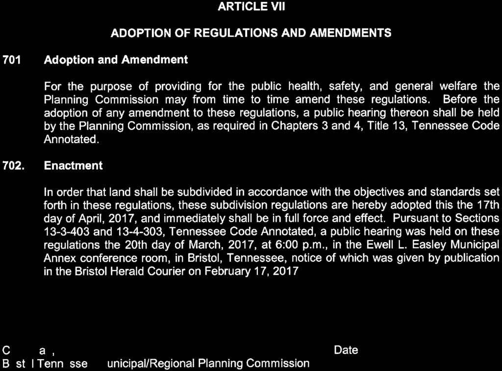
87
201 General Provisions
 201 General Provisions 201.01 Title 201.09 Amendments 201.02 Purpose and Intent 201.10 Public Purpose 201.03 Authority 201.11 Variances and Appeals 201.04 Jurisdiction 201.12 Nonconformances 201.05 Enactment
ARTICLE 15. RULES, REGULATIONS AND DEFINITIONS
 ARTICLE 15. RULES, REGULATIONS AND DEFINITIONS Section 1. Interpretation and Construction: The following rules and regulations regarding interpretation and construction of the Ulysses-Grant County, Kansas,
ARTICLE 1 GENERAL PROVISIONS
 ARTICLE 1 GENERAL PROVISIONS SECTION 100 TITLE This Ordinance shall be known and cited as the "Rice Township Subdivision and Land Development Ordinance." SECTION 101 AUTHORITY Rice Township is empowered
13-2 SUBDIVISION PLANS AND PLATS REQUIRED EXCEPTIONS Subdivision Plats Required To be Recorded
 ARTICLE XIII SUBDIVISIONS 13-1 INTENT AND PURPOSE 13-1-1 Intent: It is the intent of the County Commission through the adoption of this Article to more fully avail itself of the power granted under 17-27-601
TABLE OF CONTENTS ARTICLE I
 TABLE OF CONTENTS Section Page ARTICLE I General Provisions 1-1 Title 1 1-2 Authority 1 1-3 Jurisdiction 1 1-4 Purpose and Intent 1 1-5 Interpretation, Conflict, and Severability 3 1-5.1 Interpretation
SUBDIVISION REGULATIONS BRISTOL, TENNESSEE MARCH 2001
 SUBDIVISION REGULATIONS BRISTOL, TENNESSEE MARCH 2001 UPDATED NOVEMBER 2010 SUBDIVISION REGULATIONS PREPARED BY THE BRISTOL TENNESSEE PLANNING COMMISSION BRISTOL, TENNESSEE MARCH 2001 SUBDIVISION REGULATIONS
SUBDIVISION REGULATIONS
 SUBDIVISION REGULATIONS CITY OF DICKSON TENNESSEE SUBDIVISION REGULATIONS CITY OF DICKSON, TENNESSEE ADOPTED: June 17, 2008 LAST AMENDED: January 18, 2011 PREPARED FOR THE DICKSON MUNICIPAL PLANNING COMMISSION
ARTICLE 3 DEFINITIONS
 Sections: 3-1 Rules of Construction 3-2 Definitions ARTICLE 3 DEFINITIONS SECTION 3-1 RULES OF CONSTRUCTION 3-101. a. The language set forth in these regulations shall be interpreted in accordance with
WAYNE COUNTY, UTAH SUBDIVISION ORDINANCE
 WAYNE COUNTY, UTAH SUBDIVISION ORDINANCE A LAND USE ORDINANCE OF WAYNE COUNTY As Adopted by the Wayne County Board of County Commissioners Effective January 01, 2011 Prepared by: PLANNING AND DEVELOPMENT
Appendix A. Definitions
 Definitions 1. Terms Defined. Words contained in this are those having a special meaning relative to the purposes of this Ordinance. Words not listed in this section shall be defined by reference to: (1)
610 LAND DIVISIONS AND PROPERTY LINE ADJUSTMENTS OUTSIDE A UGB
 ARTICLE VI: LAND DIVISIONS AND PROPERTY LINE ADJUSTMENTS VI-21 610 LAND DIVISIONS AND PROPERTY LINE ADJUSTMENTS OUTSIDE A UGB 610-1 Property Line Adjustments (Property Line Relocation) A property line
CITY OF SAND SPRINGS CODE OF ORDINACES TITLE 16
 CITY OF SAND SPRINGS CODE OF ORDINACES TITLE 16 10/30/2018 TITLE 16 SUBDIVISIONS Chapters: 16.04 GENERAL PROVISIONS 16.08 DEFINITIONS 16.12 APPLICATION PROCESS 16.16 SPECIFICATIONS FOR DOCUMENTS 16.20
CHAPTER 5. Subdivisions Regulations
 CHAPTER 5 Subdivisions Regulations 10-5-1 Introduction and Purpose 10-5-2 Definitions 10-5-3 General Provisions 10-5-4 Procedure for Submitting Subdivisions 10-5-5 Design Standards; Streets and Lots 10-5-6
THE COUNTY BOARD OF SUPERVISORS OF THE COUNTY OF DOUGLAS DOES ORDAIN AS FOLLOWS:
 8.1 SUBDIVISION CONTROL ORDINANCE THE COUNTY BOARD OF SUPERVISORS OF THE COUNTY OF DOUGLAS DOES ORDAIN AS FOLLOWS: SECTION I. GENERAL INTERPRETATION This ordinance shall not repeal, impair or modify private
TOWN OF WATERVILLE VALLEY NEW HAMPSHIRE SITE PLAN REVIEW REGULATIONS
 TOWN OF WATERVILLE VALLEY NEW HAMPSHIRE Effective date March 17, 1981 Revised March 16, 1982 Revised March 13, 1986 Revised March 10, 1987 Revised March 14, 2013 Revised March 8, 2016 TOWN OF WATERVILLE
SUBDIVISION ORDINANCE CITY OF DES MOINES, IOWA
 SUBDIVISION ORDINANCE CITY OF DES MOINES, IOWA SUBDIVISION REGULATIONS CITY OF DES MOINES, IOWA NOTICE This is an unofficial and annotated copy of excerpts from the Municipal code of the City of Des Moines,
CITY OF LAKE CHARLES
 CITY OF LAKE CHARLES SUBDIVISION REGULATIONS UPDATED 04-06-05 AS AMENDED BY RESOLUTION 79-1 FEBRUARY 19, 1979 EXHIBIT A SUBDIVISION REGULATIONS CITY OF LAKE CHARLES, LOUISIANA TABLE OF CONTENTS PAGE SECTION
ARTICLE VI. SUBDIVISION STANDARDS, PUBLIC
 ARTICLE VI. SUBDIVISION STANDARDS, PUBLIC IMPROVEMENTS, AND DESIGN REQUIREMENTS ARTICLE VI. SUBDIVISION STANDARDS, PUBLIC IMPROVEMENTS, AND DESIGN REQUIREMENTS DIVISION 1. GENERAL PROVISIONS Sec. 21-6100.
VILLAGE OF SOUTH RUSSELL SUBDIVISION RULES. Revised
 VILLAGE OF SOUTH RUSSELL SUBDIVISION RULES Revised 7 2 96 1 TABLE OF CONTENTS CHAPTER 1: TITLE AND SCOPE Page 1.00 Title 1 1.01 Jurisdiction 1 1.02 Objectives 1 1.03 Interpretation 1 1.04 Separability
CHAPTER 22 SUBDIVISION AND LAND DEVELOPMENT. Part 1 General Provisions. Part 2 Application Procedure and Approval Process
 CHAPTER 22 SUBDIVISION AND LAND DEVELOPMENT Part 1 General Provisions 101. Title 102. Policy 103. Purposes 104. Authority 105. Jurisdiction 106. Interpretation, Conflict and Separability 107. Municipal
ORDINANCE NO. Be it ordained by the City Council of the City of Abilene, Texas:
 ORDINANCE NO. An ordinance repealing Chapter 23, Subpart B of the Code of the City of Abilene, Texas, entitled Mobile Homes and Vacation Travel Trailers; stating the authority; setting forth the scope
White County Subdivision Control Ordinance TABLE OF CONTENTS
 Table of Contents TABLE OF CONTENTS CHAPTER 1: PURPOSE, AUTHORITY, AND JURISDICTION 1.0 Title... 1.1 1.1 Purpose and Authority... 1.1 1.1.1 Purpose... 1.1 1.1.2 Authority... 1.2 1.2 Policy... 1.2 1.2.1
City of Russellville, Arkansas. Land Subdivision and Development Code
 City of Russellville, Arkansas Land Subdivision and Development Code Ordinance No.1789 Adopted by Russellville City Council June, 15, 2003 Amended by Ordinance 1993 October 25, 2007 Amended by Ordinance
ELK RAPIDS TOWNSHIP ANTRIM COUNTY, MICHIGAN ORDINANCE NO
 ELK RAPIDS TOWNSHIP ANTRIM COUNTY, MICHIGAN ORDINANCE NO. 3-2011 AN ORDINANCE TO REPLACE THE SUBDIVISION CONTROL ORDINANCE WITH A NEW SUBDIVISION DEVELOPMENT ORDINANCE, IN ACCORD WITH THE LAND DIVISION
SUBDIVISION REGULATIONS FOR SMYRNA, TENNESSEE
 SUBDIVISION REGULATIONS FOR SMYRNA, TENNESSEE Approved and Adopted by the Smyrna Municipal Planning Commission On July 2, 2009 Smyrna Municipal Planning Commission: Marc Adkins, Chair Edwin Davenport,
Amendments to Subdivision Ordinance Regulations #3
 Amendments to Subdivision Ordinance Regulations #3 DATE SECTION/TITLE ORDINANCE # 07/06/81 Driveways 1164 06/05/84 Fees 1216 Sec. V General Design Standards 06/12/90 Sec. VI Required Improvements 1076B
Memorandum: October 13, 2008 REVISED To: Trowbridge Township Planning Commission From: P. Hudson, AICP Re: Suggested New Ordinance
 1 Memorandum: October 13, 2008 REVISED 2-11-09 To: Trowbridge Township Planning Commission From: P. Hudson, AICP Re: Suggested New Ordinance Because of changes in both the Michigan Planning Enabling Act
SUBDIVISION REGULATIONS
 CHAPTER 41 SUBDIVISION REGULATIONS 41.01 Short Title 41.17 Presentation to Commission or Board of Supervisors 41.02 Purpose 41.18 Subdivision Classified 41.03 Application 41.19 Plats Required 41.04 Recording
MUNICIPAL SUBDIVISION REGULATIONS MUNFORD, TENNESSEE
 MUNICIPAL SUBDIVISION REGULATIONS MUNFORD, TENNESSEE MUNFORD MUNICIPAL SUBDIVISION REGULATIONS As officially readopted on November 12, 2013 Prepared by the MUNFORD MUNICIPAL / REGIONAL PLANNING COMMISSION
a. provide for the continuation of collector streets and thoroughfare streets between adjacent subdivisions;
 Section 7.07. Intent The requirements of this Section are intended to provide for the orderly growth of the Town of Holly Springs and its extra-territorial jurisdiction by establishing guidelines for:
CHAPTER 18 SUBDIVISION AND PLATTING ORDINANCE OF THE TOWN OF OSCEOLA CODE OF ORDINANCES
 TOWN OF OSCEOLA POLK COUNTY WISCONSIN ORDINANCE # 18-03-03 CHAPTER 18 SUBDIVISION AND PLATTING ORDINANCE OF THE TOWN OF OSCEOLA CODE OF ORDINANCES 18.01 Purpose Adopted 3/08/99, Amended 5/12/03, 7/9/07,
CITY OF ATHENS, TENNESSEE MINIMUM SUBDIVISION REGULATIONS
 CITY OF ATHENS, TENNESSEE MINIMUM SUBDIVISION REGULATIONS MINIMUM SUBDIVISION REGULATIONS Athens, Tennessee Prepared for the City of Athens and the Athens Planning Region By the Athens Regional Planning
THE UNINCORPORATED AREA OF CLARKE COUNTY, IOWA TABLE OF CONTENTS
 ORDINANCE #11 THE UNINCORPORATED AREA OF CLARKE COUNTY, IOWA TABLE OF CONTENTS ARTICLE I:-------------------------------------------------------------------------GENERAL PROVISIONS ARTICLE II:--------------------------------------------------------------------------------------DEFINITIONS
WAKE COUNTY SUBDIVISION ORDINANCE ANNOTATED
 WAKE COUNTY SUBDIVISION ORDINANCE ANNOTATED The Wake County Subdivision Ordinance makes up Chapters 3-1 through 3-5 of the Wake County Code of General Ordinances (as reflected in the numbering of its sections).
SUBDIVISION REGULATIONS KINGSTON SPRINGS, TENNESSEE
 SUBDIVISION REGULATIONS KINGSTON SPRINGS, TENNESSEE SUBDIVISION REGULATIONS OF KINGSTON SPRINGS, TENNESSEE Prepared for the Kingston Springs Planning Commission Prepared by Don E. Martin, Principal Planner
ARTICLE 16 SUBDIVISIONS
 ARTICLE 16 SUBDIVISIONS 16.1 Subdivision Regulations 16.1-1. Purpose. The regulations for the subdivision of land set forth below are established to promote orderly growth and development; provide for
Knoxville-Knox County SUBDIVISION REGULATIONS. Adopted July 8, 1971 As amended through February 8, 2018
 Knoxville-Knox County SUBDIVISION REGULATIONS Adopted July 8, 1971 As amended through February 8, 2018 KNOXVILLE-KNOX COUNTY SUBDIVISION REGULATIONS TABLE OF CONTENTS ARTICLE 1 - GENERAL PROVISIONS 1.01
-MENDOCINO COUNTY PLANNING AND BUILDING SERVICES- DIVISION OF LAND REGULATIONS TITLE 17
 ARTICLE VI -- GENERAL REGULATIONS AND PROVISIONS Sec. 17-50. Sec. 17-51 General Plan. Sec. 17-52 Lot and Block Design and Configuration. Sec. 17-53 Lot Access. Sec. 17-54 Private Roads. Sec. 17-55 Water
ARTICLE 100 SUBDIVISION APPLICATION PROCEDURE AND APPROVAL PROCESS
 ARTICLE 100 SUBDIVISION APPLICATION PROCEDURE AND APPROVAL PROCESS 100.01 General Procedure 100.02 Exempt Subdivision 100.03 Administrative Subdivision 100.04 Major Subdivision 100.05 Signing and Recording
Subdivision Regulations
 Subdivision Regulations City of Columbia - Maury County, TN Make no little plans. They have no magic to stir men s blood and probably themselves will not be realized. Make big plans; aim high in hope and
STATE OF MICHIGAN COUNTY OF MARQUETTE, TOWNSHIP OF NEGAUNEE LAND DIVISION, SUBDIVISION AND CONDOMINIUM ORDINANCE
 STATE OF MICHIGAN COUNTY OF MARQUETTE, TOWNSHIP OF NEGAUNEE LAND DIVISION, SUBDIVISION AND CONDOMINIUM ORDINANCE Adopted: August 8 th, 2008 Effective: August 28 th, 2008 Sec.100. Title ARTICLE I GENERAL
TITLE 25. SUBDIVISIONS 1
 TITLE 25. SUBDIVISIONS 1 Sections: Chapter 25.01 General Provisions. Section 25.01.01 Short Title. Section 25.01.02 Purposes. Section 25.01.03 Final Plat Required Before Lots May be Sold. Section 25.01.04
City of Waukegan Subdivision Ordinance
 City of Waukegan Subdivision Ordinance Table of Contents ARTICLE 1 TITLE... 5 ARTICLE 2 POLICY... 6 ARTICLE 3 PURPOSE... 7 ARTICLE 4 JURISDICTION... 8 ARTICLE 5 INTERPRETATION AND SEPARABILITY... 9 5.1
ARTICLE SINGLE FAMILY SITE CONDOMINIUM DEVELOPMENT STANDARDS
 ARTICLE 28.00 SINGLE FAMILY SITE CONDOMINIUM DEVELOPMENT STANDARDS Section 28.01 PURPOSE The purpose of this Article is to recognize that conventional single family developments, traditionally developed
TITLE 15: LAND USAGE 150. BUILDING REGULATIONS 151. RENTAL PREMISES 152. SUBDIVISIONS 153. ZONING
 TITLE 15: LAND USAGE Chapter 150. BUILDING REGULATIONS 151. RENTAL PREMISES 152. SUBDIVISIONS 153. ZONING 2 Eyota - Land Usage Building Regulations 3 CHAPTER 150: BUILDING REGULATIONS Section General Provisions
SUBDIVISION REGULATIONS
 CHAPTER 14 SUBDIVISION REGULATIONS 14-100 Provisions 14-200 Preliminary Plat 14-300 Final Plat 14-400 Replat 14-500 Minor Subdivision 14-600 Administrative Replat 14-700 Vacation of Roadways, Public Easements,
ARTICLE 1: GENERAL PROVISIONS
 ARTICLE 1 GENERAL PROVISIONS AN ORDINANCE REGULATING THE SUBDIVISION OF LAND PRESCRIBING STANDARDS FOR SUBDIVISIONS AND FOR THE IMPROVEMENT THEREOF, PRESCRIBING PROCEDURES FOR THE REVIEW OF PROPOSED SUBDIVISION
ARTICLE 23 CONDOMINIUM STANDARDS
 ARTICLE 23 CONDOMINIUM STANDARDS Section 23.01 Intent. The intent of this Article is to provide regulatory standards for condominiums and site condominiums similar to those required for projects developed
Town of Fayette. Subdivision of Land Regulations. Adopted September 11, 2008
 Town of Fayette Subdivision of Land Regulations Adopted September 11, 2008 Adopted September 11, 2008 2 SUBDIVISION OF LAND ARTICLE 1 General Regulations Section 100 Title; compliance required. These rules
Chapter 22 LAND USE* Article III. Subdivisions
 Chapter 22 LAND USE* Article III. Subdivisions Sec. 22-256. Authority to Regulate. Sec. 22-257. Scope; plat required. Sec. 22-258. Definitions. Sec. 22-259. Interpretations and Meanings. Sec. 22-260. Procedure
CITY OF COZAD DAWSON COUNTY, NEBRASKA
 CITY OF COZAD DAWSON COUNTY, NEBRASKA SUBDIVISION REGULATIONS ADOPTED BY THE CITY OF COZAD, NEBRASKA Prepared By TABLE OF CONTENTS ARTICLE 1: TITLE, PURPOSE, AND DEFINITIONS... 1 SECTION 1.01 NAME AND
Defining Subdivisions in Tennessee. Annual Planning Commissioner Training October 2017
 Defining Subdivisions in Tennessee Annual Planning Commissioner Training October 2017 What is a Subdivision? Tennessee Code Annotated 13-3-401 & 13-4-301 (B) (i) "Subdivision" means, in all counties except
WARREN COUNTY, IOWA CHAPTER 46 CHAPTER 46 SUBDIVISION REGULATIONS
 TITLE V- PROPERTY AND LAND USE CHAPTER 46 SUBDIVISION REGULATIONS 46.01 Title and Jurisdiction 46.09 Subdivision Design Standards 46.02 Definitions 46.10 Preliminary Plat Requirements 46.03 Filing Process
SECTION 11 PLANNING & ZONING. SUBDIVISION CONTROL Ord. No. 176 Adopted: December 10, 1969
 SUBDIVISION CONTROL Ord. No. 176 Adopted: December 10, 1969 An ordinance enacted under Act 288, Public Acts of 1967, as amended, of the State of Michigan establishing regulations governing the subdivision
FREQUENTLY USED PLANNING & ZONING TERMS
 City Of Mustang FREQUENTLY USED PLANNING & ZONING TERMS Abut: Having property lines, street lines, or zoning district lines in common. Accessory Structure: A structure of secondary importance or function
SECTION 7000 LAND DEVELOPMENT REQUIREMENTS
 SECTION 7000 LAND DEVELOPMENT REQUIREMENTS 7000 LAND DEVELOPMENT REQUIREMENTS... 1 7001 LEGISLATIVE AUTHORITY... 1 7001.1 LAND DEVELOPMENT... 1 7001.1.1 Title 40, Idaho Code... 1 7001.1.2 Idaho Code 40-1415
SUBDIVISION CONTROL ORDINANCE. LaPorte County City of LaPorte City of Michigan City
 SUBDIVISION CONTROL ORDINANCE LaPorte County City of LaPorte City of Michigan City Adopted January 7, 2012 Table of Contents Table of Contents Article 01 Basic Provisions 01.01 Preamble and Enacting Clause
SUBDIVISION ORDINANCE FOR LOUISA COUNTY, IOWA
 SUBDIVISION ORDINANCE FOR LOUISA COUNTY, IOWA ORDINANCE NO. 8-10. AN ORDINANCE ESTABLISHING STANDARDS FOR THE SUBDIVISION OF LAND WITHIN RURAL LOUISA COUNTY. DEVELOPMENT CRITERIA, MINIMUM STANDARDS, REVIEW
TITLE XV: LAND USAGE
 TITLE XV: LAND USAGE Chapter 150. BUILDING REGULATIONS 151. SUBDIVISIONS APPENDIX: ROAD STANDARDS 152. ZONING CODE 153. WATER RESOURCE MANAGEMENT CALCULATIONS APPENDIX A: VOLUME AND WATER QUALITY APPENDIX
A. Appropriate agency responsible for transportation review for the subject property.
 7.8.10 Procedure Any person desiring to create a minor subdivision shall submit to the Commission for approval an application on forms provided by the Division, and a record plat in conformance with the
Subdivision Ordinance. Adopted December 2, 2010 *Article III Amended June 6, 2013 TABLE OF CONTENTS
 Subdivision Ordinance Adopted December 2, 2010 *Article III Amended June 6, 2013 TABLE OF CONTENTS ARTICLE I INTRODUCTORY PROVISIONS Page Section 1-1 Title I-1 Section 1-2 Purpose I-1 Section 1-3 Authority
TITLE 16: SUBDIVISION ORDINANCE TABLE OF CONTENTS
 TITLE 16: SUBDIVISION ORDINANCE TABLE OF CONTENTS Article 1: GENERAL PROVISIONS... 3 16-1-1 TITLE... 3 16-1-2 AUTHORITY... 3 16-1-3 PURPOSE AND INTENT... 3 16-1-4 EFFECTIVE DATE... 4 16-1-5 APPLICABILITY...
SUBDIVISION DESIGN PRINCIPLES AND STANDARDS
 SECTION 15-200 SUBDIVISION DESIGN PRINCIPLES AND STANDARDS 15-201 STREET DESIGN PRINCIPLES 15-201.01 Streets shall generally conform to the collector and major street plan adopted by the Planning Commission
City Of Highland Subdivision Regulations Table of Contents. City Of Highland, Kansas. Subdivision Regulations
 Table of Contents City Of Highland, Kansas Subdivision Regulations i City Of Highland Highland Subdivision Regulations Table of Contents TABLE OF CONTENTS TABLE OF CONTENTS...II ARTICLE ONE GENERAL PROVISIONS...
Zone Lapel. Ancillary Regulations Subdivision Control Ordinance Planned Unit Development (PUD) Standards Building Code
 Standards Building Code") Town of Lapel Unified Development Code Zone Lapel Ancillary Regulations Subdivision Control Ordinance Planned Unit Development (PUD) Standards Building Code Volume 12 of 12 Ancillary Regulations Subdivision
Town of Lapel Unified Development Code Zone Lapel Ancillary Regulations Subdivision Control Ordinance Planned Unit Development (PUD) Standards Building Code Volume 12 of 12 Ancillary Regulations Subdivision
SUBDIVISION PROCEDURES AND REGULATIONS. for the Town of Stratford, New Hampshire
 SUBDIVISION PROCEDURES AND REGULATIONS for the Town of Stratford, New Hampshire TABLE OF CONTENTS Page A. PRE-APPLICATION 2 B. PRELIMINARY PLAN REQUIREMENTS 3 C. PRELIMINARY PLAN REVIEW 5 Site Plan Review
I. Requirements for All Applications. C D W
 108-16.1. Application checklists. Checklist for Required Submissions to the Planning Board or Zoning Board of Adjustment of Monroe Township All required submissions are to be made to the Administrative
This Ordinance is adopted under the authority and provisions of the General Statutes of North Carolina, Article 6, Chapter 153A 121.
 Section 74, Regulations Governing Manufactured Home Parks 1. Purpose The purpose of these regulations to be known and cited as the Madison County Manufactured Home Park Ordinance is to regulate and guide
CITY OF GRANBURY SUBDIVISION ORDINANCE # (Amended by Ord. No , January 2, 2018)
") CITY OF GRANBURY SUBDIVISION ORDINANCE #09-360 (Amended by Ord. No. 18-09, January 2, 2018) PAGE SECTION 1 GENERAL PROVISIONS... 1 Section 1.1 Authority... 1 1.2 Interpretation and Purpose... 1 1.3 Application
CITY OF GRANBURY SUBDIVISION ORDINANCE #09-360 (Amended by Ord. No. 18-09, January 2, 2018) PAGE SECTION 1 GENERAL PROVISIONS... 1 Section 1.1 Authority... 1 1.2 Interpretation and Purpose... 1 1.3 Application
ARTICLE 15 - PLANNED UNIT DEVELOPMENT
 Section 15.1 - Intent. ARTICLE 15 - PLANNED UNIT DEVELOPMENT A PUD, or Planned Unit Development, is not a District per se, but rather a set of standards that may be applied to a development type. The Planned
Planning Grant Contract No. SC P-8 (G) South Carolina State Development Board Division of Community Planning of the Development and Research Center
 South Carolina State Development Board Division of Community Planning of the Development and Research Center") SUBDIVISION REGULATIONS Prepared for: Planning and Zoning Commission Anderson, South Carolina The preparation of this report was financed in part through an Urban Planning grant from the Department of
SUBDIVISION REGULATIONS Prepared for: Planning and Zoning Commission Anderson, South Carolina The preparation of this report was financed in part through an Urban Planning grant from the Department of
TOWN OF VARICK SUBDIVISION REGULATIONS. Current as of February 2, 2016
 TOWN OF VARICK SUBDIVISION REGULATIONS Current as of February 2, 2016 History Prepared for Town of Varick Planning Board by Seneca County Planning Department. Adopted December 1977 Revised December 2007
CITY OF TIFFIN IOWA SUBDIVISION ORDINANCE NO
 CITY OF TIFFIN IOWA SUBDIVISION ORDINANCE NO. 1998-218 Other Applicable Ordinances: No. 2006-278 RECOUPMENT FEES ORD 2012-319 Amending Provisions Relating To Subdivisons EDITS by Planning and Zoning 2012.
ORDINANCE NO. 42 AS AMENDED BY ORDINANCES NO. 57 SUBDIVISION ORDINANCE
 PAGE 1 ORDINANCE NO. 42 AS AMENDED BY ORDINANCES NO. 57 SUBDIVISION ORDINANCE AN ORDINANCE REGULATING THE SUBDIVISION OF LAND IN SUPERIOR TOWNSHIP; REQUIRING AND REGULATING THE PREPARATION AND PRESENTATION
CHAPTER 22 SUBDIVISION AND LAND DEVELOPMENT
 CHAPTER 22 SUBDIVISION AND LAND DEVELOPMENT 22-101. Title 22-102. Legislative Intent Part 1 General Provisions 22-201. Development Permits Part 2 Administration 22-301. Fee Schedule Part 3 Fee Schedule
ARTICLE 7 SUBDIVISION PROCEDURES AND DESIGN STANDARDS. Table of Contents
 ARTICLE 7 SUBDIVISION PROCEDURES AND DESIGN STANDARDS Table of Contents 7-1 PURPOSE AND INTENT... 1 7-2 REGULATION OF SUBDIVISIONS IN GENERAL... 1 A. Exclusion Determination... 1 B. Approval Required...
Bolivar Subdivision Regulations Prepared by the BOLIVAR MUNICIPAL-REGIONAL PLANNING COMMISSION
 Bolivar Subdivision Regulations Prepared by the BOLIVAR MUNICIPAL-REGIONAL PLANNING COMMISSION Danny Cheshire, Chairman Tracy Byrum, Alderman, Secretary Jody Jackson Lajuana Hamer Tony Kirk E.W. McKinnie
CITY OF HOBBS ORDINANCE NO..
 CITY OF HOBBS ORDINANCE NO.. AN ORDINANCE TO AMEND TITLE 16 OF THE HOBBS MUNICIPAL CODE IN ITS ENTIRETY. BE IT ORDAINED BY THE GOVERNING BODY OF THE CITY OF HOBBS, NEW MEXICO, that the following Chapter
City of Concord, NH. Subdivision Regulations
 City of Subdivision Regulations Adopted: December 15, 2010 Revised: October 5, 2011 April 17, 2013 July 18, 2016 City of Concord Planning Board Planning Division Community Development Department Foreword
ARTICLE 8C SITE CONDOMINIUM DEVELOPMENT ORDINANCE
 ARTICLE 8C SITE CONDOMINIUM DEVELOPMENT ORDINANCE SECTION 8C.01 PURPOSE It is the purpose of this Ordinance to insure that plans for development within Oceola Township proposed under the provisions of
The purpose of this Chapter is to establish rules, regulations, standards and procedures for approval of subdivisions of land to promote and ensure:
 CHAPTER 7 SUBDIVISION SECTION 7.1 PURPOSE The purpose of this Chapter is to establish rules, regulations, standards and procedures for approval of subdivisions of land to promote and ensure: A. Conformity
BEAR CREEK TOWNSHIP EMMET COUNTY, MICHIGAN. PRIVATE ROAD ORDINANCE Ordinance No. 11A-99. (to replace prior Private Road Ordinance No.
 BEAR CREEK TOWNSHIP EMMET COUNTY, MICHIGAN PRIVATE ROAD ORDINANCE Ordinance No. 11A-99 (to replace prior Private Road Ordinance No. 11-99) An Ordinance to protect the health, safety, and general welfare
Village of South Elgin, IL. CHAPTER 156: Unified Development Ordinance
 Village of South Elgin, IL CHAPTER 156: Unified Development Ordinance UNIFIED DEVELOPMENT ORDINANCE (UDO) EFFECTIVE DATE: October 1, 2018 1 TABLE OF CONTENTS SECTION 156.01: TITLE AND APPLICABILITY...4
Town of Shorter Subdivision Regulations
 Town of Shorter Subdivision Regulations Proposed Amendments: July 12, 2007 TABLE OF CONTENTS Resolution of Adoption Article 1: General Provisions... 1 1.1 Title... 1 1.2 Authority... 1 1.3 Effective Date...
Subdivision and Land Development Regulations. Jefferson County, West Virginia
 Subdivision and Land Development Regulations Jefferson County, West Virginia Adopted October 9, 2008 Amended September 29, 2016 Amendment Reference This document contains additions and amendments approved
Administration. Subdivision Application; Procedure and Approval Process
 Section General Provisions CHAPTER 151: SUBDIVISION REGULATIONS 151.001 Title 151.002 Policies 151.003 Purpose 151.004 Authority 151.005 Jurisdiction 151.006 Interpretation; conflict 151.007 Definitions
ARTICLE 5 GENERAL REQUIREMENTS
 5.1 SUITABILITY OF THE LAND ARTICLE 5 GENERAL REQUIREMENTS 5.1.1 Land subject to flooding, improper drainage or erosion, and land deemed to be unsuitable for development due to steep slope, unsuitable
SECTION 10.7 R-PUD (RESIDENTIAL PLANNED UNIT DEVELOPMENT) ZONE
 ZONE") Article X Zones 10-20 SECTION 10.7 R-PUD (RESIDENTIAL PLANNED UNIT DEVELOPMENT) ZONE A. PURPOSE AND INTENT: The R-PUD Residential PUD Zone is intended to provide alternative, voluntary zoning procedures
Article X Zones 10-20 SECTION 10.7 R-PUD (RESIDENTIAL PLANNED UNIT DEVELOPMENT) ZONE A. PURPOSE AND INTENT: The R-PUD Residential PUD Zone is intended to provide alternative, voluntary zoning procedures
WEBSTER TOWNSHIP LAND DIVISION ORDINANCE. Summary Table of Amendments
 WEBSTER TOWNSHIP LAND DIVISION ORDINANCE Ordinance No. 2012 02 As Adopted 04-17-12 Summary Table of Amendments Adoption Date Affected Sections Summary October 10, 3 Added definition of Township Engineer
SUBDIVISION REGULATIONS. 1. SHORT TITLE. This chapter shall be known and may be cited as "The City of Graf, Iowa, Subdivision Control Ordinance.
 GENERAL PROVISIONS SUBDIVISION REGULATIONS 1. SHORT TITLE. This chapter shall be known and may be cited as "The City of Graf, Iowa, Subdivision Control Ordinance." 2. PURPOSE. The purpose of this Ordinance
St. Mary s County Comprehensive Zoning Ordinance Article 1. GENERAL PROVISIONS
 0 0 0 0 ARTICLE. GENERAL PROVISIONS CHAPTER 0 TITLE, PURPOSE AND ORGANIZATION Sections: 0. Title. 0. Authority. 0. Purpose. 0. Organization of the Zoning Ordinance. 0. Official Zoning Map. 0. Applicability.
TOWN OF CHAPIN, SOUTH CAROLINA SUBDIVISION REGULATIONS
 TOWN OF CHAPIN, SOUTH CAROLINA SUBDIVISION REGULATIONS ADOPTED: April, 1999 REVISED: March, 2005 PREPARED BY THE CHAPIN TOWN PLANNING COMMISSION TOWN OF CHAPIN, SOUTH CAROLINA SUBDIVISION REGULATIONS Prepared
Chapter 100 Planned Unit Development in Corvallis Urban Fringe
 100.100 Scope and Purpose. Chapter 100 Planned Unit Development in Corvallis Urban Fringe (1) All applications for land divisions in the Urban Residential (UR) and Flood Plain Agriculture (FPA) zones within
APPLICATION PROCEDURE
 ANTRIM PLANNING BOARD P. O. Box 517 Antrim, New Hampshire 03440 Phone: 603-588-6785 FAX: 603-588-2969 APPLICATION FORM AND CHECKLIST FOR MINOR OR MAJOR SITE PLAN REVIEW File Date Received By APPLICATION
TITLE 11 SUBDIVISIONS
 TITLE 11 SUBDIVISIONS Subject Chapter In General................................... 1 Administration And Enforcement................. 2 Procedure................................... 3 Design Standards.............................4
SUBDIVISION AND PARTITIONING ORDINANCE
 COLUMBIA COUNTY OREGON SUBDIVISION AND PARTITIONING ORDINANCE Adopted by Ordinance No. 90-10 on May 23, 1990 Amended by Ordinance No. 92-14 in November 1992 Amended by Ordinance No. 93-1 in February 1993
Planning and Zoning Code
 2014 Planning and Zoning Code City of Defiance, Ohio December 2014 Planning and Zoning Code City of Defiance, Ohio CHAPTER 1161. General Provisions... 7 1161. 01. Title... 7 1161. 02. Purpose... 7 1161.
Subdivision Regulations. for the. City of Dayton, Tennessee
 Subdivision Regulations for the City of Dayton, Tennessee Prepared for the Dayton Municipal Planning Commission April, 1996 (as amended through June, 2006) by the Local Planning Assistance Office 540 McCallie
ORDINANCE NO AN ORDINANCE OF THE CITY OF SOUTH SALT LAKE CITY COUNCIL AMENDING CHAPTER SUBDIVISION AND DEVELOPMENT STANDARDS
 ORDINANCE NO. 2018- AN ORDINANCE OF THE CITY OF SOUTH SALT LAKE CITY COUNCIL AMENDING CHAPTER 15.12 -- SUBDIVISION AND DEVELOPMENT STANDARDS WHEREAS, the City Council is authorized by state law to enact
Maize Subdivision Regulations. City of Maize, Kansas
 Maize Subdivision Regulations City of Maize, Kansas Table of Contents City of Maize Subdivision Ordinance Article 1. General Provisions 101 Title 102 Authority 103 Purpose 104 Jurisdiction 105 Applicability