Subdivision Regulations
|
|
|
- Priscilla Morris
- 5 years ago
- Views:
Transcription

1 Subdivision Regulations City of Columbia - Maury County, TN

2 Make no little plans. They have no magic to stir men s blood and probably themselves will not be realized. Make big plans; aim high in hope and work, remembering that a noble, logical diagram once recorded will never die, but long after we are gone will be a living thing, asserting itself with ever-growing insistency. Remember that our sons and grandsons are going to do things that would stagger us. Let your watchword be order and your beacon beauty. Think big. - Daniel Burnham, Chicago architect and urban planner. ( ) -

3 SUBDIVISION REGULATIONS City of Columbia, Maury County, TN Columbia Regional Planning Commission Adopted: June 13,,
4 Amendments No. Date Amendments Sheet(s) Revised 1 8/13/2014 See subsequent pages for details of Amendment 1 1-3, 2-4, 2-5, 2-6, 2-7, 2-11, 2-12, 2-13, 2-14, 3-2, 3-5, 4-7, 4-8, 4-13, 5-1, 5-2, 6-1, A-1, A-2, A-10, A /10/2014 See subsequent pages for details of Amendment , 4-18, 4-19, SD /9/2015 See subsequent pages for details of Amendment 3 SD /19/2016 See subsequent pages for details of Amendment 4 A-2 5 3/8/2017 See subsequent pages for details of Amendment /20/2018 See subsequent pages for details of Amendment 6 TOC, 2-2, 2-8, 2-11, 3-1 to 3-5, 4-5, 4-7, 4-14, 4-19, 5-2, 6-2, A-2, A-4, A- 6, A-7, A-11, A-12
5 Amendment 1 August 13, 2014 Page 1-3; Article 1; Section 1-9.2; first and second sentences Delete shall and add may (two locations) Page 2-4; Article 2; section 2-6.1; first sentence Delete Planning Commission and add Planning Director Page 2-4; Article 2; section 2-6.1; second sentence Delete Shall be included and add may be required Page 2-4; Article 2; section 2-6.2; number 1) Add application after The Sketch Plat Page 2-4; Article 2; section 2-6.2; number 4) Delete regular meeting of the Planning Commission and add meeting of the development review committee Page 2-5; Article 2; section 2-7.1; last sentence Delete and signing of a Development Agreement (Appendix B) Page 2-6; Article 2; section 2-7.3; number 17) Delete Draft proposal of restrictive covenants with maintenance plan for common areas and open space, and renumber remaining requirements. Page 2-7; Article 2; section 2-7.6; second sentence Delete When the Secretary of the Planning Commission has signed the Certificate of Preliminary Plat Approval, one (1) copy of the Preliminary Plat, Construction Plans and Development Agreement (Appendix B) with the date of approval noted thereon shall be returned to the applicant. Page 2-7; Article 2; section 2-7.7; first sentence Delete a Certificate of Preliminary Plat Approval as required by the section above, and add Construction Plan Approval Page 2-7; Article 2; section 2-7.7; second sentence Add and sidewalks after paving for streets Page 2-11; Article 2; section 2-9.1; number 6); second sentence Delete resolution of Page 2-11; Article 2; section 2-9.1; at end Add 8) shall be accompanied by an executed Development Agreement (Appendix B) Page 2-12; Article 2; section 2-9.4; second sentence Delete by resolution Page 2-12; Article 2; section ; second sentence Delete resolution of
6 Amendment 1 August 13, 2014 Page 2-13; Article 2; section Add and sidewalks after asphalt on streets Page 2-13; Article 2; section Delete and the execution of the Development Agreement (Appendix B) Page 2-14; Article 2; section Delete, construction specifications, and Development Agreement. And add and construction specifications. Page 3-2; Article 3; section 3-1.2; number 2) Delete in Maury County, Tennessee and add within a 75 mile radius of Columbia, Tennessee Page 3-2; Article 3; section 3-1.2; number 3) Delete in Maury County, Tennessee and add within 75 mile radius of Columbia, Tennessee Page 3-5; Article 3; section 3-6; number 3) Delete resolution of Final Plat approval and add approval of Final Plat Page 4-7; Article 4; section 4-6.1; first sentence Add by the Planning Director after The approval of the Sketch Plat Page 4-8; Article 4; section 4-7.2; Turnarounds Delete 50 and add 150 Page 4-13; Article 4; section 4-8.6; first sentence Delete and/or and add that are Page 4-13; Article 4; section 4-8.6; first sentence Add or natural open space after contiguous to greenways Page 5-1; Article 5; section 5-2; bottom of page Delete a recommendation to City Council for the Page 5-2; Article 5; section 5-2; b) Delete City Council Add the Engineering Department Page 5-2; Article 5; section 5-4 Delete a resolution with a recommendation for preliminary acceptance will be prepared by the Engineering Department and placed before City Council. Add, preliminary acceptance will be issued by the Engineering Department. Page 6-1; DEFINITIONS Add Engineering Department: Refers to the Engineering Division of the Development Services Department.
7
8
9
10
11
12
13
14
15
16
17
18
19 June 20, 2018 TABLE OF CONTENTS ARTICLE 1: GENERAL PROVISIONS Title Authority and Legal Status Jurisdiction Policy and Purpose Interpretation, Conflict and Severability Saving Provision Previously Approved Preliminary Plats Amendments Resubdivision of Land Conditions Vacation of Streets, Easements, or Other Public Facilities Variances Enforcement, Violation, and Penalties Repeal of Previous Regulations Fees for Plan Review ARTICLE 2: PLAT PREPARATION AND APPROVAL PROCEDURE General Procedure Review Procedure General Conditions Pre-application Meeting Traffic Impact Study Sketch Plat Procedures Preliminary Plat Construction Plans Final Subdivision Plat Signing and Recording of Subdivision Plat Sectioning/Phasing of Major Subdivisions Requirements for Improvements Construction Inspection Procedures Modification of Improvement Design Miscellaneous Platting Situations ARTICLE 3: ASSURANCE FOR COMPLETION AND MAINTENANCE OF IMPROVEMENTS Improvements and Performance Surety Inspection of Improvements Release, Reduction or Extension of Performance Surety Maintenance of Improvements City of Columbia Subdivision Regulations
20 June 20, Escrow Deposit for Lot Improvements Issuance of Building Permits and Certifications of Occupancy ARTICLE 4: GENERAL REQUIREMENTS FOR IMPROVEMENTS, RESERVATIONS AND DESIGN General Requirements Suitability of the Land for Creation of Lots Lot Requirements Lot Subdivision Connectivity Blocks Improvements Public Ways Preservation of Natural Features, Amenities or Improvements Subdivision and Street Name, Regulatory and Signs Drainage and Storm Sewers Water Facilities Sewerage Facilities Requirements for Sidewalks and Related Pedestrian Facilities Street Lighting Utility Easements Public Uses Maintenance and Supervision Responsibility for Open Space Maintenance ARTICLE 5: SUBDIVISION (S) ACCEPTANCE Requirements and Procedures for Subdivision Acceptance Final Inspection One Year Maintenance Required Acceptance Procedure City Council Resolution Minimum Standards for Issuance of Building Permits Requirements Prior to Certificates of Occupancy ARTICLE 6: DEFINITIONS APPENDIX A: Plat Certificates...A-1 APPENDIX B: Subdivision Development Agreement...A-3 APPENDIX C: Engineering Standards & Details...A-15 City of Columbia Subdivision Regulations
21 June 20, 2018 ARTICLE 1: GENERAL PROVISIONS 1-1 Title These regulations shall hereinafter be known and cited as the Subdivision Regulations of Columbia, Tennessee. 1-2 Authority and Legal Status These Subdivision Regulations are adopted, and shall be amended, by the Columbia Regional Planning Commission (hereinafter referred to as the Planning Commission ), in pursuance of the authority and powers granted by Section through , and Section through , Tennessee Code Annotated (TCA). Having adopted a major street or road plan for the jurisdictional area, and filed a certified copy with the Maury County Register of Deeds (hereinafter referred to as "County Register") as required by TCA and , and having held a public hearing as required by TCA and , the Planning Commission has fulfilled the requirements set forth in state law as prerequisites to the adoption of these regulations. The following standards guiding the Planning Commission are designed to provide for the harmonious development of the City; to secure a coordinated layout and adequate provision for traffic; and to secure adequate provision for light, air, recreation, transportation, water drainage, sewerage and other facilities. Compliance Officer. It shall be the duty of the Columbia City Engineer (hereinafter referred to as the Compliance Officer ) or his/her designee to enforce these regulations and to bring to the attention of legal counsel any violations or lack of compliance herewith. Discrepancy With Other Regulations. No subdivision of land within the force and effect of these regulations shall be approved unless it conforms to the Zoning Ordinance. Whenever there is a discrepancy between minimum standards or dimensions noted herein and those contained in the Zoning Ordinance, building codes, or other regulations, the highest standard shall apply. Validity. If any section, clause, paragraph, provision or portion of these Subdivision Regulations shall be held invalid or unconstitutional by any court of competent jurisdiction, such holding shall not affect any other section, clause, paragraph, provision or portion of these regulations. 1-3 Jurisdiction These Subdivision Regulations shall govern all subdivision of land within the jurisdiction of the City of Columbia as defined by the Columbia Planning Commission. No land shall be subdivided within the jurisdictional area until the subdivider submits a plat as required by these regulations, obtains Planning Commission approval of the plat, and files the approved plat with the County Register. 1-4 Policy and Purpose Land subdivision is the first step in the process of community development. Once land has been divided into streets, lots and blocks and publicly recorded, the correction of defects is costly and difficult. Subdivision of land sooner or later becomes a public responsibility, in that streets must be maintained and various public services must be provided. The public health, safety and welfare is thereby affected in many important respects; therefore it is in the interest of the public, the developer, and the future owners that subdivisions be conceived, designed and developed in accordance with the ordinances and regulations governing the subdivision of land within the City of Columbia City of Columbia Page 1-1 Subdivision Regulations
22 June 20, 2018 (hereinafter referred to as the City ), and the Comprehensive Plan. 1-5 Interpretation, Conflict and Severability Public Provisions These regulations are not intended to interfere with, abrogate, or annul any other ordinance, rule, or regulation, statute, or other provision of law. Where any provision of these regulations imposes restrictions different from those imposed by any other ordinance, rule, regulation, or other provision of law, whichever provisions are more restrictive or impose higher standards shall govern Private Provisions These regulations are not intended to abrogate any easement, covenant, or other private agreement or restriction; provided, that where these regulations are more restrictive or impose higher standards than such easement, covenant, or other private agreement or restriction, the requirements of these regulations shall govern. Where any private provision exceeds the standards set forth herein, such shall be considered a private contract between the parties of interest, and, as such, is beyond the jurisdiction of the Planning Commission Severability If any part or provision of these regulations or application thereof to any person or circumstances is adjudged invalid by any court of competent jurisdiction, such judgment shall be confined in its operation to the part, provision, or application directly involved in the controversy where such judgment shall have been rendered and shall not affect or impair the validity of the remainder of these regulations or the application thereof to other persons or circumstances. The Planning Commission hereby declares that it would have enacted the remainder of these regulations without any such part, provision, or application. 1-6 Saving Provision These regulations shall not be construed as abating any action now pending under or by virtue of previous Subdivision Regulations, or as discontinuing, abating, modifying, or altering any penalty accruing or about to accrue, or as affecting the liability of any person, or as waiving any right of the governing body under any section or provision existing at the time of adoption of these regulations, or as vacating or annulling any rights obtained by any person by lawful action of the governing body, except as expressly shall be provided otherwise in these regulations. 1-7 Previously Approved Preliminary Plats Unexpired Preliminary Plats The approval granted on any preliminary plat prior to the effective date of these regulations shall remain in force and effect for the time period of one year Expired Preliminary Plats If the applicant does not file and record a final plat application within one year, the preliminary plat approval is considered expired and the process must be repeated unless the applicant, through written request, is granted an extension from the Planning Commission. Expired plats are considered null and void; new plans shall be subject to all laws and provisions of these regulations that are in effect at the time such action is considered. In making the determination for extension, the Planning Commission shall City of Columbia Page 1-2 Subdivision Regulations
23 June 20, Amendments consult the City Engineer on determining if the development is in continual pursuit of construction completion Enactment For the purpose of providing for the public health, safety, and general welfare the Planning Commission may from time to time amend these regulations. Before adoption of any amendment to these regulations, a public hearing thereon shall be held by the Planning Commission, as required by Title 13, Chapters 3 and 4, Tennessee Code Annotated Codification and Distribution Subsequent to adoption of any amendment to these regulations, such amendment shall be incorporated into the text of these regulations in the following manner: 1) Replacement pages shall be prepared incorporating the new or changed language. Each such new or replacement page shall have the amendment number and shall be dated so as to indicate the date of last revision of the page. 2) Each adopted amendment shall be numbered consecutively and printed on pages separate from any other amendment and in a manner that fully states any language deleted from these regulations and any language added and the place in the text of each such change. 1-9 Resubdivision of Land Procedures for Resubdivision If any change in an approved or recorded subdivision plat would affect the layout of any public street, alley, or road (hereinafter referred to as public way) shown on such plat, or area reserved thereon for public use, or any lot line, or if it would affect any map, plan, or plat legally recorded before adoption of any subdivision regulations, such amendment shall be approved by the same procedure, rules, and regulations as for a subdivision Subdivision Procedures Where Future Resubdivision Is Foreseen Whenever a parcel of land is subdivided and the subdivision plat shows one (1) or more lots containing more than double the minimum required area for the zoning district wherein the lot is located, and the City Engineer has reason to believe that any such lot(s) will be resubdivided into smaller building sites, the City Engineer may require that the subdivision and development of such parcel of land allow for the future opening of public ways and the ultimate extension of adjacent public ways or that such lots be restricted from further subdivision. The City Engineer may also require that dedications providing for future opening and extension of such public ways be indicated on the plan Conditions Regulation of the subdivision of land and the attachment of reasonable conditions to land subdivision are exercises of valid police power delegated by the State to the Planning Commission. The developer has the duty of compliance with reasonable conditions imposed by the Planning Commission for design, dedication, improvement, and restrictive use of the land so as to provide for physical and economical development of the jurisdictional area and for the safety and general welfare of future plot owners in the subdivision and of the community at large Vacation of Streets, Easements, or Other Public Facilities Any plat or any part of any plat may be vacated by the owner of the premises, at any time before sale of any lot described therein, by a written instrument, to which a copy of such City of Columbia Page 1-3 Subdivision Regulations
24 June 20, 2018 plat shall be attached, declaring the plat or part of the plat to be vacated. In approving the vacation of plats the Planning Commission shall follow the same procedure for approval of plats. The governing body may reject any such instrument that abridges or destroys any public rights in any of its public uses, improvements, or public ways. Such an instrument shall be executed, acknowledged, or approved, and duly recorded or filed; the instrument shall operate to void the recorded plat and divest all public rights in the public ways and public grounds and all dedications described in such plat. When any lot or lots have been sold, the plat may be vacated in the manner herein provided all of the owners of all lots in such platted area join in the execution of such writing. Any dedicated right-of-way shown on a recorded subdivision plat can be abandoned only through the resubdivision of such plat, or through the resubdivision of the affected section of such plat, according to the procedures of these regulations. Thereby, the Planning Commission must approve the resubdivision of the initially recorded plat that depicts the dedicated right-of-way or future public way access area, in such a manner wherein such dedicated right-of-way is deleted from said plat. Once this revised plat is officially recorded, it acts to supersede the originally recorded plat, and accordingly preserve any existing utility easements, if present. No official action shall be made by the Planning Commission in relation to the abandonment of any dedicated right of-way, pending public notification of adjacent property owners by registered mail as to the time and place of the Planning Commission meeting, at which time such action is to be officially entertained. Any public way access area or dedicated right-of-way that is abandoned as per the procedures cited herein shall be deeded solely to the abutters of such public way access area or dedicated right-of-way Variances General If the Planning Commission finds that extraordinary hardships or practical difficulties may result from strict compliance with these regulations, a variance from these regulations may be granted; provided, such variance shall not have the effect of nullifying the general intent and purpose of these regulations and provided, further, that the Planning Commission shall not recommend variations unless it shall make findings based upon written evidence presented to it in each specific case that: 1) Granting of the variance will not be detrimental to the public safety, health, or welfare, or be injurious to other property or improvements in the neighborhood where the property is located; 2) Conditions upon which the request for a variance is based are unique to the property for which the variance is sought and are not applicable generally to other properties and is not based on financial returns; 3) Because of the particular physical surroundings, natural features, or topographical condition of the specific property involved, a particular hardship (not self-imposed) to the owner would result, as distinguished from a mere inconvenience, if the strict letter of these regulations were carried out; and 4) The variance will not in any manner alter provisions of the General Plan, Land Use Plan, Transportation Master Plan, or the Zoning Ordinance. Where the Planning Commission concludes that the purpose of these regulations may be specifically served to an equal or greater extent by an alternative proposal, condition, or circumstance, it may approve other variations to these regulations. City of Columbia Page 1-4 Subdivision Regulations
25 June 20, Procedures In approving any variances from these Regulations, the Planning Commission shall state fully, in the meeting minutes, the grounds for the variance and all of the facts upon which the decision is made Conditions In approving variances, the Planning Commission may impose such conditions as, in its judgment, will secure substantially the objectives, standards, and requirements of the Regulations Enforcement, Violation, and Penalties General Recording of Plats The enforcement of these regulations and the penalties for violations are provided pursuant to Title 13, Tennessee Code Annotated (TCA) Recording of Plats Pursuant to Section and , TCA, no Final Plat of subdivision within the jurisdictional area shall be received or recorded by the county register until such plan has received approval of the Planning Commission in accordance with these regulations, and such approval has been endorsed in writing on the plan by the Planning Commission secretary in the manner prescribed by these regulations Use of Unapproved Plats Pursuant to Section and , TCA no owner or agent of the owner of any land shall convey such land contrary to the provisions stated herein Public Ways and Utilities Pursuant to Section and , TCA, the governing body shall not nor shall any public authority accept, lay out, open, improve, grade, pave, or light any public way, lay or authorize the laying of water mains or sewers, or construct or authorize the construction of other facilities or utilities in any public way located within the jurisdictional area unless such way shall have been accepted, opened, or otherwise received the legal status of a public way prior to the attachment of the Planning Commission's jurisdiction, or unless such way corresponds in its location and lines to a way shown on a subdivision plan approved by the Planning Commission or on a public way plan made by the Planning Commission. The governing body may, however, accept or lay out any other street or adopt any other street location, provided the resolution, ordinance, or other measure for such acceptance, laying out or adoption first shall be submitted to the Planning Commission for its approval and, if disapproved by the Planning Commission, shall receive the favorable vote of a majority of the entire membership of the governing body. A street approved by the Planning Commission upon such submission or accepted, laid out, or adopted by the Planning Commission shall have the status of an approved street location as fully as though it originally had been shown on a subdivision plat approved by the Planning Commission or on a plat made and adopted by the Planning Commission. City of Columbia Page 1-5 Subdivision Regulations
26 June 20, 2018 In case, however, of any state highway constructed or to be constructed in the jurisdictional area by the State of Tennessee with state funds as a part of the state highway system, the submission to the Planning Commission shall be by the Tennessee Commissioner of Transportation, who shall have the power to overrule the disapproval of the Planning Commission Building Permits No building permit shall be issued for construction of any building or structure located on a lot or plat that is subdivided or sold in violation of any provision of these regulations. Any individual requesting a building permit for a lot located within an established subdivision shall provide evidence that the plat of subdivision wherein such lot is located has been approved and appropriately recorded Access to Lots by Public Way or Private Easement Pursuant to Section and , TCA, no building permit shall be issued and no building or structure shall be erected on any lot within the jurisdictional area, unless the public way giving access to the lot where on the building or structure is proposed to be placed shall have been accepted or opened or shall have otherwise received the legal status of a public way prior to that time or unless such way corresponds in its location and lines with a way shown on a subdivision plan approved by the Planning Commission, or on a street plan made and adopted by the commission, or unless such lot fronts upon a permanent easement that conforms to all rules, regulations and specifications set forth, herein. In any instance where a permanent easement is used to provide access to a lot or tract of land having been or being separated by deed or plan from other property, such easement shall be at least 50 feet in width and shall not be used to provide access to more than one lot or tract of land with the exception of flag lots as stated in Section Where a permanent easement is proposed to provide access to more than one (1) lot or tract of land, an access way shall be constructed within the easement which will meet or exceed the standards for design and construction of public ways set forth in these regulations, and the Planning Commission shall act to insure that the responsibility for future maintenance of any such access way lying within a permanent easement remains solely with the benefited parties and that in no event shall the maintenance of such access way become a public responsibility Penalties for Violations Recording of Unapproved Plats No County Register shall receive, file, or record a plat of subdivision within the planning region without approval of the Planning Commission as required in Section and , TCA, and any county register so doing shall be deemed guilty of a misdemeanor, punishable as provided by law. Any County Register, receiving, filing or recording a plan of a subdivision in violation of Section 2-10 (Signing and Recording of Subdivision Plats), of these regulations, shall be deemed guilty of a violation of the above cited provision of the Tennessee Code Annotated Use of Unapproved Plats Section and , TCA, provides that whoever being the owner or City of Columbia Page 1-6 Subdivision Regulations
27 June 20, 2018 agent of the owner of any land transfers, or sells or agrees to sell or negotiates to sell such land by reference to, exhibition of or by other use of a plat of subdivision of such land without having submitted a plat of such subdivision to the Planning Commission and obtained its approval as required before such plat be recorded in the office of the appropriate County Register, shall be deemed guilty of a misdemeanor punishable as provided by law Unlawful Structures Any building or structure erected or to be erected in violation of these subdivision regulations shall be deemed an unlawful building or structure; and the building official or other official designated by the local government may bring action or enjoin such erection or cause it to be vacated or removed as provided in Section and , TCA Civil Enforcement Appropriate actions and proceedings may be taken in equity to prevent any violation of these regulations, to prevent unlawful construction, to recover damages; to restrain, correct, or abate a violation, or to prevent illegal occupancy of a building, structure, or premise; these remedies shall be in addition to the penalties described in Section , Penalties for Violations, of these regulations Repeal of Previous Regulations Upon the adoption and effective date of these regulations, the Subdivision Regulations, of Columbia, Tennessee, adopted June 1, 1989, as amended, are, hereby, repealed Fees for Plan Review Any individual who is seeking to subdivide property within the jurisdictional area where these regulations are applicable shall pay such filing and review fees as are required. These fees shall be paid prior to the item being placed on an agenda for consideration by the Planning Commission. End of Section City of Columbia Page 1-7 Subdivision Regulations
28 June 20, 2018 ARTICLE 2: PLAT PREPARATION AND APPROVAL PROCEDURE 2-1 General Procedure Plat Approval Requirements Before any contract is executed for the sale of any parcel of land that is proposed to be subdivided and before any permit for the erection of any structure in a proposed subdivision shall be granted, the subdividing owner or his authorized agent shall apply for and secure the Planning Commission's approval of the proposed subdivision in accordance with the procedures of this article Classification of Subdivisions The Planning Director shall determine utilizing the following definitions whether the application is a partial, minor subdivision or a major subdivision. The applicant shall follow the procedures herein to secure plat approval. Minor Subdivision A division of land consisting of not more than two (2) lots and not involving any new or improved public way, the extension of public facilities, or the creation of any public improvements, and not in conflict with any provision of the adopted Comprehensive Plan. Major Subdivision All subdivisions not classified as minor subdivisions, including but not limited to subdivisions of three (3) or more lots, or subdivisions of any size requiring any new or improved road, the extension of government facilities, the creation of any public improvements, or in conflict with any provision of the adopted Comprehensive Plan Official Submission Date The date of the meeting of the Planning Commission at which the subdivision plat is heard shall constitute the official submittal date of the plat at which the statutory period required in Section and TCA for formal approval or disapproval of the plat shall commence. The applicant is required to meet all submittal deadlines and requirements to be considered complete by the Planning Director. The plat must be on the official Planning Commission agenda as a requirement for the formal hearing, which shall not occur until the Planning Director deems such application to be complete. Plats shall be deferred or disapproved if owner and/or owner s agent is not present at the Planning Commission Meeting. 2-2 Review Procedure Coordinated Review of Planned Developments The purpose of this segment is to eliminate unneeded duplication of plans within Planned Unit Developments. The Final Planned Unit Preliminary Plat required in accordance with applicable provisions of the Zoning Ordinance provides sufficient information to meet the needs for Sketch Plat approval. No separate submission of a Sketch Plat shall be required provided all information required for the Sketch Plat is included upon the PUD drawings, Preliminary Plats, Construction Plans and Final Plats Summary of Approval Procedure for Minor Subdivisions A Minor Subdivision shall be accomplished in accordance with the following procedure: 1) Pre-Application/Submission Conference 2) Filing of Final Plat showing proposal in detail 3) Planning Commission Secretary signs Final Plat 4) Final Plat is filed in County Register s Office City of Columbia Page 2-1 Subdivision Regulations
29 June 20, Summary of Approval Procedure for Major Subdivision A Major Subdivision may be accomplished in accordance with the following procedure: 1) Pre-Application Conference with Planning, Engineer staff and others 2) Sketch Plat submission 3) Site Inspection with Planning Director and/or City Engineer 4) Preliminary Plat submission 5) Public Hearing before Planning Commission on Preliminary Plat 6) Planning Commission action on Preliminary Plat 7) Construction Plans submission and review 8) Completion of Improvements (some items may post a surety and completed later) 9) Final Plat submission and review/approval 10) Planning Commission action on Final Plat 11) Planning Commission Secretary signs final plat 12) Final Plat is filed in County Register s Office 2-3 General Conditions Site Alterations During the subdivision review process no site disturbance shall take place, such as road construction or grading, except that directly related to obtaining any required approvals (e.g., surveying and the location of stakes), that would alter, remove or relocate any existing features including, but not limited to, stone walls, steep slopes, rock outcroppings, trees, general vegetation, streams or water courses Concurrent Review by Other Agencies When approvals by other agencies of government are required such may be achieved concurrently with the review processes required by these regulations Transferability The developer shall not transfer the developer s responsibilities to another developer on which the proposed subdivision is to be located without first providing the City with notice of when the transfer is to occur and who the proposed transferee is, along with appropriate address and telephone numbers and additional information as required by the City Engineer. 2-4 Pre-application Meeting The purpose of the pre-application meeting is to introduce the applicant to the zoning ordinance and subdivision regulations and procedures and to discuss the location, scope, and nature of the proposed development; to clarify development issues; to determine whether there are any annexation or zoning issues; and to discuss other matters as may be relevant to the development review and approval process. The Developer, along with the Developer s appropriate consultants shall review and clarify planning, engineering, and development criteria with the Planning and Engineering staff. The conference is intended to introduce the Developer and the design team to the City s development process, to identify timeframes for submittal and review, to determine whether the proposed development anticipates annexation, zoning changes or variances, or exceptions from these Regulations. At the pre-application conference there will be discussion of the City s Transportation Master Plan; the possible need for traffic studies; the City s flood insurance program; the City s Stormwater Management Program; utility availability, capacity and availability of domestic water use, water for required fire protection and sanitary sewer capacity; and the City s policies and expectations for off-site street improvements, drainage improvements, and traffic improvements. During the pre-application conference the Planning Director shall determine whether the proposed development will proceed as a City of Columbia Page 2-2 Subdivision Regulations
30 June 20, 2018 Standard Subdivision Development in accordance with the provisions of Section 4 of these Regulations or as an Integrated Site Plan/Subdivision Development in accordance with Section 3.5 DEVELOPMENT PLAN REVIEW of the Columbia Zoning Ordinance. The pre-application conference is intended to identify the coordination of any potential development with existing adopted City plans and recognize any additional or supplemental studies which may be required. All inquiries for water shall be coordinated with the Columbia Power and Water Systems (CPWS) or county water department. Questions including, but not limited to, the acquisition of offsite easements, location of proposed development within CPWS s service area, as well as determination of loading and capacity of any proposed development must be answered prior to any commitment to serve said development. All inquiries for sewer shall be coordinated with the City of Columbia Wastewater Department. Questions including, but not limited to, the acquisition of offsite easements, location of proposed development within service area, as well as determination of loading and capacity of any proposed development must be answered prior to any commitment to serve said development. Following the pre-application conference, but prior to the Master Plan submittal to the Planning Commission, the Master Plan shall be submitted to the City Engineer for review and approval of the preliminary sewer and water layout in accordance with their policies, and procedures and general design criteria. The City Engineer shall coordinate a review of the layout with the Columbia Power & Water Department and the City of Columbia Wastewater Department for sewer layout. 2-5 Traffic Impact Study A Traffic Impact Study shall be required if the need for such is determined during the preapplication conference and/or Master Plan review. The following circumstances may indicate the need for a traffic impact study: 1) Residential development with 75 or more dwelling units or non-residential development with 30,000 square feet of space or more. 2) Mixed-use development that generates 75 peak hour vehicle trips or 750 daily vehicle trips. 3) The project is located at or near an intersection that currently operates or is believed to operate at a Level of Service C or below. 4) The project is located near a location identified by the City Engineer as a high crash/incident location or high concern location. 5) A Traffic Impact Study is deemed necessary according to the City Engineer. The City Engineer has the final authority to require a Traffic Impact Study for any specific project. The Developer shall consult with the City Engineer to finalize the need for a Traffic Impact Study and the scope of any required study. The Traffic Impact Study shall be completed by a registered Engineer and shall be prepared in accordance with generally accepted standards and practices and shall be done at no cost to the City. If a Traffic Impact Study is required, the Developer or authorized agent shall: 1) Schedule and conduct a scoping meeting with the Developer, City Engineer, and Engineer performing the Traffic Impact Study. This meeting will determine the scope City of Columbia Page 2-3 Subdivision Regulations
31 June 20, Sketch Plat Procedures and breadth of the Traffic Impact Study. 2) Consult with the City Engineer prior to completing traffic projections and traffic analysis to obtain approval for background assumptions, directional distributions, and internal and pass-by reductions. 3) Submit a Draft Traffic Impact Study to the City Engineer. The City Engineer will review and comment on the draft report. A draft of the Traffic Impact Study shall be submitted on or before the submittal date with the number of copies required as determined by the City Engineer. The Traffic Impact Study shall identify, analyze, and discuss mitigation measures. These mitigation measures shall be specific and feasible actions whose implementation will improve the adverse impacts of the proposed development. 4) The Final Traffic Impact Study shall be submitted, as required by the City Engineer, and shall be signed and sealed by a registered Engineer in Tennessee prior to submittal of a Preliminary Plat as required by these Subdivision Regulations Application Procedure and Requirements A request to subdivide land shall be made by the owner of the land, or an authorized representative, by filing an application for approval of a Sketch Plat with the Planning Director. When an application for a major subdivision includes only a portion of a landowner's entire tract, or when such portion is contiguous to an adjoining tract of the landowner, a layout may be required showing future potential subdivision of all the contiguous lands belonging to the landowner to ensure that subdivision may be accomplished in accordance with current regulations and with appropriate access Sketch Plat Preparation The failure of the applicant to satisfy the requirements of this section with full and correct information may be used as a basis for disapproval of a Sketch Plat. The Sketch Plat shall be prepared in accordance with but not limited to the following: 1) The Sketch Plat application shall be made on forms available from the Planning Director and shall be accompanied by a fee as approved by the Planning Commission. 2) The Sketch Plat shall include all information described on the Submittal Checklist available from the Planning Director. 3) The Sketch Plat shall be prepared by persons licensed to perform the required design services in the State of Tennessee. 4) The Sketch Plat shall be presented to the Planning Director by posted deadline, as determined by the Planning Director, prior to a meeting of the development review committee Sketch Plat Content The Sketch Plat shall include information to include but not be limited the items listed below and accompanied with the Checklist form, which includes the applicant s name, parcel and other information as noted on the checklist. 1) Graphic Scale: between 1 inch =10 feet and 1 inch =100 feet, unless otherwise approved 2) The size of total property to be subdivided and property boundary 3) North arrow City of Columbia Page 2-4 Subdivision Regulations
32 June 20, ) Vicinity map 5) Names of adjoining property owners 6) Indicate general public way location and lot patterns 7) Explain how plans complies with the Comprehensive Plan and Transportation Master Plan 8) Provide proposed phasing, if applicable 9) Show existing rights-of-way, easements, structures, railroads, and bridges within or abutting the property 10) Show approximate topography of the site at no more than 5 foot intervals, extended into adjacent properties at a minimum of 200 ft 11) Natural features on site including but not limited to floodplain, wetlands, streams, ponds, springs, sinkholes, wells, rock outcroppings, slopes 10% and greater, soil types, forested areas and trees over 6 caliper 12) Zoning classification of property and adjoining property 13) Guarantee letter from local water provider that sufficient water is available and will be provided to all parcels of the proposed subdivision including future phases 14) Guarantee letter from local sewer provider that sewer is available and will be provided to all parcels of the proposed subdivision including future phases Site Inspection After preparing the Sketch Plat, applicants, at the request of the Planning or Engineering staff shall arrange for a site inspection of the property. At this on-site meeting, which may be publicized in the same manner as all other Planning Commission meetings and workshops, the applicant shall distribute copies of the Sketch Plat. Applicants, their site designers, and the landowner shall attend the site inspection. The purpose of the visit is to familiarize local officials with the property s existing conditions and special features, to identify potential site design including the general layout of designated conservation lands (if applicable), and potential locations for proposed buildings and street alignments. Comments made by City officials or staff and consultants shall be interpreted as being only suggestive. It shall be understood by all parties that no formal recommendations can be offered, and no official decisions can be made, at the Site Inspection, which is essentially an outdoor workshop session Effective Period of Sketch Plat Approval The approval of the Sketch Plat shall expire within one (1) year unless during such time period a Preliminary Plat is filed for all or a portion of the land included within the approved Sketch Plat. A one (1) year extension may be granted if application is made no less than sixty (60) days prior to the expiration date. In the event the Sketch Plat expires, such plat shall become null and void. 2-7 Preliminary Plat Purpose of Preliminary Plat Preliminary Plats present detailed engineering information concerning design and ultimate operation of the proposed development. Such plat will reflect results of decisions that have been made in the process of adapting the general concepts contained within the Sketch Plat to actual physical conditions of the site. Prior to approval of construction drawings, no clearing of trees or site grading in any form shall be undertaken Application Procedure and Requirements Following approval of a Sketch Plat an applicant may file with the Planning Commission a Preliminary Plat. Failure of the applicant to provide full and correct information shall be cause for disapproval of such plat. The Preliminary Plat shall contain the information presented in Section of these regulations, Plat Preparation and Content, and: City of Columbia Page 2-5 Subdivision Regulations
33 June 20, ) Be presented at the office of the Planning Director by posted deadline as determined by the Planning Director prior to the following scheduled public meeting of the Planning Commission; and 2) Include the entire subdivision, or, when phasing is being requested, section thereof, for which approval is sought and all land immediately adjacent, extending five hundred (500) feet there from, or of that directly opposite thereto, extending five hundred (500) feet from the public way frontage of such opposite land. The lot pattern of surrounding development shall be shown within the area located within five hundred (500) feet of the proposed development; and 3) Be accompanied by a minimum of twenty-five (25) copies or as stated on the City of Columbia Preliminary Plat application Plat Preparation and Content The Preliminary Plat shall be prepared by individuals who are licensed to perform the required design services in the State of Tennessee. As a minimum such plat shall contain the following information: 1) North Arrow, legend and site vicinity map 2) Graphic Scale: between 1 inch =10ft and 1 inch =100ft 3) Size of total property to be subdivided and boundary with lengths 4) Amounts of pervious/impervious area in acres 5) Name of property owners and zoning classification of subject and all adjoining properties 6) Contours at vertical intervals of not more than two (2) feet 7) 100 yr Floodplain (F-P) and Floodway (F-W) boundaries with elevations and the exact location of the nearest benchmark. Indicate the Flood Insurance Rate Map (FIRM) panel number, its effective date and flood insurance zones 8) The location and width of all existing and proposed easements, alleys, and other public ways, and building setback lines 9) The location, dimension, square footage of lot and lot numbers of all proposed lots or existing lots; note critical lots on plat 10) Natural features on site including but not limited to wetlands, streams, ponds, springs, sinkholes, wells, rock outcroppings, slopes 10% and greater, forested areas and trees over 6 caliper 11) The location of all existing buildings and the proposed location of all commercial, mixed-use or condominium buildings within proposed development, if applicable 12) The location and dimension of all property proposed to be set aside for park or playground use or other public or private reservation, with designation of the purpose thereof, and conditions, if any, of the dedication or reservation 13) Existing and proposed sidewalks, trails and other pedestrian elements. 14) Indicate the aquatic buffer zone 15) Existing and/or proposed water courses, drainage channels and subsurface drainage structures with proposed method of runoff disposal. 16) Subdivision s proposed street names 17) Existing and proposed public utility locations, sizes and types including water, fire hydrant, sanitary and storm sewer, culverts, etc. 18) Public utility and drainage easement locations and sizes, whether they are to be located within or adjacent to the subdivision 19) Proposed storm drainage system with pipe locations and direction of flow noted including areas for detention or retention to address water quality City of Columbia Page 2-6 Subdivision Regulations
34 June 20, ) Proposed density with summary table of lots, size, sq. ft., and dedications 21) Proposed timetable for all phases of development; phases of the subdivision to be clearly marked 22) Open Space Administrative Review The Planning Director shall initiate an administrative review of the Preliminary Plat and any exhibits submitted in conformance with these regulations. This review shall include the City Engineer and any other appropriate official. The findings of the review shall be presented to the applicant and the Planning Commission Planning Commission Review and Action Following the administrative review of the Preliminary Plat the applicant shall be advised of any recommendation for changes. The Planning Commission shall review the plat and any recommendations made by members of the reviewing staff, to determine conformance of the plan to these regulations, the Zoning Ordinance, and any other relevant regulations of the City. The Commission may specify conditions, changes, modifications or additions that it deems necessary or appropriate, and may make its decision to grant approval subject to such conditions, changes, modifications or additions. Whenever the approval of a Preliminary Plat is subject to conditions, the written action of the Commission shall (1) specify each condition of approval; and (2) request the applicant's written agreement to the conditions within thirty (30) days of receipt of the Commission s written decision. If the applicant s written agreement to the conditions is not received within thirty (30) days of Commission s request for agreement, the Preliminary Plat shall be deemed disapproved. If the Plat is not approved, the Commission s decision shall specify the defects found in the plat, shall describe the requirements that have not been met, and shall cite in each case the provisions of these regulations relied upon Certificate of Approval Upon approval of Construction Plans required by Section 2-8, of these regulations a Certificate of Preliminary Plat Approval may be issued by the Secretary of the Planning Commission and the applicant may proceed to apply for Final Plat approval in the manner prescribed by Section 2-9, Final Subdivision Plat, of these regulations. If a Preliminary Plat is disapproved the Planning Commission shall state specific reasons for disapproval which shall be entered into the minutes of the meeting wherein such action was taken Public Improvements Prior to initiating grading within any major subdivision (or portion thereof) or installation of any public improvements Construction Plan approval shall have been obtained for that portion of the development. With the exception of the final top coat of paving for streets and sidewalks, all public improvements shall be installed and dedicated prior to signing of the final subdivision plat by the Secretary of the Planning Commission Effective Period of Approval 1) Construction shall commence within eighteen (18) months after approval is granted, or the Preliminary Plat is void. 2) A Final Plat Shall be recorded within twenty four (24) months after approval of the Preliminary Plat by Planning Commission, or the Preliminary Plat is void. City of Columbia Page 2-7 Subdivision Regulations
35 June 20, ) A major subdivision shall not be subject to Preliminary Plat expiration when the following conditions are met: a. The subdivision has been divided into two or more phases for final approval purposes, in compliance with Subsection 2-11, Sectionalizing of Major Subdivisions, and b. At least one of those phases has a Final Plat recorded with the Register of Deeds and has all public improvements are covered by a surety Application of Changes within Regulations to Approved Preliminary Plats Every Preliminary Plat shall conform to all existing zoning provisions and subdivision regulations applicable at the time of approval. If the plat has received approval, it shall be exempt from any subsequent amendments to the zoning provisions and subdivision regulations such that would render the plat non-conforming as to bulk, use, or development standards. The exemption is allowed provided that the approval of the development or affected portion thereof is obtained within the effective period as set forth in Subsection 2-6.5, Effective Period of Sketch Plat Approval. If the Preliminary Plat approval expires for any reason, re-approval shall be subject to current Zoning Ordinance and Subdivision Regulations in effect at the time re-approval is sought Revisions to Approved Preliminary Plats The applicant shall submit proposed revisions to the approved Preliminary Plats to the Planning Director. The Planning Director shall initiate a review of the proposed revisions. The review is to be performed by the Planning and Engineering Department staff. For all revisions determined to be major revisions, Planning Commission approval shall be required. Minor Revisions If the Planning Director, on the advice of the Development Review Committee deems the revision(s) to be minor, he or she is authorized to approve the revision(s) to the Preliminary Plat. Minor revisions are insignificant shifts in street and open space locations, minor changes to lot size, minor changes to unit size and distribution of intensity not inconsistent with a final PUD approval and its associated plan. Major Revisions All other revisions, including revisions that are determined by the Planning Director, on the advice of the Development Review Committee, to constitute a public interest, shall be deemed to be major revisions. At the request of the applicant, any revised Preliminary Plat shall be forwarded to the Planning Commission for decision, including reversal of the decision of the Planning Director. The Planning Director may, at his or her discretion or on the advice of the Development Review Committee, direct any revised Preliminary Plat to the Planning Commission. 2-8 Construction Plans Application Procedure and Requirements Construction Plans shall conform to the Preliminary Plat previously submitted to and approved by the Planning Commission. Simultaneously with submitting Construction Plans to the City Engineer s office, Construction Plans shall also be submitted to the water utility provider and the Columbia Wastewater Department for review. Construction City of Columbia Page 2-8 Subdivision Regulations
36 June 20, 2018 Plans shall be accompanied with required fees. Approval of plans by the appropriate utility or jurisdiction must precede actual construction. Construction Plans may be prepared and presented, with the Preliminary Plat or at any point in time following approval of a Preliminary Plat by the Planning Commission. Construction Plans shall: 1) Be presented at the office of the City Engineer; 2) Include the entire subdivision, or, when phasing has been approved in the Development Plan, the entire section which shall correspond to the territory incorporated within the Development Plan; and 3) Be accompanied by a minimum of five (5) copies of the Construction Plans as described, herein Construction Plan Preparation and Content Construction Plans shall be prepared by persons licensed to perform the required design services in the State of Tennessee As a minimum, such plans shall contain the following information: 1) North Arrow, legend, site vicinity map and cover sheet as required for Preliminary Plats 2) Graphic Scale: between 1 inch =10ft and 1 inch =50ft 3) Profiles showing existing and proposed elevations along center lines of all public ways 4) Where a proposed road intersects an existing public way or ways, the elevation along the center line of the existing public way within the required safe stopping distance per posted speed of the existing public roadway. 5) Approximate radii of all curves, lengths of tangents, and central angles on all public ways 6) Proposed public ways, as required by the planning commission; where such are required, horizontal stationing shall be at fifty (50) foot intervals and cross-sectional elevations shall be to an accuracy of one tenth foot vertical on a line at right angles to the center line of the public way at the following points: the center line of the public way, each property line, and points twenty-five (25) feet inside each property line 7) Plans and profiles indicating the locations and typical cross-section of public way pavements, including curbs and gutters, sidewalks, drainage easements, rights-ofway, manholes, and catch basins. 8) The location of public way signs with street names shown 9) The location, size, and invert elevations of existing and proposed sanitary sewers, stormwater drains, and fire hydrants, showing connection to any existing or proposed utility system 10) Exact location and size of all water, gas, or other underground utilities or structures. 11) Location, size, elevation, and other appropriate description of any existing facilities or utilities, including but not limited to, existing public ways, sewers, drains, water mains, easements, water bodies, streams, and other pertinent features, such as swamps, railroads, buildings, and features noted on the land development plan or major street or road plan 12) The water elevations of adjoining lakes or streams and the approximate high- and low-water elevations of such lakes or streams shall be shown 13) If the subdivision borders a lake, river, or stream, the distance and bearings of a meander line established not less than twenty (25) feet back from the ordinary highwater mark of such waterways. 14) The proposed erosion and sediment plan 15) Show drainage calculation and stormwater pipe calculations table 16) Show detention and water quality calculations. City of Columbia Page 2-9 Subdivision Regulations
37 June 20, ) Provide roadway plans, profiles and pavement sections. 18) Indicate streetlights, proposed trees and landscaping avoid conflicts. 19) Natural features on site including but not limited to wetlands, streams, ponds, springs, sinkholes, wells, rock outcroppings, slopes 10% and greater, forested areas and trees over 6 caliper 20) 100 yr Floodplain (F-P) and Floodway (F-W) boundaries with elevations and the exact location of the nearest benchmark. Indicate the Flood Insurance Rate Map (FIRM) panel number, its effective date and flood insurance zones 21) Existing and proposed sidewalks, trails, bicycle facilities and other pedestrian elements. 22) Cut and fill calculations indicating amount of fill proposed to be hauled off site. 23) Fire protection system, including main sizes, location of hydrants, boxes, etc. 24) Contours at vertical intervals of not more than two (2) feet 25) Approved preliminary plan layout showing lot lines, minimum lot sizes, lot numbers, and phasing designating each phase by number or letter, with a heavy line border, at a scale appropriate with the size of the tract. If changes to the preliminary plan are proposed, they must be listed on this sheet 26) Indicate group mailbox locations and access 27) Open Space Plan Review and Approval A plan review meeting shall be conducted for the purpose of assuring a coordinated review of Construction Plans. This meeting shall include the City Engineer, Planning Director and any other appropriate governmental representative(s). The purpose of this meeting is to assure that the Construction Plans are in compliance with the provisions of these regulations, other appropriate laws and sound engineering practice. The City Engineer or his/her representative shall approve or disapprove the Construction Plans. The City Engineer shall notify the Planning Commission in writing of all actions on plans submitted. In any case where revisions may be required for unconditional approval, such revisions shall be made prior to such notice being forwarded to the Planning Commission. In the event the plan is disapproved, the City Engineer shall provide notice thereof to the submitter in writing. Such notice shall include specific provisions of these regulations and/or other provisions with which such plans do not comply. 2-9 Final Subdivision Plat Application Procedures and Requirements A subdivider shall prepare a final plat for submission to the Planning Commission in accordance with the latest final plat checklist, which may be obtained from the Engineering Department. Regular meeting dates and times and the deadline for each regular meeting shall be established by the Planning Commission. Provide the Engineering Department hard copies to scale and digital copies in.dwg file format with a projected coordinate system of North American Datum of The plat shall be prepared in accordance with the following: 1) Include the entire subdivision, or section thereof, for which final approval is sought; 2) be a reproducible record plat the size, material, and inking of which shall be as specified by the Register of Deeds. When more than one sheet is required, an index sheet of the same size shall be filed showing the entire subdivision with the sheets numbered in sequence; 3) contain such information as described in the Submittal Checklist adopted by the Planning Commission; City of Columbia Page 2-10 Subdivision Regulations
38 June 20, ) shall be accompanied by a fee as determined by the Planning Department; 5) be presented to the Planning Department at least (6) six weeks prior to the regular meeting of the Commission at which the plat is to be considered; 6) be accompanied by a performance and/or maintenance surety, if required, in a form satisfactory to legal counsel and in an amount satisfactory to the governing body upon recommendation by the appropriate governmental representative. It shall include provisions that the principal of the surety shall comply with all the terms of the final subdivision plat approval, as determined by the Planning Commission, including, but without limitations, the performance of all required subdivision and off-site improvements and land included in the irrevocable offers of dedication shall be dedicated to the governing body free and clear of all liens and encumbrances on the premises(s); and 7) be accompanied, if the final plat contains open space, recreational facilities, or any portion of the site in common ownership, regardless of the method of ownership, by the following documentation for approval by the Planning Commission and recording with the final plat: a. Plans for improvement and maintenance of the open space or facilities located thereon. b. Articles of incorporation and bylaws of the homeowners' association or other legal entity charged with improving or maintaining the open space or facilities, where open space or facilities are to be deeded to a homeowners' association or similar organization acting on behalf of the joint owners of said property, and declaration of covenants and restrictions pertaining to each and every property within the subdivision. 8) shall be accompanied by an executed Development Agreement (Appendix B) Incomplete Application An incomplete application for a Final Plat shall be conclusively deemed to be withdrawn if the Owner does not provide the documents or other information within sixty (60) days after the City has notified the Owner of the missing document or information Contents of the Final Plat The applicant shall file, with the Planning Department, an application for approval of a final subdivision plat. The Final Plat shall be prepared by persons licensed to perform the required design services in the State of Tennessee. As a minimum such plat shall contain the following information: 1) North Arrow, legend and site vicinity map 2) Graphic Scale: between 1 inch =10ft and 1 inch =100ft 3) Size of property in acres and boundary 4) Names and zoning classification of the property owner and all adjoining properties 5) Show setback of yard fronting on any street, side yards, and rear yard. 6) 100 yr Floodplain (F-P) and Floodway (F-W) boundaries with elevations and the exact location of the nearest benchmark. Indicate the Flood Insurance Rate Map (FIRM) panel number, its effective date and flood insurance zones. If lots adjoin the floodplain or floodway, provide elevation certificates and minimum floor elevations if applicable. 7) The exact boundary lines of the tract, determined by a field survey, showing angles to the nearest hundredth. See Title 62, Chapter 18 TCA for the class of survey required. 8) The location of all public ways, easements, water bodies, streams, rivers ponds, wetlands, railroads, parks, cemeteries and other features City of Columbia Page 2-11 Subdivision Regulations
39 June 20, ) the square footages and lot numbers of all proposed lots; note critical lots on plat 10) Lot numbers 11) Show all streets, easements and right-of-ways and note if they are public or private 12) Show street classification of each street within or adjacent to the subdivision 13) Show existing structures and buildings, including the exact locations and dimensions of historical structures and sites. 14) Show size, type and location of any other surface or subsurface structures existing within or immediately adjacent to the subdivision. 15) Public utility and drainage easement locations and sizes 16) Show all public utility locations, sizes, types and label name of utility company 17) Show locations of fire hydrants 18) Show the subdivision name and street names 19) Related Final Plat Certificates (See Appendix A.) 20) Aquatic Buffer Hearing and Decision on Final Plat The Planning Commission shall hold a hearing as required by Section and TCA, on each final plat brought before it. The Planning Commission shall, within sixty (60) days after initial consideration of the plat, approve, modify, or disapprove the final plat, which shall set forth in writing any conditions to which the approval is subject, or reasons for disapproval. The reasons for disapproval shall specifically reference those parts with which the plat does not comply with the ordinances or regulations. Failure of the Planning Commission to act upon a final subdivision under Section within 60 days after the official submission date (Section 2-1.3) shall be deemed approval of the plat, and in such event, a certificate of approval, entitling the subdivider to proceed shall be issued by the Secretary of the Planning Commission upon demand by the applicant or the applicant may agree to an extension of time for Planning Commission review. Default approval shall not exempt the subdivision from code compliance. One copy of the final subdivision plat shall be returned to the subdivider with the date of the approval, conditional approval, or disapproval noted thereon Vested Rights No vested rights shall accrue to any plat by reason of preliminary or final plat approval until the actual signing of the final plat by the Secretary of the Planning Commission and the recording of that plat with the Register of Deeds Signing and Recording of Subdivision Plat Signing of Plat 1) Installation of improvements is required prior to signing of the Final Plat. The Secretary of the Planning Commission shall endorse approval on the Final Plat after all conditions of the approval have been satisfied and all improvements satisfactorily completed. There shall be written evidence that the required public facilities have been installed in a manner satisfactory to the accepting body as shown on certifications by the appropriate governmental representative(s) and that necessary land dedications and improvements have been accomplished. 2) When the conditions of this section are satisfied, the Secretary shall sign a minimum of 5 original copies of the Final Plat Recording of Plat The Planning Director shall file an approved and properly signed Final Plat promptly to the Maury County Register's Office within a maximum time of five (5) working days. The Planning Director shall simultaneously record the agreement of dedication together with City of Columbia Page 2-12 Subdivision Regulations
40 June 20, 2018 such legal documents as the City Attorney shall require to be recorded. An approved Final Subdivision Plat shall expire if it is not recorded with the Register of Deeds within 30 days after the date of approval by the Planning Commission Plat Void if Revised Following Approval No changes, erasures, modifications, or revisions shall be made on any Final Plat after approval has been given by the Planning Commission and endorsed in writing on the plat, unless said plat is first resubmitted to the Planning Commission and the Commission approves any modifications. In the event that any such Final Plat is recorded without complying with this requirement, the same shall be considered null and void, and the Commission shall institute proceedings to have the plat stricken from the records of the County Register Sectioning/Phasing of Major Subdivisions When sectioning/phasing is approved within a Preliminary Plat, a Final Plat may be approved in two or more sections. All right-of-way and/or easements for public infrastructure servicing the respective phase must be recorded with the first plat. Where certain improvements are in the opinion of the Planning Commission necessary to facilitate traffic movement, water distribution, sewer collection, stormwater drainage, detention, bioretention, conveyance and any other infrastructure within future sections of a development the Commission may require that such systems be constructed as part of any section of a subdivision. Each phase of a development needs to be "stand alone" in regard to utilities, fire protection, streets and stormwater management. Phase lines must follow reasonable and logical boundaries, such as terminating at intersections or following topographical breaks and shown clearly on plans. Phases shall be constructed in the approved manner to ensure orderly and planned development. Phases shall be planned to ensure the efficient construction of adjacent future phases (those phases immediately next to the subject phase, sharing a common boundary line), and to ensure that phased development is contiguous Requirements for Improvements Basic Requirements All improvements, with the exception of the final top coat of asphalt on streets and sidewalks, shall be installed and dedicated prior to the signing of the final plat by the Secretary of the Planning Commission Authorization to Construct Improvements Construction may proceed following approval of a Preliminary Plat by the Planning Commission and approval of Construction Plans by the Engineering Department Construction of Improvements Construction shall be completed to the approved Construction Plans, construction specifications, and construction inspection requirements of the applicable department and agencies. Inspections during the construction process shall meet the requirements of Subsection 2-13, Construction Inspection Procedures. If construction has not started for a subdivision phase within 180 calendar days of the date of approval of Construction Plans, such plans shall be resubmitted (repay fees) to the applicable departments or agencies for reapproval Construction Inspection Procedures Inspections During Construction All infrastructure construction is to be completed as described in the approved City of Columbia Page 2-13 Subdivision Regulations
41 June 20, 2018 Construction Plans and construction specifications Pre-Construction Conference Required A pre-construction conference will be held with the City Engineer or appropriate agency/utility prior to the start of construction on each project. At the pre-construction conference, the contractor and owner shall sign documentation acknowledging construction and inspection requirements Inspection Schedule The contractor shall give notification of one business day to the applicable departments or agencies prior to beginning work on each phase of construction. All completed work shall be inspected and approved. Failure to obtain the required inspections and approvals may require work to be removed; certifications and testing by a licensed engineering firm to be provided on any future acceptance by the applicable department or agency Modification of Improvement Design If at any time before or during the construction of the required improvements it is demonstrated to the satisfaction of the City Engineer that unforeseen conditions make it necessary or preferable to modify the location or design of such required improvements, the City Engineer may authorize modifications, provided these modifications are within the spirit and intent of the Planning Commission s approval and do not extend to the waiver or substantial alteration of the function of any improvements required by the Commission. The City Engineer shall issue any authorization under this section in writing and shall transmit a copy of such authorization to the Planning Commission at their next regular meeting. No change shall be implemented and no construction associated therewith shall be initiated until revised Construction Plans have been submitted to the office of the Engineering Department and approved so as to reflect the proposed change Proper Installation of Improvements If City Officials shall find, upon inspection of improvements that any of the required improvements have not been constructed in accordance with the plans and specifications filed by the subdivider, this information shall be reported to the governing body and Planning Commission. The governing body shall then notify the subdivider and take all necessary steps to preserve the City's rights. No plat shall be approved by the Planning Commission as long as the subdivider is in default on a previously approved plat As Built" Record Drawings Required The required improvements shall not be considered to be completed until the installation of the improvements has been approved by City Officials and a map satisfactory to the City Engineer or appropriate agency/utility has been submitted, indicating the actual location of all required improvements and monuments marking all underground utilities as actually installed. Subdivider to provide the Engineering Department or appropriate agency/utility with hard copies to scale and digital copies in.dwg file format with a projected coordinate system of North American Datum of Completion and Maintenance of Improvements Permanent streets designated as construction routes within a subdivision shall be maintained for a time period specified in the Development Agreement (Appendix B) submitted in accordance with the offer for street dedication Other Streets Streets other than those designated as construction routes shall be maintained as provided herein. The final paving course shall be applied at the discretion of City Officials. A maintenance agreement shall be developed and held in place until all houses facing such street(s) are constructed or for a time period specified in the Development Agreement submitted in accordance with the offer for street dedication. City of Columbia Page 2-14 Subdivision Regulations
42 June 20, Miscellaneous Platting Situations Combination of Two or More Lots Any number of lots may be combined into an equal or lesser number of lots by submittal of a Final Plat, as described in Section 2-9, Final Subdivision Plat. The Final Plat shall show the original lot lines as dash lines and proposed lot lines as solid lines. Combining lots shall require an approval process as set forth herein based on the initial number of lots and manner of conveyance. Any lots resulting from such recombination shall meet all applicable regulations Shifting Lot Lines Shifting of lot lines is subject to the same procedures as described in Section Shifting of lot lines within a Planned Unit Development shall require submittal of a document showing approval by the Homeowners' Association Dedication of Right-of-way, Open Space, Public Use Lands, or Easements The dedication of land or use of land for public purposes may be accomplished by the following method. A reproducible plat shall be prepared depicting the area to be dedicated by lines and survey description. The location of surrounding property lines, streets and public utilities shall be shown for reference. The placing of monuments and the location of such shall be shown on the plat. Signatory data shall also be included in the same manner as for a final plat. If the dedication is for a street right-of-way that, by the location of the dedication area, would divide a tract into two parcels, the plan shall be created as a final subdivision plat in conformance with Section 2-9. A written document may be used for dedications in lieu of a reproducible plat. The document shall contain the following minimum information: 1) Statement of purpose for the dedication 2) A narrative survey description of the area to be dedicated 3) Conditions, if imposed 4) The document shall contain the same signatory data as required for a final subdivision plat. End of Section City of Columbia Page 2-15 Subdivision Regulations
43 June 20, 2018 ARTICLE 3: ASSURANCE FOR COMPLETION AND MAINTENANCE OF IMPROVEMENTS 3-1 Improvements and Performance Surety Completion of Improvements Before a final subdivision plat is signed by the Planning Commission Secretary as specified in Article 2-10 of these regulations, all applicants shall complete, in accordance with the Planning Commission s decision and to the satisfaction of the appropriate governmental representative: all public ways, water, sewer, drainage control and other improvements as required in these regulations and approved by the Planning Commission, and shall dedicate such improvements to the governing body free and clear of all liens and encumbrances on the property. The Planning Commission, at its discretion, may waive the requirement that the applicant complete and dedicate all public improvements prior to the signing of the final subdivision plat by providing that the applicant post a surety at the time of submission for final subdivision approval in an amount estimated by the Compliance Officer as sufficient to guarantee to the governing body the satisfactory construction, installation, and dedication of the incomplete portion of required improvements. (See Section 2-7.7) Performance Sureties shall comply with all statutory requirements and shall be satisfactory to legal counsel as to form, sufficiency, and manner of execution, as set forth in these regulations. The period within which required improvements must be completed shall be specified by the Planning Commission in the motion approving the final subdivision plat and shall be incorporated in the surety and shall not exceed two (2) years from date of final approval. Such surety shall be approved by the Planning Commission as to amount and conditions. Sixty (60) days prior to the expiration of the surety, if improvements are not complete, the City Engineer may notify the developer and recommend to the Planning Commision to extend the completion date set forth in such surety for a maximum period of one additional year with minimum of ten (10) percent increase or greater if determined by the City Engineer. Performance Sureties shall provide an automatic renewal, referred to as an evergreen clause, in the event the developer is not contacted by the Engineering Department prior to the expiration of the surety Performance Surety For the purpose of these regulations, Performance Surety shall mean two documents: a Performance Agreement and an accompanying Security Document. The Performance Agreement shall stipulate a completion date for all of the work to be performed and that the applicant agrees to have a registered professional landscape architect, architect and/or engineer, depending on the type of improvements, involved in the construction phase of the project for the purpose of monitoring construction in order to determine conformity with approved plans and specifications of the City of Columbia. The Performance Agreement shall only be entered into by the owner of the property. The surety shall be in the amount of 125 percent of the actual estimated cost as determined by the Compliance Officer and based on the recommendations of city departments. The performance surety shall also secure all lot improvements and private access improvements required pursuant to these regulations, including necessary off-site improvements. Surety information for sanitary sewer installation is contained within the Standard Sewer Specifications for Subdivisions and General System Additions. Please contact the Director of the city of Columbia Wastewater Department. City of Columbia Page 3-1 Subdivision Regulations
44 June 20, 2018 Types of Sureties. The security document may be in a form as follows and shall express the value in a total amount equaling the sum of all work categories. The beneficiary of the surety shall be the Planning Commission and/or the City. 1) Irrevocable Letter of Credit. Issued by or confirmed by a financial institution located within a 75 mile radius of Columbia, Tennessee. Any such credit shall bear an expiration date that exceeds the expiration date of the Performance Agreement and contains an automatic renewal referred to as an evergreen clause. 2) Cashiers or Certified Check. Issued by a financial institution located within a 75 mile radius of Columbia, Tennessee. The Letter of Credit option shall not be available to an applicant whose past performance has resulted in breached or expired surety. A company, whose past performance has resulted in non-payment of a surety, may be excluded from providing a letter of credit for an applicant for a period of one year from the date of breach. The financial institution shall not issue a surety for more than 10 percent of its total capital to an applicant Temporary Improvements The applicant shall build and pay for all costs of temporary improvements required by the Planning Commission, and shall maintain them for the period specified by the Planning Commission. Prior to construction of any temporary facility or improvement, a separate suitable surety shall be posted which shall ensure that the temporary facilities shall be properly constructed, maintained, and removed Costs of Improvements All required improvements shall be made by the applicant at the applicant's expense. Any provisions for reimbursement by the governing body or any utility agency shall be stipulated in a separate agreement with the applicable City Department or other governmental entity Governmental Units Governmental agencies to which these sureties and contract provisions apply may file, in lieu of said contract or surety, a certified resolution, or ordinance from officers or agencies authorized to act in their behalf agreeing to comply with the provisions of this Article Failure to Complete Improvements In subdivisions for which no performance surety has been posted, if the improvements are not completed within the period specified by the Planning Commission in the motion approving the plat, the approval shall be deemed to have expired. In those cases in which a performance surety has been posted and required improvements have not been installed within the terms of such performance surety, the City Engineer with approval of the City Attorney may then: 1) declare the agreement to be in default and require that all the improvements be installed regardless of the extent of the development at the time the surety is declared to be in default; 2) obtain funds under the security and complete improvements itself or through a third party; 3) exercise any other rights available under the law Acceptance of Dedication Offers Acceptance of formal offers of dedication of streets, public ways, easements, open space, and parks shall be by formal action of the governing body. Such action shall be in City of Columbia Page 3-2 Subdivision Regulations
45 June 20, 2018 the form of a resolution recommended by the appropriate City Staff or Department to the City Council. The approval by the Planning Commission, whether sketch, preliminary or final plat, shall not be deemed to constitute or imply an acceptance by the governing body of any public way, easement, or other ground shown on the plat. The Planning Commission may require the plat to be endorsed with appropriate notes to this effect. Wastewater improvements are accepted by the City Council upon recommendation of Wastewater Director. 3-2 Inspection of Improvements General Procedures If the appropriate governmental representative finds upon inspection that any of the required improvements have not been constructed in accordance with the applicable City Department's construction standards and specifications, the applicant shall be responsible for completing such improvements to the required standards. Whenever the cost of improvements is covered by a performance surety, the applicant and the financial institution shall be liable severally and jointly for completing said improvements according to specifications Inspection Fees The costs incurred in connection with a request for extension or reduction of the surety or release of the performance surety (that is, consulting engineering inspection fees, legal fees, and so forth) shall be borne by the subdivider, regardless of whether the request is ultimately granted. No surety shall be released until the City Recorder certifies that all fees have been paid. Inspection fees shall be charged. 3-3 Release, Reduction or Extension of Performance Surety Certificate of Satisfactory Completion The Compliance Officer shall not release nor reduce a performance surety until all applicable Departments or Agencies provide written confirmation that all required improvements have been satisfactorily completed and all associated and/or surplus construction materials are removed from the site. There shall be no reduction or release of a surety if there are any outstanding administrative penalties or violations related to the site Reduction of Performance Surety A performance surety may be reduced upon demonstration of satisfactory completion of public improvements, that includes installation of the asphalt surface binder course, and then only to the ratio that the installed improvement bears to the total public improvements for the subdivision. In no event shall a performance surety be reduced below 25 percent or $5,000, whichever is greater of the original principal amount of the infrastructure within the right-of-ways excluding utility services. No more than two reductions for any one agency shall be considered by the Compliance Officer. The initial surety reduction shall be considered only after the asphalt surface or binder is applied to the entire subdivision phase as platted Extension of Performance Sureties The Compliance Officer, upon proof of extenuating circumstances by the applicant and acknowledged and agreed to by the Planning Commission, may extend the completion date set forth in such surety and may require an increase in the surety amount to cover increases in costs per Section City of Columbia Page 3-3 Subdivision Regulations
46 June 20, Maintenance of Improvements The applicant shall be required to maintain all improvements including all lot improvements, until acceptance of such public improvements by the appropriate department. The applicant may be required to file a maintenance surety with the governing body prior to dedication, in an amount considered adequate by the appropriate governmental representative and in a form satisfactory to legal counsel in order to assure the satisfactory condition of the required improvements, including all lot improvements, for a period of one year after the date of acceptances of the public improvements by the appropriate department. Common areas and facilities within a subdivision, including but not limited to, land, detention and retention ponds, landscaping, entry features, pavilions, structures, private streets and facilities to be conveyed to an association of the owners of the lots within the subdivision shall stipulate maintenance and repair of said land and facilities in the Master Deed(s), or declaration of covenants. The conveyance shall provide mandatory membership of all present and future owners and residents within the subdivision, and shall also provide for a levy against all property within the development for said maintenance and repair. All such conveyance and covenants shall be stipulated. All such conveyance and covenants shall be made a part of the subdivision review process and the content shall be approved by the City Attorney. The Master Deed(s), or declaration of covenants, shall also provide for a sufficient level of funding to offset the reasonable and foreseeable costs of maintenance. 3-5 Escrow Deposit for Lot Improvements Acceptance of Escrow Funds Whenever, due to season of the year, any lot improvements required by these regulations cannot be performed, the Compliance Officer nevertheless may issue a Certificate of Occupancy upon accepting a cash escrow deposit in an amount to be determined by the appropriate governmental representative for the cost of such improvements; provided that there otherwise is no danger to the health, safety, or general welfare. The performance surety covering such lot requirements shall remain in full force and effect. Acceptable escrow funds shall be maintained in accounts that are beyond the reach of the developer Procedures on Escrow Funds All escrows shall be held by the City, kept in its bank accounts, and totally under control of the City. A detailed Escrow Agreement shall be prepared and appropriately endorsed by all parties to such agreement at the time of creation of any escrow account. The developer s tax identification shall be used for the escrow and the developer shall be responsible for paying tax on any interest credited to the escrow account. All required improvements for which escrow moneys have been accepted by the Compliance Office at the time of issuance of a certificate of Occupancy shall be installed by the developer within a period of nine (9) months from the date of deposit and issuance of the Certificate of Occupancy. In the event that the improvements have not been installed properly at the end of the time period, the Compliance Officer shall provide written notice of two (2) weeks to the developer requiring installation. In the event they are not installed properly, the developer may request the City to proceed to install or to contract for the installation of the necessary improvements in a sum not to exceed the amount of the escrow deposit. City of Columbia Page 3-4 Subdivision Regulations
47 June 20, Issuance of Building Permits and Certifications of Occupancy 1) Where a Performance Surety has been required for a subdivision, or any section of a subdivision, no certificate of occupancy for any building in the subdivision or section therefore shall be issued prior to the completion and dedication of the improvements to the appropriate governmental unit, as required in the planning commission s final approval of the subdivision plat. 2) The extent of public way improvements shall be adequate for vehicular access including emergency vehicles. The developer shall at the time of the dedication submit monies in escrow to the governing body in a sum to be determined by the appropriate governmental representative. 3) No building permit shall be issued for the final ten percent (10%) of lots in a subdivision or less than two (2) lots, whichever is greater, until all public improvements required by the Planning Commission s approval of Final Plat have been fully completed, dedicated and accepted by the governing body. End of Section City of Columbia Page 3-5 Subdivision Regulations
48 June 20, 2018 ARTICLE 4: GENERAL REQUIREMENTS FOR IMPROVEMENTS, RESERVATIONS AND DESIGN 4-1 General Requirements Conformance to Applicable Rules and Regulations In addition to the requirements established herein, divisions of land shall comply with all applicable laws, ordinances, resolutions, rules, policies or regulations, including, but not limited to the following: 1) All applicable provisions of Tennessee law, regulations, or policy; 2) The Zoning Ordinance, Building and Housing Codes, and all other applicable laws 3) The adopted Comprehensive Plan, including its constituent elements, and the adopted Transportation Master Plan; 4) The rules of the County Health Department, the Tennessee Department of Health and the Tennessee Department of Environment and Conservation; 5) The rules of the Federal Highway Administration or Tennessee Department of Transportation if the subdivision or any lot contained therein abuts or encompasses a federal highway or proposed state route; and 6) The standards and regulations adopted by all other boards, commissions, and agencies of the city and county, where applicable Self-Imposed Restrictions If the owner places restrictions on any of the land contained in the subdivision greater than those required by any zoning ordinance or these regulations, such restrictions or reference thereto shall be required to be recorded along with the final subdivision plat Monuments Permanent reference monuments, of non-degradable material as specified in these regulations, shall be placed in all subdivisions where new streets are to be constructed. All monuments shall be placed on property corners or referenced to property lines or street alignments by a licensed surveyor in the state of Tennessee. The plat shall include reference locations and coordinates tied to the Tennessee State Plane Coordinate System. Control Monuments shall have horizontal coordinates and vertical elevations shown on the final plat. Reference notes (field ties) defining magnetic bearings and distances to the nearest established street line or official benchmark shall be accurately described on the plat. Monuments shall be constructed of concrete not less than thirty (30) inches in length; and not less than 4 inches square or 5 inches in diameter; and marked on top with a cross, brass plug, iron rod, or other durable material securely embedded. Iron Bar Monuments may be used and shall be no less than five-eighths (5/8) inch in diameter and not less than 24 inches in length. Both shall have a permanent metal cap with a minimum diameter of 2 1/2 inches with the Land Surveyor s name and license number. Monuments shall be located and set as follows: Control Monuments Two permanent control monuments, containing both vertical and horizontal data, City of Columbia Page 4-1 Subdivision Regulations
49 June 20, 2018 shall be located within each subdivision where new streets are to be constructed. All control monuments shall be located within dedicated right-of-way along curve points or lot lines. Control monuments shall be within the line of sight of one another and, if possible, in a non-fill area or be affixed to a natural rock outcrop and shall comply with the following: 1) Horizontal coordinates and vertical elevations shall be shown on the final subdivision plat and shall be correlated to the Tennessee State Plane Coordinate System using North American Datum 1983 and North American Vertical Datum ) Reference notes (field ties) defining magnetic bearings and distances to the nearest established street line or official benchmark shall be accurately described on the final subdivision plat. 3) A description shall be included on the final subdivision plat using words and/or symbols to make it easy to locate at the site. 4) Azimuth information provided to either a second monument or a substitute such as an antenna, church spire or other natural object of which disturbance is unlikely shall be included on the final subdivision plat Internal Monuments and Lot Pins An internal monument shall be constructed to the same standards as a control monument minus the elevation data. In all subdivisions, lot corners and all lot line breaks shall be staked by iron rods, pipes, or pins at least 24 inches long and five-eighths (5/8) inch in diameter. One monument, for each 4 lots or fraction thereof in the subdivision, shall be placed within sight from one to another. 1) The monuments shall be placed within dedicated rights-of-way, when possible, and shall be located in non-fill areas or affixed to natural rock outcrops. 2) In all subdivisions, lot corners and lot line breaks shall be staked with nondegradable pins. Placement of iron pins under sidewalks should be avoided Along Rivers and Streams The lines of lots that extend to rivers or streams shall be monumented in the field by iron pins at least eighteen (18) inches long and five-eighths (5/8) inch in diameter or by round or square iron bars at least eighteen (18) inches long. Such pins shall be placed at the point of intersection of the river or stream and lot line, with a meander line established not more than forty (40) feet back from the bank of the river or stream. A control monument meeting the specifications of Section 4-1.4, may be required upon any lot affected by the 100-year floodplain of any river or stream at the discretion of the City Engineer. 4-2 Suitability of the Land for Creation of Lots Suitability of the Land Land, which the Planning Director and/or City Engineer finds to be unsuitable for subdivision or development due to flooding as shown on FEMA maps, improper drainage, steep slopes as shown on topographical maps, rock formations, problem soils, sinkholes, other adverse earth formations or topography, utility easements, or other features which may be harmful to the safety, health, and general welfare of inhabitants of the land and surrounding areas shall not be subdivided or developed unless adequate and protective City of Columbia Page 4-2 Subdivision Regulations
50 June 20, 2018 methods to solve the problems created by the unsuitable land conditions are formulated by the developer and approved by the Planning Commission, upon recommendation of the City Engineer, to solve the problems created by the unsuitable land conditions. Such land shall be set aside for uses as shall not involve any danger to public health, safety, and welfare Critical Lots A lot shall be designated critical when the lot is created on a slope of 20 percent or greater, when it contains floodplain area or on the basis of any other lot feature that affects the feasibility of construction as listed in Subsection 4-2. As part of the review process, a star symbol shall be used to clearly identify critical lots on the face of the Sketch Plan, Preliminary Plan, and Final Plat. Example star symbol: Prior to Sketch Plan Approval Prior to approval of a Sketch Plan for a subdivision that includes lots designated as critical, the applicant shall provide the Engineering Department with a preliminary grading study and a description of the measures to be taken: 1) To protect the natural features of the critical lots; 2) To minimize changes in grade, cleared area, and volume of cut or fill, and to control adverse impacts on the critical lots during and following the period of site disturbance; 3) To align streets to minimize disturbance of slopes; and 4) To identify easements along property lines to meet future drainage needs; Critical Lot Plan Required Prior to application for a building permit on a lot designated as critical, a plan shall be submitted to the Engineering Department for approval. 4-3 Lot Requirements Lot Arrangement The lot arrangement shall be such that there shall be no foreseeable difficulties, for reasons of topography, flood hazards, or other conditions in providing a building site, yard area and access. Lots proposed for creation on steep slopes, or with limited acceptable soil for private sewage disposal system (if applicable), shall be designated on the face of the plat as critical lots in accordance with the provisions of Section Where feasible, lot arrangement shall be such that building sites will afford maximum utilization of energy conservation measures, such as providing for solar access purposes Lot Dimensions Lot dimensions shall comply with the minimum standards of the Zoning Ordinance. Lot Lines. Residential side lot lines shall be at right angles to street lines (or radial to curving street lines) unless a variation from this rule will give a better street or lot plan. Frontage. Each lot shall have frontage onto a street or onto a common open City of Columbia Page 4-3 Subdivision Regulations
51 June 20, 2018 space. Lots that front onto a common open space shall have vehicular access from an abutting public or private alley, a shared driveway easement, or a frontage street and shall meet all of the following conditions: a) Vehicular access for dwelling units set back no more than 150 feet from a public way. b) Alleys shall be approved by the Engineering Department, Public Works and Fire Department. c) Alley shall extend from street to street. Flag Lots. A residential flag lot that abuts a public street with a narrow street frontage (flag lot), may be approved by the Planning Director if the following conditions are met: a) No more than one lot in a subdivision of less than eight lots shall be a flag lot. No more than two lots or 10 percent of the total lots in the subdivision, whichever is greater, shall be flag lots in a subdivision of eight or more lots. b) A flag lot shall serve only one single-family dwelling and its accessory buildings and the private drive and/or access easement shall connect to a street. c) Minimum width for the flagpole portion of the lot shall be 50 feet with a private drive of at least 10 feet wide for its entire length. d) Any occupied building on the flag lot must be within 250 feet of a fire hydrant. This distance shall be measured along the street, then along the flagpole portion of the lot, and then in a straight line to the building location. Alternatively, the City Engineer and Fire Marshal may allow a greater distance if the structure has an Approved Automatic Sprinkler System. e) The flag lot shared access easement shall be part of one non-frontage lot and under the same ownership as that lot. f) Maximum length for the flagpole portion of the lot shall be 250 feet. Corner Lots. Dimensions of corner lots shall be large enough to allow for street intersection radii and for erection of buildings, as stipulated by the requirements of the Zoning Ordinance. Additional Yard Area. Residential lots, including double frontage and corner lots, shall be platted so that the depth of any yard abutting an arterial or collector street, limited access highway or railroad can conform to any additional yard requirements established by the zone district requirements. a) In residential areas, a buffer strip at least 25 feet in depth adjacent to a railroad right-of-way or limited access highway may be required for minor subdivisions and shall be required for major subdivisions. This strip shall be designated as common open space and shall meet the requirements of Landscape Buffering and Tree Protection in the Columbia Zoning Ordinance. b) In commercial or industrial areas, the nearest street extending parallel or approximately parallel to a railroad right-of-way shall be at a sufficient distance there from to ensure suitable depth for commercial or industrial sites Building Setback Lines at Electric Power Lines Subdivider shall meet the local power distributor, Tennessee Valley Authority (TVA) Standard Right-of-Way Widths for transmission lines and National Electric Safety Code clearances. Right-of-ways shall not be blocked in any manner that City of Columbia Page 4-4 Subdivision Regulations
52 June 20, 2018 would impede ingress and egress In the case of overhead electric power lines where easement widths are not definitely established, a minimum building setback line from the center of the electric power line shall be established as follows: Voltage of Distribution Line Building Setback 15 kv and under 20 Feet 46 kv 37 1/2 Feet 69 kv 50 Feet 161 kv 75 Feet Access from Arterial or Collector Streets When property is divided along an existing street, the Engineering Department may require that lots not derive access from arterial or collector streets. Where driveway access from arterial or collector streets is necessary, the City Engineer may require that lots be served by combined driveways (usually one driveway entrance shared by two lots), or by a private access drive serving more than two lots (if necessary shared maintenance arrangements shall be incorporated into the subdivision deeds) in order to limit driveway entrances and potential traffic hazards Grading and Seeding No Certificate of Occupancy shall be issued until final grading has been completed and soil stabilization installed in accordance with the approved construction plan. Grading should be the minimum necessary to allow for the efficient construction in accordance with Columbia Zoning Ordinance. Topsoil shall not be removed from residential lots or used as spoil, but shall be redistributed so as to provide cover on the lots, cover between any sidewalks and curbs, and be stabilized by seeding or planting Debris and Waste No cut trees, timber, debris, earth, rocks, stones, soil, junk, rubbish, or other waste materials of any kind shall be buried in any land or left or deposited on any lot or street at the time of the issuance of a Certificate of Occupancy for any lot. Nor shall any such waste be left nor deposited in any area of the subdivision at the time of expiration of the performance surety and/or at the time of dedication of public improvements Fencing Each subdivider or developer shall be required to furnish and install all fences wherever the Engineering Department determines that a hazardous condition exists. Such fences shall be constructed according to standards established by the Engineering Department, as appropriate, and shall be noted on the final plat as to height and required materials. No Certificate of Occupancy shall be issued for any affected lot until such fence improvements have been installed Lot Drainage Lots shall be arranged in a manner to permit coordination of lot drainage with the general storm drainage system for the area, including subsurface drainage. 1) Drainage systems shall be designed to avoid concentration of flow from each lot onto adjacent lots. 2) The applicant shall insure that all artesian ground waters of a permanent or temporary nature discovered during the subdivision planning, development and construction process shall be intercepted and carried away to primary drainage City of Columbia Page 4-5 Subdivision Regulations
53 June 20, 2018 conduits by swale ditches or in underground pipes on property line easements. Regardless of the location of property lines, intercept shall be allowed at the point of artesian surfacing. The applicant shall be obligated to perform this work upon evidence of any artesian water discovered during the planning, development, and construction phase of the subdivision. 3) Any sinkhole or any natural channel serving as a means of moving ground water into the subterranean system shall be identified on the final plat and shall be protected as approved by the Engineering Department and the Tennessee Department of Environment and Conservation (TDEC). All sinkholes in residential subdivisions shall be platted as open space Relationship to Watercourses If a tract being subdivided contains a water body, or portion thereof, lot lines may be so drawn as to distribute the entire ownership of the water body among the adjacent lots. 1) The Engineering Department may approve an alternative plan whereby the ownership of and responsibility for safe maintenance of the water body is so placed that it shall not become a public responsibility. 2) No more than 10 percent of the minimum area of a lot required under the Zoning Ordinance may be satisfied by land that is under water. 3) Where a watercourse separates a buildable area of a lot from the street by which it has access, provisions shall be made for installation of a culvert or other drainage device of a design approved by the Engineering Department and no building permit shall be issued for a structure on such lot until the installation is completed and approved by the Engineering Department. 4-4 Lot Subdivision Connectivity Each subdivision shall provide at least two different ingress-egress routes for adequate traffic flow and for safety in the case of fire, flood, panic and other emergencies. If the subdivision is unable to have two ingress-egress connections due to limited road frontage or topography, then the City Engineer along with the Planning Commission may approve the subdivision with a single ingress-egress route. The Planning Director may require a subdivision to achieve a connectivity index of 1.2 or greater. A connectivity index is a ratio of the number of street links (road sections between intersections and cul-de-sacs) divided by the number of street nodes (intersections and cul-de-sac heads). Street links on existing adjacent streets that are not part of the proposed subdivision are not included in the connectivity index calculation. The measure of connectivity is the number of street links divided by the number of nodes. Nodes exist at street intersections as well as cul-de-sac heads. Links are the stretches of road that connect nodes. Stub outs shall also be considered as links. 4-5 Blocks If a subdivision fails to meet the connectivity index, the Planning Director may determine that this requirement is impractical due to topography, an existing development, and/or natural features. In the event road connections are impractical, a minimum six (6) foot wide pedestrian trail shall be provided to link cul-de-sacs Block Widths Blocks shall have sufficient width to provide for two tiers of lots of appropriate depths. Exceptions to this prescribed block width shall be permitted in blocks adjacent to major streets, railroads, waterways, or for commercial double frontage lots along collector or City of Columbia Page 4-6 Subdivision Regulations
54 June 20, 2018 arterial streets Block Lengths Block Lengths in residential areas shall not exceed 1,200 feet nor be less than 200 feet or 4 lot widths whichever is greater, except as the Planning Director deems necessary to secure efficient use of land or desired features of the street pattern. Wherever practicable, blocks along arterial and collector streets shall not be less than 1,000 feet in length Considerations for Block Length, Width, and Shape The lengths, widths, and shapes of blocks shall be determined with due regard to: Zoning requirements as to lot sizes; Needs for convenient access, circulation, control, and safety of vehicular and pedestrian traffic; and Limitations and opportunities of topography Easements through Blocks The Planning Director may require the dedication of an easement through blocks to accommodate utilities, drainage facilities, or pedestrian traffic. To accomplish this purpose, the Planning Director may require perpetual unobstructed easements at least twenty (20) feet in width. 4-6 Improvements Authorization to Construct Improvements The approval of the Sketch Plat by the Planner Director, and the Preliminary Plat plan by the Planning Commission, and the approval by the applicable departments or agencies of construction plans shall be authorization to proceed with construction of improvements within a subdivision Construction of Improvements Construction shall be completed to the approved construction plans, construction specifications, and construction inspection requirements of the applicable department and agencies. Inspections during the construction process shall meet the requirements of Section 2-8. If construction has not started within 180 calendar days of the approval date of the construction plans, the City Engineer may require construction plans to be resubmitted (fees repaid) to the applicable departments or agencies for re-approval. The State approves sewer plans on a 1 year basis. The developer has to request an extension from the State if construction has not started within that year Completion of Improvements After all required inspections are completed, the final paving course may be applied when 75 percent, of the structures are completed within a subdivision. Under no circumstances shall final paving occur until all utility installations, including service lines to lots are complete. However, when an undue hardship is created by disallowing the final paving of a street prior to construction of 75 percent build-out, the Columbia Engineering Department may permit final paving to occur and the Planning Commission may allow the subsequent reduction of the Performance Surety as described in Article 3: Assurance for Completion and Maintenance of Improvements. Once 90 percent of all structures within a subdivision are completed, no further building permits shall be issued until all infrastructure has been completed and accepted by the applicable departments and agencies. 4-7 Public Ways General Requirements All plans for street improvements require the approval of the Columbia Engineering City of Columbia Page 4-7 Subdivision Regulations
55 June 20, 2018 Department Street Design Standards Sight Distance. Sight distance along streets and at intersections shall be not less than the minimum horizontal and vertical distances as specified in the AASHTO Design Guide Manual, current edition, for the class of street under consideration. Grades and Cross-slopes. Maximum grades shall be approved by the Columbia Engineering Department and current standards. Vertical Design. Vertical design shall be in accordance with the current edition of the AASHTO Manual. The vertical design speed of a street shall be equal to or greater than the horizontal design speed of that street. The applicant shall show on the plans the parabolic curve ( K value) and the design speed of each vertical curve, and the design speed of each horizontal curve. Right-of-Way and Pavement Width. Minimum right-of-way width and pavement width shall meet the Engineering Department s standard details or as approved by the City Engineer. Whenever possible, four moving lanes should be avoided in residential areas except for required arterial or collector streets. Four lanes may be warranted for short distances at entrances to larger developments. One-way streets may be permitted and, in some cases, may be desirable for loop streets or where there is a need to separate the directional lanes to preserve natural features or to avoid excessive grading for street construction on slopes. Non-Curb Street Design Permitted. A non-curb street design cross section in accordance with Engineering Department's standard details and specification may be permitted along low volume roads in a Conservation Subdivision or Low Impact Development. Horizontal Radius of Curved Streets. The minimum centerline radius of curved segments shall be in accordance with the AASHTO Manual, current edition. Generally, subdivision streets shall not be superelevated. Pavement Standard. Public and private streets shall be designed in accordance with the standards as set forth by the Columbia Engineering Department Exposed Utility Casting. Prior to final paving, a manhole, valve box frame and cover, or other utility casting that is exposed to traffic and requires adjustment to an elevation one inch or more above the existing pavement shall have a temporary asphalt ramp constructed uniformly around the casting. A taper slope of not less than two feet per one inch shall be used. During the final paving operation, the temporary ramp shall be removed from the casting to allow for the permanent paving installation. Tangents between Reverse Curves. The minimum length of tangents between reverse curves for non-superelevated streets shall be in accordance with the Engineering Department's Standard details and specification. Turnarounds. The type of turnaround required shall be determined by the Engineering Department. Turnarounds shall be designed to accommodate emergency and service vehicles as well as passenger cars. Exceptions to the turnaround requirements may be made for short streets, up to 150 feet long, where emergency and service vehicles are able to back out with relative ease. The maximum lengths of streets with turnarounds shall be 650 feet. All circular turnarounds of 150 feet or greater radius on permanent dead-end streets shall have a central planting island. The design of turnarounds shall be approved by the Engineering Department. City of Columbia Page 4-8 Subdivision Regulations
56 June 20, 2018 Intersection Design Standards for Minor Local, Local, and Collector Streets. Intersecting streets shall meet at a 90-degree angle wherever possible. Where natural or manmade obstacles prevent a standard intersection, intersecting streets may have a centerline angle of not less than seventy-five (75) degrees. The centerline-to-centerline distance between offset T-type intersections shall be at least 200 feet along local streets and 300 feet when such T-type intersections occur along a collector street. The minimum radius of corner lines (returns) connecting lines of intersecting streets shall be approved by the Engineering Department. Where a street approach to an intersection is curved, there shall be a 100-foot minimum curve tangent as measured from the ultimate edge of pavement. For the purposes of this requirement, the ultimate edge of pavement is that point to which the pavement will extend when the street is built to its full dimension conforming to the standards for its assigned classification on the Transportation Master Plan and Collector Plan. At street intersections, a vertical slope not greater than 3 percent for 50 feet or greater shall be provided on all stopped streets except on minor local streets an approach slope of 35 feet or greater at a maximum 4 percent grade may be permitted as measured from the ultimate edge of pavement as defined by the Transportation Master Plan. Number of Intersecting Streets. Not more than two streets shall intersect in any one location unless otherwise specifically approved by the City Engineer. Design Speeds. For safety purposes, on low volume residential streets, the designer shall use design features that tend to reduce speed, including narrower widths, shorter streets, curves and on street parking. Gated Subdivisions. Guardhouses and gate structures shall be approved by the City Engineer and shall include a typical system, acceptable to the City Fire Department, for immediate emergency access to the subdivision. At a minimum, gated subdivisions shall meet the following requirements: 1) All gates shall be located a minimum of 30 feet from the public right-of-way and shall not open outward but shall open with the flow of traffic; 2) At least 13 feet 6 inches vertical clearance shall be provided and maintained over the full width of all means of access; and 3) The clear opening provided through gates shall be 2 feet wider than the traveled way. The Columbia Fire Marshal and the City Engineer may impose additional requirements for gated subdivisions as may be necessary to carry out the intent of these subdivision regulations. Under no circumstances shall the City or emergency service providers be responsible for the repair of any damage to the gates or structures associated with an emergency response into the subdivision Reserve Strips The creation of reserve strips adjacent to a proposed public way in such a manner as to deny access from adjacent property to such public way may be required by the Planning Director to enable a more appropriate pattern of lots or public ways. A notation to this effect shall be entered on the final plat or approved as an auxiliary instrument attached thereto Additional Regulations for Private Street Private streets may be included in any subdivision in conformity to these standards so long as the subdivision is included within a Conservation Subdivision or Traditional Neighborhood Design as defined in Article 6 of these subdivision regulations. The private street (or road) shall be identified on the face of the plat as an easement for lot access and as a public utility easement. City of Columbia Page 4-9 Subdivision Regulations
57 June 20, 2018 Private streets shall conform to the provisions of Section 4-7 of these regulations and in addition the following: 1) All vehicular access to the private street shall be shown on the development plan and final subdivision plat. 2) The Master Deed(s), or declaration of covenants shall contain, in its description of the common element(s), a specific designation of the private street as the responsibility of an Owner's Association and not of the City of Columbia. The Master Deed(s), or declaration of covenants, shall also provide for a sufficient level of funding to offset the reasonable and foreseeable costs of maintaining the private street(s) Street Construction and Related Requirements Grading and Improvement Plan. Street plans shall conform to the standards required by this Section and shall be approved as to design and specification by the Engineering Department. Improvements in Floodable Areas. The finished elevation of proposed streets shall be a minimum of one foot above the 100-year flood elevation. Location of such streets shall conform to the requirements of the Stormwater Management Regulations as administered by the Engineering Department. Arrangement of Streets: 1) All streets shall be properly integrated with the existing and proposed system of streets and dedicated rights-of-way as established in the Comprehensive Plan and Transportation Master Plan. 2) All streets shall be properly related to special traffic generators, such as industries, business districts, schools, churches, and shopping centers; to population densities; and to the pattern of existing and proposed land uses. 3) Minor local streets shall be laid out to conform as much as possible to the topography, to provide for the efficient dispersal of internal traffic while discouraging high volumes of through traffic, and to permit efficient drainage and accommodate utility systems. 4) The use of an interconnected street system shall be used to broadly disperse internal traffic and provide maximum alternatives for access to property for both public and private movement. 5) The use of curvilinear streets shall be encouraged where conformance with existing topography shall minimize the volume of cut and fill. 6) Street designs such as loop streets shown in Figure 1, are preferred to the use of a cul-de-sac design. Cul-de-sacs shall be permitted where topographic features or configuration of property boundaries prevent street connections. These alternatives shall support the turning movements of emergency and service vehicles. Figure City of Columbia Page 4-10 Subdivision Regulations
58 June 20, ) Proposed streets shall be extended to the boundary lines of the tract to be subdivided, unless prevented by topography or other physical conditions, then the extension is not desirable for the coordination of the layout of the subdivision with the layout, either in existence or proposed, of adjacent tracts. Where streets are extended to property lines, temporary turnarounds shall be installed, unless the street segment is less than 150 feet in length. In all cases, drainage and utility easements shall be extended to property boundaries. 8) In business and industrial developments, the streets and other access routes shall be planned in connection with the grouping of buildings, location of rail facilities, and the provision of alleys, truck loading, and maneuvering areas, and location of walks and parking areas to minimize conflict of movement between the various types of traffic, including pedestrian traffic. Dead-end Streets. 1) Dead-end Streets (Temporary). The arrangement of streets shall provide for the continuation of streets between adjacent properties for convenient movement of traffic, effective fire protection, and/or efficient provision of utilities. If the adjacent property is undeveloped and the street must be a dead-end street temporarily, the right-of-way shall be extended to the property line. A temporary turnaround, approved by the Engineering Department, shall be provided on all temporary dead-end streets exceeding 150 feet in length, with a notation on the subdivision plat that land outside the normal street right-of-way shall revert to abutting property owners whenever the street is continued. The reconstruction of the temporary turnaround into the normal right-of-way shall be the responsibility of the attaching developer. Temporary turnarounds shall have a minimum slope of one percent as measured from the center. Additionally, a sign shall be placed, in accordance with the requirements of Section 4-9, at the terminus of the temporary cul-de-sac that reads as follows: "Temporary Dead-End Street, to be extended by the authority of the City of Columbia, Tennessee. 2) Dead-end Streets (Permanent). Where a road does not extend beyond the boundary of the subdivision and continuation is not required by the Planning Commission for access to adjoining property, the terminus shall normally not be nearer to such boundary than 20 feet. However, the City Engineer may require the dedication of an easement extending to the property line to accommodate drainage facilities, pedestrian traffic, or utilities. A turn-around shall be provided at the end of a permanent dead-end street in accordance with these regulations. For greater convenience to traffic and more effective police and fire protection, permanent deadend streets shall be limited in length in accordance with these regulations. Alleys. Alleys may be required where appropriate in all commercial and industrial districts. Alleys are appropriate in residential districts to improve lot access, reduce the number and frequency of driveways entering public or private streets, or reduce the need for topographic disturbance. Bridges. Bridges must meet the latest version of the TDOT Standard Specifications for Road and Bridge Construction. All bridges, including bridges required as part of a driveway serving a single residential home, shall meet necessary construction standards to provide access for emergency vehicles. Bridges of primary benefit to the subdivider, as determined by the Planning Commission, shall be constructed at the full expense of the subdivider without reimbursement from the governing body. The sharing of expenses for the construction of bridges not of primary benefit to the subdivider, as determined by City of Columbia Page 4-11 Subdivision Regulations
59 June 20, 2018 the Planning Commission, shall be fixed by special agreement between the governing body and the subdivider Construction Standards. The construction plans of all streets shall be approved by the Engineering Department. 4-8 Preservation of Natural Features, Amenities or Improvements Application Where a proposed subdivision adjoins or encompasses either a Greenway Corridor shown on any Countywide Greenways Plan and/or Countywide Parks Master Plan, a substandard street, or a route depicted upon the Transportation Master Plan to be opened, widened, or realigned, or generates a need for increased recreational opportunities, then requirements of Section 4-8 shall apply Undeveloped Property Infill Development on Non-Standard Street(s). Infill development, located on streets within the urban district that is predominantly developed, provide access to primarily residential uses, and are established with a non-standard right-of-way and/or pavement width, generally shall not be required to provide right-of-way or pavement width in excess of the existing street dimensions. Planned Routing. The layout of a street(s) within a subdivision shall conform to the routing depicted upon the Transportation Master Plan. The amount of right-of-way for the type of street required shall be dedicated up to a maximum of 60 feet in width. Where any street so depicted requires a right-of-way greater than 60 feet then the developer shall show on the face of the plat an additional area "reserved for future right-of-way" and any required yard area shall be measured from the reservation line Developed Property When property containing existing structures is being divided simply to place each structure on a separate lot and the future right-of-way will fall within the existing structure footprint, then the applicant shall be required to note on the face of the plat any additional area necessary for compliance with the Transportation Master Plan" reserved for future right-of-way." The plat shall also contain a note stating, "When any existing structure is demolished, the setback requirements for any new structure shall be measured from the reservation line." Required Improvements or Dedications In addition to the above requirements, a traffic impact study shall be required in accordance with Article 2-5 Traffic Impact Study. Any required on- or off-site street improvements shall be made by the developer upon property that the developer controls and/or upon public property. Existing features which would add value to residential development or to the area as a whole, such as trees, watercourses and falls, historic spots, and similar irreplaceable assets, shall be preserved in the design of the subdivision, as required by the Planning Commission. No change of grade of the land shall be effected nor shall any natural features be removed or relocated until a preliminary subdivision plat has been approved by the Planning Commission Relationship to Scenic Routes A subdivision fronting or encompassing a street designated on the Transportation Master City of Columbia Page 4-12 Subdivision Regulations
60 June 20, 2018 Plan as a scenic road shall be platted in accordance these Subdivision Regulations and with the following: 1) Right-of-way shall be platted as noted in Article 4 except for the lot area located within 75 feet of the centerline of the existing right-of-way shall be designated on the face of the plat as a "Scenic Easement." 2) A building setback line shall be located on the face of the plat. The line shall be established by measuring the applicable zone district required yard from the scenic landscape easement line. 3) A note shall be placed on the face of the plat that states, "except as authorized by the approved construction plans, no grading, cutting of trees, or disturbance of natural features shall be performed within this easement except driveway crossings which shall be located to provide minimal disturbance." The note shall be referenced by arrow or number to the scenic easement location Conservation Easements Publicly accessible conservation easements may be required in subdivisions along blue line streams that are contiguous to greenways or natural open space as indicated in the Comprehensive Plan, City Greenway Plan or other community parks and recreation plans. In areas where the primary function of the greenway is as an urban or neighborhood transportation connector and the waterway is not a regulated floodway, the greenway conservation easement shall include the streambed plus a corridor at least 35 feet in width, measured from top of bank, outward. In areas where the greenway is intended to protect the natural environment of and public access to the major waterways in Maury County, and serve the multifunctional roles of recreation, transportation, and habitat protection, the greenway conservation easement shall include the floodway plus a corridor at least 75 feet in width, measured from the outer edge of the floodway. In cases where the maximum cross-slope of the land included in the easement is greater than 15 percent, the greenway conservation easement width shall be extended to include an area at least 25 feet in width where a cross-slope of 15 percent or less exists, to enable an ADA accessible trail, acceptable to the City Engineer, to be constructed. Lots along the edge of the greenway conservation easement shall have signs indicating the presence of a future public greenway located every 200 feet minimum along the property prior to issuance of the first building permit. Signs shall be posted with the text facing inward on the building lot(s). The developer shall be responsible for the installation and maintenance of all signs until all lots within the subdivision have been sold to the ultimate home purchaser. Paths, when constructed, shall be built to meet the specifications of the City of Columbia Engineering Department. 4-9 Subdivision and Street Name, Regulatory and Signs For all Subdivision and all public and private street names the proposed name of the subdivision or streets within the subdivision shall not duplicate or too closely approximate phonetically, the name of any other subdivision or street in Maury County Signage Requirements All signage shall conform to the requirements of the Engineering Department's standards. Temporary signs may be installed and maintained in lieu of permanent signs until curbs are installed and backfilled. Such signs shall meet the same standards for mounting height, size, and legibility as permanent signs but may be mounted on temporary structures. The installation of temporary street name signs, including the signs required for temporary dead-end streets and for greenway easement signs in accordance with these standards, shall be verified by written developer/contractor certification to the Engineering Department before authorization for building permits may be granted. City of Columbia Page 4-13 Subdivision Regulations
61 June 20, Street Name Signs Installation Requirements. The developer shall purchase and install appropriate signs. Written confirmation of this placement shall be required from the Engineering Department prior to the recording of a final plat. Surety. The developer may post a performance surety in lieu of the improvements prior to the recording of the final plat. Street sign sureties shall be a part of the original surety covering streets, drainage, water, sewer, etc. Notes. All subdivision plats that require street name signs, temporary dead-end street signs as described in Section 4-9, and/or greenway easement signs as described in Section shall require a note stating: "No building permit may be issued on any lot until street name signs, temporary dead-end street signs, or greenway easement signs are installed and verified by the Engineering Department on all streets on which the lot depends for access." Planned Unit Developments. Within Planned Unit Developments that require street name signs, but do not require the recording of a final plat, the signing requirements shall be specified in the conditions of approval Regulatory and Warning Signs Installation Requirements. The developer shall purchase and install appropriate signs. Written confirmation of this placement shall be required from the Engineering Department prior to the recording of a final plat. No special note regarding warning signs shall be required on the subdivision plat. Surety. The developer may post a performance surety in lieu of the improvements prior to the recording of the final plat. Street sign sureties shall be a part of the original surety covering streets, drainage, water, sewer, etc Street Names, Regulatory and Warning Signs for Private Streets Installation Requirements. The developer shall purchase and install signs as approved by the Engineering Department. Written confirmation of this placement shall be required by developer or contractor prior to the recording of a final plat. Notes. All subdivision plats that require street name signs, temporary dead-end street signs as described in Section and/or greenway easement signs as described in Section shall require a note stating: "No building permit may be issued on any lot until street name signs, temporary dead-end street signs, or greenway easement signs are installed and verified by developer/contractor on all streets on which the lot depends for access." Planned Unit Development. In the case of developments that require the recording of a final plat, the requirements shall be specified in the conditions of Planned Unit Development approval Drainage and Storm Sewers General Requirements In addition to the following regulations, the City of Columbia Stormwater Ordinance, shall be strictly enforced Storm Water Facilities Drainage facilities shall be located in the road right-of-way, where feasible, or in perpetual unobstructed easements. City of Columbia Page 4-14 Subdivision Regulations
62 June 20, 2018 Culvert or Bridges Headwall style shall be as approved by the city of Columbia Engineering Department. Concrete headwalls shall be constructed at both ends of cross drains or driveway culverts and approved by the Columbia Engineering Department. Masonry veneer headwalls shall be permitted upon review. Bridges and box culverts shall be constructed to the same width as the roadway where such is to be placed plus five feet on either side of the roadway to accommodate sidewalks. Accommodation of Upstream Drainage Areas. A culvert or other drainage facility shall in each case be large enough to accommodate potential run-off from its entire upstream drainage area, whether inside or outside the subdivision. The applicant s licensed engineer shall determine the necessary size of the facility. The developer shall be responsible for upsizing cross-drains under existing streets due to relocation of existing drainage channels or increased run-off resulting from the subdivision. Effect on Downstream Drainage Areas. The effect of each subdivision on existing downstream drainage facilities outside the area of the subdivision shall be determined. Where it is anticipated that the additional run-off incident to the development of the subdivision will overload existing downstream drainage facilities provisions shall be made for improvement of such drainage facilities or inclusion of detention or retention facilities within the proposed development as determined by the Engineering Department Dedication of Drainage Easements Where a subdivision is traversed by a drainage way, channel, or stream either natural or manmade, there shall be provided a storm water easement or drainage right-of-way conforming substantially to the lines of such watercourse and of such width and construction as shall be adequate for the purpose. Consideration shall also be given to incorporation of sewer easements parallel to or overlaying drainage easements as both generally follow the same course. Where topography or other conditions are such as to make impractical the inclusion of drainage facilities within a road right-of-way, perpetual unobstructed easements at least 20 feet in width for such facilities shall be provided across property outside the road rightof-way but within satisfactory access from a road. Easements shall be indicated on the plans as required in Article 2 of these regulations. Drainage easements shall be carried from roads to natural watercourses or to other drainage facilities. When a new drainage system is to be constructed which will transport water across adjacent private land outside the subdivision, appropriate drainage easement(s) shall be secured and indicated on the plat by notes referencing the easement recording. The applicant shall dedicate, when required by the Planning Commission either in fee or by drainage or conservation easement, the land on both sides of existing watercourses to a distance to be determined by the Engineering Department, but not less than 10 feet each side Floodplain Areas The Planning Commission may, when it deems it necessary for the health, safety or welfare of the present and/or future population of the area or necessary to the conservation of water, drainage, and sanitary facilities, prohibit the subdivision of any portion of the property which lies within the floodplain of any stream or drainage course. The regulatory floodway shall be preserved from any and all destruction or damage resulting from clearing, grading, or dumping of earth, waste material or stumps. No subdivision or part thereof shall be approved by the Planning Commission if proposed subdivision levees, fills, structures, or other features will individually or collectively, increase flood flows, heights, duration or damages. In approving plans for subdivision of land containing flood-prone areas, the Planning Commission shall ensure that City of Columbia Page 4-15 Subdivision Regulations
63 June 20, Water Facilities development will proceed in such a way that property lying within any floodway will be maintained in a manner prescribed by the Zoning Ordinance General Requirements 1) Necessary action shall be taken by the developer to extend a water supply system capable of providing domestic water use and fire protection. The agency providing the water shall submit a letter to the City Engineer verifying that they can and will furnish adequate potable water service. 2) Where a public water main is within reasonable access of the subdivision, as determined by the Columbia Power and Water Systems, the applicant shall install adequate water facilities, including fire hydrants, subject to the rules and regulations of the Columbia Power and Water Systems, the Tennessee Department of Public Health, adopted Fire Code, and these regulations. 3) The location of fire hydrants shall be as specified in applicable ordinances and code. Fire flow requirements shall be as specified by the Fire Marshal. The applicant shall determine the availability of sufficient fire fighting water prior to submittal of the development plan. Plans shall be approved by the State Department of Environment and Conservation Permits, Columbia Power and Water Systems, the appropriate local utility agent, and Columbia Fire Marshal, where applicable. 4) All water systems, whether public or private, located in a flood-prone area shall be flood-proofed to the regulatory flood protection elevation. All water supply facilities located below the regulatory flood protection elevation shall be designed to prevent the infiltration of floodwaters into the water supply system and discharge from the system into floodwater. 5) New water mains in subdivisions shall be located in the road right-of-way or in a ten foot utility easement behind the sidewalk. Two-inch conduits will be installed on all long water service lines prior to paving streets. 6) A preconstruction meeting will be required on any type of water facilities construction. The developer will be required to pay any applicable design, inspection and tap fees to Columbia Power and Water Systems related to water service Fire Hydrants Fire hydrants shall be required in all subdivisions. Hydrants shall be located no more than five hundred (500) feet apart by road and be within five hundred (500) feet of all residential, commercial, or industrial building envelopes or structures, whichever is applicable. The location of fire hydrants shall be approved by the City of Columbia s Fire Marshal and Columbia Power and Water Systems, who may require variations from these requirements, including closer spacing of hydrants where physical conditions or types of structures so warrant. City of Columbia s Fire Marshall may consider increased spacing of fire hydrants in a proposed subdivision if proposed structures are fire sprinkled as set forth by the City of Columbia s adopted Fire Code. In general, the fire hydrants will be located in the landscaping area between the curb and the sidewalk. To eliminate future public way cutting or openings, all underground utilities for fire hydrants, together with the fire hydrants themselves, and all other water supply improvements shall be installed before any final paving of a public way. City of Columbia Page 4-16 Subdivision Regulations
64 June 20, Sewerage Facilities General Requirements The applicant shall install sanitary sewer facilities in a manner prescribed by the regulations of the Tennessee Department of Environment and Conservation (TDEC) and by any other applicable standards and specifications. All plans shall be designed and approved in accordance with the rules, regulations, specifications, and standards of the City of Columbia Wastewater Department and any applicable governmental agency or appropriate unit thereof. No subdivision shall be approved until provisions are made for the adequate disposal of wastewater Mandatory Connection to Public Sewer System 1) When public sanitary sewers are accessible to the subdivision, as determined by the Columbia Wastewater Director, the subdivider shall provide such facilities to each lot therein and shall connect the facilities to the public system. The subdivider shall provide sewers that meet standards set forth by the City of Columbia Wastewater Department and as required by regulations of the Tennessee Department of Environment and Conservation (TDEC). 2) All sanitary sewer facilities located in a flood hazard area shall be flood proofed to the regulatory flood protection elevation. All sewer facilities located below the regulatory flood protection elevation shall be designed to prevent infiltration of floodwaters into the sewer system and discharges from the system into floodwaters. 3) All public sanitary sewer systems shall be constructed utilizing materials approved by the City of Columbia Wastewater Department Individual Disposal System Requirements If public sewer facilities are not available and individual disposal systems are proposed, lot areas shall be a minimum of forty thousand (40,000) square feet and the septic systems and other waste disposal methods must be permitted by the Tennessee State Department of Environment and Conservation (TDEC). The individual disposal system, including the size of the septic tank and size of the tile fields or other secondary treatment device, also shall be approved by the Maury County Health Department and shown on the final plat. The Planning Commission may prohibit installation of sewage disposal facilities requiring soil absorption systems where such systems will not function due to high groundwater, flooding, excess of use, or unsuitable soil characteristics. If prohibited, the subdivider shall note on the face of the plat and any deed of conveyance that soil absorption fields are prohibited in designated areas Requirements for Sidewalks and Related Pedestrian Facilities Requirements for Sidewalks on New Subdivision Streets Sidewalks shall be required along the street right-of-way line on both sides of new public and private streets, including new extensions of existing streets. All sidewalks and pedestrian ways constructed shall be in accordance with the Engineering Department s construction standards Requirements for Sidewalks on Existing Streets Sidewalks shall be required along the proposed major subdivision s frontage on existing public City streets. Sidewalks on street(s) fronting the property, that do not comply with City of Columbia Page 4-17 Subdivision Regulations
65 June 20, 2018 the Engineering Department s standards shall be repaired or replaced as part of a new development Design Criteria Sidewalks shall be included within the dedicated non-traffic way portion of the right-ofway or public access easement. The minimum width of public sidewalks shall be four feet. Where concrete curbs are required or constructed, grass or landscaped areas or strips with a minimum width of 2 feet shall separate all sidewalks from the adjacent street. 1) Where extraordinarily difficult topographic conditions exist, other design solutions, such as a wider separation, may be used. 2) Where necessary, the Planning Director may require pedestrian access ways from a public way to schools, parks, playgrounds, or other nearby public ways. Reference Easements through Blocks of these regulations for required width. 3) Sidewalks shall be designed and constructed so as to comply with ADA Standards for Accessible Design as published by the U.S. Department of Justice and include any subsequent amendments or supplements Waivers and Alternative Pedestrian Ways When an alternative pedestrian trail or greenway trail meeting City s greenway design standards is proposed to be constructed by the developer, and the trail substantially serves the same purpose as a sidewalk along an existing street required by this Section, then the applicant may choose to continue the trail as a substitute for that sidewalk section Sidewalk Encroachments/Obstructions Encroachments including, but not limited to utility poles, fire hydrants, parking meters, mailboxes, sign standards, and street furniture shall not be located within the concrete portion of the sidewalk area, unless determined to be compliant by the Engineering Department. However, tree grates, utility grates, and manholes may be permitted within a sidewalk provided three feet of unobstructed clearance is provided on one side, unless less clearance is determined to be compliant by the Engineering Department Sidewalk Tree Preservation When specimen quality trees or other natural features exist, that are desired to be preserved or protected, in the path of a sidewalk, the sidewalk may be located so as to preserve those features. Under such conditions, the sidewalk may be located within a pedestrian easement outside of the dedicated public right-of-way. Exceptions to allow a non-contiguous pedestrian easement may be considered by the Planning Commission, after obtaining a recommendation from the appropriate city agencies Sidewalk Pedestrian Easements To facilitate pedestrian access from streets to existing or planned schools, museums, parks, greenways, playgrounds, or other nearby community facilities, major shopping malls, or commercial amusement activities, the Planning Commission or the Planning Director may require perpetual unobstructed easements or dedications of land measuring at least 10 feet in width on a subdivision plat. Easements shall be indicated on the plat as a "public pedestrian access easement." 4-14 Street Lighting General Requirements: 1) Necessary action shall be taken by the applicant to have street lights installed in new subdivisions. The Planning Commission shall not approve any final plat of a City of Columbia Page 4-18 Subdivision Regulations
66 June 20, 2018 subdivision that does not provide adequate street lighting. 2) Street lighting shall be LED (light emitting diode) fixtures as specified by CPWS and the Development Services Department. Street lights shall be installed between the curb and the sidewalk, unless otherwise approved by the City Engineer and CPWS. 3) The subdivider/developer shall bear all costs for the design and installation of street lights in new subdivisions. 4) Street lighting installed by an electrical contractor which is not employed by Columbia Power and Water Systems (CPWS) must have their work inspected by the Deputy State Electric Inspector for CPWS service area before the lighting facilities can be energized Utility Easements The Planning Commission staff may require utility easements. The Planning Commission staff will consult local utilities before requiring utility easements. In Residential Developments, as defined by the Zoning Ordinance, provide 10 foot easement on all property lines parallel and abutting public roads and 5 feet easement on all interior lot lines, except for interior lot lines with a zero lot line or a common wall along a lot line, for utility and drainage easements Public Uses Easements down rear lot lines or additionally across lots, if deemed necessary by the Planning Commission staff, shall be provided for utilities (private or public). Such easements shall be at least 10 feet wide (with sanitary sewer 20 feet minimum width) except for lots that are served by alleys shall provide a common utility easement that parallels the alley and includes periodic extensions of the easement to accommodate transformers and pedestals. The frequency of periodic easements extensions shall be determined by the City Engineer and appropriate local utility agent. All proposed secondary utility service lines, including electrical services 600 volts and less, shall be placed underground and it is recommended that all primary utilities in residential subdivisions be placed underground within developments located within the City of Columbia limits. Developers that choose to place all utilities underground shall receive a 25% reduction in their Performance Surety (aka) LOC. Where a subdivision proposes public or private alleys, utilities may be above or below ground within the alley Plat to Provide for Public Uses and Service Areas Whenever a tract to be subdivided includes a school, recreation use, a portion of a major public way, or other public use, as indicated on the land development plan and/or major street or road plan, or any portion thereof, such tract shall be suitably incorporated by the developer into his plat when first presented for review by the Planning Commission. Due consideration shall be given to the allocation of areas suitably located and of adequate size for playgrounds and parks for local neighborhood use, as well as public service areas. After proper determination of its necessity by the Planning Commission and the appropriate governmental representatives(s) involved in the acquisition and use or such site, and after a determination has been made to acquire the site by the public agency, the site shall be suitably incorporated by the developer into the plat prior to final approval by the Planning Commission and recording of the plat. Public Open Spaces. Where a school, neighborhood park or recreation area, or public access to water frontage, shown on an official map or in a plan made and adopted by the Planning Commission, is to be located in whole or in part within City of Columbia Page 4-19 Subdivision Regulations
67 June 20, 2018 the subdivision, the Planning Commission may require the dedication or reservation of such open space up to a total of 10 percent of the gross subdivision area or water frontage for park, school or recreational purposes. Easements. The Planning Commission may require easements for utilities and drainage of sufficient widths to permit access for the purpose of construction and maintenance by appropriate parties along the lines of, or across, lots. Community Assets. Special requirements may be imposed by the governing body if applicant fails to protect community assets such as large trees, water courses, historical spots and similar assets which, if preserved, will add attractiveness and value to the property. Restriction of Access. When a subdivision fronts on an arterial street, the Planning Commission may require lots to be provided with frontage on a marginal access street Referral to the Governmental Agency Concerned The Planning Commission shall refer any plat proposing public facilities such as school sites, playgrounds, etc., to the public body concerned with acquisition or maintenance of such facilities for its consideration and report. The Planning Commission may propose alternate areas for such acquisition and shall allow the appropriate governmental agency thirty (30) days for reply. Among the areas which the Planning Commission may propose for public acquisition, when the commission deems it appropriate and consistent with the policies and purposes set forth in these regulations, is any land within a floodway or floodway fringe determined according to the procedure outlined herein. The acquiring agency s recommendation, if affirmative, shall include a map showing the boundaries and area of the parcel to be acquired and an estimate of the time required to complete the acquisition Notice to Property Owner Upon receipt of an affirmative report, the Planning Commission shall notify the property owner and shall designate on all plats any areas proposed to be acquired by any governmental agency. Upon such designation by the Planning Commission, any reserved portion of any floodway or floodway fringe shall not be altered from its natural state by the developer in any manner whatsoever, except upon written approval of the Planning Commission Duration of Land Reservation The acquisition of land reserved by a governmental agency on the final plat shall be initiated within 24 months of notification, in writing, from the owner that he intends to develop the land. Such letter of intent shall be accompanied by a plat of the proposed development and a tentative schedule of construction. Failure on the part of the governmental agency to initiate acquisition within the prescribed 24 months shall result in the removal of the reserved designation from the property involved and the freeing of the property for development in accordance with these regulations Maintenance and Supervision If a proposed subdivision includes land which is zoned for a commercial or industrial purpose, the layout of the subdivision with respect to such land shall make such provisions as the Planning Commission may require. City of Columbia Page 4-20 Subdivision Regulations
68 June 20, Inspections during Construction 1) A pre-construction conference shall be required with the appropriate agencies prior to the start of construction on each project. At the pre-construction conference, the contractor and owner shall sign any applicable documentation acknowledging construction and inspection requirements. 2) In addition to Section 207 of the TDOT, Standards Specifications for Road and Bridge Construction, provisions for subgrade construction, it is required that immediately before placement of the aggregate base, the street subgrade of any residential, industrial, commercial and/or gated community shall be proof-rolled using a pneumatic tire vehicle with a gross weight of not less that 30,000 (15 Tons) pounds per axle (weigh ticket shall be provided). Proof rolling must be witnessed by authorized personnel of the Columbia Engineering Department. No aggregate base shall be applied until approval of the subgrade has been given. 3) All infrastructure construction is to be completed as described in the approved construction plans, construction specifications, and construction inspection requirements of the applicable departments and agencies. It shall be the applicant's responsibility to contact the departments and agencies for requirements. 4) The contractor shall give 24 hours notification to the applicable departments or agencies prior to beginning work on each phase of construction including grading, drainage, base stone and paving. All completed work shall be inspected and approved. Failure to obtain the required inspections and approvals may require work to be removed, certifications and testing by a licensed geotechnical engineering firm to be provided or any future acceptance by the applicable department or agency to be jeopardized Responsibility for Open Space Maintenance Unless otherwise agreed to by the governing body, the cost and responsibility of maintaining common facilities and designated Open Space shall be borne by the property owner, condominium association, homeowners association, or conservation organization Open Space Maintenance Plan The applicant shall, at the time of Development Plan submission, provide a Plan for Maintenance of designated Open Space and Operation of Common Facilities in accordance with the following requirements. (This Plan may be based on the model by the Natural Lands Trust, Media, PA.) 1) The Plan shall define ownership; 2) The Plan shall establish necessary regular and periodic operation and maintenance responsibilities for the various kinds of open space (i.e., lawns, playing fields, meadow, pasture, cropland, woodlands, etc.); 3) The Plan shall estimate staffing needs, insurance requirements, and associated costs, and define the means for funding the maintenance of the Open Space land and operation of any common facilities on an on-going basis. Such funding plan shall include the means for funding long-term capital improvements as well as regular yearly operating and maintenance costs; 4) At the City s discretion, the applicant may be required to escrow sufficient funds for City of Columbia Page 4-21 Subdivision Regulations
69 June 20, 2018 the maintenance and operation costs of common facilities for up to one year; and, 5) Any changes to the maintenance plan shall be approved by the Planning Commission Failure to Maintain In the event that the organization established to maintain the Open Space Lands and the common facilities, or any successor organization thereto, fails to maintain all or any portion thereof in reasonable order and condition, the City may assume responsibility for maintenance in accordance with Section Corrective Action in Event of Failure to Maintain The City may enter the premises and take corrective action, including extended maintenance. The costs of such corrective action may be charged to the property owner, condominium association, homeowners association, conservation organization, or individual property owners who make up a condominium or homeowners association and may include administrative costs and penalties. Such costs shall become a lien on said properties. End of Section City of Columbia Page 4-22 Subdivision Regulations
70 June 20, 2018 ARTICLE 5: SUBDIVISION (S) ACCEPTANCE 5-1 Requirements and Procedures for Subdivision Acceptance At the conclusion of site construction, the following procedures must be followed and all items outlined herein must be completed and the subdivision must pass a final site inspection. The City of Columbia departments that have been involved in the construction oversight process will conduct these inspections. Construction Inspections. Engineering, Waste Water, CPWS, and Planning office shall inspect and sign off on all new site improvements and infrastructure during construction. Applicable state inspections from TDEC (WPC or Division of Water) must be documented as approved before final City acceptance. 5-2 Final Inspection Before a subdivision will be accepted or a building Certificate of Occupancy will be issued, an as-built site plan must be submitted by a fully qualified registrant, licensed in the State of Tennessee, to certify the site is in substantial compliance with the original plans issued for construction. All applicable departments must give final approval on completed construction and signoff that said improvements meet City Standards as outlined in these Subdivision Regulations and other applicable adopted codes and specifications in effect at the time of the subdivision plat approval. The Engineering Department will be responsible for the final inspection of the streets and drainage improvements which will include, but not be limited to, storm water drainage, street paving, curbing, sidewalks, street lighting, signage and other items included on the approved site plans. The City Engineering Department will inspect the improvements and issue a punch list of any deficiencies. 1) The inspection shall document the existing condition of all roads, streets, bridges, driveway structures, sidewalks and pedestrian access structures, related roadside drainage facilities, signage and traffic control devices, and all other appurtenances related to a complete system of public roads or streets. The complete system of public roads, streets along with all related appurtenances must be in strict compliance with all Federal, State and applicable regulations, codes, statutes and policies in effect at the time of the request for acceptance. Conditions that will be noted on this inspection report will consist of, but not be limited to: a) Curb and Gutter roads: pavement cracks, pavement settlement, birdbaths, lack of joint sealing, spalling joints, other pavement irregularities, cracked curbing, missing curbs, dirt, trash or other debris in right-of-way, broken, cracked, sunken or debris filled storm sewer inlets, broken driveways or sidewalks. b) Low impact design/open ditch roads: depth, width and type of base material and of any black top material; shape of road cross section, ditches holding water, undersized driveway entrance culverts and other adverse drainage conditions. c) Bridges, drainage structures, utilities and all construction located within the road or street right-of-way or directly affecting the proper function of the system of public streets. d) A complete system of signage and traffic control devices in compliance with the Tennessee Manual on Uniform Traffic Control Devices (MUTCD). e) Any and all other items related to the safe operation and maintenance of a complete system of public streets and drainage. After notification that all deficiencies have been corrected and a final inspection has been completed, the Engineering Department will issue preliminary acceptance of construction City of Columbia Page 5-1 Subdivision Regulations
71 June 20, 2018 and establish the date of Construction Completion. a) Final inspection should be scheduled within 60 days of the initial inspection. A complete re-inspection and a new punch list may be required after the sixty day period. b) Upon approval of preliminary acceptance by the Engineering Department, the surety for the roads and street may be reduced per Section 3 of these regulations and the sureties for the drainage facilities may be reduced per Section 3 c) Preliminary acceptance does not convey the responsibility of maintenance to the City, but does allow for the reduction of the performance surety for a maintenance period. 5-3 One Year Maintenance Required A one year maintenance surety will be required in an amount of 10 percent or $5,000, whichever is greater of the original principal amount of the infrastructure within the rightof-way, excluding utility services. It is intended that once a project is complete and the performance surety converted to a maintenance surety, then a follow up inspection will occur before the end of one year period. If no deficiencies are noted, Engineering will recommend final acceptance of the street and drainage improvements; Waste water will separately accept the sewer improvements. 5-4 Acceptance Procedure A request in writing must be presented to the City of Columbia (Engineering Department) from the developer or his designee for the City to consider preliminary or final acceptance (separate letter at each stage) of a subdivision, or any approved sections therein. At such time that a final inspection of all improvements has been made and deemed by the appropriate departments to be in compliance with City Subdivision Regulation standards preliminary acceptance will be issued by the Engineering Department. After the one year maintenance period a follow up inspection will be performed and upon approval the Engineering Department will prepare a City Council Resolution for final acceptance. 5-5 City Council Resolution The Resolutions to accept either sewer and/or drainage and street improvements will be subject to one (1) reading by the City Council. The process will be complete when the City Council votes to accept the improvements being considered for final acceptance at that time. 5-6 Minimum Standards for Issuance of Building Permits. No building permit shall be issued for any lot shown on an approved plat until: 1) The street and drainage system shall have been completed according to approved construction plans and have driveway access to a street and drainage system that has been completed 2) Streets shall meet the standards as set forth by the Engineering Department 3) The Planning Department certifies all requirements for compliance with the Zoning Ordinance of the City of Columbia as adopted at the time of the issuance of the permit 4) The installation of the sanitary sewer shall have been approved by the appropriate City of Columbia Page 5-2 Subdivision Regulations
72 June 20, 2018 governmental representative. 5-7 Requirements Prior to Certificates of Occupancy The following department s issues must be addressed prior to the Building Official issuing a Certificate of Occupancy: Engineering Dept # (931) Planning Dept. # Wastewater System # Fire Marshal # Code Administration # Columbia Power and Water Systems (CPWS) # Projects may be phased to achieve Certificate of Occupancy prior to a complete master plan build out. However, the following items need to be understood: 1) Once a phase has been given a Certificate of Occupancy, the completed phase shall not be disturbed without appropriate city approvals; 2) All departments must individually have their issues addressed in a given phase since each department listed previously has sign off requirements prior to issuance of Certificates of Occupancy. 3) When the Certificate of Occupancy for a structure is applied for; and that structure/site fails to meet approval by the Engineering Department, then a reinspection fee shall be imposed for each subsequent inspection. City of Columbia Page 5-3 Subdivision Regulations
73 June 20, 2018 ARTICLE 6: DEFINITIONS Unless otherwise stated, the following words shall, for the purpose of these Subdivision Regulations, have the meanings herein indicated. Words used in the present tense include the future; the singular includes the plural and the plural the singular. More specifically, any word or term defined in the Columbia Zoning Ordinance shall have the definition contained in that ordinance, unless defined differently below; other words and terms used herein are defined as follows: Alley: A minor public way used primarily for access to the back or side of properties otherwise abutting a street. Approved Automatic Fire Sprinkler System: a fire sprinkler system installed in accordance with latest National Fire Protection Association Standards. Applicant: The person applying for subdivision approval under these regulations. This shall be the Owner and Developer. If these persons are not the same then both shall be individually listed as the applicant. Building (See Zoning) Block: A parcel of land intended to be used which is entirely surrounded by public streets, railroad rights-of-way, public walks, parks or green strips, rural land or drainage channels or any combination thereof. Buffer: A combination of physical space and vertical elements, which may be existing vegetation or installed elements such as plants, berms, fences, or walls. (See Zoning Article 11) Buffer, Riparian The area of natural or planted vegetation adjacent to a natural watercourse as measured landward from the normal pool elevation of impounded structures and from the bank of each side of streams, rivers, lakes, ponds, or wetlands which is intended to remain undisturbed. (See Aquatic Buffer Ordinance #3736) Building Line or Setback Line: A line or lines designating the area within which buildings may be erected. Conservation Subdivision: (See Zoning) Comprehensive Plan: (See Zoning) Construction Plan: Constructable plans prepared by appropriate design professionals addressing site-specific parameters as outlined (See Section 2-8). Cul-de-Sac: A minor street having a closed dead-end with an appropriate terminal for the safe and convenient reversal of traffic movement. Design Review Committee: (See Zoning) Driveway: A vehicular access way serving two lots or less. Easement: A grant by a property owner to the public, a corporation or persons of the use of land for specific purposes. Engineering Department: Refers to the Engineering Division of the Development Services Department. City of Columbia Page 6-1 Subdivision Regulations
74 June 20, 2018 Compliance Office: (See Article 1-2) Escrow: A fiduciary agreement with the local government in lieu of actual performance and intended to assure performance. An escrow account may be provided as a surety subject to agreement of the governing body. Final Plat: A map of a land subdivision prepared in a form suitable for filing of record with necessary affidavits, dedications and acceptances and with complete bearings and dimensions of all lines defining lots and blocks, streets and alleys, easements, public areas and other dimensions of land (See Section 2-9). Greenbelt: An undisturbed area of existing vegetation surrounding a development that is left intact as a buffer. Greenway: Linear undeveloped area linking various types of development by such facilities as bicycle paths, footpaths, and bridle paths. Greenways should be kept in their natural state except for the pathway and areas immediately adjacent to the pathway. Low Impact Development (LID): A sustainable [design] approach that can be used to replicate or restore natural watershed functions and/or address targeted watershed goals and objectives. (Source: U.S. Environmental Protection Agency) Lot: (See Zoning) Lot of Record: (See Zoning) Open Space (See Zoning Standards in Section 12.7) Open Space, Common (See definition in Zoning Ordinance) Owner: Includes any person who is the holder of legal title as well as holders of any equitable interest, such as trust beneficiaries, contract purchasers, option holders, lessees under leases having an unexpired term of at least 10 years, and the like. Whenever a statement of ownership is required by this article, full disclosure of all legal and equitable interests in the property is required. Planned Unit Development (PUD): (See Zoning) Preliminary Plat: A map of a proposed land subdivision showing the character and proposed layout of the tract in sufficient detail to indicate the suitability of the proposed subdivision of land (See Section 2-7). Sketch Plat: Conceptual maps, renderings, and supportive data describing the project proposed by the applicant for initial departmental review prior to submitting an application for subdivision approval. Streets: (See Zoning) Street, Arterial: A street designed and intended for use by large volumes of through traffic; receives traffic flow from collector and local streets, allows for major movement between areas of the City and usually has heavy traffic moving at relatively high speeds. Street, Collector: A street which carries traffic from local streets to the arterial system; consists of principal entrance streets for residential, commercial and industrial developments and provides for major circulation within such developments. City of Columbia Page 6-2 Subdivision Regulations
75 June 20, 2018 Street, Frontage or Service: A local street auxiliary to and located on the side of an arterial or collector street to provide service to abutting properties and to control access to arterial and collector streets. Street, Local: A street used primarily for access to abutting properties and designed to discourage use by through traffic; may consist of dead-end or cul-de-sac streets designed so that they cannot be extended in the future and may be marginal access streets which are parallel and adjacent to arterial streets. Subdivider: Any person, firm, partnership, corporation or other entity, acting as a unit, subdividing or proposing to subdivide land. Subdivision: The division of a tract or parcel of land into two (2) or more lots, sites, or other divisions requiring new street or utility construction, or any division of less than five (5) acres for the purpose, whether immediate or future, of sale or building development, and includes resubdivision and, when appropriate to the context, relates to the process of resubdividing or to the land or area subdivided.. (See Sections and , TCA.) Transportation Master Plan (TMP): May also be referred to as the Major Thoroughfare Plan. Works from the goals outlined in Columbia s Comprehensive Plan to identify specific projects and programs to address transportation needs and objectives and prioritizes improvements. Traditional Neighborhood Design (TND): Refers to the development that includes a range of housing types, a network of well-connected streets and blocks, public park spaces, commercial, and civic uses within walking distance of residences. City of Columbia Page 6-3 Subdivision Regulations
76
77 June 20, 2018 APPENDIX A: Plat Certificates A.1 Certificate of Ownership and Dedication A.2 Certificate of Survey Accuracy A.3 Certificate of Approval of Water System A.4 Certificate of Approval of Streets, Drainage, and Utilities A.5 Certificate of Approval for Recording A.6 Certificate of Approval of Subdivision Name, Street Names and Street Signs A.7 Certificate of Approval of Sewer System A.8 Certificate of Compliance A.1 Certificate of Ownership and Dedication I (we) hereby certify that I am (we are) the owner(s) of the property shown and described hereon as evidenced in Book Number _, page, Maury County Registers Office, and that I (we) hereby adopt this plan of subdivision with my (our) free consent, establish the minimum building restriction lines, and that offers of irrevocable dedication for all public ways, utilities, and other facilities have been filed. Date _, 20 Owner _ Title (if action for partnership or corporation) A.2 Certificate of Survey Accuracy I (we) hereby certify that to the best of my (our) knowledge and belief this is a true and accurate survey of the property shown hereon; that this is a class " " Land Survey as defined in Title 62, Chapter 18, Tennessee Code Annotated, and that the ratio of precision is greater than or equal to 1: _. _, 20 _ Date Registered Land Surveyor Number A.3 Certificate of Approval of Water System I hereby certify that the water system(s) outlined or indicated on the final subdivision plat entitled _ has/have been installed in accordance with current local and state government requirements, or a sufficient bond or other surety has been filed to guarantee said installation. _, 20 Date Authorized Approving Agent Name, Title, Agency of _ City of Columbia Subdivision Regulations Page A-1
78 June 20, 2018 A.4 Certificate of Approval of Streets, Drainage, and Utilities I hereby certify that the streets, drainage and utilities designated in _ Subdivision have been installed in accordance with City specifications, or a performance surety in the amount of $ _ for streets and drainage has been posted with the City of Columbia, Tennessee, to assure completion of such improvements. City Engineer Columbia, Tennessee _ Date A.5 Certificate of Approval for Recording I hereby certify that the subdivision plat shown hereon has been found to comply with the Columbia Subdivision Regulations, with the exception of such variances, if any, as noted in the minutes of the Planning Commission, and that it has been approved for recording in the Office of the County Register. Secretary, Planning Commission Columbia, Tennessee _ Date _ A.6 Certificate of Approval of Subdivision Name and Street Names Subdivision name and street names approved by the City Engineering Department and by E-911 Maury County. Maury County E911 Date A.7 Certificate of Approval for Sewer System I hereby certify that the sewer system outlined or indicated on this final subdivision plat has been installed in accordance with the current local and state government requirements, or a sufficient bond or other surety has been filed to guarantee said installation. Director of Wastewater Department Columbia, Tennessee A.8 Certificate of Compliance _ Date _ I hereby certify that the subdivision plat shown hereon has been found to comply with the Columbia Subdivision Regulations and other adopted ordinances and policies. City Engineer Columbia, Tennessee _ Date City of Columbia Subdivision Regulations Page A-2
79 June 20, 2018 APPENDIX B: Subdivision Development Agreement SUBDIVISION DEVELOPMENT AGREEMENT THIS DEVELOPMENT AGREEMENT is made and entered into on this day of, 20, between THE CITY OF COLUMBIA, TENNESSEE, (hereinafter the "CITY"), and, the DEVELOPER (hereinafter the "DEVELOPER") named on the Addendum to this Agreement attached hereto and by this reference made a part hereof (hereinafter the "ADDENDUM"). WITNESSETH: WHEREAS, the DEVELOPER desires to develop the property described on the ADDENDUM (hereinafter called the "PROJECT"); and, WHEREAS, the Development Plan of the PROJECT has been approved by the Columbia Municipal Planning Commission (hereinafter the Planning Commission ) on the day of 20, pursuant to Tennessee Code Annotated Title 13, Chapters 3 and 4, and the Subdivision Regulations of Columbia, Tennessee (the Subdivision Regulations); and, WHEREAS, the DEVELOPER is the owner of the PROJECT and has authority to engage in such development; and, WHEREAS, the DEVELOPER desires to develop and improve said PROJECT; and, WHEREAS, in order to provide for the health, safety and welfare of future residents of the PROJECT, it will be necessary for certain improvements to the CITY'S utility systems and public infrastructure to be constructed within and to serve the PROJECT. Public infrastructure shall include, but not be limited to, roads, bridges, sidewalks, storm water conveyance and detention systems, street signs, markings, signals and the like; and, WHEREAS, in order for said improvements to be fully integrated with the utility systems and public infrastructure of the CITY and to function in a satisfactory manner, the DEVELOPER has agreed to construct in accordance with the Subdivision Regulations and other rules, regulations and ordinances of the CITY public improvements in said project and extend utilities to the project at his own cost; and, WHEREAS, the CITY is willing to accept the dedication of the streets, utilities and other improvements subject to the applicant's compliance with all requirements in this agreement and applicable existing laws of the CITY of Columbia and the State of Tennessee, NOW, THEREFORE, in consideration of the premises and mutual covenants of the parties herein contained, it is agreed and understood as follows: City of Columbia Subdivision Regulations Page A-3
80 June 20, 2018 I. GENERAL CONDITIONS A. Construction Costs The DEVELOPER shall pay for all material and labor necessary to install and complete the roads, sidewalks, sewers, utilities and other facilities in accordance with this agreement. B. Surety At the time of execution of this agreement, the DEVELOPER agrees that prior to recording a final plat, said DEVELOPER shall give the CITY an Irrevocable Letter-of-Credit, on a bank licensed to do business in Tennessee and insured by the FDIC, irrevocable without conditions, and callable upon a bank doing business in Columbia, Tennessee, in an amount determined by the Engineering Department for utilities and improvements, including roads, sidewalks, drainage, and other improvements specified by the plans and plats of the development approved by the CITY and the Planning Commission. This Letter-of-Credit shall secure performance of all obligations of the DEVELOPER under this agreement pursuant to Planning Commission approved plans and filings. The Letter-of-Credit shall meet all requirements established in Article 3 (ASSURANCE FOR COMPLETION AND MAINTENANCE OF IMPROVEMENTS) of the Subdivision Regulations and secure full compliance with all terms and conditions of this agreement, including payment of all amounts payable by the DEVELOPER or DEVELOPER'S obligations hereunder, and its obligations under the warranty and indemnification provisions hereof. The Letter-of-Credit may be called for failure to comply with the provisions of this agreement in whole or in part according to the terms of the Letterof-Credit. The Letter-of-Credit will not be released, except and until there has been full compliance with this agreement and upon certification of a licensed engineer that the development has been completed in full compliance with the approved plat and construction plans. C. Inspection The CITY shall have a continuous right to inspect the work and facilities to assure that the facilities are constructed in accordance with the Subdivision Regulations and approved construction plans. D. Right of Entry The CITY shall have the right, in case a Letter-of Credit is called for noncompliance, to enter upon any property of the DEVELOPER and take all necessary actions to complete the work and obligations not completed. E. Acceptance of Facilities Upon notice by the CITY of acceptance of all or part of the facilities, then those facilities specified in the acceptance shall become the property of the CITY free from all claims from any person or entity without the necessity of any further writing, agreement, or deed. The parties intend that this agreement shall operate as a conveyance of the facilities when the facilities are accepted. The DEVELOPER further agrees that any facilities placed within a public or platted right-of-way or dedicated public easement are irrevocably dedicated to the public use without any right of reimbursement or compensation of any kind. City of Columbia Subdivision Regulations Page A-4
81 June 20, 2018 F. Failure to Install In the event the DEVELOPER fails to install the facilities in accordance with the terms of this agreement, the CITY may, in its sole discretion, elect to accept all or a portion of the facilities installed. Should the CITY choose to accept all or a portion of these facilities, the CITY shall become the sole owner of these facilities. The CITY may give notice of acceptance by writing delivered to the DEVELOPER or recorded in the Register s Office of Maury County, Tennessee. No further writing or deed shall be required. The CITY S election to accept such facilities shall not be construed as an assumption of any obligation related to these facilities such as the obligation to maintain the facilities or to pay for any part of the cost of installing the facilities. G. Fees Not Refundable If the DEVELOPER fails to install the facilities in accordance with the terms of this Agreement, no portion of the review fees or other amounts paid to the CITY shall be refundable to the DEVELOPER. H. Legal Expense in Case of Default In the event the DEVELOPER or its sureties breach this agreement, they shall bear all costs of the CITY S reasonable expenses, including attorney s fees and other expenses incurred in enforcing or completing this agreement, whether incurred by negotiation, litigation or otherwise. I. City Ordinances, Rules and Regulations All currently existing CITY ordinances, rules and regulations and the Subdivision Regulations adopted by the Planning Commission are made a part of this agreement. In the event of a conflict between the terms of this agreement and a CITY ordinance, the ordinance shall prevail. In the event of a conflict between the terms of this agreement and the Subdivision Regulations, the Subdivision Regulations shall prevail. All work done under this agreement is to be performed in accordance with plans, and specifications approved by the City and made a part, hereof. J. Agreement Not Assignable No third party shall obtain any benefits or rights under this agreement nor shall the rights or duties be assigned by either party. K. Revocation and Interpretation This agreement shall bind DEVELOPER when executed by DEVELOPER and may not be revoked by DEVELOPER without permission of the CITY, even if the agreement has not been executed by the CITY, or does not bind CITY, for other reasons. This agreement shall be interpreted in accordance with Tennessee law and may only be enforced in the Chancery Court or Circuit Court or Court of competent jurisdiction of Maury County, Tennessee, and Tennessee Appellate Courts. City of Columbia Subdivision Regulations Page A-5
82 June 20, 2018 L. No Oral Agreement This agreement may not be orally amended and supersedes all prior negotiations, commitments or understandings. M. Separability If any portion of this agreement is held to be unenforceable, the CITY shall have the right to determine whether the remainder of the agreement shall remain in effect or whether the agreement shall be void and all rights of the DEVELOPER pursuant to this agreement terminated. N. Transferability The DEVELOPER or Owner agrees that he will not transfer the property on which this proposed subdivision is to be located without first providing the CITY with notice of when the transfer is to occur and who the proposed transferee is, along with appropriate address and telephone numbers. If it is the transferee's intention to develop this subdivision in accordance with the agreement, the DEVELOPER agrees to provide the CITY an Assumption Agreement whereby the transferee agrees to perform the improvements required under this agreement and to provide the security needed to assure such performance. Said agreement will be subject to the approval of the CITY Attorney. The DEVELOPER and Owner understand that if he transfers said property without providing the notice of transfer and Assumption Agreement as required herein, he will be in breach of this agreement and in violation of the subdivision regulations. The DEVELOPER further agrees that he shall remain liable under the terms of this agreement though a subsequent sale of all or part of said property occurs, unless an Assumption Agreement is entered into between the new owners and the CITY and a new agreement and Performance Surety is issued naming the new owners as principal. O. Covenants, Conditions and Restrictions to Be Filed In the event a home owners association is required or will be established, the DEVELOPER will submit a Declaration of Covenants, Conditions and Restrictions to be filed with and recorded with the final plat. The Declaration of Covenants, Conditions and Restrictions shall contain all provisions required by the Zoning Ordinances, of the CITY and shall include provisions for a home owners' association to maintain all detention or retention ponds, common drainage ditches and any and all common areas. The Declaration of Covenants, Conditions and Restrictions shall contain provisions for the CITY, to have the right, but not the obligation, to enforce any restrictions dealing with health, safety, and welfare which could be, otherwise, enforced by any land owner of record in the development. The Declaration of Covenants, Conditions and Restrictions shall also contain provisions for assessments of property for maintenance of common areas and provisions for enforcement of the assessments by liens, removal of voting rights, and enforcement at law and equity. The Declaration of Covenants, Conditions and Restrictions shall make adequate and sufficient provisions for the maintenance of any commonly owned detention ponds or drainage areas to include an amortizing of maintenance costs to be provided to the home owners' association by the DEVELOPER at the time of the establishment of the home owners' association. The Declaration of Covenants, Conditions and Restrictions shall run with the land and must be approved by the Planning Department, prior to recordation, as a part of the final plat. City of Columbia Subdivision Regulations Page A-6
83 June 20, 2018 P. Time Period for Construction In consideration of the promise by the CITY to accept for maintenance the streets, utilities and other infrastructure covered by this agreement, the DEVELOPER agrees to be bound to complete within two (2) years of commencement of construction all improvements shown on the plat and plans and all things required by this agreement. The DEVELOPER further agrees that if due to unforeseen circumstances, he is unable to complete all work included in this agreement within the time specified above, but desires to complete said agreement to the satisfaction of the CITY, he shall submit a written request for extension of the agreement period to the CITY at least sixty (60) days prior to the expiration of the existing agreement period, specifying the reason for his failure to complete the work as agreed and a prospective date for such completion. The DEVELOPER further agrees that if the surety (Letter-of- Credit) executed to secure the value of the work to be performed under this agreement, due to inflation or rising costs, is inadequate to secure the cost of said improvements at the time an extension is sought, he will provide the additional security to bring the surety amount in line with current cost projections as made by the CITY. The CITY agrees that it will not unreasonably withhold approval of extensions where the DEVELOPER has complied with the requirements of notice to the CITY and provided the required additional security, if any is needed. The DEVELOPER understands that his failure to follow this extension procedure constitutes a breach of this agreement and places him in violation of the Subdivision Regulations. The DEVELOPER further understands that should he fail to complete any part of the work outlined in this agreement in a good and workmanlike manner as approved the CITY shall reserve the right to withhold and withdraw all building permits and sewer service within the subdivision until all items of this Agreement have been fulfilled by the DEVELOPER. II. DESIGN AND APPROVAL A. Contents of Plans The DEVELOPER shall cause to be prepared and submitted to the CITY, plans (the "Plans") describing in reasonable detail all utility systems, all storm water management systems, and all street system improvements necessary to provide adequate services to the Project (hereinafter called the "IMPROVEMENTS"). The plans shall include all information required by Section 2-8 (Construction Plans) of the Subdivision Regulations and any other details as requested by the CITY. It is recognized that the IMPROVEMENTS may be constructed in phases as the Project is developed. The DEVELOPER shall submit the Plans as provided herein for each phase and execute a separate DEVELOPMENT AGREEMENT for each phase. B. Preparation of Plans The Plans shall be prepared by an engineer licensed by the State of Tennessee to design all systems and shall bear the seal, signature, date and license number of the engineer preparing the Plans C. Design Criteria The design of water and sewer improvements shall follow the State of Tennessee and Columbia Water and Sewerage Systems design criteria. Storm water management and road improvements shall be designed according to the Subdivision Regulations, all other applicable municipal specifications and ordinances and sound engineering judgment. In all cases, the specifications and design details for the Improvements shall be those of the CITY and those as approved by the State of Tennessee Department of Environment and City of Columbia Subdivision Regulations Page A-7
84 June 20, 2018 Conservation. CITY requirements will control if more stringent that State standards. In the event of a disagreement as to compliance with or interpretation of the Plans and the CITY'S specifications, the decision of the CITY shall be final and binding on the DEVELOPER. Five (5) sets of the Plans shall be submitted by the DEVELOPER to the CITY. The CITY Engineering Department agrees to review the Drawings and Plans so submitted in a timely manner. DEVELOPER agrees to make all revisions to the Plans as required by the CITY. Following review and approval of the Plans, or following review and approval of revised Plans if revisions have been required, a representative of the CITY Engineering Department will sign the Plans. The DEVELOPER must then submit the Plans, as approved by the CITY Engineer, to the Tennessee Department of Environment and Conservation for approval. III. COMMENCEMENT OF CONSTRUCTION Construction of Improvements may not begin until the following events have occurred: A. The Plans are approved by the CITY, and all necessary facets of platting and construction plan approval, through the Planning Commission, have been completed. B. The Tennessee Department of Environment and Conservation has approved the applicable portions of the Plans and has confirmed its approval to the CITY and/or DEVELOPER in writing. C. If required, the review fee described in Paragraph XIII (FEES), hereof, has been paid in full. D. The CITY shall have received an appropriately executed Development Agreement. E. The DEVELOPER shall give the CITY notice of commencement of construction, in writing at least one (1) working day prior to commencement. IV. CONSTRUCTION A. Utilities DEVELOPER agrees to pay the cost of a State approved sewage system complete with necessary stations and force mains and with manholes, outside the boundary of the subdivision as approved by the CITY. The DEVELOPER further agrees to pay the cost of sewer mains, manhole, and sewer service laterals from the sewer main to the front property line of each lot within the subdivision as approved by the CITY upon the subdivision plans and specifications. The DEVELOPER further agrees to pay the cost of all engineering, inspection and laboratory testing costs incidental to the sewer service in or to the subdivision. The DEVELOPER shall be responsible for the cost of any and all relocation, adjustment, modification, installation and removal of utilities brought about as a result of the development of the project, including street cut repair, both on and off site. As a part of constructing the Improvements, the DEVELOPER shall install, in accordance with the Plans and CITY specifications, all water service taps, fire lines, sewer service, and all facilities, equipment and accessories relating, thereto, necessary to provide utility service to the Project. City of Columbia Subdivision Regulations Page A-8
85 June 20, 2018 B. Storm Water Management Systems The DEVELOPER shall be responsible for all storm water management work, including ditch stabilization, bank protection, and fencing adjacent to open ditches made necessary by the development of this subdivision. 1. The DEVELOPER shall provide and deliver the formal written opinion of a licensed and bonded professional engineer certifying that he has reviewed the entire water shed wherein the subdivision is located and that upon full development at the greatest allowable use density under existing zoning of all land within that watershed, the proposed subdivision will not increase, alter or affect the flow of surface waters, nor contribute to same, so as to damage, flood or adversely affect any property. Further, the DEVELOPER agrees to hold harmless and defend the CITY from any claim, cause of action or liability, alleged and/or proven, to have arisen directly or indirectly from alteration to the surface water by reason of the DEVELOPER'S design, construction, installation or the development itself, in whole or part. 2. To properly manage storm water runoff during the construction process the DEVELOPER shall provide necessary erosion control in accordance with the storm water management plan for the development as approved by the CITY in conformance with the published design standards and specifications of the CITY. All freshly excavated and embankment areas not covered with satisfactory vegetation shall be fertilized, mulched and seeded and/or sodded as required by the CITY to prevent erosion. In the event the CITY determines that necessary erosion control is not being provided by the DEVELOPER, the proper authority shall officially notify the DEVELOPER of the problem. If the DEVELOPER has not begun to provide satisfactory erosion control within five (5) days after the notice, then the proper authority shall issue a stop work order to be effective until satisfactory erosion control measures have been provided. 3. Any and all unenclosed water courses lying partially or wholly within the bounds of this subdivision shall be constructed to adequate cross section to provide design flow without threat of erosion or flooding of any property within this subdivision, or of any adjoining property. 4. All storm water management structures necessitated by the infrastructure plans for this development that affect any watercourse lying partially or wholly within this subdivision are to be provided by the DEVELOPER. 5. It is understood and agreed that the CITY in its proprietary function is not and could not be expected to oversee, supervise, or direct the construction of all drainage improvements, and the excavation incident thereto. Neither is the CITY vested with the original design responsibility nor the means to formally survey elevations or the locations of improvements at every stage of the construction process. The CITY is vested with the right of periodic inspections, stop work order and final approval as a measure of secondary or subsequent enforcement. The DEVELOPER has and shall retain the responsibility to properly anticipate, survey, design and construct the subdivision storm water improvements and give full assurance that same shall not adversely affect the flow or quality of surface water from or upon any property. In providing technical assistance, plan and design review, the CITY does not and shall not relieve or accept any liability from the DEVELOPER. C. Street Construction The DEVELOPER, hereby, agrees to construct and improve the streets shown on the Plans to comply with the construction standards of the CITY and to the satisfaction and approval of the CITY Engineer by grading, draining, subgrade preparation, base preparation, curb and gutter, signage, striping, signalization sidewalk installation and paving with the required amount of material the full required width. The DEVELOPER further agrees to pay the cost of all engineering, inspection and laboratory cost incidental to the construction of subdivision streets including but not limited to material and density testing. City of Columbia Subdivision Regulations Page A-9
86 June 20, It is agreed and understood that all grading within the street right-of-way and public easements shall be completed before the utilities are installed. 2. The DEVELOPER further agrees to furnish and install asphalt base and a final asphalt surface course (wearing surface) in accordance with the Subdivision Regulations. The final surface shall be placed at least one (1) year (twelve (12) consecutive months) after final plat approval, but not more than two (2) years (twenty-four (24) consecutive months) unless a time extension is requested, and approved by the CITY. The DEVELOPER may request to install final surface within the first twelve months of acceptance if building activity is seventy-five (75) percent complete or otherwise specifically approved by the CITY. 3. The DEVELOPER further agrees to make all necessary adjustments to manholes and valve boxes to meet finished surface grade and to repair subsurface or base material, as required, in areas recommended by the CITY Engineer, prior to application of final surface. It is further agreed and understood that if it is not necessary to change the existing grade or disturb the pavement of an existing street or road, the DEVELOPER shall only be required to construct drainage, grade, gravel and pave to match the existing pavement and construct sidewalks and curb and gutter as required. If the existing grade is changed, the DEVELOPER shall be required to grade, gravel and pave the full width of said street. D. Site Grading The DEVELOPER, hereby, agrees to construct all site grading as shown on the Development plans to comply with the approved drawings, including the approved Erosion Control Plan for the development and to comply with the Subdivision Regulations, Stormwater Management Regulations, and other rules, regulations and ordinances of the CITY. V. OFF-SITE IMPROVEMENTS (UTILITIES) The DEVELOPER shall construct any and all off-site facilities that may be required to serve the Project, not including any additions, improvements and upgrades. Unless specifically noted in the Plans and made a part of this agreement, the CITY shall not be required to reimburse the DEVELOPER for construction of off-site Improvements if additional customers should later use the off-site facilities financed by the DEVELOPER. VI. INSPECTION AND COMPLIANCE After construction begins, the CITY shall provide on-site construction inspection as the CITY deems necessary to insure that all work is performed and completed in accordance with the Plans, the City s specifications and the contents of this agreement. In the event of a disagreement as to compliance with or interpretation of the Plans and the CITY'S specifications, the decision of the CITY shall be final and binding on the DEVELOPER. If the DEVELOPER fails to construct in accordance with the approved Plans or to comply with the CITY'S specifications, the CITY may issue a stop-work order and DEVELOPER, hereby, agrees to be bound by such order. City of Columbia Subdivision Regulations Page A-10
87 June 20, 2018 VII. TESTING The DEVELOPER agrees to pay the cost of all engineering, inspection and laboratory cost incidental to construction of the streets, sidewalks, utilities, sewers, compacted fill material and other facilities included within this agreement. Such testing includes, but is not limited to, material and density testing. VIII. SCRAP REMOVAL The DEVELOPER agrees that he will comply with all local, state, and federal rules and regulations regarding waste material and debris disposal. IX. ACCEPTANCE (ROADS AND UTILITIES) At such time as the improvements have been constructed and installed, in accordance with the Plans and specifications, required testing has been accomplished and the test results found satisfactory, and all clean-up and cover-up has been done to the satisfaction of an authorized representative of the CITY, a letter of tentative acceptance of construction will be provided by the DEVELOPER. Formal acceptance shall follow the procedure established in the Subdivision Regulations. The DEVELOPER agrees he shall have no claim, direct or implied, in the title or ownership of the improvements specified in this agreement when the approved phases are completed and thereafter accepted by the CITY. The DEVELOPER will be responsible for construction failures and defects in the subdivision for one (1) year after the date of preliminary acceptance of the subdivision construction. During this period, it shall remain the responsibility of the DEVELOPER to correct and cure these defects and failures. X. WARRANTY The DEVELOPER warrants that all installed facilities are free from defects in design, materials or workmanship for a period of one (1) year from the date of written preliminary acceptance by the CITY. Further, the DEVELOPER shall immediately repair, at its own costs, all defects of any type whatsoever which occur within one (1) year from the date the facilities are accepted in writing by the CITY. The CITY shall have the right to make repairs or have others make the repairs at the expense of the DEVELOPER, if the CITY deems it necessary. The DEVELOPER shall pay for all work, labor, materials and all other expenses of the facilities in a timely manner and this shall include any amounts that exceed the letter- of-credit. If the DEVELOPER does not pay in a timely manner, the DEVELOPER hereby authorizes the CITY to call payable its Letter-of-Credit, without any formal or further action, and to make the payments that are due for the facilities whether the debts are secured by a valid lien. The DEVELOPER further agrees to execute a maintenance surety (Letter-of-Credit) with good security in the amount of ten (10) percent of the construction cost of the facilities being offered for dedication. Twelve (12) months after preliminary acceptance of the facilities included in the offer of dedication, a follow up inspection will be made by the CITY to determine and list any defects or failures of improvements within the subdivision. All failures City of Columbia Subdivision Regulations Page A-11
88 June 20, 2018 or defects, if any, shall be repaired within thirty (30) days, after which the surety will be released and cancelled by CITY. XI. EASEMENTS The DEVELOPER shall obtain and dedicate to the CITY or cause to be dedicated to the CITY, either by dedication on the plat or by easement deed, in either case in a form acceptable to the CITY, permanent easements of such widths as required by the CITY and noted on the Plans. The DEVELOPER or the Owner further agrees that he will grant the necessary easement and rights-ofway across his properties without expense to the CITY and waive any claim for damages. XII. AS-BUILT DRAWINGS AND POST-COMPLETION ITEMS XIII. FEES The DEVELOPER agrees to furnish to the CITY as-built plans, on a reproducible, stable media, of the sanitary sewer, storm water management, water mains and service system and streets within the subdivision before the CITY shall accept the subdivision. Review fees established by the CITY shall be paid prior to any review of the Plans. No construction or grading of any sort shall be begun prior to approval of such plans. XIV. INDEMNITY The DEVELOPER shall indemnify and hold the CITY harmless from all loss, costs, expenses, liability, money damages, penalties or claims arising out of any work covered by this agreement, including any attorney fees incurred by the CITY in connection therewith. Inspection of the Improvements by an authorized representative of the CITY shall not constitute a waiver by the CITY of any defect or of any of the DEVELOPER'S obligations hereunder. XV. REMEDIES In the event of a default in the performance by either party of its obligation hereunder, the other party, in addition to any and all remedies set forth herein, shall be entitled to all remedies provided by law or in equity, including the remedy of specific performance or injunction. XVI. BINDING EFFECT The covenants and agreements herein contained shall bind and endure to the benefit of the parties hereto, their respective heirs, personal representatives, successors and assigns, as appropriate. XVII. ATTORNEY'S FEES AND OTHER COSTS The DEVELOPER shall pay all costs and expenses, including the CITY'S attorneys' fees, of any legal proceedings brought by the CITY against the DEVELOPER seeking remedies for the DEVELOPER'S failure to perform any of its obligations hereunder, whether or not any proceedings are prosecuted to judgment. XVIII. ENTIRE AGREEMENT This document contains the entire agreement between the parties, and there are no collateral understandings or agreements between them, and no variations or alterations of the terms of this City of Columbia Subdivision Regulations Page A-12
89 June 20, 2018 agreement shall be binding upon either of the parties, unless the same be reduced to writing and made an amendment to this agreement. XIX. HEADINGS XX. NOTICES Paragraph titles and headings contained herein are inserted for convenience only and shall not be deemed a part of the Agreement and in no way shall define, limit, extend or describe the scope or intent of any provision, hereof. Any notice or other communication required to be given hereunder shall be in writing and delivered personally or sent by United States Certified Mail, return receipt requested, or sent by Federal Express Delivery Service, addressed to the CITY Engineer at City Hall and addressed to the DEVELOPER at the address set forth on the Addendum, or such other address as either party may hereafter give the other. XXI. TRAFFIC CONTROL The DEVELOPER, hereby, agrees to prepare a traffic control/detour plan where required and shall submit said plan to the CITY for review and approval. All traffic control and safety devices, including signs, lane markings, and barriers necessitated by construction activity undertaken pursuant to this agreement shall be installed and maintained by the DEVELOPER. All traffic control devices shall meet the standards and be installed in accordance with the latest edition of the Manual on Uniform Traffic Control Devices for Streets and Highways, published by the United States Department of Transportation. XXII. TEMPORARY FACILITIES The DEVELOPER shall provide all temporary facilities, including but not limited to utilities and roadways, that are determined by the CITY to be required in connection with or as a result of interruption of service or access that occurs as a consequence of construction activity associated with the work covered by this agreement. Such temporary services shall in all regards and at all points in time be adequate to assure emergency access and adequate fire flows. City of Columbia Subdivision Regulations Page A-13
90 June 20, 2018 IN WITNESS WHEREOF, the parties hereto have caused this instrument to be executed in multiple originals by persons properly authorized so, to do on or as of the day and year first given. OWNER DEVELOPER TITLE ATTEST: TITLE ATTEST: TITLE TITLE CITY OF COLUMBIA BY: MAYOR DATE APPROVED AS TO FORM: BY: CITY ATTORNEY DATE City of Columbia Subdivision Regulations Page A-14
91 June 20, 2018 APPENDIX C: Detail Engineering Standards & Details DWG No. STREETS DETAILS Major Arterial Major Collector /Minor Arterial Minor Collector Residential Collector / Local Street Industrial / Commercial Street Section Standard Alley Section Conservation Street Section Turn-a-round Details Mountable Curb Detail Curb and Gutter Section Driveway Apron (Residential) Driveway Apron (Commercial) Sidewalk Detail Handicap Ramp Detail Detectable Warning Street Design Standards SD-01 SD-02 SD-03 SD-04 SD-05 SD-06 SD-07 SD-08 SD-09 SD-10 SD-11 SD-12 SD-13 SD-14 SD-15 SD-16 DRAINAGE DETAILS Single Vane Grate - Curb & Gutter Section DD-01 Single Vane Grate Extruded Curb Section DD-02 Area Drain DD-03 Concrete Endwall DD-04 Concrete Endwall With Energy Dissipation DD-05 Trapezoidal Ditch Section DD-06 Typical Lot Swale DD-07 EROSION / SILTATION DETAILS Construction Access Catch Basin Inlet Protection Area Drain Inlet Protection Siltation Control Fence Combination Siltation Barrier Stone Filter Ring Check Dam Detail Sediment Basin Detail Slope Stabilization ES-01 ES-02 ES-03 ES-04 ES-05 ES-06 ES-07 ES-08 ES-09 City of Columbia Subdivision Regulations Page A-15
92 June 20, 2018 MISCELLANEOUS DETAILS Street Continuation Sign Dumpster Pad & Fence Detail Handicap Parking & Ramp Details Parking Lot Pavement Section Details Property Addresses Street Cut Repair MD-01 MD-02 MD-03 MD-04 MD-05 MD-06 PREFERRED AESTHETICS DETAILS Subdivision Entrance Detail Mast Arm For Traffic Signal Standard Street Light Standard Mail Box Stop Sign PD-01 PD-02 PD-03 PD-04 PD-05 City of Columbia Subdivision Regulations Page A-16
93
94
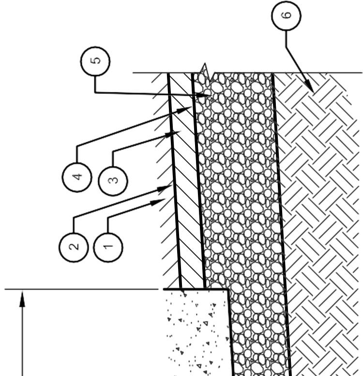
95
96
97
98
99
100
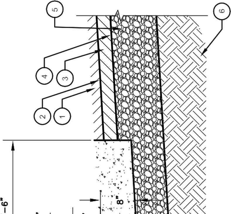
101
102
103
104
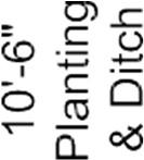
105
106

107
108
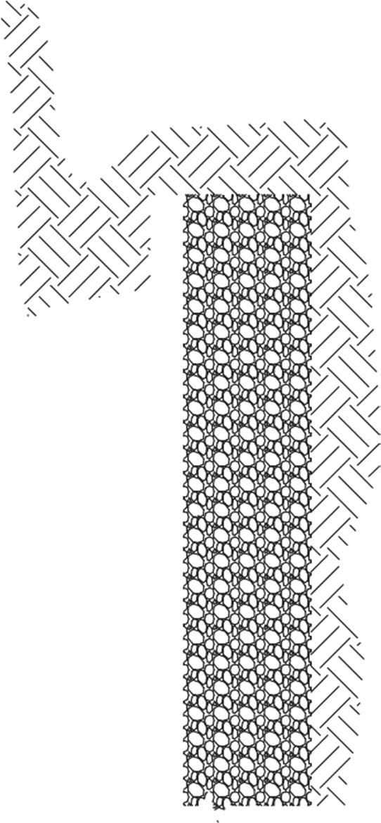
109
110
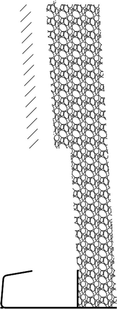
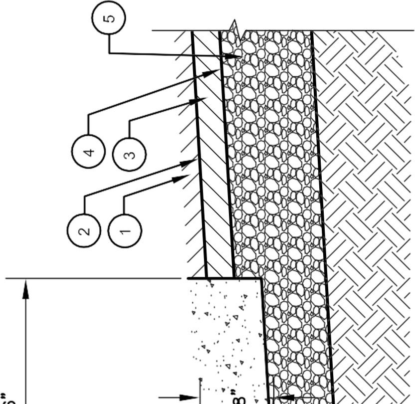
111
112

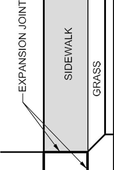
113
114
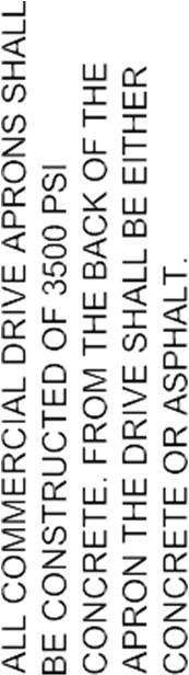
115
116
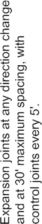

117
118

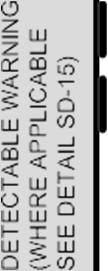
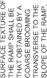

119
120

121
122
123
124
125
126
127
128
129
130
131
132
133
134
135
136
137
138
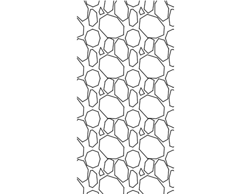
139
140
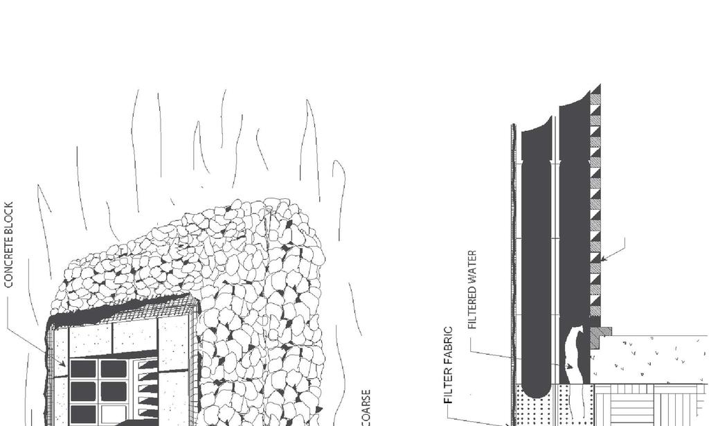
141
142
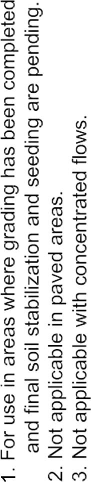
143
144

145
146
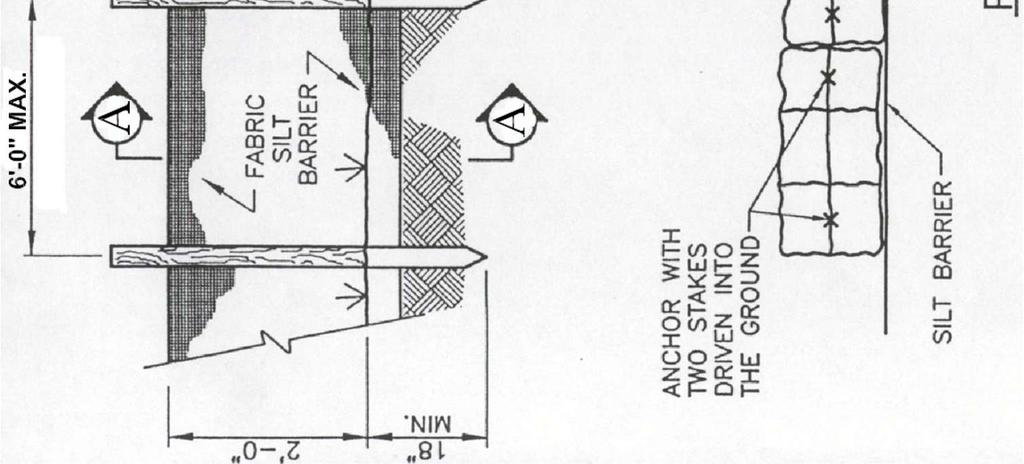
147
148
149
150


151
152
153
154
155
156
157
158
159
160
161
162
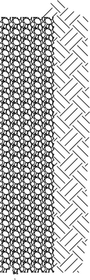
163
164


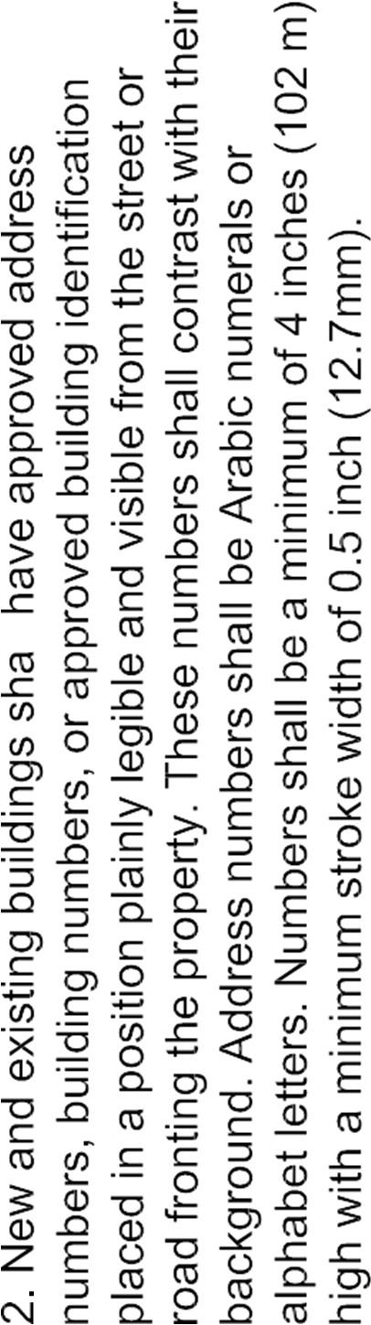
165
166
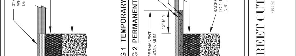
167
168
169
170


171
172
173
174
175
176
177
SUBDIVISION REGULATIONS KINGSTON SPRINGS, TENNESSEE
 SUBDIVISION REGULATIONS KINGSTON SPRINGS, TENNESSEE SUBDIVISION REGULATIONS OF KINGSTON SPRINGS, TENNESSEE Prepared for the Kingston Springs Planning Commission Prepared by Don E. Martin, Principal Planner
201 General Provisions
 201 General Provisions 201.01 Title 201.09 Amendments 201.02 Purpose and Intent 201.10 Public Purpose 201.03 Authority 201.11 Variances and Appeals 201.04 Jurisdiction 201.12 Nonconformances 201.05 Enactment
CHAPTER 22 SUBDIVISION AND LAND DEVELOPMENT. Part 1 General Provisions. Part 2 Application Procedure and Approval Process
 CHAPTER 22 SUBDIVISION AND LAND DEVELOPMENT Part 1 General Provisions 101. Title 102. Policy 103. Purposes 104. Authority 105. Jurisdiction 106. Interpretation, Conflict and Separability 107. Municipal
TABLE OF CONTENTS ARTICLE I
 TABLE OF CONTENTS Section Page ARTICLE I General Provisions 1-1 Title 1 1-2 Authority 1 1-3 Jurisdiction 1 1-4 Purpose and Intent 1 1-5 Interpretation, Conflict, and Severability 3 1-5.1 Interpretation
ARTICLE 1 GENERAL PROVISIONS
 ARTICLE 1 GENERAL PROVISIONS SECTION 100 TITLE This Ordinance shall be known and cited as the "Rice Township Subdivision and Land Development Ordinance." SECTION 101 AUTHORITY Rice Township is empowered
WAYNE COUNTY, UTAH SUBDIVISION ORDINANCE
 WAYNE COUNTY, UTAH SUBDIVISION ORDINANCE A LAND USE ORDINANCE OF WAYNE COUNTY As Adopted by the Wayne County Board of County Commissioners Effective January 01, 2011 Prepared by: PLANNING AND DEVELOPMENT
SUBDIVISION REGULATIONS
 SUBDIVISION REGULATIONS CITY OF DICKSON TENNESSEE SUBDIVISION REGULATIONS CITY OF DICKSON, TENNESSEE ADOPTED: June 17, 2008 LAST AMENDED: January 18, 2011 PREPARED FOR THE DICKSON MUNICIPAL PLANNING COMMISSION
ARTICLE SINGLE FAMILY SITE CONDOMINIUM DEVELOPMENT STANDARDS
 ARTICLE 28.00 SINGLE FAMILY SITE CONDOMINIUM DEVELOPMENT STANDARDS Section 28.01 PURPOSE The purpose of this Article is to recognize that conventional single family developments, traditionally developed
Knoxville-Knox County SUBDIVISION REGULATIONS. Adopted July 8, 1971 As amended through February 8, 2018
 Knoxville-Knox County SUBDIVISION REGULATIONS Adopted July 8, 1971 As amended through February 8, 2018 KNOXVILLE-KNOX COUNTY SUBDIVISION REGULATIONS TABLE OF CONTENTS ARTICLE 1 - GENERAL PROVISIONS 1.01
ELK RAPIDS TOWNSHIP ANTRIM COUNTY, MICHIGAN ORDINANCE NO
 ELK RAPIDS TOWNSHIP ANTRIM COUNTY, MICHIGAN ORDINANCE NO. 3-2011 AN ORDINANCE TO REPLACE THE SUBDIVISION CONTROL ORDINANCE WITH A NEW SUBDIVISION DEVELOPMENT ORDINANCE, IN ACCORD WITH THE LAND DIVISION
BY THE CITY COMMISSION ORDINANCE NO.:
 BY THE CITY COMMISSION ORDINANCE NO.: 2005-0868 AN ORDINANCE BY THE CITY COMMISSION OF THE CITY OF DADE CITY, FLORIDA CREATING A DEVELOPMENT REVIEW PROCEDURES ORDINANCE; PROVIDING FOR INTENT, PURPOSE,
BRIDGETON SUBDIVISION APPLICATION CHECKLIST
 APPLICATION NAME AND # CHECKLIST COMPLETED BY: DATE: Signature and printed name BRIDGETON SUBDIVISION APPLICATION CHECKLIST TO SUBDIVISION APPLICANTS: The attached checklist is to assist you in the submission
APPLICATION PROCEDURE
 ANTRIM PLANNING BOARD P. O. Box 517 Antrim, New Hampshire 03440 Phone: 603-588-6785 FAX: 603-588-2969 APPLICATION FORM AND CHECKLIST FOR MINOR OR MAJOR SITE PLAN REVIEW File Date Received By APPLICATION
SUBDIVISION APPLICATION CHECKLIST SKETCH PLAN PRELIMINARY PLAT FINAL PLAT
 RECEIVED STAMP SUBDIVISION APPLICATION CHECKLIST SKETCH PLAN PRELIMINARY PLAT FINAL PLAT A checklist of background information and submission requirements for processing of a sketch plan, preliminary plat
TITLE 25. SUBDIVISIONS 1
 TITLE 25. SUBDIVISIONS 1 Sections: Chapter 25.01 General Provisions. Section 25.01.01 Short Title. Section 25.01.02 Purposes. Section 25.01.03 Final Plat Required Before Lots May be Sold. Section 25.01.04
WAKE COUNTY SUBDIVISION ORDINANCE ANNOTATED
 WAKE COUNTY SUBDIVISION ORDINANCE ANNOTATED The Wake County Subdivision Ordinance makes up Chapters 3-1 through 3-5 of the Wake County Code of General Ordinances (as reflected in the numbering of its sections).
St. Mary s County Comprehensive Zoning Ordinance Article 1. GENERAL PROVISIONS
 0 0 0 0 ARTICLE. GENERAL PROVISIONS CHAPTER 0 TITLE, PURPOSE AND ORGANIZATION Sections: 0. Title. 0. Authority. 0. Purpose. 0. Organization of the Zoning Ordinance. 0. Official Zoning Map. 0. Applicability.
SUBDIVISION REGULATIONS
 SUBDIVISION REGULATIONS BRISTOL, TENNESSEE SUBDIVISION REGULATIONS PREPARED BY THE BRISTOL, TENNESSEE PLANNING COMMISSION BRISTOL, TENNESSEE APRIL 2017 SUBDIVISION REGULATIONS TABLE OF CONTENTS ARTICLE
ARTICLE 15 - PLANNED UNIT DEVELOPMENT
 Section 15.1 - Intent. ARTICLE 15 - PLANNED UNIT DEVELOPMENT A PUD, or Planned Unit Development, is not a District per se, but rather a set of standards that may be applied to a development type. The Planned
E L M E R B O R O U G H L A N D U S E B O A R D APPLICATION COVER SHEET (to be completed for all applications and appeals)
") E L M E R B O R O U G H L A N D U S E B O A R D APPLICATION COVER SHEET (to be completed for all applications and appeals) 1. Name(s): 2. Address: 3. Telephone Number(s): 4. E-mail: 5. Owner Name(s) (if
E L M E R B O R O U G H L A N D U S E B O A R D APPLICATION COVER SHEET (to be completed for all applications and appeals) 1. Name(s): 2. Address: 3. Telephone Number(s): 4. E-mail: 5. Owner Name(s) (if
ARTICLE 8C SITE CONDOMINIUM DEVELOPMENT ORDINANCE
 ARTICLE 8C SITE CONDOMINIUM DEVELOPMENT ORDINANCE SECTION 8C.01 PURPOSE It is the purpose of this Ordinance to insure that plans for development within Oceola Township proposed under the provisions of
Section SKETCH PLAN REVIEW
 Section 210 - SKETCH PLAN REVIEW 1. Within 30 days of receiving a complete application for a subdivision involving three or more lots, the Zoning Administrator shall refer the matter to the first available
Chapter 22 PLANNED UNIT DEVELOPMENT.
 Chapter 22 PLANNED UNIT DEVELOPMENT. Sec. 22.1 INTENT. The use of land and the construction and use of buildings and other structures as Planned Unit Developments in Georgetown Township may be established
TOWN OF WATERVILLE VALLEY NEW HAMPSHIRE SITE PLAN REVIEW REGULATIONS
 TOWN OF WATERVILLE VALLEY NEW HAMPSHIRE Effective date March 17, 1981 Revised March 16, 1982 Revised March 13, 1986 Revised March 10, 1987 Revised March 14, 2013 Revised March 8, 2016 TOWN OF WATERVILLE
Initial Subdivision Applications Shall Include the Following:
 Initial Subdivision Applications Shall Include the Following: 1) Subdivision Application Form: completely filled out (12 copies) 2) Plat: The Plat must adhere to the requirements set forth in the Town
Town of Norwich, Vermont SUBDIVISION REGULATIONS
 Town of Norwich, Vermont SUBDIVISION REGULATIONS Adopted: August 6, 2002 Amended: February 8, 2006 Prepared by Norwich Planning Commission with the assistance of: Burnt Rock Inc. A ssociates in Community
SUBDIVISION ORDINANCE CITY OF DES MOINES, IOWA
 SUBDIVISION ORDINANCE CITY OF DES MOINES, IOWA SUBDIVISION REGULATIONS CITY OF DES MOINES, IOWA NOTICE This is an unofficial and annotated copy of excerpts from the Municipal code of the City of Des Moines,
BEAR CREEK TOWNSHIP EMMET COUNTY, MICHIGAN. PRIVATE ROAD ORDINANCE Ordinance No. 11A-99. (to replace prior Private Road Ordinance No.
 BEAR CREEK TOWNSHIP EMMET COUNTY, MICHIGAN PRIVATE ROAD ORDINANCE Ordinance No. 11A-99 (to replace prior Private Road Ordinance No. 11-99) An Ordinance to protect the health, safety, and general welfare
I. Requirements for All Applications. C D W
 108-16.1. Application checklists. Checklist for Required Submissions to the Planning Board or Zoning Board of Adjustment of Monroe Township All required submissions are to be made to the Administrative
SUBDIVISION PROCEDURES AND REGULATIONS. for the Town of Stratford, New Hampshire
 SUBDIVISION PROCEDURES AND REGULATIONS for the Town of Stratford, New Hampshire TABLE OF CONTENTS Page A. PRE-APPLICATION 2 B. PRELIMINARY PLAN REQUIREMENTS 3 C. PRELIMINARY PLAN REVIEW 5 Site Plan Review
610 LAND DIVISIONS AND PROPERTY LINE ADJUSTMENTS OUTSIDE A UGB
 ARTICLE VI: LAND DIVISIONS AND PROPERTY LINE ADJUSTMENTS VI-21 610 LAND DIVISIONS AND PROPERTY LINE ADJUSTMENTS OUTSIDE A UGB 610-1 Property Line Adjustments (Property Line Relocation) A property line
CITY OF LAKE CHARLES
 CITY OF LAKE CHARLES SUBDIVISION REGULATIONS UPDATED 04-06-05 AS AMENDED BY RESOLUTION 79-1 FEBRUARY 19, 1979 EXHIBIT A SUBDIVISION REGULATIONS CITY OF LAKE CHARLES, LOUISIANA TABLE OF CONTENTS PAGE SECTION
SECTION 10.7 R-PUD (RESIDENTIAL PLANNED UNIT DEVELOPMENT) ZONE
 ZONE") Article X Zones 10-20 SECTION 10.7 R-PUD (RESIDENTIAL PLANNED UNIT DEVELOPMENT) ZONE A. PURPOSE AND INTENT: The R-PUD Residential PUD Zone is intended to provide alternative, voluntary zoning procedures
Article X Zones 10-20 SECTION 10.7 R-PUD (RESIDENTIAL PLANNED UNIT DEVELOPMENT) ZONE A. PURPOSE AND INTENT: The R-PUD Residential PUD Zone is intended to provide alternative, voluntary zoning procedures
CHAPTER 22 SUBDIVISION AND LAND DEVELOPMENT
 CHAPTER 22 SUBDIVISION AND LAND DEVELOPMENT 22-101. Title 22-102. Legislative Intent Part 1 General Provisions 22-201. Development Permits Part 2 Administration 22-301. Fee Schedule Part 3 Fee Schedule
THE COUNTY BOARD OF SUPERVISORS OF THE COUNTY OF DOUGLAS DOES ORDAIN AS FOLLOWS:
 8.1 SUBDIVISION CONTROL ORDINANCE THE COUNTY BOARD OF SUPERVISORS OF THE COUNTY OF DOUGLAS DOES ORDAIN AS FOLLOWS: SECTION I. GENERAL INTERPRETATION This ordinance shall not repeal, impair or modify private
TOWNSHIP OF SPRINGBROOK SUBDIVISION AND LAND DEVELOPMENT
 TOWNSHIP OF SPRINGBROOK SUBDIVISION AND LAND DEVELOPMENT ORDINANCE JULY, 1995 with Revisions to January, 2001 SUBDIVISION AND LAND DEVELOPMENT ORDINANCE TOWNSHIP OF SPRINGBROOK LACKAWANNA COUNTY, PENNSYLVANIA
SITE DEVELOPMENT PLAN REQUIREMENTS CHECKLIST
 SITE DEVELOPMENT PLAN REQUIREMENTS CHECKLIST Completed DRC Application for Review Required for Application Process DRC Processing Fee 1 Commercial $2,500.00 Fire Department Review Fee 150.00 Total $2,650.00
BOROUGH OF JESSUP SUBDIVISION AND LAND DEVELOPMENT ORDINANCE
 BOROUGH OF JESSUP SUBDIVISION AND LAND DEVELOPMENT ORDINANCE 1993 Amended May 1995 Reenacted May 2000 Amended February 9, 2004 Amended May 7, 2007 SUBDIVISION AND LAND DEVELOPMENT ORDINANCE BOROUGH OF
TOWN OF LEWISTON PLANNING BOARD APPLICATION
 TOWN OF LEWISTON PLANNING BOARD APPLICATION DESCRIPTION OF PROPOSED REQUEST: Name of Property Owner: Phone #: Name of Applicant:Phone #: Address or Location of Proposal:_SBL# Size of Parcel or Structure:Existing
-MENDOCINO COUNTY PLANNING AND BUILDING SERVICES- DIVISION OF LAND REGULATIONS TITLE 17
 ARTICLE VI -- GENERAL REGULATIONS AND PROVISIONS Sec. 17-50. Sec. 17-51 General Plan. Sec. 17-52 Lot and Block Design and Configuration. Sec. 17-53 Lot Access. Sec. 17-54 Private Roads. Sec. 17-55 Water
MAJOR RESIDENTIAL AND NONRESIDENTIAL SUBDIVISIONS
 Lawrence-Douglas County MAJOR RESIDENTIAL AND NONRESIDENTIAL SUBDIVISIONS Preliminary Plats The applicant shall schedule a Pre-Application meeting with Planning Staff at least seven (7) working days prior
DUPLIN COUNTY SUBDIVISION REGULATION ARTICLE I INTRODUCTORY PROVISIONS
 DUPLIN COUNTY SUBDIVISION REGULATION 3-13-03 ARTICLE I INTRODUCTORY PROVISIONS Section 101. Title This ordinance shall be known and may be cited as the Subdivision Regulations of Duplin County, North Carolina,
SUBDIVISION REGULATIONS BRISTOL, TENNESSEE MARCH 2001
 SUBDIVISION REGULATIONS BRISTOL, TENNESSEE MARCH 2001 UPDATED NOVEMBER 2010 SUBDIVISION REGULATIONS PREPARED BY THE BRISTOL TENNESSEE PLANNING COMMISSION BRISTOL, TENNESSEE MARCH 2001 SUBDIVISION REGULATIONS
Memorandum: October 13, 2008 REVISED To: Trowbridge Township Planning Commission From: P. Hudson, AICP Re: Suggested New Ordinance
 1 Memorandum: October 13, 2008 REVISED 2-11-09 To: Trowbridge Township Planning Commission From: P. Hudson, AICP Re: Suggested New Ordinance Because of changes in both the Michigan Planning Enabling Act
ARTICLE 100 SUBDIVISION APPLICATION PROCEDURE AND APPROVAL PROCESS
 ARTICLE 100 SUBDIVISION APPLICATION PROCEDURE AND APPROVAL PROCESS 100.01 General Procedure 100.02 Exempt Subdivision 100.03 Administrative Subdivision 100.04 Major Subdivision 100.05 Signing and Recording
CHECKLIST FOR DEVELOPMENT REVIEW
 CHECKLIST FOR DEVELOPMENT REVIEW Petitions and related documents and plans for land development or other proposals regulated by Title 16 of the Municipal Code (Development Ordinance) and Title 17 of the
City of Russellville, Arkansas. Land Subdivision and Development Code
 City of Russellville, Arkansas Land Subdivision and Development Code Ordinance No.1789 Adopted by Russellville City Council June, 15, 2003 Amended by Ordinance 1993 October 25, 2007 Amended by Ordinance
FINAL PLAT APPLICATION
 FINAL PLAT APPLICATION (Page 1 of 3) LEGAL OWNER(s): NAME: STREET ADDRESS OWNER(s): CITY, STATE, ZIP CODE: PHONE NUMBER: BILLING ADDRESS: NAME OF ENGINEER/SURVEYOR: Engineer/Surveyor Address, Phone: PROPERTY
TOWNSHIP OF BORDENTOWN LAND DEVELOPMENT APPLICATION CHECKLIST. General Requirements for all Applications
 TOWNSHIP OF BORDENTOWN LAND DEVELOPMENT APPLICATION CHECKLIST This CHECKLIST has been adopted in accordance with Section 25:807 of the Land Development Ordinance of the Township of Bordentown and will
Subchapter 16 Subdivisions.
 Subchapter 16 Subdivisions. Sections: 35.16.1 Authority. 35.16.2 Purpose. 35.16.3 Jurisdiction. 35.16.4 Application. 35.16.5 Compliance and Enforcement. 35.16.6 Approval of Plat Required. 35.16.7 Lots,
Special Use Permit - Planned Unit Development Checklist. Property Address:
 Special Use Permit - Planned Unit Development Checklist Special Use Permit Number. Parcel Code/s #28-11- - - Property Address: Applicant: ARTICLE VIII Ordinance Reference - Section 8.1.2 Permit Procedures:
Village of South Elgin, IL. CHAPTER 156: Unified Development Ordinance
 Village of South Elgin, IL CHAPTER 156: Unified Development Ordinance UNIFIED DEVELOPMENT ORDINANCE (UDO) EFFECTIVE DATE: October 1, 2018 1 TABLE OF CONTENTS SECTION 156.01: TITLE AND APPLICABILITY...4
White County Subdivision Control Ordinance TABLE OF CONTENTS
 Table of Contents TABLE OF CONTENTS CHAPTER 1: PURPOSE, AUTHORITY, AND JURISDICTION 1.0 Title... 1.1 1.1 Purpose and Authority... 1.1 1.1.1 Purpose... 1.1 1.1.2 Authority... 1.2 1.2 Policy... 1.2 1.2.1
ARTICLE 2: General Provisions
 ARTICLE 2: General Provisions 2-10 Intent The basic intent of the Town of Orange s Zoning Ordinance is to implement the goals and objectives of the adopted Town of Orange Comprehensive Plan, hereafter
SUBDIVISION REGULATIONS
 CHAPTER 14 SUBDIVISION REGULATIONS 14-100 Provisions 14-200 Preliminary Plat 14-300 Final Plat 14-400 Replat 14-500 Minor Subdivision 14-600 Administrative Replat 14-700 Vacation of Roadways, Public Easements,
13-2 SUBDIVISION PLANS AND PLATS REQUIRED EXCEPTIONS Subdivision Plats Required To be Recorded
 ARTICLE XIII SUBDIVISIONS 13-1 INTENT AND PURPOSE 13-1-1 Intent: It is the intent of the County Commission through the adoption of this Article to more fully avail itself of the power granted under 17-27-601
SUBDIVISION CONTROL ORDINANCE. LaPorte County City of LaPorte City of Michigan City
 SUBDIVISION CONTROL ORDINANCE LaPorte County City of LaPorte City of Michigan City Adopted January 7, 2012 Table of Contents Table of Contents Article 01 Basic Provisions 01.01 Preamble and Enacting Clause
Salem Township Zoning Ordinance Page 50-1 ARTICLE 50.0: PUD PLANNED UNIT DEVELOPMENT
 Salem Township Zoning Ordinance Page 50-1 ARTICLE 50.0 PLANNED UNIT DEVELOPMENT Section 50.01 Purpose The provisions of this Article provide enabling authority and standards for the submission, review,
(voice) (fax) (voice) (fax) Site Plan Review
 (fax) (voice) (fax) Site Plan Review") Town of South Boston PO Box 417 455 Ferry Street South Boston Virginia 24592 Planning Department Public Works Department (Engineering) 434.575.4241 (voice) 434.575.4275 (fax) 434.575.4260 (voice) 434.575.4275
Town of South Boston PO Box 417 455 Ferry Street South Boston Virginia 24592 Planning Department Public Works Department (Engineering) 434.575.4241 (voice) 434.575.4275 (fax) 434.575.4260 (voice) 434.575.4275
CHAPTER 5. Subdivisions Regulations
 CHAPTER 5 Subdivisions Regulations 10-5-1 Introduction and Purpose 10-5-2 Definitions 10-5-3 General Provisions 10-5-4 Procedure for Submitting Subdivisions 10-5-5 Design Standards; Streets and Lots 10-5-6
ARTICLE 1 GENERAL PROVISIONS AUTHORITY AND ADMINISTRATION RESPONSIBILITIES OF DEVELOPER AND PLANNING COMMISSION
 ARTICLE 1 GENERAL PROVISIONS 103.101. TITLE 103.102. AUTHORITY AND ADMINISTRATION 103.103. PURPOSE 103.104. INTERPRETATION 103.105. RESPONSIBILITIES OF DEVELOPER AND PLANNING COMMISSION 103.106. JURISDICTION
WOOD COUNTY SUBDIVISION REGULATIONS WOOD COUNTY, OHIO
 WOOD COUNTY SUBDIVISION REGULATIONS WOOD COUNTY, OHIO EFFECTIVE DATE : AUGUST 6, 2014 Table of Contents ARTICLE 1 - GENERAL PROVISIONS... 1 1.00 Title... 1 1.01 Policy... 1 1.02 Purpose... 1 1.03 Authority...
PRELIMINARY PLAT Checklist
 PRELIMINARY PLAT Checklist 3715 Bridgeport Way W University Place, WA 98466 PH: (253) 566-5656 FAX: (253) 460-2541 This is a checklist of materials required for a Preliminary Plat. This checklist is provided
ORDINANCE NO. 41. PRIVATE ROAD ORDINANCE As Amended Through April 10, 2008
 ORDINANCE NO. 41 PRIVATE ROAD ORDINANCE As Amended Through April 10, 2008 An Ordinance to protect the health, safety, and general welfare of the inhabitants of Port Sheldon Township. The Township of Port
THE UNINCORPORATED AREA OF CLARKE COUNTY, IOWA TABLE OF CONTENTS
 ORDINANCE #11 THE UNINCORPORATED AREA OF CLARKE COUNTY, IOWA TABLE OF CONTENTS ARTICLE I:-------------------------------------------------------------------------GENERAL PROVISIONS ARTICLE II:--------------------------------------------------------------------------------------DEFINITIONS
CHAPTER 18 SUBDIVISION AND PLATTING ORDINANCE OF THE TOWN OF OSCEOLA CODE OF ORDINANCES
 TOWN OF OSCEOLA POLK COUNTY WISCONSIN ORDINANCE # 18-03-03 CHAPTER 18 SUBDIVISION AND PLATTING ORDINANCE OF THE TOWN OF OSCEOLA CODE OF ORDINANCES 18.01 Purpose Adopted 3/08/99, Amended 5/12/03, 7/9/07,
A. Appropriate agency responsible for transportation review for the subject property.
 7.8.10 Procedure Any person desiring to create a minor subdivision shall submit to the Commission for approval an application on forms provided by the Division, and a record plat in conformance with the
APPLICATION REVIEW CHECKLISTS
 APPLICATION REVIEW CHECKLISTS The following must be submitted with and are part of each application. No application is complete until all required documentation has been submitted to the Community Development
ORDINANCE NO. Be it ordained by the City Council of the City of Abilene, Texas:
 ORDINANCE NO. An ordinance repealing Chapter 23, Subpart B of the Code of the City of Abilene, Texas, entitled Mobile Homes and Vacation Travel Trailers; stating the authority; setting forth the scope
This Ordinance is adopted under the authority and provisions of the General Statutes of North Carolina, Article 6, Chapter 153A 121.
 Section 74, Regulations Governing Manufactured Home Parks 1. Purpose The purpose of these regulations to be known and cited as the Madison County Manufactured Home Park Ordinance is to regulate and guide
WASCO COUNTY PRELIMINARY SUBDIVISION APPLICATION
 WASCO COUNTY PRELIMINARY SUBDIVISION APPLICATION DETAILED SPECIFIC WRITTEN REQUEST File Number: SDV- Number of Proposed Lots & their Dimensions: PRELIMINARY SUBDIVISION PLAN REQUIREMENTS The approval of
SECTION 3.1 Zoning Permit Required for Construction, Land Use and Development.
 CHAPTER 3 ADMINISTRATION, FEES AND ENFORCEMENT SECTION 3.1 Zoning Permit Required for Construction, Land Use and Development. A. Zoning Permit Required. A zoning permit is required for any of the following
DRAFT PARK COUNTY US HIGHWAY 89 SOUTH EAST RIVER ROAD OLD YELLOWSTONE TRAIL ZONING DISTRICT REGULATIONS
 Formatting: Changes recommended by the Board and accepted by the County Commission are formatted in RED: Changes made by the Park County Commission are formatted in YELLOW highlight: and changes made by
PLANNED UNIT DEVELOPMENTS (Ordinance No.: 3036, 12/3/07; Repealed & Replaced by Ordinance No.: 4166, 10/15/12)
") 159.62 PLANNED UNIT DEVELOPMENTS (Ordinance No.: 3036, 12/3/07; Repealed & Replaced by Ordinance No.: 4166, 10/15/12) A. PURPOSE 1. General. The Planned Unit Development (PUD) approach provides the flexibility
159.62 PLANNED UNIT DEVELOPMENTS (Ordinance No.: 3036, 12/3/07; Repealed & Replaced by Ordinance No.: 4166, 10/15/12) A. PURPOSE 1. General. The Planned Unit Development (PUD) approach provides the flexibility
PRELIMINARY PLAT CHECK LIST
 PRELIMINARY PLAT CHECK LIST Name of Proposed Subdivision: The following items must be included with the initial submittal of a Preliminary Plat: Application, filled out completely Project Narrative Pre-application
ARTICLE 5 GENERAL REQUIREMENTS
 5.1 SUITABILITY OF THE LAND ARTICLE 5 GENERAL REQUIREMENTS 5.1.1 Land subject to flooding, improper drainage or erosion, and land deemed to be unsuitable for development due to steep slope, unsuitable
APPLICATION FOR PRELIMINARY PLAT RESIDENTAIL. FILING FEE: $ for the first 20 lots; $10.00 for each additional lot over 20
 COMMUNITY PLANNING & DEVELOPMENT TELEPHONE.* (816) 331-4331 FAX * (816) 331-6973 CITY HALL ANNEX 520 MAIN STREET BELTON, MISSOURI 64012 WEBSITE * www.belton.org APPLICATION FOR PRELIMINARY PLAT RESIDENTAIL
Amendments to Subdivision Ordinance Regulations #3
 Amendments to Subdivision Ordinance Regulations #3 DATE SECTION/TITLE ORDINANCE # 07/06/81 Driveways 1164 06/05/84 Fees 1216 Sec. V General Design Standards 06/12/90 Sec. VI Required Improvements 1076B
HOW TO APPLY FOR A USE PERMIT
 HOW TO APPLY FOR A USE PERMIT MENDOCINO COUNTY PLANNING AND BUILDING SERVICES What is the purpose of a use permit? Throughout the County, people use their properties in many different ways. They build
City of Prior Lake APPLICATION FOR COMBINED PRELIMINARY AND FINAL PLAT
 Case File No. Property Identification No. City of Prior Lake APPLICATION FOR COMBINED PRELIMINARY AND FINAL PLAT Requested Action Brief description of proposed project (Please describe the proposed amendment,
MAJOR AND MINOR SUBDIVISIONS. Section 26-8: Plat Shall be Required on Any Subdivision of Land
 PART II. MAJOR AND MINOR SUBDIVISIONS Section 26-8: Plat Shall be Required on Any Subdivision of Land Pursuant to NCGS 160A-372, a final plat shall be prepared, approved, and recorded pursuant to the provisions
ARTICLE III GENERAL PROCEDURES, MINOR PLANS AND FEE SCHEDULES
 ARTICLE III GENERAL PROCEDURES, MINOR PLANS AND FEE SCHEDULES 301. Prior to Submission a. Copies of this Ordinance shall be available on request, at cost, for the use of any person who desires information
Subdivision Ordinance. Adopted December 2, 2010 *Article III Amended June 6, 2013 TABLE OF CONTENTS
 Subdivision Ordinance Adopted December 2, 2010 *Article III Amended June 6, 2013 TABLE OF CONTENTS ARTICLE I INTRODUCTORY PROVISIONS Page Section 1-1 Title I-1 Section 1-2 Purpose I-1 Section 1-3 Authority
SUBDIVISION APPLICATION
 SUBDIVISION APPLICATION Community Planning and Economic Development Development Services Division 250 South 4 th Street, Room 300 Minneapolis MN 55415-1316 612-673-3000 This application packet is used
MINOR SUBDIVISION INFORMATION
 A. POINTS OF CONTACT: MINOR SUBDIVISION INFORMATION Surveyor: Address: Phone #: Fax # E-Mail Address: Representative (If different from applicant): Address: Phone #: Fax # E-Mail Address: B. GENERAL INFORMATION:
AN ORDINANCE AMENDING THE CITY ZONING ORDINANCE AND THE OFFICIAL CODE OF THE CITY OF CLARKSVILLE RELATIVE TO CLUSTER OPTION DEVELOPMENTS
 ORDINANCE 74-2012-13 AN ORDINANCE AMENDING THE CITY ZONING ORDINANCE AND THE OFFICIAL CODE OF THE CITY OF CLARKSVILLE RELATIVE TO CLUSTER OPTION DEVELOPMENTS BE IT ORDAINED BY THE CITY COUNCIL OF THE CITY
Residential Minor Subdivision Review Checklist
 Residential Minor Subdivision Review Checklist Plan Submittal Requirements: 2 full sets of stamped plans Electric submittal - all plans contained in a single PDF 3 full sets if commercial kitchen or dining
Residential Major Subdivision Review Checklist
 Residential Major Subdivision Review Checklist Plan Submittal Requirements: 2 full sets of stamped plans Electric submittal - all plans contained in a single PDF 3 full sets if commercial kitchen or dining
SUBDIVISION AND LAND DEVELOPMENT ORDINANCE THE TOWNSHIP OF UPPER TULPEHOCKEN BERKS COUNTY, PENNSYLVANIA
 SUBDIVISION AND LAND DEVELOPMENT ORDINANCE OF THE TOWNSHIP OF UPPER TULPEHOCKEN BERKS COUNTY, PENNSYLVANIA JULY, 1975 As Amended SEPTEMBER 12, 1994 As Amended DECEMBER 13, 2005 TABLE OF CONTENTS ARTICLE
CITY OF HOBBS ORDINANCE NO..
 CITY OF HOBBS ORDINANCE NO.. AN ORDINANCE TO AMEND TITLE 16 OF THE HOBBS MUNICIPAL CODE IN ITS ENTIRETY. BE IT ORDAINED BY THE GOVERNING BODY OF THE CITY OF HOBBS, NEW MEXICO, that the following Chapter
Application for Preliminary Plat Checklist
 Application for Preliminary Plat Checklist Note: No portion of an existing parcel may be sold or transferred to another party without first legally subdividing the property according to the City of Richmond
CITY OF SARALAND PRELIMINARY SUBDIVISION PLAT REVIEW
 PRELIMINARY SUBDIVISION PLAT REVIEW Application Number: Date Plat Submitted: Name of Subdivision: Name of Owner: Owner Address: (Street or P.O. Box) Telephone #: (City) (State) (Zip) E-mail: Name of Authorized
CHAPTER 3 PRELIMINARY PLAT
 10-3-1 10-3-3 SECTION: CHAPTER 3 PRELIMINARY PLAT 10-3-1: Consultation 10-3-2: Filing 10-3-3: Requirements 10-3-4: Approval 10-3-5: Time Limitation 10-3-6: Grading Limitation 10-3-1: CONSULTATION: Each
Subtitle 24 Revision to incorporate SGT SB 236 8/3/2012 STAFF DRAFT 2
 Subtitle 24 Revisions DRAFT 2 Definitions: Section 24-101 Remainder Agricultural Parcel-On or after October 1, 2012 pursuant to Section 9-206 of the Environment Article a remainder parcel is created by
SUBDIVISION APPLICATION
 SUBDIVISION APPLICATION Preliminary Plat Minor Plat Final Plat Amended Plat Applicant Name: Owner (if different from applicant) Name: Company: Company: Address: Address: City, State, Zip City, State, Zip
A.3. ARTICLE 7 PLAN REQUIREMENTS FOR MINOR SUBDIVISION AND/OR LAND DEVELOPMENT
 700. 701.A.3. ARTICLE 7 PLAN REQUIREMENTS FOR MINOR SUBDIVISION AND/OR LAND DEVELOPMENT SECTION 700 PURPOSE The purpose of this Article is to set forth a streamlined set of Plan Requirements for minor
STATE OF MICHIGAN COUNTY OF MARQUETTE, TOWNSHIP OF NEGAUNEE LAND DIVISION, SUBDIVISION AND CONDOMINIUM ORDINANCE
 STATE OF MICHIGAN COUNTY OF MARQUETTE, TOWNSHIP OF NEGAUNEE LAND DIVISION, SUBDIVISION AND CONDOMINIUM ORDINANCE Adopted: August 8 th, 2008 Effective: August 28 th, 2008 Sec.100. Title ARTICLE I GENERAL
CHARTER TOWNSHIP OF SUPERIOR WASHTENAW COUNTY, MICHIGAN PRIVATE ROAD ORDINANCE ORDINANCE NO. 163
 PAGE 163-1 CHARTER TOWNSHIP OF SUPERIOR WASHTENAW COUNTY, MICHIGAN PRIVATE ROAD ORDINANCE ORDINANCE NO. 163 AN ORDINANCE OF THE CHARTER TOWNSHIP OF SUPERIOR ESTABLISHING PROVISIONS FOR APPROVAL OF PRIVATE
TABLE OF CONTENTS. Page TITLE, SHORT TITLE, AND PURPOSE SUBMISSION AND REVIEW PROCEDURES
 ARTICLE I TABLE OF CONTENTS TITLE, SHORT TITLE, AND PURPOSE Page 101 Title 3 102 Short Title 3 103 Purpose 3 104 Application of the Ordinance 3 105 Interpretation 4 106 Revision and Resubdivisions 4 ARTICLE
APPLICATION FOR 555 Washington Street Tentative Map Red Bluff, CA Subdivision Map (530) ext Parcel Map.
 ext Parcel Map.") City of Red Bluff Community Development Department Application No. APPLICATION FOR 555 Washington Street Tentative Map Red Bluff, CA 96080 Subdivision Map (530) 527-2605 ext. 3059 Parcel Map Applicant
City of Red Bluff Community Development Department Application No. APPLICATION FOR 555 Washington Street Tentative Map Red Bluff, CA 96080 Subdivision Map (530) 527-2605 ext. 3059 Parcel Map Applicant