Commission 7. Panamá 28 de Septiembre DANIEL PÁEZ, PhD
|
|
|
- Gabriella Miller
- 6 years ago
- Views:
Transcription
1 Commission 7 Panamá 28 de Septiembre DANIEL PÁEZ, PhD dpaez@uniandes.edu.co


2 DANIEL PÁEZ, PhD LAND IS ABOUT PEOPLE La tierra se refiere a las personas.


3 DANIEL PÁEZ, PhD PEOPLE-LAND RELATIONSHIP IS UNIQUE FOR EACH CULTURE La relación entre tierra y personas es única para cada cultura


4 DANIEL PÁEZ, PhD LAND NOT ONLY PRODUCE FOOD, GENERATES IDENTITY AND SECURITY La tierra no solo produce tierra, genera identidad y seguridad


5 DANIEL PÁEZ, PhD TODAY, YESTERDAY AND TOMORROW, CONFLICTS ARE ABOUT LAND Los conflictos de ayer, y los de mañana, son sobre la tierra


6 DANIEL PÁEZ, PhD LAND MANAGEMENT STARTED WITH TAXATION La gestión de la tierra inició en muchos casos con impuestos


7 SUSTAINABLE DEVELOPMENT IS THE GOAL TODAY Pero hoy la meta es el desarrollo sostenible


8 DANIEL PÁEZ, PhD BUT FIRST WE NEED A MAP Sin embargo, lo primero que necesitamos es un mapa


9 DANIEL PÁEZ, PhD ONE CENTURY, ONE LESSON: FIT-FOR-PURPOSE Un siglo, una lección aprendida: desarrollo de acuerdo a un propósito
10 FIG COMMISSION 7 Goals for the 4-year term Raise awareness about necessityand benefitof property registration among society being a mastermind in developments of good land management Get one step further in developing trustable, self-monitoringand sustainable land registration systems Use modern technologies for raising securityof property information and for improving trust of citizens into systems providing expertise for securing land tenure and advocating citizens rights Make the citizenthe centre of the procedures in cadastre and land management initiating professional discussions on new business models as required by a changing society Build solid long-term co-operationwith UN bodies and NGOs (UN Habitat, GLTN, FAO, WB, UN GGIM e.a.) DANIEL PÁEZ, PhD dpaez@uniandes.edu.co
11 FIG COMMISSION 7 Structure Chair V-Chair for communications, social media, web Fit-For-Purpose LA Ch. Lemmen (NL) WG 7.2 LM in WG 7.1 CC and PP Disaster areas D. Páez (CO) WG 7.3 Crowdsourcing of Land Rights R. McLaren (UK) WG 7.4 Citizen Cadastre G. Iván (HU) Joint WG C3/C7 3D Cadastre DANIEL PÁEZ, PhD dpaez@uniandes.edu.co

12 DANIEL PÁEZ, PhD
13 Working Group 7.1 Fit-For-Purpose Land Administration Chair: Dr. Ir. Christiaan Lemmen, The Netherlands Policy Issues identify role of Fit-For-Purpose Land Administration in relation to sustainable land use, food security, climate change etc. in the post-2015 Development Agenda implementing the Continuum of Land Rights and the STDM into operation at country level including innovative methodologies for fast and low cost recording of land rights and appropriate land rights for future housing, including proposals for innovative land rights (new models of leasehold, tenure of public land etc.) identify the value of land consolidation and land readjustment for rural and urban areas in poverty prevention programmes develop the second edition of the Land Administration Domain Model with ISO on behalf of FIG by integrating partners from local-national, regional and international organisations, NGOs, NPOs, insurances, reinsurances, bank companies, bar associations promoting the development of innovative hard- and software solutions for land administration identify the needs for further development, quality improvement and system optimisation after Fit-For-Purpose Land Administration is implemented DANIEL PÁEZ, PhD
14 Working Group 7.2 Land Management in Climate Change and Pre- and Post-Disaster Areas Chair: Daniel Páez (PhD), Colombia, Policy Issues assessment of land tenure in post-disaster areas pre-disaster assessment / documentation of land tenure legal/institutional/technical Fit-For-Purpose methods to secure land rights in pre- and post-disaster areas impact of climate change on land tenure / loss of land, land use changes compensation for value changes, consolidation of agricultural land, adjustment of urban land in post disaster regions new technologies for data capture in pre-disaster areas / validation of third party data cooperation models with public authorities / voluntary guidelines in conflicts capacity building in disaster response bodies spatial data infrastructures for pre-, during and post-disaster response (link to FIG Commission 3) DANIEL PÁEZ, PhD dpaez@uniandes.edu.co
15 Working Group 7.3 Crowdsourcing of Land Rights Chair: Dr Robin McLaren, United Kingdom, Policy Issues family of mobile devices supporting remote and in-situ capture of evidence of land rights global platforms managing evidence of land rights and obligations service delivery models scalability and capacity building of trusted intermediaries and land owners role of social media / validation of third party data impact on perception of security of tenure managing unintended consequences and privacy cooperation with public authorities in recognition or conversion of informal rights link to Working Group 7.1 Fit-For-Purpose Land Administration impact on land professionals and associate curriculum DANIEL PÁEZ, PhD dpaez@uniandes.edu.co
16 Working Group 7.4 Citizen Cadastre Chair: Gyula Iván(M.Sc.), Hungary, Policy Issues land tenure and culture and society needs multi-dimensional and multi-temporal cadastre security of land tenure alternative forms of land tenure in changing society (generation property, affordable land, temporary urban and agricultural land tenure) complementary to WG 7.1 role of land owner as key stakeholder privacy issues / access to data for citizens responsibilities of public authorities / cooperation models / fraud prevention analysis of trust in different land administration models assessment models for performance of land administration systems training of land owners / capacity building in institutional bodies building codes and IPMS standards for data in land administration representation in Joint WG on 3D Cadastre of Commission 3 and 7 DANIEL PÁEZ, PhD dpaez@uniandes.edu.co


17
18 Cadaster 4.0 Cadaster for people made by people. Cadastre 4.0 as a paradigm close the circle between new technologies and automatisation of processes, products and services and stakeholders, including citizen and land owners as essential partners at equal level. It is a partnership model building coalitions /symbiosis between professionals in private and public service, between citizen and users and public authorities and between technology and society. Cadastre 4.0 establishes links between the virtual and real world securing interests of land owners, society, governments and economy. It sets the scene for permanent communication between people, procedures and products. The Internet of Things is amended by a social aspect. Cadastre 4.0 if implemented, will help to save resources and at the same time will provide solutions in a more flexible, a more efficient and a more social way. DANIEL PÁEZ, PhD dpaez@uniandes.edu.co
19 Investment in the last 10 years estimated at: USD$200 million Improvement : 7% (area) It would take Colombia 112 years and 7.2 billions to complete the picture Formed updated Formed out of date Not form Source: IGAC


20 There is a direct correlation between Consequences.. poverty and cadaster problems Cadaster problems Poverty Source: IGAC Source: Rojas et al. 2009

21 Indiginous reserves in Colombia
.")
22 INTRODUCTION Colombia s Current Situation Indigenous territories are not benefiting from the rapid economic development of the country 29.8% of Colombian territory are indigenous reserves 3.28% of Colombians are indigenous Infrastructure on indigenous regions is scarce. Parcel based system conflicts with the traditional administration of land (Gobernación Vaupes and DANE, 2010).


23 Case study Mitu Vaupes No governmental support Workshops attractive enough DIFFICULTIES Lack of public services The need for isolated environment s. Lack of knowledge on geographical limits.
24 Our project Inteligent mapping Exploring the territory New technologies Recording knowledge Community mapping Societal administration Intelligent mapping Empowering communities Tells a story of a place today for needs tomorrow


25 Our project General Objectives Propose reforms on existing LAS to build a proper cadaster of indigenous territory Documents specific data where pressures affect tenure, land-use or rights. Improvingsocial conditions. Map indigenous areas using Intelligent mapping. Highlights land fragmentation approaches. Collectsand incorporates the knowledge and traditions of indigenous communities. Identifies resources, general boundaries and land uses.
26 Community mapping A methodology based on the three stages plan proposed by Herlihy (2004) inquire, mapping/georeference and feedback. Includes previous knowledge of the community and area available on the literature Based on circumstancesof the indigenous territories in Colombia basic information needed to protect land rights while respecting traditions and culture. Key research: Michael Berry from Calgary University


27 RESULTS From the fieldwork it was obtained sketchs of the territory made by the captain, number of inhabitants, female and male proportionandasketchofthepointsobtainedwiththegps. CEIMA SAN PABLO


28 RESULTS community mapping CUCURA PUEBLO NUEVO

29 Our project Inteligent mapping New technologies Community mapping Societal administration Intelligent mapping


30 DANIEL PÁEZ, PhD RURAL LAND PRODUCTIVITY DEPENDS ON MANY INDEPENDENT FACTORS Porque la producción rural depende de muchos factores


31 WE HAVE DEVELOPED A GEOGRAPHIC TOOL TO IMPROVE UNDERSTANDING RELATIONSHIP BETWEEN RURAL LAND AND INFRASTRUCTURE Nosotros hemos desarrollado herramientas para tratar de unir estos dos 31 factores


32 DANIEL PÁEZ, PhD THIS TOOL ESTIMATES LAND VALUE INCREASES BASED ON ROAD INVESTMENT Esta herramienta ayuda estimar incrementos en los valores de la tierra dependiendo de las inversiones en infraestructura

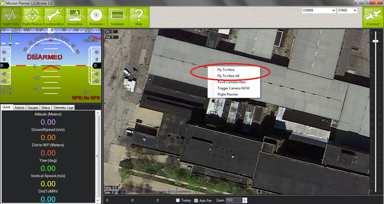
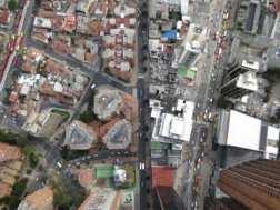
33 CROWDSOURCING: THE FUTURE El futuro: usar las masas
34 FIG Com7Annual Meeting 2016 GeoConference on Cadastre4.0 Participation, Collaboration and Transparency Oct 2016, Coimbra/Portugal 5th International FIG Workshop on 3D Cadastres FIG Com3/ Com October 2016, Athens/Greece
35 Land Consolidation and Readjustment for Sustainable Development - Designing Resilient Landscapes and Empowering Communities 9-11 November 2016, Apeldoorn/The Netherlands Co-organised byfig Com7 / Com8 / Dutch Kadaster/ FAO FIG Working Week 2017 May 29 2 June 2017, Helsinki/Finland


36 October 2017 Cartagena Colombia COMM 717 Annual meeting


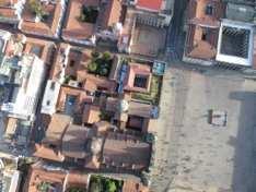
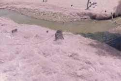
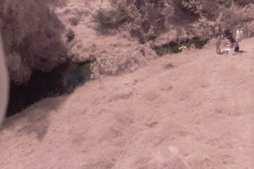
37 UN-GGIM academic network Regional Institutes ACADEMIC NETWORK National International Research and Training Institutes August 2016, NY Academic Network Report Academic Network Report
38 Objectivesof Academic Network The UN-GGIM Academic Networkwill be a coalition of recognized universities, research and education centers or equivalent involved in the research, development and training on geospatial and land information and related matters. The Academic Networkwill be a platform for the academic community to provide input and to support UN-GGIM in achieving its vision and goals by generating a platform for academic community to input to the UN-GGIM process in the form of strategic knowledge, research, education and training, and will be a strategic arm to empower UN-GGIM to achieve their vision and goals. The Academic Network will provide both research and education capabilities for UN-GGIM and affiliated members to identify and response to challenges and opportunities in which UN-GGIM and related UN offices can achieve their visions. Academic Network Report
39 Academic Network Task Team Members Prof Abbas Rajabifard, The University of Melbourne, Australia (Chair) Prof Daniel Páez, University of Los Andes, Colombia (Secretary) Prof Huayi Wu, Wuhan University, China Prof Joep Crompvoets, KU Leuven, Belgium Prof David Coleman, University of New Brunswick, Canada Prof Harlan Onsrud, University of Maine, USA Prof Menno-Jan Kraak, University of Twente, Netherlands Prof Josef Strobl, University of Salzburg, Austria Prof Maria Antonia Brovelli, Politecnico di Milano, Italy Prof jide Kufoniyi, Obafemi Awolowo University, Nigeria Academic Network Report

40 lab.uniandes.edu.co DANIEL PÁEZ, PhD
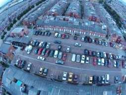
41 Other about drones


42 Technology comparison google earth (many qualities) Fixed wind rapid mapping 8cm pixels Multi rotor and fixed wind High quality 2cm pixels


43 Flying planning and ejecution tools Automatic: YES Reliable: NO


44 Data processing Georeferncing images Photogrametry Spatial analysis Urbano


45 Results: Fixed wind


46 Results: multi-rotor


47 DEM-DSM -DTM
Annual Meeting II/2016 FIG Commission 7 Cadastre & Land Management. Report
 Annual Meeting II/2016 FIG Commission 7 Cadastre & Land Management Report 1 Structure Chair G. Schennach (AT) V-Chair for communications, social media, web Hyunsook LEE (KR) WG 7.1 Fit-For-Purpose LA Ch.
FIG Commission 7 Cadastre and Land Management
 1. Title Appendix to item 13 FIG Commission 7 Cadastre and Land Management Cadastre and Land Management 2. Terms of Reference Work Plan 2015 2018 Commission 7 deals with all issues of land rights and land
FIG and FIG Commission 7 Topics of interest
 FIG and FIG Commission 7 Topics of interest Chair FIG Commission 7 Cadastre & Land Management 1 What is FIG? Interna tiona l Fed era tion of Surveyors Féd éra tion Interna tiona le d es Géom ètres Interna
Seventh Session of the United Nations Committee of Experts on Global Geospatial Information Management
 Report of the Forum P a g e 1 Seventh Session of the United Nations Committee of Experts on Global Geospatial Information Management Report of the Forum Secure Land Rights and Smart Cities - Making It
Progress in modern cadastre Challenging existing models and paradigms
 Progress in modern cadastre Challenging existing models and paradigms Gerda Schennach, Austria Chair of FIG Commission 7 Federal Office of Metrology and Surveying, Austria The Value of Cadastre for Society
The Profession between Cadastre and Citizen
 The Profession between Cadastre and Citizen Gerda Schennach, Austria Chair of FIG Commission 7 1 A human right UN DECLARATION OF HUMAN RIGHTS Article 17 par (1) Everyone has the right to own property alone
Greetings from Denmark. Property Rights, Restrictions and Responsibilities - A Global Land Management Perspective. Wonderful Copenhagen
 Property Rights, Restrictions and Responsibilities - A Global Land Management Perspective Greetings from Denmark 43,000 sq km Prof. Stig Enemark President Aalborg University, Denmark Aalborg Copenhagen
Commission 7 Cadastre and Land Administration. Work Plan
 Commission 7 Cadastre and Land Administration Work Plan 2011 2014 Appendix to item 17.7 1. Title Cadastre and Land Administration 2. Terms of Reference Commission 7 deals with land administration and land
Scenic Nepal. Land Administration Systems. Outline of Presentation. Interests in land. Rights: Registration and security of tenure positions
 Scenic Nepal Land Administration Systems Managing Rights, Restrictions, and Responsibilities in Land Prof. Stig Enemark President Aalborg University, Denmark SURVEY DEPARTMENT KATHMANDU, NEPAL. 16 FEBRUARY
Agenda. Introduction to participants First Meeting UN-GGIM - GROUP OF EXPERTS ON LAND ADMINISTRATION AND MANAGEMENT UN-GE-LAM
 First Meeting UN-GGIM - GROUP OF EXPERTS ON LAND ADMINISTRATION AND MANAGEMENT Kees de Zeeuw, The Netherlands Chair Mahashe Chaka, Lesotho Co-Chair Brent Jones, ESRI (USA) -Rapporteur Agenda Opening Introduction
Fit-For-Purpose what is it?
 FIG Commission 7 Annual Meeting 2016 Working Group 7.1 Fit-For-Purpose Land Administration Christiaan Lemmen October, 24th 2016 Coimbra, Portugal Fit-For-Purpose what is it? Fit-for-purpose: The systems
How Big is Global Insecurity of Tenure?
 Presented at the FIG Working Week 2016, May 2-6, 2016 in Christchurch, New Zealand Know Edge Limited Location Information Innovation How Big is Global Insecurity of Tenure? Dr Robin McLaren Know Edge Ltd,
The agenda for a Group of Experts on Land Administration and Management within the United Nations
 Presented at the FIG Working Week 2016, May 2-6, 2016 in Christchurch, New Zealand The agenda for a Group of Experts on Land Administration and Management within the United Nations Kees de Zeeuw, Kadaster
CADASTRE 2014: New Challenges and Direction
 CADASTRE 2014: New Challenges and Direction Anna KRELLE and Abbas RAJABIFARD, Australia Key words: Cadastre, Cadastre 2014, Land Administration SUMMARY Land and land related activities form part of the
Global Eradication of Infectious Diseases
 Global Security of Tenure Campaign the Time of Rights Dr Robin McLaren Land Professional Know Edge Limited Location Information Innovation COMMISSION 7 ANNUAL MEETING, COIMBRA, PORTUGAL OCTOBER 2016 1
Land Administration in support of the Global Agenda: Current FIG Policies
 Land Administration in support of the Global Agenda: Current FIG Policies Prof. Stig Enemark President Aalborg University, Denmark FIG COMMISSION 7 ANNUAL MEETING VERONA, ITALY, SEPTEMBER 2008 Current
Good Land Governance for the 2030 Agenda
 Good Land Governance for the 2030 Agenda Addis Ababa, Ethiopia 20-22 April, 2014 Role of Geospatial Information in Good Land Policy and Governance Oumar Sylla UN-Habitat/GLTN oumar.sylla@unhabitat.org
Land Tools for Tenure Security for All
 Land Tools for Tenure Security for All PROF. JAAP ZEVENBERGEN UNIVERSITY OF TWENTE - ITC 1 ST JUNE 2017 HELSINKI, FINLAND GLOBAL LAND CHALLENGES 70 % Dealing with the affordability issue - how to modernize
UN-HABITAT s Mission and Vision. Sustainable urban development Adequate shelter for all
 GLTN contributes to the implementation of pro poor land policies to achieve secure land rights for all www.gltn.net GLTN Secretariat, facilitated by PO Box 30030, Nairobi 00100, Kenya Tel: +254 20 762
BOOSTING THE REGISTRATION OF LAND RIGHTS IN STEP WITH THE SUSTAINABLE DEVELOPMENT GOALS
 BOOSTING THE REGISTRATION OF LAND RIGHTS IN STEP WITH THE SUSTAINABLE DEVELOPMENT GOALS KEES DE ZEEUW Cadastre, Land Registry and Mapping Agency - Kadaster, The Netherlands Kees.dezeeuw@kadaster.nl CHRISTIAAN
Commission 7 Cadastre and Land Administration Report 2015
 FIG General Assembly FIG 39 th General Assembly Christchurch, NZ, May 2-6, 2016 Commission reports Commission 7 Commission 7 Cadastre and Land Administration Report 2015 General Remarks The Mission of
Commission 7 Cadastre and Land Administration Report 2016
 FIG General Assembly FIG 40 th General Assembly Helsinki, Finland, May 29 June 2, 2017 Commission reports Commission 7 Commission 7 Cadastre and Land Administration Report 2016 General Remarks The Mission
UN GGIM LAUNCHES A GROUP OF EXPERTS ON LAND ADMINISTRATION AND MANAGEMENT. KEES DE ZEEUW 1
 UN GGIM LAUNCHES A GROUP OF EXPERTS ON LAND ADMINISTRATION AND MANAGEMENT KEES DE ZEEUW 1 Kees.dezeeuw@kadaster.nl MAHASHE CHAKA 2 Mahashe.Chaka@laa.org.ls CECILLE BLAKE 3 Blake1@un.org 1 Kadaster - Cadastre,
Land Markets and Land Rights in support of the Millennium Development Goals
 Land Markets and Land Rights in support of the Millennium Development Goals A Global Perspective Prof. Stig Enemark President Aalborg University, Denmark 3rd LAND ADMINISTRATION FORUM FOR THE ASIA AND
Spatial Data Infrastructure for knowledge sharing
 , THE NETHERLANDS Key words: SDI, knowledge sharing, people profit planet, Kadaster, system of key registers, good governance, e-government, spatially enabled society, GIDEON SUMMARY Today s global challenges
The Message FIG-WB Partnership on Land Governance in Support of the Global Agenda
 FIG-WB Partnership on Land Governance in Support of the Global Agenda Prof. Stig Enemark, Denmark President 2007-2010 Mr. Teo Chee Hai, Malaysia President Elect 2011-2014 WORLD BANK LAND GROUP, WASHINGTON,
Lessons for federated countries that have state land registries the Australian experience
 Lessons for federated countries that have state land registries the Australian experience Ian Williamson Centre for SDI and Land Administration Department Infrastructure Engineering University of Melbourne
G. Schennach / Chair Commission 7. Common Vision Conference 5-6 Oct 2017, Vienna, Austria
 Cadastre 4.0 - Integrating the community for global security on land tenure Gerda Schennach, Austria Chair of FIG Commission 7 1 200 years of innovation Fiscal Legal Local Digital Taxation Land Tenure
The LADM and the Continuum of Land Rights
 CheeHai TEO, Malaysia and Christiaan Lemmen, the Netherlands Key words: LADM, Continuum of Land Rights, Voluntary Guidelines, Spatial Enabled Societies SUMMARY The development of the Land Administration
Fit-For-Purpose Land Administration, Standards and Interoperability
 Fit-For-Purpose Land Administration, Standards and Interoperability Christiaan Lemmen Kadaster International University of Twente/ITC UN GGIM Seminar Effective Land Administration Deqing China September,
A beautiful setting. The Evolving Role of Cadastral Systems in Support of Good Land Governance. Setting the scene
 The Evolving Role of Cadastral Systems in Support of Good Land Governance Prof. Stig Enemark President Aalborg University, Denmark THE DIGITAL CADASTRAL MAP FIG COMMISSION 7 OPEN SYMPOSIUM KARLOVY VARY,
LAND TENURE IN ASIA AND THE PACIFIC CHALLENGES, OPPORTUNITIES AND WAY FORWARD
 LAND TENURE IN ASIA AND THE PACIFIC CHALLENGES, OPPORTUNITIES AND WAY FORWARD Workshop on Land Administration and Management 20th United Nations Regional Cartographic Conference for Asia and the Pacific
The importance of changes in land surveyors education
 András OSSKÓ Key words: land administration, roles of land surveyors, extended education, lifelong learning SUMMARY It s a world wide experience, especially in developed countries that the interest in
LOW-COST LAND INFORMATION SYSTEM FOR SUSTAINABLE URBAN DEVELOPMENT
 Presented at the FIG Congress 2018, May 6-11, 2018 in Istanbul, Turkey LOW-COST LAND INFORMATION SYSTEM FOR SUSTAINABLE URBAN DEVELOPMENT Case Examples in Kenya and Zambia Presented by John Gitau Land
AFRICA REGIONAL NETOWORK
 Facing the Global Agenda - The Role of Land Professionals Prof. Stig Enemark FIG Honorary President Aalborg University, Denmark AFRICA REGIONAL NETOWORK Challenges and Opportunities in Facing the SDG s:
THE NEED FOR APPROACHES AND TECHNOLOGY OF TOMORROW
 THE NEED FOR APPROACHES AND TECHNOLOGY OF TOMORROW KEES DE ZEEUW, CHRISTIAAN LEMMEN and BERNY KERSTEN Cadastre, Land Registry and Mapping Agency - Kadaster, The Netherlands Kees.dezeeuw@kadaster.nl Paper
Flying high and Keeping the feet on the ground
 Building the Capacity The FIG Agenda and Achievements 2007-2010 Prof. Stig Enemark President FACING THE CHALLENGES BUILDING THE CAPACITY FIG CONGRESS, SYDNEY, AUSTRALIA, 11-16 APRIL 2010 The Agenda Building
Spatially Enabled Society Role of the Cadastre
 armasuisse Bundesamt für Landestopografie swisstopo Swiss Federal Directorate for Cadastral Surveying Spatially Enabled Society Role of the Cadastre XXIV FIG International Congress 2010 FIG-Task Force
GLTN LAND TOOLS -SOME EXAMPLES-
 GLTN LAND TOOLS -SOME EXAMPLES- Dr. Jaap Zevenbergen University of Twente What are GLTN Land Tools? GLTN considers that a tool is a practical method to achieve a defined objective in a particular context.
Modernizing Land Administration Systems
 Presented at the FIG Congress 2018, May 6-11, 2018 in Istanbul, Turkey Modernizing Land Administration Systems B r e n t J o n e s P E, PLS E s r i Land Administration Systems GIS is the Technology Platform
Spatial Enablement and the Response to Climate Change and the Millennium Development Goals
 Spatial Enablement and the Response to Climate Change and the Millennium Development Goals Prof. Stig Enemark President Aalborg University, Denmark 18th UNITED NATIONS REGIONAL CARTOGRAPHIS CONFERENCE
ACADEMIC AGENDA. Capilla del Mar Hotel - Cartagena (Colombia) December 5 th 7 th of 2017
 December 5 th 7 th of 2017") ACADEMIC AGENDA FIG s 7 th and 9 th Commission Annual Meeting and Conference Cadastre for Emergencies and Disasters Challenges and opportunities for islands and coastlines Capilla del Mar Hotel - Cartagena
ACADEMIC AGENDA FIG s 7 th and 9 th Commission Annual Meeting and Conference Cadastre for Emergencies and Disasters Challenges and opportunities for islands and coastlines Capilla del Mar Hotel - Cartagena
Key Concepts, Approaches and Tools for Strengthening Land Tenure Security
 Key Concepts, Approaches and Tools for Strengthening Land Tenure Security Dr. Samuel Mabikke Land & GLTN Unit / UN-Habitat Urban CSO Cluster Learning Exchange on Strengthening Land Tenure Security for
FIG Commission 3 Spatial Information Management. Report of Activities 2009
 Appendix to item 10.3 Report to the 33 rd General Assembly FIG Congress in Sydney, Australia 2010 FIG Commission 3 Spatial Information Management Report of Activities 2009 1. General Since 2007, FIG Commission
A new era: Dynamic Information Management
 A new era: Dynamic Information Management Professional and Institutional Developments Kees de Zeeuw MSc Director Kadaster International The Netherlands Affiliate member s perspective 45 affiliates from
COMMISSION 7 CADASTRE AND LAND MANAGEMENT WORK PLAN
 Appendix to item 34.7 FIG Congress in Washington, 19-26 April 2002 COMMISSION 7 CADASTRE AND LAND MANAGEMENT WORK PLAN 2002 2006 1. Title Cadastre and Land Management 2. Terms of Reference Commission 7
Working Group 3 Application of Innovative Technology
 COMMISSION 7 Working Group 7.3 Annual Meeting Seoul, 18-23 May 2007 Working Group 3 Application of Innovative Technology Dr. Daniel Steudler Swiss Federal Directorate of Cadastral Surveying Table of Content
Presented at the FIG Congress 2018, May 6-11, 2018 in Istanbul, Turkey
 Presented at the FIG Congress 2018, May 6-11, 2018 in Istanbul, Turkey 5 Bibliometric Analysis of Articles Presented Under Commission 7: A Case of the 25th Fig Congress in Malaysia in 2014 Zeynel Abidin
Fit-For-Purpose Land Administration: Guiding Principles FACILITATED BY:
 Fit-For-Purpose Land Administration: Guiding Principles 1. GLTN overview - GLTN BRIEFING AND PROGRAMME 2. Geospatial Data - Sustainable Development - 3. Fit-for-purpose Land Administration Guiding Principles
Fit-for Purpose Approaches to Land Administration
 Fit-for Purpose Approaches to Land Administration Brent Jones, PE, PLS Global Manager, Casastre/Land Records bjones@esri.com Land Administration GIS is the platform for land administration Land administration
KHANALIBAYLI UNECE WPLA
 UNECE Working Party on Land Administration The role of the UNECE Working Party on Land Administration (WPLA) in the promotion and improvement of land administration and land management in the UNECE region
Implementing Innovative Land Tenure Tools In East-Africa: SWOT-Analysis Of Land Governance
 Presented at the FIG Working Week 2017, May 29 - June 2, 2017 in Helsinki, Finland Implementing Innovative Land Tenure Tools In East-Africa: SWOT-Analysis Of Land Governance Ine BUNTINX, Joep CROMPVOETS,
GLTN Tools and Approaches in Support of Land Policy Implementation in Africa
 GLTN Tools and Approaches in Support of Land Policy Implementation in Africa Jamal Browne (UN-Habitat), Jaap Zevenbergen (ITC), Danilo Antonio (UN-Habitat), Solomon Haile (UN-Habitat) Land Policy Development
Creation Land Administration in Formal and Informal Environment. FIG Commission 7 Working Group 1
 Creation Land Administration in Formal and Informal Environment András OSSKÓ, Hungary Key words: land administration, informal land tenure, customary tenure, sustainable Development. SUMMARY FIG Commission
FACTS ANDFIGURES. ITC: gateway to international knowledge exchange focusing on capacity building and institutional development
 FACTS ANDFIGURES 2008 ITC: gateway to international knowledge exchange focusing on capacity building and institutional development Introduction Geo-information management, worldwide and innovative The
Low Cost Cadastral Data Aquisition?
 Low Cost Cadastral Data Aquisition? Jacobus Meijer and Christiaan Lemmen (Netherlands): 21 May 2011 Abstract Spatial Cadastral Data (Mapping) Participatory Development Some low cost approaches in cadastral
Esri Middle East and Africa User Conference. December Abu Dhabi, UAE. Land Administration. Mark Baker
 Esri Middle East and Africa User Conference December 10 12 Abu Dhabi, UAE Land Administration Mark Baker Our Agenda 0900 0930 Welcome Mark Baker, Esri 0930 1030 New Directions The New Addressing System
STATUS REPORT
 Working Group 3 Land Administration STATUS REPORT 2006-2009 2009 Prof Ian Williamson (Chair) Mr Ahmad Fauzi Nordin (Vice Chair) Assoc. Prof Abbas Rajabifard (Vice Chair) 18th UNRCC-AP Conference Bangkok
THE CONTINUUM OF LAND RIGHTS
 THE CONTINUUM OF LAND RIGHTS Clarissa Augustinus, GLTN/UN-Habitat FIG Working Week, Sophia, Bulgaria, 17-21 June 2015 THE CONTINUUM OF LAND RIGHTS APPROACH Recognising, Recording, Administering a variety
Structure of Presentation
 Geoconference on Cadastre 4.0 Fig Commission 7 Annual Meeting 2016 24-28 October 2016 Coimbra, Portugal Cadastre 4.0 as a paradigm towards a Fin-Tech enabled Real estate management Velpuri Manohar (Denmark),
Test and Implementation of DATR System in Hungary
 Test and Implementation of DATR System in Hungary, Hungary Key words: unified land registry, cadastral map, Hungary SUMMARY During the last years there has been an important development in the Hungarian
Participants of the Ministerial Meeting on Housing and Land Management on 8 October 2013 in Geneva
 Summary At its meeting on 2 April 2012, the Bureau of the Committee on Housing and Land Management of the United Nations Economic Commission for Europe agreed on the need for a Strategy for Sustainable
Marine Spatial Data Infrastructure (MSDI) & The Marine Cadastre Application. April 10, 2018
 & The Marine Cadastre Application. April 10, 2018") Marine Spatial Data Infrastructure (MSDI) & The Marine Cadastre Application April 10, 2018 A Collaborative Pilot Project Vision of CHS: A framework of geographic data, metadata, users and tools Intent
Marine Spatial Data Infrastructure (MSDI) & The Marine Cadastre Application April 10, 2018 A Collaborative Pilot Project Vision of CHS: A framework of geographic data, metadata, users and tools Intent
Land Governance in Support of The Millennium Development Goals. Stig Enemark Paul van der Molen Robin McLaren
 Land Governance in Support of The Millennium Development Goals Stig Enemark Paul van der Molen Robin McLaren INV 1 - Land Governance in Support of the Millennium Development Goals Sydney, Australia, 11-16
Commission Chair
 Commission no. 8 Nominee Name Country Marije Louwsma Netherlands Contact Address PO Box 9046 7300 GH Apeldoorn The Netherlands E-mail address marije.louwsma@kadaster.nl Age 38 Degrees and educational background
EXPLORING OPTIONS FOR STANDARDISATION OF PROCESSES AND TRANSACTIONS IN LAND ADMINISTRATION
 EXPLORING OPTIONS FOR STANDARDISATION OF PROCESSES AND TRANSACTIONS IN LAND ADMINISTRATION CHRISTIAAN LEMMEN (1),(2), EVA-MARIA UNGER (2), PETER VAN OOSTEROM (3), MOHSEN KALANTARI (4) AND KEES DE ZEEUW
Economic and Social Council 6 July 2018
 1 ADVANCE UNEDITED VERSION UNITED NATIONS E/C.20/2018/12/Add.1 Economic and Social Council 6 July 2018 Committee of Experts on Global Geospatial Information Management Eighth session New York, 1-3 August
Challenges in technology, society and policy - how they influence Cadastre and Land Management
 Challenges in technology, society and policy - how they influence Cadastre and Land Management Gyula IVÁN, Hungary Key words: Cadastre, Land Administration, GIS SUMMARY During the last years there has
Land and the New Urban Agenda EGM June 2016
 EGM June 2016 Filiep Decorte Deputy Director New York Liaison Office UN-Habitat 2 August 2016 ROLE OF LAND IN URBAN DEVELOPMENT The New Urban Agenda is about people People need a place to live. Place means
Implementation of Fit for Purpose Land Administration in Nepal, in a post disaster context.
 Implementation of Fit for Purpose Land Administration in Nepal, in a post disaster context. Paula Dijkstra, Raja Ram Chhatkuli, Danilo Antonio, Eva-Maria Unger, Chrit Lemmen Wondimagegm Tesfaye, Shristee
Institutional Arrangements In Geoinformation: Influence of Legal and Policy Issues **
 ADVANCE UNEDITED VERSION UNITED NATIONS E/CONF.103/24 ECONOMIC AND SOCIAL COUNCIL Tenth United Nations Regional Cartographic Conference for the Americas New York, 19-23, August 2013 Item 6 (a) of the provisional
FIG Newsletter April/May 2016
 International Federation of Surveyors Fédération Internationale des Géomètres Internationale Vereinigung der Vermessungsingenieure FIG Newsletter April/May 2016 Dear Colleague, Welcome to the FIG Newsletter,
Prague Regional Workshop 2008
 Prague Regional Workshop 2008 Land Tenure and Land Consolidation Land Banks and Impact Assessment 23-25 June 2008 Ministry of Agriculture, Czech Republic Food and Agriculture Organization of the United
FIG Working group Valuation and Real estate management through Fin-tech. Manohar Velpuri
 FIG Working group 9.2 - Valuation and Real estate management through Fin-tech Manohar Velpuri Introduction Projects Timeline and working group project updates II plenary - ISO TC 307 report Integration
Centre for SDIs and Land Administration Department of Geomatics Spatial systems to support sustainable development
 Centre for SDIs and Land Administration Department of Geomatics MODERN CADASTER and LAND ADMINISTRATION تهران-مرداد 1386 2014 ..... 2 ماه Centre for SDIs and Land Administration Department of Geomatics
The computerised land reallotment process in Turkey and the Netherlands in multi-purpose land consolidation projects
 The computerised land reallotment process in Turkey and the Netherlands in multi-purpose land consolidation projects FIG Conference, 15 April 2010, Sydney Louisa J. M. Jansen (Netherlands), Mustafa Karatas,
Dr Robin McLaren. Know Edge Ltd Edinburgh, UK
 Dr Robin McLaren Know Edge Ltd Edinburgh, UK robin.mclaren@knowedge.com FIG Working Week Sofia, Bulgaria TS02B, Monday 18 th May 2015 Overview Democratisation of land rights Unintended consequences Managing
Supporting Capacity Development for Sustainable Land Administration Infrastructures
 THE EIGHTH UNITED NATIONS REGIONAL CARTOGRAPHIC CONFERENCE FOR THE AMARICAS (UNRCCA) 27 June 1 July 2005, United Nations Headquarters, New York Supporting Capacity Development for Sustainable Land Administration
Results of Central European Land Knowledge Center (CELK) Activities
 Activities") Results of Central European Land Knowledge Center (CELK) Activities András OSSKÓ, Hungary Key words :CELK Center, Property Rights and Land Market Development, Networking, direct knowledge transfer SUMMARY
Results of Central European Land Knowledge Center (CELK) Activities András OSSKÓ, Hungary Key words :CELK Center, Property Rights and Land Market Development, Networking, direct knowledge transfer SUMMARY
Importance of Spatial Data Infrastructure in the UNECE Region. Amie Figueiredo INSPIRE Conference 2016 Barcelona, 26 September 2016
 Importance of Spatial Data Infrastructure in the UNECE Region. Amie Figueiredo INSPIRE Conference 2016 Barcelona, 26 September 2016 United Nations Economic Commission for Europe 56 member States in Europe,
IMPROVING GOVERNANCE OF TENURE IN UNECE REGION: FAO/WORLD BANK/UNECE/EU JRC PARTNERSHIP
 IMPROVING GOVERNANCE OF TENURE IN UNECE REGION: FAO/WORLD BANK/UNECE/EU JRC PARTNERSHIP RUMYANA TONCHOVSKA, GULNARA ROLL, KATHRINE KELM FAO of the UN, Rome, Italy, Rumyana.Tonchovska@fao.org UNECE, Geneva,
THE 2030 AGENDA, CITIES AND URBAN GOVERNANCE A CENTRAL ROLE FOR LAND AND GEOSPATIAL INFORMATION
 THE 2030 AGENDA, CITIES AND URBAN GOVERNANCE A CENTRAL ROLE FOR LAND AND GEOSPATIAL INFORMATION Abbas Rajabifard Immediate Past President and Executive Board Member, GSDI Association Director, Centre for
The ISO/TC 211 Land Administration Domain Model (LADM)
") Geographic information/geomatics The ISO/TC 211 Land Administration Domain Model (LADM) Harry Uitermark/Editor LADM Kadaster/ITC, The Netherlands International Organization for Standardization (ISO) A
Geographic information/geomatics The ISO/TC 211 Land Administration Domain Model (LADM) Harry Uitermark/Editor LADM Kadaster/ITC, The Netherlands International Organization for Standardization (ISO) A
Ignition for Fit For Purpose Land Administration in Nepal
 Presented at the FIG Working Week 2017, May 29 - June 2, 2017 in Helsinki, Finland Ignition for Fit For Purpose Land Administration in Nepal Paula Dijkstra (Netherlands), David Mitchell, Rohan Bennett
Cadastre a role model for Private-Public-People-Partnership
 Cadastre 4.0 - a role model for Private-Public-People-Partnership Gerda Schennach, Austria Chair of FIG Commission 7 1 Who owns... buildings? the mountains? land? forests? the sea? infrastructure? 2 From
Deqing International Seminar on United Nations Global Geospatial Information Management Effective Land Administration September 2018
 Provisional Annotated Agenda 08:00 a.m. 09:00 a.m. Registration of Participants Thursday, 27th September 2018 09:00 a.m. 10:00 a.m. Joint Official Opening Session Joint official opening session of the
National Technical University of Athens School of Rural and Surveying Engineering
 National Technical University of Athens School of Rural and Surveying Engineering INFORMAL SETTLEMENTS REAL ESTATE MARKET NEED FOR GOOD LAND ADMINISTRATION AND PLANNING FIG COM3, UNECE CHLM & WPLA JOINT
Overview of PCGIAP-WG3 and Spatially Enabled Government
 Working Group 3 3 rd Land Administration Forum Overview of and Spatially Enabled Government Abbas Rajabifard Vice Chair, Established in 2000 based on a Resolution from the 15th UNRCC-AP in Malaysia. With
Governance of tenure Finding Common Ground. Voluntary Guidelines on Responsible Governance of Tenure of Land and other Natural Resources
 Governance of tenure Finding Common Ground Voluntary Guidelines on Responsible Governance of Tenure of Land and other Natural Resources Land Our most valuable resource Land is our most valuable resource...
Land surveying is probably the (second) oldest profession in the world
 oldest profession in the world") Land Surveying and Land Management in an International Perspective Prof Stig Enemark Honorary President Aalborg University, Denmark CADASTRE IN A DIGITAL WORLD NORDIC AND GLOBAL PRESPECTIVES INTERNATIONAL
Land Surveying and Land Management in an International Perspective Prof Stig Enemark Honorary President Aalborg University, Denmark CADASTRE IN A DIGITAL WORLD NORDIC AND GLOBAL PRESPECTIVES INTERNATIONAL
Land Administration In Public Private Partnerships
 Land Administration In Public Private Partnerships Workshop Customers - Co-operation - Services Vienna, 12-13 September 2002 Peter Creuzer Content Land Administration - Tasks History Spatial Data Infrastructure
Key Registers in Finland and some views of Cadastre 2035
 Presented at the FIG Working Week 2016, May 2-6, 2016 in Christchurch, New Zealand Key Registers in Finland and some views of Cadastre 2035 FIG Working Week, Christchurch New Zealand May, the 3rd, 2016
REGISTRATION OF PROPERTIES IN STRATA
 REGISTRATION OF PROPERTIES IN STRATA REPORT ON THE WORKING SESSIONS INTRODUCTION A cadastre is usually, and in most countries, a parcel-based, and up-to-date land information system containing records
BEYOND LAND TENURE REGULARISATION: ACHIEVING SUSTAINABILITY. RICHARD BALDWIN, CLIVE ENGLISH, GAVIN ADLINGTON DAI Europe Ltd
 BEYOND LAND TENURE REGULARISATION: ACHIEVING SUSTAINABILITY RICHARD BALDWIN, CLIVE ENGLISH, GAVIN ADLINGTON DAI Europe Ltd Richard_baldwin@dai.com Paper prepared for presentation at the 2016 WORLD BANK
From Measurement to Management
 From Measurement to Management The changing role of the land surveyors Prof. Stig Enemark Aalborg University, Denmark LAND MANAGEMENT AND HUMAN RIGHTS INTERNATIONAL SEMINAR, HØGSKOLEN I BERGEN, 8 9 SEPTEMBER
New Technology for Cadastral Systems. Brent Jones, PE, PLS
 New Technology for Cadastral Systems Brent Jones, PE, PLS Benefits of Good Land Administration Key to addressing global challenges.. Secure Tenure Equitable Land and Property Taxation Support for Government
Chapter 9: 3D Visualisation as a Tool to Facilitate Managing Land and Properties
 Chapter 9: 3D Visualisation as a Tool to Facilitate Managing Land and Properties Davood Shojaei Overview The rapid population growth and decrease of natural resources have concerned decision makers about
Croatian SDI: a Tool for Accelerated Development of the Geo-Conscious Society
 STATE GEODETIC ADMINISTRATION Croatian SDI: a Tool for Accelerated Development of the Geo-Conscious Society Prof.Dr.Sc. Željko Bačić, Mr.Sc. Ljerka Rašić FIG Working Week 2009 - Surveyors Key Role in Accelerated
Galicia 2009 Regional Workshop on Land Tenure and Land Consolidation. FAO s Experience with Land Development Instruments in Europe
 Galicia 2009 Regional Workshop on Land Tenure and Land Consolidation FAO s Experience with Land Development Instruments in Europe Santiago de Compostela Galicia 9-11 of February 2009 Richard Eberlin Land
Quality Improvement of the Real Estate Cadastre in Serbia
 , Serbia Key words: quality improvement, real estate information, quality assurance, Serbia SUMMARY The concept of cadastral modernization in the Republic of Serbia was defined in 1992, and it is being