LIS Development Project and Measures Proposed to Enhance Trust in the Land Administration System in Uganda
|
|
|
- Hugh Caldwell
- 6 years ago
- Views:
Transcription

1 Project for Design, Supply, Installation and Implementation of the Land Information System and Securing of Land Records (DeSILISoR) LIS Development Project and Measures Proposed to Enhance Trust in the Land Administration System in Uganda Annual World Bank Conference on Land and Poverty, Washington DC - April 23-26, 2012 April 25 th, 2012 presentation prepared by Stéphane Gil
2 Plan 1. Presentation of the DeSILISoR project 2. Ongoing and upcoming activities 3. Measures proposed to enhance confidence in Land Administration (LA) System in Uganda 4. Conclusion 2
3 DeSILISoR Project ( Design, Supply, Installation, Implementation of the Land Information System and Securing of Land Records ) This project aims to contribute to the establishment of the efficient land administration system in Uganda to facilitate and improve the delivery of basic land services to the population and improve land tenure security 3
4 DeSILISoR Project Overview: Project led by IGN France International Consortium involving international and local subcontractors Started in February 2010, planned to finish in February 2013 (February 2014 for the technical support and maintenance) Contract signed with the Government of Uganda and the Private Sector Foundation of Uganda (World Bank Funding) 4
 with its International and Ugandan main")
5 The Consortium led by IGNFI and its subcontractors The Consortium is composed of: IGN France International IGN France (French National Mapping Agency) with its International and Ugandan main subcontractors 5
6 DeSILISoR: TARGETS Rehabilitation and digitization of existing land records and cadastral maps: Titles Maps Provision of the base map for 6 districts (17,362 sq.km) Upgrade of the working environment and supporting system tools within 6 MLHUD Zonal Offices (MZOs) and National Land Information Centre (NLIC) through: Provision of IT equipment (hardware and software) Provision of tailor-made Land Information System (LIS) 6
7 The DeSILISoR Land Information System (LIS) is a professional workflow driven land information system, designed to support land administration system, ensure the efficiency of land registration and cadastral process. The LIS System will be deployed at initial stage in 6 MLHUD Zonal Offices with roll out for entire country. 7
8 DeSILISoR: TARGETS Prepare the Strategy for land registry offices modernization and enhancement of the land administration services Assist the MLHUD for implementation of this strategy through: Technical Support Training and Capacity Building Public Awareness and Communication Campaign Test the approach on 6 MZOs + NLIC and elaborate National wide Roll-out Plan 8
9 ONGOING AND UPCOMING ACTIVITIES Component 1: Detailed design of LIS Software = COMPLETED Component 2: Data Conversion (maps, orthophotos, titles, Job Records Jackets) = ONGOING Component 3: Data Integration (linkage of titles with corresponding parcels) = ONGOING Component 4: LIS implementation (Installation of LIS and IT equipment, Public Awareness Campaign, Trainings and Capacity Building) = ONGOING Component 5: Review of the design and preparation of the roll out = STARTS IN


10 Start of the vetting activities for titles

11 11 Vetting of the titles by the MLHUD prior to the data conversion

12 12 Titles Indexing and Barcoding Activity

13 Titles: Vetting and Indexing Activity Status on end of March: 120,000 titles vetted and converted / out of 500,000 Scheduled completion of activity June 30,


14 Titles: Rehabilitation and Scanning activities Rehabilitation Scanning 14


15 Quality Control, Filing back and Storage Quality Control Filing back Storage 15

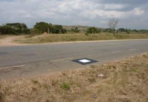
16 Provision of the Base Map 9 Geodetic points of order 0 Orthophoto and DTM over sq.km Resolution 50 cm Completed in September
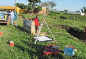
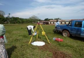
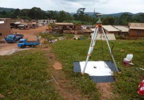
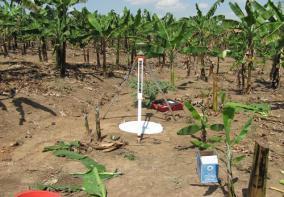

17 Measurement of Ground Control Points in different areas

18 Mbarara Fundamental Benchmark Aerial Photos: areas covered


19 Example of orthophoto Orthophoto sheet Zoom

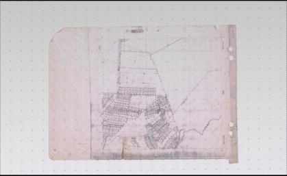
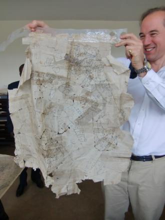
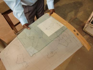
20 Cadastral Maps for rehabilitation and scanning


21 MAPS REHABILITATION AND SCANNING Rehabilitation and Scanning of : 11,500 cadastral maps 5,000 historical, topographical and cadastral index maps Completed in October 2011

22 Maps digitization Georeferencing of 16,500 maps Vectorisation of 11,500 cadastral maps To be completed in


23 Training and Capacity building Preparation and Implementation of Training and Capacity Building Plan Theoretical Practical And on the job trainings Organization of 4 Study tours 23


24 Public Information and Awareness Campaign Preparation and Implementation of Public Information and Awareness Campaign Plan Organization of the workshops with the project stakeholders Organization of the International workshop Development of the Web site Preparation and distribution of the brochures Interviews to the media (radio, 24 newspapers)
25 Measures proposed to enhance trust in LA system in Uganda Increase a transparency of business process Provision of improved information to the customers More accurate Easily accessible Consistent and up to date Well documented business process from survey data integration to the issuing of the title Improvement of transactions security Traceability of each step of the business process Organization of strict data management and backup Raise of public awareness on the reforms within MLHUD 25
26 Workflow & auditing Improved Work-flow management Accountability of documents Notifications to clients on progress of registration Time tracking and durations Assignment or scheduling of work to officers Customer Intake $$$ Fee Payment Scan Incoming Documents Initial Verification N 45 0' 0" E S 14 2' 10" E S 66 48' 5" E Survey 26 Drafting CoT etc Final Verification Signing and Sealing Documents Scanning Outgoing Documents Delivery Customer


27 Public Access Website allowing clients to query their transactions on status, duration, etc Improved accountability and transparency Using a unique transaction number clients can query the status of their transaction 27
28 Decentralized operations MLHUD Zonal Offices process registry/cadastral data, National Land Information Centre is a searchable data repository Government Data Centre NLIC and DLO Backup Registry and Cadastre District Land Office Registry/Cadastre database Registry: One Way Replication Cadastre: Once Way Replication National Land Information Center 28 District Land Office Registry/Cadastre database Registry: One Way Replication Cadastre: Once Way Replication Initially the NLIC will hold data for the 6 pilot districts
29 Customer Service Centers System will support MZO functions Cadastral and registry services Front and back office operations Segregate staff from clients Oversight from headquarters District Land Office Job Functions Public Area Front Office Applicants Visitor/ Applicant Public Access Incoming / Outgoing Documents Legal Issues Payment Staff Area Back Office Intake / Delivery Clerk Registrar Signing and Sealing Intake / Delivery Cashier Clerk Cashier DB Server MultiCadastre Editor (Cadastral) Scanning Leased Line/ Remote Access App Server Land Surveyor PID Assignment District Land Officer Data Entry Scanning Clerk NLIC System Administrator 29
30 Measures proposed to enhance trust in LA system in Uganda The introduction of the LIS will: Provide instant access to electronic registration and cadastral information, Streamline land registration procedures Facilitate reporting to appropriate stakeholders and partners, Support further digitalisation of existing paper documents and ultimately contribute to the set up of e-government in the domain of land administration 30
31 Conclusion Digitization of land records and implementation of LIS contributes to securing the transactions and provides technical basis for the struggle with and elimination of frauds; The LIS will allow effective use of the information and will facilitate the decision making process; The LIS will make land administration procedures more transparent, fast and simple and thus will enhance trust into Land Administration in Uganda 31

32 MLHUD Project for Design, Supply, Installation and Implementation of the Land Information System and Securing of Land Records Thank you for your attention CONTACT DETAILS IN FRANCE: Ms. Nadège ORLOVA Tel: CONTACT DETAILS IN UGANDA: Mr. Stéphane GIL sgil@ignfi.fr, Tel:
TSO1C: Land Reforms. Commission 7
 TSO1C: Land Reforms. Commission 7 Development of & Implementation LIS. Building an effective Partnership to Reform Uganda s Land Administration (7320) Gasant Jacobs, Head: Business Development. Tax & Accounting
LIS Development Project and Measures Proposed to Enhance Trust in the Land Administration System in Uganda
 LIS Development Project and Measures Proposed to Enhance Trust in the Land Administration System in Uganda by Land Administration Expert/Project Manager IGN France International, France, Land Administration
Land Information System as new instrument for Land Administration: Case Examples. Mike Cheremshynskyi Consultant, Land Administration Expert
 Land Information System as new instrument for Land Administration: Case Examples Mike Cheremshynskyi Consultant, Land Administration Expert Background Growth of population and fast urbanization in many
Directorate of Survey and Mapping NAMIBIA. Cadastral Information System. Vehupisa Kasuko Tjatindi Surveyor Directorate of Survey and Mapping NAMIBIA
 Vehupisa Kasuko Tjatindi Directorate of Survey and Mapping NAMIBIA Tel: +64 61 965000 Directorate of Survey and Mapping NAMIBIA Cadastral Information System Introduction Over the past few decades cadastral
Ministry of Justice Contact Person: Ms. Galina Elizarova
 Public Disclosure Authorized Public Disclosure Authorized Public Disclosure Authorized Public Disclosure Authorized Report No. PID11501 Project Name RUSSIAN FEDERATION-LAND REGISTRATION & CADASTRE PROJECT
PROJECT INFORMATION DOCUMENT (PID) CONCEPT STAGE Report No.: AB3229 Project Name. Land Registry and Cadastre Modernization Project Region
 CONCEPT STAGE Report No.: AB3229 Project Name. Land Registry and Cadastre Modernization Project Region") PROJECT INFORMATION DOCUMENT (PID) CONCEPT STAGE Report No.: AB3229 Project Name Land Registry and Cadastre Modernization Project Region EUROPE AND CENTRAL ASIA Sector Central government administration
PROJECT INFORMATION DOCUMENT (PID) CONCEPT STAGE Report No.: AB3229 Project Name Land Registry and Cadastre Modernization Project Region EUROPE AND CENTRAL ASIA Sector Central government administration
Functional system for cadastral plans
 , Republic of Macedonia Key words: Cadastre, Digital plans, Data, System SUMMARY The analysis shows that the real estate market in Republic of Macedonia grows daily. With the expansion of this market increases
DEVELOPING AN INTEGRATED LAND MANAGEMENT INFORMATION SYSTEM (ILMIS) FOR TANZANIA
 FOR TANZANIA") DEVELOPING AN INTEGRATED LAND MANAGEMENT INFORMATION SYSTEM (ILMIS) FOR TANZANIA BARNEY LASEKO, LAIZER APOLLO, AURÉLIE MILLEDROGUES, CAROL ROFFER, CHRISTOPHER BURKE Office of the Prime Minister (OPM) bislaseko@hotmail.com
DEVELOPING AN INTEGRATED LAND MANAGEMENT INFORMATION SYSTEM (ILMIS) FOR TANZANIA BARNEY LASEKO, LAIZER APOLLO, AURÉLIE MILLEDROGUES, CAROL ROFFER, CHRISTOPHER BURKE Office of the Prime Minister (OPM) bislaseko@hotmail.com
NEW DEVELOPMENTS IN THE REAL PROPERTY REGISTER AND CADASTRE IN LITHUANIA
 NEW DEVELOPMENTS IN THE REAL PROPERTY REGISTER AND CADASTRE IN LITHUANIA Jaunius Grigas E-mail: jaunius.grigas@registrucentras.lt Verona, 2008 FUNCTIONS OF STATE ENTERPRISE CENTRE OF REGISTERS Registration
International funding projects in Republic Geodetic Authority
 International funding projects in Republic Geodetic Authority Serbia: Republic Geodetic Authority Workshop Exploring Funding Instruments for NMCA 7-8 November 2012 Republic Geodetic Authority Republic
Egyptian Nationwide Title Cadastre System
 Kholoud SAAD, Egypt Key words: Cadastre, Registration, Urban, Rural, National Cadastre, Automation, reengineering. SUMMARY With growing need for integrated information, Enterprise Solutions has become
MASS REGISTRATION OF LAND PARCELS USING FIT-FOR-PURPOSE LAND ADMINISTRATION: PROCEDURES AND METHODS
 MASS REGISTRATION OF LAND PARCELS USING FIT-FOR-PURPOSE LAND ADMINISTRATION: PROCEDURES AND METHODS TAREK ZEIN Hansa Luftbild AG, Germany zein@hansaluftbild.de Paper prepared for presentation at the 2017
Integrated Safeguards Data Sheet (Initial)
") Public Disclosure Authorized Public Disclosure Authorized Public Disclosure Authorized Public Disclosure Authorized Integrated Safeguards Data Sheet (Initial) Section I - Basic Information Date Prepared/Updated:
Public Disclosure Authorized Public Disclosure Authorized Public Disclosure Authorized Public Disclosure Authorized Integrated Safeguards Data Sheet (Initial) Section I - Basic Information Date Prepared/Updated:
GAUSSCAD A WEBGIS APPLICATION FOR COLLECTING CADASTRAL DATA
 M.M. Moise GaussCAD a WebGIS Application for Collecting Cadastral Data GAUSSCAD A WEBGIS APPLICATION FOR COLLECTING CADASTRAL DATA Mihai-Mircea MOISE, S.C. GAUSS S.R.L., mihai.moise@gauss.ro Abstract:
Designing for transparency and participation in the Hellenic Cadastral Project
 Designing for transparency and participation in the Hellenic Cadastral Project Dr. Dimitris Rokos Director of Planning and Investments, Hellenic National Cadastre and Mapping Agency S.A. Table of Contents
DEEDS AND DIALOGUE. Issue Number One hhh July 2000
 DEEDS AND DIALOGUE Issue Number One hhh July 2000 VISION The Registry 2000 Project is a strategic initiative to modernize the Nova Scotia land tenure system. The vision of Registry 2000 is twofold: C to
Generic land administration business. FAO Workshop Rome, November 18-19,
 Generic land administration business FAO Workshop Rome, ovember 18-19, 2010 18.11.2010 1 Objectives Agree about what is the core land administration business common to all countries Derive the corresponding
Improvement of Effectiveness Present Developments in Hungarian Land Administration
 Improvement of Effectiveness Present Developments in Hungarian Land Administration Gyula IVÁN and András OSSKÓ, Hungary Key words: Land Administration, Cadastre, Land Registry SUMMARY New Act on Surveying
Systematic Land Regularization in Lesotho
 Systematic Land Regularization in Lesotho Jakob Riise Ian Corker Jan van Bennekom-Minnema Key words: Systematic Land Regularization First Registration Rights Adjudication General Boundary Survey Cadastre
IMPLEMENTATION OF FLEXICADASTRE IN ZAMBIA
 IMPLEMENTATION OF FLEXICADASTRE IN ZAMBIA Presented by: Simon M. Mwalimu Head of Mining Cadastre and Secretary of The Mining Advisory Committee Mining Cadastre Office-Zambia 16 th February 2009 Part A
Agenda Project Overview Project Objectives Registration Service Re-Engineering System Overview
 Agenda Project Overview Project Objectives Registration Service Re-Engineering System Overview Sydney, Australia, 11 16 April 2010 1 Project Overview Future Vision There is a vision within senior levels
e-land Administration in Hungary
 e-land Administration in Hungary Piroska Zalaba senior counsellor, project manager Ministry of Agriculture and Rural Development Department of Lands and Mapping FIG SEMINAR Innsbruck, 2-4 June 2004 Land
Esri Middle East and Africa User Conference. December Abu Dhabi, UAE. Land Administration. Mark Baker
 Esri Middle East and Africa User Conference December 10 12 Abu Dhabi, UAE Land Administration Mark Baker Our Agenda 0900 0930 Welcome Mark Baker, Esri 0930 1030 New Directions The New Addressing System
BULGARIAN CADASTRE A GUARANTEE FOR THE OWNERSHIP RIGHTS IN IMMOVABLE PROPERTIES
 4 TH INTERNATIONAL CONFERENCE RECENT PROBLEMS IN GEODESY AND RELATED FIELDS WITH INTERNATIONAL IMPORTANCE February 28 - March 2, 2007, Inter Expo Centre, Sofia, Bulgaria BULGARIAN CADASTRE A GUARANTEE
Regional Cadastral Study Reforms in the Region
 UNECE WORKING PARTY ON LAND ADMINISTRATION Workshop on the Influence of Land Administration on People and Business Cavtat, Croatia 2-3 October 2008 Regional Cadastral Study Reforms in the Region Miodrag
Quality Improvement of the Real Estate Cadastre in Serbia
 , Serbia Key words: quality improvement, real estate information, quality assurance, Serbia SUMMARY The concept of cadastral modernization in the Republic of Serbia was defined in 1992, and it is being
Spatial Data Warehouse Ltd. Cadastral Mapping INITIATIVE 1: CADASTRAL MAPPING. Version Spatial Data Warehouse Ltd. & AltaLIS Ltd.
 Spatial Data Warehouse Ltd. Initiative 1: Cadastral Mapping INITIATIVE 1: CADASTRAL MAPPING 29 P3 The SDW/AltaLIS Model Background The Government of Alberta started a mapping program, the Municipal Integrated
Land Administration Developments in Rwanda
 Land Administration Developments in Rwanda Eugène RURANGWA Expert Group Meeting on secure land tenure new legal frameworks and tools UN-Gigiri, Nairobi, 10-12 November, 2004 Contents Somme figures about
PROJECT INFORMATION DOCUMENT (PID) APPRAISAL STAGE Report No.: PIDA Project Name. Region Country Sector(s) Theme(s)
 APPRAISAL STAGE Report No.: PIDA Project Name. Region Country Sector(s) Theme(s)") Public Disclosure Authorized Public Disclosure Authorized Public Disclosure Authorized Public Disclosure Authorized Project Name Region Country Sector(s) Theme(s) Lending Instrument Project ID Borrower(s)
Public Disclosure Authorized Public Disclosure Authorized Public Disclosure Authorized Public Disclosure Authorized Project Name Region Country Sector(s) Theme(s) Lending Instrument Project ID Borrower(s)
Use of data in Ukraine for sustainable economic growth. Oleksandr Maliuk State Service of Ukraine for Geodesy, Cartography and Cadastre
 Use of data in Ukraine for sustainable economic growth Oleksandr Maliuk State Service of Ukraine for Geodesy, Cartography and Cadastre Kehl, 2017 Content of the presentation Ukraine & StateGeoCadastre:
Building Integrated Land Information Systems and Development of NSDI
 Stig JÖNSSON, Sweden Key words: Land administration, land information systems, property formation, spatial data infrastructure, Inspire, institutional cooperation SUMMARY Lantmäteriet the Swedish agency
Mainstreaming of the National Land Consolidation Programme (MAINLAND)
") Mainstreaming of the National Land Consolidation Programme (MAINLAND) Vilma Daugaliene FAO Chief Technical Advisor 19 June 2018, Skopje 1 General information about the Project Duration: 1 March 2017 31
Mainstreaming of the National Land Consolidation Programme (MAINLAND) Vilma Daugaliene FAO Chief Technical Advisor 19 June 2018, Skopje 1 General information about the Project Duration: 1 March 2017 31
Reforming the Land Sector in Jamaica
 Silburn CLARKE and Llewelyn ALLEN, Jamaica Key words: tenure, cadastre, land reform, adjudication, public awareness, land titling, GPS, parcel mapping, traversing, land legislation, tenure regularisation,
INTRODUCTION - Land is the platform of all societies activities. - Land policy regulates the access to land and the management of land.
 INTRODUCTION - Land is the platform of all societies activities. - Land policy regulates the access to land and the management of land. - An acceptable and proactive land policy is a critical success factor
Mass Valuation and Sales Price Register in the Republic of Serbia
 REPUBLIC OF SERBIA REPUBLIC GEODETIC AUTHORITY Mass Valuation and Sales Price Register in the Republic of Serbia Department for Mass Valuation Head of Department: Marija Raskovic procena@rgz.gov.rs Soest,
LIS a motivation for SDI initiative
 Eric Mwaikambo Ardhi University Dar es Salaam Tanzania Overview Status of LIS in Tanzania Relationship between SDI and LIS Spatial Standards LIS a motivation for SDI initiative Conclusion & Recommendations
Reporting Thailand Cadastral System in Cadastre 2014 Trends BY VUTTINAN UTESNAN. Rajamangala University of Technology Krungthep
 Reporting Thailand Cadastral System in Cadastre 2014 Trends BY VUTTINAN UTESNAN Rajamangala University of Technology Krungthep Faculty of Engineering, Bangkok, THAILAND Topics INTRODUCTION THAILAND CADASTRAL
Implementing Norwegian funded projects with the State Geodetic Administration in Croatia
 Implementing Norwegian funded projects with the State Geodetic Administration in Croatia Fredrik Steiwer Managing Director Project Management and Mapping AS PMM? Project Management and Mapping AS (PMM)
Using ICT to drive Business Process Change within Land Registry Offices Symposium on Innovative Technology for Land Administration
 Peter Rabley, ILS Using ICT to drive Business Process Change within Land Registry Offices Symposium on Innovative Technology for Land Administration June 23-24, 2005 Madison, Wisconsin Presentation Overview
LAND REGISTRATION SYSTEM OF THE REPUBLIC OF CROATIA
 "On the last day of the Creation God desired to crown His work, and thus created Kornati Islands out of tears, stars and breath." (George Bernard Shaw) LAND REGISTRATION SYSTEM OF THE REPUBLIC OF CROATIA
Urban Management Land Information System UMLIS: Facing Urban Challenges through Efficient Revenue Collection
 Urban Management Land Information System UMLIS: Facing Urban Challenges through Efficient Revenue Collection Kofi YEBOAH, Ghana and Linda JOHANSSON, Sweden Key words: property taxation, local governance,
Information Quality - A Critical Success Factor How to make it all right!
 Information Quality - A Critical Success Factor How to make it all right! Anders Svensson, Sweden Key words: Cadastre, information quality, property information, property boundaries SUMMARY Sweden has
Cadastral Information System of Sofia
 Alexander LAZAROV and Hristo DECHEV, Bulgaria Key words: ABSTRACT A new Cadastre and Property Register Act (CPRA) was passed in April 2000, setting up rules for the maintenance of these two registers.
Property Based Land Information Systems of Turkey
 Property Based Land Information Systems of Turkey Mehmet Fatih DİRİ, Bilgehan ÖZSOY, Ünsal ERGÜN, Turkey Key words: Cadaster, Land Registry, GIS, Property, TURKEY SUMMARY The property, addition to the
ENHANCING LAND TITLING AND REGISTRATION IN NIGERIA
 ENHANCING LAND TITLING AND REGISTRATION IN NIGERIA BY Muhammad Bashar NUHU, ANIVS, RSV, MNIM DEPARTMENT OF ESTATE MANAGEMENT FEDERAL UNIVERSITY OF TECHNOLOGY MINNA mbnuhu@futminna.edu.ng, nuhutachi@yahoo.com,
Implementation Status & Results Croatia Integrated Land Administration System Project (P122219)
") Public Disclosure Authorized Public Disclosure Authorized The World Bank Implementation Status & Results Croatia Integrated Land Administration System Project (P122219) Operation Name: Integrated Land
Public Disclosure Authorized Public Disclosure Authorized The World Bank Implementation Status & Results Croatia Integrated Land Administration System Project (P122219) Operation Name: Integrated Land
The Journey to 100% Electronic Survey. Land Information New Zealand. August 2009
 The Journey to 100% Electronic Survey and Title Lodgement Land Information New Zealand August 2009 Land Information New Zealand Established 1996 Titles, Survey, Geodetic, Electoral 12 locations 500 staff
Systematic Land Information Management (SLIM)
") Systematic Land Information Management (SLIM) By Mr. Jukka Nieminen Jaakko Pöyry Infra Soil and Water Ltd. Expert Group Meeting on Secure Land Tenure: New Legal Frameworks and Tools Nairobi 12 November
Systematic Land Information Management (SLIM) By Mr. Jukka Nieminen Jaakko Pöyry Infra Soil and Water Ltd. Expert Group Meeting on Secure Land Tenure: New Legal Frameworks and Tools Nairobi 12 November
Simplifying Land Transactions It can be done
 Simplifying Land Transactions It can be done Key words: land registration, cadastre, IT-systems 1. SUMMARY Starting from January 2012, the Government of Armenia has implemented a big reform to their cadastre.
GOVERNMENT OF ROMANIA
 GOVERNMENT OF ROMANIA DEPARTMENT FOR INFRASTRUCTURE PROJECTS AND FOREIGN INVESTMENT THE EXECUTION OF THE CADASTRAL SURVEYS AND REAL ESTATE PUBLICITY IT SYSTEM 1. Estimated value for the systematic recording
Amalia Velasco Carlos Alonso Luis Virgos Fernando Serrano
 Inspire services of the Spanish Directorate General for Cadastre and its use to resolve an old problem of coordination between Spanish Cadastre and Land Registry. Amalia Velasco Carlos Alonso Luis Virgos
MINISTRY OF LANDS, HOUSING AND URBAN DEVELOPMENT CLIENTS CHARTER 2017/ /21
 MINISTRY OF LANDS, HOUSING AND URBAN DEVELOPMENT CLIENTS CHARTER 2017/18 2020/21 July, 2017 1 Table of Contents 1.0 INTRODUCTION 1.1 The Ministry s Vision 1.2 The Ministry s Mission 1.3 The Ministry s
Jack McKenna, Director of Business Development, Africa and the Caribbean
 Presented at the FIG Working Week 2016, May 2-6, 2016 in Christchurch, New Zealand Jack McKenna, Director of Business Development, Africa and the Caribbean FIG WORKING WEEK 2016 Fit for Purpose Parcel
Estonian e-cadastre as basis for efficient land management
 Estonian e-cadastre as basis for efficient land management Priit Kuus Estonian Land Board November 14, 2017 Tallinn Scope of data Cadastral parcels (as of October 2017) 693 026 cadastral parcels, i.e.
Fit-for Purpose Approaches to Land Administration
 Fit-for Purpose Approaches to Land Administration Brent Jones, PE, PLS Global Manager, Casastre/Land Records bjones@esri.com Land Administration GIS is the platform for land administration Land administration
Urban-Rural Interrelationship for Sustainable Environment
 Urban-Rural Interrelationship for Sustainable Environment Marrakech 2-52 5 December 2003 Department of Lands and Survey - The Modernization Journey A Paper presented by Eng. Sameer Abbadi Surveying and
GLTN LAND TOOLS -SOME EXAMPLES-
 GLTN LAND TOOLS -SOME EXAMPLES- Dr. Jaap Zevenbergen University of Twente What are GLTN Land Tools? GLTN considers that a tool is a practical method to achieve a defined objective in a particular context.
TAKARNET intranet for the land administration
 Paper presented at the FIG Commission 3 Annual Meeting and Seminar Budapest, Hungary, 1999 TAKARNET intranet for the land administration Piroska Zalaba Ministry of Agriculture and Regional Development
Italian Cadastre and Real Estate Rights and Mortgages Registration System
 CLGE General Assembly Italian Cadastre and Real Estate Rights and Mortgages Registration System Franco Maggio Central Director Cartography, Cadastre and Real Estate Rights and Mortgages Registration System
Test and Implementation of DATR System in Hungary
 Test and Implementation of DATR System in Hungary, Hungary Key words: unified land registry, cadastral map, Hungary SUMMARY During the last years there has been an important development in the Hungarian
Establishing a Land policy reform and GPS Technology implementation in Burkina Faso
 Annual World Bank Conference on Land and Poverty 2013 Establishing a Land policy reform and GPS Technology implementation in Burkina Faso Presentation made by Moha EL-AYACHI, IAV Hassan 2, Morocco Paper
A Geocoded Cadastral Fabric as a Precondition for a Sustainable Land Management System
 A Geocoded Fabric as a Precondition for a Sustainable Land Management System Gottfried KONECNY, Germany; J.P. LAUZON, Canada; Abdul Salam MOHAMMED, India Key words: SDI,, Parcel Boundaries, GPS-GNSS, Land
Moving Towards a Fully Operational 3D Digital Cadastre: Victoria, Australia
 Moving Towards a Fully Operational 3D Digital Cadastre: Victoria, Australia Davood Shojaei, Hamed Olfat, Mohsen Kalantari, Mark Briffa, Abbas Rajabifard The University of Melbourne www.mcg.org.au Limitations
e-cadastre and Photo-Interpretation Technologies
 UNECE- WPLA EFFICIENT AND TRANSPARENT LAND MANAGEMENT IN ECE COUNTRIES 4 March 2010 - Baku, Azerbaijan e-cadastre and Photo-Interpretation Technologies The Italian experience as an example of Good Practice
Land Consolidation in Sweden and Land
 From chaos to order... Land Consolidation in Sweden and Land Reform in Romaniasimilarities and discrepancies a comparison Mats Backman June 16 th 2008 Personal presentation Land Consolidation work in Sweden
Information contained
 Government Information (Public Access) Act 2009 (GIPA Act) LPI Information Guide 1. Introduction and contents of this guide The Land and Property Information s (LPI) Information Guide tells you in general
New Technology for Cadastral Systems. Brent Jones, PE, PLS
 New Technology for Cadastral Systems Brent Jones, PE, PLS Benefits of Good Land Administration Key to addressing global challenges.. Secure Tenure Equitable Land and Property Taxation Support for Government
GOVERNMENT OF KOSOVA MINSTRY OF PUBLIC SERVICES KOSOVO CADASTRAL AGENCY PROGRESS OF THE CADASTRE IN KOSOVO
 KOSOVO CADASTRAL AGENCY FIG Commission 7 Annual Meeting 2004 Clermont-Ferrand, France September 8-14, 8 2004 PROGRESS OF THE CADASTRE IN KOSOVO Murat MEHA E-mail: mmeha@yahoo.com Data about Kosovo About
Key Registers in Finland and some views of Cadastre 2035
 Presented at the FIG Working Week 2016, May 2-6, 2016 in Christchurch, New Zealand Key Registers in Finland and some views of Cadastre 2035 FIG Working Week, Christchurch New Zealand May, the 3rd, 2016
LAND ADMINISTRATION IN LITHUANIA: CHALLENGES AND PERSPECTIVES
 UNECE WPLA Workshop Influence of Land Administration on People and Business, Cavtat, Croatia, October 2-3, 2008 LAND ADMINISTRATION IN LITHUANIA: CHALLENGES AND PERSPECTIVES Kestutis Sabaliauskas, Director
TOWARDS E-LAND ADMINISTRATION - ELECTRONIC PLANS OF SUBDIVISIONS IN VICTORIA
 TOWARDS E-LAND ADMINISTRATION - ELECTRONIC PLANS OF SUBDIVISIONS IN VICTORIA Mohsen Kalantari 1, Chris Lester 2, David R Boyle 3, Neil Coupar 4 1 eplan Coordinator 2 SPEAR Manager 3 Deputy Surveyor General
Economic and Social Council 6 July 2018
 1 ADVANCE UNEDITED VERSION UNITED NATIONS E/C.20/2018/12/Add.1 Economic and Social Council 6 July 2018 Committee of Experts on Global Geospatial Information Management Eighth session New York, 1-3 August
Technology-driven solutions for the innovation of land administration and management
 Technology-driven solutions for the innovation of land administration and management Technology and economic growth - Studies*find link between technology innovation and national economic prosperity especially,
PROJECT INFORMATION DOCUMENT (PID) APPRAISAL STAGE CADASTRE PROJECT - RU
 APPRAISAL STAGE CADASTRE PROJECT - RU") Public Disclosure Authorized Public Disclosure Authorized Public Disclosure Authorized Public Disclosure Authorized Project Name PROJECT INFORMATION DOCUMENT (PID) APPRAISAL STAGE CADASTRE PROJECT - RU
Public Disclosure Authorized Public Disclosure Authorized Public Disclosure Authorized Public Disclosure Authorized Project Name PROJECT INFORMATION DOCUMENT (PID) APPRAISAL STAGE CADASTRE PROJECT - RU
Massive Collection of Cadastral Data in Greece Using Web-enabled GIS Technologies
 Massive Collection of Cadastral Data in Greece Using Web-enabled GIS Technologies Lefteris LYKOUROPOULOS and George MOURAFETIS, Greece Key words: Cadastre, Web services, applications, GIS, data collection
Barbados. Land. Governance. Assessment A N A L Y S I S
 Barbados Land Governance Assessment A N A L Y S I S Methodology - Activities Strengths widest participation across all spheres of land discipline. Through coverage of land administration and management.
Cadastral services and virtual office in e-cadastre
 Cadastral services and virtual office in e-cadastre Priit Kuus Estonian Land Board October 26, 2016 Coimbra Scope of data Cadastral parcels (as of September 2016) 674 383 cadastral parcels, i.e. 97,7 %
Cadastre 2020 a Vision for a Future Cadastral System in Poland
 Cadastre 2020 a Vision for a Future Cadastral System in Poland Wojciech Wilkowski, Marcin Karabin, Poland Key words: model of cadastre, cadastral system, land register SUMMARY The paper presents results
FIG Congress 2010 Facing the Challenges Building the Capacity Sydney, Australia, April
 Setting up the infrastructure for improving the development of Cadastre in Greece Dr. Dimitris ROKOS, Dr. Konstantinos KYRIAZIS and Dr. Panos LOLONIS KTIMATOLOGIO S.A. (Hellenic Cadastre) Source: wikipedia
W B WEB E B S E S R E V R I V CE C S E S FO F R O R SU S R U V R E V Y E O Y R O S
 The Council of European Geodetic Surveyors Comité de Liaison des Géomètres Européens GEOWEB WEB SERVICES FOR SURVEYORS Hanover, Germany 10-14 October 2012 GEOWEB S.p.A. Geoweb S.p.A. was established in
Annual Meeting 2006 SLOVENIA, BLED RASAS GOFMANAS JAUNIUS GRIGAS RIMANTAS RAMANAUSKAS KESTUTIS TRECIOKAS
 Annual Meeting 2006 SLOVENIA, BLED LAND ADMINISTRATION IN LITHUANIA RASAS GOFMANAS JAUNIUS GRIGAS RIMANTAS RAMANAUSKAS KESTUTIS TRECIOKAS ADMINISTRATIVE STRUCTURE OF LITHUANIA HISTORY OF LAND ADMINISTRATION
Digitalisation of the Real Property Rights Towards Spatially enabled E-Government
 Digitalisation of the Real Property Rights Towards Spatially enabled E-Government Lise Schroeder, Bent Hulegaard Jensen, Esben Munk Soerensen & Line Hvingel Istanbul, Turkey 25 june 201 Overview Introduction
STREAMLINING LAND ADMINISTRATION AND GOVERNANCE IN CROSS RIVER STATE, NIGERIA by Engr. Bassey Oqua, Chiemeka Ngwu, Nigel Edmead & Frank Pichel
 STREAMLINING LAND ADMINISTRATION AND GOVERNANCE IN CROSS RIVER STATE, NIGERIA by Engr. Bassey Oqua, Chiemeka Ngwu, Nigel Edmead & Frank Pichel FIG Working Week, Abuja, May 6 th 10 th 2013 Environment for
City of Surrey s Digital Plan Submission Process
 City of Surrey s Digital Plan Submission Process Cadastral Update Karen Stewart, B.Tech. (GIS) Spatial Information Manager Peter Mueller, B.C.L.S., C.L.S. Survey Manager City of Surrey, British Columbia,
The World Bank Modernization of Real Property Registration and Cadastre (P151746)
") Public Disclosure Authorized EUROPE AND CENTRAL ASIA Uzbekistan Social, Urban, Rural and Resilience Global Practice Global Practice IBRD/IDA Investment Project Financing FY 2016 Seq No: 5 ARCHIVED on 23-Apr-2018
Public Disclosure Authorized EUROPE AND CENTRAL ASIA Uzbekistan Social, Urban, Rural and Resilience Global Practice Global Practice IBRD/IDA Investment Project Financing FY 2016 Seq No: 5 ARCHIVED on 23-Apr-2018
By: Barney I. S. Laseko Programme Coordinator Prime Minister s Office TANZANIA
 2014 CONFERENCE ON LAND POLICY IN AFRICA 11 14 NOVEMBER, 2014 Focussed Discussion VIII Converting from Manual Land Registration to GIS Enabled Land Information System Case of Sub Saharan Africa Tanzania
Information System of Electronic Cadastre Registration of Lands in Azerbaijan
 The State Committee on Property Issues of the Republic of Azerbaijan Information System of Electronic Cadastre Registration of Lands in Azerbaijan Chıngız Tanırverdiyev-chief engineer Cadastre and Land
GLTN Tools and Approaches in Support of Land Policy Implementation in Africa
 GLTN Tools and Approaches in Support of Land Policy Implementation in Africa Jamal Browne (UN-Habitat), Jaap Zevenbergen (ITC), Danilo Antonio (UN-Habitat), Solomon Haile (UN-Habitat) Land Policy Development
A CADASTRAL GEODATA BASE FOR LAND ADMINISTRATION USING ARCGIS CADASTRAL FABRIC MODEL A CASE STUDY OF UWANI ENUGU, ENUGU STATE, NIGERIA
 A CADASTRAL GEODATA BASE FOR LAND ADMINISTRATION USING ARCGIS CADASTRAL FABRIC MODEL A CASE STUDY OF UWANI ENUGU, ENUGU STATE, NIGERIA BY Ndukwu, Raphael. Ike Department of Geoinformatics & Surveying University
LAND ADMINISTRATION REFORM IN GHANA DR W.ODAME LARBI PROJECT DIRECTOR GHANA LAND ADMINISTRATION PROJECT
 LAND ADMINISTRATION REFORM IN GHANA DR W.ODAME LARBI PROJECT DIRECTOR GHANA LAND ADMINISTRATION PROJECT 1 OUTLINE Background Long Term Objectives of the LAP Objectives of Phase 1 of LAP The Components
DATR towards e-land Administration in Hungary
 DATR towards e-land Administration in Hungary Gyula IVÁN-Gábor SZABÓ-Zoltán WENINGER-Piroska Zalaba Institute of Geodesy, Cartography and Remote Sensing, Budapest, HUNGARY XXIV. FIG Congress Facing the
Collateral Underwriter Overview. National Association of REALTORS January 23, 2015
 Collateral Underwriter Overview National Association of REALTORS January 23, 2015 2014 Fannie Mae. Trademarks of Fannie Mae. Introduction to Collateral Underwriter I January 2015 What Is Collateral Underwriter?
Assessor. Mission Statement: Functions: Long Term Goals: Page 1 of 6
 Assessor Mission Statement: The mission of the Assessor s Office is to create accurate, equitable, and timely property tax assessments to fund public services; and to be a source of current, accurate property
Country report, HUNGARY
 Country report, HUNGARY Gyula IVÁN Institute of Geodesy, Cartography & Remote Sensing (FÖMI) HUNGARY FIG Commission 7 Annual Meeting 2009 12-16 October, 2009, Kuala Lumpur, Malaysia Institute of Geodesy,
A Complete, Free Solution for Cadastral Map Management
 A Complete, Free Solution for Cadastral Map Management Gyula IVÁN Institute of Geodesy, Cartography & Remote Sensing (FÖMI) HUNGARY FIG Commission 7, Annual Meeting 11-15 September 2008., Verona, ITALY
Map Modernization Modernization Program
 FEMA Map Modernization Program Presented to Maryland Association of Floodplain and Stormwater Managers October 27, 2005 Map Modernization Program Autorun.exe 2 Map Modernization Program Outline Map Mod
Progress Report on Green Paper. Dr. Paddy Prendergast. on behalf of the. IIS Commission on Land Registration
 Progress Report on Green Paper By Dr. Paddy Prendergast on behalf of the IIS Commission on Land Registration Paddy Prendergast - Chair Brendan Sweeny - Hempenstall Surveys Paul Corrigan - P Corrigan Associates
AGENDA REPORT. Susan Healy Keene, AICP, Director of Community Development
 AGENDA REPORT Item Number: To: From: Subject: F i Honorable Mayor & City Council Susan Healy Keene, AICP, Director of Community Development UPDATE ON IMPLEMENTATION OF AMENDED RENT STABILIZATION ORDINANCE
GLOBAL GEOSPATIAL MANAGEMENT INFORMATION
 GLOBAL GEOSPATIAL MANAGEMENT INFORMATION SEOUL, KOREA 24 th to 26 th October 2011 COUNTRY REPORT - REPUBLIC OF BOTSWANA 1. INTRODUCTION 1.1. SOCIAL, ECONOMIC AND POLITICAL BACKGROUND Botswana attained
Croatian SDI: a Tool for Accelerated Development of the Geo-Conscious Society
 STATE GEODETIC ADMINISTRATION Croatian SDI: a Tool for Accelerated Development of the Geo-Conscious Society Prof.Dr.Sc. Željko Bačić, Mr.Sc. Ljerka Rašić FIG Working Week 2009 - Surveyors Key Role in Accelerated