Technology-driven solutions for the innovation of land administration and management
|
|
|
- Rhoda Barnett
- 5 years ago
- Views:
Transcription


1 Technology-driven solutions for the innovation of land administration and management

2
3 Technology and economic growth - Studies*find link between technology innovation and national economic prosperity especially, strong connection between ICT investment and economic growth - Study of 120 nations between 1980 and 2006 estimated each 10 percentage point increase in broadband penetration adds 1.3 percent to a high income country s gross domestic product 1.21 percent for low to middle income nation - Faster broadband and wireless speeds enable people to take advantage of new digital tools such as GIS mapping and other technologies related to administration and services * 1. Christine Zhen Wei Qiang, Telecommunications and Economic Growth, Washington, D.C.: World Bank. 2. Taylor Reynolds, The Role of Communication Infrastructure Investment in Economic Recovery, Working Party on Communication Infrastructures and Services Policy, OECD.
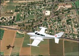


4 Advanced technologies in Cadaster & Land Administration


 area.")

")
5 IDB Project in Uruguay Fining the best methodology to create digital cadastral map in terms of cost/time/manpower aspects Establishing sustainable economic growth and citizen centered e-government by organizationally utilizing land information with various information that other departments have Project duration : 12M Project Area : Canelones City and Agricultural area (population 20 thousand /12sq.km) Acquisition of aerial photograph using UAVs and building cadastral map in urban area. Acquisition of satellite photograph and building cadastral map in rural(agricultural) area. Verify locational accuracy through ground survey and provide innovative technical approaches comparing current cadastral map. Conduct overseas training (10 persons / 2 weeks) Project Implementation System Overall control Administration Counterpart Implementation
6 Final result from the Project Before In rural areas After In urban areas

 - A cadastral map was produced on the basis of the")
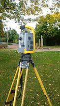
7 Final result from the Project Unmanned Aerial Vehicle (UAV) 1. Fixed wing - Less than 5cm level accuracy - 12 sq. km (Canelones city) - 120/150/200m - 60/70/80% overlap - (1*1km for pilot area) - A cadastral map was produced on the basis of the existing map In urban areas


8 Final result from the Project Satellite imagery - KOMSAT-3A - Under 50cm level accuracy - Approx. 280 sq. km - About 70 GCPs were measured - Ortho-photo map - A cadastral map for rural area was produced on the basis of the existing map Before In rural areas After KOMPSAT-3
, Residential(3%) Population: 51.")
9 Korea at a glance Officially: Republic of Korea Seoul (Capital) Area: 100,210 km 2 Land use: Forest(65%), Agriculture(21%), Residential(3%) Population: 51.2 million Population Density: 499/Km 2 Parcels: 37 million
10


11 Efforts for economic development Korea began to restore and industrialize its economy 1960s. Export Promotion 1970s. Heavy and Chemical Industrialization 1980s. Structural Reforms and Liberalization Programs. 1990s. Remarkable development of IT industry 2000s. Export amount reaches US$ 1 trillion.

12


13 Korea s Land Problems from Rapid Development Scarcity of Land Endowment Environmental problem Land disputes Skyrocketing land price

14 Problems extended to administrative areas Different views from different departments Duplicated systems Heterogeneous data Mis-conversion Informal process Mis-design of system/db

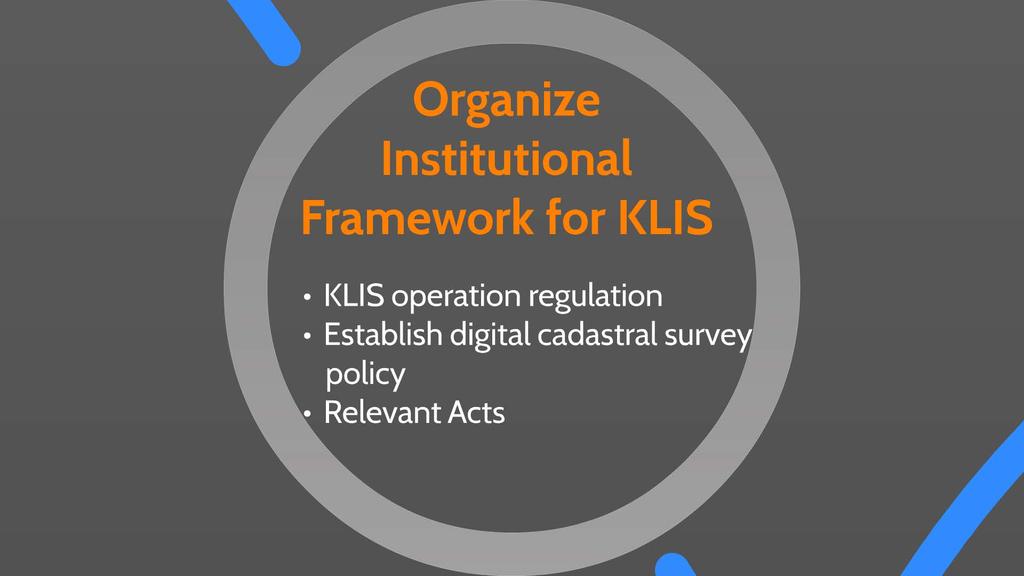
15 The solution: KLIS (Korea Land Information System) To establish a more efficient and systematic land administration and innovate civil services Enhance public service by creating a unified channel to provide land information Increase transparency and reliability of Establish a foundation for innovative and land information systematic policies The Problems Promote advancements in property transactions based on transparent information Duplication of works Multiple investment in information Time-consuming public service Conflicts of interests


16 History of modernization of land administration Simple description Map system Cadastral/Forest map Computerization of Cadastral map PBLIS* KLIS* KRAS* ( ) The initial cadastral system Paper-based Land/Forest book Document system Card-shape Land book File Computerized Cadastral book LMIS* (Land Use, etc.) current


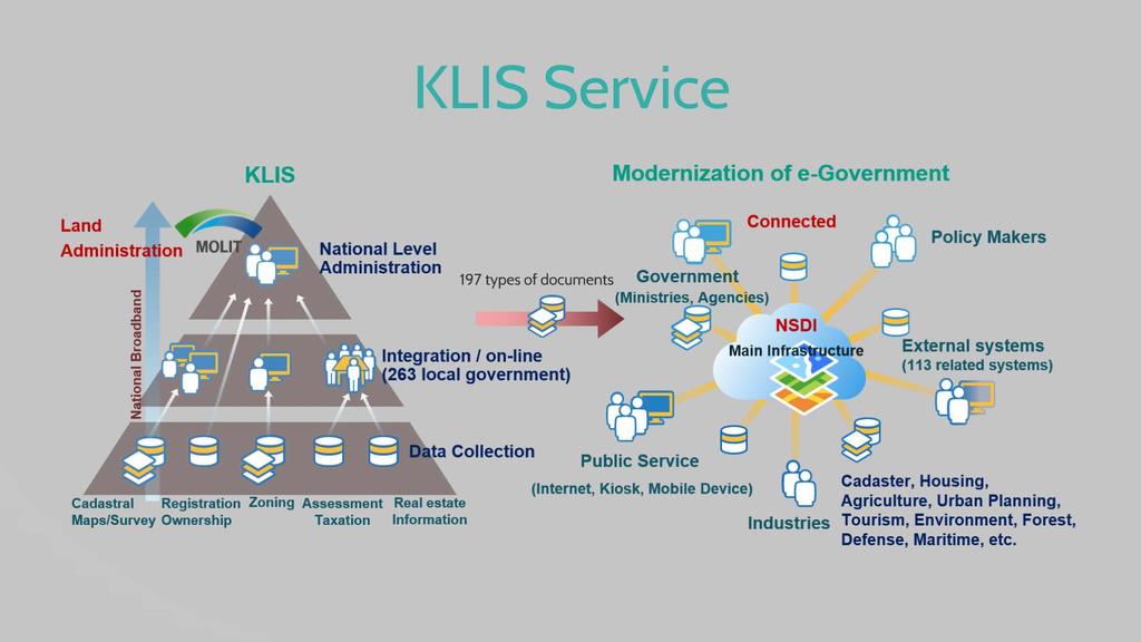
17 Integrative Land Information System Construction of a nationwide ICT-based system using an ultra high-speed national network, linking the Ministry of Land, Infrastructure, and Transport with 17 metropolitan cities and provinces, and 229 cities, counties, and wards

18 Flow of KLIS Survey Data Korea Land Information System Land Administration support system Spatial Data management system Digitized documents Digital maps Real Estate Urban Planning Price & Value Tax Land Boundary Real Estate Transaction Registration Property Administrative Data Web-based Parcel Document Management System Civil information inquiry service On-line document issuance Real estate Farmland Forest Development Value


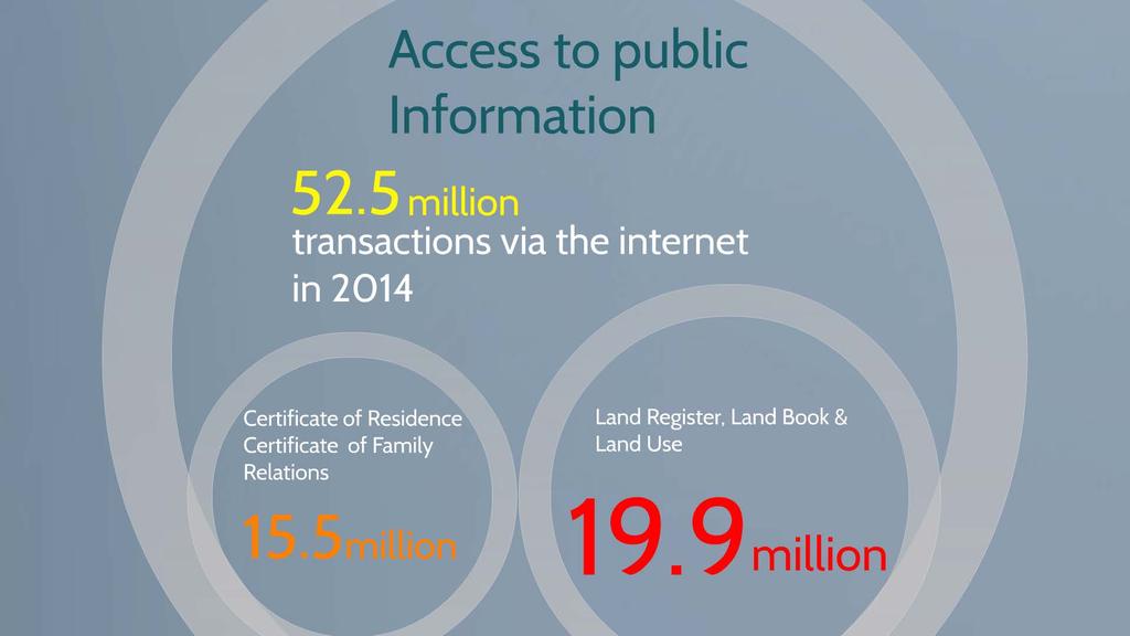
19 On & Offline Public Services KIOSK Service Online Land Information Service Anytime! Anywhere! Certificate of Real Property Community Center Bank Market

 (Land Administration Department) Municipality (262) (Land Administration")


20 Organizational structure of Land Administration & Registration ROLE Cadaster Land Land Value Cadaster service Registration Land Administration Sector & Role The Ministry of Land, Infrastructure and Transport (Office of Housing and Land) Province/Metro City (17) (Land Administration Department) Municipality (262) (Land Administration Department) - Operating Laws & Planning - Policy Making - Guidance & Supervision - Land Management - Statistics Management - Internet Service - Cadastral Records Management - Land Administration - Civil Service LX & Private Sector - Reception of Request for surveying - Cadastral surveying - KLIS management & upload data - Development of DB & systems The Supreme Court Registry Office - Registration task - Real estate Information Management Relative System Korea Land Information System (KLIS) Real Estate Registration System
21
22
23
24
25
26
27

28

29


30 KLIS
31
32
33

34


35 Outputs of land informatization 197 types of documents Parcel documents 39 types Development fee 23 types Public housing price 37 types Public land price 52 types Property brokerage 20 types Land transaction permit 7 types Integrated civil documents 19 types Land administration
Egyptian Nationwide Title Cadastre System
 Kholoud SAAD, Egypt Key words: Cadastre, Registration, Urban, Rural, National Cadastre, Automation, reengineering. SUMMARY With growing need for integrated information, Enterprise Solutions has become
An Approach to Integration of Land Administration System
 An Approach to Integration of Land Administration System, Republic of Korea Key words: Land Administration System, Integration, South Korea SUMMARY Korea s modern land system was enforced after the land
New Developments in the Hellenic Cadastre
 New Developments in the Hellenic Cadastre Prof. M. Kavouras Vice-president Ktimatologio S.A. (Hellenic Cadastre) The Hellenic Cadastre Background The Hellenic National Cadastre Organizational and institutional
Background. Contents. Analyses of current LA. Data workflow within LA. Strategy for an integrated LAS. Conclusion
 2007. 5. 21 Contents Background Analyses of current LA Data workflow within LA Strategy for an integrated LAS Conclusion Background LA data is a main sector for successful e-government Customer demands
FIG-WB Forum on Land Administration
 FIG-WB Forum on Land Administration and Reform in Sub-Sahara Africa [Nigeria] [Peter O. Adeniyi] FIG WORKING WEEK, Abuja, NIGERIA 2013-6-10 MAY 2013 Statistic Country at a Glance Total population 162,470,737
Iranian Cadastre System. Nasrollah Jahangard Iran s Deeds and Properties Registration Organization I.R. of Iran 14 th PCGIAP, KL, Malaysia 2008
 Iranian Cadastre System Nasrollah Jahangard Iran s Deeds and Properties Registration Organization I.R. of Iran 14 th PCGIAP, KL, Malaysia 2008 General Information Europe Middle East Asia Africa Middle
I GIS market of Korea.
 I. GIS market of Korea National Informationization Base Preparing National Informationization Driving The 1st National basic computer network basic plan(1987~1991) GIS Base Creating The 1st National geographic
e-cadastre and Photo-Interpretation Technologies
 UNECE- WPLA EFFICIENT AND TRANSPARENT LAND MANAGEMENT IN ECE COUNTRIES 4 March 2010 - Baku, Azerbaijan e-cadastre and Photo-Interpretation Technologies The Italian experience as an example of Good Practice
Designing for transparency and participation in the Hellenic Cadastral Project
 Designing for transparency and participation in the Hellenic Cadastral Project Dr. Dimitris Rokos Director of Planning and Investments, Hellenic National Cadastre and Mapping Agency S.A. Table of Contents
Key Registers in Finland and some views of Cadastre 2035
 Presented at the FIG Working Week 2016, May 2-6, 2016 in Christchurch, New Zealand Key Registers in Finland and some views of Cadastre 2035 FIG Working Week, Christchurch New Zealand May, the 3rd, 2016
Vietnam Land Administration - the Past, Recent and for the Future
 Mr. Ton Gia Huyen, Former Director General of General Department of Land Administration and Mrs. Tran Thi Minh Ha, Director of International Relation Department, Ministry of Natural Resources and Environment,
Land Administration Developments in Rwanda
 Land Administration Developments in Rwanda Eugène RURANGWA Expert Group Meeting on secure land tenure new legal frameworks and tools UN-Gigiri, Nairobi, 10-12 November, 2004 Contents Somme figures about
COMPUTERIZED SYSTEM SUPPORTING DEVELOPMENT OF LAND MARKET IN GEORGIA
 COMPUTERIZED SYSTEM SUPPORTING DEVELOPMENT OF LAND MARKET IN GEORGIA S. G. TSIRAMUA, I. S. MELASHVILI Land Registration Unit of Government of Georgian, World Bank and IFAD Agriculture Development Project.
ABSTRACT Land Administration System in Lithuania
 ABSTRACT Land Administration System in Lithuania 1. General introduction to the Lithuanian Land Administration System and State Enterprise Centre of Registers ( shortly SECR) Lithuania has established
Regional Cadastral Study Reforms in the Region
 UNECE WORKING PARTY ON LAND ADMINISTRATION Workshop on the Influence of Land Administration on People and Business Cavtat, Croatia 2-3 October 2008 Regional Cadastral Study Reforms in the Region Miodrag
IT Solutions in Supporting Rwanda Land Administration System
 Ease of Doing Business Initiative Conference 2016 Digitizing Government business Leveraging ICT to enhance the Business Environment IT Solutions in Supporting Rwanda Land Administration System Pothin MUVARA
Unified Land Administration for a Better Spatial Infrastructure
 Unified Land Administration for a Better Spatial Infrastructure Gyula IVÁN Institute of Geodesy, Cartography & Remote Sensing FÖMI (HUNGARY) Open Symposium 30th Korean Cadastral Seminar & FIG Commission
Use of data in Ukraine for sustainable economic growth. Oleksandr Maliuk State Service of Ukraine for Geodesy, Cartography and Cadastre
 Use of data in Ukraine for sustainable economic growth Oleksandr Maliuk State Service of Ukraine for Geodesy, Cartography and Cadastre Kehl, 2017 Content of the presentation Ukraine & StateGeoCadastre:
Building Fit for Purpose Land Administration Systems - World Bank Experience
 Building Fit for Purpose Land Administration Systems - World Bank Experience Gavin Adlington Lead Land Administration Specialist The World Bank Fit For Purpose The only way to establish a successful land
Land Administration Infrastructures for Sustainable Development
 The Global Challenges Land Administration Infrastructures for Sustainable Development Prof. Stig Enemark Department of Development and Planning Aalborg, University, Denmark INTERNATIONAL CONFERENCE ON
MASS REGISTRATION OF LAND PARCELS USING FIT-FOR-PURPOSE LAND ADMINISTRATION: PROCEDURES AND METHODS
 MASS REGISTRATION OF LAND PARCELS USING FIT-FOR-PURPOSE LAND ADMINISTRATION: PROCEDURES AND METHODS TAREK ZEIN Hansa Luftbild AG, Germany zein@hansaluftbild.de Paper prepared for presentation at the 2017
The Role of Cadastral Information for the Good Land Administration in South Korea
 The Role of Cadastral Information for the Good Land Administration in South Korea LEE Youngho, Republic of Korea SUMMARY Land administration system is mainly concerned with administrative and operational
FIG-WB Forum on Land Administration and reform in Sub-Sahara Africa
 FIG-WB Forum on Land Administration and reform in Sub-Sahara Africa Chris Mnyanga Ministry of Lands UNITED REPUBLIC OF TANZANIA] FIG WORKING WEEK, Abuja, NIGERIA 2013-6-10 MAY 2013 Country at Glance UNITED
Land Tenure and Geospatial Data and Technology
 Land Tenure and Geospatial Data and Technology Ioana Bouvier E3/Land and Urban, USAID Senior Geospatial Analyst January 23, 2018 January 23, 2018 1 OUTLINE 1. Overview of geospatial data and technology
Directorate of Survey and Mapping NAMIBIA. Cadastral Information System. Vehupisa Kasuko Tjatindi Surveyor Directorate of Survey and Mapping NAMIBIA
 Vehupisa Kasuko Tjatindi Directorate of Survey and Mapping NAMIBIA Tel: +64 61 965000 Directorate of Survey and Mapping NAMIBIA Cadastral Information System Introduction Over the past few decades cadastral
Country report, HUNGARY
 Country report, HUNGARY Gyula IVÁN Institute of Geodesy, Cartography & Remote Sensing (FÖMI) HUNGARY FIG Commission 7 Annual Meeting 2009 12-16 October, 2009, Kuala Lumpur, Malaysia Institute of Geodesy,
Land Administration and Management in Nepal" Krishna Raj B.C. Joint Secretary Ministry of Land Reform and Management Nepal
 Land Administration and Management in Nepal" Krishna Raj B.C. Joint Secretary Ministry of Land Reform and Management Nepal Presentation Outline Country Context Current Situation Available Infrastructure
RWANDA NATURAL RESOURCES AUTHORITY Department of Lands and Mapping
 RWANDA NATURAL RESOURCES AUTHORITY Department of Lands and Mapping National Land Use and Development Master Plan Presentation to National Forum on Sustainable Urbanisation in Support of EDPRS 2 Eng. Didier
The Continuous Cadastral Mapping Plan the Computerized Digital File of Cadastral Map in Korea - Focusing on the Accurative Continuous Cadastral Map -
 The Continuous Cadastral Mapping Plan the Computerized Digital File of Cadastral Map in Korea - Focusing on the Accurative Continuous Cadastral Map - KO Jeongseok, PARK Sungseok, SHIN Donghyun, Republic
FUTURE VISION ON KOREAN CADASTRAL SURVEYING
 FUTURE VISION ON KOREAN CADASTRAL SURVEYING Myounwoo LEE, Vice President, Korea Cadastral Survey Corporation, Korea 1. INTRODUCTION Cadastral surveying, which contributes to secure the ownership of the
By: Barney I. S. Laseko Programme Coordinator Prime Minister s Office TANZANIA
 2014 CONFERENCE ON LAND POLICY IN AFRICA 11 14 NOVEMBER, 2014 Focussed Discussion VIII Converting from Manual Land Registration to GIS Enabled Land Information System Case of Sub Saharan Africa Tanzania
A Study on Use of Cadastre Information for Management of Urban Facility
 In-Je WOO and Joon-Sung YUN, Republic of Korea Key words: Cadastre, Feature, Facility, Management, Classification, etc. SUMMARY The purpose of this study is to more effectively operate the cadastre information
DOING BUSINESS Frederic Meunier EDBI Conference, Nairobi
 DOING BUSINESS 2016 Frederic Meunier EDBI Conference, Nairobi May 3 rd, 2016 How has the Registering Property indicator changed over time? Efficiency of land administration systems has always been measured:
PCC conference Tällberg. Aspects on development cooperation
 PCC conference Tällberg Aspects on development cooperation PCC conference Tällberg WHO I AM Anders Åberg, Project Leader Posted over seas 10 years Tanzania 1978 1980 Vietnam 1987 1990 Laos 2004 2008 Now
CAN A PUBLIC-PRIVATE PARTNERSHIP IN LAND REGISTRATION PROVIDE A VEHICLE FOR GREATER INCLUSION AND BETTER GOVERNANCE?
 CAN A PUBLIC-PRIVATE PARTNERSHIP IN LAND REGISTRATION PROVIDE A VEHICLE FOR GREATER INCLUSION AND BETTER GOVERNANCE? Mika-Petteri Törhönen, Victoria Stanley, And Victoria Delmon ANNUAL WORLD BANK CONFERENCE
LIS a motivation for SDI initiative
 Eric Mwaikambo Ardhi University Dar es Salaam Tanzania Overview Status of LIS in Tanzania Relationship between SDI and LIS Spatial Standards LIS a motivation for SDI initiative Conclusion & Recommendations
Responsible and Innovative Land Administration
 Responsible and Innovative Land Administration An Example from Ethiopia 3 RD DECEMBER 2018 Outline A few words about NIRAS Fit-for-purpose: A low-tech disruptive approach? The REILA Project in Ethiopia
Utility networks in Estonian Restrictions Information
 Utility networks in Estonian Restrictions Information System Mr. Priit Kuus Department of Land Cadastre priit.kuus@maaamet.ee +372 675 0843 Tallinn 2011 Restrictions: legal grounds The Constitution of
Quality Improvement of the Real Estate Cadastre in Serbia
 , Serbia Key words: quality improvement, real estate information, quality assurance, Serbia SUMMARY The concept of cadastral modernization in the Republic of Serbia was defined in 1992, and it is being
Introduction to Land Tenure Administration
 Introduction to Land Tenure Administration Karol Boudreaux Land Tenure & Resource Rights Practice Lead, The Cloudburst Group January 22, 2018 January 22, 2018 1 WHAT WE LL COVER Background and Definitions
Cadastral Template 2003
 PCGIAP-Working Group 3 "Cadastre" FIG-Commission 7 "Cadastre and Land Management" Cadastral Template 2003 The establishment of a cadastral template is one of the objectives of Working Group 3 "Cadastre"
Property Based Land Information Systems of Turkey
 Property Based Land Information Systems of Turkey Mehmet Fatih DİRİ, Bilgehan ÖZSOY, Ünsal ERGÜN, Turkey Key words: Cadaster, Land Registry, GIS, Property, TURKEY SUMMARY The property, addition to the
Field surveying inspection using tablets
 Field surveying inspection using tablets Rami Farraj, Ahmad Sghyyer Survey of Israel, Lincoln 1, Tel-Aviv, Israel rami@mapi.gov.il ahmad@mapi.gov.il Key words: Field Surveying, Cadastre, Mapping Procedures
Land Information System as new instrument for Land Administration: Case Examples. Mike Cheremshynskyi Consultant, Land Administration Expert
 Land Information System as new instrument for Land Administration: Case Examples Mike Cheremshynskyi Consultant, Land Administration Expert Background Growth of population and fast urbanization in many
Securing Land Rights for Broadband Land Acquisition for Utilities in Sweden
 Securing Land Rights for Broadband Land Acquisition for Utilities in Sweden Marija JURIC and Kristin LAND, Sweden Key words: broadband, land acquisition, cadastral procedure, Sweden SUMMARY The European
Croatian SDI: a Tool for Accelerated Development of the Geo-Conscious Society
 STATE GEODETIC ADMINISTRATION Croatian SDI: a Tool for Accelerated Development of the Geo-Conscious Society Prof.Dr.Sc. Željko Bačić, Mr.Sc. Ljerka Rašić FIG Working Week 2009 - Surveyors Key Role in Accelerated
DATR towards e-land Administration in Hungary
 DATR towards e-land Administration in Hungary Gyula IVÁN-Gábor SZABÓ-Zoltán WENINGER-Piroska Zalaba Institute of Geodesy, Cartography and Remote Sensing, Budapest, HUNGARY XXIV. FIG Congress Facing the
e-land Administration in Hungary
 e-land Administration in Hungary Piroska Zalaba senior counsellor, project manager Ministry of Agriculture and Rural Development Department of Lands and Mapping FIG SEMINAR Innsbruck, 2-4 June 2004 Land
Annual Meeting 2006 SLOVENIA, BLED RASAS GOFMANAS JAUNIUS GRIGAS RIMANTAS RAMANAUSKAS KESTUTIS TRECIOKAS
 Annual Meeting 2006 SLOVENIA, BLED LAND ADMINISTRATION IN LITHUANIA RASAS GOFMANAS JAUNIUS GRIGAS RIMANTAS RAMANAUSKAS KESTUTIS TRECIOKAS ADMINISTRATIVE STRUCTURE OF LITHUANIA HISTORY OF LAND ADMINISTRATION
GOVERNMENT OF ROMANIA
 GOVERNMENT OF ROMANIA DEPARTMENT FOR INFRASTRUCTURE PROJECTS AND FOREIGN INVESTMENT THE EXECUTION OF THE CADASTRAL SURVEYS AND REAL ESTATE PUBLICITY IT SYSTEM 1. Estimated value for the systematic recording
Geoinformation Technologies in Land Management and Beyond: Case of Georgia
 Geoinformation Technologies in Land Management and Beyond: Case of Georgia Joseph SALUKVADZE Professor, Department of Human Geography, Co-team Leader, Cadastre and Land Register Project, Co-financed by
Cadastre: definitions
 Introduction New vision towards a multipurpose cadastral system to support land management in Morocco Moha EL-AYACHI, El Hassane SEMLALI, Mohamed ETTARID, Driss TAHIRI, Institut Agronomique et Vétérinaire
Integrated Safeguards Data Sheet (Initial)
") Public Disclosure Authorized Public Disclosure Authorized Public Disclosure Authorized Public Disclosure Authorized Integrated Safeguards Data Sheet (Initial) Section I - Basic Information Date Prepared/Updated:
Public Disclosure Authorized Public Disclosure Authorized Public Disclosure Authorized Public Disclosure Authorized Integrated Safeguards Data Sheet (Initial) Section I - Basic Information Date Prepared/Updated:
Building Integrated Land Information Systems and Development of NSDI
 Stig JÖNSSON, Sweden Key words: Land administration, land information systems, property formation, spatial data infrastructure, Inspire, institutional cooperation SUMMARY Lantmäteriet the Swedish agency
Information System of Electronic Cadastre Registration of Lands in Azerbaijan
 The State Committee on Property Issues of the Republic of Azerbaijan Information System of Electronic Cadastre Registration of Lands in Azerbaijan Chıngız Tanırverdiyev-chief engineer Cadastre and Land
Low Cost Titling in Africa
 Low Cost Titling in Africa Land Tenure Regularisation in Rwanda Presentation to the World Bank Annual Land Conference, Washington DC April 26-27, 2010 National Land Centre, Ministry of Environment and
CADASTRAL WORKS in TURKEY AND GDLRC (TKGM)
") CADASTRAL WORKS in TURKEY AND GDLRC (TKGM) NOVEMBER 2011 SOME NUMBERS ABOUT TURKEY Area :783.600 Km 2 Population : 747 millions (2008) Number of land parcels : 555 millions Villages and quarters : 52.437
CADASTRAL WORKS in TURKEY AND GDLRC (TKGM) NOVEMBER 2011 SOME NUMBERS ABOUT TURKEY Area :783.600 Km 2 Population : 747 millions (2008) Number of land parcels : 555 millions Villages and quarters : 52.437
LAND REGISTRATION SYSTEM OF THE REPUBLIC OF CROATIA
 "On the last day of the Creation God desired to crown His work, and thus created Kornati Islands out of tears, stars and breath." (George Bernard Shaw) LAND REGISTRATION SYSTEM OF THE REPUBLIC OF CROATIA
Cadastre and Other Public Registers: Multipurpose Cadastre or Distributed Land Information System?
 Cadastre and Other Public Registers: Multipurpose Cadastre or Distributed Land Information System? Ivan PESL, Czech Republic Key words: Cadastre, Land Registry, Property, Taxes, Land Use, Territorial Planning,
Agenda Project Overview Project Objectives Registration Service Re-Engineering System Overview
 Agenda Project Overview Project Objectives Registration Service Re-Engineering System Overview Sydney, Australia, 11 16 April 2010 1 Project Overview Future Vision There is a vision within senior levels
WORKSHOP ON TAX POLICY FOR DOMESTIC RESOURCE MOBILIZATION AND SEMINAR ON PROPERTY TAX REFORM: THE PHILIPPINE REGALA EXPERIENCE
 WORKSHOP ON TAX POLICY FOR DOMESTIC RESOURCE MOBILIZATION AND SEMINAR ON PROPERTY TAX REFORM: THE PHILIPPINE REGALA EXPERIENCE ADBI, Tokyo 20-23 February 2018 The Philippines is at a critical juncture.
Systematic Land Information Management (SLIM)
") Systematic Land Information Management (SLIM) By Mr. Jukka Nieminen Jaakko Pöyry Infra Soil and Water Ltd. Expert Group Meeting on Secure Land Tenure: New Legal Frameworks and Tools Nairobi 12 November
Systematic Land Information Management (SLIM) By Mr. Jukka Nieminen Jaakko Pöyry Infra Soil and Water Ltd. Expert Group Meeting on Secure Land Tenure: New Legal Frameworks and Tools Nairobi 12 November
BULGARIAN CADASTRE A GUARANTEE FOR THE OWNERSHIP RIGHTS IN IMMOVABLE PROPERTIES
 4 TH INTERNATIONAL CONFERENCE RECENT PROBLEMS IN GEODESY AND RELATED FIELDS WITH INTERNATIONAL IMPORTANCE February 28 - March 2, 2007, Inter Expo Centre, Sofia, Bulgaria BULGARIAN CADASTRE A GUARANTEE
Cadastral Survey in the 21 st Century. Gavin Adlington. Land Program Team Leader Europe and Central Asia Region (ECA)
") E-learning Series Cadastral Survey in the 21 st Century June 3, 2010 Gavin Adlington. Land Program Team Leader Europe and Central Asia Region (ECA) The World Bank Content : Purpose of cadastral survey
E-learning Series Cadastral Survey in the 21 st Century June 3, 2010 Gavin Adlington. Land Program Team Leader Europe and Central Asia Region (ECA) The World Bank Content : Purpose of cadastral survey
Test and Implementation of DATR System in Hungary
 Test and Implementation of DATR System in Hungary, Hungary Key words: unified land registry, cadastral map, Hungary SUMMARY During the last years there has been an important development in the Hungarian
Engr. Juan P. Fernandez, Jr. Chief, Surveys and Mapping Division DENR Region-3 Club Royale Hotel, Malolos, Bulacan February 27,2016
 Engr. Juan P. Fernandez, Jr. Chief, Surveys and Mapping Division DENR Region-3 Club Royale Hotel, Malolos, Bulacan February 27,2016 ! DAO 2007-29 issued on July 31, 2007 re Revised Regulations on Land
THE DEVELOPMENT AND CHARACTERISTICS OF THE MODERN CADASTRAL EDUCATION IN KOREA
 THE DEVELOPMENT AND CHARACTERISTICS OF THE MODERN CADASTRAL EDUCATION IN KOREA Jongduck JI and Hwanzong YU, Korea Key words: cadastral education, cadastral course, curriculum, computerization. 1. INTRODUCTION
FIG/FAO International Seminar on State and Public Land Management
 FIG/FAO International Seminar on State and Public Land Management State Land Distribution for the Poor: State Land Identification, Mapping, Classification and Registration By Dr. Sareth Boramy Deputy General
Role of Republic Geodetic Authority in the Serbian geo-sector
 Role of Republic Geodetic Authority in the Serbian geo-sector Republic Geodetic Authority, Serbia www.rgz.gov.rs EuroGeographics General Assembly 2014 Moldova, Chisinau, 28 th 30 th September 2014 The
Procedures for the legalization and registration of buildings and building units Challenges and Problems Building cadastre in Slovenia
 Procedures for the legalization and registration of buildings and building units Challenges and Problems Building cadastre in Slovenia Edvard Mivšek M.Sc. Geodetic institut of Slovenija Pristina, 19 April
Reporting Thailand Cadastral System in Cadastre 2014 Trends BY VUTTINAN UTESNAN. Rajamangala University of Technology Krungthep
 Reporting Thailand Cadastral System in Cadastre 2014 Trends BY VUTTINAN UTESNAN Rajamangala University of Technology Krungthep Faculty of Engineering, Bangkok, THAILAND Topics INTRODUCTION THAILAND CADASTRAL
TIME IS NOW FOR SPATIAL AND LAND USE PLANNING AND RE-BUILDING THE LAND ADMINISTRATION SYSTEM IN ZIMBABWE
 TIME IS NOW FOR SPATIAL AND LAND USE PLANNING AND RE-BUILDING THE LAND ADMINISTRATION SYSTEM IN ZIMBABWE BY MANDIVAMBA RUKUNI INTRODUCTION In this 10 th of 12 articles I focus on the need to rebuild the
PAPER ON THE MANAGEMENT OF SUSTAINABLE DELIVERY OF SECURED PROPERTY RIGHTS THROUGH EMPOWERNMENT AND CAPACITY BUILDING OF LOCAL GOVERNMENT AUTHORITIES
 PAPER ON THE MANAGEMENT OF SUSTAINABLE DELIVERY OF SECURED PROPERTY RIGHTS THROUGH EMPOWERNMENT AND CAPACITY BUILDING OF LOCAL GOVERNMENT AUTHORITIES PRESENTED AT: THE UNITED NATIONS AWARD PROGRAM HELD
Development of Cadastral Survey and Land Ownership Registration System in Mongolia
 Development of Cadastral Survey and Land Ownership Registration System in Mongolia M.Saandar,, Ph. D Vice President, the Mongolian Association of Surveying and Mapping, ( As National Member of FIG ) MonMap
The Hellenic National Cadastre: An elemental institution for nurturing and promoting innovation in 3D geospatial data
 Hellenic National Cadastre: An elemental institution for nurturing and promoting innovation in 3D geospatial data Professor Byron Nakos President NATIONAL CADASTRE AND MAPPING AGENCY SA (NCMA SA) 288 Mesogion
2014 National Territorial and Regional Development Policy Course for Sustainable Development of the Three Emerging Countries.
 Evolution of Land Policies of Korea 2014 National Territorial and Regional Development Policy Course for Sustainable Development of the Three Emerging Countries April 14, 2014 Hee-Nam Jung hnjung@krihs.re.kr
EXPANDING AVAILABILITY OF BROADBAND ACCESS AND ADOPTION
 Single point information Ilija Kepevski Agency for Electronic Communications Regional Conference for Europe EXPANDING AVAILABILITY OF BROADBAND ACCESS AND ADOPTION 28-29 September 2015 - Budva, Montenegro
GLOBAL GEOSPATIAL MANAGEMENT INFORMATION
 GLOBAL GEOSPATIAL MANAGEMENT INFORMATION SEOUL, KOREA 24 th to 26 th October 2011 COUNTRY REPORT - REPUBLIC OF BOTSWANA 1. INTRODUCTION 1.1. SOCIAL, ECONOMIC AND POLITICAL BACKGROUND Botswana attained
PROJECT INFORMATION DOCUMENT (PID) APPRAISAL STAGE Report No.: PIDA Project Name. Region Country Sector(s) Theme(s)
 APPRAISAL STAGE Report No.: PIDA Project Name. Region Country Sector(s) Theme(s)") Public Disclosure Authorized Public Disclosure Authorized Public Disclosure Authorized Public Disclosure Authorized Project Name Region Country Sector(s) Theme(s) Lending Instrument Project ID Borrower(s)
Public Disclosure Authorized Public Disclosure Authorized Public Disclosure Authorized Public Disclosure Authorized Project Name Region Country Sector(s) Theme(s) Lending Instrument Project ID Borrower(s)
Land Administration in Jordan
 Land Administration in Jordan Problems and Challenges Eng. Director of Registration Services Department of Lands & Survey q General information q Historical Background q Properties Initiation q Problems
E fficient L and A dministr ation E ncour ages P r oper ty M ar k ets. surveying companies at Project commencement. Key Messages
 Secur ing Pr oper ty R ights and I ncr easing R eal E state Pr oductivity in F Y R M acedonia Victoria Stanley, Denis Boskovski and Samantha De Martino Key Messages Before 2005, FYR Macedonia did not have
The World Bank Modernization of Real Property Registration and Cadastre (P151746)
") Public Disclosure Authorized EUROPE AND CENTRAL ASIA Uzbekistan Social, Urban, Rural and Resilience Global Practice Global Practice IBRD/IDA Investment Project Financing FY 2016 Seq No: 5 ARCHIVED on 23-Apr-2018
Public Disclosure Authorized EUROPE AND CENTRAL ASIA Uzbekistan Social, Urban, Rural and Resilience Global Practice Global Practice IBRD/IDA Investment Project Financing FY 2016 Seq No: 5 ARCHIVED on 23-Apr-2018
Developing a Modern Cadastre in Lao PDR
 Developing a Modern Cadastre in Lao PDR Bounhom Heuangsavath Deputy Director General, Department of Lands, Lao PDR 1 May 27 Project Contributors Lao PDR 16 provinces, 1municipality 6.2 million population
Presented by: Stewart Information International, Inc. Jack McKenna
 Presented by: Stewart Information International, Inc. Jack McKenna Held at the: 2007 ESRI Survey & Engineering GIS Summit San Diego Convention Center San Diego, California June 16-19, 2007 Integrating
Cadastral and Right of Way Data Sharing
 Cadastral and Right of Way Data Sharing May 2010 TRS 1006 This Transportation Research Synthesis (TRS) provides summaries of recent research and implementation efforts on a topic of current interest. Online
LIS Development Project and Measures Proposed to Enhance Trust in the Land Administration System in Uganda
 Project for Design, Supply, Installation and Implementation of the Land Information System and Securing of Land Records (DeSILISoR) LIS Development Project and Measures Proposed to Enhance Trust in the
Second Land and Real Estate Registration Project. between KYRGYZ REPUBLIC. and INTERNATIONAL DEVELOPMENT ASSOCIATION
 Public Disclosure Authorized CONFORMED COPY GRANT NUMBER H380 KG Public Disclosure Authorized Financing Agreement Second Land and Real Estate Registration Project between Public Disclosure Authorized KYRGYZ
Marine Spatial Data Infrastructure (MSDI) & The Marine Cadastre Application. April 10, 2018
 & The Marine Cadastre Application. April 10, 2018") Marine Spatial Data Infrastructure (MSDI) & The Marine Cadastre Application April 10, 2018 A Collaborative Pilot Project Vision of CHS: A framework of geographic data, metadata, users and tools Intent
Marine Spatial Data Infrastructure (MSDI) & The Marine Cadastre Application April 10, 2018 A Collaborative Pilot Project Vision of CHS: A framework of geographic data, metadata, users and tools Intent
Challenges for the multi purpose cadastre
 Jens RIECKEN, Markus SEIFERT, Germany Key words: Multi purpose cadastre, 3d-cadastre, land use, SDI, solar cadastre SUMMARY Over the past 30 years, with the progress of information technologies the development
Implementing Innovative Land Tenure Tools In East-Africa: SWOT-Analysis Of Land Governance
 Presented at the FIG Working Week 2017, May 29 - June 2, 2017 in Helsinki, Finland Implementing Innovative Land Tenure Tools In East-Africa: SWOT-Analysis Of Land Governance Ine BUNTINX, Joep CROMPVOETS,
Reformation of Land Administration in Botswana
 Reformation of Land Administration in Botswana Bareng MALATSI, Botswana and Åke FINNSTRÖM, Sweden Key words: Reformation, Land administration, Tribal land, Adjudication, Economic development SUMMARY In
LADM-based Crowdsourced 3D Cadastral Surveying Potential and Perspectives
 National Technical University Of Athens School of Rural and Surveying Engineering LADM-based Crowdsourced 3D Cadastral Surveying Potential and Perspectives Maria Gkeli, Surveying Engineer, PhD student
OFFICIAL DOCUMENTS. Financing Agreement. Public Disclosure Authorized CREDIT NUMBER 6306-MD. Public Disclosure Authorized
 Public Disclosure Authorized Public Disclosure Authorized OFFICIAL DOCUMENTS Financing Agreement (Land Registration and Property Valuation Project) CREDIT NUMBER 6306-MD Public Disclosure Authorized between
Land Management Procedures and Informal Constructions in Cyprus. Marilena Theodorou, Land Surveyor, Cyprus, Dr Chryssy Potsiou, Lecturer NTUA, Greece
 Land Management Procedures and Informal Constructions in Cyprus Marilena Theodorou, Land Surveyor, Cyprus, Dr Chryssy Potsiou, Lecturer NTUA, Greece FIG Working Week 2008 Integrating Generations Objectives
Land policies and land reforms in China: current situation and lessons to be learned for the future Dr. Michael Klaus
 Land policies and land reforms in China: current situation and lessons to be learned for the future Dr. Michael Klaus Presentation at 6 th International Summer School 2014 - Comprehensive Land Policy -
National Spatial Data Infrastructure development in Republic of Macedonia
 National Spatial Data Infrastructure development in Republic of Macedonia Sonja Dimova, state advisor for geomatics AGENCY FOR REAL ESTATE CADASTRE September 6-th, 2017, Strasbourg AREC competence for
Republic of Bulgaria
 Geodesy, Cartography and Cadastre Agency Republic of Bulgaria www.cadastre.bg 24. 01. 2018 г., гр. София The Cadastre Legislation in Bulgaria - historical reference 1908 г. The Cadastre Act The objective
Actual Developments of Land Consolidation in Finland. Mikko UIMONEN, Finland
 Actual developments of land consolidation in Finland Mikko UIMONEN, Finland Key words: Land consolidation, Land rearrangement, Reallotment of parcels, Quality management SUMMARY This paper describes the
HOUSING AND PROPERTY MARKET IN LITHUANIA CONTENTS
 HOUSING AND PROPERTY MARKET IN LITHUANIA Kęstutis Sabaliauskas, Director General State Enterprise Centre of Registers, Lithuania Kestutis.Sabaliauskas@registrucentras.lt CONTENTS Legal environment Real
Integration of Public Service Procedures and Use of Cadastral Data
 Integration of Public Service Procedures and Use of Cadastral Data Signe Rudzite Head of Cadastre and Register Department The State Land Service Vilnius, 21.10.2013 Content General information Current