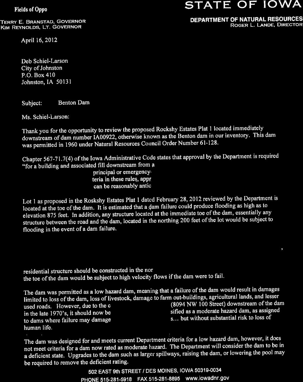
PLANNING AND ZONING COMMISSION Regular Meeting Monday, October 10, 2016
|
|
|
- Meagan Ross
- 5 years ago
- Views:
Transcription
1 PLANNING AND ZONING COMMISSION Regular Meeting Monday, October 10, 2016 Notice is hereby given that the Planning and Zoning Commission will hold a Regular Meeting at 7:00 p.m. on Monday, October 10 th, 2016, in the Council Chambers of Johnston City Hall, 6221 Merle Hay Road, Johnston, Iowa, to discuss the following business: AGENDA: 1. Call to Order 2. Roll Call 3. Approval of Agenda 4. Approval of Meeting Minutes: Regular Meeting of September 26 th, PZ Case No ; Preliminary and Final Plats for Elmerodo Estates Plat 4: The applicant, Mark Shryock, wishes to subdivide the subject property into one lot, two outlots, and one street lot. Proposed Lot 1 would contain the existing home on the property. Proposed Outlot W would contain the portion of the Benton Dam on the subject property. Proposed Outlot V is intended for future development. Proposed Lot A would be deeded to the City for street right of way. 6. Other Business 7. Adjournment Next Scheduled Regular Meeting: Monday, October 31 st, Posted on or before October 7 th, 2016 at: Johnston City Hall, Johnston Public Library, Johnston Post Office, Johnston Public Works, Crown Point Community Center, and Johnston Website (

2 PLANNING & ZONING COMMISSION City of Johnston 6221 Merle Hay Road, Johnston, IA Minutes Regular Meeting: Monday, September 26, 2016 AGENDA 1. Call to Order Chairman Petersma called the meeting to order at 7:00 p.m. 2. Roll Call Spencer Severino Johnson Smith Pavlovec Petersma Anderson Present X X X X X X X Absent City Staff Present: David Wilwerding, Aaron Wolfe, Rebekah Davis 3. Approval of Agenda Petersma called for a vote to approve the agenda. Spencer Severino Johnson Smith Pavlovec Petersma Anderson Aye X X X X X X X Nay Abstain 4. Approval of Meeting Minutes: Regular Meeting of August 29, Roll Call Vote: Spencer Severino Johnson Smith Pavlovec Petersma Anderson Aye X X X X X X X Nay Abstain 5. PZ Case No ; Site Plans for 8601 Thomas Avenue: The applicant, 814 Development, LLC has submitted site plans for the development of a 11,992 square foot child care facility with 17,241 square feet of outdoor playground area and a future 2,500 square foot retail building. The property is located on the northwest corner of Thomas Avenue and NW 86th Street. The site is zoned PUD in the Windsor Office Park PUD. Wolfe presented the staff report. Severino inquired about the potential uses for the smaller 2,500 s.f. structure. Wolfe responded that the PUD permits professional commerce park district uses; which allow community retail Page 1 of 7
3 commercial uses. Wilwerding explained the building could have a retail use; there is enough parking for a small restaurant use. Johnson questioned if there is a proposed use for the smaller structure. Wolfe stated that staff had not been informed of a proposed use for the additional building. If there is a proposed use for the building, staff recommends that the applicant provide that information so staff can consider if there would be any supplementary site requirements. Petersma inquired if the smaller building could provide added capacity for more children and if this would be the use for the building would there be additional site requirements. Wolfe affirmed that the supplementary building could provide added capacity. Wilwerding noted the staff report outlined that the primary structure will have enough parking to accommodate 240 children; the applicant is anticipating 100 children. Petersma questioned if they had the maximum occupancy, would the parking conditions still be acceptable. Wilwerding stated if added capacity would be the use for the supplementary building they would want to verify that the site requirements were met prior to issuance of the permit. Severino asked if the parking spaces would be shared with the adjacent property to the west. Wolfe stated that the parking lots will not be connected; he believes that the separate parking lots are advantageous for public safety because there will not be traffic passing thru the adjoining parking lots. Johnson inquired if additional parking stalls were required, could the parking lot be expanded to the southwest corner of the subject property. Wolfe explained that parking stalls could be added up to 5 feet to the property line. They have more than the required amount of open space therefore, adding parking stalls would not impede on this requirement. Petersma noted northeast of the subject property, the site plan illustrates an absent sidewalk identified as sidewalk by others. He inquired as to how the sidewalk would be completed in conjunction with the proposed site. Wolfe stated that Ender has been in contact with the adjacent property owner to stress the importance of connecting their sidewalk to that of the proposed site. There is approximately 30 feet of sidewalk that needs to be completed. Wilwerding explained that the adjacent property owner has been cooperative with their request to complete his portion of the sidewalk. When the site plan for the northern adjacent property was proposed it did not depict the sidewalk therefore, the sidewalk was constructed on private property and not extended to the property line. An easement has been granted to complete the sidewalk on private property. Bart Turk, Civil Engineering Consultants, Inc., stated on behalf of the applicant, that their hours of operation are from 6 a.m. to 6 p.m. Monday thru Friday. They do not require a loading zone because all of their deliveries are completed with a small van. Outside play is typically one or two classrooms at a time; never the entire building at once. There is a need in the community for before and after school care; they have a small 14 passenger bus for busing children. There will be not large summer parties or graduation parties that will cause any parking problems. Each class will have their own small graduation ceremony. Daily each parent has to park and walk their child into the facility. There will be no curbside drop-offs which alleviates concerns regarding traffic stacking. Peak drop-off and pick-up hours are from 6:00 a.m. to 9:30 a.m. and from 3:00 p.m. to 6:00 p.m. They do not have a set start time. Their food program is precooked heat and serve style so, there will not be any grease generated from this method. The dumpster service is typically once a week but may be twice a week. Motion by Johnson, second by Anderson to approve PZ Case No ; Site Plans for 8601 Thomas Avenue with the following conditions: 1. The project shall be in conformance and in accordance with the requirements, standards and regulations of the City of Johnston, and any other requirement of state or federal law or administrative rule. Page 2 of 7
4 2. A Storm Water Pollution Prevention Plan, Evidence of NPDES Permit from the Iowa DNR and a City Grading Permit shall be provided prior to any ground disturbing activity on the site. 3. A Stormwater Management Facilities Maintenance Agreement shall be provided and accepted by the City Council prior to issuance of a building permit. 4. Architectural elevations for the 2,500 square foot retail building shall be submitted for review by the Planning and Zoning Commission and City Council prior to issuance of a building permit for the 2,500 square foot retail building. 5. Council acceptance of placement of the required north buffer landscaping within 50 feet of the north property boundary instead of within the 30 foot buffer easement along the north property boundary. 6. No exterior site lighting may be installed unless and until all photometric plans have been revised, reviewed, and approved in satisfaction of Johnston s site lighting requirements as established by Resolution for staff review. 7. The site plans must be amended and the following items shall be completed prior to the issuance of a building permit: a. Update the engineer seal and landscape architect seal on the cover sheet to cover all pages of the site plan. b. Update the sheet list table on the cover sheet and the sheet numbers on the bottom right of the site plans to identify all sheets of the site plans. c. Update the open space planting schedule and the landscaping plan drawing to reflect the location, size, and species of the 15 open space trees which are required. d. Update the landscaping plan to either remove the 6 PA from the buffer planting schedule or identify their location on the landscaping plan drawing. e. Update the landscaping plan s buffer planting schedule and the landscaping plan drawing to either identify only 10 CD or identify the location of all 12 CD currently listed in the planting schedule. f. Update the site plans to show that 90 parking spaces will be at minimum 9 feet wide by 18 feet long, this includes handicap parking spaces. Length may be reduced to 16 feet if front end overhang over an open space is available. g. Update the site plans to identify that parking required for retail establishments greater than 2,000 square feet is 1 parking space for every 175 gross floor area. h. Provide a detail drawing of the trash enclosure to insure adequate screening from public right-of-way is achieved. i. Identify the size and location of the private storm sewer proposed from the west adjacent property to connect the west adjacent property s detention basin to the overland flowage easement. j. Show on the site plans the private 30 foot storm sewer easement which is proposed by the west adjacent property on the northwest corner of the rainbow rascal property, grant said private 30 foot storm sewer easement for the benefit of the west adjacent property, and provide evidence that said private 30 foot storm sewer easement has been recorded with the Polk County Recorder s office. k. A public access & sidewalk easement shall be identified on the site plans for any portion of the sidewalk not within public right-of-way, said public access & sidewalk easement shall be accepted by the City Council, and said public access & sidewalk easement shall be recorded with the Polk County Recorder s office. 8. Address Foth s review letter dated September 22, Roll Call Vote: Page 3 of 7 Spencer Severino Johnson Smith Pavlovec Petersma Anderson Aye X X X X X X X
5 Nay Abstain 6. PZ Case No ; Site Plans for 8711 Thomas Avenue: The applicant, Elsie John Properties, LLC has submitted site plans for the development of a 12,162 square foot dance studio. The property is located at 8711 Thomas Avenue in the Windsor Office Park. Wolfe presented the staff report. Severino inquired if there is enough open space on the property for more parking if it is needed. Wolfe stated that a fair amount of the site is occupied by the detention basin. Chuck Bishop, Bishop Engineering, th St, Urbandale, Iowa, stated that he believes this property has a unique use that is not addressed in the City s parking requirements. Bishop explained the parking formula: 1 space for every 3 occupants, plus 1 stall per employee, this totals 52 required parking stalls. There will be 139 occupants, who will likely not be on site at the same time. There may be some overlap in occupants due to the different class times. They calculated the parking based on all the occupants being present at the same time. If required, they could expand the parking lot the north cutting into detention pond; this would require that they construct a retaining wall. Petersma inquired if classes typically began after school. Sabetha Mumm, the applicant, stated that her business is currently located at 5860 Merle Hay Rd, Johnston, Iowa; occupying two building their students have to walk through the parking lot to attend their classes. They have proposed to build a larger facility which will meet all their needs in one building. Typically, class schedules are staggered every 15 minutes; this method should relieve some of the traffic concerns. Typically their operating hours are from 4 p.m. to 10 p.m. Monday thru Friday. On occasion they may have dance rehearsals on the weekend. Johnson inquired regarding the use of the overhead door on the eastside of the building. The applicant stated that the overdoor is for props that are currently housed in off-site facilities. The overhead door opens into the storage room. Johnson inquired if any parking spaces would be occupied by a van or a trailer. The applicant stated that they do have one prop trailer that will likely occupy the northeast parking stall. Petersma stated that there is not a proper category for the parking requirements of a dance studio. Frequently, there will be an overlap in individuals from different classes occupying the parking spaces. Wolfe stated that the parking requirements of a dance studio are likened to sites with a similar use, like that of trade schools and centers for learning; which have various start times for classes and may also experience an overlap in occupants. Petersma believes that there should be better categorization of parking requirements for similar sites with periodic large turnover and periods of lull. Wolfe stated that there have been discussions regarding improving the parking ordinance and believes that this subject will be addressed in the future. Severino inquired if the applicant has spoken with the adjacent property owner to the east regarding using their lot for overflow parking. The applicant stated that she has not had discussions with the adjacent property owner. Severino noted that both adjacent sites will have similar peak hours in the evenings and it is the commission s primary concern is to ensure that everyone is safe during the peak traffic times. The applicant believes that having her own access point from the street and not sharing a lot with the adjacent property owner should relieve the concerns of both sites sharing traffic. Anderson stated that she believes that the dance studio is a great project. Petersma inquired as to the estimated time of construction. The applicant stated, with a 6 month timeline they are seeking to be in the building before the start of the fall classes in Page 4 of 7
6 Johnson inquired about the parking circulation of the parking lot and does not believe that the proposed layout facilitate a quick turnover in traffic. Bishop stated that the parking areas to the north are likely for the staff. Although the parking spaces to the northeast are dead end spaces, attempting to bring the east drive north would cause them to lose 6 parking spaces. Wolfe clarified that an access aisle needs to be 24 feet wide, requiring 6 parking spaces. Johnson believes that if there is a front and back parking space available in the center aisle north of the east access, someone will cut-through rather than the drive around the aisle to park. Bishop stated that many parents, depending on the age of the child, will likely pull-in, drop their child off at the front door and exit. Johnson inquired as to how many staff members would be there at one time. The applicant stated at this time there would be 5. Johnson asked for more description on the semi-concealed fastener on the exterior metal panels. Kevin Barber, Shiffler and Associates Architects, 1440 Locust St #100, Des Moines, Iowa, stated that the semi-concealed is a corrugated metal panel is set on the recessed side and the screws are concealed inside a shadow line. Johnson commented although staff has stated that the panels meet the city s architectural requirements; the architectural metal panels are a pole barn pattern of material. Wolfe stated that a definition for architectural steel should be specified in our ordinance. Motion by Smith, second by Spencer to approve PZ Case No ; Site Plans for 8711 Thomas Avenue subject to the following conditions: 1. The project shall be in conformance and in accordance with the requirements, standards and regulations of the City of Johnston, and any other requirement of state or federal law or administrative rule. 2. A Storm Water Pollution Prevention Plan, Evidence of NPDES Permit from the Iowa DNR and a City Grading Permit shall be provided prior to any ground disturbing activity on the site. 3. No exterior site lighting may be installed unless and until a photometric layout and manufacturer s cut sheets for proposed lighting have been submitted, reviewed, and approved in satisfaction of Johnston s site lighting requirements as established by Resolution for staff review. 4. A Stormwater Management Facilities Maintenance Agreement shall be provided and accepted by the City Council prior to issuance of a building permit. 5. The site plans must be amended and the following items shall be completed prior to the issuance of a building permit: a. Address items 1-15 of the review letter provided by consulting engineer Foth Infrastructure and Environment dated September 22, b. A recorded easement is necessary to install approximately 36 of storm sewer pipe and an outlet structure on the east-adjacent property. Roll Call Vote: Spencer Severino Johnson Smith Pavlovec Petersma Anderson Aye X X X X X X X Nay Abstain 7. Other Business Presentation and Discussion of the Recreation Amenities for Apartment and Townhouse Developments report as prepared by the Neighborhood Development Corporation. Wilwerding presented the Neighborhood Development Corporation report. Page 5 of 7
7 Johnson asked if the dedicated amenity area would be included in the open space requirement and if walking trails could be recommended as a recreational amenity. Wilwerding responded that the recreational amenities would be a dedicated area included in the open space requirement. Spencer inquired if any amenities would be is recommended or required. Wilwerding stated that it is suggested to have playground and in larger complexes a sports lot. Johnson inquired as to how the minimum 30 bedroom threshold was determined. Wilwerding stated that the requirement would be illogical for a single building compared to a complex. The 30 bedroom threshold was a starting point. Johnson believes that 30 bedrooms is a high. Severino inquired if there was a maximum height requirement for multifamily buildings. Wilwerding responded that generally 50 feet is the maximum height allowable in a R-3 zoning district. Severino is concerned that developers would consider adding levels to their buildings to compensate for the loss in area to required recreational amenities. Wilwerding added that the normal cap is 16 units per acre. At that density, the 75 s.f. per bedroom fits on the site. He evaluated these requirements against 62W, which is 26.5 units per acre, against the proposed amenity requirements and they exceeded the minimum; the building is shaped like an E with 2 courtyards containing a pool and a lawn with park benches shade structures and grills. They do not have a playground but they would still exceed the recreational amenities requirement. The underground parking facilitates the open space and amenities. Anderson noted that 62W is on 62 nd Ave near the school where there is a playground and that it would be reasonable to consider the distance of multifamily complexes to existing schools and parks. Severino stated that recommending a playground is an admirable idea however, it would not occupy the youth creating the majority of the problems. He would not like the amenity requirement to overlook the age group that needs amenities to reduce the number of instances. He suggests an amenity recommendation tailored to teenagers and young adults would better address the target demographic. Anderson inquired if clubhouse amenities, such as a climbing wall or an indoor basketball court would meet the recreational amenities requirement. Wilwerding stated that the report is not specific to clubhouse amenities however; the motivation of the requirement is to create a space where people can congregate and engage in constructive activities. Petersma suggested that the sports court be the initial requirement then increase to requiring a playground for larger complexes. There should be a trade-off between the parkland dedication requirements and that of recreational amenities. Wilwerding stated that it has been discussed whether or not the recreational amenities requirement superseded the parkland dedication requirement. The thought is that the recreational amenities would be in addition to the parkland dedication requirements however, there is some thought that if they are putting in these amenities there should be some trade-off given on the parkland requirement. The parkland dedication requirement tends to be lower for apartment complexes because there are less people per unit. Petersma stated that it would be reasonable if the developer is permitted to intrude upon the open space requirement with the recreational amenities and not be penalized. Johnson noted that the parkland dedication figure is unbiased between single family residences and multifamily residences. Wilwerding explained that the figure is 5 acres of parkland per 1,000 residents. Wolfe added the discrepancy is in the number of persons per unit. Wilwerding clarified that in a multifamily the figure is 1.6 and in a single family dwelling Page 6 of 7
8 the figure is 2.98 people per unit. Johnson noted that in a single family the children can play in the backyard however, that is not the case in a multifamily; this is not an equitable formula. Severino stated that park space is setup for the community s use where as the recreational amenities requirement is specifically for the residents of the complex. A balance needs to be created because the recreational amenities for the complex are not for the community. Wilwerding agreed. Severino stated that he believes that it is a good idea. Petersma agrees if Council would like to explore and if it s cost effective. Spencer thinks it s a good plan to keep the youth occupied. Petersma stated that the recreational amenities requirement should be effective in addressing the goal of lowering the number of incidents among the youth in multifamily dwellings. Anderson stated that it would be interesting to report the count of incidents by season and by month; in the Midwest there are significant months out of the year where it is difficult to get outside. Petersma added that he would like to see the report address Midwestern models of recreational amenities. Wilwerding stated that he does not believe that there are any examples of a Midwestern recreational amenities model. Pavlovec would like to see clubhouse amenities addressed in the report because many of the recommendations would not be practical in the winter months. Johnson stated as an example, that the teenage residents of 62W may appreciate a skateboarding in the far wing of the parking. Anderson added that interesting and artistic walk ways that direct you to the various green spaces could be included in the recommended amenities. Wilwerding noted that one of the projects on the west side created a map distributed by the management that depicting the resident s location to trails and parks in the area. Anderson inquired if a public hearing would be the next step. Wilwerding affirmed and clarified that they would like to get further with the development process and create the framework of an ordinance. Petersma suggested that the public hearings include multifamily residents or be held at multifamily complexes. Wilwerding noted that the police department has established good working relationships with the management staff at multifamily complexes to facilitate such open communication. 8. Adjournment Meeting adjourned at 8:04 PM. Chair Secretary Page 7 of 7
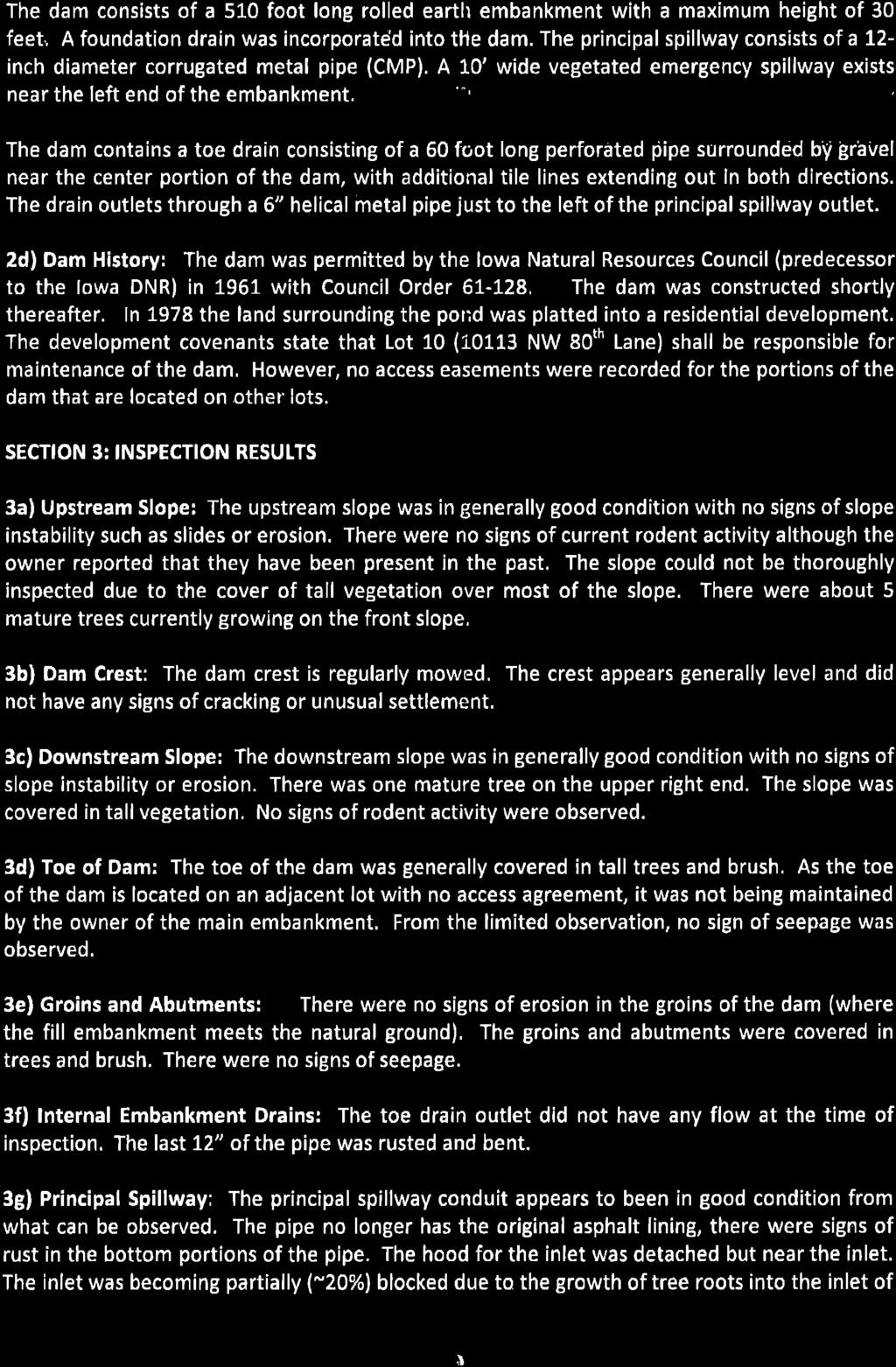
9 Planning & Zoning Commission PZ Case No COMMUNITY DEVELOPMENT DEPARTMENT October 10, 2016 Meeting SUBJECT: Consider making a recommendation on a revised Preliminary Plat and a revised Final Plat for Elmerodo Estates Plat 4, subdividing acres into one lot, two outlots, and one street lot. The property is located west of NW 100 th Street and approximately 275 feet south of the Johnston city limits (PZ Case 16-20). SYNOPSIS: The applicant, Mark Shryock, wishes to subdivide the subject property into one lot, two outlots, and one street lot. Proposed Lot 1 would contain the existing home on the property. Proposed Outlot W would contain the portion of the Benton Dam on the subject property. Proposed Outlot V is intended for future development. Proposed Lot A would be deeded to the City for street right of way. This item was considered for a recommendation by the Planning and Zoning Commission on June 27, 2016, but since that time the preliminary plat and final plat has been revised. Staff has determined that the lot configuration was significantly altered and as such would require reconsideration by the Planning and Zoning Commission prior to consideration by the City Council. RECOMMENDATION: Staff recommends approval and provides the following motion for the commission s consideration: The Planning & Zoning Commission recommends approval of PZ Case No , the Preliminary and Final Plats for Elmerodo Estates Plat 4, with the following conditions: 1. The project shall be in conformance and in accordance with the requirements, standards and regulations of the City of Johnston, and any other requirement of state or federal law or administrative rule. 2. Due to the lack of an existing maintenance agreement, the property owner of the proposed Outlot W will have ownership/maintenance responsibilities for their portion of the existing dam/pond. It is recommended that the affected parties develop a permanent maintenance agreement and begin to take steps to ensure that the Benton Dam is no longer classified as a deficient dam by the Iowa Department of Natural Resources. Any modifications to the dam shall be permitted and inspected by the Iowa DNR and should give consideration to potential future H:\Community Development\P&Z\2016 PZ\PZ 16-20; Elmerodo Estates Plat 4 Preliminary & Final Plat Page 1 of 6
10 development downstream of the dam. 3. Submission of all legal documents prior to City Council action on the Final Plat. Motion by, seconded by to recommend approval of PZ Case No , the Preliminary Plat and Final Plat for Elmerodo Estates Plat 4, with the noted conditions. Attachments: Vicinity Map; Preliminary Plat, prepared by Civil Engineering Consultants Inc, dated October 7, 2016; Final Plat, prepared by Civil Engineering Consultants Inc, dated October 7, 2016; Iowa Department of Natural Resources Benton Dam Report, dated April 12, 2012; Notice and Mailing List; H:\Community Development\P&Z\2016 PZ\PZ 16-20; Elmerodo Estates Plat 4 Preliminary & Final Plat Page 2 of 6
11 APPLICANT/ PROPERTY OWNER: REPRESENTATIVE: BACKGROUND & PRIOR APPROVALS: Mark Shryock 8094 NW 100 th Street Grimes, IA, Civil Engineering Consultants, Inc ATTN: Jeffrey A Gaddis, PLS th Street Suite 12 Urbandale, IA, The subject property consists of Lot 11 of Elmerodo Estates Plat 2 which was platted in October 1977 and the SE ¼ of Section 28, Township 80 North, Range 25 West of the 5 th P.M., all being official parcels in Book Page 121 at the Polk County Recorder s Office. The parcels were surveyed September 2006 and combined via a Plat of Survey in February 2007 to create the lot that is proposed to be subdivided with this preliminary and final plat. This property was part of the Northwest/Elmerodo Estates annexation which was approved by the City Council on February 19, 2008, and approved by the City Development Board in June 9, The annexation was finalized in September 2008 when it was recorded with the Secretary of State and Polk County Recorder. At the time of annexation the property was automatically zoned A-R, Agriculture Reserve District. On August 1, 2016 the property was rezoned to R-1(75), Single Family Residential District. This item was considered for a recommendation by the Planning and Zoning Commission on June 27, 2016, but since that time the preliminary plat and final plat has been revised. Staff has determined that the lot configuration was significantly altered and as such would require reconsideration by the Planning and Zoning Commission prior to consideration by the City Council. This item was recommended for approval at the June 27, 2016 Planning and Zoning Commission meeting. ZONING DISTRICT & BULK REQUIREMENTS: This property is zoned R-1(75), Single-Family zoning district and portions of the site are located within the Floodway Fringe Overlay District and will have to meet the requirements of that overlay district. The following are the bulk regulations required for the R-1(75) zoning district: Minimum Lot Area = 9,500 Square Feet Minimum Lot Width = 75 Feet Front Yard Setback = 35 Feet Rear Yard Setback = 35 Feet Side Yard Setback = 8 Feet one side, 17 Feet total H:\Community Development\P&Z\2016 PZ\PZ 16-20; Elmerodo Estates Plat 4 Preliminary & Final Plat Page 3 of 6
12 A development agreement was approved and recorded for this property during the rezoning of this property. The development agreement restricts the overall density of the property to 1.35 units per acre. Since no new buildable lots are being created at this time, the property is in compliance with the development agreement. TRAFFIC ACCESS & CIRCULATION: PUBLIC UTILITIES: PARKLAND DEDICATION: DRAINAGE: FLOODPLAIN: Access to the site is from NW 100 th Street. No new access points or roads are proposed with this plat. No new public utility connections are proposed with this plat. This plat is defined as a minor subdivision and as such is exempt from the requirements for parkland dedication. The site generally drains north and east to Little Beaver Creek which is located along the north boundary of the plat. Due to the limited impact, no further drainage analysis has been required. An overland flowage easement has been provided for the emergency spillway through proposed Lot 1. Further drainage impacts will be explored at the time development is proposed on Outlot V. Portions of this property are within Zone AE and Zone X on the Flood Insurance Rate Map. A small area of the floodway encroaches on the north property boundary. Zone AE is the area with a 1% annual chance of a flood, also known as the 100-year flood. Zone X is the area with a 0.2% annual chance of a flood, also known as the 500-year flood. The area defined as AE and X is located within the Floodway Fringe Overlay zoning district. Future development in the overlay district will have to meet the requirements of the overlay district in addition to the underlying zoning district. BENTON DAM: The Benton Dam is an earthen dam that was constructed in The primary purpose of the dam at that time was to create a reliable water supply for livestock. In 1978 the land containing the dam was subdivided into what is today Elmerodo Estates Plat 2. The lots were platted in the dimensions they are to provide for multiple lots on the south side of the pond to have access to the pond and for the livestock that was still grazing on the north side of the pond to still have access to the water supply. As a result of the 1978 subdivision the pond and associated dam has been placed on four neighboring properties with no single property containing the entirety of the pond or dam and with no single property owner having the full responsibility of maintenance of the pond or dam. As the subject property for this plat only contains a portion of the pond and dam, resolution of the maintenance issue for the pond and dam is H:\Community Development\P&Z\2016 PZ\PZ 16-20; Elmerodo Estates Plat 4 Preliminary & Final Plat Page 4 of 6
13 difficult. The individual property owners are responsible and liable for their portion of the dam and pond. How they choose to or who they choose to maintain the property is a private matter, but it should be resolved as the dam is aging and repairs are becoming necessary. This plat would place the portion of the dam on the subject property into an unbuildable outlot to insure that the integrity of the dam is not compromised by future development. Because of a previous development proposal in 2011 for land adjacent to this dam, the Iowa DNR completed an inspection of the Benton Dam to determine the condition of the dam. The inspection resulted in a recommendation regarding the impact a dam failure would have on downstream development that was being proposed. The study determined that if a dam failure did occur it would result in a flood crest at approximately 875 above sea level. The DNR s recommendation with this study increased the classification of this dam from a low hazard dam to a moderate hazard dam because of the presence of the home on proposed Lot 1. A moderate hazard dam is defined by the Iowa DNR as a dam where failure may damage isolated homes or cabins, industrial or commercial buildings, moderately traveled roads, interrupt major utility services, but are without substantial risk of loss of human life. Dams are also classified as Moderate Hazard where the dam and its impoundment are themselves of public importance, such as dams associated with public water supply systems, industrial water supply or public recreation or which are an integral feature of a private development complex. As a result of the upgrade in dam classification the Iowa DNR considers the Benton dam to be deficient currently. The Iowa DNR report stated that steps must be taken, such as a larger spillway, higher dam, or lowering the pool, to remove the deficient classification from the dam. Staff is recommending a condition of approval that due to the lack of an existing maintenance agreement, the property owner of the proposed Outlot W will have ownership/maintenance responsibilities for their portion of the existing dam/pond. It is recommended that the affected parties develop a permanent maintenance agreement and begin to take steps to ensure that the Benton Dam is no longer classified as a deficient dam by the Iowa Department of Natural Resources. Any modifications to the dam shall be permitted and inspected by the Iowa DNR and should give consideration to potential future development downstream of the dam. NEIGHBOR NOTICE: Notice for this meeting was mailed to all property owners within 320 feet of the subject property. A copy of this notice and the associated mailing list is attached. As of publication of this report, no comments have been H:\Community Development\P&Z\2016 PZ\PZ 16-20; Elmerodo Estates Plat 4 Preliminary & Final Plat Page 5 of 6
14 received. CONSULTANT COMMENTS: DOCUMENTS REQUIRED WITH THE FINAL PLAT: The preliminary and final plat has been reviewed by our consulting engineer, Foth Infrastructure and Environment, LLC. Foth has stated in their June 22, 2016 letter that they have no further comments regarding these items. In order to proceed to the City Council with the Final Plat, the following documents/payments shall be submitted prior to City Council consideration of the Final Plat: 1. Attorney s Title Opinion 2. Polk County Treasurer's Tax Certificate 3. Owner(s) Consent to Plat 4. Lender(s) Consent to Plat (if mortgage on the property) 5. Warranty Deed to Lot A 6. Groundwater Hazard Statement for Lot A 7. Partial Release of Mortgage for Lot A (if mortgage on the property) 8. Petition and Waiver for future NW 100 th Street improvements 9. Private Overland Flowage Easement H:\Community Development\P&Z\2016 PZ\PZ 16-20; Elmerodo Estates Plat 4 Preliminary & Final Plat Page 6 of 6
15 PZ CASE Elmerodo Estates Plat 4 Preliminary & Final Plats VICINITY MAP Subject Property ) SUBJECT PROPERTY NW 80TH LANE NW 100TH STREET inch = 3,333 feet 1,120 Feet Created by City of Johnston Department of Community Development 6221 Merle Hay Road, P.O. Box 410, Johnston, IA, (515) Fax:(515) H:\Community Development\P&Z\2016 PZ\PZ 16-20; Elmerodo Estates Plat 4 Preliminary & Final Plat\GIS\aerial vicinity PZ mxd
16 CEC Civil Engineering Consultants, Inc th Street. Unit 12. Des Moines, Iowa Fax:
17 LOT 'A' Civil Engineering Consultants, Inc. CEC th Street. Unit 12. Des Moines, Iowa Fax: LOT 1 OUTLOT 'V' OUTLOT 'W'
18 CEC Civil Engineering Consultants, Inc th Street. Unit 12. Des Moines, Iowa Fax:
19 LOT 'A' Civil Engineering Consultants, Inc. CEC th Street. Unit 12. Des Moines, Iowa Fax: LOT 1 OUTLOT 'V' OUTLOT 'W'

20
21

22
23

24
25 October 6, 2016 Notice of Public Meeting The Johnston Planning and Zoning Commission will hold a Public Meeting at 7:00 p.m. on Monday, October 10, 2016 (Tentative) and the Johnston City Council will hold a Public Meeting at 7:00 p.m. on Monday, October 17, 2016 (Tentative). Both meetings will be held in the Council Chambers of Johnston City Hall, 6221 Merle Hay Road to consider the following item: PZ Case No ; Elmerodo Estates Plat 4 Revised Preliminary & Final Plats The applicant, Mark Shryock, has submitted a revised preliminary plat and a revised final plat for the subdivision of a Acres west of NW 100th Street and approximately 275 south of the Johnston city limits. The plat includes 1 lot for an existing single family home, 1 outlot for future development, and one street lot along NW 100th Street. If you have questions or comments on the above-described action, please contact the city staff person listed at the bottom of this card, or attend the meetings at the above-listed dates and times. Additional information, including the preliminary plat & final plat is available under the proposed development section of the City s Website: Clayton Ender, Planner Johnston City Hall; 6221 Merle Hay Road; Johnston, IA Phone: ; cender@cityofjohnston.com
26 PZ Mailing List NAME ADDRESS CITY, STATE, ZIP CODE KAITLYN HEIDESCH NW 82ND AVE GRIMES, IA, USA 215 N 17TH ST OMAHA, NE, MARK MERTENS 2733 WITMER ST DES MOINES, IA, MARK SHRYOCK POB 744 GRINNELL, IA, JUDITH MERTENS 8002 NW 100TH ST GRIMES, IA, TOMI NELSON NW 80TH LN GRIMES, IA, LEE REED 7958 NW 103RD LN GRIMES, IA, JEREMIAH JOENS NW 80TH LN GRIMES, IA, GEORGE HOFMANN NW 80TH LN GRIMES, IA, ROBERT SINNOTT NW 80TH LN GRIMES, IA, DEBRA WENNERHOLT NW 80TH LN GRIMES, IA, BRAIN HUTCHINS NW 80TH LN GRIMES, IA, GERARDUS VAN DER HEIJDEN NW 80TH LN GRIMES, IA, CROSSHAVEN I LLC 6900 WESTOWN PKWY WEST DES MOINES, IA, OMEGA SOLUTIONS LLC 6565 WISTFUL VISTA DR STE 3111 WEST DES MOINES, IA, HUBBELL REALTY COMPANY 6900 WESTOWN PKWY WEST DES MOINES, IA, CROSSHAVEN OWNERS ASSOCIATION 6900 WESTOWN PKWY WEST DES MOINES, IA, 50266
PLANNING AND ZONING COMMISSION Regular Meeting Monday, May 30, 2017
 PLANNING AND ZONING COMMISSION Regular Meeting Monday, May 30, 2017 Notice is hereby given that the Planning and Zoning Commission will hold a Regular Meeting at 7:00 p.m. on Monday, May 30, 2017, in the
OFFICE OF THE CITY ADMINISTRATOR Johnston, Iowa AGENDA COMMUNICATION
 OFFICE OF THE CITY ADMINISTRATOR Johnston, Iowa AGENDA COMMUNICATION PZ Case No. 18-38 December 17, 2018 SUBJECT: Consider the following items related to Adam Ridge Commercial Plat 1, located south of
PLANNING AND ZONING COMMISSION Regular Meeting Monday, February 9, 2015
 PLANNING AND ZONING COMMISSION Regular Meeting Monday, February 9, 2015 Notice is hereby given that the Planning and Zoning Commission will hold a Regular Meeting at 7:00 p.m. on Monday, February 9, 2015,
Notice of Proposed Development City of Johnston, Iowa
 Notice of Proposed Development City of Johnston, Iowa June 21, 2013 PZ Case No.13-05; Outlot X, Northwood Estates Plat 3 Comprehensive Plan Amendment and Rezoning Request: The property owner of the above-listed
ZONING AMENDMENT, PLANNED UNIT DEVELOPMENT & SUBDIVISION STAFF REPORT Date: August 8, 2013
 ZONING AMENDMENT, PLANNED UNIT DEVELOPMENT & SUBDIVISION STAFF REPORT Date: August 8, 2013 NAME SUBDIVISION NAME PV-Magnolia, LLC Twelve Trees Subdivision LOCATION 2860, 2862 and 2866 Pleasant Valley Road
PLANNING AND ZONING COMMISSION Regular Meeting Tuesday, May 26, 2015
 PLANNING AND ZONING COMMISSION Regular Meeting Tuesday, May 26, 2015 Notice is hereby given that the Planning and Zoning Commission will hold a Regular Meeting at 7:00 p.m. on Tuesday, May 26, 2015, in
PLANNED UNIT DEVELOPMENT STAFF REPORT Date: October 19, 2017
 PLANNED UNIT DEVELOPMENT STAFF REPORT Date: October 19, 2017 DEVELOPMENT NAME LOCATION Custom Boat Storage 3975 Demetropolis Road (East side of Demetropolis Road, 0.2± miles South of Halls Mill Road.)
AN ORDINANCE TO CREATE THE ALDEN RIDGE PUD As Recommended to the Lowell Township Board by the Lowell Township Planning Commission January 11, 2016
 CHARTER TOWNSHIP OF LOWELL COUNTY OF KENT, MICHIGAN AN ORDINANCE TO CREATE THE ALDEN RIDGE PUD As Recommended to the Lowell Township Board by the Lowell Township Planning Commission January 11, 2016 At
URBANDALE PLANNING AND ZONING COMMISSION MINUTES. June 11, 2018
 URBANDALE PLANNING AND ZONING COMMISSION MINUTES The Urbandale Planning and Zoning Commission met in regular session on Monday,, at the Urbandale City Hall, 3600 86th Street. Vice-chairperson Paul Pick
URBANDALE PLANNING AND ZONING COMMISSION MINUTES. July 9, 2018
 URBANDALE PLANNING AND ZONING COMMISSION MINUTES The Urbandale Planning and Zoning Commission met in regular session on Monday,, at the Urbandale City Hall, 3600 86th Street. Chairperson Jeff Hatfield
CITY OF ALBERT LEA PLANNING COMMISSION ADVISORY BOARD
 CITY OF ALBERT LEA PLANNING COMMISSION ADVISORY BOARD 9/1/2015, 5:30 p.m. City Council Chambers AGENDA A. CALL TO ORDER AND ROLL CALL B. APPROVAL OF THE AGENDA C. APPROVAL OF MINUTES 1. PC Minutes from
City of Ferndale CITY COUNCIL STAFF REPORT
 SUBJECT: Final Plat Approval DATE: January 19, 2016 FROM: Haylie Miller, Assistant Planner PRESENTATION BY: Haylie Miller City of Ferndale CITY COUNCIL STAFF REPORT MEETING DATE: January 19, 2016 AGENDA
Minutes of the Tuesday November 28th, 2017 Planning and Zoning Commission Meeting Roll Call. Agenda Approval.
 Minutes of the Tuesday November 28 th, 2017 Planning and Zoning Commission Meeting The November 28 th, 2017 Planning and Zoning Commission meeting was called to order at 6:00 pm. Roll Call. The Following
PLANNED UNIT DEVELOPMENT & SUBDIVISION STAFF REPORT Date: November 17, 2016
 PLANNED UNIT DEVELOPMENT & SUBDIVISION STAFF REPORT Date: November 17, 2016 DEVELOPMENT NAME SUBDIVISION NAME LOCATION Autonation Ford of Mobile Autonation Ford of Mobile Subdivision 901, 909, and 925
REPORT TO THE SHELBY COUNTY PLANNING COMMISSION From the Department of Development Services Planning Services. February 4, 2019
 REPORT TO THE SHELBY COUNTY PLANNING COMMISSION From the Department of Development Services Planning Services February 4, 2019 Case No. Request for Rezoning Approval From E-1 to E-2 SD This is a request
SECTION 16. "PUD" PLANNED UNIT DEVELOPMENT OVERLAY DISTRICT
 SECTION 6. "PUD" PLANNED UNIT DEVELOPMENT OVERLAY DISTRICT Subsection. Purpose. This district is established to achieve the coordinated integration of land parcels and large commercial and retail establishments
FINAL PLAT APPLICATION
 FINAL PLAT APPLICATION (Page 1 of 3) LEGAL OWNER(s): NAME: STREET ADDRESS OWNER(s): CITY, STATE, ZIP CODE: PHONE NUMBER: BILLING ADDRESS: NAME OF ENGINEER/SURVEYOR: Engineer/Surveyor Address, Phone: PROPERTY
Medical Marijuana Special Exception Use Information
 Medical Marijuana Special Exception Use Information The Special Exception Use information below is a modified version of the Unified Development Code. It clarifies the current section 5:104 Special Exceptions
Preliminary Plat & Layout Plan Submittal Guidelines
 Preliminary Plat & Layout Plan Submittal Guidelines PRELIMINARY PLAT & LAYOUT PLANS is typically the first step in the platting process. The purpose of the PRELIMINARY PLAT & LAYOUT PLANS is for the Applicant
ARTICLE 15 - PLANNED UNIT DEVELOPMENT
 Section 15.1 - Intent. ARTICLE 15 - PLANNED UNIT DEVELOPMENT A PUD, or Planned Unit Development, is not a District per se, but rather a set of standards that may be applied to a development type. The Planned
ZONING AMENDMENT & SUBDIVISION STAFF REPORT Date: November 3, 2016
 ZONING AMENDMENT & SUBDIVISION STAFF REPORT Date: November 3, 2016 APPLICANT NAME SUBDIVISION NAME David Shumer 5955 Airport Subdivision CITY COUNCIL DISTRICT District 6 5955 Airport Boulevard, 754 Linlen
Watertown City Council
 City of Watertown Watertown City Council 2/14/2017 Agenda Item: Riverpointe Subdivision 2 nd Replat Request for Action: Sketch Plan Department: Planning Request for Action Request: Paxmar, LLC (Applicant)
PLANNING & ZONING DEPARTMENT 401 South Rogers Street Waxahachie, Texas (469)
") ZONING APPLICATION Select Application Type: Zoning Change Specific Use Permit (SUP) PD Concept Plan PD Detailed Plan PD Amendment Site Plan The following items shall be included in the application submittal:
ZONING APPLICATION Select Application Type: Zoning Change Specific Use Permit (SUP) PD Concept Plan PD Detailed Plan PD Amendment Site Plan The following items shall be included in the application submittal:
SUBJECT PARCEL(S) Property Owner(s) TMS Number Approximate Acreage Carolina Park Development, LLC
 Property Owner(s) TMS Number Approximate Acreage Carolina Park Development, LLC") Staff Report Special Planning Commission Meeting November 19, 2014 For reference, the Zoning Code and Land Development Regulations are available online. AGENDA ITEM 5c. SKETCH PLAN APPROVAL REQUEST: Request
Staff Report Special Planning Commission Meeting November 19, 2014 For reference, the Zoning Code and Land Development Regulations are available online. AGENDA ITEM 5c. SKETCH PLAN APPROVAL REQUEST: Request
Airport Rd. Lot 6 Lot 2 Lot 1. 1 Mile: Population: 1,100 Median HH Income: $51, Mile: Population: 16,300 Median HH Income: $53,500
 Walmart Outparcels For Sale Godfrey, IL Store #4695 6660 Godfrey Road Airport Rd Lot 4 Lot 6 Lot 2 Lot 1 Godfrey Rd/ Hwy 67 For more information about this site, contact: Jim Rosen Pace Properties (314)
Chapter Planned Residential Development Overlay
 Chapter 19.29 Planned Residential Development Overlay Sections 010 Purpose 020 Scope 030 Definitions 030 Minimum Size 040 Allowable Uses 050 Minimum Development Standards 060 Density Bonus 070 Open Space
CLAY TOWNSHIP PLANNING COMMISSION MEETING MINUTES September 28, 2015
 CLAY TOWNSHIP PLANNING COMMISSION MEETING MINUTES September 28, 2015 Members present were: Bruce Leisey, Clair Beyer and Annie Reinhart. Jon Price arrived at 7:10 and Adrian Kapp were absent. Also present
Courtyards at Kinnamon Park Sketch Plan
 Courtyards at Kinnamon Park Sketch Plan Courtyards at Kinnamon Park Sketch Plan Staff Analysis PART 1: PROJECT SUMMARY Applicant: EPCON Communities Property Owner: Johnsie M. Kinnamon Heirs, Douglas and
Township of Collier 2418 Hilltop Road Presto, PA 15142
 Township of Collier 2418 Hilltop Road Presto, PA 15142 Fees: Major: 2 checks $600 + $50 per lot & $1700 Escrow) APPLICATION FOR SUBDIVISION major FINAL only Plans must be folded Rolled plans will not be
Initial Subdivision Applications Shall Include the Following:
 Initial Subdivision Applications Shall Include the Following: 1) Subdivision Application Form: completely filled out (12 copies) 2) Plat: The Plat must adhere to the requirements set forth in the Town
BUFFALO TOWNSHIP PLANNING COMMISSION REGULAR MONTHLY MEETING AUGUST 2, 2017
 The Regular Monthly Meeting of the Buffalo Township Planning Commission was called to order on August 2, 2017, at 7:40 p.m. in the Buffalo Township Municipal Building by the Chairman, Ray Smetana. This
Towne Center Boulevard William Penn Highway. Lot 2. 1 Mile Population: 3,600 Median HH Income: $36,800
 Walmart Outparcel For Sale Huntingdon, PA Store #5470 6716 Towne Center Blvd Towne Center Boulevard William Penn Highway Lot 2 Raystown Road For more information about this site, contact: Lot 2: ±1.72
McGowin Park, LLC. B-3, Community Business District
 # 10, 11, 12 SUB2014-00024 ZON2014-00500 ZON2014-00501 SUBDIVISION, PLANNED UNIT DEVELOPMENT (East), PLANNED UNIT DEVELOPMENT (West) STAFF REPORT Date: April 3, 2014 DEVELOPMENT NAME LOCATION McGowin Park,
SUBMITTAL REQUIREMENTS: The number indicates the number of copies for submittal (if applicable).
.") Office Use Only Preliminary Long Plat Long Subdivision Applicant Checklist PLANNING, COMMUNITY, & ECONOMIC DEVELOPMENT DEPARTMENT PRELIMINARY LONG PLAT LONG SUBDIVISION CHECKLIST Mailing Address: P.O.
Office Use Only Preliminary Long Plat Long Subdivision Applicant Checklist PLANNING, COMMUNITY, & ECONOMIC DEVELOPMENT DEPARTMENT PRELIMINARY LONG PLAT LONG SUBDIVISION CHECKLIST Mailing Address: P.O.
ZONING AMENDMENT, PLANNED UNIT DEVELOPMENT & SUBDIVISION STAFF REPORT Date: September 15, 2011
 ZONING AMENDMENT, PLANNED UNIT DEVELOPMENT & SUBDIVISION STAFF REPORT Date: September 15, 2011 NAME SUBDIVISION NAME LOCATION Stratford, L.L.C. Grelot Office Park Subdivision North side of Grelot Road,
PLANNED UNIT DEVELOPMENT (PUD) AREA PLAN/REZONING REVIEW PROCEDURE
 AREA PLAN/REZONING REVIEW PROCEDURE") PLANNED UNIT DEVELOPMENT (PUD) AREA PLAN/REZONING REVIEW PROCEDURE Professional inquiries will be made to our Township Planning Consultant, Township Engineer, and Township Attorney to get their opinions
PLANNED UNIT DEVELOPMENT (PUD) AREA PLAN/REZONING REVIEW PROCEDURE Professional inquiries will be made to our Township Planning Consultant, Township Engineer, and Township Attorney to get their opinions
City of Brooklyn Park Planning Commission Staff Report
 City of Brooklyn Park Planning Commission Staff Report Agenda Item: 6D Meeting Date: August 9, 2017 Originating Agenda Section: Public Hearing Department: Community Development Resolution: X Ordinance:
DRAFT FOR PUBLIC HEARING (rev. March, 2016)
") Chapter 200. ZONING Article VI. Conservation/Cluster Subdivisions 200-45. Intent and Purpose These provisions are intended to: A. Guide the future growth and development of the community consistent with
Chapter 200. ZONING Article VI. Conservation/Cluster Subdivisions 200-45. Intent and Purpose These provisions are intended to: A. Guide the future growth and development of the community consistent with
Staff Report: Date: Applicant: Property Identification: Acreage of Request: Current Zoning of Requested Area: Requested Action: Attached:
 Staff Report: Completed by Jeff Palmer Director of Planning & Zoning Date: November 7, 2018, Updated November 20, 2018 Applicant: Greg Smith, Oberer Land Developer agent for Ronald Montgomery ET AL Property
Walmart Outparcel For Sale
 Walmart Outparcel For Sale Houston, TX Store # 3640 1118 Silber Road FOR INFORMATION CONTACT: Lot...Sale Pending Ryan Tinch Hollis Bloom (214) 265-1555 ryan@hollisbloom.com MORE INFORMATION AVAILABLE AT:
STATE OF ALABAMA SHELBY COUNTY
 STATE OF ALABAMA SHELBY COUNTY Members Present: Members Absent: Staff Present: SHELBY COUNTY PLANNING COMMISSION MINUTES Regular Meeting March 6, 2017 6:00 PM Michael O Kelley, Chairman; Jim Davis, Vice
Staff Recommendation Approval. Staff Planner Robert Davis
 Applicant Property Owner Reed Enterprises, Inc. Public Hearing November 8, 2017 City Council Election District Princess Anne Agenda Item D1 Request Conditional Use Permit (Bulk Storage Yard) Modification
PLANNED UNIT DEVELOPMENT & SUBDIVISION STAFF REPORT Date: April 18, 2019
 PLANNED UNIT DEVELOPMENT & SUBDIVISION STAFF REPORT Date: April 18, 2019 DEVELOPMENT NAME SUBDIVISION NAME Springhill Village Subdivision Springhill Village Subdivision LOCATION 4350, 4354, 4356, 4358,
COMMERCIAL SITE DEVELOPMENT GUIDE FOR UNINCORPORATED ST. CHARLES COUNTY
 COMMERCIAL SITE DEVELOPMENT GUIDE FOR UNINCORPORATED ST. CHARLES COUNTY GENERAL INFORMATION: This brochure is to be used as a guide and is not intended to amend or supersede the corresponding County ordinances
ADA TOWNSHIP PLANNING COMMISSION MINUTES OF THE JUNE 15, 2017 MEETING
 ADA TOWNSHIP PLANNING COMMISSION MINUTES OF THE JUNE 15, 2017 MEETING A meeting of the was held on Thursday, June 15, 2017, 7:00 p.m. at the Ada Township Offices, 7330 Thornapple River Dr., Ada, MI. I.
Final Plats for Major Residential and Commercial Subdivisions Checklist
 Project Name: : This form is a checklist of Zoning Ordinance requirements for major residential and commercial subdivision plats to assist the applicant in their submittal. It is not intended to be a comprehensive
URBANDALE PLANNING AND ZONING COMMISSION MINUTES. November 26, 2018
 URBANDALE PLANNING AND ZONING COMMISSION MINUTES The Urbandale Planning and Zoning Commission met in regular session on Monday,, at the Urbandale City Hall, 3600 86th Street. Chairperson Jeff Hatfield
WRIGHT TOWNSHIP Ottawa County 1565 Jackson Street, P.O. Box 255, Marne, Michigan 49435
 WRIGHT TOWNSHIP Ottawa County 1565 Jackson Street, P.O. Box 255, Marne, Michigan 49435 SITE PLAN REVIEW APPLICATION _ Instructions For an application to be considered complete, ALL information must be
The purpose of this Chapter is to establish rules, regulations, standards and procedures for approval of subdivisions of land to promote and ensure:
 CHAPTER 7 SUBDIVISION SECTION 7.1 PURPOSE The purpose of this Chapter is to establish rules, regulations, standards and procedures for approval of subdivisions of land to promote and ensure: A. Conformity
SUBDIVISION, PLANNED UNIT DEVELOPMENT, ZONING AMENDMENT, & SIDEWALK WAIVER STAFF REPORT Date: July 19, 2018
 SUBDIVISION, PLANNED UNIT DEVELOPMENT, ZONING AMENDMENT, & SIDEWALK WAIVER STAFF REPORT Date: July 19, 2018 NAME SUBDIVISION NAME LOCATION West Mobile Properties, LLC U.S. Machine Subdivision 556, 566,
WRIGHT TOWNSHIP Ottawa County 1565 Jackson Street, P.O. Box 255, Marne, Michigan 49435
 WRIGHT TOWNSHIP Ottawa County 1565 Jackson Street, P.O. Box 255, Marne, Michigan 49435 SPECIAL USE PERMIT APPLICATION _ Instructions For an application to be considered complete, ALL information must be
URBANDALE PLANNING AND ZONING COMMISSION MINUTES. November 2, 2015
 URBANDALE PLANNING AND ZONING COMMISSION MINUTES The Urbandale Planning and Zoning Commission met in regular session on Monday,, at the Urbandale City Hall, 3600 86 th Street. Chairperson Julie Roethler
COUNCIL ACTION FORM. 1. The City Council can approve the Preliminary Plat for Menards Ames Subdivision
 ITEM #: 49 DATE: 03-27-18 COUNCIL ACTION FORM SUBJECT: PRELIMINARY PLAT FOR MENARDS BACKGROUND: Menards Ames Subdivision is a proposed 41-acre development on SE 16 th Street just west of the Skunk River.
BAY FOREST PARK SUBDIVISION, RESUBDIVISION OF LOTS 6 & 7 AND BAY FOREST PARK SUBDIVISION LOT 10, OF THE RESUBDIVISON OF LOTS 9 & 10
 BAY FOREST PARK SUBDIVISION, RESUBDIVISION OF LOTS 6 & 7 AND BAY FOREST PARK SUBDIVISION LOT 10, OF THE RESUBDIVISON OF LOTS 9 & 10 Engineering Comments: Must comply with the Mobile County Flood Damage
APPLICATION PROCEDURE
 ANTRIM PLANNING BOARD P. O. Box 517 Antrim, New Hampshire 03440 Phone: 603-588-6785 FAX: 603-588-2969 APPLICATION FORM AND CHECKLIST FOR MINOR OR MAJOR SITE PLAN REVIEW File Date Received By APPLICATION
Walmart Outparcel For Sale
 Walmart Outparcel For Sale Texas City, TX Store # 8190 6614 GULF FREEWAY Emmett F Lowry Expy Lot 5 Gulf Fwy/ US I-45 1764 Road For more information about this site, contact: Lot 5: ±0.85 Acres - $500,000
EDGERTON CITY HALL PLANNING COMMISSION MEETING REGULAR SESSION March 12, 2019
 EDGERTON CITY HALL PLANNING COMMISSION MEETING REGULAR SESSION The met in regular session with Chair John Daley calling the meeting to order at 7:00 p.m. All present participated in the Pledge of Allegiance.
1. Roll Call. 2. Minutes a. September 26, 2016 Regular Meeting. 3. Adoption of the Agenda. 4. Visitors to Be Heard
 1. Roll Call City of Vermillion Planning Commission Agenda 5:30 p.m. Regular Meeting Tuesday, October 11, 2016 Large Conference Room 2 nd Floor City Hall 25 Center Street Vermillion, SD 57069 2. Minutes
SUBJECT: Application for Planned Unit Development and Rezoning 1725 Winnetka Road
 TO: FROM: CHAIRMAN BILL VASELOPULOS AND MEMBERS OF THE PLAN & ZONING COMMISSION STEVE GUTIERREZ DIRECTOR OF COMMUNITY DEVELOPMENT MEETING DATE: September 5, 2017 SUBJECT: Application for Planned Unit Development
MEMORANDUM. DATE: November 9, 2016 PC Agenda Item 3.C
 MEMORANDUM DATE: November 9, 2016 PC Agenda Item 3.C TO: FROM: SUBJECT: Planning Commission Eric Zweber, AICP, Interim City Planner Planning Case #16-029 Public Hearing Required Applicant: Bremer Bank,
Village of Glenview Plan Commission
 Village of Glenview Plan Commission STAFF REPORT October 14, 2014 TO: Chairman and Plan Commissioners CASE #: P2014-074 FROM: Community Development Department CASE MANAGER: Michelle House, Planner SUBJECT:
WASCO COUNTY PRELIMINARY SUBDIVISION APPLICATION
 WASCO COUNTY PRELIMINARY SUBDIVISION APPLICATION DETAILED SPECIFIC WRITTEN REQUEST File Number: SDV- Number of Proposed Lots & their Dimensions: PRELIMINARY SUBDIVISION PLAN REQUIREMENTS The approval of
TOWNSHIP OF BORDENTOWN LAND DEVELOPMENT APPLICATION CHECKLIST. General Requirements for all Applications
 TOWNSHIP OF BORDENTOWN LAND DEVELOPMENT APPLICATION CHECKLIST This CHECKLIST has been adopted in accordance with Section 25:807 of the Land Development Ordinance of the Township of Bordentown and will
ZONING AMENDMENT & SUBDIVISION STAFF REPORT Date: July 3, 2014
 ZONING AMENDMENT & SUBDIVISION STAFF REPORT Date: July 3, 2014 APPLICANT NAME SUBDIVISION NAME LOCATION Georgia Crown Distributing Subdivision Georgia Crown Distributing Subdivision Southwest corner of
610 LAND DIVISIONS AND PROPERTY LINE ADJUSTMENTS OUTSIDE A UGB
 ARTICLE VI: LAND DIVISIONS AND PROPERTY LINE ADJUSTMENTS VI-21 610 LAND DIVISIONS AND PROPERTY LINE ADJUSTMENTS OUTSIDE A UGB 610-1 Property Line Adjustments (Property Line Relocation) A property line
Special Land Use. SLU Application & Review Standards
 review and approval is needed for certain uses of property that have the potential to impact adjacent properties and the neighborhood. The application and review procedure is intended to ensure that the
PLANNED UNIT DEVELOPMENTS (Ordinance No.: 3036, 12/3/07; Repealed & Replaced by Ordinance No.: 4166, 10/15/12)
") 159.62 PLANNED UNIT DEVELOPMENTS (Ordinance No.: 3036, 12/3/07; Repealed & Replaced by Ordinance No.: 4166, 10/15/12) A. PURPOSE 1. General. The Planned Unit Development (PUD) approach provides the flexibility
159.62 PLANNED UNIT DEVELOPMENTS (Ordinance No.: 3036, 12/3/07; Repealed & Replaced by Ordinance No.: 4166, 10/15/12) A. PURPOSE 1. General. The Planned Unit Development (PUD) approach provides the flexibility
Washington County, Minnesota Ordinances
 Washington County, Minnesota Ordinances Ordinance No. 153 Text Amendment to the Washington County Development Code - Chapter One, Section 2 and Chapter Two, Part 1, Part 2, Part 3, of the Development Code
BYRON TOWNSHIP PLANNING COMMISSION July 19, 2004 MINUTES
 BYRON TOWNSHIP PLANNING COMMISSION July 19, 2004 MINUTES CALL TO ORDER, ATTENDANCE & PRAYER Chairman Seymour Gould called a regular meeting of the Byron Township Planning Commission to order at 7:00 p.m.
ARTICLE 24 SITE PLAN REVIEW
 ARTICLE 24 SITE PLAN REVIEW 24.1 PURPOSE: The intent of these Ordinance provisions is to provide for consultation and cooperation between the land developer and the Township Planning Commission in order
MINOR SUBDIVISION FINAL PLAT APPLICATION Town of Apex, North Carolina
 MINOR SUBDIVISION FINAL PLAT APPLICATION Town of Apex, North Carolina This document is a public record under the North Carolina Public Records Act and may be published on the Town s website or disclosed
Salem Township Zoning Ordinance Page 50-1 ARTICLE 50.0: PUD PLANNED UNIT DEVELOPMENT
 Salem Township Zoning Ordinance Page 50-1 ARTICLE 50.0 PLANNED UNIT DEVELOPMENT Section 50.01 Purpose The provisions of this Article provide enabling authority and standards for the submission, review,
PLANNED UNIT DEVELOPMENT (East), PLANNED UNIT DEVELOPMENT (West) STAFF REPORT Date: September 18, 2014
, PLANNED UNIT DEVELOPMENT (West) STAFF REPORT Date: September 18, 2014") PLANNED UNIT DEVELOPMENT (East), PLANNED UNIT DEVELOPMENT (West) STAFF REPORT Date: September 18, 2014 DEVELOPMENT NAME LOCATION McGowin Park, LLC PLANNED UNIT DEVELOPMENT (East) 1401 Satchel Paige Drive
PLANNED UNIT DEVELOPMENT (East), PLANNED UNIT DEVELOPMENT (West) STAFF REPORT Date: September 18, 2014 DEVELOPMENT NAME LOCATION McGowin Park, LLC PLANNED UNIT DEVELOPMENT (East) 1401 Satchel Paige Drive
PLANNED DEVELOPMENT DISTRICT STANDARDS. Cadence Site
 PLANNED DEVELOPMENT DISTRICT STANDARDS Cadence Site A Planned Development District 1. Statement of General Facts, Conditions and Objectives Property Size: Approximately 57.51 Acres York County Tax Map
APPLICANT NAME SUBDIVISION NAME DEVELOPMENT NAME LOCATION. CITY COUNCIL DISTRICT Council District 4 PRESENT ZONING PROPOSED ZONING
 SUBDIVISION, PLANNED UNIT DEVELOPMENT, PLANNING APPROVAL, ZONING AMENDMENT, & SIDEWALK WAIVER REQUEST STAFF REPORT Date: February 17, 2010 APPLICANT NAME SUBDIVISION NAME DEVELOPMENT NAME LOCATION David
Appendix J - Planned Unit Development (PUD)
") Appendix J - Planned Unit Development (PUD) Intent and Purpose The purpose of the PUD is: 1. To provide development that is consistent with the Comprehensive Land Use Plan and promote the goals and objectives
Appendix J - Planned Unit Development (PUD) Intent and Purpose The purpose of the PUD is: 1. To provide development that is consistent with the Comprehensive Land Use Plan and promote the goals and objectives
(voice) (fax) (voice) (fax) Site Plan Review
 (fax) (voice) (fax) Site Plan Review") Town of South Boston PO Box 417 455 Ferry Street South Boston Virginia 24592 Planning Department Public Works Department (Engineering) 434.575.4241 (voice) 434.575.4275 (fax) 434.575.4260 (voice) 434.575.4275
Town of South Boston PO Box 417 455 Ferry Street South Boston Virginia 24592 Planning Department Public Works Department (Engineering) 434.575.4241 (voice) 434.575.4275 (fax) 434.575.4260 (voice) 434.575.4275
CITY OF RIO VISTA PLANNING COMMISSION STAFF REPORT
 MEETING DATE: January10, 2018 CITY OF RIO VISTA PLANNING COMMISSION STAFF REPORT AGENDA ITEM #4.2 PREPARED BY: Lamont Thompson, Planning Manager SUBJECT: Vesting Tentative Tract No. 2017-001: To consider
PLANNED UNIT DEVELOPMENT & SUBDIVISION STAFF REPORT Date: July 20, 2017
 PLANNED UNIT DEVELOPMENT & SUBDIVISION STAFF REPORT Date: July 20, 2017 DEVELOPMENT NAME SUBDIVISION NAME LOCATION Rangeline Crossing III Subdivision Rangeline Crossing III Subdivision 5289 Halls Mill
Faribault Place 3 rd Addition Preliminary Plat, Final Plat, & PUD
 Faribault Small Town Pride Big City Opportunities! December 5, 2016 Planning Commission Public Hearing Faribault Place 3 rd Addition Preliminary Plat, Final Plat, & PUD Location Maps Faribault 2 Requests
PLANNED UNIT DEVELOPMENT & SUBDIVISION STAFF REPORT August 18, 2016
 PLANNED UNIT DEVELOPMENT & SUBDIVISION STAFF REPORT August 18, 2016 DEVELOPMENT NAME SUBDIVISION NAME Mullinax Ford Subdivision Mullinax Ford Subdivision LOCATION CITY COUNCIL DISTRICT District 6 Southeast
VILLAGE OF DOWNERS GROVE PLAN COMMISSION VILLAGE HALL COUNCIL CHAMBERS 801 BURLINGTON AVENUE. June 2, :00 p.m. AGENDA
 VILLAGE OF DOWNERS GROVE PLAN COMMISSION VILLAGE HALL COUNCIL CHAMBERS 801 BURLINGTON AVENUE June 2, 2014 7:00 p.m. AGENDA 1. Call to Order 2. Roll Call a. Pledge of Allegiance 3. Approval of Minutes April
RECOMMENDATION REPORT
 SARPY COUNTY PLANNING & BUILDING DEPARTMENT RECOMMENDATION REPORT CHANGE OF ZONE (CZ 18-005) PRELIMINARY PLAT (PP 18-007) FINAL PLAT (FP 18-008) SCHOLTING ESTATES APPLICANT: DIANE SCHOLTING PLANNING COMMISSION
BOSSIER CITY PARISH METROPOLITAN PLANNING COMMISSION 620 Benton Rd. Bossier City, LA Phone: Fax: PRELIMINARY PLAT
 (OFFICE USE ONLY) Application Fee: Paid: Date: CASE # Project Information BOSSIER CITY PARISH METROPOLITAN PLANNING COMMISSION 620 Benton Rd. Bossier City, LA 71111 Phone: 318-741-8824 Fax: 318-741-8827
SPECIAL ZONING DISTRICTS
 SPECIAL ZONING DISTRICTS 5.01 5.99 RESERVED 5.100 PLANNED DEVELOPMENTS: Purpose: This district is intended to accommodate unified design of residential, commercial, office, professional services, retail
ALPINE TOWNSHIP PLANNING COMMISSION REGULAR MEETING August 17, 2017
 Page 1 of 9 ALPINE TOWNSHIP PLANNING COMMISSION REGULAR MEETING 17-37 CALL TO ORDER / APPROVAL OF THE REGULAR MEETING MINUTES OF JULY 20, 2017 AND THE / PUBLIC COMMENT ON NON-AGENDA ITEMS The Alpine Township
ARTICLE 9 SPECIFICATIONS FOR DOCUMENTS TO BE SUBMITTED
 ARTICLE 9 SPECIFICATIONS FOR DOCUMENTS TO BE SUBMITTED SECTION 950 GENERALLY All applications shall be properly signed and filed by the owner or, with the owner s specific written consent, a contract purchaser
BUFFALO PLANNING COMMISSION AGENDA. Meeting: Monday, March 12, 2018 Place: Buffalo City Center Time: 7:00 p.m.
 BUFFALO PLANNING COMMISSION AGENDA Meeting: Monday, March 12, 2018 Place: Buffalo City Center Time: 7:00 p.m. 1. OPEN FORUM This is the time that residents or developers can bring items before the Planning
UPPER ALLEN TOWNSHIP PLANNING COMMISSION REGULAR MEETING August 27, :00 P.M.
 UPPER ALLEN TOWNSHIP PLANNING COMMISSION REGULAR MEETING August 27, 2018 7:00 P.M. PC MEMBERS TOWNSHIP OFFICIALS - PRESENT R. Wayne Willey, Chairperson Jennifer Boyer, Comm. Dev. Director Philip Cerveny,
Staff Report: Date: Applicant: Property Identification: Acreage of Request: Current Zoning of Requested Area: Requested Action: Attached:
 Staff Report: Completed by Jeff Palmer Director of Planning & Zoning Date: November 7, 2018 Applicant: Greg Smith, Oberer Land Developer agent for Ronald Montgomery ET AL Property Identification: Frontage
ZONING AMENDMENT & SUBDIVISION STAFF REPORT Date: July 9, 2015
 ZONING AMENDMENT & SUBDIVISION STAFF REPORT Date: July 9, 2015 APPLICANT NAME 2513 Dauphin Street, Inc. SUBDIVISION NAME Audubon Place Extension No. 3, Resubdivision of Lots 1-5 LOCATION 2513 Dauphin Street
MASTER SUBDIVISION FINAL PLAT APPLICATION Town of Apex, North Carolina
 MASTER SUBDIVISION FINAL PLAT APPLICATION Town of Apex, North Carolina This document is a public record under the North Carolina Public Records Act and may be published to the Town s website or disclosed
PLANNING COMMISSION REPORT Regular Agenda - Public Hearing Item
 Z-15-00469 Item No. 6A- 1 PLANNING COMMISSION REPORT Regular Agenda - Public Hearing Item PC Staff Report 11/16/15 ITEM NO. 6A GPI, RM12, & RS40 TO RM12; 14.756 ACRES; 5200 & 5300 CLINTON PKWY (SLD) Z-15-00469:
Article 7: Residential Land Use and Development Requirements
 Article 7: Residential Land Use and Section 701: Statement of Intent (A) (B) (C) The intent of Article 7 is to develop certain land use and development requirements for the residential uses within Cumru
CHARTER TOWNSHIP OF GRAND RAPIDS COUNTY OF KENT, MICHIGAN. At a regular meeting of the Township Board of the Charter Township of Grand Rapids, held
 For second reading by Township Board on 9/15/15 CHARTER TOWNSHIP OF GRAND RAPIDS COUNTY OF KENT, MICHIGAN At a regular meeting of the Township Board of the Charter Township of Grand Rapids, held in the
CITY PLANNING AND ZONING COMMISSION ABBREVIATED MEETING MINUTES. October 23, 2018
 CITY PLANNING AND ZONING COMMISSION ABBREVIATED MEETING MINUTES A regular meeting of the City Planning and Zoning Commission was held this date at 4:00 p.m. in the City Council Chambers, 5th Floor, City
Chapter 100 Planned Unit Development in Corvallis Urban Fringe
 100.100 Scope and Purpose. Chapter 100 Planned Unit Development in Corvallis Urban Fringe (1) All applications for land divisions in the Urban Residential (UR) and Flood Plain Agriculture (FPA) zones within
KRONER S MOBILE WEST COMMERCIAL BUSINESS PARK SUBDIVISION
 KRONER S MOBILE WEST COMMERCIAL BUSINESS PARK SUBDIVISION Engineering Comments: Must comply with the Mobile County Flood Damage Prevention Ordinance. Development shall be designed to comply with the storm
WALNUT CREEK DESIGN REVIEW COMMISSION STAFF REPORT. AGENDA: July 6, 2016 ITEM 4b.
 WALNUT CREEK DESIGN REVIEW COMMISSION STAFF REPORT Attachment 3 AGENDA: July 6, 2016 ITEM 4b. ORIGINATED BY: COMMUNITY AND ECONOMIC DEVELOPMENT DEPARTMENT PLANNING PROJECT NAME APPLICATION TYPE APPLICATION
PUBLIC REVIEW MEETING
 Douglas S. Wright, Jr., chair, opened the meeting at 7:01 p.m., on Wednesday, September 26, 2018, in the Council Chamber, Second Floor, City Hall. Also present were commission members S. McIntire, J. Stone,