File No.: &
|
|
|
- Laureen Zoe Maxwell
- 5 years ago
- Views:
Transcription
1 IK; PLANNING & ZONING BOARD STAFF REPORT DEVELOPMENT SERVICES DEPARTMENT 100 NW 1 ST AVENUE, DELRAY BEACH, FLORIDA PLANNING & ZONING DIVISION: (561) BUILDING DIVISION: (561) Preserve America Community since 2008 Banyan Cove: Privately-initiated petition for Voluntary Annexation, Future Land Use Map Amendment redesignating from Palm Beach County Medium Density Residential 5 (MR-5) dwelling units per acre (du/ac) to City Medium Density (MD) Residential 5-12 du/ac; and, Rezoning and re-designating the zoning district from Palm Beach County Agricultural Residential (AR) in part and Residential High (RH) in part and establishing a City zoning of Medium Density Residential (RM) for three parcels of land located on the east side of Barwick Road, immediately south of the Lake Worth Drainage District (LWDD) L-30 Canal. Planning and Zoning Board: October 15, 2018 File No.: & Application Type: Annexation, Future Land Use Map Amendment and Rezoning Request: Provide a recommendation to the City Commission regarding a privately-initiated petition for voluntary annexation, Future Land Use Map amendment re-designating from Palm Beach County Medium Density Residential 5 units per acre (MR-5) to City Medium Density Residential 5-12 du/ac (MD); and, rezoning and re-designating the zoning district from Palm Beach County Agricultural Residential (AR) in part and Residential High (RH) in part and establishing a City zoning of Medium Density Residential (RM) for three parcels of land located on the east side of Barwick Road, immediately south of the Lake Worth Drainage District (LWDD) L-30 Canal. Pursuant to Land Development Regulations (LDR) Section 2.2.2(E) (6), the Local Planning Agency (Planning & Zoning Board) shall review and make a recommendation to the City Commission with respect to Annexation, Future Land Use Map Amendment and Rezoning petitions. Recommendation: By Separate Motions: 1. Recommend approval to the City Commission for the Annexation of the subject property, by adopting the findings of fact and law contained in the staff report, and finding that the request and approval thereof is consistent with F.S , in that the property is contiguous to the City, reasonably compact and does not create an enclave; consistent with the Comprehensive Plan and meets the criteria set forth in Sections (C) of the Land Development Regulations. 2. Recommend approval to the City Commission for the small scale FLUM Amendment re-designating from Palm Beach County Medium Density Residential 5 du/ac (MR-5) to City Medium Density Residential 5-12 du/ac (MD); for the subject property, by adopting the findings of fact and law contained in the staff report, and finding that the request and approval thereof is consistent with the Comprehensive Plan and meets the criteria set forth in Sections 2.5.5(A) and of the Land Development Regulations. 3. Recommend approval to the City Commission re-designating the zoning district from Palm Beach County Agricultural Residential (AR) in part and Residential High (RH) in part and establishing a City zoning of Medium Density Residential 6 du/ac (RM-6) for the subject property, by adopting the findings of fact and law contained in the staff report, and finding that the request and approval thereof is consistent with the Comprehensive Plan and meets the criteria set forth in Sections 2.4.5(D)(5), and of the Land Development Regulations. Project Planner: Jasmin Allen, Senior Planner allenj@mydelraybeach.com, Board Review Dates: Planning and Zoning Board, October 15, 2018 City Commission: City Commission Schedule is attached as Exhibit B, Attachments: Listed at the end of the Staff Report PAGE 1

2 IK; PLANNING & ZONING BOARD STAFF REPORT GENERAL DATA Owner/Applicant Agent Location Property Size Andrew V. Podray Miller Land Planning, Inc. East site of Barwick Road, immediately south of the Lake Worth Drainage District L-30 Canal 6.68± Acres Future Land Use Map - Palm Beach County Medium Density Residential 5 du/ac (MR-5) - City of Delray Beach Proposed - Medium Density Residential 5-12 du/ac (MD) Zoning - Palm Beach County Agricultural Residential (AR) in part and Residential High (RH) in part -City of Delray Beach Proposed Medium Density Residential (RM) Adjacent Zoning Existing Use Proposed Use Services Water Service Sewer service North East South West Unincorporated Palm Beach County, Single Family Residential (RS) Open Space (OS) and Community Facilities (CF) Unincorporated Palm Beach County Agricultural Residential (AR) Unincorporated Palm Beach County Agricultural Residential (AR) and Planned Residential Development (PRD) Single family residence with accessory structures Multiple family residential development or other related use allowed in the RM zoning district Via extension of an eight inch water main along Barwick Road Via extension of sewer main along Barwick Road Page 2
3 REVIEW AND ANALYSIS Background/Project Description: Banyan Cove is bordered to the north by Canal LWDD L-30; to the east by the Banyan Creek Elementary School; to the south by single family residences located in unincorporated Palm Beach County (north side of Sabal Lakes Road); and to the west by Bexley Park, a Planned Residential Development (PRD) located within the City of Delray Beach; as well as a single family subdivision known as Golf Club Estates and a single family residence (located south of the L-30 Canal) all located within unincorporated Palm Beach County. The subject property encompasses three parcels and is identified by property control numbers: , , and The subject property measures approximately 6.68± acres. A single family residence with accessory structures is located on the northernmost parcel and the remaining two parcels are vacant. Several requests have been made to the City pertaining to the annexation of the subject property. The following outlines the annexation requests processed by the City. South 3.54 acre parcels (PCN & ) March 17, 1997: The Planning and Zoning Board considered requests for Annexation, Future Land Use Map amendment, and zoning of Medium Density Residential (RM) and recommended that the requests be approved with an initial zoning of Medium Density Residential - 8 du/ac (RM-8). The petitions were withdrawn prior to final action by the City Commission. Subsequently on June 2, 2000, application requests for Annexation, Future Land Use Map amendment, and zoning of Community Facilities (CF), and a conditional use for the expansion of the Pathway to Recovery Facility were submitted. On August 21, 2000, the Planning and Zoning Board recommended approval of the Annexation and Small-Scale Future Land Use Map amendment re-designating from Palm Beach County MR-5 to City CF, with azoning designation of CF for Pathways to Recovery, Inc. On October 3, 2000, the City Commission denied the Annexation, Small-Scale Future Land Use Map amendment, and Rezoning requests that were submitted on August 21, Subsequently, the buildings were demolished and the site has remained vacant. North 3.13 acre parcel (PCN ) On March 19, 2012, the Planning and Zoning Board considered requests for recommended Annexation, FLUM amendment re-designating from Palm Beach County MR-5 to City MD, and re-designating the zoning district from Palm Beach County AR to City Agricultural (A). The Board recommended approval to the City Commission of the requested petitions. On March 20, 2012, Palm Beach County Planning Department issued a letter of objection to the annexation contending that the proposed annexation would create an enclave. The application did not move forward to the City Commission. On June 8, 2012, a Water Service Agreement was approved to provide City water services for the property, for the use of the single family residential structure. On July 13, 2018, a voluntary annexation petition, Future Land Use Map amendment, and Rezoning requests were submitted for all three parcels. The application states In 2018, MLP (Miller Land Planning), on behalf of the applicant, has filed applications for a land use amendment and rezoning of the property through Palm Beach County for residential density of 8 units per acre which would allow for 53 units of multi-family residential development. Through that process, discussions continued with the City of Delray Beach about the procedures for future annexation of the property Page 3
4 into the City. Through the involvement of the City Manager, City Attorney and City Planning & Zoning Director, it has been determined that the Florida Statutes allows for the voluntary annexation of this property and reduces the enclave area remaining in Palm Beach County. Based on that determination, this application requests concurrent approval of voluntary annexation from Palm Beach County to the City of Delray Beach, implementation of the land use designation from Medium Residential 5 u/a (MR-5 Palm Beach County) to Medium Density (MD) Residential 5-12 u/a (City) and initial zoning from AR and RH (Palm Beach County) to Medium Density Residential (RM - City). No formal site plan application is being submitted at this time but acknowledged that a formal Site Plan application will be required for the proposed development prior to issuance of development permits.. This application requests the annexation, land use amendment to MD at 8 units per acre, and corresponding zoning of RM. Approval of this application will allow for a future site plan application and development of multiple family residential or related development allowed by RM zoning district. ANNEXATION ANALYSIS Florida Statutes Governing Voluntary Annexations: Pursuant to the Florida Statutes , "the owner or owners of real properties in an unincorporated area of the County, which is contiguous to a municipality and reasonably compact, may petition the governing body of said municipality that said property be annexed to the municipality". The voluntary annexation was submitted by Miller Land Planning, agent, on behalf of Andrew V. Podray, the property owner of record. The parcels are contiguous to the City of Delray Beach along the east property line which extends a total of The subject properties are compact as all three parcels abut one another and measure x Pursuant to F.S (5) "land shall not be annexed through voluntary annexation when such annexation results in the creation of enclaves". F.S , Definitions (13) Enclave means: (a) Any unincorporated improved or developed area that is enclosed within and bounded on all sides by a single municipality; or (b) Any unincorporated improved or developed area that is enclosed within and bounded by a single municipality and a natural or manmade obstacle that allows the passage of vehicular traffic to that unincorporated area only through the municipality. Florida Statutes allows for the voluntary annexation that reduces an enclave area. With the annexation of the Bexley Park development, located on the west side of Barwick Road, that portion of the development that abuts Barwick Road was identified as Parcel K, PCN: in the adopted ordinance (please refer to the attached location map). Parcel K as described within Ordinance No excluded a portion of the Barwick Road right-of-way and is described as: NE ¼ of NE ¼ of NW ¼ (less E 40 ft. Barwick Rd R/W, N 140 ft. L-30 Cnl /R/W & S 159 ft. of N 299 ft. of W 209 f.t of E 249 ft. Barwick Road is an 80 feet right-of-way. The west one-half (40 ) of Barwick Road was not included in the annexation action. Therefore, the resulting impact maintains the continued passage of vehicular traffic to the unincorporated areas to the south through the County, thus the proposed action reduces the enclave area remaining in Palm Beach County. Land Development Regulations Governing Annexations: Pursuant to the Land Development Regulations (C)(1), the owner of land may seek the annexation of contiguous property, under his ownership pursuant to Florida Statutes. The voluntary annexation petition was submitted by Andrew V. Podray, property owner, in accordance with Chapter 171, Florida Statutes and the subject property is contiguous to the City of Delray Beach as noted above. Page 4

5 Consistency With The City s Comprehensive Plan: Upon adoption of the 1989 Comprehensive Plan, the City s reserve annexation area was replaced by the boundaries of its Official Planning Area. The Official Planning Area is the area for which most calculations and projections in which the City s Comprehensive Plan are predicated upon. It is also considered the City s ultimate boundaries. The Planning Area is specifically delineated on Map #1, Future Land Use Element. Designated Annexation Areas The territory to be annexed is located within designated Annexation Area E (North Military Trail/Barwick Road Area) as identified in the Future Land Use Element of the Comprehensive Plan. Annexation of the subject territory is consistent with the Future Land Use Element Policy B-3.5, which calls for annexation of eligible properties through voluntary annexations as the opportunities arise. Provision of Services When annexation of property occurs, services are to be provided in a manner which is consistent with services provided to other similar properties already in the City (Future Land Use Element Policy B- 3.1). The provision of services with respect to Public Safety and Emergency Services is provided below. Other services with respect to concurrency is addressed under the Future Land Use Analysis portion of this report. Police: The City of Delray Beach Police Department has 14 cars per shift patrolling the city and there may be an improvement in response time. Initially, annexation may not require additional manpower. However, once full development is realized, manpower allocation will have to be reevaluated. Fire and Emergency Services: On February 3, 2015, the Palm Beach County Board of County Commissioners approved Board Resolution R The Resolution entitled, Emergency Services Agreement for Mutual Assistance, Automatic Aid, and Dispatch Services, allows for mutual assistance in aid and dispatch service between the City and the County. Currently, the property is served by Palm Beach County Fire Department located at Woolbright Road, just west of Military Trail, and Fire Station No.115, located at the intersection of Barwick Road and Lake Road. The annexation of this property will not require additional manpower. Financial Impacts: Effect upon Annexed Property: The following table depicts the current assessed value and total (Palm Beach County) taxes for the subject property: Note: The City s taxable amount is an approximate value as the non-ad valorem assessments for Solid Waste and Stormwater are not known. For the 2018 tax year, the subject property had an assessed value of $ 861,292. With the change from County to City jurisdiction, the following taxes and rates will be affected: Page 5
6 Banyan Cove PCN # Assessed Value: $309,350 Advalorem Taxes Unincorporated Total Taxes County Total Millage With Annexation City Total Taxes City Total Millage Fire/Rescue MSTU Palm Beach County Lib. Palm Beach Co. Lib. Debt Florida Inland Navigation Health Care District Palm Beach County Palm Beach County Debt Children Service Council Public Schools Loc. Board Public Schools State Law SFWMD District SFWMD Basin SFWMD Everglades Const. City of Delray Beach City of Delray Beach Debt SUB- TOTAL 1, , , , , , $5, $6, Page 6
7 PCN # Assessed Value: $97,808 Advalorem Taxes Fire/Rescue MSTU Palm Beach County Lib. Palm Beach Co. Lib. Debt Unincorporated Total Taxes County Total Millage With Annexation City Total Taxes City Total Millage Florida Inland Navigation Health Care District Palm Beach County Palm Beach County Debt Children Service Council Public Schools Loc. Board Public Schools State Law SFWMD District SFWMD Basin SFWMD Everglades Const. City of Delray Beach City of Delray Beach Debt SUB- TOTAL 1, , Page 7
8 PCN # Assessed Value: $454,134 Advalorem Taxes Unincorporated Total Taxes County Total Millage With Annexation City Total Taxes Fire/Rescue MSTU 1, Palm Beach County Lib Palm Beach Co. Lib. Debt City Total Millage Florida Inland Navigation Health Care District Palm Beach County 2, , Palm Beach County Debt Children Service Council Public Schools Loc. Board 1, , Public Schools State Law 1, , SFWMD District SFWMD Basin SFWMD Everglades Const. City of Delray Beach 0 0 3, City of Delray Beach Debt SUB- TOTAL 7, , TOTAL $14, $17, The total tax millage for Palm Beach County is mills while the total millage for the City of Delray Beach is mills. Under Palm Beach County jurisdiction, the current yearly ad valorem taxes for all three parcels are $14, With annexation, the yearly ad valorem taxes for all three parcels will be $17,353.14, a tax difference of $2, Page 8
9 The following Non Ad Valorem taxes will continue to be applied to the property: Solid Waste Authority: The Barwick Road area is serviced under a contract by Waste Management (pursuant to a contract awarded in 2015). Pursuant to Florida Statute (4)(a) if a party has an exclusive franchise which is in effect for at least six months prior to the initiation of an annexation, the franchise may continue to provide such services to the annexed area for five years or the remainder of the franchise term whichever is shorter. Thus, the waste service provider will not change with annexation. Lake Worth Drainage District: The Lake Worth Drainage District manages the water resources in southeast Palm Beach County and is supported by an annual non-ad valorem assessment. This fee will remain the same with annexation. The following new non-ad valorem tax will apply upon annexation: Delray Beach Stormwater Utility: This assessment is based upon the percentage of impervious area of the structures, buildings, parking areas, etc. For the existing single family residence a stormwater assessment will be applied based on an equivalent residential unit (ERU) x 12 months. If the property is developed as multiple family, the calculation will be based on the total square feet of impervious area / 2502 x 1 ERU x 12months. A 25% discount from the assessment is available since the property is within the Lake Worth Drainage District. An additional 25% may be available if drainage is retained on site. With annexation, stormwater assessments will made based on the current use of the property, however the assessment will be modified once the property is developed. Fiscal Impacts to the City: At the 2018/2019 City operating millage of mills and debt rate of mills, the property will generate approximately $17, in new ad valorem taxes per year. Additional revenues will be realized through the annual collection of the storm water assessment fee as well as Communication Service Tax (Cable and Telephone of 5.22%); Electric and Gas Tax of 10% and Utility Franchise Fee on Electric of 6%. Accommodating the annexation of this property is consistent with the City's program for annexation of territory within its planning and service area and is consistent with Policy B 3.5, Future Land Use Element which supports the accommodation of voluntary annexations as the opportunities arise. FUTURE LAND USE MAP AMENDMENT ANALYSIS Current Land Use Designation: The current Palm Beach County Future Land Use Map designation for the property is MR-5. The City's FLUM designations as initially contained on the City's Future Land Use Map adopted in November, 1989, (and as formally amended subsequently) are deemed to be advisory until an official Land Use Amendment is processed. The current City advisory designation is MD. Requested Land Use Designation: The requested Future Land Use Map Designation is City MD. The proposed FLUM amendment is being processed as a small-scale Comprehensive Plan amendment. Florida Statutes F.S provides that a small-scale development amendment may be adopted under the following conditions: (a) The proposed amendment involves a use of 10 acres or fewer; (b) The cumulative annual effect of the acreage for all small scale development amendments adopted by the local government does not exceed a maximum of 120 acres in a calendar year; Page 9
10 (c) The proposed amendment does not involve a text change to the goals, policies, and objectives of the local government s comprehensive plan, but only proposes a land use change to the future land use map for a site-specific small scale development activity. However, text changes that relate directly to, and are adopted simultaneously with, the small scale future land use map amendment shall be permissible under this section; (d) The property that is the subject of the proposed amendment is not located within an area of critical state concern, unless the project subject to the proposed amendment involves the construction of affordable housing units meeting the criteria of s (3), and is located within an area of critical state concern designated by s or by the Administration Commission pursuant to s (1). This is the second amendment for The first amendment involved a acre parcel. As the subject property consists of 6.68± acres, the maximum of 120 acres has not been exceeded. The proposed FLUM amendment does not involve a text change to the Goals, Policies, or Objectives of the Comprehensive Plan. The requested FLUM amendment is for a site-specific parcel of land. The subject property is not located within an area of critical state concern. Thus, the proposed FLUM amendment can be processed as a small scale amendment because it complies with all of the above conditions. The proposed land use change is being processed in conjunction with a petition for annexation. The requested zoning district is Medium Density Residential (RM) at a density of eight units per acre to accommodate 53 multi-family residential dwelling units. Future Land Use Element, of the Comprehensive Plan, Table L-6, identifies which zoning districts are consistent with the Future Land Use Map designations. Pursuant to Table L-6, the proposed MD FLUM designation and the proposed RM zoning district are consistent. Pursuant to LDR Section 3.1.1, Required Findings, prior to approval of Land Use applications, certain findings must be made in a form which is part of the official record. This may be achieved through information on the application, written materials submitted by the applicant, the staff report, or minutes. Findings shall be made by the body which has the authority to approve or deny the development application. These findings relate to the Future Land Use Map (FLUM), Concurrency, Comprehensive Plan Consistency, and Compliance with the Land Development Regulations. Pursuant to LDR Section 3.1.1(A), Future Land Use Map, the resulting use of land or structures must be allowed in the zoning district within which the land is situated and said zoning must be consistent with the applicable land use designation as shown on the Future Land Use Map. Policy A-1.7 Amendments to the Future Land Use Map (FLUM) must be based upon the findings listed below, and must be supported by data and analysis that demonstrate compliance with these findings: Demonstrated Need -- That there is a need for the requested land use. The need must be based upon circumstances such as shifts in demographic trends, changes in the availability of land, including but not limited to the minimum amount of land required to accommodate the medium population projections as published by the Office of Economic and Demographic Research for at least a 10-year planning period, changes in the existing character and FLUM designations of the surrounding area, fulfillment of a comprehensive plan objective or policy, annexation into the municipal boundaries, or similar circumstances. The need must be supported by data and analysis verifying the changing demographics or other circumstances. This requirement shall not apply to requests for the FLUM designations of Conservation or Recreation and Open Space; nor shall it apply to FLUM changes associated with annexations when the City s advisory FLUM designation is being applied, or when the requested designation is of a similar intensity to the Page 10
11 advisory designation. However, the findings described in the remainder of this policy must be addressed with all FLUM amendments. Applicant s Comments: As indicated directly within the policy (and highlighted above in bold for emphasis), this requirement does not apply to applications associated with annexations when applying the City s advisory FLUM designation. As shown in the graphic above, the Future Land Use Map shows this site with a MD land use designation which is also being requested with the annexation. Accordingly this requirement is not applicable. Staff Comments: Assignment of a City FLUM designation of MD (upon annexation) would not require a finding with respect to demonstrated need ; however, as noted above, the findings described in the remainder of this policy (i.e. Consistency, Concurrency, Compatibility, and Compliance with the Land Development Regulations) need to be addressed. The City s MD FLUM designation as described in the Future Land Use Element states as follows: Residential Land Uses: Medium Density This designation is applied to land which is developed, or is to be developed, at a density between five and twelve units per acre. Residential density is limited to a maximum of 12 dwelling units per acre, except within the portion of the Southwest Neighborhood Area Overlay District lying between the commercial area along West Atlantic Avenue and SW 2nd Street (SW 3rd Street along SW 12th Avenue), from Swinton Avenue to Interstate 95, where the density may exceed 12 units per acre, up to a maximum of 24 units per acre subject to Conditional Use approval and the recommendations and strategies outlined in the Southwest Area Neighborhood Redevelopment Plan. Areas with this designation, located within a workforce housing overlay district, may also exceed 12 units per acre, up to a maximum of 24 units per acre within the Carver Estates Overlay District and 18 units per acre within other overlay districts by obtaining density bonuses through the provision of workforce housing units. Such land is usually developed in planned communities or exists in older areas where there are duplexes and condominiums. Home ownership is characteristic of this designation. Where this designation exists, uses other than those which are residential in character shall not be considered. The subject property is not located within a workforce housing overlay district and, therefore, the maximum density allowed under the MD FLUM designation is 12 dwelling units per acre. As the request maintains the advisory MD FLUM designation, this in keeping with requirements of the demonstrated need for the requested change. Consistency -- The requested designation is consistent with goals, objectives, and policies of the most recently adopted Comprehensive Plan: The following highlights the applicable Objectives and Policies within the City of Delray Beach Comprehensive Plan Applicant s Comments: Objective B-3 of the Comprehensive Plan addresses annexation of properties. Policy B-3.1 and B-3.2 confirm that services such as fire protection, code enforcement and water and sewer facilities shall be provided to those properties anticipated for annexation. Policy B-3.3 and B-3.4 state that the FLUM designation as shown on the City's Future Land Use Map "shall be in effect immediately upon annexation of a specific parcel". For the subject site, as shown above, the Future Land Use designates this site with the MD land use designation. Accordingly, this application is consistent with the policy and should be immediately effective upon approval of the annexation. Staff Comments: Policy B-3.3 (Future Land Use Element) of the Comprehensive Plan addresses unincorporated parcels which are located within the City s Planning Area and states: Within the Delray Beach Planning Area, the City's FLUM designation shall be in effect immediately upon annexation of a specific parcel. Page 11
12 Following any annexation, the Future Land Use Map, and appropriate portions of the Comprehensive Plan, shall be amended to reflect the change in the City's boundaries. Policy B-3.4 (Future Land Use Element) of the Comprehensive Plan states For purposes of implementing Policy B-3.3, the Future Land Use Map designations as initially contained on the City's Future Land Use Map upon adoption in November, 1989, (and as formally amended subsequently) are hereby deemed to be the Future Land Use Map designations for the territory subject to provisions of the interlocal agreement. If the annexation is approved by the City Commission a City FLUM designation will be applied to the subject property. Pursuant to F.S (5)b(2)(c) small scale development amendments may not become effective until 31 days after adoption. In addition to the Goals, Objectives, and Policies identified by the applicant above, the following additional Objectives and Policies also pertain to this analysis: Future Land Use Element: Objective A-1: Property shall be developed or redeveloped, in a manner so that the future use, intensity and density are appropriate in terms of soil, topographic, and other applicable physical considerations; encourage affordable goods and services; are complementary to and compatible with adjacent land uses; and fulfill remaining land use needs. Objective A-2: To reduce, and eventually eliminate, uses which are inconsistent with predominant adjacent land uses, and to insure compatibility of future development, the following policies shall be applied. Policy A-2.3: Development of remaining vacant properties shall occur in a manner which is consistent with and complementary to adjacent development regardless of zoning designations. This policy shall be implemented through the review process associated with platting and site plans. The subject property does not have any unique environmental characteristics that would require mitigation measures as discussed further within the report. Nor does the site possesses any specific characteristics that would be negatively impacted with a change to MD. The adjacent FLUM designations are indicated below: Land Use Map Designations North South East West Unincorporated Palm Beach County Low Density Residential 3 units per acre (LR-3) north of the L-30 Canal Unincorporated Palm Beach County Medium Density Residential 5 units per acre (MR-5) Open Space (OS) and Community Facilities (CF) Low Density Residential 0-5 du/ac (LD) and Unincorporated Palm Beach County MR-5 Page 12
13 With any Future Land Use Map amendment, the resulting use of land or structures must be allowed in the zoning district within which the land is situated and said zoning must be consistent with the applicable land use designation as shown on the Future Land Use Map. Any change to a FLUM designation requires that further analysis with respect to the resulting use of land or structures, and that such use must be allowed in a zoning district that is consistent with FLUM designation. Multi-family residential use is consistent with the MD FLUM designation. While the request is consistent with the City s advisory MD FLUM specific conditions will be warranted to ensure the increase in density and related intensity is appropriate and complimentary to the surrounding neighborhoods and this will be further addressed in the Zoning Analysis of the report. Objective B-2: Facilities and services which are provided by, or through, the City of Delray Beach shall be provided to new development concurrent with issuance of a Certificate of Occupancy pursuant to the following policies. Policy B-2.3: Prior to recommending approval of any land use application which comes before it, the Local Planning Agency, or appropriate approving body, must make a finding of consistency with this objective and its supporting policies. If such a finding cannot be made, either conditions shall be made which provide for concurrency or the land use request shall be denied. This objective and supporting policies are addressed under the Concurrency portion of this analysis. Housing Element: Objective A-3: For those areas identified as stable residential on the Residential Neighborhood Categorization Map, the City shall implement the following policies to ensure that they remain stable residential and do not decline. Policy A-3.1: Each area of the City that is identified as stable residential shall be included within a neighborhood association which has an official representation. The purpose and implementation of this policy is as provided in Objective A-1 and its related policies. Policy A-3.2: The most restrictive residential zoning district that is applicable given existing development patterns and typical lot sizes shall be applied to these neighborhoods and affixed to the zoning map. Requests for rezonings to a different zoning designation, other than Community Facilities, Open Space, Open Space and Recreation, or Conservation shall be denied. Staff Comments: The Housing Element classifies neighborhoods as to their overall appearance, and condition of the structures and infrastructure. Neighborhoods were identified in several categories: Stable--No apparent signs of physical or other decline; no improvement needed. Needing Stabilization--Appearance of minor code violations and maintenance problems; some improvement desired. Needing Revitalization--Evidence of decline in condition of structures and yards; increase in crime; property values stagnant or declining. Needing Rehabilitation--Numerous code violations; deteriorated and non- maintained structures; high level of absentee ownership; significant crime problems; large number of vacant lots. The subject property is located within an area designated as stable on the Residential Neighborhood Categorization Map (map attached). Based on Policy A-3.2, the assignment of a City zoning shall Page 13
14 comply with the most restrictive residential zoning district that is applicable given existing development patterns and typical lot sizes. Conservation Element: Policy B-2.1: The submission of a biological survey and a habitat analysis shall accompany land use requests for plan amendments, rezonings, and site plan approval. However, the requirement shall not apply to small parcels, developed parcels, or where it is apparent that there are no such resources. Policy B-2.2: Whenever and wherever significant or sensitive flora and fauna communities are identified, plans shall be required to preserve the habitat to the extent feasible, or provide for mitigation if preservation is infeasible or inappropriate. A field review was conducted of the subject property to determine whether Policy B-2.1 and/or B-2.2 of the Comprehensive Plan were an issue. The property has a number of mature trees, in excess of four (4) inches DBH (Diameter at Breast Height). Those trees include Sabal Palms (Sabal palmetto), Southern Live Oaks (Quercus virginiana), Southern Slash Pines (Pinus elliotti), Orchid trees (Bauhinia spp.), Fishtail Palms (Caryota spp.), Rubber trees (Ficus elastica), Areca Palms (Dypsis lutescens), Bamboo clumps (Bambusa spp.), Mango trees (Mangifera indica) and Lychee trees (Litchi chinensis). Of the number of trees on the property, the Sabal Palms, Southern Live Oak and Southern Slash Pines indicate the property was once a remnant of a Pine Flatwood. Besides the trees, there would have been an understory of plants including but not limited to Saw Palmetto (Serenoa repens), Gallberry (Ilex glabra), Fetterbush (Lyonia lucida), Wax Myrtle (Myrica cerifera), Tarflower (Befaria racemosa) and Wiregrass (Arisida stricta). Those plant species are entirely absent. In their place is cultivated grass, primarily St. Augustine (Stenotophrum secundatum) but with a mix of Bahia (Bahia spp.), Sedges (Carex spp.), etc. The understory is now an improved field or even a lawn. In addition, the inclusion of ornamental trees, such as Orchid trees, Fishtail Palms, rubber trees, Areca Palms and Bamboo clumps, plus fruit trees, such as Mangoes and Lychees, indicate this has been somebody s backyard. In the case of fauna, in the time that I was on the property, the only animal or bird observed was a flock of Peacocks and Peahens foraging throughout the grounds. (In fact there is a dog pen on the property, which contained food for them.) The Peacock is a domesticated bird species, not a native one. In conclusion, even though the property includes a number of mature trees, it does not constitute a total and complete ecosystem. A biological survey and a habitat analysis are not required based upon the existing conditions of the properties. However, conformance with respect to preservation of trees will be addressed during the site plan review process. Concurrency: Development at the highest intensity possible under the requested designation can meet the adopted concurrency standards. Concurrency with respect to traffic, water and sewer, drainage, parks and recreation and school capacity determination are evaluated below: Applicant s Comments: The subject property was previously subject to land use and zoning applications through Palm Beach County, therefore, concurrency services for proposed development that exceeded the highest intensity possible was evaluated and found to be sufficient for traffic capacity and school capacity. Correspondence confirming these determinations is provided as an attachment to this application. That application was later modified to allow a lesser development program however was not required to re-evaluate the traffic or school impacts since they were sufficient at a greater amount of intensity. Water and sewer service is available to the property through the City of Delray Beach, also documented and attached. With the annexation of the property into the City, there is no requirement for a water and sewer service agreement otherwise required if the property remains in the County. The water and sewer Page 14
15 requirements for the specific development will be evaluated and confirmed at time of a Site Plan application. Likewise, fire and police services are available to the property and will also be confirmed at time of Site Plan application. Adequate services are available to serve the subject site as proposed. Staff Comments: Streets and Traffic: The property can be accessed via Barwick Road. Barwick Road extends from West Atlantic Avenue on the south and terminates at Coconut Lane in the City of Boynton Beach to the north. The segment of Barwick Road that is located within the City s Planning Area is under the jurisdiction of the City of Delray Beach for associated maintenance responsibility and will not change upon annexation. Barwick Road extending from the LWDD L-30 Canal to Lake Ida Road accommodates two-lanes (with turn lanes at intersections). The right-of-way of Barwick Road that abuts the subject property is 80 feet wide. With respect to traffic study the applicant states the current traffic conditions at the peak hour times of the school, both morning and afternoon, create stacking and turning movement issues along Barwick Road and more particularly at the intersection with Sabal Lakes Road which is the only road to access the school. Although, the County has reviewed and approved a traffic study for the proposed applications for the subject site, the traffic concerns of the surrounding residents during the peak times of school traffic are real and need to be addressed by the School District, County and City. A comparative traffic analysis was submitted by the Applicant, which addressed the most intense development potential of the site at both the existing and proposed zoning classifications. The study was prepared in accordance with Palm Beach County Unified Land Development Code, Traffic Performance Ordinance. The comparative traffic study reveals that under the maximum development potential of 12 units per acre (80 units) the daily traffic generation would be 532 tpd (trips per day) with 43 AM Peak and 50 PM peak hour trips would be anticipated. With the requested density of eight units per acre, the trips generated by the proposed 53 units would be 352 tpd, with 30 AM peak hour trips and 33 peak hour trips. The traffic study concludes that the estimated 352 trips per day and 30 AM peak hour trips and 33 PM peak hour trips at project build-out in 2022 and in conjunction with the required link analysis meets the requirements of Palm Beach County Traffic Performance Standards. A traffic concurrency determination has not yet been provided from Palm Beach County Traffic Division for the current proposal. However, a traffic approval letter was provided with the application for the 2017 Palm Beach County Land Use application request, which sought approval of 102 residential units. As the proposed density and corresponding units (53) is much less, staff does not anticipate a negative letter from Palm Beach County Traffic Division. The City s consultant s reviewed the submitted traffic study and indicates that the proposed development will have a significant impact on Barwick Road between the site and Lake Ida Road, with significant defined as adding more than one percent of the adopted level of service volume to the roadway. It should be noted that the project will add 17 peak hour trips to the road (i.e. one trip approximately every four minutes). The impact will not reduce the level of service, as Barwick has excess capacity allowing for additional growth of over 200 peak hour trips in the morning peak hour and over 300 peak hour trips in the evening peak hour. The project will not significantly impact any other roads in the area. Furthermore, consistent with County requirements, the intersection of Lake Ida Road and Barwick Road was analyzed and was determined to operate at an acceptable level of service with the project. Traffic congestion created during school drop off and pick up times is regularly mentioned by residents of the area as a concern. Page 15
16 Public Utility Services: The Comprehensive Plan Future Land Use Element, Policy B-3.2, indicates water and sewer facilities may be provided to unincorporated areas by the City, upon demand, in a manner consistent with policies of the City. The provision of water facilities shall be accompanied by an agreement to voluntarily annex upon eligibility unless the property is already eligible in which case, annexation shall precede the provision of services. Water: The subject property is located within the City of Delray Beach Utility Service Area for the provision of water and sewer services. The service area coincides with the City s Planning Area plus service provided through contract to Highland Beach and the Town of Gulf Stream. A water service agreement was approved for the northernmost parcel for the purpose of serving the existing single family residence. Municipal water service is available via connection to an eight inch water main located along Barwick Road. However, development of the property will require the property owner to extend the City s eight inch water main, north along the project frontage from its current terminus at Highgate Drive approximately 400 feet to the project s northern boundary line. The connection to the City s water system shall be at the north end of the annexed property. The Public Utilities Department has determined that sufficient water capacity is available to serve this site. Sewer: Pursuant to the Comprehensive Plan, treatment capacity is available at the South Central County Waste Water Treatment Plant for the City at build-out. The extension of the City s sewer system will be required to provide sewer service to the subject property. The property owner must perform an engineering study to determine if a gravity connection to the system is feasible at the City s manhole at the Sabal Lakes Road and Barwick Road intersection. If a gravity connection is not feasible, a lift station and force main will be required. The applicant may construct a public or private lift station on their property with a public force main extended to the City s force main in the Sabal Lakes Road and Barwick Road intersection. If the applicant desires to have a public lift station, it will have to be designed and built to City Standards in a lift station easement. The force main shall be constructed in an easement when not in public right of way. In addition to these specific items, any proposed project must comply with all pertinent City requirements similar to any other proposed project. Drainage: Drainage is usually accommodated on-site via exfiltration trench systems or swale retention areas. While no problems are anticipated with obtaining South Florida Water Management District permits, technical comments and issues pertaining to the drainage will be addressed during future development process. Parks and Recreation: The City has approximately acres of parks and open space. Approximately acres are activity-based recreation facilities such as tennis, baseball, basketball, soft ball and other similar sports and recreational activities. An additional acres are considered resource-based, including the municipal beach, conservation parcels, and the golf courses. Two parks, Lake Ida Park and Delray Oaks Preserve, are both owned and operated by Palm Beach County and specialty facilities, such as nature centers, cultural facilities, and schools whose recreation facilities are available to the community under joint use agreements are also included in the total inventory. Within recreation areas, amenities and facilities are provided to meet the demand for recreational and leisure opportunities for all segments of the community. The City of Delray Beach provides a ratio of 9.8 acres of parkland and recreational facilities per 1,000 people and can accommodate the increase in the number of residents anticipated from this subject property. Within the North Barwick Road Area, two City-owned parks are located approximately one-half mile from the subject property. In terms of personnel and capital improvements of the Parks and Recreation Department, there will not be an impact after annexation of the subject property. Page 16
17 Education (School Capacity Determination): The proposed change from MR-5 to MD will result in an increase in density. A school capacity availability determination was issued by Palm Beach County School. The School District found that the development proposal would generate four new students at the Banyan Creek Elementary School, two students at Carver Middle School and three students at Atlantic High School. As Atlantic High School is over capacity, there will be an impact on the public school system that requires mitigation. Therefore, if the requests are approved, the School District staff recommends the following condition to mitigate the impacts: In order to address the school capacity deficiency created by this proposed project at the District high school level, the property owner is required to contribute $40,596 to the School District of Palm Beach County prior to issuance of the first building permit. The school capacity contribution is intended to supplement the required school impact fee (impact fee credit has already been applied). Solid Waste: The subject property contains a single family residence and accessory structures. The development of the subject property will increase solid waste generation. The residential generation rates issued by the Solid Waste Authority indicates a rate of 0.52 tons per year for each unit for multi-family buildings with five or greater units. The 53 units requested by the applicant will generate tons per year and therefore would have an impact on this level of service standard. Based on population projections, waste generation rate projections, waste reduction, and recycling, the Solid Waste Authority forecasts that capacity will be available at the existing landfill through approximately The service provider will not change with annexation. Based on the above, positive findings are made with regard to concurrency for all services and facilities. Compliance -- Development under the requested designation will comply with the provisions and requirements of the Land Development Regulations. Applicant s Comments: Response: Following approval of the annexation and implementation of the future land use and zoning, a Site Plan application will be required to be processed through the City for the specific proposed development. The proposed development will be required to comply with all applicable provisions and requirements of the Land Development Regulations and the Site Plan application process will confirm compliance. Staff Comments: Any proposed development of the subject property will be required to meet the criteria set forth by the Land Development Regulations ZONING ANALYSIS Pursuant to LDR Section 2.4.5(D)(1), Change of Zoning District Designation: Rule, the City Commission, by ordinance, after review and recommendation for approval by the Planning and Zoning Board may amend the Official Zoning Map. The subject review is for the purpose of providing a recommendation to the City Commission. Pursuant to LDR Section 2.4.5(D)(2), Change of Zoning Designation: Required Information, standard application items pursuant to 2.4.3(A) shall be provided. Traffic information prepared in accordance with Section 2.4.3(E) and which addresses the development of property under reasonable intensity pursuant to the existing and proposed zoning shall be provided. In addition, a statement of the reasons for which the change is being sought must accompany the application. Valid reasons for approving a change in zoning are: Page 17
18 That the zoning had previously been changed, or was originally established, in error; That there has been a change in circumstance which makes the current zoning inappropriate; That the requested zoning is of similar intensity as allowed under the Future Land Use Map and that it is more appropriate for the property based upon circumstances particular to the site and/or neighborhood. Applicant s Comments: Section (C)(3) and Section of the City s Code indicate that an application for voluntary annexation must be considered with an application for an initial zoning designation. This application proposes a voluntary annexation, consistent with the Comprehensive Plan, implementation of the MD land use designation as shown on the City s Future Land Use Map and proposes the initial zoning designation of RM - Multiple Family Residential (Medium Density) which corresponds with the MD land use designation. A change of zoning district designation must comply with Section 2.4.5(D) of the City s Code and requires a statement of the reasons for the change. The section lists three valid reasons for approving the change and that the City Commission must find that the rezoning fulfills at least one of the valid reasons. This application fulfills the last two reasons (B & C) in that there is a change of circumstance that makes the current zoning inappropriate and that the requested zoning is similar in intensity as allowed under the Future Land Use Map and that it is more appropriate for the property based upon circumstances particular to the site and or neighborhood. The change in circumstance is based on the annexation of the property from Palm Beach County to the City of Delray Beach. The County zoning for this property is part Agricultural Residential (AR) and the balance Residential High (RH). with the annexation, an initial zoning designation needs to be applied to the property consistent with the Future Land Use Map designation of MD which allows residential density from 5 to 12 units per acre. The proposed 8 units per acre is consistent with the MD land use and RM zoning. The initial zoning proposed by this application is RM, Multiple Family Residential (Medium Density) which allows residential density from 6 to 12 units per acre. The RM district is consistent with the MD land use and the requirement for annexation as indicated in Section (D). The proposed 8 units per acre is consistent with the MD land use did RM zoning. The proposed 8 units per acre is consistent with the MD land use and RM zoning. Staff Comments: The change of zoning is being sought with the annexation of the subject property. With annexation, it is required that a City zoning district is assigned. The proposed FLUM amendment to MD is consistent with the City s advisory FLUM designation for the property. The RM is consistent with the MD FLUM however, with respect to density and intensity of the proposed use, compatibility with the existing land use designations and the adjacent development pattern and zoning designations must be evaluated. Based upon the above, positive findings are made with respect to LDR Section 2.4.5(D)(5). LDR Section 4.4.6(A) Medium Density Residential states Purpose and Intent: The Medium Density Residential (RM) District provides a residential zoning district with flexible densities having a base of six units per acre and a maximum of 12 units per acre, except within the Southwest Neighborhood Overlay District and the Carver Estates Overlay District where the maximum density is 24 units per acre, and within the Infill Workforce Housing Area, where the maximum density is 18 units per acre. The actual density of a particular RM development is based upon its ability to achieve certain performance standards which are intended to mitigate the impacts of the increased density and ensure that the project is compatible with surrounding land uses. Within the Southwest Neighborhood Overlay District, the Southwest 10th Street Overlay District, and the Carver Estates Overlay District, and the Infill Workforce Housing Area, Page 18
19 the actual density is also based upon the development's ability to comply with Article 4.7 (Family/Workforce Housing). Further, the Medium Density Residential District provides for implementation of those objectives and policies contained within the Housing Element of the Comprehensive Plan which call for accommodating a variety of housing types As stated previously the site is not located within a workforce overlay area and is subject to a maximum density of 12 units per acre. Pursuant to LDR Section 2.4.5(D)(5), Change of Zoning Designation: Findings, in addition to provisions of Chapter Three, the City Commission must make a finding that the rezoning fulfills at least one of the reasons listed under Subsection (2). A review of Subsection (2) is provided above. Chapter Three sets forth Level of Service Standards consistent with the Comprehensive Plan. It also sets forth performance standards by which a development application shall be assessed for the purpose of determining overall consistency with the Comprehensive Plan and with good planning, engineering and design practice. A complete review of both Chapter Three and the Comprehensive Plan is provided below. Pursuant to LDR Section 3.1.1, Required Findings, prior to the approval of development applications, certain findings must be made in a form which is a part of the official record. This may be achieved through information on the application, written materials submitted by the applicant, the staff report, or minutes. Findings shall be made by the body which has the authority to approve or deny the development application. These findings relate to the Future Land Use Map (FLUM), Concurrency, Comprehensive Plan Consistency, and Compliance with the Land Development Regulations. (A) Future Land Use Map: The resulting use of land or structures must be allowed in the zoning district within which the land is situated and said zoning must be consistent with the applicable land use designation as shown on the Future Land Use Map. The subject properties are currently zoned Agricultural Residential (AR) in part and Residential High (RH) in part. The proposed zoning is Medium Density Residential (RM). The proposed RM zoning designation is consistent with the MD Future Land Use Map designation and would allow for the proposed 53 unit, multi-family residential development planned for the subject site. Based upon the above, positive findings can be made with respect to Future Land Use Map Consistency. (B) Concurrency: Development at the highest intensity possible under the requested designation can meet the adopted concurrency standards. The proposed rezoning can meet the adopted concurrency standards. Concurrency findings with respect to Water and Sewer, Drainage, Parks and Recreation, Solid Waste, Schools, and Traffic were discussed within the Future Land Use Map analysis portion of the staff report. (C) Consistency: A finding of overall consistency may be made even though the action will be in conflict with some individual performance standards contained within Article 3.2, provided that the approving body specifically finds that the beneficial aspects of the proposed project (hence compliance with some standards) outweighs the negative impacts of identified points of conflict. LDR Section 3.2.2, Standards for Rezoning Actions provides five standards that must be considered for rezoning of property, listed as follows: Page 19
20 (A) (B) (C) The most restrictive residential zoning district that is applicable given existing development patterns and typical lot sizes shall be applied to those areas identified as stable and stabilization on the Residential Neighborhood Categorization Map. Requests for rezonings to a different zoning designation, other than Community Facilities, Open Space, Open Space and Recreation, or Conservation shall be denied. Rezoning to AC (Automotive Commercial) to accommodate auto dealerships shall not be permitted west of I-95. This Standard is not applicable. Zoning changes that would result in strip commercial development shall be avoided. Where strip commercial developments or zoning currently exists along an arterial street, consideration should be given to increasing the depth of the commercial zoning in order to provide for better project design. This Standard is not applicable. (D) That the rezoning shall result in allowing land uses which are deemed compatible with adjacent and nearby land use both existing and proposed; or that if an incompatibility may occur, that sufficient regulations exist to properly mitigate adverse impacts from the new use. Applicant s Comments: The proposed future land use is consistent with the Comprehensive Plan and therefore already determined to be compatible with the existing and future land uses of the area. Staff Comments: Under the MD Future Land Use Map designation, residential zoning districts which accommodate single family, duplex and multiple family units [within Rural Residential (RR); Single Family Residential (R-1 thru R-1-AAA); Low Density Residential (RL); Medium Density Residential (RM); Planned Residential Development (PRD) Zoning Districts] are allowed. Exhibit A provides density calculations based on the specific zoning categories which are deemed consistent with the MD FLUM designation. The table and map below shows the zoning districts and uses that abut the subject property: North: South: East: West: Zoning Designation Unincorporated Palm Beach County Single Family Residential (RS) Unincorporated Palm Beach County Agricultural Residential (AR) Open Space (OS) and Community Facilities (CF) Unincorporated Palm Beach County (AR Agricultural Residential) and City Planned Residential Development (PRD) Use Single Family Residence Single Family Residence Banyan Creek Elementary School Single Family Residence and Multi-family units Page 20
21 As noted previously, the requested zoning must be applied in context with the surrounding neighborhood and the resulting use of the land and zoning. Extending from the L-30 Canal on the north to the L-31 Canal on the south (approx. ½ mile), the adjacent neighborhoods fronting along Barwick Road are predominantly single family residential, however, a portion of the Bexley Park development that fronts on Barwick Road accommodates multi-family units. The table below shows the approximate densities within the development/properties fronting along Barwick Road. Overall, densities ranges from 1.13 units per acre to 4.84 units per acre. It must be noted that within Bexley Park, while the overall density for the development is 4.84 units per acre, pockets of the development exceed that density. The northeast portion of Bexley Park which fronts on Barwick Road, is developed as multi-family and contains 91 units (64 townhomes and 27 villas). This area measures approximately 8.85 ± acres and equates to a density of approximately 9.7 units per acre. Development Size/ Units Density Bexley Park (Single Family & Multi- Family) Golf Club Estates (Single Family) 54.5 acres 264 units acres - 44 units 4.84 units per acre 3.97 units per acre Single family residences Located between the subject property and Sabal Lakes Road 1.7 acres - 2 units 1.17 units per acre Barwick Ranch (Single Family) Sabal Lakes (Single Family) acres - 28 units acres units 2.95 units per acre 3.65 units per acre Single family residences south of 133 Rd S 4.4 acres - 5 units 1.13 units per acre The residential character of this area/neighborhood includes multi-family residential components which has been integrated within the neighborhood. Based on Policy A-3.2, the assignment of a City zoning shall comply with the most restrictive residential zoning district that is applicable given existing development patterns and typical lot sizes. Given the context of the neighborhood, with the Banyan Creek Elementary School to the east, the Bexley Park development which includes multi-family units to the west, and the single family uses to the south and west, it is appropriate to recommend a density less than eight units per acre. Page 21
22 E) Remaining, isolated infill lots within the coastal planning area shall be developed under zoning which is identical or similar to the zoning of adjacent properties; and, the resulting development shall be of a design and intensity which is similar to the adjacent development. This Standard is not applicable. REVIEW BY OTHERS The subject properties are not in an area that requires review by the Community Redevelopment Agency (CRA) or Downtown Development Authority (DDA). Palm Beach County Notice: On July 20, 2018, the Palm Beach County Planning Division was notified of the City s intent to annex this property. No objection has been received from Palm Beach County to date. IPARC Notice: On August 22, 2018, notice of the Future Land Use Amendment has also been provided to the Interlocal Plan Amendment Review Committee (IPARC) which distributes the information to adjacent municipalities. No opposition has been noted. Notice to Adjacent Municipality On October 2, 2018, notice was provided to the City of Boynton Beach. objection, if any, will be presented at the Planning and Zoning Board meeting. Letter of support or Courtesy Notices: Special courtesy notices were provided to the following homeowners and civic associations: Country Manor Sabal Lakes Barwick Ranch Estates Bexley Park Chatelaine Rainberry Bay Rainberry Woods Delray Shores Public Notice: Formal public notice has been provided to the owner of the subject property as well as property owners within a 500' radius of the subject property. Letters of support or objection, if any, will be presented at the Planning and Zoning Board meeting. ASSESSMENT AND CONCLUSION Accommodating the annexation of this property is consistent with the City s program for annexation of territory within its planning and utility service area. The FLUM request to MD is consistent with the existing advisory MD designation. However, based on Policy A-3.2, the assignment of a City zoning shall comply with the most restrictive residential zoning district that is applicable given existing development patterns and typical lot sizes. A recommendation of Medium Density Residential with a density suffix of six units per acre (RM-6) is more appropriate in maintaining the overall low density Page 22
23 residential character of the neighborhood. The RM zoning district provides sufficient regulations to ensure that areas of incompatibility can be mitigated. Thus, positive findings can be made with respect to Concurrency and Compatibility with the surrounding land uses. The City will receive additional revenue from property taxes, in addition to storm water assessment fees utility taxes, franchise fees, and licensing fees upon development. The total immediate revenue increase is approximately $17, (ad valorem). Based upon the above, the proposed Annexation, Future Land Use Map Amendment and associated Rezoning application should be approved. ALTERNATIVE ACTIONS A. Continue with direction. B. Move a recommendation of approval to the City Commission for the Annexation, small scale FLUM Amendment re-designating from Palm Beach County Medium Density Residential 5 units per acre (MR-5) to City Medium Density Residential 5-12 du/ac (MD); and re-designating the zoning district from Palm Beach County Agricultural Residential (AR) in part and Residential High (RH) in part and establishing a City zoning of Medium Density Residential six units per acre (RM- 6) for the subject property, by adopting the findings of fact and law contained in the staff report, and finding that the request and approval thereof is consistent with F.S in that the property is contiguous to the City, reasonably compact and does not create an enclave; consistent with the Comprehensive Plan and meets the criteria set forth in Sections 2.4.5(D)(5), and of the Land Development Regulations. C. Move a recommendation of denial to the City Commission for the Annexation, FLUM Amendment re-designating from Palm Beach County Medium Density Residential 5 units per acre (MR-5) to City Medium Density Residential (MD), and re-designating the zoning district from Palm Beach County Agricultural Residential (AR) in part and Residential High (RH) in part and establishing a City zoning of Medium Density Residential, six units per acre (RM) for the subject property, by adopting the findings of fact and law contained in the staff report, and finding that the request is inconsistent with F.S ; inconsistent with the Comprehensive Plan, and does not meet the criteria set forth in Sections 2.4.5(D) (5), and of the Land Development Regulations. Attachments: Attachments: Aerial Location Map Survey of Property Applicant s Justification Statement City of Delray Beach Future Land Use Map City of Delray Beach Zoning Map City of Delray Beach Planning Area Residential Neighborhood Categorization Map Table L-6 Land Use designation/zoning Matrix Page 23
24 EXHIBIT A Zoning District Density/Lot Size Requirements Rural Residential R-1-A R-1-AAB R-1-AA R-1-AAA & R-1-AAAB RL RM Minimum lot size 3 acres Minimum lot size 7,500 sq. ft. (5 units per acre) Minimum lot size 9,000 sq. ft. (4 units per acre) Minimum lot size 9,500 sq. ft. (4 units per acre) Minimum lot size 12,500 sq. ft. (3 units per acre) Minimum lot size 8,000 sq. ft. density ranges allowed from three to six units per acre.* Minimum lot size 8,000 sq. ft. density ranges allowed from six to twelve units per acre. ** Increases above 12 units per acre are allowed with designated workforce housing overlay districts. PRD Minimum site area is five acres. Density is determined at the time a PRD zoning designation is applied on the property (i.e. PRD-8 limits the density to 8 units per acre. To seek a density greater than that shown in such a manner, would require rezoning. If there is no density suffix, then the maximum density shall be as allowed by the Future Land Use Map. At least 50 percent of the units must be in single family detached units where the overall density is six units per acre or less, or at least 40 percent where the overall density is greater than 6 units per acre. - 15% percent of the gross area of the site must be placed in common open space where the overall density is 6 units per acre or less, or at least 20 percent where the overall density is greater than 6 units per acre. * Density increases above 3 units are allowed provided certain site development performance standards are met. **Density increases above 6 units are allowed provided certain site development performance standards are met. Page 24
25 EXHIBIT B City Commission Estimated Adoption Schedule Annexation Ordinance November 20, 2018 December 4, 2018 City Commission 1 st Reading City Commission- 2 nd Reading Future Land Use Map (FLUM) Ordinance January 15, 2019 February 5, 2019 City Commission 1 st Reading City Commission 2 nd Reading Rezoning Ordinance February 5, 2019 March 28, 2019 City Commission 1 st Reading City Commission 2 nd Reading Page 25


26 L-30 Canal NW 13th St NW 12th St Ln NW 6th Ct Avenue Montresor Aven ue Vil lan dry General Location NW 26th Ave NW 29th Ave ir S Palm Beach County I Banyan Cove City of Delray Beach Development Services NW 30th Ave Angler Dr rr y C NW 7th Ct Lake Ida Rd Lake Ida Rd NW 6th Ct R ai n be Coral Way Ct NW 8th St NW 31st Ave h NW 9th St NW 32nd Ave e w er Av 7t NW 9th St Ca k ar rd i na ll n NW NW 10th Pl NW 10th St NW 10th St NW 27th Ave Rainberr y Cir N NW 26th Ln NW 32nd Ave E Lancew ood Pl S Lancewoo d Pl Sea Grape Cir Sunfl o Barwick Rd NW 14th St NW 30t h Ave wl Shady Ln NW 15th St Riverside Way NW 39th Av e W Magnol ia Cir Bexley Park Dr W Bexley Park Dr r Ci pi p nd Ln Sa Beachw oo d Dr NW 43r d Av e er W Wickham Cir S Military Trl 133rd Rd S d do Petal Pl Lancewood Pl Sabal Lakes Rd Country Manors Blvd a Me Privet Pl Riviera Dr N Magnolia Cir bir Cort ez Ct Palm Ridge Blvd ue Bl Via Delray Banyan Creek Elementary School Sunrise Blvd Cir Oak Hill Rd E W ic kham Beechwood Rd 48th Trl S Palm Ridge Blvd Woodland Dr Fenton Dr S Classical Blvd Ruth Ln Sunrise Blvd Pl Tr ee Modern Dr Cove Pine Tree Dr Lone Pine Rd Park Banyan Highgate Dr Pine Tree Dr Satin Leaf Ct NW 37th Ave Danson Way E Magnolia Cir N Classica l Blvd L-30 Canal 750 Feet Print Date: 10/3/2018
27 CANAL SITE LAKE IDA ROAD 1.2' X X X X X X X X X X X X X X X X X X X X X X X X X X X X X X X X X X X X X X X X X X X W X X N. LINE OF THE N.E. 1/4 OF SECTION 12/46S/42E POINT OF COMMENCEMENT N.W. CORNER OF THE N.E. 1/4 OF SECTION 12/46S/42E, PALM BEACH COUNTY, FLORIDA FOUND NAIL & DISK LS4515 S89 02'22"E '(C) top of bank± S01 09'33"E 90.07'(C) 90.00' AT 90 90' LESSED FOR L.W.D.D. LATERAL CANAL L-30 RIGHT-OF-WAY (ORB 2351, PAGE 1714) 90.08'(C) POINT OF BEGINNING SET 5/8" IRON ROD & CAP LB8111 FOUND 5/8" IRON ROD & CAP LB ' L.W.D.D. EASEMENT ORB 26624, PAGE 1990 GUARDRAIL X X X S89 02'22"E ' (C&M) I-95 WPP N CONGRESS AVE #255 FOUND 1-1/4" IRON PIPE (11.9'S,1.4'E) #256 #254 #258 #259 ANCHOR S89 02'22"E 40.03'(C) #253 ONE STORY RESIDENCE # ' 81.2' #261 #251 #252 OHC (TYP) WPP ANCHOR #260 DRIVEWAY UNPLATTED #250 PAD WPP 84.8' #240 #249 #241 #239 # ' 12.00' # ' PAD WELL 84.7' 40.00' # ' (W.C.=24.8'S) FOUND 5/8" IRON ROD & CAP LB3591 X 23.70' #247 #246 #242 #235 #236 #243 #207 #234 #245 #244 #213 #201 #218 #214 #215 #212 #216 #210 GRAPHIC SCALE ( IN FEET ) 1 inch = 30.0 ft. EDGE OF WATER #208 #209 #204 #217 #211 # ' AT 90 (R) #205 #206 #200 #202 #198 #199 (PARCEL I) BARWICK ROAD #222 #197 PARCEL I.D.#: #231 #231 #196 #203 #195 ONE STORY RESIDENCE #13038 PAD #193 #194 PAD 25.25' CONC 40.00' LESSED FOR ROAD RIGHT-OF-WAY 120 #220 #223 #221 #233 #226 #224 #225 #230 TOP OF 48" CORRUGATED PIPE #232 #227 # ' #192 #228 #231 #175 WEST RIGHT-OF-WAY LINE SEPTIC TANK WPP ASPHALT PATH 4243 SABAL LAKES ROAD PARCEL #: OWNER: SCHOOL BOARD OF PALM BEACH COUNTY WARRANTY DEED (O.R.B. 5253, PG. 1535) S01 09'33"E ' #177 #178 #180 CONC 38.70' 38.70' CONC #174 # ' 13.75' 17.45' 56.45' #176 # ' #173 #182 CATCH BASIN GRATE= ' #183 #172 #188 #189 #187 #186 #185 WM ANCHOR #190 #180 #184 #171 PALM CLUSTER #160 #161 #155 WPP #191 #154 #156 #152 # ' AT 90 #166 #167 #162 #170 #168 #165 #163 #159 #158 #157 N89 02'22"W '(C) N88 10'25"W ' (R) #114 #89 #93 #169 #90 #94 #91 #96 #95 #98 #101 #99 #102 #103 #104 #97 #100 #105 #106 #151 #164 #157 X #87 #83 #84 #86 #88 #85 (W.C.=521.3'N) FOUND 1/2" IRON ROD DOG PEN #92 ON CONCRETE N01 14'31"W ' SURVEYORS' NOTES: #81 #82 #115 #80 #78 #79 #82 #116 #107 #108 #109 #73 #74 #72 #117 CONC #75 #76 #77 #112 #113 #110 #71 #70 #118 #111 #119 ASPHALT DRIVE #68 #69 #120 #146#147 #148 #145 #150 #149 #140 #141 #142 #64 #67 #65 #66 #122 #143 #144 #133 #123 #62 #121 #60 #63 #124 #59 # ' AT 90 (R) (TYPICAL) METAL FENCE 201'N, 5'E BARWICK ROAD ASPHALT ROAD BEARING BASIS WEST LINE OF SECTION S01 14'31"E '(C&M) (GRID) 80.00' RIGHT-OF-WAY HIGHGATE DRIVE BEXLEY PARK PLAT BOOK 102, PAGE 48 CITY OF DELRAY BEACH CITY OF DELRAY BEACH #125 #132 #131 #130 #139 #138 #134 #135 #136 #137 S00 00'00"W ' (R) #61 #126 #57 80' RIGHT-OF-WAY PER DESCRIPTION AND PLAT BOOK 102, PAGE 48, PLAT BOOK 25, PAGE 235 #127 #53 #54 #52 #128 #129 #49 #55 #56 # ' #50 #51 #31 #47 #46 #34 #30 FLORIDA POWER AND LIGHT COMPANY EASEMENT (ORB 6922, PAGE 842) #32 #35 #33 #45 #39 #38 #44 #43 #42 #41 #40 (PARCEL II & III) BARWICK ROAD PARCEL I.D. #: #36 #27 #28 #37 #29 PINE TREE DRIVE #26 201'N, 3'E ' AT 90 (R) #29 #36 #30 #31 #32 #35 MATCH LINE #25 WPP/ANCHOR E. LINE OF THE N.W. 1/4 OF T SECT #27 #28 SHEET 1 OF 2 #34 DRIVEWAY #33 XXX BARWICK ROAD PARCEL #: OWNER: ANDREW V. PODRAY WARRANTY DEED #24 #23 #22 DRIVEWAY GOLF CLUB ESTATES PLAT BOOK 25, PAGE 23 COCOA PINE ESTATES SABLE LAKES DELRAY GARDENS CONTRY MANORS LOCATION MAP (NTS) BARWICK ROAD MILITARY TRAIL ATLANTIC BOULEVARD LEGAL DESCRIPTION: PARCEL I THE NORTH FEET OF THE WEST ONE-QUARTER (W1/4) OF THE NORTHWEST ONE-QUARTER (NW 1/4) OF THE NORTHEAST ONE-QUARTER (NE 1/4) OF SECTION 12, TOWNSHIP 46 SOUTH, RANGE 42 EAST, PALM BEACH COUNTY FLORIDA, LESS THE WEST FEET OF ROAD RIGHT-OF-WAY RECORDED IN O.R. BOOK 52, PAGE 576, MORE PARTICULARLY DESCRIBED AS FOLLOWS: THE WEST 40 FEET OF THE NORTHWEST ONE-QUARTER (NW 1/4) OF THE NORTHEAST ONE-QUARTER (NE 1/4) OF SECTION 12, TOWNSHIP 46 SOUTH, RANGE 42 EAST, LESS AND EXCEPT THE LAKE WORTH DRAINAGE DISTRICT CANAL L-30. PARCEL II AND III THE NORTH FEET OF THE SOUTH FEET OF THE WEST ONE-QUARTER (W-1/4) OF THE NORTHWEST ONE QUARTER (NW 1 4) OF THE NORTHEAST ONE-QUARTER (NE 1 4) OF SECTION 12, TOWNSHIP 46 SOUTH, RANGE 42 EAST, PALM BEACH COUNTY FLORIDA, LESS THE WEST FEET FOR ROAD RIGHT-OF-WAY, MORE PARTICULARLY DESCRIBED AS FOLLOWS: COMMENCING AT THE SOUTHWEST CORNER OF THE NORTHWEST ONE QUARTER (NW 1 4) OF THE NORTHEAST ONE-QUARTER (NE 1 4) OF SECTION 12, TOWNSHIP 46 SOUTH, RANGE 42 EAST; THENCE RUN N00 00'00"E, ALONG THE WEST LINE OF SAID NORTHWEST ONE-QUARTER OF THE NORTHEAST ONE-QUARTER, A DISTANCE OF FEET TO A POINT ON SAID WEST LINE, ALSO BEING THE CENTER LINE OF BARWICK ROAD, (80 FOOT RIGHT-OF-WAY); THENCE RUN S88 10'24"E A DISTANCE OF FEET TO A POINT ON THE EAST RIGHT-OF-WAY LINE OF BARWICK ROAD AND THE POINT OF BEGINNING; THENCE CONTINUE ALONG THE LAST DESCRIBED COURSE, A DISTANCE OF FEET TO A POINT ON THE EAST LINE OF THE WEST ONE-QUARTER (W 1 4) OF THE NORTHWEST ONE QUARTER (NW 1 4) OF THE NORTHEAST ONE-QUARTER (NE 1 4) OF SAID SECTION 12; THENCE RUN N00 04'35"E, ALONG SAID EAST LINE, A DISTANCE OF FEET TO A POINT; THENCE RUN N88 10'25"W A DISTANCE OF FEET TO A POINT ON THE EAST RIGHT-OF-WAY LINE OF BARWICK ROAD; THENCE RUN S00 00'00"W, ALONG SAID EAST RIGHT-OF-WAY LINE, A DISTANCE OF FEET TO THE POINT OF BEGINNING. CONTAINING SQUARE FEET, OR ACRES 1. I HEREBY CERTIFY THIS SURVEY MEETS STANDARDS OF PRACTICE PURSUANT TO FLORIDA STATUTES. 2. THE SURVEY MAP AND REPORT AND THE COPIES THEREOF ARE NOT VALID WITHOUT THE SIGNATURE AND THE ORIGINAL RAISED SEAL OF A FLORIDA LICENSED SURVEYOR AND MAPPER. 3. UNDERGROUND OR OBSCURED IMPROVEMENTS WERE NOT LOCATED. 4. DIMENSIONS ARE RECORD AND FIELD UNLESS OTHERWISE NOTED. 5. STATED DIMENSIONS TAKE PRECEDENCE OVER SCALED DIMENSIONS. 6. THIS FIRM'S CERTIFICATE OF AUTHORIZATION NUMBER IS LB ADDITIONS OR DELETIONS TO SURVEY MAPS OR REPORTS BY OTHER THAN THE SIGNING PARTY OR PARTIES IS PROHIBITED WITHOUT WRITTEN CONSENT OF THE SIGNING PARTY OR PARTIES. 8. SURVEY SUBJECT TO RESERVATIONS, RESTRICTIONS, EASEMENTS AND RIGHTS-OF-WAY OF RECORD. (SEE TITLE REVIEW). 9. LOCATION MAP IS GLEANED FROM ONLINE MAPPING SITES AND AND IS ONLY APPROXIMATE. 10. ELEVATIONS SHOWN HEREON ARE BASED ON NORTH AMERICAN VERTICAL DATUM OF (NAVD'88) ALL DISTANCES SHOWN HEREON ARE GRID UNLESS NOTED OTHERWISE. COORDINATES SHOWN HEREON ARE GRID DATUM= NAD 83, 1990 ADJUSTMENT ZONE= FLORIDA EAST LINEAR UNITS= U.S. SURVEY FOOT COORDINATE SYSTEM= 1983 STATE PLANE TRANSVERSE MERCATOR PROJECTION. PROJECT SCALE FACTOR= GRID DISTANCE / SCALE FACTOR= GROUND DISTANCE ABBREVIATIONS OHC OVERHEAD CABLE WPP WOOD POWER POLE TYP TYPICAL (R) RECORD (C) CALCULATED (M) MEASURED ORB OFFICIAL RECORDS BOOK L.W.D.D. LAKE WORTH DRAINAGE DISTRICT O F E R P C TE NO STATE OF O SIGNED: GINO FURLANO PROFESSIONAL LAND SURVEYOR AND MAPPER FLORIDA CERTIFICATE No S S ION A L FU GINO L A F L N D R ERTIFI O R S C I D U LAN A A O R R V E Y R PE P M & A PROPERTY ADDRESS: AND BARWICK ROAD DELRAY BEACH FLORIDA FLOOD ZONE: "X" Panel No: 12099C 0976F Date: OCTOBER 5, 2017 CERTIFIED TO: 1. ANDREW V PODRAY ADDITIONAL COMMENTS JH BOUNDARY SURVEY PM SURVEYING LICENSED BUSINESS No CAMBRIDGE STREET WEST PALM BEACH, FL OFFICE FAX Please visit us on the
28 X X X X X X X X X GRAPHIC SCALE 'N, 5'E #39 #38 #40 PARCEL I.D. #: FLORIDA POWER AN EASEMENT (ORB #36 #27 #28 F-WAY #37 #29 ROAD #26 201'N, 3'E ' AT 90 (R) #29 #36 #30 #31 #32 #35 MATCH LINE #25 WPP/ANCHOR E. LINE OF THE W. 1/4 OF THE N.W. 1/4 OF THE N.E. 1/4 OF SECTION 12/46S/42E #27 #28 #34 #33 XXX BARWICK ROAD PARCEL #: OWNER: ANDREW V. PODRAY WARRANTY DEED #22 (O.R.B , PG. 1371) #24 # ' AT 90 #37 #20 GATE #21 #19 #10 #6 14" PALM #18 #17 #14 #11 #12 #4 X X #16 #9 #7 #2 #15 #8 #13 #5 #3 #1 // // // // // // // // // // // // // 1.6' N89 22'52"W ' (C&M) S88 10'24"E ' (R) (TYPICAL) WOOD FENCE 1.5' POINT OF BEGINNING FOUND 5/8" IRON ROD & CAP LB8111 ALSO: FOUND 5/8" IRON ROD (1.3'S,0.4'E) DRIVEWAY N89 22'52"W 40.02'(C) ( IN FEET ) 1 inch = 30.0 ft. FOUND 5/8" IRON ROD & CAP LB8111 ALSO: FOUND 1-1/4" IRON PIPE (W.C.=0.8'S); FOUND 1/2" IRON ROD (1.1'S,0.3'E) DRIVEWAY S01 09'33"E '(C) ' AT 90 (R) ASPHALT PATH '(C) DRIVEWAY DRIVEWAY WEST LINE OF THE NW 1/4 OF THE NE 1/4 OF SECTION ALSO CENTERLINE BARWICK ROAD SOUTHWEST CORNER OF THE NW 1 4 OF THE NE 1 4 OF SECTION (POINT OF COMMENCEMENT) N89 22'52"W '(C) S. LINE OF THE W. 1/4 OF THE N.W. 1/4 OF THE N.E. 1/4 OF SECTION 12/46S/42E S.W. CORNER OF THE S.W. 1/4 OF SECTION 12/46S/42E FOUND PALM BEACH COUNTY BRASS DISK '(C) TREE TABLE # CALIPER (') SPECIES 1 12 PALM 2 12 PALM 3 14 PALM 4 7 PALM 5 12 PALM 6 14 PALM 7 12 PALM 8 10 UNKNOW 9 60 OAK PALM 11 7 UNKNOW PALM PALM OAK PALM PALM PALM PALM PALM OAK PALM OAK UNKNOW OAK PALM PALM PALM OAK UNKNOW UNKNOW UNKNOW PALM FICUS FICUS PALM PALM PALM PALM PALM OAK PALM PALM PALM PALM PALM PALM PALM PALM PALM OAK OAK OAK UNKNOW OAK PALM 56 8 UNKNOW PALM PALM PALM PALM # CALIPER (') SPECIES PALM OAK OAK PALM PALM PALM PALM OAK PALM BANYAN PALM FICUS PALM PALM PALM UNKNOW PALM PALM PALM PALM PALM PALM PALM PALM PALM PALM PALM PALM PALM PALM PALM PALM PALM PALM PALM PALM PALM PALM PALM PALM PALM PALM PALM PALM PALM PALM PALM PALM PALM PALM PALM UNKNOW PALM OAK PALM FICUS OAK PALM PALM PALM # CALIPER (') SPECIES OAK PALM PALM PALM UNKMOW UNKNOW PALM PALM FICUS PALM PALM PALM PALM PALM PALM PALM PALM PALM PALM PALM PALM PALM PALM PALM PALM PALM PALM PALM PALM PALM STAGE MANGO PINE PALM PALM PALM PALM PALM PALM PALM OAK PALM PALM PALM PALM OAK OAK PALM PALM PALM OAK OAK PALM PALM LEAD MAHOGANY PALM PALM PALM PALM # CALIPER (') SPECIES OAK MANGO TABEBUIA PALM PALM PALM PALM PALM PALM PALM PALM PINE PALM PINE SEA GRAPE PINE PINE PINE MANGO OAK PINE MANGO PINE OAK PALM PALM PALM PALM OAK OAK PALM PALM PALM PALM PALM PALM PALM OAK OAK PALM PALM 222 N/A BAMBOO CLUST. 223 N/A BAMBOO CLUST N/A N/A N/A 15 BAMBOO CLUST. BAMBOO CLUST. BAMBOO CLUST. PALM PALM PALM MANGO OAK OAK PALM PALM 235 N/A BAMBOO CLUST N/A N/A N/A N/A 16 BAMBOO CLUST. BAMBOO CLUST. BAMBOO CLUST. BAMBOO CLUST. CHERRY # CALIPER (') SPECIES PINE CHERRY UNKNOW PALM PALM PALM PALM PALM 249 N/A BAMBOO CLUST PALM 251 N/A BAMBOO CLUST. 252 N/A BAMBOO CLUST PALM PALM PALM FICUS MANGO PALM UNKNOW MANGO MANGO TREE RIVE DRIVEWAY DRIVEWAY GOLF CLUB ESTATES PLAT BOOK 25, PAGE 235 SUNRISE BOULEVARD DRIVEWAY SHEET 2 OF 2 BOUNDARY SURVEY PM SURVEYING LICENSED BUSINESS No CAMBRIDGE STREET WEST PALM BEACH, FL OFFICE FAX Please visit us on the

29 MILLER LAND PLANNING, INC. 508 E. Boynton Beach Boulevard Boynton Beach, FL Phone (561) Fax (561) millerlandplanning.com Banyan Cove City of Delray Beach Application for Annexation, Future Land Use and Initial Zoning Justification Statement Original: July 13, 2018 APPLICATION REQUEST On behalf of the property owner and applicant, Andrew Podray, Miller Land Planning, is pleased to propose this application for voluntary annexation of a 6.68 acre property located on the east side of Barwick Road approximately 250 feet north of Sabal Lakes Road. The property is currently in an enclave area under the jurisdiction of Palm Beach County however identified and planned for annexation into the City of Delray Beach. Along with the annexation, the application also requests that the City apply the future land use designation of Medium Density (MD) Residential as currently shown on the City s Future Land Use Map and corresponding Medium Residential (RM) zoning district. Prior to this request, applications were filed with Palm Beach County to request a land use amendment to allow 8 units per acre. Palm Beach County has issued staff reports in support of the density at 8 units per acre. Likewise, discussions with the Delray Beach City Manager, City Attorney and City Planning & Zoning Director relative to annexation have been based on a density of 8 units per acre. Accordingly, this application requests the annexation, land use amendment to MD at 8 units per acre and corresponding zoning of RM. Approval of this application will allow for a future site plan application and development of multiple family residential or related development allowed by the RM zoning district. PROJECT SUMMARY Property Owner: Applicant: Agent: Project Manager: Site Location: Andrew V. Podray Andrew V. Podray Miller Land Planning, Inc. Ailish Villalobos / Bradley Miller, AICP East side of Barwick Road approximately 250 feet north of Sabal Lakes Road. Property Control No s: /1050/1060 Existing Land Use: Proposed Land Use: Existing Zoning: MR-5 (Palm Beach County) MD (City of Delray Beach) with density at 8 units per acre AR/RH (Palm Beach County)
30 Banyan Cove City of Delray Beach - Annexation, Land Use, Zoning Justification Statement - July 13, 2018 Page 2 Proposed Zoning: Site Area: RM (City of Delray Beach) 6.68 acres BACKGROUND This site is located within an enclave area that is under the jurisdiction of Palm Beach County, but planned and intended for annexation into the City of Delray Beach. The City serves this area with emergency services as well as water and sewer service. The City is also responsible for the maintenance of Barwick Road in this area. In 2016, the City and County collaborated on a proposed Interlocal Service Boundary Agreement (ISBA) to annex the properties within the enclave but after months of presentations, discussion and public hearings with the affected property owners, the City Council decided to stop the ISBA process. In 2018, MLP on behalf of the applicant, has filed applications for a land use amendment and rezoning of the property through Palm Beach County for residential density of 8 units per acre which would allow for 53 units of multi family residential development. Through that process, discussions continued with the City of Delray Beach about the procedures for future annexation of the property into the City. Through the involvement of the City Manager, City Attorney and City Planning & Zoning Director, it has been determined that the Florida Statutes allows for the voluntary annexation of this property and reduces the enclave area remaining in Palm Beach County. Based on that determination, this application requests concurrent approval of voluntary annexation from Palm Beach County to the City of Delray Beach, implementation of the land use designation from Medium Residential 5 u/a (MR-5 Palm Beach County) to Medium Density (MD) Residential 5 12 u/a (City) and initial zoning from AR and RH (Palm Beach County) to Medium Density Residential (RM City). No formal site plan application is being submitted at this time but acknowledged that a formal Site Plan application will be required for the proposed development prior to issuance of development permits. APPLICATION DESCRIPTION Miller Land Planning, agent for the applicant, is requesting the subject 6.68 acre property be voluntarily annexed into the City of Delray Beach from Palm Beach County, the designation of MD land use be implemented and the initial corresponding zoning of RM be approved. The subject property is presently improved with a single family home and accessory structures that according to the property appraiser were built in The surrounding area has changed significantly since 1959 with the development of the Banyan Creek Elementary School in 1988 to the east, Sabal Lakes in the early 2000 s to the east and southeast, Bexley Park to the west around 2005 and the Hunter s Run to the northeast in the City of Boynton Beach in the 1980 s. Likewise, most of the existing homes within Gulf Club Estates on the west side of Barwick Road and the two homes south of the subject property were constructed in the late 1970 s or early 1980 s. With that development, the City of Delray Beach has expanded its boundaries around this site by annexing the school property and Sabal Lakes community to the east and the Bexley Park development and other properties on the west side of Barwick Road. The Gulf Club Estates area on the west side of Barwick Road, one parcel on the west side of Barwick Road at the canal and two parcels immediately south of the subject property remain in the unincorporated area of Palm Beach County, however they too are designated to ultimately be

31 Banyan Cove City of Delray Beach - Annexation, Land Use, Zoning Justification Statement - July 13, 2018 Page 3 annexed into the City of Delray Beach. To the north is the LWDD L-30 canal which separates the municipal boundaries of the City of Delray Beach on the south and the City of Boynton Beach on the north. There are two parcels on the north side of the canal in the unincorporated area of Palm Beach County that have not been annexed into the City of Boynton Beach. An aerial exhibit is provided below to depict the jurisdictional boundaries relative to the subject site. Palm Beach County ANNEXATION APPLICATION JUSTIFICATION Boynton Beach LWDD L-30 Canal Delray Beach Bexley Park SITE Gulf Club Estates Delray Beach Banyan Creek Elem. School Delray Beach The uses that surround the subject property are described below. North: LWDD L-30 Canal. Single Family Residential in unincorporated Palm Beach County with a Future Land Use of LR-3 and Zoning is Single Family Residential (RS). South: Single Family Residential in unincorporated Palm Beach County with a Future Land Use of Medium Density Residential (MR-5) and Zoning is Agricultural Residential (AR).
32 Banyan Cove City of Delray Beach - Annexation, Land Use, Zoning Justification Statement - July 13, 2018 Page 4 East: West: Banyan Creek Elementary School in City of Delray Beach with Future Land Use of Institutional and Zoning is Community Facilities (CF). Bexley Park Community with Triplex, Townhomes, and Zero Lot Line homes in the City of Delray Beach with a Future Land Use of Low Density Residential (LD) and Zoning is Planned Residential Development (PRD). Golf Club Estates with Single Family Residential homes in unincorporated Palm Beach County with Future Land Use of Medium Density Residential (MR-5) and Zoning is Agricultural Residential (AR). Furthermore, the proposed annexation, land use and zoning will be consistent with the surrounding area. Sabal Lakes and Gulf Club Estates are single family home communities where Bexley Park is a planned residential community which includes a mix of housing types including single family zero lot line homes, townhouses and triplex homes. The residential density is dispersed across the entire community with the lower density development being in the southern and western areas and the higher density development being in the northeastern area which is closest to the subject property. Overall the Bexley Park community complies with the Low Density (0-5 u/a) designation of the Future Land Use, however the higher density development in the northern area of the community from Barwick Road west to Fenton Drive contains triplex and townhome units that are developed at approximately 9 units per acre for that area. The Banyan Creek Elementary School is also a factor for both the future development of the subject site as well as the existing traffic conditions on Barwick Road. The active play area of the school abuts the majority of the subject property s east boundary creating a compatibility concern, especially for single family homes. Likewise, the current traffic conditions at the peak hour times of the school, both morning and afternoon, create stacking and turning movement issues along Barwick Road and more particularly at the intersection with Sabal Lakes Road which is the only road to access the school. Although, the County has reviewed and approved a traffic study for the proposed applications for the subject site, the traffic concerns of the surrounding residents during the peak times of school traffic are real and need to be addressed by the School District, County and City. Given these existing conditions, the owner/applicant over the past several years has had significant developer interest in developing the site for multi-family residential housing. Under the current jurisdiction, the regulatory process of Palm Beach County, added with the process of the City of Delray Beach to secure water and sewer service, the interest has never come to action into actual development. Annexation of the property along with the implementation of the MD land use and RM zoning within the City will establish the basis and reduce the regulatory process to a Site Plan application and the necessary permits for the specific development plan.

33 Banyan Cove City of Delray Beach - Annexation, Land Use, Zoning Justification Statement - July 13, 2018 Page 5 REVIEW CRITERIA FOR ANNEXATION In the City s Comprehensive Plan, Future Land Use Element, an explanation is provided at the beginning within the Land Use and Population Data section of the history of areas outside of the City s boundaries that are planned to be annexed. The section continues with reference to the 1989 Comprehensive Plan being based on the Official Planning Area which includes properties anticipated for annexation and shown on Map #1 of the Comprehensive Plan. The subject property is within an area shown for future annexation and is designated for the MD land use designation as proposed. A clip of the Future Land Use Map is provided in the section below for reference of the current designation for the MD land use. The goals, objectives and policies of the Comprehensive Plan fully support the annexation of areas that are part of the Official Planning Area. Section (C) of the City s code outlines the procedures for annexation. This application complies with the required information and procedure for voluntary annexation, including the findings being consistent with Comprehensive Plan Objective B-3 which are addressed below. REVIEW CRITERIA FOR FUTURE LAND USE MAP AMENDMENTS Policy A.1-7 of the Comprehensive Plan requires Amendments to the Future Land Use Map (FLUM) to be based upon the findings listed below, and must be supported by data and analysis that demonstrate compliance with these findings: Demonstrated Need -- That there is a need for the requested land use. The need must be based upon circumstances such as shifts in demographic trends, changes in the availability of land, including but not limited to the minimum amount of land required to accommodate the medium population projections as published by the Office of Economic and Demographic Research for at least a 10-year planning period, changes in the existing character and FLUM designations of the surrounding area, fulfillment of a comprehensive plan objective or policy, annexation into the municipal boundaries, or
34 Banyan Cove City of Delray Beach - Annexation, Land Use, Zoning Justification Statement - July 13, 2018 Page 6 similar circumstances. The need must be supported by data and analysis verifying the changing demographics or other circumstances. This requirement shall not apply to requests for the FLUM designations of Conservation or Recreation and Open Space; nor shall it apply to FLUM changes associated with annexations when the City s advisory FLUM designation is being applied, or when the requested designation is of a similar intensity to the advisory designation. However, the findings described in the remainder of this policy must be addressed with all FLUM amendments. Response: As indicated directly within the policy (and highlighted above in bold for emphasis), this requirement does not apply to applications associated with annexations when applying the City s advisory FLUM designation. As shown in the graphic above, the Future Land Use Map shows this site with a planned MD land use designation which is also being requested with the annexation. Accordingly this requirement is not applicable. Consistency -- The requested designation is consistent with goals, objectives, and policies of the most recently adopted Comprehensive Plan. Response: Objective B-3 of the Comprehensive Plan addresses annexation of properties. Policy B-3.1 and B-3.2 confirm that services such as fire protection, code enforcement and water and sewer facilities shall be provided to those properties anticipated for annexation. Policy B-3.3 and B-3.4 state that the FLUM designation as shown on the City s Future Land Use Map shall be in effect immediately upon annexation of a specific parcel. For the subject site, as shown above, the Future Land Use designates this site with the MD land use designation. Accordingly, this application is consistent with the policy and should be immediately effective upon approval of the annexation. Concurrency -- Development at the highest intensity possible under the requested designation can meet the adopted concurrency standards. Response: The subject property was previously subject to land use and zoning applications through Palm Beach County, therefore, concurrency services for proposed development that exceeded the highest intensity possible was evaluated and found to be sufficient for traffic capacity and school capacity. Correspondence confirming these determinations is provided as an attachment to this application. That application was later modified to allow a lesser development program however was not required to reevaluate the traffic or school impacts since they were sufficient at a greater amount of intensity. Water and sewer service is available to the property through the City of Delray Beach, also documented and attached. With the annexation of the property into the City, there is no requirement for a water and sewer service agreement otherwise required if the property remains in the County. The water and sewer requirements for the specific development will be evaluated and confirmed at time of a Site Plan application. Likewise, fire and police services are available to the property and will also be confirmed at time of Site Plan application. Adequate services are available to serve the subject site as proposed.
35 Banyan Cove City of Delray Beach - Annexation, Land Use, Zoning Justification Statement - July 13, 2018 Page 7 Compatibility -- The requested designation will be compatible with existing and future land uses of the surrounding area. Response: The compatibility of surrounding uses is described in detail above within this statement. The proposed future land use is consistent with the Comprehensive Plan and therefore already determined to be compatible with the existing and future land uses of the area. Compliance -- Development under the requested designation will comply with the provisions and requirements of the Land Development Regulations. Response: Following approval of the annexation and implementation of the future land use and zoning, a Site Plan application will be required to be processed through the City for the specific proposed development. The proposed development will be required to comply with all applicable provisions and requirements of the Land Development Regulations and the Site Plan application process will confirm compliance. REVIEW CRITERIA FOR INITIAL ZONING Section (C)(3) and Section of the City s Code indicate that an application for voluntary annexation must be considered with an application for an initial zoning designation. This application proposes a voluntary annexation, consistent with the Comprehensive Plan, implementation of the MD land use designation as shown on the City s Future Land Use Map and proposes the initial zoning designation of RM - Multiple Family Residential (Medium Density) which corresponds with the MD land use designation. A change of zoning district designation must comply with Section 2.4.5(D) of the City s Code and requires a statement of the reasons for the change. The section lists three valid reasons for approving the change and that the City Commission must find that the rezoning fulfills at least one of the valid reasons. This application fulfills the last two reasons (B & C) in that there is a change of circumstance that makes the current zoning inappropriate and that the requested zoning is similar in intensity as allowed under the Future Land Use Map and that it is more appropriate for the property based upon circumstances particular to the site and or neighborhood. The change in circumstance is based on the annexation of the property from Palm Beach County to the City of Delray Beach. The County zoning for this property is part Agricultural Residential (AR) and the balance Residential High (RH). With the annexation, an initial zoning designation needs to be applied to the property consistent with the Future Land Use Map designation of MD which allows residential density from 5 to 12 units per acre. The proposed 8 units per acre is consistent with the MD land use did RM zoning. The initial zoning proposed by this application is RM, Multiple Family Residential (Medium Density) which allows residential density from 6 to 12 units per acre. The RM district is consistent with the MD land use and the requirement for annexation as indicated in Section (D). The proposed 8 units per acre is consistent with the MD land use did RM zoning. The proposed 8 units per acre is consistent with the MD land use did RM zoning.
36 Banyan Cove City of Delray Beach - Annexation, Land Use, Zoning Justification Statement - July 13, 2018 Page 8 CONCLUSION As indicated in the Comprehensive Plan, this property along with others in the City are planned for and intended to be annexed into the City of Delray Beach. This application will reduce an existing enclave of area currently under jurisdiction of Palm Beach County by voluntary annexation into the City of Delray Beach. In conjunction with the annexation, the planned designation of MD land use and corresponding zoning of RM will be applied to the property which will allow the property to be developed appropriately and consistently with the surrounding area. The application is consistent with the rules and procedures for voluntary annexation, is consistent with the designation for land use complies with the findings for approval by the City Commission. The project manager for this application at Miller Land Planning is Ailish Villalobos. Should any additional information be required, she can be contacted at the number above or via at ailish@mlpc.net.


37 Ruth Ln NW 37th Ave E Lancewood Pl NW 32nd Ave NW 32nd Ave NW 31st Ave L-30 Canal L-30 Canal Pine Tree Dr Sunrise Blvd Woodland Dr Palm Ridge Blvd N Classical Blvd TRN Modern Dr S Classical Blvd 48th Trl S E Classical Blvd LD Fenton Dr Bexley Park Dr E Bexley Park Dr Danson Way Highgate Dr Pine Tree Dr Sunrise Blvd Palm Ridge Blvd 133rd Rd S Banyan Cove MD Sabal Lakes Rd MD OS CF N Magnolia Cir Banyan Creek Elementary School Fern Forest Pl LD Park Tree Pl Lancewood Pl Beachwood Dr Satin Leaf Ct NW 13th St LD Rainberry Cir N Lone Pine Rd Riviera Dr NW 15th St NW 14th St NW 13th Ct NW 28th Ave NW 27th Ave NW 26th Ave NW 25th Ave MD NW 13th Ct NW 13th St Beechwood Rd Oak Hill Rd S Military Trl GC W Bexley Park Dr E Wickham Cir OS LD LD Barwick Rd W Magnolia Cir E Magnolia Cir S Magnolia Cir Sea Grape Cir Riverside Way S Lancewood Pl NW 12th St NW 10th Pl NW 26th Ln NW 12th St Via Delray Bluebird Ln Flamingo Ln NW 10th St NW 10th St NW 30th Ave NW 10th St NW 29th Ave NW 10th St NW 9th St Privet Pl Petal Pl MD OS Meadowlark Ln Shady Ln NW 6th Ct Lake Ida Rd Country Manors Blvd MD Mockingbird Ln NW 6th Ct NW 43rd Ave NW 9th St OS CF OS Avenue Montresor NW 7th Ct Lake Ida Rd NW 8th Ct CF NW 7th Ct NW 39th Ave OS NW 9th St NW 8th St Avenue Villandry NW 7th Ct Lawrence Rd Angler Dr NW 7th Ct Lake Ida Rd LD NW 27th Ave Coral Way NW 26th Ave Rainberry Blvd Angler Dr Palm Beach County Banyan Cove Future Land Use Map Designations Municipal Boundary I Low Density Residential Commercial ,000 City of Delray Beach Development Services Medium Density Residential Transitional Community Facilities Open Space / Recreation Feet Print Date: 10/3/2018


38 Ruth Ln NW 37th Ave E Lancewood Pl NW 32nd Ave NW 32nd Ave NW 31st Ave L-30 Canal L-30 Canal Pine Tree Dr Sunrise Blvd N Classical Blvd PRD Modern Dr S Classical Blvd E Classical Blvd PRD Fenton Dr Danson Way Highgate Dr Pine Tree Dr Sunrise Blvd Banyan Cove CF Banyan Creek Elementary School Fern Forest Pl Park Tree Pl Lancewood Pl Satin Leaf Ct RR R-1-AA NW 15th St Lone Pine Rd NW 27th Ave Riviera Dr Woodland Dr Palm Ridge Blvd 48th Trl S Bexley Park Dr E Bexley Park Dr Palm Ridge Blvd R-1-AA 133rd Rd S Sabal Lakes Rd N Magnolia Cir PRD Beachwood Dr NW 13th St NW 14th St NW 13th Ct Rainberry Cir N NW 28th Ave NW 26th Ave NW 25th Ave NW 13th Ct NW 13th St Beechwood Rd Oak Hill Rd S Military Trl PC W Bexley Park Dr E Wickham Cir OSR RM-8 R-1-AAA W Magnolia Cir S Magnolia Cir E Magnolia Cir Sea Grape Cir Riverside Way S Lancewood Pl NW 12th St NW 10th Pl PRD NW 26th Ln Via Delray Privet Pl Meadowlark Ln RM Shady Ln Bluebird Ln Flamingo Ln Country Manors Blvd Mockingbird Ln Barwick Rd NW 43rd Ave OS CF R-1-AA NW 7th Ct NW 8th Ct NW 39th Ave NW 10th St R-1-A NW 9th St Lawrence Rd NW 12th St NW 9th St NW 7th Ct NW 7th Ct NW 10th St NW 9th St NW 30th Ave NW 10th St NW 7th Ct NW 29th Ave Lake Ida Rd NW 27th Ave NW 26th Ave NW 10th St Rainberry Blvd Petal Pl NW 6th Ct NW 6th Ct Avenue Montresor R-1-AB Avenue Villandry Angler Dr R-1-AB Coral Way Angler Dr Palm Beach County Banyan Cove Zoning Districts Municipal Boundary I RR, RURAL RESIDENTIAL R-1-AB, SINGLE FAMILY RESIDENTIAL CF, COMMUNITY FACILITIES City of Delray Beach Development Services R-1-A, SINGLE FAMILY RESIDENTIAL R-1-AA, SINGLE FAMILY RESIDENTIAL R-1-AAA, SINGLE FAMILY RESIDENTIAL PRD, PLANNED RESIDENTIAL RM, MULTIPLE FAMILY RESIDENTIAL (MEDIUM DENSITY) RM-8, MULTIPLE FAMILY RESIDENTIAL (MEDIUM DENSITY) OS, OPEN SPACE OSR, OPEN SPACE & RECREATION PC, PLANNED COMMERCIAL Feet Print Date: 10/3/2018
39 FL - 3

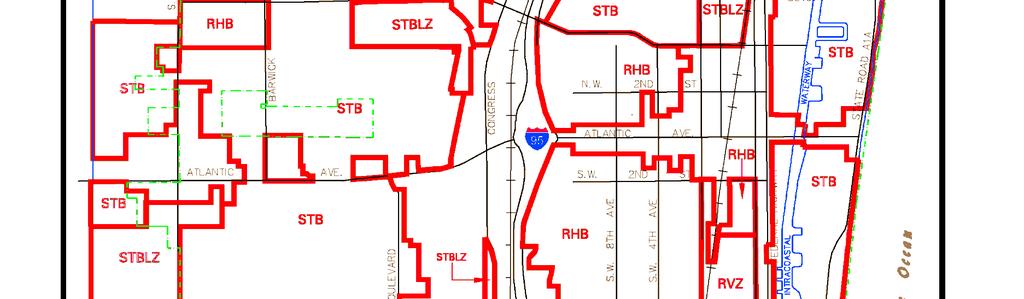


40 ` HO - 25
2016 FUTURE LAND USE ATLAS AMENDMENT APPLICATION. Palm Beach County Planning Division 2300 North Jog Road, WPB, FL 33411, (561)
") I. Amendment Data 2016 FUTURE LAND USE ATLAS AMENDMENT APPLICATION Palm Beach County Planning Division 2300 North Jog Road, WPB, FL 33411, (561) 233-5300 Round 18-B Intake Date August 4, 2017 Application
I. Amendment Data 2016 FUTURE LAND USE ATLAS AMENDMENT APPLICATION Palm Beach County Planning Division 2300 North Jog Road, WPB, FL 33411, (561) 233-5300 Round 18-B Intake Date August 4, 2017 Application
A. Application Summary. Assessment & Conclusion FUTURE LAND USE ATLAS AMENDMENT STAFF REPORT SMALL SCALE AMENDMENT
 Agenda Item: III.A.1 FUTURE LAND USE ATLAS AMENDMENT STAFF REPORT SMALL SCALE AMENDMENT PLANNING COMMISSION PUBLIC HEARING, JUNE 29, 2018 A. Application Summary I. General Project Name: Banyan Cove (SCA
INDIAN RIVER COUNTY, FLORIDA. The Honorable Members of the Planning and Zoning Commission DEPARTMENT HEAD CONCURRENCE
 Public Hearing Legislative INDIAN RIVER COUNTY, FLORIDA M E M O R A N D U M TO: The Honorable Members of the Planning and Zoning Commission DEPARTMENT HEAD CONCURRENCE Robert M. Keating, AICP; Community
PALM BEACH COUNTY PLANNING, ZONING AND BUILDING DEPARTMENT ZONING DIVISION
 PALM BEACH COUNTY PLANNING, ZONING AND BUILDING DEPARTMENT ZONING DIVISION Application No.: Z-2014-01627 Application Name: Dazco Center Control No.: 2003-00040 Applicant: 4730 Hypoluxo LLC Owners: 4730
Marion County Board of County Commissioners
 Marion County Board of County Commissioners Date: 6/4/217 P&Z: 9/25/217 BCC Transmittal: 1/17/217 BCC Adopt: TBD Amendment No: 217-L6 Type of Application Large-Scale Comp Plan Amendment Request: Change
DRAFT Subject to Modifications
 TREASURE COAST REGIONAL PLANNING COUNCIL M E M O R A N D U M DRAFT Subject to Modifications To: Council Members AGENDA ITEM 5L From: Date: Subject: Staff September 17, 2010 Council Meeting Local Government
PALM BEACH COUNTY PLANNING, ZONING AND BUILDING DEPARTMENT ZONING DIVISION
 PALM BEACH COUNTY PLANNING, ZONING AND BUILDING DEPARTMENT ZONING DIVISION Application No.: Z2003-094 Control No.: 2003-094 Petitioner: Mark A. & Susan L. Reinhold Owner: Mark A. & Susan L. Reinhold Agent:
PALM BEACH COUNTY PLANNING, ZONING AND BUILDING DEPARTMENT ZONING DIVISION
 PALM BEACH COUNTY PLANNING, ZONING AND BUILDING DEPARTMENT ZONING DIVISION Application No.: PDD/R-2014-02095 Application Name: Lake Worth Storage 2 Control No.: 2009-02300 Applicant: Michael Gilley Owners:
Chapter 100 Planned Unit Development in Corvallis Urban Fringe
 100.100 Scope and Purpose. Chapter 100 Planned Unit Development in Corvallis Urban Fringe (1) All applications for land divisions in the Urban Residential (UR) and Flood Plain Agriculture (FPA) zones within
Chapter 7 SITE DEVELOPMENT STANDARDS
 Chapter 7 SITE DEVELOPMENT STANDARDS CHAPTER 7 SITE DEVELOPMENT STANDARDS Section 701 Purpose and Intent The purpose of this Chapter is to establish minimum site requirements for the development and use
THE REDEVELOPMENT PLAN
 PAGE 37 THE REDEVELOPMENT PLAN FUTURE LAND USE The Silver Terrace Redevelopment Area is currently designated as Redevelopment Area #4 on the City of Delray Beach Future Land Use Map (FLUM). This designation
PALM BEACH COUNTY PLANNING, ZONING AND BUILDING DEPARTMENT ZONING DIVISION
 PALM BEACH COUNTY PLANNING, ZONING AND BUILDING DEPARTMENT ZONING DIVISION Application No.: CA-2012-00688 Control No.: 2011-00552 Applicant: Garry Bernardo Owners: Garry Bernardo Agent: Frogner Consulting,
PALM BEACH COUNTY PLANNING, ZONING AND BUILDING DEPARTMENT ZONING DIVISION. Preferred Realty and Development
 PALM BEACH COUNTY PLANNING, ZONING AND BUILDING DEPARTMENT ZONING DIVISION Application No.: PDD-2015-00746 Application Name: Orchid Bend Control No.: 2014-00194 Applicant: Verzaal Family Ltd Partnership
ORANGE BLOSSOM GARDENS PLANNED UNIT DEVELOPMENT PREPARED BY: COASTAL ENGINEERING CONSULTANTS, INC.
 ORANGE BLOSSOM GARDENS A PLANNED UNIT DEVELOPMENT PREPARED BY: COASTAL ENGINEERING CONSULTANTS, INC. REVISED OCTOBER 19, 1992 BY THE COLLIER COUNTY LONG RANGE PLANNING DEPARTMENT REVISED DECEMBER, 2008
PALM BEACH COUNTY PLANNING, ZONING AND BUILDING DEPARTMENT ZONING DIVISION
 PALM BEACH COUNTY PLANNING, ZONING AND BUILDING DEPARTMENT ZONING DIVISION Petition No.: Z2002-051 Petitioner: Rene & Gina Tercilla Owner: Rene & Gina Tercilla Agent: Rene & Gina Tercilla Telephone No.:
City of Sanibel. Planning Department STAFF REPORT
 City of Sanibel Planning Department STAFF REPORT Planning Commission Meeting: July 23, 2013 Planning Commission Agenda Item: No 7b. Application Number: 13-7438DP Applicant Name: Attorney Beverly Grady
42-Acre Parcel Rezoning and Master Plan Amendment. Danny Cagle and Patrick Stanley 6301 Duckweed Rd. Lake Worth, FL 33449
 STAFF REPORT CITY OF PARKLAND DEVELOPMENT SERVICES DEPARTMENT Date Prepared: May 2, 2014 I. Petition Description Petition No.: Project Name: Owners: RZ14-001; MPA14-002 42-Acre Parcel Rezoning and Master
PALM BEACH COUNTY PLANNING, ZONING AND BUILDING DEPARTMENT ZONING DIVISION
 PALM BEACH COUNTY PLANNING, ZONING AND BUILDING DEPARTMENT ZONING DIVISION Application No.: ABN/Z-2010-00656 Control No.: 1988-00109 Applicant: World Saving & Loan Association of Fla Owners: World Sav
CHAPTER Committee Substitute for Committee Substitute for Senate Bill No. 2188
 CHAPTER 2004-372 Committee Substitute for Committee Substitute for Senate Bill No. 2188 An act relating to land development; amending s. 197.502, F.S.; providing for the issuance of an escheatment tax
CONDITIONAL USE MODIFICATION REQUEST FOR UPTOWN ATLANTIC ORDER OF THE CITY COMMISSION OF THE CITY OF DELRAY BEACH, FLORIDA
 IN THE CITY COMMISSION CHAMBERS OF THE CITY OF DELRAY BEACH, FLORIDA CONDITIONAL USE MODIFICATION REQUEST FOR UPTOWN ATLANTIC ORDER OF THE CITY COMMISSION OF THE CITY OF DELRAY BEACH, FLORIDA 1. This conditional
Residential Project Convenience Facilities
 Standards for Specific Land Uses 35.42.220 E. Findings. The review authority shall approve a Land Use Permit in compliance with Subsection 35.82.110.E (Findings required for approval) or a Conditional
EXHIBIT A. City of Corpus Christi Annexation Guidelines
 City of Corpus Christi Annexation Guidelines Purpose: The purpose of this document is to describe the City of Corpus Christi s Annexation Guidelines. The Annexation Guidelines provide the guidance and
Urban Services Report For Annexation of East Lake Area
 Urban Services Report For Annexation of East Lake Area Prepared Pursuant to: Chapter 171.044 Florida Statutes And Pinellas Planning Council Resolution No.98-2 And meeting the Guidelines and Procedures
EXHIBIT D. Planned Unit Development Written Description April 13, 2016 Rouen Cove Phase II PUD
 1 EXHIBIT D Planned Unit Development Written Description April 13, 2016 Rouen Cove Phase II PUD Development # 8986.001 Developer: Curtis L. Hart Hart Resources LLC 8051 Tara Lane Jacksonville, Florida
TREASURE COAST REGIONAL PLANNING COUNCIL M E M O R A N D U M. To: Council Members AGENDA ITEM 10A
 TREASURE COAST REGIONAL PLANNING COUNCIL M E M O R A N D U M To: Council Members AGENDA ITEM 10A From: Date: Subject: Staff April 20, 2007 Council Meeting Local Government Comprehensive Plan Review Draft
TREASURE COAST REGIONAL PLANNING COUNCIL M E M O R A N D U M. To: Council Members AGENDA ITEM 4F
 TREASURE COAST REGIONAL PLANNING COUNCIL M E M O R A N D U M To: Council Members AGENDA ITEM 4F From: Date: Subject: Staff September 21, 2007 Council Meeting Local Government Comprehensive Plan Review
4.2 LAND USE INTRODUCTION
 4.2 LAND USE INTRODUCTION This section of the EIR addresses potential impacts from the Fresno County General Plan Update on land use in two general areas: land use compatibility and plan consistency. Under
REZONING APPLICATION
 Rez No. Date Received REZONING APPLICATION INSTRUCTIONS FOR COMPLETING AND FILING THE REZONING APPLICATION Applications for rezoning may be submitted to the Planning and Zoning Department at any time between
PALM BEACH COUNTY PLANNING, ZONING AND BUILDING DEPARTMENT ZONING DIVISION
 PALM BEACH COUNTY PLANNING, ZONING AND BUILDING DEPARTMENT ZONING DIVISION Application No.: Z/CA-2013-00493 Application Name: Trails Charter School Control No.: 2013-00085 Applicant: MG3 ALF Military LLC
RESOLUTION NO. RESOLUTION APPROVING ZONING PETITION 84-71, Special Exception. WHEREAS, the Board of County Commissioners, as the governing
 /. ;C- C, i RESOLUTION NO. R-@+-l2?8 RESOLUTION APPROVING ZONING PETITION 84-71, Special Exception WHEREAS, the Board of County Commissioners, as the governing body, pursuant to the authority vested in
Cobb County Community Development Agency Zoning Division 1150 Powder Springs St. Marietta, Georgia 30064
 Cobb County Community Development Agency Zoning Division 1150 Powder Springs St. Marietta, Georgia 30064 Case # Z-63 Public Hearing Dates: PC: 11-06-18 BOC: 11-20-18 SITE BACKGROUND Applicant: Loyd Development
WASTEWATER SERVICE CHARGES EFFECTIVE FOR ALL BILLS ISSUED ON AND AFTER AUGUST 1, 2003
 Louisville and Jefferson County Metropolitan Sewer District WASTEWATER SERVICE CHARGES EFFECTIVE FOR ALL BILLS ISSUED ON AND AFTER AUGUST 1, 2003 A. WASTEWATER SERVICE CHARGES Applicable to all bills rendered.
9. REZONING NO Vicinity of the northwest corner of 143 rd Street and Metcalf Avenue
 9. REZONING NO. 2002-15 Vicinity of the northwest corner of 143 rd Street and Metcalf Avenue 1. APPLICANT: Andrew Schlagel is the applicant for this request. 2. REQUESTED ACTION: The applicant is requesting
AGENDA ITEM SUMMARY GLADES COUNTY BOARD OF COUNTY COMMISSIONERS
 AGENDA ITEM SUMMARY GLADES COUNTY BOARD OF COUNTY COMMISSIONERS SUBJECT: Case Number COMP17-02, RFYC, LLC This is a Legislative Hearing. DEPARTMENT REQUEST: The Community Development Department requests
Glades County Staff Report and Recommendation Unified Staff Report for Small Scale Plan Amendment and Rezoning
 Glades County Staff Report and Recommendation Unified Staff Report for Small Scale Plan Amendment and Rezoning CASE NUMBERS: COMP17-02 and RZ17-02 DATE of STAFF REPORT: May 1, 2017 CASE TYPE: Application
TREASURE COAST REGIONAL PLANNING COUNCIL M E M O R A N D U M
 TREASURE COAST REGIONAL PLANNING COUNCIL M E M O R A N D U M To: Council Members AGENDA ITEM 5F From: Date: Subject: Staff July 16, 2010 Council Meeting Local Government Comprehensive Plan Review Draft
CITY OF COLLEGE STATION SERVICE PLAN FOR THE AREA TO BE ANNEXED EFFECTIVE 14 APRIL 2011
 CITY OF COLLEGE STATION SERVICE PLAN FOR THE AREA TO BE ANNEXED EFFECTIVE 14 APRIL 2011 I. ANNEXATION AREA The annexation area is located on the southwest side of the City of College Station, in the City
Be linked by an internal circulation system (i.e., walkways, streets, etc.) to other structures within the IPUD;
 to other structures within the IPUD;") 2. HALIFAX ACTIVITY CENTER A. DESCRIPTIONS OF FUTURE LAND USE DESIGNATIONS Each of the future land use designations specified by Phase I of the Halifax Activity Center Plan, and the relationship of these
2. HALIFAX ACTIVITY CENTER A. DESCRIPTIONS OF FUTURE LAND USE DESIGNATIONS Each of the future land use designations specified by Phase I of the Halifax Activity Center Plan, and the relationship of these
TREASURE COAST REGIONAL PLANNING COUNCIL M E M O R A N D U M. To: Regional Planning Council Members AGENDA ITEM 5D
 TREASURE COAST REGIONAL PLANNING COUNCIL M E M O R A N D U M To: Regional Planning Council Members AGENDA ITEM 5D From: Date: Subject: Staff March 20, 2009 Regional Planning Council Meeting Local Government
STAFF REPORT. Permit Number: Unlimited. Kitsap County Board of Commissioners; Kitsap County Planning Commission
 STAFF REPORT Permit Number: 15 00550 Unlimited DATE: March 2, 2016 TO: FROM: Kitsap County Board of Commissioners; Kitsap County Planning Commission Katrina Knutson, AICP, Senior Planner, DCD and Jeff
REPORT OF THE PLANNING AND DEVELOPMENT DEPARTMENT FOR APPLICATION FOR REZONING ORDINANCE TO PLANNED UNIT DEVELOPMENT SEPTEMBER 22, 2016
 BEL REPORT OF THE PLANNING AND DEVELOPMENT DEPARTMENT FOR APPLICATION FOR REZONING ORDINANCE 2016-576 TO PLANNED UNIT DEVELOPMENT SEPTEMBER 22, 2016 The Planning and Development Department hereby forwards
Expiration of Transportation Certificate of Concurrency for Application for Minor or Major Development; Approval
 Page 1 of 12 CHAPTER 3. CONCURRENCY 3.00.00. GENERALLY 3.00.01. Purpose and Intent The purpose of this chapter is to describe the requirements and procedures necessary to implement the concurrency provisions
BY BOARD OF COUNTY COMMISSIONERS AN ACT TO BE ENTITLED
 BY BOARD OF COUNTY COMMISSIONERS ORDINANCE NO. AN ACT TO BE ENTITLED AN ORDINANCE AMENDING THE PASCO COUNTY LAND DEVELOPMENT CODE, ARTICLE 700, BY REPEALING EXISTING SECTION 702, ENVIRONMENTALLY SENSITIVE
WASTEWATER SERVICE CHARGES EFFECTIVE FOR ALL BILLS ISSUED ON AND AFTER AUGUST 1, 2005
 Louisville and Jefferson County Metropolitan Sewer District WASTEWATER SERVICE CHARGES EFFECTIVE FOR ALL BILLS ISSUED ON AND AFTER AUGUST 1, 2005 A. WASTEWATER SERVICE CHARGES Applicable to all bills rendered.
Cover Letter with Narrative Statement
 Cover Letter with Narrative Statement March 31, 2017 rev July 27, 2017 RE: Rushton Pointe Residential Planned Unit Development Application for Public Hearing for RPUD Rezone PL2015 000 0306 Mr. Eric Johnson,
** If your lot does not meet the requirements above, please read Sec below
 Sec. 13-1-60 Zoning District Dimensional Requirements. For the Zoning Dept To Issue a Land Use Permit The Following Dimensions are Required. Minimum Side and Rear Yards s Lakes Classification Minimum Class
Town of Bristol Rhode Island
 Town of Bristol Rhode Island Subdivision & Development Review Regulations Adopted by the Planning Board September 27, 1995 (March 2017) Formatted: Highlight Formatted: Font: 12 pt Table of Contents TABLE
MEMORANDUM! AGENDA ITEM #IV.C
 MEMORANDUM AGENDA ITEM #IV.C DATE: DECEMBER 07, 2018 TO: FROM: COUNCIL MEMBERS STAFF SUBJECT: LOCAL GOVERNMENT COMPREHENSIVE PLAN PROPOSED AND ADOPTED AMENDMENT CONSENT AGENDA Pursuant to the 1974 Interlocal
PLANNED UNIT DEVELOPMENT (PUD)
") SECTION 38.01. ARTICLE 38 PLANNED UNIT DEVELOPMENT (PUD) Purpose The purpose of this Article is to implement the provisions of the Michigan Zoning Enabling Act, Public Act 110 of 2006, as amended, authorizing
SECTION 38.01. ARTICLE 38 PLANNED UNIT DEVELOPMENT (PUD) Purpose The purpose of this Article is to implement the provisions of the Michigan Zoning Enabling Act, Public Act 110 of 2006, as amended, authorizing
ARTICLE 14 PLANNED UNIT DEVELOPMENT (PUD) DISTRICT
 DISTRICT") ARTICLE 14 PLANNED UNIT DEVELOPMENT (PUD) DISTRICT Section 14.01 Intent. It is the intent of this Article to allow the use of the planned unit development (PUD) process, as authorized by the Michigan Zoning
ARTICLE 14 PLANNED UNIT DEVELOPMENT (PUD) DISTRICT Section 14.01 Intent. It is the intent of this Article to allow the use of the planned unit development (PUD) process, as authorized by the Michigan Zoning
ARTICLE C. ZONING TEXT, DISTRICT CLASSIFICATIONS AND BOUNDARIES
 ARTICLE C. ZONING TEXT, DISTRICT CLASSIFICATIONS AND BOUNDARIES Sec. 10-2054. ZONING TEXT, DISTRICT CLASSIFICATIONS AND BOUNDARIES. In order to regulate the location of structures, the height and bulk
Midwest City, Oklahoma Zoning Ordinance
 2010 Midwest City, Oklahoma Zoning Ordinance 9/2/2010 Table of Contents Section 1. General Provisions... 5 1.1. Citation... 5 1.2. Authority... 5 1.3. Purpose... 5 1.4. Nature and Application... 5 1.5.
ORDINANCE WHEREAS, this title is intended to implement and be consistent with the county comprehensive plan; and
 ORDINANCE 2005-015 AN ORDINANCE OF THE BOARD OF COUNTY COMMISSIONERS OF INDIAN RIVER COUNTY, FLORIDA, ADOPTING TITLE X, IMPACT FEES, AND AMENDING CODE SECTION 953, FAIR SHARE ROADWAY IMPROVEMENTS, OF THE
PALM BEACH COUNTY PLANNING, ZONING AND BUILDING DEPARTMENT ZONING DIVISION
 PALM BEACH COUNTY PLANNING, ZONING AND BUILDING DEPARTMENT ZONING DIVISION Application No.: Z-2016-00663 Application Name: Autism School Control No.: 2014-00133 Applicant: Dayna2, LLC Owners: Dayna2, LLC
O-I (Office-Institutional) and AG-1(Agricultural)
 and AG-1(Agricultural)") PROPERTY INFORMATION ADDRESS 3503 and 3505 Bethany Bend DISTRICT, LAND LOTS 2/1 973 and 974 OVERLAY DISTRICT State Route 9 PETITION NUMBERS EXISTING ZONING O-I (Office-Institutional) and AG-1(Agricultural)
PROPERTY INFORMATION ADDRESS 3503 and 3505 Bethany Bend DISTRICT, LAND LOTS 2/1 973 and 974 OVERLAY DISTRICT State Route 9 PETITION NUMBERS EXISTING ZONING O-I (Office-Institutional) and AG-1(Agricultural)
The City of Carlsbad Planning Division A REPORT TO THE PLANNING COMMISSION. Item No. P.C. AGENDA OF: March 16, 2011 Project Planner: Shannon Werneke
 The City of Carlsbad Planning Division A REPORT TO THE PLANNING COMMISSION Item No. 2 Application complete date: January 24, 2011 P.C. AGENDA OF: March 16, 2011 Project Planner: Shannon Werneke Project
CITY OF TARPON SPRINGS Staff Report May 16, 2017
 CITY OF TARPON SPRINGS Staff Report May 16, 2017 TO: FROM: HEARING DATES: SUBJECT: MAYOR & BOARD OF COMMISSIONERS PLANNING & ZONING DEPARTMENT MAY 15, 2017 (PLANNING & ZONING BOARD) JUNE 6, 2017 (BOC 1
1. Future Land Use FLU6.6.8 Land uses within the Rural Service Area portion of the Wekiva Study Area shall be limited to very low and low intensity
 1. Future Land Use FLU6.6.8 Land uses within the Rural Service Area portion of the Wekiva Study Area shall be limited to very low and low intensity uses to the greatest extent possible. Existing land uses
SECTION 1 INTRODUCTION TO THE PANAMA CITY BEACH COMPREHENSIVE GROWTH DEVELOPMENT PLAN
 1. PURPOSE SECTION 1 INTRODUCTION TO THE PANAMA CITY BEACH COMPREHENSIVE GROWTH DEVELOPMENT PLAN The purpose of the City of Panama City Beach's Comprehensive Growth Development Plan is to establish goals,
ARTICLE 5 GENERAL REQUIREMENTS
 5.1 SUITABILITY OF THE LAND ARTICLE 5 GENERAL REQUIREMENTS 5.1.1 Land subject to flooding, improper drainage or erosion, and land deemed to be unsuitable for development due to steep slope, unsuitable
APPLICATION FOR A COMPREHENSIVE PLAN AMENDMENT
 APPLICATION FOR A COMPREHENSIVE PLAN AMENDMENT Community Development Department 9220 Bonita Beach Rd, Suite 111 Bonita Springs, FL 34135 Phone: 239 444 6150 Fax: 239 444 6140 I. APPLICANT/AGENT/OWNER INFORMATION
Kitsap County Department of Community Development
 Kitsap County Department of Community Development Staff Report and Recommendation Annual Comprehensive Plan Amendment Process for 2018 George s Corner LAMIRD Boundary Adjustment Report Date 7/16/2018 Hearing
TREASURE COAST REGIONAL PLANNING COUNCIL M E M O R A N D U M
 TREASURE COAST REGIONAL PLANNING COUNCIL M E M O R A N D U M To: Council Members AGENDA ITEM 6A From: Date: Subject: Staff May 20, 2011 Council Meeting Local Government Comprehensive Plan Review Draft
SUBDIVISION REGULATIONS
 CHAPTER 14 SUBDIVISION REGULATIONS 14-100 Provisions 14-200 Preliminary Plat 14-300 Final Plat 14-400 Replat 14-500 Minor Subdivision 14-600 Administrative Replat 14-700 Vacation of Roadways, Public Easements,
COMMUNITY DEVELOPMENT. Staff Report. Site Plan Review. SP June 19, 2018
 COMMUNITY DEVELOPMENT 333 Broadalbin Street SW, PO Box 490, Albany, Oregon 97321-0144 BUILDING 541-917-7553 PLANNING 541-917-7550 Staff Report Site Plan Review SP-18-18 June 19, 2018 Summary On May 1,
AN ORDINANCE AMENDING AND SUPPLEMENTING THE REVISED GENERAL ORDINANCES OF THE CITY OF BAYONNE THE, CHAPTER 33 PLANNING AND DEVELOPMENT REGULATIONS
 AN ORDINANCE AMENDING AND SUPPLEMENTING THE REVISED GENERAL ORDINANCES OF THE CITY OF BAYONNE THE, CHAPTER 33 PLANNING AND DEVELOPMENT REGULATIONS WHEREAS, pursuant to N.J.S.A. 40:48-2, the Legislature
PLANNED UNIT DEVELOPMENT (PUD) AREA PLAN/REZONING REVIEW PROCEDURE
 AREA PLAN/REZONING REVIEW PROCEDURE") PLANNED UNIT DEVELOPMENT (PUD) AREA PLAN/REZONING REVIEW PROCEDURE Professional inquiries will be made to our Township Planning Consultant, Township Engineer, and Township Attorney to get their opinions
PLANNED UNIT DEVELOPMENT (PUD) AREA PLAN/REZONING REVIEW PROCEDURE Professional inquiries will be made to our Township Planning Consultant, Township Engineer, and Township Attorney to get their opinions
TOTTENHAM SECONDARY PLAN
 TOTTENHAM SECONDARY PLAN AMENDMENT NO. 11 TO THE OFFICIAL PLAN OF THE TOWN OF NEW TECUMSETH The following text and schedules to the Official Plan of the Town of New Tecumseth constitute Amendment No. 11
COMMUNITY DEVELOPMENT DEPARTMENT 333 Broadalbin Street SW, P.O. Box 490 Albany, OR 97321
 COMMUNITY DEVELOPMENT DEPARTMENT 333 Broadalbin Street SW, P.O. Box 490 Albany, OR 97321 STAFF REPORT Application for Site Plan Review (SP-02-18) Residential Accessory Building Ph: 541-917-7550 Fax: 541-917-7598
Article 7: Residential Land Use and Development Requirements
 Article 7: Residential Land Use and Section 701: Statement of Intent (A) (B) (C) The intent of Article 7 is to develop certain land use and development requirements for the residential uses within Cumru
CONCURRENCY MANAGEMENT SYSTEM ELEMENT
 CONCURRENCY MANAGEMENT SYSTEM ELEMENT TOWN OF HOWEY-IN-THE-HILLS LAKE COUNTY, FLORIDA ADOPTED ON OCTOBER 11, 2010 CONCURRENCY MANAGEMENT SYSTEM ELEMENT TABLE OF CONTENTS A. OVERVIEW OF THE CONCURRENCY
PALM BEACH COUNTY PLANNING, ZONING AND BUILDING DEPARTMENT ZONING DIVISION
 PALM BEACH COUNTY PLANNING, ZONING AND BUILDING DEPARTMENT ZONING DIVISION Application No.: PDD-2014-01122 Application Name: Flavor Pict Townhomes PUD Control No.: 2014-00064 Applicant: Lois Dubois Ltd,
EVALUATION AND APPRAISAL REPORT OF THE CITY OF FELLSMERE COMPREHENSIVE PLAN APPENDIX D HOUSING ELEMENT
 OBJECTIVE H-A-1: ALLOW AFFORDABLE HOUSING AND ADEQUATE SITES FOR VERY LOW, LOW, AND MODERATE INCOME HOUSING. The City projects the total need for very low, low, and moderate income-housing units for the
City of Woodinville Washington State Boundary Review Board Notice of Intent Brown Annexation
 I. BACKGROUND/MAPS City of Woodinville A. Basic Information 1. The proposal known as the is located on the southwest corner of NE 171 st Street and 140 th Avenue NE within the City s Urban Growth Boundary.
ARTICLE VII. NONCONFORMITIES. Section 700. Purpose.
 ARTICLE VII. NONCONFORMITIES. Section 700. Purpose. The purpose of this chapter is to regulate and limit the development and continued existence of legal uses, structures, lots, and signs established either
TREASURE COAST REGIONAL PLANNING COUNCIL M E M O R A N D U M. To: Council Members AGENDA ITEM 9D
 TREASURE COAST REGIONAL PLANNING COUNCIL M E M O R A N D U M To: Council Members AGENDA ITEM 9D From: Date: Subject: Staff May 15, 2015 Council Meeting Local Government Comprehensive Plan Review Draft
CHAPTER IV IMPLEMENTATION
 CHAPTER IV IMPLEMENTATION Chapter Outline IV. Implementation Page A. Public Works Projects/Public Infrastructure IV-1 1. Facilities Master Plan Overview IV-1 2. Facilities Master Plan Service Standards
ADDRESS / DESCRIPTION: Northeast corner of Sandbridge Road and Atwoodtown Road ELECTION DISTRICT: PRINCESS ANNE
 10 & 11 March 14, 2012 Public Hearing APPLICANT: MARLYN DEVELOPMENT CORPORATION PROPERTY OWNER: CORAL DEVELOPMENT, LLC STAFF PLANNER: Faith Christie REQUEST: Modification of Conditional Change of Zoning
Chapter CONCURRENCY
 Chapter 20.180 CONCURRENCY Sections: 20.180.001 Purpose. 20.180.002 Authority. 20.180.003 Definitions 20.180.004 Exempt development. 20.180.005 Capacity evaluation required for a change in use. 20.180.006
FINAL DRAFT 12/1/16, Rev. to 7/18/17
 FINAL DRAFT 12/1/16, Rev. to 7/18/17 (As Adopted 8/8/17 Effective 9/1/17) SHELTON PLANNING AND ZONING COMMISSION Proposed Amendments to Zoning Regulations I. Amend Section 23 PERMITTED USES by inserting
Existing Land Use and Zoning District Single-family development under construction, woods / Conditional R-10 Residential, AG-1 Agricultural
 Applicant Property Owners, & William Snowden and James Snowden Public Hearing September 12, 2018 City Council Election District Princess Anne Agenda Items 8 & 9 Request Conditional Rezoning (AG-1 Agricultural
Request Conditional Rezoning (R-7.5 Residential to Conditional A-18 Apartment) Staff Recommendation Approval. Staff Planner Jimmy McNamara
 Staff Recommendation Approval. Staff Planner Jimmy McNamara") Applicants Property Owners Baker Villas, LLC; Ocean Rental Properties, LLC; James Edward Sollner; & Linda Susan Sollner Public Hearing November 8, 2017 City Council Election District Kempsville Agenda
Applicants Property Owners Baker Villas, LLC; Ocean Rental Properties, LLC; James Edward Sollner; & Linda Susan Sollner Public Hearing November 8, 2017 City Council Election District Kempsville Agenda
HOUSING ELEMENT OF THE CITY OF PEMBROKE PINES COMPREHENSIVE PLAN ADOPTION DOCUMENT
 HOUSING ELEMENT OF THE CITY OF PEMBROKE PINES COMPREHENSIVE PLAN RULES 9J-5.010, FAC City of Pembroke Pines, Florida ADOPTION DOCUMENT HOUSING ELEMENT HOUSING ELEMENT ADOPTION DOCUMENT VI. GOALS, OBJECTIVES
31, Township 29 South, Range 25 East, Polk County, Florida, as depicted by the Land Use Plan attached
 ORDINANCE NO. 2013-04 AN ORDINANCE AMENDING THE ZONING MAP OF THE CITY OF BARTOW, FLORIDA, REZONING APPROXIMATELY 2. 2 ACRES OF LAND OWNED BY BALA3I OF POLK COUNTY, LLC AND LOCATED IN SECTION 31, TOWNSHIP
FUTURE LAND USE. City of St. Augustine Comprehensive Plan EAR-Based Amendments
 FUTURE LAND USE City of St. Augustine Comprehensive Plan EAR-Based Amendments Future Land Use Element FLU Goal To create an environment within the City and adjacent areas in which its residents have the
CITY OF PALM BEACH GARDENS CITY COUNCIL Agenda Cover Memorandum Meeting Date: November 1, 2018 Ordinance 24, 2018 / *Ordinance 25, 2018
 CITY OF PALM BEACH GARDENS CITY COUNCIL Agenda Cover Memorandum Meeting Date: November 1, 2018 Subject/Agenda Item: 11940 U.S. Highway One Small-Scale Comprehensive Plan Future Land Use Map Amendment and
City File ZM th Street North St. Petersburg, FL Central Avenue, Suite 1600 St. Petersburg, FL 33701
 Staff Report to the St. Petersburg Community Planning & Preservation Commission Prepared by the Planning & Development Services Department, Urban Planning and Historic Preservation Division For Public
CHAPTER 352 COUNTY LAND PRESERVATION AND USE COMMISSIONS
 CHAPTER 352 COUNTY LAND PRESERVATION AND USE COMMISSIONS Referred to in 6B.3, 15E.111, 159.6, 173.3, 455B.275 Chapter does not invalidate ordinances existing on July 1, 1982, or require adoption of zoning
ORDINANCE NO AN ORDINANCE AMENDING THE CODE OF ORDINANCES OF THE CITY OF PORT ARANSAS, TEXAS, BY ADOPTING A NEW CHAPTER
 ORDINANCE NO. 2008-09 AN ORDINANCE AMENDING THE CODE OF ORDINANCES OF THE CITY OF PORT ARANSAS, TEXAS, BY ADOPTING A NEW CHAPTER TWENTY-SIX CONCERNING IMPACT FEES FOR ROADWAY FACILITIES; INCORPORATING
PALM BEACH COUNTY PLANNING, ZONING AND BUILDING DEPARTMENT ZONING DIVISION
 PALM BEACH COUNTY PLANNING, ZONING AND BUILDING DEPARTMENT ZONING DIVISION Application No.: DOA-2014-01111 Application Name: World Class Academy Control No.: 1998-00052 Applicant: World Class Academy Inc
Request Conditional Rezoning (AG-1 & AG-2 Agricultural to Conditional R-10 Residential) Staff Recommendation Deferral. Staff Planner Jimmy McNamara
 Staff Recommendation Deferral. Staff Planner Jimmy McNamara") Applicants & Property Owners Public Hearing May 9, 2018 (Deferred by Planning Commission, 12/13/17) City Council Election District Princess Anne Agenda Item D2 Request Conditional Rezoning (AG-1 & AG-2
Applicants & Property Owners Public Hearing May 9, 2018 (Deferred by Planning Commission, 12/13/17) City Council Election District Princess Anne Agenda Item D2 Request Conditional Rezoning (AG-1 & AG-2
610 LAND DIVISIONS AND PROPERTY LINE ADJUSTMENTS OUTSIDE A UGB
 ARTICLE VI: LAND DIVISIONS AND PROPERTY LINE ADJUSTMENTS VI-21 610 LAND DIVISIONS AND PROPERTY LINE ADJUSTMENTS OUTSIDE A UGB 610-1 Property Line Adjustments (Property Line Relocation) A property line
PALM BEACH COUNTY PLANNING, ZONING AND BUILDING DEPARTMENT ZONING DIVISION ZONING COMMISSION VARIANCE STAFF REPORT 06/05/2014
 PALM BEACH COUNTY PLANNING, ZONING AND BUILDING DEPARTMENT ZONING DIVISION ZONING COMMISSION VARIANCE STAFF REPORT 06/05/2014 APPLICATION NO. ZV-2013-03120 CODE SECTION REQUIRED PROPOSED VARIANCE (V1)
CONTRA COSTA LOCAL AGENCY FORMATION COMMISSION EXECUTIVE OFFICER'S REPORT August 12, 2015 (Agenda)
") CONTRA COSTA LOCAL AGENCY FORMATION COMMISSION EXECUTIVE OFFICER'S REPORT PROPONENTS ACREAGE & LOCATION Laurel Place/Pleasant View Annexation to the City of Concord Curt Blomstrand, Lenox Homes landowner/petitioner
CONTRA COSTA LOCAL AGENCY FORMATION COMMISSION EXECUTIVE OFFICER'S REPORT PROPONENTS ACREAGE & LOCATION Laurel Place/Pleasant View Annexation to the City of Concord Curt Blomstrand, Lenox Homes landowner/petitioner
19 June 9, 2010 Public Hearing APPLICANT AND PROPERTY OWNER: KEMP ENTERPRISES, INC.
 19 June 9, 2010 Public Hearing APPLICANT AND PROPERTY OWNER: KEMP ENTERPRISES, INC. STAFF PLANNER: Karen Prochilo REQUEST: Change of Zoning District Classification, Conditional A-24 Apartment District
Letter of Intent May 2017 (Revised November 2017)
") THE BEACH AT WOODMOOR LETTER OF INTENT MAY 2017 (REVISED NOVEMBER 2017) OWNER/APPLICANT: CONSULTANT: Lake Woodmoor Holdings LLC N.E.S. Inc. 1755 Telstar Drive, Suite 211 619 North Cascade Avenue Colorado
THE BEACH AT WOODMOOR LETTER OF INTENT MAY 2017 (REVISED NOVEMBER 2017) OWNER/APPLICANT: CONSULTANT: Lake Woodmoor Holdings LLC N.E.S. Inc. 1755 Telstar Drive, Suite 211 619 North Cascade Avenue Colorado
Marion County Board of County Commissioners
 Marion County Board of County Commissioners Date: 12/29/2015 P&Z: 12/28/2015 BCC: 1/12/2016 Item Number 160113Z Type of Application Rezoning Request From: A-1 (General Agriculture) To: PUD (Planned Unit
Community Development
 Land Use Petition RZ-16-002 Date of Staff Recommendation Preparation: April 15, 2016 (CEL) Date of Planning Commission Recommendation: May 3, 2016 PROJECT LOCATION: DISTRICT/SECTION/LANDLOT(S): ACREAGE
Village of Palm Springs
 Village of Palm Springs Executive Brief AGENDA DATE: July 14, 2016 DEPARTMENT: Office of the Village Manager ITEM #9: Resolution 2016-51 Stormwater Non Ad-Valorem Assessment Rates SUMMARY: Over the years,
MEMORANDUM. Douglas Hutchens, Interim City Manag~ August 4, 2016 / Greg Rice, Director of Planning & Development
 Agenda Item: Meeting Date: PH-1 8/18/16 TO: THROUGH: DATE: FROM: SUBJECT: PRESENTER: RECOMMENDATION: BUDGET IMP ACT: PAST ACTION: NEXT ACTION: ATTACHMENTS: BACKGROUND: City Commission MEMORANDUM Douglas