MEMORANDUM. SUBJECT: Status Report DATE: December 14, 2017
|
|
|
- Alan Walsh
- 5 years ago
- Views:
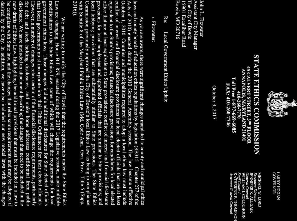
Transcription
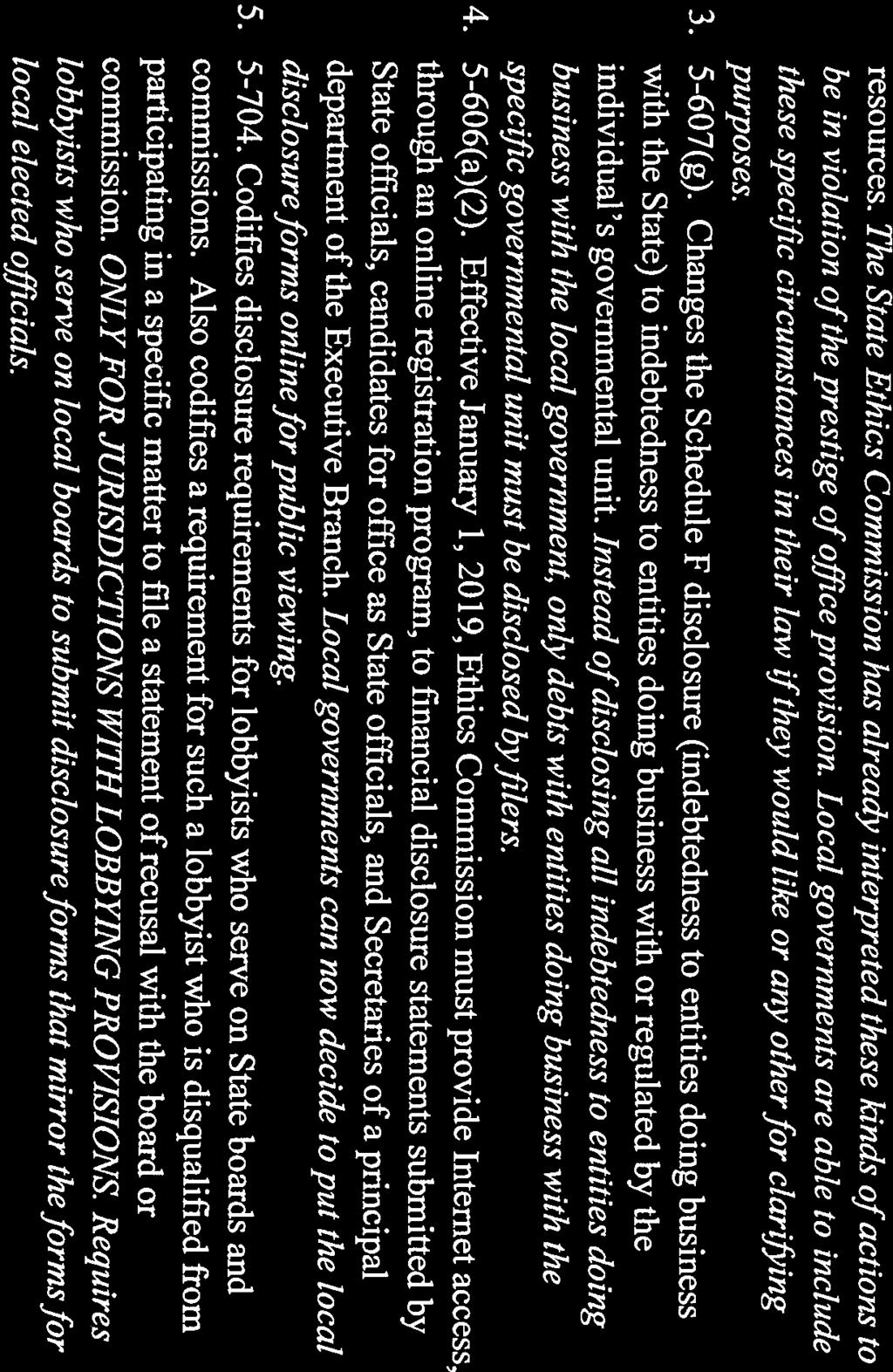
1 MEMORANDUM TO: FROM: City Council Alfred D. Lott, ICMA-CM, CPM City Manager SUBJECT: Status Report DATE: December 14, 2017 Status Report 1. Senior Center Bus Replacement The Adopted Fiscal Year 2018 Budget has appropriated $240,000 for the replacement of three Senior Center buses (#71, #73 and #77). Staff has located a GSA Contract (GS- 30F-DA019) with Colonial bus company through which we can purchase three 2018 gas powered, 16 passenger, handicap lift equipped Strartrans SII buses at a cost of $76, each. As provided by Section 62 of the City Charter, this will serve as the required seven (7) day notice of intent to issue a purchase order to Colonial in the amount of $229,131 for these three vehicles. 2. State Ethics Commission Letter In October the City received the attached letter from the State Ethics Commission regarding changes in State law that will impact local Ethics Ordinances. This letter was previously shared with City Council and it was indicated that this letter would be placed on the next agenda of the City's Ethics Commission to have them make a recommendation to City Council. On December 12, 2017, the City's Ethics Commission reviewed this letter with the Attorney for the Ethics Commission, Fred Sussman. Four of the provisions contained in the attachment to the State Ethics Commission letter are mandatory and must be implemented by local governments. Five of the provisions are discretionary and may be adopted by the local government. Of the five discretionary provisions, the Ethics Commission only recommends that the first provision, pertaining to the removal of exchange traded funds from the list of interests that must be disclosed, be enacted by City Council. Staff concurs with this recommendation. Staff will forward this recommendation to Ms. Levan for the preparation of an ordinance for City Council consideration at an upcoming City Council meeting enacting the four mandatory provisions and the one discretionary provision regarding exchange traded funds. Please let us know if you have any questions or different perspectives regarding action pertaining to this issue.
2 Status Report 2 December 14, Economic Development Committee The Bowie EDC held their December meeting on Wednesday at Bowie State University with the University President as a special guest. Dr. Aminta Breaux spoke to the EDC about her vision for the University (a copy of Dr. Breaux s Vision for is attached). Dr. Breaux is leading the University into more and better partnerships with the community including some with K thought 12 and the community college. The fall 2017 class admitted was the largest in the University s history with 1,075 students. The student body is now large enough that on-campus housing is effectively full and 60 students are housed in apartments in College Park and commute daily via a University provided shuttle bus. Additional on-campus housing is needed; the University is exploring Public-Private-Partnerships (P 3 ). The student body is 80% African American students. Students come from 19 states and 20 foreign countries. The University is interested in connecting the students with the business community via internships, externships, and job shadowing. This year s goals are Academic Excellence, Student Success, and Viability of the University Development Sites & Transportation Projects Outline Attached is a copy of the end of year report prepared by the Department of Planning and Economic Development. The publication gives the current status of over 30 development sites, as well as transportation projects, in and around Bowie. Copies of the document may be obtained by contacting the Planning Department. 5. Stakeholders Meeting The Aspen Apartments at Melford Town Center On Wednesday, December 13 th, a Stakeholders Meeting was held for the Detailed Site Plan for the Aspen Apartments proposed in Melford Town Center (formerly Melford Village) by St John Properties, Inc. This project includes a 388-unit/4-5 level/149,390 sq. ft. residential apartment building, which wraps around a 5-level parking structure designed to accommodate 587 vehicles. The building is proposed on 6.6 acres of a 25- acre parcel, located on the west side of Curie Drive, immediately north of the Melford House and approximately 900 ft. north of Melford Boulevard. The property is zoned M- X-T (Mixed Use Transportation Oriented), a zone that allows and encourages a mix of residential, retail, office and employment uses on a site located at or near a major interchange or intersection. The proposal also includes the construction of an outdoor inground swimming, a Zen Garden, and several other exterior and interior amenities. A total of 16 stakeholders attended the meeting. Questions raised by stakeholders included: -How is interior and exterior noise attenuation provided? -How is air quality ensured in the parking garage? -Do residents have their own reserved parking space within the parking deck?
3 Status Report 3 December 14, Will there be sufficient parking in the deck for the apartment residents? -Is the parking deck for the public or just the residents? -Will there be public access to the outdoor swimming pool? -How is stormwater treated and where will it go? -Will the project have public water and sewer, and what is the source of the public water supply? -How will trash be picked-up, and who will provide that service? -What are the plans for reducing traffic? What will be the impact of traffic from Melford on City streets? -What will be the approximate rents for the units? -What will be the impacts on the quality of life to existing residents? -Is a pedestrian link still proposed from Melford to the B section of the City? At the conclusion of the two hour meeting, staff reminded those in the audience of the City s public hearing dates, which are January 9 th for the Bowie Advisory Planning Board and January 16 th for City Council. Attachments ADL/lfr


4


5

6
7


8


9 City of Bowie 2018 Development Sites & Transportation Projects Outline Prepared by the Department of Planning and Economic Development Updated 12/14/17
10 GLOSSARY & DEFINITIONS Basic Plan: a plan approved in conjunction with a ZMA for a CDZ. This plan identifies the general location of the different land uses within the project, and the general location of access to property from outside roads, as well as a general design for internal road system. This plan does not contain any specifics as to building locations, density, etc. This is the first step in the CDZ process. CDP: CDZ: Comprehensive Design Plan: the second step in the CDZ process where, among other aspects of the project, comprehensive design details including land uses, densities, non-residential land uses, access to the project, setbacks from streets and property lines, and buffering are approved. Comprehensive Design Zone: a special zoning district requiring multi-step review of development proposals which are typically more intensive than a traditional subdivision, and may consist of a mixture of residential, commercial, office, or institutional uses. (NOTE: Projects marked with an asterisk (*) are projects in a CDZ.) Cluster Subdivision: a Preliminary Subdivision Plan which is not within a CDZ, where lot sizes are reduced and grouped more tightly than would normally be permitted within that zone in exchange for preserving environmental characteristics including steep slopes, flooded areas, 100-year floodplain and wetlands, etc., in the form of common open space. DSP: Detailed Site Plan: a detailed design plan similar to an SDP, required for special subdivisions such as cluster developments within a standard zoning district, not a CDZ. Two aspects of the DSP are architectural and landscaping plans. Preliminary Subdivision Plan: the County process for legally dividing property into smaller parcels such as lots for sale and development. Except for projects within CDZ s, or for special subdivisions such as cluster developments within a standard zoning district, no further public review may be necessary beyond this stage in the development process before proceeding to Record Plat (or final plat) and then to the issuance of building permit(s). Final Subdivision Plan: a plan which is placed in the County Land Records to record and establish property boundaries on parcels created through a Preliminary Subdivision Plan to permit the lawful sale of the parcel(s). SDP: Specific Design Plan: a detailed plan identifying precisely where all improvements such as roads, buildings, landscaping, entrance drives and trails, etc., will be located in a CDZ project. This is the third step in the CDZ review process. Architectural plans are a part of this review process. Special Exception: a land use not permitted by right in a zone unless the use is found to meet very specific criteria, and will have minimal or negligible impacts on adjacent properties. WSSC: Washington Suburban Sanitary Commission:a bi-county agency responsible for providing public water and sewer service outside of the City s public sewer and water system. ZHE: ZMA: Zoning Hearing Examiner: a quasi-judicial official of the County responsible for reviewing and preparing a written recommendation for ZMA s and Special Exceptions as to conformity with County laws and ordinances. Zoning Map Amendment: a proposal to change the zoning of land to permit a use other than or in addition to that previously permitted on the property. SMA: Sectional Map Amendment: a comprehensive rezoning for an entire planning area that systematically considers zoning and land use issues in conjunction with approval of a Master Plan.
11 DSO 2018 ALPHABETICAL LISTING PIPELINE PROJECTS TRANSPORTATION PROJECTS P-34 10TH STREET PARK/BOWIE RAILROAD MUSEUM T-1 THE BOWIE HERITAGE TRAIL (CITY) P-18 AMBER RIDGE T-3 THE BOWIE HERITAGE TRAIL/WB & A SPUR TRAIL P-7 BEALL FUNERAL HOME EXPANSION (MNCPPC) P-12 BOWIE GATEWAY CENTER T-2 CHESTNUT AVENUE BRIDGE REPLACEMENT (COUNTY) P-3 BOWIE MARKETPLACE T-15 CHURCH ROAD (PRINCE GEORGE'S COUNTY) P-6 BOWIE WHITEMARSH (aka Jesuit Property) T-9 GOVERNORS BRIDGE RECONSTRUCTION (COUNTY) P-13 BOWIE TOWN CENTER T-14 HALL ROAD (SHA, MNCPPC, CITY) P-9 BUCKINGHAM AT BELAIR T-13 LEELAND ROAD IMPROVEMENTS (COUNTY) P-11 CHICK-FIL-A DRIVE-THRU EXPANSION T-8 MD RTE 3 (SHA) P-26 COLLINGBROOK ESTATES (PDC/RODENHAUSER PROPERTY) T-6 MD RTE 197 FROM KENHILL DR. TO MD RTE 450 (SHA) P-20 COLLINGTON CENTER/FOREIGN TRADE ZONE T-5 MD RTE 197 NORTH LANDSCAPING/STREETSCAPE (SHA) P-32 COLLINGTON PARK FLEX BUILDING (formerly Collins Nursery) T-7 MD RTE 197 SOUTH LANDSCAPING PLAN (SHA) P-5 CORNERSTONE ASSEMBLY OF GOD ADDITION T-4 MD RTE 450 (ANNAPOLIS ROAD) (SHA) P-28 FAIRVIEW MANOR (formerly Collingbrook) T-10 US 301 IMPROVEMENTS, including US 301/ MD ROUTE P-29 FAIRWOOD 197 INTERCHANGE (SHA) P-2 HILLTOP PLAZA SHOPPING CENTER T-11 US RTE 301 SOUTH CORRIDOR TRANSPORTATION P-19 KARINGTON (SOUTHLAKE) STUDY (SHA) P-25 KING'S ISLE ESTATES T-12 US RTE 301 IMPROVEMENTS (PRINCE GEORGE'S COUNTY) P-30 LIDL GROCERY STORE P-22 LOCUST HILL P-27 LONERGAN/PDC COLLINGBROOK, LLC PROPERTY P-10 MELFORD/MARYLAND SCIENCE & TECHNOLOGY CENTER P-4 MIDWOOD LANE STORMWATER POND RECONSTRUCTION P-14 MILL BRANCH CROSSING P-15 MILL BRANCH ESTATES P-17 MILLS PROPERTY P-23 OAK CREEK CLUB P-16 THE PRESERVE AT POINTER RIDGE (PAGE COURT) P-1 SADDLEBROOK ESTATES P-31 SANTOS ROADSIDE STAND P-33 SHOPPES AT HIGHBRIDGE P-35 TULIP GROVE ELEMENTARY SCHOOL RENOVATION P-8 WHITEMARSH PARK MASTER PLAN IMPROVEMENTS P-21 WILLOWBROOK P-24 WOODMORE ESTATES
12 DSO 2018 NUMERICAL LISTING PIPELINE PROJECTS TRANSPORTATION PROJECTS P-1 SADDLEBROOK ESTATES T-1 THE BOWIE HERITAGE TRAIL (CITY) P-2 HILLTOP PLAZA SHOPPING CENTER T-2 CHESTNUT AVENUE BRIDGE REPLACEMENT (COUNTY) P-3 BOWIE MARKETPLACE T-3 THE BOWIE HERITAGE TRAIL/WB & A SPUR (MNCPPC) P-4 MIDWOOD LANE STORMWATER POND RECONSTRUCTION T-4 MD RTE 450 (ANNAPOLIS ROAD) (SHA) P-5 CORNERSTONE ASSEMBLY OF GOD ADDITION T-5 MD RTE 197 NORTH LANDSCAPING/STREETSCAPE (SHA) P-6 BOWIE WHITEMARSH (aka JESUIT PROPERTY) T-6 MD RTE 197 FROM KENHILL DR. TO MD RTE 450 (SHA) P-7 BEALL FUNERAL HOME EXPANSION T-7 MD RTE 197 SOUTH LANDSCAPING PLAN (SHA) P-8 WHITEMARSH PARK MASTER PLAN IMPROVEMENTS T-8 MD RTE 3 (SHA) P-9 BUCKINGHAM AT BELAIR T-9 GOVERNORS BRIDGE RECONSTRUCTION (COUNTY) P-10 MELFORD/MARYLAND SCIENCE AND TECHNOLOGY CENTER T-10 US 301 IMPROVEMENTS, including US 301/ MD ROUTE P-11 CHICK-FIL-A DRIVE-THRU EXPANSION 197 INTERCHANGE (SHA) P-12 BOWIE GATEWAY CENTER T-11 US 301 CORRIDOR SOUTH TRANSPORTATION STUDY (SHA) P-13 BOWIE TOWN CENTER T-12 US RTE 301 IMPROVEMENTS (PRINCE GEORGE'S COUNTY) P-14 MILL BRANCH CROSSING T-13 LEELAND ROAD IMPROVEMENTS (COUNTY) P-15 MILL BRANCH ESTATES T-14 HALL ROAD (SHA, MNCPPC, CITY) P-16 THE PRESERVE AT POINTER RIDGE (PAGE COURT) T-15 CHURCH ROAD (PRINCE GEORGE'S COUNTY) P-17 MILLS PROPERTY P-18 AMBER RIDGE P-19 KARINGTON (SOUTHLAKE) P-20 COLLINGTON CENTER/FOREIGN TRADE ZONE P-21 WILLOWBROOK P-22 LOCUST HILL P-23 OAK CREEK CLUB P-24 WOODMORE ESTATES P-25 KING'S ISLE ESTATES P-26 COLLINGBROOK ESTATES (formerly PDC/Rodenhauser) P-27 LONERGAN/PDC COLLINGBROOK, LLC PROPERTY P-28 FAIRVIEW MANOR (formerly Collingbrook) P-29 FAIRWOOD P-30 LIDL GROCERY STORE P-31 SANTOS ROADSIDE STAND P-32 COLLINGTON PARK FLEX BUILDING (formerly Collins Nursery) P-33 SHOPPES AT HIGHBRIDGE P-34 10TH STREET PARK AND BOWIE RAILROAD MUSEUM P-35 TULIP GROVE ELEMENTARY SCHOOL RENOVATION
13 DEVELOPMENT SITES OUTLINE PIPELINE PROJECTS "Pipeline" projects are generally identified as major projects for which an official subdivision or zoning application has been filed, is under review, or a decision is pending. Also, pipeline projects include properties such as surplus schools undergoing renovation/re-use, active projects with approved Water and Sewer Systems Area changes, and projects under construction. (NOTE: Projects marked with an asterisk (*) are projects in a CDZ). P-1 SADDLEBROOK ESTATES (formerly Colt s Neck Subdivision) 54 acres O-S (Open Space) Proposed Land Use: Eight (8) single-family detached units and conservation lot Final Subdivision Plan for eight (8) single-family detached lots approved, Seven units (including existing historic house) completed, Stormwater management concept plan being prepared for one remaining lot. Project Contact: Owner (Lot 9): Mr. Julian Ramirez-Brana Morris & Ritchie Associates, Inc Race Track Road Mr. Daniel Jackson, P.E. Bowie, MD P-2 HILLTOP PLAZA SHOPPING CENTER 17 acres C-S-C (Commercial Shopping Center) R-R (Rural Residential) Proposed Land Use: Renovation of existing 162,260 square foot shopping center including the addition of 49 residential dwelling units 4,506 square foot Bank of America building completed, Rezoning application for the M-X-T (Mixed Use Transportation Oriented) zone recommended for denial by City, ,870 square foot Sun Trust bank building, a new 227-seat, 6,398 square foot Outback Steakhouse and 14,967 sq.ft. Walgreen s pharmacy and partial redevelopment of existing commercial shopping center completed. Renovation of former Outback Steakhouse building completed and new restaurant (Olive Grove) opened, ,272 square foot addition to Olive Grove building completed, Rezoning application on hold at developer s request. Final Stormwater Management Concept Plan, Alternative Compliance and building permits for a 1,200 sq.ft. Dunkin Donuts building addition approved, Project Contact: Rappaport Management Company Macris, Hendricks and Glasock, P.A. Mr. Gary Rappaport Mr. Jeremiah Swenson Gibbs & Haller Mr. Tom Haller P-3 BOWIE MARKETPLACE 26 acres C-S-C (Commercial Shopping Center) Proposed Land Use: 131,558 square foot retail shopping center Retail shopping center opened Fall, Preliminary Plan of subdivision and Detailed Site Plan for a multi-family building containing 225 residential rental units approved by City and County Planning Board, and Final Stormwater Management Plan approved by City, Project Contact: Berman Enterprises Gingles, LLC -1-
14 Mr. Brian Berman Mr. Andre Gingles P-4 MIDWOOD LANE STORMWATER POND RECONSTRUCTION 3 acres R-80 (One Family Detached Residential) Proposed Land Use: Reconstruction of stormwater management pond. The project will modify the current dry stormwater detention area to a pond with a permanent pool that will provide the desired water quality improvements. Preliminary work includes site clearing and relocation of a sanitary sewer line. Under construction. Work began in early September and should be completed in Project Contacts: Department of Public Works Mr. Pat Rush P-5 CORNERSTONE ASSEMBLY OF GOD ADDITION 8 acres R-E (Residential Estate) Proposed Land Use: 865 sq.ft. second story, office addition to existing church Detailed Site Plan revision approved, Project Contacts: Cornerstone Assembly of God Landesign, Inc. Pastor Mark Lehman Mr. Jeff Felker P-6 BOWIE WHITEMARSH (aka JESUIT PROPERTY) 3 acres R-E (Residential Estate), R-A (Residential Agriculture) Proposed Land Use: 440 single-family detached and single-family attached units. Zoning Map Amendment application for the R-S (Residential Suburban) * Zone submitted, Project Contacts: Elm Street Development Mr. Jude Burke Lerch, Early & Brewer Chartered Morris & Ritchie Associates, Inc. Mr. Chris Hatcher Ms. Courtney Galiber P-7 BEALL FUNERAL HOME EXPANSION 5 acres R-E (Residential Estate) Proposed Land Use: 3,560 square foot crematory addition and 5,100 square foot chapel addition to existing 10,256 square foot funeral home and new 1,680 square foot detached garage building Departure from Parking and Loading Standards (DPLS) application withdrawn; Special Exception revision approved by District Council and plan certified by Zoning Hearing Examiner, Special Exception revision to increase gross floor area by 1.4% from 20,596 square feet to 21,345 sq.ft. approved, Owner preparing a new revision to Special Exception for a smaller expansion, involving a 3,672 sq.ft. freestanding garage/crematory building; Stormwater Mangement Concept Plan approved, Project Contacts: Zizos Properties, LLC Landesign, Inc. Mr. Tom Zizos Mr. Jeff Felker
15 P-8 WHITEMARSH PARK MASTER PLAN IMPROVEMENTS 200 acres R-O-S (Reserved Open Space) Proposed Land Use: Capital improvements within the park, involving a five phase implementation plan, including: (1) extension of the City sanitary sewer to park facilities; (2) construction of a pedestrian plaza, playground and a new restroom/concessions building; (3) parking improvements and modifications to playing fields; (4) additional parking and pedestrian circulation improvements in the main parking lot; and (5) access road improvements and additional parking to support the Bowie Playhouse. Master Plan completed, Funds for construction of the first two phases have been appropriated in FY Project Contact: Department of Public Works A. Morton Thomas Mr. George Stephanos Mr. Aaron Smith P-9 BUCKINGHAM AT BELAIR 0.75 acres R-55 (One-Family, Detached Residential) Proposed Land Use: One single-family dwelling City Water and Sewer Category change and Final Subdivision Plan approved, City Stormwater Management Plan exemption approved and County building permit submitted, Project Contact: Owner (Lot 16) Surveys, Inc. Ms. Kathleen Harjess Mr. Greg Benefiel P-10 MELFORD (FORMERLY MARYLAND SCIENCE AND TECHNOLOGY CENTER) 466 acres M-X-T (Mixed Use, Transportation Oriented) Proposed Land Use: Mixed use employment park Approvals: - Rezoning from R-R to E-I-A and Basic Plan for up to 6.4 million square feet approved, Comprehensive Design Plan approved, Specific Design Plan for 117,000 square foot Supercomputing Research Center approved, Specific Design Plan for 130,000 square foot U.S. Census Bureau Computing Facility approved, Preliminary Subdivision Plan for 1.95 million square feet in the E-I-A zone re-approved, Specific Design Plans for 300,000 square feet in two (2) four-story office buildings, 30,450 square feet in a one-story office building, 160,000 square feet in four (4) one-story office-flex buildings approved, Specific Design Plan for 83,000 square feet in three (3) flex-office buildings approved, Specific Design Plan for limited signage approved, Preliminary Subdivision Plan for three (3) parcels in Phase 2 approved, Specific Design Plan for a 234,000 square foot campus (International Masonry Institute) containing a two-story, 60,500 square foot national training center and office, a three-story, 45,500 square foot main building and dormitory approved, Specific Design Plan for two (2) stormwater management ponds approved in 2003 and redesigned and re-approved, Specific Design Plan for 81,600 square feet in two (2) office buildings approved,
16 - Specific Design Plan for a 234,000 square foot campus (International Masonry Institute) 125,000 square foot corporate office (Phase 2), and a 5,000 square foot dormitory addition (Phase 3) approved, Specific Design Plan for a 40,440 square foot, one-story flex building and a 27,990 square foot, two-story office building approved, Detailed Site Plan for 235,289 square feet in three (3), five-story hotels with 362 rooms approved, Detailed Site Plan for 24,375 square feet in three (3), one-story retail buildings approved, Preliminary Subdivision Plan for nine (9) parcels approved, Detailed Site Plan for 134,480 square feet in four (4) office buildings and 248,820 square feet in seven (7) research and development buildings approved, Detailed Site Plan for comprehensive signage proposal approved, Conceptual Site Plan revision for a mixed use development containing up to 2,500 single-family attached and multi-family residential units, 260,000 square feet of office space and 268,500 square feet of retail space (Melford Village) approved by District Council, Opponents appealed to Circuit Court and case was decided in favor of Prince George s County. Opponents appealed and case is awaiting a decision from the Court of Special Appeals. Detailed Site Plan for a fourstory/110,000 sq. ft./140 unit assisted living facility (Thrive) approved by County Planning Board and Preliminary Plan of subdivision for 1,793 dwelling units, including 293 townhouse units, 1,000 multi-family market rate units, 500 senior age-restricted multi-family units and 528,500 square feet of commercial and office uses approved, Final subdivision plan and building permit approved for 140 unit assisted living facility, and building permit for Courtyard hotel building approved, Remaining currently approved development at St. John Properties portion includes 167,320 square feet of R&D/Flex, 51,680 square feet of single-story office, 42,000 square feet of three-story office and 24,375 square feet of retail. Detailed Site Plan for 389 unit, 149,390 sq.ft. residential apartment building (The Aspen) submitted, Construction Status: 1,213,270 square feet completed. 140 unit assisted living facility and Courtyard hotel building under construction. Project Contact: St. John Properties, Inc. Shipley and Horne, PA Mr. Andrew Roud Mr. Robert Antonetti P-11 CHICK-FIL-A DRIVE-THRU EXPANSION 2.8 acres C-M (Commercial Miscellaneous) Proposed Land Use: Construction of a dual drive-thru lane and a 550 square foot building addition Special Exception for a 4,211 square foot fast-food restaurant and Detailed Site Plan approved, Applications for a Detailed Site Plan, Revision to Special Exception Site Plan and Departure from Parking and Loading Spaces to add 550 sq. ft. to the existing restaurant, add a dual drive-thru lane and to request relief from providing 5 of 51 required parking spaces approved by Planning Board, Detailed Site Plan for a new 5,235 square foot fast food restaurant with two drive through lanes and a 92-car parking lot to replace existing restaurant and lot line adjustment plat approved by County Planning Board, Building permit issued, Project substantially complete. Project Contact: Chick-Fil-A, Inc. Bohler Engineering Mr. John Martinez, PE Mr. John Maynard, PE -4-
17 McNamee, Hosea, Jernigan, Kim, Greenan & Lynch, PA Mr. Dan Lynch P-12 BOWIE GATEWAY CENTER 102 acres (formerly known as the International Renaissance Center and the City of Capitals) C-M (Commercial Miscellaneous) Proposed Land Use: Up to 1 million square feet of mixed commercial/retail/restaurant/office use on five blocks. See below Completed: 752,784 square feet of office and commercial completed as follows: 95,400 square feet existing office building (Omni); 5,400 square foot, non-fast-food restaurant (Applebee s) opened, 1994; 144,403 square foot home center (Lowe s) opened, 1995; 6,700 square foot, nonfast-food restaurant (Bob Evans Farms) opened, 1995; 27,000 square foot bank/office building (BB&T, formerly Community Bank of Maryland) opened, 1995; 1,910 square foot gas station/shop/car wash (Exxon) opened, 1996; 12,621 square foot auto car rental office (Enterprise Car Rental, formerly insurance office/claims center-state Farm Insurance) opened, 1996; 117,800 square foot department store (Target), opened, 1996; 42,954 square foot sporting goods store (The Sports Authority), opened, 1996; 23,912 square foot office supply store (Staples), opened, 1996; 25,125 square foot book/music store (Borders), opened, 1996; 2,200 square foot fast-food restaurant (McDonalds), opened, 1996; 93,000 square foot department store (Kohl s) opened, 1997; 54,990 square foot bank/office building (Washington Savings Bank) opened, 1997; 3,285 square foot, 114-seat fast-food restaurant (Wendy s) opened, 1997; 25,000 square foot pet supply store (PETsMART) opened, 1997; 11,138 square foot tire retail/service center (NTB) opened, 1997; and a 48,948 square foot retail store (Haverty s, formerly HomePlace) opened, 1997; 8,042 square foot variety retail store (Pier 1 Imports); and a 2,956 square foot office/retail (Eye Care Center) opened, 1998; 4,598 square foot, 130-seat non-fast food restaurant (Memphis Bar-B-Q) opened, 1999 (re-opened as Monterey Grille, 2007); 23,923 square foot retail craft store (Michael s Crafts) opened, 1999; 6,899 square foot, 299-seat, non-fast food restaurant (On the Border) opened, 2000; 5,567 square foot, 225-seat, non-fast food restaurant (Chili s) opened, 2000; and a 3-story, 40,200 square foot medical office building, opened 2000; an 8,495 square foot electronics store (Tweeter) and 1,900 square foot communications retail store (Sprint), opened 2005; 7,966 square foot expansion of Target completed, Detailed Site Plan for one-story, 3,500 square foot financial institution building (Navy Federal Credit Union) approved, Revised Detailed Site Plan for Applebee s for exterior architectural renovations and for new building-mounted and freestanding signage approved, Monterey Grille Restaurant converted to dental office, Development Conceptual Site Plan, changing site use designation from Office to Office/Retail and Fast Food Restaurant, Preliminary Subdivision Plan to create two lots, and Detailed Site Plan to renovate existing building to provide 1,600 sq. ft. of office space and 11,000 sq. ft. of retail space, and to construct a new one-story/2,228 sq. ft./66-seat Taco Bell restaurant approved, and Detailed Site Plan revision to divide Staples store to two separate retail spaces approved, Final -5-
18 Project Contact: subdivision plan for Taco Bell site and Detailed Site Plan for Navy Federal Credit Union building approved, Taco Bell building construction and renovation of Enterprise Car Rental building completed, and Stormwater Management Plan for Navy Federal Credit Union approved, CB Richard Ellis Ms. Valerie Dow Navy Federal Credit Union Mr. Chris Hill McNamee, Hosea Bohler Engineering Mr. Dan Lynch Mr. Chris Rizzi For Enterprise Car Rental Building: BAB Realty, LLC Reliable Real Estate Services Mr. William Steffey P-13 BOWIE TOWN CENTER* 274 acres M-A-C (Major Activity Center) R-S (Residential Suburban Development) Proposed Land Use: million square feet of retail, 719,500 square feet of office, and, 1,365 multi-family and townhouse units. Completed: 282,250 square feet of office space completed as follows: 132,250 square foot office building; 110,000 square foot office building; 79,945 sq. ft. municipal government office building and, 40,000 square foot office condominiums 1,406 dwelling units completed, including: 915 multi-family and condominium units, and; 491 townhouse units 936,662 square feet of commercial retail, restaurants and hotel, including: 3,119 square foot, 161-seat restaurant (Chipotle), opened 2004; 106,930 square foot retail center (The Shoppes at Bowie Town Center), opened 2005 and free-standing bank (Bank of America), opened 2004; a 56,400 square foot, 4-story/119-unit extended stay hotel (Marriott Towne Place Suites), opened 2005; a 20,000 square foot expansion of Hecht s store, opened 2005; and, 262 residential condominium units (Parcel U), ,070 square foot bank (Wachovia Bank, Bowie Corporate Center), Conversion of 5,328 sq. ft. of retail space to a 174- seat sit-down restaurant (Red Robin) completed, Onestory/2,837 sq. ft. free-standing bank building (TD Bank) in Bowie Corporate Center completed, Electric vehicle charging station to accommodate two vehicles completed, Specific Design Plan revision to designate event areas approved; Specific Design Plan and Stormwater Concept Plan for a 233-seat, 7,522 sq. ft. restaurant (BJ s Restaurant and Brewhouse) on 0.34 acre approved and building permits issued to raze Sears Auto Center and construct restaurant building, Specific Design Plan for BJ s Restaurant approved, Project completed. Project Contacts: Washington Property Group -6-
19 Mr. Gary Chavez, Mall On-Site Manager (Parcel N) Mr. Rod Vosper, Vice President, New Development MLS Commercial Real Estate Services Ms. Kathy Coakley (The Shoppes at Bowie Town Center) Buchanan Partners (Office building at Bowie Corporate Center) Mr. Steve Hubert O'Malley, Miles, Nylen and Gilmore, P.A Mr. Bill Shipp (Special Events Areas SDP Revision) For BJ s Restaurant and Brewhouse- Shipley and Horne, P.A. Bohler Engineering Mr. Robert Antonetti Mr. Chris Rizzi P-14 MILL BRANCH CROSSING 74 acres C-S-C (Commercial Shopping Center) Proposed Land Use: Mixed commercial. Site development proposed in two (2) phases. Phase I will include: 91,000 sq. ft. of office; 405,000 sq. ft. of retail; and, a 150-room hotel. Phase II includes 181,500 sq. ft. of retail use. Property rezoned to the C-S-C zone in the SMA. Preliminary Subdivision Plan approved, Annexation completed and a new Preliminary Subdivision Plan for site for the purpose of creating four (4) building lots and one (1) parcel to be conveyed to a business association providing access from Mill Branch Road to the Mill Branch Crossing properties was submitted but withdrawn, Special Exception for 186,933 square foot Wal-Mart Superstore on 25 acres denied by Zoning Hearing Examiner but approved by District Council; Opponents filed suit in Circuit Court, 2015; however, the Court ruled in favor of Prince George s County. Opponents appealed and case was heard by Court of Special Appeals in Final Subdivision Plan approved, Developer preparing Detailed Site Plan. Project Contact: William F. Chesley Real Estate, Inc. Myers, Rodbell & Rosenbaum, P.A. Mr. Russell Baker Ms. Michelle LaRocca Gingles, LLC The Tech Group, Inc. Mr. Andre Gingles Ms. Kim Morgan P-15 MILL BRANCH ESTATES 105 acres R-A (Residential-Agricultural) Proposed Land Use: 38 single-family detached units Final Subdivision Plan approved, units completed, two units under construction. Project Contact: K & P Builders Mr. Roy Kilby
20 P-16 THE PRESERVE AT POINTER RIDGE (formerly Page Court Subdivision) 2 acres R-80 (One Family Detached Residential) Proposed Land Use: Five (5) single-family detached units Final Subdivision Plan approved, Two units completed. Project Contact: Vitech Engineering, Inc. Mona Design/Build, Inc. Mr. Victor Amole Mr. Patrick Mona P-17 MILLS PROPERTY 27 acres R-R (Rural Residential) C-M (Commercial Miscellaneous) Proposed Land Use: 14 single-family detached units and two (2) commercial parcels Detailed Site Plan on Parcel B for 1-story/34,112 square foot vehicle sales and service facility and car wash (Mills Nissan of Bowie) approved, Final Subdivision Plan approved, acre portion of property approved for residential subdivision purchased by the City, Nissan dealership completed, Detailed Site Plan for a 11,098 square foot car wash building and a 1,773 square foot detail building on Parcel C approved, Final stormwater management plan approved, Car wash building completed. Project Contact: Commercial portion, Parcel B (Bowie Nissan) March/Hodge Baltimore Holding Co. LLC Dewberry, LLC Mr. Phil Morelli Mr. David Taylor Commercial portion - Parcel C (Car Wash) Chesapeake Holdings BB MB, LLC O Malley,Miles, Nylen Crain Partners, LLC (contract purchaser) & Gilmore, PA Mr. Brett Schaechter Ms. Nancy Slepicka Dewberry, LLC Mr. David Taylor P-18 AMBER RIDGE 19 acres M-X-T (Mixed Use Transportation-Oriented) Proposed Land Use: residential townhouse units and up to 20,000 square feet of retail commercial space Rezoning application from the C-S-C (Commercial Shoping Center) zone to the M-X-T (Mixed Use Transportation Oriented) zone approved, Conceptual Site Plan approved by District Council, Developer preparing Preliminary Subdivision Plan. Project Contact: The Rappaport Companies McNamee, Hosea, Jernigan, Kim, Mr. Gary Rappaport Greenan and Lynch, P.A Mr. Matthew Tedesco Rogers Consulting Mr. Philip R. Hughes, III, P.E P-19 KARINGTON (SOUTHLAKE)* 362 acres E-I-A (Employment and Institutional Area) Proposed Land Use: 650,000 square feet of office use, 343,000 square feet of retail use, two hotels and 1,239 dwelling units, including 490 multifamily apartments, 210 multi-family condominium units, 20 live-work units 120 multi-family senior units, 245 townhouse units and 154 single-family detached units. -8-
21 Conceptual Site Plan approved by District Council and Preliminary Subdivision Plan approved by County Planning Board, Detailed Site Plan for grading and infrastructure approved, Final Subdivision Plan approved, Revision to Detailed Site Plan and Woodland Conservation Plan approved, Stormwater management and sediment control permits approved, Tax Increment Financing (TIF) District applications submitted to City and County and TIF District was designated by the Prince George s County Council; Revision to Preliminary Plan of subdivision, revising dwelling unit mix and staging plan approved; Reconsideration hearing granted to review proposal to eliminate MD 214 access and relocate Master Plan hiker-biker trail, Project Contact: Kenneth H. Michael Companies Ben Dyer Associates Mr. Kevin Kennedy Mr. Paul Woodburn P-20 COLLINGTON CENTER/FOREIGN TRADE ZONE* 920 acres E-I-A (Employment and Institutional Area) Proposed Land Use: Offices, research laboratories, specialty manufacturing, retail and wholesalers Central Area- (Collington Center): Revision to CDP for up to 6.5 million square feet of office/light industrial uses on 708 acres approved, Approximately 3,774,978 square feet completed. Up to 87,400 square feet of flex space and 23,000 square feet of office space being marketed in Block F, ,800 square foot industrial building on 12.8 acres (MRP Industrial) completed, Liberty Sports Park A planned, multi-field sports complex including at least ten fields for lacrosse, football, soccer, field hockey and rugby on 74 acres. Groundbreaking, South Area- (Safeway Distribution Center): 1.98 million square feet on 168 acres for manufacturing, warehousing and distribution facilities completed. The south area is fully developed. Project Contact: Collington Center NAI/KLNB Mr. Alan Coppola NAI/The Michael Companies Mr. Lance Schwarz Burke Real Estate WRLC c/o Mark Jacobs Fed Ex Ground SunCap Property Group MRP Industrial, LLC Mr. Reid Townsend Ben Dyer Associates Mr. Paul Woodburn Prince George s County Office of Central Services Mr. Floyd Holt, Deputy Director
22 P-21 WILLOWBROOK * 453 acres R-S (Residential Suburban) I-1 (Light Industrial) Proposed Land Use: Mixed residential and light industrial/employment uses Property rezoned to the R-S (Residential Suburban) and I-1 (Light Industrial) in Bowie and Vicinity SMA. Comprehensive Design Plan containing 818 dwelling units, including 505 single-family detached and 97 townhouse market rate units and 50 single-family detached, 56 townhouse and 110 multi-family mixed retirement units approved, Preliminary Subdivision Plan approved, Specific Design Plan under preparation shows 737 total units, including: Market Rate single-family detached units and 121 single-family attached units and Active Adult - 46 single-family detached units and 92 single-family attached units. Specific Design Plan for Phase 1, including 183 singlefamily detached and 93 single-family attached market rate units and 43 single-family detached and 52 single-family attached active adult units approved, Project Contact: Residential portion WBLH, LLC/Toll Brothers, Inc. Mr. Tom Mateya Dewberry Consultants, LLC Ms. Meredith Byer Commercial portion - Atapco Properties, Inc. Mr. Kevin McAndrews P-22 LOCUST HILL * 507 acres R-L (Residential Low Density) Proposed Land Use: Up to 581 dwelling units, including up to 465 single-family detached units and 116 townhouse units Rezoning to the R-L (Residential Low Density) Comprehensive Design Zone and Comprehensive Design Plan approved, Preliminary Subdivision Plan approved and Comprehensive Design Plan revision for 93 townhouse units and 457 single-family detached units approved, Specific Design Plan withdrawn, Developer preparing Basic Plan Amendment for 706 total dwelling units, Project Contact: WBLH, LLC/Toll Brothers, Inc. Dewberry Mr. Tom Mateya Ms. Meredith Byer P-23 OAK CREEK CLUB* 943 acres L-A-C (Local Activity Center) R-L (Residential Low Development) Proposed Land Use: 1,149 dwelling units, 26,000 square feet retail/office center, church and day care facility, and 18-hole golf course Zoning Map Amendment approved by District Council, Comprehensive Design Plan (CDP) approved by District Council, Final Subdivision Plan approved, Revision to Phase 4 Specific Design Plan for layout changes to Landbay N and Specific Design Plan -10-
23 Project Contact: for 213 dwelling units in final phase approved, units completed, eight units under construction. NV Homes Mr. Marcus Brown Mr. Norman Rivera Ryan Homes Charles P. Johnson and Associates Ms. Sallie Stewart, RLA Toll Brothers Ms. Julie Beahm Commercial Site: Carrollton Enterprises Mr. Ian Kelly P-24 WOODMORE ESTATES (aka Tall Oaks Estates & the Franklin Property) R-E (Residential-Estate) 235 acres Proposed Land Use: 132 single-family detached units Final Subdivision Plan approved, Limited Detailed Site Plan reapproved, units completed. Project Contacts: Lot 18 Owner: James and Tracy Lagroom P-25 KING S ISLE ESTATES 41 acres R-A (Residential Agriculture) Proposed Land Use: 20 single-family detached units Final subdivision plan recorded, Three units completed, five under construction. Project Contact: Triangle Homes P-26 COLLINGBROOK ESTATES (formerly PDC/RODENHAUSER PROPERTY) 73 acres R-E (Residential Estate) Proposed Land Use: 62 single-family detached units Final Subdivision Plan recorded, Twenty units completed at the rear of Fairview Manor. Site grading along Church Road underway. Project Contacts: Collingbrook Development, LLC Caruso Homes Soltesz Ms. Xin (Sheen) Yi, P.E P-27 LONERGAN/PDC COLLINGBROOK, LLC PROPERTY 24 acres R-E (Residential Estate) Proposed Land Use: 15 single-family detached units Final Subdivision Plan recorded, Project Contacts: Lonergan Homes, Inc. Mr. Ed Lonergan Collingbrook Development, LLC
24 P-28 FAIRVIEW MANOR (formerly Collingbrook) 248 acres R-E (Residential Estate) Proposed Land Use: 202 single-family detached dwelling units Final Subdivision Plan approved, Final Subdivision Plan for last section approved, Roads and utilities in final section being installed, units completed. Project Contact: PDC, Inc. Mr. Michael Carnock Caruso Homes P-29 FAIRWOOD 1,104 acres M-X-C (Mixed-Use-Community) 1,057 acres R-E (Residential-Estate) 47 acres Proposed Land Use: Maximum of 1,799 dwelling units plus 36 additional estate lots (Roberts Estate), 100,000 square feet of retail, and 250,000 square feet of various non-residential uses (office, institutional and educational) Construction Completions: 117,000 square feet of retail space completed. Twelve of 14 condo buildings (total 213 dwelling units) in The Delight completed; 397 townhouse units completed, including The Sanctuary (87 units), The Choice (75 units), The Retreat (157 units) and The Bounty (78 units); All 848 single-family detached units west of Church Road completed as of 2016; 372 single family approved units east of Church Road include 188 completed units and 23 units under construction. Comprehensive Sketch Plan approved, Preliminary Subdivision Plans and Detailed Site Plans approved for each section. Project Contact: Howard Hughes Development Gibbs & Haller Mr. Bob Jenkins Mr. Ed Gibbs Woodlawn Development Group Mr. Christopher Rudy Ben Dyer Associates, Inc. Mr. Rick Groff The Delight Condo Builder: Goodier Builders 4518 Printers Court White Plains, MD Single Family Builder: Ryan Homes P-30 LIDL GROCERY STORE 4 acres C-S-C (Commercial Shopping Center) Proposed Land Use: 31,000 square foot grocery store Preliminary Subdivision Plan and Final Subdivision Plan approved by County Planning Board, and demolition permit application to remove existing structures approved, Building permit for temporary construction office trailer approved, Building demolition underway. Project Contact: Lidl US Operations, LLC Finance Department 3500 South Clark Street Arlington, VA Meyers, Rodbell & Rosenbaum, P.A. -12-
25 Mr. Russ Warfel Bohler Engineering Mr. Nicholas Speach P-31 SANTOS ROADSIDE STAND 0.5 acres C-M (Commercial Miscellaneous) Proposed Land Use: Commercial/retail Stormwater Management Concept Plan approved, Development plans placed on hold; property owner pursuing permits for a roadside stand. Project Contact: Santos, LLC Landesign Mr. Jeff Felker P-32 COLLINGTON PARK FLEX BUILDING (formerly Collins Nursery) 1+ acre C-M (Commercial Miscellaneous) Proposed Land Use: 19,982 sq.ft. flex building Stormwater Management Concept Plan under review, Project Contact: Santos, LLC Mr. Alan Santos Ben Dyer Associates Mr. Tekle Moges, P.E P-33 SHOPPES AT HIGHBRIDGE* 12 acres L-A-C (Local Activity Center) Proposed Land Use: Specific Design Plan revision to existing restaurant (Texas Roadhouse Restaurant) for a building addition and interior renovation to construct: a new refrigerated 128 sq. ft. storage area; a 136 sq. ft. dedicated Take Out area; and, a 384 sq. ft./32-seat expanded seating area. Specific Design Plan revision approved, Building permit plans under review. Project Contact: MLS Properties McLaren Engineering Group Ms. Kathy Coakley Mr. Pete Mellits P TH STREET PARK AND BOWIE RAILROAD MUSEUM ADDITION 3 acres M-U-I (Mixed Use Infill) with DDOZ (Development District Overlay Zone) Railroad Museum R-55 (One Family Detached Residential) 10 th Street Park Proposed Land Use: New City park and playground on 10 th Street and educational building enhancements at Railroad Museum Project under final design, including permit acquisition, Project Contact: City of Bowie Grace E. Fielder and Associates Department of Planning Ms. Grace Fielder and Economic Development Mr. Joe Meinert
26 P-35 TULIP GROVE ELEMENTARY SCHOOL RENOVATION 10 acres R-55 (One Family Detached Residential) Proposed Land Use: Renovation and new 15,000 sq.ft. building addition to existing 42,275 sq.ft. elementary school Under construction. Project Contact: County Public Schools Soltesz Mr. Will Smith Mr. Tim Davis
27 T-1 The Bowie Heritage Trail (City) BOWIE AREA TRANSPORTATION PROJECTS Phase 1 of The Bowie Heritage Trail, which consists of a 10-foot wide hiker-biker trail between 12 th Street and 10 th Street, including a pedestrian underpass of the MD Route 564 bridge over Amtrak, achieved final design approval and a contract has been awarded for construction, which is expected to begin in early The Jericho Park segment (ultimately 1,415 linear feet) connecting Jericho Park to the Adnell subdivision achieved final design approval in FY 2017 and will be constructed in Fiscal Year T-2 Chestnut Avenue Bridge Replacement (County) This project consists of replacing the existing Chestnut Avenue bridge over Newstop Branch and the reconstructing the approach roadways. The replacement bridge and approach roadways will be wider than the current structure. The existing bridge, constructed of steel and concrete, is of unknown origin and is currently load restricted to 16,000 pounds. The existing 19-foot span steel and reinforced concrete bridge is experiencing deterioration and is in need of structural replacement. Funding moved up in the FY CIP from Year 3 to Year 1 for planning and from Year 4 to Year 2 for land acquisition and construction. T-3 The Bowie Heritage Trail/WB & A Spur Trail/Patuxent River Bridge Crossing (M-NCPPC) This trail is a northern extension of the City of Bowie s planned Heritage Trail. It will extend from the Bowie State/MARC train station eastward through Bowie State University to the PEPCO power lines. This section of trail will provide a way for pedestrians and bikers in Old Town Bowie to access the existing WB & A Trail and the new Horsepen Trailhead. When The Bowie Heritage Trail is constructed by the City of Bowie, a loop trail system will be created. The WB &A Spur trail, between the Horsepen Branch Trailhead and the PEPCO power lines, was completed in A related project to construct a bridge over the Patuxent River is a cooperative effort between the State of Maryland, Anne Arundel County, and Prince George s County. Under a Memorandum of Understanding, Anne Arundel County is managing the design process for this project. The 30% engineering design plans are completed and under review. M-NCPPC is pursuing funding to get from 30% design to 100% design using a Transportation Alternatives grant. Construction will cost approximately $5 million to $6 million, and 98% of the distance will be a bridge. The bridge would be a four-pier, 600 to 700 long structure with a 13 wide clear space for trail users. T-4 MD Route 450 (Annapolis Road) (SHA) This project consists of design and engineering to upgrade the section of MD Route 450, from a point approximately 1,000 feet east of its intersection with Stonybrook Drive, to MD Route 3 to a multi-lane divided highway (1.37 miles). Planning studies were completed for this segment in Preliminary design is currently underway. Traffic volume in 2016 was 29,750 average vehicles per day; projected traffic volume for the Year 2035 is 61,850 vehicles per day. Engineering is 90-95% complete and project is on hold. No right-of-way or construction funds are programmed in the State Consolidated Transportation Program (CTP). T-5 MD Route 197 North Landscaping/Streetscape (SHA) This project involves creation of a concept plan for the corridor, from relocated Route 450 to Rustic Hill Drive. A task force consisting of local residents and business owners met regularly during 2000 and 1
28 developed a proposal to convert the continuous center turn lane to a landscaped median and to install other streetscape improvements to enhance the safety and appearance of the corridor. City Council approved a concept plan and recommended the proposal to SHA, Funding for preliminary engineering placed on indefinite hold due to State budgetary constraints. T-6 MD Route 197 from Kenhill Drive to MD Route 450 (SHA) This project would consist of the planning required to convert this segment of MD Route 197 to a fourlane roadway with medians and significant landscaping to relieve congestion and improve safety. Project planning approval obtained in December, 2009 for "Alternative 4 With Sidewalks and Street Trees". Traffic volume in 2016 was 33,000 vehicles per day; projected traffic volume for the Year 2035 is 40,700 vehicles per day. No right-of-way or construction funds are included in the State Consolidated Transportation Program. $11 million approved for design and engineering was removed from the CTP in mid-2016 but was later restored. T-7 MD Route 197 South Landscaping Plan (SHA) This project involves installing landscaping in the median of MD Route 197, between US Route 50 and US Route 301 to improve the appearance to travelers entering our community. A task force, formed with the objective of creating a landscape concept plan for this section of MD Route 197, submitted its final report to Council in February Shade trees were installed in T-8 MD Route 3 (SHA) This project consists of a study to upgrade MD Route 3 from US Route 50 to MD Route 32 (8.89 miles) to address safety and capacity concerns. The project would improve safety and relieve traffic congestion in this heavily traveled corridor. In 2016, the average daily traffic range was 65,800-84,150 vehicles per day, and is projected to grow to 78, ,800 vehicles per day in the Year The City, SHA, Crofton, Odenton and representatives of western Anne Arundel County (MD Route 3 Study Commission) concluded that there is a need to upgrade MD Route 3, including construction of interchanges at the two MD Route 3/450 intersections. Project planning is on hold, and no engineering or construction funds are included in the State Consolidated Transportation Program. T-9 Governors Bridge Reconstruction (County) This project replaces the existing structure. It is a single lane Through Pratt Truss with still stringers and steel beams with and open grid steel deck. The structure is load posted for 8,000 pounds and carries a sufficiency rating of 2. Federal funding will be utilized for design and construction of the project at a 80/20 federal/local funding ratio. The existing structure over the Patuxent River, built in 1920, is deteriorating and is need of structural replacement. Funding has been moved up from the Beyond 6 Years category of the CIP to Year 1 for Planning and Years 2-4 for construction. Estimated completion date is June, Over the past year and a half, Prince George s County Department of Public Works and Transportation ( DPW&T) and Anne Arundel County s Department of Public Works (DPW) successfully developed a scope of work and initiated preliminary design work. Prince George s County and Anne Arundel County executed a Memorandum of Understanding detailing each county s responsibilities for this project. Maryland State Highway Administration (SHA) agreed to this scope and a Notice to Proceed for the design work was issued this spring. SHA recently added the environmental and historical resources consultant to the project. Design work began in mid-2017 and included field surveys, wetland delineation and utility coordination. Consultant has developed preliminary concept designs. Consultant has initiated historic and 2
City of Bowie 2018 Development Sites & Transportation Projects Outline Prepared by the Department of Planning and Economic Development
 City of Bowie 2018 Development Sites & Transportation Projects Outline Prepared by the Department of Planning and Economic Development Updated 12/14/17 GLOSSARY & DEFINITIONS Basic Plan: a plan approved
CITY OF BOWIE 2014 DEVELOPMENT SITES & HIGHWAY PROJECTS OUTLINE
 CITY OF BOWIE 2014 DEVELOPMENT SITES & HIGHWAY PROJECTS OUTLINE PREPARED BY THE DEPARTMENT OF PLANNING & ECONOMIC DEVELOPMENT UPDATED 12/16/13 GLOSSARY & DEFINITIONS Basic Plan: a plan approved in conjunction
Monthly Report of Zoning Activity
 Monthly Report of Zoning Activity APRIL, 26 DATE ACCEPTED: 4/29/26 6 ELECTION DISTRICT: 2 SHEET: OUT OUT ROSP-358-2 TITLE: STARBUCKS @ BELTSVILLE, REVISION TO ROSP-358- TO RESTRIPE PARKING, RELOCATE DUMPSTER,
LONG RANGE AGENDA June 21, 2018 July 12, 2018
 LONG RANGE AGENDA June 21, 2018 July 12, 2018 2008 Water and Sewer Service Area Changes,... 7 A-10047 ST. BARNABAS MIXED USE PARK... 5 A-9975-01 LOCUST HILL PHASE 1... 10 CAPITAL TRAILS COALITION... 4
Monthly Report of CBCA Activity
 Monthly Report of CBCA Activity MARCH, 217 DATE ACCEPTED: ELECTION DISTRICT: 2 SHEET: OUT OUT TITLE: Record No: 1 Total Page No: 1 C:\inetpub\wwwroot\DAMS\Reports\CBCAMonthly. Page 1 4/5/217 2:38:53PM
LONG RANGE AGENDA July 19, 2018 July 26, 2018
 LONG RANGE AGENDA July 19, 2018 July 26, 2018 4-16001 PARKSIDE, SECTIONS 5 & 6...14 4-16037 FAIRVIEW CENTER...5 4-17026 ALDI DISTRICT HEIGHTS... 8 4-17039 CRAIN COMMONS... 15 4-18002 7618 MARLBORO PIKE...
Implementation. Approved Master Plan and SMA for Henson Creek-South Potomac 103
 Implementation Approved Master Plan and SMA for Henson Creek-South Potomac 103 104 Approved Master Plan and SMA for Henson Creek-South Potomac Sectional Map Amendment The land use recommendations in the
Monthly Report of Zoning Activity
 Monthly Report of Zoning Activity OCTOBER, 26 2 DATE ACCEPTED: /26/26 68 ELECTION DISTRICT: 6 2 SHEET: OUT SP-6 TITLE: SAINT MARY ERITREAN ORTHODOX TEWAHDO CHURCH, SPECIAL PERMIT FOR THE ADAPTIVE REUSE
Bowie Marketplace Residential Detailed Site Plan Statement of Justification January 13, 2017 Revised February 2, 1017
 Bowie Marketplace Residential Detailed Site Plan Statement of Justification January 13, 2017 Revised February 2, 1017 Submitted on behalf of: BE Bowie LLC 5410 Edson Lane, Suite 220 Rockville, MD 20852
Monthly Report of Urban Design Activity
 OCTOBER, 28 DATE ACCEPTED: /9/28 6 ELECTION DISTRICT: 2 SHEET: OUT DSP-827 TITLE: 7-ELEVEN: LAUREL-BALTIMORE AVENUE, PROPOSED 4,95 SQUARE-FOOT DEVELOPMENT OF A FOOD AND BEVERAGE ST 335 BALTIMORE AVENUE
Chapter VI: Implementation
 Chapter VI: Implementation Introduction This chapter reviews land use and zoning policies and practices in Prince George s County and presents the sectional map amendment (SMA) to implement the vision
Appendix A: Guide to Zoning Categories Prince George's County, Maryland
 Appendix A: Guide to Zoning Categories Prince George's County, Maryland RESIDENTIAL ZONES 1 Updated November 2010 R-O-S: Reserved Open Space - Provides for permanent maintenance of certain areas of land
LONG RANGE AGENDA May 17, 2018 June 7, 2018
 LONG RANGE AGENDA May 17, 2018 June 7, 2018 4-17025 HYATT VIEW...9 A-9975-01 LOCUST HILL PHASE 1... 10 CP-17005 ERITREAN CHURCH...5 CSP-17004 PEERLESS RESIDENTIAL & RETAIL DEVELOPMENT...9 DDS-645 HEAVENLY
WHEREAS, the staff of The Maryland-National Capital Park and Planning Commission recommended APPROVAL of the application with conditions; and
 R E S O L U T I O N WHEREAS, Redeemed Christian Church of God is the owner of a 2.83-acre parcel of land known as Lot 9, Lot 19, P/O Lot 1 and P/O Lot 18, Block B, Plat Book A, Plat 5, said property being
Note: Staff reports can be accessed at
 The Maryland-National Capital Park and Planning Commission Prince George's County Planning Department Development Review Division 301-952-3530 Note: Staff reports can be accessed at www.mncppc.org/pgco/planning/plan.htm.
Highway Projects outline
 Ur City of Bowie eons Development Sites Highway Projects outline Prepared 6y the Department of Planning F Economic Development Updated 12 30 2005 it GLOSSARY DEFINITIONS Basic Plan a plan approved in conjunction
COUNTY COUNCIL OF PRINCE GEORGE'S COUNTY, MARYLAND, SITTING AS THE DISTRICT COUNCIL ZONING ORDINANCE NO
 Case No.: A-9987-C and A-9988-C Applicant: Timothy Brandywine One, LLC & Timothy Brandywine Investments Two, LLC (Project Name Villages at Timothy Branch) COUNTY COUNCIL OF PRINCE GEORGE'S COUNTY, MARYLAND,
MEMORANDUM. City Council. David J. Deutsch, City Manager. County Zoning Ordinance Rewrite Briefing. DATE: June 11, 2015
 MEMORANDUM TO: FROM: SUBJECT: City Council David J. Deutsch, City Manager County Zoning Ordinance Rewrite Briefing DATE: June 11, 2015 As Council is aware, Prince George's County is conducting a comprehensive
PLANNING COMMISSION REPORT Regular Agenda Public Hearing Item
 PC Staff Report 11/12/12 Item No. 2B- 1 PLANNING COMMISSION REPORT Regular Agenda Public Hearing Item ITEM NO. 2B: A TO GPI; 110 ACRES; E OF K-10 & N OF W 6 TH ST (MKM) : Consider a request to rezone approximately
13 Sectional Map Amendment
 13 Sectional Map Amendment Introduction This chapter reviews land use and zoning policies and practices in Prince George s County and presents the proposed zoning in the sectional map amendment (SMA) to
STAFF REPORT. January 25, North York Community Council. Director, Community Planning, North District
 STAFF REPORT January 25, 2005 To: From: Subject: Purpose: North York Community Council Director, Community Planning, North District Refusal Report OPA & Rezoning Application 04 194214 NNY 33 OZ Applicant:
Monthly Report of CBCA Activity
 Monthly Report of CBCA Activity 8 DATE ACCEPTED: ELECTION DISTRICT: CP-162 1/27/217 8 12 995 INDIAN QUEEN POINT ROAD TITLE: INDIAN QUEEN OVERLOOK, CONSTRUCT A SINGLE FAMILY DWELLING L-D-O.69 R-R.69 FORT
THE REDEVELOPMENT PLAN
 PAGE 37 THE REDEVELOPMENT PLAN FUTURE LAND USE The Silver Terrace Redevelopment Area is currently designated as Redevelopment Area #4 on the City of Delray Beach Future Land Use Map (FLUM). This designation
R E S O L U T I O N. 2. Development Data Summary:
 R E S O L U T I O N WHEREAS, the Prince George s County Planning Board has reviewed Special Permit Application No. SP-170001, Mama s Care Assisted Living Facility, requesting to expand an existing congregate
Implementation. Introduction
 Introduction The Bladensburg Town Center Sector Plan will be implemented by a variety of partnerships and funding strategies involving federal, state, county, and municipal governments, community groups,
Cases Accepted or Approved between: 12/10/2018 and 12/16/2018
 CSP-05007 ACCEPTED: 12/10/2018 GREENBELT TOWN CENTER AT BELTWAY PLAZA; A MIXED USE AND MULTI-PHASE PROJECT CONSISTING OF 175-250 TWO-OVER-TWO AND TOWNHOUSE UNITS; 875-2,250 MULTIFAMILY DWELLI 5705 CHERRYWOOD
3 July 13, 2011 Public Hearing APPLICANT / PROPERTY OWNER: MARQUETTE & ASSOCIATES, L.L.C. /G.S. DEVELOPERS, L.L.C.
 3 July 13, 2011 Public Hearing APPLICANT / PROPERTY OWNER: MARQUETTE & ASSOCIATES, L.L.C. /G.S. DEVELOPERS, L.L.C. STAFF PLANNER: Faith Christie REQUEST: Conditional Change of Zoning (AG-2 Agricultural
Comprehensive Plan Amendment #PLN , Reserve at Cannon Branch (Coles Magisterial District)
") COUNTY OF PRINCE WILLIAM 5 County Complex Court, Prince William, Virginia 22192-9201 PLANNING (703) 792-7615 FAX (703) 792-4758 OFFICE Internet www.pwcgov.org Christopher M. Price, AICP Director of Planning
COUNTY OF PRINCE WILLIAM 5 County Complex Court, Prince William, Virginia 22192-9201 PLANNING (703) 792-7615 FAX (703) 792-4758 OFFICE Internet www.pwcgov.org Christopher M. Price, AICP Director of Planning
Town of Cary, North Carolina Rezoning Staff Report 14-REZ-31 Cary Park PDD Amendment (Waterford II) Town Council Meeting January 15, 2015
 Town Council Meeting January 15, 2015") Town of Cary, North Carolina Rezoning Staff Report 14-REZ-31 Cary Park PDD Amendment (Waterford II) Town Council Meeting January 15, 2015 REQUEST To amend the Town of Cary Official Zoning Map by amending
Town of Cary, North Carolina Rezoning Staff Report 14-REZ-31 Cary Park PDD Amendment (Waterford II) Town Council Meeting January 15, 2015 REQUEST To amend the Town of Cary Official Zoning Map by amending
County of Loudoun. Department of Planning MEMORANDUM
 County of Loudoun Department of Planning MEMORANDUM DATE: September 3, 2013 TO: FROM: Marchant Schneider, Project Manager Land Use Review Marie Genovese, AICP, Planner III, Community Planning SUBJECT:
Staff Report: Date: Applicant: Property Identification: Acreage of Request: Current Zoning of Requested Area: Requested Action: Attached:
 Staff Report: Completed by Jeff Palmer Director of Planning & Zoning Date: November 7, 2018, Updated November 20, 2018 Applicant: Greg Smith, Oberer Land Developer agent for Ronald Montgomery ET AL Property
PROPOSED AMENDMENTS TO THE DERBY ZONING REGULATIONS AUGUST 12, 2008
 ARTICLE II Definitions and word usage 195-7. Definitions and word usage. Modify the following: HOUSING FOR THE ELDERLY OLDER PERSONS Housing in accordance with and as defined in the United States Fair
Monthly Report of Zoning Activity
 Monthly Report of Zoning Activity MARCH, 216 2 DATE ACCEPTED: 3/17/216 65 ELECTION DISTRICT: 17 2 SHEET: OUT 2 CNU-11469-2 TITLE: SARGENT CLEANERS, CERTIFICATION OF NON-CONFORMING USE FOR A DRY CLEANING
The Maryland-National Capital Park and Planning Commission Prince George's County Planning Department Development Review Division
 The Maryland-National Capital Park and Planning Commission Prince George's County Planning Department Development Review Division 301-952-3530 Note: Staff reports can be accessed at www.mncppc.org/pgco/planning/plan.htm.
1/11/2019 Committee Chairperson: Sherri Conner
 SUBDIVISION Development Activity Monitoring System Report SDRC Agenda 1/11/2019 Committee Chairperson: Sherri Conner 5-18099 ASPEN AT MELFORD TOWN CENTER, PLAT M-NCPPC CONNER, SHERRI ACRES: 129.16 M-X-T
Monthly Report of Subdivision Activity
 Monthly Report of Subdivision Activity DECEMBER, 28 5 PRELIM NO: 4-87 DATE ACCEPTED: 2/8/28 73 ELECTION DISTRICT: 3 98 LANDOVER ROAD LANDOVER 6 E-3 2 SHEET: 23NE8 OUT 2 OUT TITLE: TOTAL ACREAGE: WOODMORE
PLANNED UNIT DEVELOPMENT & SUBDIVISION STAFF REPORT Date: April 18, 2019
 PLANNED UNIT DEVELOPMENT & SUBDIVISION STAFF REPORT Date: April 18, 2019 DEVELOPMENT NAME SUBDIVISION NAME Springhill Village Subdivision Springhill Village Subdivision LOCATION 4350, 4354, 4356, 4358,
Monthly Report of CBCA Activity
 Monthly Report of CBCA Activity DECEMBER, 217 5 DATE ACCEPTED: ELECTION DISTRICT: CP-172 12/4/217 68 16 4633 ARUNDEL PLACE TITLE: CITY OF HYATTSVILLE DEPARTMENT OF PUBLIC WORKS OPERATIONS CENTER REDEVELOPMENT,
Request Conditional Rezoning (B-2 Community Business to Conditional A-24 Apartment) Staff Recommendation Approval. Staff Planner Ashby Moss
 Staff Recommendation Approval. Staff Planner Ashby Moss") Applicant Management & Development, LLC Property Owner School Board of the City of Virginia Beach Public Hearing January 10, 2018 City Council Election District Kempsville Agenda Item 5 Request Conditional
Applicant Management & Development, LLC Property Owner School Board of the City of Virginia Beach Public Hearing January 10, 2018 City Council Election District Kempsville Agenda Item 5 Request Conditional
R E S O L U T I O N. Residential 384,918 sq. ft. To be demolished Floor Area Ratio (FAR) 0 0.7
 0 0.7") R E S O L U T I O N WHEREAS, the Prince George s County Planning Board has reviewed DPLS-417, Kiplinger Property, Phase I, Expedited Transit-Oriented Development Project, requesting a reduction in the
R E S O L U T I O N WHEREAS, the Prince George s County Planning Board has reviewed DPLS-417, Kiplinger Property, Phase I, Expedited Transit-Oriented Development Project, requesting a reduction in the
PLANNING AND ZONING COMMISSION AGENDA MEMORANDUM
 To: From: Planning and Zoning Commission John Hilgers, Planning Director Alice Hanson, Senior Planner Meeting Date Agenda Category Agenda Item # September 26, 2016 Commission Business 4.b 1. Public Hearing
PLANNING AND ZONING COMMISSION AGENDA MEMORANDUM
 To: Planning and Zoning Commission From: John Hilgers, Planning Director Anna Bertanzetti, Principal Planner Meeting Date Agenda Category Agenda Item # June 23, 2014 Commission Business 4.a 1. Public Hearing
PGCPB No File No R E S O L U T I O N
 R E S O L U T I O N WHEREAS, Jemal s Calvert II, LLC is the owner of a 1.69-acre parcel of land known as Greenhorne & O Mara s Addition to Riverdale Gardens, Parcel 1, said property being in the 19th Election
MEMORANDUM. City Council. David J. Deutsch City Manager. Resolution R TLBT, LLC Annapolis Road Annexation Plan. DATE: September 3, 2015
 MEMORANDUM TO: FROM: RE: City Council David J. Deutsch City Manager Resolution R-66-15 TLBT, LLC 13401 Annapolis Road Annexation Plan DATE: September 3, 2015 In accordance with the Annotated Code of Maryland,
The Maryland-National Capital Park and Planning Commission Prince George s County Planning Department Development Review Division
 The Maryland-National Capital Park and Planning Commission Prince George s County Planning Department Development Review Division 301-952-3530 Note: Staff reports can be accessed at www.mncppc.org/pgco/planning/plan.htm.
DEPARTURE OF PARKING & LOADING STANDARDS DPLS-333
 The Maryland-National Capital Park and Planning Commission Prince George's County Planning Department Development Review Division 301-952-3530 Note: Staff reports can be accessed at www.mncppc.org/pgco/planning/plan.htm.
Albany County Planning Board Meeting Agenda April 19, 2018
 Municipality Case # Project Name Project Location Consideration Colonie 07-180402981 Starbucks/ Mayfair Building Addition Colonie 07-180402983 Office Building Addition City of Cohoes 06-180402984 Cohoes
City of Decatur Planning Commission. March 13, 2018 Meeting Minutes. Decatur City Hall City Commission Room 509 North McDonough Street 7:00 PM
 City of Decatur Planning Commission Meeting Decatur City Hall City Commission Room 509 North McDonough Street 7:00 PM Members Present: Burnette (Chair), Leland-Kirk, Manrow, Travis, Doyon, Ohlandt Members
Monthly Report of Zoning Activity
 Monthly Report of Zoning Activity DATE ACCEPTED: 6/2/26 6 ELECTION DISTRICT: OUT OUT CNU-326-2 TITLE: MT LANEY, CERTIFICATION OF NON-CONFORMING USE FOR A CONCRETE RECYCLING FACILITY. 4852 OLD GUNPOWDER
Preliminary Plan
 The Maryland-National Capital Park and Planning Commission Prince George's County Planning Department Development Review Division 301-952-3530 Note: Staff reports can be accessed at www.mncppc.org/pgco/planning/plan.htm.
2 November 9, 2011 Public Hearing APPLICANT: ASHVILLE PARK, L.L.C.
 2 November 9, 2011 Public Hearing APPLICANT: ASHVILLE PARK, L.L.C. PROPERTY OWNER: ATC REALTY SIXTEEN, INC. STAFF PLANNER: Faith Christie REQUEST: Modification of Conditional Change of Zoning approved
4 June 11, 2014 Public Hearing
 4 June 11, 2014 Public Hearing APPLICANT: FRANKLIN JOHNSTON MANAGEMENT DEVELOPMENT, L.L.C. PROPERTY OWNER: TRUSTEES OF FIRST LYNNHAVEN BAPTIST CHURCH STAFF PLANNER: Stephen J. White REQUEST: Change of
WHEREAS, after consideration of the evidence presented at the public hearing on October 30, 2008, the Prince George's County Planning Board finds:
 R E S O L U T I O N WHEREAS, the Prince George s County Planning Board has reviewed DPLS-336, Mosaic at Turtle Creek, requesting a departure from the required number of parking spaces in accordance with
FINAL ACTIONS Planning Commission Meeting of August 23, 2016 August 29, 2016
 FINAL ACTIONS Planning Commission Meeting of August 23, 2016 August 29, 2016 AGENDA ITEM/ACTION 1. Call to Order. Meeting called to order at 6:00 p.m., by Chair, Mr. Keller. Absent was Mr. Dotson. Also
O-I (Office-Institutional) and AG-1(Agricultural)
 and AG-1(Agricultural)") PROPERTY INFORMATION ADDRESS 3503 and 3505 Bethany Bend DISTRICT, LAND LOTS 2/1 973 and 974 OVERLAY DISTRICT State Route 9 PETITION NUMBERS EXISTING ZONING O-I (Office-Institutional) and AG-1(Agricultural)
PROPERTY INFORMATION ADDRESS 3503 and 3505 Bethany Bend DISTRICT, LAND LOTS 2/1 973 and 974 OVERLAY DISTRICT State Route 9 PETITION NUMBERS EXISTING ZONING O-I (Office-Institutional) and AG-1(Agricultural)
COUNTY COUNCIL OF PRINCE GEORGE S COUNTY, MARYLAND, SITTING AS THE DISTRICT COUNCIL ORDER AFFIRMING PLANNING BOARD DECISION, WITH CONDITIONS
 Case No.: Applicant: SDP-0607 Acton Park, Inc. COUNTY COUNCIL OF PRINCE GEORGE S COUNTY, MARYLAND, SITTING AS THE DISTRICT COUNCIL ORDER AFFIRMING PLANNING BOARD DECISION, WITH CONDITIONS IT IS HEREBY
8Land Use. The Land Use Plan consists of the following elements:
 8Land Use 1. Introduction The Land Use Plan consists of the following elements: 1. Introduction 2. Existing Conditions 3. Opportunities for Redevelopment 4. Land Use Projections 5. Future Land Use Policies
VARIANCE APPLICATION. Note: Staff reports can be accessed at Project Name: New Carrollton Town Center
 The Maryland-National Capital Park and Planning Commission Prince George s County Planning Department Development Review Division 301-952-3530 Note: Staff reports can be accessed at www.mncppc.org/pgco/planning/plan.htm.
Community Associations & Maryland's New Stormwater Fees
 2018 Whiteford, Taylor & Preston LLP Community Associations & Maryland's New Stormwater Fees May 1, 2013 Highlight: Maryland has new local stormwater fees that will be implemented in certain counties beginning
THE CITY OF RAYMORE, MISSOURI Single-Family Residential Zoning Districts
 THE CITY OF RAYMORE, MISSOURI Single-Family Residential Zoning Districts REGULATIONS COMMON TO ALL DISTRICTS: Uses permitted in each district include detached single-family dwellings, manufactured homes
Bylaw No , being "Official Community Plan Bylaw, 2016" Schedule "A" DRAFT
 Bylaw No. 2600-2016, being "Official Community Plan Bylaw, 2016" Schedule "A" Urban Structure + Growth Plan Urban Structure Land use and growth management are among the most powerful policy tools at the
MEMORANDUM. SUBJECT: Status Report DATE: April 21, 2016
 MEMORANDUM TO: FROM: City Council David J. Deutsch City Manager SUBJECT: Status Report DATE: April 21, 2016 1. Carnival at Bowie Town Center A City permit has been issued to Reithoffer Shows, Inc. for
Courtyards at Kinnamon Park Sketch Plan
 Courtyards at Kinnamon Park Sketch Plan Courtyards at Kinnamon Park Sketch Plan Staff Analysis PART 1: PROJECT SUMMARY Applicant: EPCON Communities Property Owner: Johnsie M. Kinnamon Heirs, Douglas and
Sectional Map Amendment Brandywine
 15 Location: West side of 301, Exhibit 70 approximately 3200 feet north of Dyson Road Speaker 44 Mike Nagy, Attorney Request: Retain existing I-1 Zone South 301 Investments, Proposed SMA: I-1 to R-R (B-2)
COLERAIN TOWNSHIP ZONING COMMISSION Regular Meeting Tuesday, September 19, :00 p.m.
 COLERAIN TOWNSHIP ZONING COMMISSION Regular Meeting Tuesday, September 19, 2017-6:00 p.m. Colerain Township Government Complex 4200 Springdale Road - Cincinnati, OH 45251 1. Meeting called to order. Pledge
R E S O L U T I O N. 2. Development Data Summary:
 R E S O L U T I O N WHEREAS, the Prince George's County Planning Board is charged with the approval of Detailed Site Plans pursuant to Part 3, Division 9 of the Zoning Ordinance of the Prince George's
Washington County, Minnesota Ordinances
 Washington County, Minnesota Ordinances Ordinance No. 153 Text Amendment to the Washington County Development Code - Chapter One, Section 2 and Chapter Two, Part 1, Part 2, Part 3, of the Development Code
Requests Conditional Rezoning (I-1 Light Industrial to Conditional A-36 Apartment) Staff Planner Kristine Gay
 Staff Planner Kristine Gay") Applicant Franklin Johnston Group Management & Development, L.L.C Property Owner ABP VA (Virginia Beach), L.L.C Public Hearing October 12, 2016 City Council Election District Bayside Agenda Item 11 Requests
Applicant Franklin Johnston Group Management & Development, L.L.C Property Owner ABP VA (Virginia Beach), L.L.C Public Hearing October 12, 2016 City Council Election District Bayside Agenda Item 11 Requests
Condominium Unit Requirements.
 ARTICLE 19 CONDOMINIUM REGULATIONS Section 19.01 Purpose. The purpose of this Article is to regulate projects that divide real property under a contractual arrangement known as a condominium. New and conversion
ARLINGTON COUNTY, VIRGINIA
 ARLINGTON COUNTY, VIRGINIA County Board Agenda Item Meeting of June 16, 2012 DATE: June 7, 2012 SUBJECT: SP #397 SITE PLAN AMENDMENT to revise condition #31 to modify the retail transparency requirement
PLANNING BOARD AGENDA
 PLANNING BOARD AGENDA Public Hearing and Administrative Meeting Wednesday,, 1:30 P.M. PLANNING OMAHA Omaha/Douglas Civic Center 1819 Farnam Street Legislative Chamber DISPOSITION AGENDA This document states
Smith Property Holdings Buchanan House, LLC. Nan Terpak, Agent/Attorney 2200 Clarendon Boulevard, 13th Floor Arlington, Virginia 22201
 January 28, 2003 TO: FROM: APPLICANT: BY: SUBJECTS: The County Board of Arlington, Virginia Ron Carlee, County Manager Smith Property Holdings Buchanan House, LLC Nan Terpak, Agent/Attorney 2200 Clarendon
CITY COUNCIL STUDY SESSION MEMORANDUM
 City and County of Broomfield, Colorado To: From: Prepared by: Owner Applicant Property Size Property Location: CITY COUNCIL STUDY SESSION MEMORANDUM Mayor and City Council Charles Ozaki, City and County
COUNTY COUNCIL OF PRINCE GEORGE S COUNTY, MARYLAND, SITTING AS THE DISTRICT COUNCIL FINAL DECISION APPROVAL OF DETAILED SITE PLAN
 Case No.: U.S. Business Interiors Parcel N, Largo Centre West Applicant: U.S. Business Interior Realty Holdings, Inc., c/o NAI The Michael Companies, Inc. COUNTY COUNCIL OF PRINCE GEORGE S COUNTY, MARYLAND,
Conditional Use Permit case no. CU 14-06: Bristol Village Partners, LLC
 PLANNING AND ZONING COMMISSION STAFF REPORT August 7, 2014 Conditional Use Permit case no. CU 14-06: Bristol Village Partners, LLC CASE DESCRIPTION: LOCATION: LEGAL DESCRIPTION: EXISTING LAND USE: ZONING:
ARTICLE C. ZONING TEXT, DISTRICT CLASSIFICATIONS AND BOUNDARIES
 ARTICLE C. ZONING TEXT, DISTRICT CLASSIFICATIONS AND BOUNDARIES Sec. 10-2054. ZONING TEXT, DISTRICT CLASSIFICATIONS AND BOUNDARIES. In order to regulate the location of structures, the height and bulk
ARTICLE 834. PD 834. PD 834 was established by Ordinance No , passed by the Dallas City Council on December 8, (Ord.
 ARTICLE 834. PD 834. SEC. 51P-834.101. LEGISLATIVE HISTORY. PD 834 was established by Ordinance No. 28070, passed by the Dallas City Council on December 8, 2010. (Ord. 28070) SEC. 51P-834.102. PROPERTY
Exhibit D. Tallow Ridge PUD. Written Description. Date: January 5, E. City Development Number:
 Exhibit D Tallow Ridge PUD Written Description Date: January 5, 2016 I. SUMMARY DESCRIPTION OF THE PROPERTY A. Current Land Use Designation: RR B. Current Zoning District: PUD C. Requested Zoning District:
CONDOMINIUM REGULATIONS
 ARTICLE 37 CONDOMINIUM REGULATIONS SECTION 37.01. Purpose The purpose of this Article is to regulate projects that divide real property under a contractual arrangement known as a condominium. New and conversion
4 LAND USE 4.1 OBJECTIVES
 4 LAND USE The Land Use Element of the Specific Plan establishes objectives, policies, and standards for the distribution, location and extent of land uses to be permitted in the Central Larkspur Specific
THE SUBDIVISION AND LAND DEVELOPMENT REVIEW PROCESS
 THE SUBDIVISION AND LAND DEVELOPMENT REVIEW PROCESS INTRODUCTION: Howard County Subdivision and Land Development Regulations are intended to promote the health, safety and general welfare of County residents.
Suburban Commercial Center ( CE-S ) Permitted Principal Uses and Structures
 Permitted Principal Uses and Structures") Division 12. Suburban Commercial Center ( CE-S ) 2.9.1 Purpose Suburban commercial centers provide regional commercial destinations with design and site elements compatible with suburban character. Dimensional
Division 12. Suburban Commercial Center ( CE-S ) 2.9.1 Purpose Suburban commercial centers provide regional commercial destinations with design and site elements compatible with suburban character. Dimensional
LONG RANGE AGENDA November 30, 2017 December 28, 2017
 LONG RANGE AGENDA November 30, 2017 December 28, 2017 4-12014 LITTON TECHNOLOGY CENTER...6 4-17001 IGLESIA ROCA DE LA ETERNIDAD...4 4-17021 BA/WRPR COLLEGE PARK, LLC...8 A-10043 LINDA LANE COMMERCIAL PARK...6
New Millennium Senior Living Communities, LLC
 Applicant Property Owners Baylake Limited Partnership, W. Heywood Fralin 2012 Revocable Trust, W. Heywood Fralin Irrevocable Children s Trust, & Karen Holly Waldron Trust Public Hearing August 9, 2017
Special Use Permit #SUP , Youssef Home Fitness Studio Occoquan Magisterial District
 COUNTY OF PRINCE WILLIAM 5 County Complex Court, Prince William, Virginia 22192-9201 PLANNING (703) 792-7615 FAX (703) 792-4401 OFFICE Internet www.pwcgov.org Christopher M. Price, AICP Acting Director
RECOMMENDATION Following the public hearing, consider Zoning Case PD14-16, with a Development Plan.
 Staff Report Zoning Case PD14-16 (Helzer Tract) Planning and Zoning Meeting Date: 12-17-14 Document Being Considered: Ordinance RECOMMENDATION Following the public hearing, consider Zoning Case PD14-16,
MAYOR AND CITY COUNCIL OF LAUREL DEPARTMENT OF ECONOMIC AND COMMUNITY DEVELOPMENT
 MAYOR AND CITY COUNCIL OF LAUREL DEPARTMENT OF ECONOMIC AND COMMUNITY DEVELOPMENT 8103 Sandy Spring Road Laurel, Maryland 20707 (301) 725-5300 Web: http://www.citvoflaurel.orq E-mail: ecd laurel.md.us
COMMERCIAL ZONING DISTRICTS (Amended 11/13/14) Part I. C-1 Restricted Commercial District
 Part I. C-1 Restricted Commercial District") ARTICLE XI. COMMERCIAL ZONING DISTRICTS (Amended 11/13/14) Part I. C-1 Restricted Commercial District Section 152: Purpose This district is designed to accommodate commercial uses which act as a transition
ARTICLE XI. COMMERCIAL ZONING DISTRICTS (Amended 11/13/14) Part I. C-1 Restricted Commercial District Section 152: Purpose This district is designed to accommodate commercial uses which act as a transition
SUBJECT: CUP ; Conditional Use Permit - Telegraph Road Vehicle Sales / Storage
 2 Board of Supervisors Robert Bob Thomas, Jr., Chairman Laura A. Sellers, Vice Chairman Meg Bohmke Jack R. Cavalier Wendy E. Maurer Paul V. Milde, III Gary F. Snellings August 24, 2016 Anthony J. Romanello,
ARTICLE Encourage well planned, efficient development.
 ARTICLE 14.00 PD PLANNED SECTIONS: 14.01 Intent 14.02 Procedure 14.03 Initial Development Plan 14.04 Final Development Plan 14.05 Amendments 14.06 Planned Development Districts PD-1 Willow Run PD PD-2
Monthly Report of Zoning Activity
 Monthly Report of Zoning Activity JULY, 217 2 DATE ACCEPTED: 7/2/217 65 ELECTION DISTRICT: 17 2 SHEET: OUT SE-4796 TITLE: EMILYS RESTAURANT, EATING AND DRINKING ESTABLISHMENT; REQUEST TO ALLOW DANCING
MEMORANDUM. SUBJECT: Status Report DATE: September 29, 2016
 MEMORANDUM TO: FROM: City Council John L. Fitzwater Acting City Manager SUBJECT: Status Report DATE: September 29, 2016 1. Tree Rebates and Compost Bin Program Begin Again Tree rebates up to $100 are available
MEMORANDUM. DATE: August 31, Honorable Mayor and City Councilmembers Patrick Klaers, City Administrator. Matthew Bachler, Associate Planner
 NEW BUSINESS 8B MEMORANDUM DATE: August 31, 2015 TO: FROM: Honorable Mayor and City Councilmembers Patrick Klaers, City Administrator Matthew Bachler, Associate Planner SUBJECT: Planning Case #15-016 Applicant:
MONTGOMERY COUNTY PLANNING DEPARTMENT THE MARYLAND-NATIONAL CAPITAL PARK AND PLANNING COMMISSION
 MONTGOMERY COUNTY PLANNING DEPARTMENT THE MARYLAND-NATIONAL CAPITAL PARK AND PLANNING COMMISSION MCPB Item No. Hearing Date: 10/8/15 Howard Hughes Medical Institute, Limited Amendment of the Preliminary
7 EXPROPRIATION OF LAND - DAVIS DRIVE, VIVA PROJECT TOWN OF NEWMARKET
 7 EXPROPRIATION OF LAND - DAVIS DRIVE, VIVA PROJECT 90760 TOWN OF NEWMARKET The Finance and Administration Committee recommends the adoption of the recommendations contained in the following report dated
Staff Report: Date: Applicant: Property Identification: Acreage of Request: Current Zoning of Requested Area: Requested Action: Attached:
 Staff Report: Completed by Jeff Palmer Director of Planning & Zoning Date: November 7, 2018 Applicant: Greg Smith, Oberer Land Developer agent for Ronald Montgomery ET AL Property Identification: Frontage
R E S O L U T I O N. 1. Request: A Departure from Parking and Loading Standards (DPLS-449) for 32 parking spaces.
 for 32 parking spaces.") R E S O L U T I O N WHEREAS, the Prince George s County Planning Board has reviewed Departure from Parking and Loading Standards No. DPLS-449 requesting a departure to allow a reduction of 32 parking spaces
R E S O L U T I O N WHEREAS, the Prince George s County Planning Board has reviewed Departure from Parking and Loading Standards No. DPLS-449 requesting a departure to allow a reduction of 32 parking spaces
4.2 RESIDENTIAL ZONING DISTRICTS
 4.2 RESIDENTIAL ZONING DISTRICTS A. Purpose: To define regulations and standards for each residential zoning district in the City. The following sections identify uses, regulations, and performance standards
Preliminary Plan
 The Maryland-National Capital Park and Planning Commission Prince George's County Planning Department Development Review Division 301-952-3530 Note: Staff reports can be accessed at www.mncppc.org/pgco/planning/plan.htm.
1 September 9, 2015 Public Hearing
 1 September 9, 2015 Public Hearing APPLICANT & PROPERTY OWNER: HOLLOMON- BROWN FUNERAL HOME, INC. STAFF PLANNER: Carolyn A.K. Smith REQUEST: Change of Zoning (R-5D Residential District to Conditional O-2