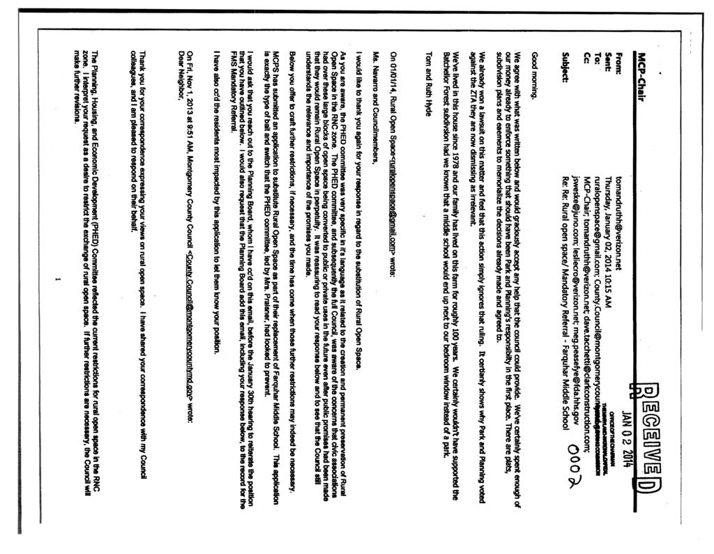
MONTGOMERY COUNTY PLANNING DEPARTMENT THE MARYLAND-NATIONAL CAPITAL PARK AND PLANNING COMMISSION
|
|
|
- Berenice Collins
- 5 years ago
- Views:
Transcription
1 MONTGOMERY COUNTY PLANNING DEPARTMENT THE MARYLAND-NATIONAL CAPITAL PARK AND PLANNING COMMISSION Farquhar Middle School MCPB Item No. 3 Date: Frederick Vernon Boyd, Planner Coordinator, Area 3, fred.boyd@montgomeryplanning.org, John Carter, Chief, Area 3, john.carter@montgomeryplanning.org, Description Farquhar Middle School A. Mandatory Referral No review of land acquisition and change in use. MCPS is acquiring approximately 17 acres of parkland on Batchellors Forest Road in Olney located adjacent to the current school site to redevelop Farquhar Middle School, which will be combined with the 18 acre site currently housing the school. The combined 35 acres will be developed for use as a school and a park. Staff Recommendation: Approval with conditions B. Release of Rural Open Space Easement granted to M- NCPPC by Pulte Home Corporation on approximately 17 acres of land dedicated to M-NCPPC as parkland as a condition of Batchellors Forest Site Plan No /A located on Batchellors Forest Road in Olney adjacent to the Farquhar Middle School. Staff Recommendation: Approval C. Abandonment of Deed of Dedication granted by Pulte Home Corporation to M-NCPPC on approximately 17 acres of land as parkland as a condition of Batchellors Forest Site Plan No /A located on Batchellors Forest Road in Olney adjacent to the Farquhar Middle School in exchange for Perpetual Use Easement to be granted by MCPS to M-NCPPC over 18 acre site currently housing the adjoining Farquhar Middle School. Staff Recommendation: Approval with Conditions Staff Report Date 02/06/14 Summary Montgomery County Public Schools proposes the following: Combine the property in Olney now used for the William H. Farquhar Middle School with an adjacent parcel intended for use as a local park, construct a new school on the intended park property, and deliver the existing school property so that a local park can be designed and built on it. This requires release of an existing Rural Open Space (ROS) easement placed on the local park parcel as part of its development approval. This memorandum evaluates the proposed change in use. MCPS will submit a second Mandatory Referral application when more detailed design work is complete.
2 BACKGROUND Montgomery County Public Schools (MCPS) proposes to combine the property in Olney now used for the William H. Farquhar Middle School with an adjacent parcel dedicated to M-NCPPC for use as a local park. MCPS then proposes to build a new and upgraded Farquhar Middle School on the park property and, once the new school building is ready for occupancy, deliver the existing school property to M- NCPPC, improved with interim park uses. A local park will ultimately be designed and improved, as contemplated in the 2005 Olney Master Plan. The two properties will thereby switch uses. Implementing this complex arrangement requires the following actions, some of which are part of this review before the Board, and some that require the Board s supplemental review as the proposed development moves forward: 1. MCPS must acquire by eminent domain the underlying fee to the 17 acre parkland site that Pulte Homes dedicated to M-NCPPC as a condition of its development approvals for the Batchellors Forest subdivision; 2. M-NCPPC must abandon the dedication; 3. M-NCPPC must release the Rural Open Space ( ROS ) Easement that Pulte Homes granted to it as a condition of its development approvals for the Batchellors Forest subdivision based on the Release of ROS Easement Policy approved by the Board on May 9, 2013; 4. MCPS must grant both a Perpetual Use Easement and an ROS Easement to M-NCPPC over the existing school site as consideration for the abandonment and the release; 5. MCPS and M-NCPPC must enter into a Joint Use Agreement to establish the terms and conditions of joint operations for the new park site, specifically access and maintenance of jointly used facilities; and 6. MPCS must construct both the new school facilities and the interim park: a. consistent with the concept plan submitted with this mandatory referral, and b. consistent with the bid documents for such improvements as approved by the Planning Board, as the Board will review in a later mandatory referral for construction of the school and interim park. This memorandum analyzes and makes recommendations for release of the dedication and the ROS easement as part of its review of the proposed changes in use. MCPS will submit a second Mandatory Referral application when more detailed design work is complete. The Planning Department recommends that the Planning Board: approve release of the ROS Easement; approve abandonment of the dedication; approve the proposed change in use for the middle school property. Staff further recommends that the documentation to implement these actions be held in escrow by the Department of Parks until Parks staff has approved the 100 percent Construction Plans or Bid Documents for construction of the interim park, and staff reviews detailed design of the new school for Master Plan conformance and coordination with the interim park. 2
3 Farquhar Middle School is located at Batchellors Forest Road in Olney. It sits on a acre site on the east side of the road. MCPS built the school in 1968 and its current enrollment is 577 students. It is one of two middle schools that serve the Sherwood High School cluster. MCPS decided several years ago to rehabilitate the school, which is now in its fifth decade of use. Its evaluation concluded that the most cost effective way to bring the school up to its program of requirements for a middle school and to incorporate appropriate climate and information systems infrastructure was to build a new building. It initially intended to build on its existing site and planned to use the Tilden Center, in north Bethesda, to house the students for two academic years while construction was underway. Farquhar parents raised significant concerns about this arrangement, because it meant long bus rides for students from Olney to north Bethesda that, they felt, would disrupt academic and extracurricular schedules and diminish the quality of learning. MCPS agreed to approach the Department of Parks about an arrangement that could allow the new school to be built without closing the existing school. The current proposal is the result. This arrangement results in a land exchange and a swap of uses: a school and a park on mirror image properties. The proposal would enable building the school on 17.2 acres of land directly adjacent to the school, property Pulte Homes dedicated to M-NCPPC as parkland to meet the open space requirements of its development approvals for the Batchellors Forest subdivision, a neighborhood of single family homes located across Batchellors Forest Road in the RNC zone. This existing parkland property was recommended in the Olney Master Plan for development and use as a local park, although the Department of Parks has not developed its Facility Plan for the long-term use of the park and does not contemplate the development of the park in its final form for at least 10 years. The property is also part of the Rural Open Space associated with Batchellors Forest. Once the new school opens, MCPS will demolish the old school, improve the existing school site as an interim park, and deliver it to the Department of Parks for later development and use as the local park recommended in the Master Plan. The approximately 17 acre park site becomes the school; the approximately 20 acre school site becomes the park. This memorandum will refer to the existing school (and future park) site as Parcel A, and the existing park (and future school) site as Parcel B. Before MCPS can begin this project, it must undertake a number of related actions. Parcel B was dedicated to M-NCPPC as a parkland to meet a portion of the open space requirements of Pulte Homes Batchellors Forest subdivision, which developed in the Rural Neighborhood Cluster (RNC) Zone under the optional method. That dedication must be formally abandoned. Upon such abandonment, the ownership of the property would, without further action, revert to Pulte. However, MCPS intends to condemn the owner s underlying fee interest prior to the formal abandonment so that, upon the abandonment, ownership of the property to be developed as the new school will revert to MCPS. 3
4 Further, in accordance with Section 59-G of the Zoning Ordinance, the homes in the Batchellors Forest subdivision will not be considered nonconforming as a result of the reduction in open space directly associated with that subdivision. 2 MCPS will ultimately own both parcels but will enter into agreements with the Commission that will allow construction of the new school on Parcel B, and enable use of Parcel A as a local park. The agreements include i) a Perpetual Use Easement in which MCPS will grant the Commission perpetual use of Parcel A as a local park, and ii) a Joint Use Agreement, which allows a single access to serve the park and the school and provides for maintenance of that access road and the parking area for the park. These agreements will be fully executed and held in escrow by the Department of Parks until staff is assured that construction of the interim park and the new school (with regard to Master Plan and coordination with the interim park) will go forward as approved by the Planning Board in a subsequent mandatory referral submission. Once MCPS has completed its design of the new school and, working with Department of Parks the interim park, MCPS will submit that mandatory referral for Planning Board review. Parcel B was also encumbered by an ROS Easement as required under Section 59-C of the Zoning Ordinance. That easement must be released before development of the school can proceed. Discussion of the ROS Easement Release follows G-4.25(b). Nonconformity through public taking. A building or structure is not a nonconforming building or structure if the lot on which the building or structure is located is reduced in area by a taking under eminent domain or another government action that would otherwise make the building or structure nonconforming because a dimension of the building or structure, or the location on the lot, is deficient. 2 Note that the quantity of open space will not actually have been diminished since the Department of Parks will be receiving Parcel A, which is approximately two acres larger than Parcel B, as consideration for the abandonment. 4
5 RELEASE OF THE RURAL OPEN SPACE EASEMENT RECOMMENDATION: Approval ANALYSIS AND FINDINGS After a public hearing on May 9, 2013, the Planning Board formally articulated a policy to review proposals to release Rural Open Space easements from properties so encumbered. The Board devised the policy in part in anticipation of the MCPS proposal for Farquhar Middle School. The policy recognizes that circumstances may arise in which there may be a clear public interest in extinguishing such easements, but replacing them with similarly situated property. The policy acknowledges that perpetual easements can be extinguished when circumstances warrant, but should not be done so without some manner in which to ensure the intent of the perpetuity is reasonably maintained. The Board policy sets out five criteria that must be met before the Board can release a Rural Open Space easement: a. The purpose for the release must be to balance another public interest; b. The party requesting such release must, at a minimum, provide another property, similarly situated in location (watershed), and size, to be encumbered with the same ROS restriction so that the intention of perpetuity as required by the Zoning Ordinance is addressed; c. The replacement, or substitute property would have been acceptable as the ROS property in the original development application under which the ROS easement was approved; d. The impact of such release cannot place the party who granted the ROS easement as a condition of approval in a position in which its entitlements, such as density may be lost; e. There must be a finding of conformance with the Master Plan for the ultimate replacement of ROS restricted property. The following paragraphs analyze the MCPS proposal to release the existing easement on Parcel B under each of the criteria. a) The purpose for the release must be to balance another public interest; Montgomery County Public Schools is requesting release of the ROS easement to enable construction of its new middle school without requiring Farquhar s student body to relocate for two academic years during construction. The Tilden Center, currently the school system s only facility available to house middle schools during renovation or reconstruction projects, is 14 miles from Farquhar s location on Batchellors Forest Road, and its use for Farquhar students would require extensive redesign of bus routes. MCPS staff estimates that relocation could require students to spend as much as three hours a day in transit. Relocation could also compromise extracurricular activities by complicating parents ability to pick students up from school in the late afternoon. Farquhar parents have expressed concerns that relocation will diminish the educational atmosphere for their children by requiring significant amounts of time in transit, time that, in their view, could be used for educational purposes. In addition, much of the travel time would occur during peak periods, further burdening the roadway networks 5
6 between Olney and Bethesda. Constructing the school on Parcel B eliminates the potential damage to educational opportunities and reduces the burden on peak hour travel. Enabling construction of a new middle school on Parcel B can also hasten creation of the local park for the community s use. The Joint Use Agreement includes delivery of a cleared and graded Parcel A once construction is finished on Parcel B. Department of Parks staff have indicated that such an arrangement would allow interim use of Parcel A for recreation while facility and detailed site planning for a permanent park is underway. This would make the new park available to community residents some years before it would be available under other scenarios. Planning staff concludes that releasing the ROS Easement meets two public interests: it enables the new school to be constructed without burdening educational opportunities for Farquhar students or contributing to traffic congestion; and it enables recreational activities on an interim basis on land controlled by the Department of Parks years earlier than previously anticipated. b) The party requesting such release must, at a minimum, provide another property, similarly situated in location (watershed), and size, to be encumbered with the same ROS restriction so that the intention of perpetuity as required by the Zoning Ordinance is addressed; To replace the Rural Open Space, MCPS will provide Parcel A at approximately 20.3 acres encumbered with the same ROS Easement as is being proposed for release. The two parcels are adjacent. Furthermore, the Commission s current interest in Parcel B was acquired as a dedication from Pulte Homes. Pulte continues to own the underlying fee, granting the Commission the perpetual use of the property consistent with the intent of the rural open space in the RNC zone as set forth in Section 59- C of the Montgomery County Zoning Ordinance and uses as set forth in Section 59-C of the Montgomery County Zoning Ordinance..., 3 which allows for the property to be used as the local park contemplated in the Master Plan. Under Maryland law, such a dedication has the effect of Pulte having granted a restrictive use easement to the Commission, operative for so long as the designated use continues. MCPS proposes to grant a Perpetual Use Easement to the Commission for use of the property as the local park contemplated in the Master Plan. Park and Trail Planning staff indicates that co-located parks and schools offer a desirable synergy of uses and that the increased size of the proposed new park site will be advantageous as potential recreation activities are identified for the new local park. As indicated earlier, enabling construction of a new middle school on Parcel B will also hasten development of the local park for the community, as it creates active recreational activities on an interim basis on land controlled by the Department of Parks years earlier than previously anticipated. If this proposal does not go forward, development of Parcel B with even interim active recreational uses as recommended in the Master Plan will not occur for many years. The importance of this schedule lies with the challenge of timing. In order for MCPS to begin construction of the new school, the required release of the ROS Easement from Parcel B must occur 3 Restrictive language from the Deed of Dedication. 6
7 prior to June In order for MCPS to continue to operate the existing school on Parcel A, the effective date of the new ROS Easement on Parcel A must be delayed until July 2016, the projected completion date for the school construction. Although this results in a two-year lag time, the value of the ROS Easement on Parcel B would not have been experienced during that time. Planning staff concludes that MCPS has agreed to provide a similarly situated property to be encumbered with the same ROS restriction, which meets the intent of perpetuity, as required by the Zoning Ordinance. c) The replacement, or substitute property would have been acceptable as the ROS property in the original development application under which the ROS easement was approved; As noted in the Background section, Parcel A, the existing school site, totals about 20 acres; Parcel B, the existing school site, is about 17 acres in size. The two subject properties share physical traits that essentially made them mirror images of one another, prior to development of the school site. Batchellors Forest Road follows a minor ridgeline from its northern terminus at Dr. Bird Road; past the subject properties to the road s crossing of a major tributary to the Northwest Branch located approximately 3,000 feet south and west of the subject properties. Land along both sides of this section of Batchellors Forest Road is best described as broad uplands, with slight to moderate slopes in the range of 3 percent to 8 percent, with the highest elevations along the road. Steeply sloping land is generally found in the stream valleys that drain the upland areas. Parcels A and B are part of these broad uplands. Older aerial photos indicate that they had both been used for agriculture, because their soils are deep, well-drained and well-suited for crops and pasture. With Batchellors Forest Road at the ridgeline, the traveler along this road had views of open farmland that were occasionally separated by hedgerows that grew along property boundaries and the streams. Parcel B contains an intermittent stream that emerges as a wetland seep on the southern portion of the property and flows at certain times of the year to the east within a shallow channel that briefly touches Parcel A. Older aerial photography suggests that the stream may have extended on to Parcel A but grading for the school pushed the stream entirely on to the Parcel B. Generally, the stream is located in its entirety on the north side of the common property line separating the two subject properties. Prior to construction of the school, both properties shared similar topography with modest slopes that generally directed runoff to this stream. Before the school was constructed, Parcels A and B exhibited very similar visual and environmental characteristics. They both are situated in the same geographic position with respect to Batchellors Forest Road and had similar topographic features, including similar slopes, which directed runoff to a stream that essentially created a natural separation of the two properties. It is reasonable to assume that because of the same soil types, the vegetation on the properties would have likely been the same, if left out of agricultural production and allowed to lie fallow. Views from Batchellors Forest Road would have been similar whether looking across the park property or the future school site. The properties similarity strongly suggests that they are equally suitable for recreational uses. In addition, Parcel A can meet all requirements for rural open space in the RNC Zone: it was largely unmanaged at the time of subdivision, confronts existing Batchellors Forest property and is large 7
8 enough to make a significant contribution to the required rural open space percentage for RNC development. Had both properties been vacant at the time Batchellors Forest was under review, and had Pulte owned Parcel A instead of Parcel B, Parcel A would have been an acceptable property for implementing the Olney Master Plan recommendations in this area. Parcel A could have been designated as Rural Open Space and Parcel B used as a school. Planning staff concludes that either property, in an undeveloped state, could have met the Rural Open Space requirements of the Batchellors Forest subdivision at the time of its review. d) The impact of such release cannot place the party who granted the ROS easement as a condition of approval in a position in which its entitlements, such as density may be lost; The Background section notes that Parcel B was a portion of the Rural Open Space required for the Batchellors Forest subdivision as part of the optional method of development in the RNC Zone. This arrangement allows development to be concentrated on smaller lots, creating a land use pattern that preserves sensitive natural features as undeveloped open space. This undeveloped open space nonetheless contributes to allowable density on the site and is considered when density is calculated. So it cannot be simply severed from the rest of the development without risking creation of a nonconformity. MCPS intends to condemn and acquire Pulte s underlying fee in Parcel B. Section 59-G-4.25 of the Zoning Ordinance states that a lot that is reduced in area by a government taking and would become as a result deficient in any dimension is not non-conforming. The proposed condemnation process, while it reduces the percentage of Rural Open Space associated with the Batchellors Forest subdivision, it is the result of government action outside the control of the property owner, and any resulting deficiency does not create a non-conforming condition. e) There must be a finding of conformance with the Master Plan for the ultimate replacement of ROS restricted property. As noted in the next section, the Olney Master Plan made specific recommendations for Parcel B, identifying it as suitable for a local park and including it as part of the Rural Open Space associated with the RNC Zone. The proposed arrangement releasing the Rural Open Space easement on the 17-acre parcel identified as parkland, condemning certain underlying interests so that the parcel can be used as a school, and encumbering the property now occupied by the school with a perpetual rural open space restriction so that it can function as a park creates a local park on property adjacent to Farquhar Middle School, which conforms to the Master Plan s recommendation. It maintains the Master Plan recommendations for a single access to serve the school and the park, and the proposed concept contributes to the rural character of Batchellors Forest Road by locating the fields nearest the road. The replacement arrangement provides a local park in the Southeast Quadrant and enables provision of recreational fields needed in this part of Olney. It also meets Master Plan objectives and recommendations for preserving the rural character of both Southeast Olney and Batchellors Forest Road. As such, it substantially conforms to the Olney Master Plan. 8
9 MANDATORY REFERRAL: CHANGING USES RECOMMENDATION: Approve the change in use with the following condition: MCPS must submit a subsequent Mandatory Referral at a later point in the project s design that includes both Parcel B (for the school construction) and Parcel A (for the interim park construction). That submission must substantially conform to the Concept Plan submitted with this Mandatory Referral and should carefully evaluate the relationship between the proposed school on Parcel B and the adjacent properties. ANALYSIS AND FINDINGS The Planning Board s Mandatory Referral responsibility requires review of the proposed location and development of public roads, parks, and public buildings before the project begins. The Board also reviews changes of use for the same public properties. This review focuses on the second responsibility, changing the uses of Parcels A and B. The proposed detailed development plans will be reviewed in a subsequent Mandatory Referral review. a. Conformance with the Master Plan The 2005 Olney Master Plan includes the findings of an analysis of park and recreation needs undertaken for the Olney Planning Area. That analysis concluded that, while Olney was generally well served by existing and proposed parkland, there remained a projected need for additional ballfields during the life of the Master Plan. The Plan (page 118) identified properties in the southern part of Olney as suitable for park acquisition. The analysis deemed a 17-acre parcel next to Farquhar Middle School (Parcel B) as suitable for active recreation, and noted that the school could share the recreational facilities. Parcel B was part of the Casey property, which had been evaluated as part of the Master Plan s broader analysis of properties in the Southeast Quadrant. The Master Plan made land use and zoning recommendations for the Casey property. It proposed residential development in the RNC Zone. The RNC Zone requires substantial amounts of generally contiguous undeveloped open space as part of any residential neighborhood and defines those areas as Rural Open Space. Master plans can, however, recommend that portions of recommended rural open space can be used for active recreation. The Olney Master Plan makes such a recommendation (p 28). The 17.4-acre portion of the property [next to the middle school] is appropriate for ballfields and possible other active recreation since it is clear with no significant environmental features, and can share its ballfields and parking area with the adjoining middle school site. Access to the ballfields should be from the Old Vic Boulevard Extended and through the middle school property. The Plan goes on to recommend designation of the parcel as Rural Open Space and acquired through dedication for a local park (p 29). The low density residential character of this portion of the Southeast Quadrant allowed an evaluation of the area s roadway network in light of the reduced development potential reflected in Master Plan land use and zoning recommendations and the desirability of protecting sensitive natural resources in the Northwest Branch watershed. The evaluation led to the removal of previously approved roads and the 9
10 designation of Batchellors Forest Road as a Rustic Road. The Plan also modified the primary residential road system in this area so that primary road P-16, called Old Vic Boulevard Extended, would intersect Batchellors Forest Road opposite Farquhar Middle School. These recommendations are on pages of the Plan. The land use recommendations included a requirement that a single access from Batchellors Forest Road serve the park and the school and that the access be located opposite the Old Vic Boulevard intersection. The Master Plan did not intend to identify Parcel B as the only appropriate place for parkland in this part of Olney. The Plan s objective is the provision of a local park in the part of the southeast quadrant of Olney to meet an already-identified need for active recreation. The Plan identified the Casey property because it was vacant and next to an existing middle school, which meant that a second desirable outcome shared recreational resources between the middle school and a residential community that would soon have a number of additional households could be achieved. The Plan is substantively indifferent to which of the two similarly sized properties is the park and which is the school. The Plan could not have anticipated the precise circumstances that led to this proposal; that MCPS would decide to renovate the school, and that it would decide to rebuild instead of rehabilitate. Had this proposal been made at the time of the Master Plan s development, planning staff would have recommended that it go forward. Planning staff concludes that building the new middle school on Parcel B and establishing a local park on Parcel A meets the Master Plan s recommendations for recreational opportunities in this part of Olney, and also meets the Plan s recommendations for Rustic Roads. Changing the use of this public property substantially conforms to the Master Plan. b. Compatibility MCPS has provided a concept drawing for the new middle school, which is attached to this memorandum. It contemplates locating the school building some distance from Batchellors Forest Road and placing the school s playing fields and tennis courts along the road. The school s bus loop and parking facilities largely would be to the side and rear of the school nearer Parcel A. In this scheme, the house nearest the new school would be next to playing fields, rather than the school building. Homes across Batchellors Forest Road would see the school at a distance, across the fields. Woods would separate the school and its parking from several homes to the east of the property. The concept plan also shows a single entrance for combined park and school, with parking areas included to serve the park. The entrance is opposite Old Vic Boulevard Extended, as recommended in the Master Plan. The relationship between the playing fields and the neighboring residential properties should be carefully evaluated during the next Mandatory Referral review. It may be necessary to increase setbacks beyond the minimum required to reduce visual and noise impacts on the residence. Additional landscaping in this area may be appropriate as well. As noted in more detail in the next section, the subsequent review should also evaluate the relationship between the school s location on Parcel B and 10
11 private Rural Open Space associated with recently approved RNC development on the adjacent property. COMMUNITY ISSUES Residents of the neighborhoods adjoining Farquhar Middle School and Farquhar families have been engaged in a vigorous discussion of the MCPS proposal. It enjoys substantial support from parents of Farquhar students, represented by the Parent-Teacher Associations of both Farquhar Middle School and Brooke Grove Elementary School. Residents of properties adjacent to the combined properties have raised a number of issues about the proposed land exchange. This section focuses on those issues. Several correspondents have asserted that the proposed arrangement converts a large block of open space to other uses and suggested that such an arrangement is contrary to the concept of perpetual rural open space. As noted in the master plan analysis above, the zoning ordinance allows recreational facilities in the rural open space but limits them to trails and related amenities or other facilities recommended in the master plan. The Olney Master Plan recognized that rural open space could be used for active recreation and specifically recommends that the open space associated with Batchellors Forest be dedicated to the Commission for use as a local park, which adheres to the ordinance language. As noted above, this recommendation responds to a demonstrated need for recreational facilities in this part of Olney during the life of the master plan. In addition, the Rural Open Space easement to be applied to Parcel A once it is delivered as an interim park will ensure that the amount of rural open space associated in this part of Olney remains the same. An adjoining property owner, whose property is part of the recently approved Stanmore subdivision, has raised questions of compatibility between rural open space on the Stanmore property and Parcel B. The concept drawing submitted with this Mandatory Referral shows the school adjacent to Stanmore Rural Open Space. That rural open space will be part of a privately owned lot in the Stanmore community. There are currently a strip of woods separating the Stanmore rural open space lot from Parcel B, shown on the concept drawing as the location of the school and part of its parking. The existing trees help minimize the visual impact of the school and the private nature of the Stanmore rural open space limits the number of residents who will be affected. The subsequent Mandatory Referral can evaluate more closely the relationship between the school and the adjacent open space. The same property owner has also sought information about Forest Conservation Plans as part of this Mandatory Referral submission. Parcel B is part of an existing approved Final Forest Conservation Plan for the Batchellors Forest subdivision. Development of the school on Parcel B must comply with the conditions of the original approval. Should aspects of the school s development require changes to the approved Forest Conservation Plan, MCPS must formally request an amendment to the Plan. This memorandum includes attachments containing correspondence from interested parties. CONCLUSION This proposal arises from the desire of Farquhar Middle School parents to reduce the inconvenience and diminished academic atmosphere they strongly believe will occur if students must be relocated to North Bethesda while MCPS builds a needed new middle school on the existing Farquhar site. To 11
12 accommodate their desires, MCPS agreed to find a way to build a new school on the adjoining property. The complex set of arrangements under review in this memorandum can achieve this objective. They enable MCPS to release the existing Rural Open Space easement on the property next to the existing school, acquire that property through condemnation, and build a new middle school on it. At the same time MCPS will also enter into a series of agreements that will allow establishment of a Master Planrecommended local park, under the control of the Department of Parks, some years earlier than anticipated, and allow the school and local park to share access, as the Master Plan recommends. Planning staff recommends that the Planning Board approve with conditions the Mandatory Referral for a change in use; approve with conditions the release of the Rural Open Space Easement on approximately 17 acres of land granted by Pulte Homes to the Commission; and approve with conditions the deed of dedication granted by Pulte Homes to the Commission as part of the approval of Site Plan A, Batchellors Forest. 12

13 Parcel A Parcel B

14 Parcel A Parcel B
15
16
17
18
19
20
21
22
23
24
25
26

27
28
29
30
31
32
33
34
35
36
37
38
39
 SUBJECT: Farquhar Middle School Mandatory Referral The 2005 Olney Master Plan includes designation of the 17-acre portion of")
40 MONTGOMERY COUNTY DEPARTMENT OF PARKS MARYLAND-NATIONAL CAPITAL PARK & PLANNING COMMISSION MEMORANDUM DATE: January 16, 2014 TO: FROM: Fred Boyd, Planner Coordinator, Area 2, Planning Department Brooke Farquhar, Master Planner Supervisor, Park and Trail Planning (PPSD) SUBJECT: Farquhar Middle School Mandatory Referral The 2005 Olney Master Plan includes designation of the 17-acre portion of the property adjacent to Farquhar Middle School as rural open space under the Rural Neighborhood Cluster Zone and acquisition of that property through dedication for use as a local park with active recreation, as follows: Three properties in the Southeast Quadrant are appropriate for purposes of active and passive recreation and should be acquired as parkland. The third property, the approximately 17-acre portion of the Casey property next to Farquhar Middle School, would serve the need for a future active recreation local park in the area and could be shared by the school. (p.119, Olney Master Plan, 2005) The Commission has a long history of locating local parks next to schools because of the synergy of uses. If Montgomery County Public Schools had proposed a land swap during the master plan s development, Park Planning staff would have supported the proposal, because it met the Plan s overall goal of meeting an identified need for active recreation and allowed the sharing of recreation space. Park Planning staff has analyzed the site of the current Farquhar Middle School site as a potential park and finds that it is slightly better than the site to the north because it has approximately 2.5 more developable acres. This scenario has the added benefit of making an interim park available to the public as soon as the existing buildings are removed, and the site is stabilized, including access, parking, athletic fields, community open space and storm water management. A typical local park program can be accommodated on this site in the future. The site is large enough for athletic fields, playground, shelters, trails, community open space, and perhaps a skate spot and a community garden. When facility planning for the ultimate park is added to a future CIP, there will be extensive public outreach to determine a final program. Cc: Mary Bradford, Director of Parks Mike Riley, Deputy Director of Parks for Administration John Nissel, Deputy Director of Parks for Operations Mike Horrigan, Chief of Northern Region Dr. John E Hench, PhD, Chief of Park Planning and Stewardship Division Mitra Pedoeem, Chief of Park Development Division Megan Chung, Associate General Counsel PARK PLANNING & STEWARDSHIP DIVISION 9500 Brunett Avenue, Silver Spring, Maryland Office: Fax:
MONTGOMERY COUNTY PLANNING DEPARTMENT THE MARYLAND-NATIONAL CAPITAL PARK AND PLANNING COMMISSION
 MONTGOMERY COUNTY PLANNING DEPARTMENT THE MARYLAND-NATIONAL CAPITAL PARK AND PLANNING COMMISSION MCPB Item No. Date: 05-22-14 Washington Gas Pipeline No.27 Main Relocation: Mandatory Referral No. MR 2014041
Authorization to Exchange Land with Montgomery County, Maryland as Mitigation for the Platt Ridge Drive Extended Project.
 MEMORANDUM MCPB Item # June 16, 2016 June 9, 2016 TO: VIA: FROM: SUBJECT: Montgomery County Planning Board Michael F. Riley, Director of Parks Mitra Pedoeem, Acting Deputy Director of Parks Dr. John E.
MONTGOMERY COUNTY PLANNING DEPARTMENT THE MARYLAND-NATIONAL CAPITAL PARK AND PLANNING COMMISSION
 MONTGOMERY COUNTY PLANNING DEPARTMENT THE MARYLAND-NATIONAL CAPITAL PARK AND PLANNING COMMISSION MCPB Item No. Hearing Date: 10/8/15 Howard Hughes Medical Institute, Limited Amendment of the Preliminary
MCPB Item # June 16, 2016 MEMORANDUM. June 9, 2016 Montgomery County Planning Board
 MEMORANDUM MCPB Item # June 16, 2016 June 9, 2016 To: VIA: FROM: Montgomery County Planning Board Michael F. Riley, Director of Parks Mitra Pedoeem, Acting Deputy Director of Parks Dr. John E. Hench, Chief,
PLANNED UNIT DEVELOPMENTS (Ordinance No.: 3036, 12/3/07; Repealed & Replaced by Ordinance No.: 4166, 10/15/12)
") 159.62 PLANNED UNIT DEVELOPMENTS (Ordinance No.: 3036, 12/3/07; Repealed & Replaced by Ordinance No.: 4166, 10/15/12) A. PURPOSE 1. General. The Planned Unit Development (PUD) approach provides the flexibility
159.62 PLANNED UNIT DEVELOPMENTS (Ordinance No.: 3036, 12/3/07; Repealed & Replaced by Ordinance No.: 4166, 10/15/12) A. PURPOSE 1. General. The Planned Unit Development (PUD) approach provides the flexibility
MONTGOMERY COUNTY PLANNING DEPARTMENT THE MARYLAND-NATIONAL CAPITAL PARK AND PLANNING COMMISSION
 MONTGOMERY COUNTY PLANNING DEPARTMENT THE MARYLAND-NATIONAL CAPITAL PARK AND PLANNING COMMISSION MCPB Item No. Date: 10-11-12 Subdivision Review Waiver SRW 2011001: Big Woods Road Richard Weaver, Acting
Land Use. Land Use Categories. Chart 5.1. Nepeuskun Existing Land Use Inventory. Overview
 Land Use State Comprehensive Planning Requirements for this Chapter A compilation of objectives, policies, goals, maps and programs to guide the future development and redevelopment of public and private
MONTGOMERY COUNTY PLANNING DEPARTMENT THE MARYLAND-NATIONAL CAPITAL PARK AND PLANNING COMMISSION
 MONTGOMERY COUNTY PLANNING DEPARTMENT THE MARYLAND-NATIONAL CAPITAL PARK AND PLANNING COMMISSION MCPB Item No. Date: 05-30-13 Pre-Preliminary Plan No. 720130040: Potomac Highlands Callum Murray, supervisor,
A Guide to the Municipal Planning Process in Saskatchewan
 A Guide to the Municipal Planning Process in Saskatchewan A look at the municipal development permit and the subdivision approval process in Saskatchewan May 2008 Prepared By: Community Planning Branch
General Development Plan Background Report on Agricultural Land Preservation
 General Development Plan 2008 Background Report on Agricultural Land Preservation February 2008 I. Introduction Anne Arundel County has been an agricultural community for over 350 years, beginning with
DRAFT FOR PUBLIC HEARING (rev. March, 2016)
") Chapter 200. ZONING Article VI. Conservation/Cluster Subdivisions 200-45. Intent and Purpose These provisions are intended to: A. Guide the future growth and development of the community consistent with
Chapter 200. ZONING Article VI. Conservation/Cluster Subdivisions 200-45. Intent and Purpose These provisions are intended to: A. Guide the future growth and development of the community consistent with
LETTER OF APPLICATION
 Description of Proposed Land Division: LETTER OF APPLICATION The proposed land division would split a 1.94 acres rectangular lot into two lots. The general configuration would have one lot in front of
Town of Falmouth s Four Step Design Process for Subdivisions in the Resource Conservation Zoning Overlay District
 Town of Falmouth s Four Step Design Process for Subdivisions in the Resource Conservation Zoning Overlay District All subdivisions shall be designed in accordance with the following four-step process.
Land Use. Existing Land Use
 8 Land Use 8.1 Land Use Chapter Purpose and Contents This element includes a brief summary of existing land use conditions and trends followed by a series of goals, objectives, and recommendations to guide
ARTICLE FIVE FINAL DRAFT
 ARTICLE FIVE 021218 FINAL DRAFT Sec. 503.6 Open Space Preservation Option Open Space Preservation Option Open Space Preservation developments may be approved in the AR, R-1, R-2 and R-3 zoning districts,
COUNTY OF SAN MATEO PLANNING AND BUILDING DEPARTMENT
 COUNTY OF SAN MATEO PLANNING AND BUILDING DEPARTMENT DATE: April 16, 2015 TO: FROM: Zoning Hearing Officer Planning Staff SUBJECT: Consideration of a Coastal Development Permit and Planned Agricultural
These matters are addressed in this report and other technical reports provided with this submission.
 September 14, 2012 Lorraine Stevens, Planner II City of Ottawa Planning and Growth Management 110 Laurier Ave. West 4th Floor Ottawa, ON K1P 1J1 Re: Jock River Estates Phase 2 Revised Draft Plan - Lot
County of Loudoun. Department of Planning MEMORANDUM
 County of Loudoun Department of Planning MEMORANDUM DATE: September 3, 2013 TO: FROM: Marchant Schneider, Project Manager Land Use Review Marie Genovese, AICP, Planner III, Community Planning SUBJECT:
Article Optional Method Requirements
 Article 59-6. Optional Method Requirements [DIV. 6.1. MPDU DEVELOPMENT IN RURAL RESIDENTIAL AND RESIDENTIAL ZONES Sec. 6.1.1. General Requirements... 6 2 Sec. 6.1.2. General Site and Building Type Mix...
Palmerton Area Comprehensive Plan
 DRAFT Palmerton Area Comprehensive Plan Bowmanstown Borough, Lower Towamensing Township, Palmerton Borough and Towamensing Township Carbon County, Pennsylvania Draft - With Minor Revisions - March 2008
PLANNED UNIT DEVELOPMENT (PUD)
") SECTION 38.01. ARTICLE 38 PLANNED UNIT DEVELOPMENT (PUD) Purpose The purpose of this Article is to implement the provisions of the Michigan Zoning Enabling Act, Public Act 110 of 2006, as amended, authorizing
SECTION 38.01. ARTICLE 38 PLANNED UNIT DEVELOPMENT (PUD) Purpose The purpose of this Article is to implement the provisions of the Michigan Zoning Enabling Act, Public Act 110 of 2006, as amended, authorizing
MIDWAY CITY Municipal Code
 MIDWAY CITY Municipal Code TITLE 9 ANNEXATION CHAPTER 9.01 PURPOSE CHAPTER 9.02 GENERAL REQUIREMENTS CHAPTER 9.03 PROPERTY OWNER INITIATION OF ANNEXATION CHAPTER 9.04 PROCEDURES FOR CONSIDERATION OF PETITION
Town of Cary, North Carolina Rezoning Staff Report 14-REZ-31 Cary Park PDD Amendment (Waterford II) Town Council Meeting January 15, 2015
 Town Council Meeting January 15, 2015") Town of Cary, North Carolina Rezoning Staff Report 14-REZ-31 Cary Park PDD Amendment (Waterford II) Town Council Meeting January 15, 2015 REQUEST To amend the Town of Cary Official Zoning Map by amending
Town of Cary, North Carolina Rezoning Staff Report 14-REZ-31 Cary Park PDD Amendment (Waterford II) Town Council Meeting January 15, 2015 REQUEST To amend the Town of Cary Official Zoning Map by amending
A. Land Use Relationships
 Chapter 9 Land Use Plan A. Land Use Relationships Development patterns in Colleyville have evolved from basic agricultural and residential land uses, predominate during the early stages of Colleyville
Napa County Planning Commission Board Agenda Letter
 Agenda Date: 9/20/2017 Agenda Placement: 8C Napa County Planning Commission Board Agenda Letter TO: FROM: Napa County Planning Commission Charlene Gallina for David Morrison - Director Planning, Building
BEFORE THE HEARING EXAMINER FOR THURSTON COUNTY
 COUNTY COMMISSIONERS Cathy Wolfe District One Diane Oberquell District Two Robert N. Macleod District Three HEARING EXAMINER BEFORE THE HEARING EXAMINER FOR THURSTON COUNTY In the Matter of the Application
MONTGOMERY COUNTY PLANNING DEPARTMENT THE MARYLAND-NATIONAL CAPITAL PARK AND PLANNING COMMISSION
 MONTGOMERY COUNTY PLANNING DEPARTMENT THE MARYLAND-NATIONAL CAPITAL PARK AND PLANNING COMMISSION Colesville Senior Living Facility, Limited Preliminary Plan Amendment, 12016011A MCPB Consent Item Date:
Master Plan Review OLNEY. Approved and Adopted April Updated September
 Master Plan Review OLNEY Approved and Adopted April 2005 BACKGROUND ZONING CODE REWRITE In 2007, the Montgomery County Council directed the Planning Department to undertake a comprehensive zoning ordinance
9. REZONING NO Vicinity of the northwest corner of 143 rd Street and Metcalf Avenue
 9. REZONING NO. 2002-15 Vicinity of the northwest corner of 143 rd Street and Metcalf Avenue 1. APPLICANT: Andrew Schlagel is the applicant for this request. 2. REQUESTED ACTION: The applicant is requesting
MONTGOMERY COUNTY PLANNING BOARD THE MARYLAND-NATIONAL CAPITAL PARK AND PLANNING COMMISSION
 MONTGOMERY COUNTY PLANNING BOARD THE MARYLAND-NATIONAL CAPITAL PARK AND PLANNING COMMISSION APPROVED MINUTES The Montgomery County Planning Board met in regular session on Thursday, February 19, 2015,
2 November 9, 2011 Public Hearing APPLICANT: ASHVILLE PARK, L.L.C.
 2 November 9, 2011 Public Hearing APPLICANT: ASHVILLE PARK, L.L.C. PROPERTY OWNER: ATC REALTY SIXTEEN, INC. STAFF PLANNER: Faith Christie REQUEST: Modification of Conditional Change of Zoning approved
Initial Project Review
 Pierce County Department of Planning and Land Services, 2401 South 35th Street, Tacoma, WA (253) 798-7037 Initial Project Review Major Amendment to Preliminary Plat: Hawks Ridge Division 1 Application
SECTION 16. "PUD" PLANNED UNIT DEVELOPMENT OVERLAY DISTRICT
 SECTION 6. "PUD" PLANNED UNIT DEVELOPMENT OVERLAY DISTRICT Subsection. Purpose. This district is established to achieve the coordinated integration of land parcels and large commercial and retail establishments
M-43 CORRIDOR OVERLAY ZONE
 ARTICLE 26.00 M-43 CORRIDOR OVERLAY ZONE Section 26.01 Findings A primary function of the M-43 state highway is to move traffic through the Township and to points beyond. As the primary east-west arterial
GROSVENOR-STRATHMORE METRO STATION MANDATORY REFERRAL APPLICATION NORTH BETHESDA, MD
 GROSVENOR-STRATHMORE METRO STATION MANDATORY REFERRAL APPLICATION NORTH BETHESDA, MD Submission by: Fivesquares JDA at Grosvenor Metro, LLC On behalf of Washington Metropolitan Area Transit Authority 1
Attachment A First Submittal JAZB Safety Zones A and B
 Attachment A First Submittal JAZB Safety Zones A and B Attachment B Second Submittal JAZB Safety Zones A and B Attachment C Flying Cloud Airport (FCM) Draft Airport Zoning Ordinance Social and Economic
STAFF REPORT. Financial Impact Statement There are no immediate financial impacts associated with the adoption of this report.
 STAFF REPORT Planning and Development Department Subject: Cottage Country Unsubstantial Amendment to Development Agreement To: CAO for Planning Advisory Committee, December 13, 2016 Date Prepared: December
MONTGOMERY COUNTY PLANNING DEPARTMENT THE MARYLAND-NATIONAL CAPITAL PARK AND PLANNING COMMISSION
 MONTGOMERY COUNTY PLANNING DEPARTMENT THE MARYLAND-NATIONAL CAPITAL PARK AND PLANNING COMMISSION MCPB Item Date: 06/01/17 900 Thayer Avenue: Project Plan Amendment No. 92005003B and Site Plan Amendment
PURCHASE OF DEVELOPMENT RIGHTS AND TRANSFER OF DEVELOPMENT RIGHTS CASE STUDIES
 PURCHASE OF DEVELOPMENT RIGHTS AND TRANSFER OF DEVELOPMENT RIGHTS CASE STUDIES Prepared for Boone County Planning Commission By American Farmland Trust May 4, 2001 Table of Contents Page Number Montgomery
Public Facilities and Finance Element
 This Element of the General Plan addresses the following public facilities issues: Water Service, including both potable (drinkable) and non-potable water delivery. Sewer Service, and Financing and construction
SUBURBAN AND URBAN RESIDENTIAL LAND USE
 SUBURBAN AND URBAN RESIDENTIAL LAND USE GOAL 1 DISCOURAGE URBAN AND SUBURBAN DEVELOPMENT OUTSIDE INCORPORATED AREAS IN WHITMAN COUNTY, EXCEPT WITHIN DESIGNATED UNINCORPORATED COMMUNITIES, AND THOSE AREAS
MONTGOMERY COUNTY PLANNING BOARD
 MONTGOMERY COUNTYPLANNING BOARD T H E MARYLAND-NATIONAL CAPITAL PARK A N D P L A N N I N G C O M M I S S I O N MCPB NO. 10-100 Preliminary Plan No. 120100210 Date of Hearing: July 1, 2010 MONTGOMERY COUNTY
MONTGOMERY COUNTY PLANNING DEPARTMENT THE MARYLAND-NATIONAL CAPITAL PARK AND PLANNING COMMISSION
 MONTGOMERY COUNTY PLANNING DEPARTMENT THE MARYLAND-NATIONAL CAPITAL PARK AND PLANNING COMMISSION MCPB Item No. Date: 12/4/14 Preliminary Plan No. 120140200, Northwood Knolls Description Patrick Butler,
Conceptual Scheme SE W4
 December 2012 1. PURPOSE 1.1. The purpose of a Conceptual Scheme (CS) is as follows: a) To provide a framework for the subsequent subdivision and/or development of land within the Country Residential Policy
STAFF REPORT. Permit Number: Porter. Kitsap County Board of Commissioners; Kitsap County Planning Commission
 STAFF REPORT Permit Number: 15 00461 Porter DATE: November 9, 2015 TO: FROM: Kitsap County Board of Commissioners; Kitsap County Planning Commission Katrina Knutson, AICP, Senior Planner, DCD and Jeff
ATTENDING THE MEETING Robert Balogh, Vice-Chairman Sonia Stopperich, Supervisor Marcus Staley, Supervisor Bob Ross, Supervisor
 SPECIAL HEARING - TUESDAY, APRIL 12, 2016 PAGE 1 The North Strabane Township Board of Supervisors held a Special Meeting- Conditional Use Hearing, Tuesday, April 12, 2016, at approximately 6:30 P.M., at
MONTGOMERY COUNTY PLANNING DEPARTMENT THE MARYLAND-NATIONAL CAPITAL PARK AND PLANNING COMMISSION
 MONTGOMERY COUNTY PLANNING DEPARTMENT THE MARYLAND-NATIONAL CAPITAL PARK AND PLANNING COMMISSION MCPB Item No. 3 Date: 01-31-13 Preliminary Plan 120090300, Boyds Highlands Calvin Nelson, Jr. Planner Coordinator,
Staff Report for Council Public Meeting
 Agenda Item 3.3 a Staff Report for Council Public Meeting Date of Meeting: April 11, 2018 Report Number: SRPRS.18.087 Department: Division: Subject: Planning and Regulatory Services Development Planning
PLAINFIELD CHARTER TOWNSHIP COMMUNITY DEVELOPMENT DEPARTMENT PLANNING, ZONING & BUILDING SERVICES MEMORANDUM
 PLAINFIELD CHARTER TOWNSHIP COMMUNITY DEVELOPMENT DEPARTMENT PLANNING, ZONING & BUILDING SERVICES 6161 BELMONT AVENUE N.E. BELMONT, MI 49306 PHONE 616-364-1190 FAX: 616-364-1170 www.plainfieldchartertwp.org
4. If any perennial surface water passes through or along the property lines of the acreage, a minimum of 200 feet or frontage should be required.
 b. Provide adequate acreage for appropriate productive use of rural residential land, such as small numbers of livestock, large gardens, etc. 3. Minimum of 200 feet of frontage on an improved county or
City of Grande Prairie Development Services Department
 City of Grande Prairie Development Services Department COUNTRYSIDE SOUTH OUTLINE PLAN Prepared by: GPEC Consulting Ltd. #202, 10712-100th Street Grande Prairie, AB Council Resolution of August 20, 2001
Staff Report: Date: Applicant: Property Identification: Acreage of Request: Current Zoning of Requested Area: Requested Action: Attached:
 Staff Report: Completed by Jeff Palmer Director of Planning & Zoning Date: November 7, 2018 Applicant: Greg Smith, Oberer Land Developer agent for Ronald Montgomery ET AL Property Identification: Frontage
Article XII. R-1 Agricultural-Low Density Residential District
 Article XII R-1 Agricultural-Low Density Residential District Section 1200. Declaration of Legislative Intent In expansion of the Declaration of Legislative Intent and Statement of Community Development
CHAPTER Committee Substitute for Committee Substitute for Senate Bill No. 2188
 CHAPTER 2004-372 Committee Substitute for Committee Substitute for Senate Bill No. 2188 An act relating to land development; amending s. 197.502, F.S.; providing for the issuance of an escheatment tax
Staff Report: Date: Applicant: Property Identification: Acreage of Request: Current Zoning of Requested Area: Requested Action: Attached:
 Staff Report: Completed by Jeff Palmer Director of Planning & Zoning Date: November 7, 2018, Updated November 20, 2018 Applicant: Greg Smith, Oberer Land Developer agent for Ronald Montgomery ET AL Property
PLANNING REPORT. Prepared for: John Spaleta 159 Delatre Street Woodstock Ontario N4S 6C2
 PLANNING REPORT County Official Plan Amendment and Zoning By-law Amendment to Permit a Seasonal Dwelling on an Existing Lot of Record with Access onto a Seasonally Maintained Road Parts of Lot 29, Concession
Residential Capacity Estimate
 Residential Capacity Estimate Montgomery County Department of Park & Planning Research & Technology Center January 2005 Current plans allow 75,000 more housing units. by Matthew Greene, Research Planner
Highland Green Estates Neighbourhood Area Structure Plan
 Highland Green Estates Neighbourhood Area Structure Plan Original Outline Plan approved by Council: March 10, 1997 Outline Plan amended by Council: March 24, 1997 Converted to a Neighbourhood Area Structure
RC ; Reclassification The Garrison at Stafford Proffer Amendment (formerly Stafford Village Center)
") Board of Supervisors Robert Bob Thomas, Jr., Chairman Laura A. Sellers, Vice Chairman Meg Bohmke Jack R. Cavalier Wendy E. Maurer Paul V. Milde, III Gary F. Snellings Anthony J. Romanello, ICMA CM County
Board of Supervisors Robert Bob Thomas, Jr., Chairman Laura A. Sellers, Vice Chairman Meg Bohmke Jack R. Cavalier Wendy E. Maurer Paul V. Milde, III Gary F. Snellings Anthony J. Romanello, ICMA CM County
1 November 13, 2013 Public Hearing APPLICANT & PROPERTY OWNER: HOME ASSOCIATES OF VIRGINIA, INC.
 1 November 13, 2013 Public Hearing APPLICANT & PROPERTY OWNER: HOME ASSOCIATES OF VIRGINIA, INC. STAFF PLANNER: Carolyn A.K. Smith REQUEST: Conditional Change of Zoning (AG-1 & AG-2 Agricultural Districts
CREEKSIDE TOWNHOMES Chevy Chase, Maryland Site Plan No Preliminary Plan No
 +1 (301) 656 5901 info@nova-habitat.com CREEKSIDE TOWNHOMES Chevy Chase, Maryland Site Plan No. 820160050 Preliminary Plan No. 120160130 Application Statement of Justification October 28, 2015 Nova-Habitat,
1. Future Land Use FLU6.6.8 Land uses within the Rural Service Area portion of the Wekiva Study Area shall be limited to very low and low intensity
 1. Future Land Use FLU6.6.8 Land uses within the Rural Service Area portion of the Wekiva Study Area shall be limited to very low and low intensity uses to the greatest extent possible. Existing land uses
NONCONFORMITIES ARTICLE 39. Charter Township of Commerce Page 39-1 Zoning Ordinance. Article 39 Nonconformities
 ARTICLE 39 NONCONFORMITIES SECTION 39.01. Intent and Purpose It is recognized that there exists within the districts established by this Ordinance lots, structures, sites and uses which were lawful prior
LAND USE AMENDMENT SPRINGBANK HILL (WARD 6) ELMONT DRIVE SW AND 69 STREET SW BYLAW 114D2017
 ELMONT DRIVE SW AND 69 STREET SW BYLAW 114D2017") Page 1 of 8 EXECUTIVE SUMMARY This land use amendment application proposes to redesignate and subdivide 1.15 hectares of land located within the southwest community of East Springbank to accommodate 17
Page 1 of 8 EXECUTIVE SUMMARY This land use amendment application proposes to redesignate and subdivide 1.15 hectares of land located within the southwest community of East Springbank to accommodate 17
Easement Program Guidelines for Water Resources and Stream Work
 Easement Program Guidelines for Water Resources and Stream Work The following guidelines are established by the Easement Committee to create standards for reviewing requests by landowners to conduct stream
Charter Township of Plymouth Zoning Ordinance No. 99 Page 208 Article 21: Residential Unit Developments Amendments: ARTICLE XXI
 Charter Township of Plymouth Zoning Ordinance No. 99 Page 208 ARTICLE XXI RESIDENTIAL UNIT DEVELOPMENTS PURPOSE The purpose of the Residential Unit Development (RUD) is to permit two (2) optional methods
KERN COUNTY COMMUNITY DEVELOPMENT BLOCK GRANT APPLICATION
 KERN COUNTY COMMUNITY DEVELOPMENT BLOCK GRANT APPLICATION To be considered for CDBG assistance, please submit this completed application with the required attachments. Applications which do not contain
CITY OF VACAVILLE PLANNING COMMISSION Agenda Item No. G.2 STAFF REPORT August 5, Staff Contact: Fred Buderi (707)
") CITY OF VACAVILLE PLANNING COMMISSION Agenda Item No. G.2 STAFF REPORT August 5, 2008 Staff Contact: Fred Buderi (707) 449-5307 TITLE: REQUEST: RECOMMENDED ACTION: OPPORTUNITY HOUSE EMERGENCY SHELTER RELOCATION
CITY OF VACAVILLE PLANNING COMMISSION Agenda Item No. G.2 STAFF REPORT August 5, 2008 Staff Contact: Fred Buderi (707) 449-5307 TITLE: REQUEST: RECOMMENDED ACTION: OPPORTUNITY HOUSE EMERGENCY SHELTER RELOCATION
Farmland and Open Space Preservation Purchase of Development Rights Program Frequently Asked Questions
 Farmland and Open Space Preservation Purchase of Development Rights Program Frequently Asked Questions Why should a community consider farmland preservation programs? Farmland preservation is important
Master Plan Review POTOMAC. Approved and Adopted March Updated January 2013
 Master Plan Review POTOMAC Approved and Adopted March 2002 BACKGROUND ZONING CODE REWRITE In 2007, the Montgomery County Council directed the Planning Department to undertake a comprehensive zoning ordinance
ZONING ORDINANCE. Calvert County, MD. Department of Planning and Zoning ARTICLE 5 DEVELOPMENT REQUIREMENTS
 ZONING ORDINANCE Calvert County, MD Department of Planning and Zoning ARTICLE 5 DEVELOPMENT REQUIREMENTS 5-0 Development Requirements 5-1 Lot Area, Lot Width, Setback & Height Requirements B All Zones
Land Use Planning Analysis. Phase 2 Drayton Valley Annexation Proposal
 Land Use Planning Analysis Phase 2 Drayton Valley Annexation Proposal Prepared for Town of Drayton Valley Prepared by Mackenzie Associates Consulting Group Limited March, 2011 TABLE OF CONTENTS 1.0 INTRODUCTION...
DEPARTMENT OF COMMUNITY PLANNING, HOUSING AND DEVELOPMENT Planning Division
 DEPARTMENT OF COMMUNITY PLANNING, HOUSING AND DEVELOPMENT Planning Division #1 Courthouse Plaza, 2100 Clarendon Boulevard, Suite 700 Arlington, VA 22201 TEL 703.228.3525 FAX 703.228.3543 www.arlingtonva.us
ARTICLE VII. NONCONFORMITIES. Section 700. Purpose.
 ARTICLE VII. NONCONFORMITIES. Section 700. Purpose. The purpose of this chapter is to regulate and limit the development and continued existence of legal uses, structures, lots, and signs established either
Chesapeake Bay Critical Area Conservation Plan
 The Maryland-National Capital Park and Planning Commission Prince George s County Planning Department Development Review Division 301-952-3530 Note: Staff reports can be accessed at www.mncppc.org/pgco/planning/plan.htm.
Planned Residence District (PR) To review a plan to construct 11 single family homes on approximately 4.01 acres.
 To review a plan to construct 11 single family homes on approximately 4.01 acres.") STAFF REPORT PLANNING & ZONING COMMISSION Village Green Municipal Building, Council Chambers 47 Hall Street Wednesday, March 13, 2019 7:00 P.M. 1. FINAL DEVELOPMENT PLAN REVIEW Applicant: Romanelli and
STAFF REPORT PLANNING & ZONING COMMISSION Village Green Municipal Building, Council Chambers 47 Hall Street Wednesday, March 13, 2019 7:00 P.M. 1. FINAL DEVELOPMENT PLAN REVIEW Applicant: Romanelli and
Comprehensive Plan 2030
 Introduction Land use, both existing and future, is the central element of a Comprehensive Plan. Previous chapters have discussed: Projected population growth. The quality housing available in the Township
STAFF REPORT. Permit History:
 STAFF REPORT Application: Request to rezone property from General Agriculture (AG) to Suburban Residential (a) (R-2a) Applicant: Perry Puncochar Agenda Item: 4(g) Background Information: Proposal: The
Staff Report. Planning Commission Public Hearing: October 17, 2007 Staff Recommendation: Denial
 COUNTY OF PRINCE WILLIAM 5 County Complex Court, Prince William, Virginia 22192-9201 PLANNING (703) 792-6830 Metro 631-1703, Ext. 6830 FAX (703) 792-4401 OFFICE Internet www.pwcgov.org Stephen K. Griffin,
To: Stillwater Town Board Reference: Horst Variance Request Stillwater Township, Minnesota Copies To: Town Board Kathy Schmoekel, Town Clerk
 MEMORANDUM To: Stillwater Town Board Reference: Horst Variance Request Copies To: Town Board Kathy Schmoekel, Town Clerk From: Soren Mattick, Attorney Daniel and Karla Horst, Applicants Ann Pung-Terwedo,
8Land Use. The Land Use Plan consists of the following elements:
 8Land Use 1. Introduction The Land Use Plan consists of the following elements: 1. Introduction 2. Existing Conditions 3. Opportunities for Redevelopment 4. Land Use Projections 5. Future Land Use Policies
UNOFFICIAL COPY OF HOUSE BILL 1272 A BILL ENTITLED
 UNOFFICIAL COPY OF HOUSE BILL 1272 M4 6lr0525 By: Delegates Smigiel, Kelley, Rosenberg, and Sossi Introduced and read first time: February 10, 2006 Assigned to: Environmental Matters 1 AN ACT concerning
The following regulations shall apply in the R-E District:
 "R-E" RESIDENTIAL ESTATE DISTRICT (8/06) The following regulations shall apply in the R-E District: 1. Uses Permitted: The following uses are permitted. A Zoning Certificate may be required as provided
Town of Cary, North Carolina Rezoning Staff Report 12-REZ-27 Morris Branch Town Council Public Hearing January 24, 2013
 Town of Cary, North Carolina Rezoning Staff Report 12-REZ-27 Morris Branch Town Council Public Hearing January 24, 2013 REQUEST To amend the Town of Cary Official Zoning Map to rezone approximately 9.0
CHAPTER 10 Planned Unit Development Zoning Districts
 CHAPTER 10 Planned Unit Development Zoning Districts Section 10.1 Intent and Purpose The Planned Unit Development (PUD) districts are intended to offer design flexibility for projects that further the
SADC Guidance Document Farmland Preservation: Frequently Asked Questions
 SADC Guidance Document Farmland Preservation: Frequently Asked Questions Minimum Eligibility Criteria What Are the Minimum Criteria for State Farmland Preservation Funding? Land must be eligible for Farmland
GENERAL PROVISIONS, DISTRICTS, AND DISTRICT MAPS
 4-1 ARTICLE 4. GENERAL PROVISIONS, DISTRICTS, AND DISTRICT MAPS Section 4-1. Organization of the Regulations Permitted uses by right and by special exception are listed for each district. Along with these
FINAL DRAFT 12/1/16, Rev. to 7/18/17
 FINAL DRAFT 12/1/16, Rev. to 7/18/17 (As Adopted 8/8/17 Effective 9/1/17) SHELTON PLANNING AND ZONING COMMISSION Proposed Amendments to Zoning Regulations I. Amend Section 23 PERMITTED USES by inserting
MEMORANDUM. Mr. Sean Tabibian, Esq. Dana A. Sayles, AICP, three6ixty Olivia Joncich, three6ixty. DATE May 26, 2017
 MEMORANDUM TO FROM Dana A. Sayles, AICP, three6ixty Olivia Joncich, three6ixty DATE VIA Email RE 3409 W. Temple Street, Los Angeles, CA 90026 Zoning Analysis and Entitlement Strategy three6ixty (the Consultant
PROPOSED FINDINGS OF FACT BENDER URBAN GROWTH BOUNDARY EXPANSION AND ANNEXATION REQUEST April 3, Background
 PROPOSED FINDINGS OF FACT BENDER URBAN GROWTH BOUNDARY EXPANSION AND ANNEXATION REQUEST April 3, 2016 Background The owners of TL300, 301, 302, 303, and 304, 3N1027BD - properties abutting the City Limits
TREASURE COAST REGIONAL PLANNING COUNCIL M E M O R A N D U M. February 19, 2010 Regional Planning Council Meeting
 TREASURE COAST REGIONAL PLANNING COUNCIL M E M O R A N D U M To: Council Members AGENDA ITEM 5G From: Date: Subject: Staff February 19, 2010 Regional Planning Council Meeting Local Government Comprehensive
ARTICLE 14 PLANNED UNIT DEVELOPMENT (PUD) DISTRICT
 DISTRICT") ARTICLE 14 PLANNED UNIT DEVELOPMENT (PUD) DISTRICT Section 14.01 Intent. It is the intent of this Article to allow the use of the planned unit development (PUD) process, as authorized by the Michigan Zoning
ARTICLE 14 PLANNED UNIT DEVELOPMENT (PUD) DISTRICT Section 14.01 Intent. It is the intent of this Article to allow the use of the planned unit development (PUD) process, as authorized by the Michigan Zoning
STAFF REPORT. January 25, North York Community Council. Director, Community Planning, North District
 STAFF REPORT January 25, 2005 To: From: Subject: Purpose: North York Community Council Director, Community Planning, North District Refusal Report OPA & Rezoning Application 04 194214 NNY 33 OZ Applicant:
Chapter SPECIAL USE ZONING DISTRICTS
 Chapter 20.20 Sections: 20.20.010 Urban Transition (U-T) Zoning District 20.20.020 Planned Development (P-D) Zoning Districts 20.20.010 Urban Transition (U-T) Zoning District A. Purpose. The purpose of
Draft Zoning Changes for the 2nd Planning Board Public Hearing, January 22, 2018.
 Draft Zoning Changes for the 2nd Planning Board Public Hearing, January 22, 2018. No changes were made at the 1st Public Hearing. Proposed wording for the 1 st Public Hearing in red, eliminated text in
Subject: Ordinance 1657, Annexation of 3.55 acres of land at 3015 and 3001 Parker Road.
 Agenda Report 2016-12-12-09 Date: December 8, 2016 To: From: Russ Axelrod, Mayor Members, West Linn City Council Jennifer Arnold, Planning Department Through: John Boyd, Interim Community Development Director
i. The only permitted uses shall be a maximum of two (2) multiple dwellings and related accessory uses;
 multiple dwellings and related accessory uses;") Presented To: Planning Committee Request for Decision Application for rezoning in order to permit 80 dwelling units, comprising two (2) six-storey multiple dwellings with 40 units, Paris Street, Sudbury
Presented To: Planning Committee Request for Decision Application for rezoning in order to permit 80 dwelling units, comprising two (2) six-storey multiple dwellings with 40 units, Paris Street, Sudbury
MONTGOMERY COUNTY PLANNING DEPARTMENT THE MARYLAND-NATIONAL CAPITAL PARK AND PLANNING COMMISSION
 MONTGOMERY COUNTY PLANNING DEPARTMENT THE MARYLAND-NATIONAL CAPITAL PARK AND PLANNING COMMISSION MCPB Item No.: Date: 06-21-12 The Plantations, Preliminary Plan -120090240 Benjamin Berbert, Senior Planner,
610 LAND DIVISIONS AND PROPERTY LINE ADJUSTMENTS OUTSIDE A UGB
 ARTICLE VI: LAND DIVISIONS AND PROPERTY LINE ADJUSTMENTS VI-21 610 LAND DIVISIONS AND PROPERTY LINE ADJUSTMENTS OUTSIDE A UGB 610-1 Property Line Adjustments (Property Line Relocation) A property line
LETTER OF APPLICATION
 Description of Proposed Land Division: LETTER OF APPLICATION The proposed land division would split a 1.94 acres rectangular lot into two lots. The general configuration would have one lot in front of